
fulltext - Simple search
Ved Stranden 18 DK-1061 Copenhagen K www.norden.org NORDISKE ARBEJDSPAPIRER N O R D I C W O R K I N G P A P E R S Results 2nd Nordic Workshop on MSP Results of the 2nd Nordic Workshop on Marine Spatial Planning and an update for 2014: Use and Management of Nordic Marine Areas: Today and Tomorrow: Reykjavik, Iceland, 12.-13. November 2013 Andrea Morf, Swedish Institute for the Marine Environment (main editor and author). Jens Perus, Centre for Economic Development, Transport and Environment, South Ostrobothnia, Finland. Sigmar Arnar Steingrímsson, National Planning Agency, Iceland. Mats Ekenger, former secretary of the Nordic Council of Ministers, Sweden. Sverker Evans, former chair of the Nordic Marine Group, Sweden. Igor Mayer, TU-Delft, Signature Games, The Netherlands. Qiqi Zhou, TU-Delft, Signature Games, The Netherlands. http://dx.doi.org/10.6027/NA2014-932 NA2014:932 ISSN 2311-0562 This working paper has been published with financial support from the Nordic Council of Ministers. However, the contents of this working paper do not necessarily reflect the views, policies or recommendations of the Nordic Council of Ministers. Results of the 2nd Nordic Workshop on Marine Spatial Planning and an update for 2014 Use and Management of Nordic Marine Areas Today and Tomorrow Reykjavik, Iceland, 12.-‐13. November 2013 Andrea Morf, associated expert of the Marine Spatial Planning Network of the Nordic Marine Group, Swedish Institute for the Marine En-‐ vironment (editor) Jens Perus, associated expert of the Marine Spatial Planning Network of the Nordic Marine Group, Centre for Economic Development, Transport and Environment, South Ostrobothnia, Finland Sigmar Arnar Steingrímsson, Marine Spatial Planning Network of the Nordic Marine Group, National Planning Agency, Iceland Mats Ekenger, former secretary of the Nordic Council of Ministers, Sweden Sverker Evans, former chair of the Nordic Marine Group, Sweden Igor Mayer, TU-‐Delft, Signature Games, The Netherlands Qiqi Zhou, TU-‐Delft, Signature Games, The Netherlands Preface This report has been commissioned by the Nordic Marine Spatial Plan- ning (MSP) network under the auspices of the Nordic Marine Group (HAV). It presents another step in an on-‐going process of Nordic capaci-‐ ty development and collaboration on sustainable management of the marine environment. The editorial team has worked in close contact with the chair of the Marine Group (Hafdís Hafliðadóttir, Tiina Tihlman, Mikael Wennberg) and its secretary Marita Guttesen. The report sum-‐ marises the results of a workshop conducted in 2013 on Iceland with the aims to make experts meet and learn from each other and to find out how common principles and a collaboration platform for Nordic MSP could be developed. As a special feature, the workshop included a role-‐ play developing an integrative marine spatial plan. The report attempts summarises important outcomes and takes a step beyond. It can be both red as a knowledge update and as an input to an on-‐going discussion. First of all, THANK YOU to the presenters contributing their knowledge and experiences and reviewing draft parts. Special thanks also to the highly motivated, integrative and adaptive MSP Challenge team from TU Delft. It has been stimulating to collaborate on the facilitation of this event. We also want to praise all the competent and highly motivated workshop participants from all over Europe and the North. We hope that you have been able to take home useful ideas and impressions for your practice. Thanks to Christina Schmidt from the Swedish Institute for the Marine Environment for checking the Swedish summary. Last but not least THANKS for great hospitality and flexible assistance to the Iceland-‐ ic National Planning Agency! It has been a fantastic experience to run the workshop on Iceland in the highly maritime environment of Reykjavik and in November during the North Atlantic storm season – impressive not the least how the local pilots flew in our continental experts, non-‐ regarding winds of over 40m/s! We are looking forward to meet again on MSP in a soon future, continu-‐ ing to work on common Nordic principles and a collaboration platform. Stay tuned for coming invitations from the Marine Group and the Nordic MSP network. If you want to share any ideas, reflections and experienc-‐ es, please don’t hesitate to contact the members of the network. Present-‐ ly, we wish you pleasant reading and look forward to hearing from you! Gothenburg, in December 2014 The authors and the Nordic MSP network’s steering group Title page pictures: AM Nordic Marine Group (HAV): MSP-Workshop No. 2 in Reykjavik 2013 Content 1. Developing Nordic Expertise and Practice in MSP ................................................................. 2 2. The State-of-the-Art in Nordic Marine Spatial Planning ..................................................... 6 2.1 Denmark: From Case-By-Case to Actual MSP .............................................................. 6 2.2 Faroe Islands: MSP Is Needed ............................................................................................. 7 2.3 Greenland: Pilots on Ecosystem Based Management and Maritime Traffic ............................................................................................................................................. 8 2.4 Iceland: Coastal and Marine Planning Under Way .................................................... 9 2.5 Norway: New Spatial & Valuation Tools and Politically Adopted EBM-MSP in the 2nd Round ................................................................................................12 2.6 Sweden: MSP Take-Off in EEZ ...........................................................................................14 2.7 Finland: Land Use Planning in Territorial Waters ..................................................16 2.8 Åland – Cross Municipal Coordination Important...................................................17 2.9 Implications for Future Nordic Work on MSP ...........................................................18 3. Context and Inspiration for Nordic Collaboration on MSP...............................................20 3.1 The Political Economy of Ocean Governance ............................................................21 3.2 Marine Planning in Scotland ..............................................................................................25 3.3 The EU-Commission’s Directive Proposals on ICZM and MSP (2013 & 2014)........................................................................................................................................31 3.4 MSP Inspiration from the Baltic Sea Region...............................................................34 3.5 Sea Meets Land: Nordic INTERREG Work on MSP ..................................................39 3.6 Implications for Future Nordic Work on MSP ...........................................................39 4. Meeting the Challenges of MSP Through Role Play..............................................................42 4.1 Research and Role Play for MSP Experts .....................................................................43 4.2 The Reykjavik MSP Challenge 2013 ...............................................................................45 4.3 Observations and reflections by the Game Team ....................................................54 4.4 Role Play in Nordic Capacity Development ................................................................56 5. Towards A Nordic Platform & Principles for MSP ................................................................60 5.1 Results from Group Work on a Nordic Platform ......................................................60 5.2 Obstacles and Priorities According to the Participant Survey ..........................63 5.3 Outlook: Next Steps for Nordic Collaboration on Marine Spatial Planning ......................................................................................................................................64 References........................................................................................................................................................66 Sammanfattning på svenska ...................................................................................................................68 Havsplanering i ett bredare perspektiv: institutionella förändringar, utmaningar och inspiration...............................................................................................68 Dagens läge i nordisk havsplanering ..........................................................................................71 Integrationens utmaningar i havsplanering: rollspel för nordisk kompetensutveckling ...........................................................................................................74 Vägen mot en plattform och principer för nordisk havsplanering...............................76 Appendix...........................................................................................................................................................80 A-1: Abbreviations ...........................................................................................................................80 A-2: Invitation & programme .....................................................................................................81 A-3: The MSP Challenge – In-Depth Information ..............................................................82 A-4: Table A4: Results from Group Work .................................................................................87 A-5: Participant Survey: Obstacles for Nordic coastal and marine planning and priority needs for Nordic collaboration .........................................90 1 Nordic Marine Group (HAV): MSP-Workshop No. 2 in Reykjavik 2013 1. Developing Nordic Expertise and Practice in MSP JP & AM Marine areas can function both as barriers and as links between countries and continents, but either way, interest in using them has been growing fast. Established uses like fishery and shipping are facing new claims for “their” coastal and offshore areas from new interests like energy production, aquaculture, mineral extraction, tourism or construction. The oceans, formerly considered to be open to all and with inexhaustible resources are increasingly used and harvested by many sectors and also function as recipients for human society (Evans et al. 2012). Moreover, with the recent decline in global economy, many nations put their hopes on so-called Blue Growth to increase their productivity, at times including initiatives to extend their exclusive economic zones to secure additional space and natural resources. Besides providing income and enjoyment for society, the sea also has important ecological functions – both regionally and globally – which should not be disturbed beyond repair. The North East Atlantic and the Arctic comprise large marine areas with directly economically valuable resources such as oil, gas, fish stocks and important ecosystems providing life space for globally important populations of keystone species among fish, birds, cold water corals, and mammals and related ecosystem services. These values are presently threatened both by use and destruction and by indirect pressures due to e.g. eutrophication, persistent chemicals, marine litter, and last but not least by global warming and acidification of the oceans. Global warming may even lead to a further increase in pressure by opening a new NE passage between Europe and Asia and making oil and gas exploitation economically viable in areas so far covered by ice. Also the Baltic Sea is both ecologically highly sensitive and under increasing use pressure. Thus, the Nordic seas have become an arena for an increasing number of spatial disputes about the most suitable and profitable uses and the disturbance of important ecosystems. Many activities can operate simultaneously or alternating in one area. Other activities, however, disturb or exclude others or damage the marine environment. One of the big challenges of the century is to address the above pressures and changes and coordinate across marine basins with different institutional systems and political aims and still rather scarce knowledge in order to assure a more long-term sustainable blue growth. This requires both careful 2 Nordic Marine Group (HAV): MSP-Workshop No. 2 in Reykjavik 2013 analysis and a boundary crossing thinking and action along many dimensions (e.g. sea-land, spatial scales, time, disciplines, nations). Marine spatial planning (MSP) has been proposed as a process promoting such international coordination and collaboration and including a possibility to couple with a more adaptive and ecosystem based perspective (e.g. Ehler & Douvere 2009). Important steps towards a more ecosystembased MSP include international consultation across oceans, the awareness and acceptance of national and international terms and conditions for different use sectors, and a well established collaboration between environment and planning both at the land-sea interface and farther offshore. Sufficient knowledge and capacity are important factors too. Nordic decision makers have seen the importance to develop a Nordic perspective on marine management including such features and a common practice, but also identified a great need for capacity development (Evans et al. 2012). Many Nordic countries and self-governing areas manage vast marine areas in the NE Atlantic and Arctic, often with small administrations. These countries and regions are to a great extent dependent on the living and non-living resources of the sea and the strong sectors operating these, which implies both potentials and dilemmas. In order to address this from a Nordic perspective, the Ministers of the Environment of the Nordic countries and self-governing areas decided in 2008 to deepen their cooperation on Nordic marine areas. Their aim was to improve coordination of planning, protection and management of marine areas in the Baltic Sea, the North Atlantic and the Arctic. Moreover, based on a workshop, an ad-hoc expert group composed the report ”Nordiskt samarbete om planering och förvaltning av nordiska havsområden” (Anon. 2010) providing a summary of Nordic marine management as well as an ambitious programme of action. Some of the proposals have been picked up by the Nordic council of Ministers, commissioning its Working Group on Aquatic Ecosystems (AEG), nowadays the Marine Group (HAV), to strengthen co-operation between the Nordic countries in order to promote ecosystem-based and sector-integrated marine management. In 2010, the Marine Group initiated a Nordic MSP Network of experts, with the mandate to work with capacity development in Nordic MSP, develop ways of cooperation in both Nordic and international marine planning and management, carry out projects and assist the Marine Group in “Supporting work with a regionally coordinated, inter-sectorial and ecosystem based approach to management of the seas and the marine environment, including spatial planning”, a priority stated in the Nordic Environmental Action Plan 2013–2018. In the Baltic Sea area, MSP has the ministerial support to be driven by a joint HELCOM-VASAB working group; it also has been site of a number of collaboration and capacity development projects. Moreover, the EU Strategy for the Baltic Sea Region (EU-Council 2009) gives HELCOM and VASAB a prominent 3 Nordic Marine Group (HAV): MSP-Workshop No. 2 in Reykjavik 2013 role in promoting MSP in the Baltic Sea region – together with other stakeholders. In the NE Atlantic region among others OSPAR and the Arctic Council are working with MSP and ecosystem management related issues. Since 2010, also a Nordic Planning Authority Group has been working on MSP related issues from the perspective of national planning authorities. It has proposed an action plan for MSP in the Nordic marine areas (see Haanpää & Kanninen 2012, based on a workshop in Oslo). It is important to share knowledge and experiences also with this group, some of its members being part of the network. The Marine Group and the Nordic MSP Network aim to assure the exchange of knowledge and good practices in both directions between Baltic Sea and NE Atlantic. In order to assess the needs of different countries and regions and to more concretely discuss how these needs could be satisfied, a series of Nordic workshops has been organized. To analyse the needs and specify important issues to work with, the working group and the network arranged a 1st workshop on the Faroe Islands (Tórshavn 15.-16. November 2011). The workshop ‘Brug og forvaltning af de nordiska havområder – i dag og i morgen’ attracted participants from governmental planning and management agencies as well as marine use sectors. One conclusion from Tórshavn was the idea of a common toolbox (methods, processes, and implementation) from which individual countries or regions could select suitable tools (for the whole report, see Evans et al 2012). The workshop also inspired the formalisation of the structure and mandate of the Nordic MSP Network and its activity planning. The 2nd workshop on Iceland ‘De nordiske havområder – i dag og i morgen. Brug og forvaltning’ (Reykjavik, 11.-13. November 2013) reported here takes the Faeroe insights further.1 The workshop’s aim was to build and promote Nordic capacity and cooperation for MSP and to find out how this could be concretised into common principles and a collaboration platform for Nordic MSP. Since the workshop, a number of important steps have been taken in the MSP-policy area. The report therefore includes besides important results also the most important updates for 2014. Sigurður Ingi Jóhannsson, Minister for Environment and Natural Resources of Iceland, opened the workshop. A status-update on coastal and marine planning from the different Nordic countries and regions brought the participants onto the same page (reported below in chapter 2). This was complemented (see chapter 3) by experiences from Scot- ────────────────────────── The workshop was co-arranged by by the Nordic Council of Ministers, the Icelandic National Planning and Environment Agencies, the Faroese Environment Agency, and the Swedish Institute for the Marine Environment, assisted for the role play part by a facilitator team from the Technical University of Delft NL and the Dutch National Planning Agency. Links to the presentations can be found on the homepage of the Faroese Environment Agency (http://us.fo/Default.aspx?ID=13747) 1 4 Nordic Marine Group (HAV): MSP-Workshop No. 2 in Reykjavik 2013 land, the USA, and the Baltic Sea, existing work with MSP principles, an update on the now adopted EU-directive on marine spatial planning and a reporting on the findings of the Nordic Planner’s group on commonalities for Nordic MSP (see Haanpää & Kanninen 2012). Because not all participants had own practical experience with MSP an interactive and experiential approach was used. This included a computer based simulation role-play, where participants had to work in mixed groups and develop an integrative marine spatial plan across the so-called Sea of Colours, in the MSP Challenge 2011 (the experiences are summarised in chapter 4 and the appendix). The interactive session was to inspire the final group and plenary discussions on common principles and a Nordic collaboration platform on MSP (see chapter 5). This chapter also concludes the reporting with a synthesis and conclusions for ongoing work by the organisers of the workshop and the Nordic Marine Group’s MSP Network. The appendix contains complementary material such as abbreviation list, overall workshop programme and more detailed results from group work, role-play and a participant survey. A summary in Swedish can be found after the reference list. For an executive summary in English see the respective final sections of each chapter. 5 Nordic Marine Group (HAV): MSP-Workshop No. 2 in Reykjavik 2013 2. The State-of-the-Art in Nordic Marine Spatial Planning AM Below, the status and development of marine and coastal planning in the different Nordic countries and independent regions and recent developments are presented in alphabetic order. Since the 2011 workshop, MSP related activities have increased in Nordic countries, so an update is timely. We tried to even include what has happened since 2013. 2.1 Denmark: From Case-By-Case to Actual MSP Presenters: Hans Lassen and Odma Johannesen. Nordic Marine Think Tank; complemented by Jakob Harrekilde Jensen from the Danish Nature Agency. Denmark’s territory and exclusive economic zone extend over a land area of 43 000km2 and a marine area of 106 000km2 (including separate islands with their own EEZ). The most expansive marine sectors at present are marine transport and energy production (wind power, oil and gas). In the last years, Denmark has not had a comprehensive marine planning, but a case-by-case approach to spatial management. The main focus has been on developing energy at sea, where the Danish Energy Agency is responsible to assess and coordinate applications – as part of a “one shop stop policy to facilitate development” based on the “first come first serve” principle. With regard to other applications except commercial ports, the Coastal Authority is responsible. However, increasing usepressure in the Danish marine areas in combination with the EU proposal for an MSP-directive have promoted a development towards a more integrative actual maritime spatial planning. Recent changes include the so-called Maritime Director’s Forum (a cross-sector group of authority directors addressing cross-sector issues) and cross-sector coordination groups of relevant authorities2, which have been responsible for the elaboration of a comprehensive report on MSP (25. April 2013) and a strategy to implement the new EU-MSP directive. The Danish Nature Agency is responsible to develop legislation for MSP – to be adopted by the Danish Parliament no later than summer 2016. ────────────────────────── Relevant Danish authorities include: Maritime Authority, AgriFish Agency, Coastal Authority, Energy Agency, Nature Agency, Agency for Culture, National Defence, GeoData Agency and Transport Authority. 2 6 Nordic Marine Group (HAV): MSP-Workshop No. 2 in Reykjavik 2013 In 2012 a Nordic Marine Think Tank (NMTT) was established as an open network of Nordic experts in marine and fisheries issues to promote international cooperation. NMTT aims to be independent of public authorities and economic interests. Its supporting vision includes healthy oceans and ecosystems, sustainable use of marine resources, and improving the use of Nordic knowledge and skills in marine management. The topics range from fisheries management, certification regionalisation, and economic assessment to MSP. So far, a number of conferences and discussion events have been arranged with NMTT as a host or contributor.3 Within NMTT, a project on MSP focusing on knowledge and decision-making in environment and fisheries has resulted in a report.4 2.2 Faroe Islands: MSP Is Needed Presenter: Anni á Hædd, Faroese Environment Agency, complemented by Suni Petursson, Faroese Environment Agency. Faeroe people/Marita: PLS check and respond whether this is right. No appropriate illustration found on the web/in presentation. So we keep it without. The Faroe Islands are one of the regions with large marine and small land areas (274 000 km2/1 399 km2). Important marine uses include transport, fisheries, salmon farming, and cables for telecommunication as well as sand extraction. Potential new uses are energy and algae farming. A number of sector-specific acts, e.g. for environment, commercial fisheries, aquaculture, bird catching, offshore oil activities, imply to some extent spatial use regulation. The Faroe Islands have yet no law or legal instrument that can ascertain a holistic and integrated approach to planning and use of coastal waters and marine areas. However, the Faroese authorities see the need to work more integrative and consider the ecosystem services concept as a way to connect environmental concerns with those of fisheries, recreation, and other types of spatial interests that are of concern in a society, where most people live adjacent to the ocean. Presently, licences allowing a certain marine activity are based on a case-by-case assessment. Except for fisheries and aquaculture, where no impact assessment is required, almost all other marine uses have to undergo some type of environmental impact assessment (EIA) and based on that follow specific requirements with regard to pollution and other impacts. The EIA is, however, not a suitable instrument for genuine marine spatial planning. Licensing for the various activities is located under different ministries: mainly the Ministry of Trade and Industry and the Ministry of Fisheries. The Ministry of Fisheries is responsible for ────────────────────────── The NMTT has no web page of its own. Contact: Victor Hjort, [email protected] tel. +45 26246813 Odma Johannesen and Hans Lassen. 2014. Decision-making management procedures: Cost – efficiency – democracy in selected procedures in Maritime Spatial Planning. TemaNord Report 2014:532, Nordic Council of Ministers, Copenhagen, http://www.norden.org/en/publications/publikationer/2014-532/ 3 4 7 Nordic Marine Group (HAV): MSP-Workshop No. 2 in Reykjavik 2013 commercial fisheries, marine research and the protection of the marine environment. The Ministry of Trade and Industry is responsible for aquaculture, oil and gas exploration, energy production, telecommunication, etc. As binding spatial regulations there are so far boundaries and limits related to specific activities (e.g. aquaculture) or permanent or temporary fisheries closures areas (coral reefs for trawling, spawning areas). Such boundaries or limitations are seldom imposed for the sake of other societal interests. Instead they tend to serve a more narrow commercial scope. Consequently, the need for MSP to secure a more holistic, balanced approach to the use of the seas surrounding the Faroe Islands is indeed evident. 2.3 Greenland: Pilots on Ecosystem Based Management and Maritime Traffic Presenter: Talea Weissang, Ministry of Environment and Nature, Government of Greenland; revised and complemented by Tina Mønster, Ministry of Environment and Nature, Government of Greenland. Greenland’s territory covers a land area of 2 166 086 km² (3/4 covered by ice) and a sea area of 1 884 926 km2. Coastal and marine spatial planning as such is not yet established in Greenland, a self-governing area within the Kingdom of Denmark. Greenland intends to use an ecosystem-based approach to the management of its coastal and marine areas and is under way with pilot projects. A problem on the rise is keeping the marine ecosystems healthy in the view of a considerable increase in maritime traffic. A report by the Arctic Council – Arctic Marine Shipping Assessment (2009) – reviewed environmental impacts and threats from current and future arctic marine traffic in the Arctic. Its recommendation Nr. IIC calls the arctic states to identify areas of higher ecological significance. Using the IMO criteria for particularly sensitive sea areas (PSSA), a number of ecologically highly significant areas have been identified for Greenland (see Christensen et al. 2012). In 2011, the Danish Government and the Greenlandic Government (Naalakkersuisut) therefore decided to work in three pilot areas: 1) the Disko Bay and the Store Hellefiskebank, 2) the Nordvandspolyniet and 3) Scoresbysund and the surrounding marine areas. These areas are important for biodiversity of marine mammals and birds and for fish recruitment and have already been pointed out as important in international agreements (e.g. IUCN/CBD). The intention is to work towards an ecosystem-based management of these pilot areas and the rest of Greenlandic waters. Main stressor is presently the cumulative effect of maritime traffic. Different available options to complement management and strengthen protection are under evaluation: a) establishing a particularly sensitive area (PSSA) according to IMO, b) establishing a sensitive marine area according to MARPOL, c) devising national rules for cruising ships, d) future surveillance and monitoring. 8 Nordic Marine Group (HAV): MSP-Workshop No. 2 in Reykjavik 2013 Fig 2.3: Fig. A: areas important for marine mammals. Fig. B: Areas important for seabirds. Fig. C: 1st Priority areas in Greenland’s coastal planning as mentioned: Nordvandspolyniet (V1), Diskobugt and Store Hellefiskebanke (V5), Scoresbysund and surrounding sea areas (NØ2). Colour code for priority is as follows: red 1st, orange 2nd, blue 3rd, and green 4th priority. Source: Christensen et al. 2012, p 25. 2.4 Iceland: Coastal and Marine Planning Under Way Presenter: Ester Anna Ármannsdóttir, Icelandic National Planning Agency. Iceland´s territory and exclusive economic zone (EEZ) extend over a land area of 103 000 km2 and a marine area of 758 000 km2. The EEZ shares borders with Greenland, Norway (Jan Mayen), The Faroe Islands and international waters on some stretches north and south of the country. Control of marine areas and licensing outside municipal jurisdiction extending 115 m from the spring low tide is currently based on sector plans and legislation under the responsibility of different ministries and public agencies. 9 Nordic Marine Group (HAV): MSP-Workshop No. 2 in Reykjavik 2013 Fig 2.4a: Icelandic marine territory and EEZ. Source: http://www.liu.is/upplysingaveita/togveidiholf/ Since 2011, Iceland has taken several steps towards integrative coastal and marine spatial planning. Based on the growing interest in marine exploitation outside municipal jurisdiction, a committee was formed under the auspices of the Minister for fisheries and agriculture to assess Icelandic legislation with regard to marine and coastal development and whether legislation for marine spatial planning was necessary. According to the assessment report, submitted in 2011, coastal and marine legislation in Iceland is unsatisfactory; the responsibility for marine and coastal affairs is scattered through the administration, resulting in a lack of integration and overview. Legislation on marine and coastal planning was deemed necessary. Moreover, a new planning legislation came into force in January 2011. The legislation introduced a National Planning Strategy, a novelty in the Icelandic planning system. Geographically, the strategy can encompass both land and sea (territorial waters and EEZ). In preparation for the 1st National Planning Policy, the Icelandic National Planning Agency (NPA) published a report on the status of marine and coastal planning in Iceland5. It analyses international agreements to consider in marine and coastal zone planning, Icelandic policies related to the marine environment, and the status of marine and coastal planning in the Nordic countries and Scotland. The report also includes the ────────────────────────── 5 http://www.landsskipulag.is/media/landsskipulagsstefna/greinargerdl_skipulag_haf_og_strand_drog_utgafa_4_jan2013_med_breytingum.pdf 10 Nordic Marine Group (HAV): MSP-Workshop No. 2 in Reykjavik 2013 results of a mapping exercise of human activities and nature protection areas in Icelandic waters and of a basic conflict analysis in marine and coastal areas around Iceland. The report concludes that stress on marine areas and ecological sensitivity varies geographically. Activities in marine areas farther offshore are mainly related to fisheries and shipping. Here, international and Icelandic legislation apply and spatial planning is therefore less urgent here than in areas closer to the land. The 1st National planning strategy included a policy on marine and coastal zone planning.6 It describes the necessary steps towards a marine and coastal planning in Iceland and proposes to introduce special legislation on the matter, specifying governance system and responsibilities for marine and coastal planning. According to the policy, a holistic policy on marine and coastal planning in Iceland should be a part of the National Planning Policy whereas local conditions should be addressed in more regionally based planning. In June 2013, preparations for legislation on marine and coastal zone planning began at the Ministry for Environment and Natural Resources. As a first step, the Ministry requested that the NPA prepare a report on relevant issues. In February 2014 the NPA published a report7 on Marine Spatial Planning (MSP) and Integrated Coastal Zone Management (ICZM), which discusses the purpose of MSP and ICZM and their geographical scope. Also regulation in the EU and how MSP has been carried out in Scotland and Sweden, regarding geographical scale, planning authority and licensing, and what relevance this will have for creating Icelandic legislation on MSP. In March 2014 preparations began for MSPlegislation in cooperation with the relevant ministries, main governmental agencies and other stakeholders. The public and other stakeholders were encouraged to submit their comments on the legislation. A committee appointed by the Ministry will start work on the MSP legislation this autumn and will deliver a proposal in January 2015. In September 2013 the Minister authorized the NPA to prepare a proposal for a new National Planning Policy in Iceland. One subject to be emphasized should be MSP. The policy should present a holistic vision for the whole economic zone as well as recommendations as to which areas were in need of more accurate planning. Preparations for the National Planning Policy are under way and there is considerable emphasis on stakeholder involvement – governmental agencies, municipalities and the public. The ambition is to submit a proposal for the National Planning Policy 2015-2026 to Parliament in spring 2015. ────────────────────────── 6 7 http://www.althingi.is/altext/141/s/1087.html http://www.skipulagsstofnun.is/media/pdf-skjol/Um-skipulag-haf--og-strandsvaeda-lokautgafa.pdf 11 Nordic Marine Group (HAV): MSP-Workshop No. 2 in Reykjavik 2013 Fig 2.4b: Icelandic Planning System. Source: Icelandic National Planning Agency. 2.5 Norway: New Spatial & Valuation Tools and Politically Adopted EBM-MSP in the 2nd Round Presentation: Anne E. Langaas, Miljødirektoratet, Norway. The main drivers for an integrative spatial approach to marine management in Norway have been conflicts between offshore oil industry and fisheries and threatened ecological values. Renewable energy and aquaculture development make further drivers in the coastal zone. Coastal management until 1 NM beyond the baseline is based on a planning legislation similar to Sweden, with municipal spatial planning as important tool. For the rest of the EEZ from the baseline outward, Norway uses area-based management plans (Forvaltningsplan) in a holistic and ecosystem-based manner. These are updated or revised at certain intervals. In contrast to many other countries, these plans are not based on planning legislation, but elaborated in collaboration of sector authorities, including the administrative sectors and the stakeholders behind it. The factual basis comes from among other research institutes and consultants. The management plan has the form of a governmental “White Paper” to the Norwegian Parliament, and is thus politically adopted at the highest steering level. This paper sets the objectives and goals for the management as a whole, and the frames for human activities. The implementation is carried out within sector legislation. The overallapproach of initiation and conducting can be seen as more top-down, as the steering group consists of representatives from the relevant ministries. The whole process is complemented by stakeholder input through hearings and public meetings throughout the process. Norwegian natu- 12 Nordic Marine Group (HAV): MSP-Workshop No. 2 in Reykjavik 2013 ral resource legislation requires this kind of a more open procedure. According to experiences so far, the MSP processes have created new contacts and forums for interaction between sectors and levels. Measures and spatial management of activities are to be adapted to the specific area and support sustainable use maintaining the health of marine ecosystems. Three such adopted plans have resulted in the last decade and planning is about to enter a second round with the following three planning areas Barents Sea (2006, revised 2011, see also Fig. 3.1 next section), Norwegian Sea (2009, revision due in 2014), and North Sea (2013). Annual reports are elaborated to inform on the status of ecosystems and human use. Through the work with the management plans, a number of areas have been identified that are especially valuable and vulnerable in relation to environmental or resource aspects. Since 2011, work has resulted in developing two new tools: 1) A GIS-based map tool for spatial planning including standardised official maps to be used working with the management plans. Harmonisation the content of geographical information will be important, as quality and resolution of data often vary. Data quality and presentation of information are to follow international standards, if available. Four dimensions are to be included: the water surface, the water column, the seabed, and time. This tool development-project, based on a cross-sectorial cooperation, is in its initial phase. 2) A tool to assess the environmental values and vulnerability of an area including maps and vulnerability criteria. The idea has been to provide decision support on one hand for strategic analyses, planning, and risk management but also for operational decision-making (e.g. licensing, management plans, advice in case of actual events). Both values and vulnerability vary over space and time. Thus, such a system needs to be time-sensitive with regard to e.g. spawning seasons. The input consists of basic data on spatially identified values based on mappings, modelling, and expert judgements coming from research institutes and consultants. These are analysed according to a system of criteria for ecological values and for vulnerability. The outputs are differentiated and synthesised value- and sensitivity-maps that include a time (seasonal) dimension. The project was led by the Norwegian Environmental Directorate, now the Norwegian Environment Agency, in close collaboration with national research institutes and consultants.8 ────────────────────────── 8 This tool is accessible at www.havmiljo.no and www.oceanvalues.org . 13 Nordic Marine Group (HAV): MSP-Workshop No. 2 in Reykjavik 2013 2.6 Sweden: MSP Take-Off in EEZ AM & Joacim Johannesson, Swedish Agency for Marine and Water Management. At the time of the Torshavn workshop (2011), the Swedish Government had just appointed the Swedish Agency for Marine and Water Management (SwAM) as new, integrative authority responsible for freshwater and marine environment and resources and for MSP. SwAM integrates parts of the former National Board of Fisheries (fish resource management) and the Environmental Protection Agency (water quality management and marine conservation). Sector development for fisheries and aquaculture was relocated to the Swedish Board of Agriculture. A Governmental bill for legislation on national MSP has been adopted by the Parliament on the 10th of June 2014. National MSP is to be part of the Environmental Code (SFS 1998:808, chapter 4 §10, in force since 1. Sept. 2014). According to the new legislation marine spatial plans are to be elaborated for three larger basins: Bothnian Bay, Baltic Sea, Western Seas (Skagerrak/Kattegat). The plans cover the EEZ 1 NM from the baseline seawards and overlap by 11 NM with municipal planning in the territorial seas (Fig. 2.6). In the overlapping areas, both types of plans are valid in parallel. In their decisions for e.g. licensing, authorities have to take both plans into consideration. The plans are to contribute to a sustainable development and an effective use of marine space. They are directional (non-binding) and to be adopted by the Government. However, in designated geographical areas, the Government may even adopt binding regulations that prohibit or limit specific activities. The legislation will come into force by 1st September 2014. A separate MSP Governmental Ordinance will regulate implementation more in detail. SwAM is to be responsible for developing the plan proposals, assisted by the County Administrative Boards (regional boards of national authorities), where three CABs are to take the lead (Västra Götaland, Kalmar, Västernorrland). Involvement in the planning process is to be broad, including municipalities and a wide range of relevant, interested stakeholders. Based on its governmental mandate and even without legislation, SwAM has since 2012 driven ahead preparations – in the form of discussion meetings with stakeholders and Swedish authorities across Sweden, and with authorities from other countries. In March 2014, SwAM presented the preliminary version of the report Marine Spatial Planning – Current Status 2014 including a synthesis of available knowledge and identified issues to address by national MSP in the three planning regions.9 A final version will be presented in late 2014, after a review process. ────────────────────────── https://www.havochvatten.se/hav/uppdrag--kontakt/publikationer/publikationer/2014-03-21havsplanering---nulage-2014-preliminar-rapport.html 9 14 Nordic Marine Group (HAV): MSP-Workshop No. 2 in Reykjavik 2013 A Governmental Bill to the Swedish Parliament from March 2014 proposes measures to promote the integration of ecosystem services into MSP.10 The EU-directive and the national legislation are expected to promote planning activities – also in the coastal zone (overlap with municipal planning). The development of MSP-relevant knowledge, methods, and education/training is just in the beginning and will require special resources and attention in the next years not the least based on integrative collaborations in new constellations (also within the North). Here, the Swedish Institute for the Marine Environment has been contributing with capacity development through workshops (such as this one) and courses and state-of-the-art analyses and method development for societal analysis and for evaluation, two issues in need of attention. Fig. 2.6: The new marine regions for Swedish MSP11 ────────────────────────── See http://www.regeringen.se/sb/d/18126/a/236278 Swedish land area is ca. 407 340 km2 and freshwater areas cover ca. 40 000 km2 (SCB 2014), whereas the territorial waters cover ca. 90 500 km2, the total Exclusive Economic Zone covers ca. 165 000 km2 (estimate Swedish Maritime Administration, letter to editor 2011-12-05), the exact marine boundaries, also between basins, are presently under enquiry. Image ource: https://www.havochvatten.se/hav/samordning-fakta/havsplanering/havsplanering-i-sverige/svensk-havsplanering.html 10 11 15 Nordic Marine Group (HAV): MSP-Workshop No. 2 in Reykjavik 2013 2.7 Finland: Land Use Planning in Territorial Waters Presenter: Tiina Tihlman, Finnish Ministry of the Environment, summarised by JP. Finland’s water area of the 12 nautical mile zone (territorial sea) is 54 130 km2 (including some 4 330 km2 of islands, not included in water areas) and the area of the Exclusive Economic Zone (EEZ) is 29 080 km2. In recent years a growing interest for reserving marine areas has come from the energy sector, when location of wind energy has looked both to land and sea for suitable areas. This initiated a greater effort to start compiling information about marine nature values and protection, biodiversity, sector activities and infrastructure out at sea and how this is interconnected with coastal areas. The Finnish marine planning system has not changed recently. Finland applies land use planning in territorial waters. Based on the Land Use and Building Act each regional council has developed a planning for its waters. Regional councils are responsible for development in their area and the drafting of regional plans. The Ministry of the Environment steers planning through national land use guidelines, formulated in text. There are national, regional, municipal and local planning levels, with plans hierarchically nested in each other (Figure 2.1). Nationa l land use objectives - Approved by Co uncil of State - Drawn up and approved by Regional Cou ncil - Co nfirmed by Ministry of the Environmen t REGIONAL LAND USE PLAN Joint master plan LOCAL MASTER PLAN - Prepared and appro ved b y lo cal authority LOCA L DETAILED PLA N - Prep ared and approved by local autho rity Fig. 2.7: Nesting of plans and planning levels in the Finnish land use planning system. Source: Ministry of the Environment. The recent report Maritime spatial planning in Finland (Paldanius 2013) reviewed the content of all coastal regional land use plans and planning carried out by sector authorities, especially from the perspective of consolidation. The report, based on interviews with planners and experts from coastal regional councils and representatives from selected central 16 Nordic Marine Group (HAV): MSP-Workshop No. 2 in Reykjavik 2013 sector authorities, shows that regional land use planning is the most effective way to integrate all aspects of use of an area in a coordinated manner. How different regional plans deal with the use of their sea areas varies greatly. Important reasons include bio-geographical variations within Finland and differing demands on the use of coastal and marine areas. Thus, the need to direct the use of sea areas through planning varies greatly, as do the contents of the plans and the symbols used. The future challenges of Finland consist in the following: a) planning larger marine areas including the EEZ in a diversified manner, b) communicating strategic planning between neighbouring councils and with neighbouring countries, c) harmonizing and developing appropriate planning symbols, and d) developing monitoring and impact assessment in order to achieve adaptive ecosystem-based planning, taking into account regional characteristics and integrated coastal management. At the time of writing this report it was not decided yet how the new European MSP directive is to be implemented. 2.8 Åland – Cross Municipal Coordination Important Presenter: Mikael Wennström, Landscape Government of Åland, summarised by AM. Åland – an independent region of Finland – is responsible for planning its own territorial waters (see also Finland above). Thus, the marine part of Ålandic spatial planning is between the inner and the outer boundary of territorial waters. Nevertheless, as the base line is relatively far out from the mainland, there are considerable marine territories to manage (land area 1 552 km2, water area incl. territorial waters: 11 771 km2; ÅSUB 2014). Relevant legislation the relatively recent: the Planning & Building Act (2008) and the Water Act (1996) relevant for the implementation of the EU Water Framework and the Marine Strategy Framework Directives and the localisation of marine uses with effects on water quality (e.g. aquaculture). Similarly to Sweden, a municipal planning monopoly puts 16 municipalities in charge of planning in territorial waters. However, sometimes lack of resources and capacity is a problem. The Ålandic regional government, the Landscapes, have ownership of all public waters and the seabed – both within and outside of the base line. Challenges with regard to Ålandic MSP are a) the complexity of ownership in private waters closer to the shoreline, b) the lack of legislation with regard to whom is allowed to lease or use public waters (extant in Finland only), c) an increasing amount of marine traffic and different regulation applying in the surrounding countries (Finland, Sweden, Åland), and last but not least d) shoreline protection (lack of legislation). There is a need for cross-municipal coordination in the outer waters, but also for integrative coastal management and a bit of push would be welcome. So Åland has not been as negative to the ICZM-part of the EUdirective proposal as many other countries with municipal planning 17 Nordic Marine Group (HAV): MSP-Workshop No. 2 in Reykjavik 2013 monopoly. There is an ambition to develop a new regional plan coordinating across the municipalities (no such planning since the 1990s), who still should keep their authority in relation to zoning and directional planning. Fig. 2.8: Map over Åland. Source: ÅSUB (2014), adapted. 2.9 Implications for Future Nordic Work on MSP AM Summing up the presentations, Nordic diversity is both an asset and a challenge. There are important differences to consider when various MSP activities are to be developed, such as between sea basins like the Baltic Sea area and the North Eastern Atlantic. In the Baltic, institutions and collaboration forums are already established with both HELCOM and VASAB and the HELCOM-VASAB working group on MSP. Here, the pressure for spatial management has been high since a while. Also in the NE Atlantic, consisting of vast sea areas to manage by a small number of Nordic states pressure is increasing. Institutional development nationally is under way, but the institutional forums and networks for international MSP collaboration are not as well established. Last but not least, 18 Nordic Marine Group (HAV): MSP-Workshop No. 2 in Reykjavik 2013 differences in national interests, capacity and resources have to be taken into consideration when designing a Nordic model. The status presentations can be summarised into the following main points for future work on Nordic MSP collaboration and principles. • Many common and strong drivers for MSP: The exploitation of the Nordic marine areas is on the rise, not the least by wind power, maritime traffic, maritime tourism, aquaculture, and mineral prospecting and exploitation. Several marine uses need to define and defend their interests in a spatial manner – not the least nature and cultural heritage protection, fisheries, energy production, and material extraction. Cross-border environmental issues such climate change, pollution and eutrophication vary between different Nordic regions and complicate the situation further. • A varying MSP state-of-the-art: A Nordic collaboration has to take into account the varying status of coastal and marine spatial planning between the countries. Political priorities and views on spatial planning but also available knowledge and capacity play a role here. Several countries are under way to take a leap forward (Denmark, Iceland, Sweden). • Think across levels, sectors and plan types: There is a need to integrate between different types of planning (local, regional, national, international – binding and non-binding). This is an issue of practical process design, but can also be part of a Nordic collaboration model. • Think in terms of the Large Marine Ecosystems (e.g. the LME concept): A larger marine basin perspective and regional collaboration are important – as the different projects show. Nordic collaboration should include a basins perspective – both in data collection and coordination. • Think in terms of coastal and marine issues: There is a close connection between coastal and marine activities and a need to coordinate with municipal and regional planning in territorial waters. • Increase the knowledge base in all countries: Here, collaboration is expected to provide synergies. • Develop strategic assessment & evaluation methods: What are the trends, what developments can be expected? How do we measure and evaluate it? This is an area in need of practice, method and capacity development. • Capacity development both for local coastal planning and for national maritime planning is important. 19 Nordic Marine Group (HAV): MSP-Workshop No. 2 in Reykjavik 2013 3. Context and Inspiration for Nordic Collaboration on MSP SS, AM, JP In order to provide inspiration and breadth, a number of invited speakers shared their knowledge and practical experiences from research, development projects and on-going MSP activities in different countries. The United States and Scotland are among the forerunners of MSP practice and the states in the Baltic Sea region and Skagerrak/Kattegat have been rather successful in the area of institutional development and project collaboration with interesting findings and lessons to share. Several blocks of presentations are merged here under suitable headings. Fig. 3.1 a: Framework for petroleum activities in the Barents–Lofoten area, Norway. Source: 1st update of the Integrated Management Plan for the Marine Environment of the Barents Sea−Lofoten Area. Source: Report by Ministry of the Environment to the Parliament Meld. St. 10 (2010–2011) https://www.regjeringen.no/contentassets/db61759a16874cf28b2f074 c9191bed8/NO/PDFS/STM201020110010000DDDPDFS.pdf ). 20 Nordic Marine Group (HAV): MSP-Workshop No. 2 in Reykjavik 2013 3.1 The Political Economy of Ocean Governance Presenter: Áslaug Ásgeirsdóttir, Department of Politics, Bates College, Lewiston, Maine. Development of institutions for ocean governance Institutions define the “rules of the game” and include both written (laws, regulations) and unwritten rules, such as norms (North 1990). Governance looks at management beyond the state as a sole actor, including non-state actors, such as users or NGOs. Two major international legal organisations are involved in global ocean governance: The International Maritime Organization (IMO) and the United Nations Convention on the Law of the Sea (UNCLOS). The most significant issues covered by UNCLOS include boundaries, navigation, archipelagic status and transit regimes, exclusive economic zones (EEZs), continental shelf jurisdiction, deep seabed mining, the exploitation regime, protection of the marine environment, scientific research, and the settlement of disputes. It includes general obligations to safeguard the marine environment and protect the freedom of scientific research on the high seas. It also creates an innovative legal regime to control mineral exploitation in deep seabed areas beyond national jurisdiction. However, there is increasing recognition that the current system to manage human activities impacting the high seas is not sufficient to ensure both long-term sustainability, equity in resource allocation, and maximise economic benefits from the high seas. The challenge is to import modern conservation imperatives into the existing governance framework provided by UNCLOS so that the current trajectory of degradation can be reversed. Key considerations in ecosystem based ocean governance Uncertainty, change and complexity are hallmarks of ocean management and need to be considered in marine spatial planning (MSP). Ecosystem uncertainty is prevalent in ocean governance. Stationary resources, primarily oil and gas, are usually delimit able, however, there is often uncertainty about their size and thus profitability. Many renewable resources are mobile and imply highly variable dimensions (e.g. stock size of fish stocks, migration patterns) and thus their long-term economic value implies often even more uncertainties. Uncertainty makes cooperation more difficult, but can be mitigated by MSP by relying on best available information and applying the precautionary principle. Ocean ecosystems are in constant change. Four types are relevant when introducing MSP: changes in resources, entry (and exit) of uses and users, climate change and ocean acidification. Hence, MSP has to plan for change. Maps create fixed ideas and ownership. So, what happens when 21 Nordic Marine Group (HAV): MSP-Workshop No. 2 in Reykjavik 2013 resources move and when new actors enter or old actors exit? In the context of MSP it is important to understand the significance of rate of possible change. Oceanic ecosystems are complex networks of interacting processes, which are not fully understood. The uses are also complex and it can be difficult to apprehend how certain ocean use may impact other uses. MSP plans need to include enough flexibility to react to unintended consequences of ocean use and interaction between uses. Case Study: MSP in the United States Steps towards an overall United States Ocean Policy The United States Oceans Act of 2000 established the United States Commission on Ocean Policy. The commission's mandate was to establish findings and develop recommendations for a new and comprehensive national ocean policy. In 2009, President Obama established an Interagency Ocean Policy Task Force to develop recommendations to enhance national stewardship of the ocean, coasts, and Great Lakes. The recommendations were finalised in 2010 and adopted by President Obama the same year. The National Ocean Council is charged with implementing the National Ocean Policy12. In 2013, the Council delivered an implementation plan13, identifying specific actions for federal agencies to implement the National Ocean Policy; introducing MSP is part of the actions. Example of MSP in US - the Massachusetts Ocean Management Plan The Gulf of Maine is shared between the US and Canada. In the US part of the Gulf, oceans out to three nm are governed by the states, whereas federal authorities govern between three and 200 nm. Three key states are involved: Maine (367 km of coastline), New Hampshire (29 km), and Massachusetts (309 km). The development of the Massachusetts Ocean Management Plan began in May 2008. The preparation of the draft, published in June 2009, involved 18 public meetings and 90 stakeholder consultations. During five months public review of the draft, five public hearings and 25 information meetings were held and eventually 300 comments received. The final recommendations were delivered in December 200914. ────────────────────────── http://www.whitehouse.gov/administration/eop/oceans http://www.whitehouse.gov/sites/default/files/national_ocean_policy_implementation_plan.pdf 14 http://www.mass.gov/eea/waste-mgnt-recycling/coasts-and-oceans/mass-ocean-plan/ 12 13 22 Nordic Marine Group (HAV): MSP-Workshop No. 2 in Reykjavik 2013 Fig. 3.1 b: Massachusetts Ocean Management Plan. Legend: blue – Commercial shipping lanes; yellow – commercial fishing traffic; brown – major fishing areas, purple – potential site for tidal power; green stripes – recreational fishing. Source: 2009 Massachusetts Ocean Management Plan, Govt. of Massachusetts 2009.15 ────────────────────────── http://www.mass.gov/eea/waste-mgnt-recycling/coasts-and-oceans/mass-ocean-plan/finalmassachusetts-ocean-management-plan.html 15 23 Nordic Marine Group (HAV): MSP-Workshop No. 2 in Reykjavik 2013 The Political Economy of Institutional Change through MSP Moving towards Ecosystem-Based Management (EBM), using MSP is a significant institutional change. Political scientists and economists think about institutional change in fundamentally different ways. Economists argue that the institutions we have are the most efficient ones (e.g. North 1990), whereas political scientists emphasise that existing institutional structures represent the power distribution amongst different actors (e.g. Knight 1992). An introduction of MSP has to consider that the process of creating maps is a political process, where not all actors are equal and inherent power relationships influence the final maps. With regard to institutional change, several important questions need to be asked: Who will benefit or lose? How are stakeholders organized? What access do they have to the process? From the perspective of political economy, people who benefit from a change will push to keep it going while those who lose will try to fight it. The losers generally have larger incentives to organize and lobby. Implementing EBM, key “beneficiaries” are the resources and future users. How these are represented in the process will influence the outcome and success. The creation of the EEZ by UNCOS was a global institutional change that promoted mapping of the ocean. MSP drives ahead this process in domestic waters. Here, profitable stationary resources will have an advantage over mobile resources and well-organized and wealthy groups will have a disproportionate impact. There is a further important human factor. Creating a map of ocean uses creates conditions for future interactions. The fit between ecological and political boundaries is a further issue: boundary conflicts become especially important when ecosystems reach across political boundaries, both international and domestic ones. Moreover, creating boundaries creates exclusiveness. Even if national MSPs does not award property rights in the traditional sense there are a number of open questions: Will users make ownership requests, such as aquaculture farmers to own the licenced area? Will users of designated areas increase their effort? Will boundaries foster long-term planning of resource use? From a governance perspective, MSP necessitates a broad involvement of stakeholders and it is critical to identify their relevance: Existing vs. future users, organized vs. unorganized interests, and science. Therefore, before a process is initiated it must be decided who participates and how different actors participate, what weight different actors carry and who decides in the end. It is crucial to process the input from stakeholders and decide, when drawing maps and who makes the final decision on where to put the line. Will stakeholders do this in cooperation with the government or does the government make the final decision? Successful process and decision making ensures compliance and satisfaction with the outcome. 24 Nordic Marine Group (HAV): MSP-Workshop No. 2 in Reykjavik 2013 3.2 Marine Planning in Scotland Presenter: David Palmer, Marine Planning and Policy, Scottish Government. Scotland's Marine Bill was approved in March 2010, making it the Marine (Scotland) Act. It introduces a duty to protect and enhance the marine environment and includes measures to help boost economic investment and growth in areas such as marine renewables. One of the main measures include a new statutory marine planning system to sustainably manage the increasing, and often conflicting, demands on Scotland's seas. The act implies that the Scottish Government has the authority to introduce statutory marine planning for Scotland's seas making it a tool for better management of the competing demands on marine resources. Marine Scotland is part of the core Scottish Government, set up in 2009 to manage Scotland's waters. Marine Scotland is involved in marine planning at various levels: • A national level, by creating Scotland's National Marine Plan • A regional level, by creating Scottish Marine Regions • Sectorial Planning, for offshore renewable energy • More widely, by working with a range of others within UK and Europe The UK Administrations (UK Government, Scottish Government, Welsh Government and Northern Ireland Executive) share a common vision of having clean, healthy, safe, productive and biologically diverse oceans and seas. This vision is outlined in the Marine Policy Statement (MPS). Scotland's National Marine Plan (NMP) must be in accordance with the MPS and compatible with existing marine plans across the UK, in particular, where there is interaction between England inshore and offshore marine plans and Northern Ireland marine plans. Fig. 3.2 a: The Scottish National Marine Plan. Source: Scottish Government 2013. 25 Nordic Marine Group (HAV): MSP-Workshop No. 2 in Reykjavik 2013 The legislative requirements for Scotland's NMP are: • The condition of the area – summary of significant pressures and human impacts • Policies for sustainable development • Economic, social, marine ecosystem and climate change objectives • Policies on Marine Protected Areas (MPAs) and other relevant nature conservation designated sites • Conformity with MPS • Public participation; consultation; Parliament; Ministerial adoption • Monitoring Scotland's National Marine Plan (NMP) provides strategic policies for a sustainable use of Scotland's marine resources out to 200 nautical miles. It sets out strategic objectives for the Scottish marine area including important marine activities such as renewable energy, aquaculture, conservation, recreation and tourism, ports, harbours and shipping, etc. These objectives are: • Achieving a sustainable marine economy. • Ensuring a strong, healthy and just society. • Living within environmental limits. • Promoting good governance. • Using sound science responsibly. • Good Environmental Status Descriptors (EU Marine Strategy Framework Directive). The general policy of the Scottish National Marine Plan (NMP) is to ensure that all future decisions lead to sustainable economic growth, which is sensitive to the environment, other users, and the long-term health of the seas. The general cross cutting policy includes (ibid. pp. 24-38): • Presumption in favour of sustainable development and use of the marine environment when consistent with the policies and objectives of the NMP (GEN 1). • Development proposals, which enable multiple uses of marine space are encouraged where possible in planning and decision making, when consistent with policies and objectives of the NMP (GEN 5). • Marine planning and decision-making authorities should ensure that development and use of the marine environment comply with legal requirements for protected areas and protected species and do not result in significant adverse effects on the national conservation status of other habitats or populations of species of conservation concern (GEN 12). 26 Nordic Marine Group (HAV): MSP-Workshop No. 2 in Reykjavik 2013 Fig 3.2 b: The National Marine Plan Area. Source: Scotland’s National Marine Plan, Consultation Draft 2013. The NMP also outlines sector specific marine planning policies16 relating to economic productivity, environmental limits, interactions with other users and climate change. As an example the marine planning policy for transport encourages and supports development of port and harbour infrastructure (economy and social objectives, Fig. 3.2c): “Ferry routes and maritime transport links to island and remote mainland activities [should] provide essential connections and be safeguarded from inappropriate marine activities and development that would significantly interfere with their operation. [Furthermore,] developments will not be consented where they interfere with lifeline ferry services (TRANSPORT 3)” (ibid. chapter 13). The NMP is a comprehensive plan, binding on decisions. Authorisation and enforcement decisions such as for marine licensing or electricity consents must be in accordance with the plan. All other decisions on the marine environment must consider the plan. ────────────────────────── Sectors included are: Fisheries, Aquaculture, Wild Salmon, Oil and Gas, Carbon Capture and Storage, Renewables, Recreation and Tourism, Transport, Telecommunications, Defence and Aggregates. 16 27 Nordic Marine Group (HAV): MSP-Workshop No. 2 in Reykjavik 2013 Fig. 3.2 c: Example of sector specific marine planning policy: Orkney and Shetland Isles Ferry Routes. Source: Scotland’s National Marine Plan, Consultation Draft 2013 The Scottish Government has used a marine planning approach to develop draft sector plans for offshore wind, wave and tidal energy in Scottish waters. This involves considering resource and key constraints before making social, economic and environmental assessments, see e.g. the offshore wind farm development in Scottish Waters see figure 3.2d. 28 Nordic Marine Group (HAV): MSP-Workshop No. 2 in Reykjavik 2013 Fig. 3.2 d: Offshore wind farm development in Scottish waters: Results of a combined restriction model, giving equal weight to the environmental, industry and socio-economic themes. Source: Scottish Marine and Freshwater Science Report Vol. 2 No. 1317 Scottish marine planning will be implemented at the local level, i.e. within each of the marine regions (Fig. 3.2e), covering the sea area out to 12NM. Within these regions, Regional Marine Plans (RMP) will be developed by Marine Planning Partnerships. Here, stakeholder engagement is a key to take account of local circumstances and smaller ecosystem units. The RMP will be developed in accordance with the NMP and MPS to ensure consistency with national objectives and priorities. They will be subject to adoption by the Scottish Ministers. ────────────────────────── 17 http://www.scotland.gov.uk/Publications/2011/11/28104658/0 29 Nordic Marine Group (HAV): MSP-Workshop No. 2 in Reykjavik 2013 Fig. 3.2 e: Boundaries for the Scottish Marine Regions. Source: Scotland’s National Marine Plan, Consultation Draft 30 Nordic Marine Group (HAV): MSP-Workshop No. 2 in Reykjavik 2013 3.3 The EU-Commission’s Directive Proposals on ICZM and MSP (2013 & 2014) Presenter: Tiina Tihlman, Finnish Ministry of the Environment. The presentation covered the European Commission’s proposal for a directive on MSP and ICZM. Meanwhile, in May 2014, the European Parliament has endorsed a final directive18 without an ICZM component. A brief update on the final directive is provided at the end. Background In recent years, the European Union (EU) has been increasingly active in the area of MSP. A main actor is the Directorate-General for Maritime Affairs and Fisheries (DG MARE), responsible for the implementation of two important marine policies of the EU: the Common Fisheries Policy (CFP) and the Integrated Maritime Policy (IMP). The IMP of 2007 seeks to respond in an integrated manner to the development and conservation challenges of the European seas. It sets out a coherent strategy to promote a more sustainable development of maritime sectors. In 2008, the European Commission (EC) published a Roadmap for Maritime Spatial Planning with the aim to develop common principles in the EU. The roadmap resulted in a series of workshops bringing together representative stakeholders from relevant areas, pilot projects to develop cross-border cooperation aspects of MSP, and a report with conclusions and proposals for further steps. The Proposal The above Roadmap paved the way for a directive proposal on maritime spatial planning (MSP) and integrated coastal zone management (ICZM) by the European Commission in 201319. The proposal aimed to integrate various EU policies such as the Marine Strategy Framework Directive, the CFP 2014-2020, the Renewable Energy Directive, the Motorways of the Seas initiative, the Habitats Directive, the Blue Growth initiative, the Europe 2020 strategy for smart, sustainable and inclusive growth, and the EU Baltic Sea Strategy. The MSP and ICZM strategies were to apply an ecosystem-based approach. The proposal also specified duties member states have to comply with in a number of areas, i.e. public participation, data collection and information exchange, assessment of environmental effects, and international cooperation. It also provided guidelines for implementing MSP and ICZM: for each coastal zone and marine region or sub-region in question the Member States should designate the ────────────────────────── 18 19 http://eur-lex.europa.eu/legal-content/EN/TXT/PDF/?uri=CELEX:32014L0089&from=EN http://eur-lex.europa.eu/LexUriServ/LexUriServ.do?uri=COM:2013:0133:FIN:EN:PDF 31 Nordic Marine Group (HAV): MSP-Workshop No. 2 in Reykjavik 2013 authority/ies competent for the implementation of the directive. For further specificities, see box 3.3. Box 3.3: Important Features of the EU MSP Directive Proposal 2013 Objectives • Secure energy-supply by promoting a development of marine energy including renewable forms, the interconnection of energy networks, and energy efficiency. • Promote the development of maritime transport and provide efficient and cost-effective shipping routes across Europe, including port accessibility and transport safety. • Foster a sustainable development and growth of fisheries and aquaculture (incl. employment in fisheries and related sectors). • Ensure the preservation, protection and improvement of the environment and prudent and rational use of natural resources, in order to achieve good environmental status, halt biodiversity loss and degradation of ecosystem services and reduce marine pollution risks. • Ensure climate resilient coastal and marine areas. Common requirements for maritime spatial plans and integrated coastal management strategies The plans and strategies are to establish operational steps to achieve the objectives, taking into account all relevant activities and applicable measures. The plans and strategies should, at least: • Be mutually coordinated, or even integrated. • Ensure effective transboundary cooperation between Member States, and between national authorities and stakeholders of relevant sectors. • Identify the transboundary effects of plans and strategies on marine waters and coastal zones under the sovereignty or jurisdiction of third countries in the same area and address them in cooperation with competent authorities of these countries. Review should occur at least every 6 years. Specific minimum requirements for maritime spatial planning To achieve the objectives of to the proposal, MSP should at minimum contain a mapping of marine waters identifying the actual and potential spatial and temporal distribution of all relevant maritime activities. MSP should also consider the following activities: installations for the extraction of energy and the production of renewable energy, oil and gas extraction sites and infrastructures, maritime transport routes, submarine cable and pipeline routes, fishing areas, sea farming sites, and nature conservation sites. 32 Nordic Marine Group (HAV): MSP-Workshop No. 2 in Reykjavik 2013 Box 3.3ctd: Important Features of the EU MSP Directive Proposal 2013 Specific minimum requirements for ICZM strategies In order to achieve the directive’s objectives, ICZM strategies should at minimum contain an inventory of existing measures in coastal zones (and an analysis of the need for additional actions), provide for integrated and cross-sectorial policy implementation and consider interactions between terrestrial and maritime activities. When establishing ICZM strategies, Member States should consider the following: a) The use of specific natural resources (including installations for the extraction of energy and the production of renewable energy). b) The development of infrastructure, energy facilities, transport, ports, maritime works and other structures including green infrastructure. c) Agriculture and industry. d) Fishing and aquaculture. e) Conservation, restoration and management of coastal ecosystems, ecosystem services and nature, coastal landscapes and islands. f) Mitigation of/adaptation to climate change. Source: document mentioned Developments in 2014: EU MSP-Directive ”without” ICZM Including coastal planning in a directive on MSP showed to be controversial in many Member States, not the least where coastal planning is under the responsibility of local and regional authorities. In May 2014, the European Parliament endorsed the final version of the MSP Directive.20 EU Member States will be required to draw up spatial plans for their waters, with the aim of better coordinating the various activities that take place at sea. Under the new directive, EU Member States must transpose the new rules into their national laws by 2016, and draw up national maritime spatial plans by 2021. The new directive does not include the ICZM component but states MSP “should take into account land-sea interactions.” The European Commission’s statement does not mention explicitly the future of the original ICZM component of the directive. ────────────────────────── 20 http://eur-lex.europa.eu/legal-content/EN/TXT/?uri=uriserv:OJ.L_.2014.257.01.0135.01.ENG 33 Nordic Marine Group (HAV): MSP-Workshop No. 2 in Reykjavik 2013 3.4 MSP Inspiration from the Baltic Sea Region The HELCOM-VASAB Collaboration on MSP Presenter: Tiina Tihlman, Finnish Ministry of the Environment (JP). In 2010, two bodies joined forces to promote and support the role of MSP in the Baltic Sea. The first body, HELCOM, the Helsinki Commission/Convention on the protection of the marine environment of the Baltic Sea, has a strong role in protecting the marine environment in the Baltic Sea. Its main guideline, the Baltic Sea Action Plan (BSAP), includes MSP as important tool of implementation. The second body, Visions and Strategies around the Baltic Sea (VASAB) originates in strategic land based spatial planning and regional development. Since 2010, a joint HELCOM-VASAB MSP Working Group has been promoting transnational co-operation, which is necessary in the field of capacity building actions in order to ensure exchange of experience, to promote education and to increase competence in MSP. The WG’s mandate is valid until the end of 2016. The EU Strategy for the Baltic Sea Region has attributed VASAB and HELCOM a prominent role in promoting MSP in the region, together with other stakeholders. This has been formulated in the Horizontal Action "Spatial Planning - Encouraging the use of Maritime and Landbased Spatial Planning in all Member States around the Baltic Sea and developing a common approach for cross-border cooperation". Key outcomes from this joint MSP WG so far include: • Ten Common MSP principles (see Box 3.4-1) • Agreement on the need of a legislative basis for MSP • A common ambition to apply the ecosystem approach in MSP • A HELCOM-VASAB MSP Roadmap 2013-2020 Box 3.4: The 2010 HELCOM-VASAB Common Principles for MSP MSP in the Baltic Sea area is to aim at: 1) Sustainable management of the sea, 2) Use of the ecosystem approach, 3) A long-term perspective and objectives, 4) Applying the precautionary principle in case of uncertainty, 5) Public participation and transparency of the process, 6) High quality of data and information basis, 7) Transnational coordination and consultation, 8) A coherent terrestrial and maritime spatial planning, 9) Sensitivity to characteristics and special conditions of different areas, 10) A continuous planning process 34 Nordic Marine Group (HAV): MSP-Workshop No. 2 in Reykjavik 2013 The roadmap is to be finalised by 2015 and applied by 2018. Seven steps are seen as necessary for the overall goal to apply MSP coherently across borders using the ecosystem approach throughout the Baltic Sea Region by 2020: 1) Intergovernmental cooperation on MSP 2) Public participation 3) Ecosystem approach in MSP 4) Information and data for MSP 5) Education for MSP 6) National and Baltic Sea regional frameworks for MSP in place and 7) Evaluation and follow-up. For more detailed information see the VASAB MSP home page. 21 The SeaGIS Project: Accessible Knowledge To Promote MSP Presenter: Jens Perus (JP), Centre for Economic Development, Transport and the Environment, South Ostrobothnia, project leader SeaGIS. SeaGIS (Cooperation for ecosystem based planning of the marine environment using GIS22) is a transboundary project in the northern Baltic Sea (Fig. 3.4). The project aims to increase the marine knowledge base and produce a free GIS-based internet platform to make maritime related data more accessible to experts and public23. Both knowledge and the internet-tool are expected to facilitate well-coordinated and holistic ecosystem based marine planning in the region. Fig. 3.3: SeaGIS project area in Gulf of Bothnia. Source: JP. ────────────────────────── For more information see also: http://www.vasab.org/index.php/maritime-spatial-planning/msp-wg See http://seagis.org 23 See: http://maps.seagis.org 21 22 35 Nordic Marine Group (HAV): MSP-Workshop No. 2 in Reykjavik 2013 The project reviewed the administrative organization and legal frameworks in Finland and Sweden for managing human effects on the marine environment (Herala 2013). The project partners also conducted interviews in seventeen coastal municipalities (planners, environmental officers or equivalent) to analyse their present knowledge on MSP, what the municipalities have included in their plans and how they foresee the development and use of their coastal and marine areas (Pettersson & Andersson 2014). Analysis showed that it is difficult for many are to define the marine environment as an object in need of planning. Moreover, the conceptual language to communicate about planning is underdeveloped. Most planning efforts are focused on land and areas close to the shore. If offshore investigations are required, they are usually purchased from consultants. Many planners said that they only get the final report from the consultant and being excluded from the actual work, they feel no ownership of conclusions, thus the planning process becomes abstract. This was foreseen already in the planning phase of SeaGIS. The project has assembled an easy-to-use guide (Perus 2014) on what methods are suitable (or not) for different kinds of marine investigations, since environmental authorities sometimes complain that statements and conclusions made in environmental impact assessments can’t be made having used gear not fitting for the investigated environment or habitat. This holds the risk of delaying projects if additional or repeated sampling surveys are required. The guide is targeting planners working at municipalities or regional councils and thus occasionally having to state demands and needs in purchases of investigations. In Finland, the planners were content with the use of regional land use plans, enabling them to plan more strategically and larger areas at a time. Swedish planners requested this alternative too, since they felt that MSP only in one municipality’s waters was rather restricted. When informed about a forthcoming EU-directive on MSP and ICM, many stated insecurity and saw a risk of increased top-down steering of the planning system, reminding the interviewers that the planning mandate is a municipal interest and right. Asked about the future use and development of the marine area the visions were lacking. Some concepts of tourism and renewable energy were presented, but most frequently the ideas were focusing on the coastal area and hopes of developing attractive recreation conditions in the municipality and thereby attracting new inhabitants. Most planners agreed that a larger vision is presently lacking and if resources are available for maritime planning, it is at the moment for exploitation or use of resources. SeaGIS hopes to address this lack of planning and development visions as well as the conceptual anonymity of the marine areas by providing GIS map-based data on the internet, on what is at hold ‘out there’ to both planners and public. By making everybody more conscious of a region’s marine history (e.g. from where has a reef or bank got its name), cultural- (lighthouses, shipwrecks) and social- (recreational values, welfare 36 Nordic Marine Group (HAV): MSP-Workshop No. 2 in Reykjavik 2013 and attractive scenery) values, the project participants hope to enhance interest both from public and politicians to start planning marine areas more holistically in a closer future. BaltSeaPlan-Baltic Lessons for the Nordic Collaboration Andrea Morf (AM), Swedish Institute for the Marine Environment, based on own experience and a presentation by Kira Gee, University of Liverpoo.l24 The EU-INTERREG project BaltSeaPlan (2009-12) is one in a row of projects (BaltPlan, PlanCoast, PartiSEAPate) with focus on developing coastal and marine planning in the Baltic Sea. 14 partners in 7 countries have been collaborating on a number of issues and 8 national and transnational case study areas.25 The project’s outputs include: educational material including a cartoon on MSP, case study reports, 7 national analyses of frameworks and strategies relevant for MSP, thematic reports on e.g. fisheries, wind power, noise; tool reports on e.g. regulation, participation, modelling, SEA; a vision document for MSP in the Baltic Sea area (overall principles and common topics and concrete suggestions how to go about), and not the least the final synthesis (lessons learned). A large library of more than 30 reports is available at: www.baltseaplan.eu, including a complete version of the power point with lessons learned. Meanwhile, even the follow-up-project PartiSEAPate, focusing on marine uses and stakeholder interaction, has been concluded in summer 2014– by the Baltic MSP Forum in Riga26 and the launching of a book on Governance of the Baltic Sea27. Many BaltSeaPlan experiences appear relevant for the Nordic MSP collaboration, as the project implied a collaboration of countries with differing planning cultures and planning systems at various stages of developing MSP. The most relevant lessons are related to overall process thinking and to conflict management. Important lessons on the overall MSP process • Think in terms of a planning cycle from the very beginning (L1). • There is no singular “right” type of MS-plan, but it is important to define from the beginning what one is aiming at (L2). • The best understanding of MSP comes by practice. ────────────────────────── A first presentation of lessons learned from BaltSeaPlan was held in Brussels at a workshop in MSP in March 2013 by Kira Gee. See also full report at: http://www.baltseaplan.eu/index.php?cmd=download&subcmd=downloads/Downloadfassung_BSP_Findin gs_01_2013_05_21_kl.pdf 25 Case study areas: Danish Stratis, Pommerian Bight & Arkona Basion, Middle Bank, Western Gulf of Gdansk, the Lithauanian and the Latvian sea, Pärnu Bay, and Hiiumaa and Saremaa Islands in Estonia. 26 For outcomes see: http://www.vasab.org/index.php/maritime-spatial-planning/baltic-msp-forum-2014 27 Zaucha, J. 2014. The Key to Governing the Fragile Baltic Sea, Maritime Spatial Planning in the Baltic Sea Region and Way Forward. VASAB Secretariate. Riga. http://www.vasab.org/index.php/documents/doc_download/799-the-key-to-governing-the-fragile-balticsea-maritime-spatial-planning-in-the-baltic-sea-region-and-way-forward 24 37 Nordic Marine Group (HAV): MSP-Workshop No. 2 in Reykjavik 2013 Fig 3.4: MSP in the Baltic Sea as Roulette? Source: MSP cartoon produced by WWF Germany within BaltSeaPlan. Conflict management lessons A good thing for conflict analysis and management is to depart from the perspectives used in BaltSeaPlan: a) collating sectorial targets and priorities, b) rating existing and potential conflicts, c) assessing spatial compatibilities by conflict matrices, d) spatial visualisation, and e) a typologisation of conflicts. The following specific lessons seem most relevant for a Nordic context: • Stakeholder involvement is also key to conflict analysis (Lesson 7). • Analysis must take into account dynamic developments including changes in opinion (L8). • There is a need to take greater account of future trends (L9). • Spatial overlap is not necessarily conflictive (L10). • Focus on both conflicts and synergies can help get beyond conflicts (L11). • The rationale of conflict analysis also affects the framing in the plan (L12). • Conflict analysis should end with a clear task for planners (i.e. problem to solve and how; L13). Conclusion: Go ahead and practice MSP and don’t be put off by perceived difficulties (L19)! 38 Nordic Marine Group (HAV): MSP-Workshop No. 2 in Reykjavik 2013 3.5 Sea Meets Land: Nordic INTERREG Work on MSP Presentation: Ingela Isaksson, County Administrative Board, Västra Götaland, Sweden The INTERREG-funded project Sea Meets Land (2011-13), presented by project leader Ingela Isaksson, County Administrative Board West Götaland) focused on climate, water management and coastal and marine spatial planning in the Kattegat and the Skagerrak. It included a large number of partners from various administrative levels in Denmark, Norway, and Sweden, and resulted in a number of useful reports and practical lessons learned. An important lesson is to mobilise and create a dialogue across all administrative levels and sectors, as the location and content of mandates for specific issues differ between countries: e.g. form working groups according to responsibilities in relation to the topic at hand. The project also tested the Open Standards for Conservation28 for marine spatial planning. The standards are a systematic and participatory methodology linking management objectives with the overall planning process and evaluation of outcomes. The methodology includes a software package (MIRADI) and a user community and facilitator network. The methodology was not used fully with the time and resources available, but found to be useful not just for conservation. Other examples are advice on how to regulate fisheries in the NATURA 2000 area of Bratten including all three countries or a cross-municipal participatory process for the Åby fjord. The library of reports includes an overview on planning legislation in the participating countries as well as available evidence from different topical perspectives for planning in the Kattegat/Skagerrak area.29 3.6 Implications for Future Nordic Work on MSP SS & AM The ongoing work on MSP in the North has to be seen in the context of a global process of institutional change. Our current management systems face increasing difficulties when addressing problems related to environmental degradation and growing pressures through ocean uses. Use patterns and ecological patterns and political-administrative boundaries do not match. Besides considerable knowledge gaps, there are also gaps in the institutional system, both with regard to basic regulation and distribution of responsibilities, implementation, and enforcement. There is a need to integrate across boundaries, sectors, levels, and knowledge areas and a need to include those affected by the marine management. ────────────────────────── Link to Conservation Measures Partnership, Open Standards and the MIRADI software: http://www.conservationmeasures.org/ 29 For more information & reports see: http://projektwebbar.lansstyrelsen.se/havmoterland/Sv/Pages/default.aspx 28 39 Nordic Marine Group (HAV): MSP-Workshop No. 2 in Reykjavik 2013 The UNCLOS Convention has globally established the basic provisions, such as the 200-NM EEZ with full rights to all resources in the water column and below for individual nations. It includes general obligations to protect the marine environment. However, this system appears to be insufficient to ensure a long-term sustainable use. To counteract environmental degradation, modern conservation imperatives need to be integrated further in existing frameworks. Ecosystem Based Management (EBM), Marine spatial planning (MSP) and integrative coastal management (ICM) have been proposed as strategies to enhance integration. EBM implies adapting management procedures and units to ecosystem characteristics. ICM emphasizes both integration and participation. MSP implies using space as integrative focus. At the same time as coastal and marine spatial planning now drive ahead a mapping and delimitation of marine areas in domestic waters, the Open Seas remain with very little integrative and ecosystem-based management. Here, strong economic interests under the ‘first come first serve’ principle are the rule. Further institutional development is needed not the least at a global level. Under the new EU directive on MSP, endorsed in 2014, EU countries will be required to draw up spatial plans for their waters by 2021 taking into account land-sea interactions. The-new legislation is bound to trigger further MSP activities in the Nordic Member States. Through recent research and collaboration projects a number of methods have been tested and principles been developed. These can function as checklist and baseline for cross-national MSP. Not the least the principles developed by HELCOM-VASAB could easily be transferred into a Nordic context. They largely correspond to those developed earlier by the EU but imply a slightly different order of principle points and a stronger ecosystem perspective. The institutional change under way implies serious challenges. The presentations also showed ways forward to address them: • Complexity of marine ecosystems, their constant change and various types of uncertainties: Institutional development of ocean management needs to incorporate many uncertainties related to complexity and change in marine ecosystems and the societies using them. An adaptive, integrative, and participatory process design and the use of best available knowledge help to to address this. As conditions vary between countries, there is no one “right” type of instrument or process. Rather, this needs to fit each country’s needs and existing institutional context, as the examples of the US, UK/Scotland, and Norway indicate (e.g. binding/non-binding, who adopts the plans, legal base, nesting of plans). Thece successful MSP countries also have invested a good deal of resources in their knowledge base and in inclusive planning procedures coupling levels and sectors. 40 Nordic Marine Group (HAV): MSP-Workshop No. 2 in Reykjavik 2013 • Accessible knowledge of good and comparable quality: A common Nordic platform can contribute here. Both political decision makers and local authorities with limited resources need easy access to relevant but non-technical knowledge. Inspiration comes from a number of recent projects aiming to improve the knowledge base for marine management and testing to relate it with a spatial perspective integrating data and modelling with GIS and web based tools for communication and distribution and contribute besides new knowledge also practical experiences in making it accessible (e.g. SeaGIS, KnowSeas, ODEMM, see also chapter 2 Norway). • Maps and boundaries are not neutral but imply prioritising and affect perceptions and behaviour. Even if MSP in the EEZ does usually not award property rights it creates boundaries, which can lead to exclusiveness. Creating maps as in MSP is a political process affecting how people see things and their rights to resources. This again emphasises the need to include stakeholders at an early stage, but with clear purposes. BaltSeaPlan comes to the same conclusion. • The process is as important as the outcome: A MSP process has to connect different countries across marine basins, and politics and society at large in each contry. It has to create a common understanding on marine uses and secure the legitimacy of documents and other outcomes. Thus, MSP necessitates a wide consultation with stakeholders. But power aspects and the plurality of views to include imply a challenge. Planners need to be aware of power aspects in the process – who participates, by which means, what weight different actors carry. It is important to begin by a thorough stakeholder analysis before carefully defining the purposes of participation and then design the process accordingly. This applies also to institutional change processes as such. • Conflict analysis and management are crucial for a successful process: A number of spatial and other tools are available. Conflict analysis in e.g. BaltSeaPlan included collating sector targets and priorities, rating existing and potential conflicts, assessing spatial compatibilities by conflict matrices, visualisation in space, and a basic typologisation of conflicts. Many experiences can directly be applied in a Nordic context. Stakeholder involvement is key to conflict analysis, the analysis also needs take into account dynamics such as changes in opinion. Future trends are important to include as well. Focus does not have to be on conflict only -spatial overlap is not necessarily conflictive and a focus also on synergies can help getting beyond conflicts. Conflict analysis should end with a clear task for planners (i.e. problem to solve and how). Last but not least, according to BaltSeaPlan, the best understanding of MSP comes by practice. So in order to address these challenges the Nordic collaboration should go ahead and learn from the experiences and not be put off by perceived difficulties. 41 Nordic Marine Group (HAV): MSP-Workshop No. 2 in Reykjavik 2013 4. Meeting the Challenges of MSP Through Role Play AM, IM, QZ and the Nordic MSP Network Group (final reflections) Both practice and academia are interested in MSP-processes. The two perspectives met in the 2013 Reykjavik MSP Challenge. Policy makers are interested in a better understanding and capacity for making better decisions. An important task of the Network group and the workshop has been to develop capacity and to find synergies and a common denominator among Nordic countries. Researchers search for generalizable knowledge and want to develop training tools based on that, such as the TU Delft team interested in testing and improving a teaching tool. This section introduces simulation or serious gaming in the form of computer based role-play on MSP and how it was used in the workshop. It includes reflections on the process by the leaders of the session and concludes with reflections of the Nordic MSP Network made at a followup meeting on Åland in March 2014.30 Fig 4.1 a & b: Role Play in Rykjavik 2013 (sources: TU Delft, AM) ────────────────────────── The text is based on cited publications and thesis work (Zhou 2014), the results from surveys, and observations and visual documentation. The process was accompanied by questionnaire surveys beforehand, during the gaming and after the workshop. The beforehand questions asked in a web-based survey regarded background and experience of the experts in MSP and gaming and their views on MSP in their respective country. The questionnaire afterwards (also by web) included participants’ views on the game and the workshop and their learning experiences. 30 42 Nordic Marine Group (HAV): MSP-Workshop No. 2 in Reykjavik 2013 4.1 Research and Role Play for MSP Experts Researchers try to better understand MSP processes and create teaching tools to promote reflection and contribute to professional education and improving systems of decision-making. Here, social scientists are interested in decision-making and MSP both from a political sciences- and from a game-theoretical and organisation research point of view. As visible from the presentations, a main task – and challenge – of MSP is to govern complex ecological systems and various maritime uses linked to several policy arenas. From a decision-theory perspective, MSP is a complex, socio-technical and multi-actor problem with complexity both in ecological and socio-political features. Important aspects include a) unclear system boundaries, b) ambiguity e.g. with regard to definition of the problems to resolve, differing values and perceptions, c) making choices between competing claims and the interests, needs and values of the stakeholders behind them and last but not least d) different types of uncertainty with regard to knowledge, the behaviour of other actors or future changes (Mayer 2009, Mayer et al. 2013). Planning, such as MSP can hardly be taught and learned individually or by books. There is a need of personal experience and interactive practice. Planning is a profession requiring the development of a personal practice over years and requires interactive teaching and reflection (e.g. Schön 1983). One such concept, coined by experts from the Technical University of Delft is serious gaming or simulation gaming (Box 4.1). It consists of a context specific package of case-based role-play with computer simulation designed for professional training. The simulation game with MSP as theme has been developed by a group of game experts from TU Delft in collaboration with planners from the Dutch Ministry of Infrastructure and Environment. The first official version was launched as Marine Spatial Planning Challenge 2011. It has been played at several occasions in differing constellations and with varying purposes and versions of the game including the Reykjavik workshop (see appendix). From a practical perspective it is essential to understand the requirements for effective MSP processes and to develop capacity to make them more so. Despite the rhetorical power of and political agreement on ‘integrated’, ‘participatory’, ‘ecosystem-based’ and ‘adaptive’ planning, these terms are in practice often poorly defined (Farmer et al., 2012) and difficult to operationalise. The MSP Network too faces these difficulties trying to find a common understanding for MSP in a Nordic context. Different countries sharing the same marine areas have different and even conflicting values, interests, administrative and legal systems, and planning cultures. Given the strong transnational dimension of MSP, it is important to understand how cooperation and coordination of various planning practices can be improved in order to use marine goods and ecosystem services in a sustainable and fair manner. Moreover, the role 43 Nordic Marine Group (HAV): MSP-Workshop No. 2 in Reykjavik 2013 of science (data, models) and scientists in such integrative process still has to be defined, not the least in relation to other types of knowledge. The objectives of the Nordic Marine Group and the MSP-network include developing Nordic capacity for MSP and common Nordic principles and a collaboration platform. This was also the focus of the workshop, where participants with differing background needed to be brought onto the same page in order to be able to work on common ideas for principles and a platform. After initial scepticism about cost and elaborate preparations and about “playing” as such, the organisers decided that it was worthwhile test and introduce the MSP Challenge to a Nordic context using it as a central feature in the overall workshop design. Thus, science and practice met in Reykjavik through an expert workshop as a forum to test and analyse new ways of discussing and learning about MSP. The experience was both interesting and instructive. Box 4.1: Simulation Gaming or Serious Gaming With its high socio-technical and multi-actor complexity, MSP can be seen as a ‘strategic game’ with interdependent players, stakes, objectives and resources. The game is characterized by a high level of strategic behaviour and by multiple rounds of decision-making. To promote understanding and learning, strategic games can be (re-) created and modelled in the form of a simulation game (SG). Simulation gaming – its digital variants often referred to as serious gaming – is a multi-faceted, highly flexible method. It can be broadly characterized as follows: • Experiential: relying on actions, trial and error, and feedback. • Experimental: providing possibilities to start over and retry. • Safe: without problematic consequences for the “outside” world. • Interactive: involving interaction with other players, with computers and game paraphernalia, and with facilitators. • Engaging: using human emotions such as joy or pleasure to enhance motivation. • Immersive: using various techniques like stories, visuals, and a 3-D representation to create a feeling of flow. • Challenging: adapting to the level of the players while challenging them to improve and compete with others, themselves or a system. • Reflective: encouraging collective sense making with regard to events, including why and what it would mean in a real-world situation. Although it is challenging to design and use, SG can provide valuable insights into complex processes such as MSP and provide possibilities for teaching and learning. For further reading on the design and use of SG in learning and policymaking see e.g. Mayer et al. (2004, 2005). 44 Nordic Marine Group (HAV): MSP-Workshop No. 2 in Reykjavik 2013 Source: Mayer et al 2013, adapted 4.2 The Reykjavik MSP Challenge 201331 The Game and Its Main Features The MSP Challenge 2011 includes four countries (Red, Blue, Green and Yellow) located around a shared Sea of Colours. The data are derived from and inspired by the basins of Kattegat-Skagerrak and Baltic Sea areas and the countries of Norway, Germany, Denmark and Sweden – based on the Harmony-Project. The information is simplified in order to create a level playing field and make the game process manageable and educational. The game is based on both role-play as interactive part and on computer simulation – a map-based model running in the background. The computer simulation tool consists of an interactive digital map with 75 layers of spatial information on the Sea of Colours. The topics include both conservation and marine uses such as fishing, shipping lines, energy, cables and pipelines, or oil and gas platforms. Fig 4.2 a: Map tool of the game (source: TU Delft) Main task: Each country, led by its planning team, has to elaborate an integrated marine spatial plan (what this is, is on purpose not defined beforehand) based on the country’s prerequisites and priorities and in ────────────────────────── 31 Main sources: own observations, supplemented by fact presentations in Zhou 2014 & Mayer et al 2013 45 Nordic Marine Group (HAV): MSP-Workshop No. 2 in Reykjavik 2013 interaction with other players and countries (exact formulation see appendix). Further tasks and objectives depend on individual roles. A feedback system is included to measure performance and enhance learning based on questionnaires and interactive evaluation and debriefing sessions. Further interactive feedback features include a journalist with camera seeking up participants and possible to seek out, professional conferences (breaks), an open microphone, and a Twitter-like possibility to post short messages accessible to all. Each country includes 4-5 different planner- and stakeholder roles to be played by 2-5 persons. Each country and player has a specific profile and objectives to achieve (see Box 4.2a) and is assigned further powers and obligations to be used at own discretion. Players are presented with country and role cards describing what there objectives and tasks are. Stakeholders mainly represent their own interest and try to assure that these are valued in the plans. The planners are responsible for the management of both process and content of the Marine Spatial Plan. There also are more process related roles such as journalists, an overall facilitator and country facilitators (responsible for a country’s process), and the Game Overall Director (GOD). The latter has to play back the ball into the game by intervening if the game goes astray or does not provide rules or actors: e.g. providing political or court feedback, information on impacts of decisions, or resolving court cases. Technical staff provides help with hardware and software, deals with questionnaires and the assembling of results. In order to fit the game to context and participants a few adaptations were made. The original is designed for ca. 80 participants. For Reykjavik (40-50 active participants) country Yellow was skipped and role distribution focused on crucial roles and a single representative per interest group. The scientists/consultants were reduced and persons with knowledge related roles had access to more data layers. Box 4.2a: Roles in the MSP Challenge 2013 The planners are in charge of the planning process. The objective is to produce an integrative marine spatial plan – whatever this is for the players. They are responsible to produce and present the plan for their country. Each planner is assigned an important sector topic such as energy, conservation, maritime traffic, ports or tourism. There is no “integrative” overall planner role and the leader among them is not defined. The planners have the most complex task: they handle both the content of the plan and planning process including stakeholder interaction. The stakeholders want their spatial claims to be included in planning. In the game this includes users such as fisheries, oil and gas and NGOs such as nature conservation. Policy analysts and scientists are responsible for knowledge production, e.g. analysing problems and providing information and knowledge. Alt- 46 Nordic Marine Group (HAV): MSP-Workshop No. 2 in Reykjavik 2013 hough they may know more than the other players, they also have their own biases and interests. Source: own summary based on material provided by TU Delft. Fig 4.2 b: Background information (source: TU Delft) The game is designed to create a realistic, ambiguous policy setting that is typical for MSP situations: 1. Information overload with too much information to handle. 2. Information asymmetry: access to and amount of information differs between roles. 3. Ambiguity: all things and notions are not clear and interests and goals of players within each country are conflicting. 4. No single best solution: the countries aim at differing outcomes, to be measured by performance indicators. These are not objectively graded beforehand, but players make their own rankings. 5. Vagueness: planning horizon and implementation guidelines are unclear, including an integrated MSP is supposed to be. It is not obvious whether MSP is a national or an international process. 6. Imperfect information: knowledge gaps, some of them even difficult to identify, cost time and resources to find and address. 7. No objectivity or neutrality - neither for scientists, analysts, modellers nor for other sources. 8. Reframing and rhetoric: Conflicts and controversies can escalate or be resolved by changing framing or wording. 47 Nordic Marine Group (HAV): MSP-Workshop No. 2 in Reykjavik 2013 As becomes clear in the outcomes, these features contributed to the “reality-experience” in the workshop. The Participants32 The workshop attracted 60 participants. More than two thirds of the participants had not participated in Tórshavn 2011. Thus, the network had successfully broadened its impact. Gender distribution was almost equal with slightly more women, especially among younger participants. Almost two thirds of the participants worked in the policy sector or are retired public servants (39); three were from the consulting and event management sector and sixteen from academia, including the Dutch game team. Except for the invited speakers from Scotland and the game facilitation team, all participants had a Nordic or a double background including the North. The expertise ranged from architecture and planning, event management, environmental sciences, marine ecology, fisheries biology and management, law, to political sciences and design and game development. More than 50% of participants were natural scientists and about were 30% planners or architects by education. Over 50% worked at national level and a handful at international or Nordic level. The average participant had about three years of experience with MSP, but quite a few had not worked with MSP before. This may have affected the outcomes of the game with regard to game achievements in integration and process managemen, at the same time, as the actual workshop might have been quite instructive for these participants. 47 persons participated actively in the game not including the facilitators. The Gaming Process The workshop was divided between three days including a reception on the evening of arrival (see Box 4.2b). The game included several instruction and debriefing sessions, where the process so far was discussed and learning and exchange between groups occurred. The facilitators watched both process and progress of planning and helped hands on or by asking questions and giving hints when necessary. 1. Starting up: focus on data but missing process planning After a first phase of getting the technical and knowledge part running, the role-play began to develop. In the beginning, the planners worked according to a similar pattern. They looked for information within their group and sat together trying to make sense of it. Then, they took contact with sector stakeholders and in some countries with consultants. This was reported back to the planning group who started information ────────────────────────── 32 Source: registration list and pre-workshop survey, for deeper information see appendix. 48 Nordic Marine Group (HAV): MSP-Workshop No. 2 in Reykjavik 2013 processing. Interaction was mainly individual. The stakeholders also contacted consultants on their issues. All stakeholders did not get included to the extent they wished. The planners’ “silent” processing took time and interaction stagnated. Some stakeholders became impatient and felt excluded. They tried to contact the planners directly (which disturbed the planners’ processing) and when they were not successful used other channels such as the media and the social media to signal readiness to participate and increasing discontent with the process. In one country, frustration became so high that politicians were called in (GOD). Interestingly, the first cross-national contacts were not made by the planners, but by stakeholders looking for synergies and support from their fellows. For example, when they did not receive attention from the planners, the red fisheries stakeholders invited for international sector communication. At this stage, there was no process planning and no clear role distribution in the planning teams. Fig. 4.2 c & d: Cross country stakeholder interaction of the sectors of wind power and conservation (sources: TUDelft, AM) The 1st debriefing session addressed stakeholders’ frustrations with the process and the issues of inclusion and process planning, but also the difficulties of planners to find and assemble information. Poorer countries and sectors showed to have considerable knowledge gaps. 2. Process planning and addressing the stakeholders The planning teams now began to develop a process schedule and find their roles within their teams. The first “official” cross-sector meetings open to all stakeholders were held. Also the planners began to use the media. The first hand-drawn maps appeared on the floor and the walls. However, after their first input, many stakeholders became impatient again, as they did not see results soon enough and were not informed about the further process. In some countries trust in the process was still there. Individual consultants felt rather under-utilised and began to advertise their services and opinions by media. At this stage, each country had conducted one stakeholder meeting and was developing a process plan. During the 2nd debriefing, the objectives for the next day were emphasised: to deliver an integrative marine spatial plan until 10:30h the next 49 Nordic Marine Group (HAV): MSP-Workshop No. 2 in Reykjavik 2013 day and that this needed to be in focus at the same time as the process had to be managed properly. Before finishing for the day, some planning teams briefed the politicians (GOD) and got approval for both their draft plans so far and the further process. To facilitate informal cross-country interaction during the workshop dinner the seating was in the form of different conventions according to the professional groups in the game. Box 4.2b: Workshop Overall Schedule (red: MSP Challenge) 11.11. Evening reception: Registration, distribution of personal folders, game material, and overall roles. 12.11. Day 1: Input and Gaming Morning: Input sessions: Nordic & international update Nordic MSP status Inspiration from the North and beyond Afternoon: Gaming Session MSP Challenge - Part 1 Introduction of the game, gaming, debriefing 1, gaming, and short discussion at conclusion of afternoon. In-game questionnaire. Conference dinner: seating according to stakeholder groups in order to make them meet across countries. 13.11. Day 2 Gaming, Results and Synthesis Morning: Input session & MSP Challenge Part 2 Input for later work with principles: EU- and VASAB/HELCOM principles Lessons learned from MSP projects in the Baltic. Gaming part 2: Introductory briefing, Gaming with focus on finalizing the plans Presentation & discussion of plans by each country incl. peerreview by questionnaire Debriefing, discussion & walking lunch. Afternoon: Workshop and Synthesis Session Group work on Nordic platform and principles for MSP Synthesis and wrapping up. 3. Balancing plan drafting and stakeholder interaction In the next morning, after a phase of input, the role-play was resumed. The countries’ plans needed to be finished and participants were encouraged to reflect and draw lessons on the subject of the afternoon: the needs and possibilities of Nordic collaboration on MSP. Most planning teams had already in the evening divided up tasks for the final phase. Motivation and professionalism was high – some country planner even worked night shift to develop a vision document, the only one in the end. 50 Nordic Marine Group (HAV): MSP-Workshop No. 2 in Reykjavik 2013 Further stakeholder meetings were held to coordinate the content of plan proposals within the countries. Fig 4.2 e & f: Planners meet outside the conference hall to avoid disturbance; Official stakeholder meeting inside the hall (source: AM) Fig. 4.2 g & h: Interactive map work with stakeholders and experts (Sources: TUDelft, AM) Finding a balance between stakeholder inclusion and working on the plan was not easy. Different strategies evolved – on both sides. In order to be able to work undisturbed some planners assembled outside the conference hall. At the same time “their” stakeholders stood in front of the planning office table wanting to know what was happening. The stakeholders were also busy coordinating among themselves. Some were trying to mobilise fellow interests to gain weight, using media more intensively, including a newly established open microphone. Wind power stakeholders invited for a cross-national meeting on renewables to promote attention for their issues. The shipping sector expressed both criticism, hope, and trust into the process in social media, even if one was not always fully satisfied with the attention from the respective planning teams. The fisheries sector had met several times and eventually presented a cross-national statement on fisheries and the need to protect recruitment areas. Representatives from the oil and gas-sector tried to put pressure against too much conservation by threatening to move to another country. They also argued that wind power was not strong enough to support developing economies with energy. As they were busy meeting outside, planning teams at times did not have a representatives there to hear the statements. Generally, communication tasks were divided up intuitively and case-by-case rather than planned beforehand. The consultants were more actively involved, providing 51 Nordic Marine Group (HAV): MSP-Workshop No. 2 in Reykjavik 2013 studies and map layers. Still they found the time to use the media to advertise for their service and present their views on the process. 4. Final discussion- and debriefing session: outputs & outcomes Nonregarding the pressure and difficulties along the way all countries finally succeeded in having a plan ready on time. One after the other, each country team presented its plan. After each presentation, the stakeholders and the rest of the audience could comment. Then, the participants from the other two countries graded the plans. Finally, the discussion was lifted to a more general level and participant’s experiences. Fig 4.2 i & j: Debriefing: presentation of country plans and final discussion, assisted by TU Delft technicians (source: AM) Important outcomes and outputs from the game include: 1) Process planning: By the first evening each country had some kind of process planning at least with 3 main steps - some using the laminated planning sheets provided. 2) Stakeholder interaction: Each country had conducted a number of individual stakeholder meetings around two more broad discussion meetings with their stakeholders (collecting ideas and needs, discussing draft plan). 3) Draft plans: one or several paper drafts on (laminated paper) as results from discussions with stakeholders and consultants/scientists. 4) Political briefings: briefing of the minister (GOD) at least once or twice during the process. 5) Evaluation surveys: on the gaming process and on the different national plans – also before and after the workshop. 6) Video films (TU Delft) and pictures (facilitators and participants) to document the process (used for reconstruction & evaluation) 52 Nordic Marine Group (HAV): MSP-Workshop No. 2 in Reykjavik 2013 7) Plans & vision documents: The main result were the three integrative marine spatial plans for the countries Red, Green, and Blue presented in the late morning on the 2nd day including spatial priorities and an oral motivation for these. In all countries the task was interpreted as preparing a spatial plan on the marine areas and including different use interests. In some countries with regard to certain issues (ports, shipping, energy infrastructure) this resulted in discussions about data and infrastructure onshore (coastal management), in one country busy with process matters this was less focus. One country made the logic more complete by preparing a coherent vision document as a base for the spatial priorities. This country’s plan also came farthest reaching the spatial target values for specific marine uses. The content and results of the plans may have been less important for the organisers – wanting to stimulate reflection and aiming at the development of platform and principles – but all the more for participants doing evening and night shifts with their the task to develop a plan. The plans’ quality was also important for the TUDelft team for research purposes, comparing the event with others (Ph.D. thesis by Q. Zhou, 2014.). Fig 4.2 k: Plans do not match entirely across borders (source: TU Delft) 53 Nordic Marine Group (HAV): MSP-Workshop No. 2 in Reykjavik 2013 Fig 4.2 l: Planning target values and outcomes (source: TU Delft) 4.3 Observations and reflections by the Game Team Participants’ Prerequisites and Learning MSP practice was rather new to many participants, whereas ecological expertise was more common. 33 With regard to marine ecosystems about half of the participants considered themselves to have good or deep knowledge and practice. However, more than 50% considered their experience in MSP to be rather low. Only about 30% considered themselves to have good or deep knowledge and practice. More than 50% thought that they were hardly or only little involved and had little influence on marine and coastal planning in their respective countries. Most participants had little gaming experience – i.e. never play computer games or just a few times a year. Nevertheless, they were highly motivated to give their best, looking forward to gaming and expecting to learn from it. Some expected that simulation games could support decision-making and affect it. The later experiences and evaluation comments rather indicate individual learning on the process and the complexity than improve of decisions after playing. ────────────────────────── 33 According to the pre-workshop survey. 54 Nordic Marine Group (HAV): MSP-Workshop No. 2 in Reykjavik 2013 The overall group process – observations on integration Knowledge bearers: It took a while until scientists and consultants were really seen and used as a source of information and analysis. They could have contributed more – and also tried to do so by posting messages on the social media to both advertise for their analytical power and communicate weaknesses they discovered in the process. Stakeholder inclusion was at first mainly regarded by the planners from an instrumental side – getting access to information – and less from a perspective on how to create a predictable, fair and transparent process. Communication planning and who was responsible tended to be improvised and was less clearly visible in defined tasks and responsible persons. This contributed to stakeholders’ confusion and frustration. Roles and task division within the planning teams in general – evolved over time. At first, it was not clear who was taking the lead. In all countries at a certain phase a more experienced person with strong personality took over – at least for a while – until after a while, usually late in the afternoon or early next morning a more concrete task distribution was worked out within the team and in the end all members had a role to play. In one planning team, a single person took over, working with little coordination with the others. This can have enhanced problems with the process and contributed to weaker outcomes. Still, towards the end of the game most planning teams succeeded in acting as one body towards the stakeholders. The final plans contain little cross-national spatial coordination (shipping lines). Each country’s planning group was mostly working for itself. Cross-national coordination was in general more driven by the stakeholders than by the planners. This can be related to the amount of time needed for tasks (planners had the most complex and time-demanding task) but also to the degree of experience in transnational planning. Moreover, the roles in the planning teams are defined according to sector expertise. Planning can be made more effective by distributing tasks e.g. data collection, stakeholder interaction & communication, preparing the plan, cross-national coordination. This requires cross-sector integration and occurred to some extent during the later half of the role-play. Reflections On Learning In difficult situations more intensive learning may take place than when everything is running smoothly. This is also the intention of the time limits and the design of the role-play. However, it is not easy to balance learning and frustration in the situation itself and to catch such learning and make it visible afterwards. The outcomes of the gaming and the survey indicate important areas for the Nordic collaboration to focus on: 55 Nordic Marine Group (HAV): MSP-Workshop No. 2 in Reykjavik 2013 1) Cross-country integration needs not just insight but also a development of practice. 2) Proper process management is crucial and needs attention in capacity development. 3) Stakeholder inclusion is important and needs both attention and practice development. It is also important to reflect upon why different stakeholders should be included, as this makes it easier to decide when and how. 4) Differences between countries with regard to focus and establishment of MSP features are highly relevant but not necessarily problematic and a sign of defective management. They need to be taken into account when coming with suggestions for common procedures. The following questions are interesting to follow further in both game and capacity development in general: • Why is it so difficult to be integrative? – Stress, frame of mind, conflicts, confusion, etc.? How can integration be facilitated? • What do the differences in process and achievements between the countries provide as general lessons (what is merely related to the distribution of people/roles)? • Continuity and coordination are important (both in reality and role play). There were problems with leadership, partially due to man fall, but also due to individuals taking over. Further reflections and ideas for continuing work in the HAV group and the Nordic MSP network can be found below and in the next chapter. 4.4 Role Play in Nordic Capacity Development Below, the Nordic MSP Network group shares its reflections and conclusions for future work with capacity building in Nordic marine spatial planning. Base for these reflections have been both own experiences, reactions from participants at the meeting, the qualitative comments in the questionnaire, and the network’s discussion right after the workshop in Reykjavik (14.11. 2013) and on Åland in spring 2014 (31.3.-1.4.). The overall impression is that MSP-related simulation gaming as part of the workshop design worked well and stimulated discussion and reflection among participants and in the Network group. It possibly even raised the interactive energy level a notch compared to the 1st workshop. Both for facilitators and for participants the simulation gaming has been an experience that will not be forgotten soon. The intensive preparations – including mobilising extra laptops, printing laminated charts, and flying in a facilitation team from the Netherlands in a winter storm 56 Nordic Marine Group (HAV): MSP-Workshop No. 2 in Reykjavik 2013 on Iceland – were absolutely worthwhile. Below, a number of points which seem important to keep in mind – with regard to the workshop as such but also with regard to using simulation gaming in capacity development (purpose, form, content, expectations). Table 4.4 is a result from the discussion on Åland. It provides a systematised overview over insights from individual and more general perspectives in the columns with a row for a) what was good, b) what should be changed if using the tool again, c) ideas and what one has learned and d) further issues to think of and new questions. Table 4.4: Insights from Reykjavik 2013 and the MSP Challenge ☺ Very good Should be kept Could be improved/ changed For individuals in relation to the game For participants as a group in relation to the game • Role play and other role than in everyday life was an eyeopener (role distribution as far as possible: let people switch roles /topic) • People had fun, especially interest representatives • Highly committed and competent persons doing night work • Individual learning e.g. in relation to process design, transparency, how to deal with stakeholder interests, knowledge etc. • Stress for some roles (planners) • People in key roles leaving early (without notifying game leaders) • Dominant persons taking over can disturb process • One country with escalating conflicts: facilitators should have helped sooner • Night work for committed people • Good, well designed game especially considering how complex it is. • Good to be able to adapt it for the situation • A lot of learning occurred • A large majority was very committed to doing a good job • Fun • Tools of communication were used – even if only after a while (meetings, open mike, media) • Stress, especially for the planners (time, tasks) • Chaos & complexity => too complex? • Problems with advanced technology and starting time due to this • The role of the experts was not clear enough (or the experts did not take the freedom they had to go selling their knowledge) For the Nordic MSP-network in relation to the overall process • Good with Nordic status information • Good with inspiration from beyond the North • The gaming process in combination with the information input did bring people onto the same page • Good location and good food • Not enough time for digestion • People were tired on the last afternoon after the intensive work to get the plan finished • Low response rate to evaluation questionnaire 57 Nordic Marine Group (HAV): MSP-Workshop No. 2 in Reykjavik 2013 ! Ideas & lessons learned Other reflections & issues For individuals in relation to the game For participants as a group in relation to the game • Emphasise even more that participants have to be part of the WHOLE game or do not give them a planner role • Role distribution is a crucial part of the preparation. Very valuable to know at least half of the participants a bit better in order to assign some experienced people as planners and have some driven stakeholders as well • Give planners a head start of an hour or so. • Appoint roles beforehand (without providing access code) so people have more time to familiarise themselves with the material. • In some cases facilitators may need to give hints earlier to keep frustration at a level still possible for learning to occur. • Only one common process where all participate • Even more de-briefing and discussing the process (too little time to draw conclusions) • Compare results between countries getting a guideline on MSP planning and governance with those doing the exercise without aid or manuals • Takes time to create a network even in a game • How useful were the social and other media? • Better to have all in one room or have different rooms? • Cross-national integration was not driven by the planners, but mainly by stakeholders and with regard to their issues. Why? Stress, experience? • Personal chemistry is an important part of the process. It should have more time to develop. Give also more time to reflect on its consequences. For the Nordic MSP-network in relation to the overall process • Simpler tasks/ methods & shorter would also work • 3-days workshop for more time to discuss implications in the evening and creative ideas about principles in the end • Good to give access to pictures • Could be a good arena for testing a foreseen guideline on Nordic MSP principles and governance • Ownership of process by participants important• How raise the response rate to the final evaluation? • What were the local effects of the workshop? • New workshop 2015? Generally, one can say that the purposes of gaming have been reached to a large extent and that using this kind of set up again is very much possible, even if some adaptations need to be made to the design. The first objective to introduce and test the game as such and the use of role-play in general in a Nordic expert workshop context was reached. Both the team and a majority of the participants consider the game itself, the software and the other gaming material as well designed and easy enough to understand. Participating in the MSP Challenge 2011 has provided a concentrated overall-experience of the complexity and challeng- 58 Nordic Marine Group (HAV): MSP-Workshop No. 2 in Reykjavik 2013 es of MSP processes. At the same time an elaborate visual design and technical equipment such as computers may not be necessary for all purposes of capacity development. Simpler equipment can suffice if focus is on process aspects. At a regional/local level, where resources may be scarce, and if working with process and communication, simple handdrawn maps and just a few data layers on a transparent may be still complex and ambiguous enough and effective to create fruitful discussions, as e.g. the Swedish MSP stakeholder workshops in 2014 indicate. The second objective of creating possibilities for transnational interaction and individual and group learning appears to be achieved for many participants as well. By blending the groups across nations and professions, there was a possibility to establish new types of contacts. The breaks and meetings during the game were used for all types of discussions, not just game related. The organisers see the game as an interesting, mostly positive experience both on individual and group level. Many participants were highly positive about their experiences in oral comments just after the workshop. Such experiences included e.g. switching from a planner to a stakeholder role or what it means to have a well-structured and transparent process of communication and how this affects the atmosphere of interaction. There also was some criticism on the time constraints and the level of stress for the planners. The TU Delft team had predicted a certain degree of frustration about the impossibility of some tasks during the game. This is part of reality and important for learning – as long as it is kept at a level still allowing reflection, a challenge for the facilitators. However, to reduce the stress level for the planners, one could give them some headway to get organised. Furthermore, the planning teams have to be complete enough. If strong individuals take over moderating the group should start earlier. Even if beforehand guidelines on how to plan can be given, there are pedagogical reasons to let people make their own mistakes first and thus increase long-term learning impact. Thinking about participation and integration is one thing and putting it into practice under pressure is a different one. But, then enough time for reflection has to be allotted. It would be interesting to know more about the long-term learning through the workshop. The third objective, to bring participants on the same page for group work on common Nordic principles and platform, seems to have been promoted by the gaming session as well. However, the energy level was considerably lower during the final sessions after lunch. The learning effect might have been better if there were more time to discuss, rest and digest the experiences before diving into the synthesis objective of the workshop. The evenings have been good occasions discuss and share experiences. Thus, for future occasions with a full scale gaming of 2x4 hours the programme could be extended by half a day. This gives more time for debriefing and discussing the quality and content of the resulting plans and the implications and difficulties of integration and participation. The synthesis group work can be scheduled to the next morning. 59 Nordic Marine Group (HAV): MSP-Workshop No. 2 in Reykjavik 2013 5. Towards A Nordic Platform & Principles for MSP AM, SE, ME and the Nordic MSP Network Group This section summarises the concluding group work on Nordic principles and platform for MSP. It also includes some results from the participant survey on obstacles and prioritie and last but not least an outlook by the Nordic MSP network group on next steps in the Nordic collaboration on Marine Spatial Planning. 5.1 Results from Group Work on a Nordic Platform SE, ME & AM The workshop culminated in a reflection through group work on possibilities and perspectives for Nordic collaboration on MSP through a platform and principles (for detailed results see Table A4 in Appendix 4). Basis for this were the common grounds and Nordic cooperation on MSP so far, the presented international inspirations and principles, and the experiences from the workshop MSP Challenge Game. Fig. 5-1: Final group work in Reykjavik (source: AM) Common Needs to Address by a Nordic Platform There is a need for a Nordic collaboration platform for a number of purposes: a) to further develop a joint planning process, b) to create a roadmap for specifying future common work, and c) to provide guidelines and a toolbox containing not the least a common terminology for 60 Nordic Marine Group (HAV): MSP-Workshop No. 2 in Reykjavik 2013 MSP. Participants agreed on the necessity of using an ecosystem perspective for Nordic marine management. Key in promoting a Nordic ecosystem based MSP process is the collaboration with existing forums such as the Arctic Council, EU, HELCOM, OSPAR, and NEAFC. Exchange of experiences and of data and the involvement of stakeholders should be further vital parts of a Nordic collaboration on MSP. Areas of common data interest are e.g. ecosystem health (shared ecosystems), fisheries (shared stocks), mineral exploration and exploitation, and transboundary infrastructure matters (shipping routes, pipelines, cables, transit harbours). Information on the various subjects should be gathered and shared and made possible to assemble in multi-layered maps of activities. Moreover, common goals and interests but also possible conflicts need to be identified (including overlaps and differences between national goals). One group also suggested that common needs in relation to marine uses such as economic growth, viable ecosystems and fish stocks and in the areas of exploration, energy production and transport could serve as a base to even formulate more concrete common policy goals once planning is under way. Obstacles to Address To drive ahead the development of a common Nordic platform for MSP a number obstacles need to be addressed: • Sufficient resources: To create a joint planning process all countries need to allocate sufficient manpower and financing. This would go both to national reviews, data exchange, and other important contributing activities that are possible to conduct within the Nordic collaboration. For mobilisation of resources, there were suggestions to try to search beyond national and Nordic sources (see below). • Many initiatives: There are presently many MSP initiatives to keep track of and participate in. A Nordic initiative should reduce complexity and produce added value in areas the other initiatives don’t. • How far is it possible to reach a common understanding? It is necessary for the MSP network to continue working towards a general acknowledgement on where it is possible at all to find a common denominator such as: commonly agreed MSP principles, common terminology, interests and priorities etc. This may be a stepby-step process (see below). • Conflicting national interests may (besides lack of resources and low priorities) reduce national commitment and hamper a progress towards a common MSP process. As a first step, the willingness of all countries to apply a common approach to MSP needs to be ascertained (and to what extent they are ready to do so). • Nordic differences: Denmark, Finland and Sweden have made commitments concerning marine issues in the EU, which need to be 61 Nordic Marine Group (HAV): MSP-Workshop No. 2 in Reykjavik 2013 embedded in the Nordic cooperation on MSP. Iceland and Norway have to value their participation within a Nordic MSP framework in relation to their policy with regard to the EU Common Fisheries Policy. It important to address such differences between countries. • Conflicting interests outside the North and powerful sector lobbies can hamper a common understanding: It is important for the MSP network to acknowledge and address conflicting and strong interests both within and outside the Nordic sphere. Sharing the responsibility for a Nordic platform There was no agreement between groups on a common platform and process, but all supported some kind of composite responsibility. It was suggested that the Marine Group’s Nordic MSP Network could and should be the operative body for developing a Nordic planning process, with the aim to achieve a more uniform “Nordic MSP”. In order to be effective, the collaboration should to a large extent use existing national and international initiatives and programmes. The participants also noted a need for governmental mandates and clear instructions on how to share responsibilities between sectors and national authorities. Mobilising the necessary resources According to the working groups, the Nordic Council of Ministers should play an important role in funding. However, this has to be complemented by national funding and sector resources. One idea was to set up a joint MSP-fund. Such a collective financing should not the least support the production and sharing of environmental and socioeconomic data, which is expected to be particularly costly. Steps towards a Nordic platform for MSP Common basis - promote MSP in the North: It was a wish that ecosystem-based MSP should be promoted in all Nordic countries. Clarify cross sector interaction within the Nordic collaboration: The interaction between land and sea in planning was seen as important for MSP. The Nordic collaboration features different relevant organs with mandates by the Council of Ministers. Their roles in a cross-sector cooperation between environment and planning should be clarified. The MSP Network needs not the least to establish a more clearly defined cooperation with the Nordic Planning Group. Interact with relevant organisations beyond the North: There is a need for continued cooperation between the Nordic MSP Network and other international organizations. 62 Nordic Marine Group (HAV): MSP-Workshop No. 2 in Reykjavik 2013 5.2 Obstacles and Priorities According to the Participant Survey AM In the pre-workshop survey the participants had been asked to grade the importance of eight pre-defined obstacles to functional MSP and to provide their priorities for working on them within a Nordic collaboration platform (for details on the questions see Appendix 5). The obstacles had been identified based on earlier discussions and observations by the workshop organisers and included: availability of legislation, planning tools and methods, planning procedures, capacity and competence, coordination across administrative levels, quality and quantity of knowledge, economic resources, conflicts within the institutional system, political interests, stakeholder/user interests and conflicts. The opinions with regard to the importance of specific obstacles to MSP diverged. Some clusters can be found, however (for graphs see appendix). There seems to be some agreement that political interest(s) and economic resources are important. The quantity and quality of knowledge seems less of an obstacle. In some aspects the opinions group in two clusters around low and high: legislation, planning tools, capacity, cross-level coordination, conflicts within the institutional system, and conflicts between stakeholders and uses. We interpret this as differences in the situation of different countries. The second question asked about priorities for the Nordic countries to collaborate on: development & harmonisation of legislation, planning tools and methods, procedural harmonisation & support, capacity and competence building, cross-level coordination, quantity and quality of knowledge, economic support for MSP, communication and conflict management among institutional actors, involving politicians, and stakeholder/user involvement. Interestingly, the divergences and priorities are much more distinctive. Highly important to collaborate on are planning tools and methods, procedural harmonisation & support, capacity and competence building, quantity and quality of knowledge, and stakeholder/user involvement. Two peaks of priorities, but with trend towards high can be found in the following areas: development & harmonisation of legislation, cross-level coordination, economic support for MSP, communication and conflict management among institutional actors, and involving politicians. These findings help interpreting the observations and conclusions from the working group session reported above. Noting that these are only up to 26 out of ca. 50 possible voices, the survey still gives indications on a ranking of priorities for the work of the Nordic MSP Network in the next years. Comparing the priorities, one also has to keep in mind that the main obstacles identified in one country are not necessarily best addressed by a Nordic collaboration but may also require work in other 63 Nordic Marine Group (HAV): MSP-Workshop No. 2 in Reykjavik 2013 contexts, both nationally and internationally. With regard to a Nordic collaboration, however, capacity building, communication and conflict management among institutional actors, but also good knowledge are valued highly and possible to work with in this context. But also economic support and stakeholder involvement get high scores – even if this differs between countries. These may be more difficult to address, however. 5.3 Outlook: Next Steps for Nordic Collaboration on Marine Spatial Planning AM & Nordic MSP Network Since the workshop, during 2014, the Nordic MSP Network has met again in Mariehamn and Gothenburg and taken further steps asking the following questions: How to continue working? With what priorities? What are the next concrete steps with regard to developing a common platform and principles for Nordic MSP? The group first discussed ideas for objectives and necessary action and is presently elaborating a steering document for a Nordic Model for MSP. The sharing of ideas first with the Nordic Planning Authority Group and later with a broader audience will be important for the continuation of this work. Below a synthesis of what has been said so far, based on the workshop and later discussions. Fig. 5.3: The Marine Group’s MSP Network meeting on Åland in spring 2014, including the associated experts and editors of the present report (source: Arni Geirsson, Iceland). 64 Nordic Marine Group (HAV): MSP-Workshop No. 2 in Reykjavik 2013 Objectives Overall strategic objective - promote ecosystem based MSP in the North: assist the implementation of ecosystem-based MSP as a process and the development of necessary tools and capacity in the Nordic countries. Partial objective 1: promote exchange of experiences between experts and countries. This can be achieved both by continuous activities and by directed training initiatives. Partial objective 2: develop a toolbox for Nordic MSP processes and provide guidance to countries in need (question: how can the Network serve the different countries). Partial objective 3: promote effective production and exchange of data and information and coordinate this with existing forums and tools of data production and exchange. It seems that especially in the NE Atlantic there is a great need for such a focus. Partial objective 4: harmonise timing and procedures between Nordic countries but with consideration of the differences in system and capacities to achieve an optimum of synchronization and coordination. Partial objective 5: assist the practical management of conflicts within the North. This would be an objective for the future, once planning is under way. Actions • Deepen the analysis of shared values, principles, and needs and elaborate further what concrete network activities could address these needs. This analysis is under way; it started with a network meeting on Åland in March 2014 and continued during a meeting in Gothenburg in October 2014. • Clarify cross sector interaction within the Nordic collaboration: The cross-sector cooperation between environment and planning should be intensified and the roles of important forums and collaboration clarified, not the least between the MSP Network and the Nordic Planning Authority Group. • Confirm the general policy basis, once the values are clear – both within the Nordic Council and towards the national level. • Concretise and discuss: Describe a possible common approach to MSP more concretely and discuss and adopt it within the North. The approach should take into account already internationally accepted and adopted principles and themes and come with suggestions for both countries and sectors that fit these. • Mobilise resources for the necessary work. • Interact with relevant organisations outside the North. The Nordic MSP Network and its steering group are now developing the above results further towards a Nordic model to discuss and share in the coming months. So, watch out for a new document and for invitations to further Nordic workshops on MSP! 65 Nordic Marine Group (HAV): MSP-Workshop No. 2 in Reykjavik 2013 References Anon. 2010. Nordiskt samarbete om planering och förvaltning av nordiska havsområden. Betänkande från ad hoc grupp för havsmiljöförvaltning. TemaNord 2010:504. ISBN 978-92-893-1987-4. 47pp. Arctic Council. 2009. Arctic Marine Shipping Assessment (AMSA). April 2009. ÅSUB (Statistics and Research Åland). 2014. Statistical Yearbook 2014. Mariehamn. Christensen, T., Falk, K., Boye, T., Ugarte, F, Boertmann, D., Mosbech, A. 2012. Identifikation af sårbare marine områder i den grønlandske/danske del af Arktis (Identification of Vulnerable Marine Areas in the Greenlandic/Danish Part of the Arctic.) Scientific report Nr. 43, Danish Centre for Environment and Energy (DCE), Århus University. European Council. 2009. Council of the European Union. Brussels, 29/30 October 2009. Presidency conclusions 15265/09. Including adoption of strategy for the Baltic Sea Region. http://ec.europa.eu/regional_policy/cooperate/baltic/pdf/council_concl_3010200 9.pdf Ehler, C., Douvere, F. 2009. Marine Spatial Planning: a step-by-step approach toward ecosystem-based management. Intergovernmental Oceanographic Commission and Man and the Biosphere Programme. IOC Manual and Guides No. 53, ICAM Dossier No. 6 UNESCO, Paris (http://www.unesco-ioc-marinesp.be/). Evans, S., Morf, A & Ekenger, M. 2012. Bruk och förvaltning av de nordiska havsområdena i dag och i morgon. Resultat och rekommendationer från en workshop om havsplanering, Tórshavn, Färöarna, 14–16 november 2011. Nordiska arbetspapper 2012:901 http://dx.doi.org/10.6027/NA2012-901 Farmer, A, Mee, L, Langmead, O, Cooper, P, Kannen, A, Kershaw, P & V Cherrier. 2012. The Ecosystem Approach in Marine Management. EU FP7 Kno. Imprint, p. 32. Government of Massachusetts, USA. 2009. Source: 2009 Massachusetts Ocean Management Plan, Govt. of Massachusetts 2009. http://www.mass.gov/eea/wastemgnt-recycling/coasts-and-oceans/mass-ocean-plan/final-massachusetts-oceanmanagement-plan.html Haanpää, S & V Kanninen. 2012. Maritime spatial planning in the Nordic context. Project report. Aalto University. Herala, N. 2013. Hållbar havsutveckling. Rättsliga ramar för myndigheternas befogenheter att styra mänsklig verksamhet som påverkar havets tillstånd i Kvarkenregionen/Norra Kvarken i Bottniska viken (Östersjön). Publikationer från Vasa Universitet. Rapporter 184. 153pp. (in Swedish). ISBN 978-952-476-438-4 Knight, J. 1992. Institutions and Social Conflict. Cambridge University Press. Mayer, I.S., Carton, L., De Jong, M., Leijten, M., Dammers, E., 2004. Gaming the future of an urban network. Futures 36 (3), 311e333. http://dx.doi.org/10.1016/S00163287(03)00159-9 Mayer, I.S., Bueren, E. M. van, Bots, P.W.G., Van Der Voort, H., Seijdel, R., 2005. Collaborative decision making for sustainable urban renewal projects: a simulation e gaming approach. Environment and Planning B: Planning and Design 32 (3), 403e423. http://dx.doi.org/10.1068/b31149 Mayer, I.S., 2009. The gaming of policy and the politics of gaming: a review. Simulation & Gaming 40 (6), 825e862. http://dx.doi.org/10.1016/1177/1046878109346456 Mayer, I., Zhou, Q, Lo, J, Abspoel, L, Keijser, X, Olsen, E, Nixon, E & A. Kannen. 2013. Integrated, cosystem-based Marine Spatial Planning: Design and results of a game- 66 Nordic Marine Group (HAV): MSP-Workshop No. 2 in Reykjavik 2013 based quasi-quasi experiment. Ocean & Coastal Management 82 (2013), 7-26. http://dx.doi.org/10.1016/j.ocecoaman.2013.04.006 Nordic Council of Ministers. 2012. Nordic Environmental Action Programme 20132018. Copenhagen. Link to English version: http://www.norden.org/en/nordiccouncil-of-ministers/council-of-ministers/the-nordic-council-of-ministers-for-theenvironment-mr-m/strategy/the-environment-action-plan-2013-2018 North, Douglass. 1990. Institutions, Institutional Change and Economic Performance. Cambridge University Press. Paldanius, J 2013. Marine spatial planning in Finland. Reports from the Ministry of Environment 29/2013. (in Finnish with Swedish and English summary). 122pp. ISBN 978-952-11-4227-7 (pdf) ISSN 1796-170X (online). Perus, J. 2014. Guide för lämpliga undersökningsmetoder av marina miljön för havsplanering. Rapport framtagen inom SeaGIS-projektet. Centre for Economic Development, Transport and the Environment for southern Ostrobothnia. Reports 64/2014. 63 pp. (in Swedish with Finnish and English summary). ISBN 978-952257-075-2 (pdf) ISSN 2242-2852 (web publication) Pettersson, Ö & Andersson, K 2014. Havet som communal angelägenhet. Planeringsförutsättningar I kommunerna kring Kvarken. 67pp. (in Swedish). GERUM kulturgeografisk arbetsrapport 2014-08-18. Scottish Government. 2013. Scotland’s National Marine Plan. Consultation Draft. http://www.scotland.gov.uk/Publications/2013/07/9185 Adopted version 2014 see: http://www.scotland.gov.uk/Topics/marine/seamanagement/national/nmp Statistics Sweden (SCB). 2014. Statistisk Årsbok 2014 (Statistical Yearbook 2014). Schön, D A. 1983. The Reflective Practitioner: How Professionals Think in Action. Basic Books. Icelandic National Planning Agency (Skipulagsstofnun). 2012. Greinargerð um stöðu haf- og strandsvæðaskpulags. Reykjavik, December 2012. From: http://www.landsskipulag.is/media/landsskipulagsstefna/greinargerdl_skipulag_ haf_og_-strand_drog_utgafa_4_jan2013_med_breytingum.pdf Icelandic National Planning Agency (Skipulagsstofnun). 2014. Um skipulag haf- og strandsvæða – Löggjöf, lykilhugtök og stjórntæki. Reykjavik, February 2014. From: http://www.skipulagsstofnun.is/media/pdf-skjol/Um-skipulag-haf--ogstrandsvaeda-lokautgafa.pdf Icelandic Parliament. 2012. Þingsályktun um landsskipulagsstefnu 2013-2024, þskj. 1087 (2013-2012). From: http://www.althingi.is/altext/141/s/1087.html Zhou, Q. (2014). Chapter 7 Gaming Integrated Marine Spatial Planning. In: Zhou, Q. The Princess in the Castle: Challenging Serious Game Play for Integrated Policy Analysis and Planning. PhD Thesis TU Delft. 67 Nordic Marine Group (HAV): MSP-Workshop No. 2 in Reykjavik 2013 Sammanfattning på svenska Denna rapport har tagits fram på uppdrag av Nordiska Ministerrådets Havgrupp och dess havsplanerarnätverk och presenterar resultaten av ett nordiskt samarbete om utveckling av havsplanering inklusive en nordisk havsplaneringsworkshop som hölls 2013 i Reykjavik. Havsplanering i ett bredare perspektiv: institutionella förändringar, utmaningar och inspiration Haven utgör en viktig livsgrund för de nordiska länderna och har alltmera blivit en arena för rumsliga konflikter. I samband med den senaste ekonomiska krisen har ”blå tillväxt” med utvecklingen av gamla och nya näringar till havs blivit viktig för många länder. Nordost-Atlanten och Arktis omfattar stora områden med både betydande naturresurser och känsliga, globalt viktiga ekosystem och nyckelarter bland fisk, fåglar, kallvattenkoraller och marina däggdjur. Dessa är idag hotade av mänskliga aktiviteter och deras konsekvenser. Många nordiska länder och självständiga regioner förvaltar stora havsområden, ibland med relativt små förvaltningar. Dessa länder och regioner är mycket beroende av havets resurser och relaterade sektorsintressen, vilket innebär både möjligheter och dilemman. Den ekologiskt högst känsliga Östersjön delas mellan nio länder och har länge befunnit sig under ökande tryck. Arbetet med havsplanering i Norden bör ses i ett sammanhang av globala institutionella förändringsprocesser inom havsmiljöförvaltning. Vårt nuvarande förvaltningssystem ställs inför allt större svårigheter att effektivt och långsiktigt hantera både växande miljöpåverkan och användartryck. Mänskligt beteende och ekologiska mönster matchar inte politiskt-administrativa gränser. Förutom betydande kunskapsluckor finns det även luckor i det institutionella systemet – både när det gäller grundläggande reglering och ansvarsfördelning verkställande, och upprätthållande. Förvaltningen behöver integreras mera för att skapa en länk mellan olika sorters gränser, sektorer, nivåer, kunskapsområden och för att även inkludera de som påverkas av havsförvaltningen. Den globala grunden för marin förvaltning har skapats av UNCLOSkonventionen som bl.a. etablerat den 200 NM exklusiva ekonomiska zonen (EEZ) som ger enskilda länder rättigheter till alla resurser i vattenpelaren och nedanför, och som även inkluderar grundläggande förpliktelser att skydda den marina miljön. Men detta system har visat sig vara otillräckligt för att garantera en långsiktigt hållbar förvaltning av 68 Nordic Marine Group (HAV): MSP-Workshop No. 2 in Reykjavik 2013 haven. För att motverka fortsatt miljöförstöring måste modernare bevarandeimperativ integreras i de nuvarande ramverken. Som strategier för att öka integrationen har bl.a. ekosystembaserad förvaltning, havsplanering och integrerad kustzonsförvaltning föreslagits. Ekosystembaserad förvaltning innebär att anpassa förvaltningens tillvägagångssätt och enheter bättre till ekosystemens karaktärsdrag och inkluderar en adaptiv och lärande förvaltningsansats. Integrerad kustzonsförvaltning betonar integrationen och deltagande. Havsplaneringen innebär att man använder rummet för att fokusera integrationen. Ännu så länge har få länder angivit sina nationella prioriteringar till havs eller bedrivit integration över sektorsgränserna till havs. Men förändringar är på gång. Inte minst den Europeiska Unionen (EU) och Generaldirektoratet för fiske och maritima frågor (DG MARE) har under de senaste åren börjat jobba allt mer intensivt med havsplanering – t.ex. i samband med implementeringen av den Integrerade maritima policyn från 2007 med ambitionen att integrera både nyttjande- och bevarandeintressen till havs. År 2008 publicerades en Vägkarta för havsplanering med ambitionen att utveckla gemensamma principer för EU. Detta resulterade i ett antal expertworkshops, samarbetsprojekt, konsultationer, utredningar och rapporter vilka så småningom bäddade för ett direktivförslag från Europeiska Kommissionen som försöker förena havsplanering och integrerad kustzonsförvaltning 2013. Därmed skulle olika politikområden inom EU och strategiskt arbete i kustzonen bindas samman. När det gällde kustzonens planering uppstod dock motstånd från många medlemsstater där den fysiska planeringen ligger i händerna på regionala eller lokala myndigheter. Så det slutgiltiga havsplaneringsdirektivet som Europaparlamentet antog i Maj 2014 innehåller bara ett krav på medlemsstaterna att till 2021 utveckla planer för de havsområden som inte berörs av annan planering baserad på nationell lagstiftning. Dessa planer bör dock ta hänsyn till interaktionen mellan land och vatten. Direktivet kan komma att skynda på kust- och havsplaneringen i nordiska medlemsländer. En blind fläck är dock de öppna havsområdena. Trots att planeringen till havs nu drivs framåt längs kusten och i EEZ är de öppna havsområdena fortfarande helt utan en integrativ och ekosystembaserad förvaltning. Här gäller mestadels fortfarande ”först till kvarn”. Sådana områden finns inom Norden inte minst i NE-Atlanten. Att ta hand om dessa kräver en institutionell utveckling på global nivå. Under de senaste åren har många verktyg och principer utvecklats som kan tjäna som minsta gemensamma nämnare och checklistor för en internationell havsplanering. Inte minst kan principerna utvecklade av HELCOM-VASAB-samarbetet lätt översättas till nordiska förhållanden. De motsvarar i stort EU:s principer, men varierar i fråga om turordning och innebär ett starkare ekosystemperspektiv. 69 Nordic Marine Group (HAV): MSP-Workshop No. 2 in Reykjavik 2013 Situationen i havsmiljön och de institutionella förändringarna som är på gång leder till ett antal utmaningar. Dessa utmaningar samt vägar att hantera dem diskuterades i ett antal presentationer på workshopen (se punkter nedan och kapitel 3 för detaljer): • Ta hand om komplexitet och förändring genom integrativa och adaptiva tillvägagångssätt och se till att det finns resurser till detta: Institutionsbyggandet för havsmiljöförvaltning måste ta hand om många sorters osäkerheter som har sin orsak i komplexiteten och föränderligheten hos havsekosystemen och samhällena som brukar dem. Detta kan hanteras genom att använda bästa tillgängliga kunskap och designa processen så att den blir adaptiv, integrativ och främjar medansvar. Då olika länders behov och institutionella förutsättningar skiljer sig åt finns inte ett enda ”rätt sätt” att skapa ett havsplaneringssystem. Lämpliga instrument och processer kan se ganska olika ut. USA, Skottland och Norge varierar till exempel i fråga om hur bindande planer är, vem som tar fram och antar dem, om de är lagbaserade eller ej och hur de inbäddas i helhetssystemet. Länderna med framgångsrik havsplanering har satsat mycket resurser på både bra kunskapsunderlag och förankringsprocesser över sektorsgränser och nivåer. • Tillgängligt och lättförståeligt kunskapsunderlag av god kvalitet: En gemensam nordisk plattform skulle kunna göra nytta. Politiska beslutsfattare, men även lokala myndigheter med små resurser behöver lättillgängliga men kvalitativt bra beslutsunderlag. Många internationella samarbetsprojekt har sysslat med kunskapsbas och testat att koppla rumsliga data med modellering och webbaserade verktyg för kommunikation och delning som t.ex. SeaGIS. • Processen är viktig – både i havsplaneringen och i institutionell förändring generellt: Anpassningsprocesserna som är på gång kommer att ta tid och inte alltid gå smidigt. De innebär förändringar i maktbalans och etablerade samverkansformer. Havsplaneringsprocessen förenar politik och samhälle och olika länder tvärs över havsområdena. Den ska även skapa förståelse och legitimitet för resulterande beslut och dokument. Havsplanering och institutionella förändringsprocesser kräver därför en bred förankring bland intressenterna. Detta kräver resurser och bör inledas av en noggrann intressentanalys. Former, roller och processens struktur bör sedan utvecklas baserat på en tydlig definition av deltagandets syften och mål. • Kartor och gränser är inte neutrala utan innebär prioriteringar och påverkar beteende och uppfattningar. Även om havsplanering i EEZ inte direkt kommer att innebära nya äganderättigheter skapar det gränser som leder till olika sorters exklusivitet. Havsplanering och dess kartor är därmed politiska och påverkar hur folk ser på havet och sina rättigheter i förhållande till dess resurser. Detta 70 Nordic Marine Group (HAV): MSP-Workshop No. 2 in Reykjavik 2013 understryker behovet av både politiska och samhälleliga förankringsoch deltagandeprocesser. • Konfliktanalys- och hantering är centrala och det finns redan ett antal analyser och verktyg från olika projekt, som t.ex. BaltSeaPlan. Konfliktanalys kan innebära att jämföra sektorsmål och prioriteringar, analysera framtidstrender, bedöma existerande och möjliga konflikter, värdera rumslig kompatibilitet genom konflikttabeller, använda rumslig visualisering och baserat på detta typologisera konflikter för att kunna hantera de systematiskt. Intressentanalysen är en viktig grund och behöver även inkludera förändringar i uppfattningar. Det är viktigt att inte låsa sig fast i konflikter utan att även se synergier och samnyttjandemöjligheter. För att ta itu med dessa utmaningar uppmuntras de nordiska länderna att börja planera och gemensamt lära från erfarenheten och försöka se längre än svårigheterna som kommer att dyka upp längs vägen. Den bästa läraren är ändå praktiken. Dagens läge i nordisk havsplanering Nordisk kust- och havsplanering börjar ta fart, inte minst tack vare de ovan nämnda övergripande institutionella förändringarna, inklusive EUdirektivet. Allt fler länder håller på att formalisera ett integrativt rumsligt perspektiv på sina kust- och havsområden – antingen genom politiskt antagna dokument som i Norge eller genom lagstiftning för havsplanering som i Danmark, Island och Sverige. Med undantag av Norge som redan befinner sig i 2:a omgångens havsplanering har inga nordiska länder färdiga integrativa havsplaner som täcker hela EEZ. I Finland, Åland, Sverige och Norge har kommunala eller regionala organ möjlighet att genomföra kustplanering i territorialhavet. Denna möjlighet har dock använts i varierande utsträckning. De flesta nordiska länder och självstyrande regioner arbetar med kustvattenområden ur ett ekosystemoch levande resursperspektiv. Men ju längre ut man kommer från kusten desto mindre blir erfarenheterna av integrativ och rumslig planering till havs. I samband med detta väcks frågan om det finns ett behov av ett samnordiskt perspektiv på havsplanering och vilka arbetsmässiga synergier ett nordiskt samarbete kunde skapa. Detta har Nordiska ministerrådets Havgrupp och dess Nätverk för havsplanering ägnat sig åt under de senaste åren… Under 2000-talet insåg nordiska havsexperter och beslutsfattare behoven av att utveckla ett nordiskt perspektiv på havsförvaltning och planering som inkluderade de ovan nämnda karaktärsdragen. Samtidigt identifierade de ett stort behov av kunskaps- och kompetensutveckling i området (se Evans et al. 2012). År 2008 fattade de nordiska miljöministrarna beslutet att fördjupa sitt samarbete kring havsområdena för att förbättra samordningen av både planering, skydd och förvaltning av 71 Nordic Marine Group (HAV): MSP-Workshop No. 2 in Reykjavik 2013 Östersjön, Nordostatlanten samt Arktis. Under de senaste åren har därför ett antal åtgärder vidtagits, bland annat: • Ett mandat till den nordiska arbetsgruppen om akvatiska ekosystem (AEG), som numera heter nordisk Havgrupp, att stärka samarbetet mellan nordiska länder och regioner för att främja ekosystembaserad och sektorintegrerande marin förvaltning. • En workshop som resulterade i rapporten Nordiskt samarbete om planering och förvaltning av nordiska havsområden författad genom en ad-hoc expertgrup. Den summerar nordisk marin förvaltning och planering och föreslår ett ambitiöst aktionsprogram. (Anon. 2010). • Ett nordiskt havsplanerarnätverk skapat av AEG 2010 med mandat att arbeta med kompetensutveckling i nordisk havsplanering och att utveckla samarbetsformer i nordisk och internationell marin planering och förvaltning. • Oberoende av miljöministrarnas beslut arbetar sedan 2010 även en grupp experter från de nordiska planmyndigheterna med havsplaneringsfrågor (länken utgörs av personer som ingår i bådadera). Gruppen har tagit fram en uppdaterad lägesbeskrivning samt en aktionsplan för havsplanering i de nordiska havsområdena (Haanpää & Kanninen 2012). • Det Nordiska miljöhandlingsprogrammet 2013-2018 vilket under punkt 3.4 Havsmiljö inkluderar som nordisk prioritet att ”stödja arbetet med ett regionalt samordnat, tvärsektoriellt och ekosystembaserat tillvägagångssätt för förvaltningen av haven och den marina miljön, inklusive rumsliga instrument” (s. 33 ff.). Här förväntas både HAV-gruppen och nätverket spela en aktiv roll. • Ytterligare två expertworkshopar om användning och förvaltning av de nordiska haven: 1) Brug og forvaltning af de nordiska havområder – i dag og i morgen (Tórshavn, Färöarna, 15-16 nov. 2011), där fokus har varit att analyser nordiska behov och specificera viktiga samnordiska teman (se rapporten Evans et al. 2012). 2) De nordiske havområder – i dag og i morgen. Brug og forvaltning (Reykjavik, Island 11-13 nov. 2013) som tar insikterna från Färöarna ett steg längre. Målet har varit att bygga och utveckla nordisk kompetens och samarbete samt ta reda på hur detta kunde konkretiseras ytterligare i nordiska principer och en samarbetsplattform för nordisk havsplanering (se denna rapport). En genomgång av ländernas statusuppdateringar (för detaljer se kapitel 2) leder till slutsatsen att följande punkter är viktiga att beakta i det nordiska havsplanerarnätverkets pågående arbete för en nordisk samarbetsplattform och nordiska samarbetsprinciper: • Drivkrafter för havsplanering: Användartrycket på de nordiska havsområdena ökar, inte minst genom vindkraft, sjöfart, turism, havsbruk samt prospektering och uttag av t.ex. olja, gas och mineraler. Ett antal marina användningsområden är i behov av att 72 Nordic Marine Group (HAV): MSP-Workshop No. 2 in Reykjavik 2013 • • • • • • • • definiera och försvara sina rumsliga intressen, inte minst vad gäller natur- och kulturmiljöskydd, fiske, energiproduktion och olja/materialuttag. Gränsöverskridande miljöproblem som klimatförändring, föroreningar och övergödning påverkar olika regioner i varierande grad och komplicerar situationen. Planeringsstatus i olika länder: Ett nordiskt samarbete måste ta hänsyn till den varierande utvecklingsnivån i de nordiska ländernas kust- och havsplanering. Även politiska prioriteringar och synen på havsplanering samt kunskaps- och kompetensnivån kan variera kraftigt. Flera länder, till exempel Danmark, Island och Sverige, är på väg att göra betydande steg på området. Nordiska olikheter: När man utvecklar havsplaneringsaktiviteterna finns regionala olikheter att ta hänsyn till, exempelvis mellan Östersjön och NE-Atlanten. I Östersjöområdet, där ett litet hav delas av många människor och länder och där både användartrycket och miljöproblemen sedan många år har varit stora. finns genom HELCOM och VASAB och deras samarbetsgrupp ett relativt välfungerande samarbetsnätverk för havsplanering. Även i NEAtlanten, med stora områden och delvis små stater, ökar användartrycket. Institutionell utveckling är på gång, inte minst genom OSPARs arbetet med frågan. Regler och fora för MSP samarbete är dock inte lika väl etablerade. Dessutom måste skillnader vad gäller intressen, kompetens och resurser tas i beaktande. Ett havsbassängbaserat ekosystemperspektiv (se det så-kallade Large Marine Ecosystem konceptet): Nordisk samverkan bör innebära ett större havsbassängsperspektiv och regionalt samarbete, såväl vad gäller datainsamling och -delning som samordning. Länka samman kust och hav: Kust- och havsrelaterade aktiviteter och ekologiska processer är nära förbundna. Det finns ett stort behov att samordna den regionala och lokala planeringen i kustzonen med planeringen längre ut. Integration över nivåer, sektorer och plantyper: Det finns ett behov att integrera olika typer av planer(som t.ex. lokala, regionala, nationella, internationellt bindande eller icke- bindande). Det handlar om praktisk samordning, men kan även vara en del av en kommande nordisk samarbetsmodell. Utveckla kunskapsbasen i alla länder: Det nordiska samarbetet kan bidra till detta. Utveckla strategiska analys- och utvärderingsmetoder: här behövs både metodutveckling, praxistester och kompetensutveckling inom Norden. Kompetensutveckling om havsplanering är viktig både lokalt och på högre nivåer. Nordiska Ministerrådets Havgrupp och dess havsplanerarnätverk bör ta hänsyn till ovanstående i sitt pågående arbete med såväl kompetensut- 73 Nordic Marine Group (HAV): MSP-Workshop No. 2 in Reykjavik 2013 veckling, en samarbetsplattform och en gemensam nordisk modell för havsplanering. Förutom inom EU, HELCOM och VASAB finns relevanta aktiviteter med fokus på havsplanering inom andra internationella relevanta samarbetsforum som bl.a. ICES, OSPAR, Arktiska rådet samt i olika samarbetsorgan för fiskeförvaltning och naturvård. Integrationens utmaningar i havsplanering: rollspel för nordisk kompetensutveckling I Reykjaviks MSP Challenge 2013 möttes två perspektiv – forskarnas och praktikernas eftersom kompetensutveckling för havsplanering är intressant för båda. Forskarna vill förstå på en mera generell nivå och utveckla utbildningsverktyg. (här kunde man lägga till resten). Praktikerna är intresserade av att få bättre förståelse för att på ett effektivt sätt kunna fatta bättre beslut. Havsplanering är ett nytt fenomen som kräver mycket kunskapsutveckling inom många fält. Planeraryrket som sådant går knappast att lära sig helt genom individuella studier och böcker utan kräver även ett mycket interaktivt och erfarenhetsbaserat lärande. Kompetensutveckling för havsplanering är därmed ett gemensamt intressefält. Ett lämpligt träningskoncept, kontextanpassat simulationsspelande (eller seriöst spelande – på allvar), har utvecklats av forskare från Tekniska Universitetet i Delft i samarbete med praktiker i Nederländerna. För havsplanering handlar det om MSP Challenge 2011 – ett paket som omfattar fallstudiebaserat rollspel stött av datasimulering för kunskap och kartarbete. För praktikförankringen står experter från Nederländernas riksplaneringskontor varav en person även hjälpte till i Reykjavik. Spelutvecklarna från Nederländerna är intresserade av att testa och vidareutveckla konceptet. Viktiga mål för Havsplanerarnätverket är att jobba med kompetensutveckling samt att hitta synergier och en gemensam nämnare för havsplanering i de nordiska länderna. Bakgrund och erfarenhet varierar dock kraftigt hos nordiska experter för kust- och havsförvaltning. Det låg därför nära till hands att både testa rollspelet som verktyg för nordisk kompetensutveckling och använda det för att skapa en gemensam erfarenhet för att sedan kunna diskutera nordiska principer och en samarbetsplattform för havsplanering. För mera information se kapitel 4 samt rapportens appendix. Rollspelet började efter en statusuppdatering om nordisk planering till havs och inspiration från länder med framgångsrik havsplanering. De 47 deltagarna hade fått var sin roll tilldelad: sektorplanerare, representant för en av havets olika intressegrupper eller expertrådgivare i ett av tre länder Röd, Blå, och Grön. Länderna ligger som grannar runt Färghavet. Ländernas planerargrupper fick ansvaret att utveckla en så-kallad integrerad havsplan. Deltagarna spelade med hög motivation och kände sig verkligen in i sina respektive roller. Spelutvecklarna ledde rollspelet tillsammans med några från workshopteamet. Spelandet bröts vid flera 74 Nordic Marine Group (HAV): MSP-Workshop No. 2 in Reykjavik 2013 tillfällen för att diskutera viktiga händelser och hantera uppkommande problem och avslutades med en redovisning och slutdiskussion. Viktiga problem var bl.a. integrationen, deltagandeprocessen, samt kunskapsoch tidsbristen. Spelledarna tycker att det är viktigt att skapa svåra situationer, då ett djupare lärande sker här än när allt flyter på problemfritt. Tidsbrist, komplexitet och hela rollspelets design är till för att skapa sådana situationer. Ledarnas utmaning ligger i att hitta en ”lagom” frustrationsnivå inom vilken lärande fortfarande sker. Det behövs även tillräckligt med tid för eftertanke och feedback. De enskilda ländernas spelledare har en viktig roll här med sina frågor och tips. Både under och efter tillfället är det svårt att fånga in och mäta denna typ av individuellt situationsbaserat lärande. Det finns metoder, men de är ofta tidskrävande. Det vore bra med enkla, jämförbara metoder med hög svarsfrekvens som går att använda systematiskt vid olika kompetensutvecklingsinsatser. Rollspelets resultat och svaren från deltagarenkäten tyder på några viktiga områden för det nordiska havsplaneringssamarbetet att fortsätta arbeta med: 5) Internationell integration kräver inte bara individuell insikt utan även utvecklingen av en gemensam praxis. 6) Bra processledning är av central betydelse och behöver ingå i kompetensutvecklingsinsatser. 7) Intressentdeltagande är viktigt och kräver utveckling av en bra praxis. Har man syftet med deltagande klart för sig blir frågor om vem, när och hur lättare att besvara. 8) Skillnader mellan länderna vad beträffar havsplaneringens innehåll och utvecklingsstatus är inte nödvändigtvis problematiska och tecken på en otillräcklig havsförvaltning. Kommande förslag på en gemensam modell bör utgå ifrån att skillnader kan och får finnas. Arrangörerna fick det övergripande intrycket att rollspel om havsplanering fungerade väl som en del av workshopen och stimulerade till diskussion och reflektion. Jämfört med 1:a workshopen kändes interaktiviteten ännu lite större. Rollspelandet har varit en upplevelse som skapar långvariga minnen både hos de som fungerade som processledare och de som deltog i spelet. Generellt anser man att man har uppnått det man ville med rollspelet. Man kan tänka sig att åter jobba med ett liknande upplägg, om än med en del anpassningar i workshopdesign och själva spelandet. • Mål 1 att introducera och testa själva spelet och rollspel i allmänhet inom nordisk kompetensutveckling verkar ha uppnåtts. Både nätverket och de flesta av deltagarna tycker att spelet, mjukvaran och det andra materialet var välanpassat och lättförståeligt. Att delta i 75 Nordic Marine Group (HAV): MSP-Workshop No. 2 in Reykjavik 2013 MSP Challenge 2011 ger en koncentrerad helhetsupplevelse av havsplaneringsprocessens komplexitet och utmaningar. Handlar kompetensutvecklingen snarare om t.ex. processen räcker dock enklare medel som kartor, papper och penna. • Mål 2 att skapa möjligheter för transnationella kontakter samt för individ- och gruppbaserat lärande verkar också ha uppnåtts i stor utsträckning. Deltagarna blandades mellan färgländerna både när det gäller kunskap och nationalitet, på ett sätt som möjliggjorde nya kontakter. Arrangörerna ser spelet som en intressant och mestadels positiv upplevelse på individ- och gruppnivå. Många deltagare uttalade sig mycket positivt om sina upplevelser i muntliga kommentarer direkt efter workshopen. Sådana upplevelser inbegrep t.ex. ombytt roll mellan planerare och intressent och insikten om vikten av en välorganiserad och genomskinlig kommunikationsprocess. Kritiken handlade mestadels om tidsramen och stressnivån för planerarna som hade den tuffaste uppgiften. Spelutvecklarna hade förutsagt en viss frustrationsnivå under spelets gång. Den är en del av verkligheten och viktig för lärandet, men den måste hållas på en sådan nivå som fortfarande tillåter reflektion. Att veta att integration och deltagande är positiva faktorer och att omsätta dem i praktik under tidspress är inte samma sak. Det kräver tillräckligt med tid för reflektion och diskussion. • 3:e målet att skapa en gemensam nämnare för slutarbetet i workshopen om principer och plattform verkar också ha fått stöd av spelandet. Lärandet och reflektionen kunde dock ha varit ännu bättre om man hade lagt till ytterligare en halvdag. Då hade man under eftermiddagen kunnat diskutera och smälta upplevelserna ännu mera och först efter att ha sovit på saken kunnat diskutera plattformen och det framtida arbetet. Vägen mot en plattform och principer för nordisk havsplanering Grupparbete om en nordisk plattform och principer för havsplanering Ett av workshopens viktiga mål var att diskutera möjligheterna till nordiskt samarbete om havsplanering genom en gemensam samarbetsplattform och principer. Utgångspunkten för arbetet var både grunderna som tagits fram i det tidigare nordiska samarbetet och inspirationen från presentationer om befintliga principer, pionjärländer och -projekt, samt inte minst upplevelsen av rollspelet (för detaljer, se kapitel 5 samt Appendix). Deltagarna tyckte att man borde ta EUs och HELCOM-VASAB samarbetetsgruppens principer för havsplanering som utgångspunkt i det 76 Nordic Marine Group (HAV): MSP-Workshop No. 2 in Reykjavik 2013 vidare nordiska arbetet, även om det fanns varierande uppfattningar om vilka principer som borde ha prioritet över andra. Grupparbetet fokuserade därför på en samnordisk plattform för havsplanering och diskuterade gemensamma behov, hinder, ansvarsfördelning, resurser samt nästa steg för ett sådant arbete. Man kom fram till följande: 1) Gemensamma behov: • Det finns ett behov av en nordisk samarbetsplattform för ett antal syften: a) att utveckla en gemensam planeringsprocess, b) att ta fram en vägkarta för framtida samarbete, samt c) att utveckla gemensamma riktlinjer och en verktygslåda – inte minst en gemensam terminologi. • Nordisk havsplanering- och förvaltning bör ta ett ekosystemperspektiv. Nyckeln till att främja en nordisk ekosystembaserad havsplanering är att samarbeta med befintliga relevanta fora som Arktiska rådet, EU, HELCOM, OSPAR, och NEAFC. • Ett nordiskt samarbete om havsplanering bör inkludera erfarenhetsoch datautbyte men även intressentdeltagande. Gemensamma dataintressen finns inte minst inom områden som ekosystemhälsa och fiske genom att man delar ekosystem samt i mineraluttags- och infrastrukturfrågor (sjöfart och energi). Datat bör syntetiseras och göras tillgängligt i olika gemensamma kartskikt. • Det behövs en analys av både gemensamma mål och intressen, men även av konflikter (exv. överlapp/olikheter mellan nationella mål). 2) Hinder samt strategier att övervinna dem: • Resursbrist: för att utveckla en gemensam planeringsprocessmodell behövs både personal och pengar. De kan t.ex. gå till nationella analyser, datautbyte och andra stödaktiviteter som kan ske inom det nordiska samarbetet. Se även längre ner. • Många initiativ och grupper som jobbar med relaterade ämnen och lite samordning. Ett nordiskt samarbete bör reducera komplexitet och skapa mervärde där inga andra initiativ finns. • Gemensam nämnare och förståelse saknas ännu: Nätverket bör därför fortsätta att identifiera områden där man kan utveckla ett gemensamt perspektiv som t.ex. gemensamma principer, terminologi, intressen och prioriteringar mm. Detta kan behöva ske i flera steg. • Intressemotsättningar mellan länder kan – förutom resursbrist och låg prioritet – reducera länders intresse av att delta i arbetet med en samnordisk havsplaneringsmodell och därmed bromsa processen. Till att börja med bör man därför se till att det finns en uttalad vilja hos länderna att arbeta mot en gemensam modell. • Skillnader inom Norden: När det gäller havets användning har Danmark, Finland och Sverige en rad förpliktelser gentemot EU som man måste ta hänsyn till i ett nordiskt havsplaneringssamarbete. Däremot behöver Island och Norge överväga hur deltagandet inom ett nordiskt sammanhang kan se ut i förhållande till deras politik 77 Nordic Marine Group (HAV): MSP-Workshop No. 2 in Reykjavik 2013 gentemot t.ex. EUs Gemensamma fiskeripolitik. Det är viktigt att hantera sådana skillnader. • Konflikter med utomnordiska intressen och mäktiga sektorsintressen kan motverka en gemensam förståelse. Nätverket behöver även hantera den här typen av motsättningar. 3) Ansvarsfördelningen: • Det gick inte att enas om en specifik gemensam form och process, men grupperna var eniga om någon sorts delat ansvar. • HAV-gruppens nordiska havsplanerarnätverk föreslogs som forum för att ta fram en mera uniform ”samnordisk havsplaneringsmodell”. Befintliga nationella och internationella initiativ och program bör så långt som möjligt användas. • Det behövs även tydliga mandat och instruktioner från beslutsfattare om hur ansvaret kunde delas mellan sektorer och nationella myndigheter. 4) Resursmobilisering: • Nordiska Ministerrådet bör vara en viktig finansiär. • Nationell och sektoriell finansiering bör komplettera denna finansiering. • En gemensam havsplaneringsfond kunde inte minst stötta framtagningen och delningen av särskilt kostsamma miljö- och samhällsdata. 5) Steg mot en samnordisk havsplaneringsplattform: • Värdegrunden: ekosystembaserad havsplanering bör främjas i alla nordiska länder. • Tydliggör samarbetet mellan sektorer inom det nordiska samarbetet: interaktionen mellan land och hav är viktigt för havsplaneringen. Inom det nordiska samarbetet finns ett antal relevanta organ med mandat från Nordiska ministerrådet. Deras roll i ett sektorsövergripande samarbete mellan miljö och planering bör tydliggöras. Nätverket bör även tydliggöra formerna för samarbetet med planmyndigheternas arbetsgrupp. • Samverkan med relevanta organisationer utanför det nordiska samarbetet: det behövs ett fortsatt samarbete mellan det Nordiska havsplanerarnätverket och andra internationella organisationer. Nätverkets fortsatta arbete mot en nordisk plattform och principer Under 2014 har nätverket träffats två gånger för att fortsätta att arbeta med workshopens resultat mot en samnordisk plattform och principer. Först diskuterades förslag på mål och nödvändiga steg (se nedan). Sedan började man arbeta med ett styrdokument för en samnordisk havsplaneringsmodell. 78 Nordic Marine Group (HAV): MSP-Workshop No. 2 in Reykjavik 2013 Mål Övergripande strategiskt mål är att främja ekosystembaserad havsplanering i Norden, att stötta genomförandet av ekosystembaserad havsplanering som process samt att utveckla nödvändiga verktyg och kompetenser inom Norden. Delmål 1: att främja erfarenhetsutbyte mellan experter och länder. Detta åstadkoms genom fortsatta aktiviteter och riktade kompetensutvecklingsinsatser. Delmål 2: att utveckla en verktygslåda för nordisk havsplanering och ge vägledning till länder och regioner i behov av stöd (fråga att utreda: hur kan nätverket bäst stötta de olika länderna och regionerna?). Delmål 3: att främja effektiv produktion och utbyte av data och kunskapsunderlag och samordna detta med befintliga fora och verktyg för dataproduktion och -utbyte (behoven är stora i NE-Atlanten). Delmål 4: att bringa tidtabeller och processer mellan nordiska länder i överensstämmelse – med hänsyn till ländernas möjligheter och olikheter i systemen – för att optimera samordningen både tids- och innehållsmässigt. Delmål 5: att stötta hanteringen av konkreta havsplaneringskonflikter inom Norden när planeringen väl är på gång. Nästa steg • Att fördjupa analysen av gemensamma värderingar, principer och behov samt att ta fram konkreta nätverksaktiviteter som tar hand om behoven. Denna analys är på gång. Under 2014 har två nätverksmöten ägnats bl.a. åt detta. • Att klargöra den sektorsövergripande samordningen inom det nordiska samarbetet: samordningen mellan miljö och planering bör intensifieras och rollerna av viktiga fora och samarbeten bör förtydligas, inte minst mellan havsplanerarnätverket och de nordiska planmyndigheternas arbetsgrupp. • Att få de allmänna policygrunderna bekräftade inom det nordiska samarbetet och den nationella nivån så snart de grundläggande premisserna är tillräckligt tydliga. • Att konkretisera och diskutera en möjlig gemensam modell för havsplanering inom nätverket och sedan få den granskad och bekräftad i en bredare nordisk diskussion. Modellen bör ta hänsyn till redan antagna internationella principer och teman och komma med passande förslag för både länder och marina användarsektorer. • Att mobilisera resurser för arbetet. • Att ta kontakt med relevanta organisationer utanför Norden. Havgruppens Nordiska havsplanerarnätverk håller nu på att vidareutveckla ett konkret förslag till nordisk havsplaneringsmodell som man kommer att diskutera inom en vidare krets under de kommande månaderna. Här är samverkan med planmyndigheternas arbetsgrupp viktig. 79 Nordic Marine Group (HAV): MSP-Workshop No. 2 in Reykjavik 2013 Appendix A-1: Abbreviations AEG BSAP CBD CAB CFP EBM EC EEZ EIA EU GIS HAV HELCOM HELCOMVASAB WG ICZM IMP MSP NEAFC NE NM NMP NMTT NPA MPS OSPAR PAME RMP SeaGIS UK USA UNCLOS VASAB 80 Aquatic Ecosystem Group (within the Nordic collaboration) Baltic Sea Action Plan Convention on Biodiversity County Administrative Board (regional bureaus of national authorities in Sweden) EU Common Fisheries Policy Ecosystem Based Management European Commission Exclusive Economic Zone Environmental Impact Assessment European Union Geographic Information System Marine Group (within the Nordic collaboration) Helsinki Commission. Convention on the protection of the marine environment of the Baltic Sea Common working group on marine spatial planning of the Helsinki Commission and of Vision and Strategies around the Baltic Sea Integrated Coastal Zone Management Integrated Maritime Policy (by the European Union) Marine Spatial Planning North East Atlantic Fisheries Commission North East Nautical Miles Scotland's National Marine Plan Nordic Marine Think Tank Icelandic National Planning Agency Marine Policy Statement (Scotland) The Convention for the Protection of the Marine Environment of the North-East Atlantic (The Oslo and Paris Conventions) Regional Marine Plans (Scotland) Cooperation for ecosystem based planning of the marine environment using GIS United Kingdom United States of America United Nations Convention on the Law of the Sea Vision and Strategies around the Baltic Sea Nordic Marine Group (HAV): MSP-Workshop No. 2 in Reykjavik 2013 A-2: Invitation & programme 81 Nordic Marine Group (HAV): MSP-Workshop No. 2 in Reykjavik 2013 A-3: The MSP Challenge – In-Depth Information Occasions of Playing the MSP Challenge So Far 1) The Lisbon MSP Challenge 2011 at a MSP-expert workshop (November 2011, by 68 international MSP professionals from 16 countries – mainly scientists, policy advisors, planners) with the purposes of both professional training and scientific research on interactive role play in complex situations. 2) Following the success of the Lisbon game, the team was asked by the Centre for Marine Policy, part of Wageningen University, to play the MSP Challenge game in a master class on MSP in the Dutch town of Leeuwarden on October 31st, 2012. 3) The Reykjavik MSP Challenge in November 2013 within a Nordic MSP context with the purposes of introducing the game as a training tool in a Nordic context and trying to bring a heterogeneous group of experts onto the same page to continue working on common principles and a Nordic platform for MSP. This experience and the conclusions are reported below. 4) A most recent occasion was in March 2014, when a new version of the game, the MSP Challenge 2050, was launched and tested in Delft, the Netherlands. The new version requires fewer participants per game (16) and fewer roles (only planners), whereas computer modelling, simulation, and visual design play a more prominent role. Participants and roles A total number of 60 persons (registration list), including the facilitation and organization teams participated. 39 work in the policy sector or were retired public servants, 3 from the consultant and event management sector and 16 from academia – including the Dutch game team. Except for 1 invited speaker and the game facilitation team, all participants had a Nordic or a double background including the North. The workshop was conducted mainly in English. The country distribution looked as follows: Åland (1), Denmark (4), Faeroe (5), Finland (4), Greenland (3), Iceland (ca. 25), Netherlands (6), Norway (2), Scotland (1), and Sweden (6), USA/Iceland (1). Last-minute cancellations were filled with Icelandic participants. The background of the participants ranged from architecture and planning, event management, environmental sciences, marine ecology, fisheries biology and management, law, to political sciences and design and game development. More than half of the group was natural scientists and about 1/3 planners/architects by education. More than 30 persons worked at national level and 5 persons were employed at international or Nordic level. The average participant was in the late 40s, with about 3 years of experience with MSP. Quite a 82 Nordic Marine Group (HAV): MSP-Workshop No. 2 in Reykjavik 2013 few have not been working with MSP before, however (the full range of experience was between 0-16). The gender distribution was almost equal, with slightly more women than men, especially among younger participants – mirroring the on-going shift in generations among marine experts and planners. 47 out of 60 registered persons actively participated in the game (not including the facilitators). Participants were informed that is important to participate in the whole gaming. Based on the registrations with information on country and organization of each participant and on a pregame survey, a preliminary role list was developed. In order to increase interaction at a personal level across countries and the division in countries and roles was made as mixed as possible. The role distribution was adapted in the first hours based on show up and whether people were able to participate in the whole game or not. Participants had also been asked to bring their own laptops and if possible install a small software package beforehand with the help of their own IT section or were assisted in this on arrival. The role of the country facilitators was to watch the process and inform the GOD and the overall facilitator on the progress of the planning and important events and if necessary help the country participants with their needs, which included asking questions and giving hints when asked. The MSP Challenge Process in Reykjavik The overall workshop process was divided between three days including a reception on the evening of arrival (see schedule). Participants who came to the reception, received already at the time of registration general information on the game (except the access code to the data layers). As there many local participants from Iceland arrived only on the next morning, only half of the participants had a possibility to study the material beforehand. The overall scheduled time for gaming in the group room was ca. 4+3 hours. The facilitating team needed extra time for preparations, debriefing and adaptation of the conference hall. Layout & material After lunch break, tables and chairs in the conference room were rearranged from lecture to interactive design. Each country had a central table for the planners and the stakeholders and consultants spread out around in a circle. Planners were provided with computer projector and screen, flip chart, laminated maps on the Sea of Colours and their country, a prepared form for scheduling the planning process and colour pens to draw. All participants had during registration received a complete folder and a badge with the colour of their country and information 83 Nordic Marine Group (HAV): MSP-Workshop No. 2 in Reykjavik 2013 both on the game, the country, and their role, including access to their datalayers. Media & social interaction possibilities • Media (Puffington Post): journalists interviewing, filming and then posting Puffins (see next) • Social media (sending Puffins - a kind of Twitter flow) • Conventions (evening dinner at different convention tables) • Open mike (opened later in the game for people to present their opinions) The task “Make a (draft) integrated Marine Spatial Plan (MSP): define its planning horizon, indicate the various spatial functions and present a limited set of (inter)national policy guidelines that will enforce the MSP.” The policy report (two pages) also includes a brief description of the process which was followed and policy instruments which have been used.” “The approved MSP of each country and the process that led to it, will be presented by one or two planners of each country at the annual Regional Coloured Sea Convention (RCSC) on Wednesday, 12th of November 2013, 10.30h.” Source: TU Delft, powerpoint presentation on the planning process. Intro phase, processing & process planning In the beginning, there was very little process planning. Planners were fully busy collecting knowledge sectorwise and individually. A communication gap began to develop between planners and stakeholders. In one country distrust into the process became so big that one planner called in the politicians to legitimise the process. After the 1st debriefing, the planning teams started to develop a process schedule (a form was already set up, but had not been used yet) and finding their roles within the teams. Moreover, also the role-distribution within the team started to develop (not necessarily consciously). During this phase, the first “official” cross-sectorial stakeholder meetings occurred, where an invitation had gone out to all stakeholders. Also the planners had discovered the social media and the Puffington Post for their purposes. The first hand-drawn maps appeared on the floor and the walls, both by the planner groups and based on the stakeholder meetings (maps & flip chart notes on their needs). Eventually, the stakeholders, after having provided input to the planning process again became impatient, as they did not see results soon enough and did not know what was going to happen next. However, depending on the country, trust in the process was still there. In the country with an earlier political crisis the frustration with the process was still highest. In most 84 Nordic Marine Group (HAV): MSP-Workshop No. 2 in Reykjavik 2013 countries the consultants and scientists still felt rather under-utilised and tried to offer their services and lobby for their analyses using media. Politics and further processing Before the second debriefing at least one stakeholder meeting had occurred in each country and a process plan was available for the next day. During the debriefing it was again emphasized that the task was to deliver an integrative marine spatial plan until 10.30 the next day and that this needed to be in focus at the same time as the process had to be managed properly. After this, some planning teams briefed the politicians (GOD) and got approval for both their draft plans so far and the further process. Evening programme: informal, integrative internationality In order to promote cross-country interaction also for gaming purposes, the evening programme was slightly adapted with regard to seating during the conference dinner. There were three large main tables for each of the different professional groups with possibilities to interact internationally across the Sea of Colors – the scientists having a conference, the planners an expert meeting and the marine users at their forum.34 Finalizing the plans and getting everyone involved A slightly smaller crowd filled the tables again at 8h the next morning. A short physical exercise in the morning illustrated the difficulties to change well-rooted behaviour and thinking habits, but encouraged to keep trying, because that’s what learning is about. After the input for the day on relevant MSP-principles and lessons from the BaltSeaPlan project, gaming was resumed. The objectives of the second phase were on one hand to finish the countries’ plans and on the other hand to reflect and draw lessons on the subject of the afternoon: the needs and possibilities of Nordic collaboration in the area of MSP. Most planning teams had already in the evening divided up tasks with regard to the final phase of preparations. Motivation and professionalism was high – someone even worked night shift to develop a vision document for one country – the only one with a vision document in the end! Some countries held further stakeholder meetings to coordinate the content of plan proposals. Finding a balance between inclusion and working on the plan was obviously not easy. Different strategies evolved – from both sides. In order to be able to work undisturbed some planners assembled outside of the gaming room at the same time as “their” ────────────────────────── Namely, these wre: the National Convention in Brussels, the Sea of Colours International MSP Convention in London, the Sea of Colours International Business Convention in Paris, the Sea of Colours International Marine Ecology Convention in Lisbon, and the Annual Regional Sea of Colours Convention. 34 85 Nordic Marine Group (HAV): MSP-Workshop No. 2 in Reykjavik 2013 stakeholders stood in front of the table of the planning office wanting to know what was supposed to happen. The planning team with the challenging start on day one had not much easier the next day, as the team due to illness and emergencies was two persons short. The user groups were also busy coordinating among themselves. Stakeholders were trying to mobilise fellow interests to gain weight and using media more intensively: Puffs, Puffington Post and a newly established open microphone. Wind power stakeholders were the first to call for a cross-national meeting on renewables and call attention to their issues. The shipping sector was not entirely satisfied with attention from the different planning teams, but eventually at for some countries used the Puffs also to expressed hope and trust into the process. The fisheries sector had met several times and eventually presented a cross-national statement with regard to fisheries and the need to protect recruiment areas. Representatives from the oil and gas-sector tried to put pressure against too much conservation by threatening to move their money and moving to another country. They also argued that wind power was not strong enough to support the developing economies with energy. However, not all planning teams had a representative there to hear the statements, as they were busy meeting outside and the dividing of tasks with regard to communication was rather intuitive and case-by-case than planned beforehand. Now, the consultants were more actively involved in planning, providing studies and material for the maps. Still they felt the need and found the time to use the media to advertise and present their views on how the process was going. Final presentations and debriefing Nonregarding difficulties along the way, all countries had a plan ready by 11.30. The conference room was re-grouped again in rows to see the screen. First the team presented the plan, then stakeholders and the rest of the audience could comment. After this, the participants from the other two countries graded the plans. During the final part the discussion was lifted to a more general level and participant’s experiences. 86 Nordic Marine Group (HAV): MSP-Workshop No. 2 in Reykjavik 2013 A-4: Table A4: Results from Group Work Gr Common needs Sharing of Mobilising a platform responsibil- necessary should address ities resources & capacity 1 Platform shall Nordic Nordic Councils – take care of the Council process in the HAVfunding? Nordic collabo- gruppen Ordinary netværk “Priration Provide guideoriterings” lines – structure fond for planning process – project management (tool-box) for the different countries to select form Barriers & obstacles Different needs in different parts of the Nordic Steps to make it happen Discuss this further – among relevant interested parties How to corporate with Nordic group of Planning Officials / LAND – SEA INTERACTION! 2 Gathering inInternation- GovernFinancing, Not a group al group of mental, formation: splitting the suggestion, Roadmap: break managers, each coun- costs between but need for up boundaries stakehold- try pay their the countries share the Multilayered ers and part Challenging to workload find the baland the map of activities scientists (?) Stationary (geol- Multiance between costs beogy substrate layered the countries tween the responsibilcountries? etc) Dynamic (miity, led by grating species, and supwaters, ice etc) ported by Modeling to governmenmake the map tal sources The information come from a wide field of sources Other comments What is the platform – form of the platform- is there a need for a platform? 87 Nordic Marine Group (HAV): MSP-Workshop No. 2 in Reykjavik 2013 Gr Common needs Sharing of Mobilising a platform responsibil- necessary should address ities resources & capacity Govern3 Economic Sharing growth Ecosys- responsibili- ment fundtems ties among ing Fisheries – re- orgs. by: source utilizationGovt. man– migrating fish date to stocks participants Equal access to say in this opportunites group Oil exploration Respective country and Energy transfer/ distri- representabution/ sales – tives collect data cables on sea bed through responsible Transit harbors Transport partners in people and each coungoods try International principles – themes – sectorial approach + country approach 4 På grenseoHver organ- For datatilisasjon er gang – verskridende tema: felles ansvarlig for begrensede datatilgang & å gjøre sine ressurser Dersom dataformater. data tilgjengelig utføre eks shipping databehanroutes, fiskebestander, dling – større utmigrerende gifter arter. Men også bunnforhold etc. sikre samlet tilgang erfaringsutveksling: involvering av stakeholders, integrerte vurderinger, sykdom i bestander. EU-landene har direktivene, Norge har kystsoneplaner og forvaltningsplaner hav 88 Barriers & obstacles Steps to make it happen Limits of our See left imagination (responsibiliLimited suita- ties) ble manpower available The goal of perfection Conflicting interests of outside nations Ulike behov i ulike land. Begrenset kapasitet. EUlandene har direktivene, Norge har kystsoneplaner og forvaltningsplaner hav Motvilje mot etablering av nye institusjoner innen NM Avklare NM sin rolle; pådriver, rådgiver, mspsekretariat (i hvilken grad?), det må først bestemmes Other comments Nordic Marine Group (HAV): MSP-Workshop No. 2 in Reykjavik 2013 Gr Common needs Sharing of Mobilising a platform responsibil- necessary should address ities resources & capacity 5 Sharing Identify Nordic experiences and “relevant Council of information organisation Ministers? Identify commons” NordForsk? interests and Mandate National conflicts funding? Identify overlaps and differences in national goals 6 Focus on area north of 62 N HELCOM active EU active (OSPAR 3-5) Information exchange – Conflict areas – Promote platforms for information exchange Common Language for MSP Promoting MSP on a Ecosystem Approach basis within existing organisations Work within existing organisations (OSPAR, HELCOM, Arctic Council) Fund to be financed public and privately Barriers & obstacles Steps to make it happen Top down or bottom up? Or both? Persue the Nordic Council of Ministers to approach the involved governments . Top down from there: Have this implemente d within 2 years. Financing Confirming Are the coun- the policy tries really basis agreeing on a Describe the common approach approach and adopt Willingness to the apenter such a proach process Strategy planning and agreeing on approach Presentation of strategy in existing organisations Other comments Financing Different national interests Powerful lobbyists Commitment Too many groups Join Force with your Nordic Sisters & BrothBrothers Promote Policy targets Joint Policy MSP on Ecosystem Approach Basis (1) Effective in target seeking (2) Money saving 89 Nordic Marine Group (HAV): MSP-Workshop No. 2 in Reykjavik 2013 A-5: Participant Survey: Obstacles for Nordic coastal and marine planning and priority needs for Nordic collaboration The questions asked in the pre-workshop participant survey implied an importance rating on a scale from 1 to 7: very low, low, rather low, medium, rather high, high, very high. There was also an open field for comments. The questions went as follows: 1) What obstacles can you identify for your country to achieve a functional and efficient system for coastal and marine spatial planning? Obstacles a) Legislation (lack, coherence etc.), b) Planning tools & methods, c) Planning procedures, d) Capacity and competence, e) Coordination across administrative levels (local-international), f) Quantity and quality of knowledge, g) Economic resources, h) Conflicts within the institutional system, i) Political interests, k) Stakeholder & user conflicts. 2) What are the needs in your country with regard to a Nordic collaboration platform for promoting good quality and functional coastal and marine spatial planning? Priorities (and possible ways to address these obstacles): a) Development and harmonisation of legislation, b) Planning tools and methods, c) Procedural harmonisation & support, d) Capacity & competence building, e) Cross-level coordination, f) Quantity and quality of knowledge, g) Economic support for MSP, h) Communication & conflict management among institutional actors, i) Involving politicians, k) Involving stakeholders. Depending on the question, between 22-25 and 24-26 people from all participating countries answered on each point. This makes ca 50% of those playing the game and can therefore give indications on the actual distribution of opinions among workshop participants. 90 Nordic Marine Group (HAV): MSP-Workshop No. 2 in Reykjavik 2013 12 Legislation (lack of coherence, etc.) 10 Planning tools and methods Planning procedures 8 Capacity and competence 6 4 Coordination across administrative levels (local <>international) Quantity and quality of knowledge Economic resources Conflicts within the institutional system 2 Political interests 0 Stakeholder / user interests and conflicts Fig A-1: Importance of obstacles to MSP in the Nordic countries according to the pre-game survey (22-25 answers). 91 Nordic Marine Group (HAV): MSP-Workshop No. 2 in Reykjavik 2013 14 12 10 Development & harmonisation of legislation Planning tools and methods Procedural harmonisation & support Capacity and competence building 8 6 Cross-level coordination Quantity and quality of knowledge Economic support for MSP 4 Communication and conflict management among institutional actors 2 0 Involving politicians Stakeholder/user involvement Fig A-2: Priorities for work in the Nordic collaboration according to the pre-game survey (24-26 answers) 92


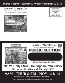


© Copyright 2026