
ZONING ORDINANCE CITY OF LAKE CHARLES
ZONING
ORDINANCE
FOR THE
CITY OF LAKE CHARLES
ORDINANCE NUMBER 7717
AS AMENDED BY
ORDINANCE NUMBER 10598
ON APRIL 22, 1998
Updated 07/22/13
CITY OF LAKE CHARLES ZONING ORDINANCE
Art. I.
Art. II.
Art. III.
Art. VI.
Art. VII.
Title, Purpose and Applicability, 1-101 – 1-106
Definitions and Rules of Interpretation, 2-101, 2-102
Land Use Policies
Part 1. [Generally], 3-101, 3-102
Part 2. Comprehensive Land Use Development, 3-201
Part 3. Transportation, 3-301
Part 4. Public Facilities and Services, 3-401
Part 5. Economic Development, 3-501
Part 6. Planning and Coordination, 3-601
Part 7. Housing, 3-701
Part 8. Environmental Quality, 3-801
Administration of Development Standards
Part 1. Decision-Making and Administrative Bodies, 4-101 – 4-103
Part 2. Development Review, 4-201 – 4-207
Development Regulations
Part 1. Zoning Districts and Map, 5-101, 5-102
Part 2. Regulations of General Applicability, 5-201 – 5-212
Part 3. District Regulations, 5-301 – 5-307
Part 4. Planned Development, 5-401 – 5-421
Enforcement, 6-101, 6-102
Fees, 7-101
Appendix A.
Appendix B.
Appendix C.
Appendix D.
Appendix E.
Application for Development Approval
Roadway Classifications
Reserved
Fee Schedule
Airport Zoning Map
Art. IV.
Art. V.
ORDINANCE NO. 7717
AN ORDINANCE adopting a comprehensive zoning ordinance of the City of Lake Charles, Louisiana,
providing for the application thereof to existing properties and land uses; providing for definitions and
rules of interpretation; providing for land use and development policies, goals and objectives; providing for
the administration of said ordinance through a planning and zoning commission and the planning office of
the City of Lake Charles, and defining the powers and duties of said offices or bodies; providing for the
development review, variances and special exceptions; providing for creation of zoning districts,
amendments to zoning districts, creating zoning districts and providing for zoning maps; providing for
development and use regulations for each district; creating historical (Charpentier and Margaret Place)
districts, providing for historic landmarks, and providing for supplemental rules and regulations with
regard thereto; providing for planned residential, commercial, industrial, mixed and mobile home
developments; prohibiting the violation of by [and providing for the enforcement of this ordinance;
providing for amendments thereto]; and providing for the repeal of comprehensive zoning law of the City
of Lake Charles being Ordinance No. 4526 of the City of Lake Charles, Louisiana as amended and by
otherwise providing with respect thereto.
WHEREAS, the City of Lake Charles wishes to promote the health, safety and morals of the general
welfare of the City of Lake Charles;
WHEREAS, the City of Lake Charles deems it necessary to enact a zoning ordinance of the City of Lake
Charles, Louisiana, for the purpose of regulating and restricting the height, number of stories, and the
size of structures, the percentage of lots that may be occupied, the size of yards, courts, and other open
spaces, the density of population, and the location and use of buildings, structures and land for trade,
industry, residence and other purposes;
WHEREAS, the City of Lake Charles, Louisiana, has determined that the goals and objectives set forth
above are best served by dividing the City of Lake Charles into districts of such number, shape and area
as set forth herein in order to carry out the purposes and goals set forth above.
1
NOW THEREFORE TO BE ORDAINED by the City Council of the City of Lake Charles, Louisiana, in
regular session convened that: Section 1, Appendix A to the Lake Charles Code of Ordinances is hereby
amended by enacting the zoning ordinance of the City of Lake Charles, Louisiana, said ordinance to read
as follows:
ARTICLE 1. TITLE, PURPOSE AND APPLICABILITY
Sec. 1-101. Title.
This ordinance shall be known as the Zoning Ordinance of the City of Lake Charles, Louisiana.
Sec. 1-102. Authority and Purpose.
This ordinance is adopted pursuant to the Charter of the City of Lake Charles in order to promote the
public health, safety, morals and general welfare of the City of Lake Charles, and is authorized by the City
of Lake Charles’ home rule charter government authority to regulate land uses within its community
without yielding to any inconsistent state law that shall not withdraw, preempt or deny the City of Lake
Charles’ power to initiate local zoning ordinances unless such state laws are necessary to protect vital
interests of the state as a whole.
Sec. 1-103. Applicability.
(1)
General application. This ordinance shall apply to the use of all land within the corporate limits of
the City of Lake Charles. All development in the city shall meet the minimum standards and
requirements of this ordinance, as amended from time to time.
(2)
Effective regulations. Decisions in regard to applications for development approval shall be
based on the provisions of this ordinance in effect at the time of the decision.
(3)
Building permits issued prior to effective date. This ordinance, or any amendment thereto, shall
not affect the validity of any building permit lawfully issued prior to the effective date of the
ordinance, or any amendment thereto, provided that the permit is valid upon the effective date of
the adoption of this ordinance or any amendment thereto, that construction authorized by such
permit has commenced prior to the effective date of the ordinance, or any amendment thereto,
and provided that construction has and does continue without interruption until development is
completed.
(4)
Conditional uses lawful prior to effective date. Any use established on the effective date of this
ordinance and which conforms with the conditional use provisions applicable in the zoning district
in which the use is located shall be considered a lawful conditional use; provided that the use
continues to conform with the provisions of this ordinance.
Sec. 1-104. Repeal.
The Comprehensive Zoning Law of the City of Lake Charles adopted 1972 as Ordinance No. 4526, as
amended from time to time, is hereby repealed.
Sec. 1-105. Severability.
If any provision of this ordinance shall, for any reason, be held to be invalid by a court of competent
jurisdiction, such invalidity shall not affect the validity of the remaining portions of the ordinance, which
shall continue in full force and effect.
Sec. 1–106. Effective date.
This ordinance shall become effective on January 1, 1984.
2
ARTICLE II. DEFINITIONS AND RULES OF INTERPRETATION
Sec. 2-101. Rules of interpretation.
(1)
This ordinance shall be constructed to achieve the purposes for which it is adopted.
(2)
In the event of a conflict between the provisions of this ordinance and any other ordinance of the
City of Lake Charles, the provisions of this ordinance shall control.
(3)
In the event of a conflict between the text of this ordinance and any caption, figure, illustration,
table or map, the text of this ordinance shall control.
Sec. 2-102. Definitions.
[Unless otherwise expressly stated or where context clearly indicates a different intention, the following
terms shall, for the purpose of Appendix A, have the meanings indicated in this section]:
Accessory Structure. A subordinate structure detached from but located on the same lot as the principal
structure. The use of which is incidental to and accessory that of the use of the principal structure. It
must contribute to the comfort, convenience, or necessity of the occupants, business, or industry of the
principle structure.
Accessory Use. A use incidental to but located on the same lot as the principle use. The use may be
detached from or attached to the principle structure. It must contribute to the comfort, convenience, or
necessity of the occupants, business, or industry of the principle use.
Access ways. A paved area intended to provide ingress or egress of vehicular traffic from a public rightof-way to an off-street parking area or loading area. Parking area aisles are not to be constructed as
access ways.
Aggrieved person. Any person with a demonstrable interest in the subject matter of a decision of the
commission, including the owners of land in the immediate vicinity of the property which is the subject of
commission action.
Agricultural use. The use of land for the raising of crops or the husbandry of food animals.
Antenna. Any structure or device for the purpose of collecting or transmitting electromagnetic waves,
including but not limited to directional antennas, such as panels, microwave dishes, and satellite dishes,
and omni-directional antennas, such as whip antennas.
Application for development approval. Any application for approval of development under the provisions
of this ordinance.
Arterial Street. Those heavily traveled streets designated as arterials in Appendix B to this ordinance.
Bar. An establishment for the primary purpose of which is the service of and on-premises consumption of
alcoholic beverages.
Bed and Breakfast facility. An owner occupied residential structure, which provides sleeping rooms for
overnight paid occupancy of up to seven (7) nights. Common bathroom facilities may be provided rather
than private bathrooms for each room. No cooking facilities are permitted in individual rooms.
Block face. The front of a block along one side of the street.
Buffer. An area established in order to protect and separate one land use from another (see Section 5209).
Buffer Planting Area. Area of land, which is unpaved between the side or rear property lines and
designated for the preservation and placement of plant materials.
3
Building. Any structure, either temporary or permanent, having a roof and designed, intended or used for
the sheltering or protection of persons, animals, chattels or property of any kind.
Bulkhead.
waterway.
A retaining wall which is adjacent to and makes contact with a body of water or navigable
Cemetery. Land used or intended to be used for the burial of the dead and dedicated for cemetery
purposes, including columbariums, crematories, mausoleums, and mortuaries when operated in
conjunction with and within the boundaries of such cemetery.
Church.
A building where persons regularly assemble for religious worship and which building is
maintained and controlled by a religious body organized to sustain religious expression.
City Council. The city council of the City of Lake Charles.
Collector Street. Those streets designated as collectors in Appendix B to this ordinance.
Commencement of construction. The physical improvement of land in accordance with a permit issued
by the City of Lake Charles, provided that the improvements are of a form and character which are not
reasonably useable for development other than that authorized by the issued permit.
Commercial purposes. Those related solely to the economic interests of the person or persons on whose
property or for whose benefit the sign is displayed, excluding signs which refer solely to the sale or lease
of the premises upon which the signs are located.
Commercial Vehicle. Those exceeding one (1) ton in size with advertising or special equipment, which
distinguish it from private automobiles. Any vehicle used for commercial purposes, except passenger
vehicles used for to and from work. All vehicles with more than 2 axles, except motor homes used for
recreation and not used in commerce.
Commission. The planning commission of the City of Lake Charles (see Section 4-101).
Common Structure. A structure, such as a garage, tool shed, or recreational facility used by more than
one resident in a planned development or manufactured housing development.
Communication Tower. As used in this ordinance shall mean a tower, pole, or similar structure, which
supports a telecommunications antenna generally operated for commercial purposes above ground in a
fixed location, freestanding, guyed, or on a building.
Community home. A dwelling unit that provides housing for six (6) or fewer mentally retarded individuals
with no more than two (2) live-in staff.
Conditional use. A use permitted in a zoning district after approval pursuant to Section 4-203.
Corner lot. A lot abutting the intersection of two (2) or more streets.
Day care center and nursery. An establishment for the care and nurture of preschool children during the
school or work day.
DBH. The diameter of a tree, stem or trunk measured at breast height.
Density. The number of dwelling units per unit of land.
Development. The use of land including change or enlargement of any use or disturbance of any land
and the performance of any building or mining operation.
Development approval. Any approval of development granted by a decision-making body, department or
other person authorized to grant approvals under the provisions of this ordinance.
District. A geographic area of the city designated in Article V of this ordinance for specified regulations
governing the use of land.
4
Dwelling. Any structure or portion thereof, which is designed or used for residential purposes.
Dwelling, single-family attached. An individual dwelling unit which is physically connected with one or
more other dwelling units.
Dwelling, single-family detached. An individual dwelling unit in a structure, which is not physically
connected with any other dwelling unit.
Dwelling unit. Any room or group of rooms located within a structure forming a single habitable unit with
facilities which are used or intended to be used for living, sleeping, cooking, eating and sanitation by one
family.
Electrical signs. Any sign containing electrical wiring and which is attached or intended to be attached to
an electrical energy source.
Entertainment uses. Establishments, which provide opportunities or environments for social relaxation or
pleasure, including the sale of food and alcoholic beverages.
Facade. The exterior wall of a building exposed to public view or that wall viewed by persons not within
the building.
Family. One or more persons related by blood, marriage, adoption or guardianship, the occupants of a
community or group home for mentally or physically challenged individuals or not more than four (4)
persons not so related occupying a dwelling unit and living as a single housekeeping unit shall be
considered a family. Notwithstanding any other provisions of this section, this definition does not include
individuals required to be assembled under one living unit for the purpose of drug or substance abuse
rehabilitation or persons assigned to same as the result of criminal activity. Halfway houses,
detoxification facilities or like facilities are not considered “family” structures and are thereby excluded
from this definition.
Finished grade. The completed surfaces of lawns, walks and roads brought to grade as shown on
development plans relating thereto.
Floodplain. Floodplain or flood-prone area means any land area susceptible to being inundated by
floodwater as depended by FEMA.
Floodway. The channel of a river or other watercourse and the adjacent land areas that must be
reserved in order to discharge the 100-year flood without cumulatively increasing the water surface
elevation more than one foot at any point.
Floor area. The sum of the gross horizontal areas of the several floors of the main building but not
including the area of roofed porches, terraces, or breezeways. All dimensions shall be measured
between exterior faces of the walls.
Floor area ratio (FAR). The ratio of floor area of a building to the area of a lot. The calculation is made
by dividing the gross floor area of all buildings on a lot by the gross area of that lot.
Frontage. Points of contact of a lot along a public street.
Gaming. The use, operation, or conducting of any game or gaming device upon a riverboat.
General retail sales and service establishment. An establishment for the sale of goods, commodities and
services to ultimate consumers or users.
Gross leasable area (GLA). That portion of the floor area of a building, which is amenable to actual
nonresidential use, including the storage of goods and material.
Ground cover. Material planted in such a way as to form a continuous cover over the ground that can be
maintained at a height not more than twelve (12’’) inches.
5
Height. The vertical distance of a building measured from the average elevation of the proposed finished
grade to the highest point of the roof for flat roofs, to the deck line of the mansard roof, and to the mean
height between eaves and ridges for gable, hip and gambrel roofs. For structures, the vertical distance
measured from average-finished grade to its highest point; provided, however, that no height limitation in
this ordinance shall apply to any of the following structures: silos, barns and other agricultural structures;
church spires; cupolas; domes; monuments; water towers; smoke stacks; derricks; flag poles; masts;
solar energy facilities; and similar structures required to be placed above the roof level and not intended
for human occupancy.
Home business. A home occupation involving a nonresident employee, permitted under the provisions of
Sections 5-301(3)(a)(ii), 5-302 (3)(a)(ii), and 5-303(2).
Home Occupation. A business, profession, occupation or trade conducted within the principle structure of
a residential use by a resident of the dwelling which is incidental and secondary to the residential use of
the dwelling, does not change the essentially residential character of the use, and which complies with
the requirements of Section 5-207 of this ordinance.
Hotel or motel. A building in which lodging or temporary living accommodations are provided or offered to
the general public.
Industrial use. The manufacture, assembly or fabrication of goods and materials.
Institutional use. Any land use for hospitals, including such educational, clinical, research and
convalescent facilities as are integral to the operation of the hospital; medical and health service facilities
and clinics, including nursing homes, physical therapy centers and public health facilities; cultural,
educational, eleemosynary facilities and other similar uses.
Intensity. Shall be defined as any of the following or a combination thereof:
a. floor area
e. gross building area
b. floor area ratio
f. height
c. density
g. traffic generation rate
d. any change of use
Kennel. A facility for the care or boarding of animals which is operated for economic gain or the keeping
of more than three (3) dogs more than six (6) months of age outside the principle building.
Land. The earth, water and air, above, below or on the surface including any improvements or structures
customarily regarded as land.
Landscape area. A non-built-upon area of land in which landscape materials are placed, planted or
maintained.
Landscape Plan. Shall mean the preparation of graphic and written criteria, specifications, and detailed
plans to arrange and modify the effects of natural features such as planting ground and water forms,
circulation, walks and other features to comply with the provisions of this Ordinance.
Landscaping. The installation of plant material or seed as a part of development.
Letter of understanding. A letter from the director of planning setting out the substance of a preapplication conference (see Section 4-201(1)(C)).
Local street. Those streets designated as local in Appendix B to this ordinance.
Lot. Any parcel of land, which can be described with definitive contiguous boundaries with one specified
use.
Lot of record. A recorded, platted lot or a parcel of land which became legally established as a lot by
deed or act of sale prior to the adoption of this ordinance.
Lot lines. The lines forming the outer boundary of a lot.
6
Major state or interstate highway. Those highways, which have an average daily total of at least 25,000
vehicles at the intersection or section nearest to the use in question.
Mansard. A roof with two slopes on all four sides, the lower slope being nearly vertical and the upper
nearly horizontal.
Manufactured housing. Dwelling units constructed at a plant or facility on a production line basis, which
are delivered, to the site as an assembled unit or in modular form.
Manufacturing uses. The assembly or fabrication of goods and materials, which does not involve toxic,
hazardous or highly flammable materials.
Mobile home. A moveable or portable structure designed and constructed on its own chassis and
designed to be connected to utilities for year-round occupancy as a dwelling.
Multiple Lot Development. A common development, which includes more than one lot, shall be treated as
one lot for the purpose of satisfying this Ordinance. Split ownership, phased development or construction,
or multiple building permits for a project shall not prevent it from being a common development as
referred to above. Each phase of a phased project shall comply with the requirements described herein.
Neighborhood commercial. A commercial use providing products and services primarily intended for the
use or consumption of the immediate neighborhood.
Nonconforming lot of record. A platted lot which does not comply with the lot size requirements of the
zoning district in which it is located.
Nonconforming structure. Any structure, which was lawful on the effective date of this ordinance, but
does not comply with all the standards and regulations of this ordinance or any amendment thereto.
Nonconforming use. Any use of any land, building, or structure, which was lawful on the effective date of
this ordinance, but does not comply with all the standards and regulations of this ordinance or any
amendment thereto.
Parapet. A low protective railing or wall along the edge of a roof or balcony.
Parcel. Any quantity of land capable of being described with such definitiveness that its location and
boundaries may be established and which is designed by its owner as land to be used as a unit.
Person. An individual, corporation, public agency, business, trust, partnership, association, two (2) or
more persons having a joint or common interest, or any other legal entity.
Planting Area. Any area designed for landscape material installation having a minimum area of twentyfive (25) square feet.
Portable signs. Any sign which is not permanently and securely connected to the ground or building so it
cannot be easily moved from one location to another and is not a lawful highway or motor vehicle
regulatory sign.
Principal building. A building or structure in which the primary use of the lot on which the building is
located is conducted.
Principal Use. The primary use and chief purpose of a lot or structure.
Public use. Any use operated by an agency of government which provides a direct service to the public
including police, fire, library, schools whether operated by a public body or not and recreational services.
Recreational facilities. Any facility which provides recreational opportunities, such as tennis clubs, health
clubs, or golf clubs.
7
Recreational facilities, intensive. A recreational facility which may impact the surrounding area in terms of
traffic and noise, such as swimming, tennis, and health clubs, or go-cart tracks.
Recreational facilities, low intensive. A recreational facility which has minimal impacts on the surrounding
area, such as golf courses, parks, campgrounds and which use has ten (10) percent or less coverage of
the parcel by impervious surfaces.
Residential use. A dwelling with permanent housekeeping facilities
Restaurant. Any establishment whose primary purpose is the service of food for consumption on or off
the premises.
Retaining Wall. A retaining wall, which shall not be deemed as a structure under these definitions, holds
back soil, rock, or other earthen material from a building, structure, or area and provides support for
vertical or near-vertical grade changes. A bulkhead shall not be deemed as a retaining for purposes of
this definition.
Setback. The required minimum horizontal distance between any structure or projection and the related
front, side, and rear property line.
Setback, building. The required minimum horizontal distance between the building and the related front,
side, and rear property line. For the purpose of this section, the setback will be measured to the nearest
point of the foundation wall of the building. A roof overhang or projection not to exceed two (2) feet will be
allowed to project past the foundation wall. (See figure 3)
Schools. Any land used for educational facilities, including universities, colleges, elementary and
secondary, and vocational schools.
Shrub. A woody perennial plant differing from the perennial herb by its persistent and woody stems, and
from a tree by its low stature (generally obtaining a height less than eight feet) and its habit of branching
from the base.
Sight triangle. See Section 5-203 (2).
Sign. Any object, device, display or structure, or part thereof, situated outdoors or indoors, the primary
purpose or use which is to advertise, identify, display, direct or attract attention to an object, person,
institution, organization, business, product, service, event or location by any means, including words,
letters, figures, designs, symbols, fixture colors, illumination or projected images. Signs do not include
the flag or emblem of any nation, organization of nations, state or city, or any political, fraternal, religious
or civic organizations; merchandise, pictures or models of products or services incorporated in a window
display; works of art which in no way identify a product; or scoreboards located on athletic fields.
Sign, Billboards/Off Site. A sign that identifies or communicates a commercial or noncommercial
message related to an activity conducted, a service rendered, or a commodity sold at a location other
than where the sign is located. A billboard is distinct from other types of signs by the fact that it is not on
the premises to which the advertising copy pertains.
Sign, Free standing. A sign supported by one or more upright poles, columns, or braces placed in or on
the ground and not attached to any building or structure.
Sign, Projecting. A sign attached to and projects from the wall or face of a building or structure, including
marquee and arcade signs.
Sign, Roof. Any sign erected upon, against, or directly above a roof or roof eave, or on top or above the
parapet, or on a functional architectural appendage above the roof or roof eave.
Sign, Wall or façade. A sign painted or attached to, and erected parallel to the face of a building and
supported throughout its length by such building. For the purpose of this section, a sign attached to the
side of a parapet will be considered a wall or facade sign.
8
Street. Public ways which have been dedicated or otherwise set aside or deeded for public use.
Street Planting Area. Front yard and the contiguous unpaved area of land, which is to be used for
landscape planting.
Structure. A combination of materials constructed or erected with a fixed location on the ground, or
attached to something having a fixed location on the ground, including, but not limited to, retaining walls
in excess of four feet.
Supervised Residential Institutions. A facility required to be licensed by the State which provides training,
care, supervised treatment, and/or rehabilitation to the aged, disabled, those convicted of crimes or those
suffering the effects of drugs and alcohol; this definition does not include daycare centers, family day
homes, schools, hospitals, jails or prisons.
Telecommunications. As defined in the federal Telecommunications Act of 1996, means the transmission
between or among points specified by the user, or information of the user’s choosing, without change in
the form or content of the information as sent and received.
Tower. Any ground or roof mounted pole, spire, structure, or combination thereof taller than 15 feet,
including lines, cables, wires, braces, and masts, intended primarily for the purposes of mounting an
antenna, meteorological device, or similar apparatus above grade. Notwithstanding any other provision
of this code “Height” of a communication tower is the distance from the base of the tower to the top of the
structure.
Trash and Garbage Storage Area. That area of a development used for the storage and containment of
refuse and refuse containers, i.e., dumpsters.
Traffic generation rates. The average daily trips generated per unit of land, as follows:
(1)
Residential dwellings: Eight (8) per dwelling unit;
(2)
Schools: One per student or twenty (20) per one thousand (1,000) square feet of gross floor area;
(3)
Neighborhood commercial: One hundred fifty (150) per one thousand (1,000) square feet of gross
floor area;
(4)
Restaurants (sit-down): Seventy-five (75) per one thousand (1,000) feet of gross floor area;
(5)
Restaurants (fast-food or take-out): Five hundred (500) per one thousand (1,000) feet of gross
floor area;
(6)
Bars: one hundred fifty (150) per one thousand (1,000) square feet of gross floor area;
(7)
General retail and service establishments: Fifty (50) per one thousand (1,000) square feet of
gross floor area;
(8)
Offices: Fifty-five (55) per one thousand (1,000) feet of gross floor area;
(9)
Wholesale and warehousing uses: Six (6) per one thousand (1,000) square feet of gross floor
area;
(10)
Manufacturing: Five (5) per one thousand (1,000) square feet of gross floor area;
(11)
Entertainment uses: Thirty (30) per one thousand (1,000) square feet of gross floor area;
(12)
Hotels and motels: Ten (10) per room;
(13)
Kennels: Twenty (20) per one thousand (1,000) square feet of gross floor area.
9
In lieu of the rates set out herein any person may submit updated counts from the Institute of
Traffic Engineering or authenticated local figures for approval by the director of planning.
Tree – Class “A”. Any self-supporting woody plant of a species which normally grows to an overall height
of at least (50’) feet, usually with one main stem or trunk and many branches, as in several varieties of
oak trees.
Tree – Class “B”. Any self-supporting woody plant of a species which normally grows to an overall height
of at least twenty-five (25’) feet, with either one main stem or trunk with many branches, or several stems
or trunks (Crepe Myrtles for example).
Truck-stop facility. Those facilities as contemplated in LA R. S. 33:4862.1 et seq., which are designed
primarily for serving eighteen wheel tractor-trailer motor vehicles and where video draw-poker devices
may be operated.
Vehicular Use Area. That area of private development subject to vehicular traffic, including access ways,
parking aisles, loading and service areas, areas used for parking and storage of vehicles, boats, or
portable construction equipment and all land which vehicles cross over as a function of primary use.
Video draw poker devices. A unity, mechanism, or device that, upon insertion of cash, in available to play
or simulate the play of the game of draw poker or other card games utilizing a cathode ray tube or video
display screen microprocessors in which the player may win games or credits that can be redeemed for
cash only. The term does not include a device that directly dispenses coins, cash, tokens, or anything
else of value, except the ticket voucher. The term does not include any device authorized to be used in
the conducting of charitable gaming.
Yard. An open space at a grade between a building and the property line of the lot in which the building
is located, unoccupied and unobstructed from the ground upward, except required parking or as
otherwise expressly permitted in this ordinance. The minimum depth or width of a yard shall consist of
the horizontal distance between the lot line and the nearest point of the foundation wall of the main
building. See setbacks.
Zoning Certificate. A certificate from the director of planning certifying that an existing or proposed use
complies with the provisions of this ordinance (see Section 4-202).
ARTICLE III. LAND USE POLICIES
PART 1. [GENERALLY]
Sec. 3-101. Purpose.
The purpose of this article is to create a comprehensive land use design suited to and provides for public
and private needs. The design is to be growth oriented and conserve environmental and municipal
resources. Guidance for land use decisions is provided in this article and shall be implemented by a
systematic framework of plans, policies, and standards in accordance with community goals.
Sec. 3-102. Goal.
(a)
Generally. Develop an orderly, efficient and beneficial arrangement of land uses in relation to
each other and to the circulation system.
(b)
Policy objectives – Summary:
(1)
Conserve undeveloped land resources suitable for agriculture and recreational use.
(2)
Prevent spreading of urban blight.
(3)
Minimize traffic congestion resulting from new developments.
10
(4)
Encourage new housing development to locate new employment centers and supporting
services.
(5)
Encourage commercial and light industries to develop near major transportation routes.
(6)
Encourage developments, such as shopping centers, where needed to serve
neighborhoods.
(7)
Encourage “fill-in” development of vacant land.
(8)
Provide incentives to encourage and control development.
(9)
Annex developing areas adjacent to the city or obtain authority for extraterritorial
jurisdiction.
(10)
Discourage isolated rezoning.
PART 2. COMPREHENSIVE LAND USE DEVELOPMENT
Sec. 3-201. Goal.
(a)
Generally. Ensure an adequate supply of suitable land for urban development to support
moderate and balanced community growth.
(b)
Policy objectives – Summary:
(1)
Provide enough land for commercial and industrial expansion.
(2)
Provide enough land for new housing to meet various density demands.
(3)
Provide enough land for public facilities and services: Streets, sewerage, etc.
(4)
Increase open space and recreational land use.
(5)
Provide land for redevelopment.
(6)
Provide a variety of locations for different land uses.
(7)
Provide enough land to prevent overcrowding.
(8)
Maintain reasonable levels of land costs.
PART 3. TRANSPORTATION
Sec. 3-301. Goal.
(a)
Generally. Develop an efficient and balanced transportation system to serve present and future
land use.
(b)
Policy objectives – Summary:
(1)
Minimize traffic congestion.
(2)
Require new developments to provide adequate circulation.
(3)
Based on local needs, extend and improve major streets and transit services to make
development easier.
(4)
Improve circulation to support the downtown area and North Lake Charles.
11
(5)
Provide adequate street and drainage improvements in existing developed areas.
(6)
Improve what public transit has to offer to the disadvantaged public.
(7)
Provide adequate intercity and local truck routes.
(8)
Provide sidewalks and bicycle routes where needed.
(9)
Protect street capacity and prevent congestion through regulation of access from a
commercial frontage.
(10)
Encourage improvement of intercity and regional circulation links of local interest.
PART 4. PUBLIC FACILITIES AND SERVICES
Sec. 3-401. Goal.
(a)
Generally. Ensure provision and maintenance of public facilities and services to support present
and future activities.
(b)
Policy objectives – Summary:
(1)
Provide services on an equitable basis to all Lake Charles residents.
(2)
Improve services to ensure suitable land for present and future activities.
(3)
Use services and facilities to encourage revitalization of older developed areas.
(4)
Improve the quality and effectiveness of social services and public facilities to serve all
development within the city.
(5)
Improve public recreational facilities to all city residents.
(6)
Ensure the new development provides adequate public improvements.
(7)
Control development to meet the provision of public facilities and services.
(8)
Provide the highest level of basic municipal services and facilities the city can afford.
(9)
Continue to require annexation before the city will extend services beyond existing city
limits.
PART 5. ECONOMIC DEVELOPMENT
Sec. 3-501. Goal.
(a)
Generally. Developed a diversified local economy to meet the needs of the local population.
(b)
Policy objectives – Summary:
(1)
Promote labor-intensive business and industries in proximity to neighbors with high
unemployment within the city.
(2)
Promote other commercial and service functions on a regional-serving basis within the
city.
(3)
Promote training and employment programs to reduce unemployment.
12
(4)
Provide public facilities and transportation routes to support development of employment
opportunities.
(5)
Provide land in good locations for commercial and light industrial development within the
city.
(6)
Acquire property for economic development (commercial and light industry).
(7)
Continue current physical and economic revitalization efforts in the downtown area.
PART 6. PLANNING AND COORDINATION
Sec. 3-601. Goal.
(a)
Generally. Guide growth through the use of plan, policies and standards.
(b)
Policy objectives – Summary:
(1)
Provide development standards and review procedures.
(2)
Coordinate development with expansion of city services and facilities and environmental
concerns.
(3)
Create and maintain a land use policy plan and a capital improvements program to use
resources better.
(4)
Provide comprehensive and consistent regulations for land use.
(5)
Tie land use regulations, capital improvements programming, other local plans, goals,
and objectives together to guide development.
(6)
Promote intergovernmental coordination of procedures affecting local governments.
PART 7. HOUSING
Sec. 3-701. Goal.
(a)
Generally. Provide sound housing and residential environments. Provide a variety of housing
needs suited to the needs and resources of the present and future population.
(b)
Policy objectives – Summary:
(1)
Provide enough land with adequate public facilities for various densities and types of new
housing development.
(2)
Protect existing neighborhoods that are sound and suitable for rehabilitation.
(3)
Encourage rehabilitation to minimize the extent of house deterioration.
(4)
Remove all unrehabitable housing.
(5)
Promote sufficient new housing for low to moderate income households and replace
substandard housing units.
(6)
Use state and federal funding sources whenever possible for all housing needs.
(7)
Acquire property for residential redevelopment.
(8)
Encourage conversion of vacant commercial floor space.
13
(9)
Maintain a balance between supply and demand for housing types and cost levels.
(10)
Encourage new housing diversity of design and cost consistent with consumer needs.
(11)
Provide housing construction and development standards to ensure quality, safety,
reasonable cost and conservation of energy resources.
PART 8. ENVIRONMENTAL QUALITY
Sec. 3-801. Goal.
(a)
Generally. Ensure that urban development is compatible with natural and environmental
resources.
(b)
Policy Objectives – Summary:
(1)
Preserve the natural beauty of the community including historical sites and structures.
(2)
Control exposure of urban development to natural hazards.
(3)
Use land unsuitable for urban development for recreational use.
(4)
Require new developments to comply with air and water quality standards.
(5)
Minimize adverse environmental impacts resulting from municipal services and facilities.
ARTICLE IV. ADMINISTRATION OF DEVELOPMENT STANDARDS
PART 1. DECISION–MAKING AND ADMINISTRATIVE BODIES
Sec. 4-101. Planning Commission.
(1)
Membership.
(a)
The commission shall be composed of five (5) regular members and two (2) alternate
members to be appointed by the mayor with the approval of the city council.
(b)
Those members in office upon adoption of this ordinance shall serve until completion of
their term.
(c)
Each member shall serve a term of four (4) years.
(d)
Each member of the commission shall be a resident of the City of Lake Charles and to
the extent practicable; the membership shall represent diverse economic, social,
business and geographic backgrounds.
(e)
If a vacancy occurs prior to the expiration of a member’s term, the mayor shall appoint a
member for the duration of the unexpired term within sixty (60) days of the vacancy.
(f)
The members of the commission shall serve without compensation and shall hold no
other public office other than as members of a regional planning commission of which the
City of Lake Charles is a member or constituent part.
(g)
A member of the commission may be removed from office by the mayor for inefficiency,
neglect of duty, malfeasance in office. Failure to attend three (3) out of five (5)
consecutive commission meetings shall constitute adequate grounds for removal.
14
(2)
(3)
Chairman and vice-chairman.
(a)
At the first regular meeting of each year, the members of the commission shall elect one
of their number as chairman and one of their number as vice-chairman.
(b)
No member may serve more than two (2) consecutive terms as chairman.
(c)
In the absence of the chairman, the vice-chairman shall act as chairman and shall have
all the powers of the chairman.
(d)
The members of the commission shall, in the event both chairman and vice-chairman are
absent from a meeting, select a member to preside over the meeting.
(e)
The chairman shall preside over all meetings of the commission and, in addition, may
appoint committees, composed of members of the commission, as well as other persons,
to serve the commission, as he deems necessary.
(f)
The chairman may engage in discussion and vote in the same manner as any other
member of the commission.
(g)
The chairman may suggest motions but may neither make nor second motions.
Secretary.
(a)
The director of planning, or his designated representative, shall serve as secretary to the
commission.
(b)
The secretary shall keep the minutes of all meetings of the commission and maintain the
record for each commission meeting, hearing or other proceeding.
(4)
Quorum and necessary vote. No business shall be transacted by the commission without a
quorum, which shall consist of at least four (4) members of the commission being present. The
concurring vote of at least three (3) members shall be necessary for the commission to take any
action.
(5)
Procedures.
(a)
The commission shall hold regular monthly meetings. Special meetings may be called by
the chairman, or at the written request of any two (2) members of the commission.
(b)
All meetings and hearings shall be open to the public and shall be conducted in
accordance with the procedures established in Section 4-201 of this ordinance, and any
rules of procedure adopted by the commission in accordance with subsection (6)(k) of
this section.
(c)
Any rules of procedures shall be kept on file by the commission and be available to the
public at all times and copies thereof shall be available at any meeting or hearing.
(d)
In the event that less than a quorum is present at any meeting of the commission, the
meeting shall be rescheduled by the director of planning to a date certain as soon as
practical. The secretary shall notify, in writing, all members of the commission, the
applicant and all other interested persons of the date of the rescheduled meeting.
(e)
Prior to voting on any matter, each member shall review the entire record of the
proceeding and fully inform himself of the facts and issues of the matter under
consideration. If a member was absent during a public hearing conducted to consider a
matter, he shall state on the record that he has complied with the provision prior to voting
on the matter.
(f)
Meetings to consider matters relating to zoning shall be held separately by the
commission.
15
(6)
Powers and duties. The commission shall have the following powers and duties:
(a)
To prepare and adopt a comprehensive plan or elements thereof.
(b)
To annually review and update the comprehensive plan or elements thereof.
(c)
To review the capital improvement programs of the city for compliance with the
comprehensive plan, or any element thereof, to comment thereon, and recommend to the
city council approval or disapproval of proposed public projects.
(d)
To prepare and revise as appropriate the official zoning district map, and recommend its
adoption, from time to time to recommend its amendment, as provided in Sections 4-207
and 5-102 of this ordinance.
(e)
To hear, review and make recommendations to the city council on proposed zoning
district classifications for land subject to a petition for annexation.
(f)
To hear, review and approve, or disapprove applications for conditional use permits as
provided in Section 4-203 of this ordinance.
(g)
To initiate, hear, review and make recommendations to the city council on proposed
amendments to the text of this ordinance as provided in Section 4-207 of this ordinance.
(h)
To review and report on any matter referred to it by the mayor or the city council.
(i)
To adopt rules of procedures which are not in conflict with the provisions of this
ordinance.
(j)
To hear and decide appeals where it is alleged there is error in any order, requirement,
decision, or determination made by an official in the administration or enforcement of this
ordinance, as provided in Section 4-204 of this ordinance.
(k)
To vary or modify, upon appeal, the application of the provisions of this ordinance, as
provided in Section 4-205 of this ordinance.
(l)
To hear, review and authorize special exceptions to this ordinance as provided in Section
4-206 of this ordinance.
(m)
To adopt rules of procedure which are not in conflict with the provisions of this ordinance.
Sec. 4-103. Department of Planning.
(1)
Appointment and authority of director. The director of the department of planning shall be
appointed by the mayor and shall have the following powers and duties:
(a)
To receive and review, or cause to have reviewed, applications for development
approval.
(b)
To issue conditional use permits pursuant to the provisions of Section 4-203(4) of this
ordinance.
(c)
To perform such duties as may be required by this ordinance or the planning
commission.
(d)
To be responsible for drafting of the city’s comprehensive plan or any element thereof.
(e)
To maintain the official zoning district map.
16
(f)
To be responsible for the administration of this ordinance and the city’s subdivision
regulations.
(g)
To issue zoning certificates and render interpretations of this ordinance as provided in
Section 4-202 of this ordinance.
(h)
To enforce the provisions of this ordinance as provided in Article VI of this ordinance.
PART 2. DEVELOPMENT REVIEW
Sec. 4-201. Procedures of general applicability.
(1)
Pre-application conference.
(a)
Request and scheduling. An applicant for development approval is encouraged to
request at his option an informal conference with the director of planning prior to filing an
application for development approval.
(b)
Purpose of conference. The pre-application conference shall be informal and its purpose
shall be to discuss the proposals, views and concerns of the applicant, to determine
whether any of the application requirements should be waived or any additional
information will be required.
(c)
Letter of understanding. Within ten (10) days after the pre-application conference, the
director of planning may transmit a letter of understanding to the applicant setting forth
the substance of the pre-application conference. No representation by the director of
planning or any other city official or employee at the pre-application conference or at any
other time shall be binding on the city with respect to any application subsequently
submitted unless such representation is set forth in the letter of understanding or in a
zoning certificate
(2)
Application submission requirements. All applications for development approval shall be
submitted to the director of planning at the offices of the planning department and contain the
information required by the form set out in Appendix A. Applicants for development approval may
be required to submit additional information, other than that required in Appendix A, which the
director of planning or the decision-making body may deem necessary to review the proposed
development.
(3)
Determination of completeness of application.
(4)
(a)
Determination by the director of planning. Within fifteen (15) days after receipt of an
application for development approval, the director of planning shall determine whether
the application is complete, he shall notify the applicant in writing that the application has
been accepted for filing. If he determines that the application is not complete, he shall
notify the applicant, specifying the deficiencies of the application, including any additional
information, which must be supplied, and no further action shall be taken by the city on
the application until the deficiencies are corrected.
(b)
Remedy of deficiencies. If the applicant fails to correct the specified deficiencies within
thirty (30) days of the notification of deficiency, the application for development approval
shall be deemed withdrawn.
(c)
Effect of determination. The time limits for completion of development review set out in
this ordinance shall commence on the date that the director of planning determines that
the applicant is complete.
Hearing procedures.
(a)
Applicability. The procedures set out in this subsection shall be applicable to all public
hearings required by a provision of this ordinance.
17
(b)
Notice of public hearing.
(i)
Content. All Notices of public hearings shall include:
(aa)
The date, time, and place of the hearings;
(bb)
The section or sections of this ordinance under which the subject matter
of the hearing will be considered;
(cc)
The name of the applicant;
(dd)
A brief description of the location of any land proposed for development
and the subject matter to be considered at the hearing;
(ee)
A statement that the application and supporting materials are available
for public inspection and copying at the offices of the planning
department;
(ff)
A statement that any person may speak or submit a written statement;
and
(gg)
A brief description of the appeal process which is available by right after
public hearings before the Planning and Zoning Commission or any
further automatic review by the City Council.
(ii)
City [director of planning] to provide notice.
(aa)
Notice of public hearings shall be given by the director of planning as
follows:
(A)
By sending a copy of the notice to the applicant by mail;
(B)
By sending a copy of the notice, by mail, to any person,
organization, or agency, which has previously filed with the city a
written request for notices and paid an annual fee in an amount
to be determined from time to time by the city to cover the actual
cost of providing such notices;
(C)
By publication of a copy of the notice, once a week for three (3)
different weeks, in a newspaper with general circulation in the
city;
(D)
By sending a copy of the notice by certified mail to each owner of
record, if different from the applicant, of any land on which
development is proposed;
(E)
By sending a copy of the notice by regular mail addressed to the
street address of improved property and the tax address of
unimproved property located within five hundred (500) feet of
any border of property proposed for development of major
conditional use or property subject to a proposed amendment to
the official zoning map; and
(F)
By sending a copy of the notice by regular mail to each council
member whose district is impacted by the above notice
requirements.
(bb)
Notice of approval of minor conditional use permits under Section 4203(4) shall be given within seven (7) days of such approval to the city
council and any other individual, organization, or agency which has
previously filed with the city a written request for notices and paid an
annual fee in an amount to be determined from time to time by the city to
cover the actual cost of providing such notice.
(cc)
In addition to the contents set forth in paragraph (i) of this subsection,
each notice of public hearing, which is given by mail, shall include a
graphic description of the location of any land proposed for development,
at an appropriate scale.
18
(iii)
(iv)
City to provide notice. The city shall provide notice of a required public hearing,
or issuance of any minor conditional use, by conspicuous posting of a
weatherproof sign at least two (2) square feet in front surface area on any
roadway frontage of the parcel proposed for development.
Time of notice. All required notices shall be provided at least fifteen (15) days in
advance of a public hearing.
(c)
Examination and copying of application and other documents. Any person may examine
any application for development approval and other material submitted in regard to that
application, and may obtain copies of the application and other materials upon
reasonable request and payment of a fee to cover the actual cost of such copies.
(d)
Conduct of the hearing:
(i)
Submission of information. Any person may appear at a public hearing and give
testimony or submit written materials, either individually or as a representative of
an organization. The decision-making body may exclude information that it finds
to be irrelevant, immaterial or unduly repetitious.
(ii)
Duty of planning department.
(aa)
Presentation of information. The planning department shall present
information concerning pertinent application considerations and the
standards set out in this ordinance, including any appeal process
available to the applicant or to any opposition or any further automatic
review by the City Council.
(bb)
Production of additional information. Upon a showing by any person
made at any time during the hearing, or on motion of the decisionmaking body, the applicant or the staff may be required to produce
additional information with respect to the proposed application.
(iii)
Continuance. The decision-making body may continue a hearing to a specified
date, time and place. Unless such continuance is publicly announced at a
properly noticed public hearing, the director of planning shall cause notice to be
given to all person originally entitled to notice of the date, time and place of such
continued hearing in the same manner as specified in Section 4-201(4)(b) hereof.
(iv)
Record of hearing.
(aa)
The director of planning shall ensure that the proceedings are recorded
by appropriate means. If a sound recording is made, any person shall be
entitled to listen to the recording at any reasonable time or to make
copies at his own expense.
(bb)
The record of proceedings shall consist of the recording of testimony, all
applications, exhibits and papers submitted in any proceeding with
respect to the matter being considered, and the summary and report or
reports of the director of planning.
(cc)
All summaries and reports of the director of planning shall be public
records, open to inspection at a reasonable time and upon reasonable
notice.
(v)
Conflicts. Any member of a decision-making body having any direct or indirect
financial interest in property or who lives within five hundred (500) feet of any
property, which is the subject of a public hearing, shall disclose such fact at the
hearing, prior to voting on the matter.
(vi)
Other rules to govern. Other matters pertaining to the public hearing shall be
governed by other provisions of this ordinance applicable to the body conducting
the hearing and its adopted rules of procedure.
(vii)
Contacts outside of the hearing. If any member of a decision-making body
receives a substantive communication from any person outside the hearing
concerning a subject matter under consideration by that body, he shall make a
statement at the hearing describing the circumstances and substance of such
communication.
19
(5)
(6)
(7)
Waiver of time limits.
(a)
By agreement. Any time limit imposed by this ordinance may be waived or extended by
agreement of the director of planning, the commission, or the city council, as the case
may be, and the applicant.
(b)
Automatic waiver. Any applicant who requests a continuance of a public hearing at which
his application is being considered, or who requests an extension of any time limit
imposed on him by statute or this ordinance, shall be deemed to have agreed to an
extension of that time limit.
Action by decision-making body.
(a)
General. Except as otherwise provided herein, the decision making body shall render its
decision during the initial hearing.
(b)
Findings. All decisions of any decision-making body shall be in writing and shall include
at least the following:
(i)
Findings relevant to the standards governing the application for development
approval under consideration.
(ii)
Conclusions regarding each standard applicable to the proposed development.
(iii)
A recommendation or final decision.
(c)
Notification. Notification of all decisions shall be mailed to all persons entitled to notice
under Section 4-201(4)(b)(ii).
Successive applications.
(a)
(8)
Whenever any application for development approval is denied, an application involving
the same property shall not be accepted for filing within one year from the date of denial,
unless the subsequent application involves a development proposal which is materially
different from prior proposals or is responsive, in the opinion of the decision-making body,
to negative findings set forth in the denial of the prior application. For the purpose of this
section, a development proposal shall be considered materially different if it involves a
change in intensity of use of more than twenty-five (25) percent.
Application change during review process.
(a)
Any application approved or denied by any decision making authority described in this
ordinance amended to reflect a 25% change of intensity must meet new application
requirements set forth under section 4-201(2). Application review by any decision
making authority described in this ordinance must stop when the application is changed
to reflect a 25% change of intensity after which applications subject to meet new
application requirements of Section 4-201(2).
Sec. 4-202. Zoning certificate.
(1)
Authority and purpose. In order to ensure that all proposed development, including development
permitted as of right, complies with the terms of this ordinance and to provide a mechanism for
rendering interpretations of the provision of this ordinance, the director of planning is authorized
to certify that a proposed development, or a particular part of a proposed development, is in
compliance with this ordinance.
(2)
Application. A zoning certificate may be obtained from the director of planning upon submission
of an application identifying the location, character, and magnitude of an existing proposed use.
20
Sec. 4-203. Conditional uses.
(1)
Authority and purpose. Conditional uses are those uses, which are generally compatible with the
uses permitted in a zoning district, but require individual review of their location, design and
intensity in order to ensure their appropriateness on any particular parcel of land and the
compatibility of the use with adjacent uses. Conditional use permits may be granted for those
uses enumerated in each of the zoning districts established in Article V of this ordinance in
accordance with the standards and procedures of this section and the standards established for
each conditional use in the district regulations.
(2)
Standards applicable to all conditional uses. A conditional use permit shall be granted only if the
applicant demonstrates that:
(a)
The proposed conditional use is consistent with the purposes, goals, and objectives of
Article III of this ordinance;
(b)
The design of the proposed development minimizes adverse effects, including visual
impacts of the proposed use on adjacent properties;
(c)
The proposed use will not unduly burden essential public facilities and services including
roadways, parking spaces, police and fire protection, drainage systems, refuse disposal,
water and sewers, and schools;
(d)
The applicant for conditional use approval has the financial and technical capacity to
complete the development as proposed and has made adequate provision to guarantee
the provision and development of any open space and other improvements associated
with the proposed development;
(e)
The proposed use complies with the regulations of general applicability set forth in Article
V, Part 2 of this ordinance unless expressly modified by the particular provisions of Article
V, Part 3 authorizing such use; and
(f)
The proposed use complies with all additional standards imposed on it by the particular
provisions of Article V, of this ordinance authorizing such use and any other requirement
of the city code.
(3)
Conditions. A conditional use permit may be issued subject to such conditions as the decisionmaking body determines are necessary to carry out the purposes of this ordinance and to prevent
or minimize adverse effects upon other property in the neighborhood, including but not limited to,
limitations on size and location, requirements for landscaping, lighting, the provision of adequate
ingress and egress, duration of the permit and hours of operation. Such conditions may include a
requirement for further review and approval prior to the issuance of building permits and a
provision for expiration of the permit in the event the applicant fails to comply with conditions of
the permit.
(4)
Issuance of a minor conditional use permit.
(a)
Minor conditional uses shall be reviewed and approved or denied by the director of
planning, subject to review by the commission in accordance with the provisions of this
subsection.
(b)
Application. An application for a minor conditional use permit shall be submitted to the
director of planning in accordance with the provisions of Section 4-201(1)(3),
accompanied by a nonrefundable fee as established from time to time by the city council.
(c)
Review. Within thirty (3) days after receipt of a complete application for minor conditional
use permit, the director of planning shall issue a decision granting or denying the
conditional use permit. The director of planning shall notify the applicant in writing of his
decision.
21
(5)
(d)
Appeal to the commission of decision of the director of planning. Within fifteen (15) days
of the decision of the director of planning, the applicant or any member of city council
may appeal the decision to the commission. The appeal shall be placed on the
commission’s consent agenda at the next regularly scheduled meeting and the
commission shall adopt the consent agenda or, by vote of a majority of the commission,
remove a decision from the consent agenda. If a permit is removed from the consent
agenda, the commission shall conduct a public hearing on the application for
development approval, in accordance with the provisions of Section 4-201(4), and require
payment of a reasonable fee by the applicant, if the applicant appealed, to cover any
additional costs incurred by the city as a result of the hearing. The commission shall
review the application, the decision of the director of planning and any additional
information, which may be submitted, and the commission may affirm, reverse, or modify
the decision. If a proposed decision is not removed from the consent agenda, adoption
of the consent agenda shall constitute final approval of the conditional use permit.
(e)
Review of decision. Notwithstanding any other provision of this ordinance, at the city
council agenda meeting following the decision of the commission either the applicant or
any member of the city council may request a review of the decision of the commission
by the city council which council may, if said review is granted, hold a hearing in
accordance with this section. If the city council chooses to hear said matter, a hearing
shall be heard thereon at the next regular council meeting. If an appeal is taken to the
city council from the decision of the planning commission relative to minor conditional
use, the decision of the planning commission and of the planning director relative thereto
shall automatically be vacated by such appeal, and it shall take the concurring vote of
four (4) city council members to grant a minor conditional use permit.
(f)
Issuance of permit/license general. No minor conditional use permit for construction or
license for occupation shall be issued by the City until all appeal periods have expired or
until final decision has been made by the City Council.
Issuance of a major conditional use permit.
(a)
Authority. Major conditional uses shall be reviewed and approved or denied by the
commission in accordance with the provisions of this subsection.
(b)
Application. An application for major conditional use permit, authorized under the
provisions of this subsection, shall be submitted to the director of planning in accordance
with the provisions of Section 4-201(1)-(3), accompanied by a nonrefundable fee as
established from time to time by the city council.
(c)
Review. Within fifteen (15) days after receipt of a complete application for a major
conditional use permit, the director of planning shall review the application and at least
ten (10) days prior to the next regularly scheduled meeting of the commission send his
recommendation on the proposed conditional use permit to the members of the
commission, with a copy to the applicant.
(d)
Action by planning commission. The commission shall conduct a public hearing on the
application in accordance with the requirements of Section 4-201(4). The commission
shall review the application, the recommendation of the director of planning and the
testimony at the public hearing and within thirty (30) days from receipt of the director’s
recommendation grant a conditional use permit, subject to specified conditions or deny
the application.
(e)
Appeal to city council from the decision of the commission.
(i)
An applicant for major conditional use approval or any member of the city council
may appeal the decision of the commission.
(ii)
Notice of appeal shall be filed with the director of planning within fifteen (15) days
of the decision of the commission.
(iii)
Upon receipt of a notice of appeal, the director of planning shall place the denial
of the application for conditional use approval on the agenda of the next regular
22
meeting of the city council and give notice of such proceedings to all persons
eligible for notice under the provisions of section 4-201(4)(b)(ii).
(f)
(6)
Action by city council on appeal. The appeal to the city council shall automatically vacate
the decision of the planning commission on a major conditional use permit application,
and it shall take the concurring vote of four (4) city council members to grant any major
conditional use. The city council shall review the application, the recommendation to the
commission by the planning director, the decision of the commission, as vacated, and
any additional information, which may be submitted. Within thirty (30) days of the notice
of appeal, the city council shall hold a public hearing and take action on said appeal.
Adjustments to an approved conditional use during development. During the development of a
conditional use, adjustments to the approved use may be permitted as follows:
(a)
Technical adjustments. The director of planning may authorize adjustments to an
approved conditional use when such adjustments appear necessary in light of technical
or engineering considerations first discovered during actual development.
Such
adjustments shall be consistent with the intent of this ordinance and the approved
conditional use and shall be the minimum necessary to overcome the particular difficulty.
Such adjustments shall be limited to the following:
(i)
Altering the location of any structure by not more than ten (10) feet;
(ii)
Altering the location of a parking area or road by more than five (5) feet;
(iii)
Altering the final grade by not more than ten (10) percent of the originally planned
grade;
(iv)
Altering the location of required landscaping elements by not more than twenty
(20) feet.
(b)
All other adjustments. Any adjustments to an approved conditional use, which are not
technical in nature, shall be granted only upon application to and approval of the
commission, if a major conditional use, or the director of planning, if a minor conditional
use. The commission or the director of planning, as the case may be, may approve an
adjustment upon finding that the proposed change is in substantial conformity with the
original approval. If the commission determines that the adjustment is not in substantial
conformity with the original approval, then the request shall be considered an amendment
under the provisions of Section 4-203(7) hereof. Any party may appeal denial of an
application for an adjustment to the city council or the commission within fifteen (15) days
after the decision is rendered.
(7)
Amendments to conditional use permits. A conditional use permit may be amended, extended,
varied or altered only pursuant to the standards and procedures for approval in Sections 4-203(4)
or (5).
(8)
Revocation of conditional use permits. In addition to any other penalties and remedies for
violation of this ordinance, every conditional use approval may be revoked for violation of any
condition imposed upon such approval. The permit issued pursuant to the conditional use
approval may be revoked only after the commission holds a public hearing and finds that the
conditions of the permit have been violated. Any party may appeal a decision by the commission
to revoke a conditional use permit to the city council within fifteen (15) days after the decision is
rendered.
(9)
Limitations on approval of a conditional use permit.
(a)
Within one (1) year of conditional use approval, or such shorter time as may be
established by an approved development schedule, if any, construction shall commence
in accordance with the approved conditional use permit. Failure to commence
construction within that period shall, unless the commission shall have granted an
extension, automatically render the conditional use permit null and void.
(b)
A permit for a conditional use authorizes only the particular use for which it was issued
and such permit shall automatically expire and cease to be of any force or effect if such
use shall, for any reason, be discontinued for a period of six (6) consecutive months.
23
Sec. 4-204. Appeals.
(1)
Authority and purpose. The planning commission is hereby authorized to hear and decide
appeals where it is alleged that there is error in any order, requirement, decision, or determination
made by an administrative official in the enforcement of this ordinance. An appeal may be
initiated by any person aggrieved or by any officer, department, commission, or bureau of the City
of Lake Charles affected by any decision of the administrative officer.
(2)
Application/notice of appeal. An application/notice of appeal authorized under the provision of
this section shall be submitted to the director of planning in accordance with the provisions of
Section 4-201(1)-(3), accompanied by a nonrefundable fee as established from time to time by
the city council.
(3)
Review. Within fifteen (15) days after receipt of a complete application, the director of planning
shall complete the review of the application and at least ten (10) days prior to the next regularly
scheduled meeting of the commission send a written recommendation to the commission, with a
copy to the applicant, setting forth whether the appeal should be granted or denied and the
grounds for such recommendation.
(4)
Action by the commission. The commission shall review the application, the recommendation of
the director of planning, conduct a public hearing on the application in accordance with the
requirements of Section 4-201(4) and grant the appeal, grant the appeal subject to specified
conditions, or deny the appeal.
(5)
Appeal. Any person or member of the city council, aggrieved by any decision of the planning
commission may file a written request within fifteen days of said decision, with the city council of
the City of Lake Charles through the Planning Department for a review of the decision and
thereupon said city council shall grant a public hearing thereon. In the event of an appeal to the
city council, the decision of the planning commission shall be automatically vacated thereby and it
shall take the concurring vote of four (4) city council members to grant an appeal or to grant an
appeal subject to specified conditions.
Sec. 4-205. Variances.
(1)
Authority and purpose. The planning commission or historic preservation commission is hereby
authorized to grant such variances from the literal terms of this ordinance where there are
practical difficulties or unnecessary hardships so that the spirit of this ordinance shall be
observed, public safety and welfare secured, and substantial justice done.
(2)
Standards. A variance shall be granted only if the applicant demonstrates that:
(a)
The variance requested arises from a condition, which is unique, not ordinarily found in
the same zoning district;
(b)
The condition, which requires the variance, arises from the regulations in this ordinance
and not by any action of the property owner or applicant;
(c)
The particular physical surroundings, shape or topographical conditions of the property
would result in unnecessary hardship, as distinguished from a mere inconvenience, if the
provisions of this ordinance were literally enforced;
(d)
The variance will not be materially detrimental to other property in the vicinity; and
(e)
The variance will not be contrary to the general spirit and intent of this ordinance.
24
(3)
Conditions. Issuance of a variance may be subject to such conditions as are necessary to carry
out the purposes of this ordinance and to prevent or minimize adverse effects upon other property
in the neighborhood, including, but not limited to, limitations on size and location, requirements for
landscaping, lighting, and ingress and egress.
(4)
Application. An application for a variance authorized under the provisions of this section shall be
submitted to the director of planning in accordance with the provisions of Section 4-201(1)(3),
accompanied by a nonrefundable fee as established from time to time by the city council.
(5)
Limitations on variances.
(a)
Variances shall not be granted which would:
(i)
Permit a structure with a height, floor area ratio, or coverage ten (10) percent
greater than otherwise permitted;
(ii)
Permit the creation of a lot or parcel that cannot be developed in compliance with
this ordinance and other regulations applicable thereto;
(iii)
Permit the use of land or structure contrary to the use provisions of the applicable
zoning district;
(iv)
Permit an increase in signage above the amount permitted in Section 5-211 of
this ordinance;
(v)
Permit any reduction of the minimum building setback required by Section 5-203
(7) of this ordinance;
(vi)
Permit any reduction of the minimum landscape requirements within the front
yard setback along an arterial or collector street required by Section 5-210 of this
Ordinance.
(b)
No variance shall be valid for a period longer than six (6) months unless a building permit
is issued and construction has commenced, or unless a certificate of occupancy is issued
and a use commenced within such period.
(6)
Review. Within fifteen (15) days after receipt of a complete application, the director of planning
shall complete the review of the application and at least ten (10) days prior to the next regular
scheduled meeting of the commission, send a written recommendation to the commission, with a
copy to the applicant, setting forth whether the variance should be issued or denied and the
grounds for such recommendation.
(7)
Action by the commission. The commission shall review the application, the recommendation of
the director of planning, conduct a public hearing on the application in accordance with the
requirements of Section 4-201(4) and shall grant the variance, grant the variance subject to
specified conditions, or deny the variance.
(8)
Appeal. Any person or member of the city council, aggrieved by any decision of the planning
commission may file a written request within fifteen days of said decision, with the city council of
the City of Lake Charles through the Planning Department for a review of the decision and
thereupon said city council shall grant a public hearing thereon. In the event of an appeal to the
city council, the decision of the planning commission shall be automatically vacated thereby and it
shall take the concurring vote of four (4) city council members to grant an appeal or to grant an
appeal subject to specified conditions.
Sec. 4-206. Special Exceptions.
(1)
Authority and purpose. The planning commission or historic preservation commission is hereby
authorized to grant special exceptions to permit:
(a)
The reconstruction of a nonconforming structure when the structure has been damaged
or destroyed to the extent of less than fifty (50) percent of the fair market value of the
structure;
(b)
A nonconforming use to change to another nonconforming use if the proposed use is a
permitted use in a more restrictive classification;
25
(2)
(c)
A nonconforming use to be expanded up to fifty (50) percent of the floor area existing on
the effective date of this ordinance;
(d)
Any nonconforming sign or other nonconformity which is nonconforming solely because
of failure to comply with regulations governing parking, landscaping, or lighting to
continue as a special exception, subject to the standards of this section and conditions
imposed by the commission;
(e)
The completion of development commenced in accordance with a lawfully issued permit
prior to the adoption of this ordinance or any amendment thereto, which when completed
will be nonconforming, [sic] offer a wrongfully issued permit provided that the applicant
can demonstrate that completion is necessary to ensure a reasonable rate of return on
investment, under the following criteria:
(i)
The rate of return shall be related to the applicant’s debt to equity ratio in this
project;
(ii)
Expenditures for legal or other professional services unrelated to the design or
construction of improvements shall not be considered development expenditures;
and
(iii)
Taxes paid shall not be considered development expenditures except for any
increase in taxes, which may result from the governmental approval or
improvements actually constructed on the property.
(f)
The reduction of the number of parking spaces required for any use by Section 5-208
provided that the applicant demonstrates that the characteristics of the proposed use are
such that the parking proposed is adequate and that the reduction is necessary to fulfill
one of the objectives of Article III;
(g)
The increase of the distance from a proposed use to required parking as provided in
Section 5-208 provided that the applicant demonstrates an adequate workable
alternative;
(h)
The substitution of alternative means of buffering adjacent land uses to the bufferyards
required in Section 5-209 when the particular characteristics of a parcel of land preclude
compliance, provided that the alternative means shall provide equivalent compatibility of
adjacent uses.
Standards. A special exception shall be granted only if the applicant demonstrates that:
(a)
The proposed use is consistent with the policies of Article III of this ordinance;
(b)
The location of the use, its nature, intensity, layout, and its relation to access streets is
such that the pedestrian and vehicular traffic to and from the use will not be hazardous or
inconvenient to the predominant residential or other prevailing character of the
neighborhood; and
(c)
The location and height of buildings, the location, nature and height of walls and fences,
and the nature and extent of landscaping on the site shall not hinder or discourage the
appropriate development or use of adjacent land and buildings or impair the value
thereof.
(3)
Conditions. Issuance of a special exception may be made subject to such conditions as are
necessary to carry out the purposes of this ordinance and to prevent or minimize the impact of
the exception on the surrounding neighborhood, including, but not limited to, limitations on size,
location, requirements for landscaping, lighting, hours of operation, parking or other reasonable
conditions.
(4)
Application. An application for a special exception authorized under the provision of this section
shall be submitted to the director of planning in accordance with the provision of Section 4201(1)-(3), accompanied by a nonrefundable fee as established from time to time by the city
council.
26
(5)
Review. Within fifteen (15) days after receipt of a complete application, the director of planning
shall complete the review of the application and at least ten (10) days prior to the next regularly
scheduled meeting of the commission, send a written recommendation to the commission, with a
copy to the applicant, setting forth whether the special exception should be issued or denied and
the grounds for such recommendation.
(6)
Action by the commission. The commission shall review the application, the recommendation of
the director of planning, conduct a public hearing on the application in accordance with the
requirements of Section 4-201(4) and shall grant the variance, grant the variance subject to
specified conditions, or deny the variance.
(7)
Appeal. Any person or member of the city council, aggrieved by any decision of the planning
commission may file a written request within fifteen days of said decision, with the city council of
the City of Lake Charles through the Planning Department for a review of the decision and
thereupon said city council shall grant a public hearing thereon. In the event of an appeal to the
city council, the decision of the planning commission shall be automatically vacated thereby and it
shall take the concurring vote of four (4) city council members to grant an appeal or to grant an
appeal subject to specified conditions.
Sec. 4-207. Amendments.
(1)
Authority and purpose. The city council is hereby authorized to amend the text of this ordinance
or the official zoning map in light of changing conditions, rather than to relieve particular
hardships or to confer special privileges. The city council is also authorized to designate historic
districts and landmarks in accordance with the provisions of Section 5-307 of this ordinance.
In determining whether to amend the official zoning map, the city shall consider the extent to
which the amendment complies with and implements Article III of this ordinance and the purposes
of the applicable zoning district.
(2)
Initiation of amendment. Amendments to the official zoning map may be initiated by the city
council, the planning commission, or any other resident of the City of Lake Charles. Any
amendment initiated by a resident which involves a single parcel of land shall require the
submission of an application to the director of planning in accordance with the provisions of
Section 4-201(1)-(3), accompanied by a nonrefundable fee to cover the cost of review, as may be
established from time to time by the city council.
(3)
Review. After receipt of a complete application for amendment or a proposal for amendment
initiated by the city council or commission, or upon receipt of a certified petition for annexation,
the director of planning shall complete the review of the application, the proposal, or the petition
for annexation and send a written recommendation to the commission, with a copy to the
applicant, if any, setting forth whether the amendment should be granted or denied and, in the
case of a petition for annexation, setting forth a recommended zoning district classification, and
the grounds for any such recommendations as they relate to the standards in Article III and the
purposes of the zoning district classifications set forth in Article V, Part 3, of this ordinance. Such
recommendation shall be submitted to the commission at least fifteen (15) days prior to the
required public hearings.
(4)
Action by the commission.
(a)
The commission shall conduct a public hearing to consider any amendment to the official
zoning map, or the appropriate zoning classification for land subject to a certified petition
for annexation in accordance with the requirements of Section 4-201(4). Public hearings
involving amendments to the official zoning map, other than petitions for annexation, shall
only be held during the months of February, May, August, and November.
27
(5)
(b)
If at any time during the conduct of a public hearing on a requested amendment, an
applicant or any of his agents or representatives makes any representation as to the
particular use which he intends to develop or that he intends to take any step or install
any improvement which is not otherwise required by this ordinance, the application for an
amendment to this ordinance shall be converted into a joint application for a major
conditional use and shall be considered in accordance with the provisions of this section
and Section 4-203(5).
(c)
The commission shall review the proposed amendment, the proposed zoning district
classification for land subject to an annexation petition, the recommendation of the
director of planning, the testimony at the public hearing and recommend to the city
council approval, approval subject to specified conditions, or denial of the proposed
amendment, or proposed zoning district classification for land subject to an annexation
petition, or amendment and conditional use permit, as the case may be.
Action by city council. The city council shall review the proposed amendment, the proposed
zoning district classification for land subject to an annexation petition, the recommendations of
the director of planning and the commission and any additional information which may be
submitted. The city council shall grant, grant subject to conditions, or deny the proposed
amendment or proposed zoning classification within thirty (30) days of receipt of the
recommendation of the commission.
ARTICLE V. DEVELOPMENT REGULATIONS
PART 1. ZONING DISTRICTS AND MAPS
Sec. 5-101. Zoning districts established.
(1)
(2)
In order to carry out the goals and objectives of the policies in Article III hereof and the purposes
of this ordinance, the following districts are hereby created:
(a)
Residential Dwelling District.
(b)
Neighborhood District.
(c)
Mixed Use District.
(d)
Business District.
(e)
Industrial District.
(f)
Downtown and Lakefront District.
(g)
Historical Districts (Charpentier and Margaret Place) and Historic Landmarks.
The designation “x” may be applied to any of the districts in subsection (1) to indicate an area of
special opportunity subject to the provisions of Part 4 of Article V of this ordinance.
Sec. 5-102. Official zoning map.
(1)
Purpose. The purpose of the official zoning map is to set forth the boundaries of the zoning
districts established in Section 5-101 as they may be applied from time to time to all land within
the corporate limits of the city.
(2)
Maintenance of map. The originals of the zoning map shall be signed by the city clerk and the
mayor and retained in the offices of the planning department. Copies of the zoning map shall be
maintained by the director of planning and kept up-to-date by posting thereon all changes and
subsequent amendments.
28
(3)
Inclusion of maps in ordinance. Copies of the zoning map shall be included as Appendix C to this
ordinance. The applicable district regulations, regulations of general applicability, and the
provisions of the text of this ordinance shall apply to lots or parcels located within districts created
by this ordinance, the boundaries of which districts are set forth on the zoning map of the City of
Lake Charles.
PART 2. REGULATIONS OF GENERAL APPLICABILITY
Sec. 5-201. Permitted uses.
No structure or land in the City of Lake Charles shall hereafter be constructed, built, moved, remodeled,
reconstructed, used or occupied except in accordance with the requirements of the zoning district in
which the structure or land is located as a nonconformity under the provisions of Section 5-205 and the
regulations of general applicability of Part 2 of Article V of this ordinance.
Sec. 5-202. Conditional uses.
No structure or land shall be constructed, built, moved, remodeled, reconstructed, used or occupied as a
conditional use under this ordinance except as provided under the procedures and requirements of
Section 4-203.
Sec. 5-203. Development standards.
(1)
General. Except as modified by the provisions for conditional uses, structures or parts thereof
shall not be constructed, built, moved, remodeled, reconstructed, occupied or used such that the
development standards exceed that specified in the zoning district in which the structure or use is
located and the regulations of this part.
(2)
Sight Triangle.
(a)
General Provisions. Typical sight obstructions include: young trees, shrubbery, banners,
A-frame or other temporary or portable signs, parked vehicles or such permanent
obstructions as monument signs, above-ground utility vaults, service points, buildings,
earth berms with or without landscaping, retaining walls, rockeries, fences, etc.
Landscaping exceeding 30” in height as measured from the flow line of the curb and
gutter or edge of pavement where curbs are not constructed. Street light poles, sign
poles, and similar obstructions must have a diameter equal to or less than 24 inches. In
addition, only the pole is permitted in the sight triangle if the diameter is equal to or less
than 24” and that the first spreading branch is located at least 9’ above the flow line of the
adjacent gutter or above the edge of the street pavement where gutters do not exist.
All plans submitted to the Planning Department (subdivision and site plans) are required
to show the sight triangle for corner lot property.
In order to ensure that proper sight distance is maintained at all intersections, no
obstructions as previously defined will be permitted within the sight triangle.
(b)
Sight Triangle at intersection of public roads. The sight triangle for left and right turns
from a controlled (stop or yield sign) road intersecting an uncontrolled road will be defined
as a triangular area formed by the intersecting street curbs and a straight line joining said
street curb lines at points defined by the roadway leg distances set forth on the diagram
below, unless specified otherwise herein. Exhibit “A” illustrates the sight triangle at the
intersection of a controlled and uncontrolled roadway and 15 feet along controlled road
curb line.
29
Roadway Leg Distances
POSTED
SPEED LIMIT (MPH)
25
30
35
40
45
50
>50
ROADWAY LEG DISTANCE (FT)
LEFT TURN
RIGHT TURN
167
122
197
143
228
165
259
186
289
208
320
230
CONTACT TRAFFIC ENGINEER CONTACT TRAFFIC ENGINEER
Exceptions
Roadway Leg Distance (ft.) at
Street
Farquhar and Bellevue Street
Right Turn
92
Exhibit A
(c)
(3)
Sight Triangle at controlled intersections. Those intersections controlled by a 4-way stop
or signal are subject to a 40 feet sight triangle formed by the intersecting street/pavement
lines and a straight line joining said street and pavement lines at points which are 40 feet
from the point of intersection, measured along said street/pavement lines. The diagram
set forth in Exhibit “B” illustrates sight triangle at the intersection of two controlled
roadways.”
Exhibit B
Curb cuts. No structure, except single-family residential structures, shall be constructed, built,
moved, reconstructed, occupied or used on any parcel of land unless access from the parcel to
public roadways complies with the following standards:
Definitions:
Frontage. The distance between property lines as in Illustration 1.
30
Illustration 1
Number of Curb Cuts
1.
Driveway entrance(s) to all building sites shall be limited to a maximum of two (2) curb
cuts per street frontage and shall be located in such a way as to maximize safety, and
efficient traffic circulation, and minimize the impact on the surrounding area as
determined by the City Engineer or his designee.
2.
The permissible number of driveways is governed by the road frontage of abutting private
property. Frontages of more than one hundred and fifty (150) feet are limited to:
a.
Two (2) two-directional driveways with a minimum twenty (20) feet and a
maximum of thirty (30) foot wide throat; or
b.
Four (4) one-directional driveways with a minimum of twelve (12) feet or
maximum of fourteen (14) feet wide throat; or
c.
Combination of driveways in which two (2) one-directional = one (1) twodirectional.
Frontages of less than one hundred and fifty (150) feet are limited to:
a.
One (1) two-directional driveway within a minimum of twenty (20) feet and a
maximum of thirty (30) feet wide throat; or
b.
Two (2) one-directional driveways with a minimum of twelve (12) feet and a
maximum of fourteen (14) feet wide throat.
Adjacent uses may share a common driveway provided that appropriate access
easements are granted between or among the property owners.
NOTE:
1.
All measurements between two curb cuts shall be done inner edge to inner edge
as seen in Illustration 2.
Illustration 2
2.
Curb cut widths are measured outer edge to outer edge as seen in Illustration 3.
Illustration 3
31
Safety Zone. Between any two driveways, there shall be a safety zone of a minimum of
50 feet along the curb line measured from inner edge to inner edge (see Illustration 2).
Corner Lot. A development on a corner lot will be allowed two points of access.
However, no more than one access shall be onto each street. No curb cut shall be
located nearer than one hundred and fifty (150) feet to the projection of any intersecting
street right-of-way line. If 150 feet is not available, then the curb cut shall be placed at
the furthest practical point from the intersection. If a development fronts three (3) or more
streets, only 2 curb cuts will be allowed for the development as defined above.
Radius of Curb Cut. All driveways governed by this section, unless otherwise specified,
shall have a radius of no less than 10 feet and no greater than 30 feet. For any access
where multi-unit vehicles, or single unit vehicles exceeding 30 feet in length, are intended
to use the access on a daily basis, the radii of the access should be determined using the
minimum turning path for the larger vehicle.
Angle of Intersection with Roadway. The angle formed by the intersection of the
centerline of a two-way roadway and the centerline of a driveway shall not be less than
60 degrees, except that an access driveway for frontage abutting a one-way roadway
may have an angle of not less than 45 degrees.
Conform to State Regulations. Notwithstanding any other part of this ordinance, all sites
fronting a street or highway that is controlled by the Louisiana Department of
Transportation and Development shall adhere to regulations for curb cut, and driveway
connection permits as administered by the Louisiana Department of Transportation and
Development.
Alternative Designs. Where natural features or spacing of existing driveways and
roadways cause the foregoing access requirements to be physically infeasible, alternate
designs may be approved through the various process.
Schools. Schools may have one (1) additional access provided the additional access
drive is limited to school bus use only.
Existing Non-Conforming Curbs. If an establishment does not currently meet the curb
cut standard, the city may elect to reconstruct the curb to bring hazardous access points
into compliance. Otherwise, that driveway will be classified as a “non-conforming use”.
(4)
Calculation of permitted density. In calculating the amount of development permitted on a lot of
land, density or intensity shall be based on the gross area of any lot, excluding installed on-site
improvements, such as roads, provided, however, that the gross area of any lot of land shall be
utilized for the calculation of permitted density or intensity in the event that on-site improvements
have not been installed at the time application for development approval is filed.
(5)
Corner lots. The front yard of a corner lot may be designated by the landowner in his application
for development approval. In making such designation, consideration shall be given to the
predominant front yards in the immediate vicinity. The minimum required yard on any other side
of a corner lot which adjoins a public street shall be one-half of the minimum front yard required
for the use proposed to be located on the lot by the particular provisions of Article V, Part 3,
applicable to such use.
(6)
Required front yard for developed areas. Notwithstanding any other provision in this ordinance
regarding required front yard setbacks, if forty (40) percent or more of the block face is improved
with buildings or structures with less than required setback front yard for the applicable district,
the required front yard setback shall be the average setbacks of the front yards along the block
face (See figure 4).
32
(7)
Minimum building setback. Notwithstanding any other provision of this ordinance, no building or
portion thereof shall hereafter be constructed, moved, reconstructed, or enlarged within a
distance of ten (10) feet from edge of the street or roadway surface of any public street or
highway.
(8)
Activities limited to authorized structures. Except as other-wise permitted for an approved
temporary use, no equipment or device which is designed for use primarily as a conveyance or
for the transportation of persons or moveable property, shall be placed on any parcel of land for
the purpose of providing shelter or enclosure for the storage or sale of goods, the conduct of
services, the housing of persons, or any other activity normally conducted within a building or
structure. Temporary uses shall comply with Section 5-206.
(9)
Setbacks – General. Driveways, parking surfaces, paved areas, and similar improvements shall
not be closer than one (1) foot to any property line unless a curb not less than 3 inches in height
is provided which will prohibit water overflow onto the adjacent property. Joint use between
adjacent parking areas or similar uses is allowed provided the joint or common area at the
adjacent property line does not exceed forty (40) feet in width.
(10)
Notwithstanding any other provisions of this ordinance, it shall be a mandatory requirement that
for all developments which front any street corridor designated as an arterial or collector corridor,
or along any Federal or State designated route, there shall be an additional five (5) foot setback
from the existing right-of-way line. This includes parking lots, parking areas, buildings, and any
other permanently installed improvements.
(11)
No more than one motorized vehicle, boat, trailer, camper, etc. will be allowed in the front yard
setback of all single family and/or multi-family use in a residential, neighborhood, and mixed use
zoning district unless located on a designated driveway with an improved surface of concrete,
blacktop, gravel or equivalent contained by a border defining the driveway or placed behind the
front building line in a side yard and screened by a wooden fence not less than six feet in height
or equivalent type buffer.
(12)
All motorized vehicles parked in private driveways in all single-family and multi-family uses shall
be kept clean of debris, shall be free of flat tires, shall not be stored on blocks or stands, and shall
not possess any other condition that would objectively make the vehicle appear inoperable from a
public right-of-way or in plain view. Only one vehicle parked on a private driveway will be allowed
with a cover designed for the vehicle which is visible from the public right-of-way. If it is evident
that a vehicle is inoperative, it must be removed from the driveway until it is returned to an
operable condition. Otherwise, it must be screened from public view, stored under an approved
structure, or removed from the property.
(13)
Commercial vehicles as defined in Article II Section 2-102 are prohibited in all single family and
multi-family uses.
(14)
Façade building materials.
(15)
(a)
The façade of the principal building in a Business or Mixed Use District shall not be
constructed with any metal materials. However, metal materials may be used for any
façade which does not face a public street and does not allow for public ingress and
egress.
(b)
The façade of the principal building in a Residential and/or Neighborhood District shall
not be constructed with any metal materials. However, metal materials shall be allowed
on all façade(s) if the metal material is horizontal lapped style and/or horizontal
simulated-wood lapped style siding.
Construction or installation of retaining wall(s) in excess of four (4) feet shall be prohibited in any
Zoning District.
33
(16)
Crematory. All crematory units or operations are considered a service use. It shall be prohibited
to locate/establish a crematory within a distance of 750 feet of a Residential or Neighborhood
Zoning District, such distance to be measured from the nearest point of the building used for
cremation to the nearest property line of any land located in a Residential or Neighborhood
Zoning District.
Sec. 5-204. Accessory uses.
(1)
Authorization. Accessory uses and structures are permitted in any zoning district in connection
with any principal use or structure lawfully existing within such district provided that all
development standards and regulations are in compliance. However, no accessory structure or
use shall exceed the height of the principal structure to which it is an accessory.
(2)
Development standards.
(a)
All detached accessory structures and uses in any residential or neighborhood district,
other than fences, garages and carports used in conjunction with the main structure shall
be located in the rear or side yard of the residential unit.
(b)
Except as provided in Section 5-203(2), fences may be located at any point on the lot
provided it does not create a traffic hazard or any similar type problem to the surrounding
area. No fence shall exceed ten (10) feet in height or extend beyond the front setback
line of the building along any arterial or collector roadway corridor. All fences shall be
constructed with a recognized fencing material of wood, chain link/decorative iron, vinyl
fencing, or masonry and maintained in good condition so as not to create an eyesore,
nuisance, or hazard to the surrounding area.
(c)
No detached accessory structure or use within a residential or neighborhood district shall
occupy more than forty (40) percent of the total floor area of the principal structure on the
lot.
(d)
No accessory structure or use shall exceed the height of the principal structure to which it
is accessory.
(e)
An accessory use connected to the principal structure by an open unenclosed breezeway
must be architecturally compatible and constructed in character to the main structure to
be considered an accessory use as part of the principal structure.
(f)
Commercial trash receptacles shall be considered as accessory structure. Large trash
receptacles, dumpsters, and other containers for receiving residential or commercial
waste shall be placed at least fifteen feet from an adjoining property line, notwithstanding
any other provision of this ordinance. Any dumpster or other trash receptacle located
closer than fifteen feet to any property line or that is visible from any public street, shall
be screened with a permanently installed buffer fence made of wood, chain-linked with
slats, or masonry.
Sec. 5-205. Nonconformities.
(1)
Purpose. The purpose of this section is to regulate the continued existence of uses, lots, and
structures lawfully established prior to the effective date of this ordinance or any amendment
thereto which do not conform to the provisions of this ordinance and which have not obtained
special exception status under the provisions of Section 4-206. Nonconforming uses, structures
and lots of record may continue in accordance with the provisions of this section.
(2)
Nonconforming uses.
(a)
Ordinary repair and maintenance. Normal maintenance and repair of nonconforming
uses may be performed.
34
(3)
(4)
(b)
Extensions and additions. Unless a special exception is granted under the provisions of
Section 4-206, nonconforming uses shall not be extended or enlarged. This prohibition is
to prevent the enlargement of nonconforming uses by external additions to the structure
in which nonconforming uses are located.
(c)
Relocation. A structure housing a nonconforming use may not be moved unless the use
shall thereafter conform to the limitations of the district into which it is moved.
(d)
Change in use. A nonconforming use shall not be changed to any other use unless such
use conforms to the provisions of this ordinance. However, a nonconforming use may be
changed to another nonconforming use provided:
(i)
A special exception is granted under the provisions of Section 4-206 or
(ii)
The change of use is 25% less intense in use with 25% less impact on the
surrounding area.
(e)
Termination.
(i)
Abandonment or discontinuance.
(aa)
Subject to subsection (bb) below, where a nonconforming use is
discontinued or abandoned for six (6) months or more, then such use
may not be reestablished or resumed and any subsequent use must
conform to the provisions of this ordinance, unless a special exception is
granted under the provisions of Section 4-206.
(bb)
In construing whether a use has been discontinued or abandoned, the
intention of the owner or anyone else to continue a nonconforming use
shall not be considered; abandonment of a nonconforming use by a
lessee shall not bind the owner provided that the owner obtains legal
control of the use within a reasonable time after abandonment by the
lessee; abandonment due to institution of foreclosure proceedings shall
not constitute abandonment under the provisions of this section until the
mortgagee or purchaser at foreclosure sale takes possession or gains by
a recorded legal transfer.
(ii)
Damage or destruction. If a structure housing a non-conforming use is damaged
or destroyed by fifty (50) percent or more of the fair market value of the structure,
then the structure may not be restored unless its use thereafter conforms to the
provisions of this ordinance, unless a special exception is granted under the
provisions of Section 4-206.
Nonconforming structures.
(a)
Ordinary repair and maintenance. Normal maintenance and repair of nonconforming
structures may be performed.
(b)
Relocation. A nonconforming structure, which is moved, shall thereafter conform to the
regulations of the district in which it is located after such move.
(c)
Termination.
(i)
Abandonment. Where a nonconforming structure is abandoned for one (1) year,
then such structure shall be removed or converted to a conforming structure,
unless a special exception is granted under the provisions of Section 4-206.
(ii)
Damage or destruction. A nonconforming structure, which is damaged or
destroyed to the extent of fifty (50) percent or more of the fair market value of
said structure, shall not be restored unless it conforms to the provisions of this
ordinance.
Nonconforming lots of record. Notwithstanding any other provision of this ordinance, a
nonconforming lot of record may be developed with a single-family dwelling, provided that such a
lot was not in common ownership with an adjoining lot of record at the time the nonconformity
was created.
35
(5)
Nonconforming accessory uses and structures. No nonconforming accessory use or structure
shall continue after the principal structure or use shall have ceased or terminated unless such
structure or use shall thereafter conform to the provisions of the district in which it is located,
unless a special exception is granted under the provisions of Section 4-206.
(6)
Termination by amortization. Any nonconforming use or structure may be terminated by the city
council in accordance with the following procedures:
(a)
The planning commission, upon recommendation of the director of planning, may
designate an area within the city, which merits special attention in regard to
nonconforming uses, signs or structures.
(b)
The planning department shall conduct an inventory of uses and/or structures within the
area so designated in order to identify those uses and/or structures, which do not
conform to the provisions of this ordinance.
(c)
Upon completion of the inventory, the director of planning shall notify the owners of said
uses and/or structures that they are nonconforming [and] that there are two (2)
alternatives available:
(i)
The owner may register his use and/or structure with the director of planning and
request special exceptions status under the provisions of Section 4-206; or
(ii)
If the owner fails to register and obtain special exception status, the director of
planning may recommend termination of the use or structure in accordance with
amortization schedule.
(d)
If the director of planning has recommended termination, the commission shall conduct a
public hearing in accordance with the provisions of Section 4-201(4) and if it concurs,
submit its recommendation to the city council.
(e)
The city council shall review the recommendations of the director of planning, the
commission, and the testimony at the public hearing and adopt an ordinance terminating
the use or structure within a specified period or deny the recommendations of the director
of planning and the commission.
Sec. 5-206. Temporary uses.
(1)
Authority. Temporary uses are permitted in any zoning district, subject to the standards
hereinafter established, provided that all temporary uses shall meet bulk regulations and parking
requirements for the zoning district in which the use is located and provided that no temporary
use shall be permitted to continue for such a length of time that it constitutes in effect a
permanent use.
(2)
Particular temporary uses permitted. Notwithstanding any of the provisions of 5-206(1) above the
following temporary uses are permitted:
(a)
Garage sales.
(b)
Indoor and outdoor art and craft shows, exhibits and sales.
(c)
Contractor’s offices and equipment sheds, provided that such uses shall be limited to the
period of actual construction and shall be terminated within one hundred twenty (120)
days of the completion of construction.
(d)
Sales of Christmas trees or other seasonal goods, provided that such sales are located
on property with direct access to collector or arterial.
(e)
Religious revival tents.
36
(f)
A manufactured home, not otherwise permitted in the zoning district, for temporary,
emergency housing in medical hardship cases, for a nonrenewable period of up to six (6)
months provided the following conditions are met: (1) Written certification of medical
hardship is presented to the director of planning stating the nature and extent of the
medical condition; (2) The manufactured home is adjacent to the lawfully permitted
housing of one related by body or marriage; (3) A building permit for construction, repair
or addition to the lawfully permitted housing has been issued; and (4) It is shown that
there is no economically feasible alternative.
(g)
Other temporary uses, which are, in the opinion of the director of planning, consistent
with the provisions of this section.
(h)
Truck trailers used for the temporary storage of goods or equipment in connection with
general retail sales and service establishments or industrial uses, provided that such use
shall be limited to a nonrenewable period of sixty (60) days.
(i)
Portable signs in addition to signage permitted as of right, provided that such use shall
not exceed forty-five (45) days in duration and shall be nonrenewable within six (6)
months after issuance
Sec. 5-207. Home occupations.
(1)
Authority. Home occupations shall be permitted in any residential dwelling unit provided that the
home occupation complies with the lot size, bulk regulations and parking requirements of the
zoning district in which the home occupation is located.
(2)
Purpose. The regulations of this section are designed to protect and maintain the residential
character of established neighborhoods while recognizing that particular professional and limited
business activities are traditionally carried on in the home and are compatible with the long-term
integrity of a residential neighborhood.
(3)
Particular home occupations permitted. Permitted home occupations are:
(4)
(a)
Homebound employment of a physically, mentally, or emotionally handicapped person
who is unable to work away from home by reason of his disability;
(b)
Office facilities for salesman, sales representatives, and manufacturer’s representatives
when no retail or wholesale sales are made or transacted on the premises;
(c)
Studio or laboratory of an artist, musician, photographer, craftsman, writer, tailor,
seamstress, or similar person provided that the existence of the home occupation will not
increase the number of average daily automobile trips generated by the residence in
which the home occupation is located;
(d)
Office facilities for accountants, architects, beauticians, brokers, doctors, engineers,
lawyers, insurance agents, realtors and members of similar professions, provided that the
existence of the home occupation will not increase the number of average daily
automobile trips generated by the residence in which the home occupation is located;
(e)
Day care facilities provided that no more than nine (9) children are on the premises at
any time.
Use limitations. In addition to the requirements of the zoning district in which it is located, all
home occupations shall comply with the following restrictions:
(a)
No stock in trade shall be displayed or sold on the premises;
(b)
The home occupation shall be conducted entirely within the enclosed principal structure,
and shall not be visible from any residential structure or a public way;
37
(c)
The home occupation shall not occupy more than ten (10) percent of the floor area of the
dwelling unit;
(d)
There shall be no outdoor storage of equipment or materials used in the home
occupation;
(e)
No more than one vehicle shall be used in the conduct of the home occupation and any
such vehicle, which is of a commercial type with advertising or other such characteristics
which distinguished it from a private automobile, shall be stored in an enclosed garage
when not in use;
(f)
No mechanical, electrical, or other equipment, which produces noise, electrical or
magnetic interference, vibration, heat, glare or other nuisance outside the residential or
accessory structure, shall be used;
(g)
No home occupation shall be permitted which is noxious, offensive or hazardous by
reason of vehicular traffic, generation or emission of noise, vibration, smoke, dust or
other particulate matter, odorous matter, heat, humidity, glare, refuse, radiation or other
objectionable emissions;
(h)
No employee shall be permitted other than a resident of the dwelling;
(i)
No sign shall advertise the presence or conduct of the home occupation, other than a
non-illuminated name plate, which:
(i)
Does not exceed one square foot; or
(ii)
Does not exceed two (2) square feet if attached and mounted on the principal
structure.
Sec. 5-208. Off-street parking requirements.
(1)
Purpose. This section is intended to establish standards for the provision of off-street parking in
order to reduce congestion in the public streets and promote the public’s safety and welfare by
ensuring the availability of adequate off-street parking facilities in the city.
(a)
(2)
All parking and driving surfaces abutting and/or directly accessible from the public
roadway in Business and Mixed Use districts shall be concrete and/or asphalt.
Number of required spaces.
(a)
Off-street parking spaces shall be provided for each use in accordance with the following
requirements:
Residential dwellings
Schools: Elementary and Junior High Schools
High Schools, colleges, Universities, and
Trade Schools
Preschool educational facilities or
childcare centers
Churches
Public uses
Neighborhood commercial
Recreational facilities
Institutional Uses
38
2 spaces/unit
2 spaces/classroom
10 spaces/classroom
1 space/every 200 sq ft.
1 space/ every 4 seats
1 space/500 sq. ft.
1 space/300 sq. ft.
1 space/300 sq. ft.
1-space/3 hospital beds plus
1 space/300 sq. ft. of office floor
area or 1 space/120 sq. ft. if no
medical facility is involved
Shopping Centers:
25,000 – 400,000 sq. ft. GLA
4-spaces/1000 sq. ft.
400,000 – 600,000 sq. ft. GLA
4.5 spaces/1000 sq. ft.
600,000 sq. ft. GLA + more
5 spaces/1000 sq. ft.
Business and professional offices
1 space/300 sq. ft.
Restaurants and entertainment uses
1 space/200 sq. ft.
General retail sales and services establishments
1 space/300 sq. ft.
Hotels or motels
1 space/room
Hotels or motels
**If any portion of the hotel or motel structure or
parking area is located within 1000ft. of a Residential
or Neighborhood Zoning District, measured from the
nearest point on said structure or area
1.5 space/room
Bed and Breakfast facilities
1 space/room
Industrial uses including wholesale and warehouse uses:
Up to 10,000 sq. ft. GFA
1 space/400 sq. ft. GFA
More than 10,000 sq. ft. GFA
25 spaces plus 1 per 3
employees
Gaming industry
1 space/200 sq. ft. GFA
Drive in or Drive thru facilities
Parking and stacking spaces for vehicles shall be as follows:
(i)
If the facility contains (500) square feet or less, (2) parking spaces and (5)
stacking spaces are required.
(ii)
If the facility contains (501) to (1000) square feet, (5) parking and (10) stacking
spaces are required.
(iii)
If the facility contains over (1000) square feet, (10) parking spaces and (10)
stacking spaces are required.
(3)
(b)
When calculating the number of required off-street parking spaces, fractions of less than
one-half shall be disregarded and fractions of one-half or more shall be counted as one
space.
(c)
Two (2) or more uses can satisfy the number of required parking spaces by providing the
spaces in the same structure or lot. Except as provided in subsection [(3), paragraphs
(a) and (b),] the number of spaces in the jointly used structure shall be equal to the sum
of the requirements for each use set forth in subsection (a).
Reduction of required spaces.
(a)
Joint use up to fifty (50) percent of required parking spaces may be permitted for two or
more uses provided that:
(i)
The applicant for development approval can demonstrate that the uses will not
substantially overlap in hours of operation; or
(ii)
The proposed development is a bank, office, retail sales establishment, or
manufacturing company and the applicant intends to share parking facilities with
a church, theater or restaurant.
(b)
Joint use of up to one hundred (100) percent of the required parking spaces may be
permitted for churches or schools if the parking will be provided off-site, the total amount
of required parking, provided in conjunction with a bank, office, retail sales establishment
or manufacturing company.
(c)
A reduction in parking requirements for any proposed use permitted as of right in the
Downtown and Lakefront District may be permitted as a special exception under the
provisions of Section 4-206, provided that:
(i)
There is adequate parking available within a reasonable distance from the site;
(ii)
Achievement of an overriding public policy requires the reduction of required
parking.
39
(d)
(4)
(5)
(6)
If an applicant for development approval can demonstrate that employee parking facilities
will be provided off-site, the total amount of required parking, provided on-site or within
five hundred (500) feet of the site, may be reduced up to fifteen (15) percent.
Location of required parking spaces. Required parking spaces shall be located as follows:
(a)
Single-family detached and up to twenty (20) single-family attached dwelling units: On
same lot.
(b)
All other uses: On same lot or, subject to subsection (c), on a lot up to five hundred (500)
feet from the principal building or use unless a special exception is granted under the
provision of Section 4-206.
(c)
If the parking spaces are to be located on a lot other than the same lot of the principal
building or use, a legal instrument assuring the continued availability of those required
parking spaces shall be approved by the city attorney and recorded prior to issuance of
development approval.
Design of required parking spaces.
(a)
Except as provided in subsection (b), each required parking space shall have minimum
dimensions of nine (9) feet by eighteen (18) feet;
(b)
Up to thirty (30) percent of required parking spaces may be designated for use by
subcompact automobiles, provided that each space is clearly marked for such use and
no space so designated is less than eight (8) feet by sixteen (16) feet;
(c)
Parking structures shall be set back from the property line the same distance as required
for the principal structure in the district in which it is located. This does not apply to
driveway, parking lots or similar type surface improvements;
(d)
A bumper rail or wheel barrier shall be installed so that no part of parked automobiles can
extend into the public right-of-way or into the landscaped area required in Section 5-209
hereof or under an approved conditional use. A minimum of three (3) feet shall be
provided from the property line to the wheel guard;
(e)
Sufficient maneuver and access aisle shall be provided to permit vehicles to enter and
leave in a forward motion in accordance with detailed design standards on file with the
department of planning; and
(f)
If light is provided, it shall be installed so that it does not reflect on adjacent properties or
interfere with traffic.
Limitations on use of parking lots and structures. No parking lot or structure may be used for the
servicing, repair, or washing of motor vehicles.
Sec. 5-209. Bufferyards.
(1)
Purpose. The purpose of this section is to promote the harmonious use of land through effective
site planning and the use of landscaped, constructed or natural bufferyards between uses that
are different in character and/or magnitude.
(2)
Bufferyards required.
(a)
Bufferyards shall be required for a proposed use when:
(i)
A proposed use is greater in character or magnitude than an existing use located
on an abutting parcel aft as established in subsection (3) of this section; or
(ii)
A proposed use in an industrial district abuts any other district; or
(iii)
A proposed use in a Business or Downtown/Lakefront District abuts a
Residential, Neighborhood, or Mixed Use District; or
40
(iv)
(v)
(vi)
(vii)
(3)
A proposed use in a Mixed Use District abuts a Residential or Neighborhood
District; or
A proposed use in a Neighborhood District abuts a Residential District; or
A proposed use which is permitted as a conditional use by the provisions of
Article V Part (3) – (District Regulation) – Authorizing such use with buffer
requirements; or
A proposed use in which bufferyards are specifically required as a condition
attached to the issuance of a Conditional Use Permit – Section 4-203, Variances
– Section 4-205, or Special Exception – Section 4-206.
(b)
Bufferyards shall be provided along the abutting property line from the point of the
required front yard to the point of the required rear yard of the parcel proposed for
development. Except permitted fencing, no principal or accessory structure or any
parking area shall be permitted in a required bufferyard.
(c)
Except for permitted fencing, no principal structure, accessory structure, parking area or
similar use shall be allowed in a required bufferyard.
(d)
For the purpose of this section, the term “existing use” shall include any vacant or
undeveloped parcel of land abutting a parcel proposed for development, and the degree
of difference in land use between such a parcel and a proposed development shall be
that which would exist if the vacant or undeveloped parcel were used or developed to the
greatest magnitude or intensity which is permitted as a matter of right by the particular
provisions of this ordinance which are applicable to that parcel.
(e)
For the purpose of this section, the degree of difference in land use between a proposed
development abutting a vacant or undeveloped parcel of land shall be considered that
use which could exist as of right should the vacant or undeveloped parcel to be used or
developed.
(f)
For the purpose of this section, Bufferyard Screening shall require that wooden fence
planks be no wider than one-quarter inch (1/4”) apart.
Degree of difference of abutting land uses.
(a)
Major – The following shall be considered to be major differences in the character or
magnitude of land use:
(i)
Any residential use and a commercial use, or collection of uses, occupying more
than two thousand five hundred (2500) square feet of floor area;
(ii)
Any residential use and any industrial use;
(iii)
Residential uses that differ in density by a factor greater than three (3);
(iv)
A structure that differs in height by more than twenty (20) feet;
(v)
Any uses that differ in traffic generation, as calculated on an average daily basis,
by more than a factor of four (4); and
(vi)
Any uses that differ in floor area ratio by a factor of more than two (2).
(b)
Intermediate – The following shall be considered to be intermediate differences in the
character or magnitude of land use:
(i)
Any residential use and a commercial use or collection of uses occupying less
than two thousand five hundred one (2,501) square feet of floor area;
(ii)
Any commercial use and any industrial use;
(iii)
Residential Uses that differ in density by a factor or two (2) but less than three
(3);
(iv)
Structures that differ in height by fifteen (15) or more, but less than twenty (20)
feet;
(v)
Any uses that differ in traffic generation, as calculated on an average daily basis,
by more than a factor of two (2) but less than four (4); and
(vi)
Any uses that differ in floor area ratio by a factor of 1.5 but less than 2.0.
(c)
Minor – The following shall be considered to be minor differences in the character and
magnitude of land use:
41
(i)
(ii)
(iii)
(iv)
(v)
(4)
Attached and detached residential uses;
Residential uses that differ in density by a factor of more than one (1) but less
than two (2);
Structures that differ in height more than ten (10) feet and less than fifteen (15)
feet;
Any uses that differ in traffic generation, as calculated on an average daily basis,
by more than a factor of 1.25 but less than 2; and
Any uses that differ in floor area ratio by a factor of more than 1 but less than 1.5.
Types of bufferyards.
(a)
Major – A bufferyard between major differences in land use shall have the following
characteristics:
(i)
A bufferyard of at least fifteen (15) feet in width;
(ii)
A six (6) foot wooden fence at the property lines to obscure view of the proposed
development.
(b)
Intermediate – A bufferyard between intermediate differences in land use shall have the
following characteristics:
(i)
A bufferyard of at least eight (8) feet in width;
(ii)
A six (6) foot wooden fence at the property lines to obscure view of the proposed
development.
OR
Plant shrubs, berms or similar foliage sufficient in size to obscure on a year-round basis
at least 75 percent of the view of the proposed development from the abutting parcel, as
defined in paragraph (d) of this subsection. The shrubs when planted shall not be less
than three (3) feet in height, spaced no further than three (3) feet on center and be
capable of growing to five (5) feet in height within one year of planting.
(c)
Minor – A bufferyard between minor differences in land use shall have the following
characteristics:
(i)
A width of at least five (5) feet, with additional building setback as required by
subsection (6) of this section; and
(ii)
A six (6) foot wooden fence at the property lines to obscure view of the proposed
development.
OR
Plant shrubs, berms or similar foliage sufficient in size to obscure on a year-round basis
at least fifty (50) percent of the view of the proposed development from the abutting
parcel as defined in paragraph (d) of this subsection. The shrubs when planted shall not
be less than two (2) feet in height, spaced no further than forty-two (42) inches on center
and capable of growing to four (4) foot in height within one (1) year of planting.
(d)
For the purposes of this subsection, the view of a proposed development from an
abutting parcel shall be the area of a plane drawn between the grade along the common
property line and a line parallel to grade and eight (8) feet above grade, running the entire
length of the common property line.
(5)
General requirements of plant material. Plant material used to comply with the provisions of this
section shall conform to the rules and regulations for nursery plants promulgated by the Louisiana
Department of Agriculture on file with the director of planning and shall be in accordance with the
landscaping standards on file with the director of planning.
(6)
Minimum building setbacks in addition to required bufferyards. Where a bufferyard is required by
this section for any proposed development of a building, which exceeds thirty-five (35) feet in
height, such building shall be set back from the interior line of the required bufferyard a distance
of at least one foot for each two (2) feet of a building height in excess of thirty-five (35) feet.
42
Sec. 5-210. Landscape Requirements
(1)
Purpose. Landscaping is accepted as adding value to property and is in the interest of the
general welfare of the City. Therefore, landscaping is hereafter required of new development.
(2)
Scope and Enforcement.
(3)
(4)
(a)
The provisions of this section shall be administered by the Director of Planning or
designee. The standards and criteria contained within this section are deemed to be
minimum standards and shall apply to all new construction or any existing development
which is altered by increasing the floor area by thirty percent (30%) or more of the
originally approved floor area, either by a single expansion or by the cumulative effect of
a series of expansions.
(b)
All existing structures which are a conversion or change in use requiring the expansion of
or substantial improvements to meet parking standards shall upgrade landscaping on the
site and meet these requirements to the extent practical. The Director of Planning or his
designee shall have the ability to waive landscape requirements on a case-by-case basis
if unique circumstances exist on the property that makes application of these regulations
unduly burdensome on the applicant. These regulations may be waived only if there will
be no adverse impact on current or future development and will have no adverse impact
on the public health, safety, and general welfare.
(c)
If at any time after the issuance of a certificate of occupancy, the approved landscaping is
found to be in nonconformance to the standards and criteria as approved on the
landscape plan, the Director of Planning or designee shall issue notice to the owner,
citing the violation and describing what action is required to comply with this section. The
owner(s), tenant(s), and/or agent(s) shall make reasonable progress within thirty (30)
days from date of said notice and shall have ninety (90) days to completely restore the
landscaping as required. A thirty (30) day extension may be granted by the Director of
Planning or designee if a hardship due to extreme seasonal conditions can be
demonstrated by the owner(s), tenant(s), and/or agent(s). If the landscaping is not
restored within the allotted time, such person shall be held in violation of this ordinance.
Permits.
(a)
No permits shall be issued for building, paving, grading, or construction until a detailed
landscape plan is submitted and approved by the Director of Planning or designee. Prior
to the issuance of a certificate of occupancy for any building or structure, all screening
and landscaping shall be in place in accordance with the landscape plan.
(b)
In any case in which a certificate of occupancy is sought at a season of the year in which
the Director of Planning determines that it would be impractical to plant trees, shrubs or
grass, or to lay turf, a temporary certificate of occupancy may be issued, if a letter of
agreement from the property owner is provided stating when the installation shall occur.
All landscaping required by the landscape plan shall be installed within six (6) months of
the date of issuance of the temporary certificate of occupancy or the site shall be deemed
to be in violation of this ordinance and the temporary certificate of occupancy shall be
revoked.
Landscape Plan.
(a)
A landscape plan shall be shown as part of the site plan development review. Prior to the
issuance of a building permit, paving, grading, or construction permit for any new use, a
final landscape plan shall be submitted to the Planning Department. The Director of
Planning or designee shall review such plans and shall approve same if the plans are in
accordance with the criteria of these regulations and the approved site plan. If the plans
are not in accord, they shall be disapproved and shall be accompanied by a written
statement setting forth the changes necessary for compliance.
43
(b)
Landscape plans shall be prepared by a person knowledgeable in plant material usage
and landscape design (e.g. landscape architect, landscape contractor, landscape
designer, etc.). Conceptual and final landscape plans shall contain the minimum following
information:
1.
2.
3.
4.
5.
6.
7.
8.
9.
10.
11.
12.
(5)
Minimum scale of one inch (1") equals forty feet (40'), or the same scale as the
associated site plan;
Location, size, and species of all trees to be preserved (do not use "tree stamps"
unless they indicate true size and location of trees);
Location of all plant and landscaping material to be used, including plants,
paving, benches, screens, fountains, statues, earthen berms, ponds (to include
depth of water), topography of site, or other landscape features (except that
location of plants and landscaping materials may be
generalized on a conceptual landscape plan);
Species, size, spacing, and quantities of all plant material to be used in a tabular
form (except that conceptual landscape plans may provide general plant types inlieu-of species);
Affidavit on the plan stating that irrigation, sprinkler, or water systems, including
placement of water sources, shall be provided;
Person(s) responsible for the preparation of the landscape plan, including
affidavit of their qualifications to prepare said plan;
Mark indicating North;
Date of the landscape plan, including any revision dates;
Planting details Percentage of total site in permanent landscaping;
Percentage of street yard in permanent landscaping;
Dimensions of all landscape areas;
Number of required trees and number of trees provided.
General Standards.
(a)
The following criteria and standards shall apply to landscape materials and installation.
For the purposes of this section, caliper shall be defined as the diameter measurement of
a tree trunk.
1.
2.
3.
4.
5.
6.
7.
Required landscaped open areas shall be completely covered with living plant
material. Non-living landscaping materials such as wood chips and gravel may
be used only under trees, shrubs, and other plants.
Plant materials shall conform to the standards of the approved plant list for the
City of Lake Charles (Appendix A). Grass seed, sod and other material shall be
clean and reasonably free of weeds and noxious pest and insects.
a.
Where specific conditions reduce the likelihood that any of these plant
materials will survive, other plants on the list may be substituted.
b.
Other plants not on the list may be substituted at the discretion of the
Director of Planning. The applicant may be required to provide
substantiation as to the hardiness, adaptability, and water demands of
the plant when used in this area.
c.
Applicants should maintain all required landscape materials in perpetuity.
Class ‘A’ trees shall be a minimum of three inches (3") in caliper as measured
thirty-six inches (36") above the ground and seven feet (7') in height at time of
planting.
Class ‘B’ trees shall be a minimum of one inch (1") in caliper as measured thirtysix inches (36") above the ground and five feet (5') in height.
Shrubs or berms not of the dwarf variety shall be a minimum of two feet (2') in
height when measured immediately after planting.
Hedges, where installed for buffering purposes required by this Section, shall be
planted and maintained so as to form a continuous, unbroken, solid visual screen
which will be three feet (3') high within two (2) years after time of planting.
Landscaping, except required grass and low ground cover, shall not be located
closer than three feet (3') from the edge of any parking space.
44
8.
9.
(6)
Grass areas shall be sodded, plugged, sprigged, hydro-mulched, or seeded,
except that solid sod shall be used in swales, or when necessary to prevent
erosion. Grass areas shall be established with complete coverage within a six (6)
month period of time from planting, and shall be re-established, if necessary, to
ensure grass coverage of all
areas.
Ground covers used in-lieu-of grass shall be planted in such a manner as to
present a finished appearance and reasonably completed coverage within one
(1) year of planting.
(b)
All required landscaped open space shall be provided with an automatic underground
irrigation system, except for required landscaping in single family or two family
development. Said irrigation system shall be designed by a qualified professional and
installed by a licensed irrigator after receiving a permit, as may be required under the
construction code.
(c)
No tree shall be planted closer than four feet (4’) to a right-of-way line nor closer than
eight feet (8’) to a public utility line (water or sewer), unless no other alternative is
available. Further, a landscaping area in which trees are to be provided shall not conflict
with a utility easement, unless no alternative is available.
(d)
No tree which has a mature height of twenty-five feet (25’) or greater shall be planted
beneath an existing or proposed overhead utility line.
Minimum Landscaping Requirements.
(a)
For all non-residential and multiple-family at least fifteen percent (15%) of the street yard
shall be permanent landscape area. The street yard shall be defined as the area between
the front property line and the minimum front set back line.
(b)
For all non-residential and multiple-family parcels, a minimum of ten percent (10%) of the
entire site shall be devoted to living landscape which shall include grass, ground cover,
plants, shrubs, or trees.
(c)
Landscape setbacks on thoroughfares.
1.
Landscape setbacks are required along all street rights-of-way.
2.
For all non-residential and multiple-family parcels, a minimum ten-foot (10')
landscape buffer adjacent to the right-of-way of any street is required. If the lot is
a corner lot, all frontages shall be required to observe the ten-foot (10') buffer.
Slight variances may be allowed to the minimum ten-foot (10') landscape buffer
in unusual circumstances, as approved on the site plan.
If unique circumstances exist which prevent strict adherence with this
requirement, the Planning and Zoning Commission may consider a granting of a
variance during the site plan approval process to reduce the minimum ten-foot
(10’) landscape buffer, provided that site design considerations have been
incorporated to mitigate the impact of the variance. Unusual circumstances
include, but are not limited to: insufficient lot depth or size of the existing lot,
existing structures and drives, and floodplain and existing trees to be preserved.
A variance may be granted if:
a.
Unique circumstances exist on the property that make application of this
item unduly burdensome on the applicant, and
b.
The variance will have no adverse impact on current or future
development, and
c.
The variance is in keeping with the spirit of the zoning regulations, and
will have a minimal impact, if any, on the surrounding land uses, and
d.
The variance will have no adverse impact on the public health, safety
and general welfare, and
e.
A financial hardship shall not be considered a basis for the granting of a
variance.
45
(d)
For all non-residential and multi-family parcels, developers shall be required to plant one
(1) Class ‘A’ tree or two (2) Class ‘B’ trees per forty (40) linear feet, or portion thereof, of
street frontage. Trees may be grouped or clustered to facilitate site design.
(e)
Landscape areas within parking lots should generally be at least 10’ x 18’ feet (180
square feet).
(f)
No landscape area counting toward minimum landscaping requirements shall be less
than twenty-five (25) square feet in area or less than five feet (5’) in width.
(g)
For all non-residential and multi-family parcels, internal landscape areas shall:
1.
have a landscaped area with at least one (1) Class ‘A’ or two (2) Class ‘B’ trees
within sixty-five feet (65') of every parking space;
2.
have a minimum of one (1) Class ‘A’ or two (2) Class ‘B’ trees planted in the
parking area for every ten (10) parking spaces within parking lots with more than
twenty (20) spaces.
(h)
Within parking lots, landscape areas should be located to define parking areas and assist
in clarifying appropriate circulation patterns. A landscape island shall be located at the
terminus of each parking row, and should contain at least one tree. All landscape areas
shall be protected by a monolithic curb or wheel stops and remain free of trash, litter, and
car bumper overhangs.
(i)
All existing trees which are to be considered for credit shall be provided with a permeable
surface (a surface which does not impede the absorption of water) within a minimum fivefoot (5’) radius from the trunk of the tree. All new trees shall be provided with a
permeable surface under the drip line a minimum two and one-half foot (2½’) radius from
the trunk of the tree.
(j)
Parking lots, adjacent to a public right-of-way, within the street yard shall be screened
from public streets with evergreen shrubs planted 3’ on center attaining a minimum height
of three feet (3'), an earthen berm of a minimum height of three feet (3’), a low masonry
wall of a minimum height of three feet (3’), or a combination of the above with a minimum
combined height of three feet (3’). A wall used for parking lot screening should be
accompanied with landscape planting in the form of low shrubs and groundcover to
soften the appearance of the wall.
(k)
A minimum of fifty percent (50%) of the total trees required for the property shall be Class
‘A’ canopy trees as specified on the approved plant list.
(l)
Necessary driveways from the public right-of-way shall be allowed through all required
landscaping areas in accordance with City regulations. Shared drives shall be allowed
through perimeter landscape areas.
(m)
For all non-residential and multi-family parcels, whenever an off-street parking area or
vehicular use area abuts an adjacent property line, a perimeter landscape area of at least
five feet (5') shall be maintained between the edge of the parking area and the adjacent
property line.
(n)
Bufferyards: When a buffer is required under the provisions of Section 5-209, the
minimum bufferyard and screening requirements must be provided along with the
minimum of one (1) Class “A” tree (minimum 3” caliper measured thirty-six inches (36”)
above the ground and 7’ in height at time of planting) or two (2) Class “B” (minimum 1”
caliper measured thirty-six inches (36”) above the ground and 5’ in height at time of
planting) for every forty (40) linear feet or fraction thereof.
(o)
Evergreen shrubs (acceptable for 6’ screening) shall be provided around dumpster
screening wall, and the plant materials must be a minimum of three feet (3’) in height at
the time of planting, unless not visible from public right-of-way or a public use area.
46
(p)
(7)
For all single-family and duplex parcels, builders shall be required to plant two (2) Class
‘A’ trees per lot. At least one of the trees shall be located in the front yard. Existing
quality trees of at least 3” caliper size located on the lot shall count to meet this standard.
Tree Preservation.
(a)
Any trees preserved on a site meeting the herein specifications may be credited toward
meeting the tree requirement of any landscaping provision of this section for that area
within which they are located, according to the following table:
Caliper of
Existing Tree
Credit Against
Tree Requirement
6" to 8"
9" to 15"
16” to 30”
31" to 46"
47" or more
2 trees
3 trees
4 trees
5 trees
8 trees
For purposes of this section, caliper measurement shall be taken at a height of 4 ½ feet
above the ground, and shall be rounded to the nearest whole number.
(b)
(8)
Sight Distance and Visibility.
(a)
(9)
Any tree preservation proposed shall designate the species, size, and general location of
all trees on the conceptual or general landscape plan.
The requirements set forth herein shall comply with Section 5-203(2) of this ordinance.
Maintenance.
(a)
The owner(s), tenant(s), and/or their agent(s), if any, shall be jointly and severally
responsible for the maintenance of all landscaping. All required landscaping shall be
maintained in a neat and orderly manner at all times. This shall include, but not be limited
to:
1.
mowing (of grass of six inches (6") or higher);
2.
edging;
3.
pruning;
4.
fertilizing;
5.
watering;
6.
weeding; and
7.
other such activities common to the maintenance of landscaping.
(b)
Landscape areas shall be kept free of trash, litter, weeds, and other such material or
plants not a part of the landscaping. All plant material shall be maintained in a healthy
and growing condition as is appropriate for the season of the year.
(c)
Plant materials used to meet minimum required landscaping provisions which die or are
removed for any reason shall be replaced with plant material of similar variety and size,
within ninety (90) days.
1.
If any tree which was preserved and used as a credit toward landscaping
requirements is later removed for any reason, it shall be replaced by the number
of trees for which it was originally credited. Replacement trees shall have a
minimum trunk diameter of three inches (3”) measured thirty-six inches (36”)
above the ground.
2.
A time extension may be granted by the Director of Planning if substantial
evidence is presented to indicate abnormal circumstances beyond the control of
the owner, tenant, or his agent.
Failure to maintain any landscape area in compliance with this Section is considered a violation of
this Section and may be subject to penalties.
47
Sec. 5-211. Signs.
(1)
Purpose. To ensure that signage in the City of Lake Charles does not constitute a visual blight on
the landscape and character of the city and poses no hazard to vehicular or pedestrian traffic.
(2)
General Prohibition. No person shall develop, install, locate or construct any sign in any district in
the City of Lake Charles except as expressly authorized in this section and in conformance with
all other ordinances of the city. Except as expressly authorized by Section 4-206 with respect to
the continuation of nonconformities, the requirements of this section shall not be varied or
modified by any development approval granted under the provisions of this ordinance.
(3)
Regulations of general applicability.
(a)
Location of signs.
(i)
No portion of any sign or sign structure shall be located within a distance of five
(5) feet from the right-of-way line or within twenty (20) feet of the edge of
pavement or roadway surface of any public street or highway. An on-premise
sign may be located closer to a public street provided it does not project or
extend closer than five (5) feet to any public right-of-way and provided it meets
the following conditions:
(aa)
The maximum area permitted for that sign shall be decreased by five (5)
percent for each foot of required yard into which the sign extends;
(bb)
The pole of the sign is not larger than twelve (12) inches in diameter; and
(cc)
The bottom of said sign is no less than eight and one-half (8 ½) feet
above grade.
(ii)
Sight Triangle – No portion of any sign shall be located within any sight triangle
required by Section 5-203(2) of this ordinance, nor shall any sign otherwise be
located or installed in such manner as to create a traffic hazard; provided,
however, that the sight triangle shall be reduced to thirty (30) feet, and signs
may, except as otherwise prohibited be placed adjacent thereto where:
(aa)
The maximum square feet of signage allowed must be reduced by 25
percent.
(bb)
The sign is located within the Industrial or Downtown and Lakefront
Districts and does not extend into any required yard or building setback
adjoining a public street.
(cc)
The bottom of said sign is no less than eight (8) feet above grade.
(iii)
Facade signs – A sign, which is integrated into or mounted on the facade or face
of a building. The sign shall not exceed more than fifty (50) percent of the
facade. The sign shall not extend more than one (1) foot beyond such building
facade toward any public street.
(iv)
Portable signs – Shall comply with Section 18-8.1 of the Code of Ordinances:
(aa)
Section 18-8.1. Commercial portable signs; other signs regulated;
enforcement and penalties.
(bb)
Not more than one portable sign used for other than commercial
purposes shall be allowed on one parcel of land.
(cc)
It shall be unlawful to erect or display a portable sign or signs for
commercial purposes.
(dd)
No permissible portable sign shall be located closer than twenty (20) feet
to the nearest roadway, nor within the site triangle defined in Section 5203(2) of the zoning code, nor on publicly owned property.
(ee)
All signs permitted under this section shall be safely displayed and
located, and maintained in a safe and sound structural condition at all
times, including repair, replacement of defective parts, painting and
cleaning. Any and all electrical portable signs must comply with the
regulations set forth in Section 6-95 of this Code.
48
(ff)
(gg)
(hh)
(b)
(4)
Violations of the provisions hereof shall be subject to the punishment
provided in Section 1-8 of this Code. In addition to any penalties
otherwise provided for violations of the provisions hereof, the city may,
through its officers charged with enforcement of city ordinances, institute
actions to prevent unlawful erection, alteration, maintenance, use, or
display of portable signs, and restrain, correct, or abate such violations.
It shall be unlawful for any person to erect, display, install, or maintain
any portable sign allowed under the foregoing provisions without first
obtaining a portable sign permit from the mayor or his designee.
Application for sign permits shall be made to the mayor or his designee
on the form provided and shall be accompanied with an annual permit
fee of fifty dollars ($50.00) and any other pertinent information that may
be required to assure compliance with applicable laws and regulations.
All commercial portable signs lawfully in use on the date of adoption of
this section but which use is prohibited by the provisions of subsection
(c) above shall be removed from use on or before July 1, 1987. (Ord. No.
8283, 1, 7-2-86).
Maximum height. No portion of any sign or sign structure shall exceed the following
maximum heights.
(i)
Signs mounted on or integrated into the facade of a building shall not extend
above the top of such facade.
(ii)
Free-standing signs or sign structures shall not exceed a height of forty (40) feet,
except within interstate highway corridors where the height limit for all signs shall
be sixty (60) feet above grade elevation or thirty-five (35) feet above the height of
an elevated roadway, provided however, that except within such interstate
highway corridors the height limit for on-site signage shall be of seventy-five (75)
feet in height to the top of the sign.
Permitted on-premises signs.
(a)
Neighborhood District. One freestanding sign structure or building-mounted sign per
nonresidential use, with no more than fifty (50) square feet of total sign face area visible
from any single point of view.
(b)
Mixed Use, Business, Industrial, and Downtown and Lakefront Districts.
(i)
Subject to the provisions of paragraph (c) below, the total amount of sign face
area visible from any single point of view shall not exceed the average of the
following:
(aa)
One square foot per two hundred (200) square feet of land area;
(bb)
One square foot per fifty (50) square feet of gross floor area;
(cc)
One square foot per two (2) linear feet of street frontage.
(ii)
No more than one free-standing sign structure shall be located on any parcel of
land, except that parcels having more than one frontage on arterial or collector
streets shall be permitted one free-standing sign structure for each such
frontage. Additionally, high-rise signs otherwise allowable shall be allowed within
interstate corridors as a secondary sign, when the total allowable signage would
not otherwise be exceeded.
Notwithstanding any of the above mentioned in subsection (a) and (b). Every location will be
allowed forty (40 square feet of on-premise freestanding signage and forty (40) square feet of
facade signage.
(c)
Increased or decreased signage. Signage permitted under this subsection shall be
increased or decreased according to the following:
(i)
In the Mixed Use, Business, Industrial, and Downtown and Lakefront Districts,
the maximum area permitted for a particular sign may be increased by twentyfive (25) percent if that sign is:
(aa)
Landscaped or installed on a wood, stone, or other base structure in
accordance with the specifications set forth in subsection (5), paragraph
(f) of this section; or
49
(bb)
(cc)
(ii)
(5)
Constructed of natural or natural-appearing materials; or
Integrated into or otherwise visually related to a building and is
composed of materials compatible with and similar to the materials of the
building. With respect to any use or development involving multiple
signs, the increase in sign area set forth above will be applied by
converting each one square foot of sign face area on each sign which
qualifies for this increase into 0.8 square feet of sign face area to be
counted against the total amount of signage permitted for that use or
development by paragraph (b) of this subsection.
Where any portion of a sign in any district is located within a required front yard
or any other required yard adjoining a public street, the maximum area permitted
for that sign shall be decreased by five (5) percent for each foot of required yard
into which the sign extends.
Permitted off-premises signs.
(a)
Mixed Use District. Subject to the provisions of paragraphs (d), (e), (f) and (g) below, offpremises signs are not to exceed:
(i)
One hundred (100) square feet per individual sign face within a major collector
roadway corridor; and
(ii)
Five hundred (500) square feet per individual sign face within a collector or
arterial roadway corridor; and
(iii)
Seven hundred (700) square feet per individual sign face within an interstate
highway corridor.
(b)
Business and Downtown and Lakefront Districts. Subject to the provisions of paragraphs
(d), (e), (f), and (g) below, off-premises signs not to exceed:
(i)
Five hundred (500) square feet per individual sign face within a collector or
arterial roadway corridor; and
(ii)
Seven hundred (700) square feet per individual sign face within an interstate
highway corridor.
(c)
Industrial District. Subject to the provisions of paragraphs (d), (e), (f) and (g) below, offpremises signs not to exceed:
(i)
Five hundred (500) square feet per individual sign face within collector and
arterial roadway corridor; and
(ii)
One thousand (1,000) square feet per individual sign face within an interstate
highway corridor.
(d)
Roadway corridors. No off-premises sign shall be located outside of a roadway corridor.
For the purposes of this section, a roadway corridor shall be an area parallel to and lying
on either side of the centerline of a roadway as follows:
(i)
Collector: One hundred (100) feet on each side;
(ii)
Arterial: Two hundred (200) feet on each side; and
(iv)
Interstate: Three hundred (300) feet on each side.
(e)
Spacing. In adjoining or intersecting roadway corridors, the minimum distance between
any off-premise sign shall be no less than three hundred (300) feet in any direction from
any other off-premises sign. No off-premises sign shall be located less than the following
minimum distances from any other off-premises sign in the same roadway corridor:
(i)
If neither sign has more than two hundred fifty (250) square feet area per
individual sign face, five hundred (500) feet;
(ii)
If either sign has more than two hundred fifty (250) but neither has more than five
hundred (500) square feet of area per individual sign face, seven hundred fifty
(750) feet; and
(iii)
If either sign has more than five hundred (500) square feet of area per individual
sign face, one thousand (1,000) feet.
50
(f)
Landscaping or architectural treatment of off-premises signs.
(i)
All off-premises signs having more than one hundred (100) square feet of area
per individual sign face shall be landscaped or installed on a wood, stone or
other base structure that meets the following standards:
(aa)
Signs of two hundred fifty (250) or less square feet of area per individual
sign face shall be installed with a base treatment of at least two (2) feet
in height which is at least one-half as wide as the sign face erected on
the sign structure and one-fourth as deep as the width of the sign face
erected on the sign structure;
(bb)
Signs of greater than two hundred fifty (250) square feet of area per
individual sign face shall be installed with a base treatment of at least
three (3) feet in height which is at least one-fourth as wide as the sign
structure, not to exceed fifteen (15) feet, and at least one-half as deep as
the base is wide.
(ii)
In the event a sign is erected on a multiple pole or piling structure, the base
treatment required herein shall be apportioned among each of the upright
members.
All base treatments shall be low maintenance plants and/or
constructed of stone, masonry or wood treated against water damage and insect
assault.
(g)
Signs per structure. No more than one sign face may be installed on a sign structure
unless the configuration of the signs is such that no more than one face of a sign or any
portion thereof is visible from any point of view. For the purposes of this section, visible
shall mean so much of a sign so that the viewer is able to determine the type or identity
of product or message displayed on the sign. In no case shall the interior angle between
any two (2) sign faces erected on the same structure exceed a maximum of forty-five (45)
degrees.
Sec. 5-212. Towers.
(1)
Purpose. In order to accommodate the communication needs of residents and business while
protecting the public health, safety, and general welfare of the community.
(2)
General Prohibition. No persons shall develop, install, locate or construct any tower in any district
in the City of Lake Charles except as expressly authorized in this section and in conformance with
all other ordinances of the city.
(3)
Regulations of general applicability.
(a)
Co-location requirements. All wireless telecommunication towers erected, constructed, or
located within the City shall comply with the following requirements:
(i)
A proposal for a new wireless telecommunication service tower shall not be
approved unless the Planning Department finds that the telecommunication
equipment planned for the proposed tower cannot be accommodated on an
existing or approved tower or building within a one mile radius if the proposed
tower equals or exceeds 120 feet in height.
(ii)
A proposal for a new wireless telecommunication service tower shall not be
approved unless the Planning Department finds that the proposed tower cannot
be accommodated on an existing or approved tower or building within one-half
(1/2) mile radius if the proposed tower is less than 120 feet in height.
(iii)
Any wireless telecommunication service tower owner shall not prohibit any other
wireless telecommunication service provider form co-locating on a tower owner’s
existing tower so long as the other wireless telecommunications service provider
pays the tower owner reasonable compensation according to industry standards
for space on the tower and pays for any and all costs, if any are required, to
ensure that the existing tower is structurally safe according to industry
engineering parameters to place additional antennas on the tower.
(iv)
All towers must be buffered according to Section 5-209 for an intermediate
difference in land use and meet the minimum landscaping requirements in
Section 5-210 of this Code.
51
(b)
Tower Setbacks. Towers shall conform to the following minimum setback requirements:
(i)
Towers shall be set back from all property lines by a minimum distance equal to
one half of the height of the tower including all antennas and attachments.
(c)
Tower Lighting. Towers shall be illuminated by artificial means and not display strobe
lights unless such lighting is specifically required by the Federal Aviation Administration
or other federal or state authority for a particular tower. When tower lighting is not
required by the FAA, red beacons shall be installed on towers greater than or equal to
100 feet in height.
(d)
Signs and Advertising. The use of any portion of a tower for other than warning or
equipment information signs is prohibited.
(e)
Utility Buildings. All utility buildings and other structures located on the same lot as a
tower shall be architecturally designed to blend in with the surrounding environment and
shall meet the minimum setback requirements of underlying zoning district.
(f)
Abandoned Towers. In the event the use of any communication tower has been
discontinued for a period of 180 consecutive days (6 months), the tower shall be deemed
abandoned. Determination of the date of abandonment shall be made by the Director of
Planning and Development who shall have the right to request documentation and/or
affidavits from the communication tower owner/operator regarding the issue of tower
usage. Upon such abandonment, the owner/operator of the tower shall have an
additional 180 days within which to: (1) reactivate the use of the tower or transfer the
tower to another owner/operator who makes actual use of the tower; or, (2) dismantle
and remove the tower. At the earlier of 181 days from the date of abandonment without
reactivation or upon the completion of dismantling and removal, any special exception
and/or variance approval for the tower shall automatically expire.
(g)
Antennas Mounted on Roofs, Walls, and Existing Towers. The placement of wireless
telecommunication antennas on roofs, walls, and existing towers may be approved by the
Director of Planning, provided the antennas meet the requirements of this Code, after
submittal of a final site and building plan and a prepared report by a qualified and
licensed professional engineer indicating the existing structure of tower’s suitability to
accept the antenna, and the proposed method of affixing the antenna to the structure.
(h)
Additional Submittal Requirements. In addition to the information elsewhere in this Code,
development applications for towers shall include the following supplemental information:
(i)
Applicant must submit plans and specifications certified by a licensed
professional engineer in the state of Louisiana, that demonstrate compliance with
the Building Code as adopted by the City of Lake Charles.
(ii)
Identification of the owners of all antennas and equipment to be located on the
site.
(iii)
Written authorization from the site owner for application.
(iv)
Additional information as required to determine that all applicable zoning
regulations are met.
(v)
Evidence that a valid FCC license for the proposed activity has been issued.
(vi)
Documentation that the proposed tower complies with regulations administered
by the Federal Aviation Administration.
(vii)
Documentation that all reasonable options for joint use have been exhausted.
(viii)
A current map, or update for an existing map on file, showing locations of
applicant’s antennas, facilities, existing towers, and proposed towers, which are
reflected, in public records, serving any property within the city.
(ix)
Documentation that all manufactured equipment to be installed on the structure
meets or exceeds the Federal Communication Commission’s standards.
(x)
Applicant must file with the Director of Planning and Development a written
indemnification of the municipality and proof of liability insurance or financial
ability to respond to claims up to One Million ($1,000,000.00) Dollars in the
aggregate which may arise from the operation of the facility during its life, at no
cost to the municipality, in form approved by the City Attorney.
52
(xi)
Applicant must submit to the Director of Planning, structural integrity reports for
the telecommunication tower on a biannual basis commencing two (2) years after
completion of such tower.
PART 3. DISTRICT REGULATIONS
Sec. 5-301. Residential dwelling district.
(1)
Purpose. To provide a residential neighborhood comprised of low-density residential uses
predominated by detached structures.
(2)
Permitted uses.
(3)
(a)
Single-family detached dwellings. Provided it does not exceed seven (7) dwelling units
per acre.
(b)
Accessory Uses.
(c)
Home Occupations.
(d)
Public Uses.
(e)
Agriculture.
(f)
Accessory Uses to the Residential Uses.
Conditional Uses.
(a)
Minor conditional uses:
(i)
Home businesses, provided that:
(aa)
No more than one nonresident is employed at the business and if the
resident of the premises is handicapped;
(bb)
No more than two hundred fifty (250) feet of floor area is devoted to the
home business; and
(cc)
The home business meets all other criteria for a home occupation in
Section 5-207 except for the nonresident employee.
(ii)
Low-intensity recreational uses, provided that:
(aa)
The parcel proposed for low-intensity recreational use has an area of a
sufficient size to reasonably accommodate the use;
(bb)
The operation of the use will not adversely affect the residential
character of the neighborhood.
(iii)
Churches, provided that:
(aa)
The lot on which the church is located fronts on a collector or arterial
street; and
(bb)
The structure and any parking areas are buffered in accordance with the
requirements of Section 5-209 for an intermediate difference in land use.
(iv)
Vocational or Trade Schools, provided that:
(aa)
The floor area ratio of all buildings on the parcel does not exceed .35;
(bb)
All outside lighting is shielded and/or directed to ensure that the lumen of
the light does not fall outside of the boundaries of the parcel on which the
school is located; and
(cc)
All structures or parking areas within fifty (50) feet of any side or rear lot
line are buffered in accordance with the requirements of Section 5-209
for an intermediate difference in land use.
(v)
Hunting or fishing camps, provided that the parcel of land on which the
development is located is within three hundred (300) feet of the banks of the
Calcasieu River or other body of water subject to periodic flooding.
(vi)
Manufactured housing units other than mobile homes, provided that:
(aa)
The number of dwelling units does not exceed seven (7) units per gross
acre of land;
53
(bb)
(vii)
The dwelling units are similar in appearance to other dwelling units
permitted in the neighborhood;
(cc)
The dwelling units are permanently installed;
(dd)
No single dimension of a dwelling unit shall exceed two (2) times either
dimension;
(ee)
Off-street parking is provided in accordance with Section 5-208 and in a
manner consistent with the predominant character of the neighborhood.
Bed and Breakfast, provided that:
(aa)
The use is located within the historic district.
(bb)
The facility maintains a residential appearance.
(cc)
The use, structures, and parking areas are buffered in accordance with
Section 5-209 for an intermediate difference in land use and 5-210
minimum landscape requirements.
(b)
Major conditional uses:
(i)
Single family attached structures, provided that:
(aa)
The density does not exceed seven (7) units per acre.
(bb)
No more than two (2) dwelling units are located on an individual lot.
(cc)
The use is buffered in accordance with the requirements of Section 5209 for an intermediate difference in land use.
(c)
Plan Development:
All other proposed uses in this District must be reviewed and approved meeting the
requirements for a Major Plan Development as provided in Part 4 of the Ordinance.
(4)
Development standards.
(a)
The proportion of the lot area covered by buildings shall not exceed a maximum of forty
(40) percent on any parcel within this district.
(b)
No more than one residential use per lot.
(c)
Except as provided for by an approved conditional use, all development in the Residential
Dwelling District shall conform to the development standards set out in Figure 1:
RESIDENTIAL DISTRICT
Figure 1.
Use
Density
Lot
Size
Front
(feet)
Rear
(feet)
30
Yards
Side
(feet)
5
10
Max
Height
(feet)
35
Single-family detached
7 du/a
6,000 sq. ft.
Single-family attached
(7 du/a)
6,000 sq. ft.
30
5
10
35
Churches
Manufactured housing
development
Schools
(-)
1 acre
50
10
10
35
(7du/a)
6,000 sq. ft.
30
5
10
35
Public Uses
FAR .35
1 acre
50
10
10
35
FAR .35
1 acre
50
10
10
35
Accessory Uses
-
-
30
5
5
35
Recreation (low intensive)
(-)
-
50
5
5
35
Bed and Breakfast facilities
(-)
6,000 sq. ft.
30
5
10
35
( ) Parentheses indicate intensity permitted as a conditional use.
54
Sec. 5-302. Neighborhood district.
(1)
Purpose. The purpose of this district is to provide a residential neighborhood with neighborhood
service uses at a level consistent with and unlikely to disturb the long-term viability of the
neighborhood as a residential neighborhood and to provide greater flexibility for the development
of nonresidential uses in neighborhoods with a legally established nonresidential component.
(2)
Permitted uses:
(3)
(a)
Single-family attached and detached dwellings provided it does not exceed ten (10)
dwelling units per acre.
(b)
Public uses.
(c)
Low-intensive recreational uses.
(d)
Churches.
(e)
Accessory uses.
(f)
Agriculture.
(g)
Home occupations.
Conditional uses:
(a)
Minor conditional uses:
(i)
Single family attached and detached dwellings provided it does not exceed
twelve (12) dwelling units per acre, and buffering is provided in accordance with
the requirements of 5-209(3) for bufferyards.
(ii)
Home businesses, provided that:
(aa)
No more than one nonresident is employed at the business;
(bb)
No more than five hundred (500) feet of floor area is devoted to the
home business; and
(cc)
The home business meets all the requirements for a home occupation in
Section 5-207 except for the nonresident employee.
(ii)
Vocational or Trade Schools, provided that:
(aa)
The floor area ratio of all buildings on the parcel does not exceed .35;
(bb)
All outside lighting is shielded and/or directed to ensure that the lumen of
the light does not fall outside of the boundaries of the parcel on which the
school is located; and
(cc)
All structures or parking areas within fifty (50) feet of any side or rear lot
line are buffered in accordance with the requirements of Section 5-209
for an intermediate difference in land use.
(iii)
Day care centers, provided that:
(aa)
The site on which the facility is located fronts on a collector or arterial;
(bb)
The facility is fenced or otherwise enclosed so that children cannot leave
the premises without adult assistance;
(cc)
No parking, loading or unloading areas are located between the structure
and an adjacent residential lot;
(dd)
All play areas are screened from adjacent residential lots.
(iv)
Manufactured housing units, other than mobile homes, provided that:
(aa)
The number of dwelling units does not exceed seven (7) units per gross
acre of land in the development;
(bb)
The dwelling units are similar in appearance to other dwelling units in the
neighborhood;
(cc)
The dwelling units are permanently installed;
(dd)
No single dimension of a dwelling unit shall exceed two (2) times any
other dimension;
(ee)
Off-street parking is provided in accordance with Section 5-208 and in a
manner consistent with the predominant character of the neighborhood.
55
(v)
(b)
Bed and Breakfast, provided that:
(aa)
The use is located within the historic district
(bb)
The facility maintains a residential appearance.
(cc)
The use, structures, and parking areas are buffered in accordance with
Section 5-209 for an intermediate difference in land use and 5-210
minimum landscape requirements.
Major conditional uses:
(i)
Single-family attached and detached dwellings provided it does not exceed
eighteen (18) dwelling units per acre and buffering is provided in accordance with
the requirements of 5-209(3) for bufferyards.
(ii)
Manufactured housing units, other than mobile homes, provided that:
(aa)
The number of dwelling units does not exceed twelve (12) units per acre.
(bb)
The dwelling units are similar in appearance to other dwelling units
permitted in the neighborhood;
(cc)
The dwelling units are permanently installed;
(dd)
No single dimensions of a dwelling unit shall exceed two (2) times either
dimension;
(ee)
Off-street parking is provided in accordance with Section 5-208 and in a
manner consistent with the predominant character of the neighborhood.
(iii)
Neighborhood commercial uses, provided that:
(aa)
The use is intended to provide goods and services to the residents of the
neighborhood;
(bb)
All parking areas are located or buffered so that the head lamps of
automobiles approaching, entering or departing the use do not shine
onto the adjacent parcels of land;
(cc)
All outside lighting and signage is shielded and/or directed to ensure that
light does not shine directly into or onto any adjacent land;
(dd)
The hours of operation of the use are limited to between 6:00 am and
11:00 pm;
(ee)
No curb cut is located within fifty (50) feet of the corner of the
intersection;
(ff)
The use involves no more than three thousand (3,000) square feet of
gross floor area, when the use fronts a collector or arterial street;
(gg)
The use does not involve the sale of petroleum products other than
lubricants in sealed containers;
(hh)
There is no outside storage except for screened waste disposal areas;
and
(ii)
If the parcel of land on which the use is developed is located at an
intersection no less intense that an intersection of a collector and a local
street; no single use occupies more than two thousand five hundred
(2,500) square feet; and no more than five thousand (5,000) total square
feet of nonresidential uses are located within two hundred (200) feet of
any corner of the intersection; or
(jj)
If the parcel of land on which the use is developed is not located at an
intersection and there is an established nonresidential character in the
interior of the block at the time of filing an application for development
approval; and
(kk)
The use involves no more than one thousand five hundred (1,500)
square feet of gross floor area when the use fronts a local street. The
use shall occupy no more than twenty-five (25) percent of the front
footage of any block.
(ll)
On collector and arterial streets, nonresidential uses including the uses
proposed for development, occupies no more than fifty (50) percent of
the front footage of any block and no single use occupies more than two
thousand five hundred (2,500) square feet.
(iv)
Intensive recreational facilities, provided that:
(aa)
The parcel of land on which the use is located fronts on a collector or
arterial street;
56
(bb)
(v)
(vi)
(vii)
(c)
All parking areas are located or buffered so that the head lamps of
automobiles approaching, entering or departing the use do not shine on
to adjacent parcels of land;
(cc)
All outside lighting and signage is shielded and/or directed to ensure that
light does not shine directly into or onto any adjacent land.
Restaurants, provided that:
(aa)
The use involves no more than two thousand five hundred (2,500)
square feet of gross floor area;
(bb)
The parcel of land on which the use is developed is located at an
intersection no less intense than the intersection of a collector street and
a local street;
(cc)
The hours of operation of the use are limited to between 6:00 am and
11:00 pm;
(dd)
All parking areas are located or buffered so that the head lamps of
automobiles approaching, entering or departing the use do not shine on
to adjacent parcels of land;
(ee)
All outside lighting and signage is shielded and/or directed to ensure that
light does not shine directly into or onto any adjacent land;
(ff)
No curb cut is located within fifty (50) feet of the intersection; and
(gg)
The use does not involve the sale of alcoholic beverages to be
consumed off the premises.
Bars, provided that:
(aa)
The use involves no more than one thousand five hundred (1,500)
square feet of gross floor area;
(bb)
The parcel of land on which the use is developed is located at an
intersection no less intense than a collector street;
(cc)
The hours of operation of the use are limited to between 8:00 am and
11:00 pm;
(dd)
All parking areas are located or buffered so that the head lamps of automobiles approaching, entering or departing the use does not shine on to
adjacent parcels of land;
(ee)
All outside lighting and signage is shielded and/or directed to ensure that
light does not shine directly into or onto any adjacent land;
(ff)
No curb cut is located within fifty (50) feet of the intersection; and
(hh)
The property line of the proposed use is no less than three hundred feet
(300’) from the nearest property line of any land located in a Residential
Dwelling District or Neighborhood District.
For purposes of this
subsection, a bar or lounge shall be defined as an establishment that
serves alcohol which is not eligible for a Restaurant endorsement permit
pursuant to the Code of Ordinances for the City of Lake Charles, Sec. 38.1.
Offices, provided that:
(aa)
The use involves no more than two thousand five hundred (2,500)
square feet on gross floor area; and
(bb)
The parcel of land on which the use is developed is located at an
intersection no less intense than the intersection of a collector street and
a local street.
(cc)
All parking areas are located or buffered so that the head lamps of
automobiles approaching, entering or departing the use do not shine on
to adjacent parcels of land;
(dd)
All outside lighting and signage is shielded and/or directed to ensure that
light does not shine directly into or onto any adjacent land.
Planned Development as a Conditional Use:
Planned Development in a Neighborhood District must meet criteria set forth in Part 4 of
Section 5 of this Zoning Ordinance.
57
(4)
Development Standards.
(a)
The proportion of lot area covered by buildings shall not exceed a maximum of forty (40)
percent on any parcel within this district.
(b)
Except as provided for an approved conditional use, all development in the Neighborhood
District shall conform to the development standards set out in Figure 2:
NEIGHBORHOOD DISTRICT
Figure 2.
Use
Density
Lot
Size
Front
(feet)
Rear
(feet)
30
30
30
30
50
Yards
Side
(feet)
5
5
5
5
10
10
10
10
10
10
Max
Height
(feet)
35
35
35
35
35
Single-family detached
Schools
10 du/a
(12 du/a)
10 du/a
(12 du/a)
FAR .35
6,000 sq. ft.
6,000 sq. ft.
6,000 sq. ft.
6,000 sq. ft.
1 acre
Churches
-
1 acre
50
10
10
35
Public uses
FAR .35
-
50
10
10
35
Recreation (low intensive)
-
-
50
10
10
35
Recreation (intensive)
(FAR .35)
-
50
10
10
35
Neighborhood commercial
(2,500 sqft)
5,000 sq. ft.
30
10
10
35
Restaurants
(1,500 sqft)
5,000 sq. ft.
30
10
10
35
Bars
(1,000 sqft)
5,000 sq. ft.
30
10
10
35
Manufactured housing
development
Bed and Breakfast
7 du/a
6,000 sq. ft.
30
5
10
35
(-)
6,000 sq. ft.
30
5
10
35
Single-family attached
( ) Parentheses indicate intensity permitted as a conditional use.
Sec. 5-303. Mixed Use District.
(1)
Purpose. The district is intended to accommodate a diversity of land uses in a neighborhood with
a character defined by a balance of residential and nonresidential uses. The character of the
district is contemplated to be defined on a block-by-block basis and conserved through the use of
bufferyards rather than limitations on use.
(2)
Permitted uses.
(a)
Single-family attached and detached dwellings provided it does not exceed twelve (12)
dwelling units per acre.
(b)
Schools.
(c)
Recreational uses (low intensity and intensive).
(d)
Churches.
(e)
Public uses.
(f)
Home occupations.
(g)
Home businesses, subject to the limitations in Section 5-302(3)(a)(ii).
(h)
Accessory uses.
(i)
Agriculture.
58
(j)
(3)
Bed and Breakfast facilities.
Conditional uses:
(a)
Minor conditional uses:
(i)
Single-family attached and detached dwellings provided it does not exceed
eighteen (18) dwellings units per acre, and buffering is provided in accordance
with the requirements of 5-209(3) for bufferyards.
(ii)
Manufactured housing units, other than mobile homes, provided that:
(aa)
The density does not exceed eighteen (18) units to the acre;
(bb)
The dwelling units are similar in appearance to other dwelling units in the
neighborhood;
(cc)
The dwelling units are permanently installed;
(dd)
No single dimension of a dwelling unit shall exceed two (2) times any
other dimension; and
(ee)
Off-street parking is provided in accordance with Section 5-208 and in a
manner consistent with the predominant character of the neighborhood.
(iii)
Day care centers, provided that:
(aa)
The site on which the facility is located is adjacent to a collector or
arterial; Access must be available from the collector or arterial street.
(cc)
The facility is fenced or otherwise enclosed so that children cannot leave
the premises without adult assistance;
(dd)
No parking, loading or unloading areas are located between the structure
and an adjacent residential lot;
(dd)
All play areas are screened from adjacent residential lots.
(iv)
Indoor retail sales and service uses, provided that:
(aa)
The floor area ratio does not exceed .5;
(bb)
The parcel on which the use is located fronts on a collector or arterial
street; and
(cc)
The use is buffered in accordance with the requirements for bufferyards
set in Section 5-209 for an intermediate difference in land use.
(v)
Offices, provided that:
(aa)
The floor area ratio does not exceed .5;
(bb)
The parcel on which the use is located fronts on a collector or arterial
street; and
(cc)
The use is buffered in accordance with the requirements for bufferyards
set out in Section 5-209 for an intermediate difference in land use.
(vi)
Institutional uses, provided that:
(aa)
The floor area ratio does not exceed 1;
(bb)
The parcel on which the use is located fronts on a collector or arterial
street; and
(cc)
The use is buffered in accordance with the requirements for bufferyards
set out in Section 5-209 for an intermediate difference in land use.
(vii)
Financial institutions, including banks and savings and loans, provided that:
(aa)
The floor area ratio does not exceed .25;
(bb)
The parcel on which the use is located fronts on a collector or arterial
street;
(cc)
The use if buffered in accordance with the requirements for bufferyards
for intermediate differences in land uses set out in Section 5-209 of this
ordinance; and
(dd)
No more than two (2) drive-in facilities are permitted on the parcel.
(viii)
Restaurants, provided that:
(aa)
The facility and use does not involve more than two thousand five
hundred (2,500) square feet of gross floor area.
(bb)
All parking areas are located or buffered so that the head lamps of
automobiles approaching, entering or departing the use does not shine
on to adjacent parcels of land;
(cc)
All outside lighting and signage is shielded and/or directed to ensure that
light does not shine directly into or onto any adjacent land;
(ee)
No curb cut is located within fifty (50) feet of another curb cut; and
59
(ff)
(ix)
(x)
(b)
The use does not involve the sale of alcoholic beverages to be
consumed off the premises.
Bars, lounges, etc., provided that:
(aa)
The facility and use does not involve more than one thousand five
hundred (1,500) square feet of gross floor area.
(bb)
The use is located on a collector or arterial street.
(cc)
All parking areas are located or buffered so that the head lamps of
automobiles approaching, entering or departing the use do not shine on
to adjacent parcels of land;
(dd)
All outside lighting and signage is shielded and/or directed to ensure that
light does not shine directly into or onto any adjacent land;
(ee)
No curb cut is located within fifty (50) feet of the intersection; and
(ff)
The property line of the proposed use is no less than three hundred feet
(300’) from the nearest property line of any land located in a Residential
Dwelling District or Neighborhood District.
For purposes of this
subsection, a bar or lounge shall be defined as an establishment that
serves alcohol which is not eligible for a Restaurant endorsement permit
pursuant to the Code of Ordinances for the City of Lake Charles, Sec. 38.1.
Towers, provided that:
(aa)
All outside lighting is shielded and/or directed to ensure that light does
not shine directly onto adjacent property.
(bb)
Comply with all requirements set out in Sec. 5-212.
Major conditional uses.
(i)
Single-family attached and detached dwellings provided it does not exceed thirty
(30) dwelling units per acre, and buffering is provided in accordance with the
requirements of 5-209(3) for bufferyards.
(ii)
Drive-in or drive-thru facilities for the sale of food or beverages, provided that:
(aa)
The facility is installed on a permanent foundation;
(bb)
The facility and use does not involve more than two thousand five
hundred (2,500) square feet of gross floor area;
(cc)
The parcel on which the use is located fronts on a collector or arterial
street;
(dd)
The use is buffered in accordance with Section 5-209.
(ee)
Parking and stacking for vehicles are provided in accordance with
Section 5-208.
(iii)
Manufactured housing, other than mobile homes, provided that:
(aa)
The number of dwelling units does not exceed thirty (30) dwelling units
per acre;
(bb)
The dwelling units are similar in appearance to other dwelling units are
permitted in the neighborhood;
(cc)
The dwelling units are permanently installed;
(dd)
No single dimension of a dwelling unit shall exceed two (2) times either
dimension;
(ee)
Off-street parking is provided in accordance with Section 5-208 and in a
manner consistent with the predominant character of the neighborhood.
(iv)
Wholesale and warehousing uses, provided that:
(aa)
The parcel on which the use is located fronts on an arterial or collector
street;
(bb)
All outside lighting and signage is shielded and/or directed to ensure that
light does not shine directly into or onto any adjacent residentially used
land; and
(cc)
The use is buffered in accordance with the requirements set out in
Section 5-209.
(dd)
Exterior storage not allowed under this provision.
(v)
Manufacturing uses, provided that:
(aa)
The parcel on which the use is located fronts on an arterial or collector
street;
60
(bb)
(vi)
(vii)
(c)
All outside lighting and signage is shielded and/or directed to ensure that
light does not shine directly into or onto any adjacent residentially used
land;
(cc)
The use does not involve the use of hazardous or toxic chemicals within
one thousand (1,000) feet of a residential land use.
(dd)
The use is buffered in accordance with the requirements set out in
Section 5-209.
(ee)
Exterior storage is not allowed under this provision.
Kennels, provided that:
(aa)
The parcel on which the use is located fronts on a collector or arterial
street;
(bb)
All structures are set back twenty-five (25) feet from any residential use;
(cc)
The use is buffered in accordance with the requirements of Section 5209 for intermediate differences in land uses.
Indoor retail sales and service uses, offices, institutional uses, and day care
centers, when the use does not meet the requirements set forth in this
subsection for a Minor Conditional Use (5-303(3)(a)).
Planned Development as a Conditional Use:
Planned Development in a Mixed Use District must meet criteria set forth in Part 4
Section 5 of this Zoning Ordinance.
(4)
Development Standards. Except as provided for an approved conditional use, all development in
the Mixed Use District shall conform to the development standards set out in Figure 3:
MIXED USE DISTRICT
Figure 3.
Use
Density
Lot
Size
Front
(feet)
Single–family
Residential
12 du/a
Minor: (18 du/a)
Major: (30 du/a)
FAR .5
FAR .5
(FAR .50)
(FAR 1)
(FAR .25)
(1,500 s.f)
(1,000s.f.)
(FAR .5)
(FAR .5)
(FAR .5)
(12-30 du/a)
5,000 s.f.
4,000 s.f.
.5 acre
.5 acre
.5 acre
10,000 s.f.
10,000 s.f.
5,000 s.f
5,000 s.f.
5,000 s.f.
10,000 s.f.
10,000 s.f.
.5 acre
5,000 s.f.
5,000 s.f.
10,000 s.f.
Churches
Schools
Public uses
General Retail
Office
Financial institution
Restaurants
Bars
Wholesale & Warehousing
Manufacturing and industrial
Recreational facilities
Industrial Manufactured Housing
Bed and Breakfast Facilities
Towers
≥ 120 feet then 1 mile radius
<120 feet then ½ mile radius
Rear
(feet)
20
20
Yards
Side
(feet)
5
5
50
50
50
20
20
20
20
20
20
20
20
20
20
½
height
10
10
10
5
5
5
5
5
10
10
5
5
5
½
height
10
10
10
10
10
10
10
10
10
10
10
10
10
½
height
10
10
Max
Height
(feet)
35
35
35
35
35
35
35
35
35
35
35
35
35
35
35
N/A
( ) Parentheses indicate intensity permitted as a conditional use.
Sec. 5-304. Business District.
(1)
Purpose. The district is intended to provide an area of ordinary commerce devoted primarily to
retail and service needs of the citizens of the City of Lake Charles.
(2)
Permitted uses:
(a)
Residential.
(b)
Indoor general retail and service establishments.
61
(3)
(c)
Offices.
(d)
Financial institutions.
(e)
Restaurants.
(f)
Entertainment.
(g)
Institutional uses.
(h)
Hotels and motels.
(i)
Public uses.
(j)
Schools.
(k)
Kennels.
(l)
Recreational facilities.
(m)
Churches.
(n)
Agriculture.
(o)
Day care centers, provided the facility is fenced or enclosed so that children cannot leave
the premises without adult supervision and the premises is buffered in accordance with
Section 5-209.
(p)
Drive-in or drive-thru facilities for the sale of food or beverages, provided that:
(A)
The facility is installed on a permanent foundation;
(B)
The facility and use does not involve more than two thousand five hundred
(2,500) square feet of total gross floor area;
(C)
The parcel of land on which the use is located fronts on a collector or arterial
street;
(D)
The use is buffered in accordance with Section 5-209; and
(E)
Parking and stacking for vehicles are provided in accordance with Section 5-208.
(q)
Outdoor retail sales and service establishments when the facility is buffered and
landscaped in accordance with Section 5-209 and 5-210, and the floor area ratio does
not exceed .5, excluding tow yards or wrecker companies and storage of vehicles related
thereto.
(r)
Bed and Breakfast facilities.
Conditional uses.
(a)
Minor conditional uses:
(i)
Manufactured housing, other than mobile homes; provided that:
(aa)
The density does not exceed thirty (30) dwelling units to the acre;
(bb)
The dwelling units are similar in appearance to other dwelling units
permitted in the neighborhood;
(cc)
The dwelling units are permanently installed;
(dd)
No single dimension of a dwelling unit shall exceed two (2) times either
dimension;
(ee)
Off-street parking is provided in accordance with Section 5-208 and in a
manner consistent with the predominant character of the neighborhood.
(ii)
Residential attached and detached dwellings, provided that:
(aa)
The facility is fenced or otherwise enclosed so that children cannot leave
the premises without adult assistance; and
62
(bb)
(iii)
(iv)
(v)
(vi)
(vii)
All parking, loading and unloading areas are buffered in accordance with
the requirements set out in Section 5-209;
(cc)
No parking, loading or unloading areas are located between the structure
and an adjacent residential lot;
(dd)
All play areas are screened from adjacent residential lots.
(ee)
The density does not exceed thirty (30) dwelling units to the acre.
Indoor and outdoor retail sales and service establishments, provided that the
facility is buffered and landscaped in accordance with Section 5-209 and 5-210,
and the floor area ratio is greater than .5 but does not exceed 1.
(aa)
The facility is installed on a permanent foundation;
(bb)
The facility does not involve more than one thousand five hundred
(1,500) square feet of floor area;
(cc)
The parcel on which the use is located fronts on a collector or arterial
street;
(dd)
The use is buffered in accordance with the requirements for bufferyards
for an intermediate difference in land uses, set out in Section 5-209 of
this ordinance; and
(ee)
Parking and stacking spaces for vehicles are provided as follows:
(A)
If the facility contains less than one thousand (1,000) square
feet, five (5) parking spaces and twenty (20) stacking spaces;
(B)
If the facility contains one thousand (1,000) square feet or more,
ten (10) parking spaces and twenty (20) stacking spaces.
Offices, restaurants, institutional uses and hotels and motels provided the facility
is buffered and landscaped in accordance with Section 5-209 and 5-210 and
when the floor area ratio is greater than 1 but does not exceed 2.
(aa)
All outside storage, service or display areas which abut a public street
are landscaped in accordance with the requirements set out in Section 5210(2) for landscaping of off-street parking areas adjacent to public
rights-of way;
(bb)
Access from the parcel to public roadways is controlled in accordance
with the requirements of Section 5-203(3); and
(cc)
The use is buffered in accordance with the requirements set out in
Section 5-209.
Indoor general retail and service establishments, provided that;
(aa)
The floor area ratio does not exceed one; and
(bb)
The use is buffered in accordance with the requirements set out in
Section 5-209.
Truck stop facilities and other gaming establishments, provided that:
(aa)
The parcel on which the use is located fronts on a major collector or
arterial street;
(bb)
The parcel on which the use is located shall be at least five (5)
developed contiguous acres;
(cc)
The parcel on which the use is located must be located adjacent to a
major state or interstate highway;
(dd)
The use is buffered in accordance with requirements set out in Section 5209 of this appendix;
(ee)
Off-street parking is provided in accordance with Section 5-208 if this
appendix;
(ff)
No portion of the parcel on which the use is located is within one
thousand (1000) feet of any property which is on the National Historic
Registry, any public playground, or a building used exclusively as a
church, synagogue, public library, or school; and
(gg)
The use complies with all applicable provisions set forth in LA R.S.
33:4862.14 as well as any other state statutes applicable to truck stop
facilities licensed for video draw poker device operation.
Towers, provided that:
(aa)
All outside lighting is shielded and/or directed to ensure that light does
not shine directly onto adjacent property.
(bb)
The use must conform to Section 5-212.
63
(b)
Major conditional uses:
(i)
Manufacturing, wholesale and warehousing uses, provided that:
(aa)
The street on which the use is located is adjacent to and has access to
an arterial or collector street;
(bb)
The use is buffered and landscaped in accordance with Section 5-209
and 5-210.
(ii)
(iii)
(c)
(4)
This does not apply to a building or structure five thousand (5,000) square feet or
less in gross floor area which is used for the sale and service of products at
wholesale prices.
Offices, institutional uses, and hotels and motels, provided that:
(aa)
The floor area ratio does not exceed two (2);
(bb)
The parcel on which the use is located fronts on a collector or arterial
street, or is connected to an arterial or collector by a street having no
existing residential frontage within any Residential, Neighborhood or
Mixed Use District; and
(cc)
The use is buffered in accordance with the requirements set out in
Section 5-209.
Supervised Residential Institution, provided that:
(aa)
The floor area ratio does not exceed 1;
(bb)
The parcel on which the use is located fronts on a collector or arterial
street; and
(cc)
The use is buffered in accordance with the requirements for bufferyards
set out in Section 5-209 for an intermediate difference in land use;
(dd)
No portion of the parcel on which the use is located is within two
thousand six hundred forty (2,640) feet (1/2 mile) of any property which
is on the National Historic Registry, any public playground, or a building
used exclusively as a church, synagogue, public library or school.
Planned Development as a Conditional Use. Planned Development in a Business District
must meet criteria set forth in Part 4 Section 5 of this Zoning Ordinance.
Development standards. Except as provided for an approved conditional use, all development in
the Business District shall conform to the development standards set out in Figure 4:
BUSINESS DISTRICT
Figure 4.
Uses
Density
Residential
General Retail and Service
Offices
Restaurants
Manufactured housing
Wholesale
Manufacturing and industrial
Entertainment
Institutional uses
Hotels and Motels
Public uses
Schools
Kennels
Recreation facilities
Churches
Bed and Breakfast facilities
Towers
(30 du/a)
FAR .5
FAR 1
FAR 1
(30 du/a)
(FAR 1)
(FAR 1)
FAR 1
FAR 1
FAR 1
FAR 1
FAR .5
≥ 120 feet then 1 mile radius,
< 120 feet then ½ mile radius
Lot
Size
(square
feet)
5,000
5,000
5,000
5,000
5,000
10,000
10,000
5,000
10,000
25,000
10,000
10,000
10,000
10,000
10,000
5,000
10,000
( ) Parentheses indicated intensity permitted as a conditional use.
64
Front
(feet)
Yards
Side
(feet)
Rear
(feet)
Max
Height
(feet)
20
20
20
20
20
20
20
20
20
20
20
20
20
20
20
20
½
height
5
5
5
5
5
5
5
5
5
5
5
5
5
5
5
5
½
height
10
10
10
10
10
10
10
10
10
10
10
10
10
10
10
10
½
height
50
50
50
50
50
50
50
50
50
50
50
50
50
50
50
50
N/A
(a)
Bars and lounges shall not be permitted if the property line of the proposed use is less
than three hundred feet (300’) from the nearest property line of any land located in a
Residential Dwelling District or Neighborhood District. For purposes of this subsection, a
bar or lounge shall be defined as an establishment that serves alcohol which is not
eligible for a Restaurant endorsement permit pursuant to the Code of Ordinances for the
City of Lake Charles, Sec. 3-8.1.
Sec. 5-304.5 Light Manufacturing District.
(1)
Characteristics. The purpose of these districts is to provide areas for the exclusive development
of Light Manufacturing (a/k/a Light Industrial) uses within enclosed structures near or adjacent to
Residential and Mixed Use Districts. It is the intent of this ordinance that land uses by compatible
with abutting districts, such as Commercial Districts, which will serve as transitional zones
between the industrial users and the lower intensity residential uses. The uses permitted in Light
Manufacturing Districts shall generate no objectionable odor, smoke, dust, release materials,
fumes, vibration, or excessive noise. Such limited manufacturing and related uses shall be
located only in areas directly accessible to major thoroughfares or railroads. It is further the
intent of this Ordinance that encroachment by all residential uses be prohibited.
(2)
Purpose. The purpose of the Light Manufacturing District is to provide for a wide variety of light
manufacturing, processing or fabricating, wholesale distributing and warehousing uses located in
the vicinity of major streets or railroads for access. Light or limited manufacturing conducted
wholly within completely enclosed buildings, except that the temporary storage of articles,
materials, or other matter to be processed, assembled, or otherwise changed may be permitted in
the Light Manufacturing District as a conditional use (See Development Standards). Commercial
uses are permitted, but new residential development is excluded except as a conditional use.
The following limited light manufacturing uses shall be permitted, provided they are not offensive
to neighboring land uses due to the emission of dust, gas, smoke, noise, fumes, odors, vibrations,
fire hazards, or other objectionable influences:
(3)
Permitted uses:
(a)
Indoor/outdoor retail and service establishments.
(b)
Indoor woodworking, including cabinet makers and furniture manufacturing.
(c)
Welding shops.
(d)
Restaurants.
(e)
Entertainment.
(f)
Agriculture.
(g)
Repair of scientific or professional instruments.
(h)
Building, heating, plumbing, or electrical warehousing.
(i)
Printing, publishing, and lithography.
(j)
Exterminators; janitorial and building maintenance warehouses.
(k)
Coatings, clothing or textile manufacturing.
(l)
Financial institutions.
(m)
Offices.
(n)
Public Uses.
65
(4)
(o)
Structured parking facility, public or commercial.
(p)
Towers, provided that the use conforms to Sec. 5-212.
(q)
Multimodal, warehousing and distribution operations.
(r)
Transit station or terminal.
(s)
Artisan/craft product manufacturing.
(t)
Hotels and motels.
(u)
Recreational facilities.
(v)
Drive-in or drive-through facilities for the sale of food or beverages, provided that:
(A)
The facility is installed on a permanent foundation;
(B)
The facility and use does not involve more than 2,500 square feet of total gross
floor area;
(C)
The parcel of land on which the use is located fronts on a collector or arterial
street;
(D)
The use is buffered in accordance with Section 5-209; and
(E)
Parking and stacking for vehicles are provided in accordance with Section 5-208.
(w)
Outdoor retail sales and service establishments when the facility is buffered and
landscaped in accordance with Section 5-209 and 5-210, and the floor area ratio does
not exceed 0.5, excluding tow yards or wrecker companies and storage of vehicles
related thereto; and
(x)
Accessory uses, including permanent storage vessels.
Conditional uses.
(a)
Major conditional uses:
(i)
Residential attached/detached, and live-work units (up to 30 d/u per acre);
(ii)
Temporary outdoor storage of materials;
(iii)
Dry stack boat storage and other exterior storage facilities;
(iv)
Agriculture;
(v)
Day care centers, provided the facility is fenced or enclosed so that children
cannot leave the premises without adult supervision and the premises are
buffered in accordance with Section 5-209; and
(vi)
Bed and breakfast facilities.
(b)
Minor conditional uses:
(i)
Institutional uses;
(ii)
Schools; and
(iii)
Churches.
(c)
Planned Development as a Conditional Use.
Planned development in a Light
Manufacturing District must meet criteria set forth in Part 4 of Article V of this Zoning
Ordinance.
.
(5)
Development Standards. All development in the Light Manufacturing District shall conform to the
development standards set out in Figure 5:
66
LIGHT MANUFACTURING DISTRICT
Figure 5.
Use
Density
General retail and
service
Wholesale
Warehousing
Manufacturing
Offices
Public uses
Accessory/OutBlds
Towers
FAR 1
FAR 1
FAR 1
FAR 1
FAR 1
FAR 1
Lot coverage 90% max
≤ 120 feet then 1 mile radius
<120 feet then ½ mile radius
Lot
Size
(square
feet)
5,000
Front
(feet)
Yards
Side
(feet)
Rear
(feet)
Max
Height
(feet)
0 min/12 max
0 to 24 max
5
50
5,000
5,000
5,000
5,000
5,000
0 min/12 max
0 min/12 max
0 min/12 max
0 min/12 max
0 min/12 max
0 to 24 max
0 to 24 max
0 to 24 max
0 to 24 max
0 to 24 max
5
5
5
5
5
50
50
50
50
50
10,000
½
height
½
height
½
height
N/A
rd
Parking Provisions: Uncovered parking spaces may be provided within the 3 layer (defined as not less than 20’ plus
the setback from the principal frontage. Temporary storage yards, outbuildings, trash containers, loading docks,
rd
heavy vehicle driveways, and warehouse entrances shall be permitted only in the 3 layer.
Sec. 5-305. Industrial District.
(1)
Purpose. To provide an area for the development of manufacturing uses and to limit uses in the
district to those, which are tolerant of the traffic, noise and odor attendant with manufacturing
process.
(2)
Permitted uses:
(3)
(a)
General retail sales and services establishments.
(b)
Wholesale.
(c)
Warehousing.
(d)
Industrial uses.
(e)
Offices.
(f)
Public uses.
(g)
Agriculture.
(h)
Towers; provided that the use conforms to Sec. 5-212.
Development Standards. All development in the Industrial District shall conform to the
development standards set out in Figure 5:
67
INDUSTRIAL DISTRICT
Figure 5.
Use
Density
General retail and
service
Wholesale
Warehousing
Manufacturing
Offices
Public uses
Towers
FAR 1
(a)
FAR 1
FAR 1
FAR 1
FAR 1
FAR 1
≤ 120 feet then 1 mile radius
<120 feet then ½ mile radius
Lot
Size
(square
feet)
5,000
Front
(feet)
Yards
Side
(feet)
Rear
(feet)
Max
Height
(feet)
10
5
5
50
5,000
5,000
5,000
5,000
5,000
10,000
10
10
10
10
10
½
height
5
5
5
5
5
½
height
5
5
5
5
5
½
height
50
50
50
50
50
N/A
Bars and lounges shall not be permitted if the property line of the proposed use is less
than three hundred feet (300’) from the nearest property line of any land located in a
Residential Dwelling District or Neighborhood District. For purposes of this subsection, a
bar or lounge shall be defined as an establishment that serves alcohol which is not
eligible for a Restaurant endorsement permit pursuant to the Code of Ordinances for the
City of Lake Charles, Sec. 3-8.1.
Sec. 5-306. Downtown/Lakefront District.
SmartCode attachment.
Sec. 5-307. Historic Districts and Historic Landmarks.
(1)
Purposes. It is the purpose of the provisions of this section related to Historic Districts,
Charpentier District, and Margaret Place District to recognize, preserve, and protect the cultural
and historic resources of the City of Lake Charles by preserving individual landmarks and
maintaining and fostering development in areas within the city of special significance to the
history and tradition of the city and the region. It is the purpose of this ordinance to:
(a)
Protect and enhance the districts and landmarks which represent the distinctive elements
of Lake Charles’ historic, architectural and cultural heritage;
(b)
Foster civic pride in accomplishments of the past;
(c)
Protect and enhance Lake Charles’ attractiveness to tourists and thereby promote and
stimulate business;
(d)
Insure the orderly, efficient and appropriate growth and development of Lake Charles;
(e)
Promote economic stability and prosperity of the community by encouraging the most
appropriate use of such significant property in Lake Charles;
(f)
Stabilize and improve property values;
(g)
Enhance the opportunities for federal or state tax benefits under relevant provisions of
federal or state law.
The Lake Charles City Council hereby declares it to be the purpose and intent of this Ordinance
to establish a uniform procedure for use in providing for the protection, enhancement,
perpetuation and use of places, districts, sites, buildings, structures, objects, and landscape
features having a special historical, cultural or aesthetic interest or value, in accordance with the
provisions of this Ordinance.
68
(2)
Definitions.
A.
“Building” – A building is a structure created to shelter any form of human activity, such
as a house, barn, church, hotel or similar structure. Building may refer to a historically
related complex such as a courthouse and jail or a house and barn.
B.
“Certificate of Appropriateness” – Means a document evidencing approval by the Historic
Preservation Commission of an application to make a material change in the appearance
of a designated historic property or of a property located within a designated historic
district.
C.
“Exterior Architectural Features” - Means the architectural style, general design and
general arrangement of the exterior of a building, structure or object, including but not
limited to the kind or texture of the building material and the type and style of all
windows, doors, signs and other appurtenant architectural textures, features, details or
elements relative to the forgoing.
D.
“Exterior Environmental Features” – Means all those aspects of the landscape or the
development of a site which affect the historic character of the property.
E.
“Historic District” – Means a geographically definable area, possessing a significant
concentration, linkage, or continuity of sites, buildings, structures or objects united by
past events or aesthetically by plan or physical development. A district may also
comprise individual elements separated geographically but linked by association or
history. A Historic District shall further mean an area designated by the Lake Charles
City Council as a Historic District pursuant to the criteria established in Section 5-307 of
this Ordinance.
F.
“Historic Property” – Means an individual building, structure, site or object including the
adjacent area necessary for the proper appreciation thereof designated by the Lake
Charles City Council as a historic property pursuant to the criteria established in Section
5-307 of this Ordinance.
G.
“Material Change in Appearance: - Means a change that will affect either the exterior
architectural or environmental features of a historic property or any building, structure,
site, object, or landscape feature within a historic district, such as:
1.
A reconstruction or alteration of the size, shape or façade of a historic property,
including relocation of any doors or windows or removal or alteration of any
architectural features, details or elements;
2.
Demolition or relocation of a historic structure;
3.
Commencement of excavation for construction purposes;
4.
A change in the location of advertising visible from the public right-of-way; or
5.
The erection, alteration, restoration or removal of any buildings or other structure
within a historic property or district, including walls, fences, steps and pavements,
or other appurtenant features, except exterior paint alterations.
H.
“Object” – An object is a material thing of functional, aesthetic, cultural, historical or
scientific value that may be, by nature or design, movable yet related to a specific setting
or environment.
I.
“Site” – A site is the location of a significant event, a prehistoric or historical occupation or
activity, or a building or structure, whether standing, ruined, or vanished, where the
location itself maintains historical or archaeological value regardless of the value of any
existing structure.
J.
“Structure” – A structure is a work made up of interdependent and inter-related parts in a
definite pattern of organization. Constructed by man, it is often an engineering project
large in scale.
69
(3)
Creation of a Historic Preservation Commission. There is hereby created a commission whose
title shall be “Lake Charles Historic Preservation Commission” (hereinafter “Historic Preservation
Commission” or “Commission”).
(a)
Commission Members: Number, Appointment, Terms and Compensation
(i)
The Historic Preservation Commission shall consist of five (5) regular members
and two (2) alternate members. At least one (1) member of the Commission
shall be from each of the districts subject to the provisions of this ordinance. The
alternate members shall serve only when called upon to form a quorum;
however, when so serving such members shall have all the powers and duties of
regular members.
(ii)
The members shall be appointed by the Mayor and approved by the City Council
as follows: the positions for three (3) regular members shall always be filled from
nominations by the Calcasieu Historical Preservation Society, or the recognized
preservation organization, and the remaining two (2) regular members and two
(2) alternate members shall be proposed by the Mayor. All Historic Preservation
Commission members shall have a demonstrated outstanding interest in the
historic traditions of the city and experience in the preservation of the historic
character and resources of Lake Charles.
(iii)
Each member shall be a resident of the City of Lake Charles.
(iv)
Each member shall serve a term of three (3) years. In order to achieve
staggered terms, initial appointments shall be one (1) member for one (1) year;
two (2) members for two (2) years; and two (2) members for three (3) years. The
Calcasieu Historical Preservation Society will slate one member for each of the
staggered terms.
(v)
The members of the Historic Preservation Commission shall serve without
compensation and shall hold no other public office.
(vi)
If a vacancy occurs prior to the expiration of a member’s term, the mayor shall
appoint a member for the duration of the unexpired term within sixty (60) days of
the vacancy; vacancies in the positions nominated from the Calcasieu Historical
Preservation Society shall be slated by the Calcasieu Historical Preservation
Society for appointment by the Mayor.
(vii)
A member of the Historic Preservation Commission may be removed from office
by the mayor for inefficiency, neglect of duty, or malfeasance in office. Failure to
attend three (3) out of five (5) consecutive regular meetings of the Historic
Preservation Commission (and should there be no adequate excuse for such
absence) shall constitute adequate grounds for removal. The vacant position
shall be filled for the remainder of that member’s unexpired term; vacancies in
the positions nominated from the Calcasieu Historical Preservation Society shall
be slated by the Calcasieu Historical Preservation Society for appointment by the
Mayor.
(b)
Chairman and vice-chairman
(i)
At the first regular meeting of each year, the members of the commission shall
elect one of their number as chairman and one of their number as vice-chairman.
(ii)
No member may serve more than two consecutive terms as chairman.
(iii)
In the absence of the chairman, the vice-chairman shall act as chairman and
shall have all the powers of the chairman.
(iv)
The members of the commission shall, in the event both the chairman and vicechairman are absent from a meeting, select a member to preside over the
meeting.
(v)
The chairman shall preside over all meetings of the commission and, in addition,
may appoint committees, composed of members of the commission, as well as
other persons, to serve the commission as he deems necessary.
(vi)
The chairman may engage in discussion and vote in the same manner as any
other member of the commission.
(vii)
The chairman may suggest motions but may neither make nor second motions.
(viii)
The Chair shall decide all points of order and procedure, subject to the historic
preservation ordinance, these bylaws, and any rules of procedure or guidelines
adopted by the Historic Preservation Commission, unless otherwise directed by a
majority of the members in session at the time.
70
(c)
Secretary
(i)
The director of planning, or his designated representative, shall serve as
secretary to the commission.
(ii)
The secretary shall keep the minutes of all meetings of the commission and
maintain the record for each commission meeting, hearing or other proceeding.
(d)
Quorum and necessary vote. No business shall be transacted by the commission
without a quorum which shall consist of at least four (4) members of the commission
being present. The concurring vote of at least three (3) members shall be necessary for
the commission to take any action.
(e)
Procedures
(i)
The commission shall hold at least one regular meeting per month. Special
meetings may be called by the chairman, or at the written request of any two
members of the commission.
(ii)
All meetings and hearings shall be open to the public and shall be conducted in
accordance with the procedures established in Section 4-201 of this ordinance,
and any rules of procedure adopted by the commission in accordance with
subsection (f)(ii) of this section. However, members of the public shall be
allowed by the Chair to address the Historic Preservation Commission in
accordance with state law. A time limit may be set by the commission for the
presentations or remarks of non-members.
(iii)
Any rules of procedure shall be kept on file by the Commission and be available
to the public at all times and copies thereof shall be available at any meeting or
hearing.
(iv)
In the event that less than a quorum is present at any meeting of the
commission, the meeting shall be rescheduled by the director of planning to a
date certain as soon as practical. The secretary shall notify, in writing, all
members of the Commission, the applicant and all other interested persons of
the date of the rescheduled meeting.
(v)
Prior to voting on any matter, each member shall review the entire record of the
proceeding and fully inform himself of the facts and issues of the matter under
consideration. If a member was absent during a public hearing conducted to
consider a matter, he shall state on the record that he has complied with the
provision prior to voting on the matter.
(vi)
Conflict of interest: A member shall not cast a vote on any issue before the
Historic Preservation Commission which involves the interests of that member or
an organization in which that member has an ownership interest or position of
control or directly represents. Neither shall a member cast a vote on any matter
which could provide direct financial benefit to that member. Whenever a conflict
of interest situation arises in the conduct of business, the individual member
should divulge the existence and reasons for the conflict, and he shall refrain
from presenting, voting on, or discussing the project, other than answering a
direct question.
(f)
Powers and duties. The Historic Preservation Commission shall be authorized to:
(i)
Recommend to the Lake Charles City Council specific districts, sites, buildings,
structures or objects to be designated by ordinance as historic properties or
historic districts;
(ii)
Adopt rules and standards for the transaction of its business and for
consideration of application for designation of Certificates of Appropriateness,
such as design guidelines and criteria, which are not in conflict with the
provisions of this ordinance and which shall be ratified by the City Council. The
Historic Preservation Commission shall have the flexibility to adopt rules and
standards without amendment to this Ordinance.
All guidelines and other
criteria used by the Historic Preservation Commission to make its determination
as to the issuance of a Certificate of Appropriateness shall be submitted to the
City Council for review and approval. Until such time as those guidelines are
proposed and adopted the Historic Preservation Commission shall use the
criteria set forth in Section 10 to issue a Certificate of Appropriateness. Nothing
71
(iii)
(iv)
(v)
(vi)
(vii)
(viii)
(ix)
(x)
(xi)
(xii)
(xiii)
(4)
herein shall be deemed to prevent the City Council from adopting any rules and
regulations it deems necessary and appropriate for the Historic Preservation
Commission to use in order to transact business or issue Certificates of
Appropriateness prior to receiving a proposal regarding such matters from the
commission.
Review application for Certificates of Appropriateness, and grant or deny same in
accordance with the provisions of this Ordinance or the design guidelines
adopted by the City Council;
Recommend to the Lake Charles City Council that the designation of any district,
site, building, structure or object as a historic property be revoked or removed;
Prepare and maintain an inventory of all property within the City of Lake Charles
designated as historic and all property having the potential for designation as
historic property;
Conduct educational programs on historic properties located within the City and
on general historic preservation activities;
Encourage individual listing of historic properties on the National Register of
Historic Places;
Prepare and promote design guidelines for landmarks and historic districts;
Make recommendations to the City Council concerning the utilization of state,
federal, or private funds to promote the preservation of landmarks and historic
districts within the city;
Propose tax or other financial incentives, such as tax abatement program(s), for
landmarks or historic districts to the City Council.
Prepare and submit annually to the City Council a report summarizing the work
completed during the previous year.
To hear, review, and consider variances or special exceptions within established
historic districts as provided in Section 4-205 and 4-206.
To hear, review, and consider applications for conditional use permits within
established historic districts as provided in Section 4-203 of this ordinance.
Appointment of Historic Preservation Officer. The Director of Planning or his designee shall
serve as historic preservation officer. This officer shall administer this ordinance and advise the
Commission on matters submitted to it.
In addition to serving as representative of the Commission, the officer is responsible for
coordinating the City’s preservation activities with those of state and federal agencies and with
local, state, and national nonprofit preservation organizations.
(5)
Standards for Designation. The city council shall consider the following standards in designating
the boundaries of the Charpentier District, Margaret Place District, future historic districts, and
individual landmarks:
(a)
The presence of structures, sites, or areas associated with the events of significance to
the cultural, political, economic or social history of the city; or
(b)
The presence of structures, sites, or areas associated with the lives of persons or
institutions of significance to the cultural, political, economic or social history of the city; or
(c)
The presence of structures which represent distinctive characteristics of a type, period or
method of construction of significance to the cultural, political, economic or social history
of the city.
(6)
Procedures for designation of districts and landmarks. The city council shall designate the
boundaries of the Charpentier District, Margaret Place District, future historic districts, and historic
landmarks in accordance with the procedures set forth in Section 4-207 for amending this
ordinance and zoning map.
(7)
Overlay District. The regulations set forth in this Section 5-307 are applicable to development in
the Charpentier District, Margaret Place District and future historic districts and historic landmarks
in addition to all other regulations in the underlying zoning district.
72
(8)
Certificates of Appropriateness. After the designation by the City Council of historic properties or
historic districts, no material change in the appearance of such historic property, or of a
contributing or non-contributing building, structure, site or object within such historic district, shall
be made or be permitted to be made by the owner or occupant thereof, unless or until the
application for a Certificate of Appropriateness (COA) has been submitted to and approved by the
Historic Preservation Commission. A Building Permit shall not be issued without a Certificate of
Appropriateness. A Certificate of Appropriateness may also be required for work not otherwise
requiring a building permit. The COA shall be required in addition to, and not in lieu of, any
required building permit.
(9)
Certificate of Appropriateness for New Construction Affecting Landmarks or within Historic
Districts. No person shall carry out any new construction within a designated historic district
without first obtaining a Certificate of Appropriateness in accordance with this ordinance. The
development of new buildings or structures shall conform with the underlying district regulations
and shall be generally of such design, form, proportion, mass, configuration, building material,
texture, color, and location on a lot as to be compatible with other buildings and structures in the
district, and in particular with those buildings and structures in the immediate vicinity of the
proposed new building or structure. The Historic Preservation Commission shall be guided by any
adopted design guidelines for determining such compatibility.
(10)
Criteria for Approval of a Certificate of Appropriateness. In considering an application for a
Certificate of Appropriateness, the Historic Preservation Commission shall be guided by any
adopted design guidelines, and where applicable, the following from The Secretary of the
Interior’s Standards for Rehabilitation of Historic Buildings. Any adopted design guidelines and
The Secretary of the Interior’s Standards shall be made available to the property owners of
historic landmarks or within historic districts.
In considering whether a Certificate of Appropriateness permitting exterior alterations shall be
granted, the Historic Preservation Commission shall consider:
(a)
The extent the alteration affects the distinctive character or architectural features of the
structure, including consideration of the harmony of materials, details, height, mass,
proportion, rhythm, scale, setback, shape, street accessories, and workmanship;
(b)
The degree to which the proposed work would isolate the structure from its historical or
architectural surroundings;
(c)
The degree to which the proposed work is compatible with the original design concept of
the structure or with the general design characteristics of the era which the structure
represents;
(d)
The degree to which the proposed building materials are compatible with the aesthetic
and structural appearance of the structure including the texture, style, color of the
materials and the proposed combination of materials such as brick, stone, concrete,
shingle, wood, or stucco;
(e)
The degree to which the proposed work is compatible with the design guidelines
approved by the Historic Preservation Commission; and
(f)
The degree to which the proposed work is compatible with the Department of the
Interior's Standards for Historic Preservation Projects, 36 C.F.R. Section 68.1, et seq.
(g)
The Secretary of the Interior’s Standards for Rehabilitation of Historic Buildings:
1.
A property shall be used for its historic purpose or be placed in a new use that
requires minimal change to the defining characteristics of the building and its site
and environment.
2.
The historic character of a property shall be retained and preserved. The removal
of historic materials or alteration of features and spaces that characterize a
property shall be avoided.
73
3.
4.
5.
6.
7.
8.
9.
10.
(11)
(12)
Each property shall be recognized as a physical record of its time, place, and
use. Changes that create a false sense of historical development, such as adding
conjectural features or architectural elements from other buildings, shall not be
undertaken.
Most properties change over time; those changes that have acquired historic
significance in their own right shall be retained and preserved.
Distinctive features, finishes, and construction techniques or examples of
craftsmanship that characterize a property shall be preserved.
Deteriorated historic features shall be repaired rather than replaced. Where the
severity of deterioration requires replacement of a distinctive feature, the new
feature shall match the old in design, color, texture, and other visual qualities
and, where possible, materials. Replacement of missing features shall be
substantiated by documentary, physical, or pictorial evidence.
Chemical or physical treatments, such as sandblasting, that cause damage to
historic materials shall not be used. The surface cleaning of structures, if
appropriate, shall be undertaken using the gentlest means possible.
Significant archeological resources affected by a project shall be protected and
preserved. If such resources must be disturbed, mitigation measures shall be
undertaken.
New additions, exterior alterations, or related new construction shall not destroy
historic materials that characterize the property. The new work shall be
differentiated from the old and shall be compatible with the massing, size, scale,
and architectural features to protect the historic integrity of the property and its
environment.
New additions and adjacent or related new construction shall be undertaken in
such a manner that if removed in the future, the essential form and integrity of
the historic property and its environment would be unimpaired.
Pre-application Conference
(a)
Request and scheduling. An applicant for a Certificate of Appropriateness is strongly
encouraged to request at his option an informal conference with the Director of Planning
or his designee prior to filing an application.
(b)
Purpose of conference. The pre-application conference shall be informal and its purpose
shall be to discuss the proposals, views and concerns of the applicant, to convey
information about The Secretary of the Interior’s Standards for Rehabilitation and the
adopted design guidelines and to determine if any additional information will be required
of the applicant.
(c)
Letter of understanding. Within ten days after the pre-application conference, the
Director of Planning or his designee may transmit a letter of understanding to the
applicant setting forth the substance of the pre-application conference. No representation
by the Historic Preservation Officer or any other city official or employee at the preapplication conference or at any other time shall be binding on the city with respect to any
application subsequently submitted unless such representation is set forth in the letter of
understanding or in a zoning certificate.
Routine maintenance.
Nothing in the ordinance should be construed to prevent ordinary
maintenance or repair of any exterior architectural feature of a property designated as a landmark
or within a historic overlay district. Ordinary maintenance shall be defined as any work that does
not constitute a change in design, material or outward appearance of the structure, and it includes
in-kind replacement or repair. The Director of Planning or his designee shall be in charge of
making the decisions as to what is “ordinary maintenance.” Routine maintenance does not
require the issuance of a Certificate of Appropriateness. Certificates of Appropriateness are
issued for all other projects. Any repair or replacement where there is a change in the design,
materials, or general appearance is defined as an alteration and needs a Certificate of
Appropriateness.
74
(13)
Certificate of Appropriateness Application Procedure. Prior to the commencement of any work,
the owner shall file an application for a Certificate of Appropriateness with the Director of
Planning or his designee. The application shall contain such drawings, photographs, plans and
documentation as may be required by the Director of Planning or Commission. Typical
requirements shall include:
(i)
Name, address, telephone number of applicant, and a detailed description of proposed
work.
(ii)
Location and current photograph of the property and adjacent properties. Historical
photographs are also helpful.
(iii)
Scaled elevation drawings of the structure and the proposed changes showing all sides
of the structure which are visible by pedestrians from any public street, sidewalk or
pathway.
(iv)
Building material schedules must include all façade materials: foundation, walls, trim,
windows, and doors.
(v)
Scaled site plan detailing the placement of the structure on the lot.
(vi)
Samples of materials to be used and product brochures.
(vii)
If the proposal includes signs or lettering, a scaled drawing showing the type of lettering
to be used, all dimensions and colors, a description of materials to be used, method of
illumination (if any), and a plan showing the sign’s location on the property.
(viii)
Any other information which the City Staff or Historic Preservation Commission may
deem necessary in order to visualize the proposed work.
No building permit shall be issued for such proposed work until a Certificate of Appropriateness
has first been issued by the Historic Preservation Officer or the Historic Preservation
Commission. The Certificate of Appropriateness required by this act shall be in addition to and
not in lieu of any building permit that may be required by any other ordinance of the City of Lake
Charles.
(14)
(15)
Minor exterior alterations (Minor Work) (Staff Review)
(a)
Minor Work projects are reviewed by the Director of Planning or his designee. If the
Historic Preservation Officer determines that the applicant is seeking a Certificate of
Appropriateness to authorize only minor exterior alterations, as defined in this section,
the Director of Planning or his designee shall review the application to determine whether
the proposed work complies with the regulations contained in this section and all
applicable historic overlay district designation ordinances and approve or deny the
application within five (5) working days of its receipt.
(b)
Minor exterior alterations include the installation of or alteration to awnings, gutters and
downspouts; incandescent lighting fixtures, restoration of original architectural features
that constitute a change from existing conditions (e.g. removing inappropriately installed
aluminum windows and replacing with original wood windows); and additions and
changes not visible from any street or public pathway which are located to the rear of the
main structure or to an accessory structure. A Certificate of Appropriateness Checklist
delineating Minor Work from Major Work is available upon request from the Director of
Planning. The Director of Planning may refer Minor Work projects to the Commission for
review if in staff’s judgment the change involves alterations, additions, or removals that
are substantial, do not meet the guidelines or are of a precedent-setting nature.
(c)
The Applicant or any City Council member may appeal the Director of Planning’s decision
by submitting to the Commission a written request for appeal within fifteen (15) days of
the Officer’s decision. The written request for appeal starts the standard Certificate of
Appropriateness review procedure by the Historic Preservation Commission.
Major Work Projects (Historic Preservation Commission review)
(a)
Major Work projects shall be reviewed by the Historic Preservation Commission. In
general, major work projects involve a change in the appearance of a structure or site,
and are more substantial in nature than routine maintenance or minor work projects.
75
Examples include new construction, additions or expansions of a building footprint, and
requested changes in original materials.
(16)
(b)
The Historic Preservation Commission shall review the Certificate of Appropriateness
application at a regularly scheduled meeting within thirty (30) days from the date the
complete application is received. The timeline does not begin until after the application is
deemed complete by the Historic Preservation Officer. An incomplete application will not
be reviewed by the Commission.
(c)
The Historic Preservation Commission shall hold a public hearing at which each
proposed Certificate of Appropriateness is discussed. Notice of the hearing shall follow
the procedures detailed in Sec. 4-201(4)(b). An opportunity will be provided for
proponents and opponents of the application to present their views.
Historic Preservation Commission Decisions:
(a)
The Historic Preservation Commission shall approve, deny, or approve with modifications
any Certificate of Appropriateness application, determining whether the proposed work is
consistent with the regulations, standards, and guidelines contained in this ordinance.
(b)
All decisions of the Commission shall be in writing. The Commission shall state its
findings pertaining to the approval, denial, or modification of the application. A copy shall
be sent to the applicant. Additional copies shall be filed as part of the public record on
that property and dispersed to appropriate departments, e.g., building inspection.
(c)
In the event the Historic Preservation Commission rejects an application, it shall state its
reasons for doing so, and shall transmit a record of such actions and reasons, in writing,
to the applicant. The Commission may suggest alternative courses of action it thinks
proper if it disapproves of the application submitted. The applicant, if he or she so
desires, may make modifications to the plans and may then resubmit the application at
any time.
(d)
In cases where the application covers a material change in the appearance of a structure
which would require the issuance of a building permit, the rejection of the application for a
Certificate of Appropriateness by the Commission shall be binding upon the building
inspector or other administrative officer charged with issuing building permits and, in such
a case, no building permit shall be issued.
An applicant for a Certificate of Appropriateness, or any City Council member, dissatisfied with
the action of the Historic Preservation Commission relating to the issuance or denial of a
Certificate of Appropriateness shall have the right to appeal to the City Council within fifteen (15)
days after receipt of notification of such action. The City Council shall give notice, follow
publication procedures, hold hearings, and make its decision in the same manner as provided in
the general zoning ordinance of the city. In hearing an appeal, the City Council shall determine
whether the proposed work is consistent with the regulations, standards, and design guidelines
contained in this ordinance.
(17)
Demolition or Relocation. A Certificate of Appropriateness is required, and a review shall be
completed by the Historic Preservation Commission. The demolition or relocation of a historic
structure is strongly discouraged and is only considered as a last resort. Both are defined as
Major Work projects. The Director of Planning shall not forward the application to the
Commission until it is complete. The following information must be supplied by the applicant
before the application is considered complete:
(i)
Information describing the condition of the structure;
(ii)
Estimated cost of restoration or repair;
(iii)
Demonstration that the adaptive use or restoration of the structure has been
seriously considered;
(iv)
Any available historic records of the building (drawings, photographs);
(v)
Architectural drawings for any proposed new constructions which are intended to
replace the historic structure;
76
(vi)
(vii)
Demonstration that the applicant has made a serious attempt for six months to
sell the structure, at market value through a multiple listing agency, to an
individual or group who would restore the property on site; and
Any other information the staff finds appropriate for the Commission to render a
decision on the application.
(a)
Standards for relocation. A decision by the Historic Preservation Commission approving
or denying a Certificate of Appropriateness for the relocation of a building, structure, or
object shall be guided by:
1.
Whether the structure is endangered in its original location. Relocation should
not be considered without meeting this first standard;
2.
The historic character and aesthetic interest the building, structure or object
contributes to its present setting;
3.
Whether there are definite plans for the area to be vacated and what the effect of
those plans on the character of the surrounding area will be;
4.
Whether the building, structure or object can be moved without significant
damage to its physical integrity; and
5.
Whether the proposed relocation area is compatible with the historical and
architectural character of the building, structure, site or object.
(b)
Standards for demolition permit. A decision by the Historic Preservation Commission
approving or denying a Certificate of Appropriateness for the demolition of buildings,
structures, sites, trees judged to be 50 years old or older, or objects shall be guided by:
1.
The historic, scenic or architectural significance of the building, structure, site,
tree or object;
2.
The importance of the building, structure, site, tree or object to the ambiance of a
district;
3.
The difficulty or the impossibility of reproducing such a building, structure, site,
tree, or object because of its design, texture, material, detail, or unique location;
4.
Whether the building, structure, site, tree, or object is one of the last remaining
examples of its kind in the neighborhood or the city;
5.
Whether there are definite plans for use of the property if the proposed
demolition is carried out, and what the effect of those plans on the character of
the surrounding area would be;
6.
Whether reasonable measures can be taken to save the building, structure, site,
tree, or object from collapse; and
7.
Whether the building, structure, site, tree, or object is capable of earning
reasonable economic return on its value.
No Certificate of Appropriateness for demolition shall be issued unless the applicant has
demonstrated that:
(i)
It is not economically feasible to maintain the structure;
(ii)
The applicant has explored preservation options, such as the sale of the
structure to an individual or group interested in preserving the structure;
(iii)
The applicant has posted on the premises of the structure, in a manner easily
visible from the public way, notice of intended demolition for a period of six
months prior to application for a Certificate of Appropriateness; and
(iv)
The applicant has sought and been denied a conditional use permit for an
alternate use, pursuant to Section 5-307(19).
(18)
Emergency. Notwithstanding any other provision of this section, where the building official
determines that demolition or alteration of a structure is necessary to correct a condition that is
dangerous to life, health or safety, a conditional use permit may be issued under the signatures of
the building official, Historic Preservation Officer, director of planning, and the mayor.
(19)
Alternate uses.
(a)
A conditional use permit may be approved, in accordance with the procedures set forth in
Section 4-203(5), to permit a use not otherwise permitted in the underlying zoning district
in a designated historic structure, subject to ratification by the Planning Commission,
provided that the applicant has demonstrated that:
77
(i)
(ii)
(iii)
(iv)
(20)
The proposed alternate use will not alter the exterior appearance of the structure;
The presence of the alternate use will not establish a precedent which will
change the character of the neighborhood;
The alternate use is economically necessary to preserve the structure; and
The structure has been offered for sale at market value through a multiple listing
agency for its existing use for a period of six months and no bona fide offer at
market appraised value has been received.
(b)
No conditional use permit for an alternate use shall be issued for industrial or heavy
commercial uses.
(c)
In considering whether the applicant for an alternate use has demonstrated compliance
with the standards in subsection (a), the historic preservation commission shall consider
whether the structure for the proposed use is in a neighborhood, the characteristics of the
neighborhood, whether the proposed use will irreversibly shift the character of the
neighborhood, and whether the site can adequately accommodate any additional parking
which may be required as a result of the change in use.
Economic Hardship Application Procedure
(a)
After receiving written notification from the Historic Preservation Commission of the
denial of a Certificate of Appropriateness, an applicant may commence the hardship
process. No building permit or demolition permit shall be issued after a denial unless the
Commission makes a finding that hardship exists.
(b)
When a claim of economic hardship is made due to the effect of this ordinance, the
owner must prove that:
(i)
the property is incapable of earning a reasonable return, regardless of whether
that return represents the most profitable return possible;
(ii)
the property cannot be adapted for any other use, whether by the current owner
or by a purchaser, which would result in a reasonable return; and
(iii)
efforts to find a purchaser interested in acquiring the property and preserving it
have failed.
(c)
The applicant shall consult in good faith with the Commission, local preservation groups
and interested parties in a diligent effort to seek an alternative that will result in
preservation of the property. Such efforts must be shown to the Commission.
(d)
The Historic Preservation Commission shall hold a public hearing on the application
within sixty (60) days from the date the application is received by the Historic
Preservation Officer. Following the hearing, the Commission has thirty (30) days in which
to prepare a written recommendation to the building inspector and Historic Preservation
Officer. In the event that the Commission does not act within ninety (90) days of the
receipt of the application, a permit may be granted.
(e)
All decisions of the Commission shall be in writing. A copy shall be sent to the applicant
by registered mail and a copy filed with the city clerk’s office for public inspection. The
Commission’s decision shall state the reasons for granting or denying the hardship
application.
(f)
An applicant for a Certificate of Appropriateness dissatisfied with the action of the
Commission relating to the issuance or denial of a certificate of appropriateness shall
have the right to appeal to the City Council within fifteen (15) days after receipt of
notification of such action. The City Council shall give notice, follow publication
procedure, hold hearings, and make its decision in the same manner as provided in the
general zoning ordinance of the city. In hearing an appeal, the City Council shall
determine whether the proposed work is consistent with the regulations, standards, and
design guidelines contained in this ordinance.
78
(21)
Demolition by Neglect. No owner or person with an interest in real property designated as a
landmark or included within a historic district shall permit the property to fall into a serious state of
disrepair so as to result in the deterioration of any exterior architectural feature which would, in
the judgment of the Commission, produce a detrimental effect upon the character of the historic
district as a whole or the life and character of the property itself.
Examples of such deterioration include:
(a)
Deterioration of exterior walls or other vertical supports.
(b)
Deterioration of roof or other horizontal members.
(c)
Deterioration of exterior chimneys.
(d)
Deterioration or crumbling of exterior stucco or mortar.
(e)
Ineffective waterproofing of exterior walls, roof, or foundations, including broken windows
or doors.
(f)
Deterioration of any feature so as to create a hazardous condition which could lead to the
claim that demolition is necessary for the public safety. Demolition by neglect will bar a
property owner from raising an economic hardship claim.
(22)
Amendments to Certificates of Appropriateness.
A Certificate of Appropriateness can be
amended, extended, varied or altered only pursuant to the standards and procedures for approval
in Sections 5-307(14) or (15). An applicant who wishes to change any terms of the COA must
receive prior approval from the Historic Preservation Commission, if a Major Work COA, or the
Historic Preservation Officer, if a Minor Work COA.
(23)
Limitations on approval of a Certificate of Appropriateness. Within one year of the issuance of a
Certificate of Appropriateness, or such shorter time as may be established by an approved
development schedule, if any, construction shall commence in accordance with the approved
COA. Failure to commence construction within that period shall, unless a prior extension shall
have been granted by the commission, automatically render the COA null and void.
(24)
Enforcement. All work performed pursuant to a Certificate of Appropriateness issued under this
ordinance shall conform to any requirements included therein. It shall be the duty of the building
inspector to inspect periodically any such work to assure compliance. In the event work is not
being performed in accordance with the Certificate of Appropriateness, or upon notification of
such fact by the Commission and verification by the Historic Preservation Officer, the building
inspector or Historic Preservation Officer shall issue a stop work order and all work shall
immediately cease. No further work shall be undertaken on the project as long as a stop work is
in effect.
The Historic Preservation Commission and the Lake Charles City Council shall be authorized to
institute any appropriate action or proceeding in a court of competent jurisdiction to prevent any
material change in appearance of a designated historic property or historic district, except those
changes made in compliance with the provisions of the ordinance or to prevent any illegal act or
conduct with respect to such historic property or historic district.
(25)
Penalties. Work begun or completed without a Certificate of Appropriateness can lead to the
reversal of any unapproved alterations, permit delays and fines. Failure to comply with any of the
provisions of this ordinance shall be deemed a violation and the violator shall be punishable by
fine of not less than ten dollars ($10) nor more than twenty-five dollars ($25) for each and every
day that such violation continues.
(26)
Maps defining the boundaries. Maps defining the boundaries of the Charpentier Historical District
and the Margaret Place Historical District are located in Exhibits C and D of Ordinance No.
11601.
79
Sec. 5-308. Airport Environs District.
(1)
Purposes. It is the purpose of the Airport Environs District in this section to promote the health,
safety and general welfare of the inhabitants of the city, by preventing the creation or
establishment of airport hazards, thereby protecting the lives and property of the users of the
public airport and of the occupants of the land in its vicinity and preventing destruction or
impairment of the utility of the airport and the public investment therein in accordance with and as
a part of any future comprehensive master plan of the airports of the city area.
(2)
Applicability. The Airport Environs District is an overlay district and shall represent a mapped
geographic area applied to the official zoning map. Unless expressly stated otherwise in this
section, all lands encumbered by this district shall conform to all other applicable provisions of
this Code.
(3)
Land use and safety zones. Zones established in order to carry out the purpose of this section,
as set forth above, and also in order to restrict those uses which may be hazardous to the
operational safety of aircraft operating to and from the airport and furthermore to limit population
and building density in the runway approach areas, thereby creating sufficient open space so as
to protect life and property in case of an accident, all of the land within 50,000 feet of the
established airfield reference point is divided into height limiting zones, the boundaries of which
and the height applicable thereto are shown on the zoning map, and hereby created and
established are the following land use safety zones:
(a)
Height limits. Except as otherwise provided in this section, no structure or natural growth
shall be erected, altered, allowed to grow, or maintained in the height limiting zones
described below to a height in excess of the height specified therefore or established for
the zone.
(i)
For the purpose of this section, the following height limits are established for
each of the height limiting zones in question:
Radical Conical Zone
(Identify from Plan)
10,000 ft.
11,000 ft.
12,000 ft.
13,000 ft.
14,000 ft.
(ii)
(b)
Maximum Permissible Height
(Feet)
150
200
250
300
350
An existing object, including a mobile object, is, and a future object would be, an
obstruction to air navigation if it is of greater height than any of the following
heights or surfaces:
(aa)
500 feet above ground level (AFL) at the site of the object.
(cc)
200 feet AFL or above the established airport elevation (EAR), whichever
is higher, within three nautical miles of the established reference point
(ARP) of the airport, and that height increases in the proportion of 100
feet for each additional nautical mile of distance from the airport up to a
maximum of 500 feet.
Imaginary surfaces.
(i)
Precision runway approach zone. Slopes 50 feet outward for each foot upward
beginning at the end of and at the same elevation as the primary surface for
10,000 feet upward. It extends an additional 40,000 feet at a slope of 40 feet
outward for each foot upward. These areas begin with a width of 1,000 feet and
end at a width of 16,000 feet.
80
(ii)
(ii)
(iii)
(c)
(4)
Transition zones. Slopes seven feet outward for each foot upward beginning at
the sides of and at the same elevation as the primary surface and the approach
surface, and extending to a height of 150 feet above airport elevation. In addition
to the foregoing, there are established height limits sloping seven feet outward
for each foot upward beginning at the sides of and at the same elevation as the
approach surface, and extending to where they intersect the conical surface.
Horizontal zone. Established at 150 feet above the airport elevation.
Conical zone. Slopes 20 feet outward for each foot upward beginning at the
periphery of the horizontal zone and at 150 feet above airport elevation and
extends horizontally 4,000 feet to a height of 350 feet above the airport elevation.
All zones defined in this section shall be governed by all applicable Federal Aviation
Regulations.
Development permits.
(a)
Future uses. Except as specifically provided in paragraphs (a) and (b) hereunder, no
material chance shall be made in the use of land and no structure shall be erected,
altered, or otherwise established in any zone hereby created unless a development
permit therefore shall have been applied for and granted by the City of Lake Charles
through the Office of Planning and Development, as hereinafter provided for. Each
application for a development permit shall indicate the purpose for which the permit is
desired, with sufficient particularity to permit it to conform to the regulations herein
prescribed. If such determination is in the affirmative, the development permit shall be
granted.
(b)
Existing uses.
No development permit shall be granted that would allow the
establishment or creation of an obstruction or permit a nonconforming use, structure, or
vegetation to become a greater hazard to air navigation than it was on the effective date
of this section or any amendments thereto or than it is when the application for a
development permit is made. A copy of each development permit application along with
Form 7460-1 (available through the Zoning Office) sent by the applicant by certified mail
to the F.A.A. except as indicated all applications for such a development permit shall be
granted.
(5)
Administration and enforcement. It shall be the duty of the director of the Department of Planning
to administer and enforce the regulations prescribed herein. Applications for permits and
variances shall be made to the director, department of planning, upon a form published for that
purpose. Applications required by this ordinance to be submitted to the director, department of
planning, shall be promptly considered and granted or denied.
(6)
Conflicting regulations. Where there exists a conflict between any of the regulations or limitations
prescribed in this ordinance and any other regulations applicable to the same area, whether the
conflict is with respect to the height of structures or vegetation, and the use of land, or any other
matter, the more stringent limitations or requirements shall govern and prevail.
(7)
Airport zoning map. (See Appendix E)
PART 4. PLANNED DEVELOPMENT
Sec. 5-401. Purpose.
The use of improved techniques for land development is often difficult under traditional zoning regulations
designed to control single buildings on individual lots. Private redevelopment of congested and blighted
areas within the City of Lake Charles, together with advantageous development of larger areas of
substantially vacant land, require that a more flexible approach be available to both the City and the
landowner.
81
Sec. 5-402. Planned Development in all districts.
Except as otherwise provided in this Part; Planned Developments shall be permitted in any district in
accordance with the standards and procedures set forth in this Part.
Sec. 5-403. Minimum size.
Except as otherwise provided in this part; there shall be no minimum lot size for development of a
planned development. There shall be no minimum lot size for a Planned Development except:
(1)
A Planned Development which included only dwelling units and which is located in a Residential
Dwelling District or a Neighborhood District shall occupy no less than one (1) acre of land. All
other Planned Developments in Residential Dwelling Districts and Neighborhood Districts shall
occupy no less than three (3) acres of land.
Sec. 5-404. Planned development as a conditional use.
(1)
Planned developments in districts marked with an "x" shall be approved as a minor conditional
use, pursuant to the procedures set out in Section 4-203 of this ordinance and the procedures
and standards of this part. When such planned development involves a subdivision of land for
which planning commission approval is required by the subdivision regulations of the City of Lake
Charles, a conditional use permit shall not be approved for such development until the final
subdivision plat has been approved by the planning commission.
(2)
Planned developments other than those provided in subsection (1) above shall be approved as a
major conditional use, pursuant to the procedures set out in Section 4-203 of this ordinance and
the procedures and standards of this part.
Sec. 5-405. Effect of district regulations in a planned development.
Except as modified by and approved in the approved conditional use permit a planned development shall
be governed by the regulations of the district or districts in which the planned development is located.
Sec. 5-406. Modification of district regulations.
A conditional use permit approving the final development plan may provide for deviations from district
regulations governing use, lot size, bulk, parking and subdivisions standards and regulations, as may be
necessary or desirable to achieve the objectives of the proposed planned development, provided that
such deviations are consistent with the standards and criteria contained in this part and further provided
that no modification of the district regulations or the subdivision standards and regulations may be
allowed when such proposed modification would result in:
(1)
Inconvenient or unsafe access to the planned development;
(2)
Undue traffic congestion in the streets which adjoin the planned development;
(3)
An undue or disproportionate burden on public parks, recreational areas, schools, fire and police
protection and other public facilities which serve or are proposed to serve the planned
development; or
(4)
A development which will be incompatible with the purpose of this ordinance.
82
Sec. 5-407. General standards and criteria.
Subject to review by the city council in accordance with the provisions of Sections 4-203(4) and 4-203(5)
of this ordinance, the planning commission may grant a conditional use permit which modifies the
applicable zoning district regulations and subdivision regulations upon finding that the planned
development meets the applicable standards and criteria contained in this part and the standards
applicable to all conditional uses in Section 4-203(2).
(1)
The proposed development will not injure or damage the use, value and enjoyment of the
surrounding property nor hinder or prevent the development of surrounding property in
accordance with the current published policies and plans of the City of Lake Charles;
(2)
The proposed development can be substantially completed within the period of time specified in
the schedule of development submitted by the applicant;
(3)
The entire tract or parcel of land to be occupied by the proposed development shall be held in
single ownership, or if there are two (2) or more owners, the application for such proposed
development shall be filed jointly by all such owners;
(4)
A potable water supply, community wastewater treatment and disposal, and storm water drainage
facilities that are adequate to serve the proposed development have been or shall be provided;
(5)
The location and arrangement of structures, parking areas, walks, lighting and appurtenant
facilities shall be compatible with the surrounding land uses, and any part of a proposed
development not used for structures, parking and loading areas, or access ways, shall be
landscaped or otherwise improved;
(6)
The dominant use in the proposed planned development shall be consistent with the
recommendations of the published policies and plans of the City of Lake Charles for the area
containing the project, including Article III of this ordinance;
(7)
Any modification of the zoning or other regulations that would otherwise be applicable to the site
are warranted by the design of the development plan, and the amenities incorporated in it, and
are consistent with the interest of the public generally;
(8)
The density or intensity of a planned development shall not exceed two (2) times the density or
intensity permitted in the underlying zoning district in which the planned development is to be
located.
Sec. 5-408. Required covenants and easements.
The development plan for a planned development shall contain such proposed covenants, easements
and other provisions relating to the bulk and location of buildings, uses and structures, and public facilities
as are necessary for the welfare of the planned development and as are consistent with the best interest
of the city.
Such covenants, easements and other provisions, if part of the development plan is finally approved, may
be modified, removed or released only with the consent of the city council after a public hearing before,
and recommendation by, the planning commission. All such covenants shall specifically provide for
enforcement by the city in addition to the landowners within the development.
Sec. 5-409. Planned residential development.
In addition to the standards and criteria set forth in Section 5-406, planned residential developments shall
comply with the following standards and criteria:
83
(1)
Perimeter setback requirements. All buildings, on the perimeter of a planned development shall
be located in such a way that the front, side or rear yard setbacks on the perimeter of the
development shall not be less than those required by the zoning ordinance for the district in which
such development is located, or which such development abuts, whichever are more restrictive.
Greater setbacks may be required when necessary to protect the privacy of residents in both a
planned residential development and the existing adjacent uses.
(2)
Screening requirements. If topographical or other barriers do not provide adequate privacy for the
planned residential development and for existing uses adjacent to the development, or when
nonresidential uses or structures in the planned residential development abut a residence or
residentially zoned district, or when nonresidential uses or structures abut residential buildings in
the same development; all structures located along the perimeter of the planned residential
development shall be permanently screened by utilizing one of the following techniques:
(3)
(a)
A neat, orderly or healthy screen of evergreen or other suitable plant material not less
than three (3) feet in height at planting;
(b)
A wooden, masonry or other fence with a maximum height of six (6) feet; or
(c)
Any other method which will provide sight-proof screening of the adjacent uses.
Usability and preservation of common open space. If common open space is provided, it shall
meet the following standards:
(a)
The location, shape, size and character of the common open space must be suitable for
the planned residential development;
(b)
Common space must be useable for recreational purposes or for provision of visual,
aesthetic and environmental amenities. The uses authorized for the common space must
be appropriate to the scale and character of the planned residential development,
considering its size, density, expected population, topography, and the number and type
of dwellings to be provided;
(c)
Layout of parking and loading areas, service areas, entrances, exits, yards, courts and
landscaping and the control of signs, lighting, noise or other potentially adverse
influences shall be such that residential areas within or adjoining the development shall
be protected;
(d)
Such facilities by reason of their location, construction, manner of timing of operation
shall avoid adverse effects on residential uses within or adjoining the development, and
traffic congestion or hazard to vehicular or pedestrian traffic;
(e)
Common open space must be improved except that areas containing natural features
worthy of preservation may be left unimproved. The buildings, structures, and
improvements located in the common open space must be appropriate to the uses which
are authorized therefore, and must conserve and enhance the amenities of the common
open space having regard to its topography and unimproved condition;
(f)
The development schedule which is part of the final development plan must coordinate
the improvement of the common open space, the construction of the buildings,
structures, and improvements in the common open space, and the construction of
residential dwellings in the planned residential development, but in no event shall building
permits for any phase of a final development plan be issued unless and until the open
space which is part of that phase has been dedicated and improved;
(g)
No portion of a planned residential development shall be conveyed or dedicated to public
use by the developer or any other person to any public body or homeowner's association
unless the character and quality of the tract to be conveyed makes it suitable for the
purposes for which it is intended, taking into consideration the size and character of the
dwellings to be constructed within the planned residential development, the topography
84
and existing trees, ground cover, and other natural features; the manner in which the
open space is to be improved and maintained for recreational or amenity purposes; and
the existence of public parks or other public recreational facilities in the vicinity;
(h)
All land shown on the final development plan as common open space must either be:
(i)
Conveyed to a public body, if said public body agrees to accept conveyance and
to maintain the common open space and any buildings, structures or
improvements which have been placed on it; or
(ii)
Conveyed to a homeowner's association or similar group organized for the
purpose, among others, of owning and maintaining common buildings, areas and
land within the planned residential development. The common open space must
be conveyed subject to the covenants required by Section 5-407 which restrict
the common open space to the uses specified on the final development plan, and
which provide for the maintenance of the common open space in a manner which
assures use for its intended purpose.
(4)
Accessibility of site. Any streets, alleys and driveways proposed shall be adequate to serve the
residents, occupants, visitors and other anticipated traffic of the planned residential development,
but may be designed to discourage through traffic from traversing the development. Traffic
controls on public roadways within or adjacent to the development will be provided by the city
council as and where determined necessary by the city council, but the city council may require,
as a condition of approval of a proposed planned residential development, that the cost of
installing such traffic controls be borne by the developer. Traffic-control device installations shall
be in accordance with the installation schedules and standards as ordinarily applied on all public
streets. If traffic control devices are required to prevent or relieve hazards or congestion on
adjacent streets and the proposed control device is not within the normal or scheduled sequences
of installations, such devices may be provided by the developer upon permission by the city
council for installation by the city.
(5)
Off-street parking. Off-street parking shall be conveniently accessible to all dwelling units and
other uses. Where appropriate, common driveways, parking areas, walks and steps may be
provided, maintained and lighted for night use.
(6)
Pedestrian circulation. The pedestrian circulation system and its related walkways shall be
insulated as completely as possible from the vehicular street system in order to provide
separation of pedestrian and vehicular movement. This may include pedestrian underpasses or
overpasses in the vicinity of schools, playgrounds, local shopping areas, nonresidential areas and
other neighborhood uses which generate a considerable amount of pedestrian traffic.
(7)
Utilities. The planned residential development shall provide, if possible, for underground
installation of utilities (including electricity and telephone) in both public ways and private
extensions thereof. Provisions shall be made for acceptable design and construction of stormwater facilities including grading, gutter, piping, and treatment of turf and maintenance of facilities.
(8)
Privacy. The planned residential development shall provide reasonable visual and acoustical
privacy for dwelling units including fences, insulation, walks, barriers, protection and aesthetic
enhancement of property and the privacy of its occupants. High-rise buildings shall be located
within the development in such a way as to dissipate any adverse impact on adjoining low-rise
buildings and shall not invade the privacy of the occupants of such low-rise buildings.
(9)
Neighborhood commercial centers. Neighborhood commercial centers may be located within a
planned residential development subject to the following restrictions:
(a)
Such centers shall be located, designed and operated to serve primarily the needs of
residents within the planned residential development and shall have direct pedestrian
access to residential areas;
(b)
The lot area of such centers shall not exceed twenty (20) percent of the total lot area of
the planned residential development.
85
Sec. 5-410. Planned commercial or industrial development.
In addition to the standards and criteria set forth in Sections 5-405, 5-406, and 5-407, planned
developments which contain commercial and/or industrial uses shall comply with the following standards
and criteria:
(1)
Residential use. No buildings shall be designed, constructed, structurally altered or used for
dwelling purposes in a planned development which includes an industrial use.
(2)
Perimeter setback. No building or other structure that exceeds thirty-five (35) feet in height shall
be located within twenty-five (25) feet of the lot line of such development. In no event shall any
building in a planned commercial or industrial development be located nearer than 50 feet to a
residential building.
(3)
Screening. When structures or uses in a planned commercial or industrial development abut a
residence district or residential buildings in the same development, sight-proof screening shall be
provided in accordance with the specifications set forth in Section 5-209(4) of this ordinance for
major differences in land use.
(4)
Display of merchandise. All business, manufacturing and processing, shall be conducted, and all
merchandise and materials shall be displayed and stored within a completely enclosed structure,
provided, however, that when an automobile service station is permitted in a planned commercial
development, gasoline may be sold from pumps outside of a structure.
(5)
Accessibility. The site shall be accessible from public roads that are adequate to carry the traffic
that will be generated by the proposed development and the streets and driveways on the site of
the proposed development will be adequate to serve the enterprises located in the proposed
development. Traffic control signals shall be provided without expense to the city when the city
council determines that such signals are required to prevent traffic hazards or congestion in
adjacent streets.
(6)
Utilities. The planned commercial or industrial development shall provide, if possible, for
underground installation of utilities including electricity and telephone in both public ways and
private extensions thereof. Provisions shall be made for acceptable design and construction of
storm water facilities including grading, gutter, piping, and treatment of turf.
(7)
Landscaping. The location and arrangement of buildings, parking areas, roads, driveways and
other features shall be adjusted to the surrounding land uses. Parts of the site not used for
structures, parking and access ways shall be landscaped with grass, trees and shrubs sufficient
in character and extent to form a permanent screen.
(8)
Storage. No materials, products or equipment shall be stored in the open on the site.
(9)
Roads. All roads, parking and loading areas and walks shall be suitably graded and drained and
paved with hard-surface material meeting all applicable specifications.
(10)
Industrial uses. Office, laboratory and manufacturing uses which do not create any danger to
health and safety, in surrounding areas and which do not generate any offensive noise, vibration,
smoke, dust, odors, heat or glare and which, by reason of high value in relation to size and weight
of merchandise handled, create very little traffic may be included in the planned development.
Sec. 5-411. Mixed planned developments.
Planned developments which do not qualify as a planned residential development and which are not
exclusively intended for commercial or industrial uses shall be subject to all relevant standards governing
both planned residential and planned commercial or industrial developments.
86
Sec. 5-412. Planned mobile home communities.
In addition to the standards and criteria set forth in Sections 5-405, 5-406, and 5-407, planned mobile
home communities shall comply with the following standards and criteria.
(1)
Location. Planned mobile home communities may be permitted in the Mixed Use and Business
Districts.
(2)
Minimum size. A planned mobile home community shall be located on a parcel of land with an
area of at least five (5) acres.
(3)
Mobile home lot standards.
(a)
No dimension of a lot shall be less than fifty (50) feet.
(b)
The minimum area of every lot shall be five thousand four hundred (5,400) square feet.
(c)
Permanent pads of concrete or equivalent materials shall be provided for every lot to
provide an adequate foundation for the placement and tie-down of the mobile home.
(d)
The installation of mobile homes shall comply in all respects with all applicable federal,
state and local regulations.
Sec. 5-413. Application for preliminary development plan approval.
An application for preliminary development plan approval shall be submitted to the Director of Planning
for all planned developments which contain a gross area of five (5) or more acres, or which involve a
subdivision of land for which a preliminary plat approval is required by the subdivision regulations of the
City of Lake Charles. The application shall be submitted in accordance with the provisions of Section 4201(1)-(3), accompanied by a nonrefundable fee as established from time to time by the city council.
Sec. 5-414. Preliminary development plan approval.
(1)
Within sixty (60) days of receiving a preliminary development plan complete in all respects, or a
final development plan in the event a preliminary development plan is not required, the
application shall be approved, approved with conditions, or disapproved in accordance with the
applicable procedures in Sections 4-203 and 5-404.
(2)
No building shall be issued and no plats recorded for any parcel which is subject to an approved
preliminary development plan until a final development plan has been approved. However, the
approval of the preliminary development plan shall bind the applicant and the city with respect to
the following parameters of development.
(a)
Categories of uses to be permitted;
(b)
Overall maximum density of residential uses and intensity of nonresidential uses;
(c)
General location of vehicular and pedestrian circulation systems;
(d)
General location and extent of public and private open space;
(e)
General location of residential and nonresidential land uses;
(f)
Staging of development; and
(g)
Exception to district regulations.
87
(3)
Unless the applicant shall fail to meet time schedules for filing final development plans or shall fail
to comply with any condition of this part or any approval granted pursuant to it, a preliminary
development plan which has been approved, or approved with modifications which have been
accepted by the applicant, shall not be modified, revoked or otherwise impaired, pending the
application for approval of a final development plan, by any action of the city without the consent
of the applicant.
Sec. 5-415. Application for final development plan approval.
An application for final development plan approval shall be submitted to the Director of Planning in
accordance with the provisions of Section 4-201(1)-(3), accompanied by a nonrefundable fee as
established from time to time by the city council.
Sec. 5-416. Final development plan approval.
(1)
If the preliminary development plan approval provides for staged development, the applicant may
request final approval of only a portion of the land included in the plan, and may delay, within the
time authorized by the preliminary development plan approval, application for final approval of
other portions.
(2)
A plan submitted for final approval may be deemed to be in substantial compliance with the
preliminary development plan provided any modification by applicant of the preliminary
development plan does not:
(a)
Vary the proposed gross density or intensity of use by more than ten (10) percent;
(b)
Involve a reduction of the area set aside for common open space;
(c)
Increase by more than five (5) percent the floor area proposed for nonresidential use;
(d)
Increase by more than ten (10) percent the total ground area covered by building;
(e)
Relocate approved circulation elements to any extent that would adversely affect their
relation to surrounding lands and circulation elements or reduce their effectiveness as
buffers or amenities;
(f)
Significantly alter the arrangement of land uses within the planned development;
(g)
Delay by more than one year any stage of an approved staging plan or significantly alter
the content of any such stage; and
(h)
Modify the location and design of streets or facilities for water and for disposal of storm
water and sanitary sewerage.
Sec. 5-417. Final development plans that are in substantial compliance with the approved
preliminary development plan.
(1)
If the Director of Planning finds that the final development plan is in substantial compliance with
the preliminary development plan, the application shall be reviewed and approved in accordance
with the applicable procedures in Section 4-203. If the final development plan contains no
variations from the approved preliminary development plan, the review and approval of the final
development plan shall follow the procedure set forth in Section 4-203(4) for a minor conditional
use.
(2)
In the event the plan contains variations from the approved preliminary development plan but
remains in substantial compliance with the preliminary development plan, the planning
commission may, after a meeting with the applicant, refuse to approve the final development plan
and shall, within thirty (30) days from the filing of the final development plan, so advise the
88
applicant in writing of said refusal, setting forth in the notice the reasons why one or more of the
variations are not in the public interest.
(3)
In the event of such refusal, the applicant may file his application for final approval without the
variations objected to by the planning commission. If the applicant shall fail to re-file within thirty
(30) days, he shall be deemed to have refused to accept such requirements and final approval
shall be deemed to have been denied.
Sec. 5-418. Final development plans that are not in substantial compliance with the approved
preliminary development plan.
(1)
In the event that the final development plan is not in substantial compliance with the preliminary
development plan the planning commission shall, within thirty (30) days of the date the
application for final approval is filed, so notify the applicant in writing, setting forth the particular
ways in which the plan is not in substantial compliance.
(2)
The applicant may either re-file his plan in form which is in substantial compliance with the
preliminary development plan, or he shall file a written request with the planning commission that
it hold a public hearing on his final development plan.
(3)
If the applicant wishes to take either such alternate action he may do so at any time within the
period originally provided for application for final approval, or within sixty (60) additional days if
the time for applying for final approval shall have already passed at the time when the planning
commission advised the applicant the plan was not in substantial compliance.
(4)
In the event the applicant shall fail to take either of these alternate actions within said time, he
shall be deemed to have abandoned the plan. Any such public hearing shall be held sixty (60)
days after request for the hearing is made by the applicant and notice thereof shall be given and
the hearing shall be conducted in the manner prescribed in Section 4-201(4) of this ordinance.
(5)
Within thirty (30) days after the conclusion of the hearing, the planning commission shall by
resolution recommend to the city council either approval or denial of the final development plan.
The grant or denial shall, in cases arising under this paragraph, be in the form and contain the
findings required for a resolution on a preliminary development plan.
(6)
An approved final development plan shall be certified without delay by the city clerk and shall be
filed or record forthwith in the office of the parish recorder before any development shall take
place in accordance therewith. Pending completion within a reasonable time of said planned
development or of a section thereof, as the case may be, that has been finally approved, no
modification of the provisions of said plan, or section thereof, as finally approved, shall be made
except with the consent of the applicant.
Sec. 5-419. Zoning administration and permits.
(1)
The Director of Planning may issue a conditional use permit for any part of the development plan
that has been approved in the area covered by the approved final development plan, for work
which is in conformity with the approved final development plan and with all other applicable
ordinances and regulations.
(2)
The department of inspection shall not issue an occupancy permit for any building or structure
shown on the development plan of any stage of the planned development unless the open space
and public facilities allocated to that stage of the development schedule have been conveyed to
the proper authorities. He shall issue a certificate of occupancy for any completed building or
structure located in an area covered by the approved final development plan if the completed
building or structure conforms to the requirements of the approved final development plan and all
other applicable regulations and ordinances.
89
Sec. 5-420. Enforcement of development schedule.
If no substantial construction has begun or no use established in the planned development within the time
stated in the final development plan and construction schedule, the final development plan shall lapse
upon written notice to the applicant from the Director of Planning and shall be of no further effect. In its
discretion for good cause, and after a public hearing, the city council may extend for a reasonable time,
not to exceed one year, the period for the beginning of construction or the establishment of a use. If a
final development plan lapses under the provisions of this section, the Director of Planning shall remove
the planned development permit from the official zoning map and shall file a notice of revocation with the
recorded final development plan.
The zoning regulations applicable before the development was approved shall then be in effect.
(1)
The Director of Planning shall periodically review all of the permits issued for the planned
development, examine all the construction that has taken place on the planned development site,
and compare actual development with the approved development schedule.
(2)
If the Director of Planning shall find that owners of the property in the planned development area
have failed to meet the approved development schedule, or that the rate of construction of
dwelling units is greater than the rate at which common open space and public and recreational
facilities have been constructed and provided, he shall revoke the planned development permit
and notify the planning commission and city council. The land will then be regulated only by those
zoning regulations applicable before the development was approved.
(3)
The planning commission shall within thirty (30) days of notice from the Director of Planning
recommend to the city council whether the planned development permit should be modified or for
good cause shown by the developer whether the limits of the development schedule should be
extended for a reasonable time.
Sec. 5-421. Amending final plan.
No changes may be made to the approved final development plan except as provided in Section 4-203(6)
or (7) of this ordinance. Any changes so approved shall be recorded as amendments to the recorded
copy of the final development plan, before they are effective.
ARTICLE VI. ENFORCEMENT
Sec. 6-101. Violation.
In case any building or structure is erected, structurally altered, or maintained or any building, structure,
or land is used in violation of this ordinance, any proper official of the zoned area or their duly authorized
representatives, in addition to other remedies, may institute any appropriate action or proceedings to
prevent such unlawful erection, structural alterations, maintenance, use or other violations to restrain,
correct, or abate such violation, to prevent the occupancy of such building, structure or land or to prevent
any illegal act, conduct, business or use in or about such premises. Each day such violation continues
shall constitute a separate violation. The building inspector may call upon the police department to furnish
him with the necessary police personnel to carry out his orders.
Sec. 6-102. Penalty.
The owner or general agent of a building or premises where a violation of any provision of this regulation
has been committed or shall exist, or the lessee or tenant of an entire building or entire premises where
such violation has been committed or shall exist, or the owner, general agent, lessee, or tenant of any
part of the building or premises in which such violation has been committed or shall exist, or the general
agent, architect, builder, contractor, or any other person who commits, takes part in, assists in any such
violation, or maintains any building or premises in which any such violation shall exist shall be guilty of a
misdemeanor punishable either by fine of not less than ten dollars ($10.00) and not more than twenty-five
dollars ($25.00) or not more than thirty (30) days in jail sentence, or both, for each and every day that
such violation continues.
90
ARTICLE VII. FEES
Sec. 7-101. Fees.
The city council does hereby establish a schedule of fees for rezoning, conditional use and other zoning
proceedings which shall be charged as set forth in Appendix D to this ordinance.
APPENDIX A. APPLICATION FOR DEVELOPMENT APPROVAL
All applications for development approval shall contain the following information:
(a)
The applicant's name, address and telephone number and his interest in the subject
property;
(b)
The owner's name, address and telephone number, if different from the applicant's, and
the owner's signed consent to the filing of the application;
(c)
The legal description and street address, if any, of the subject property;
(d)
The present use and zoning classification of the subject property;
(e)
A brief written statement generally describing the proposed development;
(f)
The name, address and telephone number of any attorney, engineer, surveyor or other
representatives for the applicant;
(g)
A plat or plan at a scale of one inch equals fifty (50) feet showing the location of all
boundaries of the subject property, the location, nature and extent of all proposed
development, including utilities and other improvements, buffering, and parking;
(h)
A location map, at a scale of one inch equals two hundred (200) feet including the area
extending at least five hundred (500) feet beyond each boundary of the subject property,
showing the nature of adjacent development and zoning classifications, if any;
(i)
In the case of an application for a variance, a statement of the provision which the
applicant seeks to be varied, accompanied by a demonstration that the applicant
complies with the standards set forth in Section 4-205(2);
(j)
In the case of a special exception, a statement of the provision under which the applicant
seeks a special exception accompanied by a demonstration that the applicant complies
with the standards set forth in Section 4-206(2).
APPENDIX C. RESERVED
91
APPENDIX D. FEE SCHEDULE
If any fee required as authorized by this ordinance is not set forth with particularity in this appendix, the
city may establish a reasonable fee as amended from time to time. The following fee schedule has been
determined to facilitate administrative, clerical and advertising costs associated with development review:
Amendments
$500.00 up to 5 acres
$50.00 for each successive acre up to $2,000.00
Planning Commission
Appeals: $100.00
Special exceptions: $200.00
Variances: $200.00
Conditional Use Permits
Minor conditional use: $75.00
(if appealed $100.00)
Major conditional use: $250.00
(if appealed $100.00)
Planned Development:
Minor: $200.00
Major: $250.00
Certificate of Zoning Compliance. Plan Reviews.
1.
Technology/Computer Fees. Each applicant applying for a zoning compliance without the
issuance of a building permit shall pay a $5.00 technology/computer fee in addition to any zoning
fees.
A.
Residential (includes one and two family dwellings and their accessory structures).
$25.00
B.
Commercial Uses - 10,000 sq. ft. or less of gross floor area (includes multi-family triplexes and above). $50.00
C.
Commercial Uses - over 10,000 sq. ft. of gross floor area.
92
$75.00
EXHIBIT A
LIST OF TREES AVAILABLE TO SATISFY REQUIREMENTS OF SECTION 5-210
CLASS A – DECIDUOUS TREES
COMMON NAME
LATIN NAME
RED MAPLE
HICKORY
GREEN ASH
TULIP POPLAR
SWEET GUM
SAWTOOTH OAK
WHITE OAK
SOUTHERN RED OAK
CHERRYBARK OAK
OVERCUP OAK
BASKET OAK
WATER OAK
NUTTAL OAK
WILLOW OAK
SHUMARD OAK
CYPRESS
AMERICAN BASSWOOD
WINGED ELM
AMERICAN ELM
CEDAR ELM
LACEBARK ELM, DRAKE ELM
ACER RUBRUM “DRUMONDII”
CARYA CORDIFORMIS
FRAXINUS PENNSYLVANICA
LIRLIODENDRON TULIPIFERA
LIQUIDAMBAR STYRASIFLUA
QUERCUS ACUTISSIMA
QUERCUS ALBA
QUERCUS FALCATA
QUERCUS FALCATA ‘PAGODIFOLIA’
QUERCUS LYRATA
QUERCUS MICHAUXII
QUERCUS NIGRA
QUERCUS NUTALLII
QUERCUS PHELLOS
QUERCUS SHUMARDII
TAXODIUM DISTICHUM
TILIA AMERICANA
ULMUS ALTA
ULMUS AMERICANA
ULMUS CRASSIFOLIA
ULMUS PARVIOFOLIA
CLASS A – EVERGREEN TREES
COMMON NAME
LATIN NAME
RED CEDAR
DEODORA CEDAR
SOUTHERN MAGNOLIA
SLASH PINE
SHORT LEAF PINE
SPRUCE PINE
LOBLOLLY PINE
JAPANESE EVERGREEN OAK
LAUREL LEAF OAK
SOUTHERN LIVE OAK
JUNIPERUS VIRGINIANA
CERCIS DEODARA
MAGNOLIA GRANDIFLORA
PINUS ELLIOTTII
PINUS ECHINITA
PINUS GLABRA
PINUS TAEDA
QUERCUS ACUTA
QUERCUS LAURIFOLIA
QUERCUS VIRGINIANA
95
EXHIBIT A – CONTINUED
CLASS B – DECIDUOUS TREES
COMMON NAME
LATIN NAME
RIVER BIRCH
BETULA NIGRA
RED BUD
CERCIS CANADENSIS
SILVER BELL
HALESIA DIPTERA
HOLLY SPECIES
ILEX SPECIES
(MATURING OVER FIFTEEN (15) FT. IN HEIGHT)
CRAPE MYRTLE
LAGERSTROEMIA INDICA
OSAGE ORANGE (MALE ONLY)
MACLURA PORNIFERA
MAGNOLIA SPECIES
MAGNOLIA SPECIES
(MATURING OVER FIFTEEN (15) FT. IN HEIGHT)
SOUTHERN CRABAPPLE
MALUS ANGUSTIFOLIA
(RUST RESISTANT)
CHINESE PISTACIO
PISTACIA CHINESIS
TAIWAN FLOWERING CHERRY
PRUNUS CAMPANULATA
MEXICAN PLUM
PRUNUS MEXICANA
BLACK CHERRY
PRUNUS SEROTINA
BRADFORD PEAR
PYRUS CALLERYANA “BRADFORD”
(OR CULT. WITH SMALL FRUIT)
WINGED ELM
ULMUS ALATA
LACEBARK ELM
ULMUS CRASSIFOLIA
CLASS B – EVERGREEN TREES
COMMON NAME
LATIN NAME
DEODARA CEDAR
CERCIS DEODARA
HOLLY SPECIES
ILEX SPECIES
(MATURING OVER FIFTEEN (15) FT. IN HEIGHT)
SWEET BAY MAGNOLIA
MAGNOLIA VIRGINIANA
WAX MYRTLE
MYRICA CERIFERA
OSMANTHUS
OSMANTHUS FRANGRANS
RED BAY
PERSEA BARBORNIA
SLASH PINE
PINUS ELLIOTTI
CHERRY LAUREL
PRUNUS CAROLINIANA
PALM SPECIES
PALM SPECIES
(CLUSTERED TO OBTAIN FIFTEEN (15) FT. SPREAD)
JAPANESE EVERGREEN OAK
QUERCUS ACUTA
96
EXHIBIT B
LISTS OF SHRUBS AVAILABLE TO SATISFY SECTION 5-209 AND 5-210
EIGHT (8) FOOT HEDGE
WAXLEAF LIGUSTRUM (LIGUSTRUM LUCIDUM)
VIBURNUM MACROPHYLLUM
BUFORDI HOLLY (ILEX CORNUTA BURFORDI)
CHERRY LAUREL (PRUNUS CAROLINIANA)
OLEANDER, HARDY VARIETIES
SIX (6) FOOT HEDGE
CLEYERA JAPONICA (TERNSTROEMIA GYMNATHERA)
ELEAGNUS PUNGENS FRUITLANDII
CAMELIA SASANQUA
JAPANESE YEW, LARGE LEAF (PODOCARPUS MACROPHYLLUS)
YOUPON HOLLY (ILEX VOMITORIA)
OLEANDER, DWARF HARDY VARIETIES
FOUR (4) FOOT HEDGE
DWARF BURFORDI HOLLY (ILEX CORNUTA DWARF BURFORDI)
NEEDLEPOINT HOLLY (ILEX CORNUTA NEEDLEPOINT)
JAPANESE YEW, SMALL LEAF (PODOCARPUS MACROPHYLLUS)
AZALEAS SOUTHERN INDICA VARIETIES
INDIAN HAWTHORN (RAPHIOLEPSIS INDICA “SPRINGTIME” OR SIMILAR)
TWO (2) FOOT HEDGE
DWARF YOUPON HOLLY (ILEX VOMITORIA NANA)
DWARF CHINESE HOLLY (ILEX CORNUTA ROTUNDA)
CARISSA HOLLY (ILEX CORNUTA ROTUNDA)
DWARF PITTOSPORUM (PITTOSPORUM TOBIRA WHEELER DWARF)
97
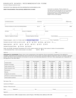
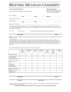

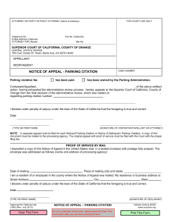
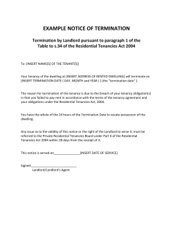


© Copyright 2026