
Memorandum To: Planning Commission From: Loren Gordon, AICP
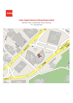
Memorandum To: Planning Commission From: Loren Gordon, AICP, City Planner Date: March 19, 2015 Subject: Change Memo for the March 19th Planning Commission Agenda ITEM 8B – Telecommunications tower at 15001 Minnetonka Industrial Road 1. Please make the following change in the “supporting information” section of the report. • The current proposal includes the removal of 55 five significant trees. 2. The city received the attached report from the city’s communication’s engineer after the distribution of the packet. Per the report, the engineer finds the proposed tower would: • Eliminate an existing coverage gap and there are no nearby towers to provide the desired coverage. • The site is not predicted to cause interference to any protected frequency in the area. • The proposal is in compliance with structural and setback requirements of the ordinance. • The city could consider increasing the height to the permitted 150-foot maximum. 3. The city received the attached comment following the distribution of the packet. EXECUTIVE SUMMARY The City of Minnetonka Communications Ordinance requires the demonstration of a need (gap in coverage). Analysis provides that proof of need. This new tower will eliminate this gap in coverage. It would provide the required PCS system coverage to eliminate the present existing poor coverage area. There are no existing towers identified that could provide the required coverage and eliminate the predicted coverage gap. All towers in the nearby area were examined and none were found that could be used. Due to the lack of any existing towers or support structures in the vicinity, the new site would need to locate very near to the proposed location in order to fill the coverage gap. Lower tower heights were analyzed but were all found to be inadequate to solve the coverage problem for Verizon. There is no evidence to show this new tower will cause interference to the present frequencies. There is no demonstrated RF Radiation hazard to the general public, even when other additional PCS systems are added to the study. As required by the ordinance, this tower will accommodate additional communications systems, and is in compliance with all the structural requirements of the ordinance. If the city were to consider increasing the tower height to the permitted 150-foot maximum it would potentially eliminate the problem of not providing the necessary antenna height for the future use by an additional communications system. REPORT REGARDING CONSTRUCTION OF A VERIZON WIRELESS TOWER PROPOSED AT 15001 MINNETONKA INDUSTRIAL BLVD. MINNETONKA, MINNESOTA PREPARED BY: GARRETT G. LYSIAK, P.E. FEBRUARY 28, 2015 TABLE OF CONTENTS ENGINEERING STATEMENT ....................................................................1 AIRSPACE STUDY ....................................................................................1 EXISTING TOWERS ..................................................................................1 COVERAGE STUDY ..................................................................................1 SITE CONSTRUCTION ..............................................................................2 INTERFERENCE STUDY ...........................................................................2 RF RADIATION ANALYSIS .......................................................................2 SUMMARY .................................................................................................3 FIGURE 1 SITE MAP FIGURE 2 AERIAL VIEW FIGURE 3 AIRPORT MAP FIGURE 4 TOWAIR RESULTS (PROPOSED HEIGHT) FIGURE 5 PRESENT COVERAGE FIGURE 6 PROPOSED COVERAGE ENGINEERING STATEMENT The application for a Conditional Use Permit that was submitted by Verizon Wireless to Minnetonka, Minnesota for a monopole tower located at 15001 Minnetonka Industrial Blvd. 1 was reviewed for compliance with the technical requirements of the Minnetonka Ordinance. The site was located and plotted on a USGS 7.5 minute map (Figure 1 “Site Map”). In addition, an aerial photograph is included to show the proposed site location and the surrounding area (Figure 2 “Aerial View Map”). AIRSPACE STUDY The proposed tower site was examined for any impact on the local airspace and airports. Since the pole is only 100-feet it was not expected to have any impact on any aviation sites. Figure 3 is a portion of the local aviation map showing the proposed site and surrounding area. The tower height is proposed to be under 200-feet and is therefore not usually required to get Federal Aviation Administration (FAA) or Federal Communications Commission (FCC) approval, unless it is located near an airport. The “FCC TOWAIR” program was used to examine the proposed tower for any FAA & FCC notification requirements. The results (Figure 4) show that notification is not required since the proposed tower is lower than 200-feet in height and is not in the proximity of an airport. EXISTING TOWERS Searches of the FCC and FAA tower databases were performed and nearby towers within 1 mile were identified and none were found. COVERAGE STUDY In reviewing the submitted data it was determined that the coverage maps provided do accurately portray the existing coverage and proposed coverage areas. This analysis shows how Verizon has designed its communications facilities in the Minnetonka area with several surrounding sites providing area wide coverage. Figures 5 & 6 show the results of the coverage study analysis for the present Verizon system. The proposed new site and existing gap in coverage is identified in these exhibits. The study was then repeated using lower heights to determine if using these lower heights would provide the required signal coverage. The results show that at this location it will not provide the coverage needed to eliminate the gap in coverage at reduced heights and still allow for future co-location use. 1 Site Location: 44° 56’ 04.4” N 93° 28’ 14.7” W ~1~ SITE CONSTRUCTION The construction documents were submitted to me for review and show that it will support the designed antenna systems as well as an additional future antenna. Since the tower is less than 200-feet there is usually no requirement for any lighting or marking by the Federal Aviation Administration (FAA). INTERFERENCE STUDY A search was performed using the FCC frequency database to determine the frequency and location of any city or county public safety facilities within one-mile from the proposed tower location. Using all the identified frequencies utilized by the city or county an intermodulation (interference) study was performed to determine if any predicted interference products would be generated by the proposed Verizon Communications facility. The results of the study indicate that there are no interference products predicted to be generated that would cause interference to any of the identified protected frequencies. RF RADIATION ANALYSIS Using the data submitted by Verizon, I performed a “Worst-Case” radiation analysis to determine the amount of RF energy that would be present at the base of the tower. In making my calculations I assumed that all of the RF energy generated by the facility would be directed downward. This is not the real world situation since the antennas used by PCS systems are designed to radiate towards the horizon. With this height above ground (100-feet) particular attention was paid to the radiation analysis since the public could pass directly below the antennas. However, using this analysis method I am able to determine that the maximum level of RF radiation reaching the ground at the tower base is less than 12 percent of the ANSI standard value and as such is not classified as an RF radiation hazard. Additionally, I did a sample calculation inserting an additional user on the tower and determined that the increased potential RF radiation would still be within the FCC standards. This calculation would have to be repeated when additional carriers were installed on the tower to get an exact value. The city might consider increasing the tower height to the permitted 150-foot maximum. It could potentially eliminate the problem of not providing the necessary antenna height for future use by an additional communications system. ~2~ SUMMARY My review of the proposed Verizon tower indicates that: 1. It would provide the required PCS system coverage to eliminate the present existing coverage gap in the Minnetonka area and no nearby existing towers would provide the desire coverage. 2. The site is not predicted to cause any interference products to any protected frequency in the area and is not predicted to be an RF radiation hazard. 3. The proposal is in compliance with the structural and setback requirements of the ordinance. 4. The city should consider increasing the tower height to the permitted 150-foot maximum. This would potentially eliminate the problem of not providing the necessary antenna height for future use by an additional communications system. Based on the data submitted by Verizon and my analysis and review it is my opinion that the city accept the proposal since at 100-feet the tower would eliminate the present existing gap in signal coverage. Respectfully submitted, Garrett G. Lysiak, P.E. February 28, 2015 ~3~ PROPOSED SITE ~ FLYLF 'HFOLQDWLRQ 01 6&$/( 01( 1DPH+23.,16 'DWH 6FDOHLQFK IW 0,/(6 <$5'6 .,/20(7(5 &RS\ULJKW&0\7RSR7RP7RP FIGURE 1 - PROPOSED SITE SITE 1 1 ~ FLYLF &RS\ULJKW&0\7RSR7RP7RP FIGURE 2- AERIAL VIEW 6&$/( )((7 SITE FIGURE 3 - AVIATION MAP FIGURE 4 - FCC TOWAIR RESULTS DETERMINATION Results Structure does not require q registration. g There are no airports within 8 kilometers (5 miles) of the coordinates you provided. Your Specifications NAD83 Coordinates Latitude 44-56-04.0 north Longitude 093-28-15.0 west Measurements (Meters) Overall Structure Height (AGL) 33.2 Support Structure Height (AGL) 33.2 Site Elevation (AMSL) 286.2 Structure Type MTOWER - Monopole COVERAGE GAP FIGURE 5 - PRESENT COVERAGE NEW COVERAGE FIGURE 6 - PROPOSED COVERAGE Ashley Cauley From: Sent: To: Cc: Subject: Ingrid Berkholtz <[email protected]> Wednesday, March 18, 2015 10:03 AM Ashley Cauley Loren Gordon; Brad Wiersum RE: 15001 Minnetonka Industrial Road Telecommunication Tower Questions and Concerns Ashley, Thank you for the clarification and opportunity to revise my comments. My concerns remain unchanged even though the corrected significant tree removal count is 5. Even five is a significant percentage given the lack of full sized trees in the industrial park. Where would the green space be that would be used to mitigate the loss? It’s pretty much parking lot to parking lot in that area. Will the existing parking lots be reduced in size to enable landscaping? Additionally, by the time any landscaping is mature enough to provide screening of the structure, technology will likely have changed making the tower obsolete. We would have destroyed trees mature trees for naught. Ingrid From: Ashley Cauley [mailto:[email protected]] Sent: Wednesday, March 18, 2015 9:20 AM To: Ingrid Berkholtz Cc: Loren Gordon; Brad Wiersum Subject: RE: 15001 Minnetonka Industrial Road Telecommunication Tower Questions and Concerns Ingrid, I just sent out the response appreciating your comment. While reading your comments I was having a hard time understanding where the removal of 55 trees was coming from. I went back through the report and found that in the “supporting information” section of the report it says that 55 trees will be removed as a result of tower construction. This is a typo, the report should say five trees will be removed as a result of the tower construction. Thank you for bringing this to our attention. I will be sure to make the change in the change memo for the meeting. Since staff will be addressing the correction, you may revise your comment. You certainly wouldn’t be required to but I wanted to make you aware of the opportunity to address the correct number of tree removals. I apologize for any confusion. Thank you for bringing this to my attention. You certainly are correct that removing 55 trees for the tower would be alarming! Ashley Ashley Cauley| Planning Technician| City of Minnetonka 1 14600 Minnetonka Blvd | Minnetonka, MN 55345 | 952‐939‐8298 From: Ingrid Berkholtz [mailto:[email protected]] Sent: Tuesday, March 17, 2015 6:34 PM To: Ashley Cauley Cc: Loren Gordon; Brad Wiersum Subject: 15001 Minnetonka Industrial Road Telecommunication Tower Questions and Concerns Ashley, Thanks again for alerting me regarding the proposed development in the industrial park. I’m happy to see that the currently proposed tower does not intend to be built to the maximum allowed by ordinance. However, this proposal is not aligned with Minnetonka’s vision of its community and stated natural resource values. This proposal removes 55 significant trees and does not address the impact of added hardscape to the health of the adjacent wetlands and Victoria Evergreen Park. (source: eminnetonka.com) The Planning Commission should NOT RECOMMEND Project 10038.15a to the City Council. Minnetonka should not sacrifice it’s natural resources in order to resolve operational expansion and efficiencies for a major corporation. The applicant and staff should go back to the drawing board and bring forward a solution that meets Minnetonka community values and Verizon’s operational desires. I’m confident a win‐win solution can be formed, not a solution of convenience 2 My specific questions and concerns follow. With extreme concern, Ingrid Berkholtz 15403 Robinwood Drive Question 1 ‐ The ordinance allows for a one time extension to the tower that can be approved administratively. Does this mean that the tower could be extended from the proposed 100 foot height to 150 foot height in the future? Question 2 ‐ What other locations did Verizon consider prior to proposing a tower at 15001? The coverage maps show service improvement in already covered and open areas. (see Figure 1). Could colocation at the water tower at the intersection of Lake Street Extension and Tonkawood Road provide similar improvement and expand the coverage area with a single action? Objectives / Observations Objective 1 – Improve quality of service along Minnetonka Blvd and Williston Rd. The area above the green line, the east/west center line of the proposed tower, appears to have near 100% existing coverage. Objective 2 – Provide capacity offload to the neighboring site Equestrian north of this location and west of Interstate‐ 494. Location at the Lake Street Extension water tower (lower red star) could provide more coverage and potentially meet offload desires. 3 Figure 1. Coverage Maps Concern 1 ‐ Tree Preservation and Landscaping The planning commission should have a preliminary tree preservation and landscaping plan available prior to making a recommendation due to number of significant trees to be removed. Removal of 55 significant trees !!!!!!!!! I nearly fell over when I read that. The proposed location is the most densely vegetated patch of land in the entire industrial park. As stated in staff’s report, a number of trees were removed in 2011 prior to any approval of tree preservation or landscaping plans. This tragedy should not be allowed to recur. Trees do no grow overnight, and they are key to maintaining a healthy ecosystem. Can’t the tower be located within existing Right of Ways where utilizes exist, minimizing tree and landscape impact? The industrial park needs beautification, not clear cutting of exiting vegetation for more pavement. Concern 2 ‐ Storm Water Management The proposal does not contain any information on plans to manage the additional storm water runoff that will occur with the increased hardscape and elimination of a natural ponding area. The patch of land proposed for development is a abutted by parking lots, and serves as a run off and absorption area for storm water and snow melt. 4 Storm‐water management in the industrial park is already an issue. The in‐place storm water management plan calls for all water from the Industrial Park to be channeled into conduits and travel north underneath Minnetonka Boulevard into the wetland north of The Marsh. The topography of the industrial park decreases in elevation going to the west. The water that makes it into to collectors in the west end needs to “wait its turn” to travel north (see Figure 2). As a result, much of the water takes the less “congested” overflow route and dumps into Victoria Evergreen Park. This pollutes the wetlands in the park with road salt, vehicle fluids and trash. Figure 2. Existing Storm Water System Concern 3 ‐ Damage to Victoria Evergreen Park and surrounding properties The storm water management issues in the industrial park are killing trees in Victoria Evergreen Park. This is costing the City in the form of manpower to ensure the park is safe and to maintain trails. It is also costing the City in the form of insurance claims. It behooves the planning commission to look at storm water management from a broader perspective, not just the micro‐view related to the proposed increase of hardscape in the industrial park. Each year, an increasing amount of storm water flows into the park, and each year more and more significant trees die. These are blown over during storms or topple over on their own accord since their anchoring root systems are no longer existent. Also each year, the size of the water covered area increases as does the time that the water remains standing. That should be no surprise. Fewer trees to absorb the water, mean more standing water for a longer time. In the past, staff has been reluctant to acknowledge these facts. A more recent action to a complaint resulted in an inspection of the storm water management system. The finding was that is constructed per design. There were no improvement projects planned in the at that time plan. Residents could prepare a petition and present it to the City it they wanted to try to get a project into the plan. 5


© Copyright 2026