
Full Packet - City of Minnetonka
CITY OF MINNETONKA
PLANNING COMMISSION
APRIL 9, 2015
!
"
$
!
$
#
!
I-394
PLYMOUTH RD
I-494
CO RD 101
MINNETONKA BLVD
W
ST H
Y7
C
EX
O
SI
EL
R
VD
BL
Planning Commission Agenda
April 9, 2015—6:30 P.M.
City Council Chambers—Minnetonka Community Center
1. Call to Order
2. Roll Call
3. Approval of Agenda
4. Approval of Minutes: March 5, 2015
5. Report from Staff
6. Report from Planning Commission Members
7. Public Hearings: Consent Agenda
A. Expansion Permit for additions to the exiting home at 3315 Frear Drive
Recommendation: Adopt the resolution approving the request. (4 votes)
•
•
Final Decision Subject to Appeal
Project Planner: Ashley Cauley
8. Public Hearings: Non-Consent Agenda Items
A. Preliminary and final plat for Congregation Hill, a three-lot subdivision at 2051
Meeting Street.
Recommendation: Recommend the city council approve the request (4 votes)
•
•
Recommendation to City Council (Tentative Date: April 20, 2015)
Project Planner: Jeff Thomson
B. Items concerning construction of a new convenience store/gas station at 3864
Hopkins Crossroad:
1)
Conditional use permit;
Planning Commission Agenda
April 9, 2015
Page 2
2)
3)
Final site and building plans, with setback variance; and
Monument sign variance.
Recommendation: Recommend the city council approve the conditional use permit
and final site and building plans, and deny the sign variance. (4 votes)
•
•
Recommendation to City Council (Tentative Date: April 20, 2015)
Project Planner: Susan Thomas
C. Items concerning reconstruction of County Road 101 from Highway 62 to Hutchins
Drive and associated new construction at 5735 County Road 101:
1)
2)
3)
4)
Floodplain alteration permit;
Wetland rezoning;
Wetland mitigation plan; and
Tree removal/mitigation
Recommendation: Recommend the city council approve the items (4 votes)
•
•
Recommendation to City Council (Tentative Date: April 20, 2015)
Project Planner: Susan Thomas
9. Adjournment
Planning Commission Agenda
April 9, 2015
Page 3
Notices
1. Please call the planning division at (952) 939-8274 to confirm meeting dates as they
are tentative and subject to change.
2. The April 23, 2015 Planning Commission meeting has been cancelled.
2. Applications scheduled for the May 7, 2015 Planning Commission meeting:
Project Description: Shelter Corporation is proposing to construct a three-story, 27-unit
apartment building on the site commonly referred to as “the Music Barn” property at
5740 and 5750 Shady Oak Road. The existing barn structure would remain. The
proposal requires: (1) rezoning from R-1 to PUD; (2) approval of a master development
plan; and (3) final site and building plan approval.
Project No.: 09002.15a
Staff: Susan Thomas
Ward/Council Member: 1—Bob Ellingson
Section: 35
Project Description: Concept Plan for Villa West at 17101 State Hwy 7
Project No.: na
Staff: Jeff Thomson
Ward/Council Member: 4 – Tim Bergstedt
Section: 29
Project Description: City of Minnetonka is proposing an ordinance amendment
regarding accessory structures
Project No.: na
Staff: Susan Thomas
Ward/Council Member: na
Section: na
Planning Commission Agenda
April 9, 2015
Page 4
WELCOME TO THE MINNETONKA PLANNING COMMISSION MEETING
This outline has been prepared to help you understand the public meeting process. The
review of an item usually takes the following form:
1. The chairperson of the meeting will announce the item to be reviewed and ask for
the staff report on the subject.
2. Staff presents their report on the item.
3. The Commission will then ask City staff questions about the proposal.
4. The chairperson will then ask if the applicant wishes to comment.
5. The chairperson will open the public hearing to give an opportunity to anyone
present to comment on the proposal.
6. This is the time for the public to make comments or ask questions about the
proposal. Please step up to the podium, speak clearly, first giving your name
(spelling your last name) and address and then your comments.
7. At larger public hearings, the chair will encourage speakers, including the
applicant, to limit their time at the podium to about 8 minutes so everyone has
time to speak at least once. Neighborhood representatives will be given more
time. Once everyone has spoken, the chair may allow speakers to return for
additional comments.
8. After everyone in the audience wishing to speak has given his or her comments, the
chairperson will close the public hearing portion of the meeting.
9. The Commission will then discuss the proposal. No further public comments are
allowed.
10. The Commission will then make its recommendation or decision.
11. Final decisions by the Planning Commission may be appealed to the City Council.
Appeals must be written and filed with the Planning Department within 10 days of
the Planning Commission meeting.
It is possible that a quorum of members of the City Council may be present. However, no
meeting of the City Council will be convened and no action will be taken by the City
Council.
Minnetonka Planning Commission
Minutes
March 5, 2015
1.
Call to Order
Chair Odland called the meeting to order at 6:30 p.m.
2.
Roll Call
Commissioners Kirk, Knight, Magney, Rettew, Calvert, and Odland were present.
O’Connell was absent.
Staff members present: Community Development Director Julie Wischnack, City
Planner Loren Gordon, and Planner Jeff Thomson.
3.
Approval of Agenda: The agenda was approved as submitted.
4.
Approval of Minutes: February 19, 2015
Kirk moved, second by Calvert, to approve the February 19, 2015 meeting
minutes as submitted.
Kirk, Knight, Magney, Rettew, Calvert, and Odland voted yes. O’Connell
was absent. Motion carried.
5.
Report from Staff
Gordon briefed the commission on land use applications considered by the city
council at its meeting of March 2, 2015:
•
•
•
Adopted a resolution approving changes to the zoning ordinances
relating to the environment.
Adopted a resolution approving the Applewood development on
Plymouth Road.
Adopted a resolution approving an ordinance change to rezone
parcels on Excelsior Road from R-1 to R-1A.
There will be a vision meeting for the Ridgedale southwest sector on March 10,
2015 from 6 p.m. to 7 p.m.
Gordon invited commissioners to participate in a survey on how bicyclists would
get to a light rail station and how the bike would be stored.
Planning Commission Minutes
March 5, 2015
Page 2
The next planning commission meeting will be March 19, 2015.
6.
Report from Planning Commission Members
Kirk stated that the SWLRT Advisory Commission is forming an arts committee to
select art work that will be infused in the stations. Anyone interesting in serving
on the arts committee should contact Wischnack.
7.
Public Hearings: Consent Agenda: None
8.
Public Hearings
A.
Sign plan review for Ridgedale Center at 12401 Wayzata Boulevard.
Chair Odland introduced the proposal and called for the staff report.
Thomson reported. He recommended approval of the application based on the
findings and subject to the conditions listed in the staff report.
Rettew asked if the “R” would be lighted or change color. Thomson answered
that it would be backlit. The existing pylon sign is 85 feet tall. The proposed pylon
sign on the north would be 70 feet tall and the signs at the east and west
entrances would be 50 feet tall. The towers already exist. The sign faces would
be redone.
In response to Kirk’s question, Thomson answered that the resolution would
restrict the amount of the square footage that would be allowed on each sign. It
would be regulated on a per-sign-type basis. All of the proposed signs are
located on property owned by General Growth Properties. The yield and stop
signs would be within the interior road system that is governed by a management
agreement.
Calvert was concerned snow would cover the directional signs. Thomson
answered that the signs would be eight feet tall and should remain visible in the
winter.
Benjamin Freeman, representing General Growth Properties, applicant, stated
that:
•
The proposed sign plan amendment represents the continued
modernization and long-term vision of Ridgedale Center. The
master plan identifies goals for now and in the future in terms of
Planning Commission Minutes
March 5, 2015
•
•
•
Page 3
signage and focusing on the customer being able to identify the
center and navigate within the site. He is excited to improve the
property.
He thanked Wischnack, Gordon, and Thomson for their continued
professionalism. It has been a pleasure working with them.
The signs would not change color. There would be a soft, back-lit
glow.
The towers would be rewrapped, but not made taller.
Kirk asked of what materials the monument sign on Interstate 394 would be
made. Mr. Freeman answered a vinyl pattern that would create a sense of
texture, but the difference between the two colors is a function of the rendering. It
is meant to be internally illuminated and not change color.
Kirk asked if it would be as heavily textured as the graphic appears. Mr. Freeman
stated that it would probably be more subtle.
Kirk stated that the signs at the mall entrances would have the same texture. He
asked if those signs would be painted aluminum. Mr. Freeman said that the intent
would be to make it subtle. There would be some texture without getting too
busy.
Chair Odland asked how the finish would weather. Mr. Freeman answered that
the materials have not fully been determined. The sign plans would next be put
out for sign vendors to bid on. He has asset managers who will advise him on
what would hold up to Minnesota winters. The materials would be subject to
change during the bid process. The light would cascade behind the letters to
create depth.
Chair Odland asked if the material around the “R” would weather well. Mr.
Freeman answered in the affirmative. It would weather as well as anything else
can in this environment. There would be upkeep that would need to occur.
Chair Odland asked if green features such as solar power would be used. Mr.
Freeman responded that the parking lot lighting would be replaced with LEDs.
The net use of power would be decreased and it would be clean light.
The public hearing was opened. No testimony was submitted and the hearing
was closed.
Kirk had a vision of a homogenous look to the entire Ridgedale area from Target
to the YMCA. He asked if consistencies in the use of materials and color of signs
Planning Commission Minutes
March 5, 2015
Page 4
could be enforced. Gordon stated that the roadway improvements would work to
bind the areas together with landscaping and way-finding signs to navigate
around the center.
Kirk noted that the way-finding signs have the opportunity to create uniformity.
He would want General Properties to take the lead to establish that.
Gordon noted that Highland Bank used corner features at Cartway Lane and
Plymouth Road for landscaping and sidewalk treatment. The city may be able to
use the landscaping and sidewalk treatments as a template for Plymouth Road.
Kirk felt that Minnetonka has standards for street signs. He did not know if those
need to be blended with those at the mall. It would be nice to have consistency
throughout the mall property. He knows that the city does not control content of a
sign. Wischnack identified two opportunities to provide design elements for the
area would be with landscaping and sidewalk treatments. Changing the look of
street signs would impact the rest of the city.
Kirk confirmed with Thomson that the approval would regulate signs for the
restaurants which would be restricted to wall signs. That restriction also exists in
the current sign plan. Freestanding buildings would only be allowed to have wall
signs.
Magney moved, second by Rettew, to adopt the resolution on pages A57A60 of the staff report which rescinds the existing sign plan and approves
a revised sign plan for Ridgedale Center at 12401 Wayzata Boulevard.
Kirk, Knight, Magney, Rettew, Calvert, and Odland voted yes. O’Connell
was absent. Motion carried.
Chair Odland stated that an appeal of the planning commission’s decision must
be made in writing to the planning division within 10 days.
9.
Other Business
A.
Concept plan review for Kraemer’s Hardware redevelopment at 14730
Excelsior Boulevard and 5431 and 5439 Williston Road.
Chair Odland introduced the proposal and called for the staff report.
Thomson reported. He recommended commissioners provide comments and
feedback to assist the applicant with future direction that may lead to the
Planning Commission Minutes
March 5, 2015
Page 5
preparation of more detailed development plans. It would be useful if
commissioners would provide their reaction and general comments on the
contemplated land use, building size, architecture, and general site design.
Kirk confirmed with Thomson that the next steps in the process would be for the
concept plan to be reviewed by the city council and then the applicant may
submit an application for rezoning, site plan, and comprehensive guide plan
modification.
Curt Fretham, of Lake West Development, applicant, stated that:
•
•
•
•
•
•
•
•
•
•
•
•
•
•
•
He described the history of the site since Kraemer’s Hardware
moved.
The plan provides a broader look at the area. There would be a
green knoll. He would work to preserve trees.
The plan would limit the visual mass and mimic what is down the
street.
The courtyard would have a green space center.
He worked hard to build the building into the topography.
He provided a slide that shows the access points off of Excelsior
Boulevard continuing into an underground garage. There would be
23 underground stalls coming in off of Williston Road. There would
be a fire lane on the north side that would access 2 units.
There would be green space in the corner.
The fourth story would be pushed back. The building would cut into
the grade.
The units would have doors facing the street to provide a
townhouse feel.
It would be a good-looking building. It would be primarily stone and
brick. There would be an option to have a flat roof or pitched roof.
He was looking for feedback on that. There would be water storage
on top of the roof for rate control. The pitched roof would tie the
building in more with the 2 homes on the north. The front elevations
mimic the neighboring units as well.
There would be a mix of 1-bedroom and 2-bedroom apartments.
There would be a roof-top deck on the corner and a patio area for
some units that would look down on the courtyard.
There would be 78 units total with 60 1-bedroom apartments and
18 2-bedroom apartments.
There would be 118 exterior parking stalls.
The overall site is 2.2 acres.
Planning Commission Minutes
March 5, 2015
•
•
Page 6
The units on the north would be twin homes.
He was looking for suggestions and available for questions.
Kirk asked if the four units would be developed at the same time as the rest. Mr.
Fretham would like to, but the area may be used for staging purposes during
construction. He was inclined to think the units would be built once the building
would be substantially complete or complete. Kirk confirmed with Mr. Fretham
that the architecture of the twin houses would be similar to the apartment
building.
Knight asked if a visitor would go into the lobby and through the garage to get to
the elevator to get to the upper floors. Mr. Fretham said he would take a closer
look at that with the architect. Knight and Mr. Fretham agreed that an elevator
from the lobby to the upper floors would be better for visitors.
Magney said that the packet mentions four to eight townhomes on the north side.
Mr. Fretham clarified that two twin homes, a total of four units, are in the
proposal.
Knight noted that the sketches do not include the four-foot rise at Excelsior
Boulevard and Williston Road. Mr. Fretham responded that that is hard to show.
Knight liked the way the north end of the apartment building would have the
roofline match the twin homes.
Chair Odland asked if there would be a way to access the green space from the
third floor. Mr. Fretham said that it would be visible, but not accessible.
Chair Odland questioned if the sidewalk would be intended for the public to use
as well. Mr. Fretham answered affirmatively.
Rettew asked if the sidewalk would extend to the twin homes. Mr. Fretham said
that diagrams have been made showing it both ways. He was open to doing the
sidewalks either way.
Kirk asked what the red-dotted line represents. Mr. Fretham answered the
location of a potential stormwater retention system.
Chair Odland asked if the underground garage would connect the 23 stalls
accessed by Williston Road and the stalls accessed by Excelsior Boulevard. Mr.
Fretham answered that it would not go through. The spots would be assigned.
Planning Commission Minutes
March 5, 2015
Page 7
The public hearing was opened.
Charles Swanson, 5436 Williston Road, stated that:
•
•
•
•
•
•
•
•
•
•
He and his wife have lived there 15 years.
Multiple-story dwellings have created problems in the past because
they were so large and he sees that happening now.
There have been a lot of new homes going in along the road. The
area has improved a lot. He would like to see it continue with
single-family houses.
The house across from his driveway is really an eyesore. It has
been vacant for 10 years. He would like to see a decision made on
it, but he wondered why single-family dwellings would not be
constructed.
New houses are being built on Williston Road.
It is not zoned for commercial.
Twin homes would be different from the residences on Williston
Road. He would rather not see twin homes or a multiple-story
building.
A new building changed an area going down to the lake in Wayzata
drastically. The area is no longer appealing.
He was concerned there would not be pride in homeownership.
The lots are nice and could be made into nice, single-family
residences.
Bill Jones, 5120 Lee Way, stated that:
•
•
•
He loved the idea of the twin homes to provide a transition from the
commercial area to the single-family area. He guessed that
Williston Road would be too busy a street and the lots would not be
large enough for single-family residences.
He suggested that one driveway to service both twin homes would
make more sense. The two driveways on Williston Road would be
20 to 30 feet apart and located on a hill which could cause a
problem. He suggested a minor design change to allow a vehicle to
either enter the garage from the north and turn right into the garage
or make a turn so a vehicle could enter the driveway would also be
an improvement.
The idea of a larger building on the corner is wonderful. The area is
a commercial site.
Planning Commission Minutes
March 5, 2015
•
•
•
Page 8
The proposal would allow a lot of residents to stay in the
neighborhood in 10 or so years when he and others will be ready to
move out of their houses. It would be wonderful to live in an
apartment next to a wonderful, commercial area.
He loved the idea of the apartment building and townhomes. It
would be a great mix.
The proposal could be a very positive change for the neighborhood.
Ellen Swanson, 5436 Williston Road, stated that:
•
•
•
•
•
•
She is opposed to the apartment building being a big box. She saw
no “aesthetics” to it at all. She did not want to live across the street
from a big box.
She is concerned with the density and number of units. She was
concerned with increasing the number of people and traffic.
She questioned if there would be parking spaces on the Williston
Road side. Mr. Fretham answered in the negative.
She did not like the flat roof. It would help to add some “aesthetics.”
The previous proposals for the site were more attractive.
She did not know why the boarded-up house is still standing. The
prior property owner allowed the structures and a falling down tree
to stay there for years. The site as it is diminishes her property
value and changes the feel of the whole area.
Phyllis Adams, 14401 Atrium Way, stated that:
•
•
She appreciated having discussions with previous applicants to
help her develop an understanding of what density would be
appropriate for the site and what uses would survive.
She is all for bringing more people into the neighborhood because
she wants all of the businesses to survive so she may use them
too.
No additional testimony was submitted and the hearing was closed.
Rettew had the same concern regarding the two driveways being located so
close together. He suggesting combining them. He saw pros and cons to the flat
and gable roofs. The flat roof has less mass, but the gable roof ties it in better
with a typical home look and breaks up the monotony of a box. He was curious to
hear other people’s thoughts. He likes the courtyard. That helps break up visually
the big-box look.
Planning Commission Minutes
March 5, 2015
Page 9
Kirk asked how the city deals with abandoned residences. Wischnack explained
that when the city receives a complaint, staff will contact the property owner and
request steps be taken to resolve the problem. City staff have visited this
property and boarded up the vacant house. The property owner is responsible for
paying for the cost. The site has not been found unsafe, but is a nuisance. If a
resident sees something, then please contact city staff.
Kirk would rather see surface parking on Excelsior Boulevard. It would make
sense to extend parking all the way down to where the grocery store and liquor
store are located. Blending of the contemporary style and gable roof style works
for him because of the horseshoe shape of the building. The massing is alright.
He liked the stepping of the number of stories down as the hillside rises so that it
would not continue to creep up the hill. It may be a little awkward of a transition
from gable roofs to a flat roof from the courtyard view, but the flat roof would
pretty much be hidden from the public view, so he did not have a lot of concern
for that. He appreciates how the green space would flow in and out of the
building. It would articulate the massive back of the building which has been
included in previous proposals. Continuing to break up the large block on the
southwest corner with different colors and textures as shown is important. He
would support more of that throughout the design. Using different textures
vertically can help break up mass. The building’s mass would be appropriate
because it would be stepped back from Excelsior Boulevard and Williston Road.
Overall, it is heading in the right direction and it looks a lot better than the
previous proposals. He would support the proposal.
Rettew loves the trees on Williston Road. He would like the developer to
complete the tree audit and preserve as many mature trees as possible.
Kirk stated that twin homes would be appropriate in the proposed location
because the area has higher density and commercial uses, but he would prefer
the rest of the lots adjacent to Williston Road contain single-family residences.
Knight asked if the twin homes would be owner occupied. Mr. Fretham answered
affirmatively.
Chair Odland asked if including more owner-occupied twin homes had been
considered. Mr. Fretham answered that it had been considered, but they could
not come up with a viable plan. The corner is busy, numerous twin homes would
create multiple driveways, and the property with the existing boarded-up building
would not make it economically feasible.
Planning Commission Minutes
March 5, 2015
Page 10
Chair Odland liked Lake West Development’s proposal in another location that
was laid out into a nice neighborhood. Mr. Fretham explained that that property
had more room for a street, but this property does not have enough room for a
street. The depth makes a big difference.
Chair Odland asked if he had considered individual houses with a row-house feel
to provide more ownership to the neighborhood. Mr. Fretham responded that the
study did not take them in that direction.
Magney likes the green space, gabled roof on the apartment to provide a nice
transition to the houses to the north, and one driveway. He likes the building
colors and different materials of stone and brick. It looks nice.
Chair Odland asked if there would be green aspects for power, water retention,
or garden areas that would be a community area. Mr. Fretham said that there
would be water retention on the rooftop, an above-ground stormwater collection
area that would collect the water from the roof, and preservation of green space
in the front and the border. That would work with either a gable or flat roof.
Knight asked if the stormwater pond would have a controlled outflow or if it could
potentially overflow. Mr. Fretham answered that it could potentially overflow.
Knight was concerned that the twin homes would have water problems. Mr.
Fretham explained that would not happen because there would be enough
change in elevation to prevent that.
10.
Elections
A.
Election of chair and vice chair of the 2015 Minnetonka Planning
Commission.
Chair Odland and Kirk volunteered themselves to serve as chair.
Knight moved to nominate Kirk to serve as chair of the 2015 Minnetonka
Planning Commission. Kirk, Knight, Magney, Rettew, and Calvert voted
yes. Odland voted no. O’Connell was absent. Motion carried.
Rettew nominated himself to serve as vice chair of the 2015 Minnetonka
Planning Commission. Kirk, Knight, Magney, Rettew, Calvert, and Odland
voted no. O’Connell was absent. Motion failed.
Planning Commission Minutes
March 5, 2015
Page 11
Knight nominated Odland to serve as vice chair of the 2015 Minnetonka
Planning Commission. Kirk, Knight, Magney, Rettew, Calvert, and Odland
voted yes. O’Connell was absent. Motion carried.
11.
Planning Commission Bylaws and Policies
Chair Odland introduced the proposal and called for the staff report.
Gordon reported. He recommended approval of the bylaws and policies without
changes.
Kirk asked if it would be appropriate to review ordinances regarding tear downs
at this time. Gordon and Wischnack noted that the mcmansion policy would apply
if the new construction would require a variance. Kirk wanted something to get at
addressing a medium-sized lot that would allow a house much bigger than those
in the existing neighborhood. He would like to address that issue at another time.
He expects more of those will be happening in the future. Gordon said that data
could be collected to identify Minnetonka’s tear-down trends. It is a lot-size issue
more than home style. Calvert noted a newspaper article that reported how
young people are looking for small, split-level houses, but the ones from the
1970s are dated. Some cities are investing in updating the split level-houses built
in the 1970s. Some were featured in the paper. Kirk noted that those are some of
the most economic houses in Minnetonka.
Wischnack said that the city now offers rehabilitation loans and down payment
assistance for residents with incomes up to 110 percent of the median income.
Gordon clarified that the issue of tear downs and rebuilds would be reviewed as
a broader policy.
Kirk moved, second by Knight, to readopt the attached bylaws and policies.
Kirk, Knight, Magney, Rettew, Calvert, and Odland voted yes. O’Connell
was absent. Motion carried.
Planning Commission Minutes
March 5, 2015
12.
Page 12
Adjournment
Knight moved, second by Kirk, to adjourn the meeting at 8:30 p.m. Motion
carried unanimously.
By:
____________________________
Lois T. Mason
Planning Secretary
C:\Users\ktelega\AppData\Local\Temp\ColumbiaSoft\Viewed\99983DA7-DD5A-45A6-B0E36D712FC3CEDA\PC030515 v12_0.docx
Minnetonka Planning Commission Meeting
April 9, 2015
Agenda Item 7
Public Hearing: Consent Agenda
(No Items)
MINNETONKA PLANNING COMMISSION
April 9, 2015
Brief Description
Expansion Permit for additions to the exiting home at 3315 Frear
Drive
Recommendation
Adopt the resolution approving the request
______________________________________________________________________
Project No.
15003.15a
Property
3315 Frear Drive
Applicant
Stephen Solum, property owner
Background
The subject property is located in the northeast corner of the
Frear Drive/Plymouth Road intersection. The property was
originally platted in 1885 as part of FREAR’S SUBDIVISON and
is just over 12,000 square feet in size.
The existing home does not meet the current front yard setback
requirements. While a 35-foot setback from the front property line
adjacent to Frear Drive is required, the existing home is located
15 feet from the property line. The home is considered nonconforming as it was constructed in 1954, prior to the adoption of
the city’s first zoning ordinance.
Proposal
The applicant is proposing several interior improvements to the
existing home, including converting the existing single-stall
garage into additional living space. The applicant is also
proposing to construct a front entry addition to the front of the
home and an attached two-stall garage on the north side of the
existing home. The additions would maintain the home’s existing
non-conforming setbacks. (See narrative and plans on pages A1A12.)
Proposal Requirements
By City Code §300.29 Subd. 3(g) an expansion permit is required
for an expansion of a non-conforming structure when the
expansion would not intrude into a setback area beyond the
distance of the existing structure. A variance is required when the
expansion would intrude further into the setback area.
Meeting of April 9, 2015
Subject: 3315 Frear Drive, Expansion Permit
Page 2
As the proposed entry feature and garage additions would not
intrude further into the existing non-conforming setback, an
expansion permit is required.
Approving Body
The planning commission has final authority to approve or deny
the request. (City Code §300.29 Subd.7)
Staff Analysis
Staff finds the applicant’s proposal would meet the expansion
permit as outlined in city code.
1.
2.
Reasonable Use and Neighborhood Character: The
proposed setback is reasonable and would not negatively
impact the character of the surrounding neighborhood:
•
The additions would be located to provide functional
expansion of the existing living space.
•
The additions would not encroach further into the
required setback than the existing structure.
•
Given existing, excess right-of-way, the proposed
unenclosed entryway would visually maintain the
required 30 foot setback and the garage would
visually maintain the required 35 foot setback from
the front property line.
•
By ordinance, it is reasonable for an unenclosed
entry feature to extend into a required setback by
five feet. Due to the existing non-conforming
setback, the proposed unenclosed entry feature
would require an expansion permit to maintain the
existing setback.
•
The applicant is proposing to construct a two-car
garage. By planning commission policy, a two-car
garage is a reasonable use of a single family
residential property. The surrounding area includes
a mixture of two and three-car garages.
Circumstance unique to the property: The existing
home was constructed prior to the adoption of the city’s
first zoning ordinance resulting in non-conforming
setbacks. Coupled with the property’s “smaller” lot size
and excessive right-of-way from Frear Drive, the property
Meeting of April 9, 2015
Subject: 3315 Frear Drive, Expansion Permit
Page 3
has circumstances not common to similarly zoned
properties.
Staff Recommendation
Adopt the resolution on pages A13-A17, which approves an expansion permit for
additions to the existing home at 3315 Frear Drive.
Originator: Ashley Cauley, Planning Technician
Through: Susan Thomas, AICP, Principal Planner
Meeting of April 9, 2015
Subject: 3315 Frear Drive, Expansion Permit
Page 4
Supporting Information
Surrounding
Land Uses
All properties to the north, east and west are improved with single
family homes, zoned R-1 and guided for low density residential.
The property to the south is St. David’s School, zoned R-1 and
guided Institutional.
Planning
Guide Plan designation: low density residential
Zoning: R-1, low density residential
Small lot
By City Code §300.10 Subd. 7, properties that are defined as a
qualifying small lot are allowed lesser setbacks from property
lines than “typical” properties. To be defined as a small lot, a
property must: (1) be less than 15,000 square feet; (2) have been
a lot of record prior to February 12, 1966; and (3) be located in
an area in which the average size of residential lots is less than
15,000 square feet.
The average lot size of surrounding properties is just under
22,000 square feet. Therefore, while the property has a “smaller”
lot size, it would not be considered a qualifying small lot.
Setbacks
The existing and proposed setbacks are as follows:
West front setback
(Frear Drive)
South front setback
(Plymouth Road)
Rear setback (north)
Side setback (east)
Required
Existing
Proposed
13 feet for front
entry and 20
feet for garage
35 feet
13 feet
50 feet*
33 feet
33 feet
36 feet
10 feet
80 feet
20 feet
60 feet
20 feet
* As a corner lot, the ordinance allows a 10 foot reduction of one front setback.
McMansion Policy
The McMansion policy regulates the floor area ratio (FAR) on
properties when either the property or the home on the property
requires a variance. By policy, the FAR of the subject property
cannot be greater than the largest FAR within 400 feet and within
1,000 feet along the same roadway. The policy applies only to
variances, not to expansion permits.
Nevertheless, staff has calculated the FAR of the subject
property. With the proposed addition, the home would have a
FAR of 0.17. The largest FAR in the area is 0.21.
Meeting of April 9, 2015
Subject: 3315 Frear Drive, Expansion Permit
Page 5
Planning
Commission
Policy
According to planning commission policy a two-car garage,
which has a maximum size of 24 feet x 24 feet, is a reasonable
use on a single family residential property.
Burden of Proof
By city code, an expansion permit for a non-conforming use may
be granted, but is not mandate, when an applicant meets the
burden of proving that:
1.
The proposed expansion is reasonable use of the
property, considering such things as:
•
•
•
•
Functional and aesthetic justifications for the
expansions;
Adequacy of off-street parking for the expansion;
Absence of adverse off-site impacts from such things
as traffic, noise, dust odors, and parking;
Improvement to the appearance and stability of the
property and neighborhood.
2.
The circumstances justifying the expansion are unique to
the property, are not caused by the landowner, are not
solely for the landowner’s convenience, and are not solely
because of economic considerations; and
3.
The expansion would not adversely affect or alter the
essential character of the neighborhood.
Natural Resources
Best management practices must be followed during the course
of site preparation and construction activities. This would include
installation and maintenance of a temporary rock driveway,
erosion control, and tree protection fencing. As a condition of
approval the applicant must submit a construction management
plan detailing these management practices.
Appeals
Any person aggrieved by the planning commission’s decision
about the requested permit may appeal such decision to the city
council. A written appeal must be submitted to the planning staff
within ten days of the date of the decision.
Motion Options
The planning commission has three options:
1.
Concur with staff’s recommendation. In this case, a motion
should be made approving the expansion permit.
2.
Disagree with staff’s recommendation. In this case, a
motion should be made denying the expansion permit. This
Meeting of April 9, 2015
Subject: 3315 Frear Drive, Expansion Permit
Page 6
motion should include a statement as to why denial is being
recommended.
3.
Table the request. In this case, a motion should be made
to table the item. The motion should include a statement as
to why the request is being tabled with direction to staff, the
applicant or both.
Pyramid of Discretion
This proposal
Neighborhood
Comments
The city sent notices to 32 area property owners and has received
no comments to date.
Deadline for
Decision
June 18, 2015
D
AND
R
R
MERLEN D
APRIL L
N
ATWOOD DR
SPRUCE LN
RL
D
ELL
RW
U
B
DGE
BRI
Subject Property
HR
R
Y
PL
UT
MO
E CI
ED G
DANA DR
G
S
FREAR DR
LN
L
RUT
CO
IN
G
STANTON DR
CHASE DR
HT
WORT
WENT
CREEK RD W
DR
ST
O
N ET
MIN
SR
K
S RD
OA
OR
AR
CH
DL
N
RD
N
S
RNE
D
DY
D
L
ELM
RR
INVE
D
BLV
A
SH
KA DR
ID
AV
TD
N
I
SA
E
BAK
MINNE
TON
NKA
PLYMOUTH RD
YR
DE
OAK
L
FOREST LN
MC
GIN
T
Location Map
Project: Solum, Stephen
Address: 3315 Frear Dr.
(15003.15a)
±
A1
This map is for illustrative purposes only.
Stephen Solum
3315 Frear Drive
Expansion Permit
City of
m
m
EXPANSION PERMIT
n e t o n k a
Where quality is our nature
PROPERTY INFORMATION
Property Address
Parcel ID Number
/r- J O - 2 2 - -
13-
O W N E R INFORMATION
Owner Name
cTTB^PHr£.
Owner Address
3
^5" F
H
^
So Lu t/i
A
u
r
L
JHN\z^rOi^
Susies'
Owner Phone
Owner Email
X-^'Zuesb!
v^hoa•
c
APPLICANT INFORMATION
Applicant Name
Applicant Address
u
m
Applicant Phone
Applicant Email
I Subnrjitt©€j by Appf{(?3nt
DESCRIPTION OF EXPANSION R E Q U E S T
/<6
OauSLE
<T/gn 4oj£.
QA/?^A<{E
bih>{/4r^^Li
uiiJQ
/o^fcA
—ATTAC^tie^^
LUjUju
lr>cjs'7ihJ^
S'Tr?.u<irrLJ^^F^
OWNER'S STATEMENT
I am the owner of the above described property and I agree to this application. By signing this application, I
certify that all fees, charges, utility bills, taxes, special assessments and other debts or obligations due to the city
by me or for this property h a v e ^ e n ^ i d . 1 further certify that I am in compliance with all ordinance requirements
and conditions regarding otHeryityyapprov^s that have been granted to me for any matter. (If the owner is a
corporation or partnership,/ayresojotion ^traDrizing this action on behalf of the board or partnership must be
attached,
x / / f / 5 -
Signature
Date
APPLICANT'S STATEMENT
This application should be processed in my name, and I am the party whom the city should contact about this
application. 1 have completed all of the applicable filing requirements and, to the best of my knowledge, the
documents and information I have submitted are true and correct.
Signature
Date
A2
Stephen Solum
3315 Frear Drive
Expansion Permit
Applicant's
narrative
Expansion Permit Application
Homeowner Statement
Stephen Solum
3315 Frear Drive
The present 65 year-old 2-bedroom Cape-Cod house is the smallest in a
neighborhood of 3 and 4 bedroom ranch houses and walkouts. It presently contains
a very small kitchen, a 4 by 6 ft. dining area, and a single detached garage.
The proposed changes include a complete kitchen remodel and expansion into the
existing dining area, new 14 by 16 ft. dining-living area, new main entry, front hall,
and front terrace, and a small mud room leading to a double attached garage with
cold storage above.
The present front setback of the house is out of code, due to the fact that it was built
before Frear Drive was constructed. The proposed addition will in no way intensify
the setback problem (in any direction)—indeed, the new garage will be set back
approximately 6 feet further than is presently the case.
I believe the expansion is justified because:
•
•
•
•
it will make the house more livable and valuable.
it will bring the house up to the standard and scale of the rest of the neighborhood.
it will add a double garage, which has been deemed desirable in Minnetonka.
it will not intensify the out-of-code setback brought on by the original design of the
Frear Drive right-of-way.
Respe(" "
Stephen Solum, homeowner
3315 Frear Drive
Minnetonka MN 55305
952-933-1363
February 18, 2015
Submitted by Appllc?'"'
A3
Stephen Solum
3315 Frear Drive
Expansion Permit
Existing conditions
photo
A4
Stephen Solum
3315 Frear Drive
Expansion Permit
Existing conditions
photo
A5
Stephen Solum
3315 Frear Drive
Expansion Permit
Existing conditions
survey
933.9
bC
» FEB
0
go
40
X f930.9
> 9306
SCALE IN FEET
nmea by Applican
TREE SYMBOL KEY
BOX
BOXELDER
FL C R A B
< 930,0
F L O W E R I N G CRABAPPLE
^33.9
934.4
93E.E
/
^^5
/ 9345
LEGEND
O DENOTES IRON SET
•
DENOTES I R O N F O U N D
@1
< 9340)
Existing home
DENOTES SANITARY M A N H O L E
20.1
^ nT^$J3.55
DENOTES FIRE H Y D R A N T
®
DENOTES W A T E R V A L V E
0
D E N O T E S P O W E R POLE
9345
SU.=936.29
7.0'
ll-O
EXiSmO HOUSE
933.7
934.0
3315
DENOTES STONE RET. W A L L
EX. house:
FREAR DR
SILL=936.10
2546 PIYMOUTH
5g
934^
D E N O T E S BITUMINOUS StIRFACE
><,936.0
SJU.a536.74
\
D E N O T E S CONCRETE SURFACE
20.0
936.S
534.8 9 3 4 5
XXX
935.0
DENOTES EXISTING E L E V A T I O N
934.4
L E G A L DESCRIPTION
Commencing at a point in the East line of Frear Acres distant 238 feet North of
the Southeast comer of Lot 20, thence continue North along said East line 180
feet, thence Northeasterly 72.55 feet to the East line of Frear Acres, thence South
along the extension of said East line to the North Ime of County Highway N o . 16,
thence Southwesterly to the point of beginning, Hennepin County, Minnesota.
SITE ADDRESS-
3315 Frear Dr
Minnetonka, M N 55305
PARCEL A R E A =
11,882 sq. ft. or 0.27 acres
P.I.N.=
15-117-22-13-0043
BENCHMARK
Top SE comer of bottom step @ 3348 Plymouth Rd. = 936.21
KIM A. REAUME
I HEREBY CERTIFY THAT THIS SURVEY. PLAN.
OR REPORT WAS PREPARED BY ME OR UNDER
MY DIRECT SUPERVISION AND THAT I AM A
DULY LICENSED LAND SURVEYOR UNDER THE
LAWS OF THE^TATEJiE-^NESOTA.
LICENSED LAND SURVEYOR
SURVEYS
INC
DATE
REG. NO. 19522
BOOK
PAGE
62-63
64
PROJECT NO
763^75-1314
2014-296
763-475-1015 FAX
EMAIL - [email protected] REVISIONS
SHEET
3305 GARLAND LANE N.
PLYMOLTXH, MINNESOTA 55447
A6
CERTIFICATE OF SURVEY AND
TOPOGRAPHIC SURVEY FOR
STEPHEN SOLUM
Stephen Solum
3315 Frear Drive
Expansion Permit
Proposed site plan
» III!
•
Id
933.4
^
932.3
^ \
933.0
SHED
X 933.9
93e.8j,;4
>
X (930.9
N 930.6 X
"Ss<
<931.0
932.1
X 931.4 I
X 93
X 930.0
930.8
X 930.2V
930.9 X
931.5
930,9
-><^931.0
931.9
^
^33.9
1934.4
I
933.5
X 932.2
/
934.5
Proposed garage
931.8
934.9 ) ;
^
934.0
Proposed front
entry feature
934.6 >
X 934.2
20.9'
15.0
933.9
EXISVNG HOUSE
934.0
'i
EX. HOUSE
3348 PLYMOUTH RD
3315 FREAR DR
80bf-ch 5 ^
s
s
ail.=936.W
o
\
O x < 33,5
934.0
15.9'-^
934.2
10.0
9 3 4 r ^ ^
SILL=936.74
20.0'
>\936.0
@934.3
X 936.2
s
935.0
X 933.5'
1
X 934.4
X 934.3
19box
X 933.7
X 933.6
5
933.9
Q
^
O
Existing home
Proposed addition
A7
Stephen Solum
3315 Frear Drive
Expansion Permit
SOLUM HOUSE;
3 3 1 5 FREAR DRIVE
EXISTING STRUCTURE, BEFORE REMODEL.
G A R A G E A N D B R E E Z E W A Y T O BE D E M O L I S H E D
PRIOR T O C O N S T R U C T I O N
A8
Stephen Solum
3315 Frear Drive
Expansion Permit
N O T E ; STANDARD CONSTRUCTION WITH CEDAR SHAKE SIDING TO MATCH
T H E EXISTING H O U S E . T E R R A C E C O N S T R U C T E D O F T R E X ' D E C K I N G OR
EQUIVILENT.
EXISTING S T R U C T U R E
S O L U M N E W ADDITION
W E S T ELEVATION
»•
3 / a l ' f f i / j fi-i'
Scale; W
= r
FEB I 8 2015
Submitted by AppiiVMnt I
A9
Stephen Solum
3315 Frear Drive
Expansion Permit
ECEi¥E
FEB 1 8 2015
Y
Sybmltled by Applicant
Bedroom
Changing ?^oom
L>LEW BACK
Patio
close existing
WINDOW
16 ft
New Garage and
Shop
balf-wall
insulated, with
cold storage
attic above
17.75 ft
14 ft
New
New
Room
20 ft
(RERNODELETL)
11.25 ft
Kitchen
obovo SO
l VB
Living
Room/Library
dishwosUor
New Front
Terrace
new doorway
to basement
SCALE:W^
close doorway
*elose existing exterior door,
remove stoop,
fill capped well cavity,
d o s e o l f l o r t o basement.
20 ft
22 ft
(existing
structure)
S O L U M N E W A D O m O N
F L O O R PLAN
N
A10
Stephen Solum
3315 Frear Drive
Expansion Permit
SOLUM N E W ADDITION
N O R T H ELEVATION
G R E E N INSET:
ADDITION SECTION
A11
Stephen Solum
3315 Frear Drive
Expansion Permit
S O L U M N E W ADDITION
E A S T ELEVATION
l/n''
~ '' yms
Scale; 4/+" = 1'
I I
I
I
1
4
8
A12
Stephen Solum
3315 Frear Drive
Expansion Permit
Planning Commission Resolution No. 2015Resolution approving an expansion permit for additions
to the existing home at 3315 Frear Drive
Be it resolved by the Planning Commission of the City of Minnetonka, Minnesota, as
follows:
Section 1.
Background.
1.01
Steven Solum owns the property located at 3315 Frear Drive. The property
is legally described as follows:
Commencing at a point in the East line of Frear Acres distant 238 feet North
of the Southeast corner of Lot 20, thence continue North along said East
line 180 feet, thence Northeasterly 72.55 feet to the East line of Frear Acres,
thence South along the extension of said East line to the North line of
County Highway No. 16, thence Southwesterly to the point of beginning,
Hennepin County Minnesota.
1.02
The existing home was constructed in 1954, prior to adoption of the city’s
first zoning ordinance. The existing setbacks, which are considered nonconforming, are as follows:
West front setback (Frear Drive)
South front setback (Plymouth Road)
Rear setback (north)
Side setback (east)
Required
35 feet
50 feet*
36 feet
10 feet
Existing
13 feet
33 feet
80 feet
20 feet
* In the case of corner lots the ordinance allows for a 10 foot reduction of
one of the front yard setbacks.
1.03
The property owner is proposing to convert the existing single-stall garage
into living space. The owner is also proposing to construct an unenclosed
front entry feature on the front of the home and a two-stall garage on the
north side of the existing home.
A13
Stephen Solum
3315 Frear Drive
Expansion Permit
Planning Commission Resolution No. 2015West front setback (Frear Drive)
Page 2
Required
Existing
35 feet
13 feet
Proposed
13 feet for front entry
20 feet for garage
South front setback (Plymouth
50 feet*
33 feet
33 feet
Road)
Rear setback (north)
36 feet
80 feet
60 feet
Side setback (east)
10 feet
20 feet
20 feet
* As a corner lot, the ordinance allows a 10 foot reduction of one front setback.
1.04
Minnesota Statute §462.357 Subd. 1(e)(b) allows a municipality, by
ordinance, to permit an expansion of nonconformities.
1.05
City Code §300.29 Subd. 3(g) allows expansion of a nonconformity only by
variance or expansion permit.
1.06
City Code §300.29 Subd. 7(c) authorizes the planning commission to grant
expansion permits.
Section 2.
Standards.
2.01
City Code §300.29 Subd. 7(c) states that an expansion permit may be
granted, but is not mandated, when an applicant meets the burden of
proving that:
1.
The proposed expansion is a reasonable use of the property,
considering such things as: functional and aesthetic justifications for
the expansion; adequacy of off-site parking for the expansion;
absence of adverse off-site impacts from such things as traffic, noise,
dust, odors, and parking; and improvement to the appearance and
stability of the property and neighborhood.
2.
The circumstances justifying the expansion are unique to the
property, are not caused by the landowner, are not solely for the
landowners convenience, and are not solely because of economic
considerations; and
3.
The expansion would not adversely affect or alter the essential
character of the neighborhood.
Section 3.
Findings.
3.01
The application for the expansion permit is reasonable and would meet the
required standards outlined in City Code §300.29 Subd. 7(c):
A14
Stephen Solum
3315 Frear Drive
Expansion Permit
Planning Commission Resolution No. 20151.
2.
Page 3
Reasonableness and Neighborhood Character: The proposed
setback is reasonable and would not negatively impact the character
of the surrounding neighborhood:
a)
The additions would be located to provide a functional
expansion and transition from the existing garage;
b)
The additions would not encroach further into the required
setback than the existing structure.
c)
Given existing excess right-of-way, the proposed additions
would visually maintain the required setbacks. The
unenclosed entryway would visually maintain the required 30foot setback and the garage would visually maintain the
required 35-foot setback.
d)
By ordinance, it is reasonable for an unclosed entry feature to
extend into a required setback by five feet. Due to the existing
non-conforming setback, the proposed unenclosed entry
feature would require an expansion permit to maintain the
existing setback.
e)
The applicant is proposing to construct a two-car garage. By
planning commission policy, a two-car garage is a reasonable
use of a single-family residential property. The surrounding
area includes a mixture of two and three-car garages.
Unique Circumstance: The existing home was constructed prior to
the adoption of the city’s first zoning ordinance resulting in nonconforming setbacks. Coupled with the property’s “smaller” lot size
and excessive right-of-way from Frear Drive, the property has
circumstances not common to similarly zoned properties.
Section 4.
Planning Commission Action.
4.01
The planning commission approves the above-described expansion permit
based on the findings outlined in section 3 of this resolution. Approval is
subject to the following conditions:
1.
Subject to staff approval, the property must be developed in
substantial conformance with the following plans, except as modified
by conditions below.
•
Survey dated August 19, 2014
A15
Stephen Solum
3315 Frear Drive
Expansion Permit
Planning Commission Resolution No. 2015•
•
2.
3.
Page 4
Site plan date stamped February 18, 2015
Floor plans and elevations date stamped February 18, 2015
Prior to issuance of a building permit:
a)
This resolution must be recorded with Hennepin County.
b)
Install a temporary erosion control and tree protection fencing
for staff inspection. These items must be maintained
throughout the course of construction
c)
Submit a driveway permit to the city for review. This permit
must reduce the driveway width to 20 feet at the property line
as allowed by ordinance.
This expansion permit approval will end on December 31, 2016,
unless the city has issued a building permit for the project covered
by this expansion permit approval or approved a time extension.
Adopted by the Planning Commission of the City of Minnetonka, Minnesota, on
April 9, 2015.
Brian Kirk, Chairperson
Attest:
Kathy Leervig, Deputy City Clerk
Action on this resolution:
Motion for adoption:
Seconded by:
Voted in favor of:
Voted against:
Abstained:
Absent:
Resolution adopted.
A16
Stephen Solum
3315 Frear Drive
Expansion Permit
Planning Commission Resolution No. 2015-
Page 5
I hereby certify that the foregoing is a true and correct copy of a resolution adopted by
the Planning Commission of the City of Minnetonka, Minnesota, at a duly authorized
meeting held on April 9, 2015.
Kathy Leervig, Deputy City Clerk
A17
Stephen Solum
3315 Frear Drive
Expansion Permit
MINNETONKA PLANNING COMMISSION
April 9, 2015
Brief Description
Preliminary and final plats for Congregation Hill, a three-lot
subdivision at 2051 Meeting Street
Recommendation
Recommend the city council approve the request
______________________________________________________________________
Proposal
The applicant is proposing to subdivide the property at 2051 Meeting Street. The
proposed subdivision would create three single-family residential lots. The existing house
would be removed and three new houses would be constructed. The proposed lots which
would share a private driveway from Meeting Street, would meet all city standards. The
proposal requires review of preliminary and final plats. (See pages A1-A10.)
Site Features
The site currently contains a single-family home and detached garage that were
constructed in 1965. There was previously a swimming pool and pool house located on
the southwest side of property, but they were demolished in 2012. The site is 4.1 acres
in total size, and includes the following natural resources:
•
Wetland: There is a large, openwater wetland located on the east side of the lot
extending to the north and east towards Interstate 494. The wetland is classified
as a manage one wetland in the city’s inventory. The wetland is also part of the
city’s 100-year stormwater area, and is classified as floodplain. (See page A1.)
•
Topography: The lot has two areas of steep slopes. Generally, the existing house
sits at the highest part of the lot. The east side of the propety, adjacent to the
wetland, contains a wooded slope with a grade of 23 to 26 percent. There is also
a wooded slope on the front of the property along Meeting Street. The grade of this
area is 21 to 23 percent. (See page A9.)
•
Trees: There is an mesic oak forest on the east side of the property, generally
located on the upland slope of the wetland. The west side of the site also contains
a heavily treed area. This area is not part of the woodland preservation area
because it is disconnected from the larger forest area. However, the area contains
many high priority and significant trees. The remaining part of the lot near the
existing house consists of mowed turf area with a scattering of individual high
priority and signficant trees. (See page A9.)
Meeting of April 9, 2015
Subject: Congregation Hill, 2051 Meeting St.
Page 2
Proposed Lots
The applicant is proposing to subdivide the property into three, single-family residential
lots. The lots would range in size from 1.2 to 1.6 acres, and would have buildable areas
between 13,000 and 18,000 square feet. The proposed lots would meet all of the city’s
minimum zoning ordinance requirements.
All of the lots would be served by a single private driveway which would be constructed
from Meeting Street. The driveway access would be on the far southern part of the
subdivision and would extend north to serve each of the new homes. The applicant is
proposing a shared driveway in order to avoid the grading and tree loss that would occur
if separate driveways were provided directly to Meeting Street. (See page A3.)
Utilities
There are existing water and sanitary sewer services stubbed to the south property line
of proposed Lot 3. The new house would utilize these existing utility services. The
northerly lots, Lots 1 and 2, would require an extension of a public sanitary sewer main in
Meeting Street, since the existing sanitary sewer line terminates near the south end of
the subject property. The new sanitary sewer line would be directionally drilled on the east
side of the street, within existing right-of-way. There is an existing public water main in
Meeting Street. New services would be provided to Lots 1 and 2 through a single utility
trench for both lots. The grading impacts associated digging this trench would result in
removal of 4 to 5 trees. However, the utility services have been located and planned to
minimize impacts to the slope and trees. (See page A5.)
Grading, Drainage and Stormwater
Initial grading would be required in order to install the shared driveway. As a condition of
approval, each of the home sites would need to be custom graded during individual home
construction. Stormwater management would be provided by three separate rain gardens
on each of the lots. Stormwater runoff from the homes would be directed to the rain
gardens. The driveway would have an infiltration trench to direct runoff to the southerly
rain garden on Lot 3. Engineering staff has reviewed the preliminary plans and
determined that they would comply with the city’s water resources management
requirements. (See page A6.)
Tree Preservation
There is 0.75 acres of woodland preservation area on the property. The woodland
preservation area connects to a larger mesic oak forest to the north that is about 18 acres
in total size. The proposed subdivision would result in removal of less than 10 percent of
the woodland preservation area. Outside of the woodland preservation area, there are 79
high priority and 83 significant trees. Of the 79 high priority trees, 22 would be removed.
Meeting of April 9, 2015
Subject: Congregation Hill, 2051 Meeting St.
Page 3
The proposed subdivision would comply with the city’s tree preservation ordinance. As
each of the lots would exceed one acre in size, the city’s maximum tree removal
requirements do not apply. However, the subdivision would still result in removal of less
than 25 percent of the woodland preservation area and less than 35 percent of the site’s
high priority trees. (See pages A9-A10.)
Staff Analysis
Staff finds that the applicant’s proposal is reasonable:
•
The proposed plans would minimize the impacts to the natural resources on the
site. The use of a shared driveway would reduce the grading and tree removal that
is necessary for providing access to each of the lots. The utility services have been
located to reduce and minimize impacts to the steep slopes and trees along
Meeting Street. In addition, the homes would be located to avoid impacts to the
steep slopes, woodland preservation area, and areas of high quality trees.
•
The proposed lots would meet all minimum lot standards, and the subdivision
would meet all zoning and subdivision regulations.
Staff Recommendation
Recommend the city council adopt the resolution on pages A11-A18 which grants
preliminary and final plat approval to Congregation Hill, a three lot subdivision at 2051
Meeting Street.
Originator: Jeff Thomson, Associate Planner
Through: Susan Thomas, Principal Planner
Meeting of April 9, 2015
Subject: Congregation Hill, 2051 Meeting St.
Page 4
Supporting Information
Project No.
15004.15a
Property
2051 Meeting Street
Applicant
Frank A. Donaldson
Proposal
Requirements
The application requires the following:
Approving Body
Surrounding
Land Uses
•
Preliminary plat: The proposed subdivision of the property
requires preliminary plat review to subdivide the property into
3 lots.
•
Final plat: The applicant is requesting concurrent review of the
final plat with the preliminary plat application.
The planning commission makes a recommendation to the city
council, which has final authority to approve or deny the request.
All surrounding land uses are single family homes, zoned R-1 and
guided for low density residential uses.
Planning
Guide Plan designation: Low density residential
Zoning: R-1/Low density residential
Lot Standards
The proposed plat would meet all minimum standards:
Lot
Area
Lot Width at
Right-of-Way
Lot Width at
Setback
Lot Depth
Buildable
Area
Required
22,000 sq.ft.
80 ft.
110 ft.
125 ft.
3,500 sq.ft.
Lot 1
69,051 sq. ft.
245 ft.
200+ ft.
400+ ft.
16,818 sq. ft.
Lot 2
52,848 sq. ft.
141 ft.
125 ft.
400+ ft.
18,248 sq. ft.
Lot 3
57,853 sq. ft.
210 ft.
180+ ft.
370 ft.
13,727 sq. ft.
Natural Resources
Best management practices must be followed during the course
of site preparation and construction activities. This would include
installation and maintenance of a temporary rock driveway,
erosion control, tree and wetland protection fencing. As a
Meeting of April 9, 2015
Subject: Congregation Hill, 2051 Meeting St.
Page 5
condition of approval the applicant must submit a construction
management plan detailing these management practices.
Neighborhood
Comments
The city sent notices to 65 area property owners and received
no comments.
Deadline for
Decision
April 20, 2015
O
AK
W
AY
S
NB I494 TO EB I394
RIDG
ED A L
E DR
OAK LN
WHITE BIRCH RD
RD
K
OA
TAMMER LN
ND
LA
CIR
ON L
N
MEET
IN
G PL
LINNER RD
CIR
BRIT
T
RD
NC
IL
INDIAN RD W
E
INTERSTATE 494
ST
O
N
CO
U
TOTEM TRL
ACORN
LINNER RD
Subject Property
INTERSTATE 494
SUMMER OAKS DR
DEE
R
H I LL
DR
RD
MEETING ST
Location Map
Project: Congregation Hill
Address: 2051 Meeting St
(15004.15a)
±
A1
This map is for illustrative purposes only.
Congregation Hill
2051 Meeting Street
A2
Congregation Hill
2051 Meeting Street
A3
Congregation Hill
2051 Meeting Street
A4
Congregation Hill
2051 Meeting Street
A5
Congregation Hill
2051 Meeting Street
A6
Congregation Hill
2051 Meeting Street
A7
Congregation Hill
2051 Meeting Street
A8
Congregation Hill
2051 Meeting Street
Steep Slope
(23 to 26%)
AREA OF
PRESERVED
Woodland
Preservation Area
(Mesic Oak Forest)
Steep Slope
(21 to 23%)
AREA OF
IMPACTED
Woodland
Preservation Area
(Mesic Oak Forest)
A9
Congregation Hill
2051 Meeting Street
18 acres of WPA
(estimated)
0.75 acres of WPA on property
0.07 acres of WPA on property to be impacted (9%)
DISCLAIMER: This drawing is not alegally recorded plat or an accurate survey. It is intended to be only an approximate representation of
information from various government offices and other sources. It should not be used for a purpose that requires exact measurement or
precision. People who use this drawing do so at their own risk. The City of Minnetonka is not responsible for any inaccuracies contained in the
A10
drawing. The City of Minnetonka provides no warranty, express or implied, about the correctness of the information
.
0
40
80
¯
160 Feet
Congregation Hill
2051 Meeting Street
Resolution No. 2015Resolution approving the preliminary and final plat of
Congregation Hill at 2051 Meeting Street
Be it resolved by the City Council of the City of Minnetonka, Minnesota, as follows:
Section 1.
Background.
1.01
Frank A Donaldson III has requested preliminary and final plat approval for
Congregation Hill, a three-lot subdivision at 2051 Meeting Street.
(Project 15004.15a)
1.02
The property is legally described as follows:
Tract B, Registered Land Survey Number 0205, according to the recorded
plat thereof, Hennepin County, Minnesota
1.03
On April 9, 2015, the planning commission held a hearing on the proposed
plat. The applicant was provided the opportunity to present information to
the commission. The commission considered all of the comments received
and the staff report, which are incorporated by reference into this resolution.
The commission recommended that the city council grant preliminary and
final plat approval.
Section 2.
General Standards.
2.01
City Code §400.030 outlines general design requirements for residential
subdivisions. These standards are incorporated by reference into this
resolution.
Section 3.
Findings.
3.01
The proposed preliminary and final plats meet the design requirements
as outlined in City Code §400.030.
A11
Congregation Hill
2051 Meeting Street
Resolution No. 2015-
Section 4.
4.01
Page 2
Council Action.
The above-described preliminary and final plat is hereby approved,
subject to the following conditions:
1.
Subject to staff approval, Congregation Hill must be developed and
maintained in substantial conformance with the following plans, except
as modified by the conditions below:
•
•
•
•
2.
Site plan dated April 2, 2015
Grading plan dated April 2, 2015
Utility plan dated April 2, 2015
Tree preservation plan dated April 2, 2015
Prior to release of the final plat for recording:
a)
This resolution must be recorded with Hennepin County.
b)
The following must be submitted to the city:
1)
2)
A final plat drawing that clearly illustrates the following:
a.
A minimum 10-foot wide drainage and utility
easements adjacent to the public right-of-way
and minimum 7-foot wide drainage and utility
easements along all other lot lines.
b.
Utility easements over existing or proposed
public utilities, as determined by the city
engineer.
c.
Drainage and utility easements over wetlands,
floodplains, and stormwater management
facilities, as determined by the city engineer.
Documents for the city attorney’s review and approval.
These documents must be prepared by an attorney
knowledgeable in the area of real estate.
a.
Title evidence that current within thirty days
before release of the final plat.
b.
Conservation easements over the 25-foot
wetland buffer, and a drawing of the easement
area. The easement may allow removal of
A12
Congregation Hill
2051 Meeting Street
Resolution No. 2015-
Page 3
hazard, diseased, or invasive species.
3.
c.
A private driveway easement between the public
right-of-way and Lots 1 and 2. The easement
must state the maintenance responsibilities of
each owner, including maintenance of the
infiltration trench.
d.
A Contract for Residential Development (or
Developers Agreement) if the applicant or
developer
is
constructing
any
public
improvements. This agreement must guarantee
that the developer will complete all public
improvements and meet all city requirements.
3)
Two sets of mylars for city signatures.
4)
An electronic CAD file of the plat in microstation or DXF.
c)
Pay park dedication fee of $10,000.
d)
Pay pending hook-up fees.
A grading permit is required for construction of the utilities and private
driveway. Unless authorized by appropriate staff, no site work may
begin until a complete grading permit application has been submitted,
reviewed by staff, and approved.
a)
The following must be submitted for the grading permit to be
considered complete.
1)
Evidence of filing the final plat at Hennepin County and
copies of all recorded easements and documents as
required in section 4.01(2)(b)(2) of this resolution.
2)
An electronic PDF copy of all required plans and
specifications.
3)
Three full size sets of construction drawings and sets of
project specifications.
4)
Final site, grading, drainage, utility, landscape, and tree
mitigation plans, and a stormwater pollution prevention
plan (SWPPP) for staff approval.
a.
The private driveway and associated grading
A13
Congregation Hill
2051 Meeting Street
Resolution No. 2015-
Page 4
must minimize impacts to the oak trees located
on the northern two lots, identified on the tree
preservation plan as 320, 321, 345, 346, 347,
and 348.
b.
Preliminary grading is allowed for construction of
the utilities and private driveway only. Each of
the home sites and rain gardens must be
custom graded at the time of individual home
construction
c.
Final utility plan must locate utilities to minimize
impact to any significant or high-priority trees.
d.
The existing private storm drainage system on
the site must be removed.
e.
The existing driveway access must be removed.
f.
Final landscaping and tree mitigation plans must
meet minimum landscaping and mitigation
requirements as outlined in ordinance. However,
at the sole discretion of natural resources staff,
mitigation may be adjusted based on site
conditions.
5)
Individual letters of credit or cash escrow for 125% of a
bid cost or 150% of an estimated cost to construct
driveway and utility improvements, comply with grading
permit, tree mitigation requirements, and to restore the
site. One itemized letter of credit is permissible, if
approved by staff. The city will not fully release
theletters of credit or cash escrow until: (1) as-built
drawings have been submitted; (2) a letter certifying
that the utilities have been completed according to the
plans approved by the city has been submitted; (3)
vegetated ground cover has been established; and (4)
required landscaping or vegetation has survived one full
growing season.
6)
A construction management plan. The plan must be in
a city approved format and must outlined minimum site
management practices and penalties for noncompliance.
7)
A copy of the approved MPCA NPDES permit.
A14
Congregation Hill
2051 Meeting Street
Resolution No. 2015-
b)
c)
4.
Page 5
8)
Evidence of closure/capping of any existing wells,
septic systems, and removal of any existing fuel oil
tanks.
9)
All required administration and engineering fees.
10)
Cash escrow in an amount to be determined by city
staff. This escrow must be accompanied by a document
prepared by the city attorney and signed by the builder
and property owner. Through this document the builder
and property owner will acknowledge:
•
The property will be brought into compliance
within 48 hours of notification of a violation of the
construction
management
plan,
other
conditions of approval, or city code standards;
and
•
If compliance is not achieved, the city will use
any or all of the escrow dollars to correct any
erosion and/or grading problems.
Prior to issuance of the grading permit:
1)
The wetland boundary must be formally approved by
the city through the Wetland Conservation Act process.
2)
Install a temporary rock driveway, erosion control, tree
and wetland protection fencing and any other
measures identified on the SWPPP for staff inspection.
These items must be maintained throughout the course
of construction.
Permits may be required from other outside agencies
including, Hennepin County, the Minnehaha Creek Watershed
District, and the MPCA. It is the applicant’s and property
owner’s responsibility to obtain any necessary permits.
Prior to issuance of a building permit for the first new house within the
development, submit the following documents:
a)
A letter from the surveyor stating that boundary and lot stakes
have been installed as required by ordinance.
b)
Proof of subdivision registration and transfer of NPDES
permit.
A15
Congregation Hill
2051 Meeting Street
Resolution No. 2015c)
5.
Page 6
An electronic CAD file or certified as-built drawings for public
infrastructure in microstation or DXF and PDF format.
Prior to issuance of a building permit for any of the lots within the
development:
a)
Submit the following items for staff review and approval:
1)
A construction management plan. This plan must be in
a city approved format and outline minimum site
management practices and penalties for noncompliance. If the builder is the same entity doing
grading work on the site, the construction management
plan submitted at the time of grading permit may fulfill
this requirement.
2)
A stormwater maintenance agreement for rain gardens
and infiltration trench. Protection should be provided at
the draintile outlets to ensure there is no erosion on the
slopes.
3)
Each lot must be custom graded at the time of home
construction. The final grading and tree preservation
plan for each lot must:
a.
Be in substantial conformance with grading plan
dated April 2, 2015 and tree preservation plan
dated April 2, 2015.
b.
Minimize grading within the wetland buffer,
woodland preservation, and steep slope areas.
c.
Show sewer and water services to minimize
impact to any significant or high-priority trees.
4)
A tree mitigation plan. The plan must meet minimum
mitigation requirements as outlined in ordinance.
However, at the sole discretion of staff, mitigation may
be decreased.
5)
Cash escrow in an amount to be determined by city
staff. This escrow must be accompanied by a
document prepared by the city attorney and signed by
the builder and property owner. Through this document
the builder and property owner will acknowledge:
A16
Congregation Hill
2051 Meeting Street
Resolution No. 2015-
Page 7
•
The property will be brought into compliance
within 48 hours of notification of a violation of the
construction
management
plan,
other
conditions of approval, or city code standards;
and
•
If compliance is not achieved, the city will use
any or all of the escrow dollars to correct any
erosion and/or grading problems.
If the builder is the same entity doing grading work on
the site, the cash escrow submitted at the time of
grading permit may fulfill this requirement.
d.
6.
Install a temporary rock driveway, erosion control, tree and
wetland protection fencing and any other measures identified
on the SWPPP for staff inspection. These items must be
maintained throughout the course of construction.
b)
Install heavy duty fencing, which may include chain-link fencing,
at the conservation easement. This fencing must be maintained
throughout the course of construction.
c)
Submit all required hook-up fees.
All lots and structures within the development are subject to the all R-1
zoning standards. In addition:
a)
Minimum floor elevation is 968.0.
b)
All lots within the development must meet all minimum access
requirements as outlined in Minnesota State Fire Code Section
503. These access requirements include road dimension,
surface, and grade standards. If access requirements are not
met, houses must be protected with a 13D automatic fire
sprinkler system or an approved alternative system.
7.
The city may require installation and maintenance of signs which
delineate the edge of any required conservation easement. This
signage is subject to the review and approval of city staff.
8.
During construction, the streets must be kept free of debris and
sediment.
9.
The property owner is responsible for replacing any required
landscaping that dies.
A17
Congregation Hill
2051 Meeting Street
Resolution No. 201510.
Page 8
The final plat must be filed within one year of final plat approval.
Adopted by the City Council of the City of Minnetonka, Minnesota, on April 20, 2015.
Terry Schneider, Mayor
Attest:
David E. Maeda, City Clerk
Action on this resolution:
Motion for adoption:
Seconded by:
Voted in favor of:
Voted against:
Abstained:
Absent:
Resolution adopted.
I hereby certify that the foregoing is a true and correct copy of a resolution adopted by
the City Council of the City of Minnetonka, Minnesota, at a duly authorized meeting held
on April 20, 2015.
David E. Maeda, City Clerk
A18
Congregation Hill
2051 Meeting Street
MINNETONKA PLANNING COMMISSION
April 9, 2015
Brief Description
Items concerning construction of a new convenience store/gas
station at 3864 Hopkins Crossroad:
1)
Conditional use permit;
2)
Final site and building plans, with setback variance; and
3)
Monument sign variance.
Recommendation
Recommend the city council approve the conditional use permit
and final site and building plans, and deny the sign variance.
______________________________________________________________________
Introduction
Croix Oil Company is proposing to redevelop the property at 3864 Hopkins Crossroad.
As proposed, the existing gas station would demolished and a new convenience store/gas
station would be constructed. (See pages A1–A10.)
Proposal Summary
The following is intended to summarize the applicant’s proposal. Additional information
can be found in the “Supporting Information” section of this report.
•
Existing Station
The existing gas station was constructed in 1967 and met the zoning ordinance
standards of the time. Those standards have changed significantly over the last 48
years and the station is now considered non-conforming. The station has an
east/west orientation and is comprised of a roughly 1,800 square foot convenience
store and four gas pump islands. (See pages A1 and A4.) A car wash was
approved and constructed in 2004 following relocation of Minnetonka Mills Road.
The station and car wash are technically located on two separate properties. (See
page A5.)
•
Proposed Station
The proposed gas has station would have a north/south orientation and would
include a 4,500 square foot convenience store and five, canopied gas pump
islands. The building façade would be comprised of brick and EIFS components.
The building and canopy area would meet or exceed all but one zoning
requirement. (See pages A6–A10.)
Meeting of April 9, 2015
Subject: Croix Oil Company, 3864 Hopkins Crossroad
Page 2
Required
Proposed
North
35 ft
77 ft
South
50 ft
115 ft
East
50 ft
135 ft
West
35 ft
9 ft*
North
20 ft
34 ft
South
20 ft
49 ft
East
20 ft
50 ft
West
20 ft
n/a
Floor Area Ratio
0.8
0.09
Impervious Surface
85%
76%
22
20 striped stalls
7 proof of parking stalls
Building
Setback
Canopy
Setback
Parking
* variance required
As part of the redevelopment, the façade of the existing car wash building would
be upgraded to complement the façade of the new convenience store. No other
changes would be made to the car wash.
•
Proposed Signs
In conjunction with redevelopment of the gas station, the applicant is proposing
new wall and freestanding signs. The proposed permanent wall signs would meet
the standards of the sign ordinance and may be approved administratively through
the sign permit application process. The proposed monument sign requires a
variance to exceeding the size and dynamic display allowances of the ordinance.
(See page A23.)
Allowed per
Monument Sign
Proposed
Monument Sign
Copy and Graphic Area
60 sq. ft.
97 sq.ft.
Dynamic Area
21 sq.ft.
45 sq.ft.
Total Monument area
90 sq.ft.
143 sq.ft.
Meeting of April 9, 2015
Subject: Croix Oil Company, 3864 Hopkins Crossroad
Page 3
Primary Questions and Analysis
A land use proposal is comprised of many details. In evaluating a proposal, staff first
reviews these details and then aggregates them into a few primary questions or issues.
The following outlines both the primary questions associated with the proposed gas
station and staff’s findings.
•
Is redevelopment of the site generally appropriate?
Yes. Redevelopment of the property as a gas station is appropriate for several
reasons:
•
1)
The property’s location at the intersection of two major roadways is well
suited for a gas station. This is “proven” by the fact that a viable station has
occupied the site for nearly 50 years.
2)
The gas station use would meet all conditional use permit standards as
outlined in the zoning ordinance. These standards may be found in the
“Supporting Information” section of this report.
3)
The redevelopment would aesthetically improve both the property and the
intersection.
Is the proposed site design, with setback variance, reasonable?
Yes. The proposed site design, including the requested side yard setback
variance, is reasonable.
•
1)
The proposed location of convenience store and gas pump islands would
result in an intuitive and appropriate circulation pattern on the site.
2)
It would be not be possible to construct a gas station that would both meet
the required side yard setback and maintain appropriate circulation patterns
within the site.
3)
The proposed convenience store building would not encroach further into
the required setback than the existing, non-conforming building.
Is the requested monument sign variance reasonable?
No. As the gas station and car wash are technically located on two separate
properties, each would be allowed a monument sign by city code. The applicant’s
intent is to essentially “combine” the code allowance of the separate monument
signs. (See the “Supporting Information” section of this report.) While staff
understands the intent, and the desire to maximize exposure/advertising, there is
Meeting of April 9, 2015
Subject: Croix Oil Company, 3864 Hopkins Crossroad
Page 4
nothing inherently unique about the property what would justify a variance or
warrant approval of an individual sign plan.
Staff Recommendation
Recommend that the city council adopt:
1.
Resolution approving a conditional use permit for a “non-service station retail
facility having gasoline pumps” at 3864 Hopkins Crossroad. (See pages A29–A34.)
2.
Resolution approving final site and building plans, with setback variance, for a
“non-service station retail facility having gasoline pumps” at 3864 Hopkins
Crossroad. (See pages A35–A43.)
3.
Resolution denying variance to allow for copy and graphic, dynamic display, and
monument areas exceeding city code allowances on a monument sign at 3864
Hopkins Crossroad. (See pages A44–A47.)
Originator: Susan Thomas, AICP, Principal Planner
Through: Loren Gordon, AICP, City Planner
Meeting of April 9, 2015
Subject: Croix Oil Company, 3864 Hopkins Crossroad
Page 5
Supporting Information
Surrounding
Land Uses
Northerly:
Easterly:
Southerly:
Westerly:
Planning
Guide Plan designation:
Existing Zoning:
City Actions
The applicant’s proposal requires the following city actions:
CUP Standards
Minnetonka Mills Road, office building beyond
Hopkins Crossroad, commercial building beyond
State Highway 7, service building beyond
Perkins Restaurant
Commercial
B-2, limited business
•
Conditional Use Permit. By City Code §300.18
Subd.4(c), “non-service station retail facilities having
gasoline pumps” are conditionally permitted uses in the B2 zoning district. At the time of its construction, the existing
gas station was zoned B-4 – a zoning category no longer
used in the city. Gas stations were permitted uses in the
B-4 zoning district.
•
Site and Building Plan Review, with setback variance.
By City Code §300.27 Subd.2(a), site and building plan
review is required for construction of any new commercial
building. By City Code §300.18 Subd.5(c), the proposed
convenience store building must be set back 35 feet from
the west property line. The proposed setback is 9 feet.
•
Sign Variance. City Code §300.30 outlines the maximum
copy and graphic, dynamic display, and total monument
areas for monument signs located on commercial
property. The proposed sign exceeds these allowable
areas.
The proposed gas station use of the site would meet the general
and specific conditional use permit standards as outlined in City
Code §300.18:
General Standards
1)
The use is consistent with the intent of this ordinance;
2)
The use is consistent with the goals, policies and
objectives of the comprehensive plan;
Meeting of April 9, 2015
Subject: Croix Oil Company, 3864 Hopkins Crossroad
Page 6
3)
The use does not have an undue adverse impact on
governmental facilities, utilities, services or existing or
proposed improvements;
4)
The use is consistent with the city's water resources
management plan;
5)
The use is in compliance with the performance standards
specified in section 300.28 of this ordinance; and
6)
The use does not have an undue adverse impact on the
public health, safety or welfare.
Specific Standards
1)
No vehicles which are unlicensed and inoperable shall be
stored on premises;
Finding: No such storage is contemplated by the owner.
However, this has been included as a condition of
approval.
2)
No repair, assembly or disassembly of vehicles;
Finding: No repair, assembly or disassembly of vehicles
is contemplated by the owner. However, this has been
included as a condition of approval.
3)
Gasoline pumps, stacking lanes or access drives shall not
be located adjacent to low density residential properties
unless separated from the low-density property by the
principal structure or shall be screened from views from
mid or high-density residential parcels, as designated in
the city's land use plan;
Finding: The closest low-density residential property is
located over 300 feet from the subject property. This area,
and nearby medium-density residential areas, are
separated from the existing gas station site by a public
street and other non-residential buildings.
4)
No public address system shall be audible from any
residential parcel;
Finding: This has been included as a condition of
approval.
Meeting of April 9, 2015
Subject: Croix Oil Company, 3864 Hopkins Crossroad
5)
Page 7
Stacking for gas pumps shall be provided for at least one
car beyond the pump island in each direction in which
access can be gained to the pump. The required stacking
shall not interfere with internal circulation patterns or with
designated parking areas and shall not be permitted in any
public right-of-way, private access easement or within the
required parking setback;
Finding: The gas pumps would be appropriately located,
meeting this requirement. (See page A12.)
6)
No sales, storage or display of used automobiles;
Finding: No sales, storage or display of used automobiles
is contemplated by the owner. However, this has been
included as a condition of approval.
7)
Shall be screened from adjacent residential areas;
Finding: The closest low-density residential property is
located over 300 feet from the subject property. This area,
and nearby medium-density residential areas, are
separated from the existing gas station site by a public
street and other non-residential buildings.
8)
All canopy lighting shall be recessed lighting, flush
mounted with canopy ceiling and having a flat glass lens;
and
Finding: This property owner intends to install such
lighting. Nevertheless, this has been included as a
condition of approval.
9)
Canopies shall be set back at least 20 feet from all
property lines, but in no case shall the setbacks be less
than 30 feet from land that the city’s land use plan
designates for residential use.
Finding: The proposed canopy would exceed this setback
requirement.
SBP Standards
The proposed convenience store/gas station use of the site would
meet the site and building plan standards as outlined in City Code
§300.27 Subd.5
Meeting of April 9, 2015
Subject: Croix Oil Company, 3864 Hopkins Crossroad
1)
Page 8
Consistency with the elements and objectives of the city's
development guides, including the comprehensive plan
and water resources management plan;
Finding: Members of the city’s legal, community
development, engineering, fire, and public works staff
have reviewed the proposal and find that it is generally
consistent with the city’s development guides.
2)
Consistency with this ordinance;
Finding: Aside from the requested setback variance, the
proposal would meet all ordinance standards.
3)
Preservation of the site in its natural state to the extent
practicable by minimizing tree and soil removal and
designing grade changes to be in keeping with the general
appearance of neighboring developed or developing
areas;
Finding: The subject property is fully developed, with no
area in a “natural state.” As required by code, the proposal
would add landscaping on the site.
4)
Creation of a harmonious relationship of buildings and
open spaces with natural site features and with existing
and future buildings having a visual relationship to the
development;
Finding: The subject property is fully developed, with no
area in a “natural state” and little open space. As required
by code, the proposal would add landscaping to the site.
5)
Creation of a functional and harmonious design for
structures and site features, with special attention to the
following:
a.
an internal sense of order for the buildings and uses
on the site and provision of a desirable environment
for occupants, visitors and the general community;
b.
the amount and location of open space and
landscaping;
c.
materials, textures, colors and details of
construction as an expression of the design
Meeting of April 9, 2015
Subject: Croix Oil Company, 3864 Hopkins Crossroad
Page 9
concept and the compatibility of the same with the
adjacent and neighboring structures and uses; and
d.
vehicular and pedestrian circulation, including
walkways, interior drives and parking in terms of
location and number of access points to the public
streets, width of interior drives and access points,
general interior circulation, separation of pedestrian
and vehicular traffic and arrangement and amount
of parking.
Finding: The redevelopment of the existing site would
improve vehicular and pedestrian circulation patterns,
while aesthetically improving both the property and the
intersection.
6)
promotion of energy conservation through design,
location, orientation and elevation of structures, the use
and location of glass in structures and the use of
landscape materials and site grading; and
Finding: As new construction, the building would include
code-required energy efficiencies, including installation of
LED canopy lighting.
7)
protection of adjacent and neighboring properties through
reasonable provision for surface water drainage, sound
and sight buffers, preservation of views, light and air and
those aspects of design not adequately covered by other
regulations which may have substantial effects on
neighboring land uses.
Finding: The proposal would allow for continued use of a
site that has long been used as a gas station. It would not
negatively impact adjacent properties or the neighboring
area.
Variance Standards
The requested side yard setback variance would meet the
variance standards as outlined in City Code §300.07 Subd.1(a)
and Minnesota Statute §462.357 Subd. 6:
1)
Purpose and Intent: The intent of the commercial side
yard setback requirement is to ensure adequate
separation between commercial buildings for aesthetic
and safety purposes. The proposed nine foot setback
would meet this intent. It would allow for redevelopment
Meeting of April 9, 2015
Subject: Croix Oil Company, 3864 Hopkins Crossroad
Page 10
resulting in: (1) aesthetic enhancement of the site and
intersection; (2) intuitive and appropriate on-site circulation
patterns; and (3) new construction with a fire suppression
system.
2)
Consistency with Comprehensive Plan: The
comprehensive plan notes that in making decisions the
city will be guided by certain principles. One such principal
is that the city will support existing businesses and their
reasonable expansion to remain competitive in the region.
The requested variance is consistent with this principal; it
allows for redevelopment of, and investment in, an existing
commercial site and business.
3)
Practical Difficulties:
a.
b.
Reasonableness and Character of Locality: The
proposed 9 foot setback is reasonable.
1.
The proposed building would not encroach
further to the required setback than the
existing building.
2.
Though the proposed redevelopment would
aesthetically improve the subject property
and the intersection – positively impacting
the character of the locality, the requested
setback variance itself would not impact area
character.
Unique Circumstance: The property’s location at
the intersection of two major roadways is well suited
for a gas station. This is “proven” by the fact that a
viable station has occupied the site for nearly 50
years. However, it would be not be possible to
construct a new gas station on the site that would
both meet the required side yard setback and
maintain appropriate circulation patterns within the
site. In combination, this long standing use and
difficulty in redeveloping the use under current
requirements presents a unique circumstance.
The requested sign variance would not meet the variance
standard as outlined in City Code §300.07 Subd.1(a) and
Minnesota Statute §462.357 Subd. 6:
Meeting of April 9, 2015
Subject: Croix Oil Company, 3864 Hopkins Crossroad
Stormwater
Page 11
1)
Purpose and Intent: The intent of the city’s sign
ordinance is to provide for effective communication and
identification while maintaining a high aesthetic standard.
The maximum copy and graphic, dynamic display, and
monument areas were established in code to achieve that
intent. Given the subject property’s location at the
intersection of two major roadways, effective
communication/identification can be achieved by a codecompliant monument sign. The proposed sign goes
beyond this intent seeking maximum communication
/identification.
2)
Unique Circumstance: There is no unique circumstance
inherent to the property justifying a sign with larger areas
than allowed by city code. In fact, situated at the
intersection of two major roadways, the property is highly
visible to the traveling public.
Under current conditions, there are no existing stormwater
management practices on the gas station site. Under proposed
conditions, a new, private storm sewer system would capture
runoff from the site and direct it to an underground filtration
facility. This facility would ultimately outlet to the city’s storm
sewer system.
The city’s water resources engineer has reviewed the stormwater
management plan and finds it to be generally acceptable. The
plans would meet the standards of the city’s Water Resources
Management Plan, incorporating rate control, volume control,
and water quality treatment.
Signs
The intent of the applicants sign proposal is to combine the code
allowance for the gas station and car wash properties into one
monument sign.
ALLOWED
Station
Property
Car Wash
Property
Total
Combined
Proposed
Wall Sign
150 sq.ft.
150 sq.ft.
300 sq.ft.
146 sq.ft.
Copy Area
Monument
Dynamic Area
Sign
Total Area
60 sq.ft.
60 sq.ft.
120 sq.ft.
98 sq.ft.
21 sq.ft.
21 sq.ft.
42 sq.ft.
45 sq.ft.
90 sq.ft.
90 sq.ft.
180 sq.ft.
144 sq.ft.
Meeting of April 9, 2015
Subject: Croix Oil Company, 3864 Hopkins Crossroad
Page 12
The applicant has provided renderings of signs that would be
permitted by city code on both the convenience store/gas station
and car wash sites. (See pages A25–A27.)
Motion Options
The planning commission has four options:
1.
Concur with the staff recommendation. In this case a motion
should be made recommending the city council adopt the
resolutions approving the conditional use permit and site
and building plan, and denying the sign variance.
2.
Disagree with staff’s recommendation. In this case, a motion
should be made recommending the city council deny the
proposal. This motion must include a statement as to why
denial is recommended.
3.
Concur with some of staff’s recommendations and disagree
with the others. In this case a motion should be made
recommending approval of the some and denial of the
others. This motion must include a statement as to why
denial is recommended.
4.
Table the requests. In this case, a motion should be made
to table the item. The motion should include a statement as
to why the request is being tabled with direction to staff, the
applicant, or both.
Pyramid of Discretion
Land Use
Site and Building plans
and monument Sign
Neighborhood
Comments
In addition to various outside agencies, notices were sent to 61
area property owners. The city has received no comments to
date.
Deadline for Action
July 7, 2015
TO
N
KA
M
IL
ROBINWOOD CIR
OAKVALE RD N
LS
RD
OAKTON RDG
M
IN
NE
Y LN
ELMO RD
WOO
D
HOPKINS XRD
ROYZELLE LN
OAKVALE RD S
CO
Subject Property
A
TT
G
E
LN
SHADY OAK RD
AY 7
HIGHW
AY
W
GH
I
H
7
PARK RD W
Location Map
Project: Croix Oil Company
Address: 3864 Hopkins Crossroad
(86088.15a)
±
A1
This map is for illustrative purposes only.
Croix Oil Company
3864 Hopkins Crossroad
A2
Croix Oil Company
3864 Hopkins Crossroad
A3
Croix Oil Company
3864 Hopkins Crossroad
A4
Croix Oil Company
3864 Hopkins Crossroad
A5
Croix Oil Company
3864 Hopkins Crossroad
X
X
X
X
X
X
X
X
R
Know what's
A6
Croix Oil Company
3864 Hopkins Crossroad
X
X
X
X
X
X
X
X
R
Know what's
A7
Croix Oil Company
3864 Hopkins Crossroad
X
X
X
X
X
X
X
X
R
Know what's
A8
Croix Oil Company
3864 Hopkins Crossroad
X
X
X
X
X
X
X
X
NOT FOR
CONSTRUCTION
R
Know what's
A9
Croix Oil Company
3864 Hopkins Crossroad
A10
Croix Oil Company
3864 Hopkins Crossroad
X
X
X
X
X
X
X
X
PROOF OF PARKING
R
Know what's
A11
Croix Oil Company
3864 Hopkins Crossroad
A12
Croix Oil Company
3864 Hopkins Crossroad
PROPOSED SIGNS
A13
Croix Oil Company
3864 Hopkins Crossroad
A14
Croix Oil Company
3864 Hopkins Crossroad
A15
Croix Oil Company
3864 Hopkins Crossroad
A16
Croix Oil Company
3864 Hopkins Crossroad
A17
Croix Oil Company
3864 Hopkins Crossroad
A18
Croix Oil Company
3864 Hopkins Crossroad
A19
Croix Oil Company
3864 Hopkins Crossroad
A20
Croix Oil Company
3864 Hopkins Crossroad
A21
Croix Oil Company
3864 Hopkins Crossroad
A22
Croix Oil Company
3864 Hopkins Crossroad
A23
Croix Oil Company
3864 Hopkins Crossroad
CODE-COMPLIANT MONUMENT SIGNS
A24
Croix Oil Company
3864 Hopkins Crossroad
A25
Croix Oil Company
3864 Hopkins Crossroad
Monument (MID) Sign A
125.625”
62.8”
62.8”
15.41
Sq Ft
15.41
Sq Ft
35.34”
68.79”
14.59
Sq Ft
98.79”
8.23’
OAH
18”
LED
Digits
49”
14.59
Sq Ft
33.45”
18”
30”
137.625”
Base Width
60 Sq Ft (Copy & Graphics)
28.67 Sq Ft (Base)
88.67 Sq Ft (Total Copy, Graphics & Base)
Crossroads Circle K/Mobil
3864 Hopkins Crossroads
Minnetonka, MN 55305
A26
Croix Oil Company
3864 Hopkins Crossroad
Monument (MID) Sign B
Watchfire
16mm
Color
Electronic
Message
Center
74”
Tuesday Special
CAR WASH
41”
21
Sq Ft
$1.99
38
Sq Ft
14’
74”
30
Sq Ft
54”
80”
59 Sq Ft (Copy & Graphics)
30 Sq Ft (Base)
89 Sq Ft (Total Copy, Graphics & Base)
Crossroads Circle K/Mobil
3864 Hopkins Crossroads
Minnetonka, MN 55305
A27
Croix Oil Company
3864 Hopkins Crossroad
RESOLUTIONS
A28
Croix Oil Company
3864 Hopkins Crossroad
Resolution No. 2015Resolution approving a conditional use permit for a “non-service station retail
facility having gasoline pumps” at 3864 Hopkins Crossroad
_____________________________________________________________________
Be it resolved by the City Council of the City of Minnetonka, Minnesota, as follows:
Section 1.
Background.
1.01
Croix Oil Company has requested a conditional use permit for a “nonservice station retail facilities having gasoline pumps.”
1.02
The property is located at 3864 Hopkins Crossroad. It is legally described
on Exhibit A of this resolution.
1.03
On April 9, 2015, the planning commission held a hearing on the request.
The applicant was provided the opportunity to present information. The
commission considered all of the comments received and the staff report,
which are incorporated by reference into this resolution. The commission
recommended that the city council approve the permit.
Section 2.
Standards.
2.01
City Code §300.21 Subd. 2 lists the following general standards that must
be met for granting a conditional use permit:
1.
The use is consistent with the intent of the ordinance;
2.
The use is consistent with the goals, policies and objectives of the
comprehensive plan;
3.
The use does not have an undue adverse impact on governmental
facilities, utilities, services or existing or proposed improvements;
4.
The use is consistent with the city's water resources management
plan;
A29
Croix Oil Company
3864 Hopkins Crossroad
Resolution No. 2015-
2.02
Page 2
5.
The use is in compliance with the performance standards specified
in §300.28 of the ordinance; and
6.
The use does not have an undue adverse impact on the public
health, safety or welfare.
City Code §300.21 Subd. 4(b) lists the following specific standards that must
be met for granting a conditional use permit for “non-service station retail
facilities having gasoline pumps.”
1.
No vehicles which are unlicensed and inoperable shall be stored on
premises except in appropriately designed and screened storage
areas;
2.
All repair, assembly, disassembly and maintenance of vehicles shall
occur within closed buildings except minor maintenance, including
tire inflation, adding oil and wiper replacement;
3.
No public address system shall be audible from any residential
parcel;
4.
Stacking for gas pumps shall be provided for at least one car beyond
the pump island in each direction in which access can be gained to
the pump. The required stacking shall not interfere with internal
circulation patterns or with designated parking areas and shall not be
permitted in any public right-of-way, private access easement or
within the required parking setback;
5.
No sales, storage or display of used automobiles, except when a
conditional use permit is approved allowing automobile, truck, trailer
or boat sales or rentals;
6.
Shall not be located within 100 feet of any low density residential
parcel or adjacent to medium or high density residential parcels, as
designated in the city's land use plan. The city may reduce
separation requirements if the following are provided:
a)
b)
c)
Landscaping and berming to shield the auto service use;
parking lots are not located in proximity to residential uses;
and
lighting plans which are unobtrusive to surrounding residential
uses;
A30
Croix Oil Company
3864 Hopkins Crossroad
Resolution No. 2015-
Page 3
7.
All canopy lighting shall be recessed lighting, flush mounted with
canopy ceiling and having a flat glass lens; and
8.
Canopies shall be set back at least 20 feet from all property lines, but
in no case shall the setbacks be less than 30 feet from land that the
city’s land use plan designates for residential use.
Section 3.
Findings.
3.01
The proposal would meet the general conditional use permit standards as
outlined in City Code §300.21 Subd. 2.
3.02
The proposal would meet the specific conditional use permit standards as
City Code §300.21 Subd. 4(b).
1.
As conditions of this resolution, the following would be prohibited on
the site:
a)
Storage of unlicensed and inoperable vehicles;
b)
Repair, assembly or disassembly of vehicles will occur on the
property;
c)
Use of a public address system audible from any residential
parcel; and
d)
Sales, storage or display of used vehicles.
2.
The closest low-density residential property is located over 300 feet
from the subject property. This area, and nearby medium-density
residential areas, are separated from the existing gas station site by
a public street and other non-residential buildings.
3.
The gas pumps would be appropriately located.
4.
All canopy lighting will be recessed lighting, flush mounted with
canopy ceiling and having a flat glass lens.
5.
Canopies will be set back at least 20 feet from all property lines.
Section 5.
Council Action.
5.01
The above-described conditional use permit is hereby approved, subject to
A31
Croix Oil Company
3864 Hopkins Crossroad
Resolution No. 2015-
Page 4
the following conditions:
1.
Subject to staff approval, the property must be developed and
maintained in substantial conformance with the site plan layout dated
March 9, 2015
2.
The following are prohibited on the property:
a)
Storage of unlicensed and inoperable vehicles;
b)
Repair, assembly or disassembly of vehicles will occur on the
property;
c)
Use of a public address system audible from any residential
parcel; and
d)
Sales, storage or display of used vehicles.
3.
The city council may reasonably add or revise conditions to address
any future unforeseen problems.
4.
Any change to the approved use that results in a significant increase
in traffic or a significant change in character would require a revised
conditional use permit.
Adopted by the City Council of the City of Minnetonka, Minnesota, on April 20, 2015.
_______________________________________
Terry Schneider, Mayor
Attest:
_________________________________
David E. Maeda, City Clerk
Action on this resolution:
Motion for adoption:
Seconded by:
A32
Croix Oil Company
3864 Hopkins Crossroad
Resolution No. 2015-
Page 5
Voted in favor of
Voted against:
Abstained:
Absent:
Resolution adopted.
I hereby certify that the foregoing is a true and correct copy of a resolution adopted by
the City Council of the City of Minnetonka, Minnesota, at a meeting held on April 20, 2015.
__________________________________
David E. Maeda, City Clerk
A33
Croix Oil Company
3864 Hopkins Crossroad
Resolution No. 2015-
Page 6
EXHIBIT A
A34
Croix Oil Company
3864 Hopkins Crossroad
Resolution No. 2015Resolution approving final site and building plans, with setback variance,
for a “non-service station retail facility having gasoline pumps”
at 3864 Hopkins Crossroad
_____________________________________________________________________
Be it resolved by the City Council of the City of Minnetonka, Minnesota, as follows:
Section 1.
Background.
1.01
In 1967 a gas station, or “non-service station retail facilities having gasoline
pumps,” was constructed on the property at 3864 Hopkins Cross Road. The
property is legal described on Exhibit A of this resolution.
1.02
Croix Oil Company is proposing to redevelop the site. As proposed, the
existing gas station would be demolished and a new convenience store/gas
station would be constructed.
1.03
Croix Oil Company has requested approval of final site and building plans
for this redevelopment. The request includes a side yard setback variance
from 35 feet to 9 feet.
1.04
Minnesota Statute §462.357 Subd. 6, and City Code §300.07 authorizes the
city to grant variances.
1.05
On April 9, 2015, the planning commission held a hearing on the proposal.
The applicant was provided the opportunity to present information. The
commission considered all of the comments received and the staff report,
which are incorporated by reference into this resolution. The commission
recommend approval of the final site and building plans, with setback
variance.
Section 2.
Standards.
2.01
By City Code §300.27, Subd. 5, in evaluating a site and building plan, the
city will consider its compliance with the following:
A35
Croix Oil Company
3864 Hopkins Crossroad
Resolution No. 2015-
Page 2
1.
Consistency with the elements and objectives of the city's
development guides, including the comprehensive plan and water
resources management plan;
2.
Consistency with the ordinance;
3.
Preservation of the site in its natural state to the extent practicable
by minimizing tree and soil removal and designing grade changes to
be in keeping with the general appearance of neighboring developed
or developing areas;
4.
Creation of a harmonious relationship of buildings and open spaces
with natural site features and with existing and future buildings
having a visual relationship to the development;
5.
Creation of a functional and harmonious design for structures and
site features, with special attention to the following:
a)
an internal sense of order for the buildings and uses on the
site and provision of a desirable environment for occupants,
visitors and the general community;
b)
the amount and location of open space and landscaping;
c)
materials, textures, colors and details of construction as an
expression of the design concept and the compatibility of the
same with the adjacent and neighboring structures and uses;
and
d)
vehicular and pedestrian circulation, including walkways,
interior drives and parking in terms of location and number of
access points to the public streets, width of interior drives and
access points, general interior circulation, separation of
pedestrian and vehicular traffic and arrangement and amount
of parking.
6.
Promotion of energy conservation through design, location,
orientation and elevation of structures, the use and location of glass
in structures and the use of landscape materials and site grading;
and
7.
Protection of adjacent and neighboring properties through
reasonable provision for surface water drainage, sound and sight
buffers, preservation of views, light and air and those aspects of
A36
Croix Oil Company
3864 Hopkins Crossroad
Resolution No. 2015-
Page 3
design not adequately covered by other regulations which may have
substantial effects on neighboring land uses.
2.02
By City Code §300.07 Subd. 1, a variance may be granted from the
requirements of the zoning ordinance when: (1) the variance is in harmony
with the general purposes and intent of this ordinance; (2) when the
variance is consistent with the comprehensive plan; and (3) when the
applicant establishes that there are practical difficulties in complying with
the ordinance. Practical difficulties means: (1) The proposed use is
reasonable; (2) the need for a variance is caused by circumstances unique
to the property, not created by the property owner, and not solely based on
economic considerations; and (3) the proposed use would not alter the
essential character of the surrounding area.
Section 3.
Findings.
3.01
The proposal would meet site and building plan standards outlined in the
City Code §300.27, Subd. 5.
3.02
1.
Members of the city’s legal, community development, engineering,
fire, and public works staff have reviewed the proposal and find that
it is generally consistent with the city’s development guides.
2.
Aside from the requested setback variance, the proposal would meet
all ordinance standards.
3.
The subject property is fully developed, with no area in a “natural
state.” As required by code, the proposal would add landscaping on
the site.
4.
The redevelopment of the existing site would improve vehicular and
pedestrian circulation patterns, while aesthetically improving both the
property and the intersection.
5.
As new construction, the building would include code-required
energy efficiencies, including installation of LED canopy lighting.
6.
The proposal would allow for continued use of a site that has long
been used as a gas station. It would not negatively impact adjacent
properties or the neighboring area.
The proposal meets the variance standard outlined in City Code §300.07
Subd. 1(a):
A37
Croix Oil Company
3864 Hopkins Crossroad
Resolution No. 2015-
Page 4
1.
PURPOSE AND INTENT OF THE ZONING ORDINANCE: The
intent of the commercial side yard setback requirement is to ensure
adequate separation between commercial buildings for aesthetic and
safety purposes. The proposed nine foot setback would meet this
intent. It would allow for redevelopment resulting in: (1) aesthetic
enhancement of the site and intersection; (2) intuitive and
appropriate on-site circulation patterns; and (3) new construction
with a fire suppression system.
2.
CONSISTENT
WITH
COMPREHENSIVE
PLAN:
The
comprehensive plan notes that in making decisions the city will be
guided by certain principles. One such principal is that the city will
support existing businesses and their reasonable expansion to
remain competitive in the region. The requested variance is
consistent with this principal; it allows for redevelopment of, and
investment in, an existing commercial site and business.
3.
PRACTICAL DIFFICULTIES: There are practical difficulties in
complying with the ordinance:
a)
b)
REASONABLENESS AND CHARACTER OF LOCATILTY:.
1)
The proposed 9 foot setback is reasonable. The
proposed building would not encroach further to the
required setback than the existing building.
2)
Though the proposed redevelopment would
aesthetically improve the subject property and the
intersection – positively impacting the character of the
locality, the requested setback variance itself would not
impact area character.
UNIQUE CIRCUMSTANCE: The property’s location at the
intersection of two major roadways is well-suited for a gas
station. This is “proven” by the fact that a viable station has
occupied the site for nearly 50 years. However, it would be not
be possible to construct a new gas station on the site that
would both meet the required side yard setback and maintain
appropriate circulation patterns within the site. In combination,
this long standing use and difficulty in redeveloping the use
under current requirements presents a unique circumstance.
Section 4.
City Council Action.
4.01
The city council approves the final site and building plans, with setback
A38
Croix Oil Company
3864 Hopkins Crossroad
Resolution No. 2015-
Page 5
variance, for a “non-service station retail facility having gasoline pumps” at
3864 Hopkins Crossroad. Approval is subject to the following conditions:
1.
Subject to staff approval, the site must be developed and maintained
in substantial conformance with the following plans, except as
modified by the conditions below:
•
•
•
2.
Site plan dated March 9, 2015
Stormsewer plan dated March 9, 2015
Exterior elevations dated March 9, 2015
Prior to issuance fo a building permit:
a)
This resolution must be recorded at Hennepin County.
b)
The following must be submitted:
1)
An electronic PDF copy of all required plans and
specifications.
2)
Three full size sets of construction drawings and sets
of project specifications.
3)
Final site, utility, illumination and landscape plans, and
a stormwater pollution prevention plan (SWPPP) for
staff approval.
a.
Final site plan must include truck turning
templates illustrating movement of gasoline
delivery vehicles in and around the site. The city
may require reduction in the total impervious
surface, includeing width of the existing
Minnetonka Mills Road access, based on these
templates.
b.
Final utility plan must illustrate relocation of the
water main away from the edge of the canopied
area toward the center of existing easement
while maintaining 10-foot horizontal separation
from the sanitary sewer.
c.
Final landscaping and tree mitigation plans must
meet minimum landscaping and mitigation
requirements as outlined in ordinance. New
A39
Croix Oil Company
3864 Hopkins Crossroad
Resolution No. 2015-
Page 6
landscaping should be concentrated in the
existing green space located between the gas
station and car wash sites.
4)
Stormwater maintenance agreement. This agreement
must outline the timing and specific maintenance
practices for both the underground filtration system and
the sump catch basin. The agreement must be filed
against the property.
5)
A construction management plan. The plan must be in
a city approved format and must outlined minimum site
management practices and penalties for noncompliance.
6)
Individual letters of credit or cash escrow for 125% of a
bid cost or 150% of an estimated cost to construct utility
improvements, install landscaping, and to restore the
site. One itemized letter of credit is permissible, if
approved by staff. The city will not fully release the
letters of credit or cash escrow until: (1) as-built
drawings have been submitted; (2) a letter certifying
that utilities have been completed according to the
plans approved by the city has been submitted; and (3)
required landscaping or vegetation has survived one
full growing season.
7)
Cash escrow in an amount to be determined by city
staff. This escrow must be accompanied by a
document prepared by the city attorney and signed by
the builder and property owner. Through this document
the builder and property owner will acknowledge:
•
The property will be brought into compliance
within 48 hours of notification of a violation of the
construction
management
plan,
other
conditions of approval, or city code standards;
and
•
If compliance is not achieved, the city will use
any or all of the escrow dollars to correct any
erosion and/or grading problems.
A40
Croix Oil Company
3864 Hopkins Crossroad
Resolution No. 2015-
Page 7
8)
c)
If required, a copy of the approved MPCA NPDES
permit.
Install a temporary rock driveway, erosion control, and tree
protection fencing and any other measures indentified on the
SWPPP for staff inspection. These items must be maintained
throughout the course of construction.
3.
The convenience store store must be equipped with a fire
suppression system.
4.
The car wash drive must be signed and delineated to prevent
blocking access to Hopkins Crossroads.
5.
All rooftop and ground-mounted mechanical equipment, and exterior
trash and recycling storage areas, must be enclosed with materials
compatible with the principal structure, subject to staff approval. Low
profile, self-contained mechanical units that blend in with the building
architecture are exempt from the screening requirement.
6.
The property owner is responsible for replacing any required
landscaping that dies.
7.
The resolution does not approve any signs. Separate sign permits
are required.
8.
A permit from Hennepin County for work with the Hopkins Crossroad
right-of-way is required. Other permits may be required from other
outside agencies including, Hennepin County, the Minnehaha Creek
Watershed District, and the MPCA. It is the applicant’s responsibility
to obtain any necessary permits.
9.
Construction must begin by December 31, 2015, unless the planning
commission grants a time extension.
Adopted by the City Council of the City of Minnetonka, Minnesota, on April 20, 2015.
_______________________________________
Terry Schneider, Mayor
Attest:
A41
Croix Oil Company
3864 Hopkins Crossroad
Resolution No. 2015-
Page 8
_________________________________
David E. Maeda, City Clerk
Action on this resolution:
Motion for adoption:
Seconded by:
Voted in favor of
Voted against:
Abstained:
Absent:
Resolution adopted.
I hereby certify that the foregoing is a true and correct copy of a resolution adopted by
the City Council of the City of Minnetonka, Minnesota, at a meeting held on April 20, 2015.
__________________________________
David E. Maeda, City Clerk
A42
Croix Oil Company
3864 Hopkins Crossroad
Resolution No. 2015-
Page 9
EXHIBIT A
A43
Croix Oil Company
3864 Hopkins Crossroad
Resolution No. 2015Resolution denying variance to allow for copy and graphic, dynamic display and
monument areas exceeding city code allowances for
a monument sign at 3864 Hopkins Crossroad
Be it resolved by the City Council of the City of Minnetonka, Minnesota, as follows:
Section 1.
Background.
1.01
In 1967 a gas station, or “non-service station retail facilities having gasoline
pumps,” was constructed on the property at 3864 Hopkins Cross Road. The
property is legally described on Exhibit A of this resolution.
1.02
Croix Oil is proposing to redevelop the property at 3764 Hopkins Crossroad.
As proposed, the existing gas station would demolished, a new
convenience store/gas station would be constructed, and new wall signs
and monument signs would be installed.
1.03
City Code §300.30 outlines the maximum copy and graphic, dynamic
display, and total monument areas for monument signs located on the
subject property. The applicant is requesting variances to exceed these
allowable areas as follows:
Allowed per
Monument Sign
Proposed
Monument Sign
Copy and Graphic Area
60 sq. ft.
97 sq.ft.
Dynamic Area
21 sq.ft.
45 sq.ft.
Total Monument area
90 sq.ft.
143 sq.ft.
1.04
Minnesota Statute §462.357 Subd. 6, and City Code §300.07 authorize the
city to grant variances.
1.05
On April 9, 2015, the planning commission held a public hearing on this
request. The applicant was provided the opportunity to present information.
A44
Croix Oil Company
3864 Hopkins Crossroad
Resolution No. 2015-
Page 2
The commission considered all of the hearing testimony and the staff report,
which are incorporated by reference into this resolution. The commission
recommend denial of the variance.
Section 2.
Standards
2.01
By City Code §300.07 Subd. 1, a variance may be granted from the
requirements of the zoning ordinance when: (1) the variance is in harmony
with the general purposes and intent of this ordinance; (2) when the
variance is consistent with the comprehensive plan; and (3) when the
applicant establishes that there are practical difficulties in complying with
the ordinance. Practical difficulties means: (1) The proposed use is
reasonable; (2) the need for a variance is caused by circumstances unique
to the property, not created by the property owner, and not solely based on
economic considerations; and (3) the proposed use would not alter the
essential character of the surrounding area.
Section 3.
Findings
3.01
The proposed variance does not meet the required variance standard for
the following reasons:
1.
Purpose and Intent of the Ordinance: The intent of the city’s sign
ordinance is to provide for effective communication and identification
while maintaining a high aesthetic standard. The maximum copy and
graphic, dynamic display, and monument areas were established in
city code to achieve that intent. Given then subject property’s location
at the intersection of two major roadways, effective
communication/identification can be achieved by a code-compliant
monument sign. The proposed sign goes beyond this intent.
2.
Unique Circumstance: There is no unique circumstance inherent to
the property justifying a sign with larger areas than allowed by city
code. In fact, situated at the intersection of two major roadways, the
property is highly visible to the traveling public.
Section 5.
Council Action.
5.01
The above-described variance is hereby denied based on the findings
outlined in section 4 of this resolution.
A45
Croix Oil Company
3864 Hopkins Crossroad
Resolution No. 2015-
Page 3
Adopted by the City Council of the City of Minnetonka, Minnesota, on April 20, 2015.
_______________________________________
Terry Schneider, Mayor
Attest:
_________________________________
David E. Maeda, City Clerk
Action on this resolution:
Motion for adoption:
Seconded by:
Voted in favor of
Voted against:
Abstained:
Absent:
Resolution adopted.
I hereby certify that the foregoing is a true and correct copy of a resolution adopted by
the City Council of the City of Minnetonka, Minnesota, at a meeting held on April 20, 2015.
__________________________________
David E. Maeda, City Clerk
A46
Croix Oil Company
3864 Hopkins Crossroad
Resolution No. 2015-
Page 4
EXHIBIT A
A47
Croix Oil Company
3864 Hopkins Crossroad
MINNETONKA PLANNING COMMISSION
April 9, 2015
Brief Description
Items concerning reconstruction of County Road 101 from
Highway 62 to Hutchins Drive and associated new construction
at 5735 County Road 101:
1)
2)
3)
4)
Recommendation
Floodplain alteration permit;
Wetland rezoning;
Wetland mitigation plan; and
Tree removal/mitigation
Recommend the city council approve the items
Background
In 2013, the city council approved a preliminary layout of the Highway 62 to Hutchins
Drive County Road 101 reconstruction project. In 2014, the council approved final design
and entered into a cooperative agreement with Hennepin County for the reconstruction.
The project will include many safety and stormwater improvements, including: expanding
the roadway from a two lane to a three lane section between Highway 62 and Excelsior
Boulevard, replacement of traffic signals, installation of bike trails and sidewalks,
relocation of the Clear Spring Elementary bus access, and construction of stormwater
ponding areas.
Four items imbedded in the approved final design require separate city council action:
1)
Floodplain alteration to accommodate a new culvert at the Purgatory Creek
crossing and road widening north of Clear Spring Elementary School;
2)
Wetland rezoning to accommodate the relocation of the bus access at Clear Spring
Elementary School;
3)
Use of Board of Water and Soil Resources (BWSR) Road Replacement Program
Credits for wetland mitigation; and
4)
Approval of road reconstruction project landscaping in lieu of tree mitigation for the
required stormwater ponding and relocated bus access.
Staff Comment
Staff finds the previously outlined actions to be reasonable and appropriate components
of the approved road reconstruction project.
Meeting of April 9, 2015
Subject: County Road 101 Reconstruction, Floodplain, Wetland, and Trees
Page 2
1)
Floodplain: Roughly 700 cubic yards of floodplain area will be altered for
installation of the new culvert and increased road width. This alteration will be
mitigated through creation of roughly 775 cubic yards of floodplain area within the
roadway corridor. (See page A1–A3.)
2)
Wetland Rezoning: The relocation of the bus access area will result in roughly
5,400 square feet of wetland fill and creation of 7,230 square feet of new
stormwater storage area. (See page A1 and A4–A5.) Following construction, the
area will technically function as a stormwater pond rather than as a wetland. The
relocated access – and resulting wetland fill – is integrally tied to the safety
improvements of the road reconstruction project. BWSR has reviewed and
approved the wetland fill.
3)
Wetland Mitigation: Wetland impact associated with the repair and rehabilitation
of existing roadways is exempt from the mitigation requirements of the city’s
wetland ordinance. As the relocated bus access is a new roadway/drive, it is not
exempt. The ordinance requires that filled wetland be re-created within the same
subwatershed unless approved by the city council. BWSR has authorized the use
of the BWSR Road Replacement Program Credits as mitigation for wetland
impacts associated with both the reconstruction project and the relocated bus
access. However, as the credits would “purchase” wetland area outside of the
subwatershed, the council must approve the use of these credits for the bus
access.
4)
Tree Removal: The reconstruction project will result in tree removal within the
roadway corridor for both roadway expansion and creation of required stormwater
ponding areas. The relocated bus access will also result in tree removal. The tree
ordinance requires mitigation of trees removed for stormwater ponding or outside
the “basic tree removal area,” unless approved by the council. As defined under
the ordinance, mitigation rates of “one-to-one” or “inch-for-inch” will not occur as
part of the County Road 101 reconstruction. However, new plantings will be done
within the corridor following completion project. The landscaping budget for the
project is nearly $150,000.
Given the current layout of the roadway, some level of floodplain alteration, wetland
impact, and tree removal was anticipated at the time of preliminary and final design. It is
only after final design that specific volumes/numbers can be determined. Therefore, it is
only after final design that the specific alteration permits and rezoning requests have been
made. Construction is scheduled to begin in 2015.
Staff Recommendation
Recommend the city council
1)
Adopt a resolution approving floodplain alteration – in conjunction with the County
Road 101 reconstruction project – at 6016 and 5609 County Road 101. (See page
A6–A10.)
Meeting of April 9, 2015
Subject: County Road 101 Reconstruction, Floodplain, Wetland, and Trees
Page 3
2)
Adopt the ordinance removing areas from the wetland overlay district at 5735
County Road 101 for relocation of the Clear Spring Elementary School bus access.
(See pages A11–A13.)
3)
Approve by motion use of BWSR Road Replacement Program Credits for wetland
fill at 5735 County Road 101 for relocation of the Clear Spring Elementary School
bus access.
5)
Approve by motion road reconstruction project landscaping in lieu of tree mitigation
for the required stormwater ponding and relocated bus access.
Meeting of April 9, 2015
Subject: County Road 101 Reconstruction, Floodplain, Wetland, and Trees
Page 4
Supporting Information
Wetland Exemption
Wetland Mitigation
By city code, wetland impact associated with the repair and
rehabilitation of existing roadways is exempt from the
requirements of the wetland ordinance. However, as the new bus
access is not existing, the wetland ordinance applies:
•
By City Code §300.23 Subd. 9 wetland area may be filled – or
removed from wetland overlay zoning district – only by a
rezoning.
•
By City Code §300.23 Subd. 10(c) wetland impact must be
mitigated at a 1:1 ratio within the same watershed of the
wetland being altered, unless otherwise approved by the city
council.
While city code has a wetland impact exemption for existing
roadways, the wetland conservation act (WCA) does not. Under
WCA wetland impact must be mitigated at a 2:1 ratio. The repair
and rehabilitation of the County Road 101 project will result in
some wetland impact throughout the roadway corridor. Given the
safety improvements resulting from this wetland impact, the
Board of Soil and Water Resources (BWSR) has allowed the
purchase of Road Replacement Program credits to ensure
compliance with the WCA mitigation standard. BWSR considered
the relocation of the bus access as contributing to the County
Road 101 safety improvements and included it in the purchase of
program credits approval.
As these credits would be located outside of the watershed, the
city council must approve the use of the Road Replacement
Program credits for the new bus access area. This approval is an
action separate from the wetland rezoning and may be adopted
at the time the rezoning is formally considered by the council.
Bus Access
As part of the county road project, the Clear Spring Elementary
School bus access will be relocated to Covington Road; the city
has acquired a portion of the property on which the drive will be
located. By separating bus and automobile traffic, the relocated
access is intended to simplify site circulation and improve safety.
The preliminary design of the access was approved by the council
in August 2013. Under final design, an existing wetland must be
filled and a larger ponding area must be created to accommodate
the bus access and associated ponding requirements. This
Meeting of April 9, 2015
Subject: County Road 101 Reconstruction, Floodplain, Wetland, and Trees
Page 5
ponding area will be constructed within a drainage and utility
easement on private property.
Wetland to be removed
Floodplain Alteration
Floodplain Alteration
A1
CO RD 101
Reconstruction Project
Floodplain, Wetland, Trees
A2
CO RD 101
Reconstruction Project
Floodplain, Wetland, Trees
N
18005
0
50 ft
100 ft
18037
March 9, 2015
18069
5520
5537
HENNEPIN
101
18101
COUNTY
5575
Floodplain
Impacts: 1,433 sq ft Fill, 26 cu yd Fill
Drainage Area:
Pre - 3,683 sq ft impervious from CSAH 101
131,277 sq ft pervious
18116
Post - 0 sq ft mpervious from CSAH 101
117,296 sq ft pervious
K:\01538-120\Cad\Exhi
bi
ts\W etl
ands\Fl
oodpl
ai
n2.dgn
5609
W SB
Fi
l
enam e:
5621
Date:Pri
nted:
3/9/2015
LEGEND
Floodplain Impacts
HENNEPIN
CSAH 101 Improvements - County Project No. 9917
101 From CSAH 62 to Hutchins Drive - Hennepin County, Minnesota
COUNTY
A3
Floodplain 2
CO RD 101
Reconstruction Project
Floodplain, Wetland, Trees
Wetland to be removed
A4
CO RD 101
Reconstruction Project
Floodplain, Wetland, Trees
A5
CO RD 101
Reconstruction Project
Floodplain, Wetland, Trees
Resolution No. 2015Resolution approving a floodplain alteration permit – in conjuction with the
County Road 101 reconstruction project – at 6016 and 5609 County Road 101
_____________________________________________________________________
Be it resolved by the City Council of the City of Minnetonka, Minnesota, as follows:
Section 1.
Background.
1.01
As part of the County Road 101 reconstruction project, floodplain alteration
is necessary to accommodate: (1) a new culvert at the Purgatory Creek
crossing generally located at 6016 County Road 101; and (2) road widening
north of Clear Spring Elementary School, generally located at 5609 County
Road 101.
1.02
The areas to be altered are depicted on Exhibits A and B of this resolution.
1.03
On April 9, 2015, the planning commission held a hearing on the proposal.
The commission considered all of the comments received and the staff
report, which are incorporated by reference into this resolution. The
commission recommended the city council approve the permit.
Section 2.
General Standards.
2.01
City Code §300.24 Subd. 9(c), states that in reviewing alteration permits,
the city will consider whether general standards are met. These standards
are incorporated by reference into this resolution.
2.02
City Code §300.24 Subd. 9(d), states that an alteration permit will not be
granted unless certain specific standards are met. These standards are
incorporated by reference into this resolution.
Section 3.
Findings.
3.01
The proposed alteration would meet the general standards outlined in City
Code §300.24 Subd. 9(c):
A6
CO RD 101
Reconstruction Project
Floodplain, Wetland, Trees
Resolution No. 2015-
3.02
Page 2
1.
The alteration area would be relatively small given the large
floodplain area within the corridor.
2.
The alteration would not increase buildable area of either property.
3.
The alteration would not negatively impact the hydrology of the
floodplain, given the small area of fill relative to the larger area.
4.
The floodplain mitigation area would not negatively impact adjacent
properties.
5.
The alteration would meet the intent of the city's water resources
management plan and the subdivision and zoning ordinances.
6.
The alteration would not adversely impact governmental facilities,
utilities, services or existing or proposed public improvements.
7.
The alteration would not have an undue adverse impact on the public
health, safety or welfare.
The proposal would meet the specific standards outlined in City Code
§300.24 Subd. 9(d):
1.
2.
Adequate water storage would be maintained and provided in an
amount at least equal to that filled.
No floodplain would be filled fo the purpose of creating buildable
area.
Section 4.
City Council Action.
4.01
The city council hereby approves the above described floodplain alteration
permit based on the findings outlined in section 3 of this resolution.
4.02
As provided for under City Code §300.24 Subd. 9(d), the city council hereby
allows the removal of regulated trees to in conjuction with the floodplain
alteration permit.
4.03
Approval is subject to the following conditions:
1.
Subject to staff approval, the floodplain alteration must occur in
substantial conformance with Exhibits A and B of this resolution.
2.
No wetland impact is allowed for the creation of floodplain.
A7
CO RD 101
Reconstruction Project
Floodplain, Wetland, Trees
Resolution No. 2015-
Page 3
Adopted by the City Council of the City of Minnetonka, Minnesota, on April 20, 2015.
Terry Schneider, Mayor
Attest:
David E. Maeda, City Clerk
Action on this resolution:
Motion for adoption:
Seconded by:
Voted in favor of:
Voted against:
Abstained:
Absent:
Resolution adopted.
I hereby certify that the foregoing is a true and correct copy of a resolution adopted by
the City Council of the City of Minnetonka, Minnesota, at a duly authorized meeting held
on April 20, 2015.
David E. Maeda, City Clerk
A8
CO RD 101
Reconstruction Project
Floodplain, Wetland, Trees
EXHIBIT A
A9
CO RD 101
Reconstruction Project
Floodplain, Wetland, Trees
EXHIBIT B
N
18005
0
50 ft
100 ft
18037
March 9, 2015
18069
5520
5537
HENNEPIN
101
18101
COUNTY
5575
Floodplain
Impacts: 1,433 sq ft Fill, 26 cu yd Fill
Drainage Area:
Pre - 3,683 sq ft impervious from CSAH 101
131,277 sq ft pervious
18116
Post - 0 sq ft mpervious from CSAH 101
117,296 sq ft pervious
K:\01538-120\Cad\Exhi
bi
ts\W etl
ands\Fl
oodpl
ai
n2.dgn
5609
W SB
Fi
l
enam e:
5621
Date:Pri
nted:
3/9/2015
LEGEND
Floodplain Impacts
HENNEPIN
CSAH 101 Improvements - County Project No. 9917
101 From CSAH 62 to Hutchins Drive - Hennepin County, Minnesota
COUNTY
A10
Floodplain 2
CO RD 101
Reconstruction Project
Floodplain, Wetland, Trees
Ordinance No. 2015An ordinance removing area from the wetland overlay district at 5735 County
Road 101 for relocation of the Clear Spring Elementary School bus access
The City Of Minnetonka Ordains:
Section 1.
1.01
As part of the County Road 101 reconstruction project, the bus access to Clear
Spring Elementary School will be relocated to the property at 5735 County Road
101. An existing wetland must be filled and a larger ponding area must be created
to accommodate the relocated access and associated ponding requirements.
1.02
The property to be removed from the overlay district is depicted on Exhibit A of this
ordinance.
Section 2. The existing wetland area at 5734 County Road 101 is hereby removed from
the wetland overlay zoning district. This action is based on the following findings:
2.01
The removal of the area from the overlay district would not compromise the public
health, safety, and welfare.
2.02
The removal of area from the overlay district would be consistent with the intent of
the code and the comprehensive plan.
1.
The wetland ordinance recognizes that the reconstruction of existing public
roads may be necessary to improve functionality and safety and, therefore,
exempts such reconstruction. Because the bus access is not existing, this
exemption does not apply. However, the relocation of the bus access – and
resulting wetland fill – is directly related to reconstruction of an existing road.
It would improve the functionality and safety of the county road.
2.
One of the primary transportation-oriented community values outlined in the
comprehensive plan is to “enhance resident and business mobility with
quality roads and transit.” The relocation of the bus access – and resulting
wetland fill – is directly related to reconstruction of an existing road. It would
A11
CO RD 101
Reconstruction Project
Floodplain, Wetland, Trees
Ordinance No. 2015-09
Page 2
improve the functionality and safety of the county road, thereby enhancing
mobility.
Section 3.
This ordinance is effective immediately.
Adopted by the city council of the City of Minnetonka, Minnesota, on April 20, 2015.
Tim Bergstedt, Acting Mayor
Attest:
David E. Maeda, City Clerk
Action on this ordinance:
Date of introduction: March 23, 2015
Date of adoption:
Motion for adoption:
Seconded by:
Voted in favor of:
Voted against:
Abstained:
Absent:
Ordinance adopted.
Date of publication:
I certify that the foregoing is a correct copy of an ordinance adopted by the city council of
the City of Minnetonka, Minnesota at a regular meeting held on April 20, 2015.
David E. Maeda, City Clerk
Date:
A12
CO RD 101
Reconstruction Project
Floodplain, Wetland, Trees
Ordinance No. 2015-09
Page 3
EXHIBIT A
A13
CO RD 101
Reconstruction Project
Floodplain, Wetland, Trees


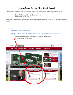


© Copyright 2026