
Building Height EMC Doc # Submitter Address Submission
Building Height EMC Doc # 3973385 Submitter Alistair O'Neill - Wolter Consulting Group Address PO Box 436, New Farm QLD 4005 Submission Summary 3973356 Marina Vit CEO (Qld) & Andrew Allen Branch President UDIA (Qld) Gladstone GPO Box 2279, Brisbane QLD 4001 While building height is included in the Administrative definitions, the application of this is somewhat inconsistent with buildings or structures common to industrial land uses. As there is no reference to building height as it applies to structures, it is assumed that control of building height would be applied to all structures on Boral sites (eg. silos). Recommendation 1: The relevant building height requirements prescribed under the respective Zone Codes be amended as follows: - to only apply where the site adjoins residential zoned land; and - to only apply where the building is within a fixed distance (for example 10 metres) from the boundary of a site which contains existing or approved residential development; and to not apply to certain structures such as materials storage silos. The Low Density Zone code and Low Medium Density zone code set a maximum building height at 8.5m and a maximum number of two stories. This represents a reduction in permissible height from the 9m allowed in much of the Gladstone Region under existing Schemes. As you may be aware, other Councils in Queensland have recently decided to raise heights to 9.5m as a means of delivering less red tape, improved flood immunity, and to facilitate the delivery of climatic responsive designs. The Medium Density Residential zone code sets a height limit of 15m and three storeys (except in some limited locations identified by the Building height and frontages overlay map). This seems low given the emphasis on delivering infill development in the Strategic Framework. It is recommend that the maximum height be raised to 20m (consistent with delivering well designed developments of up to five storeys). Reply Extractive industry is anticipated in the Rural zone. Building height is represented as an Acceptable Outcome for dwellings and rural activities. This does not include extractive industry which is captured in more detail in the Extractive industry code. In industrial areas, the Low impact industry zone code includes building height provisions that address the interface with any adjoining residential zones. Recommended Actions No change The types, density and scale of residential dwellings intended in these residential zones can be achieved within the height parameters provided in their zone code. This is demonstrated in the building typologies included in the relevant zone codes. These heights are acceptable outcomes only. There is the opportunity to submit alternate building height outcomes that demonstrate compliance with the performance outcomes for building height in the relevant zone code. No change No change Calliope School EMC Doc # 3967674 3973702 3959082 Submitter Norman Crook Roslyn Morris Josephine Mary Sidhu Address 5 Butler Street, New Auckland QLD 4680 61 Nanando Drive, Calliope QLD 4680 8 Glegg Street, West Gladstone QLD 4680 Submission Summary Calliope needs a High School within the next 5 years Site should be preserved for community use not an oversupply of housing. Reply Recommended Actions Council had reflected the proposed high school site in the Calliope structure plan and the Community use zone was applied in the first draft of the planning scheme sent to the State Government for their review. Conditions were imposed by the State Government to remove the Community use zone from the nominated high school site and replace with the Low density residential zone. Include representations in summary of submission report for the State Government to reconsider their condition to remove the Community use zone from this site. Council will approach the State Government for reconsideration on their decision to not proceed with a High school at Calliope and the proposed sale of this site. 55 Don Cameron Drive, Calliope (Lot 126 CTN 1493) should remain Council had reflected the proposed high school site in the Calliope within the Community Use Zone. For the township to grow essential community infrastructure needs to be provided inclusive structure plan and the Community use zone was applied in the first of educational facilities. draft of the planning scheme sent to the State Government for their review. Conditions were imposed by the State Government to remove the Community use zone from the nominated high school site and replace with the Low density residential zone. Council will approach the State Government for reconsideration on their decision to not proceed with a High school at Calliope and the proposed sale of this site. 55 Don Cameron Drive, Calliope (Lot 126 CTN 1493) should remain Council had reflected the proposed high school site in the Calliope within the Community Use Zone. For the township to grow essential community infrastructure needs to be provided inclusive structure plan and the Community use zone was applied in the first of educational facilities. draft of the planning scheme sent to There is ample land for residential purposes throughout the the State Government for their township and this is more suitable as opposed to eliminating any review. Conditions were imposed by potential for an educational establishment. the State Government to remove the Community use zone from the nominated high school site and replace with the Low density residential zone. Include representations in summary of submission report for the State Government to reconsider their condition to remove the Community use zone from this site. Include representations in summary of submission report for the State Government to reconsider their condition to remove the Community use zone from this site. 3959095 Moira Urquhart 8 Glegg Street, West Gladstone QLD 4680 3959078 Samir Sidhn 8 Glegg Street, West Gladstone QLD 4680 3982754 Lynda Ninness C/- Calliope Community Rezoning Petition Po Box 347, Calliope QLD 4680 Council will approach the State Government for reconsideration on their decision to not proceed with a High school at Calliope and the proposed sale of this site. 55 Don Cameron Drive, Calliope (Lot 126 CTN 1493) should remain Council had reflected the proposed high school site in the Calliope within the Community Use Zone. For the township to grow essential community infrastructure needs to be provided inclusive structure plan and the Community use zone was applied in the first of educational facilities. draft of the planning scheme sent to Given the recent increase of development within Calliope the State Government for their inclusive of commercial development (Calliope Tavern)it is review. Conditions were imposed by considered that facilities such as High Schools will be required in the State Government to remove the future. It is considered that a one hour return trip into the Community use zone from the Gladstone for education is not sustainable regional planning. nominated high school site and replace with the Low density residential zone. Council will approach the State Government for reconsideration on their decision to not proceed with a High school at Calliope and the proposed sale of this site. 55 Don Cameron Drive, Calliope (Lot 126 CTN 1493) should remain Council had reflected the proposed high school site in the Calliope within the Community Use Zone. For the township to grow essential community infrastructure needs to be provided inclusive structure plan and the Community use zone was applied in the first of educational facilities. draft of the planning scheme sent to The Calliope community including Boyne Valley are in need for a the State Government for their High School facility. In recent years population growth has led to review. Conditions were imposed by significant increases in young families and children. It is not acceptable to allow a township like Calliope grow without the State Government to remove the Community use zone from the essential services like a High School. This would be unsustainable nominated high school site and development. replace with the Low density residential zone. That the proposed rezoning of the Calliope High School not be supported and the zone remain Community Use. 256 signatures and 92 online signatures. Council will approach the State Government for reconsideration on their decision to not proceed with a High school at Calliope and the proposed sale of this site. Council had reflected the proposed high school site in the Calliope structure plan and the Community use zone was applied in the first draft of the planning scheme sent to the State Government for their review. Conditions were imposed by the State Government to remove the Community use zone from the Include representations in summary of submission report for the State Government to reconsider their condition to remove the Community use zone from this site. Include representations in summary of submission report for the State Government to reconsider their condition to remove the Community use zone from this site. Include representations in summary of submission report for the State Government to reconsider their condition to remove the Community use zone from this site. nominated high school site and replace with the Low density residential zone. 3971502 3973030 3897404 (online) Vickie Spencer Wayne and Karina Saxvik Lynda Ninness 8 Monterey Way, Calliope QLD 4680 PO Box 126, Calliope QLD 4680 PO Box 347, Calliope QLD 4680 The land should be retained in the Community Facility zone and retained for use as the future Calliope High School given the existing local demand for a high school. It is unknown whether detailed plans/studies have been undertaken regarding the appropriateness of the school site for residential development (hazards, infrastructure, environment, drainage, traffic) Residents have elected to reside in Calliope on the reasonable understanding that a future high school would be provided in Calliope This is an ideal, central location for a school in Calliope. When sold, where would the future school go when it is ultimately required? Calliope is identified as a high growth town, the requirement for a high school remains and the current alternative options are also filling quickly. Has a cost benefit analysis been done to demonstrate that selling the site and transporting students elsewhere is a better option. Object to rezoning Lot 126 CTN 1493 from Community Use to Residential. The township of Calliope has seen substantial growth in recent years and infrastructure like a high school will become essential to cater for this growth. Council will approach the State Government for reconsideration on their decision to not proceed with a High school at Calliope and the proposed sale of this site. Council had reflected the proposed high school site in the Calliope structure plan and the Community use zone was applied in the first draft of the planning scheme sent to the State Government for their review. Conditions were imposed by the State Government to remove the Community use zone from the nominated high school site and replace with the Low density residential zone. Council will approach the State Government for reconsideration on their decision to not proceed with a High school at Calliope and the proposed sale of this site. Council had reflected the proposed high school site in the Calliope structure plan and the Community use zone was applied in the first draft of the planning scheme sent to the State Government for their review. Conditions were imposed by the State Government to remove the Community use zone from the nominated high school site and replace with the Low density residential zone. Council will approach the State Government for reconsideration on their decision to not proceed with a High school at Calliope and the proposed sale of this site. Council had reflected the proposed high school site in the Calliope structure plan and the Community use zone was applied in the first draft of the planning scheme sent to the State Government for their Include representations in summary of submission report for the State Government to reconsider their condition to remove the Community use zone from this site. Include representations in summary of submission report for the State Government to reconsider their condition to remove the Community use zone from this site. Include representations in summary of submission report for the State Government to reconsider their condition to remove the Community use zone from this site. review. Conditions were imposed by the State Government to remove the Community use zone from the nominated high school site and replace with the Low density residential zone. 3898144 (online) 3901457 3910080 Shannyn Ind Wendy Raghoobar c/- Star Kids Calliope Jessica Henley 21 Capricornia Drive, Calliope QLD 4680 7 Don Cameron Drive, Calliope 4680 13 Central Avenue, Calliope QLD 4680 Council will approach the State Government for reconsideration on their decision to not proceed with a High school at Calliope and the proposed sale of this site. It is requested that the Calliope School site remain as Community Use Council had reflected the proposed due to the current growth occurring within Calliope and the increase high school site in the Calliope structure plan and the Community in young families and children. use zone was applied in the first draft of the planning scheme sent to the State Government for their review. Conditions were imposed by the State Government to remove the Community use zone from the nominated high school site and replace with the Low density residential zone. Given the population of Calliope, the town should have a High School. This would avoid children currently and in the future having to commute to school using the bus. Keep the current land for the Calliope High School as Community Use. Council will approach the State Government for reconsideration on their decision to not proceed with a High school at Calliope and the proposed sale of this site. Council had reflected the proposed high school site in the Calliope structure plan and the Community use zone was applied in the first draft of the planning scheme sent to the State Government for their review. Conditions were imposed by the State Government to remove the Community use zone from the nominated high school site and replace with the Low density residential zone. Council will approach the State Government for reconsideration on their decision to not proceed with a High school at Calliope and the proposed sale of this site. Council had reflected the proposed high school site in the Calliope structure plan and the Community Include representations in summary of submission report for the State Government to reconsider their condition to remove the Community use zone from this site. Include representations in summary of submission report for the State Government to reconsider their condition to remove the Community use zone from this site. Include representations in summary of submission report for the State Government to reconsider their use zone was applied in the first draft of the planning scheme sent to the State Government for their review. Conditions were imposed by the State Government to remove the Community use zone from the nominated high school site and replace with the Low density residential zone. 3944053 (online) 3944280 (Online) Karen macKenzie Tammy Oliver 11 Old Bruce Highway, River Ranch QLD 4680 7 Ningana Court, Calliope QLD 4680 55 Don Cameron Drive (Lot 126 CTN 1493) should remain Community Use and not Residential. 55 Don Cameron Drive (Lot 126 CTN 1493) should remain Community Use and not Residential. Tannum Sands is a perfect example of how the high school substantially reduced traffic levels on Gladstone Benaraby Road. Should the Calliope High School go ahead this would further reduce traffic levels on the Dawson Highway. Council will approach the State Government for reconsideration on their decision to not proceed with a High school at Calliope and the proposed sale of this site. Council had reflected the proposed high school site in the Calliope structure plan and the Community use zone was applied in the first draft of the planning scheme sent to the State Government for their review. Conditions were imposed by the State Government to remove the Community use zone from the nominated high school site and replace with the Low density residential zone. Council will approach the State Government for reconsideration on their decision to not proceed with a High school at Calliope and the proposed sale of this site. Council had reflected the proposed high school site in the Calliope structure plan and the Community use zone was applied in the first draft of the planning scheme sent to the State Government for their review. Conditions were imposed by the State Government to remove the Community use zone from the nominated high school site and replace with the Low density residential zone. Council will approach the State Government for reconsideration on their decision to not proceed with a High school at Calliope and the proposed sale of this site. condition to remove the Community use zone from this site. Include representations in summary of submission report for the State Government to reconsider their condition to remove the Community use zone from this site. Include representations in summary of submission report for the State Government to reconsider their condition to remove the Community use zone from this site. 3944403 (Online) 3951265 (online) 3951480 (online) Stacey Marjoram David Smith Robyn smith 13 Alpha Street, Calliope QLD 4680 4 Ironmonger Street, Calliope QLD 4680 4 Ironmonger Street, Calliope QLD 4680 55 Don Cameron Drive (Lot 126 CTN 1493) should remain Community Use and not Residential. Given the population of Calliope, the town should have a High School. This would avoid children currently and in the future having to commute to school using the bus. Given the population of Calliope, the town should have a High School. This would avoid children currently and in the future having to commute to school using the bus. Given the population of Calliope, the town should have a High School. This would avoid children currently and in the future having to commute to school using the bus. Council had reflected the proposed high school site in the Calliope structure plan and the Community use zone was applied in the first draft of the planning scheme sent to the State Government for their review. Conditions were imposed by the State Government to remove the Community use zone from the nominated high school site and replace with the Low density residential zone. Council will approach the State Government for reconsideration on their decision to not proceed with a High school at Calliope and the proposed sale of this site. Council had reflected the proposed high school site in the Calliope structure plan and the Community use zone was applied in the first draft of the planning scheme sent to the State Government for their review. Conditions were imposed by the State Government to remove the Community use zone from the nominated high school site and replace with the Low density residential zone. Council will approach the State Government for reconsideration on their decision to not proceed with a High school at Calliope and the proposed sale of this site. Council had reflected the proposed high school site in the Calliope structure plan and the Community use zone was applied in the first draft of the planning scheme sent to the State Government for their review. Conditions were imposed by the State Government to remove the Community use zone from the nominated high school site and replace with the Low density residential zone. Council will approach the State Government for reconsideration on Include representations in summary of submission report for the State Government to reconsider their condition to remove the Community use zone from this site. Include representations in summary of submission report for the State Government to reconsider their condition to remove the Community use zone from this site. Include representations in summary of submission report for the State Government to reconsider their condition to remove the Community use zone from this site. 3962735 Online Danielle Beretta C/- Aurecon Pty Ltd Graham Peever 3 Margaret Street, Tannum Sands 2 Terina Court, Calliope 55 Don Cameron Drive (Lot 126 CTN 1493) should remain Community Use and not Residential. Given the population of Calliope, the town should have a High School. This would avoid children currently and in the future having to commute to school using the bus. A High School is an important part of a towns amenity and should be incorporated into the social fabric. 55 Don Cameron Drive (Lot 126 CTN 1493) should remain Community Use and not Residential. their decision to not proceed with a High school at Calliope and the proposed sale of this site. Council had reflected the proposed high school site in the Calliope structure plan and the Community use zone was applied in the first draft of the planning scheme sent to the State Government for their review. Conditions were imposed by the State Government to remove the Community use zone from the nominated high school site and replace with the Low density residential zone. Council will approach the State Government for reconsideration on their decision to not proceed with a High school at Calliope and the proposed sale of this site. Council had reflected the proposed high school site in the Calliope structure plan and the Community use zone was applied in the first draft of the planning scheme sent to the State Government for their review. Conditions were imposed by the State Government to remove the Community use zone from the nominated high school site and replace with the Low density residential zone. Council will approach the State Government for reconsideration on their decision to not proceed with a High school at Calliope and the proposed sale of this site. Include representations in summary of submission report for the State Government to reconsider their condition to remove the Community use zone from this site. Include representations in summary of submission report for the State Government to reconsider their condition to remove the Community use zone from this site. Coastal Hazard overlay code EMC Doc # 3970761 Submitter Greg Penhaligon Address PO Box 3432, Tannum Sands QLD 4680 Submission Summary 3973933 Recommended Actions Please state the AEP of the storm tides for residential development. The Coastal Hazard overlay map is a translation of the mapping for coastal hazards prepared by the State Government at the time. Please refer to the State Government’s Coastal Hazards Technical Guide. No change Please provide the reduced levels associated with the Coastal Hazard Areas so that they can be easily ascertained for the design of development. Ie not able to search an individual property on the GRC GIS to find it? Site specific coastal hazard assessments can be undertaken to provide localised levels in which to assess the impacts of coastal hazards. No change Why are areas such as the majority of the CBD and west of Awoonga Dam Road identified as being in the Coastal Zone on the mapping? 3973504 Reply Con Moshos 69 Wilpana Tce, Aldgate RPS Australia East Pty Ltd C/- Body Corporate for Sunrise at 1770 PO Box 5497, Gladstone QLD 4680 The Coastal Hazard overlay map is a translation at the time of the mapping for coastal hazards prepared by the State Government. This identifies State interests as reflected in the State Planning Policy. Council is required under the Sustainable Planning Act to reflect these State interests in the planning scheme. Proponents have the opportunity to undertake coastal hazard assessments through development applications to demonstrate the accuracy of this State Government mapping. The Coastal Hazard overlay map is Owners of Lot 109 SP 150901. The mapping for Erosion Prone areas has increased over the lot and as such should be reviewed. a translation at the time of the mapping for coastal hazards prepared by the State Government. This identifies State interests as reflected in the State Planning Policy. Council is required under the Sustainable Planning Act to reflect these State interests in the planning scheme. Proponents have the opportunity to undertake coastal hazard assessments through the development process to demonstrate the accuracy of this State Government mapping. The Coastal Hazard overlay map is Considering the issue of Erosion Prone Land, it is considered a translation at the time of the appropriate to allow the Sunrise Body Corporate to engage an mapping for coastal hazards expert to undertake a detailed investigation of the area to No change No change. Should a change to the consent order be lodged and approved by Council, any changes to coastal hazard mapping can be reflected in a future amendment to the planning scheme. No change. establish with more accuracy the appropriate location of the hazard boundary. This would be undertaken with DEHP and completed prior to the Final Planning Scheme being report to Council for adoption by the Minister. 3973941 3971478 3971517 Mark Arnesen 8/110 North Steyne, Manly NSW 2095 Andrew Staehr - Body Corporate for Sunrise at 1770 CTS 32536 PO Box 1191, Mooloolaba QLD 4557 The new overlay code mapping undermines the master plan, earlier coastal studies and the court approval for the Sunrise at 1770 development and removes development rights of the existing landowners conferred through this approval. prepared by the State Government. This identifies State interests as reflected in the State Planning Policy. Council is required under the Sustainable Planning Act to reflect these State interests in the planning scheme. Proponents have the opportunity to undertake coastal hazard assessments through the development process to demonstrate the accuracy of this State Government mapping. Coastal hazard mapping can be refined through future planning scheme amendments as part of this process and also in conjunction with relevant development approvals. The Coastal Hazard overlay map is No change. a translation at the time of the mapping for coastal hazards prepared by the State Government. This identifies State interests as reflected in the State Planning Policy. Council is required under the Sustainable Planning Act to reflect these State interests in the planning scheme. Proponents have the opportunity to undertake coastal hazard assessments through the development process to demonstrate the accuracy of this State Government mapping. Coastal hazard mapping can be refined through future planning scheme amendments as part of this process and also in conjunction with relevant development approvals. Existing land use rights and valid development approvals still apply where relevant. Submission on behalf of the Body Corp of Sunrise @ 1770. The new The Coastal Hazard overlay map is No change overlay code mapping undermines the master plan, earlier coastal a translation at the time of the studies and the court approval for the Sunrise at 1770 development mapping for coastal hazards and removes development rights of the existing landowners prepared by the State Government. conferred through this approval. That the Body Corp & the affected This identifies State interests as owners are given the opportunity to work together with Council and reflected in the State Planning the State. Policy. Council is required under the Sustainable Planning Act to reflect these State interests in the 3971545 Mark Hulst 47/552 Springs Road, Agnes Water QLD 4677 The new overlay code mapping undermines the master plan, earlier coastal studies and the court approval for the Sunrise at 1770 development and removes development rights of the existing landowners conferred through this approval. 3973094 C&N Moshos 69 Wilpena Tce Aldgate SA 5154 Lot 103 SP150901 - The new overlay code mapping undermines the master plan, earlier coastal studies and the court approval for the Sunrise at 1770 development and removes development rights of the existing landowners conferred through this approval. That the Body Corp & the affected owners are given the opportunity to work together with Council and the State. planning scheme. Proponents have the opportunity to undertake coastal hazard assessments through the development process to demonstrate the accuracy of this State Government mapping. Coastal hazard mapping can be refined through future planning scheme amendments as part of this process and also in conjunction with relevant development approvals. Existing land use rights and valid development approvals still apply where relevant. The Coastal Hazard overlay map is No change a translation at the time of the mapping for coastal hazards prepared by the State Government. This identifies State interests as reflected in the State Planning Policy. Council is required under the Sustainable Planning Act to reflect these State interests in the planning scheme. Proponents have the opportunity to undertake coastal hazard assessments through the development process to demonstrate the accuracy of this State Government mapping. Coastal hazard mapping can be refined through future planning scheme amendments as part of this process and also in conjunction with relevant development approvals. Existing land use rights and valid development approvals still apply where relevant. The Coastal Hazard overlay map is No change a translation at the time of the mapping for coastal hazards prepared by the State Government. This identifies State interests as reflected in the State Planning Policy. Council is required under the Sustainable Planning Act to reflect these State interests in the planning scheme. Proponents have the opportunity to undertake coastal hazard assessments through the development process to demonstrate the accuracy of this 3972149 Barbara Collins Trustee Beatsworkn SMSF PO Box 169, Agnes Water Lot 112 SP150901 - The new overlay code mapping undermines the master plan, earlier coastal studies and the court approval for the Sunrise at 1770 development and removes development rights of the existing landowners conferred through this approval. That the Body Corp & the affected owners are given the opportunity to work together with Council and the State. Online Glenn Collins PO Box 169 Agnes Water 4677 Lot 112 SP150901 - as above State Government mapping. Coastal hazard mapping can be refined through future planning scheme amendments as part of this process and also in conjunction with relevant development approvals. Existing land use rights and valid development approvals still apply where relevant. The Coastal Hazard overlay map is No change a translation at the time of the mapping for coastal hazards prepared by the State Government. This identifies State interests as reflected in the State Planning Policy. Council is required under the Sustainable Planning Act to reflect these State interests in the planning scheme. Proponents have the opportunity to undertake coastal hazard assessments through the development process to demonstrate the accuracy of this State Government mapping. Coastal hazard mapping can be refined through future planning scheme amendments as part of this process and also in conjunction with relevant development approvals. Existing land use rights and valid development approvals still apply where relevant. The Coastal Hazard overlay map is No change a translation at the time of the mapping for coastal hazards prepared by the State Government. This identifies State interests as reflected in the State Planning Policy. Council is required under the Sustainable Planning Act to reflect these State interests in the planning scheme. Proponents have the opportunity to undertake coastal hazard assessments through the development process to demonstrate the accuracy of this State Government mapping. Coastal hazard mapping can be refined through future planning scheme amendments as part of this process and also in conjunction Online Barbara Collins PO Box169 Agnes Water 4677 Lot 105 SP150901 - The new overlay code mapping undermines the master plan, earlier coastal studies and the court approval for the Sunrise at 1770 development and removes development rights of the existing landowners conferred through this approval. That the Body Corp & the affected owners are given the opportunity to work together with Council and the State. 3973007 Bruce Hellwege - Escor Pty Ltd 165 Williams Road, Prahran VIC 3181 Lot 59 SP150901 & Lot 122 SP171151(?) - The new overlay code mapping undermines the master plan, earlier coastal studies and the court approval for the Sunrise at 1770 development and removes development rights of the existing landowners conferred through this approval. That the Body Corp & the affected owners are given the opportunity to work together with Council and the State. 3973036 Roger Evans 903/454 St Kilda Road, Melbourne VIC Lot 169 SP171151 - as above with relevant development approvals. Existing land use rights and valid development approvals still apply where relevant. The Coastal Hazard overlay map is No change a translation at the time of the mapping for coastal hazards prepared by the State Government. This identifies State interests as reflected in the State Planning Policy. Council is required under the Sustainable Planning Act to reflect these State interests in the planning scheme. Proponents have the opportunity to undertake coastal hazard assessments through the development process to demonstrate the accuracy of this State Government mapping. Coastal hazard mapping can be refined through future planning scheme amendments as part of this process and also in conjunction with relevant development approvals. Existing land use rights and valid development approvals still apply where relevant. The Coastal Hazard overlay map is No change a translation at the time of the mapping for coastal hazards prepared by the State Government. This identifies State interests as reflected in the State Planning Policy. Council is required under the Sustainable Planning Act to reflect these State interests in the planning scheme. Proponents have the opportunity to undertake coastal hazard assessments through the development process to demonstrate the accuracy of this State Government mapping. Coastal hazard mapping can be refined through future planning scheme amendments as part of this process and also in conjunction with relevant development approvals. Existing land use rights and valid development approvals still apply where relevant. The Coastal Hazard overlay map is No change 3973114 Donald Musto - Rockin' Red Properties Pty Ltd Suite 2A, Level 9, 20 Collins Street, Melbourne VIC 3000 Lot 124, 126 & 166 SP171151 - as above 3973264 Mitchell & Samantha Oglivie - Carnoe Pty Ltd Level 1, 168 Edward Street Lot 65 SP150901 - as above a translation at the time of the mapping for coastal hazards prepared by the State Government. This identifies State interests as reflected in the State Planning Policy. Council is required under the Sustainable Planning Act to reflect these State interests in the planning scheme. Proponents have the opportunity to undertake coastal hazard assessments through the development process to demonstrate the accuracy of this State Government mapping. Coastal hazard mapping can be refined through future planning scheme amendments as part of this process and also in conjunction with relevant development approvals. Existing land use rights and valid development approvals still apply where relevant. The Coastal Hazard overlay map is No change a translation at the time of the mapping for coastal hazards prepared by the State Government. This identifies State interests as reflected in the State Planning Policy. Council is required under the Sustainable Planning Act to reflect these State interests in the planning scheme. Proponents have the opportunity to undertake coastal hazard assessments through the development process to demonstrate the accuracy of this State Government mapping. Coastal hazard mapping can be refined through future planning scheme amendments as part of this process and also in conjunction with relevant development approvals. Existing land use rights and valid development approvals still apply where relevant. The Coastal Hazard overlay map is No change a translation at the time of the mapping for coastal hazards prepared by the State Government. This identifies State interests as reflected in the State Planning 3973329 Gregory Ward 21 Hillgate Street London W8 7SP United Kingdom Lots 125 and 160 on SP150901 and SP171151 3973993 Gordon Christian Po Box 213 Cooranbong NSW 2265 Lot 7 SP160789 Beaches Village Circuit, Agnes Water is significantly impacted by the Coastal Hazard overlay. This mapping extends further west and beyond the current Coastal Management District Boundary and will significantly impact on the development potential of this property. Policy. Council is required under the Sustainable Planning Act to reflect these State interests in the planning scheme. Proponents have the opportunity to undertake coastal hazard assessments through the development process to demonstrate the accuracy of this State Government mapping. Coastal hazard mapping can be refined through future planning scheme amendments as part of this process and also in conjunction with relevant development approvals. Existing land use rights and valid development approvals still apply where relevant. The Coastal Hazard overlay map is No change a translation at the time of the mapping for coastal hazards prepared by the State Government. This identifies State interests as reflected in the State Planning Policy. Council is required under the Sustainable Planning Act to reflect these State interests in the planning scheme. Proponents have the opportunity to undertake coastal hazard assessments through the development process to demonstrate the accuracy of this State Government mapping. Coastal hazard mapping can be refined through future planning scheme amendments as part of this process and also in conjunction with relevant development approvals. Existing land use rights and valid development approvals still apply where relevant. The Coastal Hazard overlay map is No change a translation at the time of the mapping for coastal hazards prepared by the State Government. This identifies State interests as reflected in the State Planning Policy. Council is required under the Sustainable Planning Act to reflect these State interests in the planning scheme. Proponents have the opportunity to undertake 2980263 Beth Loraine 4/32 Mitford Street, Elwood Vic 3184 Objection to land being included within Erosion Prone Area - not consistent with existing approval. The new overlay code mapping undermines the master plan, earlier coastal studies and the court approval for the Sunrise at 1770 development and removes development rights of the existing landowners conferred through this approval. That the Body Corp & the affected owners are given the opportunity to work together with Council and the State. 3974252 Daniel & Louise Searle 29 Everton Road, Singapore 089384 Lot 162 SP171151 Sunrise @ 1770 As above coastal hazard assessments through the development process to demonstrate the accuracy of this State Government mapping. Coastal hazard mapping can be refined through future planning scheme amendments as part of this process and also in conjunction with relevant development approvals. Existing land use rights and valid development approvals still apply where relevant. The Coastal Hazard overlay map is No change a translation at the time of the mapping for coastal hazards prepared by the State Government. This identifies State interests as reflected in the State Planning Policy. Council is required under the Sustainable Planning Act to reflect these State interests in the planning scheme. Proponents have the opportunity to undertake coastal hazard assessments through the development process to demonstrate the accuracy of this State Government mapping. Coastal hazard mapping can be refined through future planning scheme amendments as part of this process and also in conjunction with relevant development approvals. Existing land use rights and valid development approvals still apply where relevant. The Coastal Hazard overlay map is No change a translation at the time of the mapping for coastal hazards prepared by the State Government. This identifies State interests as reflected in the State Planning Policy. Council is required under the Sustainable Planning Act to reflect these State interests in the planning scheme. Proponents have the opportunity to undertake coastal hazard assessments through the development process to demonstrate the accuracy of this State Government mapping. Coastal hazard mapping can be Online Stephanie Mattner 117 Jakeman Drive, Agnes Water, Qld 4677 Concerned at the extensive blanket coverage of the Coastal Hazard Overlay to all areas of Agnes Water, including Rural Character areas and beyond. The broad coverage of the Coastal Hazard Overlay places too many provisos and restrictions on development in Agnes Water (and surrounds), and should be restricted only to properties directly impacted by the "Coastal" environs. Other properties beyond that area have sufficient restrictions to shape suitable development outcomes (ie Acid Sulfate Soils provisions). Online R. Kinkead-Weekes and A. Best 115/552 Springs Rd Agnes Water 4677 Lot 114/115 Sunrise @ 1770 As above refined through future planning scheme amendments as part of this process and also in conjunction with relevant development approvals. Existing land use rights and valid development approvals still apply where relevant. The Coastal Hazard overlay map is No change a translation at the time of the mapping for coastal hazards prepared by the State Government. This identifies State interests as reflected in the State Planning Policy. Council is required under the Sustainable Planning Act to reflect these State interests in the planning scheme. Proponents have the opportunity to undertake coastal hazard assessments through the development process to demonstrate the accuracy of this State Government mapping. Coastal hazard mapping can be refined through future planning scheme amendments as part of this process and also in conjunction with relevant development approvals. Existing land use rights and valid development approvals still apply where relevant. The Coastal Hazard overlay map is No change a translation at the time of the mapping for coastal hazards prepared by the State Government. This identifies State interests as reflected in the State Planning Policy. Council is required under the Sustainable Planning Act to reflect these State interests in the planning scheme. Proponents have the opportunity to undertake coastal hazard assessments through the development process to demonstrate the accuracy of this State Government mapping. Coastal hazard mapping can be refined through future planning scheme amendments as part of this process and also in conjunction with relevant development approvals. Existing land use rights Online third nomad pty ltd [email protected] Lot 127 SP171151 Online Appletree Properties Pty Ltd- Director-Jason McMeniman [email protected] Lot 1 & 2 SP 269643 (previously Lot 308 FL4036) lies outside the Coastal Management District as there is a 40 MTR esplanade buffer surrounding the property. Please see letter from Department of Employment, Economic Development and Innovation dated 3 June 2011 ( Re. Development Application no: DA/249/2010 Online Ross Nielson [email protected] Lot 172 on SP171151. Sunrise @ 1770 Similar to other Sunrise @ 1770 submissions above and valid development approvals still apply where relevant. The Coastal Hazard overlay map is No change a translation at the time of the mapping for coastal hazards prepared by the State Government. This identifies State interests as reflected in the State Planning Policy. Council is required under the Sustainable Planning Act to reflect these State interests in the planning scheme. Proponents have the opportunity to undertake coastal hazard assessments through the development process to demonstrate the accuracy of this State Government mapping. Coastal hazard mapping can be refined through future planning scheme amendments as part of this process and also in conjunction with relevant development approvals. Existing land use rights and valid development approvals still apply where relevant. The Coastal Hazard overlay map is No change a translation at the time of the mapping for coastal hazards prepared by the State Government. This identifies State interests as reflected in the State Planning Policy. Council is required under the Sustainable Planning Act to reflect these State interests in the planning scheme. Proponents have the opportunity to undertake coastal hazard assessments through the development process to demonstrate the accuracy of this State Government mapping. Coastal hazard mapping can be refined through future planning scheme amendments as part of this process and also in conjunction with relevant development approvals. Existing land use rights and valid development approvals still apply where relevant. The Coastal Hazard overlay map is No change a translation at the time of the mapping for coastal hazards prepared by the State Government. This identifies State interests as reflected in the State Planning Policy. Council is required under the Sustainable Planning Act to reflect these State interests in the planning scheme. Proponents have the opportunity to undertake coastal hazard assessments through the development process to demonstrate the accuracy of this State Government mapping. Coastal hazard mapping can be refined through future planning scheme amendments as part of this process and also in conjunction with relevant development approvals. Existing land use rights and valid development approvals still apply where relevant. Code Issues EMC Doc # 3973385 Submitter Alistair O'Neill - Wolter Consulting Group Address PO Box 436, New Farm QLD 4005 Submission Summary Protection of High impact industry Recommendation 1: Council introduce an industrial amenity overlay (similar to that adopted by Brisbane City Council’s City Plan 2014) which identifies and restricts sensitive development within proximity of key industrial land. 3973385 3973385 Reply Recommendation 2: Council apply Impact assessment provisions to sensitive and incompatible development within the buffer or separation areas. Alistair O'Neill - Wolter Consulting Group PO Box 436, New Farm QLD 4005 Hours of Operation for Industrial Uses Recommendation 1: Council include performance-based solutions to support a minimum operational timeframe of 6am to 6pm for High and Medium impact industry uses. Recommendation 2: Council provide the opportunity for High and Medium impact industry operations to occur outside the minimum operating timeframe of 6am to 6pm, where sufficient evidence can be provided that the development will achieve relevant environmental and amenity performance criteria. Alistair O'Neill - Wolter Consulting Group PO Box 436, New Farm QLD 4005 Mobile and Temporary Activities Recommendation 1: Amend the Level of Assessment Table for industrial and rural zones to include High impact industry (where a Temporary Use) as Exempt development. Recommendation 2: Amend the QPP recommended Section 1.7 – ‘Local Government Administrative Matters’, and through specific mention, clarify that Mobile and Temporary crushing and screening, concrete batching and asphalt manufacturing is an example of a Temporary Use. Recommended Actions The zone allocation in combination with setbacks and buffers within relevant zone codes provide appropriate buffers and prevent incompatible development encroaching. In particular, the industry buffer zone precinct in the Limited Development zone provides a buffer through zoning to identified High impact and Special industry. The Table of Assessment for relevant zones and where triggered by the Extractive resources and minerals overlay limits appropriate uses within the separation or buffer areas. No change No change The zoning allocation and the use of the industry buffer zone precinct in the Limited development zone provide appropriate separation to sensitive uses which controls amenity impacts in the Medium impact and Special industry zones No change. High impact industry generates the type of impacts that require a broad range of assessment criteria to assess their impacts on people, property and the environment. The impacts associated with these uses (whether temporary or permanent) require impact assessment. ‘Temporary use’ has been adequately defined in the administrative definitions of the planning scheme. No change. No change. Development Codes EMC Doc # 3968133 Submitter Cassandra Koutouridis Cement Concrete & Aggregate Australia Address Suite 2 Level 2, 485 Ipswich Road Annerly QLD 4103 Submission Summary Reply Extractive Industry D.C.: This code is overly prescriptive & may restrict the ability to extract resources. Within this development code the requirements of : Prescriptive measures in the Extractive industry code are represented through Acceptable Outcomes. This is just one way to comply with Performance outcomes. No change PO2 are not feasible to protect ridgelines etc and should instead allow measures such as progressive rehabilitation to mitigate visual impact on ridgelines & hilltops. PO2 adequately deals with the intended assessment of impacts associated with this use No change PO5 - public safety is already managed under the Mining and Quarrying Safety & Health Act 1999. Council have an obligation to ensure public safety in considering development of this type. No change PO6 - by limiting haulage to identified haulage routes the wording here does not provide for new Greenfield sites identified in the future. The note in PO6 represents existing haulage routes. This map can be amended should new haulage routes be required which comply with relevant assessment criteria such as that described in PO6. No change Part 9.2. (Statewide codes) was inadvertently dropped from the proposed online planning scheme. Part 9.2 to be reinstated. 3970761 Greg Penhaligon PO Box 3432, Tannum Sands QLD 4680 Part 9.2. is missing from the online scheme 3982900 Kathryn Sinfield C/- Bishop Outdoor Advertising PO Box 335, Kelvin Grove QLD 4059 Gladstone Regional Council Development Services PO Box 29, Gladstone QLD 4680 Advertising Devices The regulation of Advertising Devices under the proposed Draft Planning Scheme occurs as opposed to Local Laws; The incorporation of an Advertising Devices Code within the proposed Planning Scheme which can be based upon the OMA's Model Advertising Devices Code' for Queensland; Not to use 'sub definitions' for Advertising Devices, such as 'third party' advertising and 'on premises' advertising; and Not to regulate to content of advertisements through either the Planning Scheme or Local Laws as this is achieved through industry codes administered by the Australian Standards Bureau (ASB). Proposed code included for adoption. 9.3.1 Development Design - A review is to be undertaken with respect to the Waste Management Planning Scheme Policy and the provision of waste bins for Multiple Dwellings. It is recommended that bulk bins be used for 3 or more Multiple Dwellings. 3982588 Recommended Actions No change Under the Queensland Planning Provisions V3.1 (27 June 2014), advertising devices are no longer identified as development. Accordingly Council will revise its local laws to cover advertising devices Acceptable Outcome 12 Footpaths to be incorporated into all development. Recommended that the draft Gladstone Regional Council Pedestrian Cycleway and Footpath Strategy is incorporated into the Engineering Design Planning Scheme Policy (Schedule 6.2). The Waste Management Planning Scheme Policy has been revised to incorporate the proposed change amongst others. PO13 and AO13 have been reviewed to reflect the Road Hierarchy, and the Bicycle and Pedestrian Hierarchy. It is recommended that the Gladstone Regional Council Pedestrian AO13 has been revised to state: Amend Appendix 1 and 2 of the Schedules to be referenced as SC6.7 Appendix 1 and SC6.7 Appendix 2 to make it clear these appendices are associated with SC6.7. Revise appendix 3 and 4 to appendix 1 and 2. Include in Waste Management Policy that single dwellings and duplex's have single bins and all Cycleway and Footpath Strategy be added as a document within the Footpaths are: Engineering Design Planning Scheme Policy. (a) Provided to the full road frontages as required by the Engineering Design Planning Scheme Policy and relevant strategic planning documents, (b) connected to the existing footpath network, (c) designed and constructed in accordance with the requirements of the Engineering Design Planning Scheme Policy, and (d) certified by a Registered Professional Engineer of Queensland. Performance Outcome 10 be amended as follows 'Developments provided with end of trip facilities to encourage people to engage in active transport (bicycle and pedestrians) where in urban areas'. other development needs bulk bins. Revise Table SC6.7.3.2 to reflect the use of bulk bins only for anything other than single dwellings or duplexes. Also include that any development required to have a bulk bin needs to submit a waste management plan. PO10 has been revised to state: Development provides end of trip facilities to encourage people to engage in active transport (bicycle and pedestrians) where in urban areas: (a) to meet the needs of users and promote active modes of travel (b) at convenient, easily identifiable, safe locations, and (c) in locations that do not obstruct vehicular, bicycle or pedestrian movement paths. PO13 has been revised to state: Appropriate footpath connectivity is provided to and within the development to support a road and footpath hierarchy which facilitates efficient movement in accordance with relevant strategic planning documents. Footpaths are paved in durable and stable materials, matching any adjacent development footpaths where these materials comply with current standards. Revise AO13 to state: Footpaths are: (a) Provided to the full road frontages as required by the Engineering Design Planning Scheme Policy, (b) connected to the existing footpath network, (c) designed and constructed in accordance with the requirements of the Engineering Design Planning Scheme Policy, and (d) certified by a Registered Professional Engineer of Queensland. Revise PO10 to state: Development provides end of trip facilities to encourage people to engage in active transport (bicycle and pedestrians) where in urban areas: (a) to meet the needs of users and promote active modes of travel (b) at convenient, easily identifiable, safe locations, and (c) in locations that do not obstruct vehicular, bicycle or pedestrian movement paths. 9.3.3 Home Based Business - Amend Acceptable Outcomes to include the following: 'Activities on the premises do not involve the: a) Display of goods; b) Hiring out of any item; or c) Repairing, servicing, cleaning, or loading of motor vehicles'. This inclusion would ensure the above Home Business activities would not be undertaken across the region. 9.3.4 Landscaping - Provide an Acceptable Outcome with respect to proposed Table 9.3.1.3.2 Plant species list. Regulating the display of goods is captured in AO2 of the Home Based Business Code. Hiring out of any item is considered appropriate as a Home Based Business subject to meeting impact criteria included in the Home Based Business code. The ‘repairing, servicing, cleaning, or loading of motor vehicles' is not appropriate as a Home Based Business and an amendment to the code will be actioned to reflect this. Requested change to be actioned. Amend AO4 to include AO4.2 which says: 'Activities on the premises do not involve the repairing, servicing, cleaning, or loading of motor vehicles'. Amend AO3.2 to reference Table 9.3.4.3.2 Plant species list. No change. 9.3.6 Reconfiguring Lot - Column 2 (Minimum lot size) for Low Density Residential Zone - denotes 'Calliope Residential Precinct' as the adopted naming convention. Recommend changing to 'Calliope Neighbourhood Precinct' to align with Geocortex Mapping System and table 9.3.6.3.2. 9.3.7 Telecommunications Facility Use - Amend Acceptable Outcome 3.1 to read that the 2m vegetation buffer be surrounding the facility itself and not the boundary of a site. 3973097 3973385 Cathy Towers - Outdoor Media Association Suite 504, 80 William Street, East Sydney NSW 2011 Advertising Devices No identified advertising devices code contained in the proposed scheme. The existing Council local laws do not provide for 3rd party signage. The absence of an advertising devices code is contrary to the direction provided by the State in the QPP user guide "Draft User Guide on Advertising Devices" November 2013. Alistair O'Neill - Wolter Consulting Group PO Box 436, New Farm QLD 4005 9.3.2 Extractive industry - hours of operation Recommendation 1: Amend Extractive industry code to support the following hours of operation for Extractive Industry: - 9am to 5pm Monday to Friday for blasting operations; - 6am to 6pm Monday to Saturday for other operations; and - 6am and 10pm Monday to Saturday for maintenance of equipment and vehicles. "Calliope neighbourhood precinct" is already reflected in the proposed scheme. Requested change to be actioned. Amend AO3.1 to, “A vegetation buffer with a minimum width of 2m surrounds the Telecommunications facility. Under the Queensland Planning Provisions V3.1 (27 June 2014), advertising devices are no longer identified as development. Accordingly Council will revise its local laws to cover advertising devices. No change AO1.6 and AO1.7 provide acceptable hours of operation in regards to ensuring amenity impacts are regulated. No change Recommendation 2: Where sufficient evidence can be provided that the use will not result in disturbance at surrounding uses, extended hours of operation should be supported. 3970761 Greg Penhaligon PO Box 3432, Tannum Sands QLD 4680 9.3.4: Landscaping Code PO4 - which zones does this apply? Will Council empty the bins on the streets of the rural residential zone? How many bins are required? How is compliance measured? PO6: Do we plant trees along the boundary of every new residential lot? PO8 – points a. to d. are the acceptable solutions. PO1 provides appropriate assessment criteria to assess hours of operations outside of those expressed in the Acceptable Outcome. The Landscaping code applies where identified in the Assessment Criteria column in Part 5 of the Table of Assessment. It can also apply in impact assessable development where the whole planning scheme is relevant. The Landscaping code generally applies to larger development types such as multiple dwellings, mixed use development, shopping centres and some industrial development. It can also apply in some Reconfiguring a Lot proposals where landscaping is an important element of the public realm such as median strips etcetera. The criteria included in PO8 are best reflected as performance measures as they are not prescriptive. No change No change MATTER: Development design code EMC Doc # 3970761 Submitter Greg Penhaligon Address PO Box 3432, Tannum Sands QLD 4680 Submission Summary Reply Recommended Actions General: A large portion of the code is not applicable to rural, rural residential, emerging communities etc and needs to be modified accordingly. For example, should rural subdivisions have to comply with PO1,PO2, PO3,PO9, P10, PO13, PO14, PO20, PO27, PO29, PO33, PO34? A lot of the sections in this code are inappropriate to development other than residential. PO3 is to be revised. Revise PO3 to: Electricity supply network and telecommunication service connections are available to the site and are connected. Words require further work investigate if the ROL code should include something about providing conduits? PO6 and P07 should be under a title of Stormwater not wastewater. For clarity the term stormwater will be used in lieu of wastewater Revise the planning scheme to replace the term wastewater with stormwater where appropriate PO17 revise wording to clarify intent. PO17: The Performance Outcome has now been reworded for clarity. Sensitive development adjacent to State controlled roads or Council controlled arterial and sub–arterial roads minimise through their own design the nuisance caused by noise, vibration and dust emissions from these roads. PO17 Wording revised for clarity to: Sensitive development adjacent to State controlled roads or Council controlled arterial and sub–arterial roads minimise through their own design the nuisance caused by noise, vibration and dust emissions. PO21 – How does this waste management requirement apply to a Residential Reconfiguring of a Lot? The creation of a Rural Lot? Who is going to check compliance? It doesn't apply to RaL of residential or Rural nature. It is applicable to MCU's as per the Waste Management Planning Scheme Policy outlines. AO24 – the Engineering Design Planning Scheme Policy is a very large set of documents. Please reference the individual documents and sections that reflect the requirements. It is not deemed necessary to refer to specific sections of the Engineering Design Planning Scheme Policy as this is an evolving document and references may become outdated PO24: Has Council worked out what Stormwater Quality measures are acceptable? How much of Council’s budget is going to be specifically allocated to maintaining stormwater quality improvement devices? PO24 has been revised for clarity. Item b has been revised to state: (b) where privately owned must be maintained (including costs) for the life of the system PLANNERS - is this response correct? Should PO21 and PO22 be change to reference only being applicable to MCU as the Waste management Planning Scheme Policy says. No change An additional item has also been included: (e) are designed to minimise ongoing maintenance costs Revise PO24 Item b to state: (b) where privately owned must be maintained (including costs) for the life of the system include an additional item in PO24: (e) are designed to minimise ongoing maintenance costs PO30 is poorly worded – I cannot understand the message these words are trying to get across. Why aren’t there acceptable solutions to describe a bridge or a culvert? PO30 is to be revised to: Bridges and culverts for flood immunity: (a) are designed and located to minimise traffic disruption (b) improve public safety (c) provides for fauna habitat movement where possible, and (d) make appropriate allowance for active transport users. An acceptable outcome is to be included: Bridges and Culvert works are provided in accordance with the requirements of the Engineering Design Planning Scheme Policy. Reword PO30: Bridges and culverts for flood immunity: (a) are designed and located to minimise traffic disruption (b) improve public safety (c) provides for fauna habitat movement where possible, and (d) make appropriate allowance for active transport. Include new AO30: Bridges and Culvert works are provided in accordance with the Engineering Design Planning Scheme Policy. No change PO32(a): This wording is fragmented and does not have a robust meaning. How much public transport is available on a rural subdivision? It is believed this performance outcome is appropriately worded such that it can be applied to all development types PO35: Reword as follows: “Where located in close proximity to an operational railway corridor, development containing sensitive land uses must provide measures to mitigate amenity impacts and maintain the operational integrity of the rail corridors.” PO35 is proposed to be reworded: PO36: needs re-organising – points a. and b. are acceptable outcomes It is believed this performance outcome is appropriately worded. PO36 Retain as is PO39 are acceptable solutions for PO38. PO38 to PO42 are to be reviewed for clarity. Review the entirety of PO 38 to PO42, in consultation with engineering services, as they are not clearly worded at the moment These POs could be revised to be closer to SPP? PO41 is barely readable at the moment, need clarity on what it is trying to achieve prior to redrafting. PO42 is listed under the artificial waterways heading but only relates to natural waterways PO41 This doesn’t make sense. How does the applicant comply with a.? Why are we harvesting stormwater? Who has to do this? Where does it have to be done? Where is Council’s policy that outlines what satisfies this requirement? The planning scheme is correct - there are no acceptable outcomes for this one! d. accommodating aquatic habitat Does a fish tank count? PO42: When and where does it apply? To a farmer’s dam? To a creek running through a subdivision? What is Council on about with the second note? Who are the parties in the agreement – Council? State PO35: Reword Where located in close proximity to a railway corridor developments, through their own design, mitigate the amenity impacts (including potential future impacts) of, and maintain the operational integrity of, the rail corridors. government? Aren’t we were supposed to reducing green and red tape? 3974089 Ian Munro - Manager Technical Services Gladstone Regional Council PO Box 29, Gladstone QLD 4680 9.3.1 Development Design Code Performance Outcome (PO) 5 of the development design code is unclearly worded at present. It is Technical Services’ understanding that this PO relates to the provision of fire service to community title and body corporate developments. At present this PO states: Development for a material change of use or reconfiguration of a lot in areas serviced by reticulated a water supply and where part of the development is more than 90 metres from the nearest located fire hydrant and is accessed by common private title, are serviced with appropriate fire hydrant infrastructure and unimpeded emergency access. Technical Services suggests the following alternate wording: Development for a material change of use or reconfiguration of a lot in areas serviced by reticulated a water supply where; part of the development is more than 90 metres from the nearest located fire hydrant and; is accessed by common private title, is serviced with appropriate internal fire hydrant infrastructure and provide unimpeded emergency access. Technical Services also recommends that this Performance Outcome be reviewed to ensure it is clear that all internal water supply infrastructure for community title development is to be owned and maintained by the body corporate. Technical Services also recommends that this PO be reviewed to ensure it is clear that all developments including those where they are closer than 90m to the nearest hydrant are responsible for complying with the relevant firefighting Australian Standards. Revise PO5 to: Development for a material change of use or reconfiguration of a lot in areas serviced by a reticulated water supply where; part of the development is more than 90 metres from the nearest located fire hydrant and; is accessed by common private title, is serviced with appropriate internal fire hydrant infrastructure and provides unimpeded emergency access. The current wording of PO 13 of the development design code does not adequately address the situation where footpaths adjacent to the development are substandard (in relation to the current standards). Technical Services recommends the wording be reviewed and submits the following possible wording: Footpaths in the road reserve are provided along all road frontages and are paved in durable and stable materials. The footpaths are to join neatly to any adjacent existing footpaths and where compliant with current standards be constructed from similar material. Additionally Council's adopted Roads Hierarchy (Policy No. P-2014/31) does not require footpaths be provided to all road types. This Road Hierarchy Policy informs the requirements of CMDG, for Gladstone Region. As such it is recommended that this Performance Outcome be reworded to make reference to either the CMDG or the Roads Hierarchy Policy (as amended). Acceptable Outcome (AO) 13 may create confusion. The use of both width and length in its wording may imply the entire verge is to be converted to footpath. Technical Services recommends that either width or length be deleted, and this terminology be consistent with other sections of the planning scheme. PO13 and AO13 have been reviewed to reflect the Road Hierarchy, and the Bicycle and Pedestrian Hierarchy. Revise PO5 to: Development for a material change of use or reconfiguration of a lot in areas serviced by a reticulated water supply where; part of the development is more than 90 metres from the nearest located fire hydrant and; is accessed by common private title, is serviced with appropriate internal fire hydrant infrastructure and provides unimpeded emergency access. Further review required to ensure it is clear all development are responsible for compliance with firefighting standards PO13 has been revised to state: Appropriate footpath connectivity is provided to and within the development to support a road and footpath hierarchy which facilitates efficient movement in accordance with relevant strategic planning documents. Footpaths are paved in durable and stable materials, matching any adjacent development footpaths where these materials comply with current standards. AO13 has been revised to state: Footpaths are: PO13 has been revised to state: Appropriate footpath connectivity is provided to and within the development to support a road and footpath hierarchy which facilitates efficient movement in accordance with relevant strategic planning documents. Footpaths are paved in durable and stable materials, matching any adjacent development footpaths where these materials comply with current standards. AO13 has been revised to state: Footpaths are: (a) Provided to the full road frontages as required by the Engineering Design Planning Scheme Policy, (b) connected to the existing (a) Provided to the full road frontages as required by the Engineering Design Planning Scheme Policy and relevant strategic planning documents, (b) connected to the existing footpath network, (c) designed and constructed in accordance with the requirements of the Engineering Design Planning Scheme Policy, and (d) certified by a Registered Professional Engineer of Queensland. footpath network, (c) designed and constructed in accordance with the requirements of the Engineering Design Planning Scheme Policy, and (d) certified by a Registered Professional Engineer of Queensland. Technical Services requests that AO 15 be reviewed to ensure that development is not located inappropriately close to Council’s existing or future sewerage pump stations and other emissive infrastructure. Whilst PO 15 identifies that development is to “minimises potential conflicts with ... other uses having regard to odour, dust or other emissions” the AO does not adequately and clearly address this point. Technical Services submits that a 100m buffer from existing and identified future sewerage pump stations would be appropriate for inclusion in the AO. If greenfield development, will need to be addressed in subdivision design (best addressed in the Capricornia Municipal Design Guidelines) . No change Performance Outcome 24 relates to the provision of stormwater quality and water sensitive urban design infrastructure. Point b. of this PO states: Stormwater management systems: b. must be maintained (including costs) for the life of the system Technical Services requests this be amended to address two issues. Firstly where the stormwater quality assets are to enter into Council ownership it is considered onerous to expect the developer to maintain these assets for the full life of the system. Secondly, the design of the system should minimise ongoing maintenance costs both to reduce costs to Council and encourage maintenance of privately owned systems. To this end it is recommended that point b. be amended to: b. where privately owned must be maintained (including costs) for the life of the system and an additional item be included stating: e. are designed to minimise ongoing maintenance costs PO24 has been revised for clarity. Item b has been revised to state: (b) where privately owned must be maintained (including costs) for the life of the system PO24 has been revised for clarity. Item b has been revised to state: (b) where privately owned must be maintained (including costs) for the life of the system And an additional item has been included: (e) are designed to minimise ongoing maintenance costs And an additional item has been included: (e) are designed to minimise ongoing maintenance costs Please amend Performance Outcome and Acceptable Outcome 31 to address internal roads for the development. As drafted these outcomes only address external roads and not new roads created within the subdivision. The Reconfiguring A Lot code does not appear to address the requirement for internal road design to be in accordance with the Engineering design planning scheme policy. PO31 will be revised. Possible wording for PO 31: Roads associated with the development, including those providing access to the site and any roads constructed by the development, are provided, constructed, and maintained to a standard which is adequate for the likely traffic type and volume AO31 has been revised to: Road works associated with the development are provided in accordance with the requirements of the Engineering Design Planning Scheme Policy. including those generated by the activities on site. 3982588 Gladstone Regional Council Development Services PO Box 29, Gladstone QLD 4680 9.3.1 Development Design - A review is to be undertaken with respect to the Waste Management Planning Scheme Policy and the provision of waste bins for Multiple Dwellings. It is recommended that bulk bins be used for 3 or more Multiple Dwellings. The Waste Management Planning Scheme Policy has been revised to incorporate the proposed change amongst others. Amend Appendix 1 and 2 of the Schedules to be referenced as SC6.7 Appendix 1 and SC6.7 Appendix 2 to make it clear these appendices are associated with SC6.7. Revise appendix 3 and 4 to appendix 1 and 2. Include in Waste Management Policy that single dwellings and duplex's have single bins and all other development needs bulk bins. Revise Table SC6.7.3.2 to reflect the use of bulk bins only for anything other than single dwellings or duplexes. Also include that any development required to have a bulk bin needs to submit a waste management plan. Acceptable Outcome 12 Footpaths to be incorporated into all development. Recommended that the draft Gladstone Regional Council Pedestrian Cycleway and Footpath Strategy is incorporated into the Engineering Design Planning Scheme Policy (Schedule 6.2). PO13 and AO13 have been reviewed to reflect the Road Hierarchy, and the Bicycle and Pedestrian Hierarchy. It is recommended that the Gladstone Regional Council Pedestrian PO13 has been revised to state: Cycleway and Footpath Strategy be added as a document within the Appropriate footpath connectivity is Engineering Design Planning Scheme Policy. provided to and within the development to support a road and footpath hierarchy which facilitates efficient movement in accordance with relevant strategic planning documents. Footpaths are paved in durable and stable materials, matching any adjacent development footpaths where these materials comply with current standards. AO13 has been revised to state: Footpaths are: (a) Provided to the full road frontages as required by the Engineering Design Planning Scheme Policy and relevant strategic planning documents, (b) connected to the existing footpath network, (c) designed and constructed in PO13 has been revised to state: Appropriate footpath connectivity is provided to and within the development to support a road and footpath hierarchy which facilitates efficient movement in accordance with relevant strategic planning documents. Footpaths are paved in durable and stable materials, matching any adjacent development footpaths where these materials comply with current standards. Revise AO13 to state: Footpaths are: (a) Provided to the full road frontages as required by the Engineering Design Planning Scheme Policy and relevant strategic planning documents, (b) connected to the existing footpath network, (c) designed and constructed in Performance Outcome 10 be amended as follows 'Developments provided with end of trip facilities to encourage people to engage in active transport (bicycle and pedestrians) where in urban areas'. accordance with the requirements of the Engineering Design Planning Scheme Policy, and (d) certified by a Registered Professional Engineer of Queensland. accordance with the requirements of the Engineering Design Planning Scheme Policy, and (d) certified by a Registered Professional Engineer of Queensland. PO10 has been revised to state: Development provides end of trip facilities to encourage people to engage in active transport (bicycle and pedestrians) where in urban areas: (a) to meet the needs of users and promote active modes of travel (b) at convenient, easily identifiable, safe locations, and (c) in locations that do not obstruct vehicular, bicycle or pedestrian movement paths. Revise PO10 to state: Development provides end of trip facilities to encourage people to engage in active transport (bicycle and pedestrians) where in urban areas: (a) to meet the needs of users and promote active modes of travel (b) at convenient, easily identifiable, safe locations, and (c) in locations that do not obstruct vehicular, bicycle or pedestrian movement paths. Review AO 34 to include further items such as: Appropriate crossing locations Location of bus stops Where development is proposed to connect to existing bus stops these can be safely accessed. E.g. forest springs, peds have to cross Dixon drive to access the bus stop MATTER: (Flood Hazard Overlay Code) EMC Doc # Submitter 3951552 Robert Henderson 3982588 Council (Development Services Department) 3970420 Nathan Wilson - THG 3970761 Greg Penhaligon Address 53 Woods Road, Sharon Submission Summary Lot 65 RP619020 (Taunton Road, Eulielah). Flood mapping deemed inaccurate as extent of flood mapping shown on subject lot exceeds extent of actual 2013 flood waters. PO4/AO4.1 and PO5/AO5.1 within this overlay code are very similar. Is this unnecessary repetition? PO Box 1038, Fortitude Valley QLD 4006 PO Box 3432, Tannum Sands QLD 4680 Reply This area contained within the Flood overlay map is a direct translation of the mapping for flood hazards prepared by the State Government. This identifies State interests as reflected in the State Planning Policy. Council is required under the Sustainable Planning Act to reflect these State interests in the planning scheme. Proponents have the opportunity to undertake flood assessments through development applications to demonstrate any localised impacts from flooding. Flood mapping in this area is likely to be refined once Council's Baffle Creek flood study is completed and adopted. Council has reviewed and amended this criteria in response to submission. Regarding the Peet Vantage Estate, Kirkwood Drive, New Auckland (Lot 504 SP233801). AO7.1 which requires that habitable rooms have a minimum flood level at least 1000mm above the DFE, is excessive & should be reduced to 500mm of clearance. 1000mm is considered appropriate as it is to account for uncertainty in estimating flood water heights, the effects of wave action and unforeseen variation in local flood behaviour Also AO9.1 requires the filling height of building footprints does not exceed 1000mm and has batters not steeper than 1 in 6. This should be reworded as such ‘The filling height of building footprints raised above the surrounding ground levels for the purpose of achieving flood immunity does not exceed 1000mm and has batters not steeper than 1 in 6.’ PO9 and AO9.1 will be moved to the Development Design Code to cover the allowable fill batter slope for all building envelopes. No definition is provided for 'flood hazard area' Flood hazard area is defined in the State Planning Policy. Recommended Actions No change. Undertake the following amendments to the code: Combine PO 4 and 5 PO1 – need to be clear about MCU and RoL. AO only applies to no new lots. Include editors note for site based assessment AO5.2 has a separate PO that deals with septic No change to AO7.1 however Reword PO7 to: The floor levels of residential uses and other sensitive uses are raised above the DFE to provide an allowance above the main flood way for hydraulic gradient, the effects of wave action, uncertainty in estimating flood water heights and unforeseen variation in local flood behaviour. Move this PO and AO to the Development Design Code to cover the allowable fill batter slope for all building envelopes. No change 3974089 Ian Munro - Manager Technical Services Gladstone Regional Council PO Box 29, Gladstone QLD 4680 PO1 is repeated in PO4 - delete. Duplication in PO1 and PO4 to be revised. See actions for 3982588 above AO5.2 is good, but also needs to include a driveway connection to a road with 5% AEP immunity to allow some means of escape. Access is already addressed in PO2 and PO6 and their associated acceptable outcomes. No change A06.2 rules out short no through roads that are efficient in providing access to additional lots. It should be re-written “Short no through roads must be designed have a Degree of flood Hazard in a 1% AEP flood event no greater than “medium” for a maximum length of 500m or “high” for a length of 100m in accordance with Table 8.2.7.3.3—Table to acceptable outcome. Roadways must be designed to retain their structural integrity during this flooding. ” AO6.2 represents one way in which to demonstrate compliance with PO6. The proponent has the opportunity to submit other means in which to achieve compliance with PO6. No change AO9 If a 20m wide building pad is built on a 15% slope it has a height of 1.5m for the fill batter why limit a fill for flooding to 1m? It also needs some wording fixed. Request to be actioned. AO9 is to be included as part of AO10.2 in relation to earthworks Amend code: AO9 is to be included in as AO10.2. PO10 again contains the language of absolutes (use of the words: not, any, avoid ) which is not acceptable, particularly when Council cannot think of acceptable solutions. There will always be situations where not complying with one of the six alphanumerical dot points is appropriate, such as placing a road across a creek to access a property or development. Is Council itself never going to build a road across a creek again? It is considered the assessment criteria in PO10 contain appropriate performance measures in which to fulfil compliance with the purpose of the code. Amend PO10 (f) to include “substantially” PO10(c): is all fine for a lovely pristine well vegetated creek, but what about an eroded weed infested waterway through a cow paddock that could be improved by development? There are no acceptable outcomes which would indicate not enough thought has gone into this item. In fact AO5.2 which is a practical solution would appear to conflict with this part of the code. It is considered the assessment criteria in PO10 contain appropriate performance measures in which to fulfil compliance with the purpose of the code. No change PO10 - PO15: What is the aim of these? Surely service providers would be smart enough to comply with these requirements in any case. What control does Council have on Telstra? Ergon? APA? The intent of the provision is to ensure development can be serviced appropriately in response to the identified hazard. No change Terminology in AO13.1 and Table 8.2.7.3.2 should be Recommended Flood Immunity, not flood level. Flood terminology has been amended as requested. Replace flood level with phrase ‘flood immunity level’ in AO13.1 and Table 8.2.7.3.2 In reading the code in its entirely with reference to PO2/AO2 and PO10, this issue is adequately covered. Amend AO5.2 to read, “For new lots in the rural zone or rural residential zone, a designated building envelope, generally rectangular in shape, having a minimum area of 1,000m2 is provided. 8.2.7 Flood Hazard Overlay Code Within the flood hazard overlay code Acceptable Outcome 5.2 relates to the creation of rural residential building envelopes above the DFE. Technical Services requests this Acceptable Outcome be reviewed to address the good design of building pads. Technical Services requests that the following items be addressed: • Maximum Flood Flow velocity at any formed building pad to prevent scour of the pad (preventing risk to property) • Access provided with a low or medium hazard rating from the building envelope to the evacuation route. Online Appletree Properties Pty LtdDirector-Jason McMeniman 3974255 Mr Don Musto C/-RPS Please review Acceptable Outcome 7.1, at present it does not address those buildings above the DFE but less than 1000mm above the DFE. Possible alternate wording is: Habitable rooms have a minimum floor level at least 1000mm above the DFE. OR Where involving an extension to an existing residential use that has habitable rooms less than 1000mm above the DFE, any extension does not exceed 25m2 GFA. [email protected] 8.2.7 Flood hazard - QRA Flood Plain Assessment - Lot 1 & 2 SP 269643 is located well above the flood plain level with altitude between 5 - 78 mtrs above sea level. The property has majority land which is flood free. [email protected] 23 & 25 Jeffery Court, Agnes Water Flooding It is acknowledged that flood mapping has indicated the subject site is subject to potential flooding and this may elevate the habitable floor levels for the site. It is submitted that Council should consider elevating the maximum building height for development in this precinct. More specifically, development in this precinct will typically pursue basements and avoid ground water issues. The implication of the flood mapping is the overall height of the building and ability to achieve the 3 storey Acceptable Outcome may not realistically be achievable when elevated flood levels are included. Therefore, the maximum building height for the properties in the Jeffery Court Precinct should be increased to cater for the elevated habitable floor level so that 3 storey developments can be achieved as per the desire of the Mixed Use Zone Code. This area contained within the Flood overlay map is a direct translation of the mapping for flood hazards prepared by the State Government. This identifies State interests as reflected in the State Planning Policy. Council is required under the Sustainable Planning Act to reflect these State interests in the planning scheme. Proponents have the opportunity to undertake flood assessments through development applications to demonstrate any localised impacts from flooding. Building height within the Jeffrey Court precinct is representative of the intended low rise coastal character of the locality. Therefore additional building height for the purposes stated, is not supported. No change No change General Issue EMC Doc # Submitter 3972183 Carmelita Van Deventer 3972183 Carmelita Van Deventer 3982588 Gladstone Regional Council Development Services Address Submission Summary 282 Auckland St, Gladstone QLD 4680 282 Auckland St, Gladstone QLD 4680 6.2.2.2(3)(c)(d): suggestion that these purpose criteria had not been upheld by Council in the past. Non planning scheme comment. 6.2.19 - Emerging Community. Suggestion that the proposed Philip St Community Precinct is completely inappropriate at this location & the site should instead be used for Med Density Res or left as bushland Recommend: Every code starts on a new page (consistent with Toowoomba and Bundaberg Regional Councils) All images throughout the scheme should be referenced appropriately using figure numbers; and Remove all references to a structure plan/structure plan maps. PO Box 29, Gladstone QLD 4680 Reply Your observation in regards to past decisions by Council is noted. Your observation in regards to past decisions by Council is noted. No action Your comments are acknowledged. Please note that the proposed scheme is constructed to operate as an online scheme, rather than a published document. Undertake grammatical, spelling and formatting check throughout document. 6.2.21 - Acceptable Outcome 9.2 - Mixed Use - Land Use mix - 'Jeffery' "Jeffery" Court is the correct spelling. Court spelling error. The Planning Scheme should provide clarification on the overall purpose of the Structure Plan within the Scheme and the weight it gives to the assessment of development applications. Given the structure plans are not entirely consistent with the desired outcomes of the scheme, and given their longer life span (2050), this should be clarified in order to prevent confusion over what is expected/achievable within the life of the Scheme. 3973312 John Moynihan PO Box 64, Mount Larcom QLD 4695 This plan is called the Gladstone Regional Council planning scheme. I feel that a plan for the Gladstone Region should include the whole of the council area. This plan seems to concentrate on the triangle of Gladstone, Calliope, Boyne Island / Tannum Sands and Agnes Water. There appears to be quite a bit of detailed planning going into these areas with scant mention of the rest of the region. Recommended Actions Reference to how the Structure Plans are relevant is provided in section 3.6.2 Building it better: new neighbourhoods. It describes how these structure plans are included to provide an assessment framework on large scale master planning development in new growth areas in particular. The Structure Plans provide a conceptual direction on the land use pattern and master planning of growth areas. Information on the sequencing of development is also provided where relevant (eg Calliope). Weight is given accordingly for development that triggers impact assessment in these areas (ie the Emerging community zone) and is assessed against the entire planning scheme. The ‘line of sight’ from these structure plans has been considered and the subject zoning and precincts are reflected in other parts of the planning scheme. This planning scheme applies to whole local government area and a zone has been assigned to each land parcel. Given the analysis into projected population growth and housing and commercial land No action No change No change. No change. 3973385 Alistair O'Neill - Wolter Consulting Group PO Box 436, New Farm QLD 4005 State Planning Policy provisions: Review the planning scheme on an ‘across the board’ basis to ensure it appropriately reflects and incorporates the principles of the SPP. 3973385 Alistair O'Neill - Wolter Consulting Group PO Box 436, New Farm QLD 4005 3973385 Alistair O'Neill - Wolter Consulting Group PO Box 436, New Farm QLD 4005 Review and incorporate the following CCAA and State Government Model Codes: - CCAA Extractive Industry Zone Code; - CCAA Extractive Industry Use Code; and - SPP Model extractive resources overlay code. Tannum Sands Quarry: The site is afforded protection under the SPP and designation as a Key Resource Area (KRA no. 118). Recommendation 1: Adopt the Extractive industry zone and apply to the subject site. Recommendation 2: Apply Code Assessment provisions to Extractive industry uses where located in the Extractive industry zone and contained within the Extractive resources and minerals overlay. Recommendation 3: Include and update the Extractive Industry Code and Extractive Resources Overlay Code to reflect the CCAA Extractive Industry Model Codes and SPP Model extractive resources overlay code. Recommendation 4: Amend the Extractive resources and Minerals overlay Table of assessment to ensure incompatible (including commercial) and sensitive development occurring within the KRA Separation area trigger Impact assessment. 3973385 3973385 Alistair O'Neill - Wolter Consulting Group Alistair O'Neill - Wolter Consulting Group PO Box 436, New Farm QLD 4005 PO Box 436, New Farm QLD 4005 Agnes Water Concrete: Recommendation 1: Include the site and surrounding area within a High Impact Industry Zone; and Recommendation 2: Maintain Code assessable provisions for High impact industry in the High impact industry zone. OR in the event the Medium Impact Industry Zone is maintained over the site: Recommendation 1: Update the Medium impact industry code to support High impact industry (i.e. concrete batching), and amend the corresponding Table of assessment to provide Code assessment for certain High impact industry where achieving performance-based solutions. Gladstone Concrete Batching Plant: Recommendation 1: Include the site and surrounding area within a demand, the major urban areas will experience the greatest development impact over the life of the planning scheme. The planning scheme takes into account the provision of infrastructure services to growth where it is projected to occur. Council confirms that the proposed No change scheme does appropriately reflect the requirements of the SPP. This has been confirmed by the State Government in their State interest review assessment. The Extractive Industry use code No change reflects components of model codes, best practice and local specific regulations. The Extractive resources and minerals overlay map identifies all Key Resources Areas throughout the region. The associated overlay code and Extractive industry use code assist in regulating impacts and operational measures for extractive industry activities. These extractive industry areas are located in the Rural zone. The Rural zone code includes specific buffer provisions in PO3 for sensitive uses where triggered in the overlay. This effectively addresses any assessment of incompatible uses where relevant. Amend PO5 of the Rural zone code to read, “Accommodation and community activities do not encroach on existing or approved rural and extractive industry operations or uses that may result in an adverse impact on amenity, health or safety.” Industry investigation zone is the most appropriate zone at this point in time given there is no trunk infrastructure provided in this area. The Table of Assessment for the Industry investigation zone reflects this accordingly. No change Given the nature and impacts, associated with concrete batching Amend Table of Assessment for Medium impact industry to include High Impact Industry Zone; and Recommendation 2: Maintain Code assessable provisions for High impact industry in the High impact industry zone. 3973385 Alistair O'Neill - Wolter Consulting Group PO Box 436, New Farm QLD 4005 3973356 Marina Vit CEO (Qld) & Andrew Allen Branch President UDIA (Qld) Gladstone GPO Box 2279, Brisbane QLD 4001 3973356 Marina Vit CEO (Qld) & Andrew Allen Branch President UDIA (Qld) Gladstone GPO Box 2279, Brisbane QLD 4001 OR in the event the High Impact Industry Zone is not adopted over the site:: Recommendation 1: Retain the site within the Medium Impact industry zone; and Update the Medium impact industry code to support High impact industry (i.e. concrete batching), and amend the corresponding Table of assessment to provide Code assessment for certain High impact industry where achieving performance-based solutions. Calliope Concrete Batching Plant: Recommendation 1: Include the site and surrounding area within a High Impact Industry Zone; and Recommendation 2: Maintain Code assessable provisions for High impact industry in the High impact industry zone. OR in the event the Medium Impact Industry Zone is maintained over the site: Recommendation 1: Update the Medium impact industry code to support High impact industry (i.e. concrete batching), and amend the corresponding Table of assessment to provide Code assessment for certain High impact industry where achieving performance-based solutions. Surrounding Area Recommendation 1: Adopt an alternative land use strategy that removes the potential for land use conflicts and subsequent sterilisation of existing activities by establishing an industrial estate/precinct that contributes to the economic development of the region. Back zoning Whilst the Institute acknowledges that in some instances, cases of ‘back zoning’ may be accidental or unintended, it is nonetheless essential that zonings and tables of assessment be amended in the Draft Scheme prior to adoption to eliminate back zoning. Mapping & Zoning The Institute requests that the GRC thoroughly reviews its mapping and works closely with the development industry to improve the accuracy of mapping prior to the adoption of the Draft Scheme. For example, all overlay mapping must be tested against existing development approvals and cadastral boundaries prior to the Draft Scheme being finalised. plants, the Table of Assessment for Medium impact industry will be amended to include ‘high impact industry – where concrete batching plant” is code assessable ‘high impact industry – where concrete batching plant” is code assessable Given the nature of the low impact Calliope industrial area, it is considered impact assessment is the most appropriate way to assess high impact industry in this area. Lawful existing use rights are maintained. No change Council has zoned the region in response to the preferred settlement pattern based on planning need, physical constraints, efficient infrastructure provision and community expectations. Mapping has been based on the best information available at the time. A large proportion of the overlay mapping is a translation of the mapping prepared by the State Government. This identifies State interests as reflected in the State Planning Policy. Council is required under the Sustainable Planning Act to reflect these State interests in the planning scheme. Proponents have the opportunity to undertake local assessments through development No change No change applications to demonstrate the accuracy of overlay mapping. Existing land use rights and valid development approvals still apply where relevant. 3973356 Marina Vit CEO (Qld) & Andrew Allen Branch President UDIA (Qld) Gladstone GPO Box 2279, Brisbane QLD 4001 Dual Occupancy: The following acceptable outcomes in zone codes and development codes relating to dual occupancy are unnecessarily onerous: - Site cover: A site cover limit of 40 per cent for dual occupancies in the Low Density Zone is unnecessarily onerous and less than provisions in many other planning schemes across Queensland. The Institute recommends a maximum site cover of 60 per cent for dual occupancy in line the Next Generation Planning (NGP) Handbook recommendations (See http://www.dsdip.qld.gov.au/resources/guideline/ngphandbook. pdf page 97); - Minimum lot sizes: Imposition of an effective 800sqm minimum site area for dual occupancy in AO4.1b of the Low Density Zone code (one dwelling per 400m2 where a dual occupancy) will limit the attractiveness and ability to deliver this important form of housing. The Institute sees no reason why good planning outcomes cannot be achieved for dual occupancy on sites of 600sqm or less. Sites of 600sqm or less in Low Density Zones are considered acceptable outcomes in many new planning schemes across Queensland including in Rockhampton, Logan and others; - Minimum lot sizes: Imposition of an effective 600sqm minimum site area and 20m minimum frontage for dual occupancy in the LowMedium Density Zone code (one dwelling per 300sqm) will limit the attractiveness and ability to deliver this important form of housing. The Institute sees no reason why good planning outcomes in the LowMedium Density Zone cannot be achieved for dual occupancy on sites of 500sqm or less; - Private open space: The Institute recommends a minimum private open space of 30sqm with 4m minimum dimension in line with the Next Generation Planning (NGP)Handbook recommendations. (See http://www.dsdip.qld.gov.au/resources/guideline/ngp-handbook.pdf page 97). Requiring 50sqm with a minimum dimension of 5.0m in any direction is excessive; - Setbacks: Some minimum setback requirements are more onerous than the NGP Handbook recommendations (See http://www.dsdip.qld.gov.au/resources/guideline/ngp-handbook.pdf page 97); and - Other controls: Controls relating to matters such car parking areas (AO7 in the Low-Medium Density Zone code and AO5 in the low density zone code) are unnecessary and may limit the saleability of dual occupancies. These are acceptable outcomes and just one way of demonstrating compliance with the relevant performance outcome. The siting, density and building height provisions for dual occupancy and multiple dwelling (townhouses) in their relevant zones are assessment criteria which reflect the intended density, character and building bulk in these zones as they apply in the Gladstone region. The typologies provided in the Low-medium density zone have been architecturally tested to demonstrate appropriate built form, (private and communal) open space, parking and functional living outcomes that can be feasibly achieved. No change Townhouses/Terrace Houses: The following acceptable outcomes relating to townhouses / terrace houses are unnecessarily onerous: - Site cover: A site cover limit of 50 per cent for townhouses in the Low- These are acceptable outcomes and just one way of demonstrating compliance with the relevant performance outcome. The siting, No change Medium Density Zone is unnecessarily onerous and less than provisions in many other planning schemes across Queensland. The Institute recommends a maximum site cover of 70 per cent for townhouses in line with the NGP Handbook recommendations (See http://www.dsdip.qld.gov.au/resources/guideline/ngphandbook. pdf page 101); - Building heights: Building heights for townhouses are unnecessarily restrictive (see above); - Dwelling size: Imposition of an effective 240sqm minimum footprint per dwelling in AO5.1 of the Low-Medium Density Zone code will limit the attractiveness of and ability to deliver this important form of housing. This minimum size is out of step with townhouse developments being delivered across Queensland that have proven to have a high level of consumer acceptance; - Minimum lot sizes: Minimum lot sizes and frontages are unnecessary. Planning controls relating to site cover, setbacks and private open space are sufficient in controlling outcomes; - Setbacks: Some minimum setback requirements are more onerous than the NGP Handbook recommendations (See http://www.dsdip.qld.gov.au/resources/guideline/ngp-handbook.pdf page 101); and Other controls: Controls relating to matters such car parking areas (AO7 in the Low- Medium Density Zone code) are unnecessary and may limit the saleability of dual occupancies. density and building height provisions for multiple dwelling (townhouses) in the Low-medium Residential density zones are assessment criteria in which to reflect the intended density, character and building bulk in these zones as they apply in the Gladstone region. The typologies provided in the Low-medium density residential zone have been architecturally tested to demonstrate appropriate built form, (private and communal) open space, parking and functional living outcomes that can be feasibly achieved. Multiple Dwellings: The following acceptable outcomes in zone codes and development codes relating to multiple dwellings are unnecessarily onerous: - Housing Mix: AO8 in the Low-Medium Density and Medium Density Zone code requires development of 15 or more dwellings to include 25 per cent one bedroom, 40 per cent two bedroom and 15 per cent three bedroom dwellings (with the remaining 20 per cent unrestricted). The Institute supports the GRC’s desire to deliver a diversity of housing supply, however diversity across the region need not require every individual development to have diversity within it. Developers will make commercial decisions on dwelling sizes within a development based on what produces a viable development in that location and the demand for product type that exists in that local area. Mandating mixes of dwelling sizes within a multi-unit dwelling is inappropriate, unnecessary and may impact on the commercial viability of individual developments. If there is market demand for one, two and three bedroom apartments across Gladstone, developers will deliver this mix, but not necessarily be able to viably deliver it within each and every single development; and - Communal Open Space: AO6.1 and Figure 7 in the Medium Density Zone code require that a minimum communal open space of 20 per cent of the site area is provided and that it has a minimum dimension of 5m in any direction. The Institute does not believe that acceptable outcomes regarding communal open space provisions are necessary at all in the code and the Performance Outcome PO6 is sufficient in our view. In any case, minimum setbacks required in the code will necessarily result in the provision of communal open space. Acceptable Outcome 8 in both the Low-medium density residential and Medium density residential zone codes represents one way in demonstrating compliance with PO8. Proponents have the opportunity to demonstrate other ways in which a development proposal greater than 15 dwellings can provide a mix of housing sizes to meet the community needs. The siting, density and building height provisions for a multiple dwelling in the Low-medium density residential and Medium density residential zones are assessment criteria in which to reflect the intended density, character and building bulk in these zones as they apply in the Gladstone region. The typologies provided in these residential zones have been architecturally tested to demonstrate appropriate built form, (private and communal) open space, parking and functional living outcomes that can be feasibly No change achieved. Retirement facilities are supported and trigger code assessment where in the Low-medium residential density, and Medium density residential zones and in the Mixed use zone. Relocatable home park will also be amended to trigger code assessment in these zones. The broad built form outcomes expressed in these codes apply to these uses. Consultation/Submission Timing I earlier wrote the mayor strongly objecting to your failure to notify land owners about the changes to the planning scheme. Your community consultation programs and media campaigns while very good, fall short of notifying land owners, the true key stakeholders that should have every opportunity to provide a submission to the proposed changes. I am in the real estate industry in Agnes Water and I can assure you many people are not aware of the proposed changes. I reject the mayor’s response to my letter to the mayors claiming your notifications are adequate Considerations to be included in Strategic future vision: Community facilities - Men's shed, boat mooring facilities and sailing club, RSL Power stations and generators (wave/ tidal) Expansion of piggeries and chicken keeping Replacement of sewerage and water mains Sealing of Narrows Road and Targinnie Road (widening) QPP - 1.3.4 Zones for roads, waterways and reclaimed land GPC has advised that some Strategic Port Land identified as surplus to Port's needs was undesignated as SPL & by default became unzoned land under the existing planning scheme. Due to this default, it is recommended the adding of additional criteria to Section 1.3.4 to cover land relinquished by regulating authorities so that a default zone comes into play in the instance of an un-designation. Council has conducted community consultation in accordance with the legislative provisions in the Sustainable Planning Act and also undertaken various publicity campaigns in the print media, social media, radio and through community visits throughout the region. No change Community facilities have been appropriately zoned and provide for a wide range of community uses within these areas. Other uses such as special industry and rural activities have been zoned accordingly in appropriate locations. No change 3973993 Gordon Christian Po Box 213 Cooranbong NSW 2265 3986799 Graeme Davey 21 Moura Cres, Gladstone 3974020 Geoff White - Gladstone Ports Corp PO Box 259, Gladstone QLD 4680 3974089 Ian Munro - Manager Technical Services Gladstone Regional Council Olivia Loweke PO Box 29, Gladstone QLD 4680 It is recommended that all aspects of the planning scheme are reviewed to ensure there is no reference to the Priority Infrastructure Plan. 1 Page Court People are crying out for larger block sizes, the typical suburban blocks are too small. 1/2 - 1 acre block sizes allow people to have the freedom to play, grow and have peace and quiet. There is huge potential in the area for growth as it is a beautiful part of Queensland. Online Make relocatable home park code assessable in the Table of Assessment for Low-medium and Medium density residential zones. Seniors Living: Relocatable home parks (Manufactured Home Parks) and retirement villages do not appear to be governed by development codes or specifically mentioned as an anticipated use in residential zone codes. The Institute recommends that the GRC review the Draft Scheme to ensure that it facilitates code assessable Manufactured Home Parks or Retirement Villages in residential areas. The planning scheme zone allocation No change reflects a true representation of the land use pattern at that point in time. It is recommended the Gladstone Port Corporation approach Council in advance of any land transfer so the appropriate amendment process for the planning scheme can be organised. Request to be actioned. This task is to be undertaken The proposed planning scheme provides ample choice in terms of lot size, lifestyle outcomes and housing types to support the needs of people from all backgrounds and age groups. This includes an ample supply of rural residential land. No change 3939626 (online) N/A N/A There are issues with free caravan sites and beachfront land regulated by Rangers. People who own beachfront land need to understand that they do not own the land and that RVs are permitted in certain areas. 3948843 (online) 3948846 (online) 3960969 (Online) Pamela Radel 18 Archer Street, Calliope QLD 4680 18 Archer Street, Calliope QLD 4680 Shady Lane, Agnes Water QLD Online Mark Radel Warburton Anthony Bere-Streeter PO Box 4805 Springfield Qld 4300 No change. Blank This is not a Planning Scheme issue and is regulated by Council's Regulatory Services Department (Local Laws) and DEHP. N/A Blank N/A N/A Vehicle Parking in Agnes Water and 1770 There are significant vehicle parking issues for public parking at Agnes Water. Given many of the cafes and food premises utilise public parking visitors and guests have to use local streets which is often dangerous. On street or public car parking is not regulated in the planning scheme. The planning scheme provides appropriate on site car parking rates based on the land use and size of development. No change In addition the area lacks footpath infrastructure. Examples include the lack of pedestrian connectivity to the school and from 1770 to the SES Grounds and thereby Agnes Water. Existing estates also lack footpath provision. It is requested that Council include requirements for footpaths as part of the planning scheme and consider retrofitting footpath infrastructure into existing estates. Requirements have been included into the Development Design Code and Reconfiguring A Lot Code to ensure appropriate active transport infrastructure is provided as part of new development. Council may consider a program of providing footpaths through existing areas as a separate matter to the planning scheme. No change Planning Scheme Policies are incomplete and refer to external documents without providing sufficient information about those documents. The Planning Scheme Mapping Tool is difficult to use and not logical. It is recommended that PDF mapping be used. Planning scheme policies can refer to external documents. They are only a guide in to assist in the assessment of criteria in the planning scheme. No change N/A Hanson Road Precinct EMC Doc # 3967592 3965225 Submitter Brittany Lauga – Planning, Community Engagement and Approvals Address PO Box 8384, Allenstown QLD 4700 Submission Summary Submission on behalf of the Hanson Road Precinct Business Alliance (53 signatures attached). There are purpose built showroom retail facilities or bulky goods precincts other than Centro Home Gladstone (which cannot be individually owned); No suitably sized premises available elsewhere; Existing demand for floor space in precinct because of the diversity of businesses; Hanson Rd provided good access and parking for all existing businesses; New scheme will limit the market for potential tenants and the commercial value of these properties may decline; Existing offices, bulky goods and retail businesses will not be permitted to expand their existing businesses. Table 5.5.11 - Hardware & trade supplies max GFA is inconsistent with the max GFA requirements in Table 6.2.12.3.1 A01. Reply The Low Impact industry zone is considered the ‘best fit’ zone under the standardised Queensland Planning provisions zone categories given the land use context and character in this locality. The inclusion of a precinct for Hanson Road recognises the mix of low impact industry, outdoor sales, trade supplies and some showrooms. The Hanson Road Precinct describes how motor vehicle and trade related uses are supported along the Hanson Road frontage to further reflect what has historically evolved over time. The draft planning scheme has been amended to allow for existing large format type development (not associated with motor vehicles and trade supplies) such as retail showrooms have the opportunity to reasonably expand so long as it does not involve the loss of land being used for low impact industry. This provides the opportunity to expand within these land holdings subject to meeting required siting and parking provisions etc Existing land use rights are maintained. Shops and offices (Not ancillary to existing uses) are inappropriate in the Hanson Road precinct and should be located in centres such as the CBD. Recommended Actions Recommended planning scheme amendments: Strategic framework Strategic outcomes 3.3.1(11) Specialised centres provide for non–traditional centre activities such as showrooms, outdoor sales and bulky goods retailing. New specialised centre uses occur in the Specialised centre zone. 3.3.2 A gateway for local business – Specialised Centre Specialised centres are developed only in urban areas where they are close to large residential catchments and traditional mixed use centres. Whilst some specialised centre uses have historically evolved outside of designated specialised centre zones (eg Hanson Road precinct), new specialised centre development is not supported in industrial zones, the Rural zone or in other locations outside of the Gladstone, Calliope or Boyne Island / Tannum Sands urban areas. Table of Assessment for Low impact industry zone Self–assessment Agricultural supplies store Bulk landscape supplies Hardware and trade supplies Low impact industry Office Service industry Warehouse If complying with the relevant self– assessable acceptable outcomes and where the land is not adjoining a residential zone. If Office only where ancillary to an industrial activity. If Hardware and trade supplies, Zone code: Low impact industry zone code Other development codes: Development design code Landscaping code GFA thresholds have been revised for Hardware and trade supplies to better reflect the intent of the Low impact industry zone and Hanson Road precinct (where applicable). where the GFA is less than 250m2. If located in the Hanson Road precinct Code assessment Outdoor sales Showroom In all circumstances Zone code: Low impact industry zone code Other development codes: Development design code Landscaping code Low Impact Industry zone code 6.2.12.2 Purpose 2(d) The zone does not accommodate uses which are primarily oriented to retail sales where not associated with trade supplies such as retail uses which are more appropriately located in centres, such as shops, shopping centres and large format retail showrooms. Some showroom uses are well established in the Hanson Road precinct and may continue with limited expansion within their controlled land parcels. Otherwise new showrooms in the Hanson Road precinct must be associated with automotive needs and trade supplies. (3) The purpose of the zone will also be achieved through the following additional overall outcomes for particular precincts: (a) Hanson Road precinct i. Development contributes to the region’s automotive and trade supply needs through the display and sale of motor vehicles, associated automotive repair and related services and the retailing of trade supplies ii. Development supports limited expansion of existing non motor vehicle and non trade related showrooms where it does not involve the loss of land being used for industrial or industrial related purposes and does not impact on the viability of the region’s centres. PO21 Where in the Hanson Road precinct: a) any expansion of an existing non motor vehicle or non trade related showroom does not involve the loss of land being used for low impact industry; or b) any new showroom must be related to the retailing of trade supplies or associated with the display of motor vehicles. Mapping Refine mapping of precinct to focus on properties that have frontage to Hanson Road. 3912694 and 3972430 (online) Coral Marxsen PO Box 102, Gladstone Request to have self-assessable business development and building applications; Avoid the need for high fees and costs associated with Planning applications; Certainty is needed for the development of businesses in this precinct; States that this proposed arrangement may have an impact on CBD development; Impact upon small businesses and forces them into bulky goods/ big box multi-national developments; The market is heavily influenced by very high rental prices The Tables of Assessment Refer to suite of amendments above for the in Part 5 of the planning Hanson Road precinct. scheme identify appropriate self assessable development for each zone. This is supported by self assessable acceptable outcomes in relevant zone codes. The Low Impact industry zone is considered the ‘best fit’ zone under the standardised Queensland Planning provisions zone categories given the land use context and character in this locality. The Mixed industry and business zone is not included in this mandatory suite of zones. The inclusion of a precinct for Hanson Road recognises the mix of low impact industry, outdoor sales, trade supplies and some showrooms. The Hanson Road Precinct describes how motor vehicle and trade related uses are supported along 3943742 Gavin Adams PO Box 1299, Browns Plains QLD 4118 Submission on behalf of the Hanson Road Precinct Business Alliance. The plan to create a Bulk Goods Centre on Kirkwood Road is supported however this can be undertaken without the need to change the current zoning. The Mixed Business and Industry Zone should remain as it encourages a range of business and retail groups which often complement each other. Existing demand for floor space in precinct because of the diversity of businesses. New scheme will limit the market for potential tenants and the commercial value of these properties may decline. the Hanson Road frontage to further reflect what has historically evolved over time. The draft planning scheme has been amended to allow for existing large format type development (not associated with motor vehicles and trade supplies) such as retail showrooms have the opportunity to reasonably expand so long as it does not involve the loss of land being used for low impact industry. This provides the opportunity to expand within these land holdings subject to meeting required siting and parking provisions etc Existing land use rights are maintained. The Low Impact industry Refer to suite of amendments above for the zone is considered the Hanson Road precinct. ‘best fit’ zone under the standardised Queensland Planning provisions zone categories given the land use context and character in this locality. The Mixed industry and business zone is not included in this mandatory suite of zones. The inclusion of a precinct for Hanson Road recognises the mix of low impact industry, outdoor sales, trade supplies and some showrooms. The Hanson Road Precinct describes how motor vehicle and trade related uses are supported along the Hanson Road frontage to further reflect what has historically evolved over time. The draft planning scheme 3974232 LS and SE Smith and the Court Water Superannuation Fund 4 Iris Road, Kirkwood QLD 4680 Submission on behalf of the Hanson Road Precinct Business Alliance. Not supportive of the proposed Low Impact Industry Zone, Mixed Industry and Business should remain as it encourages a range of business and retail groups which often complement each other. Existing demand for floor space in precinct because of the diversity of businesses. New scheme will limit the market for potential tenants and the commercial value of these properties may decline. Keeping the current zoning could encourage other mixed business which may complement tourism when the introduction of cruise ships occurs in 2016. has been amended to allow for existing large format type development (not associated with motor vehicles and trade supplies) such as retail showrooms have the opportunity to reasonably expand so long as it does not involve the loss of land being used for low impact industry. This provides the opportunity to expand within these land holdings subject to meeting required siting and parking provisions etc Existing land use rights are maintained. The Low Impact industry Refer to suite of amendments above for the zone is considered the Hanson Road precinct. ‘best fit’ zone under the standardised Queensland Planning provisions zone categories given the land use context and character in this locality. The Mixed industry and business zone is not included in this mandatory suite of zones. The inclusion of a precinct for Hanson Road recognises the mix of low impact industry, outdoor sales, trade supplies and some showrooms. The Hanson Road Precinct describes how motor vehicle and trade related uses are supported along the Hanson Road frontage to further reflect what has historically evolved over time. The draft planning scheme has been amended to allow for existing large format type development (not associated with motor vehicles and trade 3965144 Kristen Jones C/- Baby Haven Pty Ltd 86 Hanson Road, Gladstone QLD 4680 Submission on behalf of the Hanson Road Precinct Business Alliance. Many Hanson Road properties are owned by members of the community and not multinational companies. Council should consider maintaining the current zoning to encourage greater retail opportunities within the CBD area. supplies) such as retail showrooms have the opportunity to reasonably expand so long as it does not involve the loss of land being used for low impact industry. This provides the opportunity to expand within these land holdings subject to meeting required siting and parking provisions etc Existing land use rights are maintained. Shops and offices (Not ancillary to existing uses) are inappropriate in the Hanson Road precinct and should be located in centres such as the CBD. The Low Impact industry Refer to suite of amendments above for the zone is considered the Hanson Road precinct. ‘best fit’ zone under the standardised Queensland Planning provisions zone categories given the land use context and character in this locality. The Mixed industry and business zone is not included in this mandatory suite of zones. The inclusion of a precinct for Hanson Road recognises the mix of low impact industry, outdoor sales, trade supplies and some showrooms. The Hanson Road Precinct describes how motor vehicle and trade related uses are supported along the Hanson Road frontage to further reflect what has historically evolved over time. The draft planning scheme has been amended to allow for existing large format type development (not associated with 3965193 David Kerr 96 Penda Avenue, New Auckland QLD 4680 Request that the current zoning be maintained to encourage retail uses of a variety of tenancies. This maintains retail within the CBD and avoids relocating retail business in sprawling areas like Kirkwood. motor vehicles and trade supplies) such as retail showrooms have the opportunity to reasonably expand so long as it does not involve the loss of land being used for low impact industry. This provides the opportunity to expand within these land holdings subject to meeting required siting and parking provisions etc Existing land use rights are maintained. Shops and offices (Not ancillary to existing uses) are inappropriate in the Hanson Road precinct and should be located in centres such as the CBD. The Low Impact industry Refer to suite of amendments above for the zone is considered the Hanson Road precinct. ‘best fit’ zone under the standardised Queensland Planning provisions zone categories given the land use context and character in this locality. The Mixed industry and business zone is not included in this mandatory suite of zones. The inclusion of a precinct for Hanson Road recognises the mix of low impact industry, outdoor sales, trade supplies and some showrooms. The Hanson Road Precinct describes how motor vehicle and trade related uses are supported along the Hanson Road frontage to further reflect what has historically evolved over time. The draft planning scheme has been amended to allow for existing large format type development 3965218 Hamish Mackay 93 Tarcoola Drive, Boyne Island 4680 Request to maintain the current position of supporting retail, showrooms and commercial businesses within the Hanson Precinct. (not associated with motor vehicles and trade supplies) such as retail showrooms have the opportunity to reasonably expand so long as it does not involve the loss of land being used for low impact industry. This provides the opportunity to expand within these land holdings subject to meeting required siting and parking provisions etc Existing land use rights are maintained. The Low Impact industry Refer to suite of amendments above for the zone is considered the Hanson Road precinct. ‘best fit’ zone under the standardised Queensland Planning provisions zone categories given the land use context and character in this locality. The Mixed industry and business zone is not included in this mandatory suite of zones. The inclusion of a precinct for Hanson Road recognises the mix of low impact industry, outdoor sales, trade supplies and some showrooms. The Hanson Road Precinct describes how motor vehicle and trade related uses are supported along the Hanson Road frontage to further reflect what has historically evolved over time. The draft planning scheme has been amended to allow for existing large format type development (not associated with motor vehicles and trade supplies) such as retail showrooms have the opportunity to reasonably 3965186 Rachael Dean 17 Ningana Court, Calliope QLD 4680 Request to maintain the current position of supporting retail, showrooms and commercial businesses within the Hanson Precinct. expand so long as it does not involve the loss of land being used for low impact industry. This provides the opportunity to expand within these land holdings subject to meeting required siting and parking provisions etc Existing land use rights are maintained. Shops and offices (Not ancillary to existing uses) are inappropriate in the Hanson Road precinct and should be located in centres such as the CBD. The Low Impact industry Refer to suite of amendments above for the zone is considered the Hanson Road precinct. ‘best fit’ zone under the standardised Queensland Planning provisions zone categories given the land use context and character in this locality. The Mixed industry and business zone is not included in this mandatory suite of zones. The inclusion of a precinct for Hanson Road recognises the mix of low impact industry, outdoor sales, trade supplies and some showrooms. The Hanson Road Precinct describes how motor vehicle and trade related uses are supported along the Hanson Road frontage to further reflect what has historically evolved over time. The draft planning scheme has been amended to allow for existing large format type development (not associated with motor vehicles and trade supplies) such as retail showrooms have the 3965177 Susan Carige 8 Llewellyn Close, Gladstone QLD 4680 Request to maintain the current position of supporting retail, showrooms and commercial businesses within the Hanson Precinct. opportunity to reasonably expand so long as it does not involve the loss of land being used for low impact industry. This provides the opportunity to expand within these land holdings subject to meeting required siting and parking provisions etc Existing land use rights are maintained. Shops and offices (Not ancillary to existing uses) are inappropriate in the Hanson Road precinct and should be located in centres such as the CBD. The Low Impact industry Refer to suite of amendments above for the zone is considered the Hanson Road precinct. ‘best fit’ zone under the standardised Queensland Planning provisions zone categories given the land use context and character in this locality. The Mixed industry and business zone is not included in this mandatory suite of zones. The inclusion of a precinct for Hanson Road recognises the mix of low impact industry, outdoor sales, trade supplies and some showrooms. The Hanson Road Precinct describes how motor vehicle and trade related uses are supported along the Hanson Road frontage to further reflect what has historically evolved over time. The draft planning scheme has been amended to allow for existing large format type development (not associated with motor vehicles and trade supplies) such as retail 3965170 Natasha Nixon 22 Jardine Cres, Booyne Island QLD 4680 Request to maintain the current position of supporting retail, showrooms and commercial businesses within the Hanson Precinct. showrooms have the opportunity to reasonably expand so long as it does not involve the loss of land being used for low impact industry. This provides the opportunity to expand within these land holdings subject to meeting required siting and parking provisions etc Existing land use rights are maintained. Shops and offices (Not ancillary to existing uses) are inappropriate in the Hanson Road precinct and should be located in centres such as the CBD. The Low Impact industry Refer to suite of amendments above for the zone is considered the Hanson Road precinct. ‘best fit’ zone under the standardised Queensland Planning provisions zone categories given the land use context and character in this locality. The Mixed industry and business zone is not included in this mandatory suite of zones. The inclusion of a precinct for Hanson Road recognises the mix of low impact industry, outdoor sales, trade supplies and some showrooms. The Hanson Road Precinct describes how motor vehicle and trade related uses are supported along the Hanson Road frontage to further reflect what has historically evolved over time. The draft planning scheme has been amended to allow for existing large format type development (not associated with motor vehicles and trade 3965156 Graham and Lyn McVean PO Box 1373, Gladstone QLD 4680 Submission on behalf of the Hanson Road Precinct Business Alliance. Request to maintain the current position of supporting retail, showrooms and commercial businesses within the Hanson Precinct. It is considered that the projection population figures estimated by Foresight of 60,000 by 2016 is inaccurate. Area of Auckland Creek from Flinders Parade to Baillie Street including the Hanson Road Precinct be earmarked for future development as a modern shopping precinct to include car parking, boardwalks, tourism facilities and space for shoppers and families. Request Hanson Road become a retail and leisure hub. supplies) such as retail showrooms have the opportunity to reasonably expand so long as it does not involve the loss of land being used for low impact industry. This provides the opportunity to expand within these land holdings subject to meeting required siting and parking provisions etc Existing land use rights are maintained. Shops and offices (Not ancillary to existing uses) are inappropriate in the Hanson Road precinct and should be located in centres such as the CBD. The Low Impact industry Refer to suite of amendments above for the zone is considered the Hanson Road precinct. ‘best fit’ zone under the standardised Queensland Planning provisions zone categories given the land use context and character in this locality. The Mixed industry and business zone is not included in this mandatory suite of zones. The inclusion of a precinct for Hanson Road recognises the mix of low impact industry, outdoor sales, trade supplies and some showrooms. The Hanson Road Precinct describes how motor vehicle and trade related uses are supported along the Hanson Road frontage to further reflect what has historically evolved over time. The draft planning scheme has been amended to allow for existing large format type development (not associated with 3972953 Mal Missingham - Action Property PO Box 2244, Chermside QLD 4032 3965194 Ron Harding - Central Queensland Tool Supplies Pty Ltd PO Box 326, Gladstone QLD 4680 Motor vehicle sales should be included as an appropriate use within the Specialised centre zone Reef City Ford should be treated in the same manner as Hanson Road Background bulky goods report which informed draft scheme was invalid, did not include all options and suggested locations are too small or already developed The land in question is better reflected in the Low impact industry zone given the character of surrounding uses and proximity to sensitive uses. There are other areas better located for specialised centre uses in the Specialised centre zone. motor vehicles and trade supplies) such as retail showrooms have the opportunity to reasonably expand so long as it does not involve the loss of land being used for low impact industry. This provides the opportunity to expand within these land holdings subject to meeting required siting and parking provisions etc Existing land use rights are maintained. Shops and offices (Not ancillary to existing uses) are inappropriate in the Hanson Road precinct and should be located in centres such as the CBD. There is a need for cross-purchasing and mutual buying between businesses, therefore the mixture has to be right Changing Hanson Road to an area exclusive for low impact industry will impact on diversity of business in the area (potential 20% impact to business turnover) Impractical and financial impact if required to relocate No change The Low Impact industry Refer to suite of amendments above for the zone is considered the Hanson Road precinct. ‘best fit’ zone under the standardised Queensland Planning provisions zone categories given the land use context and character in this locality. The Mixed industry and business zone is not included in this mandatory suite of zones. The inclusion of a precinct for Hanson Road recognises the mix of low impact industry, outdoor sales, trade supplies and some showrooms. The Hanson Road Precinct describes how motor vehicle and trade related 3972183 Carmelita Van Deventer 282 Auckland St, Gladstone QLD 4680 The Conversion of Hanson Road to low impact industry is a denial of owners of existing businesses right to trade and is the denial of customer choice as to where they choose to shop. There is no compelling reason as to why Hanson road should not continue to be multiple use to allow all business ventures to flourish. There is more than adequate parking both sides as well as considerable off Street parking. Hanson Road is also well constructed with 4 lanes and ample turning facilities. There would appear to be a question of Council’s ethics should this proposal to change Hanson Road to low impact industry be adopted. uses are supported along the Hanson Road frontage to further reflect what has historically evolved over time. The draft planning scheme has been amended to allow for existing large format type development (not associated with motor vehicles and trade supplies) such as retail showrooms have the opportunity to reasonably expand so long as it does not involve the loss of land being used for low impact industry. This provides the opportunity to expand within these land holdings subject to meeting required siting and parking provisions etc Existing land use rights are maintained. The Low Impact industry Refer to suite of amendments above for the zone is considered the Hanson Road precinct. ‘best fit’ zone under the standardised Queensland Planning provisions zone categories given the land use context and character in this locality. The Mixed industry and business zone is not included in this mandatory suite of zones. The inclusion of a precinct for Hanson Road recognises the mix of low impact industry, outdoor sales, trade supplies and some showrooms. The Hanson Road Precinct describes how motor vehicle and trade related uses are supported along the Hanson Road frontage to further reflect what has historically evolved over time. 3972211 Alan McCleod PO Box 5299, South Gladstone QLD 4680 Support for the maintenance of the existing mixed uses operating in this locality. The draft planning scheme has been amended to allow for existing large format type development (not associated with motor vehicles and trade supplies) such as retail showrooms have the opportunity to reasonably expand so long as it does not involve the loss of land being used for low impact industry. This provides the opportunity to expand within these land holdings subject to meeting required siting and parking provisions etc Existing land use rights are maintained. Shops and offices (Not ancillary to existing uses) are inappropriate in the Hanson Road precinct and should be located in centres such as the CBD. The Low Impact industry Refer to suite of amendments above for the zone is considered the Hanson Road precinct. ‘best fit’ zone under the standardised Queensland Planning provisions zone categories given the land use context and character in this locality. The Mixed industry and business zone is not included in this mandatory suite of zones. The inclusion of a precinct for Hanson Road recognises the mix of low impact industry, outdoor sales, trade supplies and some showrooms. The Hanson Road Precinct describes how motor vehicle and trade related uses are supported along the Hanson Road frontage to further reflect what has historically evolved over 3973184 Mrs Valerie Jensen PO Box 202, Calliope QLD 4680 It is not in the best interest of Landholders or Businesses for Council to make the proposed changes to the Hanson Road area. time. The draft planning scheme has been amended to allow for existing large format type development (not associated with motor vehicles and trade supplies) such as retail showrooms have the opportunity to reasonably expand so long as it does not involve the loss of land being used for low impact industry. This provides the opportunity to expand within these land holdings subject to meeting required siting and parking provisions etc Existing land use rights are maintained. The Low Impact industry Refer to suite of amendments above for the zone is considered the Hanson Road precinct. ‘best fit’ zone under the standardised Queensland Planning provisions zone categories given the land use context and character in this locality. The Mixed industry and business zone is not included in this mandatory suite of zones. The inclusion of a precinct for Hanson Road recognises the mix of low impact industry, outdoor sales, trade supplies and some showrooms. The Hanson Road Precinct describes how motor vehicle and trade related uses are supported along the Hanson Road frontage to further reflect what has historically evolved over time. The draft planning scheme has been amended to allow for existing large format type development 3894895 and 3912398 (online) Norman Netterfield 13 Archer Street, Gladstone QLD 4680 The potential rezoning may devalue property values, a MCU would potentially deter any lessors, the rent within Gladstone is already very high, given the downturn in the economy it is difficult to understand the timing of the change to Council policy. The policy direction to increase the population within the CBD is understandable however much of the towns services and retail are creeping outside of the CBD area. (not associated with motor vehicles and trade supplies) such as retail showrooms have the opportunity to reasonably expand so long as it does not involve the loss of land being used for low impact industry. This provides the opportunity to expand within these land holdings subject to meeting required siting and parking provisions etc Existing land use rights are maintained. The Low Impact industry Refer to suite of amendments above for the zone is considered the Hanson Road precinct. ‘best fit’ zone under the standardised Queensland Planning provisions zone categories given the land use context and character in this locality. The Mixed industry and business zone is not included in this mandatory suite of zones. The inclusion of a precinct for Hanson Road recognises the mix of low impact industry, outdoor sales, trade supplies and some showrooms. The Hanson Road Precinct describes how motor vehicle and trade related uses are supported along the Hanson Road frontage to further reflect what has historically evolved over time. The draft planning scheme has been amended to allow for existing large format type development (not associated with motor vehicles and trade supplies) such as retail showrooms have the opportunity to reasonably 3973979 Greg & Gayle Scanlan Gladstone Surgical & Health Equiptment PO Box 1459, Gladstone QLD 4680 Gladstone Surgical & Health Equipment and Central QLD Mobility operate at 120 Hanson Rd. Strongly object to the changing of Hanson Rd exclusively to low impact industry. Request instead mixed business and industry remains as the support system for the CBD. expand so long as it does not involve the loss of land being used for low impact industry. This provides the opportunity to expand within these land holdings subject to meeting required siting and parking provisions etc Existing land use rights are maintained. Shops and offices (Not ancillary to existing uses) are inappropriate in the Hanson Road precinct and should be located in centres such as the CBD. The Low Impact industry Refer to suite of amendments above for the zone is considered the Hanson Road precinct. ‘best fit’ zone under the standardised Queensland Planning provisions zone categories given the land use context and character in this locality. The Mixed industry and business zone is not included in this mandatory suite of zones. The inclusion of a precinct for Hanson Road recognises the mix of low impact industry, outdoor sales, trade supplies and some showrooms. The Hanson Road Precinct describes how motor vehicle and trade related uses are supported along the Hanson Road frontage to further reflect what has historically evolved over time. The draft planning scheme has been amended to allow for existing large format type development (not associated with motor vehicles and trade supplies) such as retail showrooms have the 3974879 Trevor Upton - Silver Grill 81 Hanson Road, Gladstone QLD 4680 Difficulty in converting existing retail buildings with showrooms to industrial workshops 3945590 (online) Ken Wilmit and Jenelle Knight C/- Sassi Furniture and Sassi Sleep Centre 57 and 69 Hanson Road, Gladstone QLD 4680 Sassi have been located on Hanson Road since 1985. Given the size of floor areas within Hanson Road much of the tenancies within the precinct are bulky good/showrooms with light industry dispersed within it. Given the mix of tenancies, the precinct provides consumers with a mix of products suitable for home construction and renovations. The change in zoning and level of assessment tables would create large costs associated with MCU applications and slowly finish a precinct which works well. This could cause high levels of vacancies, loss of jobs and loss of tenancies as they may be unable to pay the larger rents of large bulky goods centres. There was no engagement activity for local business owners other than the UDIA meeting. Maintain the current zoning to allow a mix of businesses and industries. Remove the need for an MCU application for uses which have historically been supported. opportunity to reasonably expand so long as it does not involve the loss of land being used for low impact industry. This provides the opportunity to expand within these land holdings subject to meeting required siting and parking provisions etc Existing land use rights are maintained. Shops and offices (Not ancillary to existing uses) are inappropriate in the Hanson Road precinct and should be located in centres such as the CBD. The Low impact industry zone code includes provisions which support low impact industry within the Hanson Road Precinct as self assessable development. No change The Low Impact industry Refer to suite of amendments above for the zone is considered the Hanson Road precinct. ‘best fit’ zone under the standardised Queensland Planning provisions zone categories given the land use context and character in this locality. The Mixed industry and business zone is not included in this mandatory suite of zones. The inclusion of a precinct for Hanson Road recognises the mix of low impact industry, outdoor sales, trade supplies and some showrooms. The Hanson Road Precinct describes how motor vehicle and trade related uses are supported along the Hanson Road frontage to further reflect what has historically evolved over time. The draft planning scheme 3938247 Peter Wilson C/- Side PO Box 238, Montville QLD Street Holdings Pty Ltd, NIV 4680 Pty Ltd, Wildmar Pty Ltd and Toskar Pty Ltd Submission made in support of Hanson Road Precinct Business Alliance letter. Properties affected 10 Side Street, 173 and 175 Goondoon Street, 19 Roseberry Street, 60 Glenlyon Street and 1 Collins Lane. Have invested a lot of capital within the region and improved several derelict industrial buildings. The Low and Medium Impact Industries which currently exist are suitable for the types of home decor tenancies within the area. It is inappropriate to change the direction of the precinct and not support bulky goods and showrooms in an area where this has been supported historically. has been amended to allow for existing large format type development (not associated with motor vehicles and trade supplies) such as retail showrooms have the opportunity to reasonably expand so long as it does not involve the loss of land being used for low impact industry. This provides the opportunity to expand within these land holdings subject to meeting required siting and parking provisions etc Existing land use rights are maintained. Shops and offices (Not ancillary to existing uses) are inappropriate in the Hanson Road precinct and should be located in centres such as the CBD. The Low Impact industry Refer to suite of amendments above for the zone is considered the Hanson Road precinct. ‘best fit’ zone under the standardised Queensland Planning provisions zone categories given the land use context and character in this locality. The Mixed industry and business zone is not included in this mandatory suite of zones. The inclusion of a precinct for Hanson Road recognises the mix of low impact industry, outdoor sales, trade supplies and some showrooms. The Hanson Road Precinct describes how motor vehicle and trade related uses are supported along the Hanson Road frontage to further reflect what has historically evolved over time. 3959830 (Online) Anthony Privitera 107 Hanson Road, Gladstone Support the submission by the Hanson Road Business Alliance. Have been trading at 107 Hanson Road for 22 years. It is difficult to understand why Council are proposing to change the current zoning when the precinct has been operating well historically. Such a change will increase vacancy rates, increase development costs and devalue land. The draft planning scheme has been amended to allow for existing large format type development (not associated with motor vehicles and trade supplies) such as retail showrooms have the opportunity to reasonably expand so long as it does not involve the loss of land being used for low impact industry. This provides the opportunity to expand within these land holdings subject to meeting required siting and parking provisions etc Existing land use rights are maintained. Shops and offices (Not ancillary to existing uses) are inappropriate in the Hanson Road precinct and should be located in centres such as the CBD. The Low Impact industry Refer to suite of amendments above for the zone is considered the Hanson Road precinct. ‘best fit’ zone under the standardised Queensland Planning provisions zone categories given the land use context and character in this locality. The Mixed industry and business zone is not included in this mandatory suite of zones. The inclusion of a precinct for Hanson Road recognises the mix of low impact industry, outdoor sales, trade supplies and some showrooms. The Hanson Road Precinct describes how motor vehicle and trade related uses are supported along the Hanson Road frontage to further reflect what has historically evolved over time. The draft planning scheme has been amended to allow for existing large format type development (not associated with motor vehicles and trade supplies) such as retail showrooms have the opportunity to reasonably expand so long as it does not involve the loss of land being used for low impact industry. This provides the opportunity to expand within these land holdings subject to meeting required siting and parking provisions etc Existing land use rights are maintained. Shops and offices (Not ancillary to existing uses) are inappropriate in the Hanson Road precinct and should be located in centres such as the CBD. Levels of Assessment EMC Doc # Submitter Address Submission Summary 3968133 Cassandra Koutouridis Cement Concrete & Aggregate Australia Suite 2 Level 2, 485 Ipswich Road Annerly QLD 4103 Table 5.10.1 - Extractive Resources & Minerals overlay - the level of assessment for all MCU & RoL should be Impact assessable to prevent conflict with sensitive & incompatible land uses 3951983 Ian Turton -Ergon Energy Po Box 264, Fortitude Valley, QLD 4006 3970761 Greg Penhaligon PO Box 3432, Tannum Sands QLD 4680 Table 5.9.1 - What is the justification in requiring farmers (Rural zone) to lodge a code assessable DA for earthworks of 500m3 which don't comply with the self-assessable provisions. 3973933 RPS Australia East Pty Ltd C/Body Corporate for Sunrise at 1770 PO Box 5497, Gladstone QLD 4680 Amend the Level of Assessment for Special Purpose Zone, to reflect 'if undertaken by an electrical entity' and remove 'a public sector entity'. This will remove any clout if Ergon Energy is sold by the Queensland State Government and becomes a private sector entity. Amend the Level of Assessment for the Character Residential Zone to include a Precinct for Sunrise at 1770 in accordance with the current Preliminary Approval and CMS. Dual Occupancy to be not supported within Sunrise at 1770 as this is inconsistent with the CMS and Preliminary Approval, the current facilities and infrastructure would not be able to handle this growth and retaining significant vegetation would become difficult. It is proposed that a Precinct be created within the Sunrise at 1770 area and Dual Occupancies be excluded from this. Reply Recommended Actions The Extractive resources and minerals overlay maps all Key Resources Areas throughout the region. The associated overlay code and Extractive industry use code assist in regulating impacts and operational measures for extractive industry activities. These extractive industry areas are located in the Rural zone. The Rural zone code includes specific buffer provisions in PO3 for sensitive uses where triggered in the overlay. This effectively addresses any assessment of incompatible uses where relevant. Amend PO3 to be re-worded to read, “Accommodation and community activities do not encroach on existing or approved rural and extractive industry operations or uses that may result in an adverse impact on amenity, health or safety.” Suggested change will be actioned. Amend the Level of Assessment across all zones to: remove “a public sector entity” replace with “if undertaken by an electrical entity” No change. Council's self-assessable provisions within the relevant referred codes provide clear direction as to what Council considers to be appropriate earthworks. Only proposals that do not comply with the self assessable provisions are to be elevated to code assessment. This is considered to be reasonable. It is acknowledged the Sunrise at Seventeen Seventy development is regulated through a Preliminary approval established under section 3.1.6 of the now repealed Integrated Planning Act. This mechanism ensures regulatory provisions within this Preliminary approval override or vary the planning scheme in the event of a conflict. This is considered the appropriate mechanism in which to regulate future development within this approval. The Sustainable Planning Act also provides a mechanism in which to seek a permissible change No change 3971545 Mark Hulst 47/552 Springs Road, Agnes Water QLD 4677 Table 5.5.11 - Low Impact Industry Zone Table 5.5.11 is not clear whether Outdoor Sales showrooms are allowed in the Low Impact Zone at Corfield Park, as they are in Hanson Road Is it reasonable that activities such as cabinet making & woodworking are excluded from the Corfield Park area (low impact industry zone) given that the surrounding zones are rural and rural residential. 3971839 Neil Smith - Central Queensland Motor Sports Benaraby inc PO Box 3394, Tannum Sands Table 5.5.22—Sport and recreation zone A "Motor Sport Facility" is impact assessable in the proposed scheme. This should be revised back to code assessment as it is in the Calliope scheme. 3971914 John Bryant - Stockland Level 4, 99 Melbourne Street, South Brisbane QLD 4101 Table 5.5.7 - Centre zone Stockland's identify a future potential maximum GFA of 60,000sqm. The 2,000sqm GFA MCU restriction on code assessment is considered onerous given the scale of this development. Table 5.5.10 - Specialised Centre zone It is neither fair nor equitable that a 'Showroom" in this zone is not to the development approval. Table 5.5.11 identifies that 'outdoor sales showrooms' are code assessable, if located within the Hanson Road Precinct. Elsewhere in this zone (i.e. if not located in the Hanson Road Precinct) 'outdoor sales showrooms' are impact assessable. State guidelines currently identify that "manufacturing wooden products including cabinet making, joinery, wood working, producing less than 500 tonnes per annum" is Medium Impact Industry (rather than Low Impact Industry). Council will review whether it is appropriate to revise these thresholds. Request to be actioned Council has identified that a shopping centre expansion greater than 2,000m2 in GFA is of a scale that warrants impact assessment given the likely impacts on surrounding amenity, local built Is Table 5.5.11 sufficiently clear or can the layout be reviewed? Consider revising this particular aspect of Table Sc1.1.2.1 - Industry thresholds. Amendments to the scheme Amend mapping to include the Benaraby Motor Sport precinct Table of Assessment – Motor sport facility in the Sport and Recreation zone where in the Benaraby Motor Sport precinct is code assessable. Amend Sport and Recreation zone code Overall outcome to identify that the Benaraby Motor Sport precinct is the regional motor facility area. Development is consistent with motor sport facility uses and mitigates amenity impacts on adjoining properties Amend the Rural zone code AO3 in the Rural zone code to include 1000sqm where located from the Benaraby Motor Sport precinct. No change No change subject to a maximum GFA MCU restriction for code assessment, as applies to a shopping centre expansion in the Centre zone. 3982588 Gladstone Regional Council Development Services PO Box 29, Gladstone QLD 4680 5.3.3 Rules for determining Level of Assessment - A review is to be undertaken regarding the transition from Self-Assessment to Impact Assessment. It is recommended that development progress from SelfAssessment to Code Assessment. form character, traffic and parking the public realm and the region’s hierarchy of centres. This applies to all in land within the Centre zone throughout the region. Showrooms are specialised retail uses that require large floor plates and GFA to fulfil their specialist retail roles. This is different to shops and shopping centres as they are defined under the Queensland Planning Provisions and reflected in the draft planning scheme. The relevant Table of Assessment provisions reflect these different characteristics. QPP Version 3.1 states for self assessable development, “that does not comply with one or more identified self-assessable acceptable outcomes of the applicable code(s) becomes code assessable development unless otherwise specified” Amend 5.3.3(1)(a)(iii) to be in accordance with 5.3.3(2)(c) of QPP version 3.1. Amend all MCU level of assessment table in the impact assessment section… “Any use listed in the table and not complying with the criteria in the level of assessment column unless 5.3.3(2)(c) applies” 5.5.4 Character Residential - Caretakers Residence to be amended as Caretakers Residence is self Code Assessment to reflect its low risk nature with the use generally assessable in this zone if complying appropriate within set parameters. with the relevant self–assessable acceptable outcomes. No change. Remove Sales Office from the table as the Strategic Framework and Suggested change will be actioned. Zone Code state no new subdivision or increase in density is to occur in this zone. Remove Sales office as requested. Dual Occupancy to trigger Impact Assessment if Self-Assessable criteria are not complied with. This would better reflect the intent of the Strategic Framework. QPP Version 3.1 mandatory criteria states for self assessable development, “that does not comply with one or more identified selfassessable acceptable outcomes of the applicable code(s) becomes code assessable development unless otherwise specified” No change. 5.5.7 Centre - Review the current triggers for Shopping Centres as existing uses should not be restricted within this Zoning where land is available. The proposed policy position is appropriate. No change. 5.5.17 Rural Residential if Located in the Bicentennial Precinct - Consideration should be given to including Warehouse as an Requested change to be actioned. appropriate use also for Code assessment, consistent with the existing uses and other included uses for this level of assessment. Undertake the following amendments: Include ‘warehouse’ in the group of uses in the Bicentennial Road Enterprise precinct Include warehouse in AO13.1 5.5.21 Community Facilities Zone - Outdoor Sports and Recreation to Outdoor Sport and Recreation uses be Self-Assessment if reusing an existing building otherwise Code do not include buildings that are Assessment in all other circumstances. primary to the use. This use is more appropriate in the Sport and Recreation zone. No change. 5.5.23 Open Space - The level of assessment for Club and Caretakers ‘Club’ uses are common in open Accommodation be amended as Impact Assessment as it is considered space and park areas such as guide these uses are not appropriate for the Zone. and scouts clubs. The Open Space zone code provides assessment criteria that ensures the primacy of the open space function and the scale of any buildings. No change. All Zones - The level of assessment for a Multiple Dwelling within the Low-Medium Density Residential Zone and the Medium Density Residential Zones is Code Assessable if the building height does not exceed 15m and 4 storeys. Given the emphasis placed on the importance of the building typologies and the minimum frontage requirements, it is considered that both building heights and a frontage of 30m should be the trigger for Code Assessment in these zones. This will help to support Councils position on this matter and emphasise the importance of achieving Multiple Unit Dwellings with larger frontages that result in good building/urban design. No change. Building height is a well recognised threshold which has the greatest community awareness and sensitivity in terms of amenity impacts on a neighbourhood. Site area and frontage can vary because of established lot layouts and the relevant zone code provisions provide assessment criteria in which to assess their impacts. Applicants who cannot meet these requirements will still have the ability to lodge an application for a Multiple Unit Dwelling, however will be required to pay higher application fees and undertake a more rigorous and complex assessment process. This is considered a disincentive for applicants and may aid in promoting Councils desire to achieve good built form design within the Region. It may also help to ensure that extensive preparation is put into unit design to meet the built form criteria set by the Scheme. Should the above recommendation be supported, it is considered that the Strategic Framework be amended to ensure the Building it Better section clearly reflect the intent to encourage good residential design outcomes. Amend Caretakers Accommodation levels of assessment to Impact Caretakers accommodation is an Assessable in the Low Density Residential Zone, Low-Medium Density appropriate use in situations where Residential Zone, Character Residential Zone and Emerging there is an existing and non No change. Communities Zone as it is inappropriate to have such developments in residential uses in a residential zone. this zone. The residential nature of Caretakers accommodation is not inconsistent with the character of a residential zone. 3972955 Pat Fordyce GEO Rio Tinto Alcan Pty Ltd PO Box 1479, Gladstone QLD 4680 3973385 Alistair O'Neill - Wolter Consulting Group PO Box 436, New Farm QLD 4005 3973385 Alistair O'Neill - Wolter PO Box 436, New Farm QLD All Assessable developments: To trigger the requirement to comply The Development Design Code has with the Development Design Code. been identified in the Assessment Criteria for relevant zones and their uses. It generally applies to all code assessable development including reconfiguring of a lot. Table 5.9 - Operational Work Operational works for earthworks is Lot 7 SP228453 assessable development under the Rio Tinto Alcan P/L operates at the above lot contained within the GSDA development scheme. Council GSDA. Under the existing Calliope scheme 'wall raises & earthworks' is identified as the assessment (operational works) associated with an MCU in the GSDA do not trigger manager in these circumstances. assessment. The MCU component is assessed by the Co-ordinator General and the ERA by DEHP. Under the proposed scheme (Table 5.9.1 - Operational work), this development triggers code assessment for earthworks exceeding 100m3. The proposed arrangement duplicates assessment levels and unnecessarily complicates the operation of this business. It is recommended that the level of assessment criteria (All other zones. Carrying out operational work associated with a material change of use and involving earthworks, including filling or excavating land.) contain the additional words for code assessment …"outside of the State Development Area"; and the following additional words for exempt assessment …"where involving earthworks within the State Development Area" If the Extractive industry zone is adopted, incorporate tables of Extractive industry uses are assessment to: recognised in the Rural zone and identified in areas within the Recommendation 1: Support auxiliary uses as Exempt development Extractive Resources and minerals including Caretaker’s accommodation, Office, and Research and overlay. Given the nature of impacts Research and technology industry (on-site test labs); and on the environment and amenity, Recommendation 2: Support the co-location of synergistic uses (i.e. impacts assessment is appropriate concrete batching plants and asphalt manufacturing facilities) to for Extractive industry uses. assist in: Concrete batching plants are within - promoting efficient business operations; the industry grouping of uses which - reducing trips and impacts associated with multiple haul routes; is not consistent with the intent and and character of the Rural zone where - containing and minimising potential adverse impacts. resource extraction occurs. In the instance that an Extractive industry zone is not adopted, Notwithstanding it is always amend the level of assessment table for the Rural zone to: possible for proponents to o Recommendation 1: Include Medium and High impact demonstrate the merits of such industry uses, where associated with an Extractive industry uses taking into account their use, as Code assessable. impacts on amenity, transportation networks, rural character and the environment. If the High impact industry zone is adopted, incorporate tables of Given the nature and impacts, No change. No change No change Amend Table of Assessment for Consulting Group 3974089 4005 assessment to: Recommendation 1: Apply Code assessable provisions to High impact industry in the High impact industry zone In the instance that the High impact industry zone is not adopted, amend the level of assessment table for the Medium impact industry zone to: Recommendation 1: Amend the Planning Scheme to enable certain High impact industry land uses (i.e. concrete batching plants) to be code assessable development within the Medium Impact Industry Zone. Recommendation 2: Include performance-based solutions / acceptable outcomes in the Medium impact industry zone code, to provide the supporting framework to enable existing concrete batching plants to be Code assessable development in the Medium impact industry zone. 5.9 Levels of assessment: Operational work Ian Munro - Manager Technical Services Gladstone Regional Council PO Box 29, Gladstone QLD 4680 Online Peter Orr 3/23 Morris Avenue, Calliope 3974255 Mr Don Musto C/-RPS [email protected] Level of Assessment for a Shop The code promotes the provision of shops and other non-residential uses on the site where they do not exceed a Gross Floor Area (GFA) of 250m2. However, a Shop will only remain a Code Assessable Development Application where it does not exceed a GFA of 100m2. On the basis that Council is promoting shop and similar uses to have a maximum GFA of 250m2; it seems practical to amend the Level of assessment Table to allow a Shop to remain Code Assessable where it does not exceed 250m2 It is recommended that the level of assessment for operational works are reviewed to ensure that Operational Works are triggered as Code Assessable against the development design code where the applicant proposes to construct infrastructure which is to enter into Council's ownership. Technical Services also requests the trigger for code assessment of Earthworks Operational works be reviewed to be 500m3 or more. Remove "if complying with the relevant self-assessable acceptable outcomes" for all self-assessable Material Change of Use tables of assessment as the wording under "Impact Assessment" assumes noncomplying self assessable development would be automatically escalated from code to impact assessable, which is incorrect associated with concrete batching plants, the Table of Assessment for Medium impact industry will be amended to include ‘high impact industry – where concrete batching plant” is code assessable Medium impact industry to include ‘high impact industry – where concrete batching plant” is code assessable Amendments have been agreed with Infrastructure Services Amendments made QPP Version 3.1 states for self assessable development, “that does not comply with one or more identified self-assessable acceptable outcomes of the applicable code(s) becomes code assessable development unless otherwise specified” Shop is code assessable where: GFA does not exceed 1,000m2,and complying with the building height in the Building height and frontages overlay map. No change. No change MATTER: LGIP/ Infrastructure charges & General Engineering issues EMC Doc # 3971900 Submitter Peter Neilsen Address PO Box 128, Mt Larcom Qld 4695 Submission Summary It is considered unequitable and undemocratic that Council are unsupportive of upgrading the current reticulated water supply within the Mt Larcom township. Given a private developer has to pay this expense it is thought that the township will never grow and progress due to this matter. Reply Recommended Actions The Sustainable Planning Act (as No changes amended) defines a Priority Infrastructure Area as an area: (a) used, or approved for use, for non-rural purposes; and (b) serviced, or intended to be serviced, with development infrastructure networks; and (c) that will accommodate at least 10 (but no more than 15) years of growth for non-rural purposes. The PIA is required to identify areas which are able to be serviced in a financially sustainable manner. There would be significant costs associated with providing water service to this area. ONLINE Carolyn Cross 231 Rocky Crossing Road, Agnes Water Consider including infrastructure to Rocky Crossing Road, Round Hill including sealed road and water to permit this area to be zoned General Industry rather than Industrial Investigation The Sustainable Planning Act (as No changes amended) defines a Priority Infrastructure Area as an area: (a) used, or approved for use, for non-rural purposes; and (b) serviced, or intended to be serviced, with development infrastructure networks; and (c) that will accommodate at least 10 (but no more than 15) years of growth for non-rural purposes. The PIA is required to identify areas which are able to be serviced in a financially sustainable manner. There would be significant costs associated with providing water service to this area. ONLINE Mark Cross 24 Sunset Drive, Agnes Water Consider including infrastructure to Rocky Crossing Road, Round Hill As the infrastructure discussed is not necessary to service the assumed growth inside the Priority Infrastructure Area, and as such it is not eligible to be included in the Plans For Trunk Infrastructure within the LGIP. This infrastructure may appear in other locations within Council's long term financial plans. The Sustainable Planning Act (as No changes including sealed road and water to permit this area to be zoned General Industry rather than Industrial Investigation amended) defines a Priority Infrastructure Area as an area: (a) used, or approved for use, for non-rural purposes; and (b) serviced, or intended to be serviced, with development infrastructure networks; and (c) that will accommodate at least 10 (but no more than 15) years of growth for non-rural purposes. The PIA is required to identify areas which are able to be serviced in a financially sustainable manner. There would be significant costs associated with providing water service to this area. 3967153 3973088 Allison Drabsch - JFP Urban consultant Graeme Bews - JFP Urban Consultants PO Box 172, Gladstone QLD 4680 PO Box 6, Maroochydore QLD 4558 A prelodgement held in September 2013 indicated a proposed 27 lot subdivision on this lot (including a service station/ truck stop). The necessary sewerage and water infrastructure would require analysis and could be in accordance with proposed policies, however should be included in the PIA. The land in question (on Gladstone-Benaraby Road at South Trees) should be included as Industry Investigation zone. Lot 225 CL4085 & Lot 459 CL40196- Rural zone but have approval for 147 rural residential lots (exp 2018), development has not commenced. This locality which is in the Calliope Scheme PIA is now outside the LGIP area in the new scheme. Given the proximity to Calliope township and existing approval, this site should be reinstated into the LGIP. As the infrastructure discussed is not necessary to service the assumed growth inside the Priority Infrastructure Area, and as such it is not eligible to be included in the Plans For Trunk Infrastructure within the LGIP. This infrastructure may appear in other locations within Council's long term financial plans. The Sustainable Planning Act (as No Change amended) defines a Priority Infrastructure Area as an area: (a) used, or approved for use, for non-rural purposes; and (b) serviced, or intended to be serviced, with development infrastructure networks; and (c) that will accommodate at least 10 (but no more than 15) years of growth for non-rural purposes. It is considered that appropriate amounts of land have been included within the PIA for commercial/industrial development for the required time period (in line with projections published by the state) The Sustainable Planning Act (as amended) defines a Priority Infrastructure Area as an area: (a) used, or approved for use, for non-rural purposes; and No Change Additionally the required (conditioned) pedestrian/cycle pathway & construction of the water main should at a minimum be listed as trunk infrastructure items within the new LGIP. 3974229 Glenlyon Developments Pty Ltd CARE Eugene Naude Planning Services (EPS) 8 Cambridge Close, Tannum Sands QLD 4680 Concern that the properties approved for development are shown as outside of the PIA (16 Johnson Street, Glen Eden). It is requested that Lots 172 - 200 of proposed Reconfiguration (DA/245/2010) are included within the PIA. (b) serviced, or intended to be serviced, with development infrastructure networks; and (c) that will accommodate at least 10 (but no more than 15) years of growth for non-rural purposes. It is considered that the proposed development is for rural purposes and as such is not eligible to be included in the Priority Infrastructure Area. As the infrastructure discussed is not necessary to service the assumed growth inside the PIA it is not eligible to be included in the Plans For Trunk Infrastructure within the LGIP. The Sustainable Planning Act (as No Change amended) defines a Priority Infrastructure Area as an area: (a) used, or approved for use, for non-rural purposes; and (b) serviced, or intended to be serviced, with development infrastructure networks; and (c) that will accommodate at least 10 (but no more than 15) years of growth for non-rural purposes. It is considered that appropriate amounts of land have been included within the PIA for residential development for the required time period (in line with projections published by the state). 3975757 Nicole Topple - Walker Corporation Pty Ltd GPO Box 4073, Sydney NSW 2114 Part of the approved development at Forest Springs is outside of the PIA (lots 243 and 301 SP174113). These are included in approval DA/10762/2008. Existing IA are in place but this should be in the LGIP. Any Infrastructure Charges Notice associated with an existing approval is subject to the relevant sections of the Sustainable Planning Act with regard to when Infrastructure Charges Notice may be amended or replaced (S635(4)). The Sustainable Planning Act (as amended) defines a Priority Infrastructure Area as an area: (a) used, or approved for use, for non-rural purposes; and (b) serviced, or intended to be serviced, with development No Change infrastructure networks; and (c) that will accommodate at least 10 (but no more than 15) years of growth for non-rural purposes. It is considered that appropriate amounts of land have been included within the PIA for residential development for the required time period (in line with projections published by the state). Council has excluded areas of development which are higher than the relevant water service level and as such in not intended to be serviced with development infrastructure networks. 3973312 John Moynihan PO Box 64, Mount Larcom QLD 4695 The infrastructure plan for water does not mention the need to upgrade to the current water supply in Mount Larcom to bring it up to standard. Does this mean that Council believes that there will be no need for this identified upgrade to be carried out before 2032 or are they waiting for a developer to come along and pay for what should have been done years ago. 3973356 Marina Vit CEO (Qld) & Andrew Allen Branch President UDIA (Qld) Gladstone GPO Box 2279, Brisbane QLD 4001 Amendments are required to ensure that the boundaries of the Priority Infrastructure Area (PIA) align appropriately with the strategic vision and urban footprint of the Draft Scheme. For example, the following areas ought to be incorporated into the PIA: - Riverstone Rise and The Sands Estate; - Calliope (Emerging Community Zone); and - Kirkwood Road Areas (Emerging Community Zone) 3973429 Stephen Enders - Devine PO Box 5497, Gladstone QLD Riverstone Rise As the infrastructure discussed is not No Change necessary to service the assumed growth inside the PIA it is not eligible to be included in the Plans For Trunk Infrastructure within the LGIP. This infrastructure may appear in other locations within Council's long term financial plans. The Sustainable Planning Act (as No Changes amended) defines a Priority Infrastructure Area as an area: (a) used, or approved for use, for non-rural purposes; and (b) serviced, or intended to be serviced, with development infrastructure networks; and (c) that will accommodate at least 10 (but no more than 15) years of growth for non-rural purposes. It is considered that appropriate amounts of land have been included within the PIA for residential development for the required time period (in line with projections published by the state). Council has identified areas within the mentioned developments which are envisioned by Council as occurring within the identified time frame and which are able to be serviced in a financially sustainable manner. The Sustainable Planning Act (as Limited 4680 Online Peter Orr 3/23 Morris Avenue, Calliope 3925571 (online) Ms Gay Sirriss 9A Nothling Street, New Auckland QLD 4680 The Priority Infrastructure Area (PIA) included in the draft planning scheme seems to have very little correlation with the boundaries of the future urban growth areas identified by the Emerging Communities zoning over the Riverstone Rise site. In addition to that trunk infrastructure such as a new water reservoir to be located on the Riverstone Rise site is located outside of the PIA area. The attached draft planning scheme map illustrates this. Considering the intent of requiring Council’s to prepare LGIP’s as part of their new planning scheme is to ensure that land use planning is integrated with future infrastructure planning and delivery we consider it essential and logical that the PIA areas align with future urban areas such as the emerging community zoned land. The fact that some of these areas are in a single ownership is irrelevant to planning for future trunk infrastructure. LGIP mapping not included in online scheme as it is on paper version. Provide reference to Geocortex online mapping Please consider including stormwater drains within Bulter and Nothling Streets, New Auckland currently stormwater is building up within the rear of properties within 9 Nothling Street. amended) defines a Priority Infrastructure Area as an area: (a) used, or approved for use, for non-rural purposes; and (b) serviced, or intended to be serviced, with development infrastructure networks; and (c) that will accommodate at least 10 (but no more than 15) years of growth for non-rural purposes. It is considered that appropriate amounts of land have been included within the PIA for residential development for the required time period (in line with projections published by the state). Council has identified areas within the Riverstone Rise which are envisioned by Council as occurring within the identified time frame and which are able to be serviced in a financially sustainable manner. Amend online scheme The infrastructure discussed is not necessary to service the assumed growth inside the Priority Infrastructure Area, and as such it is not eligible to be included in the Plans For Trunk Infrastructure within the LGIP. This infrastructure may appear in other locations within Council's long term financial plans. No change to Planning Scheme MATTER: Mapping error EMC Doc # 3971900 Submitter Peter Neilsen Address PO Box 128, Mt Larcom Qld 4695 Submission Summary 3970420 Nathan Wilson - THG PO Box 1038, Fortitude Valley QLD 4006 Approved development on Bottletree Tce (Lot 1 RP612257) is shown as Rural (potentially Emerging Communities may be better) Incorrect location of Mount Larcom on Strategic Framework map (shown too far south) Incorrect reflection of the existing approval for Vantage Estate on Lot 504 Kirkwood Drive, New Auckland; Lot 504 on SP233801. Proposed Stage 11-13 should be zoned residential rather than open space. Reply A Preliminary Approval overrides the planning scheme. Rural zoning is appropriate until this development in accordance with a valid development approval is constructed. The Strategic Framework map has been amended to correct the location of Mount Larcom township Open Space zoning incorrect recommended zone change to Emerging Community Recommended Actions No change Strategic Framework map to be amended accordingly Preliminary Approval only, this lot be rezoned Emerging Community until DA is lodged. 3973312 3974020 John Moynihan Geoff White - Gladstone Ports Corp PO Box 64, Mount Larcom QLD 4695 PO Box 259, Gladstone QLD 4680 Mount Larcom zone mapping does not necessarily recognise current uses: • Caravan park zoned as rural (currently Village zone) • Service Station and caravan park zoned as rural (currently Rural zone) • Show grounds shown as open space. This has the potential to severely restrict the development of the showgrounds (existing Open Space & Rec) • Bowls club shown as open space why not sports and recreation (existing Open Space & Rec) • The block surrounding the school identified in Gladstone region planning scheme – strategic framework – Residential land mapping and analysis as being a greenfield housing development is shown as rural zone (currently rural zone). Lot 333, 334 & 342 CTN1657 - GPC advise that these lots are incorrectly identified as Strategic Port Land & consequently have been zoned Special Purpose. GPC suggests that the land be zoned Specialised Centre given that these are large lots and the western gateway to Hanson Road. High density residential zones adjacent the port at Barney Point and Auckland Point are inappropriate and should be rezoned low density residential to avoid amenity conflicts with port operations. Given the nature and land uses of this sites the following amendments will be undertaken: Caravan park to Township zone The zoning for the Service Station reflects the zoning under the current planning scheme. Existing lawful use rights are maintained Showgrounds to Sport and Recreation zone Bowls Club to Sport and Recreation The parcel surrounding the school the Preliminary approval overrides the planning scheme. Rural zoning is appropriate until this development in accordance with a valid development approval is constructed. The Special Purpose zone best reflects Port land under the QPP suite of zonings. Part 10 of the planning scheme also reinforces this point. Council has repeatedly sort a unique zone for Port land however this has never been granted by the State Government. These matters have been raised through the State Interest Review. These locations are currently zoned Residential (High Density) No change Caravan park from Rural to Township zone (Lot 2 MPH40333) Service station (Lot 1 RP609780) to remain in Rural zone. Showgrounds from Open Space to Sport and Recreation zone (Lot 12 DS233) Bowls Club from Open Space to Sport and Recreation zone (Lot 112 SP232669) 3974089 Ian Munro - Manager Technical Services Gladstone Regional Council PO Box 29, Gladstone QLD 4680 It is recommended that all mapping is reviewed in consultation with Engineering Services to ensure that all water reservoirs and pumps stations, all sewerage pump stations and treatment plants, and all other infrastructure (including Waste Transfer Stations and Land Fills) are appropriately zoned. Online Peter Orr 3/23 Morris Avenue, Calliope Mapping errors: Lot 10 SP182690 - Review zoning - Mount Larcom Water Reservoir Site Lot 26 DS652 - Review zoning - GAWB East End Reservoir site Lot 216 CTN1164 - Review zoning - Sewer Pump Station A01 Lot 0 SP174653; Lot 17 RP861421; & Lot 6 SP160789 are incorrectly zoned Conservation. Zoning should be Low-Medium Density residential as per adjoining private land and the proposed Medium Density Residential zoning is merely the QPP translation of this existing zone. Noted Lot 10 SP182690 amend from Rural to Special purpose zone Lot 26 DS652 amend Rural to Special purpose zone Lot 216 CTN1164 - amend Low impact industry to Special purpose Request to be actioned (refer #3898124 & #3947973 - "Zoning Error") • Make arrangements to discuss with Engineering services • Lot 10 SP182690 – change from Rural to Special purpose zone Lot 26 DS652 – change Rural to Special purpose zone • Lot 216 CTN1164 - change Low impact industry to Special purpose Amend mapping MATTER: Operational works code EMC Doc # Submitter Address Submission Summary Reply As per PO1, Council has determined that all development needs to be sympathetic to and maintain the prevailing land form and drainage patterns. As such these acceptable outcomes have been drafted to reflect these outcomes. AO8: This typographical error has now been corrected No change PO 10 and 11 will be reviewed. PO10: review 3970420 Nathan Wilson - THG PO Box 1038, Fortitude Valley QLD 4006 Peet Vantage Estate - Lot 504 SP233801: Acceptable Outcomes AO1.3 & AO1.4 which limit excavation, fill and retaining wall heights are excessive and will restrict the production of affordable housing in the region. 3970761 Greg Penhaligon PO Box 3432, Tannum Sands QLD 4680 AO8: reference to Table A should be Table 9.3.5.3.2 PO10: PO10 doesn’t specify anything to do with performance and contains acceptable outcomes PO11 - How is Council going to control clearing and earthworks in the rural zone? Does this apply to the construction of a rural road? Is a farmer is really going to use mulch? Are the dot points really acceptable outcomes? AO15: Does PO15 and its associated AO mean street lights need to be designed now to AS4282 and not AS1158? Where does this apply? Online Matthew Figg [email protected] Acceptable Outcomes AO1.3 & AO1.4 Require clarification/review. AO1.3 limits cut/fill in excess of 200mm to 40% of a site. This is not considered feasible for expectations of flat allotments in the current market place. AO1.4 The combined height of 2.0m of retaining walls and fences does not exceed 2m is restricting a retaining wall to 200mm as the typical fence is 1.8m. The limitation of filling also conflicts with A01.3 whereby 200mm is the limitation. Recommended Actions AO8: Typographical error PO11: review These points are replicated from the development design code, which includes a separate PO regarding street lighting. It is not believed that any development will trigger the Operational works code without also requiring assessment against the Development Design Code, as such this is unnecessary repetition and can be removed. As per PO1, Council has determined that all development needs to be sympathetic to and maintain the prevailing land form and drainage patterns. As such these acceptable outcomes have been drafted to reflect these outcomes. Remove PO & AO 15 and 16 from the operational works code No change MATTER: Overlay Code EMC Doc # Submitter Address Submission Summary Biodiversity Areas Overlay Code: The Biodiversity overlay & the Extractive overlay are in conflict in that the Extractive overlay protects the resource while the biodiversity code prevents the extraction of the resource. Recommended that the Strategic Framework be amended to allow extractive resources are able to clear vegetation where it is demonstrated that such an action cannot be avoided, or an offset can be provided elsewhere. Existing approval for Vantage Estate on Lot 504 Kirkwood Drive, New Auckland; Lot 504 on SP233801 - the Steep Land overlay be amended so that future homes on approved residential subdivisions are not unfairly restricted by this code 3968133 Cassandra Koutouridis Cement Concrete & Aggregate Australia Suite 2 Level 2, 485 Ipswich Road Annerley QLD 4103 3970420 Nathan Wilson - THG PO Box 1038, Fortitude Valley QLD 4006 3960799 Carolyn Cross, Linda Chandler and Trevor Dawson 231 Rocky Crossing Road, Agnes Water QLD 4677 Coastal Hazard Overlay Code: There is an existing approval for an ROL 1 lot into 11 lots (DA/9/2009) which was subject to Erosion Prone Areas. Previously a Coastal Management Issues Report (2010) was lodged with Council during the Public Notice of the now Miriam Vale Shire Planning Scheme 2009 which recommended the Erosion Prone Area be amended to be more favourable for the land owner. This recommendation was supported by the Environmental Protection Agency (EPA) and thus supported by Council. The land owner now seeks a similar approach and correction of this mapping. 3970761 Greg Penhaligon PO Box 3432, Tannum Sands QLD 4680 8.2.12 Steep Land The “General” section of the code does not apply universally to large lots, commercial etc. acceptable solutions apply more to low density residential development. The current wording of PO1 is fragmented and references the development rather than the ground supporting it. It should be worded: AO1 The land upon which development is sited shall be assessed and improved and such that: a. people and property are protected from landslide hazard originating from inside or external to the site b. the land will have long term stability c. access to the development is not permanently impeded by a landslide event d. the development of the land does not increase the risk of landslide to adjoining properties. AO1.1 The subject land in its developed state is certified by a Reply Recommended Actions The overlay identifies biodiversity values that need to be addressed and reconciled as part of an assessment of development. No change Council is undertaking further refinement of this overlay mapping to reflect more recent contours taking into account lawful earthworks associated with subdivision approvals that have obtained plan sealing. The Coastal Hazard overlay map is a translation of the mapping for coastal hazards prepared by the State Government at the time. This identifies State interests as reflected in the State Planning Policy. Council is required under the Sustainable Planning Act to reflect these State interests in the planning scheme. Proponents have the opportunity to undertake coastal hazard assessments through development applications to demonstrate the accuracy of this State Government mapping. Existing land use rights and valid development approvals still apply where relevant. To be discussed with GIS department. The ‘General’ section of the overlay code refers to assessable development on land identified in the overlay map. No change The term ‘development’ is an all encompassing term that is defined in the Sustainable Planning Act and is considered appropriate in addressing the purpose of the Steep land overlay code. No change No change 3973933 RPS Australia East Pty Ltd C/Body Corporate for Sunrise at 1770 PO Box 5497, Gladstone QLD 4680 Registered Professional Engineer Queensland (Geotechnical) that submits a written report stating that the land is stable with an acceptable factor of safety for the intended land use.” AO1.2 The development incorporates appropriate building types and structures that minimise disturbance to the land. AO3.1 is incorrectly drafted as "PO3.1" This error has now been amended Amend "PO3.1" to AO3.1 PO3.1 describes earthworks appropriate only for a 400m2 house block. The criteria stated is not appropriate for general application. It is considered the acceptable outcomes associated with PO3 can apply in general applications. No change AO3.2 – If Council complied with this criteria, it could not build Kirkwood Road! Sometimes land forms are not suitable for development such that the best thing is to bring in a big yellow equipment and shape it to suit. The issue with large cuts and fills comes where the depth of fill is excessive 8-10 metres where subsidence causes structural issues in the house and services constructed through the fill. Acceptable outcomes represent one way in which to demonstrate compliance with the associated performance outcome. Proponents can submit alternate solutions that achieve compliance and respond better to local biodiversity values. No change PO4: “Development” is a very broad term, and may not need an onsite waste water treatment system. The term ‘development’ is an all encompassing term that is defined in the Sustainable Planning Act and is considered appropriate in addressing the purpose of the Steep land overlay code. No change PO7: is superfluous and meaningless. Basic engineering and the cost of the Creek crossings control that. PO7 is considered necessary in fulfilling the purpose of the Steep Land overlay code with respect to development minimising environmental degradation. The Steep land overlay has been mapped for areas of steep grade with the best region wide mapping available at the time. Given these topographical constraints, the overlay code ensures the safety of people, property and hazardous materials are protected from landslide hazard risk. Acceptable outcomes represent one way in which to demonstrate compliance with the associated performance outcome. Proponent can submit alternate solutions through the development process that achieve compliance and respond better to local steep land constraints. No change Existing land use rights and valid No change The mapping regarding Steep Land Overlay covers significantly more lots than the current Planning Scheme. Given the Level of Assessment Table triggers Code Assessment, it is considered that many MCU applications for Dwellings would not be able to comply with many of the AOs. Given such an Overlay will trigger many Dwellings within No change Sunrise at 1770, it is requested that this site be removed from the Overlay Code and further provisions be placed within the relevant Zone Code (Precinct). It is noted that any landowner needs to provide a Geotechnical Report as part of compliance with the current CMS. It is also noted that provisions pertaining to cut and fill are inconsistent with the Consent Order and Preliminary Approval. 3973941 Mal Missingham C/- Action Property Solutions PO Box 2244, Chermside QLD 4032 It is requested that the site be removed from the Bushfire Management Overlay and provisions placed within the Zone Code (precinct) as per the request for Steep Land. It is questioned as to how the Scenic Amenity Overlay Code is applicable within landholdings of QAL. Given QAL is a heavy impact industry it is considered that the immediate site does not hold the scenic amenity qualities as prescribed by the code. It is recommended that Lot 38 CTN 1559, Lot 57 CTN 1559 and Lot 42 CTN 1904 be removed from the Biodiversity Overlay due to obvious reasons. There are inconsistencies with the Coastal Hazard Overlay Mapping especially in places with steep topography. It is recommended that this mapping be reviewed for consistencies. development approvals still apply where relevant to the extent that they prevail over the local government planning scheme. It is also important to understand that the overlays are regionally based mapping. No change The Bushfire hazard overlay map is a translation of the mapping for coastal hazards prepared by the State Government at the time. This identifies State interests as reflected in the State Planning Policy. Council is required under the Sustainable Planning Act to reflect these State interests in the planning scheme. Proponents have the opportunity to undertake bushfire hazard assessments through development applications to demonstrate the accuracy of this State Government mapping. The overlay mapping has been developed through an accepted methodology. The overlay code does not change the level of assessment. The Biodiversity and Coastal Hazard overlay maps is a translation of the mapping for biodiversity values and coastal hazards prepared by the State Government. This identifies State interests as reflected in the State Planning Policy. Council is required under the Sustainable Planning Act to reflect these State interests in the planning scheme. Proponents have the opportunity to undertake assessments through development applications to demonstrate the accuracy of this State Government No change No change 3982588 Gladstone Regional Council Development Services PO Box 29, Gladstone QLD 4680 mapping. 8.2.11 Scenic Amenity - Acceptable Outcome 5.1: Recommended to Request to be actioned include a note with examples (i.e. Road Reserves, Public Parks). Performance Outcome 7 includes a note about 'significant viewer locations' that is not referenced on the overlay map as it is suggested. Overlay mapping to include significant view locations. 8.2.12 Steep Land - Numbering of Performance Outcome 1: (switch d and e) as this will be a more logical method of assessment (i.e. Request to be actioned. preventing and reducing risks are grouped together, followed by incorporating a design that is sensitive to the topography of the site). 3975757 Nicole Topple - Walker Corporation Pty Ltd GPO Box 4073, Sydney NSW 2114 Amend AO5.1 to, “Development does not protrude above any horizon or ridge line when viewed from any place readily accessible to the public such as parks and public spaces.” Significant viewer locations to be input into mapping. Switch (d) and (e) in PO1 Performance Outcome 4 Heading: Amend this to 'if involving a Dwelling House' or 'the subdivision of land for future Dwelling Houses'. The intent of PO4 is to focus on detached dwellings. Reconfiguring a lot with respect to this hazard is captured in PO1. No change 8.2.7 Flood hazard Overlay Code - Clarity is required for Performance Outcome 4 and Acceptable Outcome 4.1, Performance Outcome 5 and Performance Outcome 5.1. These provisions cover very similar requirements and perhaps there is repetition. Request to be actioned Undertake the following amendments to the code: Combine PO 4 and 5 PO1 – need to be clear about MCU and RoL. AO only applies to no new lots. Include editors note for site based assessment AO5.2 has a separate PO that deals with septic Steep land overlay code Development is restricted under this overlay where it was not The Steep land overlay has been mapped for areas of steep grade under the current planning scheme. (15% plus) with the best region wide mapping available at the time. Given these topographical constraints, the overlay code ensures the safety of people and property, and that hazardous materials are protected from landslide hazard risk. This does not impact on existing development approvals. The overlay does not apply to existing approval (DA/10762/2008). Existing land use rights and valid development approvals still apply where relevant. The mapping should be updated to reflect the reshaping of land Proponents have the opportunity to undertake contour surveys through post construction of stage 3. development applications to No change No change No change demonstrate any inaccuracy of this mapping and provide up to date information. Airport Overlay Code The overlay mapping does not provide AHD data in relation to the Overlay mapping is being prepared OLS and Inner and Outer horizontal areas, impacting upon to include AHD levels that apply to assessable development, interpretation. Online Appletree Properties Pty LtdDirector-Jason McMeniman [email protected] 8.2.3 Biodiversity Lot 1 & 2 SP 269643 8.2.3.3 Assessment Criteria Acceptable Outcomes (AO2) is unrealistic. The Draft Planning Scheme states ' a buffer extending from the outside edge of MSES is provided and has a minimum width of : A: 200 MTR where located outside an urban zone. Lot 1 & 2 SP 269643 has received subdivision approval with vastly different development conditions. Wetland and waterway buffers AO4.1 is unrealistic and Lot 1 & 2 SP 269643 has recently received subdivision approval on vastly different conditions to conditions set out under AO4.1 Overlays: Appletree Properties Pty Ltd (Director - Jason McMeniman} owner Lot 1 & 2 SP 269643 does not agree with the following overlay maps * MSES (State Planning Policy) - Vegetation & Habitat - MSES - Wildlife Habitat. Recent Koala surveys have been undertaken on Lot 1 & 2 SP 269643 with ZERO Koala activity present. To discuss with the Gladstone Airport and GIS on AHD levels Acceptable outcomes represent one way in which to demonstrate compliance with the associated performance outcome. Proponents can submit alternate solutions that achieve compliance and respond better to local biodiversity values. This is expressed in the Note associated with AO2 and AO4.1. Further to this, the proposed planning scheme does not invalidate existing development approvals and their associated conditions. No change The Biodiversity overlay map includes a translation of the mapping for MSES areas prepared by the State Government. This identifies State interests as reflected in the State Planning Policy. Council is required under the Sustainable Planning Act to reflect these State interests in the planning scheme. Proponents have the opportunity to undertake biodiversity assessments through development applications to demonstrate the accuracy of this State Government mapping. No change Parking Rates EMC Doc # 3973356 3974246 Submitter Marina Vit CEO (Qld) & Andrew Allen Branch President UDIA (Qld) Gladstone Kaye Cooper Address GPO Box 2279, Brisbane QLD 4001 PO Box 5099, Gladstone QLD 4680 Submission Summary The imposition of minimum car parking rates for dwellings can undermine the commercial viability of a site’s development and have a material bearing on affordability. The 2011 Census reveals that 32.9 per cent of Gladstone households own one car or less. The proportion of households that choose to live in a multiple dwelling that own one car or less is likely to be much higher than this. The Institute is therefore of the view that for residential development, Table SC6.6.2.1 ought to impose minimum parking rates of no more than 1 car per multiple dwelling in most circumstances. Our specific recommendations on parking rates for multiple dwellings can be found in the Table below. PSP UDIA (Qld) Recommendation Multiple dwelling – 1 bedroom 1 or 1.5 1 Multiple dwelling – 2 bedroom 1.5 1 Multiple dwelling – 3+ bedroom 1.5 1.25 We are currently starved for public carparks in the city centre and the GRC continues to approve developments that are woefully short of the required number – e.g. the approved development of the Stockland Kin Kora shopping centres and the redeveloped Entertainment Centre. If this trend to giving approvals without the required number of carparks onsite continues to occur, particularly in the city centre and the areas referred to, the resultant higher density residential occupancy will cause parking to become an even greater problem than it is currently. Other cities have mitigated this problem with dedicated multi-storey carparks. The draft plan does not address this significant issue. Reply Recommended Actions Parking rates outlined in the draft planning scheme ensure development includes parking on– site to satisfy the anticipated requirements of the activity based on the land use and scale of the activity. The rates for multiple dwellings have been tested in line with the multiple dwelling typologies outlined in the relevant zone codes. No change. There is opportunity to develop ‘parking stations’ as they trigger code assessment in the Principal Centre zone (CBD). Parking requirements are also imposed on developments in the CBD that provide appropriate parking rates commensurate with the type of use proposed and gross floor area of the building. No change Council is also proposing in the future to undertake a separate study that investigates car parking rates in the city centre. Recommendations from these investigations may lead to future amendments to the planning scheme on this particular issue. Planning Scheme Policies EMC Doc # Submitter Address 3970761 Greg Penhaligon PO Box 3432, Tannum Sands QLD 4680 3973356 Marina Vit CEO (Qld) & Andrew Allen Branch President UDIA (Qld) Gladstone GPO Box 2279, Brisbane QLD 4001 Submission Summary SC6.3 Flood Hazard One size doesn’t fit all with the assessment required to comply with this section. There is a lot of information required for a flood study, the amount of which is appropriate to a master planned community, but excessive for a 10 lot subdivision. Council needs to identify the requirements according to the size of the development and the potential risks. The number of flooding modelling runs in section SC6.3.6 Guidelines for the preparation of a flood hazard assessment report and flood hazard mitigation report seems excessive. Modelling of the 10%, 1% and PMF would probably suit the needs of most development to provide a reasonable guide, unless it was a master planned community. SC6.2 Engineering design The Institute notes that Planning Scheme Policy SC6.2 (Engineering Design) refers to the ‘Capricorn Municipal Development Guidelines (including Standard Drawings and Specifications, Construction Specifications and Procedures, Design Specifications and Purchase Specifications as they relate to Gladstone Regional Council).’ These guidelines, however, do not appear to be on public display. The Institute therefore recommends that these critical guidelines be publicly released and be the subject of a separate consultation process. This consultation process ought to involve a series of workshops with the development industry prior to adoption of the Draft Scheme. We note that GRC passed a resolution on the 16th of September adopting the guidelines and resolving to undertake consultation in the manner proposed above. Reply Recommended Actions The Policy includes guidelines for the No Change preparation of a flood hazard assessment report and flood hazard mitigation report which covers all scenarios. There is flexibility in these guidelines to adapt to various size developments based on need. The Capricorn Municipal Development Guidelines are available from http://www.cmdg.com.au/. When resolving to adopt the CMDG as the standards for the Region (16 September 2014), Council included a number of specific requirements, which are available as part of the agenda of this meeting. The CMDG documents are currently being revised to include these changes No change These standards are intended to be a living document and evolve over time in response to alternate solutions put forward by participating local governments or the development industry. SC6.3.4 Guidelines for achieving Flood Hazard Overlay code outcomes Point (4) has been referenced wrong. Change Point (4) and include Point (5) as: (4) Queensland Urban Drainage Manual 2013 (QUDM) (Department of Energy and Water Supply) (5) Australian Rainfall and Runoff (IEAust, 1999) MATTER: Preliminary approval issues EMC Doc # Submitter Address Submission Summary 3976149 Vu Nguyen Director Town Planning Alliance C/- Lyons Capital Pty Ltd PO Box 5329, West End QLD 4101 The current Draft Planning Scheme does not reflect the current Preliminary Approval (DA/05/0055) on 2 December 2005. Given the inconsistencies between the Preliminary Approval and the Planning Scheme it is considered that a Local Plan should be created to reflect the Sands Community. 3975614 Lyons Capital Pty Ltd C/- Vu Nguyen Director Town Planning Alliance PO Box 5329, West End QLD 4101 The current Draft Planning Scheme does not reflect the current Preliminary Approval (DA/05/0055) on 2 December 2005. Given the inconsistencies between the Preliminary Approval and the Planning Scheme it is considered that a Local Plan should be created to reflect the Sands Community. Reply A valid preliminary approval can override aspects of the planning scheme. Development can occur where in accordance with that approval. Given this, it is considered that creating a Local Plan over the area is not necessary. A valid preliminary approval can override aspects of the planning scheme. Development can occur where in accordance with that approval. Given this, it is considered that creating a Local Plan over the area is not necessary. Recommended Actions No change No change Reconfiguring A Lot Code EMC Doc # 3970761 Submitter Greg Penhaligon Address PO Box 3432, Tannum Sands QLD 4680 3982506 Peter Brady 1415 East End Road, Mt Larcom QLD 4695 3972716 Clifton Crisp 6 Fingerfield Road, Rules Beach Submission Summary Reply Recommended Actions Table 9.3.6.3.2—Minimum lot size and dimensions: The 4000m2 minimum size lot allows for marginal land that is not suitable for housing or agriculture to be used in a highest and best use, including more efficient use of roads and water mains. This is more sustainable than 6000m2 lots. Spreading the allotments out because of an arbitrary minimum lot size would waste land most suitable to rural residential allotments. The Banana Shire, Rockhampton, Livingston & Burnett Councils all have a minimum lot size of 4,000 sqm - why not GRC? The minimum lot sizes for rural residential land are linked to the Council's identified water supply capacity constraints. Rather than having a minimum lot size and an average, Council's position is best achieved through a single value. No change PO2: The performance criteria should also include: PO2e. Access handle are wide enough to provide water electricity telephone and roof water pipes where applicable, a 3m wide sealed access, and fence posts. PO2f. Access legs service one allotment only. Requested amendment has been actioned relating to the width of the access handle. PO2(a) appropriately deals with the scale of development for rear lots. Amend PO2 to include reference to the access handle of the lot. Suggested wording is: (e) the access handle has sufficient width to provide vehicular access and services to the rear lot. PO21: An alternative disposal area is no longer required because with modern treatment plants the disposal is barely sub surface and the deeper soil play only a small role. If the disposal area for a septic tank fails, most times it gets dug out removed and the home owner starts again. PO 21 (b) relating to alternative disposal areas will be removed. Remove PO 21 point (b) relating to alternative disposal areas. PO26: Should a rural subdivision provide pedestrian and cycle infrastructure? PO26 refers to residential areas, schools, centres, community uses; parks, major employment areas and public transport stops. No change. PO28/PO29: Where does the requirement for parkland apply? What type of development is required to provide park land? rural? How much park is required in a development? What are the standards for parkland? The proposed minimum lot size for the Rural Zone of 250 hectares is flawed as the majority of land within the Mt Larcom Bracewell area is substantially under this. Given the inconsistencies with the current lots, it is proposed that the minimum lot size be reduced to cater for this. Parkland requirements are set out in the Local Government Infrastructure Plan in Part 4 of the planning scheme. No change Whilst it is accepted there are some rural lots throughout the region that are less than 250 hectares, the Rural zone minimum lot size is to avoid further fragmentation of rural land parcels. This lot size is stated in order to: maintain rural, open space and landscape character protect the productive capacity of rural land resources, and allows for the efficient operation of rural activities. There is no identified planning need or growth projections which would No change. Table 9.3.6.3.2 - Rural Rules Beach is a good location for 40 acre subdivisions No change 3972733 John Greenway 296a Lindy Drive, Rules Beach QLD 4674 Table 9.3.6.3.2 - Rural Some 95% of Rules Beach properties have access to ground water which could sustain rural subdivision or a township zone. 3972817 B J McLucas 1/296 Lindy Drive, Rules Beach QLD 4674 Table 9.3.6.3.2 - Rural Rules Beach land is not suitable for agricultural purposes and therefore subdivision should be encouraged to grow the area given the nearby infrastructure such as the Wartburg School. 3972827 Colin Douglas Edwards Lot 1 Fingerfield Road, Rules Beach QLD 4674 Table 9.3.6.3.2 - Rural Recommendation that Rules Beach area rural land is appropriate for 40 acre block subdivisions. 3973356 Marina Vit CEO (Qld) & Andrew Allen Branch President UDIA (Qld) Gladstone GPO Box 2279, Brisbane QLD 4001 The Institute is fundamentally of the view that minimum lot sizes and minimum frontages for dwelling houses and dual occupancy dwellings should never be imposed in residential zones and/or trigger impact assessment. This kind of development control appears to be borne out of a belief that it would lead to a surge in undesirable small residential blocks. We believe this fear is unfounded because without minimum lot size controls, market forces would guide the delivery of a mixture of lot sizes to meet the varying demands and preferences of consumers. If removing such controls is not palatable for GRC, the Institute recommends lowering the lot size requirements in Table 9.3.6.3.2 as follows: - Low Density Residential Zone minimum lot size to be reduced to 400sqm (rather than 600sqm or 800sqm). Gladstone requirements are more onerous than many other new Schemes across Queensland (for example, Townsville applies a minimum of 400sqm and Logan a minimum of 350sqm in most precincts, with no minimum size in its small lot precincts); - Low to Medium Density and Medium Density residential zone minimum lot sizes to be reduced to 300sqm (rather than 400sqm). Small lot product below 400sqm is far more attractive for many purchasers and their financiers than similar priced duplexes or unit developments with body corporate costs; - Low Density minimum frontages to be reduced to 10m (rather than 17m). Gladstone requirements are more onerous than many other new Schemes across Queensland (for example, Townsville applies a minimum frontage of 8m); and - Low-Medium Density residential minimum frontages to be reduced to 8m (rather than 10m). In addition to the revised lot sizes suggested above, we further suggest that in cases where a combined MCU and ROL are lodged (and where support the further fragmentation of Rural zone land at Rules Beach. There is no identified planning need or population growth projected that necessitates the creation of a new township zone in the Rules Beach area. The further fragmentation of rural zone land is not supported. There is no identified planning need or population growth projected that necessitates the creation of a new township zone in the Rules Beach area. The further fragmentation of Rural zone land is not supported. There is no identified planning need or population growth projected that necessitates the further fragmentation of Rural zone land at Rules Beach. Lot sizes provide an important assessment criterion in which to inform the intended character of an area and a means in which to align these characteristics for community expectation for development within a certain zone. The minimum lot sizes and associated minimum frontages represent Council’s preferred outcomes for development in their respective zones. These lot characteristics are supported by building typologies which demonstrate preferred built form outcomes for their respective zones. Proponents have the option of lodging a combined MCU / RoL in which to demonstrate compliance with performance criteria of relevant codes where these preferred outcomes are not fulfilled. No change No change No change No change. 3973429 3973860 3974089 Stephen Enders - Devine Limited Alan Maclean - Fredriksen Maclean and Associates Ian Munro - Manager Technical Services Gladstone Regional Council PO Box 5497, Gladstone QLD 4680 PO Box 1245, Gladstone QLD 4680 PO Box 29, Gladstone QLD 4680 the MCU component will be constructed prior to titling), that no lot sizes be specified. The final lot sizes should be determined based on the built form outcome controlled by the MCU. Residential lot sizes As above (3973356) Table 9.3.6.3.2—Rural residential The Calliope scheme provides for minimum lot sizes of 4,000m2 and an average of 6,000m2. The proposed increase in the minimum lot is not justified and surprising given the improvements in onsite sewage treatment packages. Recommended scheme amendment: 6,000m2 4,000m2 (where lots are provided with full service reticulated water supply) Minimum frontage 40m. 1.5ha 1ha (in all other circumstances where town water is available). See above 3973356 No change The minimum lot sizes for rural residential land are linked to the Council's identified water supply capacity constraints. Rather than having a minimum lot size and an average, Council's position is best achieved through a single value. No change A definition for 'rural residential lot' should also be provided in the The nature and character of rural residential development is provided scheme. in the Rural residential zone code. 9.3.6 Reconfiguring a lot code No change It is recommended the Performance Outcome 2 be reworded to Request to be actioned. address servicing. Many allotments have been approved on the basis that their frontage is adequately serviced but if these were to be subdivided the new rear lot may not be adequately serviced taking into consideration the long access handle length. As such Technical Services requests that the following is added to the Performance Outcome: e. the rear lot can be adequately serviced Amend PO2 to include: (e) where the rear lot can be adequately serviced An appropriate Acceptable Outcome should be included Request to be actioned. requiring that the whole of the rear lot building envelope be located below the water supply Maximum Service Level in the area (if serviced). Additionally an Acceptable Solution should be applied requiring that the rear allotment be able to drain to reticulated sewerage (if serviced). Include AO2.5 The building envelope for rear lots within serviced areas must be: (a) located below the water supply Maximum Service; and (b) able to drain to reticulated sewerage. It is recommended that AO20.1 be reviewed to ensure clarity Request to be actioned. and remove reference to Priority Infrastructure Plan. This acceptable outcome should make reference to the ultimate service areas for water and sewer (as opposed to the Priority Infrastructure Area), please ensure consistency in terminology with the Local Government Infrastructure Plan. Insert LGIP for PIP. Check terminology with engineers in respect to LGIP Please review PO 23 point d., priority should only be given to pedestrian and bicycle pathways at intersections where appropriate given the hierarchy. Appropriate facilities should be provided including kerb ramps to allow for these crossing manoeuvres. Alternative wording could address the provision of safe crossing facilities in line with the hierarchy function of the road (e.g. priority crossings on minor roads, median breaks The wording of PO22 and PO23 appropriately reflects the draft planning scheme’s policy direction in encouraging active transport modes particularly in the design of new neighbourhoods and centres. No change up to grade separation on major roads). Rear lanes provide an appropriate urban design outcome that supports housing choice, affordability and compact settlement patterns as reflected in the intent for New Neighbourhoods throughout the region as expressed in the Strategic Framework. With regard to PO 25 Technical Services does not want developments to incorporate Rear Lanes. This form of road is currently unsupported in Council's Roads Hierarchy and Engineering Standards. Please Review AO 28 to remove reference to the Priority Request to be actioned. Infrastructure Plan and ensure it is aligned with the Local Government Infrastructure Plan as currently drafted. No change Insert LGIP for PIP. Check terminology with engineers in respect to LGIP 3953514 Suzanne McKenzie PO Box 122, Yarwun QLD 4680 508 Calliope River Road be able to be subdivided. 135 acres into 2 lots. The site is within the Rural Zone where Council seeks to avoid further fragmentation of rural land parcels. Rural lot size is stated in order to: maintain rural, open space and landscape character protect the productive capacity of rural land resources, and allows for the efficient operation of rural activities. No change. Online Troy Geaney 16 Surveyor Place, Beecher QLD 4680 Would like to suggest changing the minimum lot size and average size Minimum lot size for land identified in Beecher to be smaller (no suggested size). in the Rural residential zone is provided in order to achieve the intended character of this zone which consists of large lots for residential development at a very low density. Additionally the 'trickle feed' water supply for your location has restricted capacity which is protected by allowing for a predetermined density which is linked to the minimum lot size restrictions. No change. MATTER: Round Hill Road/ Bicentennial Drive EMC Doc # Submitter Address Submission Summary Email 3963099 Post 3964172 Jim and Elizabeth Harkess PO Box 66, Narangba Qld 4504 30 Bicentennial Drive The draft scheme rezones this site from Commercial Services to Rural Residential. The scope for future business expansion at this site is not possible under the proposed scheme. This new zoning will adversely impact the valuation of this site. It is recommended that the area be rezoned Specialised Centre. 3964638 Peter Bergman PO Box 139 Agnes Water QLD 4677 43 Bicentennial Drive The draft scheme rezones this site from Commercial Services to Rural Residential. The proposed downzoning will detrimentally impact existing use rights, future use possibilities and devalue this land. This locality is flat with good road access and unconstrained, it is therefore recommended that the area be rezoned Specialised Centre. Reply Recommended Actions Council undertook a comprehensive No change structure planning process for Agnes Water which, through a detailed assessment of future projected population growth, housing demand and commercial land requirements, resulted in a clearly defined urban footprint. This urban footprint which can adequately accommodate future population growth and their associated needs for services and facilities. The structure planning work identified an oversupply of commercial land on the fringe of the Agnes Water urban area that has never been extensively developed for traditional commercial purposes. The Bicentennial Drive Enterprise precinct provides the opportunity for some low impact business, tourism and creative enterprises that cannot be located within the Agnes Water town centre. It also best reflects the current land use and infrastructure capacity situation in the locality. It is also noted existing lawful land use rights are protected under the Sustainable Planning Act. This means existing lawful activities in the Bicentennial Drive Enterprise precinct can continue within the parameters of those uses rights irrespective of a change of owners or tenants. Council undertook a comprehensive No change structure planning process for Agnes Water which, through a detailed assessment of future projected population growth, housing demand and commercial land requirements, resulted in a clearly defined urban footprint. This urban footprint which can adequately accommodate future population growth and their associated needs for services and facilities. 3967017 Russell Webb 15 Banks Drive, Seventeen Seventy QLD 4677 Refers to land on Lot 65 on RP619141, 42 Bicentennial Drive Agnes Water. Reduced spectrum of commercial uses allowed in this vicinity Reduction in rights and entitlements, therefore decrease in property value Restricted number of potential uses allowed in precinct, with impossible conditions - all applications will require code or impact assessment Better zoned as specialised centre Commercial zoning of the area has been held back in the past, this proposed plan does not allow for progressive development If one tenant moves out, it is stated that another cannot move in and continue a similar business without an application The structure planning work identified an oversupply of commercial land on the fringe of the Agnes Water urban area that has never been extensively developed for traditional commercial purposes. The Bicentennial Drive Enterprise precinct provides the opportunity for some low impact business, tourism and creative enterprises that cannot be located within the Agnes Water town centre. It also best reflects the current land use and infrastructure capacity situation in the locality. It is also noted existing lawful land use rights are protected under the Sustainable Planning Act. This means existing lawful activities in the Bicentennial Drive Enterprise precinct can continue within the parameters of those uses rights irrespective of a change of owners or tenants. Council undertook a comprehensive No change structure planning process for Agnes Water which, through a detailed assessment of future projected population growth, housing demand and commercial land requirements, resulted in a clearly defined urban footprint. This urban footprint which can adequately accommodate future population growth and their associated needs for services and facilities. The structure planning work identified an oversupply of commercial land on the fringe of the Agnes Water urban area that has never been extensively developed for traditional commercial purposes. The Bicentennial Drive Enterprise precinct provides the opportunity for some low impact business, tourism and creative enterprises that cannot be located within the Agnes Water town centre. It also best reflects the current land use and infrastructure capacity situation in the locality. It is also noted existing lawful land use rights are protected under the Sustainable Planning Act. This means existing lawful activities in the Bicentennial Drive Enterprise precinct can continue within the parameters of those uses rights irrespective of a change of owners or tenants. MATTER: Rural and Rural Residential EMC Doc # 3970761 3973493 Submitter Greg Penhaligon Alan Maclean C/- Fredriksen and Maclean and Associates Consulting Surveyors Address PO Box 3432, Tannum Sands QLD 4680 PO Box 1245, Gladstone QLD 4680 Submission Summary Reply Recommended Actions 6.2.23 Rural Residential zone: 6.2.23.2 Purpose: 2. e Non–residential uses are limited to uses that meet the day–to–day needs of the residential catchment where not in proximity to land suitably zoned for centre activities. What does this mean? How will Council or the applicant measure compliance with this provision? Request to be actioned. Suggested change "Nonresidential uses may be appropriate where such uses provide for the day-to-day needs of the area or have a direct relationship to the land." PO2: Why allow road side stalls in this zone. Road side stall are considered appropriate to support the display and sale of small scale produce subject to the use being of a scale in keeping with the rural residential character of the area. No change. PO8: What is "Community Use"? PO8: "Community Use" meaning is contained in Schedule 1 of the planning scheme. No change. PO10: The first part of the statement seems to be a sensible broad performance approach; however the dot points below allow a Council officer assessing the criteria to stop everything because it does not comply with the absolute language used. The referred dot points provide clear statements of intent on which to measure compliance through minimising the impacts of development. No change PO14: a tourist park is not appropriate in a fully developed rural residential area and should be impact assessable. A Tourist Park is code assessable development only where located in the Bicentennials Drive Enterprise precinct. The intent of this precinct is to support a range of low impact business activities (not including shop or shopping centre), tourism uses and creative enterprises that operate on larger land parcels. This reflects the current situation in this area and reflects the outcomes of the Agnes Water / 1770 structure plan. No change. Section 3.8.1(2) of the Strategic Framework says, “No further expansion of Rural residential areas is supported beyond areas identified in the Rural residential zone. No change Do not support the framework with respect to only having Rural Residential development adjacent to existing Rural Residential development. 3.4.2 Element/Densities should be reworded to state 'encouraged' to achieve a density of 15 Dwelling per hectare not 'must'. This will result in generic development outcomes which will not create difference and alternative solutions. This provision only applies to areas identified as ‘New Neighbourhoods’ which refer to large scale master planned type development. Section 3.6 of the Strategic Framework provides guidance on the configuration of these areas which outlines criteria which supports housing diversity and good neighbourhood design. No change Current Rural Residential approvals within Calliope near Lexlip Creek should be rezoned for Rural Residential as this precinct has been created and gained precedence. Whilst a Development Permit has been issued, land is not zoned solely due to previous/historical approvals that have yet to be acted on. A valid approval overrides the planning scheme where relevant. No change 3.8.1 be reworded as follows 'new subdivision within the Rural Residential Zone is determined by the level of full pressure water supply that can be made available along with being consistent with lot sizes that reflect the character of the rural residential areas. The planning scheme only refers to new development that is triggered in accordance with the Sustainable Planning Act and reflected in the draft planning scheme Table of Assessment. As a consequence all subdivision development applies. No change A definition of a Rural Residential lot should be provided within the Planning Scheme. The Rural Residential zone code provides an adequate description of the outcomes sought in Rural Residential lots. Council has undertaken detailed analysis on projected population growth and the supply of land for housing including land for rural residential style living. This analysis has concluded there is an adequate supply of land for housing to support the region’s population growth over the life of the planning scheme. There is already an adequate supply of land vacant land in the Rural Residential zone to support the limited growth in this segment of the housing market. Council has undertaken detailed analysis on projected population growth and the supply of land for housing including land for rural residential style living. This analysis has concluded there is an adequate supply of land for housing to No change 3973514 Henry Holdaway 5 Orchard Rive, Kirkwood The Strategic Framework should be amended to allow further increases in Rural Residential land. The current demand on this type of product remains high and once this land it taken up there will be further need to rezone rural land to support this. 3982811 Jim Demaine Po Box 206, Calliope QLD 4680 Lot 3 RP 618219, Lot 1 RP 618219, Lot 120 CTN 1284, Lot 202 CTN 1284 and Lot 9 RP 6011755 all subject to recent Rural Residential applications however for a variety of reasons these never went ahead. It is proposed that these lots be amended as Rural Residential given their inability to be used for Rural pursuits and servicing opportunities. No change. No change It is recommended that the Strategic Framework be amended to remove the references for no further Rural Residential lots. support the region’s population growth over the life of the planning scheme. There is already an adequate supply of land vacant land in the Rural Residential zone to support the limited growth in this segment of the housing market. It is recommended that 6,000m2 /1.5 hectares based on water supply is a waste of land. This should be amended to 4,000m2 /1 hectare which is similar to neighbouring Councils. The minimum lot sizes for rural residential land are linked to the Council's identified water supply capacity constraints. Rather than having a minimum lot size and an average, Council's position is best achieved through a single value. Whilst it is accepted there are some rural lots throughout the region that are less than 250 hectares, the Rural zone minimum lot size is to reflect any future development in the Rural zone and avoid further fragmentation of rural land parcels. This lot size is stated in order to: maintain rural, open space and landscape character protect the productive capacity of rural land resources, and allows for the efficient operation of rural activities. Whilst it is accepted there are some rural lots throughout the region that are less than 250 hectares, the Rural zone minimum lot size is to reflect any future development in the Rural zone and avoid further fragmentation of rural land parcels. This lot size is stated in order to: maintain rural, open space and landscape character protect the productive capacity of rural land resources, and allows for the efficient operation of rural activities. The minimum lot sizes for rural residential land are linked to the Council's identified water supply capacity constraints. Rather than having a minimum lot size and an average, Council's position is best 3982469 Frank Lenx 12 Shaw Road, Machine Creek QLD 4695 The 250 hectare requirement for rural land is absurd. There are hundreds of 32 hectare lots and many 16 hectare lots within the surrounding area. Given the inability to graze on the land due to dry conditions it is requested that Council reconsider this requirement and allow future Rural Residential Land. 3968209 Jason and Sonya Jones PO Box 270, Calliope QLD 4680 There is a previous Preliminary Approval and ROL (DA/08/0015) for Rural to Rural Residential for 31 lots. It is considered that given the size of the land is 22.35 hectares, the site will never be able to function as a rural lot as intended. Given the size and shape of the lot, its proximity to the Calliope Township and the previous approval it is requested that the site be zoned for Rural Residential. 3972141 Randall Barrington - Insite SJC PO Box 1688, Bundaberg QLD 4670 Table 9.3.6.3.2 - Rural Residential Proposed minimum lot size of 6,000sqm for full service Rural residential lots is excessive, uneconomic and not in keeping with the accepted practice of other councils. The minimum lot size for full service rural residential allotments should be reduced to 4,000sqm. No change No change No change No change 3973088 3964714 Graeme Bews - JFP Urban Consultants W.Owbridge PO Box 6, Maroochydore QLD 4558 455 Awoonga Dam Road, Benaraby QLD 4680 Table 9.3.6.3.2 - Rural Residential Lot 225 CL4085 & Lot 459 CL40196 - Rural zone but have approval for 147 rural residential lots (exp 2018), development has not commenced. What is the rationale for amending the minimum lot size for rural residential lots from 4,000sqm & an average of 6,000sqm to a 6,000sqm minimum lot size? A 4,000sqm lot can comfortably accommodate on-site effluent treatment. The property at 455 Awoonga Dam Road, Benaraby has previously been approved for a Rural Residential Development in June 2014 (DA/861/2013). Given this and the area is fast becoming a popular location for this type of product it is requested that the lot be zoned Rural Residential Accordingly. achieved through a single value. Whilst a Development Permit has been issued, land is not zoned solely due to previous/historical approvals that have yet to be acted on. A valid approval overrides the planning scheme where relevant. Request to be actioned. The minimum lot sizes for rural residential land are linked to the Council's identified water supply capacity constraints. Rather than having a minimum lot size and an average, Council's position is best achieved through a single value. Whilst a Development Permit has been issued, land is not zoned solely due to previous/historical approvals that have yet to be acted on. A valid approval overrides the planning scheme where relevant. No change. MATTER: Strategic framework general EMC Doc # Submitter Address 3971900 Peter Neilsen PO Box 128, Mt Larcom Qld 4695 3970761 Greg Penhaligon PO Box 3432, Tannum Sands QLD 4680 Submission Summary Reply The area of Mt Larcom within the Strategic Framework map is incorrectly located. It is considered that the Strategic Framework is not supportive of any further growth or development to the township thus encouraging it to sterilise. Section 3.8.2 of the Strategic Framework states growth in Mt Larcom is limited to areas located within the Township zone. Any further growth is subject to the delivery of significant essential infrastructure to be provided through the development process. Given the scale & function of this mapping, the location of Boyne Island/Tannum Sands is adequately identified. As above, this strategic framework mapping is a broad brushstroke arrangement providing indicative linkages between significant areas of ecological value. Mapping reflected Parish names, which have now been deleted 3971914 3982588 John Bryant - Stockland Gladstone Regional Council Development Services Level 4, 99 Melbourne Street, South Brisbane QLD 4101 PO Box 29, Gladstone QLD 4680 Theme: Our Environment & Heritage - Boyne Island & Tannum Sands are located incorrectly on the mapping. Additionally, the Strategic Environmental Areas & Corridors actually covers The Sands development & sterilises south Tannum Sands Should "Barmunda" be "Barmundoo"? 3.6 Building it better: our urban areas The Boyne Island and Tannum Sands shopping centres have been accorded the same zone designation (and therefore recognition) as the Kin Kora shopping centre. Council's Retail & Commercial Strategy 2012 identifies that the Kin Kora centre services the Boyne Island, Tannum Sands and Calliope catchments and is recognised as the largest retail shopping and mixed use node of the region. Given this, it would be equitable to provide recognition of this retail hierarchy through some mechanism within the scheme. 3.6.2 - Elements: Kin Kora Centre The concept plan (Diagram 1 - Kin Kora Centre) does not properly reflect the approved future layout of the centre. The following amendments are recommended: o Areas not reflective of the proposed zoning; o Indicative road reserves dissecting current ownership should be removed; o Focus points and street front activation should be a reflection of the current approval and considerate of the hierarchy level of frontages; o Current pedestrian links across the Dawson Hwy should be recognised. 3.3 Gateway to the world - Part 3.3.2 Elements: Reconsider Low Impact Industry near Tannum Sands Sewerage Treatment Plant (page 3-18). It is considered that this type of development may have issues in the future should residential land uses follow the Pioneer Drive bridge Recommended Actions No change Leave unchanged Leave unchanged Strategic Framework mapping has been amended Section 3.3.2 of the Strategic No change Framework adequately describes the role of Kin Kora; “Kin Kora will remain as the largest retail shopping and mixed use node for the region with a potential expansion of up to 50,000m2 of lettable area and the inclusion of a full line department store.” 3.6.2: Diagram 1 - Kin Kora is a conceptual drawing providing a solution to the general design elements outlined in 3.6.2 Elements: Kin Kora Centre. It indicatively shows key design elements and does not compromise Stockland's existing Council approvals. No change The land is currently zoned Rural and not required for urban development within the life of this planning scheme. Low impact No change extension. industry can co-exist with sensitive uses should the need arise at a point in the future. 3.4 Community Living - Short Term and Non-Residential Workforce Accommodation does not include any requirement to remain within the greater transportation network. As such it is recommended that a provision be included that this development type is located with ease of access to the greater transport network. Section 3.4.2 of the Strategic Framework describes how Short term accommodation is encouraged in the Gladstone CBD and in mixed use centres. Other short term accommodation includes small scale tourism activities in coastal and rural townships that are connected to the road network including highways. Section 3.4.2 also describes when Non resident workforce accommodation can only be located outside of urban areas, it must be self sufficient in all forms of infrastructure. This include transport infrastructure and accessibility. 3.5 Connecting our Places - Section 3.5.2 Elements: Include Calliope Sports Park and Mt Larcom Showgrounds within the Sport and Recreation Zone. Requested change to actioned. No change Include Mt Larcom and Calliope Sports Park in section 3.5.2. Delete Calliope Equestrian facility. 3.6 Building it Better - Gladstone West Locality (image): The current Strategic Framework to be amended mapping does not accurately define the location and includes areas within the Low Impact Industry Zone. It is recommended that this be amended. Strategic Framework to be amended 3.6.2 Gladstone CBD: Additional criteria should be implemented to ensure that new uses are appropriately integrated with existing uses. The criteria should include ensure new uses complement existing uses which are supported within the Principal Centre Zone (i.e. developments which may have some incompatibility with each other (noise issues associated with night activities & permanent residential next to each other) should have design requirements to mitigate negative impacts). No change The Principal Centre and Mixed use zone codes provides assessment criteria that address land use mix, integration and amenity. 3.8.2 Rural and Rural Residential Elements - Include an additional Table of Assessment does not paragraph pertaining to transportation based activities. This could support Transport Depot in the Rural include the following: Residential zone 'Transportation reliant uses occur in rural areas where they are easily sited with access to established transport networks. No change Include an additional statement pertaining to low density development to occur within the Rural and Rural Residential areas as follows 'Development be of low scaled single residential dwellings in a rural setting'. This will ensure the character and amenity of the zone is maintained. Amend section 3.8.2 to include: “Residential development is made up of low scale detached dwellings that complement the rural and rural residential setting.” Requested change to be actioned. Tourism development opportunities are to be supported where impacts are minimised and development remains consistent with the character and natural amenity of the area. 3973312 John Moynihan PO Box 64, Mount Larcom QLD 4695 Schedule 2 Mapping - Strategic Framework Theme: Our Rural & Coastal Townships & Places. - Mt Larcom township is incorrectly located on this map 3.5.2 - mentions sport and recreation facilities but the Mount Larcom show grounds has been left off, does this mean that that facility is not recognised by Council as being a valuable community asset. 3973385 Alistair O'Neill - Wolter Consulting Group PO Box 436, New Farm QLD 4005 Amend the Strategic Framework mapping to identify State significant extractive resources and key industrial areas/sites. 3973356 Marina Vit CEO (Qld) & Andrew Allen Branch President UDIA (Qld) Gladstone GPO Box 2279, Brisbane QLD 4001 3974089 Ian Munro - Manager Technical Services Gladstone Regional Council PO Box 29, Gladstone QLD 4680 Land Supply: Whilst the Institute agrees that there is no pressing need for additional residential land to be identified in the Draft Scheme prior to adoption, we recommend that the GRC commit to ongoing annual reviews of land availability and the performance of the Draft Scheme in general. 3.8 Our rural and coastal townships and places Link roads from Agnes Water to Turkey Beach and Baffle Creek The purpose of the Strategic Framework section of the planning scheme is to set Council’s policy direction for the life of the scheme (nominally for the next seventeen years to 2031) and forms the basis for ensuring appropriate development occurs in the planning scheme area. At its meeting on 18 January 2011 Council resolved to ‘continue to investigate alignments of future infrastructure corridors between Turkey Beach Road and Agnes Water and Baffle Creek with a view to having an appropriate road reserve dedicated as soon as practical’. Council has made budget provision in the current financial year for further investigative work. Council’s policy determination of 18 January 2011 in relation to the southern corridor links represent a substantial planning strategy and it is considered that this should be clearly articulated in the planning scheme through the strategic framework. As the scheme is presently drafted, mapping for the theme ‘Our rural and coastal townships and places’ shows 'proposed roads' between Turkey Beach and Agnes Water and Agnes Water and Baffle Creek. The text of the theme does not give a policy context to these proposed roads. Mapping for the theme ‘Connecting our places’ incorporates potential The relevant zone codes provide No change appropriate assessment criterion that addresses the scale and impact of tourism uses on the character of a particular locality. The Mt Larcom township has Amend the Schedule 2 Mapping now been correctly located on Strategic Framework Theme: Our the Schedule 2 Mapping Rural & Coastal Townships & Strategic Framework Theme: Our Places Rural & Coastal Townships & Include Mt Larcom and Calliope Places. Request to be actioned. Sports Park in section 3.5.2. Delete Calliope Equestrian Requested change to be facility. actioned. Extractive resources as expressed in the State Planning Policy is adequately reflected in the Extractive resources and minerals overlay map. Council will continue refinement of the planning scheme to meet changes in population projections and housing supply. No change Strategic Framework mapping indicatively shows long term potential road corridors as a means of exhibiting the region’s land use pattern. Infrastructure programming is captured in the LGIP subject to timing, cost and need. The Strategic Framework mapping can be amended accordingly in the future should these connections proceed. No change Amend the following to ‘connecting people and places’ in ‘s3.5.2 Connecting our places’ – ‘Potential new road links will be further investigated to improve road capacity and connectivity between Gladstone and Boyne Island/Tannum Sands through an extension of Glenlyon Road, between Boyne Island and Tannum Sands through a second Boyne River crossing, and to improve access from Agnes Water to Gladstone’s higher order social and community facilities by reducing the trip distance, and providing a new access from the Baffle Creek/Deepwater areas to Agnes Water’s infrastructure. The links shown on the map are indicative only and are not intended to illustrate a particular route.’ Amend the following to ‘connecting people and places’ in ‘s3.5.2 Connecting our places’ – ‘Potential new road links will be further investigated to improve road capacity and connectivity between Gladstone and Boyne Island/Tannum Sands through an extension of Glenlyon Road, between Boyne Island and Tannum Sands through a second Boyne River crossing, and to improve access from Agnes Water to Gladstone’s higher order social and No change Online Peter Orr 3/23 Morris Avenue, Calliope road extensions in the Gladstone Boyne/Tannum area, being the extension of Glenlyon Road to the Gladstone Benaraby Road and the second Boyne River crossing. It does not repeat mapping of the potential southern infrastructure corridors. It is considered that the most appropriate way to reflect the policy is through the framework theme ‘Connecting our places’, consistent with its strategic outcome that communities are well connected to each other and that choices about how to move around the region are provided. It is proposed that the mapping for this theme be amended to incorporate the southern corridors and that element s3.5.2 – Connecting our places be refined to express their intended aspirations and protect their potential corridors from inappropriate development. Suggested amendments are – 1 Amend the map to ‘s3.5 – Connecting our places’ to incorporate the two southern corridors and change the legend to refer to each the roads as ‘potential link roads’ rather than ‘potential road extension’ to more accurately define their intent. 2 Add the following to the element ‘connecting people and places’ in ‘s3.5.2 Connecting our places’ – ‘Potential new road links will be further investigated to improve road capacity and connectivity between Gladstone and Boyne Island/Tannum Sands through an extension of Glenlyon Road, between Boyne Island and Tannum Sands through a second Boyne River crossing, and to improve access from Agnes Water to Gladstone’s higher order social and community facilities by reducing the trip distance, and providing a new access from the Baffle Creek/Deepwater areas to Agnes Water’s infrastructure. The links shown on the map are indicative only and are not intended to illustrate a particular route.’ Strategic Framework Theme: Our rural and coastal towns and places Mount Larcom township locality is incorrectly depicted community facilities by reducing the trip distance, and providing a new access from the Baffle Creek/Deepwater areas to Agnes Water’s infrastructure. The links shown on the map are indicative only and are not intended to illustrate a particular route.’ Requested change to be actioned. Amend mapping MATTER: Zoning Error EMC Doc # 3898124 Submitter Ange Kallas Address 1/12 Thomson Street, Agnes Water Submission Summary Lot 0 SP174653 & Lot 17 RP861421 have been zoned Conservation in error. Should be Low-Medium Density Residential zone. Reply Lots to be rezoned Low-Medium Density Residential Recommended Actions Amend mapping 3947973 and Online Leo M Zussino, Managing Director Macedance Pty Ltd, PO Box 5047, Gladstone Lot6 SP160789 has been zoned Conservation in error. Should be LowMedium Density Residential zone. The proposed zoning appears to be applied inconsistently with the two beachfront properties to the South of the lot. As all these lots include the Coastal Hazards Overlay and have existing premises on them it is considered that the current Conversation Zoning is a mistake. Lot to be rezoned Low-Medium Density Residential Amend mapping 3951983/3952196 James Collins [email protected] Ergon substations locations below should be rezoned from residential zonings to the Special Purpose zone 95CP844237, 1SP189295, 1RP610979,57RP619961,1RP615267, 160CTN1525,1SP252843, 3RP612065, 3SP182713,2SP182712, 1SP182712, 141CTN1822, 2SP200899, 2MPH14066, 49DS402 to aid identification and remove any ambiguity. Lots rezoned Special Purpose with the exception of Lot 1 SP182712 (GRC Land) and Lot 2 MPH14066 (Cement Australia land) Amend mapping as identified 3967413 Allison Drabsch - JFP Urban consultant PO Box 172, Gladstone QLD 4680 Lot to be rezoned Low Impact Industry Amend mapping 3974089 Council submission (Engineering Services) Engineering Services to review all Council infrastructure for zoning compatibility. Engineering Services will review GAWB assets zoning also. Await Engineering Services response. Online Council submission (Regional Strategy) Lots to be rezoned as Township Amend mapping 3970750 anita Lakeland - insite SJC Site (Lot 24 SP127804) is currently zoned Major Industry & Infrastructure, new scheme proposes Special Purpose zone. Being privately owned land, with access to reticulated services and compatible with surrounding uses, the site should be rezoned Low Impact Industry. It is recommended that all mapping is reviewed in consultation with Council's Engineering Services to ensure that all water reservoirs and pumps stations, all sewerage pump stations and treatment plants, and all other infrastructure (including Waste Transfer Stations and Land Fills) are appropriately zoned. Identified zoning errors: Lot 10 SP182690 - Review zoning - Mount Larcom Water Reservoir Site Lot 26 DS652 - Review zoning - GAWB East End Reservoir site Lot 216 CTN1164 - Review zoning - Sewer Pump Station A01 Lot 35 MPH23080; Lot 3 DSN801264; & Lot 2 MPH140333 have been back-zoned from Village to the Rural zone (because of the previous Mt Larcom SPP management zone). These lots should be rezoned as township, consistent with adjoining lots and proximity to reticulated services. 217 Captain Cook Drive, Agnes Water: Given the current use of the site as an airport, the fact that the site is not viable for agricultural production and proximity to residential development - it is appropriate that the land be rezoned as Emerging Community 3982588 Gladstone Regional Council - PO Box 29, Gladstone QLD 4680 Development Services PO Box 1688, Bundaberg QLD 4670 There is sufficient, less constrained land, identified as Emerging Community zone land available to meet the identified demand for residential land for the next 20 years. Lot 457 SP 253050, Lot 50 SP 267693, Lot 55 SP 267693, Lot 1 SP Statutory covenant applies 253036 and Part Lot 9 SP 188623 - Recommended to be zoned to regardless of zoning. The Conservation to allow for the statutory covenants to reflect the Biodiversity overlay regulates allotments. protection of biodiversity values. No change. Lot 200 SP 247058 - Recommended to be zoned to Neighbourhood Centre to reflect current approvals. No change Zoning reflects current scheme zoning and land use. No change Lot 135 CTN 886, Lot 1 SP 263704, Lot 59 SP 148532, Lot 73 CTN 1939, Lot 5 SP 133050, Lot 102 CP 907943, Lot 136 CTN 2096 and Lot 6 CP 805949 - Various Telecommunication Facilities and Water Reservoirs are recommended to be zoned to Special Purpose. Request to be actioned for Lot 135 CTN 886, Lot 1 SP 263704 and Lot 136 CTN 2096. Lot 59 SP 148532, Lot 73 CTN 1939, Lot 5 SP 133050 and Lot 102 CP 907943 are already zoned Special Purpose. Cannot locate Lot 6 CP805949.Identified lots have been zoned Low-Density Residential Lot 135 CTN 886, Lot 1 SP 263704 and Lot 136 CTN 2096 rezoned Special Purpose. Lot 59 SP 148532, Lot 73 CTN 1939, Lot 5 SP 133050 and Lot 102 CP 907943 are already zoned Special Purpose. Cannot locate Lot 6 CP805949. Lot 111 to 117 SP 264615 and Lot 27 SP 264615 - Various unzoned land is recommended to be zoned Low-Density Residential to reflect recent Plan Sealing's. Lots rezoned from Open Space to Sport & Recreation. Lot 111 to 117 SP 264615, Lot 27 SP 264615 and Lot 235 SP160766 (adjoining unzoned lot) to Low Density Residential zone. Lot 22 CTN 1622, Lot 1 and Lot 2 SP 218092 - Harvey Road and Sports Lot rezoned as Open Space Field - Recommended to be zoned Sport and Recreation. Lot rezoned as Open Space Lot 22 CTN 1622, Lot 1 and Lot 2 SP 218092 from Open Space to Sport & Recreation zone Lot 256 SP 247243 - Recommended for lot to be zoned as Open Space as this allotment is used as a drainage reserve for Oasis Estate. Lot rezoned as Open Space Lot 256 SP 247243 to Open Space from Low Density Residential zone. Lot 103 SP 261349 - Recommended for lot to be zoned as Open Space as this allotment is used as a drainage reserve for Sanctuary Hill Estate. Environmental management zone is appropriate for the harbour islands Lot 400 SP 237565 - Recommended for lot to be zoned as Open Space as this allotment is used as a drainage reserve for Koowin Park in Emmadale Gardens Estate. Lot 103 SP 261349 to be rezoned from Low Density Residential to Open Space. Lot 61 to Lot 81 CTN 1526 and Lot 63 CTN 1526 - Recommended for lots to be zoned as Township to remain consistent with other island developments. Lot 400 SP 237565 to be rezoned from Low Density Residential to Open Space. Harbour Islands: Lot 1 AP19491 (and subordinate lots) and Lot 2 AP19491 from Rural to Environmental Management zone. Lot 3 USL43254 and Lot 5 USL43256 from Rural to Environmental Management zone Request to be actioned Request to be actioned The following additional island lots to be rezoned from Township to Environmental Management: Lots 1 to 10 B11081 and Lots 50 CTN1149, 42CTN942, 38CTN942, 39CTN943, 53CTN1566, 54CTN1402, 55CTN1566 and 56CTN1865. Lot 27 USL43252 from Rural to Conservation zone & 136CTN2096 from Rural to Special Purpose Zoning is considered with the Boyne Lot 128 CP 836831 - Recommended for lot to be zoned as Township Island / Tannum Sands Structure to remain consistent with the remaining lots in Raglan. Plan Zoned Low-medium Density Lot 112 SP 232669 and Lot 12 DS 233 - Recommended for lots to be residential in error. Rezoned to zoned as Sport and Recreation. Township Mt Larcom Showgrounds and the Bowling Club have been rezoned Lot 2 RP 616291 and Lot 119 CTN 1807 - Recommended for lots to be Sport & Recreation zoned as Rural. Proposed zoning is consistent with the Boyne Island/Tannum Sands Lot 5 FD 839114 - Recommended for lot to be zoned as Community structure plan Facilities to reflect ownership and community opportunities. Wartburg State School to be rezoned Community Facilities Lot 1 RP 616480 - Recommended for lot to be zoned as Major Tourism to reflect existing Tourist Facility approval. South Quoin Island to be rezoned Major Tourism to reflect existing Lot 0 to 49 GTP 60043 - Recommended for lot to be zoned as tourist facility approval. Township to retain consistency with other islands with residential Rezone appropriate from Major development. Tourism to Environmental management zone Lots 0 to 45 SP 250651 - Recommended for lot to be zoned as Low Density Residential to reflect the Plan Sealing. Rezone is appropriate from Emerging community to LowMedium Density residential zone Lots 48 to 58, 61 to 94 SP 252926 - Recommended for lot to be zoned as Low Density Residential to reflect the Plan Sealing. Appropriate to rezone these lots Low Density Residential Yaralla Street, Barney Point zoning should be reconsidered. The Proposed zoning reflects current parcels to the East may be best utilised as Low Density Residential and intended land uses. (consistent with surrounds and lot sizes) or Community Facilities (reflecting some current uses) rather than Open Space. Zoning reflects translation from The use of the Township zone in the Boyne Valley should be current planning scheme. consistent for parcel sizes. Each small town has lots of varying size varying size in Township/ Rural. Some should be added in the Township zone in Nagoorin and Many Peaks. (Telstra) Lot 128 CP 836831 to be rezoned Township Lot 112 SP 232669 (bowling club) and Lot 12 DS 233 (Mt Larcom Showgrounds) from Open Space to Sport & Recreation zone. No change Lot 5 FD 839114 to be rezoned from Rural to Community Facilities Lot 1 RP 616480 to be rezoned from Rural to Major TourismAmend Lots 0 to 49 GTP 60043 from Major Tourism to Environmental management zone and also Lot 1 on RP607910 from Rural to Environmental Management zoneLots 0 to 45 SP 250651 rezoned from Emerging Community to Low-Medium Density residential zone Lots 48 to 58 & 61 to 94 SP 252926 to be rezoned from Emerging Community to Low Density ResNo changeNo change Amend mapping Amend mapping No change No change Zoning Issues EMC Doc # Submitter Address Submission Summary Reply No Extractive Industry zone is provided. This zone is required to facilitate code assessable applications including concrete batching plants. Alternatively the Rural Zone code be amended to convey that this zone is the appropriate zone for extractive industry and as such this use will be code assessable in this zone. Extractive industry uses are generally captured in the Extractive industry and minerals overlay. The underlying Rural zone also recognises Extractive industry use in appropriate locations where this overlay applies. Concrete batching plants are defined as High impact industry in the planning scheme. Along with Extractive industry uses it is considered the major impacts on amenity, land use and the environment associated with this type of development requires impacts assessment. Given the nature and impacts, associated with concrete batching plants, the Table of Assessment for Medium impact industry will be amended to include ‘high impact industry – where concrete batching plant” is code assessable 3968133 Cassandra Koutouridis Cement Concrete & Aggregate Australia Suite 2 Level 2, 485 Ipswich Road Annerly QLD 4103 As above As above As above As above As above As above 3949073 Wayne and Karina Saxvik PO Box 126, Calliope QLD 4680 No High Impact Industry zone is provided in the proposed scheme and therefore Concrete Batching Plants and other high impact industry uses are Impact assessable. Recommended that Concrete Batching Plants are included as an example Medium Impact Industry Uses and is therefore code assessable (as the Industry threshold table & columns 3 & 4 of the Schedule 1 definitions can be amended by Council). That existing industrial land uses should be acknowledged and provided with an appropriate zone, consistent at minimum with the existing industry zone under the current planning scheme provisions. The Mixed Use zone - the mix of potential land uses permitted The Mixed use zone code includes within this zone has the potential to create conflict & assessment criteria which addresses incompatibility with already established industrial estates. land use mix and amenity amongst other factors. Industrial uses (apart from Service industry) are not supported in the Mixed use zone. The zoning allocation of the Mixed use zone ensures there is appropriate separation from Medium and Special industry zones. The intent of the Rural zone is to The Rural Zone does not provide any 'peri-rural' options on the provide for large lots that support fringe of urban centres. This could include smaller Rural lots for rural uses and to further avoid which rural pursuits can occur which don’t require an area of fragmentation of rural land parcels. 250ha. Possible recommendation for 40 acre lots. It also does not support urban or Propose to include a new Rural Living/Lifestyle Zone which rural residential expansion into this includes lot sizes between 40-50 acres. This is land used for hobby zone on the basis there is no farming, rural recreation and similar activities. demonstrated planning need and The Queensland Fire Brigade prefer smaller rural lots as these are inadequate infrastructure to support better maintained and looked after thus reducing bushfire natural such outcomes. hazard. Development in Calliope should encourage horse related Recommended Actions No change. Amend Table of Assessment for Medium impact industry zone to include ‘high impact industry – where concrete batching plant” is code assessable Amend Mixed Use zone Table of Assessment to include Service industry as code assessment No change. industries. 3956418 Stanley James 2654 Round Hill Road, Agnes Water 3951418 and 3955353 RJ and E Harkess Superannuation Fund and RJ Harkess Estate Trust 5 and 7 Countess Russell Crescent, Agnes Water 3955369 Anthony Paul and Coleen McCray on behalf of Gecko Valley Winery PO Box 1557, Gladstone QLD 4680 Lot 5 RP 612151. Current Approval for ROL 1 lot into 17 lots (DA/41854/2007) zoned Commercial Services. It is noted that this was approved as part of a Consent Order. An Operational Works Development Application has also been lodged (OPW/595/2014). Proposed zoning is Rural Residential Zone. Given the size of lots will be 2,000m2 it is best suited for Low Impact Industry given its proximity to Corfield Drive. The approval is fitting with the amenity of the proposed Low Impact Industry Zone. By including Dwelling Houses as permitted by the Rural Residential Zone this would encourage sensitive land uses near an industry zone. This is a poor planning outcome due to the associated impacts for which industry brings. Lot 1 SP 197935 and Lot 2 SP 197935 are recommended for Neighbourhood Centre Zone. Lot 1 has endured long term retail tenancies within each and have grown in GFA size since the late 1990s. Due to the proximity away from the town centre the shops afford a cheaper rent as opposed to those within the Agnes Water centre. The proposed Rural Residential Zone does not take into account the long term retail land uses on site. Given the Rural Residential Zone only permits non-residential uses for day to day needs, this would sterilise the development potential for both sites for further commercial growth. Allowing a small centre within this location would alleviate vehicle trips into the Agnes Water township. Gecko Valley Winery (Lot 2 RP 600777): Allow for slow progressive urban development along the South East of the site near the Bukkan Road Reserve in step with demand. Allow for environmental, cultural or community portions of the land to be leased to Council to create improved tourism opportunities. Horse related industries are appropriate in the Rural zone which occurs throughout the fringe of the Calliope urban locality. Council does not zone land based on retrospective approvals. Once plan sealing occurs, the appropriate zone will be allocated. This can be captured in future amendments to the planning scheme. Council undertook a comprehensive structure planning process for Agnes Water which, through a detailed assessment of future projected population growth, housing demand and commercial land requirements, resulted in a clearly defined urban footprint. This urban footprint which can adequately accommodate future population growth and their associated needs for services and facilities. The structure planning work identified an oversupply of commercial land on the fringe of the Agnes Water urban area that has never been extensively developed for traditional commercial purposes. The Bicentennial Drive Enterprise precinct provides the opportunity for some low impact business, tourism and creative enterprises that cannot be located within the Agnes Water town centre. It is also noted existing lawful land use rights are protected under the Sustainable Planning Act. Council have undertaken numerous background studies that have concluded the expansion of urban land beyond urban zones is not required to support projected population and housing growth over the life of the planning scheme. Lot 5 RP 612151 remains as Rural Residential until such time that plan sealing occurs. No change No change. 3939354 Stephen and Lisa Zorzan 19 West Street, Childers QLD 4660 3962463 Steven Schwarzrock C/Corporation of the Synod of the Anglican Diocese of Rockhampton PO Box 3328, Tannum Sands QLD 4680 3971900 Peter Neilsen PO Box 128, Mt Larcom Qld 4695 3964443 Ben Dyer PO Box 3168, Tannum Sands QLD 4680 3963404 Warabale Pty Ltd and Gilligans Ireland Swim Academy Pty Ltd PO Box 1329 Gladstone, QLD 4680 3973933 RPS Australia East Pty Ltd C/Body Corporate for Sunrise at 1770 PO Box 5497, Gladstone QLD 4680 Reconsider rezoning 33 Balfour Street, Mt Larcom to Township Zone and not Rural. The lot has a bitumen sealed road, kerb and channel and reticulated water. Given the lot is within close proximity to the Mt Larcom Township and is adjacent land within the proposed Township Zone it is considered the lot be rezoned. That 17 Dougall Street, Bororen (previous Anglican Church) be rezoned to Township Zone. The previous church has not been used for a Place of Worship for many years and is considered abandoned. Given this it is considered that the site could be used for other purposes and should be zoned accordingly. Reconsider rezoning Balfour Street, Mt Larcom to Township Zone and not Rural. The lot has a bitumen sealed road, kerb and channel and reticulated water. Given the lot is within close proximity to the Mt Larcom Township and is adjacent land within the proposed Township Zone it is considered the lot be rezoned. It is proposed that 55 Tannum Sands Road be rezoned to Mixed Use. This zoning reflects the location of the site close to the current Tannum Sands Business Centre and also reflect the current Aged Care Approval over 75 Tannum Sands Road. Vacant Lot 207 SP 135461 is currently zoned Medium Density Residential under the current scheme and Low Medium Density within the proposed scheme. This is considered unacceptable as this reduces building heights from 11m to 8.5m and removes any ability to develop a resort style development as previously approved. It is proposed that the lot be rezoned to Centre Zone. This is a natural progression of commercial development within the Agnes Water township for which this type of available land is currently limited, the infrastructure required for such a zone is readily available and there is ample land for further residential development which is further away from the current CBD area. Whilst Sunrise at 1770 is within the Special Character Residential Zoning we believe that a Precinct should be created to differ from 1770. The Precinct would include additional development controls with respect to maintaining design, amenity and character. Current inconsistencies include the following: o Building heights being 8.5m however 9m within the current Consent Order; o Front setbacks being 6m however 4m within the current Consent Order; o If proposing Dual Occupancies why do these need to be 6m Land included in the Rural zone encourages small scale tourism uses. Lot 35 MPH23080 is zoned Village in the Calliope Scheme and it is therefore appropriate that this lot be zoned Township . Lot 35 MPH23080 to be rezoned Township Requested change has been actioned and the lot included in the Township zone. Rezone Lot 1 RP619721 as Township zone Zoning will be amended for Mt Larcom to convert lots which were formerly in the Village zone under the Calliope Scheme to Township zone. It is recommended that both 55 and 115 Tannum Sands Road be included in the Emerging Communities zone to better reflect the Boyne Island/Tannum Sands structure plan. Council undertook a comprehensive structure planning process for Agnes Water which, through a detailed assessment of future projected population growth, housing demand and commercial land requirements, resulted in a clearly defined urban footprint and intended built form outcomes which reflected coastal character. This urban footprint can adequately accommodate future population growth and the associated need for services and facilities. The Low -medium density residential zone is the most appropriate zone given the demonstrated need and intended character for the locality. It is considered that the Character Residential zoning under the mandatory Queensland Planning Provisions suite of zones is the ‘best fit’ zone and correct translation from the Special Residential zone under the Miriam Vale planning scheme. It is acknowledged the Sunrise at Seventeen Seventy development is regulated through a Preliminary approval established Amend zoning map for Mt Larcom to convert lots which were formerly in the village zone under the Calliope Scheme to Township zone 55 and 115 Tannum Sands Road (Lot 1 RP616291 and Lot 5 SP105077) to be rezoned from Rural to the Emerging Communities zone. No change No change 3982312 Peter Turich PO Box 586 3982312 Peter Turich PO Box 586 away from each other; o Residential densities of 1 Dwelling per 400m2 for Dual Occupancies is in conflict with the Preliminary Approval; o AO6.1 may be difficult to achieve as generally garages and carports on cement slabs; o AO8.1 requires driveways and car parking areas to be made of impermeable surfaces. This may be difficult to achieve given grades and sand; o The current Preliminary Approval has landscaping requirements of which the Code doesn’t; o AO9.3 needs to be amended to cater for the Preliminary Approval with respect to cut and fill. Consideration should be made when cut is fully contained within the building design verse being external to the building. That Lot 85 CL 40374 be amended as Emerging Communities Zone. The site is readily accessible, easily serviced by infrastructure and would be serviced by commercial and educational facilities provided by Riverstone Rise. Given Riverstone Rise is proposed to have a timeframe of 12 years to completion, than the inclusion of Lot 85 as Emerging Communities in the lifespan of this Draft Planning Scheme allows enough lead time for considered conceptualisation and design to deliver the best possible community outcomes. Lot 2 RP 894093, Lot 2 RP 612518, Lot 2 RP 612519, Lot 47 CTN 324, Lot 56 CTN 1339, Lot 57 CTN 130 and Lot 77 CTN 1341. Possible corridor growth between Calliope and Benaraby townships, existing presence of Council infrastructure, close proximity to Awoonga Dam and no adjoining industrial precincts. 3982468 Gareth Andrew 13 Tarcoola Drive, Boyne Island QLD 4680 Lots 1 and 2 RP 889241 are currently zoned Commercial however are proposed for Low Density Residential. It is requested that these lots remain within the Commercial Zone so these can be developed within the near future. 3982505 Peter Brady 1415 East End Road, Mt Larcom No Emerging Community or Rural Residential Zone within the Mt under section 3.1.6 of the now repealed Integrated Planning Act. This mechanism ensures regulatory provisions within this Preliminary approval override or vary the planning scheme in the event of a conflict. This is considered the appropriate mechanism in which to regulate future development within this approval. The Sustainable Planning Act also provides a mechanism in which to seek a permissible change to the development approval. Council has undertaken an extensive population and housing growth and supply analysis to inform the planning scheme. A structure planning process has also been undertaken for the Boyne Island / Tannum Sands locality. This work has concluded there is currently sufficient urban land supply to meet projected population growth in the life of the planning scheme and no additional greenfield land is required. Council has undertaken an extensive population and housing growth and supply analysis to inform the planning scheme. A structure planning process has also been undertaken for the Boyne Island / Tannum Sands locality. This work has concluded there is currently sufficient urban land supply to meet projected population growth in the life of the planning scheme and no additional greenfield land is required. Council undertook a comprehensive structure planning process for Boyne Island / Tannum Sands, through a detailed assessment of future projected population growth, housing demand and commercial land requirements. There is no demonstrated need for the expansion of this small neighbourhood centre. Growth in Mt Larcom is limited to No change. No change No change No change. Larcom Township. There is a lack of equal and equitable growth potential across the region, especially Mt Larcom. 3971545 Mark Hulst 47/552 Springs Road, Agnes Water QLD 4677 6.2.12 - Low Impact Industry Purpose 6.2.12.2.2(d): the reference to retail uses associated with servicing automotive needs in Hanson Rd is not clear. How does this apply to low impact industry in the Corfield park area. Agnes Water needs small business and the proposed scheme should not impose more restrictions on small businesses in the Corfield Park low impact industrial area. 3971839 Neil Smith - Central Queensland Motor Sports Benaraby inc PO Box 3394, Tannum Sands 6.2.8 Sport and recreation Table 5-13 "Open Space & Recreational Purposes and Development in the Open Space and Recreational Zone" Specific Outcomes 03 and 04 provide protection of the open space use (and the Benaraby Sports Club in particular) from the encroachment of incompatible and sensitive land uses. The proposed Sport & Recreational zone code instead focuses on the rights of encroaching development over the existing sport and recreational uses. AO5 limits hours to 7am - 10pm. The Benaraby Sports Complex operates 6am - 12 midnight and these hours are required if the use is to remain financially viable. 3969301 and 3964891 Chris Hill C/- Tareeda Developments PO Box 1625, Byron Bay NSW 2481 Lot 2 RP 618453 (Rules Beach) be amended from the Rural Zone to the Township Zone to reflect the current Consent Order (DA/437141/2007). The Township Zone is consistent with the rural service centre, areas located within the Township zone. Any further growth is subject to the delivery of significant essential infrastructure to be provided through the development process. Council believes that the purpose statement 6.2.12.2.2(d) is clear that "Retail uses associated with servicing automotive needs are limited to the Hanson Road precinct."This does not relate to other Low impact industry areas outside of this precinct. Compared side-by-side the Low Impact Industry zone provides similar development opportunity as that provided for under the existing Light Industry zone in the Miriam Vale Planning Scheme. A Benaraby Motor Sport Precinct has been established to reinforce the importance of this motor sport facility and the Rural zone code has been amended to include separation distances for sensitive uses to this facility. The hours of operation provisions in the Sport and Recreation zone code provide reasonable amenity outcomes and are only Acceptable outcomes. Alternate outcomes may be presented to demonstrate compliance with performance outcomes. Land is not zoned pre-emptively until valid development approvals have reached plan sealing. This can be undertaken as part of No change No change Amendments to the scheme Amend mapping to include the Benaraby Motor Sport precinct Table of Assessment – Motor sport facility in the Sport and Recreation zone where in the Benaraby Motor Sport precinct is code assessable. Amend Sport and Recreation zone code Overall outcome to identify the Benaraby Motor Sport precinct as the regional motor facility area. Development is consistent with motor sport facility uses and mitigates amenity impacts on adjoining properties Amend to the Rural zone code and, in particular, AO3 to include 1000sqm where located from the Benaraby Motor Sport precinct. No change 3964638 Peter Bergman PO Box 139, Agnes Water QLD 4677 3974078 Mal Missingham C/- Action Property Solutions PO Box 2244, Chermside QLD 4032 3973941 and 3973947 Mal Missingham C/- Action Property Solutions PO Box 2244, Chermside QLD 4032 tourist accommodation and residential development which has been approved. The Township Zoning will allow for the protection and logical evolution of the approved uses on site. The Township Zoning will encourage and enhance economic development by supporting tourist activities which are a major industry within the region. Uses reasonably expected within the Township Zone will be consistent with the existing residential uses in the directly adjoining properties. The creation of a Township in this location will not detract from the ongoing viability of other townships in the region. It is recommended that the zoning for 43 Bicentennial Drive, Agnes Water be amended from Rural Residential to Specialised Centre Zone. The amendment of such a zone would reflect the current land uses within the area, the zone would promote a greater range of land uses than currently within the proposed Precinct. It is considered that a maximum GFA of 250m2 for Trade Supplies is too small and limits the ability to greater larger retail opportunities. Lots 1 and 2 RP 615087 (French Street, Gladstone) was previously approved for 17,000m2 of total retail including showrooms, convenient centre, tavern/bottle shop, fast food outlet, service station and freestanding family restaurant during 1997. A smaller development (DA/2397/99) was approved with a total GFA of 12,055m2 in 1999 and lapsed in 2004. It is proposed that this site be zoned Specialised Centre Zone given the history of the site and its location within a well-established urban area. Whilst the site is constrained by drainage and flood issues, large format retail is a suitable option for this site given its ability to adapt to these constraints It is considered that the site is appropriately serviced by water and sewer infrastructure, would be of a scale, size and character prescribed by the current Specialised Centre Zone Code and would complement the existing residential area. The Limited Development Zoning of the current QAL site is supported in principal however, the zone should reflect the existing industrial uses and their functions. The current Limited Development Zone Code implies that land within this zone is only prone to flood natural hazard and not intended for buffer purposes between heavy industry and sensitive uses. Provisions should be included for the increase/extension of existing industrial uses. future planning scheme amendments. The land is included in the Bicentennial Drive Enterprise precinct which supports a range of low impact business activities, tourism uses and creative enterprises. The precinct was developed through the Agnes Water / 1770 structure planning project. Its role is to not function as a traditional centre in order to maintain the primacy of the Agnes Water town centre. The suite of uses and gross floor area requirements fulfil these objectives. The land in question is better reflected in the Low impact industry zone given the character of surrounding uses and proximity to sensitive uses. There are other areas better located for specialised centre uses in the Specialised centre zone. No change The Limited Development zone includes the Major industry buffer precinct which ensures inappropriate development does not encroach upon or impact on the continued operation of adjacent major industry activities. It is however considered appropriate to rezone Lot 348 CTN1664 and Lot 320 Rezone Lot 348 CTN1664 and Lot 320 CTN1607 from Limited Development to the Special Industry zone. Amend zoning from Open Space to Low impact industry. Lot 348 CTN 1664, Lot 320 CTN 1607, Lot 2 RP 615744 and Lot 348 and Lot 320 are all recommended to be included within the Special Industry Zone as they are all used in ancillary to the QAL plant. Lot 16 RP 619904, Lot 37-38 CTN 879 and Lot 305 CL 40220 include natural features which should be retained and included within the Rural Zone. The QAL Disposal Dams (Handley Drive, Boyne Island) are part of a singular enterprise even though they are contained within separate discrete precincts. If the Limited Development Zone is to be applied to the periphery areas than the following needs to be considered: o Lower Level of assessment tables for MCU and OPW similar to that of the Rural Zone; o Should Operational Works be in association to Environmental Authority for a waste disposal related ERA than the works are exempt; or o Providing that compliance with the conditions of an Environmentally Relevant Authority for a waste disposal related ERA is sufficient to comply with the Self-Assessable provisions of the relevant codes. Lot 36 CTN 17 and Lot 42 CTN 1904 include several natural features and should be included within the Rural Zone. It is noted that Operational Works associated with a Material Change of Use of Premises are triggered as a separate Development Application which require fees whereas under the current Planning Scheme this is not the case. It is recommended that Lot 3 RP 608907 (Reef City Motors) be zoned as Specialised Centre Zone. This zone accommodates vehicle sale yards whilst providing for other compatible uses. The zoning allows for redevelopment within the area which is more compatible with nearby residential areas. Such redevelopment could involve integrated development outcomes leading to less access points onto French Street. The rezoning could provide an appropriate transition from the Industry to the East to the residential land nearby and also act as a buffer between QAL. 6.2.1 Low Density Residential - 6.2.1.2 Purpose: Remove item (g) to better reflect the intent of the Strategic Framework 3.3.1(9). This is to ensure that ad-hoc commercial development within this zone is discouraged. 3972155 Mal Missingham C/- Action Property Solutions PO Box 2244, Chermside QLD 4032 3982588 Gladstone Regional Council Development Services PO Box 29, Gladstone QLD 4680 Remove Performance Outcome 12 and as per above. CTN1607 from Limited Development to the Special Industry zone given the separation distances to urban localities. The land in question is better reflected in the Low impact industry zone given the character of surrounding uses and proximity to sensitive uses. There are other areas better located for specialised centre uses in the Specialised centre zone. No change 6.2.1.2(h) refers to community uses and small scale non– residential uses that may be supported where such uses directly support the day to day needs of the immediate residential community, complement local residential amenity and do not undermine the viability of nearby centres. This is not considered inconsistent with 3.3.1(9) of the Strategic Framework which describes protecting the viability of the region’s centres. PO6 only refers to a Shop where in an existing non No change residential building. 6.2.4 Character Residential - Purpose: Include an additional provision that ensures density is no greater than that of a Dwelling House to reflect the intent of the Strategic Framework. The purpose statement of the code reflects “low density” with dwellings houses being the dominant land use outcome. Some community uses and small scale non–residential uses may be supported where such uses directly support the day to day needs of the immediate residential community, complement local residential amenity and do not undermine the viability of nearby centres. No change Acceptable Outcome 1: Remove the reference to any Dual Occupancy Dual occupancy is considered and subdivision in this zone to maintain alignment with the Purpose appropriate in limited circumstances and Strategic Framework. subject to design, amenity and density requirements being met. No change Remove all Performance Outcomes and Acceptable Outcomes for Caretakers Residence. The intensity of development occurring in this zone should not generate a need for development of this type. Appropriate for existing lawful nonresidential uses No change 6.2.6 Principle Centre - Purpose: Add an additional provision to state It is considered the Principle Centre new developments must be responsive to existing developments zone code has appropriate which that have the potential to cause conflict. provisions that address street interface, amenity and land use mix. Add a Performance Outcome: New developments fronting the Street are to complement existing uses so as to mitigate negative impacts that they will cause to existing uses. No change Figure 8 - Primary frontage building 8.3 outlines that a building depth is Typology diagram will be amended. to be '36m to Outer Most Projection including podium', whilst the associated diagram shows 36m from front to rear face of wall. The diagram should be amended or the table amended to be consistent. Action for Diecke Richards – amend typology diagram (elevation component) Figure 8 - Primary frontage building 8.5 outlines that the building Plan view diagrams show the setbacks are to increase as the height increases. Recommend that the relevant setbacks diagram be amended to reflect this. No change Figure 9 - Primary frontage building 9.3 outlines that a building depth is to be '36m to Outer Most Projection', whilst the associated diagram shows 36m from front to rear face of wall. The diagram should be amended or the table amended to be consistent. Additionally, 9.3 states that maximum building depth from the main street frontage and is recommend this be amended to the secondary frontage given these are requirements for a secondary frontage building. Action for Diecke Richards – amend typology diagram (elevation component). Otherwise no change. PO2 – remove the word ‘active’ for consistency Purpose (f): Remove all references to commercial development within this zone to better reflect the Strategic Framework. Amend typology diagram in relation to 36 OMP issue. Primary Frontage is identified in the overlay mapping. Main street frontage is the frontage in which the building is oriented. 6.2.22 Rural - Performance Outcome 4: Review consistency between Provisions are considered No change Rural and Rural Residential Zones and density provisions. appropriate given the intended density for these zones. Amend word of 'locality' to 'area' to reflect the Strategic Framework. 3982588 Gladstone Regional Council Development Services PO Box 29, Gladstone QLD 4680 3972196 Douglas Forbes - Seventeen Seventy Beach Pty Ltd PO Box 1665, Noosa QLD 4567 3973088 Graeme Bews - JFP Urban Consultants PO Box 6, Maroochydore QLD 4558 3974214 Mr Wayne Rabbits C/O RPS PO Box 5497, Gladstone QLD 4680 Included provisions for Transportation reliant uses as recommended for the Strategic Framework. Transport depots are not considered appropriate in the Rural zone. No change 6.2.23 Rural Residential - Review consistency between Rural and Rural Residential Zones and density provisions. Provisions are considered appropriate given the intended density for these zones. No change All Centre Zones - It is recommended that a review be undertaken with An extensive background study was respect to the hierarchy of centre zones. This is to include considering undertaken and the zoning reflects Kin Kora/Stockland Shopping Centre within its own higher order centre these recommendations. and Sunvalley Shopping Centre as a Centre. 6.2.2 Low–medium density residential It is considered the Low medium While the Council in its ‘wisdom’ previously rezoned much of South density residential zone code in Gladstone from Low Density Residential to Low Medium Density conjunction with other Residential, the Council seems unwilling or unable to minimize impacts development and use codes on surrounding Areas and these guide lines in 6.2.2 appear to neither provide appropriate assessment amend poor practice from the past or prevent poor practice in the criteria that address the design future. and impacts of development in this zone. Lot1 RP601689 - 6.2.22 Rural zone Council has undertaken an Plan submitted requesting the block west of Leixlip Creek be zoned extensive structure planning Industry Investigation zone and block east of Leixlip Creek be zoned process for Agnes Water and Emerging Community. No reasoning provided. Seventeen Seventy. This structure plan has determined Council’s preferred land use pattern in this locality given growth projections. After consideration it was determined that the proposed Rural zone be retained. 6.2.22 Rural Zone Council has identified that the Lot 225 CL4085 & Lot 459 CL40196 area of rural residential zone land Site has approval for 147 rural residential lots (exp 2018), development provided for in the proposed has not commenced. Rezone the parcels from rural to rural residential scheme is sufficient to meet zone to preserve these development rights and is consistent with the expected demand for the life of Calliope structure plan. the planning scheme. The referred structure plan for Calliope provides for a 50 year timeframe which is well beyond the life of the proposed scheme. Notwithstanding your client has an approval that can be acted upon despite the proposed rural zone for these lots. Jefferis Road, Beecher (Beecher nursery location) (Lot 1 & 2 RP607911 The land was zoned Rural due to & Lot 31 PL646) the considerable number of constraints on the land, including Proposed to be included in Rural Zone (back zoned from Rural significant flooding and access. Residential Zone) No change No change No change No change No change 3973179 Robert Gangemi 18 Ridgeway Avenue, Glenroy VIC 3046 Earthworks and filling within a flood area is not appropriate for development in the future. The Rural residential zone is not appropriate given these circumstances. Requested rezone to Rural Residential The property owner wishes to develop the surrounding land into 13 allotments and believes that appropriate parcels can be developed with building pads provided above 1000mm above the AEP and roads located 5% above the AEP Flood levels, utilising earthworks (including cut and fill). It is stated that the land is not suitable for use for any agricultural or rural purpose 6.2.22 Rural Zone Lot 69 FL40210 & Lot 95 FL40231 - Rosedale 2 x unconstrained sites (both 64Ha) Natural extension to Rosedale township as rural-residential zone (currently zoned rural) Close proximity to school Will support the further growth of Rosedale Lack of rural residential land in the area 3973293 Trent Bruce - TJB Holdings Pty Ltd as trustee PO Box 166, Kedron QLD 4031 3974258 Geoff Smith 9 Panorama Circuit, Benaraby QLD 4680 6.2.22 Rural Zone Lot 1 & 2 RP818073 - Rules Beach These lots (2 x 64Ha) have ocean frontage, are cleared but have no functional ability for rural production There are no opportunities for people to purchase land in this area and enjoy coastal living without buying large rural land parcels Transitional zone arrangements are required in the new scheme to facilitate a future township at Rules Beach. There is no planning need to expand the area of Residential zoned land in Rosedale. Projected growth rates for the area suggest there is sufficient residential land available in Rosedale. There is no Rural-residential zoned land in the vicinity of Rosedale in the current scheme. Council does not encourage the further fragment of rural land parcels. There is no identified planning need to fragment this rural land which is highly constrained by coastal and flood hazard overlays. There is also a lack of existing and planned infrastructure. Council has undertaken an assessment of projected population growth and housing supply which has determined there ample land to support projected population growth. The draft scheme does not adequately protect the development of the A Benaraby Motor Sport Precinct Benaraby Raceway/ Motorsports complex. has been established to reinforce the importance of this motor sport Previously, the existing planning scheme required protection from facility and the Rural zone code encroachment of inappropriate development and the onus was not on includes separation distances for the Motorsports complex. The draft scheme (only specific reference in sensitive uses to this facility. the Strategic Framework) indicates that the onus is with the complex to ensure they do not cause noise. It is believed that this reduces the importance of this facility and does not protect it for the future. It is requested that the existing scheme provisions be replicated. Suggestion of a 'Occasional Noise Disturbance overlay" to be included. Approximately 5km is an appropriate distance listed. No change No change Amendments to the scheme Amend mapping to include the Benaraby Motor Sport precinct Table of Assessment – Motor sport facility in the Sport and Recreation zone where in the Benaraby Motor Sport precinct is code assessable. Amend Sport and Recreation zone code Overall outcome the identify the Benaraby Motor Sport precinct is the regional motor facility area. 3974261 Glen Rogers C/ RPS PO Box 5497, Gladstone QLD 4680 Lagoon Road, Beecher Proposed to be included in Rural Zone (back zoned from Rural Residential Zone) Requested rezone to Rural Residential The property owner wishes to develop the surrounding land into 9 allotments and believes that appropriate parcels can be developed with building pads provided above 1000mm above the AEP and roads located 5% above the AEP Flood levels, utilising earthworks (including cut and fill). It is stated that the land is not suitable for use for any agricultural or rural purpose The land was zoned Rural due to the considerable number of constraints on the land, including significant flooding and coastal hazard. Earthworks and filling within a flood area is not appropriate for development in the future. The Rural residential zone is not appropriate given these circumstances. 3975757 Nicole Topple - Walker Corporation Pty Ltd GPO Box 4073, Sydney NSW 2114 Low medium density residential Forest Springs The Forest Springs residential component should be zoned low medium density residential zone in accordance with lot size approved in the preliminary approval (DA/10762/2008) to allow for reconfiguration to 450m2. Approval should be reflected in stages 4-7, but stages 10-21 should remain Emerging Communities zone. Development can proceed in accordance with a valid development approval. Notwithstanding, the proposed zoning is consistent with neighbouring residential land to the north. Ultimately the applicable zone can be revisited, if required, post-development of the referred land parcels. 3987726 Pitman Properties C/Murray & Associates PO Box 57, Gympie QLD 4570 The proposed zoning is a translation of the zoning under the current planning scheme and also in consideration of prevailing adjacent land uses. 3974246 Kaye Cooper PO Box 5099, Gladstone QLD 4680 Medium density residential (Lot 6 SP156005) Suggested change to specialised centre zone in keeping with surrounding zoning - consolidate uses Surrounding uses of railway ad highway better suited to commercial in terms of noise pollution Applicant intending to abandon the existing approval for a motel (DA/482/2011) in favour of commercial development 6.2.21 Mixed use 161 Goondoon St, Gladstone& 31 Bramston St, Gladstone Concerns that the mixed use zone will prevent the incorporation of commercial uses beyond the ground floor - that the code restricts upper levels to residential uses only (many buildings in this location are currently exclusively commercial and that these arrangements will not be possible in the future within a mixed use zone). Further, this being the case, the area bounded by Bramston Street, Auckland Street, Herbert Street andGlenlyon Street, including The Mixed Use zone does not prescribe a mandatory requirement for a given component of residential development in this zone. The mixed use zone code provides for shops/shopping centres in the table of assessment. The scale of this Development is consistent with motor sport facility uses and mitigates amenity impacts on adjoining properties Amend to the Rural zone code AO3 in the Rural zone code to include 1000sqm where located from the Benaraby Motor Sport precinct. No change No change No change No change Goondoon Street South should more properly be zoned Principal centre underthe Plan. If not all of this area should be zoned Principal centre, then at least some part of this areashould more properly be zoned Principal centre.The increased residential densities encouraged in this zone are also not offset with commensurate increases in the local greenspace which is of concern. The mixed use zone will preclude the further expansion/development of the Valley shopping centre. Online Daniel Searle 29 Everton Road, Singapore 6.2.4 Character residential Sunrise is one of the most environmentally designed, ecologically responsible coastal developments in Australia. Why not accept their guidelines, rather than impose your new restrictive and punitive regulations on Sunrise, especially when the rest of the council's jurisdiction is so irresponsibly developed. I object to further council restrictions as the current Sunrise plan has been proven to work. I object to your plan. 3908364 (Online) Natalie Katona C/- LG Planning Services PO Box 3168, Tannum Sands QLD 4680 6.2.6 Principal Centre Zone Code Include provisions to ensure that competing and conflicting land uses are managed and protected. The current scheme does not provide provisions for infill residential development incorporate noise mitigating provisions like double glazed glass. By not incorporating these measures, existing land uses like hotels, food premises and nightclubs will be subject to complaints which may impact their profitability. Therefore it is proposed that the following modifications to 6.2.6 Principal Centre be made: 6.2.6.1 Purpose Addition of the following purpose development provided for under code assessment is considered reasonable given the setting & location of this shopping centre. It is considered that the Character Residential zoning under the mandatory Queensland Planning Provisions suite of zones is the ‘best fit’ zone and correct translation from the Special Residential zone under the Miriam Vale planning scheme. It is acknowledged the Sunrise at Seventeen Seventy development is regulated through a Preliminary approval established under section 3.1.6 of the now repealed Integrated Planning Act. This mechanism ensures regulatory provisions within this Preliminary approval override or vary the planning scheme in the event of a conflict. This is considered the appropriate mechanism in which to regulate future development within this approval. The Sustainable Planning Act also provides a mechanism in which to seek a permissible change to the development approval. The Principal Centre zone code includes adequate amenity provisions in PO4, PO10, PO24, PO25, PO26 and PO37. These provisions provide appropriate assessment criteria including noise attenuation measures in which to minimise land use conflict and ensure a level of amenity commensurate with that of a highly urbanised city centre. No change No change (g) Because of the vibrant, diverse and exciting 24-hour environment of the Principal Centre and because it continues to remain the centre of business and a major retail and entertainment heart, Principal Centre residents do not expect the peace, quiet or privacy of suburban living. 6.2.6. 2 Addition of the following overall outcome (o) The design of residential buildings in the Principal Centre incorporates acoustic measures to mitigate noise from restaurants, hotels, nightclub entertainment facilities, railway operations and other recreational activities 3908439 Christian Ganim C/- Ganboys Pty Ltd, Ganbros Pty Ltd and Gansons Pty Ltd PO Box 6002, Upper Mt Gravatt QLD Online R. Kinkead-Weekes and A. Best 115/552 Springs Rd Agnes Water 4677 6.2.6.2 Assessment Criteria Under the sub section “Effects of Development” the addition of a performance Outcome and Acceptable Outcome as follows: PO32 - Residential development where located near restaurants, hotels, nightclub entertainment facilities, railway operations and other recreational activities must incorporates acoustic measures to mitigate noise. AO32 - Acceptable Outcome - Residential buildings must provide for a. Double Glazing on windows and doors of units that face restaurants, hotels, nightclub or entertainment facilities b. Acoustic screening on balconies that face restaurants, hotels, nightclub or entertainment facilities The owners of the Reef Hotel (38 Goondoon Street), a previous approval for a high rise apartment block, Curtis Apartments) was never conditioned to provide soundproofing or double glazed glass and as such there is substantial issues between each use. Since then issues between the Reef Hotel and Liquor Licensing have become apparent which has resulted in a net loss for the company. As such we recommend changes to the Principal Centre Zone as per those by Natalie Katona (see above response). 6.2.4 Character residential Lot 114/115 Sunrise @ 1770 It is unreasonable and wholly unfair to change the rules so as not in future to allow existing owners and future purchasers of ALL blocks within Sunrise to build on those blocks provided they comply with the terms of the Building Development code contained within the Sunrise CMS. The Principal Centre zone code includes adequate amenity provisions in PO4, PO10, PO24, PO25, PO26 and PO37. These provisions provide appropriate assessment criteria including noise attenuation measures in which to minimise land use conflict and ensure a level of amenity commensurate with that of a highly urbanised city centre. It is considered that the Character Residential zoning under the mandatory Queensland Planning Provisions suite of zones is the ‘best fit’ zone and correct translation from the Special Residential zone under the Miriam Vale planning scheme. It is acknowledged the Sunrise at Seventeen Seventy development is regulated through a Preliminary approval established under section 3.1.6 of the now repealed Integrated Planning Act. This mechanism ensures regulatory provisions within this Preliminary No change No change 3940296 (online) Stephen Bennett C/- State Member for Burnett PO Box 8371, Bangara QLD 4670 3945259 (online) John Gatley Online Appletree Properties Pty LtdDirector-Jason McMeniman online Peter Hoffmann PO Box 1530, Bundaberg It is requested that Lot 1 and 2 RP 818073 be changed to Emerging Communities and Minor Tourism to allow aspirational and community expectations for future development opportunities. Rules Beach has plenty of opportunity as by recent approvals to expand and grow into a small township. Character Residential Zone PO9-AO9.3 states that cut and fill cannot exceed -1.2m or +1.2m. Is this to only impact landscaping or is this cut and fill across the entire site? The landowner has plans to undertaken substantial cut within the site to create a stable slab for vehicle parking. Should this provision be included this would substantially detriment this project and possibly lessen the land value. We are supportive of the Character Overlay and what the code is seeking to achieve. [email protected] 6.2.22 Rural Lot 1 & 2 SP 269643 The Draft Planning Scheme is vague about use of Rural Land in regards Tourism Use. The Draft Planning Scheme does not detail Tourist Park specifics and maximum sites or Cabins allowable. [email protected] 6.2.2 Low–medium density residential In Sc2, (page 439) of the Agnes Water & Seventeen Seventy Structure Plan, the area from Surf Club Avenue through to the Agnes Water shopping area was shown as being zoned Low-Medium Density Residential (I noted this on a hard copy of the planning document in the Agnes Water library and was not able to find this on-line). Residents in the 'Beaches of 1770 Estate' and the 'Waterfront Estate' (the area from the southern side of Hoskins Way/North Break Drive to the southern side of Sunset Drive in Agnes Water) made a detailed submission to Council (this submission should in Council's records) early in the process that this area should be zoned Low Density Residential. The main reasons for this is that both Estates were specifically developed for single detached residential dwellings and that the road width does not support Medium Density Residential zoning. Our submission was accepted by Council during the first community consultation and we were assured that both the Beaches Estate and approval override or vary the planning scheme in the event of a conflict. This is considered the appropriate mechanism in which to regulate future development within this approval. The Sustainable Planning Act also provides a mechanism in which to seek a permissible change to the development approval. Council has undertaken a detailed assessment of population projections and housing supply needs which has concluded there is ample land within existing urban areas to support projected growth over the life of the planning scheme. The Rural zone offers tourism uses commensurate with rural amenity and character. Substantial cut and fill is not appropriate within this location and within land on steep slopes. The provisions associated with PO9 apply to development. It is considered the provisions in Rural zone provide adequate clarity on the regulatory requirements for tourism related uses in keeping with rural amenity and character. The proposed low-medium density zone code only supports low-rise development, with an acceptable outcome for maximum height of 8.5m/2 storeys (the same as provided for in the low density zone). Council has taken this land from a Medium Density zone in the current scheme to a low-medium density zone. No change Amend PO9 to read, “Development and landscaping:” Amend AO9.3 to refer to 1m No change No change the Waterfront Estate would be zoned Low Density Residential. In the interim between the 'Old' and 'New' Planning Schemes, a tall 3 apartment block has recently been built in the Waterfront Estate, and this has already adversely detracted from the amenity and character of the Estate. 3974255 Mr Don Musto C/-RPS I specifically request that in accordance with Council's previous agreement to residents that the area encompassing the two Estates mentioned above be zoned Low Density Residential. [email protected] 6.2.21 Mixed use 23 & 25 Jeffery Court, Agnes Water PO39 Development provides a mix of housing sizes to meet housing needs across the community. AO39 Development of 15 or more dwellings includes a proportion of bedrooms. This intent is not disputed, but we are concerned that Council is prepared to impose an Acceptable proportion of one, two and three bedroom units. By dictating the preferred mix does not allow a development to respond to the housing need of the community. It is therefore put to Council that PO39 and AO39 should be deleted from the Planning Scheme. Building Setbacks: It is noted that Council has decided to increase building setbacks under the draft Scheme. These setbacks are considered to be akin to a typical residential development. In this instance Council is intending for the land in Jeffery Court to be developed for more dense tourist related development. On this basis, it is submitted the Jeffery Court Precinct could accommodate reduced setbacks to that proposed. Approved development for this site accommodates setbacks of: Front – 0.5m to 1.4m at podium Side – 1.0m to 3.7m (to the building) Rear – 1.0m It is submitted the existing Development Approval demonstrates that a suitable built form, streetscape appearance and density can be achieved on the site with reduced setbacks. It should also be noted the setbacks being proposed and the depth of the lots in Jeffery Court would limit the depth of buildings to 14m. Pursuing significant setbacks could affect the ability to provide good quality built forms that contribute to the streetscape. It is also submitted that higher densities should be sought in the Jeffery Court Precinct given the proximity of this land to the Agnes Water Town Centre. Acceptable Outcome 39 represents one way in demonstrating compliance with PO39. Proponents have the opportunity to demonstrate other ways in which a development proposal greater than 15 dwellings can provide a mix of housing sizes to meet the community needs. The setback in the building typologies are acceptable outcomes which are one way of demonstrating compliance with the relevant performance outcome. The siting, density and building height provisions reflect the intended density, character and building bulk in these zones as they apply in the Gladstone region. The typologies provided have been architecturally tested to demonstrate appropriate built form and street interface outcomes amongst other things. No change No change
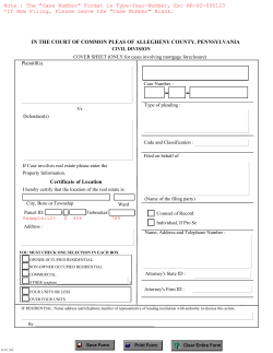


© Copyright 2026