OMW Farm Brochure - Mossy Oak Properties Land Sales & Services
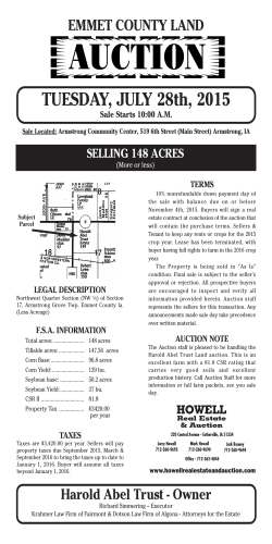
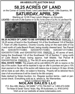
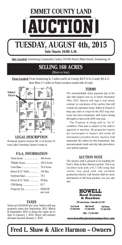
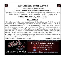
20 West High St. | Ashley, OH 43003 740.362.0007 | 419-864-8417 www.wigtonauctions.com WIGTON REAL ESTATE & AUCTION Larry & Wes Wigton, Auctioneers LARGE LAND AUCTION 977+- Acres 804+ Tillable acres (all non-highly erodible land) Wooded acreage for hunting & recreation Morrow & Marion Counties 40 miles North of Columbus-East of Marion Thursday March 19th 2015 @ 5 p.m. Auction location: Jenkins-Vaughn Post #97 American Legion Hall, 307 Park Ave., Cardington, Ohio-At the Intersections of US 42 & SR 529 The late Onieta Miller family amassed these properties starting in the 1930’s and they have been in the Miller family since. Her son, the late Robert G. Miller, continued to manage the farms after her death and the death of her second husband John Walker. Robert was an officer in the Army, enjoyed collecting coins, traveling and was a graduate of the University of Michigan. This land offering will be one of the largest offerings of land in the Cardington area for some time. Parcels 3-10 are all in close proximity to one another in Cardington & Richland Twps. Come bid your price on this AUCTION OPPORTUNITY! 804 +- Tillable Acres! Auction Parcel # 1 2 3 4 5 6 7 8 9 10 11 Acres 106.00 34.35 182.30 77.46 126.20 132.76 40.00 20.00 186.48 59.27 12.19 977.01 Road Name Kratt TR 151 US HWY 42 SR 529 Martel CR 28 28 & 529 Newcomer TWP 66 Bethel CR 66 Bethel CR 134 529 SR 746 Main Street County Morrow Morrow Morrow Morrow Morrow Morrow Morrow Morrow Morrow Marion Morrow USDA Crop Acres 94.51 33.03 156.85 41.47 94.42 132.76 40.00 18.32 148.89 38.15 6.51 804.91 Wooded acreage for hunting & recreation! ) " Hunt Rd Auction Parcel #1 106 Acres Kratt Rd • USDA Crop acres 94.51 • Prime Westfield Twp. land with frontage on Twp. Rd. 151 & Co.Rd. 150 • Predominate soils Blount-Glynwood-Pewamo • $12,000 2015 rent • annual taxes $3,740 1 94.51 NHEL United States Department of Agriculture ² 0 162.5 325 Morrow County, Ohio 650 Feet 2014 Program Year Common Land Unit Cropland Non-cropland Conservation Reserve Program Wetland Determination Identifiers - Restricted Use & Limited Restrictions ) Exempt from Conservation " Compliance Provisions Tract Boundary Map Created May 13, 2014 US Farm 3934 Tract 489 Auction Parcel #2 Hw 2 y4 ) " # * United States Deparment of Agriculture (USDA) Farm Service Agency (FSA) maps are for FSA Program administration only. This map does not represent a legal survey or reflect actual ownership; rather it depicts the information provided directly from the producer and/or National Agricultural Imagery Program (NAIP) imagery. The producer accepts the data 'as is' and assumes all risks associated with its use. USDA-FSA assumes no responsibility for actual or consequential damage incurred as a result of any user's reliance on this data outside FSA Programs. Wetland identifiers do not represent the size, shape, or specific determination of the area. Refer to your original determination (CPA-026 and attached maps) for exact boundaries and determinations or contact USDA Natural Resources Conservation Service (NRCS). 34.35 Acres • • • • USDA Crop acres 33.03 Frontage on US Highway 42 Predominate soils Blount-Glynwood-Pewamo $4,000 2015 rent • annual taxes $771 ² Auction Parcel #3 United States Department of Agriculture # * -De to n n ma rk R 6 37.13 NHEL d " ) ) " 9 3.04 NHEL ) "" ) Cardington-Denmark Martel Rd Burr Rd ) 2 " ) " 2.27 NHEL 1 40.09 NHEL ) " " ) 3 5.28 NHEL St a Feet 2014 Program Year Map Created May 13, 2014 Farm 3934 Tract 488 • • • • USDA Crop acres 156.85 • Woods Frontage on Co. Rd. 132 & both sides St. Rt. 529 Predominate soils Blount-Glynwood-Pewamo $19,000 2015 rent • annual taxes $6,441 Auction Parcel #4 & te Rt e5 77.46 Acres Acres 29 4 79.69 NHEL W Williams St 4 th St 5 29.52 NHEL N Common Land Unit Cropland Non-cropland Conservation Reserve Program Wetland Determination Identifiers - Restricted Use & Limited Restrictions ) Exempt from Conservation " 380 ) )" " ) " ² 190 182.3 Acres d ing "" ) ) 95 United States Deparment of Agriculture (USDA) Farm Service Agency (FSA) maps are for FSA Program administration only. This map does not represent a legal survey or reflect actual ownership; rather it depicts the information provided directly from the producer and/or National Agricultural Imagery Program (NAIP) imagery. The producer accepts the data 'as is' and assumes all risks associated with its use. USDA-FSA assumes no responsibility for actual or consequential damage incurred as a result of any user's reliance on this data outside FSA Programs. Wetland identifiers do not represent the size, shape, or specific determination of the area. Refer to your original determination (CPA-026 and attached maps) for exact boundaries and determinations or contact USDA Natural Resources Conservation Service (NRCS). Car ) "" ) 0 Common Land Unit Cropland Non-cropland Conservation Reserve Program Wetland Determination Identifiers - Restricted Use & Limited Restrictions ) Exempt from Conservation " Compliance Provisions Tract Boundary Parcels 3 & 4 Morrow County, Ohio Predominate soils Blount-Glynwood-Pewamo 8 1.3 NHEL 1 33.03 NHEL 0 325 650 Richelderfer St 1,300 Feet 2014 Program Year Map Created May 13, 2014 Farm 3934 Tract 484 • USDA Crop acres 41.47 • Frontage on Co. Rd.28 w/small creek, great building site, woods for recreation, hunting, Delco water available • $5,000 2015 rent • annual taxes $2,270 # * Morrow County, Ohio Cardington-De nmark Martel Rd United States Department of Agriculture ) " Sta t eR te 52 9 Auction Parcel #5 126.2 Acres • USDA Crop acres 94.42 • Frontage on Co. Rd. 28 & St. Rt. 529 w/loft barn, grain storage of approximately 34,000 bu. • 1,800 bu. holding tank • Predominate soils Blount-Glynwood-Pewamo • $12,000 2015 rent • annual taxes $4,940 1 94.42 NHEL United States Department of Agriculture ² 0 185 370 Morrow County, Ohio 740 Feet 2014 Program Year Common Land Unit Cropland Non-cropland Conservation Reserve Program Wetland Determination Identifiers - Restricted Use & Limited Restrictions ) Exempt from Conservation " Compliance Provisions Tract Boundary Map Created May 13, 2014 Farm 3934 Tract 485 5 53.54 NHEL Cardington Caledonia Rd Auction Parcel #6 # * United States Deparment of Agriculture (USDA) Farm Service Agency (FSA) maps are for FSA Program administration only. This map does not represent a legal survey or reflect actual ownership; rather it depicts the information provided directly from the producer and/or National Agricultural Imagery Program (NAIP) imagery. The producer accepts the data 'as is' and assumes all risks associated with its use. USDA-FSA assumes no responsibility for actual or consequential damage incurred as a result of any user's reliance on this data outside FSA Programs. Wetland identifiers do not represent the size, shape, or specific determination of the area. Refer to your original determination (CPA-026 and attached maps) for exact boundaries and determinations or contact USDA Natural Resources Conservation Service (NRCS). 132.76 Acres • • • • • USDA Crop acres 132.76 Great parcel w/frontage Co. Rd. 66 & Twp Rd. 136 Predominate soils Blount-Glynwood-Pewamo MGEV & CLSD Schools $17,000 2015 rent • annual taxes $5,619 United States Department of Agriculture Morrow County, Ohio ² ) " 1 80.53 Newcomer Rd NHEL 0 255 510 1,020 Feet 2014 Program Year Common Land Unit Cropland Non-cropland Conservation Reserve Program Wetland Determination Identifiers - Restricted Use & Limited Restrictions ) Exempt from Conservation " Compliance Provisions Tract Boundary Map Created May 13, 2014 Farm 3934 Tract 486 Auction Parcel #7 # * United States Deparment of Agriculture (USDA) Farm Service Agency (FSA) maps are for FSA Program administration only. This map does not represent a legal survey or reflect actual ownership; rather it depicts the information provided directly from the producer and/or National Agricultural Imagery Program (NAIP) imagery. The producer accepts the data 'as is' and assumes all risks associated with its use. USDA-FSA assumes no responsibility for actual or consequential damage incurred as a result of any user's reliance on this data outside FSA Programs. Wetland identifiers do not represent the size, shape, or specific determination of the area. Refer to your original determination (CPA-026 and attached maps) for exact boundaries and determinations or contact USDA Natural Resources Conservation Service (NRCS). 40 Acres 1 40.35 NHEL Bethel Rd ² Common Land Unit Cropland Non-cropland Conservation Reserve Program Wetland Determination Identifiers - Restricted Use & Limited Restrictions ) Exempt from Conservation " Compliance Provisions Tract Boundary Cardington Caledonia Rd • USDA Crop acres 40 • Nice NW corner parcel on Twp. Rd. 139 & Co. Rd. 66 • Predominate soils Blount-Glynwood-Pewamo • $5,000 2015 rent • annual taxes $1,877 0 75 150 300 Feet 2014 Program Year Map Created May 13, 2014 Farm 3934 Tract 487 TOTAL ACRES # * United States Deparment of Agriculture (USDA) Farm Service Agency (FSA) maps are for FSA Program administration only. This map does not represent a legal survey or reflect actual ownership; rather it depicts the information provided directly from the producer and/or National Agricultural Imagery Program (NAIP) imagery. The producer accepts the data 'as is' and assumes all risks associated with its use. USDA-FSA assumes no responsibility for actual or consequential damage incurred as a result of any user's reliance on this data outside FSA Programs. Wetland identifiers do not represent the size, shape, or specific determination of the area. Refer to your original determination (CPA-026 and attached maps) for exact boundaries and determinations or contact USDA Natural Resources Conservation Service (NRCS). 977.01+- TILLABLE 804.91 Auction Parcel #8 Bethel Rd W Cardington Rd 20 Acres • • • • 1 18.32 NHEL ²Auction Parcel #9 186.48 Acres 75 150 Parcels 9 & 10 Morrow County, Ohio Predominate soils Blount-Glynwood-Pewamo United States Department of Agriculture 300 Feet 2014 Program Year Map Created May 13, 2014 Farm 3934 Tract 508 # * • USDA Crop acres 148.89 • Frontage on both sides St. Rt. 529 w/loft barn & approximately 12,000 bu. grain bin • frontage on Twp. Rd.134 • $18,000 2015 rent • annual taxes $7,976 11 72.73 NHEL United States Deparment of Agriculture (USDA) Farm Service Agency (FSA) maps are for FSA Program administration only. This map does not represent a legal survey or reflect actual ownership; rather it depicts the information provided directly from the producer and/or National Agricultural Imagery Program (NAIP) imagery. The producer accepts the data 'as is' and assumes all risks associated with its use. USDA-FSA assumes no responsibility for actual or consequential damage incurred as a result of any user's reliance on this data outside FSA Programs. Wetland identifiers do not represent the size, shape, or specific determination of the area. Refer to your original determination (CPA-026 and attached maps) for exact boundaries and determinations or contact USDA Natural Resources Conservation Service (NRCS). ) " 13 21.64 NHEL n -C ard i ng to n S Caledonia-Ashley Rd Ma r io Auction Parcel #10 Rd E 10 16.51 NHEL W Cardington Rd 0 Common Land Unit Cropland Non-cropland Conservation Reserve Program Wetland Determination Identifiers - Restricted Use & Limited Restrictions ) Exempt from Conservation " Compliance Provisions Tract Boundary USDA Crop acres 18.32 SW corner parcel on Twp. Rd. 139 & Co. Rd. 134 Predominate soils Blount-Glynwood-Pewamo $2,000 2015 rent • annual taxes $667 1 57.34 NHEL Sta t 59.27 Acres in Marion Co • USDA Crop acres 38.15 • Frontage on St. Rts. 529 & 746 • $5,000 2015 rent • annual taxes $2,257 eR te 52 9 12 18.82 NHEL ² 0 285 570 1,140 Feet Common Land Unit Cropland Non-cropland Conservation Reserve Program Wetland Determination Identifiers - Restricted Use & Limited Restrictions ) Exempt from Conservation " Compliance Provisions Tract Boundary 2014 Program Year Map Created May 13, 2014 Farm 3934 Tract 483 # * United States Deparment of Agriculture (USDA) Farm Service Agency (FSA) maps are for FSA Program administration only. This map does not represent a legal survey or reflect actual ownership; rather it depicts the information provided directly from the producer and/or National Agricultural Imagery Program (NAIP) imagery. The producer accepts the data 'as is' and assumes all risks associated with its use. USDA-FSA assumes no responsibility for actual or consequential damage incurred as a result of any user's reliance on this data outside FSA Programs. Wetland identifiers do not represent the size, shape, or specific determination of the area. Refer to your original determination (CPA-026 and attached maps) for exact boundaries and determinations or contact USDA Natural Resources Conservation Service (NRCS). Auction Parcel #11 12.186 Acres • • • • 2015 TOTAL RENTS USDA Crop acres 6.51 In town, good bottom land w/alley access Predominate soil Shoals $1,000 2015 rent • annual taxes $322 $100,000.00 2014 TAXES $38, 880 OMW Farms, Inc. Kim M. Rose, Attorney Critchfield, Critchfield & Johnson, Ltd Heartland Title Agency, LLC Robert G. Miller Estate, Tom C. Elkin, Attorney Morrow County Probate Court# 2013 ES 17985 Wigton Real Estate & Auction Larry Wigton Auctioneer / Real Estate Broker 740-362-0007 Wes Wigton Auctioneer / Realtor 740-816-0049 In Cooperation with Mossy Oak Properties Land Sales & Services Frank DiMarco Realtor 740-393-1001 TERMS & CONDITIONS OF THE AUCTION BIDDING PROCEDURE: The parcels will be offered in 11 individual parcels, combination of any parcels, and as a whole of 977 +- acres. Competitive bidding on individual parcels, parcel combinations and the total will remain open until the highest dollar amount is achieved for the Seller. BID ACCEPTANCE & DOWN PAYMENT: The successful bidder/s will be required to enter into a purchase contract at the conclusion of the auction. Property sells with Seller’s confirmation. A 10% non-refundable down payment the day of auction is required per parcel, combination or whole in the form of cashier’s check, company or personal checks. The balance is due at closing within 30 days. Your bidding is not conditional upon financing, inspections or appraisals. A 1½% buyer’s premium will be added to the winning bid price to arrive at the total contract price paid by the Buyer. Be sure you have arranged financing, if needed, and are capable of paying certified funds at closing. Assignment of any purchase contracts are conditional on the bidder remaining jointly liable on the contract with the assignee. DEED & CLOSING: The Seller will provide Limited Warranty Deeds and Fiduciary Deeds where applicable. Owner’s Title Insurance warranting that the property is free and clear of all mortgages, liens and encumbrances that do not interfere with its normal and customary use will be furnished by the Seller. The real estate is being sold subject to any and all legal easements of record. Mineral rights that belong to the Seller shall transfer to the Buyer/s. Crop acreages are subject to change and determination by Farm Service Agency. The closing/s shall take place at Heartland Title, Mount Vernon, Ohio. TAXES & POSSESSION: Taxes shall be prorated at current CAUV rates to the day of closing and CAUV shall be transferred to the Buyer. Possession is at closing subject to tenant’s rights for the 2015 crop season. The successful bidder/s shall receive the 2015 rents on or before December 15, 2015. A schedule of rents is on file with the Auctioneer. The rents average $124.25 per tillable acre. DISCLAIMER: All information contained in this brochure and all related material were obtained from reliable sources but not warranted. Parcel acreages and dimensions, aerial photos and boundaries are approximate and are taken from County & FSA Agency records. If a new parcel survey is determined necessary by the Morrow County Engineers Offices it will be at the Seller’s expense. The potential Buyers hereby stipulate and agree that they have examined the property. Relying solely upon such examination with reference to conditions, Buyers agree to take such property “AS-IS” without any expressed or implied warranties by Seller or Seller’s agent. Any inspections desired by the Buyer shall be prior to the auction at Buyer’s expense. AGENCY: Wigton Real Estate & Auction and Mossy Oak Properties, Land Sales & Services and all affiliated agents and personnel are agents for the Seller. Any statements made auction day take precedence over any previous printed material or oral statements.
© Copyright 2026
