
Agenda reports pack PDF 2 MB - Meetings, agendas, and minutes
AGENDA
For a meeting of the
DEVELOPMENT CONTROL COMMITTEE
to be held on
TUESDAY, 7 APRIL 2015
at
1.00 PM
in the
COUNCIL CHAMBER - COUNCIL OFFICES, ST. PETER'S HILL,
GRANTHAM. NG31 6PZ
Beverly Agass, Chief Executive
Committee
Members:
Councillor Mark Ashberry, Councillor Michael Cook, Councillor
Reginald Howard, Councillor Mrs Rosemary Kaberry-Brown,
Councillor Vic Kerr, Councillor Michael King, Councillor
Charmaine Morgan, Councillor Alan Parkin, Councillor Helen
Powell, Councillor Mrs Judy Smith, Councillor Jacky Smith
(Vice-Chairman), Councillor Judy Stevens, Councillor Mrs
Brenda Sumner, Councillor Mrs Jean Taylor, Councillor Martin
Wilkins (Chairman) and Councillor Rosemary H Woolley
Committee Support
Officer:
Jo Toomey Tel: 01476 40 60 80 (Ext. 6152)
E-mail: [email protected]
(PLEASE NOTE THAT THERE WILL BE A COMFORT BREAK AT
3.00PM FOR TEN MINUTES)
Members of the Committee are invited to attend the above meeting to consider
the items of business listed below.
1.
MEMBERSHIP
The Chief Executive to notify the Committee of any substitute members
2.
APOLOGIES FOR ABSENCE
3.
DISCLOSURE OF INTERESTS
Members are asked to disclose any interests in matters for consideration at the
meeting
4.
MINUTES OF THE MEETING HELD ON 17 MARCH 2015
(Enclosure)
5.
PLANNING MATTERS
To consider applications received for the grant of planning permission – reports
prepared by the Case Officer.
(Enclosure)
The anticipated order of consideration is as shown on the agenda, but this may
be subject to change, at the discretion of the Chairman of the Committee.
6.
ANY OTHER BUSINESS, WHICH THE CHAIRMAN, BY REASON OF
SPECIAL CIRCUMSTANCES, DECIDES IS URGENT
PUBLIC SPEAKING
Anyone who would like to speak at the meeting should notify the Committee
administrator one working day before the time of the meeting. The deadline by which
you must notify us for the 2014/15 meetings are:
Meeting Date
Tuesday 7 April 2015, 1pm
Tuesday 28 April 2015, 1pm
Tuesday 26 May 2015, 1pm
Notification Deadline
Thursday 2 April 2015, 1pm
Monday 27 April 2015, 1pm
Friday 22 May 2015, 1pm
If you would like to include photographs or other information as part of your
presentation to the Committee, please send the information in an electronic format
(e-mail with attachments, memory stick or disc) to the relevant case officer at least
one working day before the meeting. If you are submitting hard copy information,
please send it to the relevant case officer at least two working days before the
meeting.
All speakers are at the Committee Chairman’s (or Vice-Chairman’s) discretion. Each
person is allowed to speak for 3 minutes. Members of the Council are allowed to
speak for 5 minutes in accordance with Council Procedure Rules.
Only one speaker for the applicant or the town and parish council will be allowed to
speak. If there are several supporters or objectors to an application, they are
encouraged to appoint a representative to present a joint case.
Development Control Committee members are able to ask questions about speakers’
presentations. There is a time limit of 10 minutes for each speaker.
ORDER OF PROCEEDINGS
1. Short introductory presentation by the case officer
2. Speakers (Committee members will ask questions after each speaker)
a. District Councillors who are not Committee members
b. Representative from town/parish council
c. Objectors to an application
d. Supporters of an application
e. The applicant or agent for the applicant
3. Debate – Councillors will discuss the application and make proposals
4. Vote – the Committee will vote to agree its decision
Agenda Item 4
MINUTES
DEVELOPMENT CONTROL
COMMITTEE
TUESDAY, 17 MARCH 2015
COMMITTEE MEMBERS PRESENT
Councillor Mark Ashberry
Councillor Reginald Howard
Councillor Mrs Rosemary Kaberry-Brown
Councillor Vic Kerr
Councillor Michael King
Councillor Alan Parkin
Councillor Helen Powell
Councillor Nick Robins
Councillor Jacky Smith (Vice-Chairman)
Councillor Judy Stevens
Councillor Mrs Brenda Sumner
Councillor Mrs Jean Taylor
Councillor Martin Wilkins (Chairman)
Councillor Rosemary H Woolley
OFFICERS
OTHER MEMBERS
Strategic Director, Development and
Growth (Steve Ingram)
Principal Planning Officers (Tony
Boswell, Kevin Cartwright, Justin
Johnson)
Planning Officers (Nigel Bryan, Alan
Harvey, Paul Milne, Phil Moore, Joe
Qureshi)
Solicitor (Colin Meadowcroft)
Principal Democracy Officer (Jo Toomey)
Councillor Bob Sampson
Councillor Paul Wood
363.
(In accordance with Council Procedure
Rule 16.5, Councillors Wood and
Sampson spoke in connection with
application S13/2699/EIAFP)
MEMBERSHIP
The Committee was notified that under Regulation 13 of the Local Government
(Committees and Political Groups) Regulations 1990, notice had been received
appointing: Councillor Robins for Councillor Cook.
364.
APOLOGIES FOR ABSENCE
Apologies for absence were received from Councillors Morgan and Mrs Judy
Smith.
1
365.
DISCLOSURE OF INTERESTS
No pecuniary interests were disclosed, however Councillor Parkin stated he
had a personal interest in application S/14/2953/MJRF, Councillor Powell
stated that she was the County Councillor for the area covered by application
S14/2020/FULL, Councillor Mrs Sumner was the district Councillor for the area
covered by application S14/3412/DC and Councillor Kerr stated that he had
been lobbied in respect of application S13/2699/EIAFP. In each instance the
Councillors did not feel that their interest affected their ability to consider each
application with an open mind and took part in debate and voting on those
items.
366.
MINUTES OF THE MEETING HELD ON 24 FEBRUARY 2015
The minutes of the meeting held on 24 February 2015 were agreed as a correct
record.
367.
PLANNING MATTERS
The Chairman stated that he had changed the order in which the applications
would be determined so that those on which members of the public wished to
speak were considered first.
Decision:
To determine applications, or make observations, as listed below:
PWM1
Application Ref:
S13/2699/EIAFP
Description:
Five wind turbines each with a maximum height from base
to blade tip of 126.5m (and transformer enclosures if
necessary); new vehicular access together with new and
upgraded access track including turning heads, laydown
areas, crane pads, and two watercourse crossings; new
control building (size:20m long x 7.5m wide x 5.5m high)
and compound and electrical infrastructure. Permanent
anemometer mast; Temporary anemometer mast (during
construction), temporary construction compound
Location:
Hough Grange Farm, Hough-on-the Hill, Grantham, NG32
2AN
Decision:
Refused
13:25 – Councillor Stevens entered the meeting
2
Noting comments made during the public speaking session by:
•
•
•
•
•
•
•
•
•
•
•
•
•
•
•
•
•
•
•
•
Councillor Paul Wood (District Councillor for neighbouring District Ward
and County Councillor for that Division)
Councillor Bob Sampson (District Councillor)
John Cooke (Fenton Parish Meeting)
Roger Kingscott (Hough-on-the-Hill Parish Council)
Marilyn Taylor (objecting)
Paul Miley (objecting)
John Halton (objecting)
Claire Brainerd (objecting)
Jackie Britten-Crooks (objecting)
Gilly Wilson (objecting)
Vikki Hoole (objecting)
Rob Thornton (objecting)
Paul Snook (objecting)
Michael Worth (objecting)
David Smith (objecting)
Dave Rawlins (objecting)
Graham Widart (supporting)
John Polkinghorne on behalf of John Freeman (supporting)
Douglas Wenn (supporting)
Robin Basten (applicant’s agent)
together with comments from English Heritage, Heritage Trust of Lincolnshire
and the National Trust, no comments received from the Garden History Society,
an objection from the Lincolnshire Gardens Trust, comments from the South
Kesteven Landscape Consultant, no comments from the Campaign for the
Protection of Rural England, standing advice from Natural England; no
comments received from the Royal Society for the Protection of Birds, the
Lincolnshire Wildlife Trust, Bat Conservation Trust and Lincolnshire Bird Club,
comments from the Lincolnshire Bat Group and the South Kesteven Ecology
Consultant, no objection from Lincolnshire County Council Highways subject to
appropriate conditions, no objection from the Highways Agency, no objection
from Lincolnshire County Council Footpaths, no objection and comments from
Network Rail, an objection from the British Horse Society, no objection from the
Ministry of Defence subject to appropriate conditions, an objection from
National Air Traffic Services, comments from the Civil Aviation Authority, no
objection from South Kesteven Environmental Protection and the Environment
Agency subject to appropriate conditions, no objection from the Upper Witham
Internal Drainage Board subject to the implementation of an appropriate SUDS
scheme; no objection from Anglian Water or the National Grid, no comments
received from Western Power Distribution, comments from Ofcom, no
comments received from the BBC, comments from JRC, no comments received
from Adkins, no objection from Arqiva Telecoms, comments from British
Telecom, no comments received from Airwave, no objection from MII
Telecoms, Anglian Water (Telecoms), Lincolnshire Fire and Rescue and
3
Lincolnshire Police, no comments received from East Midlands Ambulance
Service, objections and concerns raised by Newark and Sherwood District
Council, Melton Borough Council and North Kesteven District Council, no
objection from Nottinghamshire County Council, an objection from Lincolnshire
County Council, no comments received from Leicestershire County Council,
objections and comments from Hough-on-the-Hill Parish Council, Westborough
and Dry Doddington Parish Council, Hougham Parish Council and Stubton
Parish Council, comments from Caythorpe Parish Council, concerns raised by
Claypole Parish Council, objections from Fenton Parish Meeting, Marston
Parish Council, Foston Parish Council, Barkston and Syston Parish Council,
Carlton Scroop and Normanton Parish Council, Honington Parish Council,
Fulbeck Parish Council, Long Bennington Parish Council, Carlton le Moorland
Parish Council, Beckingham Parish Council, no comments received from
Allington Parish Council, Barrowby Parish Council, Londonthorpe and
Harrowby Without Parish Council, Ancaster Parish Council, Welbourn Parish
Council, Stapleford Parish Council, Coddington Parish Council, Balderton
Parish Council, Newark Town Council, Hawton Parish Council, Staunton
Parish Council, Bottesford Parish Council, Kilvington Parish Council or Belton
and Manthorpe Parish Council, objections from Sedgebrook Parish Council,
Brant Broughton and Stragglethorpe Parish Council, Barnby in the Willows
Parish Council, Cotham Parish Council, Fernwood Parish Council, Wellingore
Parish Council, Claswon Hose and Harby Parish Council and Harmston Parish
Council, an objection from Belvoir Locals Oppose Turbines (BLOT), Rural
Economies and Voters Oppose Loveden Turbines (ReVOLT) and the Rt Hon
Stephen Phillips MP for Sleaford and North Hykeham; 738 letters of objection,
224 letters and a petition of support received as a result of public consultation;
provisions within the National Planning Policy Framework and the South
Kesteven Core Strategy and supplementary planning documents; site visit
observations; additional information report circulated to members before the
meeting which noted 25 further letters of support, a further objection, an
additional representation from ReVOLT and officer comment thereon and
comments made by members at the meeting.
It was proposed, seconded and agreed that the application be refused for the
following reason:
The proposal would result in considerable and extensive harm to the landscape
character, visual amenity, and the setting and therefore the significance of a
number of heritage assets in the area. The harm to heritage assets in most
cases would be less than substantial, but in the case of Grade II listed Stubton
Hall the harm would be substantial. There would also be an adverse impact on
the local economy and aviation safety. It is considered that the identified harm
is contrary to the policies of the Development Plan and would not be
outweighed by the public benefits of the proposed wind farm. The
environmental impact of the proposal is therefore not acceptable and cannot be
made acceptable through mitigation so is contrary to Sections 1, 3, 10, 11, 12,
of the National Planning Policy Framework, DCLG - Planning Practice
Guidance for Renewable and Low Carbon Energy, Policies E1, EN1 and EN3
4
of the South Kesteven Core Strategy, and the siting principles of the South
Kesteven Wind Energy SPD.
There are fundamental objections to this proposal and it is considered that
these cannot be overcome. Therefore consideration has not been delayed by
discussions which cannot resolve the reasons for refusal and a decision has
been issued in a timely fashion. As such it is considered that the decision is in
accordance with paragraphs 186 -187 of the National Planning Policy
Framework.
14:49 to 15:17 – The meeting was adjourned
NB1
Application Ref:
S14/3208/MJRF
Description:
Demolition of existing redundant buildings and erection of
11 no. 2 bedroom apartments
Location:
Land to the rear of 32-34 High Street, Billingborough,
Sleaford, Lincolnshire, NG34 0QA
Decision:
Deferred
Noting comments made during the public speaking session by:
•
Mrs Montgomery (objecting)
together with no objection from Lincolnshire County Council Highways subject
to appropriate conditions, no objection from Heritage Lincolnshire, comments
from waste and recycling, no objection from Lincolnshire Fire and rescue, no
comment from Environmental Protection, comments from the Environment
Agency and the Black Sluice Internal Drainage Board, comments from Planning
Policy, no request for a financial contribution for health services, no objection
from the Partnership Project Officer, requests for a contribution to enhance play
equipment by the Community Leisure Officer, comments from the Principal
Conservation Officer and an objection from Billingborough Parish Council; 2
letters of objection received as a result of public consultation; provisions within
the National Planning Policy Framework and the South Kesteven Core Strategy
and supplementary planning documents; site visit observations and comments
made by members at the meeting.
In discussing the proposals, concerns were raised about historic incidents of
flooding in that part of Billingborough, particularly noticed were flooding
incidents on 5 July 2012 and 19 May 2014 when flood waters entered
properties on West Road, just to the north of the site. Lincolnshire County
Council (as the Lead Local Flood Authority) had a responsibility to investigate
incidences of flooding. Discussions also referred to access to and the
5
enhancement of existing play equipment, which members wanted to give
specific consideration to should the application be approved.
It was proposed, seconded, and on being put to the vote, agreed to defer the
application pending further information from Lincolnshire County Council on the
results of its investigations into the flooding incidents on 5 July 2012 and 22
May 2014.
AH1
Application Ref:
S14/2020/FULL
Description:
Erection of two no. dwellings and detached garage with
new driveway, light, etc.
Location:
11 Station Road, Thurlby, Bourne, Lincolnshire, PE10 0HD
Decision:
Approved
Noting comments made during the public speaking session by:
•
•
Sarah Wade (objecting)
John Dickie (applicant’s agent)
together with comments from Thurlby Parish Council, no objection from
Lincolnshire County Council Highways, no comments from the Environment
Agency, no archaeological implications noted by the Heritage Trust of
Lincolnshire, no objections from SKDC drainage, and recommendations made
by South Kesteven Environmental Protection; 10 letters of objection to the
scheme in its original form together with four additional representations
received as a result of public consultation; provisions within the National
Planning Policy Framework and the South Kesteven Core Strategy and
supplementary planning documents; site visit observations; additional
information report circulated to members before the meeting which referred to
demolition works that had already taken place on site and officer comment
thereon, together with an appeal decision on a previous application for the
same site.
It was proposed, seconded and agreed that the application be approved for the
reasons set out in the case officer’s report and subject to the following
conditions and notes:
1. The development hereby permitted shall be commenced before the
expiration of three years from the date of this permission.
2. Unless otherwise required by another condition of this permission the
development hereby permitted shall be carried out in accordance with
the following list of approved plans/drawings submitted as part of the
6
application:
Site Location Plan (Rev B - April 25th) received on 31 December 2014
Drawing No. JDA/2012/225/WD/PL/SUR001 received on 11 July 2014
Drawing No. JDA/2012/225/WD/PL/00C received on 24 February 2015
Drawing No. JDA/2012/230/WD/PL/002D received on 24 February 2015
Drawing No. JDA/2012/230/WD/PL/003C received on 24 February 2015
Drawing No. JDA/2012/230/WD/PL/004B received on 31 December
2014
Drawing No. JDA/2012/230/WD/PL2/WD.001F received on 25 February
2015
Drawing No. JDA/2012/230/WD/PL2/WD.002C received on 24 February
2015
3. No new build development shall commence on the site until samples of
the materials to be used to the external elevations of the proposed
development are submitted to and approved in writing by the Local
Planning Authority. The development shall be undertaken in accordance
with the approved details.
4. Notwithstanding the details shown on the submitted plans no new build
development shall be commenced on the site until details of both hard
and soft landscape works, together with a programme of implementation,
has been submitted to and approved in writing by the Local Planning
Authority. The landscaping scheme shall be implemented in accordance
with the approved details and the approved programme of
implementation. Any trees that die, are removed or become seriously
damaged or diseased within a period of five years from the date of the
completion of the scheme shall be replaced in the next available planting
season with others of similar size and species, unless the local planning
authority gives written approval to any variation.
5. Notwithstanding the details shown on the submitted plans no new build
development shall commence on the site until a plan(s) indicating the
positions, design, materials and type of boundary treatments (including
plot boundaries and any associated land retention details) to be erected,
together with a programme of implementation, have been submitted to
and approved in writing by the Local Planning Authority. The scheme
shall provide for any retained blockwork to be used for the purposes of
providing a boundary treatment(s) to have a render/paint finish to the
external faces of the boundary treatment within the application site. The
scheme shall be implemented in strict accordance with the agreed
details/programme of works.
6. No new build development shall commence on the site until details of the
proposed finished floor levels of the proposed dwellings and associated
building and proposed finished ground levels within the site (in
comparison to a fixed datum point and the existing ground levels) are
7
submitted to and approved in writing by the Local Planning Authority.
The development shall be undertaken in accordance with the approved
details.
7. No new build development shall commence on the site until details of the
arrangements, design, specifications, calculations and levels of all
surface water systems have been submitted to and approved in writing
by the Local Planning Authority. Unless otherwise first agreed in writing
this surface water drainage system shall be a Sustainable Urban
Drainage Scheme (SUDS) and shall incorporate a Management Plan.
The Management Plan shall include the following details :(i)
A overview of the SUDS proposal
(ii)
A Management statement to describe the SUDS scheme and set
out the management aims for the site. The statement should consider
how the SUDS will perform and develop over time anticipating and
additional maintenance tasks to ensure the system continues to perform
as designed.
(iii)
A specification that describes how SUDS will be constructed and
the materials to be used.
(iv)
A maintenance schedule describing the nature of the work to be
undertaken and when that work is to be undertaken using frequency and
performance requirements were appropriate.
(v)
Details of the responsibility for the management and maintenance
of each element of the SUDS scheme to be detailed.
(vi)
Flow rates on and off-site in case of excedence.
The development shall be implemented in accordance with the
approved surface water drainage scheme and any approved Sustainable
Urban Drainage Scheme (SUDS) shall thereafter be operated in
accordance with the approved Management Plan.
8. Upon the demolition of the existing buildings at the site (to the extent
shown the approved drawings listed at condition 2 above) and prior to
any works commencing on the construction of the residential
development scheme (including any associated groundworks), a land
contamination report/survey shall be carried out to the satisfaction of the
Local Planning Authority. This survey/report shall provide for the taking
of soil samples for analysis, detailing the ground conditions in the light of
the results of the soil samples analysis and identify the location and type
of any contamination found. Details of any remedial works required are
to be submitted to and agreed in writing with the Local Planning
Authority and are to be carried out in full and approved by the Local
8
Planning Authority prior to any construction work in connection with the
dwellings.
9. No new build development (including ground works) shall take place on
the site until a report has been submitted to, and approved in writing by,
the Local Planning Authority to demonstrate that removal and safe
disposal of any asbestos from the site has taken place.
10. No new build development shall commence on the site until precise
details of the vehicular access to the public highway, including materials,
specification of works and construction method (along with a phased
programme of works) are submitted to and approved in writing by the
Local Planning Authority. The development shall be undertaken in
accordance with the approved details and the approved phased
programme of works.
11. The approved parking and garaging facilities to each dwelling as shown
on Drawing No. JDA/2012/230/WD/PL2/WD.001F received on 25
February 2015 shall be provided before the relevant dwelling is first
occupied and shall thereafter be retained as being available for the
parking of vehicles at all times.
12. The approved arrangements for the turning/manoeuvring of vehicles as
shown on Drawing No. JDA/2012/230/WD/PL2/WD.001F received on 25
February 2015 shall be provided before any dwelling is first occupied
and shall thereafter be retained as being available for the
turning/manoeuvring of vehicles at all times.
13. The open car port proposed to serve the dwelling on Plot 2 shall be
provided as shown on approved drawings listed at condition 2 above
before the dwelling concerned is first occupied and thereafter be
retained as being open (i.e. without any garage doors installed) as
shown on the approved plans at all times.
14. The Construction Management Plan received on 31 December 2014 as
supplemented by the details shown on Drawing No.
JDA/2012/225/WD/PL/011F received on 24 February 2015 shall be
adhered to throughout the construction period. The scheme thus
provides for the provision of a site office/welfare hut on the site of single
storey height only which shall be built in prefabricated panels.
15. No construction works in relation to the development hereby permitted
shall be undertaken outside the hours of between 08:00 to 17:00
Monday to Friday. Construction works shall include the use of mobile
and fixed plant/machinery, (e.g. generators) and the delivery of
construction materials.
16. Obscure glazing to at least Pilkington level 5 standard (or its equivalent)
9
and fixed lights shall be installed to the first floor window unit(s) on the
south-western side elevation of the dwelling on Plot 1 (as identified on
the drawings listed at condition 2 above) before the dwelling concerned
is first occupied. Once installed the obscure glazing and fixed lights to
this first floor window unit(s) shall thereafter be retained in situ at all
times unless Planning Permission has been first obtained from the Local
Planning Authority.
17. Obscure glazing to at least Pilkington level 5 standard (or its equivalent)
shall be installed to the first floor window units on the front (northwestern) elevation of the dwelling on Plot 2 and to the first floor window
unit(s) to the north-eastern side elevation of the front projection to Plot 2
(as identified on the drawings listed at condition 2 above) before the
dwelling concerned is first occupied. Once installed the obscure glazing
to these first floor window units shall thereafter be retained in situ at all
times unless Planning Permission has been first obtained from the Local
Planning Authority
18. No opening lights shall be installed to the first floor window units on the
front (north-western) elevation of the dwelling on Plot 2 and to the first
floor window unit(s) to the north-eastern elevation of the front projection
to Plot 2 (as identified on the drawings listed at condition 2 above)
unless any part(s) of the window unit which can be opened are more
than 1.7 metres above the floor of the room in which the window is
situated.
19. Upon the completion of the dwellings in accordance with this permission
and notwithstanding the provisions of the Town and Country Planning
(General Permitted Development) Order 1995 (or any order revoking or
re-enacting that Order with or without modification), no extension,
enlargement or other alteration to any of the dwellings or the erection of
any structure within the curtilage of any of the dwellings shall be carried
out without Planning Permission having been first obtained from the
Local Planning Authority.
Note(s) to Applicant
1. The County Highway Authority advises that where private drives are
proposed as part of any development you should be aware of the
requirements laid down in the Lincolnshire Design Guide for Residential
Areas.
2. The County Highway Authority advises that prior to the submission of
details for any access works within the public highway you must contact
the Divisional Highways Manager on 01522 782070 for application,
specification and construction information.
10
16:18 – As the meeting had been in progress for 3 hours, the Chairman asked
for Members’ consent to continue. Members agreed
16:19 – Councillor Jacky Smith left the meeting
TB1
Application Ref:
S14/2953/MJRF
Description:
Residential development of 227 dwellings, public open
space, play area, associated infrastructure including
highway and pedestrian facilities and drainage
infrastructure
Location:
Land north of 372-400 Dysart Road, Grantham
Decision:
Deferred
16:46 – Councillor Mrs Sumner left the meeting
Noting comments made during the public speaking session by:
•
•
•
Alan Campion (objecting)
Eddie Mik (objecting)
John Boyd (applicant’s agent)
together with comments from Lincolnshire County Council Highways, the
Environment Agency, SKDC Land Drainage and Flood Prevention, Anglian
Water, no objection and a request for a financial contribution from Lincolnshire
County Council Education, comments and recommendations from SKDC
Environmental Health, no comments received from Lincolnshire Police Crime
Prevention Officer, no objection from the Lincolnshire Wildlife Trust, no
objections and a request for a financial contribution from NHS Lincolnshire, no
objections from the Health and Safety Executive of the Highways Agency; 15
representations received as a result of public consultation; provisions within the
National Planning Policy Framework and the South Kesteven Core Strategy
and supplementary planning documents; site visit observations; additional
information report circulated to members before the meeting highlighting
ongoing negotiations in relation to financial contributions and comments made
by members at the meeting.
16:52 – Councillor Mrs Sumner returned to the meeting
16:53 – Councillor Mrs Taylor left the meeting
16:55 – Councillor Mrs Taylor returned to the meeting
During discussion on the application, members referred to the ongoing
negotiations in relation to S.106 contributions and the level of affordable
housing that was included within the proposals. Committee members requested
11
additional information relating to these negotiations and the viability of the site,
it was consequently proposed, seconded and agreed that the application be
deferred so that the committee could be provided with further information.
PJM1
Application Ref:
S14/1923/FULL
Description:
Change of use from C3 residential to mixed use comprising
C3 residential and C2 residential training centre (health and
fitness training)
Location:
Heydour House, Church Lees, Heydour, Grantham,
Lincolnshire, NG32 3NG
Decision:
Approved
Noting representations received in relation to the original application which was
considered by the Committee on 16 December 2014, together with comments
on the amended application, including support from Heydour Parish Council, no
objection from Lincolnshire County Council Highways subject to conditions, no
objections from Heritage Trust of Lincolnshire, the SKDC Conservation Officer
and the Environment Agency and comments submitted by English Heritage and
Environmental Protection; four representing supporting the amended plans
received as a result of public consultation; provisions within the National
Planning Policy Framework and the South Kesteven Core Strategy and
supplementary planning documents; site visit observations and comments
made by members at the meeting.
It was proposed, seconded and agreed that the application be approved for the
reasons set out in the case officer’s report and subject to the following
conditions:
1. Outdoor physical exercise activities and classes within the grounds of
the application site shall only take place on the areas identified for
training on Drawing Number 3545/10/001 received on 2nd February
2015.
2. Outdoor physical exercise activities and classes within the grounds of
the application site shall not commence before 08:00am and shall cease
by 18:00pm. There shall be no physical exercise activities and classes
within the grounds of the application site at any other times.
3. There should be no external organised exercise or activities within the
grounds of the application site on Sundays or Bank Holidays
4. The use of the application site shall be limited to a maximum of 20
customers/guests utilising the residential accommodation in any
12
calendar week. The use of the application site for customers not staying
within the residential accommodation of Heydour House is not permitted.
5. There shall be no playing of amplified music to accompany the outdoor
physical exercise activities and classes within the grounds of the
application site at any time.
6. The register of visitors shall be available for inspection, on written
request of any officer of the Local Planning Authority, at all reasonable
times between 09.00 and 17.00 each day.
7. The outbuilding as identified on Drawing Number T139-16 received on
25th November 2014 shall be occupied only by persons employed by or
the registered owner or director of the Team Boot camp business
operating from on the application site and shall not be occupied as a
separate standalone dwelling
8. All activities associated with the development hereby permitted shall be
carried out in accordance with the noise and disturbance management
plan received on 24th February 2015. The development shall be
operated in accordance with the approved details at all times unless
otherwise agreed in writing with the local authority.
9. The arrangements shown on the approved plan T139-01 rev C dated
22nd September 2014 for the
parking/turning/manoeuvring/loading/unloading of vehicles shall be
available at all times when the premises are in use.
10. The development hereby permitted shall be carried out in accordance
with the following list of approved plans submitted as part of the
application:
Drawing Number T139-03 received on 22nd September 2014
Drawing Number T139-15 received on 25th November 2014
Drawing Number T139-16 Rev A received on 4th December 2014
Drawing Number T139-17 Rev A received on 2nd February 2015
Drawing Number 3545/10/001 received on 2nd February 2015
Noise and disturbance management plan received on 24th February
2015
JQ1
Application Ref:
S15/0177/HSH
Description:
Ground floor rear extension and first floor front, side and
rear extension. Replacement of various flat roofs with
pitched roofs
13
Location:
22 Hawksdale Close, Grantham, Lincolnshire, NG31 8EG
Decision:
Approved
Noting no objection from Lincolnshire County Council (Highways); no
representations received as a result of public consultations; provisions within
the National Planning Policy Framework and the South Kesteven Core Strategy
and supplementary planning documents and comments made by members at
the meeting.
It was proposed, seconded and agreed that the application be approved for the
reasons set out in the case officer’s report and subject to the following
conditions:
1. The development hereby permitted shall be commenced before the
expiration of three years from the date of this permission.
2. The development shall be built in accordance with the materials detailed
on the submitted application forms unless otherwise agreed in writing by
the local planning authority.
3. Notwithstanding the provisions of the Town and Country Planning
(General Permitted Development) Order 1995 (or any order revoking or
re-enacting that Order with or without modification), no window, dormer
window or rooflight other than those expressly authorised by this
permission shall be constructed without planning permission having first
been obtained from the Local Planning Authority.
4. The development hereby permitted shall be carried out in accordance
with the following list of approved plans submitted as part of the
application:
Drawing No. PL/A1/02 Rev H. Received 23/02/2015.
JJ1
Application Ref:
S14/3412/DC
Description:
Approval of details in relation to condition 7 (location of play
equipment) of S13/3167
Location:
Land off Lincoln Road, Stamford
Decision:
Approved
Noting no objection from the Community Leisure Officer; provisions within the
National Planning Policy Framework and the South Kesteven Core Strategy
and supplementary planning documents and comments made by members at
14
the meeting.
It was proposed, seconded and agreed that the application be approved for the
reasons set out in the case officer’s report.
368.
PLANNING REF: S14/0082 DEMOLITION OF EXISTING BUILDING AND
ERECTION OF 35 RETIREMENT LIVING HOUSE UNITS AT SHARMANS
AGRICULTURAL LTD, BARNACK ROAD, STAMFORD
Decision:
That authority is delegated to the Executive Manager, Development and
Growth in consultation with the Chairman or Vice-Chairman of the
Development Control Committee to enter into a Section 106 Agreement
for S14/0082 (demolition of existing building and erection of 35 retirement
living house units at Sharman’s Agricultural Ltd, Barnack Road,
Stamford) without an overage clause, to ensure that the Council secures
the necessary contribution of £440,000 and including a condition to
ensure that the development is commenced within 12 months of the date
of the consent being issued.
The Principal Planning Officer presented report number PLA1089 which sought
to vary the wording of the proposed Section 106 Agreement in relation to
planning permission S14/0082 to remove the need for an overage clause,
which formed part of the permission approved by the Committee at its meeting
on 3 February 2015.
The applicants had recently challenged an overage clause attached to
development in Buckinghamshire and a copy of the appeal decision had been
circulated to members. The Planning Inspector had found that viability should
be based on the market conditions at the time the application is granted and
where a development was taking place in a single phase and work was
anticipated to begin in the ensuing 12 months, it could not be regarded as
medium to long-term. Consequently, officers recommended that an overage
clause should not form part of the Section 106 Agreement and that a total
contribution of £444,000 be requested and the time limit for implementing the
development limited to 12 months from the date on which the consent is
issued.
It was proposed, seconded and agreed that the recommendation in report
PLA1089 be approved.
369.
URGENT WORKS NOTICE UNDER SECTION 54 OF THE PLANNING
(LISTED BUILDINGS AND CONSERVATION AREAS) ACT 1990 IN
RESPECT OF THE GRADE II LISTED BUILDING KNOWN AS TOLL HOUSE
COTTAGE, BOURNE ROAD, FOLKINGHAM, SLEAFORD, NG34 0HA
Following an urgent item of business considered at the Committee’s meeting on
15
2 February 2015, the Councillors were advised that a specification and been
produced and an Urgent Works Notice had been served in respect of the Grade
II listed building known as Toll House Cottage, Bourne Road, Folkingham. The
Committee noted that if the work had not commenced within 28-days of the
notice being issued, the Council could carry out that work.
370.
ANY OTHER BUSINESS, WHICH THE CHAIRMAN, BY REASON OF
SPECIAL CIRCUMSTANCES, DECIDES IS URGENT
The Chairman accepted two consultations on planning applications in
neighbouring districts as urgent business because the deadline for consultation
responses fell before the next meeting of the Committee.
Proposed solar farm and wind farm at Woolfox
The proposed officer response was that the solar farm would not have a
significant impact on the district, while the wind element was likely to have a
demonstrable impact on areas of South Kesteven.
Proposed solar farm at Gosberton
The proposed officer response was that the proposed solar farm would not
have a demonstrable impact on the district however members noted that the
application site ran along the South Kesteven border and suggested that the
local parish council’s attention should be drawn to the proposal.
17:40 – Councillor King left the meeting
17:41 – Councillors Howard and Woolley left the meeting
General discussion also ensued, during which members said that they felt local
parishes should be consulted and that any feedback from the district council
should reflect that given by the parishes.
371.
CLOSE OF MEETING
The meeting was closed at 17:46.
16
Agenda Item 5
COMMITTEE: 7 April 2015
NO
PWM1 S13/1931
PAGE
1
PROPOSAL AND LOCATION
REC
Erection of 50 dwellings, garages and associated
Infrastructure
Land at Bridge End, Colsterworth, Grantham
AC
Agenda Item 5
PWM1
S13/1931/MJRF
Target Decision Date: 01-Nov-2013
Committee Date: 07-Apr-2015
Proposal
Location
App Type
Parish(es)
Reason for
Referral to
Committee
Mr Tim Slater, Larkfleet Homes Larkfleet House, Falcon Way, Bourne,
Lincolnshire, PE10 0FF
Matt Hubbard, Antony Aspbury Associates Limited 20, Park Lane
Business Centre, Park Lane, Basford, Nottingham, NG6 0DW
Erection of 48 dwellings, garages and associated infrastructure
Land at Bridge End, Colsterworth, Lincolnshire
Major Full (Residential)
Colsterworth
This application has been referred to the committee by the authorised
officer by virtue of the scale of development. It also requires a Section
106 agreement.
Recommendation
Members will recall that this application was originally discussed at the
Committee meeting of 11 November 2014. It was recommended for
approval, subject to final confirmation of the level of affordable housing
that could be provided on site. Members voted to defer the application
for further consideration of viability and clarification on plot sizes, drives
and parking provision. These issues have now been resolved with further
information submitted and the applicant agreeing to provide the full 35%
affordable housing as required by policy. The issues are discussed in
greater detail in the relevant sections of this report.
Approved subject to condition(s)
Applicant
Agent
Key Issues
•
Principle of development (sustainability)
•
Affordable Housing
•
Design and Visual Impact
•
Highway safety/traffic
Technical Documents Submitted with the Application
•
•
•
•
•
•
•
•
•
•
•
•
•
Geophysical Survey
Contamination Report
Landscape and Visual Impact Assessment
Flood Risk Assessment
Sewage and Water Report
Noise Assessment
Topographical Survey
Ecological Report
Transport Statement and Travel Plan
Tree Survey
Design and Access Statement
Planning Statement
Viability Assessment
1
2
REPORT
1.0
Application Category
1.1
This application is categorised as a major application for residential development.
2.0
Reason for Referral to Committee
2.1
This application has been referred to the committee by the authorised officer by virtue of the
scale of development. It also requires a Section 106 agreement.
2.2
Members will recall that this application was originally discussed at the Committee meeting of 11
November 2014. It was recommended for approval, subject to final confirmation of the level of
affordable housing that could be provided on site. Members voted to defer the application for
further consideration of viability and clarification on plot sizes, drives and parking provision.
These issues have now been resolved with further information submitted and the applicant
agreeing to provide the full 35% affordable housing as required by policy. The issues are
discussed in greater detail in the relevant sections of this report.
3.0
The Proposal
3.1
This application seeks full planning permission for a residential development of 48 dwellings
(reduced from 50 dwellings as originally submitted). The development would include:
•
•
•
•
•
•
a mixture of detached, semi detached and terraced (two and three bedroom) houses
areas of open spaces and landscaping, particularly along the north and east boundaries
a footpath would link the development to Back Lane/Woodlands Drive.
New vehicular and pedestrian access from High Street
16 x affordable dwellings
a dedicated area for future provision of a local shop within the site.
3.2
Since this application was previously discussed at Committee, the proposal has been amended
to provide 35% (16 no) affordable dwellings instead of the 10 originally proposed and minor
changes to layout (omission of some garages) have been made to accommodate this
amendment.
3.3
In addition, in response to Members’ concerns, the applicant has provided the following
information. There are 112 parking spaces provided on the site (including garages and
hardstanding areas) – an average car parking provision of 233%. Every house has at least 2
parking spaces, with 14 houses having 3 parking spaces and 1 house having 4 parking
spaces. The applicant has stated that they consider these levels of off street parking to be more
generous than standard garage and driveway widths as this is a selling point for the developer.
Parking spaces range in width between 2.75m and 3m, with the average parking bay at 2.5m by
5.0m to meet the standards of the Highway Authority.
4.0
The Application Site and its Surroundings
4.1
The site is L shaped and consists of the western half of 2 rectangular fields (2.1ha) of greenfield
agricultural land on the northern edge of Colsterworth village.
4.2
The main north – south road through Colsterworth (High Street/Bridge End) runs along the west
boundary of the site.
4.3
To the west and south west of the site there are estates of mostly C20 housing and ribbon
development which form the current northern edge of the village. There is a terrace of C19 alms
3
houses to the south west of the site which are separated from the site by a belt of mature trees.
The northern end of the historic core of the village starts immediately to the south east of the site.
4.4
Colsterworth is a ‘Large Village’ designated as a Local Service Centre under Core Strategy
Policy SP2. The site itself is allocated for residential development in the Site Allocations and
Policies Plan with the proviso that any development is designed to allow for a small local shop
either as part of the development or at a later date.
5.0
Relevant Site History
5.1
None
6.0
Policy Considerations
6.1
Planning law requires that applications for planning permission must be determined in
accordance with the development plan, unless material considerations indicate otherwise.
Relevant national and local policies in respect of the proposed development are as follows:
6.2
National Planning Policy Framework (NPPF)
6.2.1 Achieving Sustainable Development (paras 6 – 10) – Defines the NPPF’s role and the 3 key
elements of sustainable development i.e. economic, social and environmental, making it clear
that these 3 elements should not be considered in isolation. It stresses the need to improve the
quality of the built, natural and historic environment through among other things, better design,
improving living conditions, widening the choice of homes.
6.2.2 Presumption in Favour of Sustainable Development (paras 11 – 16) - This summarises the key
principle of the NPPF that a positive approach to decision taking should be taken and that
development that complies with the NPPF and the adopted local plan should be approved without
delay.
6.2.3 Core Planning Principles (para 17) – Sets out the overarching principles of sustainable
development that should be followed in decision taking. Those relevant to this application include,
promoting patterns of development that encourage use of public transport, walking and cycling,
promoting sustainable economic development and ensuring that developments are appropriate to
their context, including the historic environment.
6.2.4 Section 1: Building a strong competitive economy (paras 18 -22) – Emphasises the
government’s commitment to economic growth and that the planning system should encourage
economic growth rather than be an impediment to it. Local planning authorities should plan
proactively to meet the development needs of business and business investment should not be
overburdened by planning policy expectations. This applies to housing development as well as
commercial.
6.2.5 Section 4: Promoting sustainable transport (paras 29-30, 34-35, 37-39) – supports the location of
development in sustainable locations which maximises the opportunities for safe access by public
transport, walking and cycling, whilst recognising the different solutions that will be necessary in
urban and rural areas.
6.2.6 Section 6: Delivering a wide choice of high quality homes (paras 47 – 50) – Makes clear that
LPAs should significantly boost the supply of housing by identifying the full objectively assessed
housing needs of the district and ensuring provision through suitable allocated sites and windfall
sites in their local plan. LPAs should have a 5 year supply of housing land with a 5% buffer. LPAs
are also encouraged to set out their own approach to density to reflect local circumstances.
6.2.7 Section 7: Requiring good design (paras 56, 58, 60, 64) – Requires new development to be of
high quality design which is appropriate for the character of the area and the way it functions and
4
makes use of all available opportunities to enhance it. Whilst local distinctiveness is encouraged,
planning decisions should not attempt to impose architectural styles or particular tastes and they
should not stifle innovation, originality or initiative. It is emphasised that good design goes beyond
the visual appearance of individual buildings and includes among other things, connections
between people and places, and integration with the historic, built and natural environment.
6.2.8 Section 8: Promoting healthy communities (paras 69-70) – Promotes development of housing in
locations where it is well integrated with economic uses and community facilities and services.
6.2.9 Section 10: Meeting the challenge of climate change, flooding and coastal change (paras 99-104)
- directs development away from high flood risk areas and seeks to ensure that adequate
drainage and flood risk mitigation is put in place for new development.
6.2.10 Section 11: Conserving and enhancing the natural environment (paras 111, 118, 120-121, 123) –
Encourages the effective reuse of brownfield land, and requires remediation of contaminated
land. States that planning decisions should avoid significant adverse effects from noise whilst
recognising that all development will often create some noise.
6.2.11 Section 12: Conserving and enhancing the historic environment (paras 128-129, 131-132) –
Requires local planning authorities to take into account the significance of any heritage assets
affected and the impact on their settings. If harm is identified the relevant tests should be applied.
The desirability of development providing an enhancement to the historic environment is also
emphasised.
6.3
South Kesteven Local Plan - Core Strategy 2010:
6.3.1
Policy SP1: Spatial Strategy - This policy supports new developments in sustainable locations
including allocated sites within local service centres (LSCs)
6.3.2
Policy SP2: Sustainable Communities- This policy defines Colsterworth as a local service centre
(LSC) and directs development to LSCs where localised service use is already strong.
6.3.3
Policy SP3: Sustainable Integrated Transport – This policy directs developments to locations
which encourage greater use of public transport, walking and cycling to access facilities such as
LSCs.
6.3.4
Policy SP4: Developer Contributions – Requires appropriate section 106 contributions to facilitate
sustainable development including in this case affordable housing, enhancements to existing play
facilities and NHS contributions.
6.3.5
Policy EN1: Protection and Enhancement of the Character of the District – Requires that
development must be appropriate to the character and significant natural, historic and cultural
attributes and features of the landscape within which it is situated, and contribute to its
conservation, enhancement or restoration.
6.3.6 Policy EN2: Reducing the Risk of Flooding – Directs development away from areas identified in
the South Kesteven Strategic Flood Risk Assessment and seeks to ensure that adequate
drainage and flood risk mitigation is put in place for new development
6.3.7 Policy H1: Residential Development – Sets out the spatial distribution of new housing
development over the plan period including sites in LSCs
6.3.8 Policy H3: Affordable Housing – Requires residential developments of 5 or more dwellings to
provide a target of 35% affordable housing, preferably on site unless viability or other constraints
would justify an off site financial contribution towards affordable housing elsewhere in the district
or a reduced contribution.
5
6.4
South Kesteven Local Plan - South Kesteven Site Allocations & Policies DPD 2014
6.4.1 Policy SD1: Presumption in Favour of Sustainable Development – This policy reflects the
emphasis of the NPPF towards a positive approach to approving appropriate policy compliant
development without delay
6.4.2 Policy LSC1: Housing Allocations in the Local Service Centres – The site (LSC1b) is allocated for
residential development within the 2016 – 2021 phase of the plan. It has an indicative density of
40 and an indicative expectation that 14 affordable dwellings would be provided. The policy also
states that residential development of this site should be designed to allow for the development of
a small local scale shop to serve the needs of the local community either as part of the
development or at a later date.
6.4.3 Policy SAP10: Open Space Provision – Sets out types and amounts of open space provision that
is expected for new residential developments. Off site provision or enhancement of existing
facilities is supported where appropriate.
6.5
Supplementary Planning Documents/Guidance
6.5.1
Planning Obligations Supplementary Planning Document – This documents sets out the
thresholds and formulas used to calculate S106 contributions.
7.0
SKDC Corporate Priorities
7.1
The Council’s Corporate Priorities are to:
7.2
Grow the economy
• Support & facilitate the growth of business
• Enable delivery of attractive retail & leisure offer
• Easy to do business with – look to say yes
• Promote infrastructure to support growth
• Skills – high value employment
• Attract as a destination for investment
7.3
Keep SK clean, green and healthy
•
•
•
•
•
7.4
Promote leisure, arts and culture
•
•
•
•
7.5
Enable development of our parks and open spaces
Clean and attractive street scene
Sustain high levels of recycling
Reduce the Carbon footprint of our organisation
Encourage active & healthy lifestyles
Support and enable development of a diverse economy – daytime & evening
Enable wide ranging leisure opportunities
Enable access to a balanced culture & arts programme
Promote our heritage & tourism
Support good housing for all
• Ensure the right mix of housing meets local needs
6
• Enlarge the development of lifetime homes
• Support the creation of neighbourhoods
• Reduce fuel poverty
7.6
This application supports the “keep SK clean, green and healthy”, “grow the economy” and “good
housing for all” strands of the Council’s priorities by providing new good quality homes in a
sustainable location whilst respecting the streetscene and providing new open space and
enhancing existing open space. The occupiers would contribute to the local economy through
support for local businesses and shops.
8.0
Consultations
8.1
Colsterworth Parish Council:
Object – the application is premature and does not comply with the SKDC Site Allocations and
Policies Plan (SAP), i.e. inadequate provision for retail, the allocation is not phased for release
until 2016 and the density is too high. Highway/traffic concerns. Inadequate local consultation.
Not enough open space.
8.2
LCC Highway Authority:
Various concerns were raised about elements of the originally submitted layout although no
fundamental objection. No objection raised to the proposal as amended, subject to conditions. In
respect of the site proposed for future retail, consider that it would be suitable for a small shop in
highways terms.
8.3
Highways Agency:
No objection
8.4
Heritage Trust of Lincolnshire:
The proposal affects an area of ridge and furrow, which should be recorded. This work can be
secured through a programme of works condition
8.5
English Heritage:
No detailed comments but advise that the setting of grade I listed Woolsthorpe Manor,
particularly views looking east from the building be taken into account.
8.6
National Trust:
Initial concerns raised in respect of the setting of grade I listed Woolsthorpe Manor, particularly
from the built form at the north end of the site. Consider that amended plans including extra
landscaping on the northern boundary resolve this issue but have concerns about loss of open
space within the redesigned layout.
8.7
Natural England:
No statutory sites affected. Refer to their standing advice
8.8
Anglian Water:
The local sewerage system has sufficient local capacity to accommodate this development. A
sustainable drainage system (SUDS) for surface water drainage is preferred with connection to a
sewer as the last option. Request that conditions be attached requiring final details of the
drainage strategy
8.9
Upper Witham Internal Drainage Board:
No objection in principle subject to surface water drainage condition
8.10
SKDC Drainage Officer:
No objection in principle subject to surface water drainage condition
7
8.11
Valuation Office Agency (District Valuer):
The development can accommodate the full 35% affordable housing required by policy without
negatively affecting viability.
8.12
Environmental Protection:
There are no contaminated land issues. Conditions are requested to ensure that noise mitigation
measures in the submitted noise report are implemented, including a 2m acoustic barrier along
the eastern boundary.
8.13
NHS:
Request a contribution of £45200 (£904 per dwelling) towards healthcare services in the area.
8.14
Lincolnshire CC Education:
No contribution towards education required
8.15
South Kesteven DC Open Space Officer:
Requests a contribution of £34460 towards upgrading existing recreational facilities in the village.
8.16
South Kesteven DC Streetscene (Refuse Collection):
Some concerns raised about the layout and the ability of HGVs to manoeuvre within the site.
8.17
Lincolnshire Fire and Rescue:
No objections
8.18
Lincolnshire Police:
Some minor concerns raised relating to layout as originally proposed. A number of general
suggestions made in relation to amended layout mostly relating to fencing, parking etc, not all of
which are related to planning.
8.19
Natural England:
No objection in relation to statutorily protected sites. They also refer to their standing advice.
8.20
South Kesteven DC Tree Officer:
There would be limited impact on the trees within the site which collectively are important in
terms of visual amenity and the character of the area. New buildings appear to be outside the
root protection areas of the trees but conditions required to ensure trees are adequately
protected during construction and no dig construction is used where there is encroachment onto
root protection areas from hard surfaces. Some concern raised about the proximity of a small
number of plots to large trees with potential to be overbearing and therefore pressure to remove
at a later date. It may be prudent to carry out a survey to assess the suitability of some of the
better trees for tree preservation orders.
8.21
South Kesteven DC Affordable Housing Officer:
35% (16 no) on site affordable housing required to be provided through a section 106 agreement.
The amended house types and tenures are acceptable.
9.0
Representations received as a Result of Publicity
9.1
The application has been advertised in accordance with the Councils adopted Statement of
Community Involvement relevant to this type of planning application.
9.2
Neighbours have been notified of the application and a site notice posted. A further public
consultation was carried out following the receipt of amended plans. The period for receipt of
comments expired on 28 October 2014.
8
9.3
14 letters of objection had been received raising the following concerns:
•
•
•
•
•
•
•
•
•
•
•
•
No need for more housing
Local services overstretched
Allocated site not due for release until 2016
The site for shop is unsuitable in terms of plot size and highways/traffic
Almshouses would be adversely affected
Poor design
Excessive density
Highways concerns
Inadequate community consultation
TPOs should be respected
More smaller homes needed
Flooding issues
9.4
1 letter in support of the application was received, welcoming new housing to the area
10.0
Officer Evaluation
10.1
Main Issues
•
•
•
•
10.2
Principle of development (sustainability)
Viability
Design and Visual Impact
Highway safety/traffic
Principle of Development
10.2.1 The thrust of national and regional and local policy is that development should be in sustainable
locations wherever possible. The CS has a very clear spatial strategy for the location of new
development. CS policies SP1(Spatial Strategy) and H1 (Residential Development) direct the
majority of new housing development in the rural area towards the more sustainable villages with
a higher level of local services/amenities which have been identified as Local Service Centres
(LSCs). Colsterworth is designated as an LSC under Core Strategy policy SP2. In LSCs
development on allocated sites will be permitted in principle, subject to compliance with other
policies.
10.2.2 The site is allocated for residential development under SAP policy LSC1bfor an indicative
quantity of 40 dwellings subject to the following proviso:
LSC1b (Colsterworth): residential development of this site should be
designed to allow for the development of a small local scale shop to serve
the needs of the local community either as part of the development or at a
later date.
10.2.3 Policy LSC1 of the SAP indicates that allocated sites in LSCs are to be released in 3 phases, the
application site being in the second phase proposed for development between 2016 and 2021.
However, the SAP also allows some flexibility in granting planning permission earlier than these
dates (normally no more than 12 months) to take account of time delays between the granting of
permission and development commencement as well as the need to maintain a continuous 5year supply of housing land.
10.2.4 Currently the Council’s does have a 5-year land supply and in the circumstances and in line with
the SAP, the principle of granting permission for residential development of this allocated site
within 12 months before the 2016 - 2021 phase is acceptable.
9
10.2.5 The proposed development (as amended) makes adequate provision for affordable housing and
a future small scale local shop within the site as required and whilst the density is higher than the
indicative 40 dwellings, the site can accommodate the proposed 48 dwellings without conflicting
with other CS policies.
10.2.4 Taking the above into account the principle of residential development of this site for 48 dwellings
is acceptable.
10.3
Design, Layout and Visual Impact
10.3.1 The site is allocated for residential development in SAP policy LSC1b so it is already accepted
that the character and appearance of the area would change from open countryside to a built up
area. There are many positive aspects to the proposed design which is generally appropriate for
an edge of village site.
10.3.2 Good use is made of existing landscape features and the development would be contained with
the existing east – west field boundaries. The hedgerow boundaries including the hedgerow
running through the centre of the site as well as the tree belt on the boundary would all be
retained and enhanced.
10.3.3 Additional landscaping within the site and along the northern and eastern boundary as well as
open space would soften the visual impact from viewpoints beyond the village. Density
proposed, whilst higher than the indicative figure of 40 in the SAP is still fairly low and would
consist of a mixture of detached and semi detached dwellings and short terraces, none of which
would exceed two storeys. The established semi rural appearance of the northern approach to
the village with development well set back from the road would be largely maintained. As such
the development would generally be well integrated with the existing built form of the village.
10.3.4 Within the site, the layout generally follows the established principles of good design with good
linkages between different parts of the site as well as a pedestrian link to Woodlands Drive.
Dwellings are arranged facing the street and public open spaces to provide good natural
surveillance. The site reserved for the shop is capable of accommodating a small scale shop of
appropriate design which would be well integrated into the wider site and streetscene. Conditions
requiring final details of materials and landscaping will ensure that the character and appearance
of the development is as locally distinctive as possible.
10.3.5 The setting of nearby Grade I listed Woolsthorpe Manor, Woolsthorpe conservation area in which
it is located as well as the Grade I listed St John the Baptist church is an important material
consideration. However, the provision of additional landscaping and tree planting on the northern
boundary as well as the open space at the north end of the site would ensure that the rural
setting of Woolsthorpe Manor and Woolsthorpe conservation area would be preserved. The
church’s prominence in views of the village and its wider setting would not be harmed. Equally
the setting of the terrace of C19 almshouses on the east side of High Street, which are regarded
as undesignated heritage assets, would not be unduly compromised.
10.3.6 Taking the above into account, the proposal is acceptable in terms of design and the impact on
the character and appearance of this part of the village, and would preserve the settings of
nearby heritage assets.
10.4
Residential Amenity
10.4.1 Taking into account the separation distances proposed as well as the orientation of buildings, it is
not considered that the development would be detrimental to the residential amenities of the
occupiers of properties within the site or adjacent properties.
10.5
Highways Matters
10.5.1 The Highways Authority have indicated that their original concerns have been addressed and that
the proposal for residential development is acceptable in highways terms subject to conditions.
10
10.5.2 In respect of the site proposed for future retail, the Highways Authority have indicated that it
would be suitable for a shop in highways terms.
10.6
Drainage
10.6.1 A sustainable drainage system (SUDS) is proposed with a holding ponds to the north and west of
the site. The layout was redesigned in response to objections from drainage consultees including
the Environment Agency (EA). In drainage terms the amended layout is acceptable subject to
details to be required by condition.
10.7
Ecology
10.7.1 The submitted phase 1 habitat survey shows that ecology would not be adversely affected.
Retention of trees and hedges as well as additional landscaping proposed as part of the
application would result in an enhancement to biodiversity.
10.8
Trees
10.8.1 The Council’s tree officer considers that some of the trees on site may be worthy of a Tree
Preservation Order and that a future survey may be prudent. The buildings on site are sufficiently
separated from any trees to ensure that roots are not damaged (subject to appropriate
conditions).
10.9
Noise
10.9.1 The site is fairly close to the A1 trunk road and there is potential for future residents to be
adversely affected by noise. However South Kesteven DC Environmental Protection officers are
satisfied that this can be mitigated by conditions requiring measures including acoustic fencing
along the east boundary.
10.10 Affordable Housing
10.10.1 CS Policy H3 requires developments of 5 or more dwellings to provide 35% affordable housing
which on a development of this size and type would be expected to be provided on site. For a
proposed development of 48 units it is expected that 16 would be affordable.
10.10.2 The applicant has submitted a viability assessment showing that the site would not be viable if it
were to provide the full 35% affordable housing requirement. However, this assessment does not
demonstrate any exceptional or unexpected costs which would not have been known to the
developer on securing the site. The site is greenfield and is allocated for development. Other than
normal site development costs such as access, service provision and drainage, there are no
exceptional infrastructure costs, therefore development costs would not be expected to exceed
normal industry average build costs.
10.10.3 The CS affordable housing policy has been in place since 2010. The land value used by the
developer should take account of the affordable housing policy requirement.
10.10.4 The NPPG-Viability Guidance provides detailed advice about viability in decision making,
including how to determine development costs and land values and makes it clear that in all
cases the value of land should reflect planning policy requirements and Planning Obligations.
The applicant’s viability assessment does not explain how the figure for the value of the land has
been arrived at and the justification appears to be that they consider this to be the market value
for the land.
10.10.5 On a site such as this it is expected that a developer should be able to deliver the required
affordable housing requirement, unless there is clear evidence that there are exceptional
11
development costs (which could not have been known about at the time the site was purchased).
In this case the applicant’s viability assessment does not been adequately demonstrate this.
10.10.6 In accordance with Members’ requests, Officers have sought the advice of an external viability
consultant - the Valuation Office Agency (District Valuer) to confirm whether or not the full level of
affordable housing would make development of this site unviable and whether the reduced
amount offered can be justified. The VOA have concluded that the development would be viable
with the full 35% affordable housing requirement.
10.10.7 The applicant has accepted the VOA’s conclusion that 35% (16 no) affordable dwellings should
be provided and have amended their plans accordingly. However, the applicant appears not to
have accepted that the land value should take into account planning policy requirements (in
accordance with government guidance) and continues to argue that the stated land value is the
open market value for the land and that it is unclear whether the landowner will accept a reduced
offer. They have suggested that the permission should be conditioned to allow a 5 year (rather
than the standard 3) period in which to commence the development. Officers consider that there
are no exceptional circumstances to justify this.
10.11 Conclusion
10.11.1 The proposed residential development is on an allocated site within a sustainable local service
centre and makes adequate provision for a future local shop. The design and appearance is
appropriate for the context. The development is therefore acceptable.
10.11.2 Accordingly, for the reasons set out above, this application is recommended for approval subject
to necessary conditions and a S106 agreement to secure an appropriate level of affordable
housing and contributions towards play equipment.
11.0
Section 106 Heads of Terms
11.1
The Section 106 requirements for this development are as follows:
• £34,460 towards upgrading existing recreational facilities in the village.
• 35% affordable housing (16 dwellings) to be provided on site.
11.1.1 These obligations are considered to fit the statutory tests of Section 122 of the Community
Infrastructure Levy Regulations (2010) (As Amended).
11.2
The NHS has requested a S106 contribution of £45,200 towards healthcare facilities in the area.
However, following recent case law and changes to government guidance on planning
obligations, it is considered that such a contribution would not fit the statutory tests of Section 122
of the Community Infrastructure Levy Regulations (2010) (As Amended) and therefore cannot be
justified.
12.0
Crime and Disorder
12.1
It is considered that the proposals would not result in any significant crime and disorder
implications.
13.0
Human Rights Implications
13.1
Articles 6 (Right to fair decision making) and Article 8 (Right to private family life and home) of the
Human Rights Act have been taken into account in making this recommendation.
13.2
It is considered that no relevant Article of that act will be breached.
12
14.0
SUMMARY OF REASON(S) FOR APPROVAL
14.1
It is considered that the development of this allocated site for residential, within a sustainable
local service centre is in accordance with the sustainability aims of national, and local policy. It is
considered that the proposal would result in a form of development which is appropriate and
compatible with the surrounding area and would not be detrimental to highway safety or
neighbours' amenities or the settings of nearby heritage assets.
14.2
It is therefore considered that the current proposal is in accordance with the National Planning
Policy Framework (Sections 1, 4, 6, 7, 8, 10, 11, & 12) and policies SP1, SP2, SP3, SP4, H1,
H3, E1, EN1 & EN2 of the South Kesteven Core Strategy, and policies SD1, SAP 10 & LSC 1 of
the South Kesteven Site Allocations and Policies Plan. Whilst concerns have been raised in
relation to highway matters, drainage and visual amenity they are not considered to outweigh the
policies referred to above although conditions have been attached.
14.3
In reaching the decision the Council has worked with the applicant in a positive and proactive
manner by determining the application without undue delay. As such it is considered that the
decision is in accordance with paras 186 -187 of the National Planning Policy Framework.
15.0
RECOMMENDATION:
15.1
Defer to Chairman and Vice Chairman in consultation with the Lead Officer for approval subject
to the signing of a section 106 agreement and in accordance with the conditions set out below.
Where the section 106 agreement has not been concluded prior to the Committee a period not
exceeding six weeks post the date of the Committee shall be set for the completion (including
signing) of the agreement.
15.2
In the event that the agreement has not been concluded within the six week period and where in
the opinion of the Development Management Service Manager acting in consultation with the
Chairman of the Development Control Committee, there are no extenuating circumstances which
would justify a further extension of time, the related planning application shall be refused on the
basis that the necessary criteria essential to make what would otherwise be unacceptable
development acceptable have not been forthcoming.
16.0
RECOMMENDATION: That the development be Approved subject to condition(s)
1. The development hereby permitted shall be commenced before the expiration of three years from
the date of this permission.
Reason: To comply with Section 91 (as amended) of the Town and Country Planning Act 1990.
2. No development shall commence until final details of the materials to be used in the construction
of external walls and roofs have been submitted to and agreed in writing by the Local Planning
Authority. Only the agreed materials shall be used in the development.
Reason: To ensure a satisfactory appearance to the development and in accordance with Policy
EN1 of the adopted South Kesteven Core Strategy (July 2010).
3. No development shall take place until full details of both hard and soft landscape works have
been submitted to and approved in writing by the local planning authority and these works shall
be carried out as approved. These details shall include [proposed finished levels or contours;
means of enclosure; car parking layouts; other vehicle and pedestrian access and circulation
areas; hard surfacing materials; minor artefacts and structures (e.g. furniture, play equipment,
refuse or other storage units, signs, lighting etc.); proposed and existing functional services
above and below ground (e.g. drainage power, communications cables, pipelines etc. indicating
lines, manholes, supports etc.); retained historic landscape features and proposals for
13
restoration, where relevant]. Soft landscape works shall include [planting plans; written
specifications (including cultivation and other operations associated with plant and grass
establishment); schedules of plants, noting species, plant sizes and proposed numbers/densities
where appropriate; implementation programme].
Reason: Hard and soft landscaping and tree planting make an important contribution to the
development and its assimilation with its surroundings and in accordance with Policy EN1 of the
adopted South Kesteven Core Strategy (July 2010).
4. All planting, seeding or turfing comprised in the approved details of landscaping (required by
condition 3 above) shall be carried out in the first planting and seeding season following the
occupation of the buildings or the completion of the development, whichever is the sooner; and
any trees or plants which within a period of five years from the completion of the development
die, are removed or become seriously damaged or diseased shall be replaced in the next
planting season with others of similar size and species, unless the District Planning Authority
gives written consent to any variation.
Reason: Landscaping and tree planting contributes to the appearance of a development and
assists in its assimilation with its surroundings. The implementation of the scheme is therefore
necessary to create and maintain a pleasant environment and in accordance with Policy EN1 of
the South Kesteven Core Strategy.
5. A landscape management plan, including long term design objectives, management
responsibilities and maintenance schedules for all landscape areas, other than small, privately
owned, domestic gardens, shall be submitted to and approved by the local planning authority
prior to the occupation of the development or any phase of the development, whichever is the
sooner, for its permitted use. The landscape management plan shall be carried out as approved.
Reason: Hard and soft landscaping and tree planting make an important contribution to the
development and its assimilation with its surroundings and in accordance with Policy EN1 of the
adopted South Kesteven Core Strategy (July 2010).
6. The existing hedgerows within and surrounding the site shall be retained in accordance with the
approved plan and maintained thereafter at a height of no less than 1.5m.
Reason: To retain the character of the area and in accordance with Policy EN1 of the South
Kesteven Core Strategy.
7. Before development is commenced on site a detailed up to date method statement & tree
protection plan all retained trees shown on the approved plan shall be submitted to and agreed in
writing with the local planning authority. Development shall be carried out in accordance with the
approved details.
Reason: To prevent unnecessary damage to existing trees and in accordance with Policy EN1 of
the adopted South Kesteven Core Strategy (July 2010).
8. No development shall take place until there has been submitted to and approved in writing by the
local planning authority a plan indicating the positions, design, materials and type of boundary
treatment to be erected as well as the specification of the accoustic fencing along the eastern
boundary. The boundary treatment shall be completed before before the buildings are occupied.
Development shall be carried out in accordance with the approved details.
Reason: To provide a satisfactory appearance by screening rear gardens from public view and in
the interests of the privacy and amenity of the occupants of the proposed dwellings and in
accordance with Policy EN1 of the adopted South Kesteven Core Strategy (July 2010).
9. Before development is commenced, details of all new hard surfaces inside the root protection
ares of the retained trees including the method of construction (by way of no-dig method) should
also be submitted to and approved in writing by the local planning authority.
14
Reason: To prevent unnecessary damage to existing trees and in accordance with Policy EN1 of
the adopted South Kesteven Core Strategy (July 2010).
10. The development shall be constructed in accordance with the noise mitigation recommendations
in the Environmental Noise Assessment Report by BSP Consulting, submitted with the
application.
Reason: To prevent disturbance to the amenities of residents living in the locality and in
accordance with Policy EN1 of the adopted South Kesteven Core Strategy (July 2010).
11. No development shall take place within the application site until the applicant has secured the
implementation of a programme of archaeological work in accordance with a written scheme of
investigation which has been submitted to and approved by the Local Planning Authority.
Reason: In order to provide a reasonable opportunity to record the history of the site and in
accordance with Policy EN1 of the adopted South Kesteven Core Strategy (July 2010).
12. No development shall take place until a surface water drainage scheme for the site, based on
sustainable drainage principles and an assessment of the hydrological and hydrogeological
context of the development, has been submitted to and approved in writing by the local planning
authority. The drainage strategy should demonstrate the surface water run-off generated up to
and including the 100 year plus climate change critical storm will not exceed the run-off from the
undeveloped site following the corresponding rainfall event. The scheme shall subsequently be
implemented in accordance with the approved details before the development is completed.
The scheme shall also include:
i. details of how the scheme shall be maintained and managed after completionand who will
adopt the SUDs features
ii. detailed calculations of the surface water drainage scheme taking into theidentified discharge
rate of 5.6l/s
iii details and justification of the SUDs elements which have been incorporated into the design
Reason:To prevent the increased risk of flooding, both on and off site.
13. No building works which comprise the erection of a building required to be served by water
services shall be undertaken in connection with any phase of the development hereby permitted
until full details of a scheme including phasing, for the provision of mains foul sewage
infrastructure on and off site has been submitted to and approved in writing by the Local Planning
Authority. No dwelling shall be occupied until the works have been carried out in accordance with
the approved scheme.
Reason: To prevent flooding, pollution and detriment to public amenity through provision of
suitable water infrastructure.
14. Before the access is brought into use all obstructions exceeding 0.6 metres high shall be cleared
from the land between the highway boundary and the vision splays indicated on drawing number
SK-04 Revision L dated 24 February 2015 and thereafter the visibility splay shall be kept free of
obstacles exceeding 0.6 metres in height.
Reason: In the interests of safety of the users of the public highway and the safety of the users of
the site.
15. Before the dwellings are occupied, the access and turning space shall be completed in
accordance with the approved plan drawing number SK-04 Revision L dated 24 February 2015
and retained for that use thereafter.
Reason: To ensure safe access to the site and each dwelling/building in the interests of
residential amenity, convenience and safety and to allow vehicles to enter and leave the highway
15
in a forward gear in the interests of highway safety.
16. No development shall be commenced (apart from those works identified on drawing number SK04 or as specified) before the works to improve the public highway (by means of Uncontrolled
pedestrian crossing) have been certified complete by the local planning authority.
Reason: In the interests of safety of the users of the public highway and the safety of the users of
the site.
17. Before each dwelling (or other development as specified) is occupied the roads and/or footways
providing access to that dwelling, for the whole of its frontage, from an existing public highway,
shall be constructed to a specification to enable them to be adopted as Highways Maintainable at
the Public Expense, less the carriageway and footway surface courses. The carriageway and
footway surface courses shall be completed within three months from the date upon which the
erection is commenced of the penultimate dwelling (or other development as specified).
Reason: To ensure safe access to the site and each dwelling/building in the interests of
residential amenity, convenience and safety.
18. No dwellings (or other development as specified) shall be commenced before the first 50 metres
of estate road from its junction with the public highway, including visibility splays, as shown on
drawing number SK04 Rev L dated 22nd September 2014 has been completed.
Reason: In the interests of safety of the users of the public highway and the safety of the users of
the site and to enable calling vehicles to wait clear of the carriageway of Bridge End Road.
19. The development hereby permitted shall be carried out in accordance with the following list of
approved plans submitted as part of the application:
SK 04 L received 24 February 2015
SD 39 & SD 40 both recieved 14 October 2014
L0/GAR/02 received 28 January 2014
L74/GAR/09B & L74/GAR/07B both recieved 12 July 2014
2308/DS received 24 October 2014
1206-DS-01; 2224/L00/DS; 2306/L00/DS; 2318/L00/DS; 2323/L00/DS; 2324/L00/DS;
2401/L00/DS; 2427/L00/DS; 2428/L00/DS; 2508/L00/DS; 2509/L00/DS - all received 12 July
2013
Reason: To define the permission and for the avoidance of doubt.
Note(s) to Applicant
1. Prior to the commencement of any access works within the public highway, you should contact
the Divisional Highways Manager on 01522 782070 for application specification and construction
information.
2. You are advised to contact Lincolnshire County Council as the local highway authority for
approval of the road construction specification and programme before carrying out any works on
site.
3. In order to satisfy the foul water drainage condition, an adequate scheme would need to be
submitted demonstrating that there is (or will be prior to occupation) sufficient infrastructure
capacity existing for the connection, conveyance, treatment and disposal of quantity and quality
of water within the proposed phasing of development.
16
N.B. Amendments from previous layout include omission of detached garages from plots 19 – 22, 42 &
49. There are no changes to house types although these plots are now affordable dwellings.
17
18
19
20
21
22
23
*****
24

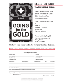


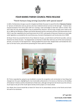


© Copyright 2026