
Sample Site 491044E 106946N 55225295_2 Sample_HCS
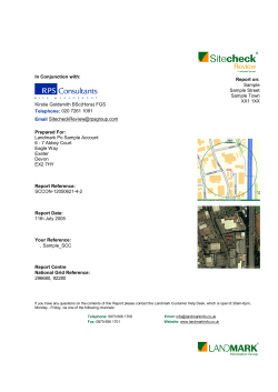
Residential Property at
Sample Site
Grid Reference: 491044E 106946N
Order Reference: 55225295_2
Your Reference: Sample_HCS
Thursday, 10 April 2014
Requested by
Landmark Po Sample Account
5 - 7 Abbey Court
Eagle Way
Exeter
Devon
EX2 7HY
Homecheck Professional is provided by Landmark Information
Group Limited, a leading UK provider of spatially-enabled property
and environmental risk information to lawyers, banks, insurance
companies, home inspectors and other property professionals.
The campaign for increased awareness of flood risk
Join at: www.knowyourfloodrisk.co.uk
Landmark Information Group works in association with:
Introduction
Guidance
Based solely on the data contained within this report, features have been identified which could cause Ground Stability
issues for the property.
You should review any survey or valuation report already prepared on the property for any comment on history of
settlement or subsidence in the vicinity. If a survey has not yet been commissioned it is recommended that an
appropriately qualified and insured surveyor or structural engineer is consulted.
Introduction
The Homecheck Professional Ground Stability Report assesses whether the property is in a mining area (including
past, present or proposed underground or surface mining) or an area of natural ground stability hazard.
Ground Stability is one of the major causes of insurance claims - potential causes are proximity to mining, mineral
extraction and natural ground subsidence. The importance of this report is to advise the user that risks are not limited
to obvious coal-mining areas but also to other types of potential subsidence hazard.
The report is for use by lawyers and other professionals involved in residential conveyancing. It provides information
within the key areas listed below that are not covered by Standard Enquiries of Local Authorities.
SUMMARY
The Summary section of the report presents enquiries in a familiar and easy-to-understand question and
answer format. Where a reply to an enquiry is Yes, further details are given for each question.
Unless otherwise stated the answers cover a search band of 0-250 metres from the specified property.
Contact details for the data providers are given in the Contacts section at the end of this report.
SECTION A Mining
This section concerns coal mining and mineral extraction. It is designed to highlight land instability issues
which may affect the value or enjoyment of the property.
SECTION B Brine and Salt Extraction
This section concerns Brine and Salt Extraction. It is designed to highlight areas that may be liable to
subside as a result of activities of the salt industry.
SECTION C Man Made Stability Hazards
This section of the report seeks to identify the existence of landfill and waste management sites together
with past industrial land use. Its purpose is to highlight stability issues relating to these activities.
SECTION D Natural Ground Stability Hazards
This section concerns Natural Ground Stability hazards and is designed to highlight land stability issues
relating to natural subsidence.
Other Reports
You may also wish to consider reports from our full range covering both Flood and Contamination issues.
Footnotes
(1) The report should only be used in connection with one residential parcel of land (for the purpose of defining a single parcel of land
Rule2(2) of the Local Land Charges Act 1997 is used). The report is based on the address and grid reference shown on the cover of this
report and the replies are given in reliance on the accuracy and completeness of this information.
(2) The report is supplied subject to our current standard terms and conditions.
(3) The search is based on a UK National Grid Reference for the property. The grid reference used is shown on the cover of this report.
(4) The information in the report is supplied under licence to Landmark Information Group Limited from various sources including:
Environment Agency, British Geological Survey and Ordnance Survey.
(5) This report is a search of statutory and non-statutory sources of information which does not include any on-site survey or inspection of the
property or its environs. Accordingly the report cannot in any way provide information as to the actual state of the property or land.
(6) The replies in this report are based on information currently supplied to Landmark Information Group Limited by its data providers.
Landmark Information Group cannot guarantee the accuracy or the completeness of any information supplied to it by its data providers.
(7) Homecheck Professional is provided by Landmark Information Group Ltd.
Order Reference 55225295_2
10-Apr-14
hcp v127.0
Page 1
Site Location
N
NW
NE
E
W
S
SW
SE
Search Details
Search address
Sample Site
Grid Reference
491044E 106946N
Date of Report
10/4/2014
Order Reference 55225295_2
10-Apr-14
hcp v127.0
Page 2
Report Summary
SECTION A Mining
Mining Areas
A.1
Is the property within an area where there has
been recorded mining activity?
within 0 - 250 metres?
No
within 0 - 25 metres?
No
within 0 - 250 metres?
Likely
Coal Mining Areas
A.2
Is the property within an area where a full coal
mining report should be obtained?
Non-coal Mining
A.3
What is the potential for ground instability
relating to non-coal mining in the search area?
The British Geological Survey has assessed the area of search as having a
likely likelihood of property damage from subsidence relating to non-coal
mining. The likely risk does not necessarily mean there is cause for concern.
Inspection of the site may be required and a house buyers survey should be
considered to test for signs of property damage that may relate to noncoalmining.
Natural and Man-Made Cavities
A.4
Are there any Natural/Man-Made Cavities
identified within the search area?
within 0 - 250 metres?
No
within 0 - 250 metres?
Yes
Mineral Extraction and Quarrying
A.5
Are there any Mineral extraction sites as
recorded by the British Geological Survey?
see additional information
Mining and Quarrying Activities
A.6
Are there any features identified from
Landmark's Potentially Contaminative Industrial
Uses (Past land Use) data relating to Mining /
Quarrying activities?
within 0 - 250 metres?
Yes
see additional information
SECTION B Brine and Salt Extraction
B.1
Is the property within an area defined as being
affected by Brine and Salt Extraction?
within 0 - 250 metres?
No
within 0 - 250 metres?
Yes
SECTION C Man Made Stability Hazards
Ground Stability
C.1
Are there any features identified from Ordnance
Survey Historical mapping which may affect
Ground Stability?
see additional information
Landfill Sites
C.2
Are there any Landfill Sites?
Order Reference 55225295_2
within 0 - 250 metres?
10-Apr-14
hcp v127.0
No
Page 3
Report Summary
C.2.1 The following list shows if local authorities
Chichester District Council - Has no landfill data to supply
West Sussex County Council - Has supplied landfill data
covering the area of search have made landfill
data available.
Please refer to the Contacts section for contact information.
Licensed Waste Management Facilities
C.3
Are there any currently Licensed Waste
Management Facilities?
within 0 - 250 metres?
No
within 0 - 50 metres?
No
Boreholes
C.4
Are there any BGS Boreholes identified?
SECTION D Natural Ground Stability Hazards
Natural Ground Stability Hazards
D.1
What is the potential for natural ground
instability in the search area?
High
The BGS indicate that there is a high potential for natural ground instability in
the search area. This does not necessarily mean there is cause for concern in
terms of property stability, however we recommend that specific advice be
commissioned from a qualified member of the RICS. Please refer to the
Additional Information section for details of records found and details of how
natural ground instability is broken down into its components.
Footnotes:
Question A.2 The reply to this question indicates whether it is advisable to obtain a coal mining search from the Coal Authority.
Question A.3 The data provides an assessment of the likelihood that past underground mining may have occurred in the area based on information supplied
by the BGS . The data takes into account many types of mining such as ironstone or limestone extraction, but specifically excludes coal. The mining hazard
data includes all known underground workings, regardless of depth
Question A.5 The reply to this question is based upon the BGS compendium of mines, quarries and mineral sites operating commercially in England and
Wales since 1993. The original data was compiled by BGS in 1993-94 primarily from BGS records and from information supplied by local authorities,
industrial sources and the Valuation Office Agency.
Question A.6 Historical maps are a valuable and recognised source of information for investigating site history. They assist in identifying any previous
potential contaminative uses relating to Mining / Quarrying which may have been carried out at a particular location.
Question C.1 Historical maps are a valuable and recognised source of information for investigating site history. They assist in identifying any previous
potential infilling of land which may have been carried out at a particular location that may affect Ground Stability.
The Historical Industrial Land Use data used in this reply is the result of a systematic analysis of 1:10,560 scale Ordnance Survey maps dating from the
1880s, as well as selected 1:10,000 scale Ordnance Survey National Grid Series.
Evidence of past potential contamination and potentially infilled land is drawn from a series of up to six historic map editions. The first of these editions will
be the earliest County Series maps, which date from between 1860 and 1890 and are to a scale of 1:10,560. The second edition of County Series maps
dates from circa 1900, and the third circa 1930.
Question C.2 The Landfill Sites have been provided by the relevant environment agency or Local Authority (where available). At present no complete national
data set exists for landfill site boundaries, therefore, a point grid reference, provided by the data supplier, is used for some landfill sites. In certain cases the
point grid references supplied provide only an approximate position, and can vary from the site entrance to the centre of the site. For Registered Landfill
Sites, where the positional accuracy of the site is unclear, a "buffer" is constructed around the point to warn of the possible presence of landfill.
Question D. 1 The search band for this question is 0 - 50 metres from the specified property.
If there is a positive answer to questions A5, C2, C3 or C4 the feature will be displayed on mapping in the Additional Information section.
Order Reference 55225295_2
10-Apr-14
hcp v127.0
Page 4
Additional Information
A.5 - Mineral Extraction and Quarrying - Records within 0 - 250m
N
NW
NE
E
W
S
SW
Order Reference 55225295_2
10-Apr-14
SE
hcp v127.0
Page 5
Additional Information
BGS Recorded Mineral Sites
Map ID
1
Contact Number
1
Direction
West
Distance
75m
Site Name:
Pear Tree Knap Gravel Pit
Location:
Boxgrove, Chichester, West Sussex
Source:
British Geological Survey, National Geoscience Information Service
Reference:
157598
Type:
Opencast
Status:
Ceased
Operator:
Unknown Operator
Operator Location:
Periodic Type:
Unknown Operator
Quaternary
Geology:
Head
Commodity:
Sand and Gravel
Positional Accuracy:
Located by supplier to within 10m
Order Reference 55225295_2
10-Apr-14
hcp v127.0
Page 6
Additional Information
A.6 - Mining and Quarrying Activities - Records within 0 - 250m
Potentially Contaminative Industrial Uses (Past Land Use)
Direction
West
Distance
56m
Use:
Quarrying of sand & clay, operation of sand & gravel pits
Date of Mapping:
1951
Order Reference 55225295_2
10-Apr-14
hcp v127.0
Page 7
Additional Information
C.1 - Ground Stability - Records within 0 - 250m
Potentially Infilled Land (Non-Water)
Direction
West
Distance
56m
Use:
Unknown Filled Ground (Pit, quarry etc)
Order Reference 55225295_2
10-Apr-14
hcp v127.0
Page 8
Additional Information
D.1 - Natural Ground Stability Hazards - Records within 0 - 250m
Potential for Collapsible Ground Stability Hazards
Contact Number
1
Direction
-
Buffer:
On Site
Hazard Potential:
Very Low
Source:
British Geological Survey, National Geoscience Information Service
Potential for Compressible Ground Stability Hazards
Contact Number
1
Direction
-
Buffer:
On Site
Hazard Potential:
No Hazard
Source:
British Geological Survey, National Geoscience Information Service
Potential for Ground Dissolution Stability Hazards
Contact Number
1
Direction
-
Buffer:
On Site
Hazard Potential:
High
Source:
British Geological Survey, National Geoscience Information Service
Potential for Landslide Ground Stability Hazards
Contact Number
1
Direction
Buffer:
On Site
Hazard Potential:
Very Low
Source:
British Geological Survey, National Geoscience Information Service
Potential for Running Sand Ground Stability Hazards
Contact Number
1
Direction
Buffer:
On Site
Hazard Potential:
No Hazard
Source:
British Geological Survey, National Geoscience Information Service
Contact Number
1
Direction
West
Buffer:
0-50m
Hazard Potential:
Very Low
Source:
British Geological Survey, National Geoscience Information Service
Potential for Shrinking or Swelling Clay Ground Stability Hazards
Contact Number
1
Direction
-
Buffer:
On Site
Hazard Potential:
No Hazard
Source:
British Geological Survey, National Geoscience Information Service
Contact Number
1
Direction
West
Buffer:
Hazard Potential:
0-50m
Very Low
Source:
British Geological Survey, National Geoscience Information Service
Order Reference 55225295_2
10-Apr-14
hcp v127.0
Page 9
Additional Information
The search results for natural subsidence above indicate the likelihood of each hazard occurring within the buffer zone. An indication of a
hazard does not necessarily mean that a particular property will be affected by subsidence problems, as this also depends on factors such as
property type or proximity to trees. How a particular property may be affected can only be determined by a more detailed search and/or further
investigation of the site and property.
Shrink-Swell Clay Hazard
Swelling Clays can change volume due to variation in ground moisture. This can cause ground movement, particularly in the upper 2 metres
of the ground that may affect foundations. Ground moisture variations can be related to a number of factors, including weather variations
(annual or longer term), vegetation effects (particularly growth or removal of trees) and man-made activity.
Collapsible Ground Hazard
Certain kinds of rock have an open porous structure, which means they can collapse suddenly when a load is placed on them (such as a
building) or when they become saturated, causing potential damage to overlying property.
Compressible Ground Hazard
Certain types of ground, such as that developed beneath river plains, can contain very soft layers or pockets. These can compress under the
weight of overlying structures, such as buildings, resulting in progressive depression of the ground and disturbance of foundations.
Ground Dissolution Hazard
Ground dissolution occurs when certain types of bedrock contain layers of material that can dissolve within the ground water. This can cause
underground cavities to develop that, with time, can reach the surface and cause significant ground movement, such as development of
collapse hollows that can directly impinge on buildings.
Landslide Hazard
Landslide hazard occurs due to particular types of slopes becoming unstable under certain circumstances, causing down-slope movement of
the ground and disruption to buildings. A combination of factors, including, amongst others, the rock type, the presence of excess water
(natural or relating to man-made activity), the angle of the slope, and construction work, for example, cuttings or embankments, can all
contribute.
Running Sand Hazard
Some rocks can contain loosely packed sandy layers that can become fluidised by water flowing through them. This may happen, for
example, around natural springs, or where excavations in sand go below the water table, or around leaking drains and mains water supply
pipes. Such sands can 'run', removing support from overlying buildings and causing potential damage.
Order Reference 55225295_2
10-Apr-14
hcp v127.0
Page 10
Contacts
1
British Geological Survey - Enquiry Service
British Geological Survey
Kingsley Dunham Centre
Keyworth
Nottingham
Nottinghamshire
NG12 5GG
Telephone 0115 936 3143 Fax 0115 936 3276
Email [email protected]
Website www.bgs.ac.uk
The BGS can provide a detailed geological report on the area in which the property is located.
Chichester District Council - Environmental Health Department
East Pallant House
1 East Pallant
Chichester
West Sussex
PO19 1TY
Telephone 01243 785166 Fax 01243 776766
Website www.chichester.gov.uk
West Sussex County Council - Environment & Development
County Hall
Tower Hall
Chichester
West Sussex
PO19 1RH
Telephone 01243 777100
Website www.westsussex.gov.uk
Peter Brett Associates
Caversham Bridge House
Waterman Place
Reading
Berkshire
RG1 8DN
Telephone 0118 950 0761 Fax 0118 959 7498
Email [email protected]
Website www.pba.co.uk
The cavity data presented has been extracted from the PBA enhanced version of the original DEFRA
national cavity databases. PBA/DEFRA retain the copyright & intellectual property rights in the data.
Whilst all reasonable efforts are made to check that the information contained in the cavity databases is
accurate we do not warrant that the data is complete or error free. The information is based upon our
own researches and those collated from a number of external sources and is continually being
augmented and updated by PBA. In no event shall PBA /DEFRA or Landmark be liable for any loss or
damage including, without limitation, indirect or consequential loss or damage arising from the use of
this data.
Order Reference 55225295_2
10-Apr-14
hcp v127.0
Page 11
Contacts
Ove Arup & Partners
Central Square
Forth Street
Newcastle Upon Tyne
Tyne And Wear
NE1 3PL
Telephone 0191 261 6080 Fax 0191 261 7879
The Data provided above was obtained on Licence from Ove Arup & Partners Limited (for further
information, contact [email protected]). No reproduction or further use of such Data is to be
made without the prior written consent of Ove Arup & Partners Limited. The information and data
supplied in the product are derived from publicly available records and other third party sources and
neither Ove Arup & Partners nor Landmark warrant the accuracy or completeness of such information
or data.
Wardell Armstrong LLP
Sir Henry Doulton House
Forge Lane
Etruria
Stoke On Trent
ST1 5BD
Telephone 0845 111 7777 Fax 0845 111 8888
Website www.wardell-armstrong.com
The Data provided was obtained on Licence from Wardell Armstrong LLP, who retain the copyright and
intellectual property rights in the data. The information has been derived and collated from publicly
available material and in-house records which are continually being expanded and updated. Whilst due
diligence has been exercised in the collation of the material, neither Wardell Armstrong LLP nor
Landmark warrant the accuracy or completeness of the data and are not liable for any indirect or
consequential loss or damage arising from the use of the data.
Landmark Information Group Ltd - Landmark Info Helpline
Legal & Financial
Imperium
Imperial Way
Reading
Berkshire
RG2 0TD
Telephone 0844 844 9966 Fax 0844 844 9980
Email [email protected]
Order Reference 55225295_2
10-Apr-14
hcp v127.0
Page 12
Search Code
IMPORTANT CONSUMER PROTECTION INFORMATION
This search has been produced by Landmark Information Group Ltd, Imperium, Imperial Way, Reading, Berkshire, RG2
0TD. Telephone: 0844 844 9966, Fax No: 0844 844 9980, email: [email protected] which is registered with the
Property Codes Compliance Board (PCCB) as a subscriber to the Search Code. The PCCB independently monitors how
registered firms maintain compliance with the Code.
The Search Code:
- Provides protection for homebuyers, sellers, conveyancers and mortgage lenders who rely on the information included
in property search reports undertaken by subscribers on residential and commercial property within the United Kingdom.
- Sets out minimum standards which firms compiling and selling search reports have to meet.
- Promotes the best practice and quality standards within the industry for the benefit of consumers and property
professionals.
- Enables consumers and property professionals to have confidence in firms which subscribe to the code, their
products and services.
By giving you this information, the search firm is confirming that they keep to the principles of the Code. This provides
important protection for you.
The Code's core principles
Firms which subscribe to the Code will:
- Display the Code logo prominently on their search reports.
- Act with integrity and carry out work with due skill, care and diligence.
- At all times maintain adequate and appropriate insurance to protect consumers.
- Conduct business in an honest, fair and professional manner.
- Handle complaints speedily and fairly.
- Ensure that all search services comply with the law, registration rules and standards.
- Monitor their compliance with the Code.
COMPLAINTS
If you have a query or complaint about your search, you should raise it directly with the firm, and if appropriate ask for your
complaint to be considered under their formal internal complaints procedure. If you remain dissatisfied with the firm's final
response after your complaint has been formally considered, or if the firm has exceeded the response timescales, you may
refer your complaint for consideration under The Property Ombudsman scheme (TPOs). The Ombudsman can award
compensation of up to £5,000 to you if it finds that you have suffered actual loss as a result of your search provider failing
to keep to the Code.
Please note that all queries or complaints regarding your search should be directed to your search provider in the
first instance, not to TPOs or to the PCCB.
TPOs Contact Details:
The Property Ombudsman Scheme
Milford House
43-55 Milford Street
Salisbury
Wiltshire SP1 2BP
Tel: 01722 333306
Fax: 01722 332296
Email: [email protected]
You can get more information about the PCCB from www.propertycodes.org.uk.
PLEASE ASK YOUR SEARCH PROVIDER IF YOU WOULD LIKE A COPY OF THE SEARCH CODE
Search Code
COMPLAINTS PROCEDURE
If you want to make a complaint, we will:
- Acknowledge it within 5 working days of its receipt.
- Normally deal with it fully and provide a final response, in writing, within 20 working days of receipt.
- Keep you informed by letter, telephone or e-mail, as you prefer, if we need more time.
- Provide a final response, in writing, at the latest within 40 working days of receipt.
- Liaise, at your request, with anyone acting formally on your behalf.
Complaints should be sent to:
Head of Customer Relations
Landmark Information Group Ltd
Landmark UK Property
Imperium
Imperial Way
Reading
RG2 0TD
Telephone: 0844 844 9966
E-mail: [email protected]
Fax: 0844 844 9980
If you are not satisfied with our final response, or if we exceed the response timescales, you may refer the complaint to The
Property Ombudsman Scheme (TPOs): Tel: 01722 333306, E-mail: [email protected].
We will co-operate fully with the Ombudsman during an investigation and comply with his final decision.
LANDMARK STANDARD TERMS & CONDITIONS
Full Terms and Conditions can be found on the following link:
http://www.landmarkinfo.co.uk/Terms/Show/515


© Copyright 2026