
PROCEDURES MANUAL CATAWBA COUNTY, NC
PROCEDURES MANUAL CATAWBA COUNTY, NC A MANUAL FOR RESIDENTIAL AND NON-RESIDENTIAL DEVELOPMENT (Applications, Plan Requirements, Plat Certificates) Updated 8/26/2014 Introduction The Catawba County Procedures Manual is to be used in conjunction with the Catawba County Unified Development Ordinance. The Procedures Manual is a booklet that contains the applications, forms, and specific site plan requirements in order to have a development reviewed by the County. We recommend that anyone going through the development process should first obtain a copy of the Unified Development Ordinance to determine the type of development and the process required for review. This ordinance can be purchased from our office for $30.00 or you may review this information on our website at: www.co.catawba.nc.us/depts/planning/general/index.html Procedures Manual Definitions and Development Checklist Key Concept Site Plan – Required for conditional rezoning requests. Conceptual site plans, characterized by graphic generalizations, drawn to scale by a design professional with enough detailed information to be considered for approval. Detailed Site Plan – Optional for conditional rezoning requests, but required for Non-Residential Zoning Authorization Permits. Detailed site plans, drawn to scale, including accurate information and illustrations necessary to demonstrate compliance with all applicable development standards. Plot Plan – A scaled drawing providing details of existing and/or proposed footprints and locations of buildings, structures, and appurtenances. G R PM MUC-O CRC-O FPM-O WP-O RP-O ED-O 2 Generalization and/or approximation as defined above under the Concept Site Plan. Required: Required to be shown on plan, if applicable to the development project. Procedures Manual Mixed Use Corridor-Overlay District Catawba River Corridor-Overlay District Floodplain Management-Overlay District Watershed Protection-Overlay District Rural Preservation-Overlay District Economic Development-Overlay District TABLE OF CONTENTS General Permits, Applications, and Checklists Zoning Authorization Permit Application------------------------------------------------------------------------------------------- 4 General Nonresidential Development Checklist -------------------------------------------------------------------------------- 5-9 Sign Permit Application ---------------------------------------------------------------------------------------------------------- 10-11 Sign Development Checklist----------------------------------------------------------------------------------------------------- 12-13 Floodplain Development Permit Application ------------------------------------------------------------------------------------- 14 Wireless Communication Facility: Eligible Facilities Requests or Substantial Modifications --------------------- 15-19 Quasi-Judicial (Board of Adjustment) Applications/Checklists Application for a Board of Adjustment Decision -------------------------------------------------------------------------------- 20 Extension of Nonconforming Use Development Checklist -------------------------------------------------------------------- 21 Special Use Development Checklist ------------------------------------------------------------------------------------------- 22-23 Variance Development Checklist --------------------------------------------------------------------------------------------------- 24 Wireless Communication Facility: New Tower or Combination New Tower/Collocation--------------------------25-33 Rezoning Applications/Checklists Rezoning/Ordinance Amendment Application ----------------------------------------------------------------------------------- 34 Rezoning Information ----------------------------------------------------------------------------------------------------------------- 35 Conditional District Development Checklist --------------------------------------------------------------------------------- 36-37 Planned Development - Development Checklist ----------------------------------------------------------------------------- 38-39 Planned Development IP Development Checklist --------------------------------------------------------------------------- 40-41 Village Development Checklist ------------------------------------------------------------------------------------------------- 42-44 321-ED (I/MX) Economic Development Developmental Checklist ----------------------------------------------------- 45-49 Manufactured Home Park Development Checklist -------------------------------------------------------------------------- 50-53 Subdivision Applications/Checklists/Certificates Non-Major Subdivision Application (Family/Minor/Exempt) ---------------------------------------------------------------- 54 Subdivision Final Plat (Family, Minor and Exempt Subdivisions) Review Development Checklist ------------------ 55 Family Subdivision Plat Certificates ------------------------------------------------------------------------------------------- 56-57 Minor Subdivision Plat Certificates -------------------------------------------------------------------------------------------- 58-60 Exempt Subdivision Plat Certificates ------------------------------------------------------------------------------------------ 61-63 Major Subdivision Sketch/Preliminary Plat Application ----------------------------------------------------------------------- 64 Subdivision Sketch Plat & Preliminary Plat Development Checklist ---------------------------------------------------- 65-67 Major Subdivision Final Plat Application ----------------------------------------------------------------------------------------- 68 Major Subdivision Final Plat Review Development Checklist----------------------------------------------------------- -69-70 Major Subdivision Plat Certificates -------------------------------------------------------------------------------------------- 71-73 Miscellaneous Forms/Agreements/Waivers Municipality Approval of Utility Installation Form ----------------------------------------------------------------------------- 74 Performance Guarantee Agreement for Corporation ------------------------------------------------------------------------ 75-76 Performance Guarantee Agreement for LLC --------------------------------------------------------------------------------- 77-78 Performance Guarantee Agreement for Individual -------------------------------------------------------------------------- 79-80 Irrevocable Letter of Credit ---------------------------------------------------------------------------------------------------------- 81 Landscape Waiver- Church, Synagogue or Temple ----------------------------------------------------------------------------- 82 Landscape Waiver-Commercial ----------------------------------------------------------------------------------------------------- 83 Appendix Procedural Flowcharts 3 Catawba County Zoning Authorization Permit Application Applicant Applicant’s Fax # Applicant’s Mailing Address Property Owner Property Owner’s Mailing Address Parcel 911 Address Subdivision Name and Lot # The proposed use for this building or land is The building or land was previously used for List physical changes to building or land Business name if different from above Zoning District Applicant’s Signature Property Owner’s Signature Phone # Applicant’s e-mail City, State, Zip Phone # City, State, Zip PIN # Overlay District Date Date An application for residential development requires a complete application and the submittal of a plot plan. (Drawn to scale). Applications for a non-residential development require complete application along with submittal of a detailed site. (See General Nonresidential Development checklist). When 2 or more lots are proposed for one zoning authorization permit, a recorded deed must be submitted combining the lots into one zoning lot. FOR COUNTY ZONING USE ONLY Residential Nonres. Accessory Change in Occupancy Home Occupation Mfg. Home 4 Residential Accessory Structure Change in Use Other(specify) Back Yard Business Parking/Loading Nonresidential Nonres. Addition New Construction Temp. Const. Office Interior Renovations CATAWBA COUNTY GENERAL NON-RESIDENTIAL DEVELOPMENT CHECKLIST Concept Site Plan – Used as part of the rezoning process for planned development, conditional and special districts. Detailed Site Plan – Required for Non-Residential Zoning Authorization Permits. Legend G – Generalization and/or approximation as defined above under the Concept Site Plan. R – Required: Required to be shown on plan, if applicable to the development project. PM - Procedures Manual Note: Applicant to check box in column B or D, if information is shown on the site plan. A Concept Site Plan 1. 2. 3. 4. 5. 6. 7. 8. 9. 10. 11. 12. 13. 14. 15. 16. 17. 18. 5 Traffic/Transportation Access – shared (driveway and parking) Access – waterfront Access points (ingress & egress) for pedestrians – sidewalks Access points (ingress & egress) for traffic; including site triangles Alleys Airstrips (if existing or proposed) on site & surrounding properties Channelization Connectivity (community pathways) to adjacent properties via trails, roadways, parking areas, etc. Cul-de-sac length Curbing requirement Entranceways Heavy traffic generators location Off-site traffic improvements Parking, Bicycle Parking, interior Parking – off street Parking, on street Parking – shared B Check if incl. on site plan C Detailed Site Plan D Check if incl. on site plan E General Code Ref. F MUC-O Code Ref. 44-430.09 44-430.09-1 G R 44-515(b) G G R R PM 44-518(a) G R G G R R 44-407 44-406 PM 44404(h)(2) G G R R G G G G G G G G 44-517 R R R R R R R 44-534-1 R R 44-535 44-430.09(f) 44-430.09(e)(f) 44-430.12(d) 44-430.09(i) 44-430.09(k) 44-430.10(b) 44-430.13(b) 44-430.09(c)(d) 44-430.12(f) 44-430.12(c)(1) 44-430.12(a)(1) 44-430.12(a)(2) G CRC-O Code Ref. H FPM-O Code Ref. I WP-O Code Ref. J RP-O Code Ref. K ED-O Code Ref. A Concept Site Plan B Check if incl. on site plan C Detailed Site Plan D Check if incl. on site plan E General Code Ref. F MUC-O Code Ref. 44-534-1 44-536(1) (3) 44-536(d) 44-430.12(e) 19. Parking facilities – spaces, location, character, scale, commercial 20. 21. 22. Paving materials Pedestrian amenities Roadway classification 23. 24. 25. Signalization Site appearance Site standards & design & preservation G G R R R 26. 27. 28. 29. Street designation (public/private) Street separation, Internal Street walls Existing/Proposed Lots or Blocks Landscaping Landscaping – planting schedule Landscaping – driveways (individual) Landscaping – perimeter for parking facilities Landscaping – internal parking area Landscaping – perimeter buffer of parcel Landscaping – foundation plantings Landscaping, existing road buffer and interior street Landscaping – street trees Landscaping – trees & shrubs, location of existing Water body buffers G G G G R R R R 44-516(b) G R R 44-523 44-523(c) G R 44-523(d) 44-430.11(h) G G R R 44-523(e) 44-523(f) 44-430.11(a) G G R R 44-523(g) G G R R 44-523(h) 44-523(f) (3)(b) G R G R 44-526 R 44-524 30. 31. 32. 33. 34. 35. 36. 37. 38. 39. 40. 41. 6 Screening Loading and service areas (screening & location) Mechanical equipment – ground (screened) G R G G R R R G CRC-O Code Ref. H FPM-O Code Ref. I WP-O Code Ref. 44-430.07(i) 44-430.13(a)(d) 44-516(c) and (d) 44-430.09(g) 44-430.07(g) 44-430.06 44-430.07(b) 44-430.09(h) 44-517 4-430.09(b) 44-430.07(h) 44-430.09(j) 44.430.10(a) 44-430.11(b) 44-430.13(c) 44-430.12(b) 44-430.11(d) 44-434.12 J RP-O Code Ref. K ED-O Code Ref. A Concept Site Plan 42. 43. 44. 45. 46. 47. 48. 49. 50. 51. 52. 53. 54. 55. 56. 57. 58. 59. 60. 61. 7 Mechanical equipment – rooftop (screened) Open storage & required screening Solid waste storage area (location & screening) Physical features Floodplain designation (boundary of the flood hazard area) Boundary of floodway or nonencroachment areas & BFE (when provided) Imperviousness Natural areas – if existing (wetlands, etc.) Slopes in excess of 20% (if existing) Storm water management facility locations Low impact development for nonresidential and multi-family Topographical features Location of old and new location of watercourse that will be altered Watershed designation - WSII-Critical-density & built upon limits & uses - WSII- Protected density & built upon limits & uses WSIII-Critical –density & built upon area & uses - WSIII-Protected – density, built upon area & uses - 10/70 Bonus Permit for WSII & WS III WSIV – Critical-density, built upon area & uses - WSIV-Protected – density, built upon area & uses B Check if incl. on site plan C Detailed Site Plan D Check if incl. on site plan E General Code Ref. F MUC-O Code Ref. G CRC-O Code Ref. H FPM-O Code Ref. I WP-O Code Ref. R 44-524 G R R 44-527 44-525 R R R R R G R R 44-503 G R PM G R G R G G R R PM R R R R PM R R 44-434.05 R R 44-434.06 R R 44-434.07 R R 44-434.10 R R 44-434.08 R R 44-434.09 44-430.06(b)(2) 44-429.07 (a)(2)(3) 44-429.07 (a)(4)(5) 44-434 44-430.06(b)(1) 44434.15(c) 44-428(g) 44-429.07 (a)(6) 44-434 44-434.04 J RP-O Code Ref. K ED-O Code Ref. A Concept Site Plan 62. 63. 64. 65. 66. 67. 68. 69. 70. 71. 72. 73. 74. - High-Density option for WSIV watershed area Accessory structures Structures Building entrances Building Design Standards/site standards Building, front Building materials Floor Area Ratio Façade not visible from R-O-W Façade visible from road Façade treatment Floodproofing 81. Foundation plan Light fixtures – type & location (free standing, on buildings, semi or full-cutoff) Multi-family res. Use & design standards Nonresidential structures Outdoor display/store Roof pitch/parapet wall Setbacks Structures, existing – location, height, use of & size Uses – existing & proposed 82. 83. Lot/Size Acreage of parcel Historic sites 75. 76. 77. 78. 79. 80. 84. 85. 86. 8 Lot (general shape, size, location, slopes, dimensions) Flag lot allowance Zoning Zoning district and land use of site and adjoining sites B Check if incl. on site plan C Detailed Site Plan D Check if incl. on site plan E General Code Ref. F MUC-O Code Ref. R R G R G G R R 44-43.07(f) 44-430.07 G G R G G G R R R R R R R 44-430.07(c)(1) 44-430.07(c)(4) G CRC-O Code Ref. H FPM-O Code Ref. I WP-O Code Ref. J RP-O Code Ref. K ED-O Code Ref. 44-434.15 44-607 44-428(h) 44-404-1 44-430.07(c)(3) 44-430.07(c)(2) 44-430.07(e) 44-429.07 (c) 44-429(d) G R R G R G G G G G R R R R R 44-404-1 44-404-1 G R 44-403 R R R R 44-404-1 44-503 R R 44-404-1 R R R R 44-522 44-430.14(c) 44-430.14(b) 44-430.08 44-436(c) 44-436(c) 44-430.07(j) 44-430.07(d) 44-404-1 44-435(b) 44-430.07(a) 44-430.04 44-430.06(b) (4) 44-430.06(c) 44-430.11(c) 44-429.07 (a)(1) 44-429.07 (e) 44-428(d) 44-428(e) 44-428(f) A Concept Site Plan 87. 88. 89. 90. 91. 92. 93. 94. 95. 96. 97. 98. 99. 100. 9 B Check if incl. on site plan C Detailed Site Plan D Check if incl. on site plan E General Code Ref. Overlay districts listed Utilities Easements – utilities (underground installation required) Utility provider (water & sewer) – confirmation in writing from provider Signs Sign – design drawing R R PM G R 44-519 R R 44-521 G R 44-562 Sign – freestanding – new sign location, size, height & surface Sign – location of existing signs on lot & building(s) Sign –wall signs (size and location) Additional Plan Details Date of plan Name of development Name(s) of developer North arrow Phasing plan noted Scale, no smaller than 1” = 200’ Vicinity map G R 44-562 G R 44-562 G R 44-563 R R R R R R R R R R R R R R PM PM PM PM 44-302 PM PM F MUC-O Code Ref. 44-430.07(h) 44-430.15 G CRC-O Code Ref. H FPM-O Code Ref. 44-429.07 (f) I WP-O Code Ref. J RP-O Code Ref. K ED-O Code Ref. HICKORY/CATAWBA COUNTY APPLICATION FOR SIGN PERMIT (This application becomes a permit upon approval by the Zoning Administrator & Building Official.) All businesses operating in the City of Hickory must have a privilege license. In order to expedite the review process needed for zoning approval, please review the following list and include all marked items with your application. An Application for Sign Permit cannot be approved until the following information has been provided to the Zoning Administrator. Site Plan to Scale Showing: ___Right-Of-Way & Property Line location ___Utility Easements ___Size/Locations of Existing Signs on Lot/Bldgs ___New Sign location, Size & Height ___Driveway Location ___Sign Design Sketch ___Location & Size of Bldgs & Bldg Walls NOTE IF WITHIN CITY OF HICKORY ETJ: All Freestanding Signs must be At Least 5 Feet from property and/or right of way line to any part of the sign and may not be placed within site triangle of any intersecting drives or streets. Please fill out the application completely to ensure timely review. Sign Location: _______________________________________________________________________________________ Parcel Identification Number: ___________________________________________________________________________ *YOU WILL BE ASKED TO GIVE DRIVING DIRECTIONS AT THE TIME OF ISSUING THE PERMIT* Sign Owner_______________________________ Sign Owner’s Phone No. ___________________ Fax No._______________ Sign Owner’s Address __________________________________________________________________________________ Contractor _________________________Contractor’s Phone No. _________________ Fax No.__________________ Contractor’s Address ___________________________________________________________________________________ Electrical Contractor: _________________________ Elect. Contr. Phone No. _________________ Fax No.___________ Electrical Contractor’s Address ___________________________________________________________________________ Hickory Sign Type: On Premise signs ___ Wall ___ Ground ___ Ground Off Premise signs ___ Wall ___ Roof ___ Roof County Sign Type: ___Multi Tenant ___Off-Premise Billboard ___Development Name Marker ___Limited Access Use ___ On Premise Wall ___ On Premise (Free Standing) ___ Temporary ___ Home Occupation/Cottage Business ___ Off-Premise Directional Sign ___ Canopy (Fuel Pump Island) Size of Sign: Width _______ (X) Length_______ (=) ________ Total Sq. Ft. Projection from building wall: _____ Ft. _____ in. Height above sidewalk or grade: _____ Ft. ____ in. For wall mounted sign, provide total sq. ft. of the wall: Width ______ (X) Length ______ (=) ________Total Sq. Ft. Canopy: ________ (Total Sq. Ft. of canopy area that can be used for signage) Ground Area Landscaping Sq. Ft.___________ Illuminated? ____Yes (______amps) ____No Other signs not attached to building? _____ Yes ___ No Electronic Message Board: ____Yes _____No (Type of Message board: LED: ___Yes ___No / Trivision: ___ Yes ___No) Support Material: ____________________________________________________________________________________ Sign Cost $___________________ Does BUILDING have field installed NEON skeleton tubing? _______Yes _______ No Signature of Applicant ___________________________________________________ Date _________________________ **Only signs that have a permit are allowed on your property. No other signs are allowed. **Non-permitted signs may be subject to removal/disposal without prior notice. ** For clarifications or to request a final zoning inspection (if required) contact Appropriate Planning/Zoning Jurisdiction ** City of Hickory Planning and Zoning Department – (828) 323-7410 Catawba County Planning and Zoning Department – (828) 465-8380 FOR ZONING ADMINISTRATOR’S USE ONLY Zoning Designation _________ Setbacks ______ /_____ /_____ /______ Airport Protection Zone_____ yes______ no Front Side Rear Side Street Sign Application Approved _______________________________________________Date __________________________ Conditions of Approval _________________________________________________________________________________ Sign Application Disapproved __________________________________________________ Date _____________________ Reason for Disapproval ________________________________________________________________________________ **** Catawba County and the City of Hickory require that ALL Signs be INSPECTED. Footings, Underground Elec., Final Elec., and Final Sign Inspections. 10 (Revised 5-12-09) SIGN PERMIT REQUIREMENTS For the sake of uniform treatment of all Sign Contractors, please be aware that the City of Hickory and Catawba County requires the following for all new Signs: 1. A permit application needs to be completed, listing the Electrical Contractor (for any illuminated signs, whether internally or externally illuminated), the square footage, and the cost (all blank spaces must be filled in). 2. A licensed electrician is required for all illuminated signs, and they must submit a signed sub-contractor form for the work on the sign (even if they are hired by the General Contractor for new construction). 3. All signs must meet Appendix H of the North Carolina Building Code to include all design requirements for working stresses from chapter 16 and attachment drawings. 4. All sign applications must include sign details. Wall sign drawings must show the building wall width and height where the sign is to be located, existing signage with dimensions, location and dimensional size of new sign to determine allowable signage. Sign material, manufacturers spec sheet showing meets 90 mph wind zone minimum if sign is prefab, type of wall construction, anchor details to include type of anchor and spacing. The anchors for masonry walls must be at least 3/8” inch embedded a minimum of 5” inches. Ground signs that exceed 12’ feet above finished grade require an engineer seal. Ground signs not exceeding 12’ feet above finished grade must show dimensional size of new sign to determine allowable signage, sign and support material, manufacturers spec sheet showing sign meets 90 mph wind zone minimum if sign is prefab, attachment schedule of sign to support, and footing detail. A notarized letter of permission from owner of land where an off-premise directional sign is to be placed must be provided. All Signs Require Inspections: 1. All signs require a final sign inspection. 2. Pole/Ground signs additionally require footing and setback inspections before concrete is poured. 3. All illuminated signs (whether internally or externally illuminated) require a final electric inspection. 4. Contractor must provide lift equipment necessary for the Code Official to complete the inspection. **Only the signs that have a permit are allowed on your property. No other signs are allowed. **Non-permitted signs may be subject to removal/disposal without prior notice. Jurisdictional Contact Information: City of Hickory Planning and Zoning Department – (828) 323-7410 Catawba County Planning and Zoning Department – (828) 465-8380 11 (Revised 5-12-09) CATAWBA COUNTY SIGN DEVELOPMENT CHECKLIST Plot Plan and Detailed Sign Plan: Used for administrative review. Show the following on the relative plan. Legend R - Required to be shown on plan, if applicable to the development project. Plot Plan 1. 2. 3. 4. 5. 6. 7. 8. 9. 10. 11. 12. 13. 14. 15. 16. 17. 18. 19. 20. 21. 22. 23. 24. 25. 26. 27. 28. 29. 30. 31. 32. 33. 34. 35. 36. 37. 12 Surface Area Computations On-Premise Signs (FREESTANDING) Number of signs proposed R Surface area (in square feet) Height Illumination Consolidated (unified) sign Multiple frontage lot R 150 ft. from any other on-premise sign R 100 feet from any residential district R Location (outside of all rights-of-way) R LED-tri-vision, electronic scrolling and electronic messaging- allowed in general or conditional district planned dev. Multi-tenant sign – to identify planned development Multi-tenant sign – for individual buildings in PD Home Occupation/Cottage Business/Special or Supplemental Use sign On-Premise wall signs Number of signs Multiple street frontage building R Maximum area of wall sign Square footage of wall LED, tri-vision, electronic scrolling & messaging Home Occupation/Cottage Business/Special or Supplemental Use wall sign Off-premise signs – billboards Number, calculation of surface area Maximum surface area Height Setbacks R Separation from other structures R Setback from residential properties R Distance between signs R Requirement of executed lease agreement Construction materials Lighting Colors Monopole requirement Off premise roof signs Off-premise wall signs Visibility regulations R Tri-vision sign Upgrade or construction of sign with LED technology Sign Specifications Plan R Check if included Status (staff only) Code Reference R 44-554 44-562 44-562(a) Table 44-562-1 Table 44-562-1 Table 44-562-1 44-562(b) 44-562(d) 44-562(d) 44-562(d) 44-562(e) 44-562(f) R R R 44-562(i) 44-562(j) 44-562(g) R R R R R R R R R R R R R R R R R R R R 44-563 44-563(a) 44-563(b) 44-563(c) PM 44-563(c) 44-563(d) 44-564 44-564(a) 44-564(b) 44-564(c) 44-564(d) 44-564(e) 44-564(h) 44-564(i) 44-564(j) 44-564(k) 44-564(l) 44-564(n) 44-564(o) 44-564(p) 44-564(q) 44-407 44-564(s) 44-564(t) Plot Plan 47. 48. 49. 50. 51. Off-premise directional Number permitted - When permitted - Permission from landowner - Surface area –maximum - Unified design for multi users - Height Nonprofit organizations Setback requirements Ground area landscaping Development name markers Maintenance Maximum # of signs (2) for each entrance Setbacks Maximum square footage of sign Illumination 52. 53. 54. 55. 56. Limited access user’s sign Maximum height - Exceptions to height & size (BOA) Setbacks On-premise sign allowed – distance between Maximum square footage of sign 38. 39. 40. 41. 42. 43. 44. 45. 46. 13 Sign Specifications Plan R R R R R R R R R R R R R R R R R R R R Check if included Status (staff only) Code Reference 44-565 44-565(a) 44-565(a)(1) 44-565(a)(2) 44-565(a)(3) 44-565(a)(4) 44-565(a)(5) 44-565(b) 44-565(c) 44-566 44-567 44-567(a) 44-567(b) 44-567(c) 44-567(d) Permitted 44-567(e) 44-568 44-568(a) 44-568(b)(c) 44-568(d) 44-568(e) 44-564(a) Catawba County Floodplain Development Permit Application Date: Received by: Location of Property: Type of Development: Permit Number: Property P.I.N.: Excavation Utility Construction Residential Construction Addition Other (specify) Fill Road Construction Nonresidential Construction Renovation Grading Size of Development: FIRM Data: Map Panel No.: Map Index Date: Flood Zone: Suffix Regulatory Floodway Info: (Check correct option below) Inside Regulatory Floodway Outside Regulatory Floodway Map Panel Date: No Regulatory Floodway Development Standards Data: 1. If Inside Regulatory Floodway is checked above, attach engineering certification and supporting data as required. 2. Base flood elevation (BFE) per FIRM at development site 3. Regulatory flood elevation at development site (BFE + 2 ft. freeboard): 4. Elevation in relation to mean sea level (MSL) at or above which the lowest floor (including basement) must be constructed (NAVD88). 5. Elevation in relation to mean sea level (MSL) at or above which all attendant utilities to include, but not limited to, all heating, air conditioning and electrical equipment must be installed (NAVD88). 6. Will garage (if applicable) be used for any purpose other than parking vehicles, building access, or storage? Yes No If yes, then the garage must be used in determining the lowest floor elevation. 7. Proposed method of elevating the structure: (a) If foundation wall is used provide minimum of 2 openings (b) Total area of openings required: area below BFE) (NAVD88). (NAVD88). (1 sq. inch per sq. foot of enclosed footprint 8. Will any watercourse be altered or relocated as a result of the proposed development? If yes, attach a description of the extent of the alteration or relocation. Yes 9. Floodproofing information (if applicable): Note: Non-residential structures in A/AE zones only. Elevation in relation to mean sea level (MSL) to which structure shall be floodproofed No (NGVD88). Applicant acknowledgment: I the undersigned understand that the issuance of a floodplain development permit is contingent upon the above information being correct and that the plans and supporting data have been or shall be provided as required. I also understand that prior to occupancy of the structure being permitted, an elevation and/or floodproofing certificate signed by a professional engineer or registered land surveyor must be on file with the Catawba County Planning, Parks and Development Dept. indicating the "as built" elevations in relation to mean sea level (MSL). Name of Applicant Applicant’s Address & Phone # Applicant’s Signature Name of Agent Agent’s Address & Phone # Agent’s Signature Foundation Inspection Date: 14 Date Date Inspector: Catawba County Application: Wireless Communication Eligible Facilities Request or Substantial Modification Type of Project: (please check one on each line) Eligible Facilities Request ____Substantial Modification _____New Provider-Existing Tower _____New Provider-Existing Structure _____Modification to Existing Equipment Wireless Provider/Applicant of the Proposed Collocation or Modification Provider/Applicant Provider’s Mailing Address City, State, Zip Provider’s Contact Person Contact’s Title__________________________ Provider’s Phone # Provider’s E-mail Provider’s Identification Information for Site: Number Site Name Applicant’s Signature Support Structure Information (This section not applicable when attaching to a structure other than a tower.) Tower Owner Tower Owner’s Contact Person Title Tower Owner’s Mailing Address City, State, Zip Tower Owner’s Phone # Tower Owner’s E-mail Tower Identification: Number Site Name FCC Registration Type of Tower (please check one): _____Lattice _____Guyed _____Monopole Tower Owner’s Signature (needed for collocations only) Parcel Information where Tower/Structure is Located (This is the owner of the land which is being leased to the tower company or owner of the other structure where antenna is constructed.) Land Owner Phone # Land Owner’s Mailing Address City, State, Zip Parcel 911 Address PIN # Tower Enclosure 911 Address Wireless Support Structure Location: Latitude Longitude Person Preparing Application/Site Acquisition or Zoning Specialist (Primary Contact in Obtaining Permit) Contact Person Company Phone # Contact’s Mailing Address City, State, Zip E-mail This person will follow project through: _____Obtaining Permit only or ____ Through Construction If only through Zoning Authorization Permit, who will be the contact through construction? (Name, Company, Address, Phone, E-mail address) Above Grade Height Project Antennae Location: _________ Height of Support Structure: Please describe the wireless communication facility request, the work that is proposed and the reason for the work (e.g. gap in coverage, capacity, change in technology). 15 1. 2. 3. 4. 5. 6. 7. 9. 10. 11. 12. 13. 14. 15. 16. 16 Status (staff only) Eligible Facilities Request or Substantial Modification New No New Providers Providers Added Added Check if included The following must be included as part of the application. Legend: R – Required submission. Note: Please use applicable column 1) New Providers Added or 2) No New Providers Added, and place a check in “Check if Included” column for all items included with the application. Catawba County Code Ref Complete pre-application meeting. One digital and one hard copy application in notebook, with coversheet indicating the date, applicant, project 911 address and type of project (Eligible Facilities Request or Substantial Modification). Agent authorization document. Statement of security compliance. Statement verifying that signage exists (or will be installed as part of this project) on the: Equipment Compound showing wireless support structure contact; and Provider’s shelter/panel with provider contact information. Application fee, per County Fee Schedule. R R R R 44-685.02 Procedures Manual R R R R R R 44-685-16(a) 44-685.08 44-685.09 R R Copy of executed lease or letter of agency showing applicant’s right to locate on site. Statement that facility will be constructed and maintained in safe manner and in compliance with all county, state & federal regulations. Statement that proposed facility is legally permissible and that applicant is authorized to do business in NC. Copy of the FCC license applicable for the intended use of the proposed facility. Narrative explaining any repairs or modifications that need to be done to the tower or structure, why they are needed and who will be overseeing changes. (If none, put NA in “Included” column. Narrative showing how facility is designed to blend with the natural surroundings. Lighting spec sheets or drawing, if lighting is added or modified. (If no lighting, put NA in “included” column.) Statement of understanding that an “as-built” certification is required from a PE, after construction, but before a Certificate of Compliance can be issued. The certification must show the project was according to submitted plans and has been completed. Statement on condition of the site access road and scheduling of necessary repairs. R 44-685-12 44-685.16(b) 44-685.16(c) R R R R 44-685.08 44-685.16(d) 44-685.20 44-685.16(d) R 44-685.16(e) R R 44-685.16(f) R R 44-685.16(i) R R 44-685.07(d) 44-685.16(j) R R 44-685.14(e) R R 44-685.16(l) 1. 2. 3. 5. 6. 7. 8. Status (staff only) Eligible Facilities Request or Substantial Modification New No New Providers Providers Added Added Check if included The following drawings/statements, sealed by a PE, must be included as part of the complete application. Legend: R – Required submission. Note: Applicant to place a check in “Check if Included” column for all items included with the application. Catawba County Code Ref Site plan drawing(s) showing the equipment compound, the tower and locations of all existing and proposed equipment panels/shelters, labeled with provider names, and utilities. If attaching to a tower: Elevation drawing(s) showing type of tower; height of tower; centerline height location of all proposed and existing antenna on the support structure, provider names and height of existing collocations; the proposed project and any related fixtures or structures; materials; color and lighting. If attaching to a structure other than a tower: Drawing(s) showing property boundaries, structure where the antenna will be placed, antennae height above the roof, location of related equipment. R R 44-685.16(k) 44-685.16(m)(2) R R 44-685(d) 44-685.16(g) 44-685.17(m)(1) R 44-685.07(d) 44-685.16(g) 44-685.16(j) 44-685.16(k) 44-685.16(n) Drawing showing that utilities will be underground. Copy of the latest ANSI or TIA structural report. Self-supporting towers need a report, completed within the last 5 years, and Guyed towers need a report completed within the last 3 years. A PE must attach a list enumerating each item which has not passed or is noted as needing repairs, and detail the measures taken to rectify the deficiency. PE structural opinion document, along with a statement that based on the structural analysis and calculations, the tower or structure being attached to and its foundation are sufficient to support the loading of the existing and proposed equipment. To obtain the C/O, get approval to the operate system after construction, and have power connection, a PE Certified Document must be submitted to the County. The Certification must state: 1. The project was built according to the submitted plan, and 2. The project is complete. A final physical zoning inspection is also required unless waived by the County. R R R R 44-685.16(k) 44-685.16(m)(5) R R 44-685.16(m)(4) 44-685.16(f) 44-685.14(e) Note: An “as-built” certification is required from a PE, after construction, but before a Certificate of Compliance can be issued. The certification must show that the project has been done according to submitted plans and has been completed. 17 Professional Engineer (PE) Sign-Off Sheet A PE who is licensed in the State of North Carolina, must verify the adequacy and accuracy of the attached application, drawings and documents, by initialing the following applicable statements and signing/sealing this document. Catawba County Unified Development Ordinance (UDO) code numbers are shown in parentheses by each statement. Item #1. ANSI/TIA Review of Tower I have reviewed the attached copy of the latest ANSI/TIA Report done, pursuant to the latest edition of ANSI-EIA/TIA regulations. (Federal/state law requires a report every 5 years for a self-supporting tower and every 3 years or for a guyed tower. If an ANSI/TIA report has not been done pursuant to the preceding schedule, an ANSI/TIA report must be done and submitted as part of this application.) (Sec. 44-685.16(m)(5). According to the attached report: (Please initial the appropriate statement.) There were no tower or foundation inefficiencies or discrepancies; or All inefficiencies or discrepancies shown on the report have been corrected. Attached is a list enumerating each item which has not passed in the report or is noted as needing repairs, and the measures taken to rectify the deficiency; or Repairs are necessary, but have not been completed. The collocation request will be put on hold and a separate Building Permit will be obtained for the changes/repairs. Repairs will be completed and pass related inspection(s), prior to obtaining the Zoning Authorization Permit and Building Services building permits to begin working on the project. Upon completion, I will inspect the changes/repairs and submit a letter indicating that according to my calculations, the tower (or alternate structure) is structurally capable of safely accommodating the proposed project. Upon receiving this letter, the project will be taken off hold and the process for the project will continue. Professional Engineer Acknowledgment: As a Professional Engineer, I have verified the applicable documents and statements related to the attached application, and to the best of my knowledge believe the information to be adequate and accurate, as shown by my initials above. I understand issuance of the Zoning Authorization Permit is contingent upon the above information being complete and correct. Professional Engineer (printed name) Company (PE Seal) Professional Engineer (signature) Item #2. Structural Verification with Proposed Project I have reviewed the tower’s type, make, model, manufacturer, age and structural design calculations (or structure on which the collocation will be attached). Please initial the appropriate statement. (Sec. 44-685.17(r)) In my professional opinion, I certify that this tower (or structure) and foundation are structurally capable of safely accommodating the existing equipment and project the applicant is proposing, without any repairs or modifications; or In my professional opinion, changes/repairs are needed on the tower, foundation (or structure on which the collocation will be attached). (Please attach a statement describing necessary changes/repairs.) I understand that this project request will be put on hold, and a separate Building Permit will be obtained for the changes/repairs. Repairs will be completed and pass related inspection(s), prior to obtaining the Zoning Authorization Permit and Building Services building permits to begin working on the collocation. Upon completion of the repairs, I will inspect the changes/repairs and submit a letter indicating that according to my calculations, the tower (or structure on which the collocation will be attached) and foundation are structurally capable of safely accommodating the proposed facilities. Upon receiving this letter, the collocation will be taken off hold and the process will continue. Professional Engineer Acknowledgment: As a Professional Engineer, I have verified the applicable documents and statements related to the attached application, and to the best of my knowledge believe the information to be adequate and accurate, as shown by my initials above. I understand issuance of the Zoning Authorization Permit is contingent upon the above information being complete and correct. Professional Engineer (printed name) Company (PE Seal) Professional Engineer (signature) 18 Procedures Checklist — Wireless Communication Eligible Facilities Requests or Substantial Modifications Zoning Permit Contact the County Planning office to discuss the type and location of the project, and to set up a time for a site visit. Submit copies of the application, fees, and all necessary attachments, as shown in the checklist below. A collocation or facility modification will require 1 complete hard copy and 1 digital copy of the application including all attachments. The hard copy must: Be bound in a notebook; Contain a cover sheet showing the applicant, date, project name, and 911 address of the project; Contain a table of contents listing items in the application; and Contain tabs to categorize items in the application. Catawba County will review the application submittal for completeness and content. The applicant will be asked to clarify any discrepancies. (The application will be put on hold until all discrepancies are rectified.) An Eligible Facilities Request of Substantial Modification on an existing facility/structure will be approved by staff or revisions will be requested on the application. Upon approval notification, a Zoning Authorization Permit will be issued by the Planning Department. Construction Phase The applicant can then obtain necessary related building permits from the Catawba County Building Services Department, in order to begin construction. During construction, the Building Services Department will perform necessary in-process building inspections. Process to Obtain Zoning Compliance Certificate (C/O, Power, and Right to Conduct Business After construction is complete, the applicant must submit an “As Built” inspection certification to the Planning Department, sealed by a PE, verifying that the project: 1. Has been completed, and 2. Has been built according to the submitted plan. Contact the County Planning Department for a final zoning inspection. Power cannot be connected and wireless service cannot be provided until: The “as built” certification is received by the County; Both Zoning Department and Building Services Department final inspections have been satisfactorily completed; and A Zoning Compliance Certificate has been issued by the Planning Department. If the project involves the addition of a new provider, the County will contact the power company for power connection. The applicant/provider can begin providing service to clients. Any future Eligible Facilities Requests or Substantial Modifications require a separate application and review. 19 Catawba County Application for a Board of Adjustment Decision Applicant Applicant’s Fax Applicant’s Mailing Address Property Owner Property Owner’s Mailing Address Parcel 911 Address Subdivision Name and Lot # Phone # Applicant’s Email City, State, Zip Phone # City, State, Zip PIN # Type of Application: Special Use Permit A detailed site plan and the general information listed below shall be submitted with the application. Special Use requested including Unified Development Ordinance Section Reference Documentation must be submitted addressing all standards found in UDO Section 44-332(f)(2) and the specific criteria for the special use. Variance Documentation must be submitted supporting all criteria found in UDO Section 44-333 (f)(1). A plot plan sealed by a licensed professional and the general information listed below must be included with the application. Extension or Change of a Nonconforming Use A detailed site plan and the general information listed below shall be submitted with the application. Documentation must be submitted addressing all standards found in UDO Section 44-704(b)(4). Appeal An appeal must be submitted in writing and filed with the recording secretary of the board of adjustment within 30 days of the date of the Planning Director’s decision. Sec. Ref. ________ General Information to be attached: 12 copies of plan at a scale no smaller than 1 inch equals 200 feet, on either a 18 x 24 or 24 x 36 inch map and either one 8.5 x 11 or 11 x 17 inch map (including digital copies in .pdf or .jpg format); complete application and any attachments. If applicable, a legal description of the property If applicable, a detailed statement of all other circumstances, factors, and reasons, which applicant offers in support of the appeal. Appropriate completed checklist (special use permit, variance, extension or change of a nonconforming use) found in Procedures Manual. Filing Fee: Per Catawba County Fee Schedule Applicant’s Signature Property Owner’s Signature 20 Date Date CATAWBA COUNTY EXTENSION OR CHANGE OF NONCONFORMING USE-DEVELOPMENT CHART (Quasi-Judicial Hearing- Board of Adjustment) Detailed Site Plan: used for: Change of Nonconforming Use - Applications must meet the requirements of Article VII, Section 44-703 (b) and Article V of the Unified Development Ordinance. Extension of Nonconforming Use (Board Review) - Applications must meet the requirements of Article VII. Section 44-704. Legend R - Required to be shown on plan, if applicable to the development project. PM - Procedures Manual Detailed Site Plan Access – waterfront R Accessory structures R Date of plan R Easements, reservations & right-of-ways (existing R and proposed) 5. Floodplain denoted & delineation of area R 6. Name(s) of applicant R 7. Name(s) of property owner (if different from R applicant) 8. Natural areas – if existing (wetlands, etc.) R 9. North arrow R 10. Parcel, includes metes & bounds description, R acreage and parcel identification (PIN). minimum size, location, dimensions 11. Roadway classification and designation (public or R private) 12. Scale, 1”=200’ or less preferred R 13. Setbacks – required for district R 14. Structures, existing - location, height & use R 15. Structures, residential proposed - types, number of R units, height and outline 16. Structures- non-residential, proposed –number, R height, outline and square footage 17. Topographical features – 5 ft. or less contours R 18. Utilities provider (water & sewer or well and septic R tank) – if applicable 19. Vicinity Map R 20. Watershed designation & delineation & % of R imperviousness 21. Zoning district and land use of adjoining sites R 22. Zoning district of site, existing R *Applicant to check box in Column B if information has been submitted on site plan. 1. 2. 3. 4. 21 Check if included on site plan Status (Staff only) Code Reference 44-515 PM PM 44-519 44-429 PM PM 44-503 PM PM 44-516 PM Table 44-404-1 PM PM PM PM 44-521 PM 44-434 PM PM CATAWBA COUNTY SPECIAL USE PERMIT-DEVELOPMENT CHART (Quasi-Judicial Hearing - Board of Adjustment) Detailed Site Plan: used for: All special use applications which must meet the requirements of Section 44-328, Article VI, Division 3, and Article V of the Unified Development Ordinance. Legend R - Required to be shown on plan, if applicable to the development project. PM - Procedures Manual *Applicant to check box in Column B if information has been submitted on site plan. A B Detailed Check if Site Plan included on site plan 1. Access management R 2. Access – waterfront R 3. Accessory structures R 4. Airstrips (if existing or proposed) on site & R surrounding properties 5. Date of plan R 6. Easements, reservations & right-of-ways R (existing and proposed) 7. Floodplain denoted & delineation of area R 8. Floor Area Ratio R 9. Historic sites (location of existing, if R applicable) 10. Landscaping – driveways R 11. Landscaping - foundation plantings R 12. Landscaping - internal parking area R 13. Landscaping - perimeter buffer of parcel R 14. Landscaping - perimeter for parking facilities R 15. Landscaping - street trees R 16. Landscaping - trees & shrubs, bermsR location of existing/proposed–preservation 17. Lighting standards - type & location (free R standing & on buildings) 18. Loading & service areas (screening & R location) 19. Mechanical equipment – ground/rooftop R (screened) 20. Name of development R 21. Name(s) of developer R 22. Natural areas – if existing (wetlands, etc.) R 23. North arrow R 24. Open storage with required screening R 22 C (Staff only) D Code Reference 44-515 PM PM PM 44-519 44-429 44-404(d) 44-523(c) 44-523(g) 44-523(e) 44-523(f) 44-523(d) 44-523(h) 44-503 44-522 44-526 44-537 44-524 PM PM PM PM 44-527 A Detailed Site Plan 25. C (Staff only) D Code Reference R PM R R 44-534 44-535 44-536 28. 29. 30. 31. Parcel, includes metes & bounds description, acreage and parcel ID. Parking - off street Parking facilities – access to adjacent street, aisle dimension, spaces (numbered and dimension), and location. Roadway classification Scale, 1”=200’ or less preferred Setbacks Sign – wall signs - location & size of R R R R 32. Sign - design drawing R PM PM 44-404-1 Art. V, Div. 7 44-563 PM 33. Sign - location of existing signs on lot & building(s) Sign – freestanding - new sign location, size, height, surface and landscaping Sign – Off-premise directional Slopes in excess of 20% (if existing) Solid waste storage area (location & screening) Storm water management facilities locations (retention basins, etc.) Street designation, internal (public or private) NCDOT driveway permit approval Street trees Structures, existing/proposed - location, height Topographical features – 5 ft. or less contours Traffic improvements-off site (turn lanes, etc.) Traffic patterns – existing & proposed circulation/channelization, access, visibility, Utilities provider (water & sewer or well and septic tank) - confirmation in writing from provider Vicinity Map Watershed designation and percentage of imperviousness Zoning district and land use of adjoining sites Zoning district of site, existing R PM R 44-562 R R R 44-565 26. 27. 34. 35. 36. 37. 38. 39. 40. 41. 42. 43. 44. 45. 46. 47. 48. 49. 50. 23 B Check if included on site plan 44-525 R R R R PM PM 44-523(h) R R PM R 44-515 R 44-521 R R PM 44-434 R R PM PM CATAWBA COUNTY VARIANCE REQUEST-DEVELOPMENT CHECKLIST (Quasi-Judicial Hearing - Board of Adjustment) Plot Plan: used for: All variance request applications must meet the requirements of Section 44-329 and Article V of the Unified Development Ordinance. Legend R - Required to be shown on plan, if applicable to the development project. *Applicant to check box in Column B if information has been submitted on plot plan. A B Detailed Site Plan 1. 2. 3. 4. 5. 6. 7. 8. 9. 10. 11. 12. 13. 14. 15. 16. 17. 18. 19. 24 Accessory structures Date of plan Easements, reservations & right-of-ways Floodplain denoted & delineation of area Name(s) of applicant Name(s) of property owner (if different from applicant) North arrow Parcel, includes metes & bounds description, acreage and parcel ID) Scale, 1”=200’ or less preferred Setbacks – required for district Setbacks – proposed Street designation (public or private) Structures, existing - location, height & use Structures, proposed Topographical features, if applicable Vicinity Map Watershed designation and percentage of imperviousness Zoning district and land use of adjoining sites Zoning district of site Check if included on site plan C D (Staff only) Code Reference R R R R PM PM 44-519 44-429 R R PM PM R R PM PM R R R R R PM 44-404-1 PM 44-516 PM R R R R PM PM PM 44-434 R PM R PM Catawba County Application for a Wireless Communication New Tower or Combination New Tower/Collocation (Quasi-Judicial Hearing - Board of Adjustment) Type of Facility (please check one): New Tower Only Combination New Tower/Collocation Owner of Tower/Applicant Tower Owner/Applicant Tower Owner’s Mailing Address City, State, Zip Tower Owner’s Contact Person Phone # Parcel 911 Address PIN # Tower Enclosure 911 Address Tower Location: Latitude Longitude Wireless Owner’s Tower Identification Information: Number Site Name FCC Registration Number of Tower: Type of Tower Construction (please check one): Lattice Guyed Tower Total Height Height of Collocation (if proposed) Applicant’s Signature: Monopole Wireless Provider/Co-Applicant of the Proposed Collocation (This section does not apply if there is not a collocation at this time.) Provider/Applicant Provider’s Mailing Address City, State, Zip Provider’s Contact Person (Typically not the same person preparing the application or the primary contact prior to construction.) Contact’s Phone # Contact’s E-mail Provider’s Identification Information for Site: Number Site Name Co-Applicant’s Signature: Land Owner of Parcel where Tower is Proposed (This is the owner of the land which is being leased to the tower company.) Land Owner Phone # Land Owner’s Mailing Address City, State, Zip Land Owner’s Signature: Person Preparing Application/Site Acquisition or Zoning Specialist (Primary Contact in Obtaining Permit) Contact Person Company Phone # Contact’s Mailing Address City, State, Zip Contact’s Fax Email This person will follow project through: _____Obtaining Permit only, or ____Through Facility Construction If only through Zoning Authorization Permit, who will be the contact through construction? (Name, Company, Address, Phone, E-mail address) Please describe the request, proposed work and the reason for the work (e.g. gap in coverage, capacity, change in technology). 25 Procedures Checklist – Wireless Communication New Tower, or increasing the Height of Existing Tower Contact the Planning, Parks, and Development office to discuss the type of facility request that you have, the location of the facility, and set up a time for a site visit. A copy of the application/checklist will be sent to the contact person representing the wireless communication company. The contact person will submit copies of the application, fees, and all necessary attachments, shown on the tables below. Constructing a new tower, or increasing the height and collocating on an existing tower by more than 10%, and collocating on an existing tower will require: 14 complete copies of the application including all attachments. At least 3 of these copies must be bound in a notebook, and contain tabs and a table of contents to categorize items. One digital copy of the application and all attachments. Catawba County will review the application submittal for completeness. Catawba County will review the content of the application. The applicant will be asked to clarify any discrepancies. (The application will be put on hold until all discrepancies are rectified.) The applicant must advertise and conduct a balloon test, meeting the requirements of Sec. 44-685.15, and submit 14 copies of the balloon test report to the Planning Department for inclusion in the Board of Adjustment meeting packets. The Board of Adjustment (BOA) will hold a public hearing to consider the Special Use for the tower. If the request is for a tower only, the Special Use will be put on hold upon BOA approval, until a collocation is contracted to go on the tower. Tower construction cannot begin, and applicable permits will not be issued until a collocation contract is signed and submitted to the Planning Department. If the request is a joint application for the tower and a collocation, applicable permits can be issued for tower construction upon Special Use approval by the BOA. (Collocation permits will not be issued, and collocation construction cannot begin until the tower structure passes all inspections shown below.) Tower Construction: During tower construction, Building Services will perform necessary in-process building inspections. Upon tower completion, the applicant must have a PE submit certification that the project is complete, that the tower was built according to the plans, and is ready for any final County inspections. Upon tower completion, the applicant must contact the County Planning Department to have a final zoning inspection. After successfully passing the zoning inspection, Building Services can be contacted to perform the final building inspection for the tower structure. Upon passing final Building Services Department inspections the Planning Department will issue a Zoning Compliance Certificate for the tower. Collocation Construction 26 The applicant should set up an appointment with the Planning Department to obtain a Zoning Authorization Permit for the collocation. The applicant can obtain necessary related building permits from the Catawba County Building Services Department, in order to begin construction of the collocation. During collocation construction, Building Services will perform necessary in-process building inspections. Upon collocation completion, the applicant must have a PE submit certification that the project is complete, that the collocation was built according to the plans, and is ready for any final County inspections. The applicant must contact the County Planning Department to have a final zoning inspection. After successfully passing the zoning inspection, done by the Planning Department, Building Services can be contacted to perform the final building inspection for the collocation. Upon passing final Building Services Department inspections the Planning Department will issue a Zoning Compliance Certificate for the collocation. The County will contact the power company for power connection. Power cannot be connected and wireless service cannot be provided until both Zoning Department and Building Services Department final inspections have been satisfactorily completed. The co-applicant provider can begin providing service to clients. Any future modifications require a separate application and review. 27 The following documents must be included as part of the application. Legend: R – Required submission. Note: Applicant to place a check in “Check if Included” column for all items included with the application. 1. 2. 3. 4. 5. 6. 7. 8. 9. 10. 11. 12. 13. 14. 28 Complete pre-application meeting Agent authorization document. Any agreement that would preclude the applicant to share the new tower must be disclosed. Statement that tower will not be over 120’, or proof of need for additional height. (An additional tower may be required if a taller tower is deemed visually obtrusive.) Statement that tower will be structurally designed to support at least 6 collocations. Statement as to the type, materials, color and lighting of tower. Statement of security compliance Statement verifying that a sign will be placed on the enclosure fence showing necessary tower contact information, and that signage will be installed on the collocator’s equipment shelter/panel with necessary provider contact information. Application fee, per Catawba County Fee Schedule. Propagation map showing all existing and planned facilities. Must demonstrate that the site, tower and collocations are the lease intrusive as possible. Computer generated “zone of visibility map,” photo simulations of “before and after” views, written description of visual impact of facility, and documentation on how facility base will be screened. Statement that facility will be constructed and maintained in safe manner and in compliance with all County, state & federal regulations Proof that landowner agrees to proposed facility, it is legally permissible, & applicant’s business is authorized in NC. Copy of the FCC license applicable for the intended use of the proposed facility Only applicable for height increases on existing towers. Narrative explaining any repairs or modifications that need to be done to the tower or structure, why they are needed and who will be responsible for overseeing the changes. (If no repairs are necessary, as shown by the ANSI report, put NA in “Included” column.) Tower with Collocation R R R R R R 44-685.02 44-685.04 R R R 44-685.06(a) R R R 44-685.06(b) R R R 44-685.07 R R R R R R 44-685.08 44-685.09 R R R 44-685.15(a) R R R 44-685.15(e) R R R 44-685.15 (f)(1)(2) R R R 44-685.15(l) R R R 44-685.15(m) R R R 44-685.15(d) R 44-685.16(f) Status (staff only) Tower Only Increase Height of Existing Facility Check if included New Tower Catawba County Code Reference 15. 16. 17. 18. 19. 20. 21. 29 Narrative showing how facility and accessory equipment is designed to blend with the natural surroundings. Statement regarding creation/condition of the site access road and turn around, along with scheduling of necessary repairs. Written report demonstrating efforts to collocate on an existing tower or structure. (Copies of written requests and responses for shared use within 1-mile must be included.) If locating in major subdivision, in the Mixed Use Overlay, or on Bakers, or Anderson Mountain, documentation must show that the area cannot be served from outside the district. Letter of intent from tower owner stating that good faith efforts will be made to allow for future collocations. Statement from the tower owner stating that the Catawba County Planning Department will be notified if any tower or collocation modification takes palace. Performance and removal security. Statement of understanding that an “asbuilt” certification is required from a PE, after construction, but before a Certificate of Compliance can be issued. The certification must show the project was according to submitted plans and has been completed. Tower with Collocation R R R 44-685.15(e)(g) R R R 44-685.15(h) R Status (staff only) Tower Only Increase Height of Existing Facility Check if included New Tower Catawba County Code Reference 44-685.15(p) R R R 44-685.15(t) R R R 44-685.14(v) R R R R R R 44-685.17 Procedures Manual The following drawings, sealed by a PE, must be included as part of the complete application. Legend: R – Required submission. Note: Applicant to place a check in “Check if Included” column for all items included with the application. 1. 2. 3. 4. 5. 6. 7. 8. 9. 30 Plan view drawing, showing zoning district, parent property area in sq. feet, lot lines, dimensions, tower & structure locations and tower fall zone, site access, type, location of all existing buildings. & landscaping. Landscaping to screen facility, to a height of 10 ft. in 2 years. Elevation drawing(s) showing height of the tower, the proposed collocation and related fixtures or structures, materials, color, lighting; age of tower, type of tower, make, model, and manufacturer of tower, and height and provider names of existing collocations (if increasing the height of an existing tower). Collocations must be flush mounted to the extent possible. Tower and foundation structural design calculations, certified by a PE, showing that the tower will accommodate a total of 6 collocations. Basis for the calculations. Drawing showing azimuth, size, centerline height, identification and location of proposed antennae on the supporting tower. Type, model and the number of antennae proposed, along with a copy of the specification sheet(s) for the antennas. Lighting drawings or spec sheets, if lighting is used. Only fast flashing strobes are permissible. (If none mark N/A.) Utilities drawing, showing that all utilities will be underground. Drawing of the proposed signage showing collocation/provider’s contact information. Statement that construction complies with all local, state and federal regulations. (An “as-built” inspection & certification will be required after construction.) Tower With Collocation R R R 44-685.1(c) R R R 44-685.15(c) 44-685.15(e) 44-685.15(v) R R R 44-685.15(k) 44-685.15(r) R R R 44-685.15(c)(5) R R R 44-685.15(c)(5) R R R 44-685.15(v) R R R 44-685.10 R R R 44-685.09 R R R 44-685.15(l) Status (staff only) Tower Only Increase Height of Existing Facility Check if included New Tower Catawba County Code Ref 10. 31 Only applicable if increasing height of an existing tower. Copy of the latest ANSI or TIA structural report, along with any subsequent amendments or corrections for: Self-supporting towers 5 years or older, and Guyed towers 3 years or older. R R 44-685.16(m)(5) Professional Engineer (PE) Sign-Off Sheet A PE who is licensed in the State of North Carolina, must verify the adequacy and accuracy of the attached application, drawings and documents, by initialing the following statements and signing/sealing this document. Catawba County Unified Development Ordinance (UDO) code numbers are shown in parentheses by each statement. Item #1. ANSI/TIA Review of Tower This paragraph only applicable when increasing the height of an existing tower. I have reviewed the attached copy of the latest ANSI Report, done pursuant to the latest edition of ANSI-EIA/TIA for any self-supporting tower that is 5 years or older or for a guyed tower that is 3 years or older, as required by federal/state law. (If an ANSI report has not been done pursuant to the preceding schedule, an ANSI report must be done and submitted as part of the application.) (Sec. 44-685.16(m)(5) There were no inefficiencies or discrepancies shown on the ANSI report; or All inefficiencies or discrepancies shown on the report have been corrected (Please attach photos of corrections.); or Repairs are necessary. Please attach a list of any necessary repairs. The collocation request will be put on hold and a separate Building Permit will be obtained for the changes/repairs. The height increase and repairs will be completed and pass related inspection(s), prior to obtaining the Zoning Authorization Permit and Building Services building permits to begin working on the collocation. Upon completion, I will inspect the changes/repairs and submit a letter indicating that according to my calculations, the tower is structurally capable of safely accommodating the proposed facilities. Upon receiving this letter, the collocation process can continue. Professional Engineer Acknowledgment: As a Professional Engineer, I have verified the applicable documents and statements related to the attached application, and to the best of my knowledge believe the information to be adequate and accurate, as shown by my initials beside each statement. I understand issuance of the Zoning Authorization Permit is contingent upon the above information being complete and correct. Professional Engineer (printed name) Company (PE Seal) Professional Engineer (signature) Item #2. Structural Verification with Proposed Tower I have reviewed the proposed tower’s type, make, model, manufacturer, age and structural design calculations. (Sec. 44-685.15(r) Request for a tower only. According to my calculations, this proposed tower is structurally capable of supporting a total of at least 6 typical collocations that may be proposed at a later date; or Joint application requests for a tower and the 1st collocation. According to my calculations, this proposed tower is structurally capable of supporting the facilities the applicant is proposing, and also 5 additional typical collocations that may be proposed at a later date; or Request for increasing the height of an existing tower and adding a collocation. According to my calculations, this tower is structurally capable of supporting the additional height, the weight from the height increase and the proposed collocation. The project complies with all County, state and federal regulations, including FAA and FCC requirements. (Sec. 44-685.15 (l) Tower lighting, or not lighting the tower, complies with FAA’s regulations. The facility may only be lit if required to do so by law. Any lighting must be a fast flashing strobe, which includes technology that enables light to be seen as intended from the air, but prevents the ground scatter. (Sec. 44-685.15(v)(1)) (Sec. 44-685.07(d)) 32 All utilities will be installed underground and in compliance with all County, state and federal regulations including the National Electrical Safety Code and the National Electrical Code. The facility will be effectively grounded and installed with appropriate surge protectors to protect persons and property. (Sec. 44-685.10) Upon completion of a new tower or extension of an existing tower and again at the completion of a collocation, I will do an “as built” inspection and send certification that construction was completed according to plan. I understand that neither the Zoning Compliance Certificate (CO) for the tower, nor the Zoning Compliance Certificate (CO) for the collocation, will be issued until the County has received my report. Professional Engineer Acknowledgment: As a Professional Engineer, I have verified the applicable documents and statements related to the attached application, and to the best of my knowledge believe the information to be adequate and accurate, as shown by my initials beside each statement. I understand issuance of the Zoning Authorization Permit is contingent upon the above information being complete and correct. Professional Engineer (printed name) Company (PE Seal) Professional Engineer (signature) 33 Catawba County Rezoning/Ordinance Text Amendment Application Applicant Applicant’s Fax Applicant’s Mailing Address Property Owner Property Owner’s Mailing Address Parcel 911 Address Subdivision Name and Lot # Current Zoning District Phone # Applicant’s Email City, State, Zip Phone # City, State, Zip PIN # Proposed Zoning District Type of Rezoning Application: General Rezoning The general information listed below shall be submitted with the rezoning application. Planned Development Rezoning All information contained in the Planned Development Chart of the Procedures Manual is to be shown on a plan submitted with the application and the general information below. Special District Rezoning All information contained in the Special District Development Chart of the Procedures Manual is to be shown on a plan submitted with the application and the general information below. Conditional District Rezoning All information contained in the Conditional District Development Chart of the Procedures Manual is to be shown on a plan submitted with the application. The complete application includes the general information below and specific development conditions substantially agreed to by the staff and applicant as well as a development agreement if applicable. Manufactured Home Park Rezoning All information contained in the Manufactured Home Park Development Chart of the Procedures Manual is to be shown on a plan submitted with the application and the general information below. Proposed Park Name Ordinance Text Amendment Submit general information listed below. General Information to be attached: If a portion of an existing parcel is requested to be rezoned, a survey of the portion of the parcel(s) covered by the proposed amendment at a scale no smaller than 1 inch equals 200 feet, on a 18 x 24 inch map and one 8 x 11 inch map (30 copies). Submittal of 30 copies of each map including digital copies in .pdf or .jpg format. If applicable, a legal description of such land If applicable, a detailed statement of any alleged error in the Unified Development Ordinance which would be corrected by the proposed amendment, and a detailed explanation of the manner the proposed amendment will correct the alleged error. A detailed statement of all other circumstances, factors, and reasons, which applicant offers in support of the proposed zoning map or text amendment. Filing Fee: Per Catawba County Fee Schedule Applicant’s Signature Property Owner’s Signature 34 Date Date Catawba County General Rezoning Checklist Note: When a rezoning request is approved, it does not necessarily mean that the structures located on the property are suitable for a particular use. It is recommended that the applicants discuss with Building Inspections and Environmental Health Departments what changes will be necessary to bring the structures in conformity with the State Building Code and other applicable codes prior to submitting the request for rezoning. In most cases, but especially when residential structures are converted for use as a commercial structure, there are changes to the structure that will be required prior to the issuance of a Certificate of Occupancy. Contact the Planning, Parks, and Development office to discuss the type of rezoning request that you have and to set up a time to meet with a staff member to review this request. Although a rezoning request may be approved, this does not mean that the building can automatically be occupied or that the new use may start immediately on the property that was rezoned. For new nonresidential uses, a detailed site plan must be submitted to the Planning Department for review. This site plan will have to be approved before the property can be developed. The applicant should call the Planning Department to schedule a meeting to review all zoning requirements that must be met before the use is permitted. If there are existing structures on the property, it is the responsibility of the applicant to communicate with the Building Inspections Department to find out what changes or alterations will need to be made to the structure to bring it up to current building code requirements. (For example, an existing residential structure that is to be converted for commercial use will have to be brought up to commercial specifications, such as handicap access, adequate rest room facilities, etc.). It is recommended that the applicant consult with the Environmental Health Department regarding any on-site septic and/or well requirements that may be needed. Also note that some establishments, such as restaurants and daycare centers, are required to have a license to operate. It is recommended that the applicant consult with the North Carolina Department of Transportation (NCDOT) regarding driveway connection permit requirements. If after meeting with staff you feel that you would like to pursue your rezoning request, then you can fill out an application. The application must be submitted a minimum of 45 days prior to the regularly scheduled meeting of the Planning Board. The Planning Board regular scheduled meeting is on the last Monday of each month. If the applicant is not the owner of the property a written verification from the property owner indicating that they are aware of the request being made is required. You will be scheduled for a hearing in front of the Planning Board, who will make a recommendation to the Board of Commissioners. The Board of Commissioners will make final decisions regarding rezoning requests. Staff will notify you by mail of the actual meeting dates and times (generally the third Monday of the month). With this notification, you will also receive a copy of the information that is to be presented by staff to the Board. If the Board of Commissioners denies a request, then another application for the same or similar amendment affecting the same property or a portion of it cannot be accepted until the expiration of a one-year period from the date of the denial. If the Board of Commissioners approves a request, then the change becomes effective immediately on the date of approval. All applicable Zoning, Environmental Health and Building Inspection requirements must be met before a Zoning Authorization Permit to begin construction can be issued for the development. 35 CATAWBA COUNTY CONDITIONAL DISTRICT DEVELOPMENTAL CHECKLIST (Used in Conjunction with General Non-Residential Development Checklist) Concept Site Plan – Required for conditional rezoning requests. Conceptual site plans, characterized by graphic generalizations, are drawn to scale by a design professional with enough detailed information to be considered for approval. Detailed Site Plan – Optional for conditional rezoning requests, but required for Non-Residential Zoning Authorization Permits. Detailed site plans are drawn to scale and include accurate information and illustrations necessary to demonstrate compliance with all applicable development standards. Legend G – Generalization and/or approximation as defined above under the Concept Site Plan. R - Required to be shown on plan, if applicable to the development project. PM – Required to be shown on plan as called for in the Procedures Manual. Note: Applicant to check box in column B or D, if information is shown on the site plan. A Concept Site Plan B Check if incl. on site plan C Detailed Site Plan (optional) D Check if included on site plan E Conditional Code ref. F MUC-O Code Reference 44-430.09(f) 3. Traffic/Transportation Channelization Landscaping Landscaping – individual driveways Landscaping – foundation plantings 4. Landscaping – internal parking area G R 5. Landscaping – perimeter buffer of parcel Landscaping – perimeter for parking facilities Landscaping – street trees G R G R G R G R R R 44-328(d)(4) 10. Landscaping – trees & shrubs, location of existing & proposed (road frontage) Physical features Floodplain designation (boundary of the flood hazard area) Storm water management facility G R 44-328(f)(2) 11. Watershed designation R R 44-327(d)(4) 1. 2. 6. 7. 8. 9. 36 G R 44-328(d)(7) G R G R 44-328(d)(7) 44-523(c) 44-328(d)(8) 44-523(g) 44-328(d)(7) 44-523(e) 44-328(d)(8) 44-523(f) 44-328(d)(7) 44-523(d) 44-328(d)(8) 44-523(h) 44-328(d)(8) 44-523(f)(3) (b) G CRC-O Code ref. H FPM-O Code Reference I WP-O Code Reference 44-430.11(a) 44-430.11(h) 44-430.06 (b)(2) 44-429.07 (a)(2)(3) 44-434.15 (c) 44-434 J RP-O Code Reference K ED-O Code Reference A Concept Site Plan 12. Structures Building Design Standards/site standards Nonresidential structures Setbacks B Check if incl. on site plan C Detailed Site Plan (optional) D Check if included on site plan E Conditional Code ref. F MUC-O Code Reference 44-430.07 G R 44-327(d)(10) G G R R R R 44-328(d)(6) 44-404-1 44-328(d)(8) 44-328(d)(8) G R 44-327(d)(6) & (9) 44-404-1 44-430.14(a) R R 44-404-1 44-430.06(c) Easements, reservations & right of ways (existing and proposed Signs Sign – design drawing G R 44-328(d)(3) G R G R 21. Sign – freestanding – new sign location, size, height & surface Additional Plan Details Phasing plan noted 44-328(d)(12) 44-559 44-327(d)(12) 44-562 R R 22. Vicinity map R R 13. 14. 15. 16. 17. 18. 19. 20. 37 Structures, existing – location, height, use of & size Structures, proposed – location, height, use of & size and elevation Lot/Size Lot (general shape, size, location, slopes, dimensions) Utilities 44-327(d)(11) 44-302 44-327(d)(1) G CRC-O Code ref. H FPM-O Code Reference I WP-O Code Reference J RP-O Code Reference K ED-O Code Reference 44-436(c) 44-435(b) 44-430.07(a) 44-430.15 44-429.07 (a)(1) 44-429.07 (a)(1) &(b) 44-428(d) 44-428(e) CATAWBA COUNTY PLANNED DEVELOPMENT DEVELOPMENTAL CHECKLIST (Used in Conjunction with General Non-Residential Development Checklist) Concept Site Plan – Required for conditional rezoning requests. Conceptual site plans, characterized by graphic generalizations, are drawn to scale by a design professional with enough detailed information to be considered for approval. Detailed Site Plan – Optional for conditional rezoning requests, but required for Non-Residential Zoning Authorization Permits. Detailed site plans are drawn to scale and include accurate information and illustrations necessary to demonstrate compliance with all applicable development standards. Legend G – Generalization and/or approximation as defined above under the Concept Site Plan. R - Required to be shown on plan, if applicable to the development project. PM – Required to be shown on plan as called for in the Procedures Manual. Note: Applicant to check box in column B or D, if information is shown on the site plan. A Concept Site Plan C Detailed Site Plan 2. Traffic/Transportation Access points (ingress & egress) for pedestrians – sidewalks Off-site traffic improvements 3. Parking – off street G R 4. 5. G G R R 6. 7. Street design & construction Street designation (public or private) Landscaping Landscaping - entranceway Landscaping – foundation plantings G G R R 8. Landscaping – internal parking area G R 9. Landscaping – perimeter buffer of parcel Landscaping – perimeter for parking facilities G R G R Landscaping – street trees G R 1. 10. 11. 38 B Check if incl. on site plan D Check if incl. on site plat E Planned Dev. Code Reference G R 44-443.07(b) G R 44-443.16(b) 44-443.10 44-534 44-443.16 44-443.16 44-443.09 44-443.09 44-523(g) 44-443.09 44-523(e) 44-443.09 44-523(f) 44-443.09 44-523(d) 44-443.09 44-523(h) F MUC-O Code Reference 44-430.09(c) (d) 44-430.12(a) (1) 44-430.11(a) 44-430.11(h) G CRC-O Code Reference H FPM-O Code Reference I WP-O Code Reference J RP-O Code Reference A Concept Site Plan C Detailed Site Plan D Check if incl. on site plat E Planned Dev. Code Reference F MUC-O Code Reference G R 44-443.09 G R G R 44-443.07 44-443.08 44-443.15 15. 16. 17. Landscaping – trees & shrubs, location of existing and proposed (road frontage) Physical features Open space/pedestrian and landscaped common areas, pathways Architectural design guidelines, theme, color, massing Building façade setback relief Big Box Design Building, front G G G R R R 44-443.15(a) 44.443.15(b) 44-443.15(c)(1) 18. Building materials G R 44-443.15(c)(4) 19. 20. 21. Floor area ratio Front loaded garages- deemphasized Lighting -Light fixtures – type & location (free standing, on buildings, semi or full-cutoff) G G G R R R 44-443.06 44-443.15(d) 44-443.17 44-522 22. Setbacks to adjacent public streets and residential districts Structures, non-residential, proposednumber, height, outline and square footage Structures, residential proposed- types, number of units, height and outline G R G R 44-443.13 44-443.14 44-443.01 G R 44-443.01 44-443.02 G R 44-443.05 44-443.18 44-430.06(c) G R 44-443.11 44-430.07(h) G R 44-443.02(b) G G R R 44-443.12 44-443.12 G G R R 44-443.12 44-443.12 12. 13. 14. 23. 24. 25. 26. 27. 28. 29. 30. 31. 39 B Check if incl. on site plan Lot/Size Lot (general shape, size, location, slopes, dimensions) Utilities Easements – utilities (underground installation required) Utility provider (water & sewer) – confirmation in writing from provider Signs Sign – design drawing Sign – freestanding – new sign location, size, height, color & surface Sign – illumination Sign –wall signs (size and location) G CRC-O Code Reference H FPM-O Code Reference I WP-O Code Reference J RP-O Code Reference 44-430.07(c) (1) 44-430.07(c) (5) 44430.14(a)(2) 44430.14(b)(2) 44-435(b) 44-430.15 44-428(d) 44-428(e) 44-429.07 (f) CATAWBA COUNTY PLANNED DEVELOPMENT – INDUSTRIAL PARK (IP) DEVELOPMENTAL CHECKLIST (Used in Conjunction with General Non-Residential Development Checklist) Concept Site Plan – Required for conditional rezoning requests. Conceptual site plans, characterized by graphic generalizations, are drawn to scale by a design professional with enough detailed information to be considered for approval. Detailed Site Plan – Optional for conditional rezoning requests, but required for Non-Residential Zoning Authorization Permits. Detailed site plans are drawn to scale and include accurate information and illustrations necessary to demonstrate compliance with all applicable development standards. Legend G – Generalization and/or approximation as defined above under the Concept Site Plan. R - Required to be shown on plan, if applicable to the development project. PM – Required to be shown on plan as called for in the Procedures Manual. Note: Applicant to check box in column B or D, if information is shown on the site plan. A Concept Site Plan B Check if included on site plan C Detailed Site Plan D Check if included on site plan E Planned Dev. – IP Code Reference F MUC-O Code Reference Traffic/Transportation 1. Connectivity (community pathways) to adjacent properties via trails, roadways, parking areas, etc. G R 44-444(j) 44-430.09 (e)(f) 44-430.12 (d) 2. Parking – off street G R 44-444(g) 3. Parking facilities – access to adjacent street, aisle dimensions, spaces, location, character, scale, commercial Pedestrian amenities G R 44-444(j) 44-534 44-430.12 (a)(1) 44430.12(e) G R 44-444(j) 44-443.03(b) 44-430.13 (a)(d) 44-444(g) 44-523(g) 44-444(g) 44-523(g) 44-444(g) 44-523(e) 44-444(g) 44-523(d) 44430.11(a) 4. Landscaping 5. Landscaping-entranceway G 6. Landscaping – foundation plantings Landscaping – internal parking area Landscaping – perimeter buffer of parcel G R G R G R 7. 8. 40 G CRC-O Code Reference H FPM-O Code Reference I WP-O Code Reference J RP-O Code Reference K ED-O Code Reference A Concept Site Plan B Check if included on site plan C Detailed Site Plan D Check if included on site plan E Planned Dev. – IP Code Reference 44-444(g) 44-523(h) 44-444(g) F MUC-O Code Reference 44430.13(c) 44430.12(b) 9. Landscaping – street trees G R 10. Landscaping – trees & shrubs, location of existing and proposed (road frontage) Screening Loading and service areas (screening & location) G R G R 44-444(g) 44-526 44-537 R G G R R 44-444(e) 44-444(k) 44-444(f) G R 44-444(d) R R 44-444(c) 44430.06(c) G R 44-444(h) 44430.07(h) G G R R 44-444(i) 44-444(i) G G R R 44-444(i) 44-444(i) 11. 12. 13. 14. 15. 16. 17. 18. 19. 20. 21. 41 Structures Floor area ratio Setbacks Structures, proposed – location, height, use of & size and elevation Uses – existing & proposed Lot/Size Lot (general shape, size, location, slopes, dimensions) Utilities Easements – utilities (underground installation required) Signs Sign – design drawing Sign – freestanding – new sign location, size, height, color & surface Sign – illumination Sign –wall signs (size and location) G CRC-O Code Reference H FPM-O Code Reference 44-429.07 (a)(1) &(b) 44-429.07 (e) 44-430.15 44-428(d) 44-428(e) 44-429.07 (f) I WP-O Code Reference J RP-O Code Reference K ED-O Code Reference CATAWBA COUNTY VILLAGE DEVELOPMENTAL CHECKLIST (Used in Conjunction with General Non-Residential Development Checklist) Concept Site Plan – Required for conditional rezoning requests. Conceptual site plans, characterized by graphic generalizations, are drawn to scale by a design professional with enough detailed information to be considered for approval. Detailed Site Plan – Optional for conditional rezoning requests, but required for Non-Residential Zoning Authorization Permits. Detailed site plans are drawn to scale and include accurate information and illustrations necessary to demonstrate compliance with all applicable development standards. Legend G – Generalization and/or approximation as defined above under the Concept Site Plan. R - Required to be shown on plan, if applicable to the development project. PM – Required to be shown on plan as called for in the Procedures Manual. Note: Applicant to check box in column B or D, if information is shown on the site plan. A Concept Site Plan 1. Traffic/Transportation Access points (ingress & egress) for pedestrians – sidewalks Block design B Check if incl. on site plan C Detailed Site Plan D Check if incl. on site plan E Village Code Reference G R 44-445.03(e) (7) G R Connectivity (community pathways) to adjacent properties via trails, roadways, parking areas, etc. Parking, on street G R 44-445.03(e) (3) 44-445.03(e) (3)d. G R 44-445.12(e) Roadway separation for village centers Street design & construction G R G R G R G R 44-445.03(d) 9. Solid waste storage area (location & screening) Physical features Open space/greenway dedication -30% Public amenity sites 44-445.03 (e) (4) 44-445.03 (e)(8) 44-445.12(b) (6) G R 10. Village Greenway areas G R 44-445.03(e) (10) 44-445.14 2. 3. 4. 5. 6. 7. 8. 42 F MUC-O Code Reference 44-430.09 (e)(f) 44-430.12(d) 44-430.12 (a)(2) 44-430.09(h) 44-430.11(c) G CRC-O Code ref. H FPM-O Code Reference I WP-O Code Reference J RP-O Code Reference K ED-O Code Reference A Concept Site Plan B Check if incl. on site plan C Detailed Site Plan D Check if incl. on site plan E Village Code Reference 14. Structures Accessory dwelling unit Accessory structures Architectural design guidelines Awnings 15. Building entrances G R 16. G R 17. 18. Building Design Standards/storefront - If along highway corridor Building materials G G R R 19. Color G R 20. G R G R 44-445.10 G R G G G G G R R R R R 44-445.12(b) (4) 44-445.03(c) 44-445.04 44-445.05 44-445.06 44-445.12 (b)(5) G G R R 44-445.08 44-445.08(c) G R 44-445.13 31. Dimensional standards for Central residential area Dimension standards and density table Façade treatment & rear entrances Front loaded garages - Storefront area - Central residential area -Village residential area Lighting -Light fixtures – type & location (free standing, on buildings, semi or full-cutoff) Residential density - Density bonus-affordable housing, greenway area and pubic use facility Residential design standards for central and village residential areas - Architectural 44-445.12(a) 44-445.12(b) (12) 44-445.12(b) (13) 44-445.07 G R 44-445.13(a) 32. -Siting of homes G R 33. -Orientation G R 44-445.13 (a)(1) 44-445.13 11. 12. 13. 21. 22. 23. 24. 25. 26. 27. 28. 29. 30. 43 G G G R R R 44-445.03(a) 44-445.03(b) 44-445.12(b) G R 44-445.12(b) (11) 44-445.12 (b)(3) 44-445.12 F MUC-O Code Reference G CRC-O Code ref. 44-428(h) 44-430.07(f) 44-430.07 44-430.07 (c)(5) 44-430.07(e) 44-430.14(c) 44-430.14(b) H FPM-O Code Reference I WP-O Code Reference J RP-O Code Reference K ED-O Code Reference A Concept Site Plan B Check if incl. on site plan C Detailed Site Plan D Check if incl. on site plan E Village Code Reference (a)(2) 44-445.13 (a)(3) 44-445.13 (a)(4) 44-445.13 (a)(5) 44-445.13(a) (6) 44-445.13(a) (7) F MUC-O Code Reference 34. -Entry porch G R 35. -Multi-family design G R 36. -Roof pitch G R 37. -Fire escapes G R 38. G R 39. 40. 41. -Off-street parking for accessory dwelling units – location and screening - Building materials Retail/commercial density Roof pitch/parapet wall G G G R R 42. Scale/massing G R 43. Use transitions G R 44. Windows G R G R 44-445.03(e) (9) 44-430.07(h) G R 44-445.12(d) 44-430.15 G G R R 44-445.12(d) 44-445.12(d) 45. 46. 47. 48. 44 Zoning Easements – utilities (underground installation required) Signs Sign – freestanding – new sign location, size, height, color & surface Sign – illumination Sign –wall signs (size and location) 44-445.13(b) 44-445.09 44-445.12(b) (10) 44-445.12(b) (1) 44-445.03 (e) (5) 44-445.12 (b)(9) G CRC-O Code ref. H FPM-O Code Reference 44-430.07(d) 44429.07(f) I WP-O Code Reference J RP-O Code Reference K ED-O Code Reference CATAWBA COUNTY 321-ED (I/MX) ECONOMIC DEVELOPMENT DEVELOPMENTAL CHECKLIST (Used in Conjunction with General Non-Residential Development Checklist) Concept Site Plan – Required for conditional rezoning requests. Conceptual site plans, characterized by graphic generalizations, are drawn to scale by a design professional with enough detailed information to be considered for approval. Detailed Site Plan – Optional for conditional rezoning requests, but required for Non-Residential Zoning Authorization Permits. Detailed site plans are drawn to scale and include accurate information and illustrations necessary to demonstrate compliance with all applicable development standards. Legend G – Generalization and/or approximation as defined above under the Concept Site Plan. R - Required to be shown on plan, if applicable to the development project. PM – Required to be shown on plan as called for in the Procedures Manual. Note: Applicant to check box in column B or D, if information is shown on the site plan. A Concept Site Plan B Check if incl. on site plan C Detailed Site Plan D Check if incl. on site plan E 321-ED Dev. Code Reference F MUC-O Code Reference 44-430.09 44-430.09-1 Traffic/Transportation G R 44-446.09(e) G G R R 44-446.09(b) 44-446.09(c) G R 44-446.09(f) 44-430.09 (e)(f) 430.12(d) 5. 6. 7. Access – shared (driveway and parking) Access to major roads Access points (ingress & egress) for traffic; including site triangles Connectivity (community pathways) to adjacent properties via trails, roadways, parking areas, etc. Channelization Entranceways Off-site traffic improvements G G G R R R 44-446.09(g) 44-446.10(c) 44-446.09(d) 8. Parking – off street G R 44-446.12 44-430.09(f) 44-430.10(b) 44-430.09 (c)(d) 44-430.12 (a)(1) 9. Parking areas connected, setbacks G R 44-446.12(c)(d) 1. 2. 3. 4. 45 G CRC-O Code Reference H FPM-O Code Reference I WP-O Code Ref. J RP-O Code Ref. K ED-O Code Reference A Concept Site Plan 10. 11. 12. 13. 14. 15. 16. 17. 18. 19. 20. 21. 22. 23. 24. B Check if incl. on site plan C Detailed Site Plan D Check if incl. on site plan E 321-ED Dev. Code Reference F MUC-O Code Reference Parking facilities – access to adjacent street, aisle dimensions, spaces, location, character, scale, commercial Paving materials Pedestrian access-location of proposed public facilities for pedestrian use (service areas, pedestrian common areas, crosswalk, sidewalks, etc. Sidewalks Signalization Street design & construction Street line preservation Landscaping G R 44-446.12 44-430.12(e) G G R R 44-446.14(c) 44-446.11 44-430.07(i) G G G G R R R R 44-446.11 44-446.09(h) 44-446.09(i) 44-446.08(d) Landscaping-entranceway Landscaping – foundation plantings Landscaping – internal parking area Landscaping – perimeter for parking facilities Landscaping buffer along US 321-50 ft Landscaping – interior street landscaping, shade trees Landscaping buffer – natural area around property abutting a residential development Water body buffers G G R 44-446.10(e) 44-446.10(k) G R G R 44-446.10(j) 44-523(e)(1) 44-446.10(j)(2) G R 44-446.10(g) G R 44-446.10(d) G R 44-446.10(h) 44-523(f) R R 44-446.10(i) 44-430.11(b) I WP-O Code Ref. 44-430.11(f) 44-430.11(f) 44-430.11(h) Screening Loading and service areas (screening & location) G R 44-446.10(l) 44-446.11(c) 44-526 44-430.13(c) 430.11(e) 430.12(b) 26. Mechanical equipment – ground (screened) Mechanical equipment – rooftop (screened) G R 44-430.11(d) G R 44-446.10(l) 44-524 44-446.14(d) 46 H FPM-O Code Reference 44-430.09(g) 25. 27. G CRC-O Code Reference 44-434.12 J RP-O Code Ref. K ED-O Code Reference A Concept Site Plan 28. B Check if incl. on site plan C Detailed Site Plan D Check if incl. on site plan E 321-ED Dev. Code Reference G R G R R R 44-446.07(b) 44-430.06(b) (2) R R 44-446.07(a) 44-430.06 (b)(1) G R 44-446.07(c) G R 44-446.14(e)(1) 34. Open storage with required Screening Solid waste storage area (location & screening) Physical features Floodplain designation (boundary of the flood hazard area) Natural areas – if existing (wetlands, etc.) Slopes in excess of 20% (if existing) Buildings Building construction materials – front Building materials G R 44-446.14(e) 35. Façade not visible from row G R 44-446.14(e)(3) 36. Façade visible from road G R 44-446.14(e)(2) 37. Floor area ratio R R 38. Lighting -Light fixtures – type & location (free standing, on buildings, semi or full-cutoff) G R 44-446.08(e) 44-446.08-3 44-446.14(b) 39. Setbacks R R 40. Structures-non-residential, proposed- number, height, outline and square footage Structures, residential proposed and existing G R 44-446.08(b) 44-446.10(h) 44-446.08(a) G R 44-446.04 R R 44-446.07(d) R R 44-446.05(b) 29. 30. 31. 32. 33. 41. 42. 43. 47 Lot/Size Historic sites Lot (general shape, size, location, slopes, dimensions) 44-446.10(m) 44-527 44-446.10(l) 44-526 F MUC-O Code Reference G CRC-O Code Reference H FPM-O Code Reference 44-430.11(c) 44-429.07 (a)(2)(3) 44-430.07(c) (5) 44-430.07 (c)(3) 44-430.07(c) (2) 44-430.14(c) 44-430.14(b) 44-430.07 (a) 44-430.06(b) (4) 44-430.06(c) 44-430.06-1 44-429.07 (a)(1)&(b) 44-428(d) 44-428(e) I WP-O Code Ref. J RP-O Code Ref. K ED-O Code Reference A Concept Site Plan B Check if incl. on site plan C Detailed Site Plan D Check if incl. on site plan E 321-ED Dev. Code Reference F MUC-O Code Reference G CRC-O Code Reference H FPM-O Code Reference Utilities 44. 45. 46. 47. 48. 49. 50. 51. 52. 53. 54. 55. 56. 57. 58. 59. 60. 61. 62. 63. 48 Easements – utilities underground installation required Signs Sign – freestanding – new sign location, size, height, color & surface Sign –wall signs (size and location) 321-ED (MX) Additional Requirements Building sites - Access G R 44-446.14(a) 44-430.07(h) G R 44-446.13(c) 44-430.15 G R 44-446.13(c)(4) G R 44-446.15(c)(1) Placement of buildings Location of commercial buildings Common-open space requirement Separation of development types G G R R 44-446.15(c)(2) 44-446.15(c)(3) G R 44-446.15(c)(4) G R 44-446.15(c)(5) Central focus area Pocket parks Sidewalks Residential developments: Clustered single-family and Duplexes Minimum lot size Minimum lot width Minimum front setback Minimum side setbacks Minimum rear setback Maximum height Accessory structure-setback Zero-lot-line development G G G R R R 44-446.15(c)(6) 44-446.15(c)(7) 44-446.15(c)(8) G G G G G G G G G 44-429.07 (f) 44-446.15(d)(1) R R R R R R R 44-446.15(d)(1)a. 44-446.15(d)(1)b. 44-446.15(d)(1)c. 44-446.15(d)(1)d. 44-446.15(d)(1)e. 44-446.15(d)(1)f. 44-446.15(d)(1)g. 44-446.15(d)(2) . . I WP-O Code Ref. J RP-O Code Ref. K ED-O Code Reference A Concept Site Plan B Check if incl. on site plan C Detailed Site Plan D Check if incl. on site plan E 321-ED Dev. Code Reference 64. 65. 66. 67. 68. Minimum lot size Minimum lot width Minimum front setback Side setback Rear setback G G G G G R R R R R 69. 70. Maximum height Location of dwelling G G R R 44-446.15(d)(2)a. 44-446.15(d)(2)b. 44-446.15(d)(2)c. 44-446.15(d)(2)d. 44-446.15(d) (2)e. 44-446.15(d)(2)f. 44-446.15(d)(2)g. 71. 72. Accessory structure- setbacks Multi-Family structures:Setbacks, # of units, height Nonresidential structuresstandards Minimum lot size Minimum lot width Minimum height Accessory structures –setbacks Parking requirements-Multifamily and non-res. mixed use development Parking area location criteria, design, and standards G G R R 44-446.15(d)(2)h. 44-445.15(d)(3) G R 44-446.15(e) G G G G G R R R R 44-446.15(e)(2)a. 44-446.15(e)(2)b. 44-446.15(e)(2)c. 44-446.15(e)(2)d. 44-446.15(f) Art. V, Div. 5 G R 44-446.15(f)(2) 44-446.10(j) 44-446.12 On-street parking G R 44-446.15(f)(3) 73. 74. 75. 76. 77. 78. 79. 80. 49 F MUC-O Code Reference G CRC-O Code Reference H FPM-O Code Reference I WP-O Code Ref. J RP-O Code Ref. K ED-O Code Reference CATAWBA COUNTY MANUFACTURED HOME PARK (MHP)-DEVELOPMENT CHECKLIST (Used in Conjunction with General Non-Residential Development Checklist) Concept Site Plan – Required for conditional rezoning requests. Conceptual site plans, characterized by graphic generalizations, are drawn to scale by a design professional with enough detailed information to be considered for approval. Detailed Site Plan – Optional for conditional rezoning requests, but required for Non-Residential Zoning Authorization Permits. Detailed site plans are drawn to scale and include accurate information and illustrations necessary to demonstrate compliance with all applicable development standards. Legend G – Generalization and/or approximation as defined above under the Concept Site Plan. R - Required to be shown on plan, if applicable to the development project. PM – Required to be shown on plan as called for in the Procedures Manual. Note: Applicant to check box in column B or D, if information is shown on the site plan. A Concept Site Plan B Check if included on site plan C Detailed Site Plan D Check if included on site plan E MHP Code Reference Traffic/Transportation 1. Access – shared (driveway and parking) G R 2. 3. G R R R 44-447.10(a) G G G G G R R R R R 44-447.10(e) G R PM 44-447.10(b) (c)(d) PM G R 44-447.18 G R 4. 5. 6. 7. 8. 9. 10. 11. Access Airstrips (if existing or proposed) on site & surrounding properties Parking – 400 sq. ft. per space Paving materials Pedestrian amenities Roadway classification Street design & construction, intersections, cul-de-sac Street designation (public or private) Landscaping Landscaping – perimeter buffer of parcel Landscaping – street trees 50 F MUC-O Code Reference 44-430.09 44-430.09-1 44-430.07(i) 44-430.13(a)(d) 44-430.11(a) G CRC-O Code Reference H FPM-O Code Reference I WP-O Code Reference J RP-O Code Reference K ED-O Code Referenc e A Concept Site Plan 12. 13. 14. 15. 16. 17. 18. 19. 20. 21. 22. 23. 24. 25. 26. 27. 28. B Check if included on site plan C Detailed Site Plan D Check if included on site plan E MHP Code Reference F MUC-O Code Reference G CRC-O Code Reference H FPM-O Code Reference Water body buffers Screening Solid waste storage area (location & screening) Physical features Floodplain designation (boundary of the flood hazard area) Boundary of floodway or nonencroachment areas & BFE (when provided) G R G R R R R R Natural areas – if existing (wetlands, etc.) Open space/pedestrian and landscaped common areas, pathways Slopes not to exceed 3% at mfg home site Storm water management facility locations Low impact development for non-residential and multi-family Topographical features Location of old and new location of watercourse that will be altered Watershed designation WSII-Critical-density & built upon limits & uses WSII- Protected density & built upon limits & uses WSIII-Critical –density & built upon area & uses WSIII-Protected – density, built upon area & uses 10/70 Bonus Permit for WSII & WS III R R G R 44-447.12 G R 44-447.13 G R G R G G R R R R R R 44-434 44-434.04 R R 44-434.05 R R 44-434.06 R R 44-434.07 R R 44-434.10 51 44-430.11(b) I WP-O Code Reference 44-434.12 44-447.11(f) 44-447.19 44-430.06(b)(2) 44-429.07 (a)(2)(3) 44-429.07 (a)(4)(5) 44-430.06(b)(1) 44-428(g) PM 44-429.07 (a)(6) J RP-O Code Reference K ED-O Code Referenc e A Concept Site Plan B Check if included on site plan C Detailed Site Plan D Check if included on site plan E MHP Code Reference F MUC-O Code Reference G CRC-O Code Reference H FPM-O Code Reference I WP-O Code Reference WSIV – Critical-density, built upon area & uses WSIV-Protected – density, built upon area & uses High-Density option for WSIV watershed area Structures R R 44-434.08 R R 44-434.09 R R 44-434.15 32. 33. Accessory structures Deck & steps requirements G G R R 34. Floodproofing G R 35. 36. 37. 38. 39. Lighting – Streetlights Nonresidential structures Office- if proposed Placement of homes Setbacks G G G G G R 44-447.11(e) R R R 44-447.17 44-447.09(a) 44447.09(b)(1) 40. Setbacks to adjacent public streets and residential districts Structures, existing – location, height, use of & size Structures, proposed – location, height, use of & size and elevation G R G R G R Uses – existing & proposed G R R R G R R R G R 29. 30. 31. 41. 42. 43. 44. 45. 46. 47. Lot/Size Acreage of parcel Historic sites Mfg., home space area, dimensions, placement, & corners marked and spaces numbered Flag lot allowance 52 J RP-O Code Reference K ED-O Code Referenc e 44-428(h) 44-447.02(a) (5) 44-447.14 44-429.07 (c) 44-436(c) 44-435(b) 44-430.07(a) 44-429.07 (a)(1) 44-429.07 (a)(1)&(b) 44-447.02 44-429.07 (e) 44-430.04 44-430.06(b)(4) 44-447.09 (b)(c)(d) 44-428(f) A Concept Site Plan 48. 49. 50. 51. 52. 53. 54. 55. Zoning Zoning district and land use of site and adjoining sites Overlay districts listed Utilities Easements – utilities (underground installation required) Utility provider (water & sewer) – confirmation in writing from provider Signs Sign – design drawing Sign – freestanding – new sign location, size, height, color & surface Sign – illumination Sign –wall signs (size and location) 53 B Check if included on site plan C Detailed Site Plan D Check if included on site plan E MHP Code Reference R R PM R R PM G R 44-519(c) R R 44-447.11(b) (c) G G R R G R G R 44-447.16 Art. 5 Div 7 44-447.16 Art. 5 Div 7 F MUC-O Code Reference 44-430.07(h) 44-430.15 G CRC-O Code Reference H FPM-O Code Reference 44429.07(f) I WP-O Code Reference J RP-O Code Reference K ED-O Code Referenc e Catawba County Non-major Subdivision Application Applicant Applicant’s Fax # Applicant’s Mailing Address Property Owner Property Owner’s Mailing Address Parcel 911 Address Subdivision Name and Lot # Applicant’s Signature Property Owner’s Signature Subdivision Type ____Family Phone # Applicant’s e-mail City, State, Zip Phone # City, State, Zip PIN # Date Date ____Minor ____Exempt Contact the Planning Department to discuss subdivision proposal. Contact an NC Registered Land Surveyor and discuss with him/her the plans. Have the surveyor prepare a plat showing how the property is to be divided. The plat should contain all information shown in the Subdivision Final Plat Checklist. Schedule an appointment with a planner and bring 2 paper copies of your survey for review. Call the County Environmental Health Department and apply for lot evaluations for wells and/or septic systems on all lots shown on the map. They will need a copy of the survey. After tests have been completed by the Environmental Health Department, obtain an approval form and bring the form to the Planning Department. After the Planning Department has reviewed the paper copy of your subdivision plan, schedule an appointment with a planner and bring 1 final paper copy and 1 final “Mylar” of your plat (recordable size 18 inch x 24 inch). A final copy must include all required corrections and signatures. Review fee – Per Catawba County Fee Schedule. Family Subdivision Lineal Family Member/Sibling Statement I hereby acknowledge that I have created the Family Subdivision titled I have read, understand, and agree to abide by the Unified Development Ordinance (UDO) as it pertains to the creation of lots for lineal family members or siblings. The purpose for creating a Family Subdivision is to have my lineal family member homestead on the new lot. I realize if lots are created for people other than lineal family members, then the provisions for a Minor or Major Subdivision is to be followed as outlined in the UDO. I further acknowledge that my lineal family members who will be homesteading on the newly created family lots are: 1. ____________________________________ (Name) 2. ____________________________________ (Name) 3. ____________________________________ (Name) ____________________ Lot#____, and (Relationship) ____________________ Lot#____, and (Relationship) ____________________ Lot#____, and (Relationship) STATE OF NORTH CAROLINA COUNTY OF CATAWBA I, ______________________________________, a Notary Public for said County and State, do hereby certify that ______________________________________ personally appeared before me this day and acknowledged the due execution of the foregoing instrument. Witness my hand and official seal, this the ___day of ____________, 20____ ___________________________ Notary My commission expires 54 _________________, 20____ (Seal) CATAWBA COUNTY SUBDIVISION FINAL PLAT REVIEW-DEVELOPMENT CHECKLIST (For Family, Minor, and Exempt, Subdivisions) Legend R - Required PM - Procedures Manual Note: Applicant to check box in column B, if information is shown on the plats. Staff will complete column C upon review of plat. A B FINAL Check if PLAT included Conservation, erosion, sedimentation and stream buffers Shared Driveways Sidewalks Easements & underground utilities Lot design & dimensional Requirements Flood hazard zone location, designated flood panel number, and Elevation where FEMA study completed Watershed designation on plat 7. Rural Protection Overlay – setbacks 8. Airstrips on land to be subdivided 9. General Plat Information Name of Development 10. Name and address of Current Property Owner 11. Name and Address of owner’s agent 12. Name, address, and NC registration # and seal of surveyor 13. and engineer Name of adjacent property owners 14. Name of adjoining subdivisions and identification of 15. publicly owned lands Date of survey 16. Parcel Identification Number (PIN) 17. Address of parent parcel 18. Scale- no smaller than 1 inch equals 200 feet, shown 19. graphically and in text. North Arrow 20. Township, County, and Small Area Plan 21. Plat Certificates 22. Total Acreage to be platted 23. Acreage of each lot, excluding ROW 24. Zoning Classification 25. Location Map 26. Location of existing structures 27. Major physical features, wetlands, rivers lakes, etc. 28. Name and widths of all adjacent roads 29. Names and widths of all streets proposed 30. Lots numbered 31. Notation if parcel is located in or ½ mile of agricultural 32. district Course and distance of the perimeter of land for platting 33. based on field survey Drainage facilities including all cross pipes and sizes 34. 1. 2. 3. 4. 5. 6. 55 R R R R R R C Staff Review D Code Reference 44-503 44-515(b) 44-518 44-519 44-544(c) R R R 44-435 (a) R R R R PM PM PM PM R R PM PM R R R R PM PM PM PM R R R R R R R R R R R R R PM PM PM PM PM PM PM PM PM PM PM PM PM R PM R PM Catawba County Family Subdivision Plat Certificates Ownership and Dedication Certificate for Individual Owner(s) I (We) certify that: I am (We are) the owner(s) of the property described hereon, which property is located within the subdivision regulation jurisdiction of Catawba County, that I (We) freely adopt this plan of subdivision and dedicate to public use all areas shown on this plat such as streets, and easements, except those specifically indicated as private, and that I (We) will maintain all such areas until the offer of dedication is accepted by the appropriate public authority. All property shown on this plat, dedicated for public use, shall be deemed to be dedicated for any other public use authorized by law when such other use is approved by Catawba County __________________________________ __________________ Owner Date And; Maintenance Certificate All roads in this subdivision are hereby declared public. The maintenance of all streets and roads in this subdivision shall be the responsibility of _______________________________________ and it shall be their responsibility to bring such streets up to the standards of the North Carolina Department of Transportation before any streets on this plat are added into the North Carolina State Highway System. __________________________________ __________________ Owner/Subdivider Date And; Acknowledgement Certificate for Family Subdivision I acknowledge that this plat was approved under the provisions of a Family Subdivision as defined in Table 44-341-1of the Catawba County Unified Development Ordinance, for the purpose for a family member to homestead on the new lot, and any further subdividing of any of these parcels beyond a Family Subdivision shall require road improvements, in accordance with the Catawba County Unified Development Ordinance. __________________________________ __________________ Owner/Subdivider Date And; STATE OF NORTH CAROLINA COUNTY OF CATAWBA I, ____________________________, a Notary Public for said County and State, do hereby certify that ______________________________ personally appeared before me this day and acknowledged the due execution of the foregoing instrument. Witness my hand and official seal, this the _____ day of _______________, 20 __ ______________ Notary My commission expires (Seal) _________________, 20__ And; Surveyors Certificate of Survey and Accuracy I ___________________, certify that this map was drawn under my supervision from an actual survey made under my supervision (deed description recorded in Book __, page __ , etc.) (other); that the boundaries not surveyed are clearly indicated as drawn from information found in Book __, page __; that the ratio of precision as calculated is 1: __; that this plat was prepared in accordance with G.S. 47-30 as amended. Witness my original signature, registration number and seal this __ day of ____________, A.D., 20 __ _________________________________ Seal or Stamp Surveyor, Registration Numb er 56 And; The survey creates a subdivision of land within the area of a county or municipality that has an ordinance that regulates parcels of land __________________________________ Surveyor And; Watershed Notation The parcels of land as shown on this plat are located in the _____________ watershed OR; Watershed Notation The parcels of land as shown on this plat are not located in a watershed And; Flood Plain Notation The parcels of land as shown on this plat are located in a 100-year flood plain FEMA Panel Number_____________ OR; Flood Plain Notation The parcels of land as shown on this plat are not located in a 100-year flood plain And; Approval Certificate for Family Subdivision Plat I certify that the subdivision plat shown has been found to comply with the Subdivision Regulations of Catawba County and is approved for recording in the Office of the Register of Deeds of Catawba County within sixty days of the date of this approval. _________________________________ ____________ Director of Planning or Designee Date And; Review Officer Certificate State of North Carolina, County of Catawba I, __________________________, Review Officer of Catawba County, certify that the map or plat to which this certification is affixed meets all statutory requirements for recording __________________________________ ____________ Review Officer Date 57 Catawba County Minor Subdivision Plat Certificates Ownership and Dedication Certificate for Individual Owners I (We) certify that: I am (We are) the owner(s) of the property described hereon, which property is located within the subdivision regulation jurisdiction of Catawba County, that I (We) freely adopt this plan of subdivision and dedicate to public use all areas shown on this plat such as streets, and easements, except those specifically indicated as private, and that I (We) will maintain all such areas until the offer of dedication is accepted by the appropriate public authority. All property shown on this plat, dedicated for public use, shall be deemed to be dedicated for any other public use authorized by law when such other use is approved by Catawba County. __________________________________ ____________ Owner Date STATE OF NORTH CAROLINA COUNTY OF CATAWBA I, ____________________________, a Notary Public for said County and State, do hereby certify that ______________________________ personally appeared before me this day and acknowledged the due execution of the foregoing instrument. Witness my hand and official seal, this the _____ day of _______________, 20 __ ______________ Notary My commission expires (Seal) _________________, 20__ OR; Ownership and Dedication Certificate for Corporations, LLCs, or Non-profits I (We) certify that; I am (We are) the owner(s) of the property described hereon, which property is located within the subdivision regulation jurisdiction of Catawba County, that I (We) freely adopt this plan of subdivision and dedicate to public use all areas shown on this plat such as streets, and easements, except those specifically indicated as private, and that I (We) will maintain all such areas until the offer of dedication is accepted by the appropriate public authority. All property shown on this plat, dedicated for a public use, shall be deemed to be dedicated for any other public use authorized by law when such other use is approved by Catawba County. __________________________________ Name of Corporation (LLC or Non-profit) __________________________________ (Corporate Seal) ____________ By (President’s signature) Date OR (For Corporations); STATE OF NORTH CAROLINA COUNTY OF CATAWBA I, __________________, a Notary Public for said County and State, do hereby certify that _________________________ personally appeared before me this day and acknowledged that he (or she) is _________________ of _________________, a corporation, and that, he (or she), as _________________, being authorized to do so, executed the foregoing on behalf of the corporation. Witness my hand and official seal, this the ___day of ____________, 20__ _________________________ Notary My commission expires: _________________, 20__ 58 (Seal) OR (For LLCs); STATE OF NORTH CAROLINA COUNTY OF CATAWBA I, __________________, a Notary Public for said County and State, do hereby certify that _________________________ personally appeared before me this day and acknowledged that he (or she) is _________________ of _________________, a LLC, and that, he (or she), as _________________, being authorized to do so, executed the foregoing on behalf of the LLC. Witness my hand and official seal, this the ___day of ____________, 20__ _________________________ Notary My commission expires: _________________, 20__ (Seal) OR (For Non-profits); STATE OF NORTH CAROLINA COUNTY OF CATAWBA I, __________________, a Notary Public for said County and State, do hereby certify that _________________________ personally appeared before me this day and acknowledged that he (or she) is _________________ of _________________, a non-profit association, and that, he (or she), as _________________, being authorized to do so, executed the foregoing on behalf of the non-profit. Witness my hand and official seal, this the ___day of ____________, 20__ _________________________ Notary My commission expires: _________________, 20__ (Seal) And; Surveyors Certificate of Survey and Accuracy I ___________________, certify that this map was drawn under my supervision from an actual survey made under my supervision (deed description recorded in Book __, page __ , etc.) (other); that the boundaries not surveyed are clearly indicated as drawn from information found in Book __, page __; that the ratio of precision as calculated is 1: __; that this plat was prepared in accordance with G.S. 47-30 as amended. Witness my original signature, registration number and seal this __ day of ____________, A.D., 20 __ _______________________ Seal or Stamp Surveyor, Registration Numb er And; The survey creates a subdivision of land within the area of a county or municipality that has an ordinance that regulates parcels of land __________________________________ Surveyor 59 And; Watershed Notation The parcels of land as shown on this plat are located in the _____________ watershed OR; Watershed Notation The parcels of land as shown on this plat are not located in a watershed And; Flood Plain Notation The parcels of land as shown on this plat are located in a 100-year flood plain FEMA Panel Number___ OR; Flood Plain Notation The parcels of land as shown on this plat are not located in a 100-year flood plain And; Approval Certificate for Minor Subdivision Plat I certify that the subdivision plat shown has been found to comply with the Subdivision Regulations of Catawba County and is approved for recording in the Office of the Register of Deeds of Catawba County within sixty days of the date of this approval. __________________________________ ____________ Director of Planning or Designee Date And; Review Officer Certificate State of North Carolina, County of Catawba I, __________________________, Review Officer of Catawba County, certify that the map or plat to which this certification is affixed meets all statutory requirements for recording. __________________________________ ____________ Review Officer Date 60 Catawba County Exempt From Subdivision Land Division Plat Certificates Ownership Certificate for Exempt from Subdivision Land Division Plat I (We) certify that I am (We are) the owner(s) of the property described hereon, which property is located within the jurisdiction of Catawba County __________________________________ _______________ Owner Date And; STATE OF NORTH CAROLINA COUNTY OF CATAWBA I, __________________, a Notary Public for said County and State, do hereby certify that _________________________ personally appeared before me this day and acknowledged the due execution of the foregoing instrument. Witness my hand and official seal, this the ___day of ____________, 20__ _______________________________ Notary My commission expires (Seal) _________________, 20__ OR (For Corporations); STATE OF NORTH CAROLINA COUNTY OF CATAWBA I, __________________, a Notary Public for said County and State, do hereby certify that _________________________ personally appeared before me this day and acknowledged that he (or she) is _________________ of _________________, a corporation, and that, he (or she), as _________________, being authorized to do so, executed the foregoing on behalf of the corporation. Witness my hand and official seal, this the ___day of ____________, 20__ _________________________ Notary My commission expires: _________________, 20__ (Seal) OR (For LLCs); STATE OF NORTH CAROLINA COUNTY OF CATAWBA I, __________________, a Notary Public for said County and State, do hereby certify that _________________________ personally appeared before me this day and acknowledged that he (or she) is _________________ of _________________, a LLC, and that, he (or she), as _________________, being authorized to do so, executed the foregoing on behalf of the LLC. Witness my hand and official seal, this the ___day of ____________, 20__ _________________________ Notary My commission expires: _________________, 20__ 61 (Seal) OR (For Non-profits); STATE OF NORTH CAROLINA COUNTY OF CATAWBA I, __________________, a Notary Public for said County and State, do hereby certify that _________________________ personally appeared before me this day and acknowledged that he (or she) is _________________ of _________________, a non-profit association, and that, he (or she), as _________________, being authorized to do so, executed the foregoing on behalf of the non-profit. Witness my hand and official seal, this the ___day of ____________, 20__ _________________________ Notary My commission expires: _________________, 20__ (Seal) And; The survey is of an existing parcel or parcels of land and does not create a new street or change an existing street __________________________________ Surveyor OR; The survey is of an existing building or other structure, or natural feature, such as a watercourse __________________________________ Surveyor OR; The survey is a control survey __________________________________ Surveyor OR; The survey is of another category, such as the recombination of existing parcels, a court-ordered survey, or other exception to the definition of subdivision __________________________________ Surveyor And; Surveyors Certificate of Survey and Accuracy I ___________________, certify that this map was drawn under my supervision from an actual survey made under my supervision (deed description recorded in Book __, page __ , etc.) (other); that the boundaries not surveyed are clearly indicated as drawn from information found in Book __, page __; that the ratio of precision as calculated is 1: __; that this plat was prepared in accordance with G.S. 47-30 as amended. Witness my original signature, registration number and seal this __ day of ____________, A.D., 20 __ ______________________________ Seal or Stamp Surveyor, Registration Number 62 And; Watershed Notation The parcels of land as shown on this plat are located in the _____________ watershed OR; Watershed Notation The parcels of land as shown on this plat are not located in a watershed And; Flood Plain Notation The parcels of land as shown on this plat are located in a 100-year flood plain FEMA Panel Number___ OR; Flood Plain Notation The parcels of land as shown on this plat are not located in a 100-year flood plain And; Approval Certificate for Exempt from Subdivision Plat I certify that to the best of my ability I have determined that the plat shown heron is exempt from Catawba County Subdivision Regulations __________________________________ __________________ Director of Planning or Designee Date OR; Approval Certificate for Recombination of Land Plat I certify that to the best of my ability I have determined that the plat shown here on is exempt from Catawba County Subdivision Regulations. This plat involves the combination or recombination of portions of previously platted lots where the total number of lots is not increased and the resultant lots are equal to or exceed the standards of the County as shown in the Unified Development Ordinance. __________________________________ __________________ Director of Planning or Designee Date And; Review Officer Certificate State of North Carolina, County of Catawba I, __________________________, Review Officer of Catawba County, certify that the map or plat to which this certification is affixed meets all statutory requirements for recording. __________________________________ __________________ Review Officer Date 63 Catawba County Major Subdivision Sketch/Preliminary Application Applicant Applicant’s Fax # Applicant’s Mailing Address Property Owner Property Owner’s Mailing Address Parcel 911 Address Subdivision Name and Lot # Subdivision Name Sketch Phone # Applicant’s e-mail City, State, Zip Phone # City, State, Zip PIN # # of Lot Preliminary Submitted with the sketch and preliminary application are the following: Plat - 15 (18 inch by 24 inch) paper copies of plat with all information contained in the Subdivision Development Checklist Subdivision Type Conventional Proposed Use of Property Water supply - Check with the Catawba County Utilities & Engineering Department, or appropriate municipality, to see if public water is available to the subdivision (check system that is proposed). o Individual wells ○ Private water system ○ Municipal water system Sewage disposal - Check with the Catawba County Utilities & Engineering Department or appropriate municipality to see if public sewer is available to the subdivision (check system that is proposed). o Individual septic systems ○ Private sewer system o Municipal sewer system Stick-built Commercial Cluster Modular MFG. Home Other(specify)_____________________ Are private roads proposed? - Private roads are constructed to NCDOT minimum construction standards, but maintained privately. Yes____ No____ Road profiles: 3 copies of road profiles, as necessary, submitted to the County. It is recommended that the applicant also submit a copy to NCDOT to expedite the process. (Preliminary only) A copy of the driveway permit application from the NCDOT. (Preliminary only) Proposed road names for Catawba County E-911 Office consideration. A copy of the Erosion Control Permit application from the County, if applicable. (Preliminary only) Copy of Home Owners Association restrictive covenants, if applicable. (Preliminary only) Filing fee - See Catawba County fee schedule. Applicant’s Signature ______________________________________________ Date _______________ Property Owner’s Signature __________________________________________ Date _______________ 64 CATAWBA COUNTY SUBDIVISION SKETCH PLAT AND PRELIMINARY PLAT REVIEW DEVELOPMENT CHECKLIST Legend R – Required IR – If Required PM – Procedures Manual IP – If Proposed Note: Applicant to check box in column B or D, if information is shown on the plats. A B C D SKETCH Check if PRELIMINARY Check if PLAT included PLAT included Site Design Relationship to thoroughfare plans Conservation, erosion, sedimentation and stream buffers Blocks-max. length General design criteria Pedestrian crosswalks within blocks Double frontage lots Access management Shared Driveways Out-parcels Internal Circulation Half-streets Permits for connection Marginal access street Street Standards Designation Road standards –major sub. Private roads External connectivity Internal connectivity - Street segment -Projecting streets Sidewalks - residential dev. 25 or more lots Easements & underground utilities - Public water supply req. -Public sanitary sewer req. Lighting standards-single family res. dev. Street trees Open Space Neighborhood recreation/open space for non-cluster dev. Amount of land or fee in-lieu Open space incentive Characteristics Neighborhood recreation/open space improvements Neighborhood recreation/open space dedication & maintenance 65 R R R IP/R IP/R R R R R R IP/R Code Reference 44-502 44-503 IP/R R IP IP/R 44-504 44-504(a) 44-504(b) 44-505 IP/R IP/R R R R IP/R R R 44-515(b) 44-515(c) 44-515(d) 44-515(f) 44-515(g) 44-515(h) 44-516 44-516(b) IP/R R R R R 44-516(d) 44-517(a) 44-517(b) 44-517(b)(1) 44-517(b)(2) IR R R R IP/R 44-518(b) 44-519 44-521(a) 44-521(b) 44-522(e) R 44-523(h) R IP/R IP/R R R R 44-543 44-543(b) 44-543(b)(3) 44-543(c) 44-543(d) 44-543(e) Open space requirements for cluster subdivisions - Minimum site size -Maximum # of lots -Lot design & dimensional requirements -Setbacks -Required open space -Open space use -Open space dedication Catawba River Corridor Overlay -Minimum lot size -Minimum lot width -Flag lot allowance and design Floodplain Management Overlay Flood hazard zone location, designated flood panel number, and Elevation where FEMA study completed Watershed Protection Overlay -WS- II WQCA Density single family --WS-II BW Density single family --WS-III WQCA Density single family --WS-III BW Density single family -WS-IV WQCA Density single family -WS-IV WPA Density single family Watershed High Density Development Watershed Stream Buffers Watershed designation on plat Rural Protection Overlay -Setback requirements Mountain Protection Overlay Density Design Standards Airstrips Airstrips on land to be subdivided General Plat Information Name of Development Name and address of current property owner Name and address of owner’s agent Name, address, and NC registration # and seal of surveyor and engineer Name of adjacent property owners Name of adjoining subdivisions and identification of publicly owned lands Date of survey Parcel Identification Number (PIN) Address of parent parcel 66 A B SKETCH Check if PLAT included C D PRELIMINARY Check if PLAT included R R R R R R R R R R R R Code Reference 44-544 44-544(a) 44-544(b) 44-544(c) R R R R 44-544(d) 44-544(e) 44-544(f) 44-544(g) R R R 44-428 (d) 44-428 (e) 44-428 (f) 44-429 R R R R R R R R R R R 44-434.04 (a)(1) 44-434.05(a)(1) 44-434.06(a)(1) 44-434.07(a)(1) 44-434.08(a)(1) 44.434.09(a) (1) 44-4340.11(a) (d) PM PM R R 44-435 (b) R R R R 44-433 (e) 44-433 (f) R R R R R R R R R R R R R R R R R R R R PM PM PM PM PM PM PM PM PM A B SKETCH Check if PLAT included Scale- no smaller than 1 inch equals 200 feet, R shown graphically and in text. North Arrow R Township, County, and Small Area R Plan Notation if parcel is located in or ½ of R agricultural district Site Information Total Acreage to be platted R Acreage of each lot, excluding ROW A Zoning Classification R Location Map R Location of existing structures R Major physical features, wetlands, rivers lakes, R etc. Name and widths of all adjacent roads R Names and widths of all streets proposed Topographical detail ( labeled) Lots numbered R Course and distance of the perimeter of land for platting based R on field survey Road Cross Sections Horizontal alignment indicating general curve data Vertical alignment indicating general curve data Drainage facilities including all cross pipes and sizes Indicate 10’ x70 site triangles for all intersections Cul-de-sac details Roadway connection detail Comments from NCDOT on design** C D PRELIMINARY Check if PLAT included Code Reference R PM R R PM PM R PM R R R R R R PM PM PM PM PM PM R R PM PM R R R PM PM PM R R R R R R R PM PM PM PM PM PM PM ** Road Cross sections should be submitted to NCDOT for review and comment prior to filing for Preliminary Plat Review. Comments should be included with Preliminary Plat application. 67 Catawba County Major Subdivision Final Plat Application Applicant Applicant’s Fax # Applicant’s Mailing Address Property Owner Property Owner’s Mailing Address Parcel 911 Address Subdivision Name and Lot # Engineer/Surveyor: Subdivision Name: Phone # Applicant’s e-mail City, State, Zip Phone # City, State, Zip PIN # Phone # of Lots Submitted with this application are the following: (all items must be submitted and checked) All outstanding conditions corrected or addressed as stated per preliminary plat approval. 2 paper copies of the final plat (size 18 inch x 24 inch) containing information stated in Subdivision Final Plat Checklist. A final road construction approval letter from NCDOT stating that the roads are complete and constructed to State standards, or o A complete performance guarantee package in accordance with Catawba County’s Unified Development Ordinance valid for up to one year. Note: NCDOT must approve and sign the mylar prior to County approval. Water Supply (check one of the following): o For connection to a municipal water supply, a final approval letter from the municipality. This will require an as-built engineering certification for the water line, or o For connection to a County water line, a final approval letter from Catawba County Utilities & Engineering Department. This will require an as-built engineering certification for the water line, or; o A complete performance guarantee package in accordance with Catawba County’s Unified Development Ordinance valid for up to one year. Sewer/Septic (check one of the following): o For connection to a municipal sewer line, a final approval letter from the municipality. This will require an as-built engineering certification for the sewer line; or o A complete performance guarantee package in accordance with Catawba County’s Unified Development Ordinance valid for up to one year. o For individual septic systems, Environmental Health must sign plat. Fees – See Catawba County fee schedule. o Road signs ($100 per pole) o Open space fee in-lieu of o Final review fee o Recording fee – See the Catawba County Register of Deeds Applicant’s Signature Property Owner’s Signature 68 Date Date CATAWBA COUNTY SUBDIVISION FINAL PLAT REVIEW-DEVELOPMENT CHECKLIST (For Major Subdivisions) Legend R - Required PM - Procedures Manual Note: 1. 2. 3. 4. 5. 6. Applicant to check box in column B, if information is shown on the plats. Staff will complete column C upon review of plat. A B FINAL Check if PLAT included Conservation, erosion, sedimentation and stream buffers Unsuitable building sites Shared Driveways Sidewalks Easements & underground utilities Neighborhood recreation/open space Neighborhood recreation/open space improvements Neighborhood recreation/open space dedication & maintenance Lot design & dimensional Requirements 9. Setbacks – cluster subdivision 10. Flood hazard zone location, designated flood panel 11. number, and Elevation where FEMA study completed Watershed designation on plat 12. Rural Protection Overlay – setbacks 13. Airstrips on land to be subdivided 14. General Plat Information Name of Development 15. Name and address of Current Property Owner 16. Name and Address of owner’s agent 17. Name, address, and NC registration # and seal of surveyor 18. and engineer Name of adjacent property owners 19. Name of adjoining subdivisions and identification of 20. publicly owned lands Date of survey 21. Parcel Identification Number (PIN) 22. Scale- no smaller than 1 inch equals 200 feet, shown 23. graphically and in text. North Arrow 24. Township, County, and Small Area Plan 25. Plat Certificates 26. Total Acreage to be platted 27. Acreage of each lot, excluding ROW 28. Zoning Classification 29. Location Map 30. Location of existing structures 31. Major physical features, wetlands, rivers lakes, etc. 32. Name and widths of all adjacent roads 33. Names and widths of all streets proposed 34. Lots numbered 35. Notation if parcel is located in or ½ mile of agricultural 36. district Course and distance of the perimeter of land for platting 37. based on field survey 7. 8. 69 C Staff Review D Code Reference R R R R R R 44-503 44-507 44-515(b) 44-518 44-519 44-543 & 44-544 R R 44-543(d) 44-543(e) R R R 44-544(c) 44-544(d) R R R 44-435 (b) R R R R PM PM PM PM R R PM PM R R R PM PM PM R R R R R R R R R R R R R PM PM PM PM PM PM PM PM PM PM PM PM PM R PM A FINAL PLAT B Check if included C Staff Review D Code Reference R R PM PM R PM 41. Road Cross Sections (major subdivision only) Horizontal alignment indicating general curve data (major subdivision only) Vertical alignment indicating general curve data (major subdivision only) Drainage facilities including all cross pipes and sizes R PM 42. 43. 44. Indicate 10’ x70 site triangles for all intersections Cul-de-sac details (major subdivision only) Roadway connection detail (major subdivision only) R R R PM PM PM 38. 39. 40. 70 Catawba County Major Subdivision Final Plat Certificates Ownership and Dedication Certificate for Individual Owners I (We) certify that; I am (We are) the owner(s) of the property described hereon, which property is located within the subdivision regulation jurisdiction of Catawba County, that I (We) freely adopt this plan of subdivision and dedicate to public use all areas shown on this plat such as streets, alleys, walks, parks, open space, and easements, except those specifically indicated as private, and that I (We) will maintain all such areas until the offer of dedication is accepted by the appropriate public authority. All property shown on this plat, as dedicated for a public use, shall be deemed to be dedicated for any other public use authorized by law when such other use is approved by Catawba County. __________________________________ _______________ Owner Date STATE OF NORTH CAROLINA COUNTY OF CATAWBA I, ____________________________, a Notary Public for said County and State, do hereby certify that ______________________________ personally appeared before me this day and acknowledged the due execution of the foregoing instrument. Witness my hand and official seal, this the _____ day of _______________, 20 __ ______________ Notary My commission expires (Seal) _________________, 20__ OR; Ownership and Dedication Certificate for Corporations, LLCs, or Non-profits I (We) certify that; I am (We are) the owner(s) of the property described hereon, which property is located within the subdivision regulation jurisdiction of Catawba County, that I (We) freely adopt this plan of subdivision and dedicate to public use all areas shown on this plat such as streets, alleys, walks, parks, open space, and easements, except those specifically indicated as private, and that I (We) will maintain all such areas until the offer of dedication is accepted by the appropriate public authority. All property shown on this plat, dedicated for a public use, shall be deemed to be dedicated for any other public use authorized by law when such other use is approved by Catawba County. __________________________________ Name of Corporation (LLC or Non-profit) __________________________________ (Corporate Seal) _______________ By (President’s signature) Date __________________________________ _______________ Attest (Secretary signature) Date OR (For Corporations); STATE OF NORTH CAROLINA COUNTY OF CATAWBA I, __________________, a Notary Public for said County and State, do hereby certify that _________________________ personally appeared before me this day and acknowledged that he (or she) is _________________ of _________________, a corporation, and that, he (or she), as _________________, being authorized to do so, executed the foregoing on behalf of the corporation. Witness my hand and official seal, this the ___day of ____________, 20__ _________________________ Notary My commission expires: _________________, 20__ (Seal) 71 OR (For LLCs); STATE OF NORTH CAROLINA COUNTY OF CATAWBA I, __________________, a Notary Public for said County and State, do hereby certify that _________________________ personally appeared before me this day and acknowledged that he (or she) is _________________ of _________________, a LLC, and that, he (or she), as _________________, being authorized to do so, executed the foregoing on behalf of the LLC. Witness my hand and official seal, this the ___day of ____________, 20__ _________________________ Notary My commission expires: _________________, 20__ (Seal) OR (For Non-profits); STATE OF NORTH CAROLINA COUNTY OF CATAWBA I, __________________, a Notary Public for said County and State, do hereby certify that _________________________ personally appeared before me this day and acknowledged that he (or she) is _________________ of _________________, a non-profit association, and that, he (or she), as _________________, being authorized to do so, executed the foregoing on behalf of the non-profit. Witness my hand and official seal, this the ___day of ____________, 20__ _________________________ Notary My commission expires: _________________, 20__ (Seal) And; Maintenance Certificate All roads in this subdivision are hereby declared public. The maintenance of all streets and roads in this subdivision shall be the responsibility of _______________________________________ and it shall be their responsibility to bring such streets up to the standards of the North Carolina Department of Transportation before any streets on this plat are added into the North Carolina State Highway System. Where a road has been offered for public dedication, that offer may not be withdrawn from public dedication without prior review and approval from the Catawba County Subdivision Review Board. __________________________________ __________________ Owner/Subdivider Date And; Surveyors Certificate of Survey and Accuracy I ___________________, certify that this map was drawn under my supervision from an actual survey made under my supervision (deed description recorded in Book __, page __ , etc.) (other); that the boundaries not surveyed are clearly indicated as drawn from information found in Book __, page __; that the ratio of precision as calculated is 1: __; that this plat was prepared in accordance with G.S. 47-30 as amended. Witness my original signature, registration number and seal this __ day of ____________, A.D., 20 __ ____________________________ Seal or Stamp Surveyor, Registration Number 72 And; The survey creates a subdivision of land within the area of a county or municipality that has an ordinance that regulates parcels of land __________________________________ Surveyor And; Watershed Notation The parcels of land as shown on this plat are located in the _____________ watershed OR; Watershed Notation The parcels of land as shown on this plat are not located in a watershed And; Flood Plain Notation The parcels of land as shown on this plat are located in a 100-year flood plain FEMA Panel Number___ OR; Flood Plain Notation The parcels of land as shown on this plat are not located in a 100-year flood plain And; Approval Certificate for Major Subdivision Plat This final plat and the street names shown have been found to comply with the Subdivision Regulations of Catawba County and were approved by the Catawba County Planning Director or his/her designee. All streets, utilities and other required improvements have been installed according to specifications and standards, or a guarantee of the installation of the required improvements in an amount and manner satisfactory to Catawba County has been received. This plat is approved for recording in the Office of the Register of Deeds of Catawba County within sixty (60) days of the date of this approval. __________________________________ __________________ Director of Planning or Designee Date And; Review Officer Certificate State of North Carolina, County of Catawba I, __________________________, Review Officer of Catawba County, certify that the map or plat to which this certification is affixed meets all statutory requirements for recording. __________________________________ __________________ Review Officer Date And; Environmental Health Approval of Subdivision Plat This final plat and lots shown have been approved by the Environmental Health Division of the Catawba County Department of Public Health. _____________________________________ __________________ Environmental Health Supervisor or Designee Date And; NCDOT Certificate Department of Transportation Division of Highways Proposed Subdivision Roads Construction Standards Certification Approved by: _________________________________________ District Engineer Date: ____________________ 73 Catawba County: Municipality Approval of Utility Installation Form The developer _______________________________________ is requesting a final approval of the subdivision in Catawba County. One of the conditions for final approval involves a completed utility installation for public (water / sewer) lines. Would you please verify that the installation of is complete to your standards by completing the form below and sending it back to Catawba County at the address below. Thank you for your assistance. Municipality __________________________________________________________________________ Type of Improvements completed _________________________________________________________ Approving authority Name/Title __________________________________________________________ Approving authority signature ____________________________________________________________ Date of completion _____________________________________________________________________ Catawba County Planning, Parks, and Development PO Box 389 Newton, NC 28658 74 Catawba County Performance Guarantee Agreement for Corporation STATE OF NORTH CAROLINA, COUNTY OF CATAWBA THIS AGREEMENT MADE AND ENTERED INTO this the ____day of __________, 20__, by _____________________________________ (Developer) hereinafter known as "Developer", and between the Catawba County Director of Planning, Parks and Development, hereinafter known as “Director”, which Director is also a duly constituted agent of Catawba County. WITNESSETH WHEREAS, Developer is attempting to secure from Director, approval of a Final Plat / Final Plan (circle one that applies) of a proposed development to be known as _______________________________________located in Catawba County, North Carolina; and WHEREAS, a County Ordinance entitled Unified Development Ordinance (UDO) of Catawba County, as adopted by the Board of Commissioners of Catawba County on the 5th day of February , 2007, (and as subsequently amended), requires the completion of certain improvements prior to Final Plat / Final Plan (circle one that applies) approval by Director; and WHEREAS, the UDO also allows Director, at his/her discretion, to permit Developer to provide one of the following: (circle one that applies) 1. 2. 3. A Certified Check or Cash A Letter of Credit A Surety Bond To be held in escrow with the County Manager as escrow agent, with Catawba County through Director to guarantee the completion of the required improvements; and WHEREAS, Director desires to approve said Final Plat / Final Plan (circle one that applies) and, in lieu of requiring completion of all improvements prior to approval, will accept from Developer the filing of all improvements prior to approval, a certified check / letter of credit from Bank / surety bond (circle one that applies) to guarantee and secure completion of said improvements. THE PARTIES AGREE TO THE FOLLOWING: 1. Developer shall on or before the ____day of ___________20____ , complete as required the following improvements in the ________________________Development: (detail improvements) 2. Developer shall file with Catawba County through the Director of Planning, Parks and Development, a certified check / letter of credit / surety bond (circle one that applies)_________________________ in the amount of _______________securing and guaranteeing completion of the improvements by the required date; and Director has, by appropriate action, caused this Agreement to be reviewed for approval by the County Attorney, and the Corporation has, by appropriate action of its Board of Directors, caused this Agreement to be executed by its President, under corporate seal, this the _______ day of _______________, 200___. By: ____________________________________ County Attorney By: _______________________________ Director of Planning, Parks and Development By: _______________________________ President 75 Name, Address and telephone number of Developer/Owner: President/Principal:____________________ Address: Telephone: County, North Carolina I certify that the following person(s) personally appeared before me this day, each acknowledging to me that he or she voluntarily signed the foregoing document for the purpose stated therein and in the capacity indicated: _______________________________________ name(s) of principal(s) _______________________________________ name(s) of principal(s) Date: Official Signature of Notary _______________________________________ Notary’s printed or typed name, Notary Public ____________________ My commission expires: [Official Seal] 76 Catawba County Performance Guarantee Agreement for LLC STATE OF NORTH CAROLINA, COUNTY OF CATAWBA THIS AGREEMENT MADE AND ENTERED INTO this the ____ day of ________________ , 20 __ , by ____________________________________ (Developer) hereinafter known as "Developer", and between the Catawba County Director of Planning, Parks and Development, hereinafter known as “Director”, which Director is also a duly constituted agent of Catawba County. WITNESSETH WHEREAS, Developer is attempting to secure from Director, approval of a Final Plat / Final Plan (circle one that applies) of a proposed development to be known as the ____________________________________________ , located in Catawba County, North Carolina; and WHEREAS, a County Ordinance entitled Unified Development Ordinance (UDO) of Catawba County, as adopted by the Board of Commissioners of Catawba County on the 5th day of February, 2007, (and as subsequently amended), requires the completion of certain improvements prior to Final Plat / Final Plan (circle one that applies) approval by Director; and WHEREAS, the UDO also allows Director, at his/her discretion, to permit Developer to provide one of the following: (circle one that applies) 1. A Certified Check or Cash 2. A Letter of Credit 3. A Surety Bond To be held in escrow with the County Manager as escrow agent, with Catawba County through Director to guarantee the completion of the required improvements; and WHEREAS, Director desires to approve said Final Plat / Final Plan (circle one that applies) and, in lieu of requiring completion of all improvements prior to approval, will accept from Developer the filing of all improvements prior to approval, a certified check / letter of credit from __________________________________ Bank / surety bond (circle one that applies) to guarantee and secure completion of said improvements. THE PARTIES AGREE TO THE FOLLOWING: 1. Developer shall on or before the ____ day of _______________ , 20 __ , complete as required the following improvements in the ________________________________ Development:(detail improvements) 2. Developer shall file with Catawba County through the Director of Planning, Parks, and Development s, a certified check / letter of credit / surety bond (circle one that applies) in the amount of ________________ securing and guaranteeing completion of the improvements by the required date; and Director has, by appropriate action, caused this Agreement to be reviewed for approval by the County Attorney, and the company has, by appropriate action of its Members or Managers, caused this Agreement to be approved and to be executed by a Member or Manager. This the ______ day of ______________________________ , 20 __ By: ____________________________________ County Attorney By: _______________________________ Director of Planning, Parks and Development By: ________________________________ Member/Manager 77 Address and telephone number of Developer/Owner: Address: _____________________________ _____________________________ _____________________________ Telephone: ( __ )___________ STATE OF NORTH CAROLINA COUNTY OF CATAWBA I, __________________, a Notary Public for said County and State, do hereby certify that _________________________ personally appeared before me this day and acknowledged the due execution of the foregoing instrument. Witness my hand and official seal, this the ___ day of _________________, 20__ _______________________ Notary My commission expires_________________, 20__ (Seal) 78 Catawba County Performance Guarantee Agreement for Individual STATE OF NORTH CAROLINA, COUNTY OF CATAWBA THIS AGREEMENT MADE AND ENTERED INTO this the ____ day of ________________ , 20 __ , by ____________________________________ (Developer) hereinafter known as "Developer", and between the Catawba County Director of Planning, Parks and Development, hereinafter known as “Director”, which Director is also a duly constituted agent of Catawba County. WITNESSETH WHEREAS, Developer is attempting to secure from Director, approval of a Final Plat / Final Plan (circle one that applies) of a proposed development to be known as the ____________________________________________, located in Catawba County, North Carolina; and WHEREAS, a County Ordinance entitled Unified Development Ordinance (UDO) of Catawba County, as adopted by the Board of Commissioners of Catawba County on the 5th day of February , 2007, (and as subsequently amended), requires the completion of certain improvements prior to Final Plat / Final Plan (circle one that applies) approval by Director; and WHEREAS, the UDO also allows Director, at his/her discretion, to permit Developer to provide one of the following: (circle one that applies) 1. A Certified Check or Cash 2. A Letter of Credit 3. A Surety Bond To be held in escrow with the County Manager as escrow agent, with Catawba County through Director to guarantee the completion of the required improvements; and WHEREAS, Director desires to approve said Final Plat / Final Plan (circle one that applies) and, in lieu of requiring completion of all improvements prior to approval, will accept from Developer the filing of all improvements prior to approval, a certified check / letter of credit from __________________________________Bank / surety bond (circle one that applies) to guarantee and secure completion of said improvements. THE PARTIES AGREE TO THE FOLLOWING: 1. Developer shall on or before the ____ day of _______________ , 20 __ , complete as required the following improvements in the ________________________________ Development: ____________________________________________________________________________________________________________ ______________________________________________________________ 2. Developer shall file with Catawba County through the Director of Planning, Parks and Development, a certified check / letter of credit / surety bond (circle one that applies) in the amount of ________________ securing and guaranteeing completion of the improvements by the required date. By: ____________________________________ County Attorney By: _______________________________ Director of Planning, Parks and Development By: ________________________________ Developer 79 Address and telephone number of Developer/Owner: Address: _____________________________ _____________________________ _____________________________ Telephone: ( __ ) ___________ STATE OF NORTH CAROLINA COUNTY OF CATAWBA I, __________________, a Notary Public for said County and State, do hereby certify that _________________________ personally appeared before me this day and acknowledged the due execution of the foregoing instrument. Witness my hand and official seal, this the ___ day of ___________________ , 20 __ _________________________ Notary My commission expires _________________ , 20 __ (Seal) 80 Catawba County “Sample” No Contest Irrevocable Letter of Credit (To be typed on Bank’s letterhead) STATE OF NORTH CAROLINA, COUNTY OF ______________________ IRREVOCABLE LETTER OF CREDIT NO. (Name of Bank) Address: (Including branch, if any) Date:________ TO: Catawba County C/O County Manager PO Box 389 Newton, NC 28658 (SEAL) Sir: We hereby open our irrevocable credit in your favor by your drafts at sight on us for a sum not exceeding $ for the account of hereinafter known as "Customer". When presented for negotiation, drafts must be accompanied by the signed statement of the Catawba County Manager that drawing is due to default or failure to perform by Customer, the following improvements in the ________________________ Development on or before the ____ day of ________________________ , 20 __. List improvements here: The term of this irrevocable credit is either through and including the ____ day of ______________ , 20 __ or upon written notice from the Catawba County Manager that the required improvements have been timely completed, whichever is earlier. Acting through the Catawba County Manager, you will notify us when either of the following occurs: 1. 2. The required improvements have been timely completed and the credit may be released; or The Customer has failed to perform or is in default thereunder. All drafts drawn hereunder must be marked as follows: The amount of any draft drawn under this credit must, concurrently with negotiation, be endorsed on the reverse side hereof, and the presentation of any such draft shall be a warranty by the negotiating bond that such endorsement has been made. This Letter of Credit shall be transferable and/or assignable to only Catawba County. This Letter of Credit, except as otherwise expressly provided herein, is governed by the Uniform Commercial Code in force in the State of North Carolina on the date hereof. Very truly yours, (Name of Bank) Address of Catawba County Office By: ______________________________ (Authorized Signature) 81 NORTH CAROLINA CATAWBA COUNTY ACKNOWLEDGEMENT OF WAIVER This is acknowledgement of waiver, made the _____________day of _________, ______, by and between ___________________________________________, parties of the first part; and ________________________, party of the second part; hereinafter referred to as church/synagogue/school; all of the Catawba County, North Carolina; WITNESSETH: THAT WHEREAS, the parties of the first part are owners of a certain tract of land located on the Catawba County being Parcel I.D. ________________________, a deed recorded in Book ____________, on Page _________, in the office of the Register of Deeds of Catawba County; and whereas, the church/synagogue/school is the owner of a certain tract of land immediately adjoining said lands of the parties of the first part; the same being found in Catawba County being Parcel I.D. _________________________, having bee n conveyed to them by _____________________________________________, by deed recorded in Book _________, on Page_________, in the office of Register of Deeds of Catawba County; both which deeds are hereby referred to for greater certainty of description; and whereas the church/synagogue/school desires to construct a structure for religious or learning purposes pursuant to the Catawba Zoning Ordinance on their above described tract; AND WHEREAS, the parties of the first part acknowledge that they consent to a waiver of the screening requirements as described in Section 44-523(f) of the Catawba County Zoning Ordinance by the parties of the second part; NOW THEREFORE, the said parties of the first part, acknowledge their consent to a waiver of the screening criteria as described in Section 44-523(f) of the Catawba County Zoning Ordinance and the above described tract as adjoined by the parties of the second part above described tract. IN TESTIMONY WHEREOF, said parties of the first part have hereto set their names and seals, the day and year above written. _______________________________ Parties of First Part ______________________________ Parties of Second Part North Carolina, _____________________County I, __________________________, a Notary Public of ____________________County, North Carolina, do hereby certify that _____________________________________________personally appeared before me this day, and acknowledged the due execution of the foregoing instrument. Witness by my hand and official seal, this the ________day of ________, 20___. My Commission Expires:_________________________ 82 ________________________________ Notary Public NORTH CAROLINA CATAWBA COUNTY ACKNOWLEDGEMENT OF WAIVER This is acknowledgement of waiver, made the _____________day of _________, ______, by and between ___________________________________________, parties of the first part; and ________________________, party of the second part; hereinafter referred to as commercial or office-institutional development; all of the Catawba County, North Carolina; WITNESSETH: THAT WHEREAS, the parties of the first part are owners of a certain tract of land located on the Catawba County being Parcel I.D. ________________________, a deed recorded in Book ____________, on Page _________, in the office of the Register of Deeds of Catawba County; and whereas, the commercial or office-institutional development is the owner of a certain tract of land immediately adjoining said lands of the parties of the first part; the same being found in Catawba County being Parcel I.D. _________________________, having been conveyed to them by _____________________________________________, by deed recorded in Book _________, on Page_________, in the office of Register of Deeds of Catawba County; both which deeds are hereby referred to for greater certainty of description; and whereas the commercial or office-institutional development desires to construct a structure for commercial purposes pursuant to the Catawba Zoning Ordinance on their above described tract; AND WHEREAS, the parties of the first part acknowledge that they consent to a waiver of the screening requirements as described in Section 44-523(f) of the Catawba County Zoning Ordinance by the parties of the second part; NOW THEREFORE, the said parties of the first part, acknowledge their consent to a waiver of the screening criteria as described in Section 44-523(f) of the Catawba County Zoning Ordinance and the above described tract as adjoined by the parties of the second part above described tract. IN TESTIMONY WHEREOF, said parties of the first part have hereto set their names and seals, the day and year above written. _______________________________ Parties of First Part North Carolina, _____________________County ______________________________ Parties of Second Part I, __________________________, a Notary Public of ____________________County, North Carolina, do hereby certify that _____________________________________________personally appeared before me this day, and acknowledged the due execution of the foregoing instrument. Witness by my hand and official seal, this the ________day of ________, 20___. My Commission Expires:_________________________ 83 ________________________________ Notary Public 85 86 87 88


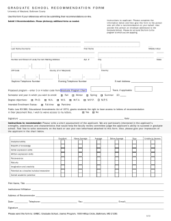
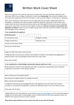
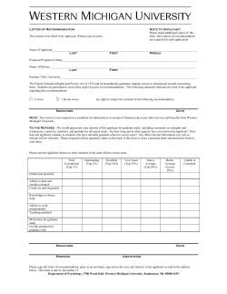
© Copyright 2026