
ALABAMA-COOSA RIVER BASIN WATER CONTROL MANUAL APPENDIX G
86$UP\&RUSV
RI(QJLQHHUV
Mobile District
ALABAMA-COOSA RIVER BASIN
WATER CONTROL MANUAL
APPENDIX G
ROBERT F. HENRY LOCK AND DAM
ALABAMA RIVER, ALABAMA
SEPTEMBER 1974
REVISED MARCH 1999
ALABAMA-COOSA RIVER BASIN
WATER CONTROL MANUAL
APPENDIX G
ROBERT F. HENRY LOCK AND DAM
ALABAMA RIVER, ALABAMA
U.S. ARMY CORPS OF ENGINEERS
MOBILE DISTRICT
SEPTEMBER 1974
REVISED MARCH 1999
Robert F. Henry Lock and Dam
Alabama River, Alabama
ii
NOTICE TO USERS OF THIS MANUAL
Regulations specify that this Water Control Manual be published in loose-leaf form, and
only those sections, or parts thereof, requiring changes will be revised and reprinted.
Therefore, this copy should be preserved in good condition so that inserts can be made to
keep the manual current.
EMERGENCY REGULATION ASSISTANCE PROCEDURES
If unusual conditions arise, contact -Water Management Section
Mobile District Office
(334) 690-2737
(334) 479-0787 (non-duty hours)
Robert F. Henry Lock Foreman
(334) 872-9525
(334) 872-6490 (non-duty hours)
UNIT CONVERSION
This manual uses the U. S. Customary System (USCS) of units. Exhibit B contains a
conversion table that can be used to convert USCS units to the metric system of units.
iii
ALABAMA-COOSA RIVER BASIN
WATER CONTROL MANUAL
APPENDIX G
ROBERT F. HENRY LOCK AND DAM
ALABAMA RIVER, ALABAMA
TABLE OF CONTENTS
Page
i
TITLE PAGE
PHOTOGRAPHS
ii
NOTICE TO USERS OF THIS MANUAL
iii
EMERGENCY REGULATION ASSISTANCE PROCEDURES
iii
UNIT CONVERSION
iii
TABLE OF CONTENTS
iv
PERTINENT DATA
ix
Paragraph
Title
Page
I - INTRODUCTION
1-01
1-02
1-03
1-04
1-05
1-06
Authorization
Purpose and Scope
Related Manuals and Reports
Project Owner
Operating Agency
Regulating Agencies
1-1
1-1
1-1
1-1
1-1
1-1
II - DESCRIPTION OF PROJECT
2-01
2-02
2-03
Location
Purpose
Physical Components
a. Spillway
b. Reservoir
2-1
2-1
2-1
2-1
2-1
iv
2-04
2-05
c. Earth dikes
d. Lock
e. Lock-Control station
f. Powerhouse
g. Switchyard
h. Other facilities
Real Estate Acquisition
Public Facilities
2-2
2-3
2-3
2-3
2-3
2-3
2-4
2-4
III - HISTORY OF PROJECT
3-01
3-02
3-03
3-04
3-05
Authorization
Planning and Design
Construction
Project Designation
Related Projects
3-1
3-1
3-2
3-2
3-2
IV - WATERSHED CHARACTERISTICS
4-01
4-02
4-03
4-04
4-05
4-06
4-07
4-08
4-09
4-10
4-11
4-12
General Description of Basin
Topography
Geology and Soils
Sedimentation
Climate
Storms and Floods
Runoff Characteristics
Streamflow at Robert F. Henry Damsite
Water Quality
Channel and Floodway Characteristics
Upstream Structures
Downstream Structures
4-1
4-1
4-1
4-2
4-3
4-3
4-3
4-3
4-4
4-4
4-4
4-4
V - DATA COLLECTION & COMMUNICATION
NETWORKS
5-01
5-02
5-03
5-04
5-05
5-06
5-07
Hydrometeorological Stations
a. Facilities
b. Reporting
c. Maintenance
Water Quality Stations
Recording Hydrologic Stations
Communication Network
Communication with Project
a. Regulating Office with Project
b. Regulating Office with Others
Project Reporting Instructions
Warnings
v
5-1
5-1
5-2
5-3
5-3
5-3
5-3
5-4
5-4
5-4
5-4
5-4
VI - HYDROLOGIC FORECASTS
6-01
6-02
General
a. Role of Corps
b. Role of Other Agencies
Forecasting Procedure
6-1
6-1
6-1
6-1
VII - WATER CONTROL PLAN
7-01
7-02
7-03
7-04
7-05
7-06
7-07
7-08
7-09
7-10
7-11
7-12
7-13
7-14
7-15
7-16
General Objectives
Constraints
Overall Plan for Water control
Standing Instructions to Damtender
Hydroelectric Power
Operation of Spillway Gates
Navigation
Flood control
Minimum Flow Agreement
Drought Contingency Plan
Recreation
Water Quality
Fish and Wildlife
Emergency Operations During Communication Outages
Passing Drift
Mosquito Control
7-1
7-1
7-1
7-1
7-2
7-3
7-3
7-3
7-4
7-4
7-6
7-6
7-6
7-6
7-7
7-7
VII - EFFECT OF WATER CONTROL
8-01
8-02
8-03
General
Flood Regulation
Droughts and Seasonal Low Flow Regulation
8-1
8-1
8-1
IX - WATER CONTROL MANAGEMENT
9-01
9-02
9-03
9-04
9-05
9-06
Project Operator
Operating and Regulating Offices
Interagency Coordination
Framework for Water Management Changes
Information Bulletins
Dam Safety
a. Notification
b. Coordination
vi
9-1
9-1
9-1
9-1
9-1
9-2
9-2
9-2
TABLES
Table
2-1
4-1
5-1
5-2
6-1
Title
R. E. “Bob” Woodruff Lake Area and Capacity
Upstream Projects from Robert F. Henry Lock and Dam
River Stage Gages Between Montgomery and Mouth of
Alabama River
Rainfall Reporting Network
Southeast River Forecast Center Forecast Locations for
Alabama River Basin
Page
2-2
4-4
5-1
5-2
6-2
EXHIBITS
A
B
C
Supplementary Pertinent Data
Unit Conversion Table
Standing Instructions to Damtender
PLATES
Title
Location Map
Plan and Section of Dam, Powerhouse and Lock
Gate Modification Plan and Elevation
Area-Capacity Curves
Reservoir Real Estate Acquisition Area
Recreational Facilities
Alabama-Coosa-Tallapoosa River Basin
Reservoir Map Sedimentation Ranges
Sedimentation Surveys
Normal Monthly and Annual Precipitation
Hydrographs - Average Daily Discharge
Mean Monthly and Annual Flows
Rainfall and river Stage Reporting Network
Rating Curve - Tailwater
Rating Curve - Catoma Creek near Montgomery, AL
NWS Rainfall Station reporting Instructions
Discharge Curve - Spillway, Lock and Overbank Dikes
Performance Curves - Turbogenerator Unit
Spillway Gate Operation Schedule
Rating Curve - Trashgate
Frequency Curve - Maximum Outflow
Frequency Curve - Maximum Pool and Tailwater Elevation
vii
E-A-1
E-B-1
E-C-1
Plate No.
2-1
2-2
2-3
2-4
2-5,2-6
2-7
4-1
4-2
4-3
4-4
4-5 - 4-9
4-10 - 4-12
5-1
5-2
5-3
5-4
7-1
7-2
7-3 - 7-10
7-11
8-1
8-2
Flood Hydrographs - Flood of March 1990
Flood Hydrographs - Flood of February - March 1961
Flood Hydrographs - Standard Project Flood
Flood Hydrographs - Spillway Design Flood
viii
8-3
8-4
8-5
8-6
R. F. HENRY LOCK AND DAM
ALABAMA RIVER, ALABAMA
PERTINENT DATA
GENERAL
Dam site location
State
County
River
Miles above mouth of Alabama River
Total drainage area above dam site
Square miles
1 inch of runoff equals, acre-ft
Alabama
Autauga
Alabama
245.40
16,300
869,333
PHYSICAL COMPONENTS
SPILLWAY
Type
Total length, including end piers, feet
Net length, feet
Elevation of crest, feet above msl
Type of gates
Number of gates
Length of gates, feet
Height of gates, feet
Maximum discharge capacity (pool elev. 125.0), cfs
Elevation of top of gates in closed position, feet above msl
concrete-gravity
646
550
91.0
tainter
11
50
35
124,500
126.0
POWERHOUSE
Type of powerhouse construction
Maximum power pool elevation, feet above msl
Maximum normal drawdown elevation, feet
Temporary/Emergency drawdown elevation, feet
Maximum static head, feet
Average operating head without spillway discharge, feet
Minimum head for generation, feet
Length of powerhouse, feet
Width of powerhouse including intake structure, feet
Number of units
Maximum discharge per unit, cfs
Generator capacity, MW
reinforced concrete
126.0
123.0
122.0
47
29
15.3
375
160
4
8,800
25
RESERVOIR
Normal pool elevation, feet above msl
Maximum operating pool elevation, feet above msl
Minimum operating pool elevation, feet above msl
Area at pool elevation 125.0, acres
125.0
126.0
123.0
12,510
ix
Area acquired in fee simple, acres
Area acquired by easement, acres
Area cleared, acres
Maximum elevation of clearing, feet above msl
Total volume to elevation 125.0, acre-feet
Length at elevation 125.0, miles
Shoreline distance at elevation 125.0, miles
LOCK
Nominal size of chamber, feet
Maximum lift, feet
Type of emergency dams
Elevation of top of upstream emergency dam, feet above msl
Elevation of top of downstream emergency dam,
feet above msl
EARTH OVERFLOW DIKES
Right Bank Dike
Total length, feet
Top elevation, feet above msl
Top width, feet
Left Bank Dike
Total length including lock mound, feet
Top elevation, feet above msl
Top width, feet
4,469
20,000
6,050
130.0
234,200
80.5
368
84 x 600
47.0
stop logs
126.7
97.9
2,661
135.0
32
12,639
143.0
32
x
I - INTRODUCTION
1-01. Authorization. This water control manual was authorized by ER 1110-2-240 and
EM 1110-2-3600, paragraphs 9-01 through 9-04. This manual also contains a drought
contingency plan as designated by ER 1110-2-1941. EC 1110-2-8156 dated 31 August
1995 was used as a guide for the format of this manual.
1-02. Purpose and Scope. The primary purpose of this manual is to document the water
control plan for the Robert F. Henry Lock and Dam project. Details of the coordinated
reservoir regulation plan for Robert F. Henry Lock and Dam within the multiple project
system of the Alabama River are presented which insure optimum benefits consistent
with the physical characteristics and purposes for which the system was authorized.
Included are descriptions of physical components of the lock and dam, operating
procedures, historical facts, and other pertinent data. Also presented are general
characteristics of the area including flood frequencies, meteorology, examples of
reservoir regulation, and a discussion on river forecasting. This manual also serves as a
reference source for higher authority and for new personnel who will become concerned
with, or responsible for, regulation of the project.
1-03. Related Manuals and Reports. The “Alabama-Coosa River Basin Water Control
Manual”, of which this is Appendix G, contains general information for the entire basin.
In addition, an “Operation and Maintenance Manual” and Emergency Notification
Procedures, CESAM Plan 500-1-4 have been prepared for Robert F. Henry Lock and
Dam.
1-04. Project Owner. The Robert F. Henry Lock and Dam project is a federally owned
project entrusted to the U. S. Army Corps of Engineers.
1-05. Operating Agency. The U. S. Army Corps of Engineers Mobile District operates
the Robert F. Henry Lock and Dam project. Reservoir operation and maintenance are
under the supervision of Operations Division. The project falls under the direction of the
Operations Project Manager located at Tuscaloosa, Alabama. Personnel attend the Robert
F. Henry powerhouse from 6:30 AM to 2:30 PM each day. The phone number is 334875-4400 during duty hours. Operators at the Millers Ferry Lock and Dam project
perform powerhouse controls via remote control. The Millers Ferry powerhouse can be
called at 334-682-9124. The lock is tended from 6 AM to 2 PM and from 6 PM to 2 AM
by operators under the direct supervision of a lockmaster. The office phone number of
the lock is 334-872-9525.
1-06. Regulating Agencies. The U. S. Army Corps of Engineers Mobile District
regulates the Robert F. Henry Lock and Dam project. The Water Management Section in
the Engineering Division monitors the project for compliance with the approved water
control plan and makes operational decisions based upon that plan. When necessary, the
Water Management Section instructs the powerhouse operators and lockmaster regarding
normal procedures and emergencies for unusual circumstances.
1-1
II - DESCRIPTION OF PROJECT
2-01. Location. The Robert F. Henry Lock and Dam project is located in the south
central part of the State of Alabama on the Alabama River at a point 245.4 miles above its
mouth. It is approximately 15 miles east-southeast of Selma and 35 miles west of
Montgomery. The dam and the first 32.9 miles of the R. E. “Bob” Woodruff Lake are in
Autauga County, which is along the right side of the river, and Lowndes County, which is
along the left side of the river. For the next 9.7 miles the right side of the lake is still in
Autauga County but the left side is in Montgomery County. The remainder of the lake is
in Elmore County on the right side and Montgomery County on the left side. The
location of the project is shown on Plate 2-1.
2-02. Purpose. Robert F. Henry Lock and Dam is a multiple purpose project. The River
and Harbor Act of 1945, Public Law 79-14, authorized flood control, navigation, and
hydropower. The operating purposes include navigation and hydropower. There is no
flood control storage in this project; flood control was deleted from the project plan prior
to construction. The Flood Control Act of 1944, Public Law 78-854, authorized
recreation. Access and facilities are provided for recreation, but water is not normally
controlled for that purpose.
2-03. Physical Components. The Robert F. Henry project consists of a gravity-type
dam with gated spillway supplemented by earth dikes, a navigation lock and control
station, and an 82,000 kW power plant. At normal pool elevation 125.0 the reservoir
formed by the dam extends upstream a maximum distance of 80.5 miles to Wetumpka on
the Coosa River. Principal features of the project are described in detail in subsequent
paragraphs. Sections, plan, and elevations of the dam and other features are shown on
Plates 2-2 and 2-3.
a. Spillway. The spillway is a concrete-gravity structure equipped with 11 tainter
gates 50 feet long and 35 feet high. The gate adjacent to the powerhouse is equipped with
a trash gate that accommodates the passing of trash accumulations at the powerhouse and
spillway. The spillway crest is at elevation 91.0. The top of gates in the closed position
is elevation 126.0, which provides a l-foot freeboard above normal pool elevation 125.0.
The overall spillway length is 646 feet. The net length is 550 feet. The gates are
mounted between 8-foot wide piers and are operated by individual hydraulically operated
ratchet gear hoists that are located on top of the piers. A bridge for pedestrian traffic
spans the top of the piers. The spillway joins the lock abutment on the left side and the
powerhouse on the right side. The spillway stilling basin is a horizontal concrete apron
with a 5-foot high sloping end sill. The basin extends downstream a maximum distance
of 100 feet from the spillway gate seal, and the apron is stepped in a transverse direction
from elevation 73.0 down to elevation 63.0.
b. Reservoir. The Robert F. Henry Dam forms R. E. “Bob” Woodruff Lake,
which covers an area of 12,510 acres at pool elevation 125.0. The impounded water at
pool elevation 125.0 has a total volume of 234,200 acre-feet. The maximum length of the
2-1
reservoir at elevation 125.0 is 80.5 miles which consists of 69.0 miles up the Alabama
River to its beginning; then, up the Coosa River 11.5 miles to Wetumpka. The lake at
elevation 125.0 also extends to the tailrace of the Alabama Power Company’s Walter
Bouldin Dam that is located in a canal which runs from Jordan Lake to the Coosa River
below Wetumpka. The reservoir also extends approximately 10 miles up the Tallapoosa
River. Area and capacity curves are shown on Plate 2-4, and selected area and capacity
values are tabulated on Table 2-1.
TABLE 2-1
R. E. “BOB” WOODRUFF LAKE
AREA AND CAPACITY
POOL TOTAL
TOTAL
ELEV.
AREA
STORAGE
(MSL) (ACRES) (AC-FT)
64
0
0
65
10
10
70
80
200
75
240
970
80
600
2,970
85
1,280
7,550
90
2,150
16,140
1
2,320
18,370
91
95
2,970
28,590
100
3,900
46,040
105
5,260
68,880
110
6,660
98,740
115
8,110
135,700
116
8,400
143,950
117
8,690
152,500
118
9,000
161,340
119
9,310
170,500
120
9,630
179,970
121
10,010
189,790
POOL
TOTAL
TOTAL
ELEV.
AREA
STORAGE
(MSL)
(ACRES)
(AC-FT)
2
10,470
200,030
122
3
10,990
210,760
123
124
11,700
222,100
4
12,510
234,210
125
5
13,500
247,210
126
127
14,580
261,250
128
15,640
276,360
129
16,650
292,510
130
17,730
309,700
131
19,150
328,140
132
20,550
347,990
133
22,300
369,410
134
24,050
392,590
6
26,380
417,800
135
136
28,800
445,390
137
31,500
475,470
138
33,700
507,990
139
36,000
542,840
140
38,400
580,040
1
Spillway crest
Emergency drawdown elevation
3
Maximum allowable drawdown
4
Normal operating pool elevation
5
Top-of-gates - closed position
6
Crest of free overflow dike
2
c. Earth dikes. The earth dike on the right overbank is 2,661 feet long and
connects the powerhouse with high ground to the northwest. A roadway along the dike
provides access to the powerhouse. The top of the dike is at elevation 135.0 except the
portion which slopes upward to the level of the switchyard at elevation 143.0. Floods of
sufficient magnitude to overtop the dike have a recurrence frequency of once in 9 years.
Both the upstream and downstream slopes of the dike are protected with grouted riprap
against high velocities that occur during overtopping. The dike on the left overbank is a
2-2
non-overflow section with a top elevation of 143.0 and has an access road along its entire
length. Considering the distance across the lock esplanade and an adjacent spoil area as
part of the dike the total length is 12,639 feet. The top elevation of 143.0 is slightly
above the computed headwater elevation of the standard project flood series. No riprap is
provided on the slopes of this dike since the base is above the normal pool level,
elevation 125.0.
d. Lock. The lock is located in the left bank between the spillway and the left
overbank earth dike. The lock chamber is 84 feet wide and is 655 feet long between gate
pintles. The usable length is slightly over 600 feet. The top of the upper gate blocks and
the top of the upstream miter gate are at elevation 143.0. The top of all other walls and
the downstream miter gate are at elevation 132.0. The top of the upper miter sill is at
elevation 109.0, 16 feet below the normal upper pool elevation 125.0. The top of the
lower miter sill is at elevation 67.0, 13 feet below the Millers Ferry normal pool elevation
80.0. The lock filling and emptying system is similar to that at Millers Ferry. It consists
of two intake ports in the riverside face of the upper gate block, a longitudinal culvert in
each of the chamber walls, a system of floor culvert in the chamber, and a discharge
system that empties outside the lower approach. Reverse-tainter valves control flow in
the culverts. The volume of water discharged in one-hour cfs for each time the lock is
emptied can be determined by multiplying the gross head by 15.3.
e. Lock-control station. The control station is located between the spillway and
lock adjacent to the upper gate block of the lock. The building is of reinforced concrete
construction three stories high. It contains an office and the mechanical and electrical
equipment necessary for operation of the lock and spillway. The third floor provides
access to the spillway bridge.
f. Powerhouse. The powerhouse at the R. F. Henry Dam retained its original
name as the Jones Bluff powerhouse. It is situated in the right bank of the river adjoining
the switchyard and parking area mound to the west. It joins the end of the spillway
section to the east or river-side. The building is a reinforced concrete structure, 375 feet
long and 160 feet wide. It consists of 4 generation bays and one erection bay. The
generation bays each contain a fixed-blade propeller-type turbine rated at 23,480
horsepower at a head of 28.2 feet. The turbine is connected to a vertical-shaft generator
rated at 20,500 kilowatts. The intake is an integral part of the powerhouse structure and
is positioned on the axis of the spillway.
g. Switchyard. The switchyard is located on the west side of the powerhouse
which is the right bank of the river. It is joined on the west by the right overbank dike.
The top elevation of the switchyard mound is 143.0. The principle structure in the
switchyard is the main takeoff for the outgoing lines. There are other structures for
busses, disconnecting switches, and potential transformers.
h. Other facilities. There are two houses located on the lock mound. They are
leased to the Alabama Marine Police for an office and training facility.
2-3
2-04. Real Estate Acquisition. Acquisition guide lines were based upon backwater
computations with the limit of taking being established at the elevation where the
backwater effect with the dam in place is less than one foot. The profiles were developed
using flows from 75,000 cfs to 125,400 cfs. The highest flows were for a natural
recurrence frequency of once every 1.5 years. The guide taking line thus adopted begins
at elevation 127.0 at the dam, mile 245.4, and continues at that elevation to mile 251.5;
then on a uniform slope to elevation 130.5 at mile 264.0; then to elevation 131.0 at mile
271.0; and then to elevation 139.5 at mile 314.4, the junction of the Coosa and Tallapoosa
Rivers. The actual taking line as developed through routine real estate practice is shown
on Plates 2-5 and 2-6. The total area encompassed by the taking line is 18,845 acres, of
which 5,370 acres were purchased in fee for construction and public use areas. Flowage
easements were acquired on the remaining 13,475 acres.
2-05. Public Facilities. R. E. “Bob” Woodruff Lake, impounded by Robert F. Henry
Lock and Dam, greatly enhances the opportunities for water-oriented recreation. The lake
offers such activities as fishing, boating, water skiing, picnicking, camping, swimming,
and hiking. The project features 17 primary recreation facilities that are rustic but well
facilitated for visitors. Fifteen of the sites are operated by the Corps and have
approximately 3,978 total acres. The Fort Toulouse National Historic Park is State
operated and maintained and has approximately 183 total acres. Powder Magazine is
operated by the City of Montgomery and has approximately 58 total acres. Conveniences
at the parks include beaches, campgrounds, picnic areas, trails, and boat launching ramps.
Since the first park was constructed in 1975, annual attendance has risen to over 2
million. All public use areas are shown on Plate 2-7. The phone number for the Robert
F. Henry Site Office is 334-872-8210.
2-4
III - HISTORY OF PROJECT
3-01. Authorization. The original project for the improvement of the Alabama River
was authorized by Congress on 18 June 1878 to provide for a navigation channel 4 feet
deep and 200 feet wide from the mouth to Wetumpka and was modified on 13 July 1892
to provide a 6-foot channel. Subsequent acts approved in 1905 and 1910 provided for a
channel 4 feet deep at low water from the mouth to Wetumpka by the use of contracting
dikes and dredging. This project was 62 percent complete in 1942, the last year that any
new work was performed. The authorization of a modified plan of development in 1945
replaced the project entirely.
3-02. Planning and Design.
a. The first comprehensive plan for the optimum use of the water resources of the
Alabama-Coosa basin was developed by the Corps of Engineers under the authority of
House Document No. 308, 69th Congress and was published in November 1934 as House
Document No. 66, 74th Congress, 1st Session. The plan contemplated five navigation
dams on the Alabama River.
b. A resolution of the Committee on Rivers and Harbors, House of
Representatives, passed on 28 April 1936 requested that a review be made to determine if
changes in economic conditions might warrant modification of the recommendations in
House Document No. 66, 74th Congress, with regard to the Alabama River. A resolution
of the Committee on Commerce, U. S. Senate, adopted 18 January 1939 requested a
review to determine the advisability of constructing reservoirs on the Alabama-Coosa
Rivers and tributaries for development of hydroelectric power and improvement for
navigation
c. The Chief of Engineers in a report submitted on 15 October 1941 and printed
as House Document No. 414, 77th Congress, 1st Session recommended a general plan for
the development of the basin. Congress authorized in the River and Harbor Act of 2
March 1945 (Public Law 14, 79th Congress) the initial and partial accomplishment of this
plan. Planning studies for the initially authorized projects on the Alabama River to
provide navigation facilities with the maximum hydroelectric power feasible began in
1945.
d. A site selection report for the entire Alabama River was submitted on l0
December 1945 which determined that the overall project for the Alabama River should
consist of dredging in the lower river, and navigation dams and locks at Claiborne,
Millers Ferry and Jones Bluff upstream with power plants added to the latter two projects.
The first design memorandum for Jones Bluff presenting "Basic Hydrology" was
submitted on 30 April 1963. It was followed by the "General Design" on 16 March 1964
and then by 19 design memoranda for particular features of the project during the next
eight years.
3-1
3-03. Construction.
a. The first phase of construction placed under contract at the Robert F. Henry
project was the lock excavation, which commenced on 7 February 1966, and was
completed on 1 October 1966. No other work was contracted because of delays in
funding until 1968. The Dravo Corporation was awarded a contract for construction of
the lock, 9 gate-bays of the spillway, the earth overbank dikes, the access roads, and the
lock mound on 17 April 1968. The work under that contract was completed 15 October
1971 at a total cost of $16,417,377.38.
b. The second-stage cofferdam was completed in October 1970 which closed the
river channel. The reservoir was not filled at the time because of reservoir clearing
operations under way in the lower reaches. The river flow was passed through the gate
bays in the completed portion of the spillway. In November 1971 filling was begun in
conjunction with clearing operations in the upper reaches of the reservoir. When clearing
was completed in December 1971 the reservoir was filled to normal pool elevation 125.0.
The first navigation through the lock was allowed in January 1972 and the facility was
officially opened to navigation on 15 April 1972.
c. A contract for construction of the powerhouse and the last two gate bays of the
spillway was awarded on 23 June 1972 to Peter Kiewlt and Sons along with Standard
Construction Company as a joint venture. The power units were placed in operation in
1975 at approximately three month intervals for each unit.
d. Spillway Gate No. 1 was modified in 1990 to include a trashgate which
accommodates the passing of trash accumulations at the powerhouse and spillway.
3-04. Project Designation.
a. The reservoir has been designated the R. E. “Bob” Woodruff Lake.
b. Public Law 97-383 [S. 2034]; December 22, 1982, designated “the lock and
dam known as the Jones Bluff Lock and Dam, located on the Alabama River, as the
‘Robert F. Henry Lock and Dam’.” The powerhouse has retained its original name as the
Jones Bluff powerhouse.
3-05. Related Projects. The Robert F. Henry Lock and Dam project is the third major
unit of the navigation system developed on the Alabama River by the U. S. Army Corps
of Engineers. Millers Ferry Lock and Dam, located downstream at navigation mile 178.0
above the foot of Government Street, Mobile, Alabama, also has hydropower capability.
Claiborne Lock and Dam is located downstream of Millers Ferry at navigation mile 117.5
above the foot of Government Street, Mobile.
3-2
IV - WATERSHED CHARACTERISTICS
4-01. General Description of Basin. The Alabama-Coosa River system drains a small
portion of Tennessee, northwestern Georgia, and northeastern and east-central Alabama.
The Alabama River basin has its source in the Blue Ridge Mountains of northwest
Georgia. The main headwater tributaries are the Oostanaula and Etowah Rivers, which
join near Rome, Georgia, to form the Coosa River. The Coosa River in turn joins the
Tallapoosa River near Wetumpka, Alabama, approximately 14 miles above Montgomery,
Alabama, to form the Alabama River. The drainage basin is approximately 330 miles in
length, and averages 70 miles wide with a maximum width of about 125 miles. The basin
has a total drainage area of 22,500 square miles of which 16,300 square miles are above
Robert F. Henry Lock and Dam. In the early 1990’s the Alabama-Coosa River basin
became more widely known as the Alabama-Coosa-Tallapoosa, or ACT, River basin.
Plate 4-1 shows a map of the ACT River basin.
4-02. Topography. The ACT River basin is composed of an unusually wide range of
topographic areas. The location of the river basin is within parts of five physiographic
provinces: the Blue Ridge Province; the Valley and Ridge Province; the Piedmont
Plateau; the Cumberland Plateau; and, the Coastal Plain. Each of these physiographic
sub-divisions influences drainage patterns. High rounded mountains and steep narrow
valleys characterize the northeastern portion of the basin in the Blue Ridge Province.
Overburden is sparse except in the valley flood plains. The topography of the Valley and
Ridge Province is alternating valleys and ridges with altitudes varying from
approximately 600 to 1,600 feet. The dominant characteristics of the Cumberland Plateau
are flat plateaus ranging in altitude from 1,500 to 1,800 feet that bound narrow, northeastsouthwest trending valleys. Rolling hills and occasional low mountains topographically
characterize the Piedmont Province. Altitudes range from 500 to 1,500 feet. Low hills
with gentle slopes and broad shallow valleys that contain slow-moving meandering
streams with wide flood plains characterize the topography of the Coastal Plain. The
Alabama River flows through a broad lowland valley that varies in width from 3 to 10
miles throughout the length of the Robert F. Henry Lock and Dam project. To the south
the river borders the Black Belt, a prairie land so named for its rich, black soil and flat to
gently rolling prairie land developed over the Selma Chalk Formation. The northern side
of the river is bounded by stable formations that are more resistant to erosion. Exposed
hillsides with a greater relief is characteristic of this northern side. The river strikes a
broad, meandering, westerly course through the valley falling at a rate of 0.5-foot per
mile. Normal river elevation is below the flood plain. There are numerous tributaries
entering the river from both sides and are rather evenly distributed between the upper and
lower limits of the lake.
4-03. Geology and Soils. The ACT River basin covers an unusually wide range of
geologic conditions. The location of the river basin is within parts of five physiographic
provinces: the Blue Ridge Province; the Valley and Ridge Province; the Piedmont
Plateau; the Cumberland Plateau; and, the Coastal Plain. Each of these physiographic
sub-divisions influences drainage patterns. Rugged crystalline rocks characterize the
northeastern portion of the basin in the Blue Ridge Province. Folded limestone, shale,
4-1
and sandstone compose the Valley and Ridge Province. The axes of the folds that trend
northeast-southwest influence the course of the streams in that they tend to flow
southwestward along the alignment of the geologic structure. Like the Valley and Ridge
Province -- folded, faulted, and thrusted rocks form the Cumberland Plateau -- with the
deformation being less than the Valley and Ridge rocks. The east-central portions of the
basin are in the Piedmont Province, characterized by sequences of metamorphic and
igneous rocks. Prominent topographic features generally reflect the erosional and
weathering resistance of quartzite, amphibolite, and plutonic rocks. The residual soils are
predominately red sandy clays and gray silty sand derived from the weathering of the
underlying crystalline rocks. The more recent sedimentary formations of the Coastal
Plain underlie the entire southern portion of both river basins. The contact between the
Coastal Plain on the south and the previously described physiographic provinces to the
north is along a line that crosses the Cahaba River near Centreville, Alabama; the Coosa
River near Wetumpka, Alabama; and the Tallapoosa River near Tallassee, Alabama. As
the rivers leave the hard rocks above this line and enter the softer formations of the
Coastal Plain, the erosion properties change, resulting in the formation of rapids. This
line is a geological divide commonly known as the "fall line". The rocks of the Coastal
Plain are typically poorly consolidated marine sediments.
Overlying the bedrock at the Robert F. Henry Lock and Dam site are layers of fine and
coarse grained soils that average 30 feet in thickness. The fine-grained soils consist of
silty clay, silty sand and fat clay. The clays were deposited in depressions and range in
thickness up to 25 feet. Below the fine grained soils is a layer of poorly graded sand and
poorly graded gravel that averages 20 feet in thickness. Underlying the sand and gravel is
a soft, residual layer of clay overlying bedrock that generally slopes towards the river
channel.
Two geologic formations exist at the project. The Selma Chalk Formation comprises the
upper rock section and ranges in thickness from 100 to 135 feet. The Selma Chalk
Formation is composed of gray, calcareous chalk, siltstone and claystone with thin layers
of green clay. The Eutaw Sand Formation underlies the Selma Formation and ranges in
thickness up to 400 feet. The sand is fine to medium grained, green to gray, micaceous
and fossiliferous. The Eutaw Formation contains groundwater under artesian pressure.
The geologic structure at the project is a monocline dipping about 35 feet per mile in a
southwesterly direction. The Selma Chalk Formation thickens in the downstream
direction and includes about 1000 feet of calcareous rocks at full thickness.
4-04. Sedimentation. Sedimentation ranges have been established for the entire length
of the reservoir and their original profiles have been surveyed. Key ranges will be
resurveyed at regular intervals in order to spot any appreciable changes from the original.
The ranges were last resurveyed in September 1988. The range locations are shown on
Plate 4-2. Plots of the original survey and resurvey for selected ranges are shown on Plate
4-3.
4-2
4-05. Climate.
a. Temperature. The average annual temperature in the vicinity of Robert F.
Henry Lock and Dam is about 65° F. This figure is based on normal annual temperatures
at Selma, Alabama, with 117 years of record, and Montgomery, Alabama, with 123 years
of record. Extreme temperatures recorded at these stations have been a high of 108° and
a low of -5°. The summer temperatures average about 81° and the winter about 48°.
b. Precipitation. The Alabama-Coosa-Tallapoosa River Basin lies in a region of
heavy annual rainfall, which is fairly well distributed throughout the year. The normal
annual precipitation is 55.06 inches, of which 57 percent occurs during the winter and
spring, 23 percent in the summer and 20 percent in the fall. The normal monthly and
annual precipitation over various portions of the Alabama-Coosa Basin above Robert F.
Henry Dam are shown on Plate 4-4. The maximum annual rainfall over the basin was 78
inches in 1929 and the minimum annual was 32 inches in 1954. The highest annual
station rainfall recorded in the basin was 104.03 inches at Flat Top, Georgia, in 1949.
The lowest recorded rainfall was 22.00 inches at Primrose Farm, Alabama, in 1954.
Moderate snowfall occurs in the northern portion of the basin during the winter months,
but seldom covers the ground for more than a few days at a time and has not been an
important contributing factor in any major flood.
4-06. Storms and Floods.
a. General. Flood-producing storms may occur over the basin anytime but are
more frequent during the winter and early spring. These storms are usually of the frontal
variety lasting two to four days. Summer storms are the convective type thundershowers
with high intensity rainfall over small areas which produce local floods. In the fall,
occasional heavy rains may accompany dissipating tropical cyclones.
b. Record Floods. A major storm system in the spring of 1990 produced record
floods on the Alabama River. On March 16, 1990, with the river still high from previous
rains, the entire basin received very heavy rainfall for two days. For the two day total
Robert F. Henry reported 9 inches, Millers Ferry reported 6.75 inches and Claiborne had
9.5 inches. The upper basin received an average of 6 to 7 inches during this period.
Robert F. Henry discharged a record-breaking 220,000-cfs on March 20, 1990 producing
a record tailwater of 135.4 feet. The largest known flood for the entire period of record is
the historical flood of February-March 1961 with a peak discharge of 283,200 cfs.
4-07. Runoff Characteristics. The tributaries contributing flow to the Alabama River
above the Robert F. Henry damsite exhibit wide variations in runoff characteristics. They
range from very flashy in the mountainous regions of the Coosa basin above Rome,
Georgia, to very slow rising and falling in the lower reaches. The mean annual discharge
for the period January 1929 through December 1993 is 26,771 cfs or about 1.5 cfs per
square mile.
4-08. Streamflow at Robert F. Henry Damsite. The average daily discharges shown
on Plates 4-5 through 4-9 and the mean monthly and annual flows on Plates 4-10 through
4-3
4-12 were developed from data for the USGS gage at Selma, AL and discharge data from
the gage site.
4-09. Water Quality. Generally, the surface waters of the Alabama River Basin are of
good chemical quality. Overall, the water quality of the R. E. “Bob” Woodruff Lake is
adequate. Some tributaries to the lake, including Catoma Creek and Big Swamp Creek,
as well as municipal, industrial, and agricultural discharges have a detrimental effect on
the water quality of the lake. Typically, the water in the lake is low in dissolved oxygen;
pH varies from 6 and 8; oxygen is sufficient to support a diverse fish fauna; and nitrogen
and phosphorous concentrations are below levels likely to cause eutrophication.
4-10. Channel and Floodway Characteristics. The navigation channel from the mouth
of the Alabama River to Montgomery, Alabama has an authorized depth of 9 feet and a
width of 200 feet.
4-11. Upstream Structures. Above Robert F. Henry Lock and Dam are Alabama Power
Company hydroelectric projects on the Coosa and Tallapoosa Rivers and two Corps
projects, Allatoona and Carters, located above the APC Coosa projects. Table 4-1 shows
the upstream projects and their drainage areas.
Table 4-1
Upstream Projects from Robert F. Henry Lock and Dam
Agency
APC
APC
APC
APC
APC
APC
Coosa
Projects
Weiss
Henry
Logan Martin
Lay
Mitchell
Jordan/Bouldin*
Drainage Area
sq. mi.
5,610
6,596
7,743
9,053
9,778
10,102
COE
COE
Allatoona
Carters
1,117
373
Agency
APC
APC
APC
APC
Tallapoosa
Projects
Harris
Martin
Yates
Thurlow
Drainage Area
sq. mi.
1,453
2,984
3,293
3,308
* Jordan Dam is located on the Coosa River at river mile 18.9. Walter Bouldin Dam is located on a by-pass of the
Jordan Dam and discharges into a canal which enters the Woodruff Lake at Coosa River mile 4.2.
4-12. Downstream Structures. Below Robert F. Henry Lock and Dam are two Corps
projects, Millers Ferry and Claiborne Locks and Dams. Millers Ferry has a drainage area
of 4,400 square miles from Robert F. Henry to Millers Ferry. Claiborne has a drainage
area of 820 square miles from Millers Ferry to Claiborne.
4-4
V - DATA COLLECTION AND COMMUNICATION NETWORKS
5-01. Hydrometeorological Stations.
a. Facilities. The hydrometeorological network installed in the Alabama River
Basin facilitates the operation of Robert F. Henry and Millers Ferry for power generation.
The Mobile District’ s daily hydrometeorological system for the Alabama-CoosaTallapoosa River basin includes 27 rainfall stations, 41 river stations and, flow data for 5
Corps projects and 4 Alabama Power projects. There are 20 river stage gages and 30
rainfall gages between Montgomery and the mouth of the Alabama River. The river
stations and rainfall stations are listed in Tables 5-1 and 5-2 and shown on Plate 5-1.
Discharge rating curves for the tailwater at Robert F. Henry L&D and for Catoma Creek
near Montgomery, AL are shown on Plates 5-2 and 5-3.
Table 5-1
River Stage Gages Between Montgomery and Mouth of Alabama River
Location
Station No.
Stream
River Miles
Above
Mouth
Drainage
Area
(mi2)
Gage Zero
Elev.
(NGVD)
Flood
Stage
Servicing
Agency
River Stage Gages in the Daily Hydrologic Network
Montgomery
Montgomery
Robert F. Henry
(HW)
Robert F. Henry
(TW)
Selma
Centreville
Suttle
Marion Junction
Millers
Ferry (HW)
Millers
Ferry (TW)
Claiborne (HW)
Claiborne (TW)
Choctaw Bluff
02420000
02421000
02421350
Alabama R.
Catoma Ck.
Alabama R.
287.6
16.1
245.4
15,087
290
16,233
151.02
0.00
20
USGS
USGS
USGS
02421351
Alabama R.
245.4
16,233
0.00
122
USGS
02423000
02424000
02424590
02425000
Alabama R.
Cahaba R.
Cahaba R.
Cahaba R.
Alabama R.
214.8
81.2
31.0
21.4
142.3
17,095
1,027
1,480
1,766
20,637
61.8
180.74
97.64
86.72
0.00
45
23
02427506
Alabama R.
142.3
20,637
0.00
66
USGS
02428400
02429593
Alabama R.
Alabama R.
Alabama R.
81.9
81.8
42.3
21,520
21,520
0.00
0.00
42
USGS
USGS
COE
36
USGS
USGS
USGS
USGS
Other River Stage Gages Within the Alabama River Basin
Jones
02422500
Mulberry Ck.
11.0
203
165.23
USGS
Trussville
02423130
Cahaba R.
182.3
20
673.30
USGS
Mtn. Brook
02423380
Cahaba R.
153.6
140
443.85
USGS
Cahaba Hts.
02423425
Cahaba R.
Hoover
02423496
Cahaba R.
138.9
226
379.56
USGS
Acton
02423500
Cahaba R.
136.8
230
375.00
USGS
Snow Hill
02427250
Pine Barren
Ck.
4.0
261
126.60
USGS
USGS
5-1
TABLE 5-2
Rainfall Reporting Network
Between Montgomery, AL and Robert F. Henry Lock and Dam
Station
Latitude
Longitude
Elevation
(Ft. ngvd)
Type
Agency(1)
Alabama River above Robert F. Henry Dam
Billingsley
Mathews
Montgomery WSO*
Catoma Creek*
Autaugaville 3N
R. F. Henry L&D*
32° 40
32° 16’
32° 18’
32° 18’
32° 28’
32° 19’
86° 40
86° 00’
86° 24’
86° 17’
86° 41’
86° 47’
445
190
221
151
200
146
Non-rec
Non-rec
Recording
Recording
Non-rec.
Recording
NWS
NWS
NWS
Corps of Engineers
NWS
Corps of Engineers
Alabama River - Robert F. Henry Dam to Millers Ferry Dam
Plantersville 2SSE
Selma*
Palmerdale
Pinson
Cahaba Heights
Oak Mtn St.Park 2N
Helena
Calera
Montevallo
West Blocton
Centreville WSMO*
Marion 7 NE
Perryville
Suttle*
Marion Junction 2NE*
Millers Ferry L&D*
Uniontown
Alberta
Camden 3 NW
Pine Apple
32° 37’
32° 25’
33° 46’
33° 41’
33° 27’
33° 24’
33° 16’
33° 06’
33° 06’
33° 07’
32° 54’
32° 42’
32° 36’
32° 32’
32° 28’
32° 06’
32° 27’
32° 14’
32° 02’
31° 52’
86° 54’
87° 00’
86° 39’
86° 42’
86° 43’
86° 42’
86° 50’
86° 45’
86° 52’
87° 07’
87° 15’
87° 16’
87° 09’
87° 11’
87° 13’
87° 25’
87° 31’
87° 25’
87° 19’
86° 59’
230
147
720
608
461
660
480
530
410
500
456
172
500
145
200
115
280
175
235
250
Non-rec.
Non-rec.
Non-rec.
Non-rec.
Non-rec.
Non-rec.
Non-rec.
Non-rec.
Non-rec.
Non-rec.
Non-rec.
Recording
Non-rec.
Non-rec.
Non-rec.
Recording
Non-rec.
Recording
Non-rec.
Non-rec.
NWS
NWS
NWS
NWS
NWS
NWS
NWS
NWS
NWS
NWS
NWS
NWS
NWS
NWS
NWS
NWS
NWS
NWS
NWS
NWS
Alabama River - Millers Ferry Dam to Claiborne Dam
Thomasville
Whatley
Robert F. Henry L&D*
Frisco City 3SSW
31° 55’
31° 39’
31° 37’
31° 23’
87° 44’
87° 43’
87° 33’
87° 25’
*Included in the MDO’s Daily Hydrologic Network
405
170
50
275
Recording
Non-rec.
Recording
Non-rec.
NWS
NWS
Corps of Engineers
NWS
(1) NWS - National Weather Service
b. Reporting. Automatic radio reporting river stage gages are interrogated at
Millers Ferry. This data and all station reports for Robert F. Henry, Millers Ferry and
Claiborne are relayed to the Water Management Section by computer. The Water
5-2
Management Section’s computer interrogates the Catoma Creek, Suttle, and Choctaw
Bluff gages collecting and storing river stages daily. The Montgomery gage and Selma
gage are extracted from the National Weather Service by computer. The river stage data
can be obtained from the annual report titled "Water Resource Data Alabama" published
by the U. S. Geological Survey. Rainfall reports from the stations at Robert F. Henry and
Millers Ferry are relayed to the Water Management Section from Millers Ferry
powerhouse personnel by computer network, facsimile, or telephone. The radio reporting
stations are monitored at Millers Ferry and the data is transferred to the Water
Management Section. Observers at non-recording stations report rainfall readings to the
National Weather Service according to the NWS Reporting Instructions shown on Plate
5-4, and the data is relayed to the Water Management Section. The airways stations at
Montgomery and Selma report every 6 hours. Robert F. Henry and Millers Ferry report
every 6 hours. The rainfall totals are documented by the National Weather Service in a
monthly publication titled "Climatological Data Alabama."
c. Maintenance. The Corps of Engineers, Mobile District has a cooperative
program with the U. S. Geological Survey and their office in Montgomery, Alabama for
both maintenance and the exchange of data for the gages identified in the above
paragraphs. Maintenance of the gages is accomplished by each agency maintaining the
gages they are responsible for according to the program.
5-02. Water Quality Stations. Water quality measurements are made at 14 USGS
gaging stations within the Alabama River basin. The data for these stations can be
obtained from the USGS yearly publication, Water Resources Data Alabama and Water
Resources Data Georgia. The Corps of Engineers operates a continuous water quality
station located below Robert F. Henry Lock and Dam. The parameters monitored are
dissolved oxygen, pH, conductivity, and temperature.
5-03. Recording Hydrologic Data. The Water Management Section maintains a Data
Storage System, DSS, containing various hydrologic data from the different projects and
river basins within the Mobile District. For the ACT River Basin this database includes
data from various river gage locations and rainfall locations as well as data relative to the
water control operations at Robert F. Henry. The data is input into the database either
automatically via computer program or manually by entering the data.
Stream flow measurements have been made at the river gages within the ACT Basin.
Records for these stations are published annually by the US Geological Survey. Data is
also available through the Water Management Section computer database as well as the
USGS Prime computer database.
5-04. Communication Network. The primary communication network consists of the
commercial telephone network, the South Atlantic Division Regional Village computer
network, and a two-way radio system. The radio system is part of the District’ s radio
communication network.
5-3
5-05. Communication With Project.
a. Regulating Office with Project Office. Communication between the Water
Management Section and Robert F. Henry Lock and Dam is by commercial telephone and
computer network. The Water Management Section can transfer current data files from
the Millers Ferry computer at any time using File Transfer Protocol, FTP. During
emergencies, a two-way voice radio in the Readiness Branch of Operations Division can
be used. For powerhouse and spillway operations, communication is between Water
Management Section and powerhouse operating personnel at Millers Ferry. Millers Ferry
communicates with Robert F. Henry lock tenders by a fixed station VHF radio network
which is part of the Mobile District’s radio communication network. The equipment is
located in the powerhouse and the lock control office at both projects. There are also a
varying number of mobile units for local communication in the reservoir area.
b. Between Project Office and Others. The Water Management Section
communicates daily with the National Weather Service and Alabama Power Company to
exchange data and forecasting information. The data exchange is made by computer and
is supplemented by telephone and facsimile when necessary. The Water Management
Section also has a computer link with the National Weather Service’s AFOS
communication system via the River Forecast Center in Atlanta, Georgia. The Water
Management Section, Millers Ferry, and Claiborne all use a telephone auto-answer
recorded message to provide daily information to the public.
5-06. Project Reporting Instructions. Millers Ferry powerhouse personnel input
project data into their computer every hour. The information includes rainfall, pool
elevations, and other information pertinent to effective water management at Robert F.
Henry and Millers Ferry. The Water Management Section receives the project data every
six hours by computer network using FTP.
5-07. Warnings. It is the responsibility of the National Weather Service to issue flood
warnings to the general public. The Water Management Section will assist by providing
current reservoir operation data to the NWS and by posting the river forecast on the
internet homepage.
5-4
VI - HYDROLOGIC FORECASTS
6-01. General. The Robert F. Henry project is affected by the operation of the Alabama
Power Company projects upstream. Therefore the Alabama Power Company, the
National Weather Service, and the Corps of Engineers exchange data daily to provide
quality forecasts on inflows, headwater elevations, tailwater elevations and river stages on
the Alabama River.
a. Role of Corps. The Water Management Section obtains on a daily basis flow
estimates for the Alabama Power Company projects. The Water Management Section
considers these inflows, local flows, current pool levels, and discharge requirements in
scheduling releases from Robert F. Henry and Millers Ferry Dams. The Water
Management Section maintains close liaison with the National Weather Service’s River
Forecast Center and Birmingham offices at all times, particularly during floods, with
mutual exchange of information and agreement on expected stages at NWS river stations
which may be affected by operations at Corps of Engineers projects.
b. Role of Other Agencies. The National Weather Service has the legal
responsibility of issuing stage forecasts to the general public. Forecasts for the Alabama
River basin are prepared by the National Weather Service Southeast River Forecast
Center in Atlanta, Georgia, and issued to the public through their Birmingham and
Mobile, Alabama, offices. Table 6-1 lists the forecast stations in the Alabama River
basin.
6-02
Forecasting procedure. The Water Management Section transmits the
Alabama Power Company data to the River Forecast Center in Atlanta, Georgia, for them
to use in constructing forecasts for Robert F. Henry, Millers Ferry, and Claiborne inflows
along with their respective tailwater elevation and the river stage for Montgomery,
Alabama, station #02419988. Additional stage forecasts are included during periods of
high flows. The additional stage locations are listed in Table 6-1
6-1
Table 6-1
Southeast River Forecast Center Forecast Locations
for Alabama River Basin
Daily Stage/Elevation Forecasts
Station
Montgomery
R. F. Henry TW
Millers Ferry TW
Claiborne TW
Station ID
MGMA1
TYLA1
MRFA1
CLBA1
Critical
Stage
26
35
Flood
Stage
35
122
66
42
Daily 24-hour Inflow in 1000 SFD Forecast
Reservoir
R. F. Henry
Millers Ferry
Station ID
TYLA1
MRFA1
Additional Stage Forecasts Only for Significant Rises
River/Creek
Coosa
Coosa
Coosa
Coosa
Coosa
Tallapoosa
Tallapoosa
Tallapoosa
Catoma Creek
Alabama
Cahaba
Cahaba
Cahaba
Cahaba
Station
Weiss Dam
Gadsden
Logan Martin Dam
Childersburg
Wetumpka
Wadley
Milstead
Tallapoosa Wt Pit
Montgomery
Selma
Cahaba Hts
Centreville
Suttle
Marion Junction
Station ID
CREA1
GAPA1
CCSA1
CHLA1
WETA1
WDLA1
MILA1
MGYA1
CATA1
SELA1
CHGA1
CKLA1
SUTA1
MNJA1
6-2
Critical
Stage
40
15
15
16
30
20
28
15
Flood
Stage
564
511
465
402
45
13
40
25
20
45
14
23
32
36
VII - WATER CONTROL PLAN
7-01. General Objectives. The primary function of the Robert F. Henry Lock and Dam
project is to provide a navigable channel; therefore, the lake will be regulated at or near
the approved normal pool of elevation 125.0 feet ngvd. The other major function of the
project is hydroelectric power generation. Provision has been made for two feet of
pondage below elevation 125.0 to facilitate operations for hydropower generation,
navigation, and downstream minimum flow requirements. Fluctuations up to elevation
126.0, the top of the spillway gates, will be permitted for increased flow-regulating
capability, power generating head, and other worthy purposes.
7-02. Constraints.
a. Full Discharge Capacity. The full discharge capacity of the spillway at
elevation 125.0 is 124,500 cfs, the equivalent of a flood which may be expected to occur
once in 1.5 years. Once the spillway capacity is reached a free overflow condition will
prevail. There will be little difference in the water surface upstream and downstream of
the dam. The river may continue to rise just as it would in the absence of any structure.
b. Head limitation. Design criteria for stability against overturning and sliding
of the Robert F. Henry structures make it imperative that the head, or difference between
headwater and tailwater, does not exceed 47 feet at any time. All operational planning
has been based on this strict limitation.
7-03. Overall Plan for Water Control. The reservoir level will be maintained between
elevations 124.0 and 126.0 by passing the inflow through the power plant and/or the
spillway gates until the powerhouse becomes inoperative. Discharges above
approximately 112,000 cfs will cause the power plant to be nonproductive because of the
high tailwater, so that for higher flows no outflow will pass through the turbines. With
turbines out of service, spillway gates will be opened to lower and maintain the pool
between elevations 124.0 and 126.0. When the inflow exceeds approximately 125,000
cfs, the spillway capacity will be reached, and there will be no control over the outflow.
At such high flow, there will be little difference in the water level above and below the
dam, and the flow condition will be that of a natural river in flood. The gates will remain
in the full open position until the pool peaks and recedes. As the pool level recedes,
spillway gates will be lowered to maintain the elevation between 124.0 and 126.0. When
the tailwater is sufficiently low to restart the powerhouse, the spillway gates will be
lowered, and the power plant and spillway gates will be used to maintain the elevation
between 124.0 and 126.0. Gate operating instructions are given in a subsequent
paragraph. Any departures from this operating schedule will be made only as directed by
the Water Management Section. Plate 7-1 shows total spillway and overbank discharge
for pool levels above elevation 125.0. In periods when flow is less than powerhouse
capability, peaking power releases will be made as described in paragraph 7-05. More
detailed instructions for water control operations are given in the following paragraphs.
7-04. Standing Instructions to Damtender. Exhibit C, Standing Instructions to the
Project Operator for Water Control, describes the operator’s responsibilities considered
7-1
necessary for reservoir regulation. These duties include reservoir operating procedures,
data collecting, and data reporting.
7-05. Hydroelectric Power. The Jones Bluff powerhouse at the project is operated as a
run-of-river hydropower plant for the production of hydroelectric energy and capacity.
Depending upon flow, the plant is either continuously running (high flow) or peaking
(low flow) on a 7-day basis. The output from the plant is marketed by the Southeastern
Power Administration (SEPA) in accordance with provisions in the Flood Control Act of
1944. The responsibility under this Act for determining the amount of power that can be
produced from this project has been delegated to the Mobile District Engineer. The
District Engineer relies on the Water Management Section to make weekly and daily
determinations of hydropower that can be generated.
a. Normal Operation. Energy from the Robert F. Henry project is included in
the weekly minimum contract requirements. Therefore, a 7 day declaration will be made
each week. However, with 82 percent of the drainage area above the project controlled
by the Alabama Power Company dams upstream and the short time of travel from these
dams to Robert F. Henry it will not be possible for SEPA to make a definite schedule of
power generation based on the weekly declaration. Normally, a declaration of energy and
capacity available at the project is prepared each morning by the Water Management
Section for the next day. The declaration, which is based on current pool levels,
capacities, expected inflows, and discharge requirements, is then given to SEPA. Actual
hourly scheduling will be as directed by SEPA in accordance with the declaration. There
may be times when the Water Management Section will require generation during certain
hours. When this condition exists, SEPA will be notified, and they will schedule
generation only during these hours. Changes to the generation schedule will be made by
2 P.M. on the day prior to the day the change will be implemented whenever possible.
Because of changes in discharge estimates at upstream projects, schedule changes may be
made hourly or daily by the Water Management Section as required to maintain the lake
within established operating levels. Performance curves which indicate the discharge
capacity and power output capability at various operating heads for a single turbogenerator unit are shown on Plate 7-2.
b. High-Flow Operation. During periods when the reservoir inflow is equal to
or greater than the capacity of the turbines, the power plant will be operated at full
capacity around the clock. As the flow increases, rising tailwater elevations will reduce
the head and the power output. When the head decreases to approximately 15.3 feet, the
units will be shut down.
c. Low-Flow Operation. The hydropower operation during extended low flow
or drought periods is slightly different from the normal operation. The maximum
allowable drawdown is elevation 123.0. Provisions have been made for an emergency
drawdown elevation of 122.0. During extended low-flow periods the Water Management
Section will establish a target tailwater elevation at Claiborne Lock and Dam. The
Section will schedule sufficient daily generation and discharge from Robert F. Henry and
Millers Ferry to maintain the target tailwater elevation. If the generation schedule causes
7-2
the pool to drop to elevation 122.5, the Project Operator for water control will notify the
Water Management Section. In no case will releases be made if the pool falls to elevation
122.0 unless specifically directed by the Water Control Manager. Because the upstream
Alabama Power projects do not normally release as much water on weekends as
weekdays, The Robert F. Henry pool can be expected to be at its lowest level on Monday
and highest level on Friday during the period.
7-06. Operation of Spillway Gates. The spillway gates will be operated as directed by
the Power Project Superintendent in order to maintain the pool between elevations 124.0
and 126.0 except during floods with inflows in excess of spillway capacity. When inflow
and pool conditions require operation of the spillway, the gates will be operated in the
order and increments of openings shown on Plates 7-3 through 7-10. The 11 spillway
gates are numbered in sequence beginning at the right bank or west end of the spillway,
adjacent to the powerhouse. Gate adjustments will be made as necessary and as specified
by the above mentioned plates to maintain the pool between limiting elevations 124.0 and
126.0. For inflows in excess of spillway capacity the gates will be left in the fully open
position until the pool has peaked and recedes to elevation 125.0. When this elevation is
reached the operator will begin closing gates to pass the inflow, in excess of power plant
and lock operation discharge, necessary to keep the pool within the established limits.
7-07. Navigation. During normal flow periods, no special water control procedures are
required for navigation at the Robert F. Henry project other than maintaining the proper
pool level. The normal maximum allowable drawdown at elevation 123.0 provides a
clearance of 13.0 feet over the upper lock sill and should provide minimum depths for a
9-foot navigation channel at Montgomery and up to Bouldin Dam. Navigable depth is
normally available downstream of the project if Millers Ferry is within its normal
operating level. However, shoaling between Selma and Robert F. Henry may result in the
need to make water releases to increase the depth over any shoals. This will be
accomplished by regular or specially scheduled hydropower releases when possible.
a. Flood Periods. Navigation will be discontinued through the Robert F. Henry
lock during flood periods when the headwater reaches elevation 131.0. At this elevation
the discharge will be 156,000 cfs which is expected to occur on an average of once every
3 years and the freeboard will be 1.0 foot on the guide and lock walls.
b. Low-Flow Periods. The navigation channel below Claiborne Lock and Dam
was designed for a 9-foot depth with a minimum flow of approximately 8,500 cfs and it
may be necessary during periods of low flow and minimum pool level at that project to
supplement the flows with releases from Robert F. Henry and Millers Ferry to the extent
that water is available in the available pondage in each project.
7-08. Flood Control. There is no flood control storage in the Robert F. Henry project.
Flood control at upstream projects has little effect on flows or levels at Robert F. Henry.
Therefore, flowage easements have been obtained encompassing all lands subjected to an
7-3
increased frequency of flooding from the operation of the project. Paragraph 2-04
describes the real estate acquisition lines.
7-09. Minimum Flow Agreement. Flow in the Alabama River is largely controlled by
Alabama Power Company impoundments on the Coosa and Tallapoosa Rivers above
Robert F. Henry Lock and Dam. Pursuant to articles in the Federal Energy Regulatory
Commission licenses for these impoundments, a minimum discharge must be released to
support navigation on the Alabama River. Although this agreement is for the purpose of
navigation, the flow has generally been insufficient for economic navigation. However, it
is significant as an environmental or water quality minimum flow. Under the terms of the
current negotiated agreement, APC projects will provide sufficient releases from the
Coosa and Tallapoosa Rivers to meet a continuous minimum 7-day average flow of
4,640-cfs (32,480 dsf/7 days). However, additional intervening flow or drawdown
discharge from Robert F. Henry and Millers Ferry reservoirs must be used to provide a
usable depth for navigation or meet the 7Q10 flow of 6,600-cfs at Claiborne Lock and
Dam.
7-10. Drought Contingency Plan. Engineering Regulation ER 1110-2-1941, dated 15
September 1981, called for the development of drought contingency plans for Corps of
Engineers reservoirs. The following plan will be used during drought conditions.
a. General. The Robert F. Henry project is authorized for navigation and the
production of hydroelectric energy with very limited storage within the reservoir. The
project is almost totally dependent upon releases of water from upstream Alabama Power
Company dams to meet the authorized functions. The runoff from the uncontrolled
drainage area is not sufficient to meet environmental and/or navigational needs.
Therefore, the District and Alabama Power Company have instituted a minimum flow
agreement to provide environmental protection and assist navigation interest on the lower
river as described above. However, the minimum flow agreement will not provide for
either full-depth navigation or maintenance of 7Q10 flow. For short periods of time, it is
possible for Corps reservoirs to utilize water from storage which, when combined with
local inflows and the minimum agreed flow, can provide a discharge of approximately
6,600 cfs, the 7Q10 flow at Claiborne. However, the limited storage afforded in both
Robert F. Henry and Millers Ferry reservoirs could only assist in meeting the 6,600-cfs
for a short period. As local inflows diminish or the storage is exhausted, a lessor amount
would be released depending on the amount of local inflows.
b. Assessing the Situation. There is no known method of predicting how severe or
when a drought will occur. There are, however, several indicators that are useful in
determining when conditions are favorable: below normal rainfall; lower than average
inflows; and low reservoir levels, especially immediately after the spring season when
rainfall and runoff conditions are normally the greatest. When conditions indicate that a
drought is imminent, the Water Management Section evaluate the impacts on reservoir
projects of Alabama Power Company, Corps projects, and navigational interests if
drought conditions continue or become worse for 30-60-90 day periods, operating under
existing low flow requirements, such as the minimum flow agreement and navigation
7-4
needs. Additionally, the WMS will determine if a change in operating criteria would aid
in the total operation of the river system and if so, what changes would provide the
maximum benefits from any available water.
c. Coordinating. When conditions determine that a change in the operating
guidelines are necessary, it is important that various users of the system are notified so
that any environmental or operational preparations can be completed prior to any
impending reductions. Also, private industries, state agencies and federal agencies with
interests in the river system will be notified. When drought conditions are deepening and
a reduction in project discharge is mandated, the following will be notified as soon as
practical:
STATE AGENCIES
FEDERAL AGENCIES
PRIVATE INDUSTRIES
Alabama Department of Environmental
Management
Alabama Department of Economic and
Community Affairs
U. S. Fish and Wildlife Service
Alabama Power Company
U. S. Geological Survey
Alabama River Pulp Mill
Alabama Geological Survey
MacMillian Bloedel, Inc.
Alabama Department of Conservation
and Natural Resources
Alabama Department of Public Health
Union Camp Corporation
Hammermill Papers Group
General Electric Corporation
navigation companies
* This list will be updated as others locate on the river system or express an interest in the
operation of the river system.
Normally the agencies will be advised of any impending reductions well in advance, and
their comment will be requested regarding any adverse impacts on the respective agency
or industry. All responses will be evaluated. If a flow reduction will result in a serious
problem that can be rectified within a short time frame, consideration will be given to
delaying any flow reduction. Further, if conditions indicate that a reduction in the
minimum flow agreement is in the best interest of the users of the river system, the WMS
will discuss with Alabama Power Company and state agencies to answer any operational
and environmental questions prior to any modification to that agreement. However, there
will be times when it will be impossible to notify all agencies prior to implementing
discharge reductions. When this condition exists, the notification will be performed as
soon as practical afterwards. During a severe drought this process may be repeated
numerous times.
In addition, as conditions develop that indicate that a possibility of a drought is
beginning, the Corps will provide routine press releases to the general public advising on
operational and climatological conditions throughout the river basin. Also, public
meetings will be conducted throughout the basin as necessary to keep major industries
7-5
and the general public informed on impending conditions and to solicit comments
regarding potential changes in project operation.
7-11. Recreation. Although there are normally no water control actions for recreation,
the project does enhance the opportunities for water-oriented recreation. Paragraph 2-05
describes the public facilities available at the project. Occasionally, releases may be
scheduled for special recreational events such as river float trips.
7-12. Water Quality. Flows from Robert F. Henry are used downstream to provide the
7Q10 flow of 6,600 cfs below Claiborne. Several industries on the Alabama River have
designed effluent discharges based on this dilution flow. Whenever flows recede to this
level, conditions will be closely monitored so adequate warning can be given if it is
necessary to reduce the flows even further. Paragraph 7-10 explains the procedures to be
followed should the outflow drop to a level which is not sufficient enough to provide
enough flow downstream.
7-13. Fish and Wildlife. The impoundment is favorable for the establishment of a
sports fishery. The pool will be maintained at a fairly constant level except during floods
when high inflows cause a rise in the reservoir level. This relatively stable pool during
the spring spawning season is beneficial to the production of crappie, large mouth and
small mouth bass, shellcracker, warmouth, and sunfishes. However, because of the
regulation of the project for navigation and hydropower, it will generally not be possible
to maintain the optimum conditions for fish spawn that may be accomplished at other
projects.
7-14. Emergency Operations During Communication Outages. Normally the Water
Management Section will arrange changes in generation schedules that are necessary to
keep the pool level within the limiting elevations, 123.0 and 126.0. However, if there is
an unexpected change in the inflow and a breakdown in communications makes it
impossible for the powerhouse operating personnel to contact someone in the Water
Management Section the following procedures will be followed until communications
can be reestablished:
a. If there is an increase in the inflow which indicates that additional discharge is
necessary to hold the pool at not higher than elevation 126.0 and the existing power
schedule does not call for full plant capability, the operator should call SEPA and request
agreement to such increased generation as necessary to prevent discharge through the
spillway up to a maximum of full plant capability determined by safe operating limits for
equipment. In case contact with SEPA is impossible, the pool will be maintained below
126.0 by opening spillway gates. If still greater discharge is required, it will be through
the spillway to prevent the pool from rising above elevation 126.0.
b. If the inflow drops below the predicted amounts so that the existing generation
schedule will cause the pool to drop below elevation 123.0, the power plant operators will
contact SEPA if possible and try to arrange for a temporary reduction in the schedule. If
SEPA cannot be contacted or if conditions on the system will not permit a reduction in
the schedule, then the schedule will be followed until communications can be
7-6
reestablished with the district office. If this operation causes the pool to drop below
elevation 123.0 the power plant operator will advise the lock operating personnel so that
they can take steps to warn navigation interests on the river. In no case will releases be
made when the pool is below elevation 122.0 unless specifically directed by the Water
Management Section.
7-15. Passing Drift. In order to pass drift through the gated spillway, it may be
necessary to occasionally raise the trash gate in Gate 1. The time to raise the trash gate to
pass the drift should be as short a duration as practical to prevent unnecessary scouring of
the channel below the spillway. The minimum tailwater elevation for passing drift is
123.0 feet. The lockmaster should write all drift passing procedures on the Washing Drift
Log Sheet and send a copy to the Water Management Section. A discharge-rating curve
for the trash gate is shown on Plate 7-11.
7-16. Mosquito-Control. Since the Robert F. Henry Reservoir is primarily for
navigation, controlled fluctuation of the pool in excess of the power pondage is not
desirable. Therefore water-level management is not considered as part of the mosquitocontrol program. Mosquito-control operations will consist primarily of clearing the
reservoir of undesirable debris and vegetation, periodic inspections for adult mosquitoes
and larva, the application of larvicides as necessary, aquatic plant control, and drift
removal operations.
7-7
VIII - EFFECT OF WATER CONTROL PLAN
8-01. General. Robert F. Henry Lock and Dam is a peaking project with very little
storage capacity between the maximum and minimum operating pool elevations of 126.0
and 123.0.
8.02. Flood Regulation. Robert F. Henry Lock and Dam has no flood control storage
and, therefore, has no significant impact on floods. The maximum discharge frequency
curve is shown on Plate 8-1, and the headwater and tailwater stage frequency curves are
shown on Plate 8-2. The effect of reservoir regulation on the project flood of record,
March 1990, and the flood of record at Selma, Alabama, February 1961, is shown on
Plates 8-3 and 8-4. Regulation of the standard project flood series is shown on Plate 8-5
and the spillway design flood series on Plate 8-6.
8-03. Droughts and Seasonal Low Flow Regulation. During droughts or seasonal low
flow periods the limited storage at the project is beneficial only as a means of reregulating
releases from upstream storage reservoirs. The negative effects of low flow are also
mitigated as described in paragraph 7-10, Drought Contingency Plan.
8-1
IX - WATER CONTROL MANAGEMENT
9-01. Project Operator. The Robert F. Henry project is a federal structure operated by
the U. S. Army Corps of Engineers. It is part of the Alabama River navigation system.
9-02. Operating and Regulating Offices. Within the Mobile District, reservoir
operations are under the supervision of Operations Division, and operating instructions
are normally issued through the Division Chief. The Water Management Section in the
Engineering Division monitors the project for compliance with the approved water
control plan. When necessary, the Water Management Section instructs the Project
Operator regarding normal procedures and most emergencies. The Robert F. Henry
project is tended by operators under direct supervision of a lockmaster who in turn reports
to the Project Manager at the BWT/Alabama-Coosa Project Management Office in
Tuscaloosa, Alabama.
9-03. Interagency Coordination. The Corps’ cooperative gaging programs with the
National Weather Service and the U. S. Geological Survey are used within the basin to
supplement the Corps’ gaging activities. Coordination of river forecasts with the National
Weather Service is explained in paragraphs 6-2 and 6-3. Coordination of power
production with the Southeastern Power Administration is explained in paragraphs 7-05
and 7-05a. Coordinating water management activities with local interest groups such as
water development associations, river navigation groups, recreation interests, state and
federal agencies and others is accomplished as required on an ad-hoc basis. The
BWT/Alabama-Coosa Project Management Office or the Technical Services Branch of
Operations Division is often the contact point with the public and local agencies. The
Water Management Section evaluates and explains the water management activities on
the Alabama River.
9-04. Framework for Water Management Changes. Special interest groups often
request modifications of the water management plan. Robert F. Henry Lock and Dam
was not built as a storage project and major changes in the regulation plan would require
modifying, either the project itself or the purposes for which it was built. However,
continued increases in the use of water resources demand constant monitoring and
evaluating reservoir operations and reservoir systems to insure their most efficient use.
The regulation plan and operating techniques are often reviewed to see if improvements
are possible without violating authorized project functions.
9-05. Information Bulletins. The Water Management Section posts the daily River
bulletin, weather forecasts, and river forecasts on the section’s e-mail bulletin board. In
addition to this data, historical project data, project maps, and other information can be
found on the Mobile District-Water Management Section homepage on the internet at
http://www.sam.usace.army.mil/sam/en/enhw/enhw.htm. When navigation is restricted
due to high water, insufficient depth, or lock closures the Water Management Section and
Operations Division coordinate closely in preparing navigation bulletins for these periods.
The Corps tries to give users a 4 to 7 day notice of the river conditions; however, with
limited project storage and unexpected circumstances on the Alabama River projects it is
9-1
not always possible. During floods the Water Management Section prepares daily flood
bulletins in cooperation with the Readiness Branch of Operations Division of the Mobile
District Office. The Water Management Section also works with the Public Affairs
Office to prepare news releases. During the hurricane season, the Water Management
Section posts tropical updates.
9-06. Dam Safety. The Robert F. Henry Dam is a low head project with a 47-foot
maximum differential between headwater and tailwater. With the existing pool
limitations plus the minimum flow requirements, a head of 47 feet is highly unlikely
except during an extreme drought. The reservoir is contained mostly within its natural
river banks, and a dam failure would tend to fill the stream channel at most. A dam
failure during a major flood would have practically no effect on downstream flooding and
possibly could go undetected until the floodwaters recede.
a. Notification. If a dam failure is suspected then the observer will contact the
Project Manager’s Office. The following flow sheet depicts the notification procedure:
P erson O bserving
P oten tial
F ailure or P roblem
C E SA D -E N -E E
D am Safety
404-331-6709
D am Safety E N -G S
334-690-2685
334-690-2681
EN
334-690-2611
P roject M anager’s O ffice
205-752-3571
E N -H W
334-690-2737
O P -R
R eadiness B r.
334-690-2495
State E M A
205-280-2201
D E D istrict
334-690-2511
L ocal E M A
O fficials
D E D ivision
404-331-6711
OP
334-690-2576
O ther O ffices
W hose E quipm ent
or M anpow er M ay
B e N eeded
PA
334-690-2505
C E SA D -E T -C R
404-331-6795
b. Coordination. The Area Engineer for Operations Division and Water
Management Section personnel will notify constituents of the Mobile District Office and
local Civil Defense Agencies. This should help prevent delays in communications. The
emergency notification procedures document, CESAM Plan 500-1-4, is kept in the Water
Management Section office and explains the notification and coordination procedures.
9-2
EXHIBIT A
SUPPLEMENTARY PERTINENT DATA
GENERAL
Other names of project
Dam site location
State
Basin
River
Miles above mouth of Alabama River
Type of project
Jones Bluff
Alabama
Alabama-Coosa
Alabama
245.40
Dam, Reservoir and
Power plant
Navigation, Power
United States of
America
U. S. Army Corps of
Engineers
Objectives of regulation
Project Owner
Operating Agency/ Regulating Agency
STREAM FLOW AT DAM SITE (Dam in place)
Period of Record
Maximum discharge
Daily (3/20/90)
Minimum discharge
Daily (5/29/78)
REGULATED FLOODS
Maximum flood of project record (Mar. 1990)
Peak inflow, cfs
Peak outflow, cfs
Peak pool elevation, feet above NGVD
Maximum flood of continuous record (Feb. - Mar. 1961)
Peak inflow, cfs
Regulated peak outflow, cfs
Regulated peak pool elevation, feet above NGVD
Standard project flood series
Peak inflow, cfs
Regulated peak outflow, cfs
Regulated peak pool elevation, feet above NGVD
Spillway design flood series
Peak inflow, cfs
Regulated peak outflow, cfs
Regulated peak pool elevation, feet above NGVD
RESERVOIR
Normal pool elevation, feet above msl
Maximum operating pool elevation, feet above msl
E-A-1
1975-1996
218,355
138
279,044
220,000
136.8
291,700
278,500
138.6
421,000
410,500
142.3
738,000
725,500
148.0
125.0
126.0
Minimum operating pool elevation, feet above msl
Total drainage area above Robert F. Henry dam site
Square miles
1 inch of runoff equals, acre-ft
Area at pool elevation 125.0, acres
Area acquired in fee simple, acres
Area acquired by easement, acres
Area cleared, acres
Maximum elevation of clearing, feet above msl
Total volume to elevation 125.0, acre-feet
Length at elevation 125.0, miles
Shoreline distance at elevation 125.0, miles
LOCK
Nominal size of chamber, feet
Distance center to center of gate pintles, feet
Maximum lift, feet
Elevation of upper stop-log sill, feet above msl
Elevation of upper miter sill, feet above msl
Elevation of lower stop-log sill, feet above msl
Elevation of lower miter sill, feet above msl
Elevation of chamber floor, feet above msl
Elevation of top of floor culverts, feet above msl
Elevation of top of upper approach walls, feet above msl
Elevation of top of upper gate blocks, feet above msl
Elevation of top of chamber walls, feet above msl
Elevation of top of lower guide walls, feet above msl
Freeboard on guide walls when lock becomes inoperative, feet
Percent of time inoperative
Type of upper gate
Height of upper gate, feet
Type of lower gate
Height of lower gate, feet
Type of culvert valves
Dimensions of culverts at valves, feet
Dimensions of culverts at laterals, feet
Elevation of culvert ceilings between valves, feet above msl
Minimum submergence of culvert valves, feet
Type of filling and emptying system
Type of emergency dams
Elevation of top of upstream emergency dam, feet above msl
Elevation of top of downstream emergency dam, feet above msl
Type of operating machinery
E-A-2
123.0
16,300
869,333
12,510
4,469
20,000
6,050
130.0
234,200
80.5
368
84 x 600
655
47.0
109.0
109.0
67.0
67.0
66.0
66.0
132.0
143.0
132.0
132.0
1.0
0.4
horizontally framed
miter
34
horizontally framed
miter
65
reverse tainter
10 x 10
10 x 15.50
74.0
5.0
floor culverts
stop logs
126.7
97.9
hydraulic oil pressure
SPILLWAY
Total length, including end piers, feet
Net length, feet
Elevation of crest, feet above msl
Number of piers, including end piers
Width of piers, feet
Type of gates
Number of gates
Length of gates, feet
Height of gates, feet
Maximum discharge capacity (pool elev. 125.0), cfs
Elevation of top of gates in closed position, feet above msl
Elevation of low steel of gates in fully open position, feet above
msl
Elevation of trunnion, feet above msl
Elevation of access bridge, feet above msl
Elevation of stilling basin apron, feet above msl
Length of stilling basin, feet
Height of end sill, feet
EARTH OVERFLOW DIKES
Right Bank Dike
Total length, feet
Top elevation, feet above msl
Top width, feet
Side slopes
Thickness of riprap on slopes, inches
Thickness of filter blanket, inches
Maximum swellhead when dike is overtopped, feet
Recurrence interval of flood which will overtop dike, years
Freeboard, top of dike above normal upper pool, feet
Left Bank Dike
Total length including lock mound, feet
Top elevation, feet above msl
Top width, feet
Side slopes
Recurrence interval of flood which will overtop dike, years
Freeboard, top of dike above normal upper pool, feet
Freeboard, top of dike above headwater for Standard Project
Flood series, feet
POWER PLANT
Maximum power pool elevation, feet above msl
Maximum normal drawdown elevation, feet
Temporary/Emergency drawdown elevation, feet
Maximum static head, feet
Average operating head without spillway discharge, feet
E-A-3
646
550
91.0
12
8
tainter
11
50
35
124,500
126.0
143.6
124.0
158.5
66.0 to 81.0
62 to 72
5.0
2,661
135.0
32
1 on 8
24
9
1.4
9
10
12,639
143.0
32
1 on 2.5
9.0
10
0.7
126.0
123.0
122.0
47
29
Rated net head,-feet
Operating head with one unit at full gate and pool elevation
125.0, feet
Minimum head for generation, feet
Length of powerhouse, feet
Width of powerhouse including intake structure, feet
Type of powerhouse construction
Type of intake gates
Number of intake gates
Height of intake gates, feet
Width of intake gates, feet
Length of unit bay, feet
Number of units
Type of turbine
Maximum discharge per unit, cfs
Capacity of each turbine, hp
Elevation of centerline of distributor, feet above msl
Generator rating, kW
Total installation, kW
Dependable plant output during critical period, kW
Generator rating, kva
Generator speed, rpm
Generator, electrical characteristics
Elevation of bottom of draft tube, feet above msl
Length of draft tube, feet
Type of draft tube gates
Number of draft tube gates
Type of draft tube gate operation
Elevation of operating deck, feet above msl
Location of switchyard
Elevation of switchyard and parking area, feet above msl
Transmission voltage, kv
Number of transformer bays
Number of 3-phase type transformers
Capacity of each transformer, kva
Average annual energy from plant, million kW-hr.
E-A-4
28.2
41.5
15.3
375
160
reinforced concrete
tractor
3/unit
30
17
73
4
fixed blade
8,800
23,480
96.0
17,000
68,000
68,000
21,500
73.5
3 phase, 60 Hertz,.95 p.f.
39.0
87
vertical slide
3/unit
positioned by gantry
143.0
right bank downstream
143.0
115.0
2
2
44,440
329.6
EXHIBIT B
UNIT CONVERSION TABLE
AREA CONVERSION
UNIT
2
m2
1m
1
1 km2
106
2
1 in
2
1 ft
1 yd2
1 mi
10
10
1 ha
2
1 ac
km2
10
1
4
6.45
ha
-6
100
0.01
10
-4
6.45
1
10
10
-8
.0929
9.29
10
0.8361
8.36
10-7
2.59 106
2.59
4047
-4
10
-8
9.29
10
-6
8.36
10-5
6.45
ft2
yd2
mi2
1550
10.76
1.196
3.86
1.55
109
1.55
7
10
1
259
0.004047
in2
107
1.196
106
0.3861
1.076
7
1.196
104
3.86
7.7
-4
10
10
6.94
-3
10
2.49
10
1.57
-8
2.3
3.59
10
1296
9
1
3.23
10-7
10
6. 27
107
2.79
3.098
43560
106
4840
2,471
-10
0.111
6
10-4
247.1
1
109
2.47
10-3
144
4.01
0.4047
1.076
ac
10-7
10-5
2.07
1
107
10-4
640
1.56
10
-3
1
LENGTH CONVERSION
UNIT
cm
m
km
in.
ft
yd
mi
cm
1
0.01
0.0001
0.3937
0.0328
0.0109
6.21
10-6
m
100
1
0.001
39.37
3.281
1.094
6.21
10-4
km
105
1000
1
39,370
3281
1093.6
0.621
1
0.0833
0.0278
1.58
10-5
-5
in.
2.54
0.0254
2.54
10
ft
30.48
0.3048
3.05
10-4
12
1
0.33
1.89
10-4
9.14
-4
36
3
1
5.68
10-4
63,360
5280
1760
1
yd
91.44
mi
1.01
0.9144
105
1.61
103
10
1.6093
FLOW CONVERSION
UNIT
3
m3/s
m /s
1
m3/day
1.16
m3/day
10-5
ft3/s
l/s
86,400
1000
35.31
1
0.0116
4.09
ft3/day
3.05
10-4
ac-ft/day
10
6
35.31
gal/min
70.05
8.1
1.58
10-4
10
gal/day
4
0.1835
2.28
10
mgd
7
264.17
22.824
2.64
10-
4
l/s
0.001
86.4
1
0.0353
3051.2
0.070
15.85
2.28
104
2.28
10-
2
ft3/s
ft3/day
0.0283
3.28
2446.6
10
-7
1233.5
28.32
3.28
1
10
-4
1.16
8.64
10
-5
104
1
1.984
2.3
448.8
10
-5
5.19
6.46
10
-3
105
7.48
0.646
7.48
10-
6
ac-ft/day
gal/min
0.0143
6.3
10
5.451
-5
0.00379
14.276
0.5042
0.0631
2.23
43,560
10
-3
1
192.5
4.42
10
-3
226.28
3.26
1
1440
105
0.3258
1.44
3
gal/day
mgd
4.3
10-8
0.0438
10-4
3785
43.82
1.55
1.55
10-6
11,337
1.34
E-B-1
3.07
10
5
3.07
10-6
6.94
694
10-4
10-6
1
10
6
1
10-
VOLUME CONVERSION
UNIT
liters
3
1
m
1000
in3
1.64
3
ft
28.317
gal
3.785
ac-ft
million
gallon
m3
liters
1.23
3.785
in3
0.001
61.02
1
10-2
1.64
10-5
0.02832
3.78
10
6
10
1233.5
6
3785
ft3
10-3
gal
0.0353
61,023
35.31
1
5.79
1728
231
75.3
2.31
10
6
10
8
0.264
8.1
264.17
10-4
4.33
1
7.48
0.134
1
43,560
1.34
ac-ft
3.26
10
5
E-B-2
10
6
8.1
10-3
10
5
million gal
10
-7
2.64
10-7
10
-4
2.64
10-4
1.218
10-8
4.33
10-9
2.296
10
-5
7.48
106
3.07
10-6
106
1
0.3260
3.0684
1
CORPS OF ENGINEERS
U. S. ARMY
EXHIBIT C
STANDING INSTRUCTIONS TO THE PROJECT OPERATOR
FOR WATER CONTROL
ROBERT F. HENRY LOCK AND DAM PROJECT
1. BACKGROUND AND RESPONSIBILITIES
a. General Information. These “Standing Instructions to the Project Operator for Water
Control” are written in compliance with Paragraph 9-2 of EM-1110-2-3600 (Engineering
and Design, Management of Water Control Systems, 30 November 1987) and with ER1110-2-240 (Engineering and Design, Water Control Management, 8 October 1982). A
copy of these Standing Instructions must be kept on hand at the project site at all times.
Any deviation from the Standing Instructions will require approval of the District
Commander.
(1) Project Purposes. The Robert F. Henry Lock and Dam project is operated for
Hydropower and Navigation.
(2) Chain of Command. The Project Operator is responsible to the Water Control
Manager for all water control actions.
(3) Structure. The Robert F. Henry Dam is located at Alabama River mile 245.4,
Autauga County, Alabama. The dam is a concrete-gravity structure with a concretegravity gated spillway. The Powerhouse is located on the right bank, joined to the
spillway on the east or river side. The Lock is located in the left bank between the
spillway and the left overbank earth dike.
(4) Operation and Maintenance (O&M). All O&M activities are the responsibility of
the U. S. Army Corps of Engineers.
b. Role of the Project Operator.
(1) Normal Conditions (dependent on day-to-day instruction). The Water Control
Manager will coordinate the daily water control actions with SEPA. The Project
Operator will then receive instructions from SEPA. This communication will be
increased to an hourly basis if the need develops.
(2) Emergency Conditions (flood, drought, or special operations). During emergency
conditions, the Project Operator will be instructed by the Water Control Manager on a
daily or hourly basis for all water control actions. In the event that communications with
Water Management Section are cut off, the Project Operator will continue to follow the
Water Control Plan and contact the Water Management Section as soon as
communication is reestablished.
E-C-1
CORPS OF ENGINEERS
U. S. ARMY
2. DATA COLLECTION AND REPORTING.
a. General. Report hourly the pool elevation, tailwater elevation, turbine discharge,
spillway discharge, capacity, and general project status on the computer and have it
accessible to the Water Control Manager by computer network.
b. Normal Conditions. The Project operator will record the following items daily, and
will report them by 6:30 AM (0630) to the Water Management Section either by
computer network, by fax machine (334-694-4058), or by telephone conversation (334690-2737):
(1) Pool elevation in feet above mean sea level at 6 am and 12 midnight (0600 and 2400)
for the period since the last report.
(2) Precipitation in hundredths of an inch.
(3) Average plant discharge in cubic feet per second for the first 4 hours of each day and
for the 24 hours of the previous day.
(4) Average turbine discharge for the 24 hours of the previous day.
(5) Inflow to the lake in cubic feet per second for the first 4 hours of each day and for the
24 hours of the previous day.
(6) Current day’s scheduled and previous day’s actual generation in megawatt-hours.
Include the schedule for the current day’s generation.
(7) Total generating capacity of the plant in megawatts.
(8) Rainfall at 6 AM of the current day for the gages at Damascus, Shucktown, and
Arundel. Stage and rainfall at 4 PM of the previous day and 6 AM of the current day for
the gages at Marion Junction and Centreville. Gages may be added or deleted as
requested by the Water Management Section.
c. Regional Hydro-meteorological Conditions. The project operator will be informed
by the Water Control Manager of any regional hydro-meteorological conditions that may
impact water control actions.
3. WATER CONTROL ACTION AND REPORTING
a. Normal Conditions. During normal conditions, all releases will be made through the
turbine units. The Project Operator will follow the Robert F. Henry Water Control
Manual for normal water control actions and will report directly to the Water Control
Manager.
E-C-2
CORPS OF ENGINEERS
U. S. ARMY
b. Emergency Conditions. During high flows, the operator at Robert F. Henry will
follow the instructions for spillway gate settings given by the Project Operator at Millers
Ferry and according to the Gate Operating Schedule. The generating units will be shut
down when the operating head decreases to approximately 15.3 feet. During low flow
conditions, the Project Operator will contact the Water Control Manager if the pool
elevation reaches 122.5. If unable to reach Water Management Section, generating units
will be shut down at elevation 122.0, and the Project Operator will notify Water
Management and SEPA as soon as possible. In no case will releases be made when the
pool is below elevation 122.0 unless specifically directed by the Water Management
Section. The Project Operator will follow the Robert F. Henry Water Control Manual for
emergency water control actions and will follow the Emergency Action Plan for
emergency notification procedures.
c. Inquiries. All significant inquiries received by the Project Operator from citizens,
constituents, or interest groups regarding water control procedures or actions must be
referred directly to the Water Control Manager.
d. Water Control Problems. The Project Operator must immediately notify the Water
Control Manager, by the most rapid means available, in the event that an operational
malfunction, erosion, or other incident occurs that could impact project integrity in
general or water control capability in particular.
E-C-3
ALABAMA-COOSA BASIN
WATER CONTROL MANUAL
ROBERT F. HENRY LOCK AND DAM
ALABAMA RIVER, ALABAMA
LOCATION MAP
APPENDIX G PLATE 2-1
40
35
30
25
20
15
10
5
0
525
600
140
POOL ELEVATION IN FEET NGVD
130
CORPS OF ENGINEERS
AREA IN 1,000 ACRES
120
110
CAPACITY
100
AREA
90
80
70
0
75
150
225
300
375
450
CAPACITY IN 1,000 ACRE-FEET
ALABAMA-COOSA BASIN
WATER CONTROL MANUAL
ROBERT F. HENRY LOCK AND DAM
ALABAMA RIVER, ALABAMA
AREA-CAPACITY CURVES
U.S. ARMY
APPENDIX G PLATE NO. 2-4
60
CORPS OF ENGINEERS
U.S. ARMY
ALABAMA - COOSA BASIN
WATER CONTROL MANUAL
ROBERT F. HENRY LOCK AND DAM
ALABAMA RIVER, ALABAMA
RESERVOIR REAL ESTATE
ACQUSITION AREA SHEET 1 OF 2
APPENDIX G PLATE NO. 2-5
CORPS OF ENGINEERS
U.S. ARMY
ALABAMA - COOSA BASIN
WATER CONTROL MANUAL
ROBERT F. HENRY LOCK AND DAM
ALABAMA RIVER, ALABAMA
RESERVOIR REAL ESTATE
ACQUSITION AREA SHEET 2 OF 2
APPENDIX G PLATE NO. 2-6
U.S. ARMY
CORPS OF ENGINEERS
CO O SA W ATTEE
R IV E R
C O N A S A U G A R IV E R
O O S T A N A U L A R IV E R
C a r te r s D a m
Rome
W e is s D a m
RI
VE
IV
R
SA
SA
ETO W AH
R IV E R
LL
C
AP
O
OO
O
B irm ing ham
A lla to o n a D a m
R
ER
H . N e e ly
H enry D am
VE
R
TA
L o g a n M a r t in D a m
A tlanta
Lay D am
CA
HA
BA
RI
H a r r is D a m
M itc h e ll D a m
W a lt e r B o u ld i n D a m
R ob ert F . H en ry D am
M a r t in D a m
Jordan D am
M o ntg o m e
ry
R
IV
ER
M ille r s F e r r y D a m
AL
AB
AM
A
C la ib o r n e D a m
C orp s D am s
N o n -C orp s D a m s
M o bile
G u lf o f
M e x ic o
ALABAMA-COOSA BASIN
WATER CONTROL MANUAL
ROBERT F. HENRY LOCK AND DAM
ALABAMA RIVER, ALABAMA
ALABAMA-COOSA-TALLAPOOSA
RIVER BASIN
APPENDIX G
PLATE NO. 4-1
CORPS OF ENGINEERS
U.S. ARMY
ALABAMA - COOSA BASIN
WATER CONTROL MANUAL
ROBERT F. HENRY LOCK AND DAM
ALABAMA RIVER, ALABAMA
RESERVOIR MAP
SEDIMENTATION RANGES
APPENDIX G PLATE NO. 4-2
U.S. ARMY
CORPS OF ENGINEERS
ROBERT F. HENRY POOL
SEDIMENTATION RANGE 01A
ELEVATION, FEET, NGVD
RIGHT BANK
Nov-74
LEFT BANK
Sep-88
140
120
100
80
60
40
20
0
-200
200
600
1000
1400
1800
STATION, FEET
ROBERT F. HENRY POOL
SEDIMENTATION RANGE 08A
ELEVATION, FEET, NGVD
Nov-74
Sep-88
RIGHT BANK
LEFT BANK
150
100
50
0
-100
0
100
200
300
400
500
600
700
800
900
STATION, FEET
ROBERT F. HENRY POOL
SEDIMENTATION RANGE 17A
ELEVATION, FEET, NGVD
Nov-74
Nov-88
RIGHT BANK
LEFT BANK
150
140
130
120
110
100
-100
0
100
200
300
400
500
600
700
STATION, FEET
ALABAMA-COOSA BASIN
WATER CONTROL MANUAL
ROBERT F. HENRY LOCK AND DAM
ALABAMA RIVER, ALABAMA
SEDIMENTATION SURVEYS
Comparison of 1974 Original Survey
and 1988 Resurvey
APPENDIX G
PLATE NO. 4-3
ABOVE
WEISS
DAM
WEISS
TO
HENRY
DAM
HENRY
TO
LOGAN MARTIN
DAM
LOGAN MARTIN
TO
CONFLUENCE
TALLAPOOSA
RIVER
ALA. RIVER
ABOVE
R. F. HENRY
L&D
8
4
2
3
5
7
2
ENTIRE
BASIN
ABOVE
R. F.
HENRY
L&D
40
4.90
5.34
5.25
5.36
5.28
5.32
5.39
4.89
5.27
5.31
4.76
5.12
5.05
5.11
5.30
5.36
5.32
5.23
5.17
March
6.57
6.12
6.19
6.38
6.59
6.62
6.43
6.53
6.29
6.41
April
5.22
5.00
4.70
4.61
5.53
5.10
5.11
5.08
4.69
5.00
May
4.7
4.29
4.71
4.49
4.52
4.23
3.93
4.51
3.83
4.35
June
4.02
3.66
4.06
4.00
3.68
4.18
3.89
4.16
3.85
3.94
July
4.91
4.69
4.98
4.69
5.01
4.90
4.79
5.00
5.04
4.89
August
4.3
3.56
3.73
3.50
3.40
3.86
3.92
3.86
3.77
3.76
September
3.94
3.67
4.25
4.27
3.73
3.87
3.91
3.69
4.01
3.92
October
3.72
2.93
3.56
3.31
3.00
2.84
2.84
3.24
2.64
3.12
November
4.16
3.83
4.42
4.26
4.14
4.04
4.03
4.10
3.94
4.10
December
5.07
4.63
5.03
5.18
5.48
5.14
5.41
5.21
5.08
5.13
Annual
57.66
52.04
56.09
54.99
55.55
55.36
54.94
56.09
53.26
55.06
ETOWAH RIVER
ABOVE
ALLATOONA
DAM
ALLATOONA
DAM TO
CONFLUENCE
5
4
January
5.74
February
NO. OF STATIONS
COOSA RIVER
OOSTANUALA
RIVER
CORPS OF ENGINEERS
NORMAL MONTHLY AND ANNUAL PRECIPITATION IN INCHES
ALABAMA RIVER BASIN ABOVE ROBERT F. HENRY LOCK AND DAM
ALABAMA-COOSA RIVER BASIN
WATER CONTROL MANUAL
ROBERT F. HENRY L&D
ALABAMA RIVER, ALABAMA
NORMAL MONTHLY AND
ANNUAL PRECIPITATION
U.S. ARMY
APPENDIX G PLATE NO. 4-4
(1) Based on normals for the period 1961-90 by the National Weather Service.
CORPS OF ENGINEERS
U.S. ARMY
340
320
300
DISCHARGE IN THOUSAND CFS
280
260
240
220
200
180
160
140
120
1939
1940
1941
1942
100
80
60
40
20
0
Jan Feb Mar Apr May Jun Jul Aug Sep Oct Nov Dec Jan Feb Mar Apr May Jun Jul Aug Sep Oct Nov Dec Jan Feb Mar Apr May Jun Jul Aug Sep Oct Oct Nov Dec Jan Feb Mar Apr May Jun Jul Aug Sep Oct Nov Dec
340
320
300
DISCHARGE IN THOUSANDS CFS
280
260
240
220
200
180
160
140
120
1943
1944
1945
1946
100
80
60
40
20
0
Jan Jan Mar Mar Apr May Jun Jul Aug Sep Oct Nov Dec Jan Feb Mar Apr May Jun Jul Aug Sep Oct Nov Dec Jan Feb Mar Apr May Jun Jul Aug Sep Oct Nov Dec Jan Feb Mar Apr May Jun Jul Aug Sep Oct Nov Dec
340
320
300
DISCHARGE IN THOUSANDS CFS
280
260
240
220
200
180
160
140
120
100
1947
1948
1949
ALABAMA-COOSA BASIN
WATER CONTROL MANUAL
80
60
40
ROBERT F. HENRY LOCK AND DAM
20
ALABAMA RIVER, ALABAMA
0
Jan Jan Mar Mar Apr May Jun Jul Aug Sep Oct Nov Dec Jan Feb Mar Apr May Jun Jul Aug Sep Oct Nov Dec Jan Feb Mar Apr May Jun Jul Aug Sep Oct Nov Dec
HYDROGRAPHS
AVERAGE DAILY DISCHARGE
AT SELMA 1939-1949
APPENDIX G PLATE NO. 4-5
CORPS OF ENGINEERS
U.S. ARMY
340
320
300
DISCHARGE IN THOUSAND CFS
280
260
240
220
200
180
160
140
120
1950
1951
1952
1953
100
80
60
40
20
0
Jan Feb Mar Apr May Jun Jul Aug Sep Oct Nov Dec Jan Feb Mar Apr May Jun Jul Aug Sep Oct Nov Dec Jan Feb Mar Apr May Jun Jul Aug Sep Oct Oct Nov Dec Jan Feb Mar Apr May Jun Jul Aug Sep Oct Nov Dec
340
320
300
DISCHARGE IN THOUSANDS CFS
280
260
240
220
200
180
160
140
120
1954
1955
1956
1957
100
80
60
40
20
0
Jan Jan Mar Mar Apr May Jun Jul Aug Sep Oct Nov Dec Jan Feb Mar Apr May Jun Jul Aug Sep Oct Nov Dec Jan Feb Mar Apr May Jun Jul Aug Sep Oct Nov Dec Jan Feb Mar Apr May Jun Jul Aug Sep Oct Nov Dec
340
320
300
DISCHARGE IN THOUSANDS CFS
280
260
240
220
200
180
160
140
120
100
1958
1959
1960
ALABAMA-COOSA BASIN
WATER CONTROL MANUAL
80
60
40
ROBERT F. HENRY LOCK AND DAM
20
ALABAMA RIVER, ALABAMA
0
Jan Jan Mar Mar Apr May Jun Jul Aug Sep Oct Nov Dec Jan Feb Mar Apr May Jun Jul Aug Sep Oct Nov Dec Jan Feb Mar Apr May Jun Jul Aug Sep Oct Nov Dec
HYDROGRAPHS
AVERAGE DAILY DISCHARGE
AT SELMA 1950-1960
APPENDIX G PLATE NO. 4-6
CORPS OF ENGINEERS
U.S. ARMY
340
320
300
DISCHARGE IN THOUSAND CFS
280
260
240
220
200
180
160
140
120
1961
1962
1963
1964
100
80
60
40
20
0
Jan Feb Mar Apr May Jun Jul Aug Sep Oct Nov Dec Jan Feb Mar Apr May Jun Jul Aug Sep Oct Nov Dec Jan Feb Mar Apr May Jun Jul Aug Sep Oct Oct Nov Dec Jan Feb Mar Apr May Jun Jul Aug Sep Oct Nov Dec
340
320
300
DISCHARGE IN THOUSANDS CFS
280
260
240
220
200
180
160
140
120
100
1966
1965
1967
1968
80
60
40
20
0
Jan Jan Mar Mar Apr May Jun Jul Aug Sep Oct Nov Dec Jan Feb Mar Apr May Jun Jul Aug Sep Oct Nov Dec Jan Feb Mar Apr May Jun Jul Aug Sep Oct Nov Dec Jan Feb Mar Apr May Jun Jul Aug Sep Oct Nov Dec
340
320
300
DISCHARGE IN THOUSANDS CFS
280
260
240
220
200
180
160
140
120
100
1969
1970
1971
80
ALABAMA-COOSA BASIN
WATER CONTROL MANUAL
60
40
ROBERT F. HENRY LOCK AND DAM
20
0
ALABAMA RIVER, ALABAMA
Jan Jan Mar Mar Apr May Jun Jul Aug Sep Oct Nov Dec Jan Feb Mar Apr May Jun Jul Aug Sep Oct Nov Dec Jan Feb Mar Apr May Jun Jul Aug Sep Oct Nov Dec
HYDROGRAPHS
AVERAGE DAILY DISCHARGE
AT SELMA 1961-1971
APPENDIX G PLATE NO. 4-7
CORPS OF ENGINEERS
U.S. ARMY
340
320
300
DISCHARGE IN THOUSAND CFS
280
260
240
220
200
180
160
140
120
1972
1973
1974
1975
100
80
60
40
20
0
Jan Feb Mar Apr May Jun Jul Aug Sep Oct Nov Dec Jan Feb Mar Apr May Jun Jul Aug Sep Oct Nov Dec Jan Feb Mar Apr May Jun Jul Aug Sep Oct Oct Nov Dec Jan Feb Mar Apr May Jun Jul Aug Sep Oct Nov Dec
340
320
300
DISCHARGE IN THOUSANDS CFS
280
260
240
220
200
180
160
140
120
1976
1977
1978
1979
100
80
60
40
20
0
Jan Jan Mar Mar Apr May Jun Jul Aug Sep Oct Nov Dec Jan Feb Mar Apr May Jun Jul Aug Sep Oct Nov Dec Jan Feb Mar Apr May Jun Jul Aug Sep Oct Nov Dec Jan Feb Mar Apr May Jun Jul Aug Sep Oct Nov Dec
340
320
300
DISCHARGE IN THOUSANDS CFS
280
260
240
220
200
180
160
140
120
100
1980
1981
1982
ALABAMA-COOSA BASIN
WATER CONTROL MANUAL
80
60
40
ROBERT F. HENRY LOCK AND DAM
20
ALABAMA RIVER, ALABAMA
0
Jan Jan Mar Mar Apr May Jun Jul Aug Sep Oct Nov Dec Jan Feb Mar Apr May Jun Jul Aug Sep Oct Nov Dec Jan Feb Mar Apr May Jun Jul Aug Sep Oct Nov Dec
HYDROGRAPHS
AVERAGE DAILY DISCHARGE
AT SELMA 1972-1982
APPENDIX G PLATE NO. 4-8
CORPS OF ENGINEERS
U.S. ARMY
340
320
300
DISCHARGE IN THOUSAND CFS
280
260
240
220
200
180
160
140
120
1983
1984
1985
1986
100
80
60
40
20
0
Jan Feb Mar Apr May Jun Jul Aug Sep Oct Nov Dec Jan Feb Mar Apr May Jun Jul Aug Sep Oct Nov Dec Jan Feb Mar Apr May Jun Jul Aug Sep Oct Oct Nov Dec Jan Feb Mar Apr May Jun Jul Aug Sep Oct Nov Dec
340
320
300
DISCHARGE IN THOUSANDS CFS
280
260
240
220
200
180
160
140
120
1987
1988
100
1989
1990
80
60
40
20
0
Jan Jan Mar Mar Apr May Jun Jul Aug Sep Oct Nov Dec Jan Feb Mar Apr May Jun Jul Aug Sep Oct Nov Dec Jan Feb Mar Apr May Jun Jul Aug Sep Oct Nov Dec Jan Feb Mar Apr May Jun Jul Aug Sep Oct Nov Dec
340
320
300
DISCHARGE IN THOUSANDS CFS
280
260
240
220
200
180
160
140
120
100
1991
1992
1993
ALABAMA-COOSA BASIN
WATER CONTROL MANUAL
80
60
ROBERT F. HENRY LOCK AND DAM
40
20
ALABAMA RIVER, ALABAMA
0
Jan Jan Mar Mar Apr May Jun Jul Aug Sep Oct Nov Dec Jan Feb Mar Apr May Jun Jul Aug Sep Oct Nov Dec Jan Feb Mar Apr May Jun Jul Aug Sep Oct Nov Dec
HYDROGRAPHS
AVERAGE DAILY DISCHARGE
AT SELMA 1983-1993
APPENDIX G PLATE 4-9
APPENDIX G
Year
1929
1930
1931
1932
1933
1934
1935
1936
1937
1938
1939
1940
1941
1942
1943
1944
1945
1946
1947
1948
1949
1950
Jan
Feb
Mar
Apr
May
Jun
Jul
Aug
18600
30400
20600
39500
76500
15100
24510
88790
79510
15330
16620
21620
23150
19910
60490
22540
19780
88750
78960
18070
67890
22490
33400
41400
18700
67800
59600
10870
27800
93800
50850
12800
47920
43330
19580
35150
36600
44720
49810
86190
37790
70780
78300
30470
149000
49300
18900
27900
56400
46580
55270
32430
43460
38770
58370
38110
26860
61520
78470
72970
38380
61340
49780
62420
42070
43230
41200
25100
29400
32700
43600
14540
42120
93690
41070
107400
32210
26230
16910
28080
47880
95690
39130
52600
54770
48120
42880
22350
60600
18200
15100
23800
21800
11190
25170
18840
56300
19370
18380
16400
12480
14000
20970
39650
40370
44340
26550
15120
46630
18010
21900
9680
10600
14300
13600
17590
15880
11020
16370
15280
21320
14170
8187
21160
12150
14740
13950
34200
17530
11090
21920
14880
17200
9780
7950
22100
13300
11380
11310
9549
12420
25610
12180
46240
23950
14160
13770
11120
12190
21250
13430
16200
28270
19920
12700
10800
8420
15100
11400
153200
13200
14640
10980
21360
47770
13050
16920
19960
15510
10880
10860
16470
10720
22150
16560
19320
Sep
11700
12600
7380
11000
11700
11990
11400
10290
14720
12190
15180
9663
9955
12750
10740
9679
9448
14170
9717
10640
15690
27770
Oct
13400
12600
6720
13400
10530
31760
8274
12820
14480
8926
12140
8729
8215
11620
8776
8518
9842
10180
8503
10600
10770
12470
Nov
78900
24700
6050
20500
10550
15610
11290
10020
15390
9012
9985
9313
6495
10510
10370
9044
10530
14330
17060
48660
14750
11820
Dec
33100
13500
27200
76800
9473
15280
13040
17860
13560
9172
10630
14500
23170
26930
11930
11920
26330
14970
24140
91300
13990
13850
40975
21505
14751
30408
28204
18125
21605
34479
30759
24601
35225
21779
16322
22979
27304
29289
23385
38232
29079
35429
33310
21381
Monthly
Min
Max
11700
9680
6050
11000
9473
10870
8274
9549
10980
8926
9985
8729
6495
10510
8776
8518
9448
10180
8503
10600
10770
11820
149000
49300
29400
76800
76500
46580
55270
93800
79510
107400
58370
46240
26860
61520
78470
95690
49810
88750
78960
91300
78300
43230
Yearly
Min
Max
6240
7340
5560
6840
7910
6970
7000
7470
8090
7670
8390
7800
3940
7940
7510
7080
7220
8250
6660
5050
8230
7710
204000
161000
68000
158000
162000
107000
92300
177000
117000
190000
151000
9000
71400
123000
165000
151000
102000
137000
151000
201000
130000
78400
ALABAMA-COOSA RIVER BASIN
WATER CONTROL MANUAL
ROBERT F. HENRY L&D
ALABAMA RIVER, ALABAMA
MEAN MONTHLY AND
ANNUAL FLOWS (1929-1950)
U.S. ARMY
PLATE NO. 4-10
*USGS gage at Selma, AL 30.65 miles downstream from damsite.
Annual
CORPS OF ENGINEERS
Alabama River near Robert F. Henry Lock and Dam*
Mean Monthly and Annual Flows (1929-1950)
APPENDIX G
Year
1951
1952
1953
1954
1955
1956
1957
1958
1959
1960
1961
1962
1963
1964
1965
1966
1967
1968
1969
1970
Average
Jan
Feb
18930
38050
50180
41070
18260
7253
20920
24930
20650
28360
14330
60570
39520
42430
36360
20710
32830
67940
30450
25770
35919
26460 33680 74360
37130 74590 33020
49820 48940 38060
26670 27710 26320
35830 27530 51700
44440 54150 51740
43800 33350 70820
38330 54460 37520
36790 34360 31480
47020 49820 45980
63910 106000 62690
56630 51530 69820
37960 62860 19990
52080 85460 123800
58640 57510 49240
60110 66710 22160
34160 23400
9841
22610 33090 39020
46750 32800 34340
23810 49280 33730
43824 51399 45316
Mar
Apr
May
Jun
Jul
17880
19470
54400
14970
19270
17350
29080
26360
16240
15180
24640
17070
43180
55490
13790
48850
24700
33060
34050
15070
26746
11880
15110
14810
11370
13960
9182
17230
13120
28860
9870
21870
13380
23340
14180
16070
14820
13430
14200
15620
21630
15844
13580
9239
13570
7520
12370
8865
14340
23820
10240
7820
22380
12750
19650
13490
12840
9868
29040
10300
11460
10410
15400
Aug
10640
11070
9821
7655
11700
6640
8079
12020
8730
9210
11000
8952
12200
13590
10540
11400
24560
12660
11290
13840
13809
Sep
9427
9651
11070
6416
7771
9656
10510
12490
9911
8900
15050
9944
8915
9650
9852
12180
26470
8131
15390
13750
11797
Oct
Nov
Dec
7570
8646
9843
5602
6999
10220
17230
11810
12210
13870
8660
11820
10260
21760
14530
21020
17300
8463
14220
14090
8414
9013
6015
8633
8434
34090
10300
15400
9638
8524
17280
8979
15060
10600
27490
31940
12240
10790
41540
17600
34310
6572
9608
19710
40550
11640
18150
13950
85590
15830
21590
31830
13440
23620
62450
22700
18650
11836
15654
24926
Annual
23336
23499
28653
15657
18635
20636
28333
23066
20251
21634
37053
28798
25703
39901
35284
28244
27510
23701
22984
Monthly
Min
Max
7570
8414
9013
5602
6999
6640
8079
10300
8730
7820
8524
8952
8915
9650
9852
9868
9841
8131
10790
74360
74590
54400
41070
51700
54150
70820
54460
36790
49820
106000
69820
62860
123800
58640
66710
62450
67940
46750
Yearly
Min
Max
4120
4670
5120
3510
5200
5020
5540
7200
7200
6360
7060
7110
6820
7680
7470
7250
5780
5770
5520
138000
100000
111000
75800
120000
126000
147000
110000
57400
96800
279000
125000
104000
198000
96000
125000
79800
88300
89000
CORPS OF ENGINEERS
Alabama River near Robert F. Henry Lock and Dam*
Mean Monthly and Annual Flows (1951-1970)
ALABAMA-COOSA RIVER BASIN
WATER CONTROL MANUAL
ROBERT F. HENRY L&D
ALABAMA RIVER, ALABAMA
MEAN MONTHLY AND
ANNUAL FLOWS (1951-1970)
U.S. ARMY
PLATE NO. 4-11
*USGS gage at Selma, AL 30.65 miles downstream from damsite.
APPENDIX G
Year
1975
1976
1977
1978
1979
1980
1981
1982
1983
1984
1985
1986
1987
1988
1989
1990
1991
1992
1993
1994
1995
1996
Average
Jan
58293
36989
52948
38811
36332
7681
52573
38652
52054
14207
10075
41534
25926
35099
62514
22135
34864
64255
23501
26391
48488
37301
Feb
Mar
35275 68404
21521 69638
33102 34425
41191 71396
36718 89236
41646 20453
75315 37471
55013 53233
33839 36742
48176 17244
17984 20810
42313 54395
22480 11406
21243 52866
112455 105496
36677 39848
42235 38781
38953 45670
38913 43434
50453 57509
73305 79036
43753 49881
Apr
52736
71182
15270
103079
81159
32986
49540
70686
35253
9993
6801
17211
11201
42791
25815
32001
19557
31262
49563
14764
31858
38319
May
35726
13832
40289
28555
48553
8016
24771
37742
42568
13224
4926
9998
6134
16500
19881
46882
8226
17909
13840
9992
16347
22091
Jun
Jul
19082
10227
16100
21948
15985
13010
13266
19129
11380
6398
4822
11779
5418
53837
8942
19873
14396
9398
12484
7083
13348
14662
24114
21712
5883
6986
17679
10340
7415
12152
11385
13749
15312
5256
10743
4778
42356
8667
15268
9850
8054
33684
6251
9449
13686
Aug
27282
10607
7856
10430
12885
6507
5588
11153
7487
35672
13054
4832
5550
4303
11983
6966
10525
14631
7130
16110
5667
10127
11198
Sep
35988
9613
11073
6558
18590
6036
7192
5914
9811
8965
6698
4122
5349
15513
12958
5558
10049
15355
5826
13285
5538
12887
10585
Oct
Nov
Dec
Annual
Monthly
Min
Max
Yearly
Min
Max
46355
7004
21145
5241
19857
11043
5515
9749
7929
9351
10184
3917
5359
9553
30674
7767
7957
10682
5529
22569
45455
26106
11619
36866
6732
29914
12756
6911
15714
26912
12366
12501
20637
5506
19826
28717
9222
15242
49969
9486
16341
42056
29024
27206
23021
13638
19451
12467
17071
68886
77552
19530
17711
27080
8590
12859
35812
17860
22437
56644
16642
36159
36176
29773
27436
20143
35280
30594
14457
31375
34628
25956
15392
10939
18194
12450
32070
32595
23241
26266
21676
26657
25611
7004
5883
5241
12885
6036
5515
5914
7487
8965
6398
3917
5349
4303
11983
5558
7957
8226
5529
12484
5538
68404
71182
52948
103079
89236
41646
75315
77552
52054
48176
27080
54395
25926
53837
112455
46882
56644
64255
49563
57509
2742
1484
138
1871
1657
1735
2507
1737
2227
1152
1463
1162
2174
3833
3601
4831
5207
4128
3933
6318
125749
120206
106931
194130
129580
106698
122696
131798
125081
109878
71673
122946
71391
139177
218355
99896
115000
110372
104870
149436
14421
19781
28372
25035
7988
61524
2695
123793
ALABAMA-COOSA RIVER BASIN
WATER CONTROL MANUAL
ROBERT F. HENRY L&D
ALABAMA RIVER, ALABAMA
MEAN MONTHLY AND
ANNUAL FLOWS (1975-1996)
U.S. ARMY
PLATE NO. 4-12
*Robert F. Henry project discharge data.
CORPS OF ENGINEERS
Alabama River near Robert F. Henry Lock and Dam*
Mean Monthly and Annual Flows (1975-1996)
CORPS OF ENGINEERS
140
ELEVATION IN FEET NGVD
130
120
110
100
90
80
APPENDIX G
70
0
50
100
150
200
250
DISCHARGE IN CUBIC FEET PER SECOND
ALABAMA RIVER, ALABAMA
TAILWATER RATING CURVE
U.S. ARMY
PLATE NO. 5-2
ALABAMA-COOSA BASIN
WATER CONTROL MANUAL
ROBERT F. HENRY L&D
CORPS OF ENGINEERS
ELEVATION IN FEET NGVD
30
20
10
0
10000
20000
30000
DISCHARGE IN CFS
40000
50000
60000
ALABAMA-COOSA BASIN
WATER CONTROL MANUAL
Gage Zero Elevation is 151.02 feet NGVD
ROBERT F. HENRY LOCK AND DAM
ALABAMA RIVER, ALABAMA
RATING CURVE FOR
CATOMA CREEK NEAR
MONTGOMERY, AL
Station No. 02421000
U.S. ARMY
APPENDIX G PLATE NO. 5-3
0
CORPS OF ENGINEERS
U.S. ARMY
NWS Form 612-20
U. S. Department of Commerce -- National Weather Service
REPORTING INSTRUCTIONS
RAINFALL STATION
TIMES OF OBSERVATION
1. Your regular daily observation of precipitation should be taken at 7 a.m. each
day. (EMPTY NON-RECORDING RAIN GAGE AFTER EACH 7 A.M.
OBSERVATION.)
2. Special observations when made should be taken at 1 p.m., and 7 p.m.
These special observations should be taken ONLY when a report is
required in accordance with instructions (see below).
WHEN TO REPORT
1. Make an initial report at 7 a.m., 1 p.m., or 7 p.m., whenever 0.50 or more of
precipitation has accumulated in the rain gage.
2. After the first report has been made CONTINUE REPORTING AT EACH
OBSERVATION TIME (1 p.m., 7 p.m., 7 a.m.) as long as any additional
precipitation has occurred since your previous report.
3. If you have made a final report, but it begins to rain again in less than 24
hours start reporting again, just as though you had not stopped. That is, you
should not consider the storm to be over until there has been no precipitation for
24 hours.
WHAT TO REPORT
Your report should include the following information in the order listed (Numbers
refer to NWS Form 1089):
(1) Time of observation (hour).
(2) Amount of precipitation in gage at time of observation, in figures (inches
and hundredths).
(3) Character of precipitation as it fell (rain, snow, sleet, etc.).
(4) Amount of precipitation measured at PREVIOUS 7 A.M. OBSERVATION,
in figures (inches and hundredths). This information should be sent ONLY in
your first report of a series of reports. The amount when sent, should always be
preceded by “previous 7 a.m.” In subsequent reports omit this section entirely.
(5) Weather at time of observation (clear, cloudy, raining, snowing, etc.).
(6) Depth of snow or ice on ground, in figures (nearest inch). The figure
showing depth should always be followed by the word “Inch” or “Inches.” If
there is no snow on the ground omit this section entirely.
(7) Remarks. Any general comments which you feel would be of real value to
the forecaster, such as: If snow is melting state whether slowly or rapidly. If
thunderstorm or unusually heavy shower occurred within short period of time,
give time of beginning and ending, etc. If instructed, include temperature
readings.
(8) Last name of observer.
PREPARATION ON REPORT
1. The special River Rainfall Report card (NWS Form 1089) furnished will assist
you in arranging your report in the proper order. This form has numbered blocks
for each of the items to be reported by river and rainfall observers.
2. You should enter the designated information in blocks 1 through 6, 12, and 13.
Each report must be complete. our report will then be ready for transmission in
message form as follows (Indicate on card whether report has been telephoned,
faxed, or e-mailed).
Sample messages:
(First of a series) -- “7 A.M. 0.75 SNOW PREVIOUS 7 A.M. 0.25 CLOUDY
6 INCHES MELTING RAPIDLY
JONES”
(Subsequent reports) -- “1 P.M. 0.30 RAIN CLOUDY 4 INCHES
MELTING RAPIDLY
JONES”
“7 P.M. 1.20 SHOWERS CLEAR THUNDERSTORM 4 P.M.
JONES”
SENDING THE REPORT
1. If you report by e-mail address message to:
____________________________________________________________
3. All messages should be sent COLLECT.
4. In an emergency, when all lines of communication are out, contact our local
or state police who may be able o transmit your report by police radio.
2. If you report by telephone or fax, call: _________________________
NOTES
1. Promptly after each observation, mail the River Rainfall Report card which
you have filled out to _______________________________
____________________________________________________________
_________________________________________________________________
_______________________________________________________
3. SPECIAL INSTRUCTIONS: ________________________________
____________________________________________________________
____________________________________________________________
2. When additional supplies are needed, notify
____________________________________________________________
____________________________________________________________
________________________________________________________________
________________________________________________________________
________________________________________________________________
________________________________________________________________
____________________________________________
ALABAMA-COOSA-TALLAPOOSA
RIVER BASIN
ROBERT F. HENRY LOCK AND DAM
ALABAMA RIVER, ALABAMA
NWS RAINFALL STATION
REPORTING INSTRUCTIONS
APPENDIX G
PLATE NO. 5-4
CORPS OF ENGINEERS
U. S. ARMY
GATE OPENING SCHEDULE
SPILLWAY DISCHARGE IN CFS
GATE NUMBER
POOL ELEVATION
STEP
NO.
11 10
9
8 7
6
5
1
2
3
4
5
6
7
8
1
1
1
1
1
1
1
1
C
1
1
1
1
1
1
1
C
C
1
1
1
1
1
1
C
C
C
1
1
1
1
1
C
C
C
C
1
1
1
1
C
C
C
C
C
1
1
1
C
C
C
C
C
C
1
1
9
10
11
12
13
14
15
16
2
2
2
2
2
2
2
2
1
2
2
2
2
2
2
2
1
1
2
2
2
2
2
2
1
1
1
2
2
2
2
2
1
1
1
1
2
2
2
2
1
1
1
1
1
2
2
2
17
18
19
20
21
22
23
24
3
3
3
3
3
3
3
3
2
3
3
3
3
3
3
3
2
2
3
3
3
3
3
3
2
2
2
3
3
3
3
3
2
2
2
2
3
3
3
3
2
2
2
2
2
3
3
3
4
3
2
1
123.5
124
124.5
125
125.5
126
C
C
C
C
C
C
C
1
C
C
C
C
C
C
C
C
C
C
C
C
C
C
C
C
C
C
C
C
C
C
C
C
101
202
303
404
506
607
708
809
102
204
306
408
509
611
713
815
103
205
308
411
513
616
719
821
103
207
310
414
517
620
724
827
104
208
313
417
521
625
729
833
105
210
315
420
525
630
734
839
1
1
1
1
1
1
2
2
1
1
1
1
1
1
1
2
C
C
C
C
C
C
C
C
C
C
C
C
C
C
C
C
C
C
C
C
C
C
C
C
1416
2023
2630
3236
3843
4450
5057
5664
1427
2038
2650
3261
3873
4484
5096
5708
1437
2054
2670
3286
3902
4518
5134
5751
1448
2069
2690
3310
3931
4552
5173
5793
1459
2084
2709
3335
3960
4585
5211
5836
1469
2099
2729
3359
3988
4618
5248
5878
2
2
2
2
2
2
3
3
2
2
2
2
2
2
2
3
C
C
C
C
C
C
C
C
C
C
C
C
C
C
C
C
C
C
C
C
C
C
C
C
6996
8328
9661
10993
12325
13657
14989
16322
7050
8392
9735
11077
12419
13762
15104
16447
7103
8456
9808
11161
12513
13866
15218
16571
7156
8519
9881
11244
12606
13969
15331
16694
7208
8581
9953
11326
12699
14071
15444
16816
7260
8643
10025
11408
12790
14173
15555
16938
OPENING IN RATCHET STEPS
ALABAMA-COOSA BASIN
WATER CONTROL MANUAL
ROBERT F. HENRY LOCK AND DAM
ALABAMA RIVER, ALABAMA
SPILLWAY GATE OPERATION
SCHEDULE
APPENDIX G PLATE NO. 7-3
CORPS OF ENGINEERS
U. S. ARMY
GATE OPENING SCHEDULE
STEP NO.
11
10
9
8
GATE NUMBER
7
6
5
4
SPILLWAY DISCHARGE IN CFS
GROSS HEAD
32.0
30.0
3
2
1
44.0
42.0
40.0
38.0
36.0
34.0
20157
21196
22235
23275
24314
25353
19693
20709
21724
22740
23755
24770
19219
20210
21201
22192
23183
24173
25164
26155
18732
19698
20664
21630
22596
23561
24527
25493
18233
19173
20113
21053
21993
22933
23873
24813
17719
18632
19546
20460
21373
22287
23200
24114
17190
18076
18962
19849
20735
21621
22508
23394
27112
28068
29025
29981
30938
31894
32851
33807
26425
27358
28290
29222
30154
31087
32019
32951
25721
26628
27535
28443
29350
30257
31165
32072
24996
25878
26759
27641
28523
29405
30287
31169
24250
25105
25961
26816
27671
28527
29382
30238
28.0
26.0
24.0
22.0
16644
17502
18360
19218
20077
20935
21793
22651
16080
16909
17738
18567
19396
20225
21054
21883
15495
16294
17093
17891
18690
19489
20288
21087
19492
20260
18662
19397
23480
24308
25136
25964
26793
27621
28449
29278
22683
23484
24284
25084
25884
26685
27485
28285
21858
22629
23400
24172
24943
25714
26485
27256
21001
21742
22482
23223
23964
24705
25446
26187
20107
20816
21525
22235
22944
23653
24363
25072
20.0
18.0
16.0
OPENING IN RATCHET STEPS
25
26
27
28
29
30
31
32
4
4
4
4
4
4
4
4
3
4
4
4
4
4
4
4
3
3
4
4
4
4
4
4
3
3
3
4
4
4
4
4
3
3
3
3
4
4
4
4
3
3
3
3
3
4
4
4
3
3
3
3
3
3
4
4
3
3
3
3
3
3
3
4
C
C
C
C
C
C
C
C
C
C
C
C
C
C
C
C
C
C
C
C
C
C
C
C
33
34
35
36
37
38
39
40
5
5
5
5
5
5
5
5
4
5
5
5
5
5
5
5
4
4
5
5
5
5
5
5
4
4
4
5
5
5
5
5
4
4
4
4
5
5
5
5
4
4
4
4
4
5
5
5
4
4
4
4
4
4
5
5
4
4
4
4
4
4
4
5
C
C
C
C
C
C
C
C
C
C
C
C
C
C
C
C
C
C
C
C
C
C
C
C
41
42
43
44
45
5
5
5
5
5
5
5
5
5
5
5
5
5
5
5
5
5
5
5
5
5
5
5
5
5
5
5
5
5
5
5
5
5
5
5
5
5
5
5
5
1
2
3
4
5
C
C
C
C
C
C
C
C
C
C
29718
30441
31251
32109
32937
28384
29808
30191
31020
31821
27317
28275
29093
29892
30663
26228
26929
27952
28719
29460
25101
25643
26762
27497
28206
23926
24362
25516
26217
26893
22694
23055
24207
24872
25513
21393
21699
22822
23449
24054
46
47
48
49
50
5
5
5
5
5
5
5
5
5
5
5
5
5
5
5
5
5
5
5
5
5
5
5
5
5
5
5
5
5
5
5
5
5
5
5
5
5
5
5
5
5
5
5
5
5
1
2
3
4
5
C
C
C
C
C
33377
34100
34911
35769
36597
31919
33344
33727
34556
35356
30724
31682
32500
33299
34070
29501
30202
31225
31993
32733
28235
28777
29896
30631
31340
26914
27351
28504
29205
29881
25529
25890
27042
27706
28348
24066
24371
25495
26122
26727
51
52
53
54
55
5
5
5
5
5
5
5
5
5
5
5
5
5
5
5
5
5
5
5
5
5
5
5
5
5
5
5
5
5
5
5
5
5
5
5
5
5
5
5
5
5
5
5
5
5
5
5
5
5
5
1
2
3
4
5
37037
37760
38570
39429
40257
35455
36880
37263
38092
38892
34131
35089
35907
36706
37477
32775
33476
34498
35266
36007
31369
31911
33030
33765
34474
29903
30339
31493
32193
32870
28364
28725
29876
30541
31183
26739
27044
28168
28795
29399
56
57
58
59
60
61
62
63
64
65
66
6
6
6
6
6
6
6
6
6
6
6
5
6
6
6
6
6
6
6
6
6
6
5
5
6
6
6
6
6
6
6
6
6
5
5
5
6
6
6
6
6
6
6
6
5
5
5
5
6
6
6
6
6
6
6
5
5
5
5
5
6
6
6
6
6
6
5
5
5
5
5
5
6
6
6
6
6
5
5
5
5
5
5
5
6
6
6
6
5
5
5
5
5
5
5
5
6
6
6
5
5
5
5
5
5
5
5
5
6
6
5
5
5
5
5
5
5
5
5
5
6
41123
41989
42855
43721
44588
45454
46320
47186
48052
48918
49784
39729
40565
41402
42239
43076
43912
44749
45586
46423
47260
48096
38283
39090
39896
40702
41509
42315
43121
43928
44734
45540
46347
36782
37556
38331
39106
39880
40655
41430
42204
42979
43754
44529
35216
35957
36699
37441
38183
38924
39666
40408
41149
41891
42633
33577
34284
34991
35698
36406
37113
37820
38527
39234
39942
40649
31854
32525
33196
33866
34537
35208
35879
36550
37221
37892
38563
30032
30665
31297
31930
32562
33195
33827
34460
35092
35725
36357
ALABAMA-COOSA BASIN
WATER CONTROL MANUAL
ROBERT F. HENRY LOCK AND DAM
ALABAMA RIVER, ALABAMA
SPILLWAY GATE OPERATION
SCHEDULE
APPENDIX G PLATE NO. 7-4
CORPS OF ENGINEERS
U. S. ARMY
GATE OPENING SCHEDULE
STEP NO.
11
10
9
8
GATE NUMBER
7
6
5
4
SPILLWAY DISCHARGE IN CFS
3
2
1
30.0
28.0
26.0
24.0
22.0
20.0
GROSS HEAD
18.0
16.0
14.0
12.0
10.0
8.0
6.0
4.0
OPENING IN RATCHET STEPS
67
68
69
70
71
72
73
74
75
76
77
7
7
7
7
7
7
7
7
7
7
7
6
7
7
7
7
7
7
7
7
7
7
6
6
7
7
7
7
7
7
7
7
7
6
6
6
7
7
7
7
7
7
7
7
6
6
6
6
7
7
7
7
7
7
7
6
6
6
6
6
7
7
7
7
7
7
6
6
6
6
6
6
7
7
7
7
7
6
6
6
6
6
6
6
7
7
7
7
6
6
6
6
6
6
6
6
7
7
7
6
6
6
6
6
6
6
6
6
7
7
6
6
6
6
6
6
6
6
6
6
7
50651
51517
52383
53249
54115
54981
55847
56714
57580
58446
59312
48933
49770
50607
51443
52280
53117
53954
54791
55627
56464
57301
47153
47959
48766
49572
50379
51185
51991
52798
53604
54410
55217
45303
46078
46853
47627
48402
49177
49952
50726
51501
52276
53050
43375
44116
44858
45600
46341
47083
47825
48567
49308
50050
50792
41356
42063
42770
43478
44185
44892
45599
46306
47014
47721
48428
39234
39905
40576
41247
41917
42588
43259
43930
44601
45272
45943
36990
37623
38255
38888
39520
40153
40785
41418
42050
42683
43315
78
79
80
81
82
83
84
85
86
87
88
8
8
8
8
8
8
8
8
8
8
8
7
8
8
8
8
8
8
8
8
8
8
7
7
8
8
8
8
8
8
8
8
8
7
7
7
8
8
8
8
8
8
8
8
7
7
7
7
8
8
8
8
8
8
8
7
7
7
7
7
8
8
8
8
8
8
7
7
7
7
7
7
8
8
8
8
8
7
7
7
7
7
7
7
8
8
8
8
7
7
7
7
7
7
7
7
8
8
8
7
7
7
7
7
7
7
7
7
8
8
7
7
7
7
7
7
7
7
7
7
8
60188
61064
61940
62816
63693
64569
65445
66321
67197
68073
68949
58147
58994
59840
60686
61533
62379
63226
64072
64918
65765
66611
56032
56848
57663
58479
59295
60110
60926
61741
62557
63373
64188
53834
54618
55401
56185
56968
57752
58536
59319
60103
60886
61670
51542
52292
53043
53793
54543
55293
56044
56794
57544
58294
59045
49143
49859
50574
51289
52005
52720
53435
54151
54866
55581
56297
46622
47300
47979
48657
49336
50015
50693
51372
52051
52729
53408
43955
44595
45235
45875
46514
47154
47794
48434
49074
49714
50353
89
90
91
92
93
94
95
96
97
98
99
9
9
9
9
9
9
9
9
9
9
9
8
9
9
9
9
9
9
9
9
9
9
8
8
9
9
9
9
9
9
9
9
9
8
8
8
9
9
9
9
9
9
9
9
8
8
8
8
9
9
9
9
9
9
9
8
8
8
8
8
9
9
9
9
9
9
8
8
8
8
8
8
9
9
9
9
9
8
8
8
8
8
8
8
9
9
9
9
8
8
8
8
8
8
8
8
9
9
9
8
8
8
8
8
8
8
8
8
9
9
8
8
8
8
8
8
8
8
8
8
9
69841
70733
71625
72517
73409
74301
67473
68335
69197
70058
70920
71782
65019
65849
66680
67510
68340
69171
70001
70832
71662
72493
73323
62468
63266
64064
64861
65659
66457
67255
68053
68851
69649
70446
59808
60572
61336
62100
62864
63628
64392
65156
65920
66683
67447
57025
57753
58482
59210
59938
60667
61395
62123
62852
63580
64309
54099
54790
55481
56172
56863
57554
58245
58936
59626
60317
61008
51005
51656
52308
52959
53611
54262
54913
55565
56216
56868
57519
51367
51976
52586
53195
53804
47556
48121
48685
49249
49813
43413
43928
44443
44958
45473
100
101
102
103
104
105
106
107
108
109
110
10
10
10
10
10
10
10
10
10
10
10
9
10
10
10
10
10
10
10
10
10
10
9
9
10
10
10
10
10
10
10
10
10
9
9
9
10
10
10
10
10
10
10
10
9
9
9
9
10
10
10
10
10
10
10
9
9
9
9
9
10
10
10
10
10
10
9
9
9
9
9
9
10
10
10
10
10
9
9
9
9
9
9
9
10
10
10
10
9
9
9
9
9
9
9
9
10
10
10
9
9
9
9
9
9
9
9
9
10
10
9
9
9
9
9
9
9
9
9
9
10
74150
74976
75803
76630
77457
78283
79110
79937
80764
81590
82417
71241
72035
72829
73624
74418
75212
76007
76801
77595
78389
79184
68208
68968
69729
70489
71250
72010
72771
73531
74292
75052
75813
65034
65759
66484
67209
67934
68659
69384
70109
70834
71559
72284
61696
62384
63072
63760
64448
65136
65824
66511
67199
67887
68575
58168
58816
59465
60113
60762
61411
62059
62708
63356
64005
64653
54411
55018
55624
56231
56838
57444
58051
58658
59264
59871
60478
50375
50936
51498
52060
52621
53183
53745
54306
54868
55430
55991
45986
46498
47011
47524
48037
48549
49062
49575
50087
50600
51113
ALABAMA-COOSA BASIN
WATER CONTROL MANUAL
ROBERT F. HENRY LOCK AND DAM
ALABAMA RIVER, ALABAMA
SPILLWAY GATE OPERATION
SCHEDULE
APPENDIX G PLATE NO. 7-5
CORPS OF ENGINEERS
STEP NO.
11
10
U. S. ARMY
GATE OPENING SCHEDULE
GATE NUMBER
9
8 7
6
5
4
3
SPILLWAY DISCHARGE IN CFS
GROSS HEAD
16.0
14.0
12.0
10.0
2
1
26.0
24.0
22.0
20.0
18.0
83255
84093
84931
85768
86606
87444
88282
89120
89958
90795
91633
79989
80794
81599
82404
83209
84014
84819
85624
86429
87233
88038
76583
77354
78125
78895
79666
80437
81208
81978
82749
83520
84290
73019
73754
74489
75224
75959
76694
77428
78163
78898
79633
80368
69272
69969
70666
71364
72061
72758
73455
74152
74849
75546
76244
65310
65968
66625
67282
67940
68597
69254
69911
70569
71226
71883
61092
61707
62322
62937
63552
64166
64781
65396
66011
66626
67240
56561
57130
57699
58268
58837
59407
59976
60545
61114
61683
62253
51632
52152
52672
53191
53711
54231
54750
55270
55789
56309
56829
8.0
6.0
4.0
OPENING IN RATCHET STEPS
111
112
113
114
115
116
117
118
119
120
121
11
11
11
11
11
11
11
11
11
11
11
10
11
11
11
11
11
11
11
11
11
11
10
10
11
11
11
11
11
11
11
11
11
10
10
10
11
11
11
11
11
11
11
11
10
10
10
10
11
11
11
11
11
11
11
10
10
10
10
10
11
11
11
11
11
11
10
10
10
10
10
10
11
11
11
11
11
10
10
10
10
10
10
10
11
11
11
11
10
10
10
10
10
10
10
10
11
11
11
10
10
10
10
10
10
10
10
10
11
11
10
10
10
10
10
10
10
10
10
10
11
122
123
124
125
126
127
128
129
130
131
132
12
12
12
12
12
12
12
12
12
12
12
11
12
12
12
12
12
12
12
12
12
12
11
11
12
12
12
12
12
12
12
12
12
11
11
11
12
12
12
12
12
12
12
12
11
11
11
11
12
12
12
12
12
12
12
11
11
11
11
11
12
12
12
12
12
12
11
11
11
11
11
11
12
12
12
12
12
11
11
11
11
11
11
11
12
12
12
12
11
11
11
11
11
11
11
11
12
12
12
11
11
11
11
11
11
11
11
11
12
12
11
11
11
11
11
11
11
11
11
11
12
76964
77684
78404
79125
79845
80565
81285
82006
82726
83446
84167
72562
73241
73920
74599
75278
75958
76637
77316
77995
78674
79353
67876
68511
69146
69781
70417
71052
71687
72322
72957
73593
74228
62841
63429
64017
64605
65193
65781
66369
66957
67545
68134
68722
57365
57902
58439
58976
59513
60050
60587
61123
61660
62197
62734
51309
51789
52270
52750
53230
53710
54190
54670
55151
55631
56111
44435
44851
45267
45683
46098
46514
46930
47346
47762
48178
48594
36281
36621
36960
37300
37639
37979
38318
38658
38997
39337
39676
133
134
135
136
137
138
139
140
141
142
143
13
13
13
13
13
13
13
13
13
13
13
12
13
13
13
13
13
13
13
13
13
13
12
12
13
13
13
13
13
13
13
13
13
12
12
12
13
13
13
13
13
13
13
13
12
12
12
12
13
13
13
13
13
13
13
12
12
12
12
12
13
13
13
13
13
13
12
12
12
12
12
12
13
13
13
13
13
12
12
12
12
12
12
12
13
13
13
13
12
12
12
12
12
12
12
12
13
13
13
12
12
12
12
12
12
12
12
12
13
13
12
12
12
12
12
12
12
12
12
12
13
84888
85610
86332
87054
87776
88497
89219
89941
90663
91385
92106
80033
80714
81395
82075
82756
83436
84117
84797
85478
86158
86839
74864
75501
76138
76774
77411
78047
78684
79320
79957
80594
81230
69311
69900
70490
71079
71668
72258
72847
73437
74026
74615
75205
63272
63810
64348
64886
65424
65962
66500
67038
67576
68114
68652
56592
57073
57555
58036
58517
58998
59479
59961
60442
60923
61404
49010
49427
49844
50261
50677
51094
51511
51927
52344
52761
53178
40017
40357
40697
41038
41378
41718
42058
42399
42739
43079
43419
144
145
146
147
148
149
150
151
152
153
154
14
14
14
14
14
14
14
14
14
14
14
13
14
14
14
14
14
14
14
14
14
14
13
13
14
14
14
14
14
14
14
14
14
13
13
13
14
14
14
14
14
14
14
14
13
13
13
13
14
14
14
14
14
14
14
13
13
13
13
13
14
14
14
14
14
14
13
13
13
13
13
13
14
14
14
14
14
13
13
13
13
13
13
13
14
14
14
14
13
13
13
13
13
13
13
13
14
14
14
13
13
13
13
13
13
13
13
13
14
14
13
13
13
13
13
13
13
13
13
13
14
92850
93593
94337
95080
95823
96567
97310
98054
98797
99540
100284
87540
88241
88941
89642
90343
91044
91745
92446
93147
93848
94549
81886
82541
83197
83853
84508
85164
85820
86475
87131
87786
88442
75812
76419
77026
77633
78240
78846
79453
80060
80667
81274
81881
69206
69760
70314
70868
71423
71977
72531
73085
73639
74193
74747
61900
62395
62891
63387
63882
64378
64873
65369
65865
66360
66856
53607
54036
54465
54894
55324
55753
56182
56611
57041
57470
57899
43770
44120
44471
44821
45172
45522
45872
46223
46573
46924
47274
ALABAMA-COOSA BASIN
WATER CONTROL MANUAL
ROBERT F. HENRY LOCK AND DAM
ALABAMA RIVER, ALABAMA
SPILLWAY GATE OPERATION
SCHEDULE
APPENDIX G PLATE NO. 7-6
CORPS OF ENGINEERS
U. S. ARMY
GATE OPENING SCHEDULE
STEP NO.
11
10
9
8
GATE NUMBER
7
6
5
4
SPILLWAY DISCHARGE IN CFS
3
2
1
18.0
16.0
14.0
12.0
10.0
8.0
GROSS HEAD
6.0
4.0
2.0
0.5
41978
42231
42485
42738
42991
43245
43498
43752
44005
44259
44512
20989
21116
21242
21369
21496
21622
21749
21876
22003
22129
22256
OPENING IN RATCHET STEPS
155
156
157
158
159
160
161
162
163
164
165
15
15
15
15
15
15
15
15
15
15
15
14
15
15
15
15
15
15
15
15
15
15
14
14
15
15
15
15
15
15
15
15
15
14
14
14
15
15
15
15
15
15
15
15
14
14
14
14
15
15
15
15
15
15
15
14
14
14
14
14
15
15
15
15
15
15
14
14
14
14
14
14
15
15
15
15
15
14
14
14
14
14
14
14
15
15
15
15
14
14
14
14
14
14
14
14
15
15
15
14
14
14
14
14
14
14
14
14
15
15
14
14
14
14
14
14
14
14
14
14
15
101029
101774
102519
103264
104009
104754
105498
106243
106988
107733
108478
95251
95953
96656
97358
98060
98763
99465
100167
100870
101572
102274
89099
89756
90413
91070
91727
92384
93041
93698
94355
95012
95669
82490
83098
83706
84314
84923
85531
86139
86747
87356
87964
88572
75302
75858
76413
76968
77523
78079
78634
79189
79744
80300
80855
67353
67849
68346
68842
69339
69836
70332
70829
71326
71822
72319
58329
58759
59189
59619
60049
60479
60910
61340
61770
62200
62630
47625
47977
48328
48679
49030
49381
49732
50084
50435
50786
51137
166
167
168
169
170
171
172
173
174
175
176
16
16
16
16
16
16
16
16
16
16
16
15
16
16
16
16
16
16
16
16
16
16
15
15
16
16
16
16
16
16
16
16
16
15
15
15
16
16
16
16
16
16
16
16
15
15
15
15
16
16
16
16
16
16
16
15
15
15
15
15
16
16
16
16
16
16
15
15
15
15
15
15
16
16
16
16
16
15
15
15
15
15
15
15
16
16
16
16
15
15
15
15
15
15
15
15
16
16
16
15
15
15
15
15
15
15
15
15
16
16
15
15
15
15
15
15
15
15
15
15
16
109232
109987
110741
111495
112249
113003
113758
114512
115266
116020
116774
102985
103696
104407
105119
105830
106541
107252
107963
108674
109385
110096
96334
96999
97664
98329
98995
99660
100325
100990
101655
102320
102985
89188
89804
90420
91035
91651
92267
92883
93499
94114
94730
95346
81417
81979
82541
83104
83666
84228
84790
85352
85914
86476
87039
72822
73324
73827
74330
74833
75336
75838
76341
76844
77347
77850
63065
63501
63936
64372
64807
65243
65678
66113
66549
66984
67420
51493
51848
52204
52559
52915
53270
53626
53981
54337
54692
55048
177
178
179
180
181
182
183
184
185
186
187
17
17
17
17
17
17
17
17
17
17
17
16
17
17
17
17
17
17
17
17
17
17
16
16
17
17
17
17
17
17
17
17
17
16
16
16
17
17
17
17
17
17
17
17
16
16
16
16
17
17
17
17
17
17
17
16
16
16
16
16
17
17
17
17
17
17
16
16
16
16
16
16
17
17
17
17
17
16
16
16
16
16
16
16
17
17
17
17
16
16
16
16
16
16
16
16
17
17
17
16
16
16
16
16
16
16
16
16
17
17
16
16
16
16
16
16
16
16
16
16
17
117538
118301
119065
119828
120592
121355
122119
122882
123646
124409
125172
110816
111536
112255
112975
113695
114415
115135
115854
116574
117294
118014
103659
104332
105005
105679
106352
107025
107699
108372
109045
109718
110392
95969
96593
97216
97839
98463
99086
99709
100333
100956
101580
102203
87608
88177
88746
89315
89884
90453
91022
91591
92160
92729
93298
78359
78868
79377
79886
80394
80903
81412
81921
82430
82939
83448
67861
68301
68742
69183
69624
70064
70505
70946
71387
71828
72268
55408
55768
56128
56488
56847
57207
57567
57927
58287
58647
59007
188
189
190
191
192
193
194
195
196
197
198
18
18
18
18
18
18
18
18
18
18
18
17
18
18
18
18
18
18
18
18
18
18
17
17
18
18
18
18
18
18
18
18
18
17
17
17
18
18
18
18
18
18
18
18
17
17
17
17
18
18
18
18
18
18
18
17
17
17
17
17
18
18
18
18
18
18
17
17
17
17
17
17
18
18
18
18
18
17
17
17
17
17
17
17
18
18
18
18
17
17
17
17
17
17
17
17
18
18
18
17
17
17
17
17
17
17
17
17
18
18
17
17
17
17
17
17
17
17
17
17
18
93865
94432
94998
95565
96132
96699
97265
97832
98399
98965
99532
83955
84462
84969
85476
85983
86490
86997
87504
88011
88517
89024
72707
73146
73585
74024
74463
74902
75341
75780
76219
76658
77097
59365
59724
60082
60441
60799
61158
61516
61874
62233
62591
62950
ALABAMA-COOSA BASIN
WATER CONTROL MANUAL
ROBERT F. HENRY LOCK AND DAM
ALABAMA RIVER, ALABAMA
SPILLWAY GATE OPERATION
SCHEDULE
APPENDIX G PLATE NO. 7-7
CORPS OF ENGINEERS
GATE OPENING SCHEDULE
STEP
GATE NUMBER
NO.
11 10 9
8
7
6
5
4
3
2
1
10.0
SPILLWAY DISCHARGE IN CFS
GROSS HEAD
8.0
6.0
4.0
2.0
0.5
STEP
NO.
11
10
GATE OPENING SCHEDULE
GATE NUMBER
9
8
7
6
5
4
3
OPENING IN RATCHET STEPS
2
1
10.0
U. S. ARMY
SPILLWAY DISCHARGE IN CFS
GROSS HEAD
8.0
6.0
4.0
2.0
0.5
OPENING IN RATCHET STEPS
199
200
201
202
203
204
205
206
207
208
209
19
19
19
19
19
19
19
19
19
19
19
18
19
19
19
19
19
19
19
19
19
19
18
18
19
19
19
19
19
19
19
19
19
18
18
18
19
19
19
19
19
19
19
19
18
18
18
18
19
19
19
19
19
19
19
18
18
18
18
18
19
19
19
19
19
19
18
18
18
18
18
18
19
19
19
19
19
18
18
18
18
18
18
18
19
19
19
19
18
18
18
18
18
18
18
18
19
19
19
18
18
18
18
18
18
18
18
18
19
19
18
18
18
18
18
18
18
18
18
18
19
100068
100604
101139
101675
102211
102746
103282
103818
104354
104889
105425
89503
89983
90462
90941
91420
91899
92378
92858
93337
93816
94295
77512
77927
78342
78757
79172
79587
80002
80417
80832
81247
81662
63289
63627
63966
64305
64644
64983
65321
65660
65999
66338
66677
44752
44991
45231
45470
45710
45950
46189
46429
46668
46908
47147
22376
22496
22615
22735
22855
22975
23095
23214
23334
23454
23574
243
244
245
246
247
248
249
250
251
252
253
23
23
23
23
23
23
23
23
23
23
23
22
23
23
23
23
23
23
23
23
23
23
22
22
23
23
23
23
23
23
23
23
23
22
22
22
23
23
23
23
23
23
23
23
22
22
22
22
23
23
23
23
23
23
23
22
22
22
22
22
23
23
23
23
23
23
22
22
22
22
22
22
23
23
23
23
23
22
22
22
22
22
22
22
23
23
23
23
22
22
22
22
22
22
22
22
23
23
23
22
22
22
22
22
22
22
22
22
23
23
22
22
22
22
22
22
22
22
22
22
23
125970
126574
127177
127781
128385
128988
129592
130195
130799
131402
132006
112671
113211
113751
114291
114831
115370
115910
116450
116990
117530
118069
97576
98044
98511
98979
99446
99914
100381
100849
101316
101784
102251
79671
80052
80434
80816
81197
81579
81961
82343
82724
83106
83488
56336
56606
56875
57145
57415
57685
57955
58225
58495
58765
59035
28168
28303
28438
28573
28708
28843
28978
29113
29247
29382
29517
210
211
212
213
214
215
216
217
218
219
220
20
20
20
20
20
20
20
20
20
20
20
19
20
20
20
20
20
20
20
20
20
20
19
19
20
20
20
20
20
20
20
20
20
19
19
19
20
20
20
20
20
20
20
20
19
19
19
19
20
20
20
20
20
20
20
19
19
19
19
19
20
20
20
20
20
20
19
19
19
19
19
19
20
20
20
20
20
19
19
19
19
19
19
19
20
20
20
20
19
19
19
19
19
19
19
19
20
20
20
19
19
19
19
19
19
19
19
19
20
20
19
19
19
19
19
19
19
19
19
19
20
106054 94857
106683 95420
107311 95982
107940 96545
108569 97107
109198 97670
109827 98232
110456 98794
111084 99357
111713 99919
112342 100482
82149
82636
83123
83610
84097
84584
85071
85559
86046
86533
87020
67074
67472
67870
68267
68665
69063
69461
69858
70256
70654
71051
47429
47710
47991
48272
48554
48835
49116
49397
49678
49960
50241
23714
23855
23996
24136
24277
24417
24558
24699
24839
24980
25120
254
255
256
257
258
259
260
261
262
263
264
24
24
24
24
24
24
24
24
24
24
24
23
24
24
24
24
24
24
24
24
24
24
23
23
24
24
24
24
24
24
24
24
24
23
23
23
24
24
24
24
24
24
24
24
23
23
23
23
24
24
24
24
24
24
24
23
23
23
23
23
24
24
24
24
24
24
23
23
23
23
23
23
24
24
24
24
24
23
23
23
23
23
23
23
24
24
24
24
23
23
23
23
23
23
23
23
24
24
24
23
23
23
23
23
23
23
23
23
24
24
23
23
23
23
23
23
23
23
23
23
24
132617
133229
133840
134452
135064
135675
136287
136898
137510
138122
138733
118617
119164
119711
120258
120805
121352
121899
122446
122993
123540
124087
102725
103199
103672
104146
104620
105094
105567
106041
106515
106988
107462
83875
84261
84648
85035
85422
85809
86195
86582
86969
87356
87743
59308
59582
59855
60129
60402
60676
60949
61223
61496
61770
62043
29654
29791
29928
30064
30201
30338
30475
30611
30748
30885
31022
221
222
223
224
225
226
227
228
229
230
231
21
21
21
21
21
21
21
21
21
21
21
20
21
21
21
21
21
21
21
21
21
21
20
20
21
21
21
21
21
21
21
21
21
20
20
20
21
21
21
21
21
21
21
21
20
20
20
20
21
21
21
21
21
21
21
20
20
20
20
20
21
21
21
21
21
21
20
20
20
20
20
20
21
21
21
21
21
20
20
20
20
20
20
20
21
21
21
21
20
20
20
20
20
20
20
20
21
21
21
20
20
20
20
20
20
20
20
20
21
21
20
20
20
20
20
20
20
20
20
20
21
112931
113519
114108
114696
115285
115874
116462
117051
117639
118228
118817
101008
101535
102061
102588
103114
103640
104167
104693
105220
105746
106273
87476
87932
88388
88843
89299
89755
90211
90667
91123
91579
92035
71424
71796
72168
72540
72913
73285
73657
74029
74402
74774
75146
50504
50767
51031
51294
51557
51820
52083
52347
52610
52873
53136
25252
25384
25515
25647
25779
25910
26042
26173
26305
26437
26568
265
266
267
268
269
270
271
272
273
274
275
25
25
25
25
25
25
25
25
25
25
25
24
25
25
25
25
25
25
25
25
25
25
24
24
25
25
25
25
25
25
25
25
25
24
24
24
25
25
25
25
25
25
25
25
24
24
24
24
25
25
25
25
25
25
25
24
24
24
24
24
25
25
25
25
25
25
24
24
24
24
24
24
25
25
25
25
25
24
24
24
24
24
24
24
25
25
25
25
24
24
24
24
24
24
24
24
25
25
25
24
24
24
24
24
24
24
24
24
25
25
24
24
24
24
24
24
24
24
24
24
25
139358
139984
140609
141235
141860
142485
143111
143736
144361
144987
145612
124646
125205
125765
126324
126883
127443
128002
128561
129121
129680
130240
107947
108431
108915
109400
109884
110369
110853
111337
111822
112306
112791
88138
88534
88929
89325
89720
90116
90511
90907
91302
91698
92093
62323
62603
62882
63162
63442
63721
64001
64281
64560
64840
65120
31161
31301
31441
31581
31721
31861
32001
32140
32280
32420
32560
232
233
234
235
236
237
238
239
240
241
242
22
22
22
22
22
22
22
22
22
22
22
21
22
22
22
22
22
22
22
22
22
22
21
21
22
22
22
22
22
22
22
22
22
21
21
21
22
22
22
22
22
22
22
22
21
21
21
21
22
22
22
22
22
22
22
21
21
21
21
21
22
22
22
22
22
22
21
21
21
21
21
21
22
22
22
22
22
21
21
21
21
21
21
21
22
22
22
22
21
21
21
21
21
21
21
21
22
22
22
21
21
21
21
21
21
21
21
21
22
22
21
21
21
21
21
21
21
21
21
21
22
119412
120007
120603
121198
121794
122389
122985
123580
124176
124771
125367
106805
107338
107871
108403
108936
109468
110001
110534
111066
111599
112132
92496
92957
93419
93880
94341
94802
95264
95725
96186
96647
97109
75523
75899
76276
76653
77029
77406
77782
78159
78536
78912
79289
53403
53669
53935
54202
54468
54734
55001
55267
55533
55799
56066
26701
26834
26968
27101
27234
27367
27500
27633
27767
27900
28033
276
277
278
279
280
281
282
283
284
285
286
26
26
26
26
26
26
26
26
26
26
26
25
26
26
26
26
26
26
26
26
26
26
25
25
26
26
26
26
26
26
26
26
26
25
25
25
26
26
26
26
26
26
26
26
25
25
25
25
26
26
26
26
26
26
26
25
25
25
25
25
26
26
26
26
26
26
25
25
25
25
25
25
26
26
26
26
26
25
25
25
25
25
25
25
26
26
26
26
25
25
25
25
25
25
25
25
26
26
26
25
25
25
25
25
25
25
25
25
26
26
25
25
25
25
25
25
25
25
25
25
26
146240
146868
147495
148123
148751
149378
150006
150634
151261
151889
152517
130801
131362
131924
132485
133047
133608
134169
134731
135292
135854
136415
113277
113763
114249
114736
115222
115708
116194
116680
117166
117653
118139
92490
92887
93284
93681
94078
94475
94872
95269
95666
96063
96460
65400
65681
65962
66243
66523
66804
67085
67365
67646
67927
68208
32700
32841
32981
33121
33262
33402
33542
33683
33823
33963
34104
ALABAMA-COOSA BASIN
WATER CONTROL MANUAL
ROBERT F. HENRY LOCK AND DAM
ALABAMA RIVER, ALABAMA
SPILLWAY GATE OPERATION
SCHEDULE
APPENDIX G PLATE NO. 7-8
CORPS OF ENGINEERS
GATE OPENING SCHEDULE
STEP
GATE NUMBER
NO.
11 10 9
8
7
6
5
4
3
2
1
10.0
SPILLWAY DISCHARGE IN CFS
GROSS HEAD
8.0
6.0
4.0
2.0
0.5
STEP
NO.
11
10
GATE OPENING SCHEDULE
GATE NUMBER
9
8
7
6
5
4
3
OPENING IN RATCHET STEPS
2
1
10.0
U. S. ARMY
SPILLWAY DISCHARGE IN CFS
GROSS HEAD
8.0
6.0
4.0
2.0
0.5
OPENING IN RATCHET STEPS
287
288
289
290
291
292
293
294
295
296
297
27
27
27
27
27
27
27
27
27
27
27
26
27
27
27
27
27
27
27
27
27
27
26
26
27
27
27
27
27
27
27
27
27
26
26
26
27
27
27
27
27
27
27
27
26
26
26
26
27
27
27
27
27
27
27
26
26
26
26
26
27
27
27
27
27
27
26
26
26
26
26
26
27
27
27
27
27
26
26
26
26
26
26
26
27
27
27
27
26
26
26
26
26
26
26
26
27
27
27
26
26
26
26
26
26
26
26
26
27
27
26
26
26
26
26
26
26
26
26
26
27
153155
153793
154431
155069
155707
156345
156983
157621
158259
158897
159535
136986
137556
138127
138698
139268
139839
140410
140980
141551
142122
142692
118633 96863
119127 97267
119621 97671
120116 98074
120610 98478
121104 98881
121598 99285
122093 99688
122587 100092
123081 100495
123575 100899
68493
68778
69063
69349
69634
69919
70205
70490
70775
71061
71346
34246
34389
34532
34674
34817
34960
35102
35245
35388
35530
35673
331
332
333
334
335
336
337
338
339
340
341
31
31
31
31
31
31
31
31
31
31
31
30
31
31
31
31
31
31
31
31
31
31
30
30
31
31
31
31
31
31
31
31
31
30
30
30
31
31
31
31
31
31
31
31
30
30
30
30
31
31
31
31
31
31
31
30
30
30
30
30
31
31
31
31
31
31
30
30
30
30
30
30
31
31
31
31
31
30
30
30
30
30
30
30
31
31
31
31
30
30
30
30
30
30
30
30
31
31
31
30
30
30
30
30
30
30
30
30
31
31
30
30
30
30
30
30
30
30
30
30
31
181519
182171
182823
183475
184127
184779
185430
186082
186734
187386
188038
162356
162939
163522
164105
164688
165271
165854
166437
167020
167603
168186
140604
141109
141614
142119
142624
143129
143634
144139
144644
145148
145653
114803
115215
115627
116040
116452
116864
117276
117689
118101
118513
118925
81178
81469
81761
82052
82344
82635
82927
83218
83510
83801
84093
40589
40735
40880
41026
41172
41318
41463
41609
41755
41901
42046
298
299
300
301
302
303
304
305
306
307
308
28
28
28
28
28
28
28
28
28
28
28
27
28
28
28
28
28
28
28
28
28
28
27
27
28
28
28
28
28
28
28
28
28
27
27
27
28
28
28
28
28
28
28
28
27
27
27
27
28
28
28
28
28
28
28
27
27
27
27
27
28
28
28
28
28
28
27
27
27
27
27
27
28
28
28
28
28
27
27
27
27
27
27
27
28
28
28
28
27
27
27
27
27
27
27
27
28
28
28
27
27
27
27
27
27
27
27
27
28
28
27
27
27
27
27
27
27
27
27
27
28
160179
160822
161466
162110
162754
163397
164041
164685
165329
165973
166616
143268
143844
144420
144995
145571
146147
146723
147299
147875
148450
149026
124074
124572
125071
125570
126068
126567
127066
127564
128063
128562
129060
101306
101713
102120
102527
102934
103342
103749
104156
104563
104970
105377
71634
71922
72210
72498
72786
73074
73361
73649
73937
74225
74513
35817
35961
36105
36249
36393
36537
36681
36825
36969
37113
37257
342
343
344
345
346
347
348
349
350
351
352
32
32
32
32
32
32
32
32
32
32
32
31
32
32
32
32
32
32
32
32
32
32
31
31
32
32
32
32
32
32
32
32
32
31
31
31
32
32
32
32
32
32
32
32
31
31
31
31
32
32
32
32
32
32
32
31
31
31
31
31
32
32
32
32
32
32
31
31
31
31
31
31
32
32
32
32
32
31
31
31
31
31
31
31
32
32
32
32
31
31
31
31
31
31
31
31
32
32
32
31
31
31
31
31
31
31
31
31
32
32
31
31
31
31
31
31
31
31
31
31
32
188696
189355
190014
190672
191331
191990
192649
193307
193966
194625
195283
168775
169364
169953
170543
171132
171721
172310
172899
173489
174078
174667
146164
146674
147184
147694
148205
148715
149225
149735
150245
150756
151266
119342
119759
120175
120592
121008
121425
121842
122258
122675
123092
123508
84388
84682
84977
85271
85566
85860
86155
86450
86744
87039
87333
42194
42341
42488
42636
42783
42930
43078
43225
43372
43519
43667
309
310
311
312
313
314
315
316
317
318
319
29
29
29
29
29
29
29
29
29
29
29
28
29
29
29
29
29
29
29
29
29
29
28
28
29
29
29
29
29
29
29
29
29
28
28
28
29
29
29
29
29
29
29
29
28
28
28
28
29
29
29
29
29
29
29
28
28
28
28
28
29
29
29
29
29
29
28
28
28
28
28
28
29
29
29
29
29
28
28
28
28
28
28
28
29
29
29
29
28
28
28
28
28
28
28
28
29
29
29
28
28
28
28
28
28
28
28
28
29
29
28
28
28
28
28
28
28
28
28
28
29
167260
167904
168548
169191
169835
170479
171123
171766
172410
173054
173698
149602
150178
150754
151329
151905
152481
153057
153633
154208
154784
155360
129559
130058
130556
131055
131554
132052
132551
133050
133548
134047
134546
105785
106192
106599
107006
107413
107820
108227
108635
109042
109449
109856
74801
75089
75377
75665
75953
76240
76528
76816
77104
77392
77680
37400
37544
37688
37832
37976
38120
38264
38408
38552
38696
38840
353
354
355
356
357
358
359
360
361
362
363
33
33
33
33
33
33
33
33
33
33
33
32
33
33
33
33
33
33
33
33
33
33
32
32
33
33
33
33
33
33
33
33
33
32
32
32
33
33
33
33
33
33
33
33
32
32
32
32
33
33
33
33
33
33
33
32
32
32
32
32
33
33
33
33
33
33
32
32
32
32
32
32
33
33
33
33
33
32
32
32
32
32
32
32
33
33
33
33
32
32
32
32
32
32
32
32
33
33
33
32
32
32
32
32
32
32
32
32
33
33
32
32
32
32
32
32
32
32
32
32
33
195949
196615
197280
197946
198612
199277
199943
200608
201274
201940
202605
175262
175858
176453
177048
177644
178239
178834
179430
180025
180620
181216
151782
152297
152813
153328
153844
154359
154875
155391
155906
156422
156937
123929
124350
124771
125192
125613
126034
126455
126876
127297
127718
128139
87631
87929
88226
88524
88822
89119
89417
89715
90012
90310
90608
43816
43964
44113
44262
44411
44560
44709
44857
45006
45155
45304
320
321
322
323
324
325
326
327
328
329
330
30
30
30
30
30
30
30
30
30
30
30
29
30
30
30
30
30
30
30
30
30
30
29
29
30
30
30
30
30
30
30
30
30
29
29
29
30
30
30
30
30
30
30
30
29
29
29
29
30
30
30
30
30
30
30
29
29
29
29
29
30
30
30
30
30
30
29
29
29
29
29
29
30
30
30
30
30
29
29
29
29
29
29
29
30
30
30
30
29
29
29
29
29
29
29
29
30
30
30
29
29
29
29
29
29
29
29
29
30
30
29
29
29
29
29
29
29
29
29
29
30
174350
175001
175653
176305
176957
177609
178260
178912
179564
180216
180868
155943
156526
157109
157692
158275
158858
159441
160024
160607
161190
161773
135051
135555
136060
136565
137070
137575
138080
138585
139090
139595
140099
110268
110681
111093
111505
111917
112330
112742
113154
113566
113979
114391
77971
78263
78554
78846
79137
79429
79720
80012
80303
80595
80886
38986
39131
39277
39423
39569
39714
39860
40006
40152
40297
40443
364
365
366
367
368
369
370
371
372
373
374
34
34
34
34
34
34
34
34
34
34
34
33
34
34
34
34
34
34
34
34
34
34
33
33
34
34
34
34
34
34
34
34
34
33
33
33
34
34
34
34
34
34
34
34
33
33
33
33
34
34
34
34
34
34
34
33
33
33
33
33
34
34
34
34
34
34
33
33
33
33
33
33
34
34
34
34
34
33
33
33
33
33
33
33
34
34
34
34
33
33
33
33
33
33
33
33
34
34
34
33
33
33
33
33
33
33
33
33
34
34
33
33
33
33
33
33
33
33
33
33
34
203257
203909
204561
205212
205864
206516
207168
207820
208472
209123
209775
181799
182382
182965
183548
184131
184714
185297
185880
186463
187046
187629
157442
157947
158452
158957
159462
159967
160472
160976
161481
161986
162491
128551
128963
129375
129788
130200
130612
131024
131437
131849
132261
132673
90899
91191
91482
91774
92065
92357
92648
92940
93231
93523
93814
45450
45595
45741
45887
46033
46178
46324
46470
46616
46761
46907
ALABAMA-COOSA BASIN
WATER CONTROL MANUAL
ROBERT F. HENRY LOCK AND DAM
ALABAMA RIVER, ALABAMA
SPILLWAY GATE OPERATION
SCHEDULE
APPENDIX G PLATE NO. 7-9
CORPS OF ENGINEERS
GATE OPENING SCHEDULE
STEP
GATE NUMBER
NO.
11 10 9
8
7
6
5
4
3
2
1
10.0
SPILLWAY DISCHARGE IN CFS
GROSS HEAD
8.0
6.0
4.0
2.0
0.5
STEP
NO.
11
10
GATE OPENING SCHEDULE
GATE NUMBER
9
8
7
6
5
4
3
OPENING IN RATCHET STEPS
2
1
10.0
U. S. ARMY
SPILLWAY DISCHARGE IN CFS
GROSS HEAD
8.0
6.0
4.0
2.0
0.5
OPENING IN RATCHET STEPS
375
376
377
378
379
380
381
382
383
384
385
35
35
35
35
35
35
35
35
35
35
35
34
35
35
35
35
35
35
35
35
35
35
34
34
35
35
35
35
35
35
35
35
35
34
34
34
35
35
35
35
35
35
35
35
34
34
34
34
35
35
35
35
35
35
35
34
34
34
34
34
35
35
35
35
35
35
34
34
34
34
34
34
35
35
35
35
35
34
34
34
34
34
34
34
35
35
35
35
34
34
34
34
34
34
34
34
35
35
35
34
34
34
34
34
34
34
34
34
35
35
34
34
34
34
34
34
34
34
34
34
35
210453
211132
211810
212488
213166
213845
214523
215201
215879
216558
217236
188235
188842
189449
190055
190662
191268
191875
192482
193088
193695
194302
163017
163542
164067
164593
165118
165643
166169
166694
167219
167745
168270
133102
133531
133960
134389
134818
135247
135676
136105
136534
136963
137392
94118
94421
94724
95028
95331
95634
95938
96241
96544
96848
97151
47059
47210
47362
47514
47665
47817
47969
48120
48272
48424
48575
419
420
421
422
423
424
425
426
427
428
429
39
39
39
39
39
39
39
39
39
39
39
38
39
39
39
39
39
39
39
39
39
39
38
38
39
39
39
39
39
39
39
39
39
38
38
38
39
39
39
39
39
39
39
39
38
38
38
38
39
39
39
39
39
39
39
38
38
38
38
38
39
39
39
39
39
39
38
38
38
38
38
38
39
39
39
39
39
38
38
38
38
38
38
38
39
39
39
39
38
38
38
38
38
38
38
38
39
39
39
38
38
38
38
38
38
38
38
38
39
39
38
38
38
38
38
38
38
38
38
38
39
240653
241359
242065
242771
243476
244182
244888
245594
246300
247006
247711
215247
215878
216509
217141
217772
218403
219035
219666
220297
220929
221560
186409
186956
187503
188049
188596
189143
189689
190236
190783
191330
191876
152202
152649
153095
153542
153988
154434
154881
155327
155774
156220
156666
107623
107939
108255
108570
108886
109202
109517
109833
110149
110464
110780
53812
53969
54127
54285
54443
54601
54759
54916
55074
55232
55390
386
387
388
389
390
391
392
393
394
395
396
36
36
36
36
36
36
36
36
36
36
36
35
36
36
36
36
36
36
36
36
36
36
35
35
36
36
36
36
36
36
36
36
36
35
35
35
36
36
36
36
36
36
36
36
35
35
35
35
36
36
36
36
36
36
36
35
35
35
35
35
36
36
36
36
36
36
35
35
35
35
35
35
36
36
36
36
36
35
35
35
35
35
35
35
36
36
36
36
35
35
35
35
35
35
35
35
36
36
36
35
35
35
35
35
35
35
35
35
36
36
35
35
35
35
35
35
35
35
35
35
36
217918
218599
219281
219963
220644
221326
222008
222690
223371
224053
224735
194911
195521
196131
196741
197350
197960
198570
199180
199789
200399
201009
168798
169326
169854
170382
170910
171439
171967
172495
173023
173551
174079
137823 97456
138254 97761
138686 98065
139117 98370
139548 98675
139979 98980
140410 99285
140841 99590
141272 99895
141704 100200
142135 100504
48728
48880
49033
49185
49338
49490
49642
49795
49947
50100
50252
430
431
432
433
434
435
436
437
438
439
440
40
40
40
40
40
40
40
40
40
40
40
39
40
40
40
40
40
40
40
40
40
40
39
39
40
40
40
40
40
40
40
40
40
39
39
39
40
40
40
40
40
40
40
40
39
39
39
39
40
40
40
40
40
40
40
39
39
39
39
39
40
40
40
40
40
40
39
39
39
39
39
39
40
40
40
40
40
39
39
39
39
39
39
39
40
40
40
40
39
39
39
39
39
39
39
39
40
40
40
39
39
39
39
39
39
39
39
39
40
40
39
39
39
39
39
39
39
39
39
39
40
248417
249123
249829
250535
251241
251947
252652
253358
254064
254770
255476
222191
222823
223454
224085
224716
225348
225979
226610
227242
227873
228504
192423
192970
193517
194063
194610
195157
195704
196250
196797
197344
197891
157113
157559
158006
158452
158899
159345
159791
160238
160684
161131
161577
111096
111411
111727
112043
112358
112674
112990
113305
113621
113937
114252
55548
55706
55863
56021
56179
56337
56495
56653
56810
56968
57126
397
398
399
400
401
402
403
404
405
406
407
37
37
37
37
37
37
37
37
37
37
37
36
37
37
37
37
37
37
37
37
37
37
36
36
37
37
37
37
37
37
37
37
37
36
36
36
37
37
37
37
37
37
37
37
36
36
36
36
37
37
37
37
37
37
37
36
36
36
36
36
37
37
37
37
37
37
36
36
36
36
36
36
37
37
37
37
37
36
36
36
36
36
36
36
37
37
37
37
36
36
36
36
36
36
36
36
37
37
37
36
36
36
36
36
36
36
36
36
37
37
36
36
36
36
36
36
36
36
36
36
37
225419
226103
226787
227471
228155
228839
229523
230207
230891
231575
232259
201621
202232
202844
203456
204068
204680
205291
205903
206515
207127
207739
174609
175138
175668
176198
176728
177258
177788
178317
178847
179377
179907
142567
143000
143433
143865
144298
144730
145163
145596
146028
146461
146893
100810
101116
101422
101728
102034
102340
102646
102952
103257
103563
103869
50405
50558
50711
50864
51017
51170
51323
51476
51629
51782
51935
441
442
443
444
445
446
447
448
449
450
451
41
41
41
41
41
41
41
41
41
41
41
40
41
41
41
41
41
41
41
41
41
41
40
40
41
41
41
41
41
41
41
41
41
40
40
40
41
41
41
41
41
41
41
41
40
40
40
40
41
41
41
41
41
41
41
40
40
40
40
40
41
41
41
41
41
41
40
40
40
40
40
40
41
41
41
41
41
40
40
40
40
40
40
40
41
41
41
41
40
40
40
40
40
40
40
40
41
41
41
40
40
40
40
40
40
40
40
40
41
41
40
40
40
40
40
40
40
40
40
40
41
256182
256887
257593
258299
259005
259711
260417
261123
261828
262534
263240
229136
229767
230398
231030
231661
232292
232924
233555
234186
234818
235449
198437
198984
199531
200078
200624
201171
201718
202265
202811
203358
203905
162023
162470
162916
163363
163809
164256
164702
165148
165595
166041
166488
114568
114884
115199
115515
115831
116146
116462
116778
117093
117409
117725
57284
57442
57600
57757
57915
58073
58231
58389
58547
58704
58862
408
409
410
411
412
413
414
415
416
417
418
38
38
38
38
38
38
38
38
38
38
38
37
38
38
38
38
38
38
38
38
38
38
37
37
38
38
38
38
38
38
38
38
38
37
37
37
38
38
38
38
38
38
38
38
37
37
37
37
38
38
38
38
38
38
38
37
37
37
37
37
38
38
38
38
38
38
37
37
37
37
37
37
38
38
38
38
38
37
37
37
37
37
37
37
38
38
38
38
37
37
37
37
37
37
37
37
38
38
38
37
37
37
37
37
37
37
37
37
38
38
37
37
37
37
37
37
37
37
37
37
38
232958
233657
234356
235055
235753
236452
237151
237850
238549
239248
239947
208364
208989
209614
210239
210864
211489
212115
212740
213365
213990
214615
180448
180990
181531
182072
182614
183155
183697
184238
184779
185321
185862
147335
147777
148219
148662
149104
149546
149988
150430
150872
151314
151756
104182
104494
104807
105120
105432
105745
106057
106370
106682
106995
107308
52091
52247
52403
52560
52716
52872
53029
53185
53341
53498
53654
452
453
454
455
456
457
458
459
460
461
462
42
42
42
42
42
42
42
42
42
42
42
41
42
42
42
42
42
42
42
42
42
42
41
41
42
42
42
42
42
42
42
42
42
41
41
41
42
42
42
42
42
42
42
42
41
41
41
41
42
42
42
42
42
42
42
41
41
41
41
41
42
42
42
42
42
42
41
41
41
41
41
41
42
42
42
42
42
41
41
41
41
41
41
41
42
42
42
42
41
41
41
41
41
41
41
41
42
42
42
41
41
41
41
41
41
41
41
41
42
42
41
41
41
41
41
41
41
41
41
41
42
263968
264695
265423
266151
266878
267606
268334
269062
269789
270517
271245
236100
236751
237402
238053
238703
239354
240005
240656
241307
241958
242609
204469
205032
205596
206160
206723
207287
207851
208414
208978
209542
210105
166948
167408
167868
168329
168789
169249
169709
170169
170630
171090
171550
118050
118375
118701
119026
119352
119677
120003
120328
120653
120979
121304
59025
59188
59350
59513
59676
59839
60001
60164
60327
60489
60652
ALABAMA-COOSA BASIN
WATER CONTROL MANUAL
ROBERT F. HENRY LOCK AND DAM
ALABAMA RIVER, ALABAMA
SPILLWAY GATE OPERATION
SCHEDULE
APPENDIX G PLATE NO. 7-10
CORPS OF ENGINEERS
126
POOL ELEVATION IN FEET NGVD
125
124
123
122
121
APPENDIX G
120
0
300
600
900
1200
1500
1800
2100
2400
DISCHARGE C.F.S.
ROBERT F. HENRY LOCK AND DAM
ALABAMA RIVER, ALABAMA
TRASHGATE RATING CURVE
U.S. ARMY
PLATE NO. 7-11
ALABAMA-COOSA BASIN
WATER CONTROL MANUAL
CORPS OF ENGINEERS
1000000
9
8
7
6
5
4
DISCHARGE CFS
3
2
100000
9
8
7
6
5
4
3
2
99
98
95
90
80
70
60 50 40
30
20
10
5
2
1
1
0
PERCENT CHANCE EXCEEDANCE
5% CONFIDENCE LIMITS
95% CONFIDENCE LIMITS
1886-1972 RECORDS FROM USGS GAGE 02423000
1975-1994 RECORDS FROM MOBILE DISTRICT WATER MANAGEMENT
COMPUTED FREQUENCY
ALABAMA-COOSA BASIN
WATER CONTROL MANUAL
ROBERT F. HENRY L&D
ALABAMA RIVER, ALABAMA
EXCEEDANCE FREQUENCY
MAXIMUM OUTFLOW
1886-1994
U.S. ARMY
APPENDIX G PLATE NO. 8-1
10000
U.S. ARMY
CORPS OF ENGINEERS
EL. 135.0 TOP OF RIGHT BANK OVERFLOW DIKE
ELEVATION, FEET NGVD
130
EL. 126.0 TOP OF SPILLWAY GATES
120
110
100
99 98
95
90
80
70 60 50 40 30
20
10
5
2
1
PERCENT CHANCE EXCEEDENCE
Annual Maximum Pool Elevation 1975-1996
Annual Maximum Tailwater Stage 1975-1996
ALABAMA-COOSA RIVER BASIN
WATER CONTROL MANUAL
ROBERT F. HENRY LOCK AND DAM
ALABAMA RIVER, ALABAMA
MAXIMUM POOL-TAILWATER
ELEVATION FREQUENCY CURVE
APPENDIX G
PLATE NO. 8-2
U.S. ARMY
CORPS OF ENGINEERS
140
PEAK POOL 136.75
PEAK TAILWATER 135.43
ELEVATION FEET NGVD
135
POOL
130
125
120
TAILWATER
115
110
105
100
300000
MAX DISCHARGE 220,000 CFS
MAX INFLOW 279,044 CFS
FLOW RATE C.F.S.
250000
200000
DISCHARGE
150000
INFLOW
100000
50000
0
16
17
18
19
20
21
22
23
24
25
26
DAYS
ALABAMA-COOSA BASIN
WATER CONTROL MANUAL
ROBERT F. HENRY LOCK AND DAM
ALABAMA RIVER, ALABAMA
INFLOW OUTFLOW-POOL TAILWATER
HYDROGRAPHS FOR FLOOD OF
MARCH 1990
APPENDIX G PLATE NO. 8-3
U.S. ARMY
CORPS OF ENGINEERS
POOL ELEVATION IN FEET NGVD
140
Peak Pool Elevation 138.6
135
130
125
NORMAL OPERATING POOL EL. 125.0
300
Peak Inflow 291,700 CFS
Peak Outflow 278,500 CFS
DISCHARGE IN 1000 CFS
Peak Natural Flow 283,200 CFS
200
Outflow
Inflow
Natural Flow
100
0
19
21
23
25
FEBRUARY
27
1
3
5
1961
NOTES: Effect of proposed APC dams not considered.
7
9
11
13
15
17
MARCH
ALABAMA - COOSA BASIN
WATER CONTROL MANUAL
ROBERT F. HENRY LOCK AND DAM
ALABAMA RIVER, ALABAMA
INFLOW-OUTFLOW-POOL STAGE
HYDROGRAPHS FOR
FLOOD OF FEB.-MAR. 1961
APPENDIX G
PLATE NO. 8-4
U.S. ARMY
CORPS OF ENGINEERS
POOL ELEVATION IN FEET NGVD
145
Peak Pool Elevation 142.3
140
135
130
125
NORMAL OPERATING
POOL EL. 125.0
120
Peak Inflow 421,000 CFS
Peak Outflow 410,500 CFS
400
Peak Natural Flow 406,300 CFS
DISCHARGE IN 1000 CFS
Inflow
Outflow
300
200
Natural Flow
100
0
0
2
4
6
8
10
12
14
16
18
TIME IN DAYS
NOTES:
Standard project flood series- Flood of March 1929
followed by standard project flood. Hydrographs prior
to beginning of standard project flood not shown.
Existing and proposed APC dams assumed in operation.
ALABAMA - COOSA BASIN
WATER CONTROL MANUAL
ROBERT F. HENRY LOCK AND DAM
ALABAMA RIVER, ALABAMA
INFLOW-OUTFLOW-POOL STAGE
HYDROGRAPHS FOR
STANDARD PROJECT FLOOD
APPENDIX G
PLATE NO. 8-5
U.S. ARMY
CORPS OF ENGINEERS
POOL ELEVATION IN FEET NGVD
150
Peak Pool Elevation 148.0
145
140
135
130
NORMAL OPERATING POOL
EL. 125.0
125
Peak Inflow 738,000 CFS
Peak Outflow 725,500 CFS
700
Peak Natural Flow 712,400 CFS
DISCHARGE IN 1000 CFS
600
Inflow
500
400
300
200
Outflow
Natural Flow
100
0
0
2
4
6
8
10
12
14
16
18
20
22
24
TIME IN DAYS
NOTES:
Spillway design flood series- Flood of March 1929
followed by spillway design flood. Hydrographs prior
to beginning of spillway design flood not shown.
Spillway- 11-50’ x 35’ Tainter Gates with crest at El. 91.0.
Existing and proposed APC dams assumed in operation.
ALABAMA - COOSA BASIN
WATER CONTROL MANUAL
ROBERT F. HENRY LOCK AND DAM
ALABAMA RIVER, ALABAMA
INFLOW-OUTFLOW-POOL STAGE
HYDROGRAPHS FOR
SPILLWAY DESIGN FLOOD
APPENDIX G
PLATE NO. 8-6
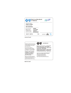


© Copyright 2026