
Preserving Rural Character: Planning for the Future of Licking Township
Preserving Rural Character:
Planning for the Future of
Licking Township
Capstone Seminar
Environmental Studies Program
Denison University
May 7, 2005
Preserving Rural Character:
Planning for the Future of Licking Township
Presented by the Denison University Environmental Studies Capstone Class
Spring 2005
Under the Advisement of Dr. Abram Kaplan
Executive Summary:
In this report, Denison University’s Environmental Studies Capstone Seminar presents
foundational elements of a green infrastructure plan for Licking Township in Licking County,
OH. This plan includes smart growth options and recommendations for future development in
the Township, which emerged from research conducted by the members of the class from
January – April 2005. In the plan, we address four specific areas including zoning, residential
development, property owner options, and greenways. If applied to current planning and
development strategies that already include some basic elements of smart growth, it is our hope
that the suggestions made in this report will help guide Licking Township into a green and
sustainable future, while simultaneously preserving the rural character and integrity of the
community.
Acknowledgements
The members of the Capstone class would like to thank those residents of Licking Township
who have volunteered their time with us, providing insight and suggestions to us as we worked
on this project. We would also like to thank the Steering Team -- Joe Cooper, Rae Johnson, Lisa
Bowers, and Barbara Evans – for posing the question of green infrastructure in Licking
Township and committing their time to us for these four months. Many thanks also, to Mr.
Jurgen Pape, Dr. John Hohmann and Dr. Spieles for patiently sharing their experiences,
knowledge and resources while improving our understanding of the matter.
Capstone 2004-2005
Advisor: Dr. Abram Kaplan
Students: Erin Collinson, Milica Dzelatovic, Ellena Fickett,
Katy Gray, Meredith Helfrich, Courtney Hunt, Maiko Kiuchi, Lindsay Michael,
Gillian Poe, Emelie Putnam, Kate Schmidt
Table of Contents
Section One: Introduction……………………………………….……………………………....1
Section Two: Development and Zoning in Licking Township…………….………………..…3
Section Three: Residential Development in Licking Township………….………………......11
Section Four: Property Owner Options………………………………….…………………....20
Section Five: Greenways…………………………………………………………………….....31
Works Cited……………………………………………………………….………………….....42
Appendix A: Licking Twp. Capstone Community Survey…………….…..…….…………..45
Appendix B: Capstone Community Meeting Mini Questionnaire…………...……………...47
Section One: Introduction
The senior members of the Environmental Studies Program at Denison University have
spent their final semester investigating green infrastructure in their Capstone Seminar. The
Capstone course offers students the opportunity to culminate their environmental studies careers
by pulling together their skills, talents, and knowledge as they work together on a real-world
environmental project. This Capstone has focused on developing a green infrastructure plan for
rural Licking Township, Ohio.
Green infrastructure refers to “an interconnected network of green space that conserves
natural ecosystem values and functions and provides associated benefits to human populations”
(Benedict & McMahon, 2002, p.12). In many communities, green infrastructure tends to be
sacrificed at the expense of built infrastructure – roads, sewers, utility lines. However, the two
types of infrastructure should not and cannot be mutually exclusive for the health of our
communities; natural systems are fundamental to the survival of our environmental, economic,
and social systems, and development and growth of our towns and cities is necessary to
accommodate a growing population. Green infrastructure plans are smart growth options that
aim to preserve ecologically significant regions of the community in order to prevent
fragmentation of these essential environments. At the same time, efficient land use strategies
and development patterns are developed to support social and economic needs of the community
(Benedict & McMahon, 2002).
This project originated when Joe Cooper decided that green infrastructure could be used
to preserve the rural character of Licking Township. Through contacts within the steering team,
Joe brought Capstone advisor, Dr. Abram Kaplan to the table to discuss the idea. Since early
February, the Capstone group has functioned as a consultant for Licking Township. For the
trustees we have been asked to consider preservation and conservation practices and apply them
to the township, to preserve rural character and the ecological integrity of the township through a
green infrastructure plan. Along the way, this group of women, with the aid of Dr. Kaplan, has
researched examples of green infrastructure around the country and especially in Ohio, studied
sites of ecological, cultural, and historical importance in Licking Township, attended community
meetings to gain perspective on issues in the township, and has interviewed and surveyed
residents to understand how green infrastructure can benefit community. Our direction has been
11
guided by feedback from the Township Trustees and residents who attended the first community
forum on preserving rural character in Licking Township.
The report that follows offers a summation of the research conducted over the last four
months, during which, the Capstone students established four focused subject areas in which the
implements of green infrastructure could be applied to the township. They include Zoning,
Subdivision Options, Property Owner Rights, and Greenways. While Licking Township is
making progress toward responsible, sustainable development and land use, it is our hope that
this report offers some additional information and helpful suggestions toward this goal.
22
Section Two: Development & Zoning in Licking Township
Introduction
The rapid growth experienced in Central Ohio is reflective of a greater national trend.
New land areas are being developed across the nation in order to accommodate the growing
population. Urban centers no longer have clear boundaries, instead, tracts of houses spread out
around them in the form of suburbs. This sprawl is often poorly planned, characteristically
inefficient, and harmful to the natural environment. Though in some ways growth and the
consequential development may be inevitable, there are tools which enable community members
to direct and mold this growth, making it fundamentally more sustainable.
Zoning is one important mechanism used to serve this purpose. When armed with a
comprehensive plan and explicit zoning regulations, villages, townships, and other municipalities
are better prepared to bargain. The goals and standards set forth in these planning documents,
give a community leverage in negotiations with potential developers. Furthermore, zoning can
be used to stipulate requirements which help ensure the preservation of community and the
natural environment in spite of, or in accordance with, growth and development (LCPC, 2005).
The zoning section of this report offers a summation of current growth trends,
recommendations on how we believe Licking Township can further incorporate the principles of
green infrastructure into their planning documents and finally, local case studies that illustrate
the importance of zoning and community planning. After considerable research, we are happy to
report that Licking Township is well on its way, possessing many of the tools necessary to
promote responsible development.
Growth Trends in Central Ohio
According to reports produced by the Licking County Planning Commission, Central
Ohio is currently the fastest growing region in the state. Close to 570,000 new residents are
expected to settle in the area by 2030. Licking County is by no means immune to regional
trends, having added close to 17,000 inhabitants over the past decade, a growth of 13.4%. The
county is expected to see an additional increase of some 58,347 residents by 2030 (Licking
County Planning Commission presentation, 2004).
33
The rapid, outward expansion experienced by the city of Columbus is characteristic of the
“urban sprawl” phenomenon plaguing communities in close proximity to metropolitan areas
across the country. Residents of these neighborhoods often fear that development will change
the defining features and qualities of their communities.
In regions, like Central Ohio, development is already increasing rapidly, but there are
ways in which municipalities can prepare for growth. Authorities within a given area can lay out
a vision for the future of the community in a comprehensive plan and adopt complementary
zoning regulations. These documents can empower localities, helping citizens direct and shape
future development.
Cost of Community Services
Return/$1.00
Residential
Counties
Knox
Clark
Townships
Hocking (Fairfield)
Liberty (Fairfield)
Average
Comm./Indust.
Farmland
$0.05
$0.11
$0.62
$0.62
$0.71
$0.70
$0.10
$0.15
$0.73
$0.49
$0.83
$0.95
$0.10
$0.62
$0.80
Table 1: Cost of Community Services in Central Ohio by District: calculated in
net revenue generated from every $1.00 in fiscal costs. (source: Mid-Ohio
Regional Planning Commission , 2004)
In addition to planning documents, there are two major issues that frequently surface in
discussions of growth control and development in rural communities. One is the provision of
centralized services, and the other is annexation (Licking County Planning
Commission). Water and sewer lines can help direct growth and allow for a more diverse and
energy efficient array of land uses. On the other hand, without adequate planning and zoning
regulations, costly centralized services may only serve to attract developers to a community.
Similarly, the power of annexation resides in the hands of local authorities, and when combined
with available centralized services, annexation options give local authorities leverage to
negotiate with potential developers. If used without careful deliberation and appropriate
planning, development can create an economic drain. This is a particular concern with
44
residential development which is expensive and generates only limited tax revenue (see Table 1
above).
Zoning as a Tool for Planning
By definition, zoning involves the use of legislation at the local level, to regulate area
land use. It also serves to divide the land, placing restrictions and standards on the activities
permitted in certain zones or districts. The type of land use regulations that serve a rural
community like Licking Township are often referred to more broadly as unincorporated zoning
(OSU CDFS-302). Rural zoning frequently delineates four separate areas or districts:
Agriculture, Residential, Business or Commercial, and Industrial (OSU CDFS-302).
Zoning laws can be used to control the density of development through lot size, manage
structure height and placement, as well as mitigate incompatible land uses on neighboring
properties. From a legal standpoint, zoning resolutions should be reasonable, consistent, respect
property ownership, and serve the interests of the community (OSU CDFS-300). If principles of
green infrastructure are incorporated, zoning can also foster more environmentally sound and
community friendly development.
There are many important ways in which zoning can benefit a community like Licking
Township. The zoning of districts can ensure land is used in an appropriate manner. Prime
farmland, for instance, can be zoned to support agriculture by restricting land use options.
Zoning can also promote the safety of residents. Restricting development in the hundred year
floodplain is one way in which zoning can protect public health. Zoning laws can also preserve
the integrity of the natural environment. By enforcing zoning restrictions, the Township can
maintain important vegetative buffer zones and safeguard greenspace. The aesthetic qualities of
a given community often reflect the local zoning regulations. Zoning laws can also be used to
help sustain property values by preventing undesirable development nearby, while supporting
positive land use activities. Attracting particular businesses or industries is another goal that is
achievable through zoning. This can help create a viable commercial district, allowing the
Township to become more self-sufficient and provide room for specified industry in order to
foster a sufficient tax base to support the local schools.
55
Recommendations based on proposed Licking Township Zoning Resolution
In this section our recommendations are based on a review of the most current Zoning
Resolution draft, current as of April 2005 (LCPC Draft, 2005). Our comments are made in the
context of establishing a green infrastructure within the township; however, we recognize that
change is gradual, and the incorporation of zoning regulations that support the preservation and
conservation of natural resources in Licking Township is an important step in the right direction.
The section that follows is organized in terms of general recommendations which highlight
where the fundamentals of green infrastructure could be incorporated consistently throughout the
Zoning Resolution. Overall we find that the proposed Zoning Resolution offers a number of
effective stipulations and mechanisms that support more responsible, sustainable land use in
Licking Township.
General Recommendations
Lawn space does not count toward green space
One of the main goals of green infrastructure is to preserve the ecology and integrity of
the natural systems within an environment (Benedict and McMahon, 2002). To achieve this
goal, large pieces of land must be conserved, where native plants and organisms can coexist in
their natural ecosystems. While large front and back yards may appear to contribute to the
volume of green space, manicured lawns do not provide support for the plant and animal species
that a preserve comprised of natural woods, brush, and grasslands, would provide. Lawns may
actually contribute negatively to the ecological wellness of an area because of few species lawns
attract and support and because runoff from lawns may contain fertilizers which are harmful to
aquatic ecosystems. Additionally, large open spaces of grass cannot absorb as much water as an
area with trees, tall grasses, and shrubbery, increasing the amount of rainwater runoff and
decreasing natural pollution filtration and flood control systems (Benedict and McMahon, 2002).
It should be noted that large-lot zoning schemes are one way to slow development by
restricting the space available for housing developments, but this is not inherently consistent with
the goals of green infrastructure. Large-lot zoning does not necessarily insure the preservation of
open spaces in their natural state.
66
Consider placement of buildings within lots
Central placement is neither the best use of space nor the most aesthetically pleasing
option, with respect to how a structure is situated on a lot. With building requirements that
stipulate a 50-40 foot setback to the front and back of a structure and a 20-30 foot side yard,
buildings are likely to be centrally located. There are circumstances that necessitate setbacks and
side yards with specific dimensions, requiring the house or building be located in a particular
area. However, where possible and appropriate, buildings should be placed at distances that
permit easy access to walking paths and other buildings, and provide more space at the front,
back, or side of a property, allowing for part of the lot to be left in its natural state. Specifically,
in commercial developments, side yard requirements keep the buildings far from each other,
reducing the number of businesses a space can support and inhibiting the walkability of the
community. In areas where walkable commercial areas are desirable (e.g. in a revitalized
Jacksontown), lot size and placement restrictions should be considered.
The use of native vegetation should be encouraged
Native vegetation is well suited to its natural habitat and therefore requires fewer
resources (e.g. water and fertilizer) to grow. Native species have become adapted to the abiotic
conditions of the area and are thus better suited for living in the area than introduced species.
Additionally, native species serve as biological controls against unwanted insects, while also
attracting vital pollinators for native flora. Wildlife also rely on these native plants for food and
shelter (Quistgaard, 2005).
The use of native vegetation should be encouraged wherever possible. Some examples
include parking lots, for the purpose of aesthetics, improved drainage, and water pollution
filtration; in road-side planters, as tree-lines or hedgerows; in natural vegetation screens, dividing
property lines or providing privacy from parking lots or adjacent buildings; and in all buffers
uses in riparian habitats.
Extend requirements proposed in Conservation Residential Development Districts (Section
1000) to other zoned districts where feasible
As stated in the purpose of Conservation Residential Development, the objective is to
“promote the health and safety of the community” by “[maximizing] the conservation of open
77
space and [maintaining] water quality and supply” while honoring the development rights of
property owners (LCPC Draft, 2005, p.98). We believe this mission statement to be more widely
applicable. In order, to promote a green infrastructure, this language should be added to all
zoned areas, especially commercial districts and non-conservation residential districts.
Additional regulations that should be extrapolated from Section 1000 and added to other
sections of the Zoning Resolution include the following:
Avoid converting natural areas to landscaped areas, for lawns, and the
use of invasive vegetation
Avoid developing on or near 100-year floodplain
Encourage efficient use of land and public services
Emphasize need for community open spaces, for the protection of natural,
historical, and cultural sites
Encourage the use of buffer zones along significant riparian zones where
possible
Encourage connectivity of natural and man-made corridors throughout
the community
Examples of Effective and Ineffective Zoning Techniques
In this section, three case studies illustrate the importance of preparedness, of
communities in Central Ohio, with respect to zoning and development regulations.
Case Study: Pataskala
In 1990, Pataskala had roughly 3,346 residents. Easy access to Interstate 70 and Route
16, left the Village a mere 25 minute commute from downtown Columbus, and consequently
susceptible to development from the sprawling urban center. A decision was made in 1994 to
merge the Village of Pataskala with neighboring Lima Township, with a population of about
4,398 (City of Pataskala, 2002). The resulting municipality, deemed simply Pataskala, was
officially established in 1996. In 1997, the mayor, Bruce Baird called for a committee to draft a
Comprehensive Plan which would serve as a guide for future growth of the city (White, 1999).
The rapid spread of nearby Columbus has had a dramatic effect on development in the
area. The unification of the Village of Pataskala and Lima Township involved the acquisition of
88
new land. Providing services like sewer and water to regions recently incorporated into city
limits quickly posed a problem for the community. One major issue was the City’s failure to
account for income tax in initial planning. The limited revenue of the City combined with high
central service demand created by expansion, left the City with severe and growing debt (White,
1999).
In the absence of sufficient planning, residential growth skyrocketed, while commercial
and industrial development remained virtually stagnant. This phenomenon provided for a
general imbalance and, more importantly, an inadequate tax base to meet the needs for
infrastructure repairs and school funding. These problems were only exacerbated by continued
growth, as a rising fear mounted among residents that they had lost the integrity of their once
beloved rural community (Lane, 2005). The historic town center of the former Village of
Pataskala has fallen into a state of disrepair. Infrastructure within this downtown area is
generally acknowledged as fair to poor (White, 1999).
While efforts are underway to address a number of these problems, the lesson of
Pataskala is clear. It is important to plan for future development. It is not too bold a statement to
say that the City may have been able to avoid at least some of these issues had they been
prepared to face development, armed with a completed Comprehensive Plan and stringent zoning
regulations, prior to the merger.
Case Study: Alexandria
The Village of Alexandria is located along Ohio route 37 in St. Albans Township. In
recent years, communities on the western edge of Licking County have been subject to
particularly fierce development pressures. The rapid growth of Columbus and nearby Johnstown
has put the small Village of Alexandria, with roughly 500 residents, in a vulnerable position
(Mallett, 2005). With developers knocking at their door, concerned residents scrambled to draft
and amend documents which would provide them leverage for the seemingly imminent forces of
development. The Village has been required to expedite the planning process as developers seek
the annexation of areas outside the Village boundaries (Gilligan, 2003). In addition, the Village
has struggled with issues pertaining to centralized services. Alexandria currently purchases their
water service from Granville. More recently the Village Council proposed the construction of a
99
costly wastewater treatment plant to replace the frequently failing septic systems (Gilligan,
2003).
Alexandria is working towards developing an arsenal with which to combat the pressures
of “suburban sprawl”. These armaments include planning documents that help shape growth and
development in a manner beneficial to residents without being harmful to the environment.
Residents have also proposed a renewal of the village center. Improvements in infrastructure
might assist the struggling commercial area and make success viable for local business owners.
Unfortunately, encroaching development has forced the Village to work quickly and perhaps
more divisively than if the community had already been prepared (Greene, 2005).
Case Study: Granville
Granville Township and the Village of Granville worked in cooperation to draft a
Comprehensive Plan which was adopted in 1990. The plan was then revised and updated in
1998. Granville is known for adopting stringent zoning laws and acquiring property so as to
actively control and direct future growth. In many ways, the Granville Community is at the
forefront of planning to avoid urban sprawl by employing legislative tactics such as passing an
open space levy and advocating a right to farm statute. The township still struggles to maintain a
tax base to assist the growing school district (Granville Township Trustees, 2005).
Furthermore, many outsiders contend that Granville’s success at keeping out chain
establishments and other undesirable commerce has been at the expense of neighboring Newark
and Heath. Property values in Granville are among the highest in Licking County, limiting the
socioeconomic diversity of the community. Overall, Granville provides an excellent example of
how zoning may be used to help residents guide the progression of development. It should be
noted, however, that Granville is an extreme example and that such rigid zoning inevitably has
trade offs for the local community.
1010
Section Three: Residential Development in Licking Township
Introduction
As we can extrapolate from growth trends, continued residential development in Licking
Township is inevitable, and the goal of this section is to provide various options for subdivision
development that meet the standards of green infrastructure. Ideally, residential development
would satisfy the developer, incoming residents, and also the community at large by protecting
farmlands, natural resources, and/or green space. At this point, our research shows that most of
the developments in Licking Township are traditional subdivisions with high density housing
and little to no quality green space. Fortunately there are many options for developing land for
residential use with a range of environmentally friendly designs.
Conventional subdivisions are typically not environmentally friendly. These subdivisions
consist of large individual lots and lawns and no common open space. The land in these
developments is usually divided up into lots, streets, and sidewalks, leaving only open space that
is unfit for development (i.e. steep slopes, floodplains, wetlands, etc.). These types of
subdivisions tend to have negative impacts on the environment and are not community oriented.
Conservation subdivisions, on the other hand, fall on the opposite end of the spectrum. These
subdivisions are characterized by permanent, common open space and clustered, compact lots.
Conservation subdivisions allow the maximum number of residents under existing zoning laws
to move into an area, while also preserving open space for recreational use and conservation
purposes. In between traditional and conservation subdivisions fall mid-spectrum subdivisions.
These developments preserve some green space but do not have as many strict guidelines as
conservation subdivisions.
As part of our green infrastructure plan for Licking Township, and in order for the
community to maintain its rural character, we recommend that the Township take responsibility
for encouraging residential developments to move away from traditional models of development
and move towards conservation-based models.
1111
Traditional Subdivisions Versus Conservation Subdivisions
Traditional Subdivisions
In a traditional subdivision, an entire parcel of land is divided up between individual
owners, leaving no common open space for the residents to use and disregarding the parcel’s
landscape and natural resources. This type of subdivision does not include any public lands or
parks unless a developer specifically chooses to incorporate them, in which case land for
potential homes is usually lost. The lots in this type of subdivision are usually two acres or
more, and sometimes extend into areas where houses cannot be built (i.e. steep slopes, rivers,
wetlands, etc.). Only the owners with property backing up to these areas have access to them
while none of the other subdivision residents are able to enjoy them. Figure 1 is an example of a
traditional subdivision.
Figure 1: A traditional subdivision. (Source: Town of Cary)
Conservation Subdivisions
Conservation subdivisions are usually located on plots of land totaling 40 acres or more.
The number of houses is the same as in traditional subdivisions, however the lots are smaller.
The smaller lots are clustered together so that at least 40% of the land is open space. Though lot
1212
sizes are smaller in conservation subdivisions (less than one acre) than traditional subdivision
lots (two acres or more), land owners in conservation subdivisions have unrestricted access to
beautiful open spaces. Table 2 includes recommended standards for the open space in
conservation subdivisions.
Open space percentage
40% open space: > 2 units per acre
50% open space: 0.66 - 2 units per acre
60% open space: < 0.66 per acre
Minimum dimension of open space
100 ft
Maximum percentage of
open space used for recreation
5%
Excluded from open space calculation
Road rows, parking/access/driveways,
required building setbacks, required building
spacing, private yards, 15' envelope
around buildings, and fragments/isolated
areas > 100' wide
Table 2: Recommended standards for open space. (Source: The Countryside Program)
The open space within a conservation subdivision can be owned in a variety of ways.
The public land is most commonly owned by the residents of the subdivision through a
homeowners association. If the land is owned by a homeowners association, the residents that
belong to the association are in charge of its upkeep. The land can also be owned by a land trust
or by the original landowner. If the original landowner continues to use the open space, there are
limitations as to what it may be used for (i.e. a vegetable crop would be an appropriate use of the
land while a livestock yard would not). Open space is protected through the use of deed
restrictions, conservation easements or dedication of land to the municipality. Figure 2 is an
example of a conservation subdivision on the same parcel of land in Figure 1.
1313
Figure 2: A conservation subdivision. (Source: Town of Cary)
Mid-spectrum Development
The development of conservation subdivisions may not be entirely feasible in all areas of
Licking Township or for every developer. However, there are some other development options
that are more environmentally and community friendly than traditional development. One option
is to develop houses on slightly smaller lots so that some open space is maintained. Although,
conservation subdivisions require that a minimum of 40% of the land be left undeveloped, if
developers can set aside some amount of land to be left as open space (i.e. 25%), the
development benefits.
If it is not feasible to decrease lot sizes (i.e. due to water and sewer issues – see
Addressing Potential Problems), there are still options for creating green infrastructure and
maintaining the rural character of the area. According to the current regulations, a house must
have 50’ in front and back and 20’ on either side. This places the house in the center of the lot
and creates the “bowling alley” look that, for environmental purposes, should be avoided. By
placing the house at one side or in one corner of the property, a large open space would remain.
Part of the character of a “bowling alley lot” is that the area surrounding the house is all lawn. In
order to avoid this, native trees, shrubs, and other flora could be planted around the house and
property. Trees not only provide environmental and aesthetic benefits, but also give privacy and
cut down on heating costs in the winter and cooling costs in the summer.
1414
Benefits of Conservation Subdivisions
The conservation subdivision method of residential development would benefit both
developers and residents in Licking Township on multiple levels. Residential developers often
choose to build traditional subdivisions because they assume that conservation subdivisions
allow for fewer lots to be built and will therefore be less cost effective. However, this
assumption is false and there are actually various economic reasons for choosing to build
conservation subdivisions instead of traditional subdivisions. Because conservation subdivisions
have less infrastructure (i.e. roads, long driveways, etc.) than regular subdivisions, it is more cost
effective to construct and maintain them. Therefore, the overall development of these
subdivisions is less costly (Haines, 2002). Also, density bonuses are sometimes awarded for
conservation development, allowing developers to build extra lots (Foth and Van Dyke).
Conservation subdivision development is not only economically beneficial to developers.
For residents, living in a conservation subdivision is no less cost effective than living in a
traditional subdivision because the property taxes are equivalent (Foth and Van Dyke). Also,
even though the lots are smaller, home values in these subdivisions tend to appreciate at faster
rates, meaning it is more economically beneficial in the long term for residents to live in
conservation subdivisions (Town of Cary).
In addition to these economic gains, residents of conservation subdivisions also
benefit on a community level. Conservation subdivisions provide residents access to a network
of open space for various kinds of recreation. This access increases the opportunity for residents
to meet one another and to cultivate relationships, creating a unique feeling of community within
these subdivisions (Foth and Van Dyke). Also, conservation subdivisions focus on preserving
the character of the community. In Licking Township, this kind of residential development
would help to maintain and promote the rural character of the area.
Finally, there are many significant environmental benefits to conservation subdivision
development. The preservation of open space in these subdivisions allows for less ecological
impact and habitat fragmentation as it reduces the disturbance of the natural landscape. Open
space in conservation subdivisions is designed to protect natural resources, including water
sources and plant and animal habitats. Also, conservation subdivisions promote environmental
awareness and increase people’s connection to the environment (Foth and Van Dyke; Arendt,
1515
1997). This can improve the overall environmental mentality of the community, leading to
greater consideration for and increased efforts to protect the environment.
Dispelling the Myths
When it comes to conservation subdivisions, everyone has their own ideas and thoughts
about the concept. While some of these notions are true, others are absolutely false.
Requirements for consideration of open space, house appreciation rates, housing density, and
ownership of open space are just a few areas where myths about conservation subdivisions arise.
Our hope is to dispel these myths so that residents of Licking Township can make informed
decisions about conservation-based development in their community.
Myth #1: Property values are lower in conservation subdivisions
Developers often believe that houses built in conservation subdivisions will be less
valuable than houses in traditional subdivisions. At many sites around the country, houses in
conservation subdivisions actually sell for slightly more than a similar house in a conventional
subdivision. The reason behind this increase in price is the desirability of property that is
associated with open space. While prices may be slightly higher in these subdivisions, in no way
are they unaffordable. In our research, we found that homes in existing conservation
subdivisions fall within any price range. Houses in these subdivisions are built based on market
demand and are usually similar in price to houses in surrounding areas. There are many
examples of conservation subdivisions aimed at moderate to low income families (e.g. in Dekalb
County, Georgia).
Myth #2: Owners of conservation subdivision homes receive no economic benefits
On the contrary, several studies have shown that houses in conservation subdivisions
appreciate in value at a rate quicker than homes in conventional subdivisions. At one site in
Amherst, Massachusetts, houses in the conservation subdivision sold for $600 more than homes
in conventional development nearby. Twenty-one years later they sold for an average of $17,100
more, even though the houses on site were on lots half the size. Similarly, homes in a
conservation subdivision in Concord, Massachusetts appreciated at an average annual rate of
21%, compared to an 18.4% appreciation rate in a conventional subdivision with lots five times
1616
are large as those in the conservation subdivision. In either case, the homeowner may pay more
up front but receives a financial return in the end (Wenger and Fowler).
Myth #3: It is more expensive to develop conservation subdivisions
This myth is easily dispelled when considering the cost of infrastructure. In conservation
subdivisions, houses are clustered together and require fewer miles of road, water lines, and
other utility lines. Fewer and lower infrastructure costs are now thought to be one of the primary
reasons developers choose to build conservation subdivisions. At a site in Georgia, where a
large portion of the open space was preserved, the cost of infrastructure was estimated to be 60%
lower than those of a conventional subdivision supporting the same number of people (Wenger
and Fowler). Site preparation can also save the developer money because a smaller portion of
the land is used for development. Randall Arendt, the forerunner in conservation subdivision
development, estimated that one Texas subdivision saved $250,000 in grading costs compared to
what it would have cost to build a conventional development on the same site (Wenger and
Fowler).
Myth # 4: Conservation subdivisions have lower density housing
One of the greater myths surrounding conservation subdivisions is that the density of
housing on a given plot is lower than the density on the same plot if developed traditionally.
People tend to assume that there are fewer houses because there is more open space in a
conservation subdivision. However, conservation subdivisions actually have the same number of
dwellings as traditional subdivisions and can have even more lots if the developer is given a
density bonus for using conservation-based development.
Myth #5: Open space includes roads, lawns and other infrastructure areas
Open space in conservation subdivisions does not include roads, parking, private yards,
golf courses, required setbacks and building spacing and fragmented and isolated areas less than
100ft wide. Areas that count as open space for the subdivision include wetlands, floodplains,
habitats of endangered species, wooded areas, agricultural land and other green spaces. At least
some portion of the open space must be left for recreation as well.
1717
Addressing Potential Problems
Zoning regulations and water resources/capabilities are often roadblocks for developers
or communities wanting to develop conservation subdivisions. For many areas, residential
zoning does not allow for high density developments needed in conservation subdivisions.
Townships must take the initiative to change their own zoning regulations for subdivisions to
allow for conservation development. In Licking County, subdivision regulations virtually
prohibit high density residential developments. Individual lots must be at least 1.6 acres if a
septic system is needed, but can be 10,000ft2 if central water and sewer is provided.
Conservation subdivision lot sizes are almost always less than one acre, but because of Licking
Township’s rural nature, sewer lines are not run throughout the area. For lot sizes to be less than
an acre, central sewer and water must be provided under county zoning regulations.
In order to deal with the lack of central sewer, a developer has a few options. The first
option is to allow multiple houses (usually two) to share a septic system, thus increasing the land
available for the tank and drainage field. Combining multiple houses onto one larger septic tank
has some potential problems associated with it, but has proven to be successful in some
conservation subdivisions. The second option is to construct a small onsite wastewater treatment
facility. This option may be the most expensive but leaves the least room for problems to arise.
Onsite wastewater treatment facilities include aerobic tanks, sand filters, and constructed
wetlands. All houses in the subdivision would be connected to this treatment facility. These
systems typically provide a pretreatment to septic tank effluents before being released into a
drain field. However, these alternative systems require more maintenance and monitoring than
traditional septic tanks and drainage fields. But, from both a surface and groundwater
perspective, soil-based treatment systems (if properly sited, installed, and maintained) can offer a
high degree of protection and reliability (Mega et al.). One type of treatment may not work for
another area, so things like site characteristics, volume of flow, and system maintenance must be
taken into account.
The final option is to have a municipal sewer system. This would eliminate the minimum
lot size of over one acre and more easily allow for conservation subdivisions to be established.
There is a concern that with a sewer system, anyone could “tap” into it, but if there are
regulations on the types of development allowed, such as conservation subdivisions, then it
1818
would not be such a problem. Many tend to view the installation of a sewer system as inviting
developers in, but zoning regulations could limit this.
Recommendations for Licking Township
Licking Township has already begun to take some of the preliminary steps necessary to
promote conservation-based residential development throughout the community (i.e. adopting a
Comprehensive Plan, making zoning revisions with consideration for green space and natural
resources). However, there is still much to be done. Although there is no "How to" manual with
which we can present Licking Township at this time, we can make one specific recommendation
to help get the ball rolling.
For any community that desires to conserve open space in spite of development
pressures, creating a map of potential conservation lands is imperative. The first step in creating
this map is to identify Primary Conservation Areas (PCAs). These areas would include the
"most severely constrained lands" in Licking Township from which development may already be
restricted. Some examples of PCAs include floodplains, wetlands, and steep slopes. Once the
township has identified the PCAs, it must define Secondary Conservation Areas (SCAs) for the
map. SCAs would include all other cultural, historic, scenic, and natural features that are
valuable and significant to the community (i.e. primary agricultural lands, greenways, trails,
historic buildings/landmarks, wildlife habitats, etc.). It is important to involve local residents of
Licking Township in this process of SCA identification because they are the ones who best
understand their community. PCAs and SCAs are then put into map form and this map is added
to the township's Comprehensive Plan. Once this Map of Potential Conservation Lands is
created, Licking Township can require developers to use the map to guide their plans for open
space when designing residential developments (Arendt, 1997).
1919
Section Four: Property Owner Options
Introduction
The large tracts of productive land have made farmland and agricultural industry a major
asset in Licking Township, which is now threatened by the aggressive development in the area.
In order to preserve the open space and farmland characteristic of Central Ohio, it is important to
enact appropriate zoning regulations to ensure “smart development” in residential and
commercial districts. Farmland is not only important for open space, but it also provides jobs,
and other economic benefits as it contributes to state and local taxes more so than it requires in
public services. Farmland also provides wildlife habitats.
The main idea proposed in this section is the preservation of open space and farmland,
and concentration of new development in areas where residential development and infrastructure
are already in place. This section offers options landowners have to preserve their land as a farm,
wildlife habitat, or open space. We do not argue against development, but rather give options to
find balance between growth and agricultural preservation that would not harm the township or
the residents. The different options reviewed below are:
1) Conservation Easements
Purchase of Development Rights (PDR)
Transfer of Development Rights (TDR)
Donation of Development Rights (DDR)
2) Land Donations
Conservation Easements
What is a Conservation Easement?
A conservation easement is a legal agreement made between a property owner with the
qualified conservation organization or government agency in which use of the land is restricted
in the type and the amount of development that takes place on his land to farming, open space or
wildlife habitat.
2020
What are different types of conservation easements?
A landowner might sell, transfer or donate his development rights to a government
agency or private land trust. These different types include Transfer of Development Rights,
Purchase of Development Rights and Donation of Development Rights.
What is an Agricultural Conservation Easement?
Agricultural conservation easements are similar to an ordinary conservation easement,
but it aims to protect farmland. This is a voluntary conservation easement restricting
development on the farmland. Land subjected to this kind of easement is generally restricted to
farming and open space. This kind of easement would be especially appropriate for Licking
Township since there are large areas or farmland and open space that are threatened by the
development. Agricultural easements will not be focused on for the purpose of this report, but it
is important to note that there are specific easements aimed at the conservation of farmland.
Advantages of Conservation Easements
•
They leave the property in the ownership of the landowner, who may continue to live
on it, sell it, or pass it on to heirs
•
They can significantly lower estate taxes – sometimes making the difference between
heirs being able to keep land in the family and their needing to sell it. In addition,
easements can provide the landowner with the income tax, and in many cases,
property tax benefits.
•
They are flexible, and can be written to meet the particular needs of the landowner
while protecting the property’s resources.
•
They are permanent, remaining in force when the land changes hands. A land trust
or government agency ensures the restrictions are followed.
Source: Land Trust Alliance
2121
Potential Tax Savings
-
Income tax – can be avoided entirely in case the land or development rights on the land
are donated rather than sold
-
Estate or inheritance tax – tax imposed on the transfer of property from the deceased
person to the heirs. This tax depends on the value of the property; lower property value
means lower taxes. If the land does not have development rights value is significantly
decreased resulting in lower estate taxes.
-
Property tax – land without development rights is lower in value resulting in lower
property tax while in case of farmlands owner keep the right to farm keeping his income
constant.
-
Appraisals – estimation of the property value. Landowner engaging in easements can be
reimbursed for the cost of hiring the appraiser.
Approaches to Conservation Easements
Purchase of Development Rights (PDR)
The voluntary sale of rights to develop property by the landowner to a government
agency or a land trust. The sale price is determined by an appraiser and the land use is restricted
to farming or open space. Landowners retain full ownership and use of their land for agricultural
purposes. Development rights are extinguished in exchange for compensation. PDR are also
known as PACE (Purchase of Agricultural Conservation Easements).
Source: Ohio State
Goals and Objectives of PDR
- Preserve farmland and support farmland operations
- Maintain rural character and quality of life in the community
- Protect environmentally sensitive areas and scenic vistas
- Create buffer zones around agricultural lands and environmentally sensitive areas
- Protect the town and privately owned based shops from the impending industrial and
commercial markets
2222
In case the landowner does not development on his land and is in need of money, he can
chose to sell or donate his/her development rights. Basically, the state pays half of the amount
that his rights are worth and the other half can be donated, or paid with another, non-state source.
For instance, a neighbor could pay part of the value because it is in their interest that the land
stays rural. The value of neighbor’s land increases if his neighboring land does not have
undesirable development on it. As a result, the value of landowner’s property decreases, but his
taxes drastically decrease as well. The owner can choose to stay on the land and hunt, use it for
agriculture or build a golf course, but they are not allowed to have any infrastructure on the land.
This process is very similar to selling mineral rights.
Numerical Example:
If a person owns a 100 acre plot of land with a value of $5,000 per acre and decides to sell the
development rights, the new value of land will be $2,000 per acre.
Value of land with rights -> 100 acres with rights at $5,000/acre = $500,000
Value of land without rights -> 100 acres without rights at $2,000/acre = $200,000
Therefore development rights are worth $300,000 for the whole 100 acres.
Landowner would be compensated for the loss of $300,000 in the value of his land by state
money (½ of value = $150,000), while the other half could be sold to local government, etc.
Benefits of PDR to Landowners
- Voluntary (landowner is free to turn down the offer or try to negotiate a higher price).
- Keep property in private ownership.
- Compensate the landowner for the development value of the property, making it financially
feasible to continue farming.
- Preserve land for farming while providing cash assets for estate planning, retiring debt and farm
improvements.
- Keep farmland affordable for new farmers.
2323
Benefits to Residents
- Provides permanent protection of vulnerable lands and important resources from encroaching
development.
- Retains scenic views of open space and farmland.
- Preserves rural character and quality of life.
- Keep property taxes low as compared to new residential development in the area.
Transfer of Development Rights (TDR)
TDR allows landowners to transfer the right to develop one parcel of land (sending area)
to a different parcel of land (receiving area). It is designed to shift development from
agricultural areas to areas that have the infrastructure to support increased development. After
the right to develop has been shifted from the sending to the receiving area, the original parcel is
protected with a permanent conservation easement. The benefits of this type of program are that
it offers permanent protection, it is a voluntary, market driven process, it promotes orderly
growth in areas with the capacity to provide necessary services, and farmers can retain equity
without developing their land. It is complicated to set up and requires a bit of study before
implementing a TDR. A market must exist for increased density in the receiving areas.
Currently it is questionable whether townships and villages have the authority to transfer
development rights. It is believed that townships do not. TDR legislation may be introduced
during this year's legislative session.
Source: Center for Farmland Preservation
Types of TDR Programs
The most common TDR program allows the landowner to sell his development rights to a
developer who then uses those development rights to increase the density of houses on another
piece of property at another location. The higher density that developers are able to realize is
that incentive for them to buy development rights.
The second method allows a local government to establish a TDR Bank to transfer
development rights. In this method, developers, who wish to develop at a higher density than
current zoning allows, would purchase development rights from the local government.
2424
Numerical Example
Consider a case where two landowners with the same sized plot of land, where zoning
laws allow development of 50 household units on each plot. Landowner 1 is a farmer and wishes
to continue farming and not develop on his land, while Landowner 2 is an investor who has just
purchased the land to build a residential housing development. Landowner 1 can transfer his
development rights to Landowner 2, and as a result, the property of the Landowner 1 will remain
as a farm and will not have any development on it, while the property of the Landowner 2 will
now have the right to build 100 houses on his land. This is beneficial for communities because it
keeps infrastructure out of rural areas. Development is clustered while there are large areas of
farmland and open space.
Advantages and Strengths of TDR
- Free exchange (buying and selling) of development rights without having to buy or sell the
land.
- Regulatory tool designed to facilitate land-use planning.
- Used in other areas of the country for the preservation or protection of open space, natural
resources, farmland, and urban areas of historical importance.
- Used to secure land for solid waste facilities and for the protection of golf courses.
- Transaction performed in a controlled setting where areas are predetermined as community
areas.
- It does not involve any state money, as opposed to PDR, but is basically a monetary
transaction of development rights between two parties.
- It results in housing cluster in areas where infrastructure already exists with a lot more open
space in other parts that will never be developed. This is a great setting for mass transit. It
also increases residential density which is a base for stronger community and is also valuable
for its viability.
Unfortunately, TDR does not exist as a law in Ohio yet but is being discussed in legislature.
2525
Donations of Development Rights (DDR)
DDR has very similar assets as TDR. The main difference, however, is that the
development rights are donated rather than sold. Even though the landowner does not receive
direct monetary compensation for the deed, he or she does receive greater tax deductions due to
the charitable contribution, and avoids capital gains taxes that would result from selling the
property. In a section following, there is a case study demonstrating the benefits of completing a
DDR.
Procedure for applying for a conservation easement
Who may grant the easement and to whom can they grant it?
The landowner can grant a conservation easement for all or a portion of his property. In
case the easement donor wishes to claim tax benefits for the gift, the landowner must donate or
sell it for less than the fair market value to a public agency, conservation organization, or historic
preservation organization that qualifies as a public charity under Internal Revenue Code Section
501(c)(3). However, most land trusts meet this criterion.
The steps in the transition:
1)
Initial contact between the property owner and the conservation organization -
2)
Consult with legal and tax advisors. While conservation organizations can assist
landowners they cannot offer professional advice regarding legal and tax issues.
3)
Conduct a tour of the property with the landowner to confirm that the potential
easement meets the program goals. Also discuss the resources on the property and
identify potential uses and restrictions on the property.
4)
Obtain title information, identify the legal property owner, property description and
identify any resources on the property that may need to be subordinated to the
conservation easement (e.g. mineral right, etc.)
5)
Compile baseline data inventory of property. Study various types and location of
resources and property conditions.
6)
Negotiate the restrictions and draft the document. Complete on a case-by-case basis,
depending on the existing appearance of the land and the type of the ecosystem
2626
inhabiting the property. Establish the landowner’s desires for the property in the
future; this usually includes any kind of development, soil and water use, etc.
7)
Obtain a qualified appraisal. This is only necessary if the owner wishes to claim a tax
deduction for the value of the easement.
8)
Sign and record the easement
Source: Northern California Regional Land Trust
Land Donations
Land can be donated to a government agency or a land trust for conservation purposes.
The major difference between donations and easements is the land owner retains certain property
rights with easements and looses all property rights as well as the ownership of the land when the
land is donated. Donations are a valuable option for landowners whose land has significant
conservation value but do not have someone who will inherit and preserve it; for owners who do
not have the ability to pay taxes for the land high in value, or for those who would like to be
relieved of the responsibility of preserving the land.
Land donation is a far simpler transaction than the conservation easements and provides
substantial tax deductions, as well as estate tax benefits (while avoiding any capital gains taxes
that would result from selling the property). Most importantly, if the land is donated for
conservation purposes, the landowner is ensured that the land will always be protected.
Source: Land Trust Alliance
Donation of Land by Will (Bequest)
The charitable giving of property in a will is a time-honored way to leave a legacy and
reduce estate taxes. For landowners who prefer to own and control their land during their
lifetimes, and who do not need the income tax benefits of outright donation, a bequest may be
the answer. As with other land donation methods, it is important, the land trust or other
conservation organization is willing and able to receive the gift.
2727
Remainder Interest or Reserved Life Estate
A remainder interest, or reserved life estate, allows the landowner, or another named
person, to enjoy and/or live on donated land. Though such transactions can be complicated,
(resulting in some estate tax liability if the life tenant is someone other than the donor) charitable
deductions are allowed. A remainder interest qualifies for federal income tax deduction with or
without restrictions on future use. Only remainder interest given for conservation purposes to a
qualified conservation organization guarantees protection of the land’s value. The amount of the
income tax deduction for a remainder interest is calculated by reducing the fair-market value of
the donated property by the value of the reserved life estate of the landowner or his or her
designees. The more life tenants and the younger they are, the lower the value of the remainder
interest and the lower the tax deduction.
Leaseback
This land donation method often is used by older landowners interested in protecting
their land's conservation values, but wanting to continue using a portion of the land during their
lifetime. Under a "leaseback" the landowner donates the property to a land trust and leases the
small parcel he or she wants for farming, hunting, fishing, timber cutting, or other uses. The
burden of managing the land's conservation value reverts to the land trust and the landowner
receives the usual donation tax benefits.
Source: Gathering Water Conservancy
Example
Dr. John Hohmann, Pataskala has donated his development rights to the Ohio Department
of Agriculture in 2000, and the following is the example of the incentives that have driven him to
do so and the benefits that he is now enjoying. The information was obtained from an informal
interview.
The farmland that Dr. Hohmann resides on has been in his family since 1929. His
grandparents stated in their wills that they would like the farm to be offered to him before any
2828
other potential customers. Since he had interests in keeping his grandparents’ farm in the family,
in 1972, Dr. Hohmann moved to the farm with his wife and three children and started farm
restoration. In that time, Dr. Hohmann planted 500 trees, raised cattle and chicken, and
cultivated a garden. Even though his grandparents owned a large piece of land, when Dr.
Hohmann became an owner it was only 15 acres in size. With the hard work, he and his wife
were able to purchase surrounding land and regain much of his grandfather’s property; the
property is now 217 acres. After retirement, Dr. Hohmann and his wife devoted most of their
time and energy into improving the farm.
Due to the urban sprawl that has been taking place in Licking County, farmland value has
inflated causing estate and inheritance taxes* to rise drastically. Dr. Hohmann and his wife have
witnessed their next-door neighbors’ children being forced to sell their parents’ land in order to
pay inheritance taxes. The value of farmland per acre is now as high as $20,000 and taxes are
also high. In order not to put their children in the same situation and to prevent development on
their land, which might take place if their children were forced to sell, the Hohmanns considered
donating the development rights of their property for two reasons: 1) to ensure that there will be
no development on their land in future and 2) to lower the value of their property so their
children are not forced to sell the land in order to pay taxes
Even though they had the option of donating their land to Licking Land Trust, their
church, or the local government, they chose to donate their development rights to the Ohio
Department of Agriculture because they believed that this would be the best way to ensure that
the land would be preserved as a farm. By donating their development rights the value of their
land has dropped from $ 20,000 to $2,500 per acre. This way they are ensured that the
inheritance taxes will be significantly lower. The $1.3 million that they donated counts as a
charitable contribution and has provided huge tax deductions over the past 5 years.
The only downside in the whole process, he said, was that he had to pay for legal fees and
appraisal, but he actually benefited from a tax reappraisal down the road because taxes have
rolled back. As to why he chose to donate and not sell his development rights, Dr. Hohmann
replied that he needed quick results due to he and his wife’s illness, and the donation provided a
less complicated and faster easement process.
Dr. Hohmann is very pleased with the decision he made because his property remains in the
family and will always remain committed to agriculture. His act was both personally and socially
2929
beneficial as it prevents development in the community. At the end of our conversation he
reminded us, “We do not inherit the Earth from our ancestors; we borrow it from our Children.”
* Inheritance or estate taxes - when a person dies all their property is accounted and is not
directly inherited by family members but is a subject to taxation. The higher the property value,
the higher the taxes.
Conclusion
We have accumulated different possibilities for the property owners who are interested in
preservation of the farmland for the economic, cultural, historical, environmental and aesthetic
benefits that it brings to the community. These various options provide different scenarios
depending on factors that influence property owner’s demands for land use in future. Along with
effective zoning regulations, donations and conservation easements can create a well-functioning
community with residential cluster while still preserving the rural character of the area by
preserving large areas of farmland and open space.
3030
Section Five: Greenways
Introduction
As the network of trails continues to grow throughout Ohio, many townships are
beginning to realize the difference they make in a community. Funding from state and local
agencies and case studies are available to aid Ohio townships in joining the linkage of trail
systems statewide. There are several ways in which recreational trails benefit a township.
Communities, personal well being and the environment can all be aided by a well planned trail.
Several studies have shown the success of trails in relation to the social and economic impacts
and benefits of adding a trail and/or greenspace corridor to a community.
Trail Benefits
Community Benefits
One of the great benefits of a trail system is that it encourages community interactions by
increasing the opportunities to encounter and socialize with other members of the neighborhood.
The increased interaction between community members helps promulgate a more friendly
community environment, increases the feelings of ownership and responsibility, and creates a
greater sense of belonging. Trails are often used by people of all ages and can be an outlet for
family activities such as picnics, walks, and biking.
3131
As a community becomes more urbanized and populated, the amount of automobile
traffic increases. This can be reduced by adding a trail to the expanding community because a
trail will potentially decrease automobile traffic. This makes it easier for children to get around
because there is a lower traffic flow on the streets (so it is less dangerous for them to walk), but
also it allows for a pathway through the community that anyone can use to get from one place to
another that doesn’t require driving.
Economic Benefits
In addition to social, community and cultural benefits, there are also economic benefits to
the community. The first is an increase in value of the properties adjacent and near to the trail.
The National Park Service notes that property values can increase 5-32% when adjacent to trails
and greenways. Additionally, realtors and landowners have noted that a trail is a selling feature
of a property or home. The other major economic benefit of a trail in a community is the overall
increase in the economic activity of the area. In a 1992 study, the National Park Service found
that the estimated economic activity stimulated by three multipurpose trails in three different
communities was approximately $1.5 million annually (Ohio Greenways).
Health Benefits
Despite the importance of maintaining a healthy lifestyle at all stages of life, recent
studies have shown that many people are not regularly active. A primary cause for inactivity is
the lack of access to outdoor recreational areas. According to the Trails and Greenways
Organization, “trails and greenways provide a safe, inexpensive avenue for regular exercise for
people living in rural, urban and suburban areas” (Better Commute Organization). Some of the
health benefits of physical activity include, but are not limited to, reduced risk of chronic disease,
weight and blood pressure control, reduced symptoms of depression and anxiety, and reduced
arthritis pain and disability. Understanding the importance of physical fitness is essential to
every community. One way of promoting healthy habits in a community is the establishment of
a greenway. Greenways and communities make good neighbors, and “greenways can provide
`close-to-home' opportunities for residents to engage in physical activity” (Pennsylvania
Department of Conservation and Natural Resources). The presence of a greenway in a
community emphasizes the importance of healthy citizens.
3232
Environmental Benefits
In addition to benefiting our communities and physical well being, greenways can
provide many benefits to the environment. Corridors and connections between natural areas
created by greenways can expand a species’ habitat range. Agricultural lands are offered
protection by greenways through vegetative buffers and soil conservation. Greenways also
protect floodplains as they absorb and filter storm water. According to the Federal Emergency
Management Agency, flooding causes over $1 billion in property damages every year (Mid-Ohio
Regional Planning Commission). By restoring developed floodplains to their natural state, many
riverside communities are preventing potential flood damage. This protection to water resources
is accomplished by providing a buffer against non-point sources of pollution. Greenways also
protect and manage wildlife, forests and ecological systems. Trails and greenways help improve
air and water quality. They provide enjoyable and safe options for transportation, which help
reduce air pollution. Finally, trails and greenways are hands-on environmental classrooms.
People of all ages can see for themselves the precious and intriguing natural world from which
they may often feel so far removed. Greenways can effectively serve these functions while also
providing recreational, economic, and social benefits to the community.
Trail Myths
There are many myths about the dangers of bringing a recreational trail into a
community. Residents worry about a number of issues thought to be related to trails, including
increased crime rates, decreased property values, increased liability, maintenance and
management. As the development of a trail opens the corridor to the general public, adjacent
landowners view this as an invitation for “undesirable outsiders” which threaten their sense of
safety. It is important however, to note that trails not only benefit the community as a whole but
also benefit the adjacent landowner. What was once an unmanaged and dangerous quasi-public
space becomes a managed and maintained amenity. Studies have concluded that trails are safe
places for local residents and visitors to enjoy.
Crime
Crime, including vandalism, trespassing, burglary, and littering has been shown to be much
less prevalent along trails than many believe. In the United States, only 3% of responding trail
3333
managers reported any major crimes in 1995 and 1996 (Tracy & Morris). A 1980 study by the
Minnesota Department of Natural Resources compared adjacent landowner attitudes on a pair of
proposed trails with the attitudes of landowners along two established trails. On the proposed
trails 75% of landowners thought that if a trail was constructed it would mean more vandalism
and other crimes. By contrast, virtually no landowners (0% and 6% respectively) along the
established trails agreed with the statement “trail users steal.” In response to the statement
“summer users trespass,” only 5% of the landowners along the two established trails agreed
(Tracy & Morris).
Eight years after the Minnesota DNR study, a graduate student interviewed the same
adjacent landowners along the trails. According to this study, 73% of all landowners viewed the
trails as a desirable feature (Tracy & Morris). According to the author, “the increase in the
desirability rating on the Root River is due to a change in the attitude of farmland residents who
owned property prior to trail development.” The majority of all landowners (85%) did not
experience major problems with the trails and 80% of the landowners believed the trails did not
increase the rate of violent crimes (Mazour, 1988 as cited in Tracy & Morris).
Studies have concluded that concerns about increased crime due to construction of a multiuse trail are unfounded. Homes immediately adjacent to trails do not experience any increase in
burglaries and/or vandalism as a result of the trail. The results showed that in the eight years of
the existence of the trail there was an average of less than 1 incident of vandalism per year where
a trail user may have been involved. This was well below the neighborhood average which,
given the number of homes along the trail, would expect about five incidents per year. A
majority of the landowners reported that since the opening of the trial there had been no increase
in problems, living near the trail was better than expected and better than living adjacent to the
unused rail corridor before construction of the trail (National Park Service, 1992 as cited in
Tracy and Morris).
Property Values Along Trails
Along with the other major concerns, a recurring concern expressed by landowners living
along proposed multi-use trails is that the development of a trail corridor along their property
will decrease their property values and will affect their ability to sell their homes. There are
numerous case studies which have determined what effect trails have on the property values of
3434
adjacent landowners. These studies have concluded that trails have no adverse effects on the
value of property adjacent to trails and in most instances result in enhanced value and increased
salability. They have also concluded that trails positively stimulate local economies.
The impact of a recreation corridor on adjacent and nearby property values has been the
primary subject of a multitude of studies and surveys throughout the United States. These
studies have revealed that trails have no adverse effects on adjacent property values, and in most
instances result in increased value and salability. According to a study of property values near
greenways in Boulder, Colorado, housing prices decline an average of $4.20 for each foot of
distance from a greenway, up to 3,200 feet. This average was $10.20 for each foot of distance in
one specific neighborhood. It was determined, other variables being equal, the average value of
property adjacent to the greenway would be 32 percent higher than those 3,200 feet away
(Correll, et.al., 1978). Also, in 1992 the National Park Service and Pennsylvania State
University released a report entitled Impacts of Rail Trails. According to this study of
landowners and users along three rail-trails, (the rural Heritage Trail in Iowa, the St. Marks Trail
in Florida which runs through small communities and forested areas and the suburban Lafayette/
Moraga Trail in California) both landowners near or adjacent to the study trails and real estate
agents felt the trails had no adverse effect on the desirability or values of the properties. Those
who felt the trails increased property values outnumbered those who reported decreased values.
A majority of the post-trail development homebuyers reported the trail either had no effect or
added to the properties appeal and along the Lafayette/Moraga Trail a majority of owners felt the
trail would increase the value of their home (National Park Services, 1995).
Liability
Adjacent landowners fear a trail user will wander onto their property, injure themselves
and hold the landowner liable. While state law provides a measure of protection for property
owners via recreational use statutes (RUS), adjacent landowners are still fearful of potential
litigation. While these statutes cannot prevent landowners from being sued, it does grant them
certain protections. The RUS does not grant immunity but it does offer limitations on a
landowner’s liability when they allow recreational use on their property.
3535
Trail Management
Adjacent landowners are especially sensitive and aware of the management issues and
happen to be major stakeholders in the overall quality of management of the proposed trail.
Therefore, they often have grave concerns about the threats a trail will have to their traditional
enjoyment of their property and to the aesthetic quality of the neighborhood. Most homeowners
do not want neighboring public lands to become eyesores or junk heaps via careless
maintenance. Some of these major concerns are going to be related to trash pickup, trash
deterrents, tree pruning, drainage control, weed control, adequate sanitary facilities and
screening. One reoccurring problem along trails is irresponsible dog owners not picking up after
their pets. However, these problems can be dealt with if proper maintenance and management
practices are used
Landowners must be an integral part of a regular maintenance and management plan for
the new trail. The plan should use their knowledge of the existing conditions, their property and
the surrounding landscape to better manage the trail. By including landowners in the
management and monitoring of the trail, trail managers can keep in touch with landowners and
the landowners develop a sense of ownership of their stretch of trail. This communication and
sense of ownership creates a few hundred managers who can spot maintenance and management
problems as they occur (Illinois Department of Conservation as cited in Tracy & Morris).
Trail Materials
There are several options when determining what type of material would be best fitted for
certain trails. The most important things to consider when deciding on the material to be used
for the trail is that the trail must be functional, safe, and fit in with the tone of the landscape.
The options range from gravel or soil to concrete or asphalt. In the case of the proposed
trail along the Buckeye Central Railroad corridor, there are a few options that are easy to
dismiss. Soil, gravel, and mulch would not be appropriate for this projected trail because they do
not last very long, potentially erode and are not suited for heavy bike, pedestrian and skating
traffic. Instead, there are several other options that are better suited for this project.
The main options are asphalt and concrete. Concrete generally lasts longer than asphalt,
but there are several setbacks to concrete use. The first is that joggers and walkers often prefer
the softer surface of asphalt to the harder concrete surface. Concrete is generally more expensive
3636
than asphalt ($35/ ft and $20/ft respectively with a 10 foot wide trail) or 30%-60% more
expensive (American Trails). In terms of maintenance, when concrete required maintenance,
there often must be slabs replaced instead of just paving over cracks or problem areas. This
makes the maintenance of a concrete path much more expensive too. There are often more
injuries associated with concrete trails as opposed to asphalt trails (Runners World).
The remaining debate is between a new material, rubberized asphalt, and the traditional
hot-mix asphalt. There are advantages and disadvantages to both types of asphalt. First of all,
rubberized asphalt uses recycled tires, which is beneficial to the environment by helping deal
with used-tire waste that would usually end up in a landfill. Rubberized asphalt has also been
found to be smoother, quieter, and provides more cushioning than regular hot mix asphalt (R&A
Productions). The problems with rubberized asphalt are that it generally costs more to purchase
and install and the actual life expectancy is unknown because it is a generally new medium.
Regular hot-mix asphalt supports the same type of use as rubberized asphalt and requires
relatively low maintenance. This also incurs quite a large overhead cost to install, but it is
known that hot mix asphalt has a long life expectancy (Capstone, 2004).
Most of the resources that were consulted suggested that asphalt or concrete be used for
multi-purpose trails. In Licking Township, it would be most cost-effective to use asphalt for
paving the trail. There is the possibility of using a mix of recycled tires with the asphalt, called
rubberized asphalt, but it has not been around long enough to know the effectiveness and
longevity of that sort of pavement. However, it would definitely be beneficial to look into the
option of using the recycled tire asphalt as more research is available as it is more
environmentally friendly.
Funding Recommendations
Funding a trail or greenway is quite a daunting task. There are many funding sources
available, ranging from state, federal and local governments and also non-profit organizations.
There are many resources on the internet that offer summaries and descriptions of different
organizations and the types of grants they provide. It is a tedious process to determine which
grant might be right for your community but when one is discovered it has the potential to help
your community develop in ways that were never thought possible.
3737
Federal funding is available for transportation programs as well as park programs,
community development and the arts. Funding at the state and local levels can be found in
health, parks and transportation departments. In the non-profit realm, “many foundations and
companies provide grants for trail and greenway projects, open space preservation, community
development and community health” (Rails to Trails Conservancy).
For the long term sustainability of a greenway project there is potential to create
partnerships which will help with the initial process of planning and building greenways and also
assist with the maintenance of greenways. Building partnerships not only benefits the partners
involved but helps increase community pride by involving larger populations of the community.
All funding information is taken from the Ohio Greenways CD entitled “Maximizing Ecological
and Community Benefits of Open Space Projects. A copy of this CD may be obtained by
contacting Elaine Marsh at [email protected].
Clean Ohio Fund
The Clean Ohio Fund is a $400 million program created to “preserve green space and
farmland, improve outdoor recreation, and revitalize blighted neighborhoods by cleaning up and
redeveloping polluted properties” (Clean Ohio Fund). This initiative passed in November 2000
and has been providing funding for areas throughout Ohio for the development of recreational
trails, conservation of greenspace, preservation of farmland and revitalization of brownfields.
There is approximately $6.25 million available each year for the development and construction
of recreational trails in addition to funding for land acquisition. According to the Department of
Natural Resources website priority is given to projects which link regional or statewide trail
systems, link population centers with outdoor recreation areas, preserve natural corridors and
assist with commuter access.
National Scenic Byway Program
The National Scenic Byway Program is a federal program that works with the
Department of Transportation to provide reimbursement for scenic byway projects under the
National Scenic Byways Program Discretionary Grants. In 2004 it was expected that there
would be $25-30 million available at the national level. These grants are not available to
individuals or non-profit organizations however they are to local governments. The local
3838
sponsor is required to match the grant at a 20% minimum. The funding provided through this
grant offers assistance in the areas of planning, designing and developing state scenic byways.
Nature Works Local Recreation Grants
The Nature Works Local Recreation Grants are state issued grants available through the
Ohio Department of Transportation- Division of Real Estate and Land Management. These
grants provide reimbursement for local governments (county, municipal, townships, park
districts, etc) who participate in the acquisition, construction or reconstruction of local parks and
recreation areas. There is also funding available to assist with the development of new
recreational areas including bicycle and hiking trails. The funding provided through the Nature
Works Grant program will assist with construction, development, and planning but will not
provide funding maintenance. In 2004, approximately $1.5 million was available through this
grant program. There is a 25% local sponsor match requirement.
Recreational Trail Program
The Recreational Trail Program is federal issues grants through the U.S. Department of
Transportation- Federal Highway Administration with the Ohio Department of Natural
Resources acting as the regulatory agency. Through this program, grants are available to assist
government agencies and trail groups in rehabilitation, development, maintenance and
acquisition of recreational trails and related facilities. The grants are divided into three subcategories of motorized, non-motorized and multi-use trails. There is also funding available for
educational programs that promote trail use, safety and environmental protection. In 2004, $1.3
million was available at the state level. There is a 20% minimum local sponsor match
requirement. One of the primary goals of this grant program is to further the purpose of Ohio’s
Statewide Comprehensive Outdoor Recreation Plan (SCORP). SCORP was created in 2003 by
the Ohio Department of Natural Resources; its intention was to create a plan addressing the
issues affecting outdoor recreation in Ohio (Ohio Department of Natural Resources).
Transportation Enhancement Funding
Grants from Transportation Enhancement Funding are available through the Federal
government, in particular, the U.S. Department of Transportation- Federal Highway
3939
Administration. The Ohio Department of Transportation acts as the administrator in these
projects. Funding through this program assists with the development of transportation related
activities designed to strengthen the cultural, aesthetic, and environmental aspects of
transportation. It includes bicycle and pedestrian projects. There is $11 million available
annually at the national level. A 20% local sponsor match is required in order to be eligible for
this grant program. There are three qualifying groupings listed under requirements- Historic &
Archaeological, Scenic & Environmental, and Bicycle & Pedestrian. Funding provided through
this program may assist with the acquisition of property, rails-trail programs, educational
activities, preservation of historic sites, amongst other areas of concern.
Rails-to-Trails Conservancy
The Rails-to-Trails Conservancy is a non-profit organization that works at the national
level to help protect funding available for trail development. They assist citizens at the local
level to action to create trails in their communities by providing information, technical assistance
and training. While Rails-to-Trails Conservancy does not offer funding directly, it does possess
a variety of resource which can be helpful when it comes to the planning, development and
funding of a trail. Most of this information is available at the Trails and Greenways
Clearinghouse website (Rails to Trails Conservancy).
As you can see there are many sources available to assist with the planning and
development of a trail, it just takes initiative to discover which program would best suit the goals
of your community. Throughout the process of creating a trail it is important to consider who
will maintain the trail once it has been completed. There are a few funding sources available to
assist in this process, but is in large part it is the responsibility of the community to think of
creative ways to provide maintenance for trails.
Maintenance Recommendations
One possibility for maintaining the integrity of a trail is through the creation of an AdoptA-Trail Program. Community members, organizations, school groups, social groups, etc could
purchase part of the trail for a one year time period in which they would be responsible for
picking up trash, monitoring for flaws and general upkeep of their section. In exchange the
group will be able to post their name on a sign at the beginning of their section.
4040
Another option is using fundraising techniques for raising money in order to maintain the
trail. One possibility is creating trail markers which companies can buy and have their name
displayed at one point along the trail. The money raised through these fundraisers will go
towards buying supplies to maintain the trail. There is also funding available through some of
the grants listed in the funding section and their may be other federal, state, or non-profit
organizations that offer funding for maintenance.
Involving the community is an essential component to the success of creating and
maintaining trail networks. Think of ways to involve local school groups through the creation of
a Trail Club at the High School which would become involved with their local natural
environment through hiking the trails, picking up trash, and learning more about their
surroundings. The more interested and active community members are in the all phases of trail
development, the more likely they are to take ownership and have a desire to maintain the
integrity of their greenways.
In Licking Township, a prime corridor exists that would serve well as a trail; the Buckeye
Central Scenic Railroad. Many trails have been created along railroad corridors because of the
grade and clear path that they offer. Often these trails are created at the expense of the railroad,
removing the rails and putting a trail in its place. Though this may be a feasible option in
Licking Township, there are others to consider. The Buckeye Central Scenic Railroad offers the
community a great historic feature and interesting educational amenity. Its removals would be a
great loss to the community. Some communities have been able to preserve their historic and
functional railroads by building a recreational trail along the side of it. This option should be
explored before decisions are made to remove the Buckeye Central Scenic Railroad.
4141
Works Cited
Arendt, Randall G. “Growing Greener: Putting Conservation into Local Codes.” Natural Lands
Trust: Media, PA. November 1997.
American Trails. “Home page: American Trails.” Accessed 16 April 2005.
<http://www.americantrails.org>
Benedict, Mark A., and Edward T. McMahon. “Green Infrastructure: Smart
Conservation for the 21st Century.” Renewable Resources Journal. Fall 2002.
Better Commute Organization. “Why establish trails and greenways?” Accessed 16 April 2005.
<http://www.bettercommute.org/orangebiketrails/why.html>
Capstone Seminar. “Off the Beaten Path: Striding Towards a More Walkable Granville.”
Denison University Environmental Studies Program: Granville, OH. 2004.
Center for Farmland Preservation. “Farmland Protection Toolbox….” Accessed 20 April 2005.
<http://www.centerforfarmlandpreservation.org/toolbox-possible.html>
City of Pataskala. “City of Pataskala Comprehensive Master Plan- Draft.” 6 Nov 2002.
http://www.ci.pataskala.oh.us/docs/PataskalaComprehensiveMasterPlan_20021106.pdf
Clean Ohio Fund. Homepage. Accessed 16 April 2005. <http://clean.ohio.gov>
Correll, Lillydahl and Singell. "The Effects of Greenbelts on Residential Property
Values: Some findings on the Political Economy of Space" Land Economics. 1978.
The Countryside Program (Kirby Date, Countryside Program Coordinator). Western Reserve
Resource Conservation and Development Council. Lyndhurst, OH
Foth and Van Dyke. “Conservation Design/Clustering To Preserve Environmental Features.”
Accessed 24 March 2005. <http://www.foth.com/client/nasewaupee/default.asp>
Gathering Water Conservancy. “Donating Land to a Land Trust.” 28 February 2002.
Accessed 20 March 2005. <http://www.gatheringwaters.org/For%20Land%20Owners/
donating_land.htm>
Gilligan, David. “Alexandria to Build New Sewer Plant Story.” The Advocate. Newark, OH.
22 April 2003.
Granville Township Trustees. “The Record.” Published for the residents of Granville Township.
March 2005.
Greene, David. Personal Interview. March 2005.
4242
Haines, A. “An Innovative Tool for Managing Rural Residential Development: A
Look at Conservation Subdivisions.” The Land Use Tracker 2:1. 2002.
Accessed 20 March 2005. <http://www.uwsp.edu/cnr/landcenter/tracker/
Summer2002/conssubdiv.html>
Land Trust Alliance. “How to Protect Your Land for Future Generations.” Conservation
Options: A Landowner’s Guide. Washington, DC. 1999.
Lane, Mary Beth. “Lots of Contention: Rural residents strive to control spread of housing.”
The Columbus Dispatch. 17 April 2005.
Licking County Planning Commission. Licking Township Zoning Resolution. “Draft.” 2005.
Licking County Planning Commission. Licking Township Planning Presentation. October 2004.
<http://www.lcounty.com/planning/presentations/>
Mallett, Kent. “Annexation could quadruple Alexandria size.” The Advocate. Newark, OH.
17 April 2005.
Mega, M., B. Lukermann, and R. Sykes. Residential Cluster Development.
University of Minnesota: Extension Service. 1998. Accessed 24 April 2005.
<http://www.extension.umn.edu/distribution/naturalresources/DD7059.html#toc>
Mid-Ohio Regional Planning Commission. “Green Infrastructure.” Accessed 16 April 2005.
<http://www.morpc.org/web/greenways/GreenInfrustructure.htm.>
National Park Service. “The impacts of Rail-Trails, a study of users and nearby property owners
from 3 trails.” Rivers, Trail, and Conservation Assistance Program. 1992.
National Park Service. Economic Impacts of Protecting Rivers, Trails and Greenway Corridors:
A Resource Book. 1995.
Northern California Regional Land Trust. Accessed 15 April 2005.
<http://www.landconservation.org/faqs_easement_def.html>
Ohio Department of Natural Resources. “ODNR Trails Plan.” Accessed 16 April 2005.
<http://www.dnr.state.oh.us/trailsplan/>
Ohio Greenways. Homepage. 9 Feb 2001. Accessed 16 April 2005. <www.ohiogreenways.org>
Ohio State. “Definitions.” Accessed 20 April 2005. <http://extension.osu.edu/~port/ag/
definitions.pdf>
Ohio State University. Community Development – Rural Zoning Purpose and Definitions
CDFS – 300. Accessed 12 April 2005. <http://ohioline.osu.edu/cd-fact/0300.html>
4343
Ohio State University. Community Development – Zoning Types CDFS – 302. Accessed 12
April 2005. <http://ohioline.osu.edu/cd-fact/0302.html>
Pennsylvania Department of Conservation and Natural Resources. “Pennsylvania Wellness.”
16 April 2005. <http://www.dcnr.state.pa.us/brc/greenways/GrnwysChpt5-4.aspx>
Quistgaard, Kaitlin. “Go Native” Natural Health. May 2005: 88-90.
R & A Productions. Home page: Rubber Pavement Association. Accessed 16 April 2005.
http://www.rubberpavement.org/
Rails to Trails Conservancy. Trails and Greenways Clearing House: Funding Database.
Accessed 11 April 2005. <http://www.trailsandgreenways.org/resources/highlights/
Funddb/default.asp>
Runner’s World. “Mind and Body.” Accessed 17 April 2005. <http://www.runnersworld.com>
Town of Cary. “Town of Cary Open Space and Historic Resources Plan: Conservation
Subdivision Design.” Accessed 26 March 2005. <http://www.townofcary.org/depts/
dsdept/CSD.pdf>
Tracy, T. and H. Morris. Rails-Trails and Safe Communities: The Experience on 372 Trails.
Rails to Trails Conservancy: Washington, DC. 1998.
Wenger S., and L. Fowler. “Community Choices Quality Growth Toolkit: Conservation
Subdivisions.” Atlanta Regional Commission. Accessed 29 March 2005.
<http://www.atlantaregional.com/qualitygrowth/planning/Toolkits/
CONSERVATION_SUBDIVISION_TOOL.pdf>
White, Melinda M. “Outside the Outerbelt.” Columbus Alive wired News. 15 July 1999.
4444
Appendix A: Licking Twp. Capstone Community Survey, 3/3/05
Please Note: None of your responses to this survey will be released to anyone outside the Capstone
Research Group or Licking Township. We are very interested in your feedback as a resident of the
Licking Township Community. Please give us your thoughts so we better understand your wants and
needs as a member of the community.
Any additional comments are welcome. Future inquiries may be directed to [email protected].
Demographic Information
1. Are you a resident of Licking Township? If so, how many years have your lived there?
Yes____& Yrs. ____
No_____
2. Do you farm in the township, or own agricultural land?
Yes _______________(Farm or Own land)
3. Could you indicate you age group
12-18
19-29
30-44
45-65
over 65
4. Do you have children under 18 at home?
Yes ____
No____
Presentation Feedback – Please give your opinion
5. How important is the preservation of historical sites in Licking Township?
Not very ………….Very
1
2
3
4
5
Comments ___________________________________________________________
______________________________________________________________
______________________________________________________________
2. Are there any additional historical, geographic, or other important features of Licking
Township we have overlooked this evening? Please specify.
Comments ___________________________________________________________
______________________________________________________________
______________________________________________________________
4545
5. How likely would you be to use recreational, multi-purpose trails in Licking Township if
they
were available to you?
Not very …… . . …….Very
1
2
3
4
5
Comments ___________________________________________________________
______________________________________________________________
______________________________________________________________
4. How important is it to preserve the “rural character” of your community?
Not very …… . .…….Very
1
2
3
4
5
Comments ___________________________________________________________
______________________________________________________________
______________________________________________________________
5. What do you enjoy most about living in Licking Township?
Not important . . . . . . . . Very important
Rural environment
1
2
3
4
5
Quiet community atmosphere
1
2
3
4
5
Lack of Congestion
1
2
3
4
5
Friendliness
1
2
3
4
5
Other: _____________________________________
Additional Comments:
May we contact you for further information? If so, please provide your name and best way of
contacting you (email or phone or other).
4646
Appendix B: Capstone Community Meeting Mini Questionnaire
History
1. What do you think are the most significant historical points in Licking Township?
2. How would you like to see those recognized?
For example: signs marking the sites, a map that lists all sites, access via a website, or a
trail system that could link the sites.
3. What do you see as potential threats to the preservation of the historical sites in the township?
Commercial Development
Greater residential population
Urban Sprawl
4. Is it in the township’s best interest to preserve these historical areas?
5. Are there any specific places of historical importance that you feel have been ignored?
6. Do you have any additional information on any of the aforementioned historical sites?
Additional Comments:
Greenways
1. Do you enjoy being active outdoors?
2. How familiar are you with the large network of multi-purpose trails and greenways throughout
Central and Greater Ohio?
3. Have you ever used a multi-purpose trail (bike trails) around Licking County (or anywhere
else)?
If so, what did you like or dislike about your experience?
4747
4. Would you like more accessible walking paths or bike paths in your community?
5. Do you have any concerns regarding multi-purpose trails being located in your community?
Additional Comments
Mapping
1. Do you own a home or property in Licking Township? Location in Twp.
2. Do you know where your property is located relative to:
a) the floodplain?
b) important historical and archaeological features?
c) proposed future development sites?
3. Do you have concerns regarding land use around your home/property in the township or
around the township in general?
4. What sort of development would you like to see in your community and Licking Township
broadly? (Commercial, Residential, Preservation of Open Space and Recreational Space)
Additional Comments
4848


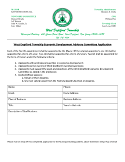


© Copyright 2026