
Document 52318
Request for Proposal CITY OF NEW BEDFORD Environmental Stewardship New Bedford Riverwalk Planning and Design New Bedford, Massachusetts # 15171020 July 28, 2014 Jonathan F. Mitchell Mayor Environmental Stewardship 133 William Street New Bedford, MA 02740 1 REVISED 07/29/2014 CITY OF NEW BEDFORD MASSACHUSETTS Advertisement REQUEST FOR PROPOSAL 15171020 The City of New Bedford, Purchasing Department, in conjunction with the Treasurer’s Office is soliciting proposals for New Bedford Riverwalk Planning and Design Sealed proposals will be received by the Purchasing Department, in the office of the Purchasing Agent, Room 208, City Hall, 133 William Street, New Bedford, Massachusetts, 02740, during business hours, until the date and time of the proposal opening. PROPOSAL OPENING Proposals will be opened August 26, 2014 at 2:00 P.M. Prevailing Time Contract Documents, including the General Conditions and Notice to Proposers, Form of Contract, Specifications, and other Contract Documents, may be obtained and/or examined on or after 07/28/2014 in the office of City of New Bedford, Purchasing Department, 133 William Street, Room 208, New Bedford, MA 02740, (Monday thru Friday – 8:30 AM – 4:00 PM). Documents may also be obtained by emailing [email protected] or [email protected]. Attention is called to the fact that supplies furnished as part of this Contract are exempt from the Sales and Use Tax. All proposals submitted should take this factor into consideration, and be calculated accordingly. The contract will be awarded within thirty (30) days after the proposal opening. The time for award may be extended by mutual agreement between the City and the awarded vendor. No Vendor may withdraw his/her proposal for a period of thirty (30) days, excluding Saturdays, Sundays, and legal holidays, after the actual date of the opening thereof. The Vendor must furnish a Non-Collusion Form and Statement of Taxes, with their proposal. Proposals must include ALL DOCUMENTS required by the Request for Proposal. The Awarding Authority reserves the right to waive any informality, reject any or all proposals, or accept other than the lowest priced proposal. AWARDING AUTHORITY CITY OF NEW BEDFORD PURCHASING DEPARTMENT 2 REVISED 07/29/2014 City of New Bedford, Massachusetts REQUEST FOR PROPOSAL # 15171020 GENERAL CONDITIONS AND NOTICE TO PROPOSERS PROPOSAL FOR NEW BEDFORD RIVERWALK PLANNING AND DESIGN 1. Sealed proposals for the Purchase and delivery of the above will be received in the Purchasing Department, Room 208, 133 William Street, New Bedford, MA, until August 26, 2014, at 2pm, at which time all proposals received will be recorded in the presence of such proposers as desire to be in attendance. No proposals will be accepted after the time and date specified. This is not a public opening 2. There will be no scheduled bidder’s conference, however, all questions must be submitted to Debra Travers, Chief Procurement Officer, City of New Bedford at [email protected] no later than 3:00 p.m. August 8, 2014. Answers will be provided by addendum via email no later than August 14, 2013. 3. The proposer must submit their Technical Proposal and Price Proposal in separate sealed envelopes bearing on the outside the name and address of the Proposer, addressed to the Purchasing Agent, City Hall, New Bedford, MA 02740. The Technical Proposal must be properly filled out, signed, sealed and endorsed: “Proposal # 15171020 – Technical Proposal”. The Price Proposal must be properly filled out, signed, sealed and endorsed: “Proposal # 15171020 – Price Proposal”. Telephone responses and faxed replies will not be accepted. No responsibility shall be attached to any person or persons for the premature openings of proposals not properly marked. 4. Proposals that are incomplete, not properly endorsed, or signed, or which are otherwise contrary to these instructions may be rejected as informal by the Procurement Officer. 5. The Proposer will be bound by all applicable statutory provisions of law of the Federal Government, the Commonwealth of Massachusetts and of the City of New Bedford. 6. All submitted proposals and associated price quotes must be guaranteed to the City of New Bedford for a period of thirty (30) days from the date of the proposal opening. If a contract is to be awarded as a result of this RFP, it will be awarded within the thirty (30) day time period. 7. As provided by Massachusetts General Law, Chapter 64H, §6(d), purchases made by the City of New Bedford are exempt from the payment of Federal Excise Taxes and Massachusetts Sales Tax; any such taxes must not be included in the quoted price. 8. The City reserves the right to reject any and all proposals, and to make awards in a manner deemed in the best interest of the City. 9. The Proposer will not be permitted to either assign or underlet the contract nor assign either legally or equitably, any monies hereunder, or its claim thereto, without the previous written consent of the Purchasing Agent. 10. All proposal prices stated must be firm. 3 REVISED 07/29/2014 11. When submitting a proposal, the Proposer shall submit two (2) signed copies of the technical proposal and one (1) copy of the price proposal. If the City accepts said proposal, it shall constitute part of the contract. 12. Before submitting a proposal, each Proposer must make a careful study of the specifications contained in this Request for Proposal document and fully assure themselves as to the quality, quantity and type of services that the City is seeking to have performed. 13. The proposal for this work must cover all contingencies, including all labor and materials, transportation, etc., necessary for the purchase and delivery/execution of the services required by the City of New Bedford. 14. If proposers have any questions to ask about specifications or terms of this Request for Proposals, they must be submitted either by mail, fax or email to [email protected] no later than 3:00 p.m. August 8, 2014. No further consideration will be given after the proposal opening. A proposer may correct, modify or withdraw a proposal by written notice received in the Office of the Purchasing Agent, prior to the time and date set for receiving of all proposals. 15. The Proposer who is selected to provide services will be required to indemnify the City for all damage to life and property that may occur due to their negligence or that of their employees, subcontractors, etc., during the period of this contract. 16. The contract agreement will be in the form customarily employed by the City and is attached hereto. 17. The specifications as detailed under part entitled TECHNICAL PROPOSAL SPECIFICATIONS shall constitute a part of the contract of purchase, as well as all conditions listed on these first 2 pages. A copy of the successful Proposer’s/vendor’s proposal will be incorporated herein and made a part of this contract. 4 REVISED 07/29/2014 To the City of New Bedford, herein called the Owner, acting through its Treasurer/Collector, for the purchase of New Bedford Riverwalk Planning and Design as required by the City of New Bedford. Proposers’ attention is called to Chapter 268A of the Massachusetts General Laws. In connection with this statute, Proposer is required to submit the following information and any other information deemed necessary by the Proposer. All of the following information regarding the Proposer must be completed: Please indicate business type by placing an X next to the appropriate category: Corporation Partnership Proprietorship If a Corporation, Full Legal Name ____________________________________________________________________________ State of Incorporation__________________________________________________________ If a Partnership, Full Legal Name ____________________________________________________________________________ If a Proprietorship, Name of Owner or d/b/a ____________________________________________________________________________ Principal Place of Business______________________________________________________ Place of Business in Massachusetts _______________________________________________ Business Mailing Address ______________________________________________________ ______________________________________________________ Telephone Number: ______________________ Ext. ________ Qualified to do business in Massachusetts YES NO Give full names and titles of all the persons and parties interested in the foregoing proposals. (Note: give first and last names in full; in cases of corporations, give names of President, Treasurer and Manager; and in cases of partnerships give names of the individual partners.) Name Title _______________________________________ _____________________________________ _______________________________________ _____________________________________ _______________________________________ _____________________________________ _______________________________________ _____________________________________ 5 REVISED 07/29/2014 A foreign corporation is required to submit its certification of corporation from the Massachusetts State Secretary’s Office, as required by Chapter 151 Section 156.d of the Massachusetts General Laws. PROPOSAL FOR NEW BEDFORD RIVERWALK PLANNING AND DESIGN TECHNICAL PROPOSAL SPECIFICATIONS The City of New Bedford, Massachusetts is seeking to plan and complete architectural design of a public pathway along a 2+ mile stretch of the Upper Harbor of the Acushnet River in New Bedford from Coggeshall Street to Wood Street. The successful proposer will be responsible for supplying all labor and materials necessary to satisfy the requirements of this proposal. One contract will be awarded to the one responsive and responsible Proposer whom the City determines offers the most advantageous proposal, taking into consideration all evaluation criteria set forth in the RFP, as well as price. The contract that is awarded as a result of this Request for Proposals will be effective upon completed execution of a contract signed by both the successful Proposer and the appropriate City officials. The contract will be for a period of 10 months, commencing upon award of the contract and anticipated to end in July, 2015. TERMINATION CLAUSE If at any time the Vendor fails to fulfill or comply with any of the requirements of this proposal/contract, such as shoddy workmanship, executing improper operating procedures, supplying sub-standard, improperly trained employees, not adhering to the work schedule, etc., the City, at its option, can terminate this contract upon thirty (30) days written notice to the firm. SCOPE OF SERVICES 1. BACKGROUND INFORMATION New Bedford Harbor/Acushnet River was once enjoyed by thousands of residents and became the source of the region’s and much of the United States’ wealth through the historic whaling and fishing industries. During the late 1800s and early 1900s, however, the construction of mills and manufacturing operations during a boom in textile manufacturing, created a physical barrier to this resource. Use of industrial oils, metals and other hazardous materials in waterfront mills directly resulted in one of New Bedford’s two Superfund Sites. New Bedford is home to the largest Environmental Justice (EJ) community in Southeastern Massachusetts and the industrial impact to the harbor is just one of many disproportionate negative burdens that the community has had to bear. EPA’s cleanup of New Bedford Harbor has been regrettably but understandably slow, as the pace has depended upon the availability of funding. EPA’s recent settlement with AVX, a significant polluter of New Bedford Harbor is expected to hasten the pace of EPA’s cleanup in the upper harbor. The City of New Bedford has meanwhile begun anticipating the reclamation of the harbor and the river as a means for the community to reconnect with the water. 6 REVISED 07/29/2014 In early 2008, the city completed the Upper Harbor Community Vision and Action Plan. The first phase of the process was a weekend-long community planning workshop that included various charettes and in-depth discussions by a broad representation of over 100 stakeholders including members of neighborhood associations, the Economic Development Council, city staff, the Buzzards Bay Coalition, and other community members. One of the outcomes of this planning process was the overwhelming support for the planning and construction of a Riverwalk along the Acushnet River to bring the community back to its river and create recreational and social opportunities for residents and visitors. In 2009, the City of New Bedford requested $4.8M from the New Bedford Harbor Trustees Council to take the Riverwalk project from conceptual design through construction. In 2009, the Trustees awarded the City $2.9M to be administered by the National Oceanic and Atmospheric Administration to engineer and construct Riverwalk. One key and fundamental element that remained unfunded was the initial planning, conceptual, and architectural design. EPA recently entered into a $100,000 Cooperative Agreement to fund this critical initial step as the cleanup efforts have been accelerated. The City is seeking an architectural firm with substantial and demonstrable experience in urban waterfront planning, landscape architecture, and walkway design (Architect) to complete the scope of work funded by this Cooperative Agreement. The City will be working with the New Bedford Economic Development Council (NBEDC) and other stakeholders, collectively referred to as the City Team, throughout the project. 2. STUDY AREA AND TASKS The proposed study area for this Cooperative Agreement, encompasses the 2¼ mile Riverwalk project pathway and is limited to the shoreline properties adjacent to the Acushnet River from River’s End Park southward to Coggeshall Street. Please refer to the attached Acushnet River Upper Harbor New Bedford Riverwalk – Application for Cooperative Agreement (Application) and attachments thereto for additional visual and narrative study area description. Task 1: Site Investigation and Research The Urban Architect/Planner shall thoroughly review previous community visioning studies, planning documents, and charettes to be provided by the City Team. Upon completion of this review, the City Team and Architect will meet to review project priorities. Plans to review include, but are not limited to: (Existing plans and documents for review are available electronically via links listed below) • • • New Bedford 2020: A Citywide Master Plan, 2010; http://www.vhb.com/newbedfordmasterplan/masterplan.asp Final District Development Action Plan: Upper Harbor District, 2008 http://www.epa.gov/region1/superfund/sites/newbedford/507971.pdf Historic Mill Inventory, North End Mill District portion, City of New Bedford, 2008; http://www.newbedford-ma.gov/Planning/mills/10Mill_Inventory_northend.pdf 7 REVISED 07/29/2014 Task 2: Existing Conditions and Reuse Analysis To identify the most effective strategy to integrate the shoreline properties with the Riverwalk project, the Urban Architect/Planner will review existing properties along the project path. This will include evaluation of: • Infrastructure; Potable Water (City of New Bedford, Department of Public Infrastructure [DPI]) Wastewater (City of New Bedford, DPI) Storm Drainage (City of New Bedford, DPI) Electricity (NStar) Natural Gas (NStar) Roadways & Sidewalks (City of New Bedford, DPI) • Zoning; • Existing and potential land use; • Historic or archeologically significant properties; and • Natural resources and environmental features. The Urban Architect/Planner will complete a build-out/reuse analysis deliverable document to determine recommended upgrades, zoning changes, and policy needs for these project properties. Task 3: Approach to Riverwalk Design and Elements The Urban Architect/Planner will complete the following: A. Review existing and potential access points to and pathways within the site, and make recommendations for pedestrian, and bicycle, and alternative use within the site and into the surrounding neighborhood. Consider safety and security to recommend primary gateways and secondary access locations to Riverwalk. B. Evaluate appropriate wayfinding and educational signage locations, content, and appearance. C. Recommend construction materials and management of landscaping, hardscaping, and gateways. D. Develop and design an environmentally-sensitive lighting scheme and evaluate locations for security video equipment. E. Design lighting, site furnishings, gateways, and other such elements. F. Evaluate and identify locations for the potential placement of tents and removable and/or permanent structures, i.e., band shell or staging, for events ranging in scale. G. Develop locations for public art and site features, including but not limited to: murals, sculptures, benches, tables and bicycle racks. H. Identify permitting requirements including but not limited to Chapter 91, MEPA, NOI, etc. Task 3 will include draft conceptual designs for Riverwalk that include elements A through G, to be reviewed by the City Team in preparation of Task 4. Task 4: Community Participation The City of New Bedford is committed to a high level of transparency and community participation in all planning efforts relating to community revitalization. Public outreach should serve to inform the public about the project and serve as a means for the public to participate in forming the plan, thus ensuring community understanding and support. The Urban Architect/Planner will create and implement a strategy to educate stakeholders/the public and to generate support for the plan. There will be a minimum of two community meetings. The first opportunity will be a meeting to be held upon completion of Task 3 and will 8 REVISED 07/29/2014 include the presentation of conceptual designs. The second will be the presentation of the final design following Task 5 and discussion of the implementation process. Products: • Marketing content (in all relevant languages; Spanish, Portuguese, and Cape Verdean Creole are spoken in New Bedford, though not all languages may be used in this neighborhood) for publicizing 2-3 public meetings, community input sessions, or charrettes • Attendance and facilitation at all public meetings, community input sessions, or charrettes • Visual aids and handouts for all public meetings, community input sessions, or charrettes • Identification of engagement strategy to engage groups such as but not limited to government entities, community groups, and businesses, that can assist in the implementation of the plan • Analysis of community-identified priorities. This will include identifying concerns and opportunities within the study area as identified by the community and stakeholders Task 5: Final Design Development Based on feedback received during the initial community participation event, the Urban Architect/Planner will meet with the City Team to determine final design elements. The City Team and Urban Architect/Planner will also review recommended policy, zoning, and /or infrastructure changes necessary for design implementation. The Urban Architect/Planner will provide permitting strategy regarding Chapter 91, MEPA, NOI, and/or other permits identified in Task 3. The Urban Architect/Planner will draft design drawings for Riverwalk and provide them to the City Team for review prior to the development of the final design documents. The Urban Architect/Planner will prepare a detailed draft cost estimate with line items, based on the draft design, which the City will review and then determine which actions may be undertaken by its own Department of Infrastructure and/or the Department of Public Facilities, and which actions must be publically bid. The City Team will review to ensure that the design incorporates the City and the public’s input and evaluate the feasibility of the implementation of the design. Task 6: Final Report and Design Documentation The Urban Architect/Planner will develop final Riverwalk drawings in color in both electronic (AutoCad or other program acceptable to the City) and hard copy format. The Urban Architect/Planner will prepare a final report to include a summary of activities along with policy, infrastructure, and zoning recommendations. Final design documentation will include material and product specifications. The Architect’s design documentation will be suitable for delivery to an engineer for final construction drawing and specification preparation. The Urban Architect/Planner will deliver 10 color hard copies. PLEASE RETURN WITH TECHNICAL PROPOSAL SUBMISSION REQUIREMENTS Proposers must submit two (2) originals of the Technical Proposal with all required information included and one (1) original of the Price Proposal. The Technical and Price Proposals must be submitted in separate sealed envelopes bearing on the outside the name and address of the Proposer, addressed to the Procurement Officer of the City of New Bedford. The Technical envelope must be labeled: “Proposal # 15171020 Technical Proposal” The Price envelope must be labeled: “Proposal # 15171020 Price Proposal” 9 REVISED 07/29/2014 Complete proposal packages must be received by: August 26, 2014, at 2pm___ In the Office of the Purchasing Agent Attn: Debra Travers, Chief Procurement Officer New Bedford City Hall 133 William Street, Room 208 New Bedford, MA 02740 MINIMUM EVALUATION CRITERIA The following information must be submitted with the proposal to be considered responsive. These are minimum standards, considered essential for satisfactory performance of the contract. • Inclusion of all documentation as specified within this RFP; • Favorable responses on all references provided; and • Evidence that the consultant firm has direct relevant experience with large-scale, urban, waterfront master planning projects as well as direct relevant experience with land-use planning and design projects on commercial industrial ports, with a similar or larger scale. COMPARATIVE EVALUATION CRITERIA Each of the following five criteria pertains to requirements listed in this RFP and will be applied to all Technical Proposals submitted that meet the above minimum criteria. Each proposal will receive one rating of Highly Advantageous, Advantageous, Not Advantageous or Unacceptable for each criterion. The rating each criterion receives will be used to compile a composite rating for each Proposer, to be used in the Selection Process segment of this RFP. If any criterion receives a rating of “Unacceptable” that proposal will be REJECTED. Each competing firm must submit a plan to complete the Scope of Work presented herein, including the approach and timeline. Please include all assumptions and any information on which you plan to rely on the City to provide. The City has referenced all known planning documents in this RFP and will work with the selected consultant to identify any additional information. Each firm must indicate if and how they meet the following Comparative Evaluation Criteria. 1. QUALITY OF PROPOSAL AND APPROACH Each proposal will be evaluated based on the quality of its content, and will be rated-as follows: • Highly Advantageous: The proposal contains strong and complete technical approach, format and responsiveness to the RFP. • Advantageous: The proposal contains a clear technical approach, format and responsiveness to the RFP. • Not Advantageous: The proposal contains a general technical approach, format and responsiveness to the RFP. • Unacceptable: The proposal does not contain a clear technical approach, format and responsiveness to the RFP. 2. QUALIFICATIONS AND EXPERIENCE OF THE FIRM AND COMMITTED STAFF Each Urban Architect/Planner must designate key staff and present qualifications and examples of work. The Urban Architect/Planner must agree to commit key staff to the project for the 10 REVISED 07/29/2014 duration of the contract and may not replace key staff without consent of the City Team. The experiences of the firm and committed staff will be rated as follows: • Highly Advantageous: The proposer has strong experience (more than 5 implemented projects) with urban waterfront, recreational planning projects as well as strong experience with land re-use planning and design projects on commercial waterfronts, with a similar scale or larger than New Bedford’s Upper Harbor. • Advantageous: The proposer has experience (3 to 5 implemented projects) with urban waterfront, recreational planning projects as well as strong experience with land re-use planning and design projects on commercial waterfronts, with a similar scale or larger than New Bedford’s Upper Harbor. • Not Advantageous: The proposer has limited prior experience (1 to 2 implemented projects) with urban waterfront, recreational planning projects as well as strong experience with land re-use planning and design projects on commercial waterfronts, with a similar scale or larger than New Bedford’s Upper Harbor. • Unacceptable: The proposer does not have any prior experience with urban waterfront, recreational planning projects as well as strong experience with land re-use planning and design projects on commercial waterfronts, with a similar scale or larger than New Bedford’s Upper Harbor. 3. EXAMPLES OF RELEVANT WORK Proposals must include examples of previous experiences and must be reflective of each firm's relevant work with urban waterfront, recreational planning projects as well as strong experience with land re-use planning and design projects on commercial waterfronts, with a similar scale or larger than New Bedford’s Upper Harbor. Such documents may be reports, presentations and / or design drawings relating to the scope of work contained within this RFP. All materials submitted will be collectively evaluated as follows: • Highly Advantageous: Examples excel with respect to graphics, format, writing style, understanding of subject matter, and relevance to the scope of work described herein. • Advantageous: The examples are clear and complete with respect to graphics, format, writing style, understanding of subject matter, and relevance to the scope of work described herein. • Not Advantageous: The majority of, or all of the examples are not clear and complete with respect to any of the aforementioned areas. • Unacceptable: No examples of previous work are provided. 4. COORDINATION SKILLS IN A PUBLIC PROCESS This project consists of the need to coordinate between many different stakeholder groups, agencies and City departments. Coordination skills will be rated as follows: • Highly Advantageous: The proposer has strong past experience (more than 5 projects) in performing coordination activities between several different groups • Advantageous: The proposer has past experience (3 to 5 projects) in performing coordination activities between several different groups • Not Advantageous: The proposer has limited past experience (1 to 2 projects) in performing coordination activities between several different groups • Unacceptable: The proposer does not have any prior experience in performing coordination activities between several different groups 5. CAPACITY TO MEET PROJECT DEVILIVERABLES AND SCHEDULE Proposer’s demonstrated ability to complete projects on a timely basis will be rated as follows: 11 REVISED 07/29/2014 • • • • Highly Advantageous: All of the proposer’s relevant work experiences indicate that the projects were completed at a level of high quality and on schedule. Advantageous: Only one of the proposer’s relevant work experiences indicate that the project was completed at a level of high quality and on schedule. Not Advantageous: Two of the proposer’s relevant work experiences indicate that the projects were not completed at a level of high quality and / or experienced substantial delays attributable to the proposer. Unacceptable: More than two of the proposer’s relevant work experiences indicate that the projects were not completed at a level of high quality and / or experienced substantial delays attributable to the proposer. 6. PERFORMANCE DURING INTERVIEWS (If Conducted) The ability of the consultant team to clearly present ideas in a meeting / interview session, particularly their ability to articulate their proposed approach to the project will be rated as follows (Any interviews will be conducted by conference call or in person with the Evaluation Committee): • Advantageous: The proposer’s oral presentation was clear and well organized and demonstrated the proposer’s ability to communicate effectively. • Not Advantageous: The proposer’s oral presentation was unclear and disorganized and did not demonstrate the proposer’s ability to communicate effectively. TO BE RETURNED WITH TECHNICAL PROPOSAL SELECTION PROCESS As a result of this RFP, the City of New Bedford intends to award the contract to one Urban Architect/Planner from the proposals received. All proposals will be submitted to the Purchasing Agent. The department responsible for evaluation will review all proposals, rate each of the Comparative Evaluation Criteria questions and assign a composite rating for each proposal. Background checks, requests for additional information, and interviews will be performed as needed. The evaluators will then submit a recommendation to the Chief Procurement Officer who will review the recommendation and, if in agreement with the recommendation, award the contract. This Request for Proposals does not commit the City to award a contract, to pay any costs incurred in the preparation of a response to this request, or to procure or contract for any services of any kind. In the evaluation of the proposals, the City, at its discretion, may obtain technical support from outside sources. The Proposers, by virtue of their proposal submissions, agree to fully cooperate with the personnel of such outside sources in the evaluation of their respective proposal. Failure to cooperate may result in the rejection of your Proposal. _______________________________________ Signature of Authorized Agent _______________________________ Company Name (Please Type) _______________________________________ Printed Name & Title _____________________________ Date 12 REVISED 07/29/2014 CITY OF NEW BEDFORD, MASSACHUSETTS NEW BEDFORD RIVERWALK PLANNING AND DESIGN PRICE PROPOSAL* The City of New Bedford requires each Proposer to supply pricing in the following format: Task Pricing 1 – Site Investigation and Research 2 – Existing Conditions and Reuse Analysis 3 – Approach to Riverwalk Design and Elements 4 – Community Participation 5– Final Design Development 6 – Final Report and Design Documentation Project Total: The proposal pricing is to cover all work required for this project as outlined in the Technical Proposal portion of this RFP document. Proposal prices must be all-inclusive, including all fees, charges, expenses, travel, postage, fax and telephone charges, preparation of reports, meeting attendance, etc., for all work proposed to be performed by the successful proposer. No separate fees will be paid for mileage, postage, telephone, reports, presentations, etc. This contract will be in effect, in response to this RFP. PRICE ESCALATION CLAUSE Prices offered by the proposer must be firm and not subject to increase during the term of the contract. Price escalation clauses over and above the total submitted proposal price(s) are not allowed. Only the total proposal price(s) will be accepted. Proposers cannot insert/include a statement indicating their price(s) will increase above or beyond their submitted proposal price(s) due to third party actions or unnamed contingencies. Inclusion of an escalation clause of any kind will result in the rejection of the proposal. CONTRACT AWARD One contract will be awarded to the one responsive and responsible Proposer whom the City of New Bedford’s Chief Procurement Officer determines offers the most advantageous proposal, taking into consideration all required qualifications, submission requirements and selection criteria set forth in the RFP, including price. Emphasis in selecting a firm shall be placed on the chosen firm's experience on similar past projects and overall experience within this category of work. PLEASE COMPLETE EXHIBIT AND RETURN WITH PRICE PROPOSAL _______________________________________ Signature of Authorized Agent _______________________________ Company Name (Please Type) _______________________________________ Printed Name & Title ___________________________ Date 13 REVISED 07/29/2014 CITY OF NEW BEDFORD MASSACHUSETTS VOTE OF CORPORATION AUTHORIZING EXECUTION OF CORPORATE AGREEMENTS At a meeting of the Board of Directors of __________________duly called and held on _________________, 20_____ at which a quorum was present and acting throughout, the following vote was duly adopted. VOTED: That ____________________________, the_________________________ of the corporation, be and hereby is authorized to affix the Corporate Seal, sign and deliver in the name and behalf of the corporation contract documents with the City of New Bedford, the above mentioned documents to include but not be limited to Bids, Proposals, Deeds, Purchase and Sales Agreements, Agreements, Contracts, Leases, Licenses, Releases and Indemnifications; and also to seal and execute, as above, surety company bonds to secure bids and proposals and the performance of said contract and payment for labor and materials, all in such form and on such terms and conditions as he/she, by the execution thereof, shall deem proper. A true copy ATTEST: ______________________________________ Name (printed) ______________________________________ (Affix Corporate Seal) Signature ______________________________________ Title ______________________ Date MUST BE INCLUDED WITH TECHNICAL PROPOSAL 14 REVISED 07/29/2014 CITY OF NEW BEDFORD MASSACHUSETTS NON-COLLUSION AND TAX COMPLIANCE FORM CERTIFICATE OF NON-COLLUSION The undersigned certified under penalties of perjury that this proposal has been made and submitted in good faith and without collusion or fraud with any other person. As used in this certification, the word “person” shall mean any natural person, business, partnership, corporation, union, committee, club or other organization, entity or group of individuals. Signature of individual submitting proposal Name of business/organization TAX COMPLIANCE CERTIFICATION Pursuant to M.G.L. c. 62C, §49A, I certify under the penalties of perjury that, to the best of my knowledge and belief, I am in compliance with all laws of the Commonwealth relating to taxes reporting of employees and contractor, and withholding and remitting child support. Signature of person submitting proposal Name of business MUST BE INCLUDED WITH TECHNICAL PROPOSAL 15 REVISED 07/29/2014 CITY OF NEW BEDFORD, MASSACHUSETTS Goods and Services Contract DATE: ___________________ This Contract is entered into on, or as of, this date by and between the City of New Bedford, Massachusetts, a municipal corporation, 133 William Street, New Bedford, Bristol County, Massachusetts 02740 (the “City”), and ______________________________________________ [“Contractor”] __________________________________ __________________________________ __________________________________ [Address of the Contractor] ____________________________________________________________________________ [Telephone Number] [FAX Number] [E-Mail Address] 1. This is a Contract for the procurement of the following: 2. The Contract price to be paid to the Contractor by the City is: 3. Payment will be made as follows: 3.1 Pursuant to invoice in accordance with Article 24 hereof. 3.2 Fees and Reimbursable Costs combined shall not exceed $_____________as more fully set forth in the Contractors Response to the Request for Proposals or Invitation for Bids. 3.3 There shall be no further costs, fees, or reimbursable charges due the Contractor under this Contract unless said fees and/or costs are so set forth in writing in an Amendment hereto. 16 REVISED 07/29/2014 4. Definitions: 4.1 Acceptance: All Contracts require proper acceptance of the described goods or services by the City. Proper acceptance shall be understood to include inspection of goods and certification of acceptable performance for services by authorized representatives of the City to insure that the goods or services are complete and are as specified in the Contract. 4.2 Contract Documents: All documents relative to the Contract including (where used) Requests for Proposals and Invitations for Bids and all attachments thereto, Instructions to Bidders, Proposal Forms, General Conditions, Supplementary General Conditions, General Specifications, other Specifications included in Project Manual, Drawings, all Addenda issued during the bidding period, and Contractor’s Response to the Request for Proposals or Invitation for Bids. The Contract documents are complementary, and what is called for by any one shall be as binding as if called for by all. The intention of the documents is to include all labor and materials, equipment and transportation necessary for the proper performance of the Contract. The Contractor: The “other party” to any Contract with the City. This term shall (as the 4.3 sense and particular Contract so require) include Vendor, Contractor, Engineer, or other label used to identify the other party in the particular Contract. Use of the term “Contractor” shall be understood to refer to any other such label used. 4.4 Date of Substantial Performance: The date when the work is sufficiently complete, the services are performed, or the goods delivered, in accordance with Contract documents, as modified by duly executed amendments. 4.5 Goods: Goods, supplies, and all property, other than real property, including equipment, materials, printing, and insurance and further including services incidental to the delivery, conveyance and installation of such property. 4.6 Services: The furnishing of labor, time, or effort by a Contractor, not involving the furnishing of a specific end product other than reports. This term shall not include employment agreements, collective bargaining agreements, or grant agreements. 4.7 Subcontractor: Those having a direct contract with the Contractor. The term includes one who furnished material worked to a special design according to the Drawings or Specifications of the work, but does not include one who merely furnishes material not so worked. 4.8 Work: The services or materials contracted for, or both. 5. Term of Contract and Time for Performance: This Contract shall be fully performed by the Contractor in accordance with the provisions of the Contract Documents on or before September 27, 2013, unless extended, in writing, at the sole discretion of the City, and not subject to assent by the Contractor, and subject to the availability and appropriation of funds as certified by the City Auditor. Time is of the essence for the completion of the Contract. 17 REVISED 07/29/2014 6. Subject to Appropriation: Notwithstanding anything in the Contract Documents to the contrary, any and all payments which the City is required to make under this Contract shall be subject to appropriation or other availability of funds as certified by the City Auditor. In the absence of appropriation or availability as certified herein, this Contract shall be immediately terminated without liability for damages, penalties or other charges to the City. 7. Permits and Approvals: Permits, licenses, approvals and all other legal or administrative prerequisites to its performance of the Contract shall be secured and paid for by the Contractor. 8. Termination and Default: 8.1 Without Cause. The City may terminate this Contract on seven (7) calendar days notice when in the City’s sole discretion it determines it is in the best interests of the City to do so, by providing notice to the Contractor, which shall be in writing and shall be deemed delivered and received when given in person to the Contractor, or when received by fax, express mail, certified mail return receipt requested, regular mail postage prepaid or delivered by any other appropriate method evidencing actual receipt by the Contractor. Upon termination without cause, Contractor will be paid for services rendered to the date of termination. 8.2 For Cause. If the Contractor is determined by the City to be in default of any term or condition of this Contract, the City may terminate the Contract on seven (7) days notice by providing notice to the Contractor, which shall be in writing and shall be deemed delivered and received when given in person to the Contractor, or when received by fax, express mail, certified mail return receipt requested, regular mail postage prepaid or delivered by any other appropriate method evidencing actual receipt by the Contractor. 8.3 Default. The following shall constitute events of a default under the Contract: 1) any material misrepresentation made by the Contractor to the City; 2) any failure to perform any of its obligations under this Contract including, but not limited to the following: (i) failure to commence performance of this Contract at the time specified in this Contract due to a reason or circumstance within the Contractor’s reasonable control; (ii) failure to perform this Contract with sufficient personnel and equipment or with sufficient material to ensure the completion of this Contract within the specified time due to a reason or circumstance within the Contractor’s reasonable control; (iii) failure to perform this Contract in a manner reasonably satisfactory to the City; (iv) failure to promptly re-perform within a reasonable time the services that were rejected by the City as unsatisfactory, or erroneous; (v) discontinuance of the services for reasons not beyond the Contractor’s reasonable control; (vi) failure to comply with a material term of this Contract, including, but not limited to, the provision of insurance and non-discrimination; (vii) any other acts specifically and expressly stated in this Contract as constituting a basis for termination of this Contact; and (viii) failure to comply with any and all requirements of federal or state law and/or regulation or City Ordinance and/or regulations. 9. Suspension or Delay: The City may order the Contractor, in writing, to suspend, delay or interrupt all or any part of the 18 REVISED 07/29/2014 performance of this Contract without cause for such period of time as the City may determine to be appropriate for its convenience. In the event of any such suspension, delay or interruption, the Contractor’s compensation shall be equitably adjusted. No adjustment shall be made if the Contractor is or otherwise would have been responsible for the suspension, delay or interruption of the performance of this Contract, or if another provision of this Contract is applied to render an equitable adjustment. 10. The Contractor’s Breach and the City’s Remedies: Failure of the Contractor to comply with any of the terms or conditions of this Contract shall be deemed a material breach of the Contract, and the City of New Bedford shall have all the rights and remedies provided in the Contract documents, including, without limitation, the right to cancel, terminate, or suspend the Contract in whole or in part, the right to maintain any and all actions at law or in equity or other proceedings with respect to a breach of this Contract, including but not limited to monetary damages, costs, attorney’s fees or other damages resulting from said breach, as well as specific performance of this Contract, and the right to select among the remedies available to it by virtue of all of the above. From any sums due to the Contractor for performance of this Contract, the City may retain and keep the whole or any part of the amount for expenses, losses and monetary damages incurred by the City as a consequence of the Contractor’s breach of the Contract and/or of the City having to procure goods or services as a result of any failure, omission or mistake of the Contractor in providing goods or services as required by this Contract. 11. Statutory Compliance: 11.1 This Contract will be construed and governed by the provisions of applicable federal, state and local laws and regulations; and wherever any provision of the Contract or Contract Documents shall conflict with any provision or requirement of federal, state or local law or regulation, then the provisions of the applicable law or regulation shall control. Where applicable to the Contract, the provisions of the General Laws are incorporated by reference into this Contract, including, but not limited to, the following: General Laws Chapter 30B – Procurement of Goods and Services. 11.2 Wherever applicable law mandates the inclusion of any term or provision into a municipal contract, this Article shall be understood to import such term or provision into this Contract. To whatever extent any provision of this Contract shall be inconsistent with any law or regulation limiting the power or liability of cities and towns, such law or regulation shall control. 11.3 The Contractor shall comply with all federal, state and local laws, rules, regulations, policies and orders applicable to the Work provided pursuant to this Contract, such provisions being incorporated herein by reference, and shall be responsible for obtaining all necessary licenses, permits, and approvals required for the performance of such Work. 11.4 The Contractor shall indemnify and hold harmless the City, its officers, agents, and employees, from and against any and all fines, penalties or monetary liabilities incurred by the City, its officers, agents, and employees, as a result of the failure of the Contractor to 19 REVISED 07/29/2014 comply with the previous sentence. If any discrepancy or inconsistency is discovered in the Drawings, Specifications or Contract for this work in violation of any such law, rule, regulation, policy, or order, it shall forthwith report the same in writing to the City. The Contractor shall at all times observe and comply with all such existing and future laws, rules, regulations, policies and orders and shall indemnify and hold harmless the City, its officers, agents, and employees, against any claim or liability arising from or based on any violation of any such law, rule, regulation, policy, or order, whether by the Contractor, its agents, employees or subcontractors. 12. Conflict of Interest: Both the City and the Contractor acknowledge the provisions of the State Conflict of Interest Law (General Laws Chapter 268A). This Contract expressly prohibits any activity which shall constitute a violation of that law. The Contractor shall be deemed to have investigated the application of M.G.L. c. 268A to the performance of this Contract; and, by virtue of its execution of the Contract Documents, certifies to the City that neither it nor its agents, employees, or subcontractors are in violation of General Laws Chapter 268A. 13. Certification of Tax Compliance: This Contract must include a certification of tax compliance executed by the Contractor, as required by General Laws Chapter 62C, Section 49A (Requirement of Tax Compliance by All Contractors Providing Goods, Services, or Real Estate Space to the Commonwealth or political subdivision thereof). 14. Non-Discrimination: The Contractor shall carry out the obligations of this Contract in compliance with all requirements imposed by or pursuant to federal, state, and local ordinances, statutes, rules and regulations and policies prohibiting discrimination in employment, including but not limited to, Title VII of the Civil Rights Act of 1964; the Age Discrimination in Employment Act of 1967; Section 504 of the Rehabilitation Act of 1973 and Mass. G. L. c. 151B, and any other executive orders, rules, regulations, requirements and policies relating thereto enacted by the United States of America, the Commonwealth of Massachusetts, and the City as they may be amended from time to time. Contractor shall not discriminate against any qualified employee or applicant for employment because of race, color, national origin, ancestry, age, sex, religion, physical or mental handicap or sexual orientation. 15. Assignment: The Contractor shall not assign, sublet or otherwise transfer this Contract, in whole or in part, without the prior written consent of the City, and shall not assign any of the moneys payable under this Contract, except by and with the written consent of the City. 16. Condition of Enforceability against the City: The obligations of the City under this Contract for the present or any subsequent fiscal year following the fiscal year in which the Contract is executed are subject to appropriation by the City of funds sufficient to discharge the City’s obligations that accrue in this or any subsequent fiscal year. In the absence of such appropriation or authorization, this Contract shall be terminated 20 REVISED 07/29/2014 immediately upon the Contractor’s receipt of notice to said effect without liability or damages, penalties or other charges arising from such early termination. Expenditures under this Contract for services that will extend beyond a single fiscal year shall not exceed in any fiscal year the amount appropriated or authorized for said fiscal year. The Consultant’s yearly costs, as contained herein, may not exceed the amount appropriated for the fiscal year. 17. Corporate Contractor: If the Contractor is a corporation, it shall endorse upon this Contract (or attach hereto) its Clerk’s Certificate certifying the corporate capacity and authority of the party signing this Contract for the corporation. This Contract shall not be enforceable against the City of New Bedford unless and until the Contractor complies with this Article. The Contractor, if a foreign corporation, shall comply with the provisions of the General Laws, Chapter 181, Sections 3 and 5, and any Amendments thereof and Acts in addition thereto, relating to the appointment of the Commissioner of Corporations as its attorney, and shall file with the Commissioner of Corporations duly authenticated copies of its Charter or Certificate of Incorporation and comply with all the laws of the Commonwealth of Massachusetts. 18. Liability of Public Officials: To the full extent permitted by law, no official, employee, agent or representative of the City shall be individually or personally liable on any obligation of the City under this Contract. 19. Indemnification: The Contractor shall indemnify, defend and save harmless the City, its officers, agents and employees, from and against any and all damages, liabilities, actions, suits, proceedings, claims, demands, losses, costs, expenses, recoveries and judgments of every nature and description (including attorneys’ fees) that may arise in whole or in part out of or in connection with the work to be performed under this Contract, or out of any act or omission by the Contractor, its employees, agents, subcontractors, material men, and anyone directly or indirectly employed by any of them or anyone for whose acts any of them may be liable, regardless of whether or not it is caused in part by any party indemnified hereunder. The Contractor further agrees to reimburse the City for damage to the City’s property caused by the Contractor, its employees, agents, subcontractors or material men, and anyone directly or indirectly employed by any of them or anyone for whose acts any of them may be liable, including damages caused by its or their use of faulty, defective, or unsuitable material or equipment, unless the damage is caused by the City’s gross negligence or willful misconduct. In any and all claims against the City, its officers, agents or employees, by any employee of the Contractor, any Subcontractor, anyone directly or indirectly employed by any of them or anyone for whose acts any of them may be liable, the indemnification obligation under this paragraph shall not be limited in any way by any limitation on the amount or type of damages, compensation or benefits payable by or for the Contractor or any Subcontractor under Workmen’s Compensation Acts, disability benefit acts, or other employee benefit acts. The foregoing provisions shall not be deemed to be released, waived, limited, or modified in any respect by reason of any surety or insurance provided by the Contractor under this Contract. 20. Insurance: 20.1 Workers Compensation Insurance: 21 REVISED 07/29/2014 The Contractor shall provide by insurance for the payment of compensation and the furnishing of other benefits under Chapter 152 of the General Laws of Massachusetts (The Worker’s Compensation Act) to all employees of the Contractor who are subject to the provisions of Chapter 152 of the General Laws of Massachusetts. Failure to provide and continue in force such insurance during the period of this Contract shall be deemed a material breach of this Contract, shall operate as an immediate termination thereof, and Contractor shall indemnify the City for all losses, claims, and actions resulting from the failure to provide the insurance required by this Article. The Contractor shall furnish to the City a certificate evidencing such insurance prior to the execution of this Contract before the same shall be binding on the parties thereto, except if specifically waived by the City. 20.2 Other Insurance Requirements: a. Comprehensive commercial general liability insurance with limits of at least $1 Million per occurrence and $2 Million annual aggregate for property damage and $1 Million per person and $2 Million per occurrence for bodily injury, which shall include the City of New Bedford as an additional insured, and which shall cover bodily injury, sickness or disease, or death of any person including employees and those persons other than the Contractor’s employees, and claims insured by usual personal liability coverage, death, or property damage arising out of the Work including injury or destruction of tangible property, including loss of use resulting therefrom. b. Motor vehicle insurance for any motor vehicles used in performing the Work, with limits of at least $500,000 per person, and $1 Million per accident. c. The intent of the above provisions regarding insurance is to specify minimum coverage and minimum limits of liability acceptable under the Contract. However, it shall be the Contractor’s responsibility to purchase and maintain insurance of such character and in such amounts as will adequately protect it and the City from and against all claims, damages, losses and expenses resulting from exposure to any casualty liability in the performance of the Work. d. All insurance policies shall identify the City as an additional insured (except Workers' Compensation) and shall provide that the City shall receive written notification at least 30 days prior to the effective date of any amendment thereto or cancellation thereof. Renewal Certificates shall be filed with the City at least 10 days prior to the expiration of the required policies. Certificates evidencing all such coverage shall be provided to the City upon the execution of this Contract, and upon the renewal of any such coverage. Each such certificate shall specifically refer to this Contract and shall state that such insurance is as required by this Contract. Failure to provide or to continue in force such insurance shall be deemed a material breach of this Contract and shall be grounds for immediate termination. Said insurance shall include: Workers Compensation/Employers' Liability Insurance, Business Automobile Liability Insurance, and Commercial General Liability Insurance (CGL). The CGL policy shall include coverage for liability arising from premises, operations, independent Contractors, personal injury, contractual liability. All Certificates of Insurance shall be on the “MIIA” or “ACORD” Certificate of Insurance form, shall contain true transcripts from the policies, authenticated by the proper officer of the insurer, evidencing in particular those insured, the extent of coverage, the location and operations to which the insurance applies, the expiration date and the abovementioned notice clauses. All insurance shall be written on an occurrence basis. Coverage’s 22 REVISED 07/29/2014 shall be maintained without interruption from date of the Contract until date of final payment and termination of any coverage required to be maintained after payment. e. The Contractor shall obtain and maintain during the term of this Contract said insurance coverage in companies licensed to do business in the Commonwealth of Massachusetts and acceptable to the City. 21. Documents, Materials, Etc: Any materials, reports, information, data, etc. given to or prepared or assembled by the Contractor under this Contract are to be kept confidential and shall not be made available to any individual or organization by the Contractor (except agents, servants, or employees of the Contractor) without the prior written approval of the City, except as otherwise required by law. The Contractor shall comply with the provisions Chapter 66A of the General Laws of Massachusetts as it relates to public documents, and all other state and federal laws and regulations relating to confidentiality, security, privacy and use of confidential data. Any materials produced in whole or in part under this Contract shall not be subject to copyright, except by the City, in the United States or any other country. The City shall have unrestricted authority to, without payment of any royalty, commission, or additional fee of any type or nature, publicly disclose, reproduce, distribute and otherwise use, and authorize others to use, in whole or in part, any reports, data or other materials prepared under this Contract. All data, reports, programs, software, equipment, furnishings, and any other documentation or product paid for by the City shall vest in the City at the termination of this Contract. The Contractor shall at all times, during or after termination of this Contract, obtain the prior written approval of the City before making any statement to the press or issues any material for publication through any medium bearing on the work performed or data collected under this Contract. 22. Independent Contractor: The Contractor acknowledges and agrees that it is acting as an independent Contractor for all services rendered pursuant to this Contract, and neither the Contractor, nor its employees, agents, or servants, nor any person for whose conduct the Contractor is responsible, shall be considered an employee or agent of the City for any purpose, and shall not file any claim or bring any action for any worker’s compensation, unemployment benefits, or compensation for which they may otherwise be eligible as a City employee as a result of the Work performed pursuant to this Contract. 23. Audit, Inspection and Recordkeeping: At any time during normal business hours, and as often as the City may deem it reasonably necessary, there shall be available in the office of the Contractor for the purpose of audit, examination, and/or to make excerpts or transcripts, all records, contracts, invoices, materials, payrolls, records of personnel, conditions of employment and other data relating to all matters covered by this Contract. 23 REVISED 07/29/2014 24. Payment: Contractor shall invoice the City for services rendered or goods provided hereunder. Invoices shall clearly describe the work performed and accepted by the City during the invoiced month. The City will compensate Contractor for work accepted by the City during the invoiced month. The City shall make all reasonable efforts to process payments within thirty (30) days from the date of receipt of each invoice. The City shall give prompt written notice of any disputed invoice amount and shall pay the amount not in dispute. 25. Waiver and Amendment: Amendment of any term, condition, covenant, duty, or obligation contained in this Contract may be made only by written amendment duly executed by the parties hereto. To the extent allowed by law, any term, condition, duty, or obligation contained in this Contract may be waived only by written agreement of the parties hereto. Forbearance or indulgence in any form or manner by a party shall not be construed as a waiver, nor in any manner limit the legal or equitable remedies available to that party. No waiver by either party of any default or breach shall constitute a waiver of any subsequent default or breach of a similar or different matter. 26. Severability: If any term or condition of this Contract is held invalid, illegal, or unenforceable by a court of competent jurisdiction, the validity, legality, or enforceability of the remaining terms and conditions shall not be affected thereby and shall remain in full force and effect. 27. Forum and Choice of Law: This Contract shall be governed by and construed in accordance with the laws of the Commonwealth of Massachusetts. Any proceedings or actions relating to the subject matter contained herein shall be brought and maintained in the courts of the Commonwealth sitting in Bristol County, Massachusetts or the United States District Court sitting in the Commonwealth. 28. Notices: Any notice permitted or required under the provisions of this Contract to be given or served by either of the parties hereto upon the other party hereto shall be in writing and signed in the name or on the behalf of the party giving or serving the same. Notice shall be deemed to have been received at the time of actual service or three (3) business days after the date of a certified or registered mailing properly addressed. Notice to the Contractor shall be deemed sufficient if sent to the address set forth on page 1 or furnished from time to time in writing hereafter. 29. Binding on Successors: This Contract is binding upon the parties hereto, their successors, assigns and legal representatives (and where not corporate, the heirs and estate of the Contractor). Neither the City nor the Contractor shall assign or transfer any interest in the Contract without the written consent of the other. 24 REVISED 07/29/2014 30. Entire Agreement: This Contract, including all documents incorporated herein by reference, constitutes the entire integrated agreement between the parties with respect to the matters described. This Contract supersedes all prior agreements, negotiations and representations, written or oral, and shall not be modified or amended except by a written document duly executed by the parties hereto. IN WITNESS WHEREOF the parties hereto have set their hands and executed this as an instrument under seal this the day and year first above written. Vendor: CITY OF NEW BEDFORD, MASSACHUSETTS ________________________________ ___________________________ By: Title: CERTIFIED that funds are available By: Jonathan F. Mitchell Title: Mayor Environmental Stewardship ______________________________ ________________________________ By: By: Michele Paul Title: Director Sharon M. Thomas Title: Acting City Auditor APPROVED as to Form and Legality _______________________________ By: Shannon Shreve Title: Counsel II PURCHASING DEPARTMENT ________________________________ By: Debra Travers Title: Chief Procurement Officer 25 REVISED 07/29/2014 Acushnet River Upper Harbor New Bedford Riverwalk City of New Bedford Application for Cooperative Agreement May 21, 2014 Introduction The Upper Harbor area of New Bedford along the Acushnet River is one of the most intact collections of historic mill buildings and environmental beauty to be found anywhere. This area of the city has long been defined by the neighborhoods of triple-decker tenements that housed the largely immigrant families who made New Bedford home at the beginning of the Industrial Revolution. These men and women, mostly of Portuguese and French-Canadian descent, supplied the textile mills with the workforce that powered New Bedford’s economy for decades. While the Acushnet River’s southern area—known locally as the mid and lower harbors—has always been crucial to the success of New Bedford’s whaling and fishing industry, historically the upper harbor area of the river has been underestimated as a significant asset for environmental education and future development in this northern area of the city. New Bedford Harbor/Acushnet River was once enjoyed by thousands of residents and became the source of the region’s and much of the United States’ wealth through the historic whaling and fishing industries. During the late 1800s and early 1900s, however, the construction of mills and manufacturing operations during a boom in textile manufacturing, created a physical barrier to this resource. Use of industrial oils, metals and other hazardous materials in waterfront mills directly resulted in one of New Bedford’s two Superfund Sites. The PCB contamination in New Bedford Harbor has compounded the negative impact of the loss of this resource by adding serious health and safety risks to the users of this area of the Acushnet River. New Bedford is home to the largest Environmental Justice (EJ) community in Southeastern Massachusetts and the industrial impact to the harbor is just one of many disproportionate negative burdens that the community has had to bear. The Upper Harbor EJ area is prime example of an economically-disadvantaged community and of families self-locating where environmental impacts have negatively influenced property values. EPA’s cleanup of New Bedford Harbor has been regrettably but understandably slow, as the pace has depended upon the availability of funding. The City of New Bedford has meanwhile begun anticipating the reclamation of the harbor and the river as a means for the community to reconnect with the water. The City is confident that EPA’s recent settlement with AVX will considerably hasten the pace of EPA’s cleanup in the upper harbor. The objective of this proposed planning process is to provide the community with a sustainable framework for redevelopment while avoiding gentrification which would further injure the EJ community. Community Vision for the Acushnet River Upper Harbor New Bedford has already laid the foundation for and made substantial progress toward sustainable reuse and redevelopment on the Upper Harbor area of the Acushnet River. In early 2008, the city completed the Upper Harbor Community Vision and Action Plan—a partnership between the City, MassDevelopment, and the Garfield Foundation. The first phase of the process was a weekend-long community planning workshop that included various City of New Bedford Upper Harbor Reuse Planning - May 2014 Page 2 of 10 charettes and in-depth discussions by a broad representation of stakeholders including members of neighborhood associations, the Economic Development Council, city staff, the Buzzards Bay Coalition, and other community members. Over 100 attendees participated in the intensive planning efforts which consistently underscored four main themes: • • • • Acushnet Avenue Corridor – Establish a stretch of Acushnet Avenue as a pedestrianfriendly international marketplace to create a gateway experience welcoming residents and visitors to the area; Waterfront Access – Create east/west connections to provide and encourage public pedestrian access to the Acushnet River and create a north-south Riverwalk along the Acushnet River to include boat launches and open recreational space for the community; Marketing – Increase exposure to existing restaurants and shops while promoting further sustainable commercial and visitor-centered development; Neighborhoods – Enhance livability to encourage home ownership and owner occupancy. The December 2008 Final District Development Action Plan: Upper Harbor District established a strategy to implement the initiatives generated by the community during the visioning process. These are projected below. The Upper Harbor vision has been developed around a pedestrian greenway, labeled Riverwalk, to be constructed along the upper harbor of the Acushnet River to provide open space, recreation, and social opportunities to the local EJ community and to all residents of the City. Riverwalk is shown as a generic red dashed line along the waterfront on the above figure. In 2009, the City of City of New Bedford Upper Harbor Reuse Planning - May 2014 Page 3 of 10 New Bedford requested $4.8M from the New Bedford Harbor Trustees Council (NRTC) for Riverwalk to take the Riverwalk project from conceptual design through construction. In 2009, the NRTC awarded the City $2.9M to be administered by the National Oceanic and Atmospheric Administration to engineer and construct Riverwalk. The scope of work to be completed through this $2.9M in NRTC funding was prescribed in a May 2011 New Bedford Harbor Riparian Restoration Project Narrative, included as Attachment A. In 2008, the City also completed its first-ever historic mill inventory. This process identified the 101 mill sites throughout the city and served as a catalytic document for the mill redevelopment that has been underway along the Acushnet River since 2008. More than $100 million in historic mill redevelopment has taken place in the Upper Harbor area with mill buildings being used for new manufacturing, professional office, and hundreds of market rate loft-style residential units including Whaler’s Cove, Manomet Place, and Riverbank Lofts. The principles supporting Riverwalk and the objectives of the Upper Harbor Community Vision and Action Plan were solidified in the City’s 2010 master plan: New Bedford 2020. Project Overview The $2.9M in funding by NRTC to design and construct Riverwalk, as well as the accelerated EPA Harbor Cleanup, will provide the community with access to the Acushnet River more quickly than originally anticipated. The nearly $2M reduction from the 2009 request, however, required the City to scale back some of the original project scope and/or to look for additional sources of funding to complete critical pieces. One such critical piece is the conceptual-level planning to integrate the greenway with the surrounding land uses. This key element is vital as it will prescribe the form and function necessary for viable project sustainability, and provide a tangible visualization to show potential private partners who can redevelop the greater area. Specifically, NRTC funded only $100,000 of the $300,000 requested for the architectural design and structural engineering of the Riverwalk. This has prevented the City from developing conceptual design plans that can be used to specify the Riverwalk path along the Acushnet River and to demonstrate how Riverwalk will serve to integrate the site with abutting properties. The approved NRTC project scope, based on the $100,000 available for engineering functions required to provide construction-level plans and specifications, included the following as prescribed in Section 2.3 of Attachment A: 2.3.1 Existing Conditions Survey; 2.3.2 Resource Area Delineation; 2.3.3 Resource Area Delineation Survey; 2.3.4 Easement Design; 2.3.5 Finalize Existing Conditions Plans; 2.3.6 Preliminary Design Plans; 2.3.7 Permitting; and 2.3.8 Final Design. City of New Bedford Upper Harbor Reuse Planning - May 2014 Page 4 of 10 At this time, New Bedford seeks to complete a comprehensive planning exercise through a supplemental $100,000 cooperative agreement with EPA that will better inform the $100,000 in engineering design tasks funded by NRTC. This will refine the vision for the Riverwalk project in a way that brings together commercial uses, continuing industry, and the residential community, and result in a more robust Riverwalk project. Positioned at Interstate 195 exits, the City also looks to capitalize on the opportunity to provide a welcoming vista or “gateway” to the Upper Harbor which will encourage private investment and spur economic development while enhancing livability of the local Environmental Justice population. Strategic and deliberate planning proposed herein will ensure that the EPA’s accelerated Harbor Cleanup and the City’s implementation of Riverwalk will provide the critical mass necessary to achieve these objectives. Existing Conditions The proposed study area for this Cooperative Agreement, shown on the Assessor’s maps1 included as Attachment B, encompasses the 2¼ mile Riverwalk project pathway and is limited to the shoreline properties adjacent to the Acushnet River. River’s End Park is the northern terminus of the project. New Bedford created this City-owned park on a former Brownfield site, shown on Map 119 Lot 40 (which has incorporated former Lots 39 and 41) and Lot 178. Riverwalk will connect River’s End Park and each of the parcels southward to Coggeshall Street. The project path will include City-owned Lot 42 on Map 119 as well as the “paper” extension of Truro Street. Map 116 parcels along the Acushnet River are privately owned and include two residential and one vacant property north of Wood Street with active industrial uses south of Wood Street. Note that the cluster of former parcels between Lots 86 and 94 are part of Lot 91. Moving south, Map 112 includes two active industrial parcels with the City-owned former Aerovox facility between them. AVX corporation is actively completing assessment and cleanup of the 9-acre former Aerovox capacitor manufacturing facility. The former Aerovox property will be excluded from the study area for this Cooperative Agreement. The active manufacturing facilities on Map 112 and Map 111 to the south maintain substantial employment. Riverwalk will provide area employees with open space and recreational opportunities before and after hours as well as lunch and break times. Privately-held parcels on Map 105 and Lot 118 on Map 100 include residentially-repurposed mills: Whaler’s Cove, Monamet Place, and Riverbank Lofts, serving the over-55 community. 1 City‐owned properties along the shoreline are identified by green‐grey shading and private properties are identified by pink‐purple shading. Where properties appear to have deeper shading, these have been incorporated into the larger lot. Shaded properties west of the project area are displayed as such on the base assessor’s map and are not included in the proposed study. City of New Bedford Upper Harbor Reuse Planning - May 2014 Page 5 of 10 Nearly three acres of underutilized property constitute Map 100 Lots 117 and 120, where dilapidated, and largely unsafe industrial structures built from 1904 to 1910 remain. Another underutilized industrial structure built in 1896 sits on nearly five acres of land just south of Coffin Avenue along over 1,000 feet of Riverwalk’s path on Map 100 lot 85. Property owners have expressed interest in divesting this property as most of the building is vacant and beyond routine repair. The City is considering options for this lot. Together, these properties along with the abutting section of Coffin Avenue represent more than eight acres of redevelopment along the Riverwalk path that the City has the opportunity to directly control. South of these properties lies 14-acre Riverside Park (Map 100 Lot 83, Map 99 Lot 82, and Map 93-2 Lot 220) that already has a 1,300-foot riverfront path that will join Riverwalk to the north and the south. Riverside Park’s southerly connection to Riverwalk is presently the site of EPA’s Sawyer Street facility: a nearly 8-acre parcel on Map 93-2 Lot 120 that will provide Riverwalk nearly 1,500 feet of shoreline. South of this facility lies just over 3 acres of undeveloped land on Map 93-2 Lots 263 and 265 between Riverside Landing and the southern terminus of Riverwalk at Interstate 195. The ultimate path of Riverwalk and the reuse of the properties along it is key to creating a sustainable resource that fulfills the vision prescribed by the community and focuses on the longterm health of the EJ community. Project Scope The Cooperative Agreement funding will be limited to recreational and related reuse planning efforts to facilitate the planning and design of the Riverwalk along the shoreline properties noted herein that are immediately adjacent to the New Bedford Harbor Superfund site. This reuse planning and design process is critical to the Superfund cleanup process as EPA’s intertidal cleanup levels relate to adjacent property use. This Cooperative Agreement will provide the City will additional planning and design funding that will ensure that the Riverwalk can be integrated into the Superfund cleanup efforts. The critical planning exercise proposed herein will directly provide vital information to maximize the sustainability of the Riverwalk project. Where this scope of work directly relates to an NRTC-funded design tasks prescribed in Section 2.3 of Attachment A, the NRTC-funded task will also be presented herein for clarity. Approval of the scope and budget of this planning process by EPA will constitute Project Start. Upon Project Start, the City will identify a core team (Team) of no more than six individuals to drive the planning process, and review all deliverables at regular intervals to keep the process on pace and on task. The Team will issue a Request for Proposals to solicit an Architect, experienced in urban waterfront planning (Architect), to develop the optimal physical layout and visual appearance of Riverwalk. The Architect will utilize Low-Impact Development design principles and will consider opportunities to minimize maintenance to maximize project sustainability. City of New Bedford Upper Harbor Reuse Planning - May 2014 Page 6 of 10 There will be one Team member selected to coordinate the exchange of information between the Team, the Architect, and other stakeholders. The scope is proposed to include the following tasks. Task 1: Site Investigation and Research The Architect shall thoroughly review previous community visioning studies, planning documents, and charettes outlined above. Upon completion of this review, the Team and Architect will meet to review project priorities. Task 2: Existing Conditions and Reuse Analysis Related NRTC Task: 2.3.1 Existing Conditions Survey An initial instrument survey will be performed to establish a networked horizontal and vertical control sufficient to cover the entire subject area along the Project Area. A secondary survey will collect data on the existing conditions, property monuments and markers, site culture, water’s edge, top of bank, land side topographic data to at least twice the width of the proposed corridor and river side near shore topographic data to at least 10 feet off the existing bank (edge of water). This element may be enhanced by the possibility of obtaining high accuracy LIDAR elevation data from a third party for the subject project area. Currently, the City has obtained 2 foot contour interval data from the third party. The need would be for at least 1 foot contour intervals with ½ foot intervals preferred especially with respect to relatively flat areas along the river front. To identify the most effective strategy to integrate the shoreline properties with the Riverwalk project, the Architect will review the information collected in NRTC Task 2.3.1 above and evaluate existing property infrastructure, zoning, and existing and potential land use along the project path. The architect will complete a build-out/reuse analysis deliverable document to determine recommended upgrades, zoning changes, and policy needs for these project properties. City of New Bedford Upper Harbor Reuse Planning - May 2014 Page 7 of 10 Task 3: Approach to Riverwalk Design and Elements Related NRTC Task: 2.3.6 Preliminary Design Plans The plans will include a planting schematic and schedule of plants. The project will restore the Upland Riparian Zone to native coastal riparian shrub and meadow habitat and will broadly increase the diversity of avian, mammalian, reptilian, and insects utilizing the area. At a minimum, the plant schedule will consist of proposed vegetation and the benefit of each species to different groups of native fauna. The proposal includes planting native coastal grasses along the top of the coastal bank to provide bank stability as well as food for birds and small mammals. All of the vegetation planted within the Upland Riparian Zone will also provide filtration of overland stormwater from adjacent developed lands thereby improving the water quality in the Acushnet River. Improved water quality will benefit the living resources within the Acushnet River, which were damaged as a result of the release of hazardous substances, including PCBs, in the New Bedford Harbor Environment. Species of vegetation will provide food, cover, nesting, and resting habitat for a variety of native birds, small mammals, reptiles, amphibians, and beneficial insects such as monarch butterflies and praying mantis. These plans were designed to mimic natural coastal upland plant communities typical of the Buzzards Bay watershed. Coastal grasses are proposed along the entire length of the top of bank to naturally stabilize the edge of the river bank. Landward of this, a mixture of native forbs (broad‐leaved plants) composed of wildflowers and other hardy low growing coastal vegetation are proposed. West of the pervious pedestrian pathway, a diverse mixture of native coastal shrubs are proposed. In addition the vegetation of 5.6 acres of riverfront with native shrubs, wildflowers and grasses shall provide filtration of overland flow from adjacent developed lands thereby improving the water quality of the Acushnet River. The vegetation shall also provide storm damage protection to adjacent uplands. In order to supplement the planting schematic and schedule in NRTC Task 2.3.6 above with appropriate recreational and social elements, the Architect will complete the following: A. Review existing and potential access points to and pathways within the site, and make recommendations for pedestrian, and bicycle, and alternative use within the site and into the surrounding neighborhood. Consider safety and security to recommend primary gateways and secondary access locations to Riverwalk. B. Evaluate appropriate wayfinding and educational signage locations, content, and appearance. C. Recommend construction materials and management of landscaping, hardscaping, and gateways. D. Develop and design an environmentally-sensitive lighting scheme and evaluate locations for security video equipment. E. Design lighting, site furnishings, gateways, and other such elements. F. Evaluate and identify locations for the potential placement of tents and removable and/or permanent structures, i.e., band shell or staging, for events ranging in scale. G. Develop locations for public art and site features, including but not limited to: murals, sculptures, benches, tables and bicycle racks. Task 3 will include draft conceptual designs for Riverwalk that include elements A through G, to be reviewed by the Team in preparation of Task 4. City of New Bedford Upper Harbor Reuse Planning - May 2014 Page 8 of 10 Task 4: Community Participation The City requires two opportunities for community participation during the planning and design process. The first opportunity will be a meeting to be held upon completion of Task 3 and will include the presentation of conceptual designs. The second will be the presentation of the final design and discussion of the implementation process. Task 5: Final Design Development Based on feedback received during the initial community participation event, the Architect will meet with the Team to determine final design elements. The Team and Architect will also review recommended policy, zoning, and /or infrastructure changes necessary for design implementation. The Architect will draft design drawings for Riverwalk and provide them to the Team for review prior to the development of the final design documents. The Architect will prepare a detailed draft cost estimate with line items, based on the draft design, which the City will review and then determine which actions may be undertaken by its own Department of Infrastructure and/or the Department of Public Facilities, and which actions must be publically bid. The Team will review to ensure that the design incorporates the City and the public’s input and evaluate the feasibility of the implementation of the design. Task 6: Final Report and Design Documentation The Architect will develop final Riverwalk drawings in color in both electronic (AutoCad or other program acceptable to the City) and hard copy format. The Architect will prepare a final report to include a summary of activities along with policy, infrastructure, and zoning recommendations. Final design documentation will include material and product specifications. The Architect’s design documentation will be suitable for delivery to an engineer for final construction drawing and specification preparation as prescribed in NRTC Section 2.3.8. The Architect will deliver 10 color hard copies. Consistent with the updated schedule recently prepared by the City for the NRTC funding in Attachment C, the final drawings and specifications are currently scheduled to be completed by Winter 2015. The NRTC funding will then support the follow on efforts, with easements and permitting currently scheduled for 2015-2016, and Riverwalk construction scheduled for 20162019. This updated NRTC schedule will provide the City with the opportunity to ensure that the Riverwalk construction is coordinated with the Superfund cleanup efforts in the intertidal areas and adjacent properties. City of New Bedford Upp per Harbor Reuuse Planning - May 2014 Page 9 of 10 1 Schedu ule The City anticipates the followinng schedule beginning b im mmediately upon u EPA appproval: Weeek 1-8 9-16 17--24 25-32 32-40 Task RFP and Procurement P Task 1: Site Investigatiion and Reseaarch Task 2: Existing E Condiitions and Reu use Analysis Task 3: Approach A to Riverwalk R Desiign Elements Task 4: Community C Pa articipation Task 5: Final F Design Development D Task 6: Final F Report and Design Documentation Outputts and Outcomes The City of o New Bedfo ord is committted to achievving the follow wing outcomees through thee deliberate dedicationn of resourcess: Inpu uts O Outputs Outcom mes E EPA Cooperative e Agreement Existing Co onditions Analysis and Build d‐Out Evaluation Sustainable Ecconomic Developm ment City Labor/Tim me (In‐Kind) Supplemeental Project Deesign Social Networkk Growth EDC Labor/Tim me (In‐Kind) Sustainable Redevelopm ment Strategy Ap ppreciation and P Preservation of Upper Harbor NRTC‐Funded R Related Task Informaation Realized Health h Benefits Enh hanceed Livability in Existing EJ Commu unity City of New Bedford Upper Harbor Reuse Planning - May 2014 Page 10 of 10 Project Budget The City of New Bedford and the Economic Development Council will provide staff dedicated to this project at no cost to the cooperative agreement. The City therefore proposes that the entirety of the grant be the contracted services of the architectural firm. Based on past experience with similar in-depth planning processes, The City is requesting $100,000 in labor and expenses for a qualified Landscape Architect to complete this comprehensive design process. Anticipated costs by task are as follows: Task 1: Task 2: Task 3: Task 4: Task 5: Task 6: Site Investigation and Research .......................................$7,500.00 Existing Conditions Analysis ..........................................$12,000.00 Approach to Riverwalk Design and Elements ..............$40,000.00 Community Participation .................................................$2,500.00 Final Design Development ...............................................$15,000.00 Final Report and Design Documentation.......................$23,000.00 TOTAL...........................................................................................$100,000.00 City of New Bedford New Bedford Harbor Riparian Restoration Project Narrative May 2011 The New Bedford Harbor Riparian Restoration proposal involves the acquisition of an easement in the area from the top of bank of the Acushnet River landward 25’ and extending 11,600 linear feet from Coggeshall Street north to Tarkiln Hill Road (the Project Area). The Project Area is shown in Figure 1. Following acquisition, this coastal riparian zone or “corridor” shall be restored to native coastal habitat with native vegetation typical of New England upland coastal shrub and herbaceous communities. A pedestrian pathway will provide passive recreation such as walking, viewing scenic areas across the River, watching birds and other wildlife inhabiting the Project Area and the Acushnet River. Limited interpretive signs shall provide public education on the history of the Acushnet River and the benefits, values and sponsors of the restoration. The completed project will be protected by a conservation easement. 1. ACQUISTION 1.1 Process that will be used (purchase and/or easement) and the level of protection that will be provided for the land that will be acquired The City intends to acquire easements in the subject parcels through donations from the property owners. It is the City’s intention to place a conservation restriction on the easement areas. 1.2 Property owners involved and their expected level of commitment Table 1 includes a list of owners of property within the Project Area. A description of their expected level of commitment is summarized in column E of Table 1. Table 1 is draft as the City is currently in the process of engaging property owners and obtaining environmental assessment information. 1.3 Due diligence tasks (appraisal, title exam, environmental site assessment) you expect to perform and the process you will use to complete these tasks. The City intends to meet with the property owners to discuss the project and to advise them that a Phase I assessment must be completed, which may result in the need to conduct sampling, which could result in liability to the owner if conditions requiring City of New Bedford New Bedford Harbor Riparian Restoration Proposal Page 1 remediation are discovered. This process has been initiated. To date, four property owners have provided copies of environmental site assessments for properties within the project area. In addition, the City will review MassDEP files to identify environmental assessment reports for properties within the project area. The City intends to obtain access agreements from the property owners for the purpose of inspecting the site and performing sampling activities, if deemed necessary. The City intends to obtain title reports on the subject properties. After completing these due diligence tasks, the City intends to accept easements from the property owners and intends to place a conservation restriction on the easement areas. 2. PLANNING/DESIGN/ PERMITTING 2.1 Project Goals The goals for the Acushnet River Riparian Restoration are: to restore the 25 foot upland riparian zone of the Acushnet River/ New Bedford Harbor from Coggeshall Street to Tarkiln Hill Road utilizing native plant species to improve water quality in Acushnet River/ New Bedford Harbor by providing filtration of overland stormwater from adjacent developed lands to provide opportunities for enhanced public access to the riparian zone 2.2 Project Area The existing project area consists of that area 25’ landward of the top of the coastal bank of the Acushnet River and extending 11,600 linear feet from Coggeshall Street north to Tarkiln Hill Road. All work is proposed within upland areas above mean high water of the river. 2.3 Design Tasks Given that this restoration project is intended to include actual reconfiguration of the Project Area to attain a more natural habitat, it is assumed that excavation, filling, and/or re-grading of the subject areas along the project corridor may be required. The easement boundary will be further identified, described, and delineated by the City during the design phase. City of New Bedford New Bedford Harbor Riparian Restoration Proposal Page 2 The following essential elements would be necessary to execute a reasonable design effort with the goal of producing a set of project drawings to be used for construction. 2.3.1 Existing Conditions Survey An initial instrument survey would be performed to establish a networked horizontal and vertical control sufficient to cover the entire subject area along the Project Area. A secondary survey would also be performed in order to collect data on the existing conditions, property monuments and markers, site culture, water’s edge, top of bank, land side topographic data to at least twice the width of the proposed corridor and river side near shore topographic data to at least 10 feet off the existing bank (edge of water). This element may be enhanced by the possibility of obtaining high accuracy LIDAR elevation data from a third party for the subject project area. Currently, the City has obtained 2 foot contour interval data from the third party. The need would be for at least 1 foot contour intervals with ½ foot intervals preferred especially with respect to relatively flat areas along the river front. The City is in the process of determining whether the data is available and whether available data can be re-interpreted to obtain narrower contour intervals. The City is attempting to determine whether the vendor that flew the LIDAR equipment collected raw data at the greatest and most accurate rate at which the equipment would operate, but processed it to obtain 2 foot contours intervals. If the original raw data is still available, it will likely require an additional post processing task to achieve 0.5 foot contours. 2.3.2 Resource Area Delineation State and federally regulated coastal and inland wetland resources within 100 feet of the Project Area will be field delineated by a qualified wetland scientist. 2.3.3 Resource Area Delineation Survey Additional survey will be necessary to locate wetland flags and other features as progress is made on the project and also to perform layout of easement lines and planned structures. 2.3.4 Easement Design City of New Bedford New Bedford Harbor Riparian Restoration Proposal Page 3 A preliminary Project Area extent and configuration will need to be established to create a working corridor that will enable presentation, review, and acceptance by the stakeholders. Upon confirming the final Project Area and width of the proposed restoration easement, the design effort can begin on establishing final easement metes and bounds for each privately owned parcel involved in the restoration corridor. These would be subject to change after being presented to the property owners. Upon finalizing the easement lines and bearings the individual final easement plans will be prepared and presented for final review and recording. Upon being recorded each easement will be laid out by instrument survey and marked permanently on each parcel thereby setting the extent of each easement over the privately owned properties. A number of the individual parcels to be included in the corridor are registered land and may be subject to additional processing time related to obtaining an easement that must be recorded against registered land. The existing conditions and topographic changes are intended to be documented to 1 foot contours and maximum 50 foot intervals between section stations along the riparian bank or less as needed to obtain adequate useful information for design purposes. 2.3.5 Finalize Existing Conditions Plans Upon completing data collection and survey data entry, the “AutoCAD” project folder will be updated and the existing conditions depicted to create the initial project model. A review and comparison will be performed to ensure that the actual field data reflects plan data reasonably well while searching for obvious field data errors as well as discrepancies between field data and available property, deed, previous plans and imagery data. 2.3.6 Preliminary Design Plans Upon validating the existing conditions model, a preliminary design for the project incorporating proposed topographic changes along the river bank will be depicted on a proposed improvements model that would be superimposed over the existing conditions model. The plans will include a planting schematic and schedule of plants. The project will restore the Upland Riparian Zone to native coastal riparian shrub and meadow habitat and will broadly increase the diversity of avian, mammalian, reptilian, and insects utilizing the area. At a minimum, the plant schedule will consist of proposed vegetation and the benefit of each species to different groups of native fauna as listed in Table 2. The proposal includes planting native City of New Bedford New Bedford Harbor Riparian Restoration Proposal Page 4 coastal grasses along the top of the coastal bank to provide bank stability as well as food for birds and small mammals. All of the vegetation planted within the Upland Riparian Zone will also provide filtration of overland stormwater from adjacent developed lands thereby improving the water quality in the Acushnet River. Improved water quality will benefit the living resources within the Acushnet River, which were damaged as a result of the release of hazardous substances, including PCBs, in the New Bedford Harbor Environment. Species of vegetation were chosen which are not only native but provide food, cover, nesting, and resting habitat for a variety of native birds, small mammals, reptiles, amphibians, and beneficial insects such as monarch butterflies and praying mantis. Table 2 provides a compilation of the species chosen and their benefit to native coastal fauna. Figures 2 and 3 provide cross sections of the proposed project planting plan. These plans were designed to mimic natural coastal upland plant communities typical of the Buzzards Bay watershed. Coastal grasses are proposed along the entire length of the top of bank to naturally stabilize the edge of the river bank. Landward of this, a mixture of native forbs (broad-leaved plants) composed of wildflowers and other hardy low growing coastal vegetation are proposed. West of the pervious pedestrian pathway, a diverse mixture of native coastal shrubs are proposed. In addition the vegetation of 5.6 acres of riverfront with native shrubs, wildflowers and grasses shall provide filtration of overland flow from adjacent developed lands thereby improving the water quality of the Acushnet River. The vegetation shall also provide storm damage protection to adjacent uplands. This set of plans will be produced and presented for review. It is noted that the design can proceed in discrete sections of the overall corridor. 2.3.7 Permitting Upon finalizing the design of the proposed riparian improvements the final drawings will be prepared for the following submissions: a Notice of Intent to the New Bedford Conservation Commission pursuant to M.G.L c. 131 Section 40 the MA Wetlands Protection Act and Regulations (310 CMR 10.00 et seq.). An Order of Conditions will be required pursuant to the Wetlands Protection Act for work proposed in the 25’ Riverfront, the buffer zone and the FEMA designated floodplain; a Chapter 91 Waterways permit application to MassDEP pursuant to M.G.L. Chapter 91 Waterways. A consultation and possible permit will be City of New Bedford New Bedford Harbor Riparian Restoration Proposal Page 5 required for work on filled tidelands. Chapter 91 encourages public access to the waterfront. As proposed, no work is proposed in tidal waters. 2.3.8 Final Design Upon receipt of permits from the agencies listed above, final design plans will be prepared. 3. CONSTRUCTION The City’s Department of Public Infrastructure will serve in the role as “general contractor” during construction phase. Construction may take the form of complete outsourcing via the bidding process to award a contract to a contractor specializing in this type of work, to a mix of outsourcing in conjunction with “in kind” work effort performed by the City using DPI resources. 4. MONITORING/MAINTENANCE 4.1 Monitoring The City’s Environmental Stewardship Department will be responsible for monitoring upon construction completion to ensure success of the restored area. The Department will monitor the following: satisfactory growth in seeded areas; significant bare spots requiring reseeding satisfactory growth in planted areas; dead plants requiring replacement erosion invasive species wildlife Success of the Upland Riparian Zone Restoration shall be documented by instituting a monitoring protocol. A Short-term Monitoring protocol (5 years) shall include establishing a minimum of 20 west to east transects through the Upland Riparian Zone and establishing vegetation monitoring plots randomly in each restoration habitat (shrub, forbs & grasses). The presence of soil or bank erosion shall be documented, measured and photographed. It can be anticipated that some invasive plants shall colonize the Upland Riparian Zone immediately following the completion of the project. Invasive plants shall be managed according to accepted protocol such as digging up the plants, cutting them down at critical times during their life cycle, or if required select City of New Bedford New Bedford Harbor Riparian Restoration Proposal Page 6 herbicide treatment. A report shall be submitted twice a year (November 1 and June 1 for 5 years) to document findings and recommending any maintenance required to ensure that the goals of this restoration are being achieved. At the end of the shortterm monitoring period, a compilation report shall be assembled which will provide all of the data collected and an analysis of the results. Success will be measured as follows: a minimum of 75% coverage of native species in the Upland Riparian Zone as determined by analyzing the vegetation plot data has been achieved long term stabilization of the top of the Coastal Bank by maintaining native vegetation coverage lack of soil erosion, which is a measure of how well the vegetation is stabilizing the soil. If the area is well vegetated, and constructed as described above, it can be reasonably assumed that any overland flow from adjacent developed lands is being intercepted and infiltrated into the soil underlying the Upland Riparian Zone. This is a means by which to measure improvement to the water quality of the Acushnet River which currently receives pollution from non point sources from development or disturbance within and beyond the Upland Riparian Zone establishment of densely vegetated Upland Riparian Zone to provide storm damage prevention by buffering adjacent developed lands from coastal river winds and wave action. Storm damage prevention can be measured using the vegetation plot data on height and vegetation coverage and the soil and bank erosion data described above. recording wildlife species seen during each monitoring event to provide a general idea of the increase in the diversity of wildlife utilizing the habitat. The vegetation data collected at each transect will determine if we have successfully provided the habitat that supports the diversity of wildlife Table 1 describes. The reports shall document general vegetation growth & vigor, bare ground, vegetation damage, soil and bank stabilization, locations of any significant erosion, locations of invasive plants and wildlife species observed. Recommendations shall be provided in the reports to plan maintenance activities for the following year. 4.2 Maintenance The City’s Department of Public Facilities, in close coordination with the Environmental Stewardship Department, will be responsible for maintenance of the restored area. Maintenance activities will consist of the following: The coastal herbaceous community proposed shall be mowed once every October, to ensure that the area remains herbaceous City of New Bedford New Bedford Harbor Riparian Restoration Proposal Page 7 the pathway will be kept clear of vegetation implementation of recommendations made in annual monitoring reports. The proposal is designed to create sustainable coastal habitats that once firmly established require little maintenance. 5. BUDGET A detailed project budget is included in Table 3. 6. SCHEDULE The project schedule is as follows: TASK Acquisition Design Permitting Construction Monitoring City of New Bedford BEGINNING DATE October 1, 2011 October 1, 2011 April 1, 2012 February 1, 2013 January 1, 2014 END DATE March 31, 2012 December 31, 2012 December 31, 2012 March 31, 2014 September 30, 2014 New Bedford Harbor Riparian Restoration Proposal Page 8 FIGURES TABLES Table 1 Project Area Property Index A B Map Lot Property Address 119 178 NS Truro St. 119 42 River Rd. & Truro St. 116 84 180 River Rd. 116 85 174 River Rd. 116 130 168 River Rd. 116 131 ES River Rd. 116 132 156 River Rd. 116 86 136 River Rd. 116 91 Howard Ave 116 94 20 Howard Ave. C D Owner Name 1. City of New Bedford City of New Bedford Norman Shurtleff Cesar & Maria Defatima M. Santos Comm. Electris/Property Tax Dept. Langley Realty Trust John L. and Janice R. Engel Mark Cote & Lionel Tetreault, Trs. Christine Dzioba, Tr. Coyne International Address 1. City 1. State 1.Zip 1. 180 River Rd. 174 River Rd. P.O.Box 567 14 Wilson St. 14 Euclid Ave 136 River Rd. 82 Ivy rd. P.O.Box 4854 New Bedford New Bedford Norwood So. Dartmouth Mattapoisett New Bedford New Bedford Syracuse MA. MA. MA. MA. MA. MA. MA. NY 02745 02745 02745 02747 02739 02745 02745 13221 744 Belleville Ave New Bedford MA 02745 Registereed Land E Expected Level of Commitment N/A N/A F Environmental Assessment on file with City 116 67 74 Howard Ave. Acushnet Rubber Co. 112 88 740 Belleville Ave. 112 252 740 Belleville Ave. 740 Belleville Ave, Inc c/o City of New Bedford City of New Bedford 112 133 700 Belleville Ave. Acushnet Co. c/o Sue Brenner P.O.Box 965 Fairhaven MA. 02719-0965 111 146 630 Belleville Ave. Darn It Realty LLC 686 Belleville Ave New Bedford MA 02745 111 98 620 Belleville Ave. Nashawena Mills Corp. 689 Belleville Ave New Bedford MA 02745 February 13, 2009 letter of support from Phase II Environmental Site owner (Joseph Abboud Apparel Co.) Assessment Feb. 17, 2004 submitted with original application 56 Regent St. Cambridge MA 02140 56 Regent St. Cambridge MA. 02140 Attended March 4, 2011 meeting and expressed support for project Attended March 4, 2011 meeting and expressed support for project 71 Country Way So. Dartmouth MA. 02748 N/A 155 ES Belleville Ave. 105 170 ES Riverside Ave. 105 183 R194 Riverside Ave. Belleville Realty Corp. c/o Boston Common Investments Belleville Realty Corp. c/o Boston Common Investments Dominick Nicolaccoi, Tr. 100 118 10 Manomet St. Victoria Riverside LLC 218 Willard St. Quincy MA. 02169 100 100 100 117 R1 Coffin Ave. 120 1 Coffin Ave. 85 12 Coffin Ave. Charles & Ruben Weinstein Pillar LLC John S. Thompson,Jr,Tr./Star Plating 77 Jordan Rd. 150 John Vertente Blvd P.O.Box 61026 Brookline New Bedford New Bedford MA. 02146 MA. 02745 MA 02745 99 93 93 93 119 84 SS Coffin Ave. 83 100 Coffin Ave. 81 120 265 263 ES Belleville Ave. 103 Sawyer St. SS Sawyer St. SS Sawyer St. 40 246 River Rd. City of New Bedford-- Sewer Dept. City of New Bedford Riverside Playground City of New Bedford City of New Bedford USA Army Corp. Engineers Coggeshall St. LLC H RTN (if applicable) comments 2. 4-0010389; 40010002 4-0011186; 40021348 Class A1 RAO achieved for 4-0010389; Class A2 RAO achieved for 4-0010002 4-0017177; 40014033; 4-0000601 Tier 1D status for 4-0017177; Adequately Regulated / RAO not required for 4-0014033; Utility Related Abatement Measure submitted for 4-0000601 4-0015213; 40019527 Class B1 RAO submitted for 4-0015213; Class A2 RAO submitted for 4-0019527 4-0016811 Class A2 RAO submitted for 4-0016811 4-0014995 Class A3 RAO submitted; AUL restricts use as recreational area Class A2 RAO achieved for 4-0011186; Downgradient Property Status Opinion filed for 4-0021348 N/A 111 100 100 February 12, 2009 letter of support from DPS June 2009 owner submitted with original application; attended meeting on March 4, 2011 and reiterated commitment G February 13, 2009 letter of support from owner submitted with original application February 13, 2009 letter of support from Phase I ESA & Ltd. Subsurface owner submitted with original investigation, May 28, 2008 application; attended meeting on March 4, 2011 and reiterated commitment Limited Subsurface Investigation Proximity to Fuel Oil Bunkers, March 10, 2010 February 13, 2009 letter of support from owner submitted with original application February 13, 2009 letter of support from owner submitted with original application N/A N/A N/A N/A 696 Virginia Rd. 1266 Furnace Brook Pkwy City of New Bedford Concord Quincy MA. 01742 MA. 02169 RAO/ AUL Oct. 1, 2010 N/A NOTES: 1. Information provided by Peter Barney, New Bedford Assessor's Office February 2011 2. Class A RAO indicates that remedial work was completed and a level of "no significant risk" has been achieved. A1: A permanent solution has been achieved. Contamination has been reduced to background or a threat of release has been eliminated. A2: A permanent solution has been achieved. Contamination has not been reduced to background. A3: A permanent solution has been achieved. Contamination has not been reduced to background and an Activity and use Limitation (AUL) has been implemented. A4: A permanent solution has been achieved. Contamination has not been reduced to background and an Activity and use Limitation (AUL) has been implemented. Class B RAO- Site assessment indicates that "no significant risk" exists. No remedial work was necessary. B1: Remedial actions have not been conducted because a level of No Significant Risk exists. B2: Remedial actions have not been conducted because a level of No Significant Risk exists, but that level is contingent upon one or more Activity and use Limitations (AULs) that have been implemented. B3: Remedial actions have not been conducted because a level of No Significant Risk exists, but that level is contingent upon one or more Activity and use Limitations (AULs) that have been implemented, and contamination is located at a depth of >15 feet but evaluation has determined that it is not feasible to reduce it. Table 2 Representative Native Vegetation to be Planted in the Upland Riparian Zone Restoration of the Acushnet River Plant Life Form Grasses Forbs (Flowering herbaceous plants) Low-growing evergreen prostrate woody shrub Deciduous Woody Shrubs Species to Include Switchgrass (Panicum virgatum), Sand Lovegrass(Eragrostis trichodes), Side Oats Grama (Bouteloua curtipendula), Big Bluestem (Andropogon gerardii), Indian Grass (Sorghastrum nutans) Seaside goldenrod (Solidago sempervirens), Beach pea (Lathyrus japonicas), Blazing star (Liatrus spicata), Lance-leaved coreopsis (Coreopsis lanceolata), Yarrow (Achillea millefolium) Sandberry (Arctostaphylos uvaursi) Benefits to Wildlife All produce seeds eaten by songbirds and small mammals. Waterfowl also eat the seeds of swithchgrass. Grasses provide cover for small mammals and songbirds. Individual stems provide resting areas for songbirds and insects. Groundsell (Baccharis halimifolia), Beach plum (Prunus maritima), Virginia rose (Rosa virginiana), shadbush (Amelanchier Canadensis), Bayberry (Myrica pennsylvanica), Black chokeberry (Aronia melanocarpa) All of these shrubs provide food, shelter, resting and nesting sites for songbirds and small mammals. Insects feed on the nectar of some of the species (Virginia rose, Beach plum) during the spring flowering season. The waxy berries on bayberry provide food in the winter for birds and small mammals. Butterflies and other insects will utilize many of these species to gather nectar. Songbirds eat the seedheads in the fall. Berries are eaten by song, gamebirds & small mammals. Evergreen leaves provide winter cover Sources: Martin et al., American Wildlife and Plants- A Guide to Wildlife Food Habits. Clarke, Roberta. North American Plant for New England Gardens, UMASS Extension USDA, Natural Resource Conservation Plant Fact Sheets 11.43 162 .52 97.12 147 .45 149 .63 53.24 56.8 50 RES. B. 36.56 50 RES. B. 45 55 7.84 25.99 88.63 91.67 93.26 27 45 45 140.62 135 20 45 90 78.50 70 70 90 90.02 45 45.4 89.53 42.75 45.46 RES. B. 88.29 88.36 RES. B. 45 88.28 45 45 45 224.35 45 45 128.28 22042 61 5 IND. A 141.85 98.93 98.94 101.96 143 41.80 128 11380 136 28283 25 25 177.02 177.02 3 80 25 6 City of New Bedford Massachusetts 64.02 64 52.38 82.50 7274 119.00 174.75 122.37 DUSTRIAL B. 60 354 1600 80 235 3945 23.16 39.5 97 232 USTRIAL A. 231 5263 64 72.50 295 230 1878 49.26 25 229 4495 73.74 49.48 61.50 51.88 227 4450 12672 178.62 73.81 60 74.22 226 2930 85 11708 203.62 RESIDENCE B. 39.50 145.97 205 55 71.62 48.25 42 90.73 52.72 49.43 50 156 50 84 8952 200.88 156 50 379 10937 335 22039 121.92 50 82.18 58.86 120.23 50 43.18 55 43.18 126.17 48 74.13 38.95 134 3370 74.28 1.61 74.89 77.74 73.28 73.70 108.42 104.36 100.3 93.38 73.67 45 301 3351 RES B. 302 3833 72.29 303 3678 73.17 304 3721 74.01 74.85 75.68 76.52 77.36 78.13 78.93 78.49 79.40 73.58 82.32 86.90 RES. B. 98.09 89.63 80 ES 66 SIN BU 56.73 40.88 NESS 79.2 84.97 73 72 45 45 148.11 BUS. 84.11 85.76 87.4 87.4 87.4 87.4 172.01 142.01 172.01 117. 07 38.2 65.8 170 S. BU 39.1 1 S. AV E BU ET S. S 48.66 46.6 9 USINESS 70 148.5 50 50 50 50 59.93 90 3 206.9 3 116.9 97 31 61.94 31.08 80.0 5 US HN 190 59.06 25.55 10 29.18 70 38.18 4.83 53 54.81 52 90.82 38.82 100.26 99.63 51 45 45 0 80 51 45 RESIDENCE B. 45 RESIDENCE B. 83.19 82.57 81.45 82.01 80.89 55.45 14.1 87.68 90 43.25 94.7 9 30.86 69.36 35.33 48.6 61.87 BU AC 122.79 75.51 80.7 5 75.51 103. 88 121.68 75.51 +/- BUS. 96.39 95.94 6 52.9 52.96 95.96 52.96 81.18 75.54 75.54 75.54 75.54 28.26 28.32 29.37 75 75 75 75 75 75 75 70.1 69.67 69.28 68.89 68.31 68.14 68.02 75 75 75 75 RES. B 75 76.88 84.77 84.71 84.64 40 67.78 67.54 84.58 84.51 84.25 84.45 84.05 4.46 35.54 RES. B 35.78 RES. B RES. B 26.8 6 44.05 43.83 47.78 83.34 97.2 BUS. BUS. 50 50 50 50 126.1 50 BUS. (B. OF S.) RES. B. COBB ST. 45.67 50 120.8 25 RES. B. 25 99.1 43 82.07 130.75 BUS. 133.75 44.10 +/- 93.61 BUS. 85.34 80.9 7 95.08 70.08 46.94 99 B. 43 RES. 6.75 T AV E SHN E ACU 56 60 BUS. 99.28 50.75 21.5 45 82.07 B. RES. 24 40.67 27.39 125 27.11 68.12 47.64 56 115 .98 64 41.56 21.5 100 21.5 21.5 80 80 80 92.47 7 .1 21 20 38.5 6 101.6 105.3 225 B. 125 PLYM PTO N ST 43.52 87.07 72.49 63.32 80 80 80 80 80 40 80 28.45 57.34 92.55 100 B. RES. 133 .69 125 RES. 132 .96 S.) KING 100 .52 80 81.65 92.3 80 57.39 95.88 94.17 BUS. 98.11 BUS. 102 197 .5 100 65.76 66.15 T STO NS 100 .58 155 .24 82.74 54.66 31.13 9.9 49.91 40.01 40.01 80.01 80.01 30 10 40 80.01 80.01 92.15 106 .43 45.01 91.64 45.01 66.15 87.3 66.15 45 41.37 41.37 82.74 10.68 (B. OF 90.24 62.84 62.05 B RES. 41.37 18.2 B RES. 30.61 41.03 40.55 29.45 10.94 40.26 40.15 50 8.25 96.32 88.91 112 113 .33 102 45 45 B. 41.37 RES. 41.37 RES. B 70 40 70 60 23.13 61.54 40.52 ST B RES. RES. B 40.24 40.14 50 2 15.4 7 B RES. 82.74 79.93 79.93 88 79.93 40 70 40 40.36 COND UIT 40 40 80 84.05 A RES. 104.3 2 121.6 3 96.52 A RES. 99.65 53.6 A RES. 96 85.89 78.54 97.83 8 103.9 84.06 83.59 82.65 89 89.03 89.81 88 70 70 70 40 70 70 70 70 60 40 80 67.31 67.12 75 75 75 80 305 3762 85 85 60.22 52.73 183.33 306 3803 50 24.34 51.86 ³ 152.44 72.33 103.51 100.2 50.01 60.22 60 Feet ER R IV 0 37.75 50 75 62.94 30 41 ET 82 HN 41 262 9339 11.07 294 3030 9082 B. 307 3847 3 94.91 81.91 22046 2 61.1 293 3281 79.89 156.09 380 70 10 295 3468 80 RES 43.42 268 254 US AC 158.9 55.35 59.10 51.17 308 3732 50.01 BREWSTER ST Engineering Lot Number Lot Area 309 3795 S 8772 43 10176 35.72 61.12 125.00 257.22 50 50.01 RESIDENCE B. 60 Text 50 41 143 8655 B Associated Parcels Text 48.01 92.18 1 inch = 60 feet Master Parcel Linking to Assessing DB 48 53.23 41 33 7989 63.88 S 6829 8 Town Boundary Combined Parcels 310 1930 37 B. Water Bodies Planned Subdivision 265 2 2227 IND. Easement 55 125.1 4465 84.72 147 R RES. 148 TRU 37 9717 54.6 Legend 150 3600 320 1895 5 .7 57 81.0 81.02 151 4511 145 311 4029 42 165.66 16 24 5 7595 BUSINES 36 4574 A 50 277 8062 35 4397 300 24255 101 .31 45 24 12.11 12.26 122.31 4290 84.15 102 45 266 4843 144 34 B 75 T OS 196 6947 66.12 149 4590 34.15 84.15 53 122.5 0 BUSINES 46 IND. 64.6 49.22 87.48 B 50 14.09 RES. B. 43 RD ER RES. B. 102.00 152 4699 100.79 62.79 113 6806 122.17 13.85 50 37.41 IND. 103.7 51.5 84.95 43 A. 112 50 RIV 1 5040 270 3937 3310 51.49 51.49 51.5 RES. B. 9386 61.58 153 4571 97.98 107.98 139.56 4588 4228 RES. 50 269 184 183 4497 288 100 BUSINESS 48 5000 26 4486 IND. 323 1601 45 158 4144 264 45 157 3703 25 4486 100 RESIDENCE B. 50 .A 54.14 45 105.17 156 3678 50 83.5 20 3654 45.01 RES 24.14 155 45 112 45.57 45.57 5423 B. 277 32.17 45.57 RES. B 116.95 CONDUIT ST 45.57 5102 RESIDENCE 64.7 09.76 276 154 3115 45.01 4413 70.09 HERSOM ST RESIDENCE B. 24 3645 77.35 70.36 32 81 186 300 6368 50 48.56 48.73 48.74 178 15158 2.5 24 66.2 89.76 7002 68.83 100 79.25 185 23 5006 48.38 80.8 4500 30 3422 48.38 47.14 100.02 38769 29 3713 51.5 100.02 214 28 4005 259 81.34 4636 45 80.7 275 258 27 4195 31 4196 48.37 80.58 67545 277 2634 22 4239 69.44 59.84 51.87 235 BUS. 52.02 212 4500 48.9 44.88 RES. B. 100.02 . B. 50 45 9220 4500 38.83 49.55 41.5 0 247 9877 3546 RES RES. B 48 58.76 25 44.88 89.76 6777 100.02 20 21 4241 60.7 60.73 25 44.88 91 3389 19 7908 80.4 91.9 1 94.76 RES. A 49 6050 9 3693 8600 .66 79 1875 40.28 217 4247 50.01 50.01 40 75 160 45 38 18.62 9 9373 16.91 44.88 198 4329 213 72 15 89.17 107 .64 239 3496 284 66.21 98 3390 248 6555 . A. 15 60.45 46 45.99 46 46 45.99 46 124.56 50 70.27 50 97 3390 245 3933 75.13 73 3794 IND RES. B RES. B. 50 40 17.91 17.91 50 194 1875 89 3390 BUS. 64.14 87.57 44.88 278 4 .5 61 40 192 3750 44.88 25 48.93 190 44.88 75 74.33 25 3646 50 90.33 RES. B. 76.12 1875 75 BUS. 45 79.11 15 45 45 45 45 90 82.11 50 3750 13 21807 RES. B. 50.01 1442 4050 41 18 7789 82.1 48.31 76 114 270 1178 89.72 25 78 201 4950 116 3150 88.17 25 135 1875 115 3908 10010 162 45 90 89.53 188 3000 133 3750 50 1331 45.04 89.22 117 4050 89.58 40 117.12 71 3842 16.36 50.39 RES. B. 78.89 50 135.51 BRANSCOMB ST 50 131 3750 76.64 70 2098 50.39 17 15808 110 15 88.17 50 129 3000 69 2762 40.31 HARWICH ST BUS. 58 BUS. RES. B 40 68 2679 54.85 50.66 154 1514 47.54 89.5 90 42.5 42 70.27 66 3833 50 RES. B. 50.5 95.13 64 3474 50 153 77.71 3983 76.12 3454 75 203.3 BUS. BUS. 5006 43.27 24.53 15.77 211 203 1913 90 90 238 34926 149.91 150 76.28 + /61 63.92 54.85 50.5 5145 25 RES. B 40 50 S. 40 50 62 U 40 164.5 67.83 108.36 87.5 21.64 42.5 40 226 111.60 7059 .88 4.62 66 63.36 20914 89.71 25 40 75 59 11831 89.57 50 40 8 1705 8805 15 90.78 50 61 1702 B 59 3395 77 16 50 233 17983 39 12384 100 24438 47 116 B. 151 5646 72.02 82.57 98.08 181.9 4 12 204.4 112 BUS. 20408 99 83.66 84.29 112.5 2 236 40 81.1 RES. B. 8000 33.7 50 57 5141 143.8 5 BUS. RES. 78.06 237 3498 2 .2 170 8436 ST 12907 70 150 7178 76.16 250 111 168 2303 7310 73.75 73.76 DAWSO N 25.58 6196 280 109 .48 143 .35 149 3390 98 3662 7294 126 .58 123 .97 148 3388 90 8000 95.12 167 281 196 4921 78.50 147 3385 67.67 146 3382 71.3 166 3662 50.13 53.63 62.12 145 3379 6.82 18.18 283 197 45 50 40 25 75 83.92 22.23 55.62 77 118+/- 331 3373 ST HAMLIN RES. A 36.33 3.85 40 B. 48 50.54 RES. B. 72.73 36.51 214.2 6 223 43.12 86.2 BUS 206.3 1 RES. A 94.01 59.99 98.63 92.63 40 3421 71.72 165 8 15652 81.68 249 107.61 7022 RES. 40 54.42 330 3365 40 3383 40 40 BUS. 171 BUS. 246 4283 81.75 3613 71.73 164 3613 72.74 150 13.64 RES. B. 40 3936 55.67 40 206 4 93 44.33 3561 14 6065 95.71 49.25 722 MILL RD 55 40 75 2077 52.44 194 3707 70 174.11 51.44 40 45 RES. A 3272 38.43 2689 40 329 2216 45 82.77 3561 195 5272 92.44 0 RES. B 49.5 328 45 RES. B. 16.45 163 BELLEVILLE AVE 40 7 45 HARWICH ST 40.27 70.71 34.02 40 75 54.28 161 3512 70.72 90.92 RES. B 32.74 160 3512 162 17539 70 38 .7 94 182 49.57 100.3 1 13.6 49.19 6235 52.3 66.06 9100 78.8 30.26 21.06 220 8568 39.65 56.09 40 244 3551 20.74 33.78 91.4 60.4 85.82 86.76 83.8 99.4 8 244 .87 42.07 243 1911 77 27 83.64 181 3597 83.64 80.67 99 4333 58.41 46.45 96 3600 34.49 109 3600 96.45 108 3600 156.48 106 5310 108 210 1710 2434 106.46 48.72 63.32 5 48 45 85.67 48 45 80.67 85.67 333 3200 35.24 57.23 14319 227 86 11926 69.7 69.71 8754 57.23 108 105 4628 3460 101.11 10 10717 7 48 45 66.69 104 3840 107.38 3164 81.68 334 3349 48 103 75.14 78.5 8 39.24 20.67 115.2 10.29 91.39 6 247 3840 68.7 68.7 224 190 .35 BUS. 45.97 21.68 67 96.87 102 3840 48 85.67 3840 48 156.9 40 508 63.75 305 2483 48 101 11 159 22215 274 1676 BUS. 750 82.07 38.42 26.01 28.79 TARKILN HILL RD 12659 171.67 50 56 3072 BUS. 93.68 36 36 5723 BUS. 215 132 57 4968 56.6 68.5 137 .17 44 62.38 55 75.20 BUS. 8184 94.45 0.93 20 4.75 .3 5 BUS. 50 219 A 75 3624 7392 94.75 67 6.98 141 128 .85 5 132 RES. B. 48 92 84.18 335 47.23 5 ACUSHNET 54.85 9763 1071 3 131 .92 177 1428 9409 76.79 2638 336 2178 41.03 13.9 68.12 304 40 332 3200 22.34 45.34 127 .92 6633 170.15 84 3719 255 19 111 4333 DAWSON ST 70.25 254 27503 2 122.5 4 94.47 RES. 41.04 95.07 303 2834 80 RES. B. 62.94 337 2663 80 80 .A 56.42 RES. B 80 302 3071 1720 231 1720 9 46.71 RES. B 73.53 80.03 230 40 112 2716 85.7 3496 92.25 4 31.21 45.85 40 113 3083 5.75 21524 19 123 52 44.78 6594 1197 144 234 21380 BUS. 42.86 83.49 145 11820 3 3403 6438 46 6.5 47.16 3.66 102 .41 55 131 4745 253 1273 200 132 5350 50.01 57.63 6 RES 339 3210 82.46 338 252 2604 7887 78.37 53.5 18 123.7 2 76.6 40 80 44.25 132 6962 72 277 3158 20 10955 3 45.01 59.47 278 2800 192 4712 50.01 22 110 .68 55.68 76.6 2586 204 7604 45.11 208 9 77.1 40 340 6400 45.17 275 3006 69.84 276 45 7 274 135.1 342 3200 80.4 2800 4576 56.57 6055 92 107 .32 5782 53 24.5 102.8 9 15.32 80 80 122 4822 43.7 50 140 115.15 BUS. 50.09 10319 6 92 80 77 45 53.57 40 53.27 82.50 4 40 50 45.2 91.25 216 3 45.2 40 82.81 58.42 264 6055 12.63 50.74 30.47 191 23.7 4833 S. A 246 3689 RE 69.38 247 2800 20.0 2 3 2278 87.23 86.85 104.8 8 126.3 8 25.25 221 5003 4 103 .27 33.62 209 68.26 77 40 248 2800 8 7963 A 79.92 245 2987 S. 244 3409 243 2800 40 121.8 88.26 RE 90.46 59 242 2800 40 45 41 40 7 90.4 40 E AV 5451 40 5513 2 2867 54 2907 3 90 75.87 189 9019 21.44 52.92 25 25.79 44.7 5385 120.4 3480 124 BUS. 207 121 55.34 50 73.09 118 .93 50 90 45.84 225 13.5 45 40 5216 9425 55 80 53.02 38.67 213 4853 1 109.2 51.33 214 1079 45 215 3197 1 38.67 7040 113. 21 97.7 8 95 7746 6814 40.55 BUS. 180 4625 130 51.8 17 80.32 80.06 5 105.1 138 98.02 8869 51.33 216 45 44.73 71.2 90 45 40.00 13.5 51 9.35 6 124.0 112 40 BUS. 208 .95 21 4391 125 4620 BUS. 60 6 2524 78.16 7 155.7 77.61 61.44 92.38 20 57.08 97.15 8654 120 70 516 6 14 517 90 90 45 60.00 80 90 45 45 NE SS BUSI 40 8 46.25 62 41 4303 127 90 95.62 95.62 40 80.03 80.03 70 62 48.07 129 4050 4 3 3983 4999 65 119 130.2 4470 90 90 8 129.0 515 4555 566 128 70 90 RES. A 52.86 518 67.63 8 210 90 90 187.9 BUS. A BUS. 6.18 5195 72.19 63.98 50.31 E T AV 90.28 209 3577 85 94.12 90 46 131. 208 3566 6 76.4 40 58.51 A E SHN 91.45 3 8 17 3 1325 A RES. 6 1352 4 1360 0 2413 60.79 RES. 96.69 77.61 48.22 88.85 90 A RES. 20 45 89.81 65.23 0 40 11150 75 223. 54.09 7.6 3 A A 40.01 11250 T HS JIRE 75 3895 90 95.18 2193 75 A RES. 91.17 116 8100 78.59 82 36 90 40 81 3 3649 84.28 11050 2 3600 4.79 94.24 99.02 73 11590 90 113 5 7 8160 79.78 6 1304 79.71 62 .7 1 8 204.7 75 26 54 54.5 45.5 9 50 64.71 45 274 7761 1695 9 3018 4 3112 5 8100 132 .29 51.76 HILL RD 366 75 104 4905 40 8 1050 23 175 81 5 54.5 450 7 1095 90 7 3017 55.57 A RES. 106 91.86 40.03 Y ST 40 55.21 800 RES. 35 112. E PHR 86.13 5 6+ /102.0 6 102.0 45.5 5956 33.96 TARKILN 9 43.8 249 78.62 50.5 A ) 17.7 318 398 S. 51.04 RES. A 6 68.4 125 77.44 50.45 HUM BUS. 1216 302 74.62 60 90 3 1593 9 109.8 9 109.8 50 40 7 161. 12.54 4897 54.18 RE 123 6147 28 34 RES. 40 BUS. 2894 E AT RIV 5548 9 206. 287 0 (P 122 115.35 4985 127.44 104.39 121 94.41 88.74 4565 23 47 109. ST 50 5036 90.43 120 1 1062 59 9.63 100 7 90.3 6 3195 45 S. A 124 37 115. 50 2 9048 50 77 RE 16 125. 2 44.2 50 40 .1 85 111.01 50 56 AM AW AG 12.33 4.12 34 6 37.6 7 1400 9 1992 50 6 114. 50 431 59.8 60 65 75 83.45 50.13 S.) 90 90 90 90 5850 5400 90 186 50 58 73 6 101. 68.4 296 7117 183 185 6750 50.13 OF 65 182 187 6 0 1107 6 1456 60 75 4500 57 98.35 RES. A 50 8 1914 (B. RES. A 3 84.7 75 75 CHICOPEE ST RES. 40 90 119. 0 1097 5000 ACU 23.11 150 83.94 75 3 1066 34 22 134.9 91 125. 1 50.2 1 40.9 76 .5 40 7 5670 28.99 75 51.11 6 58.0 100 50 2 60 135 44 1729 6512 50.54 97.27 10191 42. 6000 95 0 127.2 164 7295 97.27 7295 97.27 97.27 7295 143 LE 125.6 206 207 208 209 7295 2 3 75 75 75 75 75 130 10590 131 132-6 132-1 130H 130B 130D 130G-2 130C 130A 129 130G-1 Map: 119 Fiscal Year 2011 This parcel map should be used for planning and assessment purposes only. 130 130F130E 127D 127E 125-1 127B 127C 127 125A-1 127A 126 118 119 125B 117 116 114 123B 115 112 113 123A 109 110 111 123C 123 107 108106 105 122 103 104 100 102 98 121-1 101 Map Produced By: ACUSHNET City of New Bedford Department of Management Information Systems January 2011 FAIRHAVEN 45.4 89.53 42.75 88.28 88.36 RES. B. 98.93 98.94 45 90.29 18.88 75.95 50 50 50 50 50 23 24 55.45 55 55 90.73 49.43 156 64.02 82.50 A. INDUSTRIAL B. INDUSTRIAL 80.19 133.89 6.80 75.06 47.95 84 82.99 46 130 130.00 130.00 130.00 130.00 130.00 84 84 50 55 152.2 422.69 INDUST RIAL B. 62 3302 47.20 67.33 63 10218 50.01 149.50 200.07 34 111 99.79 40 59.87 29106 10 3403 100 83.40 7013 100 24650 177.83 RESIDENCE BUS. 92 8670 6000 100 159.39 50.35 35.50 82.50 330 13299 43.40 60 91 82.50 15 10 93 112 32.30 65 6406 177.83 103.00 3964 41 36541410 100 5736 2085 58.79 66 36.95 57 110 25 98.45 169 56 376.60 99.79 121 2495 25 5 25 3811 64 10604 68.30 67.33 134.66 67.62 41.29 326 6711 50 324 3727 B. 94.70 49.50 100 BUSINESS BUSINESS 90 60 50 347.42 HOWARD AVE RESIDENCE C. 110.72 55 61 141784 99.79 13930 255 HOWARD AVE BUSINESS 86 BUS. 50 3373 50 100 9997 134.09 129.32 50 323 100 49.50 RESIDENCE C. 50 43.50 50 45.07 50 100.20 6196 60 6698 50.44 91 125 125.00 125 339 5601 18 6196 276 75.03 11 3382 45 73.40 75 181 3433 45 152.55 144.89 40 BUSINESS 13274 75.06 3376 S 590.8 0 78.07 141 45.07 75.02 3376 180 75 179 75 100 100 75 4000 58 141.44 114.42 25 46.57 271 50 99 21780 108 7022 BUSINESS 100.9 8 BUSINES 8505 45 49.57 139.44 100 45 59 7382 264 50 92.94 188.67 3381 49.64 40 177 50 BUS. 50 169 75.02 49.64 340 4263 53 99.27 298 75.02 75 10 92.03 173 3553 100 101 82.50 82.5 16 25.00 54.32 174 3376 55 6931 BUSINESS 175 50 137.76 18137 18395 136182 45.07 27.24 3875 67.31 100.10 13 62.70 48.13 50 50.49 50 45 48.32 13906 97.73 55 35 61 344 4810 87.82 150.10 RESIDENCE B. 54.02 338 2710 75 75 176 322 5000 50 BROOKLAWN CT BUSINESS 51.60 4263 RESIDENCE B. 101.27 18.44 39.4 52 15 111.65 111.65 7000 44.50 68.60 75 75 75 75 86 31.50 95 43 RESIDENCE B. 51 4801 51.60 50 13000 95 43 325 3441 10577 RESIDENCE B. 49.73 329 183.68 98.11 50 81.95 100.10 162 6441 39 50 5000 50 7487 321 50 135.00 99.34 150 135 25.35 8.46 157.46 88 172 3223 50 133.43 48.31 62.7 105 150 S 171 BUSINESS 3564 34.94 50 15 5000 100.10 14 6696 RESIDENCE B. 12 8800 19478 3223 64 34 75.60 84.32 84.07 40 34.94 73.10 73.02 BUSINES 42.93 49 6500 100.10 90.13 7936 64.70 275 3537 42.92 279 4550 RESIDENCE B. 50 50 160 82.21 82.84 82.46 10 3561 164 4 BUSINESS 100 155.00 43 292 5785 90.18 50 49.75 117 105.22 100 341 54.06 82.65 58.87 163 3550 106 4095 50 96.92 50 45 5065 50 43 48 5070 SYLVIA ST RESIDENCE B. 91.25 35 50 42.82 44.50 114.00 43.01 31.50 103.2 47 6500 66.88 66.90 43 39 RIVER RD 40 313 4536 BUSINESS 43.01 50 130.00 5842 46 4536 130.00 251 328 326.84+/- 218389 4145 114.32 160.88 11056 384.66 34.84 257 90.18 RESIDENCE B. BUSINESS 128.00 BUSINESS 34.84 256 4229 104.68 102.60 65.09 SYLVIA ST 85.20 44 9685 30 106.77 159 65.09 31.80 133.52 64.84 99.98 130 4311 132 27958 117 360 2518 40 250 6509 332 7032 300.00 50 64.84 39 249 3877 64.78 44.61 1.2 42.67 70 80 RESIDENCE B. 46.56 37.78 90.18 223 43 342 40 103 6509 RESIDENCE B. 89 266 11423 46 BUSINESS 331 2741 83.20 66.52 130.18 40 65.09 43 123 6392 37.78 50 37.78 319 4918 130.18 29.96 8407 40 50 37.78 130.18 362 6499 AL B. ST RI 192 .00 67163 70 222 100 107.78 6402 126 7560 100 130.18 4918 100 4522 2730 21 INDU 85.20 52 283 39 39.18 101 6499 130.18 100 9 BUSINESS 4 45 RESIDENCE B. 45 130.18 E)) TE AT VA V 421.66 70 100 4290 8 RES. B. AL B. ST RI BUSINESS 84.35 52 18 63.25 99.94 316 101.2 99.88 4663 100.77 4614 100.37 10160 315 99.93 314 99.48 44 98.52 299 BUSINESS INDU (PRI 40 102 2028 39 3400 105.11 85.40 85.94 104.7 84.25 248 284 4104 .20 29 2 50.18 63.26 44.96 273 3825 183 43 42.67 51.97 22.9 1445 134 .00 65 21 173.44 82.70 38.97 18.70 39.08 27.52 126.51 46.56 274 3802 40.18 RESIDENCE B. 50 6275 285 46.56 101.85 50 125 3395 50 49.94 124 6196 124.93 120 84.63 BRIGHTMAN ST 83.34 RESIDENCE B. 99 6934 65.09 296 5673 110 131 8625 159 243.83 WOOD ST 45 39 45 50 84.64 297 3372 115 7 32775 BUSINESS BUSINESS 84.38 70.37 84.25 73.57 8636 120 45.03 45.13 3 6257 156 109.18 RESIDENCE B. 40.18 123.34 291 5048 73.70 108.42 100.3 104.36 93.38 RES. B. 127.17 22 .9 2 BUSINESS 64.35 0 BUS. .2 24 46 41 84 41 209 23812 68.20 41 190 42519 130 10590 136.00 BUSINESS 41 17527 82.25 41 80.77 40 11.13 3800 RES B. 64 237 3915 67.95 41 49 80 238 2910 64.78 40 312 177.02 177.02 125.00 41 25 25 137.99 239 2913 343 131.4 41 128 11380 136 28283 139.40 240 2916 BUSINESS 241 3027 RESIDENCE B. 242 3139 33.35 243 3033 40 130.00 41 41.80 295 3915 101.96 52.38 143 236 100.32 40 40 73.74 1 69.18 41 73.80 25 44 49 51.27 66.21 284.1 95.72 BROOKLAWN AVE 579.00 45 73.74 49.48 7274 119.00 354 1600 174.75 122.37 235 3945 49 73.81 232 73.77 244 3036 74.03 3038 74.09 245 74.15 246 3041 85 12672 203.62 80 3 41 73.85 61.5 41 205 11708 23.16 60 41 120 103.41 89 265 42 22042 80 51.88 5263 RESIDENCE B. 7926 382 4308 47.50 47.50 100.89 RESIDENCE B. 45 97 231 1878 73.91 39.5 49.94 290 5290 47.85 48.01 45 47.5 44 264 80 47.50 47.50 4786 44.52 45 48.25 49.26 72.50 230 4495 ACUSHNET 145.97 178.62 128.75 3800 71.62 72.29 52.72 84 8952 200.88 121.92 50 379 10937 335 120.23 50 25 229 74.13 74.28 61.50 227 4450 41 74.26 3327 41 127 115.00 42.53 4405 46.27 ACUSHNET AVE 289 42.50 100.66 258 84.11 45.46 50 82.18 58.86 RESIDENCE B. 60 226 2930 74.20 247 74.90 3406 82 95.58 47.5 47.50 47.50 47.50 259 301 3351 126.17 50 263 3800 98.09 89.63 74.01 73.17 74.85 75.68 76.52 50 39.50 74.22 1.61 74.89 73.28 82.32 77.74 253 74.26 74.26 6082 31.60 42.53 42.50 85 48.24 45.05 85.76 87.4 87.4 45 45 224.35 80 78.13 77.36 78.93 78.49 79.40 73.58 86.90 40.88 BUSINESS 38.95 134 3370 51.86 38.36 163.00 113.05 129.62 262 80 4775 RES. B. 142.01 172.01 190 56.73 25.55 70 BUSINESS 74.26 6 37.75 50.75 BUSINESS 111.33 96.65 80.08 47.50 46.20 46.2 260 4636 43.18 RES. B. 100.43 100.27 45 S. 128.28 38.82 29.18 65.05 41 BUSINESS 288 4336 98.75 286 4396 80 302 3833 107.78 4675 4804 3534 3678 129.12 49.64 224 87.4 87.4 S. BU ET 80.0 5 US HN S ES 66 SIN BU 54.81 52 90.82 10 48 46.6 9 278 81.74 104.47 109.47 2 42.17 51.67 95.13 100.26 RESIDENCE B. 39.04 50 54.20 261 5216 RESIDENCE B. 39.11 267 3315 FIELDING ST 78.23 84.71 84.96 99.96 46.19 3305 225 4947 3721 102.83 101.02 39.04 39.11 83.54+/- 48.66 43.18 22039 BELLEVILLE AVE CONDUIT ST RESIDENCE B. 41 82 6080 73.67 45 3 101.20 287 5100 60 58.88 281 15 3762 303 85 85 76.66 5747 54.53 3803 304 BUSINESS 84.46 161 95 294 3030 73.57 51 73.72 98.48 293 3281 43.83 50.95 43.42 10 295 3468 94.91 81.91 BUSINESS 60 285 4081 46.02 47.63 50 24.34 268 BUSINESS 85 85.09 272 5680 100.12 5065 305 125.00 RESIDENCE B. 54.72 100 86 100.42 122 100 221 5257 306 RESIDENCE B. 50.33 52.73 183.33 307 3847 RESIDENCE B. 51 70 14.83 142 8131 100.2 50.01 BREWSTER ST 41 86.64 7 RES. B 3732 50.01 53.23 50 50 45 308 RESIDENCE B. 57.49 22.5 S 254 125.00 RESIDENCE B. 125.5 309 3795 S 8772 38.18 53 4299 310 41 143 8655 50.22 65.09 45 RESIDENCE B. 40 60 70 BUSINESS 50 50 50 50 INDUSTRIAL B. 113.70 50 39.5 50 39.50 39.5 139 3950 39 3950 40 3950 100 100.04 38 3950 100 37 4200 100 36 5000 67 111891 45 50 50 50 50 50 BUSINESS 50 42 39.50 39.50 39.50 69.05 39.50 RESIDENCE C. BUSINESS 423.09 549.61 428.00 1208.72 PERRY ST 48 44 61 RES. B. 49.65 66.65 50.30 50 50 40 4000 100 43 4500 95 100 257377 40 42 40 44 42 4000 65 IND. B. 100 100 21 4275 40 44 4000 40 48 180 6538 100 41 4300 95 45 4 7.5 75.17 BUS. 5000 100 45 148 4275 39 255.17 95.0 45 5490 50 50 90 3960 90 4321 145 233 100.04 100 RES. B. 50 50 140 228 2250 45 50 44 45 40.43 4321 137 4998 50 45 48 45.02 90.03 9 2250 45 147 4500 45 45 138 4500 RES. C. 100.04 64 50 90 4500 90 139 90 90.03 90 90.03 90.03 227 4321 90.03 90 45.44 8 4 4321 48 85.18 3707 50 45.01 S 7 RES. B. 50 2 90.22 3948 50 45.02 6 45.44 BUSINES 210.0 0 95.26 4174 48 90.03 4400 48 45.01 45.44 5 40 RES. B 100.30 45 40 BUS. 100 Legend 130G-2130B 130A 130G-1130C Water Bodies Easement 1 inch = 60 feet Planned Subdivision Combined Parcels Master Parcel Linking to Assessing DB Associated Parcels 94 99913 55 55 55.56 36.97 100 35 5000 119 2450 100 34 5000 100 33 5000 100 32 5000 100 5000 100 31 100 45 30 100 S 20 90.51 44.86 100 23.97 327 1914 2249 50 39.5 200.52 50 42 200.07 50 IND. B 50 200.16 25.71 50 4 69.30 23.79 30 BUSINES 50 BUSINESS 50 260.33 29 18269 50 RIVER RD 5000 96.96 104 2709 INDUST RIAL B. 5000 28 INDUST RIAL B. 5000 27 100 100.05 26 100 5000 100 5000 100 5000 100 5000 25 /218+ 5000 22 100 21 100 129 5000 100 20 9920 100 96.50 95.50 100 569.53 1379 6 172.01 117. 07 39.1 1 AV E 59.06 BU AC 80.7 5 122.79 75.51 103. 88 75.51 99.63 51 45 80 146 50.18 45 257.22 50 50.01 143.76 50 100.26 83.19 RESIDENCE B. 82.57 45 RESIDENCE B. 82.01 80.89 81.45 45 45 80 4465 84.72 147 4000 88.29 30.86 61.94 31.08 31 S. 26.8 6 BU 69.36 35.33 48.6 61.87 28.26 75.54 75.54 75.54 75.54 121.68 75.51 75 75 75 75 75 28.32 29.37 75 75 75 75 75 75 RES. B 75 70.1 69.28 69.67 68.89 68.31 68.02 68.14 R 67.54 67.78 80 80 148 3600 50 60.22 150 3600 145 48.01 92.18 84.15 50 48 1930 12.11 12.26 BUSINES 50 81.02 151 4511 45 BUSINES 277 8062 60.22 45.57 149 4590 102 45 320 1895 152.44 103.51 16 24 122.5 0 122.31 4290 152 4699 100.79 62.79 311 4029 62.94 144 7595 262 9339 72.33 11.07 112 102.00 34.15 84.15 24 5 122.17 13.85 50 53 9082 B. B. 97.98 107.98 270 4588 22046 37 9717 70 50 1 5040 269 5000 158.9 156.09 380 RES 45 112 4571 113 6806 36 4574 43 10176 79.89 2 61.1 45 158 4144 139.56 35 4397 165.66 61.12 157 3703 BUSINESS 48 34 6947 33 7989 80 196 288 100 RESIDENCE B. 50 68 51.17 45 105.17 50 5 2629 B 156 3678 153 45.57 CONDUIT ST RESIDENCE 32.17 155 3654 45.01 9386 37 55.35 59.10 100 46 2 2227 35.72 259 81.34 154 3115 45 55 63.88 45.01 ST RO 8 70.36 42 B. 89.76 TR U 49.22 87.48 43 300 75 RES. B. RES. B. 43 70.09 B 24255 64.6 84.95 100.02 IND. 50 IND. 235 38769 BUS. 45 4500 B 51.5 14.09 37.41 51.49 51.5 50 80.8 214 3937 51.5 100.02 HERSOM ST RESIDENCE B. 4500 258 4228 51.49 67545 277 2634 184 183 4497 125.1 44.88 RES. B. 9220 51.87 26 4486 IND. 103.7 RES. 6777 45 4413 25 4486 3310 54.6 50 41.5 0 247 9877 24 3645 101 .31 49.55 48 185 7002 32 81 186 60.7 60.73 RES. B 44.88 89.76 48.38 300 6368 50 48.56 48.73 48.74 47.14 80.58 23 68.83 100 79.25 48.38 48.37 17.91 17.91 25 44.88 91 4 25 40.28 16.91 44.88 3389 212 30 3422 15158 .5 A 49 9 3693 100.02 29 3713 77.35 79 1875 4500 91.9 1 94.76 3546 28 4005 2 24 66.12 18.62 27 4195 4196 RD ER RES. B. 9373 22 4239 A. 89.17 107 .64 21 4241 178 31 59.84 98 3390 100.02 213 72 20 66.21 97 3390 8600 50.01 50.01 40 75 160 45 75.13 73 3794 19 7908 80.4 70.27 3390 BUS. 64.14 87.57 44.88 278 .5 61 50 44.88 89 25 6050 194 1875 44.88 217 4247 5006 66.2 50 198 4329 76.12 75 239 3496 82.11 3646 RES. B. 50.01 1442 48.93 50 13 21807 248 6555 284 88.17 76 245 3933 69.44 15 60.45 46 45.99 46 46 45.99 46 124.56 50 82.1 48.31 1875 25 192 3750 89.22 A IND. RES. B RES. B. 50 40 89.72 25 78 75 89.53 25 135 1875 50 190 3750 1331 45.04 117.12 71 3842 16.36 50.39 BUS. 45 89.58 133 3750 50 76.64 70 2098 50.39 BRANSCOMB ST 50 131 3750 69 2762 40.31 BUS. RES. B 50 68 2679 54.85 RES. B. 78.89 50 74.33 66 3833 50 RES. B. HARWICH ST BUS. 135.51 70.27 64 3474 50 50.66 154 58 76.12 3454 50.5 1514 47.54 77.71 50.5 75 BUS. 153 5006 43.27 24.53 15.77 RIV 63.92 54.85 88.17 25 RES. B 40 50 61.58 40 50 62 RES. 40 89.71 25 40 75 59 5145 90.78 50 5646 40 8 1705 89.57 50 6.82 18.18 25 61 1702 IND. 40 59 3395 VE 40 50 50 57 3383 Town Boundary Text Engineering Lot Number 60 Text Lot Area 30 0 60 Feet ³ City of New Bedford Massachusetts 129 Map: 116 Fiscal Year 2011 This parcel map should be used for planning and assessment purposes only. 130 130F130E 127D 127E 127B 125-1 127C 127 125A-1 127A 126 118 119 125B 117 116 114 123B 115 112 113 123A 109 110 111 123C 123 107 108106 105 122 103 104 100 102 101 98 99 97 121-1 96 93-2 92 Map Produced By: ACUSHNET City of New Bedford Department of Management Information Systems January 2011 FAIRHAVEN 78.07 40 45 45 BUSINESS 45 50 45.07 90.29 18.88 75.95 49.50 94.70 49.50 RESIDENCE C. 100 BUSINESS BUSINESS 90 BUSINESS RESIDENCE C. 110.72 50 50 50 50 50 23 24 60 HOWARD AVE HOWARD AVE 50 347.42 40 60 70 BUSINESS 50 50 50 50 INDUSTRIAL B. 113.70 39.5 39.5 50 39.50 39.5 38 55 139 39 3950 3950 3950 40 3950 100 100.04 37 4200 100 36 5000 67 111891 45 50 50 50 50 50 BUSINESS 50 42 39.50 39.50 39.50 69.05 39.50 RESIDENCE C. BUSINESS 423.09 549.61 428.00 1208.72 PERRY ST 50 BUS. 46 45 40 4000 RES. A. 4000 100 100 405.18 1022.7+/- 48 47 40 4000 40 40 4000 100 100 100 40 40 40 100 40 40 240.06 100 240.06 53 4000 50 55 4000 40 .1 11 RES. A. 40 531. 04 24006 480.39 425.06 5 BUS. 458.94 40 40 40 40 40 75.01 80.82 83.74 45 RES. C. 86.65 100.17 RES. C. 45.17 RES. C. 40 40 3686 40 40 40 225 6644 72 57.17 44 RES. C. 50.08 51.09 535.24 33.34 134 3877 415584 IND. B. 92.40 250 4022 19.91 34.50 50.87 3683 BUSINESS 12.49 40 72 224 3689 82.3 220 3683 223 3686 51.10 BU 45.13 47 .1 0 55 222 41.43 40 221 68.94 51.30 BELLEVILLE AVE 6927 4.13 27.96 58 .6 3 142 202 4412 40 40 92.22 58 .5 64.41 201 3690 92.25 92.25 200 3690 92.25 40 92.25 40 40 40 219 3681 3690 40 40 92.14 3678 218 3678 199 198 3690 92.15 217 133 79.07 41.45 ES SIN 46 9.7 20 8.7 9 S 0 38.45 82.88 BUS. RES. B. 120 HATCH ST 185.14 37.5 109.94 110.58 74.67 74.28 235.92 BUS. B 71 B 116.5 BU 74.85 .72 72 S. .7 18 Water Bodies Easement 1 inch = 60 feet Planned Subdivision Associated Parcels 146 L 71 7 Legend Master Parcel Linking to Assessing DB .97 23 3 319000 4882 45 Combined Parcels 141.3 138.3 RIA 36 7085 112.93 RES. ST 33 3194 100 68.7 10 .5 83 159 4036 34 70.85 71 3887 70.86 70.96 143 141 7100 DU 45 100 140 26.85 100 171.83 166.83 143.78 8.18 IN RES. B 45 66.38 86.75 19.85 18.35 31.6 BUS. 40 2840 149 21967 RES. B SHAW ST RES. B 148 119211 5 91.12 .8 25 40 8 72 145 78.05 1970 80 6.0 16 90.5 12.45 77.38 ST 73.54 4028 4856 22.1 72.4 72.97 153 .2 64 54.47 596 28 3433 29 T UI ND S . CO B U 57.4 12.5 .28 40 5374 40 40 130.25 156 26 25 2928 122.45 122.45 C 37.49 112.48 S. 36.65 4263 70.4 52.95 8 160+/- 104.84 92.34 7 .8 10 RE 109.58 72 40 24 2905 .66 42 110 111 40 40 4 14280 3616 40 40 40 40 40 .66 42 108 4410 36.65 107 4438 111.21 111.85 106 4462 8.08 6 277.36 109 2816 112.3 40 37.49 105 4487 46.58 65.9 87.74 91.99 103 3937 222.86 178.2 40 40 40 535.94 18.83 40.38 40.38 IRVINGTON CT 51 65.57 101 178 5175 46.53 40 92.25 197 92.25 S. ACUSHNET RIVER 102.97 50 40 40 40 3690 40 40 92.06 BU 5219 50 176 5050 50 50 92.25 3690 92.10 56 .15 30 175 5050 101.00 174 101.00 101.00 101.00 92.25 196 195 3690 92.02 27 13.92 101 101.00 101.00 101.00 68.44 105.88 BUS. 92.25 92.25 3675 91.95 56 .15 4001 163 4149 50 50 5050 50 40 40 40 40 91.99 40 40 216 IND. B 36.64 BUS. 65.9 3 2959 71 57.08 71 71 162 2840 104.7 RES. C 0 194 3690 40 40 40 71.77 HATCH ST 9 92.25 3675 BUS. 23 193 92.25 40 40 214 3673 91.87 213 3673 215 124.24 2883 173 5050 50 50 40 3690 40 91.91 212 3670 91.83 45.78 45.89 .03 52 3840 91.76 3664 11004 91.79 3664 209 91.64 91.56 1 S. 206 208 91.60 BU 5 .3 10 95.88 207 5050 120 45.78 .02 52 4942 192 3690 40 40 40 40 191 3690 92.25 .40 11 92.34 100 7558 92.25 S 45.88 3425 91.17 101 190 3690 92.25 ES 205 59 4941 189 3690 120 116.19 58.1 2 188 3690 40 80 40 40 40 80 187 3690 92.25 3690 7380 92.25 SIN 19.80 92.25 183 3690 185 92.25 3690 184 92.25 BU 181 6261 92.25 182 92.25 82.25 .78 90 143 3112 101.00 40 40 80 40 40 161 5050 40 50 50 172 101.00 11.18 1.5 10 1 5736 45 160 5050 235 RES. C. 40 40 40 40 40 57.24 6 159 5050 71.76 40 50 177 5050 50 50 50 RES. C. 40 RES. C. 100 50 50 5050 80.09 66 158 COVELL ST 3.45 179 7995 RES. C. 50 50 5050 50 171 101.00 169 5050 BUS. BUS. 157 5050 50 170 101.00 168 5050 101.00 167 5050 101.00 101.00 101.00 101.00 101.00 166 5050 40.48 156 5050 50 50 50 243.87 TAYLOR SQUARE 61 4114 50.08 50 1.59 40.47 155 5050 101.00 5050 101.00 101.00 201.88 165 4088 153 5050 40 42 50 40.48 40.47 4087 4242 43 55.21 152 4040 154 7.09 41.87 230 4260 100.17 50 50 50 50 50 101.00 4343 151 101.00 150 101.00 101.00 101.00 101.00 64 5539 164 50 957.68 50 40 42 4000 100 100 RES. C. 155.10 247 4000 50 50.08 43 54.47 62 231 90.30 RES. C. 45880 100 100 RES. C. HADLEY ST BUS. 59 4000 50 50 50 50 50 50 50 50 BUS. 63 38 5054 55 36 37 5000 4000 40 1 36 5000 80 80 35.5 35 5000 100 34 5000 100 5000 100 5000 100 5000 30 33 100 31 20 4264 93.50 32 100 24 1818 141 3201 81.35 48.03 96.07 246 50 144 1552 70.58 11.59 50 50 100.08 51.4 2 S ES SIN BU 50.2 2 36.11 21.42 100 41.0 1 54.90 57 29 232 4948 48.04 50 65 50 50 20 251 3245 52.73 50 4948 KEARSARGE ST 27 5000 6500 45 45 50 40 40.89 50 39 39 88 391991 393.83 25 4500 28 100 3153 4000 100 26 32.70 19 31.30 N.B.W.W. CONDUT T 50 100 4000 4500 50.94 50.91 65 100 4089 24 100 3900 23 100 100 229 100 20 3900 38 .84 22 100 68.70 248 57 40 RES. C. 45 45 40 40.89 39 39 3569 64548 100 DUNCAN ST BUS. 44.97 252 153.10 RES. A 40 4000 RES. C. 51 1 325524 IND. B. 159.84 BU 4000 100 BELLEVILLE AVE 3 80215 206. 01 RES. A ES S 49 SIN AC IND. B. 44 4000 100 100 ET US HN 100 43 4500 95 INGRAHAM ST AVE RIGHT OF WAY 40 40 44 4275 61 RES. B. 257377 255.17 45 100 21 45 44 42 4000 40 5490 45 4 7.5 48 65 100 41 4300 40 45 90 3960 90 90.03 90 90.03 4321 48 75.17 BUS. 40 4000 100 148 4275 95 45.02 40.43 4321 45 95.0 45.01 45.44 8 3707 50 50 145 40 50 50 140 180 6538 100 233 5000 45 50 44 137 39 100 45 48 9 100.04 4998 50 228 2250 RES. B. 147 4500 45 48 7 85.18 90.03 S 90.22 3948 2250 45 4500 90 138 90 139 4500 90 90.03 90 90.03 90.03 227 4321 50.30 2 4 4321 45.02 45.44 BUSINES 6 4174 100.04 64 50 49.65 50 66.65 50 50 50 42 48 45.01 45.44 4400 95.26 210.0 0 1379 48 5 RES. C. 40 100.30 RES. B. 40 RES. B 45 40 BUS. 3292 94 99913 55 55.56 36.97 100 35 5000 100 34 5000 119 2450 100 33 5000 100 5000 100 32 100 100 5000 100 31 45 30 100 S 20 1914 90.51 44.86 100 23.97 327 2249 50 200.52 50 200.07 50 42 IND. B 50 200.16 50 BUSINESS 25.71 50 4 69.30 23.79 30 BUSINES 50 260.33 29 50 RIVER RD 28 5000 18269 50 INDUST RIAL B. 5000 96.96 104 2709 INDUST RIAL B. 5000 27 100 100.05 26 100 25 5000 100 5000 100 5000 100 5000 100 100 5000 22 /218+ 5000 21 100 129 100 96.50 95.50 100 569.53 20 9920 Town Boundary Text Engineering Lot Number 60 Text Lot Area 30 0 60 Feet ³ City of New Bedford Massachusetts Map: 112 Fiscal Year 2011 This parcel map should be used for planning and assessment purposes only. 130C 129 130F130E 130 127D 127E 127B 125-1 127C 127 125A-1 127A 126 118 119 125B 117 116 114 123B 115 112 113 123A 109 110 111 123C 123 107 108106 105 103 104 100 102 101 98 99 97 93-1 121-1 96 93-2 91 92 95 89 83 90 84 85 86 94 88 ACUSHNET Map Produced By: City of New Bedford Department of Management Information Systems January 2011 FAIRHAVEN 71 74.85 RES. 70.97 44 RES. C. 50.08 51.09 535.24 IND. B. 46.58 816.79 71 71 121.6 55.42 IND. B 26.16 71 IND. B 71 71 A 71 74.7 74.68 B RES. 71 71 71 1074.42 803.03 30 0 60 Feet 14.8 10.98 70.81+/- 69.14+/- 43.24 122. 17 BUS. 170 199385 S. 88.56 6 .1 24 513.85 89.3 5 82.5 127 8421 98 100 6467 RES. C. 50 50 C. 97.96 99.84 38.5 150.02 38.5 60 4000 165 Engineering Lot Number 7079 H Town Boundary 498 8 1 inch = 60 feet 25 90.53 26 54.5 99 16673 94 140.3 BUS. 123.31 .89 67 90.81 80 50 45.6 S. BU 34 48.5 RES. C. 20 66 BU 76.5 20 67.64 184 1530 14.11 468 93 3080 148.5 BUS. 13.72 34 38 76.5 38 45 38 66 66 66 66 54.98 38 38 RES. C. 45.17 38 89.95 3710 98 26315 80 84.35 126 25444 DESAUTELS ST 177 48.5 62 160 39 171 2683 79 80 3040 370 BUS. 38 38 11.72 160.72 80 92 2574 176 36.5 38.54 39.78 45.98 102.5 44.95 3036 91 3040 97 137 2271 BUS. 66 66 49.3 49.11 49.5 77.79 136 2409 .54 27 163 2538 26.96 50 RES. C. 140 73.33 72.34 RES. C. 71 92.40 235.92 116.5 40.02 74.67 73.54 72.97 74.28 B 74.68 74.7 RES. 71 71 172.3 197 38 90.06 90 18 45.34 71 RES. B RES. C 88.14 Y ST A 279 .07 A ENCE TRIAL 333 .43 38 96 2619 40 3040 70.24 RES. C. Water Bodies Lot Area HEALE RESID 261.96 3275 40 40 A ST EUGENI 24 Text INDUS 38 90.01 16 4048 64.7 50 Text 18.83 109.94 110.58 37.49 112.48 37.5 71 71 112.3 38 63.7 S 15 4051 45 48 Planned Subdivision BELLEVILLE AVE 37.8 S BUSINES 83.49 78 .3 BUSINESS BU 58 .6 3 58 .5 S. BU 56 .15 45 .67 .67 45 71.27 71 71 51.10 0 S ES SIN 20 8.7 9 .7 46 9 47 .1 0 45.13 40.38 65.57 BUSINESS 46 .27 56 .15 AV E S ES 20 3 .6 SIN BU ET US HN AC S. 48 .5 BU 71 71 86 .49 41.45 38.45 40.38 IRVINGTON CT 98.29 58.29 39.8 81.31 37.6 75.1 94 .1 19 5. 19 07 4.89 68 .4 S ES SIN S 50.87 ES 82.3 SIN 41.43 BU BELLEVILLE AVE 27.96 BU 64.41 86 .51 51 112.15 115.07 BUSINESS 113.18 BUSINES 4503 45 Legend Easement 164 3028 370.00+/382.91 172.06 39 50 50 RES. C. 158 1968 159 3040 80 50 48 8.18 22 0 101 53.86 50 92.25 92.15 92.22 92.10 92.14 92.06 92.02 35.5 30 92.25 92.25 92.25 92.25 92.25 92.25 92.25 92.25 92.25 71 13.92 101 101.00 101.00 101.00 101.00 101.00 101.00 91.99 91.91 91.95 S 43 .25 1 101.00 101.00 101.00 101.00 101.00 92.25 92.25 92.25 91.87 ES 88.42 38 90.11 90.08 3526 90.23 12 90.13 4514 17 45 50 14 13 75.75 45 38.19 3526 90 1976 40 50 Master Parcel Linking to Assessing DB 101.00 101.00 92.25 SIN 38 ST MERRILL 64.44 90.18 90.39 4519 11 3626 80 48.14 Combined Parcels 101.00 101.00 101.00 BU CE C 38 6681 38.19 90.33 10 9 4519 90.44 4435 48.14 48 48 Associated Parcels 38 38 65.72 91.51 90.37 4348 90.5 4351 90.56 48 90.68 4353 90.62 47 90.74 90.87 91 91.06 90.93 AVE RES. C. 46 51 4432 90.5 90.5 50 174 3154 40 50 51.7 50 37.9 BUS. BUS. 40 36.5 38.44 39.58 45.33 51.7 49 3593 71.06 50 50 48 8 7 6 4506 155 / 95+/95 BELLEVILLE RD RES. C. 45.78 40 40 45 56.59 25 35 5.7 160 2652 33018 40 4588 90.24 4517 41.63 50 51.7 49.85 48 49.85 48 4356 3 4590 90.31 179 3628 384+/289.00+/- 37.94+/- 99 4117 57.1 IND. B RESIDENCE A 50 4 98 15.76 279.38 153.5 152.34 80.5 BUS. 35 5 90.24 34 4345 90.5 90.5 4348 48 RES. C. MADEIRA 45 IAL A 38 S 33 90.56 4351 4830 90.49 32 90.68 31 4353 48 4271 5448 50 1 653 594 56750 57.16 57 16 E RD 50 8.7 55.12 48 2 90.62 90.81 90.87 90.93 91 91.06 4277 44 4356 90.74 30 4274 81 S 38.59 RES. C. 47 47 38 115.44 75 90 90 E RD 35 47 47 43 75 4985 40.02 40.1 80.22 20 48 47 80 315.00+/- 152 1 3049 86.4 BUSINES ILL BELLEV 48 47 38 69 7873 BUS. 48 29 RESIDEN INDUSTR 38 93.73 80 3132 RES. C. ILL BELLEV 82 38059 80.31 50 BUS. 4271 79 3052 75.97 48 28 74 79.3 154 79.3 BUSINESS 143 3146 23.68 75.5 4274 78.05 2951 80.41 77.29 39.51 47.58 2978 78 3057 83.65 BUSINES 75.6 76.35 3433 67 2584 3060 38 38 73 162 39.51 50.55 78.81 39.5 66 46.21 50 130.7 4 80.51 3008 39.5 44.15 130.88 131.8 4 130 154.3 136.9 6 130 134.52 134.52 133.61 154.2 133.16 44.3 6777 45 280 38 71 3036 79 35.35 300 6565 5 362. 5 59.0 77 7968 33.31 42 38 80.34 103.61 103.61 60.16 38 38 30.8 3020 68 ST 79.5 49.97 4277 116.87 80.67 79.57 14151 3055 3071 105.5 5 10744 38 70 38.18 101.25 68.43 27 51.65 RES. A 79.5 316 19 7327 38 38 3020 ERNEST 38 3020 49.96 304 9068 3158 BATES ST RES. C 81.1 178.55 38 63 AL A INDUSTRI 79.5 179.35 AL A INDUSTRI 130.89 39.75 39.75 65 302 21 6373 36.45 BUS. CE C 104.05 62 2823 68.42 279 4050 72.23 60 RESIDEN 39.75 53.78 20 4508 40 40 40 40 40 40 71.1 71.2 61 2829 57 1020 9 MANUEL LUCIO SQUARE 40 79 71.15 37 47.35 23.67 75.5 4561 80 64 45.7 45 4638 142441 40 79.5 94.7 2 71 30 57 56 55 54 52 7845 62.64 49 2524 157 298 130.89 6207 47.47 7 34.5 4906 40.15 40.1 76 39.75 1239 5 82.09 ACUSHNET RIVER 60.06 125.2 8 4977 122.27 121.88 51 50 123.58 5182 63.49 69.5 69.56 69.7 9881 130.8 9 317 130.89 136.85 47.88 115 115 293 7481 130.89 130.89 66.25 40 297 36.71 150 BUS. 70.13 72 6197 151 265754 80.7 47.35 296 97 6542 BUS. 40.1 6507 40 94.7 5236 .96 60 40 49.86 40.04 62.64 48 5112 128.6 9 47 IND.A 47.35 281 161 QUERY ST 40.04 40.04 40.04 126.98 46 5250 2840 40 45 05 .7 18 2840 40 0 684 146 102.29 40.04 40 IND.A IND. A 75.5 .97 23 3 S. 130 131 2840 40 69.5 69.5 87.84 2780 40 55 141.3 138.3 BU 40 40 43.5 19.85 18.35 B 2840 RES. B BATES ST RES. C 160+/- 104134 62.71 132 133 134 2840 40 40 40 130.3 9 109.47 18.22 18.22 132.09 16.66 45 44 RES. C RES. B 185.14 41 126 20 40 2524 40 2780 40 46.5 47 BUS. 4800 48 45 45 82.88 .72 72 135 2840 62.59 64.29 65.96 6 6 70.65 195 3155 140 2537 2840 40 71 136 2840 38 141 2605 40 43 4376 4068 33.34 134 3877 L 2840 40 71 2840 40.04 40.04 25.99 28.81 28.81 70.38 70.25 3243 40 40 8 45 .54 39.91 40 250 4022 19.91 34.50 72 40 40 40 40 225 6644 RIA 124 123 2840 40 71 71 71 71 71 71 194 3201 71.6 73.46 75.44 74.45 3177 39.99 44.93 3686 26.45 7363 137 138 2477 46.53 40 40.04 8.43 158 193 72.55 192 191 3438 31.48 3644 40 45 45 43.53 46.47 183 2826 40 40 40 40 182 2856 71.04 72.62 2919 181 2889 71.83 74.2 75 73.41 180 3686 86.75 10 63.57 40 125 103.26 40 23.28 2840 40 139 2239 31.48 184 3683 46.05 90.35 71 71 71 71 23.19 175 2840 40 80 40 40 40 220 3683 222.86 .5 83 28.76 122 2840 40 40 RES. B RES. B 40 40 72 224 3689 535.94 171.83 166.83 ST 70.84 121 2840 71 2840 RES. B 40 223 108.75 40 40 71 120 71 118 6504 2467 40 174 2840 40 222 BUS. 40 40 40 822 40 221 68.94 RES. B. BUS. 490 2840 40 40 40 40 40 40 40 40 40 6927 4.13 51.30 163 4882 2.02 190 91.83 DU 112.93 70.86 70.98 71 71 164 163 2840 40 173 172 2840 40 40 40 40 2840 40 40 40 2840 71 2840 71 71 2840 71 71 71 2840 171 170 169 168 167 3678 142 202 4412 40 RES. A 80 46.38 40 162 2840 3678 219 3681 201 3690 8.67 40 161 2840 218 200 3690 319000 CENTRAL AVE 40 40 2840 40 40 40 40 92.62 2840 71 35.5 2840 160 159 158 157 156 2840 7085 45 82.3 RES. A 40 40 40 40 43 491 2946 3 70.85 .07 81 3194 RES. A BUS. 217 4882 165 142 32 5865 49 40 40 40 40 RES. A 40.17 36 7085 100 40 40 2840 3479 RES. A 2840 153 2840 71 2840 2840 71 6134 33 3194 49 152 151 150 149 148 147 70.86 70.96 40 40 40 2840 159 4036 68.7 82.92 BUS. 3522 92.25 IN 26.85 100 34 100 100 40 71 71 71 2840 40 4 3675 40 143.78 45 45 3887 71 7100 71 2840 40 111.17 9 3675 216 3690 148 149 45 40 40 199 198 3690 BUS. RES. B 101.77 61.77 197 3690 119211 31.6 43.19 145 2951 215 40 40 21967 BUS. 66.38 141 140 2840 3690 40 40 40 196 195 3690 415584 5 91.12 RES. B 143 2840 194 3690 133 79.07 46.53 40 6.0 16 .8 25 22.1 145 78.05 1970 ST 90.5 77.38 40 8 72 .2 64 4028 T UI ND S . CO B U 153 4856 40 139 138 137 2840 146 40 47 91.79 .28 40 72.4 71.84 40 52.87 136 5466 193 80 12.5 C 54.47 596 28 3433 29 12.45 40 122.45 122.45 57.4 100 178 92.25 S. 130.25 156 5374 RES. B 2984 214 178 5175 BUS. RE 4263 52.95 8 26 2928 40 40 5219 102.97 50 40 40 40 40 40 40 40 3690 40 40 3673 176 5050 50 50 50 50 50 50 .66 109.58 70.4 SHAW ST 40 175 5050 104.84 92.34 7 .8 10 110 68.26 BUS. 174 5050 HATCH ST 4 3616 40 72 25 2905 40 40 5050 173 5050 42 108 4410 40 40 BUS. 179 213 3673 40 .66 42 4438 40 24 23 2883 172 5050 120 14280 111 40 40 22 2861 177 171 277.36 109 2816 36.65 145.79 40 3873 9.85 107 106 4462 40 479 3230 105 4487 111.21 3937 30.51 116.59 40 36.65 91.99 103 21 40 192 3690 40 40 87.74 5086 BUSINESS 165 3664 105.88 50 50 65.9 118.08 89.16 76.13 8327 191 3690 40 40 3670 68.44 163 4149 178.2 40 40 40 104 2442 190 3690 IND. B 36.64 BUS. 65.9 3 2959 111.85 496 12207 155 189 3690 212 91.76 3664 209 11004 45.78 .03 52 45.89 284 15989 5050 40 40 40 40 40 40 162 2840 104.7 37.49 79.52 154 208 HATCH ST 99.52 1865 92.25 1 206 3840 71.77 RES. C 64.93 188 3690 161 5050 40 50 50 120 91.64 91.56 207 91.60 95.88 S. 7558 3690 80 40 45.78 .02 52 4942 160 5050 RES. C. BUS. 279 170 50 124.24 33.72 132.74 8135 169 5050 50 120 BU 100 92.34 104.66 5 .3 10 3425 91.17 4941 187 92.25 92.25 .40 11 80 205 45.88 37.5 BUS. 92.25 92.25 92.25 82.25 184 3690 40 40 59 58.1 2 101 94 .49 183 3690 S 19.80 116.19 242 3381 76.67 BUSINESS 182 3690 185 7380 ES 5736 16 .4 5 26.75 40 50 BUSINESS 181 6261 SIN 3762 40 55 5 143 3112 BU 1 30.48 3006 75.2 3015 241 5227 77 240 239 238 75.48 4155 75.6 1 461 2872 14.36 50 75.33 237 5 460 3359 65.64 40 40 159 5050 100 50 40 40 40 80 40 40 40 66 158 5050 50 50 RES. C. BUS. 157 5050 COVELL ST 3.45 .78 90 459 2229 40 55 168 5050 243.87 57.24 58.09 156 5050 50 80.09 1.5 10 2378 40 47.82 57.59 65 458 61.33 457 2528 167 5050 50 40.48 40.47 5050 50 BUS. BUS. 40.74 66.5 166 5050 1.59 63 3292 PRINCETON ST 40.17 40.17 40.17 101.00 417 5154 78.82 40.17 155 50 101.00 3878 40.17 40.17 40.17 165 4088 5050 50 40 42 101.00 3773 11.18 40.17 164 4087 153 5050 7.09 41.87 TAYLOR SQUARE 40.17 4242 152 4040 50 40.48 101.00 3667 93 3562 95.65 412 87.72 3456 90.36 411 85.08 410 3350 87.57 101.00 40 3614 151 43 40.47 101.00 93.13 416 415 247 45880 101.00 40 3836 40 414 413 4343 55.21 201.88 371 40 40 101.00 3192 5539 98.7 80 3178 64 101.00 3973 40 3164 40 40 40 370 369 79.64 3150 368 79.29 366 78.57 3135 78.93 365 78.21 364 3121 367 150 154 101.00 155.10 104 40.01 40.01 40.01 40.01 40.01 40.01 50 40 42 43 54.47 BUS. 130F130E 130127E 127B 125A-1 127C 127 125-1 127A 126 118 119 125B 117 116 114 123B 115 112 113 123A 109 110 111 123C 123 107 108106 105 122 102 103 104 100 129 ³ City of New Bedford Massachusetts Map: 111 Fiscal Year 2011 This parcel map should be used for planning and assessment purposes only. 101 96 98 99 93-1 93-2 91 92 95 90 94 88 89 85 86 84 83 82 87 78 79 121-1 97 ACUSHNET Map Produced By: City of New Bedford Department of Management Information Systems FAIRHAVEN January 2011 2780 40 40 40 40 40 40 40 40 RESIDEN RES. A CE C 80.7 10.98 14.8 140 69.14+/- 70.81+/- 73.33 66 43.24 122. 17 S. BU S. BU RES. C. 513.85 82.5 98 97.96 89.3 6 82.5 67 69.66 67 65.16 89.3 5 48.5 RES. C. 20 20 67.64 99.84 50 63.88 BUS. 38 38 38 38.5 150.02 38.5 50 RES. C. 63.49 44.33 S. 77.57 84.0 1 BU 8.32 14.79 29.28 42.7 5 .A IND IND. B 108. 03 205.69 20.15 115.51 39.21 5.5 5 54.49 RES. C. 44.33 44.33 44.33 93.69 96.39 99.1 101.8 BUS. 44.33 49.42 78.95 45.5 104.5 16.6 16.5 73.09 57.1 22.4 4 AVE S. 49.8 8 LE BU VIL 55.7 8.7 69 25 .69 625 BE L LE 26.5 50.18 40.34 RES. C. BUS. 22 22 40 90.51 104.5 91.01 45.5 RES. C. 90.04 RES. C. 90.09 46.66 45.51 45 51 40.34 IND. A 234.26 304. 87 90.57 RIVERSIDE AVE RES. C. 148.5 BUS. 13.72 34 54.98 34 38 38 38 RES. C. 38 38 BUS. 66 66 66 66 49.11 66 83.49 49.3 49.5 77.79 RES. C. 45.17 90.53 468 .89 7.5 .B 198 487.01 450.65 476.1 7 515. 32 Lot Area 72.0 7 86.86 72.0 8 40.12 134 133 7501 6303 60 Feet 10.32 73.09 86.21 97.84 128 .59 204 .72 73.46 264.64 530.48 100 78.3 87.49 2173 2 151.9 7 73.67 IND. B. 294. 15 272. 58 . B. 72.0 8 VIL BE LLE 139 123 7578 0 S 87.1 2 IND LE 0 MiIXED-USE BUS. BU 86.7 9 AV E 72.0 7 Text 30 25.45 106 .88 70.59 145 S ES SIN 60 1655 16 108 3377 0 106 3954 5 ³ 104 1277 6 150 123. 88 SIN ES Engineering Lot Number 115.8 BU 35.58 40 40 40 Town Boundary Text 6216 66.81 93 53 City of New Bedford Massachusetts 4.1 20 Master Parcel Linking to Assessing DB 118 105 20.7 Planned Subdivision 100 622 ± 3008 3 26.99 233 3011 4547 6.65 208 1 inch = 60 feet Combined Parcels 212 165.72 7.03 24.42 3011 3003 65.48 39.52 49.23 204.96 7.52 207 23.85 87 3011 243 274.9 3 IND. B. 6214 36.84 206 211 3005 Water Bodies Easement Associated Parcels 89 15.43 4066 75.23 205 75.29 75 5 204 75.28 57 61.28 75.28 BUS. E ST L e g eRLn d 3008 75.18 210 209 75.13 40 40 54 49 75.28 32.61 RES. C 40 RES. C. BUS. 75.08 38.04 250 60.24 40 40 40 40 28 36.46 34 32.88 T ST 55.67 18.6 82.65 IND. B 11.5 112 202.6 BUS. 99.7 112.53 142.97 MANOME 3628 8 t .35 Tex 234 EARLE ST 8.9 8.9 54.18 31.81 S. BU AV E LE VIL 269. 19 BE LLE 212 191.8 3 123.7 8 612.8 6 RES. C. 76.96 53.49 IND MIXED-USE BUS. 122. 74 RIVERSIDE AVE .47 31 2107 BUS. A AVE 287 RES. C. 2745 75.24 2769 28.04 286 75.18 2556 75.46 239 75.31 75.98 75.98 76.27 76.27 2516 USE 126.2 6 115.0 0 20 20 38.62 100 161.4 4 BUS. 15 238 192 MADEIR 14.75 10 2559 MIXED- 276.9 6 350 115 36.48 35.45 33.33 33.33 67 9 47.88 55.21 45.45 60.38 6 207 9176 43.21 IND. B. S M. 1 85.73 86.01 86.27 86.45 25.17 43 44 22.15 33.33 .54 27 DESAUTELS ST .4 31 43 CHARLE 3925 9 1029 43 79 4108 48 2503 DESAUTELS ST 5 80 40 SQ. FT 83.75 48 78 3787 44 5.44 122 48.5 102.5 .7 44 42 80 BUS. 80 655.0 6 85.88 3701 86.14 76 3793 34 67 49.76 MARTIN RES. C. 9541 10.19 7.01 20 BUS. BUS. 26 9 165 BUS. 100 100 100 95 95 47.5 47.5 52 75 3059 39.09 33 5110 82.31 233.1 8 RES. C. 95 47.5 95 95 95 95 2285 A BUS. 90 90 90 95 BUS. 5709 173.1 7 ST AY HATHAW 211 IND. B RES. C. 44 9.42 BUS. AY ST HATHAW 29.04 BUS. 208 210 9306 105.0 214.5 7 BUS. 112.35 13.11 53 USE MIXED- 50 50 10433 61.73 38.60 12.27 212 5000 50 454.4 2 BUS. 60 67 TRIAL 112 HOPE ST 92.13 92.86 92.35 RES. C. 92.89 92.86 5000 44 297 Y ST 45.09 45.91 45.58 51.85 4748 16.0 209 20.25 137.62 190 4748 43 92 65.11 18429 161 89 88 87 BUS. 47.9 77 169 78304 205.1 5 100 7673 6 70 186 3324 42 4 167 78304 50 54.92 11.8 135 166399 65 190 BUS. 47.5 3988 65.78 50 RES. C. 13.99 A RES. C. 40 22479 82 5851 35 70 RES. C. 333 .43 ENCE 80 95 4748 162 BUS. 47.5 47.5 3324 42 34 HEALE 22 46.27 113 4748 3150 95 95 95 95 95 43 3988 183 126760 83.25 185 50 184 183 65 147 50 185 38 182 HOPE ST 46.93 92.56 92.77 77 47.5 47.5 95 95 95 3324 42 5217 7363 50 161 4 4026 70.1 20221 ST 81 80 50 70 250 116 110 110 4979 50 42 3402 4302 50 70 54.92 115 4730 97.67 50 35 4748 138.43 510 50 78 6127 232.13 50 160 3324 59.22 57.34 112 4000 200 74 50 50 BUS. 132 80 RES. C. 206 163.78 TINKHAM 70 5625 5075 20 BUS. BUS. 42 3988 172 1860 141 ST TINKHAM 44.47 .75 .33311 277. 93.7 122.3 6 50 RES. C. 47 ES. C. 5412 73 4620 92.46 4304 RES. C. 267 2826 167.69 BUS. 114 5645 46.5 47 47 36.42 64.82 181 193 207.79 13535 BUS. 120.3 9 110 20 72 4748 159 89.53 51.5 92.67 4358 302.8 7 59.22 89.41 42.52 51.7 51.37 4367 4362 92.87 92.97 92.97 46.78 3728 BUS. BUS. 57 89.49 80 69 68 71 4353 47 50 157 89.96 80 80 80 50.8 50.8 1313 0 70 191.53 48.49 111 50 46.55 47 80 158 89.96 89.57 89.67 90 80 80 141 46.69 139 67 4555 173.31 180 5155 23.91 99.6 RES. C. R CT WEBSTE 47 108 3749 679 22.33 23.54 182 23.87 1.41 24 19 192 64.28 RES. C. 40.34 33 105.0 8 80 49.45 RES. C. 106 1120 45.17 47 93.28 4386 65 2339 76.89 207.1 8 3.09 3.8 130.7 6 75.08 45.17 47 68 60 279 .07 45 90.02 89.69 89.74 89.81 89.9 80 50.66 50.56 50.35 140 64 2330 45.17 180.6 8 141 93.38 6373 BUS. 5625 50.5 3709 63 2325 47 79.15 79.57 BUS. 93.74 4663 93.93 135 93.97 4701 93.84 136 134 2292 4078 45.17 47 49.83 137 212 104.4 2 153 3411 40.34 110 99.6 45.17 45.17 BUS. 138 46.78 68 60.05 2284 RES.C 46.69 BUS. 90.7 80 130.1 9 BUS. 210 4960 66 45.17 45.17 53.36 7227 3613 9231 45.17 46.64 BUS. 50 2276 2592 3613 59 45.17 45.17 208 3613 180.6 8 45.17 130.3 5 206 100 RES.C 80 3618 3613 45.17 6080 53.36 48.52 AVE 35.85 49.18 4472 255 36.51 49.5 199 100 3613 81.5 45.4 67.51 32.49 58 90.34 90.34 45.17 204 BUS. BUS. 3.76 45.35 45.35 81.5 94 MADEIRA 48 92.99 80 80 80 3626 3613 80 80 209 207 3613 55 54 53 52 3613 152 3417 40.34 RES. C. 56 45.17 51 211 154 3800 50 45.17 45.17 4018 130 40.34 109 45.17 4345 157 4127 3909 NASH RD 110 46.71 205 198 2426 155 156 47.85 74.48 RES. C. 45.17 RES. C. 6044 30 98.97 45.17 53.29 202 3302 4.5 197 2735 RES. C. RES. C. 32.7 23.86 52.6 80 36.89 45.17 62.8 203 3869 2.43 35554 1266 77.17 84.12 105 3640 40 37.2 194 6012 43.11 NASH RD BUS. 45.34 107 40 45.17 3626 3588 170 199385 BUS. 117.35 195 7181 80 50 6951 40.86 40 40 BUS. 200 3714 40 37 198 4108 103 3547 129 5872 BUS. 13 6080 40 50 BUS. 104 80.35 165 44 6 .1 24 53.78 112.3 60 41.39 50 45.34 3664 41 50 47 3531 BUS. 47 39 3414 90.11 90.23 90.23 90.23 3836 3599 141 43 130 3610 90.31 3613 90.4 90.7 4530 143 142 4522 90.5 4525 90.6 125 90.8 4269 90.9 91.15 90.99 4272 126 129 128 127 BUS. BUS. 124 123 3550 91.08 3373 89.81 50 225 122 145 144 175 49.82 60 7256 42.11 40 40 35.72 50 138 3577 40 60 50 47 47 3579 139 43.66 60 41.39 41 44.26 37 5380 88.56 RES. C. 40.35 80 83.89 38.5 40 39 5387 127 8421 168 40 40 47 7 7190 89.97 4144 90.23 3610 90.22 90.22 114 113 112 3613 90.4 90.5 4522 90.31 111 110 4525 90.6 4530 90.7 90.8 90.9 90.99 91.09 82 4272 42 41 39 38 7373 BUS. 123.31 RES. C. 90.09 90.16 91 06 90.93 91 109 7525 77.05 80 35 50 4269 112.32 60 60 47.67 40 140.3 BUS. 66 49.5 102 3453 75.11 80 51.61 50 100 6467 2.99 46.32 95 5094 7 80 108 99 40 50 47 76.5 66 40 BUS. BUS. 26315 80 RES. C. RES. C. 40 107 184 1530 98 16673 80 53.75 47 4000 126 25444 WHITMAN ST 42.28 47 93 3080 61.97 RES. C. RES. C. 177 3710 76.5 100 42.28 BUS. 39 171 2683 14.11 50 50 BUS. 160 3040 50 50 4277 4506 45 47 106 90.09 90.15 90.22 4508 90.36 4688 90.5 90.5 3900 90.52 90.56 3900 6074 32 9002 31 30 50 50 47 5 100 34 180.5 8 9032 29 27 91 90 4076 90.62 90.68 4533 90.74 90.87 90.81 4538 73.16 50 20 180.7 2 45.34 88 4530 4498 50 4511 50 50 87 4500 50 42.97 44.09 45 50 100 4109 45.6 43.88 50 47 89.95 25 24 23 4915 90.22 90.22 4040 370 94 26 90.36 4348 90.5 90.5 90.56 90.62 90.68 BUS. 45.41 BUS. 4271 62 80 7079 54.5 89 85 84 4274 4073 45 47 86 83 74 4076 90.49 45.34 45.4 71 4537 47 4277 RESID 44.95 90 90.06 45.6 22 21 19 50 90.87 90.93 90.98 44 44 47 4530 2574 2271 11.72 79 80 54.5 46.25 4511 73 72 4537 100 69 72.34 90.01 90.08 90.23 90.81 91 RES. C. 46.39 50 70 47 36.5 38.54 160.72 50 50 BUS. 2409 97 176 92 50 50 44 2538 39.78 45.98 80 18 84.35 75 2619 172.06 39 40 137 80 A ST 45 44 3040 3040 70.24 3036 RES. C. 40 RES. C. 96 136 26.96 91 64.7 50 100 4271 3275 45 45 BUS. 68 38 63.7 S S 4048 4051 50 EUGENI 47 4002 38 38 BUSINES 64.44 BUSINES 90.13 4503 50 47 36.5 163 40 80 45 48 67 261.96 38 38 16 15 14 3526 48.14 47 164 3028 38.44 50 RES. C. 48 1968 159 3040 40 48.14 48 48 4004 38 38 CE C 38 ST MERRILL 90.11 50 13 3526 90.33 4514 90.39 90.44 4432 4519 17 38.19 12 1976 40 75.75 45 45 38.19 11 10 4519 90.5 90.5 4435 90.56 4351 90.68 90.74 90.62 4348 90.5 RES. C. 90.87 90.93 AVE RES. C. 48 47 90.18 50 51.7 50 3626 370.00+/382.91 BUS. BUS. 39.58 80 71.06 50 50 5.7 9 51 50 49 4353 6681 3154 35 48 46 90.24 48 3593 40 158 45.33 51.7 48 4356 90.31 MADEIRA 91 4271 4506 40 41.63 50 51.7 49.85 48 49.85 8 7 4588 90.37 90.93 45 44 4517 90.24 4345 3628 4590 174 6 5 179 90.5 90.5 33 4348 4830 90.49 4351 90.56 4353 90.62 32 90.68 31 90.74 90.87 90.81 30 4356 34 48 4274 65.72 S 35 47 77 BELLEVILLE RD RES. C. 45.78 40 90 45 50 4 3 2 155 33018 95+/- IND. B RESIDENCE A 56.59 50 1 653 160 2652 37.9 57.1 25 35 50 8.7 55.12 48 384+/289.00+/- 37.94+/- 99 4117 15.76 279.38 153.5 152.34 80.5 40 38.59 RES. C. 98 57.16 BUS. 75.97 E RD 48 3 81 5448 50 ILL BELLEV 48 47 75 4985 594 80.22 E RD RES. C. 47 47 80 40.02 40.1 56750 3049 S ILL BELLEV 48 29 80.31 20 BUSINES 23.68 BUS. 82 38059 86.4 39.51 BUS. 48 4271 IAL A 69 7873 39.51 50 28 91.51 3132 79.3 3146 68.43 4274 38 38 93.73 154 79.3 143 80 BUSINESS 2584 75 75.6 76.35 3433 BUSINES 130.88 131.8 4 66 67 33.31 47.58 RESIDEN INDUSTR 115.44 39.5 39.5 46.21 75.5 74 79 3052 77.29 44.15 49.97 50.55 78.05 2951 80.41 79 35.35 6565 133.16 134.52 134.52 130 154.3 6777 133.61 136.9 6 130 316 19 7968 78 315.00+/- 152 83.65 79.5 300 9068 3158 6373 1020 9 304 302 21 20 2978 38 38 3020 53.78 7327 38 65 162 ST 68.42 23.67 75.5 79.5 49.96 78.81 73 60.16 3020 38 47.47 5.7 38 64 ERNEST 38 47.88 79.5 94.7 47.35 103.61 103.61 14151 3057 INDUS 80.51 3008 38 38 63 3020 68 AL A INDUSTRI 79.5 178.55 39.75 179.35 1239 5 AL A INDUSTRI 6197 130.89 6207 298 130.89 9881 130.8 9 7481 296 130.89 130.89 130.89 136.85 293 115 6 317 297 3060 38 38 71 79.57 72 39.75 38 77 3036 38 10744 104.05 71.2 71.1 71.15 62 2823 BELLEVILLE AVE 38 105.5 5 157 61 2829 80.67 80.34 94.7 47.35 47.35 75.5 3055 3071 39.75 39.75 55 70 38 101.25 79 IND.A IND. A 81.1 IND.A 38.18 BATES ST RES. C RES. C RES. B 37.8 76 48 45 45 45 43.5 46.5 130.7 4 RES. C 40 45.34 RES. C 4068 9.5 3155 5 74.45 72.55 71.6 3201 69.56 69.7 195 70.65 194 193 3243 7.84 158 192 3177 73.46 191 3438 69.5 43 46.47 Map: 105 Fiscal Year 2011 This parcel map should be used for planning and assessment purposes only. 127E 125A-1 127B 125-1 127C 127 125A-2127A 126 118 119 125B 117 116 114 123B 115 112 113 123A 109 110 111 123C 123 107 108106 105 122 102 103 104 100 101 96 98 99 93-1 93-2 91 92 90 94 88 85 86 84 83 87 79 78 81 82 76 77 121-1 95 89 ACUSHNET Map Produced By: City of New Bedford Department of Management Information Systems 97 FAIRHAVEN January 2011 214.5 7 .47 31 BUS. MARTIN 72.0 7 86.86 72.0 7 72.0 8 73.09 73.46 264.64 530.48 87.49 40.12 IND. B. 294. 15 272. 58 IND 72.0 8 24.05 123. 88 150 145.14 IND. B. 171.88 9.88 22.13 88.25 26.96 4 IND. B. 56.22 .6 6 71 88.46 IND. B. 16.99 136.16 23.96 90.87 93.3 93.3 493.44 15.77 109.5 93.85 88.28 55.6 4 46.3 8 62.4 116.5 4 112.97 113.47 114.82 114.37 113.92 212.67 71.5 IND. B. 14 .1 37.45± 5 IND. B. 156.44 76.47 COFFIN C 134.2 4 AVE IND. B. 100 550 IND. B. 25 46.4 37 AV COFFIN 84 3779 85 1339 20 IND. B. 57.88 BUS. 108 185 108.0 1 51.79 E IND. B. 150 156± 46.25 46.25 RES. C 50± IND. B. (PRIVATE) 9.83 86.7 5 S. BU 41.5 4 46.7 32.3 5 S. MiIXED-USE BUS. S ES SIN BU 86.7 9 AV E 87.1 2 S 95.2 3 42.9 8 S. BU 47.3 7 S ES SIN 39.7 BU 53.5 40.6 7 51.8 AVE S ES LE SIN 42.4 5 BU VIL BE L LE 78.6 7 125. 33 84.3 2 SS BU AV E 71.7 9 319.8 6 47.44 46.56 47.96 4 321.6 1529 0 9244 100 41.6 50 30 45 46.09 12 122 113.6 4 57.89 46.05 29.03 20 LE 4 346.04 259.4 5 75 2848 1715 6 115 5249 902 120 61 155 IP ST. 103 125 35 25 E) 4093 11500 IND. B. (PRIVAT 39.95 130 73 4250 ILL KING PH 5596 72 4699 70.5 70.25 70 69 5596 96 5070 4808 121.3 2 114 SIN E 3.52 7.45 15.02 87.94 88.31 14 71 5973 76 113.8 9 68 8 4893 115 52.07 45.86 95 BU 13.02 23.66 87.89 87.8 RIVERSIDE AVE 87.67 87.53 87.71 74 31 .5 52.12 5595 25 113.6 8 67 5216 53 45 46.14 52 70 3970 39.45 70 40 32.28 59 18.98 VIL 41.3 40.44 10.02 10 63.3 50 174.8 7 33.14 22 66 4424 60 4081 58 100 42 27.72 46.05 70 70 4410 87 4642 110.5 4 54 4400 55 56 110.8 5 BE LLE 9.82 87.74 85.59 104.5 9 34.4 8 85.2 34.67 10.35 170.4 8 80.22 85.78 72 117. 57 LINE VER HARBOR 142.8 90.32 90.32 80.15 70.72 4400 62 3500 50 110.1 6 53 65.1 31.5 3 138 6910 9 73.1 50 58 99 3500 57 40 113.8 64 117 50 40 110.5 4 6529 6548 109.3 9 4990 7432 IND. B. AVE PHILLIPS 40 109.8 50 113.25 3496 4.15 33.71 1074 36 IND. B. 1929 4 52 108.8 6 51 113.25 2885 53.62 126 21.73 IND. B. 176.4 56.14 52.83 59.85 79.8 40 79.98 42 65.1 5221 46 3515 6.74 13.72 58 RES. C 45.8 45.8 124 7034 82 45 45 40 71.3 106.45 6806 48.44 40 108.9 5 3760 7558 30.34 40 40 112.2 5 108.0 1 100.8 7 108 7337 90.32 90.22 90.2 80.1 80.12 103.4 5 103.4 4 1692 109.0 5 49 54.24 56 55 4320 54 1728 0 3820 121 42 RES. C 56.01 60.13 40.4 4595 102.5 2 40 160 121.3 4 121.3 4 4678 3730 42 3640 42 60 53 37 44 40 8396 47 42 41 60.66 0.55 51.11 35 126.11 40 40 250 37 4678 39.64 75 45 27.83 27.83 4511 109.0 1 40 112.8 7 165 40 40 36 4678 39 6134 60 108.8 8 5774 80.16 3200 51 3000 80 50 80 4503 112.5 112.3 2 15 4495 112.7 177 176 40 4655 38 BUS. 3 .5 10 52 37 111.9 5 111.3 5 4459 40 37 40 40 91.82 91.79 39.64 40 45 40 43 45 33 60.9 116 1560 64.42 40 40 180 35 103.4 4 103.5 2 40.14 34 4139 1203 4 170.7 5.18 5 45 108.57 40 40 2 45 103.4 5 2643 84.74 3880 40 1338 4 88.04 63.55 32 127 47.67 4 104.4 84.61 35 2 80.07 88.07 74.5 71.22 150 28 3507 1343 0 2.24 45 BUS. BUS. 4512 25 3428 27 3507 39.99 50 9346 45.25 40 24 3428 7.67 45 RES. C 40 26 23 3569 60 40 40 29 41 40 BUS. 78.25 40 IND. B. 50 20 40 37.5 37.5 40 RES. C. COLL ETTE ST 154 35.35 30 4568 16.67 143.1 4 RES. C 40 19 7.51 35.41 IND. B. 40 40 40 11015 40 168 90.28 3425 147.1 38.71 105 BUS. 40 40 6956 93.25 RES. C 40 40 93 3193 82 8466 8 120 86.75 40.01 45.1 3880 70.5 4029 5 105.2 31 3902 2 106.0 4029 3 105.6 4032 32 33 34 133 105.2 35 4032 106 4035 104 .36 65 104 .67 104 .37 4043 93 104 .49 104.34 36 34.75 82.98 83.53 83.2 37.44 4035 3812 94.14 37.49 264 122 164 37.5 37.5 37.48 46 48 3284 40 47.24 45 45 37.48 37.48 75.74 3203 45 279 37.48 37.48 35 3203 4.82 16 3100 133.1 7456 97.39 86.39 86.39 3230 60 45 45 74 8026 3651 245 80.75 3662 3743 81 82.4 6088 81.78 3686 82.04 191 3673 197 196 81.26 194 179 81.52 48 3804 3396 35.11 45 45 195 92 88 89 3521 150 40 268 90 3521 102.9 4 29 45.41 RES. C. 11 100 BUS. 45 93.25 40 40 91 BUS. 45 4404 1 13 50 BUS. 107.1 53 97 40 40 ST 4516 40 34.02 RES. C. 74 94 3613 40 40 46 4020 88.02 3423 10 3613 86.75 45.45 39.73 50 45.76 8 2872 53.64 234 4508 40 48.01 23.86 18.39 90.26 1 3533 9 98 4060 40 73.92 40 TE COLLET 3656 .8 3200 4514 24.28 40 68.92 53 53 232 16 3198 97 50 125.7 6 38.78 38.78 39.5 RES. C. .48 31 57.01 228 227 40 40 53 16 3198 40.5 21 43.46 226 53 4416 70.17 3206 36.82 3195 79.98 225 79.84 3076 79.91 79.72 224 79.77 3182 3076 80.18 80.15 38.43 223 79.66 3125 79.5 3267 79.6 4239 80 80 90.73 4239 79.5 246 247 222 221 1063 9 65 25 255 38.43 40 4783 2730 40 39 90.69 40.8 24 90 90 90 79.99 57 67.67 53 253 288 40 40 IND. B. 18 95 50 8 97.73 40 52.44 57 40 57 112 49 65 8133 3316 54.22 40 90 198 2600 40 1008 0 53 230 3600 90 4500 3600 90 4500 4498 90 199 90 200 90 66.82 42 244 5 10.02 50 7 25 272 57 201 90.04 10.03 286.2 9 40 40 40 40 50 237 . 40 BUS. RES. C. SE BUS 50 101.5 5 50 42 53 73.88 24.79 35.21 68.99 50 DAVIS ST IND. B. BUS. BUS. 112 53 MiIXED-U 148 RES. C. BUS. 3780 2367 40 40 40 23 285 4.1 IND. B. 45.45 40 6055 2007 40 40 65.92 22 44.11 93.47 58.26 284 40 40 66.81 93.53 71.22 35.21 57.01 95 95 3800 3798 40 77.4 5048 95 3800 95 3800 95 3800 219 218 3800 95 3800 95 3800 217 216 215 214 95 78.28 213 95 BUS. 63.79 30 3798 104 1277 6 161.6 2 95 40.7 40.7 170.3 5 RES. C. 3 129 130 220 123 7578 0 11.7 3975 37.99 40 40 40 40 7501 20.65 115.8 178 54 57 40 6303 133 ES 35.58 40 40 40 40 40 49 11 2573 73.67 134 SIN 3008 BU 3011 66.11 3011 139 2173 2 100 78.3 RI ACUSHNET 207 4547 151.9 7 20.7 3011 3003 106 3954 5 36.84 206 40 62.68 ES. C. 212 243 75.13 4066 3005 75.18 3690 3008 75.23 204 75.28 4.85 205 75.3 4293 75.29 3209 75.32 202 75.32 52.25 51.37 266 75.28 57 61.28 75.28 208 49 BUS. 211 210 209 75.08 40 40 1655 16 108 3377 0 6216 87 40 RES. C. 54 . B. LE 82.65 40 40 40 40 28 BUS. 118 105 622 ± BE LLE BUS. 100 15.43 EARLE ST VIL 612.8 6 RES. C. 36.46 38.04 34 6214 t .35 Tex 234 75.18 2107 165.72 3 26.99 233 BUS. A AVE 2745 287 75.24 2769 286 75.31 75 98 2556 75.46 239 192 161.4 4 BUS. 28.04 36.48 35.45 33.33 RES. C. 48 44 43 MADEIR 3787 89 23.85 100 115 85.73 4108 85.88 86.01 77 3701 250 60.24 6 1029 43 79 78 128 .59 204 .72 70.59 145 5 65 6.6 6 350 03 7.0 24.42 18.6 48 44 25.45 106 .88 99.7 112.53 142.97 5 7.52 7 3628 8 202.6 BUS. 43 274.9 3 IND. B. BUS. 42 4204 T ST 11.5 112 1 3925 9 655.0 6 IND. B 38.62 FT RES. C. 70 132 MANOME 204.96 BUS. 80 83.75 BUS. 126.2 6 20 20 43.21 212 191.8 3 276.9 6 173.1 7 ST AY HATHAW BUS. 47.5 47.5 3324 . USE BUS 20 115.0 0 55.67 454.4 2 186 MIXED- IND. B. S M. 123.7 8 3988 7.01 RES. C. 70 95 184 47.5 47.5 3324 CHARLE SQ. 207 9176 49.23 BUS. 50 5709 10.19 ST AY HATHAW 29.04 50 50 50 42 185 IND. B . USE BUS 39.52 MIXED- BUS. 100 4748 5000 100 95 7673 6 BUS. 70 4748 190 47.5 3324 162 BUS. 47.5 161 5000 100 95 88 87 211 18429 205.1 5 161 89 65.48 212 50 50 100 9541 105.0 190 50 31.81 269. 19 BE LLE 233.1 8 RES. C. 95 95 50 70 95 3988 47.5 47.5 3324 208 210 9306 12.27 53 50 160 13.11 137.62 65 35 50 70 42 159 90 4748 95 77 4748 95 95 78 BUS. BUS. 4748 5851 90 4748 302.8 7 3150 90 95 81 80 22479 82 147 50 95 TIN BUS. VIL 113 50 50 KHAM ST LE 35 50 RES. C. 50 BUS. A 65 141 RES. C. 47 80 AVE 46.78 3728 BUS. 68 S. 6.69 139 . 4 93.84 6373 42.85 40 STONE WALL BUS. 160 RES. C. AVE COFFIN BUSINES S 61.44 29.83 50 24 52.8 50.69 40 RES. C. 47.5 53.1 123 3080 46 6400 55.23 83 59 65.06 26 7361 43.2 29.72 47.49 49 52.75 165.7 1 27 4274 54 74.14 4.31 28 61.32 145.5 115.3 3 145.5 4473 5557 61.59 110 85 116 7130 115.3 2 18 7675 51 .58 67.29 50.5 50.52 169 4330 19 7304 RIVER 53.87 47.25 150 ET ACUSHN 80.34 39.75 50 40 4329 48 16 95 95 3780 43.63 172.4 50.05 93.5 47 47 10.39 BUSINESS 72.4 50 288.51 2995 39.7 9491 39.8 25 40 22 1598 89 78.23 IND. B. 6458 128 .05 23 128 .49 141 38.05 6586 141 20 6586 141 21 145 128 .49 82 75.94 11 2897 146 4442 82 149 3280 36.29 89 46 38.05 67.1 17 37.13 60 2945 BUSINES 49.87 S 50.54 49 38 52.75 12 RES. C. 40 BUSINE ST DEANE SS 57.73 50 45 45 40 Legend 42 4381 12 40 5611 41 4154 BEL 78.64 45 45 81.69 45 82.1 45 RES. C. 1 inch = 60 feet Planned Subdivision Combined Parcels Master Parcel Linking to Assessing DB Associated Parcels 127 118 119 117 116 115 112 110 111 109 123C 123 107 108106 105 122 102 103 104 100 125-1 Water Bodies Easement Town Boundary Text Engineering Lot Number 60 Text Lot Area 30 0 60 Feet ³ City of New Bedford Massachusetts 125B 127A 126 123B 114 123A Map: 100 Fiscal Year 2011 This parcel map should be used for planning and assessment purposes only. 101 96 98 99 93-1 93-2 91 92 95 90 94 88 89 85 86 84 83 87 79 78 81 82 77 76 75 71 72-172-2 70 68 121-1 ACUSHNET 113 Map Produced By: City of New Bedford Department of 97 Management Information Systems FAIRHAVEN January 2011 116.5 4 112.97 62.4 114.37 14 .1 37.45± 5 IND. B. 156.44 76.47 IND. B. 50± (PRIVATE) 113.92 113.47 BU 71.7 9 114.82 125. 33 84.3 2 S. AV E SS 46.56 LE SIN E BU VIL 114 95 BE LLE 115 113.8 9 115 113.6 8 113.25 56.14 54.24 112.2 5 113.8 113.25 56.01 108.0 1 100.8 7 108 34.4 8 20 155 IP ST. 18.98 22 80 40.4 117. 57 25 E) IND. B. (PRIVAT 39.95 39.45 110.5 4 110.1 6 110.5 4 109.3 9 109.8 108.8 6 109.0 5 108.8 8 80.16 112.8 7 112.7 112.5 112.3 2 60.13 185 STONE WALL 53.1 52.8 288.51 IND. B. 39.8 BUSINESS 43.63 125.69 82.1 47.2 IND. B. 11.45 12.45 46.73 96.45 BUSINESS 46.45 87.11 21 .9 5 100.06 3 22.4 BUSINESS 45.25 45 41.86 100 100 21 .9 5 55 55 38.63 190.8 1 BUSINESS 45.26 100 100 45 100.58 446.6 IND. B 100 100 100 100 100 100 515.39 SS 8 .1 25 208 4662 45.5 100 32.36 49.7 .52 43 223 5560 50 4.65 50 34.7 55 647 109.3 2 57 1 42.92 217 127 30 B B 1 ³ 85.54 215 6210 127.39 42.09 50 108.2 BUSINE 30 49.75 50 62 56 126.3 3 IND. B 57.4 62 .83 173.6 4 316.5 5 ST 7253 City of New Bedford Massachusetts 110 SS 31 .42 11.47 119 7738 7 104.9 4 257.2 5480 45.77 25.4 109.6 109.6 2 109.65 31 .35 26 2437 29 28 5480 21.01 77.27 109.63 109.7 25 5483 109.59 27 2311 267 56.26 47.7 2796 64.5 41 3045 60 60 23 6994 255.6 9 30 50 11.49 48.16 50 RES. C BUSINESS 60 9 50 5551 60 Feet SS RES. C BUSINE 46 24 Engineering Lot Number 84.09 100.2 100.18 100 100 100 100 100 288.77 BUSINE 95.23 112.1 2 0 56.83 38.84 37.55 50 100 100 100 100 100 100 100 40 3839 9240 30 21 .9 5 72 73.5 96.45 65.19 49.7 100 40 6141 6044 55 40 219 60.03 109.8 3 3844 BUSINESS 47 96.45 34.81 100 100 45 5001 45 ST HOLLY SS 109.8 110 109.8 5 207 BELLEVILLE AVE 81.69 78.64 40.1 61.59 48 75.09 75.33 41.65 61.32 124.81 41.67 115.3 2 115.3 3 96.45 177.23 53.87 54 67.29 116 75.52 96.45 BUS. 43.2 29.72 125.0 3 75.71 100 BUS. 39.7 59 125.25 96.45 37.12 128 .05 36.29 89 128 .49 128 .49 145.5 75.9 100 4000 120 3381 00 40 47.13 14 1386 6 Lot Area 4000 60 60.02 35 60 Text 82 82 125.47 55 55 40.01 60.02 60 60 110 65.09 Associated Parcels 126 1542 53 40 SS Town Boundary Text 4500 10 4000 36.76 1 inch = 60 feet Master Parcel Linking to Assessing DB 4000 40 Water Bodies Planned Subdivision 127 64 210 8 9 4000 50 Legend Combined Parcels 100 55.1 S 100 60 29.62 50 11 45 40 40 13 Easement 7 4000 2400 64 4397 52.1 65.85 40 125 220 4571 40 128 BUSINE SS 135 50 123 40 104.05 40 55.85 BUSINE 4000 40 124 44.55 SS 105 6714 50 40 140 BUSINE 132 40 84 190 100 100.1 45 BUSINES S 40.01 40 2633 105 BUS. 50 141 55.75 45 55.01 45 BUSINES 45 100 3114 123.6 2 50 198 202 30.02 30.53 50.08 3 4000 40 49.95 4103 131 40 41.35 BUS. 50 4000 99.17 50 112.0 5 BUSINE 71.13 130 82.5 83.32 51.17 2481 5000 3316 43.32 41.35 234 129 40 201 80 80.1 2126 55.08 100 100 3716 4 6 5000 40 5020 203 1400 0 2585 47 56.89 27 6695 239 122 194 8042 32.46 4339 77.05 133 47 64.1 47.04 140 50 . 100 100 55.1 55.01 SS 3495 25 .1 7 66.3 134 40 40 63 121 3148 SS SS BUSINE 79.1 2606 4655 50 RES. C 96.45 55 45 45 63.02 240 55.07 55.07 200 43 . 0 76.2 60.79 S S SS RES. C 66.57 33.43 50 125.9 44.25 39.02 45 BUSINES BUSINES 63.02 54.95 55 4300 100 4300 100 3.62 50.1 3459 50 1672 TALL 79.42 MAN ST 50 43 3 162.4 RES. C. 73.55 BUSINE 47.6 43 BUSINESS 50 100 71 287 86.53 BUSINE 80.93 4349 103 102.5 5 69.67 33.43 4427 44.33 22170.09 103.1 5000 60 56.92 36.15 70 199 193 2 50 RES. C 7402 449.6 80 5663 40 98.51 5224 100 100 100 100 5700 BUSINESS 14 14 5000 18.99 14 50 102.5 105.9 9 60 50 7988 50 197 5717 79 148 78 BUSINE 1 105.6 3 69 185 186 216 0 39.01 55.1 37 100 100 31.24 69.78 50 5000 278 1345 19.16 100 35.52 68 71.6 50 1772 48 50 213 2843 107 5195 4800 52 50 167 110.8 5 4879 105.97 1628 9 151 4388 39.02 60.15 43.9 50 3511 6026 78.83 40 74.43 45 100 100 2843 93.4 2265 30.84 50 67 6000 100 86 100 100.05 5200 4300 86 66 132 279 4000 40 163.3 7 40 77.62 51.45 SS 4388 40 91 57.46 74.6 35.4 60 4000 4000 4000 4000 5020 S 43 50 75 125 74 123 89 90 88 87 5000 124 BUS. 48 185.35 122800 POND 76 50 77 52 25 .17 33.1 40 40 78.43 116 BUSINE BUS 60.15 38.12 BUSINES . 52 125.68 35.29 61 4658 44.22 163 60 96.45 39.02 129 SS INE SS 43.9 51.45 BUS. . 3812 3820 38 6002 BUSINE NYE ST RES. C. 6090 45 70 47.5 47.5 65 RES. C. 40 72 63.01 40 3801 1004 0 42.86 111.1 45.45 38.32 40 63.7 41.35 102.1 98.67 SS 73 2284 100 100 100 100 4000 65.35 70 4819 40 34.5 52 103 40 31.13 10.54 41.67 33 109 4400 128 180785 69 68 4000 67 100 44 10 10 RES. C 4544 127 2000 159 1788 37.5 112 50 RES. C 50 3677 4 81 3172 30 66.40 40 7 .7 34 4167 3450 3123 62 44 36.99 60 70 65 5126 3500 63 3750 133 SS 2598 40 38 1493 1 3986 2379 66 65 161 SS BUSINE SS 101 140.96 45.17 115.9 7 174 37.5 34.5 39 35 SS 50 20.87 40 BUSINE SS 92.43 47.5 3087 BUSINESS 50 210 144 11127 93.5 139.5 140 47.5 63 64 68.5 69.5 45 46.09 3450 6956 65 627 ACUSHNET AVE 23 209 0 475 60.24 72.24 124.2 1303 33.83 BUSINE 60 68.68 45.1 50 162 98.78 115.3 2 46 96.45 61.16 S 2535 41.67 41.67 29 33.65 160 SS 168 40 108 92 5000 62 3986 40 163 6760 60 3986 41.35 50 34.55 75.45 50.01 50.01 55 BUSINE 71 101.7 4 61.26 102 50 65 299 2592 76.51 77 36.58 55 2901 56 52 3986 41.35 50 6064 2500 126 110 25 6 65 304 278 4822 59 4822 41.35 64.95 50 100 100 55 55.07 55.22 1853 54 3332 4822 50 50 110 71.37 197 37.02 3308 57 50 50 38.13 37.27 73.99 73 73.53 49.32 159 41.35 61 58 1916 2500 100 45 37.25 4451 45.45 43 41.35 44.06 BUSINE 37 40 44.07 52.92 BUSINE 70 34.55 60.62 2649 SS 152 50 7.75 4454 2488 3795 53.37 46.39 35.81 BUSINE 31.77 176 2919 24.66 35.87 35.15 35.18 45 106 50 BUSINES BUSINE 50.85 51 50.87 87.6 48 3534 RES. C. RES. C. SS 53 59.87 45.5 96.37 50 45 5629 2690 2505 41.35 31.16 2543 44.9 130 140 41.35 71.5 3087 95 46.3 78 36.81 45.5 2275 60 6.4 47 2671 50 36.42 4239 42 BUSINE SS 6.83 39.7 131 75 4560 43.68 8540 99 3975 50 BUSINE 50 12.4 BUS. 2689 4405 142 98 43 39 60 BUS. 160 117 3231 2662 44.26 35.74 53.37 47.64 48 300 25 126.1 126.3 96 49.63 4356 35.52 35.5 50 45.58 45 141 38 3697 42 4381 113 52 164 57.73 50 35.07 44.16 SS BUSINE 85.02 SS 95.05 48 77.45 40.94 3980 D ST 96.41 96.42 60.26 28.17 5611 45 40 36 50 73.13 5630 5 40.91 S 41.54 3932 49 46 5622 60 59.81 89.64 4819 5641 122 45 101.6 3 SS SS 60 44 6458 120 45 45 40 55.84 44.27 105.1 3 46 119 5649 45 35 4416 66.63 143 145.5 80 80 85 BUSINES S BUSINE 45 T 5660 50 BUSINE BULLAR BUS. 118 94 5039 51.09 50 5426 0 93 5048 40 40.76 75.5 130 121 4000 41 4154 40.19 166 T RIVER 45 40 50 37 36.75 1630 40 2957 40 32 3952 79.32 80.08 40.76 72.34 3188 E ACUSHN S 45 45 40 SS 85.31 78.75 86 136 4473 2959 BUS. 50 45 110.3 475 IND. B. 57.88 45 49.55 33 3550 42.13 4459 BUS. 61 95 95 95 49 BUSINES 41.18 4135 BUSINES BUSINE ST DEANE RES. C. 4296 85.01 85 100 40 30 314.5 6 300 RES. C. 50 50 40 2295 85 E T AV 141 114 4250 85 112 4250 28 4329 52.75 12 S 139 50 49.03 3779 AVE COFFIN RES. C 74.14 37.13 40 34 4670 4274 49.87 40 105 3264 84 150 156± 46.25 46.25 46.09 67.1 17 2945 40 55 85.63 39.34 54 1808 33.1 40 01 141 50.5 50.52 40 46 49.7 2221 100 31 29.4 140 4473 40 55 40 31 IND. B. 50.54 50 SS 40 3357 25 46.4 37 41.6 50 30 45 83 4.31 45 50 40 128 3780 3799 3799 50 51.5 172 IND. B. 57.89 46.05 C 100 100 49 BUSINE 185.6 3 16 41.4 2372 110 85 5557 45 110 13.4 265 40.4 285 113.6 4 134.2 4 80.34 27 7304 7130 40 115 NE SS BUSI E SHN BUS. 14 6 1.6 82.62 3305 165.7 1 19 150 18 51 .58 38 45.2 29 113.1 4115 47.49 39.75 44.83 SS 2015 2 5 127.4 121.7 22.62 82.62 82.62 82.62 153 73 4250 11500 9244 1598 89 72.4 16 15 156 14 2995 172.4 65.06 26.6 45.3 BUSINE 85 ACU 120 275 25 49 7675 10.3 71.58 68.51 120 120 3305 2554 141 10.65 40 137 64 143.9 136.1 40 0 169 40 50 1.82 114 17.5 22 26 40 2038 55.23 47.25 40 47 111 124 40 152 75 2848 78.23 9491 52.75 4330 204.48 50 129.2 8 42.01 75.94 76.48 76.9 22.61 12 13 15 40 1454 6 6458 40 50 4000 BUSINES BUSINE 44 22 76.3 76.72 54.67 37.25 33.07 3801 154 44 24 146 7361 47 10.39 40 5363 BUS. 169 6586 47 95 1909 8 100 9 111 3305 6586 145 6400 50 100 64 4420 BUS. 44 23 50.05 66.93 84 6847 1087 7 44 151 21 93.5 39.8 3401 86.6 0 2897 20 12.05 2366 42.2 110.4 4 143 129 86.28 05 2951 84 44 40 72 4699 5249 125B 125-1 123B 123A Map: 99 Fiscal Year 2011 This parcel map should be used for planning and assessment purposes only. 12 122 S 3080 4442 37.46 S 155 110.5 6 40 53.15 5 3280 38.14 10 S 3487 41.17 145.6 6 39 39 135 145.6 7 8.1 110 5280 5596 96 5070 103 29.03 61.44 44.48 32.65 116.1 5 110.0 6 BUSINES 6 40 38 BUS. NE SS BUSI 3 4340 4 123 BUSINES 40.79 54.88 4754 35.42 122.1 6 BUSINES 79.65 68.38 5.54 100 157 40.83 30.24 30.02 2969 2981 979 84 47 39.97 82.82 2848 26.25 27.19 131 4 51.3 44 11 97 105 153 22.83 88.20 88.25 8514 11669 5280 69 5596 71 5973 4093 1715 6 902 29.83 50 40 149 43.06 182 52.50 72.93 42.68 42.38 123.7 4192 4410 122 E 47.5 38.05 17 39.6 36 37.85 38.05 43.61 3.5 165 247 S 2514 43.06 39.70 74 1076 5 3201 52.25 2 20101 2337 8 69.5 3548 67.96 68.14 7356 8 61.25 181 64.25 202.0 2 158 54.67 34.9 40.74 SS BUS. 132 4 15 108.0 1 99.03 91 .39 BUSINE 103.5 100 5280 64 68 5595 65.1 31.5 3 50.69 100 107 26 3496 67 5216 70 76 130 61 RES. C. AV COFFIN 46 BUS. 52.25 174.1 5 6 2885 53.62 126 66 7432 8 125 35 42.85 108.0 1 108 108 110.08 110.1 84.42 18 95.64 75 52.83 25 45.86 4893 14 52 65.1 5221 74 31 .5 46.05 71.3 124 53 45 46.14 52.07 52.12 32.28 51.79 BUS. BUSINES 60.84 190.32 79.5 56 7337 45.8 70 40 42 40 40 106.45 100 121.3 2 BUS. IND. A 114.2 8 US. 4595 102.5 2 4424 174.8 7 33.14 40 108.9 5 4410 87 4642 59 3970 46 42.95 112.1 3 53 40 46 37.55 4516 6529 50 40 RES. C. 244.6 5 44 35 126.11 160 108 S 6.81 23.08 BUS. 43 7530 50 4990 54 4400 55 56 160 123 65.06 49 8396 52 6548 53 4400 60 55 1338 4 160 3559 5774 51.11 4320 250 65.06 7024 51 0.55 27.72 40 1728 0 45 277 3000 40 40 40 40.87 278 11225 4511 54 BUSINES 4 956 4495 165 121.3 4 121.3 4 15.17 109.4 8 58.45 42 5133 93.55 93.19 4459 2 49 5590 4 4.22 40 41 180 4512 4503 3200 40 T ST 43 5439 8 84.35 IND. A 218.3 6 118 .72 6 103.8 40 11599 4 109.4 58.5 41 4596 103 .55 59 168 177 176 52 51 50 80 37 2 346.4 110.6 7 110.0 3 BUS. 40 40 40 40 40 111.9 5 111.3 5 ON NORTH FR 51.75 IND. A 261.2 3 46 3 RES. C. 40 RES. C .5 10 84.61 S AVE BUS. 45.8 40 RES. C PHILLIP 50 57 1929 4 45.25 BUS. 40 40 BUS. 4658 RES. C 35 40 5 42 40 40 40 60 60 BUS. 78.25 BUS. RES. C BUS. 110.8 5 40 40 81.12 70 9 40 37.5 37.5 40 40 40 40 42.5 BUS. 4035 ILL KING PH 4043 7 264 4.4 9 110 47 42.5 8026 40 BUS. 39.15 39.15 3656 40 106.35 39.25 232 98 4136 104.34 4140 4171 104.4 4201 169 104.3 5 135 4164 4166 104.4 8 4209 104.0 9 5026 171 106.3 9 US 107.5 2 4560 107.0 1 187 107.0 9 107.6 3 4571 107.16 58 186 62 8523 256 107.2 6 106.7 9 NE SS BUSI 88.39 63 103.9 6 1640 5 42.5 8487 104.6 1 156 42.5 36 170 S SS 47 44.9 120.4 6 37 39.26 40.9 40 81.45 104.2 2 189.6 7 85 44.6 47.82 39.26 04.3 7 96.5 37 56 41.34 39.25 BUSINES 3515 BUSINE 3452 94 15 84.27 3762 84.4 3798 265 262 84.52 261 84.65 15 1021 5 123C 122 123 119 117 116 115 112 109 110 111 107 108106 105 102 103 104 100 126 114 113 101 98 99 97 93-1 121-1 96 93-2 91 92 95 90 94 88 89 85 86 84 83 87 79 78 81 82 77 76 74 75 71 72-172-2 70 68 69 66 65 64 61 62 60-1 ACUSHNET Map Produced By: City of New Bedford Department of FAIRHAVEN Management Information Systems January 2011 101.7 4 159 69 2379 4000 67 1788 1004 0 65.19 100 100 4167 100 100 68 7 .7 34 66 65 3750 6002 100.06 174 87.11 41.67 .5 40 34.81 41.67 63.7 41.35 102.1 41.35 41.35 41.35 50 21 .9 5 3986 BUSINESS 6.45 45 96.45 59 4822 42.86 49.7 SS BUSINE 98.67 40 31.13 10.54 41.67 37.5 RES. C. BUSINE SS 25 .17 33.1 3 NYE ST 60.15 185.35 43.9 40 40 100 100 100 100 BUSINESS 84.09 6026 100.18 100 4388 4000 100 4000 4000 4388 100.2 75 125 74 123 89 90 4000 122800 POND 76 40 39.02 110.8 5 45.25 60.15 43.9 40 40 79 78.83 4879 45 40 22.4 RES. C. 40 40 163.3 7 449.6 105.97 41.86 7988 80 100 5663 21 .9 5 55 1628 9 3 100 148 78 86.53 BUSINE 80.93 SS 162.4 N ST BUSINE 55 4000 77.05 27 6695 104.05 135 40 40 40 10 4500 446.6 IND. B 100 4000 100 8 5001 100 4000 100 4000 4000 100 100 288.77 55 45 BUSINE 50 515.39 100 00 6044 9 125 120 3381 00 50 123 126 1542 53 40 40 40 124 27 65.85 45 100.58 100 99.17 50 40 220 4571 52.1 190.8 1 132 38.63 4339 45 4000 100 4000 100 131 100 130 100 5000 25 .1 7 134 133 129 SS 66.3 79.1 40 40 40 45.26 TALLMA RES. C 50 BUSINESS RES. C. SS 40 40 40 RES. C BUSINE SS 8 .1 25 95.23 30 50 208 4662 45.5 21.01 100 11.47 5560 32.36 .52 43 223 50 34.7 50 4.65 55 464.8 2 647 109.3 2 57 50 BUSINE 30 42.09 4773 7253 215 6210 97.03 192 BUS. 33 .58 142.6 6 50.2 22 155. 8 .5 27 2 7 .0 24 49.15 .29 30 73.51 28.41 175 178 .21 234.69 35.68 4 28.6 66.79 22 .83 16 .4 3 .81 17 2.54 12 46.1 160 BUS 41.31 IND. B FAIRHAVEN BUSINESS 49 .4 3 146.98 112.58 ESS 117.54 42.07 19854 139.17 79.67 79.71 79.8 40.28 8 .4 44 37.68 145.71 54.81 44 .8 2 63 3106 48.92 79.75 315.9 316 338.11 8.54 13 61 140. 80 80 BUS 156 256.18 183.81 90.71 IND. B 9.76 62 2948 37 54.8 37 255 24351 12.4 227 8032 100.79 12 37 56.2 10 9472 IND. B 61 2948 31.69 83.3 50.3 72.48 13.67 90.61 122.3 IND. A BUSINESS 60 261 400018 214.19 214.2 8860 71.69 287 3357 6 COGGESHALL ST 37 37 37 2948 91.33 112.1 6 166 165 5058 104 100.1 8 42.66 65.68 85.88 98.4 BUSIN 64 3683 40018 141.4 4 169 12210 100 40.66 31.27 100 89.2 100 57.65 61.65 21.2 241.9 8 4325 49.92 168 37.23 IND. B 84.38 20 164 29 .8 8 262.3 262.3 276 90 190 100 81.32 15.88 70.73 50 46.09 5225 20.16 48.16 4.71 4662 63 165.09 63.3 100.4 2 ST 100.54 80 163 20 70.06 38.1 38.15 50 80.04 80 80.03 LL MITCHE 27.94 275 19093 237 35 3200 50 50 51.2 289 BUSINESS ESS 52 4040 79.35 42.43 6175 288 9100 196 .58 190 .58 4823 833 30.17 30.18 7890 118 117 6262 111 1933 1810 BUSIN 109.07 51 4255 39.8 IND. A 28.8 39.4 80.12 81.63 35 35 2159 12.6 SS 51.2 40.6 161 2401 BUSINESS 103.73 114.4 50 4468 32 63 109 61.38 39.45 40 40 41.34 41 80 57 3719 Legend COTT 90 80 6400 288 87.23 40 3600 40 53 80 7982 7034 79.64 50 54 65 90 40 70.14 52.46 52.61 49 2626 30 8576 162 265 3489 66 17 .83 264 126622 158.71 348.75 190.04 109 62.15 49.78 40.38 40.37 61.79 ESS 68.62 BUSIN 50 1974 108.1 9 97.65 110 BUSINESS 40.37 237 3260 42.39 142.8 1 S 61.95 7721 BUSINESS 50.47 136 78.19 116 75.79 35 2186 96.49 36.05 36.07 47.66 35 SS 66.77 3267 35 35 BUSINE 9211 108 74.45 17438 30 2213 87.45 3833 94 84.4 42.2 39.32 BUSINES 67.19 35 93 114.6 8 114.6 8 3945 110.2 8 92 348.77 69.62 76.22 216 99.44 107 62.92 25.19 4.8 7 233.01 384.83 160 106.2 2 2241 BUSINE 84.4 42.34 40.8 70 115 87.6 95.6 42.2 42.2 42.4 187 63.6 70.53 91 35 60 105.8 48.33 SS 2100 35 33.33 1661 35 101 LD ST GRANFIE 60 47.1 35.95 35.95 36.54 2100 35.27 137 BUSINE 110 48.66 100 35 40 4400 10 10 60 60 172 600 60 80 3825 50 214 1500 25 40 40 90 25 99 89 2000 2400 69.96 3564 5560 6490 1787 0 278 138 228 60 48.33 50 60 110 35 35 70 70 70 TE) (PRIVA 100 69.62 140.4 8 64.46 OTVIN 173 IND. A 50.16 98 4200 110 6927 286 76 93.64 58.39 138.4 4 30 30 50.8 172.8 9 209 3553 5.45 20.45 170 285 36.06 230 101.5 4563 72.75 50.75 5565 2120 4242 5676 101.5 66 104 235 2429 50.01 211 3045 40 40 26 100 159 56.23 50 158 101.5 95 4360 60 60 191 156 106.2 3 58.85 43.05 87.04 110 110 2723 8440 4438 42.25 42.55 114 44.59 4658 44.49 1957 7 104.0 7 58.85 47.96 195 116.4 96 4674 181 3801 84.1 2993 116.6 3 2867 66.45 66.83 67.21 241 113 2723 89.17 112 242 42.25 40 45.37 37.46 44.9 40 SS 44.58 BUSINE 43.02 161 16 .2 48.35 157 61 .4 3 88.27 4.3 74 .6 6 .4 395.2 3 42.2 6.15 100 4348 67.91 71.74 24 159.54 16.4 4220 101.9 1 155 ST BEETLE 20 .20 42.2 42.2 42.25 43 11.7 42.95 45.12 4256 72.89 40 100 154 153 43 40 28.38 4220 4165 99.75 60.42 18.5 1575 08 152 150 SS 28 167 100 22.63 40.75 BUSINE 29.05 42.95 42.95 4296 962 40 40 43 5507 5 5009 4 100 151 149 74.96 97.59 36 245 39.82 39.82 3183 45.12 64 3983 22.15 256 42.25 60.42 2728 221.0 5 220.8 1 50.5 95.39 43 3240 3757 73.24 AVE 4309 90.12 100.12 100 4364 90.12 171 62 100.12 4020 100 4000 100 100 4300 61 60 59 100 57 56 2720 45 43 58 3500 63 100 148 93.35 147 39.87 36 43 4300 50.56 60.42 46.55 30 BUSINESS 96.42 43 45 60.8 40.4 41.08 44.63 70.04 4127 36.5 39.4 40.38 50.72 43.5 55.63 LE BELLEVIL 32.47 3298 247 40 74.25 54 265 3489 66 6822 7 4394 43.5 44.87 96.42 5124 284 4093 3 283 1835 9 262 263 2744 36.02 4896 146 101 62.1 179 145 4394 222 129.2 129.0 4 40 40 2968 5084 144 53.05 96.31 51 4353 CT 74.26 186 63.5 70 0 52 129.0 4 SS 37.13 2786 51.55 SS 35 1299 35 Y BONNEA BUSINE 89 BUSINE 89 251 3206 62.1 59 54 54 37.11 37.13 62.18 53 232 59 50 101 50.56 39.43 39.4 65.8 3814 110 101 2571 44.87 37.08 3305 36.19 143 51.55 S 50.5 BUSINES 37.08 6600 43.5 SS 168.8 BUSINE 2006 213 43.5 60 42.92 50.72 60.01 60 IND. A 176.31 110 56.79 40.44 182 3 232.8 2 IND. B 57 175 62 .8 130.2 42.78 42.92 ESS SAW YER ST 93.65 15 33800 223.37 97.03 4159 110 SS 173.6 4 316.5 5 97.03 127.03 254 4159 212 127.03 33 7241 1 217 127.03 42.92 127.0 3 30 85.54 42.92 127.39 50 8.2 126.3 3 IND. B 57.4 10 8.22 26 2437 119 7738 7 104.9 4 257.2 5480 31 .42 25.4 109.59 5480 109.6 2 77.27 109.63 109.65 31 .35 29 28 109.6 47.7 25 56.26 27 2311 267 3045 5483 64.5 36.76 41 9 50 6994 45.77 11.49 48.16 50 RES. C 255.6 9 ST HOLLY BUSINESS 40 40 133.2 133.2 97.48 93.55 Water Bodies Easement 1 inch = 60 feet Planned Subdivision Combined Parcels Master Parcel Linking to Assessing DB Associated Parcels Town Boundary Text Engineering Lot Number 60 Text Lot Area 30 0 60 Feet ³ City of New Bedford Massachusetts 123B 125-1 114 113 123A 123C Map: 93-2 Fiscal Year 2011 This parcel map should be used for planning and assessment purposes only. 123 116 115 112 109 110 111 107 108106 105 103 104 100 102 ACUSHNET 101 98 99 97 93-1 121-1 96 93-2 91 92 95 90 85 86 94 88 89 FAIRHAVEN 84 83 87 79 78 81 82 77 76 74 75 72-172-2 71 68 69 70 66 65 64 60-160-2 62 63 58 59 60 57 Map Produced By: City of New Bedford Department of Management Information Systems January 2011
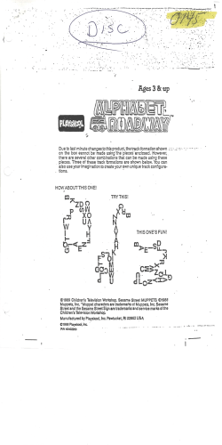
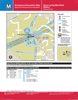

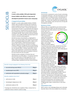


© Copyright 2026