
At Tehsil: Bagora District: Jalore (Rajasthan)
REPORT JANUARY, 2015 FINAL ENVIRONMENTAL IMPACT ASSESSMENT report & ENVIRONMENTAL MANAGEMENT PLAN Bajri Mining (Minor Mineral) (Area 2597.06 Ha) At Tehsil: Bagora District: Jalore (Rajasthan) Study Period: Post monsoon Season (October to December 2013) Applicant Sh. Anil Joshi S/o Sh. Suresh Chand Joshi 60, Pratap Nagar Banar Road, Jodhpur (Rajasthan) Mail ID: [email protected] Environment Consultant Vardan Environet (QCI/NABET Accredited Sr. No. 162) D-142, Sushant Lok-III, Sector 57 Gurgaon (Haryana) Contact no.- 9810355569 Mail ID: [email protected] Contact No. 0124-4291036, 09899651342 Format of first inside page for EIA Report mentioning the names of the experts involved Declaration by experts contributing to the EIA for bajri minor minerals Mine of M/s. Anil Joshi., at Tehsil Bagora, District Jalore, Rajasthan. I, hereby, certify that I was a part of the EIA team in the following capacity that developed the above EIA. EIA Coordinator: Name: Mr. Kuldeepak Ahuja Signature: Date: 19.01.2015 Period of involvement: From16-07-2013 to till date (Draft EIA submitted to MoEF, New Delhi) Contact information: D-142, Sector-57, Sushant Lok-III, Golf Course Extension Road, Gurgaon (Haryana) Contact no: 9815161944 Email: [email protected] Associate EIA Coordinator: Name: Mr. R.S.Yadav Signature: Date: 19.01.2015 Period of involvement: From 16-07-2013 to till date (Draft EIA submitted to MoEF, New Delhi) Contact information: D-142, Sector-57, Sushant Lok-III, Golf Course Extension Road, Gurgaon (Haryana) Contact no: 9899651342 Email: [email protected] Functional Area Experts: S. Functional No Area 1. AP Mr.S.K.Sharma 16-07-2013 to till date 2. WP Mr.S.K.Sharma 16-07-2013 to till date 3. SHW Mr.S.K.Sharma 16-07-2013 to till date 4. SE Mr.K.K.Yadav 16-07-2013 to 10-1-2014 5. EB Mr.Mukesh Kapila 16-07-2013 to 10-1-2014 6. HG Mr.R.S Yadav 16-07-2013 to till date 7. GEO Mr.R.S Yadav 16-07-2013 to till date 8. AQ Mr.Asif Hussain 16-07-2013 to till date 9. NV Mr.Arun Yadav 16-07-2013 to 10-1-2014 10. LU Mr.Joshua Anand 16-07-2013 to till date 11. RH Mr.Arun Yadav 16-07-2013 to 10-1-2014 12. SC Mr.S.K.Sharma 16-07-2013 to till date Name of Expert/s Involvement (Period & Task) Signature Declaration by the Head of the Accredited Consultant Organization I, R.S.Yadav, hereby, confirm that the above mentioned experts prepared the EIA for Bajri Mine of M/s Anil Joshi at Tehsil: Bagora, District: Jalore, Rajasthan. I, hereby, certify that I was a part of the EIA team in the following capacity that developed the above EIA. I also confirm that I shall be fully accountable for any mis-leading information mentioned in this statement. Name: Sh. R.S.Yadav Signature: Designation: Managing Director Name of the EIA Consultant Organization: Vardan Environet, QCI/NABET Accredited Environment Consultancy S. No. Functional Area Code complete name of the Functional Areas 1. 2. AP WP 3. 4. SHW SE Air Pollution Prevention, Monitoring & Control Water Pollution Prevention, Control & Prediction of Impacts Solid Waste and Hazardous Waste Management Socio-Economics 5. 6. 7. 8. EB HG GS AQ Ecology and Biodiversity Hydrology, Ground Water & Water Conservation Geology & Soil Meteorology, Air Quality Modeling & Prediction 9. 10. 11. NV LU RH Noise/ Vibration Land Use Risk Assessment & Hazard Management 12. SC Soil Conservation Project Name: Bajri Mining (Area 2597.06 Ha) Tehsil- Bagora, District-Jalore, Rajasthan Applicant Name: Anil Joshi S/o-Shri Suresh Chandra Gupta Final EIA/EMP Report INDEX CHAPTER NO. TOPIC PAGE NO. TABLE OF CONTENTS a-g LIST OF FIGURES h LIST OF TABLE i-j ABBREVIATION k-l PART A FINAL EIA/EMP REPORT I TOR LETTER 1-7 II TOR REPLY 8-21 CHAPTER–1 INTRODUCTION 22-29 CHAPTER–2 PROJECT DESCRIPTION 30-49 CHAPTER-3 DESCRIPTION OF THE ENVIRONMENT 50-105 CHAPTER–4 ENVIRONMENTAL IMPACT ASSESSMENT & MITIGATION 106-129 CHAPTER–5 ENVIRONMENTAL MONITORING PROGRAM 130-135 CHAPTER–6 ADDITIONAL STUDIES 136-152 CHAPTER–7 PROJECT BENEFITS 153-154 CHAPTER–8 ENVIRONMENTAL MANAGEMENT PLAN 155-161 CHAPTER–9 SUMMARY & CONCLUSION 162-167 CHAPTER–10 DISCLOSURE OF CONSULTANTS ENGAGED 168-171 PART C LIST OF ANNEXURES I LETTER OF INTENT 172 II COPY OF LETTER OF APPROVAL OF MINING PLAN INCLUDING PROGRESSIVE MINE CLOSURE PLAN RECEIPT OF SUBMISSION OF APPLICATION IN MOEF FOR BASELINE DATA MONITORING 173 IV ENVIRONMENTAL POLICY 175-176 V BASE LINE DATA REPORT 177-251 III 174 VI METROLOGICAL DATA SHEET 252-255 VII AUTHORIZED BIOLOGICAL DATA OF DISTRICT JALORE 256-272 QUESTIONNARIE Q1-Q28 1|Page Project Name: Bajri Mining (Area 2597.06 Ha) Tehsil- Bagora, District-Jalore, Rajasthan Applicant Name: Sh. Anil Joshi S/o Sh. Suresh Chand Joshi Final EIA/EMP Report TABLE OF CONTENTS 1. CHAPTER: INTRODUCTION 22-29 1.0 Preamble 22 1.1 Identification of Project and Project Proponent 24 1.1.1 Identification of the Project 24 1.1.2 Identification of Project Proponent 24 1.2 Lease Status 24 1.3 Brief Description of Nature, Size, Location of the Project 24 1.4 Location and Accessibility 28 1.4.1 Basic Amenities 28 1.5 Scope of Study 29 1.5.1 Data Generation 29 1.5.2 Data Collection 29 1.5.3 Preparation of EIA 29 2. CHAPTER: PROJECT DESCRIPTION 30-49 2.1 Type of the Project 30 2.2 Need for the Project 30 2.3 Location of the Project 30 2.4 Size/Magnitude of the Project 32 2.5 Mining 32 2.5.1 Topography of the Area 33 2.5.2 Geology 33 2.5.2.1 Regional Geology 33 2.5.2.2 Local Geology 34 2.5.3 Physiography & Drainage 34 2.5.4 Exploration & Reserves 37 2.5.4.1 Parameters of Reserves Estimation 37 2.5.4.2 Reserves Estimation 37 2.5.4.3 life of Mine 38 2.5.5 Replenishment Potential of Minerals 38 2.5.5.1 Replenishment Study 38 2.5.5.2 Dandy-Bolton Equation 39 2.5.5.3 Bajri Budgeting 40 2.5.5.4 Replenishment with Service of Production 43 2.5.6 Mining Methodology 44 2.5.6.1 Rotation in Mining Area 44 2.5.6.2 Production Program for the First Five Years 44 Page | a Project Name: Bajri Mining (Area 2597.06 Ha) Tehsil- Bagora, District-Jalore, Rajasthan Applicant Name: Sh. Anil Joshi S/o Sh. Suresh Chand Joshi Final EIA/EMP Report 2.5.7 Extent of Mechanization 45 2.5.8 Transportation 46 2.5.9 Conceptual Plan 46 2.5.10 Waste Rock Management 47 2.6 Use of Mineral 47 2.7 Utilities and Site Facilities 47 2.7.1 Water Requirement 47 2.7.2 Man Power 48 2.7.3 Power 49 2.7.4 Infrastructure 49 2.7.4.1 Rest Shelter 49 2.7.4.2 First Aid Facility 49 2.7.4.3 Latrines and Urinals 49 3. CHAPTER: DESCRIPTION OF THE ENVIRONMENT 50-105 3.0 General 50 3.1 Sources of Environmental Data 50 3.2 Land Environment 51 3.2.1 Land Use Pattern 51 3.2.2 Topography and Drainage 55 3.2.3 Seismicity of Area 55 3.2.4 Drought- A Major Problem of Rajasthan 58 3.3 Air Environment 58 3.3.1 Meterology of project site 58 3.3.1.1 Meterological Data Recorded At Mine Site 58 3.3.1.2 Wind Pattern 59 3.3.2 Ambient Air Quality 60 3.3.2.1 Selection of Sampling Station 60 3.3.2.2 Parameters Monitored 62 3.3.2.3 Sampling and Analytical Techniques and Instruments Used for Sampling 62 3.3.3 Results 65 3.4 Noise Environment 67 3.4.1 Noise Analysis within the Study Area 67 3.4.2 Results of Noise Monitoring 71 3.5 Water Environment 71 3.5.1 Surface Water 71 3.5.2 Ground Water Quality 72 Page | b Project Name: Bajri Mining (Area 2597.06 Ha) Tehsil- Bagora, District-Jalore, Rajasthan Applicant Name: Sh. Anil Joshi S/o Sh. Suresh Chand Joshi Final EIA/EMP Report 3.5.3 Results of Ground Water Analysis 78 3.6 Traffic Study 78 3.6.1 Conclusion 82 3.7 Soil Environment 83 3.7.1 Soil Profile of District Jalore 83 3.7.2 Soil Quality and Characteristics 83 3.7.3 Result 88 3.8 Biological Environment 89 3.8.1 Introduction 89 3.8.2 Objectives and Purpose of Study 90 3.8.3 Study Area 90 3.8.4 Survey Methodology 90 3.8.5 General Vegetation Study of the Area 91 3.8.5.1 Flora of the Core zone 92 3.8.5.2 Flora of the Buffer zone (Terrestrial vegetation) 92 3.8.6 Wild life and Avifauna of the study area 93 3.8.6.1 Amphibian 93 3.8.6.2 Terrestrial fauna 93 3.8.7 Forest and Forest Types Observed In the Study Area 96 3.8.7.1 Forest Cover in Jalore District 96 3.8.8 Protected Areas 96 3.8.9 Endangered and Threatened Species 97 3.9 Socio-Economic Environment 97 3.10 Socio-Economic Survey 98 3.10.1 Sampling Method 98 3.10.2 Data Collection Method 98 3.10.3 Field Survey and Observation 98 3.10.4 Interview Method 98 3.10.5 Socio-Economic Survey 99 CHAPTER 4: ANTICIPATED IMPACT & ITS MITIGATION MEASURES 106-129 4.0 Introduction 106 4.1 Construction Phase 106 4.2 Operation Phase 106 4.3 Air Environment 106 4.3.1 Air Quality Models 107 4.3.1.1 ISCST3 Dispersion Model 107 Page | c Project Name: Bajri Mining (Area 2597.06 Ha) Tehsil- Bagora, District-Jalore, Rajasthan Applicant Name: Sh. Anil Joshi S/o Sh. Suresh Chand Joshi Final EIA/EMP Report 4.3.1.2 Caline 4 Model 109 4.3.2 Model Setup 111 4.3.2.1 Emission of PM10 due to Mining 111 4.3.2.1.1 Loading of Material 111 4.3.2.1.2 Emission of PM10 due to Transportation 111 4.3.2.1.3 Emission of CO from Vehicles 112 4.3.3 Summary of Calculated Emission Rates 112 4.3.4 Meteorological Data 112 4.3.5 Modelling Methodology 113 4.3.6 Results 115 4.3.7 Conclusion 120 4.3.8 Mitigation Measures 120 4.5 Prediction of Impacts on Water Environment 121 4.5.1 Water Requirement 121 4.5.2 Waste Water Generation 121 4.5.3 Impacts on Surrounding Water Bodies 121 4.5.3.1 Impacts on Surface Water Quality 121 4.5.3.2 Impacts on Ground Water Quality 122 4.6 Prediction of Impacts on Land Environment 122 4.6.1 Anticipated Impacts of the Proposed Mining Project 122 4.6.2 Proposed Mining Measures 123 4.7 Prediction of Impacts on Soil Environment 123 4.7.1 Proposed Mitigation Measures 123 4.8 Prediction of Impacts on Topography and Drainage Pattern 123 4.8.1 Proposed Mitigation Measures 124 4.9 Prediction of Impacts on Human Beings and Crops 124 4.10 Prediction of Impacts on Biological Environment 124 4.11 Prediction of Impacts on Socio-Economic Environment 125 4.11.1 Human Settlement 125 4.11.2 Employment 125 4.11.3 Agriculture 125 4.12 Prediction of Impacts due to Solid Waste/Overdumps 125 4.13 Occupational Health and Safety 125 4.13.1 Anticipated Impacts of Proposed Mining Projects 125 4.13. 2 Propposed Mitigation Measures 126 4.14 Mine Closure Plan 126 Page | d Project Name: Bajri Mining (Area 2597.06 Ha) Tehsil- Bagora, District-Jalore, Rajasthan Applicant Name: Sh. Anil Joshi S/o Sh. Suresh Chand Joshi Final EIA/EMP Report 4.14.1 General 126 4.14.2 Salient Features of Mining Closure 127 4.14.3 Reason of Closure 127 4.14.4 Statutory Obligations 127 4.14.5 Progressive Mine Closure Plan Preparations 128 4.14.6 Mined Out Land 128 4.14.7 Water Quality Management 128 4.14.8 Air Quality Management 128 4.14.9 Waste Management 128 4.14.10 Top Soil Management 128 4.14.11 Infrastructure 128 4.14.12 Disposal of Mining Machinery 128 4.14.13 Safety & Security 128 4.14.14 Disaster Management and Risk Assessment 129 4.14.15 Care and Maintenance during Temporary Discontinuance 129 4.14.16 Time Scheduling For Abandonment 129 4.14.17 Abandonment Cost 129 4.14.18 Financial Assurance 129 5. CHAPTER: ENVIRONMENTAL MONIROTING PROGRAM 130-135 5.0 Introduction 130 5.1 Environmental Management Cell 130 5.1.1 Responsibilities for Environmental Management Cell (EMC) 131 5.2 Monitoring Schedule 131 5.2.1 Locations of Monitoring Stations 134 5.3 Detailed Budget 135 CHAPTER-6: ADDITIONAL STUDIES 136-152 6.1 Public Hearing 136 6.1.1 Public Hearing Advertisement 136 6.1.2 Banner of Public Hearing 137 6.1.3 Photographs of Public Hearing 137 6.1.4 Minutes of Public Hearing 139 6.2 Risk Assessment- Introduction 149 6.2.1 Risk Assessment and Disaster Management Plan 149 6.2.2 Possible Risk due to inundation & its control 149 6.2.3 Dewatering 149 6.2.4 Possible risks due to failure of pit slope & control 149 Page | e Project Name: Bajri Mining (Area 2597.06 Ha) Tehsil- Bagora, District-Jalore, Rajasthan Applicant Name: Sh. Anil Joshi S/o Sh. Suresh Chand Joshi Final EIA/EMP Report 6.2.5 Possible risks due to failure of waste dump & its control 150 6.2.6 Possible risks due to fire & control 150 6.2.7 Measures to prevent accidents due to trucks and dumpers 150 6.2.8 Other possible measures to avoid risks/disaster due to river bed mining 150 6.3 Emergency Control Centers 150 6.4 Conservation of Natural Resource 151 6.5 Rehabilitation & Resettlement (R & R) 151 6.6 Abandonment Cost 151 6.7 Peripheral Development Programme 151 6.8 Disaster Management plan 152 6.8.1 Disaster Management Team 152 6.8.2 Care and Maintenance during Temporary discontinuance 152 CHAPTER-7: PROJECT BENEFITS 153-154 7.1 Introduction 153 7.2 Improvement in Social Infrastructure 153 7.3 Green Belt Development 154 7.3.1 Plantation 154 7.3.2 Post Plantation Care 154 7.4 Employment Potential 154 7.5 Conclusion 154 CHAPTER-8: ENVIRONMENTAL MANAGEMENT PLAN 155-161 8.1 Introduction 155 8.2 Land Environment 156 8.3 Air Environment Management 156 8.3.1 Control of Gaseous Pollution 156 8.3.2 Control of Dust Pollution 156 8.4 Noise Environment 157 8.4.1 Noise Abatement and Control 157 8.5 Water Management 157 8.5.1 Surface & Ground Water Management 158 8.5.2 Waste Water Management 158 8.6 Solid Waste Management 158 8.7 Biological Environment 158 8.7.1 Floral and Faunal Environment of the Study Area 158 Page | f Project Name: Bajri Mining (Area 2597.06 Ha) Tehsil- Bagora, District-Jalore, Rajasthan Applicant Name: Sh. Anil Joshi S/o Sh. Suresh Chand Joshi Final EIA/EMP Report 8.7.2 Plantation Development 158 8.7.2.1 introduction 158 8.7.2.2 Green Belt Development/Plantation Program 159 8.7.2.3 Budget for Conservaton of Biodiversity 159 8.7.2.4 post Plantation Care 160 8.8 Socio-Economic Environment 160 8.8.1 Management Plan for Socio-Economic Environment 160 8.9 Cost of Environment Protection 161 CHAPTER-9: SUMMARY & CONCLUSION 162-167 9.1 Introduction 162 9.2 Location of the Project 162 9.3 Mining 163 9.4 Utilities and Site Faccilities 164 9.5 Baseline Data 164 9.6 Environment Management Plan 165 9.6.1 Air Quality Management 165 9.6.2 Water Management 165 9.6.3 Noise Management 165 9.6.4 Solid Waste Management 166 9.6.5 Occupational Health & Safety 166 9.6.6 Plantation Development and Program 166 9.7 Benefits of Mining 166 10. CHAPTER: DISCLOSURE OF CONSULTANT ENGAGED 10.0 Disclosure of Consultants Engaged 168-171 168 Page | g Project Name: Bajri Mining (Area 2597.06 Ha) Tehsil- Bagora, District-Jalore, Rajasthan Applicant Name: Sh. Anil Joshi S/o Sh. Suresh Chand Joshi Final EIA/EMP Report LIST OF FIGURES Figure 1.1 Key Plan showing the Environmental settings of the Study Area Figure 2.1 Location Map of the Project Site Figure 2.2 Geomorphology of District Jalore Figure 2.3 Watershed Map of the Study Area Figure 2.4 Process Flow Chart of River Bed Mining Figure 2.5 Water Balance Figure 2.6 Man Power Details Figure 3.1 Land Use Pattern of the Study Area (10 km Radius from the Mine Site) Figure 3.2 FCC Map of the Study Area (10 km Radius from the Mine Site) Figure 3.3 Drainage Map of the Study Area Figure 3.4 Seismic Map of India Figure 3.5 Earthquake Hazard Map of Rajasthan Figure 3.6 Wind Rose Diagram of Study Area Figure 3.7 Temperature Profile of Study Area Figure 3.8 Key Plan of Air Monitoring Stations Figure 3.9 Concentration of SO2 at air monitoring station Figure 3.10 Concentration of NO2 at air monitoring station Figure 3.11 PM10 concentration at air monitoring station Figure 3.12 Photographs of Noise Monitoring Figure 3.13 Key Plan of Noise Monitoring Stations Figure 3.14 Noise level monitoring Result Figure 3.15 Water Sample Collection Photographs Figure 3.16 Key Plan of Water Sampling Station Fifure 3.17 Road Map of Bajri Transportation Figure 3.18 Soil profile of district Jalore Figure 3.19 Soil Sampling Photographs Figure 3.20 Key Plan of Soil Sampling Stations Figure 3.21 Socio Economic Data Collection Figure 3.22 Total Population distributed by male female Figure 3.23 Employment Pattern Figure 3.24 Caste Distribution Figure 3.25 Literacy Distribution Figure 4.1 Gaussian Plume Model Figure 4.2 Wind Rose Diagram Figure 4.3 ISCST3 Model Setup Figure 4.4 Graphical representation incremental concentration v/s Distance Figure 4.5 Graphical representation of Model Result Figure 4.6 Spatial distribution of predicted GLCs of PM10 due to Mining Figure 4.7 Spatial distribution of PM10 GLC due to transportation 27 31 34 42 46 48 48 52 53 54 56 57 59 60 63 65 66 66 69 70 71 73 74 79 83 85 86 100 101 101 102 102 108 113 114 115 117 118 119 Figure 4.7 Impact of Mining on Water Quality 122 Figure 5.1 Hierarchy of Environment System for Dealing Environmental Issues 130 Figure 8.1 Flow chart of EMP 155 Page | h Project Name: Bajri Mining (Area 2597.06 Ha) Tehsil- Bagora, District-Jalore, Rajasthan Applicant Name: Sh. Anil Joshi S/o Sh. Suresh Chand Joshi Final EIA/EMP Report LIST OF TABLE Table 1.1: Brief Description of the Project Table 2.1: Project location Table 2.2: Details of Mining Table 2.3: Elevation Range Table 2.4: Calculation & Replenishment Capacity Table 2.5: Details Showing Year-wise Production of Mineral Table 2.6: Pre and Post Land Use Plan Table 3.1 Land Use Pattern of the Study Area Table 3.2 Metrological Condition Of The Study Area Table 3.3 Ambient Air Quality Monitoring Sampling Stations Table 3.4 Techniques Used for Determining Various Air Quality Parameters Table 3.5 Ambient Air Quality Monitoring Results Table 3.6 Noise Monitoring Sampling Stations Table 3.7 Noise Levels in Study Area Table 3.8 CPCB Noise Standards Table 3.9 Water Sampling Stations Table 3.10 Water Analysis Results Table 3.11 Roads and Highways in the Study Area Table 3.12 (A) Traffic Volume Count Survey (Hourly) Table 3.12 (B) Traffic Volume Count Survey (Hourly) Table 3.12 (C) No. of Vehicles per Hour Table 3.12 (D) Existing Traffic Scenario & LOS Table 3.12 (E) Modified Traffic Scenario and LOS Table 3.13 Soil Monitoring Stations Table 3.14 Soil Analysis Results Table 3.15 Mode of Data Collection & Parameters Considered During Survey Table 3.16 Diversity of Flora in the Study Area Table 3.17 Diversity of Fauna in the Study Area Table 3.18 Eco-Sensitive Areas falls in Study Area Table 3.19 Socio-Economic Survey Methodology Table 3.20 Demographic Details of the Study Area Table 4.1 Dispersion Parameter as per Stability class Table 4.2 Comparative analysis between ISCST3 and CALINE 4 model Table 4.3 Emissions Rates Table 4.4 Predicted GLC of PM10 at Ambient Air Quality Monitoring Stations Table 4.5 Breakup of the Land Table 5.1 Post Project Monitoring Table 5.2 Details of Post Project Monitoring Table 5.3 Locations for the Post Project Monitoring Table 5.4 Compliance for Environmental Clearance Table 5.5 Budget Allocation for Monitoring Table 6.1 Questions raised by Public in Public Hearing and Reply by Proponent Table 7.1 Proposed Budget for CSR Activities 24 30 32 35 43 45 47 51 60 61 62 64 68 68 69 72 75 78 80 81 81 82 82 84 87 91 94 95 96 99 103 109 110 112 144 127 131 132 134 134 135 146 154 Page | i Project Name: Bajri Mining (Area 2597.06 Ha) Tehsil- Bagora, District-Jalore, Rajasthan Applicant Name: Sh. Anil Joshi S/o Sh. Suresh Chand Joshi Table 8.1 Schedule of Plantation for the Five Year Table 8.2 Year wise plantation details Table 8.3 Budget for Conservation of Biodiversity Table 8.4 CSR Activities Table 8.5 Cost of Environment Protection Table 9.1 Details of the Project Table 9.2 Details of Mining Table 9.3 Details Showing Year-wise Production of Mineral Table 9.4 Baseline Environmental Status Table 9.5 Budget Allocation of EMP Final EIA/EMP Report 159 159 160 161 161 162 163 164 164 166 Page | j Project Name: Bajri Mining (Area 2597.06 Ha) Tehsil- Bagora, District-Jalore, Rajasthan Applicant Name: Sh. Anil Joshi S/o Sh. Suresh Chand Joshi Final EIA/EMP Report ABBREVIATIONS AAQM CM CPCB dB DG E EIA EMC EMP ENE EPA ESE FCC GIS GPS HP Hr IMD IRS ISCST ISO ISS KLD Km KVA KW M M asl Ambient Air Quality Monitoring Centimeter Central Pollution Control Board Decibel Diesel Generator East Environmental Impact Assessment Environmental Management Cell Environmental Management Plan East Of North- East Environmental Protection Agencies East Of South East False Colour Composite Geological Information System Global Positioning System Horse Power Hour Indian Meteorological Department Indian Remote Sensing Satellite Industrial Source Complex, Short Terms International Organization Of Standardization Indian Standard Specification Kilo Litre Per Day Kilometer Kilo Volt Ampere Kilo Watt Meter Mean Sea Level MCDR Mining Conservation & Development Rules M bgl mg MoEF mRL MT MTPA N NE NH NNE NNW Meter Below Ground Level Milligram Ministry Of Environment & Forest Mean Reference Level Million Tonne Million Tonn s Per Annum North North-East National Highway North Of North-East North Of North-West Page | k Project Name: Bajri Mining (Area 2597.06 Ha) Tehsil- Bagora, District-Jalore, Rajasthan Applicant Name: Sh. Anil Joshi S/o Sh. Suresh Chand Joshi NO2 NTU NW OB OHSAS PPE PPM Pvt. R&R RDS RPM RSPM SE SEIAA SO2 SOI SOPs SPCB SPM SSE SSW TPA TDS TOR TPH TS US EPA w.e.f. w.r.t. W/W WNW WSW LOS PCU Final EIA/EMP Report Nitrogen Dioxides Naphelo Turbidity Unit North-West Over Burden Occupational Health & Safety Assessment Personal Protective Equipment Part Per Million Private Rehabilitation & Resettlement Respirable Dust Sampler Respirable Particulate Matter Respirable Suspended Particulate Matter South- East State Level Environmental Assessment Authority Sulphur-di-Oxide Survey Of India Standard Operating Procedures State Pollution Control Board Suspended Particulate Matter South Of South-East South Of South-West Tone Per Hour Total Dissolve Solid Terms Of Reference Tones Per Hour Total Solid United State Environmental Protection Agencies With Effective From With Reference To Weight By Weight West Of North-West West Of South-West Level of Service Passenger Car Unit Page | l By Speed Post No. J-11015/341/2013-IA.II (M) Government of India Ministry of Environment and Forests IA Division *** Paryavaran Bhavan, C.G.O. Complex, Lodi Road, New Delhi-110 003 Telefax: 011-24364067 Dated: 22nd November, 2013 To M/s Anil Joshi 60, Khasra No. 184/2, Pratap Nagar, Ghatani Hospital, District Jodhpur, Rajasthan – 342003. Email: [email protected] Sub.: Bajri mine with production capacity 10.5 Lakh TPA (ROM) by M/s. Anil Joshi located at Tehsil – Bagora, District- Jalore, Rajasthan (2597.06 ha)– Prescribing TORs regarding. This has reference to your letter no. Nil dated 29.08.2013 regarding the proposal for determining the Terms of Reference (TORs) for undertaking detailed EIA study for the purpose of obtaining environmental clearance in accordance with the provisions of the EIA Notification, 2006. For this purpose, the Proponent had submitted information in the prescribed format (Form-1) along with a Pre-feasibility Report. The proposal was considered by the Reconstituted Expert Appraisal Committee in its 12th meeting held during 31st October, 2013 to 01st November, 2013. 2. The proposal of M/s. Anil Joshi is for River Bajri Mining with Production Capacity of 10.5 Lakh TPA of Bajri in 2597.06 ha. The Mine lease area is located at TehsilBhinmal, District: Jalore, Rajasthan. The lease area lies on Sagi & Sukari River bed. The Latitudes and Longitudes of the Mine Lease area are 25°04'44.82 to 25°11'35.88”N and 72°51'7.29 to 72°5'47.18"E respectively. 3. Mining is by semi-mechanized opencast method. Excavation will be carried out up to a maximum depth of 3 meters from surface of sand deposit and not less than one meter from the water level of the River channel whichever is reached earlier. The total mine lease area is 2597.06 ha which non-forest land. 4. Letter of Intent (LOI) for grant of mining lease for minor mineral Bajri over an area of 2597.06 ha. has been granted from Director of Mines and Geology Department, Govt. of Rajasthan vide letter dated 20-03-2013 for the period of 5 year Page 1 of 7 to Mr. Anil Joshi. Total water requirement for the project will be 25.2 KLD which will be sourced from nearby villages. Total Cost of the Project is Rs. 2.61 Crores. PP informed that no court case/litigation is pending against the project. 5. The Committee noted that the consultant (M/s Vardan Environet, Gurgaon) who prepared the Form I and PFR report is not accredited by QCI/NABET. However, Proponent has submitted an order of CWP No. 23391 of 2012, dated 29.11.2012 of Hon’ble High Court of Punjab and Haryana at Chandigarh staying the applicability of QCI accreditation to the instant consultant. Hence, the consultant was allowed by the Committee to present the proposal. 6. Based on the information content in the documents submitted and the presentation made before the Committee for mining projects, the following TORs are prescribed for undertaking detailed EIA study:1) 2) 3) 4) 5) 6) 7) 8) Year-wise production details since 1994 should be given, clearly stating the highest production achieved in any one year prior to 1994. It may also be categorically informed whether there had been any increase in production after the EIA Notification, 1994 came into force w.r.t. the highest production achieved prior to 1994. A copy of the document in support of the fact that the Proponent is the rightful lessee of the mine should be given. All documents including approved mine plan, EIA and public hearing should be compatible with one another in terms of the mine lease area, production levels, waste generation and its management and mining technology and should be in the name of the lessee. All corner coordinates of the mine lease area, superimposed on a High Resolution Imagery/toposheet should be provided. Such an Imagery of the proposed area should clearly show the land use and other ecological features of the study area (core and buffer zone). Does the company have a well laid down Environment Policy approved by its Board of Directors? If so, it may be spelt out in the EIA report with description of the prescribed operating process/procedures to bring into focus any infringement/deviation/violation of the environmental or forest norms/ conditions? The hierarchical system or administrative order of the Company to deal with the environmental issues and for ensuring compliance with the EC conditions may also be given. The system of reporting of non-compliances / violations of environmental norms to the Board of Directors of the Company and/or shareholders or stakeholders at large may also be detailed in the EIA report. Issues relating to Mine Safety, including subsidence study in case of underground mining and slope study in case of open cast mining, blasting study etc. should be detailed. The proposed safeguard measures in each case should also be provided. The study area will comprise of 10 km zone around the mine lease from lease periphery and the data contained in the EIA such as waste generation etc should be for the life of the mine / lease period. Land use of the study area delineating forest area, agricultural land, grazing land, wildlife sanctuary, national park, migratory routes of fauna, water bodies, human settlements and other ecological features should be indicated. Page 2 of 7 9) 10) 11) 12) 13) 14) 15) 16) 17) Land use plan of the mine lease area should be prepared to encompass preoperational, operational and post operational phases and submitted. Impact, if any, of change of land use should be given. Details of the land for any Over Burden Dumps outside the mine lease, such as extent of land area, distance from mine lease, its land use, R&R issues, if any, should be given. A Certificate from the Competent Authority in the State Forest Department should be provided, confirming the involvement of forest land, if any, in the project area. In the event of any contrary claim by the Project Proponent regarding the status of forests, the site may be inspected by the State Forest Department along with the Regional Office of the Ministry to ascertain the status of forests, based on which, the Certificate in this regard as mentioned above be issued. In all such cases, it would be desirable for representative of the State Forest Department to assist the Expert Appraisal Committees. Status of forestry clearance for the broken up area and virgin forestland involved in the Project including deposition of net present value (NPV) and compensatory afforestation (CA) should be indicated. A copy of the forestry clearance should also be furnished. Implementation status of recognition of forest rights under the Scheduled Tribes and other Traditional Forest Dwellers (Recognition of Forest Rights) Act, 2006 should be indicated. The vegetation in the RF / PF areas in the study area, with necessary details, should be given. A study shall be got done to ascertain the impact of the Mining Project on wildlife of the study area and details furnished. Impact of the project on the wildlife in the surrounding and any other protected area and accordingly detailed mitigative measures required, should be worked out with cost implications and submitted. Location of National Parks, Sanctuaries, Biosphere Reserves, Wildlife Corridors, Tiger/Elephant Reserves/(existing as well as proposed), if any, within 10 km of the mine lease should be clearly indicated, supported by a location map duly authenticated by Chief Wildlife Warden. Necessary clearance, as may be applicable to such projects due to proximity of the ecologically sensitive areas as mentioned above, should be obtained from the State Wildlife Department/Chief Wildlife Warden under the Wildlife (Protection) Act, 1972 and copy furnished. A detailed biological study of the study area [core zone and buffer zone (10 km radius of the periphery of the mine lease)] shall be carried out. Details of flora and fauna, duly authenticated, separately for core and buffer zone should be furnished based on such primary field survey, clearly indicating the Schedule of the fauna present. In case of any scheduled-I fauna found in the study area, the necessary plan for their conservation should be prepared in consultation with State Forest and Wildlife Department and details furnished. Necessary allocation of funds for implementing the same should be made as part of the project cost. Proximity to Areas declared as ‘Critically Polluted’ or the Project areas likely to come under the ‘Aravali Range’, (attracting court restrictions for mining operations), should also be indicated and where so required, clearance certifications from the prescribed Authorities, such as the SPCB or State Minning Dept. Should be secured and furnished to the effect that the proposed Page 3 of 7 18) 19) 20) 21) 22) 23) 24) 25) 26) mining activities could be considered. Similarly, for coastal Projects, A CRZ map duly authenticated by one of the authorized agencies demarcating LTL. HTL, CRZ area, location of the mine lease w.r.t CRZ, coastal features such as mangroves, if any, should be furnished. (Note: The Mining Projects falling under CRZ would also need to obtain approval of the concerned Coastal Zone Management Authority). R&R Plan/compensation details for the Project Affected People (PAP) should be furnished. While preparing the R&R Plan, the relevant State/National Rehabilitation & Resettlement Policy should be kept in view. In respect of SCs /STs and other weaker sections of the society in the study area, a need based sample survey, family-wise, should be undertaken to assess their requirements, and action programmes prepared and submitted accordingly, integrating the sectoral programmes of line departments of the State Government. It may be clearly brought out whether the village located in the mine lease area will be shifted or not. The issues relating to shifting of Village including their R&R and socio-economic aspects should be discussed in the report. One season (non-monsoon) primary baseline data on ambient air quality (PM10, SO2 and NOx), water quality, noise level, soil and flora and fauna shall be collected and the AAQ and other data so compiled presented date-wise in the EIA and EMP Report. Site-specific meteorological data should also be collected. The location of the monitoring stations should be such as to represent whole of the study area and justified keeping in view the predominant downwind direction and location of sensitive receptors. There should be at least one monitoring station within 500 m of the mine lease in the predominant downwind direction. The mineralogical composition of PM10, particularly for free silica, should be given. Air quality modelling should be carried out for prediction of impact of the project on the air quality of the area. It should also take into account the impact of movement of vehicles for transportation of mineral. The details of the model used and input parameters used for modelling should be provided. The air quality contours may be shown on a location map clearly indicating the location of the site, location of sensitive receptors, if any, and the habitation. The wind roses showing pre-dominant wind direction may also be indicated on the map. The water requirement for the Project, its availability and source should be furnished. A detailed water balance should also be provided. Fresh water requirement for the Project should be indicated. Necessary clearance from the Competent Authority for drawl of requisite quantity of water for the Project should be provided. Description of water conservation measures proposed to be adopted in the Project should be given. Details of rainwater harvesting proposed in the Project, if any, should be provided. Impact of the project on the water quality, both surface and groundwater should be assessed and necessary safeguard measures, if any required, should be provided. Based on actual monitored data, it may clearly be shown whether working will intersect groundwater. Necessary data and documentation in this regard may be provided. In case the working will intersect groundwater table, a detailed Page 4 of 7 27) 28) 29) 30) 31) 32) 33) 34) 35) 36) 37) 38) Hydro Geological Study should be undertaken and Report furnished. Necessary permission from Central Ground Water Authority for working below ground water and for pumping of ground water should also be obtained and copy furnished. Details of any stream, seasonal or otherwise, passing through the lease area and modification / diversion proposed, if any, and the impact of the same on the hydrology should be brought out. Information on site elevation, working depth, groundwater table etc. Should be provided both in AMSL and bgl. A schematic diagram may also be provided for the same. A time bound Progressive Greenbelt Development Plan shall be prepared in a tabular form (indicating the linear and quantitative coverage, plant species and time frame) and submitted, keeping in mind, the same will have to be executed up front on commencement of the project. Impact on local transport infrastructure due to the Project should be indicated. Projected increase in truck traffic as a result of the Project in the present road network (including those outside the Project area) should be worked out, indicating whether it is capable of handling the incremental load. Arrangement for improving the infrastructure, if contemplated (including action to be taken by other agencies such as State Government) should be covered. Details of the onsite shelter and facilities to be provided to the mine workers should be included in the EIA report. Conceptual post mining land use and Reclamation and Restoration of mined out areas (with plans and with adequate number of sections) should be given in the EIA report. A time bound Progressive Greenbelt Development Plan shall be prepared in a tabular form (indicating the linear and quantitative coverage, plant species and time frame) and submitted, keeping in mind, the same will have to be executed up front on commencement of the project. Phase-wise plan of plantation and compensatory afforestation should be charted clearly indicating the area to be covered under plantation and the species to be planted. The details of plantation already done should be given. Occupational Health impacts of the Project should be anticipated and the proposed preventive measures spelt out in detail. Details of pre-placement medical examination and periodical medical examination schedules should be incorporated in the EMP. Public health implications of the Project and related activities for the population in the impact zone should be systematically evaluated and the proposed remedial measures should be detailed along with budgetary allocations. Measures of socio economic significance and influence to the local community proposed to be provided by the Project Proponent should be indicated. As far as possible, quantitative dimensions may be given with time frames for implementation. Detailed environmental management plan to mitigate the environmental impacts which, should inter-alia include the impacts of change of land use, loss of agricultural and grazing land, if any, occupational health impacts besides other impacts specific to the proposed Project. Public hearing points raised and commitment of the project proponent on the same along with time bound action plan to implement the same should be Page 5 of 7 39) 40) 41) 42) 43) 44) 45) 46) 47) 48) 49) 7. a) b) c) d) e) f) g) provided and also incorporated in the final EIA/EMP Report of the Project. Details of litigation pending against the project, if any, with direction /order passed by any Court of Law against the project should be given. The cost of the project (capital cost and recurring cost) as well as the cost towards implementation of EMP should clearly be spelt out. Details of replenishment studies Details of Transportation of mined out materials as per the Indian Road Congress for both the ways (loaded as well as unloaded trucks) load and its impact on Environment; Proper species specific Conservation plan for Schedule–I and II species; Impact of mining on plankton; Details of mining activity to be provided w.r.t Block Wise/ Calendar wise/ Zonal wise, as the mine lease area is having a long stretch, Details of Gradient of river bed to be provided; Details of excavation schedule & sequential mining plan; Mining Plan shall be prepared carefully, dividing lease area into manageable blocks to ensure scientific and systematic mining of minor minerals; and The base line data shall be collected so as to represent the whole mine lease area. Besides the above, the below mentioned general points are also to be followed:All documents to be properly referenced with index and continuous page numbering. Where data are presented in the report especially in tables, the period in which the data were collected and the sources should be indicated. Where the documents provided are in a language other than English, an English translation should be provided. The Questionnaire for environmental appraisal of industrial projects as devised earlier by the Ministry shall also be filled and submitted. While preparing the EIA report, the instructions for the proponents and instructions for the consultants issued by MoEF vide O.M. No. J11013/41/2006-IA.II(I) dated 4th August, 2009, which are available on the website of this Ministry, should also be followed. Changes, if any made in the basic scope and project parameters (as submitted in Form-I and the F.R for securing the TOR) should be brought to the attention of MoEF with reasons for such changes and permission should be sought, as the TOR may also have to be altered. Post Public Hearing changes in structure and content of the draft EIA/EMP (other than modifications arising out of the P.H. process) will entail conducting the PH again with the revised documentation. As per the circular no. J-11011/618/2010-IA.II(I) dated 30.5.2012, you are requested to submit certified report of the status of compliance of the conditions stipulated in the environment clearance for the existing operations of the project by the Regional Office of Ministry of Environment & Forests, if applicable. 8. The EIA report should also include (i) surface plan of the area indicating contours of main topographic features, drainage and mining area, (ii) geological maps Page 6 of 7 and sections and (iii) sections of the mine pit and external dumps, if any, clearly showing the land features of the adjoining area. 9. The prescribed TORs would be valid for a period of two years for submission of the EIA/EMP reports, as per the O.M. No. J-11013/41/2006-IA.II(I) dated 22.3.2010. 10. After preparing the draft EIA (as per the generic structure prescribed in Appendix- III of the EIA Notification, 2006) covering the above mentioned issues, the proponent will get the public hearing conducted and take further necessary action for obtaining environmental clearance in accordance with the procedure prescribed under the EIA Notification, 2006. (Dr. Saroj) Director Copy to: 1). The Secretary, Ministry of Mines, Government of India, Shastri Bhawan, New Delhi 2). The Secretary, Department of Mines & Geology, Government of Rajasthan Secretariat, Jaipur. 3). The Secretary, Department of Environment, Government of Rajasthan, Secretariat, Jaipur. 4). The Chief Conservator of Forests, Central Region, Ministry of Environment and Forests, B-1/72, Sector-A, Aliganj, Lucknow-226020. 5). The Member Secretary, Rajasthan State Institutional area, Jhalana, Doongri, Jaipur. 6). The Controller General, Indian Bureau of Mines, Indira Bhavan, Civil Lines, Nagpur - 440 001 7). The District Collector, Jalore District, State of Rajasthan. 8). Guard File 9). MoEF website. Pollution Control Board, 4, (Dr. Saroj) Director Page 7 of 7 Project Name: Bajri Mining (Area 2597.06 Ha) Tehsil- Bagora, District-Jalore, Rajasthan Applicant Name: Anil Joshi S/o-Shri Suresh Chand Joshi Final EIA/EMP Report COMPLIANCE OF TOR CONDITIONS Point wise compliance of TOR points issued by MoEF, New Delhi vide letter no. J-11015/341/2013-IA.II (M) dated 22nd November, 2013 for Mineral-Bajri (2597.06 ha) Mine with production capacity of 10,50,000 TPA at Revenue village of TehsilBagora, District- Jalore, Rajasthan by M/s. Anil Joshi. DESCRIPTION RESPONSE PAGE NO. & ANNEXURES. IN EIA/EMP REPORT 1 Year-wise production details since 1994 should be given, clearly stating the highest production achieved in any one year prior to 1994. It may also be categorically informed whether there had been any increase in production after the EIA Notification, 1994 came into force w.r.t. the highest production achieved prior to 1994. As this is Fresh Mining lease area, no production is started, production will commence only after obtaining Environmental clearance and Consent For Establishment. Hence this is not applicable to us. -- 2 A copy of the document in support of the fact The copy of the letter of Intent (LOI) of Mining lease issued by Chapter-1 Item- 1.0 that the Proponent is the rightful lessee of the Mining Department, Government of Rajasthan Vide letter no.- Page- 22 mine should be given. P.8(21)Mining/Group-2/2013 dated 20/03/2013 is enclosed as Annexure-I Page- 172 Annexure-I. 3 All documents including approved mine plan, EIA and public hearing should be compatible with one another in terms of the mine lease area, production levels, waste generation and its Management and mining technology and should be in the name of the lessee. TOR REF. All the documents i.e. approved mining plan, EIA, and public hearing are compatible with each other in terms of ML area, production levels, waste generation and its management and mining technology. Both the approved mining plan & ML area in the name of lessee Shri Anil Joshi. -- 8 Project Name: Bajri Mining (Area 2597.06 Ha) Tehsil- Bagora, District-Jalore, Rajasthan Applicant Name: Anil Joshi S/o-Shri Suresh Chand Joshi Final EIA/EMP Report 4 All corner coordinates of the mine lease area, Al l corner of the coordinates of ML area are superimposed on superimposed on a High Resolution Imagery/ toposheet of survey of India and same has been furnished as toposheet should be provided. Such an Imagery Chapter-1 in Final EIA report. of the proposed area should clearly show the land use and other ecological features of the study area (core and buffer zone). Please refer to Figure 1.1 Chapter-1 Page-27. 5 Does the company have a well laid down Environment Policy approved by its Board of Directors? If so, it may be spelt out in the EIA report with description of the prescribed operating process/procedures to bring into focus any infringement/deviation/violation of the environmental or forest norms/ conditions? The hierarchical system or administrative order of the Company to deal with the environmental issues and for ensuring compliance with the EC conditions may also be given. The system of reporting of non compliances / violations of environmental norms to the Board of Directors of the Company and/or shareholders or stakeholders at large may also be detailed in the EIA report. Yes, the company has formulated Environmental Policy which Please refer is approved by lease holder. As per policy company will comply Annexure –IV all with all legal requirements of Environmental Protection Act Page: 175-176 & others Indian environmental laws. Signed copy of the Environment policy and hierarchical system or administrative is shown as Annexure –IV for your kind reference. 6 Issues relating to Mine Safety, including subsidence study in case of underground mining and slope study in case of open cast mining, blasting study etc. should be detailed .The proposed safeguard measures in each case should be provided. This is an opencast river bed mining. No underground workings exist in the lease area. Hence, subsidence study not required. Slope Study As the working will be continued in the river bed to the maximum depth of 3.0m only, thus slope study is not required. Blasting Study Mineral is loose so no blasting will be carried out. Mining safety & security plan is incorporated in chapter-4 of EIA/EMP Plan. to -- 9 Project Name: Bajri Mining (Area 2597.06 Ha) Tehsil- Bagora, District-Jalore, Rajasthan Applicant Name: Anil Joshi S/o-Shri Suresh Chand Joshi Final EIA/EMP Report 7 The study area will comprise of 10 km zone around the mine lease from lease periphery and the data contained in the EIA such as waste generation etc should be for the life of the mine /lease period. Study area comprises of 10 km radius around the mine lease Please refer to Figure boundary. Map showing 10 km radius of the ML area has been 1.1 Chapter-1 Page-27. furnished in Chapter-1 of EIA report. Chapter-2 Item 2.5.4.2 No waste generation envisaged as there is no OB/ interburden. Page 37-38. 8 Land use of the study area delineating forest area, agricultural land, grazing land, wildlife sanctuary, National park, migratory routes of fauna, water bodies, human settlements and other ecological features should be indicated. Land use plan of the mine lease area should be prepared to encompass preoperational, operational and post operational phases and submitted. Land use pattern based on Satellite imagery of study area has been furnished in Chapter-3 of Final EIA report. There is no National Park, Sanctuaries, Biosphere Reserve and Wild Life Corridors present in the study area. Land use plan of the mine lease in operation & post operation phase has been discuss in chapter-4. It is river bed mining. River bed will be excavated in slice of 3 meter thickness leaving statutory barrier. Material will be replenished every year during monsoon. So no change occurs in land use pattern. Chapter-3 Fig- 3.1 Page- 52 Table- 3.1 Page- 51 Chapter-2 Table 2.6 Page-47 9 Details of the land for any over Burden Dumps outside the mine lease, such as extent of land area, distance from mine lease, its land use, R&R issues, if any, should be given. There is no waste generation for Bajri mining. The Minor mineral Bajri is excavated & subsequently transported to the consumers by dumpers & tractor trolleys. Hence there will be no overburden dumps inside/outside the mine lease area. The land of Bajri mining lease area is a government land on the river bed of Parvati River. There is no human settlement and private land owners. Hence R & R is not applicable on this project. -- 10 Project Name: Bajri Mining (Area 2597.06 Ha) Tehsil- Bagora, District-Jalore, Rajasthan Applicant Name: Anil Joshi S/o-Shri Suresh Chand Joshi Final EIA/EMP Report 10 A Certificate from the Competent Authority in the State Forest Department should be provided, confirming the involvement of forest land, if any, in the project area. In the event of any contrary claim by the Project Proponent regarding the status of forests, the site may be inspected by the State Forest Department along with the Regional Office of the Ministry to ascertain the status of forests, based on which, the Certificate in this regard as mentioned above be issued. In all such cases, it would be desirable for representative of the State Forest Department to assist the Expert Appraisal Committees. The Mining Lease area does not involve any Forest Land. The mining lease area is a Government land on the river bed of Parvati River & its area is free from any reservation of Forest Land. Mining Department grant the LOI of the Lease Area after taking interdepartmental clarification from the Forest Department that the LOI lease area is free from Forest. -- 11 Status of forestry clearance for the broken up The land of the Mining lease area is Government land on the area and virgin forest land involved in the river bed of Sukari and Sagi Nadi & this area is free from any project including deposition of net present reservation of forest department, Rajasthan Government. value (NPV) and compensatory afforestation (CA) should be indicated. A copy of the forestry clearance should also be furnished. -- 12 Implementation status of recognition of forest Not Applicable. rights under the Scheduled Tribes and other There is no involvement of forest land in the project area. Traditional Forest Dwellers (Recognition of Forest Rights) Act, 2006 should be indicated. -- 11 Project Name: Bajri Mining (Area 2597.06 Ha) Tehsil- Bagora, District-Jalore, Rajasthan Applicant Name: Anil Joshi S/o-Shri Suresh Chand Joshi 13 14 Final EIA/EMP Report The vegetation in the RF/PF areas in the study Flora details in the RF has been collected for study period by area, with necessary details, should be given. Ecology & Biodiversity Expert and the acquired data was also compared with the secondary data collected by forest department. The list of flora is discussed in Chapter-3 of the EIA/EMP Report. The other eco sensitive areas falling in the study area are as follows: S. NO. PARTICULARS 1. Open Jungle (Near Village Bamal 0.2 Km, W) 2. Open Jungle (Near Village Jodhwas 0.1 Km,E) 3. Open Jungle (Near Village Meda, 1.8 km, S) 4. Open Jungle (Near Village Dungarwa) Open Mixed Jungle (Near Village Bhadwi,0.5 5. Km N) Open Mixed Jungle (Near Village Phagotra, 2.7 6. Km) Open Mixed Jungle (Near Village Sewari, 1 km, 7. S) 8. Open Jungle (Near Puniya Nadi, 5Km, NE) Open Mixed Jungle (Near Village Rah, 2.5 Km, 9. SSE) Open Mixed Jungle (Near Village Dungawas, 2.6 10. Km, S) Fairy dense Jungle (Near Village Kaleti, 600 m, 11. SE) 12. Open Mixed Jungle (Near Village Vijay Dhora) 13. Open Jungle (Near Village Bamal 0.2 Km, W) Chapter-3 Item-3.8. Page-89 to 97 Table-3.16 Page- 94-95 A study shall be got done to ascertain the impact of the Mining Project on wildlife of the study area and details furnished. Impact of the project on the wildlife in the surrounding and Chapter-3 Item-3.8. Page-89 to 97. Table 3.17, Page-95-96 Chapter-8, Item-8.7.2.3 Details of Fauna incorporated in Chapter-3. No significant impact is anticipated due to mining of Bajri minor mineral. The detailed budget for Biodiversity Conservation is discussed Table-3.18 Page- 96-97 12 Project Name: Bajri Mining (Area 2597.06 Ha) Tehsil- Bagora, District-Jalore, Rajasthan Applicant Name: Anil Joshi S/o-Shri Suresh Chand Joshi Final EIA/EMP Report any other protected area and accordingly in Chapter-8 of Final EIA/EMP Report. detailed mitigation measures required, should be worked out with cost implications and submitted. Page-159-160 15 Location of National Parks, Sanctuaries, Biosphere Reserves, Wildlife Corridors, Tiger/ Elephant Reserves/ (existing as well as proposed), if any, within 10 km of the mine lease should be clearly indicated, supported by a location map duly authenticated by Chief Wildlife Warden. Necessary clearance, as may be applicable to such projects due to proximity of the ecologically sensitive areas as mentioned above, should be obtained from the State Wildlife Department/Chief Wildlife Warden under the Wildlife (Protection) Act, 1972 and copy furnished. No National Parks, Sanctuaries, Biosphere Reserves, Wildlife Chapter-3 Table-3.18 Corridors, Tiger/ Elephant Reserves/ are falling within 10 km Page- 96-97 of the study area. However, Reserve Forests are falling in study area which is incorporated in Chapter-3. 16 A detailed biological study of the study area [core zone and buffer zone (10 km radius of the periphery of the mine lease)] shall be carried out. Details of flora and fauna, duly authenticated, separately for core and buffer zone should be furnished based on such primary field survey, clearly indicating the Schedule of the fauna present. In case of any scheduled-I fauna found in the study area, the necessary plan for their conservation should be prepared in consultation with State Forest and Wildlife Department and details furnished. Necessary allocation of funds for implementing the same should be made as part of the project cost. The details biological study (flora & fauna) within 10 km radius of the project site have been incorporated in Chapter-3 of Final EIA/ EMP Report. There are no fauna listed in Scheduled-I has been found in study area within 10 Km radius of project site so there is no need of conservation plan. The detail of Flora & Fauna of district Jalore collected from District Forest Officer, Jalore is attached as Annexure-VII. Chapter-3 Item-3.8 Page-89 to 97 Table 3.16 & 3.17 Page-94 to 96 Annexure-VII Page- 256-272 13 Project Name: Bajri Mining (Area 2597.06 Ha) Tehsil- Bagora, District-Jalore, Rajasthan Applicant Name: Anil Joshi S/o-Shri Suresh Chand Joshi Final EIA/EMP Report 17 Proximity to area declared as “Critically Polluted” or the project areas likely to come under the Aravali Range (attracting court restrictions for mining operations), should also be indicated and where so required, clearance certification from the prescribed Authority, such as SPCB or State Mining Dept. should be secured and furnished to the effect that the proposed mining activities could be considered. The project site is neither falling under Aravali range nor it is Annexure-I Page- 172 located in proximity to area declared as Critically Polluted. The proposed mining area of minor mineral Bajri is located on the river bed of Sukari and Sagi River. The valid and lawful LOI of this project site has been granted to the lease holder by the Mining Department of Rajasthan Government as enclosed in Annexure-I. 18 Similarly, for coastal Projects, A CRZ map duly authenticated by one of the authorized agencies demarcating LTL.HTL,CRZ area location of the mine lease w.r.t CRZ, coastal features such as mangrove, if any, should be furnished.(Note: The mining Projects failing under CRZ would also need to obtain approval of the concerned Coastal Zone Management Authority). Not Applicable. The lease area dose not falls in CRZ. 19 R&R Plan/compensation details for the Project There is no Project Affected Person (PAP) by mining activities. Affected People (PAP) should be furnished. Hence, there is no need of R & R Plan. While preparing the R&R Plan, the relevant State/National Rehabilitation & Resettlement Policy should be kept in view. In respect of SCs /STs and other weaker sections of the society in the study area, a need based sample survey, family-wise, should be undertaken to assess their Requirements, and action programmes prepared and submitted accordingly, integrating the sectoral programmes of line departments of the State Government. It may be clearly brought out whether the village located in the mine lease area will be shifted or -- -- 14 Project Name: Bajri Mining (Area 2597.06 Ha) Tehsil- Bagora, District-Jalore, Rajasthan Applicant Name: Anil Joshi S/o-Shri Suresh Chand Joshi Final EIA/EMP Report not. The issues related to shifting of Village including their R & R and socio economic aspects should be discussed in report. 20 One season (non-monsoon) primary baseline data on ambient air quality (PM10, SO2 and NOx), water quality, noise level, soil and flora and fauna shall be collected and the AAQ and other data so compiled presented date-wise in the EIA and EMP Report. Site- specific meteorological data should also be collected. The location of the monitoring stations should be such as to represent whole of the study area and justified keeping in view the pre-dominant Downwind direction and location of sensitive receptors. There should be at least one monitoring station within 500 m of the mine lease in the pre-dominant downwind direction. The mineralogical composition of PM10, particularly for free silica, should be given. Baseline data of study area within 10 Km radius of the project site was collected for October 2013 to December 2013 (Post Monsoon). Annexure V enclosed. The details of study are incorporated in chapter-3. The key plans of monitoring station have been shown in Chapter-3. The locations of Monitoring station have been selected in predominant wind direction. Metrological data has been collected and attached as AnnexureVI. One monitoring station within 500 m of the mine lease in the pre-dominant downwind direction. EIA contains the mineralogical composition for PM10. Lab results of mineralogy of PM10 have been attached as AnnexureV. Annexure- V Page- 177251 Fig- 3.8, 3.13, 3.16, 3.20 Page- 63, 70, 74, 86 Annexure-VI Page- 252-255 21 Air quality modeling should be carried out for prediction of impact of the project on the air quality of the area. It should also take into account the impact of movement of vehicles for transportation of mineral. The details of the model used and input parameters used for modeling should be provided. The air quality contours may be shown on a location map clearly indicating the location of the site, location of sensitive receptors, if any, and the habitation. The wind roses showing predominant wind direction may also be indicated on the map. Air quality modeling & impact of air quality has been Chapter-4 Item- 4.3 incorporated in Chapter-4 of final EIA/EMP report. Page-106-121 Air quality modeling has been carried out by AERMOD CLOUDS model using ISCST3 Dispersion Model for prediction of impact of the proposed mining on the air quality of the area. The predominant wind direction recorded during study period was from SW to NE direction. 15 Project Name: Bajri Mining (Area 2597.06 Ha) Tehsil- Bagora, District-Jalore, Rajasthan Applicant Name: Anil Joshi S/o-Shri Suresh Chand Joshi 22 The water requirement for the Project, its availability and source should be furnished. A detailed water balance should also be provided. Fresh water requirement for the Project should be indicated. 23 Necessary clearance from the Competent Authority for drawl of requisite quantity of water for the Project should be provided 24 Description of water conservation measures proposed to be adopted in the Project should be given. Details of rainwater harvesting proposed in the Project, if any, should be provided. 25 Impact of the project on the water quality, both surface and groundwater should be assessed and necessary safeguard measures, if any required, should be provided. 26 Based on actual monitored data, it may clearly be shown whether working will intersect groundwater. Necessary data and documentation in this regard may be provided. In case the working will intersect groundwater table, a detailed Hydro Geological Study should Final EIA/EMP Report Dust suppression = 17 KLD Domestic purpose = 2.2 KLD Plantation =6 KLD Total = 25.2 KLD Water will be taken from existing bore wells/ wells from nearby villages. The detail is incorporate Chapter-2. Not applicable Water will be taken from existing bore wells / wells from nearby villages so no new bore well will be dug up so necessary clearance from competent authority are not required. The requirement of water is 25.2 KLD and met from bore well. Water conservation strategies have been discussed in EMP in Chapter-8. Rainwater harvesting measures not applicable. Chapter-2 Item- 2.7.1 Fig- 2.5 Page- 47-48. Surface Water No permanent infrastructure will be developed which may obstruct the river flow, the proposed Bajri mining will not be done in rainy days hence there will not be any adverse impact on the surface water. Ground Water The ground water quality will not be changed because mining activity will not intersect the ground water table as it is restricted to 3m depth only. Impact of the project on the water quality & its mitigation measures has been incorporated in Chapter-4 of final EIA/EMP report. The maximum working depth of mining will be 3 m bgl & the ground water table exists at 20m bgl. So working depth/level will not be intersecting of ground water table. Permission from CGWA is not applicable. Systematic diagram of mining depth also incorporated in Chapter-4. Chapter-4 Item-4.5.3 Page 121-122 -- Chapter-8 Item - 8.5 Page-157-158 Chapter-4 Item- 4.5 Fig- 4.7 Page- 122 16 Project Name: Bajri Mining (Area 2597.06 Ha) Tehsil- Bagora, District-Jalore, Rajasthan Applicant Name: Anil Joshi S/o-Shri Suresh Chand Joshi Final EIA/EMP Report be undertaken and Report furnished. Necessary permission from Central Ground Water Authority for working below ground water and for pumping of ground water should also be obtained and copy furnished. 27 Details of any stream, seasonal or otherwise, passing through the lease area and modification / diversion proposed, if any, and the impact of the same on the hydrology should be brought out. There is no stream modification/ diversion. It is opencast mining of minor mineral Bajri located on the river bed and mining is permitted only up to depth of 3 meter, hence there will be no stream diversion/ modifications. 28 Information on site elevation, working depth, groundwater table etc. should be provided both in AMSL and bgl. A schematic diagram may also be provided for the same. Maximum Working Depth : 3m bgl Chapter-2 Page- 15 Ground water Table: 20 m bgl Chapter-4 Fig- 4.2 Information about site elevation, working depth has been Page- 14 incorporated in Chapter-2. Systematic diagram of mining depth also incorporated in Chapter-4. 29 A time bound Progressive Green belt Schedule of plantation of five years given below: Development Plan shall be prepared in a Year of Target of Assumed Replenishm Total tabular form (indicating the linear and Plantatio Plantation survival ent of quantitative coverage plant species and time n Casualties frame) and submitted keeping in mind, the I Yr. 51941 10388 41553 same will have to be executed up front on commencement of the project. II Yr. 51941 10388 10388 51941 III Yr. 51941 10388 10388 51941 IV Yr. 51941 10388 10388 51941 V Yr. 51941 10388 10388 51941 -- Chapter-8 Item--8.7 Page- 158-159 Table 8.1 Page- 159 Progressive Green belt program details have been discussed in Chapter-8. 17 Project Name: Bajri Mining (Area 2597.06 Ha) Tehsil- Bagora, District-Jalore, Rajasthan Applicant Name: Anil Joshi S/o-Shri Suresh Chand Joshi Final EIA/EMP Report 30 Impact on the local transport infrastructure due to the project should be indicated. Projected increase in truck traffic as a result of the project in the present road network (including those outside the Project area) should be worked out, indicating whether it is capable of handling the incremental load. Arrangement by other agencies such as State Government) should be covered. Transportation of mineral during operation of mines will be done by road & SH-28 through dumpers. Details regarding traffic study have been furnished in chapter-IV of Final EIA report. The existing road is capable of handling this additional traffic due to these proposed mines. Hence there will not be any adverse impacts on local transport infrastructure due to the proposed mines. Chapter-3 Item- 3.6 Table no. 3.12(A), (B), & (C) Page- 78-82 31 Details of the onsite shelter and facilities to be Adequate infrastructure & other facilities will be provided to Chapter-2 Item- 2.7.2 provided to the mine workers should be mine worker. Information about onsite shelter and facilities for Page- 48-49 included in the EIA report. workers has been incorporated in Chapter-2. 32 Conceptual post mining land use and Conceptual post mining land use and Progressive mine closer Please refer to Reclamation and Restoration of mined out plan has been incorporated in Approved mining Plan. Approved Mining Plan areas (with plans and with adequate number of Plate No. 5 and 6. sections) should be given in the EIA report. 33 A time bound Progressive Greenbelt Progressive Green belt program details have been discussed in Chapter-8 Item-8.7 Development Plan shall be prepared in a Chapter-8. Page- 158-160. tabular form (indicating the linear and quantitative coverage, plant species and time frame) and submitted, keeping in mind, the same will have to be executed up front on commencement of the project. Phase wise plan of plantation and compensatory afforestation should be charted clearly indicating the area to be covered under plantation and the species to be planted. The details of plantation already done should be given. 18 Project Name: Bajri Mining (Area 2597.06 Ha) Tehsil- Bagora, District-Jalore, Rajasthan Applicant Name: Anil Joshi S/o-Shri Suresh Chand Joshi Final EIA/EMP Report 34 Occupational Health impacts of the Project should be anticipated and the proposed preventive measures spelt out in detail. Details of pre-placement medical examination and periodical medical examination schedules should be incorporated in the EMP. Details about, Occupational Health impacts , person protective Chapter-4 Item-4.13 measures, pre-placement medical examination and periodical Page- 125-126. medical examination schedules, management plan has been furnished in Chapter-4 of Final EIA report. 35 Public health implications of the Project and related activities for the population in the impact zone should be systematically evaluated and the proposed remedial measures should be detailed along with budgetary allocations. Public health implication like respiratory disorder, noise Chapter-8 Item- 8.8 induced problems are major issues which will be addressed Page- 160-161. properly. Study has been performed which includes to gain an understanding of the source, identification of exposure pathway and determination of likely receptor. The impact will not be concentrated and confined to particular zone. Periodic health camps will be taken up in villages. 36 Measures of socio economic significance and influence to the local community proposed to be provided by the Project Proponent should be indicated. As far as possible, quantitative dimensions may be given with time frames for implementation. Need based assessment have been carried in consultation with Chapter-8 Table 8.3 local village panchayat to provide CSR activities. Details of CSR Page- 156 activities and budget allocation are furnished in chapter-VIII of Final EIA report. 37 Detailed environmental management plan to Environment Management Plan has been described in detail in Chapter-8 Item-8.1 mitigate the environmental impacts which, Chapter-8 of the final EIA/EMP Report. Page-155 should inter-alia include the impacts of change of land use, loss of agricultural and grazing land, if any, occupational health impacts besides other impacts specific to the proposed Project. 38 Public hearing points raised and commitment Details of Public Hearing are incorporated in final EIA/EMP Chapter 6 and section of the project proponent on the same along report. 6.1 Page 136-148 with time bound action plan to implement the 19 Project Name: Bajri Mining (Area 2597.06 Ha) Tehsil- Bagora, District-Jalore, Rajasthan Applicant Name: Anil Joshi S/o-Shri Suresh Chand Joshi Final EIA/EMP Report same should be provided and also incorporated in the final EIA/EMP Report of the Project. 39 Details of litigation pending against the project, Not Applicable. if any, with direction / order passed by any No litigation against the project is pending in any Court. Court of Law against the project should be given. 40 The cost of the project (capital cost and recurring cost) as well as the cost towards implementation of EMP should clearly be spelt out. The cost of project (capital cost and recurring cost) as well as the cost of EMP incorporates Chapter-5. Detailed capital cost and recurring cost towards implementation of EMP has been furnished in chapter-8 of Final EIA report. Capital cost Rs 261 Lakh -- Chapter-5 Item-5.3 Page- 135 Chapter-8 Item-8.9 Page- 161 Cost of Environmental Rs 27 Lakh Protection Measures Cost of Socio Economic Rs 10 Lakh Measures 41 Details of replenishment studied About 191175.96 M tonnes/year sediment replenishment is Chapter-2 Item- 2.5.5 likely to be generated i.e. approx 18% of the annual production. Page-38-43. Details of replenishment studied discussed in Chapter -2 of final EIA/EMP report. 42 Details of Transportation of mined out material as per the Indian Road Congress for both the ways (loaded as well as unloaded trucks) load and its impact on Environmental. Details regarding traffic study have been furnished in chapter-3 Chapter-3 of Final EIA report. The existing road is capable of handling this Item- 3.6 additional traffic due to these proposed mine. Hence there will Page- 78-82. not be any adverse impacts on local transport infrastructure due to the proposed mines. 43 Proper species specific Conservation plan for There is no species fall under Schedule –I & II so it is not Chapte-3 Schedule-I and II species. applicable for the project. Item-3.8.9 Page-97. 20 Project Name: Bajri Mining (Area 2597.06 Ha) Tehsil- Bagora, District-Jalore, Rajasthan Applicant Name: Anil Joshi S/o-Shri Suresh Chand Joshi Final EIA/EMP Report 44 Impact of mining on plankton. 45 Details of mining activity to be provided w.r.t Estimation of block wise production of mineral during 5 years Block wise/Calendar wise/Zonal wise as the has been detailed in chapter-2 of final EIA/EMP report. mine lease area having a long stretch. Details of Gradient of river bed to be provided. River flow from SE to NW side. The path of the river flow follows the topographical gradient. The topographical survey has been conducted along the river. The details of gradient of river bed are given in Chapter-2 of Final EIA/EMP Report 46 Not Applicable. As the mining will be carried out on the dry portion of the river bed and its paleochannels hence as such there will be no impact on the planktons. -- Chapter-2 Item-2.5.6.2 Page-44-47 Chapter-2 Table 2.3 Page-35-37. 47 Details of excavation schedule & sequential The details of execution & sequential mining plan incorporated Chapter-2 Item-2.5.6.2 mining plan. in Chapter-2. Page-44-47. 48 Mining Plan shall be prepared carefully dividing lease area into manageable blocks to ensure scientific and systematic mining of minor minerals. 49 Mining Plan is prepared by authorized RQP & it is approved by Mining Department Rajasthan Government vide letter no. SME/JO/CC/JALORE/MINOR/BAJRI/M.L.No.-27/2012/15461 dated 18/11/2013. Copy enclosed as Annexure II. Mining lease area having long stretch on river bed is divided carefully in manageable blocks as shown in Surface cum geological plan & year wise development plan in Approved Mine Plan Plate 3. The base line data shall be collected so as to Baseline data for Air, Water, Noise and Soil has been collected represent to whole mine lease. representing the whole mining lease area. Key plans showing monitoring location has been detailed in Chapter-3 of Final EIA/EMP report. Annexure-II Page-173 Approved Mine Plate 3. Plan Annexure- V Page- 177-251 Fig- 3.8, 3.13, 3.16, 3.20 Page- 63, 70, 74, 86 21 Project Name: Bajri Mining (Area 2597.06 Ha) Tehsil- Bagora, District-Jalore, Rajasthan Applicant Name: Anil Joshi S/o-Shri Suresh Chand Joshi Final EIA/EMP Report CHAPTER-1 INTRODUCTION 1.0 Preamble Environment Impact Assessment (EIA) is a process used to identify the environmental, social & economic impacts of a project prior to decision making. It aims to predict environmental impacts at an early stage of project planning & design, find ways & means to reduce adverse impacts. By using EIA, both environmental & economic benefits can be achieved. By environmental effects prediction & mitigation, early benefits in project planning, protection of environment, optimum utilization of resources, thus saving overall time & cost of the project. Rivers are the most important life sustaining system of nature and play a vital role in transport of sediment (material) from one place to other. Total quantity of material transported by rivers, a substantial part is detained within its channels and adjoining environments as fluvial deposits. River sand (Bajri) will not create any problem to riverine ecosystem as the quantity of mining well within the replenishment limits. To cope with the ecosystem systematic and scientific mining is necessary with a certain depth from surface of river channel. Quarrying of river sand is an important economic activity in India as well as in the state of Rajasthan. Rajasthan has varying topographic features though a major part of the state is dominated by ephemeral rivers. River sand (Bajri) plays a crucial role to the construction industries and infrastructure projects used as a basic raw material in mortars and concrete. Sh. Anil Joshi S/o Sh. Suresh Chand Joshi has applied for grant of mine lease area of 2597.06 Ha. for Bajri Mining at Sagi & Sukari river at Villages Kaleti, Kavatra, Kharva, Gavri, Chainpura, Dungrva, Devda Ka Golia, Daman, Dhubadia, Nai Bali Ka Golia, Naya Chainpura, Naya Morsim, Nayi Bali, Pata Ki Dhani, Bagora, Bali, Bhichawari, Bhalni, Morseem, Rauta, Rah, Lakhani, Wadanaya, Wadabhadvi, Hapu Ki Dhani, Sevari Tehsil Bagora and District Jalore (Rajasthan). The Letter of Intent (LOI) for grant of mining lease for five years was granted to Sh. Anil Joshi S/o Sh. Suresh Chand Joshi on 20th March 2013 for 5 years by Department of Mines & Geology, Rajasthan vide letter No. P.8(21)Mining/Group-2/2013 over an area of 2597.06 Hect in Tehsil Bagora District Jalore, Rajasthan for mining of Bajri (Minor Mineral) under Rajasthan Minor Mineral Concession Rule 1986 (amended up to July 12, 2013) framed under section 15 of Mines & Minerals (Development & Regulation) Act 1957). (LOI attached as Annexure-I) Vardan Environet, Gurgaon Page | 22 (Chapter-1) Project Name: Bajri Mining (Area 2597.06 Ha) Tehsil- Bagora, District-Jalore, Rajasthan Applicant Name: Anil Joshi S/o-Shri Suresh Chand Joshi Final EIA/EMP Report The lessee has submitted a mining plan prepared by RQP Shri Arun Kumar Yadav (RQP/AJM/242/2003/A), which was approved by Director, Mines & Geology Rajasthan vide letter no SME/JO/CC/JALORE/MINOR/BAJRI/M.L.No.-27/2012/15461 dated 18/11/2013 and the copy of the same is attached as Annexure-II. As per EIA Notification dated 14th September, 2006 this project falls under Category “A” or Activity1 (a), therefore this project requires Environmental Clearance from MoEF, New Delhi. It is in this context, Form-I and Pre-Feasibility Report has been submitted to Ministry of Environment & Forests, New Delhi on 29.8.2013 requesting for issue of “Terms of Reference” (ToR). The ToR presentation was held on 1.11.2013 before the Expert Appraisal Committee (EAC) of Honourable MoEF, Govt of India. Subsequently the ToR was issued on dated 22-11-2013 by Honourable MoEF vide letter no. J-11015/341/2013-IA.II(M) (Enclosed as Part I of Final EIA/EMP report). The lessee has submitted Draft EIA report for conducting public hearing to Rajasthan Pollution Control Board. Accordingly Rajasthan Pollution Control Board has conducted public Hearing on 20-08-2014 and a copy of the public hearing minutes and compliance of the management on the issues raised during public hearing is incorporated in Chapter-6 of Final EIA/EMP Report for your kind reference. Subsequently Rajasthan Pollution Control Board has issued a letter confirming that the Public Hearing has been held for Sh. Anil Joshi S/o Sh. Suresh Chand Joshi vide letter No. RPCB/RO-Balotra/PH/Bajri/08/2760 dated 10-10-2014. We are herewith submitting the copy of Final EIA Report prepared by M/s. Vardan Environet along with a soft copy Questionnaire and approved mining plan with a soft copy in PDF format, incorporating the Proceedings of the Public Consultation and our response to the issues raised during the Public Consultation. Vardan Environet has collected one season baseline data from 1st Oct, 2013 to 31st Dec, 2013. This report furnishes the details of Site location, Description of the project, prevailing baseline status w.r.t Air Environment, Water Environment, Noise Environment, Land environment, Biological Environment and Socio-economic Environment. This report also helps in identification of the environmental impacts and suggesting mitigation measures to be followed during Operation of the project as part of Environmental Management Plan (EMP). This report also acts as guidance manual for the proponent for following the EMP and for adopting post project Environmental Monitoring Program as per statutory norms. Vardan Environet, Gurgaon Page | 23 (Chapter-1) Project Name: Bajri Mining (Area 2597.06 Ha) Tehsil- Bagora, District-Jalore, Rajasthan Applicant Name: Anil Joshi S/o-Shri Suresh Chand Joshi Final EIA/EMP Report 1.1 Identification of Project and Project Proponent 1.1.1 Identification of the Project Name of the Project : Bajri Mine (Minor Mineral) (ML Area – 2597.06 Hect.) for production of 10, 50, 000 MTPA. Location of the Project: Tehsil- Bagora, Dist. Jalore (Rajasthan) 1.1.2 Identification of Project Proponent Applicant: Anil Joshi S/o Shri Suresh Chand Joshi 60, Pratap Nagar Banar Road, Jodhpur (Rajasthan) 1.2 Lease Status The Letter of Intent (LOI) for grant of mining lease for five years was granted to Sh. Anil Joshi S/o Sh. Suresh Chand Joshi on 20th March 2013 for 5 years by Department of Mines & Geology, Rajasthan vide letter No. P.8(21)Mining/Group-2/2013 over an area of 2597.06 Hect. in Tehsil Bagora District Jalore, Rajasthan for mining of Bajri (Minor Mineral). Lease Period: 5 Years Project Area: 2597.06 ha land free from forest & agricultural land and available for mining. 1.3 Brief Description of Nature, Size, Location of the Project Table1.1 Brief Description of the Project S. PARTICULARS DETAILS Nature & Size of the Project Bajri (Minor Mineral) (ML Area – 2597.06 Ha.) available for NO. A. mining for production capacity of 10,50,000 MTPA B. Location Name of the Village Tehsil Khasra Number Kaleti Bagora Kavatra Kharva Gavri Chainpura Dungrva Bagora Bagora Bagora Bagora Bagora 80, 82, 83, 426, 426/847, 463, 569, 598/751, 600, 425/916, 710 11, 261 144, 325 58, 177, 179, 202, 476, 477, 488 658, 730 152, 221, 342, 347, 255 Vardan Environet, Gurgaon Page | 24 (Chapter-1) Project Name: Bajri Mining (Area 2597.06 Ha) Tehsil- Bagora, District-Jalore, Rajasthan Applicant Name: Anil Joshi S/o-Shri Suresh Chand Joshi Devda Ka Golia Bagora Daman Dhubadia Bagora Bagora Nai Bali Ka Golia Bagora Naya Chainpura Naya Morsim Nayi Bali Pata Ki Dhani Bagora Bagora Bagora Bagora Bagora Bagora Bali Bagora Bhichawari Bhalni Bagora Bagora Morseem Bagora Rauta Bagora Rah Lakhani Wadanaya Wadabhadvi Hapu Ki Dhani Sevari Bagora Bagora Bagora Final EIA/EMP Report 600, 604, 610, 613, 614, 624, 632, 633, 654, 660, 661, 676, 682, 687, 688, 689, 704, 705, 706, 713, 715, 723, 727, 740, 741, 748, 752, 755, 762, 763, 769, 773, 780, 794, 796, 810, 813, 849, 852, 584, 870, 872, 878, 879, 880, 881, 882, 883, 884, 885, 886, 887, 902, 903, 905, 906, 906, 909, 914, 915, 917, 920, 921, 923, 924, 925, 926, 927, 928, 983, 984, 985, 986, 987, 902, 903, 905, 906, 909, 914, 915, 917, 920, 921, 923, 924, 925, 926, 927, 928, 1011, 1015, 1032, 1040, 1043, 1046, 1081, 1082, 1086, 1093, 1094, 1095, 1103, 1111/1422, 1116, 1117, 1120, 1122, 1124, 1125, 1150, 1153/1428, 1155, 1247, 1249 22 471, 476, 480, 614, 675, 688, 699, 732, 739, 773, 874, 954, 1100, 1170, 1441, 1445, 1655, 1661, 1662, 1838, 1841, 1842, 1843, 1844, 2043, 2044, 2180/2608, 2296, 2484, 2490, 275, 557, 927, 929 145, 146, 147, 149, 150, 183, 186, 189, 191, 192, 200, 201, 214, 233, 234, 235, 237, 241, 243, 244, 245, 246, 247, 249, 305, 306, 307/2668, 202, 2137, 2138, 240 566, 567, 585, 702 154 225, 226, 517, 519, 520, 521, 441 57, 71, 107, 111, 121, 12, 280, 283, 284, 286 1523, 1524, 1525, 1530, 1531, 1532, 1534, 1535, 1536, 1538, 1539 446, 712, 727, 736, 795, 1027/2684, 1580, 1581, 1582, 1655, 1797, 1835, 1836, 626/2683 109, 109/165 349, 350, 353, 354, 355, 356, 372, 377, 378, 381, 496, 497, 671, 672, 673, 674 489, 539, 571, 573, 577, 583, 588, 592, 723, 809, 819, 827, 833, 870, 872, 916, 1035 441, 442, 446, 448, 450, 451, 933, 934, 978/1073, 727, 898, 978 23, 34, 40, 44, 49, 54, 268 82, 86, 87, 88, 163, 222, 841, 842, 844, 854 761, 762, 766, 1079 310, 725, 772, 773 271 103, 156, 221, 226, 338, 395, 599, 758, 759, 763, 765, 777, 778, 976, 1082, 756 District Jalore State Rajasthan Latitude Latitude: 25°04'44.82"N to 25°11'35.88"N Longitude Longitude: 72°51'7.29"E to 72°5'47.18"E Toposheet No. 45 C/4 & 40 O/16 Vardan Environet, Gurgaon Page | 25 (Chapter-1) Project Name: Bajri Mining (Area 2597.06 Ha) Tehsil- Bagora, District-Jalore, Rajasthan Applicant Name: Anil Joshi S/o-Shri Suresh Chand Joshi Final EIA/EMP Report Lease Area Details Lease Area 2597.06 Ha Type of Land Rajasthan Govt. Topography Undulating Site Elevation Range 66.0 To 97.5 mRL Cost Details Cost of the project Rs.2,61,00,000 Cost for EMP Rs.20,00,000 Cost for CSR Rs.10,00,000 Details of Environmental Setting Ecological Sensitive Areas (National Park, Wild No Ecological Sensitive Area (National Park, Wild Life Sanctuary, Life Biosphere Reserve, Reserve/Protected Forest etc.) within 10 km of Sanctuary, Biosphere Reserve, Reserve/Protected Forest etc.) within 10 km radius the radius however Open Jungle (Near Village Bamal 0.2 Km, W) Open Jungle (Near Village Jodhwas 0.1 Km,E) Open Jungle (Near Village Meda, 1.8 km, S) Open Jungle (Near Village Dungarwa) Open Mixed Jungle (Near Village Bhadwi,0.5 Km N) Open Mixed Jungle (Near Village Phagotra, 2.7 Km) Open Mixed Jungle (Near Village Sewari, 1 km, S) Open Jungle (Near Puniya Nadi, 5Km, NE) Open Mixed Jungle (Near Village Rah, 2.5 Km, SSE) Open Mixed Jungle (Near Village Dungawas, 2.6 Km, S) Fairy dense Jungle (Near Village Kaleti, 600 m, SE) Open Mixed Jungle (Near Village Vijay Dhora) Archaeological Important Place None within 10 km radius of the project Nearest Town Town Bagora at a distance of 1-20 km (approx.). Nearest major city with 200000 population District Jalore at a distance of 63 km.(approx.) Nearest Railway Station Bhinmal Railway Station at a distance of 40 km. (approx.) Nearest National Highway SH-28 at distance of 27 km. (approx.) in the direction NW Nearest Airport Seismic Zone Deesa Airport in Gujarat at a distance of 92.32 km. (approx.) by road. Zone II (Source: Site visit /Baseline Data and Pre-feasibility Report) Vardan Environet, Gurgaon Page | 26 (Chapter-1) Project Name: Bajri Mining (Area 2597.06 Ha) Tehsil- Bagora, District-Jalore, Rajasthan Applicant Name: Anil Joshi S/o-Shri Suresh Chand Joshi Final EIA/EMP Report Figure 1.1: Key Plan showing the Environmental Settings of the Study area along with the Coordinates of Mine Lease area Vardan Environet, Gurgaon Page | 27 (Chapter-1) Project Name: Bajri Mining (Area 2597.06 Ha) Tehsil- Bagora, District-Jalore, Rajasthan Applicant Name: Anil Joshi S/o-Shri Suresh Chand Joshi Final EIA/EMP Report 1.4 Location and Accessibility The mining lease area spread over 2597.06 Ha. is situated at Tehsil- Bagora, District Jalore (Rajasthan). All villages in Rajasthan are connected by roads and electric power supply. To reach the mine, metalled road is up to the site Via-Jalore –Alasan-Veerana-Syala-Posana-Harmoo-BagoraNarsana-Meda-Jhab (SH-28). Mineral will be transported by Truck/Dumper from Mine site to end user. The Nearest Railway station is at Bhinmal at a Distance 40 Km. The nearest National highway NH-15(34.66 Km) & SH-28 (26.54 Km) & SH-16(30 Km). The Nearest Airport is Deesa Airport in Gujarat at a Distance of 92.32 Kms. The project area is completely outside of any restricted or protected area by any State or Central Government. The roads are wide enough to permit easy passage of Trucks, Tractors, and Trolleys etc. 1.4.1 Basic Amenities Railway Station: The Nearest Railway Station is Bhinmal which is about 40 Km. from proposed mine site. Police Station: The nearest police station is Bagora which is about 1-20 km from mining site. Post Office: The nearest post office is in the village of Bagora is at a distance of 1-20 km. from the mining site. The telephone facilities are also available at Bagora which is about 1-20 km. from mining site. Medical Facilities: - The nearest hospital is situated at Bagora which is about 1-20 km. from mining site. Availability of water: - Water for drinking purpose is brought from nearby village. The water of hand pump and well located nearby area has potable & drinkable quality, the villagers and habitants and labors have been using this water since long period. Water required for dust suppression will also supplied from the well by Water tanker brought on hire basis. Electricity: - There is no electric line passing through the mining lease area. But the proposed mining and mineralized area is about 2to 4 km. away from Villages, where electric line/pole is available. Electricity is not required for mining. Educational Facilities: - The school facilities are available up to Sr. Secondary in village Bagora, which is about 1-20 km. from mining site. Mode of transportation of Mineral: - To reach the mine, metalled road is up to the Via-Jalore –Alasan-Veerana-Syala-Posana-Harmoo-Bagora-Narsana-Meda-Jhab (SH-16). (Plot No.2 location Plan) Mineral will be transported by Truck/Dumper from Mining site to end user of River Sand. Vardan Environet, Gurgaon Page | 28 (Chapter-1) Project Name: Bajri Mining (Area 2597.06 Ha) Tehsil- Bagora, District-Jalore, Rajasthan Applicant Name: Anil Joshi S/o-Shri Suresh Chand Joshi Final EIA/EMP Report River/ Canal: - The river sand (Bajri mining) lease has been sanctioned in the river bed of Sagi & Sukri. 1.5 Scope of Study The scope of the study includes a detailed characterization of the environment in an area of 10 km. radius of the Mine Lease Area for various environmental parameters like Air, Water, Noise, Land, biological and Socio-economic aspects. 1.5.1 Data Generation The data has been collected by M/s Vardan Environet in accordance with the guidelines of MoEF from October to December 2013. The EAC of MoEF was informed during the ToR presentation on 01.11.13 that study was started from 1st October 2013 as per standard model ToR and copy of letter to Director, MoEF (Mining) by applicant is enclosed as Annexure III. The monitoring and testing has been done as per the guidelines of MoEF and the IS standards. 1.5.2 Data Collection The EIA study is being done for the Mine Lease (core zone) and area within 10 km radius (buffer zone), both of which comprise the study area. The field survey for the collection of the baseline data commenced from October 2013 to December 2013 (one season) i.e. post monsoon, to collect data related to air, water, noise, geology, flora, fauna, forest types and ecological parameters including soil types. A village to village socio-economic survey of the project area was also conducted. Field surveys in the study area were also conducted for the purpose of ground truthing and augmenting the remote sensing data. For this purpose various attributes such as land features, rivers, and forest and vegetation types were recorded on the ground. 1.5.3 Preparation of EIA The EIA includes the following details: 1) Study of the reports like Geological report, Pre-Feasibility report (PFR) or mining plan made available by the client. 2) Present Environmental Setting 3) Identification, prediction and evaluation of Anticipated Environmental Impact due to the proposed mine and related facilities. This Final EIA Report is prepared in accordance with the Term of Reference issued by Expert Appraisal Committee (EAC) of MoEF, New Delhi vide letter No. J-11015/341/2013-IA.II(M) dated 22.11.2013, incorporating the minutes of Public Hearing held on 20-08-2014 and compliance on the issues raised during public hearing. Vardan Environet, Gurgaon Page | 29 (Chapter-1) Project Name: Bajri Mining (Area 2597.06 Ha) Tehsil- Bagora, District-Jalore, Rajasthan Applicant Name: Anil Joshi S/o-Shri Suresh Chand Joshi Final EIA/EMP Report CHAPTER-2 PROJECT DESCRIPTION 2.1 TYPE OF THE PROJECT The proposed project is for mining of Bajri (Minor Mineral) by Open cast semi-mechanized method in 2597.06 Ha. in Tehsil-Bagora, Distt- Jalore, Rajasthan along the river Sagi & Sukari. 2.2 Need for the Project Minor mineral bajri is mainly consumed in construction works in infrastructure & housing industries and development projects. Virtually there is no construction or infrastructure building work is possible without this minor mineral, hence the same can be assumed to be the back bone of the infrastructural growth of India. The Sand and Bajri extracted are in high demand at the local market for real estate and infrastructure industry. This project will also provide employment to local people helping them earn livelihood. 2.3 Location of the Project The mining lease area is located on river Sagi & Sukari at Tehsil -Bagora, District–Jalore (Rajasthan). The lease area falls in the Survey of India Toposheet No. 45 C/4, 40 O/16. Table 2.1 : Project Location STATE DISTRICT TEHSIL TOPOSHEET NO. AREA Rajasthan Jalore Bagora 45 C/4, 2597.06 Ha. 40 O/16 LATITUDE 25°04'44.82"N 25°11'35.88"N LONGITUDE 72°51'7.29"E 72°5'47.18"E Vardan Environet, Gurgaon Page | 30 (chapter 2) Project Name: Bajri Mining (Area 2597.06 Ha) Tehsil- Bagora, District-Jalore, Rajasthan Applicant Name: Anil Joshi S/o-Shri Suresh Chand Joshi Final EIA/EMP Report Bajri Mine (Minor Mineral) Mr. Anil Joshi Area: 2597.06 Hect Tehsil Bagora District Jalore Rajasthan Figure 2.1 Location Map of the Project Site Vardan Environet, Gurgaon Page | 31 (chapter 2) Project Name: Bajri Mining (Area 2597.06 Ha) Tehsil- Bagora, District-Jalore, Rajasthan Applicant Name: Anil Joshi S/o-Shri Suresh Chand Joshi Final EIA/EMP Report 2.4 Size/Magnitude of the Project The lessee has proposed to undertake mining activity over a Mining lease of 2597.06 Ha. with proposed production capacity of 10,50,000 MTPA of Bajri (Minor Mineral). The Letter of Intent (LOI) of mining lease was granted to Shri Sh. Anil Joshi S/o Sh. Suresh Chand Joshi on 20th March 2013 for 5 years by Department of Mines & Geology, Rajasthan vide letter No. P8(21)Mining/Group-2/2013. The mining plan was approved by Director, Mines & Geology Rajasthan vide letter no SME/JO/CC/JALORE/MINOR/BAJRI/M.L.No.-27/2012/15461 dated 18/11/2013 . Excavation with proposed capacity will be taken up after obtaining EC from MoEF & CTE from RPCB. 2.5 MINING The method of mining proposed is by open cast & Semi Mechanized system of working. The bench height would not be kept greater than the statutory provisions of the prevailing Act i.e. Mine Act 1952 & RMMCR 1986. The width of the benches would in no case be less than the height of the bench. Benches of 3m height have been planned with width more than height of the bench. The mining will be started from edge of the mineralized area. The Required Barrier along the Mining lease boundary shall be kept 7.5 m. Table 2.2 Details of Mining S. No. 1. Particulars Method of Mining 2. Mineable reserves Details Manual as well as semi-mechanized open cast mining 9,81,68,868 MT 3. 4. Proposed production Elevation Range of the mine site 10,50,000 MTPA From 66.3 to 97.5 m RL 5. Bench height 3m 6. Bench width (Average) 20 m 7. 8. Bench slope Total excavated Area at end of life of mine Area Backfilled at the end of the mine 450 138.89 Hect. 9. Vardan Environet, Gurgaon Excavated area will get replenished naturally during the subsequent heavy raining/flooding in river bed. Page | 32 (chapter 2) Project Name: Bajri Mining (Area 2597.06 Ha) Tehsil- Bagora, District-Jalore, Rajasthan Applicant Name: Anil Joshi S/o-Shri Suresh Chand Joshi Final EIA/EMP Report 2.5.1 TOPOGRAPHY OF THE AREA The region is generally plain but for some scattered thickly wooded hills in the north and some hillocks in the centre. The highest spot levels within the sanctioned lease are is 97.5 mRL and lowest is 66.3 mRL. 2.5.2 Geology 2.5.2.1 Regional Geology Only 5 to 10% of the district reveals exposures of different rock types and the remaining area is covered by a thick blanket of sand and alluvium. The meta sedimentary rocks such as phyllite, schists, marble and quartzite belonging to the Delhi Super Group (1,400 to 1,650 million years old) occur only as inclusions within the dominant granites and rhyolite. The pink Jalore granite occurring near Jalore town is the most common type of granite in the district. The older grey Erinpura granite is rare. The Malani rhyolite and the associated agglomerate, volcanic ash, felsite etc. occupy west of Roja Bhaker and Lakawas and also in the, north eastern parts of the district. These rocks represent a large scale ancient volcanic activity on the Indian sub continent and have been estimated at about 745 million years old. Dykes and veins of dolerite, granite porphyry, applite etc. also occur at places. Recent to sub recent Post-Delhi- Vardan Environet, Gurgaon Sand, alluvium etc. Malani rhyolite Jalor Granite Erinpura granite Intrusive and extrusive Page | 33 (chapter 2) Project Name: Bajri Mining (Area 2597.06 Ha) Tehsil- Bagora, District-Jalore, Rajasthan Applicant Name: Anil Joshi S/o-Shri Suresh Chand Joshi Final EIA/EMP Report Figure 2.2 Geomorphology of District Jalore (Source: GSI) 2.5.2.2 Local Geology Geologically the Area belongs to Quaternary. The Alluvium/Bajri is the major litho unit of the area. The stratigraphic sequence of the litho unit of the area present is as follows: Recent & sub recent - Alluvium/ Bajri & blown sand To understand the structural configuration and the applied are surface geological mapping has been prepared on a scale of 1:10,000. Geological cross-section is also drawn and a longitudinal section prepared on a scale 1:1000 (V), 1:2000 (H) so as to understand the structural configuration of the area. In the present area only Bajri is available 2.5.3 Physiography & Drainage Physiographical the district is oblong in shape extending up to Rann of Kutch (Gujrat). The region is generally plain but for some scattered thickly wooded hills in the north and some hillocks in the centre. The highest spot levels within the sanctioned lease are is mRL 97.5 and lowest is mRL 66.3. Vardan Environet, Gurgaon Page | 34 (chapter 2) Project Name: Bajri Mining (Area 2597.06 Ha) Tehsil- Bagora, District-Jalore, Rajasthan Applicant Name: Anil Joshi S/o-Shri Suresh Chand Joshi Final EIA/EMP Report The level difference is mRL 31.2. The direction of water flow is SE to SW. The eastern portion of the district is rocky while the western tract is a roughly plain dotted with Sand dunes & sand ridges. The main drainage of the district is by means of Luni River, with other small rivers, Jawai, Kheri Bandi, Sukari, & Sagi. All the rivers are seasonal. Details of Site Elevation: (TOR# 28) Lowest Highest Working Elevation Elevation Depth (m AMSL) (m AMSL) meters) Sukari Sagi 48.79 Ground (in Water Table 83.66 67.44 112.55 3 m bgl 20 m bgl Table 2.3 Elevation Range RL Details of Sukari River Bed SN 1 2 3 4 5 6 7 8 9 10 11 12 13 14 15 16 Distance (km) Left Bank RL (m) Bed RL (m) 0 2 3 4 5 5.75 6.25 7.25 8.25 9.25 9.75 10.75 11.75 12.75 13.75 14.75 51.23 53.86 54.02 54.98 55.78 56.34 57.88 58.39 59.15 60.07 60.85 61.89 62.50 63.44 64.11 65.49 48.79 51.21 50.90 49.99 53.64 54.25 53.34 56.69 57.00 58.52 57.30 57.61 58.52 60.35 62.18 63.09 Vardan Environet, Gurgaon Right Bank RL (m) 52.38 53.61 54.88 53.69 54.72 55.39 56.75 57.10 58.94 60.59 61.02 62.33 61.95 62.50 63.97 64.55 Page | 35 (chapter 2) Project Name: Bajri Mining (Area 2597.06 Ha) Tehsil- Bagora, District-Jalore, Rajasthan Applicant Name: Anil Joshi S/o-Shri Suresh Chand Joshi 17 18 19 20 21 22 23 24 25 26 27 28 29 30 31 15.75 17.25 18.25 19.25 20.25 20.75 21.25 21.75 22.75 23.75 24.75 25.75 27.25 28.75 29.75 66.10 66.94 67.38 68.73 69.08 71.29 72.33 73.46 74.51 76.92 77.18 79.02 80.05 82.56 83.66 Final EIA/EMP Report 62.79 64.92 64.01 66.45 67.06 68.88 70.71 71.63 71.02 74.37 75.59 75.90 76.50 78.03 78.33 65.25 66.07 68.03 68.65 70.19 71.96 73.00 73.55 75.80 76.04 76.92 78.18 79.50 81.33 82.91 RL Details of Sagi River Bed SN 1 2 3 4 5 6 7 8 9 10 11 12 13 14 15 16 17 18 19 20 21 22 Distance (km) Left Bank RL (m) Bed RL (m) 0 1 1.5 2 3 3.5 4 6 7 8 9 10 10.5 11 11.5 12 12.5 13 13.5 14 14.5 15 69.59 71.26 72.01 72.93 73.88 74.57 75.79 77.18 80.22 83.50 85.61 88.49 90.25 91.90 92.35 94.53 95.87 97.69 99.04 100.14 100.89 102.55 67.44 69.19 67.97 67.67 69.49 69.19 71.02 75.29 77.72 81.38 82.30 86.56 88.09 90.22 90.53 91.14 92.96 95.10 95.71 95.40 98.15 98.76 Vardan Environet, Gurgaon Right Bank RL (m) 70.28 71.99 72.80 72.12 74.01 73.86 75.05 76.47 79.08 82.75 84.40 87.67 89.97 91.55 92.64 93.91 95.07 98.42 99.78 100.22 101.09 103.17 Page | 36 (chapter 2) Project Name: Bajri Mining (Area 2597.06 Ha) Tehsil- Bagora, District-Jalore, Rajasthan Applicant Name: Anil Joshi S/o-Shri Suresh Chand Joshi 23 24 25 26 16 17 18 19.5 104.60 107.84 109.23 112.28 Final EIA/EMP Report 99.36 105.16 106.98 109.42 105.01 107.81 111.39 112.55 2.5.4 Exploration & Reserves 2.5.4.1 Parameters of Reserves Estimation Bajri is available in the whole sanctioned lease area, it can be said that the complete lease area can be considered as a mineralized area. Besides, following points have been considered for reserve calculation. 1. Average 3 m depth of Bajri has been considered for proved category of reserve. 2. Average 3 m depth is considered as probable Category of reserve. 3. 1.4 tones /m3 have been considered as a sp. Gravity of Bajri. 4. Recovery of Bajri is considered as 90% of total reserve. 5. 10% of the total reserve is considered as not mineable because of statutory barrier (River bank), Bridge, Wells, Roads, and Railway Line etc. 2.5.4.2 Reserve Estimation To understand the structural configuration and working of Bajri, geology of the area, surface geological mapping has been prepared on a scale of 1: 20000. Geological cross-section is also drawn and a longitudinal section prepared on a scale 1:1000 (V), 1:2000 (H) so as to understand the structural configuration of the Mineral Bajri. The base line information for computation of the reserves has been generated based on geological information and parameters observed during the field visit ,the surface geologically plan has been prepared and also the geological section have been drawn. Based on the experience gained at the time of survey, the estimated reserves have been categorized in proved category only. The reserves for Bajri have been calculated based on crosssectional area method. I Proved Reserve: Reserve =Area x Avg. Depth x sp. Gravity x Recovery factor = (2597.06 x 10000) X 3 x1.4 x 0.90) = 9,81,68,868 MT II. Probable reserve Reserve =Area x Avg. Depth x sp. Gravity x Recovery factor = (2597.06 x 10000) X 3 x1.4 x 0.90) = 9,81,68,868 MT Vardan Environet, Gurgaon Page | 37 (chapter 2) Project Name: Bajri Mining (Area 2597.06 Ha) Tehsil- Bagora, District-Jalore, Rajasthan Applicant Name: Anil Joshi S/o-Shri Suresh Chand Joshi Final EIA/EMP Report Waste Rocks (OB) = There is no waste generation for Bajri mining. 2.5.4.3 Life of Mine: We are considered average production of 10, 50,000MT of Bajri per annum from the mine. For next five years there is sufficient reserve in the river. 2.5.5 REPLENISHMENT POTENTIAL OF MINERAL 2.5.5.1 REPLENISHMENT STUDY Replenishment Rate is the rate at which Bajri is transported into the river channel, which is under examination or subjected to sand extraction. This volume is often considered as sustainable yield of that river. Estimation of Bajri discharge through stream bed and its residence period (temporary deposition) is one of the most difficult tasks in sediment budgeting as it requires sophisticated instruments and establishment of many gauging stations. It is axiomatic that during high flow period, Bajri which is otherwise moved by siltation (i.e., partially suspension and partially bed load) will completely be in suspension in the overlying waters. The best way for sediment discharge computation is to collect and analyze water samples from a river reach where the entire particles come into suspension. It can be assumed that the Bajri and other coarser sediments in suspension would be deposited mainly in the river segment. The replenishment rate approach has the virtue of scaling extraction to the river load in a general way, but bed load transport can be notoriously variable from year to year. Thus, this approach is probably better if permitted extraction rates are based on new deposition that year rather than on long-term average bed load yields. The mined reach is the "upstream" sediment source for downstream reaches, so mining at the replenishment rate could be expected to produce hungry water conditions downstream. Sediment yield estimation is an important parameter in the evaluation of the sediment effects on the projects and activities occurring due to land use. Estimation of annual sediment yield produced from a single rainfall event requires applying many approaches to get acceptable and valid results. These approaches were classified as a single event approach and an average annual approach, knowing that the most project designs require quantitative estimation of the transported sediment volumes resulting from a single rainfall event. There are many sediment transport equations which are suitable for use in the prediction of the replenishment rate of rivers/ watershed. Some of the famous sediment transport equations are:1. Dandy – Bolton Equation 2. Yang Equations 3. Engelund-Hansen Equation Vardan Environet, Gurgaon Page | 38 (chapter 2) Project Name: Bajri Mining (Area 2597.06 Ha) Tehsil- Bagora, District-Jalore, Rajasthan Applicant Name: Anil Joshi S/o-Shri Suresh Chand Joshi Final EIA/EMP Report 4. Modified Universal Soil Loss Equation (MUSLE) developed by Williams and Berndt (1977) – it includes only one type of sediment yield (sheet and rill Erosion). Dandy - Bolton formula is often used to calculate the sedimentation yield. The formula uses catchment area and mean annual runoff as key determinants to give a yield value. It does not differentiate in basin wide smaller streams and their characteristics. Dandy and Bolton equations calculate all types of sediment yield i.e. sheet and rill Erosion, gully Erosion, channel Bed and bank erosion and mass movement etc. 2.5.5.2 DANDY - BOLTON EQUATION Dandy Bolton formula is often used to calculate the sedimentation yield. But use of these equations to predict sediment yield for a specific location would be unwise because of the wide variability caused by local factors not considered in the equations development. However, they may provide a quick, rough approximation of mean sediment yields on a regional basis for preliminary watershed planning. Computed sediment yields normally would be low for highly erosive areas and high for well stabilized drainage basins with high plant density because the equations are derived from average values. The equations express the general relationships between sediment yield, runoff, and drainage area. Many variables influence sediment yield from a drainage basin. They include climate, drainage area, soils, geology, topography, vegetation and land use. The effect of any of these variables may vary greatly from one geographic location to another, and the relative importance of controlling factors often varies within a given land resource area. Studies revealed that sediment yield per unit area generally decreases as drainage area increases. As drainage area increases, average land slopes usually decrease; and there is less probability of an intense rainstorm over the entire basin. Both phenomena tend to decrease sediment yield per unit area. In arid regions, sparse precipitation and low run-off are the limiting factors. As precipitation increases, density of vegetation also increases, resulting in less erosion. In areas with adequate and evenly distributed precipitation, vegetation thus becomes the limiting factor. The accuracy of the sedimentation surveys varied, ranging from reconnaissance type measurements of sediment deposits to detailed surveys consisting of closely spaced cross-sections or contours. Runoff data are translated to inches per year per unit area and sediment deposition data to tons per year per square mile of net drainage area. Net drainage area is defined as the sediment-contributing area and normally excluded areas above upstream reservoirs or other structures that were effective sediment traps. Actual sediment yields undoubtedly were slightly higher because most reservoirs do not trap inflowing sediment. Sediment Yield vs. Drainage Area: - On the average, sediment yield is inversely proportional to Vardan Environet, Gurgaon Page | 39 (chapter 2) Project Name: Bajri Mining (Area 2597.06 Ha) Tehsil- Bagora, District-Jalore, Rajasthan Applicant Name: Anil Joshi S/o-Shri Suresh Chand Joshi Final EIA/EMP Report the 0.16 power of drainage area between 1 and 30,000 square miles. Sediment Yield vs. Runoff: - Sediment yield increased sharply to about 1,860 tons per square mile per year as run-off increased from 0 to about 2 inches. As runoff increased from 2 to about 50 inches, sediment yield decreased exponentially. Because sediment yield must approach zero as runoff approaches zero, a curve through the plotted points must begin at the origin. The abrupt change in slope of a curve through the data points at Q equals 2 inches precluded the development of a continuous function that would adequately define this relationship. Thus, there are two equations derived for when Q was less than 2 inches and when Q was greater than 2 inches. Combined Effect of Drainage area and Run off on Sediment Yield Dandy- Bolton determined the combined influence of runoff and drainage area on sediment yield to compute the sediment yield. They develop two equations i.e. for run off less than 2 inch and for run off more than 2 inch, which are given below:For run off less than 2 inches (Q < 2 in) S=1280*(Q)0.46 *[1.43-0.26 Log(A)] For run off more than 2 inches (Q > 2 in): S= 1958*(e-0.055*Q)*[1.43-0.26 Log (A)] Where: S = Sediment yield (tons/mi2/yr) Q = Mean Annual runoff (inch) A = Net drainage area (mi2) 2.5.5.3 BAJRI BUDGETING Determining the Bajri budget for a particular stream reach requires site-specific topographic, hydrologic and hydraulic information. This information is used to determine the amount of Bajri that can be removed from the area without causing undue erosion or degradation, either at the site or at a nearby location, upstream or downstream. In-channel or near-channel Bajri-and-gravel mining changes the sediment budget, and may result in substantial changes in the channel hydraulics. These interventions can have variable effects on aquatic habitat, depending on the magnitude and frequency of the disturbance, mining methods, particle-size characteristics of the sediment, the characteristics of riparian vegetation, and the magnitude and frequency of hydrologic events following the disturbance. Temporal and spatial responses of alluvial river systems are a function of geomorphic thresholds, feedbacks, lags, upstream or downstream transmission of disturbances, and geologic/physiographic controls. Minimization of the negative effects of Bajriand-gravel mining requires a detailed understanding of the response of the channel to mining Vardan Environet, Gurgaon Page | 40 (chapter 2) Project Name: Bajri Mining (Area 2597.06 Ha) Tehsil- Bagora, District-Jalore, Rajasthan Applicant Name: Anil Joshi S/o-Shri Suresh Chand Joshi Final EIA/EMP Report disturbances. Decisions on where to mine, how much and how often require the definition of a reference state, i.e., a minimally acceptable or agreed-upon physical and biological condition of the channel. Present understanding of alluvial systems is generally not sufficient to enable the prediction of channel responses quantitatively and with confidence; therefore, reference states are difficult to determine. Still, a general knowledge of fluvial processes can provide guidelines to minimize the detrimental effects of mining. Well-documented cases and related field data are required to properly assess physical, biological, and economic tradeoffs. Calculation of Annual Sediment Deposition at the Place of Mining The Dandy - Bolton Equations were used to calculate annual sediment deposition. These equations include all types of sediment yield (sheet and rill Erosion, gully Erosion, channel Bed and bank erosion and mass movement). Annual sediment deposition is accomplished by taking the converted dimensionless ratio flow-duration curve and multiplying increments/duration of time in days by the sediment yield associated with that flow. The calculation of catchment area is based on SRTM data processed using ARCGIS software. Vardan Environet, Gurgaon Page | 41 (chapter 2) Project Name: Bajri Mining (Area 2597.06 Ha) Tehsil- Bagora, District-Jalore, Rajasthan Applicant Name: Anil Joshi S/o-Shri Suresh Chand Joshi Final EIA/EMP Report Fig: 2.3 Watershed Map of the Study Area Vardan Environet, Gurgaon Page | 42 (chapter 2) Project Name: Bajri Mining (Area 2597.06 Ha) Tehsil- Bagora, District-Jalore, Rajasthan Applicant Name: Anil Joshi S/o-Shri Suresh Chand Joshi Final EIA/EMP Report Table 2.4: Calculation & Replenishment Capacity S. No 1 2 3 4 5 6 Calculation & Replenishment Capacity Factors River Catchment Area Gradient of the River Probable Replenishment Sagi & Sukari 1654.66 km2 Sukari River : 0.99 m/km Sagi River : 2.15 m/km 25.9 inch 314 mm Average Annual Runoff Annual Average rainfall *Sediment yield Formula 115.54 M.Tons/Km2/Year For Q < 2 in: Or 0.46 S = 1280 Q [1.43-0.26 log (A)] 191175.96 M Tons/Year For Q > 2 in: S = 1965 e -0.055Q [1.43-0.26 log (A)] Here: Q (in) = Mean Annual run off = 25.9 inch A (mi2) = Catchment Area= 1654.66 km2= 638.86 mi2 Sediment yield S= (tonnes/yr) S= 1965 e-0.055x25.9[1.43 - 0.26 log (638.86)] S = 191175.96 M Tonnes/year *source:- Calculation of sediment yield by the Dendy-Bolton formula The area 1654.66 km2 is representing the catchment area of the Sukari & Sagi Rivers and its tributaries present in Sayla Tehsil of Bagora District Jalore. About 191175.96 M tonnes/ year sediment will be regenerated every year in the catchment area as replenishment against the mined out quantities. 2.5.5.4 Replenishment with Service of Production The maximum annual production is 10, 50, 000 MTPA. The amount of sediment regenerated every year derived hypothetically by Dandy-Bolton’s equation will be around 191175.96 M tonnes/ year for the proposed lease area. Therefore, the percentage of replenishment is around 18% every year. The hypothetical derivation of replenishment data is not supported by any ground evidence as the same can be derived only after annual study due to inconsistent rains in Rajasthan. The derived replenishment data is based on macro-watershed data taken from satellite imagery with sample ground truthing and annual average rainfall. The data derived is based on SRTM 30 m resolution Vardan Environet, Gurgaon Page | 43 (chapter 2) Project Name: Bajri Mining (Area 2597.06 Ha) Tehsil- Bagora, District-Jalore, Rajasthan Applicant Name: Anil Joshi S/o-Shri Suresh Chand Joshi Final EIA/EMP Report processed using ARCGIS software with linear and resolution factors affecting the derivation. 2.5.6 MINING METHOLOGY 2.5.6.1 Rotation in Mining Area The rotational mining shall be adopted to facilitate the replenishment of the excavated pits during rainy season. Thus the mineable area has been divided in blocks i.e. the upstream block and the downstream block. The Mining of these blocks is suggested on rotation basis in such a way that pit of previous year mining will act as depository for the post monsoon season. Mining will be carried out in the upstream block to downstream block in all five years. The work ability is suggested by keeping in the mind possible effect on the meandering of river bed. The previous year pits will reduce the velocity of the flow of the river waters and thus reducing its carrying capacity resulting in deposition of material being transported by the river waters. In totality the principal of the placer deposit is adopted. The working period for mining will be restricted to 300 days and during month of heavy rain no mining shall be undertaken. The mining operations in the lease area would be confined to day light hours. The block being rested would be remaining so nearly for 15 months. Thus virtually each block would be rested for replenishment for two consecutive monsoons. 2.5.6.2 Production Program for the First Five Years In this mining lease area only 2597.06 hectares area is available for mining. As per Terms of Reference approved by MoEF the production capacity of Bajri mining is 10, 50,000 MTPA. The mining of minor mineral bajri will be done in 7 benches for five year. Mining will be done by systematic & scientific manner by forming section wise pits. The extraction will be carried out from one end starting with the section A-A’, during first year that will be continued towards the D-D’ at the end of fifth year. I YEAR: During the period of first year, the work will be carried out in Area 1 along the section A-A’ as shown on Plate No.4. II YEAR: This year, the work will be carried out in Area 1 along the section B-B’, E-E’, F-F & G-G as shown on Plate N0.-4. III YEAR: This year, the work will be carried out in Area 1 along the section C-C’ & D-D’ as shown on Plate No. 4 Vardan Environet, Gurgaon Page | 44 (chapter 2) Project Name: Bajri Mining (Area 2597.06 Ha) Tehsil- Bagora, District-Jalore, Rajasthan Applicant Name: Anil Joshi S/o-Shri Suresh Chand Joshi Final EIA/EMP Report IV YEAR: This year, the work will be carried out in Area 1 along the section F-F’ as shown on Plate No.-4. V YEAR: This year, the work will be carried out in Area 2 along the Section D-D’ as shown on Plate No.-4. The Surface cum Geological Plan and Yearwise Development Plan of the same has been incorporated in Approved Mine Plan. Details showing estimation of production of mineral during next 5 year given below: Table 2.5: Details Showing Year Wise Production of Mineral* Year Production (MT) Overburden waste First 10,50,000 Nil Second 10,50,000 Nil Third 10,50,000 Nil Fourth 10,50,000 Nil Fifth 10,50,000 Nil *Source: Approved Mining Plan By Mines & Geology Department, Rajasthan Govt 2.5.7 EXTENT OF MECHANIZATION The method of mining proposed is by open cast semi mechanized system of working. No blasting is required. Benches of 3m height have been planned with width more than height of the bench. The mining will be started from edge of the mineralized area. The required barrier along the Mining lease boundary shall be kept 7.5 m. Mining activity will not be carried within 45 m from the bridges, roads, ani-cuts and similar permanent structures. Mining activity will be carried in block as shown in the year wise development Plan in Approved Mine Plan. Bajri mining includes direct loading from the face to the end user. Loading of Bajri will be done by semi mechanized system over the JCB, Truck/Tractor. No mineral beneficiation will be carried out at the site. The following machinery is proposed to be deployed at mines: S.No Machine No’s Make Capacity 1 Excavator 8 JCB 1.2 cubic meter 2 Dumper 32 Ashok Leyland 20 Tonner 3 Tractor 5 Ford 35 HP Vardan Environet, Gurgaon Page | 45 (chapter 2) Project Name: Bajri Mining (Area 2597.06 Ha) Tehsil- Bagora, District-Jalore, Rajasthan Applicant Name: Anil Joshi S/o-Shri Suresh Chand Joshi Final EIA/EMP Report Figure2.4 Process Flow Chart of River Bed Mining (Source: Approved Mining Plan) 2.5.8 Transportation The mining activity in the lease area will involve contractual labor. About 90-100 persons will be engaged in extraction of Bajri and loading of material into Tractor trolleys and Tipper Trucks. The Bajri shall be transported to the local market. 2.5.9 CONCEPTUAL PLAN The existing area is river bed. The conceptual Mining Plan is being prepared up to Lease period i.e. 5 years. To achieve the present targeted production of 10,50,000 MT of Bajri per annum. 100% of the area will be reclaimed and rehabilitated after the excavation during the monsoon/rainy season. Average 0.8 to 1 meter of Bajri will be deposited annually (Source: Approved Mining Plan). Thus, at the end of mining worked out area from first year to third year will be reclaimed completely and fourth and fifth years working will be reclaimed during sixth and seventh year. Vardan Environet, Gurgaon Page | 46 (chapter 2) Project Name: Bajri Mining (Area 2597.06 Ha) Tehsil- Bagora, District-Jalore, Rajasthan Applicant Name: Anil Joshi S/o-Shri Suresh Chand Joshi Final EIA/EMP Report Table 2.6: Pre and post Operational Land use Plan (TOR#8) S. No. Particulars Preoperational (ha) --- Operational 3rd Year (ha) 83.3 -- Post Operational 5th Year (ha) 138.89 -- 1 2 3 Pit area Dump area Safety Zone a. Bridge -- -- -- b. Permanent Roads -- -- -- c. Railway -- -- -- Infrastructure Plantation Un Worked Area --2597.06 0.12 77.9 2436.04 -129.9 2328.27 2597.06 2597.06 2597.06 4 5 6 Total Area Mine Drainage: Water Table: The ground table is available at a depth of 20 m bgl. There will be no discharge of toxic substance from proposed mining and hence no impact on ground water will take place. The proposed excavation will reach only up to 3m from the ground level, so it will be much above water table, hence water table cannot intersected during the mining operations. 2.5.10 Waste Rock Management: There is no generation of waste during bajri mining. 2.6 USE OF MINERAL Minor mineral Bajri is mainly consumed in construction in infrastructure, housing, road projects and other development projects. 2.7 UTILITIES AND SITE FACILITIES 2.7.1 Water Requirement Total water requirement for the mining project is 25.2 KLD. The water will be required for the suppression of the dust, plantation & domestic purpose. Vardan Environet, Gurgaon Page | 47 (chapter 2) Project Name: Bajri Mining (Area 2597.06 Ha) Tehsil- Bagora, District-Jalore, Rajasthan Applicant Name: Anil Joshi S/o-Shri Suresh Chand Joshi Final EIA/EMP Report Figure2.5 Water Balance Note: Water requirement is fulfilled through the nearby villages. Therefore there is no need of clearance from the competent authority as there will be no ground water withdrawal by the project proponent. 2.7.2 Man Power The mining activity in the lease area will involve contractual labor. About 90-100 persons will be engaged in extraction of Bajri, loading of material into tractor trolleys and tipper trucks. Proposed annual production: 10,50,000 TPA. Daily Production: 3500 TPD Requirement of Technical, other staff and man power are as follows: Figure2.6 Man Power Details (Source: Approved Mining Plan) Vardan Environet, Gurgaon Page | 48 (chapter 2) Project Name: Bajri Mining (Area 2597.06 Ha) Tehsil- Bagora, District-Jalore, Rajasthan Applicant Name: Anil Joshi S/o-Shri Suresh Chand Joshi Final EIA/EMP Report 2.7.3 Power All the mining activities will be carried out in manual as well as semi mechanized means. The material will be excavated and loaded directly into Trucks, Dumpers, Tractors, trolleys etc by the diesel run excavators cum loaders. The mining operation will be done only from sun rise to sun set. So there is no power requirement for the mining activity except domestic connection for rest shelters which will be meet from nearby sources. 2.7.4 Infrastructure The workers are mostly locals living in the close proximity of area and will work in shifts during day time only thus there is no requirement of major infrastructural facilities at the site. The following infrastructure facilities will be made available for the workers: 2.7.4.1 Rest Shelter A temporary rest shelter with amenities like drinking water and toilets facilities etc. will be provided to workers at the site office. 2.7.4.2 First Aid Facility A First Aid Box with all necessary material will be maintained at all the times at the site office. Antidotes in first aid boxes will also be maintained to counteract poison produced by certain species of small insects, if any. 2.7.4.3 Latrines & Urinal Temporary Latrines & Urinal will be provided separately for male & female mine worker as per Mine rules. Vardan Environet, Gurgaon Page | 49 (chapter 2) Project Name: Bajri Mining (Area 2597.06 Ha) Tehsil- Bagora, District-Jalore, Rajasthan Applicant Name: Anil Joshi S/o-Shri Suresh Chand Joshi Final EIA/EMP Report CHAPTER-3 DESCRIPTION OF THE ENVIRONMENT 3.0 General The main objectives of describing the environment, which may be potentially affected, are (i) to assess present environmental quality and the environmental impacts and (ii) to identify environmentally significant factors that could preclude Mine development. This chapter gives an idea and description of environmental status of the study area with reference to the prominent environmental attributes. The study area covers 10 km radius of the mine lease area. Baseline data has been collected out during the Post Monsoon Season, 2013 (1st October to 31th December, 2013) by M/s. Vardan Environlab, Gurgaon (NABL Accredited Lab) in accordance with the Guidelines for EIA issued by the Ministry of Environment & Forests, Govt. of India. The impact identification always commences with the collection of baseline data such as Ambient Air Quality, Micro-Meteorology, Ground and Surface Water Quality, Noise levels, Soil Quality, Land use pattern, Biological Environment and Socio-economic aspects within the study zone of 10 km. radius. 3.1 Sources of Environmental Data The baseline information on micro-meteorology, ambient air quality, water quality, noise levels, soil quality and floristic descriptions are largely drawn from the data generated by M/s Vardan Envirolab, Gurgaon (NABL Accredited Lab). Long term meteorological data recorded at the nearest IMD station, Jalore was also collected. Micrometeorological data at site was recorded using automatic weather station. Apart from these, secondary data have been collected from Census Handbook, Revenue Records, Statistical Department, Soil Survey and Land use Organization, District Industries Centre, Forest Department, Central Ground Water Authority, etc. The generation of primary data as well as collection of secondary data and information from the site and surroundings was carried out during post monsoon season i.e. October to December, 2013. The EAC of MoEF was informed during the ToR presentation on 01.11.13 that the study was started from 1st October, 2013 (Copy of letter to Director, MoEF (Mining) by applicant is attached as Annexure III). Vardan Environet, Gurgaon Page | 50 (Chapter-3) Project Name: Bajri Mining (Area 2597.06 Ha) Tehsil- Bagora, District-Jalore, Rajasthan Applicant Name: Anil Joshi S/o-Shri Suresh Chand Joshi Final EIA/EMP Report 3.2 LAND ENVIRONMENT 3.2.1 Land Use Pattern (TOR#8) Area statistics of land use classes has been generated within 10 km radius of mine lease area (Buffer zone & Core zone) and given in Table 3.1. A standard False Colour Composite (FCC) image has also been generated on the same scale (Fig no 3.1 & 3.2).The proposed mine site is located on land with fallow land land-use class. Table 3.1 Land Use Pattern of the Study Area LANDUSE AREA (in Hectares) % Area Water Body 45.0675 0.027 % Agricultural 93567.87 56.548% Open Forest 1946.9475 1.177% Scrub Forest 3318.1875 2.005% Dense Forest 3630.24 2.194% Pasture 13431.6 8.117% Fallow Land 32953.6125 19.916% Settlement 693.36 0.419% Barren Land/Buildup 11355.0525 6.862% River Bank/Sand 4524.5475 2.734% Total Area 165466.485 100% Source: Land use map Vardan Environet, Gurgaon Page | 51 (Chapter-3) Project Name: Bajri Mining (Area 2597.06 Ha) Tehsil- Bagora, District-Jalore, Rajasthan Applicant Name: Anil Joshi S/o-Shri Suresh Chand Joshi Final EIA/EMP Report Figure 3.1 Land Use Pattern of the Study Area (10 km Radius from the Mine Site) Vardan Environet, Gurgaon Page | 52 (Chapter-3) Project Name: Bajri Mining (Area 2597.06 Ha) Tehsil- Bagora, District-Jalore, Rajasthan Applicant Name: Anil Joshi S/o-Shri Suresh Chand Joshi Final EIA/EMP Report Figure 3.2 FCC Map of the Study Area (10 km Radius from the Mine Site) Vardan Environet, Gurgaon Page | 53 (Chapter-3) Project Name: Bajri Mining (Area 2597.06 Ha) Tehsil- Bagora, District-Jalore, Rajasthan Applicant Name: Anil Joshi S/o-Shri Suresh Chand Joshi Final EIA/EMP Report Figure 3.3 Drainage Map of the Study Area Vardan Environet, Gurgaon Page | 54 (Chapter-3) Project Name: Bajri Mining (Area 2597.06 Ha) Tehsil- Bagora, District-Jalore, Rajasthan Applicant Name: Anil Joshi S/o-Shri Suresh Chand Joshi Final EIA/EMP Report 3.2.2 Topography and Drainage Physiographical the district is oblong in shape extending up to Rann of Kutch (Gujarat). The region is generally plain but for some scattered thickly wooded hills in the north and some hillocks in the centre. The highest spot level with in the sanctioned lease area is mRL 97.5 and lowest is mRL 66.0. The level difference is mRL 31.5.The direction of water flow is SE to NW. The eastern portion of the district is rocky while the western tract is a roughly plain dotted with Sand dunes & sand ridges. The main drainage of the district is by means of Luni River, with other small rivers, Jawai, Kheri Bandi, Sukari, and Mithari & Sagi. All the rivers are seasonal. Jalore district falls in parts of Luni (82.8%), Other Nallahas (16.9%) and Outside Basin (0.3%) basins. 3.2.3 Seismicity of Area Many parts of the Indian subcontinent have historically high Seismicity. Seven catastrophic earthquakes of magnitude greater than 8 (Richter scale) have occurred in the western, northern and eastern parts of India and adjacent countries in the past 100 years. By contrast, peninsular India is relatively less seismic, suffered only infrequent earthquakes of moderate type. The main seismogenic belts are associated with the collision plate boundary between the Indian and Eurasian plates. The hazard map shows contours joining locations of equal expected peak accelerations in rock expressed in percentage. The area is located in seismic Zone II. Seismic Zone Map of India is shown as Fig 3.4 and also shown in seismic map of Rajasthan in Fig 3.5. Zone II is the least seismically active region. This region is liable to MSK VI and is classified as the Moderate Damage Risk Zone. Vardan Environet, Gurgaon Page | 55 (Chapter-3) Project Name: Bajri Mining (Area 2597.06 Ha) Tehsil- Bagora, District-Jalore, Rajasthan Applicant Name: Anil Joshi S/o-Shri Suresh Chand Joshi Final EIA/EMP Report Project Site Figure 3.4 Seismic Map of India Vardan Environet, Gurgaon Page | 56 (Chapter-3) Project Name: Bajri Mining (Area 2597.06 Ha) Tehsil- Bagora, District-Jalore, Rajasthan Applicant Name: Anil Joshi S/o-Shri Suresh Chand Joshi Final EIA/EMP Report Project Site Figure 3.5 Earthquake Hazard Map of Rajasthan Source: Bureau of Indian Standard Vardan Environet, Gurgaon Page | 57 (Chapter-3) Project Name: Bajri Mining (Area 2597.06 Ha) Tehsil- Bagora, District-Jalore, Rajasthan Applicant Name: Anil Joshi S/o-Shri Suresh Chand Joshi Final EIA/EMP Report 3.2.4 Drought –A Major Problem of Rajasthan Rajasthan is the largest state in India covering an area of 34.22 million hectares, i.e., 10.5 percent of the country’s geographical area, but sharing only 1.15 percent of its water resources. The state is predominantly agrarian as the livelihood of 70 percent of its people depends on agriculturebased activities. Most of the state (60-75%) is arid or semiarid. In the last 50 years, a threefold increase in the human population and a doubling of the livestock populations have put tremendous pressure on the fragile water and land resources of Rajasthan. Recurring and prolonged droughts, particularly in the western arid part of the state, is a common phenomenon exacerbating water shortages. The estimated annual, per capita water availability in the state during 2001 was 840 m3 and it is expected to be 439 m3 by the year 2050, against the national average of 1,140 m3 by 2050. Groundwater is overexploited in many districts of the state. Low rainfall coupled with erratic behavior of the monsoon in the State makes Rajasthan the most vulnerable to drought. Based upon the discussion with PHED officials the water table in the city continuously decreases by 1-2 meter on an annual basis combined with significant drawdown conditions. (Source CGWA, Rajasthan) 3.3 AIR ENVIRONMENT (TOR#20) 3.3.1 Meteorology at the Project Site Meteorology of the study area plays an important role in the air pollution studies. The prevailing micro metrology conditions at the mine lease area will regulate the dispersion and dilution of air pollutants in the atmosphere. The predominant wind directions and wind speed will decide the direction and distance of the most affected zone from the proposed activity. The meterological data collected during the monitoring period is very useful in interpretation of baseline as input for dispersion models for predicting the Ground Level Concentrations (GLC). Since meteorological factors show wide fluctuations with time, meaningful interpretation can be drawn only from long term reliable data. Such source of data is the Indian meteorological Department (IMD), which maintains a network of meteorological stations at several important locations. The nearest stations (Pali) to the study area is located at 140 Km. from mine site. 3.3.1.1 Meterological Data Recorded At Mine Site A temporary Weather Monitoring Station has been installed at the site and temperature, relative humidity, wind direction, wind speed, and rainfall were recorded for post monsoon season. Climatology during study period (Post-Monsoon Season) (October to December 2013) i) ii) Average Minimum Temperature Average Maximum Temperature Vardan Environet, Gurgaon : 40C : 34.30C Page | 58 (Chapter-3) Project Name: Bajri Mining (Area 2597.06 Ha) Tehsil- Bagora, District-Jalore, Rajasthan Applicant Name: Anil Joshi S/o-Shri Suresh Chand Joshi Final EIA/EMP Report iii) Average Maximum Relative Humidity (%) : 96% iv) Average Minimum Relative Humidity (%) : 16% v) Average Annual Rainfall of the area : 314 mm 3.3.1.2 Wind Pattern Wind speed and direction are recorded at site on hourly basis. The predominant over all wind patterns for the study period is from Southwest to Northeast direction. Wind speed during this period is generally 7km/hr. the wind rose diagram at ML area is shown in Fig. 3.6. Figure 3.6 Wind Rose Diagram of Study Area Vardan Environet, Gurgaon Page | 59 (Chapter-3) Project Name: Bajri Mining (Area 2597.06 Ha) Tehsil- Bagora, District-Jalore, Rajasthan Applicant Name: Anil Joshi S/o-Shri Suresh Chand Joshi Final EIA/EMP Report Table 3.2 Meteorological Condition of the Study Area S. NO TEMPERATURE0C October November December Max 34.3 31.2 27.9 RELATIVE HUMIDITY % Max Min 76 19 75 16 96 16 Min 18.8 17.2 4.0 WIND SPEED KM/HR Max Min 12 3 12 3 15 7 RAINFALL MM mm 34.3 31.2 27.9 70 Temperature 0C 60 50 40 Min 30 Max 20 10 28.12.2013 24.12.2013 20.12.2013 16.12.2013 12.12.2013 08.12.2013 04.12.2013 30.11.2013 26.11.2013 Months 22.11.2013 18.11.2013 14.11.2013 10.11.2013 06.11.2013 02.11.2013 29.10.2013 25.10.2013 21.10.2013 17.10.2013 13.10.2013 09.10.2013 05.10.2013 01.10.2013 0 Figure 3.7 Temperature Profile of Study Area 3.3.2 AMBIENT AIR QUALITY The ambient air quality with respect to the study area of 10 km radius around the lease area forms the baseline information. The various sources of air pollution in the region are dust rising from unpaved roads, domestic fuel burning, vehicular traffic, agricultural activities, other industries, etc. The prime objective of baseline air quality monitoring is to assess existing air quality of the area. This will also be useful in assessing the conformity to standards of the ambient air quality during the operations. 3.3.2.1 Selection of Sampling Station The baseline status of the ambient air quality has been assessed through scientifically designed Ambient Air Quality Network. The design of monitoring network in the air quality surveillance Vardan Environet, Gurgaon Page | 60 (Chapter-3) Project Name: Bajri Mining (Area 2597.06 Ha) Tehsil- Bagora, District-Jalore, Rajasthan Applicant Name: Anil Joshi S/o-Shri Suresh Chand Joshi Final EIA/EMP Report program has been based on the following considerations: a) Representation of ML area. b) Representation of the down wind direction and cross-sectional distribution. c) Representation of residential areas. d) Representation of regional background levels. e) Representation of sensitive receptor. 15 nos. of Ambient Air Quality Monitoring Stations were established with in the study area. The sampling locations and their distances are shown in Table 3.3 and in Fig. 3.8. Table 3.3 Ambient Air Quality Monitoring Sampling Stations Station Sampling No. Locations A1 A2 Lunwa Jagir Kharwa A3 Juna Rauta A4 A5 A6 A7 A8 Bagora Town Tilora Mine Site Dhumbadiya Kaleti A9 A10 Distance and Direction (km) 4.0 km, N 1.2 km, NE Latitude Longitude Sampling Criterion 0.2 km, North 2.0 km, NE 71°52'4.638"E 25°13'53.765"N Cross wind 71°50'48.923"E 25°10'33.422"N Near Mine Site – Downwind 71°56'51.213"E 25°11'55.553"N Near Mine Site – Downwind 72°1'0.259"E 25°13'13.372"N Downwind 3 .0km, NE Core Zone 600, Sw 1.5 km, NE 72°5'41.883"E 71°54'26.329"E 72°1'15.077"E 72°6'22.133"E Itada Juni Bali 3.5 km, SW 0.2 km, NE 71°49'47.239"E 25°3'29.979"N 71°52'27.001"E 25°6'4.108"N A11 Dungarwa 0.2 km, NE 72°0'24.946"E A12 A13 Thobau Bhadwi 7.8 km, SW 0.6 km, N 71°58'16.724"E 25°1'27.144"N 72°2'1.165"E 25°3'13.759"N A14 Sewari 0.8 km, E 72°3'44.331"E 25°4'50.559"N A15 Biya ki Galiya 1.6 km, NE 72°6'7.626"E 25°2'27.918"N Vardan Environet, Gurgaon 25°13'4.875"N 25°8'35.55"N 25°9'29.178"N 25°10'18.256"N 25°6'25.318"N Downwind Mine Site Mine Site Downwind– Dense Forest Upwind Near Mine Site – Downwind Near Mine Site – Downwind Upwind Near Mine Site / Open Mixed Jungle – D/w Near Mine Site / Open Mixed Jungle – D/w Near Mine Site – D/w Page | 61 (Chapter-3) Project Name: Bajri Mining (Area 2597.06 Ha) Tehsil- Bagora, District-Jalore, Rajasthan Applicant Name: Anil Joshi S/o-Shri Suresh Chand Joshi Final EIA/EMP Report 3.3.2.2 Parameters Monitored At each Monitoring Station, Particulate Matter (PM10), Sulphur Dioxide (SO2) and Nitrogen Dioxide (NO2) are monitored. The sampling has been carried out for 2 days in a week for one season to assess the current status of Ambient Air Quality as per CPCB Guidelines. The Max. & Min. values for all sampling stations are shown in Table 3.6. Detailed Air monitoring data sheet is attached as Annexure V. 3.3.2.3 Sampling & Analytical Techniques and Instruments Used for Sampling The various instruments used and technique adopted for sampling is given in table below: Table 3.4: Techniques Used for Determining Various Air Quality Parameters Parameters Testing Procedure PM 10 Gravimetric Method by using Repairable particulate matter sampler “Repairable Dust Sampler” (RDS) NO2 Absorption in diluted NaOH and then estimated calorimetrically with sulphanilamide and N (I-Nepthyle) Ethylene diamine Dihydrochloride and Hydrogen Peroxide (IS: 5182 1975, Part-VI). SO2 Absorption in Sodium Tetra Chloromercurate followed by Colorimetric estimation using P-Rosaniline hydrochloride and Formaldehyde (IS: 5182 Part – II, 2001). Vardan Environet, Gurgaon Page | 62 (Chapter-3) Project Name: Bajri Mining (Area 2597.06 Ha) Tehsil- Bagora, District-Jalore, Rajasthan Applicant Name: Anil Joshi S/o-Shri Suresh Chand Joshi Final EIA/EMP Report Figure 3.8: Key plan of Air Monitoring Stations Vardan Environet, Gurgaon Page | 63 (Chapter-3) Project Name: Bajri Mining (Area 2597.06 Ha) Tehsil- Bagora, District-Jalore, Rajasthan Applicant Name: Anil Joshi S/o-Shri Suresh Chand Joshi Final EIA/EMP Report Table 3.5 Ambient Air Quality Monitoring Results Station Sampling Location PM10 NO2 SO2 Max Min Max Min Max Free Silica Min Ca Mg Ni Pb Max Min Max Min Max Min Max Min Max Min A1 Lunwa Jagir 68.5 44.3 21.6 14.3 12.8 7.1 3.6 1.2 2.6 1.3 2.8 0.6 1.82 0.44 0.07 <0.02 A2 Kharwa 68.6 54.3 25.6 15.6 11.6 8.5 3.6 2.1 2.3 0.4 2.5 0.5 1.7 <0.40 0.09 <0.02 A3 Juna Rauta 61.3 48.7 17.8 15.5 9.9 7.6 3.7 2.0 2.0 0.8 1.7 0.3 2.1 <0.50 0.8 <0.02 A4 74.5 65.3 24.0 18.2 12.3 7.9 3.6 2.1 2.6 0.4 2.1 0.4 1.82 <0.50 0.08 <0.02 A5 Bagrora Town Tilora 67.8 49.4 20.3 16.6 10.3 8.3 3.2 2.1 1.7 0.4 1.7 0.4 1.1 <0.50 0.10 <0.02 A6 Mine Site 66.7 50.5 25.6 15.8 11.2 8.5 3.8 2.1 2.3 1.0 2.5 0.4 1.82 <0.50 0.10 <0.02 A7 Dhumbadiya 66.5 51.6 17.6 15.9 11.5 7.9 3.5 2.1 2.8 1.3 1.1 0.3 1.20 <0.50 0.11 <0.02 A8 Kaleti 62.9 50.7 23.3 16.5 12.6 8.3 3.3 2.1 2.8 1.5 2.2 0.4 0.98 <0.50 0.09 <0.02 A9 Itada 63.9 44.3 22.2 17.5 12.8 8.5 3.3 1.9 0.7 2.6 2.8 0.4 1.25 <0.40 0.08 <0.02 A10 Juni Bali 67.8 51.2 23.3 17.6 11.6 8.6 3.2 2.0 2.5 0.5 2.2 0.5 1.45 <0.50 0.11 <0.02 A11 Dungarwa 66.9 48.1 23.2 18.5 12.6 8.4 3.4 2.1 4.8 1.8 2.7 0.4 2.9 <0.50 0.08 <0.02 A12 Thobau 63.9 50.8 22.2 16.1 9.9 7.8 3.4 2.0 4.9 0.8 3.0 0.4 2.08 <0.50 0.12 <0.02 A13 Bhadwi 70.1 47.3 23.6 16.2 11.5 8.13.7 2.1 2.6 0.8 1.7 1.7 0.3 1.08 <0.50 0.11 <0.02 A14 Sewari 66.5 50.1 23.3 18.6 10.6 7.3 3.4 2.1 2.2 0.8 1.2 0.3 1.2 <0.50 0.13 <0.02 A15 Biya ki Galiya 63.9 50.1 21.3 16.2 13.0 7.6 3.5 1.5 3.7 1.0 1.9 0.3 3.7 <0.50 0.09 <0.02 Vardan Environet, Gurgaon Page | 64 (Chapter-3) Project Name: Bajri Mining (Area 2597.06 Ha) Tehsil- Bagora, District-Jalore, Rajasthan Applicant Name: Anil Joshi S/o-Shri Suresh Chand Joshi Final EIA/EMP Report 3.3.3 Results Ambient Air Quality Monitoring reveals that the minimum & maximum concentrations of PM 10 for all the 15 AAQM stations were found to be 74.5 g/m3 and 44.3 g/m3 respectively. As far as the gaseous pollutants SO2 and NO2 are concerned, the prescribed CPCB limit of 80 g/m3 for residential and rural areas has never surpassed at any station. The maximum & minimum concentrations of SO2 were found to be 13.0 g/m3 & 7.1 g/m3 respectively. The maximum & minimum concentrations of NO2 were found to be 25.6 g/m3 & 14.3 g/m3 respectively. 90 Concentration (µg/m3) 80 70 60 50 Limit 40 Max 30 Min 20 10 0 A1 A2 A3 A4 A5 A6 A7 A8 A9 A10 A11 A12 A13 A14 A15 Monitoring Station Figure 3.9 SO2 Concentration Vardan Environet, Gurgaon Page | 65 (Chapter-3) Project Name: Bajri Mining (Area 2597.06 Ha) Tehsil- Bagora, District-Jalore, Rajasthan Applicant Name: Anil Joshi S/o-Shri Suresh Chand Joshi Final EIA/EMP Report 90 Concentration (µg/m3) 80 70 60 50 Limit 40 Max 30 Min 20 10 0 A1 A2 A3 A4 A5 A6 A7 A8 A9 A10 A11 A12 A13 A14 A15 Monitoring Station Figure 3.10 NO2 concentration 120 Concentration (µg/m3) 100 80 Limit 60 Max 40 Min 20 0 A1 A2 A3 A4 A5 A6 A7 A8 A9 A10 A11 A12 A13 A14 A15 Monitoring Stations Figure 3.11 PM10 concentration Vardan Environet, Gurgaon Page | 66 (Chapter-3) Project Name: Bajri Mining (Area 2597.06 Ha) Tehsil- Bagora, District-Jalore, Rajasthan Applicant Name: Anil Joshi S/o-Shri Suresh Chand Joshi Final EIA/EMP Report 3.4 NOISE ENVIRONMENT (TOR#20) Noise often defined as unwanted sound, interferes with speech communication, causes annoyance, distracts from work, disturb sleep, thus deteriorating quality of human environment. The physical description of sound concerns its loudness as a function of frequency. Noise in general is sound, which is composed of many frequency components of various loudness distributed over the audible frequency range. Various noise scales have been introduced to describe, in a single number, the response of an average human being to a complex sound made up various frequencies at different loudness levels. The most common and heavily favored of those scales is the A weighted decibel (dBA). This is more suitable for audible range of 20 to 20,000 Hertz. The scale has been designed to weigh various components of noise according to the response of a human ear. The impact of noise sources on surrounding community depends on: Characteristics of noise sources (instantaneous, intermittent or continuous in nature). It is well known that steady is noise not as annoying as annoying as one that is continuously varying in loudness. The time, at which noise occurs, for example loud noise levels at night in residential areas are not acceptable because of sleep disturbance. The location of the noise source, with respect to noise sensitive area, this determines the loudness and period of noise exposure. The environmental impact of noise can have several effects varying from Noise Induced Hearing Loss (NIHL) to annoyance on loudness of Noise levels. The main objective of the noise level monitoring is to assess the background noise levels in different zones viz., industrial, commercial, residential and silence zones within the study area. Noise levels were measured in residential areas, bus stands and other settlements located within 10 km radius around the site. 3.4.1 Noise Analysis within the Study Area The noise analysis within the study area was recorded using 4012 Maxtech sound level meter. The instrument was calibrated with a Standard Acoustic calibrator before using in the field. The measurements were carried out continuously fir the 24-hour period to obtain hourly equivalent sound pressure level, 1 hour Leq. From these values, day and night time as well as 24-hour Leq values were also calculated. The Leq value is the equivalent continuous sound level, which is equivalent to the same sound energy as the fluctuating sound measured in the same period. Vardan Environet, Gurgaon Page | 67 (Chapter-3) Project Name: Bajri Mining (Area 2597.06 Ha) Tehsil- Bagora, District-Jalore, Rajasthan Applicant Name: Anil Joshi S/o-Shri Suresh Chand Joshi Final EIA/EMP Report Baseline noise levels have been monitored at different locations within the study zone of the mine lease area. 10 nos. of stations have been selected for measurement of noise levels. The location of Noise level monitoring is presented in Table 3.7 & the levels recorded are as stated in Table 3.8. Table 3.6: Noise Monitoring Sampling Stations STATION SAMPLING LOCATION Lat N1 N2 N3 N4 N5 N6 N7 N8 N9 N10 N11 N12 N13 N14 N15 Lunwa Jagir Kharwa Juna Rauta Bagrora Town Tilora Mine Site Dhumbadiya Kaleti Itada Juni Bali Dungarwa Thobau Bhadwi Sewari Biya ki Galiya COORDINATES Long 71°52'4.638"E 71°50'48.923"E 71°56'51.213"E 72°1'0.259"E 72°5'41.883"E 71°54'26.329"E 72°1'15.077"E 72°6'22.133"E 71°49'47.239"E 71°52'27.001"E 72°0'24.946"E 71°58'16.724"E 72°2'1.165"E 72°3'44.331"E 72°6'7.626"E AERIAL DISTANCE KM. AND DIRECTION FROM MINE SITE 25°13'53.765"N 25°10'33.422"N 25°11'55.553"N 25°13'13.372"N 25°13'4.875"N 25°8'35.55"N 25°9'29.178"N 25°10'18.256"N 25°3'29.979"N 25°6'4.108"N 25°6'25.318"N 25°1'27.144"N 25°3'13.759"N 25°4'50.559"N 25°2'27.918"N 4.0 km, N 1.2 km, NE 0.2 km, North 2.0 km, NE 3 .0km, NE Core Zone Core Zone 1.5 km, NE 3.5 km, SW 0.2 km, NE 0.2 km, NE 7.8 km, SW 0.6 km, N 0.8 km, E 1.6 km, NE Table 3.7 Noise Levels in Study Area S. No N1 N2 N3 N4 N5 N6 N7 N8 N9 N10 LOCATIONS Lunwa Jagir Kharwa Juna Rauta Bagrora Town Tilora Mine Site Dhumbadiya Kaleti Itada Juni Bali Vardan Environet, Gurgaon AVERAGE DAY TIME NOISE LEVEL Leq. dB (A) AVERAGE NIGHT TIME NOISE LEVEL Leq. dB (A) Day Time Night Time (6:00 a.m. to 10:00 p.m.) (10:00 p.m. to 6:00 a.m.) 52.13 53.10 54.76 53.68 54.37 53.10 54.41 52.36 51.40 50.92 43.32 44.20 44.19 44.45 44.58 43.50 45.19 42.28 41.20 40.72 Page | 68 (Chapter-3) Project Name: Bajri Mining (Area 2597.06 Ha) Tehsil- Bagora, District-Jalore, Rajasthan Applicant Name: Anil Joshi S/o-Shri Suresh Chand Joshi N11 N12 N13 N14 N15 Final EIA/EMP Report Dungarwa Thobau Bhadwi Sewari Biya ki Galiya 49.78 52.10 50.12 51.80 50.24 39.68 42.50 40.14 42.50 40.22 Table 3.8 CPCB Noise Standards Category of Zones Leq in dB(A) Day Night Industrial 75 70 Commercial 65 55 Residential 55 45 Silence Zone 50 40 Monitoring Location: Mine Site Monitoring Location: Dhumbadiya Figure 3.12 Photographs of Noise Monitoring Vardan Environet, Gurgaon Page | 69 (Chapter-3) Project Name: Bajri Mining (Area 2597.06 Ha) Tehsil- Bagora, District-Jalore, Rajasthan Applicant Name: Anil Joshi S/o-Shri Suresh Chand Joshi Final EIA/EMP Report Figure 3.13: Key plan of Noise Monitoring Station Vardan Environet, Gurgaon Page | 70 (Chapter-3) Project Name: Bajri Mining (Area 2597.06 Ha) Tehsil- Bagora, District-Jalore, Rajasthan Applicant Name: Anil Joshi S/o-Shri Suresh Chand Joshi Final EIA/EMP Report 3.4.2 RESULT OF NOISE MONITORING 60 50 40 Day 30 Night 20 10 0 N1 N2 N3 N4 N5 N6 N7 N8 N9 N10 N11 N12 N13 N14 N15 Figure 3.14 Noise Level Monitoring Result Ambient noise levels were measured at 15 locations around the proposed project site. A noise level varies from 54.76 to 39.68 Leq dB during day time and during night time. Maximum & minimum noise levels recorded during the day time were from 54.76 and 50.12 Leq dB respectively and maximum & minimum level of noise during night time 45.19 dB and 39.68 Leq dB respectively. Thus noise levels at all locations were observed to be within the prescribed limits. From the above study and discussions it can be concluded that noise levels in the study area are well within the prescribed limits as prescribed by the CPCB and State Pollution Control Board. 3.5 Water Environment (TOR#20) 3.5.1 Surface Water Surface water resources are limited within the study area. Availability of water resources in Rajasthan is related to the fluctuations of the weather and the river systems. The most important river is the Luni, which runs through the study area. The other two major rivers in the study area are the Sagi and Sukari, which are tributaries of Luni. The unique characteristic of river Luni is that its water is fresh as far as Balotra, beyond which the water of the river becomes brackish. Finally around the edge of the Rann of Kachcch, the river water becomes concentrated brine. The study area is mostly within the brackish aquifer zone. The channel of Sukari river flowing through the study area was observed to be dry. Vardan Environet, Gurgaon Page | 71 (Chapter-3) Project Name: Bajri Mining (Area 2597.06 Ha) Tehsil- Bagora, District-Jalore, Rajasthan Applicant Name: Anil Joshi S/o-Shri Suresh Chand Joshi Final EIA/EMP Report The river Sagi originates in the Sunda hills. It becomes a reasonably fast stream when it reaches the Bhinmal Tehsil, to the southeast of the study area. The Sagi River joins the river Luni after traversing further south. 3.5.2 Ground Water Quality The sources of potable water are the hand pumps, tube wells & dug wells in the area. The samples were collected & tested from different sites. The quality of ground water was studied by collecting water samples from representative open dug wells, tube wells & hand pumps. The water sampling stations are shown on Key plan in figure No. 3.9. Table 3.9 Water Sampling Stations STATION SAMPLING LOCATION W1 Lunwa Jagir W2 Kharwa W3 Juna Rauta W4 Bagrora Town W5 Tilora W6 Mine Site W7 Dhumbadiya W8 Kaleti W9 Itada W10 Juni Bali W11 Dungarwa W12 Thobau W13 Bhadwi W14 Sewari W15 Biya ki Galiya Vardan Environet, Gurgaon COORDINATES Lat AERIAL DISTANCE (KM) & DIRECTION FROM MINE SITE Long 71°52'4.638"E 71°50'48.923"E 71°56'51.213"E 72°1'0.259"E 72°5'41.883"E 71°54'26.329"E 72°1'15.077"E 72°6'22.133"E 71°49'47.239"E 71°52'27.001"E 72°0'24.946"E 71°58'16.724"E 72°2'1.165"E 72°3'44.331"E 72°6'7.626"E 25°13'53.765"N 25°10'33.422"N 25°11'55.553"N 25°13'13.372"N 25°13'4.875"N 25°8'35.55"N 25°9'29.178"N 25°10'18.256"N 25°3'29.979"N 25°6'4.108"N 25°6'25.318"N 25°1'27.144"N 25°3'13.759"N 25°4'50.559"N 25°2'27.918"N 4.0 km, N 1.2 km, NE 0.2 km, North 2.0 km, NE 3 .0km, NE Core Zone Core Zone 1.5 km, NE 3.5 km, SW 0.2 km, NE 0.2 km, NE 7.8 km, SW 0.6 km, N 0.8 km, E 1.6 km, NE Page | 72 (Chapter-3) Project Name: Bajri Mining (Area 2597.06 Ha) Tehsil- Bagora, District-Jalore, Rajasthan Applicant Name: Anil Joshi S/o-Shri Suresh Chand Joshi Final EIA/EMP Report Sampling Location: Itada Sampling Location: Tilora Sampling Location: Bagora Figure 0.7: Water Sample Collection Photographs Vardan Environet, Gurgaon Page | 73 (Chapter-3) Project Name: Bajri Mining (Area 2597.06 Ha) Tehsil- Bagora, District-Jalore, Rajasthan Applicant Name: Anil Joshi S/o-Shri Suresh Chand Joshi Final EIA/EMP Report Figure 3.16: Key Plan of Water Sampling Stations Vardan Environet, Gurgaon Page | 74 (Chapter-3) Project Name: Bajri Mining (Area 2597.06 Ha) Tehsil- Bagora, District-Jalore, Rajasthan Applicant Name: Anil Joshi S/o-Shri Suresh Chand Joshi Final EIA/EMP Report Table 3.10 Water Analysis Result S. No. 1. 2. 3. 4. 5. 6. Paramete r pH (at 25 0C) Colour (Hazen Unit) Turbidity (NTU) Lunw a Jagir Kharw a 7.23 7.26 <5.0 2.0 Biya ki Galiya Desira ble Limit Permissi ble Limit 7.45 7.05 6.5 to 8.5 No Relaxation <5.0 <5.0 <5.0 5 15 2.0 2.0 2.0 1 5 Bagro ra Town Tilora Mine Site Dhum badiya Kaleti Itada Juni Bali Dungar wa Thoba u 7.32 7.12 7.25 7.18 7.25 7.32 7.22 7.26 7.15 7.70 7.32 <5.0 <5.0 <5.0 <5.0 <5.0 <5.0 <5.0 <5.0 <5.0 <5.0 <5.0 1.0 10.0 5.00 8.0 1.0 3.0 2.0 2.0 1.0 2.0 4.0 Juna Rauta Bhadw Sewari i Agree Agreeab Agreea Agreea Agreea Agreeab Agreea Agreea Agreeab Agreeab Agreeab Agreea Agreeab Agreea Agreea Agreeab Agreeable able le ble ble ble le ble ble le le le ble le ble ble le Agreea Agreeabl Agreeab Agreea Agreea Agreeab Agreeab Agreea Agreeab Agreeabl Agreeabl Agreea Agreeabl Agreea Agreea Agreeabl Taste Agreeable ble e le ble ble le le ble le e e ble e ble ble e Chloride as 125. 96.65 85.0 214.50 130.25 178.56 132.54 178.52 120.48 125.38 142.18 136.86 122.56 132.54 137.48 250 1000 Cl (mg/l) 32 Odour Total Hardness as 7. 270.65 210.82 CaCO3 (mg/l) Calcium as 8. 70.56 64.27 Ca (mg/l) Sulphate as 9. 41.33 33.12 SO4 (mg/l) Total Dissolved 460. 10. 418.20 Solids 0 (mg/l) 196.35 296.52 304.50 275.69 402.36 318.25 306.56 332.12 339.40 270.50 280.50 260.10 318.46 200 600 60.56 78.95 92.60 76.52 115.84 85.70 38.16 96.45 91.32 75.50 80.10 70.10 90.80 75 200 32.90 40.15 44.30 37.20 45.18 92.80 42.80 44.70 41.55 40.16 39.62 41.41 200 400 412.40 490.60 532.80 475.70 612.30 670.20 485.30 515.50 530.60 500.20 485.30 435.10 488.30 500 2000 Vardan Environet, Gurgaon 48.32 Page | 75 (Chapter-3) Project Name: Bajri Mining (Area 2597.06 Ha) Tehsil- Bagora, District-Jalore, Rajasthan Applicant Name: Anil Joshi S/o-Shri Suresh Chand Joshi 11. 12. 13. 14. 15. 16. 17. 18. 19. 20. Alkalinity as CaCO3, (mg/l) Iron as Fe (mg/l) Fluoride as F (mg/l) Magnesium as Mg (mg/l) Boron (mg/l) Chromium as Cr (mg/l) Copper as Cu (mg/l) Manganese as Mn (mg/l) Nitrate as NO3 (mg/l) Cadmium as Cd (mg/l) Final EIA/EMP Report 175.2 6 146.46 0.22 0.24 0.19 0.28 0.24 0.22 0.22 0.25 0.21 0.24 0.30 0.21 0.26 0.21 0.84 0.76 0.68 0.86 0.76 0.85 0.82 0.85 0.86 0.81 0.78 0.72 0.87 22.98 12.26 11.0 24.18 17.85 20.60 27.54 25.37 18.22 22.22 27.11 19.96 0.54 0.53 0.43 0.54 0.61 0.51 0.56 0.52 0.52 0.58 0.57 <0.01 <0.01 <0.01 <0.01 <0.01 <0.01 <0.01 <0.01 <0.01 <0.02 <0.02 0.38 0.36 <0.02 <0.02 0.75 <0.02 <0.0 2 <0.02 <0.02 <0.02 <0.02 <0.02 <0.02 <0.02 16.50 18.60 16.24 22.60 22.70 18.60 19.60 18.45 <0.00 3 <0.003 <0.00 <0.003 3 <0.00 3 <0.003 <0.0 1 <0.0 2 200 600 0.26 0.3 No relaxation 0.82 0.82 1.0 1.5 19.60 20.70 22.34 30 100 0.61 0.57 0.55 0.65 0.5 1 <0.01 <0.01 <0.01 <0.01 <0.01 0.05 No Relaxation <0.02 <0.02 <0.02 0.20 <0.02 <0.02 0.05 1.5 <0.02 <0.02 <0.02 <0.02 <0.02 <0.02 <0.02 0.1 0.3 18.08 21.40 19.90 6.10 6.80 8.50 12.50 45 No Relaxation <0.00 <0.003 3 <0.003 <0.003 <0.003 <0.003 <0.003 <0.00 3 <0.00 3 0.003 No Relaxation 142.82 192.75 294.12 210.50 315.43 318.25 195.45 215.84 298.20 198.98 189.25 260.10 210.10 21. Lead as Pb (mg/l) <0.0 1 <0.01 <0.01 <0.01 <0.01 <0.01 <0.01 <0.01 <0.01 <0.01 <0.01 <0.01 <0.01 <0.01 <0.01 0.01 No Relaxation 22. Arsenic as As (mg/l) <0.0 1 <0.01 <0.01 <0.01 <0.01 <0.01 <0.01 <0.01 <0.01 <0.01 <0.01 <0.01 <0.01 <0.01 <0.01 0.01 No Relaxation 23. Mercury as <0.001 <0.001 Hg (mg/l) <0.001 <0.001 <0.001 <0.001 <0.001 <0.001 0.001 No Relaxation <0.001 <0.001 <0.001 <0.001 <0.001 <0.001 <0.001 Vardan Environet, Gurgaon Page | 76 (Chapter-3) Project Name: Bajri Mining (Area 2597.06 Ha) Tehsil- Bagora, District-Jalore, Rajasthan Applicant Name: Anil Joshi S/o-Shri Suresh Chand Joshi 24. 25. 26. 27. 28. 29. 30. 31. 32. Selenium as <0.01 Se (mg/l) <0.01 Aluminium <0.0 <0.02 as Al (mg/l) 2 Zinc as Zn <0.02 <0.02 (mg/l) Residual free <0.05 <0.05 Chlorine (mg/l) Anionic Detergents <0.02 <0.02 as MBAS (mg/l) Cyanide as <0.02 <0.02 CN (mg/l) Phenolic Compounds <0.001 <0.001 (mg/l) Total Coliform Absent Absent (MPN/100 ml) E. Coli (CFU/100m Absent Absent l) Final EIA/EMP Report <0.01 <0.01 <0.01 <0.01 <0.01 <0.01 <0.01 <0.01 <0.01 <0.01 <0.01 <0.01 <0.01 0.01 No Relaxation <0.02 <0.02 <0.02 <0.02 <0.02 <0.02 <0.02 <0.02 <0.02 <0.02 <0.02 <0.02 <0.02 0.03 0.2 0.26 0.35 0.35 0.15 0.12 0.35 0.25 0.24 <0.02 0.29 0.28 0.34 0.28 5 15 <0.05 <0.05 <0.05 <0.05 <0.05 <0.05 <0.05 <0.05 <0.05 <0.05 <0.05 <0.05 <0.05 0.2 1 <0.02 <0.02 <0.02 <0.02 <0.02 <0.02 <0.02 <0.02 <0.02 <0.02 <0.02 <0.02 <0.02 0.2 1.0 <0.02 <0.02 <0.02 <0.02 <0.02 <0.02 <0.02 <0.02 <0.02 <0.02 <0.02 <0.02 <0.02 0.05 No Relaxation <0.001 <0.001 <0.001 <0.001 <0.001 <0.001 <0.001 <0.001 <0.001 <0.001 <0.001 <0.001 <0.001 0.001 0.002 Absent Absent Absent Absent Absent Absent Absent Absent Absent Absent Absent Absent Absent - 10.00 Absent Absent Absent Absent Absent Absent Absent Absent Absent Absent Absent Absent Absent Absent Vardan Environet, Gurgaon Page | 77 (Chapter-3) Absent Project Name: Bajri Mining (Area 2597.06 Ha) Tehsil- Bagora, District-Jalore, Rajasthan Applicant Name: Anil Joshi S/o-Shri Suresh Chand Joshi Final EIA/EMP Report 3.5.3Result Analysis results of ground water reveal the following; pH varies from to 7.12 to 7.70 Total Hardness varies from 196.35 to 402.36 mg/l Total Dissolved Solids varies from 412.40 to 670.20 mg/l A review of the above chemical analysis reveals that there is some variation in chemical composition of water tapped from different open wells, tube wells and Hand pumps but the ground water from all sources remains suitable for drinking purposes as all the constituents are within the limits prescribed for drinking water standards promulgated by Indian Standards (IS: 10500). 3.6 TRAFFIC STUDY (TOR#42) Traffic study measurements were performed at village Aalpura (SH-28) to assess impact on local transport infrastructure due to this mining project. Traffic study measurements were performed at two locations of these stations is marked on the map in Fig.3.17. The monitoring was performed in October to December 2013. Traffic data collected continuously for 24 hours by visual observation and counting of vehicles under three categories, viz., heavy motor vehicles, light motor vehicles and two/three wheelers. As traffic densities on the roads are high, two skilled persons were deployed simultaneously at each station during each shift- one person on each of the two directions for counting the traffic. At the end of each hour, fresh counting and recording was undertaken. Total numbers of vehicles per hour under the three categories were determined. The traffic volume count survey has been done hourly which is given in table 3.12(A) Table 3.11 Roads and Highways in the Study Area NAME OF STATE HIGHWAY RJ- SH-28 DIRECTION Up Down Sanchore Barmer Total Mineral transported through highway Vardan Environet, Gurgaon DISPATCHED RATIO IN PERCENTAGE 100 100 % Page | 78 (Chapter-3) Project Name: Bajri Mining (Area 2597.06 Ha) Tehsil- Bagora, District-Jalore, Rajasthan Applicant Name: Anil Joshi S/o-Shri Suresh Chand Joshi Final EIA/EMP Report Figure 3.17: SHOWING THE TYPICALLY HAUL ROAD WHCH IS CONNECTED TO HIGHWAYS FOR TRASPORTATION OF BAJRI Vardan Environet, Gurgaon Page | 79 (Chapter-3) Project Name: Bajri Mining (Area 2597.06 Ha) Tehsil- Bagora, District-Jalore, Rajasthan Applicant Name: Anil Joshi S/o-Shri Suresh Chand Joshi Name of the Project: Bajri Mining Name of the Road: SH-28 (2 Lane) Location: Opp Site of Entrance TIME 1. 2. 3. 4. 5. 6. 7. 8. 9. 10. 11. 12. 13. 14. 15. 16. 17. 18. 19. Final EIA/EMP Report Table 3.12 (A) Traffic Volume Count Survey (Hourly) Date of Traffic Survey: 9.11.2013 Up: Sanchore (Jalore) Dn: Barmer FAST MOVING VEHICLES TWO THREE CAR/VANS BUSES & WHEELERS WHEELERS LORRIES Up Dn Up Dn Up Dn Up Dn 20 5 0 22 20 8 3 2 15 22 2 11 5 3 18 25 3 2 10 10 5 29 11 5 3 8 11 5 36 29 8 5 13 8 3 48 36 10 8 15 13 4 59 42 12 10 20 15 4 67 62 14 12 29 20 3 76 67 8 14 24 29 5 82 77 17 8 28 24 5 90 83 9 17 16 28 3 85 90 10 9 19 16 4 74 85 12 10 24 19 2 69 74 7 12 18 24 1 51 69 2 7 16 18 1 48 51 5 2 12 16 1 36 55 2 5 10 12 2 31 36 2 4 8 10 5 Vardan Environet, Gurgaon 2 3 5 5 3 4 4 3 5 5 3 5 4 2 2 1 1 2-AXLE & 3-AXLE Up Dn 2 2 5 0 8 5 12 8 14 12 10 14 9 10 7 9 5 7 10 5 12 10 13 12 9 13 7 9 5 7 2 5 3 2 Page | 80 (Chapter-3) SLOW MOVING VEHICLES CYCLES CYCLE CATTLE RISHKAW Up Dn Up Dn Up Dn - - - - - - Project Name: Bajri Mining (Area 2597.06 Ha) Tehsil- Bagora, District-Jalore, Rajasthan Applicant Name: Anil Joshi S/o-Shri Suresh Chand Joshi 20. 21. 22. 23. 24. S.NO. 29 25 29 25 20 22 29 25 29 25 3 3 3 - 2 3 3 1 - Final EIA/EMP Report 14 6 4 3 3 8 14 6 4 3 - 3 4 2 3 - 1 1 1 3 3 2 2 3 3 3 2 1 - - - - - - Table 3.12(B) : Traffic Volume Count Survey (Hourly) NUMBER OF VEHICLES PASSENGER TOTAL NUMBER OF VEHICLE (PCU)/HOUR VEHICLES DISTRIBUTION DISTRIBUTION/DAY CAR UNIT (PCU) RJ SH-28 RJ SH-28 1. Cars 324 1.0 324 2. Buses 70 3.0 210 3. Two wheelers 1084 0.5 542 4. Three wheelers 137 1.50 206 5. Trucks 143 3.0 429 Total 1758 1711/24=71 PCU/hr Table 3.12(C) : No. of Vehicles per hour ROAD RJ SH-28 Vardan Environet, Gurgaon - V (VOLUME IN PCU/HR) 71 C (CAPACITY IN PCU/HR) 900 EXISTING V/C RATIO 0.078 Page | 81 (Chapter-3) LOS A Project Name: Bajri Mining (Area 2597.06 Ha) Tehsil- Bagora, District-Jalore, Rajasthan Applicant Name: Anil Joshi S/o-Shri Suresh Chand Joshi Final EIA/EMP Report Table 3.12 (D): Existing Traffic Scenario & LOS The existing level may be “Excellent” for highway. V/C LOS 0.0-0.2 A 0.2-0.4 B 0.4-0.6 C 0.6-0.8 D 0.8-1.0 E Note: Capacity as per IRC: 64-1990 PERFORMANCE Excellent Very Good Good/ Average/ Fair Poor Very Poor During Mine Operation Total Capacity of mine : 10,50,000 MTPA No. of working days : 300 Extraction & Transportation of mineral : 3500 MT/day Working hours per day : 8 hour Truck Capacity : 20 Tonnes Frequency of trucks deployed/day (32 no. x 6 trips/day x 2(up/dwn) : 384 Frequency of trucks deployed/hr : 48 Increase in PCU/hr : 144 Table 3.12 (E): Modified Traffic Scenario & LOS ROAD INCREASED V C MODIFIED V/C PCUS/ STATE LOS RATIO HIGHWAY RJ SH-28 144 x 100%=144 144+71=215 900 0.23 B 3.6.1 Conclusion Not much impact on local transport as only 32 no. x 6 trips/day x 2 (up/down) = 384 dumpers/day will be required for transport of mineral from mine. The LOS value from the proposed mine may be “Very Good” for SH-28. So the additional load on the carrying capacity of the concern roads is not likely to have any significant adverse affect. Vardan Environet, Gurgaon Page | 82 (Chapter-3) Project Name: Bajri Mining (Area 2597.06 Ha) Tehsil- Bagora, District-Jalore, Rajasthan Applicant Name: Anil Joshi S/o-Shri Suresh Chand Joshi Final EIA/EMP Report 3.7 Soil Environment (TOR#20) 3.7.1 Soil Profile of District Jalore The soil is generally alluvial in nature which prone to water logging. Also nature of recently alluvial calcareous has been observed. Figure 3.18: Soil Profile of District Jalore 3.7.2 Soil Quality and Characteristics The information on soils has been collected from various secondary sources and also through primary soil sampling analysis of which is described in this section. For studying the soil profile of the region, 15 locations were selected to assess the existing soil conditions around the lease area representing various land use conditions. The concentrations of physical and chemical parameters were determined. The sampling locations have been finalized with the following objectives: To determine the baseline soil characteristics of the study area; and To determine the impact of industrialization on soil characteristics. Quality of the soil in the area is showing a marked diversity in nature depending upon the parent Vardan Environet, Gurgaon Page | 83 (Chapter-3) Project Name: Bajri Mining (Area 2597.06 Ha) Tehsil- Bagora, District-Jalore, Rajasthan Applicant Name: Anil Joshi S/o-Shri Suresh Chand Joshi Final EIA/EMP Report rock and climatic conditions prevailing in different parts of the district. 15 nos. of soil samples were collected and analyzed for various parameters. The soil sampling locations are given in Table 3.13 below and key plan is shown in Fig 3.20. Table 3.13: Soil Monitoring Station Details STATI ON SAMPLING LOCATION S1 Lunwa Jagir S2 Kharwa S3 Juna Rauta S4 Bagrora Town S5 Tilora S6 Mine Site S7 Dhumbadiya S8 Kaleti S9 Itada S10 Juni Bali S11 Dungarwa S12 Thobau S13 Bhadwi S14 Sewari S15 Biya ki Galiya Vardan Environet, Gurgaon COORDINATES Lat Long 71°52'4.638"E 71°50'48.923"E 71°56'51.213"E 72°1'0.259"E 72°5'41.883"E 71°54'26.329"E 72°1'15.077"E 72°6'22.133"E 71°49'47.239"E 71°52'27.001"E 72°0'24.946"E 71°58'16.724"E 72°2'1.165"E 72°3'44.331"E 72°6'7.626"E AERIAL DISTANCE(KM) & DIRECTION IN FROM MINE SITE 25°13'53.765"N 25°10'33.422"N 25°11'55.553"N 25°13'13.372"N 25°13'4.875"N 25°8'35.55"N 25°9'29.178"N 25°10'18.256"N 25°3'29.979"N 25°6'4.108"N 25°6'25.318"N 25°1'27.144"N 25°3'13.759"N 25°4'50.559"N 25°2'27.918"N 4.0 km, N 1.2 km, NE 0.2 km, North 2.0 km, NE 3 .0km, NE Core Zone Core Zone 1.5 km, NE 3.5 km, SW 0.2 km, NE 0.2 km, NE 7.8 km, SW 0.6 km, N 0.8 km, E 1.6 km, NE Page | 84 (Chapter-3) Project Name: Bajri Mining (Area 2597.06 Ha) Tehsil- Bagora, District-Jalore, Rajasthan Applicant Name: Anil Joshi S/o-Shri Suresh Chand Joshi Sampling Location: Mine Site Final EIA/EMP Report Sampling Location: Tilora Figure 3.19: Soil Sampling Pictures Vardan Environet, Gurgaon Page | 85 (Chapter-3) Project Name: Bajri Mining (Area 2597.06 Ha) Tehsil- Bagora, District-Jalore, Rajasthan Applicant Name: Anil Joshi S/o-Shri Suresh Chand Joshi Final EIA/EMP Report Figure 3.20: Key Plan of Soil Sampling Stations Vardan Environet, Gurgaon Page | 86 (Chapter-3) Project Name: Bajri Mining (Area 2597.06 Ha) Tehsil- Bagora, District-Jalore, Rajasthan Applicant Name: Anil Joshi S/o-Shri Suresh Chand Joshi Final EIA/EMP Report Table 3.14: Soil Analysis Result S. No. Parameter 1. 4. pH (at 25 (1:2:5 soil water sus.) Conductivit y (mS/ cm) Bulk density (gm/cc) Soil Texture 5. Color 6. Water holding capacity (%) Chloride (mg/100g) Calcium (mg/100g) Sodium (mg/100g) Potassium (kg/hec) Magnesium Lunwa Kharw Juna Jagir a Rauta 7.96 7.95 7.26 Bagr ora Town 7.48 0.37 0.30 0.39 1.39 1.46 Silty Loam Yellow ish Brown 27.65 Silty Loam Brown ish Tilora Mine Site Dhumb Kaleti adiya Itada Juni Bali Dung arwa Thob au Bhadwi Sewari Biya ki Galiya 7.90 8.16 7.62 8.01 8.05 7.26 7.42 7.65 7.05 7.35 7.60 0.37 0.41 0.37 0.37 0.36 0.37 0.36 0.32 0.40 0.42 0.34 0.43 1.57 1.49 1.57 1.43 1.55 1.58 1.54 1.24 1.47 1.95 1.85 1.62 1.38 Clay Silty Silty Loam Browni sh Yellow ish Clay Loam Blackis h Silty Loam Black ish Silty Loam Blacki sh Sandy Loam Blackis h Silty Loam Blackis h Sandy Loam Blackish 28.52 30.19 Yellowi sh Brown 25.66 Silty Loam Yellowi sh Brown 29.12 Silty Blacki sh Silty Loam Yellowish Brown 27.58 Silty Loam Yellow ish Brown 23.57 26.54 31.56 30.78 29.24 33.16 31.64 28.76 33.66 38.50 14.70 13.75 36.60 11.52 15.32 29.75 38.70 13.27 24.50 25.60 27.10 23.90 25.70 22.50 28.50 9.76 9.65 39.60 9.14 12.34 30.78 46.70 11.32 18.75 20.55 17.95 20.85 19.65 17.95 38.70 2.89 2.41 16.50 1.51 3.08 9.67 19.62 2.43 6.98 7.12 6.22 7.18 6.34 6.12 148.70 188.45 172.24 184.46 197.80 214.18 214.32 192.52 179.92 0.89 1.02 1.47 6.85 8.66 1.10 1.98 185.2 4 2.21 174.74 0.95 170.1 6 2.12 169.92 23.50 148.7 0 7.85 1.87 2.46 180 .84 2.32 0C) 2. 3. 7. 8. 9. 10. 11. Vardan Environet, Gurgaon Page | 87 (Chapter-3) Project Name: Bajri Mining (Area 2597.06 Ha) Tehsil- Bagora, District-Jalore, Rajasthan Applicant Name: Anil Joshi S/o-Shri Suresh Chand Joshi Final EIA/EMP Report (mg/100g) 12. 13. 14. 15. 16. 17. 18. 19. 20. Organic Matter (%) Available Nitrogen as (kg/ha) Phosphorus (kg/ha) Zinc (mg/100g) Lead (mg/100g) Copper as Cu (mg/100g) Mangnese as Mn (mg/100g) Chromium as Cr (mg/100g) Cadmium as Cd (mg/100g) 0.68 0.52 0.62 0.65 0.57 0.61 0.61 0.58 0.61 0.75 0.80 0.71 0.82 0.75 0.79 253.27 287.32 219.87 274.5 1 268.19 231.54 248.70 238.19 246.15 261.30 268.1 0 272.2 0 254.50 256.40 263.10 15.68 19.41 15.58 18.85 17.87 18.98 19.42 15.92 13.46 14.64 16.42 13.96 15.52 16.32 15.12 25.40 4.98 5.35 5.24 5.18 4.69 9.75 8.75 4.97 9.50 10.40 8.20 11.10 10.80 9.10 1.05 2.13 1.75 2.08 1.85 1.22 1.26 1.74 2.12 3.35 4.15 3.95 3.95 3.15 3.15 4.28 3.54 3.69 5.01 4.20 4.85 3.28 3.85 3.46 1.05 3.85 4.55 3.85 3.85 4.10 38.70 21.12 19.68 19.67 21.34 21.68 36.70 30.16 19.62 21.22 23.41 24.40 20.86 19.19 23.44 2.48 1.05 2.02 1.98 1.15 2.06 1.64 2.14 1.26 2.18 2.75 3.05 2.84 2.82 2.58 3.19 1.98 3.10 2.95 2.45 2.94 2.74 2.96 1.94 3.75 4.10 3.25 3.30 4.10 3.60 3.7.3 Result The analysis results show that soil is basic in nature as pH value ranges from 7.26 to 8.16 with organic matter 0.52 % to 0.75 %. The concentration of Nitrogen, Phosphorus & Potassium has been found to be in good amount in the soil samples. Soil texture is loamy. Vardan Environet, Gurgaon Page | 88 (Chapter-3) Project Name: Bajri Mining (Area 2597.06 Ha) Tehsil- Bagora, District-Jalore, Rajasthan Applicant Name: Anil Joshi S/o-Shri Suresh Chand Joshi Final EIA/EMP Report 3.8 Biological Environment (TOR#16) 3.8.1 Introduction The Convention on Biological Diversity (CBD), the Ramsar Convention, and the Convention on Migratory Species (CMS) recognize Environmental Impact Assessment (IA) as an important decision making tool to help plan and implement development with biodiversity “in mind.” The Conventions require Signatories (“Parties”) to apply EIA to proposals with potential negative impacts on biodiversity to help meet their objectives, so that development proposals respect mechanisms for the conservation of biodiversity, result in sustainable use of biodiversity resources, and ensure fair and equitable sharing of the benefits arising from use of biodiversity. According to the International Association for Impact Assessment (IAIA), Impact Assessment provides opportunities to ensure that biodiversity values are recognized and taken into account in decision-making. Importantly, this involves a participatory approach with people who might be affected by a proposal. The main aim of Conservation of Biodiversity is to ensure “No Net Loss”. The biodiversity-related Conventions are based on the premise that further loss of biodiversity is unacceptable. Biodiversity must be conserved to ensure it survives, continuing to provide services, values and benefits for current and future generations. The following approach has been chosen by the IAIA to help achieve ‘no net loss’ of biodiversity: 1. Avoidance of irreversible loss of biodiversity. 2. Seeking alternative solutions to minimize biodiversity losses. 3. Use of mitigation to restore biodiversity resources. 4. Compensation for unavoidable loss by providing substitutes of at least similar biodiversity value. 5. Looking for opportunities for enhancement. This approach can be called “positive planning for biodiversity.” It helps achieve no net loss by ensuring the safety and survival of rare or endangered or endemic or threatened (REET) species. The conservation of biodiversity is based on a variety of perspectives: scientific, philosophical, economic, ethical and aesthetic. Scientists contend that much remains to be learnt about species and ecosystems around the world, and that a loss of this diversity would foreclose that opportunity. Whether a species is economically important or not, every species has its own intrinsic value and hence every attempt should be made to conserve biological diversity and integrity of ecosystems. Vardan Environet, Gurgaon Page | 89 (Chapter-3) Project Name: Bajri Mining (Area 2597.06 Ha) Tehsil- Bagora, District-Jalore, Rajasthan Applicant Name: Anil Joshi S/o-Shri Suresh Chand Joshi Final EIA/EMP Report 3.8.2 Objectives and Purpose of Study: The basic objectives of the study are to evaluate the status of the flora and fauna of the core area and the buffer areas with specific reference to the rare or endangered or endemic or threatened (REET) species. The study is also designed to evaluate the adverse impacts of the proposed activity, if any and to suggest remedial / mitigation measures in accordance with the objectives as desired by the IAIA and the Ministry of Environment and Forests (MoE&F), Government of India (GoI). An ecological study of the ecosystem is essential to understand the impact of industrialization and urbanization on existing flora and fauna of the study area. Studies on various aspects of ecosystem play an important role in identifying sensitive issues for under taking appropriate action to mitigate the impact, if any. A survey was conducted to study the flora and fauna around 10 km radius. Some of the information was gathered from the local habitants. All the collected data were classified to interpret the impact of pollution on the flora and fauna of that region. Survey of the mild plants as well as cultivated crop plants was made and all the available information was recorded. 3.8.3 Study Area The proposed project is along the river Sukari & Sagi which is tributary of Luni river. The total catchment area of Luni basin is 1654.66 Km2. The study area for the proposed mining project is undulated and hilly. The slopes vary considerably and are generally moderated to slightly steep. The climate in the study area varies from sub tropical to moist temperate. 10 km (radial distance from the proposed mining lease) study area was taken for the assessment of terrestrial ecology of flora and fauna based on topography, land use, vegetation pattern, etc. The study area is divided into core zone and buffer zone. The observations were taken in agriculture fields, hills, plain area, and village wasteland prescribed by the objectives and guidelines for Preliminary Environmental Examination. All observations were taken during the month of October to December 2013. 3.8.4 Survey Methodology Detailed survey was conducted to evaluate floral and faunal composition of the study area. Primary data on floral and faunal composition was recorded during site visit and secondary data was collected from the Forest department and published relevant literature. Field study period: The ecological survey has been conducted for one season. The details are given as below: Core zone: At the project site along Sukari and Sagi River. Vardan Environet, Gurgaon Page | 90 (Chapter-3) Project Name: Bajri Mining (Area 2597.06 Ha) Tehsil- Bagora, District-Jalore, Rajasthan Applicant Name: Anil Joshi S/o-Shri Suresh Chand Joshi Final EIA/EMP Report Buffer zone: Around the project site in 10 km radius. Inventory of flora and fauna has been prepared on the basis of collected data. The mode of data and parameters considered during field investigations is given below: Table 3.15 Mode of data collection & parameters considered during the survey ASPECT DATA Terrestrial Ecology Primary data collection MODE OF DATA COLLECTION By field survey PARAMETERS MONITORED Floral and Faunal diversity Secondary data collection From authentic sources like Forests department of Rajasthan and available published literatures like [Annual report (201112) by Rajasthan State Biodiversity Board, Jaipur] Floral and Faunal diversity and study of vegetation, forest type, importance etc. Primary data collection By field survey Floral and Faunal diversity Secondary data collection From authentic sources like Forests department of Rajasthan and available published literatures like [Annual report (201112) by Rajasthan State Biodiversity Board, Jaipur] Floral and Faunal diversity and study of vegetation, forest type, importance etc. Aquatic Ecology 3.8.5 General Vegetation Study of the area: The study area comprise of Tropical Thorn vegetation. Several tropical elements can be seen scattered in the area. Species of Saccharum, Calotropis, Vitex, Zizyphus, etc. are of common occurrence. Tree species viz. Acacia nilotica, Albizia leucophloea, Prosopis cineraria, Capparis Vardan Environet, Gurgaon Page | 91 (Chapter-3) Project Name: Bajri Mining (Area 2597.06 Ha) Tehsil- Bagora, District-Jalore, Rajasthan Applicant Name: Anil Joshi S/o-Shri Suresh Chand Joshi Final EIA/EMP Report aphylla, Zizyphus spp., Flacourtia spp., etc. are found in the study area. Ground vegetation mainly consists of grasses and small shrubs. Among the grasses, Vetiveria zizaniodes, Cenchrus ciliaris are very common in the area. Useful fodder grasses, Cynodon dactylon, Eleusine indica, Trifolium alexandrinum, etc. are present in the proposed project area. The large weeds which infest uncultivated tracts are aak (Calotropis procera), arind (Ricinus communis), dhatura (Datura metel) and thor (Opnuntia stricta). Other noxious weeds and those which appear in crops are pohlior thistle (Carthamus oxyacantha), shialkanta (Argemone mexicana), kandyari (Solanum virginianum) and bhang (Cannabis sativa). 3.8.5.1 Flora of the Core zone The core zone comprises of river bed, where mining operation is proposed. This area consists of riparian vegetation in which aquatic and marshland plants are the main component. Most among them are weeds. No ecologically sensitive plant species has been reported from this area. Riparian vegetation: Riparian vegetation is found along the river side. In stagnant water growth of hydrophytes likes Hydrolea zeylanica, Ipomoea carnea, Ludwigia adscendens, Marsilea minuta, Sagittaria sagittifolia, Spilanthes paniculata, Typha latifolia, etc. can be commonly observed. 3.8.5.2 Flora of the Buffer zone (Terrestrial vegetation) Buffer zone of the proposed project is mainly fallow land. The flora of buffer zone comprises of plants growing on the edges of agricultural land, village woodlots and trees planted along the roads. Many tree species are planted in the area because of their usefulness, economic and aesthetic values. The tree species observed in the area are, Aam (Mangifera indica), Khair (Acacia catechu), Siris (Albizia lebbeck), Semal (Bombax ceiba), Behul (Celtisaustralis), Shisham (Dalbergia sissoo), Ritha (Sapindus mucorossi), Tut (Morus alba) etc. In agricultural waste land and along the road side, growth of weeds and grasses like Argemone mexicana, Cannabis sativa, Cenchrus ciliaris, Heteropogoncontortus, Lantana camara, Parthenium hysterosphorus, etc. are very common. These weeds are affecting the agricultural productivity of the region due to fast growth, short life cycle and enormous production of seeds. Agricultural land: The Jalore district has sandy loam & loamy alluvium soil and semi-arid climatic conditions. Crops which are grown are Bajra, Jawra, Barley, Wheat (Triticum aestivum), Maize (Zea mays), Rice (Oryza sativa), Pulses, Oilseeds etc. Seasonal vegetables are also grown by village people as cash crops. Vardan Environet, Gurgaon Page | 92 (Chapter-3) Project Name: Bajri Mining (Area 2597.06 Ha) Tehsil- Bagora, District-Jalore, Rajasthan Applicant Name: Anil Joshi S/o-Shri Suresh Chand Joshi Final EIA/EMP Report Fallow land: Most of the areas nearby Core zone are waste land. Commonly seen plant species in such areas are Lantana camara, Ipomea carnea, Calotropis procera, Cassia tora, Parthenium hysterophorus, Ziziphus mauritiana, Heteropogoncontortus, Argemone Mexicana, etc. Vegetation in and around human settlement: Vegetation pattern in villages and surrounding areas are slightly different from the rest of the areas. The common species grown near villages are mostly edible or useful plants such as Mangifera indica, Syzygium cumini, Azadirachta indica, Albizia lebbeck, Delonix regia, Tamarindus indica, Eucalyptus sp., Ficus religiosa, etc.A list of flora of the study area is enclosed as Table 3.17. 3.8.6 Wild life and avifauna of the study area: The major part of the study area lies under fallow land and agriculture field which restrict the wildlife habitat significantly. Most of the mammalian species reported in the study area are domesticated animals. There is neither any wildlife sensitive area nor any corridor for the movement of wildlife is present in the study areas. Migratory movement of birds in the study area has not been reported. As far as the reptile community was concerned, rat snake, python and house lizard are reported from the study area. A list of animals of the study area has been prepared on the basis of local inquiry from the village people and from the available published literatures. The animals thus recorded were cross checked with Wildlife (Protection) Act, 1972 for their schedule. No established habitats of any mammals or birds are noticed in river bed and along the banks. The fauna of study area can be grouped in to aquatic and terrestrial as the core area mostly comprises of aquatic fauna and the buffer area provides shelter to the terrestrial animals. 3.8.6.1 Amphibian: Amphibians are commonly found at the places along the margin of aquatic and terrestrial systems. Due to presence of water bodies like river, nalas, etc. the study area is providing shelter to many amphibian species. Some of the commonly reported species are Bufo melanostictus (common Indian toad), Euphlyctis cyanophlyctis (Indian skipper frog), Hoplobatrachus tigerinus (Indian bull frog)etc. 3.8.6.2 Terrestrial fauna: Mammals: Many domesticated mammal species are reported from buffer zone during the field survey. Common grazing animals like Buffalo, cow, goat etc. can be noticed in open grass fields. Small mammals like Indian palm squirrel (Funambulus palmarum) and field mouse (Apodemus sylvaticus) are noticed in vicinity of village. Inquiry from village people regarding wild animals Vardan Environet, Gurgaon Page | 93 (Chapter-3) Project Name: Bajri Mining (Area 2597.06 Ha) Tehsil- Bagora, District-Jalore, Rajasthan Applicant Name: Anil Joshi S/o-Shri Suresh Chand Joshi Final EIA/EMP Report reveals that Indian hare (Lepus nigricollis), fruits bat (Pteropus conspicillatus), Nilgai (Boselaphus tragocamelus), Indian hare (Lepus nigricollis), fruits bat (Pteropus conspicillatus), Nilgai (Boselaphus tragocamelus), etc etc. are often seen in the area. Avifauna: House crow (Corvus splendens), House sparrow (Passer domesticus), Rose ringed Parakeet (Psittacula krameri), Little cormonent (Phalacrocorax niger), are of common occurrence. Reptiles: The reptilians species commonly reported are Agama (Laudakia tuberculata) in settlement area, Garden lizard (Calotes versicolor) and Eutropis macularia along shady places in agricultural field or where growth of bushes is noticed. A list of Fauna of the study area is presented in Table 3.18. Table 3.16: Diversity of Flora in Study Area S. NO SCIENTIFIC NAME COMMON NAME FAMILY TREES 1. 2. 3. 4. 5. 6. 7. 8. 9. 10. 11. 12. 13. 14. 15. 16. 17. 18. 19. 20. 21. 22. 23. 24. 25. 26. 27. 28. Acacia nilotica Acacia senegal Ailanthus excelsa Azadiachta indica Albizia labbeck Acacia tortilis Acacia jacmontii Aegle marmelos Bombax ceiba Cassia fistula Dendrocalamus strictus Delbergia sissoo Emblica officinalis Ficus religiosa Ficus benghalensis Morus alba Mangifera indica Plumeria rubra Prosopis cineraria Prosopis juliflora Techtona grandis Babul Kumatha Jangli Sarva Neem Frywood Israeli babool Bhoo bavali Bel Semal Amaltas Bans Shisham Aonla Pipal Indian Banyan Tree White Mulberry Aam Champa Khejri Bilayati babool Saghwan SHURBS & HERBS Celosia argentia Amarti Cassia auriculata Anwal Carissa spinarum Karonda Euphorbia prostate Dadhi Jasminum multiflorum Chameli Lawsonia inermis Mehndi Martynia annua Bichu Jhar Vardan Environet, Gurgaon Fabaceae Fabaceae Simaroubaceae Meliaceae Fabaceae Fabaceae Fabaceae Rutaceae Malvaceae Caesalpiniaceae Poaceae Papilionaceae Euphorbiaceae Moraceae Moraceae Moraceae Anacardiaceae Apocynaceae Mimosaceae Fabaceae Lamiaceae Amaranthaceae Caesalpiniaceae Apocynaceae Euphorbiaceae Oleaceae Lythraceae Acanthaceae Page | 94 (Chapter-3) Project Name: Bajri Mining (Area 2597.06 Ha) Tehsil- Bagora, District-Jalore, Rajasthan Applicant Name: Anil Joshi S/o-Shri Suresh Chand Joshi Final EIA/EMP Report Ban tulsi Lamiaceae CLIMBERS Cuscufa reflexa Amarbel Convolvulacease 30. Puerarja tuberosa Ghora bel Papilinaceae 31. Zizyphus oenoplia Makoh Rhamnaceae 32. GRASSES Arundo donax Narkul Poaceae 33. Cynodon dactylan Dub Poaceae 34. Digitaria bicornis Kudi Poaceae 35. Erianthus munja Munj Poaceae 36. Pennisetum typhoides Bajra Poaceae 37. (Source: Authenticated list from DFO, Forest department, Jalore and field visit) 29. Ocimum Sanctum Table 3.17: Diversity of Fauna in the Study Area S. No. 1. 2. 3. 4. 5. 6. 7. 8. 9. 10. 11. 12. 13. 14. 15. 16. 17. 18. 19. 20. 21. 22. S. No. 1. 2. 3. AVIFAUNA Scientific Name Phalacrocorax niger Mesophoyx intermedia Fulica atra Himantopus himantopus Gallinago gallinago Motacilla maderaspatensis Halcyon smyrnensis Zosterops palpebrosus Pycnonotus cafer Turdodies caudatus Corvus splendens Saxicola torquata Cuculus Various Sudynamis scolopaceus Clamator jacobinus Streatopella Tranceoarica Psittacula krameri Passer domestics Sturmia malabarica Dendrocopos mahrattensis Parus major Orthotomus sutorius Local Name Scientific Name Little cormonent Intermediate Egret Common coot Black-winged stilt Common snipe White browed wagtail White-throated Kingfisher Oriental White-eye White browed bulbul Common Babbler Common Crow Chat Collared Bush Brain fever Bird Cuckoo Pied Crested Cuckoo Red Turte Dove Rose ringed Parakeet Yellow house sparrow Grey headed myna Wood pecker yellow Tit Grey Tailer Bird MAMMALS Common Name Lepus negricollis Apodemus sylvaticus Bandicota bengalensis Indian Hare Common Field Mouse Indian Mole Rat Vardan Environet, Gurgaon Schedule As Per (Wild Life Protection Act 1972) Schedule IV Schedule IV Schedule IV Schedule IV Schedule IV Schedule IV Schedule IV Schedule IV Schedule IV Schedule IV Schedule V Schedule IV Schedule IV Schedule IV Schedule IV Schedule IV Schedule IV Schedule IV Schedule IV Schedule IV Schedule IV Schedule IV Schedule As Per (Wild Life Protection Act 1972) Schedule IV Schedule V Schedule V Page | 95 (Chapter-3) Project Name: Bajri Mining (Area 2597.06 Ha) Tehsil- Bagora, District-Jalore, Rajasthan Applicant Name: Anil Joshi S/o-Shri Suresh Chand Joshi 4. 5. 6. 7. 8. 9. 10. 11. Sus scrofa Bosephalus tragocameleus Suncus murinus Rattus rattus Lepus negricollis Funambulus pennanti Apodemus sylvaticus Hemiechinus auritus Final EIA/EMP Report Wild boar Nilgai Grey Musk Shrew House Rat Indian Hare Palm Squirrel Common Field Mouse Hedgehog long eared Schedule III Schedule III Schedule V Schedule V Schedule IV Schedule IV Schedule V Schedule IV 3.8.7 Forest and Forest Types Observed In the Study Area The floral wealth of Rajasthan is rich and varied. The western half is desert terrain; most of the area under forest is restricted to eastern and southern parts of the state. The Forest are unevenly distributed in the various district of the forests are over the hilly area i.e. Udaipur, Rajasamand, Kota, Baran, Sawai Madhopur, Chittorgarh, Sirohi, Bundi, Alwar, Jhalawar and Banswara District, which make up for about 50% of the forests of the state. Dense natural forests are in protected patches, mostly confined to various national parks and wild life sanctuaries. Most of the remaining forests of state are in various stages of plant growth. The forests of state can be divided into four board forest types. 3.8.7.1 Forest Cover in Jalore District The Jalore district has 383 km2 forest cover out of which 11 km2 is moderately dense and 190 km2 is open forest (India State of Forests Report 2013. The area comprises of scrub land and riverine vegetation. The area comprises of Tropical Thorn vegetation. 3.8.8 Protected Areas. No National Parks, Sanctuaries, Biosphere Reserves and Wild Life Corridors are present in the study area. The other eco sensitive areas falling in the study area are as follows: Table3.18: Eco-Sensitive Areas falls in Study Area S. NO. PARTICULARS 1. Open Jungle (Near Village Bamal 0.2 Km, W) 2. Open Jungle (Near Village Jodhwas 0.1 Km,E) 3. Open Jungle (Near Village Meda, 1.8 km, S) 4. Open Jungle (Near Village Dungarwa) 5. Open Mixed Jungle (Near Village Bhadwi,0.5 Km N) Vardan Environet, Gurgaon Page | 96 (Chapter-3) Project Name: Bajri Mining (Area 2597.06 Ha) Tehsil- Bagora, District-Jalore, Rajasthan Applicant Name: Anil Joshi S/o-Shri Suresh Chand Joshi Final EIA/EMP Report 6. Open Mixed Jungle (Near Village Phagotra, 2.7 Km) 7. Open Mixed Jungle (Near Village Sewari, 1 km, S) 8. Open Jungle (Near Puniya Nadi, 5Km, NE) 9. Open Mixed Jungle (Near Village Rah, 2.5 Km, SSE) 10. Open Mixed Jungle (Near Village Dungawas, 2.6 Km, S) 11. Fairy dense Jungle (Near Village Kaleti, 600 m, SE) 12. Open Mixed Jungle (Near Village Vijay Dhora) 13. Open Jungle (Near Village Bamal 0.2 Km, W) (Data Source: Biological Survey) 3.8.9 Endangered and Threatened Species Endangered and threatened animals of India have been listed in the Schedule I and Schedule II of the Wildlife (Protection) Act, 1972 (amended in 2001). No threatened, rare, endangeredor endemic species were observed in the study area. Schedule I: None of the species were recorded from Schedule I. Schedule II: None of the species were recorded from Schedule II 3.9 Socio-Economic Environment An integral part of environmental study, which deals with the total environment, is socioeconomic environment incorporating various facts related to socio-economic condition in the area. These includes demographic structure of the area, provision of basic amenities viz., housing, education, health and medical services, occupation, water supply, sanitation, communication, transportation, prevailing diseases, pattern as well as feature of aesthetic significance such as temples, historical monuments, etc. at the baseline level. Socio-economic study of an area gives an opportunity to assess the socio-economic conditions of an area. This study would help in visualizing and predicting the likely impact depending upon the nature and magnitude of the project. It can undoubtedly be said that due to this proposed mining activity, gross economic production of the area will increase substantially as it will provide direct and indirect employment and will improve the infrastructural facilities and standards of living of the area. Vardan Environet, Gurgaon Page | 97 (Chapter-3) Project Name: Bajri Mining (Area 2597.06 Ha) Tehsil- Bagora, District-Jalore, Rajasthan Applicant Name: Anil Joshi S/o-Shri Suresh Chand Joshi Final EIA/EMP Report 3.10 Socio-Economic Survey 3.10.1 Sampling Method A judgmental and purposive sampling method was used for choosing respondents of various sections of the society i.e. Sarpanch, adult males and females, teachers, medical practitioners, businessmen, agriculture laborers, fishermen, unemployed group etc. Judgmental and purposive sampling method includes the right cases from the total population that helps to fulfill the purpose of research needs. 3.10.2 Data Collection Method In order to assess and evaluate the likely impacts arising out of any developmental projects on socio-economic environment, it is necessary to gauge the apprehensions of the people in the project area. For the process of data collection through primary and secondary sources certain methods are used among that are: 3.10.3 Field Survey and Observations Field Survey and Observations is made at each sampling village and the quality of life of that region is studied. Visits are made at hospitals, primary health centers and sub-centers to know the health status of the region. Various governmental organizations such as statistical department, department of census operations are visited to collect the population details of that region. 3.10.4 Interview Method Structured interview method is used to collect data regarding the awareness and opinion from the sample selected of the various socioeconomic sections of the community. Structured interviews involve the use of a set of predetermined questions that includes fixed and alternative questions. The questionnaire mainly highlights the parameters such as income, employment and working conditions, housing, food, clothing, water supply, sanitation, health, energy, transportation and communication, education, environment and pollution to assess the quality of life of that particular region and general awareness and opinion of the respondents about the project. The interview method has the advantage that almost all perfect sample of the general population can be reached and respond to the approach. Interview method helps to collect more correct and accurate information as the interviewer is present during the field survey. Vardan Environet, Gurgaon Page | 98 (Chapter-3) Project Name: Bajri Mining (Area 2597.06 Ha) Tehsil- Bagora, District-Jalore, Rajasthan Applicant Name: Anil Joshi S/o-Shri Suresh Chand Joshi Final EIA/EMP Report Table3.19: Socio-Economic Survey Methodology Attributes Sampling Measurement Method Remarks Minimum for two phases of the project Primary data collection through questionnaire Socio-economic Demographic structure Infrastructure resource base Economic resource base Health status: Morbidity pattern Cultural and aesthetic attributes Education Socioeconomic survey is based on proportionat e stratified and random sampling method Secondary data from census records, statistical hard books, topo sheets, health records and relevant official records available with Govt. agencies 3.10.5 Socio-Economic Survey There are around 48 villages located within all 10 Km radius of the Mine Lease Area. The salient socio-economic features observed under the study are: Most of the people in study area use Firewood, Cow dung cake and Kerosene as the main source of fuel for cooking purpose. Average literacy level among the people is about 41.90%. Among women in the study area, literacy level is less, as the educational facilities available in the study area. Road conditions are good. There is bus facility available in the interior villages. Medical facilities available in the area. Lack of drainage and control of mosquitoes nuisance, have resulted in higher prevalence of malaria in the area, especially during rainy season. Most of the villages have Bore well, Hand pump in study area for water supply. Electricity facility is available in few villages but mostly villages are not electrified. Mostly, people in the region are having the pakka houses. Vardan Environet, Gurgaon Page | 99 (Chapter-3) Project Name: Bajri Mining (Area 2597.06 Ha) Tehsil- Bagora, District-Jalore, Rajasthan Applicant Name: Anil Joshi S/o-Shri Suresh Chand Joshi Socio Economic Data Collection Location: Bagora Final EIA/EMP Report Socio Economic Data Collection Location: Meda Figure 3.21: Socioeconomic Data Collection picture The study area falls in Tehsil Bagora of Jalore District.The population as per 2011 Census records is 164643 (10 km of the project site). Village wise demographic details are given in Table 3.20. Salient features are as follows: Total population of the study area (10 km radius buffer zone) comprising 48 villages as per 2011 census is 164643 out of which 84989 are male and 79654 are female. Total population distribution of the study area with male female is shown in Fig 3.22 is given below: Vardan Environet, Gurgaon Page | 100 (Chapter-3) Project Name: Bajri Mining (Area 2597.06 Ha) Tehsil- Bagora, District-Jalore, Rajasthan Applicant Name: Anil Joshi S/o-Shri Suresh Chand Joshi 100% 90% 80% 70% 60% 50% 40% 30% 20% 10% 0% Final EIA/EMP Report 100% Series1 51.62% Total Population Total Male 48.38% Total Female Figure 3.22: Total Population distributed by Male Female ratio in study area Out of the total population Scheduled Caste 22916 (13.9 %) and Scheduled Tribe population is 19192 (11.65%) respectively. Sex ratio (number of male per thousand female) in the region is 937 this shows that male population is higher in the region as compared with the female population. Total main worker population is 62808 (38%), 20704(13%) come under marginal worker category & non worker population are 81131 (49%) Employment pattern is shown in Fig 3.23. Literacy rate of the population in the study area is 69050 (41.9%). 38% 50% Main Workers Marginal Workers Non-Workers 12% Figure3.23: Employment pattern of working population in study area Vardan Environet, Gurgaon Page | 101 (Chapter-3) Project Name: Bajri Mining (Area 2597.06 Ha) Tehsil- Bagora, District-Jalore, Rajasthan Applicant Name: Anil Joshi S/o-Shri Suresh Chand Joshi Final EIA/EMP Report 13.90% 11.65% SC 41.90% ST 74.45% UR Figure3.24 Caste distribution in Study Area Vardan Environet, Gurgaon 58.10% Literate Illiterate Figure 3.25: Literate Population in Study Area Page | 102 (Chapter-3) Project Name: Bajri Mining (Area 2597.06 Ha) Tehsil- Bagora, District-Jalore, Rajasthan Applicant Name: Anil Joshi S/o-Shri Suresh Chand Joshi Final EIA/EMP Report Table 3.20: Demographic Details of the Study Area SOCIO ECONOMIC DATA UNDER 10 KM RADIUS Name No. of House hold Total Population Total Male Total Female Population SC Population ST Total Literate Total illiterate Total Workers Total Total Main Workers Marginal Workers Total non worker Bagora 1294 7906 4142 3764 1994 495 3067 4839 3651 2550 1101 4255 Narsana 967 5470 2787 2683 679 847 2125 3345 2779 1852 927 2691 Vatera 276 1778 887 891 281 293 783 995 918 517 401 860 Kharwa 169 920 477 443 0 16 452 468 408 350 58 512 Mindawas 378 2365 1233 1132 386 509 898 1467 1031 953 78 1334 Bagawas 170 1098 508 590 11 60 509 589 554 347 207 544 Chainpura 272 1750 886 864 330 340 696 1054 797 747 50 953 1155 7360 3767 3593 443 848 3398 3962 3781 2841 940 3579 Nimbawas 795 4872 2460 2412 569 383 1988 2884 2259 2174 85 2613 Nohra 348 2090 1101 989 192 136 1010 1080 1027 927 100 1063 Kaleti Vishnoiyon Ka Goliya 405 2464 1292 1172 285 416 885 1579 1306 1180 126 1158 82 547 295 252 162 0 324 223 258 149 109 289 Tilora 1088 6085 3031 3054 561 649 2380 3705 3018 2364 654 3067 Komta 920 5525 2880 2645 838 616 2416 3109 3080 1847 1233 2445 Mandakwana 105 774 396 378 46 153 356 418 471 301 170 303 Tatra 212 1260 680 580 96 159 617 643 684 437 247 576 Ankhol 324 2120 1119 1001 184 298 1039 1081 1082 488 594 1038 Vamal 148 951 521 430 143 87 454 497 482 481 1 469 Itada 267 1540 813 727 157 12 831 709 1027 715 312 513 67 364 182 182 0 0 201 163 206 104 102 158 Joojani Janguo Nagar Vardan Environet, Gurgaon Page | 103 (Chapter-3) Project Name: Bajri Mining (Area 2597.06 Ha) Tehsil- Bagora, District-Jalore, Rajasthan Applicant Name: Anil Joshi S/o-Shri Suresh Chand Joshi Final EIA/EMP Report Rauta 595 3883 2034 1849 938 250 1616 2267 1889 1414 475 1994 Bhalni 626 3919 1973 1946 800 106 1685 2234 1984 1787 197 1935 1496 8295 4237 4058 1091 601 3599 4696 3990 2757 1233 4305 Naibali 173 1059 563 496 0 64 531 528 582 551 31 477 Arnoo 225 1259 638 621 104 487 415 844 743 432 311 516 Dadal 1011 5958 3059 2899 1207 104 2366 3592 2955 2247 708 3003 Dantiwas Deoda Ka Goliya 1351 8521 4394 4127 529 3057 3529 4992 4051 3575 476 4470 370 2345 1225 1120 131 90 1081 1264 1318 1095 223 1027 Harmoo 398 2474 1250 1224 660 0 1017 1457 1165 1116 49 1309 Jaitoo 665 3876 1963 1913 491 457 1661 2215 1924 1443 481 1952 Jeran 700 4523 2289 2234 411 370 1741 2782 2512 1535 977 2011 Jhab 799 4349 2300 2049 1213 371 2103 2246 1946 1490 456 2403 Jodhawas 622 3525 1875 1650 549 6 1507 2018 1939 1455 484 1586 Jogau 244 1309 686 623 0 89 802 507 603 589 14 706 Kerwala 214 1433 754 679 367 99 527 906 685 366 319 748 Khokha 580 3642 1933 1709 38 1 984 2658 1794 1463 331 1848 Lakhni Meda Brahmnan 430 2429 1241 1188 243 245 1106 1323 1244 527 717 1185 369 2303 1213 1090 205 32 1083 1220 1232 917 315 1071 Morseem 718 4050 2135 1915 1281 148 1767 2283 1963 1252 711 2087 Narsana 967 5470 2787 2683 679 847 2125 3345 2779 1852 927 2691 Nimbau 416 2341 1237 1104 351 179 1036 1305 1471 1100 371 870 Phagotra 451 2753 1409 1344 286 557 1133 1620 1597 1038 559 1156 Punasa 1208 7223 3735 3488 947 2532 3134 4089 3478 2592 886 3745 Punrau 223 1286 662 624 251 103 488 798 847 556 291 439 Sewari 1002 6050 3123 2927 810 571 2433 3617 2922 2891 31 3128 Dhumbariya Vardan Environet, Gurgaon Page | 104 (Chapter-3) Project Name: Bajri Mining (Area 2597.06 Ha) Tehsil- Bagora, District-Jalore, Rajasthan Applicant Name: Anil Joshi S/o-Shri Suresh Chand Joshi Final EIA/EMP Report Rampura 242 1267 668 599 173 33 612 655 1001 439 562 266 Thobau 616 3471 1761 1710 369 686 1577 1894 1888 1585 303 1583 Surana 1350 8391 4388 4003 1435 790 2963 5428 4191 3420 771 4200 27503 164643 79654 22916 19192 95593 83512 62808 20704 81131 Total Vardan Environet, Gurgaon 84989 69050 Page | 105 (Chapter-3) Project Name: Bajri Mining (Area 2597.06 Ha) Tehsil- Bagora, District-Jalore, Rajasthan Applicant Name: Sh. Anil Joshi S/o Sh. Suresh Chand Joshi Final EIA/EMP Report CHAPTER: 4 ANTICIPATED IMPACT & ITS MITIGATION MEASURES 4.0 Introduction Impact prediction is a very important phenomenon in evaluating the environmentally potential adverse impacts for any proposed mine project. The impact prediction is always carried out under worst possible conditions so as to mitigate or eliminate the environmental hazards. These predictions thus calculated are superimposed over the baseline data to calculate the net impact on the environment after the proposed mine project comes into product. The impacts on different environmental parameters due to this mining project are discussed below: 4.1 Construction Phase There will be no impacts as no construction stage is involved in this project. 4.2 Operation Phase Some of the impacts identified in various phases of operation are insignificant and do not warrant much attention whereas some others are important especially with respect to the present context. Therefore objective is to identify those impacts, which are significant and require a detailed analysis for decision making or formulating adequate management measures. This section deals with an assessment of impact of various mining activities on the existing environmental conditions. The methodology of assessment is based upon identification and description of the existing project activities as well as environmental components followed by evaluating the impact of mining and associated activities on the environment. The environmental components that are likely to be influenced or modified by the continuation of project activities are: Air Environment Noise Environment Water Environment Land use Flora and fauna Socio-economic status of the area Solid waste management 4.3 Air Environment (ToR#21) Prediction of impacts is the most important component in the environmental impact assessment studies. Several scientific techniques and methodologies are available to predict impacts of developmental activities on physico, ecological and socioeconomic environment. Such predictions are superimposed over the baseline (pre project) status of environmental quality to derive the ultimate (post project) scenario of environmental conditions. The prediction of impacts helps to Vardan Environet, Gurgaon Page | 106 (Chapter-4) Project Name: Bajri Mining (Area 2597.06 Ha) Tehsil- Bagora, District-Jalore, Rajasthan Applicant Name: Sh. Anil Joshi S/o Sh. Suresh Chand Joshi Final EIA/EMP Report identify the environmental management plan required to be executed during and after commencement of operations in the mi ne project to minimize the adverse impacts on environmental quality. In this mining project the only source of emission is excavation, transportation, loading, hauling operation and handling of mineral viz. Bajri etc. The likely sources of air pollution with respect to activities are: Operation of diesel based equipment like Excavator, Loader Truck Tractors-Trolley & Tippers etc. Transportation of mineral Excavation of Bajri from JCB Air pollution from unpaved roads & surface. 4.3.1 Air Quality Models 4.3.1.1 ISCST3 Dispersion Model The Industrial Source Complex (ISC) Short Term model provides options to model emissions from a wide range of sources that might be present at a typical industrial source complex. ISCST3 is USEPA approved model to predict the air quality. The model uses urban dispersion and regulatory defaults options as per guidelines on air quality models (PROBES/70/1997-1998). Emission sources are categorized into four basic types of sources, i.e., point sources, volume sources, area sources, and open pit sources. The volume source option and the area source option may also be used to simulate line sources. The model assumes receptors on flat terrain. The ISC short term area source model is based on a numerical integration over the area in the upwind and cross wind directions of Gaussian plume formula. This can be applied to the Point, Area, Line or Volume sources simultaneously and their resultant incremental concentration of the pollutant can be predicted. Model Options Used For Computations The options used for short-term computations are: • The plume rise is estimated by Briggs formulae, but the final rise is always limited to that of the mixing layer; • Stack tip down-wash is not considered; • Buoyancy Induced Dispersion is used to describe the increase in plume dispersion during the ascension phase; • Calms processing routine is used by default; Vardan Environet, Gurgaon Page | 107 (Chapter-4) Project Name: Bajri Mining (Area 2597.06 Ha) Tehsil- Bagora, District-Jalore, Rajasthan Applicant Name: Sh. Anil Joshi S/o Sh. Suresh Chand Joshi • Final EIA/EMP Report It is assumed that the pollutants do not undergo any physio-chemical transformation and that there is no pollutant removal by dry deposition; • Washout by rain is not considered; • Flat terrain is assumed / used for computations; • Cartesian co-ordinate system has been used for computations; and • The model computations have been done for 10 km with 100 m grid interval. Gaussian Plume Model Ground Level Concentration () (GLC) from a point source at any receptor is given by - = Qg1g2 - (USEPA ISCST3, 1987) (2 y zu) where, g1 = exp(-y2/2y2) g2 = exp[-(z-H)2/2z2] + exp[-(z+H)2/2z2] Q = source strength Z = receptor height above the ground He = effective stack height (Plume rise + Physical stack height) u = wind speed at stack level y & z = dispersion parameters Figure 4.1 – Gaussian Plume Model Dispersion Parameters Dispersion parameters y and z for open country conditions (Briggs, 1974) are used, as the project is located on in a rural area. Atmospheric dispersion coefficients vary with downwind distance (x) from emission sources for different atmospheric stability Vardan Environet, Gurgaon Page | 108 (Chapter-4) Project Name: Bajri Mining (Area 2597.06 Ha) Tehsil- Bagora, District-Jalore, Rajasthan Applicant Name: Sh. Anil Joshi S/o Sh. Suresh Chand Joshi Final EIA/EMP Report conditions. (CPCB – PROBES/70/1997-98). Table 4.1 - Dispersion parameters as per stability class y z Stability Class A B C D E F 0.22x(1+0.0001x)-.5 0.16x(1+0.0001x)-.5 0.11x(1+0.0001x)-.5 0.08x(1+0.0001x)-.5 0.06x(1+0.0001x)-.5 0.04x(1+0.0001x)-.5 0.20x 0.12x 0.08x(1+0.0002x).5 0.06(1+0.0015x).5 0.03x(1+0.0003x)-1 0.16x(1+0.0003x)-1 Plume Rise Plume rise h has been determined according to Brigg’s formula (CPCB guideline) h = 21.425 F3 4 Us 3 h = 38.71 F 5 Us for F<55 for F>55 F = g VsD2(Ts-Ta)/4Ts Where Us = wind speed at stack level (m/s) Vs = stack gas velocity (m/s) Ts = stack gas temperature (0K) Ta = ambient temperature (0K) F = Buoyancy flux parameter (m4/s3) h = Plume rise (m) D = Diameter of the stack (m) g = acceleration due to gravity, 9.807 (m/s2) 4.3.1.2 CALINE 4 model The California Line Source Dispersion Model, CALINE4 (1989), uses traffic emissions, site geometry and meteorology to predict air pollutant concentrations within 500 meters of the roadways. Predictions can be made for carbon monoxide, nitrogen dioxide and suspended particles. Options for modeling near intersections, parking lots, elevated or depressed freeways, and within canyons are given. CALINE4 is last in series of line source air quality model developed by California Department of Transportation (CALTRANS). It is based on Gaussian diffusion equation and employs mixing zone concept to characterize pollutant dispersion over the roadway. CALINE4 divides an individual link into series of elements from which incremental concentrations are computed and summed. Each element is modeled as an "equivalent" finite line source (FLS) positioned normal to the wind direction and centered at the element midpoint. Element size increases with distance from the receptor to improve computational efficiency. Incremental downwind concentrations are computed using the crosswind Gaussian formulation for a line source of finite length: Vardan Environet, Gurgaon Page | 109 (Chapter-4) Project Name: Bajri Mining (Area 2597.06 Ha) Tehsil- Bagora, District-Jalore, Rajasthan Applicant Name: Sh. Anil Joshi S/o Sh. Suresh Chand Joshi Final EIA/EMP Report . Where q is the lineal source strength, u is the wind speed, and , is the horizontal and vertical Gaussian dispersion parameters, and y1 and y2 are the FLS endpoint y-coordinates. CALINE 4 treats the region directly over the highway as a zone of uniform emissions and turbulence This “mixing zone” is defined as the region over the traveled way plus 3m (approximately two vehicle widths) on either side. The additional width accounts for the initial horizontal dispersion imparted to pollutants by the vehicle wake. Within the mixing zone, the mechanical turbulence created by moving vehicles and the thermal turbulence created by hot vehicle exhaust are treated as significant dispersive mechanisms. Both ISCST3 and CALINE 4 models are based on Gaussian equations. The comparative analysis of both models is given in Table 4.2. Table 4.2 - Comparative analysis between ISCST3 and CALINE 4 model Features Type of sources ISCST 3 Point, area, line and volume sources Uses Briggs equations with stack-top wind speed and vertical temperature gradient Surface level of met data CALINE -4 Line Source Only wind speed is Profiled Gaussian treatment in horizontal and Vertical direction Urban option either on or off; no other specification available; all sources must be modeled either rural or urban Choice of rural or Urban No met data profiling Gaussian distribution Boundary Layer Wind speed, mixing height, and stability class Stability class, wind speed, mixing height temperature. Mixed Layer Height Holzworth scheme; uses interpolation based upon maximum afternoon mixing height Combination of Huber-Snyder and Scire- Schulman algorithms; many discontinuities Based on mixing height and stability class Plume rise Met data input Profiling Met Data Plume Dispersion Urban Treatment Surface Characteristic Building downwash Vardan Environet, Gurgaon Surface level Four options : Rural, Sub urban, Central business district Rural, Sub urban, central Business District and others Based on settling and deposition velocity of pollutants Page | 110 (Chapter-4) Project Name: Bajri Mining (Area 2597.06 Ha) Tehsil- Bagora, District-Jalore, Rajasthan Applicant Name: Sh. Anil Joshi S/o Sh. Suresh Chand Joshi Final EIA/EMP Report 4.3.2 Model Setup 4.3.2.1 Emission of PM10 due to Mining The major source of PM10 emission in case of bajri mining project is the loading activity at mine site and movement of vehicles on unpaved haul roads. The emission rates for these sources are given in latest USEPA’s AP-42 guidelines. 4.3.2.1.1 Loading of Material The bajri will be loaded on dumpers / tractors using excavators. Total 8 nos. of excavators will be used for loading 3500 tonne of bajri during the working shift of 8 hours / day. The PM10 emission rate due to loading activity is calculated using below equation. --- AP42 (Nov 2006) Where, E = Emission Factor, kg/ton k = Particle size multiplier, 0.35 for PM10 M = Moisture Content, % u = Mean wind speed, m/s 4.3.2.1.2 Emission of PM10 due to Transportation The hauling of bajri from the mine lease area to the end users via haul road (unpaved road) will cause emission of particulate matters. This emission will be limited to the extent of unpaved haul road starting from mining pit to nearest paved road connectivity. As per the mining plan the material will be transported during the working shift only. Each hour maximum 32 dumpers having 20 tonne capacity each will be used for transporting bajri. The following empirical expressions is used to estimate the quantity in pounds (lb) of size-specific particulate emissions from an unpaved road in industrial sites, per vehicle mile traveled (VMT) --- AP42 (Nov 2006) Where k, a, b are empirical constants i.e. different for different particle size. E = size-specific emission factor (lb/VMT) s = surface material silt content (%) W = mean vehicle weight (tons) C = emission factor for 1980's vehicle fleet exhaust, brake wear and tire wear, 0.0047 lb/VMT for PM10. The source characteristics s and W are referred to as correction parameters for adjusting the emission estimates to local conditions. The effective emission rate after considering reduction in Vardan Environet, Gurgaon Page | 111 (Chapter-4) Project Name: Bajri Mining (Area 2597.06 Ha) Tehsil- Bagora, District-Jalore, Rajasthan Applicant Name: Sh. Anil Joshi S/o Sh. Suresh Chand Joshi Final EIA/EMP Report emission potential of haul roads due to water sprinkling was calculated for use in CALINE4 model. 4.3.2.1.3 Emission of CO from Vehicles The bajri will be transported outside the mining area for end use. Each hour maximum 56 trucks will be used for transportation. In order to estimate the emission of CO from these vehicles exhaust ARAI-2007 emission factors were used in CALINE4 model. The ARAI emission factors for CO emitting from heavy vehicles (diesel) is 3.92 gm/km or 6.32 g/mile 4.3.3 Summary of calculated Emission Rates Table 4.3 - Emissions Rates S. No. 1. 2. 3. Activities Loading Transportation on Haul Road (PM10 Emission) Transportation (CO Emission) Units g/s Emission Rates 0.041364 g/mile/vehicle 80.28034 g/mile/vehicle 6.32 4.3.4 Meteorological Data The meteorology of the project area plays very important role in dispersion of pollutants and buildup of pollution within the atmosphere. In the present study, one season (October 2013 – December 2013) meteorological data has been taken to find the dispersion of pollutant concentration. The mixing height for study period, which is an important parameter to express the dispersive potential of atmosphere, has been taken from the atlas of hourly mixing height and assimilative capacity of atmosphere in India (S.D. Attri et al., 2008). Windrose diagram of one season meteorological data used for modeling is shown given below in Figure 4.2. Vardan Environet, Gurgaon Page | 112 (Chapter-4) Project Name: Bajri Mining (Area 2597.06 Ha) Tehsil- Bagora, District-Jalore, Rajasthan Applicant Name: Sh. Anil Joshi S/o Sh. Suresh Chand Joshi Final EIA/EMP Report Figure 4.2 - Windrose Diagram 4.3.5 Modeling Methodology ISCST3 Model The ISCST3 model was used to predict the GLC of PM10 due to loading activity at mine site. Total 14 nos. of excavators will be used to load 3500 tonne of bajri on trucks for further transportation to end users. Due to vast area of the proposed mining lease, point sources resembling loading area in mine site and having equivalent emission rates were setup near each AAQM station to predict the maximum incremental concentration of PM10 at each location (as shown in Figure 4.3). The predicted incremental concentration PM10 was added to baseline concentration to obtain the cumulative concentration level at AAQM station. Vardan Environet, Gurgaon Page | 113 (Chapter-4) Project Name: Bajri Mining (Area 2597.06 Ha) Tehsil- Bagora, District-Jalore, Rajasthan Applicant Name: Sh. Anil Joshi S/o Sh. Suresh Chand Joshi Final EIA/EMP Report Figure 4.3 – ISCST3 Model Setup Vardan Environet, Gurgaon Page | 114 (Chapter-4) Project Name: Bajri Mining (Area 2597.06 Ha) Tehsil- Bagora, District-Jalore, Rajasthan Applicant Name: Sh. Anil Joshi S/o Sh. Suresh Chand Joshi Final EIA/EMP Report CALINE4 Model CALINE4 model was used to predict the worst case GLC of PM10 due to truck movement on haul road between the mine site and nearest paved road. In the present project dumpers (20 tonne capacity) have been proposed to transport the mined bajri from mining area. The maximum number of trucks proposed is 32 per hour. The model was set-up with haul road links along the mining lease and receptors at all the AAQM locations to predict the pollutant concentration. Since CALINE4 has options to predict only 1-hour and 8-hour pollutant concentration, the model was used to predict 1-hour worst case GLC of pollutant which was later converted into 24-hour GLC using Turner Equation1. The 24-hour incremental concentrations (predicted) of pollutants due to transportation were added to baseline concentrations to obtain the cumulative concentration levels. 4.3.6 Results As expected, the maximum incremental concentration of PM10 wiz. 71.15 ug/m 3 was predicted in core mining zone (near loading locations). These loading locations are generally away from sensitive receptors (baseline monitoring locations). As the distance from source increases, the incremental concentration of PM10 drops drastically due to settling of PM10 particles under gravity. A graphical representation of the variation of PM10 concentration w.r.t distance is presented in Figure 4.4. As evident from the line graph, the maximum impact of loading activity at mine site is limited to 200m only. 80 70 60 50 40 30 20 10 0 0 200 400 600 800 1000 1200 1400 1600 1800 2000 Concentration Figure 4.4 – Incremental Concentration v/s Distance Graph 1 Workbook on Atmospheric Dispersion Estimates, US Public Health Service Publication No 26, 1970; Second Edition, Lewis Publishers, 1994 Vardan Environet, Gurgaon Page | 115 (Chapter-4) Project Name: Bajri Mining (Area 2597.06 Ha) Tehsil- Bagora, District-Jalore, Rajasthan Applicant Name: Sh. Anil Joshi S/o Sh. Suresh Chand Joshi Final EIA/EMP Report The maximum cumulative GLC of PM10 was found to be 89.82 ug/m 3 at A6 (Ambient Air Quality Monitoring Station – 6); which is lower than the permissible NAAQ standard for PM10 concentration (100µg/m3). The predicted 24 hours ground level concentrations at baseline air quality monitoring locations are presented in Table 4.4 below. The graphical representation is given in Figure 5. The predicted concentration for CO was found to be 0.0µg/m3 owing to very less traffic to and from the mining area. Table 4.4 – Predicted GLC of PM10 at Ambient Air Quality Monitoring Stations Location Name Max Baseline Conc. (µg/m3) Predicted GLC (µg/m3) – ISCST3 Model Predicted GLC (µg/m3) – CALINE4 Model Cumulative GLC (µg/m3) A1 Lunwa Jagir 68.5 0.48 1.28 70.26 A2 Kharwa 68.6 2.14 2.61 73.35 A3 Juna Rauta 61.3 4.40 4.87 70.57 A4 Bagora Town 74.5 0.16 1.45 76.11 A5 Tilora 67.8 0.12 1.04 68.96 A6 Mine Site 66.7 19.99 3.13 89.82 A7 Dhumbadiya 66.5 0.70 5.51 72.71 A8 Kaleti 62.9 0.57 1.57 65.04 A9 Itada 63.9 0.12 0.75 64.78 A10 Juni Bali 67.8 1.42 2.55 71.77 A11 Dungarwa 63.6 2.90 7.31 73.81 A12 Thobau 63.9 0.13 0.81 64.84 A13 Bhadwi 70.1 0.34 5.16 75.60 A14 Sewari 66.5 0.35 4.52 71.37 A15 Biya ki Galiya 63.9 0.79 2.38 67.07 Location Code Vardan Environet, Gurgaon Page | 116 (Chapter-4) Project Name: Bajri Mining (Area 2597.06 Ha) Tehsil- Bagora, District-Jalore, Rajasthan Applicant Name: Sh. Anil Joshi S/o Sh. Suresh Chand Joshi Final EIA/EMP Report Figure 4.5 – Graphical representation of model results 100 90 80 70 60 50 40 30 20 10 0 A1 A2 A3 A4 A5 A6 A7 A8 A9 A10 A11 A12 A13 A14 Max Baseline Conc. (µg/m3) Predicted GLC (µg/m3) – ISCST3 Model Predicted GLC (µg/m3) – CALINE4 Model Permissible Limit (µg/m3) A15 The contour map PM10 showing the predicted concentration levels is presented in Figure 4.6 and 4.7. Vardan Environet, Gurgaon Page | 117 (Chapter-4) Project Name: Bajri Mining (Area 2597.06 Ha) Tehsil- Bagora, District-Jalore, Rajasthan Applicant Name: Sh. Anil Joshi S/o Sh. Suresh Chand Joshi Final EIA/EMP Report Figure 4.6 – Spatial distribution of predicted GLCs of PM10 due to Mining Vardan Environet, Gurgaon Page | 118 (Chapter-4) Project Name: Bajri Mining (Area 2597.06 Ha) Tehsil- Bagora, District-Jalore, Rajasthan Applicant Name: Sh. Anil Joshi S/o Sh. Suresh Chand Joshi Final EIA/EMP Report Figure 4.7 – Spatial distribution of PM10 GLC due to transportation Vardan Environet, Gurgaon Page | 119 (Chapter-4) Project Name: Bajri Mining (Area 2597.06 Ha) Tehsil- Bagora, District-Jalore, Rajasthan Applicant Name: Sh. Anil Joshi S/o Sh. Suresh Chand Joshi Final EIA/EMP Report 4.3.7 Conclusion From the results of ISCST3 and CALINE4 models, it is concluded that the maximum cumulative concentrations of PM10 both due to mining activities and transportation are expected to be within the prescribed standards for PM10 (89.82 ug/m3 at A6). The major contribution to the cumulative concentration level is coming from transportation on haul road comparison to mining activities which are confined to mine lease; however, in specific case of A6 (mine site) the incremental concentration due to mining activities is more. (Figure 4.5) The maximum impact of incremental concentration due to loading activity at mine site is confined to limited distance (200m) only. Beyond 200m distance the concentration of PM10 due to mining activities is expected to be lower due to settlement of PM10 particles over short distances. The same confirmed by the low predicted concentration levels of PM10 at ambient air quality stations (Figure 4.4 and Table4.4). The incremental concentration due to transportation is extended over vast area due to long haul of bajri over unpaved roads. However, these concentration levels will be limited to the length of unpaved haul road from the mining lease area until nearest paved roads. The concentration of CO due to vehicle exhaust is negligible due to small number of vehicles plying on haul road. The concentrations of SOx and NOx generated from mining area are expected to be low due to absence of any major source. The predicted concentrations are due to proposed bajri mine only and higher pollutant concentrations may be observed in the study area due to simultaneous operations of other mines / anthropogenic activities, data for which is not available. The overall impact on air quality due to proposed mining project is expected to be low extending to close vicinity of mining lease area and in proximity of unpaved haul roads only. 4.3.8 Mitigation Measures The proposed mining operations are not anticipated to raise the concentration of the pollutants beyond prescribed limits. However, the following measures should be adopted to mitigate any harmful impacts of pollutants Plantation of trees along haul roads to help to reduce the impact of dust in the nearby villages. Dust mask shall be provided to the workers engaged at dust generation points like Vardan Environet, Gurgaon Page | 120 (Chapter-4) Project Name: Bajri Mining (Area 2597.06 Ha) Tehsil- Bagora, District-Jalore, Rajasthan Applicant Name: Sh. Anil Joshi S/o Sh. Suresh Chand Joshi Final EIA/EMP Report excavations and loading points. Increased frequency of water spray on haul roads to avoid dust generation during transportation. Transportation of material shall be carried out during day time only The speed of trucks plying on the haul road should limited to avoid generation of dust Haul road shall be covered with gravels Covering of material when transport through trucks to prevent spillage of sand from the trucks. Overloading shall be prevented. The trucks shall be covered by tarpaulin. 4.5 PREDICTION OF IMPACTS ON WATER ENVIRONMENT 4.5.1 Water Requirement The total water requirement for the proposed activity will be 25.2 KLD, which will be sourced from existing bore wells of nearby villages. Therefore there is no need of clearance from the competent authority as there will be no ground water withdrawal by the project proponent. The water will be required for dust suppression, greenbelt development and for domestic purpose. The breakup of water requirement and the water balance is detailed in chapter 2 (Section 2.7.1) 4.5.2 Waste Water Generation There will be no waste water generation from the proposed mining activity. There will be only sanitary waste water generation and will be used for plantation purpose. 4.5.3 Impact on surrounding water bodies: (ToR #25) 4.5.3.1 Impact on Surface water Quality The study area itself being part of Sukari, and Sagi river course carries surface as well as ground water (under current). The flow of surface/ground water (sub surface flow) is following the trend of topography, which is in the SE to SW direction. The area is part of dry river bed for more than nine months in a year except for the rainy season. The river will flow during Monsoon/Rainy Season. During the course of water flow there will be deposition of Bajri. No waste water will be generated from the proposed mining project. Only waste water generation will be sanitary waste water, which will be treated in septic tanks and will be reused for plantation. Hence no waste water is discharged outside the ML area. The river on which mining is proposed is a seasonal river and flows only during monsoon months. There will be no mining Vardan Environet, Gurgaon Page | 121 (Chapter-4) Project Name: Bajri Mining (Area 2597.06 Ha) Tehsil- Bagora, District-Jalore, Rajasthan Applicant Name: Sh. Anil Joshi S/o Sh. Suresh Chand Joshi Final EIA/EMP Report activity during rainy season; hence there will be no impact on water quality of surface water bodies. Hence, there will be no impact on aquatic fauna and planktons of the area. (ToR#44) Hence there will be no impact on surface water due to mining operations. 4.5.3.2 Impact on Ground water Quality (ToR #26 &28) The Bajri mining will be up to the depth of 3 m. The ground water table is at the depth of about 20 meters below the ground level. Hence there will not be any intersection of ground water table in the proposed mining operation. Thus the mine operation will not affect the hydrological conditions of the area. Figure 4.7: Impact of Mining on Water Quality 4.6 PREDICTION OF IMPACT ON THE LAND ENVIRONMENT The project area does not consist of any forest land, agriculture land so there is no change in landuse pattern of the area. The land which will be diverted for mining in future is comprised of only barren land. It does not consist of any human habitations. The land of the project site is about 100% barren lands and it is considered unproductive by the community 4.6.1 Anticipated Impacts of the Proposed Mining Project If the mining is not carried out in a systematic manner by leaving sufficient safety barriers from bank then it may disturb the river flow/course. Stacking of unwanted material including mineral or spillage (if any) on the bank side of the river will hinder the flow of water in monsoon season, raise water level upstream, which may lead to bank cutting or flouting. Vardan Environet, Gurgaon Page | 122 (Chapter-4) Project Name: Bajri Mining (Area 2597.06 Ha) Tehsil- Bagora, District-Jalore, Rajasthan Applicant Name: Sh. Anil Joshi S/o Sh. Suresh Chand Joshi Final EIA/EMP Report Deviation from planned mining procedures can lead to river channel shifting as well as degradation of surrounding land, causing loss of properties and degradation of landscape. Mining within a river bed may have some impact on the streams physical characteristics, such as channel geometry, bed elevation in stream roughness of the bed, flow velocity, discharge capacity, sediment transportation capacity etc. Alteration or modification of the above attributes may cause noticeable hazardous impact on ecological equilibrium of riverine regime. 4.6.2 Proposed Mitigation Measures No adverse impact is anticipated on land use of buffer zone due to the present mining operations, as all the related activities are confined to the core zone. Mineral will be mined out in central position of stream and sufficient safety barrier say 7.5 m of width will be left towards bank side. So that the river flow/course will not get disturbed. Mining of minerals will be started from dip side towards rise at the centre and also laterally in 3 meter slice so that the river course will not get affected. Unwanted material or spillage (if any) will not be stacked by the side of the excavation voids created. This is to be done so, because it will otherwise hinder the flow of water in monsoon season. Mining is to done leaving safety barrier on both sides and maximum barrier should be on concave side of river preferably the flow channel (excavation void created) should be kept straight so as to help avoid erosion as side cutting. 4.7 PREDICTION OF IMPACTS ON SOIL ENVIRONMENT No major impact on soil of the study area is envisaged due to mining activities as there are no waste water, heavy metal, stack emissions and fugitive emission shall remain confined locally within working area and emission at haul roads will be controlled by water sprinkling and plantation. 4.7.1 Proposed Mitigation Measures There is no waste water & toxic water will be generated. Vegetation will be done on uncovered soil. 4.8 PREDICTION OF IMPACTS ON TOPOGRAPHY & DRAINAGE PATTERN The drainage pattern of the surface area will not be changed by the proposed mining activity. There will be minor change in the topography due to mining. Vardan Environet, Gurgaon Page | 123 (Chapter-4) Project Name: Bajri Mining (Area 2597.06 Ha) Tehsil- Bagora, District-Jalore, Rajasthan Applicant Name: Sh. Anil Joshi S/o Sh. Suresh Chand Joshi Final EIA/EMP Report 4.8.1 Proposed Mitigation Topography & Drainage Pattern Change in the topography is negligible. Drainage pattern will be followed. 4.9 PREDICTION OF IMPACTS ON HUMAN BEINGS & CROPS Sprinkling of water on haulage roads, regular compaction and gradation of haulage roads, good housekeeping practices, greenbelt development will help in mitigating the fugitive dust emissions due to mining operations. Net resultant ground level concentrations of PM10 due to the operation of this mine are well within the National Ambient Air Quality Standards (NAAQS). There will be no wastewater generation from the mining operations. Sanitary wastewater will be treated in septic tank and will be reused in plantation. There is no solid waste generation from the proposed mining project. All these measures will be implemented and operated to comply with the MOEF/CPCB/APPCB norms. Hence there will not be any adverse impact on human beings, crops due to operation this mine. 4.10 PREDICTION OF IMPACTS ON BIOLOGICAL ENVIRONMENT Prediction of impacts is based both on the direct and indirect, short term and long term and irreversible impacts that are most likely to occur owing to proposed mining activity during its establishment and operation. The ecological factors that are considered most significant as far as the impact on flora and fauna are as follows: Reduction in species diversity. Habitat loss or fragmentation. Additional risk or threat to the rare or endangered or endemic or threatened (REET) species. Impairment of ecological functions as disruption of food chains, decline in species population, alterations in predator-prey relationships. The ML area does not involve any forest land. There will be no cutting of trees during the operational phase of the Mine. There are no REET species in the Core area as reported during the biological study conducted during the baseline study. No Schedule I &II species are reported from the core and buffer zone of the ML area. There are no Biosphere Reserves or National Parks or other Ecologically sensitive area in the core and buffer zone. The fauna in the vicinity of the mine is restricted to few common species. There will be no impact on fauna due to this mining project. There will be no reduction in species diversity, no fragmentation of habitat and no disruption of ecological functions and ecosystem services. Vardan Environet, Gurgaon Page | 124 (Chapter-4) Project Name: Bajri Mining (Area 2597.06 Ha) Tehsil- Bagora, District-Jalore, Rajasthan Applicant Name: Sh. Anil Joshi S/o Sh. Suresh Chand Joshi Final EIA/EMP Report The proposed mining will not pose any additional risk or threat to the rare or endangered or endemic or threatened species. 4.11 PREDICTION OF IMPACTS ON SOCIO-ECONOMIC ENVIRONMENT 4.11.1 Human Settlement The villages and their inhabitants in the buffer zone will not be disturbed from their settlements due to the mining operations. There is no inhabitation within the lease area. Therefore neither villages nor any part of village or any hamlet will be disturbed during the entire life of the mine. As the mining operations will not disturb or relocate any village or settlement, no adverse impact is anticipated on any human settlement. The local areas will be benefitted by way of generation of employment opportunities, increased demand for local products and services. There will be an overall improvement in income level of local public. 4.11.2 Employment The project creates employment to about 90-100 persons. Priority will be given to locals for semi skilled and unskilled jobs. With the development of this project, the per capita income of local people will be improved. The local people have been provided with either direct employments or indirect employment such as business, contract works and development work like roads, etc. and other welfare amenities such as medical facilities, conveyance, free education, drinking water supply etc. The job/ business opportunities will improve the economic conditions of the persons. They will be in a position to utilize this money for purchase of tractors, trucks, jeeps, etc. which may be put into use for business purposes. 4.11.3 Agriculture The buffer zone will remain undisturbed and no adverse impact is envisaged. 4.12 PREDICTION OF IMPACTS DUE TO SOLID WASTE/ OVERDUMPS (ToR #9) There is no solid waste generation. Mining will be restricted to river bed only, where there is no top soil, hence stacking & utilization of top soil is not envisaged. There will be no overburden dumps inside or outside the mine lease area. 4.13 OCCUPATIONAL HEALTH AND SAFETY (ToR#34) 4.13.1 Anticipated Impacts of proposed Bajri Mining Project The collection of minor mineral from the river bed does not cause any major occupational ill Vardan Environet, Gurgaon Page | 125 (Chapter-4) Project Name: Bajri Mining (Area 2597.06 Ha) Tehsil- Bagora, District-Jalore, Rajasthan Applicant Name: Sh. Anil Joshi S/o Sh. Suresh Chand Joshi Final EIA/EMP Report effects. Except dust generation, there is no source which can show a probability for health related diseases. Dust masks will be provided to the workers. 4.13.2 Proposed Mitigation Measures The health of the workers can be protected by adopting the following measures: • Pre- placement health checkup will be made mandatory and periodic heath checkup will be done quarterly. Pre-placement will include following tests: Plan of evaluation of health of workers. Chest X-rays Audiometry ECG Haemogram Urine Routine Complete Physical Examination • Medical records of each employee will be maintained separately and will be updated as required. • All OHS equipment’s will be outsourced • Enforcement of usage of Personal Protective Devices. • Regular Work Environment Monitoring. • Air emission control systems such as water sprinklers, greenbelt development. A capital Budget of Rs 2.5 lakh and recurring budget of 1 lakh for OH&S is proposed in EMP. 4.14 Mine Closure Plan 4.14.1 General Mine closure plan is one of the most important requirements in the environment management of mining projects. It also facilitates a periodically monitoring mechanism. The mine closure plan covers technical, environmental, social, legal and financial aspects dealing with progressive and post closure activities. The closure operation is a continuous series of activities right from the commencement to decommissioning of the project. Therefore, progressive mine closure plan is specifically included in the mining plan, which is to be reviewed every five years in the scheme of mining. As progressive mine closure is a continuous series of activities, it is obvious that the proposals of scientific mining have included most of the activities to be included in the closure plan. The primary aim is to ensure that the following broad objectives along with the Vardan Environet, Gurgaon Page | 126 (Chapter-4) Project Name: Bajri Mining (Area 2597.06 Ha) Tehsil- Bagora, District-Jalore, Rajasthan Applicant Name: Sh. Anil Joshi S/o Sh. Suresh Chand Joshi Final EIA/EMP Report abandonment of the mine can be successfully achieved: • Creation of a productive and sustainable after-use for the site, acceptable to mine owners, regulatory agencies, and most importantly to the community. • Protection of public health and safety of the surrounding habitation • Minimization of environmental damage • Conservation of valuable attributes and aesthetics • Counter balancing the adverse socio-economic impacts. 4.14.2 Salient Features of Mining Closure The existing land use pattern is river bed. The breakup of the land is as given below in table no.4.4 Table 4.4: Breakup of the land (ToR #8) S. No. Particulars 1 2 3 Pit area Dump area Safety Zone a. Bridge 4 5 6 Total Area Preoperational (ha) --- Operational 3rd Year (ha) 83.3 -- Post Operational 5th Year (ha) 138.89 -- -- -- -- b. Permanent Roads -- -- -- c. Railway -- -- -- Infrastructure Plantation Un Worked Area --2597.06 0.12 77.9 2436.04 -129.9 2328.27 2597.06 2597.06 2597.06 Source: Approved Mining Plan & Progressive Mine Closure Plan Agriculture will be done outside of the lease area, where soil is available for cultivation. Bazra, Wheat etc. are common varieties of the crops, which are grown on the e agriculture land. As land is not fertile, yield is very poor. 4.14.3 Reason for Closure This area is fresh mine and so reasons for closure of mine is not applicable at present. 4.14.4 Statutory Obligations This area is fresh mining lease area, The PMCP Prepared in Compliance of Rules 37E (VI) so statutory obligation for closure of mine is not applicable at present. Vardan Environet, Gurgaon Page | 127 (Chapter-4) Project Name: Bajri Mining (Area 2597.06 Ha) Tehsil- Bagora, District-Jalore, Rajasthan Applicant Name: Sh. Anil Joshi S/o Sh. Suresh Chand Joshi Final EIA/EMP Report 4.14.5 Progressive Mine Closure Plan Preparations Progressive mine closure plan enclosed in Approved Mine Plan as Plate No. 6. 4.14.6 Mined Out Land This area is fresh applied area so mining activities will take place subsequently that is after the grant of mining lease then only this can be taken out. By proposed Mine planning, the limits of pits average 3 m depth at the end of 5th Year as shown in year wise development of the area. (Plate 4 of Approved Mining Plan) 4.14.7 Water Quality Management Mining operation is carried out when the river bed is dry; hence impact of Mining on surface water will not take place. Ground water table is not going to be touched; hence there will be no impact on ground water. More details will be given in Chapter 13 of mining plan. 4.14.8 Air Quality Management Mining operation is of small scale so air pollution due to dust will be negligible. 4.14.9 Waste Management (ToR#9) No waste generated during the mining operation. 4.14.10 Top Soil Management The area having very thin soil cover therefore, there will be Negligible of top soil will be removed during this 5 year Mining 4.14.11 Infrastructure Postal, S.T.D. and Telephone facility are available at Bagora (20 KM) Road from transportation is available up to site. Educational facility is available up to senior school at Bagora. 4.14.12 Disposal of Mining Machinery Mining is proposed for manual mining. There is no mining machinery used so disposal is not needed. 4.14.13 Safety & Security (ToR #6) 1. Safety measures to be implemented to prevent access to surface opening excavations will be taken as per Mines Act 1952, M.M.R. 1961, Mines Rule 1955 and MCDR 1988. Sides of the excavation shall be adequately benched and sloped as per regulation 106 of MMR 1961, to prevent fall of sides. 2. Excavation will be not more than 3m depth. Vardan Environet, Gurgaon Page | 128 (Chapter-4) Project Name: Bajri Mining (Area 2597.06 Ha) Tehsil- Bagora, District-Jalore, Rajasthan Applicant Name: Sh. Anil Joshi S/o Sh. Suresh Chand Joshi Final EIA/EMP Report 3. Width of bench will be kept higher than the height of bench for ease of operations and provide sufficient room for the movement of equipments. 4. Protective equipment like dust masks, ear plugs / muffs and other equipments shall be provided for use by the work persons. 5. The workers will be trained in vocational training whenever available in nearby area. They will get proper training in their particular work area. 4.14.14 Disaster Management and Risk Assessment At the end of any accident during mining activity proposal of first aid facility at mines site and one vehicle at mines side. Telephone is proposed for communication facility. The nearest hospital is at Bagora which is 1-20 km from site. 4.14.15 Care and Maintenance during Temporary Discontinuance This area is fresh mining lease area and all the precaution laid down in the statute during temporary discontinuance will be followed. Economic Repercussions of closure of mine and manpower retrenchments During five years mining in lease area generate employment potential and general financial status and socio economic conditions of approx 90-100 Laborers will be improved. During Five years compensation will be given as per rules. Satellite occupations are not connected to the Mining operation. Continued engagement of employees for certain mandatory activities. 4.14.16 Time Scheduling For Abandonment This scheduling for abandonment operations are not proposed in closure plan. If the mine is closed due to unforeseen reason then tentatively it will 12 months for closure. Production target of mineral Bajri are at the average rate 10,50,000 tonnes per year. 4.14.17 Abandonment Cost Abandonment is not proposed during five years of Mining operation. But implementation of afforestation is proposed as continuous process. Cost of these is around 20, 00,000 to 22, 00,000 Rs per year. 4.14.18 Financial Assurance The Financial assurance of Rs. 30.00 Lac in the form of Bank guarantee as stated in rule 37 (J) of Rajasthan Minor Mineral concession Rule, 1986 is given by applicant to the State Government. Vardan Environet, Gurgaon Page | 129 (Chapter-4) Project Name: Bajri Mining (Area 2597.06 Ha) Tehsil- Bagora, District-Jalore, Rajasthan Applicant Name: Anil Joshi S/o-Shri Suresh Chand Joshi Final EIA/EMP Report CHAPTER: 5 ENVIRONMENTAL MONIROTING PROGRAM 5.0 Introduction Environmental Monitoring will be taken up for various environmental components as per conditions stipulated in Environmental Clearance Letter issued by MoEF & Consent to Operate issued by the State Pollution Control Board. Compliance of same will be submitted to respective authorities on regular basis. 5.1 Environmental Management Cell (TOR#5) In order to maintain the environmental quality within the stipulated standards, regular monitoring of various environmental components is necessary which will complied as per conditions. For this the lessee Shri Anil Joshi has taken decision to formulate an Environment Policy of the mine and constitute an Environmental Management Cell. Shri Anil Joshi is committed to operate the proposed mine with the objectives mentioned in approved Environment Policy. (Copy of approved Environmental Policy attached as annexure IV). Hierarchy to implement Environment Policy An EHS Manager will be appointed to look after all environmental issues and ensure compliance with Environmental Clearance conditions/SPCB norms. An Assistant Manager and Executive Environment Engineer will be appointed under the EHS Manager. EHS Manager will report to the Lessee directly and discuss the non-compliance if so any. An immediate solution will be arrived to ensure compliance with norms. MANAGER (EHS) ASST. MANAGER (ENVIRONMENT) ENVIRONMENT EXECUTIVE (2) HORTICULTURIST (4) SUPERVISOR (4) Figure 5.1: Hierarchy of Environment System for Dealing Environmental Issues Vardan Environet, Gurgaon Page | 130 (Chapter-5) Project Name: Bajri Mining (Area 2597.06 Ha) Tehsil- Bagora, District-Jalore, Rajasthan Applicant Name: Anil Joshi S/o-Shri Suresh Chand Joshi Final EIA/EMP Report 5.1.1 Responsibilities for Environmental Management Cell (EMC) The responsibilities of the EMC include the following: Environmental Monitoring of the surrounding area Developing the green belt/Plantation Ensuring minimal use of water Proper implementation of pollution control measures Access the risk area 5.2 Monitoring Schedule Regular Monitoring of all the environmental parameters viz, air, water, noise and soil as per the formulated program based on CPCB and MoEF guidelines will be carried out every year in order to detect any changes from the baseline status. Post project monitoring will be carried out as per conditions stipulated in environmental clearance letter issued by MoEF, consent issued by SPCB as well as according to CPCB guidelines. The lease area is considered as core zone and the area lying within 10 km radius from the lease boundary is considered as buffer zone where some impacts may be observed on physical and biological environment. In the buffer zone slight impact may be observed and that too is occasional. Table 5.1: Post Project Monitoring S. NO. DESCRIPTION FREQUENCY OF MONITORING 1. Ambient Air Quality Monitoring Quarterly/ Half Yearly 2. Water level & Quality Monitoring Quarterly/ Half Yearly 3. Noise Level Monitoring Quarterly/ Half Yearly 4. Soil Quality Monitoring Yearly 5. Medical Check-up Half Yearly/Yearly The following table Vardan Environet, Gurgaon is showing details of Post Project Monitoring program: Page | 131 (Chapter-5) Project Name: Bajri Mining (Area 2597.06 Ha) Tehsil- Bagora, District-Jalore, Rajasthan Applicant Name: Anil Joshi S/o-Shri Suresh Chand Joshi Final EIA/EMP Report Table 5.2: Details of Post Project Monitoring Attributes A. Air Environment Meteorology Wind speed Wind direction Dry bulb temperature Wet bulb temperature Relative humidity Rainfall Pollutants PM10 Sampling Network Measurement Method Minimum 1 site in the project impact area Regularly in one season by Weather Monitoring Station EPA Modified West & Geake method 15 locations in the project impact area (Minimum 2 locations in upwind side, more sites in downwind side / impact zone) Revised National Ambient Air Quality Standards (NAAQS) vide MoEF circular, dated 16.11.2009 B. Water Environment Vardan Environet, Gurgaon Mechanical/ automatic weather station Gravimetric method SO2 NO2 Test Procedure Frequency Page | 132 (Chapter-5) Arsenite modified Jacob & Hochheiser Absorption in Potassium Tetra Chloromercurate followed by Colorimetric estimation using P-Rosaniline hydrochloride and Formaldehyde (IS: 5182 Part II). Absorption in dill NaOH and then estimated colorimetrically with sulphanilamide and N (INepthyle) Ethylene diamine Dihydrochloride and Hydrogen Peroxide (CPCB Method). Project Name: Bajri Mining (Area 2597.06 Ha) Tehsil- Bagora, District-Jalore, Rajasthan Applicant Name: Anil Joshi S/o-Shri Suresh Chand Joshi pH, Turbidity, Colour, Odour, Taste, TDS, Total Hardness, Calcium hardness, Magnesium hardness, Chloride, Fluoride, Sulphate, Nitrates, Alkalinity, Iron, Copper, Manganese, Mercury, Cadmium, Selenium, Arsenic, Cyanide, Lead, Zinc, Chromium, Aluminum, Boron, Phenolic compounds C. Noise Noise levels at Day & night time -Leq dB (A) D. Soil pH, Bulk Density, Soil texture, Nitrogen, Available Phosphorus, Potassium, Calcium, Magnesium, Sodium, Electrical Conductivity, Organic Matter, Chloride E. Socioeconomic Status Demographic structure Infrastructure resource base Economic resource base Health status: Morbidity pattern Cultural and aesthetic attributes Education Vardan Environet, Gurgaon Set of grab samples during pre and postmonsoon for ground and surface water for 10 km distance Final EIA/EMP Report Diurnal and Season wise As per IS 10500- Samples for water quality should be collected and analyzed as per : IS : 2488 (Part 1-5) methods for sampling and testing of Industrial effluents Standard methods for examination of water and wastewater analysis published by American Public Health Association. Mine Boundary, High noise generating areas within the lease Quarterly / Half yearly As per CPCB norms As per CPCB norms 10 locations in the project impact area Yearly/half yearly As per USDA Method As per USDA Method Network Frequency Measurement Method Socio-economic survey is based on proportionate, stratified and random sampling method Minimum for two phases of the project Primary data collection through questionnaire Page | 133 (Chapter-5) Test Procedure Secondary data from census records, statistical hard books, topo sheets, health records and relevant official records available with Govt. agencies Project Name: Bajri Mining (Area 2597.06 Ha) Tehsil- Bagora, District-Jalore, Rajasthan Applicant Name: Anil Joshi S/o-Shri Suresh Chand Joshi Final EIA/EMP Report 5.2.1 Locations of Monitoring Stations The location of the monitoring stations was selected on the basis of prevailing micro meteorological conditions of the area like; wind direction & wind speed, relative humidity, temperature, 15 AAQM stations was selected (including minimum 2 locations in upwind side, more sites in downwind side / impact zone) to assess ambient air quality of the area. Noise level monitoring will be carried out on lease boundary & in high noise generating area within the lease. Water & soil monitoring locations will be decided on the basis of general slope of the area & drainage pattern. Locations for the post project monitoring shall be as underTable5.1: Locations for the post project monitoring S. No. 1. Description Ambient Air Quality 3. Noise Level Monitoring 4. Water Level & Quality Location Lease area, Villages in downwind direction from the Lease Boundary Lease Boundary, High noise generating areas within the lease boundary Nearby Surface & Ground water sources Reporting Schedule during Operation of Mine After completion of analysis, copies of all the analysis reports will be sent to MoEF Regional Office and SPCB. Copies of the reports will be maintained in the office and will be made available to the concerned inspecting authorities. Table5.4: Compliance for Environmental Clearance S.No 1. 2. 3. 4. 5. 6. Applicable Law/Act/Rules Environmental Protection Act 1986 Air ( Prevention & Control) Act 1981 Water( Prevention & Control) Act 1974 Water Cess Act 1977 Noise Pollution (Regulation & Control) Rules 2000 CPCB emission standards for DG sets 7. Effluent discharge standards by CPCB Vardan Environet, Gurgaon Project Proponent doable EC to be procured NOC/CTO to be procured NOC/CTO to be procured Yearly Cess to be paid Noise monitoring to be carried out as per CPCB norms & standard to be met. Stack height as per CPCB rules to be provided & acoustic enclosure is compulsory, if the DG sets is used at site. Treated effluent sewage shall meet discharge standard Page | 134 (Chapter-5) Project Name: Bajri Mining (Area 2597.06 Ha) Tehsil- Bagora, District-Jalore, Rajasthan Applicant Name: Anil Joshi S/o-Shri Suresh Chand Joshi 8. Hazardous waste Management) 1989 Final EIA/EMP Report (Handling & DG set waste oil is only hazardous waste authentic shall be procured, if DG sets is used at site or for Temporary shelter 5.3 Detailed Budget (TOR#40) Capital cost of the project is Rs. 261 Lakh. Cost for Environmental Protection Measures are as: 27 Lakh Capital Cost - Rs 20 Lakh Recurring Cost - Rs 7 Lakh Cost for Socio Economic Measures is Rs 10 Lakh (As per demand) The lessee has already allocated 3.0 lacs as capital cost and 1.5 lacs as recurring cost for Monitoring measures. The break up is given below: Table 5.5 BUDGET ALLOCATION FOR MONITORING Item Cost to be incurred (Rs. In Lakhs/annum) Air Quality 0.5 Water Quality 0.5 Soil Quality 0.3 Noise Level 0.2 TOTAL 1.5 Vardan Environet, Gurgaon Page | 135 (Chapter-5) Project Name: Bajri Mining (Area 2597.06 Ha) Tehsil- Bagora, District-Jalore, Rajasthan Applicant Name: Anil Joshi S/o-Shri Suresh Chand Joshi Final EIA/EMP Report CHAPTER: 6 ADDITIONAL STUDIES CHAPTER 6 IS ENCLOSED AS PUBLIC HEARING DETAILS SEPARATELY (PAGE: 136-148) Project Name: Bajri Mining (Area 2597.06 Ha) Tehsil- Bagora, District-Jalore, Rajasthan Applicant Name: Anil Joshi S/o-Shri Suresh Chand Joshi Final EIA/EMP Report CHAPTER: 6 ADDITIONAL STUDIES CHAPTER 6-RISK ASSESMENT IS ENCLOSED SEPARATELY (PAGE-149-152) Project Name: Bajri Mining (Area 2597.06 Ha) Tehsil- Bagora, District-Jalore, Rajasthan Applicant Name: Anil Joshi S/o-Shri Suresh Chand Joshi Final EIA/EMP Report CHAPTER-7 PROJECT BENEFITS 7.0 Introduction Bajri mine at Tehsil Bagora is very much conscious of their obligations to society at large. The management will help in overall development of the area. The project has lot of positive factors for development & growth of local peoples. 7.1 Improvement in Social Infrastructure (ToR#36) Local people mainly depend upon agricultural activity, where the income is irregular and low. Jobs in the mines will increase thereby per capita income and improve the lifestyle of the people. Proper arrangements will be made for safe and healthy conditions such as dust suppression during loading, unloading & transporting etc. Infrastructure facilities and earning avenues will improve due to mining activities. General economic within the buffer zone will improve, which in turn improves quality of life; level of education and training, direct and indirect employment opportunities will go up. Awareness of safety, health and environment. A detailed programme for socio economic development of the area has been framed. The salient features of the programme are as follows- i) Social welfare programme like provision of medical facilities educational facilities, water supply for the employees as well as for nearby villagers will be taken. ii) A well laid plan for employment of the local people has been prepared by giving priority to local people. iii) Supplementing Govt. efforts in health monitoring camps, social welfare and various awareness programs among the rural population. iv) Assisting social forestry programme. v) Adoption of villages for general development. vi) Supply of water to village nearby villages. vii) Development of facilities within villages like roads, etc. Other than this Mr. Anil Joshi S/o Suresh Chandra Gupta proposes to incur approx. Rs.10 lacs per annum towards Corporate Social Responsibility. The major activities shall be: Vardan Environet, Gurgaon Page | 153 (Chapter-7) Project Name: Bajri Mining (Area 2597.06 Ha) Tehsil- Bagora, District-Jalore, Rajasthan Applicant Name: Anil Joshi S/o-Shri Suresh Chand Joshi Final EIA/EMP Report Table 7.1: Proposed Budget for Activities under Corporate Social Responsibility Medical Camps 3 Lacs Drinking water supply/Harvesting programme 2 Lacs Education Aid 3 Lacs Miscellaneous 2 Lacs TOTAL 10.0 Lacs 7.3 Green Belt Development 7.3.1 Plantation The following species are being suggested for plantationAlbizia labbeck , Techtona grandis ,Ziziphus mauritiana, Azadirachta indica, Terminalia arjuna, Punica malus, Acacia nilotica, Ficus religiosa, Albizia lebbeck, Cassia fistula, Azardirachta indica, Nerium indicum, Cynodon dactylan, Erianthus munja 7.3.2 Post Plantation Care The survival rate is expected 90 % therefore the sapling/plants which dies will be replaced in addition to the plants proposed above. Post plantation care is essential for growth of vegetation. Green belt development / Plantation will be taken up in the vicinity of river banks, along the approach roads, around Govt. building, schools. 7.4 Employment potential The mining activity in the lease area will involve contractual labor. About 90-100 persons will be engaged in extraction of Bajri, loading of material into tractor trolleys and tipper trucks. The details are mentioned in Chapter 2, Section 2.7.2. 7.5 Conclusion The management will recruit the semi-skilled & unskilled workers from the nearby villages. The project activity and the management will definitely support the local Panchayat and provide other form of assistance for the development of public amenities in this region. The company management will contribute to the local schools, dispensaries for the welfare of the villagers. Green belt development/plantation will be taken up in the mine premises, along the approach roads, around Govt. buildings, schools. Vardan Environet, Gurgaon Page | 154 (Chapter-7) Project Name: Bajri Mining (Area 2597.06 Ha) Tehsil- Bagora, District-Jalore, Rajasthan Applicant Name: Anil Joshi S/o-Shri Suresh Chand Joshi Final EIA/EMP Report CHAPTER-8 ENVIRONMENTAL MANAGEMENT PLAN 8.1 Introduction (TOR#37) The mine development in the ML area needs to be intertwined with judicious utilization of natural resources within the limits of permissible assimilative capacity. The assimilative capacity of the study area is the maximum amount of pollution load that can be discharged in the environment without affecting the designated use and is governed by dilution, dispersion and removal due to natural physicochemical and biological processes. The Environment Management Plan (EMP) is required to ensure sustainable development in the study area. This chapter covers the genesis of pollution, the principal sources of pollution, the nature of pollution, the proposed measures required for meeting the prevailing statutory requirements of dust & gaseous emissions, wastewater discharge characteristics, noise levels etc for environmental management purpose in connection with the mining and mining related activities in the study area. For attaining the desired objective of good environmental quality in the study area, several management strategies in different phases will be proposed and evaluated. Planned improvements including additional control measures Fugitive dust reduction on roads and internal roads during transport of bajri Figure 8.1: Flow Chart of EMP This section discusses the management plan for mitigation/abatement impacts and beneficial impacts due to mining. The Environmental Management Plan (EMP) has been designed within the framework of various Indian legislative and regulatory requirements on environmental and socio- Vardan Environet, Gurgaon Page | 155 (Chapter-8) Project Name: Bajri Mining (Area 2597.06 Ha) Tehsil- Bagora, District-Jalore, Rajasthan Applicant Name: Anil Joshi S/o-Shri Suresh Chand Joshi Final EIA/EMP Report economic aspects. Environmental Management plan giving the environmental protection measures at mine to meet the stipulated norms of IBM/MOEF are detailed below. 8.2 Land Environment Deviation from planned mining procedure can lead to soil erosion/cutting and thereby degradation of land, causing loss of properties and degradation surrounding of landscape. Thus for environmental friendly major mining the following control/abatement measures will be followed: Mineral will be mined out from river bed and sufficient safety barrier should be taken during mining. Land use plan of mine lease area should be prepared to encompass pre-operational, operational and post operational phases and submitted. No tree cutting, chopping, lumbering, uprooting of shrubs and herbs shall be allowed. Hence, there will not be any adverse impact on land environment due to the proposed mining operations. 8.3 Air Environment Management Mitigative measures suggested for air emission control will be based on the baseline ambient air quality monitoring data. From the point of view of maintenance of an acceptable ambient air quality in the region, it is desirable that the air quality needs to be monitored on a regular basis to check it vis-à-vis the NAAQS prescribed by MoEF and in cases of non-compliance, appropriate mitigative measures will be adopted. The Air emission sources from the proposed mining will be loading, unloading operations, vehicular emissions, dust due to vehicular movement The fugitive dust generation during mining and transportation requires some mitigation. 8.3.1 Control of Gaseous Pollution In mining activities, the only source of gaseous emissions is from the engines of transport vehicles. The emissions from the diesel engines of the machinery can be controlled by proper maintenance and monitoring of machines. 8.3.2 Control of Dust Pollution The main pollutant in air is PM10, which is generated due to various mining activities. However to reduce the impact of dust pollution the following steps have been taken during various mining activities. a) During loading operation i) Latest loading equipment like hydraulic excavators will be used with dumpers. This reduces the number of buckets to fill from height and thus have comparatively less dust generation. Vardan Environet, Gurgaon Page | 156 (Chapter-8) Project Name: Bajri Mining (Area 2597.06 Ha) Tehsil- Bagora, District-Jalore, Rajasthan Applicant Name: Anil Joshi S/o-Shri Suresh Chand Joshi Final EIA/EMP Report The propagation of this dust is confined to loading point only and does not affect any person both the operators of excavator and dumpers who will sit in closed chamber and will be equipped with dust mask. ii) Skilled operators will operate excavators. iii) Avoid overloading of dumpers and consequent spillage on the roads. iv) The operators’ cabin in the drills, dumpers will be provided with dust free enclosure and persons working at high dust prone areas will be provided with dust mask. b) During Transport operation i) All the haulage roads including the main ramp be kept wide, leveled, compacted and properly maintained and watered regularly during the shift operation to prevent generation of dust due to movement of dumpers, and other vehicles. ii) Regular Compaction & grading of haul roads to clear accumulation of loose material. c) Plantation work carried out In order to reduce air pollution in the surroundings, green belt will be developed around the mines office, mine approach road. The plantation will be done around the lease boundary. d) Monitoring of air pollution Periodic air quality survey will be carried out to monitor the changes consequent upon mining activities as per the norms of Rajasthan State Pollution Control Board. 8.4 Noise Environment The ambient noise level monitoring carried out in and around the proposed mine lease area shows that ambient noise levels are well within the stipulated limits of MoEF. 8.4.1 Noise Abatement and Control Proper maintenance of all machines is being carried out, which help in reducing generation of noise during operations. No other equipments accept the Transportation vehicles and Excavator & Loaders (as & when required) for loading is allowed. Noise generated by these equipments is intermittent and does not cause much adverse impact. Periodical monitoring of noise will be done to adopt corrective actions wherever needed. Plantation will be taken up along the approach roads. The plantation minimizes propagation of noise and also arrests dust. 8.5 Water Management Vardan Environet, Gurgaon Page | 157 (Chapter-8) Project Name: Bajri Mining (Area 2597.06 Ha) Tehsil- Bagora, District-Jalore, Rajasthan Applicant Name: Anil Joshi S/o-Shri Suresh Chand Joshi Final EIA/EMP Report There will be no wastewater generation from the mining operations. Only wastewater generation will be sanitary wastewater, which will be treated in septic tank followed by subsurface dispersion. 8.5.1 Surface & Ground Water Management Mining will neither intersect the ground water table of the area. So not at all disturbing water environment. The mining does not have any impact on topography and natural drainage of surrounding area. 8.5.2 Waste Water Management No waste water is generated from the mining activity of minor minerals as the project only involves lifting/excavation of Bajri and transportation directly to the consumers. 8.6 Solid Waste Management No solid waste is generated from the said mining operations. However, very insignificant quantity of domestic waste is expected which will be cleared everyday by the workers. 8.7 Biological Environment 8.7.1 Floral and Faunal Environment of the Study Area The project is only of extraction of minor mineral Bajri. The mining lease area is in non-forest land where presence of fauna is very rare. No endangered species of fauna is found in and around lease area. To study the floral and faunal diversity of the 10 km radius a detailed Biological study has been carried out and suggested mitigation measures are proposed therein so that there will be no adverse impact on the biological diversity of the forests falling in the proximity of the site. 8.7.2Plantation/ Green Belt Development (TOR# 29, 33) 8.7.2.1 Introduction As mentioned earlier that certain losses are inevitable during the mining operations, the important among them are loss of vegetation, degradation of land and air pollution. Besides other mitigation measures it would be in fitness of things to plant an appropriate plantation/afforestation programme As per Rajasthan Minor Mineral Concession Rules, 1986, 5% of the total lease area has to be covered under plantation. Considering tree density as 400 trees per hectare, so annually 138.89hectare area has to be covered under plantation. Total number of trees to be planted is 400 Vardan Environet, Gurgaon Page | 158 (Chapter-8) Project Name: Bajri Mining (Area 2597.06 Ha) Tehsil- Bagora, District-Jalore, Rajasthan Applicant Name: Anil Joshi S/o-Shri Suresh Chand Joshi Final EIA/EMP Report trees per hectares. The plantation will be carried out in the Govt. School, Hospital, and Police Station etc after obtaining the consent of the Concerning Competent authority. Table 8.1: Schedule of Plantation for the Five Year S.No. 1 2 3 4 5 Year of Plantation I Yr. II Yr. III Yr. IV Yr. V Yr. Target of Plantation 51941 51941 51941 51941 51941 Assumed survival 10388 10388 10388 10388 10388 Replenishment of Casualties 10388 10388 10388 10388 Total 41553 51941 51941 51941 51941 8.7.2.2 Greenbelt development: Green belts can help in reducing the impact of fugitive emissions and pollutants released at ground levels. The selection of plant species for greenbelt development should be according to CPCB guideline for greenbelt development and on the basic of climatic condition, soil fertility status etc of region. The plant species for greenbelt described below in Table which can be sustained in local climatic condition. Plants Species for greenbelt development Albizia labbeck , Techtona grandis ,Ziziphus mauritiana, Azadirachta indica, Terminalia arjuna, Punica malus, Acacia nilotica, Ficus religiosa, Albizia lebbeck, Cassia fistula, Azardirachta indica, Nerium indicum, Cynodon dactylan, Erianthus munja Table 8.2: Year wise plantation details Year I II III IV V No. of sapling 1000 1000 1000 1000 1000 Species Places of plantation As per table below or Along both sides of the river and as proposed in EMP along both sides of kuchcha rasta 8.7.2.3 Budget for conservation of Biodiversity The total budget for biodiversity conservation will be 12 Lacs spread over 5 years that will be expenditures in various activities which are described below in Vardan Environet, Gurgaon Page | 159 (Chapter-8) Project Name: Bajri Mining (Area 2597.06 Ha) Tehsil- Bagora, District-Jalore, Rajasthan Applicant Name: Anil Joshi S/o-Shri Suresh Chand Joshi Final EIA/EMP Report Table 8.3: Budget for conservation of Biodiversity S.No. Item for conservation Rs in Lakh 1 Plantation activities on project study area in core and Buffer zone with consultation to forest Department (Planting of 1000 plants each year for 5 years) @ 100 Rs per plant including flensing of plants 5.0 2 Maintenance of plants for 5 conjugative years including Casualty replacement @ 25 Rs per plant per year 2.0 3 4 Training and Awareness programme (50,000 each year for 5 years) Wildlife Monitoring (50,000 each year for 5 years) 2.5 2.5 Total 12.0 8.7.2.4 Post Plantation Care Protection from Grazing Protection from grazing will be done by erecting suitable boundary in the plantation area. As such in this area lessee will erect stonewall. This will protect plants from grazing. Watering during dry spell: Though these trees will require very less water, however, in the first year from March to July, the watering will be done daily and September to February thrice a week by water tanker/overhead tank in the plantation area. Thereafter each year watering will be done alternate day from January to June and once in five day September to February. After five years no watering will be required. Manurring Protection from the pest will be done during the plantation by application of 10 gms of BSC powder. Replenishment of Casualties The loss of each year will be counted and in subsequent plantation casualties will be again planted at same place. This way in the end of 5 years 437685 healthy trees will remain in the area giving proper density. 8.8 Socio-Economic Environment (TOR#36) 8.8.1 Management Plan for Socio-Economic Environment In general, socio-economic environment will have positive impact due to the mining project in Vardan Environet, Gurgaon Page | 160 (Chapter-8) Project Name: Bajri Mining (Area 2597.06 Ha) Tehsil- Bagora, District-Jalore, Rajasthan Applicant Name: Anil Joshi S/o-Shri Suresh Chand Joshi Final EIA/EMP Report the area. The deployed laborers will be from nearby villages only as these people are mainly dependent upon such mining activities. In order to further improve the socio-economic conditions of the area, the management will contribute for development works in consultation with local bodies. The lessee has already allocated Rs 10 Lakh (As per demand) for Socio Economic Measures. Table 8.4: CSR Activities Medical Camps Drinking water supply/Harvesting programme Education Aid Miscellaneous TOTAL 3 Lacs 2 Lacs 3 Lacs 2 Lacs 10.0 Lacs 8.9 Cost of Environment Protection The lessee has already allocated 20 lacs as capital cost and 7 lacs as recurring cost for EMP measures. The break up is given below: Table 8.5: Cost of Environment Protection Plantation 4 Recurring Cost/annum (Rs. In Lakhs) 1 Water Spraying 7 2 Monitoring 3 1.5 Maintenance & Operation 3.5 1.5 Occupational Health & Safety 2.5 1 TOTAL 20 7 Item Vardan Environet, Gurgaon Capital Cost (Rs. In Lakhs) Page | 161 (Chapter-8) Project Name: Bajri Mining (Area 2597.06 Ha) Tehsil- Bagora, District-Jalore, Rajasthan Applicant Name: Anil Joshi S/o-Shri Suresh Chand Joshi Final EIA/EMP Report CHAPTER-9 SUMMARY & CONCLUSION 9.1 Introduction Mr. Arjun Singh has proposed mining of minor mineral viz. Bajri (ML Area – 4376.84 hect.) at Tehsil Ahore and District Jalore (Raj) for production of 18, 00, 000 MTPA. This project is categorized under Category “A” of EIA Notification dated 14th September, 2006 as it is over an area of 4376.84 Hect for mineral Bajri. The Letter of Intent (LOI) of mining lease was granted to Shri Arjun Singh S/o Shri Ramendra Singh on 29th July 2013 for 5 years by Department of Mines & Geology, Rajasthan vide letter No.P8 (36) Mining/ Group-2/2013. 9.2 Location of the Project The mining lease area is located on river Sagi & Sukari at Tehsil -Bagora, District–Jalore (Rajasthan). The lease area falls in the Survey of India Toposheet No. 45 C/4, 40 O/16. STATE DISTRICT TEHSIL TOPOSHEET NO. AREA Rajasthan Jalore Bagora 45 C/4, 2597.06 Ha. 40 O/16 LATITUDE 25°04'44.82"N 25°11'35.88"N LONGITUDE 72°51'7.29"E 72°5'47.18"E Table 9.1 Details of the Project A B C Lease Area Details Lease Area 2597.06 Ha Type of Land Rajasthan Govt. Topography Undulating Site Elevation Range 66.0 To 97.5 mRL Cost Details Cost of the project Rs.2,61 lacs Cost for EMP Rs.27 lacs Cost of CSR Rs.10 lacs Details of Environmental Setting Vardan Environet, Gurgaon Page | 162 (Chapter-9) Project Name: Bajri Mining (Area 2597.06 Ha) Tehsil- Bagora, District-Jalore, Rajasthan Applicant Name: Anil Joshi S/o-Shri Suresh Chand Joshi Final EIA/EMP Report Ecological Sensitive Areas No Ecological Sensitive Area (National Park, Wild Life Sanctuary, (National Park, Wild Life Biosphere Reserve, Reserve/Protected Forest etc.) within 10 km Sanctuary, Biosphere of the radius however Reserve, Reserve/ Protected Open Jungle (Near Village Bamal 0.2 Km, W) Forest etc.) within 10 km Open Jungle (Near Village Jodhwas 0.1 Km,E) radius Open Jungle (Near Village Meda, 1.8 km, S) Open Jungle (Near Village Dungarwa) Open Mixed Jungle (Near Village Bhadwi,0.5 Km N) Open Mixed Jungle (Near Village Phagotra, 2.7 Km) Open Mixed Jungle (Near Village Sewari, 1 km, S) Open Jungle (Near Puniya Nadi, 5Km, NE) Open Mixed Jungle (Near Village Rah, 2.5 Km, SSE) Open Mixed Jungle (Near Village Dungawas, 2.6 Km, S) Fairy dense Jungle (Near Village Kaleti, 600 m, SE) Open Mixed Jungle (Near Village Vijay Dhora) Archaeological Important Place Nearest Town Nearest major city with 200000 population Nearest Railway Station Nearest National Highway Nearest Airport Seismic Zone None within 10 km radius of the project Town Bagora at a distance of 1-20 km (approx.). District Jalore at a distance of 63 km.(approx.) Bhinmal Railway Station at a distance of 40 km. (approx.) SH-28 at distance of 27 km. (approx.) in the direction NW Deesa Airport in Gujarat at a distance of 92.32 km. (approx.) by road. Zone II 9.3 Mining The method of mining proposed is by open cast Semi Mechanized system of working. The width of the benches would in no case be less than the height of the bench. Benches of 3m height have been planned with width more than height of the bench. The mining will be started from edge of the mineralized area. The Required Barrier along the Mining lease boundary shall be kept 7.5 m. Table 9.2 Details of Mining S. No. 1. Particulars Method of Mining Details Manual as well as semi-mechanized open cast mining 2. Mineable reserves 9,81,68,868 MT 3. 4. Proposed production Elevation Range of the mine site 10,50,000 MTPA From 66.3 to 97.5 m RL 5. Bench height 3m 6. Bench width (Average) 20 m 7. Bench slope 450 Vardan Environet, Gurgaon Page | 163 (Chapter-9) Project Name: Bajri Mining (Area 2597.06 Ha) Tehsil- Bagora, District-Jalore, Rajasthan Applicant Name: Anil Joshi S/o-Shri Suresh Chand Joshi 8. 9. Final EIA/EMP Report Total excavated Area at end of life 138.89 Hect. of mine Area Backfilled at the end of the Excavated area will get replenished naturally during mine the subsequent heavy raining/flooding in river bed. Table 9.3: Details Showing Year Wise Production of Mineral* Year Production (MT) Overburden waste First 10,50,000 Nil Second 10,50,000 Nil Third 10,50,000 Nil Fourth 10,50,000 Nil Fifth 10,50,000 Nil *Source: Approved Mining Plan By Mines & Geology Department, Rajasthan Govt 9.4 UTILITIES AND SITE FACILITIES Water Requirement Total water requirement for the mining project is 25.2 KLD. The water will be required for the suppression of the dust , plantation & domestic purpose. Water requirement is fulfilled through the nearby villages. Infrastructure The workers are mostly locals living in the close proximity of area and will work in shifts during day time only thus there is no requirement of major infrastructural facilities at the site. The following infrastructure facilities will be made available for the workers. 9.5 BASELINE DATA Table 9.4: Baseline Environment Status PARAMETERS NUMBER OF LOCATIONS DESCRIPTION Ambient Air Quality Monitoring Ambient Air Quality Monitoring was done at 15 Locations PM 10 – 74.5 g/m3 and 44.3 g/m3 SO2 – 13.0 g/m3 & 7.1 g/m3 NOx – 25.6 g/m3 & 14.3 g/m3 Vardan Environet, Gurgaon Page | 164 (Chapter-9) Project Name: Bajri Mining (Area 2597.06 Ha) Tehsil- Bagora, District-Jalore, Rajasthan Applicant Name: Anil Joshi S/o-Shri Suresh Chand Joshi Noise Level Monitoring Water Sampling Soil Sampling Ecology And Biodiversity Final EIA/EMP Report Noise Level were Monitored at 15 Locations Noise Level During Day Time – 54.76 and 50.12Leq dB Noise Level During Night Time – 45.19 dB and 39.68 Leq dB Water Sampling was done at 15 Locations All the Parameters Like TDS (412.40 to 670.20 mg/l), pH (7.12 to 7.70), Total Hardness (196.35 to 402.36 mg/l) etc. are found within the permissible limits. Soil Sampling was done at 10 Locations pH – 7.26 to 8.16 Texture – Loamy Organic Matter – 0.52% to 0.75% There is no wildlife sanctuary or national park within 10 km of mine lease area. No Schedule 1 and 2 species were observed in study area. 9.6 ENVIRONMENT MANAGEMENT PLAN 9.6.1 Air Quality Management Proper mitigation measures like water sprinkling on haul roads will be adopted to control dust emissions. To control the emissions regular preventive maintenance of equipments will be carried out on contractual basis. Plantation will be carried out along approach roads & mine premises. It shall be ensured that all transportation vehicles carry a valid PUC certificate. 9.5.2 Water Management No waste water will be generated from the mining activity of minor minerals as the project only involves lifting of Bajri to river bank. Mining will neither intersect ground water table. So, it will not be disturbing water environment. 9.5.3 Noise Management Periodical monitoring of noise will be done. No other equipments except the Transportation vehicles and Excavator (as & when required) Vardan Environet, Gurgaon Page | 165 (Chapter-9) Project Name: Bajri Mining (Area 2597.06 Ha) Tehsil- Bagora, District-Jalore, Rajasthan Applicant Name: Anil Joshi S/o-Shri Suresh Chand Joshi Final EIA/EMP Report for loading will be allowed at site. Noise generated by these equipments shall be intermittent and does not cause much adverse impact. Plantation will be carried out along approach roads. The plantation minimizes propagation of noise and also arrest dust. 9.5.4 Solid Waste Management No solid waste will be generated from the said mining operations. 9.5.5 Occupational Health & Safety Dust masks will be provided as additional personal protection equipment (helmet & Safety Shoes) to the workers working in the dust prone area. No, occupational health hazards is reported till date from this activity. Workers are informed, kept aware and trained about occupational health hazards, due to such activities and preventive measures. Workers health related problem if any, will be properly addressed. 9.5.6 Plantation Development and Program The local species will be planted with consultation of local forest department /horticulturist and follow the CPCB guidelines. Table 9.4: Budget Allocation for EMP: Item Capital Cost (Rs. In Lakhs) Recurring Cost/annum (Rs. In Lakhs) Plantation 4 1 Water Spraying 7 2 Monitoring 3 1.5 Maintenance & Operation 3.5 1.5 Occupational Health & Safety 2.5 1 TOTAL 20 7 9.7 Benefits of Mining The overall impact on the socio economic environment will be positive as the deployed laborers will be from nearby villages only and these people are mainly dependent upon such mining activities. Therefore Bajri mining project of Mr. Arjun Singh S/o Shri Ramendra Singh will offer the Vardan Environet, Gurgaon Page | 166 (Chapter-9) Project Name: Bajri Mining (Area 2597.06 Ha) Tehsil- Bagora, District-Jalore, Rajasthan Applicant Name: Anil Joshi S/o-Shri Suresh Chand Joshi Final EIA/EMP Report opportunities of better employment, infrastructure and other basic amenities. This will lead to a better social and economic life of the nearby villagers. Mining of minor minerals (Bajri) is a constant source of revenue generation to the State Government. It also ensures constant supply of building material to the society as well as creates several opportunities of employment to the traditional mining tribes of the State who are purely dependent upon the process of mining. In view of the above, the mining of Bajri at river Sagi and Sukari is justified. Vardan Environet, Gurgaon Page | 167 (Chapter-9) Project Name: Bajri Mining (Area 2597.06 Ha) Vardan EnviroNet Tehsil- Bagora, District-Jalore, Rajasthan Applicant Name: Anil Joshi S/o-Shri Suresh Chand Joshi Final EIA/EMP Report CHAPTER-10 DISCLOSURE OF CONSULTANT ENGAGED 10. Disclosure of Consultants Engaged Vardan EnviroNet “NABET approved EIA Consultant” at Serial No. 161, having its registered office at D-142, Sushant Lok III, Golf Course Extension Road, Sector 57, Gurgaon 122001, is an organization of Senior State and Central Government retired Officers from various departments like Pollution Control Board, Mines & Geology Department, Town & Country Planning Department and various Research Institutes who have decades of experience in the field of environment, planning, sustainability, pollution control, mining, industries and research. The team also comprises of young, dynamic and progress driven Environment Engineers, Civil Engineers, IT Specialists, Field Engineers, Chemists, Microbiologists, Geologists, GIS experts and EHS auditors. Vardan EnviroNet is established by experienced environmental and related experts and provides specialized services in the field of Environment and pollution control for all types of Industries like Mining, Distilleries, Sugar Industry, Highways, Railways, transport terminals, mass rapid transport systems, Building and large construction projects including shopping malls, multiplexes, commercial complexes, housing estates, hospitals, institutions, Townships and Area development projects and other related fields. Our transparent and professional approach, commitment to excellent quality and service, timely deliveries have contributed to create a name in the field of environment. Our operations are spread in five different states in North India Region viz Haryana, Punjab, Rajasthan, Uttar Pradesh, and Himanchal Pradesh. Vardan EnviroNet has its own Environmental Laboratory named “Vardan EnviroLab” at Village Samaspur, Opposite Amity International School, Sector 51, Gurgaon (Haryana) approved by National Accreditation Board for Testing and Calibration Laboratories, Govt. of India (NABL). This OHSAS 18001 Certified and NABL approved Environmental Laboratory provides Analytical Laboratory Services of various elements and environmental parameters. Core Business Services: We offer a diverse range of services in the field of environment like: 1. Environment Impact Assessment 2. Environment Clearance from Ministry of Environment and Forests, SEIAA/ SEAC. 3. Environmental Compliances of MoEF/Pollution Control Board and other Government/NonGovernment agencies Vardan Environet, Gurgaon Page | 168 (Chapter-10) Project Name: Bajri Mining (Area 2597.06 Ha) Vardan EnviroNet Tehsil- Bagora, District-Jalore, Rajasthan Applicant Name: Anil Joshi S/o-Shri Suresh Chand Joshi Final EIA/EMP Report 4. Environment monitoring, sampling and testing – ambient air, water, soil, stack emission, noise through in-house NABL accredited environment laboratory 5. Mine Exploration, Preparation of Pre-Feasibility/ Feasibility Reports for mineral deposits, Reserve and resource estimation, assessment of life of mine, Preparation of Mine Plan, Scheme of Mining, Progressive Mine Closure Plan, Final Mine Plan 6. Remote Sensing, GIS based mapping, Satellite mapping and Land use preparation 7. Legal advisory services for all environment related issues 8. Environment Health & Safety audits 9. Clearance from National Board of Wild Life 10. Eco-Sensitive Zone clearances 11. Consent to Establish/Operate from SPCB 12. Forest Clearance and Diversion of Forest Land from Forest Department 13. Airport Authority of India clearances Accreditations and Certifications: Vardan EnviroNet Address: D-142, Sushant Lok III, Golf Course Extension Road, Sector 57, Gurgaon 122001 NABET Accredited EIA Consultants Organization from Quality Council of India (QCI) ISO 9001 Certified Vardan EnviroLab Address: Village Samaspur, Opposite Amity International School, Sector 51, Gurgaon National Accreditation Board for Testing and Calibration Laboratories (NABL) as per ISO/IEC 17025:2005 Rajasthan Pollution Control Board (RPCB) approved OHSAS 18001 Certified Vardan Environet, Gurgaon Page | 169 (Chapter-10) Project Name: Bajri Mining (Area 2597.06 Ha) Vardan EnviroNet Tehsil- Bagora, District-Jalore, Rajasthan Applicant Name: Anil Joshi S/o-Shri Suresh Chand Joshi Vardan Environet, Gurgaon Final EIA/EMP Report Page | 170 (Chapter-10) Project Name: Bajri Mining (Area 2597.06 Ha) Vardan EnviroNet Tehsil- Bagora, District-Jalore, Rajasthan Applicant Name: Anil Joshi S/o-Shri Suresh Chand Joshi Vardan Environet, Gurgaon Final EIA/EMP Report Page | 171 (Chapter-10)


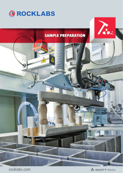


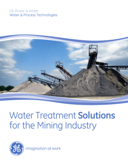


© Copyright 2026