
Paper A Planning Applications for Determination
PL.16 14/15 Planning Committee 1 April 2015 Subject: Planning applications for determination Report by: Chief Operating Officer Contact Officer: Derek Lawrence Interim Development Manager 01427 676640 Purpose / Summary: The report contains details of planning applications that require determination by the committee together with appropriate appendices. RECOMMENDATION(S): Each item has its own recommendation 1 IMPLICATIONS Legal: None arising from this report. Financial : None arising from this report. Staffing : None arising from this report. Equality and Diversity including Human Rights : The planning applications have been considered against Human Rights implications especially with regard to Article 8 – right to respect for private and family life and Protocol 1, Article 1 – protection of property and balancing the public interest and well-being of the community within these rights. Risk Assessment : None arising from this report. Climate Related Risks and Opportunities : None arising from this report. Title and Location of any Background Papers used in the preparation of this report: Are detailed in each individual item Call in and Urgency: Is the decision one which Rule 14.7 of the Scrutiny Procedure Rules apply? i.e. is the report exempt from being called in due to urgency (in consultation with C&I chairman) Yes No x Yes No x Key Decision: A matter which affects two or more wards, or has significant financial implications 2 Item 1 Sturton 1 Item 1 Sturton Officers Report Planning Application No: 132257 PROPOSAL: Outline planning application to erect 6no. detached dwellings, 4no. semi detached dwellings and 2no. detached garages, access and layout to be considered and not reserved for subsequent applications. LOCATION: Land adjacent Obam Lifts Tillbridge Lane Sturton By Stow Lincoln LN1 2BP WARD: Stow WARD MEMBER(S):Councillor Shore APPLICANT NAME: Obam Lifts TARGET DECISION DATE: 11/02/2015 DEVELOPMENT TYPE: Small Major - Dwellings RECOMMENDED DECISION: Delegate to the Chief Operating Officer to grant the application with conditions subject to the receipt of drawings which adequately address the comments of the Highway Authority Description: Application site is on the southern side of Tillbridge Lane to the south east of Sturton by Stow. The site with an area of 0.7 hectares is at a lower level than Tillbridge Lane and currently open countryside formed from rough grassland. To the south and west is open countryside and further to the west dwellings within Sturton by Stow. To the east of the site is Obam Lifts and a County Council depot. The site is part of an employment allocation in the Local Plan (SS(E)1) for B1, B2 and B8 use. A scheme for three dwellings at the front of the site was approved last year to facilitate the expansion of Obam lifts. Obam Stairlifts came to their current Tillbridge Lane premises in 2003 and have developed a strong local business with Council, housing association and private contracts. They employ fifteen people, 2 of which live in the village, 11 live in the Gainsborough and Lincoln areas and 2 live outside the county. The business has outgrown the current site and has permission to expand (129339). While these three dwellings are under construction the company have finalised their plans and understand that more finance is required to facilitate the expansion than originally considered. This application has been made therefore, to facilitate that expansion and further growth within the business, for the erection of an additional 10 dwellings. The application has been reported to Committee as the Chief Operating Officer considers that there is a perception that the site could be developed by 2 Item 1 Sturton Councillor Kinch. The applicant, via the agent, has however subsequently confirmed that this is not the case. The application was deferred at your meeting on the 4th March to enable a site visit to take place on 26th March. Background: The monies from the sale of the plots would fund the further expansion of the business. Relevant history: 129340 Outline planning application for development of 4 no. live-work units – access and layout to be considered and not reserved for subsequent applications. – Withdrawn 26/4/13 129339 (Land to the rear of the existing Obam building) Planning application for construction of a new portal frame storage and workshop building with adjoining office. Granted consent 29/1/13 130005 Outline planning application for development of 3no. detached dormer houses, access and layout to be considered and not reserved for subsequent applications, resubmission of 129340 Granted consent 2013 131348 Application for approval of reserved matters following outline approval 130005 granted 16th September 2013 for 3no. detached dormer houses. Granted consent 2014 Representations: Chairman/Ward member: Councillor Shore requests application is considered at Committee Parish Council: The Parish Council OBJECT to this application. The site has been designated as Industrial Land for decades. The applicant sought consent for 3 live/work units last year to fund the expansion of their business. This was swiftly amended to 3 residential dwellings and was granted consent by your council. It is currently being developed by a business owned by one of your District Councillors. This application is, therefore, backland development as the site is to the rear of the properties currently under construction. The application is contradictory as the plans suggest reinstatement of an ancient right of way, which, whilst lost for some time, remains on the County Council list; however,the application states no public right of way to be provided. There does not appear to be a current archaeological survey to address the 'ridge and furrow'field pattern. The adjacent County Highways road gritting depot operates for 24 hours a day for long periods during winter.This is a particularly noisy and light intrusive operation which is not compatible with a residential area. The Parish Council consider that this site is not suitable for the type of 3 Item 1 Sturton development suggested and urge the planning authority to reject the proposals. Local residents: None received LCC Highways: Access is acceptable in terms of visibility; current layout is acceptable apart from turning head shown, which is sub-standard. A small section of footway will be required at the access along with a crossing point for pedestrians to access the existing footway on the opposite side of the carriageway. Proposed drive should be designed and constructed to an adoptable standard, including street lighting, in line with the current Lincolnshire County Council Development Road Specification. Shared surface requirements would be a 5.5m wide shared c/w and f/w with 1.8m service margins (a small section of footway will be required at the access) or alternatively a 5m wide c/w with 1.8m wide footways. In this circumstance only one footway would be required on the dwellings side Upper Witham Internal Drainage Board: None received Archaeology: No requirement for archaeological work to be undertaken Environment Agency – no objections Lincolnshire Police – General comments which will be covered in the requirement to submit details as part of any reserved matters approval LCC Footpaths: The county council has an application to recognise a public footpath adjoining the western boundary of the site. This is based on the depiction of a path on an old Ordnance Survey sheet and a number of user evidence forms. None of the evidence provided suggests that a route affects this development site. It could be beneficial to retain a strip to link to this claimed footpath in the south west corner of the site. This could then facilitate a connection to this route if evidence or local goodwill were ever to result in this being recognised and set out. NHS England: No contribution required due to small size of site Relevant Planning Policies: The Development Plan West Lindsey Local Plan First Review 2006 Planning law requires that applications for planning permission must be determined in accordance with the development plan, unless material considerations indicate otherwise. The saved policies of the West Lindsey 4 Item 1 Sturton Local Plan First Review 2006 remain the statutory development plan for the district. Paragraph 215 of the National Planning Policy Framework (NPPF) states that due weight should be given to relevant policies in existing plans according to their degree of consistency with this framework (the closer the policies in the plan to the policies in the Framework, the greater the weight that may be given). STRAT 1 Development Requiring Planning Permission http://www2.west-lindsey.gov.uk/localplan/written/cpt3a.htm#strat1 STRAT 3 Settlement hierarchy http://www2.west-lindsey.gov.uk/localplan/written/cpt3a.htm#strat3 STRAT 9 Phasing of Housing Development and Release of Land http://www2.west-lindsey.gov.uk/localplan/written/cpt3b.htm#strat9 STRAT 7 Windfall and infill housing in subsidiary rural settlements http://www2.west-lindsey.gov.uk/localplan/written/cpt3b.htm#strat12 STRAT19 Infrastructure requirements http://www2.west-lindsey.gov.uk/localplan/written/cpt3b.htm#strat19 SUS4 – Cycle and pedestrian routes in development proposals http://www2.west-lindsey.gov.uk/localplan/written/cpt4.htm#sus4 RES 1 Housing Layout and Design http://www2.west-lindsey.gov.uk/localplan/written/cpt6.htm#res1 RES 2 Range of housing provision in all housing schemes http://www2.west-lindsey.gov.uk/localplan/written/cpt6.htm#res2 RES 5 Provision of play space/recreational facilities in new residential development. http://www2.west-lindsey.gov.uk/localplan/written/cpt6.htm#res5 RES6 Affordable housing provision http://www2.west-lindsey.gov.uk/localplan/written/cpt6.htm#res6 CORE 10 Open Space and Landscaping http://www2.west-lindsey.gov.uk/localplan/written/cpt8.htm#core10 NBE 14 Waste Water Disposal http://www2.west-lindsey.gov.uk/localplan/written/cpt11.htm#nbe14 NBE20 Development on the Edge of Settlements http://www2.west-lindsey.gov.uk/localplan/written/cpt11.htm#nbe20 The Preliminary Draft Central Lincolnshire Local Plan was released in October 2014. It has just been subject to public consultation. At this early stage in its development, it can only be afforded very limited weight, in accordance with NPPF paragraph 216. National Policy 5 Item 1 Sturton National Planning Policy Framework (2012) https://www.gov.uk/government/publications/national-planning-policy-framework--2 National Planning Policy Guidance http://planningguidance.planningportal.gov.uk/ Main issues Principle Design Highways Drainage Assessment: Principle The site is allocated for business under saved policy STRAT15 of the Local Plan. However, paragraph 22 of the NPPF acknowledges that, “Planning policies should avoid the long term protection of sites allocated for employment use where there is no reasonable prospect of a site being used for that purpose. …. Where there is no reasonable prospect of a site being used for employment use, application for alternative uses…. should be treated on their merits.” The site has not come forward for business use during the life of the Local Plan and is in the ownership of Obam lifts. By allowing this development business expansion is also assured through the extension to Obam lifts. Sturton by Stow is identified as a subsidiary rural settlement under the Settlement Hierarchy in saved policy STRAT3. (Although since that time Sturton has gained more facilities and could be considered as a primary rural settlement and is certainly considered to be sustainable). The recent appeal decision at Waddingham makes it clear that this type of settlement can be seen as being sustainable and new housing is helpful in adding to that sustainability and supporting local services. As the site is within the built up area of Sturton by Stow saved policy STRAT7 is relevant. It is not considered that the local need element of this policy (i) or the previously developed land clause (ix) comply with the NPPF as the Council does not have a five year supply of housing land the sustainability of development now carries more weight than these parts. The rest of the policy is considered compliant with the NPPF. The application is in outline form only with layout and access to be considered. Whilst, therefore, the size scale and design of the properties are not to be considered, the development of 10 dwellings is considered to be of a scale that would be consistent with development within Sturton by Stow. RES 6 states that affordable housing would be required for developments of three dwellings and above. Changes to the NPPG would suggest that unless 6 Item 1 Sturton there are specific onsite requirements, developments for 10 dwellings or less should not be required to make financial contributions. This together with the fact that the development is required to facilitate the finance for the expansion of the Obam premises means that it would not be appropriate in this instance to seek contributions. Subject to the right design, the proposal will not be detrimental to nearby occupiers. Design will be assessed when the reserved matters are submitted, however the site is located sufficiently far away from adjacent residential properties to ensure the new houses would not be harmful to residential amenity. A noise assessment report has been prepared to assess the impact of the Council’s highway depot on the potential occupiers of the houses. As a result a scheme of sound insulation (acoustic double glazing and an alternative means of ventilation (mechanical ventilation) and boundary treatment has been specified in order to mitigate transient noise associated with hydraulic loaders transferring grit at the adjacent highways depot. The site will be viewed in context with the three houses already approved at the front of the site and therefore there will not be a loss of a significant gap site within the street scene. The final criteria of Policy STRAT 7 relates to the impact on the Council’s housing supply. The National Planning Practice Guidance (PPG) advises that housing figures in up-to-date Local Plans should be used as the starting point for identifying the five year requirement. As the Local Plans for the three Central Lincolnshire authorities are outdated and the policies in the emerging joint Local Plan are not yet capable of carrying sufficient weight these cannot be used. The East Midlands Regional Spatial Strategy (RSS) was formally revoked in April 2013 and can therefore no longer be relied on to provide housing targets for Central Lincolnshire as it may not adequately reflect current housing needs. The PPG suggests using information provided in the latest full assessment of housing needs should be considered. The Strategic Housing Market Assessment (SHMA) is currently being prepared and therefore this cannot be used to identify the housing need for the area. The PPG goes on to state that “Where there is no robust recent assessment of full housing needs, the household projections published by the Department for Communities and Local Government (DCLG) should be used as the starting point, but the weight given to these should take account of the fact that they have not been tested.” The latest housing requirements published by DCLG for Central Lincolnshire is 1,230 dwellings per year or 6,150 over the five year period (2015/2016 to 2019/2020). However, to meet the requirements of the NPPF an additional 5% buffer must be added to the requirement. The total requirement increases to 6,458 dwellings (6,150 +308) or 1,292 per year. The results show that the Central Lincolnshire Authorities do not have sufficient land to meet the five year requirement. The supply is only 3.5 years 7 Item 1 Sturton worth of land. The shortfall, if the NPPF requirement for an additional 5% buffer is included, is 2,180 dwellings (or 436 dwellings a year). This approach of using the Central Lincolnshire position has been corroborated by inspectors following appeals against refusals by the Council and the undersupply of only 3.5 years’ deliverable supply must be afforded significant weight as a material consideration and the strategic policies of the Local Plan Review afforded very little weight given the context of paragraph 29 of the NPPF. Indeed, given the persistent under supply of housing it would be appropriate to apply the 20% buffer in addition to the 5 year deliverable supply requirement. In this context, there should be a presumption in favour of housing development, even on greenfield sites, provided that the development is sustainable and is acceptable when considered against other material planning considerations. It is considered therefore that the development is in principle acceptable and in accordance with not only the NPPF but also the relevant policies of the West Lindsey Local Plan. Design The final design of the houses will be part of the reserved matters application. However, the layout is considered acceptable as it provides for a substantial green buffer between the housing and the surrounding open countryside. A good landscaping scheme here to enhance the existing hedgerow will ensure that the impact of the houses is mitigated. The density of development is acceptable and building relationships are good. Highways The site is proposed to be accessed from the existing approved access to the three dwellings at the front of the site. This access was designed to maintain the access to the business use allocation and therefore it is considered that it will be sufficient to service the proposed housing development. Conditions need to be added to ensure that the access road is delivered and maintained The highway authority have raised some minor queries regarding the internal design of the layout and these are being addressed by the applicant Drainage The site has been the subject of a Multi Agency Group meeting regarding the drainage and the general strategy agreed at that time. All post development surface water run off will be discharged to the northern boundary ditch via the use of attenuation SuDs located through the development. The surface water drainage scheme will be designed to accommodate and dispose of runoff from storms up to the 1:100 year + 30% climate change event. The SuDs will be offered for adoption via Anglian Water the local authority (LCC) or a 8 Item 1 Sturton private management company. A condition is therefore required to ensure that this happens. Anglian Water have confirmed that the proposed development is in the catchment of the Sturton by Stow water recycling centre which currently has the capacity to treat the flows generated by the development. A pumping station will be required due to the connecting level of the existing public sewer system to avoid raising the land. This has been positioned in an acceptable location within the development to avoid nuisance to potential occupiers. Other matters An informative can be added to the permission regarding the comments of LCC footpaths section. However the applicants have agreed to incorporate a footpath within their scheme. The previous application was agreed subject to an agreement (albeit not under S106) requiring the finance from the sale of the land to be used to facilitate the expansion of Obam Lifts. With respect to the current application if it had been submitted without the link to Obam Lifts the same conclusions as above would be reached as the site is acceptable for housing irrespective of the link. It is not therefore considered necessary that the link is secured by a legal agreement as the NPPG states that Planning obligations mitigate the impact of unacceptable development to make it acceptable in planning terms. In this instance the development is acceptable without the need for the legal agreement Conclusion and reasons for decision: The proposal has been examined alongside the Development Plan, particularly saved policies STRAT1 – Development requiring planning permission, STRAT3 – Settlement Hierarchy, STRAT7 – Windfall and Infill Housing Development in Subsidiary Rural Settlements, STRAT15 – Employment Allocations, RES1 – Housing Layout and Design, NBE14 – Waste Water Disposal and NBE20 – Development on the Edge of Settlements of the West Lindsey Local Plan First Review (June 2006) alongside the advice given in the National Planning Policy Framework (March 2012) and the National Planning Practice Guidance 2014 and the lack of a five year housing land supply in Central Lincolnshire . In the light of this assessment, whilst it is noted that the land is allocated for business purposes, such development has not come forward in the life of the plan. Residential development would be acceptable on this sustainable site and would allow the business of Obam Lift Services to stay in the District and to expand. The addition of conditions will ensure that harm is not caused to highway safety, residential and visual amenity. Conditions stating the time by which the development must be commenced: 1. Application for approval of the reserved matters shall be made to the Local Planning Authority before the expiration of three years from the date of this permission. 9 Item 1 Sturton Reason: To conform with Section 92 (2) of the Town and Country Planning Act 1990 (as amended). 2. No development shall take place until plans and particulars of the scale and appearance of the buildings to be erected, and the landscaping (including details of the size, species and position or density of all trees to be planted, fencing and walling, and measures for the protection of trees to be retained has been submitted to and approved in writing by the local planning authority. The scheme shall also include a timetable for the implementation of the landscaping and a methodology for its future maintenance.) of the site (hereinafter called “the reserved matters”) have been submitted to and approved in writing by the Local Planning Authority, and the development shall be carried out in accordance with those details. Reason: The application is in outline only and the Local Planning Authority wishes to ensure that these details which have not yet been submitted are appropriate for the locality in accordance with saved policy STRAT1 of the West Lindsey Local Plan First Review June 2006 and the advice within the National Planning Policy Framework March 2012. 3.The development hereby permitted shall be begun either before the expiration of three years from the date of this permission, or before the expiration of two years from the date of approval of the last of the reserved matters to be approved, whichever is the later. Reason: To conform with Section 92 (2) of the Town and Country Planning Act 1990 (as amended). Conditions which apply or require matters to be agreed before the development commenced: 4. No development shall take place until details of the external facing materials to be used have been submitted to and approved in writing by the local planning authority Reason: To ensure a satisfactory external appearance of the development in accordance with saved policies STRAT1 and RES1 of the West Lindsey Local Plan First Review June 2006 and the advice within the National Planning Policy Framework March 2012. 5. No dwelling shall be occupied until the details of the maintenance of both the surface water and foul water drainage systems have been submitted to and approved in writing by the Local Planning Authority. Maintenance shall proceed in accordance with the approved details. Reason: In order to ensure that the drainage systems are properly maintained so as not to exacerbate flooding issues within the catchment in accordance with saved policy STRAT1 of the West Lindsey Local Plan First Review June 2006, the advice within the National Planning Policy Framework March 2012 and the Technical Guidance to the National Planning Policy Framework. 10 Item 1 Sturton 6. No development shall take place until details of a hard landscaping scheme including details of the finishes and colour of all surface materials, including those to access driveways, forecourts and parking/turning areas have been submitted to and approved in writing by the Local Planning Authority Reason: To ensure that, an appropriate level and type of hard landscaping is provided within the site in accordance with saved policies STRAT 1 and RES 1 of the West Lindsey Local Plan First Review June 2006 and the advice within the National Planning Policy Framework March 2012. Conditions which apply or are to be observed during the course of the development: 7. With the exception of the detailed matters referred to by the conditions of this consent, the development hereby approved shall be carried out in accordance with the following drawings: LDC1024-PL-02, LDC1024-PL-03 dated December 2014. The works shall be carried out in accordance with the details shown on the approved plans and in any other approved documents forming part of the application. Reason: To ensure the development proceeds in accordance with the approved plans and in accordance with saved policy STRAT 1 of the West Lindsey Local Plan First Review June 2006. 8. All drainage routes through the site shall be maintained during the course of development and following the completion of the works. Reason: In order that those areas served by the drainage routes and upstream and downstream riparian owners are not adversely affected by the development in accordance with saved policy STRAT1 of the West Lindsey Local Plan First Review June 2006 and the advice within the National Planning Policy Framework March 2012. 9. The development shall be carried out only using the materials approved in condition 4 of this permission and shall be so retained. Reason: In the interests of the visual amenity of the area in accordance with saved policies STRAT 1 and RES 1 of the West Lindsey Local Plan First Review June 2006 and the advice within the National Planning Policy Framework March 2012. 10. The details of hard landscaping approved in Condition 6 shall be implemented on site prior to the occupation of the buildings or the completion of the development whichever is the sooner and shall be so retained. Reason: To ensure that an appropriate level and type of hard landscaping is provided within the site in accordance with saved policies STRAT 1 and RES 1 of the West Lindsey Local Plan First Review June 2006 and the advice within the National Planning Policy Framework March 2012. 11. Before the dwellings are first occupied, the access, turning space and private drive shall be completed in accordance with the approved plan 11 Item 1 Sturton drawing number LDC1024-PL-03 dated December 2014 and retained for that use thereafter. Reason: In the interests of highway safety in accordance with saved policies STRAT1 and RES1 of the West Lindsey Local Plan First Review June 2006 and the advice within the National Planning Policy Framework March 2012. 12. No dwelling shall be occupied until the noise mitigation measures contained in the report by Environmental Noise Solutions Limited dated 17 th November 2014 have been implemented on site. The measures shall be maintained at all times Reason: To protect residential amenity in accordance with the National Planning policy Framework and saved Policy STRAT 1 of the West Lindsey Local Plan First Review Conditions which apply or relate to matters which are to be observed following completion of the development: 13. The approved surface water regulation system and foul water system, shall be brought into use before the development is occupied and retained in working order thereafter. Reason: In order to control surface water run off so as not to exacerbate flooding issues within the catchment in accordance with saved policy STRAT1 of the West Lindsey Local Plan First Review June 2006, the advice within the National Planning Policy Framework March 2012 and the Technical Guidance of the National Planning Policy Framework. 14. All planting, seeding or turfing comprised in the approved details of landscaping shall be carried out in the first planting and seeding season following the occupation of the buildings or the completion of the development, whichever is the sooner; and any trees or plants which within a period of 5 years from the completion of the development die, are removed, or become seriously damaged or diseased shall be replaced in the next planting season with others of similar size and species. Reason: To ensure that an approved landscaping scheme is implemented in a speedy and diligent way and that initial plant losses are overcome, in the interests of the visual amenities of the locality and in accordance with saved policies STRAT 1, STRAT 12 and CORE 10 of the West Lindsey Local Plan First Review 2006 and the advice within the National Planning Policy Framework March 2012. Notes to the Applicant: 1. The county council has an application to recognise a public footpath adjoining the western boundary of the site. This is based on the depiction of a path on an old Ordnance Survey sheet and a number of user evidence forms. None of the evidence provided suggests that a route affects this development site however the possible discovery of further evidence cannot be discounted. It could be beneficial to retain a strip to link to this claimed footpath in the 12 Item 1 Sturton south west corner of the site. This could then facilitate a connection to this route if evidence or local goodwill were ever to result in this being recognised and set out. Human Rights Implications: The above objections, considerations and resulting recommendation have had regard to Article 8 and Article 1 of the First Protocol of the European Convention for Human Rights Act 1998. The recommendation will not interfere with the applicant’s and/or objector’s right to respect for his private and family life, his home and his correspondence. Legal Implications: Although all planning decisions have the ability to be legally challenged it is considered there are no specific legal implications arising from this report 13 Item 2 Grasby 1 Item 2 Grasby Officers Report Planning Application No: 131357 PROPOSAL: Planning application for construction of 7no. dwellings LOCATION: Land off Bentley Lane, Grasby, Barnetby, North Lincolnshire DN38 6AW WARD MEMBER(S): Cllr Strange APPLICANT NAME: Lindum Group Ltd TARGET DECISION DATE: 01/09/2014 DEVELOPMENT TYPE: Minor - Dwellings RECOMMENDED DECISION: That the decision to grant permission subject to conditions be delegated to the Chief Operating Officer upon the signing and completion of an agreement under the amended s106 of the Town Planning Act 1990 that delivers:1. The mechanisms for ensuring the affordable homes are affordable and are prioritised for a local need Description: The application site comprises a parcel of land on the edge of the village of Grasby. The site is off Bentley Lane but is currently accessed along the east boundary of the site. Public footpath Gras/47/1 runs from Bentley Lane along the east boundary of the application site. The site slopes up from the road and there is a dry pond towards the front of the site. The boundaries comprise mature hedging and trees. The application seeks permission to erect 7 dwellings comprising 3no. 2 storey terraced houses (1no. 3 bed 5 person, 2no. 2 bed 4 person) and 4no. 1 bed 2 person flats, for the provision of affordable housing. The dwellings are to be set back from the roadside boundary in order to maintain the pond and roadside treeline. The site will be accessed directly from Bentley Lane. Relevant history: None Representations: Chairman/Ward member(s): Cllr Strange requests the application be determined by the Planning Committee, the reasons given are; Affordable Housing – That affordable housing was ring fenced directly for the use of the parishioners of Grasby and the inhabitants of Searby and Owmby only. Much more detail regarding the chosen social housing provider and future management of the units is required. Reference is made to agreements in place for recent affordable housing developments in the Kelsey and Great Limber. Visual Impact – The current design and layout of the development is poor and in no way in keeping with the vernacular of the village of Grasby. It was noted that the Design and Access Statement refers to the units as ‘townhouses’, clearly this is not appropriate for the site or village. A high 2 Item 2 Grasby quality design using traditional local materials is required. Infrastructure Services – That all sewage and associated services, such as surface water run off are reviewed, surveyed and proven to withstand additional housing development. Highways Issues – That a proper traffic survey is carried out to identify the affects that this development will have on the single carriageway, which does not have footpaths for children and elderly, clearly this also has health and safety implications. Ecology – That a wildlife survey is undertaken by an independent body, as there is some conflicting reporting. Sustainability – Consideration is given in regard to the relative lack of amenities within the village, limited public transport, or local services. Further reasons added: ‘Grasby is a community without a shop, with only one bus per week. Locally people are being advised in Searby, and one application in South Kelsey has been refused as being unsustainable. Surely those choosing affordable housing would prefer regular public transport, and there are plenty of lodge homes now available at Wolds retreat just 2 kilometres away. The development is situated on a narrow single carriageway, cul-de-sac.-very dangerous for emergency vehicles. There are drainage problems and no footpath as highlighted in the Highways input. Drainage and flooding is already, an ongoing problem for the existing residents, on Bentley lane. The development is very basic, when compared with much of the lovely village of Grasby, with parking provided for only one vehicle per house, when if both residents are working,14 spaces would be needed. Heritage-the field is a traditional meadow and the loss would be a direct threat to wild life, and visual aspect, also whilst not a planning matter opening up the field would be a foot in the door, for development. At least in nearby North Kelsey, the affordable housing is limited for local people whilst this development would be available for non- rural people, who we know from experience, do not find living in a community without facilities easy, and this can lead to unease, with their neighbours especially existing ones.’ Further to objections that you have received 50 in all and I gather none in favour, from Grasby residents and their parish council. As a result of the meeting held in the village hall last Wednesday 25th, I wish to add the necessity in requesting Anglian water for their view on the development proposed, as a result of last weeks, Lincolnshire county councils, Flood and drainage scrutiny committee where Anglian water were asked why they were not statutory consultees, they stated if asked they could comment! I am therefore asking you to investigate not only their thoughts about drainage where there is only one small drain in the length of road affected but more important the volume of sewerage that Messrs Boyles of Osgodby are having to tank out of the Grasby sewarge farm, on a regular basis and now coping with a further 80 properties,pumped from Searby and Owmby, since the piping scheme only completed last year. 3 Item 2 Grasby Also I gather in Osgodby village, eight proposed houses, have been refused on the following grounds at appeal by The Planning inspector- who stated"that the proposed development would have relatively poor access to services and facilities and would foster a reliance on the private car, making it unsustainable." The development, "would also encroach onto previously undeveloped open land, to the rear of properties on Washdyke lane., thus enlarging the existing developed extent of the village into the country-side. The combination of this uncharacteristic back-land development, into the open country side, would not safeguard the existing character and appearance of the area.-the judgement said". And-"Such harm would out- weigh the benefit of extra housing supply". Jonathan, Mark, and Derek, I humbly submit that Grasby would regard this as backland development, with its proximity to Front street! However the Inspectors words regarding encroachment of open countryside and the reliance on cars travel are paramount in his judgment which applies equally to Grasby. With this additional information and a senior Inspectors views and judgment I am asking on behalf of local residents that you will now if not dismiss, then at the very least, support Grasby residents, in recommending refusal of this application. Parish/Town Council/Meeting: ‘The application submitted is lacking in detail and in order for the Parish Council to consider this planning application further it would require: Affordable Housing – That affordable housing was ring fenced directly for the use of the parishioners of Grasby and the inhabitants of Searby and Owmby only. Much more detail regarding the chosen social housing provider and future management of the units is required. Reference is made to agreements in place for recent affordable housing developments in the Kelsey and Great Limber. Visual Impact – The current design and layout of the development is poor and in no way in keeping with the vernacular of the village of Grasby. It was noted that the Design and Access Statement refers to the units as ‘townhouses’, clearly this is not appropriate for the site or village. A high quality design using traditional local materials is required. Infrastructure Services – That all sewage and associated services, such as surface water run off are reviewed, surveyed and proven to withstand additional housing development. Highways Issues – That a proper traffic survey is carried out to identify the affects that this development will have on the single carriageway, which does not have footpaths for children and elderly, clearly this also has health and safety implications. Ecology – That a wildlife survey is undertaken by an independent body, as there is some conflicting reporting. Sustainability – Consideration is given in regard to the relative lack of amenities within the village, limited public transport, or local services. Local residents: Objections received from No’s 3, 8, 16, 17, 18, 35 Station Road; 4, 11 Church Hill; 4, 7, 9, 11a, 15, 17, 19, Rose Cottage 21, 23, Wold House and Malvern Clixby Lane; 9, Hawthorn House 9a, 12, 13, 14, The Cottage 15, 17 and White Cottage Front Street; 1, Tennyson Villa, Vicarage Lane; 4 Wilmore Lane; 3, 4, 5, 8, 14, 16, 18, Bentley House, Grasby House 4 Item 2 Grasby Farm, Bull Pen Cottages, Lowery Workstands, Woodstock Cottage Bentley Lane; The Old Chapel Main Street; Laurel Grange Holland Drive; 1 Wold View Church Side and Little London House North Kelsey. Objections and concerns mainly relate to (in summary): Village cannot sustain further development Development will be detrimental to village school The land should be kept for agricultural/equine use The new homes will spoil the AONB There are an abundance of properties already for sale in the village Traffic and highways concerns (increased traffic, narrow lanes, not enough parking spaces, increased danger to pedestrians, conflict with agricultural/delivery/refuse vehicles, no footpath) The housing survey is invalid There is a public footpath adjacent to the site Sewerage and drainage problems Inadequate parking facilities for the proposal The site has the potential to be extended in the future Visual impact on small village Safety risk for pedestrians Lack of village amenities/unsustainable location Damage to ecological site No public transport in the village New development will increase the risk of flooding The site is a greenfield site Construction traffic will cause obstruction Design of dwellings not in keeping with village Adjacent farm needs free access at all times Street lighting in Grasby is poor Other, more suitable sites available within Grasby Devaluation of property Injuries to children if enter nearby farm Grasby school oversubscribed Villagers of the understanding that there would be some form of village amenity built into the development eg playground for village children Dangers associated with open water (the pond) LCC Highways: ‘A frontage footway link should be provided to link to the existing footway on Bentley Lane; A 1.8m service margin is required alongside the estate road; The existing street lighting on Bentley Lane should be assessed and upgraded if necessary; Confirmation that the surface water drainage system, is taking both the private and highway drainage, is required. If this is the case Anglian Water will be the adopting drainage authority. Acceptance of the system should be obtained from them, prior to full planning consent being granted; I am concerned about the limited number of parking spaces that have been provided. No provision has been made for visitor parking and due to the rural location it is likely that some of the residents will own more than one vehicle. I have concerns that any on street parking may obstruct the turning of large vehicles (such as refuse vehicles) visiting the site. 5 Item 2 Grasby This would result in them having to reverse out onto the public highway, which will be of detriment to highway safety.’ In response to additional comments received by the agent: ‘The proposed development will increase the use of the lane, by both vehicles and pedestrians; It may be that the street lighting wont need updating, but this should be checked; There is an existing footway further up the lane, I don’t think it is unreasonable to request that a footway link is provided; It is not acceptable for the drainage for the adoptable highway to be drained into a private drainage system.’ LCC Footpaths: No objections Archaeology: ‘The site contains earthworks of ridge and furrow which are the remains of a now extinct medieval farming practice. Ridge and furrow was once a commonplace feature in our landscape but development and new intensive farming practices has meant that surviving earthworks are increasingly becoming rare. We would prefer that this land is not developed and the medieval landscape remain intact. However if consent should be forthcoming then this site should be subject to an archaeological topographic survey and because there is a potential for medieval archaeology to be preserved beneath the earthworks a scheme of archaeological and monitoring should also be undertaken.’ Housing and Communities Team: ‘A Parish Housing Needs Survey was carried out independently by Community Lincs in the Autumn of 2011 which identified a need for 7 units of affordable housing in Grasby. The findings were published in the Grasby Affordable Housing Needs Survey Report January 2012. This proposal will deliver a mix of affordable housing in terms of house type and tenure as recommended by the Rural Housing Enabler in the report which will meet the identified need. A call for land was also carried out by Community Lincs in February and March 2011 with the aim of identifying sites suitable for the delivery of affordable housing. At the time of the call for land there was only one site in question, however over a period of time 3 other locations were brought forward and assessed by officers from the Development Management Team and the Housing and Communities Team to ascertain whether there were any major constraints in relation to planning and sustainability. The application site was assessed in February 2013 as being suitable for the delivery of affordable housing as there were no high risk constraints although the narrowness of Bentley Lane and the possible impact of traffic on existing properties was noted for the benefit of the site promoter. Throughout 2013 meetings were held between the applicant and West Lindsey officers to move forward with the design of the scheme. A public consultation event was held in November 2013 where the developer presented the proposals to the residents of Grasby. Housing and Communities are satisfied that the proposal will meet the evidenced need from the Parish Housing Needs Survey and will provide affordable housing in a location where there are currently limited housing options for those households in need of affordable housing and therefore are supportive of the proposal. 6 Item 2 Grasby Natural England: ‘Based upon the information provided, Natural England advises the Council that the proposal is unlikely to affect any statutorily protected sites or landscapes.’ Environmental Protection: ‘Indication is that this development may be at risk of surface water flooding and cause flooding from surface water and this potential needs to be negated or addressed. Both accommodation units sit across a significant slope and may be impacted The access road for a large part sits across the slope and will likely redirect surface water flow towards Bentley Lane Said road will likely interfere with ground water mitigation Indicative surface water flood maps suggest that the developed part of Bentley Lane up to and including opposite the application site is already at risk of flooding in a 1:30 event. Whilst there is no indication that surface water drainage arrangements are intended to be adopted, disruption of, indeed likely natural flow patterns, would suggest problems with adoption if not addressed at an early stage. There is nothing to suggest that natural drainage of the site and/or capacity of the pond is currently adequate let alone capable of dealing with the changes intended.’ Relevant Planning Policies: The Development Plan West Lindsey Local Plan First Review 2006 Planning law requires that applications for planning permission must be determined in accordance with the development plan, unless material considerations indicate otherwise. The saved policies of the West Lindsey Local Plan First Review 2006 remains the statutory development plan for the district. Paragraph 215 of the National Planning Policy Framework (NPPF) states that due weight should be given to relevant policies in existing plans according to their degree of consistency with this framework (the closer the policies in the plan to the policies in the Framework, the greater the weight that may be given). STRAT 1 Development Requiring Planning Permission http://www2.west-lindsey.gov.uk/localplan/written/cpt3a.htm#strat1 STRAT 3 Settlement hierarchy http://www2.west-lindsey.gov.uk/localplan/written/cpt3a.htm#strat3 STRAT 9 Phasing of Housing Development and Release of Land http://www2.west-lindsey.gov.uk/localplan/written/cpt3b.htm#strat9 STRAT 12 Development in the open countryside http://www2.west-lindsey.gov.uk/localplan/written/cpt3b.htm#strat12 7 Item 2 Grasby STRAT19 Infrastructure requirements http://www2.west-lindsey.gov.uk/localplan/written/cpt3b.htm#strat19 SUS4 – Cycle and pedestrian routes in development proposals http://www2.west-lindsey.gov.uk/localplan/written/cpt4.htm#sus4 RES 1 Housing Layout and Design http://www2.west-lindsey.gov.uk/localplan/written/cpt6.htm#res1 RES 2 Range of housing provision in all housing schemes http://www2.west-lindsey.gov.uk/localplan/written/cpt6.htm#res2 RES 5 Provision of play space/recreational facilities in new residential development. http://www2.west-lindsey.gov.uk/localplan/written/cpt6.htm#res5 RES6 Affordable housing provision http://www2.west-lindsey.gov.uk/localplan/written/cpt6.htm#res6 RES7 Rural Exceptions housing http://www2.west-lindsey.gov.uk/localplan/written/cpt6.htm#res7 CORE 10 Open Space and Landscaping http://www2.west-lindsey.gov.uk/localplan/written/cpt8.htm#core10 NBE 14 Waste Water Disposal http://www2.west-lindsey.gov.uk/localplan/written/cpt11.htm#nbe14 NBE20 Development on the Edge of Settlements http://www2.west-lindsey.gov.uk/localplan/written/cpt11.htm#nbe20 The Preliminary Draft Central Lincolnshire Local Plan was released in October 2014. It has just been subject to public consultation. At this early stage in its development, it can only be afforded very limited weight, in accordance with NPPF paragraph 216. Main issues: Principle Visual amenity Residential amenity Biodiversity/ecology Drainage Highway Safety Assessment Principle The West Lindsey Local Plan First Review was drafted in 2003 and adopted in 2006. It remains part of the development plan and contains a suite of strategic (STRAT) and residential (RES) policies that, together with national planning policy, is designed to provide a policy framework to deliver residential development in appropriate locations to respond to need and the Council’s growth objectives. These strategic policies together with policy RES6 of the Local Plan Review were originally designed to deliver the 8 Item 2 Grasby majority of open market and affordable homes through allocated sites identified in the same Plan. Other sites would be permitted within settlement limits in the towns and larger, so called Primary Rural Settlements, but there were and still are policies designed to permit housing outside of settlement limits. These include where there is a local need for specific housing, where a countryside use such as farming has identified a functional need and in other exceptional circumstances where material considerations could justify development in locations deemed to be unsustainable. Policy RES7 was included to acknowledge that there would be a need to deliver “exceptions sites” for affordable housing in small and subsidiary rural settlements (as defined by policy STRAT3) to respond to an identified need for such housing in these settlements. Towns and Primary Rural Settlements were explicitly excluded from the provisions of policy RES7 as the allocations included within policy STRAT2 were designed to deliver not only the open market housing to meet the Council’s housing strategy but also affordable housing to meet local need. This is because policy RES6 required the Council to seek delivery of around 25% of the total number of dwellings within each allocated site to be affordable homes. The failure of this framework to deliver affordable homes to respond to specific need in many, although by no means all settlements in West Lindsey is outlined in the comments from Housing and Communities above. The delivery of affordable housing to meet a specific need beyond the defined settlement boundary has previously been accepted and supported. The chronology outlined above and procedure followed in agreement with officers reflects those of similar exercises undertaken. In summary, despite the site being beyond the settlement limit and on greenfield land, it is considered that the principle of the proposal can be supported as the proposal responds to an identified need for affordable housing and will provide a mix of units which will deliver that need in accordance with Policy RES 7. Sustainability of location including proximity to existing services and facilities and level of accessibility by means other than the car Ensuring that development is sustainable is the key theme of the NPPF and also a material consideration within policies STRAT1, SUS4 RES7 and RES1 of the Local Plan Review. The site is to the east of Grasby but nevertheless contained within the main settlement. Grasby itself has a church and school which would be in walking distance of the site. There is a daily bus service to the shopping facilities in either Grimsby, Brigg or Scunthorpe. There is also a Callconnect bus service operating from Caistor. While there are limited services therefore the aim of Policy RES7 was to enable affordable housing which meets a local need to be provided in such locations as an exception to market housing. 9 Item 2 Grasby Concerns have been expressed by some residents about the ability of the infrastructure serving the village to take new development. Specific concerns relate to overstretched education facilities and drainage. There has been no request for a contribution to housing from the Education Authority. The recent change to planning policy within the National Planning Practise Guidance makes it clear that the Government does not expect developments beneath 10 dwellings to have to contribute to local facilities. Drainage infrastructure is discussed below. It is considered therefore that the provision of affordable housing is acceptable only to meet a local need. A S106 agreement will need to be entered into to secure this and this will prioritise occupancy by local people. The Housing Needs Survey Report was carried out by Community Lincs, an independent body and was based on Grasby and Searby cum Owmby. Thirteen households responding to the survey considered themselves to be in housing need. Analysis revealed that 7 of the 13 households are unable to resolve their housing need through the open market. The majority are living with family or friends and unable to access the local housing market without expending more than 25% of their income on housing costs either rent or mortgage payments. The survey revealed a need for a mix of property types at affordable rents. The majority need is for properties suitable for single people. The development will therefore meet this need for local people. Flood risk and drainage The site is located within Flood Zone 1 as indicated on the Environment Agency Flood Maps categorising it at low risk of flooding. The applicants are suggesting that the surface water drainage will be via a swale into the existing dry pond on site. The highways authority have requested confirmation of Anglian Water commitment to adopt the scheme given that the system is taking both private and highway drainage. The applicants are happy to accept a condition requiring further details of the drainage both in terms of the design and the maintenance of the system Foul drainage is proposed to connect to the existing mains sewer in line with local policy Anglian Water has been consulted on the proposal. Initially they responded that they would not provide comment as the scheme was below 10 dwellings, but were asked to provide comments given the concerns raised by local people. No response has been received to date, any further comments will be reported at your committee. It is anticipated that drainage associated with only an additional 7 dwellings could be accommodated within the existing system and this is one of the reasons Anglian Water do not comment on proposals below 10 dwellings. In an email to one of the local residents Anglian Water did comment that “Having looked at the jobs raised in the last 6 months, we have had only 2 reports of a sewage overflow, both were in fields near a brook” 10 Item 2 Grasby It is considered therefore that a condition would adequately control the way that the site is drained and the future maintenance of the drainage system. Impact on the character and appearance of the area including design, landscape and layout The site is located on the fringes of the village and the closest dwellings are to the west and south and are a mix of houses and bungalows in various designs facing Bentley Lane. Grasby itself has a range of architectural styles and types. As the site is currently undeveloped any buildings will by their nature have a visual impact. Taking this into account the scheme as designed ensures that the dwellings are set back within the site. The existing hedgerows and trees are retained to soften the edge of the development. This can be supplemented by additional planting including strengthening and reinforcing the existing hedgerows and making good any gaps which can be secured by the use of a landscape condition. The dwellings themselves are accommodated in two blocks of building of a simple design not dissimilar from those on the opposite side of Bentley Lane to the application site. It is considered therefore that the development, subject to the imposition of the conditions above in relation to landscaping, is appropriate to its setting and can be supported. Highway Safety There are no objections raised on the grounds of highway safety and the main concerns appears to be the lack of car parking spaces and the footpath links and service margin. The applicant has agreed to provide a further 3 parking spaces within the scheme and provide a 1.8 metre service margin alongside the estate road. The scheme will now provide 10 parking spaces to serve the seven dwellings which is considered to be an acceptable level of provision for this development. In terms of the street lighting and footpath, a balanced approach is required here. The site provides affordable housing only and there is little opportunity for funds over and above the provision of the housing to be available to provide other facilities as this will have an impact on the viability of the scheme. In addition the location is in a rural area t would appear harmful to increase the urbanisation of the area. On balance it is considered that the provision of 7 dwellings without the footpath and lighting would be acceptable to meet the local need for affordable housing. The road here is narrow, however the access road would be taken at the point where Bentley Lane is at its widest. Given the low level of additional housing it is considered that the additional traffic would not be seriously harmful to highway safety. 11 Item 2 Grasby Residential Amenities The proposed houses are located over 80 metres from the nearest existing residential property and therefore it is not considered that they will cause harm to the amenity of the surrounding residents. Biodiversity/Ecology The applicants have submitted an ecological survey of the site undertaken by a competent person. The report found that all habitats and plant communities recorded on the site are common and widespread. The hedgerows on the south and east boundaries have local biodiversity value. The current condition of the pond offers poor aquatic habitat for great crested newts and other amphibians. No further surveys were considered necessary for protected species. The report found that no work should be undertaken in the bird nesting season without further survey. The mature trees and hedgerows should be retained. Improvements should be made to the pond to deepen it and create open areas to increase its value to wildlife. All of this work can be secured by a condition attached to any permission. Conclusion The application has been considered against the provisions of the development plan in the first instance, specifically saved policies STRAT 1 Development Requiring Planning Permission, STRAT 3 Settlement hierarchy, STRAT 9 Phasing of Housing Development and Release of Land, STRAT 12 Development in the open countryside, SUS4 – Cycle and pedestrian routes in development proposals, RES 1 Housing Layout and Design, RES 2 Range of housing provision in all housing schemes, RES 5 Provision of play space/recreational facilities in new residential development, RES6 Affordable housing provision, RES 7 Rural exceptions housing CORE 10 Open Space and Landscaping, NBE 14 Waste Water Disposal and NBE20 Development on the edge of settlements of the West Lindsey Local Plan First Review 2006 as well as against all other material considerations. These other material considerations include the provisions of the National Planning Policy Framework which has been afforded significant weight especially the presumption of favour of sustainable development and the National Planning Practice Guidance In light of this assessment it is considered that the development is acceptable subject to the imposition of conditions and the completion and signing of the section 106 agreement. Specifically, notwithstanding the fact that the site is classed as being in the open countryside and therefore policy STRAT12 applies and that the site constitutes greenfield land (the lowest category for land release defined by policy STRAT9), the site is still considered to be an appropriate location for a 12 Item 2 Grasby development which enables affordable housing to be delivered to respond to a specific outstanding need. RECOMMENDATION : That the decision to grant permission subject to conditions be delegated to the Chief Operating Officer upon the signing and completion of an agreement under the amended s106 of the Town Planning Act 1990 that delivers:2. The mechanisms for ensuring the affordable homes are affordable and are prioritised for a local need Time commencement condition 1. The development hereby permitted shall be begun before the expiration of one year from the date of this permission. Reason - To conform with Section 91 (1) of the Town and Country Planning Act 1990 (as amended) and to seek a deliverable development within five years. Conditions which apply or require matters to be agreed before the development commenced: 2. No development shall take place until a sample of the walling and roofing materials have been submitted to and approved in writing by the Local Planning Authority. Reason: To ensure that the development preserves the character and appearance of the area and to accord with Policies STRAT 1 and RES 1 of the adopted West Lindsey Local Plan First Review 2006 (Saved Policies). 3: No development shall take place until a surface water drainage scheme for the site based on sustainable drainage principles and an assessment of the hydrological and hydrogeological context of the development, has been submitted to and approved in writing by the local planning authority. The drainage strategy should demonstrate that surface water run off generated up to and including the 100 year plus climate change critical storm will not exceed the run off from the undeveloped site following the corresponding rainfall event. The scheme shall subsequently be implemented in accordance with the approved details before the development is completed. The scheme shall also include: Details of how the scheme will be maintained and managed after completion and who will adopt the surface water system and detailed calculations of the surface network design based on the allowable discharge rate of 5 l/s. Reason: To ensure that a satisfactory surface water disposal scheme is implemented to prevent the increased risk of flooding, both on and off the site in accordance with policy STRAT1 of the West Lindsey Local Plan First 13 Item 2 Grasby Review 2006 (Saved Policies) and the National Planning Policy Framework 2012 and National Planning Practice Guidance 2014. 4. No development shall take place until a scheme for the disposal of foul sewerage has been submitted to and approved in writing by the Local Planning Authority. Reason: To ensure adequate drainage facilities are provided to serve the development and to prevent pollution of the water environment in accordance with Policies STRAT1, RES1 and NBE14 of the West Lindsey Local Plan First Review 2006 (Saved Policies) 5. Before development commences on site further details relating to the vehicular access to the public highway, including materials, specification of works and construction method shall be submitted to the Local Planning Authority for approval. Reason: In the interests of safety of the users of the public highway and the safety of the users of the site and in accordance with Policy STRAT 1 of the adopted West Lindsey Local Plan First Review 2006 (Saved Policies). 6. No development shall take place until a soft landscaping scheme including details of the size, species and position or density of all trees to be planted, and measures for the protection of trees to be retained has been submitted to and approved in writing by the local planning authority. The scheme shall also include a timetable for the implementation of the landscaping and a methodology for its future maintenance. Reason: To ensure that, an appropriate level and type of soft landscaping is provided within and framing the development on this edge of settlement location and to accord with the National Planning Policy Framework and Policies STRAT 1, RES 1, CORE 10 and NBE20 of the West Lindsey Local Plan First Review 2006 (Saved Policies). 7. Notwithstanding the details on the approved plans no development shall commence until details of a revised parking layout incorporating 3 additional spaces has been submitted to and agreed in writing by the Local Planning Authority. The approved layout shall be implemented on site prior to the completion of the development and maintained at all times. Reason: In the interests of highway safety as required by the National Planning Policy Framework and saved policy STRAT 1 of the West Lindsey Local Plan. 8.No development shall take place, including any works of demolition, until a Construction Method Statement has been submitted to, and approved in writing by, the local planning authority. The approved Statement shall be adhered to throughout the construction period. The Statement shall provide for: (i) the routeing and management of construction traffic; 14 Item 2 Grasby (ii) the parking of vehicles of site operatives and visitors; (iii) loading and unloading of plant and materials; (iv) storage of plant and materials used in constructing the development; (v) the erection and maintenance of security hoarding including decorative displays and facilities for public viewing, where appropriate; (vi) wheel cleaning facilities; (vii) measures to control the emission of dust and dirt during construction; (viii) details of noise reduction measures; (ix) a scheme for recycling/disposing of waste resulting from demolition and construction works (x) the hours during which machinery may be operated, vehicles may enter and leave, and works may be carried out on the site. Reason: In the interests of amenity and in accordance with saved policy STRAT1 of the West Lindsey Local Plan First Review. Conditions which apply or are to be observed during the course of the development: 9. With the exception of the detailed matters referred to by the conditions of this consent, the development hereby approved shall be carried out in accordance with the following drawings: 31468 263 01D, 02, 03B dated March 2014. The works shall be carried out in accordance with the details shown on the approved plans and in any other approved documents forming part of the application. Reason: To ensure the development proceeds in accordance with the approved plans and to accord with the National Planning Policy Framework and saved Policy STRAT 1 of the West Lindsey Local Plan First Review 2006. 10.. The development shall be carried out using the external walling and roofing materials and details as agreed by the Local Planning Authority and referred to in condition 2 above. Reason: To ensure that the development preserves the character and appearance of the area and to accord with policies STRAT 1 and RES 1 of the adopted West Lindsey Local Plan First Review 2006 (Saved Policies). 11. No works shall take place between 1st March and 31st August in any year until, a detailed survey shall be undertaken to check for the existence of nesting birds. Where nests are found, a 4 metre exclusion zone shall be created around the nests until breeding is completed. Completion of nesting shall be confirmed by a suitably qualified person and a report submitted to and approved in writing by the Local Planning Authority before any works involving the removal of the hedgerow, tree or shrub take place. 15 Item 2 Grasby Reason: In the interest of nature conservation in accordance the National Planning Policy Framework and with saved Policies STRAT1 and NBE10 of the West Lindsey Local Plan First Review 2006. 12. The recommendations contained in the Ecological Survey carried out by ESL (Ecological Services) Ltd dated September 2013 shall be carried out prior to the completion of works on site Reason: In order to positively create ecological environments as required by the National Planning Policy Framework Conditions which apply or relate to matters which are to be observed following completion of the development: 13. The development hereby approved shall not be bought into use until the access details agreed in writing by the Local Planning Authority as referred to in condition 5 have been fully completed and shall thereafter be retained in perpetuity. Reason: In the interests of safety of the users of the public highway and the safety of the users of the site and to accord with policy STRAT 1 of the adopted West Lindsey Local Plan First Review 2006 (Saved Policies). 14. The development hereby approved shall not be bought into use until the surface water drainage scheme agreed in writing by the Local Planning Authority as referred to in condition 3 has been fully completed and it shall thereafter be retained in perpetuity. Reason: To ensure that a satisfactory surface water disposal scheme is implemented and to accord with policy STRAT1 of the West Lindsey Local Plan First Review 2006 (Saved Policies) and the National Planning Policy Framework 2012. 15. The development hereby approved shall not be bought into use until the foul water drainage scheme agreed in writing by the Local Planning Authority as referred to in condition 4 has been fully completed and it shall thereafter be retained in perpetuity. Reason: To ensure adequate drainage facilities are provided to serve the development and to prevent pollution of the water environment in accordance with Policies STRAT1, RES1 and NBE14 of the West Lindsey Local Plan First Review 2006 (Saved Policies) 16. All planting, seeding or turfing comprised in the approved details of soft landscaping referred to in condition 6 above shall be carried out in the first planting and seeding season following the bringing into use of any part of the development or the completion of the development, whichever is the sooner; and any trees or plants which within a period of 5 years from the completion of the development die, are removed, or become seriously damaged or diseased 16 Item 2 Grasby shall be replaced in the next planting season with others of similar size and species, unless the Local Planning Authority gives written consent to any variation and shall thereafter be retained in perpetuity. Reason: To ensure that a landscaping scheme to enhance the development is provided in a speedy and diligent way and that initial plant loss is overcome, in the interests of helping to integrate the approved development within its setting in accordance with Policies STRAT 1 and CORE 10 of the West Lindsey Local Plan First Review 2006 (Saved Policies) and the provisions of the National Planning Policy Framework 2012. Human Rights Implications: The above objections, considerations and resulting recommendation have had regard to Article 8 and Article 1 of the First Protocol of the European Convention for Human Rights Act 1998. The recommendation will not interfere with the applicant’s and/or objector’s right to respect for his private and family life, his home and his correspondence. Legal Implications: Although all planning decisions have the ability to be legally challenged it is considered there are no specific legal implications arising from this report. 17 Item 3 Cherry Willingham 1 Item 3 Cherry Willingham Officers Report Planning Application No: 131710 PROPOSAL: Planning application for erection of 8no. dwellings, associated garages, access road and shared amenity space LOCATION: Rear of 83 Waterford Lane, Cherry Willingham, Lincoln, LN3 4AN WARD: Cherry Willingham WARD MEMBER(S): Councillor Mrs I. Parrott, Councillor Mrs A. Welburn APPLICANT NAME: Laing Developments TARGET DECISION DATE: 21/10/2014 DEVELOPMENT TYPE: Minor - Dwellings RECOMMENDED DECISION: Grant planning permission with conditions Description: Site: The land is beyond the gardens of 83 and 85 Waterford Lane. There are some containers and sheds from a landscape gardening business. Otherwise the ground is rough and overgrown with occasional heaps of debris. The land slopes up from the road. There is a tall Poplar tree, just outside the site boundary, which is the subject of a Tree Preservation Order. There is also a Walnut tree within the site which is also the subject of a Tree Preservation Order. A Maple tree, that had a TPO on it is no longer present on the site and it is not clear how long ago it was removed. To the north there is new housing, still under construction. To the south are fields behind the houses on Waterford Lane. To the west is Waterford Lane with fields beyond. To the east (rear of the site) is an established housing estate. Proposal: The proposal has changed during the life of the application. The original proposal was for 9 dwellings, but 1 dwelling has been removed due to the impact on the Poplar tree. Therefore the plots have been renumbered on the site layout plan. It is proposed to construct four, two storey, link detached houses (plots 2, 3, 6 and 7), two, two storey detached houses (plots 1 and 5) and 2 one and half storey houses (plots 4 and 8). All plots will have four bedrooms. There will also be a landscaped area to the east and a new road onto Waterford Lane. The plans also show a new garage for number 83 and revisions to the dwelling at number 85. The new garage has been the subject of another planning application (131747) and the revisions to number 85 are permitted development. They are shown for completeness only. Relevant history: 2 Item 3 Cherry Willingham M05/P/0379 Planning application to erect 10 dwellings and garages, resubmission of M04/P/0806. Refused 2/6/05. Appeal dismissed 3/11/05 M04/P/0806 Planning application to erect 10 dwellings and associated garages. Refused 10/11/04 Representations: Chairman/Ward member(s): Councillor Mrs Welburn requested application be called in to Planning Committee following email from Mrs Booth, local resident, raising concern about flood risk. Parish Council: Members wish to see incorporation of rainwater harvesting and solar panels on all properties to fit in with community aims and objectives of becoming a sustainable village. The area in question has critical drainage problems (evidenced by numerous flood events at the bottom end of Waterford Lane/ Fiskerton Road), therefore Members would like to see a flood risk assessment. The policy aims of the National Planning Policy Framework Technical Guidance require that (even in areas of low flood risk i.e. Flood Zone 1) developers and local authorities’ should seek opportunities to reduce the overall level of flood risk in the area and beyond through the layout and form of the development, and the appropriate application of sustainable drainage systems (SUDS)’. This application is not supported by a Flood Risk Assessment and implies that SUDS will be used to ensure that the surface water runoff from the site is no greater than existing. In the circumstances, and given the existing problems, the development should seek to reduce that level of runoff to ensure that flood risk is reduced. Therefore, a Flood Risk Assessment and SUDS drainage solution needs to be agreed up front. It is possible that the SUDS scheme may impact on the character and availability of the open space or development generally (through use of swales or an attenuation pond), so even more important that it is addressed now. This Council wishes to suggest that the removed tree (covered by a Preservation Order) be replaced as part of a detailed landscape scheme. That detail should also be provided now to ensure that there are not going to be any conflict issues between trees and dwellings. The Council notes that the access to Mr Smith’s land is quite wide – this could be narrowed and a more sympathetic material used rather than tarmac (true of all the roads given the modest scale of the development). The Council also notes that the primary school is at full capacity – a financial contribution towards mitigating impact should be considered/ provided. Local residents: Representations received from 89 Waterford Lane, 3 Foxford Lane, 4 Foxford Lane, 4 The Waterfords, A summary of the objections/comments is as follows (not all of the objections apply to all of the representations received): Extremely concerned that flood risk issues do not appear to have been fully considered. 3 Item 3 Cherry Willingham The area has critical drainage problems (evidenced by numerous flood events at the bottom end of Waterford Lane/Fiskerton Road) with several properties having suffered flood damage. The Water Report does not assess the flood risk arising from this site in so far as it may affect existing properties, merely reappraises the measures required for other nearby developments. NPPF Technical Guidance requires local authorities and developers to seek ways to reduce overall levels of flood risk No flood risk assessment has been submitted. A Flood Risk Assessment and a SUDS drainage solution need to be agreed up front. The primary school is at full capacity – should a financial contribution towards mitigating impact be provided? The planning application appears to show the continued use of Foxford Lane (to the north of the site) for access. This is currently a narrow, shared driveway, serving 4 properties, via which the current occupant of No. 83 Waterford Lane has been granted access to his garage. Foxford Lane has no separate footpath, and is not wide enough for traffic coming from opposite directions to pass. Query Foxford Lane’s suitability as a main access route for the new properties and construction traffic. Can the new road to the west be suitably designed so that it becomes the sole access route to both the new properties and no 83. There would be no need to use no 83. This would leave Foxford Lane for the four homes currently built and their visitors. Construction activities should be planned so that the new road is built first, and Foxford Lane is not then required for site access for construction traffic during development. Is it correct that the new residents could not use Foxford Lane for access. Is the existing gate from Foxford Lane to remain? What are the landscaping plans (hedgerows/ fencing etc.) to maintain privacy for bordering properties / gardens on the Northern boundary of the site? Plot 9 [NB now Plot 8] is too close to plot 4 truelove development/ (Number 4 The Waterfords) leading to loss of privacy, overlooking and being too close to the boundary. LCC Highways: Access is acceptable. Due to the fact the access road is serving more than 5 dwellings; it should be designed and constructed to an adoptable standard, including street lighting and highway drainage in line with the current Lincolnshire County Council Development Road Specification. Shared surface requirements would be a 5.5m wide shared carriageway and footway with 1.8m service margins or alternatively a 5m wide carriageway with 1.8m wide footways. Tree Officer: Concern raised about proximity of original plot 1 to Poplar tree. Following removal of original plot 1, now has no objections to proposals, in terms of impact to the existing trees and any potential impact the trees could 4 Item 3 Cherry Willingham have on new residents. The proposed access to the adjacent field should have its construction materials and installation method details clarified for approval due to it being within the trees RPA. This should all be done with the tree root protection in mind. Protective fencing should be erected prior to any site clearance for development, and be kept in place around the extent of the trees RPA’s until completion. Housing and Communities Project Officer: There will be no requirement for affordable housing on this development as the number of units proposed falls below the policy threshold. Archaeology: No objections to the proposal. IDOX: Representations included under Local Residents. Relevant Planning Policies: The Development Plan West Lindsey Local Plan First Review 2006 Planning law requires that applications for planning permission must be determined in accordance with the development plan, unless material considerations indicate otherwise. The saved policies of the West Lindsey Local Plan First Review 2006 remain the statutory development plan for the district. Paragraph 215 of the National Planning Policy Framework (NPPF) states that due weight should be given to relevant policies in existing plans according to their degree of consistency with this framework (the closer the policies in the plan to the policies in the Framework, the greater the weight that may be given). STRAT 1 Development Requiring Planning Permission http://www2.west-lindsey.gov.uk/localplan/written/cpt3a.htm#strat1 STRAT 3 Settlement hierarchy http://www2.west-lindsey.gov.uk/localplan/written/cpt3a.htm#strat3 STRAT 6 Windfall and infill housing in primary rural settlements http://www2.west-lindsey.gov.uk/localplan/written/cpt3b.htm#strat6 STRAT 9 Phasing of Housing Development and Release of Land http://www2.west-lindsey.gov.uk/localplan/written/cpt3b.htm#strat9 STRAT19 Infrastructure requirements http://www2.west-lindsey.gov.uk/localplan/written/cpt3b.htm#strat19 SUS4 – Cycle and pedestrian routes in development proposals http://www2.west-lindsey.gov.uk/localplan/written/cpt4.htm#sus4 RES 1 Housing Layout and Design http://www2.west-lindsey.gov.uk/localplan/written/cpt6.htm#res1 RES 2 Range of housing provision in all housing schemes http://www2.west-lindsey.gov.uk/localplan/written/cpt6.htm#res2 5 Item 3 Cherry Willingham RES 5 Provision of play space/recreational facilities in new residential development. http://www2.west-lindsey.gov.uk/localplan/written/cpt6.htm#res5 RES6 Affordable housing provision http://www2.west-lindsey.gov.uk/localplan/written/cpt6.htm#res6 CORE 10 Open Space and Landscaping http://www2.west-lindsey.gov.uk/localplan/written/cpt8.htm#core10 NBE 14 Waste Water Disposal http://www2.west-lindsey.gov.uk/localplan/written/cpt11.htm#nbe14 NBE20 Development on the Edge of Settlements http://www2.west-lindsey.gov.uk/localplan/written/cpt11.htm#nbe20 The Preliminary Draft Central Lincolnshire Local Plan was released in October 2014. It has just been subject to public consultation. At this early stage in its development, it can only be afforded very limited weight, in accordance with NPPF paragraph 216. National Policy National Planning Policy Framework (2012) https://www.gov.uk/government/publications/national-planning-policy-framework--2 National Planning Policy Guidance (2014) http://planningguidance.planningportal.gov.uk/ Written Ministerial Statement on Small Scale Developers http://www.publications.parliament.uk/pa/cm201415/cmhansrd/cm141128/wmstext/14 1128m0001.htm#14112842000008 Main issues Principle Design Impact on Locality Drainage / Flood Risk Trees / Landscaping Highways and access Assessment: Principle The site is within the village of Cherry Willingham and the proposal needs to be considered against the policies of the Development Plan, unless material considerations indicate otherwise. Cherry Willingham is defined as a Primary Rural Settlement (STRAT3), a settlement with various facilities where infill housing development can be supported (STRAT6), subject to various criteria including that it is compatible in scale with the settlement, will not be significantly detrimental to the amenities of the adjoining or nearby occupiers, is sensitively designed and can be integrated into the village, does not 6 Item 3 Cherry Willingham represent a significant open space and would not inflict a strain on the capacity of existing services and facilities. The previous planning history has two applications that were refused. However, the refusals were mostly due to the policy situation at the time, which has moved on considerably over the last decade. The regimented design and that not all of the site was considered to be previously developed land were also sited. In the current case, the design is less regimented, and this will be discussed further below. Whilst it is noted that previously developed land is preferable for windfall sites (STRAT9), given the undersupply of housing across Central Lincolnshire (of which West Lindsey is a part), where only 3.5 years supply can be demonstrated (SHLAA 2014) as opposed to the 5 years plus 5% as required by the NPPF, STRAT 9 cannot be considered to be relevant and therefore this site is considered to be acceptable given its location within the village The scale of the development is less than the threshold contained in the National Planning Practise Guidance where contributions towards infrastructure, including affordable housing, would be required. Therefore, the principle of developing a windfall site here is acceptable in policy terms. Cherry Willingham is a primary rural settlement and there is a housing undersupply. Design The designs are modern, with the use of larger glazed elements, but within traditional forms of gabled dwellings. Whilst the dwellings will all be four bedroom properties, there is sufficient variation in design and siting of the properties to not appear regimented or identical. However, the use of a coherent material palette of slate roofs, aluminium framed windows and doors, facing brick with decorative bands and cream painted render, across the site stops the scheme appearing discordant. Each property has off street parking and some private garden area. Rainwater harvesting measures will also be incorporated. It is noted that the Parish Council would also like the properties to have solar panels. The Local Planning Authority cannot require the developer to have these installed. There will be a landscaped area in front of plot 8 which will be grassed with some tree and shrub planting. This is not public open space but for the use of residents of the site. Impact on Locality It is not thought that the positioning of the proposed dwellings or the windows in them will cause harm to the existing neighbouring dwellings. Particular concern was raised by the neighbour at No. 4 The Waterfords regarding the plot closest to his property (now plot 8). It is noted that the corner of the garage of plot 8 is closest to the boundary but the positioning of the dwelling 7 Item 3 Cherry Willingham on an angle and that the design is one of the 1 ½ storey designs minimise the neighbouring impact to an acceptable level. There is no direct overlooking and the dwelling on plot 8 will be lower in height than that a No. 4 The Waterfords. There will not be an adverse impact on any of the other residents nearby. Drainage / Flood Risk The site is in Flood Zone 1 (low risk). Concern has been raised about the surface water flood risk in association with the development of this site. There have been various planning applications around the site that will also have drainage improvements. On this site, further assessment has taken place and it has been shown that the maximum demands on drainage infrastructure would be 200 cubic metres which can be accommodated with a combination of oversized pipes and attenuation / storage. This would be through the utilisation of a landscape depression within the garden of the frontage house together with a crated system beneath as required. The design of this system will be controlled by condition and it will need to be in place before dwellings are occupied and retained and maintained in perpetuity. Trees / Landscaping Details of the landscaping and trees will be required by condition. The existing trees will need root protection during the works and the details of this will be agreed by condition. A replacement for the tree that has been lost in the past will be asked for as part of the landscaping scheme. The boundaries between plots are to be privet hedges and the gardens are to be laid to lawn. In terms of hard landscaping, the driveways will be permeable block paving. The new road will be tarmac. It is noted that the Parish Council requested that the road be narrowed and a material other than tarmac used. However, the road cannot be narrowed (see highways discussion below) and tarmac is considered to be acceptable in this instance. Highways and access The Highways Authority requires the carriageway to be either 5.5m of shared carriageway and footway with 1.8m service margins or a 5m carriageway with 1.8m footways. There is sufficient room to do either option and either would be acceptable. The details will be conditioned. New driveways for no’s 83 and 85 Waterford Lane will link to the new roadway. This is acceptable as there is good visibility in both directions. The access to Foxford Lane is not intended as the main entrance to the site and is instead a right of way for the current land owner to access the land. Whilst the extinguishment of this right of way is not in the gift of the Local Planning Authority, it can be required that the gate remains in place to limit access. 8 Item 3 Cherry Willingham Other matters It is noted that the primary school is at capacity. However, a Ministerial Statement on 28th November 2014 set out that contributions should not be sought for developments of less than 10 homes, and this is now reflected in the NPPG Paragraph: 012 Reference ID: 23b-012-20150227. Overall Planning balance and conditions The site has been assessed alongside the Development Plan, namely saved policies STRAT 1 Development Requiring Planning Permission, STRAT 3 Settlement hierarchy, STRAT 6 Windfall and infill housing in primary rural settlements, STRAT 9 Phasing of Housing Development and Release of Land, STRAT19 Infrastructure requirements, SUS4 – Cycle and pedestrian routes in development proposals, RES 1 Housing Layout and Design, RES 2 Range of housing provision in all housing schemes, RES 5 Provision of play space/recreational facilities in new residential development, RES6 Affordable housing provision, CORE 10 Open Space and Landscaping, NBE 14 Waste Water Disposal and NBE20 Development on the Edge of Settlements, the advice given in the National Planning Policy Framework (2012) and the National Planning Policy Guidance (2014) together with the lack of a five year housing supply in Central Lincolnshire. The site is within a Primary Rural Settlement, where infill development such as this can be supported subject to certain criteria such as design, drainage, access and impact on the locality. There is a housing undersupply within Central Lincolnshire, of which West Lindsey is a part, and this development would contribute to the supply. The plans have been amended to enable protection of the veteran Poplar tree, just outside the site boundary but with roots within the site. Therefore, the proposal can be supported and it is recommended that planning consent is granted subject to suitable conditions. Conditions stating the time by which the development must be commenced: 1. The development hereby permitted shall be begun before the expiration of three years from the date of this permission. Reason: To conform with Section 91 (1) of the Town and Country Planning Act 1990 (as amended). Conditions which apply or require matters to be agreed before the development commenced: 2. No development shall take place until details of the external facing materials to be used have been submitted to and approved in writing by the local planning authority. Reason: To ensure a satisfactory external appearance of the development in accordance with the National Planning Policy Framework and saved Policy STRAT 1 of the West Lindsey Local Plan First Review. 9 Item 3 Cherry Willingham 3. No development shall take place until a soft landscaping scheme including details of the size, species and position or density of all trees to be planted, fencing and walling, and measures for the protection of trees to be retained has been submitted to and approved in writing by the local planning authority. The scheme shall also include a timetable for the implementation of the landscaping and a methodology for its future maintenance. At least one replacement tree should be planted due to the previous loss of a Tree Preservation Ordered tree on site. Reason: To ensure that, an appropriate level and type of soft landscaping is provided within the site to accord with the National Planning Policy Framework and saved policies STRAT 1, RES 1, CORE 10 and NBE20 of the West Lindsey Local Plan First Review 2006 4. No development shall take place until details regarding the on-going maintenance of the landscaped area to the north of the site have been submitted to and approved in writing with the local planning authority. Maintenance shall proceed in accordance with the approved details. Reason: To ensure that the area is properly maintained and can be used by the residents of the development to accord with the National Planning Policy Framework and saved policies STRAT 1, RES 1 and CORE 10 of the West Lindsey Local Plan First Review 2006 5. No development shall take place until details of the boundary treatments, including the heights any hedges will be maintained at, have been submitted to and approved in writing by the Local Planning Authority. The approved boundary treatments shall be implemented prior to the completion of the development and the hedges shall be maintained at the agreed heights. Reason: In order to protect residential amenity and to accord with the National Planning Policy Framework and saved policies STRAT1 and RES1 of the West Lindsey Local Plan First Review 2006. 6. No development shall take place until a surface water drainage scheme for the site, based on sustainable drainage principles and an assessment of the hydrological and hydrogeological context of the development, has been submitted to and approved in writing by the local planning authority. The details should demonstrate that the surface water runoff generated will not exceed the runoff from the undeveloped site following the corresponding rainfall event. The scheme shall include: Details of how the scheme shall be maintained and managed after completion; Details of the surface water system including calculations of the network and SuDs features; Confirmation of the allowable discharge rate (to be agreed with the Environment Agency) which reflects the downstream capacity. 10 Item 3 Cherry Willingham Reason: To prevent the increased risk of flooding, to improve and protect water quality, ensure future maintenance of the surface water drainage system and to accord with the provisions of the National Planning Policy Framework 2012. 7. No development shall take place until details of the construction of the roadway, together with appropriate road drainage and street lighting, have been submitted to and approved in writing by the local planning authority. The approved details shall be implemented on site prior to the completion of the development Reason: In the interests of highway safety and to ensure that the road is constructed to an adoptable standard and to accord with the National Planning Policy Framework and saved policies STRAT 1 and RES 1 of the West Lindsey Local Plan First Review 2006. 8. No development shall take place until the details of the construction and installation method of the access into the adjacent field to the south have been submitted to and approved in writing by the local planning authority, due to part of the access being within the root protection area of the Poplar tree, which is subject to a tree preservation order. The development of the access shall be completed in accordance with the approved details. Reason: To ensure that the roots of the Poplar tree are protected from undue harm and to accord with the National Planning Policy Framework and saved policies STRAT 1, RES 1 and CORE10 of the West Lindsey Local Plan First Review 2006. 9. No development shall take place until details of protective fencing to be placed around the root protection areas of the trees along the southern boundary and the tree directly west of the existing conservatory have been submitted to and approved in writing by the Local Planning Authority. Reason: To protect the trees from damage during the construction period and to accord with the National Planning Policy Framework and saved Policy STRAT 1 of the West Lindsey Local Plan First Review 2006. Conditions which apply or are to be observed during the course of the development: 10. With the exception of the detailed matters referred to by the conditions of this consent, the development hereby approved shall be carried out in accordance with the following drawings: 42/P/S/1/d (plot omitted) Proposed Site Layout, 42/SK1a rev a plot omitted Land ownership Plan, 42/Landscape/1 Landscape, 42/P/S/2 (levels), 42/P/2/1 Unit 2 Plans and Elevations [now plot 1], 42/P/3/1 Unit 3 Plans and Elevations [now plot 2], 42/P/4/1 Unit 4 Plans and Elevations [now plot 3], 42/P/5/2 Unit 5 Elevations [now plot 4], 42/P/5/1 Unit 5 Plans and Elevations [now plot 4], 42/P/6/1 Unit 6 Plans and Elevations [now plot 5], 42/7/8/2 Units 7 and 8 Elevations [now plots 6 and 7], 42/P7/8/1 Units 7 and 8 Plans [now plots 6 and 7], 42/P/9/2 Unit 9 Elevations [now plot 8], 42/P/9/1 Unit 9 Plans [now plot 8]The works 11 Item 3 Cherry Willingham shall be carried out in accordance with the details shown on the approved plans and in any other approved documents forming part of the application. Reason: To ensure the development proceeds in accordance with the approved plans and to accord with the National Planning Policy Framework and saved Policy STRAT 1 of the West Lindsey Local Plan First Review 2006. 11. There shall be no storing of materials or machinery, no burning, no washing equipment or mixing cement/mortar within 3m of any root protection area. Reason: To protect the trees from damage during the construction period and to accord with the National Planning Policy Framework and saved Policy STRAT 1 of the West Lindsey Local Plan First Review 2006. 12. The fencing in condition 9 shall be installed in accordance with the approved details before works commence on site and shall remain in place for the duration of the works. Reason: To protect the trees from damage during the construction period and to accord with the National Planning Policy Framework and saved Policy STRAT 1 of the West Lindsey Local Plan First Review 2006. 13. The development shall be carried out only using the materials approved in condition 2 of this permission and shall be so retained. Reason: In the interests of the visual amenity of the area and to accord with the National Planning Policy Framework and saved policies STRAT 1 and RES1 of the West Lindsey Local Plan First Review 2006. 14. All planting, seeding or turfing comprised in the approved details of landscaping shall be carried out in the first planting and seeding season following the occupation of the building(s) or the completion of the development, whichever is the sooner; and any trees or plants which within a period of 5 years from the completion of the development die, are removed, or become seriously damaged or diseased shall be replaced in the next planting season with others of similar size and species. Reason: To ensure that an approved landscaping scheme is implemented in a speedy and diligent way and that initial plant losses are overcome, in the interests of the visual amenities of the locality and in accordance with the National Planning Policy Framework and saved policies STRAT 1, STRAT 12 and CORE 10 of the West Lindsey Local Plan First Review 2006. Conditions which apply or relate to matters which are to be observed following completion of the development: 15. No dwelling shall be occupied until the roadway is in place together with the driveway serving the particular dwelling concerned. 12 Item 3 Cherry Willingham Reason: To ensure the provision of adequate access and in the interests of highway safety and to accord with the National Planning Policy Framework and saved policies STRAT 1 and RES1 of the West Lindsey Local Plan First Review 2006. 16. The existing gate between the Foxford Lane development and the site shall remain in place at all times. Reason: To ensure that Foxford Lane is not used as a main access to the site in the interests of highway safety and to lessen the impact on the residents of Foxford Lane and to accord with the National Planning Policy Framework and saved policies STRAT 1 and RES1 of the West Lindsey Local Plan First Review 2006. 17. The surface water management system shall be in place before the dwellings are first occupied and shall be retained and maintained in accordance with the approved details submitted under condition 6. Reason: To prevent the increased risk of flooding, to improve and protect water quality, ensure future maintenance of the surface water drainage system and to accord with the provisions of the National Planning Policy Framework 2012. Human Rights Implications: The above objections, considerations and resulting recommendation have had regard to Article 8 and Article 1 of the First Protocol of the European Convention for Human Rights Act 1998. The recommendation will not interfere with the applicant’s and/or objector’s right to respect for his private and family life, his home and his correspondence. Legal Implications: Although all planning decisions have the ability to be legally challenged it is considered there are no specific legal implications arising from this report 13 Item 4 Dunholme 1 Item 4 Dunholme Officers Report Planning Application No: 131882 PROPOSAL: Outline planning application for residential development of up to 275no. dwellings and associated works-access to be considered and not reserved for subsequent applications. LOCATION: Land at Lincoln Road/Honeyholes Lane, Dunholme, LN2 WARD: Dunholme WARD MEMBER: Councillor Mrs Rawlins APPLICANT NAME: Chestnut Homes Ltd TARGET DECISION DATE: 15/12/2014 DEVELOPMENT TYPE: Large Major - Dwellings RECOMMENDED DECISION: That the decision to grant planning permission, subject to conditions and be delegated to the Chief Operating Officer upon the completion and signing of an agreement under section 106 of the Planning Act 1990 (as amended) pertaining to:(1) Up to 69 affordable dwellings (25%) subject to viability (tenure 70% affordable rent; 30% shared ownership) (2) Financial Contribution (£657,393) in lieu of on-site education provision; (3) Financial Contribution (£116,875) in lieu of on-site health care provision; (4) Financial Contribution (£483,050) towards highway improvements, bus stop, speed limit reduction to Lincoln Road, contribution to weekend and evening bus services and junction improvements at the A46/Lincoln Road, Welton junction (Centurion Garage) (5) Provision of open space and its future management And, in the event of the s106 not being completed and signed by all parties within 6 months from the date of this Committee, then the application be reported back to the next available Committee meeting following the expiration of the 6 months. Description: The site is currently existing agricultural fields to the south western edge of Dunholme. 8.65ha in size the site is located between Honeyholes Lane and Lincoln Road and directly adjoins residential properties at Merleswen, Kneeland and Anderson along with Lincoln Road. The site is generally flat although there is a slight fall to the north eastern side. To the Lincoln Road frontage a ditch exists along with a well maintained hedge. To Honeyholes Lane a 2m high hedge exists to the frontage with sporadic trees within it. To the eastern boundary are a variety of hedges, walls, fences and 2 Item 4 Dunholme outbuildings to the existing residential properties on the adjoining estate. In a similar manner the residential properties to Lincoln Road back onto the site to the south. Access is currently available to both Lincoln Road and Honeyholes Lane by farm accesses. The residential area to the east (Merleswen, Kneeland and Anderson) is generally formed of bungalows and dormer bungalows with the occasional dwelling whilst to Lincoln Road the properties are generally houses with the occasional bungalow. A further dwelling is located to the south western side of the site which also fronts Lincoln Road. This property has a few small windows which face onto the application site across a side garden area. To the west are further agricultural fields, whilst to the north west is the village hall and the access drive to the William Farr Secondary School. This outline application seeks permission to erect 275 houses with all matters (scale, layout, appearance and landscaping) reserved, except access. The main access would be to Lincoln Road towards the south western corner of the site. A narrower secondary access would also be available to the north western corner of the site to Honeyholes Lane. Town and Country Planning (Environmental Impact Assessment)(England and Wales) Regulations 1999: The development has been assessed in the context of Schedule 2 of the Regulations and after taking account of the criteria in Schedule 3 it has been concluded that the development is not likely to have significant effects on the environment by virtue of its nature, size or location. Neither is the site within a sensitive area as defined in Regulation 2(1). Therefore the development is not ‘EIA development’. Relevant history: There is no planning history to the site although there are a number of applications within the area for residential dwellings which have been determined by the planning committee on the last 12 months. Representations: Chairman/Ward member(s): None received Parish Council: Dunholme Parish Council make the following points: Facilities within the village (doctors, primary and secondary school) are already stretched and these proposals will stretch them further. Roads cannot cope with 300 additional cars. Roads are in a poor state of repair and the junctions to the A46 are already dangerous. There have been a lot of serious accidents at the garage junction and the sharp corner on Lincoln Road will cause more accidents. The site is a known flood risk area for surface water flooding. Where will additional water go? Existing drainage infrastructure is already at capacity, particularly at Honeyholes Lane. 3 Item 4 Dunholme The Parish Council also include comments from William Farr School which outlines that there is no room to expand. Expansion beyond the existing planned admission number would not enable the school to operate in the most effective way. Further comments have also been received by the Parish from the GP surgery indicating a 9400 patient list with no ability to expand at the current premises and no funding for the site available. St Chads Primary School have indicated to the Parish Council that they are at capacity. Welton Parish Council make the following points: Given the 650 houses proposed in Welton and approximately 400 in Dunholme concerns are raised as to how facilties in Welton will cope? The village has one shop containing a post office and hairdressers. The surgery catchment covers 135 sq. miles with 9500 patients but with no plans to expand. The ability to cope with all these households is limited. Increased traffic flows from 1000 households through Welton will increase congestion and accidents. There are significant concerns for traffic at the junctions of Lincoln Road and Honeyholes Lane with the A46 and A15. Sites on Ryland Road and Honeyholes Lane have significant drainage problems leading to flooding. The proposal will only make things worse. The site is not within easy reach of facilities and there is no bus route on Honeyholes Lane. William Farr School is at capacity and is currently oversubscribed. Future pupils will therefore have to travel away to go to school. Funding offered for schools, health and transport is recognised but this just goes to a central pot which will not, necessarily, get spent in the locality. Consideration should be given to Welton and Dunholme’s Neighbourhood Plans. LCC Highways: The highways team indicate that the junction at Centurion Garage will be over capacity as a result of the scheme and is a particular hazard. A contribution of £1.5 million is also required to upgrade it. The speed limit to Lincoln Road will need to be reduced costing £3500, a 2m wide footpath to Lincoln Road is required along with improved crossings on Honeyholes Lane to access the village hall and secondary school. Further contributions will be required to improve the bus services, creation of a bus stop outside the site and the provision of information packs for new householders. Revised response received indicates the contribution of £393 000 towards the junction improvements at Centurion Garage would be acceptable as would the provisions to undertake speed limit reductions on Lincoln Road, support for bus services in the evenings and on Sundays and the provision of a footpath to connect with the existing footpath at Lincoln Road. Other contributions include the provision of better crossings to Honeyholes Lane to the village hall and schools. Confirmation has also been received that other developments in the Welton/Dunholme area such as the Prebend Lane application have been taken into account when assessing the Transport Assessment for this site. 4 Item 4 Dunholme Other junctions in the area will still be operating within capacity following the construction of this development (and the others that have been proposed). To date only the Lincoln Road, Welton/A46 junction will be operating above capacity. A scheme has been identified to improve both the existing safety issues and capacity issues at this junction and a Contribution agreed with the developer towards the cost of the scheme. Environment Agency: Withdraw their original objection to the scheme subject to conditions relating to surface water drainage proposals and a management scheme for its maintenance. Anglian Water: No objection to foul drainage subject to condition relating to improvements in off-site infrastructure but object on surface water grounds. Revised response following additional information – indicating no objection subject to conditions for improvements to water courses. Education: A contribution is required to provide additional capacity for secondary and sixth form places. There is no requirement for primary schools. £930 465.00 is requested. Confirmation through further investigation of need has resulted in the request for £657 393 to cover secondary and sixth form contributions. This has been accepted by the applicant. NHS: Request £116 875.00 to contribute towards a new medical centre. Housing: Require affordable housing 25% - Accepts a split of 70% affordable rent and 30 shared ownership. Archaeology: Work undertaken at pre application stage shows the majority of the site was used for agriculture with little significance. The parts of the site closest to Lincoln Road and Honeyholes Lane have potential to provide more interest. Conditions are therefore requested. Lincolnshire Constabulary: no objections in principle but offer general design advice. Natural England: Site is not sensitive and standing advice should be utilised. Volunteer Flood Warden Langworth Parish: Surface water will flow into Scothern Beck unrestricted then into the Barlings Eau which is already under significant pressure. With all the developments in the immediate area this will lead to flooding in Langworth. Mitigation schemes are required. Local residents: 4, 9(x2), 12, 14 & 23 Anderson, 8 & 12(x2) Oak View, 34, 38(x2), 44, 45, 51, 53(x2), 55, 57 & 59 Merleswen, 3 & 5 Kneeland, 12, 35, 98 & 102 Lincoln Road, 12 & 16 Market Rasen Road, 9 & 16 Kennington Close, 3 Woods End, 6 Bishop Close, 9 Ayam Close, Welton: Object. 5 Item 4 Dunholme 1000 new homes in the area will change the character of the villages of Dunholme and Welton. Dunholme has already increase by 22% over the period 2001 – 2010. Why should Dunholme and Welton bear the brunt of house development? It’s wrong that each application should be dealt with separately when there are so many proposals in one settlement. The proposal is not supported by policy LP2 of the Central Lincolnshire Local Plan Preliminary Draft which indicates that large scale development in this area will not be allowed. Similarly the Dunholme Development Guide 1985 (WLDC) does not include this land for development. Site was formerly green belt and prime agricultural land. Communities Secretary recently indicated that local planning authorities should protect greenbelt sites from housing along with sites of particular importance to retain the characteristics of area. Similarly, grants should be given to those looking to regenerate brown field sites. Why is this site being developed, it is an attractive greenfield site. Also why has Chestnut Homes been given money from the Builder Finance Fund? Consideration should be given to developing the old airfields as new locations for development so that all facilities could be provided at once and brown field sites redeveloped. All schools in the area are oversubscribed and it’s difficult to get an appointment at the doctors and dentist. There is not even a pub. Bus services stop at 18:30. The employment opportunities at the industrial estate are very limited. There are few shops in the villages of Dunholme and Welton with the Spar closing taking the post office and hairdressers with it. Loss of view and privacy, lack of garden space would lead to new dwellings dominating bungalows to the rear. Quietness of village will be lost. There are no houses or terraced blocks on the Merleswen estate so the proposals will be out of keeping. There should be more eco-friendly 2 bed houses for elderly people to move into and tax those people whom have bedrooms which are empty. Drains flood in winter and the site holds significant standing water. Proposals will make this worse. Houses in Merleswen have been flooded with surface and foul sewage due to water flowing off the field. The area also has a high water table. The previous development blocked the culvert increasing surface water flooding in the area. This should be a consideration in this proposal. Junctions to the A46 and A15 are already dangerous. In particular the slip road and right turn lane are very short at the Lincoln Road junction. Improvements need to be made. Congestion will be worse, it sometimes takes 15 minutes to turn right onto the A46 from Lincoln Road. The traffic surveys were undertaken in summer do not take account of school traffic. The junction to Honeyholes Lane is opposite the school entrance and the village hall is used by parents dropping their children off to school, play group, scouts, brownies and a number of elderly persons groups. A large number of buses also bring children to the school from outside the area increasing congestion and the likely hazards. The estate will be used as a rat run for people taking their children to school. The junction to Honeyholes Lane is too narrow increasing risk of accident and congestion. Similarly, Honeyholes Lane is very narrow making it difficult for cars 6 Item 4 Dunholme to pass. The pathway is also narrow making it difficult to use by people with disabilities or pushchairs. The development will increase the number of children using the lane to access William Farr School and St Chads Primary. Honeyholes Lane will be made worse by the proposal especially taking account of the development of 49 houses opposite Merleswen. Without widening pupils will be forced out onto the road leading to accidents. The increasing number of vehicles using the lane will also increase the potential for accidents. Crossing to the schools should be made at Ryland Road and Honeyholes Lane. 30mph limit should be moved to the start of developments to the west. Nature habitats within the area will be lost. Noise and nuisance during construction phases which will go on for a considerable period. Given the scale of development (cumulatively with other proposals planned) there will be a shortage of materials in the area increasing the time it takes to build the proposals increasing noise and nuisance. Also the shortage of supplies will push costs up, reducing the amount of affordable housing possible. The only people who can afford housing are private landlords and speculators not locals changing the character of the area. New occupiers will not join in village life and will not understand the country ways. In response: The Dunholme Village Development Guide has been superseded by more recent planning policies. The site is not designated as a green belt and it currently does not have a designation within the current local plan. No funding has been granted for Chestnut Homes on this site. The acknowledged brick shortage is easing and is not a material planning consideration in this case. Planning applications have to be determined on their merits. The nature of the future occupiers is not a material planning consideration. All other issues will be considered within the appraisal section. Relevant Planning Policies: National guidance National Planning Policy Framework (NPPF) https://www.gov.uk/government/publications/national-planning-policyframework--2 National Planning Practice Guidance (NPPG) http://planningguidance.planningportal.gov.uk/ West Lindsey Local Plan First Review 2006 STRAT 1 Development Requiring Planning Permission http://www2.west-lindsey.gov.uk/localplan/written/cpt3a.htm#strat1 7 Item 4 Dunholme STRAT 3 Settlement hierarchy http://www2.west-lindsey.gov.uk/localplan/written/cpt3a.htm#strat3 STRAT 9 Phasing of Housing Development and Release of Land http://www2.west-lindsey.gov.uk/localplan/written/cpt3b.htm#strat9 STRAT 12 Development in the open countryside http://www2.west-lindsey.gov.uk/localplan/written/cpt3b.htm#strat12 STRAT19 Infrastructure requirements http://www2.west-lindsey.gov.uk/localplan/written/cpt3b.htm#strat19 SUS4 Cycle and pedestrian routes in development proposals http://www2.west-lindsey.gov.uk/localplan/written/cpt4.htm#sus4 RES 1 Housing Layout and Design http://www2.west-lindsey.gov.uk/localplan/written/cpt6.htm#res1 RES 5 Provision of play space/recreational facilities in new residential development. http://www2.west-lindsey.gov.uk/localplan/written/cpt6.htm#res5 RES6 Affordable housing provision http://www2.west-lindsey.gov.uk/localplan/written/cpt6.htm#res6 CORE 10 Open Space and Landscaping http://www2.west-lindsey.gov.uk/localplan/written/cpt8.htm#core10 NBE 14 Waste Water Disposal http://www2.west-lindsey.gov.uk/localplan/written/cpt11.htm#nbe14 NBE20 Development on the Edge of Settlements http://www2.west-lindsey.gov.uk/localplan/written/cpt11.htm#nbe20 Central Lincolnshire Local Plan Preliminary Draft Oct 2014 In accordance with paragraph 216 of the NPPF the weight afforded to policies within this preliminary draft of the Local Plan is very limited. This is due to the early stage the Plan is at within the adoption process and the likelihood for change. Dunholme Neighbourhood Plan (Draft Jan 2014) This Plan has not been adopted at this stage but identifies that most agricultural land within the village is grade 1. It also notes that land at Honeyholes Lane next to existing residential development is a natural extension to the village although drainage and traffic concerns remain. It is not clear whether such a description relates to the application site, however. The plan is at a very early stage and cannot be afforded any significant weight. Main issues 8 Item 4 Dunholme Principle of housing in Dunholme (STRAT1, STRAT3, STRAT6, STRAT9 and STRAT12) Housing numbers, sustainability, agricultural land/ brown field) Character of area and design (STRAT1, STRAT12, RES1, RES5, CORE10 and NBE20) Residential amenity (STRAT1, RES1 and NBE20) Highway safety and capacity (STRAT1, STRAT19, SUS1 and RES1) Infrastructure & drainage (STRAT1, STRAT3, STRAT19) Wildlife (STRAT1) Assessment: Principle of housing in Dunholme (STRAT1, STRAT3, STRAT6, STRAT9 and STRAT12) Planning law requires that applications for planning permission must be determined in accordance with the development plan, unless material considerations indicate otherwise. The Local Plan, which has a lifetime of 2006-2016, contains a suite of strategic (STRAT) and residential (RES) policies that are designed to provide a policy framework to deliver residential development in appropriate locations to respond to need and the Council’s housing provision objectives. The site lies outside of the settlement limit for Dunholme and is therefore classified as being with the open countryside. Policy STRAT12 applies and states that development should not be permitted in such locations unless there is justification for it being in an open countryside location or it can be supported by other plan policies. Permission is sought for residential development comprising both market and affordable housing – it does not meet the exceptional criteria of STRAT12. As an undeveloped, or ‘greenfield’ site it also falls on the bottom rung of STRAT9’s sequential approach towards prioritizing previously developed land. Development falls contrary to the development plan and falls to be refused unless there are material considerations to indicate otherwise. Development would take place on agricultural fields in active arable use. The NPPF (paragraph 112) states that Local Planning Authorities should take into account the economic and other benefits of the best and most versatile agricultural land. Where significant development of agricultural land is demonstrated to be necessary, local planning authorities should seek to use areas of poorer quality land in preference to that of a higher quality. The Natural England Agricultural Land Classification for the site is grade 3 (good to moderate). A significant material planning consideration is the National Planning Policy Framework (NPPF). Paragraph 49 states that: 9 Item 4 Dunholme ‘Housing applications should be considered in the context of the presumption in favour of sustainable development. Relevant policies for the supply of housing should not be considered up-to-date if the local planning authority cannot demonstrate a five-year supply of deliverable housing sites.’ The Council is unable to demonstrate a five year supply of deliverable housing sites. The latest assessment (September 2014) can only identify a supply of 3.5 years across Central Lincolnshire. The Local Plan does not have sufficient housing land to meet need - its strategic approach does not address need and national policy requires its housing supply policies be considered as out of date. Consequentially, consideration must be given to greenfield sites on the edge of settlements deemed to be sustainable locations. This approach is verified in the recent appeal for land west of Ryland Road, Dunholme (APP/N2535/A/13/2207053 – see http://www.pcs.planningportal.gov.uk/pcsportal/fscdav/READONLY?OBJ=CO O.2036.300.12.6709569&NAME=/DECISION.pdf). Inspector Lyons found that “The unmet need for additional housing becomes a consideration of substantial weight” and that the “spatial application of [Local Plan Policy] should be seen as out of date”. He found that the second bullet point of NPPF paragraph 14 on decision making must apply - planning permission should be granted unless any adverse impacts of doing so would significantly and demonstrably outweigh the benefits, when assessed against the policies of the NPPF taken as a whole. Paragraph 14 of the NPPF sets out the presumption in favour of sustainable development, the “golden thread” of decision making. For decision-taking this means: approving development proposals that accord with the development plan without delay; and where the development plan is absent, silent or relevant policies are outof-date, granting permission unless: – any adverse impacts of doing so would significantly and demonstrably outweigh the benefits, when assessed against the policies in this Framework taken as a whole; or – specific policies in this Framework indicate development should be restricted. 10 Item 4 Dunholme The proposed development does not comply with the Development Plan. But as its spatial approach and housing supply policies are deemed to be out of date, the second strand of the NPPF presumption should be applied. Planning permission should be granted unless the adverse impacts of doing so would significantly and demonstrably outweigh the benefits. Sustainability For proposals to accord with the NPPF consideration should therefore be given to sustainable credentials. This includes not just the development itself but also the location in which it is proposed. Paragraph 7 of the NPPF identifies three dimensions to sustainable development: economic, social and environmental. It is important to note from paragraph 37 of the Dunholme appeal decision that “the NPPF enjoins the planning system to seek joint and simultaneous gains across the three mutually dependent dimensions of sustainable development: social, economic and environmental” and “the overall balance must look across all three strands” but that “weakness in one dimension did not automatically render a proposal unsustainable.” Dunholme (along with Welton) is allocated as a Primary Rural Settlement (LP policy STRAT3) and was identified as a sustainable location for new residential development in the Ryland Road appeal decision. This is due to the settlement having a small co-op supermarket, post office, hairdressers, village hall, primary and secondary school. Two site entrances are proposed, one being to Honeyholes Lane to the north and the other to the south at Lincoln Road. Both entrances would be designed with additional footpath links (2m wide) to connect to the established pedestrian network. Taking the Lincoln Road entrance first with the Honeyholes Lane access second distances in (brackets), the site would be within 900m (800m) of the Spar shop, 1km (900m) of the Co-op, the St Chads Primary School would be 1.2km (800m) away whilst William Farr Secondary School would be 700m (300m) away. Similarly, the village hall and sports facilities would be 400m (200m) away. Other facilities such as the surgery, pharmacy and library within Welton would be further away at 1.9km and (1.5km) respectively. Whilst the distances quoted appear substantial it is worth noting that facilities within a comfortable 10minute walk (800m) are deemed to fall with a walkable neighbourhood although this is not an upper limit as walking 2km is deemed a realistic alternative to the motor car (Manual for Streets DCLG 2007). Similarly, cycling has the potential to replace motor vehicles for trips of 5km or less. The application, whilst in outline form also includes a children’s play area within the site increasing facilities without having to resort to the use of a motor vehicle. Dunholme is well served by bus routes and the services are considered to provide a sustainable method of connecting to the services and facilities in Lincoln (including the hospital).The bus stop closest to Lincoln Road is within 180m of the site and the service to Lincoln runs every 60 minutes during the day although there are no services in the evening or on Sundays. Proposals for 11 Item 4 Dunholme additional bus stops on Lincoln Road would allow the whole of the site to be within 450m of services making the whole estate highly accessible. Services to Market Rasen, Caistor and Grimsby also run every 60 minutes during the day (although not during the evening or on Sundays) from the village centre some 1km from Lincoln Road (700m from Honeyholes Lane). The new stops would be provided under a section 106 agreement. In addition to this, the applicant is willing to implement a travel plan which seeks to promote sustainable transport option through taster bus tickets, £50 off bicycle purchases, public transport information packs for each dwelling and the subsidising of evening/ week end bus services for a three year period. Residents have raised concerns with the capacity of facilities, particularly health and education, to accommodate this development when taken cumulatively with other developments. NHS England advise that the average number of patients per square metre for the Welton Family Health Centre is currently below the Lincolnshire average. They state that any further increase to patient list size and the level of patient care may be compromised and raise the apprehensions of the clinic. In mitigation NHS England seeks a financial contribution which would provide capital as an option to fund towards a new health care facility, subject to a full business case. The applicant has agreed to meet the required contribution in full, to mitigate against the impacts of the proposed development. This would need to be secured in the S106 Planning Obligation and would be utilised for both physical infrastructure and equipment. The figure required by the NHS amounts to £116,875. It is noted that this would be tied to the contribution being spent in Welton/Dunholme parishes. LCC Education advises the development will result in the need for 45 secondary school places and 9 school-based sixth form places locally. Whilst there is capacity to meet Primary School need, a capital contribution is sought to address the shortfall in secondary and sixth form places. The figure agreed with the education authority is below that originally requested on the basis of an examination of where the pupils attending the school come from. It has been found that 35% of the pupils travel from outside the catchment area to attend the school. It has been agreed therefore that this artificially raises the pressure for spaces at the school. Following examination of the need within the school catchment the applicant has agreed with the education authority that a £657,393.00 contribution would meet the demand generated. This represents 65% of the original figure required taking account of the examination noted above. This would need to be secured through the S106 planning obligation. It should be noted that any contribution would be tied so that the County Council could only spend the contribution in Welton. It is concluded that the application site is within a sustainable location for new residential development and that the applicant proposes appropriate measures to mitigate the impact on health and educational services. Measures are proposed to secure pedestrian accessibility to village facilities and public transport connections to the wider area. 12 Item 4 Dunholme Character of area and design (STRAT1, STRAT12, RES1, CORE10 and NBE20) Saved policy RES1 indicates that residential development should be approved on appropriate sites provided they are satisfactory with regards to the local environment in terms of siting, layout, density, scale, massing, materials, design and detailing. Proposals should also seek to retain existing key features of the site to enhance the character of the settlement (e.g. hedges, trees and walls. Consideration should also be given to providing adequate buffer zones with landscaping measures. Wider character considerations are also highlighted within saved Policy NBE20. It states that: “Development will not be permitted which detracts from the rural character of the settlement edge and the countryside beyond. Where development on the edge of settlements is permitted the Council will require: i. Design proposals which respect and maintain the existing character and appearance of the boundary of the settlement footprint, or result in the improvement of an unattractive approach; ii. An agreed scheme of landscape treatment and/or open space provision.” Paragraph 17 of the NPPF also provides 12 guiding principles. It states that the process of assessment of a development is not simply about scrutiny, but instead it is a creative exercise in finding ways to enhance and improve the places in which people live their lives recognising the intrinsic character and beauty of the countryside and supporting thriving rural communities. Paragraph 56 of the same Framework states that planning policies and decisions should not attempt to impose architectural styles or particular tastes on developments. It is, however, proper to seek to promote or reinforce local distinctiveness and paragraph: 004 (Reference ID: 26-004-20140306) of the NPPG states that local planning authorities are required to take design into consideration and should refuse permission for development of poor design. The site (along with Dunholme) is in the Lincoln Fringe Local Landscape Character Area as defined in the West Lindsey Landscape Character Assessment 1999 (WLLCA). The WLLCA defines its key characteristics which include “flat agricultural landscape with a number of expanded settlements” and “approaches to settlements generally dominated by the built form”. It is not considered to be a highly sensitive landscape. The WLLCA finds that buildings can be accommodated [on the edge of settlements] provided they are accompanied by sensitively designed tree and woodland planting. The scheme submitted is in outline form with all matters reserved except for access. A detailed consideration of the design of the estate is therefore difficult 13 Item 4 Dunholme and would be the subject of a reserved matters application if outline consent is granted. Nevertheless the applicant has provided an indicative layout and the impact of the development on the nature and character of the site and the surrounding area can be assessed. It is considered that the proposal would not significantly alter the overall relationship of village to open countryside maintaining the character of the area with the site appearing as a natural addition to the built environment. It could even enhance the appearance the entrance of the village on Honeyholes Lane. The site lies between Lincoln Road and Honeyholes Lane which provide site boundaries to the north and south. To the east is an existing housing estate constructed in the 1960’s and which backs onto the application site in a stark linear line. To Lincoln Road, south, a significant proportion of the development would back onto the gardens of existing houses and bungalows, whilst to the south western corner Waltham House provides a physical presence close to Lincoln Road’s junction with the A46. To the north of the site, across Honeyholes Lane, is the Village Hall a not insubstantial building with tennis courts and other leisure facilities and paraphernalia which creates a built presence to the highway. This when considered in light of the housing development (49 units) allowed opposite the current application site (ref. no. 131087) this presents a built up frontage to the street. In considering the character of the area it already has a built up character which is not wholly lost until after the business park to Honeyholes Lane and Waltham House on Lincoln Road. The site is currently open fields but it is, in essence, surrounded in a rough horse shoe shape by existing or consented development on three sides. In addition to this, the eastern estate of Merleswen provides a hard and immediate change between open countryside to the existing residential estate which detracts from the character of this entrance to the village of Dunholme. Although not a matter for consideration at outline stage the indicative layout shows significant landscaped areas Lincoln Road and Honeyholes Lane, with a large grassed play area to the north. The open space proposed would equate to 10% of the site area which accords with advice within saved policy RES5. The area would be maintained by a management company which could be agreed through an s106 legal agreement. This together with additional landscaping to the western site boundary with houses either fronting or siding on to the landscaped boundary would present an attractive and softer transition from open countryside than the present situation at Merleswen. As such therefore it is considered that the proposed development of this site would not significantly detract from the character of the area as a whole and could even improve its appearance when viewed from public highways and vantage points. Similarly, the indicative layout provided, whilst not binding, shows that 275 houses of varying sizes and heights could be accommodated on the site in an attractive manner without appearing overly dense. 14 Item 4 Dunholme Residential amenity (STRAT1, RES1 and NBE20) Saved Policy STRAT1 indicates that development should safeguard and improve the quality of life of residents. Similarly, saved Policy RES1 notes that new residential development should be satisfactory with regard to: the impact on the amenities of nearby residential properties. Given the outline nature of the proposals the impacts on residential amenity are difficult to assess. Detailed consideration and provision of a layout would be provided at reserved matters stage. The scheme identifies, however, that the two vehicular access points to Lincoln Road and Honeyholes Lane would be located away from existing residential areas limiting the impacts of noise, nuisance and fumes from existing properties. Similarly areas for open space which can generate additional nuisance, would be bounded, in general, by either new development or the public highway. The positioning of proposed dwellings to existing areas is a consideration for reserved matters stage but the applicant has shown that 275 dwellings at a density of 30 – 35 dwellings per ha could be accommodated with reasonable relationships with adjoining properties protecting residential amenity. Where the layout appears close to existing properties at the north east portion of the site this could be amended at reserved matters stage. Highway safety and capacity (STRAT1, STRAT19, SUS1 and RES1) Saved Policies STRAT1 and RES1 require adequate access to and from the site including safe access to the road network to prevent the creation or aggravation of highway problems. Access is a matter under consideration and the layout plan show two junctions one to Lincoln Road and the other to Honeyholes Lane. The junctions are designed that the main access/ exit for vehicles would be to Lincoln Road. This junction would have a carriageway width of 5.5m with 2m wide pavements either side allowing two way traffic, including lorries, to pass. The junction would have visibility splays of 2.4 x 90m either way providing a safe access point to the highway. The 30mph speed limit at Lincoln Road would be extended to cover the full extent of the site and this has been agreed with the applicant to form part of the s106. The access to Honeyholes Lane would also be 5.5m wide with 2m wide footpaths either side with a visibility splay of 2.4 x 110m. In addition to this, the access would be positioned 90m west of the main village hall access and 40m from the secondary access and car park which is also used by school traffic. A 60m section of the existing highway at Honeyholes Lane would also be widened making, with the exception of a 4.7m pinch point to the east of the site, 5m wide improving accessibility. Improvements to pedestrian drop kerbs/ crossing points to the village hall and school are also proposed along those to the east at Merleswen. A public footpath is also proposed across the site frontage to connect to the existing footpath network at Merleswen. 15 Item 4 Dunholme As a result of the details provided it is deemed that these access points are acceptable and safe subject to conditioning and agreement to fund works through the s106. Such a position is supported by the Highways Authority. A development of 275 houses would however generate significant levels of traffic which is a major concern for residents and the parish councils. The position of the site to the extreme western edge of Dunholme provides some benefit. The applicant has investigated the 2011 census data indicating usual places of work and commuting trips show that within West Lindsey 44.6% of trips are to Lincoln with 27.5% being trips within West Lindsey itself. Of these only 8.6% are within Dunholme, Welton and Fauldingworth areas. Based on these figures an assessment of the potential traffic movements around in and around the Dunholme/ Welton has been projected. The assignment of traffic generated by the proposed development is based upon identifying the shortest routes from the site to other locations. This assessment indicates that the majority of traffic (77.2%) would use the Lincoln Road access with 22.8% using Honeyholes Lane junction. The generated traffic distribution destination includes Lincoln and areas to the south west of the city which would equate to 69.5% of movements. Given the proximity of the Lincoln Road/ A46 junction and the lack of intervening junctions it is highly likely that occupiers of the new development would follow this route meaning that the impact on traffic levels within Dunholme itself would not be significant. Traffic counts have also been undertaken at a number of locations within Dunholme and Welton (Honeyholes Lane/ Ryland Road, Lincoln Road/ Ryland Road, A46/ Scothern Lane, A46/Lincoln Road and A46/Centurion Garage junctions). With the exception of the A46/Centurion Garage junction all appear to operate within their capacity and would continue to do so if the proposal were to proceed. In addition to this, the applicant has confirmed along with the highways authority that other committed developments within the area including the 350 dwelling approval at Prebend Lane Welton has been included within such assessments and the junctions would still operate with capacity. To quote the highways officer: “I can confirm that other developments in the Welton/Dunholme area such as the Prebend Lane application have been taken into account when assessing the Transport Assessment for this site. Other junctions in the area will still be operating within capacity following the construction of this development (and the others that have been proposed). To date only the Lincoln Road/A46 junction will be operating above capacity. A scheme has been identified to both the existing safety issues and capacity issues at this junction and a Contribution agreed with the developer towards the cost of the scheme.” As the majority of traffic generated heads south west to Lincoln the junction between the A46 and Lincoln Road Dunholme has been assessed. It has been found to operate within its design capacity with a good record of safety with only 16 Item 4 Dunholme 3 accidents within a 5 year period 2 being slight and the other serious. These were due to conflicting movements with one involving the slight injury to a cyclist. The junction has good visibility and a right hand turn lane. The applicant has also taken traffic counts within the location which indicates the levels of traffic generated by the proposals could be accommodated within the junction’s design capacity. It is noted, however, that the A46 Centurion Garage junction is over capacity and has a poor safety record. The main issue with this junction is vehicles turning right from Lincoln Road (Welton) towards Lincoln to the West. At the junction, visibility is limited by the small hill to the east and the curved road to the west. The highways authority has designed and costed two roundabout schemes which would alleviate these difficulties; one of which includes the flattening of the hill. These would cost of between £1.2 and £1.3 million. As has been shown above, the position of the proposed development next to Lincoln Road, Dunholme and the narrowing of the estate access road to Honeyholes Lane, would mean it is realistic to expect the vast majority of traffic to enter the A46 at the Lincoln Road (Dunholme) junction. To enter the A46 before the Centurion Garage Junction would reduce conflicting vehicle movements across the main traffic flows at this dangerous junction. The proposal would, however, increase traffic using the A46 through the junction and the potential for reducing space for existing traffic turning into the road towards Lincoln. As a result of the capacity/ safety concerns the developer has indicated a willingness to provide £393000 towards the junction improvements. Whilst some way short of the overall figure required it would not be appropriate or realistic to expect the developer to fully fund the improvements given the traffic generated by the proposal would, on the whole, already be on the A46 and would not require conflicting movements across the main traffic flows. Other sites within Dunholme and Welton are also contributing to the improvements such as at Honeyholes Lane, Dunholme - £20 000, Prebend Lane, Welton - £500 000, and Land east of Hackthorn Road, Welton - £100 000. Even with such contributions an application for public funding is likely to be required for the remaining funding. A s106 agreement is therefore proposed to provide a mechanism to capture this contribution with appropriate trigger points for payment. It should be noted at para 32 if the NPPF that development should only be prevented or refused on transport grounds where residual cumulative impacts of development are severe. Infrastructure & drainage (STRAT1, STRAT3, STRAT19) Saved policy STRAT19 indicates that development proposals and other uses of land must take account of the need to provide on– and off- site service infrastructure and social/ community infrastructure and other services in accordance with the requirements of statutory undertakers or other providers of essential services. Development that increases demand on infrastructure that cannot be satisfactorily provided for within the existing capacity of on – and off –site service and community infrastructure or other services will not be permitted unless extra capacity will be provided. 17 Item 4 Dunholme Many of the services which make Dunholme and Welton sustainable are under pressure and as a result service providers have requested additional funding to improve facilities. Each one of these facilities is taken in turn. Health The current health centre at Welton is currently running at a capacity of less than the Lincolnshire average. Nevertheless the application would place additional pressure on the services including staffing and physical infrastructure. As a result it has been agreed that a contribution £116 875 be paid to offset the increased use of the service and would be used to improve facilities within the Dunholme area. This would be secured by means of a s106 planning legal agreement. Education The Education Authority has indicated that the primary school within the area has capacity to accommodate additional children and no contribution is requested. William Farr School is, however, at capacity for secondary education. A contribution has been requested to accommodate the additional pupils generated. The situation, however, is skewed in that 35% of pupils are brought to the school from outside its catchment area. The developer has thereby agree to fund additional places on account of the demand from the catchment area i.e. 65% of the total contribution on the basis that the pupils from within the catchment area will take precedence over those from outside. The Education Authority has accepted this argument and as a result a contribution of £657,393.00 has been agreed. This amount would form part of a s106 agreement and would be focused on William Farr School. Affordable Housing The district has a shortage in affordable housing with demand required for additional accommodation. In line with local affordable housing guidance the applicant has indicated a willingness to provide 25% affordable provision on site. This equates to 69 units. The contribution would be split 70% affordable rent and 30% shared ownership with a mix of 25% 1 bed accommodation, 35% 2 bed, 35% 3 bed and 5% 4 bed. Trigger points for this provision would be agreed as part of the s106 and the properties would be transferred to a register housing provider. The Council’s housing officer has agreed this provision subject to the signing of a s106. Drainage. The site is in flood zone 1 (low probability – land having less than 1 in 1000 annual probability of river and sea flooding). The NPPF (paragraph 103) requires a sequential approach towards directing development to those areas with the lowest probability of flooding. Development in this location therefore accords with the NPPF sequential test. 18 Item 4 Dunholme The NPPF (Paragraph 103) requires that priority is given to Sustainable Urban Drainage Systems (SUDS). Through investigations it has been found that the site gently slopes to the north eastern corner and the south western portion of the site with the highest ground levels being to the centre of the site. The geology of the site is not suited to soakaways or infiltration. It has also been found that although there are no river or open water courses on the site there are is a network of riparian ditches and water courses adjoining the site which link to the public sewer network. Investigations have also shown that a mains sewer runs to the rear of existing houses in Lincoln Road. An easement around this main is required to protect it. Although a diversion may be possible, the indicative layout shows extended gardens to these plots to allow access for Anglian Water in the event of problems and to maintain the easement. In line with the latest sustainable urban drainage guidance (SUD) as an adequate infiltration system is not possible it is proposed that runoff be discharged into existing water courses/ drains. A system of linked swales, filter strips and balancing ponds/ basins are proposed. A system of swales/ filter strips would run through the site to collect surface water. These systems would then direct water across the site to the proposed basins/ ponds. The basins/ ponds would collect water to the north, centre and south western portions of the site. These areas are dual purpose being available for recreational use during dry periods with shallow slopes but suitable to hold 600mm of surface water in times of flood. As a result of this the majority of proposed amenity areas are also the drainage basins. Connections from these areas to the existing watercourses/ drains would be attenuated to ensure water rates do not exceed current green field run off rates. Both types of system provide amenity but also assist to clean the water runoff. It is also noted that current ponding/ flooding on site could be alleviated through this scheme and as a result the proposal recommends possible filtration systems to the eastern boundary of the site, possibly including bunding to ensure protection to existing occupiers. The detail of this scheme and its maintenance has not been agreed at this stage and requires further assessment at reserved matters stage. This can be controlled through conditions. On the basis of detail provided and imposition of specific conditions both Anglian Water and the Environment Agency are content to support the scheme for surface water drainage. Foul water would be connected to the existing drainage system and then to the Dunholme Water Recycling Centre. Anglian water has confirmed capacity at the centre to accommodate flows. Due to the topography of the site, a pumped system would be required. The pumping station and sewerage pipes would be adoptable by Anglian Water. Again Anglian Water has confirmed acceptance of this scheme in principle subject to further detail being agreed. Wildlife (STRAT1) The site and its surroundings have been surveyed to assess its value for wildlife and supporting habitat. The survey found that the site is not designated for its 19 Item 4 Dunholme importance to wildlife and does not display any special features of value to attract wildlife. The site does include a number of trees and existing hedgerows but these are noted to be species poor. The site, however, could be used opportunistically by various birds and animals and as a result conditions are recommended to limit specific works at certain times of the year and to put in place measures to protect animals during construction. Finally, conditions are recommended to improve the ecological value of the site through any proposed landscaping scheme. As such therefore the proposal is deemed to accord with saved Policy STRAT1 of the Local Plan. Other matters The site has been assessed for its archaeological value. Whilst existing investigations have determined that the value of the site is likely to be low, there is potential for finds towards the road frontages. Conditions are sufficient to assess any impacts of the proposals. Overall balance and conclusion This application seeks outline permission for 275 residential dwellings with associated access works under consideration and all other matters reserved. The site is located outside of Dunholme on greenfield land and as such is contrary to saved Local Plan Policies STRAT9 and STRAT12. Planning law requires applications to be determined in accordance with the development plan unless there are material considerations otherwise. The housing shortfall within Central Lincolnshire is such that the NPPF indicates that there should be a presumption in favour of sustainable residential development and that local plan policies should not be considered up to date. 275 houses would make a significant contribution to this shortfall and significant weight should be attached to this point. Dunholme is considered to be a sustainable settlement within the Local Plan which along with Welton, provides access to shops, a post office, hair dressers, schools, medical and community facilities. It has been shown however, that schools and medical facilities are at capacity and the proposal would further stretch these important services. Contributions have been agreed to mitigate the impact the proposal would have these facilities. In addition contributions have also been agreed to fund evening and Sunday bus services to the wider area. The site is agricultural green field land but is almost surrounded on three sides by existing development. In addition to this, the current estate to Merleswen provides a harsh change from agricultural land to urban development. The proposal therefore has the opportunity to blend the edge of the village to the open environment in a softer progression without having an overall detrimental impact on the character of the area and indeed could even improve the appearance of Honeyholes Lane village entrance without harming residential amenity. 20 Item 4 Dunholme The proposal would add significant numbers of vehicles to the highway network. The site is, however, within walking distance of a number of key facilities and contributions have been agreed to improve public transport and footpath networks. Highway safety and capacity has been assessed (in the knowledge of existing committed developments) and is deemed acceptable subject to conditions requiring a reduced speed limit at Lincoln Road and a contribution towards the Centurion Garage junction upgrade. It is also noted that the majority of work traffic is likely to use the A46 junction from Lincoln Road reducing the likelihood of increase traffic through built up areas. The site is a greenfield location which is used by wildlife. It has no specific landscape designation and a survey has shown that there is limited wildlife of value on the site. Significant areas of open space, swales and landscaped boundaries would also offer the opportunity to enhance biodiversity at the site. Subject to detailed designs and conditions site drainage is acceptable and has the support of the Environment Agency and Anglian Water. It is considered therefore that on balance the proposal would represent a sustainable residential development, which would assist to meet the housing need whilst maintaining: the character of the area, residential amenities, highway safety, local facilities, landscaping, wildlife and drainage capacity and would accord with saved Policies STRAT1, STRAT3, STRAT19, RES1, RES5, SUS1, NBE20 and CORE10 of the West Lindsey Local Plan and the harm caused by the development would not significantly and demonstrably outweigh its benefits in accordance with the provisions of the National Planning Policy Framework (NPPF) Conditions stating the time by which the development must be commenced: 1. Details of the appearance, landscaping, layout, and scale, (hereinafter called "the reserved matters") shall be submitted to and approved in writing by the local planning authority before any development begins and the development shall be carried out as approved. Application for approval of the reserved matters shall be made to the Local Planning Authority before the expiration of 18 months from the date of this permission. Reason: This element of the development is in outline only and the local planning authority wishes to ensure that these details which have not yet been submitted are appropriate for the locality and to accord with the West Lindsey Local Plan First Review 2006 and the provisions of the National Planning Policy Framework 2012. 2. The development hereby permitted shall be begun either before the expiration of two years from the date of this permission, or before the expiration of one years from the date of approval of the last of the reserved matters to be approved, whichever is the later. 21 Item 4 Dunholme Reason: To conform with Section 92 (2) of the Town and Country Planning Act 1990 (as amended). 3. No development shall take place until a surface water drainage scheme for the site, based on sustainable drainage principles and an assessment of the hydrological and hydrogeological context of the development, has been submitted to and approved in writing by the local planning authority. The drainage strategy should demonstrate that the surface water runoff generated up to and including the 100 year plus climate change critical storm will not exceed the runoff from the undeveloped site following the corresponding rainfall event. The scheme shall subsequently be implemented in accordance with the approved details before the development is completed. The scheme shall also include: Details of how the scheme shall be maintained and managed after completion; Details of the surface water system including calculations of the network and SuDs features; Confirmation that the receiving downstream surface water system on Honeyholes Lane has been cleared and maintained to its original design standard resolving identified issues on page 9 of the drainage statement. Reason: To prevent the increased risk of flooding, to improve and protect water quality, ensure future maintenance of the surface water drainage system and to accord with the provisions of the National Planning Policy Framework 2012. 4. No development shall take place until, a scheme for the disposal of foul waters have been submitted to and approved in writing by the Local Planning Authority. The development shall only be carried out in accordance with the approved details. Reason: To ensure adequate drainage facilities are provided to serve the development and/or to prevent pollution of the water environment in accordance with West Lindsey Local Plan First Review Policy NBE14. 5. No development shall take place, until a Construction Method Statement has been submitted to, and approved in writing by, the local planning authority. The approved Statement shall be adhered to throughout the construction period. The Statement shall provide for: (i) the routeing and management of construction traffic; (ii) the parking of vehicles of site operatives and visitors; (iii) loading and unloading of plant and materials; (iv) storage of plant and materials used in constructing the development; 22 Item 4 Dunholme (v) the erection and maintenance of security hoarding including decorative displays and facilities for public viewing, where appropriate; (vi) wheel cleaning facilities; (vii) measures to control the emission of dust and dirt during construction; (viii) details of noise reduction measures; (ix) a scheme for recycling/disposing of waste resulting from demolition and construction works (x) the hours during which machinery may be operated, vehicles may enter and leave, and works may be carried out on the site. Reason: In the interests of amenity and in accordance with saved policy STRAT1 of the West Lindsey Local Plan First Review. 6. No development shall take place within the area indicated on the attached plan until, the applicant has secured the implementation of a programme of archaeological work in accordance with a written scheme of investigation which has been submitted by the applicant and approved in writing by the Local Planning Authority. Reason: To ensure that no development shall take place which may adversely affect any items of archaeological interest without adequate prior investigation in accordance with the National Planning Policy Framework 7. No development shall take place before a scheme has been agreed in writing by the local planning authority for the construction of a 2 metre wide footway to link to the existing footway on Lincoln Road, together with arrangements for the disposal of surface water run-off from the highway at the frontage of the site. The agreed works shall be fully implemented before any of the dwellings are occupied. Or in accordance with a phasing arrangement to be agreed in writing with the local planning authority. Reason: To ensure safe access to the site and each dwelling/building in the interests of residential amenity, convenience and safety and in accordance with saved policy STRAT1 of the West Lindsey Local Plan First Review. Conditions to be observed during the development of the site 8. No tree(s) or hedges on the site shall be felled or removed without the prior written agreement of the Local Planning Authority. Reason: In the interest of visual amenity and the protection of wildlife in accordance with saved policy STRAT 1 of the West Lindsey Local Plan 2006 and the National Planning Policy Framework 23 Item 4 Dunholme 9. No works shall take place involving the loss of any hedgerow, tree or shrub other than outside the bird nesting season (1st March to 31st August), unless it has been thoroughly checked for any nests and nesting birds by a suitably qualified person who has confirmed there are no active nests present. Reason: To protect the wildlife using the hedge in accordance with policy STRAT 1 of the West Lindsey Local Plan and the National Planning Policy Framework 10. If, during development, contamination is discovered that has not previously been identified, the local planning authority shall be notified immediately and no further work carried out until a method statement, detailing a scheme for dealing with the contamination discovered, has been submitted to and approved in writing by the local planning authority. Development shall thereafter proceed only in accordance with the approved details. If, during development, no contamination is found, a written statement confirming that fact must be submitted to the local planning authority upon completion of the construction works. Reason: In order to safeguard human health and the water environment in accordance with West Lindsey Local Plan First Review Policy STRAT1. Conditions to be observed before occupation of any of the dwellings 11. None of the dwellings hereby approved shall be first occupied until the surface water drainage system serving that dwelling including for the highway serving that dwelling and the public open space has been completed in accordance with the details required by condition 3. The approved system shall be retained thereafter. Reason: To prevent the increased risk of flooding, to improve and protect water quality, ensure future maintenance of the surface water drainage system and to accord with the provisions of the National Planning Policy Framework 2012. 12. No dwelling in site shall be occupied until a scheme to reduce the speed limit on Lincoln Road has been submitted to and agreed in writing by the Local Planning Authority and the works to reduce the limit have been completed in accordance with the agreed details. Reason: To maintain highway safety in accordance with Saved Policy STRAT1 of the West Lindsey Local Plan First Review. 13. No dwellings shall be commenced before the first 60 metres of estate road from its junction with the public highway, including visibility splays, as shown on drawing number NTP 14026 -03 Rev A (Honeyholes Lane) and drawing no. NTP 14026-02 Rev A (Lincoln Road) has been completed. 24 Item 4 Dunholme Reason: In the interests of safety of the users of the public highway and the safety of the users of the site and to enable calling vehicles to wait clear of the carriageway of Lincoln Road and Honeyholes Lane and in accordance with saved policy STRAT1 of the West Lindsey Local Plan First Review. 14. No dwelling shall be occupied until a scheme to improve the pedestrian cross over points (to include tactile blocks) at both accesses at Merleswen and to the existing footway on the northern side of Honeyholes Lane, at the point where the existing footpath on the southern side ends has been submitted and agreed in writing by the Local Planning Authority. The approved works shall be implemented before the first dwelling is first occupied. Reason: To maintain pedestrian safety in accordance with Saved Policy STRAT1 of the West Lindsey Local Plan First Review. 15. Notwithstanding the details submitted with the application, none of the dwellings shall be first occupied until a Travel Plan has been submitted to and approved in writing by the local planning authority. Those parts of the approved Travel Plan that are identified therein as being capable of implementation after occupation shall be implemented in accordance with the timetable contained therein and shall continue to be implemented as long as any part of the development is occupied. Reason: In accordance with paragraph 36 of the National Planning Policy Framework. 16. With the exception of the detailed matters referred to by the conditions of this consent, the development hereby approved shall be carried out in accordance with the following drawings: LRD/05 Rev A, 14-37-01, NTP 14026 -03 Rev A and NTP 14026-02 Rev A and Documents Titled: Design & Access Statement, Extended Phase 1 Habitat Survey, Archaeology Geophysical Survey, Geoenvironmental Report Geotechnical Category 1, Transport Assessment and Transport Assessment Technical Appendix and Framework Travel Plan. The works shall be carried out in accordance with the details shown on the approved plans and in any other approved documents forming part of the application. Reason: To ensure the development proceeds in accordance with the approved plans and to accord with the National Planning Policy Framework and saved Policy STRAT 1 of the West Lindsey Local Plan First Review 2006 Conditions which apply or relate to matters which are to be observed following completion of the development: None 25 Item 4 Dunholme Reason for approval It is considered therefore that on balance the proposal would represent a sustainable residential development, which would assist to meet the housing need whilst maintaining: the character of the area, residential amenities, highway safety, local facilities, landscaping, wildlife and drainage capacity and would accord with saved Policies STRAT1, STRAT3, STRAT19, RES1, RES5, SUS1, NBE20 and CORE10 of the West Lindsey Local Plan and the provisions of the National Planning Policy Framework (NPPF) Working Practice Statement The Local Planning Authority has acted positively and proactively in determining this application by identifying matters of concern within the application (as originally submitted) and negotiating, with the Applicant, acceptable amendments to the proposal to address those concerns. As a result, the Local Planning Authority has been able to grant planning permission for an acceptable proposal, in accordance with the presumption in favour of sustainable development, as set out within the National Planning Policy Framework. Informatives You are advised to contact Lincolnshire County Council as the local highway authority for approval of the road construction specification and programme before carrying out any works on site. The surface water drainage scheme should be based on a maximum discharge rate of 13l/s. Evidence that the surface water hierarchy has been adhered shall also be provided before connection takes place. Advice in terms of the archaeology works advice is available at 4.8.1 in the Lincolnshire Archaeological Handbook (2012) 26 Item 4 Dunholme Human Rights Implications: The above objections, considerations and resulting recommendation have had regard to Article 8 and Article 1 of the First Protocol of the European Convention for Human Rights Act 1998. The recommendation will not interfere with the applicant’s and/or objector’s right to respect for his private and family life, his home and his correspondence. Legal Implications: Although all planning decisions have the ability to be legally challenged it is considered there are no specific legal implications arising from this report Representors to be notified (highlight requirements): Standard Letter Prepared by : Special Letter Jonathan Cadd Draft enclosed Date : 18 March 2015 Signed: Authorising Office D Lawrence Date: 19 March 2015 Decision Level (tick as appropriate) Delegated Delegated via Members Committee X 27 Item 4 Dunholme 28 Item 5 Scampton 1 Item 5 Scampton Officers Report Planning Application No: 131907 PROPOSAL: Planning Application for erection of 18 new dwellings comprising 7 homes for local people with a specific housing need and 11 open market homes with a new site access and associated roads, drives, garages and public open space. LOCATION: Land to the West of Manor Farm High Street Scampton Lincoln LN1 2SS WARD: Scampton WARD MEMBER(S): Councillor R Patterson APPLICANT NAME: Mr G Hughes – GS Hughes Ltd & JCM Glassford Ltd TARGET DECISION DATE: 23/12/2014 DEVELOPMENT TYPE: Small Major - Dwellings RECOMMENDED DECISION: That the decision to grant planning permission, subject to conditions, be delegated to the Chief Operating Officer upon the completion and signing of an agreement under section 106 of the Planning Act 1990 (as amended) pertaining to:(1) The provision of seven affordable homes to meet a local need; (2) A capital contribution of £45,105 towards primary school provision, in lieu of on-site education provision. (3) Measures for the delivery, maintenance and ongoing management for 0.23ha of Public Open Space And, in the event of the s106 not being completed and signed by all parties within 6 months from the date of this Committee, then the application be reported back to the next available Committee meeting following the expiration of the 6 months. Description: The application seeks planning permission to erect eighteen dwellings. This would comprise eleven market houses and seven affordable houses (38% of the overall number of units). A single vehicle access point directly off High Street is proposed. An area of Public Open Space (POS) measuring 0.23ha is proposed within the centre of the site. The site measures 1.07 hectares and comprises a fenced field on the southern side of High Street, Scampton, currently being used for grazing alpaca. The northern boundary with High Street comprises a grass verge 2 Item 5 Scampton (unpaved) with mature trees. A public right of way (SCMP/35/1) runs along the western and southern edge of the site. The site is allocated with an Area of Great Landscape Value (AGLV – policy NBE10) in the West Lindsey Local Plan. The frontage to High Street is allocated as an ‘Important Frontage in Settlements’ (Policy CORE9). Local Plan Policy STRAT3 identifies Scampton as a Subsidiary Rural Settlement. Town and Country Planning (Environmental Impact Assessment) Regulations 2011: The development has been assessed in the context of Schedule 2 of the Regulations and after taking account of the criteria in Schedule 3 it has been concluded that the development is not likely to have significant effects on the environment by virtue of its nature, size or location. Neither is the site within a sensitive area as defined in Regulation 2(1). Therefore the development is not ‘EIA development’. Relevant history: W86/529/95 - Planning application to convert existing grain store to riding school, erect stables, shop, toilets, tack room and office in accordance with amended drawing received on 28 November 1995. Approved 04 December 1995. W86/31/92 - Planning application to erect 11 dwellings and construct vehicular access. Refused 24 March 1992. [Reasons in summary: (1) contravenes Southern Area Local Plan policies which restrict residential development beyond village limit and infilling of frontage sites; (2) Would have a detrimental effect on the visual amenity and character of the village and an open area of land directly opposite the village green would be lost; (3) Does not satisfy criteria whereby development may be acceptable outside development limits.] Appeal Dismissed 15 October 1992 [The Inspector concluded that it would be a damaging intrusion in this countryside of acknowledged landscape value, for which no convincing justification had been shown] Representations: Chairman/Ward member(s): No comments received. Scampton Parish Council: (1) The application site is not zoned for housing in the West Lindsey Local Plan which remains the statutory development plan; (2) If the site is to be treated as an exceptions site, policy RES7 is not met because there is no current identified need for housing local people (2010 survey considered out of date) and the number of open market houses exceeds 50%. (3) The proposal is not sustainable; (4) Large development in context of Scampton village representing a 20% increase in total houses; (5) 3 Item 5 Scampton Appears not to meet Draft Local Plan which classifies Scampton as a “small village” with very limited growth potential; (6) There are known drainage problems in the highway. LCC Highways: Subject to the EA confirming that infiltration rates are acceptable, the highways authority has no objection to the future adoption of the permeable paving on the adoptable carriageway. Advise planning conditions to secure construction of estate road junction prior to occupation; no frontage plot to be occupied until pedestrian cross over points are completed; to require a street phasing plan; to require full details of roads proposed for adoption. Environment Agency: Have no objection subject to conditions to secure full surface water drainage scheme details. Archaeology: No archaeological input required. LCC Education: Present projections show that Scampton CE Primary School will have zero permanent surplus places over the next four years and the nearest secondary school zero surplus permanent places by 2017. Require capital contribution for an additional four primary school places and four secondary places equating to £113,071. Scampton Church of England Primary School: Do not seek to raise objection but make the following observations: (1) The school is currently almost at capacity with 88 places taken from 91; (2) Permission has been granted for new dwellings at the Lincolnshire Showground and Ingham which may impact upon available places; (3) 87% of pupils are transported to school by car, resulting in significant amounts of traffic. LCC Public Rights of Way Officer: Although there is nothing wrong with the proposed treatment of the public footpath enclosing this on its existing line, feels that an opportunity is missed by not diverting onto a line more central course within the development. Environmental Health: Recommend consultation with Highways Authority to ensure remedial works on drainage have been carried out. Objections received from 19, High Street, Manor Farm Cottage, Maple Cottage, Primrose Cottage, School House, Stonecroft, Van Gelre House (all High Street). Comments in summary: - Whole village should have say; - West Lindsey Local Plan policies remain relevant; - Contrary to policy RES7 which states that open market housing should not exceed the number of affordable houses; - Scampton is not a sustainable location with no shop, no post office, no doctors, limited public transport and an oversubscribed village school; - Local bus service is at most 2 hourly and does not enable employment traffic; - Development would increase the size of the village by over 20%; 4 Item 5 Scampton - 2010 Housing Needs Survey Report is out of date; 2010 Housing Needs Survey Report covers Scampton, Aisthorpe and Brattleby. Not exclusive to Scampton; Existing traffic problems with school traffic will be exacerbated; Little thought has been given to car parking on the east side of the development leading to onstreet parking; The site and highway historically flood; The site seems too small for proposed number of dwellings; Does not include a high enough proportion of affordable housing; Greenfield space should not be sacrificed when brownfield sites are available; Loss of views of open fields; Loss of property values. Letter of support from Thorpe Lane Farm, Brattleby. In summary: Is particularly pleased that the scheme is delivering affordable housing in a village that is simply unaffordable to many young people. Without affordable housing opportunities being provided in rural villages they would not be able to think about moving into their own property. Relevant Planning Policies: The Development Plan West Lindsey Local Plan First Review 2006 (WLLP) Planning law requires that applications for planning permission must be determined in accordance with the development plan, unless material considerations indicate otherwise. The saved policies of the West Lindsey Local Plan First Review 2006 (WLLP) remains the statutory development plan for the district. Paragraph 215 of the National Planning Policy Framework (NPPF) states that due weight should be given to relevant policies in existing plans according to their degree of consistency with this framework (the closer the policies in the plan to the policies in the Framework, the greater the weight that may be given). STRAT 1 Development Requiring Planning Permission http://www2.west-lindsey.gov.uk/localplan/written/cpt3a.htm#strat1 STRAT 3 Settlement hierarchy http://www2.west-lindsey.gov.uk/localplan/written/cpt3a.htm#strat3 STRAT7 Windfall and Housing Development in Subsidiary Rural Settlements http://www2.west-lindsey.gov.uk/localplan/written/cpt3b.htm#strat7 STRAT 9 Phasing of Housing Development and Release of Land http://www2.west-lindsey.gov.uk/localplan/written/cpt3b.htm#strat9 STRAT19 Infrastructure requirements http://www2.west-lindsey.gov.uk/localplan/written/cpt3b.htm#strat19 5 Item 5 Scampton SUS4 – Cycle and pedestrian routes in development proposals http://www2.west-lindsey.gov.uk/localplan/written/cpt4.htm#sus4 RES 1 Housing Layout and Design http://www2.west-lindsey.gov.uk/localplan/written/cpt6.htm#res1 RES 2 Range of housing provision in all housing schemes http://www2.west-lindsey.gov.uk/localplan/written/cpt6.htm#res2 RES 5 Provision of play space/recreational facilities in new residential development. http://www2.west-lindsey.gov.uk/localplan/written/cpt6.htm#res5 RES6 Affordable housing provision http://www2.west-lindsey.gov.uk/localplan/written/cpt6.htm#res6 RES7 Rural Exceptions Housing http://www2.west-lindsey.gov.uk/localplan/written/cpt6.htm#res7 CORE9 Retention of Important Open Space and Frontages within or adjoining Settlements http://www2.west-lindsey.gov.uk/localplan/written/cpt8.htm#core9 CORE 10 Open Space and Landscaping http://www2.west-lindsey.gov.uk/localplan/written/cpt8.htm#core10 NBE10 Protection of Landscape Character in development proposals http://www2.west-lindsey.gov.uk/localplan/written/cpt11.htm#nbe10 NBE 14 Waste Water Disposal http://www2.west-lindsey.gov.uk/localplan/written/cpt11.htm#nbe14 The Preliminary Draft Central Lincolnshire Local Plan (CLLP) was released in October 2014. It has just been subject to public consultation. At this early stage in its development, it can only be afforded very limited weight, in accordance with NPPF paragraph 216. National Policy National Planning Policy Framework (NPPF, 2012) https://www.gov.uk/government/publications/national-planning-policy-framework--2 National Planning Practice Guidance http://planningguidance.planningportal.gov.uk/ Main issues Rural Exceptions Housing (policy RES7) Local Housing Policy (STRAT3, STRAT7, STRAT9, RES6) National Policy 6 Item 5 Scampton Requiring Good Design (STRAT1, RES1, CORE9, CORE10, NBE10) Highways (STRAT1) Drainage and Flood Risk (STRAT1) Biodiversity (STRAT1) Assessment: (i) Rural Exceptions Housing The applicant submits that the site is a ‘rural exceptions housing site’ proposal which is being brought forward following the identification of a specific local ‘housing need’. A Parish Housing Survey was carried out in 2010 which identified a Local Need for affordable housing equating to: 5no. 2-bed flats or starter homes; 1no. 3-bed house; 1no. 1-bed ground floor flat or a 2-bed bungalow. The application proposes 6no. 2-bedroom houses and a 2-bedroom bungalow in order to meet need. A registered social provider has been identified to deliver the affordable housing element. The Parish Survey is now over four years old. Nonetheless, there has not been any local needs housing provided within the Parish in the intervening period that would have addressed this previously identified need. Paragraph 54 of the NPPF states that “In rural areas… local planning authorities should be responsive to local circumstances and plan housing development to reflect local needs, particularly for affordable housing, including through rural exception sites where appropriate. Local planning authorities should in particular consider whether allowing some market housing would facilitate the provision of significant additional affordable housing to meet local needs.” Rural exception sites are defined by the NPPF as “Small sites used for affordable housing in perpetuity where sites would not normally be used for housing. Rural exception sites seek to address the needs of the local community by accommodating households who are either current residents or have an existing family or employment connection. Small numbers of market homes may be allowed at the local authority’s discretion, for example where essential to enable the delivery of affordable units without grant funding.” Local Plan policy RES7 relates specifically to rural exceptions housing and states that “small-scale developments which provide affordable housing for local people will be permitted as an exception to other planning policies” subject to meeting specific criteria. Policy RES7 allows a “limited element of open market housing” to cross-subsidise the local needs housing, where it is no more than that required to provide the necessary number of local needs 7 Item 5 Scampton dwellings at low cost and shall not be more than 50% of the total number of the scheme. The open market housing (11 units) has been shown to be no more than that what is required to cross-subsidise the local needs housing. It nevertheless amounts to 61% of the overall development and therefore exceeds the threshold set by policy RES7. The development does not therefore qualify as rural exceptions housing under policy RES7 of the statutory development plan. (ii) Local Housing Policy Scampton is identified as a Subsidiary Rural Settlement in the West Lindsey Local Plan (policy STRAT3). The Draft Central Lincolnshire Local Plan lists Scampton as a “small village” where development will normally be of a very limited nature – although the Plan is at an early stage and could be subject to change, hence only limited weight can be attached. The policies reflect that Scampton has very limited facilities, primarily consisting of the Dambusters Public House and the Scampton Church of England Primary School located opposite the site. The Primary School is presently close to, and forecast to soon be at capacity. Bus services only run once every two hours to Scunthorpe and Lincoln. Due to its very limited facilities and public transport, Scampton is not considered to be a sustainable location in which to direct major new residential development. Planning permission has recently been refused for 2no. detached dwellings on the land immediately adjacent, to the west of the application site on the basis that “it is considered that the benefits in terms of additional housing are outweighed by the unsustainable location of the development in an area with limited services, facilities and public transport provision that would run contrary to the principles of sustainable development in the National Planning Policy Framework.”. This decision is now the subject of an appeal to the Secretary of State (appeal reference APP/N2535/W/15/3002378). Subsidiary rural settlements do not have a defined settlement boundary in the Local Plan and paragraph A100 states that the assessment of what is in the settlement or within open countryside should be taken on a case by case basis. Whilst the site comprises an open field, it is in the “centre” of Scampton, directly opposite the green and respects the southern boundary set by existing properties and the public footpath. It is therefore considered to be within the settlement. Policy STRAT7 does permit infill housing development within subsidiary rural settlements where it meets certain criteria such as “Development meets a local need or is otherwise required to accommodate a local resident with a connection to the settlement”. However, 18 dwellings on a site of over 1ha in area would exceed how infill and windfall development is envisaged by the policy and would indicate that policy STRAT7 does not apply here. 8 Item 5 Scampton Development would take place on previously undeveloped, greenfield land, currently being used for grazing alpaca. Policy STRAT9 prioritises previously developed land, consistent with the core NPPF principle to “encourage the effective use of land by reusing land that has been previously developed (brownfield land)”. The front of the site is defined in the Local Plan as an ‘Important Frontage in Settlements’. Policy CORE9 applies which states that development will not be permitted where it will adversely affect the open character or important feature of a protected frontage. The site is not allocated for housing. The statutory Local Plan (policies STRAT3 and STRAT7) and emerging Local Plan, only envisage limited growth within such a settlement with very limited facilities. Development is concluded not to accord with the provisions of the development plan. In accordance with planning law, planning decisions must be determined in accordance with the development plan, unless there are material considerations which indicate otherwise. (iii) National Policy The NPPF, a significant material consideration, states that housing applications should be considered in the context of the presumption in favour of sustainable development. Relevant policies for the supply of housing should not be considered up-to-date if the local planning authority cannot demonstrate a five-year supply of deliverable housing sites. The Authority is unable to demonstrate a five year supply – the latest assessment (September 2014) shows only a 3.5 year supply. The NPPF presumption for decision taking is given as: approving development proposals that accord with the development plan without delay; and where the development plan is absent, silent or relevant policies are outof-date, granting permission unless: – any adverse impacts of doing so would significantly and demonstrably outweigh the benefits, when assessed against the policies in this Framework taken as a whole; or – specific policies in this Framework indicate development should be restricted. Development does not accord with the development plan, but in view of the housing land shortfall, housing supply policies should not be considered as up-to-date, and this proposal for residential development should be 9 Item 5 Scampton considered in the context of the NPPF presumption in favour of sustainable development. The development would produce 18 new dwellings towards the housing land shortfall which can be attached weight as a benefit of development. Of the development, 38% of the units (7 units) would be for affordable housing. This far exceeds the 25% sought by WLLP policy RES6. The affordable units are to address a previously identified need for housing (2010 Parish Survey) which has not been satisfied. This can be attached weight in favour of development. (iv) Education The Government attaches great importance to ensuring that a sufficient choice of school places is available to meet the needs of existing and new communities (NPPF, paragraph 72). WLLP policy STRAT19 states that “Development that increases demand on infrastructure that cannot be satisfactorily provided for within the existing capacity of on- and off-site service and social/community infrastructure or other services will not be permitted unless extra capacity will be provided to serve the development.” The Scampton CE Primary School is located opposite the site. LCC Eduation has advised that, excluding the effect of development, Scampton CE Primary School will have zero permanent surplus places over the next four years and the nearest secondary school zero surplus permanent places by 2017 when it is assumed the development would be completed or underway. A capital contribution is therefore sought for four additional primary school places and four additional secondary school places, amounting to £113,071. The applicant puts forward that, as the open market housing is being used to cross-subsidise the local needs housing, the scheme would not be viable to make a full education contribution. Instead, they have offered a contribution only towards the four primary school places required (£45,105). The Education Authority has advised that the Primary School places are the highest priority and that this would be acceptable on grounds of viability. (v) Requiring Good Design A core NPPF principle is to “always seek to secure high quality design and a good standard of amenity for all existing and future occupants of land and buildings.” WLLP policy RES1 states that residential developments must be satisfactory in terms of a number of criteria including “the nature of the local environment in terms of siting, layout, density, scale, massing, material, design and detailing” and “the provision of key features which will be in keeping with and 10 Item 5 Scampton which enhance the character of the settlement or locality such as hard and soft landscaping (e.g. hedges, walls, trees)”. The site is self-contained with an agricultural building to the east, an undeveloped pasture to the west, and fields to the south. There would be no arising harm to the amenities of existing properties. The layout presents a considered design with the centre of the site forming an area of Public Open Space (POS) (0.23ha), enclosed with natural surveillance offered by the proposed dwellings. Walking through the POS would allow connection with the existing Public Right of Way to the rear of the site. The proposed buildings would emulate traditional Lincolnshire designs and materials such as red brick / limestone walls and natural clay pantile / slate roofs. Hedgerows, traditional timber post and rail, brick walls and metal railings to the High Street frontage would all be used. The site frontage is allocated as Important Frontage in Settlements. WLLP policy CORE9 states that development will not be permitted “where it will adversely affect the open character or important feature of a protected frontage”. The application proposes to retain existing trees within the frontage (replacing two poor quality specimens) with only two trees (identified as poor quality in the aboricultural report) proposed for removal, at the proposed site entrance. Only four of the proposed dwellings would “front” High Street and would be set back from the road, behind the tree line. Additional tree planting is proposed throughout the POS. The majority of the frontage would have the backdrop of the POS which would reflect the existing green within High Street. Overall, the provision of formalised POS is considered an enhancement which would accord with policy CORE9. The existing public right of way (PROW) would not be interrupted by the development. Whilst the PROW Officer notes the opportunity to divert the PROW through the site, this is subject to a separate consenting regime – the development layout does not preclude this in any event. The site, along with Scampton village as a whole, is within the Lincoln Cliff Area of Great Landscape Value (AGLV). The Countryside Design Guide refers to villages clustered around greens and refers to Limestone as the predominant building material. The design respects these principles by clustering limestone built development around a formalised ‘green’ which would mirror that within the High Street. It is considered that development would not be contrary to the provisions of policy NBE10. 11 Item 5 Scampton (vi) Highways The Highways Authority do not object on highway safety grounds and recommend conditions to secure the provision of public walkways and a safe entrance. Despite objector concerns, each property is offered adequate off-street car parking provision. Development would comply with STRAT1 in this regard, and the NPPF which states that “development should only be prevented or refused on transport grounds where the residual cumulative impacts of development are severe.” (paragraph 32). (vii) Drainage and Flood Risk The site is in flood zone 1 (low probability) and therefore accords with the NPPF sequential approach to directing development to those areas at lower risk of flooding. The use of soakaways and permeable paving is proposed which accords with the NPPF requirement (paragraph 103) to give priority to the use of sustainable drainage systems. Whilst neighbours refer to flooding having taken place within the highway, it is the applicant’s responsibility to ensure that development does not increase the risk of flooding elsewhere (i.e. the site is drained at existing greenfield rates). The Environment Agency has no objection subject to conditions to secure full surface water drainage scheme details. (viii) Biodiversity A Phase 1 Habitat Study has been submitted with the application. It advises that the trees surrounding the site provide opportunities to support breeding bird species. It is recommended that any building work or any clearance of any vegetation be undertaken outside of the breeding bird season. In the event that this is unachievable then supervision of clearance works would be required by a suitably qualified ecologist. This can be secured with a planning condition. A large mature lime in the north-west corner of the site is identified as having potential for a bat roost, but is proposed for retention by the scheme. The site is considered to provide a high quality habitat for supporting reptiles, especially grass snake. However, a reptile survey found no evidence of reptiles using the site and further mitigation is not proposed. 12 Item 5 Scampton Other matters A Phase 1 (desk top) study finds no significant potential sources of contamination in the site or immediate surrounding area. An Archaeological Geophysical Survey has been undertaken. It found residual traces of ridge and furrow in the western half of the site, possible pits / areas of burning, and a possible former well. The County Archaeologist advises no further investigation is needed. Loss of a view and potential reduction in property values are not material planning considerations. The application has been adequately publicised, in accordance with the legislative requirements, by writing to addresses with High Street and with three site notices placed within the vicinity of the site. Overall Balance and Conclusions Planning law requires that applications for planning permission must be determined in accordance with the development plan, unless material considerations indicate otherwise. The site is not allocated for housing in the Local Plan. Proposing 18 dwellings on a site over 1ha in area, it does not qualify as windfall or infill development under policy STRAT7. The development comprises over 50% open market housing and does not therefore qualify as rural exceptions housing under policy RES7. Development does not accord with the provisions of the statutory development plan and falls to be refused, unless there are material considerations which indicate otherwise. The Council is unable to demonstrate a five year supply of housing land. The NPPF states that relevant policies for the supply of housing should not be considered up-to-date in such circumstance, and that housing applications should be considered in the context of the presumption in favour of sustainable development. Development would produce eighteen dwellings to contribute towards meeting the housing land shortfall and this can be attached weight. Development would produce seven affordable houses which would meet a previously identified need in a Parish Survey from 2010. The age of the survey is to be noted, but there is no evidence to show the need has dissipated and there has been no development in the intervening period to address this need, and it is therefore reasonable to assume that a high degree of need is likely to remain. This can be attached some weight in the planning balance. 13 Item 5 Scampton The applicant seeks to address the shortfall in primary school places through a capital contribution – a neutral effect of development. The applicant does not, on viability grounds, seek to address the forecast shortfall in four secondary school places – a resulting harm of development. Scampton, a subsidiary rural settlement, has very limited facilities and public transport connections, and is not considered to be a sustainable location for major new residential development. The new occupants would be required to seek facilities outside of the village, and would be heavily reliant upon private transport to reach these facilities. This weighs against the development. Nonetheless, the local needs housing is to address a specific previously identified need within this particular Parish – and the open market housing has been shown as necessary in order to cross subsidise it. On overall balance, it is considered that whilst there is harm associated with the development (unsustainable location; shortfall in secondary school places) there are key benefits being the provision of local needs housing, and that the harm identified does not significantly and demonstrably outweigh these benefits. On this basis, it is recommended that planning permission is granted. RECOMMENDED DECISION: That the decision to grant planning permission, subject to conditions, be delegated to the Chief Operating Officer upon the completion and signing of an agreement under section 106 of the Planning Act 1990 (as amended) pertaining to:(1) The provision of seven affordable homes to meet a local need; (2) A capital contribution of £45,105 towards primary school provision, in lieu of on-site education provision. (3) Measures for the delivery, maintenance and ongoing management for 0.23ha of Public Open Space And, in the event of the s106 not being completed and signed by all parties within 6 months from the date of this Committee, then the application be reported back to the next available Committee meeting following the expiration of the 6 months. Pre-commencement conditions 1. The development hereby permitted shall be begun before the expiration of three years from the date of this permission. Reason: To conform with Section 91 (1) of the Town and Country Planning Act 1990 (as amended). 2. No development shall take place until a surface water drainage scheme for the site, based on sustainable drainage principles and an assessment of the hydrological and hydrogeological context of the 14 Item 5 Scampton development, has been submitted to and approved in writing by the local planning authority. The details should demonstrate that the surface water runoff generated will not exceed the runoff from the undeveloped site following the corresponding rainfall event. The scheme shall include: Details of how the scheme shall be maintained and managed after completion; Detailed calculations for the plot soakaways and permeable paving infiltration. Reason: To prevent the increased risk of flooding, to improve and protect water quality, ensure future maintenance of the surface water drainage system and to accord with the provisions of the National Planning Policy Framework 2012. 3. No development shall take place, including any works of demolition, until a Construction Method Statement has been submitted to, and approved in writing by, the local planning authority. The approved Statement shall be adhered to throughout the construction period. The Statement shall provide for: (i) the routeing and management of construction traffic; (ii) the parking of vehicles of site operatives and visitors; (iii) loading and unloading of plant and materials; (iv) storage of plant and materials used in constructing the development; (v) the erection and maintenance of security hoarding including decorative displays and facilities for public viewing, where appropriate; (vi) wheel cleaning facilities; (vii) measures to protect trees during construction; (viii) measures to control the emission of dust and dirt during construction; (ix) measures to protect the water course on the southern boundary; (x) details of noise reduction measures; (xi) a scheme for recycling/disposing of waste resulting from demolition and construction works (xii) the hours during which machinery may be operated, vehicles may enter and leave, and works may be carried out on the site. Reason: In the interests of amenity and in accordance with saved policy STRAT1 of the West Lindsey Local Plan First Review. 4. No development shall take place until, a scheme of landscaping including details of the size, species and position or density of all trees to be planted, and measures for the protection of trees to be retained during the course of development have been submitted to and approved in writing by the Local Planning Authority. 15 Item 5 Scampton Reason: To ensure that a landscaping scheme to enhance the development is provided in accordance with West Lindsey Local Plan First Review Policies STRAT 1, CORE 10 and RES1. 5. No development shall take place until a scheme for biodiversity enhancement measures has been submitted to, and agreed in writing with, the Local Planning Authority. The agreed scheme shall thereafter be implemented in its entirety. Reason: As proposed by the Phase 1 Habitat Study and in accordance with paragraph 118 of the National Planning Policy Framework. 6. No development shall be commenced until full engineering, drainage, street lighting and constructional details of the streets proposed for adoption have been submitted to and approved in writing by the Local Planning Authority. The development shall, thereafter, be constructed in accordance with the approved details, unless otherwise agreed in writing with the Local Planning Authority. Reason: In the interests of highway safety, in accordance with policy STRAT1 of the West Lindsey Local Plan First Review. 7. No development shall be commenced until details of the proposed arrangements for future management and maintenance of the proposed streets within the development have been submitted to and approved by the local planning authority. The streets shall thereafter be maintained in accordance with the approved details. Reason: In the interests of highway safety, in accordance with policy STRAT1 of the West Lindsey Local Plan First Review. Conditions to be observed during the development of the site 8. With the exception of the detailed matters referred to by the conditions of this consent, the development hereby approved shall be carried out in accordance with the following drawings: - (08)001 A00 Existing Site Location Plan - (08)005 A05 Proposed Site Layout Plan - (08)006 A05 Proposed Site Layout Plan - (08)007 A00 Proposed Street Sections - (08)008 A04 Proposed Site Ground Floor & Drainage Plan - (08)009 A03 Proposed Boundary Treatments Plan - (08)010 A00 Proposed Dwelling Plot 1-2 (Local Housing Needs Homes) - (08)011 A00 Proposed Dwelling Plot 3 (Local Housing Needs Homes) - (08)012 A00 Proposed Dwelling Plot 4-7 (local Housing Needs Homes) - (08)013 A01 Proposed Dwelling Plot 8 - (08)014 A00 Proposed Dwelling Plot 9 16 Item 5 Scampton - (08)015 A00 Proposed Dwelling Plot 10 (08)016 A01 Proposed Dwelling Plot 11 (08)017 A01 Proposed Dwelling Plot 12 (08)018 A00 Proposed Dwelling Plot 13 (08)019 A00 Proposed Dwelling Plot 14 (08)020 A01 Proposed Dwelling Plot 15 (08)021 A00 Proposed Dwelling Plot 16 (08)022 A00 Proposed Dwelling Plot 17 (08)023 A00 Proposed Dwelling Plot 18 (08)024 A01 Proposed Garages The works shall be carried out in accordance with the details shown on the approved plans and in any other approved documents forming part of the application. Reason: To ensure the development proceeds in accordance with the approved plans and to accord with West Lindsey Local Plan First Review. 9. No tree(s) or hedges on the site shall be felled or removed other than in accordance with drawing (08)006 A05, without the prior written agreement of the Local Planning Authority. Reason: In the interest of visual amenity and the protection of wildlife in accordance with saved policy STRAT 1 of the West Lindsey Local Plan 2006 and the National Planning Policy Framework 10. No works shall take place involving the loss of any hedgerow, tree or shrub other than outside the bird nesting season (1st March to 31st August), unless it has been thoroughly checked for any nests and nesting birds by a suitably qualified person who has confirmed there are no active nests present. Reason: To protect the wildlife using the hedge in accordance with policy STRAT 1 of the West Lindsey Local Plan and the National Planning Policy Framework 11. If, during development, contamination is discovered that has not previously been identified, the local planning authority shall be notified immediately and no further work carried out until a method statement, detailing a scheme for dealing with the contamination discovered, has been submitted to and approved in writing by the local planning authority. Development shall thereafter proceed only in accordance with the approved details. If, during development, no contamination is found, a written statement confirming that fact must be submitted to the local planning authority upon completion of the construction works. Reason: In order to safeguard human health and the water environment in accordance with West Lindsey Local Plan First Review Policy STRAT1. 17 Item 5 Scampton Conditions to be observed before occupation of any of the dwellings 12. None of the dwellings hereby approved shall be first occupied until the surface water drainage system serving that dwelling including for the highway serving that dwelling and the public open space has been completed in accordance with the details required by condition 2. The approved system shall be retained thereafter. Reason: To prevent the increased risk of flooding, to improve and protect water quality, ensure future maintenance of the surface water drainage system and to accord with the provisions of the National Planning Policy Framework 2012. 13. All planting, seeding or turfing comprised in the approved details of landscaping required by condition 4 shall be carried out in the first planting and seeding season following the occupation of the buildings or the completion of the development, whichever is the sooner; and any trees or plants which within a period of 5 years from the completion of the development die, are removed, or become seriously damaged or diseased shall be replaced in the next planting season with others of similar size and species, unless the Local Planning Authority gives written consent to any variation. Reason: To ensure that an approved landscaping scheme is implemented in a speedy and diligent way and that initial plant losses are overcome, in the interests of the visual amenities of the locality and in accordance with West Lindsey Local Plan First Review Policies STRAT 1,CORE 10 and RES1. 14. No frontage plot shall be occupied unless the pedestrian cross-over point and footway link across the island/verge on the opposite side of High Street to link to the existing footway on High Street, has been provided, as shown on drawing (08)006 A05. Reason: In the interests of safety of the users of the public highway and the safety of the users of the site in accordance with policy STRAT1 of the West Lindsey Local Plan First Review. 15. Before any dwelling is occupied, all of that part of the estate road and associated footways that forms the junction with the main road and which will be constructed within the limits of the existing highway, shall be laid out and constructed to finished surface levels in accordance with details to be submitted and approved by the local planning authority. Reason: In the interests of safety of the users of the public highway and the safety of the users of the site in accordance with policy STRAT1 of the West Lindsey Local Plan First Review. 18 Item 5 Scampton Human Rights Implications: The above objections, considerations and resulting recommendation have had regard to Article 8 and Article 1 of the First Protocol of the European Convention for Human Rights Act 1998. The recommendation will not interfere with the applicant’s and/or objector’s right to respect for his private and family life, his home and his correspondence. Legal Implications: Although all planning decisions have the ability to be legally challenged it is considered there are no specific legal implications arising from this report 19 132419 Gainsborough 1 132419 Gainsborough Officers Report Planning Application No: 132419 PROPOSAL: Planning application for proposed extension to existing garage to provide storage, wc and sun room. LOCATION: 3 North Street Morton Gainsborough DN21 3AR WARD: Thonock WARD MEMBER(S): Councillor Mrs Rollings APPLICANT NAME: Mr D Mellors TARGET DECISION DATE: 03/04/2015 DEVELOPMENT TYPE: Householder Development CASE OFFICER: Zoe Raygen RECOMMENDED DECISION: That the application be granted with conditions Description: The application site forms an end terrace property on the north side of North Street in Morton. No 1 North Street has been demolished and there is a garage on this site serving another dwelling. To the rear the large garden is bounded by a 2 metre close boarded fence and has a garage at the far northerly end which accesses onto Walkerith Road. The proposal is to build a single storey extension to the garage building. The application has been referred to Planning Committee under the requirements of the Constitution as the applicant is an officer of West Lindsey District Council Relevant history: None Representations: Chairman/Ward member(s): None received Parish/Town Council/Meeting: Local residents: LCC Highways: Environment Agency: Archaeology: Building Control: Relevant Planning Policies: The Development Plan West Lindsey Local Plan First Review 2006 2 132419 Gainsborough Planning law requires that applications for planning permission must be determined in accordance with the development plan, unless material considerations indicate otherwise. The saved policies of the West Lindsey Local Plan First Review 2006 remains the statutory development plan for the district. Paragraph 215 of the National Planning Policy Framework (NPPF) states that due weight should be given to relevant policies in existing plans according to their degree of consistency with this framework (the closer the policies in the plan to the policies in the Framework, the greater the weight that may be given). STRAT 1 Development Requiring Planning Permission http://www2.west-lindsey.gov.uk/localplan/written/cpt3a.htm#strat1 RES 11 Extensions to houses within settlement boundaries http://www2.west-lindsey.gov.uk/localplan/written/cpt6.htm#res1 The Preliminary Draft Central Lincolnshire Local Plan was released in October 2014. It has just been subject to public consultation. At this early stage in its development, it can only be afforded very limited weight, in accordance with NPPF paragraph 216. National Policy National Planning Policy Framework (2012) https://www.gov.uk/government/publications/national-planning-policy-framework--2 National Planning Policy Guidance http://planningguidance.planningportal.gov.uk/ Assessment: Policy RES 11 allows the extension of residential properties within settlement boundaries subject to several criteria which are designed to prevent the extension having a harmful impact on residential amenity, visual amenity and highway safety. The proposed extension is small scale and single storey enveloping the existing garage on site. It is well designed and will be constructed in materials to match those of the existing garage. It will be sited behind a 2 metre close boarded fence and will have minimal impact on the street scene and therefore would not be harmful to visual amenity. The nearest residential property is 2 Walkerith Road sited to the north of the application site. This property is 3 metres from the joint boundary separated by their driveway. There is a 2 metre hedge between the properties and 2 Walkerith Road presents a side elevation to the application site within which are a number of small windows , none principal windows to rooms. The 3 132419 Gainsborough extension will come to within 500 mm of the boundary within the property at a height of 2,6 metres with a shallow roof pitching away from the neighbouring property. It is considered therefore that the relatively low height of the extension and the distance from No 2 Walkerith Road means that there will be no harm caused to the amenity of the residents of the property. The neighbouring property at 5 Morton Road is sited over 25 metres from the proposed extension and therefore is it considered that harm would not be caused to the occupants of this property. The proposal will result in the loss of the garage as it will be converted into a sun room. However this aspect of the proposal does not require planning permission. While there will be no off street parking space available there are no parking restrictions on the street apart from an area of traffic calming and therefore parking will be available in a manner that will not be harmful to highway safety. Conclusion and reason for decision The proposed extension will not be harmful to residential amenity, visual amenity or highway safety and therefore is in accordance with the National Planning Policy Framework and saved policies STRAT 1 and RES 11 of the West Lindsey Local Plan First Review Recommendation Conditions stating the time by which the development must be commenced: 1. The development hereby permitted shall be begun before the expiration of three years from the date of this permission. Reason: To conform with Section 91 (1) of the Town and Country Planning Act 1990 (as amended). Conditions which apply or require matters to be agreed before the development commenced: None Conditions which apply or are to be observed during the course of the development: 2. With the exception of the detailed matters referred to by the conditions of this consent, the development hereby approved shall be carried out in accordance with the following drawings: EGM2005/1909123/2 dated February 2015. The works shall be carried out in accordance with the details shown on the approved plans and in any other approved documents forming part of the application. 4 132419 Gainsborough Reason: To ensure the development proceeds in accordance with the approved plans and to accord with the National Planning Policy Framework and saved Policy STRAT 1 of the West Lindsey Local Plan First Review 2006 Conditions which apply or relate to matters which are to be observed following completion of the development: None Human Rights Implications: The above objections, considerations and resulting recommendation have had regard to Article 8 and Article 1 of the First Protocol of the European Convention for Human Rights Act 1998. The recommendation will not interfere with the applicant’s and/or objector’s right to respect for his private and family life, his home and his correspondence. Legal Implications: Although all planning decisions have the ability to be legally challenged it is considered there are no specific legal implications arising from this report 5


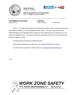


© Copyright 2026