
Ward 4 Heritage Guide - DC Preservation League
WARD 4 HERITAGE GUIDE A Discussion of Ward Four Cultural and Heritage Resources District of Columbia Office of Planning Ward 4 Heritage Guide Text by Patsy M. Fletcher, DC Historic Preservation Office Design by Kim Elliott, DC Historic Preservation Office Published 2015 Unless stated otherwise, photographs and images are from the DC Office of Planning collection. This project has been funded in part by U.S. Department of the Interior, National Park Service Historic Preservation Fund grant funds, administered by the District of Columbia’s Historic Preservation Office. The contents and opinions contained in this publication do not necessarily reflect the views or policies of the U.S. Department of the Interior, nor does the mention of trade names or commercial products constitute endorsement or recommendation by the U.S. Department of the Interior. This program has received Federal financial assistance for the identification, protection, and/or rehabilitation of historic properties and cultural resources in the District of Columbia. Under Title VI of the Civil Rights Act of 1964 and Section 504 of the Rehabilitation Act of 1973, the U.S. Department of the Interior prohibits discrimination on the basis of race, color, national origin, or disability in its Federally assisted programs. If you believe that you have been discriminated against in any program, activity, or facility as described above, or if you desire further information, please write to: Office of Equal Opportunity, U.S. Department of the Interior, 1849 C Street, N.W., Washington, D.C. 20240. Table of Contents Introduction................................................................................................. 5 Historical Perspective.............................................................................. 6 Timeline Ward 4 Development Ward 4 at a Glance ................................................................................. 30 Community Stakeholders Ward 4 Neighborhoods Attractions Preservation Framework..................................................................... 32 Lost Resources Then and Now Preservation Challenges Preservation Strategies Historic Sites.............................................................................................. 36 Historic Landmarks in Ward 4 African American Heritage Trail Cultural and Heritage Resources Bibliography.............................................................................................. 74 3 N WARD 4 District of Columbia Ward Map (2012) INTRODUCTION Ward 4 encompasses the northern point of the diamond that once was the shape of the District of Columbia. It sits east and west of Rock Creek Park from the North Boundary Stone at the juncture of Eastern and Western Avenues to Kennedy Street, Riggs Road and North Capitol Street on the east, Rock Creek Church Road, Spring Road, and Piney Branch Parkway on the south, and roughly Beach Drive, Military Road, Broad Branch and Linnean Avenue on the west. The ward is known for its park-like ambiance, open spaces, family atmosphere, and strong sense of community. Its great physical treasure, Rock Creek Park with its highlands, valleys, and numerous springs, its colorful wildflowers, and its dogwood, oak and maple trees, has conveyed beauty and healthfulness over the centuries informing the ward’s development and eventual settlement. The largely residential Ward 4 today has been influenced also by its late 19th century streetcar suburbs and its grand 20th century automobile-influenced neighborhoods. This includes its single family communities of Barnaby Woods, North Portal Estates, Colonial Village, Crestwood, Shepherd Park, Takoma, and 16th Street Heights; and the apartment, row house and semidetached enclaves such as Lamond Riggs, Brightwood, Brightwood Park, Petworth, and Manor Park. Most are located in the section of Washington with the alphabetic three-syllable and flora street names. Georgia Avenue, one of the District’s oldest roads, bisects the ward, and serves as its major commercial corridor. Within Ward 4, it extends from the Petworth neighborhood on the south to the border of Silver Spring, Maryland on the north. Smaller, local commercial areas are throughout the ward and include 4th Street NW in Takoma, Kennedy Street NW in Brightwood, and portions of 14th Street, which runs mostly parallel to Georgia Avenue. Georgia Avenue country drive, 1893-1897 The Historical Society of Washington Benefits of a Ward 4 Heritage Guide This guide is intended to identify historic or culturally important places in Ward 4 and to provide a framework for developing strategies necessary to capitalize on, and, if necessary, protect the historic resources. A cultural or heritage resource is defined as a site, building, structure, object, or ritual of importance to a community or culture. The significance, whether traditional, historic, religious, educational, or other, is one of several factors that illustrate the hallmarks of a community’s way of life or identity. For many residents in Ward 4, one such resource is the Walter Reed Army Medical Center, whose commanding presence was an instant identifier of the ward. Dating back to 1909, Walter Reed was one of the oldest operating Army general hospitals in the nation and the site of numerous medical innovations and advances. It graced the ward for over a century before its 2012 move to Maryland. Though its collection of medical archives achieved national historic landmark status, its grounds and 30 some buildings have only recently received local historic designation. There are a number of other cultural resources in Ward 4, many of which are not widely acknowledged. Left unrecognized, they become vulnerable to devaluation and even loss as the ward seeks investment and diversification. The DC Historic Preservation Office, along with community partners, hopes to promote stewardship of the ward’s heritage by assisting residents in identifying important cultural icons and places, and by facilitating initiatives to promote, preserve, and reuse the ward’s significant historic resources. This guide presents a brief history of Ward 4, providing a foundation for understanding the ward’s heritage. The historical overview is followed by some broad strategies and suggested actions for achieving shared community goals including recognizing, protecting, and promoting use of historic resources. Finally, the guide identifies some places of historical or cultural significance that might be considered when development or heritage planning is undertaken. The intent is to address the needs, desires, and challenges of the wide range of preservation interests that exist in Ward 4. 5 historical perspective Hunting, fishing and quarry campsites exist along Rock Creek 1608 1662 1664 1632 1600 1650 British explorer John Smith documents the area and people along Potomac King Charles I claims what becomes Maryland and grants it to George Calvert First land patent for future site of DC granted Maryland codifies enslavement of Africandescended people Native American Presence and Early European Settlements “[M]any sweet rivers and springs, . . . fall from the bordering hills,” so described Captain John Smith in the report of his 1608 exploration of the Potomac River and the area part of which became Ward 4. Human habitation in the Rock Creek Valley of the District of Columbia dates back some 13,000 years. From that time to 2500 BC, the area was used by nomadic groups. However, archaeological evidence shows that after that period through the early 16th century, there were semi-permanent camp sites. Along Piney Branch, a tributary of Rock Creek, large beds of major quarries dating to 2500 – 2000 BC were discovered littered with stone tools. The people were the Nacotchtanks, a branch of the Piscataway Indians also called the Conoy who gathered soapstone to use as currency. Following 17th century European exploration into the region, the land was claimed in 1632 by British king, Charles I. He granted a charter for the colony named Maryland to George Calvert, the first Lord Baltimore, and later to Cecil, the second Lord Baltimore. Slowly Europeans began to inhabit in the area or at least claim and divide it. “Rangers” were organized to protect their property from Indian hostilities. Eventually, the Native Americans were pushed out through warfare and disease, leaving the area open to the new owners, their farm homesteads and grand estates run with enslaved African labor. The Ellicott “10 Mile Square” map, 1794 6 Library of Congress 1685 1696 1712 1719 1722 1700 Earliest land grants in Ward 4- The Girles Portion, to Colonel Henry Darnall Prince George’s County created, and includes the Ward 4 area 1750 Rock Creek Church Road already operating making it Ward 4’s oldest known street Though early land grants dated to 1685, the Ward 4 area was not immediately populated by the non-Natives. The new property holders tended to live elsewhere. Col. Henry Darnall of The Girles Portion (1685) in the area of today’s Shepherd Park and Takoma was an example. Additional land grants had been dispensed by the Lord Baltimore. John Bradford, for instance, received 500 acres, 300 of which he turned around and sold to a man who named it Argyle Cowall and Lorn in 1720. This area became Crestwood almost two hundred years later. John Bradford donates acreage to establish Rock Creek Parish glebe James White earliest recorded white settler in future Brightwood/Petworth area Tayloe lived, though, in The Octagon, the home he built around 1800 (and which still stands at 17th Street and New York Avenue) in Washington City. The city, then lowland, swampy, and plagued by insect-born diseases, was laid out according to plans created in 1791 by Peter L’Enfant and later modified by Andrew Ellicott. What became the County of Washington, the location of Ward 4, remained lightly populated and agricultural. Other absentee owners installed tenants who, aided by indentured and enslaved workers, raised various crops mainly to feed the growing Washington City population. Most of Ward 4 was part of the Rock Creek Hundred, a geographic and tax subdivision created in 1722 within Prince George’s County. In 1776, Montgomery County was carved out of Prince George’s County and almost 20 years later both counties contributed land to the new diamond-shaped 100-square mile federal capital, part of which ultimately became Ward 4. James White was the earliest recorded white settler in the Ward 4 area, living on his 586-acre patent received in 1772 in the future Brightwood/Petworth community. His residence was called Pleasant Hills and was located near 13th and Longfellow Streets. In 1803, his heirs sold a southern portion of this property to Col. John Tayloe, a wealthy Virginia planter. With the assistance of some of his 225 enslaved Africans, Tayloe built stables and a race track where a number of his bondsmen served as trainers and jockeys. Tayloe named his estate Petworth. His enterprise also marked the beginning of a long history of professional horse racing in Ward 4. Petworth farmlands circa 1910 Powderly Collection, ACUA, The Catholic University of America 7 American Revolutionary War 1790 1791 1792 1750 Congress approves creation of DC as the national capital One of the earliest Colonial period roads was Rock Creek Church Road. It was named for the parish that had been established in 1712 and for the church built in 1719. A donation of 100 acres and 1,000 pounds of tobacco from Bradford’s “Generosity” land grant, made it possible to erect the church building, later called St. Paul’s, and to establish a cemetery, Washington’s first church and oldest burial ground. Initially private, in 1817, it became the District’s second public cemetery. The road originally cut through the Rock Creek Church grounds within a few feet of the church building, but was rerouted in the late 19th century. Although there were roads through the District in the early 19th century to and from Georgetown and Bladensburg, Congress determined that a throughway was needed from Washington City to Rockville, Maryland. It authorized a toll road to traverse the entire north-south length of Washington from the Potomac waterfront and the Center Market in the city through the county to Rockville. Opened in 1818, the 7th Street turnpike became “the spine” of the District of Columbia and of what is now Ward 4 as its main commercial corridor and public transportation route. The road also catalyzed 19th and early 20th century residential development of the ward. The many names of 7th Street in Ward 4 reflect the evolution of the communities along the way: 7th Street Turnpike, Plank Road, 7th Street, Brightwood Avenue, and finally Georgia Avenue. Rock Creek Cemetery “Tenant” House on Rock Creek Church Road circa 1910 8 Powderly Collection, ACUA, The Catholic University of America Maryland ceded a portion of Montgomery and Prince George’s Counties for the federal capital Stones delineating District of Columbia boundaries laid War of 1812 1803 1814 1818 1820s 1832 1835 1800 1850 Petworth Estate built by Colonel John Tayloe British march into 7th Street, later Washington and burn the Georgia Avenue, Capitol and White House authorized by Congress and constructed Mills east along Rock Creek Park in Ward 4 begin operating Emory Methodist Chapel is established in Brightwood Washington branch of B&O Railroad opens, route is through neighboring Ward 5 If Georgia Avenue is the spine of Ward 4, Rock Creek is its heart. Extending through the ward from south to north, Rock Creek proved to be a considerable asset to the early community. The longest tributary in Washington, Rock Creek was the best of the “many fast flowing streams to power griste mills,” as George Washington wrote in his justification for selecting the site for the new capital city. Most of the early farmers with small to large holdings initially raised tobacco. When that crop leached the land, they began to grow grains, natural companion crops to mill runs. Many of the local entrepreneurs then were engaged in businesses related to farming and milling. By 1810, milling was Washington’s second most important manufacturing enterprise. Several mills operated on the Ward 4 end of Rock Creek. Among these were Lyon’s Mill and Peter’s Mill. Another, near today’s Blagden Avenue was owned by Isaac Peirce who in 1794 had purchased the four acres on the east side of Rock Creek. However, Peirce’s most prosperous, and now the most wellknown of the Rock Creek mills, was the 1820s Peirce Mill physically located in Ward 3. The stone used to build both Peirce mills, however, came from the same quarries along Piney Branch and Broad Branch in Ward 4 mined by the Nacotchtank centuries earlier. Though Quakers, Peirce, later Joshua Peirce and son-in-law David Shoemaker used slave labor in the building and running of their enterprises. The Shoemaker family would become influential in the development of Ward 4. Matthew Gault Emery summer estate The Historical Society of Washington, DC 9 American Civil War 1851 1861 1862 1863 1865 1871 1850 Soldier’s Home at southeastern border of Ward 4 established Emancipation Proclamation Civil War declared and Compensated frees enslaved in the construction of fortification Emancipation Act Confederate states begins, including on several frees enslaved Ward 4 sites people of the District Brightwood Brightwood began as a few little settlements in the largely uninhabited area between Silver Spring, Maryland, Chillum, Rock Creek Church Road, and Rock Creek Park. With the opening of 7th Street, a hamlet initially called Crystal Springs for the local springs clustered around the crossroads of 7th Street, Rock Creek Ford (formerly known as Milk House Ford, Rock Creek Park’s oldest road), and Piney Branch Roads. It was at this juncture that tolls for the turnpike were collected. 7th Street became the major route for leisure patrons and agricultural commerce between Maryland and downtown Washington. Travelers by horseback, wagon, and stagecoach for a time had to ride over a plank road, an “improvement” made to 7th Street in 1852. Small businesses catering to the travelers, as well as the residences of the owners and workers, were also found here. The Brightwood Hotel and the Moreland Tavern were a few of the more prominent establishments along the turnpike before the Civil War. Emory Methodist Chapel was founded in 1832 at 7th and what is now Quackenbos Street. The post office established at this juncture was originally named “Brighton” but was later changed to Brightwood to reduce confusion as there was a Brighton in Montgomery County. One of the better documented early communities of free blacks in Ward 4 existed in the Brightwood area along Milk House Ford Road from at least the 1830s. Most residents were engaged in the dairy business; and others were laborers at nearby farms and business concerns. An early settler of the community that came to be called Vinegar Hill was Elizabeth Butler who, in 1840, purchased 11 acres with a house and outbuildings for $500 from Rev. William Ryland. From the description of the house, it may have been the early parsonage for Emory Chapel. It is said that in 1861, the day the Union Army 10 The Civil War ends; Lincoln is assassinated Washington County consolidated with Washington City took possession of her land, animals, outbuildings, and food stores to erect Fort Stevens, Butler sat down and died. Her granddaughter Elizabeth Proctor Thomas, who would gain some renown, inherited the property. African American neighbors of the Butlers and Proctors included Savoys and Diggs’s. Civil War and Forts Differing views on the institution of slavery led to war between the Northern and Southern states, with Washington in the middle. On the eve of the Civil War, most of the people of color in the District were already free. However, there were a number of enslaved people remaining in Ward 4. Among the slaveholders were Archibald White, farmer and descendant of original settler James White, Daniel Calclezar, a blacksmith, Richard Butt, the 7th Street toll taker, and Abigail Shoemaker of the large landholding Peirce-Shoemaker family. The Compensated Emancipation Act of 1862 then liberated the bondspeople of Washington City and County. Once Southern states seceded from the United States and declared war, a ring of forts was quickly erected on Washington County’s terraced plains to protect the city. The forts of Ward 4 – Slemmer, Stevens, and DeRussy and its batteries– were part of a system of 68 forts and 93 batteries built to defend the capital. Fort Stevens, the most well-known of the forts, had the distinction of being the only battle site where a United States president (Lincoln) came under enemy fire while in office. It was the site of the only D.C. battle against Confederate forces, on July 11 and 12, 1864. Erected in Brightwood on land 1873 1878 1883 1887 1888 1890 1892 1893 1897 1900 B&O Railroad builds the Metropolitan line through Ward 4 area Organic Act spurs real estate speculation and development along Ward 4 streetcar lines Takoma Park, DC, Petworth Congress authorizes the Congress 16th Street Heights Second Highway Act Baltimore and Washington 1st railroad subdivided and Brightwood Railway electric authorizes subdivided and dictates that street patterns Transit Company opens suburb subdivided development line up Georgia Avenue to Rock Creek as a development and platting in the county electric streetcar line from begins the DC border national park initiated conform to pattern in the city Maryland taken from the aforementioned Elizabeth Thomas, from Emory Chapel, and from Matthew Gault Emery, a future mayor of Washington, among others, Fort Stevens was restored in the 1930s by the Civilian Conservation Corps. The nearby Battleground National Cemetery contains 41 grave sites and a cemetery lodge, honoring the dead from the battle of Fort Stevens. Fort Slocum, considered a companion to Fort Stevens, was built partially on property owned by druggist John Callan and his family. Located on high ground near Kansas Avenue and Blair Road, the fort has been partially preserved. Fort DeRussy was built on the Rock Creek property owned by B.T. Swart, a Washington County road supervisor. A slaveholder, Swart also accumulated a few hundred acres throughout what became Ward 4. After the Civil War, several owners, including Emory Church, sued to be compensated for the destruction and loss of their property. Thomas, who had been told personally by President Lincoln that she would be paid for the taking of her 11 hilltop acres, buildings, animals, and crops, was never remunerated though her land was restored to her. Thomas lived out her years in Vinegar Hill whose population swelled after the Civil War with formerly enslaved people who had taken shelter there and perhaps worked at the fort. A school for the newly freed was established in 1864 in Fort Stevens soldiers barracks. In 1879, the school moved into the vacated 1866 schoolhouse initially built for white students. The black school took its name, Military Road, for the road on which it was located. Much of the green space that exists today in Ward 4 beyond Rock Creek is due to the attempts by the federal government to create a road connecting all of the Civil War forts as the Fort Circle Park. The National Park Service managed to purchase many acres before it became apparent that the initiative would not succeed. Most of that land is undeveloped and has returned to a more natural state. Fort Slocum Library of Congress 11 World War I 1906 1907 1909 1914 1918 World War II 1920 1924 1926 1931 1939 1945 1948 1950 1900 Capital Traction Company/ Decatur Street Car Barn built on 14th Street, NW Chevy Chase 16th Street development extended expands into into Ward 4 Ward 4 Development of Hebrew Home for Barnaby Woods the Aged moves begins from downtown into Ward 4 Part of Fenwick/Van Ward 4 Civil War fort Riswick farm purchased sites became part of the to develop Rock Creek Fort Circle Drive project Estates/Colonial Village Enforcement of racial Carter Barron covenants ruled Amphitheater at unconstitutional by Rock Creek Park Supreme Court opens Ward 4 Comes into Being as Trolley and Railroad Suburbs After the Civil War, the city of Washington slowly expanded north up 7th Street into Washington County. Serviced first by stage coaches and later horse-drawn trolleys, the area above Spring Street began evolving more into the Ward 4 as we know it today. The advent of the electric streetcar, the rapid transit of its day, spawned many of the suburbs that exist today as urban communities. By 1895, there were at least four subdivisions in Ward 4, Takoma, Petworth, Brightwood Park, and Stott’s (later Chillum Castle Manor). Present-day upper 14th Street traversed a rural landscape. The land on either side of the extended 14th Street consisted of several tracts of land ranging in size from one-acre parcels to the 80-acre “Maple Grove” owned by John Saul. A nurseryman, Saul worked with preeminent horticulturalist Andrew Downing assisting with much of the design of the Mall, White House, and Capitol using plants from his nursery. Many of these rural holdings in the vicinity of upper 14th consisted of a farmhouse and associated buildings surrounded by cultivated land. One of these early farm buildings survives – a house on Madison Street, NW. It was part of the 22-acre farm located west of 14th Street, and north of Longfellow Street, belonging to Benedict Jost, a wine merchant. 12 Jost-Kuhn House Georgia Avenue and Longfellow Street The Historical Society of Washington, DC Capital Traction Railway company, nearing completion 1954 1958 1962 1965 1968 1976 1991 2013 2014 2000 Coolidge High School integrates without incident Red Line of the Neighbors, Inc. Last streetcar Successful protests Reaction to King murder Washington Metro forms to halt operating in DC against freeway leads to rioting and block-busting runs on Georgia construction through continued flight of white system opens, servicing areas of Ward 4 Avenue Ward 4 neighborhoods residents and businesses From the 1850s and into the Gilded Age, the Brightwood and Crestwood areas served as a playground for the wealthy and as a recreational destination for the working classes of Washington. Transportation access and proximity to the rustic highlands and cooler settings of Rock Creek, Piney Branch, and other springs contributed to the attraction. Stately frame homes were built as summer country estates of persons of means. Among them were a Russian ambassador to the United States, Alexander de Bodisco, and Thomas Carbery, a mayor of Washington, whose farm would become the site of Walter Reed. In 1859, a modern track with betting opened in the lower Brightwood area. Piney Branch Race Track spurred a thriving tourist and leisure industry. Some attractions included the Crystal Springs Resort Hotel, taverns, picnic areas, a tree house, medieval tournaments, and plays. After the Civil War, the renamed Brightwood Driving Park opened offering harness racing, bicycle racing, baseball games, and later automobile racing. In 1894, the race track served as a campground for Coxey’s Army of jobless men from around the nation before their march through the ward to the Capitol to protest the country’s high unemployment. The track ultimately closed in 1909 to make way for 16th Street Extended and for construction of a reservoir. The Metropolitan Branch of the Baltimore and Ohio Railroad had opened in 1873 along the northeastern edge of the ward. Takoma DC, as it is known to distinguish it from Takoma Park, Maryland, is significant for being Washington’s first railroad suburb. Subdivided in 1883, the 93 acres owned by B.F. Gilbert straddled the District and Maryland line. It was quickly populated by civil servants and other professionals desiring country living but convenience to jobs in town. The suburb was planned with large detached houses, villas, cottages, and pattern book-designed houses with verandas, large lawns and Andromeda Transcultural Center, serving primarily Hispanics, moves to the ward Walmart opens on site Walter Reed Army of the razed Brightwood Medical Hospital campus Car Barn building placed on DC Inventory of Historic Places setbacks. The relaxed bucolic community grew to 1500 acres. 739 Rock Creek Church Road Takoma Park Post Office and Station 13 New residents set about ensuring that there were schools and churches. Takoma Elementary School opened in 1899. The first church was Trinity Episcopal, built in 1893, and replaced in 1937. The first branch of Washington’s Public Library was donated by Andrew Carnegie and built there in 1911. Takoma’s proximity to the railroad also influenced the relocation of the world headquarters of the Seventh-Day Adventist Church (1903-1989), which in turn contributed to the population and commercial growth of the District suburb. Petworth, at the southeastern area of the ward, was subdivided in 1887. The developers extended the L’Enfant plan for Washington City into this 387-acre county tract devised from the former Tayloe and Marshall Brown estates. Thus it became notable for its wide streets, avenues, and circles but also for its rich architectural variety of townhouses. One architectural oddity was an octagonal house built by Benjamin Summy, later active in Brightwood’s Stansbury Lodge. The house stood from 1856 to 1922 on a rise near Randolph Street and 7th Street/Georgia Avenue. Chevy Chase DC community and circle. Like the original Chevy Chase, these new neighborhoods eschewed commercial development while following the newly adopted street layout as finalized in the Permanent Highway Plan of 1897. These new subdivisions dictated domestic architectural design and restrictive covenants. Late 1800s maps show a small subdivision, Stott’s, between the Metropolitan Branch of the B&O Railroad (now CSX), Blair and Riggs Road. Stott’s was the name of the railroad stop, sited on land owned by Samuel Stott. The area was also the general location of Chillum Castle Manor, left over from the grand estate of William Diggs who also owned Greenvale just across the District border in Maryland and where L’Enfant was once buried. Chillum (an alleged slang word for tobacco) Castle Manor for many years was advertised as a place where the city dwellers could lodge for respite from the heat of the summer. It was later the name of the subdivision part of which spills over into what is now Ward 5 and today is known as the Lamond-Riggs neighborhood. A very active Brightwood Citizen’s Association led by civic-minded movers and shakers like Louis P. Shoemaker, William Van Zandt Cox, Blair Lee, and Charles Glover sought improved amenities and a more urbanized identity. The association had pushed for the extension of 13th, 14th and 16th Streets and of the electric streetcar into its community. Shoemaker would be responsible for the establishment of Walter Reed Army Hospital. By 1894, the former farm land, country estates, and recreational grounds of Brightwood were being subdivided and sold to new residents drawn away from the center city by the availability and convenience of street car transportation. The first development, Brightwood Park, was subdivided in 1891. By 1916 Brightwood was as fully settled as its booming neighbor to the south, Petworth. Partially located in Ward 4 since 2002, Chevy Chase whose development began in the first decade of the twentieth century, became the District’s premier streetcar suburb. Capitalizing on the success of Francis Newlands and the Chevy Chase Land Company he founded, frenzied real estate entrepreneurs began buying farms northwest of Rock Creek Park and subdividing them for residential projects. With names like Chevy Chase Grove and Chevy Chase Terrace, these subdivisions were closer to the park than the original 14 Benjamin Summy Octagon House The Historical Society of Washington, DC Establishment of Rock Creek Park “Wild Sylvan Spring that Beautifies Washington” read an 1889 Washington Post headline describing Rock Creek. Rock Creek is mostly located in Ward 4 – from Piney Branch Parkway on the south to Beach Drive, Military Road and Oregon Avenue (formerly Daniels Road) on the west to Western Avenue, and 16th Street on the east. The value and contribution of this natural wonder to the ward, the District and the region is immeasurable. To preserve this treasure and to maintain it for recreation for residents and visitors, Congress established Rock Creek Park in September 1890. This was the same year that Sequoia and Yosemite were authorized, placing Rock Creek Park among the first generations of United States national parks. By the mid-nineteenth century, American civic leaders began to consider large landscape parks to be essential components of urban design. Pursued since 1867, the successful legislation called for a tract of 2000 acres to be set aside as “a public park and pleasuring ground”. A commission was set up to acquire land in the Rock Creek Valley and to connect to the Zoological and Potomac Parks, south of Ward 4. A plan for development of the park area was prepared in 1918 by the famous landscape architects, Frederick Law Olmsted, Jr. and his brother, John C. Olmsted. From the beginning, though, the U.S. Army Corps of Engineers provided the primary technical expertise and leadership until 1933 when the National Park Service assumed management. estate house that was eventually purchased by Howard University Classics professor, George M. Lightfoot. The property was immediately adjacent to the Military Road School for black pupils and at the foot of Vinegar Hill. Rock Creek Park Powderly Collection, ACUA, The Catholic University of America The federal government eventually acquired almost 1800 acres for the park. Property was purchased from many longtime Ward 4 residents and landowners including B.T. Swart whose 117 acres of land had been used for Fort DeRussy. Among other landowners in the Rock Creek Park area were members of Ward 4 pioneer families – the Shoemakers, Fenwicks, Van Riswicks, and Blagdens, and African American families, the Dicksons and Hepburns. Another resident was Frederick Bex, a prosperous carriage maker and inventor who owned and lived on 73 acres west of Rock Creek until 1891 when his property too was appropriated. Shortly thereafter, Bex purchased the land that became known as 1321 Missouri Avenue. He built a modest country A buggy ride in Rock Creek Park in the early 1900s Powderly Collection, ACUA, The Catholic University of America 15 Over the years, Rock Creek Park posed a number of issues for the city and residents of the surrounding neighborhoods. Entrance to the park, grading roads and trails, flooding, and sewer drainage were among the many concerns and sources of work projects. Several of the improvements were pushed by the local civic organizations, particularly the Brightwood Citizens Association led by Louis Shoemaker, especially as they related to roads. Piney Branch Parkway, for example, was proposed in 1895 but the final land was not acquired until 1908. It was worked on continuously for several decades. During the Depression, black laborers of the Civil Works Administration, a short-lived New Deal agency, reworked the road to much of the look it retains today. In 1959, the Park Road Bridge over Piney Branch Parkway opened, another measure that had been urged by citizen groups. At the same time, from the first movements to make this resource a park, Rock Creek Park presented constant preservation concern. There were issues around the preservation of the natural park scenery and ambiance. An example is Beach Drive, the 6.09-mile drive named for the lead engineer of it construction, Capt. Lansing H. Beach, completed in 1900 using chain gang labor. The road was praised for its skillful layout following the meandering and sometimes plunging Rock Creek, but complaints were made that there were several places where it had “very appreciably injured the scenery.” Wealthy citizens such as Shoemaker and Charles Glover worked diligently, and with their pockets, to ensure that the area stayed out of the hands of those who saw the site as ripe for high end residential development. In fact though, the bridges over the creek helped to open the rest of the ward for settlement. Rock Creek Park, 1920 Courtesy of Chris Shaheen Rock Creek Park, a triumph of the national parks movement, is hailed as one of the most beautiful natural urban parks in the world. With a road system of 18.79 miles, the park is twice the size of New York’s Central Park. Rock Creek offered then as now many amenities such as picnic areas, golfing, tennis courts, horseback riding, hiking and bicycle trails. Unfortunately, until the 1950s, black patrons were barred from most park attractions and confined to a specific area for picnicking. 16 PWA workers building Piney Branch Parkway A Ward of Streetcar Suburbs Comes of Age Ward 4’s slow but planned development and relative homogeneity have contributed to its reputation as a stable area with highly engaged residents. Following recovery from the economic depression of 1893, Ward 4’s earliest communities were joined by new neighborhoods, each lending their own flavor. They were developed to capitalize on the improved roads and public transportation, and the District’s growth of a white-collar class. Congress had mandated a coordinated highway plan for the layout and naming of streets to extend L’Enfant’s Plan, so the circles and diagonal avenues of Petworth were absorbed into this plan. As the ward grew, new streets were laid, old roads were rerouted and renamed, and houses and buildings were moved to accommodate the changes. The most modern and among the most affluent of D.C.’s residential communities would then be platted and built over the next 60 years. Early restrictive covenants in many of these new largely white protestant communities specifically barred Jews and blacks, and sometimes persons of Mexican, American Indian, Persian, Syrian or Armenian ancestry. In the dual 1948 Supreme Court decisions in Shelley v. Kraemer and DC’s Hurd v. Dodge, enforcement of such restrictions was ruled a violation of the Constitution. Soon other racial barriers fell, with the 1954 school desegregation rulings in Brown v. Board of Education and the companion DC case, Bolling v. Sharpe. muddy in the rain or that harbored large puddles where there were dips in the paths. To respond to the safety of the growing modern community north of Florida Avenue, the first “fully equipped motor fire engine house” was located off Georgia Avenue. Among Petworth’s more notable residents was Terrence V. Powderly, prominent labor leader and US Commissioner of Immigration under President McKinley who entertained personalities such as Mother Jones. He was also prolific photographer who captured much of the early 20th century DC. Petworth developed a sizeable Jewish community, which operated many of the businesses along Georgia Avenue and lived over or near their shops. A remnant of that community is the Appleton P. Clark-designed Hebrew Home for the Aged constructed on Spring Road in 1924 and expanded in 1953. On Shepherd Street near 8th, traces of the first official synagogue of the Beth Shalom Congregation and Talmud Torah are visible on the building that now houses the 1st Seventh Day Adventist Church. Streetcar bound for Takoma Park The Historical Society of Washington, DC The District’s first transit-oriented suburb, Takoma Park, is now a designated historic district. Takoma’s reputation for fostering wholistic lifestyles and a penchant for social reforms could be traced to its healthy climate; pure water from wells, some of which were serviced by windmills; its natural “healing” springs; and to some extent, to the presence of the Seventh-Day Adventist Church and its emphasis on vegetarianism and eschewing of alcohol use. Among the most civically active in the city, Takoma’s residents guard their heritage as a historic community. Petworth was a predominantly white suburb in the first half of the 20th century. Its large Victorian-styled frame houses sheltered white civil servants who took the streetcars to work but who frequently had to cross roads made House in Brightwood, early 1900s Powderly Collection, Archives of the Catholic University of America 17 Petworth occupies a cherished place in the first post-World War II generation of African Americans in particular. It was one of the first neighborhoods that many of their parents moved to for a better life following the desegregation of housing and schools in Washington. One of Petworth’s earliest churches was Wallace Memorial United Presbyterian at New Hampshire and Randolph Street built in 1914. In 1958, however, it moved its services to Maryland and sold its building to First Baptist Church of Southwest, which became the center of the new middle class Petworth African American community. The prominent white congregation of St. Gabriel’s Catholic Church, founded by the renowned Bishop McNamara, housed in the commanding Grant Circle edifice erected in 1930, eventually became significantly black as well. A 1955 church built for African Americans by African Americans, however, was Rock Creek Baptist Church designed by Lewis Giles, Sr. 4th of July parade, Petworth, 1921 Sitting in the middle of the ward, Brightwood and Brightwood Park comprise one of the largest neighborhoods in the city in spite of reduction from its 19th century size. It is made up of a variety of townhouses, small apartment buildings, and comfortable single-family homes, some of which date to the 1890s. Three of the earliest houses of prolific D.C. developer and builder, Harry Wardman, dating from 1899, are found in the Brightwood Park neighborhood. Courtesy of Kent Boese Emory Methodist Church, now Emory Fellowship, was rebuilt in the same location as its predecessor following the end of the Civil War. The Catholic Church of the Nativity also on Georgia Avenue dates back to 1901 with the present church building being constructed in 1941. The ward’s earliest public school for white students, Brightwood Elementary, moved into a larger building completed in 1925. Military Road School also received a new building in 1912 yet was the smallest brick schoolhouse in the District. It remained the only school in the ward for African Americans for decades until Petworth Elementary was converted to “Negro use” in 1954, just months before the Brown decision. The 1909 establishment of the Walter Reed Campus, influenced by Shoemaker, contributed to the development and economic health of Brightwood and surrounding communities. A children’s birthday party with Randolph Street neighbors, Petworth, 1952 18 Courtesy of Linda Crichlow White Late Electric Streetcar and Early Automobile Suburbs “Section is Restricted” was a big selling point for the new fashionable communities established in upper Ward 4 beginning in the 1910s and 20s. The majority advertised themselves as exclusive even in the case of the large affordable Wardman development of Fort Stevens Ridge, a community of semi-detached homes constructed specifically for the moderate-income. The term was code for the prohibition of selling to “colored” or those of “Hebrew” persuasion. Neighborhoods built along 16th Street included Crestwood, 16th Street Heights, Colonial Village and Shepherd Park. The 1909 extension of 16th Street and construction of its bridge over the Piney Branch Valley provided streetcar access and the impetus for residential development. Bordering the hilly and verdant Rock Creek Park, these communities contain grand buildings including churches, schools, ambassadorial residences and private homes. Their large single-family detached homes and townhouses were sought after addresses for some of the District’s more prominent. construction of semi-detached houses and was open to Jews but not blacks. In 1943, the first Hebrew/English elementary school, the Hebrew Academy, initially founded in 1861 in downtown Washington, opened on Decatur Street at Georgia. The same community and its neighbors, however, successfully fought the placement of the municipal hospital on the 37 acres of the District Tuberculosis Hospital built in 1906 at 14th and Upshur. The limited commercial corridor that grew along 14th Street was more diverse. Many shop owners, also primarily Jewish, and their African American employees, lived nearby. Some local Jewish merchants came together to form the District Grocers Society and operate their stores under the banner, DGS. Capital Traction Company car barn and the Arthur Heaton-designed former John Dickson Home for Aged Men building are among the notable nonresidential structures along 14th Street. Many of these communities in formerly un- or underdeveloped areas illustrate cutting edge urban planning and zoning dating of the 1920s and 30s when the District became a model not just for its unifying highway plan of the 1890s, but early 20th century planning. Zoning created the ground work for stable residential neighborhoods, school and park placements, and predictable commercial areas. The subdivision of property and placing of neighborhood streets changed significantly in 1927 when the National Capital Planning Commission stopped using the grid dictated by the highway plan and began requiring streets to be platted based on topography. Additionally, a systematic approach to planning for and providing municipal facilities greatly influenced these neighborhoods. For example, the city intentionally clustered recreation facilities, libraries, and schools most notably in the 1930s. 16th Street Heights is roughly between Georgia Avenue and 16th Street, and north of Arkansas and south of Missouri. Its beginning dates to 1892 with the sale of Saul’s Maple Grove farm. While Saul’s Addition subdivision had certain design and racial restrictions, the 16th Street Heights permitted the District Grocers Society, 1935 Jewish Historical Society 19 The development of 16th Street was influenced by the doyenne of Meridian Hill, Mary Henderson. The street was envisioned as a prominent boulevard graced with churches and elegant residences to rival Massachusetts Avenue and Embassy Row. The section of 16th Street located in Ward 4 beyond Spring Street to the Maryland border touts some of the most palatial places of worship, residences, and non-profit headquarters in the city. Community buildings of many nationalities and social movements are also represented. plants. It is said that Shepherd was responsible for the floral names of Washington’s streets. Among the imposing edifices along 16th is the 1951 building constructed for the B’nai Israel Congregation and Talmud Torah, which had its beginnings in 1925 in a kosher butcher shop on Georgia Avenue and Emerson Street. Following the congregation’s flight to Montgomery County, the building was purchased in 1975 by Washington’s oldest black Baptist congregation, the 19th Street Baptist Church, who worship there today. Other sights along 16th include the Carter-Barron Amphitheater, built in 1950 in place of the race track of old. It serves as a popular arts venue of Rock Creek Park. Adjacent is the more recent Fitzgerald Tennis Center. The Crestwood neighborhood began with the subdivision of Thomas Blagden’s Argyle estate. Developments were given names such as Mount Pleasant Heights and Argyle Park. Piney Branch Parkway at the southern border of Crestwood and today’s Ward 4 opened in 1909. The earliest homes were large late Victorian houses. Blagden’ mansion at 18th and Varnum existed until 1934 when it was razed along with the small community of African Americans who lived and worked in the area. Another notable resident was Senator John D. Rockefeller IV. In 1989, he refinanced his 1920s 15.9-acre estate called the Rocks, for what was thought to be the largest sum ever paid for a residence in Washington. Shepherd Park was initially part of the estate of Montgomery Blair, Postmaster-General under President Lincoln. Alexander Robey “Boss” Shepherd, the architect for much of the infrastructure that modernized Washington, purchased the land and erected his summer home, Bleak House in 1870s. Though the house is gone, a remnant of the carriage house still exists. Like Saul, Shepherd also maintained an extensive nursery with a large variety of 20 Bleak House, southern exposure circa 1910 The Historical Society of Washington, DC Some developers of the day strove to assemble “complete” communities – residential and amenities. Henry Breuninger, the modern Shepherd Park founder, designed Northminster Presbyterian Chapel for the well-heeled and Anglo-Saxon residents he hoped to attract. The church was built in 1926 as the houses went up. A new sanctuary was erected in 1937. In spite of his earnest wishes, Jewish people who were initially barred from living in the community, began to buy inand the Agudath Achim congregation built its synagogue in 1939. By the 1950s, Shepherd Park was predominantly Jewish and dotted with their businesses and synagogues. The next wave of residents were African Americans assisted in great part by the activism of the remaining Jewish neighbors. The community of Colonial Village was similarly closed to Jews and blacks as it began development by 1931. The community boundaries today are considered 16th Street on the east, Holly Street on the south, Beach Drive on the west and the Maryland-D.C. border on the north. The suburb is located on the former 145-acre farm owned by Phillip Fenwick, a large area landowner and slaveholder. Following his death in 1863, his daughter and son-in-law Mary and John Van Riswick purchased a portion of the estate and by 1874, had built their home, Van View, which still stands today. In 1926, Edson W. Briggs bought 100 acres of the former Van Riswick estate for a new development, “Rock Creek Estates. “ By the 1930s, stately brick and stone homes, some replicas of historic colonial houses, on curving and dipping sylvan-named streets followed the natural terrain. They comprise the oldest sections of this new community of 612 homes. The 1950s saw the last decades of wholesale development—modern ranch-style homes built on the northern edge of Colonial Village. A year after Briggs began this development, he sold six acres to the Marjorie Webster School of Expression and Physical Education (later Junior College) and campus, now the home of Lowell School. In the Mediterranean villa style and perched atop a hill, the building is a stunning sight at a turn in the road from Rock Creek. The property which today holds North Portal Estates was once the estate of Ann Fenwick. Advertised as the last, and one of the finest, exclusive subdivisions in Washington, it was built by Jewish developer, Leo Bernstein. The homes were much larger than neighbors to the south and east with the definite look of an upper class residential enclave. Marketed initially to wealthy Jewish families, the somewhat insular neighborhood is located at the northern edge of District. Driveways and garages clearly mark the automobile era of their provenance. On the other hand, typical of fashionable suburban residential developments of the 1950s, there is no commercial area to speak of. In spite of an unsuccessful fight by residents a few years later to prevent the construction of a proposed HUD-subsidized apartment complex, just across the boundary in Maryland, North Portal Estates retains its forested parkside and privileged air. Manor Park, South Manor Park, and Lamond-Riggs are solid, middle-class neighborhoods of apartments, rowhouses, and single-family detached homes. The majority of the homes were designed and built in the late 1930s by prodigious DC architect and developer, George Santmyers. Kalmia Street approach to Rock Creek Park, 1917 Olmsted National Historic Site 21 Manor Park grew opposite the former Stott’s Station on the Metropolitan line. Advertised in 1905 as a mile closer to the city than Takoma Park, it is the area roughly between Aspen Street, 5th, Missouri Avenue, North Capital, Street and Blair Road. Civil War Fort Slocum was also located in the southeastern section of Manor Park and is now one of the several parks found in the community. Manor Park was not connected to its northern neighbor, Takoma, until 1926 when 4th and 5th Streets were extended. Although a few houses were built in the area prior to the 1920s, developers such as Preston Wire and J.J. James began making their mark along the new extensions. There are a few 1920s Harry Wardman-developed and built houses. Land owned by former Takoma Dairy farm owner, F.W. Heine, a Brightwood pioneer, became the site for Coolidge High School (1940) initially to be called Northern, and the Takoma Recreation Center. The Whittier Education Campus and Albright Memorial United Methodist Church (1927) are among other noteworthy sites. Lamond-Riggs, consists primarily of semi-detached brick houses and clusters of garden apartments. The community boasts that its civic association was the first in the city to integrate. Because of its proximity to the railroad, it also has the major share of the ward’s industrial resources. Located at DC’s northeastern border from about Van Buren to Kennedy to the railroad tracks, the community was really two neighborhoods. Lamond was named for Angus Lamond, owner of terra cotta works along the railroad near Van Buren Street. The Metropolitan Branch established a station in his name that serviced his manufacturing. He and his wife, Alcena, were active in the Stansbury Lodge of Brightwood, and the establishment of the Eastern Star Home built in the community in 1907. They also donated the land for the Takoma branch of the Carnegie Library. One of the star attractions of the community until the mid-1950s was Weile’s Soda Bar, famous for sculptured ice cream sundaes resembling famous buildings. The ice cream parlor’s former location on Kennedy Street is now part of the Fort Circle Park complex. 22 Albright Memorial United Methodist Church Though primarily a 1950s community built by the Pollins’ development company, Lamond-Riggs had several houses including Sears-designs dating from the 20s and 30s. At the time of the development of Riggs community, the site was the largest single remaining undeveloped subdivision in the District and was only partially located in Ward 4. A shopping center at Riggs Road and South Dakota Avenue was later added. In 1954 the Shaare Tefila Synagogue opened at Riggs and Chillum with influential members, Dan Pollin, the developer and Sam Eig, entrepreneur. “West of Rock Creek Park,” is both a geographical descriptor and a term connoting a racial and class divide. On the other hand, many sections of both sides have commonalities – mid-20th century suburban appearance, topographical platting of streets, and similarities in school buildings, for example. Ward 4 west of the park now includes three communities – Barnaby Woods and Hawthorne, relatively new neighborhoods, and Chevy Chase which began in the turn of the century. Development of the 23-acre Barnaby Woods began in the 1920s with the construction of frame houses, some of which were designed by Louis Justement, architect of the Fort Dupont Dwellings public housing, the award-winning Prettyman Federal Courthouse, and the new Sibley Memorial Hospital. Developers of the later Colonial-style homes on the site of the former Chevy Chase Sanitarium took great pride in ensuring that homes would match each other to create a harmonious ensemble. These were joined in the 1950s and 60s by split-level brick and frame homes. Substantial 1970s townhomes line Oregon Avenue on the site of the former Bonnie Brae estate. Bonnie Brae was owned by Emma T. Hahm, a restaurant owner/operator, and active club woman. Her 16-acre estate regularly hosted charitable events and tours of her resplendent gardens and “garden house” designed by landscape architect Rose Greely, DC’s first licensed female architect. Following the death of Hahm, the 16-acre site was approved by the Secretary of State to rezoned and sold to the Russian government to erect its chancery. However, the idea was abandoned following successful protests and litigation by Barnaby Woods residents. Later, Bonnie Brae was under consideration to serve as the residence of Vice-President Hubert Humphrey and his family. A fire which destroyed the house led to the site being redeveloped. In spite of these changes, the community of tree-lined streets and set back homes with driveways has retained its sense of verdant rolling hills and brooks in complete juxtaposition to the urban rowhouse density of some of its sister neighborhoods in other wards. Hilly Hawthorne is located between Rock Creek Park, Western Avenue and the Pinehurst Parkway, a popular attraction and extension of Rock Creek. The area was essentially undeveloped land held by John Marshall Brown, Inc. until the 1940s. Among the first styles were Colonial Revival, many of which were designed by Louis Moss, architect for much of Barnaby Woods and for the notable Chevy Chase Arcade. In the 1950s, the neighborhood saw the addition of ramblers and split level homes characteristic of mid-century suburbs found all over the country. Hawthorne is noted today for its racially and ethnically diverse population. Though most of the hawthorn trees for which the community was named are gone, the woodsy ambiance still exists and prompted a controversy over the installation of paved sidewalks. Some residents felt paved sidewalks would detract from the suburban feel while others felt the pavement would make for a more walkable area. Ultimately residents on each street were allowed to decide. 32nd Street and Western Avenue 23 Late 20th Century Development into the 21st As farm and estate land shifted to rows of suburban-style housing and apartments, the commercial areas also began to expand, primarily along Georgia Avenue and along 14th Street. Auto-oriented shopping centers sprouted amidst the line of small shops, owned and operated primarily by Jewish merchants. When it opened in 1937, the Classical Moderne-styled Sheridan Movie Theater and Park ‘n Shop complex on Georgia Avenue was considered state of the art neighborhood theater design. Park-n-shop complexes also indicated a degree of affluence and level of car ownership. The first drive-in Hot Shoppe opened in 1928 at Georgia and Gallatin. After the rulings striking down enforcement of racial covenants and public school segregation, the demographics of Rock Creek East shifted noticeably. Whites began to leave the area for west of the park or for Virginia or Maryland. African Americans, previously confined to certain areas of the District regardless of middle- and upper-class status, began to move into the more affluent neighborhoods for better homes, schools, and services. Predominantly white prior to 1950, by 1970 Ward 4 was mainly black. The impressive homes and subdivisions along 16th Street now inhabited by upper and middle income black professional families – doctors, judges, attorneys, educators, politicians – became known as Washington’s “Gold Coast.” Together with the “Platinum Coast”, the communities of North Portal Estates and Colonial Village, this area of the ward was characterized by some as the “bastion of black bourgeoisie.” Many of the notable African American residents were also civic leaders, active in leadership roles in the community service and non-profit world. This contributed, along with already active white residents who chose to remain, to the strong sense of community spirit characterizing Ward 4 neighborhoods. Well-organized networks of community associations, churches, and interest groups, black and white, helped to overcome or avoid some of the social upheaval that occurred in other parts of the city following school desegregation. For example, the 1955 integration of Coolidge High School with two black students allegedly took place without incident. 24 Billy and Edith Simpson in their restaurant, 1960s Courtesy of Ruth Simpson One particularly effective organization was Neighbors, Inc., a bi-racial coalition formed in 1958 by Shepherd Park residents, Marvin Caplan, a Jewish journalist with a long history of activism, and Warren Van Hook, a black pharmacist. The purpose was to stanch the block-busting measures of rapacious realtors. Along with activists from Takoma, Brightwood, and Manor Park communities, the group worked to foster stable and integrated neighborhoods. Rock Creek Baptist Church Photo by Chris Shaheen Despite efforts of groups like Neighbors, Inc. and the relatively peaceful racial coexistence established in Shepherd Park, the civil unrest of the 1960s following the assassination of Martin Luther King, Jr. hastened white flight. Though many of businesses along Georgia, 14th Street, and Kennedy Avenue such as Abraham Posin’s kosher market remained and were supported by black customers, most Jewish businesses began following their white customers to the suburbs beyond the District boundaries. Entrepreneurs of other ethnicities, including Latinos, West Indians, and Asians began operating or replaced some of these businesses. Black-owned or oriented restaurants and clubs such as Billy Simpson’s, Faces, Twins, and Eugertha’s attracted prominent professionals and politicians and continued to thrive until the late 20th century. During the 1970s and 80s, the old Colony Theater served as the DC Black Repertory Company’s Last Colony Theater and hosted notable black actors and directors. However, in time, all these closed or moved. Though the eclectic mix of commercial uses along Georgia Avenue have enjoyed a relatively stable existence, they have been affected by high vacancy rates, aesthetic issues, parking problems, and land use conflicts where commercial businesses abut low density housing. Residents have also had to fight the incursion of sex-oriented businesses and the operation of drug markets. The success of organizations from Takoma and Manor Park (and Brookland and Michigan Park in Ward 5) in derailing plans for a freeway through their communities resulted in a diversion of public funds to support WMATA and the establishment of subway stations in Petworth and Takoma. Now transitoriented development to attract new businesses and to provide needed affordable housing has become a high priority. A goal is to strengthen commercial development along Georgia Avenue and increase formerly prohibited or limited commercial areas of the ward without sacrificing the neighborhood’s historic resources and visual character. The repurposing of the historic Kennedy Theater into a senior services center is an example. The continued plans for revitalizing Kennedy Street and the Central 14th Street Plan are a few of the additional efforts to address some of these issues. Many of the assets of Ward 4 such as Rock Creek Park and its numerous amenities, the Carter-Barron Amphitheater, the parks around the Civil War-era forts, new and staffed recreation centers are among those initiatives that foster egalitarian quality-of-life measures. In fact, efforts are underway to engage the community in thoughtful planning for the future of Rock Creek Park. “Georgia Avenue Day” has always been a special event for residents and visitors alike. Farmers markets are hosted in Petworth, Takoma, and 14th Street Heights. The number of quality restaurants and clubs such as Chez Billy in historic buildings thus preserving the historic fabric of the community is increasing. The proposed broadening of Broad Branch Road to safely accommodate the growing numbers of bicyclists and walkers is another measure. Takoma is the site of DC’s first “green” and co-housing complex, while the future of Walter Reed Hospital site redevelopment with its 14 acres of open space continues to be debated. Though the racial composition remained fairly constant, there have been increasing signs of diversity. Most telling, the businesses, particularly along Georgia Avenue, show the presence of Caribbean, East Indian, Ethiopian, Vietnamese, and other ethnicities. By the 1990s, the number of Latino residents and services had increased. For example, the Colony Theater was alleged to have been one of the few venues in DC for Spanish-language films. The Andromeda Transcultural Center, founded by Dr. Ricardo Galbis in 1970, and now one of the District’s oldest Latino institutions, moved to the ward in 1991. At the same time, Ward 4 has enjoyed the largest share of long time homeowners and the lowest number of renters in the city. It also had the largest number of registered voters. The ward remains comprised of communities/ neighborhoods rich with history, whose members have long united to advocate for and defend their shared values and beliefs, among them a love for that heritage. Even as the demographics are shifting again, its activism and preservation goals foster an inclusiveness that was absent from its past. 25 Mural in Petworth neighborhood 26 1861 Ward Four Development The following maps are used to demonstrate the development of Ward 4 over time. They provide a graphic representation of the history of the area. N Boschke 1861 and Hopkins 1879 1861 A. Boschke map Roads 1 2 3 4 5 Notable Sites Piney Branch Road 6 7 8 9 Blair Road 10 Rock Creek Church Road Broad Branch Road Oregon Avenue Georgia Avenue Riggs Road 1 2 3 4 1 Rock Creek Church Rock Creek Ford Road Colorado Avenue Spring Road Baist 1915maps in this section have been adapted by Brian Kraft. All historical 27 1878 1892 NOAA 1892 NOAA 1892 Boschke 1861 andand Hopkins 1879 Boschke 1861 Hopkins 1879 1878 G.M. Hopkins map RoadsRoads 1 2 3 4 5 Subdivisions Subdivisions Notable SitesSites Notable CreekCreek Church Church 1 1RockRock Branch RoadRoad 6 6RiggsRiggs RoadRoad Branch 1BroadBroad Avenue CreekCreek FordFord RoadRoad 7 7RockRock Oregon Avenue 2Oregon Avenue Avenue 8 8Colorado Georgia Avenue Colorado Avenue 3Georgia Branch RoadRoad 9 9Spring RoadRoad Branch Spring 4PineyPiney RoadRoad CreekCreek Church RoadRoad Church 10 10RockRock 5BlairBlair Baist 1915 Baist 1915 28 1892 NOAA Map of Suburban Subdivisions 1 2 3 4 Park,Park, 18831883 1Takoma Takoma 18891889 2Petworth, Petworth, Park,Park, 18901890 3Brightwood Brightwood Addition to Takoma Park,Park, 18901890 Grammer’s Addition to Takoma 4Grammer’s Roads 1 Broad Branch Road 2 Oregon Avenue 3 Georgia Avenue 1929 4 Piney Branch Road 5 Blair Road 1921 Notable Sites 6 7 8 9 1 Rock Creek Church Riggs Road Rock Creek Ford Road Colorado Avenue Spring Road 10 Rock Creek Church Road Baist 1915 NOAA 1892 Boschke 1861 and Hopkins 1879 Roads 1 2 3 4 5 Notable Sites 1 Rock Creek Church Piney Branch Road 6 7 8 9 Blair Road 10 Rock Creek Church Road Broad Branch Road Oregon Avenue Georgia Avenue Riggs Road Rock Creek Ford Road Colorado Avenue Spring Road 1 2 3 4 Church Road 1 2 3 4 5 6 7 8 9 10 North Brightwood, 1901 North Columbia Heights, 1901 11 Peter’s Mill Seat, 1901 12 White Croft, 1901 13 Manor Park, 1905 14 Mount Pleasant Heights, 1905 15 Argyle Park, 1906 16 17 Girls Portion, 1895 Saul’s Addition, 1906 Pinehurst, 1907 South Pinehurst, 1907 Fourteenth Street Terrace, 19 Sixteenth Street Highlands, 1 Blue Ridge Heights, 1911 Chevy Chase Grove, 1911 Chillum Castle Heights, 1911 Sixteenth Street Heights, 191 USGS 1929 1921 Baist Map 1929 USGS Map Roads Subdivisions 1 2 Oregon Avenue 7 Riggs Road 3 Kalmia Road 8 Rock Creek Ford Road 4 Georgia Avenue 9 Colorado Avenue Piney Branch Road 5 10 Spring Road 6 11 Rock Creek 7 Church Road 8 Girls Portion, 1895 Broad Branch Road 6 Blair Road 1 Broad Branch Road 6 Blair Road Subdivisions 7 Riggs Road 2 Oregon Avenue Takoma Park, 1883 8 Rock Creek 3 Kalmia Road Ford Road Petworth, 1889 4 Georgia Avenue Brightwood Park, 1890 9 Colorado Avenue 5 Piney Branch Road Spring1890 Road Grammer’s Addition to Takoma 10 Park, 11 Rock Creek Baist 1915 1 2 3 4 5 Subdivisions Roads 9 10 North Brightwood, 1901 North Columbia Heights, 1901 11 Peter’s Mill Seat, 1901 12 White Croft, 1901 13 Manor Park, 1905 14 Mount Pleasant Heights, 1905 15 Argyle Park, 1906 16 17 Roads Saul’s Addition, 1906 Pinehurst, 1907 South Pinehurst, 1907 Fourteenth Street Terrace, 1909 Sixteenth Street Highlands, 1910 Blue Ridge Heights, 1911 1 2 3 4 5 Broad Branch Road Oregon Avenue Kalmia Road Georgia Avenue Piney Branch Road Notable Sites 6 7 8 9 Blair Road Riggs Road Rock Creek Ford Road Colorado Avenue 10 Spring Road 11 Rock Creek Church Road 1 2 3 4 5 Walter Reed Army Medical Center Brightwood Car Barn Streetcar/Bus Barn MacFarland Middle School Rock Creek Church Chevy Chase Grove, 1911 Chillum Castle Heights, 1911 Sixteenth Street Heights, 1911 29 ward four at a glance Community Stakeholders Ward Four Neighborhoods N Advisory Neighborhood Commissions Civic Associations DC Preservation League Neighborhood Blogs Local BIDs North Portal Estates Colonial Village Maryland Hawthorne Barnaby Woods Shepherd Park Takoma Park Rock Creek Chevy Chase Brightwood Manor Park Ward 4 Neighborhoods Brightwood South Park Manor Park Chillum Lamond Riggs 16th Street Heights Ward 3 Crestwood Petworth Ward 5 Ward 1 Old Soldier’s Retirement Home Site Key Present for the May 1970 dedication of a new greenhouse at Twin Oaks Community Garden (14th and Taylor Streets): (l. to r.) junior leader Roger Walker; Mrs. Bennetta Bullock Washington (wife of Mayor Walter Washington); youth gardener Kenneth Flemming; Bill Hash, DPR Youth Gardens horticulturalist; youth gardener Renard Huckaby; and Mrs. Martha Hardin (wife of Secretary of Agriculture Clifford Hardin). Courtesy of Kent Boese 30 Historic District Ward 4 Boundary Attractions William H. Fitzgerald Tennis Center Carter-Barron Amphitheatre Emery Park Rock Creek Park Pinehurst Parkway Park Civil War Fort Sites & Parks Walter Reed Center City Parks and Recreation Centers 16th Street Corridor Rock Creek Park Fitzgerald Tennis Center, Rock Creek Park Proposed Walter Reed Redevelopment Carter-Barron Amphitheatre 31 preservation framework Lost Resources A Sample of Demolished Buildings Places and structures that have survived over time help tell the story of a community. They provide a setting and context for events, patterns, and mark the degree of change that has taken place. When they remain, they provide a tangible connection to the history of a neighborhood. When they are gone, a beat in the rhythm of a neighborhood is missed and a sense of what was is forever lost to new generations. Streetcar, 14th and Hamilton Streets Chevy Chase Sanitarium, 32nd and Tennyson Streets, circa 1917 Hot Shoppe at Georgia Avenue and Gallatin Street The Historical Society of Washington, DC 32 Streetcar Barn, Georgia Avenue near Missouri Avenue, 1947 Then and Now Places of cultural and heritage significance often remind us of where we once were and what our communities once looked like. These are just a few examples of what once was and what is today. Sometimes, things stay the same, sort of and, other times, well…. 5th Street and Rock Creek Church Road Powderly Collection, ACUA, The Catholic University of America Brightwood neighborhood - building construction 557 Randolph Street 5409 14th Street Wymer Collection, The Historical Society of Washington, DC 8th and Crittenden Streets Courtesy of Chris Shaheen 33 Preservation Challenges Ward 4 is challenging for its relative newness. Many people view 18th and 19th century resources as the rightful subjects for historic preservation. Yet many of Ward 4’s neighborhood resources are early to mid-20th century and have just come of age to be evaluated under the accepted guidelines of historic designation. All of what today is Ward 4 historically lay in the County of Washington, outside of the urban core of Washington, DC. Thus, while there were one or two railroad (1890s) and streetcar (1910s) suburbs in the ward, the vast majority of neighborhoods are early automobile suburbs. They exist in park-like settings with setbacks, driveways and limited commercial and institutional resources. In general such communities were not considered “historic” and may have been subject to modifications affecting their integrity. Subdivided lots, razes to build larger houses or apartment building, relaxation of original design covenants are just a few issues that may have arisen because of the perceived lack of historicity. Many residents may have elected to live in these suburbs because they were modern, not “old” and therefore available for change. At the same time, the conversion of large homes, especially along 16th Street corridor, into non-residential uses, or the expansion of existing institutions into residential communities has been of concern as has the “pop-up” phenomena in the rowhouse suburbs for expanded living space or condominium conversion. 34 Designation of individual standout places in these often cookie-cutter communities, such as the Marjorie Webster School in Colonial Village or the Hampshire Apartments in the Fort Totten community, is a strategy to bring attention to the historical or architectural importance of these modern neighborhoods. There are other sites or collections of sites in the ward that also deserve the protection historic designation can bring. However, surveys of the resources are needed to identify them and determine their significance. An alternative tool for neighborhood preservation could also be the establishment of conservation districts. Residents have also become engaged in the DC Community Heritage Project, an initiative of DCHPO and the Humanities Council of Washington, DC, to explore and document the history of their neighborhoods. Crestwood, Takoma, Brightwood, the Gold Coast and Upper 16th Street are among neighbors who have produced books, documentaries, websites, and preservation plans regarding their communities. There are more stories to tell that may perhaps be revealed through an additional funding source, the DC Preservation League’s Brightwood Car Barn Fund. In any event, the outcome of the preservation work in these neighborhoods has been increased awareness of the importance of local cultural resources and a heightened desire for their protection. Preservation Strategies In consideration of the many challenges, the following strategies are offered to further preservation education and advocacy: • Continue research to accurately document significant historic sites. THE PRIDE PROMISE AND OF PETWORTH A DC COMMUNITY HERITAGE PROJECT * PREMIERE THE VIDEO OCTOBER 4, 2014 • 3PM PETWORTH LIBRARY • Support preservation efforts such as the development of Cultural Tourism’s neighborhood heritage trail and Walking Town DC programs and other cultural initiatives. 4200 KANSAS AVE NW, WASHINGTON, DC 20011 LIVE FACEBOOK, TWITTER AND INSTAGRAM ENCOURAGED #pride&promise LIGHT REFRESHMENTS • FAMILY FRIENDLY • Ensure that preservation and community conservation are fully considered and integrated into neighborhood planning efforts. • Recruit community groups to participate in the DC Community Heritage Project as a way to engage residents in an inquiry of neighborhood cultural resources. ROOSEVELT SCHOOL MURAL MCFARLAND HIGH SCHOOL PETWORTH LIBRARY MAP OF PETWORTH CIRCA 1892 LINCOLN STATUE MAP OF PETWORTH CIRCA 1900 *This DC Community Heritage Project was funded by Humanities Council of Washington, DC and the DC Historic Preservation Office. This DC Community Heritage Project has been also funded in part by the US Department of the Interior, the National Park Service Historic Preservation Fund grant funds, administered by the DC Historic Preservation Office and by the DC Commission on the Arts and Humanities. • Engage and assist community-based explorations of heritage preservation and goals. • Conduct informal inquiries into preservation goals/issues of stakeholders. • Fund cultural resource surveys of discrete areas and themes of the ward, such as Brightwood, Petworth, and mid-century Modern resources along 16th Street. • Support the growing public arts program as a tool for heritage preservation. • Nominate eligible sites for historic designation in consultation with affected owners and residents. Community history projects through the DC Community Heritage Project 35 historic sites Historic Landmarks in Ward Four Ward 4 has several designated historic landmarks and sites. A designated landmark means the property is listed on the DC Inventory of Historic Sites and mandates a review to ensure that physical changes to designated properties are compatible with their historic and architectural character. Landmarks are designated by the Historic Preservation Review Board, a mayoral-appointed commission. Landmarks may also be forwarded to the National Register of Historic Places, administered by the National Park Service. Landmarks are listed by date of construction of the historic resource. Boundary Stones: NE 3, NE 2, NE 1, North, NW 9, NW8 Civil War Fort Sites DeRussy, Slocum, Stevens Significance: Significance: Significance: Renamed St. Paul’s Episcopal Church in 1871, Rock Creek Church was established in 1719, constructed in the 1770s, remodeled in 1864, the steeple added in 1909, and restored after burning in 1921; the glebe or church estate also holds the oldest active cemetery in the District, the burial place of some of the nation’s most notable people. This is one of the nation’s few intact colonial-era glebes and the only one in Washington D.C. Though some now sited on the Maryland side of today’s boundary, these are 6 of 40 stones that marked the original boundary of the District of Columbia laid by Col. A. Ellicott as plotted by B. Banneker; pictured is NE 2, at Maple and Carroll Avenues. Located at high points in the ward, the forts were erected to form a protective ring around Washington. Pictured is a section of Fort Stevens. Rock Creek Parish Glebe Webster Street and Rock Creek Church Road, NW; 201 Allison Street, NW 36 Along Eastern and Western Avenues, from Chillum to Utah Battleground National Cemetery Joaquin Miller Cabin Takoma Park Historic District Significance: Significance: Significance: Established in 1864 to commemorate Union casualties of the Battle of Fort Stevens. Built in 1883 by “Poet of the Sierras” as his residence on 16th and Crescent Place from 1883-86; moved to Rock Creek Park in 1912. Designated primarily for its architecture that includes Stick and Shingle along with Queen Anne and Bungalow styles, it was DC’s first railroad suburb, established in 1883, and site of DC’s first branch library. 6625 Georgia Avenue NW Beach Drive north of Military Road, NW Roughly bounded by Aspen Street, Piney Branch Road and 7th Street and Eastern Avenue 37 Cady-Lee House 7064 Eastern Avenue, NW Rock Creek Park Historic District The Ward 4 section is roughly 16th Street, NW to Piney Branch Parkway to Beach Drive, and from 27th Street to Oregon Avenue to Western Avenue Adams Memorial 201 Allison Street, NW (Rock Creek Cemetery) Significance: Significance: Significance: One of the largest and most elaborate Victorian houses, built in 1887, in the new commuter suburb of Takoma Park; designed by Leo Dessez. The recreational area is a picturesque forested gorge and stream valley with sloping hills and meadows; in use since prehistoric times, the 1740-acres is one of the oldest national parks in the U.S., established in 1909; the original landscaping plan was completed in 1918 by the noted Olmsted brothers. Sculptural memorial to Clover Adams also known as “Grief”, by Augustus Saint-Gaudens; Stanford White, architect of the site completed 1891. 38 Engine Company No. 22 Chemical Company No. 2 (Brightwood Firehouse) Boulder Bridge Significance: Significance: Significance: This eclectic country mansion commissioned in 1892 by Frederick Bex, carriage maker, was sold to Howard University Classics educator and became the site of salons for African American intelligentsia in the 1930s and 40s. The oldest firehouse in the District still in use as a firehouse and at its original location, the Italian Renaissance building was built in 1897 as a result of a petition by Brightwood residents; designed by Leon Dessez. One of several bridges in the Rock Creek Historic District; constructed 1901-03, W.J. Douglas, architect. George M. Lightfoot House 1329 Missouri Ave NW Beach Drive, Rock Creek Park 5760 Georgia Avenue, NW 39 Capitol Traction Company Car Barn 4615 14th Street, NW Walter Reed Army Medical Center Historic District 6900 Georgia Avenue, NW Pictured is the Army Nurse Corps Home. Engine Company No. 24 (Petworth Firehouse) 3670 New Hampshire Avenue, NW Significance: Significance: Significance: The high style 1906 Italian Renaissance building was designed by the firm of Wood, Donn and Deming as part of company’s efforts to improve streetcar service and promote new settlement of the northwest quadrant of the District. In 1959, it was converted to bus garage after the ending of the streetcar era. A diversified campus complex begun in 1909, incorporating major and minor buildings and connecting landscapes, it played major role in treating sick, injured and wounded members of the armed forces and U.S. presidents and fostered advances in medical training and in the study, treatment and prevention of disease. It was also the site of the Civil War battle of Fort Stevens. From the early-20th century period of eclectic revivalism in municipal buildings; represents development of the firehouse as a neighborhood institution; housed city’s first motorized firefighting unit; built 1911, designed by architectural firm, Gregg and Leisenring. 40 Military Road School Petworth Gardens Apartments/ Webster Gardens Apartments Billy Simpson’s Steak and Seafood Restaurant Significance: Significance: Significance: Built in 1911 on the site one of the city’s first public schools for freedmen, symbolizes the presence of Washington’s vanished refugee settlements and their dependence on military encampments; Office of Municipal Architect, designer. Inspired by “Londonese” style apartments, first example of garden apartments constructed in the District and one of the first nationally; developed 1929 by Allan E. Walker from designs of Robert F. Beresford. During the period of segregation, an “upscale” venue where African American “luminaries” of politics, government, civil rights, and entertainment could meet, socialize, and strategize; operated from 1956-1975. 1375 Missouri Avenue, NW 3815 Georgia Avenue, NW 124, 126, 128, 130 Webster Street, NW 41 Marjorie Webster School and Junior College Campus Hebrew Home for the Aged and Jewish Social Service Agency Grace Evangelical Lutheran Church Significance: Significance: Significance: Built to house the growing Jewish population, operated here from 1925-1969; supported by some of Washington’s most prominent Jewish residents; additions in 1951 and 1955; Appleton P. Clark, original architect. Erected 1926-18 following the design of noted ecclesiastical architect, John William Cresswell Corbusier (1877-1928) of Corbusier & Lenski; built as a “national church”, and is a superb example of the neo-Gothic style with a high degree of quality of craftsmanship, materials and details. Set on 8 acres and built in the Mediterranean Revival-style beginning in 1928 for the education of young working women; campus designed by Col. P.M. Anderson, 1943 addition by R.C. Archer, and 1949 dormitory by Corning and Moore. 4300 Sixteenth Street, NW 1638, 1640 Kalmia Road, NW and 7775 17th Street, NW 1125-31 Spring Road, NW 42 Hampshire Gardens Apartments Garden Club of America Entrance Marker Fort View Apartments Significance: Significance: Significance: Built in 1929 in Tudor-Revival style, as first fully-developed garden apartment complex in District, consisting of buildings, grounds and occupying an entire city block; George T. Santmyers, architect. One of four markers erected in 193233 a part of the George Washington Bicentennial celebration, marking the entrance to the city from Maryland; of Aquia Creek sandstone, designed by Edward Donn. Designed by master architect George T. Santmyers, this 1939 apartment building exemplifies the multi-family residential development of the 14th Street and Georgia Avenue corridors that took place in response to the population boom in the city and the resulting extensions of the streetcar lines. 215, 225, 235 Emerson Street, NW; 4915 3rd Street, NW; 222, 236, and 250 Farragut Street, NW; 4912 New Hampshire Avenue, NW 6040 13th Place, NW Georgia Avenue (on traffic island of Georgia Ave. and Kalmia Rd, NW) 43 N 5 Landmark Sites Map Key 5 16 5 12 6 5 21 22 5 2 1 Adams Memorial (Rock Creek Cemetery) 2 Battleground National Cemetery 3 Billy Simpson’s Steak and Seafood Restaurant 4 Boulder Bridge, Beach Drive, Rock Creek Park 5 Boundary Stones: NE 3, NE 2, NE 1, North, NW 9, NW8 6 Cady-Lee House 7 Capitol Traction Company Car Barn 8 Civil War Fort Sites – DeRussy, Slocum, Stevens 9 Engine Company No. 22/Chemical Company No. 2 (Brightwood Firehouse) 10 Engine Company No. 24 (Petworth Firehouse) 8 17 18 13 5 11 8 11 Fort View Apartments 12 Garden Club of America Entrance Marker 13 George M. Lightfoot House 8 9 14 Grace Evangelical Lutheran Church 15 Hampshire Gardens Apartments 16 Marjorie Webster School and Junior College Campus 17 Military Road School 15 4 18 Joaquin Miller Cabin 1 7 19 14 20 19 Petworth Gardens Apartments/ Webster Gardens Apartments 20 Rock Creek Church Yard and Cemetery; Saint Paul’s Episcopal Church 3 10 44 21 Rock Creek Park Historic District 22 Takoma Park Historic District Looking towards the Fenwick barn from Rock Creek Park, 1917 Frederick Law Olmsted National Historic Site 45 African American Heritage Trail Sites in Ward Four An initiative funded by the DC Historic Preservation Office and developed and designed by Cultural Tourism DC, this heritage trail project introduces over two hundred African American historic and cultural sites in Washington. Several sites in Ward Four are marked with signs. former site of Neighbors, Incorporated Site 46 Billy Simpson’s House of Seafood and Steaks, now Chez Billy restaurant Frank D. Reeves Residence African American Heritage Trail N Map Key A B C E D E F G H B D H F I J I K Billy Simpson’s House of Seafood and Steaks 3815 Georgia Ave. NW Emory United Methodist Church 6100 Georgia, Ave. NW First Church of Seventh-day Adventists 810 Shepherd Street, NW Fort Stevens 13th & Quackenbos Street, NW Frank D. Reeves Residence 7760 16th Street, NW George M. Lightfoot Family Residence 1329 Missouri Ave., NW Jones-Haywood School of Ballet 1200 Delafield Place, NW Military Road School 1375 Missouri Ave., NW Neighbors, Incorporated Site 5508 Illinois Ave., NW Lemuel A. Penn Residence 1622 Upshur Street, NW The ClubHouse Site 1294-1296 Upshur Street, NW G J K C A 47 Cultural and Heritage Resources What follows is a listing of a few of the places that maybe important to the heritage of the ward or represent important points of history. These sites have been identified from many sources, including historic resource surveys, publications, historic archives, planning documents, and community residents. Some have been identified as important places on the African American Heritage Trail (AAHT). These are marked with . * Apartment Buildings A Concord Apartments 5807-25 14th Street, NW Importance: Architecture, Community Planning/Development A 1937 George T. Santmyers design, built during the Depression when the District sought to address the housing shortage. B Crestwood Apartments 3900 16th Street A Importance: Architecture, Community Planning/Development In spite of several years of active opposition from residents of the then community of single family homes, the apartment developed by Harry Poretsky was built and opened in 1951. C The Cromwell, Aberdeen, Fernbrook, Rosedale, Iselworth, Traymore, and Zellwood 1433 – 1445 Spring Road, NW Importance: Architecture, Community Planning/Development Seven apartment houses in a row designed by Harvey H. Warwick for developer Morris Cafritz in 1922 at the boom in apartment construction. B D Garden Manor/Ft. Stevens Apartments 1329-37 Ft. Stevens Drive, NW Importance: Architecture, Community Planning/Development The 1941 building designed by George T. Santmyers and built in response to the expansion of the federal government and the effects of the measures instituted to combat the Depression. 48 D E Ivanhoe Apartments 6401 14th Street, NW Importance: Architecture, Community Planning/Development Designed in 1936 by Phillip Julien, the landscape style apartments were constructed during the expansion of the federal government and attendant office and housing needs. F The Longfellow 5521 Colorado Avenue, NW Importance: Architecture, Community Planning/Development End of the era, this attractive landscape style building was designed by George T. Santmyers in 1932. E G New Hampshire Apartments 3800 New Hampshire Avenue, NW Importance: Architecture, Community Planning/Development Designed in 1929 by George T. Santmyers during the boom period in apartment construction. H The Rittenhouse 6101 16th Street, NW G F Importance: Architecture, Community Planning/Development Luxury building developed in 1956 by Pollin and Sons; its Berla and Abel design touted as preserving the character of the neighborhood; home to many notables and the location of Abe Pollin’s headquarters for many years. H 49 I The Selma/Chillum Heights 21-25 Kennedy Street, NW Importance: Architecture, Community Planning/Development The 1940-41 building was designed by J.P. Fitzsimmons along the busy transportation corridor of Missouri Avenue. J The Taylor 4027 13th Street Importance: Architecture, Community Planning/Development Designed in 1931 by prolific George T. Santmyers, reflects the attempts to address housing needs in the District at the beginning of the Depression. I K Twin Oaks Apartments 3802 14th Street, NW Importance: Architecture, Community Planning/Development Early apartment building in new apartment corridor built along streetcar lines; designed in 1919 by architectural firm Rich and Bell. L Whittier Gardens 301-5 Whittier, and Aspen Streets, NW, 6700 block of 3rd, and Blair Streets, NW Importance: Architecture, Community Planning/Development Part of the Takoma Park Historic District, built in 1939-40; designed by George T. Santmyers J 50 L K M The Winchester Apartments / 6600 Luzon Apartments 6600 Luzon Avenue, NW Importance: Architecture, Community Planning/ Development Designed and developed by the Shapiro, Inc. in 1940, the building was popular with civil servants. N M 912-1/2 Shepherd Street, NW Importance: Architecture, Community Planning/Development One of the few remaining apartments buildings developed in the streetcar corridors of the ward designed by an African American, 1948, architect, R.C. Archer, Jr. N 51 Commercial A Bank of Brightwood Building 5913 Georgia Avenue, NW Importance: Architecture, Commerce/Business Designed and built in 1923 by architects Arthur Blakeslee and John D. Wischousen, in an asymmetrical neoclassical revival style, served as a centerpieces of commercial Brightwood of the 1920s and 30s, though one of four Washington banks closed during the Depression. A B B Colony Theater/DC Black Repertory Theater/Colony House 4921 Georgia Avenue, NW Importance: Architecture, Commerce/Business, Social Movements Built in 1925, movie theater mogul Harry M. Crandall’s building by architect John Zink was an early example of modern mixed use site: a theater, shops, and apartments; later home of signature African American playhouse; first theater to regularly feature Spanish-language movies. C Osborn Feed Store 5910 Georgia Avenue, NW or 1201 Rock Creek Ford Road, NW Importance: Architecture, Commerce/Business Possibly one of the oldest commercial buildings in Brightwood; built prior to 1881 and owned by A.G. Osborn, grocer, feed dealer, justice of the peace, and civic activist. C D Park Theater and Shops 4618 and 4608-32 14th Street, NW Importance: Architecture, Commerce/Business, Community Planning/ Development Designed and developed by Charles E. Wire in 1923; theater opened in 1924 but operated only a few years. 52 D E Penn Recreation Bowling Center/DC Department of Human Services 1207 Taylor Street, NW Importance: Architecture, Commerce/Business Developed in 1939 by Himmelfarb Properties and Julius Wenig, architect; advertised in 1940 as having maple lanes and air conditioning; operated until 1965; late 1960s became a public assistance office. F Seven Seas Restaurant Building/Iglesia Evangelica Fuente de Vida 5915 Georgia Avenue, NW Importance: Architecture, Community Planning/Development Art deco-style embellished with vitrolite, was designed and built by Jesse G. Berrich in 1923; the Chinese food establishment was a mainstay in downtown Brightwood until moving to Maryland in the 1980s. E G Sheridan Theater & Park ‘n Shop 6201-6219 Georgia Avenue, NW Importance: Architecture, Community Planning/Development Built in 1936, following the design by preeminent movie theater architect, John Eberson, and Morton Levy for the shops, the moderne-style theater and retail complex marked the development of the automobile culture along Georgia Avenue; later the home of Theater West, an African American production company. G H Upshur Street between 8th and 9th, NW Importance: Architecture, Community Planning/Development Part of retail strip developed in 1922 by Morris Cafritz, architect, George T. Santmyers; opposite side also had Santmyers-designed stores including a Sanitary Grocery. I 3700-3720 14th Street, NW Importance: Architecture, Commerce/Business Exemplifies early urbanization of upper 14th Street; one of the earliest designs, 1922, of prominent apartment architect, Robert O. Scholz, who designed Washington’s largest apartment hotels, the distinctive Albans Towers. H 53 Educational/Institutional A Blythe Knoll/ Knoll House/Knollwood/Army Distaff Hall 6200 Oregon Avenue, NW Importance: Architecture, Military/Maritime Built as a private residence in 1930 for insurance company founder, William Montgomery; architect, Porter and Lockie; landscape designed 1936 to 1950 by landscape architect Rose Greely; the Hall, built on the estate in 1962, is one of the earliest and best examples of a retirement residence for female Army officers and Army widows. B Carnegie Institution for Science, Department of Terrestrial Magnetism and Geophysical Laboratory 5251 Broad Branch Road, NW B Importance: Education, Science/Technology Established in 1904, the Department of Terrestrial Magnetism built its laboratory at this site beginning in 1913. One of the notable buildings on the site is the Art Deco style Van de Graaff accelerator, built in 1933. In 1990, the Carnegie Institution’s Geophysical Laboratory, established in 1905 and first located in a landmark building on Upton Street, joined the DTM at this location. C John Dickson Home for Aged Men/The Kingsbury Center 5000 14th Street, NW Importance: Architecture, Community Planning/Development Opened in 1913; a bequest of Henry Dickson in memory of his father, “a free home to indigent men who had been bona fide residents of the District of Columbia for five years”; Arthur Heaton, designer; in 1980 became part of the Maharishi International University campus. C D Episcopal Center for Children 5901 Utah Avenue, NW Importance: Architecture, Social Movements Established in 1896 in Anacostia as the Bell Home for Poor Children, the institution was able to double its capacity through relocation to this nineacre site purchased in 1926 with an anonymous donation; the 1929 design of the administration building by prominent architect Appleton P. Clark. 54 D E Paul Junior High School/Paul Public Charter School 5800 8th Street, NW Importance: Architecture, Community Planning/ Development Constructed 1929-30, designed by Municipal Architect, A.L. Harris. F Petworth Elementary School/Metropolitan Police Department 6th District, & George M. Ferris, Jr. Boys and Girls Clubhouse #6 801 Shepherd Street, NW Importance: Education, Architecture, Community Planning/ Development Designed in 1901 by Appleton P. Clark, Jr. with 1920 additions by Municipal Architect, Snowden Ashford; one of the few DC schools named for its neighborhood though constructed for white students, it was turned over to “Negro” division to relieve overcrowding in black schools in 1954. E F 55 Fraternal/Recreational A Eastern Star-Masonic Home 6000 New Hampshire Avenue, NE Importance: Architecture, Community Planning/Development Opened in 1907 as a retirement home for the women of the Masonic Eastern Star; Edward A. Poynton, architect, and Poynton Company, builders; grounds being developed for single family homes and townhouses. A B Emery Place site/Emery Park 5701 Georgia Avenue, NW B Importance: Recreation/Sports, Military/Maritime, Archaeology Before and after the Civil War, the 12-acre site was summer home of Matthew Gault Emery, a stonecutter, mayor of the District (1870-1), and designer of the mansion; razed in 1948; during the Civil War house used as a Fort Stevens headquarters and signal station; Emery’s will stipulated that his property be used for educational and recreational purposes. C Stansbury Masonic Lodge No. 24/Ibex Club/Lofts at Brightwood 5832 Georgia Avenue, NW Importance: Architecture, Community Planning/Development Second building for lodge formed in 1870; on site of the former Brightwood Hotel; irregular shape designed by Frank Russell White, 1919, to align with new street pattern; outstanding example of grand masonic architecture. C D D D 56 4402 Georgia Avenue, NW Importance: Social Movements Built in 1915, this building housed many different Jewish, Labor, and Communist organizations including the Jewish Cultural Center (1940s), the Jewish Peoples Fraternal Order (1930s-40s), advocates for opening Palestine for Jewish resettlement, International Workers Orders (1940s), Progressive Party of DC (1950s), and Cooperative Jewish School of Greater Washington (1960s); implicated in 1952 trial of the alleged first person, and African American woman, indicted under the post-WWII “loyalty oath” campaign. Houses of Worship A Agudath Achim Synagogue/St. John’s United Baptist Church 6343 13th Street, NW Importance: Religion/Spirituality, Architecture, Community Planning/ Development Designed in 1939 for a growing Jewish population in the ward; sold to St. John’s in 2002. B A Albright Memorial Evangelical Church/ Albright Memorial United Methodist Church 409 Rittenhouse Street, NW Importance: Religion/Spirituality, Architecture, Community Planning/ Development Manor Park church designed in 1927 by C.J. Sappley; later additions from 1946-1954 by A.B. Lowstuter C Chinese Mandarin Church site 5709 16th Street, NW Importance: Religion/Spirituality, Social Movements Founded in 1958 as a Bible study group, the congregation incorporated with Rev. Moses Chow as first pastor and occupied this building from the 1960s until 1971 when its growth led to a move to Maryland and a name change to Chinese Christian Church of Greater Washington. C D Chùa Giác Hoàng Buddhist Temple, Buddhist Congregational Church 5401 16th Street, NW Importance: Religion/Spirituality, Architecture, Social Movements Under the guidance of Dr. Tich Giat Duc, congregation moved to 16th Street in 1978 first into a building later occupied by one of the “Real Housewives of DC”; in both locations, served as the center of the area’s Vietnamese culture and heritage; once the only Vietnamese Buddhist temple, as distinguished from chapel, on the East Coast. D 57 Houses of Worship E Church of the Nativity 6000 Georgia Avenue, NW Importance: Religion/Spirituality, Architecture, Community Planning/ Development Original home of Brightwood’s earliest Catholic Church; establishment spearheaded by Brightwood civic leaders Harry Daly and Louis Shoemaker; constructed 1900-1 though significant alterations since; once the site of the first Emory Church building on land donated by Abner C. Pierce. F Emory United Methodist Church/Emory Fellowship 6100 Georgia Avenue, NW Importance: Religion/Spirituality, Architecture, Military/Maritime Third home of Brightwood’s earliest church (1832), built in 1922 to replace the 1856 structure razed in 1863 to build Fort Stevens; though the majority of parishioners supported the institution of slavery prior to the Civil War, of its 72 members in 1856, 13 were black; initial design by Milburn, Heister & Company with subsequent alterations by builder Frank Genechesi. E G G Evangelical Lutheran Church of the Incarnation/Mt. Zion Baptist Church 5101 14th Street, NW F 58 G Importance: Religion/Spirituality, Architecture Designed by architects Gregg & Leisenring and built in 1919; enlarged with an addition in 1928; example of a neighborhood church in a new 16th Street Heights community; congregation dating to 1889 moved into the building in 2002. H Har Zion-Voliner Anshey Sfard or Beth Shalom Congregation & Talmud Torah/1st Church of Seventh Day Adventists 810 (801) Shepherd Street, NW Importance: Religion/Spirituality, Architecture Designed by George T. Santmyers and built in 1938 for one of Washington’s oldest Jewish congregations; in 1957 became home of DC’s oldest Adventist congregation. I Iglesia Adventista Del Septimo Dia de la Capital 4800 16th Street NW I Importance: Religion/Spirituality, Architecture, Community Planning/ Development Also known as Capital Spanish Seventh-day Adventist Church, the building is one of the more contemporary structures on “church row”. J Iowa Avenue Methodist Episcopal Church/St. Paul African Methodist Episcopal Church 4901 14th Street, NW Importance: Religion/Spirituality, Social Movements 1914 structure designed by Rich & Fitzsimmons was part of newly developed streetcar community, later purchased by one of Washington’s oldest African American congregations, organized in 1857 in Southwest but displaced in the 1950s by urban renewal. J K Our Lady of Lebanon Maronite Church 7142 Alaska Avenue, NW Importance: Religion/Spirituality, Architecture Erected in 1976 for one of few DC congregations practicing Eastern Rites of the Roman Catholic Church; shares the grounds of the church’s seminary. K 59 Houses of Worship L Petworth Primitive Baptist Church/Zion Hill Baptist Church 841 Shepherd Street, NW Importance: Religion/Spirituality, Architecture, Community Planning/ Development Also called “Old School Baptist Church,” it was designed in 1911 by Speiden & Speiden; occupied by Zion Hill since 1971. M Rock Creek Baptist Church 4201 8th Street, NW Importance: Religion/Spirituality, Architecture, Community Planning/ Development One of the first churches in Petworth built by an African American congregation, 1952-56; Lewis Giles, Sr., architect. L N Russian Orthodox Cathedral of Saint John The Baptist 4001 17th Street, NW Importance: Religion/Spirituality, Architecture Designed and built in 1956-1958 in the 17th-century Muscovite-Yaroslav style; dedicated in 1958. O N 60 O Saints Constantine and Helen Greek Orthodox Church /Iglesia Ni Cristo (Church of Christ) 4115 16th Street, NW Importance: Religion/Spirituality, Architecture, Social Movements Designed in 1952 by Locroft & Murphy; when original congregation moved to Maryland, church and school building sold in 2012 to DC congregation of the Phillipines-based church with a legacy of restoring and using historic church buildings throughout the world for its congregations. P Simpson-Hamline Methodist Episcopal Church 4501 16th Street, NW Importance: Religion/Spirituality, Architecture, Social Movements Constructed in 1924-26, following the design of Charles W. Bolton & Sons, the declining white congregation of Hamline Methodist, merged in 1974 with the growing black congregation of Simpson Methodist. Q Sixth Presbyterian Church 5413 16th Street, NW Importance: Religion/Spirituality, Architecture Designed by architect Joseph Younger and constructed in 1929 for one of the District’s oldest white congregations, founded in Southwest in 1853, attended by U.S. Pres. Benjamin Harrison during his presidency. R Tifereth Israel Congregation 7701 16th Street, NW Importance: Religion/Spirituality, Architecture, Social Movements Third home of early Jewish congregation and one that chose to remain in now racially-mixed area rather than move to suburbs; 1956, Daumit & Sargent, designers. Q P R 61 Houses of Worship S Vietnamese Buddhist Temple 1400 Madison Street, NW Importance: Religion/Spirituality, Social Movements Formerly located on upper 16th Street, temple serves the local Vietnamese population that began expanding in 1975. T S 62 T Wallace Memorial United Methodist Presbyterian Church/ First Baptist Church 712 Randolph Street, NW Importance: Religion/Spirituality, Architecture, Community Planning/ Development Built in 1914 for new suburban community of Petworth; became Baptist church for new African American residents; Charles W. Bolton & Son, designers. Neighborhoods A Arkansas Avenue, NW - 4000 Block B Brightwood C Fort Stevens Ridge D Petworth E Wrenwood- 6000-6010 34th Place, NW A B D Importance: Architecture, Community Planning/Development International–style homes, designed 1941 by DC native Joseph H. Abel, architect of several prominent hotels, including the Shoreham. Importance: Architecture, Community Planning/Development Demonstrates growth from a village, to tourist destination, to thriving streetcar suburb, with Civil War and military sites and a range of building types and architectural styles. Importance: Architecture, Community Planning/Development Developed during a time of housing shortages by Harry Wardman beginning in the 1920s and designed mostly by Mihran Mesrobian and Eugene Waggaman specifically for the moderate income family. Importance: Architecture, Community Planning/Development Late 19th century suburb, influenced by the development of Georgia Avenue and later the streetcar line. Importance: Architecture, Community Planning/Development A Shannon & Luchs development designed by Arthur Heaton in 1931; a bit of old English Revival architecture in community named whimsically for Sir Christopher Wren. 63 Notable Buildings / Houses A 228 Quackenbos Street, NW B 715 Randolph Street, NW C 739 Rock Creek Church Road, NW D 1332 Holly Street, NW E E 1716 Poplar Lane, NW A C 64 D Importance: Architecture, Community Planning/Development One of several Sears Catalog Houses in the ward; this 1924 Langston model was built from the kit by owner. Importance: Architecture, Community Planning/Development Designed 1892 for the offices of the Petworth Real Estate and Improvement Company; Victor Mindeleff, architect. Importance: Architecture, Community Planning/Development Designed in 1897, by Edward Woltz, architect, demonstrating the intention of earlier developers to present Petworth as an affluent community. Importance: Architecture, Commerce/Business Designed by Luther R. Ray in 1929, who was also the designer of several Little Tavern Shops. Importance: Architecture, Community Planning/Development Tudor Revival house designed in 1948, Clifton B. White, architect, whose commissions were mostly in the communities near Rock Creek Park. F 3900 8th Street, NW G 4500 16th Street, NW Importance: Architecture, Community Planning/Development Though altered, example of early Petworth subdivision homes; 1901, designers, Speiden & Speiden for John Abbott, a fruit dealer. Importance: Architecture, Community Planning/Development Designed and built in 1924 by H.L. Breuninger & Sons, developer of the 1600 block of Allison Street; early example of an auto-related home – offered a three-car garage. G H 7308 Alaska Avenue, NW Importance: Architecture, Community Planning/Development Designed in 1924 by Edward St. Cyr Barrington, a rare Spanish Colonialstyle represents a departure from the brick Colonial Revival homes that mostly characterize Shepherd Park. I Bleak House Carriage House Rear 1332 Holly Street, NW Importance: Architecture, Community Planning/Development, Archaeology Built before 1878, remaining building of the estate owned by Gov. Alexander “Boss” Shepherd, the architect of the District’s infrastructure and its only governor. H JI The Himmelfarb Mansion/Jewish Primary Day School 4715 16th Street, NW Importance: Architecture, Community Planning/Development Built in 1920s for Russian Jewish immigrant who became president of the Penn Oil Company; home of the Honduras Ambassador in 1946; now the main building of the Jewish Primary Day School; designed, 1922, by preeminent architect, George O. Totten. J 65 Notable Buildings / Sites K Richard S. Jones/ Horace and Mary Jones Farmhouse 3326 Quesada Street, NW Importance: Architecture, Community Planning/Development One of the District’s few remaining farmhouses built prior to 1860; farm subdivided at the turn of the century for several developments in Chevy Chase and Barnaby Woods including the Lafayette School and Park. L George S. Rees House 6115 33rd Street, NW Importance: Architecture, Community Planning/Development Called “Edgewood”; built in 1907 in disregard to Pinehurst subdivision where it located on the Jones Farm and later Corbin “Highwood” estate. K M M VanView 7714 13th Street, NW Importance: Architecture, Community Planning/Development Built by John and Mary Van Reswick between 1868-1871 on 16 acres purchased from the estate of Philip Fenwick, Ward 4 pioneer, a large land and slave holder, and Mary’s father. N Harry Wardman Houses 5620 & 5622 9th Street, NW as examples Importance: Architecture, Community Planning/Development One of Washington’s most prolific and colorful developers and builders, these 1899 designs by N. Grimm were Wardman’s first projects in Ward 4; his designs were adapted to diverse neighborhoods and economic groups. N 66 Residences of Notables A Roy J. Carew (1883-1967) Residence 818 Quintana Place, NW Importance: Architecture, Community Planning/Development A leading authority on ragtime, blues, and New Orleans Jazz; his residence with wife, Lillian, from 1923-1967, was frequented by Jelly Roll Morton, archivist Alan Lomax, and others, and housed an extensive collection on Scott Joplin music and memorabilia;. A B Clark C. Griffith (1869-1955) Residence/Bible Way Rectory 4720 16th Street, NW Importance: Recreation/Sports, Architecture, Religion Designed in 1926 by accomplished architect James E. Cooper for the owner of the Washington Senators Baseball Club and National Park, renamed Griffith, stadium; building purchased in 1959 to serve as home for the charismatic minister, Smallwood Williams. C Hilda (1916-2007) and Charles (1911-2006) Mason Residence 1459 Roxanna Road (Hilda Mason Drive), NW Importance: Education, Government/Politics/Law Hilda Mason, a former educator and school board member, served on the DC City Council for over 20 years representing the Statehood Party. With husband, Charles, a lawyer, they were long-term community activists who established Advocates for Elder Justice, and an endowment fund to University of the District of Columbia for scholarships. B D Lemuel Penn (1915-1964) Residence 1622 Upshur Street, NW E D Importance: Social Movements Residence of DC public school administrator who while traveling back to Washington from military reserve duty in 1964, was murdered in Georgia by Ku Klux Klan members. 67 E John Clagett Proctor (1867-1956) Residence 1605 Jonquil Street, NW Importance: Education, Social Movements Home of noted early historian and journalist who chronicled early Washington history. F Frank D. Reeves (1916-1973) Residence 7760 16th Street, NW Importance: Government/Politics/Law Lawyer, political and civil rights activist- first African American member of the Democratic National Committee, advisor to Pres. John F. Kennedy, legal counsel to Southern Christian Leadership Conference, co-founder of Joint Center for Political Studies E G The Rocks 1940 Shepherd Street, NW Importance: Architecture, Government/Politics/Law Built in 1926 for the family of David S. Gaillard, manager of an investment company, and son of a supervisory engineer for the Panama Canal construction; designed by John M. Deibert; purchased in 1985 by Sen. John D. Rockefeller, the 15.9 acre estate at 6.5 million was the most paid in Washington for a residence at the time. G H “White Oaks” – Edmund Kauffman Family Home 4845 Colorado Avenue, NW Importance: Architecture; Commerce/Business Built in 1926 for the family of David S. Gaillard, manager of an investment company, and son of a supervisory engineer for the Panama Canal construction; designed by John M. Deibert; purchased in 1985 by Sen. John D. Rockefeller, the 15.9 acre estate at 6.5 million was the most paid in Washington for a residence at the time. 68 H Other A Call boxes Ex. 14th and Buchanan, NW Importance: Architecture, Community Planning/Development, Government/Politics/Law Police and fire call boxes, scattered throughout the ward on street corners, date back to the 1860s; some were in use until @ 1976; early boxes signaled with a gas light, later ones (beginning 1920s) with telephones. B 16th Street over Piney Branch Parkway C Importance: Architecture/Engineering, Community Planning/Development Noted being the first parabolic arch bridge in the U.S., the structure over the Piney Branch valley opened in 1910; designed by the DC Division of Bridges and built by the Pennsylvania Bridge Company and the Cranford Paving Company; sculptor Alexander Phimister Proctor designed the four tigers at the ends. C A 16th Street Bridge Stables, Carriage Houses, and Early Garages Ex. 15th and Emerson; 739 (Rear) Rock Creek Church Road Importance: Architecture, Community Planning/Development Remnants of the development of early fashionable neighborhoods where houses had their own stables. C D Twin Oak Community Garden 14th and Taylor Streets NW Importance: Recreation, Education, Community Planning/Development Established in 1920 as a playground for African Americans, a youth garden set up in 1962 to teach elementary school students horticultural skills and life skills such as team building, personal responsibility, selfconfidence and environmental stewardship won numerous awards and national attention. twin oaks garden D 69 Map of Selected Cultural and Heritage Resources N C E F E M R D I K Ward Boundary H A L D H D A B C D G S F Q G B J B I J D A P G D O N D B I B K C H 70 B Brightwood E Wrenwood E Arkansas Avenue A 4000 Block L M K Apartment Buildings Places of Commerce Educational Fraternal/Recreational Houses of Worship Neighborhoods Notable Buildings/Sites Houses of Notable Residents Other C A F A G E C F A E C B N B C Fort Sevens Ridge A A I B D Petworth D M H F E H F L J N B T G C C Neighborhoods Houses of Worship Cemeteries Schools Fraternal/Recreational Map Places Key of Commerce Apartment Buildings Apartment Buildings A Concord Apartments Houses of Notable Residents B Crestwood Apartments Fernbrook C Notable Buildings/Sites (Zellwood, Traymore, Isleworth, Rosedale, Aberdeen, and Cromwell) D Garden Manor/Ft. Stevens Apartments E Ivanhoe Apartments F The Longfellow G New Hampshire Apartments H The Rittenhouse Neighborhoods Selma/Chillum Heights I The Taylor J The Houses of Worship K Twin Oaks Apartments Cemeteries Gardens L Whittier M Winchester Schools Luzon N 912-1/2 Shepherd Street Fraternal/Recreational Places PlacesofofCommerce Commerce A Bank of Brightwood Building Apartment Buildings B Colony Theater/DC Black Repertory Theater/Colony House FeedofStore C Osborn Houses Notable Residents D Park Theater and Shops Notable Buildings/Sites E Penn Recreation Bowling Center/DC Department of Human Services F Seven Seas Restaurant Building/Iglesia Evangelica Fuente de Vida Neighborhoods Theater & Park ‘n Shop G Sheridan 8th and 9th, NW Street H Upshur Houses ofbetween Worship I 3700-3720 14th Street, NW Cemeteries Educational/Institutional Schools A Blythe Knoll/Knoll House/Knollwood/Army Distaff Hall Fraternal/Recreational B Carnegie Institute of Science Geophysical Laboratory Places of Home Commerce Dickson for Aged Men/The Kingsbury Center C John Center for Children D Episcopal Apartment Buildings E Paul Junior High School/Paul Public Charter School HousesElementary of Notable Residents Police Department F Petworth School/Metropolitan Notable Buildings/Sites Neighborhoods Houses of Worship Cemeteries Schools Fraternal/Recreational Fraternal/Recreational A Eastern Star-Masonic Home Places of Commerce B Emery Place site/Emery Park C Apartment Lodge No. 24 Stansbury Masonic Buildings D 4402 Georgia Avenue, NW Houses of Notable Residents Neighborhoods Buildings/Sites Worship Notable Houses ofof Houses Worship A Agudath Achim Synagogue/St. John’s United Baptist Church Cemeteries B Albright Memorial Evangelical Church/ Schools Albright Memorial United Methodist Church Chinese Mandarin Church C Fraternal/Recreational D Chùa Giác Hoàng Buddhist Temple, of Commerce Congregational Church Places Buddhist Church of the Nativity E Apartment Buildings F Emory United Methodist Church/Emory Fellowship Notable Residents Lutheran Church of the Incarnation/ Evangelicalof G Houses Baptist Church Notable Mt. ZionBuildings/Sites H Har Zion-Voliner Anshey Sfard or Beth Shalom Congregation & Talmud Torah/ I Iglesia Adventista Del Septimo Dia de la Capital J Iowa Avenue Methodist Episcopal Church/ St. Paul African Methodist Episcopal Church K Our Lady of Lebanon Maronite Church Petworth Primitive Baptist Church/Zion Hill Baptist Church L Rock Creek Baptist Church M Russian Orthodox Cathedral of Saint John The Baptist N Saints Constantine and Helen Greek Orthodox Church/Iglesia Ni Cristo (Church of Christ) O Simpson-Hamline Methodist Episcopal Church P Sixth Presbyterian Church Q Tifereth Israel Congregation R Vietnamese Buddhist Temple S Wallace Memorial United Methodist Presbyterian Church/ First Baptist Church Neighborhoods Houses of Worship Cemeteries Neighborhoods Schools Neighborhoods A Fraternal/Recreational Arkansas Avenue - 4000 block Houses of Worship B Brightwood of Ridge Commerce Cemeteries C Places Fort Stevens D Apartment Petworth Schools Buildings E Wrenwood, 6000-6010 34th Place, NW of Notable Residents Fraternal/Recreational Houses Notable Buildings / Sites Notable Buildings/Sites Places of Commerce A 228 Quackenbos Street, NW Buildings NW 715 Randolph Street, B Apartment Church Road, NW 739 Rock Creek C Houses of Notable Residents D 1332 Holly Street, NW 1716 PoplarBuildings/Sites Lane, NW E Notable Neighborhoods F 3900 8th Street, NW NW 4500 16th of Street, G Houses Worship H 7308 Alaska Avenue, NW Bleak House Carriage House I Cemeteries The Himmelfarb Mansion/Jewish Primary Day School J Schools K Richard S. Jones/Horace and Mary Jones Farmhouse George S. Rees House L Fraternal/Recreational VanView M Places of Commerce N Harry Wardman Houses Apartment Buildings Houses Notable Houses ofof Residents Notable Residents A Roy J. Carew Residence Notable Buildings/Sites B Clark C. Griffith Residence/Bible Way C Hilda and Charles Mason Residence D Lemuel Penn Residence E John Clagett Proctor F E. Frank D. Reeves Residence G The Rocks Neighborhoods H “White Oaks” Edmund Kauffman Family Home Houses of Worship Other Cemeteries A Call boxes Schools B 16th Street Bridge Fraternal/Recreational Carriage houses, Early Garages C Stables, D Twin Oaks Community Garden Places of Commerce Apartment Buildings 71 selected bibliography Neighborhood Preservation & Planning District of Columbia Municipal Regulations, Historic Preservation Regulations, Title 10A. District of Columbia Inventory of Historic Sites. DC Historic Preservation Office, 2004, updated January 2007. District of Columbia Map of Historic Sites. Historic Preservation Office, 2005. Growing an Inclusive City: The Comprehensive Plan for the National Capital. DC Office of Planning, 2006. Historic Landmark and Historic District Protection Act of 1978 (DC Law 2-144, as amended). Preserving Communities and Character: DC Historic Preservation Plan 2008-2012. DC Historic Preservation Office, 2009 Historic Preservation Resource Surveys and Guides Anacostia Park Phase 1A,” Report 88, 1989, Engineering Science. Brockett, Anne. Cemeteries in the Nation’s Capital – Gone But Not Forgotten. http://planning.dc.gov/DC/Planning/Historic+Preservation/ Maps+and+Information/DC+History/Citywide+and+Ward+Heritage+Publications/Cemeteries+in+the+Nation’s+Capital+-+Gone+But+Not+Forgotten Firehouses (1988; 1992) Georgia Avenue: Brightwood’s Road from the Past to the Future, Historic Resource Documentation and Preservation Plan. Prepared by University of Maryland Historic Preservation Studio, Fall 2006. Geidel, Richard A.1993 Archaeological Resources Study: U.S. National Arboretum, Washington, D.C. Prepared by KCI Technologies, Inc., Mechanicsburg, Pennsylvania for the Agricultural Research Service, United States Department of Agriculture (USDA). D.C. SHPO Archaeological Report # 079. Public Schools (1989; 1998) Scott, Pamela. Places of Worship in the District of Columbia. 2003. Williams, Kim Prothro. Schools For All: A History of DC Public School Buildings 1804-1960. http://planning.dc.gov/DC/Planning/Historic+Preservation/ Maps+and+Information/DC+History/Citywide+and+Ward+Heritage+Publications/Cemeteries+in+the+Nation’s+Capital+-+Gone+But+Not+Forgotten 72 Ward and DC History Benedetto, Robert, Jane Donovan, Kathleen Du Vall. Historical Dictionary of Washington, Part 3. Lanham and Oxford: Scarecrow Press, 2003. Cary, Francine Curro, ed. Washington Odyssey: A Multicultural History of the Nation’s Capital. Washington: Smithsonian Books, 1996. Dryden, Steve. Peirce Mill: Two Hundred Years in the Nation’s Capital. Washington, DC: Bergamot, 2009. Einberger, Scott. A History of Rock Creek Park: Wilderness and Washington, D.C. Charleston:History Press, 2014. Fitzpatrick, Sandra & Maria R. Goodwin. The Guide to Black Washington, Revised Edition. New York: Hippocrene Books, 1999. Headley, Robert K. Motion Picture Exhibition in Washington, D.C.: An Illustrated History of Parlors, Palaces and Multiplexes in the Metropolitan Area, 1894-1997. North Carolina: McFarland & Company Books, 1999. Henley, Laura. “The Past Before Us: An Examination of the Pre-1880 Cultural and Natural Landscape of Washington County, D.C.” A Dissertation, The Catholic University, Washington, DC; 1993. Hienton, Louise Hutchinson. Prince George’s Heritage. 1972 Janke, Lucinda Prout and Iris Miller. “Facilitating Transportation and Communication: Te Prigs Map, A Copy by Daniel Bell.” In Washington in Maps: 1602-2000. Iris Miller, editor. New York: Rizzoli International Publications, Inc., 2002) King, LeRoy O., Jr. 100 Years of Capital Traction: The Story of Streetcars in the Nation’s Capital, Dallas, TX: Taylor Publishing Co., 1972. Lampl, Elizabeth Jo and Kimberly Prothro Williams. Chevy Chase: A Home Suburb for the Nation’s Capital. Crownsville, MD; Montgomery County Historic Preservation Commission, 1998. McQuirter, Marya, “African-American Heritage Trail, Washington, DC.” . Washington: Cultural Tourism DC, 2003. Moore, John E. and Julia A. Jackson, ed. Geology Hydrology and History of the Washington, D.C. Area. Alexandria, VA: American Geological Institute, 1989. Proctor, John Clagett. Proctor’s Washington and Environs. Written for the Washington Sunday Star (1928-1949). 1949. Swerdloff, David. Crestwood: 300 Acres, 300 Years. 2013. “Through the Lens: Jeremy Goldberg’s Washington”. The Record. Vol. 27, 2005-2006. Jewish Historical Society of Greater Washington. Other Sources American Catholic History Research Center and University Archives (ACUA), The Catholic University of America, Washington, D.C. Debi’s Genealogy Page: http://washingtondcmemories.com/memories_of_the_washington.htm. 2014 http://www.howardfairhousing.org/case_law/34/ . 2014 The Evening Star The Historical Society of Washington, D.C. The Library of Congress ProQuest Historical Newspapers: The Baltimore Afro-American (1893-1988), and The Washington Post (1877-1997). Tindall, Dr. William (1918). “Beginning of Street Railways in the National Capital”. Records of the Columbia Historical Society, Washington, D.C. (Washington, D.C.: Columbia Historical Society) 21: 24–118. Retrieved through Google Books. 2014. http://en.wikipedia.org/wiki/Streetcars_in_Washington,_D.C.. 2014 73 For questions and further assistance, please contact the Historic Preservation Office: Historic Preservation Office (HPO) 1100 4th Street SW, Washington, DC 20024 phone:202.442.8800 email: [email protected] website: www.preservation.dc.gov District of Columbia Office of Planning Rock Creek Park Library of Congress
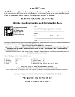


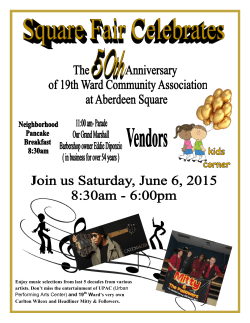

© Copyright 2026