
Annexes - Bundeswaldinventur
Survey instructions
for the
3rd National Forest Inventory
(2011-2012)
2nd revised version, May 2011
with 4. Corrigendum (21.03.2014)
Survey instructions for the 3rd National Forest Inventory (2011-2012)
2nd revised version, May 2011
Published by:
Federal Ministry of Food,
Agriculture and Consumer Protection
Bundesministerium für Ernährung,
Landwirtschaft und Verbraucherschutz (BMELV)
Referat 535, Friedrich Schmitz
Postfach, 53107 Bonn
Contents:
Dr. H. Polley, Institut für Waldökologie und Waldinventuren im
Johann Heinrich von Thünen-Institut,
Bundesforschungsinstitut für Ländliche Räume, Wald und Fischerei
In cooperation with the Länder
Dr. G. Kändler, Forstliche Versuchs- und Forschungsanstalt BadenWürttemberg
Dr. M. Bachmann, Bayerische Landesanstalt für Wald und
Forstwirtschaft
J. Müller, Landesforstanstalt Eberswalde, Brandenburg
T. Ullrich, Hessen-Forst Forsteinrichtung und Naturschutz
R. Neuß, Landesforst Mecklenburg-Vorpommern
U. Neupert, Niedersächsische Landesforsten AöR / Niedersächsisches
Forstplanungsamt
L. Falkenried, Landesbetrieb Wald und Holz Nordrhein-Westfalen
J. Diesler, Zentralstelle der Forstverwaltung, Rheinland-Pfalz
E. Fritz, Saarforst-Landesbetrieb
M. Schmid, Staatsbetrieb Sachsenforst
E. Binnemann, Landeszentrum Wald Sachsen-Anhalt
R. Hinrichsen, Ministerium für Landwirtschaft, Umwelt und ländliche
Räume des Landes Schleswig-Holstein
S. Stiefel, Thüringer Landesanstalt für Wald, Jagd und Fischerei
Printed by: BMELV
May 2011, Bonn
Survey instructions for the
3rd National Forest Inventory
(2011-2012)
2nd revised version, May 2011
Bundesministerium für Ernährung, Landwirtschaft und
Verbraucherschutz (publisher)
Institut für Waldökologie und Waldinventuren im
Johann Heinrich von Thünen-Institut,
Bundesforschungsinstitut für Ländliche Räume, Wald und Fischerei
In cooperation with the Länder
zuletzt geändert 30.01.2015 14:51
Content
Survey instructions for the 3rd National Forest Inventory
Table of contents
1 General information ......................................................................... 6
1.1
Scope of application............................................................... 6
1.2
Coordination of the National Forest Inventory ..................... 6
1.3
Land inventory administration ............................................... 8
1.4
Survey teams .......................................................................... 8
1.5
Training .................................................................................. 8
1.6
Right of access ....................................................................... 9
1.7
Data collection, data validation and data flow ...................... 9
1.8
Use of the programmes and stored data............................... 10
1.9
Inventory inspection............................................................. 11
1.10 Documents and working tools for the survey teams ........... 11
2 Inventory method............................................................................ 12
2.1
Sample distribution, inventory territory .............................. 12
2.2
Repeat survey ....................................................................... 12
2.3
The inventory cluster ........................................................... 13
2.4
Angle-count sampling .......................................................... 14
2.5
Sample circles ...................................................................... 15
3 Establishing the preliminary details of the cluster ...................... 16
3.1
Information on the cluster .................................................... 16
3.1.1 Cluster identification............................................................ 16
3.1.2 Cluster status ........................................................................ 17
3.1.3 Base map .............................................................................. 18
3.1.4 Occurrence of hoofed game ................................................. 18
3.2
Information on plots ............................................................. 18
3.2.1 Assignment of administrative attributes .............................. 19
3.2.2 Types of ownership .............................................................. 19
3.2.3 Ownership size classes......................................................... 20
3.2.4 Restrictions on use ............................................................... 21
3.2.5 Indication of the age on the basis of documents.................. 23
3.2.6 Natural altitudinal zone ........................................................ 23
3.2.7 Natural forest community .................................................... 23
1
Content
3.2.8 Change in the type of land use ............................................ 23
3.2.9 FFH area .............................................................................. 24
3.2.10 Forest habitat type ............................................................... 25
4 Laying out the cluster on site ........................................................ 26
4.1
Locating the cluster ............................................................. 26
4.2
Marking the plots ................................................................. 28
4.3
Determination of the plot coordinates with GNSS ............. 29
4.4
Locating the sample circles ................................................. 31
5 Surveying the cluster ...................................................................... 32
5.1
Accessibility ........................................................................ 32
5.2
Forest/non-forest.................................................................. 32
5.3
Management type ................................................................ 35
5.4
Timber harvesting conditions .............................................. 35
5.5
Sample trees from 7 cm diameter at breast height (DBH) .. 37
5.5.1 Selection by means of angle-count sampling ...................... 37
5.5.1.1 Principles ..................................................................... 37
5.5.1.2 Borderline tree check .................................................. 38
5.5.1.3 Angle-count sampling at the stand edge ..................... 38
5.5.2 Sample tree number ............................................................. 39
5.5.3 Sample tree code number .................................................... 39
5.5.4 Tree species ......................................................................... 42
5.5.5 Azimuth ............................................................................... 43
5.5.6 Horizontal distance .............................................................. 43
5.5.7 Canopy class ........................................................................ 44
5.5.8 Diameter at breast height ..................................................... 45
5.5.9 Tree class ............................................................................. 46
5.5.10 Tree age ............................................................................... 47
5.5.11 Tree height ........................................................................... 48
5.5.12 Stem height .......................................................................... 50
5.5.13 Upper diameter .................................................................... 51
5.5.14 Height code number ............................................................ 52
5.5.15 Trunk code number.............................................................. 52
5.5.16 Trees with special attributes ................................................ 52
5.5.17 Pruning ................................................................................. 53
5.6
Sample trees under 7 cm in breast-height diameter ............ 54
2
Content
5.7
Structural and biotope attributes .......................................... 55
5.7.1 Horizontal and vertical structure of the forest cover ........... 55
5.7.2 Ground vegetation plant species of particular importance to
forestry ................................................................................. 59
5.7.3 Particularly protected forest biotopes .................................. 59
5.7.4 Natural forest community .................................................... 61
5.7.5 Forest habitat type ................................................................ 61
5.7.5.1 Wooded dunes (forest habitat type 2180) ................... 62
5.7.5.2 Bog woodlands (forest habitat type 91Dx) ................. 63
5.7.5.3 Carpinetum oak-hornbeam forests (forest habitat types
9160 and 9170) .................................................................... 63
5.7.5.4 Acidophilous oak woods (forest habitat type 9190) ... 66
5.7.5.5 Evidence of the designation of forest habitat types .... 66
5.7.5.6 Pressures and threats on the conservation status of
forest habitat types .............................................................. 67
5.8
Site attributes........................................................................ 68
5.8.1 Site form ............................................................................... 68
5.8.2 Site gradient ......................................................................... 69
5.8.3 Site aspect ............................................................................ 69
5.9
Deadwood ............................................................................ 69
5.9.1 Selection ............................................................................... 69
5.9.2 Deadwood tree species group .............................................. 70
5.9.3 Type of deadwood................................................................ 70
5.9.4 Diameter of deadwood ......................................................... 71
5.9.5 Length of deadwood ............................................................ 71
5.9.6 Degree of decomposition of deadwood ............................... 71
5.10 Forest edges and stand boundaries ...................................... 72
5.10.1 Locating forest edges and stand boundaries ........................ 72
5.10.2 Selection and locating .......................................................... 74
5.10.3 Type of forest edge or stand boundary ................................ 74
5.10.4 Adjoining terrain .................................................................. 75
3
Content
Annexes:
Annex 1: Contact persons for the coordination of the National
Forest Inventory at federal level ............................................... 76
Annex 2: Addresses of the Land inventory administrations (as of
13 August 2010) .......................................................................... 77
Annex 3: Services of the Institute for Federal Real Estate –
federal forest operations (as of 25 October 2010) ................... 80
Annex 4: List of natural forest communities .................................. 81
Annex 5: Assignment of natural forest communities to forest
habitat types ................................................................................ 85
Annex 6: Identifying a forest habitat type according to tree
species composition .................................................................... 86
Annex 7: Distinguishing characteristics between common oak
(110) and sessile oak (111) ........................................................ 87
Annex 8: Distinguishing characteristics between European
white birch (NFI code 200), Betula pubescens ssp. pubescens
and Betula pubescens ssp. carpatica) (NFI code 201) .............. 91
Annex 9: Distinguishing characteristics for poplar ....................... 93
Annex 10: Reduction table for slope gradients .............................. 96
Annex 11: Tree heigt for leaning trees ............................................ 98
Annex 12: Maximum tolerances .................................................... 100
Annex 13: Alphabetical list of tree species ................................... 101
Annex 14: Equipment-specific figures .......................................... 102
Annex 15: Ordinance on the carrying out of a third National
Forest Inventory ....................................................................... 104
Annex 16: § 41 a National Forest Inventory................................. 106
4
Content
Figures:
Figure 1: Structure of a cluster with its four plots .............................. 13
Figure 2: Surveys on the plot............................................................... 14
Figure 3: Definition of breast height and position for diameter
measurement at breast height ....................................................... 46
Figure 4: Tree classes according to KRAFT ....................................... 47
Figure 5: Sighting of the crown to measure the height ....................... 50
Figure 6: Measuring point for stem height (deciduous trees) ............. 51
Figure 7: Locating forest edges and stand boundaries ........................ 73
Figure 8: Angle-count sampling with basal area factor 4 through the
Relascope .................................................................................... 102
Figure 9: Measuring an upper diameter with the callipers................ 102
Figure 10: Measuring an upper diameter with the Relascope (Metric
CP) .............................................................................................. 103
5
General information
1 General information
1.1 Scope of application
These survey instructions apply to the implementation of § 41a of the
Federal Forest Act and the third National Forest Inventory Ordinance of
23 May 2007 (Federal Law Gazette I, p. 954).
The survey instructions for the third National Forest Inventory
(NFI 2012) contain the directions, definitions, attribute descriptions and
attribute values with key codes. They regulate the collection, control and
communication of data.
It addresses employees of the Federal Government and the Länder, as
well as contractors who collect, control, communicate and evaluate data.
Chapter 1 gives an overview of the organisation of the National Forest
Inventory.
Chapter 2 explains the main characteristics of the inventory procedure.
Chapter 3 describes the preliminary details of the cluster to be gathered
before the outdoor surveying phase.
Chapter 4 establishes how the statistical units in the forest are located.
Chapter 5 determines how data are collected in the forest. The
description of the data collection process covers the forest/nonforest decision and the identification of sample trees, structural
attributes, site attributes, deadwood and forest edges.
The survey instructions replace the General Administrative Regulation
on Implementation of the second National Forest Inventory (NFI 2002).
The aim of the National Forest Inventory is to provide an overview of
the forest conditions and the forest production potential over an
extended area in Germany.
1.2 Coordination of the National Forest Inventory
The compilation and evaluation of the data and the coordination tasks
they entail are undertaken by the Federal Ministry of Food, Agriculture
6
General information
and Forestry (Federal Ministry). For this purpose, it calls on the Johann
Heinrich von Thünen Institute1 (national inventory administration)
which cooperates directly with the Land inventory administrations.
In particular, the coordination tasks include:
- discussing all questions of importance with the Land inventory
administrations to ensure that the National Forest Inventory is carried
out uniformly, including the inventory inspection results,
- examining the data for plausibility and correcting implausible data,
- evaluating the data,
- clearing up doubts of supraregional importance.
In so far as insight into the conducting of the local inventory is
necessary to coordinate the National Forest Inventory, this is ensured by
the Land inventory administration.
The national inventory administration makes all the data of the former
National Forest Inventories necessary for the repeat survey available to
the Land inventory administrations, as well as the software for the
following steps:
- data collection and validation,
- data management (selection as well as import and export of data for
survey teams and national inventory administration),
- printout of sketches (maps) of the sample trees from the angle-count
sampling.
The addresses of the partners to coordinate the National Forest Inventory
at federal level are given in Annex 1.
1
Johann Heinrich von Thünen Institute, Federal Research Institute for Rural Areas, Forestries
and Fisheries (http://www.vti.bund.de)
7
General information
1.3 Land inventory administration
The Land authority in charge of collecting the data (Land inventory
administration) has the following tasks:
- planning and coordinating the deployment of the survey teams,
- preparing the documents for the survey teams,
- ensuring the proper collection of the data, including inventory
inspection measures,
- controlling and correcting the data in consultation with the national
inventory administration,
- releasing the verified data in the central database for use in the
national inventory administration,
- informing the national inventory administration of the timetable for
carrying out the inventory,
- informing the national inventory administration of additional Landspecific surveys.
The addresses of the Land inventory administrations are given in
Annex 2.
1.4 Survey teams
The survey teams are responsible for measuring and describing the
forest condition in accordance with these survey instructions and the
directions of their Land inventory administration. A survey team
consists of two people and is led by a qualified graduate forester (or a
person with comparable qualifications).
1.5 Training
Up to two members of the Land inventory administrations, the leaders of
the survey teams and, if necessary, the team members are introduced to
the survey procedure and the survey software on behalf of the Federal
Ministry.
8
General information
1.6 Right of access
The persons assigned the task of conducting the National Forest
Inventory are entitled, to perform their duties, to enter land and to carry
out the necessary work for the inventory on this land (§ 41 a (4) of the
Federal Forest Act).
If, when establishing the preliminary details of the cluster areas, it is
found that clusters lie in areas used for military purposes, the competent
federal forest operation is asked to supplement the missing information
to establish the preliminary details of the cluster and to designate the
competent authority to grant permission to enter these areas.
The addresses of the Federal Forestry Offices are listed in Annex 3.
Where the German Federal Armed Forces have jurisdiction, granting
permission to enter is the responsibility of the respective base
commander who takes the necessary protection measures on a case-bycase basis. If the Land inventory administration does not reach
agreement with these authorities on the right of access and the carrying
out of the inventory work, it informs the Federal Ministry. The latter
decides, in agreement with the Federal Ministry of Finance and the
Federal Ministry of Defence, and communicates the result to the Land
inventory administration.
1.7 Data collection, data validation and data flow
The data and software required for conducting the survey are made
available on a server of the national inventory administration. The Land
inventory administrations have access to the relevant Land data and
determine the access rights for the survey teams and other authorised
persons.
All survey data – apart from the cluster sketch of clusters to be surveyed
for the first time (Chapter 4) – are entered into the specific software. The
first plausibility check must be carried out by the software immediately
after data entry. Each contested entry must be examined and corrected if
necessary.
9
General information
In case of an error message, correction of the entry is imperative as the
check routine assesses this entry as wrong. If the check programme
shows errors in the corrected data, the national inventory administration
must be informed in order to change the check routines, if necessary. In
the case of warnings, the relevant data have to be checked and corrected,
or the warnings, and thus the values, have to be confirmed.
The survey teams must synchronise the data collected offline with the
central NFI database in the national inventory administration on a
regular basis.
The Land inventory administrations re-examine the data in the central
NFI database for plausibility and completeness, using the software made
available by the national inventory administration, and make the
necessary corrections. To this end, they cooperate with the survey team
if necessary or have a new survey carried out to correct the incorrect
data.
Brandenburg is in charge of the data collection in Berlin, and Lower
Saxony is in charge of the data collection in Hamburg and Bremen.
The Land inventory administration releases the completely collected and
validated data in the NFI database for use by the national inventory
administration.
The national inventory administration then validates these data and
clarifies discrepancies with the Land inventory administrations. After
the data have been released by the Land inventory administration, the
national inventory administration assumes that all warnings still
appearing have been examined and taken into consideration by the teams
or Land inventory administrations.
1.8 Use of the programmes and stored data
The Länder always have access to their data on the central server. The
Federal Government provides the Länder with the evaluation
programmes as soon as the first evaluations of the National Forest
Inventory have been completed.
10
General information
1.9 Inventory inspection
The Land inventory administration carries out an inventory inspection
on a minimum of 5% of the clusters. Errors and (especially systematic)
divergences are cleared up with the respective survey team. A report is
drawn up on each inspected cluster, showing the divergences and the
measures prompted. Documentation can be provided by way of storing
the inspection surveys in the central database.
1.10 Documents and working tools for the survey teams
survey instructions for the 3rd National Forest Inventory (NFI 2012)
brief guides to the NFI 2012 field software for survey/inspection
teams
1 guidelines for the identification of forest trees, shrubs, forest grasses
and plants, forest habitat types
6 ranging poles for the first survey (3 suffice for the repeat survey)
1 range finder (recommendation: ultrasonic)
1 25 m measuring tape
2 diameter measuring tapes
1 Relascope (Metric CP or Metric Standard) or comparable device
with slope correction and the angle-count factors 1, 2, 4 (k=1, 2, 4)
2 compasses (400 gon)
1 clipboard
1 mobile data-entry terminal with the data-entry software provided by
the national inventory administration
1 axe
1 calliper kit for diameters up to 30, 40, 60 cm, including 7 m
telescopic rod or other device to measure an upper diameter at any
height
1 metal detector
angle sections to mark the sample points, BMELV suggestion: length:
30 cm; width of both angles: 30 mm; thickness: 4 mm; sharpened
and then hot-galvanized; material: ferromagnetic steel or austenitefree alloy steel so that it can be found with the help of a metal
detector.
forms, maps, chalk
GNSS device according to the needs of the Länder
2
2
11
Inventory method
2 Inventory method
2.1 Sample distribution, inventory territory
The sample distribution is based on a regular 4 km x 4 km quadrangle
grid (basic grid) which is determined by the Gauß-Krüger coordinates
system and covers the entire inventory territory. The starting point of the
grid used in the first National Forest Inventory (1986-1990) remains the
same. The sample grid is densified in some Länder or in parts of some
Länder to a 2.83 km x 2.83 km or 2 km x 2 km quadrangle grid (Annex
to the 3rd National Forest Inventory Ordinance). The national inventory
administration provides each Land with a list of its coordinates. This list
also contains the grid points in the direct vicinity of the Land concerned
to avoid cases of doubt. The planned densifications are taken into
account in this context.
The inventory territory comprises the land surface and the inland waters
in Germany.
2.2 Repeat survey
As the third National Forest Inventory (NFI 2012) is a repeat survey
throughout Germany, data for many objects are already available from
former surveys. Permanent attributes, i.e. attributes the values of which
remain unchanged (e.g. site attributes), need not be surveyed again.
Obvious errors have to be corrected, however. Other attributes are
relatively stable (e.g. type of ownership) and must be verified. Dynamic
attributes that usually are subject to change (e.g. DBH for sample tree)
have to be surveyed again.
12
Inventory method
2.3 The inventory cluster
The inventory cluster covers a quadrangle with a side length of 150 m.
The sides of the cluster are oriented north-south and east-west
respectively. They form the boundaries of the cluster. The cluster
coordinates give the location of the south-west plot. The data collections
are carried out on the plots.
B
2
1
A
C
3
4
D
Cluster coordinate
Figure 1: Structure of a cluster with its four plots
Forest clusters
Clusters of which at least one plot is located in a forest (Chapter 5.2) are
forest clusters and are surveyed in accordance with these instructions.
The objects to be surveyed on the plots are selected with the help of
angle-count sampling and sample plots. The surveys to be carried out are
shown in Figure 2.
13
Inventory method
Winkelzählprobe
Zählfaktor 1 (2)
für Bäume über 4 m Höhe
r=1 m für Probebäume 20 cm ≤ Höhe ≤ 50 cm
(wird bei <4 Probebäumen auf r=2 m vergrößert)
r=2 m für Probebäume
Höhe > 50 cm und BHD < 7 cm
r= 10 m für Bäume bis
4 m Höhe und
Bodenvegetation
Winkelzählprobe Zählfaktor 4
für BHD≥7 cm
r=5 m für
Totholz
Mittelpunkt
Traktecke
r=25 m
für Geländemerkmale, Waldränder
und Beeinträchtigungen WLRT
Figure 2: Surveys on the plot
2.4 Angle-count sampling
Every plot in the forest, except unstocked forest land, represents the
centre of an angle-count sample with basal area factor 4. Angle-count
sampling should also be carried out on temporarily unstocked areas if
data on sample trees in the adjacent stand can thus be collected.
Sample trees of the NFI and trees to be described in more detail as a
basis for a wide variety of evaluations are, above all, all trees that
- are included in the angle-count sampling (basal area factor 4), and
- are either alive or probably died less than 12 months ago, and
- have a breast-height diameter of at least 7 cm.
14
Inventory method
In addition, angle-count sampling with basal area factor of 1 or 2 is
carried out, counting the trees as a basis for describing the forest
structure by species of tree and canopy class (Chapter 5.7.1). For this
sampling area, the natural forest community (Chapter 5.7.4) and the
forest habitat type (Chapter 5.7.5) are also indicated where necessary
and appropriate. At forest edges and on the border to unstocked forest
land, the angle-count sampling must be mirrored. Stand boundaries are
not taken into account.
2.5 Sample circles
1.
A sample circle with a radius of 1 m (or r = 2 m if there are less than
4 sample trees) is usually located 5 m away from the plot to the
north (Chapter 5.6). In this sample circle, small trees of 20 cm to
50 cm in height are surveyed.
2.
A sample circle with a radius of 2 m is located at the same place. In
this sample circle, all trees over 50 cm in height and under 7 cm in
breast-height diameter are surveyed (also Chapter 5.6).
3.
In a sample circle with a radius of 5 m around the plot, the
occurrence of deadwood is determined (Chapter 5.9).
4.
In a sample circle with a radius of 10 m around the plot, trees of up
to 4 m in height (Chapter 5.7.1) and ground vegetation plant species
(Chapter 5.7.2 and, if necessary, Chapter 5.7.5) are surveyed.
5.
In a circle of 25 m around the forest plots, site attributes
(Chapter 5.8), forest edges (Chapter 5.10) and pressures and threats
on forest habitat types (Chapter 5.7.5.6) are recorded.
15
Establishing the preliminary details of the cluster
3 Establishing the preliminary details of the cluster
3.1 Information on the cluster
3.1.1 Cluster identification
The identification of the cluster is necessary to check the data for
completeness. It is only necessary for the new clusters resulting from the
application of a denser sample grid in the NFI 2012. The other clusters
have already been preallocated on the basis of the information from the
NFI 2002.
Cluster identification
1
cluster that is entirely outside the inventory territory and is
therefore not covered
2 = cluster on the border between two Länder that, on account of
different grid-size areas, is only covered in part (<4 plots)
3 = cluster on the border between two Länder that is covered in full
(4 plots)
4 = normal cluster, located entirely in one Land (4 plots)
5 = cluster that is not in the grid of the NFI 2012 and is therefore
not covered. This can, for instance, be the case if a grid-size
area has not been correctly defined in the list of coordinates.
6 = cluster on the national border that is only covered in part
(<4 plots)
7 = cluster on the border of different grid-size areas within one
Land that is only covered in part (<4 plots)
8 = cluster on the border of different grid-size areas within one
Land that is covered in full (4 plots)
10 = cluster that is located very close to another cluster and is
therefore not covered. This can be the case on the border of two
longitude zones.
Data-technical background: The cluster identifications 1 and 5 prevent
incorrect error messages during data validation.
16
=
Establishing the preliminary details of the cluster
3.1.2 Cluster status
The status of the cluster serves as the basis for the decision as to whether
a cluster must be visited on site. It has been preallocated with cluster
identification 1, 4 or 5 on the basis of the data from the previous survey2
and is verified with the help of up-to-date forest distribution maps or
aerial photographs.
The sample grid is plotted on the map or the aerial photographs. The
cluster extends 150 m to the north and to the east from the grid
coordinate. Clusters with at least one plot in the forest are forest clusters.
Clusters that, according to the map or the aerial photographs, are
incontestably situated entirely outside the forest are non-forest clusters.
All other cases must initially be considered “uncertain”.
The national inventory administration provides aerial photographs and
maps of the cluster environment with the entered clusters in electronic
form.
Cluster status
1
2
3
4
=
=
=
=
forest cluster of the previous survey
new forest cluster
forest/non-forest decision uncertain
non-forest cluster, situated entirely in a built-up area or in a
body of water
5 = non-forest cluster in the open countryside, also partly in a builtup area or in a body of water
Clusters with cluster status 1 to 3 are visited on site.
If a cluster is divided by a Land border, the Land that conducted the
NFI 2002 survey is also responsible for the survey of this cluster. This is
usually, and particularly in the case of new clusters, the Land in which
the grid coordinate (south-west plot) is located. Departures from this
general rule are possible in individual cases if the adjoining Länder have
2
this can be the NFI 2002, the inventory study 2008 or a Land inventory
17
Establishing the preliminary details of the cluster
agreed in advance and informed the national inventory administration.
The Land inventory administrations exchange the necessary documents
and information for this purpose.
3.1.3 Base map
The base map serves to visit the clusters on site (Chapter 4.1).
First survey
Repeat survey
All clusters classified as forest (2)
or uncertain (3) are marked
precisely on a large-scale base map
(e.g. Deutsche Grundkarte 1:5,000)
or suitable electronic maps. The
section of the map with the marked
cluster serves as a basis for the
survey of this cluster. A copy is
archived with the national inventory
administration.
For all NFI 2002 forest clusters,
the NFI 2002 survey locating
record is copied.
For clusters classified for the
first time as forest (2) or
uncertain (3), the procedure is
the same as it was during the
first survey.
The Land inventory administrations send copies of the base maps of all
forest clusters and copies of the survey locating record in digital form to
the national inventory administration for archiving.
3.1.4 Occurrence of hoofed game
With regard to forest clusters, the competent local authority is
questioned about the regular occurrence of hoofed game species which
is then shown by yes (1) or no (0) for wild boar, red deer, fallow deer,
roe deer and mouflons respectively.
3.2 Information on plots
In the repeat survey, the information available from the previous survey
is examined and, if necessary, corrected or supplemented.
The attributes under Chapter 3.2.1 are assigned to the plots in any case.
All other attributes must only be indicated if the plot lies in the forest.
18
Establishing the preliminary details of the cluster
3.2.1 Assignment of administrative attributes
For each plot, the structural unit (forestry office) is indicated.
Land, district, municipality, forest region, forest area are assigned by the
national inventory administration and must be controlled and, if
necessary, corrected by the Land inventory administrations.
The codes of the NFI database are used for the attributes. No account is
taken of later restructuring.
In the case of clusters on the German border, the Land assignment "0" is
entered for plots located outside of the inventory territory. The other
administrative attributes are left blank. For the attribute 'forest'
(Chapter 5.2), the indication must be "8" (= irrelevant, because outside
of the inventory territory).
In the case of clusters on the border of grid-size areas, only the Land is
recorded for the plots not belonging to the grid. For the attribute 'forest'
(Chapter 5.2), the indication must be "9" (= irrelevant, because not
belonging to the grid-size area). All other parameters are left blank.
In the case of clusters bordering on another Land, the information for all
plots is collected in full. In so doing, care should be taken to use the upto-date attributes and key codes specific to the Land.
3.2.2 Types of ownership
The information on the type of ownership available from a previous
survey is verified for each plot (e.g. map of forest estates, cadastral
map).
Types of ownership
1
2
3
30
31
32
33
=
=
=
=
=
=
=
state forest (national property)
state forest (Land property)
communal forest
municipal forest
church forest assigned to communal forest
community forest assigned to communal forest
cooperative forest assigned to communal forest
19
Establishing the preliminary details of the cluster
34 =
35 =
4
40
41
42
43
44
=
=
=
=
=
=
45 =
5
=
communal forest under exclusive ownership or under exclusive
sponsorship of the Land government
communal forest under ownership or under exclusive
sponsorship of the national government
private forest
private forest (in the narrower sense)
church forest assigned to private forest
community forest assigned to private forest
cooperative forest assigned to private forest
private forest under exclusive ownership or under exclusive
sponsorship of the Land government
Private forest under exclusive ownership or under exclusive
sponsorship of the national government
forest under Treuhandanstalt 3 administration (Treuhand forest)
The use of the two-digit codes is optional. This is determined uniformly
for each Land. The primary one-digit code numbers may not be used in
this case.
The following codes are used in the Länder:
BB, BE, NW, RP, SH, SL,
BW, BY, HB, HE, HH, MV, NI, SN, ST, TH
One-digit codes
Two-digit codes
3.2.3 Ownership size classes
Communal and private forests are classified into the ownership size
classes indicated below. This classification is made according to the
forest area managed by the same enterprise or by the same operating
office.
If necessary, forest owners should be asked which ownership size class
they should be assigned to. This will ensure that forest ownership
unknown to the inventory staff is not ignored. The decisive factor is the
forest management area in the whole country.
3
20
Since 1995: Bundesanstalt für vereinigungsbedingte Sonderaufgaben (Federal Institute for
Special Tasks Arising from Unification)
Establishing the preliminary details of the cluster
Ownership size classes
1 = up to 20 ha
11 = up to 5 ha
111 = up to 1 ha
112 = >1 to 5 ha
12 = >5 to 10 ha
13
>10 to 20 ha
2 = >20 to 50 ha
21 = >20 to 30 ha
22 = >30 to 50 ha
3 = >50 to 100 ha
4 = >100 to 200 ha
5 = >200 to 500 ha
6 = >500 to 1,000 ha
7 = >1,000 ha
The use of the multi-digit codes is optional. This is determined
uniformly for each Land. The primary shorter code numbers may not be
used in this case.
The following codes are used in the Länder:
HE, RP, SL
1/2/3/4/5/6/7
SN, ST, TH
111 / 112 / 12 / 13 / 2 / 3 / 4 / 5 / 6 / 7
BY, HB, HH, NI, NW
111 / 112 / 12 / 13 / 21 / 22 / 3 / 4 / 5 / 6 / 7
BE, BB, BW, SH
11 / 12 / 13 / 2 / 3 / 4 / 5 / 6 / 7
MV 11 / 12 / 13 / 21 / 22 / 3 / 4 / 5 / 6 / 7
3.2.4 Restrictions on use
Restrictions on use exist if the possible uses of timber cannot all be
taken advantage of.
This includes restrictions on the use of timber both due to legal
regulations or other external reasons. The reason for such restrictions is
indicated.
21
Establishing the preliminary details of the cluster
Restrictions on use
0
2
3
4
=
=
=
=
no restriction on the use of timber
use of timber not authorised or not to be expected
approx. 1/3 of the usual harvest to be expected
approx. 2/3 of the usual harvest to be expected
External reasons for the restriction on use
0 = no external restrictions on use
1 = nature conservation
2 = protection forest
3 = recreational forest
9 = other external reasons
In case of several external reasons, indicate the most important reason.
Internal reasons for the restrictions on use
0
1
=
=
no internal restrictions on use
splitted ownership of uneconomic size (e.g. if the system of
land tenure provided for the equal division of land among all
qualified heirs)
2 = stand-alone location
3 = insufficient accessibility
4 = site characteristics, wet location
5 = little expected yield (mean total increment < 1 m3/a*ha)
6 = areas protected at owner's discretion (e.g. natural forest
reserves)
9 = other internal reasons
In case of several internal reasons, indicate the most important reason.
Restrictions on use that are only detected during the surveying of the
cluster must be entered by the survey team (Chapter 5.4).
22
Establishing the preliminary details of the cluster
3.2.5 Indication of the age on the basis of documents
Only for the first survey: Where documents (including forest
management plans) exist, the age of the stand is taken from them and
recorded for each species of tree or canopy class. If a tree species occurs
in several age groups, multiple entries are made. The age indicated is the
age reached on the reference date of the inventory (1 October 2012).
3.2.6 Natural altitudinal zone
As a permanent parameter, the natural altitudinal zone need only be
recorded during the first survey.
1
2
3
4
5
=
=
=
=
=
flat
hilly
sub-montane
montane
sub-alpine, high-montane
3.2.7 Natural forest community
As a permanent attribute, the site aspect need only be surveyed during
the first survey.
For each forest plot to be recorded for the first time, the natural forest
community is taken from the site maps and classified in the list in
accordance with Annex 4. Where no site maps exist, the Land inventory
administration derives a proposal for the natural forest community from
relevant documents (general maps showing potential natural vegetation,
topographic map, geological map, soil map, regional/local vegetation
maps). This proposal is examined by the survey team on site and
corrected if necessary (Chapter 5.7.4). The necessary training of the
team is carried out by the Land inventory administration. The natural
forest community is reviewed in particular if the forest habitat type
derived from it (Annex 5) is not plausible.
3.2.8 Change in the type of land use
In the case of non-forest plots that used to be forest plots during the
NFI 2002 survey, the current type of land use is entered, whereas in the
23
Establishing the preliminary details of the cluster
case of forest plots that used to be non-forest plots during the NFI 2002
survey, the former type of land use is entered.
Settlement areas
11 = industrial, commercial and traffic areas, including vegetationcovered slopes along the traffic areas
12 = built-up, sealed off areas not assigned to any other category
(e.g. housing estate)
13 = mining sites, landfills, dumps, open areas with no or little
vegetation (areas that naturally have these surfaces are in their
terminal stage and do not become forest. The existing rare cases
are assigned to this category as they often originate from this
use of land)
14 = urban green, other unsealed areas, sport and recreation areas
Agricultural areas
21 = arable land
22 = permanent crops (vines, fruit stands, hops, tree nurseries not
belonging to the forest)
23 = permanent grassland (pastures, meadows, natural grassland,
heaths, transitional stages between forest and shrubs)
Other areas
3 = wetlands
4 = bodies of water
Errors
90 = plot was already clearly non-forest before (missing or wrong
designation in NFI 2002)
99 = plot was already clearly forest before (missing or wrong
designation in NFI 2002)
Changes in the type of land use that are only detected during the
surveying of the cluster must be entered by the survey team
3.2.9 FFH area
The following data on FFH areas are preallocated by the national
inventory administration in accordance with the standard data sheet for
plots and are controlled and, if necessary, corrected by the Land
inventory administrations: 1.2 code, 1.7 area name.
Plots located outside FFH areas are preallocated with "0".
24
Establishing the preliminary details of the cluster
3.2.10
Forest habitat type
In order to support the field survey, the forest habitat type can be
indicated when establishing the preliminary details provided that
suitable data are available. In this context, the codes from Chapter 5.7.5
are used.
The source is indicated.
1
2
3
4
5
6
=
=
=
=
=
=
9
=
deduction from habitat type maps
deduction from biotope maps
deduction from site maps or site parameters
deduction from geological maps
deduction from other maps
according to the natural forest community (preliminary details),
it is only possible to choose between one specific forest habitat
type and no forest habitat type
separate visual inspection by experts
25
Laying out the cluster on site
4 Laying out the cluster on site
4.1 Locating the cluster
First survey
Repeat survey
The cluster is transferred to the
site by first locating the most
accessible plot from a starting
point that is clearly identifiable in
nature and from the base map
(e.g. boundary stone, road
junction, parcel corner). From this
point, work is continued according
to the specified cluster structure to
the other plots. The starting point
is documented in a sketch and the
locating of the plots is evidenced
in the survey locating record.
To find the cluster, it is
recommended to first go to the
starting point established during a
former survey. Then, the first plot is
located with the help of the survey
locating record and the cluster and
angle-count sampling sketches of
the previous survey, and – where
necessary – the marker
(Chapter 4.2) is located with the
metal detector. From this point,
work is continued according to the
specified cluster structure to the
other plots.
In the case of full clusters (all four
plots in the forest), the
measurement is continued from
the last plot located to the first
plot for control purposes. In this
context, the following divergences
between the end point of the
cluster boundary and the starting
plot are tolerated:
If the starting point of the previous
survey cannot be found or if it
appears more favourable to locate
the cluster in another order, a new
starting point for locating the plot
and searching its marker is
determined.
26
Laying out the cluster on site
- under normal (easy) conditions:
5m
- under difficult conditions: 10 m
- under very difficult conditions
(extremely steep slopes): 20 m.
If the plot marker cannot be found
again but its location can be clearly
reconstructed with the help of the
angle-count sampling sketch, a new
marker is set.
If these tolerance limits are
exceeded, the cluster must be
located again.
If a cluster or a plot cannot be found
at all, the reasons are to be
discussed with the Land inventory
Alternatively, the given coordinate administration for each individual
case and the relevant points are to
can be located with a GNNS
be located anew.
(Global Navigation Satellite
Alternatively, the given coordinate
System) device on the site.
can be located with a GNNS
(Global Navigation Satellite
System) device on the site.
If a GNSS device is used, a prominent landmark (Chapter 4.3) is
indicated and recorded in the base map for at least one plot. This will
ensure that the cluster is found again if there are doubts about the
accuracy of the GNSS measurement.
In addition, current aerial photographs can be used to help find the
cluster.
Measure all distances horizontally.
The azimuth to the object to be located is always indicated. When
locating the plot, the measurement is taken from the starting point to the
plot; when locating a sample tree, on the other hand, the measurement is
taken from the plot to the tree.
If there are obstacles on the cluster boundary, the next plot can also be
surveyed with the help of a polygonal chain.
Polygonal chains can be calculated with a tool integrated in the data
collection programme.
The starting point serves the long-term safeguarding of the sample point.
As a prominent landmark, it is clearly described and easy to find on the
27
Laying out the cluster on site
maps, on site and in the team documents. The selection of a suitable
starting point has considerable influence on the effort needed to locate
the cluster – for both the present and future inventories. The starting
point should be permanent, unambiguous and close to a plot. During the
first survey of a cluster, the starting point is marked on the base plan and
shown and sketched in the survey locating record (e.g. on the form
'Trakteinmessung TE').
During the first survey, it is advisable to first locate all the plots and
only start with the data collection if the authorised divergence limits in
closing the cluster (from the last to the first plot) are not exceeded.
If an electronic range finder is used to locate the cluster, it is calibrated
both daily and before each cluster survey according to the instruction
manual.
If in a sloping site the horizontal distance cannot be determined
automatically with the range finder, the distances measured on the slope
are converted using the reduction factors in Annex 10.
The Land inventory administrations send copies of the base maps of all
forest clusters and copies of the survey locating record in electronic
form to the national inventory administration for archiving.
4.2 Marking the plots
First survey
Repeat survey
The plots situated in the forest are
marked by angle sections
(Chapter 1.10) which are lowered
into the ground. If the marker
cannot be lowered into the ground
(e.g. rock, stream bed), a substitute
point is marked and documented
(azimuth, horizontal distance).
All plots surveyed within the scope
of the previous inventories are
marked by a metal rod with round
profile (NFI 1987) or T profile
(NFI 2002) which has been
lowered into the ground or by
another hidden marker. Where the
marker could not be lowered into
the ground (e.g. rock, stream bed),
a substitute point was marked and
recorded in the form
'Trakteinmessung'.
28
Laying out the cluster on site
If a marker cannot be found again
or is no longer suitable as a
permanent marker, this is noted and
the plot is marked anew just like in
the first survey.
An intact marker is left unchanged.
Marking the plot
0
1
2
=
=
=
marker not sought / not found because plot is now in non-forest
old marker found again
old marker not found again or unsuitable, but plot and sample
trees clearly identified; new marker in place
3 = marker placed for the first time
4 = old plot and sample trees not found again, plot surveyed anew,
new marker in place
The type of the found or new marker is indicated.
If a prominent landmark is situated near the plot (e.g. boundary stone,
crossroads), this landmark is located with its polar coordinate (azimuth,
horizontal distance) as an additional reference point to facilitate the
finding of the plot at a later stage.
For control purposes (Chapter 1.9), the plot is marked temporarily
(Chapter 5.5.2).
As temporary marking of the plot, the sample tree closest to the plot is
marked with its sample tree number according to the requirements of the
Land inventory administration.
4.3 Determination of the plot coordinates with GNSS
The following minimum standards are recommended with regard to
determining the coordinates of the accessible forest plots with a GNSS
device:
29
Laying out the cluster on site
Criterion
Good
Suitable
Not suitable;
must be
repeated
>8
>8
0-59
HDOP
PDOP
Number of
measurements
Duration of individual
measurement
[seconds/measurement]
*
Correction signal
≤3
≤3
100
> 3 and ≤ 8
> 3 and ≤ 8
60-99
≤2
> 2 and ≤ 10 > 10
Existent
Age of the correction
signal [minutes]**
Number of satellites if
only GPS or only
GLONASS
Number of satellites in
the case of combined
use of GPS and
GLONASS
Elevation angle**
SNR (signal noise
ratio, signal strength)
≤ 15
Nonexistent
> 15
≥4
<4
≥5
<5
≥ 10
< 10
According to the
manufacturer
recommendation
Motionless positioning 30 seconds
on the measuring point
before the beginning of
the measurement
Updating the almanac Lock onto the satellites for
15 minutes prior to the first
measurement if the last
measurement was more
than two days ago or over
500 km away
* If signal frequency = one measured value per second
** Recommended configuration value
30
Laying out the cluster on site
Store the data in the database.
The measurement can be aborted after twenty minutes in case of
unfavourable reception conditions.
The measurement must be repeated if no suitable value could be gained
for a certain criterion. It is recommended to repeat the measurement if
all values measured can only be assessed as 'suitable'.
If the plot cannot be located with the help of GNSS, a staggered
auxiliary point can be located by GNSS measurements. A compass
traverse is made from the auxiliary point to the plot. The course is
shown on the navigation surface simultaneously with the data entry. The
coordinate of the plot is calculated from the GNSS coordinate of the
auxiliary point and the compass traverse.
As for determining the position of the auxiliary point, the same
minimum standards apply as for the measurement of the plot
coordinates.
4.4 Locating the sample circles
The sample circles with a radius of 1 m or 2 m are located 5 m north of
the plot (horizontal distance). If they are not entirely in the same stand as
the plot or if they are divided by a wildlife fence, the centre is shifted not
to the north but to the south. If it is not in the same stand there either,
then it is shifted to the east or finally to the west. If none of these
provisions prove successful, the distance is shortened and the direction
that allows for the greatest distance is chosen. The position is indicated.
The centre of the sample circle is marked by a ranging pole for the time
of the survey.
All other sample circles are centred exactly on the plot marker.
Sample circle radii are measured as horizontal distances. A suitable
range finder is used for this purpose, or a measuring tape or measuring
stick is held horizontally.
31
Surveying the cluster
5 Surveying the cluster
5.1 Accessibility
Accessible plots are located and surveyed. For inaccessible plots, only
the data recognisable from a distance are recorded.
Temporarily inaccessible plots are to be surveyed at a later date, if
possible. Sample points that are temporarily inaccessible due to storm
damage should be surveyed as soon as investigations are completed,
where possible.
1
2
3
=
=
=
4
5
=
=
accessible
inaccessible, entry prohibited
inaccessible, dangerous site conditions (e.g. mountain, bog,
water)
inaccessible, other dangers
inaccessible, mountain pines or other impenetrable vegetation
5.2 Forest/non-forest
After a plot has been located, it is first established whether it is in the
forest or not.
32
Surveying the cluster
Forest within the meaning of the NFI is any area of ground covered by
forest vegetation, irrespective of the information in the cadastre or
similar records. The term forest also refers to cutover or thinned areas,
forest tracks, firebreaks, temporarily unstocked land and clearings, forest
glades, feeding grounds for game, landings, forest aisles, further areas
linked to and serving the forest including areas with recreation facilities,
overgrown heaths and moorland, overgrown former pastures, alpine
pastures and rough pastures, as well as areas of dwarf pines and green
alders. Heaths, moorland, pastures, alpine pastures and rough pastures
are considered to be overgrown if the natural forest cover has reached an
average age of five years and if at least 50% of the area is covered by
forest.
Areas with forest cover in open pasture land or in built-up areas of under
1000 m², coppices under 10 m wide, Christmas tree and ornamental
brushwood plantations, commercial forest-tree nurseries as well as
parkland attached to country houses are not forest within the meaning of
the NFI. Watercourses up to 5 m wide do not break the continuity of a
forest area.
Christmas tree and ornamental brushwood plantations in the forest are
considered forest within the meaning of the NFI.
Forest/non-forest
0
3
4
5
8
9
=
=
=
=
=
=
non-forest
forest, temporarily unstocked land
forest, unstocked forest land
forest, stocked timberland
irrelevant, because outside of inventory territory
irrelevant, because not belonging to the grid-size area
33
Surveying the cluster
Temporarily unstocked areas are areas of timberland that are
temporarily without forest cover.
Unstocked forest land includes forest tracks*, forest aisles** over 5 m
wide, landings, non-commercial forest-tree nurseries belonging to the
forest, seed and plant nurseries, food plots and meadows, yard and
building areas used for forestry purposes, recreational facilities linked to
the forest as well as rocks, boulders, gravel and water located in the
forest. Swamps and moors located in the forest are also considered
unstocked forest land provided that they are not overgrown.
*
When determining the width of the track for the identification of
unstocked forest land, verges and ditches on both sides are included in
the measurement, but not adjacent slopes.
** The measurement of the width of the aisle is made from tree to tree
at root collar level, deducting 3 m on each side as belonging to the
respective stand. A forest aisle is therefore also regarded as unstocked
forest land if the distance from tree to tree at root collar level is greater
than 11 m. The borders of the unstocked forest land are in these cases to
be established at a distance of 3 m each from the trees on the edge at
root collar level.
On unstocked forest land, only particularly protected forest biotopes
(Chapter 5.7.3) are recorded.
Further surveys are only carried out in the forest (timberland, including
temporarily unstocked areas).
Changes in the type of land use
In the case of non-forest plots that used to be forest plots during the
previous survey, the current type of land use is entered, whereas in the
case of forest plots that used to be non-forest plots during the previous
survey, the former type of land use is entered. The preliminary details
established at the beginning are checked (Chapter 3.2.8).
34
Surveying the cluster
5.3 Management type
Management type
1 = high forest
2 = plenter forest
3 = composite forest
4 = coppice forest
5 = short-rotation plantation
The information is cited for the stand in which the plot is located.
High forest is a forest developing from plantation or grown from
seedlings or a forest from coppice stand or suckers that is not considered
coppice forest because of its age (>40 years). In the high forest, entire
stands or parts of a stand are exploited through clearing or during a
period of regeneration.
Plenter forest is a form of high forest in which trees of different ages
and different dimensions (height, diameter) are mixed in small
aggregations and over a long period of time.
Coppice forest is a forest from coppice shoots or suckers of up to
40 years of age.
Composite forest is a hybrid formed from coppice forest and high
forest, with an overstorey (standards) of grown coppice stands and trees
grown from seedlings and an understorey grown from coppice shoot,
suckers and seedlings.
Short-rotation plantations are areas that are exclusively stocked with
fast-growing tree species and are managed with rotation periods of up to
20 years. Due to their growth behaviour and their structure, historic land
management systems such as coppice or composite forests are not
included.
5.4 Timber harvesting conditions
0
=
1
=
suitable for all timber harvesting methods, e. g.
- flat to sloping sites (< 30% [17°] slope gradient),
- no extremely soft soils,
highly mechanised methods only possible with slope
harvester/slope forwarder, e.g.
- sloping to steep sites (30 – 55% [17° – 29°] slope gradient)
35
Surveying the cluster
- no/few rock piles, spring horizons, slope ruptures,
- bank gradient (transition road/extraction track) < 60% [31°],
- extraction tracks at a distance of 40 m along the line of
greatest slope
2 = not suitable for harvesters, but no cable-crane site, e. g.
- sloping to steep sites (30 – 50 % [17° – 27°] slope gradient),
- rock piles, spring horizons, slope ruptures,
- skidding road existing,
3 = cable crane required, e. g.
- extremely soft soil situations at any slope gradient,
- steep slope > 50 % [27°] slope gradient,
- rock piles, spring horizons, slope ruptures,
- lacking or insufficient skidding roads (distances > 150 m),
- forest or skidding road existing at both the top and the bottom
of the slope
4 = timber harvesting unlikely due to considerable difficulties, e. g.
- lacking or insufficient extraction tracks or skidding roads
(distances > 150 m),
- extremely long skidding distances (distance from the felling
site to the next road > 1 km) or lacking connection
- steep slopes > 50 (55)% [27° (29°)] slope gradient without
forest or skidding roads at the top and the bottom of the slope
The timber harvesting conditions are indicated irrespective of possible
restrictions on use (Chapter 3.2.4). Restrictions on use under
Chapter 3.2.4 that are only detected on site must be indicated.
36
Surveying the cluster / Sample trees from 7 cm diameter at breast height (DBH)
5.5 Sample trees from 7 cm diameter at breast height (DBH)
5.5.1 Selection by means of angle-count sampling
5.5.1.1
Principles
The sample trees from 7 cm diameter at breast height (DBH) are
selected by way of an angle-count sampling with basal area factor 4 on
each forest plot. This angle-count sampling is also carried out on
temporarily unstocked areas, but not on unstocked forest land. Fallen
trees are also taken into account if they meet the conditions mentioned
below. Stand edges are not taken into account.
The survey is carried out with the Relascope. As a rule, this Relascope
must be located precisely on the plot. For this purpose, the Relascope is
placed next to the ranging pole driven onto the plot. It is moved to the
side if vision is restricted by obstructions that cannot be removed easily.
In this case, the distance to the targeted tree must not change, however.
As a matter of principle, the observations with the Relascope are carried
out with the weighted wheel released. In case of leaning trees, the
Relascope is also inclined accordingly.
Every living tree and every tree that probably died less than 12 months
ago with a DBH of 7 cm or more, the DBH of which appears wider than
the scale for basal area factor 4 in the Relascope (as regards the
Bitterlich-Spiegelrelaskop: a white band and four narrow alternating
black and white bands) or which passes the borderline tree check is
selected as a sample tree (see Figure 8 in the Annex).
In case of doubt, a borderline tree check must be carried out (see
Chapter 5.5.1.2).
All sample trees recorded in the previous survey must be identified. The
whereabouts of sample trees no longer in existence must be documented
(Chapter 5.5.3).
Tree species, azimuth and distance, as well as the age of the tree
extrapolated from the previous inventory are checked and, if necessary,
corrected.
37
Surveying the cluster / Sample trees from 7 cm diameter at breast height (DBH)
5.5.1.2
Borderline tree check
A borderline tree check is carried out if the Relascope observations
cannot clearly determine whether a tree is a sample tree or not. With
regard to the Bitterlich-Spiegelrelaskop it can be said: left edge of the
tree in the area of the two points.
In this context, it is checked whether the centre of the angle-count
sampling lies within the limit circle of the tree to be controlled. This is
the case if the horizontal distance is ≤ 25 times the breast-height
diameter (or if the horizontal distance in m is ≤ ¼ of the breast-height
diameter in cm).
As described in Chapter 5.5.6, the horizontal distance must be measured
to 1 cm accuracy.
For the trees recorded, the borderline tree check is carried out
automatically during the data validation process with the mobile data
collection device (MDE). In this context, the diameter converted to
1.3 m measuring height is used if the DBH was measured at another
height.
5.5.1.3
Angle-count sampling at the stand edge
Whether a tree belongs to a stand or not has no influence on whether a
tree is recorded with the help of angle-count sampling. Only trees
located behind unstocked forest land or non-forest are not included.
With respect to sample trees in the vicinity of the stand edge, it is to be
determined which part of their marginal circle lies within the stand in
order to make the data comparable to former surveys. To this end, forest
edges or stand boundaries are located if their distance from the sample
tree is less than 25 times the breast-height diameter and their distance
from the sampling point is less than 25 m. If correct data are available
from the NFI 2002, the edges do not have to be located again.
Further details with regard locating stand edges are provided in
Chapter 5.10.1.
38
Surveying the cluster / Sample trees from 7 cm diameter at breast height (DBH)
5.5.2 Sample tree number
Every sample tree is assigned a tree number with which it can be clearly
identified within the scope of the angle-count sampling. Forks
developing below breast height (1.3 m) are recorded as two separate
trees.
First survey
Repeat survey
The sample tree closest to the centre
of the angle-count sampling is
recorded first. The survey is then
continued clockwise. The sample
trees are numbered in the order in
which they are recorded, starting
with 1.
The tree numbers allocated during
previous surveys (including
sample tree code number = 8 if
DBH was measured) are retained.
The counting of the newly
recorded sample trees starts with
the next free number that is
assigned by the survey software.
The survey is conducted
clockwise.
It is recommended to temporarily identify the sample trees during the
survey. The sample tree standing closest to the plot is marked
temporarily for control purposes (Chapter 1.9).
5.5.3 Sample tree code number
0
1
2
3
4
5
8
= new sample tree
= re-surveyed sample tree from the previous inventory
= sample tree from the previous inventory that has been
selectively removed
= sample tree from the previous inventory that has been removed
though clear-cutting
= sample tree from the previous inventory that is no longer
standing but obviously not intended for removal (possibly
deadwood; Chapter 5.9.1)
= sample tree from the previous inventory that probably died
more than twelve months ago (e. g. without fine branch
structure), no sample tree of the current inventory, possibly
deadwood (Chapter 5.9.1)
= invalid sample tree because horizontal distance is greater than
the marginal circle radius
39
Surveying the cluster / Sample trees from 7 cm diameter at breast height (DBH)
9
= sample tree from the previous inventory that can no longer be
found, not even as a stump 4
10 = tree still existing but no longer a sample tree
11 = cut tree outside the sample
1111 = tree marked for the inventory but not belonging to the sample
trees
Further information is given only for trees with sample tree code number
0 or 1.
Sample tree code number 4 refers to trees that were cut down or have
fallen over but must not be classified as intended for removal. This does
not include recently felled trees that are obviously intended for
extraction.
Before the code number "can no longer be found" (9) is assigned, it has
to be thoroughly checked whether it is possible that the coordinates are
wrong and a corresponding, unsurveyed tree can be found somewhere
else.
Above all, it is to be checked whether the sample tree can be found with
an azimuth reduced by 200 gon. This error occurs if the measurement
during a previous survey was mistakenly not carried out from the plot to
the tree but in the opposite direction.
The distinction between "removed" (code number =2 or =3) and "no
longer standing" (code number = 4) sample trees is important to
calculate the quantity of the timber harvest. In the case of "removed"
sample trees, it is assumed that they have been or will be used. They are
therefore to be taken into account in the calculation of the timber
harvest. "No longer standing" sample trees, on the other hand, are not
taken into account in the calculation of the timber harvest.
4
The following code numbers are contained in the data but are not assigned within the scope of
the survey:
2002, 2007, 2008 = sample tree sorted out during a previous survey (year)
40
Surveying the cluster / Sample trees from 7 cm diameter at breast height (DBH)
A sample tree is considered "removed" (code number =2 or =3) if the
trunk is no longer – neither standing nor lying – in its former place so
that it can be assumed that it was extracted. Furthermore, recently felled
sample trees that are obviously intended for extraction are also
considered "removed".
In contrast to this, code number = 4 is assigned if the sample tree has
fallen and is lying in the vicinity of its former location. Moreover, code
number =4 is assigned to sample trees that were felled some time ago
but have not been extracted so that it can hardly be expected that they
will in fact be used.
If a part of the tree has been "removed" and another part of it is still
lying in the vicinity of its former location, the code number is assigned
according to the whereabouts of the main part of the trunk.
Sample tree code number = 3 is always to be assigned if all trees in the
vicinity of the plot have been eliminated since the previous survey and
there is no sample tree anymore. Accordingly, code number =2 is
assigned if individual trees have been removed while others remained.
Code number =10 is assigned, for instance, to sample trees from a
former survey that have remained at a plot that has become non-forest.
If a tree marked for the NFI (1111) has grown into the sampling range
and has thus become a sample tree, the marking must be deleted and the
code number must be changed to 0.
With regard to newly recorded sample trees, it must be indicated
whether they belong to the stand in which the plot is located.
Affiliation to the stand
0
1
=
=
tree does not belong to the stand in which the plot is located
tree belongs to the stand in which the plot is located
41
Surveying the cluster / Sample trees from 7 cm diameter at breast height (DBH)
5.5.4 Tree species
10 European spruce
150 Native lime trees (Tilia cordata, T.
platyphyllos, T. x. hollandica)
12 Sitka spruce
160 Robinia
19 Other spruces
170 Native elms (Ulmus glabra, U. minor,
U. x. hollandica; U. laevis)
20 Common pine
181 Sweet chestnut
21 Mountain pine
190 Other deciduous trees with a long life
expectancy
22 European black pine
191 Service tree
24 Swiss pine
193 Whitebeam
25 Weymouth pine
200 European white birch
29 Other pines
201 Betula pubescens ssp. pubescens +
Betula pubescens ssp. carpatica
30 European silver fir
211 Black alder
33 Grand fir
212 White alder, grey alder
39 Other firs
220 Aspen
40 Douglas fir
221 European black poplar
50 European larch
222 Grey poplar
51 Japanese larch (+hybr.) 223 Silver-leaf poplar, white poplar
90 Other conifers
224 Balsam poplar (+hybrids)
94 Yew
230 Rowan tree
100 European beech
240 Native willows (S. aurita, S. caprea,
S. alba, S. fragilis, S. x. rubes, S.
eleagnos)
110 Common oak
250 Bird-cherry
111 Sessile oak
251 Wild cherry
112 Northern red oak
252 Black cherry
120 European ash
290 Other deciduous trees with a short life
expectancy
130 European hornbeam
292 Wild apple
140 Sycamore maple
293 Wild pear
141 Norway maple
295 Wild service tree
142 Field maple
Alphabetic tree species lists can be found in Annex 13.
42
Surveying the cluster / Sample trees from 7 cm diameter at breast height (DBH)
The data from the NFI 2002 must be checked and, if necessary,
corrected. In the Länder BB, BE, BW, HE, RP, SL, SN and TH, where
relevant, the following tree species are to be specified in more detail for
sample trees from the NFI 2002: 12 Sitka spruce (used to be 19, other
spruces), 25 Weymouth pine (used to be 29, other pines), 33 grand fir
(used to be 39, other firs), 211 black alder and 212 white alder (used to
be 210, alder).
Annex 7 contains information on the distinction between English oak
and sessile oak, Annex 8 contains information on the distinction
between European white birch and Betula pubescens (incl. Betula
pubescens var. glabrata), and Annex 9 contains information on the
distinction between the various poplar tree species.
5.5.5 Azimuth
First survey
Repeat survey
The angle between the line from the
angle-count sampling centre to the
sample tree and magnetic north is
measured in gon. The magnetic
deviation is not taken into account in
this context.
The data for NFI 2002 sample
trees that have been found again
are corrected if the view in the
direction indicated does not line
up with the tree trunk.
In this process, aim is taken at the perpendicular axis through the crosssection at breast height, just like when measuring the horizontal
distance.
5.5.6 Horizontal distance
First survey
The horizontal distance from the
angle-count sampling centre to the
sample tree is measured in cm.
Repeat survey
The data for NFI 2002 sample
trees that have been found again
are corrected if a divergence of
over ½ DBH is detected. If a
borderline tree check is required
(Chapter 5.5.1.2), a divergence
43
Surveying the cluster / Sample trees from 7 cm diameter at breast height (DBH)
of 1/10 DBH is tolerated.
The measuring point on the tree is determined by the perpendicular axis
through the cross-section at breast height. Alternatively, the point of
contact of a tangent running through the plot to the trunk at a height of
1.30 m can also serve as measuring point. For trees that in the Relascope
observations are incontestably identified as sample trees, the indication
of the horizontal distance to the nearest 10 cm suffices.
The measured slope distances in an inclined site are converted using the
reduction factors in Annex 10 if the horizontal distance cannot be
ascertained automatically with an appropriate measuring instrument.
5.5.7 Canopy class
Every tree is assigned to a canopy class. If the sample covers trees from
different stands, the canopy classes are determined separately for each
stand.
The canopy classes form the vertical configuration of the stand. Within
a canopy class, the trees have their crown area at the same height above
the ground. Different canopy classes of a stand have no contact with one
another in the crown area.
The main stand is the canopy class where the main economic focus lies.
If the degree of coverage of the highest canopy class is at least 5/10, this
canopy class is always considered the main stand.
The understorey is the canopy class below the main stand.
The upper storey is the canopy class above the main stand.
Canopy class
0
1
2
3
9
44
=
=
=
=
=
no assignment possible (plenter forest)
main stand
understorey
upper storey
lying tree
Surveying the cluster / Sample trees from 7 cm diameter at breast height (DBH)
5.5.8 Diameter at breast height
The diameter at breast height is measured with the girth tape to the
nearest mm. The measurement is made at right angles to the trunk axis.
The measuring tape must be pulled tightly. Loose pieces of bark, lichen,
moss, etc. are removed.
This breast height is determined with the help of a height stick. For this
purpose, the stick is set firmly on the ground so that humus layer and
ground vegetation are compressed (foot). In the case of swellings of the
trunk at breast height, the measurement is taken above or below the
swelling. The measuring height is recorded. It must lie between 0.5 m
and 2.5 m in height. As a matter of principle, the measuring height of the
previous inventory must be used for the new measurement. Trees that
have forked below breast height (1.30 m) are recorded as two separate
trees.
The fork begins where the pith divides.
45
Surveying the cluster / Sample trees from 7 cm diameter at breast height (DBH)
Figure 3: Definition of breast height and position for diameter
measurement at breast height5
In level sites, the foot for the measuring height of the diameter at breast
height is established in the direction of the sampling centre.
If a different measuring height is recorded from a previous inventory,
the measurement is taken at the same height again, if possible.
5.5.9 Tree class
The social position and crown formation of each sample tree in the main
stand is assessed according to KRAFT:
5
46
Zöhrer S.: Forstinventur. Ein Leitfaden für Studium und Praxis. Pareys Studientexte 26. 1980
S. 126 (geändert: 2. Reihe Mitte. 3. Reihe links und Mitte).
Surveying the cluster / Sample trees from 7 cm diameter at breast height (DBH)
Tree class
0
1
2
3
4
=
=
=
=
=
not main stand
predominant tree
dominant tree
subdominant tree
suppressed tree
Figure 4: Tree classes according to KRAFT
Tree class = 5 is not used as these trees do not belong to the main stand.
The tree is assigned to tree class = 0 and canopy class = 2 (understorey).
5.5.10
Tree age
The age of the tree indicates the number of calendar years since the
germination of the seeds and/or the rooting of the nursery plant. The age
at the reference date of the inventory (1 October 2012) is recorded.
First survey
Repeat survey
The age of the tree is taken from the
preliminary data of the cluster
established before the actual survey,
provided that this is not obviously
The age of the tree is extrapolated
from the previous inventory. This
information is corrected if the
visual estimate of age suggests a
47
Surveying the cluster / Sample trees from 7 cm diameter at breast height (DBH)
inconsistent with the real age of the
tree. If the preliminary details of the
cluster contain a false age or no age
at all, the annual growth rings on
stumps or the number of branch
whorls are counted. Alternatively,
the age is estimated on the basis of
the local growth dynamics. With the
consent of the forest owner, an
increment borer may also be used.
These samples must not be taken at
breast height, however.
considerably different age (>1/3
of the indicated age).
The age of new sample trees is
estimated on the basis of the
existing age information for the
relevant plot (tree age or stand
age).
The way in which the age was determined must be indicated.
Determination of age
1
2
3
4
5
6
7
8
=
=
=
=
=
=
=
=
5.5.11
information taken from the preliminary details of the cluster
age determined from stumps
count of branch whorls
age determined by increment borer
estimate
age extrapolated from previous inventory
same as the age of the forest cover
same as the other trees of the stand
Tree height
To measure the height, clearly observable sample trees from the anglecount sampling (basal area factor 4) are selected from the medium to
large diameter range on every plot in each stand and in each canopy
class. Trees measured in the scope of previous inventories should be
measured anew, if possible. These trees are marked in the data collection
programs.
48
Surveying the cluster / Sample trees from 7 cm diameter at breast height (DBH)
Main stand
two trees of the most prevalent group of tree species*
and
one tree of every other occurring group of tree
species*
Upper storey
one tree of every occurring group of tree species*
Understorey
one coniferous and one deciduous tree (if available)
* Spruce, fir, Douglas fir, pine, larch, oak, beech.
All other coniferous trees are classified as firs and all other deciduous
trees are classified as beeches.
Trees with broken crowns or broken tops, forked trees and trees without
a pronounced single trunk, as well as leaning, crooked or dead trees are
excluded.
Trees to be excluded from measuring under the above sentence should
nevertheless be measured if there is no better suitable tree available for
such height measurement.
The Land inventory administrations may stipulate that further tree
heights are measured.
In plenter forests, all tree heights are measured.
The tree height is measured as the length from the foot (Chapter 5.5.8)
to the top with the range-finder to the nearest dm. Annex 11 contains
further information on leaning trees.
On steeper ground, the height should be measured parallel to the slope,
if possible. In the case of deciduous trees, special care is to be taken that
the crown is not aimed tangentially but that the ideal piercing point of
the trunk axis with the crown is to be aimed at.
49
Surveying the cluster / Sample trees from 7 cm diameter at breast height (DBH)
Figure 5: Sighting of the crown to measure the height
5.5.12
Stem height
The following Länder measure the stem height: BW, BY, MV, NW, RP,
SH, SL, TH.
The following Länder do not measure the stem height: BB, BE, HB, HE,
HH, NI, SN, ST.
The stem height is measure in dm. It is measured at least on all
deciduous trees ≥ 20 cm DBH, the height of which is also measured.
The selection criteria for tree height mentioned in Chapter 5.5.11 apply.
Trees the trunks of which are extended into the crown layer
(Chapter 5.5.15 Number 1) are not measured.
The stem height is measured at the point where the shaft, which is
sawable due to its form, ends.
If the diameter decreases significantly along the trunk due to a strong
branch (including dead branches), the stem height is measured up to the
beginning of this branch (cf. Figure 6)
50
Surveying the cluster / Sample trees from 7 cm diameter at breast height (DBH)
Figure 6: Measuring point for stem height (deciduous trees)
5.5.13
Upper diameter
It is up to the Länder whether the upper diameter is measured or not.
It is measured in the following Länder: BW, BY, HE, MV, NW, RP,
SH, SL, SN, ST, TH
The following Länder do not measure the upper diameter: BB, BE, HB,
HH, NI
For all height-measurement trees, the upper stem diameter is preferably
measured at 30% of the tree height (as indicated by the MDE), in any
case in the range between 30% of the tree height and 7 m in height. The
measuring height is indicated in dm.
51
Surveying the cluster / Sample trees from 7 cm diameter at breast height (DBH)
The upper diameter of trees with trunk code number 2 or 3
(Chapter 5.5.15, forked tree or no pronounced trunk) is not measured.
The upper diameter is measured to the nearest 0.5 cm. In level sites, the
measurement is made from the direction of the centre point of the anglecount sampling. In sloping sites, the callipers are set from the upper
slope at the same foot as that used to determine the breast height
(1.30 m) (Figure 3).
The information in Annex 14 (Figure 9 and Figure 10) is taken into
account when measuring the upper diameter.
5.5.14
Height code number
0 = no shaft breakage
1 = top breakage (estimated length of broken part up to 3 m)
2 = crown breakage (estimated length of broken part over 3 m)
A healed top breakage or crown breakage where the broken length has
been replaced by a new shoot is not indicated.
5.5.15
0
=
1
=
2
3
=
=
5.5.16
Trunk code number
disintegration of the shaft below a height of 70% of the tree
height
continuous shaft up to the top (trunk extending into the crown
layer); continuous shaft ≥ 70% of the tree height
fork between breast height and 7 m of height
no pronounced single trunk, foot to crown base < 3 m
Trees with special attributes
The following attributes are indicated for each sample tree as "present"
(=1) or "not present" (=0):
52
bark-peeling damage in the last 12 months
bark-peeling damage older than 12 months
skidding or felling damage
resin streaks (commercial resin harvesting)
beetle damage in the surface of the trunk
probably died less than 12 months ago (e.g. fine brushwood still
present)
Surveying the cluster / Sample trees from 7 cm diameter at breast height (DBH)
- fungal infection
with large fungal bodies such as fungi fruiting bodies, etc.
- special habitat tree attributes,
• with stem rot > 500 cm² in the timber body or
• with loosening bark or bark pockets > 500 cm², 10 cm
minimum width, or
• with rotten or rotting trunk injury or
• with wood mould hollows large enough for a forearm or
• slime or sap bleeding longer than 50 cm on deciduous trees
- eyrie tree
trees with medium-sized or large eyrie, which is often populated over
many years thus excluding exploitation of the trees in the medium
term (at least 50 cm estimated eyrie diameter or at least buzzard nest
size)
- hollow tree
at least one cavity made by woodpeckers or caused by decomposition
of branches
- crown deadwood
more than one third of the upper crown dead
- other damage from outside influences
- tree marked as biotope tree (Land-specific support scheme)
5.5.17
Pruning
The pruning height is indicated as follows:
0
1
2
3
4
5
6
=
=
=
=
=
=
=
no pruning
up to 2.5 m
> 2.5 to 5.0 m
> 5.0 m to 7.5 m
> 7.5 m to 10.0 m
> 10.0 m to 15 m
> 15 m
53
Surveying the cluster / Sample trees under 7 cm in breast-height diameter
5.6 Sample trees under 7 cm in breast-height diameter
Sample trees under 7 cm in breast-height diameter are counted in sample
circles with a radius of 1 m or 2 m the common centre of which is
located 5 m north of the plot. If they are not entirely in the same stand or
if they are divided by a wildlife fence, the common centre is shifted
(Chapter 4.4). The direction from the sampling point to the sample circle
is recorded:
1 = north / 2 = south / 3 = east / 4 = west.
The horizontal distance is indicated in cm.
In this context, a distinction is made between tree species, tree size,
damage from game and individual protection measures. For each case,
the canopy class and the protection by fence are indicated for the entire
sample circle.
Sample trees over 50 cm in height
up to 6.9 cm DBH
Sample tree radius = 2 m
Sample trees from 20 cm to 50 cm
in height
Sample tree radius = 1 m
If there are less than four sample
trees in r = 1, the radius is
extended to 2 m.
Tree size
1 = > 50 cm to 130 cm in height
2 = > 130 cm in height up to 4.9 cm
DBH
5 = 5.0 to 5.9 cm DBH
6 = 6.0 to 6.9 cm DBH
Tree species in accordance with tree species list (Chapter 5.5.4).
Browsing
0 = no browsing
1 = simple browsing of the terminal bud within the last 12 months
2 = multiple browsing (also in the case of an intact terminal bud) over a
longer period of time (including the last 12 months)
54
Surveying the cluster / Sample trees under 7 cm in breast-height diameter
Sample trees over 50 cm in height
Sample trees from 20 cm to 50 cm
up to 6.9 cm DBH
in height
Bark-peeling damage
0 = not present
1 = bark-peeling damage of the last
12 months
2 = only older bark-peeling damage
Individual protection measures
0 = not present / 1 = present
Protection by fence
A fence is also indicated if it is obvious that game can enter. The
information is to be given in any case.
0 = not present / 1 = present
Canopy class (for the entire sample circle)
0 = no assignment possible (plenter forest)
1 = main stand
2 = understorey
4 = regeneration under shelterwood
The assignment of the sample trees to the sample circle is determined by
the point of emergence from the ground. In the case of leaning trees, the
indication of height relates to the height of the terminal bud above the
ground. In the case of forest from coppice stand, only the strongest shoot
from a stump is considered.
5.7 Structural and biotope attributes
5.7.1 Horizontal and vertical structure of the forest cover
Stand edges are not taken into account.
Trees up to 4 m in height
Trees over 4 m in height
are included in the sample circle
with r = 10 m. Trees under 20 cm
in height are not taken into account
in this context. The following
attributes are indicated:
are recorded by means of anglecount sampling with a basal area
factor depending on the number of
sample trees in the angle-count
sampling with basal area factor 4
(Chapter 5.5.1). In the case of up to
55
Surveying the cluster / Structural and biotope attributes
Proportion of tree species*,
estimated in 1/10
ten sample trees with basal area
factor 4, basal area factor 1 is used
to describe the structure while
Degree of coverage*, estimated in
basal area factor 2 may be used
1/10
beyond this.
* Estimation aid: The degree of
In contrast to the angle-count
coverage and the proportions of
tree species are estimated in tenths sampling with basal area factor 4,
the selection is made without
of the covered 1 m² quadrangles.
consideration of a minimum
The 10 m circle has approx.
314 m². If the 10 m circle is divided diameter. On forest edges or
boundaries to unstocked forest land
by a forest edge or a boundary to
(apart from forest tracks), a true
unstocked forest land, only the
mirroring is carried out.
timberland part is taken into
The trees are counted by tree
account.
species and canopy class:
Layer of forest cover
1 = main forest cover
2 = regeneration
Predominant type of
regeneration
1 = natural regeneration
2 = sowing
3 = plantation
4 = coppice stand
5 = classification not possible
Layer of forest cover
1 = main forest cover
3 = residual forest cover
9 = already taken into account in
the 10 m sample circle.
The basal area factor (BAF) is
indicated.
1 = angle-count sampling with
BAF 1
2 = angle-count sampling with
BAF 2
Either for trees up to 4 m in height or for trees over 4 m in height, "main
forest cover" (layer =1) must be indicated.
The main forest cover is the layer where the economic focus lies. If the
degree of coverage of the trees over 4 m in height is at least 5/10, they
always form the main forest cover. In this case, "regeneration" (2) is
entered for the trees up to 4 m in height.
56
Surveying the cluster / Structural and biotope attributes
All trees of a layer the average height of which is ≤ 4 m are taken into
account when estimating the degree of coverage and the proportions of
tree species in the sample circle with r = 10 m, even if they are
insignificantly larger. If such trees are also included in the angle-count
sampling 1(2), these trees, instead of the layer, are assigned the
comment "already taken into account in the sample circle" (layer = 9).
With a view to consistent data collection, the estimate in the 10 m circle
must be made before the angle-count sampling 1(2) is conducted.
The type of regeneration must always be indicated for trees up to 4 m in
height and not only for layer = 2 (regeneration).
Structure of the forest cover
1
2
3
=
=
=
one layer
two layers
two layers (upper storey: hold-over trees or remnants from
former fellings)
4 = two layers (understorey: advance regeneration)
5 = two layers (understorey: underwood)
6 = multiple layers or plenter type.
The indication of the structure relates to the part of the forest cover that
is included in the angle-count sampling 1(2) or the sample circle with
r = 10 m.
Age
The age reached on the reference date of the inventory (1 October 2012)
is entered in years. If the age is derived from different data for various
tree species or stands, it is calculated as a proportion-weighted mean.
The way in which the age was determined must be indicated.
With the consent of the forest owner, the age can also be determined by
increment borer. However, the increment borer must not be used at
breast height on the trees of the angle-count sampling.
The following information should be given:
Structure 2:
age of the upper storey
Structure 3:
age of the main forest cover; the age of the hold-over
57
Surveying the cluster / Structural and biotope attributes
trees and the remnants from former fellings is not
indicated
Structure 4:
age of the main forest cover
Structure 5:
age of the main forest cover
Structure 6:
in the case of stands with multiple layers: age of the
upper storey; in the case of plenter-type stands: no
age
Management age of the overstorey
type 3:
(composite
forest,
Chapter 5.3).
Type of age determination
0
1
2
3
4
5
6
8
=
=
=
=
=
=
=
=
none (in plenter forest)
information taken from the preliminary details of the cluster
age determined from stumps
count of branch whorls
age determined by increment borer
estimate
age extrapolated from previous inventory
same as the other trees of the stand
Forest development phase
A forest development phase is a stage of forest development in which
the forest trees have a certain dimension. The indication refers to the
part of the forest cover for which the age is indicated, in plenter forest to
the main forest cover.
1
2
3
4
5
58
=
=
=
=
=
temporarily unstocked area to polewood (DBH < 20 cm)
minor tree stand (DBH 20 cm to < 35 cm)
medium tree stand (DBH 35 cm to < 50 cm)
strong tree stand (DBH 50 cm to < 70 cm)
mature stand (DBH ≥ 70 cm)
Surveying the cluster / Structural and biotope attributes
5.7.2 Ground vegetation plant species of particular importance to
forestry
If the following plant species occur in the sample circle with r = 10 m,
the abundance of the ground vegetation is estimated as follows:
Plant species of importance to forestry
11 = bracken fern (Pteridium aquilinum)
12 = stinging nettle (Urtica dioica)
13 = sedges (Carex brizoides)
0 = not present
14 = creeping soft grass (Holcus mollis) 1 = sparse (up to 10%)
15 = reed grass (Calamagrostis spec.)
2 = rich (>10% to 50%)
16 = heather (Calluna vulgaris)
3 = extensive (> 50%)
17 = bilberry (Vaccinium myrtillus)
18 = blackberry (Rubus fruticosus agg.)
19 = giant hogweed (Heracleum
mantegazzianum)
20 = knotweed (Fallopia japonica, F.
sachalinensis)
21 = Himalayan balsam (Impatiens
glandulifera)
22 = small balsam (Impatiens parviflora)
23 = American pokeweed (Phytolacca
americana)
Stand boundaries are not taken into consideration in these surveys.
5.7.3 Particularly protected forest biotopes
The following forest biotopes, particularly protected under federal or
Land law (§ 30 of the Federal Nature Conservation Act 6, Land Nature
Conservation Act, Land Forest Act), are identified:
0
1
6
=
=
no special protection
bog, swamp and lowland riparian forests (all Länder)
Non-forest biotopes are only specified if they are covered by the Federal Nature Conservation
Act. In this case, they are listed in groups in order to prevent too many rare categories.
Federal Nature Conservation Act of 29 July 2009, Federal Law Gazette I, pp. 12542-2579
(entry into force on 1 March 2010)
59
Surveying the cluster / Structural and biotope attributes
2
3
4
5
6
7
8
9
10
11
12
=
=
=
=
=
=
=
=
=
=
=
forests and shrubs in dry and warm locations (all Länder)
ravine forests (all Länder)
boulder and talus slope forests (all Länder)
field copses (HE, MV, ST)
regionally rare, semi-natural forest communities (BB, BW)
slope forests (BB)
structurally diverse forest edges (BW)
old growth stands rich in tree cavities(SN)
forests as relics of historical land management systems (BW)
riparian woodlands (HE)
pine-oak forests, oak-beech forests and oak-hornbeam forests
(BE)
89 = subalpine larch and larch-arolla pine forests
91 = biotopes in humid and wet locations that are protected under
§ 30 of the Federal Nature Conservation Act and that may be
forest according to the NFI definition (bogs, swamps, reed
banks, wet meadows with abundant sedge and rushes, spring
areas, inland salt sites, running or still fresh waters including
their banks and the accompanying natural or semi-natural
riparian vegetation as well as their natural or semi-natural
sedimentation areas, dead water arms and regularly flooded
areas)
92 = biotopes in dry locations that are protected under § 30 of the
Federal Nature Conservation Act and that may be forest
according to the NFI definition (open inland dunes, open
natural boulder, talus and debris areas, clay and loess walls,
dwarf shrub, broom and juniper heaths, matgrass communities,
dry grassland meadows, heavy-metal plant communities)
93 = site formations that are protected under § 30 of the Federal
Nature Conservation Act and that may be forest according to
the NFI definition (cliffs and bold coasts, coastal dunes and
barrier bars, Bodden with sedimentation areas)
94 = biotopes on the forest edge that are protected under § 30 of the
Federal Nature Conservation Act and that may be forest
according to the NFI definition (open rock formations, alpine
grass as well as snow pockets and dwarf bushes in the Alpine
area)
The categories 5 to 12 are only used in the Länder mentioned there.
The information refers to the plot.
60
Surveying the cluster / Structural and biotope attributes
5.7.4 Natural forest community
As a permanent attribute, the natural forest community must only be
recorded during the first survey. In the case of new evidence, the
information available from the previous surveys is corrected.
The natural forest community is the forest community of the present
potential natural vegetation of a location. This is the model idea of the
highest developed vegetation that may evolve under current site and
flora conditions excluding any existing and future direct human impact
on a site. The natural forest community also includes shade-intolerant
tree species that occur for a limited time and space in pioneer phases of
the natural forest development.
The natural forest community is taken from the preliminary detail data
(Chapter 3.2.7) and corrected on-site, if necessary, in the event of the
presence of an azonal natural forest community.
The information refers to the part of the forest cover that is included in
the angle-count sampling 1(2) or the sample circle with r = 10 m. The
natural forest community is also to be indicated for temporarily
unstocked areas, but not for unstocked forest land.
5.7.5 Forest habitat type
The forest habitat types are surveyed according to the following list:
NFI N 2000- Designation of forest habitat types
code
code
0
0 Not a forest habitat type or not a forest habitat type to
be dealt with in the scope of the NFI
2180
2180 Wooded dunes of the Atlantic coast
9110
9110 Luzulo-Fagetum beech forests
9130
9130 Asperulo-Fagetum beech forests
9140
9140 Subalpine beech woods with Acer and Rumex arifolius
(only in high montane or subalpine altitude)
9150
9150 Calcereous beech forest of the Cephalanthero-Fagion
(only on southerly, south-westerly or south-easterly
slopes)
9160
9160 Stellario-Carpinetum oak-hornbeam forests
61
Surveying the cluster / Forest habitat type
NFI N 2000- Designation of forest habitat types
code
code
9170
9170 Galio-Carpinetum oak-hornbeam forests
9180 *9180 Tilio-Acerion ravine forests
9190
9190 Old acidophilous oak woods with Quercus robur on
sandy plains
9210 *91D0 Bog woodland (only used if none of the four subtypes
can be classified)
9211 *91D1 Sphagnum birch woods
9212 *91D2 Scots pine bog woods
9213 *91D3 Mountain pine bog woods
9214 *91D4 Sphagnum spruce woods
9220 *91E0 Residual alluvial forests (Alnion glutinoso-incanae)
(only in floodplains)
9230
91F0 Mixed oak-elm-ash forests of great rivers (only in
floodplains)
9240 *91G0 Pannonic woods with Quercus petraea and Carpinus
betulus
9410
9410 Acidophilous forests (Vaccinio-Piceetea)
9420
9420 Alpine Larix decidua and/or Pinus cembra forests
* priority habitat type
The information refers to the part of the forest cover that is included in
the angle-count sampling 1(2) or the sample circle with r = 10 m.
The data collection program suggests the possible forest habitat types on
the basis of the natural forest community, the tree species composition
and other relevant data (Annex 5). The team can deviate from this
suggestion or change the natural forest community in justified cases.
In this context, the provisions on the tree species composition of the
forest habitat types described in Annex 6 are taken into account.
5.7.5.1
Wooded dunes (forest habitat type 2180)
The forest habitat type 2180 occurs only in the direct proximity of the
coasts on coastal dunes, dune-covered barrier beach systems and on a
small number of sandy intermediate zones, always in dune complexes
62
Surveying the cluster / Forest habitat type
spatially linked to the actual beach. According to this definition, stands
situated in isolation from the coast do not belong to forest habitat type
2180.
NFI code
Linked to the
beach
5.7.5.2
0
No
1
Yes
Bog woodlands (forest habitat type 91Dx)
The following surveys are required to confirm forest habitat type 91Dx
in the sample circle with r = 10 m
NFI code
Peat
thickness
Coverage
peat mosses
0
< 30 cm
1
≥ 30 cm
2
3
<5%
≥ 5 % to 20
%
> 20 % to
30 %
> 30 %
Bog species
No individual At least one
individual
*Bog species: Calluna vulgaris (common heather), Empetrum nigrum
(black crowberry), Erica tetralix (cross-leaved heath), Eriophorum spp.
(cottongrass), Ledum pallustre (wild rosemary), Myrica gale (bog
myrtle), Rhododendron ferrugineum (rusty-leaved alpenrose),
Vaccinium myrtillus (bilberry), V. uliginosum (bog bilberry), V. vitisidaea (cranberry),
5.7.5.3
Carpinetum oak-hornbeam forests (forest habitat types
9160 and 9170)
The following surveys are required to designate the secondary forest
habitat types 9160 and 9170 in the sample circle with r = 10 m:
NFI code
0
1
Carpinion
No individual
At least one individual
type**
**Carpinion types: Carpinus betulus (hornbeam), Dactylis polygama
(slender cock`s-foot), Potentilla sterilis (barren strawberry), Ranunculus
63
Surveying the cluster / Forest habitat type
auricomus (Goldilocks buttercup), Stellaria holostea (greater
stitchwort), Vinca minor (lesser periwinkle)
To distinguish between forest habitat type 9160 and 9170, it is
recommended to either check the vegetation in the sample circle with
r = 10 m for indicator species or carry out a site assessment.
1
2
9160 at least one
individual present
9170 at least one
individual present
Alnus glutinosa
Athyrium filixfemina
Carex remota
Filipendula
ulmaria
Stellaria nemorum
Asarum europaeum
Black alder
Lady fern
Remote sedge
Meadowsweet
Wood stitchwort
European wild
ginger
Peach-leaved
bellflower
Pill sedge
Wavy hair-grass
11
9160 site
Campanula
persicifolia
Carex pilulifera
Deschampsia
flexuosa
Hepatica nobilis
Anemone hepatica
Lilium martagon
Martagon lily
Teucrium
Wood sage
scorodonia
Viburnum lantana Wayfaring tree
Vincetoxicum
Swallow wort
hirundinaria
Documentation in the free text
12
9170 site
Documentation in the free text
The following additional indicator species are relevant in the Länder
NI, HH and HB:
1
9160 at least one
individual present
(NI, HH, HB)
64
Adoxa
moschatellina
Allium ursinum
Anemone
Muskroot
Wild garlic
Yellow anemone
Surveying the cluster / Forest habitat type
ranunculoides
Arum maculatum
Circaea spp.
Corydalis spp.
Gagea lutea
2
9170 at least one
individual present
Cuckoo pint
Enchanter's
nightshade
Corydalis species
Yellow Star Of
Bethlehem
Touch-me-not
balsam
Spring snowflake
True oxlip
Woolly buttercup
Impatiens nolitangere
Leucojum vernum
Primula elatior
Ranunculus
lanuginosus
Convallaria majalis Lily-of-the-valley
Galium sylvaticum Wood bedstraw
(NI, HH, HB)
The following additional indicator species are relevant in NW:
1
9160 at least one
individual present
(NW)
2
9170 at least one
individual present
Allium ursinum
Carex brizoides
Corydalis spp.
Festuca gigantea
Gagea lutea
Impatiens nolitangere
Leucojum
vernum
Luzula
luzuloides
Luzula pilosa
Primula elatior
Ranunculus
lanuginosus
Convallaria
majalis
Wild garlic
Sedge
Corydalis species
Giant fescue
Yellow Star Of
Bethlehem
Touch-me-not balsam
Spring snowflake
Oakforest woodrush
Hairy woodrush
True oxlip
Woolly buttercup
Lily-of-the-valley
65
Surveying the cluster / Forest habitat type
(NW)
5.7.5.4
Galium
sylvaticum
Wood bedstraw
Acidophilous oak woods (forest habitat type 9190)
To confirm the secondary forest habitat type 9190 (natural forest
community 1-7), verify in the sample circle with r = 10 m whether the
following attributes are present:
Forest habitat type 9190 attribute
Sandy soils without solid bedrock at the
surface and
Periodically dry to periodically wet sites with
moor grass (Molina coerulea) or
0
1
No
attribute
present
At least
one
attribute
present
Not
present
Present
Presence of an individual of Calluna vulgaris
(common heather), Calamagrostis sp. (reed
grass), Deschampsia flexuosa (wavy hair
grass), Dryopteris carthusiana (spinulose
wood fern), Frangula alnus (alder buckthorn),
Holcus mollis (creeping soft grass),
Polypodium vulgare (common polypody),
Pteridium aquilium (bracken fern), Trientalis
europaea (Arctic starflower), Vaccinium
myrtillus (bilberry) or
Secure basis (Chapter 3.2.10 No 1-3, 9 or
Chapter 5.7.5.5 No 9)
Carpinion type
5.7.5.5
8
9
10
11
66
=
=
=
=
Evidence of the designation of forest habitat types
team decision
separate visual inspection by experts
taken from the preliminary detail data
result of algorithm
Surveying the cluster / Forest habitat type
5.7.5.6
Pressures and threats on the conservation status of forest
habitat types
The following attributes are surveyed for plots with forest habitat type
(Chapter 5.7.5) in the sample circle with r = 10 m:
Degree of coverage of eutrophication
indicators*
only for naturally nutrient-poor forest
habitat types 9110, 9190, 91D0
Degree of coverage of invasive woody
plants**
(uncontrolled occurrence of woody
plants that are atypical for the habitat
type)
0
1
2
up to 10 > 10 to 50 >50 %
%
%
0%
> 0% to
10%
>10 %
* Eutrophication indicators: Aegopodium podagraria (ground elder),
Alliaria petiolata (garlic mustard), Elymus caninus (bearded couch
grass), Gallium aparine (cleavers), Rumex obtusifolium (broad-leaved
dock), Urtica dioica (stinging nettle),
** Invasive woody plants: Acer negundo (box elder), Ailanthus spp.
(tree of heaven), Buddleja davidii (summer lilac), Fraxinus americana
(white ash), Fraxinus pennsylvanica (red ash), Mahonia aequifolium
(Oregon grape), Prunus laurocerasus (cherry laurel), Prunus serotina
(black cherry), Rhus spp. (sumac), Robinia pseudoacacia (black locust),
Symphoricarpus spp. (snowberry)
All occurring species are indicated.
The following attributes are surveyed for plots with forest habitat type
(Chapter 5.7.5) in the sample circle with r = 25 m:
Driving tracks of vehicles (motor vehicles of all kinds and bicycles) off
of regular pathways and forestry access tracks
0
1
=
=
not recognisable
recognisable
67
Surveying the cluster / Forest habitat type
Recognisable driving tracks are, for example, visible ground compaction
or damage or changes in herbaceous vegetation caused by vehicles
(regardless of the time since driving occurred). Historic formation of
hollows that obviously have not been used for a longer period are not
considered an impairment.
Number of forestry access tracks in a sample circle with r = 25 m:
Code
0
1
2
3
4
5
=
=
=
=
=
=
Number of forestry
acc. tracks
none
½
1
1.5
2
2.5
6
7
8
9
10
11
12
13
=
=
=
=
=
=
=
=
3
3.5
4
4.5
5
5.5
6
6.5
14
15
16
17
18
19
20
=
=
=
=
=
=
=
7
7.5
8
8.5
9
9.5
10
Forestry access tracks that are not located with their entire width in the
sample circle are counted as ½ tracks.
5.8 Site attributes
5.8.1 Site form
As a permanent attribute, the site form must only be surveyed during the
first survey.
The predominant site form at the sampling point is recorded.
0 = level site
1 = hilly / undulating
2 = valley site
21 = valley site without cold-air pooling
22 = valley site with cold-air pooling
3 = hillside
31 = on the lower part of the hillside
32 = in the middle of the hillside
33 = on the upper part of the hillside
4 = high altitude site, ridge site, high plateau site
The use of the two-digit codes is optional and is determined uniformly
for each Land.
68
Surveying the cluster / Site attributes
The following codes are used in the Länder:
SH, HE, RP, SL, BE, BB, MV, TH 0 / 1 / 2 / 3 / 4
HH, NI, HB, NW, BW
0 / 1 / 2 / 31 / 32 / 33 / 4
BY, SN, ST
0 / 1 / 21 / 22 / 31 / 32 / 33 / 4
5.8.2 Site gradient
As a permanent attribute, the site gradient must only be surveyed during
the first survey.
The gradient of the site is measured with the range finder within a radius
of 25 m in the direction of the main incline and indicated in degrees.
A conversion from percentages to degrees can be made using the table in
Annex 10.
5.8.3 Site aspect
As a permanent attribute, the site aspect must only be surveyed during
the first survey.
The aspect of the site (direction of incline) is measured within a radius
of 25 m with the compass (graduation: 400 gon) viewing in the direction
of the main incline.
On level sites (up to 3 degree slope), the site aspect does not have to be
measured.
5.9 Deadwood
5.9.1 Selection
The occurrence of deadwood is recorded in a sample circle with a radius
of 5 m. Pieces of deadwood lying on the ground are assigned entirely to
the sample if the thick (=root) end lies within the sample circle. In this
context, every lateral branch that is connected to such a piece of
deadwood and has a diameter of at least 10 cm is recorded separately.
Recently felled timber or timber made ready for hauling, processed
timber (raised hides, benches, fencing posts) as well as stumps that can
sprout again in the coppice forest are not recorded. Trees that probably
69
Surveying the cluster / Site attributes
died less than 12 months ago are not counted as deadwood either.
Forgotten, unhauled timber, on the other hand, is considered deadwood.
Deadwood on living trees is not indicated.
The survey includes all deadwood with a diameter ≥ 10 cm at the thicker
end and root stocks with a diameter at felling height ≥ 20 cm. With
regard to lying fragments without root collar, this threshold refers to the
diameter at the thicker end, whereas with regard to the other types of
deadwood, it refers to the diameter to be measured in accordance with
Chapter 5.9.4.
In the case of piles of unhauled timber, all pieces are considered that
reach into the sample circle; the conditions regarding minimum diameter
and location of the thick end do not apply in this respect.
Deadwood is also recorded on temporarily unstocked areas, but not on
unstocked forest land.
Pieces of deadwood lying on the ground with their thick (=root) end
outside the sample circle are not recorded – even if a part of the piece
lies inside the sample circle.
5.9.2 Deadwood tree species group
1
2
3
=
=
=
coniferous trees
deciduous trees (except oak)
oak
5.9.3 Type of deadwood
11
12
13
2
3
4
5
70
=
=
=
=
=
=
=
lying, whole tree with root collar
lying, trunk fragment with root collar
lying, fragment without root collar
standing, whole tree
standing, fragment (height ≥ 1.3 m)
root stock, (height < 1.3 m)
unhauled timber (piled up)
Surveying the cluster / Site attributes
5.9.4 Diameter of deadwood
The following diameters are indicated in cm. The measurement is made
as found, with or without bark (without bark in the case of stumps).
Standing deadwood
Lying trees or trunk fragments
(from 130 cm in length) with root
collar
Lying fragments without root collar
and lying trunk fragments < 130 cm
in length with root collar
Stumps
Unhauled timber
Diameter at breast height
Diameter at breast height
Diameter at both ends
Diameter at felling height
In the case of stumps, the largest
occurring diameter at felling height
(including root collars) without
bark is measured.
Average mid-diameter
Measurement aids can be used (e.g. callipers, putting the girth
measuring tape around the half of the girth and doubling this value).
5.9.5 Length of deadwood
The height of standing deadwood and stumps and the length of lying
deadwood are measured in dm. In the case of lying trees or trunk
fragments with root collar, the lower measuring point is where the
earth's surface used to be.
In the case of hollow root stocks, the height is rounded down or reduced
in such a way that the hollow is filled by the timber volume above this
height.
Several separate sections of an originally longer piece of deadwood can
be measured as one piece. This measurement aid has no impact on the
selection of the deadwood according to Chapter 5.9.1.
5.9.6 Degree of decomposition of deadwood
Description of the categories regarding the degree of composition of
deadwood:
71
Surveying the cluster / Site attributes
1 = undecomposed
2 = beginning
decomposition
3 = advanced
decomposition
4 = heavily
decomposed
bark still on the trunk
bark loosening to missing, wood can still be
cut with an axe, in the case of heart rot < 1/3 of
the diameter
sapwood soft, heart can only partly be cut with
an axe, in the case of heart rot > 1/3 of the
diameter
wood soft all the way through, crumbly if
trodden on, contours disintegrated
Deadwood is also to be surveyed if it is hidden under moss.
5.10 Forest edges and stand boundaries
Information available from a previous survey is verified and, if
necessary, corrected. New forest edges and stand boundaries
(boundaries) are surveyed in addition.
5.10.1
Locating forest edges and stand boundaries
Boundaries are located if the marginal circle of a sample tree of the
angle-count sampling with basal area basal area factor 4 (Chapter 5.5.1)
is intersected. These are all stand boundaries within a radius of 25 times
the diameter at breast height around sample trees of the angle-count
sampling. Stand boundaries at a distance of over 25 m from the plot are
not located, however.
The boundaries located during the previous inventory are verified. If the
data are correct, the boundaries do not have to be located again.
Locating the boundaries is simplest if horizontal distance and azimuth
are determined for two points on the boundary line. If the boundary line
does not run straight, a further point is located at the point of breakage.
The survey locating points on the boundary should be at least 10 m
apart. For one plot, a maximum of two boundaries can be recorded.
Two separately located boundary lines must neither cross nor touch one
another between the located starting and end points.
72
Surveying the cluster / Forest edges and stand boundaries
Endpu
Anfa
Anfa
ngs
Knickp
Endpu
k
Figure 7: Locating forest edges and stand boundaries
If the actual situation cannot be described correctly with two lines, the
two boundaries that are closest to a sample tree of the angle-count
sampling (basal area factor 4) are recorded.
If a boundary line has more than one point of breakage within the area to
be located, the course is to be straightened so that the deviation from the
actual situation is as small as possible.
The boundary line normally runs along the outer crown area (edge). If
the adjoining form of land use is clearly demarcated (e.g. fence, road),
this demarcation forms the boundary line. In the case of tracks less than
5 m wide (timberland belonging to the forest), the centre line of the track
is located as the boundary line.
The located boundaries are also shown in the cluster sketch for the
angle-count sampling on the data-entry terminal (MDE). The data are
checked by the team on site, comparing the sketch with the actual
situation.
73
Surveying the cluster / Forest edges and stand boundaries
The direction is always determined from the plot to the measuring point
on the boundary line.
A code number for the boundary (Chapter 5.10.2) is entered to indicate
the validity of boundaries.
5.10.2
Selection and locating
All forest edges within a radius of 25 m around the plots in the forest are
described. The locating takes place as described in Chapter 5.10.1.
A forest edge is also recorded if unstocked forest land (which, according
to the definition of forest, is also part of the forest) adjoins the forest
stand or if the plot is situated on temporarily unstocked land.
If the temporarily unstocked area borders on a non-forest, the forest edge
is described as forest edge type 1 or 2, depending on whether, and if so
at what distance, more forest is located behind the non-forest.
The border between a temporarily unstocked area and a tree stand is not
considered a forest edge but a stand boundary (forest edge type 4 or 3).
This stand boundary does, however, not have to be located.
Code number for the boundary
0
1
4
9
=
=
=
=
5.10.3
1
=
2
=
3
=
4
=
74
new boundary
boundary taken from a previous survey
newly located boundary that is also valid for previous surveys
boundary of a previous survey that can no longer be found or
that is no longer valid
Type of forest edge or stand boundary
outer edge of forest – at least 50 m distance to the boundary line
of the opposite forest edge
inner edge of forest - between 30 m and 50 m distance to the
boundary line of the opposite forest edge
stand boundary between stands directly bordering on one
another (< 30 m distance) with the adjoining stand at least 20 m
lower in height (this can also be a temporarily unstocked area or
unstocked forest land)
other located stand boundary
Surveying the cluster / Forest edges and stand boundaries
5.10.4
Adjoining terrain
The adjoining terrain is indicated for all boundaries.
0
1
2
3
4
=
=
=
=
=
5
6
7
8
9
10
11
12
13
14
=
=
=
=
=
=
=
=
=
=
stocked timberland
built-up areas (residential, traffic, commercial areas)
arable land
meadows and pastures
forest succession (not forest according to the definition in
Chapter 5.2)
wetland
water body
upland moor
rocky areas
timber-line in the mountains
other extensively used or unused land
unstocked forest land
temporarily unstocked area
other stand with survey
other stand without survey (inaccessible)
The decisive factor is the area that directly adjoins the boundary within
the sample circle with r = 25 m. However, tracks or roads up to 5 m
wide running directly along the boundary are not to be taken into
account if another category lies beyond them.
If the adjoining terrain within the sample circle with r = 25 m changes,
the category with the greatest length within the sample circle is
indicated.
75
Annexes
Annex 1: Contact persons for the coordination of the
National Forest Inventory at federal level
Tasks
Name
Postal address
Telepho E-Mail
ne
Coordination
Friedrich
Schmitz
BMELV, Div. 535,
P.O. Box 14 02 70
53107 Bonn
0228/
99529
4167
Friedrich.Schmitz
@BMELV.Bund.d
e
vTI, Institut für
03334/
Waldökologie und
65 306
Waldinventuren
Alfred-Möller-Str. 1
16225 Eberswalde
03334/
65 319
[email protected]
und.de
03334/
65 309
[email protected].
de
0228 /
8491 1540
Eckhard.Schroeder
@BfN.de
Federal
Dr. Heino
inventory Polley
administra
tion
Data ma- Petra
nagement, Hennig
software
NFI 2012
helpline
Forest
habitat
types
76
Dr.
Eckhard
Schröder
Bundesamt für
Naturschutz,
Konstantinstr. 110,
53179 Bonn
[email protected]
und.de
Annexes
Annex 2: Addresses of the Land inventory administrations
(as of 13 August 2010)
Land Authority /
Staff member
BW FVA Freiburg,
Dr. Kändler,
Gerald
BY LWF Freising,
Dr. Klemmt,
Hans-Joachim
BE see BB
BB Landesbetrieb
Forst
Brandenburg BT LFE Müller, Jörg
HB see NI
HH see NI
HE HESSEN FORST FENA Forsteinrichtung
und Naturschutz
Ullrich, Thomas
MV Landesforst MV, AöR
Lindenkreuz,
Katja
Address
Telephone
E-Mail
Wonnhaldestr. 4 0761/ 4018- Gerald.Kaendler@f
79100 Freiburg 120
orst.bwl.de
Hans-Carl-von- 08161/ 71Carlowitz-Platz 1 5152
85354 Freising
HansJoachim.Klemmt@
lwf.bayern.de
Seeburger
Chaussee 2,
Haus 4
033 201445240
[email protected]
0641-4991307
Thomas.Ullrich@f
orst.hessen.de
Fritz Reuter Platz 03994/2359
125
17139 Malchin
katja.lindenkreuz@
lfoa-mv.de
14479 Potsdam
Europastrasse
10-12
35394 Giessen
77
Annexes
Land Authority /
Staff member
NI
Niedersächsische
Landesforsten /
Nds. Forstplanungsamt
FOR Neupert,
Uwe
NW Landesbetrieb
Wald und Holz
NRW
Falkenried, Lutz
RP Zentralstelle der
Forstverwaltung,
Diesler, Joachim
SL SaarforstLandesbetrieb,
Fritz, Erich
SN
ST
SH
78
Staatsbetrieb
Sachsenforst
Geschäftsleitung
Referat 44
FOR Schmid,
Michael
Landeszentrum
Wald
Binnemann,
Ernst
MLUR SH
Hinrichsen, RolfPeter
Address
Telephone
E-Mail
Forstweg 1a
38302
Wolfenbüttel
05331/
3003-0
Uwe.Neupert@NF
P.Niedersachsen.D
e
Mobile
0171/ 978
178 1
(02931)
7866179
lutz.falkenried@wa
ld-und-holz.nrw.de
Südallee 15-19
56068 Koblenz
0261 /120
26 54
Joachim.Diesler@
wald-rlp.de
Von der Heydt
12
0681/ 9712- [email protected]
116
.de
Postanschrift:
intern bR
Brößweg 40
45897
Gelsenkirchen
66115
Saarbrücken
Bonnewitzer Str. 0350134
46189-13
01796 Pirna
Michael.Schmid@s
mul.sachsen.de
Haferfeld
06507 Gernrode
039485/971 e.binnemann@lzw.
64
mlu.sachsenanhalt.de
Mercatorstr. 3
24106 Kiel
0431/9887076
RolfPeter.Hinrichsen@
mlur.landsh.de
Annexes
Land Authority /
Staff member
TH TLWJF Gotha
Schwerhoff,
Jürgen
Address
Telephone
E-Mail
Jägerstr. 1
99867 Gotha
03621/225
168
juergen.schwerhoff
@forst.thueringen.d
e
79
Annexes
Annex 3: Services of the Institute for Federal Real Estate – federal forest operations
(as of 25 October 2010)
No
1
2
Main name
Trave
Vorpommern-Strelitz
Street
Herrenschlag 10a
Liepgartener Str. 50
3
4
Forstweg 2
Philosophenweg 70
5
6
7
Niedersachsen
Lüneburger Heide
Nördliches SachsenAnhalt
Mittelelbe
Westbrandenburg
8
9
10
11
12
13
14
15
16
17
Havel-Oder-Spree
Rhein-Weser
Thüringen-Erzgebirge
Lausitz
Rhein-Mosel
Schwarzenborn
Reußenberg
Grafenwöhr
Hohenfels
Heuberg
Wasserburger Str. 5
Lindberghweg 80
Am See 25
Kaupener Str. 7a
Grünbacher Weg 7
Küppelstr. 6
Rommelstr. 2
Kellerweg 3
Kreuzbergstr. 14
Haupstraße 56 und 58/1
80
Steinberge 2
Kurhutweg 1
Berliner Str. 98-101
Town
23879 Mölln
17373 Ueckermünde
29683 FallingbostelWense
29303 Lohheide
Telephone
04542 / 85670-0
039771 / 235-07
Fax
04542 / 85670-20
039771 / 235-10
E-mail
[email protected]
[email protected]
05163 / 98868-0
05051 / 9884-0
05163 / 98868-22
05051 / 9884-40
[email protected]
[email protected]
39517 Dolle
04849 Durchwehna
14467 Potsdam
15748 Klein
Wasserburg
48155 Münster
36433 Bad Salzungen
02957 Weißkeißel
55774 Baumholder
36280 Oberaula
97762 Hammelburg
92249 Vilseck
92287 Schmidmühlen
72469 Meßstetten
039364 / 930-0
034243 / 2869-0
0331 / 3702-272
039364 / 930-50
034243 / 2869-29
0331 / 3702-271
[email protected]
[email protected]
[email protected]
033765 / 208-31
0251 / 6749-0
03695 / 6063-75
03576 / 2531-0
06783 / 99998-10
06628 / 915290
09732 / 78313-0
09662 / 4101-0
09474 / 9517-0
07431/ 94933-0
033765 / 208-37
0251 / 6749-20
03695 / 6280-85
03576 / 2531-10
06783 / 99998-17
06628 / 8529
09732 / 78313-29
09662 / 4101-23
09474 / 9517-30
07431 / 94933-25
[email protected]
[email protected]
[email protected]
[email protected]
[email protected]
[email protected]
[email protected]
[email protected]
[email protected]
[email protected]
Annexes
Annex 4: List of natural forest communities
No English description
Botanical name
1
Luzulo-Fagetum beech
forests, sometimes with
firs
Luzulo-Fagetum
2
Wavy hair grass-beech
forest
Woodruff-beech forest,
sometimes with firs
DeschampsioFagetum
Galio-Fagetum
3
4
Forest communities
included according
to Oberdorfer
(1992)
Ilici-Fagetum,
Polygonato
verticilataeFagetum
Dentario
enneaphylliFagetum, Dentario
heptaphylliFagetum
Wild rye-beech forest,
Hordelymo-Fagetum
sometimes with firs
5 Beech-durmast oak forest, Fago-Quercetum
Holco-Quercetum
including the wet variant
of the beech-common oak
forest
6 Alpine honeysuckle-firLonicero-Fagetum CardaminoFagetum, (syn.
beech forest
AposeridoFagetum)
7 Sedge-beech forest
Carici-Fagetum
Seslerio-Fagetum
8 Spruce-beech forest
Fago-Piceetum
Calamagrostio
villosae-Fagetum
9 Sycamore maple-beech
Aceri-Fagetum
forest
10 Wood rush-spruce-fir
Luzulo-Abietetum
forest
11 Bedstraw-spruce-fir forest Galio-Abietetum
81
Annexes
No English description
Botanical name
12 Cranberry-spruce-fir
forest
13 Wintergreen-spruce-fir
forest
14 Birch-common oak forest
15 Birch-durmast oak forest
16 Cranberry-oak forest and
Leucobryum moss-pine
forest
161 Cranberry-oak forest
162 Leucobryum moss-pine
forest
17 Stitchwort-hornbeamcommon oak forest
18 Wood bedstrawhornbeam-durmast oak
forest
19 Durmast oak-lime forests
20 Xerothermic oak-mixed
forests
Vaccinio-Abietetum
82
Forest communities
included according
to Oberdorfer
(1992)
Pyrolo-Abietetum
Betulo-Quercetum Genisto-Quercetum
Luzulo-Quercetum
Vaccinio-Quercetum
und LeucobryoPinetum
Vaccinio-Quercetum
Leucobryo-Pinetum
StellarioCarpinetum
Galio-Carpinetum
Quercion
pubescentis,
Carpinion p.p.
Aceri monspessulani-Quercetum,
Quercetum pubescenti-petraeae,
Cytiso-Quercetum,
PotentilloQuercetum,
Genista-Quercus
community, CariciTilietum
Annexes
No English description
Botanical name
21 Winter heath-pine forests Erico-Pinion
22 Steppe pine forest
23 Maple-ash forest
24 Talus and scree valuable
broadleaved forests
Pyrolo-Pinetum
Adoxo-Aceretum
Lunario-Acerenion
p.p., Tilienion
platyphylli,
DeschampsioAcerenion
25 Green alder grove
26 Carpathian birch-rowanboulder forest
27 Boulder spruce forest
28 Bazzania moss-spruce
forest
29 Small reed-spruce forest
Alnetum viridis
Betula-Sorbus
community
Asplenio-Piceetum
Bazzanio-Piceetum
CalamagrostioPiceetum
30 Alpine coltsfoot // lettuce- Homogynospruce forest
Piceetum
31 Alpenrose-dwarf pine
Erico-Pinion p.p.,
groves
RhododendroVaccinienion p.p.
32 Larch-Swiss stone pine
forest
Forest communities
included according
to Oberdorfer
(1992)
Erico-Pinetum,
Cytiso-Pinetum,
Coronillo-Pinetum,
CalamagrostioPinetum
Fraxino-Aceretum,
Sorbo-Aceretum,
Ulmo-Aceretum,
Querco-Tilietum,
Deschampsia-Acer
community, AceriTilietum
EricoRhododendretum
hirsuti, VaccinioRhododendretum
Vaccinio-Pinetum
cembrae
83
Annexes
No English description
33 Bog bilberry-moorland
forests
34 Black alder alluvial
forests
35 Bird cherry-alder-ash
alluvial forests
36 Ash brook forests
37 Ash-alder forest of fast
flowing rivers
Botanical name
Forest communities
included according
to Oberdorfer
(1992)
Piceo-Vaccinienion Vaccinio uliginosiPiceetum, Vaccinio
uliginosi-Pinetum
sylvestris, Vaccinio
uliginosi-Pinetum
rotundatae,
Vaccinio uliginosiBetuletum
Alnion glutinosae
Carici elongataeAlnetum, SphagnoAlnetum, CalthaAlnus community
Pruno-Fraxinetum Ribeso-Fraxinetum
Carici remotaeFraxinetum
Stellario-Alnetum
38 Grey alder riparian forest Alnetum incanae
39 Oak-elm floodplain forest Querco-Ulmetum
40 Lowland alluvial willow Salicetum albae
forest
84
EquisetoFraxinetum, Carex
remota-Alnus
incana community
Annexes
Annex 5: Assignment of natural forest communities to forest habitat
types
Natural forest community (cf Annex 4)
Forest habitat type (cf page 61)
2180 9110 9130 9140 9150 9160 9170 9180 9190 91D0 91E0 91F0 91G0 9410 9420
1
1
1
2
2
2
2
1
1
2
2
2
3
1
1
2
2
4
1
1
2
2
5
1
1
2
2
3
6
1
2
2
7
1
2
8
(1)
1
9
1
10
1
1
11
1
1
12
1
1
13
1
1
14
1
1
15
1
1
161
1
1
162
1
17
1
18
1
19
1
(1)
20
21
22
23
1
24
1
25
26
1
27
1
28
1
29
1
30
1
31
32
1
33
1
34
35
1
36
1
37
1
38
1
39
(2)
(2)
1
40
1
1 = primary forest habitat type
2 = secondary forest habitat type
3 = both primary and secondary forest habitat type
() = does not take the NFI algorithm into account
85
Annexes
Annex 6: Identifying a forest habitat type according to tree species
composition
1.
2.
3.
4.
Forest habitat type if
M ≥ 30
M + S ≥ 50
M + S + P ≥ 70
Sum of coniferous trees max. 50 %
Conjunction
AND
AND
AND
AND
Restrictions
P + S + M ≥ 70 and
M ≥ 10 %
6. ≥ 30 cm peat thickness
7. ≥ 5 % coverage peat mosses
8. ≥ one species from the list bog species 1
9. Occurrence of oak-hornbeam species in
10 m circle 2
10. < 10 % beech
OR
in deciduous-dominated forest habitat
types (all except 94XX, 91Dx except
91D1)
only in forest development phase 1
AND
AND
AND
AND
only in 91Dx
only in 91Dx
only in 91Dx
in secondary 9160 and 9170
AND
11. < 30 % beech
AND
12. If beech < 30 % and ≥ oak, then beech
forest habitat type
AND
13. If beech < 30 % and < oak, then 9170 or
9190
AND
in 9160 or in part of area not dominated by
Atlantic climate of 91903 (only at
secondary locations, nat. forest
communities 1-6)
in 9170 or in part of area dominated by
Atlantic climate of 9190 3 (only at
secondary locations, nat. forest
communities 1-7, 39)
in 9170 or in part of area dominated by
Atlantic climate of 91903 and in
development phase 1 (only at secondary
locations, nat. forest communities 1-7, 39)
in 9170 or in part of area dominated by
Atlantic climate of 91903 and in
development phase 1 (only at secondary
locations, nat. forest communities 1-7, 39)
2180 only
In case of doubt between
9180 and 91G0: 9180
9170 and 91F0: 9170
9110 and 9410: 9410
5.
14. Proximity to sea and only on coastal dunes AND
15. Classification in cases of doubt
M = main tree species, S = secondary tree species, P = pioneer tree
species
1
Dwarf shrubs: Vaccinium myrtillus, V. uliginosum, V. vitis-idaea, Calluna vulgaris, Empetrum
nigrum, Myrica gale, Erica tetralix, Rhododendron ferrugineum), cotton grasses (Eriophorum
spp.), Ledum palustre
2
Carpinion species: Carpinus betulus, Dactylis polygama, Ranunculus auricomus, Stellaria
holostea, Potentilla sterilis, Vinca minor,
3
The Atlantic region encompasses the Länder of Bremen (HB), Hamburg (HH), Lower Saxony
(NI), Mecklenburg-Western Pomerania (MV), Schleswig-Holstein (SH)
86
Annexes
Annex 7: Distinguishing characteristics between common oak (110) and
sessile oak (111)
Brief guide
Typical
characteristic
Sinus veins
Common oak
(110)
Quercus robur
Almost always
sinus veins in
the middle third
of the leaf
Petioles
Short → 2 to
10 mm
Peduncles
Long → 10 to
60 mm
Leaf base
Strongly
cordate,
auriculate
No pubescence
on the
underside of the
leaf
Pubescence
Sessile oak
Comments
(111)
Quercus petrea
No sinus veins Sinus veins are axillary veins
in the middle
of the first order that do not
third of the leaf lead to lobes but to sinuses at
the edge of the leaf. Sinus
veins that are longer than half
the distance between the
origin of the vein and the leaf
sinus of destination are
relevant.
Long → 12 to The length of the petiole is
measured from the base of the
25 mm
stalk to the lower attachment
of the leaf blade.
Short 1 to 20 The length of the peduncle is
mm
measured to the attachment of
the cupula of the first fruit. If
the first fruit has already
fallen prematurely, the stigma
of the point of adhesion
serves as measuring point.
Narrow-cuneate
Abundant
pubescence in
the angles of the
veins on the
underside of the
leaf
Pubescence is made up of
bushy trichomes on the
epidermis and contiguous to
the pedate. If pubescence
exists, it is always to be found
on the underside of the leaf.
87
Annexes
Detailed guide
Distinguishing
characteristics
1.
Habit
Entire
tree
1.1
Form of
trunk and
crown
(from
about 80100 years
and older)
Sessile oak (111)
Quercus petrea
Trunk usually straight, crown
stem, branches set higher,
branching off radially at acute
angles so that the ideal type of
crown appears an elongated
oval and highly arched.
1.2
On account of the long petiole
of the leaves and their more
even distribution, more loosely
woven and transparent crown
(“aspen effect”).
Bark finer, furrows and ribs
running through longer
distances, lesser strength, rather
soft (easy to make an
impression), inside yellowish;
sessile oak bark on older trees is
almost always finer on one side
of the trunk and coarser on the
other (similar to common oak)
without this having anything to
do with the “weather side”.
More regular, lighter; annual
rings narrower and also more
regular.
1.3
1.4
88
Common oak (110)
Quercus robur
Trunk more massive, more
twisted. Tendency for trunk to
disintegrate with deep
attachment of massive,
irregular “more gnarled”
branches extending apart from
one another as far as
horizontally, crown as a result
arched widely and flatter.
Trunk and branches more often
contorted, more frequently than
sessile oak; more numerous
stronger roses.
Foliage
Leaves on short shoots and
twigs amassed in clusters;
crown as a result irregular, but
against the sky thicker, darker
and more opaque.
Bark (on Coarsely, thickly and deeply
older trees) ridged, hard, outside light grey,
inside reddish; short, narrow
vertical plates with transverse
cracks. The coarse bark extends
higher on the trunk and the
main branches than in the case
of the sessile oak; coarser or
finer bark on about half a trunk
each is less distinctive than in
the case of the sessile oak.
Timber
Dark, harder; annual rings
irregular and often wider
especially when the tree is
young.
Annexes
Distinguishing
characteristics
2.
Leaves
2.1
Common oak (110)
Quercus robur
Petiole max. 1 cm, leaf base
distinctly auriculate (but
usually irregular); leaf less long
and in the centre of the leaf to
the upper third of the leaf
broader in relation to the length
than in the case of the sessile
oak. Wide variety of leaf forms.
Fewer (4-5) larger and often
coarser, irregular lobes;
Fewer axillary veins than
sessile oak, principal veins do
end in the lobes, but frequently
lateral veins which end in the
sinuses;
Primary shoots of different
colour tones: yellow-copperbrown-reddish; later upper
surface matte green, more
rarely slightly shiny,
underneath light bluish-green
and always hairless; lammas
shoots as a rule distinctly
reddish.
AppearLeaf edges especially towards
ance and
autumn become undulating,
autumn
after falling also rolled up and
colouration concealed; variegated greenyellow-beige-light orange,
underneath lighter
Changes colour later (summer
oak) at same location.
Sheds leaves in autumn.
3.
3.1
Shoots
Buds
3.2
Shooting
Strikingly clustered at end of
shoot, more thick-ovoid,
tapering to blunt end, highly
squamous
Earlier, early to mid-May, but
depending on location and
aspect
Sessile oak (111)
Quercus petrea
Petiole clear, 1-2 cm, leaf base
cuneate or light, cordate
indication of lobes; leaf form
tends to be more elongated and
narrower, largely laterally
symmetrical with numerous
more evenly rounded pairs of
lobes;
Axillary veins on account of the
multiple lobes in larger number
and exclusively ending in the
lobes;
Primary shoots on opening
yellowish green; later upper
surface shiny green, underneath
matte green with pubescence in
the sinus angles (magnifying
glass!) and individual hairs on
the veins.
Late summer and autumn leaves
thick, leathery and coarse,
flatter; first uniformly yellow,
then upper surface shiny (deep)
brown, underneath lead grey
Changes colour earlier (winter
oak) at same location.
Whithered leaves usually
remain on the tree until spring.
Distributed more individually
and regularly along the entire
twig, more slender-ovoid to
pointed
Later, mid to late May, but
depending on location and
aspect
89
Annexes
Distinguishing
characteristics
3.3 Young
shoots
4.
Blossom
(female)
5.
6.
90
Fruits
(acorns)
Common oak (110)
Quercus robur
Greenish brown, only slightly
pruinose, brownish lenticels
Terminal, 1-2 peduncles 2-5 cm
long, usually with 2-5 (or
more) flowers on peduncle,
spherical brown-red
On peduncles 4-13 cm long,
each with 1-5 lateral acorns,
mostly longer and elliptical;
largest ∅ in the middle or top
half;
Sessile oak (111)
Quercus petrea
Dark grey, in part reddened and
grey pruinose
Terminal, sessile or on very
short peduncles. 2-6 flowers
whitish, spherical.
Directly sessile on the tip of the
shoot or with 0.5-1.5 cm long
peduncle, individual or in
clusters of 2-6; in diameter
smaller and squatter than those
of the common oak; ovoid, with
largest ∅ almost always in the
bottom third;
Loamy brown with dark
Well ripened, coffee brown
lengthwise stripes when fresh; without lengthwise stripes; on
drying out variegated;
Do not germinate in autumn or Often germinate strongly in the
only to limited extent and
autumn, often already on the
therefore winter better.
trees.
Seedlings Always grow from a side bud 2 year-old plants and older
and young at the tip, therefore twisted.
usually grow from terminal
plants
bud.
Annexes
Annex 8: Distinguishing characteristics between European white
birch (NFI code 200), Betula pubescens ssp. pubescens and Betula
pubescens ssp. carpatica) (NFI code 201)
Characteristics in descending order of importance, crucial characteristics
underlined
Typical
characteristic
Pubescence of
leaves and
twigs
Leaf shape
Fruits
Habit
Bark
European white
birch (common
birch)
Betula pendula
Code 200
Leaves and
young twigs
hairless, young
twigs stickywarty/glandular
Downy birch
Carpathian birch Comments
Betula pubescens Betula pubescens
ssp. pubescens
ssp. carpatica
NFI Code 201
Leaves and
Leaves and young
young twigs
twigs only
clearly hairy,
slightly pubescent
twigs slowly
and quickly
becoming
becoming
glabrous, leaves glabrous
pubescent at
least underneath
+ persistently
TriangularOvoid, 3-8 cm
Rhombic-rounded
rhombic shape,
long and 2-6 cm shape, short
wide, short
apiculate, 2.5long apiculate,
2.5-6 cm long
apiculate, widest 5 cm long, 2-4 cm
and 2-4 cm wide; under the centre wide, widest in
the centre; margin
margin biserrate of the leaf,
margin biserrate biserrate
to irregularly
serrate
Samara wings 2- Samara wings + wide as the seed
3x wider than
seed
Branches often
Branches + upright or spreading
hanging
White, fissured
towards the base
Magnifying
glass!
Assessment
only for normally developed plants, not
for water
sprouts, shade
plants, etc.
Magnifying
glass!
Characteristic
not applicable
to young
growth
Yellowish-white, Yellowish-reddish Characteristic
+ remaining
or brown, +
not applicable
smooth
remaining smooth to young
growth
91
Annexes
Typical
characteristic
Habitat
92
European white
birch (common
birch)
Betula pendula
Code 200
Wide amplitude,
on moist to dry
and often baseand nutrient-poor
soils
Downy birch
Carpathian birch Comments
Betula pubescens Betula pubescens
ssp. pubescens
ssp. carpatica
NFI Code 201
Wide amplitude, Slightly dryer
mostly on clearly locations than ssp.
moist to wet soils pubescens, at bog
edges and on
boulder fields
Can only be
used as
additional
information, to
be verified in
any case against
morphological
characteristics
Annexes
Annex 9: Distinguishing characteristics for poplar
Taxon of
the
genus
Populus
European
black poplar
(Populus
nigra)
Balsam
poplar and
hybrids (P.
balsamifera,
here also
P. x canadensis, etc.)
224
Silver-leaf Grey poplar Aspen
poplar,
(P. x canes- (P. tremula)
white
cens)
poplar
(P. alba)
NFI
Code
Leaf
shape,
leaf
margin
and
petiole
221
223
222
220
Regularly
toothed,
margins
more or less
unciliate,
rhombictriangular
shape, apex
often more
pointed;
petioles
laterally
compressed
Leaf blade
truncate to
cordated,
margins
often
initially
with long
cilia or
often
glabrous,
petioles
round or
laterally
compressed
On long
shoots
clearly 3
to 5lobed, on
short
shoots
ovoidrounded
On long
shoots
sparsely
lobed, on
short
shoots
rounded
Pubesce Underneath
nce of
glabrous or
leaves
slightly
pubescent
Underneath
glabrous or
slightly
pubescent
Undernea
th
persistent
ly felted
white
Felted
white or
grey when
young,
quickly
becoming
glabrous
Margins
without or
with only
very thin
transparent
edge
(magnifyin
g glass!);
irregularly
sinuatetoothed,
rounded to
wide
ovoid,
petiole
clearly
longer than
leaf blade
Underneat
h glabrous
or slightly
pubescent
93
Annexes
Taxon of
the
genus
Populus
European
black poplar
(Populus
nigra)
Glands
on
petiole
near
base of
leaf
blade
Buds
None
Balsam
poplar and
hybrids (P.
balsamifera,
here also
P. x canadensis, etc.)
Variable
Glabrous,
very sticky,
brownishred
Glabrous,
Felted
Felted, not
very sticky, white, not sticky
brownish- sticky
red
Young
twigs
Round, red
or green,
glabrous
Bark
94
Roundsquared,
partly corky-barked,
glabrous to
rarely
slighty
pubescent
On the
Variable,
upper part
often
white-grey, heavily
on the lower fissured
part net-like
patterns,
furrowed,
sometimes
with corky
ridges
Silver-leaf Grey poplar Aspen
poplar,
(P. x canes- (P. tremula)
white
cens)
poplar
(P. alba)
None
0-4
Approx. 2
Green,
felted
white
Greenreddish,
felted
white to
slightly
pubescent
Glabrous,
getting
slightly
sticky not
before
spring
Glabrous,
cylindrical,
shiny,
yellowbrownreddish
Whitegrey
Yellowgrey with
horizontal
lenticel
bands
Yellowbrown,
smooth,
often
cross-zonal
Annexes
Taxon of
the
genus
Populus
European
black poplar
(Populus
nigra)
Commen A poplar
ts
that meets
all
characteristi
cs
underlined
above very
likely
belongs to
P. nigra; a
definite
differentiati
on between
221 and 224
is difficult
and only
possible
with special
keys 1 or
genetic
typing
1
Balsam
poplar and
hybrids (P.
balsamifera,
here also
P. x canadensis, etc.)
Code 224
covers all
other tall
poplars, the
group
characterist
ics are
therefore
less clear;P.
x
canadensis
is probably
most
common
(extensive);
differentiati
on only
possible
with special
keys
Silver-leaf Grey poplar Aspen
poplar,
(P. x canes- (P. tremula)
white
cens)
poplar
(P. alba)
Species is
easily
identifiab
le in the
field
Bastard
between
223 and
220
Species is
easily
identifiable
in the field
Koltzenburg, Michael: Bestimmungsschlüssel für in Mitteleuropa heimische und kultivierte
Pappelarten und -sorten (Populus spec.) / Michael Koltzenburg. - Abb.; Tab.; Lit. In:
Floristische Rundbriefe. Beiheft. - 6 (1999), 53, 28 S. (Themenheft)
95
Annexes
Annex 10: Reduction table for slope gradients
%
1
2
3
4
5
6
7
8
9
10
11
12
13
14
15
16
17
18
19
20
21
22
23
24
25
26
27
28
29
30
31
32
33
96
Deg Facto
ree r
0.6 1.000
1.1 1.000
1.7 1.000
2.3 0.999
2.9 0.999
3.4 0.998
4.0 0.998
4.6 0.997
5.1 0.996
5.7 0.995
6.3 0.994
6.8 0.993
7.4 0.992
8.0 0.990
8.5 0.989
9.1 0.987
9.6 0.986
10.2 0.984
10.8 0.982
11.3 0.981
11.9 0.979
12.4 0.977
13.0 0.975
13.5 0.972
14.0 0.970
14.6 0.968
15.1 0.965
15.6 0.963
16.2 0.960
16.7 0.958
17.2 0.955
17.7 0.952
18.3 0.950
%
41
42
43
44
45
46
47
48
49
50
51
52
53
54
55
56
57
58
59
60
61
62
63
64
65
66
67
68
69
70
71
72
73
Deg Facto
ree r
22.3 0.925
22.8 0.922
23.3 0.919
23.7 0.915
24.2 0.912
24.7 0.908
25.2 0.905
25.6 0.902
26.1 0.898
26.6 0.894
27.0 0.891
27.5 0.887
27.9 0.884
28.4 0.880
28.8 0.876
29.2 0.873
29.7 0.869
30.1 0.865
30.5 0.861
31.0 0.857
31.4 0.854
31.8 0.850
32.2 0.846
32.6 0.842
33.0 0.838
33.4 0.835
33.8 0.831
34.2 0.827
34.6 0.823
35.0 0.819
35.4 0.815
35.8 0.812
36.1 0.808
%
81
82
83
84
85
86
87
88
89
90
91
92
93
94
95
96
97
98
99
100
101
102
103
104
105
106
107
108
109
110
111
112
113
Deg Facto
ree r
39.0 0.777
39.4 0.773
39.7 0.769
40.0 0.766
40.4 0.762
40.7 0.758
41.0 0.754
41.3 0.751
41.7 0.747
42.0 0.743
42.3 0.740
42.6 0.736
42.9 0.732
43.2 0.729
43.5 0.725
43.8 0.721
44.1 0.718
44.4 0.714
44.7 0.711
45.0 0.707
45.3 0.704
45.6 0.700
45.8 0.697
46.1 0.693
46.4 0.690
46.7 0.686
46.9 0.683
47.2 0.679
47.5 0.676
47.7 0.673
48.0 0.669
48.2 0.666
48.5 0.663
%
121
122
123
124
125
126
127
128
129
130
131
132
133
134
135
136
137
138
139
140
141
142
143
144
145
146
147
148
149
150
151
152
153
Deg Facto
ree r
50.4 0.637
50.7 0.634
50.9 0.631
51.1 0.628
51.3 0.625
51.6 0.622
51.8 0.619
52.0 0.616
52.2 0.613
52.4 0.610
52.6 0.607
52.9 0.604
53.1 0.601
53.3 0.598
53.5 0.595
53.7 0.592
53.9 0.590
54.1 0.587
54.3 0.584
54.5 0.581
54.7 0.578
54.8 0.576
55.0 0.573
55.2 0.570
55.4 0.568
55.6 0.565
55.8 0.562
56.0 0.560
56.1 0.557
56.3 0.555
56.5 0.552
56.7 0.550
56.8 0.547
Annexes
34
35
36
37
38
39
40
18.8 0.947
19.3 0.944
19.8 0.941
20.3 0.938
20.8 0.935
21.3 0.932
21.8 0.928
74
75
76
77
78
79
80
36.5 0.804
36.9 0.800
37.2 0.796
37.6 0.792
38.0 0.789
38.3 0.785
38.7 0.781
114
115
116
117
118
119
120
48.7 0.659
49.0 0.656
49.2 0.653
49.5 0.650
49.7 0.647
50.0 0.643
50.2 0.640
154
155
156
157
158
159
160
57.0 0.545
57.2 0.542
57.3 0.540
57.5 0.537
57.7 0.535
57.8 0.532
58.0 0.530
97
Annexes
Annex 11: Tree heigt for leaning trees
20
30
40
50
60
70
80
90
100
110
120
130
140
150
50
54
58
64
71
78
86
94
103
112
121
130
139
149
158
60
63
67
72
78
85
92
100
108
117
125
134
143
152
162
70
73
76
81
86
92
99
106
114
122
130
139
148
157
166
80
82
85
89
94
100
106
113
120
128
136
144
153
161
170
90
92
95
98
103
108
114
120
127
135
142
150
158
166
175
100
102
104
108
112
117
122
128
135
141
149
156
164
172
180
110
112
114
117
121
125
130
136
142
149
156
163
170
178
186
120
122
124
126
130
134
139
144
150
156
163
170
177
184
192
130
132
133
136
139
143
148
153
158
164
170
177
184
191
198
140
141
143
146
149
152
157
161
166
172
178
184
191
198
205
150
151
153
155
158
162
166
170
175
180
186
192
198
205
212
160
161
163
165
168
171
175
179
184
189
194
200
206
213
219
170
171
173
175
177
180
184
188
192
197
202
208
214
220
227
180
181
182
184
187
190
193
197
201
206
211
216
222
228
234
190
191
192
194
196
199
202
206
210
215
220
225
230
236
242
200
201
202
204
206
209
212
215
219
224
228
233
239
244
250
210
211
212
214
216
218
221
225
228
233
237
242
247
252
258
220
221
222
224
226
228
231
234
238
242
246
251
256
261
266
230
231
232
233
235
238
240
244
247
251
255
259
264
269
275
240
241
242
243
245
247
250
253
256
260
264
268
273
278
283
250
251
252
253
255
257
260
262
266
269
273
277
282
287
292
260
261
262
263
265
267
269
272
275
279
282
286
291
295
300
270
271
272
273
275
277
279
282
285
288
292
295
300
304
309
280
281
282
283
284
286
289
291
294
297
301
305
309
313
318
290
291
292
293
294
296
298
301
304
307
310
314
318
322
326
300
301
301
303
304
306
308
310
313
316
320
323
327
331
335
310
311
311
313
314
316
318
320
323
326
329
332
336
340
344
320
321
321
322
324
326
328
330
332
335
338
342
345
349
353
330
331
331
332
334
335
337
340
342
345
348
351
355
358
362
340
341
341
342
344
345
347
349
352
354
357
361
364
368
372
350
351
351
352
354
355
357
359
361
364
367
370
373
377
381
360
361
361
362
363
365
367
369
371
374
376
379
383
386
390
370
371
371
372
373
375
377
379
381
383
386
389
392
396
399
380
381
381
382
383
385
386
388
391
393
396
398
402
405
409
390
391
391
392
393
395
396
398
400
403
405
408
411
414
418
400
400
401
402
403
404
406
408
410
412
415
418
421
424
427
On flat terrain, the perpendicular height of the tree top above ground level and the horizontal
distance of the tree top to the root collar are measured [dm]. The value is then taken from the
table via the first column and the header (Pythagoras). On sloping sites, the difference in height
between root collar and perpendicular foot under the tree top are taken into account.
98
Annexes
160
170
180
190
200
210
220
230
240
250
260
270
280
290
50
168
177
187
196
206
216
226
235
245
255
265
275
284
294
60
171
180
190
199
209
218
228
238
247
257
267
277
286
296
70
175
184
193
202
212
221
231
240
250
260
269
279
289
298
80
179
188
197
206
215
225
234
244
253
262
272
282
291
301
90
184
192
201
210
219
228
238
247
256
266
275
285
294
304
100
189
197
206
215
224
233
242
251
260
269
279
288
297
307
110
194
202
211
220
228
237
246
255
264
273
282
292
301
310
120
200
208
216
225
233
242
251
259
268
277
286
295
305
314
130
206
214
222
230
239
247
256
264
273
282
291
300
309
318
140
213
220
228
236
244
252
261
269
278
287
295
304
313
322
150
219
227
234
242
250
258
266
275
283
292
300
309
318
326
160
226
233
241
248
256
264
272
280
288
297
305
314
322
331
170
233
240
248
255
262
270
278
286
294
302
311
319
328
336
180
241
248
255
262
269
277
284
292
300
308
316
324
333
341
190
248
255
262
269
276
283
291
298
306
314
322
330
338
347
200
256
262
269
276
283
290
297
305
312
320
328
336
344
352
210
264
270
277
283
290
297
304
311
319
326
334
342
350
358
220
272
278
284
291
297
304
311
318
326
333
341
348
356
364
230
280
286
292
298
305
311
318
325
332
340
347
355
362
370
240
288
294
300
306
312
319
326
332
339
347
354
361
369
376
250
297
302
308
314
320
326
333
340
347
354
361
368
375
383
260
305
311
316
322
328
334
341
347
354
361
368
375
382
389
270
314
319
324
330
336
342
348
355
361
368
375
382
389
396
280
322
328
333
338
344
350
356
362
369
375
382
389
396
403
290
331
336
341
347
352
358
364
370
376
383
389
396
403
410
300
340
345
350
355
361
366
372
378
384
391
397
404
410
417
310
349
354
358
364
369
374
380
386
392
398
405
411
418
424
320
358
362
367
372
377
383
388
394
400
406
412
419
425
432
330
367
371
376
381
386
391
397
402
408
414
420
426
433
439
340
376
380
385
389
394
400
405
410
416
422
428
434
440
447
350
385
389
394
398
403
408
413
419
424
430
436
442
448
455
360
394
398
402
407
412
417
422
427
433
438
444
450
456
462
370
403
407
411
416
421
425
430
436
441
447
452
458
464
470
380
412
416
420
425
429
434
439
444
449
455
460
466
472
478
390
422
425
430
434
438
443
448
453
458
463
469
474
480
486
400
431
435
439
443
447
452
457
461
466
472
477
483
488
494
99
Annexes
Annex 12: Maximum tolerances
If at least one of the following tolerance limits is exceeded under
average conditions, the Land inventory administration may request that
the plot be surveyed again or another measure be taken.
-
Number of trees in the angle-count sampling with basal area
factor 4: no deviation allowed;
-
Azimuth to the sample tree in the angle-count sampling (4): tree
must still be met;
-
Distance to the sample tree in the angle-count sampling (4): half tree
diameter, for boundary trees see Chapter 5.5.6;
-
Tree height: coniferous trees: ± 5 %; deciduous trees: ± 10 % and
max. < 2 m;
-
Diameter at breast height: ± 3 mm,
-
Upper diameter (D7)): ± 2 cm;
-
Number of trees in the sample circle (1 or 2 m circle): ± 1 tree;
-
Diameter of deadwood, standing, lying: ± 1 cm, from degree of
decomposition 3: ± 2 cm;
-
Diameter of deadwood, stumps: ± 2 cm,
-
Length of deadwood, lying, under easy conditions: ± 2 dm,
-
Number of pieces of deadwood, standing, lying: 0.
100
Annexes
Annex 13: Alphabetical list of
tree species
Alder, Black
Alder, White/Grey
Apple, Wild
Ash, European
Aspen
Beech
Birch, Downy/Carpathian
Birch, European White
Cherry, Bird
Cherry, Black
Cherry, Wild
Coniferous Trees, Other
Deciduous Trees, Other
With A Long Life
Expectancy
Deciduous Trees, Other
With A Short Life
Expectancy
Douglas fir
Elm (Ulmus glabra, U.
minor, U. x. hollandica; U.
laevis)
Fir, European Silver
Fir, Grand
Firs, Other
Hornbeam, European
Larch, European
Larch, Japanese (+Hybr.)
Lime Tree (Tilia cordata, T.
platyphyllos, T. x.
211
212
292
120
220
100
201
200
250
252
251
90
190
290
40
170
30
33
39
130
50
51
150
hollandica)
Maple, Field
Maple, Norway
Maple, Sycamore
Oak, Common
Oak, Red
Oak, Sessile
Pear, Wild
Pine, Common
Pine, European Black
Pine, Mountain
Pine, Swiss
Pine, Weymouth
Pines, Other
Poplar, Balsam (+Hybrids)
Poplar, European Black
Poplar, Grey
Poplar, Silver-Leaf/White
Robinia
Rowan Tree
Service Tree
Spruce, European
Spruce, Sitka
Spruces, Other
Sweet chestnut
Whitebeam
Wild Service Tree
Willow, Native (S. aurita, S.
caprea, S. alba, S. fragilis,
S. x. rubes, S. eleagnos)
Yew
142
141
140
110
112
111
293
20
22
21
24
25
29
224
221
222
223
160
230
191
10
12
19
181
193
295
240
94
101
Annexes
Annex 14: Equipment-specific figures
Figure 8: Angle-count sampling with basal area factor 4 through the
Relascope
Figure 9: Measuring an upper diameter with the callipers
102
Annexes
Figure 10: Measuring an upper diameter with the Relascope (Metric
CP)
A Relascope unit = 2 % of the horizontal distance from the measuring
point to the tree.
If the horizontal distance is 10 m, the targeted stem diameter is 78 cm.
A 1st band in the Relascope represents a diameter of 10 cm at a
distance of 5 m and a diameter of 20 cm at a distance of 10 m. The
weighted wheel must be loosened for this measurement.
103
Annexes
Annex 15: Ordinance on the carrying out of a third National
Forest Inventory
104
Annexes
105
Annexes
Annex 16: § 41 a National Forest Inventory
In the version published at the time of the adoption of the ordinance:
Federal Forest Act of 2 May 1975 (Federal Law Gazette I, p. 1037),
last amended by Article 213 of the Ordinance of 31 October 2006
(Federal Law Gazette I, p. 2407)
§ 41 a National Forest Inventory
(1) To perform the tasks under this Act, a large-scale forest inventory
covering the entire territory of the Federal Republic of Germany shall
be conducted on the basis of random sampling (National Forest
Inventory). It shall provide an overview of the forest conditions and
forest production potential over an extended area. The measurements
and descriptions of the state of the forest (basic data) necessary for
this purpose shall be undertaken in accordance with a uniform
procedure. If required, the inventory shall be repeated.
(2) The Länder shall collect the basic data referred to in paragraph 1;
the Federal Ministry of Food, Agriculture and Consumer Protection
shall compile and evaluate these data.
(3) The persons assigned the task of preparing and conducting the
National Forest Inventory shall be entitled, to perform their duties, to
enter land and to carry out the necessary work for the inventory on this
land.
(4) The Federal Ministry of Food, Agriculture and Consumer
Protection shall be empowered, by statutory order with the consent of
the Bundesrat, to determine the time of the National Forest Inventory
and to adopt detailed provisions on the sampling procedure to be used
according to paragraph 1 and the basic data to be communicated.
106
Annexes
In the current version:
Federal Forest Act of 2 May 1975 (Federal Law Gazette I, p. 1037),
last amended by the Second Act amending the Federal Forest Act of
31 July 2010 (Federal Law Gazette I, p. 1050)
§ 41 a Forest surveys
(1) To perform the tasks under this Act and to implement legal
instruments of the European Union or agreements within the scope of
the Act that are binding under international law, with reservation made
for paragraph 3, a large-scale forest inventory covering the entire
territory of the Federal Republic of Germany shall be conducted every
ten years on the basis of random sampling (National Forest
Inventory). It shall provide an overview of the forest conditions and
forest production potential over an extended area. The measurements
and descriptions of the state of the forest (basic data) necessary for
this purpose shall be undertaken in accordance with a uniform
procedure. The exploitability of the basic data, also within the scope
of the observation under § 6 Federal Nature Conservation Act, shall be
taken into account in this context.
(2) The Länder shall collect the basic data referred to in paragraph 1;
the Federal Ministry of Food, Agriculture and Consumer Protection
shall compile and evaluate these data.
(3) To meet reporting obligations based on climate protection
agreements that are binding under international law, the Federal
Ministry of Food, Agriculture and Consumer Protection shall, if
required, collect data on forest carbon stocks in the years between two
national forest inventories.
(4) The persons assigned the task of preparing and conducting the
forest surveys mentioned in paragraph 1 and 3 and in the ordinances
under paragraph 6 are entitled, to perform their duties, to enter land
and to carry out the necessary data collection and samping work on
this land.
107
Annexes
(5) The Federal Ministry of Food, Agriculture and Consumer
Protection shall be empowered, by statutory order with the consent of
the Bundesrat, to adopt detailed provisions on the sampling procedure
to be used for the national forest inventory and on the basic data to be
communicated.
(6) The Federal Ministry of Food, Agriculture and Consumer
Protection may stipulate by way of ordinance, with the consent of the
Bundesrat, that data
1. on the nutrient supply and the pollution of the forest soils (forest
soil survey),
2. on the vitality of the forests,
3. on the interactions in forest ecosystems
can be collected and, in this context, may also adopt detailed
provisions on the time, the procedures to be followed and the basic
data to be communicated. In the case of an ordinance under the first
sentence, paragraph 2 shall apply accordingly.
108


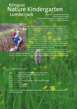
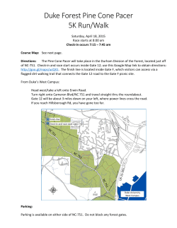


© Copyright 2026