
WHY ELEPHANT ROAM Shadrack Mumo Ngene
WHY ELEPHANT ROAM Shadrack Mumo Ngene ITC dissertation number 171 ITC, P.O. Box 6, 7500 AA Enschede, the Netherlands ISBN 978-90-6164-290-9 Cover designed by Benno Masselink Printed by ITC Printing Department Copyright © 2010 by Shadrack Ngene WHY ELEPHANT ROAM DISSERTATION To obtain the doctor’s degree at the University of Twente, on the authority of the Rector Magnificus, prof.dr. H. Brinksma, on account of the decision of the graduation committee, to be publicly defended on Wednesday 19 May.2010 at 13.15 hrs by Shadrack Mumo Ngene born on 18 July 1968 in Kitui, Kenya This thesis is approved by Prof. dr. Andrew K. Skidmore, promotor Prof. dr. Herbert H.T. Prins, promotor Dr. Hein A.M.J. van Gils, assistant promotor To my wife Felistus Matha, children Faith Kalunda and Francis Muthui Acknowledgements This work could not have been completed without the input and support of many people. I take this opportunity to thank some of them. Firstly, I am grateful to my promotor Prof. Andrew K. Skidmore of the International Institute of Geo-Information Science and Earth Observation (ITC), Prof. Herbert T. Prins of Wageningen University, and assistant promotor Dr. Hein van Gils (ITC, The Netherlands) for their guidance and encouragement throughout this work. I acknowledge Sipke Van Wieren (Wageningeni University, The Netherlands), and Dr. Boniface Oindo (Maseno University, Kenya) for reviewing the thesis chapters. Prof. Andrew Skidmore was instrumental in accepting me as his PhD student in early 2005. He pursued funding for me through a PhD scholarship from the ITC research fund. I also greatly honour and appreciate his scientific contributions. Without his continuous encouragement I could not have completed this work. Prof. Andrew Skidmore, I enjoyed working with you during my PhD period, and still appreciate the many meetings we had from which I learned a lot about remote sensing and GIS. Prof. Andrew Skidmore, you were supportive, friendly, and contributed immensely to my PhD thesis. You taught me the tricks of publishing manuscripts and you were my inspiration throughout my stay in Netherlands I greatly acknowledge the contribution of Prof. Herbert T. Prins, who kept on providing stimulating new ideas during our discussions throughout my entire PhD. Discussions with Prof. Herbert were always thrilling but scientifically challenging. Many thanks go to Dr. Hein van Gils, Dr. Bert Toxopeus, Dr. Sipke van Wieren, and Dr. Boniface Oindo for reviewing my first draft manuscripts. You were all friendly and reviewed my draft manuscripts promptly. I appreciated your open discussions on the ecology of elephant movement as well as on life issues. To ITC, the African Parks Conservation (APC, The Netherlands), the United States Fish and Wildlife Service (USFWS), and the Kenya Wildlife Service (KWS) European Union (EU) funded Elephant Research Fund (ERF), I am deeply indebted for providing me with a fully funded PhD position to work on this thesis. At Kenya Wildlife Service headquarters, many people supported my studies. I am grateful to Dr. Julius Kip’ngetich (Director, KWS) for leading the fund i raising for purchase of the satellite linked GPS collars used in this study. Your willingness to hold several meetings in Serena hotel (Nairobi, Kenya) after working hours and over the weekend motivated me to work in Marsabit, a hardship area. Dr. Richard Bagine (former Deputy Director - Biodiversity Research and Monitoring, KWS) and Dr. Samuel Kasiki (current Deputy Director - Biodiversity Research and Monitoring, KWS) provided the necessary administrative support and technical input during my fieldwork and the period during which I was writing my thesis. Drs Patrick Omondi (Senior Assistant Director - Species Conservation and Management, KWS) was instrumental in raising funds from the European Union’s KWS-ERF and USFWS and I greatly appreciate his efforts to make sure that the project proposal was accepted for funding. I thank Drs Sharon Kisire (Head of human capital, KWS) and Joseph Onyango (former training manager, human capital department, KWS) for facilitating clearance from the director’s office, a requirement for my many travels from Kenya to the Netherlands. I thank Dr. Francis Gakuya (Head of veterinary department, KWS) and Dr. Chege (Veterinary department, KWS) for facilitating and immobilizing the elephant during the collaring operations. Lastly I thank the support I had from Wicliff Mutero and Joseph Mukeka (both of KWS-GIS unit), who ensured that I received all the necessary shape files for the study area promptly. They also provided technical support in GIS analysis. Special thanks to the Head of KWS airwing, Pilot Major (rtd) Solomon Nyanjui for ensuring that an aircraft was allocated in times when I needed to fly to Marsabit, and for being our helicopter pilot during the collaring operation in April 2007. Many other staff in KWS contributed to my study in one way or another, including Moses Litoroh, Drs Erustus Kanga, Apollo Kariuki, Thomas Mailu, Felix Mwangangi, Pilot Robert Obrien, Pilot Kiroken, Pilot Mwiti, and Mwanahamis Twalib. You made me achieve my field work goals and gave me words of encouragement, which kept me working hard to complete writing this thesis. My deepest appreciations are extended to all the members of Marsabit Protected Area with whom I stayed during field work. I thank Dr. Iain Douglas-Hamilton, Dr. Henrik Rasmussen, Drs Jake Wall, David Dabaleen, and the late Dr. Kashimir, all of Save the Elephant trust for their fieldwork and technical support. To Dr Iain Douglas-Hamilton, you efforts to ensure that we received the funding from APC are highly appreciated. Your aerial support during collaring operations made our work of deploying the collars easier. Henrik, Jake, and David, without your field and technical support, it could have been difficult for me to fix the collars on the elephant. I thank you all for your jokes and encouragements. ii I would like to thank Prof. Dr. Martin Hale and Ms. Loes Colenbrander for their admirable research administration. My stay in ITC was also facilitated by the support of the Education Affairs department, with special thanks to Marie Chantal Metz, Theresa van den Boogaard and Bettine Geerdink. Particular thanks go to Carla Gerritsen, Marga Koelen and Petry Maas–Prijs of the ITC library for their support and facilitation with acquiring articles and books from outside the ITC library. I thank Marjolein Woerlee and Saskia Groenendijk for organizing my accommodation during my stay in Enschede. I recognize and appreciate Esther Hondebrink for her secretarial supports and ensuring that I had opportunities to meet with Prof. Andrew Skidmore. Also, thanks to Marco van Druten, Frans Gollenbeek, Marion Pierik and Kim Velthuis for their support in all financial matters. Special thanks to Thea de Kluijver for her unrelenting help with keeping us healthy and physically fit. Thanks to Ginie Gerrits, Hellen Murad, and Wendy Stiksma, you made my travelling to and from The Netherlands and Kenya possible. I am grateful to the geo-technical support team at ITC, without their appropriate and speedy support it would have been difficult to have written this thesis. My acknowledgements go to Ard Kosters, Gerard Leppink for their IT support and Benno Masselink and Job Duim for all other logistical help. I also thank Patricia Meijer, Secretary Resource Ecology Group, Wageningen University, for organizing our many meetings with Prof. Herbert Prins. Sincerest thanks go to my generation of PhD candidates. I feel grateful to be part of this fabulous group. As PhD studies take a long time, it is difficult to mention all the friends and colleagues. But among them: Dr. Peter Minang, Dr. Marleen Nooman, Dr. Moses Cho, Dr. Roshanak Darvishzadeh, Dr. Chudamani Joshi, Dr. Jane Bemigisha, Dr. Pieter Beck, Dr. Wang Tiejun, Richard Onchaga, Si Yali, Yanqiu Xing, Guofeng Wu, Claudia Pittiglio, Ha Nguyen, Nicky Knox, Mobushir Riaz Khan, Mohammad Abouali, Abdulmaged Alhemiary, Filiz Bektas, Meng Bian, Sabrina Carvalho, Anas Fauzi, Teng Fei, Atkilt Girma, Nima Moin, Jeniffer Kinoti, Abel Ramoelo, Ben Wielstra, Si Yali Ha Nguyen, Sureeporn Nipithwitaya, Ouyang Wei, Monica Lengoiboni, Tyas Mutiara Basuki, Mhosisi Masocha, Ajay Kumar Katuri, Anthony Arko Adjei, Lal Muthuwatta, Adam Nyaruhuma, Alphonse Nkurunziza. Kitsiri Weligepolage, Iswar Das, and the lates Emmanuel Owusu and Dan Omolo are worth mentioning. Special thanks go Mhosisi Masocha not only because he was my first office mate but also for his encouragement and advice, especially during the first six months of my PhD course. His technical support during my entire study period is highly appreciated and his scientific publishing knowledge and advice was of great help. iii I am grateful to all Kenyan students for supporting me in one way or another during my stay in Enschede. All of you were really supportive and your encouragement renewed my energy to keep on working during the most difficult phases of this journey. Special thanks go to Richard Onchaga, Peter Masika, Peter Mapusia, Zack Kuria, Richard Kyuma, and the late Dan Omolo. I also thank all my friends from different countries for their honourable support. My strongest support came from my family as they always kept sending me good wishes and encouragement from Kenya. I am grateful to my dearest wife (Felistus Matha), daughter (Faith Kalunda) and son (Francis Muthui) who were the source of all my aspiration, encouragement and strength. Without your support I would not have had the energy to complete this work. Last but not least, I extend my gratitude to my mother, brothers, sisters and in-laws for their encouragement throughout my study. They gave me and my family a lot of support and I thank them all. I will remain grateful to them all my life. iv Table of Contents Acknowledgements .................................................................... i Table of contents. ..................................................................... v Chapter 1 ................................................................................ 1 1. General introduction ........................................................... 2 Chapter 2 ...............................................................................21 2. Elephant distribution around a volcanic shield........................22 Chapter 3 ...............................................................................43 3. Ranging patterns of elephant ..............................................44 Chapter 4 ...............................................................................69 4. Intensity of elephant occupancy ..........................................70 Chapter 5 ...............................................................................95 5. Walk or stride? A question for roaming elephant ....................96 Chapter 6 ............................................................................. 121 6. Roaming elephant track rain-driven vegetation dynamics ...... 122 Chapter 7 ............................................................................. 143 7. The cost of living with elephant ......................................... 144 Chapter 8 ............................................................................. 159 8. General discussion........................................................... 160 Summary ............................................................................. 185 Samenvatting ....................................................................... 187 Author’s biography................................................................. 191 Author’s publications .............................................................. 193 ITC Dissertation List............................................................... 195 v vi Chapter 1 General Introduction 1 General introduction 1. General Introduction 1.1 Taxonomy, distribution and status of the African elephant The African elephant (Loxodonta africana) and the Asian elephant (Elephas maximus) are the surviving species in the order proboscidae. Both genera originated in sub-Saharan Africa in the early Pleistocene (Sukumar, 2003; Krause et al., 2006). Loxidonta remained in Africa while Elephas moved into Asia during the late Pleistocene (Maglio, 1973). Two subspecies of Loxodonta are recognized: Loxodonta africana cyclotis (the forest elephant; figure 1-1A) and Loxodonta africana africana (the savanna elephant; figure 1-1B; Spinage, 1994). The taxonomy of a third subspecies which lives in mosaics of forest and savanna has not been determined (Blanc et al., 2007; Spinage, 1994). The Loxodonta africana africana inhabits mainly Eastern and Southern Africa, while the Loxodonta africana cyclotis occurs predominantly in the Congo Basin of Central Africa (Blanc et al., 2007). The West African elephant occupy mosaics of forest and savanna. These elephant share morphological characteristics with both the forest and the savanna elephant (Blanc et al., 2007). In some areas in East Africa (e.g., Mount Marsabit, Mount Kenya, Aberdare ranges, in Kenya; Mount Kilimanjaro in Tanzania; the Ruwenzori Mountains in Uganda) elephant also occur in mosaics of forest and savanna (Blanc et al., 2007). The three categories of elephant interbreed in regions where their ranges overlap (Kingdon, 1997). Some genetic studies have suggested that the two subspecies of African elephant, savanna and forest elephant, are in fact two distinct species namely, Loxodonta africana (Blumenbach 1797) and Loxodonta cyclotis (Matschie 1900) respectively (Comstock et al., 2002; Eggert et al., 2002; Grubb et al., 2000; Roca et al., 2001; Roca et al., 2005). These genetic studies have in turn been criticized on the grounds that their sampling was insufficiently extensive (Blanc et al., 2007). To date taxonomists have not agreed on the classification of African elephant. To avoid the ambiguity of describing elephant according to inconclusive taxonomy, the International Union for Conservation of Nature (IUCN) recognizes Loxodonta africana as a single species (AfESG, 2009). This thesis recognizes the Marsabit elephant as a savanna population. About ten thousand years ago, the Loxodonta was widespread throughout Africa (Sukumar, 2003). Today, the genus occurs in sub-Saharan Africa where it occupies different biomes. These biomes include deserts (e.g., Namib Desert; Etosha; Blanc et al., 2007; Gourma region, Mali; Blake et al., 2002), savanna (e.g., Amboseli National Park and Maasai Mara National Reserve, Kenya; Serengeti National Park, Tanzania; Kruger National Park, South Africa; 2 Chapter 1 A B Figure 1-1: Morphological differences between A: African forest elephant and B: African savanna elephant. The forest elephant has rounded ears and almost straight, downward pointing tusks, while the ears of the savanna elephant have the “map of Africa” shape and the tusks curve upwards (Spinage, 1994). Photo A: from Google; Photo B: from Save the Elephant (2007). Blanc et al., 2007), equatorial rainforest (e.g., Congo and Gabon forests; Blanc et al., 2007), swamps (e.g., Amboseli swamp, Kenya; Blanc et al., 2007), woodlands (e.g., Caprivi area, Northern Botswana and Namibia ; Miombo woodlands, Tanzania; Blanc et al., 2007), floodplain grasslands (e.g., Caprivi area, Botswana and Namibia; Blanc et al., 2007; Zambezi, Zambia; van Gils et al., 1988), agricultural landscapes (e.g., Sebugwe region; Zimbabwe; Muwira et al., 2003; Meru-Isiolo region, Kenya; Blanc et al., 2007;), bushland (e.g., Tsavo National Park, Kenya; Blanc et al., 2007; Addo National Park, South Africa; Whitehouse & Hall-Martin, 2000) and high altitude mountain forests (e.g., Kibale forest; Uganda; Mount Kenya and Aberdare ranges, Kenya; Virunga, Rwanda; Mount Kilimanjaro, Tanzania; Blanc et al., 2007). The current status of the elephant population in these biomes is described by Blanc et al. (2007). The distribution of elephant in Kenya and specifically Marsabit is presented in figure 1-2 (AfESG, 2009). The distribution map for each country is updated by a single person answering a questionnaire, which inevitably affects the collection of range information (Blanc et al., 2007). Before 2006, information on the distribution of elephant in Marsabit was based on an informed guess (Blanc et al., 2007). Blanc et al. (2007) estimated the population of the African elephant to be about 0.5 million individuals, with the East African region accounting for over 90 thousand individuals. Kenya accounts for about 23 thousand individuals, with the largest population of about 12 thousand elephant occupying the Tsavo ecosystem (Blanc et al., 2007). About 150-300 elephant are found in the Marsabit forest and lowland shrubs (Blanc et al., 2007; Robert Obrien pers. comm.). Over the years, the elephant population has been threatened by various factors discussed in section 1.2. 3 General introduction A B Figure 1-2: A: Map showing the distribution of elephant in Kenya; source: African Elephant Specialist Group (AfESG), 2009. The distribution of elephant in Marsabit (northern Kenya) is circled. B: The distribution of elephant in and around the Marsabit Protected Area according to AfESG (2009) and this study: source: African Elephant Specialist Group (AfESG, 2009; Blanc et al., 2007) and the Marsabit elephant monitoring project. 1.2 Threats to elephant Communities in Africa used to hunt animals for economic, social, and cultural reasons (Steinhart, 1989). The hunters originally used simple traditional weapons, mainly bows and poisoned arrows which did not cause serious threats to the existence of the elephant (Steinhart, 1989). In addition, the cultural norms and totems associated with hunting of wild game in some communities (e.g., Maasai, Meru, and Kikuyu communities in Kenya) helped to conserve big herds of elephant (Adams, 2004). However, the hunting groups started to acquire better techniques and guns for hunting from the early foreign traders and explorers, thereby transforming the hunting culture (Steinhart, 1989; Stone, 1972). Guns made it easier to kill elephant, which accelerated the decline of the elephant population (Adams, 2004). For example, hunting elephant for ivory eliminated them from northern Africa by the 18th century, when the area was still grassland (Douglas-Hamilton, 1992). From about the mid-18th century, elephant also started to disappear from the Zambezi floodplains in Zambia due to hunting for ivory (van Gils et al., 1988). 4 Chapter 1 About 1895, Africa experienced an influx of foreign traders, explorers, hunters, missionaries, and large scale farmers. This influx occurred after the pioneers returned to their homeland and shared the African experience with relatives and friends (Adams, 2004). In addition to hunting, farmers established large scale farms on fertile areas, resulting in the destruction of elephant habitat (Adams, 2004). The farms were fenced to prevent wildlife from destroying crops, which resulted in blockage of key migratory corridors. In addition, these farmers possessed a license allowing them to kill any wild animal which destroyed crops or other property on their farms (Adams, 2004; Steinhart, 1989). As a result, hundreds of animals, especially elephant and rhinos, were killed to prevent or avenge the destruction of crops and fences on these large scale farms (Steinhart, 1989). Although hunters had various motives ranging from fame to prestige and trophies, hunting for ivory had the greatest impact, leading to the decline in the population of African elephant (Adams, 2004). After 1895, governments in African countries started to realize that the population of elephant was in decline (Adams, 2004; Grove, 1976; Mackenzie, 1976). This realization led to initiatives to establish areas for the protection of elephant and other wildlife (Adams, 2004; Grove, 1976). In Kenya for example, the first game ordinance was enacted in 1897 to protect species from unlicensed hunting. However, the effects of the World Wars (1914-1918 and 1939-1945), coupled with famine, a rinderpest outbreak (1918-1919) and more bouts of famine (1928-29; 1940) led to a further significant decline in elephant populations. The price of ivory usually went up during periods of war and famine, which caused the poaching problem to escalate (Steinhart, 1989; Stone, 1972). As efforts to establish protected areas in Africa continued, awareness campaigns on the effects of hunting on the wildlife population were also undertaken at local, national and international levels (Adams, 2004; Grove, 1976). After the Second World War (1939-1945) and through 1960s, protected areas, where hunting of any wildlife was prohibited by law, were established in most African countries. The control of hunting through licensing and the establishment of protected areas resulted in an increase in the number of elephant in the 1960s. This higher number of elephant in turn resulted in destruction of vegetation (e.g., Queen Elizabeth National Park, Uganda; Laws, 1970; Tsavo ecosystem, Kenya; Morchand, 1965; Kruger National Park, South Africa; Caprivi region, Namibia and Botswana; Ngorongoro, Tanzania; Sikes, 1966). To minimize this destruction, elephant culling programs were introduced in the affected areas (Cumming et al., 1990). The period with a 5 General introduction high elephant population (in the 1960s) was short-lived, as the population of African elephant started to decline again in the 1970s (Cumming et al, 1990). Four factors were responsible for this decline (Blanc et al., 2007). Firstly, the civil wars in Uganda, Rwanda, Mozambique, Chad, Mali, Somalia, Burundi, and the Democratic Republic of Congo resulted in illegal killing of elephant for ivory and food (Blanc et al., 2007). Secondly, in politically stable countries (e.g., Kenya, Tanzania, Zambia, Malawi, Zimbabwe, Ethiopia, South Africa, Botwana, and Namibia) hunting for ivory reduced the population of elephant (Blanc et al., 2007; Cumming et al., 1990; Douglas-Hamilton, 1989; figure 13). Illegal hunting of elephant in Africa reduced their population from about 1.3 million in 1979 to fewer than 650,000 in 1991 (Douglas-Hamilton et al., 1992). Thirdly, the development of roads and railways in Central and West African forests enabled poachers to penetrate into elephant ranges not previously visited. For example, in Central Africa, poaching was intensified by the development of new roads constructed for logging operations as well as mineral and oil explorations and extraction (Blanc et al., 2007). The new roads provided access deep into the forest and routes for the transport of ivory and meat (Blanc et al., 2007). Accessibility of the West African elephant range via roads and railways led to their eradication through hunting (Blanc et al., 2007). In the Central African Republic, poachers also used roads to access areas utilized by elephant to illegally kill these elephant (Blom et al., 2005). A B Figure 1-3: Poached elephant with tusks removed. Photo A: a poached elephant in Marsabit, about 2 km from Marsabit town, about 100 m east of the Marsabit-Isiolo main road (Source: photo by the author, 2007); Photo B: A poached elephant in an undisclosed locality (Source: GoogleTM). Fourthly, the increase in human population/settlements, as well as the area under logging, crop farming, and development of infrastructure reduced the population of elephant through destruction and fragmentation of elephant habitat (Blanc et al., 2007; Naughton-Treves & Weber, 2001). This also occurred in West Africa, where forest destruction led to eradication of the 6 Chapter 1 elephant (Blanc et al., 2007). In areas such as Marsabit where the area covered by farms and settlements has been increasing over the years and poaching is high, the elephant population has declined (figure 1-4; figure 1-5). The farm area was proportional to the population size, but the elephant population in Marsabit decreased with the increase in human population and area used for farms and settlements (figure 1-5). The elephant population in Marsabit Protected Area decreased from approximately 900 animals in 1973 to approximately 150-300 animals in 2007, an average loss of about 21 individuals per year (Thouless et al., 2008; Litoroh et al., 1994; Oroda et al., 2005; figure 1-5). Figure 1-4: Former elephant range around Marsabit Protected Area which is currently farmed (2007). These areas (north west, north, and north east of Mount Marsabit) were once utilized by elephant before crop farming was introduced in the 1970s. Mount Marsabit is visible in the background. (Source: photo by the author, 2007). The increase in area used for settlements, logging, and farming results in fragmentation and reduction of the elephant range, thereby interfering with the movement of elephant. This has led to elephant populations being confined to areas, which are small, fragmented and isolated (Cumming et al., 1990). The implications are discussed in section 1.3. 7 General introduction 35000 1000 900 Elephant population (No.) 25000 700 600 20000 500 15000 400 300 10000 200 Farms & settlements (sq. km) 30000 800 5000 100 0 0 11000 17000 22100 30450 39375 43000 45150 Human population Elephant population Farms & settlements Figure 1-5: Numbers of elephant in Marsabit Protected Area (columns), and farms and settlements (km2, black line) against human population (numbers) in the area adjacent to Marsabit Protected Area. Source of data: Thouless et al. (2008), Blanc et al. (2007), Oroda et al. (2005), and Litoroh et al. (1994). 1.3 Elephant movement, corridors and confinement Changes in land cover, increase in human population, and fencing of protected areas or farms often result in loss and fragmentation of elephant habitat, obstructing of their seasonal movements and confinement. Studies by Dolmia et al. (2007), Douglas-Hamilton et al. (2005), Waithaka (1994), Western (1989), Field (1971), and Darling (1960) have shown that elephant movement and migration are important as they enable elephant to obtain resources (e.g., forage, saltlicks, drinking water, shelter, and mates) or avoid disturbances from humans due to hunting, farming, or livestock grazing. In addition, migration allows the elephant habitats to recover (Ipavec et al., 2007; Waithaka, 1994). Elephant use specific corridors for migration. These corridors connect two or more areas, on average about 10 km apart (Chapter 3; Douglas-Hamilton et al., 2005), and utilized by elephant during different periods (Chapter 3). A corridor is about 2 to 7 km wide (Chapter 3). However, as free movement is threatened by fragmentation of the elephant range and obstruction of used corridors, confinement of elephant will be the result (Waithaka, 1994). According to the island biogeography theory, confinement of elephant in small 8 Chapter 1 and isolated areas has adverse effects on the ecology of those areas and may cause local extinction (Mac-Arthur and Wilson, 1967). Confinement of elephant has a negative impact on their habitat as the elephant start ring-barking and knocking down trees (Waithaka, 1994; Caughley, 1976; Laws et al., 1970). As a result the forest may be converted into open savanna or grassland (Caughley, 1976). Confinement of elephant also causes inbreeding and loss of genetic diversity (Caughley, 1976; Armbruster & Lande, 1993). Inbreeding may be avoided if the isolated population is large. One to three hundred elephant is considered to be the minimum viable population size with a high (>99 %) probability of survival over the next 100 years (Sukumar, 1995). However, populations of only a few hundred individuals would be unable to survive serious catastrophes (Sukumar, 1995; Armbruster & Lande, 1993). A total of at least 3000 elephant (1.2 elephant per km2) are required to ensure their long-term conservation (Sukumar, 1995; Morley, 2006; Armbruster & Lande, 1993). A population of a few thousand individuals has a 99 % probability of surviving for 1000 years (Morley, 2006; Armbruster & Lande, 1993). Based on the above, the current elephant population in Marsabit (about 150-300 individuals) is stable in the short term, but unstable in the long term. The challenge in Marsabit is to not just maintain the elephant population size but restore it to a population size viable in the long term. 1.4 Wildlife telemetry, remote sensing and Geographic Information Systems Wildlife was tracked and recorded on foot in the 1960s (Whyte, 1996). Radiotracking telemetry was introduced in the 1970s (Douglas-Hamilton, 1973). The radio-collared animals were followed on foot, in a vehicle or from an aircraft, which limited tracking to daylight hours. Other disadvantages are also discussed in detail by Whyte (1996) and include inaccuracies incurred by system errors, movement errors, geometric errors, and topographic errors. Satellite radiotracking is a new technology which improves the logistics of data acquisition by overcoming many of the deficiencies of past radio-tracking telemetry techniques (Douglas-Hamilton et al., 2005). Hazardous weather conditions, darkness, remoteness and extensive animal movement no longer hinder the systematic collection of data (Fancy et al., 1988). Satellite tracking of wildlife has been possible since the early 1980s, using a system operated from France by Service Argos (France) and the National Oceanic and Atmospheric Administration (NOAA) meteorological satellites. The Argos system depended on TIROS satellites operated by NOAA, which orbit round the earth at an altitude of 850 km, with approximately 14 9 General introduction overpasses per calendar day. Radio signals are sent out from a platform transmitter terminal (PTT) on the elephant at specific time intervals. As a satellite passes over the PTT signals are detected. If a sufficient number of signals are received during an overpass, the satellite can calculate the location of the PTT. However, the Argos and NOAA telemetry systems fitted to the elephant experienced difficulties associated with elevation, speed, transmitter instability, and satellite orbit errors, as outlined by Harris et al. (1990). This motivated an improvement in satellite based wildlife telemetry and resulted in the development of satellite-linked geographical positioning systems (GPS) collars. The GPS records the location of the collared animal and relays the position data to a satellite. The data are retrieved from the satellite and sent to a ground station, then on to a server, and finally to a desktop via interface software. Having an internet connection is a prerequisite for data downloading. This new technology has been successfully used in research on movement of polar bears, caribou, musk oxen, wandering albatrosses and a variety of other species (Fancy et al., 1988; Harris et al., 1990). It has also been used on elephant in Namibia (Leggett, 2006), Kenya (Thouless, 1996; Douglas-Hamilton et al., 2005), Tanzania (Galanti et al., 2006), Cameroon (Tchamba et al., 1995), and South Africa (Grainger et al., 2005). An advance in Geographic Information System presents an opportunity for analyzing elephant movements in relation to biophysical and anthropogenic data (Douglas-Hamilton et al., 2005). Remotely sensed bio-physical data (NDVI and DEM) is available and can be used for analysis of elephant movement and distribution (NASA, 2000). Advances in Geographic Information Systems (ESRI, 2006) have facilitated the overlay of location data in relation to biophysical and social factors. Spatial analyst and spatial statistics tools in ARCGIS 9.2(3) have made such overlays and analysis possible (Mitchell, 2005). 1.6 Research objectives and questions In this thesis, the distribution, movement, and occupancy intensity of elephant in Marsabit Protected Area are analyzed. The findings are used to propose management strategies to help protect the elephant in the area in the short and long term. The objectives of this thesis are: To record, map, understand and explain the distribution of elephant in Marsabit Protected Area; To identify, map, and understand the movement routes and corridors the elephant use; To record and understand the intensity of elephant occupancy in Marsabit Protected Area; 10 Chapter 1 To record and understand the variations in the speed elephant herds move; To establish the costs incurred by people living next to Marsabit Protected Area, the main habitat for the Marsabit elephant; To suggest management strategies to help create a sustainable Marsabit elephant population; The following questions form the basis of this research: What influences the distribution of elephant in Marsabit Protected Area? Why do elephant roam within Marsabit Protected Area? What is the range the elephant use in the wet and the dry season in Marsabit Protected Area and surroundings? What is the size of these ranges? Where are the elephant migratory routes and corridors to and from the Marsabit Protected Area located? What is their length and width? How much time do elephant spend in the different parts of their distribution area? How fast do elephant move and why? Do elephant track the NDVI as proxy/surrogate for seasonal greening of the forage? How much money do farmers living next to Marsabit Protected Area lose because of crop destruction by roaming elephant? 1.7 Study Area The study was conducted in Marsabit National Park (about 360 km2) and Reserve (about 1,130 km2), which are jointly labeled as protected area (figure 1-6) and located at longitude 37020’ E and latitude 20 20’ N. The climate of the Marsabit Protected Area is characterized by two rainy seasons, with peaks in April and November. The annual rainfall varies from about 50 to 250 mm on the plains and about 800 to 1000 mm on the mountain. The evaporation rate ranges from about 2400 to 2600 mm/year. The eco-climatic zone of the forest is categorized as sub-humid and the surrounding plains as very arid (Eiden et al., 1991). The defining feature of the protected area is Mount Marsabit (about 1680 m) with about 125 km2 of evergreen forest (Oroda et al., 2005). The mountain is a dormant shield volcano dating back to the tertiary period (McLaughlin et al., 1973). The surrounding gently sloping plateau is also of volcanic origin. Spectacular craters are found in the mountain. The most prominent are Sokorte Dike and Gof Sokorte Guda with their crater lakes. These lakes are both within the forest and frequented by elephant. Two other notable craters that lie outside 11 General introduction the forest are Gof Bongole and Gof Redo. These craters have seasonal waterholes, and are frequented by elephant at the onset of the dry season (McLaughlin et al., 1973). Marsabit Protected Area has a water deficit (Loltome, 2005). Only Mount Marsabit supplies water (spring and wells) to the surrounding areas. No permanent rivers originate from Mount Marsabit (Oroda et al., 2005). Permanent springs do occur inside the forest and at its edges (Loltome, 2005). The vegetation within the Marsabit Protected Area ranges from evergreen forest to semi-deciduous and deciduous bushland, deciduous shrubland, and finally perennial grassland (Harlocker, 1979). The evergreen forest occurs at high elevations (over 1000 m; Oroda et al., 2005). Frequently occurring forest tree species are Croton megalocarpus, Strombosia schleffler, Diospyros abyssinica, Olea Africana, and Olea capensis (Schwartz, 1991). The lowlands (below 1000 m) are dominated by savannas, mosaics of shrubs, sparse grasses and sparse trees, (Oroda et al., 2005). Common savanna trees, shrubs and grasses include, respectively: Acacia brevispica and Boscia minimifolia; Bauhinia tomentosa, Phyllanthus sepialis, Grewia fallax and Aspilia mossambicensis; Eragrostis tenuifolia, Themeda triandra, Chenopodium quinoa and Cynodon dactylon (Schwartz, 1991). Common plants consumed by Marsabit elephant include Bauhinia tomentosa, Phyllanthus sepialis, Glewia fallax, Acacia brevispica and Aspilia mossambicensis (Githae et al., 2007). Mammals in the Marsabit Protected Area include: the African elephant (Loxodonta africana), the greater kudu (Tragelaphus strepsiceros), the African buffalo (Syncerus caffer), the bushbuck (Tragelaphus scriptus), the common duiker (Sylvicapra grimmia), the warthog (Phacochoerus aethiopicus), the olive baboon (Papio anubis), the vervet and syke’s monkey (Cercopithicus aethiops and C. mitis), the lion (Panthera leo), and the leopard (Panthera pardus; Williams, 1994). 12 Chapter 1 Figure 1-6: Location of Marsabit Protected Area (MPA) and the protected areas in Kenya. The dark arrow at the background shows the location of MPA (circled) in northern Kenya (Source: KWS GIS database). The rural neighbours of the Marsabit Protected Area are either semi-nomadic pastoralists (the Rendile, Gabbra, and Boran communities) or crop farmers 13 General introduction (Burji community). Rain-fed crop farming and its associated sedentary lifestyle is increasingly being adopted by the previously nomadic pastoralists in areas suitable for maize, beans, bananas, fruits and vegetables. The crop farmers keep some livestock in the dry lowlands. 1.8 Outline of the Thesis This thesis contains a collection of research papers accepted or published in peer reviewed journals or international and regional conference proceedings. The thesis is organized into eight chapters. Chapter 1 presents a general introduction to the spatio-temporal features of elephant. The African elephant and threats to its survival are introduced. The implications of confining elephant populations are outlined. Subsequently, the research objectives, questions, and the study area are introduced. Chapter 2 researches the distribution of elephant around a volcanic shield dominated by a mosaic of forest and savanna in the Marsabit Protected Area, Kenya. Principal component analysis, as well as correlations and regression analysis are applied to understand the distribution of elephant. The implications of the expansion of settlements for the conservation of elephant in Marsabit are also discussed. Finally, options for mitigating threats by settlement expansion are suggested. Chapter 3 analyzes the ranging patterns of elephant in the Marsabit Protected Area and beyond. The seasonal and daily movement patterns of elephant are analyzed using remotely sensed data and GIS. One way analysis of variance is used to identify seasons when the speed of movement of bachelor and female family herds significantly differed. The elephant ranges in the dry, intermediate and wet seasons are established. Maps visualizing the corridors/routes and occasional dispersal are provided. New protected areas, safe settlement zones, and farming zones are recommended to policy makers based on the findings. Chapter 4 aims to provide an understanding of the time-density of elephant in the Marsabit Protected Area. Maps visualize the time-density of elephant herds. The biophysical and anthropogenic factors influencing the time-density are analyzed. From fourteen biophysical and anthropogenic factors, the five most important are selected by factor analysis. Three factors are isolated as major determinants of the time-density through the use of binary logistic regression analysis. Finally, a deductive model is developed to explain the time-density of elephant. 14 Chapter 1 Chapter 5 visualizes and analyzes the day and night time speed of movement of bachelor and female family herds of elephant. Firstly, one-way analysis of variance is used to isolate periods of the day when speeds significantly differed. Secondly, maps visualize locations of low (<200 mh-1) and high (>200 mh-1) speeds. Thirdly, the biophysical and anthropogenic factors which influence the speed are analyzed. From nine biophysical and anthropogenic factors, the four most important were identified using principal component analysis. Two of these factors are identified as major determinants of speed by using generalized linear/nonlinear (GLZ) multiple regression model with a multinomial distribution and a logit link. Areas for priority security patrols are recommended. Chapter 6 relates the seasonal movements of elephant to altitude, rainfall and NDVI. MODIS NDVI 16-day composite product, with a spatial resolution of 232 m was used. The NDVI trajectories are ratified using an altitudinal gradient and displayed jointly with the elephant movement data. Correlation between seasonal changes in green biomass and areas used by elephant are visualized. Relationships between rainfall, altitudinal seasonal distribution of elephant, home range sizes and overlaps with NDVI are analyzed using regression and correlation analysis. It is concluded that elephant track the NDVI over the seasons, i.e., they move to areas at high altitude with a high NDVI during the dry season and return to lower altitudes with higher NDVI values during the wet season. Chapter 7 aims to establish the costs incurred by people living next to Marsabit Protected Area, the main habitat for the Marsabit elephant. The quantity and costs of crops destroyed by elephant was assessed from August 2004 to July 2005 (excluding December 2004 and April 2005 due to rains). A chi-square test was used to isolate the season(s) and month(s) when the number of farms raided and the cost of crop raiding by elephant was high. The spatial distribution of crop raiding by elephant is visualized. The cost of sharing the environment with elephant was higher during the dry season than in the wet season as more farms were raided during the dry season. In total 414 farms were raided, with the farmers loosing KES 15,034,610 (USD 208,814) during the study period. Revival of the collapsed fence project in order to reduce the costs incurred by farmers due to elephant raiding their crops is recommended. In Chapter 8 (general discussion), the results of all chapters are compared and combined. The use of remote sensing and GIS to understand spatio-temporal patterns of elephant distribution is discussed. Management strategies required to manage crop destruction by roaming Marsabit elephant are recommended as well as recommentations for future reserach. 15 General introduction References Adams, W.M., (2004) Against Extinction: The Story of Conservation. Earthscan, London. Sterling, VA, 240 pp. AFESG [African Elephant Specialist Group] (2009) Loxodonta africana. In: IUCN Red List of Threatened Specie, Version 2009.1 (Ed. IUCN). Cambridge, United Kingdom. <www.iucnredlist.org> (Accessed 26 August 2009). Armbruster, P., & Lande, R. (1993) A population viability analysis for African elephant (Loxodonta africana): how big should reserve be? Conservation Biology 7, 602-610. Blanc, J.J., Barnes, R.F.W., Craig, G.C., Dublin, H.T., Thouless, C.R., Douglas-Hamilton, I. & Hart, J.A. (2007) African Elephant Status Report 2007: an update from the African Elephant Database. Occasional Paper Series of the IUCN Species Survival Commission No. 33. I. S. A. E. S. Group. Gland, Switzerland, IUCN: vi + 276 pp. Blake, S., Bouche, P., Rasmussen, H.B., Orlando, A. & Douglas-Hamilton, I. (2002) The last Sahelian elephant: ranging behaviour, population status and recent history of the desert elephant of Mali. Report, Save the elephant, Nairobi, Kenya. Blom, A., Zalinge, R., Heitkonig, M.A. & Prins, H.H.T. (2005) Factors influencing the distribution of large mammals within protected central African forest. Oryx 39(4), 381-388. Caughley, G. (1976) Plant-herbivore systems: In: Theoretical Ecology; principles and applications (Ed. R.M. Saunders). Philadelphia, Pennyslyvania, USA. Comstock, K.E., Georgiadis, N., Pecon-Slattery, J., Roca, A.L., Ostrander, E.A. & O'brien, S.J. (2002) Patterns of molecular genetic variation among African elephant populations. Mol Ecol. 11(12), 2489-98. Cumming, D.H.M., Toit, R.F., And Stauart, S.N. (1990) African elephant and rhinos: Status survey and action plan. IUCN, 72. Darling, F.F (1960) Wildlife in African Territory. Oxford University Press, London, United Kingdom. Dolmia, N.M., Calenge, C., Mailard, D. & Planton, H. (2007) Preliminary observations of elephant (Loxodonta africana, Blumenbach) movements and home range in Zakouma National Park, Chad. Afr. J. Ecol. 45, 594-598. Douglas-Hamilton, I, Krink, T. & Vollrath, F. (2005) Movement and corridors of African elephant in relation to protected areas. Naturwissenschaften 92, 158-163. Douglas-Hamilton, I. (1992) News and views: Indeference of the ivory trade ban. Oryx 26(1), 1-4. 16 Chapter 1 Douglas-Hamilton, I. (1989) Overview of status and trends of the African elephant. Technical extracts from the ivory trade and the future of the African elephant. Report 1. EEC/WWF African elephant programme, Wildlife Conservation International, Nairobi. Douglas-Hamilton, I. (1973) On the ecology and behaviour of the lake Manyara elephant. East African Wildlife Journal 11, 401-403. Eggert, L.S., Rasner, C.A., Woodruff, D.D. (2002) The Evolution and Phylogeography of the African Elephant Inferred from Mitochondrial DNA Sequence and Nuclear Microsatellite Markers. Proc. R. Soc. Lond. B (2002) 269, 1993-2006. Eiden, A., Keith, G. & Jonnes, M. (1991) Large scale monitoring of rangelands vegetation using NOAA/11 AVHRR LAC data. In: Range Management Handbook of Kenya Vol. III, Part IV. Ministry of Livestock Development, Nairobi, Kenya. Esri (Environmental Systems Research Institute) (2006) ArcGIS: Arc Map Version 9.2. ESRI, California, USA. Fancy, S.G., Pank, L.F., Douglas, D.C., Curby, C.M., Garner, G.W., Amsrup, S.C. & Regelin, W.L. (1988) Satellite telemetry: a new tool for wildlife research and management. U.S Fish and Wildlife Service Resource, Washington DC, United States of America. Field, C.R. (1971) Elephant ecology in the Queen Elizabeth national Park, uganda. E. Afri. Wildl. J. 9, 99-123. Galanti, V., Preatoni, D, Martinoli, A., Wauters, L.A. And Tosi, G. (2006) Space and habitat use of the African elephant in the Tarangire– Manyara ecosystem, Tanzania: Implications for conservation Mammals Biology 71(2), 99-114. Githae, E.W., Petiot, M.C., Mworia, J.K. & Odee, D.W. (2007) A botanical inventory and diversity assessment of Mt. Marsabit forest, a sub-humid montane forest in the arid lands of northern Kenya. Afr. J. Ecol. 46, 39-45. Grainger, M. Aarde, R. & Whyte, I. (2005) Landscape heterogeneity and the use of space by elephant in the Kruger National Park, South Africa. Afri. J. Ecol. 43, 369-375. Grove, R. (1976) Early themes in African conservation: the cape in the nineteenth century. In: Conservation in Africa: peoples, policies and practice (Eds. R. Grove & D. Anderson). Cambridge University Press, Cambridge, United Kingdom. Grubb P, Groves C.P, Dudley J.P. & Shoshani J. (2000) Living African elephant belong to two specices: Loxodonta africana (Blumenbach, 1797) and Loxodonta cyclotis (Matschie, 1900). Elephant 2, 1-4. 17 General introduction Harlocker, D.J. (1979) Vegetation of southern Marsabit, Kenya. IPAL technical report D-1. UNEP-MAB integrated project for arid lands, UNESCO, Nairobi, Kenya. Harris, S., Cresswell, W.J., Forde, P.G., Trewhella, W.J., Woollard, T. & Wray, S. (1990) Home-range analysis using radio-tracking data—a review of problems and techniques particularly as applied to the study of mammals. Mammal Review 20, 97-123. Ipavec, A., Malillard, D., Chardonnet, P., Danes, C., Wally, M., Lompo, M. & Dulieu, D. (2007) Elephant movement in W region park, West Africa. Pachyderm 43, 36-42. Kingdon, J. (1997) The Kingdon Field Guide to African Mammals. Academic Press, London Laws, R.M., Parker, I.S.C. & Johnstone, R.C.B. (1970) Elephant and their habitats in North Bunyoro, Uganda. East Afr. Wildl. J. 8, 163–180. Krause, J., Dear, P.H., Pollack, J.L., Slatkin, M., Spriggs, H., Barnes, I., Liste, A.M., Ebersberger, I., Paabo, S. & Hofreiter, M. (2006) Multiplex amplification of the mammoth mitochondrial genome and the evolution of Elephantidae. Nature 439, 724-727. Leggett, K.E.A. (2006) Home range and seasonal movement of elephant in the Kunene region, northwestern Namibia. African Zoology 41, 1736. Litoroh, M., Nicholas, A. & Masinde, P. (1994) A survey of the Marsabit National Park/Reserve elephant and large mammal population. An unpublished KWS report, Nairobi, Kenya. Loltome, M.L. (2005) Water resources assessment for the Marsabit mountain catchment areas and its associated watersheds. MSc Thesis, University of Nairobi, Nairobi, Kenya. Maglio, V.J. (1973) Origin and evolution of the Elephantidae. Transaction of the American Philosophical society 63, 1-149. Makenzie, J.M. (1976) Chivalry, social Darwinism and ritualized killings: the hunting ethos in Central Africa up to 1914. In: Conservation in Africa: peoples, policies and practice (Eds. R. Grove & D. Anderson). Cambridge University Press, Cambridge, United Kingdom. Mclaughlin, J.S., Dougherty, D.G. & Mclaughlin, E.C. (1973) A conceptual master plan for Marsabit National Reserve. A National Parks of Kenya report, Nairobi, Kenya. Mitchell, A. (2005) The ESRI guide to GIS analysis: Volume 2, spatial measurements and statistics. ESRI Press, Ridland, California, USA. Morley, R.C. (2006) The demography of a fragmented population of the savanna elephant (Loxodonta africana Blumenbach) in Maputaland. PhD Thesis, University of Pretoria, Pretoria, South Africa. 18 Chapter 1 Morchand. D.D. (1965) The Tsavo elephant: control shooting is a regrettable necessity it seems. Africana 24, 35. Naughton-Treves, N. & Weber, W. (2001) Human dimensions of the African rain forest. In: African rain forest ecology and conservation (Eds. W. Weber, L. J. T. White, A. Vedder & L. Naughton-Treves). Yale University Press, New Haven, Connecticut, U.S.A. Nasa [National Aeronautics And Space Administration] (2000) Shuttle radar topographic mission. NASA, Washington D.C., USA. Oroda, A.S.K., Olukoye, G.A., Koske, J. & Lambrechts, C. (2005) The impact of land sub-division and sedentarization on the land cover dynamics in Mt. Marsabit area, Kenya. Marsabit Forest Project: UNEP/AGREF Technical Report, UNEP, Gigiri, Nairobi. Roca, A.L., Georgiadis, N., O'brien, S.J. (2005) Cytonuclear genomic dissociation in African elephant species. Nature Genetics 37, 96-100. Roca, A.L., Georgiadis, N., Pecon-Slattery, J., O’brien, S.J. (2001) Genetic evidence for two species of elephant in Africa. Science, 293, 1473Ð1477. Schwartz, H.J. (1991) Marsabit District. In: Range Management Handbook of Kenya Vol. II Part I. Ministry of livestock Development, Nairobi, Kenya. Sikes, S.K. (1966) The elephant problem in Africa: random slaughter or selective husbandry? African Wildlife 20(3), 225-235. Spinage, C.A. (1994) Elephant. University Press, Cambridge, United Kingdom. Steinhart, E.I., (1989) Hunters, Poachers and Gamekeepers: Towards a Social History of Hunting in Colonial Kenya. The Journal of African History 30(2), 247-264. Stone, M.L. (1972) Organized Poaching in Kitui District: A Failure in District Authority, 1900 to 1960. The International Journal of African Historical Studies, 5(3), 436-452. Sukumar R (2003) The living elephant. Evolutionary ecology, behavior, and conservation. Oxford University Press, New York. Sukumar, R. (1995) Minimum viable population for Asian elephant conservation. In: A week with elephant (Eds. J.C., Daniel, and H., Datye). Bombay and Oxford University Press). New Delhi, India. Tchamba, M.N., Bauer, H. & De Iongh, H.H. (1995) Application of VHF-radio and satellite telemetry techniques on elephant in northern Cameroon. Afr. J. Ecol. 33, 335-346. Thouless, C.R. (1996) Home ranges and social organization of female elephant in Northern Kenya. African Journal of Ecology 33: 284-297. Thouless, C.R., King, J., Omondi, P., Kahumbu, P. & Douglas, I. (2008) The status of Kenya’s elephant. Save the Elephant, Nairobi, Kenya. 19 General introduction Van Gils, H.A.M.J. (1988) Environmental profile: western province, Zambia. Enschede; Mongu, ITC ; Provincial Planning Unit. 37 p. Waithaka, J.M. (1994) The ecological role of elephant in restructuring plants and animal communities in different eco-climatic zones in Kenya and their impact on land-use practices. Ph.D thesis, Kenyatta University, Nairobi, Kenya. Western, D. (1989) Why manage nature? In: Conservation for the 21st century (Eds. Western d. and M.C. Pear). Oxford University Press, New York, U.S.A. Whitehouse, A.M. & Hall-Martin, A.J. (2000) Elephant in Addo Elephant National Park, South Africa: reconstruction of the population's history. Oryx 34, 46-55. Williams, J.G. (1994) A Field Guide to the National Parks of East Africa. Collins, Cambridge, United Kingdom. Whyte, I.J. (1996) Studying elephant movements. In: Studying elephant (Kangwana, K., 1996 ed.). African Wildlife Foundation Technical Series Handbook No. 7, Nairobi, Kenya, pp. 75-89. 20 Chapter 2 Elephant distribution around a volcanic shield dominated by a mosaic of forest and savanna (Marsabit, Kenya) This chapter is based on: Shadrack M. Ngene, Andrew K. Skidmore, Hein van Gils, Iain, DouglasHamilton & Patrick Omondi (2008) Elephant distribution around a volcanic shield dominated by a mosaic of forest and savanna (Marsabit, Kenya). African journal of ecology 47: 234-245. 21 Elephant distribution around a volcanic shield 2. Elephant distribution around a volcanic shield dominated by a mosaic of forest and savanna (Marsabit, Kenya) Abstract We investigated the factors that influenced the distribution of the African elephant around a volcanic shield dominated by a mosaic of forest and savanna in northern Kenya. Data on elephant distribution were acquired from four female and five bull elephant, collared with satellite-linked GPS collars. Based on the eigenvalues (variances) of the correlation matrix, the percentage contribution of seven factor loadings in the observed variation of the elephant distribution were 15%, 13%, 11%, 10%, 9%, 8%, and 7%. All the other variables were correlated with distance to drinking water points and major road, and presence of shrubs; therefore their influence in the distribution of elephant was masked. A binary logistic regression model (Nagelkerke’s R2) including distance to major road and drinking water, and presence of shrubland as significant variables explained 92 % of the variances in the distribution of elephant in Marsabit Protected Area. The model could predict with certainty, 96 % the probability of elephant distribution. The elephant were found at high forested elevations during the dry season but they moved to the decidous lowlands shrubs during the wet season. The presence of elephant near permanent water points and major road during the dry and wet seasons respectively demonstrates that security and water are the most important determinant of their distribution throughout the year. We conclude that the distribution of elephant in Marsabit Protected Area and its adjacent areas is influenced mainly by major road (proxy for security) and drinking water. Key words: Principal component analysis, elephant, soils, forest, shrubland, satellite-linked GPS collars, Marsabit Protected Area 2.1 Introduction The distribution of animals, including elephant varies across landscapes. Interacting factors, which influence this distribution, include drinking water sources, forage, shelter, salt licks, soil fertility (nutrients for plants), slope angle and elevation (Blom et al., 2005; Tchamba et al., 1995; Thouless, 1996a & 1996b; Wall et al., 2006). Infrastructure (settlements, crop fields, roads, fences and so on) often restricts or compresses the elephant range and may block migratory routes (Newmark, 1996). 22 Chapter 2 Studies on the African elephant have analyzed home range, movement patterns, foraging behaviour, and population dynamics (e.g., Blake & Douglas-Hamilton, 2001; Thouless, 1995, 1996 a & 1996b; Tchamba at al., 1995; Douglas-Hamilton, 1973; Lindeque & Lindeque, 1991; Leuthold & Sale, 1973; Tchamba, 1993; Whyte, 1993; Grunblatt et al., 1995; DouglasHamilton et al., 2005; Galanti et al. 2000; Legget, 2006 among others). Technological limitations and associated high costs of radio-telemetry had made data collection over twenty four hour periods difficult (Thouless, 1995, 1996 a & 1996b; Leuthold & Sale, 1973). However, recent advancements in wildlife telemetry have tackled most of these limitations and allowed a refocusing of research on elephant distribution (Douglas-Hamilton et al., 2005). The development of satellite-linked geographical positioning system (GPS) collars has resulted in a better understanding of the interaction between elephant and their biotic and abiotic environment (Galanti et al., 2000). With this new technology, data on elephant locations may be collected over twenty four hour periods. This makes it possible to overlay elephant location data on environmental data layers and analyze their interactions, allowing researchers to establish the main factors influencing elephant distribution. GPS collars provide high spatial-temporal resolution and plot individual locations (Douglas-Hamilton et al., 2005). Our study is the first to track elephant in Marsabit, and then explain the elephant’ usage of a landscape dominated by a mosaic of forest and savanna. A mosaic of forest and savanna occurs around Mount Marsabit, a volcanic shield surrounded by a desert and semi-desert environment (McLaughlin et al., 1973). Owing to its high altitude of about 1680 m above sea level, the mountain receive an annual rainfall of between 800 mm and 1000 mm annual rainfall, which is adequate to support forest cover (Oroda et al., 2005). However, the areas below the peak of the mountain are characterized by a gently sloping plateau of volcanic origin (McLaughlin et al., 1973). The mountain peak with its gently sloping plateau makes the mountain look like a shield. The plateau receives less than 250 mm annual rainfall, which is adequate to support shrubby vegetation. The rich volcanic soils support nutritious plants, which are consumed by elephant (Ngene & Omondi, 2005). The mountain has permanent water sources, whereas water on the gently sloping plateau is available only during the rainy season (Loltome, 2005). Woody plants around the mountain are evergreen, whereas shrubs and trees on the gently sloping plateau shed their leaves and are consequently of less nutritional value to the elephant (Ngene & Omondi, 2005). Humans have settled around the mountain because of the availability of drinking water and good soils (Oroda et al., 2005). 23 Elephant distribution around a volcanic shield Space for elephant has decreased with increase of the human population, thereby causing changes in land use and even land tenure systems (DouglasHamilton et al., 2005). It is therefore important to understand and explain how different factors interact and influence the elephant distribution (Douglas-Hamilton et al., 2005). This knowledge may be used by park managers to effectively provide security for elephant throughout the year. In this paper, we quantify the impact of a set of environmental factors on the spatial distribution of elephant in Marsabit Protected Area. The potential implications of the extension of settlements schemes and drinking water points on the future of elephant conservation in Marsabit are also forecast. 2.2 Materials and methods 2.2.1 Study site Marsabit National Park (about 360 km2) and Reserve (about 1130 km2) are together labelled as a protected area (figure 2-1) and are centered on longitude 37020’ E and latitude 20 20’ N. Its precipitation regime is characterized by two rainy seasons, with peaks in April and November. The annual rainfall varies from 50 mm to 250 mm on the plains and 800mm to 1000mm on the mountain. The evaporation rate is high, at about 2400 to 2600 mm/year (Synott, 1979). The eco-climatic zone of the forest is categorized as sub-humid and the surrounding plains fall within the very arid category (Eiden et al., 1991). A characteristic feature of the protected area is Mount Marsabit (1680 m a.s.l), and its conspicuous evergreen forest covering about 125 km2 (Oroda et al., 2005). The mountain, a dormant remnant of a shield volcano, arose in the Tertiary (McLaughlin et al., 1973). The surrounding areas are characterized by a gently sloping plateau of volcanic origin (McLaughlin et al., 1973). Spectacular craters indent the surface of the protected area. Most prominent are Sokorte Dike, which contains a small lake, and Gof Sokorte Guda, which envelops Lake Paradise, both within the forest. Two other notable craters are Gof Bongole and Gof Redo, both with waterholes at the bottom, which are frequented by elephant (McLaughlin et al., 1973). Generally, Marsabit is a water deficit area (Loltome, 2005). Mount Marsabit supplies groundwater to the surrounding areas. No permanent rivers originate from Mount Marsabit (Oroda et al., 2005). Permanent springs occur inside the forest and along the forest edges (Loltome, 2005). The vegetation within the protected areas ranges from evergreen forest, shrubland, perennial grassland, and evergreen to semi-deciduous bushland 24 Chapter 2 (Harlocker, 1979). The evergreen forest occurs on high elevations (elevation of over 1000m; Oroda et al., 2005). Some common forest tree species are Croton megalocarpus Hutch., Strombosia schleffler Blume, Diospyros abyssinica (Hiem) F. White, Olea Africana L., and Olea capensis L. (Schwartz, 1991). The savanna, which is characterized by a mixture of shrubs, a few trees and grasses, occurs in the lowlands (elevation of less than 1000m; Oroda et al., 2005). Common savanna trees, shrubs and grasses include: Acacia brevispica Harms and Boscia minimifolia Chiov.; Bauhinia tomentosa Vell, Phyllanthus sepialis Mull. Arg, Grewia fallax K. Schum and Aspilia mossambicensis (Olive) Wild; Eragrostis tenuifolia (A. Rich.) Steud., Themeda triandra Forssk, Chenopodium quinoa Willd and Cynodon dactylon (L.) Pers. (Schwartz, 1991). Common plants consumed by Marsabit elephant include Bauhinia tomentosa, Phyllanthus sepialis, Glewia fallax, Acacia brevispica and Aspilia mossambicensis (Ngene & Omondi, 2005; Githae et al., 2007). Common mammals in the Marsabit Protected Area include: the African elephant (Loxodonta africana), the greater kudu (Tragelaphus strepsiceros), the African buffalo (Syncerus caffer), the bushbuck (Tragelaphus scriptus), the common duiker (Sylvicapra grimmia), the warthog (Phacochoerus aethiopicus), the olive baboon (Papio anubis), the vervet and syke’s monkey (Cercopithicus aethiops and C. mitis), the lion (Panthera leo), and the leopard (Panthera pardus; McLaughlin et al., 1973). The rural residents neighbouring Marsabit Protected Area are either seminomadic pastoralists (of the Rendile, Gabbra, and Boran tribes) or crop farmers (the Burji tribe). The Burji came as refugees from Ethiopia in the early 1980s and are now recognized as settlers in Kenya (Oroda et al., 2005). Rainfed crop farming and its associated sedentary lifestyle is increasingly adopted by the previously nomadic pastoralists in areas with suitable soils and sufficient rainfall for maize, bananas, fruits and vegetables. The crop farmers keep some livestock in the dry lowlands. 25 Elephant distribution around a volcanic shield Figure 2-1: Location of Marsabit Protected Area (National Park and Reserve) and its adjacent area. 26 Chapter 2 2.2.2 Elephant presence and absence data Data on elephant presence was from four female and five male elephant, collared with Iridium satellite-linked GPS collars manufactured by Televilt Positioning AB of Sweden. We followed the procedures as described by Whyte (1996) and Thouless (1996a & 1996b) during the collaring operations. The first group of seven elephant was collared between 4 December 2005 and 16 December 2005. The elephant were collared in the north western, western, south western and southern parts of the Marsabit forest. The second group of two female elephant was collared between 7 and 11 July 2006 in the northeastern and southeastern parts of Marsabit National Park. Darting for collaring was done on foot in 2005 and from a helicopter in 2006. In addition to the GPS position transmission via satellite, the collars emitted a very high frequency (VHF) signal, which we used on the ground or for aerial tracking as required. The battery life of the collar is almost seven years, given an hourly schedule of data recording. All collars were set to collect and record a position once every hour and to emit a VHF signal every day between 06:00 and 19:00. The collected positions were transmitted to the Iridium satellite every 48 hours. The original time record was in GMT; three hours are added to obtain the local time. The position data were sent from the satellite to an e-mail account and downloaded automatically using STE downloader software. A point map was prepared from the elephant location data for the period December 2005 to November 2006. This was categorized as the presence data. The Spatial Analyst and Spatial Statistics tools in ArcMap 9.2 were applied for analysis (ESRI, 2006). Absence data was obtained by generating random points in areas that were never used by the elephant. First, the areas not used by elephant were masked. Second, the random number generator in ArcGis 9.2 was used to generate the absence data as described by ESRI (2006). 2.2.3 GIS and remote sensing data layers Data layers for analysis included drinking water points, settlements, elevation, slope, main roads, minor roads, seasonal rivers, soil types and vegetation cover. Drinking water points and settlements were mapped during a ground survey by recording their UTM co-ordinates with a hand-held GPS at a spatial accuracy of about 4 m. Co-ordinates for settlements were taken at 27 Elephant distribution around a volcanic shield the center, middle, and periphery. Spatial data for elevation, slope, main roads, minor roads, vegetation cover, seasonal rivers, and soil types were acquired from the United Nations Environment Programme (UNEP), Marsabit Forest Database. The classification accuracy of the vegetation cover map (87 %) is above the threshold of 85 % for operational mapping accuracy (Anderson et al., 1976). The elevation and slope angle were extracted from a 30m resolution digital elevation model (DEM) of Mount Marsabit and its environs (NASA, 2000). 2.2.4 Data analysis We used ArcMap’s Spatial Analyst in order to create distance surfaces from roads, drinking water points, settlements, main roads, minor roads, and seasonal rivers (ESRI, 2006). Elevation and slope of the study area were obtained from the Marsabit DEM acquired from the UNEP. The vegetation cover and soil maps were rasterized. STE tracking database interface software was applied to download elephant locations onto ArcMap 9.2. Lastly, we extracted values for each factor at each point representing elephant location (presence data) and each point where elephant were not present (absence data). All extracted elephant location values were correlated with corresponding distance values extracted for each factor under examination. Before the correlation analysis was undertaken, the datasets were visually inspected and tested for normality using the Kolmogorov-Smirnov method (Fowler et al., 1998). Normality was assumed if P > 0.05. However, Spearman’s rank correlates were used as almost all the datasets were not normally distributed (Fowler et al., 1998). The strength of the correlations was interpreted following guidelines described by Fowler et al., (1998). In addition, a chisquare test was undertaken in order to test the significance of elephant locations in relation to elevation during the dry and wet seasons, following procedures described by Fowler et al. (1998). The datasets were tested for autocorrelation (spatial and temporal) and multicollinearity in order to correct and transform any problems in the data. Spatial autocorrelation of the factors was tested using Moran-I (Mitchell, 2005) and implemented using Arc Map 9.2. The Moran-I statistic was run several times, using increasing distance bands until a distance was found where the spatial autocorrelation was statistically insignificant (Mitchell, 2005). At this distance, Moran-I was equal to zero. The study area was then overlaid with grids corresponding to pixels of the resulting Moran-I = 0 (i.e., 3000 m by 3000 m). One elephant location was selected from the resulting 28 Chapter 2 grids. Analysis to test temporal autocorrelation of the data was then carried out. Temporal autocorrelation between the factors was tested using the ‘DurbinWatson statistic (d)’ in multiple regressions (Statsoft, 2002). Its value lies between 0 and 4. A value from 0.8 to 2 indicated that there was no autocorrelation between the factors being tested. If the Durbin-Watson statistic was less than 0.8, the factors being tested were then autocorrelated (Verbeek, 2004). Small and large values of d indicated that successive error terms were positively and negatively correlated respectively (Verbeek, 2004). This was followed by multicollinearity testing. Multicollinearity of the factors was tested using ‘tolerance’ in multiple regressions (Statsoft, 2002). The tolerance of a factor was defined as 1 minus the squared multiple regression of this factor with all other independent factors (Dirk & Bart, 2004). A tolerance of less than 0.1 indicated a multicollineality problem (Dirk & Bart, 2004). The data exhibited insignificant multicollinearity. Finally, a principal component analysis (PCA) was carried out (Statsoft, 2002). We used PCA (Statsoft, 2002) to compose the original autocorrelated variables into linearly independent orthogonal principal components (PCs). The variables used as inputs to the PCA were elevation, soil types, land cover types, slope, and distance to: drinking water points, settlements, seasonal rivers, minor roads and major roads. PCA transforms a number of potentially correlated variables into a smaller number of uncorrelated components, the first of which accounts for as much variability in the data as possible, followed by the second and subsequent components (Blom et al., 2005). Using the first two components, this technique provides an ordination of the environmental variables in a two-dimensional plane, onto which their multicorrelation can be explored (Kent & Coker, 1994). For example, a PCA involving k variables decomposes into the following linear combinations of original variables (Khaemba & Stein, 2000): PCi = ξi1X1i + ξi2X2i + …. + ξijXij + …. + ξikXki Where, PCi is the ith PC and ξij is the coefficient corresponding to variable Xij. The coefficient ξij forms a matrix ξ composed of eigen vectors from the correlation matrix of explanatory variables (Jambu, 1991). Eigen values derived from the correlation matrix represent the PCs’ ability to reflect the original variables (Afifi et al., 2004). We report factors with eigen-values greater than 1 as recommended by Afifi et al. (2004). For each of the 29 Elephant distribution around a volcanic shield principal components, the factors with a correlation greater than coefficient 0.7/(eigen value)0.7 were significant (Afifi et al., 2004). Using the elephant tracking data, new factors were derived from the PCs and used to discern which PCs best explained the distribution of elephant in Marsabit Protected Area. This was followed by binary logistic regression (Hair et al., 1998). The binary regression analysis yielded Nagelkerke’s R2, which was used to assess the overall fitness of the model (Hair et al., 1998). A Wald statistic was used to rank the importance of the factors that influence the distribution of elephant in Marsabit Protected Area (SPSS, 2006). The correlation matrix of the output was inspected to identify and exclude variables that were correlated (Fowler et al., 1998; SPSS, 2006). To validate the model and assess its accuracy, the area under the Receiver Operating Characteristics (ROC) curve was used (Swets et al., 2000; SPSS, 2006). The sample size (n) for the presence and absence data was 2500 and 1911 respectively. 2.3 Results The distribution of elephant in Marsabit Protected Area could be explained by seven out of an initial fourteen factors (table 2-1). The combinations of variables responsible for each factor loading are as shown in table 2-1 below (in bold). The percentage contribution of the seven factors were 15 %, 13 %, 11 %, 10 %, 9 %, 8 %, and 7 % (table 2-1). These factor loadings contributed to 73 % of the observed variation in elephant distribution. The first two factors loadings are illustrated in a bi-plot (shown in figure 2-2) as they had the highest influence on the distribution of elephant in Marsabit Protected Area. The remaining factor loadings (8-14) had eigen-value of less than one as they consisted of variables with less influence on the distribution of elephant in Marsabit Protected Area, therefore they were not considered. Our results indicated that, firstly distance to drinking water was correlated with elevation, distance to: seasonal rivers and minor roads, mollic andosols, eutric nitisols, slope, and agriculture. Secondly, the open shrublands was correlated with forest, distance to settlements, eutric nitisols, chromic cambisols, slope, agriculture, and closed grassland. Lastly, distance to major roads was correlated with elevation, closed forest, distance to settlements, mollic andosols, eutric nitisols, and agriculture. Therefore, the influence of these variables on the distribution of elephant in Marsabit Protected Area was masked by distance to: drinking water and major road, and open shrubland. 30 Chapter 2 Figure 2-2: X-Y vector plot of factor loadings for the location of elephant and each explanatory factor. All the factors were used to define the principal component space (active factors). The x-axes display factor loadings (correlations) of the first PCA factor; the y-axes display the factor loadings for the explanatory factors along the second PCA factor. cc = chromic cambisols, cg = grassland, agr = agriculture, mar = distance to major road, dr = distance to seasonal rivers. A binary logistic regression model included distance to drinking water (Xwp), open shrubland (Xos), and distance to major road (Xmar) as significant variables explaining 96 % (ROC = 0.96) of the variances in the distribution of elephant in Marsabit Protected Area [Y] (Nagelkerke R2 = 0.92; p < 0.01; tolerance > 0.1; d > 0.8). The negative values of distance to drinking water points and major roads indicate that the presence of elephant decreased with increase of distance from drinking water points and main road. The high Wald statistic (w) of distance to main road (w = 337) and distance to 31 Elephant distribution around a volcanic shield Table 2-1: Seven principal factors derived from the initial fourteen explanatory factors and their corresponding scores. PCs with correlation values greater than [0.7/(Eigenvalue)0.7], i.e., significant correlations, are in bold. Factors with an eigenvalue of less than 1, as recommended by Affifi et al. (2004), do not have significant influence on elephant distribution and are therefore excluded from this table. Factors/ factor loadings PC1 PC 2 PC3 PC4 PC5 PC6 PC7 Elevation 0.44 -0.15 0.39 -0.17 0.12 0.22 0.36 Distance to drinking water -0.16 0.29 -0.06 -0.72 0.00 -0.10 -0.21 Distance to seasonal rivers 0.06 0.16 0.01 -0.79 -0.02 0.05 -0.16 Open shrubland -0.21 0.85 0.32 0.17 -0.24 0.15 0.09 Distance to minor roads -0.44 -0.04 -0.17 0.02 -0.03 0.06 0.04 Distance to settlements -0.52 -0.15 0.12 -0.01 0.22 0.10 0.16 Distance to major roads -0.07 0.17 -0.35 0.25 -0.19 -0.37 -0.55 Slope 0.34 -0.08 0.19 0.20 0.06 0.01 -0.28 Forest 0.22 -0.73 -0.40 -0.16 -0.44 0.13 0.02 Agriculture -0.02 -0.17 0.05 0.05 0.78 0.30 -0.46 Closed grassland 0.01 -0.11 0.05 -0.08 0.38 0.85 0.31 Mollic andosols 0.32 -0.21 0.74 -0.01 -0.24 -0.18 -0.28 Eutric nitisols 0.60 0.40 -0.60 0.03 0.22 0.10 0.18 Chromic cambisols -0.87 -0.24 0.00 -0.03 -0.03 0.05 0.04 2 1.8 1.5 1.4 1.2 1.2 1.0 % total variance 15 13 11 10 9 8 7 Cumulative (%) 15 28 39 48 57 65 72 0.7/(Eigenvalue)0.7 0.4 0.5 0.5 0.6 0.6 0.7 0.7 Eigenvalue drinking water (w = 210) than that of open shrubland (w = 13) was an indication that the first two factors were important determinants of elephant distribution than shrublands. In addition, the high Wald statistic (w) of distance to main road (w = 337) than for distance to drinking water (w = 210) was an indication that major road (proxy of security) was an important determinants of elephant distribution than drinking water. The elephant were all found at high elevations during the dry season but six moved to the lowlands during the wet season (dry season: χ2 = 59.6, P < 0.05; wet season: χ2 = 23.4, P < 0.05; figure 2-3). During the dry season, at night, most of the elephant were found in the shrublands rather than in the forest (night: χ2 = 4.2; P < 0.05). During the wet season, the elephant were more common in the lowland shrublands than the highland forest during the day and the night (day: χ2 = 29.0; P< 0.01; night: χ2 = 84.6; P< 0.01). 32 Chapter 2 Seasonal rivers Settlements S S S S Permanent water points Elephants were recorded at high elevations in dry season Wet season elephant movement Dry season elephant movement Mollic andosols – Forest High numbers of elephants at intermediate elevations in dry season S S High elephant numbers at low elevations in wet season Eutric nitisols – Forest S S S S S S Eutric nitisols – Open shrub land S S S S S Chromic cambisols – Open shrub land/closed grassland With very few settlements S S Figure 2-3: A diagram showing the seasonal movement of Marsabit elephant in relation to elevation. Elephant moved from higher elevations to lower elevations during the wet season. The reverse happens during the dry season. 2.4 Discussion 2.4.1 Water points, seasonal rivers, settlements and roads Elephant require drinking water every one or two days (Douglas-Hamilton, 1973). Generally, Marsabit is a water deficit area (Loltome, 2005). Water sources are located in the forest and along its edges, whereas seasonal rivers traverse the entire Marsabit lowlands during the rains. Our results indicate that elephant prefer to be near drinking water points and seasonal rivers. The mean distance of elephant locations to water points was about 4 km. The distance of elephant locations to drinking water points ranged from 0km to over 45 km, with about 75 % of elephant locations being about 2 km to 6 km from drinking water points. In addition, the mean distance of elephant locations to seasonal rivers was about 1 km. The distance of elephant locations to seasonal rivers ranged from 0 km to about 26 km, with about 75 % of elephant locations being about 0.20 km to 1 km from seasonal rivers. Similar observations were made for elephant in Samburu (Thouless, 1995), Maasai Mara Game Reserve (Khaemba & Stein, 2000), Tsavo East National Park (Ayeni, 1975; Western, 1975; Leuthold & Sale, 1973; Albricht, 1995), Maputo Elephant Reserve in Mozambique (Boer, et al., 2000), Serengeti National Park in Tanzania (McNaughton, 1990), the Kunene region in northwest Namibia (Leggett, 2006), and the northern Namib Desert 33 Elephant distribution around a volcanic shield (Viljoen, 1989), and northern Kenya (Leeuw et al., 2001). We conclude that during the dry season, the Marsabit elephant depend on drinking water points within the Marsabit mountain forest. During the rainy season, the main drinking water points are the seasonal rivers in the lowlands. Both scenarios indicate that water availability influences the distribution of the Marsabit elephant throughout the year. However, the same water points are also used by humans. Our results show that the Marsabit elephant congregate close to human settlements. The mean distance of elephant location to settlements was about 3km. The distance between elephant locations and settlements ranged from 0 km to over 45 km, with about 75 % of elephant locations being about 1 km to 3 km from settlements. The Marsabit case is unique as only a small area around the forest has water resources, used by both elephant and humans. The mean distance of water points to settlements was approximately 4 km. The distance between water points and settlements ranged from approximately 1km to 6km with about 75 % of water points being about 4 km to 5 km away from settlements. As a result, elephant have no choice but to remain close to settlements. Blom et al. (2005) reported that elephant in Dzanga-Ndoki National Park and the Dzanga-Sangha Dense Forest Reserve (southwest Central African Republic) were significantly less common near settlements. Such avoidance behaviuor have also been reported in Gabon (Barnes et al., 1991), northern Cameroon (Tchamba, et al., 1995), northern Congo (Fay & Agnagna, 1991), and Samburu (Thouless, 1995). Most settlements are linked to water points via the road networks. Elephant were found close to minor and major roads. As Marsabit is a water deficit area, with only a small area around the forest being the sole source of water for both elephant and humans, elephant have no choice but to cross roads as they move from feeding grounds to watering points and back. In addition, where poaching is rampant, closeness to roads may increase the possibility of poaching. However, in Marsabit, the roads are used for security patrols and as a consequence poaching from roads is rare. Instead, poachers appear to conceal themselves in the thickets and forest. Therefore, elephant feel more secure when they are close to roads. In contradiction to our findings, Blom et al. (2005) and Barnes et al. (1991) reported that, in southwest Central African Republic and Gabon, elephant avoided areas near roads as poachers use them to penetrate into the national parks. It appears that in the dry savanna-forest ecosystem of Marsabit, with inadequate water supplies during the dry season, humans and elephant co-exist. 34 Chapter 2 2.4.2 Vegetation, soils, and slope The vegetation on Marsabit Mountain and its environs is associated with elevation. At the high and intermediate elevations, evergreen forests dominate. Part of the intermediate elevations and the lowlands consist of open shrubland and closed grasslands, with the former being dominant. Mollic andosols, eutric nitisols, and chromic cambisols dominate the highlands, intermediate elevations and lowlands respectively. Most of the drinking water points are located within the intermediate and high elevations with eutric nitisols and mollic andosols. The presence of elephant follows the same trend, with elephant being recorded at high elevations dominated by mollic andosols. Different observations were reported in Samburu, where elephant avoided a hill rising only 300m from the lowlands (Wall et al., 2006). In Marsabit, elephant were recorded at elevations from <500m to >1600m. We suggest that elephant use the vegetation communities in high elevation where the soils support their food resources (forage, salt licks, and water), as the latter are correlated with soils (Pomeroy & Service, 1992). Common plants consumed by elephant at high elevations include Bauhinia tomentosa, Phyllanthus sepialis, Grewia fallax, Acacia brevispica, and Aspilia mossambicensis (Ngene & Omondi, 2005; Githae et al., 2007). Our results agree with those of Anderson & Herlocker (1973), Bell (1982), McNaughton (1988), and Mwangi et al. (2004), who showed that vegetation and mineral content of soil influence wildlife distribution. Also, our results are supported by Ayien (2005), who reported that the Marsabit soils are rich in clays and essential minerals for wildlife as they are of volcanic origin. However, the clay soils do become slippery during the wet season. During the dry season, drinking water points in the lowlands dry up and forage plants shed their leaves, therefore becoming unavailable to elephant (Ngene & Omondi, 2005; Githae, et al., 2007). This makes the lowlands unattractive to elephant during the dry season. Conversely, during the same period, at the high elevations, the high groundwater table results in drinking water availability and green forage, making the area attractive to elephant (Ngene & Omondi, 2005; Githae et al., 2007). However, during the wet season, drinking water is found over the entire research area and the withered plants regenerate their leaves. Therefore, elephant move from the high elevations to the lowlands as water and food in the lowlands are not limiting during the wet season. Elephant avoid the mountain forest or high elevations during the wet season. First, the forest trees are tall (over 20 m), have little undergrowth and few shrubby patches, and are therefore unavailable or have inadequate forage. 35 Elephant distribution around a volcanic shield Second, it is possible that elephant avoid high elevation areas (forest) during the wet season because of their steepness. This is because the risk of injury in steep areas is high during the wet season as the Marsabit volcanic soils are slippery. In addition, it becomes impossible for elephant to access shrubby patches inside the forest. However, the risks become minimal during the dry season, when water and forage become scarce (Ngene & Omondi, 2005). Consequently the elephant move up to the high elevations and steeper slopes to enable them to access resources (water, salt licks, and forage). They use ziz-zag routes in order to enable them to overcome the steep slopes in the highest elevation areas. However, cliffs are totally avoided during the wet and dry seasons as the elephant cannot make any manoeuvers to overcome their steepness. 2.4.3 Seasonal utilization of the mountain forest and lowland shrubs Elephant utilize the evergreen Marsabit mountain forest and adjacent deciduous lowland shrub savanna in a unique way. They stay in the highlands during the dry season and move to the lowlands during the rainy season. The lowlands lack both drinking water and green forage during the dry season. The mountain forest provides the only drinking water during the dry season, as well as salt licks. However, the mountain lacks sufficient forage for yearround provision for a sizeable elephant population. Annual migration between the mountain forest and lowland savanna is therefore essential. Similar observations have been reported in the Meru, Mount Kenya, and the Samburu areas by Douglas-Hamilton et al., (2005), the northern Namib Desert, Namibia by Viljoen (1989), and the Kunene region, northwest Namibia by Leggett (2006). 2.4.4 Implication of extending settlement schemes and associated water points on the future conservation of elephant in Marsabit Settlements occur all around the Marsabit forest: Marsabit town, Hula Hula, Kijiji, Karare, Lpus, Kituruni, Songa, Leyai, Badassa, Gabbra Scheme, Sagante, and Dirib Gombo. However, uninhabited corridors between settlements connect the mountain forest and lowlands. These corridors are currently used as migratory or dispersal routes by the elephant. Within heavily settled areas, such as Sagante, Dirib Gombo, Gabbra Scheme, and Badassa, patches of shrub-lands occurring along the seasonal rivers are used by the elephant as corridors between the mountain forest and the lowlands. As the human population increases and its demand for land increases (Oroda et al., 2005), these corridors are likely to be cleared and lost as vital 36 Chapter 2 migratory and dispersal routes. If so, the elephant will have two options; first, they could continue migrating or dispersing using traditional routes; second, they could explore alternative routes. Therefore, as their fragmented forest and shrub covers give way to settlements and farms in the future, we expect the population of Marsabit elephant to decline. To remedy the situation, we propose that the expansion of settlements and farms from Karare to Hula Hula, Karare to Kituruni, and Kituruni to Badassa be regulated by land use zoning, or alternatively by gazetting these areas as part of the Marsabit National Park. In addition, we propose that elephant be guided through the few existing corridors by landscaping the terrain and vegetation or by fencing these corridors. 2.5 Conclusions In this paper we have evaluated fourteen environmental and anthropogenic factors that potentially influence the seasonal distribution of Marsabit elephant. Our results demonstrate the interaction of factors. We conclude that the distribution of elephant in Marsabit Protected Area is mainly influenced by the seasonal availability of drinking water and green forage. However, elevation influences the type of soils, vegetation and water availability and appears to act as a proxy for both drinking water points and vegetation. Croplands and closed grassland were less frequently visited. The two contrasting seasonal Marsabit elephant habitats are separated by settlements interspersed with narrow migration corridors. Ongoing expansion of farming settlements threatens the vital corridors and therefore the Marsabit elephant. Mosaics of forest and savannah are important for elephant populations (as shown by many studies in Africa) as they provide them with vital resources (food, shelter, saltlicks, and water) throughout the year (Thouless, 1996a & 1996b; Douglas-Hamilton et al., 2005; Boer, et al., 2000; McNaughton, 1990; Leggett, 2006). The remnant forest-savannah mosaic sustains the Marsabit elephant population, which is the only large elephant population remaining in northern Kenya beyond the Laikipia-Samburu area. The use of satellite-linked GPS collars provided us with an opportunity to further our understanding of the interaction of elephant with important environmental factors. 37 Elephant distribution around a volcanic shield References Afifi, A., Clark, V.A. & May, S. (2004) Computer-Aided Multivariate Analysis. Chapman and Hall/CRC, Florida, USA. Albricht, R.C. (1995) Where are the Tsavo elephant? GIS modeling of elephant distribution in the Tsavo National Park, Kenya. MSc Thesis, ITC, Enschede, The Netherlands. Anderson, G.D. & Herlocker, D.J. (1973) Soil factors affecting distribution of the vegetation types and their utilization by wild animals in Ngorongoro crater, Tanzania. J. Ecol 61(3), 627-651. Anderson, J.R., Hardy, E.E., Roach, J.T. & Witmer, R.E. (1976) A land use and land cover classification system for use with remote sensing data. Geological Survey professional paper 964, USA Government Printing Office, Washington DC, USA. Ayeni, J.S.O. (1975) Utilization of water holes in Tsavo National Park (East). E. Afr. Wildl. J. 13, 305-323. Ayien, O.E. (2005) An assessment of soil erosion susceptibility and conservation in Mount Marsabit Forest, Kenya. MSc Thesis, University of Nairobi, Nairobi, Kenya. Barnes, R.F.W., Barnes, K.L., Alers, M.P.T. & Blom, A. (1991) Man determines the distribution of elephant in the rainforests of northeastern Gabon. Afr. J. Ecol. 29, 54-63. Bell, R.H.V. (1982) The effect of soil nutrient availability on community structure in African ecosystems. In: Ecology of Tropical Savannas (Eds. B.J. Huntley and B.H. Walker), pp. 193-216. Springer-Verlag, Berlin. Blake, S. & Douglas-Hamilton, I. (2001) GPS telemetry of forest elephant in central Africa: results of a preliminary study. Afr. J. Ecol. 39, 178186. Blom, A., Zalinge, R., Heitkonig, M.A., And Prins, H.H.T. (2005) Factors influencing the distribution of large mammals within protected central African forest. Oryx 39(4), 381-388. Boer, W.F., Ntumi, C., Correia, A.U. & Mafuca, M.J. (2000) Diet and distribution of elephant in the Maputo elephant reserve, Mozambique. Afr. J. Ecol. 38, 188-201. Dirk, V.P. & Bart, L. (2004) Attrition Analysis for Financial Services Using Proportional Haard Models, Euro. J. Oper. Res. 157 (1), 196-217. Douglas-Hamilton, I, Krink, T. & Vollrath, F. (2005) Movement and corridors of African elephant in relation to protected areas. Naturwissenschaften 92, 158-163. Douglas-Hamilton, I. (1973) On the ecology and behaviour of the lake Manyara elephant. E. Afr. Wildl. J. 11, 401-403. 38 Chapter 2 Eiden, A., Keith, G. & Jonnes, M. (1991) Large scale monitoring of rangelands vegetation using NOAA/11 AVHRR LAC data. In: Range Management Handbook of Kenya Vol. III, Part IV. Ministry of Livestock Development, Nairobi, Kenya. Esri (Environmental Systems Research Institute) (2006) ArcGIS: Arc Map Version 9.2. ESRI, California, USA. Fay, J. & Agnagna, M. (1991) A population survey of forest elephant in Northern Congo. Afr. J. Ecol. 29, 177-187. Fowler, J., Cohen, L. & Jarvis, P. (1998) Practical Statistics for Field Biology. John Wiley and Sons. West Sussex, England Galanti, V., Tosi, G., Rossi, R. & Foley, C. (2000) The use of GPS radio-collars to track elephant in the Tarangire National Park, Tanzania. Hystrix 11(2), 27-37. Githae, E.W., Petiot, M.C., Mworia, J.K. & Odee, D.W. (2007) A botanical inventory and diversity assessment of Mt. Marsabit forest, a sub-humid montane forest in the arid lands of northern Kenya. Afr. J. Ecol. 46, 39-45. Grunblatt, J., Said, M., Wargute, P. & Kifugo, S.C. (1995) DRSRS Aerial Surveys Database. Ministry of Planning and National Development, Nairobi, Kenya. Hair, J.F., Anderson, R.E. & Texham, R.L. (1998) Multivariate data analysis. Prentice Hall, New Jersey, USA, 730 pp. Harlocker, D.J. (1979) Vegetation of southern Marsabit, Kenya. IPAL technical report D-1. UNEP-MAB integrated project for arid lands, UNESCO, Nairobi, Kenya. Jambu, M. (1991) Exploratory and Multivariate Data Analysis: Statistical Modeling and Decision Science. Academic Press, Ltd, San Diego, USA. Kent, M. & Coker, P. (1994) Vegetation Description and Analysis: A Practical Approach. John Wiley and Sons, Chichester, UK. Khaemba, W.M. & Stein, A. (2000) Use of GIS for a spatial and temporal analysis of Kenyan wildlife with generalized linear modeling. Int. J. Geo. Info. Sci. 14(8), 833-853. Leggett, K.E.A. (2006) Home range and seasonal movement of elephant in the Kunene region, northwestern Namibia. Afr. Zool. 41(1), 17-36. Leuthold, W. & Sale, J.B. (1973) Movements and patterns of habitat utilization in Tsavo National Park, Kenya. E. Afr. Wildl. J. 11, 369384. Leeuw J., Waweru, M.N., Okello, O.O., Maloba, M., Nguru, P., Said, M.Y., Aligula, H.M., Heitkönig, I.M.A. & Reid, R.S. (2001) Distribution and diversity of wildlife in northern Kenya in relation to livestock and permanent water Points. Bio. Conser. 100, 297-308. 39 Elephant distribution around a volcanic shield Lindeque, M. & Lindeque, P.M. (1991) Satellite tracking of elephant in northwestern Namibia. Afr. J. Ecol. 29, 196-206. Loltome, M.L. (2005) Water resources assessment for the Marsabit mountain catchment areas and its associated watersheds. MSc Thesis, University of Nairobi, Nairobi, Kenya. Mclaughlin, J.S., Dougherty, D.G. & Mclaughlin, E.C. (1973) A conceptual master plan for Marsabit National Reserve. A National Parks of Kenya report, Nairobi, Kenya. Mcnaughton, S.J. (1988) Mineral nutrition and spatial concentrations of African ungulates. Naure. 334, 343 – 345. Mcnaughton, S.J. (1990) Mineral nutrition and seasonal movements of African migratory ungulates. Nature 345, 613–615. Mitchell, A. (2005) The ESRI guide to GIS analysis: Volume 2, spatial measurements and statistics. ESRI Press, Ridland, California, USA. Mwangi, P.N., Milewski, A. & Wahungu, G.M. (2004) Chemical composition of mineral licks by elephant in Aberdares National Park, Kenya. Pachyderm 37, 59-67. NASA (National Aeronautics And Space Administration) (2000) Shuttle radar topographic mission. NASA, Washington D.C., USA. Newmark, W.D. (1996) Insularization of Tanzanian parks and local extinction of large mammals. Conser. Biol. 10, 1549-1556. Ngene, S.M. & Omondi, P. (2005) Elephant and man destroy vegetation in Marsabit Protected Area, Northern Kenya. A technical report to United States Fish and Wildlife Service, Nairobi, Kenya. Oroda, A.S.K., Olukoye, G.A., Koske, J. & Lambrechts, C. (2005) The impact of land sub-division and sedentarization on the land cover dynamics in Mt. Marsabit area, Kenya. Marsabit Forest Project: UNEP/AGREF technical report, UNEP, Gigiri, Nairobi Pomeroy, D. & Service, M.W. (1992) Tropical Ecology. Longman Group Limited, Essex, England, UK. Schwartz, H.J. (1991) Marsabit District. In: Range Management Handbook of Kenya Vol. II Part I. Ministry of livestock Development, Nairobi, Kenya. Spss (2006) Statistical Package foe Social Sciences (SPSS) release 14. New York, USA. Statsoft (2002) Statistica release 6.0. New York, USA. Synott, T.J. (1979) Impact of human activities and land practices on grazing lands. IPAL technical report D-2. UNEP-MAB integrated project for arid lands, UNESCO, Nairobi, Kenya. Swets, J.A., Dawes, R. & Monaham, J. (2000) Psychological science can improve diagnostic decisions. Association of psychological science 1(1), 23-34. 40 Chapter 2 Tchamba, M.N., Bauer, H. & De Iongh, H.H. (1995) Application of VHF-radio and satellite telemetry techniques on elephant in northern Cameroon. Afr. J. Ecol. 33, 335-346. Tchamba, M.N. (1993) Numbers and migratory patterns of savanna elephant in Northern Cameroon. Pachyderm 16, 66-71. Thouless, C.R. (1995) Long distance movements of elephant in northern Kenya. Afr. J. Ecol. 33, 321-334. Thouless, C.R. (1996a) Home ranges and social organization of female elephant in northern Kenya. Afr. J. Ecol. 33, 284-297. Thouless, C.R. (1996b) Satellite tracking of elephant. In: Studying Elephant (Ed. K. Kangwana). African Wildlife Foundation Technical Series Handbook No. 7, Nairobi, Kenya, pp. 120-135. Verbeek, M. (2004) A Guide to Modern Econometrics. John Wiley and Sons, Chichester, England. Viljoen, P.J. (1989) Spatial distribution and movements of elephant in the northern Namib desert region of Kaokoveld, Namibia. S. Afr. J. Zool 219, 1-19. Wall, J., Douglas-Hamilton, I. & Vollrath, F. (2006) Elephant avoid costly mountaineering. Curr. Biol. 16 (14), 527-529. Western, D. (1975) Water availability and its influence on the structure and dynamics of a savannah large mammal community. E. Afr. Wildl. J. 13, 265-286. Whyte, I.J. (1996) Studying elephant movements. In: Studying Elephant (Ed. K. Kangwana). African Wildlife Foundation Technical Series Handbook No. 7, Nairobi, Kenya, pp. 75-89. Whyte, I.J. (1993) The movement patterns of elephant in the Kruger National Park in response to culling and environmental stimuli. Pachyderm 16, 72-80. 41 Elephant distribution around a volcanic shield 42 CHAPTER 3 The ranging patterns of elephant in Marsabit Protected Area, Kenya This chapter is based on: Shadrack M. Ngene, Hein Van Gils, Sipke E. Van Wieren, Andrew K. Skidmore, Herbert H.T. Prins, Albertus G. Toxopeus, Patrick Omondi and Iain Douglas-Hamilton (2009 [in press]). The ranging patterns of elephant in Marsabit Protected Area, Kenya: The use of satellite-linked GPS collars. African Journal of Ecology, doi: 10.1111/j.1365-2028.2009.01125.x. 43 Ranging patterns of elephant 3. The ranging pattern of elephant in Marsabit Protected Area, Kenya Abstract This study investigated the ranging patterns of elephant in the Marsabit Protected Area, north eastern Kenya, to ascertain the range of bachelor and female family herds in different seasons, and to identify corridor and noncorridor areas. Data were acquired for five bachelor and four female family herds equipped with satellite-linked geographical positioning system collars, and monitored from December 2005 to December 2007. Distinct dry (about 260 km2) and wet seasons (about 910 km2) ranges were observed, with connecting corridors (north-eastern corridor: about 90 km long, about 2-7 km wide; southern corridors: about 10-20 km long, about 2-3 km wide). The dry season range corresponded with Marsabit evergreen forest, while the wet season range matched with dry deciduous lowland shrubs. The ranging elephant moved at speed of about 0.2-20 kmh-1. Bachelor herds moved faster than female family herds. Elephant moved fast during the intermediate and wet seasons than during the dry season. The speed of ranging elephant was over 1 kmh-1 in the corridor areas and about 0.2 to less than 1 kmh-1 in the non-corridor areas. Expansion of settlements towards corridor areas needs to be controlled to avoid future blocking of connectivity between wet and dry season elephant ranges. Key words: Ranging patterns, elephant migration, satellite, GPS collars, speed, corridor, conservation of connectivity 3.1 Introduction The distribution of food resources for mega-herbivores in natural environments is not homogeneous. The distribution is influenced by an interaction of factors, which include topography, elevation, soil type, amount of rainfall and human interference (Pomeroy & Service, 1992; Bailey & Provenza, 2008). In addition, seasonal change in the distribution of food resources has impact on the spatial structure, demography and movement patterns in mega-herbivores (Turchin, 1998) including elephant (Wittmyer et al., 2007). As a result, for mega-herbivores to maximise food resource intake, they have to move from one area to another within the landscape (Prins & Van Langevelde, 2008). The movements have to match the distribution of the food resources. At a given time of the day, they will occur at feeding and resting areas, and then move to drinking water points or salt lick sites (Prins & Van Langevelde, 2008). Such movements arise within two frameworks: natural selection acting over generations and new experiences 44 Chapter 3 that animals learn within their life time (Senft et al., 1987; Pyke, 1984). The goal of such movements is to enhance the food resource intake as it is necessary for their daily body energetic requirements. Elephant, being important mega-herbivores in an ecosystem, employ the same strategies as other mega-herbivores while foraging in ecosystems with heterogeneously distributed food resources (Pomeroy & Service, 1992; Laca, 2008). The importance of elephant in an ecosystem is further exemplified by their role in modifying landscapes and revenues emanating from tourism. Elephant are ecological landscape ‘gardeners’, local and national revenue earners and destroyers of crops (Douglas-Hamilton et al., 2005). In addition, elephant cause serious conservation-farming conflict in areas adjacent to protected areas (Hoare & DuToit, 1999). In such cases, a common solution is to fence them, but this hastens habitat destruction (Douglas-Hamilton et al., 2005). Regrettably, the elephant’s range is declining due to habitat fragmentation resulting from an increase of human population and associated land use and land tenure changes (Ipavec et al., 2007). The mosaic of forest and savanna in Marsabit Protected Area in northern Kenya is no exception. However, the Marsabit elephant have not been studied in the past due to technological limitations. As a result, collection of quality data in insecure and remote areas like Marsabit was not guaranteed. Therefore, there is need to monitor and analyse the ranging patterns of elephant in the Marsabit Protected Area. Monitoring is at present easier and more reliable because of recent advances in radio tracking using GPS technology. The use of satellite linked GPS collars allows for acquisition of high resolution spatio-temporal data, which is important for studying the elephant ranging patterns. Past studies on African elephant have concentrated on their movement patterns and estimation of home range extent. A home range is an area that an animal uses to satisfy its requirements for mating, food, water, escape routes from enemies, resting sites, and look up positions (Delany, 1982; Jewell, 1966) over a specified time. Estimates of elephant home range have been achieved using three methods: minimum convex polygon (Leuthold & Sale 1973; Lindeque & Lindeque 1991, Thouless, 1996; Whyte, 1996; Foguekem et al., 2007; and Ipavec et al., 2007), squared grids (DouglasHamilton et al., 2005), and fixed kernel density estimation (Leggett, 2006). Ipavec et al. (2007), Leggett (2006) and Douglas-Hamilton et al. (2005) reported that elephant home ranges, studied over a two year period and for separate regions, have highly complex structure. Individual elephant ranged over areas from 101 to 103 km2 (Leuthold & Sale 1973; Lindeque & Lindeque 1991; Thouless, 1995 & 1996; Whyte, 1996; Douglas-Hamilton et al., 2005; Leggett, 2006; Foguekem et al., 2007; and Ipavec et al., 2007). For 45 Ranging patterns of elephant example, the Samburu-Laikipia elephant ranged from about 100 km2 to more than 700 km2, whereas in Amboseli, Shimba Hills and Meru National Park, their home range was from about 100 km2 to about 200 km2, more than 10 km2 to about 80 km2, and 200 km2 about 300 km2 respectively (DouglasHamilton et al., 2005). The home ranges in fenced and open areas were small (over 10 km2 to about 80 km2) and large (over 90 km2 to about 800km2; Douglas-Hamilton et al., 2005; Leggett, 2006; Dolmia et al., 2007). Migrations of over 400 km have been reported from Mali (Blake et al., 2003) and Namibia (Leggett, 2006; Lindeque & Lindeque, 1991). As the elephant move within their dry and wet seasons range or migrate from their dry to wet seasons range and vice versa, they do so in varying speeds (Leggett, 2006). Famini & Hutchinson (2003) provide a detailed review of the literature pertaining to the speed of moving elephant dating back to 1899. Since then, different authors have reported varying speeds for moving elephant, the lowest and highest being almost 0 kmh-1 to about 0.03 kmh-1 and about 2 kmh-1 to about 50 kmh-1, respectively (Hutchinson et al., 2006; Dolmia et al., 2007; Ren & Hutchinson, 2008). While using the latest GPS telemetry to study the speed of elephant movements in Samburu/Laikipia, Meru, Shimba Hills and Amboseli (Douglas-Hamilton et al., 2005), Kunene region (Leggett, 2006), Tarangire (Galanti et al., 2000), northern Cameroon (Foguekem et al., 2007), and Zokouma (Dolmia et al., 2007), the researchers showed that distinct elephant range sectors were connected by narrow corridors. A range sector is an area larger than 2 km2, in which neighbouring grid squares were visited at least three times each by an elephant whereas a corridor refers to a segment of continuous movements over at least 10 km distance that connects two range sectors (Douglas-Hamilton et al., 2005). Based on the definitions, in Samburu/Laikipia, Meru, Shimba Hills and Amboseli ecosystems, bachelor herds and female family herds have been recorded to move faster in corridor areas (95 % confidence interval (CI) = about 1-2 kmh-1) than in non-corridor areas (range sectors; 95 % CI = about 0.30.4 kmh-1; Douglas-Hamilton et al., 2005). Generally, the discrepancies in the reported speeds of moving elephant by different authors were because they used different methods to obtain data on elephant speeds. The methods include the use of moving vehicles, photographs, videos (Hutchinson et al., 2003 & 2006; Ren & Hutchinson, 2008), global system for mobile communication (GSM)-geographic positioning (GPS) collars (DouglasHamilton et al., 2005). In addition, most of these studies have used elephant day-time location data because the contemporary tracking technology did not allow for data recording at night. However, with the GPS collars functioning for 24 hours, ranging patterns of elephant can be studied in more details. 46 Chapter 3 The ranging space for elephant in Marsabit is reportedly decreasing due to demographic and economic development (Oroda et al., 2005). Settlements and farms are found around the Marsabit forest mountain. The human population around the forest mountain increased by 153 % from 17,000 people in 1979 to 43,000 people in 2006 (Oroda et al., 2005). Accordingly, the land under crop farming increased from about 35 km2 ha in 1973 to about 300 km2 in 2005 (Oroda et al., 2005). In addition, land under settlements increased from about 1 km2 in 1973 to about 4 km2 in 2005 (Oroda et al., 2005). Based on these changes, understanding the ranging pattern is therefore important to identify the threatened elephant range as well as other areas used by elephant to effectively provide them with security throughout the year. As such, it will be possible to plan for security patrols with more precise knowledge of actual elephant range. In this paper, we establish the ranging patterns of elephant in and around the Marsabit Protected Area. Potential effects of human developments on the future of elephant conservation in Marsabit are discussed. To understand the elephant’ ranging patterns and speed of movements, we (i) compare the speed of moving bachelor and female family herds (ii) compare speed of movements in different seasons (iii) compare long distance movement and speed, and (iv) compare speed of movement in corridor and non-corridor areas. We aim to test the following hypotheses. Firstly, group composition determines its speed of movement. Because bachelor herds are composed of individuals of almost the same age, while female family herds consist of young individuals who slow female family herds, we hypothesise that bachelor herds moved significantly faster than female family herds. Secondly, since the speed of moving elephant is likely to vary in relation to the spatial arrangements of food resources, inter-patch speed of movements, common during the dry season, will differ from those during the intermediate or wet seasons. We thus hypothesise that the speed of moving elephant should be significantly faster during the intermediate season, when the elephant migrate from their dry season range to wet season range and vice versa. Thirdly, because human infrastructures (e.g., farms, settlements, and roads) disturb and repel elephant (Ngene et al., 2009), elephant move significantly faster in corridors where human infrastructures are present than in noncorridors. 47 Ranging patterns of elephant 3.2 Materials and Methods 3.2.1 Study site The Marsabit National Park and Reserve (northern Kenya), together labelled a Protected Area, cover approximately 360 km2 and 1,130 km2 respectively (figure 3-1) and is centred on longitude 370 20’E and latitude 20 20’N. A characteristic feature of the protected area is Mount Marsabit (1680 m), and its conspicuous evergreen forest covering about 125 km2 (Oroda et al., 2005). Mount Marsabit is a dormant shield volcano dating from the Tertiary (McLaughlin et al., 1973). The surrounding areas are characterized by a gently sloping shrub-land plateau. The humid upper peak of Mount Marsabit supplies ground water to the surrounding areas. Permanent rivers are absent on Mount Marsabit (Loltome, 2005). However, water points (wells, boreholes, crater lakes, and springs) occur inside the forest and along the forest edges (Loltome, 2005). The precipitation regime in Marsabit is characterized by two rainy seasons, with peaks in April and November. The annual rainfall varies between 50 mm to 250 mm (on the lowlands) and 800 mm to 1000 mm (in the mountain forest; Loltome, 2005). The evaporation rate is high, at about 2400-2600 mm/year (Synott, 1979). The eco-climatic zone of the forest is categorized as sub-humid and the surrounding shrub-lands fall within the very arid category (Eiden et al., 1991). The vegetation within the protected areas ranges from perennial grassland, evergreen - semi-deciduous open and thick shrub-lands to evergreen forest (Harlocker, 1979). Their flora and fauna are described in detail by Githae et al. (2007), Harlocker (1979), and McLaughlin et al. (1973). The grasses occur amongst the shrubs and in some cases amongst trees in the forest. The tree cover is over 75 percent and has less developed undergrowth (less than 10 percent; Ngene & Omondi, 2005). The percentage cover of shrubland is from 10 percent, within open shrub-lands, to over 75 percent in thick shrub-lands (Ngene & Omondi, 2005). The trees are over 20 m tall, while the shrubs are less than 1 m to greater than 1.5 m tall. The area under forest and woodland decreased from about 180 km2 to about 125 km2 and 100 km2 to about 1 km2 from 1973 to 2005, respectively due to increase of settlements (about 1 km2 to about 4 km2 from 1973 to 2005, respectively) and farms (about 35 km2-300 km2 from 1973-2005; Oroda et al., 2005). 48 Chapter 3 Figure 3-1: Map showing the Marsabit Protected Area and surrounding areas. The names indicate the villages surrounding the mountain forest, which occurs in the area enclosed by the road: Karare-Marsabit-Songa-Karare. 49 Ranging patterns of elephant 3.2.2 Elephant location data Four female and five male elephant in different parts of the protected area were equipped with Iridium satellite-link GPS collars supplied by Televilt Positioning AB of Sweden. The animals were immobilized following procedures described by Whyte (1996). The elephant locations’ data were recorded at a spatial and temporal accuracy of 5-15 meters and 5-10 minutes, respectively (Televilt, 2005). The first group of seven elephant were collared from 4-16 December 2005. The elephant were collared on the North West, Western, South Western, and Southern slopes of the Marsabit mountain forest. The second group of two female elephant were collared from 7-11 July 2006 on the North Eastern and South Eastern part of the mountain forest. All collars were set to collect and record a position once every hour. The collected positions were transmitted to the satellite every 48 hours. The original time recorded was in GMT; three hours were added to obtain the local time. The position data were sent from the satellite to an e-mail account and downloaded automatically using the Save the Elephant (STE) downloader software (save the Elephant, Nairobi, Kenya). The STE tracking database interface software downloaded the elephant tracks onto Arc Map 9.2. The tracks’ attribute data had information on distance between two points and track speed, which were calculated as described by Turchin (1998). The data was exported to an excel file using Arc Map 9.2 (ESRI, 2006) for further analysis as outlined by Harris et al. (1990). 3.2.3 Data analysis We analysed data for the period January 2006 to December 2007. The elephant herds were categorised into female family herds and bachelor herds. Seasons were divided into three categories: dry (January, February, July, August and September), intermediate (March, June, and October) and wet (April, May, November and December). Elephant location data were categorized into corridor and non-corridor data sets. Corridor areas were described as areas where elephant moved continuously for more than 10 km, whereas non-corridor areas were depicted as areas where elephant moved continuously for less than 10 km (Douglas Hamilton et al., 2005). All the datasets were visually inspected and tested for normality and homogeneity of variances using the Kolmogorov-Smirnov and and Brown-Forsythe tests, respectively (Fowler et al., 1998). Normality and homogeneity of variances were assumed when p > 0.05. The datasets were not normally distributed and the variances were heterogeneous. Therefore, we log transformed the 50 Chapter 3 datasets to normalize them and ensure homogeneity of variances. We then used one-way ANOVA F-tests to analyse the data (Fowler et al., 1998) following procedures described by Statsoft (2002). Post hoc analysis (Scheffe test) was used to isolate the seasons when the speed of moving bachelor and female family herds was significantly different (Statsoft, 2002). Significant differences were at P ≤0.05 (Fowler et al., 1998). 3.3 Results 3.3.1 Speed of movement, herds’ composition, and seasons The speed of moving elephant ranged from about 0.2 kmh-1 to about 19kmh-1 (bachelor herds range: about 0.4 kmh-1 to about 19 kmh-1; female family herds range: about 0.2 kmh-1 to about 18 kmh-1). The bachelor herds moved slightly faster than female family herds during all the seasons. The 95 % confidence interval (CI) of mean speed of moving bachelor and female family herds during the dry, intermediate and wet seasons were: about 0.30-0.31 kmh-1 and about 0.25-0.27 kmh-1; about 0.30-0.35 kmh-1 and about 0.310.33 kmh-1; about 0.33-0.35 kmh-1 and about 0.32-0.34 kmh-1, respectively. Figure 3-1 below presents a summary of the speed of moving bachelor and female family during the dry, intermediate and wet seasons. Bachelor and female family herds in each season moved at the same speeds (figure 3-2). However, they moved significantly faster during the intermediate and wet seasons than in the dry season ((one-way ANOVA F = 52; df = 5; P < 0.05; figure 3-2). 3.3.2 Long distance movements and seasonal elephant range Four elephant herds were followed for 17 hours. Each herd was represented by a single collared elephant (ID). Table 3-3 below presents a summary of the total and average distance moved by the four herds from 22 October 2006 at around 6:00 p.m. to 25 October 2006 at around 12:00 p.m. The total distance moved by the four herds differed significantly with Mrs Kamau’s herd moving at a longer distance in 17 hours than the other three herds (Χ2 = 107, df = 3, p < 0.05; table 3-1). 51 Ranging patterns of elephant Bachelor herd 400 Female family herd b 350 cb 340 326 320 a 298 a 300 Mean speed (m/h) cb b 342 260 250 200 150 n=9112 100 n=8144 n=5763 50 n=8465 n=6429 n=9871 0 Dry Intermediate Wet Seasons Figure 3-2: Seasonal variations in speed (mh-1) of moving bachelor and female family herds during the dry, intermediate, and wet seasons, respectively. The values are expressed as mean speed and also at a 95 % confidence interval (CI) of the mean speed. The probability value (p-value) was < 0.05 for all pairs. The numbers above the bars are the mean speeds, whereas bars labelled with different letters indicate the significant difference of the mean speeds at different seasons, with n being the sample size. Table 3-1: Distance travelled by four elephant herds during the beginning of the rainy season between 7:00 p.m on 22 October 2006 and 12:00 p.m. on 25 October 2006. One female herd (Mrs Kamau’s) exhibited long distance movement (migration) whereas the three other elephant herds displayed short distance movement (local dispersal). The approximate minimum and maximum distances indicate the lowest and highest distance travelled within an hour during the 17 hour period. The total distance is the overall distance travelled during the 17 hours. Elephant ID Herd composition Minimum distance (km) Maximum distance (km) Total distance (km) Hours Average (kmh-1) Rita Hula Hula Shadrack Kamau Family Bachelor Bachelor Family 0.01 0.01 0.01 0.02 2 1 2 4 18 19 23 95 17 17 17 17 1 1 1 6 52 Chapter 3 One female elephant (Mrs Kamau), collared on the eastern part of Marsabit forest, in a herd of 12 family members, moved over 90km north-east of Marsabit forest (figure 3-3A; table 3-1). This long distance movement started about 6:00 p.m. on 22 October 2006 and ended about 8:00 a.m. on 25 October 2006, though some rest stops were made. For example, on 23 October 2006, the family herd rested for four hours, from approximately 11:00 a.m. to approximately 3:00 p.m. after continuously walking for about 42 km. Also, on 24 October 2006, the family herd rested again for four hours, from about 1:00p.m to about 5:00 p.m., after continuously walking for approximately 41 km. On 23 October 2006, from around 8:00 p.m. to around 9:00 p.m., the family herd entered a lava field, thereby reducing their average speed from approximately 2 kmh-1 to approximately 1kmh-1 (figure 3-3A). Between 24 October 2006 (around 6:00 p.m.) and 25 October 2006 (around 5:00 a.m.), the family herd only moved for short distances, with an average speed of approximately 0.4 kmh-1. During this period, the family herd speed ranged from approximately 0.01 kmh-1 to approximately 2 kmh-1. Before the long distance migration, the family herd walked at an average speed of approximately 0.3 kmh-1. During ninety percent of the time, family herd speed was less than or equal to approximately 0.5 kmh-1. In the remaining ten percent of the time, the family herd’s speed was greater than or equal to approximately 0.6 kmh-1, while for only 3.4 percent of the time was their speed greater than or equal to approximately 1 kmh-1. A second female elephant (Rita), collared in a herd of 10 family members, moved for about 16 km without stopping between 7:00 p.m. of 24 October 2006 and 12:00 p.m. of 25 October 2006 before settling to utilize an area about 28 km, south of Marsabit forest (table 3-1; figure 3-3B; figure 3-3). All the other elephant herds utilized the area south of Marsabit forest during the wet season (figure 3-3B). During the dry season, on the western part of the Marsabit forest, elephant moved from the forest to the lowlands late in the afternoon (between 5:30 p.m. and 7:30 p.m.) and were back to the forest in the morning (between 6:30 a.m. and 8:00 a.m.). On the southern and south-eastern part of the forest, some herds of elephant moved from the forest to the lowlands and vice versa in two distinct periods, first from 6:30 a.m. to 8:00 a.m. and 5:30 p.m. and 7:30 p.m., and second from 5:30 p.m. and 7:30 p.m. and 6:30 a.m. to 8:00 a.m. respectively. 53 Ranging patterns of elephant Figure 3-3: A: Movement of a female family herd’s over a 90 km journey to the north east of Marsabit forest. During the period under observation (October, 2006), “Mrs Kamau’s” female family herd undertook long distance movements from the Marsabit forest to the Bule Marmar area. Notice the reduction in speed when entering the volcanic lava area. B: Movements of a female family herd and two bachelor herds to the south of Marsabit forest (October 2006). The three herds exhibited short distance movements before settling to utilize the area south of Marsabit forest (figure 3). Two distinct wet season elephant ranges were identified, one of about 470 km2 being approximately 90km north east of Marsabit forest and the other of about 440 km2, which was about 15-30 km south of Marsabit forest (figure 3-4). The dry season range of about 260 km2 corresponded with Marsabit evergreen forest, while the wet season range matched with dry deciduous lowland shrubs. The elephant moved from the forest to the lowlands during the wet season. Conversely, during the dry season, they moved from the lowlands to Marsabit forest and its surroundings (figure 3-4). The dry and wet season ranges were connected by corridors. The northeastern corridor was over 90 km long and its width was approximately 2 km near the forest and increased to a maximum of approximately 7 km near Bule Marmar, where the elephant established their wet season range. The southern corridors were about 10 km to about 20 km long and its width ranged from approximately 2 km near the forest and increased to a maximum of about 3km, where the elephant established their wet season range. 54 Chapter 3 Figure 3-4: Dry and wet seasons’ range of elephant in Marsabit Protected Area and its surroundings. One of the elephant’ wet season ranges was over 90 km northeast of Marsabit forest whereas the other was within approximately 15-30 km from Marsabit forest. The elephant use migratory/dispersal corridors to migrate/disperse from dry to wet season ranges and vice versa. The wet season range is dominated by Acacia spp., Bauhinia huilensis, Pyranthus sepialis, and Aspilia mosambiscences woody plants, which are major sources of elephant forage. The two water points on the further south of the park boundary are only used by livestock and humans during the dry season. 55 Ranging patterns of elephant 3.3.3 Spatial distribution of varying speed of movements and corridors Figures 3-5A, 3-5B and 3-5C show the distribution of varying speed of elephant in Marsabit Protected Area. Figure 3-5C also shows the location of elephant’ migratory and dispersal corridors. The elephant appear to use more the northern, western, southern, and eastern parts of the bushy forest edge rather than forest itself (figure 3-5A). The central portion of the forest was sparingly utilized by the elephant (figure 3-5A). The most heavily occupied areas were from near Marsabit town in the north to Gof Bongole in the south along the forest edge (figure 3-5A). The speed in these areas was less than 0.2 kmh-1. Figure 3-5B details the speed of elephant (about 0.21 kmh-1) when moving to patchy habitats close to each other, whereas figure 3-5C shows migratory corridors, where the speed was greater than 1 kmh1 . Figure 3-5: Spatial distributions of varying speeds of moving elephant from December -1 2005 to December 2007. A: Below 0.2 kmh , associated with foraging or resting. B: -1 0.2-1 kmh another. 56 associated with limited foraging or shifts from one habitat patch to Chapter 3 Figure 3-5C: Spatial distributions of speeds of moving elephant (greater than -1 1 kmh ) from December 2005 to December 2007, which is associated purely with high speed “transport” movements between foraging and drinking or travel corridors between fragmented habitats. Consistent high speed (greater than 1 kmh-1) is associated with movements from drinking water points to foraging habitats through corridors. The majority of individuals have used most of the western side of the mountain, the area to the south between Kituruni, Gof Bongole, Karare, Kijiji and Lake Paradise. Areas within the forest where elephant were recorded to move at low speed (less than 0.2 kmh-1) were those near drinking water points (e.g., Crater Lake, Lake Paradise, Lehutaa and the central springs (figure 3-5A). Nearly all slow movements occurred in the plains around the 57 Ranging patterns of elephant mountain and outside the forest (figure 3-5A). Areas within the forest where elephant were recorded to move at higher speed (about 0.2-1 kmh-1 or more) were associated with their movements between foraging areas along the bushy forest edge and drinking water points inside the forest (figure 3-5B and 3-5C). 3.4 Discussion 3.4.1 Speed of movement and herds’ composition In this study we have observed that elephant’ bachelor and female family herds moved at almost the same speed (figure 3-2). However, bachelor herds moved slightly faster than female family herds (figure 3-2), which could be due to the social organization of the elephant. Collared female family herds contain young elephant (KWS, 2006), who cannot move fast (Estes, 1991; Moss, 1996). Conversely, the collared bulls were individuals, or in a bachelor herds (KWS, 2006), without young individuals to retard their speed. These observations are in line with already existing observations on the social organization of elephant (Moss, 1996). During the intermediate season, the elephant moved from the wet season habitats (lowland shrubs) to the dry season ones (Marsabit forest and adjacent shrubland) and vice versa. The female family and bachelor herds appear to be minimising their time on the slippery volcanic soils of the forest mountain during the wet season. However, during the onset of dry season, scarcity of drinking water on the lowland shrubs forces the elephant to move back to the areas around the forested mountain, where they remain until the end of the dry season. The higher speed of female family herds during the intermediate season compared with the dry season may be attributed to their long distance movements. Before the female family herd enter the volcanic lava area, the average speed was about 2 kmh-1, but it was reduced to about 1 kmh-1 on entering the lava area. This indicates that the speed of moving elephant during their migration dependents on the nature of the ground surface they are migrating through. Within the non-corridor areas, the speed of moving elephant was less than 1 kmh-1; elephant move faster in corridors than non-corridor areas as also reported by Douglas-Hamilton et al. (2005). Similar seasonal movement patterns and varying speeds of movements by elephant have been observed in Zokouma National Park, Chad (Dolmia et al., 2007), Chope National Park, northeast Botswana (Cushman et al., 2005), Tarangire National Park, Tanzania (Galanti et al., 2000), Maputo elephant reserve, Mozambique (Boer et al., 2000), protected forest, West Africa (Blom 58 Chapter 3 et al., 2005), Kunene region northwest Namibia (Legget, 2006), and northern Namib desert region of Kaokoveld, Namibia (Viljoen, 1989). Our results on the maximum speed of moving elephant (about 19 kmh-1), sustained over a period of one hour, are in line with available literature (Famini & Hutchinson, 2003; Hutchinson et al., 2003; Hutchinson et al., 2006; Douglas-Hamilton et al., 2005). In addition, Estes (1991) reported that the normal speed of a walking elephant is about 6-8 kmh-1, which may be increased to about 10-13 kmh-1 by taking longer, quicker strides, and can reach about 30kmh-1 at top speed. Hutchinson et al. (2006) reported that the near maximal speed of an African elephant is less than 25 kmh-1. The near maximal speed of moving elephant could have been reached due to two reasons. First, at night, elephant move from the highland forest to the lowlands shrubs but get back to the forest during the early morning hours as the lowlands are used by livestock herdsmen during the day (Ngene et al., 2009). However, cases of elephant returning to the forest between 8:00 a.m. and 9:00 a.m. have been observed. This is the time livestock herdsmen take their animals out to graze and browse. It therefore implies that the elephant have to move faster, even approaching maximal speed. Secondly, poaching of elephant in Marsabit is common (Thouless et al., 2008) and one of the collared female elephant was poached in April 2006 (KWS, 2006). As such, we expect the elephant to escape from the poachers at near maximal speed. 3.4.2 Long distance movement, seasonal elephant range and seed dispersal Mammals move in order to place themselves in optimum conditions for as long as possible (Sinclair, 1983). This enables them to build body reserves, which are important for enhancing their breeding success including walking and foraging (Sinclair, 1983). The Marsabit elephant exhibit a seasonal movement pattern. They move from the Marsabit forested mountain to the lowland shrubland during the wet season and vice versa during the dry season. The reasons for the seasonal movements are threefold. First, the relatively high rainfall at the mountain results in lower quality forage, compared to the drier lowland shrublands (Pomeroy & Service, 1992). Second, the presence of adequate dry season water supplies trapped in shallow lava troughs within the volcanic lowlands. Third, the steep slopes and wet conditions make the volcanic soils in the mountain area slippery, therefore increasing the possibility of injuries if elephant slip and fall. As the dry season approaches, lowland water points dry up and the lowland shrubs start to shed their leaves. In contrast, drinking water is available year round on the mountain. The mountain shrubs and grasses are greener during the 59 Ranging patterns of elephant dry season, owing to the high water table around the forest and clay rich soils, which are able to retain water for a longer period (Ayien, 2005; Oroda et al., 2005). As a result, the elephant migrate from the lowlands shrubland to the mountain shrub-land and forest. Our findings are in line with other studies in Meru, Mount Kenya, and the Samburu areas (Douglas-Hamilton et al., 2005), northern Namib Desert, Namibia (Viljoen, 1989), and Kunene region, northwest Namibia (Leggett, 2006). The data confirms that elephant tend to move much faster in corridors than non-corridor areas because of lack of adequate forage and drinking water as well as disturbances from humans including farms, fences and settlements (Douglas-Hamilton et al., 2005). The maximum speed of migrating elephant depends on the morphology of the ground surface they encounter. In Marsabit, the presence of rock boulders and outcrops at a section covered with lava along the north eastern migratory routes significantly slowed elephant’ speed of movement. Avoidance of intra-specific and inter-specific competition is an important strategy for animals using the same ecosystem (Pomeroy and Service, 1992). One strategy used by the animals to avoid intra-specific and interspecific competition is to partition resource use in space and time (Pomeroy and Service, 1992; Estes, 1991). The Marsabit elephant portrayed avoidance of intra-specific and inter-specific competition by using different sites at the same time or using the same sites at different times. For example, during the day in the dry season, elephant were not using the lowlands on the western side of the forest due to presence of livestock in the area (Loltome, 2005), thereby avoiding inters-specific competition. The use of the same site on the lowlands on the southern and south eastern parts of Marsabit forest by different elephant herds at different periods was a demonstration of avoidance of intra-specific competition. Such avoidance of intra-specific and inter-specific competitions are also recorded in Samburu (Douglas-Hamilton et al., 2005), northern Namib Desert, Namibia (Viljoen, 1989), and Kunene region, northwest Namibia (Leggett, 2006). 3.4.3 Spatial distribution of varying speed and corridors Different travelling speeds are associated with different types of behaviour (Douglas-Hamilton et al., 2005). Hence the spatial distribution of hourly speeds can act as a crude guide to the activities in an area. Speeds below 0.2kmh-1 are normally associated with foraging, resting and comfort behaviour around water sources, whereas speeds from 0.2 kmh-1 to 1.0 kmh1 are associated with limited foraging and gentle shifting between foraging 60 Chapter 3 patches (Famini & Hutchinson, 2003; Hutchinson et al., 2006; DouglasHamilton et al., 2005). At speeds above 1.0 kmh-1 elephant do not forage but movements are associated with shifts between foraging and drinking, or travelling along corridors (Famini & Hutchinson, 2003; Hutchinson et al., 2006; Douglas-Hamilton et al., 2005). The slow speeds associated with foraging (and resting) did not occur within the mountain forest except around the few water sources where reduced speed was associated with drinking and bathing. This is because the foliage of the forest is largely in the canopy (greater than 20 m) making the foliage to be out of reach to elephant. Moreover, the few tree seedlings (e.g., Croton megalocarpus, Strombosia schleffler, Diospyros abyssinica, Olea africana, and Olea capensis) available for browsing by the elephant are of low nutritional value (Ngene & Omondi, 2005). However, few shrubby patches dominated by Bauhinia tomentosa, Pyranthus sepialis, Aspilia mosambiscences, Glewia similis and young Croton megalocarpus occur within the forest, especially along riverbeds. These shrubby patches are utilized by elephant as feeding sites, resulting to speeds of less than 0.2 kmh-1 therein. Slow movements are observed at forest edges. This is attributed to feeding behaviour, due to the presence of preferred plant species (e.g., Pyranthus sepialis, Bauhinia tomentosa, Vangueria madagascariensis, a variety of Acacia species, and Aspilia mossambicensis; Estes, 1991; Ngene & Omondi, 2005; Githae et al., 2007). In addition, the areas are also near water sources (Loltome, 2005; Ngene et al., 2009). Elephant moved slowly where preferred food plants were plenty in Maputo elephant reserve, Mozambique (Boer et al., 2000), Manovo-Gounda-St Floris National Park, Central African Republic (Ruggiero, 1992), Northern Namib Desert, Namibia (Viljoen, 1989), and Lake Manyara National Park, Tanzania (Kalemera, 1989). 3.4.4 Effect of human development on elephant in Marsabit Settlements and large arable farms occur around the Marsabit forest, specifically at Marsabit town, Hula Hula, Kijiji, Karare, Lpus, Kituruni, Songa, Leyai, Badassa, Gabbra Scheme, Sagante and Dirib Gombo. However, some agricultural areas have vegetation patches, which connect the forest and lowlands and are currently used as migratory or dispersal routes by the elephant. Conversely, in heavily settled areas like Sagante, Dirib Gombo, Gabbra Scheme and Badassa, patches of shrub-lands occur within the settlement areas, and along the riverine vegetation. These patches are used by the elephant to migrate between the mountain forest and the plain shrubland. However, an increasing human population may result in 61 Ranging patterns of elephant conversion of these interspersed shrub-lands into farms and residential areas (Oroda et al., 2005), fragmenting the corridors between seasonal habitats. Therefore, we expect the population of Marsabit elephant to decline due to fragmenting landscape. We recommend an area of about 1,300 km2 to be protected from developments like construction of new settlements and establishment of new farms (figure 3-6). We propose that the expansion of settlements and farms from Karare to Hula Hula, Karare to Kituruni and from Kituruni to Badassa should be regulated through land-use zoning, delineation of improved corridors, and through appropriate legislation. Gazetting the seasonal migratory corridors including the entire Marsabit forest (about 150 km2, figure 3-6) as part of Marsabit National Park is also suggested. 62 Chapter 3 Figure 3-6: A map showing areas proposed for protection from development, area available for settlements, and proposed boundary of Marsabit National Park. Marsabit forest and corridor areas between Karare and Kituruni are proposed to be inside the park. This portion is critical for movement of elephant to the southern part of Marsabit forest. The area proposed for protection from development matches the range of elephant during the dry and wet seasons. The names are the town and villages around the Marsabit mountain forest. 63 Ranging patterns of elephant 3.5 Conclusion In this paper we describe and explain the ranging patterns of elephant in (and around) the Marsabit Protected Area. Bachelor herds moved significantly faster than female family herds. We conclude that the presence of young elephant in female family herds forces them to move at a slower speed than bachelor herds. During migration, rock boulders and outcrops along migratory routes reduce the speed of migrating elephant. The Marsabit elephant seem to stay at forest edges longer than in forests. During the intermediate season, the speed of moving elephant was significantly higher than during the dry and wet seasons. The speed of moving elephant was significantly higher in corridor areas than non-corridor areas. The elephant used corridors to migrate from the forested mountain to the lowlands and vice versa. Loss of current migratory corridors due to continued expansion of settlements and crop farms are plausible. Controlled expansion of settlements and farms from Karare to Hula Hula, Karare to Kituruni and from Kituruni to Badassa is vital for preservation of the corridors. This could be achieved either through land-use zoning, enacting of appropriate legislation and gazetting the corridors as part of Marsabit Protected Area or both. References Ayien, O.E. (2005) An assessment of soil erosion susceptibility and conservation in Mount Marsabit Forest, Kenya. M.Sc thesis, University of Nairobi, Nairobi, Kenya. Bailey, D.W. & Provenza, F.D. (2008) Mechanisms determining largeherbivores distribution. In: Resource Ecology: Spatial and Temporal Dynamics of Foraging (Eds. H.H.T. Prins & F. Van Langevelde). Springer, New York, United States of America. Barnes, R.F.W. (1982) Elephant feeding behaviour in Ruaha National Park, Tanzania. Afr. J. Ecol. 20, 123–136. Blake, S., Douglas-Hamilton, I. & Karesh, W.B. (2001) GPS telemetry of forest elephant in central Africa: results of a preliminary study. Afr. J.Ecol. 39, 178-186. Blake, S., Bouche, P., Rasmussen, H.B., Orlando, A. & Douglas-Hamilton, I. (2003) The last Sahelian elephant: ranging behaviour, population status and recent history of the desert elephant of Mali. Report, Save the elephant, Nairobi, Kenya. Blom, A., Zalinge, R., Heitkonig, M.A. & Prins, H.H.T. (2005) Factors influencing the distribution of large mammals within protected central African forest. Oryx 39(4), 381-388. 64 Chapter 3 Boer, W.F. Ntumi, C., Correia, A.U. & Mafuca, M.J. (2000) Diet and distribution of elephant in the Maputo elephant reserve, Mozambique. Afr. J. Ecol. 38,188-201. Cochrane, E.P. (2001) Elephant as seed dispersal agents for tropical forest tree species in Kibale National Park, Uganda. PhD thesis, University of Wisconsin-Madison, Madison, WI, U.S.A. Cushman, S.A., Chase, M. & Griffin, C. (2005) Elephant in space and time. Oikos 109, 331-341. Delany, M.J. (1982) Mammal Ecology. Chapman and Hall, New York, USA, pp. 37-38. Dolmia, N.M., Calenge, C., Mailard, D. & Planton, H. (2007) Preliminary observations of elephant (Loxodonta africana, Blumenbach) movements and home range in Zakouma National Park, Chad. Afr. J. Ecol. 45:594-598. Douglas-Hamilton, I, Krink, T. & Vollrath, F. (2005) Movement and corridors of African elephant in relation to protected areas. Naturwissenschaften 92, 158-163. Dudley, J.P. (2000) Seed dispersal by elephant in semiarid woodland habitats of Hwange National Park, Zimbabwe. Biotropica 32, 556–561. Eiden, A., Keith, G. & Lonnes, M. (1991) Large scale monitoring of rangelands vegetation using NOAA/11 AVHRR LAC data. In: range management handbook of Kenya Vol. III, Part IV. Ministry of livestock, Nairobi, Kenya. Esri [Environmental Systems Research Institute] (2006) ArcGIS: Arc Map Version 9.2. ESRI, California, USA. Estes, R.D. (1991) The behavioural guide to African mammals: including hoofed mammals, carnivores, primates. University of California press, Berkeley and Los Angeles, California, USA. Famini, D. & Hutchinson, J.R. (2003) Shuffling Through the Past: The muddled history of the study of elephant locomotion. London, United Kingdom. http://www.rvc.ac.uk/AboutUs/Staff/jhutchinson/ResearchInterests/E lephant/History.cfm (accessed 17 Apr 2008). Foguekem, D., Tchamba, M.N., Macallister, M., Ngassam, P. & Loomis, M. (2007) Application of Arc View animal movement analysis extension as a tool for monitoring elephant movement: Preliminary results from northern Cameroon. Pachyderm 43, 29-35. Fowler, J., Cohen, L. & Larvis, P. (1998) Practical statistics for field biology. John Wileys and Sons. West Sussex, England. Galanti, V., Tosi, G., Rossi, R. & Foley, C. (2000) The use of GPS radio-collars to track elephant in the Tarangire National Park, Tanzania. Hystrix 11(2), 27-37. 65 Ranging patterns of elephant Githae, E.W., Petiot, M.C., Mworia, J.K., & Odee, D.W. (2007) A botanical inventory and diversity assessment of Mount Marsabit forest, a subhumid montane forest in the arid lands of northern Kenya. Afr. J. Ecol. 46, 39-45. Gonthier, D.J. (2007) Notes on seeds deposited in elephant dung at Tarangire National Park, Tanzania. http://ezproxy.itc.nl:2276/cgibin/fulltext/120121685/PDFSTART (accessed 20 January 2009). Harlocker, D.J. (1979) Vegetation of southern Marsabit, Kenya. IPAL technical report D-1. UNEP-MAB integrated project for arid lands, UNESCO, Nairobi, Kenya. Harris, S., Cresswell, W.J., Forde, P.G., Trewhella, W.J., Woollard, T. & Wray, S. (1990) Home-range analysis using radio-tracking data—a review of problems and techniques particularly as applied to the study of mammals. Mammal Rev 20, 97–123 Hoare, R.E. & Dutoit, J.T. (1999) Co-existence between people and elephant in African savannahs. Conservation Biology 13: 633-639. Hutchinson, J.R., Famini, D., Lair, R. & Kram, R. (2003) Are fast-moving elephant really running? Nature 422, 493-494. Hutchinson, J.R., Schwerda, D., Famini, D.J., Dale, R.H.I., Fischer, M.S. & Kram, R. (2006) The locomotor kinetics of Asian and African elephant: changes with speed and size. Journal of Experimental Biology 209, 3812-3827. Ipavec, A., Malillard, D., Chardonnet, P., Danes, C., Wally, M., Lompo, M. & Dulieu, D. (2007) Elephant movement in W region park, West Africa. Pachyderm 43: 36-42. Jewell, P.A. (1966) The concept of home range in mammals. Symp. Zool. Soc. Lond. 163, 451-479. Kalemera, M.C. (1989) Observations on feeding preference of elephant in the Acacia tortolis woodland of Lake Manyara National Park, Tanzania. African Journal of Ecology 27, 325-333. KWS [Kenya Wildlife Service] (2006) Studying elephant movement patterns using satellite linked GPS collars: a case study of the Marsabit elephant. Collaring Operation Report, KWS, Nairobi, Kenya. Laca, E.A. (2008) Foraging in a heterogeneous environment: intake and diet choice. In: Resource Ecology: Spatial and Temporal Dynamics of Foraging (Eds. H.H.T. Prins & F. Van Langevelde). Springer, New York, United States of America. Leggett, K.E.A. (2006) Home range and seasonal movement of elephant in the Kunene region, northwestern Namibia. African Zoology 41, 1736. Leuthold, W. & Sale, J.B. (1973) Movement patterns and habitat utilization in Tsavo National Park, Kenya. East Africa Wildlife Journal 11, 369-384. 66 Chapter 3 Lindeque, M. & Lindeque, P.M. (1991) Satellite tracking of elephant in northwestern Namibia. African Journal of Ecology 29, 196-206. Loltome, M.L. (2005) Water resources assessment for the Marsabit mountain catchment areas and its associated watersheds. M.Sc. Thesis, University of Nairobi, Nairobi, Kenya. Mclaughlin, J.S., Dougherty, D.G. & Mclaughlin, E.C. (1973) A conceptual master plan for Marsabit National Reserve. A National Parks of Kenya Report, Nairobi, Kenya. Moss, C. (1996) Getting to know a population. In: Studying elephant (Kangwana, K., 1996 ed.). African Wildlife Foundation Technical Series Handbook No. 7, Nairobi, Kenya, pp. 59-74. Nchanji, A.C. & Plumptre, A.J. (2003) Seed germination and early seedling establishment of some elephant-dispersed species in Banyang-Mbo wildlife sanctuary, south-western Cameroon. J. Trop. Ecol. 19, 229– 237. Ngene, S.M. & Omondi, P. (2005). Elephant and man destroy vegetation in Marsabit Protected Area, Northern Kenya. A technical report to United States Fish and Wildlife Service, Nairobi, Kenya. Ngene, S.M., Skidmore, A.K. Gils, H., Douglas-Hamilton, I. & Omondi, P. (2009) Elephant distribution around a volcanic shield dominated by a mosaic of forest-savannah (Marsabit, Kenya). Afr. J. Ecol. 47, 234245. Oroda, A.S.K., Olukoye, G.A., Koske, J. & Lambrechts, C. (2005) The impact of land sub-division and sedentarization on the land cover dynamics in Mt. Marsabit area, Kenya. Marsabit Forest Project: UNEP/AGREF Technical Report, UNEP, Gigiri, Nairobi. Pomeroy, D. & Service, M.W. (1992) Tropical ecology. Longman group limited, Essex, England, UK. Prins, H.H.T. & F. Van Langevelde (2008) Assembling a diet from different places. In: Resource Ecology: Spatial and Temporal Dynamics of Foraging (Eds. H.H.T. Prins & F. Van Langevelde). Springer, New York, United States of America. Pyke, G.H. (1984) Animal movements: an optimal foraging approach. In: The Ecology of Animal movement (Eds. I.A. Singland & P.J. Greenwood). Clarendon Press, Oxford, United Kingdom. Ren, L. & Hutchinson, J.R. (2008) The three-dimensional locomotor dynamics of African (Loxodonta africana) and Asian (Elephas maximus) elephant reveal a smooth gait transition at moderate speed. J. R. Soc. Interface 5, 195–211. Ruggiero, R.G. (1992) Seasonal forage utilization by elephant in central Africa. African Journal of Ecology 30, 137-148. 67 Ranging patterns of elephant Senft, R.L., Coughenour, M.B., Bailey, D.W., Rittenhouse, L.R., Sala, O.E. & Swift, D.M. (1987) Large mammals foraging and ecological hierarchies. Bioscience 37(11), 789-799. Sinclair, A.R.E. (1983) The function of distance movements in vertabrates. In: The ecology of animal movement (Eds. I.R. Swingland & P.J. Greenwood). Oxford University Press, New York, United States of America. Statsoft, Inc. (2002) Statistica release 6.0. New York, United States of America. Synott, T.J. (1979) Impact of human activities and land practices on grazing lands. IPAL technical report D-2. UNEP-MAB integrated project for arid lands, UNESCO, Nairobi, Kenya. Televilt Tvp Positioning AB, (2005), GPS-satlink collars Televilt. TVP Positioning AB, Lindesburg, Sweden. Thouless, C.R. (1995) Long distance movements of elephant in northern Kenya. African Journal of Ecology 33, 321-334. Thouless, C.R. (1996) Home ranges and social organization of female elephant in Northern Kenya. African Journal of Ecology 33, 284-297. Thouless, C.R., King, J., Omondi, P., Kahumbu, P. & Douglas, I. (2008) The status of Kenya’s elephant: 1990-2002. Save the Elephant, Nairobi, Kenya. Turchin, P. (1998) Quantitative analysis of movement: measuring and modelling population redistribution in animals and plants. Sinaeur Associates, Sunderland, Massachusetts, USA. Viljoen, P.J. (1989) Spatial distribution and movements of elephant in the northern Namib desert region of Kaokoveld, Namibia. South African Journal of Zoology 219, 1-19. Whyte, I.J. (1996) Studying elephant movements. In: Studying elephant (K. Kangwana). African Wildlife Foundation Technical Series Handbook No. 7, Nairobi, Kenya, pp. 75-89. Wittemyer, G., Getz, W.M., Vollrath, F. & Douglas-Hamilton, I. (2007) Social dominance, seasonal movements, and spatial segregation in African elephant: a contribution to conservation behaviour. Behav Ecol Sociobiol 61, 1919–1931. 68 CHAPTER 4 Intensity of elephant occupancy in Marsabit Protected Area, Kenya: effects of biophysical and anthropogenic factors This chapter is based on: Shadrack M. Ngene, Andrew K. Skidmore, Hein Van Gils, Herbert H.T. Prins, Patrick Omondi, Iain Douglas-Hamilton, and Albertus G. Toxopeus (2009) Intensity of elephant occupancy in Marsabit Protected Area, Kenya: effects of biophysical and anthropogenic factors, in review 69 Intensity of elephant occupancy 4. Intensity of elephant occupancy in Marsabit Protected Area, Kenya: effects of biophysical and anthropogenic factors Abstract This study investigates the factors that influence the amount of time elephant spend in various components of their habitat. Data on the occupancy intensity of elephant were acquired from four female family herds and five bachelor herds, collared with satellite-linked geographical positioning system. The elephant spent more time at the forest edge than in the forest. However, inside the forest, the intensity of elephant occupancy was higher around drinking water points than in other parts of the forest. The outcome of our research shows that the intensity of elephant occupancy was inversely proportional to distance to drinking water throughout the year. However, both distance to drinking water and season had a significant positive influence on moderate and high intensity of elephant occupancy. Steeper terrain significantly reduced intensity of elephant occupancy. During the dry season, high intensity of elephant occupancy was recorded around the Marsabit forest, whereas low intensity of elephant occupancy was documented on the lowland shrubs. Immediately after the rains, elephant moved to the lowland shrubs resulting in a transition from low to high intensity of elephant occupancy states. In contrast, a transition of high to low intensity of elephant occupancy states was recorded around the forest. In conclusion, the area around Marsabit forest and lowlands contains elephant habitat components utilized at different periods of the year and at different occupancy intensities. Loss of connectivity of the highland forest and lowland shrubs could result in local extinction of the elephant in Marsabit Protected Area. It is therefore important to maintain the connectivity of these areas through the reduction and removal of human infrastructure along elephant dispersal and migratory routes. This could be achieved through appropriate legislation, gazetting of the corridors as part of Marsabit Protected Area and fencing the corridors. Key words: Protected area, occupancy intensity, satellite, GPS collars, deductive model, human infrastructure, elephant 4.1 Introduction Ecologists evaluate habitat utilization by large mammals using two approaches. The first approach takes into account the proportions of the utilized habitat verses the available habitat (Manly et al. 1993; Mac-Loughlin, et al., 2002). The proportion of utilized and available habitats is based on 70 Chapter 4 four components: the actual habitat area utilized, the total area covered by study population at a specified time, total area covered by habitat type within the study area, and total study area (Manly et al., 1993; Mahony & Vigil, 2003). The second approach quantifies the presence of the study population in a habitat within a specified time against its total presence in all habitats (Mac-Loughlin, et al., 2002). The outcome is then compared among different habitats to ascertain habitats where the study population occurred more or less. The two approaches assume that the study population will more often be in habitats they prefer to utilize (Mahony & Vigil, 2002). The two approaches are weak approaches of evaluating habitat utilization by large mammals as they only indicate the proportion of habitat utilized and presence of the study population. The approaches do not indicate how much time the population spent in the habitat. In this paper, we use a better approach incorporating the amount of time an animal spends in a specified habitat, to understands utilization of habitats areas by the Marsabit elephant. Using this approach, it is possible to associate the amount of time spent in a habitat area with the animal’s activity. For example, if an animal spends more time in a specified habitat area, this could be associated with foraging, resting or drinking water, whereas the opposite could be associated with movement from one habitat to another. In this paper, we therefore adopt an approach of understanding habitat utilization that includes the amount of time elephant spent in a habitat. Habitat utilization by elephant is also quantified by intensity of occupancy expressed in hours/square kilometer (hr km-2). The main components of a habitat are biota, land, environmental space, and cartesian-space (Corsi et al., 2000; Morin et al., 2005). As such, elephant spend most of their time in areas with essential resources: foliage, saltlicks, water, and shelter (Pyke, 1984). Beyond these biophysical factors, the occupancy intensity of elephant is also influenced by physical barriers between these habitat components including high elevation, slope steepness, rivers, water, roads, and settlements. Human infrastructure (settlements and roads) as barriers to drinking water access may therefore negatively impact on habitat utilization by elephant. Recent advances in radio tracking using global positioning systems (GPS) and information communication technology (ICT) have overcome past technological limitations of acquiring and downloading 24hour elephant tracking data (Blake and Douglas-Hamilton, 2001), essential in obtaining occupancy intensity information. In addition, advancements in GIS and remote sensing have made it possible to acquire spatial data on the exogenous (independent) factors e.g., distances to: drinking water points, settlements, rivers, and roads; elevation; slope; soil types; and, land cover classes (NASA, 2000; ESRI, 2006). These datasets are then overlaid onto 71 Intensity of elephant occupancy elephant’ occupancy intensity raster maps and GIS operations undertaken to obtain occupancy intensity values against the exogenous factors (Mitchell, 2005). These operations were not possible in the past due to technological limitations (Whytes, 1996). Previous research on African elephant has concentrated on mapping home range and movement patterns, foraging behaviour, and population dynamics (e.g., Tchamba, 1993; Grunblatt et al., 1995; Legget, 2006). In addition, drinking water has been identified as the main factor influencing the distribution of elephant in Samburu, Kenya (Thouless, 1995), Tsavo East National Park, Kenya (Albricht, 1995), Maputo Elephant Reserve in Mozambique (Boer et al., 2000), Serengeti National Park in Tanzania (McNaughton, 1990), and Kunene Region in northwest Namibia (Leggett, 2006). Also, elephant avoid areas being used by humans (Barnes et al., 1991; Thouless, 1995; Blom et al., 2005). The above factors can be collated together by using a deductive model with a goal of explaining the intensity of elephant occupancy in different habitats (Skidmore, 2002). One such deductive model is the state-and-transition model (Rietkerk et al. 1996; Skidmore, 2002). The application of a deductive model to describe and explain variations of habitats utilization by elephant and other large mammals have not been explored. A conceptual state-and-transition model (Rietkerk et al. 1996; Skidmore, 2002) is generated to collate all the factors explaining ecological phenomena like the elephant’ occupancy intensity variations between habitats components. By using the conceptual model, it becomes possible to visualize how the factors under investigation interact together to modify outcomes of study subject (e.g., intensity of elephant occupancy; Skidmore, 2002). Based on this we hypothesize that in specific areas (e.g., Marsabit Protected Area), each habitat component attains a specific occupancy intensity state, described as “low” when located at low elevation, away from drinking water points during the dry season; “moderate” when located at intermediate elevation, away from drinking water points, and with moderate density of preferred forage; or “high” when located at high elevation, close to drinking water, and with adequate preferred forage during the dry season. Also, low occupancy intensity state occurs at high elevations close to drinking water during the wet season, whereas high intensity occupancy state occurs at low elevation, away from drinking water during the wet season. The scenario is common in Marsabit Protected Area as the elephant utilize the high elevations around the Marsabit forest during the dry season but move to the lowlands during the wet season and vice versa (Ngene et al., 2009). The movements results to high intensity of elephant occupancy at the high and 72 Chapter 4 low elevation areas during the dry and wet seasons respectively (Ngene et al., 2009). However, during the wet and dry seasons, elephant slightly utilize areas at the high and low elevations, which results to low intensity of occupancy (Ngene et al., 2009). Two states are separated in time by a transition (Skidmore, 2002). Transitions can be observed over relatively short periods of time, while a state persists for a season (Westoby et al., 1980). In addition, during the model development, the modeler identifies key influencing factors (flags), within the study site, to describe and explain the observed state-and-transition processes (Rietkerk et al., 1996). This approach enables researchers and managers to develop specific scenarios in different elephant habitats for short and long periods, a vital process in identifying important elephant habitats. The important habitat components for elephant in Marsabit Protected Area are associated with elevation, vegetation and soils (Ngene et al., 2009). An evergreen forest dominates the high and intermediate elevations. Shrubland and grasslands dominate parts of the intermediate elevations and the lowlands, with the former being dominant. Mollic andosols, eutric nitisols, and chromic cambisols dominate the high, intermediate, and low elevations respectively. Nearly all the drinking water points are in the intermediate elevations, where eutric nitisols dominate. The presence of elephant follows the same trend, although few elephant are recorded at high elevations where mollic andosols is common (Ngene et al., 2009). The elephant use the vegetation communities in high, intermediate and low elevation where the soils support their food resources (forage, salt licks, and water), as the latter are strongly correlated with soils (Pomeroy & Service, 1992). Vegetation and mineral content of soils have been shown to influence the distribution of wildlife in Ngorongoro crater, Tanzania (Anderson & Herlocker, 1973), Serengeti, Tanzania (Bell, 1982; McNaughton, 1990 & 1988), Sabi-Sand Wildtuin private game reserve, South Africa (Ben-Shahar & Coe, 1992), and Aberdares, Kenya (Mwangi et al., 2004). The soils in Marsabit Protected Area are rich in clays and essential minerals for wildlife as they are of volcanic origin (Ayien, 2005). Therefore, elephant in the protected area spent most time in habitats where soils support abundant quality forage. The Marsabit elephant spent most time on the western, southern, and south eastern forest edges. The forest edges are dominated by Bauhinia tomentosa, Phyllanthus sepialis, Grewia fallax, Acacia brevispica and Aspilia mossambicensis, which provide desired elephant browse (Ngene and Omondi, 2005; Githae et al., 2007). The area is near drinking water points (e.g., Lake Paradise, Hula Hula, Karantina, and Karare natural springs), making it attractive to the water-dependent elephant (Douglas-Hamilton, 1973). The 73 Intensity of elephant occupancy habitat consists of a mixture of shrubs and a few trees (e.g., Croton megalocarpus, Olea Africana, Olea capensis, Teclea hanangensis, Albizia gummifera, and Diospyros abyssinica that provide shelter for the elephant in the afternoon when temperatures are high (Ngene and Omondi, 2005; Githae et al., 2007). The main Isiolo-Marsabit road is within 0.5 km to 1.5 km to this area. The road is heavily used by Kenya Wildlife Service for security patrols as well as by many vehicles travelling between Isiolo and Marsabit. Moreover, communities from Kamboe, Karare, Kijiji and Hula Hula villages travel by foot to and from Marsabit town on this road. Poaching of elephant is common on the eastern side of the forest, an area inhabited by communities that kill elephant for cultural reasons (e.g., presentation of an elephant ear or tail as a sign of being brave) and for ivory trade (Save the Elephant, 2003; KWS, 2006). However, the western, southern, and south eastern areas are inhabited by a community that considers the killing of wildlife a taboo (Kuriyan, 2002; KWS, 2006). Therefore, the western, southern, and south eastern edges of the forest are secure from poachers, have abundant food resources (forage and water), and provide the required shelter for the hot periods of the day, and are then heavily utilized by elephant, therefore making it more attractive to elephant (Ngene et al., 2009). In this paper, we map the spatial variation of the intensity of elephant occupancy in the Marsabit Protected Area. We then explore the impact of biophysical factors and barriers (human infrastructure) on the intensity of elephant occupancy in the study area and adjacent lowlands. Subsequently, we develop and use a deductive model to understand the role of distance to drinking water, elevation, and season in determining the amount of time elephant spend in a specific habitat component. 4.2 Materials and Methods 4.2.1 Study site The study was carried out in Marsabit National Park (about 360 km2) and Marsabit National Reserve (about 1,130 km2), located at longitude 370 20’ East and latitude 20 20’ North (figure 4-1). The park and reserve are characterized by Mount Marsabit (1,680 m above sea level) and its evergreen forest of approximately 125 km2 (Oroda et al., 2005). The mountain is a dormant remnant of a shield volcano (McLaughlin et al., 1973). The surrounding areas are characterized by open terrain and a plateau sloping gently downwards away from the central heights. Several craters indent the surface of the park and reserve, with most prominent being Sokorte Dike (Marsabit lodge lake), and Gof Sokorte Guda (lake Paradise). Both lakes are within the forest and their water is 74 Chapter 4 utilized by elephant. Two other eminent craters are Gof Bongole and Gof Redo (McLaughlin et al., 1973), whose waterholes are also utilized by elephant (Loltome, 2005). The park and reserve experience two rainy seasons: April-May and NovemberDecember. The annual rainfall ranging from 50 mm to 250 mm on the plains and 800 mm to 1000 mm in the highlands. The area experiences regular droughts, common during conventional wet seasons (Loltome, 2005). There are no permanent rivers originating from Mount Marsabit (Loltome, 2005; Oroda et al., 2005). Lake Paradise, Sokorte Dika Lake, and Bakuli are the main permanent water sources, all located in the forest. In addition, seasonal water holes and springs occur along the forest edges (Loltome, 2005). The vegetation within the park and reserve ranges from perennial grassland, evergreen - semi-deciduous open and thick shrub-lands, and evergreen forest (Harlocker, 1979). A detailed description of the flora and fauna of the park and reserve is provided by Githae et al. (2007), Harlocker (1979) and McLaughlin et al. (1973). In addition, Ngene & Omondi (2005) describes the vegetation cover, species composition and their heights in different vegetation communities. A detailed account of the area under vegetation communities is provided by Oroda et al. (2005). Most residents around the protected area are either pastoralists (Rendile, Gabbra, and Boran tribes) or crop farmers (Burji tribe). Rainfed crop farming and its associated sedentary lifestyle is increasingly adopted by the formerly nomadic pastoralists in areas with soils suitable for cropping and with sufficient rainfall. 4.2.2 Elephant location data Female and male elephant in different parts of the protected area were equipped with Iridium satellite-linked GPS collars manufactured and supplied by Televilt Positioning AB of Sweden. During the collaring operation, we followed procedures described by Whyte (1996) and Thouless (1996). The first seven elephant were collared from 4-16 December 2005. Two more female elephant were collared from 7-11 July 2006. The collar settings were as described by Ngene et al. (2009). The position data was sent from the satellite to an e-mail account and downloaded into a computer using Save the Elephant (STE) downloader 3.1 software (STE, Nairobi, Kenya). The position data were downloaded into ArcGis 9.2 GIS software using the STE analysis extension 9.2.5 software (STE, Nairobi, Kenya). 75 Intensity of elephant occupancy Figure 4-1: Location of Marsabit Protected Area and its surrounding areas. The names represent place names with settlements. An overall point map (n = 35,000) was generated from 77 % of randomly selected elephant location data points (Whyte, 1996) from December 2005 to December 2006 and used for further analysis to fulfill the requirements for 76 Chapter 4 parametric statistical tests (Fowler et al., 1998). Spatial Analyst and Spatial Statistics tools in Arc-Map 9.2 were used for analysis (ESRI, 2006). 4.2.3 GIS and remote sensing data layers Data layers for analysis included data on drinking water points, settlements, elevation, slope, major and minor roads, seasonal rivers, land cover (shrubland, cropland, grassland, and forest) and soil types. Data on water points and settlements were mapped by visiting the water points and settlement areas and recording their Universal Transverse Mercator (UTM) coordinates with a hand-held GPS with an accuracy of about 4 m. Coordinates for settlement areas were taken in the centre, middle, and periphery of each settlement. Spatial data for elevation, slope, main and minor roads, land cover, and seasonal rivers were acquired from the United Nations Environment Program, Marsabit Forest Database. The elevation and slope were extracted from a 30 m resolution digital elevation model (DEM) of Mount Marsabit and its environs (NASA, 2000). 4.2.4 Data analysis First, Arc Map’s Spatial Analyst was used to create distance surfaces for factors like distance from drinking water points, settlements, major and minor roads, and seasonal rivers, following procedures described by ESRI (2006). The distance surfaces indicate the change of distance (in meters) from the vector data layers (e.g., water points, settlements, major and minor roads, and seasonal rivers) in relation to the spatial extent of the study area. The distance starts from zero (at the vector data layer) and increases away from the vector data layers. Second, elevation and slope of the study area were obtained from the Marsabit DEM. Third, we used STE tracking database interface software to download elephant locations into Arc Map 9.2. Fourth, we used the STE downloading interface software time density tool to calculate the occupancy intensity of elephant within half-kilometer square grids (0.5 km x 0.5 km = 0.25 km2) of the entire elephant range. The halfkilometer square grids were chosen as they provided different habitat areas, but each with approximate homogeneous habitat characteristics (Whyte, 1996). This offered better comparisons of intensity of elephant occupancy in different habitat areas within the elephant range. One-kilometer square grids could result to heterogeneity within the same habitat area making comparisons of different habitat areas difficult. Finally, we extracted values of each factor and occupancy intensity onto each elephant location data using Arc Map 9.2 spatial analyst extraction of value to point tool (ESRI, 2006). 77 Intensity of elephant occupancy Spatial autocorrelation of the exogenous (independent) factors was tested using Moran-I (Mitchell, 2005) and implemented using Arc Map 9.2. The exogenous factors are the factors that influenced elephant’ occupancy intensity and included distance to drinking water, settlements, seasonal rivers, major roads, and minor roads, elevation, slope, soil types, forest, shrubland, cropland, and grassland. The Moran-I statistic was run several times, using increasing distance bands until a distance was found where the spatial autocorrelation was statistically insignificant (Mitchell, 2005). At this distance, Moran-I was equal to zero. The study area was then overlaid with a grid with pixels of the resulting Moran-I = 0 (i.e., 3000 m by 3000 m). One elephant location was selected from the resulting grids. Analysis to test temporal autocorrelation of the data was then carried out. Temporal autocorrelation of the exogenous factors was tested using the Durbin-Watson statistic (d) as described by Verbeek (2004) and implemented using Statistica software (Statsoft, 2002). One location from each grid cell was randomly selected and used for further testing of temporal autocorrelation (Mitchell, 2005). A d value from 0.8 to 2 indicated that there was no temporal autocorrelation of the factors being tested while a d value of less than 0.8 indicated that the factors being tested were temporally autocorrelated (Verbeek, 2004). Small and large values of d indicated that successive error terms were positively and negatively correlated respectively (Verbeek, 2004). Insignificant temporal autocorrelation were detected in the data. This was then followed by multicollinearity testing. Multicollinearity of the exogenous factors was tested using tolerance in multiple regressions of Statistica software (Statsoft, 2002) as described by Dirk & Bart (2004). A tolerance of less than 0.1 indicated a multicollinearity of the factors being tested (Dirk & Bart, 2004). As insignificant multicollinearity was detected in the data, stepwise multiple regression analysis followed. Before analysis, all the variables except slope, forest, shrubland, cropland and grassland were transformed using the natural logarithm to normalize the distribution and ensure equal variances (Fowler et al., 1998). Slope, and percent forest, shrubland, cropland and grassland cover were transformed using arcsine transformation as outlined by Sokal & Rohlf (1994). Slope data was first converted to proportion using 90o as maximum slope values (i.e., equal to 100 %; Sokal & Rohlf, 1994). A rotated component matrix obtained from factor analysis was used to isolate factors for input in a stepwise binary regression analysis (Hair et al., 1998; SPSS, 2006). Nagelkerke’s R2 was used to assess the overall fitness of the model following procedures described by Hair et al. (1998). The correlation 78 Chapter 4 matrix of the output was inspected to identify and exclude variables that were correlated (Fowler et al., 1998; SPSS, 2006). To validate the model and assess its accuracy, the area under the Receiver Operating Characteristics (ROC) curve was used (Swets et al., 2000). A deductive model (Skidmore, 2002), indicating the state-and-transition of elephant occupancy intensity, was developed based on the results from the binary regression analysis. 4.3 Results 4.3.1 Spatial variations of the intensity of elephant occupancy in Marsabit forest and adjacent lowlands Figure 4-2 shows the spatial distribution of the intensity of elephant occupancy in Marsabit forest and the surrounding lowlands. The elephant spent most of their time at the western and southern areas on the forest edges, rather than in the deep forest. The intensity of elephant occupancy significantly decreased with increase in distance from the Marsabit forest boundary (one-way ANOVA F = 692; df = 10; P < 0.05). The intensity of elephant occupancy was also significantly high close to the main road (oneway ANOVA F = 521; df = 10; P < 0.0). Deep in the forest, high intensity of elephant occupancy was only recorded at drinking water points, however, overall, elephant occupancy intensity was significantly high close to water points (one-way ANOVA F = 194; df = 10; P < 0.05). 4.3.2 The intensity of elephant occupancy in relation to biophysical factors and anthropogenic factors Based on values from the rotated component matrix of factor analysis, the variables with a high contribution to the computed five new components were distance to drinking water and major roads, mollic andosols, cropland, and grassland (table 4-1). A binary logistic regression model included distance to drinking water a significant variable explaining 97 % (ROC = 0.97) of the variances in the intensity of elephant occupancy [Y ] (Nagelkerke R2 = 0.83; p < 0.01; tolerance > 0.1; d > 0.8; figure 4-2). 79 Intensity of elephant occupancy Figure 4-2: The intensity of elephant occupancy (hr 0.25 km-2) in Marsabit forest and surrounding lowlands (December 2005 to December 2006). The area (hr 0.25 km-2) was chosen to ensure that the intensity of elephant occupancy was compared amongst different elephant habitats, each with approximately homogeneous habitat components. The elephant spend less time inside the Marsabit forest. Elephant spent most hours at drinking water points and foraging areas on the western and southern periphery of Marsabit forest. Data combined for all seasons (dry, intermediate, and wet seasons). The main road runs from Isiolo town (about 260 km south of Marsabit forest) to Marsabit town. 80 Chapter 4 Table 4-1: Five components derived from the initial fifteen explanatory factors and their corresponding scores. Values with a star (*) have the highest contribution to the respective component and they were used for further analysis using stepwise binary logistic regression. Data on intensity of elephant occupancy for computing new components against the biophysical and anthropogenic factors were extracted from figure 4-2 above. Component Factors 1 2 3 4 5 Elevation -0.627 0.549 -0.434 0.133 -0.090 Distance to drinking water 0.881* -0.320 -0.101 -0.090 -0.017 Distance to major road -0.102 -0.031 0.861* -0.040 0.134 Distance to seasonal rivers -0.075 0.723 -0.007 0.021 -0.183 Slope -0.336 0.318 -0.108 0.032 -0.275 Distance to minor roads 0.856 -0.192 0.022 -0.100 -0.030 Distance to settlements 0.702 0.112 0.533 0.004 -0.103 -0.050 Seasons 0.710 -0.230 -0.073 0.087 Mollic andosols -0.078 0.761* -0.089 -0.131 0.144 Eutric nitisols -0.601 -0.167 0.297 0.242 -0.350 Chromic cambisols 0.601 -0.417 -0.329 -0.161 0.267 Forest -0.351 0.734 0.087 -0.059 -0.054 Shrubland 0.246 -0.567 -0.283 -0.517 -0.199 Cropland -0.050 -0.120 -0.091 0.907* -0.006 Grassland -0.036 -0.041 0.097 0.050 0.849* Distance from drinking water was strongly correlated with slope, elevation, mollic andosols, chromic cambisols, forest, shrubland, and distances from settlements, minor roads, and seasonal rivers. Therefore, the influence of slope, elevation, mollic andosols, chromic cambisols, forest, shrubland, and distances from settlements, minor roads, and seasonal rivers on intensity of elephant occupancy was masked by distance from drinking water. 4.3.3 Seasonal variation of the intensity of elephant occupancy in Marsabit forest and adjacent lowlands During the dry season, elephant spent most of their time at the inner and outer forest edges rather than the deep forest (figure 4-3A). The forest was used sparingly during the wet season (figure 4-3B). Elephant spent very few hours in the forest during the beginning of the wet season. Herds utilizing the western side of the forest did not move to the estern side, wherease herds utilizing the estern and nort eastern side did not move to the western side of the forest. 81 Intensity of elephant occupancy Figure 4-3: The seasonal distribution of intensity of elephant occupancy (hr 0.25 km-2) in Marsabit forest and adjacent lowlands. A: dry season (DS, January-February 2006), and B: wet season (WS, April-May 2006). One female family herd (Felista) still utilized Marsabit forest during the beginning of the wet season. The main road is from Isiolo town (260 km south of Marsabit forest) to Marsabit town. During the intermediate season, one female family herd (Felista) utilized the northern part of Marsabit forest (figure 4-4A). Other herds spent most of the time on the western, southern and eastern parts of the forest edge rather than in the deep forest (figures 4-4A and 4-4B). Migration from the forest took place as indicated by streaks of less than 4 hrs 0.25 km-2 during the intermediate season (figure 4-4B). 82 Chapter 4 Figure 4-4: The spatial variation of intensity of elephant occupancy (hr 0.25 km-2) in Marsabit Protected Area during the intermediate season. A: Intermediate season 1 (IS1, March 2006). Data for the initial seven elephant collared in December 2005. B: Intermediate season 2 (IS2, October 2006). Data for one bachelor herd (Hula Hula herd), and two female family herds (Rita and Kamau herds) collared in July 2006. Data from other elephant herds were not used as the collars had malfunctioned. The main road is from Isiolo town (about 260 km south of Marsabit forest) to Marsabit town. 4.3.4 Deductive model and intensity of elephant occupancy statesand-transitions Based on our results (figures 4-3A, 34-B, 4-4A, and 4-4B), Marsabit Protected Area and adjacent lowlands were categorized into three states of intensity of elephant occupancy: low [state I] (≤39 hr 0.25 km-2); moderate [state II] (40-69 hr 0.25 km-2); and high [state III] (≥70 hr 0.25 km-2) as shown in figure 4-5. In addition, the factors that controls the transition of states of intensity of elephant occupancy in the protected area were identified (figure 4-2, tables 4-1 and 4-2). Distance to drinking water points and seasons are useful control factors because they are the main forces driving the transitions between the three states of intensity of elephant occupancy against an elevational gradient (figures 4-3A, 4-3B, 4-4A, 4-4B, and 4-5). A low and high intensity of elephant occupancy (states I and III) was recorded in two areas. First, low and high intensity of elephant occupancy 83 Intensity of elephant occupancy (states 1 and III) was recorded in high elevations, close to drinking water around Marsabit Forest Mountain during the wet and dry seasons respectively (figures 4-3A, 4-3B, and 4-5). Second, low and high intensity of elephant occupancy (states I and III) was recorded in lowlands away from drinking water around Marsabit forest Mountain during the dry and wet seasons respectively (figures 4-3A, 4-3B, and 4-5). In high elevation areas close to drinking water but with low intensity of elephant occupancy state (state I) during the wet season, as the land starts to get drier, the elephant will start to move closer to drinking water around the Marsabit forest. The movements results to a transition from a low intensity of elephant occupancy state, (state I) to moderate intensity of elephant occupancy state (state II), and eventually to high intensity of elephant occupancy state (state III, figures 4-3A and 4-5). The reverse happens at the high elevations as it starts to get wetter (figure 4-5). Conversely, in lowland areas far from drinking water points around the Marsabit Mountain but with low intensity of elephant occupancy (state 1) during the dry season, as it becomes wetter, elephant will start moving into the lowlands. The outcome of the movements is a transition from low intensity of elephant occupancy state (state I) to moderate intensity of elephant occupancy state (state II) and eventually to high intensity of elephant occupancy state (state III; figures 4-3B and 4-5). The reverse happens at the lowlands as it gets drier (figure 4-5). During the dry season, in higher elevation area, close to drinking water points, the intensity of elephant occupancy is high (state III; figures 4-3a and 4-5). However, from the higher to lower elevation areas, the intensity of elephant occupancy declines sharply from high (state III) to low intensity of occupancy state (state I), bypassing the moderate intensity of elephant occupancy state (state II; figure 4-5). The opposite happens from the lower to higher elevation areas during the dry season (figure 4-5). Conversely, during the wet season, in high elevation areas, the intensity of elephant occupancy is low (figure 4-3b and 4-5). However, from the high to low elevation areas, the intensity of elephant occupancy increases from low (state I) to moderate (state II; figure 4-5) and eventually high (state III; T1b; figure 4-5). The converse happens from the low to high elevation areas during the wet season (figure 4-5). 84 Chapter 4 State I State II State III State II 0. < 0 State I 1 m om k fr r ( ce t e n a ta w is g D in k in dr ) 4 > et w to o n ry eas D s 0 Figure 4-5: A cusp model surface of the intensity of elephant occupancy (hr 0.25 km-2) against an elevational gradient in Marsabit Protected Area, northern Kenya during the dry and wet seasons. The state-and-transition formulation is modified from Rietkerk et al. (1996). During the wet season, elephant move to lower elevation, resulting to a transition in the intensity of elephant occupancy in high elevation from state III (high intensity of elephant occupancy) to state II (moderate intensity of elephant occupancy), and state I (low intensity of elephant occupancy). The reverse happens from lowlands to higher elevations during the dry season due to lack of drinking water. 4.4 Discussion 4.4.1 Reasons for spatial variation in the intensity of elephant occupancy The amount of time that large mammals spent in specific habitat components depends on factors linked to their daily requirements (Pomeroy & Service, 1992). The requirements include food resources (forage - quality and quantity, drinking water, salt-licks), shelter, and security (Pomeroy & 85 Intensity of elephant occupancy Service, 1992). However, these requirements are not uniformly distributed within the habitat components throughout the year (Prins & Van Langevelde, 2008). As a result, large mammals disproportionally spent varying time periods in a habitat component depending on the availability of daily requirements, with more time being spent in habitats components providing adequate daily requirements (Pomeroy & Service, 1992; Sinclair & NortonGriffiths, 1979). It is for the above reason that the Marsabit elephant spent most of their time on the western, southern, and south eastern forest edges instead of inside the forest. Specifically, forest edges on the western, southern, and south eastern of Marsabit forest has six characteristics that make elephant to spend more time therein. First, the area is dominated by Bauhinia tomentosa, Phyllanthus sepialis, Grewia fallax, Acacia brevispica and Aspilia mossambicensis, all providing desirable elephant browse (Ngene & Omondi, 2005; Githae et al., 2007). Second, the area is near drinking water points (e.g., Lake Paradise, Hula Hula, Karantina, and Karare natural springs), an important requirement for elephant (Douglas-Hamilton, 1973; Ngene et al., 2009). Third, the habitat consists of a mixture of shrubs and a few trees (e.g., Croton megalocarpus, Olea Africana, Olea capensis, Teclea hanangensis, Albizia gummifera, and Diospyros abyssinica, which provide adequate shelter for the elephant in the afternoon when temperatures are high (Ngene and Omondi, 2005; Githae et al., 2007). Fourth, the main Isiolo-Marsabit road, which is heavily used by Kenya Wildlife Service for security patrols as well as by many vehicles travelling between Isiolo and Marsabit, is within 0.5 km to 1.5 km. The presence of humans and vehicles (security and civilian) on the main road deter poachers (Ngene et al., 2009). Fifth, the western, southern, and south eastern areas are inhabited by a community that considers the killing of wildlife a taboo (Kuriyan, 2002; KWS, 2006), a contrast with communities living on the northern and eastern side of the forest. Lastly, the deep forest is less attractive to elephant since adequate forage from the tall trees is difficult to obtain (Githae et al., 2007; Ngene et al., 2009). When the elephant are in the deep forest, they spend most time at drinking water points (e.g., Lake Paradise, Bakuli springs, and Lake Sokote Dika next to Marsabit lodge). 4.4.2 The importance of drinking water and the role of elevation and seasons Our results indicate that drinking water is the most important factor that explains the amount of time elephant spend in a given area. This is demonstrated by the fact that the mean distance of elephant locations from drinking water points is about 4 km (Ngene et al., 2009). Seasons determine 86 Chapter 4 the quantity of drinking water in an area and therefore influence the amount of time elephant spend there. The importance of water to the Marsabit elephant is demonstrated by the elephant being close to drinking water points throughout the year. For example, during the dry and wet seasons, about 75 % of elephant locations were within an average of about 1-4 km and about 5-9 km respectively from drinking water, and about 0.3-1 km and about 0.1-0.6 km from seasonal rivers. We can therefore argue that drinking water determines the occupancy intensity of elephant in a given habitat in Marsabit Protected Area. It is possible that the presence of human settlements near some drinking water points (about 75 % of drinking water points were about 4-5 km from settlements) could have resulted in the highest elephant time-densities being distant from some drinking water points (e.g., water points between Badassa and Sagante areas) since the proximity of drinking water points to settlements lowers the amount of time the elephant spend near them. This could be attributed to human-induced disturbances (scaring, chasing, or killing) close to drinking water points (Thouless, 1995; Blom et al., 2005). Permanent drinking water points occur in high elevations. The high elevations are utilized by elephant during the dry season. However, after the rains, drinking water is no longer limiting, resulting to elephant movement to the lowlands (Ngene et al., 2009). Only temporally drinking water points occur in the lowlands during the wet season. Therefore, the main factors that influence movements of elephant in Marsabit are distance to drinking water, season, and elevation. The three factors can be combined together to describe and explain elephant’ occupancy intensity using a deductive model. The model identifies occupancy intensity flags, thus presenting a better explanation of the underlying factors that influence seasonal movement of elephant in Marsabit. 4.4.3 Deductive model and the intensity of elephant occupancy From the deductive model, we identified the following elephant occupancy intensity flags to describe the state-and transition cusp model: habitat occupancy intensity bimodality; unavailable habitats; sudden occupancy intensity change; and habitat divergence. These flags cause the transitions of the states of elephant occupancy intensity in Marsabit Protected Area. Habitat occupancy intensity bimodality: We used habitat bimodality to refer to two distinct elephant occupancy intensity states occurring in the same habitat but at different periods of the year. In Marsabit these are low and high elephant occupancy intensity states i.e., that at any one time, 87 Intensity of elephant occupancy occupancy intensity in a habitat is either high or low. Seasonality plays a major role in determining the occupancy intensity state of specific areas within a habitat. For example, occupancy intensity is high around the forest mountain during the dry season (although this area is near settlements) as this is the only area with water during this time of the year. Other habitats with no water points, mostly away from Marsabit Forest Mountain, will exhibit low occupancy intensity during the dry season. However, during the rainy season, water becomes available in the latter habitats and elephant immigrate into them resulting in an increase in their occupancy intensity. Consequently, emigration of elephant from habitats around the forest mountain during the wet season results in low elephant occupancy intensity in these habitats. Therefore, elephant occur close to drinking water during the dry season, with the reverse being true during the wet season. Unavailable habitats: These are described as habitats characterized by very steep slopes, settlements, lack of watering points, and deep depressions (e.g., Gof Bongole) without water. The habitats are unavailable to elephant as elephant have to expend too much energy if they are to use them. In Samburu, Wall et al. (2006) reported that elephant avoided a hill of 300 m high, with elephant densities decreasing exponentially with increasing hill slope. Wall et al. (2006) also demonstrated that the energetic costs of using these habitats are high and therefore elephant will avoid them. A further reason for some habitats being unavailable to elephant is lack of water. In Marsabit Protected Area, we can generalize and conclude that any habitat beyond 36 km from a drinking water point is unavailable to the elephant either during the wet or dry season. Sudden occupancy intensity change: Sudden change is seen when a trajectory reaches the edge of a cusp and abruptly changes from one state to another, bypassing the middle state. This process is comparable to transition and it occurs in the case of very wet or dry seasons, or in either season along the elevation gradient, as the distance from drinking water increases or decreases. Habitat occupancy intensity divergence: It is common to have either small amounts of rainfall or a few new settlements in an area, which modify elephant occupancy intensity (Viljoen, 1989). During the start of the rains, the quantity of rainfall dictates the occupancy intensity of elephant in specific habitats. If the amount of rainfall is low, the elephant will not move away from the mountain forest area to the lowlands. However, if the rainfall is high enough, they move out from the forest mountain to the lowlands. In the first scenario, occupancy intensity will be high in the forest mountain area and low 88 Chapter 4 in the lowlands. The second scenario will result in low and high elephant time-densities around the mountain forest and lowlands respectively. Location of temporary settlements by herdsmen in specific habitats within the lowlands will reduce the occupancy intensity of elephant. The concept of occupancy intensity can be used to understand habitat utilization by other animals (e.g., giant panda and golden takin; Wang, 2009 & Zeng et al., 2008; wild herbivores; Morin et al., 2005; Mahoney & Vigil, 2003). This is because it is possible to deploy satellite-linked geographic information system (GPS) or GPS-GSM (Global System for Mobile Communication) collars on other animals (Whyte 1996). Once location data is acquired, it is possible to calculate their occupancy intensity. The analysis is undertaken with the assumption that other animals also spent more time in habitat components providing their daily requirements (Wallgren et al., 2008; Prins & Van Langevelde, 2008). We use two examples to elaborate the above concept. First, in Serengeti rainfall drives grassland-herbivore dynamics, resulting to temporal and spatial patchiness of green forage, as rainfall vary in space and time (McNaughton, 1979). Due to these stochastic variations of forage, the nomadic behaviour of wild ungulates in Serengeti ecosystem allows them to exploit the widely separated forage. They spent more time in grasslands that provide their daily requirements (Pomeroy & Service, 1992; Prins & Van Langevelde, 2008). Once the resources diminish, the ungulates move to other grassland patches, and the movement cycle is repeated again and again. The predators follow the ungulates in a similar cyclic manner (Pomeroy & Service, 1992). Second, the golden takin and giant panda in Foping Nature Reserve in China exhibit seasonal altitudinal movements (Wang, 2009; Zeng et al., 2008). During summer and winter, the golden takin occupied high and intermediate elevations, whereas during spring and autumn, they stayed for short periods at low elevations (Wang, 2009; Zeng et al., 2008). The seasonal movements may have been caused by changes in phenology of plants they prefer to forage (Wang, 2009; Zeng et al., 2008). The giant panda utilize bamboo plants at high and low elevations during summer and winter respectively, while taking four and one to migrate from their summer and winter range (Wang, 2009). However, these studies only describe the seasonal range use across resource gradient without calculating and visualizing the intensity of occupancy (hrs km-2) in specific habitat areas. Although a lot of data on wildlife telemetry (e.g., Wang, 2009; Zeng et al., 2008; Leggett, 2006; Morin et al., 2005; Mahoney & Vigil, 2003; Blake et al., 2001; Galanti et al., 2000; Thouless, 1996) have been collected over the years, calculations on the intensity of occupancy (hrs km-2) to understand habitat utilization are never done because of lack of tools to simplify the 89 Intensity of elephant occupancy calculations. However, it is possible to develop and use an occupancy intensity calculation tool, an add-on extension to ARCGIS 9.3 given the advances in computer programming and available human capital. Such a too will enable visualization of states and transitions of habitat utilization in different seasons and elevations. Therefore, future research on wildlife movement patterns, distribution, and habitat utilization ought to use the new advances in computer programming, wildlife telemetry, GIS, remote sensing, and ICT. 4.5 Conclusions In this paper, we mapped the spatial variation of the occupancy intensity of elephant in Marsabit Protected Area. Next, we explored the influence of physical factors and human infrastructure (settlements, farms, and roads) on the occupancy intensities of elephant in the area. The results demonstrate that elephant chose to inhabit the fringe areas at the forest edge rather than the deep forest. However, the occupancy intensities of elephant were high near drinking water points found deep in the forest. Distance to drinking water and season explain moderate and high occupancy intensities of elephant. Low elephant occupancy intensities were recorded away from drinking water points. It is possible to develop and use a deductive model to demonstrate that factors like human infrastructure, distance to drinking water and season modify the amount of time elephant spend in a specific habitat. The elephant utilize the forest and the lowlands at different seasons. As such, the areas around the Marsabit mountain forest and the lowland shrubland are both important habitats for the elephant throughout the year. It is therefore important to maintain their connectivity by avoiding human settlements along the elephant dispersal and migratory routes. This could be achieved through appropriate legislation, gazetting of the corridors as part of Marsabit National Park (Ngene et al., 2009) and fencing the corridors. References Albricht, R.C. (1995) Where are the Tsavo elephant? GIS modeling of elephant distribution in the Tsavo National Park, Kenya. M.Sc. Thesis, ITC, Enchede, the Netherlands. Anderson, G.D. & Herlocker, D.J. (1973) Soil factors affecting distribution of the vegetation types and their utilization by wild animals in Ngorongoro crater, Tanzania. J. Ecol 61(3), 627-651. 90 Chapter 4 Ayien, O.E. (2005) An assessment of soil erosion susceptibility and conservation in Mount Marsabit Forest, Kenya. MSc Thesis, University of Nairobi, Nairobi, Kenya. Barnes, R.F.W., Barnes, K.L., Alers, M.P.T. & Blom, A. (1991) Man determines the distribution of elephant in the rainforests of northeastern Gabon. Afr. J. Ecol. 29, 54-63. Bell, R.H.V. (1982) The effect of soil nutrient availability on community structure in African ecosystems. In: Ecology of Tropical Savannas (Eds. B.J. Huntley and B.H. Walker), pp. 193-216. Springer-Verlag, Berlin. Ben-Shahar, R. & Coe, M.J. (1992) he relationships between soil factors, grass nutrients and the foraging behaviour of wildebeest and zebra. Oecologia 90, 422-428 Blake, S. & Douglas-Hamilton, I. (2001) GPS telemetry of forest elephant in central Africa: results of a preliminary study. Afr. J. Ecol. 39, 178186. Blom, A., Zalinge, R., Heitkonig, M.A. & Prins, H.H.T. (2005) Factors influencing the distribution of large mammals within protected central African forest. Oryx 39(4), 381-388. Boer, W.F. Ntumi, C., Correia, A.U. & Mafuca, M.J. (2000) Diet and distribution of elephant in the Maputo elephant reserve, Mozambique. Afr. J. Ecol. 38,188-201. Corsi, F., De Leeuw, J., Skidmore, A. (2000) Species distribution and modelling with GIS. In: Research techniques in animal ecology (Eds. L. Boitani & T.K. Fuller). Columbia University Press, New York, pp 389-434. Dirk, V.P. & Bart, L. (2004) Attrition Analysis for Financial Services Using Proportional Hazard Models, Euro. J. Oper. Res. 157 (1), 196-217. Douglas-Hamilton, I. (1973) On the ecology and behaviour of the lake Manyara elephant. E. Afr. Wildl. J. 11, 401-403. Esri [Environmental Systems Research Institute] (2006) ArcGIS: ArcMap Version 9.2. ESRI, California, USA. Fowler, J., Cohen, L. & Jarvis, P. (1998) Practical statistics for field biology. John Wileys and Sons. West Sussex, England Galanti, V., Tosi, G., Rossi, R. & Foley, C. (2000) The use of GPS radio-collars to track elephant in the Tarangire National Park, Tanzania. Hystrix 11(2), 27-37. Githae, E.W., Petiot, M.C., Mworia, J.K., & Odee, D.W. (2007) A botanical inventory and diversity assessment of Mount Marsabit forest, a subhumid montane forest in the arid lands of northern Kenya. Afr. J. Ecol. 46, 39-45. Grunblatt, J., Said, M., Wargute, P. & Kifugo, S.C. (1995) DRSRS Aerial Surveys Database. Ministry of Planning and National Development, Nairobi, Kenya. 91 Intensity of elephant occupancy Hair, J.F., Anderson, R.E. & Texham, R.L. (1998) Multivariate data analysis. Prentice Hall, New Jersey, USA, 730 ppp. Harlocker, D.J. (1979) Vegetation of southern Marsabit, Kenya. IPAL technical report D-1. UNEP-MAB integrated project for arid lands, UNESCO, Nairobi, Kenya. Kenya Wildlife Service [Kws] (2006) Marsabit National Park and Reserve, Annual Report. Marsabit, Kenya. Kuriyan, R. (2002) Linking Local Perceptions of Elephant and Conservation: Samburu Pastoralists in Northern Kenya. Soc and Nat. Res. 15, 949957. Leggett, K.E.A. (2006) Home range and seasonal movement of elephant in the Kunene region, northwestern Namibia. Afr. Zool. 41(1), 17-36. Loltome, M.L. (2005) Water resources assessment for the Marsabit mountain catchment areas and its associated watersheds. M.Sc. Thesis, University of Nairobi, Nairobi, Kenya. Mahoney, S. P. & Virgil, J.A. (2003) Habitat selection and demography of nonmigratory woodland caribou population in Newfoundland." Cananadian Journal of Zoology 81, 321-334. Manly, B. F. J., Mcdonald, L.L., & Thomas, D.L. (1993) Resource selection by animals: statistical design and analysis for field studies. London, Chapman and Hall. Mc-Loughlin, P. D., Case, R.L., Gau, R.J., Cluff, H.D., Mulders, R. & Messier, F. (2002). "Hierarchical habitat selection by barren-ground grizzly bears in central Canadian arctic." Oecologia 132, 102-108. Mclaughlin, J.S., Dougherty, D.G. & Mclaughlin, E.C. (1973) A conceptual master plan for Marsabit National Reserve. A National Parks of Kenya Report, Nairobi, Kenya. Mc-Naughton, S.J. (1990) Mineral nutrition and seasonal movements of African migratory ungulates. Nat. 345, 613–615. Mc-Naughton, S.J. (1988) Mineral nutrition and spatial concentrations of African ungulates. Naure. 334, 343 – 345. Mc-Naughton, S.J. (1979) Grassland-herbivore dynamics. In: Serengeti: Dynamics of an ecosystem (Eds. A.R.E. Sinclair and M. NortonGriffiths). University of Chicago press, Chicago, United States of America. Mitchell, A. (2005) The ESRI guide to GIS analysis: Volume 2, spatial measurements and statistics. ESRI Press, Ridland, California, USA. Morin, P., Berteaux, D. & Klvana, I. (2005) "Hierarchical habitat selection by North America porcupines in southern boreal forest." Can. J. Zool. 83, 1333-1345. 92 Chapter 4 Mwangi, P.N., Milewski, A. & Wahungu, G.M. (2004) Chemical composition of mineral licks by elephant in Aberdares National Park, Kenya. Pachyderm 37, 59-67. NASA [National Aeronautics And Space Administration] (2000) Shuttle radar topographic mission. NASA, Washington D.C., USA. Ngene, S.M., Skidmore, A.K. Gils, H., Douglas-Hamilton, I. & Omondi, P.O.M. (2009) Elephant distribution around a volcanic shield dominated by a mosaic of forest-savannah (Marsabit, Kenya). Afr. J. Ecol 47, 234245. Ngene, S.M. & Omondi, P.O.M. (2005) Elephant and man destroy vegetation in Marsabit Protected Area, Northern Kenya. A technical report to United States Fish and Wildlife Service, Nairobi, Kenya. Oroda, A.S.K., Olukoye. G.A., Koske, J. & Lambrechts, C. (2005) The impact of land sub-division and sedentarization on the land cover dynamics in Mt. Marsabit area, Kenya. Marsabit Forest Project: UNEP/AGREF Technical Report, UNEP, Gigiri, Nairobi Pomeroy, D. & Service, M.W. (1992) Tropical ecology. Longman group limited, Essex, England, UK. Prins, H.H.T. & F. Van Langevelde (2008) Resource Ecology: Spatial and Temporal Dynamics of Foraging. Springer, New York, United States of America. Pyke, G.H. (1984) Animal movements: an optimal foraging approach. In: The Ecology of Animal movement (Eds. I.A. Singland and P.J. Greenwood) Clarendon Press, Oxford, UK. Rietkerk, M. Ketner, P., Stroosnijder, L. & Prins H.H.T. (1996) Sahelian rangeland; a catastrophe? J. Range Manage. 49, 512-519. Save The Elephant (2003) Field diary: Marsabit Report. Save The Elephant, Nairobi, Kenya. http://www.savetheelephant.org/diaryreader/items/marsabit-report-40april-200341.html (accessed 5 March 2009). Sinclair, A.R.E. & Norton-Griffiths, M. (1979) Serengeti: dynamics of an ecosystem. University of Chicago press, Chicago, United States of America. Skidmore, A. (2002) Environmental modeling with GIS and remote sensing. Taylor and Francis Group. London, Great Britain. Sokal, R.R. & Rohlf, F.J. (1994) Biometry: the principles and practice of statistics in biological research. W.H. Freeman, New York, United States of America. SPSS (Statistical Package for Social Scinces] (2006) Statistical Package for Social Scinces (SPSS) release 16. New york, USA. Statsoft (2002) Statistica release 6.0. New York, USA. 93 Intensity of elephant occupancy Swets, J.A., Dawes, R. & Monaham, J. (2000) Psychological science can improve diagnostic decisions. Association of psychological science 1(1), 23-34. Tchamba, M.N. (1993) Numbers and migratory patterns of savanna elephant in Northern Cameroon. Pachyderm 16, 66-71. Thouless, C.R. (1995) Long distance movements of elephant in northern Kenya. Afr. J. Ecol. 33, 321-334. Thouless, C.R. (1996) Satellite tracking of elephant. In: Studying elephant (Ed. K. Kangwana). African Wildlife Foundation Technical Series Handbook No. 7, Nairobi, Kenya, pp. 120-135. Verbeek, M. (2004) A Guide to Modern Econometrics. Chichester, England: John Wiley and Sons. Viljoen, P.J. (1989) Spatial distribution and movements of elephant in the northern Namib desert region of Kaokoveld, Namibia. S. Afr. J. Zool 219, 1-19. Wall, J., Douglas-Hamilton, I. & Vollrath, F. (2006) Elephant avoid costly mountaineering. Curr. Biol. 16 (14), 527-529. Wallgren, M., Skarpe, C., Bergstrom, R., Danell, K.,Granlund, L. & Bergstrom, A. (2008) Mammal community structure in relation to disturbance and resource gradients in southern Africa. Afri. J. Ecol. 47, 20-31. Wang, T.J. (2009) Observing giand panda and forage abundance from space. PhD thesis, ITC, Enschede, The Netherlands. Westoby, M. (1980) Elements of theory of vegetation dynamics in arid rangelands in Israel. J. Bot. 28, 169-194. Whyte, I.J. (1996) Studying elephant movements. In: Studying elephant (Ed. K. Kangwana). African Wildlife Foundation Technical Series Handbook No. 7, Nairobi, Kenya, pp. 75-89. Zeng, Z.G., Skidmore, A.K., Song, Y.L., Wang, T.J., & Gong, H.S. (2008) Seasonal altitudinal movement of golden takin in the Qinling Mountains of China. Journal of wildlife Management 72, 611-617. 94 CHAPTER 5 Walk or stride? A question for roaming elephant herds This chapter is based on: Shadrack M. Ngene, Andrew K. Skidmore, Hein Van Gils, Herbert H.T. Prins, Patrick Omondi, and Iain Douglas-Hamilton (2009). Walk or stride? A question for elephant herds, in review 95 Roaming elephant walk or stride? 5. Walk or stride? A question for roaming elephant herds Abstract This study investigated walking and striding of elephant herds to map the potential walking and striding sites, and determine the interaction of factors that influence the speed of walking or striding elephant. The speed of five bachelor and four female family herds was measured using satellite-linked geographical positioning system collars from December 2005 to December 2007 in Marsabit Protected Area, northern Kenya. The elephant stride (>200 mh-1) in the early morning (7:00-9:59) and evening (19:00-21:59). This is the time they move from night feeding areas to day feeding sites and vice versa. In the afternoon (13:00-15:59), elephant walked (<200 mh-1), with the female family herds slightly faster than bachelor herds. The herds walks and strides during late morning (10:00-12:59), with female family herds striding slightly faster (mean = about 220 mh-1; 95 % CI = about 200-250 mh-1) than bachelor herds (mean = about 200 mh-1; 95% CI = about 180-210 mh-1). Slow speed (<200 mh-1) associated with foraging and resting were observed around the forest from 9:59-18:59. The forest edges were mostly used for foraging and resting during the day. Bachelor herds moved faster at night while female family herds moved faster during the day. The factors explaining the speed of elephant herds were distance from drinking water points and a major road. The elephant walked if close to drinking water and the major road. The drinking water points are interconnected by minor roads, which together with the major road are used as security patrol routes. Areas where elephant walk (<200 mh-1) are potential sites for poaching. Such areas should be a priority for security patrols. Key words: Walk, stride, elephant, GPS collars, bachelor herd, female family herd, 5.1 Introduction Locomotion by quadrupedal animals is classified according to their speed of movement (Ren & Hutchinson, 2008; Hutchinson et al., 2006). For megaquadrupeds like elephant, their speed of movement is categorized into two: walking and striding (Hutchinson et al., 2006; Hutchinson et al., 2003). Walking and striding describes movements at slower (<200 mh-1) and faster (>200 mh-1) speeds respectively. Walking is taken as a proxy for foraging and resting whereas striding indicates moving to another foraging patch (Ngene et al., 2009). Understanding speed of moving elephant in natural environments has been a perplexing challenge for scientists because of 96 Chapter 5 technical difficulties (Alexander, 2000 & 1989). However, advancement of wildlife telemetry, remote sensing, geographic information systems (GIS), and information communication technology (ICT) enabling collection of data for 24-hour periods, has resolved the limitation (Douglas-Hamilton et al., 2005). The data is used to calculate the speed of moving elephant during the day and at night. In addition, it is overlaid against farms and settlements to identify areas where the farms and settlements have encroached onto elephant range and migratory corridors. The encroachment of farms and settlements onto former elephant range and migratory corridors oblige scientists to revisit the understanding of the speeds of moving elephant under changing scenario. Fragmentation of natural living areas by an increasing farming rural population causes, in large parts of Africa, a major threat to the survival of wildlife populations (Galanti et al., 2006; Newmark, 1996; Mwalyosi, 1991). For large mammals like elephant, the expansion of farms and settlements towards elephant corridors can drastically affect their movement as the migratory corridors are cut off or their sizes are reduced (Galanti et al., 2006; Galanti et al., 2000). In northern Kenya, where the Marsabit Protected Area is the only remaining elephant range beyond the Laikipia-Samburu ecosystem, settlements and farms have encroached onto elephant corridors and foraging range (Oroda et al., 2005) and affected the spatial-temporal distribution (Ngene et al., 2009). The walking and striding of elephant herds are tested in this paper as a proxy of the strategy elephant use to continue utilizing encroached corridors and range. The spatio-temporal variation in the speed of moving elephant herds (over 24 hours) is not well documented. In addition, the interacting factors (bio-physical and human) that control the gaits of elephant herds have not been explored. The research has become feasible because of recent advances in tracking using satellite-linked GPS technology combined with GIS technology for overlay the tracking data with bio-physical and social data (Ngene et al., 2009; Blake et al., 2001). An analysis of the speed of elephant herds during the day and night is scanty from the literature. Tracking technology until recently did not allow data recording at night. Female elephant spend their entire lives in tightly knit family herds made up of mothers, daughters, sisters, and aunts (Estes, 1991). Conversely, adult males live mostly solitary but occasionally form loose associations of almost equal age animals known as bachelor herds (Estes, 1991). The presence of young individuals in female family herds makes them move slowly compared with bachelor herds (Estes, 1991; Ngene et al., 2009). The time of the day (early morning, mid-morning, early afternoon, late afternoon, early evening and late evening) influences the 97 Roaming elephant walk or stride? speed of moving elephant as elephant’ activity differs at different time periods (Galanti et al., 2006; Douglas-Hamilton et al., 2005; Grainger et al., 2005). The variations in resource availability (drinking water and forage) over different seasons force elephant to move at different speeds in different seasons (Grainger et al., 2005; Western, 1989; Senft, 1987). The situation is complicated by human infrastructure that acts as barriers to elephant movements (Blom et al., 2005; Sitati et al., 2005 & 2003; Newmark, 1996). To overcome the barriers, elephant have established routes connecting habitat patches with essential resources (e.g. food, shelter, salt-licks, and drinking water points) for sustaining their livelihoods (Blom et al., 2005; Grainger et al., 2005; Hayer, 2001; Douglas-Hamilton, 1973). In this paper we investigate whether the interaction of human infrastructure (settlements, farms and roads) and bio-physical factors (distance to seasonal rivers and drinking water, elevation, slope, presence of preferred plants, and percent vegetation cover) could be controlling factors of the speed of moving elephant. Our assumption is that elephant move at higher speed in the proximity of human infrastructure (settlements, farms, and roads; Blom et al., 2005; Ecosystems, 1980), at lower slope gradients, lower elevation, far from drinking water, and in areas without preferred plant species (Granger et al., 2005). In addition, we: (i) explore and test the speed of moving bachelor and female family herds at three hour time intervals starting with 1:00-3:59. Elephant herds are expected to move significantly faster during the early morning and evening hours, since they have to move through areas inhabited by people. This is the period they move from the lowlands (night feeding and resting areas) to Marsabit forest (day feeding and resting areas) and vice versa. We expect bachelor herds to move at higher speed than female family herds due to absence of young individuals in the latter herds (Estes, 1991); and, (ii) map the speed of less than 200 mh-1 and more than 200 mh-1 for moving bachelor and female family herds at night and daytime. We expect elephant to move slowly at night due to minimal human disturbances (Galanti et al., 2006). 5.2 Materials and Methods 5.2.1 Study site The study was undertaken in Marsabit National Park (about 360 km2) and Reserve (about 1,130 km2; figure 1), which are within longitude 370 20’ E and latitude 20 20’ N. A characteristic feature of the park and reserve (protected area) is Mount Marsabit (1680 m.a.s.l) including its evergreen forest of 125 km2 (Oroda et al., 2005). The mountain is a dormant shield volcano whose 98 Chapter 5 surrounding areas are characterized by gently sloping shrubland plateau (McLaughlin et al., 1973). The humid upper peak of Mount Marsabit supplies ground water to the surrounding areas, although no permanent rivers originate from the mountain (Loltome, 2005). However, permanent and temporarily water points (wells, boreholes, crater lakes, and springs) occur inside the forest and along the forest edges, respectively (Loltome, 2005). The rainfall patterns in Marsabit are characterized by two rainy seasons (AprilMay and November-December), with peaks in April and November. The annual rainfall vary from 50 mm to 1000 mm (50-250 mm: on the lowlands; 800-1000 mm: in the mountain forest; Loltome, 2005). Figure 5-1: Map of Marsabit Protected Area in relation to elevation. The names indicate villages and town centres in the area. 99 Roaming elephant walk or stride? Structurally, the vegetation within the protected areas ranges from perennial grassland, evergreen - semi-deciduous open and thick shrublands, and evergreen forest (Harlocker, 1979). Their flora and fauna are described in details by Githae et al. (2007), Harlocker (1979) and McLaughlin et al. (1973). Important plant species, which are the main forage for elephant are outlined by Githae et al. (2007) and Ngene & Omondi (2005). The grasses occur amongst the shrubs and in some cases amongst trees in the forest. The forest cover is over 75 % and has less developed undergrowth (< 10 %; Ngene & Omondi, 2005). The percentage cover of shrubland is from 10 %, within open shrublands, to over 75 % in thick shrub-lands (Ngene & Omondi, 2005). The trees are over 20m tall, while the shrubs are either dwarf (< 1 m tall), medium (=1≤1.5 m) or tall (> 1.5 m tall; Ngene & Omondi, 2005). The area under forest decreased from about 180 km2 to about 125 km2 between 1973 and 2005 due to increase of settlements (about 1 km2-4 km2 from 1973-2005) and farms (about 35 km2-300 km2 from 1973-2005; Oroda et al., 2005). This means that cultivation of crops (e.g., maize, bananas, paw paws, oranges, guava, mangoes, sukuma wiki, tomatoes, onions, and cabbages) has increased in the uplands, whilst livestock-keeping is practiced in the lowlands. 5.2.2 Elephant movement data Iridium satellite-link GPS collars, supplied by Televilt Positioning AB of Sweden, were deployed to female and male elephant in different parts of the Marsabit Protected Area (Ngene et al., 2009). The animals were immobilized following procedures described by Whyte (1996). The data on elephant locations were recorded at a spatial and temporal accuracy of 5-15 meters and 5-10 minutes, respectively (Televilt, 2001). Details of collaring operations, herd composition, collar settings, and protocols of data acquisition and downloading are provided by Ngene et al. (2009) and Save the Elephant [STE] & Kenya Wildlife Service [KWS] (2005-2007). STE tracking database interface software (STE, Nairobi, Kenya) downloaded elephant points onto Arc Map 9.2 to produce a point map. The speed of moving elephant was calculated from the point map as described by Beyer (2004) and Chou (1997). The data were ready for extraction of values of the biophysical and anthropogenic factors onto the points. 5.2.3 GIS and remote sensing data layers Data layers for analysis included drinking water points, settlements, elevation, slope, main roads, minor roads, seasonal rivers, vegetation cover, and preferred plant species. Data on water points and settlements were mapped by visiting the water points and settlement areas and recording their 100 Chapter 5 UTM coordinates with a hand-held GPS at an accuracy of about 4 m. Coordinates for settlement areas were taken at the centre, middle, and periphery to ensure adequate coverage. Spatial data for elevation, slope, main roads, minor roads, land cover, percent vegetation cover, and seasonal rivers were acquired from United Nations Environment Program (UNEP), Marsabit Forest Database. The classification accuracy of the vegetation cover map was 87 %, which is above the 85 % proposed by Anderson et al. (1976) as a threshold for operational mapping accuracy. The elevation and slope were extracted from a 90m resolution digital elevation model (DEM) of Mount Marsabit and its environs (NASA, 2000). The probability map of the distribution of six plant species (Bauhinia tomentosa, Grewia spp, Acacia spp, Pyranthus sepialis, Vangueria madagascarensis, and Aspilia mossambiscences) was prepared following three steps. The six plant species were preferred for browsing by the Marsabit elephant (Ngene & Omondo, 2005; Githae et al., 2007). First, randomly selected GPS points (n = 35) were visited and the number of the six plant species present in an area of 10m by 10m were recorded. Second, we used the inverse distance weighting (IDW) interpolation tools in ArcGis 9.2 to estimate the distribution and density of the six plant species. Third, we used the reclassification and overlay tools of spatial analyst on slope, land cover and IDW maps to produce the preferred plant species suitability map (ESRI, 2006). 5.2.4 Data analysis We analyzed data for the period January 2006 to December 2007. To test whether elephant moved significantly faster during the early morning (1:009:59) and evening (19:00-21:59), and during the day (6:00-18:59) and at night (19:00-5:59), the datasets were exported using the text format and opened using Excel software to avoid loosing contents of the attribute table (speed, date, and time on each GPS location). The downloaded data was manually organized into herd composition (bachelor and female family herds), three hour periods (1:00-3:59 to 22:00-24:59), daytime, and nighttime using the excel software. Day and night hour included the hours from 07:00 to 18:59 and 19:00-6:59, respectively. One-way ANOVA (Fowler et al., 1998) was used to discern whether the speed of moving elephant were statistically significant (Statsoft, 2002). Before undertaking the one-way ANOVA tests, the data was checked for normality and homogeneity of variances using the Kolmogrov-Smirnov and Brown-Forsythe tests, respectively (Fowler et al., 1998). Normality and homogeneity of variances was assumed at P ≤ 0.05. The data on speed of moving elephant was then log-transformed to ensure normal distribution and homogeneity of the variances (Statsoft, 2002; Fowler et al., 1998). Post hoc analysis (Scheffe 101 Roaming elephant walk or stride? test) was used to isolate the periods of the day when the mean speed of moving elephant (female family and bachelor herds) were statistically significant (Statsoft, 2002). Significant differences were at P ≤0.05 and ≤0.01 (Fowler et al., 1998). To test whether the speed of moving elephant was higher in the proximity of human infrastructure (settlements and roads), at lower slope gradients, lower elevation, far from drinking water, in areas without preferred plant species, first we used Arc Map’s spatial analyst to create distance surfaces from drinking water points, settlements, main roads, minor roads, and seasonal rivers (ESRI, 2006). Second, elevation and slope of the study area were obtained from the Marsabit DEM. Third, the preferred species distribution and vegetation cover (Oroda et al., 2005) maps of the study area were rasterized. Fourth, we used the Hawth’s tools to calculate the speed of moving elephant between two locations as provided by the point map of all elephant locations (Chou, 1997; Beyer, 2004). Lastly, we extracted values of each factor to each co-ordinate (X,Y) of an elephant’s location (ESRI, 2006; Mitchell, 2005). Prior to undertaking further analysis of the extracted values, autocorrelation (spatial and temporal) and multicollinearity of the datasets were tested as outlined by Ngene et al. (2009), Verbeek (2004), and Dirk & Bart (2004). Spatial autocorrelation between the independent factors was tested using the ‘Durbin-Watson statistic (d) in multiple regressions (Statsoft, 2002). Values of “d” statistic range from 0 to 4. Values ranging from 0.8 to 2 indicated that there was no spatial autocorrelation between the factors being tested. The dstatistic was equal to 1.83, an indication of lack of temporal autocorrelation in the datasets (Verbeek, 2004). Temporal autocorrelation was tested using Moran-1 as described by ESRI (2006) and Mitchell (2005). Moran-I was equal to zero at lag distance of 3000m (ESRI, 2006; Mitchell, 2005). This was followed by Multicollinearity testing of the resulting data. Multicollinearity of the bio-physical and human (independent) factors was tested using ‘tolerance’ in multiple regressions (Statsoft, 2002). The tolerance of a factor was defined as 1 minus the squared multiple regression of this factor with all other independent factors (Dirk & Bart, 2004). Tolerance was greater than 0.1, indicating insignificant multicollinearity in the datasets (Dirk & Bart, 2004). We used PCA (Statsoft, 2002) to decompose the original auto-correlated variables into linearly independent orthogonal principal components (PCs). The variables used as inputs to the PCA were elevation, percent vegetation cover, slope, and distance to drinking water points, settlements, seasonal 102 Chapter 5 rivers, minor roads, and major roads. The PCA analysis followed procedures described by Afifi et al. (2004) and Jambu (1991). We analyzed the effects of cover, and distance from drinking water, seasonal rivers, and major road on the speed of moving elephant using a generalized linear/nonlinear (GLZ) multiple regression model with a multinomial distribution and a logit link (McCullagh & Nelder, 1989). A Multinomial distribution was used because the speed of moving elephant was categorized into three (slow [<200 mh-1], moderate [300-900 mh-1], and fast [>1000 mh-1]). The categories had a gap of 100mh-1 to avoid class overlaps as elephant were not expected to move in a straight line each hour as calculated. We used the Wald statistic and estimates (B) to interpret the results (Statsoft, 2002; McCullagh & Nelder, 1989). Positive and negative B estimates indicated direct and inverse relationships of the speed of moving elephant and the respective independent factor (McCullagh & Nelder, 1989). To assess whether the model fitted the data well, we used the ratio of computed statistic over the degree of freedom [df] (McCullagh & Nelder, 1989; Statsoft, 2002). Ratios close to 1.0 indicated that the model fitted the data well (McCullagh & Nelder, 1989). Before analysis, the independent factors were first tested for autocorrelation and Multicollinearity. The data had insignificant autocorrelation and multicollinearity. Second, they were arcsinh transformed to normalize the distribution and ensure equal variances as recommended by Sokal & Rohlf (1994) for predictors with zero values. 5. 3 Results 5.3.1 Speed of movement, herds’ composition, and time The bachelor and female family herds moved significantly faster during the early morning (7:00-9:59) and evening (19:00-21:59) than the late morning (10:00 to 12:59) and early afternoon (13:00-15:59) respectively (One-way ANOVA F-test = 136; df = 15; P < 0.05; figure 5-2). The bachelor and female family herds, at each three hour interval (1:00-3:59 to 22:00-24:59) moved at the same speed (figure 5-2). Figure 5-2 below presents a summary of the periods of the day when the mean speed of moving bachelor and female family herds were statistically significant. Pairs that are labeled with different letters are for period of the day when the mean speeds of moving bachelor and female family herds were significantly different (figure 5-2). 103 Roaming elephant walk or stride? Bachelor herd Female family herd 550 d 456 450 a a Mean (m/h) 350 319 af 320 b ah be bde 418 369 ab be 351 332 334 ae 402 abeh 355 311 287 cf c 250 223 199 c 163 c 174 150 50 1:00-3:59 4:00-6:59 7.00-9:59 10:00-12:59 13:00-15:59 16:00-18.59 19:00-21:59 22:00-24:59 -50 Time interval Figure 5-2: The temporal variation of mean speed (mhr-1) of moving bachelor and female family herds. The values are expressed as mean speed (mhr-1) and also at a 95% confidence interval (CI) of the mean speed. The sample sizes (n) starting from 1:00-3:59 are: n = 1514, n = 1671; n = 1509, n = 1778; n = 1594, n = 1651; n = 1411, n = 1622; n = 1409, n = 1484; n = 1487, n = 1643; n = 1507, n= 1293; and n = 1566, n = 752. The approximate ±95 % confidence intervals (CI) starting -1 -1 -1 from 1:00-3:59 m are: CI = 290-340 mh , CI = 260-310 mh ; CI = 300-340 mh , -1 -1 -1 -1 -1 -1 -1 -1 -1 -1 CI = 290-330 mh ; CI = 330-370 mh , CI = 350-400 mh ; CI = 180-210 mh , CI = 200-250 mh ; CI = 150-180 mh , CI = 160-190 mh ; CI = 310-350 mh , -1 -1 CI = 320-350 mh ; CI = 430-480 mh , CI = 390-440 mh ; CI = 370-430 mh , -1 CI = 300-370 mh . Mean speed collumn bars that are labeled with different letters were found to be statistically different by Scheffe post hoc test (P < 0.05). Vertical bars donate ±95 % confidence interval, whereas the numbers above the bars are the mean speeds of bachelor and female family herds. 5.3.2 Speed of moving elephant (bachelor and female family herds) during the day and night Figure 5-3A and 5-3B below indicates the spatial distribution of speed of moving elephant (less than 200 mh-1) in Marsabit forest and adjacent lowlands. On the western forest boundary, speeds of less than 200 mh-1 were common on the right and left side of Isiolo-Marsabit road during the day and night respectively (figure 5-3). Besides, speeds of less than 200 mh-1 were evident on the forest edge rather than deep in the forest (figure 5-3 and 54). However, deep in the forest, speed of less than 200 mh-1 was recorded at drinking water points and a few feeding sites in shrubby patches in the 104 Chapter 5 forest (figure 5-3 and 5-4). One female family herd (Felista herd) moved at speeds of less than 200 mh-1 on the northern part of Marsabit forest. The female herd used the forest during the day and night (figure 5-4). Female family herds more frequently used the forest at night than bachelor herds (figure 5-4). A B Figure 5-3: Spatial distribution of speed of less than 200 mh-1 of moving elephant (combined bachelor and female family herds) from December 2005 to December 2007 in Marsabit forest and adjacent lowlands. A: Speed below 200 mh-1 during the day (6:00-18:59). B: Speed below 200 mh-1 during the night (19:00-5:59). The speed of less than 200 mh-1 during the day and night is associated with foraging or resting. The main road is from Isiolo town (260km south of Marsabit forest) to Marsabit town. 105 Roaming elephant walk or stride? A B C D Figure 5-4: Spatial distribution of speed of less than 200 mh-1 (walking) of bachelor and female family herds from December 2005 to December 2007. A: Speed of bachelor herds during the day (6:00-18:59). B: Speed of bachelor herds at night (19:00-5:59). C: Speed of female family herds during the day. D: Speed of female family herds at night. 106 Chapter 5 The speed of moving bachelor herds was slower during the day than at night; female family herds moved significantly slower at night than bachelor herds at night (One way ANOVA F-test = 34, df = 3; P < 0.05; figure 5-5). During the day, female family herds moved at almost the same speed with bachelor herds at daytime (figure 5-5). Female family herds moved equally fast during the day and night (figure 5-5). Day-time 450 b 372 400 Mean speed (m/h) 350 300 Night-time ac a c 321 290 276 250 200 150 n=5583 n=4879 100 50 n=6414 n=7015 0 Male herd Female family herd Herd composition Figure 5-5: Mean speed of striding (>200 mh-1) bachelor and female family herds during the day (6:00-18:00) and night (19:00-5:00). n indicates the sample size whereas the numbers above the bars are the mean speed of moving bachelor and female family herds. The approximate ±95 % confidence interval (CI) of the mean speed for the bachelor herds and female family herds were; day: 260-290 mh-1 and 280-300 mh-1; night: 360-390 mh-1 and 310-330 mh-1, respectively. Mean speed column bars that are labeled with different letters were found to be statistically different by Scheffe post hoc test (P < 0.01). Vertical bars donate ±95 % CI. Movements from night to day feeding and resting sites (figure 5-3 and 5-4) and vice versa were as shown in figure 5-6 where the speed of moving elephant was 200 mh-1 to 1000 mh-1. 107 Roaming elephant walk or stride? A B Figure 5-6: Spatial distribution of striding of moving elephant (200 mh-1-1000 mh-1) from December 2005 to December 2007. A: Striding of moving elephant during the day (6:00 to 18:59). B: Striding of elephant during the night (19:00 to 5:59). The striding speed (200 mh-1-1000 mh-1) is associated with limited feeding or shifting from one patch to another. 5.3.3 Speed of moving elephant in relation to bio-physical and anthropogenic factors From the nine original explanatory variables, PCA produced four factors, which collectively explained 75 % of the total variance of the speed of moving elephant (table 5-1). Based on the loadings, contributions to the four factors are as shown in table 5-1. Distance from settlements and minor roads, presence of preferred plants, slope, and elevation were excluded from generalized linear/nonlinear (GLZ) analysis as they were correlated with distance from drinking water points. The factors selected for input in GLZ multiple regression analysis were vegetation cover and distance from: drinking water points, major road, and seasonal rivers (table 5-1). 108 Chapter 5 Table 5-1: Three principal factors derived from the initial eight explanatory factors and their corresponding scores (n = 764). PCs with correlation values > [0.7/(Eigen value)0.7]) and correlation values > 0.5, (i.e. significant correlations) are in bold. Factors with an Eigen value <1, as recommended by Afifi et al. (2004) do not have significant influence on the speed of moving elephant and are therefore excluded from this table. Factors/Factor loadings Factor1 Factor2 Factor3 Factor4 Slope -0.55 0.29 0.13 0.17 Elevation -0.83 -0.39 0.03 0.03 Distance from drinking water 0.86 0.20 0.00 0.00 Distance from settlements 0.86 -0.03 -0.18 -0.16 Distance from seasonal rivers -0.19 0.27 -0.92 0.12 Distance from major road 0.34 -0.71 -0.22 -0.16 Distance from minor roads 0.68 -0.17 0.06 -0.30 Percentage vegetation cover -0.33 -0.31 -0.06 -0.85 Presence of preferred plants 0.46 0.63 0.19 0.15 Eigen value 3.37 1.40 1.00 1.00 % total variance 37.00 16.00 11.00 10.00 Cumulative (%) 37.00 53.00 64.00 74.00 0.30 0.55 0.71 0.73 0.7/(Eigen value)0.7 Overall, distance from water and major roads are the two main factors that control the speed of moving elephant (distance from drinking water: GLZ Wald statistic = 15.0, df = 2; p < 0.05; distance from major road: GLZ Wald statistic = 28.0, df = 2; p < 0.05). The elephant moved significantly slower close to drinking water (GLZ Wald statistic = 13.3, df = 2; p < 0.05) and the major road (GLZ Wald statistic = 10.5, df = 2; p < 0.05; table 5-2). However, as the distance from the main road increased, the elephant moved significantly faster (GLZ Wald statistic = 9.0, df = 2; p < 0.05 table 5-2). The ratios of the computed statistic over the degree of freedom (df) are all close to 1.0. 109 Roaming elephant walk or stride? Table 5-2: The influence of four factors on the speed (low and high) of moving elephant in Marsabit Protected Area (n = 764). The probability value (p-value) was < 0.05 for all pairs. CI indicates the confidence interval. LCL and UCL indicate the lower and upper confidence intervals respectively. Although both distance from: drinking water and major road significantly control low speed, the former is more important than the later as it has an higher Wald value. Intercept 1 Distance from drinking water (DW) Distance from seasonal rivers (SR) Distance from major road (MR) Level of effect Mean of Estimate (B) LCL UCL Low speed 4.53 2.10 6.96 -0.51 -0.15 -0.11 0.07 -0.37 -0.09 1.74 Low speed -0.33 Low speed -0.02 Low speed -0.23 95% CI of Estimate (B) Percentage cover (PC) Low speed 0.84 -0.06 Intercept 2 High speed -3.4 -6.53 -0.30 -0.25 0.18 -0.13 0.70 0.12 0.55 -0.80 1.14 Distance from drinking water (DW) Distance from seasonal rivers (SR) Distance from major road (MR) Percentage cover (PC) High speed 0.03 High speed 0.03 High speed 0.33 High speed 0.17 Wald statistic p 13.27 0.00 13.28 0.00 0.19 0.66 10.48 0.00 3.31 0.07 4.63 0.03 0.09 0.77 0.31 0.57 9.05 0.00 0.12 0.73 5.4 Discussion 5.4.2 Speed of movement, herds’ composition and time period The results reveal that bachelor and female family herds moved significantly faster during the early morning (7:00-9:59) and evening (19:00-21:59). The period coincides with the time elephant shift from their night to day feeding sites, and vice versa. Two reasons necessitate the shifts of feeding sites. First, livestock and elephant co-occur in the same areas, but avoid interspecific competition by using the same area at different time periods. As such, early in the morning, the elephant move out of areas likely to be utilized by livestock during the day (pers. obs.). However, elephant return to utilize the areas again early in the evening once livestock is herded back to the homesteads (pers. obs.). Second, during the dry season, drinking water is only available in Marabit forest. However, plants in the forest are unavailable to elephant due to their height (>20 m tall) and any shrubby patches available in the forest cannot provide adequate browse to the elephant (Githae et al., 2007; Ngene & Omondi, 2005). Adequate forage is found from lowland shrubs. Given this scenario, elephant move from the 110 Chapter 5 Marsabit forest to the lowland shrubs during the early evening and move back in the early morning and vice versa (Ngene et al., 2009). Bachelor and female family herds moved 6km and 9km from the forest boundary to the lowlands, during the dry season. As such, female family herds have to move slightly faster than males in the early morning hours (7:00-9:59) so that they can be in the forest by at 8:00-9:59 when livestock is released to graze/browse in the lowlands. The livestock compete with the elephant for space and forage (Sitters et al., 2009). At the same time, bells attached on some livestock produces sounds that harass the elephant, making them to move away from areas inhabited by livestock (Sitters et al., 2009; pers. obs.). Such averting of inter-specific competition and harassment has also been reported in Kajiado district, Kenya (Sitters et al., 2009), Laikipia, Kenya (Georgiadis et al., 2007; Young et al., 2005), northern Kenya (de Leeuw et al., 2001), and other parts of Africa (Blom et al., 2005; Prins, 2000; Voeten & Prins, 1999). Both bachelor and female family herds moved faster at night than during daytime. Three reasons explain this observation. First, foraging peaks of elephant herds in the mid-morning period (10-12:59) results to slow speeds of movements (bachelor herds CI: about 180-210 mh-1; female family herd CI = about 200-250 mh-1). Second, the heat of the day makes the bachelor and female family herds to move slowly (bachelor herds CI: about 150-180 mh-1; female family herd CI = about 160-190 mh-1) during the early afternoon period (13:00-15:59). The high daytime heat as the early afternoon temperatures reaching over 35oC (Loltome, 2005), forces the elephant to retreat and rest under tree shades. Third, presence of humans and livestock limits free movement of elephant during the day making them to move slowly. However, at night humans and livestock get back to the households, therefore they do not limit elephant movements. Slow speeds at such period (10:00-15:59) have been reported in samburu, Kenya (Thouless, 1995), Tarangire, Tanzania (Galanti et al., 2000), Gourma area, Mali (Blake et al., 2002), and northwest Namibia (Lindeque & Lindeque, 1991). The peak hourly speed from other elephant studies in African vary depending on study site. Elephant in Amboseli National Park had peaks of hourly speed at mid-morning hours (9:00-10:00; Douglas-Hamilton, 1998). The average hourly speed of 5 radio collared elephant in Tarangire National Park in Tanzania, exhibited their highest movements during the late afternoon and evening hours (4:00-24:00; Galanti et al., 2000). According to DouglasHamilton (1972), undisturbed elephant family groups slept probably after 1:00. It is possible that the collaring of elephant with satellite linked GPS 111 Roaming elephant walk or stride? collars resulted in more accurate data at night (Douglas-Hamilton et al., 2005). 5.4.2 Speed of moving elephant during the day and night and biophysical and anthropogenic factors Movement of wild animals including elephant at their feeding and resting sites is minimal (Ngene et al., 2009; Douglas-Hamilton et al., 2005; Pomeroy and Service, 1992). For an area to be used as a feeding and resting site, it should have three characteristics. First, the site should have adequate forage (Caughley and Sinclair, 1994). Second, cover should be available to provide required the shelter/shade during the resting periods (Senft et al., 1987; Pyke, 1984). Third, the area should be secure from potential threats, i.e., poaching, livestock and human disturbances (Ngene et al., 2009 [in press]; Estes, 1991; Senft et al., 1987). For Marsabit forest, the elephant utilized the area to the east and west of the Isiolo-Marsabit road during the day and night, respectively. Three reasons may explain the behaviour. First, the area is dominated by Pyranthus sepialis, Bauhinia tomentosa, Vangueria madagascariensis, a variety of Acacia species, and Aspilia mossambicensis, which are the main forage plants consumed by the Marsabit elephant (Githae et al., 2007; Ngene & Omondi, 2005). Second, the area consists of a mixture of shrubs and a few trees (e.g., Croton megalocarpus, Olea africana, Olea capensis, Teclea hanangensis, Albizia gummifera, and Diospyros abyssinica (Ngene and Omondi, 2005; Githae et al., 2007). The trees provide adequate shelter for the elephant from the afternoon heat especially during the dry season. Third, the presence of humans and vehicles (security and civilian) on the main road deters poachers (Ngene et al., 2009 [in press]). In contrast to our findings, studies in southwest Central African Republic and Gabon by Blom et al. (2005), Blom et al. (2004) and Barnes et al. (1991) reported avoidance of areas near roads by elephant as poachers use them to penetrate into the national parks. Inside the forest, slow movement speeds (day and night) were recorded at drinking water points. This is expected as elephant spent sometime at drinking water points (Leggett, 2006; Douglas-Hamilton et al., 2005; Boer et al., 2000). In addition, slow speeds (day and night) inside the forest were recorded in patchy shrubs located inside the forest. Other areas outside the forest where elephant moved slowly (200 mh-1) are mostly associated with presence of plants they prefer to browse (Pyranthus sepialis, Bauhinia tomentosa, Vangueria madagascariensis, Acacia species, and Aspilia 112 Chapter 5 mossambicensis) and provide cover (e.g., Croton megalocarpus, Teclea hanangensis, and Albizia gummifera) needed to provide shade/shelter against high temperatures during the afternoon (Ngene & Omondi, 2005; Githae et al., 2007). The area on the northern and north eastern parts of Marsabit forest boundary is not utilized by elephant due to settlements, farms, and a 10km fence (Oroda et al., 2005). The fence runs from the forest boundary, near Marsabit town, to the east. Poaching of elephant is common on the eastern side of the forest (KWS, 2006; STE, 2003), an area inhabited by communities that poach elephant for cultural (e.g., presentation of an elephant ear or tail as a sign of being brave) and economic reasons (Martin & Stiles, 2000; KWS, 2006; Mohammed Guyo, pers. comm.). The western, southern, and south eastern areas are inhabited by a community that considers killing of wildlife a taboo (STE & KWS, 2005-2007; Kuriyan, 2002; David Dabaleen and Peter Leado, pers. comm.). Therefore, the elephant do not utilize the area north, north east, and east of Marsabit forest for feeding and resting due to insecurity and other human disturbances. Such avoidance behaviour has been reported in other parts of Africa (e.g., Southwest Central African Republic: Blom et al., 2005; Gabon: Barnes et al., 1991; northern Cameroon: Tchamba, et al., 1995; northern Congo: Fay & Agnagna, 1991; Samburu: Thouless, 1995; and, Tarangire-Manyara ecosystem in Tanzania: Galanti et al., 2006). 5.4.3 Implication of slow speed of moving elephant and security patrol planning Marsabit area is designated as a high potential poaching zone by Kenya Wildlife Service (KWS) because of two reasons (Robert Muasya pers comm., KWS, 2006). First, the area is inhabited by communities that originated from southern Ethiopia (Litoroh et al., 1994) where ivory has been used for cultural and economic reasons for a long time (Martin & Stiles, 2000). Second, the many firearms in the hands of local communities potentially pose a great threat to the elephant (Thouless et al., 2008). Poaching is the major cause of elephant mortality in Marsabit area (Thouless et al., 2008). Blanc et al. (2007) estimates that the elephant population decreased by 83 % between 1973 and 2005, an average loss of 21 elephant per year in Marsabit. It is therefore important to identify and isolate potential areas where poaching can take place. Poaching involves stalking or ambushing of elephant in feeding and resting sites, where they move slowly (Thouless et al., 2008). The most suitable areas for poachers to stalk or ambush elephant are locations where elephant 113 Roaming elephant walk or stride? move at speeds of <200 m-1. This minimizes the search time for the elephant, an advantage to the poachers since they have limited time between killing the elephant, taking off the tusks, and escaping. Due to these reasons, anti-poaching rangers should patrol areas where the speed of moving elephant is less than 200 mh-1. The patrols should cover dry, intermediate and wet season areas where the speed of moving elephant is less than 200 mh-1. Specifically, during the dry season, the security patrols ought to cover water points in the forest and its edges, lowland shrubs, about 12 km from the forest boundary starting from the north western part of Marsabit forest to the western, southern, eastern, and north eastern areas. During the wet season, security patrols have to cover about 10 km, and 30 km from the forest boundary on the north western and western, and south western, southern and south eastern parts of the forest, respectively. However, on the north eastern part, the patrols are supposed to concentrate in an area of over 450 km2, about 90 km north east of Marsabit forest [Bule Marmar area] (Ngene et al., 2009; in press). It is also important to patrol the migratory routes, especially during the intermediate seasons when elephant utilize them (Ngene et al., 2009; in press). Patrol buffers of 10 km (dry and intermediate seasons) to 20 km (wet season), outside the priority areas are suggested as poachers may use them as hiding sites. 5.5 Conclusions In this study, we evaluated and mapped the speed of moving elephant at different time periods and the factors that control the speeds. Our results demonstrate that the speed of moving elephant vary depending on the time period. In addition, two factors (distance from drinking water and major road) determine the speeds of moving elephant. We therefore conclude that elephant (bachelor and female family herds) move faster in early morning (7:00-9:59) and evening (19:00-21:59). Slow speeds were recorded early in the afternoon (13:00-15:59), with female family herds moving slightly faster than bachelor herds. The elephant mostly utilized the forest edges as feeding and resting sites during the day. The area west of the forest boundary is utilized as feeding and resting sites at night. Bachelor herds moved significantly faster at night than during the day. However, female family herds moved faster than bachelor herds during daytime. From an initial nine factors, the four factors, which collectively explain 75 % of the total variation of the speed of moving elephant, were percentage vegetation cover and distance from drinking water points, seasonal rivers, and major roads. Out of these, distance from drinking water, and major road were the most important. Elephant moved slowly close to drinking water and major road. 114 Chapter 5 Areas where elephant move slowly are potential sites for poaching. Such areas should be a priority for security patrols. REFERENCES Afifi, A., Clark, V.A. & May, S. (2004) Computer-Aided Multivariate Analysis. Chapman and Hall/CRC, Florida, USA. Alexander, S. (2000) The astonishing elephant. New York: Random house, United States of America. Alexander, R.Mcn. (1989) Optimization and gaits in the locomotion of vertabrates. Physiological Review 69: 1199-1227. Anderson, J.R., Hardy, E.E., Roach, J.T. & Witmer, R.E. (1976) A land use and land cover classification system for use with remote sensing data. Geological Survey professional paper 964, USA Government Printing Office, Washington DC, USA. Barnes, R.F.W., Barnes, K.L., Alers, M.P.T. & Blom, A. (1991) Man determines the distribution of elephant in the rainforests of northeastern Gabon. Afr. J. Ecol. 29, 54-63. Beyer, H.L. (2004) Hawth's Analysis Tools for ArcGIS. Available at http://www.spatialecology.com/htools. Blanc, J.J., Barnes, R.F.W., Craig, G.C., Dublin, H.T., Thouless, C.R., Douglas-Hamilton, I. & Hart, J.A. (2007) African Elephant Status Report 2007: an update from the African Elephant Database. Occasional Paper Series of the IUCN Species Survival Commission No. 33. I. S. A. E. S. Group. Gland, Switzerland, IUCN: vi + 276 pp. Blake, S., Douglas-Hamilton, I. & Karesh, W.B. (2001) GPS telemetry of forest elephant in central Africa: results of a preliminary study. African Journal of Ecology 39, 178-186. Blake, S., Bouche, P., Rasmussen, H.B., Orlando, A. & Douglas-Hamilton, I. (2002) The last Sahelian elephant: ranging behaviour, population status and recent history of the desert elephant of Mali. Report, Save the elephant, Nairobi, Kenya. Blom, A., Zalinge, R., Heitkonig, M.A. & Prins, H.H.T. (2005) Factors influencing the distribution of large mammals within protected central African forest. Oryx 39(4), 381-388. Blom, A., Zalinge, R., Mbea, E., Heitkong, I.M.A. And Prins, H.H.T. (2004) Human impact on wildlife populations within central African forest. Afric. J. Ecol. 42, 23-31. Boer, W.F. Ntumi, C., Correia, A.U. & Mafuca, M.J. (2000) Diet and distribution of elephant in the Maputo elephant reserve, Mozambique. Afr. J. Ecol. 38,188-201. 115 Roaming elephant walk or stride? Caughley, G. & Sinclair, A.R.E. (1994) Wildlife Ecology and management. Blackwell Science, Oxford, united kingdom. Chou, Y. (1997) Exploring spatial analysis in geographic information systems. OnWord Press, Santa Fe, United States of America. De Leeuw J., Waweru, M.N., Okello, O.O., Maloba, M., Nguru, P., Said, M.Y., Aligula, H.M., Heitkönig, I.M.A. & Reid, R.S. (2001) Distribution and diversity of wildlife in northern Kenya in relation to livestock and permanent water Points. Bio. Conser. 100, 297-308. Dirk, V.P. & Bart, L. (2004) Attrition Analysis for Financial Services Using Proportional Hazard Models, Euro. J. Oper. Res. 157 (1), 196-217. Douglas-Hamilton, I. (1972) The Ecology and Behaviour of the African Elephant. PhD Thesis, University of Oxford, Oxford, United Kingdom. Douglas-Hamilton, I. (1973) On the ecology and behaviour of the lake Manyara elephant. East African Wildlife Journal 11: 401-403. Douglas-Hamilton, I. (1998) Tracking elephant with a global positioning system (GPS) radio collar. Pachyderm 25:81–92. Douglas-Hamilton, I, Krink, T. & Vollrath, F. (2005) Movement and corridors of African elephant in relation to protected areas. Naturwissenschaften 92, 158-163. Ecosystems Limited (1980) Livestock, wildlife and land use survey. Arusha planning and village development project, Arusha, Tanzania. Esri [Environmental Systems Research Institute] (2006) ArcGIS: Arc Map Version 9.2. ESRI, California, USA. Estes, R.D. (1991) The behavioural guide to African mammals: including hoofed mammals, carnivores, and primates. University of California press, Berkeley and Los Angeles, California, USA. Fay, J. & Agnagna, M. (1991) A population survey of forest elephant in Northern Congo. Afr. J. Ecol. 29, 177-187. Fowler, J., Cohen, L. & Larvis, P. (1998) Practical statistics for field biology. John Wileys and Sons. West Sussex, England. Galanti, V., Tosi, G., Rossi, R. & Foley, C. (2000) The use of GPS radio-collars to track elephant in the Tarangire National Park, Tanzania. Hystrix 11(2), 27-37. Galanti, V., Preatoni, D, Martinoli, A., Wauters, L.A. & Tosi, G. (2006) Space and habitat use of the African elephant in the Tarangire–Manyara ecosystem, Tanzania: Implications for conservation. Mamm. biol. 71 (2), 99–114. Georgiadis, N., Olwero, J.G.N., Ojwang, G.S.O. & Romanach, S.S. (2007) Savanna herbivore dynamics in a livestock dominated landscape: I. Dependence on land use, rainfall, density and time. Biological Conservation 137, 461-472. 116 Chapter 5 Githae, E.W., Petiot, M.C., Mworia, J.K., & Odee, D.W. (2007) A botanical inventory and diversity assessment of Mount Marsabit forest, a subhumid montane forest in the arid lands of northern Kenya. Afr. J. Ecol. 46, 39-45. Granger, M. Aarde, R. & Whyte, I. (2005) Landscape heterogeneity and the use of space by elephant in the Kruger National Park, South Africa. Afri. J. Ecolo. 43, 369-375. Harlocker, D.J. (1979) Vegetation of southern Marsabit, Kenya. IPAL technical report D-1. UNEP-MAB integrated project for arid lands, UNESCO, Nairobi, Kenya. Haynes, G. (1991) Mammoths, mastodonts, and elephant: biology, behaviour, and the fossil records. Cambridge University Press, Cambridge, United Kingdom. Hutchinson, J.R., Famini, D., Lair, R. & Kram, R. (2003) Are fast-moving elephant really running? Nature 422, 493-494. Hutchinson, J.R., Schwerda, D., Famini, D., Dale, R.H.I., Fischer, M.S. & Kram, R. (2006) The locomotor kinematics of asian and African elephant: changes with speed and size. Journal of Experimental Biology 209: 3812-3827. Jambu, M. (1991) Exploratory and Multivariate Data Analysis: Statistical Modeling and Decision Science. Academic Press, Ltd, San Diego, USA. Kuriyan, R. (2002) Linking Local Perceptions of Elephant and Conservation: Samburu Pastoralists in Northern Kenya. Soc and Nat. Res. 15, 949957. KWS [Kenya Wildlife Service] (2006) Marsabit National Park and Reserve. Unpublished Annual Report, Marsabit, Kenya. Leggett, K.E.A. (2006) Home range and seasonal movement of elephant in the Kunene region, northwestern Namibia. African Zoology 41, 1736. Lindeque, M. & Lindeque, P.M. (1991) Satellite tracking of elephant in northwestern Namibia. African Journal of Ecology 29, 196-206. Litoroh, M., Nicholas, A. & Masinde, P. (1994) A survey of the Marsabit National Park/Reserve elephant and large mammal population. An unpublished KWS report, Nairobi, Kenya. Loltome, M.L. (2005) Water resources assessment for the Marsabit mountain catchment areas and its associated watersheds. M.Sc. Thesis, University of Nairobi, Nairobi, Kenya. Martin, E. & Stiles, D. (2000) The ivory markets of Africa. Save the elephant, Nairobi, Kenya. Mccullagh, P. & Nelder, J.A. (1989) Generalized linear models. Chapman and Hall, Cambridge, United Kingdom. 117 Roaming elephant walk or stride? Mclaughlin, J.S., Dougherty, D.G. & Mclaughlin, E.C. (1973) A conceptual master plan for Marsabit National Reserve. A National Parks of Kenya Report, Nairobi, Kenya. Mitchell, A. (2005) The ESRI guide to GIS analysis: Volume 2, spatial measurements and statistics. ESRI Press, Ridland, California, USA. Mwalyosi, R.B.B. (1991) Ecological evaluation for wildlife corridors and buffer zones for Lake Manyara National Park, Tanzania, and its immediate environment. Biol. Conserv. 57, 171-186. NASA [National Aeronautics and Space Administration] (2000) Shuttle radar topographic mission. NASA, Washington D.C., USA. Newmark, W.D. (1996) Insularization of Tanzanian parks and the local extinction of large mammals. Conserv Biol. 10, 1549-1556. Ngene, S.M. & Omondi, P.O.M. (2005). Elephant and man destroy vegetation in Marsabit Protected Area, Northern Kenya. A technical report to United States Fish and Wildlife Service, Nairobi, Kenya. Ngene, S.M., Van Gils, H.A.M.J., Wieren, S.E., Rasmussen, H., Skidmore, A.K., Prins, H.H.T., Toxopeus, A.G., Omondi, P. & Douglas-Hamilton, I. (2009) The ranging patterns of elephant in Marsabit Protected Area, Kenya: the use of satellite-linked GPS collars. African Journal of Ecology doi: 10.1111/j.1365-2028.2009.01125.x. Ngene, S.M., Skidmore, A.K. Gils, H., Douglas-Hamilton, I., & Omondi, P.O.M. (2009) Elephant distribution around a volcanic shield dominated by a mosaic of forest and savannah (Marsabit, Kenya. African Journal of Ecology 47, 234-245 Oroda, A.S.K., Olukoye, G.A., Koske, J. & Lambrechts, C. (2005) The impact of land sub-division and sedentarization on the land cover dynamics in Mt. Marsabit area, Kenya. Marsabit Forest Project: UNEP/AGREF Technical Report, UNEP, Gigiri, Nairobi. Pomeroy, D. & Service, M.W. (1992) Tropical ecology. Longman group limited, Essex, England, UK. Prins, H.H.T. (2000) Competition between wildlife and livestock in Africa. In: Wildlife Conservation and by Sustainable Use (EDS Prins, H.H.T., Grootenhuis, J.G., Dolan, T.T.). Kluwer Academic Publishers, Norwell, Massachusetts, United States. Pyke, G.H. (1984) Animal movements: an optimal foraging approach. In: The Ecology of Animal movement (Eds. I.A. Singland & P.J. Greenwood) Clarendon Press, Oxford, UK. Ren, L. & Hutchinson, J.R. (2008) The three-dimensional locomotor dynamics of African (Loxodonta africana) and Asian (Elephas maximus) elephant reveal a smooth gait transition at moderate speed. J. R. Soc. Interface 5, 195–211. 118 Chapter 5 Senft, R.L., Coughenour, M.B., Bailey, D.W., Rittenhouse, L.R., Sala, O.E. & Swift, D.M. (1987) Large mammals foraging and ecological hierarchies. Bioscience 37(11), 789-799. Sitati, N.W., Walpole, M.J. & Leader-Williams, N. (2005) Factors affecting susceptibility of farms to crop raiding by elephant: Using a predictive model to mitigate conflict. Journal of Applied Ecology 42, 1175-1182. Sitati, N.W., Walpole, M.J., Smith, R.J. & Leader-Williams, N. (2003) Predicting spatial aspects of human–elephant conflict. Journal of Applied Ecology 40, 667-677. Sitters, J. Heitkoning, I.M.A., Holmgren, M. & Ojwang, G.S.O. (2009) Herded cattle and grazers partition water but share forage resources during dry years in East African savannas. Biological Conservation 142, 738750. Sokal, R.R. & Rohlf, F.J. (1994) Biometry: the principles and practice of statistics in biological research. W.H. Freeman, New York, United States of America. Statsoft, (2002) Statistica release 6.0. New York, USA. STE [Save The Elephant] & KWS [Kenya Wildlife Service] (2005-2007) Studying elephant movement patterns using satellite linked GPS collars: a case study of the Marsabit elephant. Collaring Operation Technical Reports, Nairobi, Kenya. STE [Save The Elephant] (2003) Field diary: Marsabit Report. Save The Elephant, Nairobi, Kenya. http://www.savetheelephant.org/diaryreader/items/marsabit-report-40april-200341.html (accessed 5 March 2009). Tchamba, M.N., Bauer, H. & De Iongh, H.H. (1995) Application of VHF-radio and satellite telemetry techniques on elephant in northern Cameroon. Afr. J. Ecol. 33, 335-346. Televilt/Tvp Positioning Ab (2001) Discover the full power of GPS with Televilt GPS collars. Tracking animals with GPS: an international conference. Pages 107–109 in Proceedings of tracking animals with GPS: an international conference. The Macaulay Land Use Research Institute, 12–13 March 2001, Aberdeen, Scotland. Thouless, C.R. (1995) Long distance movements of elephant in northern Kenya. African Journal of Ecology 33: 321-334. Thouless, C.R., King, J., Omondi, P., Kahumbu, P. & Douglas, I. (2008) The status of Kenya’s elephant. Save the Elephant, Nairobi, Kenya. Verbeek, M. (2004) A Guide to Modern Econometrics. Chichester, England: John Wiley and Sons. Voeten, M.M. And Prins, H.H.T. (1999) Resource partitioning between sympatric wild and domestic herbivores in the Tarangire region of Tanzania. Oecologia 120, 287-294. 119 Roaming elephant walk or stride? Western, D. (1989) Why manage nature? In: Conservation for the 21st century (Eds. D. Western & M.C. Pearl). Oxford University Press, New York, United States of America. Whyte, I.J. (1996) Studying elephant movements. In: Studying elephant (Ed. K. Kangwana). African Wildlife Foundation Technical Series Handbook No. 7, Nairobi, Kenya, 75-89 pp. Young, T.P., Palmer, T.M. & Gadd, M.E. (2005) Competition and compensation among cattle, zebras, and elephant in a semi-arid savanna in Laikipia, Kenya. Biological conservation 122: 351-359. 120 CHAPTER 6 Roaming elephant tracks rain-driven vegetation dynamics in a mosaic of forest and savanna landscape This chapter is based on: Beck, P.S.A., Ngene, S.M., Skidmore, A.K. & Douglas-Hamilton, I. (2009) Elephant movement closely tracks rain-driven vegetation dynamics in a mosaic of forest and savanna landscape, in review 121 Roaming elephant track rain driven vegetation dynamics 6. Roaming elephant tracks rain-driven vegetation dynamics in a mosaic of forest and savanna landscape ABSTRACT This study investigates the movement of elephant in relation to spatiotemporal dynamics of rain-driven vegetation dynamics against an elevation gradient in Marsabit Protected Area. Elephant movement data were acquired for five bachelor and five female family herds fitted with satellite-linked geographical positioning system collars. The herds were monitored from December 2005 to December 2008. MODIS normalized difference vegetation index (NDVI) data from 18 February 2000 to 18 February 2009 was used to derive the rain-driven vegetation dynamics. The NDVI in the area was low during the dry season (0.2-0.3), but increased to 0.5-0.7 after significant rainfall of about 50 mm in 20 days. Areas below 650 m.a.s.l experience one very short growing season per year that lasts for less than a month or sometimes experiencing no growing season. Altitudes of 650 to 1100 meters experience two growing seasons per year, while above 1100 m.a.s.l., the NDVI drops below 0.45 only once per year or two years. The altitudinal migration of individual elephant herds closely matched the spatio-temporal patterns of greening and wilting of vegetation in their annual home range. The elephant occupied lower elevations when the mean NDVI in their home range was high, whereas the higher altitudes were occupied when no green vegetation was available in the lower altitudes. When at higher altitudes, elephant had smaller home ranges, whereas at lower altitudes, the elephant home ranges were larger. Home range overlaps increased consistently with home range sizes. The home range overlaps decreased with increase of altitude for five elephant herds, whereas for two elephant herds, home range overlap increased with increase of altitude. The results shows that a combination of GPS tracking data and NDVI derived estimates of productivity can increase understanding on the seasonal movements of migratory species. Key words: Elephant, home range, NDVI, elevation, movement, season 6.1 Introduction For the successful conservation and management of migrating wildlife populations it is crucial to understand when animals move, where they move and why they move (Berger, 2004; Thirgood et al., 2004). Failure to understand migration dynamics and their drivers jeopardizes the successful protection of animals and is likely to increase animal-human conflicts (Bolger et al., 2008; Harris et al., 2009). 122 Chapter 6 Elephant play an important role in East-African ecosystems, both ecologically and as source of revenue via tourism (Blanc et al., 2007). Their activity can dramatically affect vegetation composition and structure, in particular of woody species (Holdo, 2003; Nelleman et al., 2002; Skarpe et al., 2004). Consequently, it also modifies animal biodiversity (Ben-Shahar & Macdonald, 2002; Herremans, 1995), as well as nutrient cycling and ecosystem productivity (McNaughton et al., 1988). Elephant are disproportionally responsible for crop-raiding, especially where cultivated land borders protected areas (Hoare, 1999; Jackson et al., 2008). Hence, an improved understanding of the migrations of elephant, and how they relate to variation in their environment in space and time, is critical to the conservation and management of elephant and their habitats, as well as local farming communities. The study of elephant’s migration has looked at home range sizes (Leuthold, 1976; Lindeque & Lindeque ,1991; Thouless, 1995, 1996; Viljoen, 1989), elephant’ travelling speeds (Douglas-Hamilton et al. 2005; Hutchinson et al., 2003) and has described differences and movement between elephant’s seasonal habitats (Wittemyer et al., 2007a). Murwira and Skidmore (2005) showed that vegetation heterogeneity and patch size, estimated using remote sensing, are good predictors of elephant presence in savannah landscapes in northwestern Zimbabwe. Savanna elephant in Northern Kenya as well as desert-dwelling elephant in Namibia range over larger areas during wet seasons, when water sources are more prevalent, than during dry seasons (De Leeuw et al., 2001; Leggett, 2006b). In addition, the latter population changed their foraging areas when artificial water points were built in their otherwise very dry habitat (< 100 mm annual rainfall, Leggett , 2006a). Clearly, the availability of forage and water, both natural and artificial, are key drivers in elephant’s habitat utilization and understanding them is essential to elephant ecology and conservation. Until now, however, data availability has forced a strong trade-off between describing the link between animal movement and landscape dynamics at either fine temporal or fine spatial resolutions. Equipping animals with GPS receivers provides animal movement data at daily or hourly temporal resolution and a spatial accuracy of meters (Douglas-Hamilton, 1998). So far, these data have only occasionally been combined with remote sensing data of comparable detail to relate animal movement dynamics to landscape scale changes of land cover (e.g., Cerling et al. 2009; Mueller et al., 2008). Remote sensing data are ideally suited to provide information on spatiotemporal change in landscapes. For green vegetation in particular, optical 123 Roaming elephant track rain-driven vegetation dynamics remote sensing has proven unique in its capability to estimate abundance (Myneni et al., 1995). The Normalized Difference Vegetation Index (NDVI) exploits the contrast in reflectance in the near-infrared and red portions of the electromagnetic spectrum that is particular to photosynthetic active vegetation. Hence, the NDVI, defined as (Rnir-Rred)/(Rnir+Rred), is positively correlated with photosynthetic active biomass. It does tend to saturate in high biomass conditions though (Sellers, 1985), and is insensitive to changes in understory vegetation under a closed canopy (Gao et al. 2000). In low to intermediate biomass conditions, however, time series of NDVI strongly reflects seasonal greening and wilting of vegetation (Beck et al., 2007; Fischer, 1994; Scanlon et al., 2002). Here, we analyze how elephant movement and habitat use relates to water vegetation dynamics derived from NDVI and water availability in a forestsavanna landscape in Kenya. Our case study employs a framework for data visualization and analysis that links the movement of animals to changes in vegetation biomass through the landscape as well as through time (Beck et al. 2008). In particular, we focus on the Elephant population in the Marsabit Protected Area which contains both forested and scrubland areas, intermixed with settlements and farm land. The human population in the area has grown from 17000 in 1979 to 43000 in 2006, with an even more striking expansion of cropland, from 3596 ha in 1973 to 30000 ha in 2005 (Oroda et al., 2005). While historic data for the Marsabit area are rare, this expansion has in all likelihood reduced the elephant’ ranging areas and increased farmer-elephant conflicts, or if continued, will do so in the future. This is supported by reports of illegal killing of elephant in the area and recent research indicating that elephant in the Marsabit area move faster in periods when livestock are herded in their habitat (Ngene et al., 2009). It reveals a pressing need to understand the movement patterns of elephant in this particular area and what drives them, both from an ecological perspective, and for the successful co-existence of humans and elephant. To meet this need we combine multi-temporal NDVI data with ground based meteorological data and the GPS-measured movement of ten elephant between 2005 and 2008. We assess a) how strongly rainfall drives temporal patterns in vegetation productivity in the Marsabit area, and b) how the temporal dynamics of biomass change through the area. We then investigate how c) the movement of the elephant, d) their seasonal home ranges and e) the sharing of home ranges varies with changes in biomass in the landscape at biweekly timescales. We finally discuss the implications of the results for developing conservation strategies. 124 Chapter 6 6.2 Materials and Methods 6.2.1 Study area The Marsabit Protected Area (2°20’N37°20’E) comprises the Marsabit national park and reserve. It covers about 1500 km2, including the dormant volcano Mt. Marsabit (about 680 m.a.s.l.), which is more than about 1000 m higher than its surroundings. While most of the area is covered in a mosaic of scrubland, savanna and farmland, Mt. Marsabit supports an evergreen forest covering about 125 km2 from altitudes of about 1000 m.a.s.l. and upwards. Permanent rivers are absent, but a precipitation regime of approximately 800-1000 mm annual rainfall, along with crater lakes, springs, and boreholes provide water in the forest year-round. In the grass and scrubland surrounding Mt. Marsabit, rainfall is as low as approximately 50-250 mm and concentrated around April and November. Rainfall is recorded daily in a station at the edge of the evergreen forest, at about 1340 m.a.s.l. (2°34’N37°98’E). The national park contains the evergreen forest on the mountainous slopes which provide a dry season habitat for elephant. During the wet season, elephant are known to occupy the scrublands at lower elevations (Ngene et al., in press). 6.2.2 Elephant data Ten elephant in the Marsabit Protected Area were equipped with GPS collars. Each collar recorded its position every hour. In December 2005, 2 female and 4 male elephant that resided on the slopes of Mt. Marsabit were equipped with collars. A further 2 females, and 2 males were collared in were collared in July 2006, and June 2007, respectively. Individual collars provided useful data for 207 to 648 days, with a median of 445 days. 6.2.3 NDVI data Several space-born remote sensing instruments register wavelengths that allow for the calculation of NDVI time series. Of these, the two MODIS sensors launched in 1999 and 2002 are of particular use to the spatiotemporal analysis of vegetation in large mammal habitats since they provide data at a 232 m resolution, and near-daily frequency. Using the MODIS NDVI for the entire Marsabit region between 18 February 2000 and 18 February 2009, we assessed the changes in photosynthetic 125 Roaming elephant track rain-driven vegetation dynamics active biomass through the area and through time. Quality-filtered MODIS NDVI data are produced every 16 days at a spatial resolution of 232 m (MOD13, Huete et al., 2002). In the production, a compositing algorithm extracts from daily reflectance data the highest-quality NDVI observation over contiguous 16 day intervals, trading data frequency for data quality. Thus, within a single NDVI image, data recorded in any of the preceding 16 days can be represented, and intervals between observations for a single pixel can vary from 1 to 31 days. We converted the NDVI time series to regular 16 days intervals, by first interpolating the NDVI time series for each pixel to daily resolution using univariate Akima interpolation (Akima, 1991) and then extracting data for every 16th day. 6.2.4 Statistical analysis Since evergreen forest only occurs on Mt. Marsabit, with arid to semi-arid areas surrounding the mountain, we hypothesized that rainfall and altitude were important determinants of the amount of biomass and its seasonal and inter-annual change. Hence we compared the daily rainfall data collected at the meteorological station on the northwestern slope of Mt Marsabit with the NDVI time series in the pixel coinciding with the station. In addition, we measured how the number and length of growing seasons, estimated from the entire MODIS record, varied with altitude in the area (as extracted from a digital elevation model with a 30 m horizontal resolution). By stratifying NDVI trajectories using a gradient in the landscape and displaying it simultaneously with the movement of animals along that gradient, correlations between spatiotemporal changes in vegetation and animal migration can be visualized (Beck et al. 2008). We applied this technique to investigate the correlation between seasonal changes in green biomass in the section of the Marsabit Protected Area used by the elephant and the animals’ movement from the lower to the higher altitudes of the area. Regression analysis was used to quantify how closely altitudinal movement among the elephant matches the rate of change in primary production, as quantified by the NDVI, in their habitat. In addition, we investigated how the home range of individual elephant and their overlap with the home ranges of other elephant changed through the seasons. In particular, we quantified (a) the response of NDVI to rainfall (b) the altitudinal distribution of vegetation (in terms of the magnitude and seasonality of the NDVI) and elephant 126 Chapter 6 (c) (d) (e) the speed at which elephant descend or ascend in the landscape in comparison to the rate at which NDVI changed the sizes of the home ranges of the elephant as they move between elevations, and the degree of overlap between the home ranges of different elephant through time A Random Forest regression model (Breiman, 2001) was developed to test if NDVI could be predicted from rainfall data (a). Random Forest models are aggregates of regression trees, each using a random sample of the data where splits of the trees are chosen from subsets of the available predictors, randomly chosen at each node. Here, 500 trees, with 5 terminal nodes each, comprised the forest. Observations, of altitude (b), rate of altitudinal migration (c) and home range size (d), from different individuals were used as response variables in linear mixed-effect models. The names of the elephant were included as a random effect in the models to account for the autocorrelation amongst observations of a single elephant (Pinheiro & Bates, 2002). More specifically, in (b and d) regression slopes were considered common amongst individual elephant, while allowing for randomly distributed shifts in the response variable between individuals. This accounts for any systematic differences in the altitude (b) and size (d) of home ranges between elephant. In (c) in contrast, the regression intercept was fixed at 0 and the regression slope varied between individuals to account for any differences in the maximum travelling speeds of animals. Temporal autocorrelation between observations for individual animals was accounted for by including random effects of time, as bimonthly periods, in the models (b, c, and d, Bates & Sarkar, 2006). Home ranges were calculated using a 75% kernel-based estimation of the animal’s utilization distributions, which quantifies the probability distribution of the animal’s use of space (Fieberg & Kochanny, 2005; Van Winkle, 1975). For the calculation of the NDVI in the elephant’ habitat (c and d), we outlined for each animal their year-round home range. To analyze the change in home range sizes and overlaps (d and e) we calculated monthly home range sizes if at least 75 % of the potential hourly geo-location recordings were available during an interval. To estimate how much of their home range animals shared with other elephant, we relied on the utilization distribution overlap index (UDOI, Fieberg & Kochanny, 2005). Like the the Hurlbert index which it is an extension of, it measures the amount of overlap in utilization distributions, relative to two animals using the same space uniformly. Values below 1 indicate that the observed overlap is smaller compared with uniform 127 Roaming elephant track rain-driven vegetation dynamics space use, whereas values above 1 indicate higher than normal overlap relative to uniform space use. The overlap of home ranges was only calculated in months when a home range estimate was available for at least three animals. 6.3 Results 6.3.1 Rainfall-vegetation dynamics 0.6 80 0 20 40 60 0.2 rainfall (mm) 0.4 NDVI 0.8 Rainfall at the meteorological station on the northern slope of Mt Marsabit occurs predominantly in two wet seasons: April-May (mean monthly rainfall (MR) = about 153 mm), and October-December (MR = about 75 mm, figure 6-1) which are responsible for 90 % of the annual rainfall. This pattern results in a longer dry season from July to September (MR = about 8 mm) and a shorter dry season from January to February (MR = about 15 mm). 01-'05 07-'05 01-'06 07-'06 01-'07 07-'07 01-'08 07-'08 Figure 6-1: Daily rainfall at the Marsabit meteorological station (vertical bars), observed MODIS-NDVI at 16 day intervals (solid line), and NDVI estimated from the rainfall observations using a random forest model (dashed line) A Random Forest model succeeded in predicting NDVI values at 16 day intervals, based on the NDVI value predicted 16 days earlier and the rainfall accumulated in the past week and month (r2 = 0.93, RMSE = 0.04, n = 86, figure 6-1). Crucially, the model predicted NDVI well when it was changing rapidly, as is characteristic of the start and end of growing seasons: i.e., when considering only 16 day intervals when the observed NDVI had increased or decreased by at least 0.1: r2 = 0.91, RMSE = 0.05, n = 20). Based on these results, and in absence of ground data on vegetation 128 Chapter 6 phenology, we defined the NDVI-derived growing seasons as periods when NDVI exceeded 0.45. 6.3.2 Distribution of vegetation seasonality with altitude Higher altitudes in the Marsabit area experience more days with green vegetation (NDVI > 0.45; equation 6-1) GD = exp(ALT) * 109[±2] - 121 (Equation 6-1) where GD indicates the number of days with NDVI > 0.45 per year, and ALT indicates the altitude in km (r2 = 0.63, RMSE = 33 days, n = 2500). This is the result of variability in the number of growing seasons each year as well as their length (figure 6-2). The lower elevations of the Marsabit area (< 650 m.a.s.l.) experience one very short growing season per year, generally lasting less than a month, or go through years without any growing season at all. Altitudes of 650 to 1100 m.a.s.l., generally experience two growing seasons per year. Above 1100 m.a.s.l., the NDVI reflects the presence of evergreen trees with NDVI values dropping below 0.45 only once per year or two years (figure 6-2a), and for only short periods of time. Consequently, NDVI-derived growing seasons can last for a year or more at the higher altitudes on Mt. Marsabit (figure 6-2b). 129 Roaming elephant track rain-driven vegetation dynamics 3.0 2.0 1.0 0.0 mean nr of periods 1 with NDVI>0.45 (year ) a) 400 600 800 1000 1200 1400 altitude (m) 400 200 0 mean length of periods with NDVI>0.45 (days) b) 400 600 800 1000 1200 1400 altitude (m) Figure 2: a) The number of growing seasons per year, estimated as NDVI > 0.45, in the Marsabit area and b) the mean length of these seasons, and associated standard deviations. 130 Chapter 6 6.3.3 Elephant’ migration and the flushing and wilting of vegetation Figure 6-3: NDVI and altitudinal migration of the ten elephant equipped with GPScollars in the Marsabit area. Bold lines show weekly mean altitudes of the Elephant and the dashed lines the weekly range of the altitudes. The names are for the collared elephant. 131 Roaming elephant track rain-driven vegetation dynamics The altitudinal migration of individual elephant very closely matches the spatiotemporal patterns in flushing and wilting of vegetation in their yearround home range (figure 6-3, equation 6-2), although not all the animals lived in the same altitudinal range. In general, the elephant lived at lower elevations when the mean NDVI in their home range was higher and at higher altitudes during periods when no green vegetation was available in the lower regions: ALT = log(-397[±26]*NDVI) + 1511[±65] (Equation 6-2) where NDVI is the mean MODIS-NDVI in the elephant’s annual homerange and ALT is the mean altitude at which the elephant lived calculated at 16 day intervals (r2 = 0.86, RMSE = 73 m, n = 210). As soon as vegetation flushed at the lower altitudes, the elephant rapidly descended from the Marsabit forest (figure 6-3). Depending on the abundance of fresh biomass at lower elevations, the animals migrated further down the mountain. As long as fresh vegetation was available at the lower altitudes, the animals generally did not return to the higher elevations of their home range. Instead, the timing of their return towards the evergreen forest matched the senescence of the vegetation, which occurred first at lower altitudes. During periods of decreasing NDVI, the speed at which elephant ascended to higher altitudes tended to weakly reflect the rate at which NDVI increased (r2 = 0.19, n = 146; equation 6-3): Δalt = -1059[±240]*ΔNDVI (Equation 6-3) where ΔNDVI is the change in NDVI and ΔALT is the change in mean altitude at which elephant lived, calculated between consecutive 16 day intervals. Similarly, during periods of increasing NDVI, the speed at which elephant descended to lower altitudes reflected the rate which NDVI increased, though the strength of the relationship was even weaker than during periods of decreasing NDVI (r2 = 0.13, n =5 4): Δalt = -563[±122]*ΔNDVI (Equation 6-4) While the majority of the elephant returned from the lower elevations back to the Marsabit forest each time vegetation senesced, two of the ten animals showed a different migration pattern (figure 6-3). Mrs Kamau and Sora migrated to the lowlands in the north-east in late October 2006, the start of a 132 Chapter 6 growing season which lasted for two months. Despite a sustained period of low NDVI after this growing season, she and Sora, a male, stayed there until mid July 2007, when they returned to Mt Marsabit. 6.3.4 Sizes and overlaps of home ranges We focused the analyses of home range sizes and overlap on the seven elephant that returned to the Marsabit forest every dry season, excluding the two animals that made the longer migration to the north east of the area. When at higher altitudes, elephant had smaller home ranges (equation 6-5): log(HR) = -0.0020[±0.0006]*ALT+1.3[±0.8] (Equation 6-5) where HR is the monthly home range size (in km2) of an animal, and ALT the mean altitude of the animal during that period (r2 = 0.51, n = 80). Similar regression analyses, considering the home ranges of individual animals, showed a statistically significant decrease in monthly home range size with altitude for five of the seven elephant (PE = -0.0004 ± 0.00018 to 0.0068 ± 0.0021). For the other two animals (Paradise and Rita) the regression suggested an increase in monthly home range size with altitude (PE = -0.00039 ± 0.0030 and PE = 0.0013 ± 0.0009). Only two data samples were available to assess the overlap between monthly home ranges of different elephant: Sample 1 comprised data for Paradise, Karare, Jaldesa, Hula_Hula, Felista and spanned 5 months between January and August 2006, and sample 2 comprised data for Rita, Karare, and Hermes spanning June, August, and December of 2007. Overlaps between homeranges increased consistently with homerange sizes in both samples (Kendall’s τ = 1) and appeared to decrease with altitude (sample 1: τ = -0.8, sample 2: τ = -0.3). 6.4 Discussion 6.4.1 Spatio-temporal patterns of biomass and elephant movement Rainfall and other sources of water form the major determinant of variation in primary production, and thus the availability of forage to herbivores, within and across African ecosystems (Sankaran et al., 2005). The Marsabit area reflects this variation spatially as well as seasonally: Owing to the continuous availability of water on Mt Marsabit, it supports an evergreen forest, while lower elevations experience progressively fewer and shorter growing seasons, 133 Roaming elephant track rain-driven vegetation dynamics with the most arid areas showing years without much significant vegetation growth. Our analyses show how strongly the movement of elephant in the Marsabit area is linked to these spatio-temporal patterns in vegetation productivity. The movement of elephant tracks the productivity response of vegetation following not only the large rainfall events, but also of the smaller ones, with timing, duration and speed matching the greening and wilting of the vegetation. Occasionally, the elephant descend to the lowlands when they are at higher altitudes, but they very rarely ascend while green vegetation is available at lower altitudes. This general migration pattern was not followed by two of the nine elephant. They spent long periods of drought at lower elevations in the northwest of the Marsabit area, over 90 km from the Marsabit forest. This area is characterized by lava rock outcrops and pan shaped shallow depressions which capture water during the rainy season and hold it long into the dry season if rainfall is more sustained than normal, as was the case in October-December 2006 rainy season (figure 6-3). 6.4.2 Contrasting landscape use in dry and wet seasons While the Marsabit forest provides water and a green canopy year-round, as indicated by consistently high NDVI values, trees are tall (>20 m) and undergrowth and shrubs are sparse. Consequently, forage is unavailable to the elephant or of poor quality, compared to the grasslands and shrubland at lower elevations (Ngene et al., in press). The immediate link between landscape phenology and rainfall in combination with the observed migration pattern suggests an opportunistic migration strategy among the elephant of residing in the savannah and scrublands as long as the availability of forage and especially water allows, and moving to the forest when it does not, or occasionally staying close to other sources of water. This strategy agrees with the recent evidence from a north Kenyan elephant family that the dry season to wet season transit coincides with a habitat range expansion away from year-round water sources and a much greater dominance of grasses in the elephant diet during times of peak NDVI (Cerling et al., 2009). Holdo et al. (2009) recently hypothesized that a negative correlation between water availability in the landscape and the peak nutritional value of vegetation drive many of the long-distance ungulate migrations observed in African savanna landscapes, based on a study of Wildebeest migration. Our results lend support to this hypothesis, extending it to non-ungulates and migratory behavior over much smaller distances; the two main corridors between wet and dry season elephant habitats in the Marsabit area are about 20 km and over 90 km long (Ngene et al., in press). 134 Chapter 6 The Marsabit forest measures only 125 km2 which is less than 10% of the Marsabit Protected Area and comparable to the smallest home range reported in literature for African elephant (Douglas-Hamilton, 1971). Yet, all nine elephant we followed resided in the Marsabit forest during two or more dry seasons. During these periods, the individual animals ranged over much smaller areas each month, than during wet seasons (monthly home range: about 0.7 ± 0.1 km2 vs. about 1 ± 0.2 km2), as has been observed in other elephant populations (Leggett, 2006b; Wittemyer et al., 2007a). In addition, elephant appeared to share less of their habitat with other elephant while in the forest, than when they resided at lower elevations, indicating a higher degree of inter-individual competition. Although the data to support the latter hypothesis were few (n = 7), the result agrees with by the previously reported difference in size of the combined dry season and wet season ranges (about 900 km2) of all tracked elephant in the Marsabit area (about 270 km2 vs about 900 km2, Ngene et al., in press). While their need to drink regularly appears to confine the elephant to Marsabit forest during dry seasons, interactions within the elephant population appears to play a role in their habitat selection inside the forest. With resources very scarce and concentrated in a relatively small area during the dry season, the elephant use different sites in Marsabit forest at the same time or use the same sites at different times. This partitioning of limiting resources in space and time fits with a strategy of avoiding intra-specific competition when resources are limited, and is consistent with observations in northern Kenya (Wittemyer et al., 2007a). Accordingly, when rain accumulates and causes vegetation to flush at lower elevations, elephant are quick to descend from the forest; individual elephant in the Marsabit area move at speeds below 0.2-1 kmh-1 within their seasonal habitats, but travel faster than 1 kmh-1 when moving between them (Ngene et al., in press). As they reach the lower elevations, they occupy larger areas and share more of it with other elephant. This is likely a combined effect of the larger size of the home ranges and the abundance of water and high-quality forage throughout the area reducing intraspecific competition. 6.5 Management implications Surface-water availability has the potential to limit the size of elephant populations, as was suggested for the Hwange National Park in Zimbabwe (Chamaille-Jammes et al., 2008). In the Marsabit area, apart from isolated water holes, only the Marsabit forest appears to provide a sufficient supply of water during the dry season. Our results indicate that the limited size of the forest and its poor quality of forage compared to the shrubland currently 135 Roaming elephant track rain-driven vegetation dynamics affects the elephant’ ranging behavior through competition. Thus, any further encroachment on the Marsabit forest and its surroundings by agricultural activity or environmental change could considerably increase the stress on its elephant population. This should be taken into consideration in conservation and land management practices. It comes in addition to the fact that the animals migrate to and from the lowland sdhrubland at the start and end of each wet season along corridors which are currently located amid settlements and farms that border Marsabit forest (Ngene et al., in press; Oroda et al., 2005). At the same time, the highly opportunistic migration pattern with regard to rain-driven vegetation dynamics displayed by the Marsabit elephant indicates that any changes in the precipitation regime will immediately be reflected in the elephant’s habitat use. 6.6 Wider relevance The use of remote sensing data in ecology is rapidly expanding; vegetation indices are used to characterize of vegetation distribution, productivity and dynamics and how they affect diversity, life-history traits, movement patterns and animal population dynamics (Pettorelli et al., 2005). Recently, for example, Wittemyer et al. (2007b), used time series of mean NDVI to show how elephant appear to base their reproductive strategy on present and expected forage quality conditions. The analysis framework used here (figure 6-3) combines multitemporal remote sensing with GPS animal movement data to relate the movement of elephant to spatiotemporal heterogeneity of resources. It forms a very powerful tool to visualize and predict the dynamics of animals’ behavior at the landscape scale, such as browsing and migration, in response to spatiotemporal changes in the environment, contrasting with methods that cover only the temporal (e.g., Valeix et al., 2007) or the spatial dimension (e.g., Murwira & Skidmore, 2005). The technique could also shed light on slower processes, such as the effects of spatial and temporal heterogeneity of resources on population densities, which is still poorly understood in non-temperate systems (Chamaille-Jammes et al., 2008) Environmental change, man-made land cover alteration (Ito et al., 2005; Leggett, 2006a; Mahoney & Schaefer, 2002), and exceptional events, such as fire and el Niño (Woolley et al., 2008), can cause dramatic changes in the way animals utilize the landscape. A combination of GPS tracking data and NDVI-derived estimates of productivity, can produce base-lines or help detect changes in this utilization function in near real-time. More generally, it can increase our understanding of the migration of most species in seasonal ecosystems (Zeng et al., in press). The information gained on their 136 Chapter 6 interaction with landscape-scale biophysical dynamics in particular, can prove of great value for management and conservation strategies. References Akima, H. (1991) A method of univariate interpolation that has the accuracy of a third-degree polynomial. ACM Transactions on Mathematical Software 17, 341-366. Bates, D. & Sarkar, D. (2006) lme4: Linear mixed-effects models using S4 classes for R http://CRAN.R-project. Beck, P.S.A., P. Jönsson, P. Høgda, K.A., Karlsen, S.R., Eklundh, L. & Skidmore, A.K. (2007) A ground-validated NDVI dataset for monitoring vegetation dynamics and mapping phenology in Fennoscandia and the Kola peninsula. International Journal of Remote Sensing 28, 4311-4330. Beck, P.S.A., Wang, T.J. , Skidmore, A.K., & Liu, X.H. (2008) Displaying remotely sensed vegetation dynamics along natural gradients for ecological studies. International Journal of Remote Sensing 14, 42774283. Ben-Shahar, R. & Macdonald, D.D.W (2002) The role of soil factors and leaf protein in the utilization of mopane plants by elephant in northern Botswana. BMC Ecology 2, doi:10.1186/1472-6785-1182-1183. Berger, J. (2004) The Last Mile: How to Sustain Long-Distance Migration in Mammals. Conservation Biology 18, 320-331. Blanc, J.J., Barnes, R.F.W., Craig,G.C., Dublin, H.T., Thouless, C.R., DouglasHamilton, I. & Hart, J.A. (2007) African Elephant Status Report 2007: an update from the African Elephant Database. Page vi + 276 pp. in I. S. A. E. S. Group, editor. Occasional Paper Series of the IUCN Species Survival Commission No. 33. IUCN, Gland, Switzerland. Bolger, D.T., Newmark, W.D., Morrison, T.A. & Doak, D.F (2008) The need for integrative approaches to understand and conserve migratory ungulates. Ecology Letters 11, 63-77. Breiman, L. (2001) Random Forests. Machine Learning 26, 123-140. Cerling, T.E., Wittemyer, G., Ehleringer, J.R., Remien, C.H., & DouglasHamilton, I. (2009) History of Animals using Isotope Records (HAIR): A 6-year dietary history of one family of African elephant. Proceeding of the National Academy of Sciences 106, 8039-8100. Chamaille-Jammes, S., Fritz, F., Valeix, M., Murindagomo, F. & Clobert, J. (2008) Resource variability, aggregation and direct density dependence in an open context: the local regulation of an African elephant population. Journal of Animal Ecology 77, 135-144. 137 Roaming elephant track rain-driven vegetation dynamics De Leeuw, J., Waweru, M.N., Okello, O.O., Maloba, M, Nguru, P., Said, M.Y, Aligula, H.M., Heitkonig. I.M.A. & Reid, R.S. (2001) Distribution and diversity of wildlife in northern Kenya in relation to livestock and permanent water points. Biological Conservation 100, 297-308. Douglas-Hamilton, I., Krink, T. & Vollrath, F. (2005) Movement and corridors of African elephant in relation to protected areas Naturwissenschaften 92, 158-163. Douglas-Hamilton, I. (1998) Tracking elephant using GPS technology. Pachyderm 25, 81-92. Fieberg, J. & Kochanny, C.O. (2005) Quantifying home-range overlap: The importance of the utilization distribution. International Journal of Wildlife Management 69, 1346-1359. Fischer, A. (1994) A model for the seasonal variations of vegetation indices in coarse resolution data and its inversion to extract crop parameters. Remote Sensing of Environment 48, 220-230. Gao, X., Huete, A.R., Ni, W. & Miura, T. (2000) Optical-biophysical relationships of vegetation spectra without background contamination. Remote Sensing of Environment 74, 609-620. Harris, G., Thirgood, S., Hopcraft, J.G., Cromsigt, J.P.G.M. & Berger, J. (2009) Global decline in aggregated migrations of large terrestrial mammals. Endangered Species Research 7,55-76. Herremans, M. (1995) Effects of woodland modification by African elephant Loxodonta africana on bird diversity in northern Botswana. Ecography 18, 440-454. Hoare, R.E. (1999) Determinants of human-elephant conflict in a land-use mosaic. Journal of Applied Ecology 36, 689-700. Holdo, R.M. (2003) Woody plant damage by African elephant in relation to leaf nutrients in western Zimbabwe. Journal of Tropical Ecology 19, 189-196. Holdo, R.M., Holt, R.D. & Fryxell, J.M. (2009) Opposing Rainfall and Plant Nutritional Gradients Best Explain the Wildebeest Migration in the Serengeti. The American Naturalist 173, 431-445. Huete, A., Didan, K., Miura, T., Rodriguez, E.P., Gao, X. & Ferreira, L.G. (2002) Overview of the radiometric and biophysical performance of the MODIS vegetation indices. Remote Sensing of Environment 83, 195-213. Hutchinson, J.R., Famini, D., Lair, R. & Kram, R. (2003) Are fast-moving elephant really running? Nature 422, 493-494. Ito, T.Y., M. Naoko, Badamjav, L., Dulamtseren, E., Seiki, T., Atsushi, T. & Zhaowen, J. (2005) Preliminary evidence of a barrier effect of a railroad on the migration of Mongolian gazelles. Journal of Zoology 19, 291-298. 138 Chapter 6 Jackson, T.P., Mosojane, S., Ferreira, S.M. & Van Aarde, R.J. (2008) Solutions for elephant Loxodonta africana crop raiding in northern Botswana: moving away from symptomatic approaches. Oryx 42, 8391. Leggett, K. (2006a) Effect of artificial water points on the movement and behaviour of desert-dwelling elephant of north-western Namibia. Pachyderm 40, 40-51. Leggett, K. A. (2006b) Home range and seasonal movement of elephant in the Kunene Region, northwestern Namibia. African Zoology 41, 1736. Leuthold, W. (1976) Group size in elephant of Tsavo National Park and possible factors influencing it. Journal of Animal Ecology 45, 425439. Lindeque, M. & Lindeque, P.M. (1991) Satellite tracking of elephant in northwestern Namibia. African Journal of Ecology 29, 196-206. Mahoney, S.P. & Schaefer, J.A. (2002) Hydroelectric development and the disruption of migration in caribou Biological Conservation 107, 147153. Mcnaughton, S.J., Ruess, R.W. & Seagle, S.W. (1988) Large mammals and process dynamics in African ecosystems. BioScience 38, 794-800. Mueller, T., Olson, K.A., Fuller, T.K., Schaller, G.B., Murray, M.G. & Leimgruber, P. (2008) In search of forage: predicting dynamic habitats of Mongolian gazelles using satellite-based estimates of vegetation productivity. Journal of Applied Ecology 45, 649-658. Murwira, A. & Skidmore, A.K. (2005) The response of elephant to the spatial heterogeneity of vegetation in a Southern African agricultural landscape. Landscape Ecology 20, 217-234. Myneni, R.B., Hall, F.G., Sellers, P.J. & Marshak, A.L. (1995) The interpretation of spectral vegetation indexes. IEEE Transactions on Geoscience and Remote Sensing 33, 481-486. Nelleman, C., Moe, S.R. & Rutina, L.P. (2002) Links between characteristics and forage patterns of elephant (Loxodonta africana) in northern Botswana. Journal of Tropical Ecology 18, 835-844. Ngene, S.M., Van Gils, H.A.M.J., Wieren, S.E., Rasmussen, H., Skidmore, A.K., Prins, H.H.T., Toxopeus, A.G. Omondi, P. & Douglas-Hamilton, I. (2009) The ranging patterns of elephant in Marsabit Protected Area, Kenya: the use of satellite-linked GPS collars. African Journal of Ecology doi: 10.1111/j.1365-2028.2009.01125.x. 139 Roaming elephant track rain-driven vegetation dynamics Ngene, S.M., Skidmore, A.K. Gils, H. & Douglas-Hamilton, I. (2009) Elephant distribution around a volcanic shield dominated by a mosaic of forest and savanna (Marsabit, Kenya). Afr. J. Ecol 47, 234-245. Oroda, A.S.K., Olukoye, G.A., Koske, J. & Lambrechts, C. (2005) The impact of land sub-division and sedentarization on the land cover dynamics in Mt. Marsabit area, Kenya: A UNEP/AGREF Technical Report. UNEP, Nairobi, Kenya. Pettorelli, N., Vik, J.O., Mysterud, A., Gaillard, J.M., Tucker, C.J., & Stenseth, N.C. (2005) Using the satellite-derived NDVI to assess ecological responses to environmental change. Trends in Ecology & Evolution 20, 503-510. Pinheiro, J.C. & Bates, D.M. (2002) Mixed Effects Models in S and S-Plus. Springer, Berlin. Sankaran, M., Hanan, N.P., Scholes, R.J., Ratnam, J., Augustine, D.J., Cade, B.S., Gignoux, J., Higgins, S.I., Le Roux, X., Ludwig, F., Ardo, J., Banyikwa, F., Bronn, A., Bucini, G., Caylor, K.K., Coughenour, M.B., Diouf, A., Ekaya, W., Feral, C.F., February, E.C., Frost, P.G.H., Hiernaux, P., Hrabar, H., Metzger, K.L., Prins, H.H.T., Ringrose, S., Sea, W., Tews, J., Worden, J., & Zambatis, N. (2005) Determinants of woody cover in African savannas. Nature 438, 846-849. Scanlon, T.M., Albertson, J.D., Caylor, K.K. & Williams, C.A. (2002) Determining land surface fractional cover from NDVI and rainfall time series for a savanna ecosystem. Remote Sensing of Environment 82, 376-388. Sellers, P.J. (1985) Canopy reflectance, photosynthesis and transpiration. International Journal of Remote Sensing 6, 1335-1372. Skarpe, C., Aarrestad, P.A., Andreassen, H.P., Dhillion, S.S., Dimakatso, T., Du Toit, J.T., Halley, D.J., Hytteborn, H.K., Makhabu, S., Mari, M., Marokane, W., Masunga, G., Modise, D., Moe, S.R., Mojaphoko, R., Mosugelo, D., Mptsumi, S., Neo-Mahupeleng, G., Ramotadima, M., Rutina, L., Sechele, L., Sejoe, T. B., Stokke, S.R., Swenson, J.E., Taolo, C., Vandewalle, M., & Wegge, P. (2004) The Return of the Giants: Ecological Effects of an Increasing Elephant Population. AMBIO: A Journal of the Human Environment 33, 276-282. Thirgood, S., Mosser, A., Tham, S., Hopcraft, G., Mwangomo, E., Mlengeya, T., Kilewo, M., Fryxell, J., Sinclair, A.R.E. & Borner, M. (2004) Can parks protect migratory ungulates? The case of the Serengeti wildebeest. Animal Conservation 7, 113-120. Thouless, C. R. (1995) Long distance movements of elephant in northern Kenya. African Journal of Ecology 33, 321-334. 140 Chapter 6 Thouless, C.R. (1996) Home ranges and social organization of female elephant in Northern Kenya. African Journal of Ecology 33, 284-297. Valeix, M., Fritz, S., Duboiss., Kanengoni, K., Alleaume, S. & Said, S. (2007) Vegetation structure and ungulate abundance over a period of increasing elephant abundance in Hwange National Park, Zimbabwe. Journal of Tropical Ecology 23, 87-93. Van Winkle, W. (1975) Comparison of several probabilistic home-range models. Journal of Wildlife Management 39, 118-123. Viljoen, P.J. (1989) Spatial distribution and movements of elephant in the northern Namib desert region of Kaokoveld, Namibia. South African Journal of Zoology 219, 1-19. Wittemyer, G., Getz, W.M., Vollrath, F. & Douglas-Hamilton, I. (2007a) Social dominance, seasonal movements, and spatial segregation in the African elephant: A contribution to conservation behavior. Behavioral Ecology and Sociobiology 61, 1919-1931. Wittemyer, G., Rasmussen, H.B., & Douglas-Hamilton, I. (2007b) Breeding phenology in relation to NDVI variability in free-ranging African elephant. Ecography 30, 42-50. Woolley, L.A., Millspaugh, J.J., Woods, R.J., Janse Van Rensburg, S., Mackey, R.L., Page, B. & Slotow, R. (2008) Population and Individual Elephant Response to a Catastrophic Fire in Pilanesberg National Park. PLoS ONE 3, e3233. Zeng, Z.G., Beck, P.S.A., Wang, T.J., Skidmore, A.K., Song, Y.L., Gong, H.S., & Prins, H.H.T. (2009 [In Press]) Plant phenology and solar radiation drive seasonal movement of golden takin in the Qinling Mountains, China. Journal of Mammalogy. 141 Roaming elephant track rain-driven vegetation dynamics 142 CHAPTER 7 The cost of living with elephant in the areas adjacent to Marsabit Protected Area, Kenya This chapter is based on: Shadrack M. Ngene & Patrick Omondi. (2009) The cost of living with elephant in the area adjacent to Marsabit National Park and Reserve. Pachyderm 45: 77-87. 143 Cost of living with elephant 7. Cost of living with elephant in the areas adjacent to Marsabit Protected Area, Kenya Abstract Crop raiding by elephant is a serious management problem around protected areas in Kenya. This is because of changes of land use systems in these areas, with crop farming taking place in areas where it did not occur previously. Crop raiding by elephant was monitored in the area adjacent to Marsabit Protected Area between August 2004 and July 2005 (excluding December 2004 and April 2005 due to rains, which made it impossible to drive around the study area). A total of 414 farms were raided, with the farmers loosing KES 15,034,610 (USD 208,814) during the period. The cost of crop raiding and the number of farms raided were high during the dry season than the wet season. Crop raiding was higher in August 2005 (KES 5,598,660; USD 77,759) than August 2004 (KES 503,960; USD 6,999.4). Tribal clashes in August 2005 contributed to unguarded farms and consequently elephant were provided with an opportunity to raid. It was peaceful in August 2004 and farmers had adequate time to guard their farms. Crop raiding may be minimized by farmers increasing their vigilance on farms since they use scaring strategies to keep elephant away. There is an urgent need to revive the collapsed fence project to reduce the cost incurred by farmers due to elephant raiding their crops. Key words: Crop raiding, cost, conflict, Marsabit Park/Reserve, Elephant, farmers 7.1 Introduction Marsabit National Reserve and Forest Park is an important elephant habitat in northern Kenya. The elephant population declined from 900 individuals in 1973 to 219 individuals in 1992 due to poaching (Litoroh et al., 1994). The elephant use Marsabit Forest as a dry season refuge and disperse to the vast lowlands during the rains. A small resident herd of less than thirty elephant is believed to use the forest during the wet season (Litoroh et al., 994). A conflict between two or more species arises if they share limited resources. Elephant and humans conflict over resources (water, space, and forage). Human-wildlife conflicts occur when wildlife destroy crops, property, and cause injuries and deaths (Akama et al., 1993; Kangwana, 1993; Ngure, 1993; Omondi, 1994). Over the years, human-wildlife conflicts in Africa have been increasing due to increase of human population ((Akama et al., 1993; Kangwana, 1993; Ngure, 1993). The increase in population in Africa has 144 Chapter 7 resulted in encroachment on areas which used to be occupied by wildlife, including elephant (Dublin et al., 1997; Hoare & Toit, 1999). Kenya is no exception as the rapid increase of human population immediately after independence and associated changes in land use and land tenure systems has led to loss of wildlife habitats. Crop farming in some areas has replaced nomadic pastoralism resulting in human-wildlife conflicts. Regrettably, in Marsabit, the elephant’s range is declining due to habitat fragmentation resulting from an increase of human population and associated land use and land tenure changes (Oroda et al., 2005). Settlements and farms are found around the Marsabit forest mountain. The human population around the forest mountain increased by 153 % from 17,000 people in 1979 to 43,000 people in 2006 (Oroda et al., 2005). Accordingly, the land under crop farming increased by 700 % (from 3596-30000 ha in 1973-2005; Oroda et al., 2005). Besides, land under settlements increased from 105 ha in 1973 to 409 ha in 2005, a 300 % increase within 32 years (Oroda et al., 2005). The origin of human-wildlife conflicts in Kenya can be attributed to establishment of parks and reserves as wildlife protected areas, with communities settling next to them. The establishment of protected area was mostly realized by removing the local communities either by treaty or by force. In this way, the communities lost their land rights. In some areas like Amboseli, the government promised the pastoral communities alternative water sources and grazing fee as compensation. However, the promises were not honoured (Western 1989; Waithaka, 1994). The same scenario is observed in Nairobi National Park (Akama et al., 1993; Tsavo area (Mutinda & Waithaka, 1995), and Maasai Mara National Reserve (Omondi, 1994). During the 21st century, the explosive human population growth has heightened the need to provide food for humans. This has led to agricultural expansion into “what is believed to be” wildlife areas, making human-wildlife conflict issues more complex, for example in Nairobi National Park (Akama et al., 1993; Tsavo area (Mutinda & Waithaka, 1995), and Maasai Mara National Reserve (Omondi, 1994). People forced out of their land have not been properly compensated. Besides, there are not yet clear revenue sharing policies and laws, making many protected areas in Kenya to have problems dealing with revenue sharing related issues. Elephant are known to cause severe damage to crops within the affected areas. They can destroy entire fields of crops (Barnes et al., 1995; HillmanSmith et al., 1995; Lahm, 1996; Naughton-Treves, 1998). As a result, many people have a negative perception towards them than other wildlife species (Naughton-Treves, 1998; Hoare, 2000). It is thus important to gain a thorough understanding of the nature, extent, and costs of human-elephant conflict in order to develop and direct mitigation measures. 145 Cost of living with elephant Human-elephant conflict (HEC) studies have been carried out in many areas (Hoare, 1999a, 2000; Barnes et al., 1995; Bhima, 1998; Parker & Osborne, 2001; Sitati et al., 2003 and 2005; Nysus et al., 2000; Sukumar & Gadgil, 1988; Sukumar, 1989 & Smith & Kasiki, 1999). All these studies gave detailed account of the nature of human-elephant conflicts. However, none of them quantified the monetary costs of living with elephant. In this paper, we investigated the monetary values of crops lost due to raiding by elephant in the areas adjacent to Marsabit National Park/Reserve. We focus on the contribution of elephant to loss of revenue for communities living next to the park/reserve. The purpose is to stimulate managers and policy makers to design management options that will be geared towards either reducing crop raiding and associated revenue loss or compensating communities adequately once appropriate laws are put in place. 7.2 Materials and methods 7.2.1 Study area The Marsabit National Park and Reserve, together labeled a Protected Area, cover about 360 km2 and about 1,130 km2 (Figure 7-3a and 7-3b shows the study area map). The protected area lies at longitude 370 20’ East and latitude 20 20’ North (Litoroh et al. 1994). The biophysical and human environment of the protected area and its surroundings have been described by many authors including Ngene et al. (2009), Githae et al., (2007), Oroda et al. (2005), Loltome (2005), Litoroh et al. (1994), Eiden et al. (1991), Schwartz (1991), Synott (1979), Herlocker (1979), and Mclaughlin et al. (1973). The presence of settlements and farms around Marsabit forest, the use of the forest and lowland shrubs by elephant at different periods of the year make it a suitable location of this study (Ngene et al., 2009). This is because as the elephant move to and from the forest to the lowlands, their pass through farms, which have occupied some of the elephant range and corridors (Ngene et al., 2009). 7.2.2 Data collection and analysis Data was collected from occurrence book as described by Kangwana (1996) and Waithaka (1999). In this study, information on farms raided by elephant was obtained from occurrence book at Kenya Wildlife Service, Marsabit station. Other procedures of collecting human-elephant conflict data were used as described in Kangwana (1996) and Hoare (1999b). Names of individuals who reported the cases were obtained and visited. They later identified other farms which had been raided within their area. In-depth 146 Chapter 7 monitoring of farmlands concentrated on collecting the data on crop raiding incidences and property destruction by elephant including associated costs. During farm visits, the following data collected included: data/time when elephant visited farm and destroyed crops/property, number of elephant involved, crops completely destroyed, crops partially destroyed, time when elephant left, how long they stayed on the farm, and any other property they destroyed (Kangwana 1996). To establish the cost of crops destroyed, different approaches were used for different crops. For maize, beans, wheat, the area was measured and based on information from Ministry of Agriculture crop yield (in-terms of sacks/acreage) was estimated. For paw paws, guava, and bananas, individual fruits were counted based on information from the Ministry of Agriculture, and cost established based on market values at Marsabit town. If the fruit tree was whole or partially destroyed, we used another intact fruit tree of the same size as a proxy and counted the number of fruits and estimated their cost, as advised by Ministry of Agriculture. The farmers helped us to identify the proxy fruit trees. The cost of mangoes fruits lost was based on estimates of yield for a tree, which we extrapolated to estimate the losses and costs based on the percentage of mango tree destroyed. The cost of miraa was obtained by estimating the number of kilograms lost by portion of plant destroyed. Also, discussions were held with individual farmer and other experienced old farmers to establish whether the values obtained were reasonable. To ensure that data on crops lost were as a result of elephant raids, presence of elephant on the farms was verified by looking for elephant footprints and dung. Further verification was undertaken from the crops destroyed as described by Kangwana (1996) as elephant feed on crops in a unique and conspicuous manner. In farms that lacked evidence of elephant presence, further data collection was discontinued. Rainfall data was acquired from the Kenya Wildlife Service, Marsabit station rainfall database. The rainfall data was categorized into three classes, which included less than 50mm (dry months), 50mm-100mm (intermediate months), and over 100mm (wet months). A chi-square test was performed to establish whether the observed and expected costs due to crop raiding by elephant differed significantly. All the farms, which had crop raiding incidences, were geo-referenced using a hand held geographical positioning system (GPS) unit and the information mapped using ARCGIS 9.1 geographical information system (GIS) software to produce crop raiding distribution maps. The raw data was organized into corresponding row x column contingency tables. SPSS computer software was used to analyze the data (for chi-square [X2] analysis) and EXCEL for 147 Cost of living with elephant calculation of percentages. Calculations of the chi-square were used as described and explained in Zar (1984). From the raw data, chi-square (X2) analysis were performed to test whether the observed crops lost due to elephant raiding differed significantly with the expected values and was compared for in different months. Descriptive statistics (percentages) were computed from the raw-data to guide the interpretations of the chi-square values. A ninety nine percent (99%; 0.01) confidence limit was used. 7.3 Results 7.3.1 Rainfall and cost of crop raiding During the drier (<50 mm rainfall) the cost of living with elephant was higher than during the wet months (>100 mm rainfall; X2 = 95; P < 0.01; Figure 7-2). The dry months (50 mm rainfall) were January, February, August, and September, whereas the intermediate (50 mm-100 mm rainfall) and wet (>100mm rainfall) months were March and May, and October to November. A high number of farms were raided during the dry months (<50 mm rainfall) than intermediate (50 mm-100 mm rainfall and wet (>100 mm rainfall) months (X2 = 406; P < 0.01). 6,000 160 140 Rainfall (mm) 4,000 100 3,000 80 60 2,000 40 Costs (Kshs '000) 5,000 120 1,000 20 Ju ly05 05 Ju ne - ay -0 5 M ar ch -0 5 M be r -0 4 Se pt em Au gu s O ct ob er -0 4 No ve m be r-0 4 Ja nu ar y05 Fe br ua ry -0 5 0 t-0 4 0 Months Rainfall Cost (Kshs '000) Figure 7-2: The relationship between rainfall and costs of losses incurred because of crop raiding by elephant in the area adjacent to Marsabit National Park and Reserve (source of rainfall data: Kenya Wildlife Service, Marsabit Station) 148 Chapter 7 7.3.2 Number of farms raided A total of 414 farms were raided between August 2004 and July 2005 (results exclude data for December 2004 and April 2005 due to rains, which made it impossible to drive around the study area). The percentage number of farms raided during the period were 4.8 % (n = 20), 10.6 % (n = 44), 10. 6 % (n = 44), 5.8 % (n = 24) respectively; and 13.8 % (n = 57), 4.6 % (n = 19), 1.7 % (n = 7), 2.4 % (n = 10), 28.5 % (n = 118), and 17.1 % (N = 71; figure 7-3a and 7-3b). The percentage number of farms raided each month was significant different (X2 = 60.87; df = 9; p < 0.01). The highest and lowest number of farms raided was in June 2005 and March 2005 respectively (figure 7-3a and 7-3b). Figure 7-3a: Number of farms raided between August-November 2004. 149 Cost of living with elephant Figure 7-3b: Number of farms raided from January 2005 to July 2005 (excluding April 2005) 7.3.3 Costs of losses due to crop raiding by elephant Between August 2004 and July 2005, the community surrounding Marsabit National Park/Reserve lost KES 15,034,610 (USD 208,814) as a result of crop raiding by elephant (table 7-1). The crops raided most and had the highest contribution to the total loss were beans (31.22 %), maize (28 %), Mango (8.78 %), Banana (8.1 %), fodder plant (5.48 %), miraa (4.44 %), pigeon peas (3.06 %), paw paw (2.45 %), and sweet potatoes (2.3 %). There was a significant difference on the percentage monthly losses due to elephant crop raids (X2 = 121; df = 9; p < 0.01). Highest losses of 24.30 % (n = KES 3,652,815; USD = 50,733.5) and 36.42 % (n = KES 5,475,805; 150 Chapter 7 USD = 76,052.8) respectively, were recorded between June and July 2005. Other months, which experienced low losses were, August 2004 (3.35 %), September 2004 (10.06 %), and October 2004, (9.62 %), November 2004 (3.25 %), January 2005 (4.44 %), and May 2005 (7.62 %). The lowest losses were experienced during the months of February and March 2005 (0.64 % and 0.3 % respectively). Monthly data on number of farms raided and costs incurred due to the raids were compared (figure 7-4). There was a moderate correlation between the log percentage number of farms raided and log percentage costs of crops destroyed (R2 = 0.51). Crop raiding by elephant in August 2004 and August 2005 were compared (table 7-2). The raiding was higher in August 2005 (KES 5,598,660; USD 77,759) than August 2004 (KES 503,960; USD 6,999.4). 151 152 2,000 25,000 104,600 Gruveria (No .) Oranges (B ags) M iraa (Kgs) 0 0 Wheat (B ags) Gro und nuts (Kgs) 5 0 3 ,9 6 0 0 P o tato es (B ags) T o tal 0 0 0 B eans (Kgs) So rgum (B ags) 3000 Guava (B ags.) Sweet po tato es (kgs) 4,300 Fence destructio n 0 Ho ney (liters) Napier grass (B undles) 0 3,600 2,000 W. suppo rter (B undles) Cassava (No .) 40 9,600 P aw P aw (No .) 18,000 A vo cado (No .) Fo dder plant (B undles) 250 160,500 M aize (B ags) 1,070 94,500 B anana (No .) Tuff (Kgs) 6,000 Sukuma (B undles) Shalkeda (B undles) 39,900 M ango es (B ags) 200 To mato (Kgs) 23,400 6,000 Sugar cane (No .) P igeo n peas (B ags) A ug- 0 4 T ype o f c ro ps 1,5 12 ,8 2 5 0 0 0 0 0 0 2,500 3,500 4,000 1,500 0 10,000 54,750 9,690 98,800 0 11,160 73,000 33,750 0 0 474,000 0 597,825 130,500 500 7,350 S e p- 0 4 1,4 4 5 ,8 2 5 0 0 0 0 0 0 700 2890 0 500 1,000 0 112,200 1,000 527,800 34,860 99,600 1500 17,000 0 322,500 2,000 276,750 45,000 525 0 Oct-04 4 8 8 ,7 3 0 0 0 0 0 0 230,400 0 8,600 0 0 0 0 0 65,500 5,000 630 1,200 25,000 63,000 50,400 1,500 0 37,500 0 0 0 N o v-04 6 6 6 ,8 7 5 0 0 0 0 4,500 96,750 0 0 0 0 500 0 4,200 0 112,000 0 800 68,000 0 3,000 322,125 28,500 0 6,000 4,500 16,000 0 J a n- 0 5 9 6 ,8 0 0 0 0 0 0 0 0 12,000 0 0 0 0 0 1,500 2,000 2,200 0 50 15,000 0 22,050 42,000 0 0 0 0 0 F e b- 0 5 4 5 ,0 0 0 0 0 0 0 0 0 0 600 0 0 0 0 0 0 0 0 0 32,400 0 0 0 12,000 0 0 0 0 0 M a r- 0 5 1,14 5 ,9 7 5 0 22,500 0 0 7,500 549,000 0 0 0 0 0 0 93,000 1,000 0 0 0 241,600 3,375 0 166,500 18,000 0 43,500 0 0 0 M a y- 0 5 3 ,6 5 2 ,8 15 125,000 105,750 61,500 1,000 91,500 1,652,625 500 0 0 0 0 0 11,490 1,800 0 4,500 6,000 32,400 0 0 1,295,250 103,500 4,000 156,000 0 0 J un- 0 5 5 ,4 7 5 ,8 0 5 74,000 81,000 64,500 12,000 242,505 2,164,500 1,000 0 0 7,200 0 0 81,540 6,000 0 300 2,000 98,00 3,000 0 2,188,500 126,000 3,260 162,000 256,500 0 0 J ul- 0 5 15 ,0 3 4 ,6 10 19 9 ,0 0 0 2 0 9 ,2 5 0 12 6 ,0 0 0 13 ,0 0 0 3 4 6 ,0 0 5 4 ,6 9 3 ,2 7 5 19 ,7 0 0 19 ,8 9 0 4 ,0 0 0 9 ,2 0 0 3 ,5 0 0 13 ,6 0 0 3 6 8 ,2 8 0 2 1,5 3 0 8 2 4 ,3 0 0 10 ,0 5 0 5 6 ,5 7 0 6 6 7 ,8 0 0 9 1,6 2 5 8 5 ,0 0 0 4 ,2 0 5 ,3 2 5 1,2 2 2 ,5 0 0 15 ,2 6 0 1,3 19 ,4 7 5 4 5 9 ,9 0 0 17 ,2 2 5 13 ,3 5 0 T o t a l ( KE S ) Cost of living with elephant Table 7-1: Cost of different crops destroyed by elephant (August 2004 to July 2005). The costs is in Kenya Shillings (KES) Chapter 7 Table 7-2: A comparison of crops destroyed by elephant in the Marsabit forest environs (August 2004 and August 2005) Type of Crops Sugar cane (No.) Tomato (Kgs) August, 2004 August, 2005 Quantity Costs (KES) Quantity Costs (KES) 240 6,000 100 2,500 4 200 100 5000 5.2 23,400 5 22,500 Mangoes (Bags) 26.6 39,900 231 187,500 Sukuma (Bundles) 600 6,000 100 1,000 Banana (No.) 63 94,500 974 1,461,000 Maize (Bags) 1,264,500 Pigeon peas (Bags) 107 160,500 843 Gruveria (No.) 2 2,000 0 0 Oranges (Bags) 5 25,000 14 69,000 Miraa (Kgs) 523 104,600 843 168,600 Shalkeda (Bundles) 107 1,070 1,024 10,240 Tuff (Kgs) Fodder plant (Bundles) 5 250 720 36,000 90 18,000 3,146 629,200 Avocado (No.) 4 40 462 4,620 Paw Paw (No.) 320 9,600 3,406 507,180 W. supporter (Bundles) 72 3,600 1,201 60,050 Napier grass (Bundles) 20 2,000 0 0 Cassava 0 0 183 25,000 Wheat (Bags) 0 0 10 45,000 Fence destruction - 4,300 0 0 Guava (Bags.) 3 3000 0 0 Pumpkins (No.) 0 0 30 1,500 Irish potatoes (Bags) 0 0 1 1,500 Ground nuts (Bags) 0 0 14 53,100) Lemon (Bags) 0 0 10.5 5,250 Beans (Kgs) 0 0 238.56 1,073,520 Sweet potatoes (kgs) 0 0 12 Total 7.4 503,960 18,000 5,598,660 Discussion This study indicates that crop raiding in Marsabit takes place throughout the year with the great losses generally taking place during the JanuaryFebruary-March and May-June-July periods. This is the period elephant disperse to the forest or are near the farmed settlement areas. This period coincides with maize and beans growth and maturation as these crops are 153 Cost of living with elephant planted twice a year. The variation of costs resulting from crop raiding by elephant and number of farms raided show that it does not automatically mean that if many farms are raided, the costs incurred will be high that month. Factors including type of crops raided, community vigilance, and extent of destruction during a visit may influence the costs associated with the crop raiding during specific months. Besides, the total number of farms raided by elephant (79 %) was high during the drier months (<50 mm rainfall) making these months to have the highest total cost due to crop raiding by elephant. It implies that the observed number of farms raided was high when rainfall was low. Our results contradicts those of Kioko et al. (2006), who reported that crop raiding by elephant in Amboseli were insignificantly related to rainfall. In Marsabit, during the drier months, elephant diurnally move to and from the Marsabit Mountain forest to the lowland shrubs and encounter farms and therefore crop raid take place. Due to increased insecurity resulting from tribal clashes between May-August 2005, farms were left unattended and elephant were moving freely within farms destroying crops thus resulting to high costs due to elephant crop raiding. This period coincided with the time the elephant were inside the forest and the ripening of the crops (especially maize, beans and pigeon peas). However, it was peaceful in August 2004 and farmers had adequate time to guard their farms and therefore costs of losses resulting from crop raiding by elephant were low. These observations indicated that guarding of farms by farmers reduces crop raiding incidences as reported by Caitlin et al. (2000); Nysus et al. (2000), and Sitati et al. (2003 & 2005). Also, comparison of data for August 2004 and August 2005, with the former being peaceful and latter period not peaceful (due to the tribal clashes between May-August 2005) shows the importance of community vigilance in reducing crop raiding by elephant. Different crops are raided at different months of the year. The Marsabit elephant use the Forest as a dry season refuge and disperse to the vast lowlands during the rains but a small resident herd is believed to utilize the forest during the wet season (Litoroh et al., 1994). This resident population occurs within the bush lands surrounding the forest and make random visits to farms during the rainy season (pers. obs.). The extent of migration of the elephant during the rainy season depends on the amount of rainfall and its distribution. During periods of low rainfall, whose distribution is uneven, elephant have been observed to remain close to the forest and do not go beyond Logologo or Gudas, a distance of about 20-30km from the east and south of the forest edge. The elephant move to and from the forest edge and in 154 Chapter 7 the process raid farms in Karare, Hula Hula, Songa, Kituruni, Badasa, DiribGombo, and Gabbra Scheme. Herds of elephant are normally expected back to the forest from JanuaryFebruary and June-July each year. This is the period when most of the water sources away from the forest dry up and also quality of browse and graze decreases. Additionally, this coincides with the ripening of maize and beans, during which period elephant invade farms, resulting to high losses of crops. There observed pattern of crop raiding during the year show that once the beans and maize harvesting is over, farmers living next to the forest stop being vigilant. This allows elephant to move freely within farms near the forest and those away from the forest, where they raid other crops like miraa, bananas and paw paws. Miraa and bananas are raided the whole year. This could be because they remain green through out the year. For probably the same reason, a considerable amount of destruction is caused to mango trees, shalkeda, fodder plant, avocado and sweet potatoes. This destruction is greater during the period preceding the rains. 7.5 Conclusion and recommendations 7.5.1 Conclusion When crops are unguarded, elephant are partly responsible for revenue loss to the Marsabit community due to crop raiding. To address the losses incurred, there is need to develop short-term and long-term mitigations on human-elephant conflicts in Marsabit. The community needs to be encouraged to continue being vigilant throughout the year to minimize losses. However, there are additional indirect costs incurred by the need for people to spend sleepless nights guarding their crops from raids by elephant and other wildlife. In extreme cases, children are unable to attend school because their parents require their assistance in chasing or scaring off elephant and other wildlife from their farms or routes to school became too dangerous due to the presence of elephant. Our study did not include the indirect costs incurred by living with elephant. Therefore, if such indirect costs are included in the analysis, the cost of living with elephant will even be higher. 155 Cost of living with elephant 7.5.2 Recommendation The following is recommended: A community based elephant raids reporting strategy using community scouts. This will create employment to a few locals and will provide additional data to give a wider picture of the problem. The scouts could be part of the Kenya Wildlife Service field research assistants. Revival of the Marsabit Fence, which had been designed to fence off villages rather than the forest itself. Wind power could be a source of electricity to operate the fence since the area is windy and has dotted hills, which could house the equipment. There is need to build capacity of the community to make them responsible for maintaining the fence. A fence maintenance fund needs to be established and mechanisms for its administration agreed on. It was noted that failure of the fence erected by the Food for the Hungry was partly due to lack of funds to maintain the fence. In the near future, compensation due to crop raiding will start and there is need to put in place measures to minimize human-wildlife conflicts. Further comparative research on the total cost (direct and indirect) of living with elephant and other wildlife in the area adjacent to Marsabit National Park and Reserve is required. References Akama, J.S., Lant, C.L. & Burnett, G.W. (1995) Conflicting attitude towards state wildlife conservation programs in Kenya. Soc. and Nat, Res. 8: 133-144. Ayien, O.E. (2005) An assessment of soil erosion susceptibility and conservation in Mount Marsabit Forest, Kenya. M.Sc. thesis, University of Nairobi, Nairobi, Kenya. Barnes, R.F.W., Azika S. & Asamoah-Boateng, B. (1995) Timber, cocoa, and crop-raiding elephant: A preliminary study from Southern Ghana. Pachyderm, 19, 33-38. Caitlin, E.O., Rodwell, T., Rice, M. & Hart, A.H. (2000) Living with the modern conservation paradigm: can agricultural communities co-exist with elephant? A five-year case study in East Caprivi, Namibia. Biological Conservation 93, 381-391. Dublin, H.T., Mcshane, T.O. & Newby, J. (1997) Conserving Africa’s Elephant: Current Issues and Priorities for Action. WWF, Gland, Switzerland. Eiden, A., Keith, G. & Jonnes, M. (1991) Large scale monitoring of rangelands vegetation using NOAA/11 AVHRR LAC data. In: range management 156 Chapter 7 handbook of Kenya Vol. III, Part IV. Ministry of livestock, Nairobi, Kenya. Hillman-Smith, A.K.K., De Merode, E., Nicholas, A., Buls, B. & Ndey, A. (1995) Factors affecting elephant distribution at Garamba National Park and surrounding reserves, Zaire, with a focus on human elephant conflict. Pachyderm, 19, 39–48. Hoare, R.E. (1999a) Assessing the evidence for the existence of habitual problem elephant. Pages 1-2. IUCN African Elephant Specialist Group Report, Nairobi, Kenya. Hoare, R.E. (1999b) A standardized data collection and analysis protocol for human-elephant conflict situation in Africa. IUCN African Elephant Specialist Group Report, Nairobi, Kenya. Hoare, R.E. (2000) African elephant and humans in conflict: the outlook for co-existence. Oryx, 34, 34-38. Kangwana, K. (1996) Assessing the impact of human-elephant interactions. In: Studying elephant (Kangwana, K., 1996 ed.). African Wildlife Foundation, Nairobi, Kenya. Kangwana, K. (1993) Elephant and Maasai: Conflicts and conservation. Unpublished Ph.D. thesis, Cambridge University, Cambridge, United Kingdom. Kioko, J., Kiringe, J. & Omondi, P. (2006) Human-wildlife conflict outlook in the Tsavo-Amboseli ecosystem, Kenya. Pachyderm, 41: 53-60. Lahm, S.A. (1996) A nation-wide survey of crop raiding by elephant and otherspecies in Gabon. Pachyderm, 21, 69-77. Litoroh, M., Nicholas, A. & Masinde, P. (1994) A survey of the Marsabit National Reserve elephant and large mammal population. A KWS report, Nairobi, Kenya. Loltome, M.L. (2005) Water resources assessment for the Marsabit mountain catchment areas and its associated watersheds. M.Sc. Thesis, University of Nairobi, Nairobi, Kenya. Mclaughlin, J.S., Dougherty, D.G. & Mclaughlin, E.C. (1973) A conceptual master plan for Marsabit National Reserve. A National Parks of Kenya Report, Nairobi, Kenya. Mutinda, H. & Waithaka, J. (1995) The elephant-human conflicts in some areas around Tsavo ecosystem. Unpublished KWS report, Nairobi, Kenya. Naughton-Treves, L. (1998) Predicting patterns of crop damage by wildlife around Kibale National Park, Uganda. Conservation Biology12, 156168. Ngure, N. (1993) History of present status of human-elephant conflicts in Mwatate-Bura area, Kenya. M.Sc thesis, University of Nairobi, Kenya. 157 Cost of living with elephant Nyhus, P.J., Tilson, R. & Sumianto, M. (2000) Crop raiding elephant and conservation implications at Way Kambas National Park, Sumatra, Indonesia. Oryx, 34, 262-274. Omondi, P. (1994) Wildlife-human conflicts in Kenya: Integrating wildlife conservation with human needs in the Mara region. PhD thesis, Mcgill University, Montreal, Canada. Oroda, A.S.K., Olukoye, G.A., Koske, J. & Lambrechts, C., (2005) The impact of land sub-division and sedentarization on the land cover dynamics in Mt. Marsabit area, Kenya. Marsabit Forest Project: UNEP/AGREF Technical Report, UNEP, Gigiri, Nairobi. Parker, G.E. & Osborne, F.V. (2001) Dual-season crop damage by elephant in Eastern Zambezi Valley, Zimbabwe. Pachyderm 30, 49–56. Schwartz, H.J. (1991) Marsabit District. In: Range management handbook of Kenya Vol. II part I. Ministry of livestock development, Nairobi, Kenya. Sitati, N.W., Walpole, M.J., Smith, R.J. & Leader-Williams, N. (2003) Predicting spatial aspects of human–elephant conflict. Journal of Applied Ecology 40, 667-677. Sitati, N.W., Walpole, M.J. & Leader-Williams, N. (2005) Factors affecting susceptibility of farms to crop raiding by elephant: Using a predictive model to mitigate conflict. Journal of Applied Ecology 42, 1175-1182. Smith, R.J. & Kasiki, S. (1999) A Spatial Analysis of Human–Elephant Conflict in the Tsavo Ecosystem, Kenya. AfESG Report. IUCN/SSC, Gland, Switzerland. Sukumar, R. (1989) The Asian Elephant: Ecology and Management. Cambridge University Press, Cambridge, UK. Sukumar, R. & Gadgil, M. (1988) Male-female differences in foraging on crops byAsian elephant. Animal Behaviour 36, 1232-1235. Synott, T.J. (1979) Impact of human activities and land practices on grazing lands. IPAL technical report D-2. UNEP-MAB integrated project for arid lands, UNESCO, Nairobi, Kenya. Waithaka, J.M. (1999) Monitoring human-elephant conflicts through remotely located stations. Pachyderm 27, 66-69. Waithaka, J.M. (1994) The ecological role of elephant in restructuring plants and animal communities in different eco-climatic zones in Kenya and their impact on land-use practices. PhD thesis, Kenyatta University, Nairobi, Kenya. Western, D. (1989) Why manage nature? In: Conservation for the 21st century (Eds. D. Western & M.C. Pearl) New York: Oxford University Press. Zar, H.J. (1984) Biostatistical analysis. Printice-Hall International Inc, USA. Blackwell Publishing Ltd. 158 CHAPTER 8 General discussion 159 General discussion 8. General discussion 8.1 Introduction Large herds of elephant roamed freely in Africa before local and foreign hunters reduced the elephant population during the first millennium and a half AD (Western, 1989; Spinage, 1973). In the 19th century most governments either banned or controlled the ivory hunt (Beachey, 1967). In the same period, government authorities established substantial protected areas for elephant and other wildlife (Steinhart, 1994). Post-independence governments continued to expand these protected areas (Adams, 2004). However, such protected areas were not large enough to adequately cover the elephant ranges (Western, 1989). Since the 1960s, civil war in many parts of Africa has interrupted the effective conservation of elephant within the established protected areas (Adams, 2004). Economic and demographic growth formed a major threat to the conservation of elephant and other wildlife from the 1980s (Western, 1989). Economic and demographic developments have resulted in an increase of the area used for farming in large parts of Africa (Western, 1989). This increase started at different times in different parts of Africa. In Kenya, the increase in farmland took place after 1963, when high growth rates were also reported in the human population (Adams, 2004). This demography-driven farm expansion led to a loss of range for the elephant and migratory corridors for the elephant. Currently, expansion of farms into migratory corridors and seasonal ranges forms the major threat to elephant conservation (Thouless et al., 2008; Douglas-Hamilton et al., 2005). The expansion of farms drives elephant away directly through competition for resources (forage, water and space), and indirectly by increased poaching. The Marsabit Protected Area and its surroundings are no exception. The Marsabit Protected Area was selected as the study site for three reasons. Firstly, the protected area is the only important elephant range in northern Kenya with about 150-300 elephant beyond Samburu and Laikipia. Secondly, the Marsabit elephant population has not been studied because of the remoteness and insecurity of the Marsabit Protected Area. Therefore, there was a need to provide information about these elephant in order to effectively manage them. Thirdly, the protected area is surrounded by settlements which are expanding into the elephant range and corridors. This provides an opportunity to understand the ranging patterns of elephant in a fragmented landscape. 164 Chapter 8 The main objectives of this thesis was to study and ascertain how biophysical (e.g., elevation; slope; soil types; seasonal rivers; presence of forest, shrubland, grassland, and plants preferred by elephant; and vegetation greenness [NDVI]) and anthropogenic (distance from: settlement, drinking water points, roads; and farms) variables influence the distribution, intensity of occupancy, and speed of movement of elephant in a mosaic dominated by forest and savanna in Marsabit, as well as to describe the spatial and temporal range of Marsabit elephant in order to minimize or mitigate the loss of elephant range due to the expansion of farms. To achieve these objectives, recent geo-information technologies were applied to record, analyze and understand the distribution, ranging patterns, degree of occupancy, and movement of Marsabit elephant in relation to biophysical and anthropogenic variables. In addition, this thesis establishes and discusses the cost of humans sharing the environment adjacent to the Marsabit Protected Area with elephant. Biophysical and anthropogenic variables influence the distribution, intensity of occupancy and speed of movement of elephant and other animals (Prins & Van Langevelde, 2008; Blom et al., 2005; Boer et al., 2000; Barnes et al., 1991). However, whether these variables play a similar role in Marsabit is unclear. This chapter brings together the most important results from the prior chapters in order to gain a better understanding of the distribution and movement bevahiour of the Marsabit elephant. A synopsis of why elephant roam is provided. Lastly, four recommendations for future research are provided. 8.2 What influences the distribution of elephant in MPA Findings in this thesis (Chapter 2) indicate that three factors influence the distribution of elephant in the mosaic of forest and savanna in Marsabit, namely distance to drinking water, distance to a major road, and the presence of shrubs. These factors interact with other biophysical and anthropogenic factors to influence the distribution of elephant (see Chapter 2). Elephant require drinking water every 1 to 2 days (Estes, 1991). In Marsabit, rain water collects into seasonal rivers, streams and troughs over the entire elephant range during the wet season, whereas during the dry season, drinking water is only available in the forest and along its edges (Loltome, 2005). During the wet season, elephant inhabit the lowlands while water is abundant, but they move to the mountain forest during the dry season once water becomes limited in the lowlands (Chapter 2). The importance of water 165 General discussion is depicted by the fact that the Marsabit elephant prefer to be near watering points and seasonal rivers. For example, the distance of elephant locations to drinking water ranged from 0 to about 45 km with about 75 % of the elephant locations being about 2-6 km from watering points. In addition, the distance of elephant locations to seasonal rivers ranged from 0 to about 26 km, with about 75 % of elephant locations being about 0.2–1 km from these rivers (Chapter 2). The mean distance between elephant locations and water points was about 4.3 km (Chapter 2). During the dry season, the Marsabit elephant depend on watering points within the Marsabit mountain forest. This indicates that water availability influence the distribution of Marsabit elephant throughout the year. Results from other studies support this finding (e.g., Loarie et al., 2009 [in press]; Gaugris & van Rooyen, 2009 [in press]; Leggett, 2006; Leeuw et al., 2001; Khaemba & Stein, 2000; Thouless, 1995; Boer et al., 2000; Albricht, 1995; McNaughton, 1990; Viljoen, 1989; Leuthold & Sale, 1973). Elephant were found close to minor and major roads because of three reasons. Firstly, the roads interconnect the water points around the forest. Therefore, elephant have no choice but to cross roads as they move from feeding grounds to watering points and back. Secondly, the roads are used for security patrols, which make areas near roads safer (Chapter 2). Thirdly, in Marsabit poachers appear to conceal themselves in thickets or the forest. This forces the Marsabit elephant to prefer open areas near the roads. However, findings from central and western Africa indicate that elephant avoided areas near roads as poachers use them to penetrate into the national parks (Blom et al., 2005; Barnes et al., 1991). These findings differ from our results because the study sites are very different ecosystems. The study sites by Blom et al. (2005) and Barnes et al. (1991) consisted of continuous forests whereas our study site is comprised of a mosaic of forest and savanna, with human settlements surrounding the forest. Common plants that dominate shrublands and are preferred by elephant include young Croton megalocarpus, Bauhinia tomentosa, Phyllanthus sepialis, Grewia fallax, Acacia brevispica, and Aspilia mossambicensis (Ngene & Omondi, 2005; Githae et al., 2007). The distribution of shrubs is correlated to soils and elevation, with shrubs occurring mainly at lower elevations dominated by volcanic soils (eutric nitsols and chromic cambisols; Chapter 2). The volcanic soils are rich in clays and minerals essential to wildlife (Ayien, 2005). Other studies have shown that vegetation and mineral content of soils influence the distribution of wildlife (Anderson & Herlocker, 1973; McNaughton, 1990). The distribution ensures that elephant occupy different areas as discussed in section 8.3. 166 Chapter 8 8.3 Dry and wet season range of elephant in Marsabit The Marsabit elephant occupy an area of about 260 km2 around the Marsabit forest mountain during the dry season, of which about 125 km2 consists of Marsabit forest. The elephant cannot utilize the forest due to the height of trees (>20 m; Chapter 3). Therefore, only about 135 km2 consists of plants that can be foraged by elephant. This area supports approximately 300 elephant (approximately 2.2 elephant’ km-2) during the dry season (Chapter 3). The elephant density is almost twice the recommended density for long term conservation of a viable elephant population (Morley, 2006; Armbruster & Lande, 1993). The high density of elephant results to over utilization of the available forage. This is indicated by the poor body condition of the elephant and available shrub cover (Ngene & Omondi, 2005). Therefore, elephant migrate from Mount Marsabit after the rains because the mountain and its surroundings lack sufficient forage. The migration allows regeneration of shrubs, which were over browsed during the dry season, ensuring food supply when the elephant return (Bailey & Provenza, 2008). Three elephant herds were identified according to the distance and direction they migrated during the wet season. One herd utilized an area (about 470 km2) over 90 km north east of Marsabit forest during the wet season. The second herd utilized an area (about 440 km2) 10-20 km south west or south east of Marsabit forest. The last herd utilized the Marsabit forest and lowland shrubs (about 45 km2) about 2 km and 3 km west and northwest of the forest respectively. The latter herd was considered to be resident at Marsabit forest as these elephant did not move more than 5 km away from the forest boundary throughout the year. The same herds migrated to the same areas each wet season. Findings from studies in other parts of Africa indicate that elephant herds utilized different areas during the wet season, but regrouped in the same area(s) in the dry season, with the distance between the dry and wet season ranges varying between herds (Foguekem et al., 2007; Dolmia et al., 2007; Douglas-Hamilton et al., 2005; Leggett, 2006; Galanti et al., 2000). The variation in distance travelled by the different migrating herds of elephant results in the utilization of different areas, which minimizes intraspecific competition (Pyke, 1984). The movement redistributes the elephant in their dry and wet season range. Within the ranges, the intensity of elephant occupancy (hr km-1) is influenced by drinking water (section 8.4). 167 General discussion 8.4 What influences the intensity Marsabit Protected Area? of elephant occupancy in Results in Chapter 4 indicate that the degree of elephant occupancy was significantly influenced by the distance to watering points, with high occupancy occurring close to watering points. The drinking water points were close to sites with plants the elephant prefer (Chapter 4). The African savanna can be categorized as either highland or lowland savanna, with the former receiving more rainfall than the latter (Bell, 1982). During the wet season, the highland and lowland savannas have low and high quality biomass and therefore a low and high degree of occupancy by elephant (Bell, 1982; Fritz & Duncan, 1994). Other studies indicate that interaction of biophysical and anthropogenic factors influences the degree of utilization of an area by wildlife (Caughley & Sinclair, 1994; Bell, 1982). Further research would be required to confirm such a relationship, as recommended in section 8.10.2. 8.5 Roaming Marsabit elephant walk or stride? Walking or striding by Marsabit elephant was defined by their speed of movement. This thesis identifies elephant herds as walking when they move at a speed of 0.2 kmh-1 or less, whereas striding occurs when the speed of movement is more than 0.2 kmh-1. Results in Chapter 5 indicate that the Marsabit elephant stride during the early morning (7:00 to 9:59) and evening (19:00 to 21:59) hours. This is the time they shift from and to night feeding sites respectively. However, the elephant walked in the late morning (10:00 to 12:59) and early afternoon (13:00 to 15:59) hours, periods associated with feeding and resting. On the western forest boundary, speeds of less than 0.2 kmh-1 were common on the right and left side of the Isiolo-Marsabit road during the day and night, respectively (Chapter 5; figure 5-3). Speeds below 0.2 kmh-1 also occurred on the forest edge rather than deep in the forest. Interactions with biophysical and anthropogenic factors were responsible for these observations as discussed by Pomeroy & Service (1992) and Bell (1982). Elephant moved more slowly (less than 0.2 kmh-1) close to watering points and near the major Isiolo-Marsabit road (Chapter 5). The slow speeds around drinking water points occurred because elephant dawdle for over an hour at drinking water points (Thouless, 1995). In addition, the drinking water points are surrounded by plants that elephant prefer to browse (Ngene & Omondi, 2005). Therefore, after drinking and wallowing, elephant forage near the 168 Chapter 8 water points. The water points are frequently interconnected by road networks. Although in some places in Africa roads are used by poachers to travel into protected areas to kill elephant (e.g., Blom et al., 2005; Barnes et al., 1991), in Marsabit, roads are used by rangers to provide security for the elephant. In other words, the presence of vehicles and people on the roads deter poachers (Chapter 5). This encourages the elephant to move slowly and use the western, southern and south eastern parts of Marsabit forest (Chapters 5). In addition, this area contains plants elephant prefer to browse, and trees that provide shelter from the mid-day heat. Consequently, the combination of shrubs and trees, a savanna, forms an ideal habitat for elephant. The elephant mostly stride while in the forest as the forest trees are unavailable for browsing by elephant due to their height (>20 m; Ngene & Omondi, 2005). The Marsabit elephant strode during seasonal migrations as they covered long distance (see section 8.6). 8.6 Seasonal migration of elephant in Marsabit in relation to rainfall Figure 8-1 outlines conditions that cause seasonal migration of elephant from or to the Marsabit forest and highland semi-deciduous shrubs. The migration to the wet season range is induced by rainfall, which ensures availability of drinking water and adequate forage. Three regimes, based on the average annual rainfall in the lowlands and highlands respectively, are identified: (1) above average [over 500 mm and over 800 mm] (2) average [about 250 mm and about 800 mm], and (3) below average (less than 250 mm and less than 800 mm]. The three rainfall regimes correlate with the seasonal movement of the Marsabit elephant (figure 8-1). After about 50 mm of rainfall in the dry season, accumulated over 4-6 consecutive days, the migration to the wet season range (figure 8-1) would start. If, after migration, no more rains were experienced in over 5 days, the elephant would move back to their dry season range as water in the lowlands shrubs remained limiting. In case of months under above average, average, and below average rainfall conditions, elephant stayed in the lowlands for 5 months, 2-3 months, and 2-7 days respectively (Chapter 6). The elephant were in the lowland for longer period (5 months) during months with above average rainfall conditions as water and green forage was available. Elephant migrated back from the lowland shrubs to the highland forest and shrubs once the water pools in the lowlands dried up. This occurred at the onset of the dry season (late July and December). During the beginning of 169 General discussion the wet season, shrubs, grasses and herbs sprout after an accumulation of about 50-100 mm of rainfall (Prins, 1988). In Marsabit, about 50-100 mm of rainfall accumulated after 4-7 consecutive days. This explains the lag-time of 4-6 days after the first seasonal rain before migration to the lowlands commenced. The influence of rainfall on the seasonal migration of elephant has been noted elsewhere in Africa (Foguekem et al., 2007; Dolmia et al., 2007; Douglas-Hamilton et al., 2005; Leggett, 2006; Blake et al., 2003; Galanti et al., 2000). Migration from the dry season range occurred immediately after rains, whereas migration back to the dry season range took place once water in the wet season range became limiting. Figure 8-1: Three seasonal scenarios showing elephant migration. The arrows indicate the direction of the migration. The rainfall threshold which triggers departure from the mountain forest is 50 mm accumulated over 4-6 consecutive days. Drying up of surface water in the lowlands triggers the movement of elephant back to the mountain forest. 170 Chapter 8 8.7 Why the Marsabit elephant roam: a synopsis The basic requirements of African elephant are water, food, shelter, and security. The availability of these requirements is influenced by biophysical and anthropogenic variables (Pomeroy & Service, 1992). These requirements and variables are summarised in figure 8-2. In this section three requirements (water, security, and food) are discussed as the key reasons elephant roam. Figure 8-2: The interaction of variables influencing the four basic requirements of elephant (food, shelter, security and drinking or wallowing water). The direction of the arrows indicates the influence of respective factors. Single sided arrows indicate the direction of the influence (e.g., elevation, slope and geology influence soil types). Two sided arrows indicate an interaction of the two factors in question (e.g., soils types influence vegetation type, which in turn modify soils by provision of organic materials). 171 General discussion Elephant, being water dependent animals, have to drink water every 1-2 days (Estes, 1991). The distribution of water resources in the Marsabit elephant range is not homogeneous (Loltome, 2005), therefore elephant have to move to water once the need to drink arises after 1-2 days. Findings presented in Chapters 2, 4, and 5 together with available literature (Loarie et al., 2009 [in press]; Gaugris & van Rooyen, 2009 [in press]; Leggett, 2006; Boer et al., 2000; Albricht, 1995; Thouless, 1995; Viljoen, 1989; Leuthold & Sale, 1973) support that the search for drinking water forms a key reason for elephant to roam. The second requirement explaining why elephant roam is security. The need for elephant to occupy secure areas within their range is a key strategy for maintaining a stable elephant population. The Marsabit elephant range is insecure because of the presence of illegal fire arms as well as cultural reasons (Thouless et al., 2008). This has resulted in intense poaching of elephant in Marsabit. For example, from 1999 to 2007, about 20 elephant were poached in Marsabit each year (Thouless et al., 2008; KWS, 2009). However, in 2008, the number of poached elephant was approximately 35 individuals, an increase of about one hundred percent compared to 2007 (KWS, 2009; Douglas-Hamilton, 2009). However, further research would be required to confirm such a relationship, as recommended in section 8.10.2. The third requirement why the Marsabit elephant roam is food. Although mapping the distribution of forage resources was beyond the scope of this study, available literature indicates that the distribution of forage in natural environments is not homogeneous (Bailey & Provenza, 2008), which in Marsabit is no exception (Ngene & Omondi (2005). Findings in Chapters 3 and 5 indicate that elephant moved at slow speeds (less than 0.2 kmh-1), associated with foraging (and resting), especially in shrubby patches in the forest and riverbeds, the forest edges, and lowland shrubs. The slow speeds are not homogeneously distributed within the elephant range. This is attributed to the heterogeneous distribution of preferred forage species (e.g., Gloria similis and young Croton megalocarpus, Pyranthus sepialis, Bauhinia tomentosa, Vangueria madagascariensis, a variety of Acacia species, and Aspilia mossambicensis; Estes, 1991; Ngene & Omondi, 2005; Githae et al., 2007). Where preferred food species were plentiful, slow movements has been noted in other areas (Boer et al., 2000; Whyte, 1996; Ruggiero, 1992; Kalemera, 1989). The available literature indicates that animals stay at feeding sites for a specific time period and move on once the advantage of remaining there diminishes (Viljoen, 1989; Stephens & Krebs, 1986). 172 Chapter 8 In conclusion, the drinking water points and forage in Marsabit are not homogeneously distributed (Chapter 2, 3, & 6). The elephant have to shift from the foraging sites to drinking water points or to other foraging sites and vise versa (Chapter 3 & 6). Therefore, the need to shift from foraging sites to drinking water points or other foraging areas is the key reason why the Marsabit elephant roam. 8.8 The economic Marsabit implications of elephant roaming around The area around Mount Marsabit lacks permanent rivers (Loltome, 2005). Settlements occur around Mount Marsabit because the mountain is the only source of permanent drinking water during the dry season (Oroda et al., 2005). Livestock, people, and elephant compete for the same scarce water resources during the dry season. However, during the wet season, livestock and elephant move to the lowlands as open water is available over the entire ecosystem (Chapter 3). As the lowland water disappears during the dry season, livestock and elephant move back to the mountain, crossing farmlands at the lower slopes around Mount Marsabit, at a time coincident with maturation of crops (e.g., maize and beans). As a consequence, crop raiding by elephant has emerged as a management problem in Marsabit and resulted in destruction of crops on approximately 400 farms, resulting in farmers losing about KES 15,000,000 (about USD 200,000) in ten months (during 2004 and 2005; Chapter 7). This translates to a loss of approximately USD 50 per farm per month. Although the figures appear small, some maize and bean farms are completely destroyed by the elephant in a single raid, destroying the only source of food for the family. Other costs associated with elephant presence include the labour and hours needed to prevent elephant from raiding crops; repairing fences, water pipes and food stores; as well as preventing children attending schools or villagers taking farm produce to markets. In some cases, elephant cause injury or death (Chapter 7). In total, the cost to farmers of having to share their environment with roaming elephant is high (Chapter 7). Therefore, information on the distribution and movement patterns of Marsabit elephant generated through this research raises the question: “what should wildlife managers and villagers do to minimize the cost of sharing their environment with roaming elephant?”. The answer to this question was beyond the scope of this thesis. However, this thesis discusses some of the options that managers can implement to minimize the costs associated with the presence of roaming Marsabit elephant, but concludes by suggesting further research before any of the options is adopted. 173 General discussion Crop farming is likely to continue and even expand around Marsabit forest. At the same time, elephant will continue to move between their seasonal habitats. Therefore, conflicts between crop farming and elephant conservation will persist. Six options to mitigate the conflict are now considered. Firstly, elephant and crop farms could be contained by electric fences, resulting in islands of farms in an elephant dominated landscape. If this is the objective, then community conservation programs will have to commit to long term crop protection plans that accommodate most or all of the farms in any one village, including a commitment to maintain an electric fence. Secondly, subsistence and commercial farming could be replaced with an economy based entirely on wildlife related revenues (e.g., establishment of community wildlife sanctuaries and tourism). This option is based on community acceptance and good will. Its short-term feasibility has been reported in other parts of Kenya (e.g., Amboseli, Mburu & Birner, 2002; Kwale, Mburu et al., 2002; Samburu, NRT, 2009; Laikipia, LWF, 2009) which have a dense population of elephant and other wildlife. The long-term sustainability of community wildlife sanctuaries is not guaranteed, however, and community based wildlife conservation has failed in other countries due to governance issues and eco-politics (e.g., Zimbabwe: Frost & Bond, 2008; Mapedza & Bond, 2006; Zambia, Tanzania, and Mozambique: Newson & Agrawal, 2008). In addition, many community-based wildlife management institutions are managed by locally powerful elites (Norton-Griffiths, 2007). The elites fail to keep the interests of ordinary members of the community in mind when entering into tourism contracts and sharing revenues from such contracts (Newson & Agrawal, 2008). This stimulates subdivision of community wildlife sanctuaries so that economic benefits can be captured directly at the household level (Newson & Agrawal, 2008; Norton-Griffiths, 2007), but land subdivision into smaller units results in no meaningful population of wildlife (Norton-Griffiths, 2007). As well, land subdivision causes a dramatic reduction in wildlife as individuals resort to crop farming and land sales (Norton-Griffiths, 2007). The third option advocates the protection of cropland with electric fences as well as the establishment of community wildlife sanctuaries (Meinzen-Dick & Knox, 2001). Tourism earnings act as a source of finance for maintaining the electric fencing around the villages. It is possible to establish a community wildlife sanctuary in an area of about 400 km2 south of the Marsabit Protected Area boundary (Chapter 3; figure 3-4). This area has no settlements or farms, and is utilized by elephant and other wildlife (e.g., buffalo, Thomson’s gazelle, Grant gazelle, Grevy’s zebra, Burchell’s zebra, 174 Chapter 8 and gerenuk) throughout the year, although less so during the dry season. Translocation of different species of wildlife will increase their number and ensure visitor viewing satisfaction. However, the area lacks drinking water during the dry season (Chapter 6). Although providing artificial drinking water could ensure the redistribution of elephant and other wildlife in the above area, as reported in other protected areas (e.g., Kruger National Park, Smit et al., 2007; du Toit et al., 2003; Hwange National Park, ChamailleJammes & Fritz, 2007; and, Etosha National Park, Khaudum Game Reserve and Ngamiland District 11, de Beer & Aarde, 2008), this may have negative ecological implications. For example, the widespread distribution of artificial water points resulted in a homogeneous woody vegetation structure in Kruger National Park (Gayland et al., 2003). The homogeneity of the woody vegetation was due to the even distribution of the impact of elephant on the vegetation (Gaylard et al., 2003). Failure of community conservation as a strategy to resolve human-elephant/wildlife conflicts has been described in the second option. The fourth option proposes the adoption of mixed farming (e.g., crop farming and livestock) while compensating farmers for losses incurred through crop raiding by elephant and other wildlife. Livestock and elephant can co-exist by utilizing the same resource at different times of the day (Chapter 3). For example, during the dry season, at night, the Marsabit elephant utilize the shrubs at the base of the mountain when livestock are herded back to homesteads, while during daytime hours, livestock utilizes the lowland shrubs and elephant move to the mountain forest (Chapters 2, 3 and 6). However, crop farming and the roaming behaviour of elephant are not compatible since the roaming elephant destroy crops (Chapter 7) and compensating for crops damaged by wildlife is a cumbersome process (Jackson et al., 2008). The fifth option entails compensating and relocating people living within the Marsabit elephant range (an area with over 700 households; GoK, 2001) and gazette the area as part of Marsabit National Park (Chapter 3; figure 3-6). This option aims to safeguard the elephant range from farms and settlements (Chapter 2) by separating areas utilized by wildlife from areas used for farming and settlement, as recommended in the revised Kenya land use policy document (GoK, 2007). If this option is to be adopted, it will provide a long-term solution to the human-elephant conflict and loss of the elephant range due to expansion of the farming area. However, political will at national and local level is required to make this a success (Norton-Griffiths, 2007). Often lack of political resolve in Africa has resulted in failure to implement land use policies or in formulation of weak land use policies (e.g., Zimbabwe 175 General discussion and Zambia: Mapedza & Bond, 2006; Meinzen-Dick & Knox 2001; Kenya: Norton-Griffiths, 2007). The sixth option involves maintaining the situation as it is today (i.e., no electric fences, no community wildlife sanctuaries, and farms continuing to expand into the elephant range). Maintaining the “status quo” implies that the range of Marsabit elephant will continue to decline since farms and settlements will continue to expand into the elephant range. Therefore, elephant will be confined to the protected area over time. Confinement of elephant will cause inbreeding and loss of genetic diversity (Caughley, 1976; Armbruster & Lande, 1993). Eventually, the elephant will become extinct in Marsabit, as few individuals cannot survive adverse catastrophes (e.g., severe drought, disease outbreak, extensive poaching, or genetic loss through drift; Sukumar, 1995; Armbruster & Lande, 1993). Therefore, if elephant are to survive outside the protected areas, then it is vital that conservation management plans address long-term protection of crops and include practical proposals for establishing community based wildlife economies in realistic time frames. Crop damage by roaming elephant needs to be minimized by protecting farms with electric fences. Establishment of a community wildlife sanctuary south of Marsabit Protected Area, an area already utilized by elephant and other wildlife, could provide the funds required to maintain the electric fence. The goal is to stop cropland and settlements from expanding into areas where elephant roam. Alternatively, the government could compensate and relocate people from areas utilized by elephant and gazette the areas as part of Marsabit National Park, as proposed in the current national land use policy (GoK, 2007). A stakeholders’ consultative forum should be held to identify the best option for adoption as a strategy for the future conservation and management of elephant in Marsabit. Unless the government acts in the next 15 years, elephant will be confined to the Marsabit Protected Area, which will require active genetic management through translocations. However, if the management strategy in Marsabit Protected Area remains as a status quo and no action is taken, more farms will be established in the elephant range. Consequently, the elephant range will shrink, resulting in a very small elephant population with associated genetic problems, which may ultimately lead to local extinction in 15-30 years (Chapter 1; figure 1-5). In conclusion, before managers select and adopt one of the six options for implementation, I recommend analysis of the costs/benefit and stakeholders’ acceptance of the options as a subject for future research (see section 8.10.2). 176 Chapter 8 8.9 The link between remote sensing, GIS and management of elephant roaming around Marsabit Wildlife managers have to answer six key questions to effectively manage elephant roaming around Marsabit Protected Area. These questions include: “where are the elephant?; when are the elephant in these areas?; how long do they stay in these areas?; what routes do they use to shift from one area to another?; what interferes with their free movements?; and, why are they where they occur?”. The acquired information is vital to the manager as it helps to: plan for resource allocations and mobilization, prioritize areas for security patrol and establishment of temporary mobile security units, identify area to initiate dialogue with communities to secure migratory routes/corridors and important elephant range, plan for provision of problem animal control units, and identify periods when resources (finances, personnel, ammunitions, vehicles) are required. The information is collected using remote sensing and GIS. By deploying satellite-linked GPS collars on elephant, information on where the elephant occur at an interval of one hour is remotely collected over 24hours. GIS is used to visualize the distribution and map the migratory routes/corridors, dry and wet season range, home ranges, feeding/resting sites, and crop raiding areas (Chapter 2, 3, 4, 5, & 6). The point data on elephant locations is overlaid to remotely sensed data (e.g., NDVI, land cover, elevation, and slope) and vector layers (settlements, roads, and water points). GIS is then used to manipulate the data (Chapter 2, 4, 5, & 6). Therefore, by using remote sensing and GIS, managers acquire the information required to manage elephant roaming in Marsabit Protected Area. Otherwise, without this information, it is difficult for the managers to effectively manage the elephant. 8.10 General conclusion and recommendations for future research 8.10.1 General conclusion The main objectives of this thesis was to identify and explain how biophysical and anthropogenic variables (section 8.1) influence the distribution, intensity of occupancy, and speed of roaming elephant around a mosaic of forest and savanna in Marsabit, as well as discern the ranging patterns of elephant and the cost of living with roaming elephant. The general conclusion of this thesis is that the distribution of elephant in Marsabit is influenced by the seasonal availability of water and green shrubby forage as well as presence of main road, which is used by security agents to provide security to the elephant. 177 General discussion The intensity of elephant occupancy was high close to drinking water points as well as near the main road. In addition, the elephant moved slowly (less than 0.2 kmh-1) close to water points and the main road. The Marsabit elephant utilize the Marsabit forest mountain and its surroundings during the dry season. Areas on the forest edges were more frequently occupied than the deep forest. However, inside the forest, the elephant intensively utilized areas around watering points during the dry season. The elephant moved to the lowland shrubs at the onset of the wet season, and they moved faster in corridor areas than in non-corridor areas. Distinct dry and wet seasons range were observed, with connecting corridors (Chapter 2). The major contribution of this research to the ecology of elephant movement, in a mosaic dominated by a highland forest and lowland savanna is that, the altitudinal migration of elephant matched the spatio-temporal patterns of greening and wilting of vegetation in their annual home ranges. The elephant occupied lower elevations when the mean NDVI in their home range was high, whereas the higher altitudes were occupied when no green vegetation was available in the lower altitudes. The greening of vegetation and subsequent migration of elephant to the lowlands was influenced by the amount of rainfall (Chapters 3 & 6). 8.10.2 Recommendations for future research Four recommendations can be made for future research. Firstly, the link between seasonal variations in the intensity of elephant occupancy and speed of movement against seasonal variation of forage quality and quantity should be established in the future research. The results from such study will expound on the understanding of the intensity of elephant occupancy in a mosaic dominated by a forest and savanna. Secondly, mapping of suitable elephant habitats is recommended as a future research interest. The two studies will go a long way in improving the accuracy of mapping suitable habitats for elephant, especially in a mosaic dominated by a forest and savanna in a fragmented landscape. Once the habitats are mapped, they will be secured from human developments, key to the long-term management of a viable population of elephant in Marsabit. Thirdly, a cost-benefit and stakeholders analysis of the options that can be adopted to minimize crop damage by elephant is recommended in future research. Outcomes from the analysis will contribute towards the understanding of participatory humanelephant conflict mitigation and will help to shape the way human-elephant conflicts are resolved in the future. Fourth, the link between poaching against roaming patterns of elephant should be ascertained in future research. Findings from the study will further the understanding of the impact of 178 Chapter 8 poaching on the ecology of elephant movements in a mosaic dominated by forest and savanna. References Adams, W.M. (2004) Against Extinction: The Story of Conservation. Earthscan, London. Sterling, VA, 240 pp. Albricht, R.C. (1995) Where are the Tsavo elephant? GIS modeling of elephant distribution in the Tsavo National Park, Kenya. M.Sc. Thesis, ITC, Enchede, the Netherlands. Anderson, G.D. & Herlocker, D.J. (1973) Soil factors affecting distribution of the vegetation types and their utilization by wild animals in Ngorongoro crater, Tanzania. J. Ecol 61(3), 627-651. Armbruster, P., & Lande, R. (1993) A population viability analysis for African elephant (Loxodonta africana): how big should reserve be? Conservation Biology 7, 602-610. Ayien, O.E. (2005) An assessment of soil erosion susceptibility and conservation in Mount Marsabit Forest, Kenya. MSc Thesis, University of Nairobi, Nairobi, Kenya. Bailey, D.W. & Provenza, F.D. (2008) Mechanisms determining largeherbivores distribution. In: Resource Ecology: Spatial and Temporal Dynamics of Foraging (Eds. H.H.T. Prins & F. Van Langevelde). Springer, New York, United States of America. Barnes, R.F.W., Barnes, K.L., Alers, M.P.T. & Blom, A. (1991) Man determines the distribution of elephant in the rainforests of northeastern Gabon. Afr. J. Ecol. 29, 54-63. Bell, R.H.V. (1982) The effect of soil nutrient availability on community structure in African ecosystems. In: Ecology of Tropical Savannas (Eds. B.J. Huntley and B.H. Walker), pp. 193-216. Springer-Verlag, Berlin. Beachey, R.W. (1967) The East African Ivory Trade in the Nineteenth Century. The Journal of African History 8(2), 269-290. Blake, S., Bouche, P., Rasmussen, H.B., Orlando, A. & Douglas-Hamilton, I. (2003) The last Sahelian elephant: ranging behaviour, population status and recent history of the desert elephant of Mali. Report, Save the elephant, Nairobi, Kenya. Blom, A., Zalinge, R., Heitkonig, M.A., & Prins, H.H.T. (2005) Factors influencing the distribution of large mammals within protected central African forest. Oryx 39(4), 381-388. Boer, W.F. Ntumi, C., Correia, A.U. & Mafuca, M.J. (2000) Diet and distribution of elephant in the Maputo elephant reserve, Mozambique. Afr. J. Ecol. 38,188-201. 179 General discussion Caughley, G. & Sinclair, A.R.E. (1994) Wildlife ecology and management. Blackwell Science, Massachusetts, United States of America. Caughley, G. (1976) Plant-herbivore systems: In: Theoretical Ecology; principles and applications (Ed. R.M. Saunders). Philadelphia, Pennyslyvania, USA. Chamaille´-Jammes, S., Valeix, M. & Fritz, H. (2007) Managing heterogeneity in elephant distribution: interactions between elephant population density and surface-water availability. Journal of Applied Ecology 44, 625–633. De Beer, Y. & Van Aarde, R.J. (2008) Do landscape heterogeneity and water distribution explain aspects of elephant home range in southern Africa’s arid savannas? Journal of Arid Environments 72, 2017–2025. Du Toit, J., Biggs, H. & Rogers, K. (2003) The Kruger experience: ecology and management of savanna heterogeneity. Island press, Washington DC, United States of America. Dolmia, N.M., Calenge, C., Mailard, D. & Planton, H. (2007) Preliminary observations of elephant (Loxodonta africana, Blumenbach) movements and home range in Zakouma National Park, Chad. Afr. J. Ecol. 45, 594-598. Douglas-Hamilton, I. (2009) The current elephant poaching trends. Patchyderm 45, 154-157. Douglas-Hamilton, I., Krink, T. & Vollrath, F. (2005) Movement and corridors of African elephant in relation to protected areas. Naturwissenschaften 92, 158-163. Estes, R.D. (1991) The behavioural guide to African mammals: including hoofed mammals, carnivores, primates. University of California press, Berkeley and Los Angeles, California, USA. Foguekem, D., Tchamba, M.N., Macallister, M., Ngassam, P. & Loomis, M. (2007) Application of Arc View animal movement analysis extension as a tool for monitoring elephant movement: Preliminary results from northern Cameroon. Pachyderm 43,: 29-35. Fritz, H. & Duncan, P. (1994) On the carrying capacity for large ungulates of African savanna ecosystems. Proc R Soc Lond B 256, 77–82. Frost, P.G.H. & Bond, I. (2008) The CAMPFIRE programme in Zimbabwe: Payments for wildlife services. Ecological Economics 65, 776-787. Galanti, V., Tosi, G., Rossi, R. & Foley, C. (2000) The use of GPS radio-collars to track elephant in the Tarangire National Park, Tanzania. Hystrix 11(2), 27-37. Gaugris, J.Y. & Van Rooyen, M.W. (2009) Effects of water dependence on the utilization pattern of woody vegetation by elephant in the Tembe Elephant Park, Maputaland, South Africa. African Journal of Ecology doi: 10.1111/j.1365-2028.2009.01095.x. 180 Chapter 8 Geylard, A., Owen-Smith, N. & Redfern, J. (2003) Surface water availability: implications for heterogeneity and ecosystem process. In: The Kruger experience: ecology and management of savanna heterogeneity (Eds. J. du Toit, H. Biggs & K. Roggers). Island press, Washington DC, United States of America. Githae, E.W., Petiot, M.C., Mworia, J.K., & Odee, D.W. (2007) A botanical inventory and diversity assessment of Mount Marsabit forest, a subhumid montane forest in the arid lands of northern Kenya. Afr. J. Ecol. 46, 39-45. GoK [Government of Kenya] (2001) Kenya Population Census 1999. Ministry of Planning and National Development, Central Bureau of Statistics, Nairobi, Kenya. GoK [Government Of Kenya] (2007) National land policy (Kenya). Ministry of Lands, National land Policy Secretariat, Nairobi, Kenya. Jackson, T.P., Mosojane, S., Ferreira, S.M. & Van Aarde, R.J. (2007) Solutions for elephant (Loxodonta Africana) crop raiding in northern Botswana: moving away from symptomatic approaches. Oryx 42(1), 83–91. Kalemera, M.C. (1989) Observations on feeding preference of elephant in the Acacia tortolis woodland of Lake Manyara National Park, Tanzania. African Journal of Ecology 27, 325-333. Kenya Wildlife Service [Kws] (2009) Annual report (2008). Kenya Wildlife Service, Naiobi, Kenya. http://www.kws.org/export/sites/default/kws/info/publications/annua l_reports/KWS_Annual_Report_2008.pdf (accessed 19 November 2009). Khaemba, W.M. & Stein, A. (2000) Use of GIS for a spatial and temporal analysis of Kenyan wildlife with generalized linear modeling. Int. J. Geo. Info. Sci. 14(8), 833-853. Leeuw J., Waweru, M.N., Okello, O.O., Maloba, M., Nguru, P., Said, M.Y., Aligula, H.M., Heitkönig, I.M.A. & Reid, R.S. (2001) Distribution and diversity of wildlife in northern Kenya in relation to livestock and permanent water Points. Bio. Conser. 100, 297-308. Leggett, K.E.A. (2006) Home range and seasonal movement of elephant in the Kunene region, northwestern Namibia. African Zoology 41, 1736. Leuthold, W. & Sale, J.B. (1973) Movement patterns and habitat utilization in Tsavo National Park, Kenya. East Africa Wildlife Journal 11, 369-384. Loltome, M.L. (2005) Water resources assessment for the Marsabit mountain catchment areas and its associated watersheds. M.Sc. Thesis, University of Nairobi, Nairobi, Kenya. 181 General discussion Loarie, S.R., Van Aarde, R.J. & Pimm, S.L. (2009 In Press) Fences and artificial water affect African savannah elephant movement patterns. Biological conservation (2009) doi:10.1016/j.biocon.2009.08.008. LWF [Laikipia Wildlife Forum] (2009) Community conservation and tourism development programmes. LWF, Nanyuki, Kenya. http://www.laikipia.org/general-information/generalinformation/community-conservation-programme.html (accessed 2 September 2009). Mapedza, E. & Bond, I. (2006) Political deadlock and devolved wildlife management in Zimbabwe: the case of Nenyunga Ward. The Journal of Environment and Development 15, 1–21. Mburu, J. & Birner, R. (2002) Analysing the efficiency of collaborative wildlife management: The case of two community wildlife sanctuaries in Kenya. International Journal of Organization Theory and Behavior 5, 259-297. Mburu, J., Birner, R. & Zeller, M. (2002) Relative importance and determinants of landowners’ transaction costs in collaborative wildlife management in Kenya: an empirical analysis. Ecological economics 45, (1): 59-73. McNnaughton, S.J. (1990) Mineral nutrition and seasonal movements of African migratory ungulates. Nature 345, 613–615. Meinzen-Dick, R. & Knox, A. (2001) Collective action, property rights, and devolution of natural resource management: a conceptual framework. In: Collective Action, Property Rights and Devolution of Natural Resource Management: Exchange of Knowledge and Implications for Policy (Eds. R. Meinzen-Dick, A. Knox, M. Di Gregorio). CAPRi, ICLARM, ZEL/DSE, Eurasburg, pp. 41-73. Morley, R.C. (2006) The demography of a fragmented population of the savanna elephant (Loxodonta africana Blumenbach) in Maputaland. PhD Thesis, University of Pretoria, Pretoria, South Africa. Nelson, F. & Agrawal, A. (2008) Patronage or Participation? Communitybased Natural Resource Management Reform in Sub-Saharan Africa. Development and Change 39(4), 557–585. Ngene, S.M. & Omondi, P.O.M. (2005) Elephant and man destroy vegetation in Marsabit Protected Area, Northern Kenya. A technical report to United States Fish and Wildlife Service, Nairobi, Kenya. Norton-Griffith, M. (2007) How Many Wildebeest do You Need? World Economics 8(2), 41-64. NRT [Northern Rangeland Trust] (2009) Conservancies in Samburu District. NRT, Isiolo, Kenya. http://www.nrt-kenya.org/conservancies.html (accessed 2 September 2009). 182 Chapter 8 Oroda, A.S.K., Olukoye, G.A., Koske, J. & Lambrechts, C. (2005) The impact of land sub-division and sedentarization on the land cover dynamics in Mt. Marsabit area, Kenya. Marsabit Forest Project: UNEP/AGREF Technical Report, UNEP, Gigiri, Nairobi. Pomeroy, D. & Service, M.W. (1992) Tropical Ecology. Longman Group Limited, Essex, England, UK. Prins, H.H.T. & F. Van Langevelde (2008) Resource Ecology: Spatial and Temporal Dynamics of Foraging. Springer, New York, United States of America. Prins, H.H.T. (1988) Plant phenology patterns in Lake Manyara National Park, Tanzania. Journal of Biogeography 15: 465-480. Pyke, G.H. (1984) Animal movements: an optimal foraging approach. In: The Ecology of Animal movement (Eds. I.A. Singland & P.J. Greenwood). Clarendon Press, Oxford, United Kingdom. Ruggiero, R.G. (1992) Seasonal forage utilization by elephant in central Africa. African Journal of Ecology 30, 137-148. Smit, I.P.J., Grant, C.C. & Devereux, B.J. (2007) Do artificial waterholes influence the way herbivores use the landscape? Herbivore distribution patterns around rivers and artificial surface water sources in a large African savanna park. Biological conservation 136, 85-99. Spinage, C.A. (1973) A review of ivory exploitation and elephant population trends in Africa. African Journal of Ecology 11, 281-289. Steinhart, E. (1994) National Parks and Anti-Poaching in Kenya, 1947-1957. The International Journal of African Historical Studies 27(1), 59-76. Stephens, D. W. & Krebs, J.R. (1986) Foraging theory. Princeton, New Jersey, USA, Princeton University Press. Sukumar, R. (1995) Minimum viable population for Asian elephant conservation. In: A week with elephant (Eds. J.C., Daniel, and H., Datye). Bombay and Oxford University Press). New Delhi, India. Thouless, C.R. (1995) Long distance movements of elephant in northern Kenya. African Journal of Ecology 33: 321-334. Thouless, C.R., King, J., Omondi, P., Kahumbu, P. & Douglas, I. (2008) The status of Kenya’s elephant: 1990-2002. Save the Elephant, Nairobi, Kenya. Viljoen, P.J. (1989) Spatial distribution and movements of elephant in the northern Namib desert region of Kaokoveld, Namibia. South African Journal of Zoology 219, 1-19. Western, D. (1989) Why manage nature? In: Conservation for the 21st century (Eds. Western D. and M.C. Pearl) New York: Oxford University Press. 183 General discussion Whyte, I.J. (1996) Studying elephant movements. In: Studying elephant (Ed. Kangwana, K., 1996). African Wildlife Foundation Technical Series Handbook No. 7, Nairobi, Kenya, pp. 75-89. 184 Summary Summary The expansion of human activities due to the increase in human population outside protected areas is reducing the range of elephant. This range reduction occurs when elephant habitats are cleared for more farms and settlements. This causes fragmentation of the elephant range, which changes the elephant’ distribution, movement patterns, intensity of occupancy, and speed of movement. Past studies on elephant distribution, movement, and intensity of occupancy in areas undergoing changes in land cover have been hindered by technological limitations, which meant data on elephant locations could only be collected during the day. However, the development of satellite-linked geographical positioning systems, allows for continuous collection of data. This way, GIS and remote sensing can be used to understand the ecology of elephant movement, as well as facilitate development of a conservation strategy for the elephant. The objectives of this study were to use GIS and remote sensing to identify the factors that influence the distribution, intensity of occupancy, and speed of movement of Marsabit elephant; to map and describe their wet and dry season range, intensity of occupancy, and speed of movement, as well as seasonal altitudinal movement in the fragmented mosaic of forest and savanna; to research the cost of humans sharing the environment with the elephant in areas adjacent to Marsabit Protected Area. Elephant location data were acquired from five bachelor and five female family herds equipped with satellite-linked geographical positioning system collars, and monitored from December 2005 to December 2008. Water points and settlements were mapped during a ground survey. Spatial data for elevation, slope, main roads, minor roads, vegetation cover, seasonal rivers, and soil types were acquired from the United Nations Environment Programme (UNEP) Marsabit Forest Database. Crop raiding data were collected during fieldwork by paying visits to farms raided by elephant and having discussions with farmers and the Marsabit district agricultural officer. From 18 February 2000 to 18 February 2009 MODIS NDVI 16-day composite products for the entire Marsabit region were used to assess the changes in green vegetation. Rainfall data were acquired from the meteorological department at Marsabit Meteorology Station, Kenya. Distance from a major road, drinking water, and presence of shrubs formed the significant factors which explained 92 % of variations in the distribution of elephant. The model could predict elephant distribution with a probability of 96%. The elephant were found at high forested elevations during the dry 185 Summary season (NDVI = 0.2-0.3), but moved to the lowlands characterized by shrubs during the wet season (NDVI = 0.5-0.7). Distinct dry and wet season ranges (about 260 km2 and 910 km2, respectively) were observed, with connecting corridors (a north-eastern corridor of about 90 km long and 2-7 km wide; southern corridors of about 10-20 km long and 2-3 km wide). Elephant moved faster during intermediate and wet seasons than during dry seasons. The elephant moved at a speed of more than 1 kmh-1 in corridor areas and about 0.2 to 1 kmh-1 in non-corridor areas. The elephant spent more time at the forest edge than in the forest. However, inside the forest, the intensity of elephant’ occupancy was higher around water points than in other parts of the forest. The intensity of the elephant’ occupancy was inversely related to the distance to drinking water throughout the year. During the dry season, the intensity of elephant occupancy recorded around the Marsabit forest was high, and low in the lowland shrubs. Soon after the rains started, the elephant would move to the lowland shrubs. The speed with which elephant herds moved was significantly influenced by the distance to water resources and the major road. The water resources were interconnected by minor roads, which were used as security patrol routes just as the major road. The roaming elephant destroyed crops in 414 farms between August 2004 and July 2005 (excluding December 2004 and April 2005 due to rains). The farmers lost KES 15,034,610 (USD 208,814) during the study period. The number of farms raided and the cost of crop raiding were high during the dry season than the wet season. Crop raiding was higher in August 2005 (KES 5,598,660; USD 77,759) than August 2004 (KES 503,960; USD 6,999.4). Security, drinking water, and shrubs/seasonal NDVI changes were the most important factors which influenced the distribution, intensity of occupancy, and speed of movement of elephant in Marsabit. Expansion of settlements towards corridor areas needs to be controlled to avoid future obstruction of the connections between wet and dry season elephant ranges. Loss of connectivity between the highland forest and lowland shrubs could result in local extinction of the elephant in Marsabit Protected Area. It is therefore important to maintain the connections between these areas through reduction and removal of settlements along elephant dispersal and migratory routes (Chapter 8). This could be achieved through fencing of corridors (Chapter 8) and gazetting them as part of the Marsabit Protected Area. 186 Samenvatting De uitbreiding van menselijke activiteiten gedreven door bevolkingsgroei reduceert het areaal van de olifant buiten de reservaten. Deze areaalafname wordt veroorzaakt door de ingebruikname van het leefgebied van de olifant voor land- en woningbouw. Het leefgebied van de olifant wordt daardoor in fragmenten opgedeeld, wat op zijn beurt weer de verspreiding, migratiepatronen, verblijfsintensiteit en voortbewegingsnelheid beïnvloedt. Voorheen werd het onderzoek naar de verspreiding van olifanten belemmerd door gebrekkige technologie, waardoor bijvoorbeeld het lokaliseren van olifanten ’s nacht praktisch onmogelijk bleek. Door het gebruik van GPS met een communicatiesatellietverbinding kunnen geografische posities permanent worden geregistreerd. Dit opent de weg om GIS en satellietbeelden te gebruiken voor een beter begrip van de verspreidingsecologie van de olifant om vervolgens passende beschermingsmaatregelen te kunnen nemen. De doelstellingen van deze studie waren om door gebruik van GIS en satellietbeelden factoren te identificeren die de verspreiding, verblijfsintensiteit en voortbewegingsnelheid van de Marsabit olifant beïnvloeden; om de leefgebieden in de droge tijd en de regentijd, de verblijfsintensiteit en de voortbewegingsnelheid, als ook de seizoensgebonden verplaatsing tussen de hoogtegordels in het mozaïek van bos- en savannefragmenten te karteren en te beschrijven; om de kosten van het samenleven van mens en olifant net buiten de Marsabit reservaten te onderzoeken. Vijf volwassen vrouwtjes in vijf verschillende familiegroepen en vijf jonge mannetjes olifanten zijn voorzien van halsbanden met ingebouwde GPS en satellietverbinding ter registratie van hun geografische posities van december 2005 tot december 2008. Drinkwaterplaatsen en nederzettingen werden in het veld geïnventariseerd. Kaartlagen met hoogte boven zeeniveau, hellingshoek, hoofdwegen, secondaire wegen, vegetatiebedekking, efemere rivieren and bodemtypen zijn ontleend aan de ‘Marsabit Forest Database’ van het Milieuprogramma van de Verenigde Naties (UNEP). Gegevens over gewasschade door olifanten werden verzameld in het veld door gesprekken met boeren en lokale landbouwvoorlichters. De MODIS NDVI 16-daagse samengestelde beelden van de hele Marsabit regio zijn gebruikt als maat voor de veranderingen in de groene vegetatie van 18 februari 2000 tot 18 februari 2009. Regenvalgegevens zijn aangeleverd door het meteorologisch instituut te Marsabit, Kenia. Afstand tot hoofdwegen, tot drinkwaterplaatsen, en het voorkomen van struikgewas zijn de significante factoren die 92% van de variatie in de 187 verspreiding van de olifanten verklaren. Het model kan de verspreiding van de olifant met een waarschijnlijkheid van 96% verklaren. De olifanten verbleven in het droge seizoen (NDVI = 0.2-0.3) in de beboste berggebieden, maar verplaatsten zich in de regentijd (NDVI = 0.5-0.7) naar de laagvlakte begroeid met struikgewas. Kontrasterende leefgebieden werden vastgesteld voor de droge tijd en de regentijd verbonden door corridors (een noordoostelijke corridor ongeveer 90 km lang en 2-7 km breed; zuidelijke corridors van ongeveer 10-20 km lang en 2-3 km breed). Olifanten verplaatsten zich sneller gedurende de regentijd en het overgangsseizoen vergeleken met de droge tijd. De olifanten verplaatsen zich met snelheden van meer dan 1 kmh-1 binnen de corridors en variërend van 0.2 tot 1 kmh-1 buiten de corridors. De olifant brengt meer tijd door aan de bosrand dan in het bos zelf. De verblijfsintensiteit van olifanten was groter rondom drinkwaterplaatsen dan dieper in het bos en omgekeerd evenredig met de afstand tot drinkwaterplaatsen door het hele jaar heen. In de droge tijd was de verblijfsintensiteit van olifanten hoog in het Marsabit bos en gering in het laagland struikgewas. Spoedig na het begin van de regentijd verplaatsen de olifanten zich naar het laagland begroeid met struikgewas. De bewegingssnelheid van de olifantskudden bleek significant te worden beïnvloed door de afstand tot drinkwaterplaatsen en hoofdweg. De drinkwaterplaatsen waren verbonden door secondaire wegen, die gebruikt worden voor antistropers patrouilles, evenals de hoofdweg. De olifanten veroorzaakten gewasschade op 414 landbouwbedrijven tussen augustus 2004 en juli 2005 (behalve in december 2004 en april 2005 ten gevolge van regen). De boeren leden een verlies van ongeveer 15 miljoen KES (ongeveer 200.000 USD) in deze periode. Het aantal bedrijven met gewasschade en de kosten ervan waren hoger in de droge tijd dan in de regentijd. De gewasschade was hoger in augustus 2005 (ongeveer 6 miljoen KES of te wel 80.000 USD) dan in augustus 2004 (ongeveer 0.5 miljoen KES of te wel 7.000 USD). Veiligheid, drinkwater en struikgewas/seizoensgebonden NDVI veranderingen waren de belangrijkste factoren die de verspreiding, verblijfsintensiteit and voortbewegingsnelheid beïnvloeden van de olifanten in Marsabit. Uitbreiding van de nederzettingen richting corridors zou vermeden moeten worden om obstructie van de verbinding tussen de leefgebieden van de olifant tijdens de droge tijd en regentijd te voorkomen. Verlies van de verbindingen tussen het beboste hoogland en het open laagland zou tot het uitsterven van de olifant in de Marsabit reservaten kunnen leiden. Daarom is het belangrijk om de corridors tussen de seizoensgebonden leefgebieden te beschermen door 188 beperking en verwijdering van nederzettingen langs de migratie- en verspreidingsroutes (Hoofdstuk 8). Dit kan bereikt worden door het plaatsen van hekken langs de corridors en door de corridors tot beschermd gebied te verklaren. 189 190 Author’s Biography Shadrack Ngene was born on 18 July 1968 in Kitui, Kenya. He completed high school in 1988 at Machakos Boys High School, where he majored in Geography, Biology and Chemistry. In 1993, he acquired his first degree in wildlife management from Moi University, Eldoret, Kenya. In September 1993, he was awarded a government scholarship and enrolled at Moi University, Department of Wildlife Management, for a Masters Degree in wildlife management. He obtained his MSc degree in 1998 with a thesis entitled: "The predation of livestock by lions and other predators in the area adjacent to Nairobi National Park, Kenya". Between 1998 and 2000, he worked as a part-time lecturer at Jomo Kenyatta University of Agriculture and Technology, Department of Zoology, and at the University of Nairobi, Department of Zoology, where he taught undergraduate students. During the same period, he worked on contract with Kenya Wildlife Service on specific projects in Nairobi & Amboseli National Parks and Maasai Mara National Reserve. In August 2000, he joined the Kenya Wildlife Service as a research scientist in the ecological monitoring department. He was posted to Nairobi National Park as a resident scientist. In 2002, he was nominated to participate in a short course on water quality management in Japan for a period of three months. In 2003, he attended the 10th World Lake Conference, Chicago, Illinois, where he presented a paper entitled: "Pollution Loading in Lake Nakuru, Rift Valley, Kenya". This paper was awarded the Lake Kasumigaura prize by the Ibaraki Prefecture, Japan. In 2004, he was sent to the Gateway Recreation Area, New York and New Jersey on an exchange program between the Kenya Wildlife Service and the National Parks Service of the United States of America for a period of three months, where he acquired more knowledge about research and management of urban parks. In late 2004, while still at the Kenya Wildlife Service, he became the Marsabit Elephant Project Officer, a project funded by the United States Fish and Wildlife Service (USFWS). He was responsible for the overall implementation of this project. In 2005, further funding of the project was provided by the Elephant Research Fund (a European Union fund managed by the Kenya Wildlife Service) and the African Parks Conservation, The Netherlands. In 2006, he was promoted to senior scientist, Northern Conservation Area, which included Marsabit National Park and Reserve. Following the experience gained at Kenya Wildlife Service and after securing project funds, he was awarded an ITC scholarship and enrolled at ITC to pursue his PhD at the Department of Natural Resources, which resulted in this thesis. After his PhD, he will continue to work with the Kenya Wildlife 191 Service as a senior scientist in charge of Biodiversity Research and Monitoring Activities in the Eastern Conservation Area. He has been married to Felistus Matha since September 1993 and is father of a daughter, Faith Kalunda, and a son, Francis Muthui. 192 Author’s publications Thesis/Dissertation Ngene, S. M. (1998) The predation problem in the area adjoining Nairobi National Park. MSc Thesis, Moi University, Eldoret, Kenya Ngene, S. M. (1992) Habitat selection by Fiscal Shrike (Lanius collaris) in Chepkoilel Campus, Eeldoret. Kenya. B.Sc. Dissertation, Moi University, Eldoret, Kenya. Journal articles Ngene, S.M., Gils, H., Skidmore, S.K., Douglas-Hamilton, I. and Omondi, P. (2009) Elephant distribution around a volcanic shield dominated by a mosaic of forest and savanna (Marsabit, Kenya). African Journal of Ecology 47, 234-244. Ngene, S.M. and Omondi, P. (2009) The costs of living with elephant in the areas adjacent to Marsabit National Park and Reserve. Pachyderm 45, 77-87. Shadrack M. Ngene, Hein Van Gils, Sipke E. Van Wieren, Andrew K. Skidmore, Herbert H.T. Prins, Albertus G. Toxopeus, Patrick Omondi and Iain Douglas-Hamilton (2009) The ranging patterns of elephant in Marsabit Protected Area, Kenya. African Journal of Ecology, doi: 10.1111/j.1365-2028.2009.01125.x. Ngene, S.M., Skidmore, S.K., Gils, H., Herbert H.T. Prins, and DouglasHamilton, (2009) Intensity of elephant occupancy in Marsabit Protected Area, Kenya: effects of physical and anthropogenic factors, in review. International, Regional and local conferences Ngene, S.M., Gils, H., Wieren, S.E., Skidmore, S.K., Prins, H.H.T, DouglasHamilton, I., Omondi, P., Rasmussen, H., Wall, J. and Litoroh, M. (2008) The ranging patterns of elephant in Marsabit Protected Area, Kenya: The use of satellite linked GPS Collars. Proceedings of the 7th International Conference of the African Association of Remote Sensing of the Environment (AARSE). Ngene, S.M. (2007) The movement patterns of elephant in Marsabit Protected Area, Kenya. Proceedings of the Kenya Wildlife Service 1st Regional Conference on Wildlife Conservation and Management, Nairobi, Kenya. Ngene, S. M. (2003) Pollution loading in Lake Nakuru. Proceedings of the 10th world lake international conference in Chicago, Illinois, USA. 193 Ngene, S. M. (2003) Grassland conditions before prescribed burning: A case study of Athi Basin grassland, Nairobi National Park. Wildlife management congress, Proceedings of the 3rd International Wildlife Management Congress, Christchurch, New Zealand. Ngene, S. M. (2003) The management of water quality in Lake Nakuru. A country report presented during a short course at International Lake Environment Committee (ILEC), Kutsatsu, Japan. Project reports Mwangi, P., Ngene, S.M., Lala, F., Litoroh, M., Adanje, S., Ken, E. and Omondi, P. (2007) Status of wildlife population in Meru Conservation area (wet season). Aerial census report, Kenya wildlife Service, Nairobi, Kenya. Ngene, S.M., Lala, F., Litoroh, M., Adanje, S., Ken, E. and Omondi, P. (2006) Status of wildlife population in Meru Conservation area (dry season). Aerial census report, Kenya wildlife Service, Nairobi, Kenya. Ngene, S.M. and Omondi, P. (2005) Elephant and man destroy vegetation in Marsabit Protected Area, Northern Kenya. A technical report to United States Fish and Wildlife Service, Nairobi, Kenya. Ngene, S. M. (2003) A pre-burning baseline data for Athi basin of Nairobi National Park. A Technical Report, Kenya Wildlife Service, Nairobi, Kenya. Ngene, S. M. (2003) The population trends of wildlife in Nairobi National Park (1990-2002). A Technical Report, Kenya Wildlife Service, Nairobi, Kenya. Ngene, S. M. (1999) Proceedings of a study tour of Koyiaki-Lemek wildlife trust by Amboseli-Tsavo wildlife conservation association Directors. A Technical Report, Kenya Wildlife Service, Nairobi, Kenya. Ngene, S. M. and Kariuki, A. (1999) Annotated Bibliography for Kenyan Biosphere Reserves. A Technical Report, Kenya Wildlife Service, Nairobi, Kenya. Ngene, S. M. (1999) The impact of land use changes on livestock and wildlife in Amboseli Biosphere Reserve. A Technical Report, Kenya Wildlife Service, Nairobi, Kenya. Ngene, S. M. and Kariuki, A. (1999) Community Knowledge, attitude and practice on Wildlife Conservation: A case study of the Group Ranches Adjacent to Maasai Mara National reserve. A technical Report, Kenya Wildlife Service, Nairobi, Kenya. Ngene, S. M. and Njumbi, S. (1998) The vegetation of Nairobi and Amboseli National Parks. Technical Report, Kenya Wildlife Service, Nairobi, Kenya. 194 ITC Dissertation List http://www.itc.nl/Pub/Research/Graduate-programme/Graduate-programmePhD_Graduates.html 195


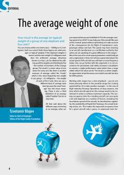


© Copyright 2026