
0530151 COVER SHEET FOR PROPOSAL TO THE NATIONAL SCIENCE FOUNDATION NSF 05-533 03/10/05
COVER SHEET FOR PROPOSAL TO THE NATIONAL SCIENCE FOUNDATION
PROGRAM ANNOUNCEMENT/SOLICITATION NO./CLOSING DATE/if not in response to a program announcement/solicitation enter NSF 04-23
NSF 05-533
FOR NSF USE ONLY
NSF PROPOSAL NUMBER
03/10/05
FOR CONSIDERATION BY NSF ORGANIZATION UNIT(S)
0530151
(Indicate the most specific unit known, i.e. program, division, etc.)
OISE - COLLABORATIVE RESEARCH
DATE RECEIVED NUMBER OF COPIES DIVISION ASSIGNED FUND CODE DUNS#
FILE LOCATION
(Data Universal Numbering System)
153926712
EMPLOYER IDENTIFICATION NUMBER (EIN) OR
TAXPAYER IDENTIFICATION NUMBER (TIN)
SHOW PREVIOUS AWARD NO. IF THIS IS
A RENEWAL
AN ACCOMPLISHMENT-BASED RENEWAL
IS THIS PROPOSAL BEING SUBMITTED TO ANOTHER FEDERAL
AGENCY?
YES
NO
IF YES, LIST ACRONYM(S)
043167352
NAME OF ORGANIZATION TO WHICH AWARD SHOULD BE MADE
ADDRESS OF AWARDEE ORGANIZATION, INCLUDING 9 DIGIT ZIP CODE
University of Massachusetts Amherst
Grant & Contract Administration
Amherst, MA. 010039242
University of Massachusetts Amherst
AWARDEE ORGANIZATION CODE (IF KNOWN)
0022210000
NAME OF PERFORMING ORGANIZATION, IF DIFFERENT FROM ABOVE
ADDRESS OF PERFORMING ORGANIZATION, IF DIFFERENT, INCLUDING 9 DIGIT ZIP CODE
PERFORMING ORGANIZATION CODE (IF KNOWN)
IS AWARDEE ORGANIZATION (Check All That Apply)
(See GPG II.C For Definitions)
TITLE OF PROPOSED PROJECT
MINORITY BUSINESS
IF THIS IS A PRELIMINARY PROPOSAL
WOMAN-OWNED BUSINESS THEN CHECK HERE
Developing International Protocols for Offshore Sediments and their
Role in Geohazards: Characterization, Assessment, and Mitigation
REQUESTED AMOUNT
2,396,579
$
SMALL BUSINESS
FOR-PROFIT ORGANIZATION
PROPOSED DURATION (1-60 MONTHS)
60
REQUESTED STARTING DATE
09/01/05
months
SHOW RELATED PRELIMINARY PROPOSAL NO.
IF APPLICABLE
CHECK APPROPRIATE BOX(ES) IF THIS PROPOSAL INCLUDES ANY OF THE ITEMS LISTED BELOW
BEGINNING INVESTIGATOR (GPG I.A)
HUMAN SUBJECTS (GPG II.D.6)
DISCLOSURE OF LOBBYING ACTIVITIES (GPG II.C)
Exemption Subsection
PROPRIETARY & PRIVILEGED INFORMATION (GPG I.B, II.C.1.d)
INTERNATIONAL COOPERATIVE ACTIVITIES: COUNTRY/COUNTRIES INVOLVED
HISTORIC PLACES (GPG II.C.2.j)
(GPG II.C.2.g.(iv).(c))
AS
SMALL GRANT FOR EXPLOR. RESEARCH (SGER) (GPG II.D.1)
VERTEBRATE ANIMALS (GPG II.D.5) IACUC App. Date
PI/PD DEPARTMENT
or IRB App. Date
NO
HIGH RESOLUTION GRAPHICS/OTHER GRAPHICS WHERE EXACT COLOR
REPRESENTATION IS REQUIRED FOR PROPER INTERPRETATION (GPG I.E.1)
PI/PD POSTAL ADDRESS
Department of Civil & Environmental Eng.20 Marston Hall
PI/PD FAX NUMBER
Amherst, MA 01003
United States
413-545-2840
NAMES (TYPED)
High Degree
Yr of Degree
Telephone Number
Electronic Mail Address
ScD
1989
413-545-0088
[email protected]
PhD
2000
617-627-2211
[email protected]
PhD
2001
413-545-2639
[email protected]
Ph.D
2000
845-437-7703
[email protected]
Sc.D.
1991
617-373-3995
[email protected]
PI/PD NAME
Don J DeGroot
CO-PI/PD
Laurie Baise
CO-PI/PD
Jason T DeJong
CO-PI/PD
Brian McAdoo
CO-PI/PD
Thomas C Sheahan
Page 1 of 2
Electronic Signature
PROJECT SUMMARY
The December 2004 Sumatra earthquake and tsunami have served as a horrible reminder of the
vulnerability of coastal communities to geohazards. This vulnerability has been exacerbated by the dense
population and infrastructure development pressures near coastal areas. Offshore geohazards pose a major
threat to coastal population centers and development projects. Submarine landslides are one of the most
devastating geohazards because they can damage coastal installations and trigger tsunamis. Critical
research needs to be conducted by geotechnical engineers and geoscientists to evaluate past submarine
landslides to understand and evaluate existing submarine topographies that pose a future threat of
instability. Research is needed to establish protocols for conducting sediment characterization programs
to understand triggering of these slides, and so reliable designs can be established for economic
development and protection facilities. Once existing sediment conditions are established, assessment of
the likelihood and potential impacts of geohazards need to be determined. These impacts can then be
examined on a broader level to develop plans to mitigate the deleterious effects of such events.
Our vision is to form an international collaboration among experts in geosciences, geotechnical
engineering and disaster mitigation to: 1) characterize seabed sediment properties as they relate to
offshore geohazards, 2) develop geostatistical tools to assess the spatial variability of sediments relative to
critical coastal regions, 3) propose solutions to mitigate the potential damage from these geohazards, 4)
promote sustainable solutions for future infrastructure development in these zones, 5) develop protocols
to assist policymakers with regulations that govern coastal and offshore sites, and 6) develop educational
resources and international interactions to train future geologists and engineers in offshore geohazards. A
unique team of researchers and educators has been assembled from four US institutions (University of
Massachusetts Amherst, Tufts University, Northeastern University, and Vassar College) and two
international partners, the International Centre for Geohazards at the Norwegian Geotechnical Institute
and the Centre for Offshore Foundation Systems at the University of Western Australia.
The following research themes will be addressed by the team: 1) seabed sediment sampling and sample
quality; 2) implementation of full flow penetrometers in offshore practice; 3) in-situ measurement of pore
pressure; 4) evolution of seafloor morphology and geophysical characterization; 5) spatial variability of
sediment properties and data visualization (GIS); 6) seismicity and triggering mechanisms; 7) disaster
response, preparedness, and mitigation; and 8) international protocols for geohazards assessment and
mitigation. A central website portal will be developed for both the project team and the world community.
The education plan will draw on the shared intellectual and physical resources among the partner
institutions, and use technology in innovative ways; all of which will promote sustainability of the
collaboration. We propose five significant mechanisms for delivering an effective education package:
international, cross-institutional course offerings, delivered electronically; international workshops;
undergraduate research opportunities; co-op work experiences; and outreach activities via the website.
Intellectual Merit: The eight research themes have been identified by the US and international partners
as among the most challenging and high impact topics in the area of offshore geohazard characterization,
assessment and mitigation. Research advancement in these areas is vitally needed to understand the
causes of past events and the potential for future events, particularly in regions where geohazard effects
could be catastrophic. Bench-scale and field testing, analytical/numerical modeling, and geostatisticaldata management methods will be used and further developed as a result of this multidisciplinary project.
Broader Impacts: The project involves the integration of research and education, the participation of US
and international institutions, and deals with a topic that has immediate and long-term critical importance
to mankind and sustainable development. The project includes two co-PIs from underrepresented groups
whose mentorship will be felt across the broad population impacted by this collaborative effort. Because
of its international focus, the project will serve as a mechanism for cross-cultural experiences. The use of
IT tools will offer unique opportunities to leverage resources from all the partners around the world to
produce a whole much greater than the individual partners could offer. This project addresses an
engineering and scientific need, but with an eye toward influencing how governments and populations
view the risks involved and measures needed to mitigate damage from geohazard events.
TABLE OF CONTENTS
For font size and page formatting specifications, see GPG section II.C.
Total No. of
Pages
Page No.*
(Optional)*
Cover Sheet for Proposal to the National Science Foundation
Project Summary
(not to exceed 1 page)
1
Table of Contents
1
Project Description (Including Results from Prior
NSF Support) (not to exceed 15 pages) (Exceed only if allowed by a
specific program announcement/solicitation or if approved in
advance by the appropriate NSF Assistant Director or designee)
18
References Cited
4
Biographical Sketches
(Not to exceed 2 pages each)
Budget
12
35
(Plus up to 3 pages of budget justification)
Current and Pending Support
5
Facilities, Equipment and Other Resources
4
Special Information/Supplementary Documentation
20
Appendix (List below. )
(Include only if allowed by a specific program announcement/
solicitation or if approved in advance by the appropriate NSF
Assistant Director or designee)
Appendix Items:
*Proposers may select any numbering mechanism for the proposal. The entire proposal however, must be paginated.
Complete both columns only if the proposal is numbered consecutively.
Developing International Protocols for Offshore Sediments and their Role
in Geohazards: Characterization, Assessment, and Mitigation
1 PROJECT VISION STATEMENT
The December 2004 South Asian earthquake and tsunami have served as a horrible reminder of the
vulnerability of coastal communities to geohazards. This vulnerability has been exacerbated by the dense
human population and infrastructure development pressures near coastal areas throughout the world.
Despite this event and other such tragedies, these pressures will continue to increase as coastal and
offshore infrastructure development are seen as a solution to mankind’s need to build, access natural
resources, and optimize the use of ports, beaches, and other coastal features.
Offshore and coastal sediment geohazards (e.g., submarine landslides, excess gas pressures, mud
volcanism, seismicity, etc.; Figure 1) pose a major threat to coastal population centers and economic
development projects (e.g., land reclamation projects such as offshore airports, construction of shoreline
protection facilities, development of offshore renewable energy sources such as wind farms, and offshore
oil/gas resources). Submarine landslides are one of the most devastating geohazards because they can
damage coastal installations and trigger tsunamis. These landslides occur in offshore and coastal
sediments and can be triggered by a combination of factors including seismic events, elevated gas
pressures in the sediments, and/or construction of civil infrastructure systems.
Critical research needs to be
conducted by geotechnical engineers
and geoscientists to evaluate past
submarine landslides to understand
and evaluate existing submarine
topographies that pose a future threat
of instability (Lacasse 2000). Such
events are increasingly likely with
global climate change and have the
potential to cause tsunamis of
cataclysmic proportion, particularly
with the relatively recent explosion
in coastal development.
For
example, the Storegga landslide
(Solheim et al. 2005) off the
Norwegian coast, which occurred
Figure 1. Schematic of Offshore Geohazards (from NGI 1998)
about 8,200 years ago, triggered a
gigantic tsunami that hit the coasts of Norway, Iceland, and Scotland. More recently, the 1998 Papua New
Guinea earthquake generated a submarine landslide-induced tsunami that flooded coastal areas in the
region resulting in over 2,000 deaths. Research is needed to establish protocols for conducting accurate
sediment characterization programs so that the triggering of these slides can be understood and reliable
designs can be established for economic development and human protection facilities in such regions.
Once the existing sediment conditions are established through a comprehensive characterization program,
assessment of the likelihood and potential impacts (on infrastructure, population, cultural sites and natural
features) of a geohazard needs to be determined. These impacts can then be examined on a broader level
to develop action plans to mitigate the deleterious effects of such an event. Technical expertise is
necessary on larger-scale policy teams that establish such action plans.
Our vision for the project is to form an international research and education collaboration among experts
in offshore sediment geology, geotechnical engineering and disaster mitigation to:
1. Characterize fundamental physical aspects of seabed sediments including geomorphology,
engineering properties, and in situ conditions that impact the sediments’ susceptibility to geohazards,
1
2.
3.
4.
5.
6.
with a particular emphasis on events that would occur and/or impact coastal populations and
infrastructure.
Develop geostatistics and geographic information tools that allow for assessment of sediments’
spatial variability and orientation relative to critical coastal regions,
Propose engineering solutions to mitigate the potential damage from these geohazards to existing
infrastructure and other affected resources,
Promote sustainable technical solutions for future infrastructure development in these zones,
Develop technical guidance and characterization/assessment protocols that will assist policymakers in
shaping laws and regulations that govern coastal and offshore sites, and
Develop the educational resources and international interactions to train future geologists and
engineers in fields related to these sediments and their role in geohazards and their effects.
2
US RESEARCH TEAM AND INTERNATIONAL COLLABORATORS
Table 1 summarizes the US research and education team (UMass Amherst, Tufts University, Northeastern
University, and Vassar College). Our proposed International Partners are the Norwegian Center of
Excellence: International Centre for Geohazards (ICG) at the Norwegian Geotechnical Institute (NGI)
and the Centre for Offshore Foundation Systems (COFS) at the University of Western Australia
(UWA). Dr. Farrokh Nadim is director of the ICG and Dr. Mark Randolph is director of COFS.
Table 1 Senior US Research/Education Team, technical expertise (as pertains to this proposal).
Name
PI:
Don J.
DeGroot
Title
Assoc. Prof. of
Civil and Environ.
Engineering
Institution
Co-PI:
Jason T.
DeJong
Assist. Prof. of
Civil and Environ.
Engineering
UMass
Amherst
full-flow penetrometers and
miniature piezoprobe
Applicability of 'Full-Flow'
Penetration Probes for
Characterizing Soft Soil Deposits
Co-PI:
Laurie G.
Baise
Assist. Prof. of
Civil and Environ.
Engineering
Tufts
University
geostatistics, Geographic
Information Systems (GIS),
seismic trigging
Numerical Modeling of Moderate
Magnitude Earthquakes
Co-PI:
Brian G.
McAdoo
Mary Clark
Rockefeller Assist.
Prof. of Geology
Vassar
College
UMass
Amherst
Technical Expertise
Synergistic NSF Funding
sampling and laboratory testing International Development of New
Tools for Evaluating and
strategies for engineering
Remediating Sample Disturbance
characterization of sediments.
geomorphology, geophysics and Surface Geomorphology from 3D
submarine landscapes, landslide Seismic and Multibeam
induced tsunamis
Bathymetry: Cascadia Seismicity
Assoc. Prof. of
sediment mechanical behavior
Co-PI:
Northeastern
and in situ instrumentation;
Thomas C. Civil and Environ.
University
Engineering
education team leader
Sheahan
Assoc. Prof.,
Co-PI:
Friedman School of
Peter J.C.
Nutrition Science
Walker
and Policy
Tufts
University
International Development of New
Tools for Evaluating and
Remediating Sample Disturbance
disaster response, preparedness,
and mitigation; Director, Alan
Shawn Feinstein International
Famine Center
Collectively, senior personnel of the US and International Team consists of a broad and interdisciplinary
mix of academics, practitioners, researchers and institutions as follows:
• Academic Rank: Assistant, Associate and Full Professor
• Academic Institutions: Research I, Predominately Undergraduate, public, private.
• Practitioners/Researchers: Project Manager, Division Director, International Centre Director
• Underrepresented Groups : Minority (African American), female
• Institution Geographic/Continent Location: North America, Europe, Australia/Oceania
Brief overviews of the ICG and COFS follows with additional details in the support letters provided by
Dr. Nadim for ICG and Dr. Randolph for COFS. Specific details of the proposed collaboration and how
2
the synergistic efforts of the full US and International Team will collectively work towards fulfilling the
research and educational objectives of the project are included in Sections 3 and 4 below.
2.1 The International Centre for Geohazards (ICG; www.geohazards.no)
The ICG Centre of Excellence is funded by the Research Council of Norway and hosted by the
Norwegian Geotechnical Institute (NGI). ICG was established in 2002 as part of The Research Council of
Norway's Centres of Excellence program. This program was initiated by the Norwegian Government to
establish leading international research and education groups. ICG partners are: NGI, University of Oslo
(UiO), Norwegian University of Science and Technology (NTNU), NORSAR, and Geologic Survey of
Norway (NGU). The ICG conducts research on geohazards, including risk of landslides due to rainfall,
flooding, earthquakes and human intervention, and geological risks in deep waters, especially underwater
slides and tsunamis. The Centre also contributes to the education of researchers in these fields. This is
exemplified by the education link on their website addressing the recent December 2004 tsunami.
2.2 The Centre for Offshore Foundations Systems (COFS; www.cofs.uwa.edu.au/)
COFS is funded by the Australian Research Council and is hosted by the School of Civil and Resource
Engineering at the University of Western Australia (UWA). COFS was established in 1997 and includes a
partnership between the UWA and the University of Sydney (USyd). COFS core research objectives are
to develop quantitative links between the micro-mechanics and engineering response of offshore soils and
the resulting behavior of foundation systems to provide a fundamental understanding for safe and
economic design of offshore facilities.
The potential for technical and logistic success of the proposed collaboration between the US Team and
the International Partners is excellent. Both ICG and COFS have extensive experience hosting and
collaborating with international researchers. Dr. DeGroot spent a six month sabbatical at NGI in 1997 and
Dr. DeJong spent a six month NSF International Research Fellowship as a Post Doctorate in 2001 at
COFS. Although these experiences were individually focused, they serve as building blocks and verify
the feasibility of the significantly larger collaboration proposed for the full US Team. The other Co-PIs
have limited or no previous collaboration with either institution. Furthermore, the establishment of a
program of research and education at ICG and COFS and their partner universities (UiO, NTNU, UWA,
and USyd) for the US students will be novel and new. We are also proposing through Dr. Walker's
extensive worldwide network of contacts with disaster preparedness and mitigation agencies to work with
the Asian Disaster Reduction Center. Participation in such collaboration for both the US and International
Teams, which are predominantly engineering and science focused, will be novel and innovative.
3
RESEARCH OBJECTIVES AND PLAN
The ultimate goal of our research plan is to develop protocols (e.g., design guidelines, standards, manuals
of practice, public education documents) for the international community that can be used to accurately
characterize offshore sediments and the role they play in assessment and mitigation of geohazards (Figure
2). It is anticipated that these protocols will be of great value globally to the technical community (e.g.,
engineers, geologists, geophysicists, etc.) for developing a better understanding of the nature and extent of
offshore sediments and their role in geohazards and to policymakers (e.g., governments, regulatory
agencies, etc.) to enable them to make more informed decisions about policies, building codes, and
international agreements regarding the affected regions.
Recent and currently funded NSF projects related generally to offshore geohazards are focused primarily
on topics specifically related to tsunamis and modeling of slope failure (e.g., propagation, scenario
simulation, constitutive and numerical modeling of submarine slope response, and 3-D physical modeling
and laboratory simulation of tsunami generation). As noted in the project vision statement, the goals of
this project are broader. They are linked to a suite of tasks that must be executed in order to conduct a
realistic and accurate assessment of past geohazards (to better understand them) and, more importantly, to
assess the potential occurrence of future geohazards. The information from both of these technical
protocols can then be used to formulate both near-term mitigation strategies and longer term policies to
3
reduce the impact of future events (Figure 2). To this end, the novel aspect of the proposed project’s
technical goal is that we will develop the tools and methodologies that are necessary for:
1. Accurate characterization of the engineering properties of seabed sediments, in situ pore pressures,
and seabed geomorphology;
2. Characterization and database management/visualization of seabed property spatial variability which
is a critical input for engineering stability calculations and risk assessment analysis; and
3. Delineating the linkage between geohazard triggering mechanisms and sediment properties/seabed
geomorphology.
While this is a major and far reaching
technical challenge, the coupling of the US
Research Team's expertise areas with those of
the world leaders in offshore research and
design at ICG and COFS make this goal
achievable. The proposed collaborations
among teams from North America, Europe
and Australia/Oceania will ensure the
international relevance and sustainability of
the protocols. As such, this will have an
impact on US and worldwide practice for
characterization of offshore sediments and
assessment and mitigation of geohazards.
The technical research themes outlined below
(and summarized in Table 2) nominally follow
a chronological sequence of activities that are
required in the assessment of offshore
geohazards and their mitigation. The core of
the technical research will be conducted by the
PI/Co-PIs working with a team of PhD level
graduate students. Each graduate student will
spend a minimum of approximately 25% of
their research study duration at one of the
International Collaborator Institutions. A
minimum of two lead International Theme Figure 2. Offshore sediments and geohazards:
Leaders-Advisors are assigned to each theme characterization, assessment, mitigation and response.
to strengthen the potential for a successful
collaboration and outcome. However, it is noteworthy that both NGI and COFS have a number of
additional experts not listed here who will be able to contribute their skills to the research.
3.1 Research Theme 1 – Seabed Sediment Sampling and Evaluation of Sample Quality
Offshore seabed sampling tools: Collection of high quality samples of offshore cohesive sediments is
essential for accurate and reliable characterization of their mechanical properties. Without such data, any
subsequent analytical and numerical analyses of offshore geohazards, such as submarine landslides, can
be highly unreliable (i.e., they may misrepresent critical engineering properties). Significant research
progress has been made on developing methods for improving sampling equipment for onshore practice
including the current NSF project by DeGroot and Sheahan (Table 1). Numerical and experimental
research (e.g., Hvorslev 1949; Baligh et al. 1987; Clayton et al. 1998) has highlighted the importance of
sampler geometry (e.g., sharp cutting angle, small area ratio, and zero inside clearance ratio) and
operation (e.g., fixed piston vs. free piston sampler) in order to obtain high quality "undisturbed" samples
of cohesive soils deposits. And yet, many of these important aspects have not found their way into
offshore practice. Research needs to be conducted on how to apply the results found for onshore sampling
4
operations to the more challenging offshore environment (e.g., deep water, very soft sediments, vesselbased sampling operation, etc.). The US research team will partner with ICG/NGI to foster their seminal
research on onshore and offshore sampling equipment and operations. NGI is currently leading a research
effort on the design of a new continuous seabed sampler that incorporates many of the research findings
noted above (Lunne and Long 2005). Dr. DeGroot will team with NGI on this effort. Specifically, UMass
Amherst will provide the laboratory and human resources (research students) to conduct extensive
advanced laboratory tests (triaxial, CRS consolidation, direct simple shear) on samples collected with the
new sampler in order to evaluate its performance and, as appropriate, develop design improvements.
Table 2. Research Themes, US Team Leaders and Lead International Advisors
US Team
Leaders1
Lead International
Technical Advisors2
1. Seabed Sediment Sampling and Evaluation of
Lunne/Dyvik (ICG/NGI),
DeGroot/Sheahan
Sample Quality
Ismail (COFS)
2. Implementation of Full Flow Penetrometers in
Randolph (COFS),
DeJong/DeGroot
Offshore Practice
Anderson/Lunne (ICG/NGI)
3. In-Situ Measurement of Equilibrium Pore
Solheim/Strout (ICG/NGI),
DeJong/DeGroot
Pressure
Randolph (COFS)
4. Evolution of Seafloor Morphology and
Solheim (ICG/NGI), Longva
McAdoo/Baise
Geophysical Characterization
(ICG/NGU), Lecomte (ICG/NORSAR)
5. Spatial Variability of Sediment Properties and
Nadim/Lacasse (ICG/NGI), Etzelmuller
Baise/McAdoo
Data Visualization (GIS)
(ICG/UiO), Cassidy (COFS)
6. Seismicity and Triggering Mechanisms
Baise/Sheahan
Nadim (ICG/NGI), Randolph (COFS)
7. Disaster Response, Preparedness, and Mitigation Walker/McAdoo
Asian Disaster Reduction Center
8. Synthesis of Research Themes - International
Full US Team
Full Norway and Australia Team
Protocol for Geohazards Assessment and Mitigation Participation
Participation
Notes: 1US PI/Co-PI names are listed to indicate primary responsibility for specific research themes; however, other
team members have overlapping interests/expertise and will contribute as appropriate.
2
International names are listed to indicate primary advisors; however, ICG/NGI and COFS have many personnel
with expertise relevant to the research themes and may contribute as appropriate (see support letters).
Research Theme
Development of portable nondestructive sample quality measurement equipment and test procedures for
offshore drilling operations: Evaluation of sample quality is considered essential for cohesive sediments
collected for laboratory measurement of engineering properties (Hight and Leroueil 2003, Ladd and
DeGroot 2003). NGI pioneered the use of laboratory reconsolidation volumetric strain as an indicator of
sample quality (Andresen and Kolstad 1979; Lunne et al. 1997). However, in spite of its great value (it is
significant to note that it is rarely used in US practice, which is a technology transfer problem), this
method is an a posteriori measure, i.e., one does not know a sample’s quality until a laboratory specimen
has been trimmed and set up. Current NSF sponsored research being conducted at UMass Amherst and
NU (Table 1) is focused on development of a nondestructive measure of sample quality using shear wave
velocity. Field testing at onshore research sites by the UMass Amherst/NU team using bender elements
shows that shear wave velocity is a viable parameter for nondestructive evaluation of sample quality
immediately after sampling (e.g., Landon et al. 2004). Research needs to be conducted on how to
implement such a tool in the more challenging offshore drilling environment. Both NGI and COFS have
proven expertise in the use of bender elements (e.g., Dyvik and Madshus 1985; Ismail et al. 2003).
Together the US Team, NGI and COFS will work towards developing a robust tool that can
nondestructively measure shear wave velocity of offshore sediment samples immediately after sampling,
i.e., on the drilling vessel. This will allow for "real-time" decisions to be made on sampling operations
while the vessel is offshore and hence offers potentially significant cost savings. It also affords a
systematic procedure for screening samples prior to setting up costly and often time consuming advanced
laboratory tests for measurement of design parameters.
5
The collective effort of the research team on the development and proof testing of a new seabed sampler,
as envisioned by NGI, and a rapid nondestructive measure of sample quality, as envisioned by the US
Team could revolutionize the worldwide practice of offshore sediment sampling. The development of
international specifications/standards for these new tools will lead to much more efficient and reliable
sampling operations and more accurate laboratory measurement of design properties.
3.2 Research Theme 2 – Implementation of Full Flow Penetrometers in Offshore Practice
In-situ Determination of Peak and Remoulded Strength Using Full-Flow Penetrometers. Accurate and
precise measurement of the peak and remoulded strength is critical for the assessment of geohazard
stability and for the design and performance of all structures founded in soft sediments. Unlike onshore
characterization, offshore sediment characterization is complicated by significantly higher cost per hour
of investigation and execution and resolution limitations of all current state-of-practice and state-of-the–
art in situ devices (DeJong et al. 2004). In recent years, full-flow penetrometers have shown to have the
potential to measure undrained and remolded strength directly, quickly, and accurately, thereby solving a
major technical obstacle in geohazard characterization.
Translation of full-flow penetrometers from potential to realization for characterization of offshore
sediments is not trivial. However, progress has been made internationally (COFS and NGI) and at UMass
Amherst, and the collaborative scope of work contained in this proposal has the potential to result in
internationally standardized probe designs, testing methodology, and data analysis and interpretation.
The full-flow research scope for this project will focus on (1) practical issues regarding development of
international specifications that would enable consistent and reliable implementation by engineers at any
potential geohazard site in the world and (2) phenomenological issues regarding testing specifications and
data analysis and interpretation. Practical issues to be addressed include design of a mandrel with a
temperature compensated, moment insensitive load cell and a pore pressure module, probe compatibility
with offshore drilling pipe, procedures required for remoulded strength determination, penetration rate,
and framework for initial analysis factors and site-specific factor calibration. Much of the practical issues
are integrated with soil behavior phenomena and properties including: strain-rate effects (viscosity and
partial consolidation), sensitivity, stratigraphic and stress anisotropy, strain-softening rate, and soil type.
These series of issues will be investigated in an integrated collaborative research program that will use
well characterized international test sites in the US and Canada as well as sites managed by NGI (Onsøy,
Norway) and COFS-UWA (Burswood, Australia). With baseline, full-flow investigations (by UMass
Amherst) and extensive laboratory investigations already performed at these sites, the background
research is completed, and the potential and ability to research the above issues is established. Following
development of a new probe, testing at each site will consist of monotonic penetration to determine
undrained strength, cycling at a specific depth interval to determine remoulded strength, and variable
penetration rate tests to separate undrained viscosity and partial consolidation effects. The variable
penetration rate tests are especially relevant for geohazards since full-scale in situ loading can occur
slowly (i.e. during gradual slope creep) or very quickly (i.e. during active submarine slide).
The collaboration with NGI and COFS is of central importance to this project. NGI has direct interactions
with site investigation companies (providing practical aspects), and are experts in soft sediment behavior,
especially strain rate effects. The collaboration with COFS will take advantage of their analytical
abilities, which will help provide a theoretically-based framework for investigating the aforementioned
phenomena, and their numerical modeling capabilities, which will help discriminate the effects of
relevant soil properties unique to each site.
3.3 Research Theme 3 - In-Situ Measurement of Equilibrium Pore Pressure
Determining the stability of soft sediments requires knowledge of the in situ pore pressure state. In
offshore soft sediments, where strengths are typically very low and the deposits are either still
6
consolidating (due to high sedimentation rates) or normally consolidated, accurate measurement of the
pore pressure profile is critical. Excess in situ pore pressures are believed to have been a major
contributing factor to the Storegga slide (Solheim et al. 2005) and many other offshore regions of the
world have excess pore water pressure caused by rapid sedimentation rates, mud volcano activity, and
other mechanisms (e.g., Gulf of Mexico, Caspian Sea, Offshore West Africa).
While measurement of the water pressure at the seabed floor (top of sediment) is relatively
straightforward, determination of the pore pressure within soft sediments is much more complex. The
complexity in measuring the in situ pore pressure arises from the current state-of-the-art: measurement
requires installation of a sensor or probe that in turn displaces soil and creates excess pore pressures.
Immediately after installation, the probe measures the excess pore pressure during installation, and it is
only after prolonged durations (often hours and even days; which is costly because it ties up the drilling
vessel) that the excess pore pressure dissipates and hydrostatic pore pressures can be measured. Efforts to
reduce the time required for dissipation have primarily focused on development of a miniature tapered
piezoprobe since the degree of excess pore pressure is proportional to the square of the probe diameter
(Houlsby and Teh 1988). Constrained by practical implementation issues, the miniature piezoprobe
begins to taper up to a larger diameter about 100 to 150 mm behind the tip (Whittle et. al. 2001). During
dissipation the excess pore pressure generated by the miniature tip dissipates relatively quickly.
However, before it reaches the in situ equilibrium pore pressure, the excess pore pressure from the upper
tapered section propagates forward and produces an increase in the excess pore pressure at the tip. This
results in the equilibrium pore pressure at the tip not being measured until the excess pore pressure from
the tapered section is also dissipated, effectively negating the tapered section’s benefit. To overcome this
issue Whittle et. al. (2001), using numerical modeling, proposed the use of a dual element piezoprobe and
a more complex analysis where the correlations between two dissipation curves are analyzed. This
enables a rigorous prediction of the equilibrium pore pressure but not a direct measurement.
Determination of the equilibrium pore pressure from piezoprobe dissipation is essentially a timedependent process during which an instantaneous pore pressure differential must diffuse and return to
equilibrium. To date, all piezoprobe methods have required dissipation excess pore pressure via flow of
water away from the probe into the surrounding soil. The dissipation time has been accelerated by using a
smaller probe since a smaller probe produces a smaller differential pressure. This research proposes a
novel approach that enables accelerated dissipation of excess pore pressure via the flow of water into the
piezoprobe. Prior to penetration, an estimate of the in situ equilibrium pore pressure will be made. After
piezoprobe penetration to the target depth, the pore pressure will be measured continuously. For a
specified time (to be determined by this research) water flow in/out of the probe will be regulated so that
the measured pore pressure remains at the estimated in situ equilibrium conditions. After the specified
time, water flow in/out of the probe will cease and the pore pressure will come to equilibrium. This
approach will rapidly reduce the initial pore pressure differential since water flow into the probe will
occur at the location of highest excess pore pressure. Once most of the excess pore pressure has been
relieved, the time required for equilibrium conditions to be restored will be minimal and less than the time
required for the pore pressure front generated by the tapered section to reach the measurement location.
The novel device and technique proposed above requires significant design, analysis, modeling, and
testing components. The external dimensions of the miniature piezoprobe will be maintained as closely
as possible to those by previous researchers, enabling use of prior results and analysis (e.g. Whittle et al.
2001). The control of water flow in and out of the piezoprobe (fluid chamber in which the pore pressure
sensor is located) will be performed using a stack of piezoceramic disks. The piezoceramic disk stack
expands with positive voltage and contracts with negative voltage. During penetration the piezoceramic
will be in the expanded state with high positive voltage. By varying the voltage the volume of the
piezoceramic stack will be varied, which will be equal to the volume of water flow into the probe.
7
In addition to the design details, analytical and numerical analyses will be performed to determine the
time duration during which the flow should be regulated, the time required to reach equilibrium
conditions, whether this time is less than that at which the tapered pore pressure front reaches the
measurement, and how these parameters vary with soil properties. With a developed probe and analytical
framework, testing will be performed at select international test sites including two US sites (UMass
Amherst and Boston), the NGI site (Onsøy), and the COFS-UWA site (Burswood). The collaborative
effort for the new piezoprobe will include extensive interactions with NGI and COFS utilizing their
expertise in the development of offshore piezoprobes (NGI), data interpretation and practical
implementation (NGI), and analytical and numerical analysis (COFS).
3.4 Research Theme 4 – Evolution of Seafloor Morphology and Geophysical Characterization
In addition to developing improved tools and protocols for the characterization of offshore sediment
properties, we also need to develop novel approaches to evaluate regional stability of offshore sediments
(Themes 4, 5, and 6). The proposed collaboration with ICG will provide a unique opportunity for the US
research team, under the leadership of Dr. McAdoo, to evaluate and implement regional models of
seafloor morphology using 2D and 3D seismic and multibeam bathymetry datasets (e.g., McAdoo et al.
2000, 2004). Research being conducted in academic environments has a critical need for access to "real
world" geophysical datasets. NGI/ICG's extensive experience in consulting projects involving
geophysical characterization affords this opportunity to the US research team. Therefore, several “real
world” geophysical datasets at NGI/ICG will be identified for evaluation and analysis in Themes 4, 5, and
6. These test cases will be used to develop a methodology for assessment of offshore sediment stability.
An example test case would be a large well-studied submarine landslide. Dr. McAdoo will interact
directly with Dr. Baise on this research theme to ensure synergies between the three geohazards analysis
research themes. Dr. McAdoo will work with research undergraduate students from the Geology and
Physics Departments at Vassar College.
When considering regional models, it is critical to have basemaps that can be used to extrapolate the
physical soil properties over a broader area. By correlating soil properties with seafloor morphology, this
extrapolation can be accomplished. Technological advances in multibeam bathymetry collection
techniques, along with more time for additional surveys, have provided the research community with a
relatively inexpensive and effective tool for evaluating regional continental slope hazard. During the
1990’s, the STRATAFORM project (funded largely by the US Office of Naval Research) set out to
understand how sediment is transported from subaerial river systems to deepwater basins. One of the
regional study areas was the Eel River Basin of northern California. A combination of regional
multibeam bathymetry, high resolution 2D seismic, and physical properties of the seafloor sediment
allowed a regional slope stability model to be developed (Lee et al. 1999).
The international framework of this project will provide excellent data that can be incorporated into a
regional geographic information system database and analyzed for slope stability and hazard (Themes 5
and 6). The combination of seismic (2D or 3D) with multibeam bathymetry and geotechnical data is the
best way to assess regional continental slope hazard. Based on the seismic character of a given area, the
geotechnical data can be extrapolated to provide a measure of the regional sediment character (Theme 5).
From these data, the geomorphology and major shaping processes can be evaluated, and hazard
constrained.
3.5 Research Theme 5 - Spatial Variability of Sediment Properties & Data Visualization (GIS)
Geohazards in the offshore environmental are generally associated with large-scale potential failures –
such as large submarine landslides. In order to properly characterize the offshore deposits associated with
such potential failures, techniques to integrate diverse data (as acquired in Research Themes 1 to 4) are
needed. By applying our combined expertise in geomorphic interpretation, geotechnical characterization,
geostatistics, and Geographic Information System (GIS), we will develop an integrated method for
regionally characterizing offshore sediments. This integrated method will take into account the spatial
8
variability of sediment properties in order to determine required/recommended sampling density and
provide interpolated regional models of geotechnical properties. The regional models of geotechnical
properties can then be displayed in conjunction with multibeam bathymetry and other geophysical data in
a three-dimensional GIS.
Because lithologic and engineering properties of sediments vary considerably laterally and with depth,
extrapolation of properties from sparse datasets to undersampled locations is necessary for the evaluation
of large scale geohazards. The geologic/geomorphic evaluation of seafloor morphology (Theme 4)
provides a basemap for subsequent extrapolations of sediment properties. Geostatistics provides a
methodology to take advantage of the inherent spatial correlations of geologic data to estimate properties
in undersampled areas and to quantify the uncertainty (Chiles and Delfiner 1999; Goovaerts 1997).
Geostatistical techniques are derived from the assumption that geomaterials exhibit spatial patterns and
that these spatial patterns, if known, can be used to improve predictions of geo-properties at unsampled
locations. For the problem at hand, the subsurface structure and soil properties need to be estimated over
a broad area in order to evaluate susceptibility to submarine slope failures. Geostatistical techniques will
be used to quantify spatial correlation and to estimate geotechnical properties and strata interfaces. Luna
and Frost (1998), Lee et al. (1999), Parsons and Frost (2000), and Dawson and Baise (2005) have
developed similar integrated approaches using GIS, geostatistics, visualization software, and engineering
computations to evaluate the liquefaction potential of a site, slope stability, and site investigation quality.
The Dawson and Baise (2005) approach uses 3D GIS to define volumes of liquefiable soil.
Using a 3D GIS framework linked with a relational database, we plan to assemble multiple data types into
a single visual interface. The 3D GIS will therefore allow visualization of multiple datasets
simultaneously. We will develop a set of GIS tools to visualize subsurface (geotechnical) and GIS layers
(topography, multibeam bathymetry, etc.) in 3D. We are currently developing with the Computational
Geometry Group at Tufts a customized 3D GIS that displays geotechnical point data with layer data
(topography, street maps, etc). For the proposed project, we will further customize the 3D GIS to
incorporate any additional datasets such as scanning and profile data generated in earlier tasks. The
customized 3D GIS will have geostatistical analysis, statistical analysis, and spatial clustering
capabilities. We will evaluate the spatial variability of offshore sediments. Geostatistics will be used to
assess spatial correlation of offshore sediments. Clustering techniques will also be investigated to
determine zones of similar materials as an alternative to geostatistical Kriging, which can break down
when the spatial heterogeniety is high (Baise et al. 2005). Alternatively, clustering allows for short scale
variability within regionally correlated points. As an outcome of the spatial variability evaluation,
sampling scheme recommendations will be developed to insure that offshore investigations optimally
sample the sediment properties. The geotechnical sampling scheme will be based on morphology
characterization of the region (McAdoo et al. 2000) as well as geostatistical characterization of the
geotechnical properties (relevant strength properties).
Theme 5 will also build on the extensive project data collection at ICG/NGI. Continuing with the test case
regions identified in Theme 4, we will assemble available data for each test case region into a 3D GIS
framework, and the integrated analysis. This theme will be led by Drs. Baise and McAdoo.
Undergraduates at Vassar and a graduate student at Tufts will partner with the Co-PIs to conduct this
research. The international partners will provide data for the test case as well as guidance and
interpretation for developing a useful integrated 3D GIS for analysis of offshore sediments. ICG/NGI has
extensive experience analyzing regional datasets and will provide expertise in the numerical analysis of
submarine slope stability.
3.6 Research Theme 6 - Seismicity and Triggering Mechanisms
In order to assess geohazards, potential triggering mechanisms need to be identified and characterized.
Potential triggering mechanisms for offshore sediment failures include seismic loading, gassing, offshore
construction, static loading, wave loading, etc. (e.g., Driscoll et al. 2000, Solheim et al. 2005). Through
9
interaction with both international partners who have extensive experience with geohazard failures in the
offshore environment (e.g., Solheim et al. 2005), we will assemble a set of reasonable loading
mechanisms to be used in a numerical analysis of potential geohazard failures. Failures in geologic
materials can be induced by both static and dynamic loads. For any dynamic loading condition, the soil
behavior depends on the frequency content, duration, and intensity of the loads. This theme will result in a
suite of motions that characterize a variety of loading conditions (e.g., seismic, wave, construction). In
addition, these loads will be used with the test case assembled in Research Theme 5 to evaluate the
sensitivity of submarine soils to the range of loading conditions (this can only be accomplished with the
numerical analysis expertise at ICG/NGI and COFS). Using the results from the numerical analysis
performed at ICG and/or COFS, we can evaluate the attenuation with distance from each source to
determine the area of influence of a potential source. This theme represents a collaboration between Drs.
Baise (Tufts), Sheahan (Northeastern), Nadim (ICG), and Randolph (COFS).
3.7 Research Theme 7 – Disaster Response, Preparedness, and Mitigation
In order to address the human side of geohazards, we will examine disaster response, preparedness and
mitigation. Using the 2004 Sumatra earthquake and tsunami as a guide, we will evaluate the process of
disaster management and allocation of resources as well as the procedure for implementing technical
findings into public education as well as government policy. Drs. Walker (Tufts) and McAdoo (Vassar)
will take the lead on Research Theme 7. Dr. McAdoo participated in a post-disaster reconnaissance to Sri
Lanka, the Maldives, and Aceh after the tsunami and Dr. Walker has extensive experience in relief
missions to regions struck by natural disasters as well as experience in implementing institutional change
to mitigate disasters (e.g., Walker et al. 2005). We propose that Drs. McAdoo and Walker return to the
Indian Ocean region twice over the course of the project to evaluate the disaster management and
allocation of resources. One of the most significant challenges in the relief effort for the 2004 Tsunami is
the large amount of aid that must be distributed within the first year following the disaster. Effective use
of aid money will be a significant challenge and should be evaluated. Drs. McAdoo and Walker will share
their findings with the research team through project seminars.
In conjunction with these visits, the research effort (led by Dr. Walker) will focus on how to develop
institutional change processes which allow new research methodologies in disaster reduction to be
accepted into international policy and thence into practice in disaster prone countries. The research will
focus on the countries of East Africa, primarily Kenya, Ethiopia and Sudan, and will look at the
institutions of major aid agencies such as USAID, World Vision, Oxfam and UNICEF. The research will
build on the ongoing work of the Feinstein International Famine Center at Tufts, which has a long track
record in East Africa and with major international aid agencies. In addition, a parallel study of the 2004
Tsunami relief effort will connect the prior work done by this center with the work on geohazards in this
proposal.
Dr. Walker (Tufts) will interact with Dr. Nadim at ICG on this theme. In addition, Dr. Walker has an
extensive, worldwide network of contacts. We plan to work with the Asian Disaster Reduction Center
(ADRC; www.adrc.or.jp), a multi-nation organization whose primary goal is to promote international
collaboration in the mitigation of natural disasters and to facilitate the sharing of information and
expertise across national boundaries.
3.8 Research Theme 8 – Synthesis of Research
The results of Research Themes 1 to 7 will be synthesized into a set of protocols (i.e., design guidelines,
test standards, manuals of practice, policy recommendations) for the international community that can be
used to accurately characterize offshore sediments and the role they play in assessment and mitigation of
geohazards. The protocols will be a byproduct of the collaborative research effort. Dr. DeGroot will lead
the technical component of this theme and Dr. Walker will lead the non-technical component. Both will
rely on input from the full US and International Teams.
10
One significant challenge for the team will be to address the wide variety of standardization bodies that
bear upon geotechnical engineering test procedures and certification (e.g., American Society for Testing
and Materials [ASTM], European Committee for Standardization [CEN]; International Organization for
Standards [ISO], etc.). There are often important differences in standards that purport to measure the same
property (a simple but relevant example is the many different standards worldwide for measuring the
liquid limit of a soil – one of the most basic properties of soils). During the project, a team of students
will be tasked to review and compile relevant worldwide standards that will potentially impact our
proposed protocols. While such a document in itself will have value to the international geotechnical
engineering community, we propose to use it for this project to guide us on how best to resolve important
differences in standards. A number of the senior US and International personnel on the project team are
actively involved in standard development and we will rely upon their collective expertise to guide this
effort. We fully recognize that changes in and/or development of new standards is often a lengthy process.
But we are confident the collaboration established in this project will be sustained well beyond the project
duration allowing our collective efforts on standards development to succeed.
The specific areas of expertise and stature of the collaboration team (individuals and institutions) together
with recommendations based upon sound research results will ensure that the technical protocols will
have creditability. Furthermore, the involvement of technical experts from three continents (North
America, Europe, and Australia/Oceania) together with the experiences of Drs. Walker and McAdoo in
Africa and Asia ensures worldwide relevancy of the protocols.
3.9 Synergism of Individual US and International Institutional Expertise
Table 3 outlines the unique expertise, equipment, tools, and facilities of the US Team and International
Collaborators as they pertain to the proposed Research Themes. The coupling of these resources into an
international partnership allows for a grand yet feasible vision for this project as outlined in Vision
Statement in Section 1.
4
EDUCATION OBJECTIVES AND PLAN
The education component of the proposed activity will draw on the shared intellectual and physical
resources among the partner institutions, and use technology in innovative ways to bridge around the
world. There are five significant mechanisms for delivering an effective education package as part of this
project: international, cross-institutional graduate course offerings, delivered electronically; international
research seminar series; research experiences for undergraduates with the option of international travel;
cooperative work experiences for undergraduates, also with the option for international travel; and
outreach activities via a dedicated website that will include virtual field trips related to the research.
4.1 Cross-institutional graduate course offerings
We plan to develop a series of courses related to offshore geohazards that will be offered by faculty and
other researchers at a number of the partner institutions. We will work with the graduate schools at
participating institutions to secure agreements regarding course credit and appropriate revenue recovery
for these courses. Under these agreements, for example, a graduate student at Tufts University could
receive graduate course credit at that institution for a course being offered on offshore geomorphology
being taught by a faculty member at NTNU. Through this program, the project will leverage its
international resources to provide advanced education in offshore sediments and their relation to
geohazards.
Clearly, significant work will be required on an administrative level to implement this arrangement;
however, the project team is confident that the partner institutions share a common goal of enhancing
graduate student experiences, including the use of technology and distance-learning. From a technical
viewpoint, these courses are very feasible, and a number of options are available for delivery of course
content. The following are criteria for selecting one or more delivery platforms: must be asynchronous so
students can “attend” the courses at different times; require minimal hardware at the course “author”
(instructor) end since there may be numerous instructors in various locations; and require minimal
11
development effort by the course authors over a traditionally delivered course. The delivery platforms we
anticipate using are Macromedia Breeze (http://www.macromedia.com/software/breeze/) and Blackboard.
A particularly attractive feature of Breeze is the ability to synchronize MS PowerPoint slides with audio
narration of the material being covered. Breeze and Blackboard also provide a means for delivery of other
course content such as reference documents, assignments, online quizzes and discussion groups.
Table 3. Unique expertise/resources of US Team and International Collaborations by Research Theme
US Team
- design and development of new
nondestructive tool (shear wave velocity)
for field evaluation of sample quality
(UMass Amherst/NU)
- design and development of a new full
flow ball probe with pore pressure
element; access to university research
field test sites (UMass Amherst)
- novel design concept for a new pore
pressure probe; access to university
research field test sites for proof of
concept testing (UMass Amherst)
- tools for incorporation of multibeam
bathymetry and geotechnical data into
GIS databases for regional continental
slope hazard assessment (Vassar)
- partnership with Computer Science for
development of new data analysis and
visualization tools (Tufts); GIS research
laboratories (Tufts and Vassar)
- modeling of wave propagation and site
effects (Tufts); characterization of
ground motions (Tufts)
- experience with disaster response
(Tufts); institutional change and
international policy processes (Tufts);
reconnaissance surveys of the Dec 2004
tsunami disaster regions (Vassar)
- US standards for geotechnical testing
and analysis (UMass Amherst/NU);
methodologies for implementing
institutional change (Tufts)
Research Theme
International Team
- design and development of seabed
Seabed Sediment Sampling
samplers and sample quality criteria
and Evaluation of Sample
(ICG/NGI); signal processing tools for
Quality
shear wave velocity data (COFS)
- analytical/numerical modeling of fullflow penetrometers (COFS); selection of
Implementation of Full
design parameters from in situ tests
Flow Penetrometers in
(ICG/NGI); use and implementation of in
Offshore Practice
situ tools in offshore practice (ICG)
- design and implementation of past
In-Situ Measurement of
piezoprobe designs (ICG/NGI);
Equilibrium Pore Pressure analytical/numerical modeling of pore
pressure dissipation fields (COFS)
Evolution of Seafloor
- access to geophysical datasets
Morphology and
(ICG/NGI/NORSAR); sedimentation
Geophysical
processes (ICG/NGI/NGU)
Characterization
- access to large datasets from real world
Spatial Variability of
projects (ICG/NGI); input requirements
Sediment Properties and
for risk assessment studies (ICG/NGI and
Data Visualization (GIS)
COFS)
- seismology (ICG/NORSAR); case
Seismicity and Triggering
studies of geohazard failures (ICG/NGI);
Mechanisms
landslide dynamics (ICG/UiO)
Disaster Response,
Preparedness, and
Mitigation
Synthesis of Research
Themes - International
Protocol for Geohazards
Assessment and Mitigation
- technical experience on projects
worldwide (ICG/NGI)
- European (ICG) and Australia/Oceania
(COFS) standards for geotechnical testing
and analysis; practical aspects of design
projects (ICG/NGI and COFS)
The College of Engineering at NU will provide a license for Breeze that allows for up to 30 content
authors and on-demand delivery. The NU Educational Technology Center (NU EdTech) will provide
technical assistance to the project’s education director and other content authors as part of their overall
assistance agreement on this project (see Section 5).
Course content would be accessed through the main project website (described in Section 5) via a secure
portal that could be accessed only by authorized users. A significant broader impact of the international
course development is that this content could be made available to researchers and students at other
institutions worldwide, particularly those in locations most affected by offshore sediments and related
geohazards. We envision this to be a powerful mechanism for technology transfer to less developed
nations and their research/educational institutions.
12
4.2 International research "multicasts"
A research seminar series will be coordinated among the various participating institutions. This will allow
researchers working on various aspects of offshore geohazards to share the latest information and research
activities. Again, our goal is to have the widest possible audience for these seminars, and web-based
delivery will enable asynchronous, comprehensive “multicasts” to be available and archived at the
project’s website. While Macromedia Breeze could provide the delivery platform, video may offer a more
active environment for on-line viewers to see the speaker and hear question-and-answer interactions at the
seminar location. Digital video taken at the time of the seminar will be sent electronically to the
webmaster and posted in the multicast portion of the website. Partner institutions will then schedule a
time for showing the video, and with appropriate time zone considerations, the speaker could be available
for question-and-answer at a particular site.
The archiving of these multicasts on the project website again provides an outstanding mechanism for
technology transfer on an international level, and provides exposure for project participants, their
institutions, and the research conducted on offshore geohazards. It lends further credibility to the concept
of the project as a new type of international center, one that is established not only by its physical spaces,
but by its intellectual resources, linked through technology and a common set of research themes.
4.3 Undergraduate researchers with the option of international travel
As part of the project’s research and education activities, we will establish a central administration at NU
for providing undergraduates a research experience at any of the participating U.S. institutions. The
budget includes funding for 31 such positions during the life of the project. During each academic year,
we will put out a solicitation to the U.S. research partners for projects that would be mutually beneficial
for undergraduate research involvement. Preference will be given to those projects that involve
international partnerships and have a potential international travel component during the undergraduate
experience. While project funds will not be available for travel on all such projects selected, partner
institutions not awarded travel funds will be encouraged to seek this funding from other sources. This
project list will then be compiled and sent to the partners for student applications. Students will be
selected and best matched with particular projects, with a particular emphasis on having students go to
other institutions to conduct their research, rather than remaining at their own institution.
Like many undergraduate experiences, this important education component will allow undergraduates to
interact with graduate students, faculty and other researchers, and to be part of a research project. For a
portion of their research period, students will have opportunities to travel to international partner
institutions, participate in offshore exploration activities, and work in laboratories in the U.S. and abroad.
They will also participate in any multi-casts that may be available and relevant to their respective
projects. Furthermore, UMass Amherst, Tufts and Northeastern all have Engineers Without Borders'
student chapters (www.ewb-usa.org) and we envision this project providing an excellent opportunity to
partner with these student chapters to identify service projects directly related to offshore geohazards,
especially for developing coastal countries of the world that are especially vulnerable to them.
It is anticipated that during the 5-year project duration, we will see a number of these undergraduate
students transition to graduate study at one of the partner institutions.
4.4 Cooperative work experiences for undergraduates with the option for international travel
In addition to undergraduate summer research experiences for undergraduates, the project proposes to
fund a limited number of 3- to 6-month full-time cooperative work experiences. Co-op is a hallmark of
the undergraduate program at NU, and is also available to a more limited extent at UMass Amherst and
Tufts. During typical co-op employment periods, students work as employees for firms, gaining realworld experience. For engineering students, this often means they work as an engineering assistant,
performing themes ranging from data entry to laboratory testing to construction site layout. The proposed
scope of co-op employment opportunities for this project may have similar descriptions as the
undergraduate researcher themes. However, because these are full-time employment periods, co-op
13
employees can be involved in more intensive and more practical aspects of a project. For example,
consider a hypothetical project involving the use of GIS for mapping and characterizing a submarine slide
zone. This mapping will then be used for subsequent analyses of slope stability. If both a co-op employee
and undergraduate were working on this project, the co-op employee might be more involved with data
entry in the GIS database, and then both students would assist with producing appropriate maps and
interpreting the data with the lead researcher. While both students might travel to one of the international
partner locations during their experience, it is envisioned that the co-op student, if s/he travels, would be
there throughout their employment.
Funding for four person-semesters of co-op employment is included in the proposal budget. As with the
undergraduate researcher selection, it is anticipated that researchers at partner institutions will submit
prospective research projects for which they would like to hire a co-op student, including a detailed
description of the responsibilities for the position (much like a job opening description). The education
director would then work with the U.S. partners to identify student candidates for these positions, with an
emphasis again on students going to other institutions than their own to work. Prof. Sheahan works
directly with the NU civil engineering co-op coordinator, Prof. Robert Tillman, who has agreed to assist
with screening and placing students.
5
WEBSITE PORTAL FOR THE PROJECT TEAM AND WORLD COMMUNITY
A comprehensive, professionally designed and maintained website will be developed for this project by
NU’s Educational Technology Center (NU EdTech; see support letter). This is intended to be a single
electronic portal for project participants and the public. Data and information sharing will be critical for
this project and the website portal will serve this purpose. It will provide an innovative way to stimulate
and maintain the international collaboration well beyond the project duration. There will be secure
portions of the website that will include: web-based course content, video from research multicasts, and
databases for use in research activities. In addition, there will be descriptions of various related research
projects, project reports, and news links related to offshore geohazards. Another example feature of the
site is a comprehensive list of international standards related to offshore sediment sampling and testing.
This could include a function that lists standards on a particular topic across all of the standards systems.
NU EdTech is professionally staffed with graphic designers and website developers who are fully funded
by NU to assist faculty and staff with their educational technology needs. While they have the resources
to do initial website development, website maintenance will require some limited, additional resources in
the form of a co-op student employee who will work in the EdTech offices. This student will have access
to any technical assistance s/he may require, and also be close in proximity to Prof. Sheahan, who will
oversee the website’s general functioning.
EdTech has developed a number of project-specific websites, e.g., www.icefish.neu.edu, which is the
archive and outreach site for an expedition to Antarctica. This site serves as an excellent template for the
kind of site we envision for the proposed project. A significant role for the website will be to provide
outreach opportunities for both K-12 and undergraduates. The site will be a central repository for a
variety of information on offshore geohazards as well as virtual field trips (e.g., an offshore exploration
drilling operation), delivered via stored video files. Another example that exemplifies the type of
education and outreach features we envision for the project website is the GIS based Boston Subsurface
Project developed by our Dr. Baise of Tufts University (http://bostonsoil.atech.tufts.edu/). This website
allows researchers, students, and the public to explore historic, spatial, and temporal data for the Boston
Underground. There is great potential for extending such educational tools for offshore geohazards.
6
PROJECT MANAGEMENT AND INTERNATIONAL TRAVEL PLAN
Figure 3 presents the proposed organization chart for the project. Dr. DeGroot will be responsible for
overall project management and also specifics of the research mission. At the International Collaborator
Sites, Dr. Nadim will manage the Norway activities and Dr. Randolph will manage the Australia
activities. All have experience managing multi-disciplinary, multi-investigator projects (in some cases
14
very large ones) and all have extensive international travel experience. Table 2 lists US Team and
International Collaborator personnel who will be responsible for management of each of the eight
research themes. Dr. Sheahan will be responsible for management of the education plan and will
coordinate with Dr. Nordal of ICG/UiO and Dr. Randolph at COFS.
The US project team will meet biannually for a
project workshop (once per year in person at
UMass Amherst, which is centrally located to
all the US partners and once per year via video
conference) for presentation of research results
(by research students and senior personnel),
evaluation of project progress towards the
research and education goals, and planning for
the following six month period. While much of
our communication will rely on IT tools, we
believe there is still great value to having a
select number of face-to-face meetings. The
video conferences will also include senior
personnel from the International Partners. The
central project web site will also be used by the
PI to monitor and evaluate progress of the
project (e.g., as research results and educational
components are developed and uploaded to the
web site by team members worldwide).
This management plan provides significant
opportunities for mentoring via the research
and education goals. The US and International
Figure 3 Project organization chart
Teams consist of a wide spectrum of research
experience levels; academic ranks from junior
to senior faculty; and a mix of undergraduate, graduate and post-doctorate students. It is anticipated that
extensive use of virtual data handling and communication tools will foster significant opportunities for
mentoring across all experience levels.
The education plan presented in Section 4 describes procedures that will be used for recruiting and
selecting students for travel to the International Sites. All of the US Team Institutions have excellent
International Programs Offices that support students and faculty for international travel and study. For
example, at UMass Amherst the International Programs Office provides direct assistance to students and
faculty traveling abroad. This office provides information and help on managing the logistics of
international travel (e.g., passports, visas, finances, health and safety, health care options, information for
parents, etc.). This is provided via their web site, regular workshops, and the Education Abroad Advising
Center which is available for individual consultation. We will use such resources at all of the US Partner
schools to assist in travel logistics. Furthermore several of the PIs have traveled extensively and are well
prepared to provide necessary advice on travel logistics. As also noted in the support letters from ICG and
COFS, both institutions have experience in hosting international visitors. Additionally, there is valuable
information available on the web that will also assist the team in travel logistics, e.g., the handbook on
Best Practices for Managing International REU Site Programs (http://www.nsftokyo.org/REU/).
None of the US partner schools have a language program in Norwegian; however, several organizations
in Norway teach Norwegian language courses in Oslo year-round (some are free of charge), and visitors
to Norway will be able to take advantage of these opportunities. While English is the language of
Australia and is commonly spoken in Norway, it is important to note that the cultural exposure of the
15
research team (both senior personnel and students) will go well beyond that of Norway and Australia.
Both ICG/NGI and COFS/UWA have numerous personnel (permanent staff, researchers, students,
visitors) that represent an impressive array of countries, ethnic backgrounds, cultures, and languages.
It is anticipated that the efforts on the research themes outlined in Table 2 will be active during the full
duration of the project. The five year period will allow for sufficient time to fully develop and foster the
international collaboration mission both at institutional and individual levels. Research trips will be
coordinated through Dr. DeGroot. Target goals for each researcher to an International Site are: 1) PI/CoPI = 1 month per visit (max one trip per year); 2) Graduate Student = 6 months per visit – includes PhD
students who are RAs on this project and also an equal number of opportunities for Post-Doctorates and
RAs working on other current and future synergistic funded projects (see Table 1); and 3) Undergraduates
= 2 months. These durations were selected by the US Team in consultation with the International
Collaborators. They represent what we believe are of sufficient duration to make the international
collaborations meaningful to insure their success both during the project and to foster relationships that
will sustain the collaboration beyond the project duration. While individual trip durations will inevitably
vary, these time periods are used for planning and budgetary purposes.
The number of trips to the International Partner sites were assigned as follows: 1) in general accordance
to the effort (i.e., PI/Co-PI and student researchers) required to work on the Research Themes listed in
Table 2 and location of key International Team members (Table 2) who will have important roles in the
collaborations, 2) to execute the education plan as described in Section 4 such that it takes full advantage
of the educational opportunities in each country for the maximum number of students, and 3) to maintain
approximate continuity from year to year such that there will be overlapping time between US visitors to
assist in acclimation and logistics. In sum, the 60 proposed international stays will involve approximately
40 different individuals (Table 4). Details on travel cost estimates are given in the Budget Justification.
Table 4 International collaboration time line – number of individual stays per year.
A. US Team Members in Norway or Australia:
PI/Co-PI (1 month) – 6 individuals
Graduate Students (6 months) – 10 individuals
Co-op students (2 months) – 4 individuals
Undergraduate Research Students (2 months) – 20 individuals
B. PI/Co-PI Indian Ocean Region: – 3 individuals
Total number at International Sites
C. Project Workshops (events per year):
US Team – in person at UMass Amherst – full team
US + International Team–video conference – full team
International Team at UMass Amherst
Y1
6
4
0
3
13
Y2
3
3
1
4
3
14
Y3
2
4
1
5
12
Y4
3
3
1
4
2
13
Y5
2
1
1
4
8
Totals
16
15
4
20
5
60
1
1
-
1
1
1
1
1
-
1
1
1
1
1
-
5
5
2
7
BROADER IMPACTS
The proposed project involves the integration of research and education, the participation of a number of
institutions and departments, both in the US and internationally, and deals with a topic that has both
immediate and long-term critical importance to mankind and sustainable development. Thus, on a number
of levels, the project will have a variety of broader impacts.
The integration of research education will be achieved first by having both graduate and undergraduate
students involved in the project’s research themes, including travel to the international partner
institutions. The travel will expose each student, as well as the supervising researcher, to expertise in that
area at a world center for that particular type of research work. The development of the international
graduate course offerings and the international research seminar series will enhance this experience,
allowing our students to take courses and attend state-of-the-art seminars in topics related to the project’s
overall theme. The development of a professionally designed and deployed website will allow
dissemination of the project’s activities as well as other resource materials on offshore sediments and
16
their relationship to geohazards. Part of this web design will specifically target the interests of K-12
teachers and students who can use the site to research a class project on this topic or go on a virtual field
trip with one of the research teams (e.g., on an offshore sample collection trip).
The project team views the underrepresentation of minorities and women in fields relevant to the project
(engineering, in particular) as a unique opportunity to improve this situation by novel approaches. The
team has both of these groups represented by Co-PI personnel for this project, and the dissemination plans
for the project results will certainly include multicasts, virtual field trips and presentations by these
researchers during the course of the project. The participation by these researchers and their visibility in a
number of our dissemination venues will be an effective means of promoting the success of minorities
and women in these fields. As we choose students to participate at undergraduate and graduate levels, we
will be mindful of creating as diverse an environment as possible. Each of the U.S. institutions will work
with its respective on-campus diversity resources (e.g., student chapters of the Society for Women
Engineers, Black Engineers Student Society, Minority Engineering Program) to publicize the
opportunities offered by this project. Vassar College is a Predominately Undergraduate Institution (PUI)
and involving senior students in the project represents an excellent opportunity to motive such students
towards graduate studies. In the K-12 arena, we anticipate that dissemination through the website portal
will promote the concept that underrepresented groups can be part of an exciting and important area of
research through engineering and the sciences. Because of its international focus, the project will also
serve as a mechanism for cross-cultural experiences, as students traveling abroad learn about other
countries’ standards regarding development and other policies related to geohazard management.
The use of advanced computer software (Macromedia Breeze), the establishment of the web portal for
both general information and protected data and course content, and the multicasts and virtual field trips
will establish a strong technology-based education and research framework. The use of such technology
will offer unique opportunities to leverage the resources from all the partners around the world to produce
a whole much greater than the individual partners could offer.
As previously noted, we expect the project website to be a remarkable place for visitors, from the most
advanced researcher looking for data on the Storegga submarine landslide to the elementary school
student looking for graphics of submarine topography. It will also be a comprehensive resource center for
policy makers and others who need technical guidance to formulate regulations or develop laws regarding
offshore usage in potential geohazard areas. The project team is working with NU’s EdTech Center which
develops professionally designed web portals for research and education projects.
The project will have a considerable impact on the world community. With the December, 2004 tsunami
still in the forefront of the world’s conscience, there is a critical need to better understand the potential for
geohazards particular parts of the world, and what can be done to minimize their impact on human life,
infrastructure, cultural sites, and natural resources, including a region’s biota. This project directly
addresses that need in a scientific way, but with an eye toward influencing how governments and
populations view the risks involved and measures needed to mitigate damage from geohazard events.
8
DISSEMINATION OF FINDINGS
All of the senior US and International personnel are highly active in dissemination of research findings
via numerous outlets including: publication in leading journals and conferences, presentations at major
national and international conferences, workshops, seminars, web pages, design manuals, and
development of standards. Collectively, all are active in international and national professional society
technical committees, conference organizing committees, and hold editorship/editorial board membership
for leading journals. The team members have also demonstrated strong records in working on
multidisciplinary projects that result in multi-author papers. Examples of these dissemination activities
are given in the biographical sketches provided with the proposal. Collectively the project team will
continue these activities which will ensure that the findings of this project will be widely disseminated.
17
9
COLLABORATION SUSTAINMENT PLAN
The international partnerships and collaborative research and education efforts developed as part of this
project are expected to continue and be enhanced beyond the project’s formal conclusion. We anticipate
that the sustainability of these efforts will occur on a number of levels. First, the graduate course and
multicast offerings are expected to continue since much of the work to establish these programs will have
occurred during the project. Researchers on the project will write additional collaborative proposals that
build on both the relationships established and technical advancements achieved. Both US and
international faculty on the project, as well as their colleagues, can be expected to take advantage of the
relationships by taking sabbatical leaves and making other visits to the partner institutions. Because all of
the partners are active in professional societies and committees, they will continue to promote the
project’s vision in committee activities, conference sessions and special projects (e.g., synthesis
documents generated by technical committees). Work on international standards initiated during this
period will inevitably continue due to the lengthy approval processes involved with their implementation.
10 BUDGET
Table 5 presents our proposed budget by project function. The core of the budget is student support (24
person-years of graduate student assistantship support, 4 undergraduate co-ops, and 35 undergraduate
research assistantships) and international travel. Details are in the budget forms and budget justification.
Table 5 Budget by Project Function – 5 years
Function
Project Management - PI Salary
Graduate RA Salary
Co-op Research Student Salary
Undergraduate Research Stipend
Budget %
54,945 2
539,845 23
43,200 2
117,120 5
IT Management Salary
Fringe + Tuition charge
Equipment
Domestic Travel
International Travel
Undergraduate US subsistence
72,000
199,139
18,000
12,900
469,675
20,000
3
8
<1
<1
20
<1
Supplies (Lab, field and office)
71,275
3
Total Direct Cost (TDC)
Indirect Costs (IDC)
Total = TDC + IDC
1,616,364 67
780,214 33
2,396,578 100
11 PRIOR NSF SUPPORT
References cited are included in the REFERENCES section.
DeGroot: CMS-9812106, "A New Experimental Approach
Toward a Unified Theory of Time-Dependent
Consolidation."
06/98–07/00,
$141,716,
Co-PI/Dr.
Sheahan;
CMS-021948,
"Collaborative
Research:
International Development of New Tools for Evaluating and
Remediating Sample Disturbance." 09/02–08/05, Co-PI/Dr.
Sheahan. Publications: DeGroot et al. (2003, 2005),
DeGroot (2003), Sheahan et al. (2004), Landon et al.
(2004), Poirier et al. (2005).
DeJong: INT-0107341 "International Research Fellowship
Program: Efficient Design of Deep Foundations in
Cemented Soils through Investigation of the Soil-Structure
Interface."
08/01-07/04,
$27,550;
CMS-0301448
"Applicability of “Full-Flow” Penetration Probes for
Characterizing Soft Soil Deposits." 08/03-07/05, $147,454.
Publications: DeJong et al. (2003a, 2003b, 2005). DeJong et
al. (2004, 2005).
Baise: DUE-0220651“Tufts Computer Science, Engineering, and Mathematics Scholars Program (CSEMS)”
$385,000, 9/02-8/06. (Souvaine PI, Baise, Cao, Hassoun, Kilmer Co-PIs); CMS-0409311 “Numerical
Modeling of Moderate Magnitude Earthquakes”, $175,000, 9/04-8/07. Publications: Horn et al. (2004).
Sheahan: see DeGroot, and: CMS-0086733 "Developing a Reactive Geocomposite to Remediate
Contaminated, Subaqueous Sediments," 9/2000-2/2003, $100,000, Publications: Sheahan et al. (2003), US
Patent Office (2002), Sheahan & Alshawabkeh (2003), Alshawabkeh et al. (2004, 2005). SSGER project,
CMS-9820773, "Improving Soft Soil Mechanical Properties Using an Innovative Grouting Methodology,”
ended in Dec. 2000. Publications: Alshawabkeh & Sheahan (2002), Alshawabkeh et al. (2003, 2004).
McAdoo: Research Opportunity Awards ($34,000 & $25,000) MARGINS initiative (Surface Geomorphology
from 3D Seismic, Nankai Accretionary Prism, Japan). Funding was provided via an existing award to Dr.
Moore (UC Santa Cruz, OCE-9802264) Publications: McAdoo & Watts (2004), McAdoo et al. (2004).
18
REFERENCES
Alshawabkeh, A. N. and Sheahan, T. (2002) “Stabilizing Fine-Grained Soils by Phosphate ElectroGrouting," Journal of the Transportation Research Board, TRB, No. 1787, Geomaterials 2002, pp.53-60.
Alshawabkeh, A.N. and T.C. Sheahan. "Soft Soil Stabilization by Ionic Injection under Electric Fields,"
Ground Improvement, 7(4): 177-185 (2003).
Alshwabkeh, A.N., Rahbar, N., Sheahan, T.C. and Tang, G. (2004). "Volume Change Effects on Solute
Transport in Soils under Consolidation,” Geo Jordan, ASCE Practice Publ. No. 1, ed. by K. Alshibli et al.,
105-115.
Alshawabkeh, A. N., Sheahan, T. C. and Wu, X. (2004). “The Effects of DC Field Application on Soft
Soil Properties” Journal of Mechanics of Materials, 36: 453-465.
Alshawabkeh, A.N., N. Rahbar and T.C. Sheahan (2005). “Prediction of Contaminant Mass Flux in
Sediment under Consolidation,” accepted for publication, Journal of Contaminant Hydrology.
Andresen, A. and Kolstad, P. (1979). "The NGI 54-mm Samplers for Undisturbed Sampling of Clays and
Representative Sampling of Coarser Materials." Proc. of the Int. Conference on Soil Sampling,
Singapore, 1-9.
Baise, L.G., Higgins, R.B., and Brankman, C.M. (2005) Regional Liquefaction Hazard Mapping.
Submitted to Journal of Geotechnical and Geoenvironmental Engineering June 2004.
Baligh, M.M., Azzouz, A.S., Chin, C.T. (1987). "Disturbances Due to Ideal Tube Sampling." J. of
Geotech. Engrg., 113(7), 739-757.
Chiles, J., and Delfiner, P. (1999). Geostatistics : modeling spatial uncertainty. Wiley, New York.
Clayton, C.R.I., Siddique, A., and Hopper, R.J. (1998). "Effects of Sampler Design on Tube Sampling
Disturbance – Numerical and Analytical Investigations." Geotechnique, 48(6), 847-867.
Dawson, K.D., and Baise, L.G. (2005) Three-dimensional Liquefaction Hazard Analysis using
Geostatistical Interpoloation. Accepted for publication in: Soil Dynamics and Earthquake Engineering,
Feb. 2005.
DeGroot, D.J. (2003). "Laboratory Measurement and Interpretation of Soft Clay Mechanical Behavior."
Soil Behavior and Soft Ground Construction, ASCE Geo-Institute Geotechnical Special Publication No.
119, pp. 167-200.
DeGroot, D.J. and Lutenegger, A.J. (2003). Invited Paper: "Engineering Properties of Connecticut Valley
Varved Clay." Characterisation and Engineering Properties of Natural Soils, Tan et al. (eds.), Balkema,
Vol. 1., 695-724.
DeGroot, D.J., Lunne, T., Sheahan, T.C., and Ryan, R.M. (2003). "Experience with Downhole Block
Sampling in Soft Clays." Proc. of the 12th Panamerican Conf. on Soil Mechanics and Geotechnical
Engineering, Boston, MA, pp. 521-526.
DeGroot, D.J., Poirier, S.E., and Landon, M.M. (2005). "Sample Disturbance – Soft Clays." Journal of
Marine Engineering and Geotechnics, Poland Geotechnical Society, in press.
1
DeJong, J.T., Randolph, M.F., and White, D.J. (2003a) “Interface Load Transfer Degradation During
Cyclic Loading: A Microscale Investigation”, Soils and Foundations, Vol. 43, No. 4, pp. 81-94.
DeJong, J.T., White, D.J. and Randolph, M.F. (2003b) “Effect of Cementation of Cyclic Soil-Structure
Interface Behavior”, ASCE EM2003 Conference, CD-ROM Proceedings, 4 p.
DeJong, J.T., Yafrate, N.J., DeGroot, D.J., and Jakubowski, J. (2004) “Evaluation of the Undrained Shear
Strength Profile in Soft Layered Clay Using Full-Flow Probes”, 2nd International Site Characterization
Conference, Porto, Portugal, Vol. 1, pp. 679-686.
DeJong, J.T. and Yafrate, N.J. (2005) “Considerations in Determination of Remolded Undrained Shear
Strength from Full-Flow Penetrometer Cycling”, International Symposium on Frontiers in Offshore
Geotechnics, Perth, Australia. (in press).
DeJong, J.T., White, D.J., and Randolph, M.F. (2005) “Microstructure Observation and Modeling of SoilStructure Interface Behavior Using PIV”, Soils and Foundations (in review).
Driscoll, N. W., Weissel, J.K., and Goff, J.A. "Potential for large-scale submarine slope failure and
tsunami generation along the U.S. mid-Atlantic coast." Geology, 28, No. 5, pp. 407-410.
Dyvik, R. and Madshus, C. (1985). "Lab measurements of Gmax using bender elements." ASCE, New
York, 186-196.
Goovaerts, P. (1997). Geostatistics for natural resources evaluation. Oxford University Press, New York.
Hight, D.W. and Leroueil, S. 2003. Characterisation of soils for engineering purposes. Proc.,
Characterisation and Engineering Properties of Natural Soils, Tan et al. (eds.), Balkema, 1, 255-360.
Horn, M., Cao, C.G.L., Baise, L., Kilmer, M., Hassoun, S., Souvaine, D. (2004). Model for mentoring
and retaining engineering students from underrepresented groups. In Proceedings of the ASEE New
England Section 2004 Annual Conference.
Houlsby, G.T. and Teh, C.I. (1988) “Analysis of the piezocone in clay”, Proc. International Symposium
on Penetration Testing, ISOPT-1, Orlando, FL, Vol. 2, pp. 777-783.
Hvorslev, M.J. (1949). Subsurface Exploration and Sampling of Soils for Civil Engineering Purposes.
Waterways Experiment Station, U.S. Army Corps of Engineers, Vicksburg.
Ismail, M. A. and Hourani, Y., 2003, An innovative facility to measure shear-wave velocity in centrifuge
and 1-G models, Proc. Deformation Characteristics of Geomaterials , IS-Lyon.
Lacasse, S. and Berre. T. (1988). "State-of-the-Art: Triaxial Testing Methods for Soils." Advanced
Triaxial Testing of Soil and Rock, ASTM STP 977, 264-289.
Lacasse, S. (2000). "Geotechnical Engineering at the Dawn of the 3rd Millennium." Proceedings of the
53th Annual Canadian Geotechnical Conference, Montreal, Keynote Presentation.
Ladd, C.C. and DeGroot, D.J. (2003). Invited Paper: "Recommended Practice for Soft Ground Site
Characterization." The Arthur Casagrande Lecture, Proceedings of the 12th Panamerican Conference on
Soil Mechanics and Geotechnical Engineering, Boston, MA, 3-57.
2
Landon, M.M, DeGroot, D.J., and Jakubowski, J. (2004). "Comparison of Shear Wave Velocity Measured
in Situ and on Block Samples of a Marine Clay." Proc. of the 57th Canadian Geotechnical Conf., Quebec
City, Session 4E, pp. 22-28.
Lee, H., Locat, J., Dartnell, P., Israel, K., and Wong. F. (1999). "Regional variability of slope stability:
application to Eel margin, California. Marine Geology, Vo. 154, pp. 305-321.
Luna, R., and Frost, J. D. (1998). "Spatial liquefaction analysis system." J.Comput.Civ.Eng., 12(1), 48-56.
Lunne, T., Berre, T. and Strandvik, S. (1997). "Sample Disturbance Effects in Soft Low Plasticity
Norwegian Clay." Proc. of Conference on Recent Developments in Soil and Pavement Mechanics, Rio de
Janeiro, 81-102.
Lunne,T. and Long, M.( 2005), Review of long seabed samplers and criteria for new sampler design.
Marine Geology, under review.
Lutenegger, A.J. (2000). "National Geotechnical Experimental Site: University of Massachusetts."
National Geotechnical Experimental Sites, GSP No. 93, ASCE, 102-129.
McAdoo, B. G., Pratson, L. F., and Orange, D. L. (2000). "Submarine landslide geomorphology, US
continental slope." Mar.Geol., 169(1-2), 103-136.
McAdoo, B. G., and P. Watts. (2004). Tsunami hazard from submarine landslides on the Oregon
continental slope. Marine Geology 203, 3-4, p. 235-245.
McAdoo, B. G., M. K. Capone, and J. Minder. (2004). Seafloor geomorphology of convergent margins:
Implications for Cascadia seismic hazard, Tectonics 23. p. 1-15.
NGI (1998). Annual Report, 97-98. Norwegian Geotechnical Institute, Oslo, Norway.
Parsons, R. L., and Frost, J. D. (2000). "Interactive analysis of spatial subsurface data using GIS-based
tool." J.Comput.Civ.Eng., 14(4), 215-222.
Poirier, S.E., DeGroot, D.J., and Sheahan, T.C. (2005). "Measurement of Suction in a Marine Clay as an
Indicator of Sample Disturbance." Site Characterization and Modelling. ASCE Geo-Institute
Geotechnical Special Publication No. 138. pp. 1-10.
Sandbeakken, G., Berre, T., and Lacasse, S. (1986). "Oedometer Testing at the Norwegian Geotechnical
Institute." Consolidation of Soils: Testing and Evaluation, ASTM STP 892, 329-353.
Sheahan, T. C., Alshawabkeh, A., Fernandez, L. A., and Henry, K. S. (2003). “A Reactive Geocomposite
to Remediate Contaminated, Subaqueous Sediments,” Contaminated Sediments: Characterization,
Evaluation, Mitigation/Restoration, and Management Strategy Performance, ASTM STP 1442, J. Locat,
R. Galvez-Cloutier, R. C. Chaney and K. Demars, Eds., ASTM International, West Conshohocken, PA.
Sheahan, T. C., and A. Alshawabkeh (2003). “Practical Aspects of a Reactive Geocomposite to
Remediate Contaminated, Subaqueous Sediments,” 12th Pan-American Conf. Soil Mech. Fdn. Eng., pp.
1417-1422.
3
Sheahan, T.C., DeGroot, D.J., Fu, Q., and Ryan, R. (2004). "Use of 'Zero Controlled Gradient' Tests to
Determine EOP Compression Behavior." Geotechnical Testing Journal, Vol. 27, No. 3, pp. 314-321.
Solheim, A., P. Bryn, K. Berg and J. Mienert (2005). Ormen Lange - an integrated study for the safe
development of a deep-water gas field within the Storegga Slide Complex, NE Atlantic continental
margin. Eds., Special Issue, Marine and Petroleum Geology, Vol. 22, Issues 1-2, pp. 1-318.
United States Patent Office (2002). “Reactive Geocomposite for Remediating Contaminated Sediments,”
patent application submitted by U.S. Army Corps of Engineers, pending.
Walker, P., Wisner, B., Learning, J. and Minear, L. (2005). "Smoke and mirrors: deficiencies in disaster
funding." British Medical Journal. 330, pp. 247-250,
Whittle, A.J., Sutabutr, T., Germaine, J.T. and Varney, A. (2001) "Prediction and interpretation of pore
pressure dissipation of a tapered piezoprobe." Geotechnique, 51, No. 7, pp. 601-617.
4
LIST OF PARTICIPANTS
Developing International Protocols for Offshore Sediments and their Role
in Geohazards: Characterization, Assessment, and Mitigation
Key US and International Personnel (for international personnel, only the Directors of the
collaborating Centres are listed – other international personnel participating in the project are
noted in the Project Description and in the International Centre's support letters).
Name
PI
Dr. Don J. DeGroot
Associate Professor
Department
Civil and Environmental
Engineering
Institution
University of
Massachusetts Amherst
Amherst, MA
Dr. Jason T. DeJong
Assistant Professor
Civil and Environmental
Engineering
University of
Massachusetts Amherst
Amherst, MA
Dr. Laurie G. Baise
Assistant Professor
Civil and Environmental
Engineering
Tufts University
Medford, MA
Dr. Brian G. McAdoo
Mary Clark Rockefeller
Assistant Professor
Geology and Geography
Vassar College
Poughkeepsie, NY
Dr. Thomas C. Sheahan
Associate Professor
Civil and Environmental
Engineering
Northeastern University
Boston, MA
Dr. Peter J.C. Walker
Associate Professor and
Director
Friedman School of Nutrition
Science and Policy
Director, Alan Shawn Feinstein
International Famine Center
Tufts University
Medford, MA
Farrokh Nadim
Director and Adjunct
Professor
- Director, Centre of Excellence,
International Centre for
Geohazards (ICG)
- Department of Geosciences (UiO)
- Civil and Transport
Engineering Department (NTNU)
- Norwegian Geotechnical
Institute, Oslo Norway
- University of Oslo (UiO)
- Norwegian University of
Science and Technology
(NTNU)
Mark F. Randolph
Professor and Director
Civil Engineering and,
Director, Centre for Offshore
Foundation Systems (COFS)
University of Western
Australia, Perth


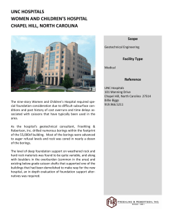


© Copyright 2026