
RURAL LAND STRATEGY Draft 2 2/15/2012
RURAL LAND STRATEGY
2/15/2012
Draft 2
PURPOSE
This document summarises the key issues relating to rural
land use in the Rural City of Wangaratta and also
summarises proposed actions to respond to those issues.
The document forms part of a project involving:
• The first draft Rural Land Strategy produced in March
2011;
• The Rural Land Strategy Background and Issues paper;
and
• A 2009 Landscape Assessment and 2012 Review.
Table of Contents
PROCESS .................................................................................................................................................... 2
LAND USE POLICY CONTEXT .................................................................................................................... 3
STATE POLICY....................................................................................................................................... 4
LOCAL PLANNING POLICY ........................................................................................................................ 6
REGIONAL SETTLEMENT STRATEGY .......................................................................................................... 7
HUME STRATEGY ....................................................................................................................................... 7
ISSUES FROM BACKGROUND AND ISSUES PAPER ................................................................................... 8
VISION ..................................................................................................................................................... 10
PROPOSALS .............................................................................................................................................. 11
1.
Minimum lot sizes for dwellings in the Farming zone........................................................... 11
2.
Dwellings on small lots in Farming zone ................................................................................. 12
3.
Minimum lot sizes for subdivisions in the Farming zone....................................................... 15
4.
Excisions........................................................................................................................................ 16
5.
Second and subsequent dwellings on a lot ........................................................................... 16
6.
Tourism to build on and diversify agricultural activity ........................................................ 17
7.
Grow the villages ....................................................................................................................... 18
8.
Landscape protection of key areas ........................................................................................ 20
9.
Glenrowan Myrtleford Road – Oxley to Markwood ......................................................... 22
10.
West Wangaratta/Warby Ranges precinct ..................................................................... 23
11.
Rural Conservation Zone and Wildfire Management Overlay ..................................... 25
12.
Rating......................................................................................................................................... 25
13.
Decision making and Delegation .......................................................................................... 26
CONCLUSION ........................................................................................................................................... 27
Page 1
RURAL LAND STRATEGY
DRAFT 2
PROCESS
As a first step in this process, Council produced a first draft Rural Land Strategy (DRLS). At its
meeting on 15 March 2011 Council resolved:
“That Council adopt the draft Rural Land Strategy and place it on exhibition for a period
of 2 months and undertake a program of community consultation seeking feedback on
the strategy.”
That decision commenced a significant communication process involving mail-out of
information, one-on-one consultations, small group briefings and four community meetings.
During the consultation process, Council’s Mayor and Chief Executive Officer met with the
Minister for Planning, to clarify his position regarding aspects of the DRLS.
The Minister advised that he:
• did not support a 250 hectare minimum for the “as of right” construction of a dwelling in
the Farming zone;
• did not offer an alternative and encouraged Council to work through other options, in
consultation with the community;
• did not support discontinuing the DRLS and had no opinions on other elements of it; and
• preferred that Council continue with the process and respond to the issues as part of the
review.
Feedback from the community in the form of 400 written submissions was also received.
The Council also resolved to establish and Agriculture and Agribusiness Advisory Committee
(AAAC) to provide input into planning and policy relating to agriculture and agribusiness and
advise on agricultural land and water resource issues, among other things.
This Draft 2 Rural Land Strategy has taken into account the Minister’s advice, feedback
received from the consultation, further information that is now to hand and the input of the
AAAC.
Page 2
LAND USE POLICY CONTEXT
Like all planning schemes in Victoria, the Rural City of Wangaratta Planning Scheme
comprises a State Planning Policy Framework (SPPF) and a Local Planning Policy Framework
(LPPF).
The SPPF comprises general principles for land use and development and specific policies
dealing with settlement, environment, housing, economic development, infrastructure, and
particular uses and development. To ensure integrated decision-making, planning authorities
and responsible authorities must take account of and give effect to the general principles and
specific policies contained in the SPPF.
The LPPF sets a local and regional strategic policy context for a municipality. It comprises the
Municipal Strategic Statement and specific local policies.
The LPPF must not operate inconsistently with the SPPF and should where possible
demonstrate how broader state planning policies will be achieved or implemented in a local
context.
If there is an inconsistency between the SPPF and LPPF, the SPPF prevails.
The rural provisions of the Rural City of Wangaratta Planning Scheme are largely a carryover
from those of the former municipalities rather than an outcome of strategic intent. The
implementation of the Farming zone resulted in a direct translation of every Rural zone parcel
into the Farming zone and continued many of the provisions of the formers municipalities.
A selection of zones and overlays can be used to implement the policy framework. Each zone
has a purpose and provides for uses that either do not require a permit, or require a permit or
are prohibited. Zones have permit triggers for subdivision and certain buildings and works.
Decision Guidelines assist in assessing and determining applications. Schedules to the zones
allow certain variables to be included. However, Council is only able to vary a small number of
matters so that the zone remains uniform across Victoria.
A Farming zone schedule can specify such matters as the minimum lot size for subdivision, set
a permit trigger above which a permit is not required for a dwelling, set distances for buildings
to be setback from boundaries and to prescribe if a permit is required for earthworks.
An Overlay is used to recognise a certain feature or characteristic such as a bushfire or
flooding risk or landscape significance. An overlay has permit triggers for buildings and works
and does not generally control land use.
Page 3
STATE POLICY
There are five State policies that have particular relevance to this project.
Policy & Objective
11.05-3
Rural Productivity
Strategy
Prevent inappropriately dispersed urban activities in
rural areas.
Objective
Limit new housing development in rural areas, including:
• Directing housing growth into existing settlements.
• Discouraging development of isolated small lots in
the rural zones from use for single dwellings, rural
living or other incompatible uses.
To manage land use change and
development in rural areas to
promote agriculture and rural
production.
Encouraging consolidation of existing isolated small lots
in rural zones.
Objective
Restructure old and inappropriate subdivisions.
Ensure that the State’s agricultural base is protected
from the unplanned loss of productive agricultural land
due to permanent changes of land use.
To protect productive farmland
this is of strategic significance in
the local or regional context.
Consult with the Department of Primary Industries and
utilise available information to identify areas of
productive agricultural land.
Protection of agricultural land
Take into consideration regional, state and local issues
and characteristics in the assessment of agricultural
quality and productivity.
Permanent removal of productive agricultural land from
the State's agricultural base must not be undertaken
without consideration of its economic importance for the
agricultural production and processing sectors.
Sustainable agricultural land use
Objective
To encourage sustainable
agricultural land use.
Page 4
Subdivision of productive agricultural land should not
detract from the long-term productive capacity of the
land.
Ensure agricultural and productive rural land use
activities are managed to maintain the long-term
sustainable use and management of existing natural
resources.
Encourage sustainable agricultural and associated rural
land use and support and assist the development of
innovative approaches to sustainable practices.
Support effective agricultural production and processing
Policy & Objective
14.02-1
Catchment planning and
management
Objective
Strategy
infrastructure, rural industry and farm-related retailing
and assist genuine farming enterprises to adjust flexibly
to market changes.
Facilitate the establishment and expansion of cattle
feedlots, piggeries, poultry farms and other intensive
animal industries in a manner consistent with orderly
and proper planning and protection of the environment.
Planning must consider as relevant:
Any regional catchment strategies approved under the
Catchment and Land Protection Act 1994 and any
associated implementation plan or strategy including
any regional river health and wetland strategies.
To assist the protection and,
where possible, restoration of
catchments, waterways, water
bodies, groundwater, and the
marine environment.
Any special area plans approved under the Catchment
and Land Protection Act 1994.
14.02-2
Protect reservoirs, water mains and local storage
facilities from potential contamination.
Water quality
Objective
To protect water quality.
Ensure that land use activities potentially discharging
contaminated runoff or wastes to waterways are sited
and managed to minimise such discharges and to
protect the quality of surface water and groundwater
resources, rivers, streams, wetlands, estuaries and
marine environments.
Discourage incompatible land use activities in areas
subject to flooding, severe soil degradation, groundwater
salinity or geotechnical hazards where the land cannot
be sustainably managed to ensure minimum impact on
downstream water quality or flow volumes.
Prevent the establishment of incompatible land uses in
aquifer recharge or saline discharge areas and in
potable water catchments.
Page 5
LOCAL PLANNING POLICY
The strategic directions from the Local Planning Policy Framework of the Planning Scheme are
also relevant.
Rural Land Use and Agriculture
Encourage the growth and development of
environmentally and economically sustainable
agricultural enterprises.
Recognise and protect agriculture and other rural uses
as significant economic strengths, social capital and
productive resources.
Maintain the productivity and versatility of agricultural
land, particularly in higher agricultural productivity and
versatility areas.
Establish the municipality as the primary centre for the
wine industry in north eastern Victoria.
Minimise potential amenity impacts between rural
agricultural uses and rural lifestyle uses, particularly in
higher agricultural productivity and versatility areas.
Maintain and enhance the potential for viticultural use
and development particularly in the Milawa, Oxley and
King Valley areas.
Ensure that any subdivision and rural housing proposals
in higher agricultural productivity and versatility areas
are directly linked to an agricultural use, retain
productive agricultural use of the land and area, protect
the economic potential of the land and area for
agriculture, and are not used for rural lifestyle purposes.
Encourage and protect the potential for intensive animal
industries, such as broiler farms, in appropriate
locations.
Subdivision and housing
Support timber production and processing as locational
and economic strengths of the area and region.
Ensure that rural subdivision and housing is provided
with a level of infrastructure that is required for that use
or development.
Ensure that any subdivision of land for ‘house lot
excision’ maintains the agricultural land resource by
minimising the parcel size of an existing house that is to
be excised and maintaining a large vacant balance of
land for agricultural purposes.
Page 6
REGIONAL SETTLEMENT STRATEGY
In addition, the Regional Settlement Strategy proposes:
• Balancing strategic objectives to achieve improved land-use and development outcomes
at a regional, catchment and local level; and
• Preserving and protecting features of rural land and natural resources and features to
enhance their contribution to settlements and landscapes.
HUME STRATEGY
The Hume Strategy for Sustainable Communities, a regional response to the State policy,
proposes directing population growth to settlements with greatest capacity to accommodate
and retaining productive rural land for agriculture and other compatible rural uses.
Page 7
ISSUES FROM BACKGROUND AND ISSUES PAPER
Community consultation – Two rounds of consultation produced some similar and a number
of different messages. In both rounds there was concern about the economic sustainability of
agriculture, the ageing of farmers and the loss of vitality of rural communities. In both rounds
there was concern about the undermining of “right to farm’ but, at the same time, many
supported relaxation, rather than tightening, of planning controls. In both rounds many
contended that changing rules would affect superannuation and succession plans, while a
number suggested that young people aren’t interested in agriculture so there is no succession.
Some argued that subdivision was a necessary response to low farming profits and others
considered this added to problems.
Agricultural trends – The general view is that farms will get bigger (with the inevitability of
less farms) or get very small. A third option is for farmers to get off-farm work. Small farms are
seen by some to be a source of problems (drive up land prices, increase biosecurity risk, food
safety threat or poor resource managers) while others argue the contrary position (small and
efficient, look after the land, have access to capital). There is also a strong view that small
farms add to social capital.
Farm expansion – The Wangaratta region has been described as an Amenity Landscape
where the amenity attribute inflates property valuations beyond their productive value. This is
supposed to prevent farmers from expanding their operations and holdings or increase the risk
of farm business failure. However, review of property transactions has shown that this appears
not to be the case in the Rural City of Wangaratta. Around 550 farming enterprises owned
1682 individual properties in 1999. In the period from 1999 to 2010, 202 of these enterprises
purchased a further 272 properties (20,900ha). The average size of the purchases was
154ha. This suggests farm expansion activity is continuing despite suggestions that rural land
has been priced out of the reach of farmers.
Dwellings in Rural areas – There have been significant residential developments in rural
areas. Since 1999, of 671 dwellings constructed in rural areas, 397 were in Farming or Rural
zones and 235 of these were on lots less than 40 hectares. In the same period, 289 planning
permits were approved for dwellings, on lots less than 40 hectares. In the period there were
just 17 refusals of applications for dwellings on small lots and 11 of these related to overlays.
Dwellings and Farming zone – The introduction of the Farming zone in 2006 has resulted in
a dramatic reduction in both applications and dwellings on small lots. Since 2009 there have
been more dwellings constructed on lots greater than 40ha than on smaller lots and in 2011
only one house was constructed on a small lot. The number of applications for dwellings on
small lots has reduced from almost 50 in 2001 to less than 10 per year since 2007.
Demographics – Feedback during the consultation stages suggested that restricting the
development of dwellings had contributed to the loss of vitality in rural communities. Further, if
more dwellings were constructed, rural communities would prosper and grow. In fact, there
has been already been a substantial increase in the number of dwellings in recent years;
almost 700 since 1999. Of these almost 400 were in Farming or Rural zones and only 274 in
Township or Rural Living zones. In this same time period, the number of residents of rural
areas has grown from 8,829 to 9,156. At the same time, the proportion of older people
Page 8
increased and the numbers of young people decreased. In summary, there have been 700
new houses constructed, rural population has increased by 327 new residents and but there
has been a continual ageing. There appears to be almost no connection between dwelling
construction and the number of residents or of the age distribution.
Social Outcomes – As has been documented in accompanying Background and Issues
Paper, the changing circumstances facing farmers make it almost inevitable that increasing
size of farms and reduced labour requirements are the outcomes of the evolutionary
development of our economy and society.
Economics – Agriculture is a significant sector of the local economy. In 2006 agriculture was
the fourth most important employer, with 1,117 people employed, in the Rural City of
Wangaratta. There are also another 288 jobs that relate to value adding manufacture in the
areas of timber, meat and dairy products.
The Gross Value of Agricultural Production statistics show that beef, fruit and grape production
increased from 1997 to 2006 whereas sheep and broadacre cropping both decreased. It must
be noted that 2006 was also the last year of tobacco production and the extremely dry seasons
between 2003 to 2006 also impacted production.
Development in Water Supply Catchments - Ministerial Guidelines regarding Planning
Permit applications in open, potable water supply catchment areas were released in May 2009.
The Guidelines require that the density of dwellings in declared catchments should be no more
than one dwelling per 40 hectares and each lot created in a subdivision should be at least 40
hectares. The declared Ovens catchment area includes almost all of the Rural City of
Wangaratta, extending south and east from the Hume freeway and Reedy Creek. The
interpretation and application of the guidelines are currently subject to a Victorian Civil and
Administrative Tribunal test case. The outcomes of that case and of the State Government’s
response could be significant matter for future development.
Page 9
VISION
The Rural City of Wangaratta 2030 Community Vision sets out the community view of the rural
landscape in 2030.
The Vision is:
“In 2030 the Rural City of Wangaratta maintains a sustainable balance between urban and
rural environments; each benefiting from the other…The rural townships have grown in size to
meet service and infrastructure needs. The growth in population across rural townships has
been instrumental in reviving these communities…The high-value and productive rural
agricultural land in the Rural City of Wangaratta has been strongly preserved for agricultural
activities. This has maintained the rural feel of the area and ensured that agriculture continues
to form a key element of the local economy.”
Page 10
PROPOSALS
1.
Minimum lot sizes for dwellings in the Farming zone
Background:
The Background and Issues paper showed that there has been significant residential
development in rural areas, often in the Farming or Rural zones and more often than not,
on lots less than 40 hectares. (670 dwelling in rural areas, almost 400 in Farming or
Rural zone and 235 of these on lots less than 40 hectares)
The introduction of the Farming zone has reduced the number of dwellings being
constructed on small lots from an average of almost 30 per year to only one in 2011.
There are approximately 8,500 lots or parcels in the Farming zone. Of these, 2,650 have
dwellings. There are 2,820 dwellings in total with some parcels having multiple dwellings.
Approximately 1,980 or 75% of the lots with dwellings are less than 40ha.
There are approximately 5,850 lots in the Farming zone that do not have a dwelling.
Almost 1,270 of these are greater than 40ha and of these 920 are not subject to any
Overlay. Of the 4,580 lots that are less than 40 hectares, 2,660 are not subject to any
Overlay.
There are more than 500 properties of 80ha or more that have the potential to be further
subdivided into possibly more than 1,500 lots of 40ha.
In summary, there is the potential for a further 920 as of right dwellings, another 2,660 on
lots of less than 40 hectares without Overlay restriction and a further 1,920 where
Overlays have been applied. Up to 1,500 lots could be created subject to meeting the
subdivision requirements.
There is, therefore considerable potential for further dwelling development in the Farming
zone.
As a result, the first Draft Rural Land Strategy proposed increasing the minimum lot size
for as of right construction for a dwelling to 250ha. The rationale for this proposal was
that the risk of encroachment of rural residential development onto agricultural land was
such that all dwellings should be required to seek a planning permit. In order for all
dwellings to be required to seek a permit it was initially proposed that there be no as-ofright. However, further advice suggested that a minimum size was mandatory. As a
result the 250ha minimum was included on the basis that almost all new dwelling
developments in the Farming zone would require a permit. This proposal was
subsequently vetoed by the Minister.
Much of the feedback received on the draft Rural Land Strategy expressed concern that a
“One size fits all” or “broadbrush approach” did not adequately reflect the differing
characteristics and land uses across the municipality.
Page 11
As a result, consideration was given to including in this Draft 2 Rural Land Strategy,
potential planning areas, zones or localities where particular development controls could
apply. Characteristics such as soil versatility, access to irrigation water, existing dwelling
densities, existing land uses etc were considered as bases for defining zones. For
example, the very high versatility soils and irrigation water along the Ovens River, the
possible future intensification of agriculture along the aquifer north of Wangaratta, and the
fragmented holdings west of Wangaratta to the Warby Ranges were all considered as
zones for specific planning arrangements.
However, the difficulties associated with defining boundaries of the potential zones
together with the perceived inequities created where neighbouring properties would have
differing as-of-right entitlements led to a view that those options should not be included in
this Draft 2 Rural Land Strategy.
Further, a significant number of submissions argued that the 40ha minimum lot size for a
dwelling did not cause land to be lost to agriculture because properties of 40ha or more
are too large not to farm in some way. A number of submissions cited personal
experience that a 40ha property with a grazing operation was an ideal complement to offfarm employment.
Conclusion:
Given the lack of compelling evidence to support one size over another or of any
conclusive methodology for determining minimum lot sizes, a case for change to the
minimum lot size, for an as of right dwelling, cannot be substantiated.
Proposal:
Retain 40ha as the minimum lot size for an as of right dwelling in the Farming zone for
lots that currently exist.
2.
Dwellings on small lots in Farming zone
Background:
As indicated above there are a large number of lots in the Farming zone without
dwellings. There has been and continues to be pressure for residential development on
many of these rural areas.
Proposal 1 above has confirmed that an as of right to a dwelling, in the Farming zone, will
continue to apply where the lot is 40ha or more.
However, there are two situations where a dwelling may be permitted on a lot of less than
40ha. The first is where it can be demonstrated that the dwelling is necessary for the
agricultural activity. The second is where an isolated lot has no agricultural value and the
alternative, long term use could be residential. These exceptions are discussed below.
Page 12
1. Dwelling necessary for the agricultural activity:
The State Planning Policy Framework aims to “Limit new housing development in rural
areas, including:
• Directing housing growth into existing settlements;
• Discouraging development of isolated small lots in the rural zones from use for
single dwellings, rural living or other incompatible uses; and
• Encouraging consolidation of existing isolated small lots in rural zones.”
The Decision Guidelines for deciding on the construction of a dwelling include an
important test as to “whether the dwelling is reasonably required for the operation of the
agricultural activity carried out on the land.”
Council’s Local Policy attempts to further clarify this Guideline by making it necessary to
“ensure that any dwelling proposal has a relationship with and is required to directly
support the continuing operation of an existing rural land use conducted on the land.”
The previous Draft Rural Land Strategy proposed that: “It must be clearly demonstrated
that the dwelling is essential to carry out an agricultural activity on the land. New
dwellings in the Farming zone will only be approved in order to support rural activities and
production and will not be supported where the underlying intention of the dwelling is to
meet rural lifestyle objectives”.
Other Councils have also attempted to clarify these requirements. One requires that the
“…primary use of land will continue to be agriculture”. (Geelong) Another specifies that
“The dwelling should be necessary to support the ongoing or planned farming activity on
the land and any adjacent land.” (Ballarat)
Feedback on the DRLS suggested that the density of dwellings was also a consideration.
In addition, the Guidelines for Development in Open, Potable Water Supply Catchment
Areas also require that dwelling density should not be greater than one dwelling per 40
hectares.
Conclusion:
State Planning Policy aims to limit new houses in rural areas and Council’s existing Local
Policy requires any new dwelling to directly support an existing rural land use.
Proposal:
Council policy will continue to discourage dwellings in the Farming zone unless the
dwelling is reasonably required for the operation of the agricultural activity and the
dwelling density of not more than one dwelling per 40ha can be maintained.
Page 13
2. Isolated lots with no agricultural value
The first Draft Rural Land Strategy identified a number of areas, within the Farming zone,
where the construction of dwellings made it unlikely that agriculture would ever again
become the predominant land use.
These locations included Greta West, Henley Ridge and the Wilson Road area of
Wangandary. The first Draft Rural Land Strategy proposed defining boundaries for these
localities and allowing residential development within those boundaries subject to certain
conditions. However, the consultation feedback has brought forward a number of other
locations and smaller, isolated lots that often have no agricultural value.
Further, the Victorian Civil and Administrative Tribunal recently overturned a Council
decision and allowed a dwelling on a small parcel of land in the Farming zone. The
decision was on the basis that the land had minimal agricultural value, the dwelling would
not result in loss of agricultural land and the land would not be fragmented from
agricultural production. The decision also noted that Council’s policies did not provide for
land that was not usable for agricultural activities.
Conclusion:
Considering that State policy aims to discourage development of isolated small lots from
use for dwellings there may be still situations where residential development is an
acceptable long term use. In addition, rather than attempting to identify all locations
where future residential development could be approved, it is preferable to develop
criteria to be applied to all applications for dwellings on small lots.
Proposal:
Council policy will continue to discourage dwellings in the Farming zone unless it can be
demonstrated that the dwelling satisfies the following criteria:
•
Small lot less than 4ha;
•
Be of minimal agricultural value e.g. low agricultural versatility;
•
Not be able to be physically consolidated with other agricultural land;
•
Access via a road in Council’s Register of Public Roads;
•
Complies with Ministerial Guideline regarding development in Water Supply
Catchment;
•
Not the result of a new subdivision(after 1 July 2012);
•
No access to irrigation water;
•
Surrounded by roads, rail, public land or residential development;
•
Not totally covered by an overlay;
•
Waste water disposal adequacy; and
•
Adequate water supply.
Page 14
3.
Minimum lot sizes for subdivisions in the Farming zone
Background:
The Farming zone intends, among other things, to provide land for agriculture, encourage
retention of productive agricultural land and ensure that other uses, particularly dwellings,
do not adversely affect the use of land for agriculture.
Of the 8,500 parcels or lots in the Farming zone there are 6,580 lots that are less than
40ha and these make up 35% of the land area of the zone. Of these 4,590 do not have
dwellings.
There are a further 1,430 lots that are between 40 and 80ha and these make up 44% of
the area of the Farming zone. There are more than 930 lots with sizes of between 40ha
and 80ha that do not have a dwelling
In aggregate, 8,003 lots or 94% of lots are less than 80ha. In area terms, 79% of the
area of the Farming zone is made up of lots of less than 80ha.
In regard to subdivisional activity, in the period from 1999 to 2010, there were 95 lots
created with sizes of between 40ha and 45 ha. Land sales data shows that the most
common size for a property sale is between 40ha and 50ha with 25 sales of properties
between 40ha and 42 ha.
Conclusion:
With 79% of the rural area in lots of 80ha or less and 35% in lots of 40ha or less, the
Farming zone is already highly fragmented. Subdivision activity continues to create more
lots of 40ha than any other size because these are highly marketable.
Feedback on the DRLS suggested that the creation of 40ha lots did not result in the loss
of productive agricultural land. However, there is also a contrary view that the continued
subdivision of broadacre agricultural areas is undesirable. There are economic
arguments, supported by evidence, that economies of scale are particularly important in
broadacre farming areas. This would suggest that further fragmentation is undesirable in
many localities across the municipality.
In addition, there is potential for a large number of dwellings to be developed on existing
lots of 40ha and there is no need to create further lots for dwellings.
Proposal:
Lots created by subdivision after 1 July 2012, must be 40ha or more and will not have an
automatic right to a dwelling but may apply for a permit for a dwelling.
Page 15
4.
Excisions
Background:
In the period from 1999 to 2010, there were approximately 100 dwelling excisions in the
Rural and Farming zones. The separation of these dwellings from the farming property
can have the same effect as allowing dwellings on small lots in that it results in the
establishment of uses that are Rural Living rather than Farming.
There are also 165 properties that have more than one dwelling and 180 additional
dwellings on total on those properties. Many of these additional dwellings are in areas
that were previously tobacco growing areas.
While the State provisions enable only one dwelling to be excised, and also require an
agreement to prevent the further subdivision of any new lots created, the Farming zone
provisions don’t require the balance lot to be at least the minimum lot size of the zone.
There are also many excisions made before the Farming zone was introduced and as a
result there are no agreements to prevent further subdivision. There are locations where
excisions have already established rural living enclaves in areas that are most suited to
agriculture.
Conclusion:
While the Rural Productivity policy seeks to prevent urban activities in rural areas, the
current arrangements enabling the excision of existing dwellings allow those activities to
occur. There is also likely to be ongoing demand for excisions, particularly as the former
tobacco growing areas are redeveloped, as landowners seek to separate non-agricultural
assets from agricultural land.
Proposal:
Council seeks Ministerial support for a removal of the clause enabling the excision of an
existing dwelling, from the Farming zone.
In the event that the Minister will not support that proposal, then Council policy will:
•
Strongly discourage excisions; and
•
Where excisions are approved, that it be on the proviso that the balance lot must be
greater than 40HA and further subdivision or construction of a new dwelling, on the
balance lot will be removed by an agreement registered on title for each lot created.
5.
Second and subsequent dwellings on a lot
Background:
A number of submissions on the DRLS proposed that a second or subsequent dwelling
on a lot should be encouraged as a solution to family succession or farm labour needs.
Page 16
The Farming zone allows for more than one dwelling on a lot but a permit is required and
the Decision Guidelines are the same as those for a dwelling on a lot of less than 40ha.
Allowing more than one dwelling on a lot could create similar issues to those that arise
from allowing dwellings on small lots. In the event that the dwelling is no longer required
for agricultural purposes its use will be for residential purposes and could result in an
excision. However, where second or subsequent dwellings will form part of and remain
part of the ownership of the agricultural activity, it is much more likely that the dwelling will
contribute to productivity and not result in conflict.
Conclusion:
Second or subsequent dwellings can be a necessary part of agricultural expansion or
farm transition. Future conflict is much less likely if dwelling remains as part of the
ownership of the agricultural activity.
Proposal:
Council policy will support second and subsequent dwellings on the same title as existing
farm dwellings and/or infrastructure. Approval for the dwelling would be conditional on
entering an agreement that would carry over with any change of ownership, that the
dwellings could not be subdivided or excised from the original title.
6.
Tourism to build on and diversify agricultural activity
Background:
There is considerable interest in, and development already occurring, in agriculture
related tourism activities. Consistent with the objective of ensuring that agriculture
remains the predominant use in the Farming zone, tourism developments must be based
on existing agriculture.
The first Draft Rural Land Strategy proposed applying the Rural Activity zone to areas of
the King Valley and Milawa-Oxley.
The Farming zone already enables a number of uses such as Bed and Breakfast; Group
Accommodation, Host Farm, Primary Produce Sales and Restaurant provided that these
uses are in conjunction with Agriculture, Outdoor recreation, winery etc. The Farming
zone also limits Bed and Breakfast accommodation to 6 people and Group
accommodation to no more than 6 dwellings. These limits are possibly too restrictive.
The Rural Activity Zone enables a small number of additional uses, such as Backpackers
Lodge, Hotel, Tavern and Convenience shop. While these uses are potential tourism
developments, most would be more appropriately located in villages. Further, the Rural
Activity zone does not allow for as-of-right dwellings. Therefore, every new dwelling
would need a permit which is inconsistent with other proposals in this Strategy of allowing
Page 17
dwellings on lots greater than 40ha. Further, feedback received from consultation was
that it may be counterproductive to encourage agriculture based tourism and, at the same
time, restrict dwellings because many of the likely tourism uses could be either in
conjunction with, or require the construction of additional dwellings.
Conclusion:
The additional uses and development options offered by the Rural Activity zone are more
than offset by the additional controls. The Farming zone, with relaxation of existing limits
is the preferred means of supporting ongoing agricultural activity as well as the emerging
agriculture based tourism developments.
Proposal:
Continue to apply the Farming zone to areas with tourism potential (except as further
specified below) but to seek approval from the Minister to relax the limits on Bed and
Breakfast and Group Accommodation.
7.
Grow the villages
Background:
The small towns and villages play important social and economic roles in the rural
districts. Expansion of villages will enhance these roles and also has the potential to
ease the pressure for residential development in agricultural areas. However, further
development of most of the villages is constrained by lack of infrastructure; particularly
water supply and waste water treatment as well as inappropriate zoning in some
instances. The consultation process also raised the issue of potential conflict on the
boundaries of villages and the interaction with neighbouring agricultural uses.
The following summary outlines the current planning and development activities in the
major villages:
Glenrowan, Milawa and Oxley are to be provided with reticulated sewer. This will
improve the development potential of each of these villages by enabling the provision of
smaller lots than is currently the case. Council has approved funding to prepare structure
plans for these 3 towns, to review the existing planning arrangements and to examine
development and zoning options to make best use of this infrastructure.
Boorhaman, Peechelba, Springhurst and Tarrawingee all appear to have adequate areas
of land zoned Township to accommodate future growth.
Rural residential development is facilitated in Peechelba, Springhurst and Tarrawingee by
the use of the Low Density Residential zone with a 1 hectare minimum lot size and there
may be some opportunity to encourage this development type in Boorhaman by varying
some of the Township zoning to facilitate this.
Page 18
Moyhu and Whitfield will require further investigation to allow growth including expansion
of land not currently zoned Township. Wastewater effluent management will dictate lot
sizes as much as village character and settlement pattern. The upgrading of water supply
to Whitfield will facilitate some additional growth.
Everton has a mixed zoning pattern with zoning changes required to recognise village
uses that are currently within the Farming zone. A recent subdivision will provide for its
immediate residential growth.
Eldorado has capacity within the Township zone for further residential development but
there are options available to provide additional rural residential opportunities at the
south-west entrance to town.
Cheshunt has some constraints with an area of Rural Living zoned land limited by the
Wildfire Management overlay. The appropriateness of this zone needs to be considered
having regard to the review of the bushfire provisions in the Scheme. There is
opportunity for further township growth within the current zoning. Some minor
adjustments to the boundaries of the zones should occur.
Whorouly has extensive areas zoned for Township and a small strip for Rural Residential
development. Flooding issues are significant and Council, in the future will work with the
community and North East Catchment Management Authority to address development
opportunities and constraints.
Other scattered rural settlements exist without a core zoning or township area such as
Myrrhee, Everton Upper, Greta West and Peechelba East. The need to look at these
areas and their zoning requirements will be directed by the Housing and Population
Strategy.
Conclusion:
Limitations on further residential development in several villages are being resolved.
While the expansion of residential development in these towns may offer an alternative to
residential development in agricultural areas, the future residential growth of all these
villages is more appropriately determined as part of the Housing and Population Strategy.
Proposal:
Zoning anomalies around the northern township boundary of Milawa, on the western
boundary of Oxley, and in Everton will be corrected as part of this Draft 2 Rural Land
Strategy. However, the expansion and finalisation of the boundaries of all villages will
form part of the Housing and Population Strategy that is currently being completed.
Mapping of boundary adjustments for Milawa (attachment 1), Oxley (attachment 2) and
Everton (attachment 3) accompany this draft.
Page 19
8.
Landscape protection of key areas
Background:
The Wangaratta 2030 Community Vision places a high value on protection of rural
landscapes.
“High value rural agricultural land and open rural landscapes have been protected from
development and fragmentation.”
As part of developing the first Draft Rural Land Strategy, a Landscape Assessment was
carried out to guide the protection and management of rural landscapes.
The Assessment identified several areas of high significance. Three of these were
recommended for additional planning control.
Warby Ranges
The existing Significant Landscape Overlay (SLO) boundary is considered to accurately
reflect the area of landscape significance.
The schedule to the SLO requires additional information about the significance of the
area, and control over vegetation removal.
King Valley
Given the significance of the King Valley and its sensitivity to unsympathetic
development, it is recommended that an SLO is applied to the King Valley, generally
along the 200m contour line, effectively forming an area of protection between the
adjoining areas of PCRZ.
A permit should be required for all buildings and works within the SLO area, as well as
fencing other than post and wire fencing, and removal of vegetation.
The SLO objectives should include:
• Retain the scenic quality of the area which is characterized by open
agricultural/horticultural land and long range views to the alps.
• Contain development at the edges of townships from intruding into adjoining
agricultural areas.
• Outside of townships, restrict development along the edges of roadways.
• Maintain existing character of townships.
• Avoid visual clutter and proliferation of signage.
• Retain significant vegetation that contributes to the landscape character of the area.
Decision guidelines should relate to the siting and design of buildings, structures and
fences and to the contribution of vegetation to the character of the area.
The King Valley Masterplan, that is nearing completion, is also likely to recommend
strengthening of protection of landscape features in the King Valley south of Moyhu.
Page 20
Glenrowan Gap
For the Glenrowan Gap, an additional Significant Landscape Overlay is recommended for
a 500 metre stretch of land east of the Highway from Glenrowan to Wangaratta. It is
important to retain this view corridor as a significant ‘gateway’ into Wangaratta.
The SLO objectives should include:
• Retain the scenic quality of area which is characterized by open
agricultural/horticultural land and long range views to the alps.
• Contain development or signage at the edges of Hume Freeway that might inhibit
these long range views.
Review Report 2012
A review has not been completed of the recommendations contained within the 2009
assessment report.
The outcomes of this review were:
King Valley
A new local policy to provide basis for consideration of the siting and design of buildings
within the King Valley.
In addition, a schedule to the Farming Zone be amended so that any building within 200
metres of the Wangaratta Whitfield Road of the King Valley Road requires a permit.
Glenrowan
The Significant Landscape Overlay be applied along the eastern side of the Hume
Freeway (500m in width) from the Laceby Glenrowan Road to the Glenrowan Myrtleford
Road.
Proposal:
1. A schedule to the Farming zone be amended so that any proposed building within 200
metres of the Wangaratta Whitfield Road and the King Valley Road requires a
planning permit. A new local policy be developed to provide for consideration of the
siting and design of buildings.
2. A Significant Landscape Overlay be applied a 500 metre stretch of land east of the
Hume Freeway from Laceby Glenrowan Road to Glenrowan Myrtleford Road.
3. That additional information about the significance of the area, and control over
vegetation removal, be added to the Schedule to the Significant Landscape Overlay
already applying to the Warby Ranges area.
Mapping of proposed King Valley schedule (attachment 4) and Glenrowan significant
Landscape Overlay (attachment 5) accompany this report.
Page 21
9.
Glenrowan Myrtleford Road – Oxley to Markwood
Background:
Tourism is an important element of the employment and economic base of the
municipality.
The Milawa Gourmet Region, bounded by Oxley and Markwood is an area where the
gourmet food and wine experience is well established and additional opportunities exist
for on-farming processing and marketing of local produce. This is acknowledged in
Wangaratta Tourism Industry Strategic Plan, 2010 – 2013.
The Landscape Assessment Study characterised this area as the Open Agricultural
Plains (Character Type 2.2). The study highlighted:
“Another popular route to the Alps, the Glenrowan- Myrtleford Road is also referred to as
‘Snow Road’. This route is becoming more attractive to tourists because it passes
through the Milawa Gourmet Region offering food and wine experiences. Conceived in
1994, it now boasts a proliferation of excellent wineries, restaurants and farm gate
enterprises”.
The landscape recommendations for this area include:
• to protecting rural views and vistas, including views to Mount Buffalo and the Warby
Ranges;
• to maintain the agricultural landscape views;
• to protect and enhance roadside and streamside vegetation; and
• to manage new buildings and structures having regard to the siting, spacing and
design of buildings and ensuring roads and driveways do not dominate the
landscape.
The Farming Zone, which currently applies to most rural land, restricts new tourism
development to small scale accommodation and a limited range of tourism uses. An
opportunity to provide for further tourism development in this locality can be facilitated via
the application of the Rural Activity Zone.
The townships of Oxley and Milawa are the hubs of the region but it is considered that
there is a strategic opportunity to foster further growth of accommodation, food and wine
product and associated leisure and recreation activities within the wider landscape.
Page 22
There is potential to capitalise on the significant tourist traffic using the road to access the
ski fields, build on the cycle tourism initiatives and continuing to facilitate the expansion of
the gourmet food and wine experience.
The first Draft Rural Land Strategy proposed applying the Rural Activity zone to an area
extending along the Glenrowan Myrtleford Road, from Oxley to Milawa, to the south to
Colemans Lane and to the north generally to the Tea Garden Creek and Oxley Flats road.
North East Catchment Management Authority expressed some concern at including large
areas that have flooding constraints in a zone fostering tourism and accommodation
growth. Having regard to this feedback and further assessing this issue it is proposed to
vary the area proposed.
Conclusion:
Strategic support exists to foster tourism associated growth to complement the townships
of Milawa and Oxley and to strengthen the Milawa Gourmet Region. The Rural Activity
zone provides a tool that provides for a wider range of uses, particularly tourism
accommodation without the need for them to be in conjunction with agriculture.
Proposal:
Apply the Rural Activity zone to a narrow strip extending north and south of the
Glenrowan Myrtleford Road from the Wangaratta Whitfield Road at Oxley to Carbour
Road at Markwood, generally bounded to the south by Colemans Lane and to the north
by Oxley Flats Road and partly by the Markwood-Tarrawingee Road.
The minimum lot size for subdivision should be retained at 40 hectares so that
predominant rural landscape is not further fragmented and separation between buildings,
tourism uses and existing farming uses can be maintained.
To have a local policy to support and encourage uses in association with food and wine
tourism including a range of accommodation and recreational opportunities and to ensure
adequate consideration to landscape and heritage characteristics, including the views
and vistas to and from Oxley and Milawa townships.
Mapping of the proposed Glenrowan, Myrtleford Road Rural Activity Zone (attachment 6)
accompanies this report.
10. West Wangaratta/Warby Ranges precinct
Background:
On the western boundary of the municipality an area bounded by the Warby Ranges from
Glenrowan to Chick Road, Wangandary in the north extending east to the Yarrawonga
Road, urban Wangaratta and the Hume Highway near Glenrowan, is an area under
Page 23
pressure from a range of possible uses. The area borders the Ovens Warby National
Park and the scenic vistas provided in the landscape. It also has significant ties with
Kelly history and heritage, pressure for rural living development, urban encroachment, the
need to provide for urban growth of Wangaratta and, in its upper reaches, is also
exposed to bushfire risk. Agriculture is still the predominant landuse. Agricultural pursuits
vary from grazing, horticulture and equine activities
The foothills of the Warby Ranges abutting the National Park already have planning
recognition via Wildfire Management Overlay and Significant Landscape Overlay.
Many of the submissions to the DRLS generated from this locality suggested that the
area was largely lost to agriculture and was more suited for rural residential purposes.
The Landscape Character Assessment recommends extension of the Significant
Landscape Overlay. The planning framework relating to bushfire management will also
pose additional measures in relation to the appropriateness of and siting of new buildings
in this landscape.
This area has a fragmented subdivision pattern and has seen a number of subdivisions in
the past 11 years utilising the 40 hectare minimum provision. With the locality playing a
key role in the urban expansion of Wangaratta, the subdivision provision of 40 hectares
keeps land in parcels that can be progressively rezoned to facilitate conventional
residential or a range of rural living opportunities.
The mixed nature of existing uses, the landscape characteristics and the varying
agricultural versatility in this locality lead to a need to assess whether retention of this
area in the Farming zone will deliver the most appropriate outcomes.
This locality over the next 30 years will be subject to substantial change and warrants the
use of the Rural Activity zone which eases the restriction on linking dwellings to
agriculture and provides flexibility to balance the competing pressures.
Conclusion:
The declining significance of agriculture, potential tourism and recreation development
around the Ovens Warby National Park, and the urban expansion of Wangaratta, means
that the Rural Activity zone is preferred to the Farming zone for this area.
Proposal:
To rezone the locality to Rural Activity zone, maintain the 40 hectare minimum lot size
and use local policy to guide the transition of this locality for urban growth, rural living
demand and agricultural uses, particularly encouraging equine related land use close to
the existing TAFE and Racecourse. As a result, applications for dwellings necessary for
the conduct of equine activities will be favorably considered in this area.
Issues surrounding rural residential uses in this precinct will be considered in detail in
Council’s Housing and Population Strategy where recommendations may contribute to
the policy for this area.
Page 24
Mapping of the proposed West Wangaratta / Warby Ranges Rural Activity Zone
(attachment 7) accompanies this report.
11. Rural Conservation Zone and Wildfire Management Overlay
The Draft Rural Land Strategy proposed rezoning significant areas of privately owned
land from Farming zone to Rural Conservation zone. However, feedback from the
consultation process established that many `of the areas identified for rezoning were
used for agricultural production and that the restrictions imposed by the Rural
Conservation zone would seriously impede these agricultural activities. Submissions
suggested that many of the areas proposed for rezoning were farmed sustainably and
that rezoning would not result in better management or better environmental outcomes.
As a result it is not proposed to continue with the expansion of the Rural Conservation
zone.
The consultation activities also raised a number of concerns about construction of
dwellings in bushfire prone areas. The Bushfire Royal Commission has made a number
of recommendations that are being implemented on a state wide basis.
As a result it is not proposed to make any amendments to Wildfire Management Overlay
as part of this strategy.
Conclusion:
There are no compelling reasons for Council to either expand the application of the Rural
Conservation zone or reconsider the use of the Wildfire management Overlay.
Proposal:
Not proceed with expansion of either Rural Conservation zone or Wildfire Management
Overlay.
12. Rating
Council has utilised a Differential rating approach for several years. This approach
applies different levels of rate to different classes of properties based on the Planning
Scheme zoning of those properties. As a result Farming zone properties are levied the
lowest rate, residential zoned properties a higher rate and commercial and industrial
properties an even higher rate.
In the event that there are changes made to zoning, particularly where areas are rezoned
from Farming zone to Rural Activity zone, all else being equal, rating levels would be
expected to increase.
Consideration needs to be given to the effect on rates of those properties where zoning
changes are made.
Page 25
Conclusion:
One of the aims of the Rural Land Use Strategy is to ensure that agriculture continues to
form a key element of the local economy. Rapidly increasing or excessive rates may
undermine agricultural viability.
Proposal:
Council review its rating strategy to ensure that landowners are not disadvantaged by
rate increases that occur because the zoning has changed but the agricultural land use
has not.
13. Decision making and Delegation
There are matters relating to Council decision making that could be improved to provide
better outcomes.
A number of submissions drew attention to the large number of approvals issued for
dwellings on small lots in the Rural/Farming zone, particularly in the period prior to 2009.
These approvals were issued despite a policy position that discouraged these
developments.
Submissions also questioned whether Council planners had the expertise, experience
and knowledge of rural matters to be able to make decisions on rural or agricultural
development proposals.
Council’s current decision making arrangements enable officers to determine applications
in situations where there are no objections and the application is to be approved.
Applications that either have attracted one or more submissions or where the application
is to be refused, must be decided by Council. The effect of this arrangement is that
Councillors can be unaware of applications that have been approved and so, don’t gain a
full picture of development occurring in these areas.
In regard to enabling access to knowledge and information for decision making, the
preferred approach is to ensure that planning staff have access to independent experts.
The Agriculture and Agribusiness Advisory Committee will not be involved in decision
making on particular applications as their role is to provide advice to Council on broader
agricultural matters.
Proposal:
That
• all applications relating to the Farming zone or Rural Activity zone be decided by the
Council; and
• Council continues the practice of seeking expert input into consideration of
applications as required.
Page 26
CONCLUSION
The proposals number 1 to 13 set out in this draft strategy are the outcomes of extended
process that has sought to balance:
• Councils 2030 Vision;
• requirements of Planning and Environmental Act;
• Changing agricultural practices;
• Feedback received from consultation and Agriculture and Agribusiness Advisory
Committee; and
• Research and opinion from experts in the field.
Page 27
BRIMIN
BRIMIN
ESMOND
ESMOND
NORONG
NORONG
BOORHAMAN
BOORHAMAN NORTH
NORTH
BUNDALONG
BUNDALONG SOUTH
SOUTH
LILLIPUT
LILLIPUT
CHILTERN
CHILTERN VALLEY
VALLEY
PEECHELBA
PEECHELBA
PEECHELBA
PEECHELBA EAST
EAST
BOORHAMAN
BOORHAMAN EAST
EAST
CHILTERN
CHILTERN
SPRINGHURST
SPRINGHURST
BOWEYA
BOWEYA NORTH
NORTH
MONDS
MONDS
LMONDS
Legend
BOORHAMAN
BOORHAMAN
BORALMA
BORALMA
KILLAWARRA
KILLAWARRA
BOWEYA
BOWEYA
DOCKERS
DOCKERS PLAINS
PLAINS
MOUNT
MOUNT BRUNO
BRUNO
BYAWATHA
BYAWATHA
BOWSER
BOWSER
WALDARA
WALDARA
NORTH WANGARATTA
WANGARATTA
NORTH
WANGANDARY
WANGANDARY
ELDORADO
ELDORADO
BEECHWORTH
BEECHWORTH
LONDRIGAN
LONDRIGAN
HOONA
HOONA
EAST
EAST WANGARATTA
WANGARATTA
WANGARATTA
WANGARATTA
EVERTON
EVERTON UPPER
UPPER
TARRAWINGEE
TARRAWINGEE
TAMINICK
TAMINICK
OXLEY
OXLEY FLATS
FLATS
WANGARATTA
WANGARATTA SOUTH
SOUTH
LACEBY
LACEBY
WINTON
WINTON NORTH
NORTH
STANLEY
STANLEY
EVERTON
EVERTON
OXLEY
OXLEY
MURMUNGEE
MURMUNGEE
MILAWA
MILAWA
GLENROWAN
GLENROWAN
BOWMANS
BOWMANS FOREST
FOREST
MARKWOOD
MARKWOOD
GAPSTED
GAPSTED
DOCKER
DOCKER
GLENROWAN WEST
WEST
GLENROWAN
WHOROULY
WHOROULY
BOBINAWARRAH
BOBINAWARRAH
GRETA
GRETA
GRETA WEST
WEST GRETA
Map 2
Land Sales by Locality
WHOROULY EAST
EAST
WHOROULY
MERRIANG
MERRIANG
LURG
LURG
MYRTLEFORD
MYRTLEFORD
UPPER LURG
LURG
UPPER
MOYHU
MOYHU
MEADOW CREEK
CREEK
MEADOW
Average area of land Sales
HANSONVILLE
HANSONVILLE
62 to 175 ha (15)
EDI
EDI
GRETA SOUTH
SOUTH
GRETA
Municipal Boundary
WHOROULY SOUTH
SOUTH
WHOROULY
MERRIANG SOUTH
SOUTH
MERRIANG
50 to 62 ha
(13)
41 to 50 ha
(10)
5 to 41 ha
(16)
CARBOOR
CARBOOR
BUFFALO RIVER
RIVER
BUFFALO
UPPER RYANS
RYANS CREEK
CREEK
UPPER
KING
KING VALLEY
VALLEY
Bar Chart of Sales By Locality
41
EDI
EDI UPPER
UPPER
MYRRHEE
MYRRHEE
WHITFIELD
WHITFIELD
TATONG
TATONG
No of sales
Sales<40ha
WHITLANDS
WHITLANDS
Map Produced by: GIS Coordinator
Date: 8 August 2011
CHESHUNT
CHESHUNT
DANDONGADALE
DANDONGADALE
ARCHERTON
ARCHERTON
ROSE
ROSE RIVER
RIVER
TOLMIE
TOLMIE
CHESHUNT
CHESHUNT SOUTH
SOUTH
This map contains Vicmap information
© The State of Victoria,
Department of Sustainability and Environment, 2011.
Reproduced by permission of the Department of
Sustainability and Environment.
Disclaimer:
This material may be of assistance to you but the
state of Victoria and its employees do not guarantee
that the publication is without flaw of any kind or is
wholly appropriate for your particular purposes and
therefore disclaims all liability for any error, loss or
consequences which may arise from your relying
on any information contained in this material.
Using or copying parts of this document is
prohibited without Councils written Authority.
Springhurst
Peechelba
Boorhaman
Eldorado
Wangaratta
Tarrawingee
Everton
Oxley
Milawa
Glenrowan
Whorouly
Moyhu
Map 4
Land Parcels with dwelling
Parcels in Farming Zone
with Residence
Parcels in Farming Zone
without Residence
Whitfield
Cheshunt
Crown Land
Municipal Boundary
Watercourse
Map Produced by: GIS Coordinator
Date: 8 August 2011
This map contains Vicmap information © The State of Victoria,
Department of Sustainability and Environment, 2011.
Reproduced by permission of the
Department of Sustainability and Environment.
Disclaimer:
This material may be of assistance to you but the state of
Victoria and its employees do not guarantee that the
publication is without flaw of any kind or is wholly
appropriate for your particular purposes and therefore
disclaims all liability for any error, loss or consequences
which may arise from your relying on any information
contained in this material.
Using or copying parts of this document is prohibited
without Councils written Authority.
Map 5
Dwellings constructed since 1999
in Farming Zone
Legend
Dwellings constructed since 1999
VM Transport Road class
Freeway
Highway
Arterial
Sub Arterial
Collector
Local
2WD
4WD
Proposed
Walking Track
Bicycle Track
Municipal Boundary
Crown Land
Map Produced by: Rural City of Wangaratta, GIS Coordinator
Date: 29 August 2011
This map contains Vicmap information © The State of Victoria,
Department of Sustainability and Environment, 2011.
Reproduced by permission of the
Department of Sustainability and Environment.
Disclaimer:
This material may be of assistance to you but the state of Victoria and
its employees do not guarantee that the publication is without flaw of
any kind or is wholly appropriate for your particular purposes and
therefore disclaims all liability for any error, loss or consequences
which may arise from your relying on any information contained in
this material.
Using or copying parts of this document is prohibited without
Councils written Authority.
Map 6
Subdivision since 1999
in Farming Zone
Legend
Subdivision since 1999
VM Transport Road class
Freeway
Highway
Arterial
Sub Arterial
Collector
Local
2WD
4WD
Proposed
Walking Track
Bicycle Track
Municipal Boundary
Crown Land
Map Produced by: Rural City of Wangaratta, GIS Coordinator
Date: 29 August 2011
This map contains Vicmap information © The State of Victoria,
Department of Sustainability and Environment, 2011.
Reproduced by permission of the
Department of Sustainability and Environment.
Disclaimer:
This material may be of assistance to you but the state of Victoria and
its employees do not guarantee that the publication is without flaw of
any kind or is wholly appropriate for your particular purposes and
therefore disclaims all liability for any error, loss or consequences
which may arise from your relying on any information contained in
this material.
Using or copying parts of this document is prohibited without
Councils written Authority.
Wangaratta Rural City Council – Ordinary Meeting
21 February 2011
ATTACHMENT
PLANNING PERMIT APPLICATION PLN11-059 –
FULL PLANS
Refer Item 11.2.2.2
N
Overall.:SItStowteg43%
ItripeNibuscifeWL:
/
/
/
Legend
/
/
/
/
/
/
/
/
/
/
J'
/
<
i
i.
,
.
/
/
06'Si
I, '..,
,
0' Ailk-
/
N-
42
/
/
8
Purposed bee
Proposed 604585700
Site Douridery-sue role/
Der10010 areas
Dwellings
Lander:mood awns
SPOS
Neighbouring Structure
Subject Land
Vot.
Fol.
PS
Parish
Township
Sedon
Gown Motward
Area
8626
411
LPSI046 dot 185)
Ihrangaralre South
---
NolatIons
Sao liao for boundary a alsaa
3T.T.I.liA and .Areas are ra PPITAIrrale only and subject ta
hal savoy
Loudon 01 MD boundaries Is epproWnetennty and sublect
flnal Slimy .
The proposal shown IS MIAMI 10 COurICL 6 AultiOrily
approvni co appropriate)
Ravisions
a
a
97 Greta Road, Wangaratta
Toni Goullet-Gratton
OXLEYA COMPANY - Surveyors Engineers Planners Development Cnnsultants
46 05E318 STREET. WARGARATTA 3677 - PFi 453) 5721 6255, F 103) 5721 2773 Nowdeloyco.corniau - ruir 3$00.conmiu
//
/
/
/
/
Swot t of 1 01,000
01E712 Am 402101011
18.0
1.011 HOVEVIWORPA0M0 10,01.3
Mal 0080 CO0I0OMM:1017
4111 travcuuSna nos
N01111
,Ta01 marmammunalme
05•01010030. mama
R
ma
CATE
Seale 1:200
1111,11.1.1
2
010
1:1001001
0
OWN 01K
Sheet A3
Ref: 54860
I
I
I
I
2
4
6
8
S49110PropSub vgdpn
P
:
•
ELEVATION B
ALL GLASS TO CONFORM WM ASI288-2006 : GLASS IN BUILDINGS
.,,,..,..,
r-
•.,,! i I
3r
-
10810
356
Nua
3 30
2583
CLPOST
GARAGE
DENOTES OVERFLOW
PROVISIONS TO GUTTERING.
2525
110 0
353D
I 990 a
DIRK*
ip 1 cli
9390
PAKIRT li
PROVIDE MINA PASSAGE SET 18111 %IDLE CYLINDER
DEADBOLT Willi LOGO TRIM NATE TO FRONT DOOR
0510 mammon
1:
re 2
0
LOOMING
mulDORS ARE NOMINAL
S
NOTE ALL INTERNAL BOOR
poRdL
295
B ED 3
HEWS TO BE 204Dmm. HIGH
BULKHEADS NIBS ARE NOMINAL
SIZES ONLY
i
op,
PROVIDE DAPtSBOROLIGN 545 SINGLE MOEN DEADROLT &
LIANNA PASSAGE SET TO INFERNAL GARAGE ACCESS DOOR
DENOTES 15Ornm DEEP BULKHEAD
UNLESS NOTED GTHERIVISE
3040
•1787/ WING
GARAGE
1,1
I1
PROVIDE CARONA COSMO CHROME TOILET
ROLL HOLDERS TO ENSUITE WC at MIC3R%
ENGAGED BRICK PIER‘
230)010 & HOOP IRON
MIN. 1800mm INTO
BRICKWORK
CHROME TOWEL RAIL TO ENSURE. WA.
PROVIDE CAROMA COSMO DOUBLE 600mm
CHROME TOWEL R.NL To BATHROOLLW
61-
CENTRAL ENGAGED
SE BRICK PIER 460x110
& HOOP IRON MIN.
1800mm INTO
BRICKWORK
22
1690
BEAM OVER AS PER
MANUFACTURER'S SPEC'N
SOLAR
FIWS.
0
+830_4
W12
WI3
POSTS ON GALVANISED
STIRRUPS
I
•
,4L
43_2_
F.C. SHIETINO OVER
9L
3No.115x115 TIMBER
t1780 r__
W11
05
OP
I
r`..
•
0
I
PROVIDE CAIROILA COSMO SINGLE BOOosn
HI
0
0
WOH
1151z.:411Dral
0
A
OP
V104
ML WET AREAS TO COMPLY WITH A.S. 3790
WOB _ WO
59 ri 1
A
NOTE: PROVIDE INo. TEMPERATURE CONTROL
DEVICE TO REGULATE HOT WATER SUPPLY
TO BATHROOM & ENSURE TO CONFORM
WITH PLUMBING & DBUNAGE CODE.
3610
990
GARAGE PROJECTION
REF.
11
u
3645
W06
2630 I
1550
11 1480
KITCHEN
II
OP
I-411 SO-
PLACE NOGGIN 0 1550MM ABOVEET.-I 050
FP_ FOR FUTURE TOWEL. RAIL
gz
ive
G RDEN TAP
Ta a
1604
I
1404
ROBEII
3705
1440
BED 1
REF. FRE. WM. CD. TM INDICATE POSMDLI
LOLLY
3550
NET FLOOR 11LE AREA:
(NOT MIMING MING IVIES)
STANDARD ti"
ADDITIONAL
(BY VARIATION)
3645
2425
BED 1
ENSUITE
-
FINAL PLANS
1550 I . 1 .2
950
2580
BATH
W.C.
r.8
• Total Area:
House:
17,
ELEVATION D
View:
SIMONDS HOMES MELBOURNE P/1. ACM 0,50
HEAD OFFICE
S P4 0 14 D S
We're in it together
30
NM
18-32
0 0 Imo
Spill/LNG
HOMES 2010 SPEC.
GROUND FLOOR PLAN
3130.7 RDA 5308 00593680wc 335
Customer.
TELEPHONE 813) 9682 0700
GRATTON & GOULET—GRATTON
ENQUIRIES 1300 733 133
EMAIL anquiriesesimonds.59m.08
INTERNET 6866.59,orldS.con1.88
01 3111,Z 11.291.11.
4 621cM411 144
63901131
0 . 1.MA .
V1
cs
O
c.4.1
CV
Address.
LOT 186A GRETA ROAD, WANGARATTA.
12_28 sqrs
12.26 SqrS
0.52 sqrs
2.741ssqrs
'Grow d Floor:
bt tal:
!oral.
Gara e:
TED 2/ STUDY
14590
OVERALL
0
11,
Facade:
Drawn:
M.J.W
Checked:
144.27 sq.m
15.53 qrs
JADE 1615
MOSSMAN
T7gt5—ACC
Fheet No:
2.1
ELEVATION B
NOTE:
15690
OVERALL
8600
PROVIDE INSULATION TO:
EXTERNAL DWELLING WALLS,
WALL BETWEEN GARAGE AND HOUSE
AND CEILING DIRECTLY UNDER ROOF SPACE
EXCLUDES INSULATION TO GARAGE COMIC SPACE.
GARAGE EXTERNAL WALLS
AND GROUND FLOOR CEIUNG UNDER
1ST FLOOR OF DOUBLE STOREY HOMES.
7090
PROVIDE CEILING BATTENS
THROUGHOUT DWELLING
2850
3520
2640
GARAGE
z
0
O
S
o
°n
0 .5
2, 5
B
nx
O
GARDEN
TAP
8A
BED
\1
W
1-4
a o .1D
o 0
E
F.c.
0611 OVER
BEAM OVER TO
ENG'S DESIGN.
0
dp
1550
2560
I b56
6101
11
SECTION
Pwrr
DENOTES OVERFLOW
PROVISIONS TO GUTTERING.
3530
(NOT iNO_LIOING SKIRTING TILES)
STANDARD AREA:
ADDITIONAL AREA:
(BY VARIATION)
900
9.70 m2
XX.XX m2
2190
PORCH
MEALS
FLOOR TILE ARM
V2
R/A
4290
6240
100 k5,
FAMILY
IEP
6720
1630 t
TRADITIONAL FACADE
3610
ELEVATION D
— REF, FRE, Mt CO OW INDICATES POSTTION ONLY
2
MH — MANHOLE
0 —
SMOKE DETECTOR TO AS. 3766
2006 ALTIMA SPECIFICATION
Simonds Homes
Melbourne Pty.Ltd.
2'. FLOOR, 28-32 ALBERT ROAD,
SOUTH MELBOURNE VIC 3205
Tel. 9682 0700 Fax 9682 0800
ACTT 050 L97 510
OEMENSIONS,I,TEMEAricANTA.
—
..69,aanamina125mm SPACING
MS
To SIRUCTURAL TIMBERS AND FACE OF BRICKS
OCCLUDING BATTENS, PUOIERBOARD, ETC.
ANSION
— ALL wolooyis TO REF AT 2110rAnti.)LA LAILFAS
NOMINATED °THERMS F ORCKwOOK
ADJUST HEAD
I
HERM-IT TO WITHIN D — 0 ,D D OF uNTeL
ENGINEERS Mums FOR STRUCTURAL MITAIRESS
COPYRIGHT 2002 — SIMONDS CORPORATION PTY. LID.
NOT TO 30 REPRODUCED IN PART OR WHOLE WITHOUT
— REFER TO ALL
C)
EXPRESS PERMISSION.
VIEW
5
Gr. cf Fl.
1013.71m2 11.70Sqs
1st Fl.
Total
108.71m2 11.70Sqs
-0C Porch
Garage
Total Area
House
3.40m2 0.37Sqs
24.32m2 2.62Sqs
135.43m2 14.695as
BROADWATER 1600 V2
GROUND FLOOR
Scale
CUSTOMER
GRATTON & GOULLET—GRATTON
1:100
Date
A3
21/07/11
Drawn
M.J.W 1:17586—CON
ADDRESS
LOT 1868 GRETA ROAD, WANGARATTA.
Checked
Sheet No.
2
ALL GLASS TO CONFORM WITH AS1288-2006 : GLASS IN BUILDINGS
SEE GUTTER OVER BRICKWORK
DETAIL No. 2-0120
.......
,
:111
LJ
SEE GUTTER OVER BRICKWORK
DETAIL No. 2-0120
_ C.L
1
..2
Li
SELECTED
FACE BRICKWORK
15-2
051418
ELEVATION C
ELEVATION A
PROVIDE CAVITY FLASHING AND
WEEPHOLES AT 1000 MAX. CRS.
ROOF VENTILATOR
CONTROL JOINTS TO
ENGINEERS RECOMMENDATIONS
ROOF SHEETING
0 22.5 ROOF PITCH
(HILLY SARKED)
COLLIRBOND
600x600
SKYLIGHT o J
01 J
r.- -.¢
cu
w
0
>4
o
a
EL
..c
SELECTED
FACE BRICKWORK
DS1218SP
<
El
1.I
-
051006
051412
ou
N.—„_
DS1418
0
SLIDING ALUMINIUM
WINDOWS
ELEVATION B
HOT WATER SERVICE LOW PROFILE
1/211WIrn SOLAR COLLECTOR PANES
ROOF LOCATION 'S IMMOATINE ONLY
LOCATION B DEPENDED' ON RHO. OTT ORIENTATION
A TO MANUFACTURER'S RECOMMENDATION.
LJ
DSD2 18-2
.
r-r—
cs.1
L
I
I
a
0
SOLAR
.4.74
TArIK
NOTE: WINDOWS TO BE SET AT 2100mm
EVA HEAD ABOVE FLOOR UNLESS NOTED ON DRAWING.
Simonds Homes
Melbourne Pty.Ltd.
FLOOR, 28-32 ALBERT ROAD,
SOUTH MELBOURNE VIC 3205
Tel. 9682 0700
Fax 9682 0800
ACE
CUB 1ST MOO
I
:11:1
70x19mm T.P. STRAPPING
ON E.C. SHEET INFILL
OVER GARAGE DOOR OPENING
(REFER TO DETAIL)
,
'2400Wx2 00H
LORBOND PAN
UGARAGE 0 R
(REMOTE CONTROL
A
9/010‘SirS?1'
M-
kr
-..—
SLIDING ALUMINIUM
DOOR
ELEVATION D
2!
EVAPORATIVE AIRCONDITIONING
UNIT POSITION AS PER
GAS'N'COOL'S RECOMMENDATION!.
g
g I
V2
2006 ALTIMA SPECIFICATION
WRITTEN DIMENSIONS TAKE PRECEDENCE OVER SCALE
ALL GLASS TO CONFORM WITH SCA VOL 2 PART 3.6.
- DIMENSIONS TO STRUCTURAL TIMBERS AND FACE OF BRICKS
EXCLUDING BATTENS. PLASTERBOARD, ETC.
PROVIDE SUBFLOOR VENTILATION TO TIMBER FLOORS TO
ACHIEVE 73001112/METRE RUN OF WALL
NOTES:
°BRICK CONTROL JOINTS TO CONFORM WM-I CRS FROM -114E
CEMENT & CONCRETE ASSOCATION
0
COPYRIGHT 2003 - SIMONDS CORPORATION PM LTD.
NOT TO BE REPRODUCED IN PART OR WHOLE WITHOUT
EXPRESS PERMISSION.
VIEW
TRADITIONAL FACADE
House
ELEVATIONS
CUSTOMER
GRATTON & GOULLET—GRAITON
BROADWATER 1600 V2
Scale
1100 1:1) A3
Drawn
Date
21/07/11
Dr .No.
M.J.W 27586—CON
ADDRESS
LOT 186B GRETA ROAD, WANGARATtA.
Checked
Sheet No.
3
Clause 55 Assessment – 97 Greta Road, Wangaratta
Std No.
B1
Description
Neighbourhood
character
The design response
must be appropriate to
the neighbourhood and
the site.
The proposed design
must respect the
existing or preferred
neighbourhood
character and respond
to the features of the
site.
B2
Residential policy
Written statement of
State policy and local
planning policy
framework
Assessment Comments
The location of the proposed
development is in an established
residential area.
Complies?
Partial
Compliance
The dwelling is slightly set forward of
the adjoining properties. The dwellings
are to be single storey and of a scale
and design which is reflective of the
neighbourhood character.
A large portion of the front building
setback has been sealed with
concrete, to provide the ability to park
vehicles, this section of the
development does not respond to the
established neighbourhood character.
A written report was prepared with the
application.
Compliance
SPPF – 16.02 –
Medium Density
Housing
MSS – 21.06 – Urban
Development
B3
B4
B5
B6
B7
LPPF – Not relevant
Dwelling diversity
Range of dwelling
sizes and types for
developments of 10 or
more dwellings
Infrastructure
Able to be connected
to reticulated services.
Capacity of the existing
infrastructure.
Integration with the
street
Development oriented
to the street frontage.
Street setback
Minimum Setback
from front street (m).
Building Height
N/A
N/A
There is existing infrastructure
available and the dwellings can be
connected to reticulated services.
Complies
Dwelling 1 is existing within the
streetscape. A recent addition of the
concrete pad has been constructed
within the front building setback, which
is not consistent with the existing
character of the street, which generally
contains open style landscaped front
yards.
N/A - existing dwelling.
Complies
The development is only one storey
Complies
N/A
Std No.
Description
9 metres maximum
B8
Site Coverage
60% maximum
coverage
Permeability
Pervious surfaces 20%
min
Energy Efficiency
Orientation
B9
B10
Living areas located on
the north side of
development.
B11
B12
Maximise north facing
windows
Open Space
If any public or
communal open space
is provided on site it
should: be fronted by
dwellings, provide
outlook for dwellings,
be designed to protect
any natural features,
be accessible and
useable.
Safety
Entrances to dwellings
should not be
obscured or isolated
from the street and
internal access ways.
Planning which creates
unsafe spaces along
streets and access
ways should be
avoided.
Developments should
be designed to provide
good lighting, visibility
and surveillance of car
parking and internal
access ways.
Private spaces within
developments should
be protected from
inappropriate use as
public thoroughfares.
Assessment Comments
thus has a maximum height of less
than 9m.
The proposal has a site coverage of
48%.
Complies?
The proposal has 28% permeability
across the site.
Complies
Dwelling 1, main living room of the
dwelling are south facing and adjoin a
southern area of open space. Energy
efficiency low (existing)
Compliance
for Dwelling
2
Complies
Dwelling 2 main living areas are on the
northern side of the dwelling.
Non
Compliance
for Dwelling
1 (existing)
Not Applicable
N/A
Both dwelling entrances are clearly
defined with non-obscure planting
proposed.
Complies
Std No.
B13
Description
Landscaping
Protect any
predominate
landscape character of
the neighbourhood.
To provide appropriate
landscaping
To encourage the
retention of mature
vegetation on the site.
B14
Access
Allow convenient, safe
and efficient vehicle
movements and
connections within the
development and the
street network
Assessment Comments
Significant street tree within the nature
strip is to be retained, use of existing
crossover will not impact on this tree.
Complies?
Refer to
discussion
within report
No significant landscaping exist on site
for retention.
No opportunity is provided for the
establishment of landscaping along the
common driveway areas.
Limited areas available for
establishment of canopy trees for
dwelling 1.
Landscape plan has not been
submitted with the application. A
requirement could be included as a
condition of any approval to require the
submission of a landscape plan.
The existing vehicular crossover is to
used.
Greta Road is an RDZ1,
therefore all vehicles must exit in a
forwards direction.
Refer to
discussion
within
report.
Concern is held over the workability of
the proposal.
Forward direction exit
Be at least 3 metres
wide
B15
B16
Have an internal radius
of at least 4 metres at
changes of direction
Parking location
Reasonably close and
convenient to dwellings
and residential
buildings
Be secure
Allow safe and efficient
movements within the
development
Parking provision
At least one
undercover car parking
space and Two spaces
for each three or more
bedroom dwelling with
one space under cover
Refer to comments above
Refer to
discussion
within
report.
The proposal has
Non
Compliance
The proposal has one car parking for
each of the 2 bedroom dwelling
meeting the standard.
Std No.
B17
B18
B19
B20
B21
B22
Description
Side and rear yard
setbacks
Side or rear setbacks 1 m plus 0.3m for
every metre of height
over 3.6 m up to 6.9m,
plus 1m for every
metre over 6.9m
Walls on boundary
A new wall constructed
on or within 150mm of
a side or rear boundary
of a lot or carport
constructed on or
within 1m of a side or
rear boundary should
not abut a boundary for
a length of no more
than – 10m plus 25%
of the remaining length
of the boundary of an
adjoining lot
Daylight to existing
windows
Impact on existing
dwellings
North facing
windows
North facing habitable
rooms
Overshadowing Open
Space
The impact of the
proposal on the
amenity of existing
dwellings and their
private open space
areas
Overlooking
Habitable room
windows balcony,
terrace, deck or patio
should be located and
designed to avoid
direct views into a
secluded private open
space of an existing
dwelling. Views should
be measured from a
height of 1.7metres
above floor level with a
horizontal distance of
9m and a 45-degree
Assessment Comments
Dwelling setbacks vary between 0 and
4.3 metres.
Complies?
Complies
Approx. 9.5 metres of wall is to be
located on the southern property
boundary. This wall is associated with
the garage areas of both dwellings
Complies
There is no impact on the existing
windows due to sufficient setbacks of
the proposal.
Complies
Adj property to south/west has
habitable room windows within 3
metres of boundary, under pergola..
Complies
No shadow drawings submitted with
application.
Complies
The dwellings are single storey and
boundary fences are provided to the
site. The proposal is considered to
comply with this standard.
Complies
Std No.
B23
B24
B25
B26
B27
Description
angle for the setback.
Internal views
Windows and
balconies should be
designed to prevent
overlooking of more
than 50% of the
secluded private open
space of a lower-level
dwelling or residential
building directly below
of within the same
development.
Noise impacts
Noise sources, such as
mechanical plant,
should not be located
near bedrooms of
immediately adjacent
existing dwellings.
Noise sensitive rooms
and secluded private
open spaces of new
dwellings and
residential buildings
should take into
account noise sources
on immediately
adjacent properties
Accessibility
The dwelling entries of
the ground floor of
dwellings and
residential buildings
should be made
accessible to people
with limited mobility.
Dwelling entry
Entries to dwellings
and residential
buildings should:
Be visible and easily
identifiable from streets
and other public areas.
Provide shelter, a
sense of personal
address and
transitional space
around the entry.
Daylight to new
windows
A window in a
Assessment Comments
Complies?
N/A
The proposal does not include
mechanical plants near proposed
bedrooms nor is there a plant on
existing properties that will result in
noise impacts to proposed bedrooms.
Compliance,
subject to
conditions
Condition of permit in relation to
location of air / con units can be
applied.
The entry point to the dwellings is at
ground level, providing easy and
efficient pedestrian accessibility to the
dwellings.
Complies
The dwelling entrances are visible and
well defined. An overhanging pitched
roof protects the area.
Complies
Habitable room windows are well
located to receive adequate daylight.
Complies
Std No.
B28
B29
B30
B31
Description
habitable room should
be located to face:
- An outdoor space
clear to the sky or a
light court with a
minimum area of 3
square metres and
minimum dimension of
1 metre clear to the
sky, not including land
on an abutting lot
Private open space
An area of 40 square
metres, with one part
of the private open
space to consist of
secluded private open
space at the side or
rear of the dwelling or
residential building with
a minimum area of 25
square metres, a
minimum dimension of
3 metres and
convenient access
from a living room.
Solar access to open
space
The private open
space should be
located on the north
side of the dwelling or
residential building, if
appropriate.
The southern boundary
of secluded open
space should be
setback from any wall
on the north side of the
space at least (2+0.9h
metres, where ‘h’ is the
height of the wall.
Storage
Each dwelling should
have convenient
access to at least 6
cubic metres of
externally accessible,
secure storage space.
Design Detail
To encourage design
detail that respects the
Assessment Comments
Complies?
Private open space of Dwelling 1
meets the minimum numerical
requirements, however concern is held
over providing adequate area of open
space for the recreational
requirements of the future occupiers.
Complies,
however
concerns
are raised.
Dwelling 2’s open space has good
northern orientation and is considered
sufficient in space for the recreational
requirements of the occupiers.
Dwelling 1
Dwelling 1 marginally meets the
requirements of this standard, given
the orientation of the site. Concern is
still held over the usability of this area
and the amenity value that it will
provide to future occupants.
Compliance
Dwelling 2
Private open space is located on the
northern side of the dwelling is setback
between 4.3 and 5.8 metres from.
No storage areas have been
nominated on the plans.
Non
Compliance.
The design of the proposed dwelling
respond to the existing character of the
area.
Complies
Std No.
B32
B33
B34
Description
existing or preferred
neighbourhood
character.
Maximum front fence
height
Should not exceed 1.5
metres in height when
adjoining a road that is
not located in a road
zone.
Common property
Clearly delineate
public, communal and
private areas.
Common property
should be functional
and capable of efficient
management.
Site services
Ensure site services
can be installed,
maintained and look
attractive.
Assessment Comments
Complies?
1.8 metre high colorbond fence is
provided for dwelling 1 (existing)
setback further than 3 metres from the
front property boundary.
Complies
Common Property include the
proposed driveway and vehicle turning
area.
Complies
Concern is held over the functionality
as a car parking area, however it is
clearly delineated
No designated facilities on the plans or
within the application.
Compliance
imposed by
condition of
permit.
11.2.4.3
Committee Of Management For The Ovens River Shared Path
11.2.4.4
Petition: Pedestrian Crossing – Docker Street, Wangaratta
11.3.1.1
Friends Of Lacluta Special Committee
11.4.1.1
Agriculture And Agribusiness Advisory Committee
Other items
1.
Arrangements for Australia Day.
Meeting Closed:
The meeting closed at 6.10pm.


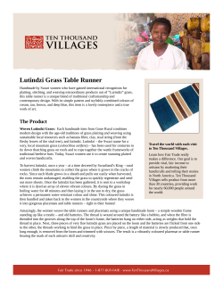


© Copyright 2026