
Initial Environmental Examination Widening and Strengthening of Gohana - Lakhan
Initial Environmental Examination May 2013 Widening and Strengthening of Gohana - Lakhan Majra - Meham - Bhiwani Road (km 16.000 to km 53.700) in Rohtak District Prepared by Haryana State Road Development Corporation ABBREVIATIONS ADB : : : : Asian Development Bank CONTENTS Page I. INTRODUCTION A. Overview B. Environmental Compliance Requirements 7 7 7 II. DESCRIPTION OF SUBPROJECT A. Need for the Subproject B. Description of Subproject C. Construction Activities D. Implementation Schedule 10 10 10 15 17 III. DESCRIPTION OF THE ENVIRONMENT A. Physical Features B. Ecological Resources C. Economic Development D. Social and Cultural Resources 22 22 26 28 29 IV. ANTICIPATED IMPACTS AND MITIGATION MEASURES 32 V. INSTITUTIONAL ARRANGEMENTS 35 VI. GRIEVANCE REDRESS MECHANISM 38 VII. ENVIRONMENTAL MANAGEMENT PLAN A. Environmental Impact Mitigation & Monitoring Program B. Training & Capacity Building C. Environmental Management Costs 39 39 47 48 VIII. PUBLIC CONSULTATION AND INFORMATION DISCLOSURE A. Public Consultations Conducted B. Future Consultation and Disclosure 49 49 50 IX. FINDINGS AND RECOMMENDATIONS 51 X. CONCLUSIONS 52 Executive Summary of Initial Environmental Examination Report of Gohana- Lakhan Majra – Meham- Bhiwani road project Proposal The Initial Environmental Examination (IEE) Report has been prepared for the Widening and Strengthening of 37.700 km long GLMB road within District –Rohtak boundary. The HSRDC is the implementing agency at the district level under PWD and proponent of the Initial Environmental Examination study for this GLMB road project. Background HSRDC has approached NCRPB for financing the project. It is proposed to fund the project under the National Capital Region Urban Infrastructure Financing Facility (NCRUIFF) supported by Asian Development Bank (ADB). This project covers widening & strengthening of an existing road, including geometric improvements, removing deficiencies and reconstruction of cross drainage structure with new structures Objective The main objective of the IEE study is to identify the impacts of physical, biological, socioeconomic and cultural environment of the sub-project area. The specific objectives of the proposed IEE study include: i) Identify the major impacts that may arise as a result of proposed works on biophysical, socio-economic and cultural environment of the project area. ii) recommend practical and site specific environmental mitigation and enhancement measures, prepare and implement environmental monitoring plan for the Subproject, and iii) provide information on the general environmental setting of the sub-project area as baseline data and make sure that IEE is sufficient for the proposed road Subproject Relevancy of the proposal Road widening and strengthening has several benefits from the project to the people living in the vicinity of project area in terms of easy access, saving of time on travel, easy transportation facilities for people. The widening and strengthening of the proposed road may uplift social and economical status of the local people. Project Description The project road proposed for improvement is a State Highway (SH 16), and is an important road of Rohtak District. Basically this road is connecting Bhiwani and Sonepat, the two very important districts of Haryana, which are the part of NCR. The existing road consists of carriageway width varying from 8 to 10 m and 1m to 1.5 m wide earthen shoulders on both sides. The present traffic is 22341 pcu at 11/6 – 23/00 i. e. Bahalgarh Chowk and Sonepat and Traffic is 5213 PCU and the current traffic in the entire stretch of the project road exceeds the design service volume (DSV). This indicates the immediate requirement of capacity augmentation in form of upgrading carriageway. Sections of the road pass through a few builtup areas with not only inadequate road geometry, but also with various deficiencies such as riding surface distress, weak and unsafe cross drainage structures and safety procedures etc. The Project corridor (SH 16) section is from Gohana (Km 16.6 and the Design Chain: Km 0.0) to Bhiwani Road (Km 54.3 and the Design Chain: Km 37.7) through Gohana, Lakhan Majra, and Meham, towns. The Project road runs in Rhotak district. The length of the project road section is 37.7 km. Beneficial Impacts The development efforts particularly the development of transportation network will have multifold beneficial impacts. The immediate beneficial impacts from road development are apparent in the construction phase like there will be various employment opportunities for the local population, supports for the transfer of construction work skills and technical know-how to the local workers. During operation stage, an improved road access will bring an improvement of food security situation and overall economic and social stability. The road will also provide cheap, safe and fast transport of goods and services from rural areas to urban centers and vice versa. The farmers will be more interested to increase agricultural production due to market accessibility. This will contribute significantly to increase the productivity in rural areas and eventually improve the overall socio-economic condition of the people. There is a possibility of increased economic opportunities and significant growth and extension of the local markets along the road alignment. In addition, construction of road will lead to appreciation of land values particularly near the market and settlement areas. Adverse Impacts The physical adverse impacts during construction will be due to change in land use, slope instability and air, dust and water pollution, quarry sites and spoil disposal. The adverse physical impacts during road operation are slope instability and management, air and noise pollution, and road safety. Likewise, biological impacts are depletion of forest resources. Socio-economic impacts are due to new settlement and market center development, change in social behavior during road operation. Benefit Augmentation and Mitigation Measures Impacts from the proposed road projects can be both beneficial as well as adverse. An effective implementation of benefit maximization measures and adverse impacts mitigation measures would optimize the benefits expected from the project and avoid/minimize the adverse impact from the project. Based on the impact assessment and identification, beneficial augmentation and adverse impact mitigation measures are presented in both constructions as well as in operation stage of the road. Mitigation Measures Spoils should be safely disposed and managed with minimum environmental damage using LEP approach which includes balanced cut and fill volume, re-use of excavated materials and minimum quantity of earth works and adoption of bio-engineering techniques. Adequate slope stabilization measures will be provisioned in design for the stabilization of slopes. Unstable sites, erosion prone area, dense forest area, settlements, fertile farm land will be avoided for quarrying operation. The workers will be provided with helmets, masks, muffles depending on the nature of the construction work. Drinking water facility and temporary pit latrine will be established and disposal of excavated materials in the water bodies will be avoided. Workers will be provided with medicines and group accidental insurance facility. During operation stage, minor landslide and mass wasting will be immediately cleared and slope restored with appropriate technology. Environmental Management Plan Environmental management plan is an important tool to ensure the implementation and monitoring of mitigation measures for minimizing adverse impacts and maximizing the beneficial impacts. Similarly, environmental monitoring generates useful information and improves the quality of implementation of mitigation measures. Conclusion and Recommendation The initial environmental examination process described in the earlier sections of this report assessed the environmental impacts of the proposed widening and strengthening of Gohana – Lakhan Majra – Meham - Bhiwani Road (from 16.00 km to 53.700 km) in Rohtak District. Potential negative impacts were identified related to design, location, construction and operation of the project. Negative impacts due to the design and location are assessed to be minimal, and due to minimal operational and maintenance activities, there are no major negative impacts of operation. The potential impacts will be mitigated through provision of proven mitigation measures in the design and can further be offset by adoption of good engineering practices during construction and implementation. EMP prepared to this affect addresses these potential impacts through appropriate mitigation, management and monitoring measures. The effective implementation of the measures proposed will be ensured through the building up of capacity towards environmental management within the HSRDC supplemented with the technical expertise of an Environmental Management Specialist as part of the Supervision Consultant Team. Further, the environmental monitoring plans prepared as part of the EMP provide adequate opportunities towards course correction to address residual impacts during construction stages. The important recommendation of this IEE is that this Road Improvement Project can proceed for implementation provided all impacts are addressed through suggested mitigation measures. The other important recommendation is that the involuntary resettlement issues, which are identified through a parallel process of resettlement planning, need to be addressed by RP implementation prior to award of contract for civil works. 7 I. INTRODUCTION A. Overview 1. The Haryana State Road Development Corporation (HSRDC) of Government Haryana is proposed to improve the existing Road of Gohana – Lakhan Majra – Meham - Bhiwani Road from 16.00 km to 53.700 km in in District Rohtak to facilitate free and easy movement of traffic and improve road safety. The proposed project includes strengthening and widening of 37.7 km length of existing road. 2. HSRDC has approached NCRPB for financing the project. It is proposed to fund the project under the National Capital Region Urban Infrastructure Financing Facility (NCRUIFF) supported by Asian Development Bank (ADB). 3. As per the NCRPB Environmental and Social Management System (ESMS), the project is classified as ADB as environment Category E2 (equivalent to ADB category B) and accordingly requires preparation of initial environmental examination (IEE) Report. This IEE Report has been prepared for the project of widening and strengthening of of Gohana – Lakhan Majra – Meham - Bhiwani Road from 16.00 km to 53.700 km in District Rohtak – in Haryana State. This project covers widening & strengthening of an existing road, including geometric improvements, removing deficiencies and reconstruction of cross drainage structure with new structures. B. Environmental Compliance Requirements 1. NCRPB Environmental Policy and ESMS 4. Recognizing the importance of environmental and social issues that can arise in infrastructure projects, NCRPB has established Environmental and Social Management Systems (ESMS) in line with Government and other multilateral agencies like ADB safeguard requirements for Financial Intermediaries (FIs). The ESMS provides an overall management system to NCRPB to identify, assess, and mitigate environmental and social issues that are likely to arise in projects funded by NCRPB. The ESMS outlines the policies, methods of assessments and procedures that will enable NCRPB to ensure that a project that it funds is developed in accordance with ESMS. Implementing Agencies (IAs) will have to comply with the ESMS and Policy. 5. Screening and Categorization. According to NCRPB ESMS, the projects are screened for their expected environmental impacts and are assigned to one of the following categories: E1, E2 or E3. (i) (ii) Category E1 (Significant impacts or in eco-sensitive areas): If the project has significant adverse environmental impacts that are irreversible, diverse, or unprecedented, then it is regarded to have environmental scenario. These impacts may affect an area larger than the sites or facilities subject to physical works. These impacts will be considered significant if these are in eco-sensitive areas. Category E2 (Limited environmental impacts): If the project has impacts that are site-specific, few if any of them are irreversible, and in most cases mitigation measures can be designed. 8 (iii) Category E3 (No environmental impacts): If the project is likely to have minimal or no adverse environmental impacts 6. The proposed project of widening and strengthening of Gohana – Lakhan Majra – Meham - Bhiwani Road is unlikely to have significant impacts. The project road neither passes through nor is located within 10 km from any wildlife sanctuary, national park, or any other environmentally sensitive or protected areas. It traverses predominantly through agricultural land and follow existing alignment except at Nindana Bypass. All widening is also confined to existing ROW except at Nindana Bypass where land acquisition is proposed. The majority of the activities have short-term minor, negligible or no residual impacts. The subproject is however likely to have typical impacts associated with the construction activity and therefore classified as Category E2. 7. According to ESMS, E2 projects require carrying out Initial Environmental Examination (IEE) and preparation of IEE Report. This IEE report is prepared accordingly. 2. Applicable Legislations 8. The implementation of the subprojects will be governed by the national government and state of Haryana environmental acts, rules, regulations, and standards. These regulations impose restrictions on the activities to minimize and/or mitigate likely impacts on the environment. It is the responsibility of the project executing and implementing agencies to ensure subprojects are consistent with the legal framework, whether national, state or municipal and/or local. 9. Environmental Assessment Requirements. The GoI EIA Notification of 2006 (replacing the EIA Notification of 1994), sets out the requirement for Environmental Assessment in India. This states that Environmental Clearance (EC) is required for specified activities/projects, and this must be obtained before any construction work or land preparation (except land acquisition) may commence. Projects are categorized as A or B depending on the scale of the project and the nature of its impacts. Category A projects require EC from the national Ministry of Environment and Forests (MoEF). Category B projects require environmental clearance from the State Environment Impact Assessment Authority (SEIAA). The Notification also provides that any project or activity classified as category B will be treated as category A if it is located in whole or in part within 10 km from the boundary of protected areas, notified areas or inter-state or international boundaries. Owing to its scale and nature, this project does not falls under the ambit of the EIA Notification, and, therefore EC is thus not required. 10. Forest Clearance. The strip of land with trees along the roads in Haryana is notified as Protected Forests. The widening of road requires diversion of Protected Forest land for nonforest (i.e. for road widening) purpose. Cutting of trees also require permission of Forest Department The project requires following environmental related approvals/clearances from regulatory agencies: Table 1: Clearances and Approvals 1 Component Use of forest land and tree cutting Clearance Approval from forest department Forest department will take up afforestation program at a rate of 10 trees per each tree cut at the cost of HSRDC. Responsibility HSRDC Status Application submitted to Forest Department (Appendix 3). 9 2 Component Hot mix plant, crusher etc 3 Disposal of Hazardous Waste 5 Employing Labor/Workers Clearance Consent for Establishment and Consent for Operation from Haryana Pollution Control Board Authorization for Disposal of Hazardous waste as per Hazardous waste (Management and Handling) Rules 1989 Employing labor/workers as per The Building and Other Construction Workers (Regulation of Employment and Conditions of Service) Act, 1996 Responsibility Contractor - Status Contractor - Contractor - As per Forest(Conservation) Act, 1980 (amended in 1988) under “Diversion of Forest land for Widening or Expansion or Realignment of Road/Rail/Canal”, such lands which were acquired by the above departments and the vacant areas were subsequently planted and notified as protected forests for management purposes will need approval from the Central Government under Forest (Conservation) Act, 1980. The user agency will submit the proposal in the prescribed format through the State Forest Department to the concerned Regional Office of the Ministry. The Regional Offices shall be competent to finally dispose of all such proposals irrespective of the area, preferably within 30 days from the date of receipt of the proposal. While issuing the approval, in place of normal provision for compensatory afforestration, the Regional Offices will stipulate a condition that for every cut at least two trees should be planted. 10 II. A. DESCRIPTION OF SUBPROJECT Need for the Subproject 11. The project road proposed for improvement is a State Highway (SH 16), and is an important road of Rohtak District. Basically this road is connecting Bhiwani and Sonepat, the two very important districts of Haryana, which are the part of NCR. The existing road consists of carriageway width varying from 8 to 10 m and 1m to 1.5 m wide earthen shoulders on both sides. The present traffic is 22341 pcu at 11/6 – 23/00 i. e. Bahalgarh Chowk and Sonepat and Traffic is 5213 PCU and the current traffic in the entire stretch of the project road exceeds the design service volume (DSV). This indicates the immediate requirement of capacity augmentation in form of upgrading carriageway. Sections of the road pass through a few builtup areas with not only inadequate road geometry, but also with various deficiencies such as riding surface distress, weak and unsafe cross drainage structures and safety procedures etc. B. Description of Subproject 12. The Project corridor (SH 16) section is from Gohana (Km 16.6 and the Design Chain: Km 0.0) to Bhiwani Road (Km 54.3 and the Design Chain: Km 37.7) through Gohana, Lakhan Majra, and Meham, towns. The Project road runs in Rhotak district. The length of the project road section is 37.7 km (Figure 1). Figure 1: Project Road Project Road 13. Under the project, it is proposed to widen and strengthen existing road stretch of total 37.7 km from current status (two lane with hard shoulders) to higher status (two lane with paved shoulders) including removal of various road engineering deficiencies. The widening proposal in road corridor is within the existing right-of-way. The improvement work extends to all components of the road, namely, pavements, drains, structures within Right-of-Way (Row), 11 improvement of the road geometry etc. The widening of this road stretch will facilitate smooth flow of traffic thereby reducing travel time and cost. Further, the poor pavement condition, bad geometry and the heavy traffic growth combined together warrant for an immediate protection and capacity augmentation of the project road. The project road passes through plain terrain with mild gradients. The proposal is generally restricted within the available ROW. There are no rivers crossings the existing road however there are 34 culverts, of which 30 will be reconstructed. . 14. The following are the proposed components of the project: Road Widening: The present traffic requires developing the existing two lane carriageway with hard shoulder carriageway to two lane paved shoulder to ensure good riding quality with reasonable riding comfort and speed. No major constraint in widening of the carriageway, as it will be done within the existing right of way. It is proposed to construct a bypass road at Nindana, which requires acquisition of land (width of 30 meters at km 17/850 to 21/850) Horizontal alignment is achieved by improving the existing at various locations on the project roads. Design speed : o 60 kph for the built-up areas. o 80 kph for rest of the alignment. Smoothening of kinks with high radii within the ROW Introduction of proper transition curve for design speed assigned Realignment of curves with deflection angle < 5 degrees for minimum required length Vertical profile has been taken care of by rising the formation wherever requires. Carriage way: Item Two Lane with Paved Shoulder Carrageways 1x7.0 m Paved Shoulder 2x1.5m Unpaved shoulder (gravel) 2 × 1.0 m Total Roadway width 12.00 m For the road sections passing through built-up areas, unpaved shoulder is extended to 2.0m width before a lined drain is placed. 12 Proposed Road Pavement Composition: New pavement for widening and reconstruction is proposed to be constructed with following composition. Pavement Layers Widenning New / Reconstructions Surfacing Layer 40mm BC + 53mm DBM 40mm BC + 75mm DBM Base Course 250mm Wet Mix Macadam (WMM) 250mm Wet Mix Macadam Sub-base 190mm granular drainage quality, CBR>30% 230mm granular, drainage quality, CBR>30% Sub-grade 500 mm, in Tibba Sand, CBR> = 7% 500mm, Tibba Sand, CBR >= 7% Shoulder: Hard shoulder is proposed with the composition of adjoining pavement . For earthen shoulder, selected earth fill is proposed over granular sub-base layer. For builtup areas, earthen shoulder/ margin of 1.00 - 1.50m between paved shoulder and lined drain is proposed with paver blocks which will be utilized for non-motorised vehicles: Granualr sub-base material + 30 mm sand fill + 100 mm Thick Interlocking Block (M-40) Drains. Roadside drains are proposed in all villages for disposal of surface run-off away with covered slab of 1.5m width which will be served as pedestrian footpath.. Culverts: Out of the 34 existing culverts, only 4 slab culverts will be retained. Remaining 30 culverts will be replaced. 72 new culverts will be constructed. Rehabilitation of Minor Bridges: One bridge at Km. 4.900 which requires complete dismantling and reconstruction. This bridge is proposed of open foundation type of 2x7.00 m span arrangement. Junction Improvements: There are 16 minor/major junctions enroot of mostly T-type. These are proposed to be improved typically with provision of adequate turning radius and safety measures. Traffic Control and Safety Measures: To enhance the safety of road users, due consideration have been made for the provisions contained in the IRC: SP 44-1994, Highway safety code. Also various measures have been proposed to increase traffic control for the High-Speed highway. Road Signs: Adequate road signs are proposed for the project road in order to provide advance information to regulate/control traffic flow and ensure safety of operations. Road signs will be ground mounted. The signs will be of retro reflective sheeting of encapsulated type as per the MORT&H specifications for Road and Bridge Works, 2001. Road signs will be erected minimum 2.5m from extreme edge of the carriageway. Pavement Markings: Pavement markings are proposed as per IRC: 35-1997, Code of Practice for Road Marking with centre-line and edge strip. The pavement marking will be in thermo-plastic paint with glass beads as per the MoRTH specification for Road and Bridge Works 2001. 13 Bus Stops: It is proposed to provide 10 pairs of bus stops on the project road to facilitate commuter movement. Bus stops would be provided in the form of a layby/widened carriageway or stoppage of bus and exchange of passenger. However, passenger shelters are not envisaged to be constructed under this project. Kilometre and Hectometre Stones: Kilometre stones are proposed at each kilometre interval all along left hand roadway edge of the project road with increasing chainage. Hectometre stones of 150 mm x150 mm x 450 mm with 150 mm projection above ground would be fixed between kilometre stones. M-20 grade of concrete shall be adopted. Environmental up gradation: Following are included in the project as enhancement measures: Turfing of side slopes to avoid erosion, and also to arrest dust and improve aesthetics Plastic Reuse: Use of waste plastic in bituminous surface for builtup areas Interception drains to collect storm water drain Installation operation of ambient air quality monitoring station along the project road Solar lighting and rain water harvesting Required provisions for site clearance, earthwork, sub base & base course, Bituminous course, cement concrete pavement, drainage and cross drainage works, traffic safety, road appurtenances, forest clearance, environmental upgradation and shifting utilities have provided for making a reasonably accurate cost estimation. Amount required for have also been provided. 15. Proposed Road Cross Sections: Typical cross sections of the proposed road are shown in Figure 2 and Figure 3. While these are the typical cross-sections, modifications have been made to at various locations with Right of Way (RoW) constraints to minimize land acquisition and resettlement. Separate cross sections are adopted for various sections according to site conditions. Figure 2: Typical cross-section of the Road: Rural Section 14 Figure 3: Typical cross-section of the Road: Urban/Built up Section 15 16. Design Parameters. Guidelines and standards / Specifications by Indian Roads Congress (IRC), Ministry of Road Transport and Highways (MORTH) of GoI, Bureau of Indian Standards (BIS), and Government of Haryana are followed as the basis for the design. Following is a summary of the recommended design standards adopted for the project road other than intersections. (i) (ii) (iii) (iv) (v) (vi) (vii) (viii) (ix) (x) C. Design Speed (kmph) : 80 (Ruling), 65 (Minimum) Desired Level of Service: LOS-B upto Year 2021 Roadway Widths : 12.00 m Roadway Elements – a. Carriageway, Two-Lane: 1 x 7.00 m b. Paved Shoulder : 2x 1.50 m c. Unpaved shoulder : 2 x 1.00m d. Carriageway Four-Lane : 2 x 7.00m i. Medium : 1 x 1.5.00m e. Unpaved Shoulder : 2 x 1.00m f. Roadway width : 17.5m Camber – a. Carriageway/ Paved Shoulder: 2.5% b. Unpaved Shoulder : 3.0% Right of Way : Minimum 20m Embankment Slope – a. In filling : 1 Vertical : 2 Horizontal b. In cutting : 1 Vertical : 1 Horizontal Super-elevation : Maximum 7% Radii for Horizontal Curves: 360m for design speed of 100km/hr 230m for design speed of 80km/hr Ruling Gradient : 3.33% Construction Activities 17. Following provides the details of construction activities, requirement of quarry material, construction equipment and workers. S. No. Chainage in m From To 1. 2. 0 1000 1000 2100 3. 2100 2360 4. 2360 3300 5. 3300 3450 Table 2: Construction Activities & Requirement Existing Proposed Existing Proposal Pavement Pavement Pavement width in m width in m Type 7.00 10.00 BT Raising 7.00 10.00 BT Re-construction after dismantling existing crust. 7.00 10.00 BT Re-construction after dismantling existing crust along with provision of side drain in Abadi area. 7.00 10.00 CC Unbounded Overlay Over Rigid Pavement with provision of side drain in Abadi area. 7.00 10.00 BT Reconstruction 16 6. 3450 4600 7.00 10.00 BT 7. 8. 4600 5300 5300 7100 7.00 7.00 10.00 10.00 BT BT 9. 10. 7100 8250 8250 8750 7.00 7+1+7 10.00 7+1+7 BT BT 11. 8750 9100 7.00 10.00 BT 12. 13. 9100 11200 11200 14400 7.00 7.00 10.00 10.00 BT BT 14. 14400 15400 7.00 10.00 BT 15. 15400 16100 7.00 10.00 BT 16. 17. 16100 16700 16700 17050 7.00 7.00 10.00 10.00 BT BT 18. 19. 17050 17850 17850 21850 7.00 7.00 10.00 10.00 BT BT 21850 25750 7.00 10.00 BT 21. 22. 25750 27250 27250 29500 7.00 7.00 10.00 10.00 BT BT 23. 29500 29850 7.5+1.5+7.5 7.5+1.5+7.5 BT 24. 29850 30050 7.50 10.00 CC 25. 30050 31150 7.00 10.00 BT 26. 31150 37700 7.00 10.00 BT Re-construction after dismantling existing crust. Raising for Profile Correction Re-construction after dismantling existing crust. Raising Re-construction after dismantling existing crust along with provision of side drain in Abadi area of Lakhan Majra village. Re-construction after dismantling existing crust. Raising Re-construction after dismantling existing crust. Re-construction after dismantling existing crust along with provision of side drain in Abadi area. Re-construction after dismantling existing crust. Raising for Profile Correction Re-construction after dismantling existing crust. Raising Proposed By Pass (Nindana Village) 20. Re-construction after dismantling existing crust. Raising Re-construction after dismantling existing crust along with provision of side drain in Abadi area. Improved by providing BM+PC on NH-10 Unbounded Overlay Over Rigid Pavement with a provision of side drain in Abadi area. Re-construction after dismantling existing crust along with provision of side drain in Abadi area. Re-construction after dismantling existing crust. 17 18. Water for construction of the project road will be taken from ground water and surface water sources after obtaining necessary permissions. No public water sources will be used for road construction. D. Implementation Schedule 19. Detailed design work has been completed, and Detailed Project Report has been approved. The project is proposed to be implemented over a period of 15 months and as a single construction package. Bids will be invited in May 2013, and construction work will commence in November 2013 and will be completed by January 2015. . 18 Figure 4: Proposed Road Alignment Features Rohtak Limits ends and Bhiwani Limit starts Sisar Village Rohtak 36.5 km Sisar Village 37.7 km Meham Kheri Village 28.3 km Kheri Village Meham Meham 30.0 km Nindana Village Nindana Village 19.7 km Nindana Bye Pass 21.8 km Lakhan Majra Village Lakhan Majra Village 15.5 km Bansi Village Bansi Village 18.2 km Jind Rohtak Chiri Village Chiri Village 9km 0 km Rohtak Limits ends and Sonepat Limit starts 19 Figure 5: Detailed Road Features (0 km – 10 km) Lakhan Majra 10 KM 20 F Meham 9800 M Johad Pond LHS RHS 9700 M Lakhan Majra Chowk Lakhan Majra Jind Road Rohtak Road 9 KM 8500 M Govt. School 8200 M 20 F 7100 M 15 F Road Canal 3800 M 8800 M 25 F Road 7100 M 15 F Road 5100 M Canal B/side 3800 M Govt. School Water Pond Sonipat / Gorana 2500 M Johad Johad Water Pond 20 F Road 3100 M 20 F Road 2800 M 15 F Gali 20 F Road 3000 M 2800 M Road B Side 2550 M 2500 M 2500 M Village Chiri 750 M Chiri Village Point 16 KM Stone 15 F Gali 15 F Gali Canal 20 Figure 6: Detailed Road Features (10 km – 28. 3 km) Kheri Village (Meham) 28300 28200 M 20 F Road 27800 M 27700 M Kheri Bus Stop Kheri Meham Road 20 F Road H.D. Sr. Sec. School Kheri Village Canal Kheri Village 25000 M P.P. 21800 M 19700 M Govt. School Road Nindana 19300 M 18500 M Nindana Bypass End Point Bus Stop School Road 20 F Pulia 18200 M 16900 M 16000 M Bansi Village 15500 M 15200 M Nindana Village By Pass Pulia Bansi Bus Stop Bansi Village Khareti Village Road 66 F Waste Water Canal 15100 M 13900 M 13900 M 12600 M 11200 M 10600 Railway Line 11200 M Start Point Pulia Pulia Canal Pulia Both Sided 10600 Railway Line 10 KM Lakhan Majra Village 21 Figure 7: Detailed Road Features (28. 3 km – 37.7 km) Bhiwani District Starts 37700 Rohtak District Ends Board of End Points Canal 36700 M Water @ 1991 Shishar 36500 M Shishar Village Chowk 22 Road Badeshara 20 F Road Shishar Village Canal 33900 M 31600 M 31400 M 31200 M 20 F Road 15 F Road 20 F Road 32700 M Dharamkanta 31200 M Kishangarh Village 31100 M 20 F Road 30900 M 30600 M 30350 M Govt. School Civil Hospital NH Road 30000 M Meham Road Rohtak Road 29600 M Meham Village 20 F Gali 20 F Gali 29100 M Peer Majar 28300 M 28900 M Mandir 28600 M 20 F Road Kheri Bus Stop 22 III. A. DESCRIPTION OF THE ENVIRONMENT Physical Features 1. Location 20. Rohtak district is one of the 21 districts of Haryana state in northern India and falls between Latitude 28° 40’ 30” to 29° 05’ 35” north and longitude 76° 13’ 22” to 76° 51’ 20” east covering an area of 1668 sq. km. Rohtak District, a part of eastern Haryana plain in the southeast of Haryana and northwest of Delhi, bounded by Jind and Sonipat districts to the north, Jhajjar and Sonipat districts to the east, and Hissar, Sirsa, and Bhiwani districts to the west. Rohtak city is the district headquarters. In July 1997 Jhajjar district was created after bifurcating Rohtak district into Rohtak and Jhajjar. 21. The district headquarter is situated in Rohtak town at a distance of about 70 km from Delhi, the National Capital of India. The district lies in the south east of Haryana state. Rohtak District is one among the important districts of Haryana State and the district Headquarter lies on the National Highway No. 10, 71 and 71 A. Rohtak is one of the eight identified priority towns in National Capital Region. Due to proximity to National capital, the developmental activities are taking place very rapidly. The district has witnessed rapid industrialisation, urbanisation, diversification in agriculture, and change in occupation structure. The district is situated on the National Highway No. 10 leading from Delhi to Hissar. Figure 4: Location of Proposed Road in Rohtak District 23 2. Topography, Geology, and Soils 22. Plain and some undulating sandy dunes mark the overall topography of the district. The average elevation of the district is about 220 meters above mean sea level. There is gentle slope of about 19 cm. per kilometre from north-east to south-west. The north-eastern part have a number of wide quilled, low land with salict channels slopping from North-North East to SouthSouth West. The hydrologic gradient of ground water is very gentle. Rohtak district is comprised of vast Indo-Gangetic alluvial plain. The canal system of the district drains rain water during rainy season. District is sub-divided into following two sub-regions. 23. Meham Plain. The region extends over the Meham tehsil and western part of Rohtak. A branch of it further enters in newly created district of Jhajjar and extends over western part of it. The Meham plain of Rohtak district makes its boundaries with Hissar and Bhiwani districts in west, Jhajjar district in south, Jind and Sonipat district in the north and Rohtak plain in the east. The soil of the region is loamy. Climatically, the region is relatively dry than the Rohtak plain. Due to good network of canals, the region has shown good progress in the field of agriculture. 24. Rohtak Plain. The region extends over the parts of Rohtak District. It makes its boundaries with Meham Plain in the west, Sonepat district in the north, and Jhajjar district in the south. The soil found in the region is loam. It is agriculturally well off due to better concentration of rainfall and canal irrigation. Its slope is towards south. Due to its close proximity of Delhi this region has very large industrial development. . 25. The district may be roughly divided into three regions: (i) (ii) (iii) The Khadar. Along the River Yamuna is a narrow flood plain, 3 to 6 km wide, and is formed by the river along its course. The Khadar plain is 20 to 30 ft. lower adjoining upland plain. It is comprised of fine clay loam left by the receding floods of the Yamuna. Presently, rice and sugar cane cultivation is undertaken by the farmers in the Khadar area. Recently, the farmers have started planting Banana, Pappaya and other fruits trees in this area. The Upland Plain. It consists of Sonepat tehsil lying to the west of the Khadar, and is the most extensive of the three regions: The Upland Plain is covered with old alluvium, which if properly irrigated, is highly productive. Extensive Farming of crops, oil seeds, horticultural plants, vegetables and flowers, is undertaken in this region. The ridges in Gohana tehsil represent the northern most extension of the Aravallis. The Sandy Region. A very smaller part of the district is covered with soil comprising of sand or sandy loam. Parts of this region has high pH value leading to kallor land. 26. Geology. The geological structure of the district consists of alluvium (recent), loam (Bhangar and Nadrak), coarse loam (daher and chaeknote). In fact, the district is a part of indo Gangetic alluvial plain ranging from Pleistocene to recent age. Aeolian deposits of sub recent age cap the plains. The sediments comprise of clay, sand and kankar mixed in different proportions. No exposure of hard rocks forming the basement are seen in the area which one as deep as three hundred metres. Geological succession of the area is as under: Age Pleistocene to recent System Recent to sub recent Formation Alluvial Aeolian sand 24 27. Soils. The sediments consist of Sand, Silt, Clay, Gravel & Kankar etc. The soil texture varies from Sandy to clayey having a heterogeneous composition with frequent calcium carbonate layers at shallower depths. The soil is coarse to fine loam in texture in most of the area. 10% of the total area is affected by salinity. And Alkalinity problem due to poor drainage, brackish waters and compact Kankar layer below root zone. 3. Climate 28. The climate of Rohtak district is sub-tropical, semi arid type. Thus, it has hot summers, cool winters and small rainy season. The winter season starts towards the later half of November and extends till about the middle of March followed by summer, which continues till about the end of June when maximum temperature reaches up to 45º C and dust cyclones are common. After it, Southwest monsoon arrives. The rainy season remains between July to September. The post monsoon months October and November constitute a transitional period from monsoon to winter season. 29. The climate is ideal for agricultural development, particularly for wheat, rice, sugarcane and cotton crops. Limited rainy season, good and healthy climate is suitable for industrial development also. 30. Annual rainfall of the district is about 58 cm. Rainfall is unevenly distributed and decreases from south east to Southwest. Rainy season starts from July to September. About 80% of the total rainfall is received during this period. Some amount of rainfall is received from western disturbances during winter season. Due to less rainfall and its short duration the agricultural activities is mostly dependent upon canal irrigation and Tubewells. . 4. Air Quality 31. 47. Air quality values for suspended particulate matter (SPM) and respirable particulate matter (RPM) observed in Rohtak block exceeded the standards for Industrial, Residential, Rural, and Other areas. High SPM and RSPM levels occurred due to inversion conditions Levels of sulfur dioxide (SO2) and NOx were well within the permissible standards for Industrial, Residential, Rural, and Other areas. Ambient air quality as observed during the monitoring carried out by Green Consultants in Rohtak is depicted in the following Table: . Table 3: Ambient Air Quality Parameter Observed in Rohtak in December 2012 - January 2013 125.0 – 428.0 92.0 – 315.0 1.6 – 10.3 6.0 – 42.0 TSPM (µ/m3 ) PM10(µ/m3 ) NO2 SO2 5. Standards 60 80 80 Noise 32. As per the monitoring carried out by Green Lab during the study period of the Project Average noise levels monitored in the Rohtak block of the district on rural and residential areas varied from 40.8 to 52.4 dB(A) during the day and 38.1 to 44.6 dB(A) at night, and are within the prescribed limits. Day time noise levels near the Rohtak Railway station averaged 65 dB(A), exceeding the limit of 55 dB(A); while night time noise levels averaged 49.3 dB(A), exceeding 25 the limit of 45 dB(A). The noise levels at the beginning of the road, between the stretches Lakhan Majra and Meham were very high as compared to prescribed limits due to vehicular/ traffic movement. The monitored noise levels for residential areas were within the prescribed limits. 6. Surface Water 33. Rohtak district is a part of Inland drainage basin. The topography of the district is saucer type therefore rain water creates flood problems in monsoon season. In order to avoid flood, drains have been dug out. The main source of draining floodwater is drain no. 8, which is contributing a lot of ground water recharge. It enters the district in village Sanghi. It flows along the western side of the district headquarter and leaves the district and enters Jhajjar district near Beri. This drain safeguards the district from floods. Two new drains have been dug after 1995 floods to drain off the water of Meham, Lakhan Majra & Kalanaur area into drain no. 8. These are Meham drain which is 42 kms long and passes through Kalanaur & Meham blocks covering 33 villages. Second is Lakhan Majra drain which is 33 kms long and covers 23 villages of Meham and Lakhan Majra blocks. These two enters in drain no. 8 at village Kalanaur ultimately going to the river Yamuna. 34. Jawahar Lal Nehru Feeder & Jhajjar sub branches are the two main canals running in the district with its sub branches, distributaries, minors and sub-minors. Bhiwani and Kalanaur sub-branches enter in the district in territory of Meham and Lakhan Mara Blocks and feed the area of Kalanaur, Lakhan Majra and Meham blocks. Most of the drainage problem is along canals and its distributaries passing through the district. 35. There is no perennial river in the district. The district is in Yamuna sub-basin of Ganga basin; and it is drained by artificial Drain No. 8 flowing from north to south. During rains the water, instead of flowing into some rivers, follows a cause directed towards inland depression in eastern and Southern parts of the district and these areas get flooded. 7. Groundwater 36. The development of an area largely depends over the quality as well as quantity of ground water. As far Rohtak District is concerned ground water occurs in semi-confined to unconfined aquifers. The unconfined aquifers are tapped by dugwells. While the semi-confined aquifers are tapped by shallow Tubewells which are 22,000 in number. 37. In the district depth to water table ranges between minimum 0.48 metres in village Gugahari (block Rohtak) to maximum 10.25 metres below ground level in village Badwa (Block Meham). Almost the whole area of the district lies within 10 metres of depth to water table below ground level. About 17% area (27646 hectares) falls under water logging conditions i.e. water level upto 3 metres depth below ground level. 38. CGWB has carried out studies for chemical quality of ground water in the district area. The range of mineral concentration is tabulated below. The ground water of the district is alkaline in nature. About 33% shallow waters have EC more than 3000 micromhos/cm and 40% have nitrate values more than 100mg/ll In large part (about 53% ) falling in all the blocks of the district high fluoride (>1.5mg/l ) is reported. Thus the ground water in these areas is harmful (unfit for human consumption 26 Ground water of the district is alkaline in nature with pH ranging from 7.37 to 8.39. Chemical constituents in the ground water are more than the permissible limit, EC (µmho/cm at 25oC) – 605 to 10500; F (mg/l) – 0.4 to 8.84; Fe – Nil to 7.0 mg/l. High chloride content in ground waters of eastern and western parts of the district shows high specific conductivity. The ground water quality is given in the following Table. Table 3: Ground Water Quality Parameter Measured Indian Standard Desirable limit Permissible limit pH 7.37-8.39 6.5 – 8.5 No relaxation Total hardness (as CaCO3), mg/l 228-2931 300 600 Chloride (mg/l) 14.0-3088 250 1000 Calcium (mg/l) 24.0-446 75 200 Magnesium (mg/l) 20.0-442.0 30 200 Flouride (mg/l) 0.4-8.84 1.0 1.5 Source: Ground Water Information Booklet, Rohtak, Haryana, Central Ground Water Board, 2007 B. Ecological Resources 39. There are no reserved or protected forests or areas near and around the project road. Given that there are no major protected areas and especially the project road, are largely inhabited, there is hardly any wildlife existing, with exception of nilgai (blue bull). Flora and fauna in the district are not unique. No endangered flora and fauna is noted. There is no forest along the proposed road and the 9534 trees will be affected along the road. 40. Flora. General available floras of the Rohtak district are as follows: Acacia nilotica (Kikar), Albizia procera (Safed siris), Azardirachta indica (Neem), Delbergia sissoo (Shisham), Delonix regia (Gulmohar), Eucalyptus hybrid (Safeda), Ficus bengalensis (Bargad), Ficus religiosa (Papal), Magnifera indica (Aam), Syzygium cumini (Jamun), Tamarindus indica (Imli), Tamaris articulata (Farash), Tecomella undulata (Rohera), Tectona grandis (Sagwan), Terminalia arjuna (Arjun), Zizyphus maruitiana (Ber) Trees required to be cut along the Projected Road sides are mostly Eupts, Shisham, Safeda, Peepal, Neem and Kikar. Around 6782 Eupts trees, 455 Shisham, 1077 Kikar and 1220 miscellaneous have to be cleared for widening of GLMB road. Details of Total abstract of marking list of green standing trees is given in Appendix 5. 41. Fauna. Species found in district are: (i) Mammals. Baselaphus Tragocamelus (Nilgai), Canis aureus (Gidar), Felis Chaus (Jungli billi), Herpestes edwardsi (Newla), Macaca mulatto (Lal Bandar), Presbytis entellus (Langoor), Rhesus macaque (Bandar), Suncus murinus (Ground shrews), Vulpes bengalensis (Lomri) (ii) Reptiles and Amphibians. Bufo bufo, Chamaeleon calcaratus (Goh), Naja naja (Nag), Rana tigrina and Rana temporaria (Mendhak), Sphenoden- punctatus, Typholops spp., Tortoise, Turtle (Kachhwa), Varanus spp., (Sanda), Viper snake (iii) Land and Aquatic Birds. Acridottheres tristis (Myana), Alcedo athis (Chhota Kikila), Bubobubo (Ulloo), Collumba livia (Kabutar), Coracias bengalensis (Neel Kanth), Eudynamys seolopacea (Koel), Milvus migrans (Cheel), Pave cristatus (Murga), Phasianidae (Bater), Psittacula eupatria (Tota), Pterocles exustus (Bhatt teetar), Anas acuta (Sinkh- par), Anas crecca (Chhoti murgabi), Anser indicus (Swan), Anthya fuligula (Sblak), Babulcus ibis (Gai bagula), Gallinago gallinago (Raj chacha), Tandrna ferruninea (Sukhab). 27 42. Fisheries. The fish farming in Rohtak is carried out in village / panchayat ponds on lease. Fishes caught in the district include Barbus chilinadea (Kali marchli), Barbustor (Mahasher), Hetropneuster fossils (Singhi), Labeo calbasu (Calbasu). Figure 5: GLMB proposed road stretch and proposed location of bypass 43. Details of settlements along the proposed sub-project road are given in Table 5. Table 5: List of settlements along the proposed GLMB road S.No Distance from Proposed GLMB Type of Settlement road 1 Within 1 km away Village/Towns, Perennial tanks, Irrigation drains, Western Yamuna Canal (Bhiwani Sub branch), Cremation ground, roads, Temple/Chhatri, Huts – Permanent/Temporary, Railway lines, Tube well, Sand features, Rest house/Inspection Bungalow, Dry tanks, Dispensary, Monument 2 Between 1 km – 5 km away from Bainsi protected forest (fairly dense shisham), Fairly proposed road dense kikar, Foot bridge, canal, Embankments, Dense kikar, lined wells, tube wells, Village/Towns, Perennial tanks, Irrigation drains, Western Yamuna Canal 28 (Bhiwani Sub branch), Cremation ground, roads, railway lines C. Economic Development 1. Land Use 44. Land use in the district is dominated by agriculture, with net area sown at 83% of total geographical area. Growth induced by inclusion of the district in the National Capital Region (NCR) is reflected by increase of land use for residential and industrial purposes. Only a negligible area is under forest cover in this district. 45. The project road is surrounded mainly by agricultural lands. There are following villages along the alignment. Table 6: Settlements/Villages area along the Road S.No. 1. 2. 3. 4. 5. 6. 7. Location km 0.000 to km 0.225 km 2.225 to km 3.775 km 7.600 to km 9.550 km 14.850 to km 15.350 km 19.000 to km 20.500 km 27.050 to km 29.950 km 34.050 to km 35.100 2. Settlement/Village habitation Kathura Chiree Lakhan Majra Bainsi Nindana Meham Shishar Industry and Agriculture 46. Agriculture is the major activity in the district. Livestock rearing is also an important activity. The economy of the district is primarily agriculture i.e. agrarian economy. About 51.89% of the total workers are engaged in agriculture and allied activities, 7.68% in cottage & household industries and the rest are engaged in other activities. Ample agricultural resources, availability of skilled laborers a good network of infrastructure facilities and various incentives offered by Government coupled with its close proximity to Delhi has given good impetus to the new enterprises to establish their industries in the district. Some new industrial centres are coming up fast along N.H.-10 passing through the district. The distribution of industrial activities is, however uneven. The majority of industrial units are concentrated at Rohtak only. 47. Upcoming Industries. The Japanese township is planned to be set up near Madina village, 15 kilometres (9.3 mi) from Rohtak city, along NH10 towards Meham. It will include several big industries and commercial offices. Asian Paints, India’s largest paint company has started the construction, of the proposed state-of-the-art paint plant, at the Industrial Model Township (IMT), Rohtak, Haryana. The Haryana government has allotted 700 acres of land to India's largest car manufacturer Maruti Suzuki India Limited (MSIL) for the company's proposed Research and Development Complex in Rohtak. The State Government is also developing four food parks at Rai, Saha, Narwana and Dabwali for the promotion of agro based and food processing industries. Expeditious completion of these parks shall be ensured. The Government shall also strive to develop a state of art Food Processing Hub around Sampla in Rohtak. The Haryana government is setting up a state-of-the-art State Institute for Film & Television at Rohtak on the pattern of the Film and Television Institute, Pune 29 48. The main crops grown in the district during rabi season are wheat, gram, barley, mustard, sarson, sugarcane; and in kharif season are cotton, paddy, jawar, bajra, gawar, arhar, till, groundnut, soya bean, moong. Fruits grown in the district include ber, guava, anola and jamun. All major vegetables, spice crops like chillies, garlic and flowers like chrysanthemum, Gladiolus marigold are cultivated in the district. The aerial extent of land use / land cover is as given in the following Table. Table 7: Land Use & Agricultural Areas Land use/land cover categories Agriculture Plantation Current Fallow Degraded grazing land Land with open scrub Open Forest Kharif only Rabi only Kharif & Rabi (doublecrop) Mining/Industrial waste Salt affected land Sandy Desert Land Canal Lakes/Ponds Water logged Settlement Total D. Area ( km² ) 4.11 2.31 62.90 5.04 0.15 1.36 267.92 1221.92 1.00 6.43 10.65 4.60 6.24 0.86 73.00 1668.00 Percentage 0.25 0.13 3.80 0.30 0.01 0.08 16.13 73.13 0.06 0.39 0.64 0.28 0.38 0.05 4.37 100.00 Social and Cultural Resources 49. Demography. In 2011, Rohtak had population of 1,058,683 (4.18% of total state population) of which male and female were 566,708 and 491,975 respectively. In 2001 census, Rohtak had a population of 940,128. The 2001-11 decade registered a growth rate of 12.6%, while the previous decades (1991-2001) growth rate was 21%. Population density of Rohtak District for 2011 is 607 people per sq. km. Literacy rate of Rohtak (2011) is 80.40 with male and female literacy rates of 83.20 and 62.60 respectively. Sex Ratio in Rohtak stood at 868 per 1000 male compared to 2001 census figure of 847. The average national sex ratio in India is 940. Out of the total Rohtak population for 2011 census, 42.02 percent lives in urban regions of district. Table 8: Demographic Characteristics – Rohtak District Description 2011 2001 Population 1,058,683 940,128 Male 566,708 509,038 Female 491,975 431,090 Population Growth 12.61% 21.00% Area Sq. Km 1,745 1,745 Density/km2 607 539 Proportion to Haryana Population 4.18% 4.45% 30 Description 2011 2001 Sex Ratio (Per 1000) 868 847 Child Sex Ratio (0-6 Age) 807 798 Average Literacy 80.40 73.70 Male Literacy 88.40 83.20 Female Literacy 71.20 62.60 Total Child Population (0-6 Age) 125,954 119,332 Male Population (0-6 Age) 69,699 66,379 Female Population (0-6 Age) 56,255 52,953 Literates 749,583 367,842 Male Literates 439,376 236,405 Female Literates 310,207 604,247 Child Proportion (0-6 Age) 11.90% 12.69% Boys Proportion (0-6 Age) 12.30% 13.04% Girls Proportion (0-6 Age) 11.43% 12.28% Table 9: Rural – Urban Demographic Characteristics of Rohtak District Description Rural Urban Population (%) 57.98 % 42.02 % Total Population 613,864 444,819 Male Population 330,788 235,920 Female Population 283,076 208,899 Sex Ratio 856 885 Child Sex Ratio (0-6) 814 797 Child Population (0-6) 75,709 49,781 Male Child(0-6) 41,728 27,705 Female Child(0-6) 33,981 22,076 Child Percentage (0-6) 12.33 % 11.19 % Male Child Percentage 12.61 % 11.74 % Female Child Percentage 12.00 % 10.57 % Literates 419,938 330,075 Male Literates 254,746 184,951 Female Literates 165,192 145,124 Average Literacy 78.03 % 83.56 % Male Literacy 88.13 % 88.83 % 31 Female Literacy 66.32 % 77.68 % 50. Workers participation rate (WPR) of the district was 40.89% of the total population; it was 44.59% in rural areas and 29.84% in urban. Sex-ratio of the total work force was 514 (rural605; urban-207). Majority of the work force are main workers; 73.31% of the total workers are main workers (in rural - 69.90%; in urban-88.53%). 52.97% of the total workers are engaged in cultivation and agricultural sector; it was 63.22% in rural and 7.31% in urban areas. 51. Health Facilities. 66. The district is well provided with other essential service like postal service, education/health etc. The city hosts the Pandit Bhagwat Dayal Sharma Post Graduate Institute of Medical Sciences (PGIMS) and Civil Hospital, both of which are operated by the State Government. There are also various privately-operated medical facilities. There are 3 community health centres, 19 primary health centres and 85 sub-health centres, 10 hospitals and 7 dispensaries also available in the district. 3. History, Culture and Tourism 52. The district derives its name from its headquarter's town Rohtak which is said to be a correction of Rohtashgarh, a name still applied to the ruined sites (also called khokhrakot) of two older sites, one lying immediately north of the present town and other about 5 km towards the east. Traditionally, it is named after Raja Rohtash during the days city is said to have been built. It is also claimed that the town derives its name from the Roherra (Tacoma undulate) tree called Rohitaka in Sanskrit. It is said that before the town came into existence, it was site of a forest of Rohitaka trees & hence its name became Rohtak. Another version connects Rohtak with Rohitaka, which is mentioned in Mahabharta in connection with campaign of Nakula, the Pandva warrior. 53. There are no historically or archeologically or religiously important places along the project road. In overall district as well there are no such important places; the tourism importance of Sonipat is almost negligible. 32 IV. ANTICIPATED IMPACTS AND MITIGATION MEASURES 54. This section of the IEE reviews possible subproject-related impacts, in order to identify issues requiring further attention and screen out issues of no relevance. The assessment for each physical component proposed for this project has been carried out with respect to the potential impacts during the following stages of the project planning and implementation: Location impacts: Impacts associated with site selection, including impacts on environment and resettlement or livelihood related impacts on communities. Design impacts: Impacts arising from project design, including the type of designs, design standards etc Construction impacts: Impacts resulting from construction activities including site clearance, earthworks, civil works, etc. O&M impacts: Impacts associated with the operation and maintenance of the infrastructure built in the project. 55. Location impacts are not likely to be significant as there are no major environmentally sensitive areas along the road proposed for improvement. However, there are a number of trees (9534 no,s) in the right of way which will be removed for the project. Trees will be cut with prior permission of Forest Department and necessary cost of afforestation, at a rate of 10 trees per each tree removed, will be provided to Forest Department. The project also requires diversion of 19.46 ha of protected forest land for road widening. As indicated earlier, the strip of land along the roads with tree cover are notified as protected forested, and therefore the widening of road requires permission of Forest Department. Application is already submitted to the Forest Department and approval is under process (Appendix 3). The impacts pertaining to road safety, especially for stretches in urban areas have been addressed through incorporation of appropriate safety measures in designs. 56. Construction impacts. The impacts during the construction stage shall be typical of road including impacts on the sensitive receptors and communities in the vicinity of the project road. These are discussed below. The mitigation measures for the various impacts are outlined in the Table 8. 57. Impact on Traffic Movement. The road construction work will affect the traffic movement on the road. Work will be conducted one side, leaving the other side open for traffic. It is proposed to construct 102 culverts in the proposed road stretch of 37.7 km, nearly 3 culverts for every km of road. These require traffic diversions and have to be notified sufficiently in advance for safe passage of the traffic. Traffic guides with red flags, and security persons shall be employed to guide the traffic. A traffic management plan shall be prepare prior to start of construction at every stretch. 58. Dust and Air Emissions: Since the work is conducted mostly in dry season, there is lot of potential to generate dust from various activities like site clearance, material transport, material loading and unloading, spreading on site etc. Crushers are one of the main sources of dust. Emission from vehicles, equipment and machinery used for excavation and construction would induce impacts on the air pollution in the construction site as well as on the surrounding settlements. Hot-mix plants installed for road construction will lead to generation of fugitive dust and exhaust emissions. Adequate siting criteria for the hot mix plants to be adopted based on the environmental sensitivity of surrounding land uses. Dust and emission control measures should be followed during construction. 33 59. Public and workers safety during construction: Since the work is conducted on existing road passing through inhabited areas, the general public an traffic will come in close contact with the construction areas, and there is potential risk to public and as well as workers. Appropriate measures during construction shall be worked out to address safety issues during construction. Prolonged exposure of workers to consistently high decibel noise levels above 90 dB(A) also induces hearing losses. Similarly, prolonged exposure of the workers to dusty environment of the construction site induces respiratory problems and loss of man days. 60. Noise and Vibration Impacts: Generation of noise from construction equipments is a major concern during construction stage. Use of heavy construction machinery in the construction site would generate vibrations and affect the adjacent structures in the settlements. Noise generated during construction is however intermittent and would be of limited duration but would affect the construction workers in case of unprotected prolonged exposure. 61. Sourcing of materials: While material such as bitumen may be acquired from local hotmix plants and aggregate from already identified & licensed quarries, procurement of soil will still need to be carried out. Considering that the brick kilns have already used the top soil in many areas, sites for the procurement of soil may have to be carefully identified. 62. Material Handling: Storage of Bitumen and other hazardous material if stored near drainage channels would induce hazardous situations to the environment from possibility of leaching into ground and flow as runoff. Spillage of debris and construction material to surface water bodies may lead to surface water quality deterioration. Stockpiling of materials along the edge of the road will obstruct the drainage and restrict the free movement of vehicles. 63. Drainage: Construction activities in the vicinity of natural drainage channels and water bodies, if drainage is not adequately provided, would cause change in the drainage character of the site and lead to water logging. 64. Water Bodies: Stockpiles of construction debris if left unattended will be washed off as runoff into nearby areas causing siltation. Spillage of oil, lubricants and other chemicals also mix with the runoff and contaminate the land. 65. Soil: Proposed Widening and Strengthening of GLMB Road increases the paved surface and permanent loss of top soil under these civil construction activities. Excavation for forming the drains and borrowing also involves loss of top soil as well as scarifying the surface with construction machinery and equipment. Spillage of fuel, lubricants, other oils and chemicals will contaminate the soil in the area. Storage of hazardous material will also have a considerable impact on the top soil if not handled as per norms. 66. Tree Cutting:Proposed Widening and Strengthening of GLMB road involves tree cutting along the proposed road. However there will be negligible impact on slope instability, soil erosion due to tree cutting as topography is almost flat throughout the project area. Prior clearance will be obtained before commencing of construction work. 67. Site clearance and Restoration of Construction Camps: Post construction clearance if not adequate, would create unsightly conditions and affect aesthetics of the area. Campsites if not removed usually become a refuge for unscrupulous activities and sometimes develop as another settlement putting strain on the resources. Sanitary pits may cause contamination of surface and ground water. 34 68. Operational impacts. Impacts on environmental conditions associated with the operation stage of the project are mainly due to increase of air and noise pollution from the increased vehicular traffic along the route. 69. The proposed improvements and safety provisions, in area would reduce accidents and congestion and result in more public and private transport vehicles also plying in the area. Improved drainage provision within the settlements shall ensure avoidance of water logging and poor drainage conditions along the project road. 35 V. 70. INSTITUTIONAL ARRANGEMENTS Following agencies are involved in execution of this sub project of construction of GLMB road. i. ii. iii. iv. NCRPB: National Capital Region Planning Board is the funding agency for the project. Implementing Agency (IA): Implementing Agency of the project will be Public Works Department (PWD)Haryana State Roads & Bridges Development Corporation (HSRDC) Design and Supervision Consultants: Implementing Agency will be assisted by Design and Supervision Consultants (DSC) in tendering, and reviewing and revising designs during the construction, if required, and supervising the construction to ensure quality. Construction Contractors: IA will appoint Construction Contractors (CC) to construct the infrastructure elements. 71. Haryana State Roads Development Corporation (HSRDC) is the Implementing Agency (IA) of this project. IA will undertake all actions for the implementation of the project. Implementing the project according to and incompliance with the policies, the funding agency, NCRPB will be the responsibility of the Implementing Agency. The Environmental and Social Management Cell (ESMC) of NCRPB will deal with environmental and social safeguard issues. ESMC would guide and monitor IA in complying with its ESMS policy. An Environmental Officer (EO) shall be inducted within the HSRDC to address the environmental impacts and implement EMP during the project life cycle. During construction, the construction supervision is conducted by HSRDC with the assistance of Supervision Consultant (SC). The Supervision Consultant Team shall include an Environmental Management Specialist (EMS), who will assist EO in implementation of EMP. 72. The ESMC will be housed inside the appraisal function of NCRPB and will have two distinct sub-functions, i.e. managing environmental safeguards and social safeguards. ESMC will be provided with one full-time staff-safeguard officer, who will look after the day-to-day activities related to the safeguard compliance. Safeguard Officer will be responsible for both environmental and social safeguard functions. Based on the necessity, the Safeguards Officer will source expertise from outside/external consultants on a case-to-case basis. 73. ESMC will review and approve IEE, oversee disclosure and consultations, and will monitor the implementation of environmental monitoring plan and environmental management plan wherever required. The Construction Contractor (CC) will implement mitigation measures in construction. IA or DSC will monitor the implementation of mitigation measures by the CC. ESMC will oversee the implementation of EMP. Implementation of mitigation and monitoring measures during the Operation and Maintenance (O&M) stage will be the responsibility of the implementing agency. 74. Roles and Responsibilities of EO with assistance of EMS of Supervision consultant are as follows: 36 o o Review of IEE and other environment documents based upon ADB’s Environmental Assessment Guidelines, or other multilateral or bilateral agency guidelines, as required. Liaise and obtain clearances from with required state and central departments for clearances and compliance to regulations. o Monitor and oversee the implementation of the Environmental Management Plan o Ensure inclusion of EMP in contractor’s bid and contract. o Oversee implementation and monitor compliance to the EMP o Undertaken required interactions with civil society groups and community for projects under implementation o Ensure inclusion of public concerns and grievances in EMP and project implementation. Undertake dialogue with affected communities, as required. o Review environmental performance of project through periodical environmental monitoring reviews. Where additional environmental safeguards are identified incorporate them in project design, construction or implementation or other follow-up actions, as required. o Provide required support for the management of environmental concerns in the implementation of the project o Develop, review and plan and implement training and capacity building for contractors and consultants involved in the project o A consultant shall be hired for supervising construction activities. This agency will need an officer identified for overseeing the implementation of EMP. The roles and responsibilities of this individual will be- o Work closely with corporations environment specialist for the implementation of EMP and ensure compliance to environmental safeguards, support its implementation o Work with corporations environmental specialist for getting environmental clearances for the project o Review of EMP implementation and advice the corporations environmental specialist on the implementation status o Review any changes in project design, identify environmental safeguards if required and work with the corporations environmental specialist to reflect identified safeguards in EMP 37 o Ensure all identified systems – safety, accident management and control, waste are in place, functioning and implementing personnel have adequate training to implement actions o Consultation with stakeholders and inclusion of their concerns in project implementation o Incorporate additional implementation. environmental safeguards as required during project 75. The Contractor should employ an Environmental, health and safety (EHS) expert with experience in road construction projects, for implementation of EMP on site. 38 VI. GRIEVANCE REDRESS MECHANISM 76. As the work is being done along inhabited areas and areas with various human activities, and most of the impacts are construction-related, and therefore it is anticipated that improper or inadequate implementation of EMP may lead to disturbance and inconvenience to local people and traffic. In order to provide a direct channel to the affected persons for approaching project authorities and have their grievance recorded and redressed in an appropriate time frame, HSRDC will establish a Grievance Redress Mechanism, which will be functioned throughout the construction period. 77. A Complaint receiving system will be put in place at the project office of HSRDC in Project Area. A complaint register and complaint forms will be made available at the site office of each contractor, with a display board indicating availability of such facility. This will accept complaints regarding the environment safeguard issues in implementation of the project. The grievances received and actions taken will be included into the environmental monitoring reports submitted to NCRB. 78. HSRDC will constitute a three-member Grievance Redressal Committee (GRC) comprising of the DGM, HSRDC, (jurisdictional DGM), the elected member of the project area and one member from the public who is known to be persons of integrity, good judgment and commands respect among the community. The existence of the GRC will be disseminated to the villagers through printed handouts providing details of the structure and process in redressing grievances. Any aggrieved person (whose complaint to the complaint cell is not redressed to his/her satisfaction) can approach GRC, chaired by the DGM, HSRDC and if the grievance is not addressed, the aggrieved person will be directed to approach the District Collector. The aggrieved person will have the right to approach the court of law, if he/she is still unsatisfied with the decisions taken by the GRC and the Collector. 79. The GRC will meet every month, determine the merit of each grievance, and resolve grievances within a month of receiving the complaint; failing which the grievance will be addressed by the District Collector. If not satisfied, the affected households will have the option of approaching the appropriate courts of law. Records will be kept of all grievances received including: contact details of complainant, date that the complaint was received, nature of grievance, agreed corrective actions and the date these were affected, and final outcome. 39 VII. A. ENVIRONMENTAL MANAGEMENT PLAN Environmental Impact Mitigation & Monitoring Program 80. The potential impacts identified and assessed and the mitigation measures formulated to minimize those impacts to acceptable levels are summarized in the following table. The table also delegates the responsibility of implementing mitigation measures to various agencies involved in the project implementation. Table 9 presents the Environmental Monitoring Plan. Table 10: Environmental Management Plan S No Environmental Duration / Extent Magnitude Issues 1 Location Impacts 1.1 Temporary impacts on Temporary Low road side shops and other livelihood activities. 2 Design and pre-construction Impacts Permanent Medium 2.1 Road furniture 2.2 Alterations of drainage pattern of the site 2.3 Removal road side trees Permanent Medium Permanent High Mitigation Measures Responsibility Implement compensatory measures as per HSRDC the Short Resettlement Plan (SRP) All roadside structures / furniture, HSRDC protection, intersections, traffic islands, etc is provided as per the road safety requirement Necessary cross-drainage works proposed HSRDC and designed to avoid alteration of drainage pattern. Design has been done considering 50 year return flood level to avoid overtopping of the road and maintain natural drainage Unavoidable as the trees are within the HSRDC proposed road carriage way; trees within the RoW but not required to be cut are identified. For trees not proposed to be cut, but within the construction area, take all precautions to protect trees not impacted from any damage including placement of tree guards Prior approval and clearance from Forest Department will be obtained; necessary budget for compensatory afforestation will be deposited with the Forest Department as per the Forest Departments procedures 2.4 Impact on community Temporary Negligible and cultural properties and relegious places 3 Pre-construction Activities by Contractor 3.1 Construction Camps Temporary Medium – Location, Selection, Design and Layout Temporary Medium 3.2 Drinking water availability and water arrangement Tree plantation will be taken up in the ROW where land is available, considering the road safety issues The designs are worked out to avoid HSRDC impacts on cultural properties, shrines etc. The construction camps will be located at Contractor least 500m away from habitations The contractor will be responsible for Contractor arrangement of water in every workplace at suitable and easily accessible place for the 40 S No Environmental Duration / Extent Magnitude Mitigation Measures Responsibility Issues whole construction period. Sufficient supply of cold potable water (as per IS: 10500) to be provided and maintained. If the drinking water is obtained from an intermittent public water supply then, storage tanks will be provided. Establishment of hot Temporary High mix plants, crushers, etc if required 3.3 Identification of disposal sites 3.4 Quarry Operations 3.5 Batching Plants Permanent Low Permanent Medium Temporary High 4 Construction Impacts 4.1 Improper stockpiling Temporary High of construction materials can cause impacts starting from obstruction of drainage, disturbance/ safety hazard to local population, traffic Contractor should obtain all required permission for abstraction of groundwater and/or surface water for use in construction activities and camps Establish plants/crushers away from Contractor habitations Obtain the consent-to-establish and consent-to-operate from the Pollution Control Board Adhere to the air pollution and water pollution standards prescribed. Location of disposal sites will be finalized Contractor based on consultations with the Engineer. The Engineer will certify these are not located within designated environmentally sensitive areas and confirm that: Disposal of the material does not impact natural drainage courses No endangered / rare flora is impacted by such material Settlements are located at least 1000m away from the site Contractor should obtain authorization for disposal of hazardous wastes as per Hazardous Waste (Management and Handling) Rules 1989 It has to be ensured that materials are Contractor obtained from licensed quarries having environmental clearance. Quality and legality to be examined by the Contractor and copies of environmental clearances for these needs to be submitted prior to sourcing of material. If new borrow pits are made for gravel in the private or revenue lands, quarry pit closure/restoration plans shall be prepared and implemented before completion of work Batching plants will be located sufficiently Contractor away from habitation, where possible such plants will be located at least 500m away from the nearest habitation. The contractor will obtain the consent to operate the plants from the SPCB. Due consideration will be given for material Contractor storage and construction sites such that it doesn’t cause any hindrance to daily traffic movement. Stockpiles will be covered to protect from dust and erosion. 41 S No Environmental Issues blockage, etc. 4.2 Quarry / Borrow pits Operations Duration / Extent Magnitude Permanent Medium 4.3 Stripping, stocking and preservation of top soil Permanent Low 4.4 Soil Erosion Permanent Low 4.5 Compaction of Soil in Temporary Low agricultural area 4.6 Blasting Temporary Low Mitigation Measures Responsibility Material should be procured only from Contractor licenced quarries Adequate safety precautions will be ensured during transportation of quarry material from quarries to the construction site. Vehicles transporting the material will be covered to prevent spillage. Operations to be undertaken by the contractor as per the direction and satisfaction of the Engineer. The topsoil from borrow areas, areas of cutting and areas to be permanently covered will be stripped to a specified depth of 150mm and stored in stockpiles. The stockpile will be designed such that the slope does not exceed 1:2 (vertical to horizontal), and the height of the pile is to be restricted to 2m. Multiple handling will be kept to a minimum to ensure that no compaction will occur. The stockpiles will be covered with gunny bags or tarpaulin. It will be ensured by the contractor that the topsoil will not be unnecessarily trafficked either before stripping or when in stockpiles. Such stockpiled topsoil will be returned to cover the disturbed area and cut slopes. At the outfall of each culvert, erosion prevention measure, will be undertaken, as per the direction and satisfaction of the Engineer The work will consist of measures as per design, or as directed by the Engineer to control soil erosion, sedimentation and water pollution. All temporary sedimentation, pollution control works and maintenance thereof will be deemed as incidental to the earthwork or other items of work. To minimize soil compaction construction vehicle, machinery and equipment will move or be stationed in designated area (RoW or CoI, haul road as applicable) only. The haul road for construction materials will be routed to avoid agricultural areas Except as may be provided in the contract or ordered or authorized by the Engineer, the Contractor will not use explosives. Where the use of explosives is so provided or ordered or authorized, the Contractor will comply with the requirements of the following Sub-Clauses of MoRTH 302 besides the law of the land as applicable. The Contractor will at all times take every possible precaution and will comply with appropriate laws and regulations relating to the importation, handling, transportation, storage and use of explosives and will, at all times when engaged in blasting operations, post sufficient warning flagmen, Contractor Contractor Contractor Contractor 42 S No Environmental Duration / Extent Magnitude Mitigation Measures Responsibility Issues 4.8 Loss of Access Temporary Medium 4.9 Soil and Water Pollution due to fuel and lubricants, construction waste Temporary Medium 4.10 Siltation of irrigation Temporary Low canals due to spillage of construction wastes 4.11 Generation of Dust Temporary High 4.12 Dust/emissions from batching/hot mix plants Temporary High to the full satisfaction of the Engineer. The Contractor will at all times make full liaison with and inform well in advance and obtain such permission as is required from all Government Authorities, public bodies and private parties whomsoever concerned or affected or likely to be concerned or affected by blasting operations. Blasting will be carried out only with permission of the Engineer. All the statutory laws, regulations, rules etc., pertaining to acquisition, transport, storage, handling and use of explosives will be strictly followed. all directions at least 10 minutes before the blasting. The contractor will provide safe and convenient passage for vehicles, pedestrians and livestock to and from side roads and property access connecting the project road. Construction activities that will affect the use of side roads and existing access to individual properties will not be undertaken without providing adequate access. The construction works will not interfere with the convenience of the public or the access to, use and occupation of public or private roads, or any other access to properties, whether public or private. The fuel storage and vehicle cleaning area will be stationed such that runoff from the site does not drain into the water body. Oil interceptor will be provided at construction vehicle parking area, vehicle repair area and workshops ensuring that all wastewater flows into the interceptor prior to its discharge. Silt fencing to be provided at all water bodies near construction sites to prevent sediments from the construction site to enter into the watercourses. The number of units of silt fencing to be installed is to be decided by the engineer. Discharge standards promulgated under the Environmental Protection Act, 1986 for surface water bodies will be strictly adhered to. No disposal of construction wastes will be carried out into the river. The contractor will take every precaution to reduce the levels of dust at construction sites to the satisfaction of the Engineer. All earthwork to be protected/covered in a manner acceptable to the satisfaction of the engineer to minimise dust generation. Dust control measures like water sprinkling shall be carried out Batching plants will be located atleast 500m away from environmentally sensitive areas as Reserved Forests / National Parks and sensitive receptors i.e., hospital and college. The exhaust gases will comply with the requirements of the relevant Contractor Contractor Contractor Contractor Contractor 43 S No Environmental Duration / Extent Magnitude Mitigation Measures Responsibility Issues 4.13 Emission from Temporary Low Construction Vehicles, Equipment and Machinery 4.14 Dust Pollution from Crushers Temporary High 4.15 Noise from construction Equipments Temporary Medium 4.16 Traffic Control and Safety Temporary High current emission control legislation. All operations at plants will be parameters will be as per monitoring plan undertaken in accordance with all current rules and regulations protecting the environment. Monitoring of air and noise The discharge standards promulgated Contractor under the Environmental Protection Act, 1986 will be strictly adhered to. All vehicles, equipment and machinery used for construction will conform to the relevant Bureau of Indian Standard (BIS) norms. All vehicles, equipments and machinery used for construction will be regularly maintained to ensure that pollution emission levels comply with the relevant requirements of SPCB and the Engineer. ‘PUC’ certificates will be obtained regularly for all vehicles used for the project. Copies will be submitted regularly to the Engineer. All crushers will obtain siting clearance Contractor from SPCB or only those crushers that have already have obtained license from SPCB will be used. Maintenance of vehicles, equipment and Contractor machinery will be regular and to the satisfaction of the Engineer, to keep noise from these at a minimum. All vehicles and equipment used for construction will be fitted with exhaust silencers. During routine servicing operations, the effectiveness of exhaust silencers will be checked and if found to be defective will be replaced. Noise limits for construction equipment used in this project (measured at one metre from the edge of the equipment in free field) such as compactors, rollers, front loaders, concrete mixers, cranes (moveable), vibrators and saws will not exceed 75 dB (A), as specified in the Environment (Protection) Rules, 1986 Notwithstanding any other conditions of contract, noise level from any item of plant(s) must comply with the relevant legislation for levels of noise emission. The contractor will take all necessary Contractor measures for the safety of traffic during construction and provide, erect and maintain such barricades, including signs, marking flags, lights and flagmen as per Engineer’s direction and satisfaction, for the information and protection of traffic approaching or passing through the section under improvement. Before taking up any construction, detailed Traffic Management Plans will be prepared and submitted to the Engineer for approval, 5 days prior to commencement of work on any section of 44 S No Environmental Duration / Extent Magnitude Mitigation Measures Responsibility Issues road. The traffic control plans shall contain details of arrangements for construction under traffic and details of traffic arrangement after cessation of work each day. The Contractor will ensure that the running surface is always maintained in good condition, particularly during the monsoon so that no disruption to traffic flow occurs. Put up visible signs showing duration Contractor of construction activities, contact details of focal persons from HSRDC and contractor, contact numbers in case of complaints/grievances Sign Boards, Name boards showing project details at site 4.17 Material Handling at Site Temporary Medium Temporary Low 4.18 Disposal of Bituminous wastes / Construction Waste / Debris / Cut Material 4.19 Safety Measures During Construction Temporary Medium 4.20 Risk caused by Force Temporary Low Majure 4.21 Malaria Risk Temporary Medium All workers employed on mixing asphaltic material, cement, concrete etc., will be provided with protective footwear and protective goggles. Workers, who are engaged in welding works, would be provided with welder’s protective eyeshields. Workers engaged in stone breaking activities will be provided with protective goggles and clothing and will be seated at sufficiently safe intervals. The use of any toxic chemical will be strictly in accordance with the manufacturer’s instructions. The bituminous waste generated will be reused in road construction based on its suitability of reuse to the maximum extent possible. Safe disposal of the extraneous material will be ensured in the pre-identified disposal locations. In no case, any construction waste will be disposed around the project road indiscriminately. Cut material generated because of construction will be utilized for as filling material. Remaining material if any will be disposed off safely at the disposal sites. All relevant provisions of the Factories Act, 1948 and the Building and other Construction Workers (regulation of Employment and Conditions of Service) Act, 1996 will be adhered to. Adequate safety measures for workers during handling of materials at site will be taken up. The contractor has to comply with all regulations regarding safe scaffolding, ladders, working platforms, gangway, stairwells, excavations, trenches and safe means of entry and egress. The Personal Protective Equipment for workers shall conform to respective IS codes. All reasonable precaution will be taken to prevent danger of the workers and the public from fire, flood, drowning, etc. All necessary steps will be taken for prompt first aid treatment of all injuries likely to be sustained during the course of work. The Contractor will undertake all measures Contractor Contractor Contractor Contractor Contractor 45 S No Environmental Duration / Extent Magnitude Mitigation Measures Responsibility Issues 4.22 First Aid Temporary High 4.24 Hygiene Temporary High Temporary Medium 4.25 Clearing of Construction of Camps & Restoration 5 O&M Impacts 5.1 Environmental Conditions 5.2 Survival of trees planted Permanent Low Permanent Medium Permanent Low 5.3 Increased air and noise pollution due to as required to avoid such risk to the workers At every workplace, a readily available first Contractor aid unit including an adequate supply of sterilized dressing material and appliances will be provided as per the Factory Rules. Suitable transport will be provided to facilitate transfer of injured or ill person(s) to the nearest hospital. At every workplace and construction camp, a staff trained in first aid will be made available Temporary toilets shall be provided with Contractor septic tank and soak pits, and will be regularly cleaned to maintain hygiene. All temporary accommodation must be constructed and maintained in such a fashion that uncontaminated water is available for drinking, cooking and washing. Garbage bins must be provided in the camps and regularly emptied and the garbage disposed off in a hygienic manner. Adequate health care is to be provided for the work force. Unless otherwise arranged for by the local sanitary authority, the local medical health or municipal authorities will make arrangement for disposal of excreta. On completion of the works, all such temporary structures will be cleared away, all rubbish burnt, excreta tank and other disposal pits or trenches filled in and effectively sealed off and the outline site left clean and tidy, at the Contractor’s expense, to the entire satisfaction of the engineer. Contractor to prepare site restoration plans Contractor for approval by the Engineer. The plan is to be implemented by the contractor prior to demobilization. On completion of the works, all temporary structures will be cleared away, all rubbish burnt, excreta or other disposal pits or trenches filled in and effectively sealed off and the site left clean and tidy, at the Contractor’s expense, to the entire satisfaction of the Engineer. The HSRDC will undertake seasonal HSRDC monitoring of air and noise through an approved monitoring agency. The parameters to be monitored, frequency and duration of monitoring as well as the locations to be monitored will be as per the Monitoring Plan prepared. Proper care shall be taken to increase HSRDC survival rate of saplings like regular watering, pruning, provision of tree guards, manure for better nourishment, etc. including timely replacement of perished saplings. Smooth and better road surface will reduce HSRDC generation of noise. Provision of vegetative 46 S No Duration / Extent Environmental Magnitude Issues increased traffic using the improved road 5.3 Drainage of roadsides Permanent Low 5.4 Traffic and Accident Safety Permanent Low Mitigation Measures Responsibility barriers where ever possible. Other measures such as improved transport fuel quality, more stringent environmental norms, installation of no horn signages at educational institutes and at hospitals To ensure efficient flow of surface water HSRDC and to prevent water logging along the side of the road adequate size and number of cross-drainage structures and longitudinal drains are provided in the design. These will be adequately maintained by cleaning and avoiding clogging of openings. Depending on the level of Congestion and HSRDC traffic hazards, traffic management plans will be prepared. Traffic control measures including speed limits to be enforced strictly. Road control width to be enforced. Local government bodies and development authorities will be encouraged to control building development along the highway. Table 11: Environmental Monitoring Plan Sl. Attributes No. 1 2 1 2 3 4 Pre Construction Integration of local peoples environmental concerns Stage Parameters to be Monitored Location Pre Implementation On-site/Off-Site construction of measures as suggested in the EMP Incorporation of Pre Implementation On-Site mitigation measures Construction of measures as and environmental suggested in codes of conduct into the EMP designs Construction Phase Implementation of Construction Implementation On-site construction phase of measures as impact mitigation suggested in measures the EMP Construction and Construction Drains location of drainage facilities Care and safe Constrution Loose soil storage of top soil for later use Care of vegetation in Construction vegetation Site inspections at places where such drains are required Site clearance activities Site clearance Frequency Responsibility Cost estimates INR During the study and design process and prior to approval During Project Approval Design Supervision consultant Part of DSC cost DSC Part of DSC cost Weekly-one Environmental Management Specialist (Supervision Consultant Team) / Environmental Officer (HSRDC) During Contractor construction As part of Consultant Team costs Weekly Contractor Part of project cost Weekly Contractor Part of Part of project cost 47 5 the immediate vicinity Safeguarding of Construction Public toilets, community bus stops etc infrastructures 6 activities Site observation Safe disposal of Construction Soil, debris etc excavated materials and other construction wastes 9 Impacts on Construction Topography agricultural land due to spoil, soil erosion, water logging etc 10 Plantation of Construction Along the vegetation in the cut shoulder slope slopes At excavation sites 11 Information Sign Boards Construction Information about work Construction sites 2 Air Quality 7 locations (near habitations). 3 Noise 4 Water quality Construction SPM, and RSPM, NOx, CO Construction Equivalent Day & Night Time Noise Levels Construction Canal water quality – General parameters and Oil and grease, B. During and Contractor immediately after construction Weekly Contractor Respective locations Weekly At elevated alignment project cost Part of project cost Part of project cost Contractor Part of project cost Before Contractor starting, in between and after completion Before Contractor starting, in between construction Quarterly Contractor Part of project cost At seven locations, Quarterly especially around sensitive receptors and settlements Four water bodies – Quarterly 2 points at each location , upstream and down stream To be included in BOQ. Part of project cost 4400/sample Contractor 1400/sample Contractor 2800/sample Training & Capacity Building 81. A Sensitization Workshop for officials and engineering staff of HSRDC concerning with the project and also the Contractor’s personnel will be conducted. This workshop shall be conducted at Project Office of HSRDC immediately after the mobilization of the Contractor. The workshop will be conducted by the Environmental Officer of HSRDC with the support of Environmental Management Specialist of the Supervision Consultant. This sensitization workshop shall include the following topics: o Introduction to environment considerations in Road Projects o Review of IEE/EMP and Integration into design and construction o Improved Co-ordination within Nodal Departments, on special issues, if any. 48 o Roles and responsibility of project agencies in EMP implementation during construction o Monitoring & Reporting procedures C. Environmental Management Costs 82. The subproject is assessed to have no major design or location impacts. There were many construction stage impacts but these are typical for the construction activity and mitigation provided is mainly in terms of good construction practices like water sprinkling to arrest dust generation, clearing of excess soil, which will be incorporated into the construction contractor’s contractual agreements, which will be binding on him for implementation. Therefore there will be no additional costs of environmental management. 83. The monitoring proposed mainly includes site inspections and informal discussions with workers and local people and this will be the responsibility of HSRDC with the assistance of Supervision Consultant. As the existing road is being improved, traffic will be affected. Moreover there a number of culverts proposed in the project, which requires proper diversion and management of traffic. It is suggested that Contract should prepare a Traffic Management Plan and implemented during construction. The water, air quality and noise level monitoring of construction phase will be conducted by the contractor. 84. The environmental management and monitoring costs are summarized in the table below. The costs of environmental management and monitoring costs are estimates as INR 729,200 during the implementation. Table 12: Environmental Management and Monitoring Cost Item Implementation of EMP (24 months) A. Environmental Management Specialist B. Preparation of Traffic Management Plan C. Environmental monitoring survey expenses during construction I ii iii Ambient air quality during construction Noise quality during construction Water quality monitoring Quantity Unit Cost INR Total Cost INR Source of Fund 6 months - - 1 Lump sum 350,000 Part of supervision consultant team Contractor 4,400 1,400 2,800 Total (B) 1,58,000 50,400 44,800 7,29,200 42 samples 42 samples 36 samples Contractor Contractor Contractor 49 VIII. A. PUBLIC CONSULTATION AND INFORMATION DISCLOSURE Public Consultations Conducted 85. A series of public consultation meetings were conducted during the project preparation and IEE preparation. Various consultation forms were adopted, direct interaction, interviews with the local community members, passerby and people residing nearby area, particularly people living in the villages along the road stretches was conducted. The consultations were conducted on the entire stretch i.e. Kathura, Chiree, Lakhan Majra, Bainsi, Nindana, Meham and Shishar during the month of December, 2012 and January, 2013. 86. The basic purpose of the project discussed with the stakeholders and the proposed widening / strengthening of Road was explained in detail to the General Public living in the area with details of improvement works proposed and the extent (two-lane) to which the roads are proposed for widening. The reason for identifying the stretch for widening / strengthening of Road was discussed with the villagers and in particular the volume of traffic crossing; the need for Road widening/strengthening, the likely impact to land and structures along the widening/strengthening of road and its peripherals, and disturbance, inconvenience and safety issues during the construction and the efforts to be taken for minimizing the impacts. 87. The villagers as well as the daily users of the Road welcomed the proposal for widening / strengthening of Road and wanted the work to be undertaken immediately and completed as early as possible. The queries and concern of the villagers and the response given is detailed in the following Table. Table 13: Stakeholders Concerns & Responses Query/Concern HSRDC Response The road gets damaged after each monsoon and repair works are delayed It was explained that proper drainage has been proposed in the design and there will be no flooding of the road. Hence once laid, with minimum maintenance, the roads will last for a long time. Two-lane road has been proposed with minimum 10 meters wide carriage way. In built-up places, it is proposed to restrict widening within available space and provide realignments at later stage. What is the width of the Road? What will happen in the village area where you will not have the required space What will be the basis of fixing compensation Wanted the widening to start immediately and said encroachments can be demolished Wanted that instead of widening of the Road a bypass should be made No. of Participants 12 12 08 Compensation will be paid as per the Government Rules wherever there will be land acquisition. It was also explained that the land acquisition will be restricted to agricultural land and that too for construction of Nindana Bye-Pass Road. Was explained that adequate notice will be given before civil works start and structures will be compensated. 08 It was explained that as of now there is no proposal of a bypass to some of the villages except Nindana and only strengthening and widening proposal is under consideration. Due care would be taken while measuring the distances from centre line of the road so that widening be completed within the available ROW. 12 15 50 Wanted to know if construction will be carried out in one half of the Road so that the other half would be available for access Will the construction of Road requires more land? It was explained that road will be only strengthened and widened. 10 There is availability of government land for the widening throughout the proposed road but due to thickly populated area in village Abadi of Nindana, proposal for Bye-Pass has been made. 10 88. The IEE will be translated into Hindi. Both the English and Hindi versions will be made available to the villagers by the implementing agency viz. Haryana State Roads and Bridges Development Corporation Limited (HSRDC). Copies of the IEE will be available at the office of the Executive Engineer, Rohtak Division and its availability as part of public disclosure will be widely publicized through the village Panchayats. HSRDC will continue consultations, information dissemination, and disclosure. Final IEE Report will also be disclosed in websites of ADB, HSRDC and NCRPB B. Future Consultation and Disclosure 89. The public consultation shall be a continuous process and will continue in the future. The HSRDC will extend and expand the consultation and disclosure process during implementation. 1. Consultation during construction: (i) Public meetings with affected communities to discuss and plan work programmes and allow issues to be raised and addressed once construction has started; and Smaller-scale meetings to discuss and plan construction work with individual communities to reduce disturbance and other impacts, and provide a mechanism through which stakeholders can participate in subproject monitoring and evaluation. (ii) 2. Project disclosure (i) Public information campaigns (via newspaper, TV and radio) to explain the project to the wider population and prepare them for disruption they may experience once the construction programme is underway; Public disclosure meetings at key project stages to inform the public of progress and future plans, and to provide copies of summary documents in Hindi and; Providing a mechanism through which comments can be made. (ii) (iii) 51 IX. FINDINGS AND RECOMMENDATIONS 90. The initial environmental examination process described in the earlier sections of this report assessed the environmental impacts of the proposed widening and strengthening of Gohana – Lakhan Majra – Meham - Bhiwani Road (from 16.00 km to 53.700 km) in Rohtak District. Potential negative impacts were identified related to design, location, construction and operation of the project. Negative impacts due to the design and location are assessed to be minimal, and due to minimal operational and maintenance activities, there are no major negative impacts of operation. 91. The potential adverse environmental impacts of the proposed project are mainly related to the construction phase and which can be minimized by the proposed mitigating measures and environmentally sound engineering and construction practices. Mitigation measures have been developed to reduce all negative impacts to acceptable levels. 92. As stated above, most impacts are due to construction, this is because construction work is to be carried out on existing road carrying traffic and passing through habitation areas. The important impacts identified are: generation of dust and noise from construction activities; impacts due to disposal of large quantities of construction waste soil; disturbance and inconvenience to local people; affect on road side hawkers and vendors and public safety. 93. The potential impacts will be mitigated through provision of proven mitigation measures in the design and can further be offset by adoption of good engineering practices during construction and implementation. EMP prepared to this affect addresses these potential impacts through appropriate mitigation, management and monitoring measures. The effective implementation of the measures proposed will be ensured through the building up of capacity towards environmental management within the HSRDC supplemented with the technical expertise of an Environmental Management Specialist as part of the Supervision Consultant Team. Further, the environmental monitoring plans prepared as part of the EMP provide adequate opportunities towards course correction to address residual impacts during construction stages. 94. Preparation of a Traffic Management Plan is also recommended for ensuring site specific management measures to ensure road safety, and smooth traffic flow. An environmental monitoring plan has been developed to assess the environmental performance of subproject implementation. The EMP will be incorporated into the construction bid/contract. 95. The important recommendation of this IEE is that this Road Improvement Project can proceed for implementation provided all impacts are addressed through suggested mitigation measures. The other important recommendation is that the involuntary resettlement issues, which are identified through a parallel process of resettlement planning, need to be addressed by RP implementation prior to award of contract for civil works. 52 X. CONCLUSIONS 96. The main objective of the proposed widening and strengthening of Gohana – Lakhan Majra – Meham - Bhiwani Road (from 16.00 km to 53.700 km) in Rohtak District.is to :o o o Reduce time taken to travel on the road with reduced traffic congestion. Reduce road accidents Improve ride quality, reduce air pollution 97. Thus ultimately this subproject aims to improve overall socio-economic conditions. This initial environmental examination has been conducted to identify and assess negative impacts. The project involves straightforward construction. Not many environmental issues were noticed during this initial environmental examination. In most cases, environmental issues identified are typical for the type of construction components, and a range of proven mitigation strategies exist to address them. 146. This IEE has assessed all potential environmental impacts associated with the project. There are no impacts, which are significant or complex or which needs an in-depth study to assess the impact or to develop the mitigation measures. The environmental impacts identified are manageable, and HSRDC will implement the mitigation measures as stated in IEE. The project therefore does not warrant environmental impact assessment (EIA). The project does not fall under the ambit of the EIA Notification, 2006 of Government of India, and therefore do not require Environmental Clearance from Ministry of Environment and Forest. However, the project requires permission and approval of Forest Department for diversion and use of forest land for road widening, and for cutting of trees, and this will be obtained before award of the Contract. Also, the Contractor requires consent of pollution control board for facilities like hot mix plants and crushers. It will be ensured that the consent is in place before start of the work. 53 APPENDIX 1: Photographs of Project Road & Consultation 54 APPENDIX 2 General Environmental Measures A. Dust Control o o o o o o o o Barricade the work area which will also act as a dust and noise barrier Apply water and maintain soils in a visible damp or crusted condition for temporary stabilization Apply water prior to leveling or any other earth moving activity to keep the soil moist throughout the process; Use tarpaulins to cover loose material/soil that is transported to and from the site by truck Control dust generation while unloading the loose material (particularly aggregate) at the site by sprinkling water and unloading inside the barricaded area Clean wheels and undercarriage of haul trucks prior to leaving construction site Stabilize surface soils where loaders, support equipment and vehicles will operate by using water and maintain surface soils in a stabilized condition where loaders, support equipment and vehicles will operate Don't allow access in the work area except workers to limit soil disturbance and prevent access by fencing/barricading B. Safety o o o o o o o o o Follow standard, safe and quality construction practices; Display Contractor Safety Policy on-site prominently Prohibit public entry – unauthorized / accidental and enforce strictly – enclose/barricade the construction area; provide warning boards and sign boards and posting of security guards throughout the day and night Ensure that all workers are provided with and use appropriate Personal Protective Equipment (helmet, hand gloves, boots, masks, safety hoists when working at height, etc); Barricade the entire area that may come under influence in case of accidents – this may particularly critical if heavy duty cranes are used; Follow standard practices of safety checks as prescribed before use of equipments such as cranes, hoists, etc. Provide on -site Health and Safety Training for all site personnel; Report accidents to the authorities promptly, and maintain records Conduct 15 minute safety briefing session every day prior to start of work C. Traffic Management o o o o o o o Prepare a Traffic Management Plan Provide alternative traffic arrangement/detours so that traffic can be distributed and move on different roads and ensure that public is informed about such traffic diversions; Allow smooth traffic movement by confining and barricading the construction area; ideal vehicles and equipment shall be parked within the confined area; Provide necessary personnel to guide and control the traffic; Provide information to the public through media – daily news papers and local cable television (TV) services, about the need and schedule of work, and alternative routes; At work site, public information/caution boards shall be provided - information shall inter-alia include: project name, cost and schedule; executing agency and contractor details; nature and schedule of work at that road/locality; traffic diversion details, if any; entry restriction information; competent official’s name and contact for public complaints; Barricade the site properly; avoid accidental entry of traffic (pedestrian/vehicular) into site. 55 APPENDIX 3: Application under Forest Conservation Act, 1980 for diversion of Protected Forest Land for Road Widening 56 APPENDIX 4 Rapid Environmental Assessment Checklist ROADS AND HIGHWAYS Instructions: This checklist is to be prepared to support the environmental classification of a project. It is to be attached to the environmental categorization form that is to be prepared and submitted to the Chief Compliance Officer of the Regional and Sustainable Development Department. This checklist is to be completed with the assistance of an Environment Specialist in a Regional Department This checklist focuses on environmental issues and concerns. To ensure that social dimensions are adequately considered, refer also to ADB checklists and handbooks on (i) involuntary resettlement, (ii) indigenous peoples planning, (iii) poverty reduction, (iv) participation, and (v) gender and development. Answer the questions assuming the “without mitigation” case. The purpose is to identify potential impacts. Use the “remarks” section to discuss any anticipated mitigation measures. Gohana–Lakhan Majra-Meham-Bhiwani Road from 16.00 km to 53.700 km in Tehsil Meham/Rohtak in District Rohtak Country/Project Title: Sector Division: ROHTAK, SCREENING QUESTIONS A. PROJECT SITING B. Is the project area adjacent to or within any of the following environmentally sensitive areas? Cultural heritage site Protected area Wetland Mangrove Estuarine Buffer zone of protected area Special area for protecting biodiversity POTENTIAL ENVIRONMENTAL IMPACTS WILL THE PROJECT CAUSE… Encroachment on historical/cultural areas; disfiguration of landscape by road embankments, cuts, fills, and quarries? Encroachment on precious ecology (e.g. sensitive or protected areas)? Alteration of surface water hydrology of waterways crossed by roads, resulting in increased sediment in streams affected by increased soil erosion at construction site? Yes No REMARKS There are no special or protected areas with the project road. The topography of the area is relatively flat. There are a few village ponds near the roads as they pass through the villages. Surface runoff during rains could lead to stagnating water in the fields adjoining the roads or in the villages. The project design therefore needs to include culverts and road side drainage. 57 Deterioration of surface water quality due to silt runoff and sanitary wastes from worker-based camps and chemicals used in construction? Increased local air pollution due to rock crushing, cutting and filling works, and chemicals from asphalt processing? Noise and vibration due to blasting and other civil works? Dislocation or involuntary resettlement of people Other social concerns relating to inconveniences in living conditions in the project areas that may trigger cases of upper respiratory problems and stress? Hazardous driving conditions where construction interferes with pre-existing roads? Poor sanitation and solid waste disposal in construction camps and work sites, and possible transmission of communicable diseases from workers to local populations? Creation of temporary breeding habitats for mosquito vectors of disease? Dislocation and compulsory resettlement of people living in right-of-way? Accident risks associated with increased vehicular traffic, leading to accidental spills of toxic materials and loss of life? Increased noise and air pollution resulting from traffic volume? Increased risk of water pollution from oil, grease and fuel spills, and other materials from vehicles using the road? Climate Change and Disaster Risk Questions The following questions are not for environmental categorization. They are included in this checklist to help identify potential climate and disaster risks. Is the Project area subject to hazards such as earthquakes, floods, landslides, tropical cyclone winds, storm surges, tsunami or volcanic eruptions and climate changes (see Appendix I)? Could changes in temperature, precipitation, or extreme events patterns over the Project lifespan affect technical or financial sustainability ? Are there any demographic or socio-economic aspects of the Project area that are already vulnerable (e.g.,high incidence of marginalized populations, rural-urban migrants, illegal settlements, ethnic minorities, women or children)? Could the Project potentially increase the climate or disaster vulnerability of the surrounding area ? Yes Concerns may exist as there will be a need to get labour from outside, therefore requiring labour camps. This would occur, however as it is planned to procure all material from the Market. Increasing noise and vibrations during construction and civil works shall be an impact, to address which, construction timing therefore will need to ensure that disruptions are low. Dust control measures suggested Local population do not work as construction labour, therefore workers from outside will be specially brought for the construction of the road, requiring labour camps and associated amenities. At labour camps, quarries and borrow pits the possibility of temporary breeding habitats for mosquito vectors is possible. There is nobody living in right of way. The identified land is mainly for agricultural and also in case of Bye-Pass the agricultural land will be acquired. No Remarks √ No √ No. √ No √ No 58 Appendix 5: Total Abstract of Marking List of Green Standing Trees List No.1 List No.12
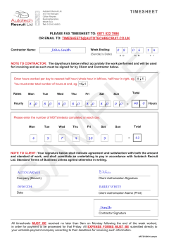
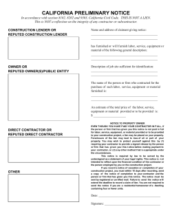

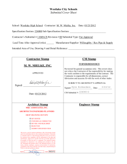


© Copyright 2026