
Where does the water flow? ... runoff, soil erosion,
Where does the water flow? Roads
runoff, soil erosion, groundwater,
livelihoods and poverty alleviation in
Tigray, Ethiopia
Katharina Welle, Rossella Alba and Jonathan Demenge
Institute of Development Studies (UK)
University of Mekelle (Ethiopia)
Meta Meta Research (Netherlands)
June 2014
Acknowlegements
This work was produced under the supervision of Dr Lyla Mehta, with the participation
of Dr Kifle Woldearegay, Dr Lyla Mehta, Kebede Manjur, Alemu Addisu and Diego
Garcia-Landarte Puertas.
The project is a collaborative effort of researchers from Europe (MetaMeta Research, a
private research organization in The Netherlands, with a branch in Ethiopia and the
Institute of Development Studies, UK) and from Ethiopia (Mekelle University).
The study is part of the UpGro project. Unlocking the Potential of Groundwater for the
Poor (UPGro), is a new seven-year international research programme which is jointly
funded by UK's Department for International Development (DFID), Natural
Environment Research Council (NERC) and the Economic and Social Research Council
(ESRC). It focuses on improving the evidence base around groundwater availability and
management in Sub-Saharan Africa (SSA) to enable developing countries and partners
in SSA to use groundwater in a sustainable way in order to benefit the poor.
2
TABLE OF CONTENTS
SUMMARY
5
1. INTRODUCTION
6
2. PROBLEM AND OBJECTIVES
8
ROADS AND DEVELOPMENT
ROADS, WATER AND LIVELIHOOD
OBJECTIVES OF THE STUDY
8
10
12
3. METHODOLOGY AND THEORETICAL FRAMEWORK
13
WHY TIGRAY?
SITES SELECTION
SELECTION OF PARTICIPANTS
APPROACH
METHODS
LIMITATIONS
13
15
19
19
20
23
4. VULNERABILITY CONTEXT, ASSETS AND LIVELIHOODS
23
REGIONAL CONTEXT
WEALTH RANKING
ASSETS
23
27
31
5. ROAD IMPACTS
36
IMPACTS DIRECTLY RELATED TO THE ROAD
IMPACTS LINKED TO THE CHANGING HYDROLOGY
PHYSICAL IMPACTS, COPING STRATEGIES AND ADAPTATION
LIVELIHOODS IMPACTS AND WELL-BEING
WHO IS IMPACTED?
37
39
40
49
53
6. PARTICIPATION AND PLANNING PROCESSES
58
7. CONCLUSIONS AND RECOMMENDATIONS
63
RECOMMENDATIONS
64
ANNEXES
66
GLOSSARY AND KEY TERMS
SEASONAL CALENDARS
ANNEX 1: FOOD SECURITY (NO IRRIGATION) AND FOOD PRICES IN SINKATA
ANNEX 2: FOOD SECURITY AND RAIN WATER AVAILABILITY IN MEGAB
ANNEX 3: FOOD SECURITY AND AGRICULTURAL OUTPUT WITH IRRIGATION IN GULE
ANNEX 4: SEASONALITY OF DISEASES
ANNEX 5: SEASONALITY OF WORK
ANNEX 6: INCOME (IN KIND AS WELL AS MONETARY)
EXAMPLE OF HOUSEHOLD BUDGET: A. IN SINKATA
STUDY SITES
66
66
67
67
68
68
69
69
69
72
3
LIST OF INTERVIEWS AND PARTICIPANTS
74
REFERENCES
76
TABLE OF ILLUSTRATIONS
MAP OF ETHIOPIA AND TIGRAY (COPYRIGHT: ADBG 2011)
THE GERALTA RANGE IN THE REGION OF TIGRAY; IN THE BACKGROUND IS THE ROAD FROM HAWZIEN TO ABIY ADDI.
THE SINKATA-ABIY-ADI ROAD UNDER CONSTRUCTION
MAP OF THE SINKATA-HAWZIEN-ABREHA WEASTBEHA-WUKRO ROAD SYSTEM.
TABLE 1: STUDY SITES
A PARTICIPATORY APPRAISAL IN GIRA ARAS
A TRANSECT WALK IN GULE
IRRIGATED LAND IN GULE: THE WATER IS PUMPED OUT OF WELLS IN THE BED OF THE RIVER
TABLE 2: CULTIVATED LAND AND WEALTH CATEGORIES
TABLE 3: IRRIGATED LAND AND WEALTH CATEGORIES
TABLE 4: CHARACTERISTICS OF WEALTH GROUPS
TABLE 6: NUMBER AND PROPORTION OF HOUSEHOLDS IN EACH WEALTH GROUP
ILLUSTRATION 1: PROPORTION OF HOUSEHOLDS IN EACH WEALTH GROUP
TABLE 7: DETERMINANTS OF WEALTH
AN IRRIGATED FARM IN GIRA ARAS
TABLE 8: HOW IS WATER USED IN AGRICULTURE?
THE ROAD BEING UPGRADED BELOW SINKATA. THE ROAD GENERATED A LOT OF EROSION AND SILTATION DURING THE
RAINY SEASON.
TABLE 9: PHYSICAL IMPACTS OF THE ROAD
DUST LIFTED UP BY TRUCKS AND CARS IN MEGAB
A GULLY FORMED AFTER A CULVERT IN SINKATA
A HOUSE COLLAPSED BECAUSE OF THE FLOOD IN SINKATA
A BLOCKED CULVERT AND THE ELEVATED ROAD AND SERVICE ROAD IN GIRA ARAS
THREE TYPES OF CACTUSES ARE PLANTED TO PROTECT THE LAND AND LIMIT EROSION
PARTICIPANTS INDICATE THE HEIGHT OF THE WATER DURING THE FLOODS
THE BRIDGE IN GULE
THE IRISH BRIDGE IN MEGAB HAS BENEFITTED THE AREA
TABLE 10: SUMMARY OF THE POSITIVE AND NEGATIVE IMPACTS NOTED
A LINED HAND-DUG WELL IN GIRA ARAS
TABLE 11: POSITIVE AND NEGATIVE IMPACTS OF THE ROAD ON LIVELIHOODS
SAND COLLECTION ON THE WAY TO MEGAB
MAPPING BEFORE THE TRANSECT WALK
UNDERSTANDING THE DIFFERENTIATED EFFECTS OF ROADS IN MEGAB
TABLE 12: COPING STRATEGY MATRIX ACCORDING TO WEALTH STATUS
CANAL CONSTRUCTION IN ABREHA WE ATSBEHA
TRANSECT WALK IN SINKATA
TRANSECT WALK IN GIRA ARAS
TRANSECT WALK IN MEGAB
TRANSECT WALK IN GULE
4
7
15
16
17
18
21
22
25
28
28
30
30
30
31
32
34
37
37
39
41
42
43
44
45
46
47
49
52
53
53
56
57
58
61
72
73
73
74
Summary
In rural development theory and practice, roads are built to improve people’s mobility and
enhance access to markets, administrative centres, schools and health posts, and are credited
with important socio-economic changes. A less studied aspect is the impact of roads on
hydrological resources, as roads interact with existing surface and groundwater systems,
reorganising the distribution of water related hazards and resources among the population,
with significant consequences on their livelihoods. In Ethiopia, the government has embarked
in a massive road construction programme over the last decade, mainly to serve the needs of
an essentially rural population and agrarian economy. In parallel, the government has also
invested significantly into soil and water conservation measures and irrigation to serve the
needs of a population whose livelihoods depend heavily on rain fed agriculture. Based on
fieldwork conducted in 2014 in the semi-arid region of Tigray, Ethiopia, this report explores
the physical and socio-economic impacts of road related surface and groundwater flows – and
how people cope with and adapt to them. We argue that two distinctive objectives of
improving road connectivity and improving water availability for irrigation – are linked and
could be served by the same infrastructure, which we call multifunctional roads.
5
1. Introduction
Where does road runoff flow? A considerable amount of literature deals with the
consequences of roads on development and their effects in terms of poverty alleviation.
In rural areas roads are built to improve people’s mobility and connectivity to markets,
administrative centres, schools and health posts, and are credited with important socioeconomic improvements. However, one aspect that has received little attention is the
effect of roads on water flows, and how these positively or negatively affect people.
In Tigray, a semi-arid region situated in the North of Ethiopia, the effects of runoff on
the landscape are considerable. Whereas flows of water and silt triggered by torrential
rains devastate the land and people’s assets in summer, during the nine month long dry
season water becomes the scarce and precious resource on which all life depends.
Where surface and groundwater flows and how water can be stored and reused - and by
whom - become crucial questions. And evidence shows that roads, when they are built
or upgraded, modify considerably the hydrology of the place, and therefore the
allocation of water hazards and resources.
Based on fieldwork conducted in 2014 in Tigray, this article attempts to understand
how the impacts of hydrological changes triggered by road construction affect positively
and negatively the life of socially differentiated individuals and households, and how
people adapt to and cope with these effects. Taking the route corridor Sinkata1Hawzien-Abreha Weastbeha-Wukro as a case-study, we explore the geographical, socioeconomic and political determinants of processes induced by road and water
interactions, and how the negative impacts of roads could be minimised and the
positive ones maximised to serve the needs of the local population. We further
investigate their effects – real and potential – on equity and poverty alleviation, and
advocate for road planning processes that are inclusive and take local knowledge and
multifunctionality into account.
Section two examines the key literature on roads and development, and roads, water
and livelihoods, before presenting the objectives of the study. Section three introduces
the methodology, the study sites and the theoretical framework that informs this work.
Section four frames the context of the study in terms of vulnerability, assets and
livelihoods. Section five analyses the socio-physical effects of roads in their complexity:
the physical consequences of road, as well as the consequences of roads on the
hydrology of the place; the consequences these have in terms of livelihoods and wellbeing; coping mechanisms and adaptation strategies; and finally the distribution of
roads consequences among the population. Section six analyses political processes of
road construction for different types of roads, and the degree to which people are
included or excluded from planning and construction processes. The final sections
brings together the main findings of the study and makes recommendations in order to
1
Also called Freiweign
6
integrate the multifunctionality concept into road construction and improve the effects
of roads in terms equity and poverty alleviation.
Map of Ethiopia and Tigray (copyright: ADBG 2011)
7
2. Problem and objectives
Roads and development
Contrarily to an idea widely spread among many development theorists and
practitioners, the link between roads and development is far from straightforward. To
put it simply, the effects of roads are complex, difficult to measure, and if people often
benefit from road construction, its effects are unequally distributed among the
population.
Roads often form an important component of social and economic development
theories and poverty alleviation strategies. Modernisation theory argues that the
development of transport is conducive to economic growth (Bryceson et al. 2008: 359),
an argument backed by econometric demonstrations. For instance, based on statistical
correlations between economic growth and a host of other factors, and a sample of 43
countries in Asia, Africa, Fan and Rao find that “agricultural spending, irrigation,
education, and roads contributed strongly to growth” (Fan and Rao 2003: 29). Overall,
the main economic justification for road construction is market integration: “by
reducing trade costs and promoting economic specialization across space,
transportation infrastructure is said to be a determining factor of growth” (Burgess et
al. 2010: 2). By opposition “the lack of infrastructure is often mentioned as one of the
main reasons of African underdevelopment” and a deterrent to trade expansion (Buys
et al. 2006): “overland transport is so difficult and costly that Africa’s diverse regions
remain largely isolated from one another” (Buys et al. 2006: 2). This, in turn, acts as
disincentive to industrialization (Shiferawa et al. 2012: 3), putting manufacturing firms
(which are intensive users of infrastructure services) at a comparative disadvantage.
Therefore, economies with poor infrastructure record a low share of manufacturing
production in GDP.
“One of the most glaring differences between the developed and developing countries is in the
densities of their respective road networks. Indeed the density or quality of a country’s road
system is often used as a measure of its state of development” (xii)
Hindson, Jack , Howe, John and Hathway, Gordon (1983) Earth Roads: Their Construction and
Maintenance, Intermediate Technology Publications, London
Likewise, in rural development roads are “logically assumed to alleviate [...] poverty
associated with spatial isolation” (Bryceson et al. 2008: 460). The argument is based on
the idea that roads provide farmers with access to markets for agricultural inputs,
labour, and outputs, and therefore stimulate agricultural production. Based on the
observation that poverty is generally concentrated in areas where the market has a
weak presence, it is argued that “roads allow the market to infiltrate peripheral areas”,
and “permit the inhabitants of those areas to access the jobs, services, and higher
standards of living in the core” (Rigg 2002: 619). Similarly, Porter argues that roads
increase access to social services and markets for the rural poor - schools, healthcare,
8
labour markets, and credit facilities - services that have a direct impact on
socioeconomic well-being and human development (Porter 2002).
However, both in theory and in practice, the links between roads and development
remain contested. Already in the 1950s and 1960s, Hirshmann argued that investing in
transport infrastructure was “costly and unpredictable” (Edmonds 1998: 26), and that
economic growth would lead to the development of transport, not the other way round;
Wilson argued that “transport [was] no more an initiator of growth than any other form
of investment” (in Edmonds 1998: 26). As some authors argue, there is still a critical
lack of evidence regarding roads’ consequences in terms of development (van de Walle
2002). Studies that posit a direct and uncontested link often use inadequate
methodologies or lead to unconvincing results (deGrassi 2005), while benefits “are
often seen as so obvious […] that they are listed rather than discussed” (Wilson 2004:
525). As a result, “short-term and long-term distributive impacts of transport projects,
particularly on low- income groups, are not well understood ” (deGrassi 2005: 53).
One may cite at least three reasons why the link between and roads and development
came to be discredited. First, because the effects of roads tend to be complex and
context specific, and sometimes even negative. Hook and Howe criticize reports and
statements that “posit a rather direct connection between road investments, poverty
alleviation, and economic growth”, for “these statements do not sufficiently specify
conditions under which road investments will lead to positive growth or poverty
alleviation outcomes” (Hook and Howe 2005: 4). They add: “there is a significant risk
that misguided transport investments will actually harm the development process and
adversely impact the lives of the poor” (Ibid.: 11). For instance, DeGrassi shows that
increased connectivity can also have detrimental effects through increased competition
for workers or through increased imports (deGrassi 2005). Roads can harm groups of
people and villages, and they can lead to a decline in livelihoods, just as they can
contribute to them: the effect of roads are context specific (Rigg 2002). Roads are
sometimes reproached for destroying existing livelihoods, generating environmental
destruction, creating disputes over resources, and increasing social differentiation,
thereby generating social conflicts (Perz et al. 2007; TRL 1997)(Humbert-Droz and
Dawa 2004; Smethurst 2000), increasing the speed of disease transmission and
dependency on oil prices (and other imports).
Second, roads do not necessarily serve the needs of local populations, let alone the rural
poor, because their needs have been misconceived. In general, the “transport needs of
rural population can be characterized as the movement of small loads over relatively
short distances” and the predominant means of transport is often on foot (Barwell et al.
1985: 130). As a consequence of road construction, non-motorized and intermediate
means of transport are sometimes forgotten and displaced from the market (Fairhead
1992; Fouracre 2001). In Africa, evidence suggests that roads tend to be
overengineered relatively to the density of traffic (Gwilliam et al. 2008), as traffic
remains very low, especially on rural roads. The focus on expensive motorable roads
has also created problems for governments because of their maintenance costs (Barwell
et al. 1985: 135; Hine and Rutter 2000). Also, planners have too often focused on
increasing mobility through road provision, when the bigger question is that of
9
“accessibility” to social services (Dawson and Barwell 1993: 41); instead of improving
access, such interventions have led to off-road markets and social services being
neglected, affecting local dwellers and more particularly those with reduced mobility. In
fact, several authors argue that interventions other than road construction are more
likely to alleviate poverty (Hook and Howe 2005)
Finally, roads are not necessarily conducive to development, because “roads are not
enough” (Dawson and Barwell 1993). While evidence suggests that benefits often do not
accrue to those living outside a 3- to 4-kilometre-corridor along the road (Håkangård
1992; Porter 2003), benefits tend to be captured by the wealthiest sectors of the
population (Hook and Howe 2005). People’s ability to benefit from the road depends
largely on their initial assets: individual landholdings, livestock, and the presence and
efficacy of integrated development projects. In general, only “better off communities are
able to take advantage of the new opportunities [while] the poor and socially
disadvantaged require additional interventions if their capacity to benefit from
transport improvements is to be increased” (RAP 2003: 2). “Roads alone provide an
insufficient stimulus for growth in the agrarian sector” (Molesworth 2001: 119-20): in
order to make a difference roads need to be accompanied by favourable conditions and
by the right policies, and access to health, social services, credit or extension services
have to be guaranteed.
Therefore, this study will already contribute to the road literature in two ways. First it
will help understand how people and their livelihood are indirectly affected by the
environmental consequences of roads, especially by the runoff. Second it will issue
recommendations as to how roads can offer more than just transport: access to markets
as well improving water availability and irrigation means, therefore creating synergies
that contribute to development and poverty alleviation.
Roads, water and livelihood
Water and livelihoods are intimately interconnected. People need access to clean water
for drinking, cooking and household chores, to maintain their health and their dignity.
Water also maintains ecosystem services, and is necessary for animal watering and crop
production that make up peoples’ livelihoods (UNDP 2006).2 Achieving water security is
key for food security and poverty reduction (Tucker, Lema and Lemma, 2013).3 Among
others, access to clean water supply frees up time for productive activities and
contributes to the decrease of water-related diseases. Having access to greater storage
and retention of water may increase livestock production, kitchen gardening, and
irrigation. Water also contributes to other small-scale productive activities such as beer
brewing and kitchen gardening (Moriarty et al, 2004).4 Moreover, recent studies also
show that irrigation has impacts on poverty reduction in terms of production and
UNDP (2006): Beyond scarcity: Power, poverty and the global water crisis. Human Development Report.
Tucker, Josephine; Lema, Zelalem and Lemma, Samson E (2013): Water for livelihood resilience, food
security and poverty reduction. In Calow, Roger; Ludi, Eva and Tucker, Josephine (2013) Achieving Water
Security. Lessons from research in water supply, sanitation and hygiene in Ethiopia. Rugby: Practical
Action Publishing.
4 Moriarty, Patrick, Butterworth, John, van Koppen, Barbara (eds) (2004): Beyond domestic: case studies
on poverty and productive uses of water at the household level. Delft: IRC
2
3
10
consumption, but also in terms of savings behaviour and informal insurance practices
(Dillon 2011)
Water availability is even more of an issue for the rural poor who live in arid and semiarid areas, and are subjected to high rainfall irregularity. Extreme events such as
flooding and droughts also affect the productive assets and therefore livelihoods (World
Bank 2006: 10):
“Flooding is a problem mainly along the riverine areas affecting productive
agricultural land, settlements, and infrastructure. Flooding and sedimentation also
cause damage by inundating and waterlogging productive land, encouraging growth
of undesirable species, and blocking road access and trekking routes. Flooded fields
often delay planting, thus reducing yields and quality of crops” .
These conditions, which are worsened by climate change, frequently lead to droughts,
crop failure, reduced vegetation, fodder scarcity, and insecure water supplies
(Steenbergen and Verheijen accessed 01.01.2014). In this context, increased water
retention and provision can be the key to increased resilience, food and water security,
and poverty reduction.
Roads and water are also clearly interconnected, although surprisingly little references
can be found. When roads and water are jointly dealt with in the literature (and for
engineers) it is rather about the destructive effects of runoff on the road infrastructure
than the other way around. For instance: “floods and droughts cause severe damage to
roads, making many roads impassable during the rainy season and even during the dry
season, due to poor conditions and inadequate river crossings” (World Bank 2006: 10),
or “unpaved roads are extremely vulnerable to floods, landslides, and gully erosion”
(Ibid.: 25). However, roads have an important effect on the circulation of water, both
surface and groundwater, and the major impacts of roads on hydrology and local
groundwater availability remain little understood and rather unstudied. For instance, a
Transport Research Laboratory publication mentions that roads can provoke soil and
channel erosion, often increase the pressure on natural resources, and destroy
agricultural land (TRL 1997).5 More recently, a World Bank report on Water Resources
Development for Ethiopia argues that "failure of traditional road designs to integrate
hydrology frequently leads to interference with downstream water use(r)s, as well as
inaccessible roads" (World Bank 2006: pp. xiv), but without going into much more
details. In particular, relatively little work is found on the specific effects of roads on
local groundwater, for instance reduced groundwater recharge through altered surface
water pathways; altered sub-surface shallow groundwater flows; waterlogging in the
upstream areas, or opening springs draining some of the mountain aquifers. And
therefore no work can found on the effects this may have on local people and their
livelihoods: a gap remains to be filled.
Road construction itself may also lead to environmental issues like pollution (waste, but also solvents,
paints, oils, fuels such as gasoline, diesel oil, kerosene, lubricating oils, and grease) and sediment loadings.
(Griffiths et al. 2000: 12). During the construction, the effects of a temporary labour force on the use and
availability of local resources – including water - may also have to be considered.
5
11
In general, most road construction works have no provision for the storage of run-off
water generated from road drainage (Nissen-Petersen 2006). Roads are often built with
little consideration for hydrology, no formal Environmental Impact Assessment (EIA) is
required, and “little, if any, importance is given to environmental issues during
planning, design or construction,” a situation that results in “detrimental impacts not
only to the natural environment but also the road and local communities” (Griffiths et
al. 2000: 1). Effectively, poorly designed roads result in rain erosion to the roads,
forcing motorists to pass through the fields and permanently damaging them. Cut-off
channels to divert water from the road to the fields also create gullies, carry away the
topsoil, and often turn fields into “a desolate moon landscape” (Nissen-Petersen 2006:
ix). This way, “thousands of acres of fertile farmland are being washed away every year
by uncontrolled rainwater running off roads” (Ibid.). Hence, poorly engineered road
negatively affect people’s assets and livelihoods,6 when it would actually be possible to
protect and “enhance natural water supplies and encourage the development of
sustainable economic activities by encouraging retention and use of flood water”
(Griffiths et al. 2000: 7).
A pioneer literature provides a comprehensive list of features that can be incorporated
into road construction design to control erosion and enhance water supplies and
groundwater recharge, notably “by retaining water in small dams, by maintaining a high
water level that would increase the availability of water and recharge aquifers, by
incorporating retarding basins to reduce runoff peaks, or by improving drainage in
residential or farming areas” (Griffiths et al. 2000: 16). Although “the study of the
upstream and downstream consequences of rainwater harvesting, and road runoff
harvesting in particular, has started to receive attention only in recent years” (Kubbinga
2012: 15), a lot remains to be done in order to develop a comprehensive understanding
of road impacts on surface and ground water flows, and how these impact livelihoods.
Objectives of the study
As highlighted in this section, a certain number of gaps remain in the road and water
literature. Based on empirical material, this study’s objective is to contribute to filling
these different gaps.
Objective 1
The first objective is to better understand the impacts of road on surface and ground
water, and how these positively and negatively affect people and their livelihoods. More
particularly, with soil erosion often considered “one of the most serious environmental
problems in Ethiopia” (Shiferaw and Holden 1999: 739), and Ethiopia described as “one
of the most serious soil erosion areas in the world” (Bekele and Drake 2003: 473),
threatening food production and food security, the problem deserves some concern.
There is a clear interest to understand how roads contribute to soil erosion, and how
this could be changed.
“Another hazard created by rainwater running off roads is that some people and animals lose their lives,
while trying to cross a road over a riverbed flooded by rainwater.” (Ibid.)
6
12
This objective is also made more urgent in the light of current climate change
predictions, which include modifications in the rainfall regime, higher probability of
extreme weather events (droughts and rain intensity), and regional and food
production crises. This is particularly the case in Ethiopia (McSweeney et al. 2008), an
already food insecure country where changes to climate patterns are predicted to add
pressure on water availability, accessibility, supply and demand (Jones et al. 2013).
Objective 2
Also, some evidence suggests that people do use roads for water harvesting, including in
Ethiopia, although the practice remains limited. We call the fact that roads can serve
purposes other than mobility – multifunctionality of roads. Through this paper, we
would like to formulate general recommendations as to how roads and other integrated
interventions can be multifunctional and serve needs in terms of water retention,
recharge and re-use and benefit people.
Objective 3
Road design and construction processes tend to be non-inclusive. This study advocates
for better inclusion of road beneficiaries and local populations into the planning and
construction process, in order to serve better the needs of populations. Also, we argue
that by integrating local knowledge roads could be more adapted to local specificities
(geology and climate), and construction and maintenance costs could be minimized.
We believe that if these three objectives can be fulfilled – understanding road impacts
on hydrology and livelihoods, building the case for multifunctional roads, and
advocating for more inclusive road planning processes – then roads can be made a
central tool in poverty alleviation. And by filling these three gaps, this study will help
build roads that truly serve the needs of populations, and do not undermine their
livelihoods.
3. Methodology and theoretical framework
Why Tigray?
There are several reasons why Ethiopia and Tigray in particular make an ideal terrain
to research the impacts of roads on the hydrology, how they affect livelihoods, and what
the potential of multifunctional roads could be for local populations.
The first one is the climate and occurrence of soil erosion, and the importance water has
for livelihoods. The climate in Tigray is characterised as semi-arid. Mean annual varies
between 552 and 767 mm a year, with erratic and torrential rains mainly concentrated
during the period of June to early September and a lot of inter-year variability. These
have two main consequences: the first one is soil erosion during the rainy season, with
13
Tigray considered as seriously degraded; the second one is water insecurity during the
dry season, with severe implications in terms of food security.7
In an attempt to ensure water and food security, different water harvesting, soil
conservation and afforestation programmes have been implemented, especially over
the last 15 years.8 Irrigation, which has been promoted as one of the key priorities by
both the national and regional governments (WSDP 2002) is expanding. Between 2004
and 2009 the number of farmers practising irrigation would have more than doubled
(from 159,000 to 379,000), and the surface irrigated increased more than fivefold (from
15,000 ha to 83,000 ha) in Ethiopia (GTP 2003EC/2011). Interestingly, Road Runoff
Harvesting is practised in Ethiopia, notably in Tigray where borrow pits turned into
ponds are used by farmers to water their livestock (Kubbinga 2012). However, these
tend to remain coincidental rather than properly planned, and wider integrated road
and water harvesting/retention projects remain to be developed.
Finally, a significant road construction programme is being implemented in Ethiopia.
Although the road density is considered one of the lowest in Africa, road infrastructure
has been defined by the Ethiopian government as “one of the main pillars of its
development policy” while rural roads are seen as “one of the decisive factors that
highly contribute to social and economic development” (Emmenegger 2012: 9).
Between 1997-2010, Ethiopia has implemented a large scale public investment
program known as the Road Sector Development Program (RSDP), with significant
results in terms of road construction and maintenance (Shumiye 2010). In a decade,
government’s spending on roads was multiplied by 10 (Worku 2011). Between 2004/5
and 2009/10, the government, which has made of poverty eradication its “main
development agenda” (MFED: vii) added 11,000 km of federal roads to the existing
36,400 km long network, reaching a total of 46,800 km of roads, without counting
community roads (120.5 km/ 1000 km2 if community roads are accounted for; see
Worku 2011: 3). In 2012, the total network consisted of 114,397 km of roads
(Emmenegger 2012: 9).9 Road authorities in Tigray have been approached by
researchers at university of Mekelle and are interested in the potential or road water
harvesting and multifunctional roads.
Although we are aware of the wide-spread existence of a powerful land degradation narrative in
Ethiopia and elsewhere (Keeley and Scoones 2000, 2003), its wide occurrence was also noted by
participants. The elder participants often observed and showed us the physical impacts of land
degradation, as well as a decrease in soil fertility: when they were young, they said, the soil was rich and
everything grew easily.
8 In terms of soil conservation, a large array of techniques are used and built, mostly under PSNP: deep
trenches, terraces, hill sides water harvesting, check dams, eye-brow basin, herring bone (for trees), semicircle, percolation ponds, negari, gabion check-dam to reduce run-off speed and collect the water, or
wood check dams.
9 20,429 km federal roads, 23,930 regional roads and 70,038km community roads (Ibid.). For a map of
the road network, and functional classification of roads, see (World Bank 2010: 41-2). In terms of
organization, Ethiopian roads are essentially governed and maintained by two different organizations:
the Ethiopian Road Authority (ERA), and the Regional Road Authority (RRA.). Roads are functionally
classified in 10 different standards, from DS1 to DS10 (only DS1 to DS4 are paved roads. Levels of
standard are chosen based on the design traffic flow (Ibid.: 40).
7
14
The large road construction development coupled with a considerable movement to
bring irrigation, associated with a significant interest in water harvesting and
conservation make it a fertile ground to experiment with multifunctional roads.
Recommendations that could be incorporated into current construction programmes could
also be of relevance to other arid and semi-arid regions of Africa.
The Geralta Range in the region of Tigray; in the background is the road from Hawzien to Abiy Addi.
Sites selection
This study has benefited from the work of a team of engineering geologists at University
of Mekelle, who have been working on a detailed study of the route Sinkata-HawzienAbreha we Atsbeha (around 50Km long) with a radius of 5Km from the main road. The
survey included evaluating the geohydrology and locations of gullies. Based on this
survey, a preselection of 12 sites was initially done, according to the following criteria:
- feasibility of the study (time wise an distance wise);
- impacts of runoff and formation of gullies;
- potential for rain water harvesting and re-use, and occurrence of hand dug wells and
water conservation structures;
- road currently under construction, so that the ongoing process could be documented
and would enable the team to research and measure its impacts on runoff, groundwater
and people’s livelihoods.
Also, the different sites would offer the opportunity to look at different types of roads
(highway, feeder roads and community roads), and therefore different structures
(tarmac and dirt roads) and construction processes. In addition, the sites would present
15
different settings in terms of distance to administrative centres and geomorphology of
the landscape – which happened to be an important factor in understanding the
hydrological impact of roads and their consequences on the lives of people who dwell
therein.
The Sinkata-Abiy-Adi road under construction
The Sinkata10-Hawzien-Abreha Weastbeha-Wukro road system, situated 45 km North of
Mekelle was chosen as a study site. The main road was built before 1974, was widened
under the Derg regime, and is currently being upgraded into a highway to link Sinkata
to Abiy Addi. This main road is managed by the Ethiopian Road Authoritiy (ERA). Two
more sections were added to our case study to include Access and Feeder roads that are
respectively managed by the regional and local authorities. The following table
describes the different sections of the road.
Road
Technical
classification
Functional
classification
Sinkata-Hawzen
Hawzen-Abreha
Weatsbeha-Wukro
DS - 05
Trunk road (highway)
Link road
Gule to the main
road
DS - 10
Access road
10
Also called Freiweign
16
Administrative
classification
(responsible
administration)
Federal road (ERA)
Regional
road
(Tigray
Construction,
Road
and
Transport Bureau)
Community
road
constructed through the
URRAP programme
Selam-Hawzien
-
Feeder road
(Tigray Construction, Road
and
Transport
Bureau
responsible
for
URRAP
programme)
Community road (Woreda
and kebele administrations)
Map of the Sinkata-Hawzien-Abreha Weastbeha-Wukro road system.
Based on these criteria eleven sites were selected and ranked by order of interest (see
map). Based on a pre-visit by the team of researchers, six sites that corresponded the
most to our criteria were selected for detailed study:
No
1
4
Location
(Adindan
UTM,
Zone
37N)
(East,
North,
Elevation)
Freweign/Sinkata area
(Saese
Tsaedemba
woreda); Coordinate:
561270mE,
1553379mN,
Elev=2412m
Number of househa
olds affected: 42
Gira
Aras
area
(Hawzien
Woreda);
Coordinate:
Site condition and main reasons for selection
The site, situated down-hill from Freweign/Sinkata town is heavily
affected by the run-off from the tarmac road which is being
upgraded, and by erosion and siltation which inundates and
destroys fields, wells, ponds and houses. People constructed extra
protection walls to minimize the impact of the run-off.
The site is particularly interesting to understand the negative
physical and socio-economic impacts of the construction of a
paved road, and how people cope with these, individually and
collectively. How to minimise negative impacts and increase
positive ones can also be studied there.
The tarmac road crosses a plain scattered with fields and
grassland, and one side of the road experiences water logging. A
borrow pit is used by neighbouring households to water cattle. A
17
0553858mE,
1548608mN,
Elev=2300m.
Number of households
affected:
approximately 120
7
Megab
(Hawzien
woreda); Coordinate:
0541377mE,
1539142mN,
Elev=2036m.
Number of households
affected: 30
10
Gule (Klite Awlaelo
Woreda); Coordinate:
552262mE,
1534990mN,
Elev=
2062m
Number of households
affected:
approximately 100
6
Selam
(Hawzien
woreda); Coordinate:
0548596mE,
1542186mN,
Elev=2186m.
11
Abreha
Weatsbeha
(Klite
Awlaelo
woreda); Coordinate:
0557542mE,
1530520mN,
Elev=2007
number of water conservation and irrigation systems (deep
trenches, lined hand dug wells) have been built. Moisture stress is
a major problem in the area.
The site offers the opportunity to observe positive and negative
effects of the construction of a paved road, as well as the potential
to integrate road construction with water harvesting and water
conservation areas.
The unpaved link road to Abreha Weatsbeha, situated close to
Hawzien, branches off the main tarmac road to Abiy Addi. The
road impacts water flows, creates water logging and increases soil
moisture and water recharge near an Irish bridge. Sand is
collected there, but irrigated agriculture is not practised. However,
people divert water from roadside drains into their farmland and
runoff from the roads into deep trenches. People would like the
road to be upgraded into an asphalt one considering water
harvesting from roads.
The site’s interest resides in the opportunity to study the impacts
of an unpaved road, as well as existing practices of road runoff
harvesting, groundwater recharge and reuse, their effects on
livelihoods, as well as potential improvements.
The site is a wide irrigated plain of green fields and wells that
contrast with the surrounding dry hills. The unpaved feeder road,
which has been built according to a new model piloted by the
government involving small local businesses, presents a number
of Irish bridges and a check dam.
This site is interesting to study the potential effects of irrigation on
livelihoods improvements, as well as the impact an unpaved road
has on irrigation, on agriculture based livelihoods and on their
distribution among the population. It also offers the possibility to
understand community involvement into the process of road
construction
This area is about 5Km from Hawzien town, and the road was built
by the communities (using manual labour only). The communities
are highly interested to have standard road to be constructed that
connects their village with Hawzien town.
Community involvement into road construction and as the
distance from the main road are the most important points to be
studied there.
This site is situated on the link road between Hawzien and Wukro.
Its interest lies in its well known successful water harvesting
implementation that turned the area from a dry, food insecure
woreda into a food secure place, and in the voluntary approach
taken by its inhabitants. The kebele chairman is charismatic and
very interested in trying out new techniques; including agroecological development. Communities want the road to be
upgraded and water to be harvested from roads.
Table 1: Study sites
Participatory assessments (PA) and interviews were carried out in the first four
locations, while detailed interviews with tabea (sub-district) leaders and villagers were
conducted in the two last locations. Examples from other locations visited that were not
short-listed in the study were also included when relevant.
18
Selection of participants
In every research location, participants and interviewees were selected so as to include:
- representatives of households that were positively and negatively affected by the road;
- male and female participants,
- representatives of different wealth groups;
- members of households that practised irrigated agriculture and others who only
practised rain fed agriculture.
Further participants were chosen based on their particular experience with the road,
road runoff harvesting and irrigation, because they represented a different social
groups, or had been identified through focus group discussions.
Approach
This paper adopts a political ecology and livelihoods approach to the problem. Although
the influences and concepts that inform our framework are numerous, it would be
sacrilege to look at the political economy of land erosion without referring to the
approach and tools developed by Blaikie in his seminal work (Blaikie 1985) (Blaikie and
Brookfield 1987). Hence, this article, its focus and its theoretical lens are all loosely
grounded in political ecology, understood as an approach that “combines the concerns
of ecology and a broadly defined political economy [and] encompasses the constantly
shifting dialectic between society, and also within classes and groups within society
itself ” (Ibid. 1987: 17).11 Also, noting that “there are competing social definitions of
land degradation” this work puts “the land manager ‘centre stage’ in the explanation”
and attempts to “learn from the land managers’ perceptions of their problems” (Ibid.:
16), and build on their recommendations.
Whenever possible, our approach leaves the simple factual description of physical
processes to integrate them within chains of causality (Robbins 2004) that link facts
and perceptions to their social and political causes and consequences, thus constantly
oscillating between the physical/environmental and the social/political spheres. It also
submits these chains of causality through to the prism of the livelihoods framework to
decompose them into distinct categories: the vulnerability context in which people live;
their (physical, social, human, financial and environmental) assets; their strategies;
institutions and processes; and outcomes, including poverty alleviation.
This article attempts to depart from the type of “road determinism” that seems to affect
part of the road literature,12 in which roads impacts remain largely speculative
(Edmonds 1998) and are more often assumed that measured (Wilson 2004). First, we
11
Following Swyngedouw, “produced environments are specific historical results of socio-biophysical
processes” (Swyngedouw 2009: 56), and their consequences are not neutral: some lose, while others
benefit from the newly generated circulation of water. Understanding the causes and distribution of
positive and negative impacts of a changed environment requires looking at power relations, discourses
and practices.
12 An illustration of which could be: “The benefits of road provision are both direct and indirect. Roads
create connectivity, which allows for easier access to external goods and labour markets as well as
greater social contact with other settlements. This can have very powerful long-run implications and is
accompanied by secondary effects on the provision of other basic goods and services” (Wales and Wild
2012: 1).
19
consider that roads do not create connectivity, but may improve connectivity, within a
context in which people practice certain forms of mobility that often persist after the
road has been built. We also look at mobility for whom. Second, we attempt to look at
roads’ impacts with all their contradictions and complexity: hence not everyone is
equally affected by the road, road effects remain context specific, and after the road
does certainly not equal because of the road. Finally, we consider the effects of a whole
range of factors other than roads, and acknowledge when their impacts may be
contradictory or greater than those attributed to roads. In short, our approach attempts
to identify and pin down causality chains in which roads are involved, as highlighted by
stories and testimonies of our participants. We believe it is only by submitting our
material to a critical evaluation that a strong case for a multifunctional approach to road
construction can be built.
Regarding water, one first has to acknowledge the particular characteristics of a
resource whose availability varies across time and space, and whose access to depends
on technology and institutions (Mehta 2014). Our paper drifts away from purely
utilitarian and economistic conceptions of water to consider a plurality of uses,
experiences and understandings, and dig into ways the availability and use of water is
socially mediated. Integrating the concept of hydro-social cycle, we attempt to follow
and represent “the circulation of water as a combined physical and social process”
(Swyngedouw 2009: 56). Departing from statements such as “Water security is
achieved when water underpins economic growth rather than undermining it, or, in
other words, when the net impact of water on growth is positive” (World Bank 2006)
we include psychological aspects and diverse practices of production and subsistence
grounded into experience of a time and place. Following Mehta, water “has different
faces and meanings in the everyday contexts within which people live their lives. People
across the globe value water for both its non-economic and economic roles” (Mehta
2014: 60). Water does mater for economic pursuits, especially in a rural land-based
economy, but looking at water exclusively “through an economic lens […] can
undermine its embeddedness in the everyday symbolic, cultural, and social contexts
within which people live their lives” (Ibid.).
Methods
Our methods aim at capturing in details a plurality of individual experiences and
perceptions of changes in surface and groundwater patterns strongly associated with
road construction and upgrading, and the effects this had on people’s livelihoods. Of
particular importance was to understand the impacts of the road (and associated
runoff) on their land, cropping patterns, livestock, food security, income and nonincome poverty, mobility and access, and well-being, but also how people had
responded and adapted to these changes. Importantly, the tools had to capture the
seasonality of these processes, as well as the way their effects and responses were
geographically, socially or politically mediated.
A participatory appraisal (PA) which essentially consisted in a participatory mapping
exercise, a transect walk, a wealth ranking matrix, a gender matrix and seasonal
calendars, along with more general discussions on road related changes and coping
strategies was conducted in four of the six selected sites. Together, the different tools
20
were to capture the immediate water-related impacts - e.g. flood, water loss, increased
storage, retention and recharge, damaged wells or springs, waterlogging, runoff change
patterns, sedimentation, etc. - and how these impacted distinct groups of households
and individuals in varying ways. After the initial introduction, participants were asked
to draw a map on the ground representing the road, their house, fields and well(s) or
pond(s), as well as main features related to road, road runoff, water conservation and
irrigation (spring, stream, culverts, deep trenches, etc.) using sand, stones, sticks,
feathers, flowers, etc. Based on the map, participants discussed and explained where
they would take us, and why (See maps of the transect walks in annexes). The group
was then broken down into smaller clusters, often by gender, to ensure all participants
had the opportunity to express themselves as freely as possible. During the walk,
participants showed and explained what the effects of the road and associated runoff
were, and how they coped with and adapted to them, while the researchers took ample
notes, drawings, pictures, and waypoints that were later included into a Google map of
the area. At the end of the walk (one to two hours), the findings were summarised and
discussed in a table, along with a wealth matrix, a gender matrix, a seasonal calendar
and discussions whose content was adapted to the context and used to verify our
preliminary hypotheses. General results were discussed between researchers after the
session.
A Participatory Appraisal in Gira Aras
The PA also enabled us to identify participants for individual case studies: seven
interviewees were selected among PA participants and two independently. Altogether,
21
the nine individual case studies conducted gave us an in-depth understanding and a
more personal gaze into people’s life and experiences.
In order to include “different geographical scales and hierarchies of socio-economic
organizations” (Blaikie and Brookfield 1987: 16), interviews with leaders and officials
were conducted at the local (district and sub-district level, or woreda and tabea level)
and at the regional level. Officials from the Water Resources offices and from the
Agricultural and Rural Development were also interviewed. The objective was to
understand perceptions, mindsets, procedures and processes related to road
construction and people’s involvement at the level of road authorities. These interviews
also offered the opportunity to investigate existing links between departments and
probe the interest, potential and suitability of a an inclusive and multifunctional
approach to road construction and planning.
A transect walk in Gule
Except for the two last sites of inquiry, the decision was made to conduct research as a
team in order to adopt a similar approach and limit personal bias, to be able to discuss
and fine-tune the methodology, split groups into different clusters (notably gender
wise), and cross-check our data. Individual interviews (except the first one) were
generally carried out by one or two researchers with the help an interpreter to provide
more intimacy and cover a wider diversity of cases. Preliminary findings and
hypotheses were shared and discussed within the team after each session, and field
notes were exchanged, completed and verified within the group at the end of the
fieldwork.
22
Limitations
Keeping these ambitious objectives in mind, one must nonetheless acknowledge the
main limitation of the study, namely time. Despite benefiting from the expertise of a
team of seven committed researchers whose experience covered road studies, water
and irrigation and rural development in Tigray and Ethiopia, the short duration of
fieldwork13 implies that seasonal variations in the rainfall regime – for instance – could
not be directly observed; that only six sites were selected, therefore reducing the
representativeness of the survey; and that that we had to rely on what participants
were willing to tell without always being able to record alternative voices. Sometimes
participants were hiding real figures for yields or cattle ownership, because it is
believed it brings bad luck or because they might have expected a donation.14 Hence
figures for yields, incomes, or livestock ownership tend to be rather conservative,
whereas the amount of destruction attributed to the road sometimes tend to be inflated.
For these reasons, we always privileged direct observations. Also, indirect effects such
as changes in social relations, cooperation and conflicts between neighbours and other
phenomena would certainly have benefitted from more in-depth and sustained methods
such as participant observation over a longer time span. However, the study has also
benefitted from the long preparation and extensive presence and experience in the
region of four of the researchers, one of which lives in Addis Ababa, the other three
hailing from and living in Tigray.
Another Limit is geographic. Regarding policy processes and public participation, for
instance, it is impossible to generalise at the country level. As Keely and Scoones
reminds us, the sentiment of inclusion and engagement in policy-making in Tigray are
considered quite high, but “cultures of participation vary significantly across regions,
depending on the relationship with those in power at the centre, and the history of
interaction between people and the ruling party” (Keeley and Scoones 2003: 13-4).
Hence the ability to generalise based on the experience of Tigray is limited, as it may not
be representative of the whole country, although some broad lessons can be learned out
of this case-study
4. Vulnerability context, assets and livelihoods
Regional context
Ethiopia is characterised by a high degree of food insecurity, which varies across
regions, seasons and households and is influenced by agroecological conditions and
farming practices (Tesfay 2006). The economy is highly dependent on the agricultural
sector, which accounts for 50 percent of Ethiopia’s GDP, while around 90% of the crop
production derives from the peasants sector.
With less than 24% of the people of Tigray living in urban areas, the population of the
research area is mainly rural (GTP 2003EC/2011). The bulk of the population relies on
13
14
All interview took place between the 9th of January and the 2nd of February 2014.
Although our role and the purpose of the study were always stated clearly in the beginning.
23
a mix of subsistence agriculture and livestock raising. Crops include barely, wheat,
beans, peas, lentils, teff, maize, and some vegetables (tomatoes, onion, pepper, carrots,
etc.), while oxen, cows, donkeys, horses, camels, sheep, goats and poultry are owned.
Agriculture is characterized by smallholder traditional rain-fed agriculture and is highly
dependent on the timing and volume of rains (Devereux 2009; Tesfay 2006). It
represents the main source of livelihood and economic activity for 85% of the rural
population (Teshome 2003).
Following rainfall patterns, most of the rain-fed crops are planted between June and
August (when 70% of yearly precipitations take place) and harvested in September
(Van Den Berg and Ruben 2006). Average yields are typically low (average of 13.1
quintal/ha). The ‘hungry season’ has its peak during these months but might last 4-6
months (Devereux 2009), as our seasonal calendars demonstrate (See Annex 1 and 2 on
food security and water availability). Besides climate variability, several other factors
contribute to structural food insecurity in Ethiopia including low agricultural
productivity, lack of off-farm economic opportunities, fragmentation of landholding15
and environmental degradation (Devereux 2000; Van der Veen and Gebrehiwot 2011).
High rates of population growth put further pressure on availability of arable land and
agriculture production. The prevalence of extreme poverty (citizens living on less than
one dollar a day) was last measured at 48.5 % in 2004/5.
One of the central instruments to deal with high poverty rate and chronic food
insecurity is the Productive Safety Net Programme (PSNP) introduced by the federal
government in 2004. The PSNP, which operates cash and food transfers to households
in most food-insecure woredas in rural Ethiopia, aims at reducing household
vulnerability, improving household and community resilience, and decreasing
dependence on food aid (Devereux et al. 2006). In addition to smoothing households’
consumption during the “hungry season” and preventing them from falling into
destitution, the PSNP also employs people into public works to deliver productivityenhancing infrastructure such as roads, irrigation wells and other soil and waster
conservation measures. While eligible households with able-bodied adults (90%)
receive payments in kind and in cash for the participation of their members in public
works projects, those who cannot provide labour receive unconditional transfers.
Although eligibility criteria are defined at the central level, implementation guidelines
allow for regional variations and community norms are used to target beneficiaries
(Coll-Black et al. 2013). In Tigray, those who benefited from the PSNP received help for
six months a year, in kind and/or in cash. Although PSNP wages are below market
prices (around 90 birrs/month for 4 days of work, i.e. 22.5 birrs/day in Tigray), the
scheme reaches people who do not have access to other forms of employment (women
and elderly). In addition, each adult has to contribute 40 days of “free labour” to the
community (construction, water conservation work, etc.), independently of his/her
wealth status.
The average arable land size per household in the highlands of Tigray ranges from 0.5 to 1 ha per
household (Beyene et al. 2006; Segers et al. 2010).
Note that political disruptions linked to the war with Eritrea and the armed opposition to and repression
by the Derg regime from 1974 to 1991) highly contributed to famines.
15
24
In order to increase agriculture productivity, reduce food shortage and tackle poverty in
the country, irrigation development has been promoted as one of the key priorities by
both the national and regional governments (WSDP 2002). In 2003, the total irrigated
area in Ethiopia was about 160,000 hectares (WSDP, 2003), and it would have nearly
doubled by 2012, at 300,000 hectares (Diao et al. 2005, Abebe et al. 2012). 16 Whilst
most of the area equipped for irrigation is concentrated in the southern regions, in
Tigray the irrigated area covered around 13 000 ha in 2005 (Frenken 2005), and has
significantly increased over the last decade. It mainly consists in small-scale irrigation
employing traditional practices (Seleshi BekeleYilma Awulachew et al. 2007; Hagos
2005): irrigation canals are not lined and diversion structures are constructed with
wood, stones and other locally available materials (Teshome 2003). Moreover, farmers
are able to irrigate not more than 30% of the land in the dry period, when the water
table drops from sub-surface to 8-10 meters.
Irrigated land in Gule: the water is pumped out of wells in the bed of the river
While initial efforts to develop irrigation through micro-dams and river diversion17
have remained fairly limited (Seleshi B Awulachew et al. 2005; Hagos 2005), the
government and NGOs further tried to spread the utilisation of other structures such as
ponds and wells. In 2002, 22 districts in Tigray were involved in the Rainwater
Harvesting Ponds Programme which aimed at decreasing households’ dependency on
16 According
to official data, more than 715,000 ha of agricultural land were put under irrigation (MFED:
15). The country’s potential is estimated at 3.7 million hectares.
17 It started with the establishment of the Commission for Sustainable Agriculture and Environmental
Rehabilitation in Tigray (CoSAERT) in the mid 1990s.
25
rainfall by collecting run-off and rain water (Segers et al. 2008). In 2004, the
construction of private and community shallow wells started, supported by the PSNP,
one of the main food security programmes active in Ethiopia. The programme is active
in the construction of shallow wells, ponds and other water harvesting structures
including small-dams, deep trenches and check-dams that were all present in the
research sites. As a result, the situation of soil erosion in Tigray would have improved
over the last decade thanks to intensive soil and water conservation measures (Munro
et al. 2008).
Another characteristic of Ethiopia, which is essential to understand the context and
situations described in this study, is the land tenure regime. In Ethiopia, peasants and
farmers do not own the land but are granted land use rights. Hence farmers cannot sell
or buy the land, which remains the property of the state, and authorities are closely
involved into its management.18 The land tenure plays a role when a new road is
constructed, as the state does not have to acquire the land from the people, and
compensations tend to be minimal. Since the introduction of the 1975 land reform,
several periodic land redistribution have been carried out in different regions
(Gebreselassie, 2006): if redistributions were frequent during the Derg regime, since
the early 1990s they have been discouraged (Gebreselassie, 2006). The last land
redistribution in Tigray dates back to 1991.19 Short-term rental contracts or other
arrangements, which take the form of cash leases or sharecropping where a ‘tenant is
entitled to cultivate a field in exchange for a fee or a share of the harvest, or both, to the
land [holder]” are common (Segers et al. 2010: 1022), and are negotiated on a seasonal
basis. In Tigray, they represent one of the dominant forms of tenancy (Tesfay, 2006).20
The 1975 Derg land reform established that the land is a property of the state that grant land use rights to
households (Segers et al. 2010). Land sale, long-term rental and permanent transfers were forbidden. The 1995
Constitution confirmed the public ownership of land and the restrictions on land transfers and sales (Crewett and
Korf 2008). At a later stage, a federal law transferred responsibilities related to land management to the regional
governments (Deininger et al. 2008). In Tigray Region a new land proclamation was introduced in 1997 and
amended in 2002 (Tigray National Regional State's Rural Land Usage Proclamation No. 23/1997). The
Proclamation endorsed the constitutional principles and introduced land certification with the aim of increasing
tenure security and facilitating land transactions (Dokken 2013). A process of land registration at regional level
was initiated where certification where given to land holders and rural arable lands were recorded in district
register. Based on Tigray experience, since 2003 land registration has been introduced in other regions. The
introduction of land certificates aims at increasing security of land tenure and thus promoting long-term
investment on land improvements (Gebreselassie 2006).
19 Under certain circumstances land can be re-allocated, when a landholder die without heirs and when a
landholder is absent from the village for more than two years (Haile et al. 2005). In both cases, the land returns
to the tabia council who redistributes it according to a waiting list. The list includes both male and female
farmers landless living in the village and people returned after the last land redistribution. The last is the case of
G.M.C., who returned to Selam after spending several years in Eritrea and received land from in-village redistribution in 2010.
20 These forms of land rental occur between farmers holding lands who lack productive means (e.g. ox) or
between farmers who experienced harvest failure. Vice versa, farmers who are land deficient in relation
to their labour force or productive means rent in land. A study on dynamics of land access in Tigray
suggests that land deals involve elderly farmers who, unable to cultivate their land, rent it to their
younger relatives (e.g. children) or they include non-farmers who abandoned agriculture for other
activities (e.g. handicrafts, constructions or other small businesses) and lease out their land (Sergers et
al., 2010). The details of the lease arrangements vary depending on the farmers, the family ties and the
type and position of land (ibid.). For instance, S. M. a farmer who holds 0.5 ha irrigated land in Gulle
18
26
In terms of transport, human portage and pack animals are still the main means of
transportation in the country (World Bank 2006: 23) and only 25 percent of Ethiopia’s
area is served by the road transport system, mostly gravel or earth surfaced. Road
density is said to be one of the lowest in Africa,21 and half the average road density on
the continent (Ibid.: 24). In 2002, 70 percent of farms were situated more than half a
day’s walk from an all-weather road. In 2010, the Federal Government planned to
decrease the Proportion of Areas further than 5 km from all weather roads from 64 to
29%, and to reduce the average time to reach the nearest all-weather road from its
current 3.7 hours to 1.2 hours (MFED 2010: 69) by 2015.
Wealth ranking
The wealth ranking exercise had two purposes: frame the discussion regarding the
distribution of gains and losses that occurred because of the road and the road runoff,
as well as identify the life conditions and vulnerability context of our participants. In
general, there were very few external signs of affluence. Although houses may vary in
size they look very similar, vehicles possession is null in each location studied, and the
absence of electricity in all sites (except in Abreha Weatsbeha) prevents the ownership of
a television set, for instance. Mobile phone ownership seems quite widespread: all
participants carried one independently of their wealth status.
Wealth ranking criteria were widely similar among the different sites (except for a few
differences that are explained later). The main criteria used to differentiate between the
better off, medium and poor categories are months of food security and oxen
ownership. The latter determine the ability to plough the land: those who do not have
any ox must engage in sharecropping; those who have one ox must borrow/exchange a
second one. The list of common wealth ranking criteria includes:
- months of food security
- land cultivated and access to irrigation
- livestock ownership (including oxen)
- involvement in trade versus reliance on PSNP and daily labour.
- number of barrels of tella (a locally produced fermented barley drink) that a
household could provide for social events.
Notwithstanding the fact that they may not be the most relevant wealth indicator to
categorise subsistence farmers, figures for monetary incomes were difficult to obtain
and quite contested. In site 2 (Gira Aras), a “near-consensus” seemed to emerge around
5-10,000 birrs22 a year for the better off, 5,000 birrs for the medium ones, and no
Valley engaged in sharecropping for 0.5 ha of his neighbour’s land. S. M. provides the pump and diesel to
irrigate the field of the neighbour who in turn provides labour and ploughing. Eventually, they share the
harvest equally.
21 and therefore of the world (LOMBARD and COETZER Year unknown).
22 The equivalent of USD 260 to 520 for the better off, and USD 260 for the medium category. At PPP
(purchasing power parity), a better off household would earn betwee USD 998 and 1995 USD per year.
For information, Ethiopia’s GDP per capita (PPP) was estimated at USD 1366 in 2013 by the IMF.
27
monetary income (besides PSNP) for the poor. But even these figures remained
controversial.23
The surface of land a household can cultivate is a significant indicator and determinant
of wealth. If the surface tenured by households is roughly similar (in theory), the main
difference is in terms of cultivated/ploughed surface and access to irrigation. As Table 2
indicates the area cultivated by better off and medium households is smaller in Sinkata
and Gira Aras than in Megab and Gule. Poor households are either landless or cultivate
their land through sharecropping arrangements.
Site
(Sinkata)
1
Site
(Gira Aras)
2
Site
(Megab)
3
Site
(Gule)
4
Better off
Medium
Poor
1 ha
0.5 ha
0
0.85 ha
0.5 ha
0
1.5 ha
1 ha
0
1.5 ha
0.75 ha
0
Table 2: Cultivated land and wealth categories
As far as irrigated land is concerned, surfaces vary between locations: for the better off,
from 0.35 ha in Gira Aras to 0.75 ha in Gule and up to to 1ha in Sinkata, to; and from 50
m2 for the medium category in Sinkata, to 0.25 ha in Gira Aras. In areas where irrigation
is practised, the better off generally own a motorpump (up to three in Gira Aras). In
Megab, there is no irrigation available, and therefore it is not a wealth indicator. This
also seems to have an impact on the general level of affluence.
Site
(Sinkata)
1
Site
(Gira Aras)
2
Site
(Megab)
3
Site
(Gule)
4
Better off
Medium
Poor
Up to 1 ha
50 m2 (0.005
ha)
0
0.35 ha
0.25 ha
0
0
0
0
0.75 ha
0.125 ha
0
Table 3: Irrigated land and wealth categories
23
For an example of household budget for a medium-poor household, see annexes.
28
Other wealth indicators: In Sinkata, people gave the number of clothes owned by an
individual as a marker of wealth: from four for a better off, to one for a poorer person.
Also, the better off are able to buy fertilizers, whereas the poor ae not. In Megab,
participants cited the type of housing as criterion: iron roof Vs hidmo (earth and straw).
The better off also have three oxen, by comparison with other sites where the better off
only have two. In Gule, it was mentioned that the rich can give or lend to the poor, and
have a higher status in society.
Based on the data collected, particularly the difference in terms of access to land and
irrigation, it seems that the better off in site 1 (Sinkata) and 4 (Gule) are the most
affluent across all categories. Without access to irrigation, inhabitants of Megab are
incontestably in a worse off position.24 Besides access to irrigation (site 1, 2 and 4),
proximity of town/market (site 1 and 2) and of a main road (site 1 and 2) seem to be
the important assets and could explain inter-location wealth differentiation.
The table below (Table 4) aggregates the most relevant information from the four sites
where PAs were conducted. Table 5 shows the proportion of people in each category, as
defined by the participants.
Better off
Medium
Poor
9-12
4-9
0-4
- oxen
2-3
1
0
- cow
1-2
0-1
0
- sheep/goats
10-20
0-10
0-3
- donkey
2-3
0-1
0
- total land used
in
hectares
('owned'
and
cultivated
through
sharecropping)
1-1.5
0.5-1
0-0.5
unable to work
the
land
(sharecropping)
- irrigated land
in
hectares
(when available)
0.35-1
0.005-0.25
0
- Owns a motor
pump)
1-3
0-1
0
1. Months of
food security
2. Livestock
3. Land (ha)
However, it is interesting to note that it is also in Megab that the difference in the surface cultivated
land between the better off and the medium category is the smallest: the better off only cultivate 50%
more land than the medium category, against 70% to 100% more in other locations.
24
29
4. PSNP
No
Graduating
Yes
5.
Monetary
income from the
sell
of
agricultural
products
and
livestock
5-10,000
birrs/year
less
than
5,000
birrs/year
Daily labourer
6. Barrels of
tella at social
events
8-22
1-10
0
Table 4: characteristics of wealth groups
Site
(Sinkata)
1
Site
(Gira Aras)
2
Site
(Megab)
3
Site
(Gule)
4
Better off
%
Medium
%
Poor
%
Total
14
33
18
42
11
26
43
20
17
60
50
40
33
120
10
33
8
27
12
40
30
15
15
25
25
60
60
100
Table 6: Number and proportion of households in each wealth group
100%
90%
80%
70%
60%
Better off
50%
Medium
40%
Poor
30%
20%
10%
0%
Site 1
(Sinkata)
Site 2
(Gira Aras)
Site 3
(Megab)
Site 4
(Gule)
Illustration 1: proportion of households in each wealth group
30
Assets
Land
With Agriculture being the most widespread occupation in the research locations, land
is indisputably the major productive asset. Most households have use rights over an
area of around 0.5 ha (depending on the size of the household at the time of land
distribution), and sometimes engage in sharecropping over their own land or somebody
else’s land. Some households have no land. As we have seen, there are discrepancies in
cultivated land between households, but also large disparities in terms of fertility
between the most and the less productive land. In Gule for instance, under the best
conditions, the land upstream yields 2.5 qtl of barley per timad, whereas the land
downstream yield 5 qtl per timad.25 The valley is a vast plain surrounded by hills and
mountains and which concentrates the water and sediments, which explains the high
fertility observed in the fields in the centre of the plain - where corn, tomatoes, peppers
grow in abundance – by comparison to land on the hillsides. Hence at least some of the
determinants of wealth are geographic, and depend on land quality and access to
irrigation (see Table 7).
How to people explain wealth differentiation?
According to respondents in Gule, people who work more and are willing to take risks (like taking a
loan) end up being better off. But wealth also depends a lot on the quality and fertility of the land:
those who have irrigated land earn much more than those who depend solely rain fed agriculture,
especially if they can cultivate and irrigate using their own resources (and not borrowing). As a
consequence, participants also confirmed that those who have land downstream in the alluvial plain
tend to be better off than those who have land upstream.
Table 7: Determinants of wealth
Livestock
Other important assets are livestock, especially oxen which are necessary to plough the
land (as well as being social status symbols). Livestock provides manure, which is
indispensable to fertilize the land, but also fuel, work (oxen), transport (donkeys), and
animal products such as wool, milk and eggs that can be consumed or sold on the
market. Buying livestock is also an investment as those can be sold when prices are high
(during the festival season for instance) or in times of hardship.
Water
The fundamental role of water as a resource and it different uses deserve a special emphasis.
The first consideration is that the availability of water tends to be very seasonal, depends first
of all on climatic conditions, and has widespread consequences for livelihoods in Tigray.
Hence for all households relying exclusively on rain-fed agriculture (the majority of
households), the rain regime and the availability of rainwater determine the agricultural
25
1 timad = 1/4 ha. The equivalents are therefore 10 and 20 qtl per hectare, or 1 to 2 tonnes per hectare.
31
calendar, the timing and volume of harvests, periods of (relative) food abundance and food
scarcity, as well as food prices (see Annexes 1 and 2). The rain water cycle also determines to
a large extent households incomes as well as well-being, which will vary seasonally and
inter-annually.
As previously seen, people’s ability to tap into groundwater somehow shelters
households from highly seasonal availability of rainwater, although well’s recharge is
lower from April to June. The availability of a reliable source of water all year round
enables farmers to irrigate their fields and reap a steady income from the land (see
Table 9 and Annex 3). If ponds enable farmers to retain water and water their fields for
two more months at the end of the rainy season, (self-recharging) wells are essential to
produce during the dry season, when prices are high (see seasonal calendar of water
availability and agricultural production and prices in Annexes 1 and 3). The effects of
irrigated agriculture are immediate in terms food security and income. Many of the
participants we interviewed could be totally self-sufficient, or at least had managed to
double the number of months they were food secure thanks to irrigated agriculture.
Access to groundwater, which can be greatly enhanced by water conservation work to
improve water retention and recharge, is not universally shared.
An irrigated farm in Gira Aras
Access to irrigation does not seem to be precluded by the lack of human capital,
knowhow or individual incentives, but rather by the lack of financial capital and most of
all on geographical factors. People know how to construct water harvesting structures
32
and wells, and know what the benefits would be. Guidelines for construction of these
structure and experiences often derive from ‘Community-based participatory
watershed development” projects on-going in Ehtiopia.26 Many participants had worked
as labourers in the construction of hand-dug wells with the PSNP. In Gule for instance,
significant water conservation work had been undertaken on the sides of the valley
through PSNP.
Participants in Gule also mentioned that irrigation started through individual
incentives, through farmers who had witnessed it elsewhere and experimented it in
their village. Then the government encouraged irrigation and helped building wells, on
which farmers have individual rights. A large check dam was under construction in the
bed of the river, in order to limit erosion and increase water retention and availability
through shallow wells. Wells within the riverbed are used to pump water to the fields
above.
In all locations and in nearly every case, water and soil conservation structures had
been built with external support, as people usually lack the financial resources to
provide the construction material on their own, as in the following account:
H. lives in Gira Aras. Thanks to the well situated next to the road, H. is able to irrigate half
an hectare of land, and produce for the market as well as ensure at least 8 months of food
security a year. The hand dug well was built by the Millennium Villages Project in 2010,
with the help of a contractor, and is shared by 6 farmers; 10m wide and 8m deep; because
it was constructed on his land, H. has the prior use right in case water is getting scarce; at
the moment, it is used for 1 day and then left to recharge for 3 days; the 6 farmers
maintain the well together; each farmer has an individual pump, which they use to irrigate
4h/day, 8 days a month; there are 30 wells across the road, also built by the Millennium
Villages Project.27 H. could also buy his pump thanks to a loan from the Millennium Project.
In Megab, there are very few wells, so that irrigation is not practised. This seems to be
due to the sandy nature of the soil and therefore the very deep water table, too deep to
be exploitable for agriculture. The availability of water for irrigation depends above all
on geological factors. This was confirmed during interviews with experts from the
Woreda office who mentioned the availability of groundwater as one of the criteria for
hand-dug wells location.
26
Managing Environmental Resources to Enable Transitions to more Sustainable Livelihoods (MERET,
which in Amaric also means land), for instance, is one of them. MERET is a programme implemented in
several woreda within the whole country (Abreha-Weatsbeha was included in the project). It puts
together rural development and enviromental protection. MERET is similar to PSNP, but it focuses mostly
on soil and water conservation measures through community based integrated watershed management
approaches. Through a participatory planning process the community design the watershed management
plan and define the actions needed to deal with soil erosion. The project includes capacity building in
relation to soil and water conservation.
27 Gira Aras is located close to Koraro (Hawzien districit), a village chosen by the Milenium Villages
Project (MVP) managed by the Earth Institute, the United Nations Development Programme (UNDP) and
Millenium Promise. Although the aim of this paper is not to assess the MVP – and this is one of the very
few times the projected was mentioned during our fieldwork – the achievements, principles and most of
all the poor evaluation of the project have recently come under criticism, notably by the work of the
journalist Nina Munk and her book The Idealist (2013).
33
How is water used in agriculture?
The water is used before ploughing to soften the soil, after seeding to irrigate the seeds and young
sprouts (water stress at this period kills the crop), and during growth as the use of irrigation increases
the yields (up to double). The water is diverted to the fields when required, and diverted along the
road to the river when water is not necessary or too abundant.
Different mechanisms are in place, both informal and formal, to allocate water between users. For
instance, in Gule formal Water User Associations have been introduced. These are in charge of
dealing with allocation of water for irrigation purposes between several users within one hand-dug
well. Meanwhile, in Megab, water harvested from the road is divided by farmers cultivating nearby
the road through informal agreements.
Table 8: How is water used in agriculture?
For drinking water, people usually use the closest hand pump, which can be situated up
to one hour walk away as water from springs and runoff is generally unfit for human
consumption: in Sinkata for instance, the water coming from the hill (and town above)
is full of rubbish and human waste. In Megab, a hand pump lies in the middle of the
community grazing land. The pump, which was built some 20 years ago by the
government, is used for drinking purposes.28 It is protected by a stone enclosure while a
20-meter long channel carries the runoff to a pond sheltered by an acacia tree, where
donkeys and cattle are taken to drink. People living downstream use another pump. For
other domestic purposes (washing clothes) people use a spring nearby.
People complained that the number of pumps for drinking water in the area was not
enough. In Megab, the pump is used by around 200 households, so that those in charge
of fetching water (usually women) have to queue for up to two hours. If added to the
time spent commuting (some would walk up to two hours for a return trip to collect
water at this point), the task is enormously time consuming. The amount of water that
can be collected is also wealth dependent: those who has two donkeys can carry four
jerry cans (25 L each) in one trip, i.e. 100 L, whereas someone who has no donkey can
only carry 25 L.
Work opportunities
Especially for landless and non-food sufficient households, work opportunities include
construction work (houses and roads), carpentry in urban areas, or agricultural labour
(ploughing, watering, weeding, harvesting, hay collection). Many households depend on
the Productive Safety Net Programme (PSNP), which provides households with cash
and grain for 6 months a year (from January to June) in exchange for 4 days of work per
month per registered member.29 Each adult also has to contribute with 40 days of
28
The hand pump in Megab is managed by a five members development group who is in charge of
maintenance, fees collection and managing savings. Users ay a fee of 3 birs/month.
As previously explained, there are also PSNP targeted member, usually elders and disable people, who
are targeted and dispensed from work obligations.
29
34
voluntary labour a year for communal works, but this is unpaid. In general, work
opportunities tend to be very seasonal as those are dictated by the agricultural calendar
(for agricultural work) or happen during the dry season (construction work – see Annex
5). Irrigation also increases work opportunities beyond the rain-fed agricultural season.
Financial capital
As previously mentioned for most households monetary incomes tend to be low and
financial capital is therefore limited. External support was always required to undertake
major works, build a lined well or to acquire a pump for irrigation. Some individuals had
access to loans through credit cooperative.
Social capital
An essential institution is the development group. The group, which was introduced 4
years ago by the government, has a well-defined structure consisting of a chairman, a
secretary, a spokesman (vice-chairman) as well as 20 to 28 households. Development
groups are responsible for managing communal land: enriching the grazing land,
clearing of stones, and controlling access and enforcing the “cut and carry system” f.30
Separate groups are in place to regulate the use and access to hand pumps, for instance.
According to participants, solidarity mechanisms between households are fairly limited
and closely related to social status and wealth. When asked how they would cope with
an extreme event that would affect their family, like the flood of 2004, participants
would first answer: “the government (mengesti) is responsible. Our community should
help each other, but it cannot due to limited assets, so it is the role of the government.”
Second, if the government is not in a position to respond, respondents said they would
have to migrate. If only one household is affected, the community could help by
providing straw and grain, although the support depends on the social capital, status
and kinship of the household. As a participant in Megab confirmed, if she had a husband
with a high status, people would help her; but in her situation she would get no help: “I
would have two options: migrate, or die.” Those who are member of a saving
association can also take a loan.31 An interviewee mentioned that she bought sheep
thanks to such a loan and sold them during festival times to repay her loan.
If solidarity mechanisms and labour sharing groups did exist in the past, and richer
households used to lend grain to poorer ones, these would have been significantly
weakened by the fact that even relatively well off households are not food sufficient
anymore. This would explain why, as it will be seen later, people tend to rely more on
individual than collective coping mechanisms. For instance, in case of fields siltation
there is no or little cooperation between households. The same happens with collective
land, if protecting the land from erosion is not included within the list of duties of the
group. In numerous cases, participants mentioned they would turn to the state, which
tends to be very present in regulating communities’ affairs.
The cut and carry system was introduced some 6 years ago by the government and has been enforced
for the past 3 or 4 years.
31 Each member saves 50 birrs a month, in exchange of what they are entitled to take a loan at 10% of
interest.
30
35
Seasonality
As it has been in rural Tigray, the vulnerability context is characterised by high seasonal
variability linked to climatic factor. As previously highlighted, rainwater availability,
yields, food security, prices, work opportunities and incomes are all very seasonal (See
Annexes 1 to 6). The climate has also some effect on health (see Annex 4), as malaria,
common cold and diarrhoea mostly occur during the wet season, while eye disease are
more common during the dry season.
5. Road impacts
Our first encounter with the Sinkata-Hawzien-Abreha Weastbeha-Wukro road started
in Sinkata. Just after branching off the main highway and its impeccable tarmac- good
enough to organise a bicycle race on that day – and crossing an grid like urban zone of
small and colourful ground floor houses that had been half destroyed to make way for
road enlargement, we found the road to Hawzien, a large dust road that winded down
the hill until it reached the plain, crossing through the landscape of scattered houses
and dry fields in a near straight line towards the horizon. The few vehicles (mainly
construction trucks and a few occasional busses) lifted dense clouds of fine dust. The
steep slopes above and below the road was devoid of vegetation, and the gullies that
formed after each culvert showed the clear signs of erosion. We were told that the road
had been built under the Derg regime in 1976 to replace the existing track (the bridge
on the way to Hawzien had been built by the Italians during the occupation). Culverts
were added around 1983, leading to increased erosion downstream. In 1992, the road
was widened to a 15 meters width and covered with asphalt, leading to more precious
land lost and increased erosion. Since the road had been widened last year, erosion had
increased and was threatening houses.
“Others do benefit, but there is not a single benefit this road has brought us.”
If this statement translates exasperation with the authorities’ lack of reaction in face of
the erosion and of the high probability of a coming disaster in Sinkata (see later) rather
than an objective evaluation of the situation, the fact is that for the people of Tigray the
road comes with blessings and curses which tend to be unequally distributed. As
another participant later summed up “We believe that roads are good for the
community, but we are affected by the road runoff, erosion and floods.” People are
positively and negatively affected by the road, and the distribution of positive and
negative effects differs between households and individuals.
In this section, we first attempt to describe the direct impacts of the road, second the
impacts of the road on the hydrology and how people cope with them (coping strategies
and adaptation), and third the consequences these impacts have on people’s livelihoods
and well-being. Finally, we will investigate how impacts are distributed and coping
strategies and adaptation capacities differ between individuals and households. This
first sub-section examines the impacts of roads per se (summarised in box 10). The
impacts are classified as positive or negative, based on perception of the men and
women interviewed during the PAs.
36
The road being upgraded below Sinkata. The road generated a lot of erosion and siltation during the rainy
season.
Impacts directly related to the road
Positive
- Easier Transportation and use of vehicles
- Access to ambulances (for childbirth and other
health issues)
-Access to markets to sell goods, resulting in
more cash crops being grown
- Better circulation of price information
- Better access for tabea and woreda services
(Agriculture extension and health services)
- Road construction provides employment
- Use of vehicles
- Asphalt roads reduce the amount of dust32
Negative
- Land lost to the road, to the service road, and
to the borrow pit
- Compensation too low in relation to the loss of
livelihoods and level of dependency on land
- Fields compacted by construction trucks
- Dust, which makes people sick and dirty,
affects crops and reduces fertility of the fields
Table 9: Physical impacts of the road
In all locations, participants noted that the most positive aspects of road construction
were access to hospitals and health centres, and the ability to call an ambulance in case
of emergency. This change, which went hand in hand with the better provision of health
32
Due to road upgrading, from dirt road to asphalt road.
37
services, is especially important for pregnant women, at time of delivery. In Gule, One
female participant recalled: “ I delivered twins: one was born on Tuesday, the other one
on Wednesday. If the road had already been built my pain would have been over in a
day.” They also mentioned the case of a woman who died in labour the previous year in
the neighbouring village of Erub, “because there is no road access.”
Second, it was noted that road transport offers access to markets and allows people to
sell wood and agricultural products. Better transport options during market days
enabled them to sell in Wukro, Dugum, Hawzien and Megab; and thanks to the road
there is also better information flows on market prices.33 “Tomatoes for instance are
difficult to transport to the market by donkey;” they can now be transported by truck.
The road also facilitates the acquisition of agricultural inputs, as the company now
comes and delivers pumps, seeds, fertilizers and pesticides directly to the village. By
comparison, in unconnected villages those have to be carried by donkey. Partly as a
consequence of the road, irrigation has expanded, and participants mentioned they had
witnessed significant transformations in the village: “Ten years ago, we had only rain
fed agriculture. Now, irrigation enables us to have up to three harvests a year, the
productivity has increased, with positive consequences in terms of income and
nutrition. […] We need infrastructure: roads, electricity, transport…”
Also, with the road government services have become closer: from two days, to two
hours from Abreha we Atsbeha to Wukro. It also makes the work of officials easier: as a
health extension worker in Gule told us: “now we are connected to the rest of the
country.” And in Megab more tourists come and visit the area (the village is the access
point to troglodyte churches higher in the Geralta Range).
Finally, road construction provides employment. This is mostly the case on smaller
roads whose construction tends to be more labour based. Near Sinkata, a Federal road,
the Chinese construction company employed only young people from the village,
around 18-20 years old; elder women, for instance could not participate. In Gule –
because it is a community road – there was also overlapping between the upgrading of
the road and the PSNP programme; women were employed through PSNP. Employment
of young people (at 30-50 birr per day) was ongoing on other stretches of the road.
At the same time, people also reported negative impacts linked to the road, the main
one being the loss of agricultural land due the construction of the road and associated
structures: borrow pits, embankments and secondary road notably. This was
particularly resented, since in most cases people who had lost land on which they
heavily depended for a living had not received any compensation;34 and each time the
road was upgraded people were losing more land. As A. , a women from Sinkata told us:
I have seen 3 phases of road upgrading: every time I lost some land, but I have
received zero benefits. Others have, but not me (…). Some land was lost to the first
road in 1976. The culvert was added in 1983, leading to erosion downstream. In
Note that many sell their crops at the time of harvest or in December, and later buy them back when
they are short of food, selling animals. Lack of storage issues could be an issue.
34 A compensation was given for the land taken by the secondary road in Gira Aras: between 400-700
birr.
33
38
1992, the road was widened to 15 meters and covered with asphalt, leading to more
land lost and more erosion. No compensation was paid, and this explains why we are
left with only 0.5 ha.
Another problem was the production of dust, especially during the phase of road
construction but also later in the case of dirt roads. The thin dust, which reduces the
visibility to a few meters every time a car or truck passes, makes people sick and dirty,
affects crops (especially during harvest time), and decreases the fertility of the fields.
This is why people were in favour of upgrading roads to tarmac roads, which would
enable them to remain “as clean as an Italian bride” (Sinkata).
Dust lifted up by trucks and cars in Megab
Impacts linked to the changing hydrology
In the twelve sites visited, among all impacts attributed to the road, the effects of the
runoff were by far the most observable ones, often spectacular, although not always
predictable. Roads tend to increase the runoff, divide watersheds, redirect the runoff,
and redistribute water across the landscape. These physical impacts can have positive
and negative consequences for the land, fields, wells, ponds and ultimately on people’s
livelihoods. These effects may vary seasonally and are affected by the geography as well
as the intensity of rains. We start with the negative effects, before looking at the positive
ones.
39
Physical impacts, coping strategies and adaptation
a. Negative impacts
Before the road was upgraded and elevated, water spread relatively evenly across
the land; but the elevation of the road led to a concentration of water upstream and
along the road, so that the water runs off through the culverts or where the slope’s
gradient allows it. In two places, culverts have created gullies down the road, while
in a third place another gully has formed as the water flows along the upper side of
the road and into peoples’ houses and fields and threatening them.
One of the main impacts of the water coming from the road is land degradation.
Erosion and siltation make the fields difficult to cultivate and sometimes useless
(they indicate a piece of land where sediments coming with the run off make the soil
hard and difficult to cultivate). A lady explains that cactuses were planted along the
canal in order to control the erosion, but even cactuses are damaged by siltation.
People also constructed soil bounds to protect their houses from the runoff. In some
cases they asked for help from the woreda, and the Chinese [the construction
company] came with machines. The contractor dug a trench at the third gully to
protect the houses, but it has not been effective and is already silted after less than a
year. In other cases they had to give up the land to create some protection for the
house… For the people, these structures are “a matter of survival.”
(Abstract from Rossella’ field notes, Sinkata, 9th of January 2014)
In this location, a large area of fertile land had been lost due to the construction of
the road and its embankments, the service road and the borrow pit. Talking only
about the borrow pit, eight households had lost some of the their fields, some up to a
quarter of their land. Although there were talks by the contractor of restoring the
land, it was pretty clear that the fertility of the soil could not easily be reclaimed.
Also, erosion could be observed on the edges of the borrowpit – as the runoff was
washing away part of the thin and dark layer of top soil – which farmers tried to
prevent by constructing small mounds. Similarly, the secondary road built for road
construction was full of stone and mud, and it was obvious that it would be difficult
to cultivate that land again, if they ever got it back….
(Abstract from Jon’s field notes, Gira Aras, 13th of January 2014)
As these two field notes abstracts show, people who live near the road have to face
varied physical consequences of road and road construction, whose impacts seriously
affect their assets. People use a variety of adaptation and coping strategies to protect
themselves from the runoff and repair the damage due to it. Of all locations visited,
Sinkata was undeniably the most affected one, with gullies up to 4 metres wide and 3
metres deep forming on the downside of the road. The gullies carried flows of water,
mud and garbage during the rainy season, threatening fields and houses downstream.
The causes were certainly geographical, linked as they were to the large catchment area,
steep slopes and large patches of barren land between the village and the road that
concentrated the runoff over a large area and into a small bottleneck. But causes were
also social and political, linked to the road and its upgrading, to urban extension above,
and to conscious and unconscious decisions made by planners and engineers and
40
desperate measures taken to shelter from the floods. The road had been elevated; the
single culvert inside the turn had been replaced by three culverts in order to get rid of
the increased amount of water that could damage the road; and the land above had been
stripped naked and heavily terraced to make space for the road. Although last year’s
rains had been relatively few and less intense than on a typical year, the impacts of the
runoff on fields and houses had worsen. Most of all people feared for the coming years:
with more culverts and more rain, people expected the impacts of the runoff to be
disastrous and feared for their lives and livelihoods.
A gully formed after a culvert in Sinkata
The strong runoff coming from the road had flooded the fields and houses downstream.
It had infiltrated into houses, washed away the mortar, provoked the subsidence of the
soil, eroded the walls and weakened them, and in at least two cases led to the complete
collapse of houses. Similarly, the runoff carried away the topsoil of fields. As it reached
less steep areas, the mighty runoff transformed into floods of stagnating water, leaving
large areas waterlogged, decreasing people’s mobility and risking contaminating
groundwater around hand pumps. Deep gullies also hindered people’s and livestock
mobility, and in the case of Gule often caused cattle to break their legs in the thick, steep
and slippery clay gully walls.
41
A house collapsed because of the flood in Sinkata
The silt carried by the runoff was also responsible for siltation of ponds, compost pits
and wells, but also of fields which were rendered difficult to till and sterile. In Sinkata,
the increased runoff also carried the garbage coming from urban areas, particularly
during the first rains (people from Sinkata town discard their garbage down-hill, just
above the road). Women were afraid of needles and condoms that deposit on the
grassland downstream and which cause a threat to both people and cattle. The water
also carried excrements, while large flooded areas downstream favoured the outbreak
of waterborne diseases and malaria. In other areas, the runoff carried oil and mud from
the road to the fields.
In Gira Aras (Site 2), the situation was slightly different, as the elevated road in the wide
plain blocked the flow of surface and ground water, resulting in one side being water
logged and the other drier. The negative impacts were also due to the 12 ft large service
road that ran parallel to the main road. As it was higher than the fields, it prevented the
water from flowing through the culvert. As road are upgraded, they are often elevated,
up to two meters higher than the field. Therefore roads have more effects on the
circulation of the runoff. In some places, the culvert was accidentally closed by stones
that fell during the construction, while in other places the contractor had built mounds
to protect the service road from the runoff: this increased water logging in fields and
resulted in a loss of fertility due to the combined effect of salinization and anaerobiosis.
The loss of fertility also seemed aggravated by soil compaction caused by road
construction trucks. As a result, over the last two years crops of teff and barley that
42
were planted in affected field did not grow well, if at all. Famers consequently lost their
investments in seeds and inputs, and their harvests and incomes had decreased.
A blocked culvert and the elevated road and service road in Gira Aras
Coping strategies
People who have to deal with road’s impacts on changing hydrological regimes
essentially have to cope with two types of situations: having too much water, or not
enough of it. One also has to differentiate coping techniques that are used to deal with
immediate effects of the road runoff, from longer-term strategies.
Hence, people could develop waterways and dig trenches to divert the water to the
farmland if they wanted to irrigate the land, or away from the farmland if there was too
much water. In the later case, people could drain the fields by building furrows and
trenches. Water conservation structures like deep trenches were also built to increase
water recharge, although these were always undertaken collectively through PSNP.
When built upstream, they could reduce the runoff; downstream, they could reduce the
occurrence of waterlogging.
A common way to limit erosion and contain the flood was to build mounds of soil or
stones in front of walls, fields and houses. People were also commonly planting cactuses
(of two different types), agaves and eucalyptus trees. This was rather done individually
to protect one’s own field: in Megab for instance, a clear difference existed between
individually managed land which were bordered with cactuses, and collective land that
43
were devoid of cactuses and prone to erosion (the gully there was up to 1.60m deep at
that place). In Sinkata, planting cactuses to contain erosion was supported by the PSNP.
Three types of cactuses are planted to protect the land and limit erosion
In Gule, where the area downstream of the road and of the ford was severely eroded,
forming a gully 10 meters large and up to 5 meters deep, the community had filled the
gully with stones and gabion to stop the erosion. And next to the ford was a
reforestation area where community members had planted eucalyptus trees to attempt
to stabilise the land and retain the topsoil. A check dam was also under construction
downstream to limit erosion, increase groundwater retention and irrigate the fields.
Such measures were efficient, but necessitated more material resources than what
people usually have. Hence an external contribution as well as tabea coordination was
required.
In Gira Aras, because the flow of water is obstructed by the service road, the amount of
water available for the grazing land is less than optimal, resulting in less animal fodder
available. Potential effects and coping strategies identified included having to buy
fodder, selling cattle, or giving less food to animals (which may die).
People also had to cope with destructions generated by the runoff, for instance reploughing and re-sowing what had been washed away, clear off the silt, and as a last
resort abandon the fields. As a result of waterlogging and runoff, people grew crops that
were less valuable in the market but more resistant: crops with longer stems such as
maize, sorghum and finger millet. People also had to clean the silt from other productive
assets such as wells, ponds, compost pits, trenches and furrows, and rebuild houses,
44
sometimes changing the location of openings so as to be less affected by the next flood.
When dealing with destructions, people could also use collective action and legal
mechanisms: In Sinkata, 42 affected households (represented by three persons from the
community) went to court to complain of the effects of the runoff. A petition was passed
on to the woreda and from there to the regional and federal court (people were still
waiting for a decision at the time of fieldwork). The sub-tabea leader also said that the
government arranged compensation for those who had to move because of the road – a
total of 1500 birr (approximately $75), although they had not received anything yet, and
no concrete solution had been suggested. In Gule, some people affected were attributed
new land in compensation.
Participants indicate the height of the water during the floods
b. Positive impacts
As a participant in Sinkata once mentioned “Having more water run-off is bad during
the rainy season, but more water in wells is good during the dry season,” so that
negative effects at one time of the year could become positive at another. For instance,
at the entrance Gule, one finds an Irish bridge which was constructed by a contractor
with the help of the population (the material was provided by the tabea while the
community built the gabions to protect the bridge). The gabion structure was washed
away by the runoff three times during the construction process, and people noticed that
since the bridge was protected there was more runoff during heavy rains, causing heavy
45
erosion downstream.35 On the other hand, the bridge had also increased moisture and
water retention upstream, and people were able to divert the water to irrigate their
fields. In that case, the situation had improved thanks to the road.
The bridge in Gule
In Gira Aras, the increased run off from the road had a positive effect on the moisture of
grazing land downstream, which had become greener. The higher quantity of runoff had
also increased the recharge of hand dug wells used for livestock watering and irrigation:
four hand dug wells had seen an increase in recharge, and obviously the aquifer had
been replenished since the water level in wells was about two metres higher. Many
more wells were built in the area under PSNP in order to benefit from groundwater
available.
Sometimes, combined effects could be observed both upstream and downstream. In
Megab, an Irish bridge had been built to cross a seasonal stream while sand had
accumulated behind it, acting as a sand dam. The bridge had increased and spread
water retention and moisture upstream, benefitting the cropland. By doing so, it had
also decreased and regulated the amount of peak run-off, making it more even across
time. While the area used to be severely degraded and had developed huge gullies, the area
above and below had become greener and more forested than before. Trees were planted or
grew spontaneously, and grass started growing so that more fodder is available. Later, the cut
and carry system was introduced, while deep trenches had been built to increase groundwater
The participants suggested a lower Irish bridge to limit the amount and concentration of run-off; or a
high bridge to that the water flows freely.
35
46
recharge, measures that also contributed to improve the situation. A hand dug well was
currently being built upstream in order to irrigate the fields around (water was visible in the
bottom). There was also a water pond downstream that was used to water the livestock, but it
was said to be very contaminated and had a lot of insects breeding. In Megab the construction
of the road and Irish bridge had very much benefitted the area.
The Irish bridge in Megab has benefitted the area
In relation to erosion, there were also cases, like in Megab, in which the concentration of
runoff through culverts had resulted in reduced erosion and less siltation of the fields.
Road structures that channelize the runoff also led to clear improvements in terms of
accessibility. In Gule for instance, before the ford at the centre of the village was built,
the river could remain impassable for three to four hours in a stretch, dividing the
village into two and preventing access to the school. Now that a bridge is constructed
people can cross the river safely nearly at any time of the year.
Positive adaptation
In several cases, people have also positively adapted to the augmented runoff. In Gira
Aras as well as other locations, the run-off from the road and from the area adjacent to
the road is canalised through a small trench and small stack running parallel to the road
until its lowest point (the location of the blocked culvert). The water can be diverted to
the fields, or further to the grazing land where deep trenches have been cut to increase
groundwater recharge. This has resulted in increased moisture in the grazing land and
increased water availability in wells. The system was even more elaborate in Megab,
47
where a trench parallel to the road is lined at the lowest end with stones and interrupted by a
gate system to direct the water to the field or downstream along the road in the direction of
the culvert.
In several places, the augmented runoff was captured and used to recharge the aquifer
through shallow and deep trenches dug into pastures. Although the trenches had been
built under PSNP prior to road upgrading, they are one possible adaptation mechanism
that could be put into place to benefit from the increased road runoff.
In places where the runoff was too important and floods and silt damaged people’s
assets, deep trenches and other water conservation measures could be built, and in
combination with the road and bridges also helped reduce the runoff, limit damages and
recharge the aquifer. For instance in Megab the situation had improved since a culvert,
had been built 20 years earlier, resulting in more concentrated runoff and therefore in
less water flowing onto the fields and less siltation.36 The situation had also improved
thanks to water conservation measures taken on the hills above, which reduced the runoff. Similar tendencies were noted elsewhere.
In other places, it seemed the potential for irrigation and improvement had been
missed. For instance in Megab a small trench bordered by trees runs nearly parallel to the
road. The engineers built the trench to protect the road, but people are not allowed to use it to
irrigate the fields as “it could result in more water running on the road and damaging it,” as a
participant explained. Hence the water, which flows directly into the gully, remains unused.
In Sinkata, since there is no reservoir, people are not able to retain some of the
formidable runoff that flows down the slope, and which could be used to irrigate their
fields. In Gira Aras, people used to harvest road run-off in some places, but they “cannot
use it now because the situation is different:” The elevated road had lead to hydrological
changes, and the water does not flow anymore. People have to adapt to the new
circulation of water, surface water as well groundwater, or “the visible and invisible
effects of the road” as a participant explained during the PA.
Negative
- Flooding and waterlogging upstream, and
decreased moisture downstream (negative
effects on fields, grazing land and livestock)
- Runoff redirected and concentrated in
culverts, leading to increased and accelerated
erosion, formation of gullies and floods
downstream
- Siltation of fields, ponds and wells
- Obstruction of culverts during construction
and during rains due to siltation
- Elevated road and service road blocking the
even flow of runoff
- Increased runoff leading to the destruction of
crops, and the loss of seeds, fertilizer and
Positive
- Increased runoff from the road and adjacent
areas is canalised to the fields and pastures; as
a result fields benefit and grazing land
downstream is enriched; forest cover has also
increased
- Road runoff harvesting and groundwater
recharge through ponds, deep trenches and
shallow wells
- Increased groundwater available in wells for
irrigation and increased fodder for livestock
- Increased moisture downstream (in some
cases)
- The water table downstream is more stable
throughout the year
This was also visible from the large amount of sand carried away by the seasonal stream and
obstructing the culvert. The culvert had to be cleared regularly, or the water would flow over the road
during the rainy season, inundate and bring sand and silt into the fields, and affect the crops.
36
48
seedlings
- Waterlogging and siltation (clay) decrease the
fertility of the land and make it more difficult to
cultivate
- Waterlogging increases the incidence of
malaria
- Loss of arable land due to road, gullies and
infertility of the land
- Increased runoff carrying the garbage from
town
- Oil and mud from the road transported by the
run-off to the fields.
- Damage to houses: water infiltration, collapse
of walls, soil subsidence, and mortar washed
away
- Hand pump’s apron damaged by runoff and
floods, making water unsafe to drink
- Invasive species carried by the run-off and
growing in peoples’ fields
- Borrow pits can be used to store the water
- Diversion of rainwater from erosion gullies to
fields
- Sand concentrating in gullies
- Yields at the hand pump increase
- Possibility to cross the river during heavy rains
Table 10: summary of the positive and negative impacts noted
Livelihoods impacts and well-being
Negative impacts on livelihoods
“The flood went through the house, the family had to pack their belongings and run to a higher place until
the flood subsided; now every night that there is rain, they need to be prepared to pack their belongings,
take their animals and go out to an elevated place or to neighbours to shelter; this is particularly difficult
for women who just delivered, small children and older people. They reinforced the walls of the house to
minimise the effects of the flooding, which comes first as a flash flood that can be up to 1.5 meters high
and then longer standing water of about 50cm; they also changed the position of the entrance door of the
house to protect it from water running inside. Behind the house, the compost pits are half filled up with
sand (siltation) […]
“When a strong flood came, one year ago, the ground under the house subsided and led to the wall partly
collapsing; the sleeping/living room was destroyed and the family had to move to a different area of the
house; while they have collected stones to rebuild it, they have not yet been able to carry out the works;
the owner fears that in the next rainy season, the flooding will be much worse. If nothing is done, they
said they would have to abandon the house.”
(Abstract from Katharina’s field notes, Sinkata, 9th of January 2014)
As the previous field notes’ abstract illustrates, physical impacts of road runoff have
wide reaching consequences in terms of livelihoods and well-being, first of all because
they affects people’s physical assets. But they also impose on people a financial burden,
as people have very limited resources to rebuild or cope with roads impacts, protect or
rebuild their assets. Moreover, as people fear for their lives their well-being is seriously
affected.
First, people have to deal with lost or damaged assets: not only those destroyed by the
road for which they often received no compensation, but also those damaged by the
49
runoff, siltation and waterlogging - fields, house, ponds, livestock lost, etc – on which
agrarian based livelihoods depend. Second, agricultural inputs that were washed away
by the runoff have to be replaced. In Gira Aras, a farmer had ploughed and sowed
expensive high yield varieties (1000 birr/kg), and twice they were destroyed by the
flood. In Sinkata, it was estimated that in case of complete harvest failure in one field a
farmer would lose the equivalent of 50,000 birr per hectare if planted with wheat, and
30,000 birr per hectare if planted with teff at market prices,37 and several months of
food security depending on the size of the family. There were also losses due to farmers
shifting from high yielding varieties to more resistant but less valuable crops, resulting
in smaller harvests and inferior incomes when sold on the market.
Households also have to bear additional financial and labour costs to repair houses,
empty ponds and wells, re-plough the fields, or repair other assets. Sometimes people
had to plough and sow their fields 3 times because their seedlings had been washed
away by the flood. In Sinkata, a farmer had had to repair twice the front and the back of
his house that collapsed over the last three years (the last time after the upgrading of
the road, although the rains had been relatively weak): it did cost him a total of 7000
birr in addition to his own work.38 The same person also had to build a wall to protect
his lined hand dug well from siltation, although he still needs to remove the silt every
year. Collective assets such as the apron of the hand pumps that had developed cracks
would also have to be repaired to limit contamination risks.
People’s well-being is also affected in other ways, such as by reduced mobility and
waste of time resulting from floods, waterlogging, unusable assets (such as silted ponds
and wells) or from the formation of deep gullies that become impassable for humans
and livestock. In Sinkata, between September and February, when ponds are silted
those who do not have lined hand dug wells have to walk one hour away to water the
cattle. There were also health threats due to the garbage and excrements transported by
the runoff, and increased risks of waterborne diseases, notably malaria, due to water
stagnating in fields. Since people’s life is also at risk (house collapsing and children
washed away in gullies and canals), the effects are also psychological: in Sinkata some
people cannot sleep at night because of the fear of flooding. As T., a lady from Sinkata
told us, when it starts raining she stops her activity and runs home as she is worried
about what could happen to her house, family, and cattle. She dreams they could have a
house in a safer place: “If we would receive new land, she says, we would not stay here
one more minute.”
Issues related to road runoff also impact social cohesion. Conflicts arose between the
two communities of Sinkata and Dinkishe in relation to the management of the canal
and of the run off: they fight physically and brought the case to court. A mediator was
appointed by the tabea to help the farmers cooperate. In Gule, the Development Agent
(DA) also mentioned that there were more and more water related conflicts among
farmers, which required mediation on behalf of the authorities. He attributed them to
Respectively $2560 and $1540.
Altogether, he spent 2000 birr on labour and a total of 5000 birr on lunch, tella, and coffee. In addition
to his work, he employed two workers for eight days each for the back of the house, and six people for
one day for the front.
37
38
50
the increased vegetable production, which requires additional water. For instance, “last
week, a farmer came to complain, because a neighbour was taking too much
groundwater and therefore he emptying his own well. There was not enough water for
the two of them. Everyone understands the importance of irrigation.”
Positive impacts on livelihoods
As previously explained, physical impacts of the changed hydrology can also be positive,
and some households’ livelihoods have also benefited from better access to resources
and improved assets, thanks to the road. In Gule when the road was built people who
lost land were allocated new stretches of land in compensation. While in general new
fields are less fertile than the old ones because the area was previously uncultivated and
the land is stony and untilled, people have benefitted as some of the newly allocated
fields are now irrigated by the runoff of a nearby spring.39
In several locations people benefitted from the road runoff to water their fields, with
positive effects on yields and incomes, although these effects were sometimes marginal.
Where the runoff and moisture had increased, grazing land had also become greener
and produced more fodder to feed and fatten animals. Another positive effect noted in
Gira Aras was the possibility to use the large borrow pit – which recharges at its lowest
point – as a water retention structure to water the livestock: water cows, oxen, donkeys
sheep and goats.40
The most notable improvement on livelihoods came from increased groundwater
resources, i.e. when the runoff can be collected, stored in the aquifer – for instance
through deep trenches and sand dams – and re-used during the dry season. When the
amount of groundwater is available in sufficient quantities, people are able to irrigate
their fields. As a result, they produce more and can cultivate during the dry season. In
Sinkata and elsewhere, people benefitted from the increased recharge of lined hand dug
wells, which now yielded up to two or three additional barrels a day. Participants noted
the potential of more groundwater available for irrigation: someone who only grows 8
qtls of grain on a hectare could easily grow 15 qtls in one harvest with irrigation. Hence
yields are double. Moreover, those who irrigate are able to harvest two times a year sometimes even three - including during the dry season when prices are higher. They
are also able to produce higher value crops. As a participant mentioned, “the one who
has access to irrigation will always be food secure.” In Gira Aras where the runoff is
directed through a culvert towards deep trenches, the water is harvested through a
large hand dug shallow well. The water is used to irrigate the fields around, as well as a
small plant nursery (see illustration). For people of Gira Aras, ground water recharge
and shallow wells are “the most important and sustainable solution,” a solution to
which multifunctional road infrastructure can contribute.
Five households who were allocated land share the run-off from the spring. They have informal byelaws on how to distribute the water, maintain the channel and manage the spring, without any external
intervention. The fields bordering the road are covered with pepper and thistle, a nitrogen fixing plant
whose seeds are also used for cooking.
40 Although the water was said to be contaminated by the high density of cattle
39
51
A lined hand-dug well in Gira Aras
Roads’ impacts and changed hydrology also benefited new and non-farm based
livelihoods, such as sand collection. In Megab, since the culvert concentrates the runoff
through the gully, sand also deposits there. The gully downstream of the road is used for
sand collection, which generates livelihoods in the village. Four cooperatives of 28
members each (members belong to the youth association and are essentially school
dropouts from land-less households, from different kushets)41 are entitled to collect and
sell the sand that accumulates in the riverbed, as long as it does not damage/erodes’
farmer’s plots.42 The following table summarises the effects of roads on livelihoods.
Negative
- Loss of assets (fields, house, ponds, livestock,
etc.)
- Increased costs for agriculture due to the loss
of inputs
- Financial and labour costs to repair houses,
empty ponds and wells, re-plough the fields,
etc.
- Floods and Waterlogging decrease peoples
mobility; deep gullies become impassable for
humans and livestock
- Health threats due to transport of garbage
Positive
Livelihoods impacts:
- Increased groundwater for irrigation and
increased production: higher yields, more and
bigger grain, more straw
- More grass collected for livestock
- Increased agricultural and livestock production
resulting in improved food security and higher
incomes
- Borrow pits can be used to water the
livestock.
- Forestry
Neighbourhoods, a subdivision of the tabea.
There are 4 collection points in total, and each cooperative is entitled to use them (cooperatives usually
take turns). Profits are divided between members who receive around 50 birr each for a whole truck,
while the sand is exported to Wukro and beyond to feed the booming construction industry.
41
42
52
(notably needles and condoms) excrements by
the runoff and risk of waterborne disease
(malaria) from water stagnating in fields
- Siltation of common pond result in people
without wells having to walk further to water
the livestock
- Psychological effects: people live in fear,
cannot sleep when it rains out of fear for floods
- Concentrated run-off and high level of water
in the canal are dangerous for children
- Conflict between communities in relation to
the management of the canal and of the run off
- Sand concentrating in gullies
harvested, providing extra livelihoods
can
be
Table 11: Positive and negative impacts of the road on livelihoods
Sand collection on the way to Megab
Who is impacted?
As our car zoomed at high speed on the perfectly engineered large and slick tarmac road
to Sinkata on a Saturday morning, one could not miss the hundreds of people walking
on the side of the road carrying pots, bags, baskets or chickens or dragging oxen and
goats to the weekly market. And as we passed the market and approached the top of the
hill, we realised it was thousands of people who converged on the city, sometimes
covering huge distances and carrying heavy loads on the head. If buses are few and
53
transport expensive, walking is undeniably the way of transportation for the vast
majority of people, which leads us to ask “whose road is it?” As people mentioned, the
road has huge advantages for the community. The road benefits all, “Roads are a
prerequisite for other development activities” as a participant said; but whereas rich
persons can go by car and have easier access to transportation services, others have to
walk. Rich people have donkeys, whereas the poor have to carry crops, goods or water.
Naturally, the distance from their house and fields to the road – principally a main road
– is one of the aspects that influences people’s ability to use the road. But access to
transport is also differentiated according to wealth, as for the vast majority of people
transport remains expensive: a return ticket from Sinkata to visit the hospital in Wukro
(a mere 35 km away on the highway) would cost 25 birr, for instance. Participants
established that the rich could travel 3 times a year to Wukro, whereas the poor could
only go once a year, and may have to sell assets to pay for the trip. Few buses are
available, and the service tends to remain limited from town to town. Walking remains
by far the most common means of transportation, even over long distances, except
when heavy loads need to be carried. The price of transport also prohibits daily
labourers and wageworkers from commuting. Yet, as a lady in Megab explained people
do manage to use the bus free of cost to deliver foods and small items to their relatives
in town, passing on the goods to a passenger in the bus.
Regarding the effects of the road on surface and ground water and on livelihoods, these
are not equally distributed either. Participants noted that the impacts of the road are
first of all geographically distributed, and that they tend to hit or benefit the rich,
medium and poor in the same way. Yet coping strategies and the ability to adapt differ
between wealth groups.
For instance, poor and rich can collect the road runoff. The ability to divert or remove
water from the fields is the same for everyone, and depends above all on the location of
the field and on the terrain. When floods and siltation happen, those who are situated
closer to the road, and especially closer to culverts and gullies tend to be the most
affected (See maps in annexes: the arrows represent the runoff). People were also more
affected in Sinkata where the slope is steep and the land barren, and therefore large
quantities of silt are carried away by the runoff. The possibility to store and re-use
water also depends largely on physical factors such as the geomorphology and geology
of the place. In Megab there were attempts to introduce ponds, but due to siltation they
could not be used much, and wells were generally not built, due to the nature of the soil.
Hence the first important factor in order to benefit from the new hydrology is
geographic.
However, coping and adaptation options also depend on financial, human and physical
resources available to the household. For instance, it was found that poorer households
with low food security are proportionally more affected by floods than richer
households who have more resources to rely on. Whereas the poor need external
support from the government through PSNP or from relatives, the rich can live and cope
without external support. The wealthiest have access to a pump, to a well, and to
54
material (cement) to construct a well. They also have more social capital when it comes
to mobilising the work of others.
The better-off also tend to have a wider array of options available to them. A better-off
persons can hire daily labour to work on water conservation works (e.g. digging
trenches), use more fertiliser and plough up to four times, build stronger protections
around their houses, react without delay (e.g. rebuild a house within a short period of
time) or rent another place if their house is damaged. In comparison, poorer persons
have to do the work themselves (which has an opportunity costs), can only plough their
fields twice, use only little fertilizer, cannot remedy a problem quickly, cannot protect
themselves so well from flooding, and cannot rebuild their house because they have no
savings to pay for labour and material.
In terms of reaping the benefits offered by irrigation, the wealthiest are also likely to
benefit the most. The better-off can afford a pump, buying fuel, fertilizer and extra-labour,
which are all expensive.43 With the use of fertilizer, water requirements are also higher, and
water is said to be insufficient. Hence, there is a tendency towards an accumulation of
benefits attributed to the road to the better-off. Those who have access to irrigated
agriculture can produce vegetables and off-season, which they can export thanks to the
road, and therefore become better off. Moreover, there is a risk that the administration
tends to reinforce this bias. Since the agriculture department and its officials seek to
maximise agricultural output, when choosing the location of wells, the priority is given
to farmers that already have a pump, and highly productive land. Those receive
precedence over the use of the well.44 This could favour the better off farmers, without
concerns for equity or poverty alleviation.
However, one unexpected finding concerns the impact of irrigation on the landless. If
“the allocation of state-controlled resources in rural development […] usually disfavours
the physical and social margin” (Blaikie and Brookfield 1987: 18), it was discovered that
those who had been excluded from land distribution could actually benefit from
irrigation and associated gains in agricultural productivity.
G. lives in Megab. He is landless, because he was working as a daily labourer in
Harar and was absent when the last land redistribution took place in 1991. He has
no access to the grazing land, no livestock and no poultry. Yet, G. does cultivate
land through sharecropping arrangements.
G. has access to credit, and once took a loan from Dedebit (at 15% interest rate) to
buy an ox. He used the ox to plough and cultivate one timad (a quarter of an
hectare) in sharecropping, thanks to which he managed to produce enough teff and
Because of the costs, people were sometimes wondering whether the use of intensive agriculture made
sense.
44 According to officials, the location of wells depends above all on the hydrogeology and on the potential
for recharge. In Wukro, it was described to us as “a technical issue: it depends on groundwater
availability, whether the area is cultivated, the potentially irrigable land, soil type, and returns should be
at least 38 quintals of grain for 3 hectares; if less, it is not worth it.” Wells are also shared among a
number of farmers, at least in theory; but in practice several wells were used by a single farmer. It is also
agreed that if groundwater is insufficient for all users, then the owner of the land on which the well is
located has the priority over others.
43
55
wheat to be food sufficient for four months. The arrangement was that he would
provide for all costs (seeds, labour, fertilizers), and would keep half of the harvest
for himself. He managed to feed the ox with straw, grass from roadsides and weeds
collected on others’ fields, but had to sell the ox after the harvest as he was unable
to feed it and had to repay the loan (being denied access to pastures). He bought
the ox 5000 birr in May, and sold it 4700 birr in November, when prices are lower.
It was a success and he intends to do the same this coming year.
Would he benefit from irrigation in Megab? Since there is no irrigation in the
village he cannot comment. It could help him if he had 2 oxen, but in any way it is
too recent for him to have an opinion. The spread of irrigation in Dugum – a
nearby village included into the Millennium Development project – has no impact
in Megab: “there is a lot of poor people there, so they are the ones who get more
work”. After thinking more about it, he thinks irrigation in Megab could also help
him, by creating more demand for labour, and through sharecropping
arrangements.
As the experience of G. shows, the landless could also indirectly benefit from land-based
interventions such as irrigation schemes, under the condition that they have access to
credit (or sufficient financial capital) and access to sharecropping arrangements. Yet,
the strategy implies a certain risk, a large investments (money and labour wise) and it is
likely that the landless will benefit proportionally less than farmers with tenure rights.
However, the experience is worth mentioning, and how such interventions could be
made to benefit the landless more should be investigated.
Mapping before the transect walk
56
Road impacts also have a gender dimension. It is a known fact that women (as well as
elders and young ones) tend to be more vulnerable to climate change linked events and
shocks (Nelson 2011). During our fieldwork as well, in case of flood, weak people
(women, children, old) were found to suffer more because they are less able to resist
the flood: “When there is a flood, women and children are not able to leave the house
and die.” Men, women and youth are also likely to be affected differently by changes in
hydrology and water resources, according to the separation of tasks within the
household. Whereas irrigation is usually mostly done by men, collecting domestic water
tends to be done by women, and watering the livestock by children, wells, ponds and
hand pumps will affect them differently whether they are intended and used for
irrigation, domestic water supply or watering the cattle. This can have tremendous
effects that are distributed along gender lines. As Mehta reminds us, the world over
“cultural norms dictate that women and girls are responsible for water collection […].
This time instead could be used to focus on livelihood and agricultural activities and
also improve maternal health and that of infants [or] to attend school” 45 (Mehta 2014:
59). This, in turn, can also affect the wellbeing of the entire household.
Understanding the differentiated effects of roads in Megab
In terms of taking advantage of new opportunities offered by increased runoff and
groundwater available, it was also found that single headed households are at a
disadvantage:
45
“and enjoy a normal childhood” (Ibid.)
57
B. is a single mother who lives in Gira Aras with her two children (one daughter
and one son), her brother and his family. She lost land when the side road was
constructed during the road upgrading process, and some of her land (around 20 x
40 m) is affected by waterlogging because of the elevated service road. As a result,
she estimates she loses around 150 kg of grain every year. In 2011, a lined hand
dug well was built on her land, next to deep water trenches. The well recharges
well and could potentially be used for irrigation. Unfortunately, she cannot
cultivate, as her brother suffers from noma and his unable to plough the land.
Hence, her ability to take advantage of new opportunities is constrained by gender
relations (ploughing is customarily a male task) and the disease of her brother. Not only
did B. lose because of the road, but she also lacks the human and social capital that
would enable her to restore the productivity of her land and irrigate her fields.
The following table sums up the conclusions from PAs. It shows that the better-off have
relatively more options than the poor when it comes to coping from the impacts of the
runoff and floods. As a consequence, the better-off tend to be more resilient to the
effects of the run-off than the poor, while the poor tend to be more affected, without
possibilities to react or to adapt.
Better-off
- Can hire daily labour to work
on water conservation works
- Can use standard fertiliser
and plough up to four times
- Can build stronger protection
at their houses
- Can react quickly (e.g.
rebuild a house within a short
period of time)
- Can rent another place if
their house is damaged
Medium
- Can employ Labour and work
themselves
- Plough 3 times
Use non-standard fertiliser
Poor
- Have to do the work
themselves (opportunity cost)
- Can only plough 2 times
- Can use only little fertilizer
- Cannot remedy a problem
quickly
- Cannot protect themselves so
well from flooding,
- Cannot rebuild their house
because they have no savings
Table 12: Coping strategy matrix according to wealth status
6. Participation and planning processes
In Tigray, as in many other parts of the world, the shape of roads - straight lines with
angular turns and grid patterns - seems to symbolise planning processes: in most cases,
roads are imposed on the landscape and on the people without much local consultation.
And as it came out from interviews with officials, communities in general are little
involved in the decisions concerning the design of the roads. Design represents a
technical activity reserved for experts from the woreda offices, regional or national
roads departments. This was also confirmed by participants in villages, according to
whom there were no consultations by authorities or contractors during the planning
phase. However, since the agency in charge of road construction depends on the
classification of roads, levels of public participation in decision-making depend on the
type of roads built.
58
Requests for new roads or road upgrading are said to originate from the tabea, and
demands are transmitted to the woreda, to the regional bureau, and to the Ethiopian
Road Authorities (ERA), although the criteria are set and the final decision made by the
highest authority. Before the construction or up-grading of the studied roads,
community meetings were held to illustrate the road project and to promote the road
construction with the community (to ‘motivate’ the community). But most of the time,
participation was limited to a contribution in labour: with free labour (20 days
community free labour) or paid daily labour (food for work, PSNP, or employed by the
contractor). As M. in Megab told us:
Initially the government gathered the whole community to communicate the
construction of the road. The government officials promoted the road as a way to
improve the livelihoods of the people, as it would facilitate access to markets. The
people asked for a compensation for the ones who would lose land due to road
construction. The government officials answered: ‘our government is poor’ and
they highlighted that land is the property of the government. Eventually, people
did not receive any compensation for the loss of their land. Nowadays, the people
in the village are murmuring that ‘the Chinese’ (referring to the Chinese company
that is constructing the highway) give compensations to the people for the loss of
land. Villagers are a bit unhappy.
In some cases the Woreda would have contacted the road authorities regarding specific
issues – sometimes related to water and erosion– but they said there was hardly any
response. One reason may be that roles and responsibilities in relation to roads
construction, design and monitoring activities are divided between different institutions
depending on the road classification; and the higher the classification, the more difficult
it is for people and their tabea to contact the relevant authorities. Another reason could
be that integration and collaboration between different departments (including bureaus
and woreda offices) in relation to road is rather limited at all administrative levels
(although it tends to be more frequent at woreda level, where roads and water were
part of the same office until 5 years ago). At the regional level, there is no collaboration
between the Tigray Bureau of Water Resources, Mines and Energy (BoWRME) responsible for construction of borehole, shallow wells, hand-dug well, small and big
dams, and river diversions - and the office in charge of water and soil conservation
measures, or the bureau in charge of road construction (Mekelle).
This lack of collaboration also precludes the integration of hydrological considerations
and irrigation needs within road design and construction processes. According to
officials, what happened was more adaptation in reaction to a changing configuration
due to roads than concerted planning. For instance, after the construction of the road,
adaptation happened in the form of soil and water conservation structures and water
harvesting in Megab and Gule: deep trenches or tree conservation areas next to Irish
bridges were an adaptation by government offices and local communities. In fact, road
authorities and contractors seem mostly concerned with protecting the road and getting
rid of the water (with limited considerations for those living downstream). And if
potential negative impacts of the roads in relation to the environment (landscape, water
resources management, etc) are supposed to be assessed through Environmental
Impact Assessments (EIA) and EMSF (Environmental and Social Management
59
Framework) during the design phase, it is not clear how far their recommendations are
included into the design and put into practise during the project development phase.46
Opportunities linked to water harvesting from roads are not included into the road
design guidelines, and thus are not taken into account in the design process. Moreover,
most of the time experts did not ‘see’ them. There were exceptions, however, at the
woreda level, where engineers and experts did observe the increase in runoff and
mentioned its potential use for “spate irrigation” (Wukro).
There were cases in which the road infrastructure was damaged because engineers and
contractors did not take people’s knowledge, perceptions and recommendations
seriously into consideration. For instance, in Gule the main bridge was damaged even
before the contractor handed it over. According to participants the bridge should have
been higher and consist of six culverts rather than three. During heavy rains, the bridge
is flooded as the water passes 50cm above the structure: it damages the bridge, makes it
impassable, and further erodes the fields downstream. The villagers had mentioned that
three culverts would be insufficient given the amount of water, but their warnings were
ignored.
In fact, it is likely that increased community participation and inter-sectoral
collaboration into the planning and construction phase would lead to better roads that
would really serve the needs of the people, decrease the amount of runoff related
damage and increase rainwater harvesting opportunities. As the episode about road
construction in Gule shows, road authorities would also benefit from integrating local
knowledge and people’s suggestions into the design: this would also lead to more
adapted structures and lower construction and maintenance costs.
Overall, it appears that community roads (Rural road – Design standard 10) - i.e. rural
community roads that connect kushet to kushet and kushet to tabea - offer a wider
potential in terms of multifunctionality and rainwater harvesting. Physically less
disruptive, communal produce less destructive runoff. In terms of planning process,
since the demand originates at the tabea level and is dealt with at a local level, people
tend to have a better access to decision-making centres and therefore on the road itself.
At woreda level, decisions concerning the road and water related infrastructures and
involving the PSNP) are discussed within a Steering committee that consists of
representatives of the road, water, environment, youth and women offices. Issues are
addressed by the local authorities. After the construction, it is also the community that
is in charge of road maintenance. Some projects even involve a money contribution
from the communities to increase their ownership of the project. Another interesting
initiative is the Universal Rural Road Access Programme (URRAP), under which the
government engages fresh university graduates and local small-scale contractors to
build roads and reduce unemployment. The community is consulted and the tabea
leader takes parts in decisions for non-technical matters.
Such a project was taking place in Abreha we Atsbeha, a tabea of 919 households
situated 20 kilometres away from Wukro and notorious for its strong leader known by
his war name as Abra Wani and its successful use of water and soil conservation
46
We were told that these documents cannot be accessed.
60
measures. We visited the village as an 8 km-long irrigation canal was under
construction through PSNP and voluntary labour. The dirt road that crosses the village
and was constructed in 1994 but had never been upgraded. The road, which is managed
by the regional road office, is included in the URRAP programme which also finances its
maintenance. Abra Wani strongly asked for the upgrading of the road to asphalt. He
even talked to the vice-president of Tigray region, who promised him that the design of
the new road will be ready in 2015 and the road upgrading will start in 2016. The
leader is involved in the design of the road and do consult people “if it is necessary.” In
one case a farmer had to give up a part of his land due to the community road
construction, and he gave him another piece of land as a compensation.
Canal construction in Abreha we Atsbeha
However, this experience contrasted with the initial construction phase, when people at
the tabea level were not consulted. The road had negative impacts, to which they had to
react and adapt. The water that concentrated into the culvert caused erosion, gulling
and loss of farmland downstream. People managed to turn these negative impacts into
positive ones: downstream of each culvert they constructed structures to harvest the
water flowing through the culvert and from the road. They used this water to irrigate
fields, grazing land and plantations or let it percolate through deep trenches. In one site
a new spring opened, which they use to their advantage. Other structures include check
dams and ponds. The community did not receive any external help: the people
contributed with free community labour. They now receive help from the woreda:
cement and mesh for the gabion.
61
By contrast, activities organised through PSNP tend to be more standardised. In order
to define which are the priority activities that they submit to the woreda for funding
they use the manual provided by PSNP and consider “the interest of the community.”
The woreda committee (15 members) defines the priority activities. The woreda leader
then submits a plan to the committee; the plan is discussed, modified, approved and
implemented. During the construction, the leader appoints ‘activity leaders’ in charge of
directing the works, organizing the farmers and supervising them. For instance, for the
construction of the irrigation canal, the leader divided the labourers into three groups.
Each group is supervised by a management committee consisting of three members
(one directly reports to the leader, two support the coordination of activities and
division of labour). They also make use of informal networks.
In Selam, a tabea situated 5km away from Hawzien and connected to it by an earth road,
the current road was constructed 12 years ago to replace a track used by people and
donkeys. When the current road was constructed, the location and direction of the road
was modified to the current one. As the vice-leader explained to us, the community was
consulted regarding the new location of the road. Meetings were organized, and he
thinks that the community fully participated in the decision through development
groups and the network system. The road was constructed mainly through community
free labor and through the food-for-work program. As the road crosses several
communities (kushets), each kushet contributed with labour. The construction of the
road lasted 20 days. The woreda coordinated the whole construction process, whereas
woreda experts were in charge of the technical design of the road.
When the road was constructed, the villages also faced problems linked to the run-off
that negatively affected the road and the farmland downstream of the road. To solve the
problems soil and water conservation structures were introduced upstream. The people
from the village contributed to the construction of these structures within the 20 days
of voluntary labour, and built deep trenches, and soil and stone bounds. Hand dug wells
were also built, sometimes with credits from the government. Decisions concerning the
location of hand-dug wells or other water harvesting structures followed two main
criteria: availability of water, and presence of alternative options and food security
status. Hence poverty and vulnerability was also taken into consideration in the
selection process.
In Selam, there are no public transport facilities, partly due the low quality of the road
and low population density. Yet people do benefit from the road, as it facilitated the
construction of a health centre in the kushet. The road also improved access to
government services and to the court. Thanks of the presence of the road, the farmers
are also able to sell their products before the harvest, at the so-called ‘farm get price’, as
retailers come directly to the village to buy the product before it is harvested. Villagers
used to suffer of post-harvest losses, now they can sell their products more easily, and
the price of commodities has improved.
The processes at play in community road building and water and soil conservation
measures at the tabea level, as described here, rely on a great part on leaders and
experts. These processes certainly happen within a setting characterised by power
configuration and are not exempt from village politics, although we did not have the
62
opportunity to investigate these in details. However, the devolution of decision making
and responsibilities and the stronger community participation do ensure that more
appropriate decisions are made, in terms of mitigating the effects of the runoff, adapting
and harnessing potential of water harvesting, and that these decisions are made for the
greater benefit of the people, with some consideration for equity and poverty
alleviation.
Positive trends are also observed at the administration level. In terms of cross-sectoral
integration for instance, the new “interface approach” started by the government
attempts to create an interactions between the different offices, although it remains
limited. Also, training organised by University of Mekelle had an impact in raising
awareness about road linked negative impacts and potential. Experts of the Bureau of
Agriculture and Road Development (BOARD) at the regional level mentioned that “now
the experts within the BoARD are aware of the problems and challenges related with
road and water (e.g. siltation, erosion, gulling). They also increasingly consider the
opportunities for water harvesting.” An expert from the regional office of BoWRME also
told us: “until now, the road only represented a barrier. Now the situation has changed
as he has started looking at roads as an opportunity for water harvesting” (Mekelle).
7. Conclusions and recommendations
The construction of roads modifies the physical landscape. By doing so, it imposes a
reorganisation and redistribution of the hydrological (surface and ground water),
geological (erosion, siltation) and socio-economic processes (location and movements
of goods and people). For people who inhabit the landscape, roads have positive and
negative impacts, which are physical and whose distribution is first of all geographically
determined, notably by the geomorphology and hydrology of the place (weather regime,
gradient of the slope, type of soil, size of the catchment area, etc.) and by the trajectory
and structure of the road. The impacts of roads and water run-off on peoples and on
their livelihoods, and people’s ability to influence these physical processes, adapt to
these new geophysical processes, grab new opportunities or cope with their impacts
depend in turn on political and institutional mechanisms, on which people tend to have
very limited control. This is more especially the case if the road is a major infrastructure
managed by a centralised body far from farmers’ reality.
As the numerous examples from this study illustrate, roads are often planned and built
with insufficient consideration for surface and ground water flows. As a result, these
often have deleterious effects on the assets and livelihoods of people who depend on
them, notably because of the devastating effect of the runoff. But properly planned
roads – associated with simple engineering techniques – can also be used to direct
surface run-off, collect and store water and recharge aquifers. By providing extra water
and sheltering rural dwellers, farmers and herders from floods, droughts and irregular
rainfalls, such techniques have the potential to tremendously improve the life and
livelihoods of the rural poor in arid and semi-arid regions of the world. And because
people are often knowledgeable of local conditions and of their needs, they should be
consulted and their knowledge should be integrated into the planning process. Rather
63
than being coincental, if generalised, multifunctional roads and better community
participation could contribute to poverty reduction and to a more equitable use of
shallow groundwater resources.
The examples of road rain-water harvesting, or soil and water conservation measures
and wells built next to a road show that roads can help increase the availability of water.
However, such occurrences tend to be quite coincidental: they should be generalised.
Roads have to be thought planned and built as multifunctional infrastructure, and serve
needs in terms of water retention, recharge and re-use and benefit people. Also, better
inclusion of road beneficiaries and local populations into the planning and construction
process is necessary in order to serve better the needs of populations. By integrating
local knowledge roads could be more adapted to local specificities (geology and
climate), and construction and maintenance costs could be lowered. By understanding
road impacts on hydrology and livelihoods, by building multifunctional roads, and
ensuring more inclusive road planning processes, we believe that roads can be made a
central tool in poverty alleviation.
Recommendations
1. Systematically include Environmental Impact Assessments and Social Impact
Assessments in the process.
2. “Take account of design changes which concentrate or speed up flows, lower the
water table, or increase flood risks” {Griffiths, 2000: 5).
3. Consult people during the planning and construction process (see box) by
introducing formal consultations and take local knowledge into account.
4. Include guidelines on how to harvest water from the roads in the Design
Standards of all roads from highways to feeder roads and in the guidelines on
Participatory Watershed Management.
5. Support on-going training efforts in relation to roads and water harvesting and
promote cross-sectoral workshops or trainings to enhance collaboration.
6. Initiate formal consultations and/or collaboration processes between different
sectors at regional levels and support current on-going efforts at woreda level:
road construction, water management, agriculture and PSNP.
7. Compensate the loss of assets, if possible with land allotment.
8. Provide material and financial support to help to people cope and adapt to roads,
to runoff and to the potential of irrigated agriculture .
9. Integrate a watershed approach to limit runoff and siltation (case of Sinkata) and
include the totality of ecosystemic changes triggered by road construction.
10. Include multiple ways to harvest water and soil and water conservation
techniques in road design
11. Turn borrow pits into rain harvesting ponds (use chlorine to avoid
contamination/water born diseases); if possible, create several borrow pits
spread around the road and in useful areas rather than one single one
64
12. Further promote the use of local resources (material, capital and labour) and
pursue labour-intensive methods to benefit communities by maximizing
employment and income creation
Recommendations from participants:
- “Before conducting any intervention in rural areas, the authorities should consult the people
who live there. Local communities should be included into decision making”. Also, the
contractor should consult people in the tabea because they have knowledge about the
land run-off in general in the area. Local expertise should be included into road design.
- When problems occur, the authorities should respond immediately
- When there is no ground-water available, water harvesting and storage is necessary
- The government needs to design proper water management facilities and provide different
sources of water for household consumption, irrigation and livestock
- the government should compensate for lost land
- Runoff from the mountains should be collected
- tarmac rather than dirt roads should be built, due to the problems of dust
65
Annexes
Glossary and key terms
birr
Official currency of Ethiopia. Exchange rate as of Jan 2014:
BoARD
ureau of Agriculture and Road Development
BoWRME
Bureau of Water Resources, Mines and Energy
EMSF
Environmental and Social Management Framework
ERA
Ethiopian Road Authorities
Irish bridge
causeway, ford
kushet
neighbourhood
mengesti
the government
MERET
Managing Environmental Resources to Enable Transitions to more Sustainable
Livelihoods; meret also means land in Amharic.
PSNP
Productive Safety Net Programme
RSDP
Road Sector Development Programme
tabea (tabia)
lowest administrative tier in Ethiopia, equivalent to a sub-district
teff
local cereal
tella
locally produced fermented barley drink
timad
Measure of land
URRAP
Universal Rural Road Access Programme
woreda (wereda)
second lowest administrative tier in Ethiopia, equivalent to a district
Seasonal calendars
66
4
3
Food security
2
Food price
1
0
Sep Oct Nov Dec Jan Feb Mar Apr May Jun Jul Aug
Annex 1: Food security (no irrigation) and food prices in Sinkata
4
3
2
Food security
Rain water availability
1
0
Sep
Oct
Nov Dec
Jan
Feb Mar Apr May
Jun
Jul
Annex 2: Food security and rain water availability in Megab
67
Aug
4
3
2
Food security
Agricultural
output
1
0
Sep
Oct
Nov
Dec
Jan
Feb
Mar
Apr
May
Jun
Jul
Aug
Annex 3: Food security and agricultural output with irrigation in Gule
4
3
2
Health
1
0
Sep Oct Nov Dec Jan Feb Mar Apr May Jun
Jul Aug
Annex 4: Seasonality of diseases47
Main diseases include: caugh (dry season), common cold, eye diseases, skin diseases, diarrhoea, and
malaria (rainy season).
47
68
4
3
2
Work opportunities
1
0
Sep Oct Nov Dec Jan Feb Mar Apr May Jun Jul Aug
Annex 5: Seasonality of work
4
3
2
Sources of income
1
0
Sep Oct Nov Dec Jan Feb Mar Apr May Jun Jul Aug
Annex 6: Income (in kind as well as monetary)
Example of household budget: A. in Sinkata
Income:
Tala (local beer)
Cow food
Eggs
80 birrs/month
100 birrs/month
64 birrs/month
69
(3birr/L)
(by product of Tala)
32 eggs/month
PSNP (4 persons targeted)
360 birrs/months (6 months)
Woreda
parliament 70 birrs (3 months)
membership
Son’s daily labour
1020 birrs/month (6 months)
Total
90 birrs/pers/months for 6
months per year*
70 birr/day, around 4 days a
week from Jan to June
244 to 1694 birrs/month
Expenditures
Food
Cloth
School
Up to1500 birrs/month
83 birrs/month
31 birrs/month
Health
Labour (harvesting)
Fertilizer
Transport
58 birrs/month
208 birrs/month
125 birrs/month
0
Total
515 to 2015 birrs/month
1000 birrs/year
140 birrs/year (uniform and
books)
9 birrs/month (fees)
700 birrs/year
2500 birrs/year
1500 birrs/year
(last year, 3 times to hospital,
26 birrs for a return ticket)
* PSNP entitled persons receive 90 birrs/month for 4 days of work, i.e. 22.5 birrs/day,
and Atsede is entitled to 16 days of work (4 members). This is below market prices, but
people who do not have access to other forms of employment (women and elderly)
usually accept; also, people are often paid for a particular task (e.g. 10 metres of trench),
so that a working day is often 3-4 hours. Usually, old people are “directly targeted” and
do not have to work. In addition, each adult has to contribute 40 days of “free labour” to
the community (construction, water conservation work, etc.)
Note that there are important variations in terms of income and expenditures between
months with food security and monetary income, and those without, when food and
fertilizer must be bought (and food prices are high). It is difficult to get a yearly figure
due to variations in terms of prices, because participants tend not to keep a track their
budget, and because they tend to voluntary under-estimate and hide their income and
assets (for instance, Atsede declared 5 sheep but we counted 7). Considering that A.’s
household is food secure for 3 months a year (food expenditure: 0), has to buy food at
low price for 7 months (500 birr/month), and high price for 2 months (1500
birr/month), the household’s yearly expenditure can be estimated at 12,560 birrs a
year, for a total income of 11,418 birrs a year. The difference could be made of
additional days of labour, or sale of agricultural products or fattening of cattle (during
festival times when prices are hign).
Estimation of yearly income/expenditures:
per month
nb months
year
70
Tala
beer)
(local
Cow food
Eggs
PSNP
persons
targeted)
80
12
960
100
12
1200
64
12
768
360
6
2160
70
3
210
1020
6
6120
(4
Woreda
parliament
membership
Son’s daily
labour
Total
11418
Expenditures
Food low
Food
Cloth
500
7
3500
1500
2
3000
83
12
996
31
12
372
School
0
Health
Labour
(harvesting)
Fertilizer
58
12
696
208
12
2496
125
12
1500
71
Transport
Total
12560
Study sites
Transect Walk in Sinkata
72
Transect walk in Gira Aras
Transect walk in Megab
73
Transect walk in Gule
List of interviews and participants
PA (Participatory Appraisals)
Site
Number of Participants
Male/Female
1 (Sinkata)
8
5/3
4 (Gira Aras)
8
5/3
7 (Megab)
7
3/4
10 (Gule)
6
3/3
Total
29
Case studies
Site
Interviewee
Occupation
74
Gender
16/13
Sinkata
A.
Farmer
Female
Sinkata
T.
Farmer
Female
Gira Aras
H.
Farmer
Male
Gira Aras
B.
Farmer
Female
Megab
M.
Farmer
Male
Megab
A.
Farmer
Female
Megab
G.
Farmer
Male
Gule
S
Farmer
Male
Officials/Authorities
Site
Interviewee
Gule
B., farmer
Farmer
Male
Gule
H., Tabea Chairman
(Gule Kebele Leader)
Farmer
Male
Gule
DH (DA1)
Farmer
Male
Gule
DA2
Development Agent
Male
F.T.
Irrigation
engineer,
Resources Office
Wukro
T.
irrigation expert, Agriculture and
Rural Development (ARD) Office
Male
Wukro
G.
Food Security expert, ARD office
Male
Wukro
W.
rural road construction
transport office
Male
Tigray Regional experts
(Mekelle)
A.
Bureau of Agriculture and
Rural Development (BoARD)
Tigray Regional experts
(Mekelle)
G
Bureau of Water Resources,
Mines and Energy (BoWRME)
Male
Tigray Regional experts
(Mekelle)
K
Bureau of Construction, Road and
Transport (BoCRT)
Male
Abreha we Atsbeha
Am
Tabea leader of Abreha we
Atsbeha
Wukro
75
Water
Male
and
Male
Male
Selam
A.
Tabea vice-leader
Male
Selam
G.i
Farmer
Male
REFERENCES
Awulachew, Seleshi B, et al. (2005), 'Experiences and opportunities for promoting
small-scale/micro irrigation and rainwater harvesting for food security in
Ethiopia', (International Water Management Institute Addis Ababa).
Awulachew, Seleshi BekeleYilma, et al. (2007), Water resources and irrigation
development in Ethiopia (123: IWMI).
Barwell, Ian, et al. (1985), Rural Transport in Developing Countries (London:
Intermediate Technology Publications).
Bekele, Wagayehu and Drake, Lars (2003), 'Soil and water conservation decision
behavior of subsistence farmers in the Eastern Highlands of Ethiopia: a case
study of the Hunde-Lafto area', Ecological Economics, 46 (3), 437-51.
Beyene, Atakilte, Gibbon, David, and Haile, Mitiku (2006), 'Heterogeneity in land
resources and diversity in farming practices in Tigray, Ethiopia', Agricultural
systems, 88 (1), 61-74.
Blaikie, Piers (1985), The Political Economy of Soil Erosion in Developing Countries
(London and New York: Longman).
Blaikie, Piers and Brookfield, H.C. (1987), Land degradation and society (London:
Methuen).
Bryceson, D. F., Bradbury, A., and Bradbury, T. (2008), 'Roads to Poverty Reduction?
Exploring Rural Roads' Impact on Mobility in Africa and Asia', Development
Policy Review, 26 (4), 459-82.
Burgess, Robin, et al. (2010), 'Our Turn To Eat: The Political Economy of Roads in
Kenya'.
Buys, Piet, Deichmann, Uwe, and Wheeler, David (2006), 'Road Network Upgrading and
Overland Trade Expansion in Sub-Saharan Africa', (Washington: Development
Research Group, The World Bank).
Coll-Black, Sarah, et al. (2013), 'Targeting Food Security Interventions When “Everyone
is Poor”: The Case of Ethiopia’s Productive Safety Net Programme', ESSP Working
Paper (24; Addis Ababa/Washington: International Food Policy Research
Institute).
Crewett, Wibke and Korf, Benedikt (2008), 'Ethiopia: Reforming land tenure', Review of
African Political Economy, 35 (116), 203-20.
Dawson, Jonathan and Barwell, Ian (1993), Roads Are Not Enough. New Perspectives on
Rural Transport Planning in Development Countries (London: Intermediate
Technology Publications).
76
deGrassi, Aaron (2005), 'Transport, Poverty and Agrarian Change in Africa: Models,
Mechanisms and New Ways Forward', IDS Bulletin (36(2)), 52-57.
Deininger, Klaus, et al. (2008), 'Rural land certification in Ethiopia: Process, initial
impact, and implications for other African countries', World Development, 36
(10), 1786-812.
Devereux, Stephen (2000), 'Food insecurity in Ethiopia. A discussion paper for DFID',
(Institute of Development Studies, University of Sussex, Brighton, UK.).
Devereux, Stephen (2009), 'Seasonality and social protection in Africa'.
Devereux, Stephen, et al. (2006), 'ETHIOPIA’S PRODUCTIVE SAFETY NET PROGRAMME
(PSNP): Trends in PSNP Transfers Within Targeted Households. Final Report',
(Brighton/Addis Ababa: Institute of Development Studies, Sussex, UK; Indak
International Pvt. L. C., Addis Ababa, Ethiopia).
Dillon, Andrew (2011), 'The Effect of Irrigation on Poverty Reduction, Asset
Accumulation, and Informal Insurance: Evidence from Northern Mali', World
Development, 39 (12), 2165-75.
Dokken, Therere (2013), 'Land tenure in Tigray: How large is the gender bias?', (Centre
for Land Tenure Studies, Norwegian University of Life Sciences).
Edmonds, Geoff (1998), Wasted Time: The Price of Poor Access, ed. International Labour
Organisation (Integrated Rural Accessibility Planning (IRAP); Geneva: ILO).
Emmenegger, Rony (2012), The Roads of Decentralisation: The History of Rural Road
Construction in Ethiopia, ed. Anne Zimmermann (Dialogue, 39; Bern and Zurich:
NCCR North-South).
Fairhead, James (1992), 'Paths of authority: Roads, the state and the market in Eastern
Zaire', The European Journal of Development Research, 4 (2), 17 - 35.
Fan, Shenggen and Rao, Neetha (2003), 'PUBLIC SPENDING IN DEVELOPING
COUNTRIES: TRENDS, DETERMINATION, AND IMPACT', EPTD DISCUSSION
PAPER (99; Washington: International Food Policy Research Institute).
Fouracre, Phil (2001), 'Transport and Sustainable Livelihoods', (Transport Research
Laboratory).
Frenken, Karen (2005), Irrigation in Africa in figures: AQUASTAT survey, 2005 (29: Food
& Agriculture Org.).
Gebreselassie, Samuel (2006), 'Land, Land Policy and Smallholder Agriculture in
Ethiopia: Options and Scenarios'.
Griffiths, P J, Hird, A B, and Tomlinson, P (2000), 'Rural Road Drainage Design For
Environmental Protection', Rational Road Drainage Design For Unbound
Pavement Materials (Crowthorne: DFID).
GTP (2003EC/2011), 'Tigray Regional State Five Years (2010/11-2014-15 Growth and
Transformation Plan', in Bureau of Plan and Finance (ed.), (Mekelle).
Gwilliam, Ken, et al. (2008), 'The Burden of Maintenance: Roads in Sub-Saharan Africa',
Africa Infrastructure Country Diagnostic, Background Paper (14; Washington:
World Bank).
Hagos, Eyasu Yazew (2005), Development and management of irrigated lands in Tigray,
Ethiopia (AA Balkema Publishers).
Haile, Mitiku, et al. (2005), 'Research Report 2 Land Registration in Tigray, Northern
Ethiopia', IIED, Mekelle University and Central Research Department, DFID.
77
Håkangård, Agneta (1992), A Socio-Economic Study of Villagers, Transport and Use of
Road 13 S, Lao P.D.R (Stockholm: Development Studies Unit, Stockholm
University).
Hine, John and Rutter, John (2000), 'Roads, Personal Mobility & Poverty: The Challenge',
Transport & Poverty Alleviation Workshop (World Bank: Transport Research
Laboratory).
Hook, Walter and Howe, John (2005), TRANSPORT AND THE MILLENNIUM
DEVELOPMENT GOALS: A Background Paper to the Task Force on Slum Dwellers of
the Millennium Project.
Humbert-Droz, Blaise and Dawa, Sonam (2004), Biodiversity of Ladakh, eds Blaise
Humbert-Droz and Sonam Dawa (New-Delhi: Sampark).
Jones, L. , et al. (2013), 'Responding to climate variability and change: implications for
planned adaption', in Roger Calow, Eva Ludi, and Josephine Tucker (eds.),
Achieving Water Security. Lessons from research in water supply, sanitation and
hygiene in Ethiopia (Rugby: Practical Action Publishing).
Keeley, James and Scoones, Ian (2000), Environmental Policymaking in Zimbabwe:
Discourses, Science and Politics (Working Paper 116: Institute of Development
Studies).
Keeley, James and Scoones, Ian (2003), Understanding Environmental Policy Processes:
Cases from Africa (London: Earthscan).
Kubbinga, Ben (2012), 'Road Runoff Harvesting in the Drylands of Sub-Saharan
Africa:Its Potential for Assisting Smallholder Farmers in Coping with Water
Scarcity and Climate Change, Based on Case Studies in Eastern Province, Kenya',
(FREE UNIVERSITY).
LOMBARD, P and COETZER, L (Year unknown), 'THE ESTIMATION OF THE IMPACT OF
RURAL ROAD INVESTMENTS ON SOCIO-ECONOMIC DEVELOPMENT'.
Mehta, Lyla (2014), 'Water and Human Development', World Development, 59 (0), 5969.
MFED (2010), 'Growth and Transformation Plan 2010/2011 - 2014/2015', in Ministry
of Finance and Economic Development (ed.), (1; Addis Ababa: Federal
Democratic Republic of Ethiopia).
Molesworth, Kathryn Nicola (2001), 'The impact of the Lamosangu-Jiri road on the life
experience and reproductive behaviour of women of the Tamang community of
Jetthul, Nepal', (University of Durham).
Munro, R. Neil, et al. (2008), 'Soil landscapes, land cover change and erosion features of
the Central Plateau region of Tigrai, Ethiopia: Photo-monitoring with an interval
of 30 years', CATENA, 75 (1), 55-64.
Nelson, Valerie (2011), Gender, Generations, Social Protection and Climate Change: a
thematic review (London: Overseas Development Institute/University of
Greenwhich).
Nissen-Petersen, Erik (2006), Water from Roads: A handbook for technicians and farmers
on harvesting rainwater from roads (Nairobi: ASAL Consultants Ltd for the
Danish International Development Assistance).
Porter, Gina (2002), 'Living in a Walking World: Rural Mobility and Social Equity Issues
in Sub-Saharan Africa', World Development, 30 (2), 285-300.
Porter, Gina (2003), 'Spatio-Temporal Perspectives on the Social Benefits and Costs of
Roads and Road Transport: A Discussion Paper with Special Reference to
78
Women and Children', TRL Workshop on Framework for the inclusion of social
benefits in transport planning (Bracknell, UK: Transport Research Laboratory).
RAP (2003), 'Implementing the Rural Access Programme, Nepal. Information Brief:
Overview of Evaluation Paper 1', in DIFID (ed.), (Kathmandu: Rural Access
Programme).
Rigg, Jonathan (2002), 'Roads, marketization and social exclusion in Southeast Asia:
What do roads do to people?', Bijdragen tot de Taal-, Land- en Volkenkunde, 158
(4), 619-36.
Robbins, Paul (2004), Political ecology: a critical introduction (Oxford: Blackwell).
Segers, Kaatje, et al. (2008), 'Developers and farmers intertwining interventions: the
case of rainwater harvesting and food-for-work in Degua Temben, Tigray,
Ethiopia', International journal of agricultural sustainability, 6 (3), 173-82.
Segers, Kaatje, et al. (2010), 'Unravelling the dynamics of access to farmland in Tigray,
Ethiopia: The ‘emerging land market’revisited', Land use policy, 27 (4), 1018-26.
Shiferaw, Bekele and Holden, Stein (1999), 'Soil Erosion and Smallholders' Conservation
Decisions in the Highlands of Ethiopia', World Development, 27 (4), 739-52.
Shiferawa, Admasu, et al. (2012), Road Infrastructure and Enterprise Development in
Ethiopia (Working Papers, 12/0695; London: International Growth Centre).
Shumiye, Alem (2010), 'Economic Returns of High Investment in Asphalt Road
Construction Compared to Low-cost Access Options in an Agrarian Community',
Transport in Mountains, An International Workshop (Kathmandu).
Smethurst, David (2000), 'Mountain Geography', The Geographical Review, 90 (1), 3556.
Steenbergen, Frank van and Verheijen, Olaf (2014), 'Water retention and harvesting',
Enabling
poor
rural
people
to
overcome
poverty
<http://www.ifad.org/english/water/innowat/topic/harvesting.htm>, accessed
01.01.2014.
Swyngedouw, Erik (2009), 'The Political Economy and Political Ecology of the HydroSocial Cycle', Journal of contemporary water research & education, (142), 56-60.
Tesfay, Girmay (2006), Agriculture, resource management and institutions: a
socioeconomic analysis of households in Tigray, Ethiopia (Wageningen University
and Research Centre).
Teshome, Woldeab (2003), Irrigation practices, state intervention and farmers' lifeworlds in drought-prone Tigray, Ethiopia (Wageningen Universiteit).
TRL (1997), 'Principles of Low Cost Engineering in Mountainous Regions, with Special
Reference to the Nepal Himalaya', Overseas Road Note (Crowthorne/London:
TRL/Overseas Development Administration).
van de Walle, Dominique (2002), 'Choosing Rural Road Investments to Help Reduce
Poverty', World Development, 30 (4), 575-89.
Van Den Berg, Marrit and Ruben, Ruerd (2006), 'Small-scale irrigation and income
distribution in Ethiopia', Journal of Development Studies, 42 (5), 868-80.
Van der Veen, Anne and Gebrehiwot, Tagel (2011), 'Effect of Policy Interventions on
Food Security in Tigray, Northern Ethiopia', Ecology & Society, 16 (1).
Wales, Joseph and Wild, Leni (2012), The political economy of roads: An overview and
analysis of existing literature (London: Overseas Development Institute).
Wilson, Fiona (2004), 'Towards a Political Economy of Roads: Experiences from Peru',
Development and Change, 35 (3), 525-46.
79
Worku, Ibrahim (2011), Road Sector Development and Economic Growth in Ethiopia
(Working Paper, 4; Addis Ababa: ETHIOPIAN DEVELOPMENT RESEARCH
INSTITUTE).
World Bank (2006), 'Ethiopia: Managing Water Resources to Maximize Sustainable
Growth', (Washington).
World Bank (2010), 'Making Transport Climate Resilient. Country Report: Ethiopia',
(Washington).
WSDP (2002), 'Water Sector Development Programme 2002-2016', in Ministry of water
resources (ed.).
80
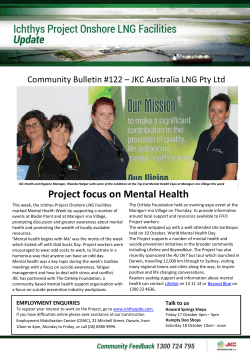


© Copyright 2026