
SWALIM Update 6th Edition May - July 2014
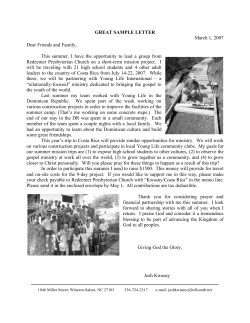
SWALIM Update
6th Edition
May - July 2014
SWALIM Completes Survey of Irrigated Agricultural Areas in
Puntland
by Simon Mumuli, Osman Abdulle & Mohammed Saeed
Few people know that Puntand has a large
number of small scale irrigated farms that
provide vegetables and fruits all year round.
These farms are located all over Puntland
wherever there is adequate amount of water to
support irrigated vegetable and fruit farming.
To gain a better understanding of the potential
of these farms and to provide the data required
to improve their production, SWALIM and the
Puntland Ministry of Agriculture and Irrigation
commissioned a survey of these farms as part
of SWALIM’s goal of maintaining up to date
comprehensive land resources information for
Puntland.
questionnaire covered a wide range of land
use and production questions including types
of fruits and vegetables grown, size of areas
grown, farming inputs used, management
of irrigation water, yields harvested and use
and marketing of farm produce. Additionally,
soil samples were collected from each farm
surveyed for detailed soil fertility analysis.
After three weeks of intensive field work, the
survey was completed successfully on 30
June 2014 with the team having covered the
175 farms sampled. The survey generated a
large dataset, which has been processed and
is currently being analysed
to characterize the farms.
The soil samples collected
are also being analysed to
provide detailed soil fertility
information. These data
– the satellite mapping,
land use characterization
and soil fertility condition
will be used to develop a
comprehensive
irrigated
farming
database
for
Puntland. This database will
be used by the Ministry of
Agriculture and Irrigation
and
its
development
partners
to
manage
and
improve
irrigated
Surveyor interviewing an irrigated date palm farmer
agriculture
in
the
region.
Inset: Hon. Abdi Ismail Boss Minister for Agriculture and
The
information
will
also
Irrigation, Puntland
be valuable to all agencies
As it was not possible to visit each and every involved in irrigated agriculture and rural
farm, the survey started with looking at the development in Puntland that work with
bigger picture by analysing high resolution community based organizations and farm
satellite images to map all irrigated farms in owners.
the region. This exercise also generated data
and statistics necessary to efficiently sample Through this survey, SWALIM has developed
representative farms to be surveyed. 175 farms the capacity of the Ministry of Agriculture and
were sampled and surveyed by a team of six Irrigation and Ministry of Environment, Wildlife
staff drawn from the Ministry of Agriculture and Tourism in land resources management
and Irrigation and the Ministry of Environment, and land use assessment. The ministry now
Wildlife and Tourism. To ensure high quality has well trained and capable staff that will
results, the ministry staff were trained on all train other staff and continue to utilize the
the tools and techniques that were used in skills gained to support the government and
the survey including land use assessment other development partners make informed
methods, soil sampling techniques and field land use and land resources management
data collection and management. The survey decisions.
In this issue
Feature: Ground Water
Monitoring in Somalia .....
Page 6
SWALIM Academic Open Days in
Somaliland........................................Page 2
Presidential Award in Somaliland for
SWALIM Trainee...............................Page 2
Drought in Somalia due to Poor Gu
Seasonal Rains.................................Page 3
Land Degradation
Monitoring.......................................Page 4
Water and Land Information Sharing
Platform (WALISP).........................Page 7
Contacts
Somalia Water and Land Information Management
(SWALIM)
OFFICE
FAO Somalia, Ngecha Road, Nairobi
+254 20 4 000 000
Email: [email protected]
Website: www.faoswalim.org
Funded by:
EDITORIAL STAFF
EDITOR IN CHIEF
EditorS Writers - Hussein Gadain
- Evelyne Karanja & David Dion
- SWALIM Staff
Photography
SWALIM Staff
Creative
Design AND LAYOUT - Evelyne Karanja
- Stephen Waswa
1
SWALIM Academic Open Days in Somaliland
by Evelyne Karanja
SWALIM held 2 open days at Mansoor
Hotel, Hargeisa on 16 and 17 June 2014.
The open days targeted the higher
learning institutions in Somaliland.
Over 200 students and lecturers from
six universities located in Hargeisa and
Borama attended this event, whose
main objective was to strengthen the
collaboration and knowledge sharing
between
SWALIM
and
academic
institutions. The faculties that were invited
were those focusing on environment,
agriculture, natural resources, engineering
and development studies. Additional
objectives were; creating awareness
and visibility for SWALIM, equipping a
demonstrations at thematic stations setup within the venue of the event . The
students also had the opportunity to hold
one on one discussions with SWALIM staff
and ask questions. In addition, lectures
were organized for the junior students
of Golis University at the university
lecture hall, which were attended by
over 100 students from various faculties
of the university that deal with natural
resources management. The lectures
focussed on two topics: Monitoring of
Water Resources in Somaliland; and
Land Degradation Assessment and
Monitoring Framework in Somaliland.
On each of the two days, the event begun
with presentations from the different
theme groups within SWALIM i.e. Water,
Land, Information Management and
Geospatial and Remote Sensing. The
students were then given the opportunity
to interact with the theme groups and
see various information and services
2
SWALIM Capacity Building
Efforts lead to a Presidential
Award in Somaliland
by Ali Ismail
SWALIM’s
capacity building programme
resulted in a Presidential Award accorded to
Mr. Ahmed Duale, the data centre manager
at the Ministry of Environment and Rural
Development. Ahmed received the award from
the Somaliland President, Ahmed Mohamed
Mohamoud Silanyo in May 2014, during
the opening ceremony of the new ministry
offices. The award was in recognition of his
hard work, dedication and commitment and
recognized him as the best staff in this ministry.
Participants at the
SWALIM Academic
Open Days
pool of candidates with the technical
knowledge and ability to use SWALIM’s
information for research and programme
and policy development in their future
job placements, in organisations focusing
on natural resources management and
demonstrating the state of Somaliland’s
natural resources, particularly the water
and land resources to Somali youth in
order to contribute to the development of
a generation that is aware of the potential
of and threats facing these resources.
Ahmed Duale receives
award from Somaliland
President Ahmed Mohamed
Mohamoud Silanyo
A meeting was also held with the faculty
deans and senior lecturers to discuss
ways in which SWALIM and academic
institutions in Somaliland can strengthen
collaboration and identify partnership
areas.
It was clear from the open days that
SWALIM is a unique source of reference
materials, providing vital primary and
secondary data for research and a strong
partner for capacity development in
Somaliland for the universities. In the past,
SWALIM’s engagement with academic
institutions has been limited to availing
SWALIM staff to lecture at the universities,
providing materials to universities and
students through liaison office and data
centers, engaging lecturers in assessments
and
workshops
and
establishing
focal points at academic institutions.
Mr. Ahmed Duale has been working in different
positions at the ministry. since 1999. He
obtained a Bachelor of Arts degree in Business
Administration from the University of Hargeisa
in Somaliland. He also holds a higher Diploma in
Modern Administration and Management from
the Cambridge University in distance learning.
Ahmed has benefitted from the SWALIM
capacity building programme where he
has acquired technical skills and knowledge
management on water and land resources.
He serves almost 30 SWALIM information and
products client requests in a month with the
clients including NGO staff, academic students,
government officials and the general public.
SWALIM supports the data centre at the ministry
by providing institutional capacity building. This
capacity building includes various trainings such
as information management, data analysis and
interpretation, map reading and GPS, Google
Earth, GIS among others as well as development
of skills in field surveys and data collection.
This presidential award is a great achievement
for SWALIM’s capacity building programme
in the Somaliland line ministries, and is also
a major success story for FAO in Somaliland.
Poor Gu seasonal rains lead to drought in Somalia
by Peris Muchiri
Somalia is experiencing drought yet again, barely three years
after the last one led to famine, causing the death of over
250,000 people in 2010/2011. The poor rainfall performance
of the Gu season (April – June 2014), the primary rainy season, is largely responsible for the current drought conditions
in some parts of the the country.
SWALIM continues to use the FAO Combined drought Index to monitor the drought conditions in the country.
You can subscribe to receive weather updates disseminated by SWALIM by sending an e-mail to [email protected]
with the words “subscribe weather updates” as the subject.
Hot and dry weather conditions persisted in most parts of Somalia from March to June 2014. High temperatures combined
with sparse rainfall caused stress to crops, livestock and water
reserves. While some areas in the North recorded within-average rains for the three months, the rainfall experienced during
this period fell within a limited period. In Gedo region, for instance, Bardheere weather station received a total of 265mm
in eight days - with half of this occurring in a single day.
In the southern and central regions, only a few areas had
rain in April and May after a late start of the Gu rains. A few
pockets show above normal rainfall performance in Middle
Shabelle, where the Jowhar and Balad stations show good
rainfall distribution. However, the Bay and Bakool agricultural
areas, which had poor rains during this season, are of major
concern. Dollow and Luuq in Gedo region had rain for only
two days during the whole season. Observations from several stations gave the number of rainy days at less than five
within each month. According to field reports, the hardest hit
areas are Mudug, Galgadud, Hiraan and upper parts of Bakool.
The northern regions saw a late start of the season with the
north-eastern areas receiving no rainfall in the month of
April. There was relief in the month of May when good rains
were recorded in many areas. The north-western parts benefited immensely from the Gu 2014 rainfall, with some stations recording normal rain levels. At the same time, however, rainfall levels in the Sool, Sannag, Bari, Nuugal and
Mudug regions in the north-east were low during the season.
Gu 2014 Rainfall Performance Map
Subscribe/Unsubscribe?
To subscribe, send a blank e-mail to [email protected] with the words “Subscribe Newsletter” as the subject.
To unsubscribe, send a blank mail to [email protected] with the word “Unsubscribe Newsletter” as the subject.
Comments?
The Editorial Staff of SWALIM Update invites letters, comments and opinions from readers.
Kindly address your comments to:
The Editor,
SWALIM Update,
Ngecha Rd, Lake View.
P. O .Box 30470-00100, Nairobi Kenya
Tel: +254 (0) 204000300
Fax: +254 (0)204000300
E-mail: [email protected]
3
SWALIM Establishes Land Degradation Monitoring Systems in Somaliland
by Simon Mumuli
In a meeting held in Hargeisa at the beginning of May this
year, government ministers were asked to identify key development issues in food security and nutrition. As each of
the ministers took their turn to speak, it came as a surprise
to many of the participants that these senior government officers frequently identified land degradation as one of the key
issues affecting food security and nutrition in the region.
Somaliland Minister for Environment
and Rural Development,
Hon. Shukri Haji Ismail,
the field survey team and SWALIM
team
Land degradation sets-in very gradually and in many cases
without warning until it is too late. Fortunately for Somaliland, it is clear that the government and development agencies have identified land degradation as a major development
concern that needs urgent attention. It is also clear that action
is required now, especially considering that the problem will
be aggravated by climate change.
To provide a basis for addressing land degradation, SWALIM
and the Somaliland Ministry of Environment and Rural Development have established a pilot land degradation monitoring
system. The system is built on extensive land degradation assessments that SWALIM carried out in the region in 2006.
SWALIM has been building the capacity of the Ministry of
Environment and Rural Development who will run the land
degradation system. The first training covering tools and techniques for monitoring water, soil and vegetation degradation
4
was organized in Hargeisa from 6 to 12 May 2014 and was
officially opened by the Minister for Environment and Rural
Development Hon. Mrs. Shukri Haji Ismail Mohamed. Addressing the trainees, the minister emphasized that such training
sessions should be made continuous. The minister thanked
SWALIM for the support it had given to the ministry in the
past and the present. The minister also pointed out that the
training that is immediately followed by field data collection activity would help build capacity of
the ministry in the field of land resources data collection. Following
the training, the team of six monitors commenced the first round
of monitoring between 29 and 12
June 2014 at 60 benchmark sites.
Monitoring was completed successfully and the data collected
is currently being analyzed. The
data, which includes density and
cover of mangroves and other
trees, soil fertility, gully, rill and
sheet erosion and herbaceous
biomass will provide the baseline
for the monitoring system.
Once finalized, the land degradation monitoring system will provide information on the “state of
the land” and a database that will
provide the capacity to analyze land degradation trends in Somaliland. Additionally, the system will keep track of good land
husbandry and land rehabilitation efforts that have shown
positive impacts on the land and its productivity and that can
be up-scaled and transferred to other similar environmental
and livelihood contexts.
To expand the capacity of the ministry, a second training on
data processing, analysis and dissemination is planned for
August and September 2014. In all land degradation activities, the environment ministry has been collaborating with
the Ministry of Agriculture since land degradation equally
affects agricultural activities. After the completion of the second training, the team will have capacity to manage the land
degradation monitoring system, train other staff, support the
government and development partners in the use of the data
generated by the system and design and implement interventions to address pressing land degradation problems in Somaliland.
by Flavian Muthusi
Feature: Groundwater Monitoring in Somalia
Groundwater is the main water source in Somalia, as the country
has limited surface water resources. The Juba and Shabelle Rivers
in the south are the only perennial rivers in a country that has a
predominately arid and semi arid climate. Domestic, livestock
and agricultural water needs are met mostly from groundwater
resources, hence the importance of a good ground monitoring
system in the country to effectively plan and utilize this vital
resource. Building such a system is however a big task which
requires huge financial and time resources to accomplish.
SWALIM has over the years supported the establishment of a
groundwater monitoring system for Somalia by developing
tools and building capacity within the Somali water authorities
and WASH partners. This investment started in 2006 with
the development of the Somali Water Sources Information
Management System (SWIMS) to standardize point water sources
data collection and management across the agencies involved
in the water sector. Using this tool, the water sources data from
different agencies was consolidated into one national database.
This database was updated in a country wide water sources
inventory in 2008 and 2009 that surveyed over 2,250 strategic
sources, mainly boreholes, shallow wells and springs. This survey
covered many parameters including sources yield, usage and
water quality and formed the baseline data for the ground water
monitoring system.
In 2012, SWALIM built on existing information to investigate the
potential groundwater aquifers in Somaliland and Puntland.
Hydrogeology data was collected and added to the SWIMS
database and geophysics surveys were carried out at selected
sites to understand the underlying formations with respect to
water availability. From this study, a regional hydrogeology map
at a scale of 1:750,000 was developed. Four areas of interest
were identified in consultation with the government and water
authorities and detailed investigations carried out, facilitating
production of detailed hydrogeology maps at a scale of 1:250,000.
These products have become instrumental in guiding the
selection of areas for detailed investigations before drilling.
In 2013, SWALIM started installing divers to monitor aquifer water
levels and temperature to further improve the ground water
monitoring system. So far, eight divers have been installed in four
locations in Somaliland (Hargeisa, Burco, Borama and Berbera)
Diver data download
by Ministry of Water
Resources staff
and four locations in Puntland (Garowe, Galckayo, Qardho and
Bosaso). This expansion has been carried out in collaboration
with government water authorities and water utility companies
in the two regions. The divers record aquifer water level and
temperature four times a day. The data is periodically downloaded
by the Ministry of Water Resources in Somaliland and PSAWEN
in Puntland and analysed to support ground water resource
management.
Burco aquifer water level – Sep 2013 to Apr 2014
The current manual data download from the eight divers is costly
considering the spatial distribution of the sites. However, with
advances in technology, SWALIM has recently received a test
diver from SUTRON that allows automatic transmission of data via
satellite. The test diver was installed in Garowe in April 2014 and
transmits data every 12 hours to an online server. Once the testing
is satisfactory, more of these automatic divers will be installed to
cut running costs.
A comprehensive ground water monitoring system should
include water quality monitoring. SWALIM has been supporting
water quality testing and monitoring systems at the Ministry of
Water Resources in Somaliland and PSAWEN in Puntland through
trainings and provision of water quality testing kits and chemical
reagents. Additionally, water samples have been sent periodically
to Nairobi for detailed water quality tests.
The long term sustainability of the monitoring systems
established by SWALIM depends on capacity of the water
authorities to operate and maintain them. Capacity building for
the Ministry of Water (Somaliland) and PSAWEN (Puntland) staff
has been going on through regular trainings, including on the job
training in the installations, data download, processing, analysis
and dissemination. The capacity building will continue until the
systems are fully operated and maintained by the Somali water
authorities and a local water testing facility is established.
The ground water monitoring system that SWALIM has established
should be expanded to cover the entire country and supported
with resources to allow regular monitoring. This requires
involvement of stakeholders since Somali government authorities
cannot raise all the resources required to maintain such a system.
5
Monitoring Land Degradation Control In Puntland
by Anthoni Ndubi & Julie Maingi
The environmental conditions in Puntland are deteriorating
at a fast pace. Deforestation due to unregulated grazing
and charcoal production has led to massive and possibly
irreversible degradation of grazing lands in a region where
the majority of the population depend on livestock for their
livelihoods. To improve the state of natural resources, external
intervention to control land degradation is essential. There
is a need for baseline information on the state of natural
resources in Puntland as a starting point for monitoring
the interventions aimed at rehabilitating and restoring
degraded lands. Recognizing this need, the European Union
has allocated funds towards the MDG Initiative for Somalia:
Reducing hunger and food insecurity in Puntland region
through improved and sustainable use of rangeland resources,
currently being carried out by ADESO, an African charity and
development agency and CARE, the private international
child welfare organization. SWALIM was tasked to monitor
the interventions to be put in place as a check to expansion of
gullies and other land degradation types.
Mudug, Bari, Sanaag, Nugaal and Sool Regions of Puntland.
118 of these 169 sites were selected by ADESO and 51 by
CARE for interventions to control land degradation and follow
up with monitoring and impact assessments.
SWALIM has created a baseline to be used for monitoring
rehabilitation of degraded lands in project target areas.
This will involve monitoring the state of natural resource
management by conducting land cover change analyses
through remote sensing. The monitoring looks specifically at
the reduction of bare land, the slowing of gullies expansion
and the expansion of vegetation cover.
Gully erosion at Hingood Sare
site, Qardho District, Bari Region
(December 2013) as seen from a
satellite image
A preliminary analysis of very high resolution satellite images
was performed for the hot spots to show the status of land
degradation and differentiate land degradation types,
including “gully erosion”, “sheet erosion” and “rangeland
degradation”. It also showed any land management initiatives
that already exist.
Based on visual image interpretation, 48% of the sites picked
for assessment had sheet erosion, 41% had a combination of
sheet and gully erosion, 5% had gully erosion only, 4% had
a combination of sheet erosion and rangeland degradation,
1% had only rangeland degradation, and just 1% had a
combination of sheet erosion, gully erosion and rangeland
degradation.
Map showing CARE and Adeso Land degradation
intervention locations
SWALIM has contributed to this effort by conducting training
for line ministry, ADESO and CARE staff on how to collect
field data on land degradation. These training sessions
were followed by practical field work campaigns. Initial
field assessments performed by ADESO and CARE (with the
support of SWALIM during the field work) led to the selection
of 169 hot spots, with project target areas clearly identified in
6
Once the interventions to control land degradation have been
carried out, impact assessments will be conducted by SWALIM
using a combination of satellite remote sensing and field visits
for those areas that are accessible.
This monitoring activity links to one of the outputs of the
fifth phase of the SWALIM project: establishment of a land
degradation monitoring system covering all types of land
degradation in Puntland.
The Water and Land Intervention Information Sharing Platform
(WALISP)
by Margaret Mugo
Over the years, many projects and programmes supporting
sound land and water management have been developed
in Somalia, boosting the productive infrastructure in recent
years. However, many successful infrastructure rehabilitation
interventions - often involving “cash for work” mechanisms
- are limited in their scope and geographic coverage, are
not well documented, and are rarely known, as the scant
information relating to them is not widely disseminated.
The need to share information on these interventions gave
rise to the development of the Water and Land Intervention
Information Sharing Platform (WALISP). This is in line with
SWALIM Phase V activities which seek to ensure enhanced
access to information. In order to help visualize the
interventions undertaken by FAO-financed implementing
partners on water and land resources, this internet-based
platform shows information on a static map interface. In
addition to the maps, users will be able to access photos
of the infrastructure site taken before, during and
after rehabilitation, as well as query the data and filter
for implementing partners, cash-based intervention
phases and infrastructure types such as catchments,
feeder roads and canals. By bringing together this
previously inaccessible data, the system will also
facilitate, inter-agency harmonization efforts on land
and water projects such as gully erosion control and
rangeland conservation, among others. All data will be
available as downloadable excel files and maps.
The information sharing platform is expected to
influence as well as enable informed actions and
decisions, a need that cannot be underestimated.
The initiative will not only focus on compiling,
archiving, querying and sharing information on past
interventions, but also on building the capacity of
partners and counterparts to use the information
available in the system to support policy makers,
researchers, development organisations and other
relevant stakeholders.
SWALIM Digital Document Repository
(SDDR) Updates
Snapshot of WALISP
Did You Know?
* SWALIM information is available free of charge provided that
you are acknowledge as the source when the information is
used.
* SWALIM products and services copyright is held by FAO on
behalf of the Somali government. Some products such as high
resolution satellite imagery have commercial copyright and use
restriction as extended by the providers.
* You can follow us on Facebook - “Somalia Water and Land
Information Management (SWALIM)” and Twitter - @FAOSWALIM
SDDR has been updated with the following
data for the period April to June 2014:
Time-series
* Water sources data from January 2014
survey
* Climate data from automatic weather
stations
* Rainfall data from manual stations
* River levels and discharge data
* Synoptic stations data
Maps
* Land degradation hotspots in Puntland
* Land degradation intervention types
* Gu Performance 2014
7
GIS training participants
in Garowe
Practical field GIS training
in Garowe
SWALIM Training Continues to Attract Wide Audiences
by James Ngochoch
With a comprehensive training schedule planned throughout
Phase V of SWALIM, capacity building activities have been taking
place every month of this year. A clear indicator of the need for
capacity building can be seen in the increasing demand and
number of participants as well as field application of the taught
subjects.
Trainings on GPS, Google Earth, Basic GIS and map reading attracted
an audience of 30 trainees in both Somaliland and Puntland, from
a variety of stakeholders. The training held in May in Garowe saw
participants from 8 partner agencies (PSAWEN, HADMA, CARE,
ADESO, VSFG, EAU, ADRA and OCHA), 2 line ministries (MoEWT,
MoAI) and FAO office staff. Participants at a similar training held
in June in Hargeisa were drawn from 2 academic institutions
(UOH and Gollis University), 4 line ministries (MoA, MNDP, MoERD
and MoWR), partner agency (NERAD) as well as FAO Hargeisa
office. The maximum capacity per session for these courses is 30
trainees due to the hands-on and practical nature of the training
that necessitates one-on-one interaction between the trainer and
trainees.
The trainings undertaken by SWALIM follow a Training of Trainers
(TOT) approach. The training participants, are trained with a view to
not only imparting practical skills that can be used in their jobs but
also to empower them with skills to train others in the same areas.
This TOT approach has also begun to show success, for example, in
June, Abdikani Yusuf the Meteorology Officer from MoA, & Abdinasir
Ibrahim the Data Centre Officer from MOWR undertook a 5-day
mission to provide training to the Burco meteorological station
observation staff and to repair the Erigavo Automatic weather
station. The capacity to conduct the training and to diagnose and
resolve problems with the weather monitoring equipment are a
result of the training they have received from SWALIM.
Our information desk continues to receive requests for trainings
with the highest demand coming from partner agencies,
government institutions and academia from Mogadishu, Hargeisa,
Garowe and Nairobi. Training is planned for Nairobi targeting
partner agencies involved in field data collection exercises. To
register your interest in these trainings, send an email to swalim@
fao.org or visit our website for updates: http://www.faoswalim.org/
Training Timetable
September- December 2014
Course
Date
Land Degradation Data Analysis
Remote Sensing for Land Resources
Assessment and Mapping
Google Earth, GPS and Basic GIS course
Rainfall Data Collection
September 2014 Hargeisa
Weather Observation
Water Sources Live Map
Drought Monitoring
8
Location
September 2014 Hargeisa & Garowe
September 2014 Nairobi
September 2014 Dollow
Hargeisa, Garowe
October 2014
& Mogadishu
Hargeisa, Garowe
October 2014
& Nairobi
November 2014 Garowe & Hargeisa


© Copyright 2026