
A STUDY ON CBM AND RESOURCE USE
A STUDY ON CBM AND RESOURCE USE PATTERN OF TRIBAL OF GUDIPADA IN SEMELPADAR VILLAGE 2007 Nihar Dash 15 Sahid Nagar, Vasundhara Bhubaneswar CONTENTS Chapters Particulars Page 1. Introduction 1-33 2. Review of Literature 34-36 3. Research Methodology 37-41 4. Result & Discussion 42-71 5. Summary & Conclusion 72-74 6. Appendix 1-9 1 Chapter-1 INTRODUCTION Rich biodiversity is an indicator of the health of a particular habitat and its potential to sustain life. During the past few centuries biodiversity has come under tremendous pressure not only due to shifting of developmental paradigm but also due to the control over the resources from local to global. Probably due to this we have lost many species of flora and fauna and now many species are on the verge of extinction. According to the recent Red List data, in 2004 the number of plant species that has been evaluated was 11,824, out of which 5328 species were under the category of threatened during 1996-98 and in 2004 this number has reached to 8321, which means in an average 438 plant species have been added each year under the threatened category. And loss of each species has direct implications on the sustainability of the planet. India’s biological diversity is one of the most significant in the world. About 45,000 species of wild plants and over 77000 species of wild animals have so far been recorded, together comprising 6.5% of the world’s known wildlife. However, many plant species all over the world are on verge of extinction and the rate of extinction of plant species in India is perhaps highest in the world. For example about 150 species, which were collected 100 years ago, have not been spotted in the recent past. Conservation is a means, which tells about the management of the natural resources of the earth, taking into consideration their proper use, preservation and protection from destructive influences and misuse. Conservation of Bio-diversity and Wildlife is an essential part of environment. By conservation, we do not mean merely preservation, but the utilization of renewable natural resources in such a way that they are not allowed to destroy but are to be used in a more sustainable manner. 2 Over a period of time various policies like Wildlife Protection Act 1972 (amended 2002), Environmental Protection Act 1986 and Biological Diversity Act 2003 have been enacted to preserve and conserve the Bio-diversity. However, when one observes the ground realities, the spirit of the policies and its process of implementation do not compliment. The premises of the policies have certain lacunas like the exclusion of the human habitation from the Protected Area, the idea that co-existence of human and flora and fauna is impossible, eye washing the Conservation policy where commercial interest is concerned etc., This not only creates disparity between the human and the wildlife but cause a huge blow to the traditional culture of the indigenous group which is on the brink of extinction. “Does the Conservation Policy really conserve bio-diversity?” 1. Is wildlife and biodiversity conservation possible without conserving forest dwellers and their livelihoods”? 2. “Are the human being not part of eco-system?” 3. “Is present attitude and approach of policy makers especially the politicians and bureaucrats conserving the wildlife and biodiversity?” 4. “Is co-existence between people and animal possible?” 5. “Is existing laws par with the International Treaties signed/promised by the Government of India?” These few questions arise from the nature Conservation of Wildlife and biodiversity. The legislation and the policy makers assumes that people and Wildlife don’t co-exist and that the only way fragile ecosystems can be kept intact is by keeping people out of them. This ideology is largely borrowed from the western conservation, which itself is based on the separation between humans and nature originating in Christian percepts of stewardship. Like many of the ideological constructs borrowed by India’s ruling elite from the West, it also ignores the practical realities of the forested regions of India, where millions of people have lived in harmony with nature for millennia’s, and the syncretism traditions of 3 Hinduism and Buddhism, which treat human beings as just a part of NATURE (“prakruti”). The dominant conservation ideology and policies ignore that millions of advasis have been traditionally living in the forest and depend extensively on the natural resources for their livelihood. At least 3.5 million people are living inside the Protected Areas. According to a study carried out in the mid 80’s by the Indian Institute of Public Administration, around 69% of the PA’s are inhabited by people. Most of them have lived in these areas before their notification as protected areas. As per the laws and policies of conservation, all these people don’t belong to Protected Areas before their notification as protected areas and therefore must be displaced. The laws also impose strict restrictions on their basic livelihood needs such as forest product collection, grazing etc. Creation of protected areas is done without any democratic consultation or participation by local people and thereafter-strict restriction are imposed without any compensation. This has generated resentment and antagonism towards the very concept of conservation amongst the local forest dweller, and has created major conflicts in and around protected areas. What is protected area (PA)? A Protected Area is defined by the convention on biodiversity as a geographically defined area, which is designated, or regulated and managed to achieve specific conservation objectives. The first section of the National Wildlife Action Plan (NWAP) says – the establishment of network of PAs such as National Parks [NPs] and Sanctuaries [WLS] and the Biosphere Reserves [BRs] to cover representative samples of all major life ecosystems and with adequate geographic distribution. It is clear therefore that the Protected Area may be legally established National Park or Wild life Sanctuary under the provisions of 4 Wildlife (Protection) Act, 1972. Objectives: To protect nature and maintain natural resources in an undisturbed area in order to have ecologically representative examples of natural environment for scientific study, environmental monitoring education and maintenance of genetic resources in a dynamic and evolutionary state. There are two sub categories 1. PAs managed for scientific research and monitoring 2. PAs managed mainly for wilderness protection, subsistenance and recreation How PAs Contribute to Human Activities? 1. Conserve soil and water in zones that are potentially highly erosive if the original vegetation is removed, notably the steep slopes of the upper catchments; 2. Regulate and purify water flow, notably by protecting wetlands and forests; 3. Protect people from natural disasters, such as flood and storm surges, notable by protecting watershed forests, riverain wetlands, coral reefs and other coastal wetlands; 4. Support important natural vegetation on soils and inherently low productivity that would yield of human communities if transformed; 5. Provide for the maintenance of wild genetic resources or of species important in medicine; 6. Protect species and population that are highly sensitive to human disturbance; 7. Maintain species that enhance the attractiveness of the landscape or the vitality of the PAs; and 8. Provide habitat that is critical to harvested, migratory or threatened species for breeding, feeding or nesting. 5 National Park Objectives: To protect outstanding natural and scenic areas of national or international significance for scientific, educational and recreational use. These are relatively large areas not materially altered by the human activity and where extractive resource uses are not allowed. Habitat/Species Management Area Objectives: To assure the natural conditions necessary to protect nationally significant species, groups of species biotic communities or physical features of the environment where these may require specific human manipulation for their perpetuation. Controlled harvesting of some resources may be permitted. It is new category so these PAs is to be established. Managed resource Protected Area Objectives: A new category designed to include areas that ensure long-term protection and maintenance of biodiversity while providing a sustainable flow of natural products and services to meet community needs. They are intended to be relatively large and predominantly unmodified natural systems where traditional and sustainable resources are encouraged. Legal steps for Establishment of Protected Areas in India The present Wildlife (Protection) Act, 1972 not only specifies the procedures to be followed in setting up National Parks [NPs], Wild life sanctuaries [WLS] but also specifies the management parameters by indicating the sort of activities that are allowed or forbidden in the PAs. NPs are given higher level of protection; no grazing is permitted under Section 3.5.6 of the Act. Moreover no private landholding or right is allowed within a NP. WLS are accorded a lesser level of protection e.g. grazing is allowed in these types of PAs and certain activities might be permitted under Section 29 (i) and Section 33 of the Act. The provision of Section 29 has been made for a wildlife sanctuary 6 to prohibit any type of exploitation, destruction or removal of wildlife similar to the provisions of the Section 3.5.6 for a NP. The procedure specified in the Act for the setting up of NPs and WLSs have the following broad objectives: i) To identify the extent and boundary of the PA [NP or WLS] ii) To determine rights, if any, that exists within such an area [Section 19] iii) In case of existing right, to either compensate the owner of such right if the owner is cooperative; or to acquire the land or right, if the owner is not willing voluntarily to accept compensation [Section 24] iv) To allow the continuation of those activities which are considered acceptable [Section 24.2 (c)] v) To provide alternatives to public way, or a common pasture, as far as may be practicable or convenient [Section 25.1 (f)] BROAD ISSUES IN PROTECTED AREAS IN ORISSA The major issues are as follows: • Management deficiencies in conservation approach. The sanctuaries and National Park do not have separate management plans and there is no detailed guideline available for the preparation of the plans. Every Protected Area has its own situation specific problems, which have to be tackled independently, and hence independent management plans are required. • Lack of holistic approach in Wildlife Management. The present conservation paradigm is borrowed from the Western Concept, which ignores the involvement of the local people, the primary stakeholders, in the management process. Exclusionary principle of conservation sidelines the local people from the conservation scenario, further imposing the cost of conservation on the weakest section of the society who cannot afford it. 7 • The Management system also neglects the potential of the local people in conservation. Local people are good source of traditional knowledge, developed through human nature interfaces over thousands of years. Therefore consideration of human face of wildlife management is very important. • Related laws and policies are conflicting and contradictory to each other, effectively exiling people within the Protected Areas from civilization and debarring them from their basic and fundamental rights. • Mainly legal issues are emerging from rights, control and access over the resources. Our wildlife laws and policies limit the access of the local people over the resources, which create major conflict. The local people living within the PAs critically depend on the natural resources for their sustenance. But our conservation policy considers the local people as threat therefore restricts the access of the local people over the resources. It completely ignores the social aspect of natural resource management thus converting the potential allies into poachers causing depletion of the resources, which are not only affecting humans but also our conservation goals. • The Wildlife (Amendment) Act, 1991 allowed for continuance of rights inside the sanctuaries. But WLP (Amendment) Act, 2002 made such rights less possible by prohibiting all activities that are not ‘beneficial’ to wild life (including those that may be neutral in their impact), by committing state governments to provide alternatives for all rights as soon as intention was declared to notify a sanctuary, and by prohibiting any commercial activity. • The order of Supreme Court dated 14.02.2000 in I.A 548 in W.P 202 of 1995 further restricted the access over the resources by imposing a ban even on the collection of NTFP. Such a blanket order of the Supreme Court has led to the loss of traditional livelihood and the forest dwelling communities including tribal residing within the Protected Areas is facing large-scale hardship. The order has led to the closure of KL phadis inside many Protected Areas, which has adversely affected the livelihoods of the local people. Bamboo harvesting has also been stopped. Stopping of bamboo cutting will not only adversely affect the growth of the new culms due to over 8 congestion ultimately leading to the death of the forest but it has also snatched away means of livelihood for thousands of people. Without carrying out any research on the impact of the NTFP collection within the PAs, on what basis can such laws and orders be implemented? • The Hon’ble Supreme Court in Pradeep Kishen vs. State of Madhya Pradesh case has emphasized the need to protect the forest as well as the livelihood of the communities dependent on such forests. In the instant case, the Hon’ble Supreme Court upheld the order of issued by the state of Madhya Pradesh permitting collection of Kendu leaves from the sanctuaries and National Parks by the villagers living in and around the sanctuaries and the national parks, in view of the fact that since final notification under Section 26 A and 35 is yet to be issued as rights are yet to be settled. The Hon’ble Court held that the State Govt. (M.P) was not in the position to bar the entry of the villagers living in and around the sanctuaries and national parks so long as their rights were not acquired and final notification is issued. If the state of Madhya Pradesh can move to the court with its plea and succeed in getting a positive response from the Hon’ble Court, then why has such an action not been initiated by the Orissa State Govt. till now? • Non- recognition of the customary uses. Most of the customary uses of the local inhabitants on forests (including other natural resources like water) have not been codified or recorded in any record of rights. Declaration of the Protected Areas with restrictions on the entry and forest produce collection means that livelihoods of the poor and resource dependent are taken away without compensation or alternatives. • The Wildlife laws and policies provide that the people living in and around the Protected Area can collect and remove the forest produces, but only to meet their ‘bonafide needs’. The problem is that the law does not define what bonafide needs means. The matter would have been simple to interpret if the definition of ‘commercial collection’ and ‘personal bonafide use’ would have been defined in the Wildlife Protection Act, 1972. 9 • Issues pertaining to right settlement in the Protected Areas. In context of Orissa, most of the sanctuaries are located in the remote tribal areas where only one round of settlement has taken place. There are no. of villages inside the PAs which have not been surveyed and hence not regularized. The Forest Department treats these villages as encroachers, whereas records exist that these tribal settlements are very old and never been surveyed. As per the WPA, 1972, these villagers are not entitled to any sort of compensation and neither are people who have been cultivating land not regularized in their names (and which should have been recorded in their names as per the existing law). People have not yet got patta for the land that they have been cultivating since ages. Since proper survey and settlement process has not been done before the declaration of the sanctuary hence many people are deprived of the compensatory package and benefits of the Govt. schemes. • Non-recognition of rights over land in the Survey and Settlement. This applies mainly to the practice of shifting cultivation. As the shifting cultivation land has been settled as Govt. land, declaration of sanctuaries means that a large no. Of tribal who depend upon shifting cultivation in sanctuary areas are summarily evicted, creating major conflicts and misery. (Kotgarh, Karlapat, Sunabeda and Lakhari sanctuaries.) • Lack of final settlement of claims. In most Protected Areas in Orissa the settlement of claims and rights as laid down in Section 19- 26 A of Wildlife Act of 1972 has not taken place. Only one PA has been finally notified. How can the Wildlife Administration curtail the rights of the people living within the PAs even without the completion of the proceedings of determination and acquisition of rights [Section 25A of Wildlife Amendment Act, 2002] • Non-conversion of Forest villages within the PAs into Revenue villages has deprived the inhabitants from the Govt. programmes and schemes. The proposals of conversion of forest villages into revenue villages are still lying with the GOI. But on 13.11.2000 and 9.2.2004 the Hon’ble Supreme Court has passed interim orders regarding no dereservation of forest/Sanctuaries/National Parks shall be effected, therefore it is very difficult to convert these villages into revenue villages. In the present scenario the 10 Govt. and the administration has to take up seriously the issue of the forest villages because the people staying here have already lost their livelihood because of the Supreme Court order, further they are also debarred from any Govt. schemes and facilities. How is life possible under such circumstances? • Restriction on mobility and access to basic services. Restriction on the entry into the Protected Areas immediately comes into effect with the declaration of intention to create a PA [Section 27 of the Wildlife Protection (Amendment) Act 2002]. This further strengthens the control of the authorities over the local residents. Such stringent policy deprives the people from their basic rights, which a violation of the fundamental right and is a grave concern. • Increasing Man Animal conflict is also one of the major issues. The man-animal interface has grown in recent years in Orissa particularly in respect of wild elephants and bear. The loss of corridors and migratory routes of long ranging animals like elephant is the major cause of increasing man elephant conflicts in Orissa. • Increasing developmental projects like mining, big dams etc are emerging around the Protected Areas. These destructive developmental projects, like mining, are not only seriously impacting the conservation scenario by negatively affecting the ecosystem but also shrinking the Protected Areas into islands of conservation by destroying the rich biodiversity and natural habitat of important species outside the PAs. Legal Issues Conflicts between laws: There are contradictory provisions regarding rights amongst the various laws. The stringency of the Wildlife (Protection) Act, 1972 for instance is countermanded by the Panchayati Raj Act, 1998 and Panchayat (Extension of Scheduled Areas) Act, 1996 which grants the local communities ‘ownership’ rights as opposed to the usual usufruct rights, which is access and the right to use natural resources in notified areas. The Panchayati Raj Act, 1998 and the Panchayat (Extension of Scheduled Areas) Act, 1996 read together with the 73rd Amendment and the JFM order, have special significance for the natural resources rights of tribal communities and particularly for 11 states like Madhya Pradesh. This poses a conflicting picture vis-à-vis forest and wildlife laws. Mainly legal issues are emerging from rights, control and access over resources. Our wildlife laws and policies limit the access of local people over resources, which create major conflict. Humans inhabit around 60% of India’s PAs. Almost 4 million people inside India’s protected areas most of them belonging to families that have lived in these areas before the protected areas were notified. All these people are dependent on local resources for fulfillment of basic needs. All the people living inside protected areas and in regions adjacent to the protected areas are dependent on local resources for fuel, fodder, medicines, non-timber forest produce, fish and other aquatic produce, livelihoods, water, cultural sustenance, and myriad other critical resources. In many cases collection of non-timber forest produce contributes to more than 50% of each household’s earnings; more importantly, up-to 100% of the daily requirements of such families comes from forest or aquatic produce. Thus these people are primary stakeholders of Protected Area Management. But they are neither considered Protected Area Management nor are their basic needs dealt. Local people are closely linked with resources so they have great potential in wildlife conservation. But in our conservation approach local people are always considered as threat to conservation therefore restricts access of local people over resources, it is completely ignoring the social aspect of natural resource management, and excluding human from nature. Thus converts potential allies into poachers causing depletion of resources, which are not only affecting humans but also our conservation goal. Many times due to improper survey and settlement processes these villagers are considered as encroachers. Many times conflict between forest official and local people arises due to restriction on accesses to the resources, which were enjoyed from hundreds of years. But situations differs from location to location, it depends upon various factors. Various tribes are becoming accustomed with modern forces of globalization. But 12 Various PTGs are still maintaining their relations with nature, as these were century before. In comparison with other nations, wildlife laws in India are considered among the ‘progressive’ in the world, but they have failed to stop the drain of nature. The assumption at the governmental level and among many urban wildlife conservationists is that the presence of humans and their usufruct relation with the forest is contributing to the degradation of the environment. Some concede reluctantly that though historically ‘eco-system’ people had a ‘symbiotic’ relationship with nature but presently their population has increased, as have their cattle and goats that graze the downy undergrowth in competition with the herbivorous ungulates of the wilds. Political and financial reasons, inertia and ground realities have so far prevented the government from taking any action towards permanently disassociating these people from their natural surrounds. Additionally, there is mounting pressure from the affected people themselves with the support of select community based social organizations. The role of the state as landlord or estate owner created a dual problem. On the one hand, it imposed the British legal system on an ethnocentric legal order based on customary usage and norms and guided by ecological parameters. On the other, it paved the way for a western model of conservation inherently established on the duality of man and nature. The areas of conflict are wide and they range from the alienation of forest dwelling and dependent communities from the state and urban conservationists/wild lifers, the abrogation of the customary rights of these communities, including the spectra of displacement to the alleged harassment of the local people by officials of the forest department. There are rumors of forced evictions, loss of livelihood, lack of effective rehabilitation and compensation. 13 Forest rights act 2006: Issues pertaining to Right Settlement in Protected Areas As per the Act, once the Government decides to create a sanctuary in an area, it issues a notification of intention of the same (section 18), appoints a Collector to determine rights and carry out inquiry with the power to exclude rights bearing land from sanctuary boundary/ acquire the land under Land Acquisition Act, 1894/ allow continuation of rights in consultation with Chief Wildlife Warden (section 24). A process of time bound serving of notice, submission of claim by affected persons, inquiry into the submissions and acquisition of rights has been laid out in the Act. Same provisions (section 19-26A) apply for declaration of National Parks. Thus the law provides power for acquisition or commutation of rights within the area intended to declare as sanctuary or National parks. The argument put forward for such appropriation of land and resources was the extension of eminent domain, the authority or power of the state to acquire the property belonging to individuals for reasons of public interest, provided due compensation was paid to the former proprietors and rights holders. It is clearly proved that a change in sovereignty does not imply the extinguishing of the right to domicile or other existing customary rights enjoyed by the local communities concerning access and use of forest resources. Certain assumptions lie beneath the process of acquisition of rights. One of the important one is that the rights in the area to be declared are already formally recognized i.e. legal instruments and records exist of the rights of people in the area, both over land and other natural resources. These formal rights include ownership over land (provided by Survey and Settlements), Nistar Rights over forest products, right of way etc. It is assumed that the state of formal rights represents justly the up to date situation of rights over natural resources in the area. However, given the ground level situation in tribal areas of Orissa, this assumption turns out be deficient and problematic in many ways. These deficiencies lead to a perversion of the principles of natural justice and equity, drastically affect the weakest sections of 14 society i.e. Tribal communities including PTGs having constitutional protection, and in many case contravention of the rights to life. Forest Right Act 2006 recognizes the Tribal Rights: An act to recognize and vest the forest rights and occupation in land in forest dwelling Schedule Tribes and other traditional Forest Dwellers who have been residing in such forest for generations but whose rights could not be recorded; to provide for frame work for recording the forest right so vested and the nature of evidence required for such recognition and vesting in respect of forest land. So this Act is implemented to recognize the tribal rights, which includes the: • Responsibilities and authority for sustainable use • Conservation of Bio-diversity • Maintenance of ecological balance and thereby strengthening the conservation regime of the forests while ensuring livelihood and food security of the tribal. Forest Right Act and its Brief History For the purpose of this Act the forest rights that vested by the forest dwelling scheduled tribes and other traditional forest dwellers. The rights include: Right to Occupation With regards to the occupation the act refers that family may consist off a nuclear family and their minor children and may include any person wholly or substantially dependent on the family. But in case of land under occupation, the tribal have right to hold and live in the forestland under the individual or common occupation for habitation or for selfcultivation for livelihood by the forest dwelling scheduled tribes, which actually may be recognized and vested with the community up to maximum 4 hectares. Community right such as Nistar This right is recognized in different status by the various names (Zamindary or such intermediary regimes) shall be considered for bonafide livelihood needs. 15 Right to minor forest produce This act shall include rights of ownership, access to collect; use and dispose of minor forest produce (all non-timber forest produce of plant origin including bamboo, brush wood, stumps, cane, tussar, cocoons, honey, wax, lac, tehdu or kendu leaves, medicinal plants and herbs, roots, tubers etc.) which has been traditionally collected within or outside the village boundaries. Rights to other community rights and entitlement The community which has been traditionally using water bodies shall have the right over the fishing and other products of such water bodies while ensuring its sustainable use, grazing (both settled and transhumant) and traditionally seasonal resources access of nomadic or pastoralist communities. Right to community tenure of habitat and habitation The habitat for Primitive Tribal Groups (PTG) and Pre-agricultural communities shall have the some inclusive meaning as communities’ forest resource and in particular, noncontiguity and non-exclusiveness. Rights over Disputed Lands It shall include rights in lands in “Deemed Reserve Forest” or forestlands where the process of forest settlement has been incomplete in any manner including in correct records or non-adherence to due process of laws. Rights for conservation of pattas, leases and grants Rights for conservation of pattas or leases or grants issued by any local authority or any state government on forestlands or pattas in forest villages and pattas issued by cancelled or extinguished without following the due process of laws. Rights to conversion of forest villages and unrecorded settlements into revenue villages In case of rights to conversion of a forest village in to a Revenue village the act has to take into consideration of some eligible criteria – the land granted to dweller of revenue village created out of forest villages or such settlements shall be sustainable used for 16 bonafide livelihood needs and shall not be put to ecologically damaging commercial use in any farm. Right to protect, regenerate, conserve or manage community forest resources Right to protect, regenerate, conserves or manages community forest resource which they have been traditionally protecting and conserving for sustainable use. Rights in autonomous District councils and Regional councils Rights which are recognized under any state law or laws of any autonomous District councils or autonomous regional council or which act accepted as rights of tribal under any traditional or customary law of the concerned tribes of any state. Right to intellectual property and Bio-diversity This rights shall include rights to regulate, access, control, develop and protect traditional science and technology associated with bio-diversity resources including genetic resources, seeds, medicines, health practices, medical plants, agriculture, knowledge of fauna and flora, minerals and other IK system and practices Right to in-situ rehabilitation This right includes alternative land in case where the ST and other traditional forest dwellers have been eligible evident or displaced form forestland of any description without receiving their legal entitlement to rehabilitation. Any other traditional rights Any other traditional rights customarily enjoyed by the forest dwelling ST or other traditional forest dwellers, as the case may be, which are not mentioned, but excluding the traditional right of hunting or trapping or extracting a part of the body of any species of wild animals. Features of Forest Right Act and Conservation After enforcement of the Forest Right Act it can help to aware the tribal and other forest dwellers for their duties, responsibilities, and rights towards the forest. This act has certain features, which are: 17 • To aware the responsibilities and authority of the tribal inhabitants for the sustainable use of minor forest produce, so that it can never be affected the ecological balance. • To conserve the bio-diversity in a sustainable manner which can strengthen the conservation regime of the forest while ensuring the livelihood and food security. • Forest Right Act recognizes the areas inside the National Parks and Sanctuaries considered as a Critical Wildlife Habitat. For declaration of CWH the inside villages of these areas has to be resettled and relocated in another area with the provision of bonafide livelihood and food security. • After declaration of CWH, the tribal inhabitants are restricted to entry inside into CWH areas that can strengthen the betterment of wild life conservation in a sustainable way. • The holders of any forest right, Gram Sabha and Village level institutions in areas where there are holders of any forest right under this act: Empowered to protect the wild life, forest and bio-diversity. Ensure that adjoining catchments area, water sources and other ecological sensitive areas are adequately protected. Ensure that the habitat of forest dwelling tribal and other forest dwellers is preserved from any form of destructive practices affecting their cultural and natural heritage. Ensure that the decisions taken in Gram Sabha to regulate, access to community forest resources and stop any activity which adversely affects the wild animals, forest and the bio-diversity are compiled with. In one side the forest right act has put more emphasis on the field of conservation of wildlife, declaration of CWH, sustainable use of forest resources, maintenance of ecological balance, but what is happening in other side that tribal people are totally deprived of getting their basic needs. • Restriction on entry inside the CWH area that put negative impact of the tribal livelihood process those are totally dependent on the forest. 18 • Wild life conservation seems to be emerging as one of the greatest threats to tribal livelihoods and well being in the state.10% of the areas of the state is being converted into wildlife areas, even though hundreds of thousands of tribal people live inside these areas. The declaration of any area as Protected under Wildlife Act, 1972 is effectively leading to displacement, both physical and that of livelihoods. • The order of Supreme Court (dated 14th February 2000) restricting NTFP collection in Protected Areas followed by the enactment of Wildlife (Amendment) Act 2002 has extremely serious implications for the tribal and other forest dwellers living in and around the 18 protected areas. Considering that income from sale of NTFPs can contribute more than 50% in case of the poorest tribals, these policy decisions contravene the fundamental right life and livelihood. • Another major implication of Wildlife Policy is the restriction on the mobility of people residing in the protected areas and access to basic services like people living inside the sanctuary have to face lot of difficulties due to poor access to health facilities because of the distant location of Primary Health Centers. With regards to the Forest Conservation Act 1980 the Central Govt. shall provide for diversion of forestland for the following facilities managed by the Govt. Which involve felling of trees not exceeding 75 trees per hectare, namely: a) Schools b) Dispensary or hospitals c) Anganwadies d) Fair price shop e) Electric and telecommunication lines f) Tanks and other minor water bodies g) Drinking water supply and water pipelines h) Water or rain water harvesting structures i) Minor irrigation canals j) Non-conventional source of energy k) Skill up gradation or vocational training centers 19 l) Roads and m) Community centers Provided that such diversion of forestland shall be allowed only if: i) The forest land to be diverted for the purposes mentioned in this sub-section is less than one hectare in each case and ii) The clearance of such developmental projects shall be subject to the condition that the same is recommended by the Gram Sabha. Critical Wildlife Habitat (CWH) Provision and Its Procedures Critical Wildlife Habitat means such areas of the National Parks and Sanctuaries where it has been specifically and clearly established, on the basis of scientifically that such area required to be kept as inviolate for the purpose of wildlife conservation as may be determined and notified by the Central Govt. in the Ministry of Environment and Forest Affairs. Procedural Requirements of CWH The Forest Rights recognized under this act in Critical Wildlife Habitat of National Parks and Sanctuaries may subsequently be modifies or resettled, provided that no forest rights holders shall be resettled or have their rights in any manner affected for the purpose of creating inviolate areas for Wildlife conservation except in case all the following conditions are satisfied namely: a) The Gram Sabha shall be the authority to initiate the process for determining the nature and extent of individual or community forest rights or both that may be given to scheduled tribes and other traditional forest dwellers within the local limits of its jurisdiction under this act by receiving claims, consolidating and verifying them and preparing a map delineating the area of each recommended claim as may be prescribed for exercise of such rights and the Gram Sabha will pass the resolution to the Sub-Divisional Level Committee. b) Gram Sabha may prefer a petition to the Sub-Divisional Level Committee and it shall consider and dispose of such petition: - 20 • Provided that every such petition shall be preferred within 60 days form the date of passing resolution by the Gram Sabha. • Provided further that no such petition shall be disposed of against the aggrieved person, unless he has given a reasonable opportunity to present his case. c) The State Govt. shall constitute a Sub-Divisional Level Committee to examine the resolution passed by the Gram Sabha and prepare a record of forest rights and forwarded it to the District Level Committee for a final decision. d) Any person aggrieved by the decision of the Sub-Divisional committee may prefer a petition to the District Level Committee within 60 days from the date of passing resolution by the Sub-Divisional level Committee shall consider and disposed of such petition. e) The State Govt. shall constitute a District Level Committee to consider and finally approve the record of forest rights prepared by the Sub-Divisional level Committee. f) The decision of the District Level Committee on record of forest rights shall be final and binding. g) The State Govt. shall constitute a State Level Monitoring Committee to monitor the process of recognition and vesting of forest rights and submit to the Nodal Agency. h) The Sub-Divisional Level Committee, District Committee and State Level Monitor Committee shall consist of officers of the Revenue, Forest and Tribal Affairs of the State Govt. and 3 members of the Panchayati Raj Institutions at the appropriate level, appointed by the respective PRIs of whom 2 shall be ST members and at least 1 shall be a women, as may be prescribed. Under the Wildlife Protection Act 1972 that the activities or impact of the presence of right holders upon the wild animals is sufficient to cause irreversible damage and threaten the existence of said species and their habitats. The State Govt. has concluded that other reasonable options, such as, co-existence are not available. 21 A resettlement or alternative package has been prepared and communicated that provides a secure livelihood for the affected individuals and communities and fulfills the requirements of such affected individuals and communities given in the relevant laws and the policy of the Central Govt. The free informed consent of the Gram Sabhas in the areas concerned to the purposed resettlement location is complete as per the promised package. No resettlement shall take place until facilities and land allocation at the resettlement location are complete as per the promised package. Provided that the CWH from which right holders are thus relocated for purpose of wild life conservation shall not be subsequently diverted by the state Govt., the Central Govt., or any other entity for other uses. The recognition and vesting of forest rights under this act to the Scheduled Tribes and other forest dwellers in relation to any State or Union Territory in respect of forest land and their habitat shall be subject to the condition that such STs or Tribal communities or other traditional forest dwellers had occupied forest land before the 13th December 2005. A right shall be heritable but not alienable or transferable and shall be registered jointly in the name of both the spouses in case of married persons and in the name of the single head in the case of household headed by a single person and in the absence of a direct heir, the heritable right shall pass on the next-of-kin. No member of a Scheduled T or other traditional forest dwellers shall be evicted or removed from forestland under his occupation till the recognition and verification procedure is complete. Forest Right recognized that such forest land (occupation for habitation or selfcultivation for livelihood) shall be under the occupation of an individual, family, or community on the date of commencement of this act and shall be restricted to the area under actual occupation and shall in no case exceed an area of 4 hectares. The forest rights shall be conferred free of all encumbrances and procedural requirements, including clearance under the forest conservation act 1980, 22 requirements of paying the net present value and compensatory a forestation for diversion of forest land, except those specified in this act. The forest right recognized and vested under this act shall include the right of land to forest dwelling scheduled tribes and other forest dwellers who can establish that they were displaced from their dwelling and cultivation without land compensation due to State development intervention, and where the land has not been used for the purpose for which it was acquired within 5 years of the said acquisition. Some of these deficiencies are as follows: 1. Lack up to Date and Proper Settlements of Land Rights Most of the sanctuaries are in the remote tribal areas. In most of these areas, only one round of Settlements has taken place. The current situation in terms of land tenure in these areas is highly confused, with a major discrepancy between formal tenure and informal land use. This includes extension of cultivation in pre 1980s periods, which haven’t been regularized and are therefore treated as encroachments, existence of unsurveyed areas etc. For example, in the Sunabeda Sanctuary area, there are 30 Revenue Villages but there are 34 villages, which are shown as unsurveyed village. Forest Department treats these villages as encroachers, whereas records exist which show that most of these tribal settlements are very old and were never surveyed. As per WPA, 1972, these villagers are not entitled to any compensation, and neither are those people who have been cultivating land not regularized in their names (and which should have been recorded in their name as per existing law). 2. Non-recognition of Rights over Land in Survey and Settlement This applies mainly to the practice of shifting cultivation, traditionally practiced by large number of tribal communities in Orissa. Even though many princely states condoned and even legalized shifting cultivation, the post independence statutes on land totally delegitimised it, and therefore in all shifting cultivation areas, the land on hill slopes was designated as Government land, even though these areas were being used for shifting cultivation. The estimates of shifting cultivation in Orissa range from 5000 sq. km. to 37,000 sq. km, a substantial part of the forested parts of Orissa. As the shifting 23 cultivation land have been settled as Government land, declaration of sanctuaries means that the large number of tribal who depend on shifting cultivation in sanctuary areas are summarily evicted, creating major conflicts and misery. (Kotgarh, Karlapat, Sunabeda, Lakhari sanctuaries) 3. Non-recognition of Customary Use Most of the customary uses of the local inhabitants on forests (including other natural resources like water) have not been codified or recorded in any record of rights. Nistar rights are a legacy of colonial period wherein limited rights were given over forest produce, mainly to landowning families. Post independence there has been no effort to redefine or formalize customary uses as per actual practice. Thus the existing rights systems don’t even start to cover the customary or actual use of natural resources in any area. However, these uses or dependence are a major source of livelihood and subsistence for a large number of poorest people, including Primitive Tribal groups. Declaration of protected areas with restrictions on entry and forest produce collection means that the livelihoods are taken away without compensation or alternatives. In wildlife policies and laws concessions are given to residents to enjoy bonafide uses of forest products. But not mentioned any difference between bonafide and commercial use. 4. Lack of Final Settlement of Claims In most PAs in Orissa, the settlement of claims and rights as laid down in Sections 1926A of WL Act, 1972 hasn’t taken place. Only one PA has been finally notified. All the other PAs are at different stages of notifications. However, the Wildlife Administration, taking the plea of the provision on intention of declaration of protected area leading to suspension of rights even in case of non-completion of proceedings of determination and acquisition of rights [Section 25 A of Wildlife (Amendment) Act, 2002], has clamped down on the people living inside the boundaries of the PAs. This perversion of natural justice is against the spirit of law as well as constitution, as many of these processes of settlement have been pending for more than a decade. 24 These deficiencies need to be investigated and used to challenge the State’s promotion of an exclusionary conservation model. One of the most serious livelihood issues have emerged from the ban on NTFP collection in PAs as per the Supreme Court order dated 14th February 2000(WP No. 202/95). 5. Issues of Forest Villages In many protected areas forest department itself established forest villages. The main objective behind establishing these villages was to ensure availability of labour for carrying out various forestry works such as forest line demarcation, extinguishing forest fires, construction of forest roads etc. forest department allotted land to these villagers at that time for homestead and agriculture for meeting their subsistence needs. But till now these villages are not converted in to revenue villages. 6. Non-Conversion of Forest Villages into Revenue Villages Deprived the Inhabitants from the Govt. Programmes & Schemes: The proposals of conversion of forest villages into revenue villages are still lying with GOI. But in 13.11.2000 and 9.2.2004 the Hon’ble Supreme Court has passed interim orders no de-reservation of forest/Sanctuaries/ National Parks shall be effected, therefore it is very difficult to convert these villages in to revenue villages. As these villages are not being converted into Revenue Village, which deprives the inhabitants of the benefits of various government programmes and schemes like old age pension, widow pension, Anthodaya Yojana and Annapurna Yojana, though all the households in these villages are coming under BPL category. 7. No Legal Entitlement over the Allotted Land Though forest department allotted land from forestland at different periods for their survival, but in most of the cases, forest department didn't issued any patta to any of the households residing in the village. As villagers do not have record of rights over the land cultivated & resided by them they are not able to access any loan from the nationalized banks. During the emergency situations, they have been taking loans from the local people at a higher rate of interest. Even for 25 obtaining bail, they have been depending upon others for which the ‘Jamindars’ (the person who takes bail) demands huge money in lieu of bail. Even these families are also being deprived from getting of the caste certificates1. As these villages are coming under the category of forest villages, the R.I is not issuing residential proof, which is a prerequisite condition for obtaining caste certificate. 8. Impact of Supreme Court order on NTFP on livelihoods of people The protected areas are located in the regions, which constitute large population of tribal communities. Data collected through multifarious studies in many parts of Orissa show that a major part of livelihood and subsistence of forest dwellers and tribal people comes from NTFP economy. The NTFPs collection has immense significance in the livelihood of forest dwelling communities. The contribution of NTFPs in the total annual household income ranges between 50-60%. In case of nomadic tribe, their livelihood is 100% based on NTFP. The order of Supreme Court restricting NTFP collection in protected areas followed by the enactment of Wildlife (Amendment) Act 2002 has extremely serious implications for the natives in and round 18 proposed protected areas. As a result of legal restrictions on collections of forest products, people are getting increasingly dependent on wage labour for eking out their sustenance. In many cases these restrictions have compelled the forest dwellers to revert to illegal collection of such forest products, which makes them easy victims to rent seeking by petty officials. The Order of Supreme Court (dated 14th February 2000) restricting NTFP collection in Protected areas followed by the enactment of Wildlife (Amendment) Act 2002 (see section 29) has extremely serious implications for the tribal and forest dwellers living in and around the 18 Protected areas. More communities are likely to face the adverse consequences once the 18 proposed protected areas (which are in the pipelines) in the state get finally approved. As reported in a local Daily (Prajatantra, dated 17th July 2002) NTFPs worth Rupees 35 lakh used to be traded annually from Sunabeda Sanctuary which has come to a halt with the imposition of restriction. Considering that income from sale of NTFPs can contribute more than 50% in case 26 of the poorest tribal, these policy decisions contravene the fundamental rights to life and livelihood. For example, in the Simlipal Tiger Reserve area, the villagers residing inside the sanctuary are restricted from collecting and carrying NTFPs such as seeds of Karanj, Tamarind, Kusum, leaves of Date Palm, Sal resin, Siali fibre, Honey, Arrowroot etc. through the gate of the Simlipal Tiger Reserve despite the fact that some of these NTFP items are collected by the people from their private lands. Similarly, collection of NTFPs like Nalia grass, Honey, Bahumruga creeper etc. has been banned in Bhitarkanika National Park creating immense difficulties for the ST and SC people of Dangamal, Khamarasahi, Hariharpur, Okilapal and several other villages. Closure of Kendu leaf Phadis in the Sunabeda and Satakosia Sanctuary has deprived thousands of poor pluckers from their one of the most significant income source. In certain areas, it is alleged that people are also restricted from carrying agricultural produces for marketing outside the sanctuary area thus, reducing their livelihood options. The distress caused by loss of income from both stoppage of collection of NTFPs and loss of land has compelled the nomadic tribe of protected areas to resort to wage labour, migrate to industrial places and at times mortgaged their scarce assets to avail emergency loans. The most alarming thing is the imposition of ban on fuel-wood collection. Fuel-wood is very basic need of villagers. The villagers are restricted to pluck a piece of dried leaf and twig from the forest area and violation of this has reportedly led to the most inhuman consequences in the hands of the FD. 9. Restrictions on mobility and access to basic services Another major implication of wildlife policy is the increasing restriction on the mobility of people residing in the protected areas. The control of the authorities is further strengthened through the Wildlife (Amendment) Act 2002, according to which restrictions on the entry will immediately come into effect with the declaration of intention to create a protected area (Section 27 27). People living inside the Sanctuary have to face lot of difficulties due to poor access to health facilities because of the distant location of Primary Health Centers. There has been hardly any effort from the government side to provide alternative health services in these areas. We have got reports from different protected areas that people carrying patients are stopped at the gate leading to medical complications, and the reason cited is that going outside the sanctuary in night is not permissible. Effectively all access to services from outside world is restricted, and the people are cut off from basic human needs of health, education etc. Further, restrictions over the mobility of outside traders and local people (especially while carrying commodities to sell outside), on implementation of social security programmes like Indira Awas Yojana, Jawahar Gram Samridhi Yojana, ICDS etc. deprive the people from basic services which is a violation of fundamental rights of people within the protected areas. Such incidents are being reported from almost all protected areas in the State. 10. Increasing Man-Animal conflicts Crop depredation by wild elephants is growing and has emerged as a serious problem not only in core villages but also even in the villages located in the periphery of the Sanctuary. The frequency of intrusion of elephants into the paddy fields of people increases during harvesting season when the herds destroy lot of standing crops falling on the way. Besides, attack on human lives has also increased and every year a case of human casualty is reported from the surrounding villages. 11. Increasing Developmental Activities Various developmental projects like mining; big dams, etc. are immerging around Protected Areas. Various protected areas are de-notified for these developmental projects. Protected Areas possesses rich stocks of mineral resources, which are viewed as very critical for industrial growth. But mining projects are seriously impacting overall conservation scenario by negatively affecting ecosystem, it is not only adversely affecting ecosystem but also creating protected areas as island of conservation by destroying important under natural habitats of considered species outside the protected areas. (E.g. mining in Keonjhar region is seriously impacting elephant corridor thereby, brought out behavioral changes in elephants causing increased cases 28 of man-elephant conflict, elephant poaching, etc.) Furthermore big dams are also threatening wildlife conservation by submerging large patches of biodiversity rich forests (e.g. Rengali, Hirakud, Indravati, etc. had submerged large patches of biodiversity rich forests). Other projects like national highways, pipelines are also impacting biodiversity adversely, thereby disturbing ecological balance. Provision of critical wild life habitat (CWH) The Forest Rights Act mentions that if any area of the National Park and Sanctuaries has been established as critical wildlife habitat on the basis of scientific and objective criteria, forest rights in such areas of National Parks and Sanctuaries may be subsequently modified or resettled for the purpose of creating inviolate areas for wildlife conservation. To ensure that the Act is implemented properly and the affected villages are not deprived of their rights, Gram Sabhas will be empowered to conduct such studies as mapping of their village boundaries, documenting their rights, participating in the mapping of the critical wildlife habitat which would help them to complement or challenge the proposal of the State Government for the demarcation of critical wildlife habitat. Given Orissa’s poor record of implementing any progressive law, it is imperative that pressure is built up from below to ensure that the law gets implemented properly. 29 Need of the study The forest right act 2006 an act to recognize and vest the forest rights and occupation in land in forest dwelling Schedule Tribes and other traditional Forest Dwellers who have been residing in such forest for generations but whose rights could not be recorded; to provide for frame work for recording the forest right so vested and the nature of evidence required for such recognition and vesting in respect of forest land. So this Act is implemented to recognize the tribal rights, which includes the: • Responsibilities and authority for sustainable use • Conservation of Bio-diversity • Maintenance of ecological balance and thereby strengthening the conservation regime of the forests while ensuring livelihood and food security of the tribal. The Forest Rights Act mentions that if any area of the National Park and Sanctuaries has been established as critical wildlife habitat on the basis of scientific and objective criteria, forest rights in such areas of National Parks and Sanctuaries may be subsequently modified or resettled for the purpose of creating inviolate areas for wildlife conservation. To ensure that the Act is implemented properly and the affected villages are not deprived of their rights, Gram Sabhas will be empowered to conduct such studies as mapping of their village boundaries, documenting their rights, participating in the mapping of the critical wildlife habitat which would help them to complement or challenge the proposal of the State Government for the demarcation of critical wildlife habitat. Given Orissa’s poor record of implementing any progressive law, it is imperative that pressure is built up from below to ensure that the law gets implemented properly. Objectives of the study • To mark the entire village boundary of Semelpadhar village demarcated by Forest dept. • To identify the customary boundary of tribal at Gudipada cluster of Semelpadhar village. • To know the land use pattern of tribal in forestland. • To record the Bio-diversity in the village and around. • To know the resource use pattern and the maximum coverage distance inside forest of tribal. 30 • To analyze the traditional/customary rights of tribal at Gudipada. • To record the human-animal conflict in the village. Scope of the study The study intends to explore the variegated process of Critical Wild Life Habitat (CWH) enhancing the settlement of tribal rights that can be replicated in similar situation to help the tribal people achieve their livelihood objectives. First time in India a manual is developed for the process of CWH. A scientific study will be established in this regard to recognize the tribal rights and settlements of rights. It would contribute a big support to NGOs CSOs GOVT. officials Other developmental sectors. Limitation of the study The area selected for the research study is placed at the midst of forest and the time was in monsoon phase. The place is faced extreme weather condition. The study was given a time frame of 20 days, during the period always the study was clashed with the hazardous weather condition, the rain was at its pick form that led to unavailability of tribal for resource interaction and the objective of the study resource interaction map and the customary boundary mapping of tribal got disturbed. Also the household survey was bothered due to the heavy rain and most of the time the tribal were busy in reshaping their houses. At the first phase of the study some PRA tools were seems to be impossible like social map, resource map, FGD because of space constraints, all the time rain forced to pack up. Constraints are as follows: Weather constraint Time constraint Space constraint 31 Chapter-2 REVIEW OF LITERATURE The scholar had to study a number of literatures like Research papers, Magazines, Books and Concept papers to gain an understanding about the subject and to acquaint him with similar research work done in this area. Presented below are summaries of some of the works, studies and reports, which have guided the scholars in his study. A guide to the biological diversity Act 2002’ (2007) Kalpavriksh, Grain and IIED stated that, “Bio-diversity is crucial for livelihoods of communities are directly dependent on the ecosystem that they live in. The dependence also extends to basic subsistence requirements with regard to water, food, fuel, housing, fodder, medicine, fruits, seeds, flowers, timbers, while communities and traditional healers use a range of plants extracts and animal parts for traditional medicines.” The Magazine Kurukshetra, December (2006), (Radhey Shyam and Ritesh) Joshi examined that; “wild life and rural people depend directly or indirectly on forest materials for many needs. Strong awareness among the rural peoples, especially tribal community may be helpful in wild life conservation.” Intellectual property rights, biodiversity and traditional knowledge (2006) (Tejaswini Apte) stated that, “traditional knowledge plays an important role in the conservation of bio-diversity and it traditional uses for developing commercial products. Peopled bio-diversity Register (PBR) states village level register that documents local bio-diversity and the local community’s knowledge on bio-diversity including its conservation and traditional uses.” Wild bio-diversity: - All over India local communities have independently conserved wild areas, natural ecosystem, sometimes deemed to be sacred and inviolate. The Journal “Parks” Vol.16 No.1 Community Conserved Areas 2006 defined that, “Community Conserved areas can be determined as natural and modified ecosystem with 32 significant biodiversity, ecological and related cultural values, voluntarily conserved by indigenous peoples and local communities through customary laws.” The Wildlife Protection Act, 1972 is strong regulatory statue which restricts almost all activities inside protected areas and Impacts of wildlife policies on the lives and livelihood of poor tribal and other marginalized Communities living in and near the protected areas. The order of Supreme Court (14th Feb 2000) restricting NTFP collection in protected areas followed by enactment of wildlife Act 2002 has extremely serious implications for the tribal and forest dwellers living in and around the 18 protected areas. Revised working plan for the reserved forests and proposed reserve forests of Kalahandi forest Division (1997-98 to 2006-07) informed that all Govt. documents of both forest Sanctuary and Reserve Forest. Wild life conservation, NTFP collection, community rights and livelihood security, community conserved areas and protected areas, land use pattern, tribal rights, etc. The Gazette of India extraordinary Part-II, Section-1 (29th Dec 2006) Stated that, “The scheduled tribes and other traditional forest dwellers (Recognition of forests) Act, 2006 recognized the rights of the forest dwelling scheduled tribes and other traditional forest dwellers include the responsibilities and authority for sustainable use, conservation of bio-diversity, maintenance of ecological balance and strengthening the livelihood and food security of the forest dwelling Scheduled Tribes and other traditional forest dwellers. The Gazette of India extraordinary (29th June 2007) Stated that, ‘The scheduled tribes and other traditional forest dwellers (Recognition of forest rights) rules, 2007, it explained about Gram Sabha and various communities, forests rights of forest dwelling scheduled tribes and other traditional forest dwellers, duties of holders of forest rights, responsibility of authorities and procedure for vesting of forest rights- Claim form for community rights to forests rule 27 (1), Title for forest Land under occupation rule (18). 33 Chapter-3 Research Methodology The chapter research methodology deals with methods and procedures adopted in the study during the course of investigation, field survey, data analysis and preparation of manuscript. The methods used in carrying out the investigation have been presented under the following headings: Selection of area for the study Tools and techniques applied in the study Sampling technique used Selection of area for the study Gudipada cluster of Semelpadar village of Karlapat panchayat in ThuamulRampur block of Kalahandi dist was preferred for the study. The place was selected for the research study for following criteria: Coming under scheduled V area Belong to Protected Area (PA) network Falls in KBK dist. Un-surveyed village. Rights related problem in the area. 34 Satellite Image of Semelpadar Village 35 Satellite Image of Gudipada Cluster 36 Methods of Study • PRA Tools • Observation Method • Household Survey • Global Positioning System (GPS) PRA TOOLS USED ¾ Transact walk ¾ Social map ¾ Resource map ¾ Seasonal work activity ¾ Seasonal food calendar ¾ Seasonal diseases calendar ¾ Mobility map ¾ Venn diagram ¾ Daily activity clock for men and women ¾ ITK mapping These many of PRA tools are found to meet with the objectives of the study. 37 Tools and Techniques applied for the study Sl.no Topic of Study Demography Tools/Methods used Social map, FGD 1 Village Boundary Mapping Transact walk, Mobility Map, GPS, FGD 2 Resource Interaction Pattern Resource Map, Venn diagram, Seasonal food 3 calendar, GPS technology, FGD Land Use Pattern Resource Map, House hold survey Bio-diversity Resource map, FGD, house hold survey Livelihood Pattern Seasonal work activity, daily activity clock, 4 5 6 FGD Rights on Resources Transact walk, FGD, Observation, Survey 7 Sampling Technique Used Identification of Groups • NTFP Gatherers. • Hunters • Grazers • Women Group For the study four groups were selected in the village for knowing the resource interaction pattern. 38 Chapter-4 Result and discussion Demography profile of “Semelpadar” village Semelpadar village is a set of four cluster named “Gudipada”, “Nuapada”, “Apamarapada”, and “Garudpadar”. The clusters are not adjacent to each other; all these come within 4 km radius. The separation distance is around 1 km from each other. Each cluster has some habitation and certain population. The following table gives the detail demography of each cluster. Sl no. Cluster name House Male Female Boys Girls Total holds 1 Gudipada 30 31 36 44 38 149 2 Nuapada 07 06 07 14 10 37 3 Apamarapada 04 05 05 13 03 26 4 Garudpadar 03 03 03 05 06 17 44 45 51 76 57 229 Total D E M O GR AP HY O F S E M E L PAD H AR 3 3.18 19.65 m a le 22.27 24.89 S fem ale b o ys g irls 39 The Gudipada cluster of Semelpadar was only emphasized for the study, which has room for 30 households and the population is 149. Demography of Gudipada Cluster H.H Male Female Boys Girls Total 31 36 44 38 149 name Gudipada 30 DEMOGRAPHY OF GUDIPADA 29.53 25.5 24.16 20.8 male female boys girls DISTANCES OF INSTITUTION FROM SEMELPADAR SL. NO. 1 2 3 4 5 6 7 8 9 10 11 12 13 14 15 INSTITUTIONS LOCATION POST OFFICE PRIMARY SCHOOL FOREST OFFICE AGANWADI PANCHAYAT POLICE STATION (FANDI) MARKET REVENUE OFFICE BANK ANTODAYA OFFICE MAIN MARKET SUB-DISTRICT HOSPITAL BLOCK R.I OFFICE PURUNAGUMA PURUNAGUMA PURUNAGUMA PURUNAGUMA KARLA PAT KARLA PAT DISTANCE Km.) 4 Km 4 Km 4 Km 4 Km 11 Km 11 Km SAISURNI SAISURNI GUNUPUR KANIGUMA BHAWANIPATNA BHAWANIPATNA BHAWANIPATNA THUMAL-RAMPUR THUMAL-RAMPUR 13 Km 13 Km 16 Km 21 Km 30 Km 30 Km 30 Km 42 Km 42 Km (IN 40 Socio-economic profile of Gudipada of Semelpadar The people of Gudipada are entirely dependent on agriculture, NTFP collection and wage labour. Their livelihood is supported by these three activities. Apart from agriculture and NTFP collection they also depend upon seasonal wage labour. The village consists of a homogeneous community comprising scheduled tribes (ST), mainly Kondh tribe. Livelihood Distribution 10 9 4 Agriculture NTFP Wage Labour In a year agriculture is done for 10 months which provides a key support for strengthening livelihood of tribal, than the livelihood is dependent on NTFP for 9 months and wage labour contribute a support of 4 months. Family structure Family structure found in the village is generally nuclear with the newlywed preferring to stay separate from their parents. Once a boy marries with a girl the maximum he stays with his parent is 6 month after which they are separated with the consent of the parents and are recognized as a separate household of the village. But the new family continues to maintain a close relationship with the original family. 41 House type Uniformity is observed in the house pattern. Almost all the houses are made of mud walls with the support of bamboo sticks. Stones are laid down to afford extra hold up to the mud walls. The roofs are prepared with straw and “chapara/khapar”(roof tiles). The houses are less resistant to weather condition like heavy rain and wind, which is very frequent in that area as it is at the midst of forest and close to mountains. In monsoon season the houses are reshaped, modified and attuned in daily basis due to unbearable capacity for the brutal weather. Educational status The literacy rate of the village is very low. People in the village do not give much stress to the education of their children. The people are reluctant to send their children to school, as their pockets do not allow them to do so. Also the children are engaged in labour activities, which contribute to parent’s livelihood. The children are considered to be the supporting hands for their parent in agriculture, NTFP gathering and in wage labour. One of the main factors responsible for lower literacy rate in the village is that there is no formal education facility and the schools are far away from the village. Though govt. has launched a programme of education guarantee scheme (EGS) & a teacher is appointed for the purpose but it is yet to reach out to the villager. The assigned teacher of govt. is found to be absent most of the time since the indifferent attitude of villager towards education. The literacy rate of Gudipada is as follows: Category Literate Illiterate Total Male 03 27 30 Female 02 36 38 Boys 12 32 44 Girls 09 28 37 Total 26 123 149 42 82 18 ILLITERATE LITERATE In the village parents are found to be allowing girls student to school utmost up to 5th class and 10th class for a boy. Marriage system Mostly arrange marriage is favored in the village also love marriage is acceptable but the rituals are strictly followed within the same caste. Early marriage is done in the village. The normal suitable age is 17-18 yr for boys whereas the girls are taken eligible at the age of 14-15 yr for marriage. Death rituals Once a person dies the whole villages join together for condoling the family member of deceased, the body is than shifted to the cremation ground located in the sanctuary area, this area the tribal have spotted of their own. Than the body is put on pyre, for which the required woods are procured from sanctuary area by gathering or felling dry trees. While returning after completion of funeral they prefer to take alcohol. The span of the rituals is for ten days after 3 days of death, the whole villager gets to gather with the mourned family and “san dibi” is functioned. Than on 10th day “bada dibi” is celebrated. In these two celebrations are sponsored by the family member of deceased, sufficient amount of wine and meat is offered to all villagers. 43 Festivals Two main festivals are celebrated in a year. One is “push parav” falls in the month of January and second is “maa rani parav” falls in the month of august. The functions provide a base to the tribal to go for a purchase of new dresses. The local Jani (they call Dishari) conducts all the rituals. Wine and meat are two things flooded out in these festivals. In “push parav” otherwise known as “tukel jhika parav” (in tribal language) here the adult boys and girls dance together in a rhythm, in that flow of dance if a boy chooses a girl can take her to his home with the consent of girl or forcibly, this is the significance of this festival. The goats and hens are sacrificed abundantly to please their goddess. The tribal believe this way they fetch all the joy, happiness and wealth to their family. Social evils The male of the Gudipada of Semelpadhar village are very fund of taking wine. For this they depend on nearby “mad bhatti” and most of the times they form of their own by using locally available produce like mandia, maize, mango, jackfruit, mahul, tamarind etc. they also prefer to get the juice extract of khajur tree and salapa tree, it is used as wine. The frequency of wine taking of male is in 2-3 days of interval. Through out the day with a gap of 1 hour they enjoy “kahali” (a type of self made Biddi) and “Bhanga”. At evening the male group together in their comfortability basis and use “Ganjei”. The female only chew “Bhanga” with an interval of 1-hour major part of the day. It is studied in the village, unless a boy get adult than only he can use alcohol, there is no such restriction from parent side. Otherwise in minor age they can use “Biddi” and “Bhanga”. 44 List of Disease occurred SEASON SUMMER RAINY WINTER MONTHS MARCH APRIL MAY JUNE JULY AUGUST SEPTEMBER OCTOBER NOVEMBER DECEMBER JANUARY FEBRUARY DISEASES DISENTRY, MALARIA, FEVER, COLD, DIARRHEA, MALARIA, PANIKHIA, COLD MALE FOX, SKIN DISEASES, FEVER, CHICKEN POX Bio-diversity registers of Gudipada: SL. NO. NAME OF LIVESTOCK TOTAL 1 COWS 60 2 OXEN 22 3 GOAT 66 4 POULTRY 63 5 DOGS 29 6 PEACOCK 01 7 PARROT 01 TOTAL 242 List of domestic trees found in the village: SL.NO. NAME OF THE TREES TOTAL 1. JACK FRUIT 11 2 MANGO 12 3 GUAVA 08 4 PAPAYA 07 5 ORANGE AND LEMON 05 6 TAMARIND 12 7 DATES 02 8 SEETAPHAL 03 TOTAL 60 45 FINDINGS Resource interaction pattern Customary Boundary Mapping The research was conducted in Gudipada (one of the cluster) of Semelpadhar village, one of the un-surveyed village in Kalahandi dist. of Thuamul-Rampur block. The village is 30 km from Bhabanipatna falls at the south direction toward the road of Karlapat. The village is located at the midst of sanctuary area and reserve forest area. The main aim of the research was to identify the degree of resource use pattern and the actual customary boundary of tribal dwelling in that village. When talking of customary boundary mapping it signifies the extent of use over resources (natural resources like forest) and the furthermost coverage area inside forest of tribal, which they have spotted out. The study tried to know the maximum coverage of resource use inside sanctuary and reserve forest, which was use as an indicator to identify the actual resource use pattern of the tribal. The actual resource use pattern and its geographical extent were used as a measure to compare the official and the tradional village boundary. The study also attempted to find out the zone of interaction common to the tribal and the wildlife found in the area. This exercise was undertaken to determine whether resource interaction of the tribal people coincides with the Critical Wildlife Habitat (CWH) of wild animals present in the area. Despite of the rules and regulation of govt. the tribal fearlessly overstep the line drawn by forest dept. and move within the radius they have assumed their own; this practice has been going on since ages. It is interesting to observe how tribal who primarily depend on forest resources, which are sometimes non-contiguous, are told to limit their mobility within 1 km radius area demarcated by forest dept where they do not have any resource to depend upon. There are instances when such “spatial dependence” has landed these tribal into trouble when the forest department intercepts them. 46 The followings are the perceived rights of tribal of Gudipada under Semelpadar village, which has strengthen the study Critical wildlife habitat. CUSTOMARY RIGHTS OF TRIBAL OF GUDIPADA Land use pattern: The village Semelpadhar is an un-surveyed village where survey and right settlement process has not been completed so far. The agriculture is practiced in forestland. Tribal here are found to be practicing traditional cultivation or Jhum on a large scale in uplands where the land is divided with mutual understanding of people. Every tribal has some “Ghardiha”, “Gharbari”, plain land, “Jhum land”, “Bata land”, and “Aanth land”. Three villagers have acquired some land in nearby revenue village. List of land in acre and cultivation therein: SL NO NAME OF LAND CULTIVATION TOTAL 1 PLAIN LAND PADDY (SINGLE and DOUBLE CROPPING) 63.7 ACRE 2 JHUM LAND MANDIA, BLACK GRAM, KANDUL, KATING, 36.9 ACRE JHUDUNGA, BRINJAL, CHILLI, KUSHILA, KHED CHHANA, DOLDANGA 3 GHAR BARI MAIZE, SEMI, MUSTARD SEED, BRINJAL, 16.95 ACRE CHILLI, TOMATO, BARBATI 4 BATTA LAND 26.05 ACRE ALSI Land Use Pattern 63.7 36.9 26.05 16.95 Plain Land Jhum Land Ghar bari Bataland 47 House Hold survey done in the village revealed that 63.7acre of land is Plain land where paddy is only cultivated. Some people practices double crop in a year, whose land are situated close to the stream and some are bound to do once in a year because no alternative water source is available only dependency is on rainwater. In paddy field step system of agricultural practice is done in that area. 36. 9acre of land in reserve forest area is used for Jhum cultivation. In Jhum land they cultivate Mandia, Birhi, Kandul, Doldagn, Khedjanha, Jhudunga, Kating, Kangu. The lands attached with their habitation are called “Gharbari”; 16 .95-acre Gharbari lands are recorded in the village. In this land mostly the villagers cultivate maize, Sorisa, Alasi and in a little space in that land they cultivate Simba, Saru, chilli, brinjal. 26. 05 acre of land is recognized as “Bataland” in the village, the lands are not adequately supplied with water so everyone prefers to cultivate “Alasi”. The villagers have been paying “Encroachment fees” for all their plain land, Gharbari, Ghardiha, Bata land and Aanth land, which are considered to be forestland encroached by the villagers since ages. The fee is paid to the Revenue dept. the villager has settled their encroachment fees up to last 2001. The villagers of Gudipada have very recently received their “Ghardiha Patta” on 30.06.07 at Mohangiri village. Every household has been granted 4 dis. the villagers have got the pattas through “Lineguda Mauza”. Lineguda is a revenue village so Semelpadhar is considered to be a part of that village and these pattas are issued. 48 Facilities availed by the villager: SL. NO. 1 2 3 NAME OF THE FACILITIES BPL CARD/RATION OLD AGE PENSION ANNAPURNA TOTAL 19 03 02 Water bodies Many a water bodies have been identified inside and outskirt of Gudipada cluster. By leaving very few all are originated from nature and considered to be streams, which flow throughout the year. In summer some gets dried up for the heat wave. These water bodies helped the research to know the tribal dependency and their extent of use. Following are the water bodies inside the demarcated radius of Gudipada cluster. The locals have named these: • Rapta/Sukhanala/Niamba jharan/Balamba • Kusum jar • Chuan • Dumerykua • Dudura aam jharan • Budi bahal The followings are exterior the cluster flows in the interior forest. Identification of these water bodies depicts the tribal intrusion inside forest. • Bagbari (the stream is detracted and enter to sanctuary before coming to the village) • Ghusuriguda (6 km inside sanctuary) • Kutenguda (6 km inside sanctuary) • Tranja (1 km inside sanctuary) • Otpating (a under constructed dam in Reserve forest.) 49 • Pond (constructed by forest dept. 5km inside sanctuary area for elephant drinking purpose.) These outskirt water bodies are fully accessed by the tribal for fishing and the water is fetched for any kind of road construction activities. The grazers allow the livestock to satisfy the thrust. For accessing these water bodies, the interaction of human always surpass the wild life zone and move far ahead. The fresh pug marks of leopard, elephant, barking deer, samara, wild-bore and Gaur are found in 3-4 km inside sanctuary which were trapped during the study, it shows a positive evidence of wild life presence, which are adversely affected by human interaction. Forest: An un-surveyed village “Semelpadar” is at the midst of sanctuary and Reserve forest area. The forest has contributed a big share to strengthen the livelihood of tribal. Their major dependency is based on collecting minor forest products. The ample availability of resources in forest always put a smile on tribal face. The utmost coverage of tribal is around 7-10 km inside forest to satisfy their requirements. Their coverage distances are recorded by Global Positioning System (GPS). These distances the tribal have formed their boundary, which is the customary boundary. They are convinced for their interaction within the area they have spotted out. Purposes of entering into Forest: As the study was conducted in Gudipada, the study of CBM has analyzed the actual purposes of tribal to venture in to forest, their resource use pattern, and the coverage radius the tribal have perceived. 50 Generally they have three purposes. • To collect fuel wood • To gather minor forest products • Hunting The visit to forest is in daily basis. The visit includes gathering NTFP and fuel wood but the intention of hunting cannot be avoided. In every fine morning the mind set up is predetermined and the hands are fully equipped with bows/ arrows to hunt when they set out for their trip to forest. It is an everyday routine for them to have an access to forest to collect the firewood and other NTFP. But during that phase of travel always their eyes stroll to hit upon any wild animal to kill, they never leave a chance of hunting. The hunting is not done for commerce; they only hunt for offer a spice to their taste. (Locally made bullet used for hunting) The requirement of firewood is in 2 days of interval, for the tribal never hesitate to down a tree but the task is found to be arduous so they always prefer to collect firewood from laid trees or the branches of tree. This is observed, their direction is focused on one source of firewood till that part completely fetched up. One head load of firewood will support the family for two days. It is seen within 2 km there is abundant availability of firewood, for bamboo the coverage distance is 4 km. 51 The women groups who more deliberate on collecting Siali leaves, mushroom, Kendu, Kendu leaves, Char, Kanda, Kusum, fuel wood etc. the highest distance they have spotted is 5 km inside forest, within this radius their use over resources is made. Comparatively the women toddle less distance than men. The radius women have perceived is their safe zone. They are not considered to be hunters when they step in to their zone only axe they hold for collecting fuel woods. But throughout their activities if their eye captures a Rabbit or Rat or Hen or monitor lizard then their hand automatically picks up stones and pelt on it. With this trick they go for the hunt. Male and female together never go to forest because man has certain radius to cover where the women cannot be accompanied due to safety ground and time ground. 52 TYPES OF FOREST PRODUCTS/ TREES AND ITS USE FOREST TREES SL.NO. 1 TYPES OF TREES (LOCAL NAME) RESERVE SANCTUARY COLLECTION FOREST AREA PURPOSES AVAILABLE MORE FUEL AVAILABLE PURPOSES MORE HABITATION AVAILABLE PURPOSES MORE MAKING PLATES SAHAJ, DAAHRA, KHALAN, HARIDA, BARENG, DAMAN SARGI, SAHAJI, HALAN, BAMBOO 2 TYPES OF WOOD AVAILABLE KHALAN, TANGAN, HARDIA, AMALA, KHANSI, KARALA, BIJA, BAMBOO 3 SIALI LEAVES, KENDU LEAVES, SAL AVAILABLE LEAVES 4 KENDU, CHAR, MAHUL AVAILABLE AVAILABLE KARRADI, MUSHROOM, MORE CONSUMPTION AVAILABLE KANDA, SAG, KUSUM 5 HARIDA, BAHADA, AMALA, JHUNA, LAKHA, KENDU, HALAN, AVAILABLE MORE SELLING AVAILABLE PURPOSES TAGAN, BIJA, BAMBOO Wild life The density of sanctuary and reserve forest in the region encourages the presence of wild animals inside. The confirmatory evidence of animal presence in the area was acknowledged while tracing their pug/scat marks, which were found within 3 km radius from Gudipada. The pug mark of barking deer and wild-boar have been detected in 1.5 km from Gudipada, while the pug/ scat of leopard, elephant, samara, Gaur start in 3km from Gudipada, and in reserve forest zone the pug mark of Bear was identified in 1 km. The freshness of pug marks and scat has put a firm proof for the study, the local accounts 53 of human/animal conflicts and the caves of leopard/beer shows clear picture of the ample presence of wild animal in that area. The points were trapped by GPS where these pug/scat marks were found. (Pugmark of leopard, elephant, Gaur, Bear and barking deer) At one side the pug/scat marks of animals confirm their presence, their interaction is much closed to the village that is 1.5- 3km but at another side the human interaction exceeds the interface zone of animal that is 7-10 km, it indicates the human interaction overlap the interaction zone of animal and animal species are violated, they often become the prey for men in this way. Also the whole process put an adverse affect on eco-system. 54 List of wild animals/birds found in that area FOREST AREA NAME OF ANIMALS NAME OF BIRDS RESERVE FOREST LEOPARD, BARKING DEER, PARROT, PEACOCK, BEAR, SNAKES, RABBIT HALDIBASANTI, MONITOR LIZARD, MONKEY, WOODPECKER, KOYAL, BAJRAKPTA, SAM BAR, WILD EAGLE, BAICHADHAI, SANCTUARY BOAR, RAT, OWL ELEPHANT, MONKEY, PARROT, PEACOCK, LEOPARD, HALDIBASANTI, BARKING DEER, BEAR, WILD WOODPECKER, KOYAL, BORE, SNAKES, EAGLE, BAICHADHAI, MONITOR LIZARD, OWL BAJRAKPTA, RABBIT, SAM BAR, TIGER GAUR, DEER 55 Bear snatched a portion of ear of a tribal. [ Resource Interaction Zone 9 10 3 4 2 1.5 0 7 2 4 3 8 The analyzed chart depicts, the red colour is the place of Gudipada and the violet colour defines the human maximum interaction space inside forest. The boundary in the region of red patch ensures the animal entrance, which is much closed to the place of dwelling. The chart indicates the distances where within 1.5- 4 km of radius the animal presence is spotted through pug/scat marks. Whereas human’s dealing go beyond up to 10 km that is indicated in violet colour. 56 Satellite Image of Resource Interaction zone 57 Daily activity of women Daily activity of men 41.66 37.5 33.33 29.16 16.66 field activity 20.83 12.5 forest entertainment dependency 8.33 rest household activity forest dependecy field activity rest The above graphs give an idea, how much time men and women devote for resource interaction in a day and rest time is slotted for their other activities that are known from the daily activity clock of men and women. It is analyzed 29.16% (9.30am to 5pm) of time is devoted for forest dependency in 24 hour whereas the women devote 8.33% (10am to 2pm) of time in a day. Stones Another form of human interference in forest has been observed. The tribal of Gudipada has got a clue to ruin stone, procure from reserve forest area that is based on hilly region. The big rocks they make into pieces by hammer mostly for their habitation purposes and sometimes they sell to the road contractors. But the tribal never allow their hammer to break stone inside the village, the laid down rock are used for their relaxation purposes. In reserve forest area where the tribal travel for breaking stones, that area has sighted the presence of leopard, beer all these variety of species get disturbed because for these kind of activity of tribal. It is really a serious threat for the wild species. The tribal have made their coverage distance up to 3-4 km in reserve forest area but in 1 km the fresh pug mark of Bear is found in its cave. 58 Minerals The villagers of Gudipada have identified a spot 1.5 km inside sanctuary area where a precious stone they procure in the local tone it is called “ Kakanili” around 50 gm of good variety of stone cost around 10,000-12,000 rupees, this report is fed by the villager but the place where the “kakanili” is originated is completely run out. Another spots the people in a mood to search. The traders of Bhabanipatna made the villager to be acquainted with the value of these stone and purchased from them by giving extremely nominal price. But with that allurement the villagers were in top form to stick their eyes on that place to dig up more stones, in this process they always exceeded the interaction zone of animal like barking deer and wild-boar, which put an adverse affect. But with the same time the tribal assume it is their right to access. Soil A type of red soil is only available at one point of hill, which falls in reserve forest area. The soil is used for smearing the wall of their house. For this purpose heavy amount soil is eroded from reserve forest. Whenever the eyes find any fadedness on the house wall, their venture start to procure the red soil, this is a right the tribal have perceived. The distance to the procurement point is around 1.5 km but with in 1 km the fresh pug mark of Bear was explored, means the interaction zone of man and animal is overlapped for this activity. Food habit The food habit is made according to the availability of resources. The food habit is very much susceptible to change with the change of seasons, because season forever determines what their cultivated land is produced. 59 The following table gives detail idea of their food habit in all seasons. SEASON MONTH DAY NIGHT SUMMER MARCH MANDIA PEJA, TOMATO MANDIA PEJA, APRIL TULU SAG, KANDUL, TOL SAG, MAY SEME, BRINJAL, POTATO, BRINJAL, JUNE MEAT-ABBIT, BARRAH, TOMATO, KOSHLA RICE FISH FRUIT-MANGO, KENDU, JACK- FRUIT, CHAR RAINY JULY MAIZE, RICE, MANDIA PEJA, BHAJI PADDY RICE, BEANS, AUGUST SAG, KARADI, MUSHROOM, KUSHILA BRINJAL SEPTEMBER RICE, BARBATI, POTATO, SAG, OCTOBER MEAT-GOI, CARB KANDUL DAL, MANGO FURIT- KUSUM SEED CAKE, KANGU KHEER, MANDIA PEJA WINTER NOVEMBER KUSILA RICE, KHED CHHANA RICE, KUSILA RICE, PADDY DECEMBER KANGU KHEER (MIX WITH JUGGERY, RICE, JHUDUNGA SAG JANUARY SALT) JHUDUNGA SAG, KARADI FEBRUARY Rice, Dal and Mandia peja are the prime food of tribal. But Mushroom, Kardi, variety of leafy vegetables (sag) etc. that they gather in a daily basis from forest are the additional food items in their lunch and supper. For non-veg they fully depend on wild animal rather than the livestock. An opportunity is always searched to hunt a wild-bore or Barking deer or samara but in that search often they hunt a mentor lizard or a rabbit or red jungle fowl. If at all someone succeed to hunt a big animal that is shared in whole village. 60 Seasonality of Food & Resource Interaction 25% 50% 25% FC NTFP Meat The tribal depend on 50% of food crop (FC), 25% dependency on NTFP and 25% is based on meat throughout the year. Apart from FC, the tribal dependency on meat and NTFP that is 50 %( 25%+25%) gives clear depiction of their resource use pattern, and this is availed within the radius the tribal have perceived which always supercede the interaction zone of animal. The livestock (goats, hens) preserve are very occasionally sacrificed, when they have guest to please or in their festival seasons. In their food habit alcohol is always added. Which they form of their own from the local produces like Maize, Tamarind, Mandia (raggy), Jackfruit, Mango, Mahul etc. the male are only habituated of it. For making wine the tribal prefer in a hidden place inside forest as they are completely aware of the stringent rule of govt. for the preparation of wine they cut down trees which is degrading the density of forest day by day. But still the tribal feel this is their customary right that they avail since ages. 61 Ritual and social customs The rituals and customs of tribal contribute a lot to know their resource use pattern. For funeral activities they have positioned the place that is in sanctuary area and that place is used since ages. The funeral purposes the tribal collect firewood from sanctuary area by cutting down trees. Also in festive season or any local occasion they show their customary right that has been with in since years back and without any kind of hesitation they chop down trees. Traditional agriculture Jhum cultivation referred to the traditional agriculture of tribal in Gudipada. Jhum cultivation is a traditionally adopted practice of the tribal. For this practice the mountain ranges are divided area wise with a mutual understanding of villagers. For jhum cultivation trees are mercilessly slashed down, put at middle of the land and blaze those. The remained ass is used for manure of the land. In one land they farm highest up to two year than the land’s yielding capacity is decreased. Then they leave the land as such for two years to regenerate and regain the fertility. Mostly during this time they do not search other area for Jhum cultivation, in this phase their livelihood is completely depend on the low land farming. The upland farming contributes a big strength to the livelihood rather than lower land farming. NAME OF LAND CULTIVATION ACRE JHUM LAND MANDIA, BLACK GRAM, KANDUL, KATING, 36.9 ACRE JHUDUNGA, BRINJAL, CHILLI, KUSHILA, KHED CHHANA, DOLDANGA 62 Lower land and upland cultivation throughout the year: Slno. Month Lower land Jhum land 1 Jan Nil Nil 2 Feb Seed sowing (10 days) Land preparation (10 days) 3 Mar Fencing Burning trees 4 April Harvesting (last 15days) Nil 5 May Harvesting (1st 15 days) Nil 6 Jun Nil Harvesting (last 15days) 7 July Seed sowing (15 days) Harvesting (1st 10days) 8 Aug Seed sowing (15 days) Nil 9 Sep Nil Nil 10 Oct Harvesting (last 15days) Nil 11 Nov Harvesting (1st 15days) Harvesting (Biri,Mandia,Kating) 12 Dec Nil Harvesting (Biri,Mandia,Kating) Farm ing Pattern 8 6 Upland Farm ing(Jhum ) Low land Farm ing Though 8 month of farming is done in lower land but the production is not sufficient because of the soil texture but in upland farming that is for 6 month provides a better yield. The wealth graph is bit elevated in upland farming and food security is sustained throughout the year. 63 As this traditional practices has been since ages but it was not affected the ecosystem in early time as there was a great density of forest but now a days for human greed forest is degraded like anything. Still traditional agricultural practices is in top form despite the strict rules and regulation of govt. people still feel fearless and perform the practice the cause of this scare less is, it is a traditionally adopted practice of tribal and they believe it as their traditional right. But serious threat on ecology is clearly marked for the uplandfarming pattern. The practice is on the verge to finish the remained forest. While moving towards Saisurni, 16 kms from Gudipada just before reaching Saisurni a devastated picture is visualized at the left side from road point, all the mountain range are completely wiped off. But it is surprised why the man in uniform overlooks while a normal eye can catch the picture easily. Land preparation for Jhum Grazing Land The grazing lands the tribal have spotted in a certain distance supplement a strong base for the research study to analyses another form of resource use pattern and the customary boundary marked for this purpose. The livestock grazing stuff is not adequate inside village; it becomes a risk factor if they are allowed to graze inside village because agricultural lands are packed around. Two persons in that village are engaged to take the livestock (cows, oxen, goats) for grazing into the sanctuary area up to a distance of 6-7 64 kms. The usual time to collect all the livestock from each house is at 10 am than engaged persons get those to forest and return at 6pm. Each person is paid 50/- per each livestock in a year, any kind of misshapen or loses of livestock the grazer is not responsible for. The grazing land they have identified is full of grass and leaves. First the grazer take them to the last grazing land that is in 7 km inside forest, one hour the animals are allowed to graze and the grazers engage in collecting NTFP. Than after an hour the grazer assembles all the livestock take them to two more grazing lands which is 1 km back from that point than the animals are allowed to graze up to 5 pm. during that period the grazers search firewood or NTFP, the hands are equipped with bows and arrows for hunting. Major interaction is done for this work as compare to other activities. In 20 days of study 18 times the grazers with livestock entered to the sanctuary area up to that distance. In case of severe weather condition than they take the livestock to very near distance. But their each visit crosses the wild animal zone that is 3-4 km from the village. In 20 days of study a percentage is derived to know the tribal dependency over forest for varied of purposes. Resource interaction frequency 90 75 50 NTFP Hunting 50 Grazing Firewood It is observed in 20 days for NTFP collection in 15 days the tribal had entered to forest, 10 days were for hunting purpose, for grazing highest 18 days tribal had gone to the forest and for fire wood collection they have visited 10 days out of 20 days. 65 Records of Traditional rights of Tribal • Cremation Ground. • Jhum cultivation (RF) and agricultural practice in forest land. • Collection of minor forest products. • Cutting down commercial trees for selling and habitation purpose. • Hunting of wild animals. • Grazing land in sanctuary. • Extraction of red soil from RF house making. • Collecting stones for construction and selling from RF and “Gem from sanctuary. (kakalini) stone” • Making wine inside forest. 66 Chapter-5 SUMMARY AND CONCLUSION • The main aim of the research was to identify the degree of resource use pattern and the actual customary boundary of tribal dwelling in the village and the customary rights the tribal have felt. • The agriculture is practiced in forestland. Tribal here are found to be practicing traditional cultivation or Jhum on a large scale in uplands (hilly area). • These outskirt water bodies are fully accessed by the tribal for fishing and the water is fetched for any kind of road construction activities. The grazers allow the livestock to satisfy the thrust. For accessing these water bodies, the interaction of human always surpass the wild life zone and move far ahead. • The study of CBM has analyzed the actual purposes of tribal to venture in to forest, their resource use pattern, and the coverage radius the tribal have perceived. • The density of sanctuary and reserve forest in the region encourages the presence of wild animals inside. The confirmatory evidence of animal presence in the area was acknowledged while tracing the animal’s pug/scat marks, which were found within 3 km radius from Gudipada. • The human interaction exceeds the interface zone of animal that is 7-10 km; it indicates the human interaction overlap the interaction zone of animal and animal species are violated. 67 • Stone procurement from reserve forest area that is based on hilly region. For this purpose the extent of use over resource and the traditional right is analyzed. • The villagers of Gudipada have identified a spot 1.5 km inside sanctuary area where a precious stone they procure in the local tone it is called “ Kakanili”. • A type of red soil is only available at one point of hill, which falls in reserve forest area. The soil is used for smearing the wall of their house. • The food habit is made according to the availability of resources. The food habit is very much susceptible to change with the change of seasons, for food habit what is the resource use pattern is analyzed in the study. • The rituals and customs of tribal contribute a lot to know their resource use pattern. • Jhum cultivation referred to the traditional agriculture of tribal in Gudipada. Jhum cultivation is a traditionally adopted practice of the tribal. • The grazing lands the tribal have spotted in a certain distance supplement a strong base for the research study to analyze another form of resource use pattern and the customary boundary marked for this purpose. 68 Conclusion The study has guided to know the boundary of tribal that is their customary boundary and the rights (customary) they have been assuming since ages over resource use pattern. For availing these rights the tribal are not supposed to abide by any rules and regulations. Many a customary/traditional rights have come up in the research, which have some relevance in the life of tribal. The assumed rights of tribal have contributed more or less in their livelihood. Except very few other rights should be availed otherwise the tribal are handcuffed to strive for food. The food security of tribal is persistent for the forest resources around. But some perceived traditional rights have put the eco-system in threat, these rights have compelled the ecology to degrade, and following are these rights: • Hunting wild animal • Jhum practice • Cutting down trees Recommendation • Restriction on hunting. • Advocacy of rights over traditional agriculture based on scientific study. Hunting should be strictly prohibited otherwise it is not so far when the wild animals are found only in books. 69 Appendix GPS READINGS VILLAGE BOUNDARY MAPPING Sl.no 0 Pillar no. RF/Sanctuary Sanctuary 1 74 Sanctuary 2 73 Sanctuary 3 72 Sanctuary 4 71 Sanctuary 5 70 Sanctuary 6 69 Sanctuary 7 68 Sanctuary 8 67 Sanctuary 9 66 Sanctuary 10 65 Sanctuary 11 64 Sanctuary GPS reading 117-78-471E 070-62-572N 533m 117-80-415E 070-63-091N 524m 117-79-119E 070-63-081N 504m 117-79-686E 070-63-047N 475m 117-79-403E 070-62-868N 479m 117-79-186E 070-62-747N 498m 117-78-978E 070-62-720N 596m 117-78-739E 070-62-749N 518m Description Main road of Gudipada chowk 1st pillar of Gudipada NTFP Godown (Downwards to the sanctuary area) 117-78-275E 070-62-835N 517m 117-77-002E 070-62-940N 518m 117-77-714E 070-63-031N 516m 117-77-498E 70 12 63 Sanctuary 13 ---- Reserve forest 14 ---- Reserve forest 15 ---- Reserve Forest 16 ---- Reserve forest 17 ---- Reserve forest 18 ---- Reserve forest 19 ---- Reserve forest 20 ---- Reserve forest 21 ---- Reserve forest 22 ---- Reserve forest 23 ---- Reserve forest 24 ---- Reserve forest 25 Reserve forest 070-63-169N 504m 117-77-334E 070-63-311N 505m 117-77-207E 070-63-308N 491m 117-76-730E 070-63-076N 494m 117-76-952E 070-62-747N 503m 117-76-952E 070-62-641N 511m 117-77-139E 070-62-473N 519m 117-77-221E 070-62-326N 519m 117-77-293E 070-62-199N 522m 117-77-316E 070-62-048N 526m 117-77-486E 070-61-944N 518m 117-77-582E 070-62-129N 521m 117-77-640E 070-62-228N 525m 117-77-826E 070-62-267N 531m 117-78-081E Saw a Rabbit 71 26 Reserve forest 27 Reserve forest 28 Reserve forest 29 Reserve forest 30 Reserve forest 31 10 Reserve forest 32 Reserve forest 33 Reserve forest 34 Reserve forest 35 Reserve forest 36 Reserve forest 37 Reserve forest 38 Reserve forest 070-62-174N 529m 117-78-196E 070-61-841N 533m 117-78-432E 070-61-754N 547m 117-78-578E 070-61-689N 551m 117-78-794E 070-61-853N 554m 117-78-890E 070-61-869N 553m 117-79-104E 070-61-787N 548m 117-79-837E 070-61-770N 531m 117-79-980E 070-61-706N 531m 117-80-185E 070-61-604N 545m 117-80-297E 070-61-544N 528m 117-80-367E 070-61-530N 546m 117-80-563E 070-61-440N 527m Last pillar of Gudipada cluster First pillar of Nuapada cluster 117-80-798E 070-61-676N 537m 72 39 40 Reserve forest 45 Reserve forest 41 Reserve forest 42 Reserve forest 43 Reserve forest 44 Reserve forest 45 Reserve forest 46 Reserve forest 47 Reserve forest 48 Reserve forest 49 Reserve forest 50 16 Reserve forest 51 15 Reserve forest 52 Reserve forest 117-81-012E 070-61-027N 544m 117-81-251E 070-60-866N 563m 117-81-373E 070-60-783N 566m 117-81-825E 070-60-546N 577m 117-81-511E 070-60-585N 568m 117-81-799E 070-60-873N 553m 117-81-907E 070-60-779N 561m 117-82-174E 070-60-572N 568m 117-82-362E 070-60-371N 566m 117-82-778E 070-60-517N 564m 117-82-778E 070-60-517N 564m 117-82-972E 070-60-416N 556m 117-83-034E 070-60-329N 567m 117-83-253E 070-59-893N Plantation of teak trees by Forest dept. Last pillar of Nuapada cluster First pillar of Apamarapada cluster Last pillar of Apamarapada cluster 73 53 12 Reserve forest 54 Reserve forest 55 Reserve forest 56 Reserve forest 57 Reserve forest 58 Reserve forest 59 Reserve forest 60 Reserve forest 61 Reserve forest 62 Reserve forest 63 Reserve forest 64 Reserve forest 65 Reserve forest 66 90 Sanctuary 613m 117-83-401E 070-59-767N 604m 117-83-474E 070-59-316N 644m 117-83-531E 070-58-988N 633m 117-83-734E 070-58-518N 645m 117-83-873E 070-58-447N 651m 117-84-079E 070-58-952N 644m 117-84-166E 070-58-753N 634m 117-84-199E 070-58-864N 630m 117-84-271E 070-58-976N 613m 117-84-273E 070-59-083N 605m 117-84-507E 070-58-989N 608m 117-84-629E 070-59-043N 571m 117-84-760E 070-59-192N 596m 117-84-852E 070-59-192N First pillar of Garudpadar cluster Reached at main road of Garudpadar cluster 74 67 89 68 Sanctuary Sanctuary 69 88 Sanctuary 70 87 Sanctuary 71 85 Sanctuary 72 84 Sanctuary 73 Sanctuary 74 83 Sanctuary 75 82 Sanctuary 76 81 Sanctuary 77 80 Sanctuary 78 79 Sanctuary 79 78 Sanctuary 80 Sanctuary 608m 117-84-789E 070-59-616N 613m 117-84-807E 070-59-415N 614m 117-84-720E 070-59-872N 605m 117-84-440E 070-60-144N 593m 117-83-593E 070-60-721N 567m 117-83-268E 070-60-907N 552m 117-83-234E 070-61-023N 548m 117-83-224E 070-61-158N 542M 117-83-023E 070-61-270N 538m 117-82-825E 070-61-330N 531m 117-82-566E 070-61-536N 532m 117-82-150E 070-61-859N 499m 117-81-842E 070-62-075N 506m 117-81-732E 070-62-091N Move towards from Garudpadar to Semelpadar. Entry point of Garudpadar cluster from main road. Entry point of Apamarapada from main road Entry point of Nuapada from main 75 81 77 Sanctuary 82 76 Sanctuary 83 75 Sanctuary 84 Sanctuary 513m road 117-81-453E 070-62-205N 502m 117-81-187E 070-62-440N 496m 117-80-693E 070-62-812N 483m 117-80-523E 070-62-987N 492m Entry point of Gudipada from main road. RESOURCE INTERACTION ZONE IN SANCTUARY/RESERVE FOREST AREAS Sl no 1 2 3 4 5 GPS Reading Description 117-76-141E 070-64-988N 524m 19*42.27N 083*04.84E 117-77-491E 070-64-779N 524m 19*42.07N 083*05.01E 117-77-822E 070-65-685N 482m 19*42.17N 083*05.17E 117-77-826E 070-65-716N 489m 19*42.16N 083*04.93E 117-77-441E Plantation of Teak trees (5000) by forest Dept. in sanctuary area. Kiapadar villager for habitation purpose cut down a Bija tree. Reached at main road. Sanctuary pillar point of Gudipada from NTFP Godown Earlier they were the residents and later on they were 76 6 7 8 9 10 11 12 13 070-64-891N 485m 19*42.10N 083*05.02E 117-77-396E 070-68-992N 447m 19*42.57N 083*05.51E 117-77-321E 070-68-874N 442m 19*42.65N 083*05.51E 117-77-321E 070-69-165N 427m 19*42.70N 083*05.53E 117-76-715E 070-69-968N 426m 19*42.57N 083*05.56E 117-78-158E 070-71-176N 461m 09*42.85N 083*05.92E 117-76-621E 070-70-178N 430m 19*42.19N 083*05.57E 117-76-154E 070-70-276N 410m 19*43.07N 083*05.52E 117-77-712E 070-70-743N 395m 19*43.09N displaced by the Forest rule. Identified of pug mark of leopard The pugmark of biog leopard. Identified the pugmark of wild bore Scat of elephant The Ghusuriguda stream The pug mark of Gaur The pug mark of Elephant Reached at the Kutenguda stream 77 14 15 16 17 18 19 20 21 22 083*05.52E 117-75-075E 070-69-391N 491m 19*42.99N 083*05.25E 117-75-048E 070-67-109N 456m 19*42.69N 083*04.96E 117-75-319E 070-66-667N 454m 19*42.059E 083*04.94E 117-78-144E 070-68-928N 454m 19*42.29N 083*05.38E 117-79-691E 070-65-610N 408m 19*41.79N 083*05.29E 117-82-045E 070-75-196N 512m 19*42.58N 083*05.71E 117-83-298E 070-68-231N 618m 19*41.84N 083*06.27E 117-78-073E 070-60-483N 685m 19*41.44N 083*04.54E 117-77-965E The pug mark of Barking Deer The Tractor wheel mark Reached at main road. Scat of Elephant Reached at Tranja (water body) A pond constructed by forest dept. for elephant drinking purpose. Highest grazing point of the hill. The pug mark of Wild bore The pugmark of Bear and its cave in Reserve Forest 78 23 24 070-60-295N 724m 19*41.42N 083*04.50E 117-77-875E 070-59-828N 811m 19*41.37N 083*04.43N 117-77-000E 070-58-369N 1009N 19*41.16N 083*04.26E area. The Leopard cave The top point of mountain in Reserve forest 79

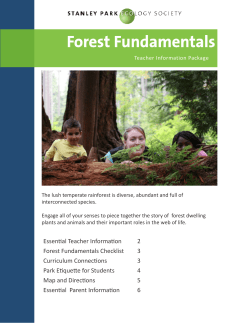


© Copyright 2026