
Strengthening Transparency and Access to Information on
Strengthening Transparency and Access
to Information on Transboundary Rivers
in South Asia
March 2015
Authored and Published by
The Asia Foundation
India
114 Jor Bagh, First Floor
New Delhi — 110 003
Email: [email protected]
Website: www.asiafoundation.org
With the support of
The Skoll Global Threats Fund
1808 Wedemeyer Street, Suite 300
San Francisco, CA 94129 USA
Website: www.skollglobalthreats.org
Any part of this document may be freely reproduced with appropriate acknowledgement.
Suggested citation:
Surie, M. and Prasai, S. (2015). Strengthening Transparency and Access to Information on
Transboundary Rivers in South Asia. The Asia Foundation. New Delhi.
Design by Vinset Advt., Delhi
Printed and bound in India
Contents
List of Abbreviations
v
Foreword and Acknowledgements
vii
Executive Summary
1
Introduction
5
Transboundary Water Governance in South Asia
9
New Developments in Access to Information in South Asia
13
Methodology
17
Mapping Information Access: Laws, Institutions, and Practices
25
Laws
27
Institutions
33
Practices
35
State of Information Disclosure on Water in South Asia: Key Findings
49
Recommendations
57
References
61
Annex 1: Research Methodology
65
Endnotes
67
THE ASIA FOUNDATION | www.asiafoundation.org
List of Abbreviations
ADB
—
Asian Development Bank
ASEAN
—
Association of South East Asian Nations
BCAS
—
Bangladesh Centre for Advanced Studies
BELA
—
Bangladesh Environmental Lawyers Association
BWDB
—
Bangladesh Water Development Board
CCA
—
Culturable Command Area
CEA
—
Central Electricity Authority (India)
CSO
—
Civil Society Organization
CWC
—
Central Water Commission (India)
DHM
—
Department of Hydrology and Meteorology (Nepal)
DoED
—
Department of Electricity Development (Nepal)
DoI
—
Department of Irrigation (Nepal)
DoR
—
Department of Roads (Nepal)
DPR
—
Detailed Project Report
ECA
—
Environment Conservation Act 1995 (Bangladesh)
ECR
—
Environmental Conservation Rule 1997 (Bangladesh)
EIA
—
Environmental Impact Assessment
FFWC
—
Flood Forecasting and Warning Center (Bangladesh)
FOI
—
Freedom of Information
G-K Project —
Ganges-Kabodak Irrigation Project
ICCPR
—
International Covenant on Civil and Political Rights
ICIMOD
—
International Center for Integrated Mountain Development
ICTs
—
Information and Communication Technologies
INGO
—
International Non-Governmental Organization
ISET-N
—
Institute for Social and Environmental Transition – Nepal
THE ASIA FOUNDATION | www.asiafoundation.org
LIST OF ABBREVIATIONS
ISRO
—
Indian Space Research Organization
JCKGP
—
The Joint Committee on Kosi and Gandak Projects
JCWR
—
India-Nepal Joint Committee on Water Resources
JSTC
—
Nepal Joint Standing Technical Committee
LIFE
—
Legal Initiative for Forest and Environment
MEA
—
Ministry of External Affairs (India)
MoEF
—
Ministry of Environment, Forests and Climate Change (India)
MoP
—
Ministry of Power (India)
MoWR
—
Ministry of Water Resources (India)
NEA
—
Nepal Electricity Authority
NGO
—
Non-Governmental Organization
NHPC
—
National Hydroelectric Power Corporation (India)
NWRC
—
National Water Resources Council (Bangladesh)
PIO
—
Public Information Officer
PMP
—
Pancheshwar Multipurpose Project
ProPublic
—
Forum for Protection of Public Interest (Nepal)
RTI
—
Right to Information
SAARC
—
South Asian Association for Regional Cooperation
SGTF
—
Skoll Global Threats Fund
TAF
—
The Asia Foundation
TAI
—
The Access Initiative
UNESCO
—
United Nations Educational, Scientific and Cultural Organization
WARPO
—
Water Resources Planning Organization (Bangladesh)
WECS
—
Water and Energy Commission Secretariat
WRI
—
World Resources Institute
WRIS
—
Water Resources Information System
WWF
—
World Wildlife Fund
vi
Strengthening Transparency and Access to Information on Transboundary Rivers in South Asia
Foreword and Acknowledgements
T
his report is the outcome of a research collaboration between The Asia Foundation (TAF)
and its partners: the World Resources Institute (WRI), the Bangladesh Centre for Advanced
Studies (BCAS), the Legal Initiative for Forest and Environment (LIFE), and the Institute
for Social and Environmental Transition – Nepal (ISET-N). The Asia Foundation is grateful to Sylvia
Lee and Bessma Mourad from the Skoll Global Threats Fund (SGTF) for their continued support of
our work on transboundary water in South Asia.
The principle authors of this report are Mandakini D. Surie and Sagar Prasai of The Asia Foundation,
India. TAF would like to acknowledge and thank Lalanath de Silva and Carole Excell of WRI for
working with us to prepare the methodology and toolkit for the country-level transboundary water
governance assessments, training our partners to use access-to-information legislation to secure
water-related data, and working with partners to develop in-country advocacy strategies.
Golam Rabbani, Samarendra Karmakar, Mustainur Rahman, Mahmud Hasan Tuhin, Hafijul Islam
Khan, and Zoheb Mahmud Khan of BCAS conducted fieldwork and research in Bangladesh.
Ritwick Dutta, Preeta Dhar, and Rohit Choudhury conducted fieldwork and research in India. TAF
would like to especially thank Preeta Dhar for anchoring and coordinating project activities among
partners and compiling the country-level findings into a first draft.
Ajaya Dixit, Jayendra Rimal, Anustha Shrestha, and Rabi Wenju of ISET-N conducted fieldwork and
research in Nepal.
We would also like to thank the Foundation's country offices in Bangladesh, India, and Nepal for their
logistical support. We are grateful to our partners, WRI, BCAS, LIFE, and ISET-N, for their
commitment to this project and to carrying forward the recommendations of this report.
Sagar Prasai, Ph.D.
Country Representative
India
March 2015
THE ASIA FOUNDATION | www.asiafoundation.org
Executive Summary
P
ublic access to climate and water
information is quite limited in South
Asia, particularly at the local level.
Where data and information are available,
they are often of poor quality, inadequate,
and difficult to verify. Given the history of
tensions and disputes between co-riparian
countries in the region, hydrological
information pertaining to transboundary
rivers such as the Indus, Ganges, and
Brahmaputra is particularly sensitive and is
often considered classified on the grounds of
national security. The culture of secrecy
embedded in South Asian bureaucracies
makes open access to information especially
problematic. In this scenario, developing a
shared understanding of transboundary river
basins is an uphill task, with limited
information on critical measures such as
water stocks, water and sediment flow, and
other analytical parameters that are needed to
gain a holistic understanding of river basins.
In the last decade, in the wake of a global
movement towards greater transparency and
accessibility of environmental information
(Principle 10 of the Rio Declaration and the
Aarhus Convention), governments in the
region have taken preliminary steps towards
disclosing sensitive water and climate data.
This is well illustrated in Bangladesh, India,
and Nepal, where governments have enacted
laws and policies that require the collection,
retention, and dissemination of
environmental information. At the same
time, information-gathering initiatives among
NGOs and civil society organizations have
expanded significantly through the support
of multilateral and bilateral donor agencies.
Finally, the proliferation of access-toinformation or right-to-information (RTI)
laws throughout South Asia has provided
citizens and civil society organizations with
new means to access government data and
information. These laws offer a unique
opportunity to broaden the understanding of
the general public and various stakeholder
groups, setting the stage for improved
transboundary water governance decisions.
But to what extent have these developments
aided public access to hydrological data and
information in South Asia? What are some
of the barriers to accessing information, and
what are the means by which information
sharing could be facilitated among
governments and between governments and
the public? To unpack some of these
questions, in June 2013 the Asia Foundation
(TAF), with support from the Skoll Global
THE ASIA FOUNDATION | www.asiafoundation.org
EXECUTIVE SUMMARY
Threats Fund (SGTF) and in partnership
with the World Resources Institute (WRI)
and civil society organizations in Bangladesh,
India, and Nepal, initiated a project to
promote and strengthen transparency and
access to data and information on
transboundary water governance in South
Asia. Over a 15-month period, TAF and its
partners assessed the availability of data and
information relating to three transboundary
rivers in Bangladesh, India, and Nepal, built
the capacities of civil society and the media
to utilize transparency tools and mechanisms
including RTI to push for greater access to
data and information on water and climate
issues, and disseminated this information
within the region.
transboundary water management and
cooperation have been highly
nationalistic, technocratic and zealously
securitized.
•
Capacity and implementation gap:
As with other bureaucracies in South
Asia, limited human resources,
infrastructure, training, and capacity
have undermined transparency laws
and policies in Bangladesh, India, and
Nepal. Even where RTI laws exist, the
data management and access control
procedures are poorly implemented,
perpetuating a de facto denial of
access.
•
Fragmented availability of data and
information: In all three countries,
data and information on the selected
rivers are collected and held by
government departments in a very
fragmented manner, making it difficult
to get a complete hydrological picture
of a river and its regime. Furthermore,
information does not appear to be
systematically collected at a basin level.
•
Poor data and records management
practices: Data and records
management practices are poor in all
three countries. In many instances,
while departments appear willing to
provide information, it either cannot be
traced or is not held by the department
responsible for collecting it.
•
Limited proactive disclosure of
information: The RTI laws of
Bangladesh, India, and Nepal require
This report presents the regional and
country-level findings and recommendations
of the study. Our analysis of data-and
information-sharing practices on water in
Bangladesh, India, and Nepal highlights
several barriers preventing the sharing of
regional water and climate information —
between governments, among departments
and ministries within governments, and with
the public.
Key Findings
•
Data and information secrecy: Even
as governments in the South Asia
region have made progress towards
greater cooperation and benefit sharing
in trade, energy, and food security,
water has remained a politically charged
and nationalistic issue. Whether in
Bangladesh, India, Nepal, or Pakistan,
the dominant approaches to
2
Strengthening Transparency and Access to Information on Transboundary Rivers in South Asia
EXECUTIVE SUMMARY
government to proactively disclose a
range of information through websites
and other means, and to update it
periodically. Yet, in practice, there
appear to be no clear institutional
norms establishing what kinds of
hydrological data and information
should routinely be published by
government agencies. Disclosure, by
and large, is ad hoc.
•
•
Weak implementation of RTI and
other disclosure laws and policies:
Bangladesh, India, and Nepal have RTI
laws, but implementation varies
considerably from country to country.
In Bangladesh and Nepal, RTI
implementation is still quite poor. Many
government agencies have not
appointed public information officers
(PIOs), to process information
requests, as required by the law.
Government officials lack awareness of
the law and their responsibilities to
provide information proactively and on
request.
Informal vs. formal access to
information: In Bangladesh and
Nepal, government departments seem
more willing to provide information
“informally,” in response to a letter or a
telephone call, than “formally,” in
response to a legally binding RTI
request. The study also found that data
is sporadically accessible at the local
level, and it is here that national
restrictions on data sharing occasionally
fail.
THE ASIA FOUNDATION | www.asiafoundation.org
•
Access to information is a tangible
need on the ground: Fieldwork and
stakeholder interviews in all three
countries reveal the lack of local access
to information about the selected
rivers. Much of the governance and
decision making concerning rivers in
these countries is concentrated at the
national and state levels. Local officials
and communities have little knowledge
of the mechanisms governing
transboundary rivers.
Each of these findings provides a window of
opportunity for action and reform on the
part of governments, civil society
organizations, and international stakeholders.
Recommendations
Governments of Bangladesh, India, and
Nepal
•
Desecuritize and declassify
transboundary water and climate data
and information to enhance public
access to this information throughout
the region.
•
Improve implementation of existing
laws and practices by increasing
investments in human capacity,
infrastructure, and financial resources
to ensure that government departments
and officials have the knowledge,
training, and capacity to put established
laws into practice.
•
Promote proactive disclosure of data
and information by government
3
EXECUTIVE SUMMARY
departments. Pushing for more
effective proactive disclosure of water
and climate data can improve
departmental compliance with existing
laws and policies, while providing
stakeholders on the ground with critical
data and information.
•
Improve data and information
management practices by better
integrating national data and egovernment initiatives into the
everyday functioning of the
bureaucracy while at the same time
investing in new and cost-effective
information and communication
technologies (ICTs).
•
•
•
Promote cross-border collaborations to
generate local-level data. Work with
local communities to collect and share
upstream-downstream flow data and
develop early-warning systems for
flood-prone and irrigation-centered
communities affected by transboundary
rivers.
International Stakeholders
Strengthen the implementation of RTI
laws by appointing and providing
effective training for designated
information officers, allocating
adequate human and financial
resources, and supporting autonomous
information commissions to effectively
oversee government agencies.
Civil Society Organizations and the
Media
by working with other CSOs and
groups in the region for more effective
implementation of existing laws and
policies on environmental data and
transparency.
•
Promote high and low tech ICT
initiatives to make climate and water
data more accessible. Support RTI laws
and other programs focused on
strengthening environmental
transparency at the country and
regional level.
•
Converge existing national and regional
data and information-sharing initiatives
to ensure that they support rather than
compete with one another.
Advocate greater transparency and
information sharing by governments,
4
Strengthening Transparency and Access to Information on Transboundary Rivers in South Asia
Introduction
W
ater scarcity1 is a growing
concern for countries in South
Asia, where per capita water
availability has decreased by nearly 80 percent
since the 1950s (ADB, 2001: 3). The Indus,
the Ganges, and the Brahmaputra — three
of the most densely inhabited river basins in
the world — are under intense pressure from
population growth, industrial development,
urbanization, and environmental pollution
and degradation. In India and Pakistan,
excessive groundwater extraction and
overuse, particularly in agriculture-intensive
parts of the country, has led to severe and
persistent water shortages in many villages,
2
towns, and cities.
A recent study suggests that as many as 22
3
of 32 Indian cities face daily water shortages.
The lack of access to clean drinking water
and basic sanitation, particularly in rural
areas, is a critical constraint to reducing
poverty and malnutrition in the region (Babel
and Wahid, 2008).4 Compounding the
problem, excessive groundwater extraction,
poor domestic management of water
resources, and increasing variability in rainfall
and climate patterns have made South Asia
highly susceptible to floods, droughts, and
5
natural disasters. By 2050, when South Asia's
population is expected to hit 2.2 billion, and
as urban populations grow, it is estimated
that all major population centers in the
region will experience seasonal or perennial
water shortages (McDonald et al., 2011).
Countries in South Asia — Afghanistan,
Bangladesh, Bhutan, India, Nepal and
Pakistan — depend heavily on transboundary
water resources to meet their domestic water
and energy needs. The headwaters of the
region's major river systems — the Indus, the
Ganges and the Brahmaputra — originate in
the arid Tibetan plateau in China and
crisscross several countries before meeting
the sea.
As rivers cross borders, their flows are
diverted, dammed, or stored by national
governments for multiple purposes. It is
estimated, for example, that Pakistan annually
diverts nearly three quarters of available
water from the Indus River into irrigation
canals to support the country's agrarian
economy (Stimpson Centre et al., 2013: 14).
Similarly, approximately 92.5 percent of
Bangladesh's fresh water comes from
upstream transboundary rivers, making it
highly vulnerable and dependent on the
actions of its upstream neighbors, India and
China (Kolås, Å. et al., 2013: 11).
THE ASIA FOUNDATION | www.asiafoundation.org
INTRODUCTION
Despite these natural “water
codependencies” (Kugelman, 2011:2),
regional cooperation on water remains
contentious. While, on paper, bilateral treaties
and agreements govern water sharing and
infrastructure development between India
and Pakistan (Indus Water Treaty 1960),
India and Nepal (Kosi Agreement 1954;
Gandak Agreement 1959, and Mahakali
Treaty 1996), and Bangladesh and India
(Ganges Water Sharing Treaty 1996), in
practice, deep mistrust and chronic political
tensions surround their implementation.
The agreements have been criticized for
adopting a piecemeal approach focused on
particular rivers and designed to address
specific country concerns such as water
sharing (Indus Water Treaty 1960 and
Ganges Water Sharing Treaty), flood control
(Kosi Treaty 1954, revised in 1966), or the
construction of specific dams and projects
(Gandak Agreement 1959, and Mahakali
Treaty 1996), rather than providing a broad
framework or blueprint for cooperation and
joint management based on principles of
equity, justice, mutual benefit, and sustainable
use (Siwakoti, 2011; Uprety, 2012). They have
also lacked the necessary norms and
mechanisms to deal with and adapt to
variability in water flows and other
environmental changes over time (Uprety,
2012).
As the demand for water for household
consumption, agriculture, industries, and
hydropower generation in these countries
grows, water is increasingly a source of
tension and potential conflict in the region.
At the national level, intra-country water
6
disputes between states or provinces,
particularly in India and Pakistan, have been
increasing.6 At the transboundary level,
demands for water are putting similar
pressure on longstanding bilateral treaties
and agreements. The United Nations
Educational, Scientific and Cultural
Organization (UNESCO) has identified the
Ganges-Brahmaputra Basin as one of 17
basins worldwide with a high potential for
disputes in the next decade (Wolf et al.,
2003). On the ground, protests in Pakistan
against the lack of access to water and
electricity in cities such as Karachi have put
pressure on the government to seek a
redefinition of the Indus Water Treaty with
India.7 Pakistan has consistently argued that
India's construction of hydro-engineering
structures such as the Baghlihar and
Kishenganga projects on tributaries of the
river that originate in India will substantially
reduce the availability of water downstream.
In Bangladesh, a country that depends
almost entirely on transboundary river flows
for its fresh water, the reduced availability of
water from the Ganges and Teesta rivers,
particularly in the lean season, has been a
sore point in relations with India. Despite
being the upper riparian, a history of political
instability in Nepal and asymmetric power
relations with lower riparian India have made
flood control, irrigation, and hydropower
development on shared rivers such as the
Kosi, Gandaki, and Mahakali a major source
of discord between the two countries
(Condon et al., 2009).
As these examples indicate, transboundary
cooperation on water in South Asia is at an
Strengthening Transparency and Access to Information on Transboundary Rivers in South Asia
INTRODUCTION
impasse, stuck with the problems of the past
and unable to meet the challenges of the
future. While South Asian countries share a
common history, cultural ties, and natural
geography, they have been unable to rise
above their geopolitical tangles to
meaningfully engage and produce tangible
results on any aspect of regional
cooperation, including water. This is most
clearly demonstrated by the fact that South
Asia is one of the least integrated regions in
the world, with intra-regional trade
accounting for less than five percent of total
trade (Chatterjee and George, 2012). Land,
air, sea, and telecom connectivity are poorly
developed, even as the mobility of goods and
people is heavily restricted by complex
customs, visa, and transit regulations. At a
regional level, the South Asian Association
for Regional Cooperation (SAARC),
established in 1985 to promote greater
economic, social, and cultural cooperation,
lacks dynamism and political clout compared
to other regional blocks such as the
Association of South East Asian Nations
(ASEAN) or the European Union
(Kugelman, 2014; Prasai, 2013).
Given the current impasse on South Asian
regional cooperation in general, and on
transboundary water issues specifically, unless
something changes, it is difficult to be
optimistic about the region's ability to resolve
its impending water crisis. It is perhaps
necessary to start at the core of the problem
and work to build confidence among key
actors rather than to pursue elusive
agreements on individual basins. Improving
information and data sharing between coriparians is one way this could be achieved
THE ASIA FOUNDATION | www.asiafoundation.org
(Babel and Wahid, 2008; Price et al., 2014).
At a minimum, The United Nations has
described the sharing of information related
to the construction of hydropower and
infrastructure projects, irrigation and
navigation, pollution, and natural disasters
such as floods and droughts as key to
“building trust and a shared vision among
riparian countries” (UN-Water, 2008:8).
The need for greater transparency and access
to information on environmental issues has
been internationally recognized. Principle 10
of the Rio Declaration on Environment and
Development specifically advocates greater
citizen access to information on
environmental issues at a national level, and
greater civic participation in decision-making
processes. It further advocates that
governments facilitate and encourage public
awareness and participation by making
information widely available.8 In recent years,
the proliferation of access-to-information or
right-to-information (RTI) laws throughout
South Asia has provided citizens and civil
society organizations with new tools to
access government data and information.
These laws provide a unique opportunity to
broaden understanding among the public and
various stakeholder groups, thereby
potentially widening the scope for improved
transboundary water governance decisions.
Against this background, in June 2013 the
Asia Foundation (TAF), with support from
the Skoll Global Threats Fund (SGTF), and
in partnership with the World Resources
Institute (WRI) and civil society
organizations in Bangladesh, India, and
Nepal, initiated a project to promote and
7
INTRODUCTION
strengthen transparency and access to data
and information on transboundary water
governance in South Asia.9 Over a 15-month
period, TAF and its partners assessed the
availability of data and information relating
to three transboundary rivers in Bangladesh,
India, and Nepal, built the capacities of civil
society and the media to utilize transparency
tools and mechanisms, including RTI, to
push for greater access to data and
8
information on water and climate issues, and
disseminated this information within the
region. This report highlights the key
findings of the study at a country and
regional level, and provides
recommendations for improving the
availability and accessibility of data and
information on transboundary rivers in the
region as a means to enhance cooperation on
water in South Asia.
Strengthening Transparency and Access to Information on Transboundary Rivers in South Asia
Transboundary Water Governance
in South Asia
T
ransboundary water disputes in
South Asia are inextricably linked to
geopolitics in the region, as river
systems are shared between riparian
countries that differ in size, natural resources,
political power, and economic strength. At
the country level, water cooperation is almost
exclusively the domain of national
governments, with limited opportunities for
civil society, local communities, the media,
and other stakeholders to broadly engage in
bilateral discussions. The dominance of the
state has led to a discourse that is highly
nationalistic, developed and guided by the
views of scientists, technocrats, and
government experts. Bilateral negotiations
are reductionist in nature, centered largely on
arriving at a technical formula to divide
available water flows between both countries.
This zero-sum approach has narrowed the
scope for discussions, but more importantly,
it has excluded a range of economic, social,
and cultural interests from the debate,
thereby preventing the development of a
basin-wide, integrated approach to planning,
management, and conservation of shared
river systems.
South Asia's inability to cooperate on water
or to ensure improved water security for the
region has been analyzed from many angles
(for instance, Verghese, 2007; Chellaney,
2011; Wirsing, 2013; Shah and Giordano,
2013). While there is no single bottleneck
that can be isolated and addressed, the
current impasse has its roots in the way water
is governed in South Asia. Here, we argue
that water governance in South Asia is
characterized by four distinct features that
debilitate transboundary cooperation at a
fundamental level: i) the framework for
cooperation is statist in nature; ii) the
discourse is nationalistic, antagonistic, and
securitized; iii) the scope of bilateral
negotiations is reductionist and extractive;
and iv) state control of data and information
fosters power and information asymmetries
among stakeholders and prevents policy
contestations (see also Prasai and Surie,
2013). Taken together, these characteristics
significantly affect outcomes on shared water
resources, and each merits some elaboration.
The framework for cooperation is statist
in nature: At the country level, policy
formulation and management of water
resources is almost exclusively the domain of
national governments. States have retained
the exclusive right to articulate public interest
on national and transboundary water issues
THE ASIA FOUNDATION | www.asiafoundation.org
TRANSBOUNDARY WATER GOVERNANCE IN SOUTH ASIA
to the extent that there are few opportunities
for other actors to participate in national or
bilateral discussions. In particular, even at a
national level, direct users of water such as
farmers and industrialists can only indirectly
articulate their views and influence formal
negotiations (Crow and Singh, 2000). This is
well illustrated by the case of the Teesta
River dispute between India and Bangladesh.
The river, which originates in the Indian state
of Sikkim, is a politically charged issue in
both countries. Bangladesh has consistently
argued that India's upstream abstraction has
reduced the availability of water, particularly
in the lean season. Following several rounds
of bilateral negotiations, in 2011 both
governments were poised to sign a bilateral
agreement on the Teesta that would
guarantee to Bangladesh 50 percent of the
river flow year round.
However, at the last minute, India was forced
to withdraw from the agreement due to
protests raised by the chief minister of West
Bengal, Mamta Banerjee, over the availability
of water for her own state (Prasai and Surie,
2013). As the Teesta episode illustrates, in
dominating bilateral negotiations on water,
states frequently ignore or neglect the
interests and stakes of other critical actors.
This has not only limited the scope of
discussion to technical issues and caused the
neglect of critical social, cultural, and
ecological perspectives, but has also spurred
resistance from excluded stakeholders,
jeopardizing efforts to implement
agreements and treaties on the ground.
The discourse is nationalistic and
securitized: The dominance of the state has
10
led to a discourse that is predominantly
nationalistic and technocratic, guided by the
views of scientists, technocrats, and
government experts. As discussed above,
given the subcontinent's complex and
contentious history, water in South Asia is
tied to geopolitics and consequently to
national security. Track 1 dialogue processes
between co-riparian countries are largely
dominated by officials from the hydroengineering, foreign policy, and security
establishments.
These interests are often predisposed to
assert absolute control over national
resources and institutionally incapable of
driving political compromises. Media
coverage of water issues tends also be
nationalistic and is often based on
incomplete and inaccurate information. This
has perpetuated myths about transboundary
water sharing that fuel domestic antagonism,
increase the potential for conflict, and
prevent effective regional dialogue and
coordination. It has been noted that the
nationalization and politicization of
transboundary water issues have served to
deflect public attention from the fact that
water is very poorly managed within
countries in the region (John, 2011: 3).
Bilateral negotiations are reductionist in
nature: Negotiations over water between coriparians are centered largely on arriving at a
technical formula to divide available water
flows between countries. Most dialogue
processes are bilateral, with the notable
exception of the Indus Water Treaty, which
was negotiated by the World Bank. India in
particular has insisted on bilateralism as a
Strengthening Transparency and Access to Information on Transboundary Rivers in South Asia
TRANSBOUNDARY WATER GOVERNANCE IN SOUTH ASIA
prerequisite for negotiations with its
neighbors since gaining independence in
1947 (Crow and Singh, 2000). It has been
argued that bilateralism has enabled the
Indian state to keep negotiations within
certain bounds, limit contestation, and
prevent the formation of third party
opposition (Crow and Singh, 2000). The
predominance of bilateral approaches to
water has fostered a zero-sum approach that
has narrowed the scope of discussions and,
more importantly, excluded a range of
economic, social, and cultural interests from
being debated, thereby preventing the
development of basin-wide, integrated
approaches to planning, management, and
conservation of shared river systems.
State control of data and information
fosters power and information
asymmetries: The ability to articulate
alternative narratives and to contest policies
from the outside depends on stakeholder
access to data and information. In the
absence of an open data environment, nonstate actors are unable to formulate informed
arguments. As we explore in greater detail in
the following sections, bilateral negotiations
over water between co-riparians in South
Asia typically take place in a closed data
environment. While some of the existing
treaties recognize in principle the importance
of sharing information and data, in practice,
states monopolize access to data and
THE ASIA FOUNDATION | www.asiafoundation.org
information as a way to keep negotiations
within their control.
This has two perverse consequences. On the
one hand, it prevents those at the negotiating
table from arriving at common ground, and
on the other hand, it fosters power and
information asymmetries between state and
non-state actors, preventing those most
affected by transboundary water negotiations
from articulating compelling and sufficiently
nuanced alternatives to the dominant stateled discourse. This is well demonstrated in
the Teesta river basin, where affected
communities in the Indian states of Sikkim
and West Bengal and in downstream
Bangladesh have extremely limited and
localized knowledge of the river, its ecology,
and the effects of upstream dams and other
proposed projects on their own livelihoods.
This, in turn, has prevented them from
developing a holistic understanding of the
basin and the factors that influence changes
in the river regime (Prasai and Surie, 2013).
Achieving broadly acceptable agreements on
transboundary water takes time, and when
negotiations revolve around narrowly defined
national interests in a general atmosphere of
secrecy and mistrust, and where the content
of the dialogue is constrained by a highly
securitized and commoditized view of water,
it takes even longer to find common ground.
In this scenario, unless the basic parameters
of engagement change, the current impasse
on water in South Asia is likely to persist.
11
New Developments in Access to
Information in South Asia
I
nternationally, access to information has
been recognized as a fundamental
human right10 that is critical to good
governance, participation, and democratic
deliberation (Article 19 and ADC, 2007).
There is a substantive body of empirical
literature arguing that, with access to
information, citizens are better placed to
make informed decisions, assess government
policies, and demand greater accountability
from governments and service providers
(Besley and Burgess, 2002; Islam, 2003;
Reinikka and Svensson, 2004; World Bank,
2003; Krishna, 2007). International
recognition has led to the incorporation of
the right to information in a range of
international and human rights charters
including Article 19 of the Universal
Declaration of Human Rights, the
International Covenant on Civil and Political
Rights (ICCPR), and the regional charters of
the African Union, the Organization of
American States, the Council of Europe, and
the European Union (CHRI, 2007).
In recent years, the need for greater
transparency and access to information
specifically on water, climate, and
environmental issues has also been
internationally recognized. Principle 10 of
the Rio Declaration on Environment and
Development, 1992, advocates greater citizen
access to information on environmental
issues at a national level, and greater civic
participation in decision-making processes. It
further advocates that governments facilitate
and encourage public awareness and
participation by making information widely
available.11 The 1998 Convention on Access
to Information, Public Participation in
Decision-Making and Access to Justice in
Environmental Matters — the Aarhus
Convention — formally recognizes the rights
of the public to environmental information,
to participate in environmental decision
making, and to review procedures to
challenge public decisions made with regard
to environmental matters.12 A number of
international conventions on bio diversity,
wetlands, and international trade in wild
species, flora, and fauna, as well as the UN
Convention on Climate Change and the
Kyoto Protocol, also recognize to varying
degrees the importance of providing public
access to environmental information.
While these conventions set important
international standards, it is really the
proliferation of national freedom-ofinformation (FOI) or right-to-information
THE ASIA FOUNDATION | www.asiafoundation.org
NEW DEVELOPMENTS IN ACCESS TO INFORMATION IN SOUTH ASIA
(RTI) laws that has opened up new
opportunities for citizens to access a greater
volume of data and information from their
governments on a range of issues including
the environment. Globally, over 100
countries have enacted FOI or RTI laws. In
South Asia, Pakistan (Freedom of
Information Ordinance 2002), India (Right
to Information Act 2005), Nepal (Right to
Information Act 2007), Bangladesh (Right to
Information Act 2009) and the Maldives
(Right to Information Act 2014) have
enacted RTI laws, while bills are currently
pending in Afghanistan and Bhutan.13 The
Secretariat of the South Asian Association
for Regional Cooperation (SAARC) supports
the adoption of RTI legislation by member
states to promote good governance and
transparency at the country and regional
levels.14
Drawing on international best practice, these
laws broadly guarantee citizens the right to
access information held by the government,
give governments the duty to provide
information proactively (suo moto) and on
request, obligate governments to set in place
mechanisms to receive, process, and respond
to requests, and establish grievance
procedures to respond to appeals and
complaints related to the denial of
information requests. The laws also specify
the kinds of information that can be
requested, as well as the grounds on which
information can be legitimately exempted
from disclosure. Such exemptions are
typically related to concerns over national
sovereignty, international relations,
commercial and trade secrets, etc. However,
in most instances, the exemptions are
14
intended to be applied as an exception rather
than a rule, with the law balanced in favor of
information disclosure.
While the laws in the region vary in strength,
levels of public awareness, implementation,
and demand-led use, civil society
organizations (CSOs) and ordinary citizens
have used RTI laws innovatively to access a
range of government information. RTI laws
have been used, for example, as a tool to
demand improvements in public service
delivery, access basic entitlements, investigate
government policies and decisions, and
expose corruption and misadministration
(The Asia Foundation, 2014). The laws have
also been used by environmental activists,
CSOs, scientists, and academics to access a
range of environmental data and information
in different countries in the region. In India,
for example, CSOs such as Kalpavriksh have
effectively used India's RTI Act 2005 to
access information related to the disposal of
hazardous waste, forest and environmental
clearances, water policy, and hydropower
projects and dams (Singh and Singh, 2006).15
In Bangladesh, the country's Right to
Information Act 2009 has been used by
environmental law groups such as the
Bangladesh Environmental Lawyers
Association (BELA) to investigate and
expose violations of environmental laws and
regulations in various sectors such as
construction, mining, and ship breaking. At
the regional level, a coalition of civil society
groups from Bangladesh, India, and Nepal
have used RTI laws in these countries to
access information and documents on joint
river commissions and treaties in the region.16
Strengthening Transparency and Access to Information on Transboundary Rivers in South Asia
NEW DEVELOPMENTS IN ACCESS TO INFORMATION IN SOUTH ASIA
The information gathered has been made
available to the public through a website that
hosts copies of agreements, treaties,
important administrative and judicial
decisions, and minutes of meetings of
different joint committees between
Bangladesh, India, and Nepal.17 While these
developments are encouraging and have
brought government documents and analyses
into the public domain, the real test of
openness and willingness to promote wider
public engagement on water governance lies
THE ASIA FOUNDATION | www.asiafoundation.org
in the treatment of hydrological data. Until
this data becomes more accessible, the
current impasse on transboundary water
cooperation in South Asia described above
will not be easily resolved. In the following
section we examine the impact of these new
developments on South Asian information
regimes “where the rubber hits the road” to
see if the recent reforms are deep enough to
secure adequate access for interested
stakeholders.
15
Methodology
T
his report is based on country-level
assessments conducted in
Bangladesh, India, and Nepal by the
Asia Foundation in partnership with the
World Resources Institute (WRI), the
Bangladesh Center for Advanced Studies
(BCAS), the Institute for Social and
Environmental Transition – Nepal (ISET-N),
and the Legal Initiative for Forest and
Environment (LIFE). The country-level
assessments formed part of a project funded
by the Skoll Global Threats Fund (SGTF) to
gather data and information on selected
transboundary rivers in the region. The
specific research objectives of the study were
to test i) the availability of accurate data and
information on selected transboundary rivers
in the region, ii) the extent to which
governments collect, retain, and publicly
disseminate relevant and accurate
hydrological data and information, and iii)
the efficacy of RTI laws as a tool to access
hydrological data and information.
The study utilized a combination of primary
and secondary research methods including
desk-based research, interviews, group
discussions, site visits, and fieldwork. At the
country level, partners conducted in-depth
assessments of the laws, institutions, and
practices affecting the availability and
accessibility of information related to
transboundary rivers. Field-level action
18
research tested proactive disclosure
practices, the efficacy of RTI laws and
institutions, and responses to RTI requests,
filed at various government ministries,
agencies, and departments in each country,
for data and information on three core
parameters:
•
Stream flow data
•
Sediment flow data
•
Dams and hydro-engineering structures
(proposed and existing).
The methodology of the assessments was
based on a modified version of The Access
Initiative's (TAI) Water Governance
Assessment Toolkit, and consisted of a
phased assessment.19 Initially, partners
compiled a river basin overview capturing the
physical and ecological characteristics of the
river, water use, existing and proposed hydroengineering structures, etc. This provided
background and context for the issues and
related transboundary conflicts associated
with the river. This was followed by the
identification and assessment of national
laws and institutions responsible for
governance and management of rivers. Based
THE ASIA FOUNDATION | www.asiafoundation.org
METHODOLOGY
on this mapping, partners conducted an
assessment of the extent to which
institutions in each country were disclosing
information related to the three core
parameters under study: stream flow,
sediment flow, and dams and hydroengineering structures. As part of this
process, partners evaluated the proactive
disclosure of information by government
agencies and institutions at the national, state,
and local levels. Proactive disclosure was
assessed by evaluating the release of
information on websites, examining official
agency reports, and inspecting agency offices.
Where information gaps were identified,
partners filed strategic RTI requests with the
public authorities or government agencies
concerned, focusing on those parameters. In
total, 59 requests for information were made
across the region: 26 in India (13 each for the
Kosi and Sharda Rivers), 21 in Nepal, and 12
in Bangladesh. All requests were tracked by
partners to record information on requests
processed, denied, or transferred, response
time, mute refusals, etc. Partners documented
their findings and recommendations in the
form of country-level issue or policy briefs.
These have been synthesized to provide
insights into information and data disclosure
issues at both the country and the regional
level.
Transboundary River Segments
The study focused on three transboundary
rivers of the Ganges River basin: the Kosi
River (Nepal and India); Sharda (Nepal and
India) and Padma (India and Bangladesh)
(Figure 1). The study focused on specific
segments or stretches of these rivers because
Figure 1: Transboundary River Segments20
18
Strengthening Transparency and Access to Information on Transboundary Rivers in South Asia
METHODOLOGY
they were transboundary (i.e., flowed from
one country to another), they were subject to
existing bilateral treaties or agreements, and
they were involved in past or current bilateral
disputes. A brief overview of the physical,
ecological, and socio-political characteristics
of the selected rivers is provided below.
The Trijuga River joins it downstream before
it enters India. The Kosi River basin spreads
over 17 districts of Nepal.22 There the study
focused on the stretch of river from the
Arun, where it enters Nepal, to the
Saptakoshi at the Kosi Barrage at Bhimnagar,
where it exits Nepal. In India, the study
focused on the main stream of the Kosi,
which enters India at Hanuman Nagar in
Bihar, and on the tributaries23 that join it
before it in turn joins the Ganga near
24
Kursela, Bihar.
Kosi
The Kosi River21 is one of the largest
tributaries of the Ganges. It is 225 kilometers
in length, and drains 71,500 square
kilometers in Tibet (28,500 square
kilometers), Nepal (31,600 square kilometers)
and India (11,400 square kilometers). The
Kosi River has seven tributaries, of which the
three major upstream tributaries — the
Tamor (east branch), Sunkoshi (west branch),
and Arun (north branch) — merge at Tribeni
to form the Kosi and flow southwards via
the Barahkshetra gorge to reach the Tarai.
The Kosi catchment area is unique in that it
covers six geological and climate zones,
which vary in elevation from over 8,000
meters to just 95 meters (Dixit 2009: 71).
The annual water yield of the river is 51,656
3
million m3, of which 39,833 million m is
available for use (WWF-Nepal 2007:6). There
is high temporal and spatial variation of
water availability and rainfall in the basin,
26
Sediment deposits downstream of the Kosi Barrage
THE ASIA FOUNDATION | www.asiafoundation.org
19
METHODOLOGY
which supports an estimated population of
4.5 million. The river is a source of
hydroelectricity and irrigation in Nepal, with
a number of medium, small, and micro
hydropower plants in the basin.25 Major
hydro-engineering projects in the basin in
Nepal that are in different phases of
planning or construction include the Upper
Tamakoshi Hydroelectric Project, the Arun
III Hydropower project, and the Melamchi
Water Supply and Sunsari Morang Irrigation
projects. On entering India at Hanuman
Nagar in Bihar, the Kosi joins the Ganges
near Kursela and is one of its largest
tributaries. In India, major uses of the river
relate to irrigation and flood protection
works. The Kosi Treaty, signed in 1954 and
amended in 1966, predominantly deals with
the issue of floods and embankment
construction. Under the Treaty, the Kosi
Kosi River near Barahkshetra, Sunsari, Nepal
20
Barrage was constructed in Nepal,
approximately five kilometers upstream of
Hanuman Nagar in Bihar, as a flood
mitigation measure. Embankments were also
constructed along the river as flood
protection works, and provisions were made
for using the river for irrigation and
hydroelectricity. The treaty also provides for
the construction of the eastern and western
Kosi Canals, which originate from the point
of the Kosi Barrage and irrigate parts of
North Bihar and Nepal respectively.
Due to the sudden drop in elevation as the
river enters the plains and the heavy sediment
load, the river is prone to frequent changes in
its course. In the last 220 years, the river has
shifted westwards about 115 kilometers
(Gole and Chitale 1966 as cited in Dixit
2009: 72). The recurrent flooding,
33
Strengthening Transparency and Access to Information on Transboundary Rivers in South Asia
METHODOLOGY
sedimentation, and changes in the river's
course have caused large-scale devastation in
parts of Nepal and downstream in India,
where large swathes of land have been made
untenable for agriculture in North Bihar.27
The river's pernicious nature has earned it
the moniker “Sorrow of Bihar.”
In 2008, India and Nepal experienced one of
the worst river disasters in their history when
the Kosi river breached one of its
embankments near Kusaha in Nepal,
flooding vast areas in Nepal and North
Bihar. The floods affected an estimated
50,000 Nepalis and 3.5 million Indians (Dixit
2009: 70). The Kosi is a highly politicized
issue in Nepal and India, with each
frequently blaming the other for failing to act
to prevent the recurring floods.28
India has consistently argued that there are
law-and-order issues in the areas of the Kosi
Lower Sharda Barrage, India
THE ASIA FOUNDATION | www.asiafoundation.org
project in Nepal that have made it difficult
for it to maintain and repair embankments
constructed as flood protection works. At
several bilateral joint committee meetings,
India has made representations expressing
the difficulties it faces operating and
maintaining the project due to illegal
encroachments and cultivation in the area,
restrictions on the movement of people, and
levies of multiple taxes. From the perspective
of Nepal, pending and unresolved issues
include claims of unpaid land taxes and
compensation for land lost to erosion.29
Sharda
The Sharda River (also known as the
Mahakali) originates in Pithoragarh in the
Indian state of Uttarakhand and forms the
international boundary between India and
Nepal for a stretch (and the eastern
38
21
METHODOLOGY
boundary of Uttarakhand) before entering
India at Lakhimpur Khiri in the Indian state
of Uttar Pradesh. The Sharda flows through
Nepal for a distance of 223 kilometers and
through India for a distance of 323.5
kilometers up to its confluence with the
Ghagra River in the Bahraich district in Uttar
Pradesh. The Dhauliganga, Gori Ganga,
Sarju, and Ladhiya are some of the
important tributaries in India. Projects that
are already up and running include projects at
Tanakpur, Dhauliganga, and Khatima.30 The
study focused on the stretch of the river
from its point of origin in Pithoragarh to its
confluence with the Ghagra. In its upper
reaches, the river has significant hydropower
potential, with 28 existing and 48 proposed
hydropower projects. The cumulative impact
of these projects has been a cause for
concern among environmentalists and civil
society organizations in India.
In June 2013, heavy rains caused
unprecedented flooding in Uttarakhand and
some parts of Himachal Pradesh, Uttar
Pradesh, and Nepal. According to estimates
by the Uttarakhand government, the flood
affected 4,200 villages, damaged 3,360
houses, destroyed several roads and bridges,
and killed more than 900 people. More than a
year after the incident, the number of
missing people is estimated to be more than
12,000.31 In 2014, heavy monsoon rainfall
again led to flooding and damage to life and
property in parts of Uttarakhand and Uttar
32
Pradesh.
On entering the plains, the river is a major
source of water for irrigation networks of
the Sharda Canal system and the Sharda
22
Sahayak project. The Sharda Canal system is
one of the oldest and largest canal systems in
the state of Uttar Pradesh. The culturable
command area (CCA) of the Sharda Canal
System is 1,462,000 hectares, and the ultimate
irrigation potential is 725,000 hectares.34 The
Sharda Sahayak project was constructed to
meet the region's increasing irrigation
demands.35 The CCA of the project is
1,522,000 hectares, and the irrigation
36
potential is 1,750,000 hectares.
Dudhwa National Park,on the Indo-Nepal
border in Uttar Pradesh, is an important tiger
reserve in the basin. Gangetic dolphins are
also reported along the stretch of the Sharda
River in Dudhwa National Park.37 The 1996
Mahakali Treaty between India and Nepal
calls for the “integrated development of the
Mahakali River.” It provides for the
operation and the distribution of benefits of
the Tanakpur and Banbassa Barrages and
provides a framework for the development
of the Pancheshwar Multipurpose Project
(PMP). The PMP has been controversial in
both countries. It is estimated that 33 percent
of the land inundated by the PMP will lie in
39
Nepal, and 67 percent will lie in India. The
Chief Minister of Uttarakhand has further
claimed that the project will submerge 120
square kilometers and affect 19,700 people in
60 villages in Uttarakhand.40
Environmentalists have raised concerns that
the project is located in a fragile zone and
could have major ecological and social
impacts.41 Following Indian Prime Minister
Narendra Modi's recent visit to Nepal, both
countries reportedly signed an MoU on the
terms of reference for the 5600 megawatt
Strengthening Transparency and Access to Information on Transboundary Rivers in South Asia
METHODOLOGY
project and the creation of a Pancheshwar
Development Authority.42
Padma
The Ganges River is one of three main
transboundary rivers in Bangladesh, along
with the Brahmaputra and Meghna Rivers.
Known in Bangladesh as the Padma, it flows
from India into Bangladesh at Shibganj
Upazila of Chapai Nawabganj District. It
meets the Brahmaputra at Goalondaghat, and
further downstream it meets the Meghna at
Chandpur. The Ganges has a catchment area
in Bangladesh of about 46,300 square
kilometers. The Mahananda is the only
tributary of the river in Bangladesh. The
Mathabanga, Ichamati, Nabaganga, Bhairab,
Kumar, Goari Madhumati, and Arial Khan
Rivers are some of the important
distributaries.43 The river is approximately
100 kilometers in length and four-to-eight
kilometers in width. The study focused on
the stretch of the river from the IndiaBangladesh border to its confluence with the
Jamuna (known as the Brahmaputra in India).
Agriculture in the southern part of
Bangladesh is largely dependent on water
from the Ganges. While there are no large
dams or water diversion structures, the
Ganges-Kabodak Irrigation Project (G-K
Project) was once the largest surface water
44
irrigation project in Bangladesh. It is not
currently operating, however, due to the
river's low flow. The Lalon Shah and
Hardinge Bridges are two other structures
over the river, both in Pabna-Kushtia. The
Ganges Barrage is a proposed project to
divert freshwater in streams and distributaries
48
Hardinge Bridge, Bangladesh
THE ASIA FOUNDATION | www.asiafoundation.org
23
METHODOLOGY
to the southwest regions, and includes plans
for two small hydropower plants. According
to press reports, the pre-feasibility study and
the feasibility studies have been completed,
and the project has received the assent of the
Prime Minister.45
The proposed Rooppur Nuclear Power Plant
is also located in the basin. Although India
and Bangladesh share 54 rivers, the Ganga
Treaty is the only formal instrument
governing riparian relations between India
and Bangladesh. Signed in 1996 and valid for
30 years, the treaty regulates the sharing of
Ganga waters at Farakka Barrage. In line with
previous agreements,46 it allocates shares of
water to each country on the basis of ten-day
average flow from January 1 to May 31. Each
country is entitled to an equal share of the
47
river's total available water. However, for
alternating ten-day periods between March
11 and May 10, each country is entitled to a
guaranteed 35,000 cusecs. The treaty also
24
provides for a joint committee for its
implementation. The major bone of
contention between India and Bangladesh
over the Ganges has been seasonal reduction
in the flow of the river and the alleged
diversion of water by India at Farakka
Barrage for irrigation purposes. The 1996
treaty establishes water entitlements during
the lean season. The local perception is that
there has been a drastic reduction in the
downstream flow, particularly in the lean
season, and consequently Bangladesh has
been receiving less than its due share under
the treaty. The low availability of water has
resulted in excessive withdrawals of ground
water. Reduced flow has also caused
sedimentation and modified the channel
morphology of the river. Due to flow
modification in the river channel, riverbank
erosion has increased in some parts of the
Ganges. The low availability of freshwater
has also caused saline water intrusion in
coastal areas.
Strengthening Transparency and Access to Information on Transboundary Rivers in South Asia
Mapping Information Access:
Laws, Institutions, and Practices
T
o test the availability of data and
information related to the selected
rivers, partners mapped the laws,
institutions, and information disclosure
practices governing the management of the
selected rivers in each country. Specifically,
information disclosure was tested against
three core parameters: stream flow, sediment
flow, and proposed and existing dams and
hydro-engineering structures. In this section,
we provide a broad overview of the laws,
both general and sector-specific, that govern
information disclosure in each country. We
also highlight some of the key institutions
associated with governing the rivers under
study, and how well, in practice, data and
information related to these rivers is being
disclosed proactively and on request.
49
Boatmen cross the Sharda River in Uttar Pradesh, India
THE ASIA FOUNDATION | www.asiafoundation.org
Laws
Right-to-Information Laws
B
angladesh, India, and Nepal have
each enacted RTI laws that require
government agencies to disclose
information both proactively and on request.
The laws conform to international best
practices on the right to information, and
premise the maximum disclosure of
information and minimum exemptions. The
laws in all three countries cover all levels and
branches of government — legislative,
executive, and judicial — and also cover nonprofit organizations and private entities that
receive substantial government funding. The
laws cover a broad range of information
including, for example, file notings, samples,
certified copies, electronic copies, etc. (See
Table 1 for more details). However, certain
kinds of information are exempt from
disclosure. These exemptions are well
defined in each of the laws and usually
involve national security, international
relations, commercial and trade secrets, etc.
For example, the RTI Act 2007 in Nepal has
five exemptions, the RTI Act 2005 in India
has ten, and the RTI Act 2009 in Bangladesh
50
has 19.
Notably, hydrological data and information
are not specifically exempt under any of the
laws, nor do they fall more generally under
any of the cited exemptions. However, the
laws do exempt the disclosure of
Table 1: Types of Information Accessible under RTI
Information
Bangladesh
India
Nepal
File Notings
Samples
Inspection
Basis of decisions
Compilations
Certified copies
Electronic versions
Audio-visual material
THE ASIA FOUNDATION | www.asiafoundation.org
LAWS
information that would negatively affect
national sovereignty or international
relations.51 The RTI Acts of India and
Bangladesh also exempt information received
in confidence from a foreign government,52
and exempt certain institutions from
53
coverage under the law. However, it is
important to emphasize that the exemptions
are designed to be narrow and specific in
their application, and the laws premise
greater transparency and openness rather
than secrecy and non-disclosure. India's RTI
Act, for example, overrides the Official
Secrets Act of 1923, and specifically states
that even exempt information can be
disclosed if the public interest in disclosure
outweighs the harm to protected interests.54
Last but not least, the RTI laws in all three
countries override laws (for example secrecy
laws) that infringe on a citizen's right to
information.
Public authorities covered by the law are
required to proactively publish a range of
information related to the role and function
of the organization, powers and duties of
officials, decision-making procedures, norms,
budgets, information related to policies and
schemes, etc. The laws also state that the
information must be made widely available
through various means and updated on a
55
regular basis. In addition to proactively
disclosed information, public authorities are
required to respond within a set time frame
to right-to-information requests made by
citizens.
Under the laws, each public authority is
mandated to appoint designated public
information officers (PIOs) to respond to
28
such queries. On receiving a request,
authorities in Bangladesh must respond
within 20 days, in Nepal within 15 days, and
in India within 30 days. India's RTI Act
provides for transfers of RTI requests when
the information sought is held by another
public authority or the subject matter of the
information sought is more closely
connected with the functions of another
public authority. There are no provisions for
transfers in the RTI Acts of Nepal or
Bangladesh. In instances where requests for
information are denied, the RTI Acts in all
three countries provide for a first appeal to
an appellate authority within the public
authority and a second appeal to the
Information Commission.
Sector-Specific Laws
In addition to RTI laws, there are sectorspecific laws in each country that cover water
and related sectors. Some of these laws also
contain provisions related to the collection
and disclosure of water-related data and
information. A brief summary of these laws
follows.
Nepal
In Nepal, the Water Resource Rule 1993,
under the Water Resource Act 1992, requires
the district water resource committee to
publish information regarding proposed
water-based projects, and to invite comments
or objections from affected people.56 The
Local Self-Governance Act 1999 also makes
it mandatory for local governments to share
information related to projects on drinking
Strengthening Transparency and Access to Information on Transboundary Rivers in South Asia
LAWS
water, irrigation, sanitation, and water
conservation among the inhabitants of the
municipality.57 Under the Environment
Protection Act 1997, environmental
assessment reports prepared by project
proponents must be made available for
public feedback.58 Likewise, when an
application is received for a project involving
the production, transmission, or distribution
of electricity, information about the project
59
must be made public to seek public opinion.
There are also provisions for collection and
disclosure of studies and hydrological data
and information. The Irrigation Policy 2013
of Nepal provides for the publication of
irrigation journals from studies done by
academic institutions and NGOs/INGOs. It
also provides for the establishment of
documentation and information centers
under the department of irrigation, which is
responsible for developing a digital library
and publishing Nepal's yearly irrigation
status.60
The Local Infrastructure Development
Policy 2004 provides for the establishment
of information resource centers at national
and district levels to facilitate the collection,
processing, and dissemination of
infrastructure information related to
irrigation, micro-hydropower, water supplies,
61
etc. Finally, the National Water Plan 2002
provides for the preparation of a database of
land, water, and human resources.
India
The Environment Impact Assessment
Notification 2006, notified under the
Environment (Protection) Act 1986, provides
THE ASIA FOUNDATION | www.asiafoundation.org
in several places for public disclosure of
information on infrastructure projects, which
include hydroelectric and river valley
projects.62 In a judgment of the National
Green Tribunal in Save Mon Region Federation
vs Union of India,63 it was held that the
environmental clearance letter and other
conditions are all public documents that must
be made available proactively to the public.
Further, the functions of the Central
Electricity Authority (CEA), established
under the Electricity Act 2003, include
collecting and publishing the data on
generation, transmission, trading,
distribution, and utilization of electricity, and
64
carrying out various studies.
Recognizing that large volumes of data of
various types are collected by government
ministries and departments at the national
and state levels, and that the lack of
standardized systems and formats for this
data poses a serious problem, the Indian
government formulated the National Data
Sharing and Accessibility Policy 2012.65 The
Policy cites the importance of Principle 10
of the Rio Declaration and India's RTI Act.
Under the Policy, all departments and
ministries are required to prepare, within six
months of notification of the Data Sharing
Policy, a “negative list” of information that
cannot be made public, while simultaneously
ensuring that all sharable data are made
available. However, the Policy does not
provide any guidance as to which data is or
should be classified. The Policy provides for
an oversight committee to periodically review
the negative list.
29
LAWS
The Government of India's National Water
Policy 2012 states that all hydrological data,
other than those classified on national
security grounds, should be in the public
domain. It also states that a periodic review
for further declassification of data may be
carried out. It emphasizes the very real need
for better hydrological information and
better data practices. The HydroMeteorological Data Dissemination Policy,
notified in 2013, lays down the procedure for
disclosing data and information for the
country's rivers. The policy divides the
country into three regions: “Region I — the
Indus basin and other rivers and their
tributaries discharging into Pakistan; Region
II — the Ganga-Brahmaputra-Meghna basin
and other rivers and their tributaries
discharging into Bangladesh/Myanmar; and
Region III — the country's remaining rivers
and their tributaries” (Government of India,
2013: 2). The policy goes on to state that
Region I and Region II data, comprising all
of the northern rivers in India, is “classified,”
while Region III data is not. Notably,
reservoir water levels, live storage position,
water quality, and groundwater and
meteorological data for all regions is
unclassified.
Similarly, all metadata, yearly average data,
and historically important data (such as
highest flood level, yearly flood peak, etc.)
are also unclassified. To obtain so-called
“classified data” — gauge, discharge, silt,
water quality, and meteorological data — a
request must be made in writing to the
Ministry of Water Resources, stating the
specific purpose for which the data is
required, and accompanied with a “secrecy
30
undertaking.” The request is examined by the
Classified Data Release Committee, which
has representatives of the Ministry of
Defence, the Intelligence Bureau, and the
Research and Analysis Wing.66 There is no
indication in the policy of how this
committee evaluates requests, or on what
grounds a request can be denied. There are
also restrictions on the use of classified data.
Any classified data, if supplied, is nontransferable, and may not be reproduced in
any report, publication, detailed project
report (DPR), etc. Only the results of
analysis and the inferences drawn can be
published.
Finally, the Ministry of Water Resources and
the Indian Space Research Organization
(ISRO) have jointly developed a web-enabled
India-Water Resources Information System
(WRIS). The India-WRIS has been designed
as a single-window solution and repository
for comprehensive data and information on
India's water and other natural resources.
The WRIS portal enables users to search,
access, visualize, and analyze a range of data
and information related to water resources in
the country. However, in keeping with the
government of India's policy, much of the
data and information related to
transboundary river basins such as the Indus,
Ganges, and Brahmaputra is classified and
cannot be accessed online.67 Notably, while
some macro-level data for these major rivers
is published by the Ministry of Water
68
Resources in the form of basin reports, as
discussed above, more detailed information
on these rivers, including gauge, silt, water
quality, discharge, and meteorological data, is
not publicly available. This is in marked
Strengthening Transparency and Access to Information on Transboundary Rivers in South Asia
LAWS
contrast to data and information on India's
peninsular rivers, which are considered “nonclassified” and can be accessed by the public.
Bangladesh
The Environment Conservation Act 1995
(ECA) establishes the procedure for
obtaining environmental clearance, including
the requirement of an environmental impact
assessment (EIA). The 2010 amendment to
the ECA also mentions that the government
is to frame further rules on public access to
EIAs. However, no specific rules have yet
been framed for the disclosure of EIA
information. Under the Environmental
Conservation Rule 1997 (ECR), framed
under the ECA, the Department of
Environment has an obligation to supply,
upon application of any person or
organization, reports of test results on
samples of water and liquid waste, and the
information or data derived from such
THE ASIA FOUNDATION | www.asiafoundation.org
69
analysis. The National Water Resources
Council (NWRC), or “Water Parishad,”
established under the Bangladesh Water Act
2013, is responsible for planning the
integrated development and use of water
70
resources in the country. The Water Act
also states that the Government of
Bangladesh may, in consultation with the
NWRC, exchange and assess information
and data on common water resources with
other countries or international
organizations.71 The Act also specifically
states that any actions undertaken or powers
exercised by the NWRC fall under the
purview of the RTI Act. These are extremely
progressive provisions with respect to
transparency and good information practices.
The Water Resources Planning Organization
(WARPO), an organization under the
Ministry of Water Resources, also has a data
dissemination policy that provides specific
procedures for accessing information on
water issues.
31
Institutions
I
n each country, specific institutions have
been tasked with collecting,
maintaining, and publishing waterrelated information. For the purposes of this
study, partners mapped institutions tasked
with gathering data and information related
to stream flow, sediment flow, and dams and
hydro-engineering structures of the selected
rivers. In Bangladesh and Nepal, the study
focused on national-level institutions, and in
India, given that water is a state matter, the
study focused on institutions at the national
and state government levels, including the
state of Bihar (Kosi River) and the states of
Uttarakhand and Uttar Pradesh (Sharda
River). A list of the government agencies and
institutions assessed is provided in Table 2
overleaf.
72
Inhabitants of Char Ashariya on the Padma River, Bangladesh
THE ASIA FOUNDATION | www.asiafoundation.org
INSTITUTIONS
Table 2: List of Institutions and Agencies Assessed
India
Nepal
Bangladesh
National Government
State Government
Department of
Hydrology and
Meteorology
(DHM)
Ministry of Water
Resources, River
Development
and Ganga
Rejuvenation
(MoWR)
Irrigation Department
and Environment
Directorate,
Uttar Pradesh
Ministry of Water
Resources
Department of
Electricity
Development
(DoED)
Central Water
Commission
(CWC)
Irrigation Department,
Uttarakhand
Bangladesh
Meteorological
Department (BMD)
Water and
Energy
Commission
Secretariat
(WECS)
Ministry of
Environment,
Forests and
Climate Change
(MoEF)
Environment Protection
and Pollution Control
Board, Uttarakhand
Water Resource
Planning Organization
(WARPO)
Department of
Roads (DoR)
Ministry of Power
(MoP)
Watershed Management
Directorate, Uttarakhand
Flood Forecasting
and Warning Center
(FFWC)
Department of
Irrigation (DoI)
Ministry of External
Affairs (MEA)
Water Resources
Department, Bihar
Roads and Highways
Department
Upper Tamakoshi
Hydropower
Limited
National
Hydroelectric
Power Corporation
(NHPC)
Environment and Forest
Department, Bihar
Melamchi Water
Supply
Development
Board
Central Electricity
Authority (CEA)
Bihar State Hydroelectric
Power Corporation Ltd.
Bhote Koshi
Power Company
Pvt. Ltd.
Project
Directorate of
Asian
Development
Bank (ADB)
Himal Hydro
and General
Construction
Limited
Nepal Electricity
Authority
34
Strengthening Transparency and Access to Information on Transboundary Rivers in South Asia
Practices
Bilateral Information Sharing
G
overnment-to-government sharing
of data and information on
transboundary water issues is
fairly limited in the South Asia region. Some
of the existing bilateral treaties and
agreements do, however, contain provisions
requiring the exchange of data and
information between co-riparians. The Indus
Treaty of 1960 requires India and Pakistan to
regularly exchange daily gauge and discharge
data as well as data related to daily
extractions or releases from reservoirs,
withdrawals from canals, etc. It provides for
the data to be transmitted on a monthly
basis, and no later than three months after
the month to which the data relates. The
treaty also provides that, where data and
information pertaining to the rivers is
required by either party for operational
reasons, it may be provided daily, or in less
frequent intervals, on request.73
Similarly, the Ganges Treaty between India
and Bangladesh provides for joint
monitoring of the river, and mandates the
Joint River Committee to set up teams to
observe and record daily flows below
Farakka Barrage and at Hardinge Bridge and
submit an annual report, as well as the data
74
collected, to both governments. Between
India and Nepal, under the Mahakali Treaty,
the Mahakali River Commission can inspect
or seek information about the structures that
are provided for under the treaty.75 Lastly, the
Kosi Treaty provides for the mutual
exchange of data, reports, and results of
surveys and investigations carried out with
76
respect to the Kosi River. India and China
have also had a pact to share flood data and
information on the Brahmaputra River that
77
has been renewed from time to time.
However, while these provisions exist on
paper, actual data-and information-sharing
practices are ad hoc, and the range of
information exchange covered under most of
the treaties is fairly limited. To illustrate, the
Ganges Treaty calls for India and Bangladesh
to share information on water levels at
Farakka, but not other types of basin-wide
information about the Ganges. Data on the
consumptive use of the river, or plans for
diversion of water within the country, are not
covered. On the ground, the lack of data
sharing has fostered tensions with
Bangladesh, where there are concerns over
India's use of Ganges River waters and
suspicions about the effect on the availability
THE ASIA FOUNDATION | www.asiafoundation.org
PRACTICES
of water downstream. The lack of accurate
data and information sharing within the
region remains a key concern for
government and civil society actors in the
region, and there is a general perception that
“greater awareness within and between
countries of information that is available
would serve to ease transboundary water
tensions and could facilitate improved
domestic water management” (Price et al.,
2014: 2).
Furthermore, it is important to note that
none of the existing treaties or agreements
provide for the public disclosure of data and
information exchanged between
governments. This data is simply not
accessible to academics, scientists, civil
society, or the media in the region. For
instance, information on the meetings of
joint river and technical committees called
for by various treaties, whether or not they
have been established, details of their
functioning including minutes of meetings,
etc., are generally not publicly available. This
has made it very difficult for non-state actors
such as civil society organizations, academics,
scientists, and the media to get a sense of the
key issues and concerns between countries or
the progress of joint initiatives. In response
to the limited availability of data and
information on transboundary water
resources and bilateral processes,
information-sharing initiatives led by civil
society organizations have proliferated in the
last decade. At the regional level, a coalition
of civil society groups from Bangladesh,
India, and Nepal have used RTI laws in these
countries to access information and
documents on joint river commissions and
36
78
treaties. The information gathered has been
made available to the public through the
Water Beyond Borders website
(www.waterbeyondborders.net). The website
hosts copies of agreements, treaties,
important administrative and judicial
decisions, and the minutes of meetings of
various joint committees among Bangladesh,
India, and Nepal. The Water Beyond Borders
initiative has placed a large volume of
information in the public domain, providing
new opportunities for research, analysis, and
advocacy by civil society. Other, betterknown initiatives include the WRI's
Aqueduct project, which has developed a
global, water risk-mapping tool to help
companies, investors, governments, and
other users understand where and how water
79
risks and opportunities occur.
At the intergovernmental level, the
International Center for Integrated Mountain
Development (ICIMOD) is a regional,
intergovernmental, learning and knowledgesharing center that serves eight regional
member countries in South Asia. ICIMOD
has established a regional database system to
serve as a data repository on different themes
in the Hindu Kush-Himalaya region and
provide a portal for easy public access to the
data.80 More recently, thethirdpole.net,81 has
launched Data.TheThirdPole, an “open
source geospatial database” that provides a
searchable catalog of water-related data sets
sourced from different organizations in
82
Asia. Such initiatives testify to the growing
demand for accurate and comprehensive data
and information on transboundary water
issues on the subcontinent.
Strengthening Transparency and Access to Information on Transboundary Rivers in South Asia
PRACTICES
Proactive Disclosure
The RTI laws in Bangladesh, India, and
Nepal require public authorities to
proactively publish and routinely update a
range of government information. However,
compliance levels vary greatly in practice. A
recent study conducted by The Asia
Foundation on the implementation of rightto-information laws in South Asia finds that
proactive disclosure within the region, and
particularly in Bangladesh and Nepal, is quite
limited (The Asia Foundation, 2014). To
assess the extent to which data and
information on water-related issues are being
proactively disclosed by governments in
Bangladesh, India, and Nepal, partners in
each country examined a selection of
government agencies and institutions in each
country. Information availability was assessed
in relation to the following parameters: i)
bilateral treaties and agreements; ii) stream
flow data; ii) sediment flow data; and iv)
existing and proposed hydro-engineering
structures.
Bilateral Treaties and
Agreements
The analysis suggests that information on
bilateral treaties and agreements is by far the
most proactively disclosed in all three
countries. This is not surprising, given that
these are longstanding agreements between
national governments, and as such are in the
public domain. For example, India's Water
Resources Information System houses an
inventory of river-related international
agreements and treaties to which India is a
THE ASIA FOUNDATION | www.asiafoundation.org
signatory.83 However, this does not have
updated information on the implementation
of these agreements or the functioning of
joint committees or other bilateral
mechanisms under them. In Nepal, the
websites of the Water and Energy
Commission Secretariat, the Ministry of
Energy, and the Ministry of Irrigation
provide access to a copy of the Kosi treaty
and minutes of meetings of bilateral
committees such as the India-Nepal Joint
Committee on Water Resources (JCWR) and
the Nepal Joint Standing Technical
Committee (JSTC). In Bangladesh, the
Ministry of Water Resources has a fairly
detailed and updated website for the IndiaBangladesh Joint Rivers Commission, which
contains a copy of the Ganges Treaty 1996
as well as press releases covering the sharing
of Ganga waters in ten-day periods during
the dry season, as per the Treaty, since 2008.
Stream Flow Data
In Bangladesh and Nepal, government
departments were found to proactively
disclose some stream flow data and
information on rivers. Nepal's Department
of Hydrology and Meteorology (DHM),for
example, discloses data and information for
11 rivers in Nepal, including the Arun,
Bhotekoshi, Sunkoshi, and Tamakoshi, which
are part of the Kosi River basin. River trend
information describing water levels is
available for all rivers, as well as information
on flood warnings. While stream flow data
was available for some rivers, such as the
Karnali, Babai, West Rapti, and Bagmati,
flow data for rivers in the Kosi basin was not
available. Furthermore, where flow data was
37
PRACTICES
available, it was quite limited, with
information on maximum and minimum
flows and monthly and yearly averages found
to be missing. In Bangladesh, the proactive
disclosure practices of government
departments are in general quite weak. The
website of the Bangladesh Meteorological
Department does not disclose rainfall,
evaporation, or temperature data for the
Ganges Basin. However, this information
was provided following an informal request
and the payment of a fee. Similarly, a
historical statistical analysis of discharge data
for the Ganges River during lean periods was
not available proactively, but it was provided
by the Water Resources Planning
Organization (WARPO), at a minimal cost, in
response to an informal request.
Notably, monthly stream flow data, basinwide rainfall data, and inundation maps are
proactively disclosed by the Flood
Forecasting and Warning Center (FFWC) on
their website. The website also contains real
time and forecast data on river water levels
and floods. In India, the hydrological
observation stations of the Central Water
Commission (CWC) regularly collect data on
gauge, discharge, and water flow. Data from
non-classified sites is published yearly in the
Integrated Hydrological Data Book.
However, hydrological data of the Ganga,
Brahmaputra, and Indus basins and related
water year books are classified and therefore,
not disclosed.84
Sediment Flow Data
In Bangladesh and Nepal, while sediment
flow data was not proactively available on
38
government websites, partners were able to
obtain this information from the government
departments concerned by filing data request
applications. In Nepal, for example, the
Department of Hydrology and Meteorology
provided researchers with access to mean
monthly sediment flow data for different
stations within the Kosi Basin on completion
of a data request form and payment of a
specified fee.85 While the sediment flow data
that was provided was not uniformly
available across consecutive years, it is
noteworthy that this information was
publicly accessible without a formal right-toinformation request. Similarly, in Bangladesh,
while data on sediment flow was not
available proactively on the website of the
Water Resource Planning Organization
86
(WARPO), access to data on char-land in the
Ganges River was provided upon submission
of an informal request for information.87
Data was provided for a fee.
In India, the hydrological observation
stations of the Central Water Commission
regularly collect data on gauge, discharge, silt,
sedimentation, water quality, and water flow.
While data from non-classified sites such as
India's peninsular rivers is published
proactively in a yearly hydrological data book,
similar micro-level data is not published
proactively for northern transboundary
rivers, i.e., the Ganges, the Brahmaputra, and
the Indus. It is important to reiterate here
that while the Ministry of Water Resources
does publish basin reports for the Ganga,
Brahmaputra, and Indus Rivers on the IndiaWRIS portal — reports which do contain
considerable macro-level information —
these reports do not provide data or
Strengthening Transparency and Access to Information on Transboundary Rivers in South Asia
PRACTICES
information on gauge, discharge, silt,
sedimentation, etc.88
Dams and Hydro-Engineering
Structures
In Nepal, information on dams and other
hydro-engineering structures in the Kosi
basin was sought from a number of
government departments and private sector
agencies, including the Department of
Electricity Development (DoED), the Water
and Energy Commission Secretariat (WECS),
the Department of Irrigation (DoI), Upper
Tamakoshi Hydropower Limited, the
Melamchi Water Supply Development Board,
Bhotekoshi Power Company Private Limited,
Himal Hydro and General Construction
Limited, and the Nepal Electricity Authority
(NEA). The websites of some of these
agencies were found to provide basic
information about the key features of
existing and proposed dams and hydroengineering structures within the Kosi Basin.
In the case of WECS, for example,
researchers were able to access copies of
EIAs for the Tamur-Mewa, Likhu Khola, and
Dudh Koshi hydroelectric projects. Similarly,
the websites of private companies and
agencies such as Upper Tamakoshi
Hydropower Limited, Bhote Koshi Power
Company Pvt. Ltd., and Himal Hydro and
General Construction Ltd, were found to
provide details of the salient technical
features and operational details of different
projects. In Bangladesh, information
pertaining to existing hydro-engineering
projects, such as the two major bridges,
Hardinge and Lalon Shah, and the Ganges-
THE ASIA FOUNDATION | www.asiafoundation.org
Kabodak Irrigation Project, are not
proactively available. Similarly, information
including EIA and feasibility studies for
proposed projects, notably the Ganges
Barrage, is not in the public domain.
In India, at the national, state and local levels,
a number of government departments and
agencies collect, retain, and publish
information on existing and proposed hydroengineering projects. Given the multiplicity
of agencies and layers of government, it is
not surprising that there are variations in the
availability, comprehensiveness, and quality
of information.
At the national level, a considerable amount
of data and information are available on the
websites of government departments. For
example, the Central Water Commission of
the Ministry of Water Resources maintains a
national registry of large dams. The
Ministry's India-WRIS portal also provides
public access to a list of hydro-engineering
projects in the country. Similarly, the Central
Electricity Authority maintains a record of
hydroelectric projects and their performance.
However, efforts to proactively access
information pertaining specifically to
structures within the Kosi and Sharda basins
revealed that, even at a national level, there is
very limited granular information about
existing and proposed structures and projects
such as the Sharda Canal Project, the Sharda
Sahayak Project, and the eastern and western
Kosi Canals and embankments. At the state
level, in Uttar Pradesh, Bihar, and
Uttarakhand, the availability of information
on government websites is even more
39
PRACTICES
limited, and where information is available, it
is frequently not comprehensive or up to
date. Interestingly, at a local level, at district,
and project offices, researchers found that
basic project information and facts were
proactively displayed on boards and notices
outside the offices of the Tanakpur, Banbasa,
and Kosi Barrages. In some instances,
researchers were also allowed to inspect data
and information records in the local field
offices, but not allowed to take copies. A
summary of the proactively available data
and information available across all three
countries is provided in Table 3 below.
better job of proactive disclosure than statelevel agencies in Bihar, Uttar Pradesh, and
Uttarakhand, but because there are no
specific mandates for the proactive disclosure
of hydrological data and information, even
here sufficient information is not always
publicly available. Furthermore, due to the
multiplicity of national, state, and local
departments, each with a mandate and
jurisdiction over water-related issues,
information is spread out, piecemeal, and
frequently incomplete. For each of the
parameters assessed in this study, much of
the data was found to be very basic, minimal,
and neither comprehensive nor up to date.
Very often, the manner of presentation was
also not very user friendly. Most of the data
was not available in interoperable formats,
making it difficult to conduct further analysis.
In Nepal, the study found that agencies were
quite willing to share hydrological data and
information, but their procedural compliance
with the proactive disclosure provisions of
the RTI Act was weak.
I
n summary, our analysis suggests that,
while there exist laws and policies in
Bangladesh, India, and Nepal that
premise and encourage the disclosure of
information, proactive disclosure of waterrelated data and information is limited and ad
hoc in practice. In India, national-level
agencies such as the MoWR, the MOEF, the
CWC, and the CEA were found to do a
Table 3: Proactive Disclosure of Water Data and Information
Nepal
Information
requested
All
Some
India
None
All
Some
Bangladesh
None
All
Some
None
Bilateral
agreements
Stream
flow data
Sediment
flow data
Details of
proposed
& existing
hydroengineering
structures
40
Strengthening Transparency and Access to Information on Transboundary Rivers in South Asia
PRACTICES
In Bangladesh, agencies were similarly
responsive to informal requests, but
proactive availability of data and information
was limited. Stream and sediment flow data
that were made available to researchers in
Nepal and Bangladesh were denied to them
in India on the grounds that they were
classified.
In India, there is a recognition of the need
for better collection and disclosure of data in
general, and hydrological data in particular, as
reflected in the government's HydroMeteorological Data Dissemination Policy
and the National Water Policy. However,
because data and information related to
transboundary rivers are considered
classified, there are several restrictions on the
access, use, and sharing of such data.
To conclude, our analysis suggests that
proactive disclosure of hydrological data and
information is quite weak in all three
countries. At best, such disclosure where it
exists is check-the-box or procedural rather
than purposeful in its intent to publish
information that is of public use and interest.
Governments need to more effectively
implement and enforce the proactive
disclosure provisions of the right-toinformation laws in these countries.
At the same time, mandated guidelines and
policies for more purposeful collection and
dissemination of hydrological data and
information are also needed. There is also a
need to ensure that data and information are
disseminated in standardized, user-friendly,
and interoperable formats.
THE ASIA FOUNDATION | www.asiafoundation.org
Right to Information
As part of the study, partners in each country
filed targeted right-to-information requests
with selected government agencies. Requests
were filed for data and information
pertaining to the following parameters: i)
stream flow data, ii) sediment flow data, and
iii) proposed and existing dams and hydroengineering structures. A total of 59 requests
for information were filed. Twenty-six
requests, 13 each for the Kosi and Sharda
Rivers, were filed in India. Twenty-one
requests were filed with eight agencies in
Nepal, and 12 requests were filed with eight
agencies in Bangladesh. Once requests were
filed, the number processed, denied, or
transferred, response times, mute refusals,
etc., were tracked and analyzed. Requests and
responses were analyzed against a number of
criteria including comprehensive-ness, quality,
temporal nature of the information, costs
and accessibility, form, and usability.
Types of Data and Information
Requested
Nepal: RTI requests were filed for data and
information on the Kosi River, including
30–35 years of mean monthly stream flow
and sediment flow data, details of hydroengineering structures such as the Upper
Tamakoshi and Bhote Koshi power projects
and their operation, and EIAs of existing
and proposed projects in the Kosi basin.
Data and information were sought in the
form of reports, circulars, and newsletters,
and in different data formats including Excel,
Word, PDF, etc.
41
PRACTICES
India: RTI requests were filed for the
location of observation stations in the Kosi
and Sharda basins, 30 years of mean monthly
average stream and sediment flow data,
details of hydro-engineering structures and
their operation in the states of Bihar (Kosi),
and Uttarakhand and Uttar Pradesh (Sharda),
and EIAs of proposed and existing
structures. Specific queries were made about
structures that withdraw, discharge, or
regulate the flow of the water in each river.
For dams, reservoirs, and barrages, specific
queries were made for the storage capacity of
those structures and the quantity, rate, and
times of water releases.
Bangladesh: RTI requests were filed for 30
years of stream and sediment flow data,
dams and hydro-engineering structures, and
EIAs of proposed and existing structures on
the Bangladesh side of the Ganges River.
Number of Requests Filed
Nepal: Twenty-one different RTI requests
were filed with eight different agencies or
companies. Six requests were filed with the
Ministry of Physical Planning, Infrastructure,
and Transport. Four requests were filed with
the Ministry of Science, Technology, and
Environment. One request was filed with the
Department of Irrigation and two requests
with the Department of Hydrology and
Meteorology. Requests were also filed with
government owned companies, including the
Melamchi Water Supply Development Board,
Upper Tamakoshi Hydropower Limited, and
Himal Hydro and General Construction
Limited, and with one private company,
Bhotekoshi Power Company Pvt. Ltd.
42
India: Twenty-six requests for information
were filed in India, 13 each for the Kosi and
Sharda Rivers. The bulk of the requests were
filed with the national Ministry of Water
Resources, the nodal agency responsible for
the development and regulation of the
country's water resources. As the Kosi River
flows through the state of Bihar, and the
Sharda flows through Uttarakhand and Uttar
Pradesh, requests for information were also
filed, as appropriate, with state-level
departments and agencies.
Bangladesh: Twelve different RTI requests
were filed with eight departments, which
included the Ministry of Planning, the
Department of Environment, the
Bangladesh Water Development Board
(including the Flood Forecasting and
Warning Center and the Processing and
Flood Forecasting Circle of Bangladesh
Water Development Board), the Bridge
Department of the Ministry of
Communication, the Joint River
Commission, the Bangladesh Meteorological
Department, and the Ministry of Science and
Technology.
Transfers
Nepal: The Right to Information Act 2007
does not include a specific provision for the
transfer of requests for information from
one department to another. Of the 21
requests for information filed with different
departments in Nepal, only one was
transferred by the Department of Irrigation
to the Sunsari-Morang Project office in
Biratnagar. The applicant was informed
about the transfer however no response was
Strengthening Transparency and Access to Information on Transboundary Rivers in South Asia
PRACTICES
ultimately received. The Ministry of Physical
Planning and Infrastructure initially informed
that they will transfer the requests to
Department of Road, Ministry of Energy
and Department of Urban Development.
However, there was no intimation of any
transfer, and on follow-up it was found that
no transfers had been made as on April 23,
2014. No response was ultimately received.
India: The Right to Information Act 2005
requires public authorities covered under the
law to transfer a request for information
within five working days when it pertains to
the functions of another public authority.
The public authority to whom the request is
originally made is also required to inform the
applicant of the transfer. In this study, every
single RTI request filed with the Ministry of
Water Resources was transferred two to three
times to public authorities at the state level.
This was the case for both the Kosi and
Sharda Rivers. (See Figure 2 for a flow chart
of RTI requests and transfers pertaining to
the Sharda River.)
Bangladesh: The Right to Information Act
2009 in Bangladesh does not provide for the
transfer of requests. In response to a request
for information, the Department of
Environment replied that the information
requested was not held by them and that an
application should be re-filed with another
department.
Figure 2: Flow chart of RTI Requests, Sharda River, India
Ministry of Water Resources
(13 requests filed)
Ministry of Water Resources
(Ganga Wing)
(13 requests transferred)
Water Resources Department
(Irrigation Department), Uttar Pradesh
(13 requests transferred)
Irrigation Department
(Lakhimpur Khiri)
(6 requests
transterred)
Supdt. Engineer
(Research andPlanning),
Allahabad
(11 requests transterred)
Executive Engineer
(Flood Division),
Sharda Nagar
(8 requests transterred)
Executive Engineer
(Head Works Division),
Sharda Nagar
(13 requests transterred)
Response: "Information
requested
does not pertain to
this division"
(6 requests)
Response: "Information
requested
does not pertain to
this division"
(11 requests)
Response: "Information
requested
does not pertain to
this division"
(8 requests)
Joint reply-provided
the water level
and discharge at the
Sharda Barrage and
Banbassa Barrage
(8 requests)
THE ASIA FOUNDATION | www.asiafoundation.org
43
PRACTICES
Despite delays, it's worth noting that every
single request filed in India received a
response. In Bangladesh, out of 12 requests,
four responses were received within the 20day deadline, one was received within 30
days, and seven requests received no
response.
Timeline of Responses
The RTI laws in each country prescribe
specific response times for information
requests — 15 days in Nepal, 20 days in
Bangladesh, and 30 days in India. Across the
sample in each country, responses to requests
were not received within the stipulated
period, and there were multiple delays. In
Nepal, only six of 21 requests received
responses within four days of the time limit,
and one response from Upper Tamakoshi
Hydropower Limited was received in 28 days.
Seven requests received mute refusals (no
response). In India, due to the en masse
transfer of requests from one department to
another, the response time exceeded the 30day limit significantly. Most of the responses
to requests on the Kosi River were received
between 61-70 days and responses to
requests on the Sharda River between 91-100
days. Only two requests received responses
within the stipulated period (see Figure 3).
Types of Responses
Nepal: Out of 21 requests, information was
provided in response to only six — two each
filed with the Department of Hydrology and
Meteorology, the Melamchi Water Supply
Board, and Upper Tamakoshi Hydropower
Limited. Seven requests received no response
within the 15-day time limit and were
recorded as mute refusals. Two requests were
denied orally over the phone or in person,
and six requests were denied on the grounds
that the information requested was not held
by that department or agency. Notably, no
request was denied on the grounds that the
Figure 3: Response Times for RTI Requests in India
12
10
No. of requests
10
8
7
6
4
4
2
2
1
1
1
44
e
ns
ys
re
sp
o
da
o
0
N
0
da
ys
11
112
10
111
0
da
ys
ys
-1
0
91
-9
0
da
da
81
-8
0
71
-7
0
da
ys
ys
ys
Sharda
61
0
-6
51
41
-5
0
da
da
ys
ys
da
ys
31
0
-3
-4
0
da
ys
da
21
11
-2
0
1-
10
da
ys
0
Kosi
Strengthening Transparency and Access to Information on Transboundary Rivers in South Asia
PRACTICES
information sought was classified or exempt
from disclosure. Rather, it appears that
information most often could not be
provided because of lack of documentation
and inability to find it.
India: Twenty-six requests were filed in
India — 13 each for the Kosi and Sharda
rivers. On the Kosi River, complete
information was provided in response to just
one request. Twelve requests were denied on
the grounds that the information was
classified or exempt from disclosure under
the RTI Act. On the Sharda River, complete
information was provided in response to one
request, and partial information in response
to two requests. The remaining requests were
denied on the grounds that the information
was not held by the agency to which the
request was made.
Bangladesh: Out of 12 RTI requests, not
one was successful. Seven requests elicited no
response at all, two were denied orally, and
three were denied on the grounds that the
information was not held by that agency. As
in Nepal, no request was denied on the
grounds that it was exempt from disclosure
or classified (see Figure 4).
Availability of Information
Across all three countries, very limited
information on the core parameters —
stream flow, sediment flow, and dams and
hydro-engineering structures — was
successfully accessed through RTI requests.
Nepal: In response to two requests for
information, the Department of Hydrology
and Meteorology provided 30–35 years of
mean monthly stream and sediment flow
data on the Kosi River. Notably, researchers
had to pay to get the data.89 Neither of the
data sets was found to be complete. The
starting date of the stream flow data
provided was not uniform, as not all of the
observation stations were established in the
same year. At some stations, data for the
Figure 4: Comparative Overview of RTI Responses
Total requests
21
No response received
7
Oral refusal
2 2
RTI exemption
26
7
10
Classified information
2
Information not available
6
Partial information
4
Complete information
10
3
2
2 2
0
20
40
Nepal
THE ASIA FOUNDATION | www.asiafoundation.org
12
India
60
80
Bangladesh
45
PRACTICES
period 1980–2010 or 1975–2010 was
inconsistently available. Researchers were also
able to purchase data from the 1960s and
1970s. None of the stations that were chosen
had a complete data set.
In some cases, certain months were missing;
in other cases, there were gaps of two to four
years. Similarly, sediment flow data dating
back to 1974 is available but lacks continuity.
Most of the records made available were
from the 1970s and 1980s, and recent data is
not available. Even within a single year, large
data gaps were found to exist. At some
stations, data for eight to nine months was
completely missing. In addition to stream and
sediment flow data, structural details and
EIAs of the Melamchi Water Supply project
and Upper Tamakoshi Hydropower Limited
were provided by those two organizations
respectively.
India: Very limited information on the Kosi
and Sharda rivers could be accessed via RTI.
In the case of both rivers, stream and
sediment flow data could not be acquired.
Interestingly, the reasons provided by
government agencies varied between the two
rivers. On the Kosi River, information access
was denied on the grounds that the data was
“classified” and a separate application had to
be made to the Ministry of Water Resources
under the government's HydroMeteorological Data Dissemination Policy.
Similarly, all queries regarding hydroengineering structures were denied on the
grounds that the information pertained to
India's relations with a foreign country.90 For
the Sharda River, access to stream and
sediment flow data was not denied, but the
46
requests were transferred multiple times and
ultimately received no response. Details of
hydrological observation stations and their
location were provided, however.
In response to the query regarding existing
and proposed structures on the Sharda River,
partial information91 was provided by the
Irrigation Department and the Flood
Division of Lakhimpur Khiri, Uttar Pradesh
— covering primarily flood protection works
to protect railway lines and villages. It may be
noted, however, that the query was originally
addressed to the Ministry of Water
Resources, seeking information for the entire
stretch of the river so that all the
information could be obtained from a single
source. The response received was
incomplete as it did not cover the barrages in
Uttarakhand, the Sharda and Sharda Sahayak
irrigation network, smaller irrigation projects,
and flood protection works in other districts.
Of the limited information received
regarding the Sharda, details of the locations
of hydrological observation stations were
comprehensive and relevant. The
information regarding hydro-engineering
structures was discussed above was
incomplete.
Bangladesh: Unlike Nepal and India, where
some information, albeit limited, could be
accessed, no information could be accessed
via RTI in Bangladesh.
I
n summary, the experience of filing and
tracking RTI requests to gather
hydrological data and information in
Bangladesh, India, and Nepal reveals
institutional weaknesses and barriers to
Strengthening Transparency and Access to Information on Transboundary Rivers in South Asia
PRACTICES
access in all three countries. Out of 59 total
requests, only ten resulted in partial or
complete information being provided. Of
the three countries, relatively more
information was obtained in Nepal, very little
was obtained in India, and no information
was obtained in Bangladesh.
In all three countries, a number of requests
were denied or received no response due to
the unavailability of data and information.
The inability to provide information appears
to be tied, among other things, to limited
state capacity, bureaucratic inefficiencies, and
archaic data and information management
systems that make it difficult to retrieve and
process information efficiently. In India, the
classification of hydrological data and
information pertaining to transboundary
river systems was another key reason for the
denial of information requests.
Interestingly, while the Sharda is also a
transboundary river, information was
withheld, not on the grounds that it was
classified, but because it was in many cases
simply unavailable. This suggests that the
classification of data notwithstanding,
information disclosure and dissemination
practices within and among different layers
of government (national, state, local) in the
country and on different river systems is by
no means uniform. There is also a limited
knowledge and understanding within
government about the responsibility for data
collection, maintenance and dissemination.
This is illustrated by the fact that each RTI
request was transferred an average of two to
three times by the Ministry of Water
Resources to other state departments and
THE ASIA FOUNDATION | www.asiafoundation.org
agencies. Ultimately, despite the multiple
transfers, several departments responded that
the information was not held by them.
Lastly, there is a capacity gap in the
implementation of the RTI law in each
country. In India, the law has been in place
longer and has been more vigorously used by
civil society groups and citizens. This is
reflected by the fact that, despite denials of
access, each RTI request filed received a
response and was dealt with. No request
received a mute or oral refusal in India,
whereas one third of the requests in Nepal
and more than half of the requests in
Bangladesh resulted in mute refusals.
Likewise, in both Nepal and Bangladesh,
there were instances of oral refusals, which
are not permitted under the RTI Acts.
In all three countries, and especially in Nepal
and Bangladesh, the institutional mechanisms
required to implement the laws have not
been well established. Site visits to
government departments and other agencies
in Nepal highlighted the fact that many did
not have a designated information officer to
handle requests. In Bangladesh, some
designated RTI officers were not aware that
they been assigned to deal with RTI requests.
In other cases, junior level officials were
appointed as RTI officers and claimed that
they did not have the authority or clearance
to access the information requested. In two
requests filed with the Bangladesh Water
Development Board (BWDB), for example,
the designated RTI officers informed
requesters orally that they did not have access
to the information requested and suggested
47
PRACTICES
sending letters to the director general and the
chief monitoring officer. These findings
clearly highlight the need to strengthen the
information collection and disclosure
practices in all three countries and, more
48
specifically, bring existing disclosure practices
related to hydrological data and information
into line with existing government policies
and laws designed to improve transparency
and openness.
Strengthening Transparency and Access to Information on Transboundary Rivers in South Asia
State of Information Disclosure on
Water in South Asia: Key Findings
O
pen data and information sharing
between and among governments
in South Asia has been widely
recognized as one of the drivers of improved
regional cooperation on water and climate
change. In some instances, existing bilateral
treaties and agreements provide a framework
for cooperation and prescribe information
exchange protocols, but such arrangements
are often limited to particular rivers and river
segments. Moving beyond this limited access
regime requires an internalization of the
value of data sharing by all governments in
the region. While information on water
remains for the most part inaccessible, in all
other aspects of governance, governments in
the region, in keeping with international
conventions and agreements promoting open
environmental data (Rio Principle 10 and
Aarhus Convention), have introduced laws
and policies to enable better collection,
retention, and dissemination of data and
information on publicly valued resources.
While the implementation of access-toinformation or right-to-information
legislation in the South Asia region has given
new impetus to citizen-led efforts to demand
data and information from governments, our
analysis shows that data and information
sharing on water in South Asia remains
restricted for a number of reasons:
Securitization of Data and Information:
Within the South Asia region, even as
governments have made progress towards
improved cooperation in areas such as trade,
energy, and food security, water issues remain
politically charged and tinged with
nationalism. Whether in Bangladesh, India,
Nepal, or Pakistan, the dominant perspective
on water within governments is nationalistic
and securitized. As discussed in the opening
sections of this report, bilateral negotiations
on water are dominated by technocrats,
scientists, and security officials, leaving little
space or opportunity for stakeholders outside
the state to meaning fully intervene or
contribute.
This approach has resulted in treaties and
agreements that largely view rivers as
resources to be divided on the basis of the
quantum of flow, without recognizing
ecological concerns, and routinely ignoring
non-extractive benefits. In a scenario where
countries come to the negotiating table with
a view to protect their own rights of use
against those of their neighbors, open data
and information sharing is not a key priority.
THE ASIA FOUNDATION | www.asiafoundation.org
STATE OF INFORMATION DISCLOSURE ON WATER...
Within India and Pakistan in particular, the
securitization of water, and the deeply
entrenched fear that water will be used as a
weapon of proxy war between by the
opposing state, have led to a regime of
secrecy around transboundary water issues.
As our analysis suggests, the governments of
Bangladesh and Nepal do not consider the
waters of transboundary rivers to be secret
or classified data. In India, on the other
hand, data pertaining to transboundary rivers
is considered classified and is very difficult to
access. The Indian government's position on
this contradicts its own laws and policies,
including the National Water Policy 2012, the
Hydro-Meteorological Data Dissemination
Policy 2013, and the Right to Information
Act 2005, which seek to open up data and
information on water and climate related
issues. This discordant treatment of water
and climate data from transboundary rivers
becomes even more significant when we
consider that data on India's peninsular rivers
remains publicly accessible even as the
number of interstate water disputes has been
growing significantly over the last decade.
Open access to data in this region has not in
any way undercut the interests of one state
vis-à-vis the other, just as opening access to
data on transboundary rivers is not likely to
provide an advantage to one country over the
other.
Capacity and Implementation Gap: A
law's intent is only realized to the extent of
its implementation. In Bangladesh, India, and
Nepal, limited human resources,
infrastructure, training, and capacity have
undermined laws and policies intended to
promote greater transparency and openness.
50
This capacity and implementation gap cuts
across government departments and agencies
in each country. Even very progressive laws
are poorly implemented. In the context of
data and information sharing on
transboundary water issues,there are
significant and debilitating weaknesses in
states' ability to actually collect, retain, and
disseminate information. This is elaborated
further in the next two points.
Fragmented Availability of Data and
Information: At a national level, the
governments of Bangladesh, India, and
Nepal recognize the importance of public
access to environmental information and
have introduced legislation that specifically
acknowledges the importance of sharing
hydrological information with the public.
The Bangladesh Water Act 2013, for
example, states that the government may
exchange data and information on common
water resources with any foreign country,
government, or regional or international
92
organization. Similarly, India's National
Water Policy 2012 and its HydroMeteorological Data Dissemination Policy
2013 emphasize the importance of public
disclosure of hydrological information and
the need for better data and information
management practices.
But the indications on the ground are that
data and information on the selected
transboundary rivers is not being collected,
maintained, or published by governments in
a systematic manner. Instead, information is
gathered piecemeal by different departments
at various levels of government. This makes
it difficult to get a complete hydrological
Strengthening Transparency and Access to Information on Transboundary Rivers in South Asia
STATE OF INFORMATION DISCLOSURE ON WATER...
picture of the rivers under study. In India,
for example, information on rivers such as
the Kosi and the Sharda is collected and
retained by government agencies at the
national level (the Ministry of Water
Resources and the Central Water
Commission) as well as by water, irrigation,
and flood departments at the state level in
Bihar, Uttar Pradesh, and Uttarakhand.93
Ironically, while the Indian government has a
very sophisticated satellite-based water
resources information system (India-WRIS),
this database restricts public access to
hydrological data and information on India's
northern transboundary rivers on the
grounds that it is classified. The
government's Hydro-Meteorological Data
Dissemination Policy 2013, which outlines a
procedure for public access to hydrological
information on India's river systems, also
defines this information as classified on
national security grounds (Government of
India, 2013). While the policy does spell out a
procedure through which classified
information can be requested, disclosure or
use of this information in its original format
is strictly prohibited.94 Even with a standing
policy commitment to information
disclosure, compliance remains weak on the
ground, and a regime of secrecy appears to
override all pronouncements favoring
disclosure laws and policies.
Poor Data and Records Management
Practices: Across all three countries, data
and records management practices were
found to be poor. In many instances, while
departments appeared willing to provide
information, it either could not be traced or
was not held by the department mandated to
THE ASIA FOUNDATION | www.asiafoundation.org
collect it. It is worth noting that the poor
state of record keeping is not unique to
water- and climate-related information, but
extends to most governance information in
the region. Where information was available
— either proactively disclosed or acquired
through RTI — it was often found to be
incomplete, difficult to interpret, or provided
in a format that was not very user friendly.
For instance, in many cases, older records
could not be provided because they were
available only on paper. In other cases, the
information was available in the form of
scanned PDFs, which are not machinereadable. Without standard formats and
means of disclosure, it is difficult for anyone
on the outside to use data and information
acquired from the government for further
analysis.
Limited Proactive Disclosure of
Information: The RTI laws of Bangladesh,
India, and Nepal require governments to
proactively disclose a range of information
through websites and other means, and to
update it periodically. In essence, this “duty
to publish” encapsulates the idea of open
data and encourages governments to move
from a reactive posture to a more purposeful
and regular disclosure of information. To
assess the extent to which departments
proactively disclose hydrological information
related to stream flow, sediment flow, and
dams and hydro-engineering structures,
research teams trawled government websites
and conducted on-site inspections of office
premises. Our findings again indicate that at
the departmental level there appear to be no
clear institutional norms determining the
kinds of hydrological data and information
51
STATE OF INFORMATION DISCLOSURE ON WATER...
that should routinely be published by
government agencies. Disclosure, by and
large, is ad hoc.
Across government departments in each
country, requested information was provided
in a very patchy manner. Much of the
information was incomplete or out of date.
This made it quite difficult to get a
comprehensive sense of what was or was not
available. Information disclosure also varies
among countries.
requests, and partial information for two. In
Bangladesh, 12 requests for information
yielded nothing. In analyzing the poor
responses of these three countries to RTI
requests, it is worth noting some of the
differences among them.
In Nepal, the Department of Hydrology and
Meteorology publishes water level data on its
website, but stream flow information is only
available on request. In Bangladesh, stream
flow data, basin-wide rainfall data, and realtime and forecast data on water levels and
floods are available on the website of the
Flood Forecasting and Warning Center. In
India, stream flow data gathered by the
Central Water Commission is classified and
not publicly accessible. Sediment flow
information is available on written request in
Bangladesh and Nepal, but researchers could
not access this information in India. Since
the Ganges River flows through all three
countries, getting a complete picture of the
river system is thus virtually impossible.
In general, the requests for information
received three kinds of responses: i) mute
refusal, where the department did not
respond at all; ii) the information requested
was not held by the department queried
(there were instances of this in all three
countries); iii) the information was classified
or exempt from disclosure and could not be
provided. RTI requests in Bangladesh and
Nepal received the maximum number of
mute refusals. This reflects the fact that RTI
implementation is still at an early stage in
both countries, and indeed, interactions with
government officials revealed that they
lacked knowledge and understanding of the
law, their roles and responsibilities, and the
procedures for responding to requests. In
India, none of the requests filed received a
mute or oral refusal. India has had an RTI
law, and a history of RTI activism, for a
much longer time, and government agencies
have much more experience responding to
RTI requests.
Weak Implementation of the Right to
Information: Fifty-nine RTI requests were
filed for the study — 12 in Bangladesh, 26 in
India, and 21 in Nepal. Information was
received in response to just ten requests. In
Nepal, complete information was received
for just two requests out of 21, and partial
information for just four. In India, complete
information was provided for two of 26
In all three countries, agencies frequently
responded that the information requested
was not held by them. In India, for example,
each of the requests filed with the Ministry
of Water Resources was transferred to
another government department at least
three times. This seems to indicates that
government departments at different levels
are not routinely collecting and retaining this
52
Strengthening Transparency and Access to Information on Transboundary Rivers in South Asia
STATE OF INFORMATION DISCLOSURE ON WATER...
information as required. Interestingly, in
Bangladesh and Nepal, no request for
information was denied on the grounds that
it was classified or exempt, whereas in India,
requests for information on stream flow and
sediment flow in the Kosi River were denied
by the Central Water Commission as
classified. Similarly, information on the Kosi
Barrage and other structures on the river was
denied on the grounds that it pertained to
national security and sovereignty. This
illustrates the highly securitized approach
towards water and climate data in India. In
contrast, Bangladesh and Nepal do not treat
information pertaining to transboundary
rivers as classified or secret, but in those
countries the information is simply not
collected, retained, or disseminated in a
consistent manner.
Most of the departments to which requests
were transferred responded that the
information did not pertain to that division
or that they did not hold the information.
This illustrates the curious disjunction
between the highly centralized collection of
information under some government
initiatives such as the India-WRIS system,
and the very poor systems for data and
information collection and management at
the state and local levels. On paper,
government policies like the National Water
Policy and the Hydro-Meteorological Data
Dissemination Policy require information to
be collected and disseminated in a systematic
manner, but in practice, there is a distinct
capacity gap and a lack of awareness about
the roles and responsibilities of the various
agencies at the national and state levels.
THE ASIA FOUNDATION | www.asiafoundation.org
Informal vs. Formal Disclosure of
Information: In Bangladesh and Nepal,
government agencies appeared more willing
to provide information “informally” — in
response to a personal request in writing or
by phone rather than a formal, legally
binding RTI request. This points to a certain
bureaucratic uneasiness with the RTI laws,
which establish personal penalties for noncompliant officials, as well as a lack of
knowledge and training. In India, the
reluctance to share information has less to do
with bureaucratic unease or inexperience, and
more to do with the fact that on the data and
information on transboundary waters are
regarded as secret and therefore classified.
The study also found that national
restrictions on data sharing occasionally fail,
and that restricted data on transboundary
rivers is sporadically available at the local
level. In India and Nepal, researchers were
able to obtain some information and data
through informal interactions with local
officials. For example, in India, researchers
were able to inspect the Kosi Barrage and the
eastern and western Kosi Canals in the state
of Bihar, while in Nepal, researchers
obtained documents and data on the Sapta
Koshi High Dam project, the Sunsari Mirang
Irrigation Canal, and the Kosi Bridge, and
information on the 2008 floods. It is worth
mentioning, however, that the information
maintained at the local level is limited and
fragmented. Basin-wide hydrological
information is maintained largely at the
national and state levels, and in India it is not
publicly available for northern transboundary
rivers.
53
STATE OF INFORMATION DISCLOSURE ON WATER...
Access to Information is a Tangible Need
on the Ground: Fieldwork and stakeholder
interviews in all three countries indicate a
lack of access to information about the
selected rivers at the local level. Much of the
governance and decision-making authority is
concentrated at the national and state levels,
and local officials and communities have little
knowledge of the institutions that govern
these rivers. Interviews with stakeholders
affected by the 2008 Kosi floods in Nepal,
for example, revealed that stakeholders on
the ground were largely unaware of ongoing
bilateral negotiations on the Kosi between
India and Nepal. These stakeholders pointed
to the lack of an early warning system in the
Kosi Basin, the lack of coordination and
cooperation between governments on either
side of the border, and the limited public
sharing by local governments of information
about incidents such as the 2008 floods. This
paucity of information on the ground is
paralleled by the fact that, even in the
aftermath of the 2008 floods, government
agencies on both sides of the border have
made little effort to disclose relevant
information to local communities on critical
issues such as relief and rehabilitation efforts.
These findings indicate that the internal and
external clamor for increased transparency in
government has not affected access-toinformation regimes on water at a
fundamental level. The willingness to
become more open in other sectors of
government such as health or education has
not percolated down to the water sector,
especially when it comes to transboundary
rivers. There is some degree of cross-sectoral
parity emerging when it comes to
54
government-produced research and policy
documents, but with primary data, the
governments still remain extremely guarded.
The ability of the governments to retrieve,
use, and manage data, as well as to administer
regulated access, also remains weak. In that
respect, the preference for imposing a
blanket restriction on access is easy to
understand: governments in South Asia have
not developed the capability to administer
managed or regulated access to hydrological
data. The essential choice is between open
access and blanket restriction. Incremental
openness, therefore, is less likely, at least in
the near term.
T
o conclude, South Asia presents an
interesting paradox when it comes to
governing its transboundary water
resources. Countries in the region, despite
their shared histories and cultures, have been
unable to meaningfully engage and cooperate
on water. The existing bilateral treaties and
agreements, while providing a framework for
cooperation, have largely approached the
issue in a piecemeal and ad hoc manner. As
we have discussed in this report, the
overarching narrative has been shaped by
governments that have a highly nationalistic,
securitized, and commoditized view of water.
Within this largely state-dominated discourse,
spaces for broader civil society and
stakeholder engagement are limited, even as
access to information and data related to
transboundary water issues is heavily
restricted. Monopoly access to data,
especially as it relates to climatology,
hydrology, economic costs, and feasibility of
infrastructure projects, is used routinely by
Strengthening Transparency and Access to Information on Transboundary Rivers in South Asia
STATE OF INFORMATION DISCLOSURE ON WATER...
governments to justify policy decisions and
to pursue particular outcomes on water.
In this environment, those outside the state
have limited means of producing informed
counter-positions and challenges to the state.
Monopolized access to data also prevents an
appreciation of alternative positions, thereby
limiting the scope of meaningful dialogue
among diverse stakeholders. In the absence
of reliable information and data, the
discourse on water gets distorted by myth
and rhetoric, allowing predetermined political
positions to get further entrenched. All of
these factors have contributed to the current
political impasse on water in South Asia.
The failure to articulate a broadly acceptable
cooperation framework on transboundary
water is at the root of the current impasse in
the region. Unless the processes by which
national interests on water are articulated are
opened to contestation, and the content of
the policy discourse itself is opened to
alternative perspectives, a different outcome
on transboundary water is unlikely to emerge.
To get to this point, access-to-information
regimes around transboundary water issues
in the region need to be reformed as a first
step. The proliferation of right-toinformation laws in the region provides a
window through which this issue could be
tackled.
The laws provide a normative and legal
framework within which governments can
legitimately start opening up their data and
information on water. The proactive
disclosure requirements of the RTI laws in
Bangladesh, India, and Nepal enable
THE ASIA FOUNDATION | www.asiafoundation.org
governments to disclose a range of
information to the public through various
means. There is no reason why governments
cannot utilize this provision to start
disclosing certain types of hydrological data
and information to the public. Increased
disclosure of information related to
precipitation, stream flow, and sediment flow,
for example, has the potential to enable local
communities to make better and more
informed livelihood decisions and choices.
Regular updates and early warning systems
on floods and other natural disasters can
significantly reduce the loss of human life
and property frequently associated with these
events in South Asia. Mandated disclosure of
environmental assessment reports related to
dams and other hydro-engineering structures
planned for rivers can provide civil society,
affected communities, and the media with
important information, opening a door for
greater dialogue with government and
potentially easing post-facto resistance and
conflict.
The advent of information and
communication technologies (ICTs) also
provides governments with an opportunity
to disclose information more easily and to a
broader audience. Developing online and
digitized repositories of water and climate
information that are publicly accessible and
useable is a critical first step for governments
in the region. This need is recognized by the
Bangladesh Water Act 2013, as well as the
National Water Policy 2012 and the HydroMeteorological Data Dissemination Policy
2013 of India. For example, India's National
Water Policy 2012 calls for hydrological data
(except classified information) to be made
55
STATE OF INFORMATION DISCLOSURE ON WATER...
public, and emphasizes that all water-related
data such as rainfall, snowfall, surface water,
groundwater, water quality, etc., should be
collected and presented in a format that can
be updated online and entered into a
database.
Similarly, the Bangladesh Water Act 2013 not
only emphasizes cooperation with co-riparian
countries to establish a system to exchange
data and information on water and climate
issues, but also calls for the development of a
central database and information
management system to consolidate
information from different sources and
agencies on existing hydrological systems,
56
natural water resources, and water quality.
These existing policies on data transparency
can be coupled with available technology to
do more to publish and disseminate
hydrological data and information in a
systematic, user-friendly, and cost-efficient
manner. The legal and technological
advances in transparency can make open data
regimes possible in South Asia, but they
cannot force governments to liberalize
information regimes on water against their
will. Until the impending water crisis in
South Asia becomes more tangible and
politically impossible to ignore, governments
in South Asia are not likely to reform the
ways in which they operate.
Strengthening Transparency and Access to Information on Transboundary Rivers in South Asia
Recommendations
T
his report represents one of the first
systematic efforts to document and
test the public availability of data
and information related to transboundary
rivers in South Asia. While there is
considerable right-to-information activism in
the region, especially in Bangladesh, India,
and Nepal, there have been limited efforts to
date to use the RTI laws in these countries to
access water and climate information.
Through this study, The Asia Foundation
and its partners have gained an insight into
the nature, structure, and gaps in the existing
information and data management systems
within the governments of Bangladesh,
India, and Nepal when it comes to the
collection, storage, and dissemination of
information on water-related issues. The
following recommendations are based on
these insights and are intended to influence
the actions of stakeholder groups in each
country.
Governments of Bangladesh,
India, and Nepal
Desecuritize and Declassify
Transboundary Data and Information:
The regime of secrecy that has shrouded
transboundary water negotiations and
discussions has long outlived its utility in the
South Asian region. Open sharing of climate
and water data is internationally recognized
as a crucial first step in fostering regional
efforts to improve the management of
shared water resources. While the legal
barriers are less acute in Bangladesh and
Nepal, the classification of all data pertaining
to India's transboundary rivers must be
reconsidered. At the very least, efforts must
be made to move away from blanket
classification or exemption of data, to a
system that makes a more reasonable and
careful distinction between data that
genuinely requires protection and data that is
valuable to the public interest. Moreover, as
high quality satellite imagery becomes
increasingly available to individuals and
governments alike, and with community
initiatives to collect and exchange data
thriving in several parts of the country,
governments must consider the ultimate
futility of data secrecy. Governments in
Bangladesh, India, and Nepal, and for that
matter the region as a whole, can make a start
by building on the existing framework of
bilateral treaties and agreements and taking
concrete steps to improve data and
information sharing.
THE ASIA FOUNDATION | www.asiafoundation.org
RECOMMENDATIONS
Improve Implementation of Existing
Laws and Practices: As our analysis
suggests, the governments of Bangladesh,
India, and Nepal have enacted a number of
laws and policies that recognize and support
greater transparency and openness on
environmental data and information, i.e., the
Water Act 2013 in Bangladesh and the
National Water Policy 2012 and the HydroMeteorological Data Dissemination Policy
2013 in India. However, the legislative
imperative to make more data and
information publicly accessible has not
necessarily translated into greater public
access on the ground. In all three countries,
legislation and policy need the effective
backing of adequate human and financial
resources to ensure that government agencies
and officials have the knowledge, training,
and capacity to translate laws on paper into
actual practice.
Promote Proactive Disclosure of Data
and Information: The RTI laws in
Bangladesh, India, and Nepal contain
provisions that require governments to
proactively or voluntarily disclose different
types of data and information in a variety of
formats. At a practical level, pushing for
more effective proactive disclosure of water
and climate data can go a long way towards
improving departmental compliance with
existing laws and policies, while at the same
time providing stakeholders on the ground
with critical data and information. This could
include, for example, better collection and
timely disclosure of information that affects
the local populations, such as the rate and
timing of water available for irrigation, the
rate and timing of water released from dams
58
and barrages, areas and households served by
irrigation projects, water in rivers for fishing
communities, etc. Further, the information
and data disclosed should be accurate, and
should be collected and maintained in a
standardized, user-friendly, and interoperable
format.
Improve Data and Information
Management Practices: Despite the
remarkable progress made by countries in
South Asia on e-governance and open data
initiatives, bureaucracies in South Asia for the
most part continue to rely on paper-based
systems of data and information
management. As illustrated in this report,
current data and information management
systems for climate and water data,
particularly at the local level, are woefully
inadequate in Bangladesh, India, and Nepal.
For example, while India's Ministry of Water
Resources has developed the national IndiaWRIS to provide access to data and
information on the country's water resources,
continued reliance on paper-based systems at
the state level has meant that data and
information collection and management
practices remain quite weak.
In all three countries, greater efforts are
needed to integrate national-level data and egovernment initiatives with the everyday
functioning of the bureaucracy at every level.
The proliferation of new and more costeffective information and communication
technologies also provides governments with
the means to collect and disseminate data
and information more easily, cheaply, and
effectively. By making early investments in
these technologies, particularly in Bangladesh
Strengthening Transparency and Access to Information on Transboundary Rivers in South Asia
RECOMMENDATIONS
and Nepal, governments can go a long way
towards improving data and information
collection and management practices. As a
first step, governments must work towards
developing online and digitized repositories
of water and climate information that are
accessible to the public, user friendly, and
cost effective.
Strengthen Implementation of RTI Laws:
Right-to-information laws provide a legally
binding framework for transparency and
openness by requiring governments to
provide information proactively and upon
request. However, these laws are only as
good as their implementation. As our
analysis suggests, more effective and
stringent implementation and enforcement
of existing RTI laws are needed in
Bangladesh, India, and Nepal. At a practical
level, this includes the appointment and
training of designated information officers,
allocation of adequate human and financial
resources, and support for an independent
and autonomous Information Commission
to ensure oversight and accountability of
different government agencies.
Building on the framework of proactive
disclosure, more can be done at the
ministerial or departmental level to make
water and climate data and information
accessible to the public. At a very basic level,
ministries and agencies should publish a list
of the departments responsible for collecting
and disclosing water and climate information
and the means by which the public can
access this information. Additionally, to
ensure consistent and uniform application of
exemptions under the law, departments
THE ASIA FOUNDATION | www.asiafoundation.org
should draw up a “negative list” of sensitive
information that cannot be disclosed —a list
that must be in line with the general
principles of the RTI laws in each country —
but caution must be exercised to ensure that
any classification of information as sensitive
or exempt is narrow, and that all requests,
even for “classified” data or information, are
considered on a case-by-case basis.
Civil Society Organizations and
the Media
Advocate Greater Transparency and
Information Sharing: Civil society in South
Asia has been at the forefront of
transparency and social accountability
movements seeking to expand public access
to government data and information on
issues such as budgets, public procurement,
and social sector spending. The enactment of
RTI laws in the region is but one significant
consequence of this activism. To date, a
remarkable amount of data and information
has come into the public domain through
CSO-led efforts. Going forward, CSOs
working in partnership with other groups in
the region need to push governments to
more effectively implement existing laws and
policies on environmental data and
transparency.
Support Local Generation of Data and
Information: Given the proliferation of
mobile phones, GPS devices, and other lowcost digital and electronic tools, there is
tremendous potential for civil society-led
initiatives to collect data and information
locally. CSOs and groups working across
59
RECOMMENDATIONS
borders are well positioned to work with
local communities to gather upstreamdownstream streamflow data, develop
mechanisms for sharing, and establish early
warning systems for flood-prone and
irrigation-centered communities on
transboundary rivers in India, Bangladesh,
and Nepal.
International Stakeholders
In South Asia, there is a need to accelerate
this process, and to demonstrate the futility
of state-centered, physical control of data.
When such initiatives are coupled with
programs that support the right to
information and other environmental
transparency activism, state control of data
will gradually become redundant and will
cease to be a major impediment to effective
transboundary water management.
Promote Data and Information
Transparency in the Region: For too many
years, multilateral and bilateral agencies have
helped governments in developing countries
to consolidate their control over data,
analysis, and the policy agenda. This has
undermined the ability of non-governmental
actors to engage effectively or to offer viable
alternatives to the highly reductionist
constructs of water sharing that have guided
water governance in the region. With
significant advances in information
communication technologies such as mobile
phones, GPS, and remote sensing and
satellite imaging, a growing volume of
climate and water data is now becoming
available in the public domain. Most stateguarded data can now be remotely gathered
and made public at modest cost.
Converge Existing Data and Information
Sharing Initiatives: A number of non-state
and multilateral organizations and programs
in South Asia, including ICIMOD,
SAWI/World Bank, Action Aid, DFID
(CARIAA and SAWGP), AusAID, The Asia
Foundation, and others have been working
with transboundary CSO networks and
research consortia to generate, house, and
analyze climate and water data. While these
networks have sought to disseminate
knowledge products and analyses in different
ways, sharing of data and information
remains weak and disorganized. Greater
information sharing, and convergence of
donors and programs, are needed to ensure
that efforts to achieve greater openness
support rather than compete against one
another.
60
Strengthening Transparency and Access to Information on Transboundary Rivers in South Asia
References
Asian Development Bank. (1998). Project
performance audit report on the GangesKabodak irrigation project in Bangladesh.
Available at http://www.adb.org/sites/default/
files/pe499.pdf
Asian Development Bank. (2001). Water for all: The
water policy of the Asian Development Bank. Manila,
Philippines: ADB.
Article 19 and ADC (Asociaciónpor los
Derechos Civile). (2007). Access to information
an instrumental right. London, UK: Article 19.
Babel, M.S., and Wahid, S.M. (2008). Freshwater
under threat in South Asia: Vulnerability assessment of
freshwater resources to environmental change. Nairobi,
Kenya: United Nations Environment Program
and Asian Institute of Technology.
Besley, T., and Burgess, R. (2002). The political
economy of government responsiveness: Theory
and evidence from India. The Quarterly Journal of
Economics, 117(4): 1415–1451.
Chatterjee, B., and George, J. (2012). Consumers
and economic cooperation: Cost of economic noncooperation to consumers in South Asia. Jaipur, India:
CUTS International.
Chellaney, B. (2011). Water Asia's new battleground.
Washington, DC, USA: Georgetown University
Press.
Chokkakula, S. (2012). Disputes, (de) politicization
and democracy: Inter-state water disputes in India.
Working Paper 108. RULNR Working Paper 13.
January.
http://www.cess.ac.in/cesshome/wp/RULNRworking-paper-13.pdf
CHRI (2007). Our rights our information: Empowering
people to demand rights through knowledge. New Delhi,
India: Commonwealth Human Rights Initiative.
Condon, E., Hillman, P., King, J., Lang, K., and
Patz, A. (2009). Resource disputes in South Asia:
Water scarcity and the potential for interstate conflict.
Prepared for the Office of South Asia Analysis,
U.S. Central Intelligence Agency, Workshop in
International Public Affairs, 1 June 2009. Robert
M. La Follette School of Public Affairs,
University of Wisconsin-Madison.
Crow, B., and Singh, N. (2000). Impediments and
innovation in international rivers: The waters of
South Asia. World Development, 28(11): 1907–1925.
Dixit, A. (2009). Kosi embankment breach in
Nepal: Need for a paradigm shift in responding
THE ASIA FOUNDATION | www.asiafoundation.org
REFERENCES
to floods. The Economic and Political Weekly, 44(6):
70–78. 7 February.
Government of India (2013). Hydrometeorological data dissemination policy 2013.
http://www.cwc.nic.in/main/downloads/hddp20
13.pdf (accessed 5 November 2014).
Government of the People's Republic of
Bangladesh (2013). Bangladesh water act 2013.
http://www.warpo.gov.bd/pdf/WaterActEnglish.
pdf(accessed 5 November 2014).
Islam, R. (2003). Do more transparent governments
govern better? World Bank Policy Research Working
Paper 3077. Washington, DC: World Bank.
John, Wilson (2011). Water security in South Asia:
Issues and policy recommendations. ORF Issue brief.
No. 26. New Delhi, India: Observer Research
Foundation.
Kolås, Å.,Barkved, L., Bhattacharjee, J., Edelen,
K., Hoelscher, K., Holen, S., Jahan, F., Jha, H.B.,
and Miklian, J. (2013). Water scarcity in Bangladesh:
Transboundary rivers, conflict and cooperation. PRIO
Report. Oslo, Norway: Peace Research Institute
Oslo.
Krishna, A. (2007). The conundrum of services:
Why services are crucial for making service
provision better. In Devarajan, S. and Widlund, I.
(Eds). The politics of service delivery in democracies:
Better access for the poor. Stockholm, Sweden:
Ministry of Foreign Affairs Sweden.
Kugelman, M. (2011). Safeguarding South Asia's
water security. Seminar 626. October.
http://www.india-seminar.com/2011/626/
626_michael_kugelman.htm
62
Mathur, P.K. and Midha, N. (2008). Mapping of
national parks and wildlife sanctuaries, Dudhwa Tiger
Reserve, WII-NNRMS-MoEF Project, Final Technical
Report. Dehradun, India: Wildlife Institute of
India.
http://www.moef.nic.in/downloads/publicinformation/Volume_IV_NPWS.pdf
McDonald, R.I., Green, P., Balk, D., Fekete, B.M.,
Revenga, C., Todd, M., and Montgomery, M.
(2011). Urban growth, climate change, and
freshwater availability. Proceedings of the National
Academy of Sciences, 108(15):6312–6317.
Mega Publication and Research Centre. (2013).
Village Development Committee and
Demographic Profile of Nepal (A SocioEconomic Development Database of Nepal).
Kathmandu, Nepal.
Prasai, S. (2013). Beyond South Asian geopolitics:
The everyday forms of state ineffectiveness in
water cooperation. The Asian Journal: 42–55. New
Delhi: Asian Institute of Transport
Development. September.
Prasai, S., and Surie, M.D. (2013). Political economy
analysis of the Teesta River Basin. New Delhi, India:
The Asia Foundation.
Price, G., et al. (2014). Attitudes to water in South
Asia. Chatham House Report. London, UK: The
Royal Institute of International Affairs.
Reinikka, R., and Svensson, J. (2004). The power of
information: Evidence from a newspaper campaign to
reduce capture. World Bank Policy Research
Working Paper No. 3239. Washington, DC:
World Bank.
Strengthening Transparency and Access to Information on Transboundary Rivers in South Asia
REFERENCES
Shah, T., and Giordano, M. (2013). Himalayan
water security: A South Asian perspective. In
Himalayan water security: The challenges for
South and Southeast Asia. Asia Policy 16. July.
UN-Water (2008). Transboundary waters: Sharing
benefits, sharing responsibilities. UN-Water thematic
paper.
Singh, M., and Singh, S. (2006). Transparency and
the natural environment. Economic and Political
Weekly 41(15): 1440–1446. 15 April.
Uprety, K. (2012). Transboundary water governance:
Lessons for South Asia. Global Water Forum
Discussion Paper 1233. Canberra, Australia:
Global Water Forum.
Siwakoti, G. (2011). Transboundary river basins in
South Asia: Options for conflict resolution. Berkeley,
California: International Rivers.
Verghese, B. G. (2007). Waters of hope: New
challenges in Himalayan Ganga cooperation. 4th
Edition. New Delhi, India: India Research Press.
Stimson Center, Sustainable Development Policy
Institute and Observer Research Foundation.
(2013). Connecting the drops: An Indus Basin roadmap
for cross-border water research, data sharing, and policy
coordination. Washington, DC: StimpsonCenter.
Wirsing, R. G. (2013). Melting the geopolitical ice
in South Asia. In Himalayan Water Security: The
Challenges for South and Southeast Asia. Asia
Policy, 16. July.
Thakkar, H. (2013). Uttarakhand: Existing, under
construction and proposed Hydropower Projects: How do
they add to the disaster potential in Uttarakhand?. New
Delhi: South Asia Network for Dams, Rivers and
People.
http://sandrp.in/copy_of_Uttarakhand_Existing
_under_construction_and_proposed_Hydropow
er_Projects_August2013.pdf/view
Thanju, J.P, Basnyat, B, Shrestha, N.R and Pandit,
H. (2009). Nepal hydropower database 2009. Lalitpur,
Nepal: Jagdamba Press.
Wolf, A.T., Yoffe S.B., and Giordano. M. (2003).
International waters: Indicators for identifying basins at
risk. Paris, France: UNESCO.
World Bank. (2003). World Development Report
2004: Making services work for poor people. New
York, USA: World Bank.
WWF Nepal. (2007). Proceedings of the
Working Session on Koshi River Basin
Management, 9 August. Kathmandu, Nepal:
WWF Nepal.
http://awsassets.panda.org/downloads/krbm_pr
oceeding.pdf
The Asia Foundation (2014). Citizens access to
information in South Asia: Regional synthesis report.
Kathmandu, Nepal: The Asia Foundation.
THE ASIA FOUNDATION | www.asiafoundation.org
63
Annex 1: Research Methodology
T
o guide partners in conducting incountry water governance assessments,
and in consultation with TAF, WRI
developed a revised version of The Access
Initiative's Water Governance Toolkit training
manual. The Water Governance Toolkit
comprised five modules, including a core study
of basic parameters, an elective case study on
water crisis decision making, and a political
economy study. A brief summary of these
modules is as follows:
Module 1 — Overview: The overview
included data collection for each of the
following statistical questions related to the
targeted river basins: physical and
ecological characteristics, water use
information, events and issues, waterrelated institutions, water-related laws, and
the presence of dams or other hydroengineering structures. The purpose of the
river overview was to provide a broader
context for the different ecological, social,
economic and political issues associated
with the rivers and related transboundary
conflicts.
Module 2 — Political Economy Case
Study: As a part of this module, partners
conducted field visits and research on the
Kosi, Sharda and Padma rivers to examine
the political economy interests involved in
access, control, and proactive disclosure of
information on bilateral negotiations,
implementation of treaties and agreements,
prevailing disputes over water sharing and
flood control, and existing and proposed
hydro-engineering structures in these subbasins.
Module 3 — Basic Parameter
Worksheet and Water Crisis Case Study:
This module consisted of a basic water
parameter worksheet capturing all of the
parameters and indicators relevant to water
allocation, water crisis decision-making,
uses, and structures. For each indicator and
parameter, the worksheet captured the
applicable laws and institutions. The
information gathered by the basic
parameter worksheet was intended to serve
as the building blocks for Modules 4 and 5.
Partners were also asked to complete an
extra case study on water crisis decision
making.
The case study sought to address the laws
and responsible institutions (at the national,
the state, and where applicable, the district
level), the procedures for accessing
information, and whether or not proactive
release is required by law or institutional
practice.
Module 4 — Proactive Disclosure of
Information: To assess proactive release
THE ASIA FOUNDATION | www.asiafoundation.org
ANNEX 1: RESEARCH METHODOLOGY
66
of information on the identified
parameters, partners were asked to identify
and review the proactive disclosure of
information by government agencies and
institutions at the national, state, and local
levels.
Module 5 — RTI monitoring: Following
from Module 4, partners identified the gaps
in proactive information disclosure by the
selected institutions and filed strategic and
targeted RTI requests covering the core
parameters.
Proactive release was assessed by evaluating
the release of information on websites and
in official agency reports, and by inspecting
agency offices. Partners further analyzed
the information collected according to set
criteria such as comprehensiveness, quality,
temporal nature of information, cost and
accessibility, format, and usability. An
online tracking tool developed by WRI
enabled partners to document the proactive
release of information by various
institutions.
Partners then tracked responses to the
requests, recording information on requests
processed, denied, or transferred, response
time, mute refusals, etc. An RTI
monitoring and tracking sheet and a simple
guidance sheet were developed for the
request-monitoring exercise. Requests were
analyzed according to a number of criteria
including comprehensiveness, quality,
temporal nature of the information, cost
and accessibility, format, and usability.
Strengthening Transparency and Access to Information on Transboundary Rivers in South Asia
Endnotes:
1.
Water scarcity is defined as per capita water
availability under 1,000 cubic meters per
person per year.
2.
See for example: N. Lal, “India's groundwater
drops to critical levels”, thethirdpole.net,
October 1, 2014. Available at
http://www.thethirdpole.net/indiasgroundwater-drops-to-critical-levels/;
“Karachi thirsts for water supply”, The
Hindu, August 24, 2014. Available at
http://www.thehindu.com/news/
international/south-asia/drinking-watercrisis-in-karachi/article6347057.ece.
3.
4.
5.
6.
D.K Dash, “22 of India's 32 cities face water
crisis”. The Times of India. September 9,
2013. Available at
http://timesofindia.indiatimes.com/india/22
-of-Indias-32-big-cities-face-watercrisis/articleshow/22426076.cms.
It is estimated that nearly 20 percent of
South Asia lacks access to clean drinking
water.
In 2014 alone, northern parts of India-and
Pakistan-administered Kashmir experienced
heavy flooding causing significant loss of
human life and property. In Nepal,
unprecedented rainfall and landslides caused
the Kosi River to flood, submerging large
parts of Terai Nepal and the Indian state of
Bihar. Bangladesh — a low lying and deltaic
country — annually experiences heavy
flooding during the monsoon season, leading
to significant damage.
In India, constitutionally, water is a state
subject. There have been a number of
disputes between states in India over shared
rivers, most notably the Ravi-Beas (Punjab,
Haryana, and Rajasthan), Narmada (Gujarat,
Madhya Pradesh, Rajasthan, and
Maharashtra), Cauvery (Karnataka and Tamil
Nadu), Godavari (Maharashtra, Andhra
Pradesh, Karnataka, Madhya Pradesh, and
Odisha), and Krishna (Maharashtra, Andhra
Pradesh, and Karnataka) Rivers (Chokkakula,
2012).
7.
PTI, “Pakistan may ask India to review Indus
Water Treaty”, The Times of India, October
23, 2013. Available at:
http://timesofindia.indiatimes.com/india/Pa
kistan-may-ask-India-to-review-IndusWaters-Treaty/articleshow/24761776.cms.
8.
Rio Declaration on Environment and
Development, 1992. http://www.unep.org/
Documents.Multilingual/Default.asp?docume
ntid=78&articleid=1163.
9.
The project was implemented in partnership
with the Bangladesh Centre for Advanced
Studies (BCAS),the Legal Initiative for Forest
and Environment (LIFE), and the Institute
for Social and Environmental Transition –
Nepal (ISET-N).
10.
The United Nations has described freedom
of information as “the touchstone for all
freedoms to which the UN is consecrated.”
UN General Assembly Resolution 59, 14
December 1946.
11.
Rio Declaration on Environment and
Development, 1992. http://www.unep.org/
Documents.Multilingual/Default.asp?docume
ntid=78&articleid=1163.
THE ASIA FOUNDATION | www.asiafoundation.org
ENDNOTES
12.
Convention on Access to Information, Public
Participation in Decision-making and Access
to Justice in Environmental Matters (Aarhus
Convention), 1998. http://ec.europa.eu/
environment/aarhus/.
13.
For more information about the right to
information in these countries or globally
visit www.freedominfo.org.
14.
Specifically, in 2008, delegates at a SAARC
ministerial meeting in New Delhi committed
to adopt “appropriate legislation conferring
the right to information for all citizens from
governments and public authorities, to
eliminate arbitrariness and corrupt practices
and improve governance at the regional,
national and local level.” (The Asia
Foundation, 2014: 1).
15.
As early as 1984, well before India had a
right-to-information law, Kalpavriksh filed a
case in the Supreme Court demanding a legal
right to information in a case related to the
storage of harmful chemicals (Singh and
Singh, 2006). Since the RTI Act was enacted
in India in 2005, Kalpavriksh has gone on to
file a number of right-to-information
requests seeking information on
environmental impact assessment reports and
other documentation on dams and other
hydro-engineering structures in the country.
More information is available at
http://www.kalpavriksh.org/.
16.
68
Since January 2011, the Asia Foundation has
supported a coalition of civil society
organizations from India, Bangladesh, and
Nepal to work jointly towards increasing
transparency and public participation in the
formulation and implementation of water
sharing agreements in the region. The
coalition has utilized RTI laws in India,
Bangladesh, and Nepal to obtain and analyze
information on treaties and joint
commissions governing water sharing
between their countries, and launched a
public website “Water Beyond Borders”
(http://www.waterbeyondborders.net/index.
php/en/) to disseminate its findings.
Coalition partners include Environics Trust
and Legal Initiative for Forest and
Environment (LIFE) in India; Bangladesh
Environmental Lawyers Association (BELA)
in Bangladesh; and the Forum for Protection
of Public Interest (Pro Public) in Nepal.
17.
For more information log on to Water
Beyond Borders at:
http://www.waterbeyondborders.net/index.p
hp/en/.
18.
Fieldwork was conducted by partners in each
country. In Bangladesh, fieldwork was
conducted in Rajshahi and Ishwardi districts;
in India, fieldwork was conducted in
Tanakpur and Champawat in the state of
Uttarakhand; in Pilibhit, Lakhimpur Khiri,
and Lucknow in the state of Uttar Pradesh;
and in Hanuman Nagar, Bhimnagar, and
Patna in the state of Bihar. In Nepal,
fieldwork was conducted in Sunsari district.
19.
The TAI Water Governance Assessment
Toolkit identifies strengths and weaknesses in
a country's water governance by examining
how well laws, institutions, and practices
provide access to information, public
participation, and access to justice on waterrelated issues. The Toolkit includes i) a
national TAI water overview survey; ii)
criteria for selecting case studies in access to
information, participation, and justice; and iii)
research guidance, with 148 indicators for the
evaluation of laws, institutions, and practices.
http://www.accessinitiative.org/resource/taiwater-method-combined-documents. For this
project, the TAI Toolkit was adapted to
assess the availability of data and information
on transboundary rivers in South Asia.
20.
The highlighted areas in this image represent
the segments of the river that were selected
for study. This map was generated using
Google Earth.
21.
The Kosi River is also known as the Koshi in
Nepal. For the purposes of uniformity in this
report, we refer to the river as the Kosi.
22.
Twelve districts in the Eastern Region and
five in the Central Region. These districts are
the Taplejung, Sankhuwasabha, Paanchthar,
Dhankuta, Terhathum, Bhojpur,
Okhaldhunga, Khotang, Udayapur,
Strengthening Transparency and Access to Information on Transboundary Rivers in South Asia
ENDNOTES
Solukhumbu, Sunsari, and Saptari districts of
the Eastern Development Region, and the
Dolakha, Sindhupalchowk, Sindhuli,
Ramechhap, and Kavrepalanchowk districts
of the Central Development Region.
23.
The tributaries of the Kosi are the Bagmati,
the Kamla Balan, the Bhuthi Balan, the
Trijuga, the Farianidhar, and the
Dhemamadhar.
24.
http://fmis.bih.nic.in/riverbasin.html#kosi.
25.
Nepal gets more than 95 percent of its
electricity from hydropower of which it is
estimated 16.5 percent is generated in the
Kosi River Basin. There are two medium (15100MW), five small (1-15 MW), 386 Mini
(>100KW-1 MW) and micro (5-100 KW),
and 94 Pico (up to 5 KW) hydropower plants
in the basin (Mega Publication 2013 and
Thanju et.al, 2009).
26.
Photo - Legal Initiative for Forest and
Environment.
27.
In addition to the changeable nature of the
river itself, ill-planned flood embankments
have resulted in further water logging,
rendering land untenable for agriculture.
Another reason for the destruction of
agricultural land has been the sudden
deposition of large quantities of sediment
and silt between the embankments upon their
breach.
28.
Anand S.T. Das, “The Deluge and the
Discontent,” Tehelka Magazine5, no. 38
(2008).http://www.tehelka.com/story_main4
0.asp?filename=Ne270908thedelgue.asp.
29.
Nepal has raised the issue of unpaid land
taxes, accruing since 1987, that India owes to
Nepal, at every meeting of the Joint
Committee on Kosi and Gandak Projects
(JCKGP). At the fifth Meeting of the
JCKGP, India claimed to have paid the taxes,
but Nepal asserted that some remained
outstanding. The process of calculating and
reconciling the outstanding dues is underway,
but the matter is yet to be resolved.
30.
Himanshu Thakkar, Uttarakhand: Existing,
under construction and proposed
THE ASIA FOUNDATION | www.asiafoundation.org
Hydropower Projects: How do they add to
the disaster potential in Uttarakhand? (South
Asia Network for Dams, Rivers and People,
July 2013). Available at http://sandrp.in/
copy_of_Uttarakhand_Existing_under_const
ruction_and_proposed_Hydropower_Project
s_August2013.pdf.
31.
G. Vishnu, “A Familiar Road to Disaster,”
Tehelka, July 3, 2014. Available at
http://www.tehelka.com/a-familiar-road-todisaster/#.U_XE2sWSxYo.
32.
“Over 1,000 villages flooded in east UP,”
Daily News Analysis, August 19, 2014.
Available at
http://www.dnaindia.com/india/report-over1000-villages-flooded-in-east-up-2011795;
Shahira Naim, “Nepal dams release water, UP
rivers play havoc; 48 dead, 1,000 villages
marooned,” The Tribune, August 18, 2014.
Available at
http://www.tribuneindia.com/2014/2014081
9/main3.htm.
33.
Photo - Deepak Adhikari.
34.
The first phase was constructed from 1924 to
1928. With growing pressure on the land
following the introduction of high-yield
crops, the canal system was expanded, and
the Sharda Sagar Project Stage I (1954–55),
Sharda Sagar Project Stage II (1960–61) and
Nanak Sagar Project were added to the
system. Sharda Sahayak Pariyaojan (1977–75)
was developed to augment the canal supplies
in the lower reaches. The Sharda Canal
system is an integrated system. The Sharda
Main Canal takes off from the right flank of
Banbasa Barrage at border of India and
Nepal. The districts benefitted in Uttar
Pradesh and Uttarakhand are Hardoi, Pilibhit,
Lakhimpur, Shahjahanpur, and Udham Singh
Nagar. India-WRIS portal, available at
http://indiawris.nrsc.gov.in/wrpinfo/index.php?title=Sar
da_Canal_Project_JI01966.
35.
The project has two barrages — the Girija
Barrage on the Ghagra (to divert the
floodwaters of the Ghagra into the Sharda)
and the Lower Sharda Barrage, 408 meters
long, on the Sharda.
69
ENDNOTES
36.
The districts benefitted are Raebareli,
Sultanpur, Pratapgarh, Jaunpur, Lakhimpur
Khiri, Sitapur, Barabanki, Allahabad,
Faizabad, Ballia, Ghazipur and Lucknow.
India-WRIS portal, available at http://indiawris.nrsc.gov.in/wrpinfo/index.php?title=Sha
rda_Sahayak_IIrigation_Project_JI01838.
37.
Mathur, P.K. and Neha Midha, Mapping of
National Parks and Wildlife Sanctuaries,
Dudhwa Tiger Reserve, WII-NNRMS-MoEF
Project, Final Technical Report. (Wildlife
Institute of India, Dehradun, India, 2008).
Available at
http://www.moef.nic.in/downloads/publicinformation/Volume_IV_NPWS.pdf.
38.
India-WRIS portal, available at http://indiawris.nrsc.gov.in/wrpinfo/index.php?title=Sha
rda_Sahayak_IIrigation_Project_JI01838.
39.
“Pancheshwar Multipurpose Project to
displace 21,621 souls,” Republica, February
20, 2010. Available at
http://archives.myrepublica.com/portal/inde
x.php?action=news_details&news_id=15401.
40.
“Uttarakhand demands rehab policy for
Indo-Nepal Pancheshwar project,” The
Indian Express, August 5, 2014. Available at
http://indianexpress.com/article/india/india
-others/uttarakhand-demands-rehab-policyfor-indo-nepal-pancheshwar-project/.
41.
42.
Kavita Upadhyay, “Environmentalists oppose
Pancheshwar dam,” The Hindu, August 25,
2014. Available at
http://www.thehindu.com/news/national/e
nvironmentalists-oppose-pancheshwardam/article6347305.ece.
“India, Nepal Ink Three Pacts; Work on
Pancheshwar Dam to Start Soon,” NDTV
India, August 3, 2014. Available at
http://www.ndtv.com/article/india/indianepal-ink-three-pacts-work-on-pancheshwardam-to-start-soon-570214.
43.
Banglapedia: http://www.banglapedia.org/
HT/G_0025.htm.
44.
Asian Development Bank, Project
Performance Audit Report on the GangesKabodak Irrigation Project in Bangladesh,
(Asian Development Bank, 1998). Available
70
at http://www.adb.org/sites/default/files/
pe499.pdf.
45.
Mohosinul Karim, “PM for involvement with
India for Ganges Project”, The Dhaka
Tribune, May 12, 2014. Available at .
46.
An earlier treaty, signed in 1977, established
the basic premise of subsequent agreements
that water would be shared at Farakka and
allocated in ten-day periods. It also contained
a minimum guarantee clause that was not
included in subsequent agreements. This fiveyear agreement was followed by two MoUs,
in 1982 and 1985, which covered just two and
three dry seasons respectively. An eight-year
legal vacuum followed the expiration of the
second MoU, during which the sharing of
lean season flow was unregulated by any
agreement.
47.
India and Bangladesh are entitled to 50
percent each when the total available water is
70,000 cusecs or less. When more than
70,000 cusecs are available, the balance is
divided in accordance with a schedule in the
treaty.
48.
Photo - Bangladesh Centre for Advanced
Studies.
49.
Photo - Legal Initiative for Forest and
Environment.
50.
See Section 3, RTI Act 2007, Nepal; Section
8, RTI Act 2005, India; and Section 7, RTI
Act 2009, Bangladesh.
51.
Section 8(1)(a) of the RTI Act 2005, India;
Section 7(a) and (b) of the RTI Act 2009,
Bangladesh; and Section 3(a) of the RTI Act
2007, Nepal.
52.
Section 8(1)(f) of the RTI Act 2005, India,
and Section 7(c) of the RTI Act 2009,
Bangladesh.
53.
Section 24(1) of the RTI Act 2005, India,
exempts intelligence and security
organizations specified in the Second
Schedule from the application of the Act.
Schedule (vide Section 32), RTI Act 2009,
Bangladesh.
54.
Section 8(2), RTI Act 2005, India.
Strengthening Transparency and Access to Information on Transboundary Rivers in South Asia
ENDNOTES
55.
Sections 4 and 5 of the RTI Act 2007 of
Nepal, Section 4 of the RTI Act 2005 of
India, and Sections 5 and 6 of the RTI Act
2009 of Bangladesh.
56.
Rule 19(1), Water Resource Rule 1993.
57.
Section 114(5), Local Self Governance Act
1999.
58.
Section 6(3), Environment Protection Act
1997.
59.
Section 16, Electricity Regulation 1993.
60.
Paragraph 1.6.97, Irrigation Policy 2013.
61.
Paragraph 7.6, Local Infrastructure
Development Policy 2004.
62.
The provision dealing with “public
consultation” states that the relevant
pollution control board is required to publish
on its website the summary EIA report to
invite responses from concerned persons
(Paragraph 7(III)(vi), EIA Notification 2006).
The Notification also provides for postenvironmental clearance monitoring in the
form of half-yearly compliance reports in
respect to the terms and conditions stipulated
in the environmental clearance. The Notification also states that all such compliance
reports are public documents, and requires
the latest compliance report to be displayed
on the web site of the concerned regulatory
authority (Paragraph 10 (iii)).
63.
M.A. No. 104 of 2012, Available at
http://awsassets.wwfindia.org/downloads/sa
ve_mon_region_federation___anr__vs_unio
n_of_india___ors___2013_.pdf.
64.
Section 73(i),(j), Electricity Act 2003.
65.
The Department of Science and Technology
is the nodal department for all matters
connected with the overall coordination,
formulation, implementation, and monitoring
of the Policy. The Policy is available at
http://www.dst.gov.in/NDSAP.pdf.
66.
The composition of the Classified Data
Release Committee, as provided in the
Hydro-Meteorological Data Dissemination
Policy, is highly “securitized” and includes
officials from the Ministry of External
Affairs, the Ministry of Water Resources, the
THE ASIA FOUNDATION | www.asiafoundation.org
Intelligence Bureau, the Research and
Analysis Wing, the Ministry of Defence, the
Central Water Commission, etc.
67.
The India-WRIS is the result of a
collaboration between the CWC, the MoWR,
and the ISRO. It seeks to be “a 'Single
Window Solution' for all water resources data
and information in a standardized national
GIS framework.” More information is
available at http://www.indiawris.nrsc.gov.in/.
68.
Basin reports on the Ganges, Indus, and
Brahmaputra are available for download on
the India-WRIS webportal. The reports
describe the macro-picture of water resource
development in the basin, including
information on major water projects, hydrometeorological observations, surface and
ground water, topographic characteristics,
land use, climate variability, etc. See:
http://www.india-wris.nrsc.gov.in/.
69.
Rule 15, Environmental Conservation Rule
1997.
70.
The composition of the 36-member Water
Parishad includes the Prime Minister,
Ministers and Secretaries of various
departments (Fisheries, Water Resources,
Land, Agriculture, etc.) as well as technical
experts and one representative from nongovernmental organizations. Section 4,
Bangladesh Water Act 2013.
71.
Section 7, Bangladesh Water Act 2013.
72.
Photo - Abu Bakar Siddique.
73.
Article VI, Indus Water Treaty 1960.
74.
Article 4 and Article 6, Ganges Water Treaty.
75.
Article 9(3)(a) Mahakali Treaty.
76.
Article 2(iv) Kosi Treaty.
77.
In 2008, India and China signed a five-year
pact under which China agreed to share flood
data and information on the Brahmaputra
River during the monsoon season from June
1 to October 15. In 2013, the pact was
renewed, following some modifications to the
agreement by which India was to receive
information twice a day from June to
October. More recently, in 2014 India and
71
ENDNOTES
China signed a new MoU under which India
will receive data from three hydrological
centers on the Chinese side of the border
from May 15 to October 15. Additionally,
India has agreed to invest in and support the
maintenance of these centers. For more
information see: http://www.ibtimes.co.in/
india-china-signs-mou-requests-eased-entryindian-markets-603386.
78.
See footnote 16, supra.
79.
http://www.wri.org/our-work/project/
aqueduct.
80.
http://rds.icimod.org/.
81.
thethirdpole.net is a web-based forum and
platform that provides access to data,
information and analysis of transboundary
water issues in the Hindu-Kush-Himalaya
region. It is a project of China Dialogue and
the Internews Earth Journalism Network.
http://www.thethirdpole.net/.
82.
http://data.thethirdpole.net/.
83.
http://india-wris.nrsc.gov.in/wrpinfo/
index.php?title=Volume-IV.
84.
http://www.cwc.nic.in/main/webpages/
rti/rti_item14.html.
85.
Researchers paid Nepali Rs. 5.00 for each
year of data provided.
86.
In Bangladesh, newly formed sandbars and
land masses created in the middle of the river
due to the effects of erosion and
sedimentation are locally referred to as
“chars” or “diara”. Many char-lands serve as
settlements for local communities.
87.
72
WARPO has published a data dissemination
policy on its website that informs users of
the process and required payments to get
access to data and information held by the
department.http://warpo.gov.bd/pdf/DataD
issProc.pdf
88.
http://www.cwc.nic.in/main/webpages/
rti/rti_item14.html
89.
1800 Nepali rupees for stream flow data and
300 Nepali rupees for sediment flow data.
90.
A standard reply to requests was this: “Kosi
barrage is located in Nepal, and is managed
and operated by the Government of Bihar
under bilateral agreement between India and
Nepal. Therefore, under sections 8(1)(a), (f)
& 8(2) of the RTI Act 2005, information
could not be provided” (translated). Section
8(1)(a) of the RTI Act pertains to the
sovereignty and integrity of India; 8(1)(f)
pertains to information received in
confidence from a foreign nation; 8(2)
pertains to the disclosure of information
where the public interest outweighs the harm
to protected interests. It is worth noting that
the use of Section 8(2) is incongruous, as it
actually seeks to protect the right of access to
information. This seems to suggest an
arbitrary rather than informed application of
exemptions.
91.
The information was considered partial as it
covered hydro-engineering structures only
within the district, rather than over the entire
stretch of the river.
92.
Section 7, Bangladesh Water Act 2013,
http://www.warpo.gov.bd/pdf/WaterActEng
lish.pdf
93.
As mentioned previously, water is a federal or
state subject under the Indian constitution.
94.
To obtain access to classified data, a special
request can be made to the MoWR; however,
the requester must sign a secrecy agreement
prohibiting the transfer, publication,
disclosure, or dissemination of the
information in its pure form.
Strengthening Transparency and Access to Information on Transboundary Rivers in South Asia


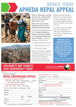
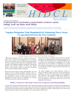

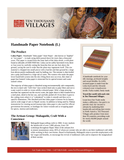
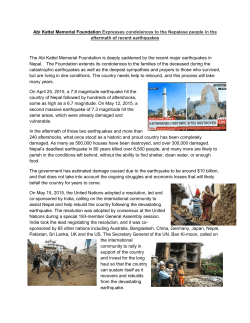

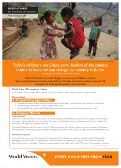
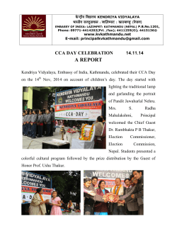
© Copyright 2026