
WWW.BARNQUILTTRAILS.CA ELGIN OXFORD NORFOLK MIDDLESEX BRANT
ELGIN OXFORD NORFOLK MIDDLESEX BRANT
WWW.BARNQUILT TR AILS.CA
E.O.N. is an Association of Curators and
Directors of Art Galleries, Museums,
Historical Societies, and Archives.
Originally, all of the association’s
members were located within the
Counties of Elgin, Oxford and Norfolk.
Our acronym might reflect the location
of the founding organizations, but our
membership has since expanded to
include heritage-cultural sites in Perth,
Middlesex and Brant Counties.
Through regular meetings and joint
professional and marketing activities,
E.O.N. members share resources, plan
cooperative projects and events, assist
each other, and work together to further
develop heritage-cultural goals for
our geographical area as well as our
respective communities. The Southwest
Ontario Barn Quilt Trails is our latest and
most exciting cooperative venture.
We hope that you enjoy reading through
this guide and that you take the time to
follow at least some of our trails outlined
here. Also take the time to stop in at our
many member sites; history is exciting!
ELGIN OXFORD NORFOLK MIDDLESEX BRANT
You can also
find us online!
Discover the trails online!
Our website features detailed histories of many of the
locations, including more photos and more images of the
barn quilt designs. Use our interactive maps to plot your
own route to the different sites. Links to other local tourism
information are also supplied.
Scan this QR code with a smartphone for a
direct link to the Southwest Ontario Barn
Quilt Trails website
W WW.BARNQU
ILT T R Barn
AILSQuilt
.CA Trails
Southwest Ontario
| 5
HISTORY MADE LOCAL
Contents
Ontario’s Southwest
Barn Quilt Trails
5
INTRODUCTION
7
FOREWORD
8
REGIONAL MAP
Barn quilt trails use colourful, decorative murals based on quilt block designs
as markers to signal historical and other points of interest. The quilt blocks are
painted on an eight foot square wooden frame hung on the side of a barn or
farm building or set on free standing posts.
10
BRANT COUNTY/BRANTFORD
20
ELGIN COUNTY
30
MIDDLESEX COUNTY
40
NORFOLK COUNTY
50
OXFORD COUNTY
60
ACKNOWLEDGEMENTS
The gateway to Ontario’s southwest
Following in the footsteps of Thomas Talbot
Tales of war, struggle and triumph
A land of opportunity
They highlight not only this history in a
refreshing way but also, in the beauty
of the quilt designs themselves, the
creativity of our many communities.
All of the trails are accessible by car
Stories of settlement and rural prosperity
Four Corners
6 | www.barnquilttrails.ca
With fertile soils, the diversity of
Carolinian forest and easy access to
Lake Erie, it’s no wonder Ontario’s
southwestern region has long been a
centre of human settlement, first by the
peace-loving Attawandaron First Nations
and later by many others from around
the world seeking refuge or opportunity.
The Southwest Ontario Barn Quilt Trails,
which run through the Counties of
Middlesex, Elgin, Oxford, Norfolk and
Brant as well as the City of Brantford,
tell the stories of the communities,
families and events that comprise the
region’s rich heritage.
Friendship Block
Empire Star
or bicycle but please remember that
the barn quilts are located on private
property. You can travel one or more
trails, or just explore part of a trail.
Two hundred years ago, pioneers
employed the power of community at
quilting bees to keep families warm
at night. Once again it is community
that warms our region, this time by
having created access to its memorable
moments through art.
Enjoy our history and the scenic
lakeshore, bustling towns and
picturesque countryside of our present.
Whether it’s a history new to you or
a pleasant pastoral view, prepare for
surprises — and many delights!
Elm’s Strength
Crossroads
Southwest Ontario Barn Quilt Trails | 7
FOREWORD
designing a trail to our past
The Elgin, Oxford, and Norfolk
Association of Museums (EON) was
awarded a grant in 2011 to establish
a barn quilt trail through the five
counties of the Sand Plains region
(Elgin, Oxford, Norfolk, Middlesex
and Brant). Along with our partners in
Middlesex, Brantford and Brant County,
the museums, archives and galleries of
EON have assembled 100 quilt locations
along the historic highways and roads of
our region.
Our project was inspired by the
popularity of barn quilts in the
United States where many counties
have sponsored these trails as a way
to encourage tourism and provide
commercial opportunities to businesses.
It builds on a trail already established at
Wardsville in Middlesex County. Another
trail was established in northern
Ontario’s Temiskaming District and a
trail is also currently being developed
in the southwestern municipality of
Chatham-Kent.
A wide variety of historic sites, longestablished farms and museums have
been assembled to act as hosts for the
quilt blocks. For the past year, hundreds
of volunteers including quilters,
historians and many community groups
have laboured to produce the stories
and blocks that now stretch along the
Southwest Ontario Barn Quilt Trails.
community initiatives the Fund has
contributed to, in its objective “to build
a stronger, more diversified economy”
in our region.
We also wish to acknowledge the
guidance and expertise of the
Wardsville Barn Quilt Trail leaders Mary
Simpson and Denise Corneil, who acted
as consultants on this project.
Within each county on the trail,
EON members led the creation and
implementation of a local committee
charged with finding volunteers,
locations, writing histories, and in some
cases raising funds to see the trail built.
They have done a magnificent job.
And finally, a big thank you to the site
hosts, who have made this trail possible
by contributing the sides of their barns
or the fronts of their yards to host
a block.
As the trail continues to grow with
new sites and blocks, we look forward
to welcoming you back to revisit the
Southwest Ontario Barn Quilt Trails and
the many attractions and experiences
along their routes.
Mike Baker, Project Coordinator
Mary Gladwin, EON Chair
We are very grateful to the Sand Plains
Community Development Fund for its
support of this project. It is one of many
8 | www.barnquilttrails.ca
“Irish Star” - Elgin County Barn Quilt Trail
Southwest Ontario Barn Quilt Trails | 9
Annandale House
Brantford Farmers Market
Wardsville
Barn Quilt
Trail
Elgin Arts Trail
Waterford Heritage Museum
Toronto
LAKE HURON
407
401
Stratford
OXFORD
QEW
LAKE ONTARIO
Brantford
403
QEW
MIDDLESEX
Port Huron
London
402
BRANT
401
Niagara Falls
HALDIMAND
SARNIA - LAMBTON
NORFOLK
ELGIN
Detroit
LAKE
ST. CLAIR
CHATHAM - KENT
401
LAKE ERIE
WINDSOR - ESSEX
PELEE ISLAND
10 | www.barnquilttrails.ca
The Southwest Ontario Barn Quilt Trails is a project of the
Elgin, Oxford and Norfolk Association of Museums. We are
very grateful to the Sand Plains Community Development Fund
for our intitial funding and wish to acknowledge the tremendous support from community groups and quilt block hosts
across the region whose have made these trails possible.
Southwest Ontario Barn Quilt Trails | 11
BRANT &
BRANTFORD
BRANT COUNTY
Lorne Park
Gateway to Ontario’s southwest
Harmony Square, Brantford
Fishing in Paris ON
K
nown as the gateway to Ontario’s
southwest, the area which
encompasses the County of Brant,
the City of Brantford, Six Nations of
the Grand River Territory, and the
Mississaugas of the New Credit First
Nation, is also the location of many
intriguing moments in Canadian history,
not to mention home to several notable
Canadians. Long before European
settlement, the Grand River Valley was a
major First Nations trading district.
In 1784, the British government granted
land six miles on either side of the river
from Lake Erie to present-day Fergus
to its First Nations allies when they left
the United States for Canada after the
American Revolution. One of those who
arrived in this newly formed territory
was Joseph Brant (Thayendanegea),
who would eventually open it to
European and American settlers.
In nearby Brantford, hockey legend
Wayne Gretzky gained his first
skating experience in a backyard rink.
Telephone inventor Alexander Graham
Bell also called this city home.
The area and its residents were of great
tactical importance during the War of
1812. Many of the stops along the quilt
block trail detail moments from the war.
They also highlight the area’s engaging
architectural and community heritage.
In Paris, whose industry was built in the
1800s on gypsum deposits and knitting
mills, explore the cobblestone homes
and breathtaking view of the Grand
River that has earned the community
the title “prettiest little town in Canada.”
The Grand River is a designated
Canadian Heritage River and as you
follow its storied past, enjoy the many
other attractions available. With over 70
kilometres of trails, including a portion
of the Trans-Canada trail, nature is only
a short walk, cycle or snowshoe away.
From outdoor adventures and family
fun, to funky bistros and fine dining,
there are culinary and recreational
experiences to suit everyone’s taste.
Savour a delicious strawberry drink, a
Bell Homestead National Historic Site
Brantford International Jazz Festival
hallmark in Iroquoian culture, or attend
the annual Bread and Cheese Day,
a celebration established by Queen
Victoria to honour the Six Nations
community’s allegiance during the War
of 1812.
For more information visit
www.discoverbrantford.com or
call 1-800-265-6299.
You can also visit www.brant.ca or call
1-888-250-2296.
Southwest Ontario Barn Quilt Trails | 13
BRANT COUNTY
Wheels #1
443, 8th Concession, Burford Township
Situated between Kenny Creek and Horner Creek, both
tributaries of Whitemans Creek, this area is rich in agriculture. Nearby Harley Road is known as the “Quaker
Trail” for its historical significance as a route for early
settlers. The “Wheels” pattern represents its significance
as a transportation route, while the red, white and blue
colours evoke the Dutch heritage of the landowners, the
Vandenberg family.
The Fallen #2
King Street West, Burford
Burford Pioneer Cemetery
The community of Burford is over 219 years old, and was
a prominent British outpost by the time of the War of
1812. The pioneer cemetery land was donated by Loyalist settler John Fowler in 1799. The first burial took place
in 1800. It’s the final resting place for many prominent
local figures. Commemorative plaques in the cemetery
share more of the community’s rich history.
Old Oak Tree #3
Maple Ave. North, Burford
Art Cadman Lions Park
The ancient oaks in Art Cadman Lion’s Park were once
part of an oak savannah plain that stretched east to
Brantford and south to Norfolk. Many local stories can be
traced to Whiteman’s Creek and the settlement of this
area. The park was dedicated during the Burford Fall Fair
in 1967. New trails and picnic areas provide a pleasant
rest stop.
Edgar Fields #4
925 Rest Acres Road, Paris
Edgar Barn Studio
This heritage barn was built by James Allan Edgar and
John Guthrie Edgar after the turn of the 20th century.
Owners Marsha Deans Edgar and John Edgar, are descended from local farming families that emigrated from
Scotland. This original quilt block represents their strong
family ties to rural life. Still a working farm, this barn is
now an art studio, performance space and hockey rink.
14 | www.barnquilttrails.ca
Paris On The Grand #5
51 William Street, Paris
Paris Museum & Archives
Visitors to Paris marvel at its beauty and history – the
lovely cobblestone and brick buildings, the rivers, bridges, and parks. Located on property that was once the
fairgrounds, this building and the surrounding parkland
reflect that history. Constructed in 1922 as an arena, and
now home to the Paris Museum and Archives, this Community Centre celebrates Toronto Maple Leaf hockey
great and later M.P.P., Sylvanus Apps.
Corn & Beans #6
Paris, ON
Paris Rd. is a main route between Paris and nearby
Brantford, but it was once a toll road owned and operated by David Patten, an early settler to the area. First
settled in 1829 by Hiram Capron and incorporated as
a town in 1856, Paris is named for the nearby gypsum
deposits that were used to make plaster of Paris.
Hoodless Homestead #7
359 Blue Lake Road, St. George
Adelaide Hunter Hoodless Homestead
National Historic Site
Adelaide Hunter Hoodless Homestead National Historic
Site portrays rural life in the 19th century. Adelaide was
instrumental in the establishment of the YWCA, VON,
National Council of Women, the Women’s Institute and
domestic science in public schools. Built in 1851 and
restored and furnished to properly reflect her era (18571910), the Homestead is open to the public.
Spinning Colour Wheel #8
20 Ava Road, Brantford
Glenhyrst Art Gallery of Brant
Located in Glenhyrst Gardens, a beautifully landscaped
16-acre park on the banks of the Grand River, this historic home was bequeathed to the City of Brantford by
Edmund Cockshutt in 1957, with directions that it be a
place for artistic and cultural pursuits. Glenhyrst Art Gallery of Brant is a public, nonprofit art gallery.
Southwest Ontario Barn Quilt Trails | 15
BRANT COUNTY
Window To The Past #9
Jacob’s Ladder #13
Acquired by the Brant Historical Society in 1951, this
building is home to the Brant Museum & Archives. Built
in approximately 1879 by Fredrick Brendon, it was home
to Rev. William Cochrane from 1883 to 1896. Founded
in 1908, the Brant Historical Society operates three local
museums. This pattern is taken from a quilt in
the collection.
Built by John McEwan, one of several settlers who came
from Scotland to Mount Pleasant in the 1850s, this yellow brick house is built in the Victorian Italianate style.
Now home to Red Red Bobbin Quilt Shop, specializing in
fabric and longarm quilting services, it is owned by Louise Clarke and Jim Blumer. Visit www.redredbobbin.com.
57 Charlotte St., Brantford
Brant Museum & Archives
495 Mount Pleasant Rd., Brantford
Red Red Bobbin Quilt Shop
Woodland Cultural #10
Centre Quilt
Patriot’s Star #14
The Woodland Cultural Centre is a First Nations educational and cultural centre. It was established in 1972
to protect, promote, interpret, and present the history,
language, intellectual and cultural heritage of the Anishinaabe and Onkwehon:we. Our member Nations include:
Wahta Mohawks, Six Nations of the Grand River and the
Mohawks of the Bay of Quinte. Open year-round.
This property is part of the Phelps Tract, a 1,200-acre
parcel of land granted by Joseph Brant in 1804 to his
friend and advisor Epaphras Lord Phelps. Phelps advised
that the Six Nations remain neutral during the War of
1812 and was forced to flee to America, leaving behind
his wife and children. Now it is home to Linda Phelps
Guest and Doug Guest, who operate a bed and
breakfast.
184 Mohawk Street, Brantford
538 Mount Pleasant Road, Mount Pleasant
Be My Guest Bed & Breakfast
Friendship Circle #11
McAlister Thistle #15
Located near Lions Park in Brantford, close to the Grand
River and trails, this area will become the War of 1812
Peace Garden in 2013. Located just south of “Brant’s
Ford,” it is along the route travelled by American General
Duncan McArthur during his raid on the Grand River Territory in 1814. Like the garden, the Friendship Circle quilt
block symbolizes 200 years of peace.
The McAlister family’s connection to Mount Pleasant
goes back 200 years. Born in Ireland to Scottish parents,
Samuel McAlister came to Upper Canada from America
around 1800, settling first at Long Point in Norfolk
County. Originally property of the Sturgis family, this
home was acquired by the McAlisters in 1918 and has
been a prosperous dairy and crop farming operation for
several generations.
Bell’s Telephone #12
Double Wedding Ring #16
One of Ontario’s oldest historic house museums, the Bell
Homestead National Historic Site is the family home of
Alexander Graham Bell, inventor of the telephone. Brantford is known as the Telephone City, and this original
quilt block represents the first telephone. The museum
and café are open to visitors.
The Bryning Manse, owned by Michael and Delia
O’Byrne since 1986, is named for Rev. John Bryning
(1770-1853) who came to Mount Pleasant as the first
resident minister c. 1828. Bryning officiated at most of
the marriages in the hamlet for many years, so many
that his children were able to recite the ceremony from
memory! In later years Bryning also preached from
the manse.
Gilkinson St. at Mount Pleasant Road, Brantford
War of 1812 Peace Garden
94 Tutela Heights Rd., Brantford
Bell Homestead National Historic Site
16 | www.barnquilttrails.ca
641 Mount Pleasant Road, Mount Pleasant
676 Mount Pleasant Road, Mount Pleasant
Southwest Ontario Barn Quilt Trails | 17
BRANT & BRANTFORD POINTS OF INTEREST
Crossroads #17
704 Mount Pleasant Road, Mount Pleasant
Devlin’s Country Bistro
This former general store, post office and residence
has been a meeting spot in Mount Pleasant since being
built c. 1834 by Russell and Juletta Sturgis Hardy. It is
the birthplace of Arthur Sturgis Hardy, 4th Premier of
Ontario (1896-1899), who was born during the Rebellion
of 1837. The Devlins have prospered here for over 125
years, and Devlin’s Country Bistro continues the tradition
of hospitality.
Our Mount Pleasant Home #18
Mount Pleasant Road, Mount Pleasant
Mount Pleasant Pioneer Cemetery
Situated at the main crossroads, the Mount Pleasant
Pioneer Cemetery is designated by the County of Brant
under the Ontario Heritage Act. Granted as a burying
ground upon the death of village co-founder Thomas
Sturgis in 1802, the cemetery contains settlers and
residents from all walks of life including several veterans
of the War of 1812, businessmen, landowners, local
legends, pioneer women, and children.
Water Wheel #19
109 War Road, Brant County
A mill was built in this location c. 1801, and the land
acquired by Captain Thomas Perrin Sr. in the early 1800s.
In 1811, Perrin raised a militia flank company of settlers.
Known as “Captain Barefoot” to his men, he later led
Perrin’s Company 5th Lincoln Militia at Lundy’s Lane. Perrin’s mill was torched on Nov. 6, 1814 during McArthur’s
Raid, but was quickly rebuilt.
Musket Balls #20
Oakland Lion’s Park
Oakland Pioneer Cemetery
In late 1814, American General Duncan McArthur set out
from Detroit with the intent to attack the British at Burlington Heights. Destroying many mills and resources on
his route, the Americans eventually arrived at Malcolm’s
Mills (now Oakland) where he encountered 400 Oxford
and Norfolk militia on November 6, 1814. The skirmish
that took place here would be the final one of the war.
18 | www.barnquilttrails.ca
Adelaide Hunter Hoodless Homestead
359 Blue Lake Road, St. George
www.adelaidehoodless.ca
Bell Homestead National Historic Site
94 Tutela Heights Road, Brantford
519-756-6220
www.bellhomestead.ca
Brant Museum & Archives 57 Charlotte Street, Brantford
Brant Twin Pad Arena
519-448-1130
519-752-2483
www.brantmuseums.ca
944 Powerline Road, Paris
519-442-1944
www.brant.ca
Burford Agricultural Society & Fairgrounds
6 Park Ave, Burford
519-753-7242
www.brantmuseums.ca
Canadian Military Heritage Museum
347 Greenwich Street, Brantford
Earl Haig Family Fun Park
www.cmhmhq.ca
101 Market Street South, Brantford
Glenhyrst Art Gallery of Brant
519-759-1313
519-758-0963
www.brantford.ca
20 Ava Road, Brantford
519-756-5932
www.glenhyrst.ca
Her Majesty’s Royal Chapel of the Mohawks
301 Mohawk Street, Brantford
519-756-0240
www.mohawkchapel.ca
Myrtleville House Museum
34 Myrtleville Drive, Brantford
519-752-3216
www.brantmuseums.ca
Mount Pleasant Nature Park
755 Mount Pleasant Road, Mount Pleasant
519-442-6324
www.brant.ca
Paris Agricultural Society & Fairgrounds
139 Silver Street, Paris
519-442-2823
www.parisfair.com
Paris Museum & Historical Society
15 William Street North, Paris
www.parishistoricalsociety.com
Sanderson Centre for the Performing Arts
88 Dalhousie Street, Brantford
Woodland Cultural Centre
519-442-9295
519-758-8090
www.sandersoncentre.ca
184 Mohawk Street, Brantford
519-759-2650
www.woodland-centre.ca
Tourism Information
399 Wayne Gretzky Parway, Brantford ON
Phone: 519-751-9900
Toll free: 1-800-265-6299
Email: [email protected]
Website: www.discoverbrantford.com
66 Grant River Street North, Paris ON
Phone: 519-442-6324
Toll free: 1-888-250-2296
Email: [email protected]
Website: www.brant.ca
Southwest Ontario Barn Quilt Trails | 19
7
NORS
GOVER
RD
23
PAR
I
ON
D
NS
DU
SR
D
FAIRVIEW
403
FAIRVIE
D
RLINE
ST
ST
WE
18
MC
GIL
BU
RTC
D
D
HR
D
4
5
Wheels
443 8th Concession, Burford
The Fallen
King Street West, Burford
Old Oak Tree
Maple Ave North, Burford
Edgar Fields
925 Rest Acres Road, Paris
Paris On The Grand
51 William Street, Paris
20 | www.barnquilttrails.ca
6
7
8
9
Corn & Beans
Paris, ON
Hoodless Homestead
359 Blue Lake Road, St. George
Spinning Colour Wheel
20 Ava Road, Brantford
Window To The Past
57 Charlotte Street, Brantford
Woodland Cultural Centre
10 184 Mohawk Street, Brantford
20
KING ST
FAIRFIELD
PLAIN
LD RD
D
3
INE R
WNL
2
4
MOUNT
PLEASANT
19
D
LE TO
NEW DURHAM
1
24
FAIRFIE
18
TOURISM INFORMATION
COCK
SHUT
TR
MIDD
25
202
Y RD
D
SR
IS A
VE
16
18 17
BR
LP
LR
ELL
UNT
CO
ANT
KSH
T RD
D
T R 11
AN 24
TR
HE
MT P
LEAS
AN
24
10
12
14 P
15
BRANT
18
UT
PLEASA
13
PLE
MT
D
ATE R
OPSG
AVE S
202
E
COLBORNE ST
AS
RD
16
BISH
E
MAPL
1
HENRY ST
ELGIN ST
CO
C
E RD
NT RIDG
LN
24
CES
8TH CON
403
Y
S
ACRE
2
18
W
KY PK
ST
REST
3
D
AR
LL
E
SH
VE
EA
ERI
24
K
RNE
ST W
403
AW
OH
M
E ST W
53
D
SION R
9
COLBORN
O
COLB
RD
BRANTFORD
D
BRANT COUNTY HWY
VE
TA
AN
SR
ACRE
N
E AVE
MAPL
BURFORD
CATHCART
HOLMEDALE
D
ATE R
OPSG
D
BISH
INE R
WNL
25
BR
REST
LE TO
MIDD
EL RD
RD
11
403
4
BETH
16
LYNDEN
403
403
403
LYNDEN
W DR
8
25
11
ST
ETZ
E GR
WAYN
POWE
D 32
LINE R
R
POWE
HILLS
6
RES R
PRINCETON
217
WYNDHAM
CLARENCE ST
ETONIA
KI
ST
RD E
RD
AC
REST
NG
RD
5
PARIS
NORS
GOVER
11
RD
N LN
GREE
51
36
RD
RD
BRANT COUNTY
T
BRAN
14
KE
LA
K
CLAR
BRANT COUNTY
BARN QUILT TRAIL
E
BLU
NORS
GOVER
TRAIL ROUTE
COUNT Y ROUTE CONNECTIONS
OAKLAND
Friendship Circle
11 Gilkinson Street at Mount Pleasant Road
Bell’s Telephone
12 94 Tutela Heights Road, Brantford
Jacob’s Ladder
13 495 Mount Pleasant Road, Brantford
Patriot’s Star
14 538 Mount Pleasant Road, Mount Pleasant
McAlister Thistle
15 641 Mount Pleasant Road, Mount Pleasant
Double Wedding Ring
16 676 Mount Pleasant Road, Mount Pleasant
Crossroads
17 704 Mount Pleasant Road, Mount Pleasant
Our Mount Pleasant Home
18 Mount Pleasant Pioneer Cemetery
Water Wheel
19 109 War Road, Brant
Musket Balls
20 Oakland Lion’s Park & Cemetery, Brant
Southwest Ontario Barn Quilt Trails | 21
ELGIN COUNTY
ELGIN COUNTY
Anything Used
Following the footsteps of Thomas Talbot
“Welcome with Open Arms”
LAVENDER SENSE
Jumbo Monument
During the War of 1812, American raids
plagued the settlement, particularly
during 1814 as American soldiers and
sympathizers roamed freely along Lake
Erie between Detroit and Brantford,
burning mills and stealing horses.
After the war, more settlers arrived:
Highland Scots, Irish and Quakers from
Pennsylvania. Towns like St. Thomas
and Sparta appeared in the interior and
ports — Talbot and Stanley, for example,
developed along Lake Erie’s shores to
export grain and wood.
L
and fit for a King: That’s what Thomas Talbot must have thought when he spied
the fertile shores of Elgin County in 1803. Over the next 30 years, in his role as
official land agent, he would oversee the settlement of 3,000 new residents in the
area stretching from Woodstock to Windsor. Settlers fulfilled conditions, such as
building roads and clearing land, to finalize the grant. Talbot penciled in settlers’
names on his land chart so if they didn’t perform he could erase them and grant the
land to someone else.
Historic 1840 lighthouse, Port Burwell
Railways arrived in the 1850s. Over the
next 100 years a multitude of railways
were established in St.Thomas, and the
city has been aptly named the “Railway
Capital of Canada”. It was here in 1885
that Jumbo the elephant, part of P.T.
Barnum’s Circus was tragically killed after
being struck by a locomotive.
Plants such as the Carnation Milk
Company and the Canadian Canners
Limited in Aylmer as well as cheese
factories and fisheries, made food
processing a key industry. Sandy soils
in the county’s east were ideal for
tobacco production and the Imperial Leaf
Tobacco Company opened a facility in
Aylmer in the 1940s.
Today, Elgin County’s storied past can be
found in the historic village of Sparta,
the Southwold Earthworks near Iona,
its many museums, and during annual
events such as Doors Open in September.
Experience the bounty of local gardens,
orchards and vineyards at festivals such
as Shedden’s Rosy Rhubarb Festival
in June or at one of the area’s many
restaurants. Create your own memories
during the Talbot Trail of yard sales in
August or at the Blue Flag beach in
Port Stanley.
For more information, visit www.
elgintourist.com or call toll free
1-877- GO ELGIN x 168.
Southwest Ontario Barn Quilt Trails | 23
ELGIN COUNTY
Peace Star #1
Irish Star #5
Thomas Ford, from Edinburgh, emigrated to the United
States in 1808 and eventually established a brewery in
Caledonia, New York. When war erupted in 1812, the
U.S. government confiscated Thomas’ horses to draw
munitions and compelled him to fight his countrymen.
After the war he abandoned the U.S. and settled here.
His sixth generation descendant now works the land. The
colours represent the Ford tartan.
Col. Thomas Talbot’s first settlers arrived near here in
1809 and were all related to Leslie Patterson, an Irishman from County Fermanagh. Each of the Star’s points
represents one of the four founding families – Backus,
Patterson, Pearce and Storey. The homes of these settlers and their descendants can still be found in this area.
The Backus-Page House was built in 1850 by
Andrew Backus.
20272 Talbot Line, West Elgin
Ford Farm
All Tangled Up #2
24810 Talbot Line, Eagle
McKillop Farm
The McKillops are a founding family of Elgin County; this
farm is now managed by the seventh generation. Originally from Lochgilphead in the Highlands of Scotland,
Duncan McKillop and his brother Archibald (30312 Talbot
Line) were among several Highland families who arrived
in 1818 on the ship, Mars. The 1913 barn, is a stable with
a hay mow above. The colours represent the McKillop tartan.
Four Corners #3
28143 Talbot Line, Dutton-Dunwich
Country Seat
These corners are named for Henry Coyne who arrived
here in 1817 and built an inn. For many years, Coyne’s
Road was the route south to the busy lake dock at Tyrconnell from which grain and timber were shipped. Wagons travelling to and from the port stopped here at one
of several hotels, including the McGugan Hotel which still
stands on the north side.
Rail Fence #4
Sponsored by the Wallacetown Women’s Institute
29593 Talbot Line, Wallacetown
Community Hall
Wallacetown is one of the early communities of the
Talbot settlement. Once known as Frogtown for the
frog-filled swamps in the vicinity, it was renamed for the
Scottish hero William Wallace. The hall was moved here
after World War II from the British Commonwealth Air
Training base at Fingal (#4 Bombing and Gunnery School)
and bricked over.
24 | www.barnquilttrails.ca
29424 Lakeview Line, Dutton-Dunwich
Backus-Page House Barn
Star of Bethlehem #6
30312 Talbot Line, Dutton-Dunwich
McKillop Farm
Archibald, the brother of Duncan McKillop – whose
descendants still manage the farm he cleared at 24810
Talbot Line – settled here in the early 1800s. A “fold” of
Highland cattle can be found in this field; a hardy breed
that survived in the Scottish Highlands with their long
hair. Nearby are the McKillop Cemetery and the Particular Covenanted Baptist Church, a denomination founded
by Scots in West Elgin in the 1820s.
Indian Trail #7
33280 Fingal Line, Southwold Township
Brown Farm
These corners are named for Col. Mahlon Burwell, who
surveyed many nearby townships and the Talbot Road
from Port Talbot east to Delhi and west to Windsor.
Afterwards, he built a home and registry office on the
northwest corner. Towards the back of the Brown Farm
are the remains of a double-palisaded First Nations fort,
now a National Historic Site open to the public.
Grist Mill #8
37632 Fingal Line, Southwold
Tufford Farm
The Tufford Barn occupies the site of the Neil McAlpine
farm. In the 1830s, when McAlpine settled here, the
Talbot Settlement was still small. When a severe frost
destroyed the wheat crop it transpired that only McAlpine had enough seed wheat to keep the settlers going.
He distributed a bushel to each of his neighbours asking
only for the same amount back at harvest time.
Southwest Ontario Barn Quilt Trails | 25
ELGIN COUNTY
Log Cabin #9
38662 Fingal Line, Southwold Township
Shaw Barn
Originally Smoak’s Corners, the village once located here
became known as Middlemarch, named after George
Elliott’s novel. One of the three American rail lines that
once passed through Elgin County, the Chesapeake and
Ohio, was built near the corner, c. 1900, where today
a plaque with historic photos stands. Fingal Line is the
original Talbot Road, surveyed c. 1810.
Corn and Beans #10
Sponsored by the Municipality of Central Elgin
9592 Sunset Road, Central Elgin
Hayhoe Farm
Drunkard’s Path #13
Sponsored by Sparta & District Historical Society
Morgan Nina’s - Corner of Sparta Line and Hiram
Smith Lane, Sparta
Three of Sparta’s four taverns voluntarily closed with the
rise of the temperance movement. Led by two ministers and Dr. Shannon, citizens lifted the license from
the fourth, the Ontario House. On its last day, patrons
lit torches and marched down Main Street intending to
burn the Baptist minister’s home. They changed their
minds when Dr. Shannon greeted them with a
loaded shotgun.
Baby Blocks #14
5277 Quaker Road, Central Elgin
Winter Wheat
For the 30 years preceding the building of the London
and Port Stanley Railway in 1853, what is now Sunset
Road was the main route to London. Supplies, settlers
and even the British Army travelled this road. This farm,
which produces corn and soybeans today, also produced
some of the gravel that improved the road over
the years.
This board and batten home was constructed in 1840
and features bargeboard trim. Here, Fred Sheppard, an
artist and true eccentric, lived without hydro, plumbing
or a furnace. In 1995, Mike Roberts and Lucy Ogletree
purchased the property and established their folk-art
business, Winter Wheat. Mike carves characters from
dead trees in the pine forest. In addition to her folk-art
paintings, Lucy has developed gardens.
Evening Star #11
Rippling Waters #15
45471 Sparta Line, Central Elgin
Zavitz-Bond House
Sponsored by Heritage Central Elgin
47972 Rush Creek Road
Pineo Farm
This site was once the home of Sarah Haight, the Quaker
Community’s first minister. Haight settled here in 1820.
This home, built by her son in 1837 is still owned by the
family. The barn behind contains elements of the original
Meeting House which was located on the site of the
present Quaker burial ground just east of here.
Across from the barn lies Catfish Creek on which scows
once took flour, lumber and whisky from the village of
Jamestown inland to Port Bruce on Lake Erie. In 1864
Thomas Pineo bought the village and turned its hotel
into a house. His grandson George Frank Pineo and
his family lived here on the former Dalley farm. Only a
bridge remains where Jamestown once stood.
Sugar Maple #12
Churn Dash #16
Until the 1930s, a huge sugar maple was located southeast of this barn about one mile from the four corners in
Sparta. Found by the surveyors who decided to build the
road (Sparta Line) around it, the tree became a landmark
known as the Sparta Mile Maple. For many years, the
stage coach stopped here to pick up mail from the locals.
One of Ontario’s largest collections of dairy industry artifacts resides in these buildings. Built up over a span of 30
years, the collection is the work of former dairy farmers
Andy and Lotty van Kasteren. Purchased in 2008 by Gay
Lea Foods, it is open to the public from Victoria Day to
Labour Day.
45644 Sparta Line, Central Elgin
Burgess Barn
26 | www.barnquilttrails.ca
48075 Jamestown Line, Malahide
Gay Lea Dairy Heritage Museum
Southwest Ontario Barn Quilt Trails | 27
ELGIN COUNTY POINTS OF INTEREST
Bike Wheel #17
Sponsored by McBain Signs & Graphic Design Inc.
50812 John Wise Line, Malahide
Luton Community Centre
Perry Doolittle, a Luton native, built the area’s first bicycle with the help of a nearby blacksmith in the 1860s. He
raced in the 1880s, won numerous trophies and, in 1896,
invented a braking system that became widely used. An
early auto enthusiast, he helped found the Canadian
Automobile Association and advocated for good roads
and a Trans-Canada road system.
Pinwheel Star #18
51200 Vienna Line, Malahide
Mennill Farm
One of a number of former tobacco farms in the area,
this farm today produces cash crops. The house was
built in the 1870s. The TransCanada Trail follows Vienna
Line east from here to the Village of Vienna, named by
Thomas Alva Edison’s grandfather, after his ancestors’
birthplace in Austria.
Lavender Sense
28011 Ash Line, Wallacetown
Old Rodney Jail
www.lavendersense.com
135 Queen Street, Rodney
Empire Valley Farmers Market
17 Robinson Street, Port Burwell
Port Burwell Lighthouse
The name compass rose comes from the figure’s compass points, which resemble the flower’s petals. It has
appeared on maps and charts since the 1300s, originally
to indicate wind direction, but is now used on all marine
charts. The adjacent lighthouse, built in 1840, is one of
Canada’s oldest wooden lighthouses. The Port Burwell
Marine Museum nearby has a fine collection of lighthouse lenses.
Railway Crossing #20
56486 Heritage Line, Straffordville
For 90 years, a rail line ran through this farm. The station
was located nearby and the station master lived across
the road. When he died, his daughter, Edith Allen, looked
after it until its closure in the 1980s. The line took tourists to the beach and hauled Ohio coal, conveyed on the
Ashtabula ferry from Port Burwell to Tillsonburg, largely
for use in CPR locomotives.
28 | www.barnquilttrails.ca
519-762-3504
27983 Talbot Line, Wallacetown
Elgin County Museum
519-631-1460 ext. 159
450 Sunset Drive, St. Thomas
www.elgincounty.ca
Forge and Anvil Museum
46316 Sparta Line, Sparta
The Sparta Tea Room
Main Street, Sparta
519-775-2292
519-775-2312
www.spartahouse.com
Rush Creek Wines
48995 Jamestown Line, Aylmer
519-773-5432
www.rushcreekwines.com
Wind Interpretive Centre
519-874-4054
5361 Brown Road, Port Burwell
North America Railway Hall of Fame
519-633-2535
750 Talbot Street, St. Thomas
www.narhf.org
Elgin Military Museum
30 Talbot Street South, St. Thomas
Compass Rose #19
519-762-2188
519-633-7641
www.elginmilitarymuseum.ca
Aylmer and District Museum
519-773-9723
14 East Street, Aylmer
www.amtelecom.net/~aylmermuseum/
Elgin County Railway Museum
225 Wellington Street South, St. Thomas
519-637-6284
www.ecrm5700.org
Port Burwell Museum & Historic Lighthouse
519-866-5521
Corner of Pitt & Robinson Street, Port Burwell
Edison Museum of Vienna
519-866-5521
14 Snow Street, Vienna
Heritage Line Herbs and Silver Birch Tea Room
53443 Heritage Line, Aylmer
519-866-5577
www.heritagelineherbs.com
Tourism Information
Phone: 519-631-1460 x 168
Toll Free: 1-877- GO ELGIN x 168
Email: [email protected]
Website: www.elgintourist.com
Port Burwell Marine Museum
& Lighthouse
519-874-4807
18 Pitt St, Port Burwell
The Jumbo Caboose
519-637-3326
Old Talbot St, St. Thomas
Port Stanley
Elgin County
Unit #3 & #4,
Economic Development and Tourism 302 Bridge St, Port Stanley
450 Sunset Drive, St. Thomas
Southwest Ontario Barn Quilt Trails | 29
ELGIN COUNTY
401
E
R
FR
N
LO
ON
D
AC
M
INE 3
TL
BO
IE
E
LIN
4
WEST LORNE
C
T
HA
HA
4
GA
6
RODNEY WALLACETOWN
M
E
R
T
AR
DU
VE
SIL
AD
RO
CHATHAM-KENT
AY
CL
2
EAGLE
UNION RD
7
FING
3
LIN
LL
3
FIN
401
IN
E
TA
L
FINGAL
5
LINE
13
17
SPARTA LINE
VIENNA LINE
PORT STANLEY
LAKE
AL L
INE
SPARTA
11 12
14
ATE LIN
E
19
18
20
STRAFFORDVILLE
SAWMILL RD
10
FRUIT RIDGE LINE
SUNSET DR
401
BO
T
RD
DUTTON
T IL
TALBOT LINE
SPRINGFIELD RD
NA
IO
RD
D
LR
3
OT TER
G
RICHMOND
AYLMER
NEW
SARUM
QUAKER RD
AM
AH
IVA
RD
RN
401
8
74
TALBOT LINE
9
JAC
KSO
NL
VIENNA
INE
JAMESTOWN LINE
DEXTER LINE
15
16
NOVA SCOTIA LINE
PORT BRUCE
19
PORT BURWELL
19
NEW GLASGOW
Y
3
RICHMOND RD
GR
N
FU
ISO
RD
RR
SHEDDEN
3
ST.
THOMAS
RR
CU
MO
2
TALBOTVILLE
L
TA
401
76
ST
UR
GH
D
AL
E
LIN
WALKER RD
-CA
R
TIE
UNT
D CO
R
URG
B
O
S
N
XF
LSO
SPRINGFIELD
IMPERIAL ROAD
MIDDLESEX
COUNT Y
O
LYONS
4
AY 401
EW
73
74
YARMOUTH CENTRE RD
2
BELMONT
NORFOLK COUNT Y
401
HIGHBURY AVE
CIT Y OF LONDON
WELLINGTON RD
ELGIN COUNTY
BARN QUILT TRAIL
GLE
NE
RIE
LAKE ERIE
3
1
TOURISM INFORMATION
TRAIL ROUTE
COUNT Y ROUTE CONNECTIONS
1
Peace Star - Ford Farm
20272 Talbot Line, West Elgin
6
Star of Bethlehem - McKillop Farm
30312 Talbot Line, Dutton-Dunwich
11
Evening Star - Zavitz-Bond House
45471 Sparta Line, Central Elgin
16
Churn Dash - Gay Lea Diary Heritage Museum
48075 Jamestown Line, Malahide
2
All Tangled Up - McKillop Farm
24810 Talbot Line, Eagle
7
Indian Trail - Brown Farm
33280 Fingal Line, Southwold
12
Sugar Maple - Burgess Barn
45644 Sparta Line, Central Elgin
17
Bike Wheel - Luton Community Centre
50812 John Wise Line, Malahide
3
Four Corners - Country Seat
28143 Talbot Line, Dutton-Dunwich
8
Grist Mill - Tufford Farm
37632 Fingal Line, Southwold
13
Drunkard’s Path - Morgan Nina’s
Corner of Sparta & Hiram Smith Line, Sparta
18
4
Rail Fence - Community Hall
29593 Talbot Line, Wallacetown
9
Log Cabin - Shaw Barn
38662 Fingal Line, Southwold
14
Baby Blocks - Winter Wheat
5277 Quaker Road, Central Elgin
5
Irish Star - Backus-Page House Barn
29424 Lakeview Line, Dutton-Dunwich
10
Corns and Beans - Hayhoe Farm
9592 Sunset Road, Central Elgin
15
Rippling Waters - Pineo Farm
47972 Rush Creek Road
30 | www.barnquilttrails.ca
Pinwheel Star - Mennill Farm
51200 Vienna Line, Malahide
Compass Rose - Port Burwell Lighthouse
19
17 Robinson Street, Port Burwell
20
Railway Crossing
56486 Heritage Line, Straffordville
Southwest Ontario Barn Quilt Trails | 31
LINE
MIDDLESEX COUNTY
MIDDLESEX COUNTY
Tales of war, struggle and triumph
Glencoe Train Station
Delaware Speedway
F
rom the first European settlers’ arrival
in the late 1700s to the early 1800s,
Middlesex County’s evolution was tied to
military interests.
In 1793 Upper Canada’s first LieutenantGovernor John Graves Simcoe recognized
strategic advantages in the area’s river
access to the western frontier and proposed
establishing a provincial capital at the
forks of the Thames River to be named
London. His proposal was rejected but in the
meantime, United Empire Loyalists from the
United States, drawn by rich soils and the
promise of a new start, settled southwest of
present day London at Delaware.
When war broke out in 1812, Middlesex
settlers became uneasy. By 1813 the area
west of the small British military outpost at
Delaware became a no-man’s land where
soldiers from both sides confiscated
settlers’ supplies.
Then, in 1814, American soldiers had
advanced along the Longwoods Road
planning to raid the Delaware outpost.
They occupied a hill overlooking the bridge
at Twenty Mile Creek, near present day
Wardsville. British soldiers, militiamen and
First Nations warriors attacked but were
unsuccessful and retreated. The American
soldiers, recognizing that they would be
outnumbered if attacked again, fled
to Detroit.
Equine in Middlesex
Within the next decades European and
First Nations communities appeared in the
area. Many early settlers were Highland
Scots and in several communities Gaelic was
commonly heard.
Northwest of London, Quakers settled at
Coldstream. At present day Lucan, they
helped create the short-lived Wilberforce
Colony, a refuge for former slaves, fugitive
slaves and free blacks from the United
States. It was in this area that the Irish and
the legendary Donnelly family settled in the
1840s. Lawlessness in the community and
long-standing feuds amongst neighbours led
to the 1880 murder of five members of the
Donnelly family by local vigilantes.
Wardsville Barn Quilt Trail
Experience Middlesex’s eventful history at
local museums or during the annual Doors
Open Middlesex event. Capture it live at the
annual Battle of Longwoods re-enactment in
May. Explore the county’s Carolinian forest
in its parks and conservation areas. While
visiting, sample the local fare from organic
greens to specialty meats. Search out Ailsa
Craig, home of the renowned Quilt Festival.
For more information, visit
www.tourmiddlesex.ca or
call 1-855-245-8951.
Southwest Ontario Barn Quilt Trails | 33
MIDDLESEX COUNTY
Dogwood #1
406 Longwoods Road, Newbury
Hosted by Scott and Lenore Patterson Farm
The dogwood tree signifies the dense deciduous forest which
greeted the settlers in the late 1700s. The woods were a
blessing and a curse. The Longwoods forest made travel
extremely difficult and the huge trees were a challenge to
clear, but the Carolinian species provided building materials,
shelter, tools, medicine, and food.
Log Cabin #5
5297 Longwoods Road, Appin
Hosted by John Cooper
This familiar quilt block represents the home of the early
settlers. Notice the welcoming yellow light shining from the
window. The dense Longwoods forest allowed for the construction of solid shelters. Ends were notched for a close fit.
Moss and mud blocked the draft. The hearth was the centre
of home: warmth, safety, food, and love.
Peace & Plenty #2
Grandmother’s Flower Garden #6
3515 Longwoods Road, Glencoe
Hosted by Brenda and Bill Miller
5338 Longwoods Road, Appin
Hosted by Anna and Peter Semowoniuk
The Loyalists were a combination of British and European
immigrants and American-born citizens who settled in the
Thirteen Colonies. Loyalty to Britain forced them to leave
property and possessions and move to the wilderness of Upper Canada to start over. 1812 brought another war and the
elusive dream of Peace and Plenty was put on hold again.
The hexagon is one of our best-loved and well-known quilt
patterns. Brought here by early settlers, Grandmother’s
Flower Garden reminded them of the beauty of their
homeland and the gardens they left behind. The honeycomb
mosaic, always hand-pieced and quilted, reflects our natural
world. The flower’s centre surrounded by petals, makes
use of the smallest scraps of fabric.
Elm’s Strength #3
Rosebud #7
The Traitor Tree and the Crooked Elm: could the tree used for
torture in 1814 be the same tree that died of old age in the
1940s? Many tales abound about the Crooked Elm, a Longwoods Road landmark. Less is known about the Traitor Tree
near Strathburn where George Ward was strung up by the
Americans to glean information about British troops.
It has been said that the women of early settlements treated
their sick with “home remedies and prayer.” In times of
famine, the First Nations women strung dried rose hips into
necklaces. The leaves and petals of the rose bush were used
to make a wide variety of medicines. Rich in vitamin C, rose
hips make great tea, jellies, sauces, soups and seasoning.
Geese In Flight #4
Fireside Visitor #8
The autumn arrival of southbound geese has long been a
harbinger of winter. October 1813 brought the Battle of the
Thames and with it thousands of hungry British and American
soldiers, First Nations warriors and their families and other
refugees. The settlers’ fields, gardens, animals and larders
were decimated. Wheat fields were torched as a military
tactic to ensure starvation. Famine was inevitable.
Fireside Visitor conjures images of warmth and friendship
but fire was used as a weapon against the defenceless settlers after the Battle of the Thames. The British retreated
and the Americans burned mills and fields so there would
be no food to feed the soldiers. How many hearths supplied
live coals to McArthur’s 700 men on 700 horses thundering
down Longwoods Road, burning as they went?
4135 Longwoods Road, Glencoe
Hosted By Kelly and Richard Jansen Farm
4833 Longwoods Road, Appin
Hosted by Carr Farm
34 | www.barnquilttrails.ca
5814 Longwoods Road, Melbourne
Hosted by John Sr. and Mary Wolfe
5914 Longwoods, Road, Melbourne
Hosted by Grant and Sharon Wolfe
Southwest Ontario Barn Quilt Trails | 35
MIDDLESEX COUNTY
Basket Weave #9
Baby Blocks #13
Before there were big box stores, pharmacies and druggists,
there was an incredible variety of local plants and trees.
The First Nations used the surrounding forest and tall grass
prairies for enrichment and even survival. The black ash tree
was the wood of choice for basket making. Sharing their skills
and knowledge of these treasures, the First Nations eased the
hardships of pioneer life.
Awaiting the birth of their babies, mothers-to-be prepared
warm coverings. First Nations women prepared skins and furs.
The settlers stitched quilts. Perhaps the expectant mothers
knew each other, visited, and shared their secret fears.
6278 Longwoods Road, Melbourne
Hosted by Gus and Betty Fletcher
7221 Longwoods Road, Melbourne
Hosted by Jim and Debbie Atchison
Old Rail Fence #10
Old Indian Trail #14
Building a split rail fence was an incredible amount of work.
One mile of fence required 8,000 rails. Cold soldiers burned
them to keep warm as they advanced and retreated along the
Longwoods. Imagine looking out over your land and seeing
fires in every direction, the sickening horror of years of hard
labour going up in a few hours of smoke.
Present day Longwoods Road bears no similarity to the
wilderness it was 200 years earlier. Thick growth did not
allow sun to penetrate. Travelers frequently lost their way
or encountered animals, soldiers or warriors. Swamp, snow,
fallen leaves and steep ravines hindered travel with only an
occasional wigwam to shelter travelers. Yet, it was a major
thoroughfare during the war.
Butterfly #11
Broken Heart #15
6410 Longwoods Road, Melbourne
Hosted by Sheila and Ted Hexter
7694 Longwoods Road, Mount Brydges
Hosted by Bonwill Farm
6781 Longwoods Road, Melbourne
Hosted by Bruce and Roxanne Carruthers
8280 Longwoods Road, Hosted by Robert Jr. and
Kim Parish, Robert Parish Trucking Ltd.
Sensing the warmth of spring, sometimes a butterfly emerged
during the dead of winter from a pupa brought in unknowingly with the firewood. The First Nations believed it was a sign
of the souls of relatives returning from the dead. If a butterfly
landed on you it was good luck. If you whispered wishes to a
butterfly when released, it carried them to the gods
for granting.
The state of heartbreak was constant. With their husbands
gone with the militia, those left behind lived in constant fear
and worry. Women accompanying their husbands to war
endured backbreaking labour and social isolation. The new
widow had to wed another soldier immediately or face ejection from the company. Too frequently, they suffered sudden
and traumatic loss. Broken hearts were just more casualties
of war.
Tall Pine Tree #12
Drunkard’s Path #16
Magnificent stands of Eastern White Pine gave the area
around Delaware its early name, “The Pinery.” This tall conifer
in eastern Canada yielded soft pale wood of great value to the
local economy, the developing United States, and the far-flung
British Royal Navy.
June 4, King George III’s birthday: the local militia mustered
and drilled with their pitchforks and assorted weaponry in
the King’s honour. They gathered on the river flats and the
women braced for the inevitable ribald behavior and drunkenness. The behaviour of the men, young and old, usually ended
with the majority having “drunk to excess.” The seeds of the
temperance movement were thus sown.
7004 Longwoods Road, Melbourne
Hosted by Anne & Ron Carruthers, Lonely Pine Consulting
36 | www.barnquilttrails.ca
8486 Longwoods Road, Mount Brydges
Hosted by City Slickers Family Restaurant
Southwest Ontario Barn Quilt Trails | 37
MIDDLESEX COUNTY POINTS OF INTEREST
Broken Dishes #17
8898 Longwoods Road, Delaware
Hosted by Hilltop Antique Flea Market
The family dishes came to Delaware, Upper Canada,
from the United States in 1796 with Joseph Kilbourne,
his sons Timothy and Aaron, and their brides the Woodhull sisters, Clement and Hannah. The Kilbournes and
Woodhulls, prosperous millers and farmers, were proud
of those handsome table settings but war came and at
the end of it all, the dishes were nothing but shards.
Lucan Area Heritage & Donnelly Museum
171 Main Street, Lucan
Museum Strathroy-Caradoc
2577 Gideon Drive, Delaware
Hosted by Coleen and Marty Thody
The sparsely settled Thames River valley had few roads,
villages or towns. Many women were isolated and lonely.
Visiting one’s neighbour was a rare treat, given the
difficulty of travelling through the forest, the distance
between farms, and the constant, backbreaking work
required to carve a home out of the wilderness.
34 Frank Street, Strathroy
Ska-Nah-Doht Village & Museum
Delaware Speedway
2115 Gideon Drive, Delaware
Hosted by ROKS Farms
Glaciers. Glacial lakes. Giant whales. Musk ox. Caribou
herds. Mammoths. Mastodons. Paleo Indians, 11,000
BCE. From these beginnings came Askunesippi, Antler
River, La Tranche, and finally the Thames, designated August 14, 2000 as a Canadian Heritage River. The river was
the lifeblood in the growth and history of Ontario.
1640 Gideon Drive, Delaware
1640 Gideon Drive, Delaware
Hosted by Delaware Speedway
Andrew Westbrook was a muscular red-haired Delaware
settler – a “giant of a man.” An American sympathizer,
his capture by General Brock at Detroit in 1812 intensified his actions as a traitor and spy. On January 31, 1814,
Westbrook invited his American allies to plunder his
own property in Delaware. Then he gathered his wife,
children and livestock together to watch as he torched
their buildings.
38 | www.barnquilttrails.ca
519-652-5068
www.delawarespeedway.com
Along # 2 HWY, near Wardsville
www.wardsvillebarnquilts.wordpress.com
Wardsville Golf Club
1948 Longwoods Road, Wardsville
519-693-4921
www.wardsvillegolfclub.ca
The Tall Trees B&B
519-264-9750
2550 Emerson Street, Mount Brydges
Komoka Railway Museum
519-657-1912
33 Queen Street, Komoka
Golden Gryphon Medieval Entertainment & Catering
519-287-5513
www.goldengryphon.ca
Texas Longhorn Ranch
1745 Melwood Drive, Strathroy
157 McRae Street, Glencoe
Victorian Pines B&B
64 Main Street, Glencoe
Clock Tower Inn
519-287-2015
www.southwestmiddlesex.ca
519-287-9909
www.bbcanada.com/victorianpines
Jefferson Junction Family Campground
4838 Switzer Drive, Appin
519-247-3644
www.texaslonghornranch.com
Glencoe Train Station
71 Frank Street, Strathroy
Fire & Smoke #20
519-264-2420
www.lowerthames-conservation.on.ca
21562 Tait’s Road, Glencoe
Thames River #19
519-245-0492
www.strathroymuseum.ca
8348 Longwoods Road, Mt Brydges
Wardsville Barn Quilt Trail
Next Door Neighbour #18
519-227-0756
www.donnellymuseum.com
519-289-2100
www.jeffersonjunction.ca
519-245-5656
www.clocktower-inn.com
Donald Hughes Annex Museum
159 George Street, Ailsa Craig
519-293-9388
Tourism Information
137 Frank Street, Strathroy, ON
Phone: 519-245-8951
Toll free: 1-855-245-8951
Email: [email protected]
Website: www.tourmiddlesex.ca
Southwest Ontario Barn Quilt Trails | 39
KERWOOD RD
RT
C
RD
VE
AL
20
DR
mount
brydges
E
D
OL
19
18
OODS
RD
A
IN
ST
RI
RD
17
TH
E
D
OL
AM
RD
8 Fireside Visitor
E
LD
5914 Longwoods Road, Melbourne
N
DO
DR
EN
DR
GL
9
appin
O
9 Basket Weave
6278 Longwoods Road, Melbourne
DU
10 Old Rail Fence
ND
6410 Longwoods Road, Melbourne
AL
D
E
NC
7221 Longwoods Road, Melbourne
ONYOTA’AKA
FIRST NATION
RD
GW
OO
MUNCEY DELAWARE
FIRST NATION
TH
AM
ES
401
RD
DS
4
CHIPPEWA OF
THE THAMES
FIRST NATION
OO
N
IO
SS
13 Baby Blocks
DR
GW
12 Tall Pine Tree
7004 Longwoods Road, Melbourne
2
RD
glencoe
RD
LO
N
6781 Longwoods Road, Melbourne
mayfair
5
ON
11 Butterfly
8
7
6
10
11
13
DS
CA
5814 Longwoods Road, Melbourne
RD
LV
7 Rosebud
2
12
melbourne
402
OO
T
ER
ES
RD
GW
5338 Longwoods Road, Appin
14
K
R
PA
DR
LO
N
6 Grandmother’s Flower Garden
DR
U
HO
LO
N
SE
DS
GL
EN
D
napier
Log Cabin
5297 Longwoods Road, Appin
15
MUNCEY RD
RD
4135 Longwoods Road, Glencoe
Geese In Flight
4833 Longwoods Road, Glencoe
ON
3 Elm’s Strength
16
DR
NE
UR
BO
EL
3515 Longwoods Road, Glencoe
delaware
LONGW
CH
M
2 Peace & Plenty
CIT Y OF
LONDON
ON
komoka
413 Longwoods Road, Newbury
5
402
GL
EN
D
strathroy
1 Dogwood
4
DR
MIDDLESEX COUNTY
MIDDLESEX
COUNTY
BARN QUILT
TRAIL
CO
3
14 Old Indian Trail
7694 Longwoods Road, Mount Brydges
2
15 Broken Heart
8486 Longwoods Road, Mount Brydges
2577 Gideon Drive, Delaware
19 Thames River - ROKS Farms
2115 Gideon Drive, Delaware
20 Fire & Smoke - Delaware Speedway
1640 Gideon Drive, Delaware
40 | www.barnquilttrails.ca
RD
18 Next Door Neighbour
Y
8898 Longwoods Road, Delaware
RT
17 Broken Dishes
newbury
GE
HA
16 Drunkard’s Path
CHAT HAM -KEN T
8280 Longwoods Road, Mount Brydges
wardsville
TOURISM INFORMATION
2
ELGIN COUNT Y
TRAIL ROUTE
401
COUNT Y ROUTE CONNECTIONS
1
LAKE ERIE
Southwest Ontario Barn Quilt Trails | 41
NORFOLK COUNTY
Tour de Norfolk
Carillon Tower
Backhouse Mill
P
eople and animals alike have prized
Norfolk County’s sandy shores and
lush Carolinian forest for centuries.
Long Point is a major stop for migrating
birds and a world biosphere reserve.
Until the Iroquois Wars in the midseventeen century the county was
home to several Attawandaron First
Nations settlements. It is therefore no
surprise that when the British began
settling Upper Canada in the late 1700s,
John Graves Simcoe, the colony’s first
Lieutenant-Governor, identified Lake
Erie’s shores as a priority. Simcoe
appealed to United Empire Loyalists in
New Brunswick to relocate to Norfolk
using free property as an enticement.
NORFOLK COUNTY
A land of opportunity
When war erupted in 1812, Norfolk
militiamen defended the colony on
land and water. Back at home safety
concerns escalated. In 1814, eight
American warships carrying 800 men
and artillery arrived at the mouth of the
Lynn River, and burned the mills and
homes in Dover Mills (Port Dover) and
Ryerse Mills (Port Ryerse). Marauders
ravaged many other mills and buildings
along the lake shore before retreating to
American territory.
After the war, Norfolk became a centre
Simcoe Park
of export for agricultural goods and
lumber. There was great demand for
Norfolk’s pine, used for shipbuilding.
Railroads arrived in the 1850s bringing
more changes and technology.
By the mid 1900s, Norfolk’s tobacco
production was in full swing, attracting
another wave of European immigration.
Today, niche crops such as lavender,
ginseng and peanuts have replaced
much of the tobacco acreage. The
county is also a becoming a hub for
grape and wine production.
There are many local museums and
historic sites to celebrate Norfolk’s
rich and eventful heritage. Some
preserve local architecture. Others offer
opportunities to experience the artifacts
and activities of days gone by, both on
and off the shores of this picturesque
county. While here, enjoy the coast’s
white sandy beaches and sparkling
waters that are ideal for boating. Take in
its relaxed atmosphere, antique stores,
local dining fare and singular attractions
like Port Dover’s Friday the 13th
motorcycle celebrations.
For more information, visit
www.norfolktourism.ca or
call 1-800-699-9038.
Southwest Ontario Barn Quilt Trails | 43
NORFOLK COUNTY
Garden Maze #1
845 Lakeshore Road, Jacksonburg
Sand Hill Park
This quilt pattern was inspired by a quilt that has
belonged to the homeowners’ family for four generations. John Alton and his wife Margaret Walker settled in
Houghton in 1854 and built the house presently on this
property. The Walkers originally came to Houghton from
Scotland in 1820. Thomas Alton, John’s father, came
from England in 1819 and first settled in Halton County.
Prisoner Exchange #2
350 Erie Blvd., Long Point
American and British ships met at Long Point, one of
the many sites where prisoners were exchanged during
the War of 1812. British prisoners, held in Frankfort,
Kentucky, were marched to Sandusky, Ohio, in July and
August 1814. They suffered from malaria and hunger
while the Americans stalled the exchange until September, fearing that the prisoners would reinforce the British
military in Niagara.
Mortar & Pestle #5
314 Front Road, Port Rowan
“Doctor” John Troyer (1753-1842) was a Tunker – a Baptist religion offshoot – from Pennsylvania who settled on
the flats below this property in 1793. He was an herbalist, diviner, hunter, farmer and miller whose superstitions
and fear of witches made him one of the area’s best
known pioneers. He is buried on this land with his wife
Sophronia, their son Michael, and his family.
Star Of Hope #6
1725 Front Road, St. Williams
Burning Kiln Winery
The Star of Hope pattern used in this location recognizes
the hope that exists in times of hardship. During the War
of 1812, many people on both sides of the conflict lost
crops, livestock, barns, homes, and even family members. Hope for a peaceful conclusion to the war became
the only way for many to carry on with their lives, after
personal tragic events.
Bird’s Nest #3
Birds In Air #7
115 Front Street, Port Rowan
Bird Studies Canada
Long Point Regional Conservation Area
Front Road, Fisher’s Glen
One of the area’s earliest settlers, Lucas Dedrick, came
to Long Point in 1793 and was granted a 200 acre parcel
that included the current site of Bird Studies Canada’s
headquarters. The Nature Conservancy of Canada, the
Natural Heritage League and the Norfolk Field Naturalists (through a bequest from Catherine Smale) and Bird
Studies Canada purchased the property in 1995 from the
Starling family.
Finch’s Mill (Fisher’s Glen) was burned on May 14, 1814
by Lt. Col. John Campbell and his American troops. As
in the raids that took place simultaneously on Dover
Mills and Ryerse Mills, the troops slaughtered livestock
and destroyed private residences, apparently retaliating against similar raids in Buffalo and other areas in
the Niagara region. A U.S. Army court of inquiry later
condemned this raid.
Grist Mill #4
No Place Like Home #8
John Backhouse, the original owner of the Backhouse
Grist Mill, was a Colonel in the Norfolk Militia as well as
the local Justice of the Peace. The gristmill was built in
1798 and was one of the few mills not burned during the
McArthur Raids in the War of 1812. It stayed in operation until 1957 and is now a National Historic Site
of Canada.
The Tisdale Mill located in Vittoria was not burned in
1814 as Thomas Bowlby a pioneer Mason from the
district appealed to General McArthur, who was also a
Mason to spare the mill because there was a large Masonic community in the area and this community would
suffer if the mill was burned. Bowlby was successful in
his appeal as the mill was spared.
1267 2nd Concession Road, Port Rowan
Backus Conservation Area
44 | www.barnquilttrails.ca
1231 Hwy 24 South, Vittoria
Cider Keg
Southwest Ontario Barn Quilt Trails | 45
NORFOLK COUNTY
Vittoria Challenge #9
Mariner’s Compass #13
Originally a tobacco farm, this land was used to also grow
strawberries, potatoes, wheat, rye, turkeys and hogs. In
1977 tobacco was still the primary crop but experimentation began with growing peanuts. Southwestern Ontario
is the only region in Canada suited to commercial peanut
growing because of its temperate climate and sandy soil.
By 1982 a processing plant and wholesale department
and retail store were established.
General Brock continued from Culver’s Tavern to Port
Dover, successfully mustering a force of about 50
regulars and 250 militiamen. Travelling in open long
boats along the north shore of Lake Erie, they arrived
in Amherstburg five days later. Since Brock and his
troops found that the Americans had already crossed
the Detroit River, on August 16, 1812 they undertook a
triumphant assault on Detroit.
393 Fisher’s Glen Rd, Vittoria
Kernal Peanuts
Courthouse Steps #10
Old Brock Street, Vittoria
Lamport Park
Established in 1796, Vittoria remained untouched by the
Americans during the War of 1812 despite having been
surrounded by troops. In 1815, a courthouse with jail
and registry office was constructed making Vittoria the
most active and important commercial centre between
Niagara Falls and Detroit. This distinction lasted for
nearly a decade until the night of St. John’s Day, 1825
when fire destroyed the courthouse.
Maple Leaf #11
2785 Front Road, Port Ryerse
Ryerse Glen Farm
Fort Norfolk was a minor fortification built at Turkey
Point. Following the retreat of British Major-General
Procter from Amherstburg in 1813 the British decided
to construct a fort on Turkey Point Hill to defend the
southwestern end of Upper Canada. Due to the unsuitability of the location the fort was abandoned after only
a blockhouse and part of a palisade had been built.
Empire Star #12
25 King Street, Port Ryerse
In May 1814, Amelia Ryerse received unwanted fireside
guests when American soldiers arrived with orders to
burn. As her mother pleaded with the commanding officer to spare their home, an officer wordlessly gathered
coals from the hearth. Every building was set ablaze –
except for the homestead.
46 | www.barnquilttrails.ca
44 Harbour Street, Port Dover
Port Dover Harbour Museum
Square Dance #14
Heritage Park, Hwy 6, Port Dover
According to local legend, in August 1813 Captain Robert
Barclay briefly abandoned his naval blockade of American warships in Erie Harbour to deliver “a pretty widow
from Amherstburg” to Port Ryerse. Once ashore, he and
his officers were invited to a party in their honour, and
stayed the night. When they returned to Erie, the American ships had escaped and were on the lake.
Log Cabin #15
34 Haldimand Road 55, South, Nanticoke
This barn quilt represents the Battle of Nanticoke, which
took place Nov. 13, 1813. The log cabin design signifies
the cabin of John Dunham, where the Norfolk volunteer
militia routed a band of American marauders who had
been pillaging area farms and terrorizing the countryside. This exploit inspired the British military forces and
the people of Upper Canada during the War of 1812.
Log Cabin 2 #16
Wheeler Road, Selkirk
Selkirk Provincial Park
In 1814, a party of American Marauders, consisting of
John Dickson, John Robinson, Henry Dochstader and ten
other unnamed Americans murdered Captain William
Francis, former confidante of Sir Isaac Brock at his farm
(presently Selkirk Provincial Park). Captain Francis had
been at the Battle of Nanitcoke and had testified against
Dickson, John Dunham and others at the Bloody Assizes
in Ancaster.
Southwest Ontario Barn Quilt Trails | 47
NORFOLK COUNTY POINTS OF INTEREST
Whirling Geese #17
Norfolk Street North, Simcoe
Simcoe Lynnwood Park
On August 8, 1812, Major General Isaac Brock travelled
to Culver’s Tavern in Norfolk to give a passionate speech
to the reluctant recruits, appealing to their patriotism
to the crown. With this speech, he attempted to disarm
the enemy and to unite the loyal. His ringing words had
the desired effect. The Norfolk militia turned out in great
numbers and was highly praised by Brock.
King’s Crown #18
Old Highway 24, Bloomsburg
Bloomsburg Park
In the early spring of 1812, the Norfolk Militia was
organized into two regiments commanded by Lieut.-Col.
Joseph Ryerson and Lieut.-Col. Robert Nichol. Members
of the Norfolk Militia saw action at most of the battles
on the Niagara Frontier. It was still active after the War
of 1812 and was called on during the Rebellion of 1837
and the Fenian Raids of 1866 to 1870.
Delhi Tobacco Museum & Heritage Centre
200 Talbot Road, Delhi
Norfolk Arts Centre
www.delhimuseum.ca
21 Lynnwood Ave, Simcoe
Port Dover Harbour Museum
519-582-0278
519-428-0540
www.norfolkartscentre.ca
44 Harbour St, Port Dover
519-583-2660
www.portdovermuseum.ca
Waterford Heritage & Agricultural Museum
159 Nichol St, Waterford
519-443-4211
www.waterfordmuseum.ca
Teeterville Pioneer Museum
519-443-4400
194 Teeter St, Teeterville
www.teetervillemuseum.ca
Norfolk Alligator Tug
519-426-5870 Ext. 1340
Lynn River South of Argyle St, South
www.norfolkalligatortug.ca
Norfolk War Memorial Carillon Tower
519-426-5870 Ext. 1340
Hwy 24 (Norfolk St) corner of Wilson Ave, Simcoe
www.norfolkcarillon.ca
Backus Heritage Conservation Area
519-586-2201
1267 2 Concession Rd, R.R. # 1, Port Rowan
www.lprca.ca/backus.htm
nd
Eva Brook Donly Museum
109 Norfolk Street, South, Simcoe
519-426-1583
www.norfolklore.com
Canada’s First Forestry Station -St. Williams Interpretive Centre 519-586-7175
Mill Wheel #19
3 Alice Street, Waterford
Waterford Hardware and Appliance
Moses Sovereen’s mill in Waterford was burned in 1814
by American General McArthur and his troops. The mill
was set on fire three times and, each time, Sovereen put
the fire out under threat of death. Finally he was seized,
taken up a hill and a rope put around his neck, ready for
the execution. When Sovereen made the Masonic sign,
his life was spared.
Hole In Barn Door #20
758 Concession 3, Wilsonville
Procyk farms (1994) Limited
After the Battle of Malcolm’s Mills on November 6, 1814
Brigadier General Duncan McArthur led an estimated
army of 700 men south, taking militia prisoner, burning
mills, homes and barns and stealing provisions. When
they reached Port Dover they did not find the reinforcements they expected due to the capture of Fort Erie
by the British. McArthur then returned to Detroit on
November 17, 1814.
48 | www.barnquilttrails.ca
885, HWY #24, St. Williams
Comfort Inn
www.forestryfarm.ca
85 Queensway East, Simcoe
www.comfortinn.com
Normandale Century Inn
519-426-8345
2326 Front Road, Normandale
www.normandaleinn.com
The Causeway Restaurant & Marketplace
50 Erie Blvd, Long Point
519-426-2611
1-800-272-4273
www.atplayadventures.com
Waterford Old Town Hall
76 Main Street, Waterford
Long Point Eco Adventures
1730 Front Road, St. Williams
519-443-0113
www.oldtownhall.org
519-586-9300
www.lpfun.ca
Tourism Information
30 Peel Street, Simcoe, Ontario
Phone: 519-426-9497 Toll free: 1-800-699-9038
Fax: 519-426-9689
Email: [email protected]
Website: www.norfolktourism.ca
Southwest Ontario Barn Quilt Trails | 49
NORFOLK
COUNTY BARN
QUILT TRAIL
6
Star Of Hope
Long Point Regional Conservation Area,
Front Road, Fisher’s Glen
Birds In Air
Front Road, Fisher’s Glen
7
8
No Place Like Home
1231 HWY 24 South, Vittoria
9
Vittoria Challenge
393 Fisher’s Glen Road, Vittoria
RD
RD
TFO
BRA
N
ST
MAIN
TILLSONBURG
24
NORFOLK NORTH
24
59
COURTLAND
NORFOLK WEST
DELHI
59
EDEN
3
LYNEDOCH
10 Courthouse Steps
11 Maple Leaf
2785 Front Road, Port Ryerse
ELGIN
COUNT Y
VITTORIA
FROGMORE
ST WILLIAMS
FAIRGROUND
44 Harbour Street, Port Dover
Heritage Park, HWY 6, Port Dover
16
Log Cabin 2
Selkirk Provincial Park, Wheeler Road
Whirling Geese
17 Lynnwood Park, Norfolk Street North, Simcoe
18 King’s Crown
HOUGHTON
SAND HILLS
CLEAR CREEK
TOURISM INFORMATION
20 Hole In Barn Door
TRAIL ROUTE
50 | www.barnquilttrails.ca
6
S
ER
HOR
LAKE
BOOTH’S
5
HALDIMAND
COUNT Y
6
14
13
D
ROA
11
12
NT
FRO
AD
RO
15
16
PORT DOVER
PORT RYERSE
FISHERS GLEN
NORMANDALE
TURKEY POINT
LONG POINT BAY
HARBOUR
3
MESSIAH’S
CORNERS
PORT ROWAN
OAD
PORT ROYAL
LAKE ERIE
19 Mill Wheel
3 Alice Street, Waterford
758 Concession 3, Wilsonville
4
ERIE SHORES
WIND FARM
Bloomsburg Park, Old HWY 24, Bloomsburg
6
2N
24
1
ION
ESS
ONC
DC
CULTUS
14 Square Dance
ORIA
VIT T
8
24
25 King Street, Port Ryerse
13 Mariner’s Compass
9
7
59
12 Empire Star
15 Log Cabin
34 Haldimand Road 55, South, Nanticoke
SIMCOE
24
10
Lamport Park, Old Brock Street, Vittoria
BLOOMSBURG
17
3
PINEGROVE
18
KEY
Mortar & Pestle
314 Front Road, Port Rowan
24
19 WATERFORD
Grist Mill
1267 2nd Concession Road, Port Rowan
5
20
WILSONVILLE
OXFORD COUNT Y
TUR
4
24
N
NORFOLK ST
Bird’s Nest
115 Front Street, Port Rowan
NORWICH
S
NORFOLK ST
3
BRANT COUNT Y
T RD
2
Prisoner Exchange
350 Erie Blvd., Long Point
TO KITCHENER/ CAMBRIDGE
TO HWY 403
POIN
1
Garden Maze
845 Lakeshore Road, Jacksonburg
NORFOLK COUNTY
BRANTFORD
2
LONG POINT
LO N
G POI
NT
COUNT Y ROUTE CONNECTIONS
Southwest Ontario Barn Quilt Trails | 51
OXFORD COUNTY
Norwich Museum
Local Farm
Meanwhile, Peter Lossing and Peter
Delong, Quakers from New York State,
bought 15,000 acres in the county’s
southwest in 1809 to found the Norwich
Quaker settlement.
OXFORD COUNTY
Stories of settlement and rural prosperity
The settlement was a catalyst for others,
including Otterville, a haven for free
blacks and escaped slaves from the
United States, and industrialist George
Tillson’s settlement of Tillsonburg begun
with the purchase of 600 acres west of
Norwich in 1824.
xford County’s diverse communities owe their start to Upper Canada’s
first Lieutenant-Governor, John Graves Simcoe. Appointed in 1792, Simcoe
believed that the security of his colony lay in developing a transportation route and
settlement in the southwestern interior. To this end he granted townships to land
agents, many United Empire Loyalists – people who remained loyal to the British
crown after the American Revolution – and required them to recruit settlers.
O
Tillson was among a wave of U.S.
settlers who were attracted to the
county’s fertile land. British settlement
promotions also brought Scottish,
German and Dutch settlers to the
county’s northern region.
The county was established in 1800. Over the next few decades, former British
navy and army officers who received land grants would populate Woodstock, now
Oxford’s main urban centre, and its surroundings.
After World War II, the sandy soils in
southern Oxford became a popular
destination for Dutch emigrants. There,
they and other farmers grew tobacco,
a major crop until recently. Amish emigrating from the United States arrived
around the same time.
Tulip Farm
Otterville Mill
Food production has always been key
to Oxford’s economy. At its peak, for
example, the county had 98 cheese
factories.
Today, there is still plenty of agricultural
activity in the county’s rolling hills,
ranging from dairy production to
niche field crops such as ginseng and
peanuts. Experience it firsthand along
with unique tastes fresh from the farm
gate at destinations like Birtch Farms
winery and orchards, Jakeman’s Maple
farm, local farmers’ markets and Gunn’s
Hill Artisan Cheese. There is plenty of
opportunity to explore the county’s
diverse heritage and fine examples
of period architecture at many local
museums and through annual events
such as Doors Open Oxford.
For more information, visit www.
tourismoxford.ca or call toll free
1-866-801-7368.
Southwest Ontario Barn Quilt Trails | 53
OXFORD COUNTY
Right Hand Of Friendship #1
293905 Culloden Line, Ingersoll
The perfect block to start your tour of Oxford Country
Barn Quilts is called the Right Hand of Friendship and
you will find the people of this predominately rural
county welcoming. The rich soil and rolling hills of the
area attracted pioneer settlement as early as 1789,
with the majority of the county being settled between
1820-1870. Dairy farms like this one owned by the Van
Manens have long been part of Oxford’s landscape.
Path Through the Woods #2
293140 Culloden Line, Verschoyle
This block on the 90-year-old Bowman family barn
symbolizes the dense forests that the early settlers of
Oxford had to tame. They created roads from paths
through the woods, felling thousands of trees to
establish farms and villages. The County was formally
established in 1850 and its motto reads “Labour
Conquers All Things” – a fitting tribute to the hard work
of our first settlers.
Cock’s Comb #3
163719 Brownsville Road, Brownsville
A rooster and chickens were an essential part of a
settler’s belongings. It seemed fitting to place this block
on the 1880’s barn of Janet Justus, operator of “The Hen
House Shoppe” located outside Brownsville. Named
for Brinton Brown Sr., who settled the area in 1842,
Brownsville was awarded a post office in 1854 as a result
of an election promise made by Sir Francis Hinks.
Arrowhead Puzzle #5
616 Broadway, Tillsonburg
Stubbes Countrywide
The block on the Stubbe’s Furniture Barn honours this
area’s First Nations. Prior to European settlement, Oxford
County was home to many First Native villages, one of
which was located just west of here. An archaeological
dig conducted in 2000 discovered an Iroquoian village
dating to approximately 1400. that covered over 20
acres, making it the largest known pre-contact Iroquoian
village of its time in southern Ontario.
Roads to the Station #6
41 Bridge St. W., Tillsonburg
Station Arts Centre
The coming of the railroad was an exciting event! This
block is located at the Great Western Railway Station
(1879-1975), which today has been repurposed to the
arts-based, community involved, Station Arts Centre.
The design originates from the Railroad Crossing pattern,
with each arm representing a function of the Station:
arts programming, galleries, in-house groups and visitor
information – all coming together at this heritage site.
New Water Wheel #7
20 John Pound Road Tillsonburg
Mill Tales Inn
Water was an important source of power for early
settlers. E.D. Tillson, son of Tillsonburg’s founder George,
created a milling empire by harnessing the power of the
Otter Creek. This block, located on Tillson’s Pea & Barley
Mill, built in 1878 and opened in 2009 as the Mill Tales
Inn, celebrates all the power generated on the creeks
and rivers of Oxford during the late 1800s.
Cross in a Cross #4
9 Patch Log Cabin #8
Settlers held religious services in their homes until
congregations grew large enough to build a church.
Often, Methodist circuit ministers were the only
ordained clergyman that pioneers of this area saw,
and soon Methodist churches dotted the landscape.
The Delmer United Church is built on the site of the
1840s frame church and this block on the church
barn remembers those early ministers who preached
throughout the wilderness.
This block represents the first building in Tillsonburg, a
two room log cabin built by George Tillson. Settling in
1825, George and Nancy Tillson with their five children,
became the fourth family in Dereham Township. Born
that same year, their sixth child Edwin Delevin, would
become Tillsonburg’s first Mayor (1872) and the
builder of Annandale House which has been nationally
designated for its ornate interior.
312281 Dereham Line, Delmer
Delmer United Church
54 | www.barnquilttrails.ca
30 Tillson Avenue Tillsonburg
Annandale National Historic Site
Southwest Ontario Barn Quilt Trails | 55
OXFORD COUNTY
Churn Dash #9
4860 Milldale Road, Springford
Leeholm Farms
The Churn was an important household item for the
early settler. Churns were used into the early 1900’s on
farms, like this century family dairy farm, that now has
the fourth generation of Holstein breeders living and
working on it. This barn was built in 1912 by Fred W. Lee,
a prominent Holstein judge and breeder to showcase the
famous herd of Haley and Lee.
Weathervane #13
225720 Otterville Road, Otterville
“Reading the signs” to forecast the weather was a talent
many settlers developed. To assist, early barns were
decorated with a weathervane and lightning rods. This
farm was settled by Job Church. Being a butcher by
trade, Job was one of the area’s early businessmen. Built
originally as a dairy barn, this is one of the few remaining
barns that were repurposed as a tobacco barn.
Envelope Motif #10
Tobacco Road #14
In 1905, Springford’s George Wilcox began lobbying
politicians to provide mail delivery to rural Canada since
urban residents already had that convenience. By June
1911, the first mail was delivered to the farmers in South
Norwich Township. Due to George’s prodding, the press
informed voters of this idea and it became an election
issue. He deserves the title “Father of Rural Mail Delivery
in Canada.”
This area’s cultural diversity developed most of its roots
from European and American settlers who were attracted to growing the rich tobacco crop. 1928 saw the first
crop grown in the township; 1930, on this farm. Since
1943, this has been home to the Van Torre family, who
developed it into a model tobacco farm. Today, it has
become repurposed as Van Torre Ginseng Farms.
592624 Oxford 13 Road, Springford
Canadian Biofuel
812868 Baseline Road, Norwich
Van Torre Farm
Church Window #11
Corn and Beans #15
250 Church Street, Otterville
African Methodist Episcopal Cemetery
325861 Norwich Road, Norwich
Corwic Farms/ Cornwell family
As early as 1829, free Blacks made their way to the
Otterville area and by 1840, their settlement was significant enough for a school to be built. By 1856, they
constructed their church on this site. Blacks settled here
near members of the Religious Society of Friends, where
they were accepted and felt safe. The area became a terminus for fugitives travelling the Underground Railroad.
Corwic Farms is owned and operated by four brothers and their families. The brothers are descendants of
Samuel Cornwell, an early settler in Norwich Township.
The Corn and Beans pattern represents the rich heritage
of crops grown in Oxford County, from the earliest settlers to present day. The Cornwells grow traditional crops
of both corn and soybeans and have diversified into
other types of beans.
Grist Mill #12
The Wagon Wheel #16
250 Main Street, Otterville
Recognized as an ideal mill site, with the building of Earl
and Avery’s Mill in 1807, Otterville became one of the
area’s early settlements. Quakers or members of the
Religious Society of Friends were also attracted here, as
were free Blacks and escaped slaves. The present mill
was constructed in 1845 by Edward Bullock, with the
concrete dam creating the mill pond being added by
Solomon Lossing in 1904.
56 | www.barnquilttrails.ca
89 Stover Street North Norwich
Norwich Museum/ Historical Society
The Norwich & District Historical Society is comprised
of a museum and archives. Buildings on site include the
1889 Quaker Meeting House and the 1811 Peter Lossing
Saltbox house. The Wagon Wheel represents the journey
of early Quakers settlers to Norwich Township in 1810.
The ‘Q’ is a testament to the rich Quaker history of Norwich Township and is the symbol of the
Historical Society.
Southwest Ontario Barn Quilt Trails | 57
OXFORD COUNTY POINTS OF INTEREST
Friendship Block #17
345609 Quaker Street, Norwich
This farm, presently owned by Hans and Ursula Habeggar, was first occupied by Joseph Throckmorton and
his wife, Adeline Delong whose father, Peter Delong,
accompanied Peter Lossing from Dutchess County, New
York, in 1810. The Friendship Quilt symbolizes the fact
that these families were among the original settlers on
Quaker Street. The Habeggars, who immigrated from
Switzerland in February 1992, run a dairy operation.
The Dutchman’s Puzzle #18
713829 Middletown Line, Burgessville
Couwenholm Farms
The ‘Dutchman’s Puzzle’ represents the integral role of
Dutch immigration to Oxford County, which began as
early as 1946. Henry Couwenberg emigrated to Canada
from the Netherlands in 1956. In 1965 he and his wife
Kay established Couwenholm Farms and apple orchard in
Burgessville. Burgessville has long been known as centre
for apple production and home to the first Fruit Growers
Co-Operative in the county.
Farmer’s Daughter #19
714318 Middletown Line, Curries
Kelner Farm
This block pays homage to the women of pioneer
families who worked alongside the men to settle Oxford
County. Hard work in both the field and the home created strong women whose influence can still be felt
throughout the County today. This block is located on
a Century Farm which was purchased by Orin Kelner in
1901 and handed down through four generations of the
Kelner family.
Wagon Tracks #20
505032 Old Stage Road, Oxford Centre
Innes Farm
Roads were the lifeline of pioneer settlement. Fittingly
“Wagon Tracks” is located on the historic Stage Road,
Southwestern Ontario’s first road. As early as 1829, this
important road saw up to 36 coaches and express riders
daily. It was also used by thousands of American settlers
taking a shortcut from New York to Michigan. Built in
1896 by Hubert Schell, this has been the Innes family
home since 1927.
58 | www.barnquilttrails.ca
Annandale National Historic Site
30 Tillson Ave, Tillsonburg
Norwich Museum & Archives
519-842-2294
www.tillsonburg.ca
89 Stover Street, North, Norwich
519-863-3101
www.norwichdhs.ca
Historic Otterville Mill & Station
Main Street, Otterville
519-879-6804
www.historicotterville.ca
Station Arts Centre
41 Bridge Street West, Tillsonburg
519-842-6151
www.stationarts.ca
Godelie Family Farm
519-879-6562
225754 Otterville Road, Otterville
Cowenburg Orchard Store
519-424-9922
R.R. #2 Burgessville
Ross Butler Studio-Agricultural Art Gallery 519-456-8155
708 Pattullo Ave, Woodstock
Gunn’s Hill Artisan Cheese Ltd.
445172 Gunn’s Hill Road, Woodstock
Seven Sisters Quilting
7 Main Street, Norwich
519-532-9189
www.gunnshillcheese.ca
519-863-2077
www.sevensistersquilting.biz
Canadian Harvard Aircraft Association
244411 Airport Road, Tillsonburg
519-842-9922
www.harvards.com
Norwich Deli & Bakery
519-863-2920
27 Main Street West, Norwich
Brown’s Country Corner Restaurant
519-879-6830
225737 Otterville Road
Salt Box Antiques
519-879-6757
222 Main Street East, Otterville
Oxford Honey & Supplies
519-550-1096
385296 Oxford County Road 59, Burgessville
The Hen House Shoppe
519-877-2798
163719 Brownsville Road, Brownsville
Tourism Information
580 Bruin Blvd. Woodstock, ON Canada
Phone: (519) 539-9800 Ext. 3355
Toll free: 1-866-801-7368
Fax: (519) 537-2718
Email: [email protected]
Website: www.tourismoxford.ca
Southwest Ontario Barn Quilt Trails | 59
D
OXFORD COUNTY
PERTH
T Y OF
D RD
-OXFOR
PERTH
FIELD
ELGIN
WASHINGTON
EMBRO
WOODSTOCK
UNION RD
C
D
BR
K
OC
ST
IN
L
DW
7
MILL TALES INN
JOHN
BA
ST
60 | www.barnquilttrails.ca
PRINCETON
OSTRANDER
DELMER
3 4
MUIR
17
16
NORWICH
15
NORWICH
14
ZENDA
9
SPRINGFORD
5
TILLSONBURG
6 8
7
W
RD
S
WA
BROWNSVILLE RD
ST
N
HI
POUN
D
AN
COUNT Y OF ELGIN
AY
DW
OA
GR
VE
EA
ST
HYMAN
ANNANDALE NATIONAL
HISTORIC SITE
BR
B
ON
GT
TW
ES
G
RID
8
OSTRANDER RD
DEREHAM
CENTRE
CULLODEN LINE
AIRPORT RD
E
K ST
NORWICH RD
E
tillsonburg
2
PROUSE RD
QUAKER ST
K LIN
ST
DANIEL RD
VERSCHOYLE
18
HOLBROOK
BURGESSVILLE
PLAN
N AVE
AY
DW
OA
BR
MOUNT ELGIN
RD
SALFORD RD
13
EBENZER RD
W
6
DEREHAM LINE
TILLSO
MCBETH RD
BRO
STATTION ARTS
CENTRE
1
E RD
19
SUBSTATION RD
FOLDENS
401
N ST
CESSIO
SW
SALFORD
STAG
MUIR LINE
INGERSOLL
505032 Old Stage Rd, Oxford Centre
592624 Oxford Rd 13, Springford
OLD
CURRIES RD
RD
G
UR
B
EA SWEABURG GUNN’S HILL RD
20 Wagon Tracks
10 Envelope Motif
2
401
DICKSON’S
CORNER
714318 Middletown Line, Curries
OXFORD
CENTRE
E
MIDDLETOWN LIN
19 Farmer’s Daughter
4860 Milldale Rd, Springford
HIGHWAY
MILLDALE
MILLDALE RD
10
OTTERVILLE
AN T
CO UN T Y OF BR
9 Churn Dash
CL
20
RD
K
AR
OXFORD
30 Tillson Ave, Tillsonburg
RD
RN
KA
THAMESFORD
TILLSON AVE/
CRANBERRY LINE
713829 Middletown Line, Burgessville
RAYSIDE
DUFFY LINE
18 The Dutchman’s Puzzle
GOBLES
403
345609 Quaker St, Norwich
8 9 Patch Log Cabin
CON
EASTWOOD
89 Stover St, North Norwich
20 John Pound Rd, Tillsonburg
401
GOLSPIE
WINDHAM LINE
17 Friendship Block
KINTORE
RICHWOOD
13
11 12
BASE LINE
7 New Water Wheel
HUNTINGFORD
3
16 The Wagon Wheel
ZORRA
325861 Norwich Road, Norwich
41 Bridge St, Tillsonburg
DRUMBO
INNERKIP
OXFORD ROAD
6 Roads To The Station
616 Broadway St, Tillsonburg
BLANDFORD BLENHEIM
GOBLES RD
15 Corn and Beans
812868 Baseline Road, Norwich
BENNINGTON
22
5 Arrowhead Puzzle
312281 Dereham Line, Delmer
225720 Otterville Rd, Otterville
401
OXFORD ROAD
14 Tobacco Road
STRATHALLAN
RD
4 Cross In A Cross
LAKESIDE
BLANDFORD
13 Weathervane
163719 Brownsville Rd, Brownsville
ILLS RDBLEHILLS RD
COB
3 Cock’s Comb
MEDINA
22
250 Main St, Otterville
BRIGHT
59
293140 Culloden Line, Verschoyle
EAST ZORRA - TAVISTOCK
BROOKSDALE
HIGHWAY
12 Grist Mill
PLATTSVILLE
RATHO
CASSEL
HARRINGTON
UNIONDALE
H
COBBLE
2 Path Through The Woods
MAPLEWOOD
RD
250 Church St, Otterville
293905 Culloden Line, Ingersoll
TAVISTOCK
OXFORD ROAD
11 Church Window
1 Right Hand Of Friendship
CO U N
OXFO
RD R
OXFORD COUNTY
BARN QUILT TRAIL
D RD
-OXFOR
PERTH
CORNELL RD
CORNELL
HAWTREY
COUNT Y OF NORFOLK
TOURISM INFORMATION
TRAIL ROUTE
COUNT Y ROUTE CONNECTIONS
Southwest Ontario Barn Quilt Trails | 61
SOUTHWEST ONTARIO BARN QUILT TRAILS
ACKNOWLEDGMENTS
EON Project Team:
Michael Adams, Executive Director
Elgin County Railway Museum
Michael Baker, Curator
Elgin County Museum
Nicole Drake, Arts & Culture Coordinator
Economic Development & Tourism,
City of Brantford
Laura Garner, Manager
Lucan Area Heritage & Donnelly Museum
Mary Gladwin, Archivist
County of Oxford Archives
Patricia Phelps, Curator
Annandale National Historic Site
Glenn Stott, Historian
Tanya Zajac, Heritage & Culture Coordinator
Norfolk County
Partners:
Adelaide Hunter Hoodless Museum, Bell
Homestead National Historic Site, Brant
Historical Society, Glenhyrst Art Gallery of
Brant, Paris Museum & Historical Society
Woodland Cultural Centre, City of Brantford
County of Brant
Elgin
Elgin Coordinating Committee:
Sally Martyn, Kim Teuscher, Jan Row, Norma
Schnekenburger, Helen Van Brenk, Lori MilosIvanski, Pat Zimmer, Mary Clutterbuck, Chuck
Buchanan, Lindsey Morritt, Carrie Ford, Pete
Sheridan, Yvonne Taylor, Jim Semple, Mike
Baker, Chair
Publication Management:
Sheila Devost and Rachel Robson,
Tourism Middlesex
Art Direction, Design, Layout:
Rachel Robson, Tourism Middlesex
Writer, Copy Coordinator:
Mary Baxter, Writing and Editing Services
Photography Courtesy of:
Brantford Economic Development & Tourism;
Brant Tourism, Arts and Culture; Elgin County
Tourism; Jan Row; Patrick Mooney; Tourism
Middlesex; Norfolk Tourism; Tourism Oxford,
Dave Chidley
Consultants:
Mary Simpson and Denise Corneil, Creative
Communities; Sheila Devost, Rachel Robson,
Tourism Middlesex; Mary Baxter, Writing and
Editing Services
62 | www.barnquilttrails.ca
Brant/Brantford
Brant/Brantford Steering Committee:
Susan Baldauf, Seig Bauldauf, Jim Blumer
Audrey Bomberry, Kay Boyd, Louise Clarke
Debbie Desforges, Nicole Drake, Melissa
Minshall, Delia O’Byrne, Patricia RyckmanFleming, Marcia Tavernese, Ann Verth
Paula Whitlow, Brian Wood
Volunteers:
Clayton Barker, Theresa DeVries, Marsha
Deans Edgar, Lana Jobe, Mary Gladwin
Southwest Ontario Barn Quilt Trails Guide:
Publisher: Southwest Ontario Barn Quilt Trails
Website: Echidna Solutions Corp.
Organizing Committees and Volunteers:
Print run of approximately 25,000 copies by
Impressions Printing, St. Thomas ON
A digital copy and much more at
www.barnquilttrails.ca
Reproduction or duplication of any material
is strictly prohibited without the written
permission of the Elgin, Oxford and Norfolk
Association of Curators and Directors. All
information contained in this publication
is believed to be accurate at the time of
printing but is subject to change. EON
assumes no liability whatsoever for damages
or loss arising from errors, changes
or omissions.
Middlesex
Middlesex Barn Quilt Committee:
Jim Burr, Sheila Devost, Sherry Graham,
Laura Garner, Michael Adams, Mark
Williams, Janneke Newitt, Glenn Stott,
Historian, Mary Simpson, Denise Corneil.
Volunteers and Groups:
Longwoods Barn Quilt Trail
planning committee,
First Nations and Settlers quilting groups
Joan Hillhorst, quilt coordinator
Jim Burr, Funding Coordinator
Glenn Stott, George Henry, historians
Frances and Richard Kilbourne, South
Caradoc Barn Quilt Trail
Denise Corneil and Mary Simpson, project
coordinators
Settlers Story Writers:
Anne Carruthers, Frances Kilbourne, Chris
Crawford, Laura Hathaway
First Nations History and research
committee:
Leslee Henry Whiteye
Painting groups:
2nd Bothwell Boy Scouts and parents
Glencoe and District Lions
Delaware Lions
Tait’s Corners Community Club
Melbourne Agricultural Society
Glencoe Rotary
Glencoe District High School
Norfolk
Volunteers:
Ginger Stanley, Nancy Racz, Margaret Hicks,
Karen Richardson, Lana Thomson, Monty
Wiegand, Annie Zaluski, Cathy Thompson,
Ian Bell, Pat Loncke, Rose Pettit, Paul Smith,
Marlene Smith, Madaline Wilson, Dianne
Jones, Dan Paterson, Barb Paterson, Anneli
West, Ric Peterson, Shirley Rothery, Anne
Wynia, Sharon Beaseart, Marie Penner,
Margaret Zavaros, Melissa Collver, James
Christison, Soroptimist International of
Haldimand-Norfolk
Oxford
Oxford Organizing Committee:
Jon Bowman, Rebekah Crocker, Gail Lewis,
Patricia Phelps
Oxford Route Volunteers:
Bridges Street Artists, Lia Byl, Gale Connors,
Melanie Cornwell, Olive Cornwell, Lynne
DePlancke, Rebecca Duran, Mary Gladwin,
Jennifer Grant, Emma-Lee Kellins, Mae
Lennard, Bruce Lilley, Joan McQuiggan,
Brian Petrie, Courtney Phelps, Jessica Phelps,
Wendy Phelps, Blance Porchack, Quaker
Quilt Guild, Glen Riach, Lila Sackrider, Carol
Sharpe, Station Arts Centre, Station House
Quilters, Cathy Symons, Tillsonburg & District
Historical Society
Southwest Ontario Barn Quilt Trails | 63
ELGIN, OXFORD AND NORFOLK
ASSOCIATION OF MUSEUMS MEMBERSHIP
Brant County/Brantford
Tourism Brantford
Elgin County
Aylmer and District Museum Association,
Backus-Page House Museum/Tyrconnell
Heritage Society,
Elgin County Railway Museum,
Elgin Military Museum,
Gay Lea Dairy Heritage Museum,
North American Railway Hall of Fame in the
Canada Southern Railway Station,
Port Burwell Marine Museum and Historic
Lighthouse,
Port Stanley Terminal Rail,
St. Thomas-Elgin Public Art Centre,
The Elgin County Museum,
Ye Olde Forge and Anvil Museum,
The Arts and Cookery Bank,
Edison Museum of Vienna
Middlesex County
Lucan Area Heritage & Donnelly Museum
Upper Thames Military Re-enactment Society
Norfolk County
Delhi Tobacco Museum and Heritage Centre,
Eva Brook Donly Museum and Archives,
Norfolk Arts Centre,
Teeterville Pioneer Museum,
Waterford Heritage and Agricultural
Museum,
Port Dover Harbour Museum
Oxford County
Annandale National Historic Site
Beachville District Museum
County of Oxford Archives
Drumbo and District Heritage Society
Historic Otterville
Ingersoll Cheese and Agricultural Museum
Norwich and District Historical Society
Museum and Archives,
Oxford County Museum School
Princeton and District Museum
Tavistock and District Historical Society
Woodstock Art Gallery
Woodstock Museum National Historic Site
Perth County
St. Marys Museum
COUNTY SPONSORS
Brant/Brantford
Dulux Paints, 50 King George Road, Brantford
Elgin
McBain Signs & Graphic Design Inc.
Middlesex
Northcott Silk Inc.
Municipality of Strathroy Caradoc
Betty Simpson
Southwest Middlesex
Communities in Bloom
Dulux Paint 2,000
3M
Brockman and Associates Insurance
City Slickers Family Restaurant
64 | www.barnquilttrails.ca
Crocodile Productions
Chris Dewit Construction Inc.
F.T. Garage
Sew Creative
T.L. McCallum Construction Ltd
Norfolk
Waterford United Church
Quilt Junction
Waterford Pro Hardware
Twilight Quilters Guild
Nancy Racz
Comfort Inn, Simcoe
Bonnieheath Lavender
Waterford & Townsend Historical Society
SOUTHWEST ONTARIO BARN QUILT TRAILS
REGIONAL SPONSORS
The Southwest Ontario Barn Quilt Trails are funded in part by the Sand Plains
Community Development Fund, created to assist rural communities in Elgin,
Middlesex, Oxford, Brant and Norfolk Counties in building stronger, more diversified
economies. It is one of many community initiatives which support regional
development by stimulating business, investment and job creation, strengthening
local populations and attracting visitors.
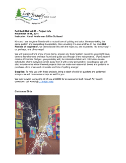


© Copyright 2026