
- Climate and Agriculture Network for Africa
Stakeholder Participatory Workshops in Lushoto, Tanzania: Climate Smart Agriculture Practices Lushoto, June 2014 1 Stakeholders’ participatory workshops: best practices for outscaling climate smart agriculture practices in Lushoto, Tanzania. International Center for Tropical Agriculture (CIAT) CGIAR Research Program on Climate Change Agriculture and Food Security (CCAFS) Tenesia Benjamin Brigitte Rudram Jennifer Tywman Leigh Winowiecki Beatriz Rodriquez Anton Eitzinger Caroline Mwongera Kelvin Mashisia Edidah Ampaire Peter Laderach Suggested citation: Benjamin, T., B. Rudram, J. Tywman, L. Winowiecki, B. Rodriquez, A. Eitzinger, C. Mwongera, K. Mashisia, E. Ampaire, P. Laderach. 2014. Stakeholder Participatory Workshops in Lushoto, Tanzania: Climate Smart Agriculture Practices. International Center for Tropical Agriculture. Nairobi, Kenya. Disclaimer: The stakeholders’ participatory workshops and fieldwork report has been prepared as an output of the OFID and the IFAD projects: ‘Stakeholder Participatory Workshops: Best Practices for Outscaling Climate Smart Agriculture Practices’ and ‘Increasing Food Security and Farming System Resilience in East Africa Through Wide-scale Adoption of Climate-smart Agricultural Practices’ respectively. The projects are financed by both the International Fund for Agricultural Development and OPEC Fund for International Development (OFID). Any opinions expressed herein are those of the authors and do not reflect the policies or opinions of CCAFS, donor, agencies, or partners. Photos: All images remain the sole property of their source and may not be used for any purpose without the written permission of the source. Photo credit: Anton Eitzinger, Beatriz Rodriquez and Tenesia Benjamin/ CIAT 2 About the Authors ___________________________________________________________________________ Tenesia Benjamin Visiting Researcher, International Center for Tropical agriculture (CIAT) in Cali, Colombia [email protected] Brigitte Rudram Visiting Researcher, International Center for Tropical agriculture (CIAT) Nairobi, Kenya [email protected] Jennifer Tywman Social Scientist, International Center for Tropical agriculture (CIAT) in Cali, Colombia [email protected] Leigh Winowiecki Soil Scientist, International Center for Tropical agriculture (CIAT), Nairobi, Kenya [email protected] Beatriz Rodriquez Researcher the International Center for Tropical agriculture (CIAT) in Cali, Colombia [email protected] Anton Eitzinger Spatial Analyst, International Center for Tropical agriculture (CIAT) in Cali, Colombia [email protected] Caroline Mwongera Research Scientist, International Center for Tropical Agriculture (CIAT) in Nairobi, Kenya [email protected] Kelvin Mashisia PhD fellow with International Center for Tropical agriculture (CIAT) in Nairobi, Kenya University in the Netherlands and Wageningen [email protected] Edidah Ampaire Social Scientist, International Institute of Tropical Agriculture (IITA) in Kampala, Uganda [email protected] Peter Laderach Central America and Caribbean Coordinator of the Decision Analysis and Policy (DAPA) Program, International Center for Tropical agriculture (CIAT) in Managua, Nicaragua [email protected] 3 Contents ___________________________________________________________________________ 1. OVERALL OBJECTIVES AND SITE CHARACTERISTICS .............................................................. 9 1.1 BACKGROUND ............................................................................................................................................... 9 2. PARTICIPATORY FARMER WORKSHOP ............................................................................................. 10 2.1 WORKSHOP ATTENDEES .............................................................................................................................. 10 2.21 SITE CHARACTERIZATION .......................................................................................................................... 12 2.3 WELLBEING CHARACTERIZATION ................................................................................................................ 13 2.4 FARMER PRIORITIZATION OF CSA PRACTICES ............................................................................................. 14 2.41 PRESELECTED CSA PRACTICES AND PROGRAMS ....................................................................................... 14 2.42 FARMER CSA PACKAGES FOR IMPLEMENTATION ...................................................................................... 18 2.5 DEMONSTRATION PLOTS ............................................................................................................................. 20 3. PARTICIPATORY EXPERT WORKSHOP ............................................................................................... 22 3.1 BACKGROUND ............................................................................................................................................. 22 3.2 SIMILAR AGROECOLOGICAL AND SOCIO-ECONOMIC AREAS TO LUSHOTO .................................................... 23 3.3 ASSIMILATED INFORMATION ON CSA ......................................................................................................... 23 3.4 PRESELECTED CSA PRACTICES: KEY POINTS FROM DISCUSSION ................................................................. 24 3.5 CSA PACKAGES: EXPERTS WORKSHOP ........................................................................................................ 25 3.6 DEMONSTRATION SITES ............................................................................................................................... 26 3.7 CHANNELS AND METHODS FOR OUTSCALING CSA ...................................................................................... 27 4. FIELD VISITS: OBSERVATIONS OF FARMS AND DEMONSTRATION PLOTS IN LUSHOTO .... 29 4.1 BACKGROUND ............................................................................................................................................. 29 4.2 RESULTS: SITE-SPECIFIC OBSERVATIONS .................................................................................................... 29 4.3 BEAN AND MAIZE DATA ............................................................................................................................. 33 4.4 POTATOES AND CASH CROP SITES ................................................................................................................ 33 4.5 THE LANDSCAPE .......................................................................................................................................... 35 4.6 FIELD TESTING OF ICT, TABLET, AND CIAT FIELDWORK APPLICATION ..................................................... 35 5. DISCUSSION .................................................................................................................................................. 37 5.1 CONCLUSION AND LESSONS LEARNED ......................................................................................................... 37 5.2 NEXT STEPS AND RECOMMENDATIONS ........................................................................................................ 38 6. REFERENCE ................................................................................................................................................... 39 7. APPENDICES ................................................................................................................................................. 40 7.1 APPENDIX A: SITE SELECTION OF CSA PRACTICES: THE CASE OF LUSHOTO................................................ 40 7.2 APPENDIX B: CONTACT DETAILS FOR FARMERS AND EXPERTS .................................................................. 40 7.3 APPENDIX C: PAST AND PRESENT AGRICULTURAL INITIATIVES IN LUSHOTO.............................................. 41 LIST OF TABLES TABLE 1: CSA PACKAGES CREATED BY LOWLAND WOMEN GROUP. .................................................................. 18 TABLE 2: CSA PACKAGES CREATED BY LOWLAND MEN GROUP ........................................................................ 19 TABLE 3: CSA PACKAGES CREATED BY HIGHLAND WOMEN GROUP .................................................................. 19 TABLE 4: CSA PACKAGES CREATED BY HIGHLAND MEN GROUP ....................................................................... 20 TABLE 5: EXISTING DEMONSTRATIONS AS REPORTED BY FARMERS .................................................................. 20 TABLE 6: SIMILAR AGROECOLOGICAL AND SOCIO-ECONOMIC AREAS IN LUSHOTO ......................................... 23 4 TABLE 7: EXPERTS' COMMENTS ........................................................................................................................ 24 TABLE 8: GROUPS A AND B'S CSA PACKAGES .................................................................................................. 25 TABLE 9: GROUP C'S CSA PACKAGES ............................................................................................................... 26 TABLE 10: COMPILATION OF AGRICULTURAL INITIATIVES IN LUSHOTO , PAST AND PRESENT………………………………41 LIST OF FIGURES FIGURE 1: PARTICIPATORY WORKSHOP AND FIELD VISITS AND ACTIVITIES………………………….. ………………….................9 FIGURE 2: CHARACTERISTICS OF PARTICIPATORY FARMERS: AGE AND EDUCATION LEVEL……………………………………..10 FIGURE 3: PHOTOGRAPH OF PARTICIPATORY MAP OF LUSHOTO CCAFS SITE, PRODUCED BY FARMERS DURING PARTICIPATORY WORKSHOP………………………………………………………………………………………………….11 FIGURE 4: MAP OF THE CCAFS LUSHOTO SITE…………………………………………………………………………………………..11 FIGURE 5: PHOTOGRAPHS OF FARMERS DURING PLENARY DISCUSSION ON CSA PRACTICES……………………………………14 FIGURE 6: FREQUENCY OF CSA PRACTICES USED………………………………………………………………………………………..18 FIGURE 7: PARTICIPANTS OF THE EXPERTS' WORKSHOP……………………………………………………………………………….22 FIGURE 8: PHOTOGRAPH OF MBUZII (UPPER AREA)…………………………………………………………………………………….29 FIGURE 9: PHOTOGRAPH OF MBUZII………………………………………………………………………………………………………..30 FIGURE 10: PHOTOGRAPH OF KWANG'WENDA SITES VISITED………………………………………………………………………..31 FIGURE 11: PHOTOGRAPH OF THE SITES VISITED TOWARDS BOHELOI……………………………………………………………..31 FIGURE 12: PHOTOGRAPH OF BOHELOI SITES VISITED…………………………………………………………………………………32 FIGURE 13: PHOTOGRAPH OF GARE SITES VISITED…………………………………………………………………………………….32 FIGURE 14: PHOTOGRAPH OF MAIZE AND BEANS………………………………………………………………………………………..33 FIGURE 15: PHOTOGRAPH OF MAGAMBA SITES VISITED……………………………………………………………………………….33 FIGURE 16: PHOTOGRAPH OF MILUNGI SITES VISITED …………………………………………………………………………………34 FIGURE 17: PHOTOGRAPH OF SITES VISITED IN MAMBA……………………………………………………………………………….35 FIGURE 18: PHOTOGRAPH OF TYPICAL LANDSCAPES IN LUSHOTO…………………………………………………………………..35 List of Acronyms CCAFS CIAT CSA DAPA IFAD IITA M&E OFID PRA RRA SARI Climate Change, Agriculture and Food Security International Center for Tropical Agriculture Climate Smart Agriculture Decision and Policy Analysis International Fund for Agricultural Development International Institute of Tropical Agriculture Monitoring and Evaluation OPEC Fund for International Development Participatory Rural Appraisal Rapid Rural Appraisal Selian Agricultural Research Institute _________________________________________________________________________________ Acknowledgements The authors would like to extend appreciation to George Sayula of SARI, Elizabeth Msoka of Lushoto District Council and Gladness Bush of CCAFS-SARI, for their support in organizing and facilitating the workshops and fieldwork. Thanks also to all of the participating experts and farmers. ________________________________________________________________________________________ 5 Executive Summary ___________________________________________________________________________ In June 2014, participatory workshops and field visits were conducted by the CIAT-DAPA and CIAT-Soils Research Area teams in the CCAFS Climate Smart Village of Lushoto, Tanzania in the West Usambara Mountains to identify locally appropriate climate smart practices and potential barriers to adopt them. Two stakeholder workshops were conducted; farmers’ workshop and national and local expert workshop. The key objectives for workshops included identifying the different agroecological zones around Lushoto CCAFS villages and their characteristics; assimilating information, opinions, and or concerns regarding CSA practices from farmers and experts; developing a prioritized list of CSA practices and or packages for each agroecological zone; and identifying current and past demonstration plots of different sustainable land management (SLM), CSA, or other agricultural practices in the region. In addition to the workshops, researchers visited several farms and demonstration sites to better understand farming systems and practices used by farmers. Field visits were carried out in the 10 x 10km block that comprises the CCAFS sites: Massange, Kwang’wenda, Mbuzii, Boheloi, GARE, Yamba and Milungi. Farmers identified four agroecological zones in this 10 x 10km block. These zones are at different altitudes, with different micro-climates, different crops under production, varying soil quality, diverse landscape, etc. Farmers representing their diverse perspectives, concerns and preferences provided CSA practices relevant for different zones. This approach ensures that interventions to expand and accelerate adoption are locally appropriate. Main Findings Information gathered during farmers’ participatory workshop revealed that smallholders are becoming increasingly vulnerable to changing climate, climate variation and a spectrum of co-related challenges, food security and changes in state of wellbeing. Smallholders in Lushoto practice rain-fed agriculture, threats pose by climate change have resulted in loss of crop yields, due to unpredictable rains, heat stress and diseases. To adapt, farmers implement climate smart agriculture practices; among the most commonly used are early planting, optimal use of fertilizer, cut and carry, intercropping, crop rotation, silvopastoral system and terracing. Notwithstanding the benefits attained from their use; farmers still remain vulnerable to climate change and its impacts. Adapting to climate change requires a wholesome approach that does not merely assess climate impact, but one that places equal focus on socio-economic factors which may influence smallholders’ adaptive capacity. Adaptive capacity, according to farmers, is intrinsically linked to one’s state of wellbeing, which for them is defined in relations to the robustness of their livelihood. The report presents farmer-led discussion on well-being as possible barrier to CSA adoption. It was revealed that climate change does not merely endanger fragile food production systems, but it undermines farmers’ capacity to build resilient livelihoods, thus making them more risk adverse to hostile climatic events. In Lushoto, farmers are characterized as worst off, best off and mid-wellbeing families. Best off farmers are described as well educated men and women owning valuable assets; livestock, farms, businesses and houses. Farmers have constant and regular income, they use improved varieties of seeds and are food secure. Worst off farmers do not have many assets; farmers do not own farms or houses and for those who do, houses have thatched roofs and dirt floor. Farmers are food insecure and are usually unemployed or depend on primitive employment. Mid-wellbeing farmers are educated and food secure. They have assets such as houses, usually operate small- scale businesses or are small scale traders and land owners. 6 Taking into account the possible barriers that exist to CSA adoption, men and women farmers of lower and higher altitudes created packages of CSA practices they would like implemented in Lushoto. For the higher altitude, farmers recommended the implementation of cut and carry, optimal use of fertilizer, silvopastoral system, crop rotation, water harvesting, minimum tillage and intercropping; whilst the most commonly recommended CSA practices by men and women farmers of lower altitudes were early planting, optimal use of fertilizer, intercropping, cut and carry, terracing, water harvesting, silvopastoral system, strip cropping, crop rotation and composting. Factors that influenced the selection of CSA practice include agro-ecological zone, wellbeing, labor intensiveness, knowhow and availability of resources. Information gathered during the farmer workshop provided great insights into what agriculture practices are working and feasible in the region. Discussions held furthered our understanding of the influence of gender dynamics in CSA interventions and socio economic factors as barriers to adoption. This information can better inform researchers approach to pursue suitable CSA technologies and practices to build farmer’s resilience to climate change. A wide range of experts’ opinions re adaptation and locally appropriate CSA practices were captured during the expert workshop. Experts’ workshop included agricultural, environmental, climate and gender experts from a range of institutions: Tanzanian Ministry of Agriculture, Food Security and Cooperatives, Local and District Councils (Dept. of Agriculture and Livestock Development) Agricultural Research Institutes, CCAFS, and NGOs such as - Mlingano Agricultural Research Institute - Selian Agriculture Research Institute - Ilonga Agricultural Research Institute - Ardhi University - Rural Resources Centre (RRC) Similar to the farmers’ workshop, agroecological characteristics were used as the basis for selecting CSA practices. Among the practices selected for Zone 4 are crop rotation, timely planting, intercropping and irrigation; for Zone 3, compost manure, crop rotation, minimal tillage and timely planting; for Zone 2, contour farming, crop rotation and intercropping; and Zone 1, intercropping, manure compost, mulching and terracing. Important for the successful uptake of CSA practices are the methodologies used to increase smallholders’ awareness and the training sessions done to improve smallholders’ skill. One such methodology is demonstration plot. Privately and publicly owned demonstration plots, according to experts, have been proven to be a success for smallholders in Lushoto. Indicators of success for demonstration plots include plot ownership and location, farmers’ awareness and project’s objective. For institutional support, policies were discussed specifically with regards to outscaling. According to experts, government and local councils should be fully involved from the onset for effective impacts and long-term support; also, having policies to support these activities is critical for outscaling CSA. Policies for enhancing CSA adaptation include National Agricultural Policy (2013); National Land Policy (1997) and National Environmental Policy (1997). Decision makers and key actors in policy include ministries /parliament, permanent secretaries of the relevant ministries, research and development departments and local government. For CIAT, polices provide a strategy to guide researchers decision making processes. In addition to participatory workshops, field visits were conducted. GPS location of farms and existing demonstration sites were registered alongside researcher’s observations. Observations revealed different management approaches on demonstration plots, diverse landscape, soil types and farming systems. Crops such 7 as maize and beans, potatoes and cash crops such as cabbage and coffee were grown along the hillside. Seed varieties used in Lushoto include maize: Pana 62 and 63, Deka and Stata and beans: Soya, Rosecoco, and Kachina. The areas between Milungui, Masanga and Mamba were characterized by thick natural forest; Eucalyptus trees were dominant throughout these areas, especially near the river on the higher elevations. Information and communication technologies (ICT) were used to document and record field observations. Observations was uploaded and shared on an online platform; this offers researchers easy information access in the field and offers to the user, a tool to share feedback with experts. The platform can be used for the monitoring of ongoing field implementations of CSA practices and for sharing of lessons learned during the implementation process. Farmer and expert participatory workshops and field visits offered diverse yet complementary opinions re local realities. For researchers, this approach allows people with different background, skills and experiences to bring fresh ideas and perceptions on CSA that can be outscaled to different areas in Tanzania. With this report, the aim is to disclose methods used for CSA site selection so that other researchers can simulate CSA research and or build on the results, and to inform researchers and institutions, government, NGOs, etc, about major findings. 8 1. OVERALL OBJECTIVES AND SITE CHARACTERISTICS 1.1 Background Lushoto is a mixed crop-livestock area, with intensive farming systems found at higher elevations and agropastoral systems at lower elevations. Agriculture is predominantly small-scale farming, and despite its steady decline, both in terms of income and number of farmers specifically youths, agriculture remains the main source of livelihood for smallholders. Threats posed by climate change and climate variation to food systems may therefore undermine farmers’ way of life; consequently, there is a high demand for improved agricultural productivity and systems. Smallholders and local decision makers, such as national agriculture research institutes and extension officers, need concrete frameworks and pathways to respond to global climate change through adaptation and mitigation practices. Using the strength and knowledge of experts across multiple disciplines and at different levels together with participatory methods and the use of information and communication technologies, researchers and partners explore climate smart agriculture (CSA) as a viable option for farmers to adapt and to mitigate the effects of climate change. The overall objectives of research activities were to: Gather information on climate smart practices and demonstration plots in the area that may be used to inform the selection and identification of CSA practices and demonstration sites respectively; Create a prioritization list of CSA practices, differentiated by agroecological zones, farming systems, etc; Uncover methodologies for appropriate demonstration plot management; and Use modern information and communication technology (ICT) to support the interaction between actors, document and record field observation. Figure 1: Participatory workshops and field visits’ activities 9 2. PARTICIPATORY FARMER WORKSHOP __________________________________________________________________________________ 2.1 Workshop attendees Number Farmer participatory workshop was attended by 30 men and women farmers from the seven CCAFS Lushoto baseline villages. 53% percent of the attendees were between 21-35 years old, 34% were between 36-50 years old, and 13% were above 50 years of age, see Figure 2. Majority of the participants (84%) had primary level of education, while 16% had secondary level of education, see Figure 2. Of the 5 farmers who obtained secondary education, 3 were females and 2 males. Head of households were male dominated. Household members ranged from 3 to 11 people. Figure 2: Characteristics of participating farmers: age and education level. 2.2 Farmer characterization of agroecological zones Located in Northeastern Tanzania, the Lushoto district forms part of the Eastern Arc Mountains of East Africa, and despite its small area it is considered a global hotspot for biodiversity due to its numerous micro eco-zones. Lushoto is a CCAFS benchmark site which include seven CCAFS baseline villages: Milungui, 1543 masl; Yamba,1729 masl; Masanga and Gare,1479 masl; Kwangw’enda, 1269 masl; Mbuzii,1460 masl and Boheloi, 1270 masl. These villages, according to farmers, can be divided into four agroecological zones, see Figure 3. Though farmers predominantly engage in mixed crop- livestock production, a participatory mapping exercise revealed that farming systems are strategically utilized according to the location where they are most suitable. Maize and beans, both cash and food crops and often intercropped, are the crops of choice for smallholders. Other crops include, coffee, cassava, fruits and vegetables- cabbage, carrots, sweet pepper, tomato, soya and rosccoca. Also of significance are livestock and agroforestry systems, which provide supplementary incomes for farmers. 10 Figure 4: Map of the CCAFS Lushoto site. 11 2.21 Site characterization Highland: Zone 1 Zone 1, which has altitudes of 1700m and higher, is comprised of Mamba, Milungi, Gare, Yamba and Masange villages. Defined by extremely steep slopes and forest, the area has cool and temperate climate; micro-climates afford farmers three planting seasons, long rains, short rains and intermediate rains. Maize for example is planted only during the long rainy season, and according to farmers, this strategy reduces the risk of yield loss. Farmers engage in a mixed crop-livestock production system. Crops include coffee, tea, Chilli peppers, apples, pears, plums, passion fruit, maize, potatoes, and avocadoes. Though the area specializes in vegetable cultivation, it is reported that Irish potato and Chili peppers do better in Milungi. Soil erosion and over grazing are among the challenges to production. To combat these challenges, farmers practice terracing and agroforestry related practices such as strip-cropping. Upper highland: Zone 2 Upper highland includes the village of Kwang’wenda. Similar to the Zone 1, Zone 2 is heavily forested and has cool and temperate climate. Farmers practice mixed crop-livestock production. Crops include vegetables, fruits and different varieties of maize and beans. Crops in Kwang’wenda, similar to those in Zone 1, depend entirely on rains. Vegetables are planted during the long rainy season, and maize is planted during the long and short rains. Terracing along with strip cropping are two dominant agricultural practices in this area. Livestock rearing and agroforestry provide supplementary income to farmer. Lower Midland: Zone 3 Zone 3 includes the village of Mbuzii. Here, farmers experience warmer climate compared to Zones 1 and 2. There are two planting seasons, the short and long rains. Maize, which is both a food and cash crop, was reported to yield better in terms of quantity and quality, during the long rainy season. Irrigation farming, specifically traditional irrigation and water harvesting, is practiced by farmers. Irrigation farming, according to farmers, is supplying water to land through rivers, tanks, wells and other catchments. For women farmers, water is often harvested and sold. Minimal tillage is important due to soil compaction. Framers reported that tillage helps to secure plants’ roots, and prevents crop loss which may occur as a result of soil erosion. Zero grazing is widely practiced. Traditional irrigation is the construction of water channels to harness water from rivers using water pumps. Often the instruments used are basic and temporary. (George Sayula, SARI.) Lowland: Zone 4 Zone 4 includes the village of Boheloi. Of all four zones, Zone 4 is described as the warmest and driest. Farmers experience two rainy seasons, the long rains and short rains. During the long rains, farmers plant cash and food crops such as vegetables, cabbage, carrots, sweet pepper, tomato, soya, rosccoca maize and French beans. Irrigation and tillage are widely practiced in this area. Similar to Zone 3, farmers harvest rainwater in drums and practice irrigation agriculture. 12 2.3 Wellbeing characterization Wellbeing relates to economic, social and environmental status both in the present and in the future. Given the extent and severity of climate change impacts, the state of a person’s wellbeing can impact their ability to adapt to climate change, (IPCC 2013). Thus, understanding farmers’ wellbeing can provide insight into potential barriers that exist to CSA adoption. Three main wellbeing groups were identified; the best off, the worst off, and mid-wellbeing group. Best-off farmers were described as having high state of wellbeing, economic and social circumstances were good, which gave them the opportunity to invest in various business ventures to supplement farming income. In contrast, persons described as worst-off had low state of wellbeing, having little monetary, physical and social opportunities. Farmers’ comments Best off farmers: Own valuable assets, e.g., good houses, cattle, farms and businesses. Good houses, according to farmers, have concrete structures, electricity (solar and/or otherwise), portable water, and electronic equipment, such as a television with cable TV service. Have constant and regular source of income; they have business ventures within and outside Lushoto that supplement their farm income. They are also able to employ farmers to work their lands. Use improved varieties of seeds and have better livestock breeds. Often have forested land and can harvest and trade timber to supplement their income. Large forested lands allow farmers to better conserve land. Have a system for harvesting water, for example sink tanks. Are food secure; they have healthy bodies. Are well educated and can send their children to private and international schools. Worst off farmers: Have little assets. They do not have farm lands and generally do not own houses; often farmers share accommodation with neighbors. For those who do have houses, houses are small with thatched roofs, a dirt floor and little or no furniture. Do not have chickens. It is believed that farmers without chickens are extremely poor. Do not use improved seeds or fertilizer. Are usually unemployed or depend on primitive employment. These farmers sometimes rent other farms or borrow pieces of land for working, in which case, very little is produced. Are food insecure, they are only able to eat once per day. Are not well schooled, unable to read or write well and they cannot afford to send their children to school. Mid-Wellbeing farmers: Own good houses, quite often it is a family house. The houses may not have electricity and water, but the structure of the house is made of concrete. Usually own and operate small-scale businesses or are small-scale traders. Own land and livestock, use terraces, use improve seed varieties. Are educated and are able to send their children to government school, at least up to form 4. Are food secure, they have three meals per day. 13 2.4 Farmer prioritization of CSA practices Understanding farmers’ concerns and experiences with CSA practices is critical to developing strategies and methodologies suitable to farmers’ circumstances, agroecological systems, gender, education background, etc. By tapping into farmers’ prior knowledge on CSA practices, researchers can plan activities that will: Clarify incomplete or erroneous prior knowledge; Determine the extent of skill and knowledge necessary in a particular CSA practice; and Discern necessary adjustments for planning independent activities and assessment materials. Participating farmers were divided into 4 groups, based on gender and agro-ecological zones of Lushoto: Lowland women: (mainly Zone 3 and 4) Lowland men: (mainly Zone 3 and 4) Highland women: (mainly Zone 1 and 2) Highland men: (mainly Zone 1 and 2) Figure 5: Photos of farmers during plenary discussion on CSA practices 2.41 Preselected CSA practices and programs Crop rotation Crop rotation is the alternation of different crops with different characteristics cultivated on the same field to avoid exhausting the soil nutrients and to control weeds, pests, and diseases, (FAO 2014). 14 Potential benefits: Increases soil organic matter and by extension enhances water and nutrient retention, and decreases synthetic fertilizer requirements. Improves soil structure, reduces soil degradation, and can result in higher yields and greater farm profitability in the long-term. Controls weeds and diseases, and limits insect and other pest infestations and as a result significantly reduce pesticide use, (IFOAM EU et al 2012). Inter-cropping Planting of two different, though complementary, crops on the same plot of land, either in a mixed row or strip intercropping system, (Stephen Machado 2009). Potential benefits: Production diversification, reduces risks of total crop failure, reduces pest and or diseases. Rotational grazing Livestock are strategically moved to fresh paddocks or partitioned pasture areas to allow vegetation in previously grazed pastures to regenerate, (Dan Undersander et al 2002). Potential benefits: Reduces soil erosion and soil compaction, which encourages root growth and reduces weeds from resting periods. It lengthens the grazing season because of a shorter forage recovery period when rotating paddocks. More efficient use of forage, healthier livestock and improved animal productivity, improved income. Cut and carry with improved forages Establishing livestock fodder such as Napier grass that is cut green and then fed to animals contained in feeding pens, rather than allowing free grazing or pasture grazing, (Caitlin A. Peterson et al, 2014). Potential benefits: Reduces land degradation and soil compaction from overgrazing and animal trampling. It provides additional income from the sale of livestock products, the land is utilized more efficiently and centralization of animal waste production, (J. Jeff Palmer et al). Seasonally adapted planting time (early planting) Planting seeds before the onset of the rains to compensate for rainfall variability and shortened growing season, (Caitlin A. Peterson et al, 2014). Potential benefits: Reduces weed infestations, compensates for climate variability and shortened growing seasons. It reduces the risk of crop failure. Terracing Construction of earthen, bench-like structures along the contours of planting of annual crops. The structures are stabilized by planting erosion- resistant fodder grasses and/or agroforestry tress, Caitlin A. Peterson et al, 2014. Potential benefits: Increases soil-water availability reduces soil erosion and land degradation, increases agricultural productivity. Irrigation: water harvesting and storage System to transport and supply water to crops, either on a large-scale such as a canal/pump system, or as a smaller micro-irrigation scheme, (Caitlin A. Peterson et al, 2014). Potential benefits: Compensation for drought or reduced rainfall; reduces crop loss due to water deficiency. 15 Mulching Covering the soil surface with a layer of organic residues (leaves, straws stems, cut grasses) and allowing for eventual decomposition. Potential benefits: Reduces soil temperatures; increases soil moisture retention to compensate for drought or reduced rainfall. Stifles weed growth and reduced GHG emissions from exposed soil surface. Organic fertilizer (composting) Collection and heaping of organic waste materials such as food scraps, crop residues or livestock manure in a pit, pile or other structure to allow for decomposition and later application to cropland soil, (Caitlin A. Peterson et al, 2014). Potential benefits: Reduces emissions associated with production, reduces the use of inorganic fertilizers, and improves soil fertility and agricultural productivity. It decreases tillage requirements for next season through improved soil structure. Optimal use of inorganic fertilizer A substance of synthetic origin that is applied to the soil to supply one or more key nutrients essential to the growth of the plants, (Mercy S, Mubsira Banu S, Jenifer, 2014). Potential benefits: Compensates for declining soil fertility. Minimal tillage Tillage refers to all methods used to prepare soil for planting, especially the loosening and breaking up of topsoil by the use of a hoe, plough or similar tilling implement. Specifically, minimum tillage can refer to tied ridging, digging, planting, preparing pits with a hand hoe, in contrast to conventional deep tillage. Crop residues are often left on the soil surface or incorporated into the soil rather than removed, (Caitlin A. Peterson et al, 2014). Potential benefits: Reduces soil compaction from over tillage, prevents soil degradation. Reduces GHG emissions compared to deep tillage or conventional ploughing, improves agricultural productivity. Contour (I) ploughing (II) bunding Contour ploughing: the practice of ploughing and/or planting across a slope following its elevation contour lines. These contour lines create a water break which reduces the formation of rills and gullies during times of heavy water run-off, (Caitlin A. Peterson et al, 2014). Contour-bunding: This practice consists of making a comparatively narrow-based embankment at intervals across the slope of the land on a level that is along the contour, Caitlin A. Peterson et al, (2014). Potential benefits: Reduces soil erosion, improves water infiltration, the water break also allows more time for the water to settle into the soil, increases soil carbon sequestration. Strip cropping Growing crops in a systematic arrangement of strips across a field, i.e., planting strips several meters wide of alternating grasses, hedge rows, or shrubs and annual crops. Types of strip cropping include contour, field or buffer, (Dennis Carman, 1997). 16 Potential benefits: Creates favorable microclimates, improves water quality control, increases soil carbon sequestration, and reduces soil erosion from water and wind. Silvopastoral system Silvopastoral systems are characterized by integrating trees or shrubs within forage and livestock production systems in the same acreage to utilize space and growing season limitations, (Stephanie & Temidayo, 2014). Potential benefits: Improves soil condition with the incorporation of trees, improves nutrient cycling with the deeper tree roots or use of nitrogen-fixing trees, reduces soil erosion, and provides shade for animals, reduces wind velocity, improves soil moisture retention and increases production. Weather index insurance/ micro-lending (SACCOS) Savings and credit cooperatives- local organizations offering micro loans and savings opportunities for members in exchange for a membership fee, (Caitlin A. Peterson et al, 2014). Potential benefits: Reduces risks associated with crop loss or extreme weather events, provides additional financial resources to purchase food and other products. Farmers’ comments Many of these practices are currently done in Lushoto, see Figure 6. Mulching, though not practiced due to unavailability of materials and the lack of knowhow, could be a good option for vegetable growers. As an alternative, organic manure is frequently used by smallholders. Farmers do not have sufficient knowledge, skill and resources to practice contour bunding. A few farmers practice contour ploughing. Terracing requires advance knowledge and specialize skills. Furthermore, terracing is perceived as having high input and labor costs, with a long time lapse before benefits are realized. Rotational grazing is not locally appropriate, due to land scarcity. However, zero grazing, also referred to as cut and carry, is more locally appropriate. The application of inorganic fertilizer is a commonly practiced; for farmers it makes up loss in soil nutrients as a result of run offs or soil erosion. More knowledge is needed re accurate application of fertilizer per acreage of land/plot. Despite land scarcity, few highland male farmers practice crop rotation to reduce the risk of pests e.g., White Fly. Maize and beans are intercropped. With this practice, if one crop fails farmers could rely on the second crop. Intercropping however requires technical knowledge, spacing between crops. Inorganic fertilizer has a positive influence on yield, however high financial cost is burdensome; as an alternative manure is used. A combination of the right amount of inorganic fertilizer and manure however could represent a viable option. Used inorganic fertilizers for beans; urea at planting date and DAP when plants germinate. 17 From the pre-selected list, farmers identified the practices that have been and are currently being used in the area, see Figure 6. Figure 6: Frequency of CSA practices being used as classified by farmers groups into (0) not used, (1) least commonly used, (2) used by a few people, and (3) most used. 2.42 Farmer CSA packages for implementation Table 1: CSA packages created by lowland women group CSA practice Benefits Challenges Intercropping Sustainable income and maximizes land use Shading effect from trees does not allow other crops to grow well. Crops demand much attention, labor intensive Optimal use of inorganic fertilizer and animal manure Increases yield and improve soil fertility Does not work well in dry season, farmers are unsure of the rate of application to crop and high price of fertilizer Silvopastoral system Efficient use of land, manages soil erosion, source of timber, charcoal, fodder for livestock, fodder adds nutrients to soil and maintain soil fertility, sustainable means of income Limited land 18 Strip cropping Efficient use of land, manages soil erosion, sustainable means of income, fodder adds nutrients to soil and maintains soil fertility Shading effects from trees do not allow other crops to grow well. Some trees are toxic, which can poison animals. Zero grazing / Cut and Carry Healthy livestock and by extension better quality meat and high production of milk. Provides manure. Labor intensive and time consuming. Table 2: CSA packages created by lowland men group CSA practice Benefits Challenges Increases yield. Rainfall is not reliable. Fertilizer Increases yield and improves soil fertility. Inputs are very expensive, subsidies from government are needed. Compost Improves soil fertility. Rotation Improves soil fertility and reduces runoff. Intercropping Provides more income, reduces risks to crop failure and improves soil fertility. Early planting Table 3: CSA packages created by highland women group CSA practice Benefits Challenges Crop rotation Improves soil fertility Limited land Early planting High yields Determining when is “early panting”. Inter cropping Sustainable income, efficient land use and improves soil fertility Low yields due to overshadowing e.g. beans & maize. Poor spacing due to limited land Optimal inorganic fertilizer use High yields Expensive mulching 19 Table 4: CSA packages created by highland men group CSA practice Benefits Challenges Composting Inexpensive and requires limited labor. Contour ploughing Conserves water and controls soil erosion. Loss of fertilizer during heavy rains and high start-up cost Intercropping High yields, maximizes land use. Cost of labor is minimized. Soil fertility could decrease. Mulching Conserves soil moisture and controls soil erosion. If there is prolonged drought fields can be set on fire. Contour bunding 2.5 Demonstration plots Demonstration plots, according to farmers, are successful because of their practical nature, which make the practices easy to understand. It creates awareness and motivates farmers to apply practices on their own farms. Farmers participate in demonstration plot activities to develop their skills and know-how, farming and farm management practices. Farmers listed existing demonstration plots in Lushoto and discussed suitable areas for implementation of CSA practice. Farmers examined the benefits between privately owned-farm or community plots such as a schools, open areas or district council lands. This information will inform researchers’ approach/ methodology for the implementation of CSA practice. Table 5: Existing demonstrations as reported by farmers Demonstration Plots Organization Location Practices How is demonstration plot implemented? Visits Visits Community implemented project, 21 members. Members manage the nursery. CCAFS and TAFORI Masange: Asia’s farm Mirungui: Jamila’s farm Mirungui & Masange Yamba & Nagali Milungui and Mansange Intercropping Intercropping Tree nursery Tree nursery Tree Nursery Government projects-DADPS Milungui Irrigation channels - Government projects-DADPS Milungui Poultry keeping - 20 Milungui Water pump - CCAFS and TAFORI Gare Tree Nursery - International Potato Centre (CIP) Boheloi Improved variety of Irish potato seed. Farmers are taught correct application of inorganic fertilizer and conservational farming, planting of fodder around plots. Visits - Boheloi Improved variety of French beans. Visits Government DADPS projects- Farmers’ comments For successful uptake of CSA: Conduct trainings or demonstrations on privately owned farms and encourage community involvement. Have one demonstration plot per village. Each practice should be demonstrated on separated plots, however if the practices are complementary they should be demonstrated together. The most suitable areas to host demonstrations are Gare, Milungui and Mbuzii. Milungi is easily accessible and has two large acres of fallow farms that are available at any time. Mbuzii’s secondary school, water is easily available and there is on-campus security. Areas near the forest are more suitable for demonstration plots as they receive more rain. If the demonstrations are conducted on farmer’s plot of land, the community should actively partake in plot activities to build awareness and to improve skills. 21 3. PARTICIPATORY EXPERT WORKSHOP ___________________________________________________________________________ 3.1 Background A high degree of specialization is required for the evaluation of CSA practices; to pursue this, experts from diverse backgrounds engaged in discussions on CSA, to determine local appropriateness of preselected CSA practices and policies. Participants came from Dar es Salaam, Tanga, Arusha, Kilosa and Lushoto and were part of the following institutions: Ministry of Agriculture (Food Security and Co-operatives) Mlingano Agricultural Research Institute Selian Agriculture Research Institute Lushoto District Council (Dept. of Agriculture and Livestock Development) Ilonga Agricultural Research Institute Ardhi University Selian Agriculture Research Institute Rural Resources Centre (RRC) Ministry of Agriculture Figure 7: Participants of the experts’ workshop With this diverse background, a wide range of experiences can be drawn on to identity perceived problems or reservations regarding the implementation and uptake of preselected CSA practices, and to make recommendations accordingly. Experts’ advice was sought on methodologies for CSA adoption, and on policies and institution support for outscaling CSA. For researchers, gathering technical advice on demonstration plots is the first step towards the implementation of CSA and outscaling efforts. With this information, researchers will be able to conduct comprehensive evaluation of CSA practices before implementation. 22 3.2 Similar agroecological and socio-economic areas to Lushoto Table 6: Similar agroecological and socio-economic areas to Lushoto 1 SAGCOT: Southern Agricultural Growth Corridor of Tanzania 2 Zones 1 – 4 refer to CCAFS Lushoto site as per divisions documented by Table one. Locations listed are then characteristically similar to that zone. 3 Zones refer to Tanzania’s country geographical divisions. Locations listed under these areas are those that are characteristically similar to the Lushoto CCAFS site. 3.3 Assimilated information on CSA Communication- schools of thought amongst scientists need to be better aligned to avoid confusing farmers. Experts argued that scientists often re-name the same/similar agricultural technologies, in Lushoto, for example, there have been similar initiatives under varying terminology, for example Conservation Agriculture (CA) and Climate Smart Agriculture (CSA). Conservation agriculture (CA) was renamed to CSA to Sustainable Land Management (SLM) then back to CSA. Clarity is required to maintain farmers’ interest. Continuity: value should be placed on learned lessons of past and current initiatives. There are current and past initiatives with similar objectives to CSA in Lushoto that can inform researchers’ work. A baseline survey could be used to learn of and about current and past initiatives. This will allow researchers to assess what elements lead to success in Lushoto. Holistic, locally appropriate approaches: understanding farmers’ perspectives is critical, thus recommended approaches should take into account the context of the whole farm. Holistic approach- if high yield is the focus then storage systems for additional yield should also be incorporated. 23 - Local appropriateness: high yielding crops are a focus of many initiatives, but does this encompass indicators and benefits farmers prioritize? Has ‘high yield’ been an objective of the prevailing traditional farming system and is it proven to be compatible with intensified, diversity-led nutrition-driven mixed cropping small scale farming based agriculture in the long term? A baseline survey should be undertaken to ascertain what is growing, where and how CSA impact and benefit farmers. Trade-offs and cost-benefit analysis should be considered when implementing CSA. Researchers show the change evolution for farmers and farming systems as a result of CSA. It is essential to maintain support from policy makers and justify outscaling. CSA could/should be linked with other initiatives with joint objectives. 3.4 Preselected CSA practices: Key points from discussion The evolution of the techniques and methods and the development of new rules in sustainable agriculture and processes often require amendments. Experts evaluated CSA list to make practices more locally appropriate. - - Expert amendments to the pre-selected CSA list: Intercropping was changed to mixed cropping Cut and carry was changed to zero grazing Early planting was changed to timely planting Strip cropping was termed agroforestry Composting and mulching should be referred to as crop and plant residue only Expert additions to the pre-selected CSA list: Organic manure Farmyard manure: grass, ash, manure. Green manure and cover crops, ploughed into the soil. Liquid manure applied to plants Weather forecasts Traditional weather forecasts Scientific weather forecasts Seasonal forecasting Site-specific variety selection to adapt to climate change Microcredits Post-harvest considerations Locally appropriate storage facilities Proper handling of agro-chemicals Transportation Table 7: Experts’ comments Variety selection is the key to all other processes. It is important to first think about locally appropriate varieties before considering practices to implement. Planting date and weather forecasting: One major challenge for smallholders in Lushoto is early and unpredictable onset of rains. Alternative to early planting, benchmark dates should be set for planting to encourage timely planting. To achieve this, value should be placed on building farmers’ awareness; for example where there are communities with chiefs, announcements for timings of ploughing, planting, etc. could be made. Also, collaborative efforts between experts and project implementers should be established to create awareness of climate change issues and how farmers can adapt. Research at the Sokoine Agricultural University (SUA) has produced numerous indicators to predict when the rain will start; and currently 24 researchers are identifying ways to apply this knowledge to inform farmers so they can then prepare land and seeds. Crop rotation, although practiced by some smallholders in GARE Zone 4, is not a practice with which farmers would be keen to implement; farmers like to maintain the crops they are accustomed to growing. Crop rotation is more favorable for large farms; land scarcity in Lushoto will therefore make it an unattractive practice. An alternative to crop rotation is ‘differentiated fields’, that is, planting different crops on different fields. Optimal use of inorganic fertilizer: Experts stated that a baseline survey showed that organic manure in Lushoto is more commonly used, as most smallholders cannot afford inorganic fertilizer. There have also been problems with Rock Phosphate fertilizer in Lushoto, making it an unattractive option for many farmers. Contour bunding is labor intensive, without available help, farmers would not be inclined to adopt it. Rotational grazing: Land scarcity may be a barrier to adoption. Post-harvest: Collection centers are needed to ensure security and stability of food supply. It can also evolve into a market place, as is the case of Mtega center in the Uluguru Mountains. Experts proposed having a collection center in Lushoto to support CSA practices and policies. 3.5 CSA packages: experts workshop Experts created CSA packages for the four agroecological zones in Lushoto, but which could also be outscaled to other areas in Tanzania with similar agroecological characteristics. Table 8: Groups A and B’s CSA packages Experts Group A Experts Group B Zone 4 Zone 4 Zone 3 Zone 2 Irrigation Crop rotation Compost manure Composting manure Contour ploughing Intercropping Crop rotation Irrigation Microcredit Contour farming – grasses, trees Microcredit Minimal tillage Crop rotation Composting Manure Optimum use of inorganic fertiliser Intercropping Contour ploughing Microcredit Microcredit Timely planting Organic manure inorganic fertiliser Mulching Crop Rotation Zone 1 and Agroforestry: - Strip cropping - Silvopastoral - Intercropping / & Optimal use agrochemicals (fertilisers, pesticides, herbicides) of Timely planting Rain harvesting water Timely planting Mulching Terracing Timely Planting Timely planting 25 Table 9: Group C’s CSA packages Group C CSA ‘packages’ for Lushoto CCAFS site Zone one Zone two Zone three Zone four -Water harvesting and storage -Terracing (with exception of Yamba) -Cut and carry -Mulching -Crop rotation -Optimal use of inorganic fertiliser -Timely planting -Intercropping -Silvopastoral system -Contour ploughing -Terracing -Water harvesting and storage -Mulching -Cut and carry -Crop rotation -Composting -Timely planting -Silvopastoral system -Contour ploughing -Intercropping -Seed selection -Terracing -Intercropping -Optimal use of inorganic fertiliser -Water harvest and storage -Composting -Timely planting -Mulching -Cut and carry -Contour ploughing -Silvopastoral system -Minimal tillage -Contour bunding (using grass) -Irrigation (proper) -Contour ploughing -Minimal tillage -Silvopastoral system -Intercropping -Cut and carry -Mulching -Timely planting -Terracing -Composting -Water harvesting and storage -Optimal use of inorganic fertiliser 3.6 Demonstration sites Farmer learning platform has largely focused on demonstration plots, in order to explore other available options, experts discussed different methodologies and approaches for participatory evaluation of CSA and for outscaling CSA. Demonstration plots, according to experts, can be community, private or government owned land, and or individually or collectively managed plots. In Lushoto, community led demonstrations are many, and are often the norm. Experts’ guidelines for establishing on-farm demonstrations Awareness: Building awareness is essential to the participation and uptake of CSA practices; on farm demonstrations serve as one of the most effective educational tool for disseminating useful and practical information. Farmers not knowing when and where demonstrations plots are being held, and not receiving adequate information on practices, are a few factors that result in the failure of on farmdemonstration. Objective: Define in advance of field work the purpose or objective of demonstration plots. For example, is high yield the goal for researchers or is it the uptake of CSA practice? Communicate objectives with farmers; do they correlate with that of the farmers? Often times researchers and farmers have different expectations for demonstration plots, causing farmers to lose interest resulting in failed demonstrations. Location: Privately owned farmer’s plot and community plots are frequently used in Lushoto. Smallholder plots can be used to demonstrate one or two practices, and farmers can assume the responsibility of managing plots. Determining which farmer’s plot to use should be based on the land size, accessibility to the farm and farmer community relations. Community plots, such as schools, churches, can be used to host demonstration plots. There are two ward resource centers in the Lushoto area; demonstration plots can be hosted here, which will add value to ongoing research. Also, plots are easily accessible. 26 Treatment and plot design: A demonstration site in the traditional sense refers to on farm plots. Other methodologies should be considered, such as community initiatives, communal land, etc. A properly designed plot can satisfy various interests and yield conceivable more useful information. Proper management of demonstration plots is critical. Ownership: Demonstration plots should be established so that farmers fully participate and view activities solely for their benefit and not as a CIAT or CCAFS project. Local appropriateness: Farmers have previously refused uptake of practices because it was not locally appropriate, did not suit their farming needs. Size: It is important that demonstration plots are not too large. A representative number should be determined so as to demonstrate the technology to farmers. This also ensures the full participation of attending farmers. Field history: Assess past and current initiatives. This would allow researchers to assess factors that lead to both effective and less effective outcomes on demonstration plots, to then guide and informed their approach. Also, there are many new technologies that have been introduced and have still not been used. Knowledge of these initiatives can help inform researchers’ activities. Policy and policy makers: Securing and encouraging policy makers’ support from the outset is crucial to aid researchers’ outscale and upscale efforts. The establishment of bylaws should be considered regarding uptake of initiatives. Outscaling of innovation and technologies: Have two demonstration plots per village so as to increase farmer participation. 3.7 Channels and methods for outscaling CSA Experts’ opinions on policies for climate change adaptation were discussed with the aim of gathering data on best-practice approaches for effective out-scaling of initiatives. Policies for enhancing CSA adaptation National Agricultural Policy (2013) National Land Policy (1997) National Environmental Policy (1997) ICT Policy Livestock Policy Decision makers and key actors in policy Policy related decision makers: Ministries /Parliament Ministers and permanent secretaries of the relevant ministries Planning commission and other key actors Implementation related decision makers: Responsible organizations and institutions Technical Departments Other Key Actors: Research and Development Departments Training Department Local Government (not within ministry) 27 Activities to influence policy makers Information and knowledge sharing forums: Host interactive workshops for politicians, policy makers and stakeholders Policy maker platforms Seminars conducted by different researchers; invite groups of parliamentarians especially those dealing directly with farmers Improve information channels between ministry and policy makers. Raise awareness amongst youths at universities, secondary schools, etc. Information can be incorporated into the school’s curriculum. Share results and information based on research. Gain political support. Current policy interventions at the national level FAO, UNDP NAPA: National Adaptation Plan of Action ASDS1: Agricultural Sector Development Strategy ASDS2 – Second phase ASDP: Agriculture Sector Development Programme ASDP1 – Phased out ASDP2 : Phase in PPP – pubic private partnership Environmental unit working to incorporate initiatives Local communication options Workshops and fieldtrips for different stakeholders, 1 – 2 days, and field trips to demonstration plots Farmers’ exchange visits for training. Include all key stakeholders. Platforms use to share ideas amongst the different stakeholders involved in the value / production chain Publish success stories several times a year internally in the ministry Use ZIELU – Zonal Information and Extension Liaison Unit, including MoAgriculture, Food Security and Cooperatives Farmer fields Raise awareness at schools Media, telephone, radio, TV, internet – TIGO In Kenya there is a weekly TV show on agricultural practices called Shamba Shape-Up, perhaps this could be replicated in Tanzania Promotional materials, booklets, leaflets, etc Awareness raising at conferences and agricultural exhibitions / technology fairs The National Agricultural Fair in Tanzania called ‘Nane Nane’, held between the 1st of August to the 8th of every year Advocacy to policy makers. The use of an integrated systems approach where farmers are actively involved Private sector engagement 28 4. FIELD VISITS: OBSERVATIONS OF FARMS AND DEMONSTRATION PLOTS IN LUSHOTO ___________________________________________________________________________ 4.1 Background Transect walks were done throughout the Lushoto district to identify and observe food and cash crops planted on individual farmer and community demonstration plots. Thirteen demonstration plots were visited. From these visits, technicians’ observed different management approaches taken on each demonstration plot. GPS coordinates were recorded. Additionally, technicians were able to gain a deeper appreciation for the diverse landscape, soil type, farming systems and to better understand the challenges, limitations and barriers to the implementation, monitoring and management of demonstration plots. Lessons learnt will aid in the selection and management of demonstration plots. Extension officers were also trained in data recording on the use of technician base equipment, Tablet, using a purpose-designed application, so they may continue to do this for future project work and potential monitoring and evaluation. The selection of sites was based upon research set criteria: varying crops and farming systems at a range of altitudes and farms belonging to both CCAFS farmers and non-CCAFS farmers. Extension officers supporting the fieldwork then made the site selections, also partly dictated by accessibility within the time-frame of two and a half days. 4.2 Results: Site-specific Observations Site 1: Mbuzii (upper area): i) CSA intercropping demo-plot ii) Agroforestry A CSA demonstration plot displaying intercropped maize and beans was visited. Opposite this plot, an agroforestry system with Grevillea trees (local name Sangoma) and beans being grown on steep slopes was observed. Plot owner stated that there was a lack of land to crop Grevillea trees and beans both separately; and though trees do not provide any specific benefit to the beans they are used for firewood and charcoal. Figure 8: Photograph of Mbuzii (upper area) 29 Site 2: Mbuzii (lower area), 1460 masl: CSA intercropping The CSA-plots visited consisted of two fields with intercropping systems. On field one, intercropped maize and beans with a few trees disperse throughout the field was observed; and field two intercropped maize, beans and bananas. New varieties provided by the CCAFS project were being used, beans: Eria mungu 97 and maize: Pana 67. However the farmer stated that the intercropped system resulted in reduced yields of beans due to the shade created by the maize, compared to planting beans independently. The shade effect thwarts beans’ growth. Additionally, intercropped fields were difficult to weed, thereby requiring higher labor inputs. For these reasons the farmer preferred crop rotation of maize and beans as opposed to intercropping. However, lack of land prevents the farmer from implementing this practice. With regards to maize, the farmers stated that the new varieties generally perform better, resulting in higher yields, largely due to fewer problems associated with rotting maize. There is a higher resistance of maize: Pana 67 to dryer seasons, farmers within the district are thus motivated to adopt these new varieties. Currently, farmers within the CCAFS-project farmers are spreading the seeds of the new varieties to the other farmers within the village. There are 20 demonstration plots in Mbuzii, all belonging to the farmers that were interviewed during the CCAFS baseline survey. Figure 9: Photograph of Mbuzii. Site 3: Kwang’enda, 1269 masl A CSA-plot on which a new bean variety had been planted was observed. Maize and beans though intercropped on this plot; at the time of field visit bean was the only crop planted. The farmer noted that it was too late in the season to plant maize; 19 other farmers within the village with CSA demonstration plots were however intercropping maize and beans. Nonetheless, the farmer was interested in applying intercropping practices at the onset of the rainy season. The new bean variety observed was not doing well. The farmer stated that this was on account of the heavy rains. The bean plants were yellow in color, potentially indicating a nutrient deficiency. The field was located on a low slope and the soil was brownish indicating high organic matter content, which contrast fields we visited in other villages where the soil was red with low organic matter. 30 Figure 10: Photograph of Kwang’wenda sites visited Site 4: Towards Boheloi, Terracing On the way to Boheloi, terraced fields on which beans were cultivated were observed. There were a number of other terraced fields present in the area/valley as well as fields with hedges, presumably to prevent or reduce erosion down the valley. As a stabilization mechanism the terraces were framed with Napier grass. Other slopes were covered mainly with maize, usually not with terracing or contour ploughing systems, causing high erosion problems within the area. This was evident from the erosion deposits that were collected in the valley bottom and sold for construction work. Notably however, terracing was not observed at other locations throughout the fieldwork. Figure 11: Photograph of sites visited towards Boheloi Site 5: Boheloi, 1270 masl, Vegetables Neighboring Boheloi, a village located within a valley, with wet lands, was observed to be growing cabbages, tomatoes and sugar cane. On one plot, cabbages were grown specifically to be delivered to the markets of Dares-Salaam. Throughout the village, crops, such as beetroot, onion, maize and varieties of beans including both the CCAFSproject variety and traditional types of beans were observed being dried on the street. Street stands sold small amounts of okra, carrot, tomatoes and other vegetables, which seemed to come from the surrounding area. 31 Figure 12: Photograph of Boheloi sites visited Site 6: Gare, 1479 masl, coffee A farmers’ plot with an agroforestry system, consisting of coffee, bananas, etc, was visited. The farmer, who spoke English, is a member of a coffee cooperative, to which he and more than 4000 farmers, according to him, sell coffee. His bananas are sold on the local market. On this plot, a small shack housing cattle was observed. Farmer practiced cut and carry. On a second plot owned by the same farmer, researchers visited a CSA demonstration plot established to intercrop beans, maize and trees (names of trees were not registered). At the time of the visit, maize and beans were already harvested and the farmer was currently growing Irish potato. Figure 13: Photograph of Gare sites visited Site 7: Yamba, 1729 masl, potatoes A CCAFS trail growing Irish potatoes was visited. Also a few single coffee plants were observed alongside banana plants and avocado trees. 32 4.3 Bean and Maize Data Beans Maize Variety included local variety, Roscoco and Njano First data: March (planting) and June (harvest) Second data: November (planting) and February or March (harvest) Organic fertilizer: Compost and manure incorporate into the soil Inorganic fertilizer: DAP and Urea, Urea in planting and DAP in germination Variety included Pana and Deca Data planting: February or April Organic fertilizer: Compost and manure incorporate into the soil Inorganic fertilizers: Not used Figure 14: Photograph of maize and beans 4.4 Potatoes and cash crop sites Site 8: Magamba, 1640 masl Two roadside plots growing Irish potatoes were visited. One plot was along a hilly slope and was intercropped with pine trees; the other grew only Irish potatoes. Figure 15: Photograph of Magamba sites visited 33 Site 9: Milungui, 1543 masl In Milungui, a school was visited as a potential location for a demonstration plot. Researchers met with a CCAFS farmer who has an on-farm demonstration plot. Although no visit was done on this plot, the farmer showed a neighboring field where intercropped maize, cassava and a few fruit trees were being grown. In Milungui, along the main road, CCAFS-plot intercropping maize and beans was observed, beans were not growing well. Further towards Masange, a CCAFS farm project that had a number of demonstration plots open to other farmers in the area was visited. Cabbage and potatoes were grown on terraces, terraces were framed with Napier grass to reduce erosion; however the cabbage was diseased (unidentified). According to the farmer, this was the first time he had had this problem. Working with 21 other farmers from the village, the farmer nurses seedlings of trees to be used for agroforestry. He also had demonstration plots displaying intercropping of cabbage, one year old Arabica coffee and banana, and then intercropping on another plot of Irish potato, coffee and banana. Figure 16: Photograph of Milungui sites visited Site 10: Masanga, masl Discussion with a CCAFS farmer was conducted; however his demonstration plot was too far from the homestead to visit. Site 11: Mamba, masl A non-CCAFS plot, located in the hilltops, outside of Mamba village, was visited. A variety of cash crops were being grown, inclusive of cabbage, spinach, onion, banana, citrus fruits and peach trees. Grapes were also cultivated to make wine. The plot is used to teach local farmers about planting. Within the village, another plot which intercropped coffee, maize, banana, beans and papaya was visited. 34 Figure 17: Photograph of sites visited in Mamba 4.5 The landscape In Lushoto, the varying topography dictates the implementation of different practices and crops. For example, intercropping although commonly practiced in Lushoto, is more prevalent in some areas more so than others, and counter ploughing practices are only partly applied throughout the districts. Many crops, maize and beans, potatoes and cash crops such as cabbage and coffee are grown along the hillside. Crops are not planted in rows, also called broadcasting. The areas between Milungui, Masanga and Mamba were characterized by thick natural forest, as well as deforested sites of pine trees, areas close to Mamba forested areas were cleared to give way to agriculture. Eucalyptus trees were dominant throughout these areas, especially near the river on the higher elevations. In general, the steeper slopes indicated less signs of erosion and higher natural land cover than the lower land sites. Water is not a limiting resource for most of the farmers during most of the year. Instead the over-riding limitation here for farmers is land availability, a key driving factor for intercropping practices. Figure 18: Photograph of typical landscapes in Lushoto. 4.6 Field testing of ICT, Tablet, and CIAT Fieldwork Application During field visits, the extension officers were taught how to use the tool, Tablet, in real-time; logging information of plots that were visited, whilst also gaining an understanding of the different sub-tools of the application. All information gathered for the plots visited during the two day field work visits was uploaded to 35 the Tablet, and these were then left with the extension officers in order to continue capturing information from the practices observed in the area. The longer term aim is to gather information on varieties, management and farming practices that the farmers are performing at the specific time of data recording to build up a bigger representative picture. An aligning objective is to gather farmers’ opinions on practices or on CSA specifically, particularly around what they feel is working well and what’s not so effective, alongside any aspects they would like to change; essentially a monitoring and evaluation exercise. It is hoped that this information can then contribute to the assimilation of information for a baseline survey to then support determination of CSA packages to be implemented. 36 5. DISCUSSION ___________________________________________________________________________ 5.1 Conclusion and lessons learned The overall results of the farmers’ workshop show that despite gender, zone and agriculture systems differences, farmers share similar concerns for livelihood and wellbeing. Farmers understood that with the decline in agriculture productivity and with no supplementary incomes this can critically alter their well-being. They also understand the intrinsic link between climate and agriculture systems, and how their impacts, positive or negative, will affect their livelihoods. CSA packages created by farmers and experts provided a good overview of the practices that were of interest and appropriate for Lushoto. However this approach has resulted in numerous packages with reasonable variation, despite being intended for the same areas. This now requires detailed analysis by the researchers. Importantly also, researchers will need to evaluate whether this is the approach they want to include in the final scalable approach to package selection, or whether to invest additional time with farmers and experts to further analyze their selected packages, and how best these could be implemented to collectively. Farmers and experts stated that ownership of plots was a key component to effective implementation of agricultural trials/demonstrations geared toward adoption. One of the reasons the tree nursery imitative was successful, according to farmers, was because they not only had ownership of plots, but that the farmers were responsibility for the management of the nursery by becoming committee members. All activities confirmed that there are numerous ongoing and past initiatives in Lushoto implemented by a number of organizations. Experts expressed the importance of continuity and learning from past work. It was therefore suggested that a baseline survey should be undertaken to assess factors leading to successful initiatives, whilst also exploring why some initiatives have not been effective. This could then be used to help guide a locally appropriate informed approach. Also, for successful outscaling and sustainability, experts suggested that local councils, ministry, etc, should be involved from the outset and opinions incorporated as appropriate. Overall observation Among the most commonly cultivated crops are cabbage, on the lower lands, and intercrop systems of maize and beans, on steep slopes. Potatoes were observed as monoculture, in a few cases interspersed with pine trees. In some places crops are planted with several trees, and according to farmers, this generally does not affect crop yield. Agroforestry systems were a mix of natural and planted forest. Planted forest mainly included Eucalyptus, Pine and Asante (local name) and are sometimes intercropped with coffee and banana. Practices of significance for Lushoto are timely planting, optimal use of fertilizer and intercropping. Intercropping was recommended by all four farmer groups as a practice to be implemented on demonstration plots, regardless of the location of those plots. Intercropping was done on all the demonstration plots that were visited. Though farmers argued that the shade from maize stunt the growth of beans, it is nonetheless one of the most favored practices due to the problem of land scarcity. Farmers stated that they wanted to practice terracing. Although it is labor intensiveness, with expensive start-up 37 and maintenance cost; terracing, according to farmers, is an important practice to solve one of their greatest challenges, soil erosion. For farmers, the indicators used for the selection of CSA practice differ with each group. Generally, farmers’ indicators appeared to be based on their barriers and constraints to farming, that is, knowhow, the ability to afford inputs and labor intensiveness of the practice. Gender did not appear to be an indicator for the selection of CSA practices. The most common challenges for smallholders are: Soil erosion: according to farmers, the erosion of soil, particularly in zones 3 and 4, has depleted the soil of its nutrients and has contributed to crop loss. As a soil erosion defense mechanism, farmers use terraces framed with Napier grass. Deforestation: observations showed that deforestation had occurred in some places along steep slopes. Land scarcity: land availability is limited, as a solution, intercropping systems are used. Soils in the lower lying areas appeared to have high clay contents, being red in color; in those plots where organic matter was incorporated; the soil was darker / black in color. In the higher areas, soils were darker, again potentially due to addition of organic matter. Unpredictability of rains. Gender disparities: In the fieldwork, the majority of famers interviewed were women. This shows that women, like men, are actively participating in agriculture. Male farmers are mainly involved in the production of cash crop, whilst women farmers largely focus on food crops. Unlike the highland women’s group, men in the highland areas practice contour bunding and ploughing to combat soil erosion. Women stated that there was an unavailability of stones to practice contour bunding. Women in both the highland and lowland areas, in contrast to the men’s group, identified water harvesting as commonly practiced. 5.2 Next steps and recommendations Collate detailed information on specific ongoing and past agriculture demonstration to ascertain current monitoring and evaluation approaches and perceived overall project effectiveness. The assimilated data should then contribute to the development of best practice approach for implementation, monitoring and evaluation. Undertake a literature review with regards to project implementation. Place particular focused on the concept of ownership instigated through a community driven participatory approach to implementation, monitoring and evaluation of CSA adoption. Conduct a comparative analysis of information gathered from steps 1-3 to guide an initial proposal to CSA adoption that is both scalable and sustainable. The proposed approach from 3 to be cross-checked with existing reports, research, scientific data, as well as with experts so as to conclude with a final scalable approach. Note that local councils and ministries should be involved at this stage (if not before). This would ensure key stakeholders involvement. 38 6. Reference ___________________________________________________________________________ Albino John Mkavidanda Tenge, Participatory appraisal for farm-level soil and water conservation planning in West Usambara highlands, Tanzania, (2005). Caitlin A. Peterson, Mary Nyasimi, Philip Kimeli, Local-level appraisal of benefits and barriers affecting adoption of climate-smart agricultural practices: Lushoto, Tanzania. CIAT, 2014 Dan Undersander, Beth Albert, Dennis Cosgrove, Dennis Johnson and Paul Peterson, Pastures for profit: A guide to rotational grazing, 2002. Joseph Kienzle, Conservational Agriculture (CA) in FAO. Food and Agriculture Organization, 2014. Lennart Olsson, Maggie Opondo and Petra Tschakert, Livelihoods and Poverty. In: Impacts, Adaptation, and Vulnerability, IPCC, 2014. Leigh Winowiecki, Peter Laderach, Anton Eitzinger, Jennifer Twyman & Kelvin Maskisia, Soil and Land Health Preliminary Baseline Assessment CCAFS EA Benchmark Sites, (2013) Leigh Winowiecki, Lushoto and Hoima: Soil Health Baseline Assessment, (2014). Lindsey Jones & Emily Boyd, Exploring social barriers to adaptation: Insights from Western Nepal, (2011) http://www.odi.org.uk/sites/odi.org.uk/files/odi-assets/publications-opinion-files/7801.pdf Mercy S, Mubsira and Banu S, Jenifer, Application of Different Fruit Peels Formulations As A Natural Fertilizer For Plant Growth. International Journal of Scientific & Technology Research Volume 3, 2014. Christine Watson and Donal Murphy-Bokern, Crop rotation and increased legume cultivation are essential for future farming, IFOAM EU Group, 2012. Michael Hailu, and Bruce Campbell, Climate Smart Agriculture Success Stories From Farming Communities Around the World, (2012) Richard Gledhill, Celine Herweijer & Don Hamza-Goodacre, Climate Smart Agriculture Project Identification and Feasibility guide, (2012). 39 7. APPENDICES ___________________________________________________________________________ 7.1 Appendix A: Site selection of CSA practices: the case of Lushoto Methodology A literature review was carried out to filter an initial long list of practices from the Scientific & Grey Literature in terms of geographical area, challenges to be addressed and desired outcomes. Richard Gledhill et al (2012) paper entitled “CSA Project Identification and Feasibility Guide: Climate Smart Agriculture in Sub Saharan Africa Project” presents several guidelines for the implementation of climate smart agriculture at different phases of a CSA project. Based on his work, research questions were identified and developed that uncovered critical information about land and soil health along with other environmental conditions for the area, existing socio-cultural conditions, land use and land history, farming systems and household types. From the information obtained, researchers were able to identify social, natural and human barriers that exist in Lushoto for the adaptation of climate smart agriculture. The guidelines provided by Richard Gledhill et al (2012) were further supplemented by successful stories of climate smart agriculture presented by Michael Hailu & Bruce Campbell (2013). The authors wrote extensively on the impact of agriculture on the climate, particularly through the production of methane and nitrous oxide—potent greenhouse gases. From their work, the main sources of GHG emission by the agriculture sector and CSA practices with multiple benefits that would offer adaptation, production and mitigation benefits were identified,. With the information obtained from the literature review, researchers were better able to select those practices that addressed (for the most part) the existing conditions in Lushoto. In Lushoto, CSA practices should: • Aid in the retention and enhancement of soil nutrients and fertility, and improve soil moisture. Interventions should focus on practices that stabilize or increase soil organic carbon (SOC) in order to increase the capacity of the farming systems, Leigh Winowiecki et al (2014). • Build resilience to pests, diseases & weeds. • Build resilience to heat stress, droughts and erratic rainfall. • Take into account socio-economic challenges and constraints. • Include policies and programs that support adaptation methods. In order to overcome barriers to CSA and achieve adaptation of CSA at a meaningful scale, activities need to be implemented at a project and/or even program level, Richard Gledhill et Al (2012). • • Create new spaces for men and women to collaborate and make decisions together. • Take into account labor and input requirements and costs of establishment. • Take into account potential risks and uncertainties. • Take into account time lag until realization of benefits. • Increase production of marketable agricultural and agroforestry products. Select crops that have short term and long term maturity. This is a more sustainable approach to livelihood and food security. • Improve capacity to access market information. • Mobilize farmers into farmer based organization. 7.2 Appendix B: Contact Details for Farmers and Experts Contact and personal data for participating farmers and experts were recorded. For confidentiality reasons this cannot be included. Informed consent however was obtained and so data is accessible to CIAT researchers for further work. For additional information please contact the authors. 40 7.3 Appendix C: Past and Present Agricultural initiatives in Lushoto Effectiveness to date 1. Source: SARI presentation, Ndeshi Munisi, 2013 Substantial work in Natural Resource Management (NRM) has been undertaken in Lushoto. Despite great achievements from these technologies in the piloted areas, results and/or lessons learnt are neither optimally embraced by institutions nor widely adopted. These include: • SECAP and TIP: Sunga ward • AHI: Kwalei Way forward 2. Source: SARI presentation, Ndeshi Munisi, 2013 3. Based on CCAFS ongoing projects Field data collection Establish tree nurseries in the villages to cater for the tree seedling needed. - Distribution of fruit tree seedlings, at least 100 fruit trees per village (Avocado, apple, pears). - Collaborate with community development officers to establish micro credit facilities in the 7 pilot villages. - Include of leadership at different level. - Use Community Based Organizations (CBOs) to reach more farmers. - Inform leaders and the community about the importance of existing laws and by-laws. Table 10: Compilation of Agricultural Initiatives in Lushoto, Past and Present. Project Type Location Site: Communal, on farm, gov. etc Management / Monitoring Effectiveness / Notes Past project: Soil Erosion and Agroforestry Programme, SECAP (SARI presentation – Ndeshi Munisi) Soil and water erosion control measures and zero grazing Sunga ward From SECAP presentation: Management Catchment afforestation and range rehabilitation - mainly indigenous tree and fodder bush Alternative ways of crop production, livestock keeping and related activities: -draught animals for transport -intensification of dairy production by exotic / local cross breeds -crop production (manure application, green maturing, intercropping) to fruit-tree planting. SUPPORTIVE MEASURES: -Training of farmers (emphasis on women farmers), local leaders, interest groups, schools. -Training of Professional staff, e.g. Village extension workers, divisional staff, district staff. ................................................. -Participatory planning. -Transfer of know-how and skills. -Encourage self-help capacities. -Awareness creation of soil and water Conservation Measures (SWCM). -Facilitate Implementation. Participatory Rural Appraisal: -Participatory Land Use Planning. - Implementation of activities. -Participatory evaluation. -The catchments is handed over to farmers and catchment committees. Sunga ward areas, by-laws successful with regards to terracing *– based on photo in presentation, other practices. Other areas, by-laws not effective yet re terracing only. See SECAP slides for numerical data on extent of achievements based on below measures: BIOLOGICAL MEASURES: -Macro contour lines with fodder grass, food crops, agroforestry trees, fruit trees, fodder bushes. -Integration of agroforestry trees in the fields. -Organic farming. -Improved crop production. -Afforestation of hills tops of individual / communal wood lots. PHYSICAL MEASURES: -Infiltration ditch/cut – off drains -Fanya juu terraces -Infiltration -Bench terraces -Undertaken with a multidisciplinary team – Forester Agronomist Livestock staff. -Other projects and institutions are involved: 1. (TIP) Traditional Irrigation 41 2. 3. 4. Improvement Project (FHP/DHS) Family Health Project / District Health Support (SRWS) Support of Rural Water Supply District Road Engineers’ Office Past project: African Highland Initiatives, AHI (SARI presentation – Ndeshi Munisi) Soil and water conservation: Management: -Multipurpose trees and grass. -Collective approaches for managing water sources under increasing risk to climate change. -Farmers contributions: stones, sand, poles and labor. -Soil fertility enhancement methods, FYM, indigenous fertilizer, shrubs e.g. vernonia subligera compost making, correct use of inorganic fertilizers. Approximately 74,000m of soil and water conservation structures stabilized with fodder in place. -Fostering local government leadership for effective enforcement of natural resource management by-laws. -High value crops to enhance profitability of terrace establishment -Collaborate with traditional irrigation project in Lushoto; construction of SWC structures was tied with the availability of irrigation water. Success limited: approximately 10% of pilot villages; improved crop varieties, horticulture and tree nurseries. Introduce improved crop varieties Improved livestock husbandry -High quality fodder -Veterinary services Community-driven micro-credit systems Markets and marketing -Training on marketing skills. -Explore available markets. -Value addition e.g. processing and packaging. CCAFS Ongoing projects (SARI presentation – Ndeshi Munisi) Evaluation of promising technologies for enhancing farmer capacity to adapt to climate change Evaluation of Irish Potatoes Drought tolerant varieties: early maturing-100 days, pests and disease tolerant. -2012: Two varieties - Spatan and Kidinya. -2013: Two varieties - Kidinya & Obama. Evaluation of sweet potatoes Drought tolerant varieties: early maturing-90 days, highly nutritive, Management; 2012: Boheloi, Yamba, Gare, Mbuzii In 2012 long rain season; -Involved 80 farmers from four villages Why was Mbuzii changed to Kwangw’enda in year 2, but other villages remain the same? In 2013; -Involved 96 farmers from four villages 2013: Boheloi, Yamba, Gare and Kwangw’e nda Masange, Yamba, Management: Involved approximately 90 farmers from four villages. 42 pests and disease tolerant. 2013: Three varieties -Kiegea, Mataya and Simama. Gare, Kwangw’e nda About 90 farmers in 4 villages (Masange, Yamba, Gare & Kwangw’enda). Evaluation of cassava Drought tolerant, early maturing(9-12 months), pests and disease tolerant. Management: Involved approximately 152 farmers in four villages. Masange, Yamba, Gare & Milungui 2013: Two varieties of cassava Kiroba and Kikombe. About 152 farmers in 4 villages (Masange, Yamba, Gare & Milungui). Management: 2012: -Involved 112 farmers from five villages. - After harvesting, 500kg seed collected for distribution to other farmers. Bean seed multiplication 2012 long rain season: -Bean variety - Lyamungo 90, high yielding, drought tolerant, early maturing -90 days, palatable & preferred by farmers. 2013 long rain season: Evaluation of Lyamungo 90 beans. 2012: Yamba, Kwang’we nda, Mbuzii, Gare and Boheloi 2013: Involved 160 farmers from five villages. 2013: Milungui, Masange, Kwang’we nda, Mbuzii and Boheloi villages Management: -Farmers operate under the Quality Declared Seed (QDS) program. Evaluation of Maize 2012 long rain season: -70% planted local varieties. -25% planted hybrids (Seedco & Pannar 67). -5% planted Situka and Vumilia varieties. Both are drought tolerant and early maturing-90 days. 2013: Milungui, Masange, Kwang’we nda, Mbuzii and Boheloi. 2013: Approximately 200 farmers from five villages. 2013 long rain season: -2 maize varieties (Situka and Lishe). Sustainable Land Management (SLM): Agroforestry 2012 long rain season, 18,000 tree seedlings of Grevilea spp, Pine spp planted. 2013 long rain season: Approximately 1500 tree seedlings spps (Grevillea Robusta, Eucalyptus grandis, Pinus patula, Acrocarpus fraxinifolius and Casuarina cuninghamiana distributed and planted. 2012: Yamba, Gare 2013; Milungui, Masange and Kwang'wen da (planting) 2012: -Schools in Yamba -Gare village community woodlot -Individual farmers in Gare 2012: 75% (of the 18,000 tree seedlings of Grevilea spp, Pine spp) planted survived 2013: -Open areas (for wood lots) -Farmlands (As boundary trees and along the contours) 43 -Roadsides and wind breaks -Primary schools Sustainable Land Management (SLM); Training on soil and water conservation Boheloi, Mbuzii and Kwang’we nda -Approximately 48 para-professions from Boheloi, Mbuzii and Kwang’wenda villages were identified and trained on practical aspects of soil and water conservation techniques. Management Monitoring: -Monitoring and evaluation of soil and water conservation activities in the three villages. – What approaches were used? -Coordinate and oversee soil conservation initiatives in the three villages. Lushoto District Council -Are these current plots? Lushoto Long term Langoni Short term Langoni Short term Rice -Proper use of fertilizers. -Proper planting space. -Use of improved seeds. Lunguza Short term Rice -Proper use of fertilizer. -Use of improved seeds. -Proper planting space. -Irrigation techniques. Kwemkwaz u Short term Coffee and Banana -Use of improved seed varieties. -Proper planting space. -Fertilizer application. -Proper Coffee and Banana management. -Pest and Disease control. Coffee and Banana -Use of improved seed varieties. -Proper planting space. Irente Long term Milungui Long term -Coffee and Banana -Fruit trees -Vegetable crops -Fish farming -Fruits Mother tree orchard -Planting space -Use of improved seed -Use of natural deterrent -Good fish production technologies -Maximum land utilization -Fruit trees grafting/budding -Learning center fruit production -Sorghum -Establishment of crop resistant varieties -Proper use of Farm Yard Manure. -Proper planting space. Rice - Proper use of fertilizer. - Use of improved seeds. - Proper planting space. - Irrigation techniques. 44 -Fertilizer application. -Proper Coffee and Banana management. -Pest and disease control. Irish Potatoes -Proper use of fertilizers. -Proper sue of improved seeds. -Proper planting space. Pest and disease control. Mpanga Short term Ginger -Efficient use of land. -Proper planting space. -Proper use of fertilizer. -Pest and disease control. Nkombo Long term 45

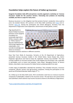


© Copyright 2026