
Program Flyer - University of Maryland
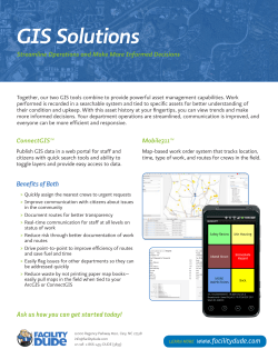
This workshop focuses on introducing Open Source software for both desktop and internet GIS applications. Upon successful completion of this workshop, the student should be able to understand the concepts of Open Source software, and show competency using the leading desktop and web mapping Open Source software packages, e.g. Quantum GIS (QGIS), SpatiaLite, GRASS GIS, GDAL/OGR, Google mashup and web mapping software. This workshop is designed to study webbased GIS technologies, and to help students develop the knowledge and skills necessary to plan, design, develop and publish a web-based GIS solution. This workshop provides students with a comprehensive and up-to-date understanding of: 1) the concepts and theories of Web/Internet GIS and its impacts on GIS applications; 2) various technologies or techniques for creating, analyzing, and publishing GIS data and services via the Internet. Students will be equipped with the state-of-art technical skills and knowledge necessary to develop Web GIS applications and to manage Web GIS projects, and will be inspired with broad and real -world applications of Web GIS in various fields. This workshop is designed as an introduction to mobile GIS, to the programming concepts underlying mobile GIS development, and more importantly, to the design and implement of a mobile GIS application. This workshop covers how to develop, test, and publish mobile GIS native apps working across two mobile platforms: Android and iOS. This workshop will also try to leverage the capabilities of Java, Swift, Google maps, ArcGIS Server and runtime SDK to developing and publishing mobile GIS apps. Detailed workshop contents, labs, and requirements are available at http:/ / te r. ps/ stgis. Workshop registration is managed by the Office of Extended Studies at the University of Maryland, visit http://ter.ps/stgis for registration information. Ruibo Han, PhD Director of Programs, GIS Center Department of Geographical Sciences, University of Maryland 1111B LeFrak Hall, College Park, MD 20742 E-mail: [email protected] Tel: (301) 314-1343 Website: http://ter.ps/stgis Center for Geospatial Information Science Department of Geographical Sciences University of Maryland, College Park The workshop sequence at the UMD Center for Geospatial Information Science is designed to provide a comprehensive overview of current state-of-the-art technologies in geospatial information science (GIS), through intensive training over a short time frame. The workshops hosted by our ESRI Developer Center provide fundamental training in key aspects of GIS, alongside hands-on lab-based exercises across a diversity of devices, software libraries, exercises, and data environments that emphasize “learning by doing”. experience in building and applying geographic UMD student ID and regular on- WORKSHOPS IN 2015 (FRI, SAT, SUN) Programming in GIS Jun. 12 – Jun. 14 Advanced GIS Jun. 19 – Jun. 21 Big data analysis Jun. 26 – Jun. 28 Open source GIS Jul. 10 – Jul. 12 days of 8-hour training. The cost includes lab Web GIS Jul. 31 – Aug. 02 fee and materials. All required materials, hard- and high-bandwidth access to cloud Mobile GIS Aug. 07 – Aug. 09 ware, software are provided on UMD’s campus computing and virtualization technolo- during workshops. gies SCHEDULE information systems for use in research and campus resources and services, such commercial environments. as library, shuttle bus, etc. A wide range of GIS, remote sensing, image processing, statistics, and dataThe cost of each workshop is $1800 for three Customized workshops/courses are available mining platforms State-of-the-art geovisualization facility upon request for group registration, contact us velopment platforms, and 50 tablet three days long, and is taught by faculty in the on details. devices for hands-on development of location-aware sensors on Android and iOS platforms Center for Geospatial Information Science at the University of Maryland, with extensive The students of Summer School have access Based on your understanding and knowledge of basic GIS, this workshop focuses on advanced GIS concepts, tools and operations including spatial analysis, geostatistical analysis, and geoprocessing. Students will also be introduced to a range of methods that can be applied to the exploration, modeling and visualization of quantitative data. This workshop will help you develop advanced theoretical and practical knowledge in spatial analysis and GIS modeling and the application this knowledge to solve real world problems. Advanced software products and de- Each workshop module in the sequence is Department of Geographical Sciences and This workshop introduces conceptual and practical aspects of programming for geographic applications. Students in this workshop will develop a proficiency in applying basic programming principles to manipulating spatial data sources in a GIS environment. Students will be introduced to the ArcPy component of the ArcGIS software and develop a proficiency in developing custom applications for spatial data processing in the ArcPy environment using Python programming language. … to: This workshop is designed to provide an introduction to statistical analysis over big data sets (and tackling big data problems) in geography. Students will be introduced to a range of methods that can be applied to the exploration, modeling and visualization of quantitative data. The workshop covers a range of topics including: graphing and data visualization, descriptive statistics, probability and sampling, hypothesis testing, and approaches for summarizing relationships between variables. Professionals and students who wish to pursue career in GIS, to keep pace with the advances of GIS, to get recharged based on basic GIS skills they have learned, and to specialize in areas of the offered topics. GIS


© Copyright 2026