
Brochures - AirâInfo
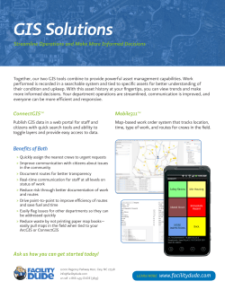
Map Your Business– Geospatial Consultancy At Air Info Geospatial we help you decide on the very technology suited and required as per your requirements. Our experts will work closely with you to get your needs updated with the effective GIS methods and technology that would help your requirement fulfilled in the most suitable and easy way. Our . specialized and expert consultants have expertise in various assignments and projects ensuring your satisfaction. Optimize Your Technology Our Aim and Objectives Our services and consultancy includes: A one step destination to all solutions of GIS based mapping and modeling. Whether you desire a geo-location based mapping system or resource management charts and maps, we are there for you. Our current emphasis are (and not limited to) on Landuse/Landcover mapping, Resource mapping, Cartographic generations, Regional mapping, Network channel mapping and Resource modeling. Secure Your Assets – Offline Maps One of our most endeavored accomplishments efficiency and specialty is offline supportive maps, specially built for mobiles and tablets, helpful when you are offline too. This unique feature not only assists in navigation but also locational based work and support. The registered key dependent maps protect from wrong use and inappropriate users. For further information and details contact us. Geospatial Consultancy 3-D Modeling Customized Mapping Digital Data Procurement and dissemination including the following Digital Images Topographic Sheets Satellite and Aerial photography images Radar Imagery Hydrological Consultancy Geomorphological Consultancy Urban Planning, Mapping and Modeling. Rural Infrastructure and agricultural assets mapping. Site Selection for Dams, Reservoirs and farming using GIS tools. Consultancy and data provision for Research and other related projects. GIS Training of personnel on latest available GIS technologies and software in market. Conducting events related to GIS to enhance awareness of GIS in masses. Mining Consultation using Remote sensing and ground verification with GIS tools Content Writing for GIS products QA / QCof GIS products. Consultancy on large and small scale mapping especially regarding Datum’s and Projection suitability for area purpose and region. Watershed delineation, mapping and classification using latest GIS tools and data. Aeronautical database generation and aerial navigation data and tools provision. Battlefield consultancy and monitoring systems Data creation for various marine, terrestrial and airborne display systems for navigation. Disaster management and related consultancy. Network analysis, mapping modeling and related consultancy. Natural Resource mapping and management. Crime and social event mapping. Logistic and fleet management using GIS. Resource allocation and mapping. Think Plan Act Think 3-Dimentional (3D) Our world is beautiful place with patterns in 3 dimensions. As we see the surroundings, we perceive it the same. GIS 3D visualization renders similar effect creating a ravishing scene of the area of interest. 3D products are generated on special request and demand basis by us. The level of 3D is decided by the layers of data requested by the clients. Digital Elevation Models (DEM) Products A DEM helps not only visualizing the terrain but also extract vital surface and subsurface occurring in the region. Our purpose at Air-Info is to use this data as a means to generate better and substantial information so as to generate models and maps for water prospects, urban planning and management. We also aim at terrestrial and battlefield simulations in which DEM plays a key role. Map making simplified (Geo-Spatial Training) To know how to implement this wonderful technology in itself is a challenging task. That’s where we come to help. Our targeted training programs specially designed for students, scholars and working people are our offering extended towards the society for help make a better tomorrow. Our helpful team not only extends a classroom training but also supports internships and student project designing guidance and helps them conduct the overall thesis designing too – and of course you get a certificate in GIS GIS has been a source of mapping for the past decade. It has not only helped in establishing a proper balance of flow of resources but also maintain a perfect planning and management order unlike other systems. Various layer-wise information generations are the key to our work. We not only provide end products but also intermediary products on clients demand basis. Our Services MAPPING MODELLING CONSULTANCY TRAINING DESIGNING ORGANISE RATIONALISE OPTIMIZE Career Prospect & Support A career in Remote Sensing & GIS is far more interesting and promising rather than just a source of money. At Air - Info we help you persuade your dreams. That’s why we help you find a job and help you extend your career in this wonderful field of Geo-Information Science. NOTE: We Don’t make false job guarantees. Anyone claiming so on our name should be immediately informed/reported to us. AIR–INFO GEOSPATIAL® Contact Us: 486,Ram Nagar, Rampur, Jabalpur Madhya Pradesh-482002 Phone No.: +91 97165 57426, +91 85275 80306 email: [email protected] www.aigs.co.in


© Copyright 2026