
Mobile GIS - Center for Geospatial Technology
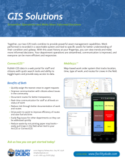
Mobile
GIS
Introduction
With more than 6.8 billion mobile cellular
subscribers, (2013), wireless communication and
mobile computing have gained acceptance
worldwide with speed that has surpassed many
other technological innovations.
Mobile GIS emerged in the mid-1990s to meet the
needs of field work such as surveying and utility
maintenance.
Introduction
Early systems operated mainly in a disconnected
mode.
With radical advances in wireless communications,
especially the operation of 3G networks, mobile
GIS is increasingly connected to the Web, and thus
becoming a part of Web GIS.
Uses and Benefits
Mobile GIS can update the server with the latest information
from the field.
The Web server can, in turn , support mobile GIS with rich
content and advanced analytics.
Mobile GIS is needed by the general public as it is by
organizations and professionals.
Uses and Benefits
Consumer mapping applications provide location-based
services (LBS) related to the location of the user.
This leads to GIS on the go- to find things that are nearby, to
get to places, and to locate friends.
Mobile GIS can potentially be used by anyone, for anything,
anytime, anywhere.
Uses and Benefits
In the past decade, there has been no greater
influence on GIS architecture than in the enormous
improvements that have been made in computer
networks.
We are in the midst of a radical shift from wired to
wireless communications, and from wired to
wireless computer networks.
Concept
Conceptually, there are 4 locations in a GIS:
The location of the User (U)
The location where the data is stored (D)
The location where the data is being processed (P)
The location of the subject of the GIS Project (S)
Traditionally, U≠S, since the user is usually in the
office, and the subject can be anywhere in the
world.
Concept
In Mobile GIS, U=S. That is, the user is usually
located in the subject area; thus the user can see,
touch, feel, hear and even smell the subject.
For eg. First responders are right at the incident
scene and they can record what they see, feel, hear
and smell. Such information extends the awareness
of those in command through observations from
afar.
Mobile GIS- Functions and Applications
The early applications of mobile GIS were often for
in-vehicle navigation and field surveying.
GIS data and software were preloaded and
operated in a disconnect mode in the field.
With advances in wireless communication, rich and
powerful GIS services and applications are available
over the web.
Mobile GIS- Functions and Applications
Mobile GIS works well with following GIS
functions:
1.
2.
Information capturing and updating:
a.
Mobile devices are portable
b.
Built-in GPS receivers allow for acquiring accurate location information
c.
Contemporary mobile devices with cameras and recorders allow for
capturing rich geospatial information in several forms.
Dissemination:
a. Mobile devices can bring GIS into the hands of billions, whether users
are in the field, office, home or on the go.
b. You can view maps and query what’s around you on demand.
Mobile GIS- Functions and Applications
Mobile GIS is relatively weak in the following GIS
functions:
1.
Storage:
•
2.
Mobile devices are not considered a robust platform for large
databases.
Analysis:
• Because of limited computing power, it cannot provide the
comprehensive and sophisticated analysis capabilities.
3.
Presentation:
• Mobile screens cannot compare with desktop monitors in terms of size
of presentation and depth of color
Mobile GIS- Functions and Applications
There are two types of Mobile GIS Applications
1. Consumer Mobile GIS Applications:
a. Where am I?
b. What is around me?
c.
Where is the closest restaurant, bank, atm, gas station or store?
d. How do I get from here to there?
e. These applications usually fall under the umbrella of LBS- location based services.
f.
They all need to have basemaps and Point of interests.
g. Main competition focuses on who has the most comprehensive and up-to-date basemaps
and POIs, and who has the best usability and trendiest user interface.
h. Eg. Google Maps, Bing for mobile, Mapquest etc.
Mobile GIS- Functions and Applications
There are two types of Mobile GIS Applications
2. Enterprise Mobile GIS Applications:
a. Developed for utility and infrastructure companies, public safety, law enforcement and
government agencies.
b. Field mapping, query and decision support
c.
Field inspection and inventory of assets
d. Field Surveying
e. Incident reporting
f.
Collaboration
g. Tracking
h. Functionality over Novelty
Advantages of Mobile GIS
Mobile GIS has certain advantages over traditional
desktop GIS.
1.
Replacing paper-based workflows: Replace paper forms, redundant work process and improve
currency and accuracy of data.
2.
Mobility: Compact and portable. Mobile devices can extend GIS to areas where wiring is
infeasible or costly, where its too hot or humid for normal computers to functions.
3.
Large volumes of users: With more than 4 billion cell phone subscribers, mobile users have far
exceeded the number of desktop computer users. Broadens the market for geospatial industry
and provides tremendous potential for the use of geospatial science.
4.
Location awareness: A number of technologies can be used to pinpoint the current location of
a mobile device.
5.
Versatile means of communication: Users of mobile GIS can communicate via voice, short
message, photo, video, email and the Web.
6.
Near-real-time information: The application domain of mobile GIS is usually wherever an event
is taking place and whenever a user needs information. Field events can be recorded and
reported to the Web server in near-real time. Mobile GIS has the potential to monitor the
spatial and temporal aspects of the world around us.
Mobile Devices
Mobile devices can be classified in 4 categories:
1. Mobile Phones : IPhones, Samsungs etc. Allows for versatile
communication
2. Pocket PCs: Handheld computers, more powerful mobile phones,
hence provide a strong platform for mobile GIS
3. Portable PCs: Laptops, Tablet PCs etc. Relatively heavier, but more
powerful.
4. Special Devices : Car GPS, Trimble Junos etc. For specialized tasks
Wireless Communications
Wireless communications technologies vary in
their speed, range and setup costs:
1. Bluetooth: Designed for short range communication about 10m.
• Applications include communication between mobile
device and its peripherals such as GPS receiver and
headset
2. WI-FI: Typical range of 100m, therefore limited in spatial coverage
Wireless Communications
Wireless communications technologies vary in
their speed, range and setup costs:
3.
Cellular Networks: Cellular network covers wider areas.
•
1G: Analog Technique and transmits voice only. Mobile GIS cannot be built
on this technology
•
2G and 2.5G: Digital network, supports voice and low speed data
transmission(10 KBps). 2.5G is an updated version of 2G (384 KBps) Building
mobile GIS in 2G and 2.5G faces a challenge of limited data transfer speeds.
•
3G: Currently available in many parts of the world. Data transmission speeds
upto 2 MBps. Mobile GIS can be built on this technology
•
4G: Fourth Generation Technology, will provide data transmission speeds of
about 100 MBps. The network will be built on LTE(Long Term Evolution),
WiMax (Worldwide Interoperability of Microwave Access) or UMB (Ultra
Mobile Bradband). Mobile GIS will thrive in the 4G era.
Mobile Positioning Technology
The cornerstone of most mobile GIS applications is
location awareness.
The main mobile positioning technologies today are
based on
• satellite
• cellular network
• Wi-Fi network
• IP address
• radio frequency identification (RFID)
Mobile Positioning Technology
Navigation Satellite-Based Approach:
• GNSS- Global Navigation Satellite Systems allows small
electronic receivers to determine their location by using the
signals transmitted by satellites.
• The most commonly used satellite system is the U.S. Global
Position System (GPS).
• Other systems include GLONASS, Beidou and Gallileo
• This approach is often used for applications where high
accuracy is required such as in-vehicle navigation, field
surveying and utility maintenance.
• The disadvantage is that satellite based accuracy can be
reduced by satellite position, cloud cover and physical barriers
such as high-rise buildings.
Mobile Positioning Technology
Cellular Network-Based Approach
• The cellular network based positioning approach relies on the
way the cellular site finds mobile devices in its service territory
and routes calls or other types of communication services to
them.
• Relatively lower accuracy
• Can be implemented via several different methods using
triangulation:
• COO – Cell of Origin: considers the location of the
origin base station as the location of the caller.
• TOA –Time of Arrival
• TDOA – Time Difference of Arrival
• AOA – Angle of Arrival
• E-OTD – Enhanced Observed Time Difference
Mobile Positioning Technology
Assisted GPS Approach
The assisted GPS approach uses satellite-based and
cellular-network based technology. It can achieve
accurate location and still operate in area behind or
under barriers.
Mobile Positioning Technology
WI-FI- Based Approach
When a mobile device connects to the internet via Wi-Fi, its location
can be determined by the location of the Wi-fi hot spot.
This method relies on
•
A database of Wi-Fi hot spots
•
Mobile device must be within 100m of Wi-Fi access
point
•
With Wi-Fi triangulation the accuracy can be higher
•
Does not work when mobile device is out of range.
•
Wi-Fi hot spots database must constantly be updated
Mobile Positioning Technology
IP Address-Based Approach
When a mobile device connects to the internet, the
IP address of the mobile device, which is usually a
gateway of the Internet Service Provider (ISP), can
be used to determine the location of the mobile
user. The accuracy of this approach is relatively low,
usually within the range of a city area.
Mobile Applications- Technical Challenges
Mobility comes at price. The small size of mobile
devices imposes limitations:
• Limited System Resources(CPU, Memory, and Battery
Power)
• Limited Bandwidth and Intermittent Network
Connections
• Small Screen Size, Tiny Keyboard and Outdoor
Environment
Mobile Application Development
Mobile GIS can be developed using 3 main
approaches.
1.Native Application Based
• Java, .NET Mobile, Java mobile etc.
2.Mobile Browser Based
• HTML, HTML5, XHTML, Javascript, Adobe Flash,
Silverlight etc.
3.Message Based
• SMS, MMS etc.


© Copyright 2026