
Orange Water and Sewer Authority
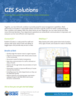
GIS: GATEWAY TO EFFICIENT
UTILITY OPERATIONS
Integrating Customer Service Data and GIS to Improve
OWASA Operations
2015 G. Herbert Stout Award Application
Orange Water and Sewer Authority
Carrboro, North Carolina
A public, non-profit agency providing water, sewer and reclaimed water services
to the Carrboro-Chapel Hill community.
GIS: Gateway to Efficient Utility Operations
Integrating Customer Service Data & GIS to Improve OWASA Operations
Purpose
Orange Water and Sewer Authority (OWASA) provides water, wastewater, and reclaimed water services
to about 82,000 people through about 21,000 customer accounts in the Carrboro-Chapel Hill
community, including the University of North Carolina at Chapel Hill and outlying areas. Like all utilities,
OWASA faces increasing challenges to providing affordable services while ensuring quality customer
service and the long-term sustainability of its operation and facilities. To help improve operating
efficiency, reduce costs, enhance customer service, and ensure reliable operations, OWASA is expanding
its use of advanced information technologies, including its geographic information system (GIS).
A key strategy in this effort has been the full integration of OWASA’s customer information system (CIS)
data with infrastructure data into the GIS platform, and deploying that information throughout office
workstations and mobile computing technology. This effort is exemplary because it supports a wide
range of essential utility management and planning functions, including but not limited to: (a) customer
service activities in the office and in the field; (b) water and sewer system modeling efforts; (c) service
affordability efforts to help customers in need reduce their bills; and (d) customer billing and revenue
recovery. Jeff Hughes, Director of UNC’s Environmental Finance Center, said: I often am asked to
present at workshops across the country and having OWASA as my local service provider has helped
my presentations enormously. I’ve found over the years that OWASA is typically out in front,
sometimes way out in front, in dealing with emerging utility management challenges and developing
innovative tools and approaches. Their integration of billing and GIS data and use of dashboards are
two examples of things that OWASA was working on 5 to 10 years before most utilities even started.
Implementation
Motivation and Why it was Developed
OWASA staff recognized that if CIS data could be automatically linked with the GIS, we could perform
advanced analytics to inform, guide, and support many different utility management and field service
functions in a more efficient manner.
Problems Intended to be Solved
The initiative to link CIS and infrastructure data through GIS was initially focused on addressing three
main needs:
1. Make real-time CIS data accessible to all OWASA staff, especially field personnel
Prior to the integration, CIS data was maintained in a stand-alone database only accessible to
Customer Service staff. As a result, meter readers, meter shop staff, and other employees
would constantly call or visit the Customer Service Department to obtain basic information
about meters including location, meter size and number, customer name and phone numbers,
usage history, routing information, etc. The Customer Service team and field staff both wanted
CIS data to be made available to all staff via the GIS through workstations and mobile
technology so that staff throughout OWASA could be more efficient, self-sufficient, and
responsive in meeting customer needs.
2. Use CIS data to support water and sewer demand forecasting and system modeling
Like most utilities, OWASA retained consulting firms to develop demand projections needed to
support water and sewer system modeling and engineering design studies. Typically, the
1
consultants met with staff from local planning departments to identify existing development
conditions and compile population and employment forecasts needed to project future demand
for water and sewer services. The result was a variety of approaches and reporting and data
formats, and the lack of a central repository for that information. We recognized that we
understood our customers and service area better than our consultants, and that if we could
link our CIS data to our GIS, we could establish parcel-based water (and sewer) demand
estimates for use in engineering and planning studies.
3. Review water and sewer billing setups for all customers
Since assuming operation of the water and sewer systems in 1977, OWASA had not completed a
formal, systematic review of water and sewer billing set-ups for its various customer accounts.
Staff recognized that if CIS data could be linked with GIS, it would enable the systematic,
streamlined review of billing set-ups to ensure that all OWASA’s customers were being correctly
billed for the services they were receiving.
Staff also recognized that once the CIS and GIS data linkage was established, it was very likely that other
opportunities to maximize the value of that linked data would be quickly identified and pursued.
Problems Actually Solved
Following the integration of CIS and GIS data, OWASA successfully met the three initial needs described
above. As anticipated, the data integration has also been essential to several other accomplishments,
such as:
1. Optimization of meter reading routes to increase the productivity of our meter reading staff;
2. Identification of areas of high customer turnover, which enables us to prioritize our automatic
meter reading (AMR) installation program;
3. Identification of “hot spots” of high water use so that we can better target customer outreach
efforts to reduce water demands; and
4. Identification of service locations where customers have trouble paying their bills and have high
water use, thereby enabling us to target our efforts to help customers in need.
Further information on each topic is provided in the following sections.
Implementation Phases, Decisions and Results
Once the potential benefits of CIS and GIS data integration were identified, OWASA staff established a
three-phased approach to accomplishing the CIS and infrastructure data integration into a single GIS
platform. Phase 1 was the creation of the CIS data link to the GIS database, and associated data cleanup and field verification work. Phase 2 included meeting the three initial needs identified for the
project, and Phase 3 – which is ongoing – has included additional analyses that have been made possible
by the data integration.
Phase 1: Integrating Customer Information System Database with GIS Geodatabase
The CIS database contains information about water meters such as type, size, meter number,
installation date, metered consumption, and location; therefore, the logical approach was to develop a
way to link CIS data to the meter box layer in the GIS. Meter box locations in that layer are based on
GPS coordinates or field survey data for all meters in the OWASA system. In addition to meter data,
2
other customer information to be linked included customer address, customer phone numbers, critical
customers, account class, reading route number and reading sequence.
To enable linking with Orange and Durham County parcel-level data, the Parcel Identification Number
(PIN) for each service location was also linked to the meter box layer. A new field, GISObjectID, was
added to the CIS database and populated based on service address and applicable meter number. This
linking field enabled OWASA to automatically join the CIS data to the GIS meter box feature class.
After the initial data download, over an 18-month period OWASA’s Engineering staff performed
extensive quality assurance and quality control on the data. Hundreds of hours were spent field
verifying information, and the CIS and GIS databases were updated, as needed.
OWASA’s Information Technology staff developed a routine to automatically upload CIS data to the GIS
nightly. This is a very efficient way of providing OWASA’s GIS users near real-time access to CIS data.
Phase 2: Utilizing Customer Data in GIS Analyses to Address the Three Core Needs
Once the data linkage was established, staff moved forward with several initiatives to maximize the
value of the data integration. The first three accomplishments were directly related to the key drivers
for the CIS – GIS data integration. Those were as follows:
1. Access to near real-time CIS data is now available to office staff and field personnel, thereby
enabling staff to provide more efficient customer service. Field personnel use tablets and
laptops to access linked CIS and GIS data in the field, thereby enabling them to respond to
customer inquiries and issues without needing to call Customer Service staff for assistance, or to
return to the office for information, maps, etc. Office staff now access CIS data through the GIS
as needed to respond to customer inquiries about existing service arrangements, water and
sewer service availability, and other matters. (Exhibit 1 is a screenshot of a GIS map and display
of some of the CIS data available through the Meter Box layer. Exhibit 2 shows photos of field
personnel using mobile technology to access the data remotely in the field.)
2. We have used our linked CIS data, including usage data, to support several water and sewer
system modeling and engineering studies. Since the integration was established, OWASA’s
parcel-based customer and water usage data has been used to support several different water
and sewer system modeling and engineering projects, including the update of OWASA’s Water
Distribution System Hydraulic Model and Sewer System Model, and evaluation of the potential
impact of new development proposals on the water and sewer systems. This has enabled
OWASA to save money and time on consulting services for these projects and improved model
accuracy. (Exhibit 3 includes an example of historical monthly water usage data available for
each meter, and accessible through the CIS – GIS integration.)
3. Water and sewer billing setups were systematically reviewed for all customers and corrections
were made where needed. Following the integration of CIS data with the GIS, staff completed
an internal review of water and sewer billing set-ups for all customer accounts. This effort
resulted in the identification of several sewer service connections that had been made without
OWASA’s knowledge or approval, and for which sewer service billing had not been initiated.
OWASA was able to revise customer billing set-ups to ensure those locations are billed for the
services they receive, and where applicable, customers were back-billed for services they had
received but had not paid for. As a result, OWASA was able to increase operating revenues at
very low cost. (Exhibit 4 is a screenshot showing the location of an existing residence that was
3
being billed for water service, but not sewer service. Once the CIS – GIS integration was
completed, graphical display of the data, including existing water and sewer infrastructure,
enabled staff to identify properties such as this that had likely connected to the sewer system
without prior knowledge of OWASA.)
Phase 3: Expanding the Value of the Data Integration
As noted previously, the data integration has also enabled OWASA staff to achieve the following:
1. Water meters are now being read more efficiently because we have used the CIS and GIS data
linkage to optimize our meter reading routes. Traditionally, meter routes and meter reading
sequence were determined by Customer Service staff using a manual process. By using the
animation feature in GIS to analyze our CIS data for meter routes, meter read sequencing, and
meter types, we have been able to re-sequence meter reading routes to increase the
productivity of our meter reading staff. (Exhibit 5 is a screenshot showing optimized meter
reading sequencing for one route.)
2. We are using the CIS and GIS data to inform our service affordability efforts in partnership
with local social service and affordable housing agencies. As our water and sewer rates have
increased, so has our concern about service affordability, which is one of the key themes
included in OWASA’s Strategic Plan. In partnership with several local social service and
affordable housing agencies, we have been working to find ways to help customers in need,
including helping them reduce their bills by reducing their water use. We have used the CIS –
GIS linkage to analyze and graphically display service locations of customers that have (a) had
their water service temporarily disconnected for non-payment; (b) received bill payment
assistance from other agencies; and/or (c) received extensions of credit from OWASA to allow
more time to pay one or more of their bills. We have analyzed water use and building attribute
data (year built, number of bedrooms and bathrooms, etc.) for those customers to identify
those who we think could achieve important savings by reducing their water use through
behavioral changes and/or cost-effective water efficiency investments (such as replacement of
old toilets and showerheads with high-efficiency fixtures.) This has enabled us to prioritize our
staff time for completing water audits at selected residences. (Exhibit 6 is an example of a map
showing average monthly water use for customers that have service disconnected for nonpayment.)
3. The data linkage is helping us identify our best opportunities to deploy advanced meter
reading technology. OWASA uses both manually read meters and radio-read meters, and we
are evaluating the feasibility of installing advanced metering infrastructure (AMI) which would
enable meters to be remotely read and turned on and off. This would enable service
connections and disconnections to be completed remotely from the office, thereby saving staff
time, fuel, and money. AMI meters with remote control capability are expensive; therefore, the
most cost-effective deployment strategy would be to install them at service locations that
experience the highest customer turnover. The CIS – GIS data linkage is being used for this
purpose. (Exhibit 7 illustrates areas of high customer turnover which are prioritized for AMI.)
4. Using the Hot Spot analysis feature and other analysis methods in GIS, we analyze customer
usage data to help inform our conservation planning and outreach work. Data has been
analyzed by neighborhood, by age of housing, and by season. Large differences in winter and
summer use likely indicate higher levels of irrigation. (Exhibits 8 and 9 are examples of the hot
spot analysis and analysis of water use by neighborhood.)
4
Organizational Impact
How Applied in Organization
OWASA’s GIS Coordinator has implemented Web GIS throughout the organization, thereby enabling
staff to have easy access to GIS, including the CIS data available through GIS. Many staff members
regularly use the CIS - GIS data integration feature in support of their work. As a result, they are better
able to perform their work and serve our customers more efficiently than before.
Decisions Impacted
As summarized above, the CIS – GIS integration has enabled OWASA to improve the efficiency and
productivity of customer service and field operations; inform our service affordability, conservation
program, and advanced metering technology efforts; and ensure proper billing of our customers. These
improvements are part of OWASA’s successful efforts to maintain rates at the same level for the past
three years despite experiencing reduced water sales (and therefore revenue).
Other Users
Other users that have benefited from the CIS – GIS database integration include: (a) consulting firms
performing water and sewer engineering studies for OWASA; (b) local social service and affordable
housing agencies partnering with OWASA on the service affordability initiative; and (c) University
researchers that have used the information for doing behavioral research, studies of water use patterns
by OWASA customers, and evaluation of alternative billing/revenue recovery methods.
OWASA does not disclose customer billing or customer-specific water use data to third parties without
the consent of the customer, unless the data is needed for technical and planning studies conducted by a
consulting firm or other party under agreement with OWASA.
Quantitative and Qualitative Impact
As described above, the linking of CIS and infrastructure databases through GIS has enabled OWASA to
realize many important benefits. A few key examples of these benefits are:
1. Customer service activities are now more efficient and effective. Prior to the integration, about
30 calls per week were initiated by field staff to the Customer Service Department to obtain
basic information about specific meters or customers. The CIS – GIS integration has significantly
reduced call volume, and saved staff more than 20 hours per month. The meter staff can now
quickly find a meter number and related information via a search button on OWASA’s Web GIS.
During a typical day, a meter crew member uses this search tool an average of 15 to 20 times to
quickly locate a meter location in GIS. This has increased efficiency, reduced calls to Customer
Service, and improved morale and independence.
2. Relevant CIS data can be efficiently provided to support engineering and planning studies,
thereby saving consultants time and reducing costs for OWASA. Our consultant on our Sewer
Capacity Study estimates OWASA saved approximately $15,000 by having its CIS data in GIS.
3. Customers are being properly billed for the services they receive, thereby enhancing revenues.
4. Service affordability efforts, conservation program activities, and plans for implementation of
advanced meter reading technology can be more effectively targeted.
5
Exhibit 1
CIS – GIS Data Linkage Enables More Efficient Customer Service
Exhibit 1: Screenshot of GIS map and some of the attribute data available in the Meter Box layer.
Whether in the field or in the office, OWASA staff members have easy-to-use access to customer and
meter data through the CIS-GIS data integration. (For privacy protection, we have made the customerspecific information above illegible).
6
Exhibit 2
OWASA Field Personnel Have Remote Access to CIS and GIS Data
Exhibit 2: While working in the field, OWASA personnel use mobile technology to view CIS and GIS data
and automatically receive and complete service requests for customers.
7
Exhibit 3
CIS – GIS Data Integration Provides Usage Data Needed for System Modeling and Engineering Studies
Exhibit 3: Screenshot of GIS map displaying location of water and sewer infrastructure and water
meters. The attribute data show the historical monthly water use for the selected customer.
8
Exhibit 4
CIS – GIS Data Linkage Enables Efficient Review of Customer Billing Set-Ups
Exhibit 4: The CIS and GIS data linkage was used to analyze water-only accounts (customer is billed for
water service but not sewer service) that were in close proximity to existing sewer lines. After these
were identified in the GIS, field investigations were conducted to confirm that this customer was
connected to sewer and the account information was corrected.
9
Exhibit 5
CIS – GIS Data Linkage Has Supported Optimization of Meter Reading Routes
Exhibit 5: The above map shows the optimized meter reading sequencing for Route #01470015 (reading
sequence number is shown in red). Meter readers read meters on the right side of street first, then the
left side. If a new water meter is added to the route, the new sequence number is updated in the CIS
database and the changes are automatically seen in the GIS as a result of the database integration.
10
Exhibit 6
CIS – GIS Integration Helps Inform Service Affordability Initiative With Local Agencies
Exhibit 6: By examining average monthly consumption (2013) of customers who have experienced cutoffs for non-payment, OWASA can target its water conservation efforts to help customers in need
reduce their monthly water bills. By partnering with other agencies, funds for new plumbing fixtures,
such as low-flow toilets, can be used to further reduce water use and customer costs.
11
Exhibit 7
Using CIS – GIS Data to Target Deployment of Advanced Meter Reading Technology
Exhibit 7: The above map shows the frequency of customer turnover (disconnection of service at
request of customer) during 2014. By linking CIS data to GIS, areas where there is high customer
turnover and associated service disconnections and reconnections can be identified and targeted for
AMR/AMI meter installation to provide more efficient customer service and field services.
12
Exhibit 8
Water Use “Hot Spot” Analysis Helps Inform Conservation Education and Outreach Efforts
Exhibit 8: Water use “Hot Spot” analysis showing areas of high (red) vs. low (blue) water consumption
for individually-metered residential customers.
The map on the left shows patterns of average monthly use during winter months (January – March) of
2012, while the map on the right shows patterns of mean water use during the summer months (July –
September) of 2012. The Increased frequency of high consumption areas (red) is primarily due to
irrigation.
13
Exhibit 9
Water Use Analysis By Neighborhood Also Supports Conservation Efforts
Exhibit 9: The above map shows mean water use, by neighborhood, for the summer of 2012. This
information helps OWASA target its conservation education and outreach efforts to areas with higher
water use.
14


© Copyright 2026