
odiham parish neighbourhood plan 2015 - 2032 draft
 ODIHAM PARISH NEIGHBOURHOOD PLAN
2015 - 2032
DRAFT PLAN (V9)
[PHOTO/IMAGE]
Published by Odiham Parish Council for informal consultation.
May 2015
CONTENTS
FOREWORD
LIST OF LAND USE POLICIES
1. INTRODUCTION & BACKGROUND
2. VISION & OBJECTIVES
3. LAND USE PLANNING POLICIES
4. OTHER PROPOSALS
SITE PROPOSAL MAP
INDEX OF CONSULTATION QUESTIONS
RELATING TO POLICIES AND PAGE NUMBERS IN THE DOCUMENT
Question number
Policy number
Page
number
Q1 Housing Sites
Policy 2 - Housing Development Sites
21
Q2 Housing Sites
Policy 2 - Housing Development Sites
21
Q3 Housing Sites
continued
Policy 2 - Housing Development Sites
21
Q4 Housing Mix
Policy 3 Housing Mix
26
Q5 Affordable Housing
Policy 3 Housing Mix
26
Q6 Green Spaces
Policy 9 Green Spaces
34
Q7 Green Spaces
continued
Policy 9 Green Spaces
34
Q8 High Street
Policy 7 Odiham High Street
32
Q9 Parking
Section 4 Other Proposals
40
Q10 Infrastructure Aims
Section 4 Other Proposals
41
ODIHAM PARISH NEIGHBOURHOOD PLAN: DRAFT PLAN
MAY 2015
2 1. INTRODUCTION & BACKGROUND
The Odiham Parish Neighbourhood Plan
1.1The Odiham Parish Council is preparing a Neighbourhood Plan for the area
designated by Hart District Council (HDC) under the provisions of the Localism
Act 2011 and the Neighbourhood Planning (General) Regulations 2012. The
designated area is shown in Plan A below.
Plan A: Odiham Parish Neighbourhood Plan Area
1.2 The purpose of the Odiham Parish Neighbourhood Plan will be to make
planning policies that can be used to determine planning applications in the
area. In some cases, it policies will encourage development proposals for the
benefit of the local community. In others, its policies will aim to protect the
special character of the parish.
1.3 Neighbourhood Plans provide local communities with the chance to
shape the future development of their areas. Once approved at a
referendum, the Plan becomes a statutory part of the development plan for
the area and will carry significant weight in how planning applications are
decided. Plans must therefore contain only land use planning policies that
can be used for this purpose. This often means that there are important issues
of interest to the local community that cannot be addressed in a Plan if they
are not directly related to planning.
1.4 Although there is considerable scope for the local community to decide
on its planning policies, Plans must meet four ‘basic conditions’. These are:
ODIHAM PARISH NEIGHBOURHOOD PLAN: DRAFT PLAN
MAY 2015
3 • • • • Is the Plan consistent with national planning policy?
Is the Plan consistent with local planning policy?
Does the Plan promote the principles of sustainable development?
Has the process of making of the Plan met the requirements of
European environmental standards?
1.5 In addition, the Neighbourhood Plan must be able to show that it has
properly consulted local people and other relevant organisations during the
process of making the Plan and has followed the Regulations.
1.6 These requirements will be tested by an independent examiner once the
Plan is finalised. If satisfied, the examiner will recommend to the HDC that the
Plan goes to a referendum of the local electorate. If a simple majority of the
turnout votes for the Plan then it must become adopted as formal planning
policy for the area.
The Draft Plan
1.7 This Draft Plan is the first opportunity for the Neighbourhood Plan to consult
on the emerging policies and proposals of the Plan. It has reviewed existing
national and local planning policies and how they may affect this area. And
it has already sought the local community’s opinions on local issues that the
Plan might help address.
1.8 The contents of this Draft Plan are therefore presented to obtain the views
of the local community and other organisations on the vision, objectives and
policies of the Plan. It is especially important to understand the preferences
for the options that are presented in the document as the final version of the
Plan must only propose the preferred option.
1.9 This document is deliberately brief and focused on the draft vision,
objectives and policies. The final version of the Plan will not only contain the
preferred policies but it will also explain in more detail the background to the
Plan, it will provide a profile of the area and its will describe the key planning
issues in the area, to which the Plan is aiming to respond.
The Planning Policy Context
1.10 The Neighbourhood Plan must be in line with national and local planning
policies. At the national level, these are set by the National Planning Policy
Framework (NPPF) of 2012, which is complemented by the Planning Practice
Guidance of 2014. These documents set out the key national planning
principles that apply to preparing plans and managing development
proposals across the country.
1.11 At the local level, the key documents are the Hart Local Plan (1996-2006)
as revised 2006 and the Hart Local Plan (2011-2032). The District Council is now
working towards a new Local Plan (Strategy & Sites) document and a
Development Management document. The first document will contain the
strategic policies for the District; the second will establish the detailed
ODIHAM PARISH NEIGHBOURHOOD PLAN: DRAFT PLAN
MAY 2015
4 planning policies for the District. Both will gradually replace the saved policies
of the current Local Plan.
1.12 The District Council consulted on a ‘Housing Development Options
Paper’ in autumn 2014. In November 2014, it resolved to respond to that
consultation exercise with a preferred housing distribution strategy to deliver
4,000 new homes in the period 2011 to 2032 above those schemes already
built or consented. The strategy proposes that 150 – 200 new homes of this
total number will be planned for in the part of the District beyond the 5km
zone of the Thames Basin Heath Special Protection Area (an internationally
important ecological area). The Odiham and North Warnborough area falls
inside that zone and there is therefore a long term expectation that the
Neighbourhood Plan will make provision for much of that development,
taking into account housing schemes in the Parish that already have planning
consent. However, its proposals will be assessed for their impact on the
Special Protection Area in accordance with Policy NRM6 of the South East
Plan (which remains in place) and with the Habitats Regulations (see para
1.23 below for more details).
1.13 The District Council plans to publish a draft Local Plan for consultation in
autumn 2015 that will formalise this strategy, with a view to its Plan being
examined and adopted by summer 2016. In which case, assuming the
Neighbourhood Plan is submitted for its own examination in autumn 2015, it
will be about one year ahead of the Local Plan. The Neighbourhood Plan will
therefore be tested against the saved strategic policies of the current Local
Plan, but it can draw on the reasoning and evidence of the new Local Plan
to support its proposed policies.
1.14 The District Council has not defined which of its saved policies are
‘strategic’ for the purpose of guiding the preparation of Neighbourhood
Plans. Those policies considered to be relevant for this Plan are listed below:
• • • • • • • • • • • • • • • • • • GEN1 General Policy for Development
GEN3 General Policy for Landscape Character Areas
GEN4 General Design Policy
GEN11 Areas Affected by Flooding or Poor Drainage
ALT GEN13 Affordable Housing
CON1 European Designations (see reference to South East Plan Policy
NRM6 above and in para 1.23)
CON2 National Designations (Nature Conservation)
CON3 Local Designations (Nature Conservation)
CON7 Riverine Environments
CON10 Basingstoke Canal (Nature Conservation)
CON13 Conservation Areas
CON17 Listed Buildings or Buildings of Local Interest
CON21 Local Gaps
CON22 Setting of Settlements and Recreation
RUR1 Definition of Rural Settlements
RUR2 Development in the open countryside – general
RUR3 Development in the open countryside – control
RUR32 Basingstoke Canal (Leisure & Recreation)
ODIHAM PARISH NEIGHBOURHOOD PLAN: DRAFT PLAN
MAY 2015
5 • • • • • • URB8 Shopping in Rural Centres
URB9 Retail: Local Needs
URB11 Shop Fronts
URB12 Residential Development Criteria (in Rural Centres)
URB20 Retention and Provision of Local Services/Community Facilities
URB21 Loss of Amenity and Recreation Open Space
Plan B: Hart District Local Plan 2011 - 2032 Key Diagram
ODIHAM PARISH NEIGHBOURHOOD PLAN: DRAFT PLAN
MAY 2015
6 1.15 The plan also has two site-specific policies in the area (DEV18 and DEV19)
covering RAF Odiham and Land between Dunleys Hill and Robert Mays
School respectively.
Community Views
Building on earlier research by Odiham Parish Council (OPC) and InOdiham,
the NP Steering Group has consulted the community extensively since June
2014.
By December 2014, the team had engaged with hundreds of local residents
with a formal presence at seven diverse parish events. During this period the
aim was to raise awareness of the intention to produce a Neighbourhood
Plan. 86% of the 218 residents who gave feedback supported this initiative
and its proposed main focus: which housing sites should be developed,
additional amenities and more affordable housing.
The term OnwardPlan was adopted in publicity to unite both villages (O +NW)
in a concise, inclusive and forward-looking way. OnwardPlan has served
since as a useful and imaginative handle used consistently across traditional
and modern media. A dedicated website was launched in November 2014
(www.onwardplan.com) plus Facebook and Twitter activity.
In January 2015, nearly 500 residents attended four consultation events (C1)
at venues throughout the parish and contributed around 4,000 post-it
comments. Here is a summary of the key results:
Vision
Over 90% of respondents reacted positively to the emerging draft
vision. The majority of spontaneous comments related to infrastructure
concerns over further development eg. healthcare, education, traffic,
flooding, utilities.
Environment
Most felt that all the environmental criteria proposed were important to
them. However, the most important single criterion was ‘prioritising
brown field or degraded sites for development over natural woodland
and prime agricultural land’.
Green Space
‘The preservation of our heritage, including conservation areas and
view/landscape’ was considered more important than ‘the provision
of new community/recreation facilities’. A village green would be
welcomed by many even if it meant seeing some development
around the edge. The open spaces most valued by the community
were the Canal, the Deer Park, Odiham Common, and Broad Oak
Common.
Amenities
There was strong endorsement for more cycle paths, and for
maintaining footpaths. As for existing facilities, improving the
ODIHAM PARISH NEIGHBOURHOOD PLAN: DRAFT PLAN
MAY 2015
7 Canal/Wharf area attracted most support, plus refurbishing the public
toilets in King Street. There was limited appetite from this audience for a
new Community Centre or for additional sports pitches.
Housing
‘As far as possible, development should not impact detrimentally on
conservation areas, listed buildings and views valued by the
community.’ That was considered the most important criterion for
assessing housing sites put forward by landowners for development.
The second was that ‘valued green spaces should be retained’.
The largest group of respondents favoured small housing sites (up to 30
dwellings), followed by those favouring a mix of small and medium sites
(up to 60 dwellings). Affordable homes were considered a priority;
likewise small 2-bedroom houses. There was more support for more low
cost market housing than provision by Housing Associations. Many
respondents agreed with the need for a residential care home.
High Street
In January 2015 the largest number of respondents said that they
would like short term parking to be free of charge. Many said that they
would like additional parking close to the centre of Odiham. However,
the Steering Group is aware that this consultation period coincided
with an unprecedented peak in demand for parking in early 2015
during substantial construction work on the High Street. OPC has been
monitoring this situation throughout.
Of the traffic calming methods suggested, a 20mph speed limit and
some limitations on HGV traffic through Odiham village were seen as
the most acceptable.
Results were publicised systematically (Feb-April 2015) via the Parish
Magazine, by emailing the growing database of interested residents and
stakeholders, as well as via online posts and via social media.
In Spring 2015, the team also made extra efforts to engage with business,
teenagers, children and young families e.g. via surveys, interactive workshops,
a children’s art competition as well as on Facebook and Twitter.
A second round of consultation (C2) is taking place in May 2015 and is being
widely publicised throughout the parish, online and via social media.
The emerging Draft Plan is also available to read in full online and at key
public hubs around the parish. The community is encouraged to have their
say via a questionnaire online or in writing.
There are also 3 events in May where the community can view results of
earlier consultations and ask members of the Steering Group any questions on
the Draft Neighbourhood Plan.
ODIHAM PARISH NEIGHBOURHOOD PLAN: DRAFT PLAN
MAY 2015
8 Strategic Environmental Assessment (SEA)
1.16 Some Neighbourhood Plans must be formally assessed to ensure they will
have no significant environmental effects. This is done using a Strategic
Environmental Assessment (SEA). Given the many nature conservation and
heritage areas and buildings in the parish, an SEA is being prepared
alongside the Neighbourhood Plan.
1.17 The SEA provides a framework that is being used to assess the emerging
policies of this Neighbourhood Plan. Its conclusions will inform the final choice
and wording of policies to ensure the Plan can avoid or minimise its impacts
on the local area.
1.18 There are no significant environmental problems that are not also
common to rural England, especially in terms of managing growth in historic
villages and in meeting local housing needs. The main challenge for this
Neighbourhood Plan will be in striking the right balance between meeting
those housing needs and protecting the special historic character of the
parish, in a way that will deliver a majority vote at a referendum in due
course.
1.19 Despite their environmental constraints, both Odiham and North
Warnborough have accommodated housing growth over the last few years,
though not all has been of a quality desired by local people. The Plan must
therefore not only identify a spatial plan with technical merits (i.e. deliverable
and sustainable development) but it must also demonstrate that it will lead to
higher standards in the design of development.
1.20 The proposed SEA framework is set out below. It comprises four
objectives, each with a number of measures to help decide if the proposed
policies will have any effects.
Objective 1: Historic Environment
To protect and enhance the local historic environment:
• 2A - Will it sustain and enhance listed buildings and their settings?
• 2B - Will it sustain and enhance the three conservation areas and their
settings?
• 2C – Will it ensure that any less than substantial harm to a heritage
asset is outweighed by securing sufficient public benefits?
Objective 2: Biodiversity
To protect and enhance biodiversity:
• 3A - Will it lead to a loss, damage or indirect impact to a biodiversity
asset or the fragmentation of existing habitat?
• 3B – Will it lead to habitat protection or the creation of new habitat?
• 3C – Will it lead to any significant effects on the nature conservation
interest of the Thames Basin Heath Special Protection Area?
ODIHAM PARISH NEIGHBOURHOOD PLAN: DRAFT PLAN
MAY 2015
9 Objective 3: Landscape
To protect and enhance the local countryside and rural landscape:
• 4A - Will it safeguard or enhance the character of the landscape
around the settlements that influences local distinctiveness and
identity?
• 4B - Will it avoid development in the open countryside and protect the
most sensitive landscapes?
• 4C - Will it avoid the coalescence of existing settlements?
Objective 4: Flood Risk
To avoid and mitigate the risks to existing and new development from
flooding:
• 5A – Will it avoid allocating development in Flood Zones 2 and 3?
• 5B – Will it ensure any groundwater flooding risk is taken into account?
1.21 The preliminary conclusions of the assessment will be reported in a Draft
SEA document, which will be published for consultation at the same time of
the Pre Submission Neighbourhood Plan. A final version of the report will be
submitted with the Plan for examination.
ODIHAM PARISH NEIGHBOURHOOD PLAN: DRAFT PLAN
MAY 2015
10 Habitats Regulations Assessment (HRA)
1.22 An HRA is a requirement of the Conservation of Habitats and Species
Regulations 2010 (known as ‘the Habitats Regulations’). This transposed the
requirements of the European Directives for the protection of wild birds and
flora and fauna (92/43/EEC) into UK law. The assessment focuses on the likely
significant effects of qualifying plans or programmes on the nature
conservation interests of European-protected areas. It also seeks to establish
whether or not there will be any adverse effects on the ecological integrity of
these European sites as a result of those plans or programmes.
1.23 Policy NMR6 of the South East Plan and Policy CON1 of the Hart District
Local Plan require that development proposals within 7km of the boundary of
the Thames Basin Heath Special Protection Area should be assessed to
identify any significant effects on the Area. The extent of the 5km ‘buffer
zone’ is shown on Plan C below. Given that most of the settlements of
Odiham and North Warnborough lie within the 7km zone (but not the 5km
zone itself), the Plan will require screening for an HRA in due course. Further
guidance will be sought from HDC and Natural England on this matter.
ODIHAM PARISH NEIGHBOURHOOD PLAN: DRAFT PLAN
MAY 2015
11 Plan C: Map Showing Extent of Thames Basin Heath Special Protection Area
5km Buffer Zone
ODIHAM PARISH NEIGHBOURHOOD PLAN: DRAFT PLAN
MAY 2015
12 The Next Steps
1.24 Once this informal consultation exercise is complete, the O&NW NP
Steering Group will review the comments made and prepare a final version of
the draft Plan, known as the ‘Pre Submission Plan’. It will be formally published
for a minimum six-week formal consultation period to allow comments by
local people and other organisations.
1.25 Once that period is completed the Plan, revised as necessary, will be
submitted to Hart District Council to arrange for further consultation,
independent examination and then the referendum.
Consultation
1.26 If you have any comments to make on this Draft Plan, please do so by
Friday 22 May at the latest in the following ways:
Email
[email protected]
By post
Odiham Parish Council (OnwardPlan)
Library Buildings
The Bridewell
The Bury
Odiham
Hampshire RG29 1NB
Background information and the online survey are available at
www.onwardplan.com
ODIHAM PARISH NEIGHBOURHOOD PLAN: DRAFT PLAN
MAY 2015
13 2. DRAFT VISION & OBJECTIVES
Draft Vision
2.1 The draft vision for the parish in 2032 is:
“Odiham and North Warnborough will remain special historic Hampshire
villages but each with their own distinctive character. The villages will
remain separated by an attractive green space that will be made more
accessible for recreational use by the local communities and visitors.
Both villages will grow and ensure their communities continue to have
access to the housing and services required. This will include new housing
provision that is affordable for younger families and local people. Housing
growth will come from the development of small/medium housing sites
either within, or adjacent to, the villages’ core. In all cases the quality of
design will be high and be in keeping with the established character of
the area.
A key consideration in managing development will be to secure the
preservation of the many special and significant views both within, from
and towards the settlements and consequently retaining the essentially
rural nature of the villages’ location and surrounding landscape.
The character and vitality of Odiham’s village centre will be maintained or
enhanced; providing an attractive and interesting place for people to
meet up. Existing and new businesses and services will be encouraged,
whilst retaining the special historic character of the area but with traffic
and car parking managed more effectively.
The Parish will have improved cycleways and footpaths that connect
settlements, amenities, green space and historic attractions in an
environmentally sustainable way. The parish will flourish as a place for both
residents and visitors.
Recreational facilities will be sustained with green space preserved both
within and adjoining the settlement areas and enhanced for everyone to
enjoy.
The schools of the villages will continue to thrive as they expand to provide
excellent educational facilities but without compromise to the historic
character of the area.
An effective and close community partnership with RAF Odiham will
continue, with local residents and young people able to make use of
available RAF sporting facilities and with military personnel and their
dependants encouraged to continue to utilize the many services and
facilities available within the area.”
ODIHAM PARISH NEIGHBOURHOOD PLAN: DRAFT PLAN
MAY 2015
14 Draft Objectives
The following goals and objectives for the Plan have been drafted by the
Steering Group:
1. To support future growth whilst retaining the distinctive historic
character of the respective villages, together with maintaining the rural
setting and views. Its objectives are as follows:
• To ensure new development is sustainable and helps to protect
the distinctiveness, character and historic assets of the parish
including the Odiham, North Warnborough and Basingstoke
Canal Conservation Areas
• To deliver a housing growth strategy focused on the
development of small sites (up to 30 dwellings) or small/medium
sites (up to 60 dwellings) – rather than large sites – but avoids
isolated and intrusive sites
• To enable development that as far as possible does not harm
conservation areas, preserves valued views and green spaces,
which is within reasonable walking distance of village facilities.
• To concentrate development within, or immediately adjacent
to, existing settlement boundaries.
• To utilise suitable brownfield sites for re-development.
2. To ensure new houses are of high quality design, in keeping with the
established character of the area, and, that meets the needs of the
existing community, especially younger families and local people. Its
objectives are as follows:
• To require a high quality of design that is in keeping with the
scale and established character of the area surrounding
development sites.
• To provide an appropriate mix of housing types that meets the
needs of the existing and future community.
• To provide affordable homes and smaller houses/flats suited to
those wishing to downsize, to secure their first home, or to move
into or continue to be able to live in the parish due to local
connections
3. To maintain and enhance the character and vitality of the Odiham
High Street, and the parish’s ability to attract visitors. Its objectives are
as follows:
• To seek to strengthen and support the economic activity of
restaurants, retail units and commercial premises in and around
the High Street.
• To ensure Odiham’s High Street provides an attractive
environment as a good place for residents and visitors to shop,
eat, drink and socialise through the improvement of pavement
seating, furniture and signage.
• To investigate the use of appropriate traffic calming measures
where this will not detract unduly from the visual amenity of the
Odiham Conservation Area
ODIHAM PARISH NEIGHBOURHOOD PLAN: DRAFT PLAN
MAY 2015
15 • To provide visitors with an attractive destination to visit and
explore the villages and the surrounding countryside including
Basingstoke Canal
4. To maintain and ideally improve recreational and sporting facilities,
and other community amenities including footpaths and cycleways. Its
objectives are as follows:
• To protect and ideally extend the provision of recreational
opportunities, community halls and sporting facilities for
community use.
5. To maintain and protect the natural environment and the open/green
spaces within and adjoining the villages’ and the wider surrounding
rural areas. Its objectives are as follows:
• To establish a public open space as both an amenity and a
gathering place for residents and visitors. Protect the natural
environment of the villages, their ecosystems, SSSIs and to
conserve or enhance biodiversity.
• To conserve and enhance open/green spaces in or adjoining
the villages and the wider surrounding rural areas.
• To improve public access to the green spaces most valued by
the community.
ODIHAM PARISH NEIGHBOURHOOD PLAN: DRAFT PLAN
MAY 2015
16 3. LAND USE PLANNING POLICIES
Policy Issues
3.1 The planning policy context and the community engagement work
already undertaken have raised a number of issues for the Neighbourhood
Plan to address:
• What sites are either available now or may become available for
development in the plan period to deliver approximately 150 - 200 new
homes?
• Which ones are suitable and will be supported by the local
community?
• What types of houses or other residential accommodation are most
needed in the area in terms of their size and affordability?
• How can the Plan help secure community benefits as a result of this
new development?
• How can the Plan raise the design standards of new development to
conserve the special character of the two villages?
• How can the Plan assist the long-term viability and vitality of Odiham
Village Centre?
• Should the Plan continue to safeguard land for possible expansion of
Robert Mays School in future?
• How should the Plan ensure adequate car parking is provided by new
development and that there are improvements to the network of
footpaths and cycleways in the parish?
• Which open spaces within and between the villages deserve special
protection from development to retain their special character?
• How can the Plan protect other environmental areas that may not
already be protected?
3.2 The purpose of the Draft Plan is to canvas the opinions of the community
and others on how the Parish Councils are proposing to address these issues
before they commit to publishing a formal version of the Plan. These proposals
for planning policies are set out in the next section.
Land Use Policies
3.3 Land use policies are used to determine planning applications made for
development proposals. They can establish the principles for retaining or
changing the use of land in settlements and in the countryside. They can also
set out the conditions against which development proposals will be judged in
terms of their design, access, and other considerations relevant to individual
sites.
3.4 The purpose of these policies is to either encourage planning applications
to be made for things the local community wants to see happen or to
discourage applications for developments that they do not want to happen.
ODIHAM PARISH NEIGHBOURHOOD PLAN: DRAFT PLAN
MAY 2015
17 Policies must be clearly written so they can be easily applied when
considering planning applications.
3.5 The Plan deliberately avoids repeating existing national or local planning
policies. The proposed policies therefore focus on a relatively small number of
key development issues in the area. For all other planning matters, the
national and local policies – the National Planning Policy Framework and the
Hart District Council Local Plan – will continue to be used.
3.6 Set out below are the proposed policies of the Plan. Each policy has a
number and title and the policy itself is written in bold italics for ease of
reference. There is also a short statement explaining the intention of the policy
and any other relevant background information.
3.7 At the end of this document is the Site Proposals Map – where a policy
refers to a specific site or area then it is shown on the map.
Policy 1: Spatial Plan for the Parish
Over the plan period, the focus for growth will be the villages of Odiham and
North Warnborough as the two principal settlements in the parish.
The Settlement Boundaries of Odiham, North Warnborough, RAF Odiham and
Broad Oak are defined on the Site Proposals Map. Proposals for infill
development within these boundaries will be supported, provided they
accord with other provisions of the Neighbourhood Plan and the Hart
development plan.
Development proposals outside the Settlement Boundaries will be required to
conform to the policies of the Hart development plan in respect of the control
of development in the open countryside.
This policy directs future growth in the parish to its two largest settlements of
Odiham and North Warnborough and re-defines settlement boundaries of the
established settlements of the parish. The purpose of the boundaries is to
establish where conventional housing and economic development should
take place and where it should be constrained.
The principle of development inside the defined settlement boundaries is
accepted provided proposals can demonstrate that they accord with all
other relevant policies in the development plan.
Proposals outside the defined settlement boundaries are by definition
regarded as lying within the ‘open countryside’ as each settlement has a
distinct edge with extensive countryside beyond. They must therefore be
justified in relation to policies controlling development in such sensitive
locations.
The settlement boundaries of the current Local Plan will be redrawn in those
places where proposed site allocations in Policy 2 of the Neighbourhood Plan
are identified as being appropriate for future development. The boundaries
ODIHAM PARISH NEIGHBOURHOOD PLAN: DRAFT PLAN
MAY 2015
18 also incorporate planning consents since the previous map was prepared.
Plan D below shows the current boundaries as defined by the Hart Local Plan
1996-2006 Proposals Map.
Two types of criteria have been used to decide where the boundaries should
be redrawn to allow for new development. The first type are criteria that
exclude locations that are unsuited to development as a matter of principle
and these are as follows:
• The land does not adjoin an existing settlement boundary of either
Odiham or North Warnborough villages
• The land selected does not remove the defined Odiham – North
Warnborough Local Gap nor does it lie within an important part of a
cherished green space.
• The land lies within a designated flood risk zone (2 or 3)
• The site cannot be accessed and there are known physical barriers to
development
The second type of criterion allows for the potential sites to be compared in
terms of their appropriateness for development:
• The scale of the housing capacity of the available land.
• The contribution of the site to establishing the historic significance of
Listed Buildings and Conservation Areas and their settings
• The impact of the site on the overall settlement pattern and shape
• The status of the land and especially whether or not it has been
previously developed (‘brownfield’), with either redundant buildings still
standing or the site has been demolished
• The reasonable walking distance of the site to local services
ODIHAM PARISH NEIGHBOURHOOD PLAN: DRAFT PLAN
MAY 2015
19 Plan D: Hart Local Plan 1996-2006 Proposals Map – Parish Extract
Those locations for growth on the edge of Odiham and North Warnborough
that are not excluded by the first list of criteria and best meet the criteria in
the second list are those that have determined the selection of specific site
proposals in Policy 2. Given the community engagement work carried out so
far, they are also locations where the local community is more likely to be
supportive of new development in the next few years.
An estimate of the total housing capacity of those sites selected indicates the
Plan will enable the provision of approximately 150 new homes over the plan
period. These sites are all located outside the current defined settlement
boundary.
In addition “windfall” – infill - sites within the settlement boundaries will arise
during the plan period. Also some new housing may be permitted on sites
that are currently already in the planning system, where the outcome of the
planning applications is not yet known.
Where any such application is granted before final submission of the plan, the
plan may withdraw sites listed in Policy 2 below to account for the numbers of
new dwellings given permission. It follows that the sites listed below will only
be confirmed as selected for development in this Plan at the final submission
stage.
If however applications are granted after the final submission of the plan, it
will not be possible to withdraw identified sites from the plan. This timing
question, together with the uncertainty of future infill development within the
ODIHAM PARISH NEIGHBOURHOOD PLAN: DRAFT PLAN
MAY 2015
20 settlement boundary, means that the number of houses delivered within the
plan period may well be higher than the approximate 150 houses on the sites
proposed in this draft plan.
This level of provision accords with the Neighbourhood Plan expectations of
the emerging Hart District Council Local Plan for 150 – 200 new dwellings to
be built over the course of the whole Neighbourhood Plan period of 2015 2032.
Q: If you have any comments on this policy, please make them in the general
comment box at the end of the survey form. Please give us the page or
policy number on which you are commenting.
.
Policy 2: Housing Development Sites
The draft Neighbourhood Plan allocates the following sites for housing
development, as shown on the Site Proposals Map, where development will
be supported, provided it adheres to the following development principles:
i. 0.3 Ha of land at Longwood, Odiham (site 119) provided:
a. Access is from Western Lane via the Dunleys Hill site allocation or
via 4 Western Lane;
b. The landscape scheme retains the existing boundary trees and
hedgerows, other than those required to achieve site access;
c. The proposals include satisfactory mitigation of any ground water
and/or surface water flooding risk on the site; and
d. The scheme layout, building forms and building heights have
regard to its surroundings.
ii. 0.64 Ha of land at 4 Western Lane, Odiham (site 66) provided:
a. the existing bungalow to be demolished to provide access to this
site and to Land at Longwood;
b. The landscape scheme retains existing boundary trees and
hedgerows;
c. The proposals include satisfactory mitigation of any ground water
and/or surface water flooding risk on the site; and
d. The scheme layout has regard to the character of surrounding
dwellings and includes a mix of dwelling types including some
single storey accommodation.
iii. 0.28 Ha of land at Crumplins Yard (site 233), provided:
a. The landscape scheme retains existing boundary trees and
hedgerows, other than those required to achieve access;
b. The proposals include satisfactory mitigation of any ground water
and/or surface water flooding risk on the site;
c. The scheme layout, building forms and building heights have
regard to its surroundings; and
ODIHAM PARISH NEIGHBOURHOOD PLAN: DRAFT PLAN
MAY 2015
21 d. Given the size and awkward shape of the site, consideration be
given to a terrace of small dwellings/flats with shared/communal
amenity/parking space to the rear.
iv. 0.26 Ha land at Swan Inn, North Warnborough (site 147), provided:
a. The integrity of the canal bank can be assured;
b. Regard is paid to Basingstoke Canal SSSI and 10m buffer zone;
c. The dwellings front onto the Canal;
d. the landscape scheme includes a buffer to the countryside to the
north and west of the site and a sensitive boundary treatment;
e. The scheme layout, building forms and building heights have
regard to the special character of the North Warnborough and
Canal Conservation Areas and nearby listed buildings; and
f. The scheme design takes cues from canal cottages near Swing
Bridge North Warnborough, recognising the relative height of the
site above the canal bank; and
g. The proposals include satisfactory mitigation of any ground water
and/or surface water flooding risk on the site.
v. 0.96 Ha of land behind Albion Yard, North Warnborough (site 232),
provided:
a. The scheme layout, building forms and building heights have
regard to the contribution made by the site to the views and
significance of the North Warnborough Conservation Area and of
the nearby listed buildings;
b. The scheme layout does not preclude future access to serve the
dwellings in any redevelopment of the adjoining Swan Public
House;
c. Access via Albion Yard or Wycliffe House;
d. The landscape scheme includes a buffer to the countryside to the
west of the site;
e. Car parking for visitors to King John’s Castle to be provided off site
on land under the control of the landowner; and
f. The proposals include satisfactory mitigation of any ground water
and/or surface water flooding risk on the site.
vi. Land at Dunleys Hill, Odiham (site 65), provided:
a. The housing scheme is the minimum to enable the remaining land
in the control of the landowner to be public open space,
designated as a Local Green Space in Policy 9 of the
Neighbourhood Plan;
b. The housing scheme is confined to a part of the southern side of the
site only;
c. Vehicular access to serve the housing is from Western Lane;
d. The remainder of the site to comprise public open space to include
footpaths and play areas to be transferred by planning obligation,
into suitable community ownership in perpetuity for the recreational
benefit of the local community;
ODIHAM PARISH NEIGHBOURHOOD PLAN: DRAFT PLAN
MAY 2015
22 e. The scheme layout, building forms and building heights have
regard to the contribution made by the site to the significance and
setting of the nearby Odiham Conservation Area;
f. A small public car park to be provided to serve the open space;
g. The vehicular access to serve the car park is from Dunleys Hill in
such a way to reserve for future access to other land in the vicinity;
and
h. The proposals include satisfactory mitigation of any ground water
and/or surface water flooding risk on the site.
vii. 1.52 Ha of land at Hook Road, North Warnborough (site 58),
provided:
a. The two halves of the site are accessed from Hook Road separately
so as to avoid jeopardising the stability of the canal bank;
b. A 10m buffer zone, to be kept free from all forms of development
and hard surfacing, alongside the canal to protect the adjoining
SSSI and the stability of the canal bank;
c. The scheme layout, building forms and building heights have
regard to the contribution made by the site to the significance of
both North Warnborough and Basingstoke Canal Conservation
Areas and to the setting of nearby listed buildings, with gaps to be
retained to maintain the loosely developed character of the
Conservation Areas and to retain the important view across the site
from the canal;
d. The proposals include satisfactory mitigation to resolve the known
ground water/surface water flooding problems within and
downstream of the site;
e. Dwellings not to back onto the Canal; and
f. The boundary treatment is in keeping with existing properties in the
Conservation Area.
viii. 0.45 Ha of land at Roughs Cottage, North Warnborough (site 60),
provided:
a. A landscape/ecology buffer is provided to the adjoining SINC;
b. The proposals include satisfactory mitigation of any ground water
and/or surface water flooding risk on the site; and
c. The scheme layout, building forms and building heights have
regard to the contribution made by the site to the gradual soft
entrance to North Warnborough and to the setting of its
Conservation Area.
AND EITHER
ix. 2.28 Ha of land for residential development adjacent to
Crownfields, Odiham (site 327), provided:
a. Vehicular access is only from Alton Road;
b. A landscape buffer screen is provided along the southern
boundary of the site;
ODIHAM PARISH NEIGHBOURHOOD PLAN: DRAFT PLAN
MAY 2015
23 c. The scheme layout, building forms and building heights have
regard to the contribution made by the site to the significance and
setting of the nearby Odiham Conservation
d. Existing footpath route is maintained along the northern boundary of
the site;
e. A new small parking/turning area is provided to serve the adjoining
day nursery;
f. A new footpath is provided alongside Firs Lane up to the northern
boundary of the site;
g. A small parcel of land is provided off site on land also controlled by
the owner, for Odiham Tennis Club to create an additional tennis
court; and
h. The provision of some additional land to serve Odiham and
Greywell Cricket Club will be investigated with the landowner.
OR
2.28 Ha of mixed residential and care home development adjacent to
Crownfields, Odiham (site 327), provided:
a. The scheme comprises a care home (C2) and dwellings;
b. Vehicular access is from Alton Road;
c. A landscape buffer screen is provided along the southern boundary
of the site;
d. The scheme layout, building forms and building heights have regard
to the contribution made by the site to the significance and setting
of the nearby Odiham Conservation Area;
e. The existing footpath route is maintained along the northern
boundary of the site;
f. A new small parking/turning area is provided to serve the adjoining
day nursery;
g. A new footpath is provided alongside Firs Lane up to the northern
boundary of the site;
h. A small parcel of land is provided off site on land also controlled by
the owner, for Odiham Tennis club to create an additional tennis
court;
i. The provision of some additional land to serve Odiham and Greywell
Cricket Club will be investigated with the landowner;
j. The care home use is confined to providing high dependency
accommodation and nursing care; and
k. The care home to be sited on the western part of the site, so as to
make use of the lower lying land and to limit the overall height of the
building to no more than 3 storeys.
This policy allocates nine sites for new housing development during the plan
period to 2032 and establishes the key development principles for each site.
All the sites are located outside the current Settlement Boundary on the edge
of the villages. They are also in locations defined in Policy 1 of the
Neighbourhood Plan as having the fewest environmental effects and
ODIHAM PARISH NEIGHBOURHOOD PLAN: DRAFT PLAN
MAY 2015
24 meeting the site selection criteria considered as acceptable to the local
community to grow the villages and provide new homes.
The housing capacities in this document are indicative only at this stage and
are based on a simple assessment of the net developable area of each site
and an average density of houses that reflects both the prevailing density of
housing areas in that locality and the need to make an efficient use of scarce
land on the edge of the settlements.
As the policy identifies the key development principles and character of
each site, it is the applicant’s consideration of those principles that will
determine the eventual number of houses proposed in a planning
application. However, it is important that the total housing provisions of this
policy inform the spatial plan of Policy 1 in terms of defining to what extent
the settlement boundaries should be amended.
The precise number of dwellings for each site will be determined by the
application of the development principles in the development plan (NPPF,
Hart Local Plan and Neighbourhood Plan combined) at the time of applying
for planning permission.
However, this number should closely reflect the capacities identified in the
table below.
Using this method, the following estimates of housing capacity are given:
Policy
No.
i
ii
iii
iv
v
vi
vii
viii
ix
Site Name
Land at Longwood, Odiham
Land at 4 Western Lane, Odiham
Land at Crumplins Yard, Odiham
Land at Swan Inn, North Warnborough
Land at Albion Yard, North Warnborough
Part Land at Dunleys Hill, North
Warnborough
Land at Hook Road, North Warnborough
Land at Roughs Cottage, North
Warnborough
Land adjacent to Crownfields, Odiham
119
66
233
147
232
65
Approximate
Housing
Capacity
10
20
8
4
12
TBA *
58
60
15
12
327
30 + care
home OR
60**
SHLAA
Ref No.
* subject to agreeing an acceptable minimum to allow for the remainder to
be designated as a public open space or a Local Green Space.
** subject to which development option is chosen by the community.
In summary, in January, the community expressed a clear preference for
small and small-to-medium sites over larger sites for new housing
development. Available sites have been assessed against the following key
ODIHAM PARISH NEIGHBOURHOOD PLAN: DRAFT PLAN
MAY 2015
25 criteria:
• • • • • • • • • known environmental constraints e.g. flood risk;
sustainable location e.g. close to schools and services to minimise car
use;
brownfield/conversion site i.e. reuse of existing buildings and land;
character/conservation i.e. those aspects that contribute to the
special character of the parish;
setting e.g. rural views;
preserving valued green space;
ease of vehicular access;
avoiding sites that are isolated;
impact on the historic settlement pattern of the parish.
As a result, the Neighbourhood Plan (NP) currently proposes to specify 9 new
small-to-medium sites adjacent to the settlement boundary. These are shown
in purple on the proposals map at the end of this document:
Q1: Do you agree with this selection?
Yes or No
Q2: If you answered NO, please tell us which site(s) you would remove and why:
Q3: For the Crownfields site (no 327 on map), we have identified 2 options for
consideration. Please state your preference for either:
An estimated 60 dwellings
OR
An estimated 30 dwellings and a high dependency nursing/care home (likely to be
50/60 beds, privately run - so fee-paying with no local-only priority).
Any comments:
Policy 3: Housing Mix
Proposals for housing development will be supported, provided they make
sufficient provision for:
i. ii. Dwelling types suited to small households and especially those new
households wishing to acquire a first new home and older
households wishing to downsize from larger homes in the parish;
and
A proportion, type and tenure of affordable housing that accords
with development plan policy and which includes a local letting
priority scheme secured by appropriate planning obligation to
secure in perpetuity (subject to agreement by Hart District Council)
ODIHAM PARISH NEIGHBOURHOOD PLAN: DRAFT PLAN
MAY 2015
26 a proportion of affordable homes for households with a local parish
connection.
This policy requires housing schemes to consider how specific types of
homes are provided to meet local housing needs.
Given the likely small number of houses to be built under this plan on small
sites, the mix for the next 18 years should be strongly in favour of 1-2 bedroom
properties. The mix for market housing will be, as set out below:
Policy Requirement
Hart stock
Odiham stock
1/2
bedrooms
50%
26%
31%
3 bedrooms
4+ bedrooms
30%
36%
38%
20%
38%
30%
Q4: The Neighbourhood Plan proposes that approximately 50% of the new
houses in the life of the Plan should be 1-2 beds i.e. for first time buyers, single
and small households and downsizers. Is this the right policy?
Any comments:
Affordable Housing mix is advised by Hart Housing on a site by site basis at the
time of the planning application in line with the prevailing Strategic Housing
Market Assessment.
The policy also provides for a local letting priority scheme in perpetuity
(subject to agreement by Hart District Council) within the affordable provision
of the NP. The local letting criteria, and the policy if sufficient local candidates
do not apply, is to be agreed between Hart Housing and the Parish Council.
There may be an opportunity for Odiham Consolidated Charities to fund and
take ownership of some of these properties, where their funds permit. The
precise tenure and mix of affordable homes will be determined by Hart
Housing, informed by the overall housing provision on the site, Hart's latest
SHMA and 2015 parish needs survey.
Q5: Affordable housing is subsidised housing available to rent or buy through
Hart or other registered providers of social housing. The NP proposes
affordable housing that would allow a proportion to be specifically reserved
for people with a parish connection e.g. family links.
Do you agree with this?
Any comments:
Policy 4: General Design Principles
In accordance with Policies 1 and 2 of the Neighbourhood Plan, proposals for
development will be supported, provided their design, scale, density,
ODIHAM PARISH NEIGHBOURHOOD PLAN: DRAFT PLAN
MAY 2015
27 massing, height, landscape design, layout and materials, including alterations
to existing buildings, reflect and enhance the character of the parish and they
have regard to the following general design principals:
i. ii. iii. iv. v. The scale of buildings reflecting the density and character of buildings
in the local area;
The height of buildings being in keeping with the predominant
surrounding heights;
The value of glimpsed and wider views from within the villages which
establish and enhance the positive contribution the surrounding
countryside makes to the setting and rural feel of much of the built
environment within the parish;
The soft treatment of the edge between the village and countryside;
and
parking on development sites (and any sites for extensions) to adhere
to Hart’s Parking Provision Interim Guidance1.
In the East & South character area of Odiham village, as shown on the
Character Area Map (to be supplied), they should have regard to the
following specific design cues:
i. In the areas of Pre-1900 development is characterised by:
a. Red brick or white painted brick and render;
b. Slate roofs;
c. Long linear frontages;
d. Prominent chimneys; and
e. Sash windows
ii. In the areas of Interwar development is characterised by:
a. Hipped & pyramid roofs;
b. Red brick; and
c. Building line set back;
iii. In the areas of 1950’s development is characterised by:
a. mix detached & semi;
b. mainly 2 storey;
c. hipped & pyramid roof line; and
d. building line set back;
iv. In the areas of 1970’s/80’s development is characterised by:
a. brown & red brick;
b. weatherboarding;
c. open frontages;
d. mixed building line; and
e. brown paint windows;
v. In the areas of 1990’s development is characterised by:
1 – see
http://www.hart.gov.uk/sites/default/files/4_The_Council/Policies_and_published_documents/Planning_poli
cy/Parking_Provision_Interim_Guidance.pdf ODIHAM PARISH NEIGHBOURHOOD PLAN: DRAFT PLAN
MAY 2015
28 a. 2 storey, detached;
b. yellow or red brick; and
c. high hedge frontage;
vi. In the areas of 2000’s development is characterised by:
a. red brick;
b. plain tile roof; and
c. hipped and gable ends;
In the West character area of Odiham village, as shown on the Character
Area Map (to be supplied), they should have regard to the following design
cues:
vii. In the areas of Interwar development is characterised by:
a. Mix detached & semi;
b. Red brick & white painted render;
c. Hipped & pyramid roof; and
d. Low hedge boundaries;
viii. In the areas of 1960’s development is characterised by:
a. Bungalows;
b. White wall on red brick; and
c. Wide plots, set back;
ix. In the areas of 1970’s/80’s development is characterised by:
a. red / brown brick
b. gable end plain roof tiles
In North Warnborough village, as shown on the Proposals Map, they should
have regard to the following specific design guidance:
Equivalent design advice to be supplied for the non-Conservation Area parts
of North Warnborough in the pre-submission plan
This policy establishes important design principles for development outside of
the two Conservation Areas is based on the Urban Characterisation and
Density Study, the Odiham Village Design Statement character appraisal and
a recent appraisal of North Warnborough village (to be supplied in the presubmission plan).
The policy requires proposals to demonstrate that they have acknowledged
their location in relation to their surroundings and they have responded
positively to the design references for that part of the village. This need not
mean that the design of all proposals should replicate what is already there,
nor does it require uniformity in design. However, where proposals intend to
depart from the established character of the area, the onus will be on the
applicant to demonstrate how this will be successful.
Q: If you have any comments on this policy, please make them in the general
comment box at the end of the survey form. Please give us the page or
policy number on which you are commenting.
ODIHAM PARISH NEIGHBOURHOOD PLAN: DRAFT PLAN
MAY 2015
29 Policy 5: Odiham Conservation Area
Proposals for development within the Odiham Conservation Area and its
setting will be supported, provided they comply with the other statutory and
Neighbourhood Plan policies and they sustain and enhance its special
significance as a designated heritage asset and they have regard to the
following specific design guidance:
i. ii. iii. iv. v. vi. vii. viii. ix. x. xi. The common building lines, long and narrow plot shapes and narrow
opening and alleyways in the High Street;
The gentle curve of the High Street and the prominence of a wide mix
of retail frontages and other ground floor uses;
The prominence of listed buildings and buildings of local interest in the
village streetscene, especially in framing, punctuating or terminating
key views through, out of and/or into the village;
The significance of the Deer Park to the north and the open land to the
south of the village, notably Crown Field (also known as Close
Meadow), in creating a distinct setting for the Conservation Area by
allowing views into and out of the village to the countryside;
The scale of The Bury defined by its adjoining buildings and setting;
The character of Church Street created by small scale cottages and
modest town houses;
The linear nature of development through the village;
The proportioning of windows on ground to upper floors and the use of
dormers;
The use of jettied gables with barge boards;
The main access to buildings being in their frontage; and
The common palette of vernacular building forms and materials:
a. Painted brick or stucco, red brick and reddish/brown handmade
clay roof or wall tiles;
b. Red brick walls;
c. Steeply-pitched roof forms of a domestic scale with a variety of
eves heights and chimney stacks;
d. vertically sliding sash windows or hinged casement windows of
timber material;
e. Georgian-period architectural detailing to public facades and
fenestration;
f. Predominance of red brick but also occasional flint for boundary
walls;
g. cast or wrought iron railings and hand rails for other boundary
treatment; and/or
h. The use of hedges, such as beech, as boundaries on the edge of
the village.
This policy establishes important design principles for development in the
Conservation Area based on its character appraisal.
Q: If you have any comments on this policy, please make them in the general
comment box at the end of the survey form. Please give us the page or
policy number on which you are commenting.
ODIHAM PARISH NEIGHBOURHOOD PLAN: DRAFT PLAN
MAY 2015
30 Policy 6: North Warnborough Conservation Area
Proposals for development within the North Warnborough Conservation Area
and its setting will be supported, provided they comply with the other
statutory and Neighbourhood Plan policies and they sustain and enhance its
special significance as a designated heritage asset and they have regard to
the following specific design guidance:
i. ii. iii. iv. v. vi. vii. The presence of notable green spaces interwoven with natural water
features;
The prominence of listed buildings and buildings of local interest in the
village streetscene, especially in framing, punctuating or terminating
key views through, out of and/or into the village;
Closely packed cottages at the northern end of the village
The presence of barns and farm-related outbuildings that establish a
distinct rural pattern and character of development;
The importance of the open space opposite “The Cat” allowing views
to the canal;
The linear nature of development through the village; and
The common palette of vernacular building forms and materials:
a. red brick and timber frames;
b. red clay roofing tiles;
c. hipped roof forms;
d. timber sash windows;
e. Georgian-period architectural detailing to public facades and
fenestration;
f. simple boarded timber doors; and/or
g. brick and slate roof in farm workers cottages.
This policy establishes important design principles for development in the
Conservation Area based on its character appraisal. The local community is
concerned that the design and quality of infill development in the village has
been poor in the past and desires any new proposals to achieve higher
standards.
Q: If you have any comments on this policy, please make them in the general
comment box at the end of the survey form. Please give us the page or
policy number on which you are commenting.
An equivalent policy on Basingstoke Canal Conservation Area, which
includes Broad Oak and other parts of the parish near the canal, to be added
in the pre-submission plan.
ODIHAM PARISH NEIGHBOURHOOD PLAN: DRAFT PLAN
MAY 2015
31 Policy 7: Odiham High Street
Proposals for new or extended A1 retail development will only be supported if
they are located in Odiham Village Centre, as shown on the Proposals Map
below, and if they accord with the design guidance of the Neighbourhood
Plan.
Proposals for a change of use from a Retail (A1) to non-A1 use at ground floor
level in the Odiham Village Centre will be resisted, unless either
i. ii. it can be demonstrated that the premises are no longer suited to or are
commercially viable in the future for retail (A1) use; or
the change of use will be to a restaurant/café (A3) use or drinking
establishment (A4) use, provided the change of use will not lead to the
number of retail A1 uses in the Village Centre falling below XX% of the
total number of ground floor uses.
Development proposals for the provision, alteration or replacement of shop
fronts and signs in Odiham Village Centre will be supported provided:
iii. iv. v. they do not require the loss of an existing shop front of heritage value;
the design, colour, materials and details of alterations to and
replacements of shop fronts and signage are in keeping with the
character of the building and its surrounding shopping frontage and
are appropriate to the Odiham Conservation Area; and
separate access to upper floors is preserved where this exists.
ODIHAM PARISH NEIGHBOURHOOD PLAN: DRAFT PLAN
MAY 2015
32 This Policy applies to the ground floor use of buildings within the defined
boundary of the Odiham Village Centre. It firstly supports proposals for new
retail development or to improve existing retail premises provided they take
full account of other policies, notably those managing change in the
Conservation Area. Many buildings are also designated heritage assets
(Listed Buildings) and will therefore have to be satisfactory in terms of the
statutory obligation to conserve and enhance those assets.
Secondly, the policy seeks to manage the mix of Village Centre uses to
ensure that there remains a critical mass of retail (A1) uses for the High Street
to continue to serve as a viable local centre. The current mix is deemed by
the business community as suitable to sustaining the vitality and viability of the
High Street.
Thirdly, it establishes the key principles by which changes to shop fronts and
signage in the High Street will be managed to sustain and enhance the
historic and architectural significance of the Conservation Area. The
Conservation Area Appraisal highlighted the significance of the High Street in
terms of its special character, which is not only cherished by the local
community but is also an attraction to tourists and visitors. In turn, this footfall
supports the ongoing viability of the High Street.
Q8: In the main shopping area of Odiham High Street, would you support a
policy in the NP which seeks to balance use between shops, cafes or
restaurants and offices or houses?
Q: If you have any other comments on this policy, please make them in the
general comment box at the end of the survey form. Please give us the page
or policy number on which you are commenting.
Policy 8: Education
The Neighbourhood Plan safeguards land adjoining Robert May’s School,
shown on the Proposals Map as site 57, for D1 educational uses. Development
proposals for educational uses of the land will be supported, provided:
i. ii. The use is confined to outdoor facilities and not significant built
development; and
An obligation is made to secure the shared use of new facilities by the
school and the local community.
This policy replaces saved policy DEV19 of the Local Plan with a similar intent
of safeguarding the land for the future expansion of the school. Proposals for
any other type of development will therefore be resisted.
ODIHAM PARISH NEIGHBOURHOOD PLAN: DRAFT PLAN
MAY 2015
33 The policy confines the use of the land to allow for outdoor facilities only, as
the site occupies an important location within the local gap that separates
Odiham from North Warnborough. It also requires that such facilities should be
shared by the school and the local community, as this public benefit will help
justify development in the local gap.
Q: If you have any comments on this policy, please make them in the general
comment box at the end of the survey form. Please give us the page or
policy number on which you are commenting.
Policy 9: Green Spaces
The Neighbourhood Plan designates the following locations as Local Green
Spaces, as shown on the Proposals Map, subject to further feedback from the
draft plan consultation in May:
i. ii. iii. iv. v. vi. Close Meadow
Dunleys Hill
Hockley’s Farm
Kitchen Garden
Land adjacent to Archery Fields
Land behind Beech Cottage, King Street
Proposals for any development on the land will be resisted unless it is ancillary
to any recreational use of the land or it is essential to meet specific utility
infrastructure needs and no alternative feasible site is available.
All sites are shown on the proposals map at the end of this document,
hatched green with their initials as identifier.
This policy designates up to six Local Green Spaces to protect them from
development, except in very special circumstances, for the plan period and
beyond. This protection has the same status as the land being designated
Green Belt land.
Following Neighbourhood Plan consultations earlier this year (C1) the five
green spaces most valued by residents are the Basingstoke Canal, Deer Park,
Odiham Common, Broad Oak Common and Dunleys Hill land between
Odiham and North Warnborough. However, the canal is already protected
by its SSSI designation and the Commons are protected by their status as
Commons.
Criteria for designating a Local Green Space, taken from the National
Planning Policy Framework:
Beauty:
This relates to the visual attractiveness of the site and its
contribution to landscape, character and or setting of the
settlement. LGS would need to contribute to local
identity, character of the area and a sense of place and
ODIHAM PARISH NEIGHBOURHOOD PLAN: DRAFT PLAN
MAY 2015
34 make an important contribution to the physical form of
the layout of the settlement. It may link up with other
open spaces and allow views through or beyond the
settlement which are valued locally.
Historical
significance:
The land should prove a setting for, and allow views of
heritage assets or other locally-valued landmarks.
Recreational
value
It must have local significance for recreation, perhaps
through the variety of activities it supports and be of value
to the community.
Tranquility
An area that provides an oasis of calm and a space for
quiet reflection.
Richness of
wildlife
This might include the value of its habitat, and priority
areas may have been identified by the council.
Local in
character, not an
extensive tract of
land:
The areas would normally be fairly self-contained with
clearly-defined edges. Blanked designation of open
countryside adjacent to settlements will not be
appropriate.
Close Meadow:
Close Meadow lies within the Odiham Conservation Area. The Conservation
Area Assessment and the more recent Odiham Conservation Area –
Assessment of Setting highlights the key contribution the Meadow makes to
the conservation area. It provides striking views towards the Grade 1 listed
church, other listed buildings and the village centre from one of the main
roads into the parish and from two public footpaths.
Dunleys Hill
In respect of Land at Dunleys Hill, there are permissive paths across part of this
land used for walking and exercising dogs.
The land is valued as a strategic gap which prevents development that
would join the two villages and damage the identity of both.
Hockleys Farm
Valued and attractive green edge to settlements with footpaths to open
countryside. It establishes the rural character of the villages, with their closely
adjacent farmland.
Kitchen Garden
Valued small green space, in close proximity to the Grade 1 listed All Saints
Church and the historic heart of Odiham.
ODIHAM PARISH NEIGHBOURHOOD PLAN: DRAFT PLAN
MAY 2015
35 Land to the East of Archery Fields:
This land at the eastern entrance of Odiham provides beautiful views to the
south across rolling countryside. The contribution it makes to the setting of the
Odiham Conservation Area, and its contribution towards maintaining the rural
feel of the village is highlighted in the Odiham Conservation Area –
Assessment of Setting. The footpath across the land is very well used and
forms an important link in footpaths that circle the village.
Land behind Beech Cottage, King St
Valued small green area in the centre of settlement. Attempts to develop
the site have failed on appeal due to the acknowledged sensitivity of the site.
Deer Park
The Deer Park comprises over 100 acres and is unlikely in examination to be
considered an “extensive tract of land” in which case it would not comply
with the NPPF criteria for the designation of Local Green Spaces. See Policy
10.
Q6: We are currently giving consideration to the possibility of designating any one or
more of the following sites as Local Green Spaces (LGS) if they are capable of
qualifying as such. If they do qualify, it affords them a higher level of protection from
development. You can see these sites on the Proposals Map.
These open spaces are believed to be valued by the community for reasons such as
their beauty, views, historic importance or recreational use and consequently are
where future development should be resisted. Please note that designation as LGS
does not create rights of public access in addition to any that might already exist
(e.g. a public footpath), nor impose any obligation on the landowner to maintain the
land for public benefit.
Please rank any sites that you agree should ideally be designated as Local Green
Spaces, ticking 1 for your highest priority down to 6 for your lowest priority.
Any comments?
Policy 10: The Deer Park
The Deer Park is also known to be an area of open, green space valued by
the community that retains its rural character, and is used for walking and
exercising dogs. It provides an unspoilt open space and enables open views
to the countryside from close to the centre of the village. (“Deer Park”
on Proposals Map).
Although the Deer Park has been used for agriculture for at least 400 years its
outline has been of vital importance in influencing the layout of settlement
today. Its western boundary defines the eastern limit of North Warnborough
and its southern boundary the northern limit of Odiham.
ODIHAM PARISH NEIGHBOURHOOD PLAN: DRAFT PLAN
MAY 2015
36 Q7: The owner of the Deer Park is developing a proposal. This would be
funded through some development.
Details of the proposal can be viewed via the following link: www.bellcornwell.co.uk
Details of the history of the Deer Park can be viewed via the following link:
www.onwardplan.com/consultations/deerpark/
Are you open to such a proposal?
Yes
/
No
Do you have any comments on the proposal?
Policy 11: The Parish Environment
Development proposals will be supported if they:
i. ii. iii. iv. v. vi. protect and enhance wildlife areas, including sites of special scientific
interest, and contain measures to sustain and improve biodiversity;
protect and enhace footpaths and public rights of way;
contain measures that will help the parish mitigate the impacts of, and
adapt to, climate change;
do not adversely affect the distinctive character of the open
landscapes of the parish or harm valued public views and vistas;
include satisfactory alleviation or mitigation measures in areas liable to
flood, or which would increase the risk of flooding on other land; and
accord with all other relevant policies of the Neighbourhood Plan and
the Hart development plan.
Land alongside watercourses is particularly valuable for wildlife and it is
essential this is protected. Development that encroaches on watercourses
has a potentially severe impact on their ecological value, e.g. artificial
lighting disrupts the natural diurnal rhythms of a range of wildlife using and
inhabiting the river and its corridor habitat.
Development schemes shall provide and manage at minimum a 10 metre
wide buffer zone alongside the Basingstoke canal and River Whitewater. The
buffer zone scheme shall be free from built development including lighting,
hard-surfacing, domestic gardens and formal landscaping; and could form a
vital part of green infrastructure provision.
Sites of special scientific interest, which contain valuable habitats and rich
ecological diversity in the Parish include the Basingstoke Canal, Odiham
Common and Warnborough Green.
The Whitewater Valley character area is defined in Hart’s Landscape
Character Appraisal, 1997. It contains the channel and flood-plain of the
Whitewater River and its boundary is defined by the fringing farmland that
clothes the valley sides or is associated with, and provides a setting for, the
valley floor.
ODIHAM PARISH NEIGHBOURHOOD PLAN: DRAFT PLAN
MAY 2015
37 The Hart Downs character area is a typical chalk landscape, with strongly
rolling landforms, smooth hilltops and dry valleys.
Odiham Parish has many good networks of footpaths and bridleways, with
opportunities for circular routes, within easy reach of main settlements, which
are of particular value and amenity to local residents. Development that
would have an adverse impact on views from such routes, or which would
suburbanise their surroundings, will therefore normally be resisted. Examples of
areas currently important for countryside walking include the countryside
around the Basingstoke Canal area.
Development in areas liable to flood or increase flooding risk elsewhere shall
include sustainable drainage design features, including permeable driveways
and parking areas, water harvesting and storage and soakaways. Riparian
owners, both public and private are responsible for maintaining drainage
pipes, ditches and culverts in perpetuity.
Development proposals shall encourage the efficient use of energy, and onsite / distributed renewable energy generation, where appropriate.
Q: If you have any comments on this policy, please make them in the general
comment box at the end of the survey form. Please give us the page or
policy number on which you are commenting.
Policy 12: Assets of Community Value
Development proposals that will result in either the loss of, or significant harm
to an Asset of Community Value will be resisted, unless it can be clearly
demonstrated that the operation of the asset, or the ongoing delivery of the
community value of the asset, is no longer financially viable.
This policy seeks to protect designated Assets of Community Value from
unnecessary loss. For clarity, the policy does not seek to designate assets.
That is done through another legal process; this policy only applies to assets
once they have been designated.
A building is an asset of community value if its main use has recently been or
is presently used to further the social wellbeing or social interests of the local
community and could do so in the future. The Localism Act states that “social
interests” include cultural, recreational and sporting interests.
Once designated, the inclusion of a site on the register of Assets of
Community Value will provide the Parish Council or other community
organisations within the parish with a six-month opportunity to bid to acquire
on behalf of the local community the asset once placed for sale on the open
market. In addition, the inclusion will enable the asset to benefit from the
protection of this planning policy.
ODIHAM PARISH NEIGHBOURHOOD PLAN: DRAFT PLAN
MAY 2015
38 The Parish Council currently considers the following properties meet the
criteria for designation and it will be requesting the District Council formally
considers them for that purpose in due course:
• • • • • • North Warnborough Village Hall
Cross Barn
All Saint’s Church
The Old School
Baker Hall
The Library Buildings
All the assets selected are considered to be buildings of some considerable
longstanding value in the local community and with which local people have
a strong affinity. However, they will not benefit from this policy until and unless
they are formally designated by the District Council.
Q: If you have any comments on this policy, please make them in the general
comment box at the end of the survey form. Please give us the page or
policy number on which you are commenting.
ODIHAM PARISH NEIGHBOURHOOD PLAN: DRAFT PLAN
MAY 2015
39 4. OTHER PROPOSALS
The Neighbourhood Plan can only contain land use policies that can be used
by the District Council to determine planning applications. However, the Plan
may identify proposals that relate to other planning matters that are not
directly related to planning applications, for example infrastructure projects.
Rural Exception Sites
For example, the Parish Council is keen to identify a Rural Exception Site after
the Neighbourhood Plan has been made. A Rural Exception Site allows
construction of a small number of houses on land outside the settlement
boundary and all such houses are allocated using local connection criteria.
The exception site will be subject to normal planning considerations. There
should be an opportunity to be given to Odiham Consolidated Charities to
work with Harah Partnership/Hyde Housing (Hart's chosen Exception Scheme
provider) and the Rural Housing Enabler (RHE) to propose at least one suitable
site and to take ownership of a proportion of the houses built, subject to the
funds it can provide at the time. Evidence for this need rests on the Housing
Needs Survey of 2008, to be updated in 2015. The mix of homes will be
determined by the new Housing Needs Survey of the parish.
Parking
Odiham Parish Council will continue to monitor parking capacity with a view
to proposing to Hart District Council changes to the existing arrangements
where this can be justified. The Neighbourhood Plan supports the existing work being undertaken by
Odiham Parish Council that reflects the ongoing concerns raised by the
community and we know from feedback from the consultation events, held
in January 2015, that parking in and around the High Street was considered a
significant issue at that time.
In analysis issues it was noted that this was during a period of extensive
building development on the High Street; particularly evident with the BMW
garage site redevelopment and the Vets surgery conversion. Consequently
many building contractors were parking on the High Street at that time taking parking capacity in the High Street away from residents and visitors.
Although a site for a new car park is not being proposed in the Draft Plan due
to the current lack of evidence to provide a justification, the Plan is
nevertheless investigating the possibility of additional parking capacity to
support specific facilities.
ODIHAM PARISH NEIGHBOURHOOD PLAN: DRAFT PLAN
MAY 2015
40 Q9. Although a site for a new car park is not being proposed, where possible the NP is
seeking to provide some parking capacity to support specific facilities as follows:
• • • • A small car park to serve a proposed village green area at Dunleys Hill (site 65)
A small car park or dropping-off point to serve Leapfrogs Nursery (on Crownfields
site 327)
A small car park to serve visitors to Odiham Castle (related to site 232)
Some parking capacity at Palace Gate (site adjacent to the Cross Barn)
Traffic Management
Odiham Parish Council will continue to monitor and seek to address the safety
concerns expressed by residents; working with Hart District Council, Hampshire
County Council and other organisations with the aim of mitigating community
concerns with respect to the safety of roads and crossings within the Parish.
The Neighbourhood Plan supports the existing work being undertaken by
Odiham Parish Council that reflects the concerns raised by the community.
In the development of the Neighbourhood Plan we propose to investigate
whether 20mph speed limits, in particular in Odiham High Street, would help
to create a safer and more positive environment for the Community.
Other locations of concern and opportunity identified during the 2015
Neighbourhood Planning consultations to-date for investigation include:
• • • • Dunleys Hill – crossing near the top of West Street
Hook Road – section either side of the bridge over the canal
On the approaches and near to Robert May’s school
Odiham High Street – the possibility of a crossing near the Post Office
and across to/from new Co-op.
Infrastructure Projects
In addition, it is expected that the Parish Council will secure funding from
planning obligations and the Hart Community Infrastructure Levy in order to
make financial contributions to a number of infrastructure projects during the
life of the Plan:
• The Parish Council will support proposals to provide cycle routes to the
neighbouring villages of Hook and Hartley Wintney to provide safe cycle
routes for commuters, school children and recreational cyclists and an
alternative to car use
• The Parish Council will seek to create a cycling initiative group composed
of representatives from Odiham, Hook and Hartley Wintney parish
councils, Hart District Council, Hampshire County Council as well as
members of the local community in order to progress these cycle routes
• Following consultation with the community, the condition of footpaths in
and around the villages is of great concern. The Parish Council should
ODIHAM PARISH NEIGHBOURHOOD PLAN: DRAFT PLAN
MAY 2015
41 take on or contribute towards the maintenance of some of the most-used
public footpaths
• The canal is highly valued as a recreational amenity in addition to its status
as a conservation area. The Neighbourhood Plan therefore gives its
backing to any proposals that will maintain and develop the canal's use
for recreation, for example the adaptation of towpaths where feasible to
accommodate the needs of both cyclists and walkers, and any proposals
such as a boat basin at Hatchwood or a visitor centre which would bring
much-needed revenue to the canal authority.
• If land is made available for the provision of a public open space, CIL
money might to be needed to enhance and maintain the site
• The public toilets in King Street, owned by Odiham Parish Council, require
refurbishment and upgrading. As with previous consultations, the NP’s
consultation has found that such a project is favoured by many in the
parish and so the Plan would welcome the application of CIL money for
this if required
• The Plan has established that improved, heritage-style signs highlighting
historic features of the parish would be welcomed by residents. Such signs
should not however detract from the visual amenity of the conservation
areas. Improved public footpath signage would also be welcomed, as
would heritage style street furniture (e.g. litter bins, benches)
Q10 When funds become available from development sites, OPC will aim to
contribute to the projects listed below.
How would you rank them in order of your preference? Simply tick any below, with 1
as your highest priority and 6 as your lowest priority
New cycle routes
Maintenance of popular footpaths
Enhancing the canal for recreation, [particularly walking or cycling along the
towpath
Maintain a village green area at Dunleys Hill
Re-furbishing and maintaining public toilets in King Street
Improving heritage style signage and street furniture (e.g. litter bins, benches) to help
support parish businesses by encouraging more visitors.
Sports & Recreation Facilities
The following sports clubs are not proposed as Assets of Community Value
and will therefore not have the protection of Policy 12 of the Neighbourhood
Plan. However, they are also considered important to the quality of life in the
Parish:
• • • • Odiham & Greywell Cricket Club
Odiham Tennis Club
Odiham & North Warnborough Bowls Club
North Warnborough Football Club
The Parish Council will encourage and facilitate the operation and use of
these assets and clubs.
ODIHAM PARISH NEIGHBOURHOOD PLAN: DRAFT PLAN
MAY 2015
42 SITE PROPOSAL MAP

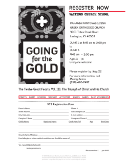

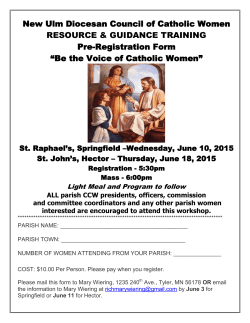


© Copyright 2026