
OOI RFA Cover Sheet
OOI RFA
LOI
Cover Sheet
X Full
Addendum
Above For Office Use Only
Please fill out requested information in all gra y boxes
Seismic and Geodetic Observations of the Cascadia Continental Margin:
Towards an effective real-time earthquake and tsunami warning system
Title:
Proponent(s): co-PIs: Richard Allen, David Chadwell, Chris Goldfinger. Jeff McGuire, John Nabelek, Mladen
Nedimovic, Fred Spiess, Anne Trehu, Harry Yeh (see pg. 2 for additional project participants)
Keywords: earthquakes, tsunamis, seismology, geodesy, megathrust
PNW margin of the
Area:
(5 or less)
United States
Contact Information:
Contact Person:
Department:
Organization:
Address
Tel.:
E-mail:
Anne Trehu
College of Oceanic and Atmospheric Sciences
Oregon State University
Corvallis OR 97331-5503
541-737-2655
[email protected]
Fax:
541-737-2064
Permission to post abstract on ORION Web site:
x
Yes
No
Abstract: (400 words or less)
The earthquake and tsunami hazard associated with subduction zone megathrust events was tragically illustrated
on December 26, 2004, with the devastating earthquake in Sumatra and the subsequent tsunami that killed hundreds
of thousands of people along the shores of the northern Indian Ocean. The Cascadia subduction zone has a welldocumented history of large tsunamigenic earthquakes. Historical and geologic data indicate that the Cascadia
megathrust last ruptured in AD 1700 and experiences large earthquakes at intervals of 200 to 1200 years. Large
events are to be expected in the future, with a conditional probability of ~20% over the next 50 years. ORION
provides an opportunity to observe strain accumulation seaward of and above the nominally locked part of the
subduction zone, which lies primarily offshore and is therefore inaccessible to existing instrumentation. The
information provided by ORION will greatly improve our scientific understanding of the factors that control slip
initiation and propagation, seafloor deformation, and the impact of slab hydration and subsequnt dehydration.
Several lines of current research are leading to new insights about how strain accumulates and is released along
the megathrust in response to plate tectonic forces. Among interesting new observations are tremor-like seismic
events that correlate with aseismic slow slip events. The slow slip events, which were first observed beneath Vancouver Island, have been interpreted to represent slip on the subduction interface down-dip from the locked zone,
whereas the seismic tremor is thought to reflect contemporaneous motion of fluid. Another important new observation is that forearc basin structure and co-seismic rupture areas are correlated, implying that patterns of earthquake
activity are consistent over long time scales. These observations provide a framework for designing a network of
offshore seismic and geodetic stations to monitor elastic strain accumulation and release along the Cascadia subduction zone. The proposed network includes six transects of seismic and geodetic instrumentation that will be located
in different forearc segments. Each subarray will consist of shallowly-buried broadband seismometers, an array of
short-period seismometers, bottom pressure recorders, temperature sensors, acoustic baseline strainmeters, and GPSacoustic stations. Sensors will be installed on the Juan de Fuca plate seaward of the deformation front and on the
continental slope (the deforming leading edge of the North American plate). The magnitude 8.3 Tokachi-Oki earthquake of 2003 offshore Japan demonstrated both the scientific value and survivability of such stations.
Broader impacts: This study should ultimately lead to more effective earthquake and tsunami forecasting and realtime warning strategies in the Pacific Northwest.
Please describe below key non-standard measurement technology needed to achieve the proposed
scientific objectives: (250 words or less)
Most of the instrumentation proposed for this project currently exists in a non-observatory form. Modifications will
be needed to mate the instruments with observatory technology, but no major new instrument development and testing
program is needed.
Proposed Sites:
Site Name
Strait of JdF
Grays Harbor
Cape Meares
Newport
Capte Blanco
Crescent City
Cape Mendocino
Position
47.3N, 126.3W
46.7N, 125.9W
45.2N, 125.5W
44.5N, 125.4W
42.5N, 125.3W
41.7N, 125.3W
40.5N, 125.0W
Water
Depth
(m)
2400
2000
2600
2800
3000
3000
2600
Start
Date
2011
2008
2008
2007
2011
2008
2011
Proposed Duration
Revisits
Deploy
during
(months)
deployment
Site-specific Comments
see table 1.
List of Project Participants
Oregon State University: Anne Trehu*, Bill Chadwick, Chris Goldfinger, John Nabelek, Harry Yeh
University of Oregon: David Schmidt, Doug Toomey
University of Washington: Ken Creager, Will Wilcock
Scripps Institution of Oceanography: David Chadwell
University of California at Berkeley: Richard Allen
Woods Hole Oceanographic Institution: Jeff McGuire, John Collins
Georgia Tech: Dan Lizarralde (soon to be WHOI)
Lamont-Doherty Earth Observatory: Mladen Nedimovic
Suggested Reviewers
Roy Hyndman (GSC)
Geoff Freymuller (Un. of Alaska)
Thorne Lay (Un. of California at Santa Cruz)
Doug Wiens (Washington Un.)
Geoff Abers (Boston Un.)
Tom Heaton (Caltech)
Mark Simons (Caltech)
Chen Ji (Caltech)
SEISMIC AND GEODETIC OBSERVATIONS OF THE CASCADIA CONTINENTAL
MARGIN: towards an effective real-time earthquake and tsunami warning system
ABSTRACT
The earthquake and tsunami hazard associated with subduction zone megathrust events was
tragically illustrated on December 26, 2004, with the devastating earthquake in Sumatra and the
subsequent tsunami that killed hundreds of thousands of people along the shores of the northern
Indian Ocean.
The Cascadia subduction zone has a well-documented history of large
tsunamigenic earthquakes. Historical and geologic data indicate that the Cascadia megathrust
last ruptured in AD 1700 and experiences large earthquakes at intervals of 200 to 1200 years.
Large events are to be expected in the future, with a conditional probability of ~20% over the
next 50 years. ORION provides an opportunity to observe strain accumulation seaward of and
above the nominally locked part of the subduction zone, which lies primarily offshore and is
therefore inaccessible to existing instrumentation. The information provided by ORION will
greatly improve our scientific understanding of the factors that control slip initiation and
propagation, seafloor deformation, and the impact of slab hydration and subsequnt dehydration.
Several lines of current research are leading to new insights about how strain accumulates
and is released along the megathrust in response to plate tectonic forces.
Among interesting
new observations are tremor-like seismic events that correlate with aseismic slow slip events.
The slow slip events, which were first observed beneath Vancouver Island, have been interpreted
to represent slip on the subduction interface down-dip from the locked zone, whereas the seismic
tremor is thought to reflect contemporaneous motion of fluid. Another important new
observation is that forearc basin structure and co-seismic rupture areas are correlated, implying
that patterns of earthquake activity are consistent over long time scales. These observations
provide a framework for designing a network of offshore seismic and geodetic stations to
monitor elastic strain accumulation and release along the Cascadia subduction zone.
The
proposed network includes six transects of seismic and geodetic instrumentation that will be
located in different forearc segments. Each subarray will consist of shallowly-buried broadband
seismometers, an array of short-period seismometers, bottom pressure recorders, temperature
sensors, acoustic baseline strainmeters, and GPS-acoustic stations. Sensors will be installed on
the Juan de Fuca plate seaward of the deformation front and on the continental slope (the
1
deforming leading edge of the North American plate). The magnitude 8.3 Tokachi-Oki
earthquake of 2003 offshore Japan demonstrated both the scientific value and survivability of
such stations.
Broader impacts: This study should ultimately lead to more effective earthquake and
tsunami forecasting and real-time warning strategies in the Pacific Northwest. Real-time
earthquake records and earthquake and tsunami research also generally elicit excitement from the
community and are a mechanism for teaching the public about Earth science and natural hazards.
PROGRAM RATIONALE
A number of factors have converged in the past year to draw the attention of the
seismological and earthquake hazards community towards Cascadia:
•
The Dec. 26 Sumatra earthquake was a tragic reminder of the deadly power of great
subduction zone megathrusts.
•
The confirmation of a magnitude 9 event in 1700 (Satake et al., 1996, 2003) and the
continued accumulation of evidence for a recurrence interval of several hundred years
(eg. Atwater, 1987; Adams, 1990, 1998; Atwater and Hemphill-Haley, 1997; Goldfinger
et al., 2003a,b; Kelsey et al., 2002, 2005) have reinforced the realization that a large
subduction event will eventually occur in the Pacific Northwest.
•
Increased deformation monitoring and earth imaging capabilities are scheduled to be
implemented onshore in the next several years as part of EarthScope. The promise of
these initiatives for understanding subduction zone will not be fully realized without
offshore geodetic and seismic data.
•
Advances in designs for real-time warning systems (Allen and Kanamori, 2003;
Kanamori, 2004), combined with the developing understanding of megathrust
earthquake processes and planned new observing systems mentioned above, suggest that
an advance warning system for Cascadia may be a realistic long-term objective, and not
simply fodder for science fiction (Nance, 2005).
Moreover, several recent observational and theoretical advances in understanding
geodynamic processes associated with the megathrust earthquakes in Cascadia and elsewhere
2
have provided new insights with the potential to improve long-term earthquake hazard
forecasts.
•
The presence of forearc basins strongly correlates with the rupture zone of large
earthquakes (Wells et al., 2003; Song and Simons, 2003). Moreover, detailed studies of
the rupture propagation within individual M8 events show that earthquakes that nucleate
outside these basins often release little seismic moment until they propagate beneath the
basin, where the majority of the slip occurs (Simons, pers. comm. 2005). This pattern is
similar to the observations of Thatcher (1990), who noted that many large subduction
earthquakes initiate on the edge of the eventual rupture plane. These observations are
important because they imply that rupture patterns on the megathrust are controlled by
geologic strucutures that are stable for long time periods. The model predicts that the
plate interface beneath the gravity highs is weak, which should lead to distinctive
patterns of microseismicity (e.g. the creeping portion of the San Andreas fault) and
deformation. Does this model apply to the Cascadia subduction zone, which has
forearc basins similar to other subduction zones but no historical large low-angle
thrust earthquakes (Wells et al., 2003)?
•
The discovery of episodic aseismic slip events accompanied by seismic tremor downdip
of the locked zone (Dragert et al., 2001; Miller et al., 2002; Rogers and Dragert, 2003;
Szeliga et al., 2004) promises to provide new understanding of the physics of the
earthquake process (Liu and Rice, JGR, in review; Miyazaki et al, JGR, in review).
Although the implications of these ETS (episodic tremor and slip) observations are not
yet fully understood, they are generally thought to be related to changing fluid pressures
and material properties resulting from slab dewatering and serpentinization of the
overlying mantle (eg Obara, 2002; Kodaira et al., 2004; Preston et al., 2003; Hacker et
al., 2003a,b; Milsch and Schultz, 2005). While most current ETS observations are from
downdip of the locked zone, this may be, at least in part, an artifact of current station
distribution. At present, all seismometers and geodetic stations in Cascadia are downdip
of the locked zone. Globally, few observations exist of updip processes. Offshore Peru,
seafloor geodetic observations suggest that locking there begins at a depth as shallow as
2 km (Gagnon et al., 2005). Offshore Central America, where temporary ocean bottom
seismometers have been deployed near the trench and geodetic observations over the
3
locked zone are available from the Nicoya Peninsula, locking occurs within two patches
at 14 and 39 km depth with a band of seismicity and slip in between (Norabuena et al.,
2004). Recently a silent slip event was observed initiating within this updip region and
propagating downdip (Protti et al., 2004). The position of the updip edge of the locked
zone is an important parameter for evaluating tsunamigenic potential. Where is the
updip edge of the Cascadia locked zone? Is it really locked?
Are ETS events
occurring within this updip transition zone?
•
Correlations between forearc crustal structure and seismic reflectivity in other
subduction zones are indicating correlations between the rupture zones of large
earthquakes and features like anomalously bright regions of the plate interface and the
presence of subducted seamounts on the down-going plate (eg. Scholtz and Small, 1997;
Husen et al., 2002; Park et al., 2003, Bilek et al., 2003; Kodaira et al., 2004; Graindorge
et al., 2004; Mochizuki et al., 2005). Similar features are present in Cascadia (eg.
Fleming and Trehu, 1999; Gerdom et al., 2000; Nedimovic, 2003).
What is the
relationship between earthquake activity, subducted seamounts, and plate boundary
"bright spots?" Are these strong or weak points on the plate boundary?
•
The development of longer paleoseismic records for Cascadia and the adjacent Northern
San Andreas Fault (Goldfinger et al., 2003a,b; 2005) offer opportunities to model the
two faults as a system in terms of stress interaction. Do model predictions fit the
patterns of seismicity and deformation that can be observed by an offshore seismic
and geodetic observing system?
Long time-series observations offshore are essential for addressing the above questions and
developing a better understanding of the processes whereby strain accumulates and is released
along and updip of the nominally locked part of the Cascadia plate boundary. The naturally long
time scale of this process (decades to centuries) requires an observatory approach. Real-time
observations in the source region of a megathrust event could have a huge societal impact in
improving emergency response if such an earthquake occurred. Even without a megathrust
event, detection of changes in patterns of seismicity and aseismic deformation over several
decades can be used to test developing theoretical models of low angle thrusting and
tsunamigenesis. At present, such models are poorly constrained, in large part because of a
dearth of data from the updip part of subduction zones, which are almost invariably submerged
4
in subduction zones around the world. The data to be acquired by this proposed component of
the NEPTUNE Regional Cabled Observatory (RCO) promises to yield a much better
understanding of the physics of low-angle faulting and accretionary wedge response to this
faulting in the endmember case of subduction of a young, warm, sedimented oceanic plate.
3. BACKGROUND AND SCIENTIFIC OBJECTIVES
In this section we briefly summarize recent results on the seismic activity and
deformation of the Cascadia forearc in order to establish a framework for the questions we have
posed about the behavior of the subduction zone and the value of realtime recording for
addressing those questions. In particular, we focus on several features of the central part of the
Cascadia subduction zone that suggest that this is a major structural segment boundary and a
possible nucleation point for the next large plate boundary earthquake. This central portion of the
Cascadia subduction zone is currently poorly monitored and poorly understood. The central
transect is complemented by five additional transects that monitor structurally distinct segments
of the subduction zone. Because of uncertainties in the expected patterns of seismic activity and
aseismic deformation in this unexplored part of the suduction zone, we propose a phased
installation plan with three transects installed during Phase I (years 1 and 2) and three more
installed during Phase II (year 5).
Seismicity and paleoseismology of the forearc: Compared to many other subduction zones, the
Cascadia subduction zone is relatively aseismic. Small earthquakes, recorded by land-based
networks, occur daily in the upper and lower plates and are concentrated near the Mendocino
triple junction and beneath Puget sound (Figure 1A,B). Several large, damaging events have
occurred in the lower plate near Seattle in the past several decades, most recently in 2001 (the
M6.8 Nisqually earthquake), and in the upper plate, most recently near Portland and Klamath
Falls in 1993. There is also paleoseismic and seismic imaging evidence for a major crustal fault
through Seattle. The lack of seismicity along the plate boundary is generally attributed to locking
offshore and to aseismic slip on shore; these processes will be discussed further in the sections
on deformation and plate hydration/dehydration.
So why should we worry about earthquakes offshore? Although no large plate boundary
earthquakes have been recorded since the advent of modern seismic instrumentation, there is
5
considerable evidence for very large earthquakes in the past, including evidence for a magnitude
9 (M9) plate boundary event on Jan 26, 1700, that appears to have ruptured the entire subduction
zone and was recorded by a tsunami in Japan (Satake et al., 1996, 2004; Figure 1C).
Paleoseismic records along the coast and turbidite records on the abyssal plain indicate that large
earthquakes occur at intervals of 200–1200 years (Figure 1D) and that these earthquakes are
ususally accompanied by large tsunamis along the coast (eg. Adams, 1990, 1998; Atwater, 1995;
Atwater and Hemphill-Haley, 1997; Hemphill-Haley, 1995; Nelson et al., 2000; Goldfinger et
al., 2003a,b; Kelsey et al., 2005). Such an earthquake today would be devastating. The average
recurrence time of great earthquakes over the past 5000 years is 526 years from the onshore
record (Atwater and Hemphill-Haley, 1997; Kelsey et al., 2002) and 520 years from the offshore
record (Goldfinger et al., 2005). The distribution of recurrence intervals, however, is skewed,
with an interval of ~400 years being most common (Figure 1E). Goldfinger et al. (2005) and
Mazzotti and Adams (2004) have calculated that the conditional probability of an event in the
next 50 years is 10-30%, depending on the definition of a “short interval” and the assumed
model for recurrence.
Detailed studies of seisimicity and deformation in Japan (eg. Wyss et al. 1996,
Katsuma and Kasahara, 1999; Seno 2004) and of patterns of uplift and subsidence in the decades
prior to previous large earthquakes in Cascadia and Alaska (eg. Hamilton and Shennan, 2003;
Hawkes et al., 2005) suggest that precursory phenomema may occur decades in advance of a
large megathrust event, although these phenomena are not yet well enough understood for
reliable earthquake prediction. Temporal changes may also indicate interactions between the
oceanic plate and a the plate boundary, as documented prior to the magnitude 7.2 Petrolia
earthquake of 1992 on the Gorda/North America plate boundary beneath Cape Mendocino,
which was preceded by earthquake activity within the Gorda plate (Fox and Dziak, 1999). The
proposed observatory is needed to establish baseline rates for microseismicity and
deformation. At present, the rate, hypocenters and mechanisms of small offshore earthquakes
are very poorly known because of the absence of offshore seismic stations. Even a few
stations can increase location precision significantly (Braunmiller et al., 1997). A lower
detection threshold and more precise hypocentral parameters are needed to detect changes in
seismicity prior to a large earthquake.
6
Earthquakes along the plate boundary: The 1992 Petrolia earthquake mentioned in the last
sentence is the only confirmed low angle thrust event to have been detected in Cascadia (event 7
in figure 2A). However, on July 12, 2004, a M4.9 earthquake occurred offshore Newport; it
was followed on August 18 by a M4.7 event nearby (see figure 6 for epicenters). Although
these events did not do any damage, they were widely felt and were well recorded by
seismographs to a distance of ~35o. Hypocentral parameters, especially depth and mechanism,
are not well known. The Berkeley Seismic Network reports depths of ~25 km for both events
and high angle strike-slip and dip slip motion for the July and August events, respectively
(http://quake.geo.berkeley.edu/mt). However, based on moment tensor inversion of data from
19 stations, J. Nabelek (personal communication, 2005 obtains a low angle thrust mechanism
for each event with a strike approximately parallel to the strike of the subduction zone and a
depth of ~6 km, indicating that earthquakes may be occurring on the plate boundary within the
nominal locked zone.
The proposed seismic network would lead to much more precise
knowledge of earthquake parameters for future events, leading to a better correlation
between crustal structure and seismic activity.
Deformation of the Cascadia forearc: The common view of deformation in subduction zones
in the time between great plate boundary earthquakes is shown in Figure 3A. This model
predicts uplift and shortening in the forearc that can be measured with GPS and other geodetic
techniques. To first order, this model explains observations in Cascadia, especially in the
northern part of the subduction zone beneath Puget Sound (eg. Wang et al., 2003). In the
central Oregon margin, however, it is necessary to invoke uniform translation of a large forearc
block north relative to North America in addition to elastic loading of the locked zone to explain
GPS data (McCaffrey et al., 2000; Wang et al., 2003; Figure 4). The coherence of this forearc
block is consistent with paleomagnetic data (Wells et al., 1984) and crustal imaging (Trehu et
al., 1994), which indicate that the central part of the forearc is floored by anomalously thick
oceanic-type crust that was accreted to North America approximately 50 Ma. When this
coherent northward translation is removed, the remaining GPS signal is consistent with strain
accumulation along the megathrust, although there is a significant slip deficit (Figure 3B).
Another anomaly about the central part of the Cascadia margin is the apparent absence of
vertical uplift along the central Oregon margin (Mitchell et al., 1994).
7
Recent GPS data from the Juan de Fuca plate (Figure 2 from Chadwell et al., in prep.),
utilizing a breakthrough technique for GPS geodetic observations offshore, suggest that
convergence between the Juan de Fuca and North America plates is considerably less than
expected from global models, and less than that currently invoked in modeling strain
accumulation on the Cascadia megathrust. They propose that the discrepancy may be explained
by strain accumulation in the Juan de Fuca plate, as opposed to the conventional assumption
that this occurs only in the continental plate. We speculate that this anomalous deformation may
be driven by plate locking along the central Oregon margin combined with greater strength of
the Siletz block (see section on structural segmentation) compared to the young oceanic
lithosphere of the Juan de Fuca plate. This model might also explain the enigmatic null in uplift
rate onshore (see Fig. 6A) and should lead to a distinctive pattern of microseismic activity in the
subducting plate both landward and seaward of the trench. The proposed seismic and geodetic
network, combined with a high resolution geodetic transect across the central Oregon margin
planned as part of the EarthScope PBO initiative, will test this hypothesis.
Episodic tremor and slip: The recent discovery of episodic aseismic slip events accompanied
by seismic tremor downdip of the locked zone (Dragert et al., 2001; Miller et al., 2002; Rogers
and Dragert, 2003; Szeliga et al., 2004) is arguably the most exciting result from the Cascadia
subduction zone of the past 5 years. The slip events were first observed beneath northern Puget
Sound and southern Vancouver Island, where a periodicity of ~14 months and regular
northward propagation of slip in single events is observed in GPS data (Dragert et al., 2001).
The surface displacements observed during the ETS events reverse the interseismic
displacements, resulting in a sawtooth pattern (shown schematically in Figure 2). These slip
events are associated with an increase in the occurrence of high-frequency pulses of background
seismic noise (Rogers and Dragert, 2003). Spectrograms of these pulses show that they last
several hours and result in increased seismic energy in the frequency band of 2-6 Hz
(www.pnsn.org/WEBICORDER/DEEPTREM). Beamforming techniques have been effective
for determining the propagation velocity and azimuth of the tremor. Although the implications
of these observations are not yet fully understood, they are generally thought to be related to
changing fluid pressures and material properties resulting from dehydration of the subducted
oceanic crust and mantle and serpentinization of the overlying continental mantle.
As
8
observations accumulate, it is becoming apparent that there are distinct patches within the
forearc characterized by different periodicities (Dragert, personal communication, 2005).
Beneath northern California, slip events appear to be more frequent, with a periodicity of ~11
months, and are also accompanied by increased tremor activity (Szeliga et al., 2004). Slip
events have also been observed in central Oregon at the Newport permanent GPS site, with a
periodicity of ~18 month, although it is less well resolved than in northern California or Puget
Sound because of a more limited data base (Szeliga et al., 2004). Refining estimates of the
depth at which these events occur and the velocity with which they propagate along strike (~5
km/day) will help evaluate candidate mechanisms. Offshore GPS and seismicity data are
needed to determine whether similar processes occur at the updip limit of the nominal locked
zone.
Correlation between gravity anomalies and the rupture zones of large earthquakes: The
structural segmentation of the Cascadia forearc is best illustrated by a map of isostatic residual
gravity anomalies (Figure 5A). The large, coherent gravity high corresponds to anomalouslythick, accreted oceanic crustal rocks of the Siletzia-Crescent terrane (eg. Wells et al., 1984;
Trehu et al., 1994). The lows represent deep structural basins, containing 2-10 km of Neogene
sediments, located between the paired forearc highs of the outer shelf and Coast Range (eg.
Snavely, 1987; McNeill et al., 2000). The Puget Willamette basin comprises an inner forearc
basin.
Structural basins have been spatially linked to areas of large moment release in
subduction earthquakes in Nankai, the Aleutians, and other subduction zones (Wells et al., 2003;
Song and Simons, 2003). The model of Song and Simons (2003) suggests that the interbasin
gravity highs are weak points at which ruptures initiate. Detailed studies of the time and space
history of moment release of several large subduction interplate events show that rupture
propagated from edge across the center of the basin, where moment release is greatest (Simons,
unpublished figures, 2005).
This behavior has been attributed to spatial variability in the
frictional parameters of the fault zone.
Wells et al. (2003) have suggested that this process
results in erosion of the base of the upper plate, thinning the crust there and creating the basins.
Although there is no historic record of large earthquakes in Cascadia, the spatial rupture pattern
of Cascadia great earthquakes inferred from paleoseismic data is generally consistent with this
model. If this model is validated, it could provide the basis for refined seismic hazard models in
9
coastal regions. Observations of offshore microseismicity and deformation from near the
gravity highs and lows are needed to determine whether the gravity highs overlie weak patches
on the plate boundary. Observations of distinct patterns of seismicity from weak fault patches
within a larger, stronger fault zone are available from the densely instrumented Nankai trough
and San Andreas fault and will be compared with the data acquired by this proposed observing
network.
The effect of subducted seamounts or ridges: Several studies have correlated the rupture
planes of moderate to large earthquakes with the base of subducted and deeply buried seamounts
inferred from results of seismic tomography (eg. Husen et al., 2001). Even in generally aseismic
subduction zones like the Tonga-Kermadec and Izu-Bonin arc, buried seamounts and ridges have
been associated with large earthquakes (Schultz and Small, 1997). Offshore Japan and South
America, they have been associated with the initiation and/or stopping of the rupture during
megathrust earthquakes (eg. Park et al., 2003; Graindorge et al., 2004) and geodetically-observed
slow slip events (Kodaira et al., 2004; Miyazaki et al., in press). Since a buried seamount should
produce a relative gravity high, these observations raise the question of whether subducted
seamounts represent strong or weak spots along the plate boundary. As one end-member model,
the seamount can be considered to be a strong "asperity," and motion along the plate boundary
away from the seamount may be accommodated by aseismic slip. In the other end-member,
earthquakes initiate at seamounts, which represent weak spots on the plate boundary, and some
ruptures stop when they reach adjacent strong portions of the fault whereas others continue to
propagate. The factors that control whether or not a small earthquake grows into a large event
remain enigmatic. Only long-term observations of seismicity and deformation, coupled with
good seismic imaging and other data to constrain the physical properties of the fault plane can
address this question.
In spite of the relatively low average rate of earthquake activity, Cascadia is a good place
to look at the relationship between buried seamounts, forearc basins, and other factors that may
be affecting the subduction process. There is good evidence from active source seismic and
potential field data that the large gravity high on the continental margin in the central part of the
subduction zone is associated with a buried ridge (Trehu et al. 1994; Fleming and Trehu, 1999;
Trehu, unpublished data), The region around the gravity high is shown in more detail in Figure 6.
10
This region is characterized by a wide range of anomalous forearc behavior, including: (1) a
relatively high level of forearc seismicity (Figure 5); (2) the possible “mini-megathrust” events
discussed previously; (3) a null in the contemporary Coast Range uplift rate (Mitchell et al.,
1994; Figure 6A)), (4) correlation with a the thick, strong, Siletz terrane immediately to the east;
(5) an active blind thrust on the shelf far landward of the deformation front (Stonewall Bank in
Figure 6A, which is growing at a rate of 0.5-1.3 mm/yr and has the potential to produce a M7
earthquake, Yeats et al., 1998); and (6) a series of well-developed NW-striking left-lateral strikeslip faults that cross the deformation front and may accommodate much of the arc-parallel
component of convergence that is taken up by arc-parallel strike-slip faults in many other
subduction zones (Goldfinger et al., 1997). As mentioned in the section on forearc deformation,
approximately half of the expected loading of the locked zone along this segment may be
occurring in the Juan de Fuca plate. Because those paleoseismic events that did not rupture the
entire plate boundary either started or stopped near this latitude, we speculate that this is the
most likely initiation point for the next large plate boundary earthquake. In addition to
providing information on the seismic behavior of a subducted seamount, a transect at this
latitude may have the best chance of recording precursury phenomena prior to the next large
plate boundary earthquake. It may also be optimally situated for a real-time warning system.
Hydration and subsequent dehydration of the subducting plate: Metamorphic dehydration of
the subducting plate is widely believed to be a significant factor, not only in the generation of the
ETS events observed onshore but also for a variety of other processes that influence the
“subduction factory” (the term adopted by the NSF-Margins program for subduction zones
studies because of the hypothesis that subduction zones are a “factory” for new continental crust
through magmatism and sepentinization of mantle rocks; both of these processes depend on
pressure and temperature-dependent release of water bound in the subducted crust and upper
mantle). Much research has been devoted to the effects of dehydration, which may be the cause
of the deep, damaging lower plate events that occur beneath the Puget basin (eg. Hacker et al.,
2003a,b; Preston et al., 2003). To fully evaluate the importance of slab dehydration, however, it
is necessary to constrain the amount of water bound in the slab when it is subducted. Hydration
of the oceanic crust and uppermost mantle may occur just before subduction because of faulting
when the slab bends into the trench (Hyndman and Wang, 1995; Ranero et al., 2003, Nedimovic
11
et al., in press) as well as through hydrothermal circulation near the ridge axis and in the plate
interior (topics explored by other ORION RFAs). The proposed transects will deformation and
seismicity rates seaward of the trench and thus address the question of whether active faults in
this region create pathways for fluid flow and hydration of the crust and upper mantle.
Factors influencing tsunamigenesis: The onshore paleoseismic record includes evidence of
tsunami inundation of subsided marshes along the Cascadia coast. Minimum tsunami heights
have been 5-8m (Kelsey et al.,2005) but may well have been larger. Cascadia and Sumatra share
many offshore geological characteristics. Much like Cascadia, the northern part of the Sumatran
forearc consists of landward vergent low-tapering folds associated with the accretion of the
Nicobar fan. Analogous to the Washington margin, the Andaman and Nicobar Islands have
abundant mud volcanoes, indicating lithostatic fluid pressures at depth. Detailed analyses of
Sumatra earthquake should lead to a better understanding of the rupture characteristics that
distinguish tsunamigenic earthquakes and the relationship between the earthquake source and
local forearc morphology and rheology (Lay et al., 2005; Ammon et al., 2005; Bilham et al.,
2005). A key question to address in this context is the up-dip position of the locked zone. Coseismic deformation of the seafloor depends strongly on this parameter. Hyndman and Wang
(1995) have argued that the up-dip position of the locked zone is controlled by temperature
dependent diagenesis of clay minerals and should extend to the trench whereas Clarke et al.,
(1992) and Goldfinger et al. (1997) have argued that this boundary should correspond to a
change in the taper of the accretionary wedge and an associated change in the strike of
accretionary wedge folds. The difference between these two models is largest offshore
Washington, and comparison of seismic and geodetic data from transects where these two
models coincide to data off Washington could help distringuish between these two models. By
studying the source time function of a number of different shallow thrust faults, Bilek and Lay
(2002) have argued that the shallow thrust faults with frictional properties conducive to
tsunamigenesis are common, even though large tsunami earthquakes are rare, Seismic and
geodetic observations made using the proposed array will help to constrain the frictional
properties of the shallow plate boundary. Observations of microseismicity and aseismic
deformation are needed to define the distribution of coupling both along and across strike,
12
both of which are poorly constrained by land observations and which are important for
predicting maximum seismic moment and tsunami excitation.
Feasibility of a real-time warning system: The scientific value and survivability of seafloor
cables with geophysical sensors has been demonstrated by recent experience in Japan, where
cabled ocean bottom pressure sensors were in place when the Mw 8.0 Tokachi-Oki earthquake
occurred offshore (Watanabe et al., 2004) and when two earthquakes with magnitude > 7
occurred offshore the Kii peninsula (Satake et al., 2005; Matsumoto and Mikada, 2005). These
data have provided valuable constraints for models of the fault rupture and tsunami generation,
including the first evidence for super-shear propagation velocities in a subduction zone. The
offshore record for the Tokachi-Oki event is used by Kanamori (2004) to demonstrate the
feasibility of rapidly determining earthquake magnitude as part of a real–time warning system
based on the P waveform. The approach uses the first 3-4 sec of the P waveform to rapidly
estimate the magnitude of an earthquake in progress and has been tested on the existing
waveform dataset from earthquakes in the Pacific Northwest (Lockman and Allen, in review).
Using waveforms from Japan, Taiwan, California and Alaska, Olson and Allen (in review)
show that this approach to magnitude estimation is applicable to large subduction zone and
strike-slip earthquakes alike. Using a global dataset of 71 earthquakes with 3.0 ≤ M ≤ 8.3,
including 24 events with M ≥ 6.0, they find that the average absolute magnitude error is 0.54
magnitude units.
This approach to seismic hazard mitigation is now being tested for
implementation across California (see www.ElarmS.org) and could also be applied to the
Pacific Northwest. The use of offshore stations could provide a 20 to 30 sec warning to coastal
communities of significant ground shaking and tsunami potential, compared to less than 10 sec
using land-based stations. Such a warning could be used to automatically power down critical
systems, as is now done in Japan. The same system would also provide an additional 20-30 sec
warning before a tsunami. In a repeat of the AD 1700 earthquake which ruptured the entire
subduction zone, the warning time for cities in the Pacific Northwest would depend on the
hypocenter location.
If the rupture were to initiate at Mendocino, Seattle would have
approximately 3 minutes warning. Real-time data streams from the seismometers and GPS-A
instruments could be integrated into an earthquake early warning system for the region
13
providing valuable seconds of warning time before ground shaking, and extending warning
times for tsunamis.
Other objectives: The proposed instrumentation will be useful for addressing several additional
topics of high scientific interest that are not directly related to the dynamics of the subduction
zone. For example, these data will contribute to studies of how wind-driven ocean waves
generate elastic waves in the solid earth. That this may occur has been known for >50 years,
since the landmark paper of Longuette-Higgens (1950), but has recently received new attention
with the recognition that seismic stations can be used to reconstruct past oceanographic
conditions (Bromirski, 2001; Bromirski et al., 1999, 2002, 2005) and that coupling from the
ocean to the earth occurs in a broader frequency band than previously recognized (Rhie and
Romanowicz, 2004).
The data from the central array will also complement seismic data
planned for a Hydrate Ridge observatory by providing additional earthquake location capability
and by providing a control site away from the main locus of venting that will permit an
evaluation of vibrations that result directly from local fluid motion.
Finally, the bottom
pressure recordings are of value in monitoring changes in pressure on the seafloor that result
from important oceanographic “events” like El Nino (Fujimoto et al., 2003).
Summary of key scientific questions addressed by a Cascadia seismic and geodetic
network:
1) Where is the up-dip limit of the locked portion of the megathrust? Is it really locked?
Does the degree of locking vary along strike? What are the controlling parameters? How
does the updip part of the plate interface respond during a megathrust and how might this
effect tsunami generation? The response of the seaward edge of the overriding plate is critical
for predicting maxiumum seismic moment and the efficiency of tsunami generation. Our
experiment will provide seismic and geodetic measurements to determine deformation within
the upper plate during interseismic strain accumulation and define the up-dip position of the
locked zone. Combined with results from ongoing studies of the recent great Sumatran
earthquake, which occurred in a region with similar forearc structure to Cascadia, these data
will lead to better models for tsunamigenesis in Cascadia,
14
2) How do microseismicity and strain vary along the forearc along the deformation front?
At present, the rate of occurrence and distribution patterns of microearthquakes offshore is
essentially unknown. Even larger events are poorly located. Although SOSUS arrays have
revolutionized the detection level for seismicity along mid-ocean ridges, they are not well
located to resolve activity along the continental margin. On land and where microseismicity
data are available offshore Japan, distinctly different patterns of microseismic activity and strain
are observed in creeping patches of the faults compared to locked patches.
3) Do the forearc gravity highs along the margin indicate weak patches or a strong patches
along the plate boundary? What is the relationship between the gravity high along the
central Oregon margin and topography on the subducted plate? Is this a likely nucleation
point for the next big earthquake? Microseismicity within the Juan de Fuca plate, both
seaward and landward of the trench, will provide constraints on how the plate is being loaded
by convergence in this region.
PROPOSED INSTRUMENTATION
We propose six transects across the margin to be installed in 2 phases. Locations of the
transects and the schematic instrument distribution within the transects are shown in Figure 8.
No instruments have been planned for the continental shelf because of the expectation that
instruments here would be very noisy and subjected to disruption by fishermen. However, if
comparison of data from instruments on the upper slope to those in the Coast Range reveal that
this region is critical for understanding plate dynamics here, instrumentation on the shelf could
be attempted.
Newport is the highest priority transect because it crosses a major structural boundary in
the forearc and has a history of repeated offshore earthquake activity. Several observations,
discussed above, lead us to speculate that the next great Cascadia earthquake may nucleate near
here. This transect will be installed during the first year of this project. This transect has the
potential to share an RCO backbone node with at least two other RFAs (a coastal “Endurance”
transect along the historic Newport hydrographic line, and a multidisciplinary gas hydrate
observatory at Hydrate Ridge).
15
The second highest priority is a transect to the north where the forearc is characterized
by a wide band of landward-vergent folds and is morphologically similar to the northern part of
the Sumatra rupture zone. We will choose one of the following two locations for this transect:
Grays Harbor or Cape Meares.
Either location samples the largest marginal gravity low
(labeled C on Figure 5). Because the continental shelf is very narrow offshore Cape Meares, a
subarray can be installed very close to the coast along this transect; it is also near a possible
cable landing at Nedonna Beach. On the other hand, the Grays Harbor location increases alongstrike coverage, is closer to the major population centers in the Pacific Northwest, and is
coincident with a high priority coastal “Pioneer” array.
The third priority, which completes Phase I installation, crosses the margin offshore
Crescent City, which was devastated by a tsunami caused by the Good Friday earthquake of
1964. Here the forearc is characterized by rapid uplift, shorter wavelength variations in gravity
and crustal structure, an enigmatic mid-slope plateau at a depth of ~1000m, and a high rate of
upper and lower plate seismicity.
Three additional transects are proposed for Phase II, to be installed during year 5 of the
project. The first is near Cape Blanco, at the southern end of the subducted ridge inferred by
Fleming and Trehu (1999). Another crosses the margin near the Straits of Juan de Fuca, where
there is a smaller gravity high separating basins B and C. The third is near the Mendocino triple
junction, where the subduction zone is affected by transform tectonics. This transect could be
expanded to cover the Mendocino transform fault, which represents an end-member transform
that has been under compression for 8 my and provides a contrast to the more typical Blanco
transform, which is the focus of a related RFA.
Assuming that the RCO backbone cable will run along the base of the continental slope,
each transect will require a 40-75 km-long extension cable to link the subarrays to the backbone
and 2-9 km of additional cable (depending on water depth) to link elements within each
subarray. Cable routes will be chosen based on high resolution bathymetry and sidescan data
avoid steep, unstable sections of the margin, like the western flank of Hydrate Ridge. These
transects are similar to those described in Box 3.3 of the ORION Science Plan, except that short
period seismometer arrays have been added at each sub-node and fewer broadband
seismometers are included in each transect.
16
While we assume that a fiber-optic cable will be available, the proposed network could
be implemented via moored buoys with some compromises. For example, we could transmit
only a subset of the data in real time and record data that are not time-critical in packages in
seafloor dataloggers, which would be retrieved periodically via ROV. In this case, only a
decimated data stream for seismic data (eg. 1 Hz sampling rate), with windows of higher
resolution data identified by automatic event detection, would be transmitted in real time.
Although this approach would require less initial investment in backbone support, savings
would be partially offset by increased costs for battery packs on the seafloor and increased
maintenance charges to replace batteries and retrieve data.
In the following paragraphs, we discuss the planned instrumentation. We have focused
primarily on seismological and geodetic instrumentation. Additional instrumentation could
potentially be added to permit, for example, studies of bottom currents, electrical resistivity
structure of the subsurface, or fluid flow across the sediment/ocean interface.
Broadband Seismometers: Each sub-node of the transect will include one broadband
seismometer. Each seismometer should be buried to mitigate the effect of noise generated by
flow over the instrument package, which can generate both broadband noise and large
amplitude narrowband resonances that depend on flow rate and package configuration (eg.
Trehu, 1984). Efforts are ongoing at WHOI and at MBARI to explore techniques for the
shallow burial of broadband seismometers on the seafloor. We expect that this burial will
require deployment via ROV. Each seismometer will produce continuous data with a sampling
rate of 50 samples/s on each of three orthogonal components and on a broadband hydrophone.
This is a rough estimate. More detailed estimates will become available in future proposals to
build these units should this proposed seismic and geodetic network go forward.
Strong motion accelerometers: Strong motion accelerometers will be included with each
broadband seismometer package. While we cannot be certain that strong motion sensors will be
needed during the lifetime of the sensor package, the incremental extra cost is only ~10K.
Short period seismic arrays: The short period seismometer arrays contain 6 4-component short
period seismometers in an L-shaped pattern with geometrically increasing spacing at intervals
17
of 75 to 300 m for an array aperture of 525 m centered around the broadband seismometer (Fig.
8).
These arrays will permit beam-forming analyses for determination of the azimuth of
approach and apparent velocity of seismic waves from microearthquakes and tremor events (eg.
Lin et al., 1998). This beam-forming capacity will partially compensate for the relatively sparse
instrument spacing compared to land-based networks. Sensors will be geophones with a natural
resonance of 2 Hz. Sampling rate will be at least 50 Hz.
Strain meters: The long-baseline acoustic strain sensor determines the direction and magnitude
of minimum and maximum horizontal strain.
Two components are used. Precision acoustic
interrogators (Spiess et al., 1997) on the seafloor which constitute the benchmarks and
transponder units buoyed ~100 m off the bottom, which are intermediate tie points. Four
seafloor units are deployed to form a square with sides of length approximately 1.4 times the
nominal water depth. A minimum of three buoyed units are deployed across the square. The
seafloor units interrogate the buoyed transponders which provide sufficient acoustic ranges to
determine both the changing position of the buoyed unit and x and y position of the seafloor
units with centimeter-level resolution (Sweeney et al., 2005).
The x, y position determination
and the square array allow the determination of strain. Sampling rate will be a few times per
hour, but can be increased to a 10 second repeat to capture events.
BPRs can be co-located
with the seafloor units. The seafloor units also serve as the seafloor array for the GPS-acoustic
approach.
Bottom pressure recorders: Bottom pressure recorders (BPRs) can accurately measure ocean
tides (Mofjeld et al., 1995; Mofjeld et al., 1996), displacements of the ocean surface from
tsunami waves (Eble and Gonzalez, 1991; Gonzalez et al. 1991), and vertical deformation of the
seafloor (Fox, 1999; Chadwick et al., in press). For example, BPRs on a cabled observatory off
of Japan recorded crustal uplift, earthquake-related oscillations, and tsunamogenic pressure
fluctuations during the 2003 Tokachi-oki earthquake (Watanabe et al, 2004). Repeated ROVbased pressure measurements can be used to calibrate the long-term rate of drift of the BPRs
(Nooner et al., 2004; Chadwick et al., in press), so that they can be used to measure lower rates
of deformation. The BPR data from the continental margin (and from other projects farther
offshore) will be used for documenting seafloor deformation events, earthquake and silent-slip
18
source modeling, and for understanding the generation and propagation of tsunami wave forms.
The BPR measurements will be integrated with the other geodetic monitoring efforts.
GPS-A: GPS-Acoustic arrays will be used to measure the sub-centimeter horizontal motion of
the JdF plate and NA continental slope relative to stable plate interior. In this approach, the
entire array formed by the seafloor transponders described in the strain meter section is
considered as a single unit (Spiess et al., 1998). The locations are determined relative to the
global reference frame provided by GPS. This permits measuring deformation across the
interface between oceanic and continental plate.
This approached was used successfully
offshore Peru to observe deformation associated with updip locking (Gagnon et al., 2005).
The coastal buoys included in a companion proposal by Jack Barth and others serve as
the interface platform between the GPS and acoustic systems. The buoy would either be threepoint moored at the center of the acoustic array or it would be single-point mooring with
temperature and salinity monitoring of the vertical water column, which is already a standard
coastal configuration. It would use cable powered seafloor units already part of the strain meter
system. It could also use battery-powered seafloor transponders (replaced every 5 yrs or so).
Battery-powered GPS and buoy acoustics (replenished with solar) would collect GPS and
acoustic data, which would be stored onboard on removable media. Modest (Kb capacity)
telemetry could push back snippets of data. The removable media would be recovered/swapped
during the periodic visits that service the bio and other buoy sensors. The geodetic system
would operate for a few hours every day to address questions about forearc deformation, We
suspect that once continuous data are acquired, we will obtain a better idea of the factors
generating error, as happened on land, allowing the precision to be improved enough to detect
episodic slip, if it occurs. The fact that the megathrust is shallow here also improves our ability
to detect such signals. Over the life cycle of this project, improvements in technologies should
permit a shorter duty cycle.
Seafloor and subseafloor temperature: Temperature probes to measure water bottom and
sediment temperature to a depth of ~1 m will be deployed by each subnode. These are
inexpensive and can be used to detect major changes in water masses and whether there is rapid
(>10 cm/yr) fluid outflow from the seafloor associated with earthquakes. Full ocean
19
hydrographic and current data will be available at each transect that is coincident with the
coastal observatories being proposed by Jack Barth and others.
RELATIONSHIP TO OTHER PROJECTS
This ORION conceptual proposal is closely related to several other proposals:
•
It complements the proposal from McGuire and others to instrument the Blanco fracture
zone because of the common scientific objective of understanding what controls the
initiation and propagation of earthquake rupture in the earth. Most observations to date
have focused on complicated continental transform faults, which represent the scenario
that is most accessible to land-based instrumentation systems but is probably also the
most complex and most difficult for which to identify key controlling parameters.
•
It compements the proposal to study ridge processes from Kelley and Wilcock in that it
will add to constraints on plate hydration prior to subduction.
•
It complements the proposal from Trehu and others for an observatory on Hydrate Ridge
to study the role of gas hydrates as a “capacitor” that regulates fluid exchange between
the atmosphere, ocean and subseafloor “ocean” because the processes of strain
accumulation and release that are the focus of this proposal represent one of several
factors thought to drive fluid transport into and out of the seafloor.
•
It complements a proposal from Toomey and others to supplement efforts such as this
one focused on a particular plate tectonic environment in order to establish a plate scale
observatory (see map of the full plate array, which is attached as a supplement at the end
of this proposal). A plate observatory is needed to understand remote triggering of
earthquakes.
•
It is colocated with proposals from Barth and others, enabling efficiencies in installation,
operation and maintenance. The physical oceanographic information obtained from
these projects will also contribute to achieving some of the seismic goals.
PROJECT MANAGEMENT CONSIDERATIONS
20
A number of different groups are currently working on development of aspects of the
seafloor sensor packages that comprise these proposed seismic and geodetic transects across the
Cascadia subduction zone. We expect that in some cases, construction of seafloor instrument
packages will be done by the university based groups that developed the instrumentation
whereas in other cases it will be more appropriate for ORION to contract with industry groups
for mass production.
Most of the sensor packages proposed for this experiment will be
produced in similar form for other ORION experiments.
An important management consideration concerns data management and integration.
The data management problem has several levels.
A considerable framework for quality
control, archiving and distribution of basic seismological and geodetic data already exists for
the land community at the data centers run by IRIS and UNAVCO. These data centers could
provide advice on how best to organize an ORION data center (which would also deal with the
other types of data); alternatively they could distribute the seismic and geodetic data for
ORION. The data volume from 9 broadband seismometers and accelerometers, 54 short period
seismometers and 9 geodetic stations (GPS-A, BPR and strainmeter) for Phase 1 (and twice that
for Phase II) is modest compared to even the data load for temporary land-based networks. A
framework also exists in the onshore community, through the regional networks that are part of
the Advanced National Seismic System (ANSS), to deal with real-time determination of
earthquake locations and mechanisms, and dissemination of this information to the scientific
community and the general public. Analogous procedures will be required to enable rapid
response to major events, both for hazard mitigation and to launch scientific surveys to
determine changes in seafloor topography or hydrology. A third level of data management is
needed to enable integration of multiple types of data from different ORION experiments. This
to multidisciplinary data integration is needed to fully realize the potential of a RCO. Definition
of this third level will require additional community discussion and commitment of funds for
planning and implementation. Many of the issues related to this third level of data integration
are currently being discussed by groups such as EarthScope and NEPTUNE-Canada.
FIGURE CAPTIONS:
21
Figure 1. A. Seismicity of the Pacific Northwest region (from McCrory et al., 2004).
Earthquakes are color-coded by depth.
Contours show the depth to the plate boundary
interpolated from a compilation of active source seismic experiments. Profile 2 is shown in
cross-section in B, which shows that earthquakes recorded by land-based networks occur
primarily in the upper and lower plates. The abrupt decrease in seismic activity ~20 km west of
the coast is, at least in part, an artifact of the detection level for small offshore earthquakes. An
offshore array would detect microseismicity associated with deformation in the upper plate,
lower plate and along the plate boundary. The inferred position of the interplate locked zone is
shown as a red line, with possible transition zones shown as dashed lines. The downdip edge of
the locked zone and lower transition zone boundary are defined by the 350o and 450o
isotherms,respectively. These inferred rheologic boundaries are generally consistent with
onshore geodetic data. Two contrasting models have been proposed for the updip edge of the
locked zone. Hyndman and Wang (1995) have suggested that this boundary is controlled by
temperature and should occur near the deformation front; Clarke et al. (1992) and Goldfinger et
al. (1997) suggest that it should occur at a change in structure within the accretionary wedge.
The difference between these two models for the up-dip edge of the locked zone is shown in
map view in C, which shows the inferred fault plane for the megathrust event of 1700. The
difference between these two models for the up-dip boundary of the locked zone, while not
resolvable from onshore data, has important implications for tsunamigenesis. D shows the
distribution in time as a function of latitude of onshore and offshore markers for prehistoric
earthquakes. See Goldfinger et al. (2003, 2005) or Kelsey et al. (2005) for references. Marine
turbidite events are shown as larger symbols; land paleoseismic ages are shown as smaller
symbols. Events are plotted at the age probability peaks, with 2σ ranges shown. Dashed lines
show physical property correlations between sites. Colored bars indicate the best fitting age
range for each event. Yellow bars indicate a "small" turbidite event; red bars indicate an
unusually "large" event; intermediate size events are shown in green. Slight southward slope to
some correlation bars indicates variation of the reservoir correction for C14 age dating, which
produces a systematic southward increase in reservoir age for some time intervals. E is a
histogram of recurrence times between events in D. While details of the pattern depend on
choices about which events to include. Neither curve includes the events around 5500 years
ago, which only affected the southern Oregon segment. The blue curve includes the events
22
around 2000 years ago, which ruptured the northern and southern segments only;the pink curve
excludes these events. Although details of the distribution depend on the time interval used to
group events and the choice of which events to include, that the distribution is skewed to shorter
intervals is indisputable. The most common interval is ~400 years, significantly shorter than the
average interval of 520-560 years.
Figure 2. Results of a seafloor GPS study of the Juan de Fuca plate (Chadwell, in prep.). Red
vectors are observerd; black vectors are predicted JdF-NA motion from Wilson (1993) and NAPA from Sella et al. (2002). Black dots are earthquake epicenters from SOSUS. Focal
mechanisms 1, 2 from Spence (1989); others from Fox and Dziak (1999). Events 3-6 preceded
the Petrolia earthquake (event 7), which was a low-angle thrust that may have been located on
the plate boundary. White triangles are campaign sites proposed by Chadwell. Inset shows GPS
data acquired by returning to the seafloor acoustic installation annually. Overlain on the eastwest displacement is a hypothetical sawtooth curve that is diagnostic of episodic slip events.
The events observed on land were originally thought to represent a processing or calibration
problem. They are now recognized as being real and are remarkably periodic and associated
with times of heightened microseismic tremor activity.
Figure 3. A. Schematic illustration of the elastic model for strain accumulation on a the
megathrust. During the interseismic period, the region above the subducting plate will be
uplifted. The locked portion of the fault will slip suddenly during a megathrust earthquake,
resulting in uplift near the trench and subsidence further landward. B. Slip deficit rate calculated
from onshore GPS data along 3 transects. Red bars show the predicted slip deficit. For the two
southern transects, the slip deficit at the trench indicated by the data is half of the predicted slip
deficit, indicating either that aseismic slip is occurring or that the JdF plate is deforming further
west. (adapted by Chadwell from McCaffrey et al., 2000 and McCaffrey, 2002).
Figure 4. A. Forearc motion model of Wells et al. (1998) showing a rotating block (OC) in the
Cascadia forearc. The rotation pole for this block is located near the OR/WA/ID border.
Similar poles are obtained from paleomagnetic and GPS data (McCaffrey et al, 2000). This
block has been associated with a thick accreted oceanic terrame known as Siletzia (Wells, 1984;
23
Trehu et al., 1994). B. GPS velocities in Cascadia relative to North America. C. GPS velocities
after correction for rotation of the forearc block. Remaining motion is interpreted as
interseismic elastic deformation (from Wang et al., 2003).
Figure 5. Map of isostatic residual gravity anomalies (from Wells et al., 2003). Pink dashed
lines show the predicted locations of the 350o and 450o isotherms on the plate boundary. These
isotherms are generally thought to mark the down-dip edge of the locked and transition zones,
respectively. hh - Heceta Head; cb - Cape Blanco. White dots show earthquakes from 19602004 within the limits of the dashed box from the ANSS catalog. Black dashed lines show
locations of transects proposed here.
Figure 6. A. Topography of a late-Miocene unconformity on the central Cascadia continental
margin (from McNeill et al., 2000). The dashed white line is the edge of continental shelf.
Turquoise lines in the Coast Range represent recent uplift rates (Mitchell et al., 1994). White
lines represents tracks of active source seismic experiments. SB - Stonewall Bank. NS Newport Syncline. Stonewall Bank is an active anticline that is probably cored by a blind thrust
(Yeats et al, 1998). B. Detail of the isostatic residual gravity (from Wells et al., 2003) and
location of the shelf edge and seismic lines. C. Topographic map of the margin showing the
seaward edge of the Siletz terrane (fine dotted line; note that the line follows the upper western
edge. Siletz rocks probably extend further west because the seaward edge dips seaward. See
figure 7.). The outline of the subducted ridge inferred from seismic, gravity and magnetic data,
and the predicted track of the subducted ridge for the past 2 million years are also shown.
Locations of active source seismic lines shown as red lines; a profile with gravity and magnetics
data onlu is dashed; the broadband seismic line from the 1993/94 TORTISS experiment is
dashed. Epicenters of the M4.9 and 4.7 earthquakes from summer, 2004, are shown by red stars.
Figure 7. P-wave velocity model of the Cascadia forearc across central Oregon: west of km
200 velocities are from Trehu et al. (1994); east of km 200 velocities are from Nabelek et al.
(unpublished manuscript). The plate boundary here is thought to be at ~12 km depth from
active source seismic imaging (dotted white line).
A "lump" on the plate boundary is
interpreted to be a buried ridge. This feature is also seem in potential field data (Fleming and
24
Trehu, 1999). The solid white portion of the plate boundary is a zone of anomalously high
seismic reflectivity (Gerdom et al., 2000) that may indicate the presence of high fluid pressures
along the plate boundary. Locations of the 2004 earthquakes are projected onto this line
assuming the depth of 25-30 km reported by the Pacific Northwest Seismic Network. Depth is
poorly constrained. Nabelek obtains a depth of ~6 km. The 2004 earthquakes were located near
the seaward edge of the Siletz terrane, which is outlined by the white line.
Modeling
waveforms from these events in a realistic velocity structure should yield more precise
hypocentral locations. The velocity inversion beneath the Siletz terrane beneath the Willamette
Valley is interpreted to be either underplated oceanic crust or hydrated North America mantle.
Constraints on faulting seaward of the trench will help constrain the amount of water
transported with the crust and mantle to greater depth in the subduction zone.
Figure 8. Locations of proposed transects. Red boxes represent Phase I transects; white boxes
represent phase II transects. Cape Meares is an alternate for Grays Harbor. Figures on the right
show schematics of the three Phase I transects, assuming that the transects are accessed by
extension cables from an RCO backbone that runs along the base of the slope. Each subnode
has the same configuration. The Newport transect has highest priority for reasons discussed in
the text.
The other transects cross distinctly different segments of the subduction zone.
Locations of subnodes for a complementary Hydrate Ridge proposal are also shown.
25
26
27
28
29
References Cited:
Adams, J., 1990, Paleoseismicity of the Cascadia subduction zone: evidence from turbidites off
the Oregon-Washington margin: Tectonics, v. 9, p 569-583.
Adams, J., 1998, Great earthquakes recorded by turbidites off the Oregon-Washington coast, in
Rogers, A.M., et al. (eds.), Assessing earthquake hazards and reducing risk in the Pacific
Northwest: U.S. Geological Survey Prof. Paper 1560, vol. 1, 147-160.
Allen, R., and Kanamori, H., The potential for earthquake early warning in southern California,
Science, v. 300, p. 786-789,(2003).
Ammon, C.J., and 12 others, Rupture process of the 2004 Sumatra-Andaman earthquake,
Science, v. 308, p. 1133-1139, 2005.
Atwater, B.F., 1987, Evidence for great Holocene earthquakes along the outer coast of
Washington State, Science, 236, 942-944.
Atwater, B.F., Nelson, A.R., Clague, J.J., Carver, G.A., Yamaguchi, D.K., Bobrowsky, P.T.,
Bourgeois, J., Darienzo, M.E., Grant, W.C., Hemphill-Haley, E., Kelsey, H.M., Jacoby, G.C.,
Nishenko, S.P., Palmer, S.P., Peterson, C.D., and Reinhart, M.A., 1995, Summary of coastal
geologic evidence for past great earthquakes at the Cascadia subduction zone: Earthquake
Spectra, v. 11, p. 1-18.
Atwater, B.F., and Hemphill-Haley, E., 1997, Recurrence intervals for great earthquakes of the
past 3500 years at northeastern Willapa Bay, Washington: U.S. Geological Survey
Professional Paper, 1576, 108 p.
Bilek, S.L., T. Lay, Tsunami earthquakes possibly widespread manifestations of frictional
conditional stability, Geophys. Res. Let., v. 29, doi10.1029/2002GL015215, 2002.
Bilek, S.L., S.Y. Schwartz, and H.R. DeShon. Control of seafloor roughness on earthquake rupture
behavior, Geology, 31, 455-458, 2003.
Bilham, R., Engdahl, E.R., Feldl, N., Satyabala, S.P., Partial and complete rupture of the IndoAmdaman plate boundary, 1847-2004, Seis. Res. Let., in press.
Braunmiller, J., B. Leitner, J. Nabelek, A. Trehu, 1997, Location and source parameters of the June
19, 1994 (Mw = 5.0) offshore Petrolia, CA, earthquake, Bull. Seis. Soc. Am., 87, p. 272-276,
1997.
Bromirski, P. et al., Ocean wave height determined from inland seismometer data: Implications
for investigating wave climate changes in the NE Pacific., Journal of Geophysical Research,
Oceans 104:20,753-20,766, 1999.
Bromirski, P., Vibrations from the "Perfect Storm.", G3, Geochemistry, Geophysics, Geosystems
V.2.2000GCD00119, 2001.
Bromirski, P. et al.. The near-coastal microseism spectrum: Spatial and temporal wave climate
relationships., Journal of Geophysical Research, Solid Earth, 2002.
Bromirski, P, F.K. Duennebier, R.A. Stephen, Mid-ocean microseisms, G3, in press.
Chadwick, W.W., Jr., S. Nooner, M. Zumberge, R.W. Embley, and C.G. Fox, Vertical deformation
monitoring at Axial Seamount since its 1998 eruption using deep-sea pressure sensors, J.
Volcanol. Geotherm. Res., in press.
Dragert, H., K. Wang, and T.S. James, 2001, A silent slip event on the deeper Cascadia
subduction zone, Science, 292, 1525-1528.
Eble, M.C., and F.I. Gonzalez, Deep-ocean bottom pressure measurements in the northeast Pacific,
J. Atmos. Oceanic Technol., 8, 221-233, 1991.
Fleming, S.W., and A.M. Tréhu, 1999, Crustal structure beneath the central Oregon convergent
margin from potential-field modeling: Evidence for a buried basement ridge in local contact
with a seaward dipping backstop, J. Geophys. Res., v. 104, p. 20,431-20,447.
Fox, C.G., In situ ground deformation measurements from the summit of Axial Volcano during the
1998 volcanic episode, Geophys. Res. Lett., 26 (23), 3437-3440, 1999.
30
Fox, C.G., and R.P. Dziak, Internal deformation of the Gorda Plate observed by hydroacoustic
monitoring, J. Geophys. Res., v. 104, p. 17,603-17,615, 1999.
Fujimoto, H., M. Mochizuki, K. Mitsuzawa, T. Tamaki, and T. Sato, Ocean bottom pressure
variations in the southeastern Pacific following the 1997-98 El Nino event, Geophys. Res.
Lett., 30 (9), 1456, 2003.
Gagnon, K., C. D. Chadwell, E. Norabuena, Measuring the onset of locking in the Peru-Chile
trench with GPS and acoustic measurements, Nature, 434, pp. 205-208, 2005.
Gerdom, M., A. Trehu, E.R. Flueh, and D. Klaeschen, 2001, The continental margin off Oregon
from seismic investigations, Tectonophysics, 329, 79-97.
Goldfinger, C., Kulm, L.D., Yeats, R.S., McNeill, L.C., and Hummon, C., Oblique strike-slip
faulting of the central Cascadia submarine forearc: Journal of Geophysical Research, v. 102,
p. 8217-8243, 1997.
Goldfinger, C. Nelson, C. H., Johnson, J., 2003, Holocene Earthquake Records From the
Cascadia Subduction Zone and Northern San Andreas Fault Based on Precise Dating of
Offshore Turbidites Annual Reviews of Geophysics, v. 31, p. 555-577.
Goldfinger, C., Nelson, C. H., Johnson, J. E., Morey, A., and Guiterrez-Pastor, J., 2005, Rupture
Lengths and Clustering of Holocene Great Earthquakes on the Cascadia Subduction Zone: In
revision, Nature.
Goldfinger, C., Nelson, C.H., and Johnson, J.E., 2003, Deep-Water Turbidites as Holocene
Earthquake Proxies: The Cascadia Subduction Zone and Northern San Andreas Fault
Systems: Annali Geofisica, v. 46, p. 1169-1194.
Gonzalez, F.I., C.L. Mader, M.C. Eble, and E.N. Bernard, The 1987–88 Alaskan Bight
Tsunamis: Deep ocean data and model comparisons, Natural Hazards, 4 (2,3), 119-139,
1991.
Graindorge, D., A. Calahorrano, P. Charvais, J-Y Collot, N. Berthoux, 2004, Deep structures of
the Ecuador convergent margin and the Carnegie Ridge, possible consequence on great
earthquake recurrence interval, Geophys. Res. Let., v. 31, L04603,
doi:10.1029/2003GL018803.
Griggs, G.B., Carey, A.G., and Kulm, L.D., 1969, Deep-sea sedimentation and sediment-fauna
interaction in Cascadia Channel and on Cascadia Abyssal Plain: Deep-Sea Research, v. 16, p.
157-170.
Hacker, B.R., G.A. Abers, and S.M. Peacock, Subduction factory, 1. Theoretical mineralogy,
densities, seismic wave speeds, and H2O contents, J. Geophys. Res., 108(B1), 2029,
doi:10.1029/2001JB001127, 2003.
Hacker, B.R., S.M. Peacock, G.A. Abers, and S.D. Holloway, Subduction factory, 2. Are
intermediate-depth earthquakes in subducting slabs linked to metamorphic dehydration
reactions?, J. Geophys. Res., 108(B1), 2030, doi:10.1029/2001JB001129, 2003.
Husen, S., E. Kissling, R. Quintero, 2002, Tomographic evidence for a subducted seamount
beneath the Golf of Nicoya, Coast Rica: the cause of the 1990 Mw=7.0 Gulf of Nicoya
earthquake, Geophys. Res. Let., v. 29. doi:10.1029/2001GL014045.
Hagstrum, J. T., Atwater, B. F., and Sherrod, B. L., 2004, Paleomagnetic correlation of late
Holocene earthquakes among estuaries in Washington and Oregon: G3, v. 5, p.
doi:10.1029/2004GC000736.
Hamilton, S, and Ian Shennan, 2003, Late Holocene great earthquakes and relative sea-level
change at Kenai, southern Alaska, Journal of Quaternary Science v. 20, 2 , p. 95 – 111.
Hawkes, A.D., Scott, D.B., Lipps, J.H., Combellick, R., 2005, Evidence for possible precursor
events of megathrust earthquakes on the west coast of North America GSA Bulletin; v. 117;
no. 7/8; p. 996–1008; doi: 10.1130/B25455.1
Hemphill-Haley, E., 1995, Diatom evidence for earthquake-induced subsidence and tsunami 300
yr age in southern coastal Washington: GSA Bulletin, v. 107, no. 3, p. 367-378.
31
Hyndman, R.D., and Wang, K., The rupture zone of Cascadia great earthquakes from current
deformation and the thermal regime, J. Geophys. Res., v. 100, p. 22,133-22154, 1995.
Inouchi, Y., Kinugasa, Y., Kumon, F., Nakano, S., Yasumatsu, S., and Shiki, T., 1996,
Turbidites as records of intense palaeoearthquakes in Lake Biwa, Japan: Sed. Geol., v. 104,
p. 117-125.
Iwaki, H., Hayashida, A., Kitada, N., Ito, H., Suwa, S., and Takemura, K., 2004, Stratigraphic
correlation of samples from the Osaka Bay off Kobe based on magnetic properties and its
implication for tectonic activity of the Osaka-wan fault for the last 6300 years: Eos
Transactions American Geophysical Union, v. 84, p. GP41C-0053 F554.
Kanamori, H., Real-time seismology and earthquake damage mitigation, Ann. Rev. Earth Plan.
Sci, v.33, 2005.
Katsumata, K., and Kasahara, M, 1999, Precursory Seismic Quiescence before the 1994 Kurile
Earthquake (Mw=8.3) Revealed by Three Independent Seismic Catalogs,Pure and Applied
Geophysics,155,2/4,443-470.
Kelsey, H. M., Witter, R. C., and Hemphill-Haley, E., 2002, Plate-boundary earthquakes and
tsunamis of the past 5500 yr, Sixes River estuary, southern Oregon: Geological Society of
America Bulletin, v. 114, no. 3, p. 298-314.
Kelsey, H. M., Nelson, A. R., Hemphill-Haley, E., and Witter, R. C., 2005, Tsunami history of
an Oregon coastal lake reveals a 4,600 year record of great earthquakes on the Cascadia
subduction zone: Geological Society of America Bulletin, in press.
Kikuchi, M., and H. Kanamori, Source characteristics of the 1992 Nicaragua tsunami earthquake
inferred from teleseismic body waves, PAGEOPH, 144, 441-453, 1995.
Kodaira, S., Iidaka, T., Kato, A., Park, J.-O., Iwasaki, T., Kaneda, Y., 2004, High pore fluid
pressure may cause silent slip in the Nankai Trough, Science, 304, 1295–1298.
Lay, T, and 13 others, The great Sumatra-Andaman earthquake of 26 December, 2004, Science,
v. 308, p. 11127-1133, 2005.
Li, X-Q, Nabelek, J.L., 1999, Deconvolution of Teleseismic Body Waves for Enhancing
Structure beneath a Seismometer Array, Bull. Seis. Soc. Am., v. 89,pg. 190-201.
Lin, G. J.L. Nabelek, A.M. Trehu, 1997, Characterization and sources of ambient microseismic
noise in North America, ONR Final Technical Report N0001490J1216, 203 pp.
Liu, Y., and J.R. Rice, Aseismic slip transients emerge spontaneously in 3D rate and state
modeling of subduction earthquake sequences, in press.
Lockman, A. and R. M. Allen (in review). Magnitude-period scaling relations for Japan and the
Pacific Northwest: Implications for earthquake early warning.
Longuet-Higgins, M. S. A theory of the origin of microseisms. Philos. Trans. R. Soc. London,
Ser A 243, p. 1-35, 1950.
Mazzotti, S., and Adams, J., 2004, Variability of near-term probability for the next great
earthquake on the Cascadia subduction zone: Bulletin of the Seismological Society of
America, v. 94, no. 5, p. 1954-1959.
McCaffrey, R., Crustal block rotations and plate coupling, AGU Geodynamics Series, v. 30, p.
101-122, 2002.
McCaffrey, R., M. D. Long, C. Goldfinger, P. C. Zwick, J. L. Nabelek, C. K. Johnson, and C.
Smith, Rotation and Plate Locking at the Southern Cascadia Subduction Zone, Geophysical
Research Letters, vol. 27, no. 19, p. 3117-3120, October, 2000.
McNeill, L.C., C. Goldfinger, L.D. Kulm, R.S. Yeats, 2000, Tectonics of the Neogene Cascadia
forearc basin: Investigations of a deformed late Miocene unconformity, GSA Bull., v. 112, p.
1209-1224.
32
Melbourne, T., and Webb, F., 2002, Precursory transient slip during the 2001 Mw = 8.4 Peru
earthquake sequence from continuous GPS, Geophysical Research Letters, v. 29, 21, 2032,
doi:10.1029/2002GL015533.
Mitchell, C.E., Vincent, P., and Weldon, R.J., and Richards, M.A., Present-day vertical
deformation of the Cascadia margin, Pacific Northwest, United States, 1994, Journal of
Geophysical Research, v. 99, p. 12,257-12,277.
Mofjeld, H.O., F.I. Gonzalez, and M.C. Eble, Subtidal bottom pressure observed at Axial
Seamount in the northeastern continental margin of the Pacific Ocean, J. Geophys. Res., 101
(C7), 16381-16390, 1996.
Miller, M.M., T. Melbourne, D.J. Johnson, and W.Q. Sumner, Periodic Slow Earthquakes from
the Cascadia Subduction Zone, Science, v. 295, no. 5564, p. 2423, 2002.
Milsch, H.H., Scholtz, C.H., 2005, Dehydration-induced weakening and fault slip in gypsum:
implications for the faulting process at intermediate depth in subduction zones, Jour. Geophys.
Res. v. 110, B04202, 16 pp.
Miyazaki, S., P. Segall, J. McGuire, T. Kato, Y. Hatanaka, in press, Spatial and temporal
evolution of stress and slip-rate during the 2000 Tokai slow earthquake.
Mochizuki, K., Nakamura, M., Kasahara, J., Hino, R., Nishino, M., Kuwano, A., Nakamura, Y.,
Yamada, T., Shinohara, M., Sato, T., Moghaddam, P.P., Kanazawa, T., 2005, J. Geophys.
Res., 110, B01302, doi:10.1029/2003JB002892.
Mofjeld, H.O., F.I. Gonzalez, M.C. Eble, and J.C. Newmand, Ocean tides in the continental
margin off the Pacific Northwest Shelf, J. Geophys. Res., 100 (C6), 10789-10800, 1995.
Nance, J., Saving Cascadia (a disaster novel), Simon and Schuster, 2005.
Nedimovic, M.R., R.D. Hyndman, K. Ramachandran, and G.D. Spence, 2003, Reflection
signature of seismic and aseismic slip on the northern Cascadia subduction thrust, Nature,
424, 416-420.
Nelson, A.R.,Kelsey, H. M., Hemphill-Haley, E., Witter, R. C.., 2000, Oxcal analyses and varvebased sedimentation rates constrain the times of c14 dated tsunamis in southern Oreon: in
Clague, J, Atwater, B Wang, K., Wand M.M. Wong, I (Eds) Proceedings of the GSA Penrose
Conference Great Cascadia Earthquake Tricentennial, Oregon Dept. of Geology and Mineral
Industries, p. 71-72.
Nooner, S.L., W.W. Chadwick, Jr., M.A. Zumberge, R.W. Embley, and C.G. Fox, Monitoring
vertical deformation at Axial Seamount since its 1998 eruption using deep-sea pressure
sensors, Eos Trans. AGU, 85 (47, Fall Meet. Suppl.), Abstract G51A-0070, 2004.
Norabuena, E. T. H. Dixon, S. Schwartz, H. DeShon, A. Newman, M. Protti, V. Gonzalez, L.
Dorman, E. R. Flueh, P. Lundgren, F. Pollitz, D. Sampson “Geodetic and seismic constraints
on some seismogenic zone processes in Costa Rica” J. Geophys. Res., 109, B11403,
doi:10.1029/2003JB002931, 2004.
Obara, K., Nonvolcanic deep tremor associated with subduction in SW Japan, Science, v. 296, p.
1679-1681, 2002.
Obara, K., Haryu, Y., Ito, Y., Shiomi, K., Low frequency events occurred during the sequence of
aftershock activity of the 2003 Tokachi-Oki earthquake; a dynamic process of the tectonic
erosion by subducted seamount, Eath. Plan. Space, v/ 56, p. 347-351, 2004.
Oleskevich, D. A., Hyndman, R. D., and Wang, K., 1999, The updip and downdip limits to great
subduction earthquakes: Thermal and structural models of Cascadia, south Alaska, SW Japan,
and Chile: Journal of Geophysical Research B: Solid Earth, v. 104, no. 7, p. 14,965-14,991.
Olson, E. and R. M. Allen (in review). The deterministic nature of earthquake rupture
Park, J-O, G.F. Moore, T. Tsuru, S. Kodaia, Y. Kaneda, 2003, A subducted oceanic ridge
influencing the Nankai megathrust earthquake rupture zone, Earth Plan. Sci. Let, v. 217, p.
77-84.
Preston, L.A., K.C. Creager, R.S. Crosson, T.M. Brocher, and A.M. Tréhu, 2003, Intraslab
earthquakes: Dehydration of the Cascadia slab, Science, v. 302, no. 5648, p. 1197-1200.
33
Protti, M., V. Gonzalez, T. Kato, T. Iinuma, S. Miyazaki, K. Obana, Y. Kaneda, P. La Femina, T.
Dixon, S. Schwartz, “A Creep Event on the Shallow Interface of the Nicoya Peninsula, Costa
Rica Seismogenic Zone”, EOS Trans. AGU, 85(47)
Ranero, C., Morgan, J.P., McIntosh, K., Reichert, C., Bending-related faulting and mantle
serpentinization of the Middle America trench, Nature, v. 425, 367-373, 2003.
Rhie, J. and B. Romanowicz, Excitation of earth’s incessant free oscillations by AtmosphereOcean-Seafloor coupling, Nature, 431, 552-556, 2004.
Rogers, G., and H. Dragert, 2003, Episodic tremor and slip on the Cascadia subduction zone:
The chatter of silent slip, ScienceExpress, 8 May 2003, 10.126, Science.1084783.
Satake, K., Shimazaki, K., Tsuji, Y., and Ueda, K., 1996, Time and size of a giant earthquake in
Cascadia inferred from Japanese tsunami records of January, 1700: Nature, v. 379, p. 246249.
Satake, K., Wang, K., and Atwater, B.F., Fault slip and seismic moment of the 1700 Cascadia
earthquake inferred from Japanese tsunami descriptions. Journal of Geophysical Research,
108, B11, doi:10.1029/2003JB002521, ESE 7-1 to 7-17 (2003).
Scholtz, C., and C. Small, 1997, The effect of seamount subduction on seismic coupling,
Geology, v. 25, p. 487-490.
Seno, T., 2004, Intermediate-term precursors of great subduction zone earthquakes: An
application for predicting the Tokai earthquake, Earth Planets Space, 56, 621–633, 2004
Song, T.-R., Simons, M., 2003, Large trench-parallel gravity variations predict seismogenic
behavior in subduction zones, Science, 301, 630–633.
Spiess, F. N. , D. E. Boegeman, R. Zimmerman, C. D. Chadwell, J. A. Hildebrand, SIO
Precision Transponder , SIO Report Series, 97-3, pp. 19, 1997.
Spiess, F. N., C. D. Chadwell, J. A. Hildebrand, L. E. Young, G. H. Purcell, H. Dragert, Precise
GPS/Acoustic positioning of seafloor reference points for tectonic studies, Phys. of the Earth
and Plan. Int., 108, pp. 101-112, 1998
St-Onge, G., Mulder, T., Piper, D. J. W., Hillaire-Marcel, C., and Stoner, J. S., 2004, Earthquake
and flood-induced turbidites in the Saguenay Fjord (Québec): a Holocene paleoseismicity
record: Quaternary Science Reviews, v. 23, p. 283-294.
Stein, R. S., King, G. C. P., and Lin, J., 1992, Change in failure stress on the southern San
Andreas fault system caused by the 1992 M 7.4 Landers earthquake: Science, v. v. 199.
Sternberg, R. W., 1986, Transport and accumulation of river-derived sediment on the Washington
continental shelf, USA, Jour. of Geol. Soc. London, v. 143, p 945-956.
Stuvier, M., and Braziunas, T.F., 1993, Modeling atmospheric 14C influences and 14C ages of
marine samples to 10,000 BC: Radiocarbon, v. 35, p. 137-189.
Stuvier, M., and Reimer., 1993, Modeling atmospheric 14C influences and 14C ages of marine
samples to 10,000 BC: Radiocarbon, v. 35, p. 137-189.
Sweeney, A. D., C. D. Chadwell, J. A. Hildebrand, F. N. Spiess, Centimeter-level positioning of
seafloor acoustic transponders from a deeply-towed interrogator, Marine Geodesy, 28, pp. 3970, 2005
Stuvier, M., et al.,1998, Modeling atmospheric 14C influences and 14C ages of marine samples to
10,000 BC: Radiocarbon, v. 35, p. 137-189.
Szeliga, W., Melbourne, T.I., Miller, M.M., Santillan, V.M., 2004, Southern Cascadia episodic
slow earthquakes, Geophys. Res. Lett., 31, L16602, doi:10.1029/2004GL020824.
Thatcher, W., 1990, Order and diversity in the modes of circum-Pacific earthquake recurrence, J.
Geophys. Res., v. 95, p. 2609-2623, 1990.
Trehu, A.M., A note on the effect of bottom currents on an ocean bottom seismometer, Bull. Seis.
Soc. Am., v. 75, p. 1195-1204, 1984.
Tréhu, A. Asudeh, I., Brocher, T.M., Luetgert, J.H., Mooney, W.D., Nabelek, J.L., and
Nakamura, Y., 1994, Crustal architecture of the Cascadia forearc: Science, v. 266, p. 237-243.
Ward, S. N., and Goes, S. D. B., 1993, How regularly do earthquakes recur? A synthetic
seismicity model for the San Andreas Fault: Geophys. Res. Letts., v. v. 20, no. no. 19, p. p.
2131-2134.
34
Watanabe, T., H. Matsumoto, H. Sugioka, H. Mikada, and K. Suyehiro, Offshore monitoring
system records recent earthquake off Japan's Northernmost island, Eos Trans. AGU, 85 (2),
14, 2004.
Wells, R.E., D.C. Engebretson, P.D. Snavely, R.S. Coe, 1984, Cenozoic plate motions and the
volcano-tectonic evolution of western Oregon and Washington, Tectonics, v. 3, 275-294.
Wells, R.E., C.S. Weaver, R.J. Blakely, 1998, Fore-arc migration in Cascadia and its neotectonic
significance, Geology, v. 26, 759-762.
Wells, R. E., Blakely, R. J., Sugiyama, Y., Scholl, D. W., and Dinterman, P. A., 2003, Basincentered asperities in great subduction zone earthquakes: A link between slip, subsidence, and
subduction erosion: Journal of Geophysical Research, v. 108, no. B10, 2507, p.
doi:10.1029/2002JB002072.
Wyss, M., Shimazaki, K. & Urabe, T. Quantitative mapping of a precursory quiescence to the
Izu-Oshima 1990 (M6.5) earthquake, Japan. Geophys. J. Int. 127, 735-743 (1996).
Yeats, R.S., L.D. Kulm, C. Goldfinger, L.C. McNeill, 1998, Stonewall anticline: An active fold
on the Oregon continental shelf, GSA Bull., v. 110, p. 572-587.
35
Table 1. Proposed seismic and geodetic transects across the Cascadia subduction zone.
Latitudes and longitude given are for the node located west of the deformation front. Each
transect nominally has 3 nodes, distributed on an extension cable that extends onto the
continental slope. Cape Meares is presented as an alternate to Grays Harbor that addresses the
same scientific objective. Final choice between these two transects depends on logistics.
Transect
Le Depth
ngt range
(m)
h
(k
m)
75 2400 to
600
Pha
se
Lat.
o
N
Long.
o
W
Strait of
Juan de
Fuca
47.3
-126.3
Grays
Harbor
46.7
-125.9
75
2000 to
600
1*
Cape
Meares
45.2
-125.5
75
2600 to
400
(1)
Newport
44.5
-125.4
50
2800 to
400
1
Cape
Blanco
42.5
-125.3
40
3000 to
400
2
Crescent
City
41.7
-125.3
55
3000 to
600
1
Cape
Mendocino
40.5
-125.0
40
2600 to
400
2
2
Comments
Crosses wide, landward-vergent
accretionary complex and an interbasin
gravity high. Can perhaps be connected to
the NEPTUNE-Canada cable.
Crosses wide, landward-vergent
accretionary complex and an interbasin
gravity low. Coincident with a high-priority
proposed coastal oceanography
“Pioneer” transect.
Crosses wide, landward-vergent
accretionary complex and an interbasin
gravity low. Near possible cable landing at
Nedonna Beach OR.
Crosses a section of landward-vergent
accretionary complex and an inter-basin
gravity high. Coincident with proposed
coastal oceanography “Endeavor” transect
and gas hydrate multidisciplinary
observatory.
Crosses section of the margin showing
topographic disruption related to the
eastward extension of the Blanco transform
fault.
Crosses an interbasin gravity low in a region
where seismicity rates are very high.
Coincident with a transect proposed as part
of a large-scale NE Pacific
oceanographic/biological/geophysical
observing system
Southern end of the Cascadia subduction
zone. Narrow continental margin. Trench/
transform intersection. Abundant seismicity.
36
Table 2. Proposed instrumentation for a Cascadia seismic and geodetic network.
Instrumentation for a single subarray is shown. Each transect includes 3 subarrays.
Number
Timing
Accuracy of units/
subnode
(ms)
Cost per
unit
Duty cycle
40
Acquisi
tion
rate
(Mbytes
/day)
70
cont.
2
1
$80K
0.2
100
11
cont.
1
6
$20
10 @
buoy;
3@
strain;
1 Hz
for
GPS,
BPR;1/
min
strain
10 GPS
6 hrs/day
for GPSA; cont.
for BPR
and strain
0.003
7
seafloor;
1 buoy
system
$50k
0.1
1/min.
cont.
100
9
$3K
Instrument
Power
(W)
Sample
rate
(Hz)
3-component
broadband
seismometer
with differential
pressure gauge
and hydrophone
3-component
short period
seismometer
with hydrophone
Integrated GPSA, bottom
pressure
recorder, and
acoustic baseline
strainmeter
system
Seafloor/subseafl
oor temperature
probes with 8
sensors/probe
1.25
0.02
BPR,
0.05
strain
0.035
$90k
Total cost/subarray, including an average of 4 km of cable/node (ranges from 2-9 km,
depending on water depth), is $407K, or $1,221/transect, exclusive of the cost of cabling along
the transect, which ranges from $400K to $750K. The cost of cabling is assumed to be
$10K/km.
37
Budget explanation:
Logistical needs: Each instrument will require an ROV for installation on the seabed.
Installation of each buried broadband seismometers is estimated to require 0.5 days. Each short
period seismometer should take 0.15 days ROV time. The integrated GPS-A/BPR/strainmeter
instrument is expected to take 1 day for installation. The temperature probes are expected to take
0.1 day each. Allowing for contingency time, each subarray is expected to require 3-4 days of
ROV time for installation, for a total of 9-12 days for each transect, exclusive of the time to lay
the extension cable. With a cable to provide power and return data, servicing will only be
needed for repairs. If data are transmitted via acoustic modem to a buoy that transmits through
cell phone, then an annual service visit, estimated to take 3 days/transect, will be needed to
replace batteries and retrieve high sample rate seismic data from a seafloor data logger.
Costs: Each subarray is expected to cost ~$410K, including $20K for 4 km of cabling to join
elements of the subarray. Each transect of three subarrays is estimated to cost $1,450K,
including $200K for an average of 40 km of extension cable/site.
Personnel costs: We anticipate that ~0.5 FTE for senior scientists (split between seismology
and geodesy) and 3 FTE for data analysts to process the seismic and geodetic data will be
required to prepare quality controlled data for submission to IRIS and UNAVCO, to determine
earthquake hypocenters and source mechanisms for larger events, and to post results on a Web
site that is useful to the specialist but also attractive to the public. This results in a total
estimated annual cost of ~$500K/yr, including overhead but excluding data center hardware.
After the initial 2-year ramp up, we do not expect the staffing level of this center to increase
significantly as new data are added because the first several years will require development to
implement routine data processing and distribution techniques. We note that there should be
substantial ecomonies of scale possible if the other proposed seismic and geodetic arrays (Blanco
transform fault,. ridge, whole plate) are established as part off the RCO.
Phased budget summary: We present the following outline for installation of this seismic and
geodetic network over a period of 5 years. The program will be evaluated twice during this
period: first in Year 2 to determine whether the instrument configuration is optimal and evaluate
how many earthquakes and how much aseismic deformation is occurring. The second evaluation
will occur in year 4 to determine whether the 3 Phase II sites are in the best location to study
evolving ideas about the factors controlling the distribution of microseismic events and aseismic
deformation. After year 5, the budget should be steady, except for inflation, in years 6-10.
38
Table 3. Budget overview.
Personnel costs
at data center
Instrumentation
costs for
extension
cables and
subarrays.
Year 1
Year 2
Year 3
Year 4
Year 5
$500K
$500K
$500K
$500K
$500K
$814K
for 2
subnodes
plus
1,300K
for
cable.
407K for
one
subnode
(Crescent
City), plus
550K for
cable and
$20K for
repairs
23
$60K
for
miscellaneous
repairs
$60K for
miscellaneous
repairs
$1,221K for 3
subnodes, plus
1,500K for
extension
cable, plus
60K for
miscellaneous
repairs
$120K
for
miscellaneous
repairs
9
9
39
18
288K
304K
304K
304K
328K
1,757K
864K
864K
3,585K
948K
Number of
10
ROV dives.
Overhead (on 280K
personnel and
miscellaneous
only)
Total
2,794K
Year 610
$500K
Total for first 5 years: $9,972,000
Total for next 5 years: $4,740,000
(NSF budget forms only filled out for years 1-5)
39
FOR ORION USE ONLY
SUMMARY PROPOSAL BUDGET
year 1
ORGANIZATION
PROPOSAL NO.
DURATION (MONTHS)
Oregon State University
Proposed
PRINCIPAL INVESTIGATOR/PROJECT DIRECTOR
Granted
AWARD NO.
Anne Trehu
A. SENIOR PERSONNEL: PI/PD, Co-PIs, Faculty and Other Senior Associates
List each separately with name and title. (A.7. Show number in brackets)
Funded
Person-months
CAL
ACAD SUMR
1. TBN
.25
2. TBN
.25
3. _____
__
4. _____
__
5. _____
__
6. (___) OTHERS (LIST INDIVIDUALLY ON BUDGET EXPLANATION PAGE)
__
7. (___) TOTAL SENIOR PERSONNEL (1-6)
__
B. OTHER PERSONNEL (SHOW NUMBERS IN BRACKETS)
1. (1) POSTDOCTORAL ASSOCIATES
__
2. (1) OTHER PROFESSIONALS (TECHNICIAN, PROGRAMMER, ETC.)
__
3. (1) GRADUATE STUDENTS
4. (___) UNDERGRADUATE STUDENTS
5. (___) SECRETARIAL - CLERICAL (IF CHARGED DIRECTLY)
6. (___) OTHER
TOTAL SALARIES AND WAGES (A + B)
C. FRINGE BENEFITS (IF CHARGED AS DIRECT COSTS)
TOTAL SALARIES, WAGES AND FRINGE BENEFITS (A + B + C)
D. EQUIPMENT (LIST ITEM AND DOLLAR AMOUNT FOR EACH ITEM EXCEEDING $5,000.)
__
__
__
__
__
__
__
__
__
__
__
__
__
__
__
__
__
__
Funds
Funds
Requested By
Granted
Proposer
(If Different)
$
_____
_____
_____
_____
_____
_____
_____
_____
_____
_____
_____
_____
_____
_____
500,000
$_____
_____
_____
_____
_____
_____
_____
_____
_____
_____
_____
_____
_____
_____
_____
_____
_____
_____
_____
TOTAL EQUIPMENT
E. TRAVEL
1. DOMESTIC (INCL. CANADA, MEXICO AND U.S. POSSESSIONS)
2. FOREIGN
F. PARTICIPANT SUPPORT
1. STIPENDS
$ _____
2. TRAVEL
_____
3. SUBSISTENCE
_____
4. OTHER
_____
TOTAL NUMBER OF PARTICIPANTS (_____)
TOTAL PARTICIPANT COSTS
G. OTHER DIRECT COSTS
1. MATERIALS AND SUPPLIES
2. PUBLICATION/DOCUMENTATION/DISSEMINATION
3. CONSULTANT SERVICES
4. COMPUTER SERVICES
5. SUBAWARDS for construction of instruments
6. OTHER _____
TOTAL OTHER DIRECT COSTS
H. TOTAL DIRECT COSTS (A THROUGH G)
I. INDIRECT COSTS (F&A) (SPECIFY RATE AND BASE) We do not t budget overhead on funds for construction of instruments
becuase
instruments
because we anticipate that those contracts will come directly from the ORION office.
_____
_____
_____
_____
_____
_____
_____
_____
_____
_____
_____
_____
2,014,000
_____
_____
2,514,000
_____
_____
_____
_____
_____
_____
_____
_____
_____
_____
TOTAL INDIRECT COSTS (F&A)
J. TOTAL DIRECT AND INDIRECT COSTS (H + I)
K. RESIDUAL FUNDS (IF FOR FURTHER SUPPORT OF CURRENT PROJECT SEE GPG II.D.7.j.)
L. AMOUNT OF THIS REQUEST (J) OR (J MINUS K)
280,000
_____
_____
_____
$_____
_____
M. COST SHARING: PROPOSED LEVEL $_____
PI/PD TYPED NAME AND SIGNATURE*
2,794,000
_____
$_____
AGREED LEVEL IF DIFFERENT: $_____
DATE
FOR ORION USE ONLY
_____
_____
INDIRECT COST RATE VERIFICATION
Date Checked
Date of Rate Sheet
Initials-ORG
_____
_____
OOI Form 1030 (10/99) Supersedes All Previous Editions
*SIGNATURES REQUIRED ONLY FOR REVISED BUDGET (GPG III.C)
ORG. REP. TYPED NAME & SIGNATURE*
DATE
FOR ORION USE ONLY
SUMMARY PROPOSAL BUDGET
year 2
ORGANIZATION
PROPOSAL NO.
DURATION (MONTHS)
Oregon State University
Proposed
PRINCIPAL INVESTIGATOR/PROJECT DIRECTOR
Granted
AWARD NO.
Anne Trehu
A. SENIOR PERSONNEL: PI/PD, Co-PIs, Faculty and Other Senior Associates
List each separately with name and title. (A.7. Show number in brackets)
Funded
Person-months
CAL
ACAD SUMR
1. TBN
.25
2. TBN
.25
3. _____
__
4. _____
__
5. _____
__
6. (___) OTHERS (LIST INDIVIDUALLY ON BUDGET EXPLANATION PAGE)
__
7. (___) TOTAL SENIOR PERSONNEL (1-6)
__
B. OTHER PERSONNEL (SHOW NUMBERS IN BRACKETS)
1. (1) POSTDOCTORAL ASSOCIATES
__
2. (1) OTHER PROFESSIONALS (TECHNICIAN, PROGRAMMER, ETC.)
__
3. (1) GRADUATE STUDENTS
4. (___) UNDERGRADUATE STUDENTS
5. (___) SECRETARIAL - CLERICAL (IF CHARGED DIRECTLY)
6. (___) OTHER
TOTAL SALARIES AND WAGES (A + B)
C. FRINGE BENEFITS (IF CHARGED AS DIRECT COSTS)
TOTAL SALARIES, WAGES AND FRINGE BENEFITS (A + B + C)
D. EQUIPMENT (LIST ITEM AND DOLLAR AMOUNT FOR EACH ITEM EXCEEDING $5,000.)
__
__
__
__
__
__
__
__
__
__
__
__
__
__
__
__
__
__
Funds
Funds
Requested By
Granted
Proposer
(If Different)
$
_____
_____
_____
_____
_____
_____
_____
_____
_____
_____
_____
_____
_____
_____
500,000
$_____
_____
_____
_____
_____
_____
_____
_____
_____
_____
_____
_____
_____
_____
_____
_____
_____
_____
_____
TOTAL EQUIPMENT
E. TRAVEL
1. DOMESTIC (INCL. CANADA, MEXICO AND U.S. POSSESSIONS)
2. FOREIGN
F. PARTICIPANT SUPPORT
1. STIPENDS
$ _____
2. TRAVEL
_____
3. SUBSISTENCE
_____
4. OTHER
_____
TOTAL NUMBER OF PARTICIPANTS (_____)
TOTAL PARTICIPANT COSTS
G. OTHER DIRECT COSTS
1. MATERIALS AND SUPPLIES
2. PUBLICATION/DOCUMENTATION/DISSEMINATION
3. CONSULTANT SERVICES
4. COMPUTER SERVICES
5. SUBAWARDS for construction of instruments
6. OTHER _____
TOTAL OTHER DIRECT COSTS
H. TOTAL DIRECT COSTS (A THROUGH G)
I. INDIRECT COSTS (F&A) (SPECIFY RATE AND BASE) We do not t budget overhead on funds for construction of instruments
becuase
instruments
because we anticipate that those contracts will come directly from the ORION office.
_____
_____
_____
_____
_____
_____
_____
_____
20,000
_____
_____
_____
957,000
_____
_____
2,514,000
_____
_____
_____
_____
_____
_____
_____
_____
_____
_____
TOTAL INDIRECT COSTS (F&A)
J. TOTAL DIRECT AND INDIRECT COSTS (H + I)
K. RESIDUAL FUNDS (IF FOR FURTHER SUPPORT OF CURRENT PROJECT SEE GPG II.D.7.j.)
L. AMOUNT OF THIS REQUEST (J) OR (J MINUS K)
288,000
_____
_____
_____
$_____
_____
M. COST SHARING: PROPOSED LEVEL $_____
PI/PD TYPED NAME AND SIGNATURE*
1,757,000
_____
$_____
AGREED LEVEL IF DIFFERENT: $_____
DATE
FOR ORION USE ONLY
_____
_____
INDIRECT COST RATE VERIFICATION
Date Checked
Date of Rate Sheet
Initials-ORG
_____
_____
OOI Form 1030 (10/99) Supersedes All Previous Editions
*SIGNATURES REQUIRED ONLY FOR REVISED BUDGET (GPG III.C)
ORG. REP. TYPED NAME & SIGNATURE*
DATE
FOR ORION USE ONLY
SUMMARY PROPOSAL BUDGET
year 3
ORGANIZATION
PROPOSAL NO.
DURATION (MONTHS)
Oregon State University
Proposed
PRINCIPAL INVESTIGATOR/PROJECT DIRECTOR
Granted
AWARD NO.
Anne Trehu
A. SENIOR PERSONNEL: PI/PD, Co-PIs, Faculty and Other Senior Associates
List each separately with name and title. (A.7. Show number in brackets)
Funded
Person-months
CAL
ACAD SUMR
1. TBN
.25
2. TBN
.25
3. _____
__
4. _____
__
5. _____
__
6. (___) OTHERS (LIST INDIVIDUALLY ON BUDGET EXPLANATION PAGE)
__
7. (___) TOTAL SENIOR PERSONNEL (1-6)
__
B. OTHER PERSONNEL (SHOW NUMBERS IN BRACKETS)
1. (1) POSTDOCTORAL ASSOCIATES
__
2. (1) OTHER PROFESSIONALS (TECHNICIAN, PROGRAMMER, ETC.)
__
3. (1) GRADUATE STUDENTS
4. (___) UNDERGRADUATE STUDENTS
5. (___) SECRETARIAL - CLERICAL (IF CHARGED DIRECTLY)
6. (___) OTHER
TOTAL SALARIES AND WAGES (A + B)
C. FRINGE BENEFITS (IF CHARGED AS DIRECT COSTS)
TOTAL SALARIES, WAGES AND FRINGE BENEFITS (A + B + C)
D. EQUIPMENT (LIST ITEM AND DOLLAR AMOUNT FOR EACH ITEM EXCEEDING $5,000.)
__
__
__
__
__
__
__
__
__
__
__
__
__
__
__
__
__
__
Funds
Funds
Requested By
Granted
Proposer
(If Different)
$
_____
_____
_____
_____
_____
_____
_____
_____
_____
_____
_____
_____
_____
_____
500,000
$_____
_____
_____
_____
_____
_____
_____
_____
_____
_____
_____
_____
_____
_____
_____
_____
_____
_____
_____
TOTAL EQUIPMENT
E. TRAVEL
1. DOMESTIC (INCL. CANADA, MEXICO AND U.S. POSSESSIONS)
2. FOREIGN
F. PARTICIPANT SUPPORT
1. STIPENDS
$ _____
2. TRAVEL
_____
3. SUBSISTENCE
_____
4. OTHER
_____
TOTAL NUMBER OF PARTICIPANTS (_____)
TOTAL PARTICIPANT COSTS
G. OTHER DIRECT COSTS
1. MATERIALS AND SUPPLIES
2. PUBLICATION/DOCUMENTATION/DISSEMINATION
3. CONSULTANT SERVICES
4. COMPUTER SERVICES
5. SUBAWARDS for construction of instruments
6. OTHER _____
TOTAL OTHER DIRECT COSTS
H. TOTAL DIRECT COSTS (A THROUGH G)
I. INDIRECT COSTS (F&A) (SPECIFY RATE AND BASE) We do not t budget overhead on funds for construction of instruments
becuase
instruments
because we anticipate that those contracts will come directly from the ORION office.
_____
_____
_____
_____
_____
_____
_____
_____
60,000
_____
_____
_____
_____
_____
_____
_____
_____
_____
_____
_____
_____
_____
TOTAL INDIRECT COSTS (F&A)
J. TOTAL DIRECT AND INDIRECT COSTS (H + I)
K. RESIDUAL FUNDS (IF FOR FURTHER SUPPORT OF CURRENT PROJECT SEE GPG II.D.7.j.)
L. AMOUNT OF THIS REQUEST (J) OR (J MINUS K)
304,000
_____
_____
560,000
_____
M. COST SHARING: PROPOSED LEVEL $_____
PI/PD TYPED NAME AND SIGNATURE*
864,000
_____
$_____
AGREED LEVEL IF DIFFERENT: $_____
_____
_____
_____
$_____
DATE
FOR ORION USE ONLY
_____
_____
INDIRECT COST RATE VERIFICATION
Date Checked
Date of Rate Sheet
Initials-ORG
_____
_____
OOI Form 1030 (10/99) Supersedes All Previous Editions
*SIGNATURES REQUIRED ONLY FOR REVISED BUDGET (GPG III.C)
ORG. REP. TYPED NAME & SIGNATURE*
DATE
FOR ORION USE ONLY
SUMMARY PROPOSAL BUDGET
year 4
ORGANIZATION
PROPOSAL NO.
DURATION (MONTHS)
Oregon State University
Proposed
PRINCIPAL INVESTIGATOR/PROJECT DIRECTOR
Granted
AWARD NO.
Anne Trehu
A. SENIOR PERSONNEL: PI/PD, Co-PIs, Faculty and Other Senior Associates
List each separately with name and title. (A.7. Show number in brackets)
Funded
Person-months
CAL
ACAD SUMR
1. TBN
.25
2. TBN
.25
3. _____
__
4. _____
__
5. _____
__
6. (___) OTHERS (LIST INDIVIDUALLY ON BUDGET EXPLANATION PAGE)
__
7. (___) TOTAL SENIOR PERSONNEL (1-6)
__
B. OTHER PERSONNEL (SHOW NUMBERS IN BRACKETS)
1. (1) POSTDOCTORAL ASSOCIATES
__
2. (1) OTHER PROFESSIONALS (TECHNICIAN, PROGRAMMER, ETC.)
__
3. (1) GRADUATE STUDENTS
4. (___) UNDERGRADUATE STUDENTS
5. (___) SECRETARIAL - CLERICAL (IF CHARGED DIRECTLY)
6. (___) OTHER
TOTAL SALARIES AND WAGES (A + B)
C. FRINGE BENEFITS (IF CHARGED AS DIRECT COSTS)
TOTAL SALARIES, WAGES AND FRINGE BENEFITS (A + B + C)
D. EQUIPMENT (LIST ITEM AND DOLLAR AMOUNT FOR EACH ITEM EXCEEDING $5,000.)
__
__
__
__
__
__
__
__
__
__
__
__
__
__
__
__
__
__
Funds
Funds
Requested By
Granted
Proposer
(If Different)
$
_____
_____
_____
_____
_____
_____
_____
_____
_____
_____
_____
_____
_____
_____
500,000
$_____
_____
_____
_____
_____
_____
_____
_____
_____
_____
_____
_____
_____
_____
_____
_____
_____
_____
_____
TOTAL EQUIPMENT
E. TRAVEL
1. DOMESTIC (INCL. CANADA, MEXICO AND U.S. POSSESSIONS)
2. FOREIGN
F. PARTICIPANT SUPPORT
1. STIPENDS
$ _____
2. TRAVEL
_____
3. SUBSISTENCE
_____
4. OTHER
_____
TOTAL NUMBER OF PARTICIPANTS (_____)
TOTAL PARTICIPANT COSTS
G. OTHER DIRECT COSTS
1. MATERIALS AND SUPPLIES
2. PUBLICATION/DOCUMENTATION/DISSEMINATION
3. CONSULTANT SERVICES
4. COMPUTER SERVICES
5. SUBAWARDS for construction of instruments
6. OTHER _____
TOTAL OTHER DIRECT COSTS
H. TOTAL DIRECT COSTS (A THROUGH G)
I. INDIRECT COSTS (F&A) (SPECIFY RATE AND BASE) We do not t budget overhead on funds for construction of instruments
becuase
instruments
because we anticipate that those contracts will come directly from the ORION office.
_____
_____
_____
_____
_____
_____
_____
_____
60,000
_____
_____
_____
_____
_____
_____
_____
_____
_____
_____
_____
_____
_____
TOTAL INDIRECT COSTS (F&A)
J. TOTAL DIRECT AND INDIRECT COSTS (H + I)
K. RESIDUAL FUNDS (IF FOR FURTHER SUPPORT OF CURRENT PROJECT SEE GPG II.D.7.j.)
L. AMOUNT OF THIS REQUEST (J) OR (J MINUS K)
304,000
_____
_____
560,000
_____
M. COST SHARING: PROPOSED LEVEL $_____
PI/PD TYPED NAME AND SIGNATURE*
864,000
_____
$_____
AGREED LEVEL IF DIFFERENT: $_____
_____
_____
_____
$_____
DATE
FOR ORION USE ONLY
_____
_____
INDIRECT COST RATE VERIFICATION
Date Checked
Date of Rate Sheet
Initials-ORG
_____
_____
OOI Form 1030 (10/99) Supersedes All Previous Editions
*SIGNATURES REQUIRED ONLY FOR REVISED BUDGET (GPG III.C)
ORG. REP. TYPED NAME & SIGNATURE*
DATE
FOR ORION USE ONLY
SUMMARY PROPOSAL BUDGET
year 5
ORGANIZATION
PROPOSAL NO.
DURATION (MONTHS)
Oregon State University
Proposed
PRINCIPAL INVESTIGATOR/PROJECT DIRECTOR
Granted
AWARD NO.
Anne Trehu
A. SENIOR PERSONNEL: PI/PD, Co-PIs, Faculty and Other Senior Associates
List each separately with name and title. (A.7. Show number in brackets)
Funded
Person-months
CAL
ACAD SUMR
1. TBN
.25
2. TBN
.25
3. _____
__
4. _____
__
5. _____
__
6. (___) OTHERS (LIST INDIVIDUALLY ON BUDGET EXPLANATION PAGE)
__
7. (___) TOTAL SENIOR PERSONNEL (1-6)
__
B. OTHER PERSONNEL (SHOW NUMBERS IN BRACKETS)
1. (1) POSTDOCTORAL ASSOCIATES
__
2. (1) OTHER PROFESSIONALS (TECHNICIAN, PROGRAMMER, ETC.)
__
3. (1) GRADUATE STUDENTS
4. (___) UNDERGRADUATE STUDENTS
5. (___) SECRETARIAL - CLERICAL (IF CHARGED DIRECTLY)
6. (___) OTHER
TOTAL SALARIES AND WAGES (A + B)
C. FRINGE BENEFITS (IF CHARGED AS DIRECT COSTS)
TOTAL SALARIES, WAGES AND FRINGE BENEFITS (A + B + C)
D. EQUIPMENT (LIST ITEM AND DOLLAR AMOUNT FOR EACH ITEM EXCEEDING $5,000.)
__
__
__
__
__
__
__
__
__
__
__
__
__
__
__
__
__
__
Funds
Funds
Requested By
Granted
Proposer
(If Different)
$
_____
_____
_____
_____
_____
_____
_____
_____
_____
_____
_____
_____
_____
_____
500,000
$_____
_____
_____
_____
_____
_____
_____
_____
_____
_____
_____
_____
_____
_____
_____
_____
_____
_____
_____
TOTAL EQUIPMENT
E. TRAVEL
1. DOMESTIC (INCL. CANADA, MEXICO AND U.S. POSSESSIONS)
2. FOREIGN
F. PARTICIPANT SUPPORT
1. STIPENDS
$ _____
2. TRAVEL
_____
3. SUBSISTENCE
_____
4. OTHER
_____
TOTAL NUMBER OF PARTICIPANTS (_____)
TOTAL PARTICIPANT COSTS
G. OTHER DIRECT COSTS
1. MATERIALS AND SUPPLIES
2. PUBLICATION/DOCUMENTATION/DISSEMINATION
3. CONSULTANT SERVICES
4. COMPUTER SERVICES
5. SUBAWARDS for construction of instruments
6. OTHER _____
TOTAL OTHER DIRECT COSTS
H. TOTAL DIRECT COSTS (A THROUGH G)
I. INDIRECT COSTS (F&A) (SPECIFY RATE AND BASE) We do not t budget overhead on funds for construction of instruments
becuase
instruments
because we anticipate that those contracts will come directly from the ORION office.
_____
_____
_____
_____
_____
_____
_____
_____
60,000
_____
_____
_____
2,721,000
_____
_____
3,281,000
_____
_____
_____
_____
_____
_____
_____
_____
_____
_____
TOTAL INDIRECT COSTS (F&A)
J. TOTAL DIRECT AND INDIRECT COSTS (H + I)
K. RESIDUAL FUNDS (IF FOR FURTHER SUPPORT OF CURRENT PROJECT SEE GPG II.D.7.j.)
L. AMOUNT OF THIS REQUEST (J) OR (J MINUS K)
304,000
_____
_____
_____
$_____
_____
M. COST SHARING: PROPOSED LEVEL $_____
PI/PD TYPED NAME AND SIGNATURE*
3,585,000
_____
$_____
AGREED LEVEL IF DIFFERENT: $_____
DATE
FOR ORION USE ONLY
_____
_____
INDIRECT COST RATE VERIFICATION
Date Checked
Date of Rate Sheet
Initials-ORG
_____
_____
OOI Form 1030 (10/99) Supersedes All Previous Editions
*SIGNATURES REQUIRED ONLY FOR REVISED BUDGET (GPG III.C)
ORG. REP. TYPED NAME & SIGNATURE*
DATE
FOR ORION USE ONLY
SUMMARY PROPOSAL BUDGET
years 1-5
ORGANIZATION
PROPOSAL NO.
DURATION (MONTHS)
Oregon State University
Proposed
PRINCIPAL INVESTIGATOR/PROJECT DIRECTOR
Granted
AWARD NO.
Anne Trehu
A. SENIOR PERSONNEL: PI/PD, Co-PIs, Faculty and Other Senior Associates
List each separately with name and title. (A.7. Show number in brackets)
Funded
Person-months
CAL
ACAD SUMR
1. TBN
.25
2. TBN
.25
3. _____
__
4. _____
__
5. _____
__
6. (___) OTHERS (LIST INDIVIDUALLY ON BUDGET EXPLANATION PAGE)
__
7. (___) TOTAL SENIOR PERSONNEL (1-6)
__
B. OTHER PERSONNEL (SHOW NUMBERS IN BRACKETS)
1. (1) POSTDOCTORAL ASSOCIATES
__
2. (1) OTHER PROFESSIONALS (TECHNICIAN, PROGRAMMER, ETC.)
__
3. (1) GRADUATE STUDENTS
4. (___) UNDERGRADUATE STUDENTS
5. (___) SECRETARIAL - CLERICAL (IF CHARGED DIRECTLY)
6. (___) OTHER
TOTAL SALARIES AND WAGES (A + B)
C. FRINGE BENEFITS (IF CHARGED AS DIRECT COSTS)
TOTAL SALARIES, WAGES AND FRINGE BENEFITS (A + B + C)
D. EQUIPMENT (LIST ITEM AND DOLLAR AMOUNT FOR EACH ITEM EXCEEDING $5,000.)
__
__
__
__
__
__
__
__
__
__
__
__
__
__
__
__
__
__
Funds
Funds
Requested By
Granted
Proposer
(If Different)
$
_____
_____
_____
_____
_____
_____
_____
_____
_____
_____
_____
_____
_____
_____
2,500,000
$_____
_____
_____
_____
_____
_____
_____
_____
_____
_____
_____
_____
_____
_____
_____
_____
_____
_____
_____
TOTAL EQUIPMENT
E. TRAVEL
1. DOMESTIC (INCL. CANADA, MEXICO AND U.S. POSSESSIONS)
2. FOREIGN
F. PARTICIPANT SUPPORT
1. STIPENDS
$ _____
2. TRAVEL
_____
3. SUBSISTENCE
_____
4. OTHER
_____
TOTAL NUMBER OF PARTICIPANTS (_____)
TOTAL PARTICIPANT COSTS
G. OTHER DIRECT COSTS
1. MATERIALS AND SUPPLIES
2. PUBLICATION/DOCUMENTATION/DISSEMINATION
3. CONSULTANT SERVICES
4. COMPUTER SERVICES
_____
_____
_____
_____
_____
_____
_____
_____
200,000
_____
_____
_____
_____
_____
_____
_____
_____
_____
5. SUBAWARDS for construction of instruments and laying of extension cables
6. OTHER _____
TOTAL OTHER DIRECT COSTS
H. TOTAL DIRECT COSTS (A THROUGH G)
I. INDIRECT COSTS (F&A) (SPECIFY RATE AND BASE) We do not t budget overhead on funds for construction of instruments becuase
instruments
because we anticipate that those contracts will come directly from the ORION office.
5,792,000
_____
_____
8,492,000
_____
_____
_____
_____
TOTAL INDIRECT COSTS (F&A)
J. TOTAL DIRECT AND INDIRECT COSTS (H + I)
K. RESIDUAL FUNDS (IF FOR FURTHER SUPPORT OF CURRENT PROJECT SEE GPG II.D.7.j.)
L. AMOUNT OF THIS REQUEST (J) OR (J MINUS K)
1,480,000
_____
_____
_____
$_____
_____
M. COST SHARING: PROPOSED LEVEL $_____
PI/PD TYPED NAME AND SIGNATURE*
9,972,000
_____
$_____
AGREED LEVEL IF DIFFERENT: $_____
DATE
FOR ORION USE ONLY
_____
_____
INDIRECT COST RATE VERIFICATION
Date Checked
Date of Rate Sheet
Initials-ORG
_____
_____
OOI Form 1030 (10/99) Supersedes All Previous Editions
*SIGNATURES REQUIRED ONLY FOR REVISED BUDGET (GPG III.C)
ORG. REP. TYPED NAME & SIGNATURE*
DATE
RICHARD M ALLEN
Dept. of Earth and Planetary Sciences
University of California Berkeley
307 McCone Hall
Berkeley, CA 94720-4767
Tel:
(510) 642-1844
Fax:
(510) 643-5811
Email:
[email protected]
http://seismo.berkeley.edu/~rallen
PROFESSIONAL PREPARATION
Cambridge University, UK.
Major: Earth Sciences. Minors: physics, mathematics, and materials science.
University of Durham, UK. Dept. of Geological and Geophysical Sciences.
Thesis topic: The crustal structure of the Bering Strait.
Research conducted at the U.S. Geological Survey, California.
Princeton University. Dept. of Geosciences.
Dissertation Topic: The crust and mantle structure beneath Iceland.
Certificate in Science, Technology and Public Policy. Woodrow Wilson School.
Research topics: Natural hazard reduction and societal response;
Verification of the Comprehensive Test Ban Treaty.
California Institute of Technology, Seismological Laboratory.
Texaco Prize Postdoctoral Research Fellow in Geophysics.
B.A. 1994
M.Sc. 1995
Ph.D. 2001
Jan-Dec 2001
ACADEMIC EMPLOYMENT
University of Wisconsin-Madison, Dept. of Geology and Geophysics
Assistant Professor of Geology and Geophysics.
University of California Berkeley, Dept. of Earth and Planetary Sciences
Assistant Professor of Geophysics.
Jan 2002-Dec 2004
Jan 2005-present
RELATED PUBLICATIONS († students of R. Allen)
†Olson, E., and R.M. Allen, Earthquake magnitude estimation prior to rupture termination,
submitted April 2005.
†Lockman, A., and R.M. Allen, Single station earthquake characterization for early warning,
submitted to Bull. seism. Soc. Am. December 2004.
†Lockman, A., and R.M. Allen, Magnitude-period scaling relations for Japan and the Pacific
Northwest: Implications for earthquake early warning, submitted to Bull. seism. Soc. Am. April
2004.
Allen, R.M. Rapid magnitude determination for earthquake early warning, in "The many facets of
seismic risk," edited by G. Manfredi, M.R. Pecce, and A. Zollo, Napoli, Universita degli Studi
di Napoli "Federico II", Napoli, Italy, p15-24, 2004.
Allen, R.M., and H. Kanamori, The potential for earthquake early warning in southern California,
Science, 300, 786-789, 2003.
1
OTHER PUBLICATIONS († students of R. Allen)
†Xue, M., and R.M. Allen, Anisotropy beneath Iceland: Using splitting observations to constrain
mantle flow, Earth Planet. Sci. Letters, In Press.
Allen, R.M., J. Tromp. Resolution of regional seismic models: Squeezing the Iceland anomaly,
Geophys. J. Int. 161, 373-386 doi: 10.1111/j.1365-246X.2005 .02600.x, 2005.
Ritsema, J., and R.M. Allen, The elusive mantle plume, Earth and Planetary Science Letters, 207, 1-12,
2003.
Allen, R.M., G. Nolet, W.J. Morgan, K. Vogfjord, B.H. Bergsson, P. Erlendsson, G.R. Foulger, S.
Jakobsdottir, B.R. Julian, M. Pritchard, S. Ragnarsson, and R. Stefansson, Imaging the mantle
beneath Iceland using integrated seismological techniques, Journal of Geophysical Research, 107
(B12), 2325, doi: 10.1019/2001JB000595, 2002.
Allen, R.M., G. Nolet, W.J. Morgan, K. Vogfjord, M. Nettles, G. Ekstrom, B.H. Bergsson, P.
Erlendsson, G.R. Foulger, S. Jakobsdottir, B.R. Julian, M. Pritchard, S. Ragnarsson, and R.
Stefansson, Plume driven plumbing and crustal formation in Iceland, Journal of Geophysical
Research, 107 (B8) 10.1029/2001JB000584, 2002.
PROFESSIONAL AND SYNERGISTIC ACTIVITIES
Program Committee Member for American Geophysical Union Fall Meeting 2004-2005.
Convener of American Geophysical Union session titled “Earthquake Alerting Systems: From
Rapid Hazard Determination to Societal Response.” December 2003.
Participated in a planning workshop for CIDER, California 2003.
Participated in a planning workshop for NSF Oceanic Mantle Dynamics Program, Utah 2002.
Participated in a planning workshop for Earthscope, Utah 2001.
Reviewer for publications in JGR, GJI and EPSL, and for NSF proposals.
Professional memberships: American Geophysical Union, Seismological Society of America,
Earthquake Engineering Research Institute.
Popular dissemination of science: Participated in press interviews for print, radio and TV science
news. Organized and participated in scientific press conferences.
SCIENTIFIC COLLABORATORS
Hiroo Kanamori, California Institute of Technology; Jeroen Tromp, California Institute of
Technology
ADVISORS AND ADVISEES
Graduate Advisors: Guust Nolet and W. Jason Morgan, Princeton University
Postdoctoral Advisors: Hiroo Kanamori and Jeroen Tromp, California Institute of Technology
Graduate Students: Mei Xue, Andrew Lockman, Erik Olson (total number of graduate students: 3)
2
BIOGRAPHICAL SKETCH
C. David Chadwell
PROFESSIONAL PREPARATION:
The Ohio State University,
Surveying
B.S., 1985
The Ohio State University
Civil Engineering
B.S., 1985
The Ohio State University
Geodesy
M.S., 1989
The Ohio State University
Geodesy
Ph.D., 1995
Scripps Institution of Oceanography, UCSD
Post-doc., 1994-1997
APPOINTMENTS:
2003–present Assistant Research Geophysicist, Marine Physical Laboratory (MPL), Scripps
Institution of Oceanography (SIO), University of California, San Diego (UCSD)
1997-2003
Assistant Project Scientist, MPL, SIO, UCSD
1994-1997
Post-Graduate Research Geophysicist, MPL, SIO, UCSD
1992-1994
Graduate Research and Teaching Associate, Department
of Geodetic Science and Surveying (DOGSS), OSU
1990-1992
Graduate Research Associate, Byrd Polar Research Center (BPRC), OSU
1990
Civil Engineering Assistant, P & L System Ltd., Columbus, Ohio
1987
GPS Surveyor, Trimble Navigation Ltd., Sunnyvale, California
1986-1990
Graduate Research and Teaching Associate, DOGSS, OSU
1985
Surveyor, Franklin County Engineers Office, Columbus, Ohio
1983-1984
Undergraduate Research Assistant, BPRC, OSU
1982
Surveyor, U.S. Army Corps of Engineers, Huntington, West Virginia
1982
Civil Engineering Intern, Ohio Department of Transportation, Delaware, Ohio
PUBLICATIONS:
Five recent publications related to the proposed research:
Gagnon, K.L., C.D. Chadwell, E. Norabuena, Measuring the onset of locking in the PeruChile Trench from GPS-Acoustic measurements, Nature, 434, pp. 205-208, 2005.
Sweeney, A. D., C. D. Chadwell, J. A. Hildebrand, F. N. Spiess, Centimeter-level positioning
of seafloor acoustic transponders from a deeply-towed interrogator, Marine Geodesy, 28, pp. 39-70,
2005
Chadwell, C.D., J.A. Hildebrand, F.N. Spiess, J. L. Morton, W.R. Normark, and C.A. Reiss.
No spreading across the southern Juan de Fuca Ridge axial cleft during 1994-1996, Geophys. Res.
Lett., 26(16), 2525-2528, 1999.
Chadwell, C.D., Reliability analysis for design of surface stake networks to measure glacier
surface velocity, J. Glaciol., 45(149), 154-164, 1999.
Spiess, F.N., C.D. Chadwell, J.A. Hildebrand, L.E. Young, G.H. Purcell, Jr, and H. Dragert.
Precise GPS/acoustic positioning of seafloor reference points for tectonic studies. Physics of the
Earth and Planetary Interiors, 108, 101-112, 1998.
Other significant publications:
E-1
Chadwell, C. D. Shipboard Towers for Global Positioning System Antennas, in press Ocean
Engineering, Vol. 30, 1467-1487, 2003.
Chadwell, C.D., Y. Bock. Direct estimation of absolute precipitable water in oceanic regions by
GPS tracking of coastal buoy, Geophys. Res. Letts., 28(19), 3701-3704, 2001.
Hildebrand, J. A., C. D. Chadwell, F. N. Spiess, W. R. Normark, C. A. Reiss. Monitoring
Plate Motion on the Seafloor: The Southern Juan de Fuca Ridge Cleft Segment, 1994-1999, Eos
Trans. AGU, 80 (46), Fall Meet. Suppl., F266, 1999.
Chadwell, D., F. Spiess, J. Hildebrand, L. Young, G. Purcell, Jr., and H. Dragert. Deep-Sea
Geodesy: Monitoring the ocean floor, GPS World, 9(9), 44-55, 1998.
SYNERGISTIC ACTIVITIES:
Currently advise two graduate students (Phillips, Gagnon) working in seafloor geodesy/geophysics.
Supervised one MS student (Kussat) and co-supervised one PhD student (Sweeney). Support one
summer undergraduate intern each summer. Act as Chief Scientist aboard 1-2 cruises per year and
include aboard the cruise intern, 2-3 volunteers from the Stephen Birch Aquarium, 2-3
undergraduate science students and occasionally international scientists (Peru) to expose them to
sea-going research. Provide guidance and build equipment for researchers in Japan and France to
conduct seafloor geodetic research. Serve on SIO Marine Operations Committee and as Chair of
the IEEE-Ocean Engineering Society Technical Committee on Communications, Navigation and
Positioning.
COLLABORATORS AND OTHER AFFILIATIONS
Collaborators and Co-Editors (last four years):
Tim Dixon
Herb Dragert
Hiromi Fujimoto
Seth Gutman
Satoshi Miura
Seth Stein
University of Miami
Pacific Geoscience Centre, Geological Survey of Canada
Tohoku University, Sendai, Japan
NOAA, Boulder, CO
Tohoku University, Sendai, Japan
Northwestern University
Graduate/Post-graduate Advisor:
Fred N. Spiess (Post-doctoral, SIO)
Clyde C. Goad (Ph.D, The Ohio State University)
Graduate Student Advisor:
Aaron Sweeney Ph.D (2001, Tohoku University)
Neil Kussat M.S. (2004, Furgo Co).
Graduate Students Currently Advising:
Katie Phillips (SIO)
Katie Gagnon (SIO)
E-2
2004 BIOGRAPHICAL SKETCH - CHRIS GOLDFINGER
A. PROFESSIONAL PREPARATION:
• B.A. (Geology)
Humboldt State University
• B.S. (Oceanography)
Humboldt State University
• M.S. (Geology)
Oregon State University
• Ph.D. (Structural Geology) Oregon State University
1980
1980
1990
1994
B. APPOINTMENTS
• Associate Professor of Oceanography
• Associate Professor of Oceanography (Senior Research)
• Assistant Professor of Oceanography (Senior Research)
• Consultant (Earthquake Hazards)
• Post-Doctoral Research Associate, Oregon State University
• Research Assistant, Oregon State University
C. PUBLICATIONS
5/02-present
6/00-5/02
4/95-6/00
4/94-present
3/94-4/95
4/89-3/94
Most Closely Related to Proposed Project
2003 Deep-Water Turbidites as Holocene Earthquake Proxies: The Cascadia Subduction
Zone and Northern San Andreas Fault Systems. In, Pantosti, D. Berryman, K., eds., Annali
Geofisica Special issue on Paleoseismology (Goldfinger, C. Nelson, C. H., Johnson, J.)
2003 Holocene Earthquake Records From the Cascadia Subduction Zone and Northern San Andreas
Fault Based on Precise Dating of Offshore Turbidites. Annual Reviews of Earth and Planetary
Science, v.31, p555-577. (Goldfinger, C. Nelson, C. H., Johnson, J.)
2003 Geophysical constraints on the surface distribution of authigenic carbonates aross the Hydrate
Ridge region, Cascadia margin: Marine Geology, v. 202, no. 1-2, p. 79-110 (Johnson, J. E.,
Goldfinger, C., and Suess, E.).
1997 Oblique strike-slip faulting of the central Cascadia submarine forearc, Journal of Geophysical
Research, v. 102, p. 8217-8243, (Goldfinger, C.., Kulm, L.D., Yeats, R.S., McNeill, L.C., and
Hummon, C.)
1996 Active strike-slip faulting and folding of the Cascadia plate boundary and forearc in central and
northern Oregon. U.S.G.S. Professional Paper 1560, Earthquake Hazards in the Pacific
Northwest, Rogers, et al., eds., p. 223-256 (Goldfinger. C.,Kulm, L., Yeats, R., Appelgate, B.,
MacKay, M., and Cochrane, G.)
1996 Active strike-slip faulting and folding of the Cascadia plate boundary and forearc in central and
northern Oregon. U.S.G.S. Professional Paper 1560, Earthquake Hazards in the Pacific
Northwest, Rogers, et al., eds., p. 223-256 (Goldfinger, C., Kulm, L., Yeats, R., Appelgate, B.,
MacKay, M., and Cochrane, G.).
2000 Tectonics of the Neogene Cascadia forearc basin: Investigations of a deformed late Miocene
unconformity: Geological Society of America Bulletin, v. 112, no. 8, p. 1209-1224 McNeill,
L. C., Goldfinger, C., Kulm, L. D., and Yeats, R. S.).
Other Significant Publications
2004 Active deformation of the Gorda plate: Constraining deformation models with new
geophysical data, Geology v.32, p.353-356, (Chaytor, J.D., Goldfinger, C., Dziak, R.P., and
Fox, C.G.)
2001 Bathymetric Map of the Gorda Plate: Structural and Geomorphological Processes Inferred
Multibeam Surveys, Dziak, R., Fox, C. G., Bobbitt, A., and Goldfinger, C., Marine
Geophysical Researches, v. 22, no. 4, p. 235-250.
2000 McCaffrey, R., Long, M., Goldfinger, C., Nabelek, J., Johnson, C., Zwick, P., and Smith, C.,
2000, Rotation and plate locking at the southern Cascadia subduction zone: Geophysical
Research Letters, v. 27, p. 3117-3120.
E-1
2000 Super-scale slumping of the southern Oregon continental margin: In Press, Keating, B., and
Waythomas, C., eds., Pure and Applied Geophysics Special Volume on Landslides v. 157, p.
1189-1226 (Goldfinger. C, Kulm, L. D. and McNeill, L.C.)
1999 The Effects of Upper Plate Deformation on Records of Prehistoric Cascadia Subduction Zone
Earthquakes, in Vita-Finzi, C., and Stewart, I., eds., Coastal Tectonics: Geological Society
Special Publication 14.6, p. 319-342 (McNeill, L.C., Goldfinger. C., Yeats, R.S., Kulm, L.D.)
D. SYNERGISTIC ACTIVITIES
Teaching Experience:
- Courses Taught Geology of Earthquakes, Plate Tectonics.
Geophysics, Structural Geology, Field Methods, Summer Field Camp,
Professional Service:
- Consulting Panel, Oregon Department of Transportation, Seismic Design Mapping Project.
Geornatrix Consultants, 1994-95.
- Panel Member, USGS National Earthquake Hazards Reduction Program review panel, 1995, 1997.
- Invited Panelist, NURP-sponsored Gulf of Alaska (GASS) Initiative Workshop. Anchorage, Alaska
March 1996.
- Invited Panelist, 5 Year Planning Workshop, USGS National Earthquake Hazards Reduction
Program, 1997
- Invited Panelist, SEIZE Seismogenic Zone Experiment Workshop, Kona HI, 6/97.
- Invited Panelist, Plate Boundary Observatory Workshop, Snowbird Utah, 10/99, Palm Springs,
2000.
- Invited Panelist, DESCEND Deep submergence vehicles Workshop, Washington, DC., 10/99
- Member, Pacific Northwest Geodetic Array Coordinating Board and Executive Committee.
- Steering Committee Member: Developing a Robotic Drill Facility for NSF Ocean Sciences.
Field Experience (most recent):
• Chief Scientist, NOAA cruises, paleoshorelines in Southern Califonia, RV Velero 2001-2004.
• Co-Chief Scientist, NOAA cruise, Advanced Technologies, RV Thompson, 2004, 2005.
• Chief Scientist, NSF cruise, San Andreas Fault Paleoseismicity, RV Revelle 2002
• Chief Scientist, NSF cruise, PROD Drill Sea Trial, RV Thompson, March, 2000.
• Chief Scientist, NSF cruise, Cascadia Subduction Zone Paleoseismicity, RV Melville, July, 1999.
• Chief Scientist, NSF cruise, TECFLUX gas hydrates, RV New Horizon, July, 1999.
• Scientist: NSF cruise, Costa Rica subduction zone, coring, sidescan, multibeam, seismic, 2000.
• Scientist: NSF cruise, Peru-Chile subduction zone, coring, sidescan, multibeam, seismic, 1997.
• Chief Scientist, NOAA Sponsored National Undersea Research Program Cruise, R.V. Laney
Chouest, US Navy Submersible SeaCliff, Advanced Tethered Vehicle, 1996, 1997.
E. COLLABORATORS AND OTHER AFFILIATIONS
i) Collaborators - L.D. Kuhn, R.S Yeats, R. McCaffrey, E. Suess, M. Torres, A. Trehu, H. Nelson,
H. Dragert, M. Miller, T. Quamar, J. Nabelek, G. Bohrmann, A. Mix, N. Pisias, L. McNeill, D.
Clague, R. Dziak, H. Vergara, D. Wright, R. Milstein, M. Legg, M. Kamerling, B. Atwater, K. Sieh, D.
Natawidjaja.
ii) Thesis Advisor - R.S. Yeats, Post Doctoral Advisor, LaVerne D. Kulm
iii) Students advised (Graduate): Joel Johnson, Jason Chaytor, Andrew Lanier, Grant Kaye, Chris
Romsos, Daniel Wisdom, Natalie Reed
E-2
.Jeffrey J. McGuire
Assistant Scientist
Dept. of Geology and Geophysics
Woods Hole Oceanographic Institution
Woods Hole MA, 02543
Birth: March, 25, 1972
Telephone: 508-289-3290
email: [email protected]
fax: 508-457-2150
Education
Ph.D.
B.A
2000
1994
MIT (Seismology).
Washington University, cum laude (Geophysics and Physics)
Professional History
1991-1995: Research Assistant, Washington University
1995-2000: Graduate Research Assistant, Massachusetts Institute of Technology;
2000-2001: NSF Earth Sciences Post-Doctoral Fellow, Stanford University;
2002- Assistant Scientist, Woods Hole Oceanographic Institution.
2004 Visiting Assistant Professor, California Institute of Technology
Honors and Awards
2001 NSF Earth Sciences Post-Doctoral Fellowship
Five Most Relevant Publications:
2005
2003
2002
2000
1996
J. J. McGuire, M. S. Boettcher, and T. H. Jordan, Foreshock sequences and short-term earthquake
predictability on East Pacific Rise transform Faults, Nature, 434, p457-461.
J. J. McGuire, Immediate Foreshock Sequences of Oceanic Transform Earthquakes on the East
Pacific Rise, Bull. Seism. Soc. Am., 93(2) 948-952.
J. J. McGuire, T. H. Jordan, and J. Lin, Complexities of Transform Boundaries in the Oceans, in
“Plate Boundary Zones”, edited by Stein and Freymueller, AGU, 2002.
J. J. McGuire and T. H. Jordan, "Further Evidence for the Compound Nature of Slow Earthquakes:
The Prince Edward Island Earthquake of April 28, 1997", J. Geophys. Res.. 105, 7819-7828.
J. J. McGuire, P. F. Ihmlé, and T. H. Jordan, "Time-Domain Observations of a Slow Precursor to
the 1994 Romanche Transform Earthquake", Science, 274, 82-85.
Five Other Significant Publications:
2004
J. J. McGuire, Estimating the finite source properties of small earthquake ruptures, Bull. Seismol.
Soc. Am., 94, 377-393.
2002
J.J. McGuire, L. Zhao, and T. H. Jordan, “Predominance of Unilateral Rupture for a Global
Catalog of Large Earthquakes”, Bull. Seism. Soc. Am, 92, 3309-3317.
1997
J. J. McGuire, D. A. Wiens, P. J. Shore, and M. G. Bevis, "The March 9th, 1994 Deep Tonga
Earthquake: Rupture Outside the Seismically Active Slab." J. Geophys. Res., 102, 15163-15182
1994
D. A. Wiens, J. J. McGuire, P. J. Shore, M. G. Bevis, K. Draunidalo, G. Prasad, and S. P. Helu,
"A Deep Earthquake Aftershock Sequence and Implications for the Rupture Mechanism of Deep
Earthquakes." Nature, 372, 540-543.
1993
D. A. Wiens, J. J. McGuire, and P. J. Shore, "Evidence for Transformational Faulting from a Deep
Double Seismic Zone in Tonga", Nature, 364, 790-793.
Ph.D Thesis Advisor: Tom Jordan (MIT/USC)
Current Collaborators
Paul Segall, Stanford University; Greg Beroza, Stanford University; Shinichi Miyazaki and Ryu
Ohtani, ERI University of Tokyo; Doug Wiens, Washington University; Yehuda Ben-Zion, Tom
Jordan, USC; John Collins, Bob Detrick, Debbie Smith, Greg Hirth, and Laurent Montesi WHOI;
Synergistic Activities: Associate Editor for the Journal of Geophysical Research, Reviewer for NSF,
GRL, JGR, PAGEOPH, and GJI. Co-organizer of the Deep Ocean Exploration Institute workshop on
McGuire – CV
Page 1 of 2
crustal deformation and seafloor geodesy (October, 2002). Abstract review committee for the Oceans 2005
conference.
McGuire – CV
Page 2 of 2
Vita
John L. Nabelek
Personal
Data
Date and place of birth: April 4, 1952; Prague, Czechoslovakia
Citizenship: U.S.A.
Address: College of Oceanography, Oregon State University, OR 97331
Telephone: (503) 737-2757
FAX: (503) 737-2064
e-mail: [email protected]
Employment
May 1990 - present: Associate Professor, Oregon State University
September 1987 - April 1990: Assistant Professor, Oregon State University
November 1985 - August 1987: Associate Research Scientist, L-DGO
November 1985 - August 1987: Visiting Scientist, Massachusetts Institute of Technology
(MIT)
January 1984 - October 1985: Postdoctoral Research Associate, MIT
Education
1977 - 1984: Massachusetts Institute of Technology
Ph.D. degree in geophysics, January, 1984. Thesis: "Determination of Earthquake Source
Parameters from Inversion of Body Waves"
1975 - 1977: University of Hawaii
Enrolled in the Ph.D. program in marine geophysics
1974 - 1975: Massachusetts Institute of Technology
M.S. degree in geophysics, June, 1975. Thesis: "The Analysis of the Seismic Refraction
Measurements from the North Atlantic Ocean"
1970 - 1974: Massachusetts Institute of Technology
B.S. degree in geophysics, June, 1974
Professional
Affiliations
American Geophysical Union and Seismological Society of America
Advisory
Committees
& Editorships
Associate Editor, PAGEOPH, 1997 - 2000
Convener for IASPEI Symposium, Thessaloniki, Greece, 1997
IRIS PASSCAL Steering committee, 1994 - 1996
IRIS Data Management Center, Steering committee, 1990 - 1992
Associate Editor, Journal of Geophysical Research, 1990 - 1993
Editorial Board, Studia geophysica et geodetica (Journal of the Czech Academy of Sciences),
1990 - 2000
Convener for IASPEI Symposium, IUGG Assembly in Vienna, 1991
PASSCAL regional instrumentation center site selection panel, 1991
October 1988 - 1993: Consultant for Oregon Department of Energy, seismic hazard for Trojan
nuclear power plant
Oregon Department of Geology and Mineral Industries, Seismic Hazard Advisory Panel, 1989
Member of the Board of Directors, IRIS, 1984 – present
Field
2002-2006: Project HiCLIMB, brodband seismic experiment in Nepal and
Tibet
February, 1996: RAMP Aftershock survey following magnitude 8.2 Irian Jaya earthquake
February, 1995: Broad-band array experiment, Toba, Sumatra, Indonesia
July-September, 1994: INDEPH2, broad-band array experiment, Tibet, China
March, 1993-March, 1994: Oregon broad-band array experiment
September, 1993: Aftershock recording following the Klamath Falls, Oregon earthquakes
March, 1993: Aftershock recording following the Scotts Mills, Oregon earthquake
Experience
October, 1991: Oregon-Washington seismic transect; in charge of deployment of PASSCAL
instruments
October - December, 1990: "SAMSON: The onshore array of PASSCAL instruments", coast of
North Carolina, broadband array
June - August 1978: Microseismic field experiment; Garm, U.S.S.R.
February - April 1976: 3 legs on R/V Kana Keoki in the western and southern Pacific.
Reflection and refraction seismics, heat flow, dredging, coring and underway geophysical
observations
November 1974: Testing of airguns, R/V Lulu
June - August 1974: Well logging, research on induced polarization (Kennecott Explorations
Inc.)
Grad. Students: R. Ludwig (M.S., 1989), J. Braunmiller (M.S., 1991; Ph.D. 1999), X.-Q. Li (M.S., 1991;
Ph.D., 1996), G. Xia (M.S., 1993), A. Fabritius (M.S., 1995), B. Schurr (M.S., 1996), D.
Myers (M.S., 2001), Jan Baur (M.S., present), Seth Carpenter (M.S., present), Gyorgy Hetenyi
(Ph.D., present), G. Lin (Ph.D., dnc), L. Zhang (Ph.D., dnc)
Relevant Publications
Nabelek, J., and G. Xia, Moment-tensor analysis using regional data: Application to the 25 March, 1993, Scotts
Mills, Oregon, earthquake, Geophys. Res. Lett., 22, 13-16, 1995.
Braunmiller, J., J. Nabelek, J., B. Leitner, and A. Qamar, The 1993 Klamath Falls, Oregon, earthquake sequence:
Source mechanisms from regional data, Geophys. Res. Lett., 22, 105-108, 1995.
Braunmiller, J., B. Leitner, J. Nabelek, and A. Trehu, Short Note: Location and Source Parameters of the June 19,
1994 Earthquake Offshore Petrolia, California, submitted to Bull. Seismol. Soc. Am., 1996.
Braunmiller, J., B. Leitner, J. Nabelek, and A. M. Tréhu, Location and source parameters of the 19 June 1994 (Mw
= 5.0) offshore Petrolia, California, earthquake, Bull. Seis. Soc. Am., 87, 272-276, 1997.
Li, X.Q., and J. Nabelek, Deconvolution of teleseismic body waves for enhancing structure beneath a seismometer
array, Bull. Seismol. Soc. Am., 89, 1, 190-201, 1999.
Schurr, B., and J. Nábe˘ lek, New techniques for analysis of earthquake sources from local array data with an
application to the 1993 Scotts Mills, Oregon aftershock sequence, Geophys. Jour. Int., in press, 1998.
Johnson, H.P., M.A. Hutnak, R.P. Dziak, C.G. Fox, I. Urcuyo, C. Fisher, J.P. Cowen, and J. Nabelek,
Earthquake-Induced Changes in a Hydrothermal System at the Endeavour Segment, Juan de Fuca Ridge, Nature,
407, 174-177, 2000.
Dziak, R.P., C.G. Fox, R.W. Embley, J.L. Nabelek, J. Braunmiller, and R.A. Koski. Recent Tectonics of the
Blanco Ridge, Eastern Blanco Transform Fault Zone. Mar. Geophys. Res., 21 (5), 423-450, 2000.
McCaffrey, R., M. D. Long, C. Goldfinger, P. C. Zwick, J. L. Nabelek, C. K. Johnson, and C. Smith, Rotation
and Plate Locking at the Southern Cascadia Subduction Zone, Geophysical Research Letters, vol. 27, no. 19, p.
3117-3120, October, 2000.
Braunmiller, J., and J. Nabelek, Seismotectonics of the Explorer region, Journal of Geophysical Research, 107, EGT
1-1 to EGT 1-25, 2002.
Mladen Nedimovi´
c
Lamont-Doherty Earth Observatory
61 Route 9W, P. O. Box 1000
Palisades, New York, 10964-8000
e-mail: [email protected]
Telephone: 845-365-8561
Professional preparation:
1991
• B.Sc., Geophysics, University of Belgrade, Belgrade, Serbia, Yugoslavia.
1994
• M.Sc., Geophysics, University of Toronto, Toronto, Ontario, Canada.
2000
• Ph.D., Geophysics, University of Toronto, Toronto, Ontario, Canada.
Appointments:
2004-present
• Doherty Associate Research Scientist, LDEO of Columbia Univ., Palisades, NY.
2002-2004
• Post-Doctoral Research Scientist, LDEO of Columbia Univ., Palisades, NY.
2000-2002
• Visiting Fellow, Geological Survey of Canada - Pacific, Sidney, BC, Canada.
1993-2000
• Research and Teaching Assistant, Univ. of Toronto, Toronto, Ont., Canada.
1991-1993
• Geophysicist, NIS-Naftagas Petroleum Comp., Belgrade, Serbia, Yugoslavia.
1986-1990
• Summer Research Assistant, Univ. of Belgrade, Belgrade, Serbia, Yugoslavia.
Recent publications:
Nedimovi´
c, M. R., Carbotte, S. M., Harding, A. J., Detrick, R. S., Canales, J. P., Diebold, J. B.,
Kent, G. M., Tischer, M. and Babcock, J. M. Frozen subcrustal magma lenses,
N ature, in review, 2005.
Hayward, N., Nedimovi´
c, M. R., Cleary, M. and Calvert, A. J., Structural variation along the
Devils Mountain fault zone, Northwestern Washington, inferred from reflection
and high-resolution tomography images, Can. J. Earth Sci., in review, 2005.
Nedimovi´
c, M. R., Crustal structure and seismicity at subduction zones, Zapisnici Srpskog Geoloˇskog Druˇstva (Records of the Serbian Geological Society), 2004 Annual Volume,
in press. (INVITED).
Nedimovi´
c, M. R., Hyndman, R. D., Ramachandran, K. and Spence G. D., Reflection signature
of seismic and aseismic slip on the northern Cascadia subduction thrust, Nature,
424, 416-420, 2003.
Nedimovi´
c, M. R., Mazzotti, S. and Hyndman, R. D., 3D structure from feathered 2D seismic
reflection data; The eastern Nankai trough, J. Geophys. Res. 108, NO. B10,
2456, doi:10.1029/2002JB001959, 1-14, 2003.
Nedimovi´
c, M. R. and West, G. F., Crooked line 2D seismic reflection imaging in crystalline
terrains: Part I, data processing, Geophysics, 68, 274-285, 2003.
Nedimovi´
c, M. R. and West, G. F., Crooked line 2D seismic reflection imaging in crystalline
terrains: Part II, migration, Geophysics, 68, 286-296, 2003.
Nedimovi´
c, M. R. and West, G. F., Shallow 3D structure from 2D crooked line seismic reflection
data over the Sturgeon Lake volcanic complex: E con. Geol. and the Bull. Soc.
Econ. Geol., 97, 1779-1794, 2002.
Fred Noel Spiess
Professor of Oceanography
Scripps Institution of Oceanography, 9500 Gilman Drive, La Jolla, CA 92093-0205
T: 858-534-1621, FAX:858-534-6849, email: [email protected]
BIRTH:
December 25, 1919, Oakland, California
EDUCATION:
A.B., 1941, University of California, Berkeley, Physics
M.S., 1946, Harvard University, Communications Engineering
Ph.D., 1951, University of California, Berkeley, Physics
PROFESSIONAL
EXPERIENCE:
1941-1946
1951-1952
1952-1957
1957-1961
1958-1980
1961-1963
1961-1990
1964-1965
1965-1980
1974-1975
1975-1976
1980-1988
1990-Present
1993-Present
6/96 -Present
U.S. Navy, Submarine Service
Nuclear Engineer, Knolls Atomic Power Lab, Schenectady, N.Y.
Associate Research Physicist, Marine Physical Laboratory (MPL),
Scripps Institution of Oceanography (SIO), University of California, San Diego
Research Geophysicist, SIO, MPL
Director, MPL
Acting Director, SIO
Professor of Oceanography, SIO
Director of SIO
Associate Director, SIO
Liaison Scientist, Office of Naval Research, London
Chairman, Graduate Department of SIO
Director, Institute of Marine Resources, University of California Statewide
Distinguished Professor of Oceanography, Emeritus, SIO
Research Professor, SIO
Research Professor, MPL
PROFESSIONAL
SOCIETIES:
Acoustical Society of America (Fellow, 1961)
American Geophysical Union (Fellow, 1983)
Marine Technology Society (Fellow, 1985)
Maritime Historical Society
Society for Industrial Archaeology
AWARDS &
HONORS:
Phi Beta Kappa, 1941: Sigma XI, 1949
L.Y. Spear Prize (USN Submarine School), 1941
Silver Star (USN Combat) & Bronze Star (USN Combat), 1943 and 1945
John Price Wetherill Medal (Franklin Institute), 1965
Distinguished Achievement Award (Marine Technology Society), 1971
Robert Dexter Conrad Award (Navy), 1974
Newcomb Cleveland Prize (Amer. Assn. Advancement Sci.), 1980
Maurice Ewing Medal (American Geophysical Union/U.S. Navy), 1983
National Academy of Engineering (1985)
Pioneers of Underwater Acoustics Medal (Acoustical Soc. of Amer.), (1985)
Marine Technology Society/Lockheed Award for Ocean Science and Engineering, 1985
Secretary of the Navy Distinguished Public Service Award (U.S. Navy), 1991
Oliver Johnson Award. 1999 (Univ. of Calif Academic Senate)
RESEARCH
ACTIVITIES:
Underwater Acoustics (sound propagation, underwater communication, sonar system
concepts)
Ocean Technology (stable floating platforms, acoustic navigation, deeply towed vehicles
and instruments)
Marine Geophysics (studies of the fine scale nature of the deep sea floor, rise crests
trenches transform faults, manganese nodule areas, sediment erosion and deposition, etc.)
Chief Scientist for 1 or 2 oceanographic expeditions per year.
Over 100 publications
SCIENTIFIC
J. Hildebrand, C. de Moustier, K. Becker, R. Embley, J. Delaney, J. Karson,
COLLABORATORS: R. Stephen, J. Orcutt, H. Dragert, L. Young, G. Purcell jr., F. Vernon, J. Collins
GRADUATE/
POSTGRADUATE
ADVISORS:
Emilio Segre (deceased), University of California, Berkeley, Physics Department
GRADUATE/
POSTGRADUATE
ADVISEES:
Thesis committee chair or co-chair for: C. Alexander, T. Atwater, K. Crane J. Grow, D. Johnson
K. Kastens, M. Kleinrock, R. Larson, P. Lonsdale, B. Luyendyk, L. Mayer, M. McIntyre,
C. de Moustier, W. Normak, R. Pinkel, V. Simmons, R. Tyce, M. Weydert, R. Zalkan.
Post-docs advisor: C. Chadwell, T. Francis, J. Hildebrand, K. MacDonald, J. Mudie, A. Reese.
Spiess Selected Publications:
Spiess, F. N.; Geodetic measurements at sea floor spreading centers; Proc. 9th Geodesy Solid Earth and
Ocean Physics Conf., An International Symposium on the Applications of Geodesy to Geodynamics, Ohio
State Univ., Columbus OH, 2-5 Oct., OSU-DGS No. 280, PP. 131-136, 1978.
Spiess, F. N., D. E. Boegeman, F. V. Pavlicek, and C. D. Lowenstein; Precision transponder and method of
communication therewith; U. S. Patent 4,214,314; July 22, 1980.
Lonsdale, P. F. and Spiess, F. N., "Deep-tow observations at the East Pacific Rise, 8˚45'N, and some
interpretations," in Initial Reports of the Deep Sea Drilling Project, Vol. LIV, Eds. B. R. Rosendahl, R.
Hekinian, et al., (U.S. Government Printing Office, Washington, D.C., 1980), pp. 43-62.
Spiess, F. N.; Suboceanic geodetic measurements; IEEE Trans. on Geosciences and Remote Sensing; GE 23(4), pp 502-510; 1985.
Spiess F.N., J.A. Hildebrand; Employing Geodesy to Study Temporal Variability at a Mid-Ocean Ridge, EOS,
v76, n45, pp. 451-455, 1995.
Spiess, Fred N., C. David Chadwell, John A. Hildebrand, Larry E. Young, George H. Purcell, Jr., and Herb
Dragert; Precise GPS/Acoustic positioning of seafloor reference points for tectonic studies; Physics of the
Earth and Planetary Interiors; v. 108, pp. 102-112, 1998.
Spiess, Fred N., C. David Chadwell, John A. Hildebrand, Herb Dragert; New Geodetic Reference Stations on
the Juan de Fuca Plate; Eos Trans. AGU, 81 (48), Fall Meet. Suppl., Abstract G11C-09, 2000
de Moustier, C., F. N. Spiess, D. Jabson, P. Jonke, G. Austin and R. Zimmerman; Deep-sea borehole re-entry
with fiber optic wireline technology; Proceedings of the 2000 International Symposium on Underwater
Technology, Tokyo, Japan; 23-26 May, 2000.
Hildebrand, J.A., C.D. Chadwell, S.M. Wiggins, and F.N. Spiess, Offshore Geodetic Monitoring on
the Southeast Flank of Kilauea Volcano, Seism. Res. Letts., 71:1, 232, 2000.
K. Becker, E.E. Davis, F.N. Spiess, C.P. deMoustier, Temperature and video logs from the upper
oceanic crust, Holes 504B and 896A, Costa Rica Rfit flank: implications for the permeability of
upper oceanic crust, Earth Plan. Sci. Letts. 222, 881-896, 2004.
ANNE MARTINE TREHU, Professor
College of Oceanic & Atmospheric Sciences, Oregon State University,
104 Ocean Admin Building, Corvallis, OR 97331-5503
tel: (503) 737-2655; fax: (503) 737-2064; e-mail: [email protected]
Birthdate: January 7, 1955 in Princeton, New Jersey
Employment: 1995-present: professor, Oregon State University; 1987-1995: associate professor, Oregon State
University; 1983-1987: research geophysicist, U.S. Geological Survey; 1982-1983: postdoctoral research
associate, U.S. Geological Survey; 1979-1982, research assistant, M.I.T.
Education: 1976-1982: Woods Hole/M.I.T. Joint Program in Oceanography,Ph.D. in geophysics, January, 1982
(Thesis: "Seismicity and structure of the Orozco Transform Fault from ocean bottom seismic experiments."); 19751976: University of Paris VII; 1972-1975: Princeton University, A.B. in geology and geophysics (summa cum
laude), June, 1975 (Senior thesis: "Mother Earth splits a seam - a computer generated film of the evolution of the
Galapagos Spreading Center.")
Awards and Fellowships: 1982-1983: National Research Council postdoctoral research associateship; 19761979: National Science Foundation 3-year graduate fellowship; 1975-1976:Fulbright fellowship for study in
France; 1975: Arthur Buddington award for senior graduating from the Princeton geology department; 1972:
National Merit Fellowship, Presidential Scholar.
Professional Organizations: American Geophysical Union, Geological Society of America, American
Association for the Advancement of Science, Phi Beta Kappa.
Advisory Committees and Editorships: AGU Ewing medal committee (2000-2002), Associate Editor, NSF-OBS
facility advisory committee (2001- ); Marine Geophysical Research (1999-2001); ODP gas hydrates PPG (19992000); NSF/EAR Instrumentation Review Panel (1997- 1999); AGU committee to evaluate JGR-RED (1996);
OSN Steering Committee (1995-1999); NAS/NRC Committee on Seismology (1991-1996); ODP Site Survey
Panel (1991-1995); PASSCAL Steering Committee (1988-1993; chairperson 1991-1993); PASSCAL
Instrumentation Center Site Selection and Review Committees (1989, 1994); Associate Editor, Journal of
Geophysical Research (1990-1992); NSF/OCE Marine Geology and Geophysics Review Panel (1989-1992); NSF
Science and Technology Centers Site Visit Committee (1990); USGS Science Advisory Committee (1986-1987)
Graduate Students: (Principal or Co-Advisor) John Shay (MS, March, 1990); Daniel Sattel (MS June, 1990);
Christof Lendl (MS, 1996); Sean Fleming (MS, 1996); Maren Scheidhauer (MS, 1997); Guibiao Lin (Ph.D
expected 2001); Beate Leitner (PhD, 1999); Sue Potter (MS, 2002), Johanna Chevallier (MS expected, 2003
(Thesis Committee) Ned Pennick (MS, 1988); Ana Macario (MS, 1989); Haraldur Audunson (PhD, 1989); Akbar
Khurshid (MS, 1990), Nick Enos (MS, 1992); Mohammed Soofi (MS, 1991); Jochen Braunmiller (MS, 1991; PhD
expected, 1997); Kelly Enriques (MS, 1994); Xiao-Qing Li (MS, 1991; PhD, 1996); Axel Fabritius (MS, 1996);
Bernd Schurr (MS, 1997); Weerachi Siripunvaraporn (PhD 1999), Joel Johnson (PhD expected 2003); Leiph
Preston (UW, PhD expected 2003)
Scientific Collaborators within last 48 months: Tom Brocher, Roy Hyndman, George Spence, Ken Creager, Bob
Crosson, Erwin Suess, Debra Stakes. ODP Leg 204 Science Party, Ian MacDonald
PhD Thesis Advisors: G. Michael Purdy; Sean C. Solomon; Postdoc Advisor: John Grow
Research topics: crustal structure, gas hydrates, seismic hazards of the Cascadia subduction zone
5 Recent, Relevant Publications (* graduate student co-author; ** undergraduate coauthor):
Trehu, A.M., T.M. Brocher, K. Creager, M. Fisher, L. Preston*, G. Spence, and the SHIPS98 working group,
Geometry of the subducting Juan de Fuca plate: new constraints from SHIPS98, in The Cascadia
Subduction Zone and Related Subduction Systems-Seismic Structure, Intraslab Earthquakes and
Processes, and Earthquake Hazards: U.S. Geological Survey Open-File Report 02-328, and Geological
Survey of Canada Open File 4350; Kirby, Stephen, Wang, Kelin, and Dunlop, Susan, eds.,
http://geopubs.wr.usgs.gov/openfile/of02-328, p. 25-32, 2002.
Trehu, A.M., and E. Flueh, Estimating the thickness of the free gas zone beneath Hydrate Ridge, Jour.
Geophys. Res., 106, 2035-2045, 2001.
Gerdom*, M. A.M. Trehu, E. R. Flueh, D. Klaeschen, The continental margin off Oregon from seismic
investigations, Tectonophysics, v. 329, p. 79-97, 2000.
Trehu, A., M. Torres, G. Moore, E. Suess, G. Bohrmann, Dissociation of gas hydrates in response to
slumping and folding on the Oregon continental margin, Geology, 27, 939-942, 1999.
Fleming, S.*, A.M. Trehu, Crustal structure beneath the central Oregon convergent margin from potential
field modeling: Evidence for a buried basement ridge in local contact with a seaward-dipping backstop,
Jour. Geophys. Res., 104, 20,431-20,447, 1999.
5 Other Recent Publications:
Trehu, A.M., Bohrman, G., Rack, F.R., Collett, T.S., D.S. Goldberg, P.E. Long, A.V. Milkov, M. Riedel,
P. Schultheiss, M.E. Torres, N.L. Bangs, S.R. Barr, W.S. Borowski, G.E. Claypool, M.E. Delwiche,
G.R. Dickens, E. Gracia, G. Guerin, M. Holland, J.E. Johnson, Y-J. Lee, C-S. Liu, X. SU, B.
Teichert, H. Tomaru, M. Vanneste, M. Watanabe, J.L. Weinberger, 2004. Three-dimensional
distribution of gas hydate beneath southern Hydrate Ridge: constraints from ODP Leg 204, Earth and
Plan. Sci. Let, v. 222, p. 845-862..
Torres, M.E., K. Wallmann, A.M. Trehu, G. Bohrmann, W.S. Borowski, H. Tomaru, Gas hydrate
dynamics at the Hydrate Ridge southern summit based on dissolved chloride data, Earth and Plan.
Sci. Let., v. 226, p. 225-241.
Trehu, A.M., P. Flemings, N. Bangs, J. Chevallier, E. Gracia, J. Johnson, M. Riedel, C-S Liu, X. Liu, M.
Riedel, M.E. Torres, 2004, Feeding methane vents and gas hydrate deposits at south Hydrate Ridge,
GRL, v. 31, L23310, doi:10.1029/2004GL021286,.
Trehu, A.M., D.S. Stakes, C.D. Bartlett, J. Chevallier*, R.A. Duncan, S.K. Goffredi, S.M. Potter*, K.A.
Salamy, Seismic and seafloor evidence for free gas, gas hydrates, and fluid seeps on the transform
margin offshore Cape Mendocino, J. Geophys. Res., 108, doi:10.1029/2001JB001679, 2003.
Heeschen, K.U., A.M. Tréhu, R.W. Collier, E. Suess, and G. Rehder, Distribution and height of methane
bubble plumes on the Cascadia margin offshore Oregon from acoustic imaging, Geophys. Res. Let.,
30, doi:10.1029/2003GL016974, 2003.
A.M. Trehu is author or coauthor on ~95 peer-reviewed publications. She has participated in 39 ocean-going
or onshore field programs, and has served as chief scientist or co-chief on 24 of these projects.
Synergistic activities: A.M. Trehu has participated in numerous activities to encourage young
women to enter science, has given many radio and newspaper interviews on gas hydrates and
seismic hazards in the Pacific Northwest, and has given talks on gas hydrates and seismic hazards to
community organizations and in classrooms in local elementary, middle and high schools. She also
fields calls from the public on these topics. These efforts help to put a human face on science and to
inform the public of the societal relevance of scientific research in these fields.
HARRY H. YEH
Professional Preparation:
Keio Gijuku University, Japan
Washington State University
Washington State University
University of California, Berkeley
Economics
Agricultural Engineering
Engineering
Civil Engineering
A.B.,
B.S.,
M.S.,
Ph.D.,
1972
1975
1977
1983
Appointments:
Professor, Civil, Construction & Environmental Engineering, Oregon State University, 2003Professor, Civil & Environmental Engineering, University of Washington, 1995-2002
Adjunct Professor, Applied Mathematics, University of Washington, 1995-2002
Visiting Professor, Disaster Prevention Research Institute, Kyoto University, 1997
Associate Professor, Civil Engineering, University of Washington, 1989-94
Adjunct Associate Professor, Applied Mathematics, University of Washington, 1989-94
Visiting Associate Professor, Cornell University, 1991
Visiting Associate Professor, Stanford University, 1990-91
Assistant Professor, Civil Engineering, University of Washington, 1983-89
Hydraulic Engineer, Bechtel Inc., San Francisco, 1977-83
Publications Relevant to the Research Proposed:
Tonkin, S., Yeh, H., Kato, F., and Sato S. 2003. Tsunami Scour around a Cylinder: an Effective
Stress Approach, Journal of Fluid Mechanics, 496, 165-192.
Carrier, G.F., Wu, T.T. and Yeh, H. 2003. Tsunami Runup and Drawdown on a Plane Beach,
Journal of Fluid Mechanics, 475, 79-99.
Matsuyama, M., Walsh, J.P., and Yeh, H. 1999. The effect of Bathymetry on Tsunami
Characteristics at Sissano Lagoon, Papua New Guinea. Geophysical Research Letters, 26,
3513-3516.
Synolakis, C., Liu, P., Carrier. G., and Yeh, H. 1997. Tsunamigenic Sea-Floor Deformations.
Science, 278, 598-600.
Yeh, H., Liu, P., Briggs, M., & Synolakis, C. 1994. Propagation and Amplification of Tsunamis
at Coastal Boundaries. Nature 372, 353-355.
Other Significant Publications:
Gardarsson, S., Yeh, H., and Reed, D.A. 2001. The Behavior of Sloped-Bottom Tuned Liquid
Dampers. Journal of Engineering Mechanics, 127, 266-271
Wakahara, T. and Yeh, H. 1999. Spectral characteristics of wind-induced forces on a rectangular
column structure in a higher frequency range. Journal of Wind Engineering, 80, 65-73.
Mok, K.M. and Yeh, H. 1999. On Mass Transport of Progressive Edge Waves. Physics of
Fluids, 11, 2906-2924.
Jessup, A.T., Zappa, C.J., and Yeh, H. 1997. Defining and Quantifying Microscale Wave
Breaking with Infrared Imagery. Journal of Geophysical Research. 102, 23145-23153.
Yeh, H., 1991. Vorticity-Generation Mechanisms in Bores. Proceedings of the Royal Society,
London, Series A 432, 215-231.
Synergistic Activities:
Yeh has extensive research experience in hydrodynamics on long-wave runup including
controlled laboratory experiments as well as collaborative large-scale experiments with Public
Works Research Institute. He worked theoretical developments of nonlinear shallow-water-wave
theory in close collaboration with the late Prof. Carrier. The majority of his recent research
activities are cooperative with numerical experts, mitigation strategists, and theoreticians.
Yeh participated in several field surveys for tsunami disaster sites – from the 1992 Nicaragua to
the 2004 Great Indian Ocean Tsunamis. He organized numerous multidisciplinary workshops for
long-wave modeling, measurements, bathymetry and topography data, seafloor deformation, and
NEES tsunami facility.
Yeh has extensive collaborative experience with Japanese scientists and engineers, including
research program of structural control performance with Shimiz Corporation, laboratory
experiments with Public Works Research Institute and University of Tokyo, collaborative
engineering education with Tohoku University, and mitigation measures with Kyoto University.
Previous and Present Collaborators (past 4 years):
George Carrier (Harvard University),
Peter Raad (Southern Methodist University),
Joseph Hammack (Penn State),
Fred Raichlen (CalTech),
Jon Herlocker (Oregon State University),
Shinji Sato (University of Tokyo, Japan),
Yoshinari Kanamori (Gunma University),
Nobuo Shuto (Iwate Prefectural University),
Toshitaka Katada (Gunma University),
Costas Synolakis (U. of So. California),
Philip Liu (Cornell University),
Toshihiro Wakahara (Shimiz Corporation),
Cherri Pancake (Oregon State University),
Janet Webster (Oregon State University),
Catherine Petroff (Univ. of Washington),
Solomon Yim (Oregon State University).
Jane Preuss (GeoEngineering),
Graduate Advisors:
Larry G. King for M.S. at WSU, 1977.
Joseph L. Hammack for Ph.D. at UCB, 1983 -- deceased.
Graduate Students (past 5 years):
M.S.: Tonkin, S., Karadottir, O., Grandinetti, C., Sigurdur G., Renehan, L., Zappa, C.,
Gudmunsdottir, T.
Ph.D.: Abdulhamid Ghazali; Ram Srinivasan; Kai-Meng Mok; Kuo-Tung Chang; Sigurdur
Gardarsson; Sherrill Mausshardt; Eric Dolven; Halldor Arnason; Kevin Schock (current)
Professional Recognition:
The JSPS Short-Term Invitation Fellowship for Research in Japan, 1999.
Japanese Government Research Award for Foreign Specialist, Prime Minister’s Office, 1998.
DPRI Visiting Senior Professor Fellowship, 1997.
Irving and Lucille Smith Scholarship, 1979
Award of Merit, Bechtel Inc., 1979
Professional Affiliation:
American Society of Civil Engineers (Editor: Journal of Waterway, Port, Coastal, and Ocean
Engineering: 1994 - 1996);
The Society for Industrial and Applied Mathematics;
American Geophysical Union;
Earthquake Engineering Research Institute;
The Tsunami Society;
Japan Association for Wind Engineering;
Japanese Society of Civil Engineers;
American Academy of Mechanics
Professional Registration: Registered Civil Engineer, State of California, #C031030
Supplementary Information: The NEPTUNE Plate Scale Observatory
Design of a plate-scale seismic network across the Juan de Fuca/Gorda plate systems
instrumented with ~19 three-component broadband seismometer packages. Addressing
the key scientific questions requires the distribution of nodes around the entire plate
and across the plate boundaries. There is considerable overlap with nodes proposed in
other OOI RFAs (yellow symbols) and those being installed by NEPTUNE Canada
(orange circles). Four additional nodes (red) are required to give the spatial coverage
essential to monitoring the entire plate at once and making this a truly plate-scale
observatory.


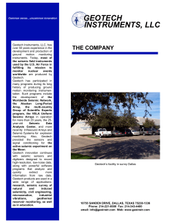


© Copyright 2026