
ORIGINAL
ORIGINAL Stage 3 Site-specific Assessment (Cemetery Investigation) First Anglican Chapel Burial Grounds, Burgoyne Bridge (Structure #081220) Class Environmental Assessment and Preliminary Design Northeast portion of Lot 18, Concession 7 (St Paul Street West and McGuire Street), Former Township of Grantham, Lincoln County City of St. Catharines, Regional Municipality of Niagara, Ontario Prepared for: Delcan Corporation (Niagara) 4342 Queen Street, Suite 407 Niagara Falls, ON, L2E 7J7 Phone: 905-356-7003 Fax: 905-356-7008 [email protected] Archaeological Licence P094 (Lisa Merritt) MTC PIF P094-034-2011 ASI File 11EA-164 December 12, 2011 Stage 3 Site-specific Assessment (Cemetery Investigation) First Anglican Chapel Burial Grounds, Burgoyne Bridge (Structure #081220) Class Environmental Assessment and Preliminary Design Northeast portion of Lot 18, Concession 7 (St Paul Street West and McGuire Street), Former Township of Grantham, Lincoln County, City of St. Catharines, Regional Municipality of Niagara, Ontario EXECUTIVE SUMMARY Archaeological Services Inc. (ASI) was contracted by Delcan Corporation, Niagara, to conduct a Stage 3 Site-specific Assessment (Cemetery Investigation) in the St Paul Street West and McGuire Street right-of-ways (ROWs) in the vicinity of the historic First Anglican Chapel Burial Grounds in the downtown core of the City of St Catharines, Ontario. This investigation stems from recommendations made in ASI’s 2011 Stage 1 background study and property inspection report submitted for the Burgoyne Bridge Class Environmental Assessment and Preliminary Design. The background research revealed that lands on the north side of the Burgoyne Bridge once contained a church constructed in 1776 and an associated burial ground that once spanned St. Paul Street West in the vicinity of Memorial Park. The exact boundaries of the historic burial ground have been lost since its closure in the early 19th century. The purpose of the current investigation is to undertake archival research and mechanical trenching to determine if there are any grave shafts in the public ROW lands, thereby helping to inform the choice of a preferred alignment for the proposed reconstruction of the Burgoyne Bridge and to avoid any burials that may still be present. New archival research undertaken indicates that the burial ground occupies the north-east side of the present day Memorial Park and the garage/auto glass repair shop at 4 St. Paul Street West, and it included the land on the opposite side of the street north of Merritt Park; there are very likely burials remaining insitu in these locations. Of the 250 known burials, only 16 were recorded as being removed when the cemetery was closed between 1837 and 1855. Several burials have also been encountered in the 20th century during construction projects in the vicinity. The Burgoyne Bridge cemetery investigation was undertaken on August 25, 2011. Heavy equipment was engaged to trench in the St Paul Street West and McGuire Street ROWs in the study area to determine the presence or absence of burial shafts. Due to the existence of buried utilities and buried irrigation systems in the vicinity of both Memorial Park and Merritt Park, trenching was only possible at the south east corner of St. Paul Street West and McGuire Street. The trench measured 1.2 m wide, ranged from 0.45 m to 1.6 m deep and was 6.2 m in length. In spite of careful observation, no burial shafts were detected, and no features of archaeological interest were observed at this location. Due to the buried utilities and irrigation lines in the north end of the project area, no trenches were excavated in the area identified in the archival research as having high potential for burials, and ASI was therefore unable to determine if any burials remain insitu in the vicinity of Memorial or Merritt Park. In light of these results, the following recommendations are made: 1. The area investigated related to the First Anglican Chapel Burial Grounds has no further cultural heritage value or interest, and Stage 4 mitigation of impacts is not required for the site; 2. The remainder of the project lands in the St. Paul Street West ROW in front of Memorial Park and Merritt Park retain high potential for insitu burials from the First Anglican Chapel Burial Grounds. Any construction in the area should avoid exceeding the current road footprint. If this is not possible then any ground disturbing activities should be preceded by a Stage 3 Site-specific Assessment (Cemetery Investigation) involving removal/relocation of all utilities and irrigation systems prior to mechanical trenching to search for burial shafts. In areas with deeply buried utilities, it is recommended that any construction work be monitored by a licensed archaeologist to ensure that burials are not impacted; and 3. If lands are acquired beyond the public ROW along St. Paul Street West, these lands should be subject to a Stage 1-Background Study and Property Inspection, Stage 2 Property Assessment, and possibly a Stage 3 Site-specific (Cemetery Investigation) following the Ministry of Tourism and Culture’s 2011 Standards and Guidelines for Consultant Archaeologists. Stage 3 Site-specific Assessment (Cemetery Investigation) First Anglican Chapel Burial Grounds Burgoyne Bridge Class EA and Preliminary Design City of St. Catharines, Regional Municipality of Niagara, Ontario Page iii TABLE OF CONTENTS EXECUTIVE SUMMARY ...................................................................................................................................... i TABLE OF CONTENTS ...................................................................................................................................... iii PROJECT PERSONNEL ...................................................................................................................................... v 1.0 PROJECT CONTEXT ......................................................................................................................... 1 1.1 Development Context .................................................................................................................... 1 1.2 Historical Context...................................................................................................................... 1 1.3 Archaeological Context ............................................................................................................. 4 2.0 FIELD METHTODS: FIRST ANGLICAN CHAPEL BURIAL GROUNDS CEMETERY INVESTIGATION ............. 5 2.1 Field Methods ........................................................................................................................... 5 2.2 Field Assessment Results.......................................................................................................... 5 2.3 Record of Finds ......................................................................................................................... 6 3.0 ANALYSIS AND CONCLUSIONS ....................................................................................................... 6 4.0 RECOMMENDATIONS ..................................................................................................................... 7 5.0 LEGISLATION COMPLIANCE ADVICE ................................................................................................ 8 6.0 BIBLIOGRAPHY .............................................................................................................................. 9 7.0 MAPS .......................................................................................................................................... 12 8.0 IMAGES: PLATES...........................................................................................................................17 APPENDIX A: ARCHIVAL REPORT ................................................................................................................ 20 LIST OF FIGURES Figure 1: Location of the study area. .............................................................................................................. 12 Figure 2: Approximate location of the study area on the 1836 map of St. Catharines .......................................13 Figure 3: Approximate location of the study area on the 1852 map of St. Catharines .......................................13 Figure 4: Approximate location of the study area on the 1875 map of St. Catharines........................................13 Figure 5: Plan Showing the Location of the Original Site of the First Church .....................................................14 Figure 6: Artistic reconstruction of the First Anglican Chapel ...........................................................................14 Figure 7: Location of Stage 3 Cemetery Investigation of First Anglican Burial Grounds .....................................15 Figure 8: Results of Stage 3 Cemetery Investigation of First Anglican Burial Grounds...................................... 16 LIST OF PLATES Plate 1: View southeast across Merritt Park. ...................................................................................................17 Plate 2: First Church and Burial Grounds Commemorative plaque...................................................................17 Plate 3: Looking north east along edge of retaining wall constructed for the Burgoyne Bridge. Note the memorial in background commemorating Canadian workers killed or disabled by injury or disease in the workplace......................................................................................................................................................17 Plate 4: View north northeast of retaining wall & Burgoyne Bridge railing at McGuire and St. Paul St. West.... 18 Plate 5: Northeast view of ROW trench excavation in progress. Note asphalt layer from former road alignment of McGuire Street in foreground. ................................................................................................................... 18 Plate 6: View southeast of trench excavation. Note light standard and bell manholes in sidewalk in background .................................................................................................................................................. 18 Plate 7: North wall of trench showing homogenous fill soil. Drainage pipe uncovered at base of trench........ 18 Stage 3 Site-specific Assessment (Cemetery Investigation) First Anglican Chapel Burial Grounds Burgoyne Bridge Class EA and Preliminary Design City of St. Catharines, Regional Municipality of Niagara, Ontario Page iv Plate 8: View south across Merritt Park towards Burgoyne Bridge. Note sprinkler access panel in grassy area beyond concrete pad. ................................................................................................................................... 19 Plate 9: View down at sprinkler access panel in Merritt Park.......................................................................... 19 Plate 10: View north on west side of St. Paul St. West at sprinkler hose uncovered during trench excavation. Excavations were halted ............................................................................................................................... 19 Plate 11: View south down St Paul Street West in front of Memorial Park at utility access panel in foreground and fire hydrant in background. .................................................................................................................... 19 Stage 3 Site-specific Assessment (Cemetery Investigation) First Anglican Chapel Burial Grounds Burgoyne Bridge Class EA and Preliminary Design City of St. Catharines, Regional Municipality of Niagara, Ontario ARCHAEOLOGICAL SERVICES INC. ENVIRONMENTAL ASSESSMENT DIVISION PROJECT PERSONNEL Senior Project Manager (licensee): Project Coordinator: Lisa Merritt, MSc [MTC license P094] Senior Archaeologist, Assistant Manager Environmental Assessment Division Sarah Jagelewski, BA Hons. Research Archaeologist Field Director Lisa Merritt Report Writer: Lisa Merritt Heidy Schopf, MES Research Archaeologist Historical Research: Brian K. Narhi, MA Archival Specialist Graphics Preparation: Lisa Merritt Heidy Schopf Blake Williams, MLitt [MTC License R344] GIS Technician Report Reviewer: Rob Pihl MA [MCT License P057] Partner and Manager Environmental Assessment Division Page v Stage 3 Site-specific Assessment (Cemetery Investigation) First Anglican Chapel Burial Grounds Burgoyne Bridge Class EA and Preliminary Design City of St. Catharines, Regional Municipality of Niagara, Ontario 1.0 Page 1 PROJECT CONTEXT Archaeological Services Inc. (ASI) was contracted by Delcan Corporation, Niagara, to conduct a Stage 3 Site-specific Assessment (Cemetery Investigation) in the vicinity of the historic First Anglican Chapel Burial Grounds. The historic burial ground is generally located at the corner of St Paul Street West and McGuire Street in the City of St Catharines, Regional Municipality of Niagara, Ontario (Figure 1). 1.1 Development Context The purpose of this investigation is to confirm the presence or absence of burials in the St Paul Street West and McGuire Street rights-of-way (ROW) in part to fulfill the archaeological condition of the Burgoyne Bridge Class Environmental Assessment (EA) and Preliminary Design. The larger project is being conducted to evaluate alternative routes for the proposed replacement of the Burgoyne Bridge which was constructed in 1915. This cemetery investigation stems from recommendations made in ASI’s Stage 1 Background Study and Property Inspection report which was undertaken for Burgoyne Bridge Class EA in 2011 (ASI 2011, MTC PIF PO94-034-2011). This report presents the results of the Burgoyne Bridge Stage 3 site-specific assessment (cemetery investigation) and makes three recommendations. This assessment was conducted under the project management and project direction of Lisa Merritt (MTC PIF P094-034-2011) to satisfy conditions in the Environmental Assessment Act (2005). All activities carried out during this assessment were completed in accordance with the Ontario Heritage Act and the Ministry of Tourism and Culture’s 2011 Standards and Guidelines for Consultant Archaeologists (S&G) and the Cemeteries Act (1990). Permission to access the study area and to carry out the activities necessary for completion of the Cemetery Investigation was granted to ASI by Delcan Corporation on July 26, 2011. 1.2 Historical Context The Stage 1 assessment undertaken by ASI for Burgoyne Bridge Class EA determined that the present day site of the Burgoyne Bridge and its immediate surroundings occupy what many have considered to be the “birthplace” of the City of St. Catharines (ASI 2011). Historically, the study area was located in part of Lot 18, Concession 7, in Grantham Township, Lincoln County. The Stage 1 background research also found that the north half of the Burgoyne Bridge study area falls within the presumed boundary of the First Anglican Chapel Burial Ground which was closed in the 1830s. For this cemetery investigation, archival research was undertaken to examine where the church and burial ground were located and to estimate if possible how many burials may still remain insitu. The exact location remains elusive because the City of St Catharines has significantly modernized its infrastructure and relocated roads in this area over the last two centuries. A review of historic mapping and records provided often contradictory lines of evidence about the exact boundaries of the burial grounds. A summary of the archival research is provided below and the full archival report is available as Appendix A of this report. Stage 3 Site-specific Assessment (Cemetery Investigation) First Anglican Chapel Burial Grounds Burgoyne Bridge Class EA and Preliminary Design City of St. Catharines, Regional Municipality of Niagara, Ontario Page 2 First Anglican Chapel Burial Grounds The “First Anglican Chapel Burial Ground” study area is located in downtown St. Catharines at the intersection of St. Paul Street West and McGuire Street (formerly Yates Street East). Part of the burial ground occupies the north-east side of the present day Memorial Park and the garage/auto glass repair shop at 4 St. Paul Street West and includes the land on the opposite side of the street. This cemetery has officially been closed to any further burials since 1837. Although some of the burials were removed for re-interment behind the present day St. George’s Anglican Church, it is known that many other graves were left in situ, and some of these have been disturbed during subsequent construction activities. Historically, the study area falls in Lot 18 of Concessions 6 and 7, and a section of the unopened road allowance between Concessions 6 and 7 in the former Township of Grantham, Lincoln County. The largest portion of the old burial ground was contained in Lot 18, Concession 6, which was originally patented by the Honourable Robert Hamilton. Hamilton granted the deed for the lot to the church wardens, John Gould and Abel Letten, in 1798 so that the lot could be dedicated to church and school uses. Lot 18 Concession 7 was patented in 1797 by John Haimer, one of St. Catharines original settlers. Hainer appears to have conveyed part of this lot to Robert Hamilton either through an unregistered deed or by means of a registered instrument, which was destroyed during the burning of the Town of Niagara in 1813. The exact location of the church and extent of the burial ground is unknown. The approximate location of the study area in relation to the church and burial grounds is provided in Figures 2-4. By the late 1820s, the steady growth of the congregation meant that the old church was inadequate in terms of its size for the comfortable accommodation of all worshipers. Records from the vestry meeting in 1832 show that the congregation had resolved to purchase a new lot of land in order to construct a larger church. The wardens and parishioners also felt that the site was “inconveniently situated” and requested a proper deed of land so that they could sell and dispose of the original church property and put the funds generated towards a new churchyard. As a result, the original church property was divided and sold to individual purchasers. The subdivision of these lots is clearly depicted on the 1852 Marcus Smith map of the Town of St. Catharines (Figure 3). After deciding to sell the original church lot, the land for the new church was purchased from William Hamilton Merritt in 1833, and the construction of the church began soon after (Grantham Memorial deed #9636). The old church was sold to the Methodist congregation in 1835. Unfortunately, in 1836, the church caught on fire and was totally destroyed. The cause of the blaze was thought to have been either a stray coal from the stove or a candle that had not been extinguished since the church had been used for a meeting earlier during the day. Newspaper accounts of the event mentioned that strong winds prevailed that day, which had the effect of fanning the flames. After the flames were extinguished, the only items that were salvaged were the wood stove and the church bell (St. Catharines Journal 1836). The cemetery for the original church was officially closed in 1837 after a motion was passed at a vestry meeting. An advertisement published in the local newspaper called for the removal of burials. It reads: “It was considered necessary to have the Corpses removed from the Old Burying Ground to the new (or to such other place as those interested may deem necessary) in order to secure the dead from the shameful disrespect paid to their memories. Notice is therefore given, that previous to a general disinterment, all those persons who may have relations or friends interred therein, are requested to attend their removal, on or before the 1st day of May next.” (St. Catharines Journal 1837) Stage 3 Site-specific Assessment (Cemetery Investigation) First Anglican Chapel Burial Grounds Burgoyne Bridge Class EA and Preliminary Design City of St. Catharines, Regional Municipality of Niagara, Ontario Page 3 Unfortunately there area no early parish registers for St. Catharines, which may have provided some indication of the number of burials at the original church site. Archival research suggests that some records were maintained by the Reverend Edward Parking (1828-29) and his successor (1830-40), but that these records were most likely destroyed in the fire of 1836. Further, there is no mention in early burial records of the transfer of any remains from the old churchyard to the new one. Based upon surviving tombstone inscriptions and newspaper accounts, it is known that at least 16 graves were exhumed from the old site and then transferred to the St. George Churchyard. There are no known plans or maps showing the layout of the graves or plot distribution within the “first churchyard.” Neither are there any known eye-witness statements or recollections as to the number of burials which took place, nor where they were situated in relation to the old church itself. Due to the lack of a full parish register or a complete run of local newspapers, it is difficult to ascertain the exact number of burials which may have been made at this location. If all of the above mentioned individuals were buried in the “First Churchyard,” there would have been at least 69 interments at a minimum. The number of known individuals, based upon other newspaper death notices, may perhaps raise the total number of burials at this site to just over one-hundred. If a comparison is made with other surviving church registers in the region from the same period, it is not unreasonable to suggest that as many as 250 individuals may have been interred here during the space of 40 years. This is based upon a conservative estimate of half a dozen burials in any given year, extending over the entire time when this plot remained in active use between 1796 and 1835-36. Exactly how many of these graves in excess of the 16 known removals were actually transferred to another site during the period between 1837 and 1855 is not known. Undoubtedly some of the forgotten burials were uncovered during the period between the “general disinterment” of May 1837, and the early 1850s. At that time, the original churchyard was severed into four large “estate” or villa lots which occupied the space on Yates or McGuire Street between the Merritt home at “Oak Hill” and St. Paul Crescent. At least four homes were built there, which in 1852 were the residences of Mr. John L. Ranney, Mrs. McKenny, William Chisholm, and Rolland McDonald. The local newspapers from that period were not searched for any accounts of the discovery or reburial of any such graves. Other burials may have been uncovered during the construction phase of the Burgoyne Bridge approaches, between July and December 1915. Again, the local newspapers (the Standard, the Journal, and the Thorold Post) were not examined for any news coverage of these events. Several city residents, who are still alive, know from first hand knowledge that full burials and partial human remains were uncovered at this site at various times. One of the most notable tales surrounds the burial of a female that was discovered near the former Phelan’s garage or gas station. Her body is said to have been perfectly preserved with “long blonde hair.” Her remains were taken to Fonthill for reburial. Other remains were found on the opposite side of St. Paul Street West, during the late 1950s or early 1960s on the Esso Service Station property, when that business was under the management of Einar Narhi. The most recent discovery of graves occurred during the 1990s, when the downtown “rock pile” park was constructed between St. Paul Street and St. Paul Crescent at the Ontario Street intersection. There is the definite possibility that human burials may still remain in situ at this location, which date from the period when the first churchyard was in active use. The cause of death for many of the individuals buried there was often not accurately recorded. Some of these people died accidentally or from natural causes such as old age. However, several died from unspecified “illness.” One death, that of Stage 3 Site-specific Assessment (Cemetery Investigation) First Anglican Chapel Burial Grounds Burgoyne Bridge Class EA and Preliminary Design City of St. Catharines, Regional Municipality of Niagara, Ontario Page 4 Rachel Brundage in 1828, was caused by tuberculosis (or “consumption”), and several others died during the cholera epidemic of 1832. Other infectious diseases may have been present within the community and responsible for the demise of some of the other individuals, but specific information is lacking in the extant records that are available for study and analysis. In conclusion, the research indicates that there is the definite possibility that more human burials may still remain in situ at this location, which dates from the period when the first churchyard was in active use. This fact must therefore be carefully considered during any proposed construction work carried out on the re-alignment of the Burgoyne Bridge approach on St. Paul Street West. 1.3 Archaeological Context The study area has previously been subject to a comprehensive Stage 1 background study and property inspection. The project report was produced and submitted to the MTC in 2011 and is entitled Stage 1 Archaeological Assessment (Background Study and Property Inspection), Burgoyne Bridge (Structure #081220), Class Environmental Assessment and Preliminary Design, City of St. Catharines, Ontario (ASI 2011; MTC PIF P094-034-2011). The Stage 1 assessment determined that there are no registered archaeological sites within the study area. It further concluded that although the majority of the study area had been previously disturbed by typical road construction along with residential and commercial development, portions of the study area appear relatively undisturbed and are considered to have archaeological potential. The following recommendations were made: Once the preferred alternative has been chosen, it should be reviewed to determine potential impacts to archaeological resources associated with the Burgoyne Bridge Class EA and Preliminary Design; More detailed archival research should be undertaken on the Shickluna Shipyard and the ‘Merritt Tunnels’ in advance of a Stage 2 property assessment, if the proposed project is to impact these lands; A Stage 2 Archaeological Assessment is required on any lands within the Burgoyne Bridge study area where there is potential for archaeological sites (Figure A-1: green highlighted areas) if the proposed project is to impact these lands. This work will be done in accordance with Ministry of Tourism and Culture’s 2010 Standards and Guidelines for Consultant Archaeologists; and A Cemetery Investigation is required in the vicinity of the former church (east side of St. Paul Street) and within Memorial Park (west side of St. Paul Street) if the proposed project is to impact these lands. This work will be done in accordance with the Ministry of Tourism and Culture’s 2010 Standards and Guidelines for Consultant Archaeologists and the Cemetery Act, to confirm the presence or absence of unmarked graves. The current cemetery investigation stems from the final recommendation and its purpose is to determine whether or not there are insitu burials in the public ROWs in the vicinity of the First Anglican Chapel Burial Grounds. Historic cemeteries often contain unmarked burials beyond the official boundaries. Over time, the boundaries of historic cemeteries, particularly those beside busy roadways, often “shrink” to Stage 3 Site-specific Assessment (Cemetery Investigation) First Anglican Chapel Burial Grounds Burgoyne Bridge Class EA and Preliminary Design City of St. Catharines, Regional Municipality of Niagara, Ontario Page 5 accommodate road widening and the pressure of modern development. In this case, the First Anglican Chapel Burial Grounds were established in the 1790s, but burials and use of the site for church purposes was discontinued in the 1830s. The exact location and extent of the burial ground is unknown, but the site is commemorated by a historic plaque (Plate 1-2). The area to be examined includes only the ROW lands along St. Paul Street West and McGuire Street in downtown St. Catherines. As is typical in highly urbanized areas, the soils in the public ROW lands are highly disturbed by buried utilities, road and sidewalk construction. Much of the study area is adjacent to green park space for Memorial Park, and Merritt Park. In this case as well, the construction of the Burgoyne Bridge in 1915 necessitated that the northern bridge approach be reinforced and streets were realigned (see Figures 2-5, Plates 3-4). Mechanical trenching was used to determine the presence or absence of burial shafts. Fieldwork was undertaken on August 25, 2011. 2.0 FIELD METHTODS: FIRST ANGLICAN CHAPEL BURIAL GROUNDS CEMETERY INVESTIGATION 2.1 Field Methods The Cemetery Investigation was conducted in accordance with the Ontario Heritage Act (2005), the Cemeteries Act (1990), and S&G Sections 2.2, Guideline 4 and 3.3.3 Standard 2. The assessment was undertaken under the project management and field direction of Lisa Merritt (P094) of ASI. The field work was conducted on August 25, 2011 under mostly sunny skies with seasonal temperatures. Visibility conditions were considered adequate for the fieldwork. All field observations are compiled onto mapping and presented in Section 9.0 (Figure 7-8) and photographic plates are presented in Section 10.0 (Plates 111). To determine if there were any burials in the ROW, trenching was undertaken in one small area at the intersection of St. Paul Street West and McGuire Street (Figures 7 and 8). The purpose of trenching is the controlled removal of topsoil to the undisturbed subsoil level under the supervision of a licensed archaeologist. Once the subsoil level is exposed, the area is examined for burial shafts, using a shovel to “shine” the subsoil and wall profiles, if necessary. For this investigation a backhoe fit with a smoothedged bucket was used for trenching. 2.2 Field Assessment Results Utility locates undertaken in advance of trenching indicated that the majority of the St. Paul Street West ROW contained buried utility lines including street light cables, water shut off boxes, a water main, cable TV lines, and a Bell line (Figure 8, Plates 6, 8-11). Much of the ROW lands also contained an extensive buried irrigation system to service the sprinklers for the park spaces (Plates 10-11). This sprinkler system prevented us from undertaking trenching in front of Memorial Park along the west side of St. Paul Street West and around Merritt Park. Trenching was only attempted in the southeast corner of the intersection of St. Paul Street West and McGuire Street (Figure 7). The area to be trenched was also limited to an area bound by a light standard in the southwest and a small monument in the northeast (Plate 5-6). Stage 3 Site-specific Assessment (Cemetery Investigation) First Anglican Chapel Burial Grounds Burgoyne Bridge Class EA and Preliminary Design City of St. Catharines, Regional Municipality of Niagara, Ontario Page 6 The trench measured approximately 1.2 m wide, ranged from 0.45 m to 1.6 m deep and was 6.2 m in length. The trench revealed a layer of asphalt at 45 centimeters below the surface that extended for 2.9 m of the trench. This asphalt surface is left over from a recent realignment of the intersection. After the asphalt ended, the trench was excavated to a depth of 1.5 meters (Plate 6). The excavation was halted when clay drainage pipe was uncovered at the base of the trench at 1.5 m (Plate 7). Once the trench was opened up, the wall profiles and trench floor were checked for any signs of disturbances from possible grave shafts. No evidence of any burial shafts was found. The soil in the trench was observed as follows: from 0-8 cm was a sod layer, from 8-45 cm was dark brown .sand loam topsoil, and from 45cm to 1.6 m was medium orangey brown sand with gravel inclusions. The trench excavation shows that the soil in this area is fill. This section of the study area was built up for the Burgoyne Bridge north approach and a retaining wall was constructed to contain the fill soil (Plates 3-4). Trenching indicates that this area was not the original ground surface during the use of the First Anglican Chapel Burial Ground and therefore has little to no potential for burials. The excavation of trenches could not proceed in the remainder of the ROW lands because of utilities and a buried irrigation system. A shallow trench was excavated to confirm the existence of the irrigation pipes (Plate 10). This system must be removed if further work is required in the vicinities of Memorial and Merritt Parks. Because of our inability to excavate trenches in these areas we were unable to determine if any burials remain insitu in the remainder of the St. Paul Street West ROW lands. 2.3 Record of Finds No archaeological finds were recovered during the course of this Cemetery Investigation. The inventory of the documentary record generated in the field (maps, field notes, and photographs) is presented in the table below: Document/Material Written Field Notes, Annotated Field Maps, trench mapping. Location Archaeological Services Inc., 528 Bathurst Street, Toronto, ON M5S 2P9 Comments Scanned copies stored on ASI network servers and/or CD-ROM Field Photography (Digital) Archaeological Services Inc., 528 Bathurst Street, Toronto, ON M5S 2P9 Stored on ASI network servers and/or CD-ROM Research/Analysis/Reporting Materials (Various Formats) Archaeological Services Inc., 528 Bathurst Street, Toronto, ON M5S 2P9 Hard copy and/or digital files stored on ASI network servers and/or CD-ROM 3.0 ANALYSIS AND CONCLUSIONS Archaeological Services Inc. (ASI) was contracted by Delcan Corporation, Niagara, to conduct a Stage 3 site-specific assessment (cemetery investigation) in the St Paul Street and McGuire Street ROWs in the vicinity of the historic First Anglican Chapel Burial Grounds in downtown St Catharines, Ontario. This investigation stems from recommendations made in our 2011 Stage 1 assessment report for the Burgoyne Bridge Class Environmental Assessment and Preliminary Design. The background research revealed that lands on the north side of the Burgoyne Bridge once contained a church constructed in 1776 and an Stage 3 Site-specific Assessment (Cemetery Investigation) First Anglican Chapel Burial Grounds Burgoyne Bridge Class EA and Preliminary Design City of St. Catharines, Regional Municipality of Niagara, Ontario Page 7 associated burial ground that once spanned St. Paul Street West in the vicinity of Memorial Park. The exact boundaries of the historic burial ground have been lost since its closure in the 1830s. New archival research was undertaken, and it indicated that the burial ground occupies the north-east side of the present day Memorial Park and the garage/auto glass repair shop at 4 St. Paul Street West and includes the land on the opposite side of the street north of Merritt Park; there are very likely many burials remaining insitu in these locations. Of the 250 estimated burials, only 16 were recorded as being removed when the cemetery was closed between 1837 and 1855. Several burials have also been encountered in the 20th century during construction projects in the vicinity. The Burgoyne Bridge cemetery investigation was undertaken on August 25th 2011. A backhoe was engaged to trench in the St Paul Street West and McGuire Street ROWs in the study area to search for burial shafts. Due to the presence of buried utilities and a buried irrigation systems in the vicinity of both Memorial Park and Merritt Park, trenching was only possible in the south east corner of St. Paul Street West and McGuire Street. The trench measured 1.2 m wide, ranged from 0.45 m to 1.6 m deep and was 6.2 m in length. In spite of careful observation, no burial shafts were detected. Trenching indicates that this area was not the original ground surface during the use of the First Anglican Chapel Burial Ground, and, therefore, has no further cultural heritage value or interest. Due to the buried utilities and irrigation lines in the north end of the project area, no trenches were excavated in the area identified in the archival research as having high potential for burials. Based on the results of our archival research, it can be concluded that there remains a high potential for insitu burials in on the east and west sides of St. Paul’s Street West north of McGuire Street relating to the First Anglican Chapel Burial Grounds. 4.0 RECOMMENDATIONS In light of these results, the following recommendations are made: 1. The area investigated related to the First Anglican Chapel Burial Grounds has no further cultural heritage value or interest, and Stage 4 mitigation of impacts is not required for the site; 2. The remainder of the project lands in the St. Paul Street West ROW in front of Memorial Park and Merritt Park retain high potential for insitu burials from the First Anglican Chapel Burial Grounds. Any construction in the area should avoid exceeding the current road footprint. If this is not possible then any ground disturbing activities should be preceded by a Stage 3 Site-specific Assessment (Cemetery Investigation) involving removal/relocation of all utilities and irrigation systems prior to mechanical trenching to search for burial shafts. In areas with deeply buried utilities, it is recommended that any construction work be monitored by a licensed archaeologist to ensure that burials are not impacted; and 3. If lands are acquired beyond the public ROW along St. Paul Street West, these lands should be subject to a Stage 1-Background Study and Property Inspection, Stage 2 Property Assessment, Stage 3 Site-specific Assessment (Cemetery Investigation) First Anglican Chapel Burial Grounds Burgoyne Bridge Class EA and Preliminary Design City of St. Catharines, Regional Municipality of Niagara, Ontario Page 8 and possibly a Stage 3 Site-specific (Cemetery Investigation) following the Ministry of Tourism and Culture’s 2011 Standards and Guidelines for Consultant Archaeologists. Notwithstanding the results and recommendations presented in this study, Archaeological Services Inc. notes that no archaeological assessment, no matter how thorough or carefully completed, can necessarily predict, account for, or identify every form of isolated or deeply buried archaeological deposit. In the event that archaeological remains are found during subsequent construction activities, the consultant archaeologist, approval authority, and the Cultural Programs Unit of the Ministry of Tourism and Culture should be immediately notified. 5.0 LEGISLATION COMPLIANCE ADVICE The following advice on compliance with legislation is provided: This report is submitted to the Minister of Tourism and Culture as a condition of licensing in accordance with Part VI of the Ontario Heritage Act, RSO 1990, c 0.18. The report is reviewed to ensure that it complies with the standards and guidelines that are issued by the Minister, and that the archaeological field work and report recommendations ensure the conservation, preservation and protection of the cultural heritage of Ontario. When all matters relating to archaeological sites within the project area of a development proposal have been addressed to the satisfaction of the Ministry of Tourism and Culture, a letter will be issued by the ministry stating that there are no further concerns with regard to alterations to archaeological sites by the proposed development. It is an offence under Sections 48 and 69 of the Ontario Heritage Act for any party other than a licensed archaeologist to make any alteration to a known archaeological site or to remove any artifact or other physical evidence of past human use or activity from the site, until such time as a licensed archaeologist has completed archaeological field work on the site, submitted a report to the Minister stating that the site has no further cultural heritage value or interest, and the report has been filed in the Ontario Public Register of Archaeology Reports referred to in Section 65.1 of the Ontario Heritage Act. Should previously undocumented archaeological resources be discovered, they may be a new archaeological site and therefore subject to Section 48 (1) of the Ontario Heritage Act. The proponent or person discovering the archaeological resources must cease alteration of the site immediately and engage a licensed consultant archaeologist to carry out archaeological fieldwork, in compliance with sec. 48 (1) of the Ontario Heritage Act. The Cemeteries Act, R.S.O 1990 c. C.4 and the Funeral, Burial and Cremation Services Act, 2002, S.O. 2002. c.33 (when proclaimed in force) require that any person discovering human remains must immediately notify the police or coroner and the Registrar of Cemeteries, Ministry of Consumer Services. Stage 3 Site-specific Assessment (Cemetery Investigation) First Anglican Chapel Burial Grounds Burgoyne Bridge Class EA and Preliminary Design City of St. Catharines, Regional Municipality of Niagara, Ontario 6.0 Page 9 BIBLIOGRAPHY [anon.] 1837 “Notice” of vestry meeting closing the cemetery, March 27, 1837. Published in the St. Catharines Journal, issue of April 6, 1837. n.d. Grantham Township Memorials Abstract Index to Deeds, 1796-1865. St. Catharines: Niagara North Land Registry Office, microfilm 30E5. n.d. Town of St. Catharines Abstract Index to Deeds, “Yates and Chace Street, formerly Canal Street,” 1834-1876. St. Catharines: Niagara North Land Registry Office, microfilm 30E33. ASI (Archaeological Services Inc.) 2011 Stage 1 Archaeological Assessment (Background Study and Property Inspection), Burgoyne Bridge (Structure #081220), Class Environmental Assessment and Preliminary Design, City of St. Catharines, Ontario. (MTC PIF P094-034-2011) Baum, Ronald. 1994 A History of St. George’s Anglican Church. St. Catharines: The Church. Burtch, W. Craig. 1986 The Niagara Papers. Bur-Mor Publications. Brosius, H. 1875 St. Catharines, Province of Ontario, Canada. Chicago: lithographed by Charles Shoberg & Co. Carnochan, Janet (ed.) 1907 “Early Churches in the Niagara Peninsula,” Ontario Historical Society Papers and Records, Volume 8, pp. 149-222. Halfyard, Robert. 2005 First Presbyterian Church Records 1831-49. St. Catharines: Ontario Genealogical Society, Niagara Peninsula Branch. Holt, E.O. 1935 St. George’s Church, St. Catharines, Ont., Plan Showing Location of Original Site of the First Church, Built About the Year 1796. St. Catharines: E.O. Holt. Hutchinson, Paul. 1995 Sincerely Lamented: St. Catharines Obituaries 1817-1918. St. Catharines: Slabtown Press. 1996 Late and Lamented: St. Catharines Obituaries 1835-1918. St. Catharines: Slabtown Press. Stage 3 Site-specific Assessment (Cemetery Investigation) First Anglican Chapel Burial Grounds Burgoyne Bridge Class EA and Preliminary Design City of St. Catharines, Regional Municipality of Niagara, Ontario Page 10 Jackson, John N. 1976 St. Catharines, Ontario: Its Early Years. Belleville: Mika Publishing Co. Jackson, John N. and Sheila M. Wilson. 1992 St. Catharines: Canada’s Canal City. St. Catharines: St. Catharines Standard Ltd. Ker, Rev. Robert. 1891 St. George’s Parish Church, St. Catharines: Jubilee Celebration and Historic Centenary Review. St. Catharines: Star Print. Luxton, Rev. George N. 1935 The Old Parish Church of St. Catharines, 1796-1835: Studies in the Beginning of St. George’s Congregation. St. Catharines: Luxton. Maingy, Robert A. 1836 Map of the Village of St. Catharines. Plan deposited in the Niagara North Land Registry Office as Plan 77. McKenzie, Rev. Donald A. 1982 Death Notices from the Christian Guardian 1836-1850. Lambertville, NJ: Hunterdon House. 1986 More Notices from Methodist Papers 1830-1857. Lambertville, NJ: Hunterdon House. Merritt, William H. 1832 Letter from W.H. Merritt to his wife, St. Catharines, September 10, 1832. Archives of Ontario: Merritt Papers, family letters, package 48. Ministry of Tourism and Culture 2011 Standards and Guidelines for Consultant Archaeologists. Culture Policy, Programs and Services Division, Programs and Services Branch, Culture Programs Unit, Toronto. Narhi, Brian K. 2006 Early Niagara District Court Records 1787-1841. St. Catharines: Midnight Sun Press. Page & Smith 1878 Illustrated Historical Atlas of the County of York, Ontario. Toronto: Page & Smith. Reprinted 1972 by Maracle Press, Oshawa. Park, William W. 1962 Notes on the History of St. George’s Anglican Church, 1796-1962. St. Catharines: The Church. Parnall, Maggie. 1999 Grantham Township Ancestors. Jordan Station: Maggie Parnall. [Phelps, Oliver Seymour.] 1967 Junius: St. Catharines A to Z, 1856. St. Catharines: printed by Lincoln Graphics Ltd. for the St. Catharines and Lincoln History Society. Stage 3 Site-specific Assessment (Cemetery Investigation) First Anglican Chapel Burial Grounds Burgoyne Bridge Class EA and Preliminary Design City of St. Catharines, Regional Municipality of Niagara, Ontario Page 11 Reid, William D. 1980 Death Notices of Ontario. Lambertville, NJ: Hunterdon House. Revised Statutes of Ontario (R.S.O.) 1990 Cemeteries Act 2005 Ontario Heritage Act Sabiston. 1890 St. Catharines, Ontario, and Surroundings. Montreal: Sabiston. St. Catharines Centennial Committee. 1967 St. Catharines Centennial History. St. Catharines: Advance Print. Smith, Marcus. 1852 Map of the Town of St. Catharines, C.W. Philadelphia: lithographed by A. Kollner. Taylor, Corlene (et. al.) 1997 St. Mark’s Anglican Church, Niagara-on-the-Lake, Burial Records 1792-1854. St. Catharines: Ontario Genealogical Society, Niagara Peninsula Branch. Walker, Dan and Fawne Stratford-Devai. 1995. Vital Records of Upper Canada/Canada West. Niagara District. Milton: Global Heritage Press. Wilson, Thomas B. n.d. The Ontario Register (volumes 1-8, 1968-1990). Lambertville, NJ: Hunterdon House. Stage 3 Site-specific Assessment (Cemetery Investigation) First Anglican Chapel Burial Grounds Burgoyne Bridge Class EA and Preliminary Design City of St. Catharines, Regional Municipality of Niagara, Ontario 7.0 Page 12 MAPS Figure 1: Location of the study area. Base Map: NTS Sheet 30 M/ 03 N N N STUDY AREA STUDY AREA BU RG OY NE BR ID GE STUDY AREA E Figure 2: Approximate location of the study area on the 1836 map of St Catharines G ID Base Map: Map of the Village of St. Catharines (Maingy 1836) E YN E O G ID E BR G R BR BU YN O G R BU Figure 3: Approximate location of the study area on the 1852 map of St. Catharines Base Map: Map of the Town of St. Catharines (Smith 1852) Figure 4: Approximate location of the study area on the 1875 map of St. Catharines Base Map: Map of St. Catharines (Brosius 1875) Stage 3 Site-specific Assessment (Cemetery Investigation) First Anglican Chapel Burial Grounds Burgoyne Bridge Class EA and Preliminary Design City of St. Catharines, Regional Municipality of Niagara, Ontario Figure 5: Plan Showing the Location of the Original Site of the First Church Base Map: St. George’s Church, St. Catharines (Holt 1935) Figure 6: Artistic reconstruction of the First Anglican Chapel Page 14 ST ± KI NG WI LL ST ST E IAM ST TA R ST TR AF AL GA R IO ST P AUL ON CH ER RY S T 8 Memorial Park 1 11 S T ES IR GU MC 2 YA TE Merritt Park ST 9 10 Oak Hill HWY 3 406 RENO ST P AUL ST W HAINER ST WN RD Location of Excavated Trench Burgoyne Bridge East Route Option 1 Niagara Waterbody Areas in ROW with potential for burials BASE: 528 Bathurst St. Toronto, Ontario Canada, M5S 2P9 T 416-966-1069 F 416-966-9723 [email protected]/www.iAS±.to Photo direction and location 0 Niagara Ortho Courtesy of Delcan 100 Meters ASI PROJECT NO.: 11EA-164 DATE: November 11, 2011 DRAWN BY: B.C.M.W. FILE: 11EA164_E_Opt_Zoom Figure 7: Location of Stage 3 Cemetery Investigation of First Anglican Chapel Burial Grounds for Burgoyne Bridge Class EA 4 5 7 6 0 100 m SCALE BASE: LEGEND 528 Bathurst St. Toronto, Ontario Canada, M5S 2P9 T 416-966-1069 F 416-966-9723 [email protected]/www.iAS±.to 1 Photo Location and Direction Location of Trench Property Boundaries Figure 8. Burgoyne Bridge First Anglican Chapel Cemetery Investigation: Results of Trenching and Location of Buried Utilities 0 Map Title:: Project Area Map Producer: Delcan Niagara Date, Project or Map No. 25 m SCALE ASI PROJECT NO.: 11EA-164 DATE: 11/11/11 DRAWN BY: JF & LM FILE:11EA-164_Graphics Stage 3 Site-specific Assessment (Cemetery Investigation) First Anglican Chapel Burial Grounds Burgoyne Bridge Class EA and Preliminary Design City of St. Catharines, Regional Municipality of Niagara, Ontario 8.0 Page 17 IMAGES: PLATES Plate 1: View southeast across Merritt Park. Plate 2: First Church and Burial Grounds Commemorative plaque Plate 3: Looking north east along edge of retaining wall constructed for the Burgoyne Bridge. Note the memorial in background commemorating Canadian workers killed or disabled by injury or disease in the workplace. Stage 3 Site-specific Assessment (Cemetery Investigation) First Anglican Chapel Burial Grounds Burgoyne Bridge Class EA and Preliminary Design City of St. Catharines, Regional Municipality of Niagara, Ontario Page 18 Plate 4: View north northeast of retaining wall & Burgoyne Bridge railing at McGuire and St. Paul St. West. Plate 5: Northeast view of ROW trench excavation in progress. Note asphalt layer from former road alignment of McGuire Street in foreground. Plate 6: View southeast of trench excavation. Note light standard and bell manholes in sidewalk in background Plate 7: North wall of trench showing homogenous fill soil. Drainage pipe uncovered at base of trench. Stage 3 Site-specific Assessment (Cemetery Investigation) First Anglican Chapel Burial Grounds Burgoyne Bridge Class EA and Preliminary Design City of St. Catharines, Regional Municipality of Niagara, Ontario Page 19 Plate 8: View south across Merritt Park towards Burgoyne Bridge. Note sprinkler access panel in grassy area beyond concrete pad. Plate 9: View down at sprinkler access panel in Merritt Park. Plate 10: View north on west side of St. Paul St. West at sprinkler hose uncovered during trench excavation. Excavations were halted Plate 11: View south down St Paul Street West in front of Memorial Park at utility access panel in foreground and fire hydrant in background. Stage 3 Site-specific Assessment (Cemetery Investigation) First Anglican Chapel Burial Grounds Burgoyne Bridge Class EA and Preliminary Design City of St. Catharines, Regional Municipality of Niagara, Ontario APPENDIX A: ARCHIVAL REPORT Historical Overview of the “First Anglican Chapel” Burial Grounds, St. Paul Street West, City of St. Catharines. Page 20 Stage 3 Site-specific Assessment (Cemetery Investigation) First Anglican Chapel Burial Grounds Burgoyne Bridge Class EA and Preliminary Design City of St. Catharines, Regional Municipality of Niagara, Ontario Page 21 Historical Overview of the “First Anglican Chapel” Burial Grounds, St. Paul Street West, City of St. Catharines. The “First Anglican Chapel Burial Ground” study area is located in downtown St. Catharines, at the intersection of St. Paul Street West and McGuire Street (formerly Yates Street East.) Part of the burial ground occupies the north-east side of the present day Memorial Park and the garage/auto glass repair shop at 4 St. Paul Street West, and included the land on the opposite side of the street. This cemetery has officially been closed to any further burials since 1837. Although some of the burials were removed for re-interment behind the present day St. George’s (Anglican) Church, it is known that many other graves were left in situ and some of these have been disturbed during subsequent construction activities. The underlying township fabric for the study area is comprised of part Lot 18 in Concession 6, a very small part of Lot 18 in Concession 7, and a section of the unopened road allowance between Concessions 6 and 7 in the former Township of Grantham. The earliest land registry information for these lots may be found recorded in the “Grantham Memorials” Abstract Index to Deeds. After St. Catharines was elevated to the status of a town in 1845, subsequent land transactions were recorded in the “Town of St. Catharines” volume, under the heading “Yate and Chace Street, formerly Canal Street.” In the late 1930s, in order to facilitate the transfer of real property in the downtown core, a Registrar’s Compiled Plan, now known as “Corporation Plan 2” (or “C.P. 2” for short) was deposited in the Lincoln County (Niagara North) Land Registry office. By that time, the site of the old burial ground had been subdivided into twelve lots in addition to a laneway and the St. Paul Street West approach to the Burgoyne Bridge. Lot 18 Concession 6, Grantham. The largest portion of the old burial ground was contained in part Lot 18 Concession 6. This lot was patented by the Hon. Robert Hamilton, a Queenston merchant, on May 6, 1796. The deed for the land occupied by the first church was granted by Hamilton to the (then) church wardens, John Gould and Abel Letten, for the consideration of one penny, on January 24, 1798. This document specified that the ground was to be used for the purposes of a church and school, but it did not refer to a burial ground. It also noted that if any of the said buildings were neglected or allowed to fall into decay after seven years of neglect, then the deed would become null and void and the land would revert back to the grantor. This deed was not registered. There are probably two reasons for this, the first (and less likely reason) being that registration at that early period was done “by election” (ie, voluntarily.) The more probable cause was that the deed did not contain a proper legal description of the lands being conveyed. It did not refer to the actual lot and concession numbers, but simply stated that the parcel contained “about two acres.” The metes and bounds for this parcel stated that it commenced “by a line parallel to and twenty yards in front of the present church running from the edge of the road which rises the hill from the creek running towards the present farm house seventy yards; thence running towards the road which leads down the creek one hundred and forty yards; thence in a line towards the road which comes from the creek seventy yards; and thence along the said road to the place of setting out, about one hundred and forty yards.” This parcel was therefore about 210 x 420 feet in size. Due to the fact that the old road followed a serpentine path rather than a straight line up the slope of the hill, the parcel was probably shaped more like a parallelogram rather than a rectangle. Stage 3 Site-specific Assessment (Cemetery Investigation) First Anglican Chapel Burial Grounds Burgoyne Bridge Class EA and Preliminary Design City of St. Catharines, Regional Municipality of Niagara, Ontario Page 22 This deed raises a few problematic issues. The first one is: where was the exact place of beginning? Many local historians believe, and some nineteenth and twentieth century maps have shown, that the church yard began at the corner of McGuire Street and St. Paul Crescent. The difficulty with using that corner as the place of beginning is that the deed would have included some land in Lot 18 Concession 7, as well as a portion of the road allowance between Concessions 6 and 7---land which Hamilton apparently did not yet own at that time. Furthermore, if that corner was the starting point for the legal description, the churchyard lot would have extended nearly right across the St. Paul-Ontario intersection, thereby encroaching upon both of these public highways. In order for the deed to transfer a plot of land containing a depth of 420 feet for the churchyard, the place of beginning would necessarily have been even further into the adjoining Lot 18 Concession 7, probably to the far side of what would eventually become the Welland Canal Office lot on the opposite side of McGuire Street. The width of 210 feet is easier to reconcile. This would include all of what is now the old garage/auto glass lot at number 4 St. Paul Street West, as well as part (but not all) of the cenotaph and Memorial Park property. The Merritt Park area where the statute of William Hamilton Merritt stands, as well as the plaques commemorating the first church, probably did not form any part of the churchyard. In the late nineteenth century, a “survey” of the village of St. Catharines was published in the Page’s Atlas. This map was compiled from the descriptions contained in registered deeds in the local land registry office, and was described as a map of the nascent village of “circa” 1809. The time period for many of these land divisions shown on the map was actually somewhat later, a more accurate date would have been “circa” 1829. However, the importance of that map is that it clearly depicted the original church reserve just opposite the St. Paul and Ontario Street intersection. This sketch also indicated that the churchyard was crossed or bisected by a portion of the unopened road allowance, and that the churchyard also included part of Lot 18 in Concession 7 (Page 1876:66). In May 1817, the surveyor Richard Cockrell had been commissioned to re-survey the “church reserve.” By his estimation, the churchyard contained just one acre, two roods and sixteen perches (ie, slightly more than 1.5 acres.) His metes and bounds description was much different than that found in the 1798 deed. It described a slightly irregularly shaped parcel which measured 244.86 x 297 x 222 x 300 feet in size. It should be noted that his “place of beginning” was on the south-east corner of the St. Paul and Ontario Street junction, and measured at a distance from a fixed point which was the south-east corner of Paul Shipman’s house. Lot 18 Concession 7, Grantham. This farm lot was patented by John Hainer, one of the first two original settlers in St. Catharines, on March 1, 1797. Hainer appears to have conveyed part of this lot to Robert Hamilton. This transaction was made either through an unregistered deed, or by means of a registered instrument which was destroyed during the burning of the Town of Niagara in December 1813. If a registered deed once existed, the duplicate copy was never brought forward to be recopied by the Commissioners appointed for this purpose in 1817-18. A portion of this tract of land, containing twenty-four acres, was sold to William Hamilton Merritt in November 1821, by William Dickson and Thomas Clark, the executors of the late Robert Hamilton (Grantham Memorial deed #6289.) Stage 3 Site-specific Assessment (Cemetery Investigation) First Anglican Chapel Burial Grounds Burgoyne Bridge Class EA and Preliminary Design City of St. Catharines, Regional Municipality of Niagara, Ontario Page 23 Unopened Road Allowance, between Concessions 6 and 7, Grantham. This road allowance was created in 1787-88, when Grantham Township was first surveyed by Daniel Hazen. In theory, this strip of land one chain in width should never have been included within the boundaries of the church reserve. However, when the surrounding topography is taken into consideration, it is easy to see the difficulties that the early settlers in the area would have had in opening up and maintaining the road allowance. Connecting it with the other sections of the allowance on either side of it would have required the construction of steep roads in and out of the Twelve Mile Creek valley, and the construction of substantial bridges over the creek. After several years of undisputed possession as part of the church reserve, the congregation would have had little or no difficulty in substantiating their claim to the road allowance---especially since an alternate route (St. Paul Crescent, or Hill Street) which was part of the Queenston-Grimsby Road, already provided access for travelers through the creek valley. A formal survey of the land---possibly this was the reason for the Cockrell survey?---and followed by an order issued by the local magistrates in the Quarter Sessions, would have sufficed to vest the freehold of the soil with the congregation. Unfortunately, a complete set of Quarter Session records for the Niagara District does not begin until 1828, with only scattered records surviving prior to that date (Narhi 2006.) Lot 18 Concessions 6 and 7, plus the unopened road allowance. By the late 1820s, the steady growth of the congregation meant that the old church was inadequate in terms of its size for the comfortable accommodation of all worshippers. As a result, in May 1832, the records from the vestry meeting showed that the congregation had resolved to purchase a new lot of land, at least one acre in size, upon which they planned to construct a larger church. Burials from the old cemetery were to be moved to the new plot once it had been procured. Land for the new church, the present St. George’s, was acquired for £37.10.0 from William Hamilton Merritt in November 1833. Construction of the new church commenced shortly thereafter, with the corner-stone being laid in July 1835 (Grantham Memorial deed #9636). In February 1834, Dickson and Clark as the executors and trustees of the Hamilton estate formally deeded the “church reserve” of “two acres” to the (then) trustees of the congregation, Elias S. Adams and Henry Mittleberger. The recitals contained within this document noted that the church had been erected and the “dead buried” there during Hamilton’s lifetime, and since his death the use of this land “hath continued as such hitherto.” The wardens and parishioners however felt that this site was “inconveniently situated,” and requested a proper deed of land so that they could “sell and dispose of the same.” The funds generated from the sale of this property would then be applied towards the purchase of the new and more centrally located churchyard. The deed noted that the old church lot was two acres and six perches in extent, and the consolidated description showed that it was composed of part of Lot 18 in Concessions 6 and 7 in Grantham, as well as part of the unopened road allowance between those Concessions (Grantham Memorial deed #9634). There is a major difficulty associated with using the description contained in the “Memorial” of this deed as a means of determining the boundaries and extent of the 1830s churchyard. Quite simply, the metes and bounds description is faulty. It does not accurately describe the lands conveyed from the Hamilton estate to the congregation and, since one or more of the courses are in error, the parcel does not properly close. Part of the description forms a shape similar to that found in the Cockrell survey, but the St. Paul Crescent portion of the description is very odd looking indeed. Stage 3 Site-specific Assessment (Cemetery Investigation) First Anglican Chapel Burial Grounds Burgoyne Bridge Class EA and Preliminary Design City of St. Catharines, Regional Municipality of Niagara, Ontario Page 24 The Church at the Twelve Mile Creek. It has been a long standing error (in part) to refer to this building as the first “St. George’s Church” or the “First Anglican Chapel.” The original deed of land from Robert Hamilton was granted to “the present Church Wardens” of Grantham Township, and to “the other inhabitants of that Township” for a place of worship and for a school. We know that it was used for divine worship on alternating Sundays by the Anglicans, Presbyterians and Methodists. The Lutheran congregation had erected their small frame building, called the Old German Church or Meeting House, a short distance to the south-west near the border between Grantham and Thorold Townships. Another early Anglican chapel had been constructed to the east of St. Catharines, where the Queenston-Grimsby Road crossed the Ten Mile Creek at Homer, in 1795. There was no regular minister appointed to St. Catharines during this early period. Divine services were occasionally held here by the Rev. Robert Addison from St. Mark’s in Niagara, while at other times services were conducted by local clergymen who visited here in rotation. Since the church was also shared by the Presbyterians and Methodists, it is supposed that the three congregations may have worshipped together when a preacher did visit the settlement. In 1819, Dr. Howison described the arrival of the congregation at Sunday service in St. Catharines. He particularly noted the appearance of the minister, who was dressed in “a showy blue coat, white pantaloons, top hat and spurs.” The worshippers were described as the plump, local “meinherrs” and “fraus.” Musical accompaniment was provided by a flute and flageolet. The first resident minister here was the Rev. Edward Parkin in 1828, followed by the Rev. James Clarke in 1830. The church at St. Catharines was a modest frame structure, with circular headed windows, which measured 30 x 34 feet in size. The construction of the church appears to have progressed at a leisurely pace. The first reference to carpentry work on the building dates from 1801-02, and glazing and interior trim and woodwork were installed sometime after January 1810. Its location within the churchyard was traditionally placed on part Lot 18 Concession 7. This was below the unopened road allowance near McGuire Street, and on the south-east side of a laneway which bisected the churchyard. Other sources placed it “near the residence of Rolland Macdonald, Esquire” or “being once where the Messrs. Macdonald’s and Chisholm’s residences now are.” We are fortunate in knowing the interior layout of this structure, since a floor plan of it survives from 1819 (Junius, St. Catharines Journal, Walk “E.”) During the War of 1812, the church was pressed into use as a hospital and as a barracks for the troops. The building sustained some damage, and the trustees submitted a claim for £100 to the government to cover the cost of these repairs. A portion of this claim was allowed, and repairs to the structure were carried out by James Tinlin in the summer of 1817. In 1817, the church was also used by the Court of King’s Bench since the new court house in the Town of Niagara had then not yet been completed. The wooden roof of the church caught fire in January 1823, but it was quickly extinguished with little damage done to the structure. This news was reported in the Niagara papers at the time. The old church was to have been sold to the Methodist congregation in December 1835, but the space was to have been shared with the Anglicans during the time that their new building was under construction. Unfortunately in March 1836, the old church caught fire and was totally destroyed. The cause of the blaze was thought to have been either a stray coal or ember from the stove, or a candle which had not been extinguished, since the church had been used for a meeting by the Methodists earlier during the day. The newspaper accounts of the conflagration referred to the strong winds which fanned the flames. The church itself partially stood on the slope of the hill, and the ground was covered by snow and ice from a recent Stage 3 Site-specific Assessment (Cemetery Investigation) First Anglican Chapel Burial Grounds Burgoyne Bridge Class EA and Preliminary Design City of St. Catharines, Regional Municipality of Niagara, Ontario Page 25 storm, which hindered the efforts of the bucket brigade. After the flames were extinguished, the only items which were salvaged from the ruins were the wood stove and church bell (St. Catharines Journal, March 10, 1836.) Yates and Chace Street, formerly Canal Street. Once the new site for the future St. George’s Church had been procured, the church wardens E.S. Adams and Henry Mittleberger began to convey portions of the old church reserve to individual purchasers. The lands sold by them were utilized for building purposes, and by 1852 the Marcus Smith map of the town of St. Catharines showed that four large residential lots occupied the space between Merritt’s house adjacent to the present day Memorial Park, and the line of these residential properties extended across what is now St. Paul Street towards St. Paul Crescent. A late nineteenth century photograph clearly showed the appearance of Yates Street at that time. The frontage along St. Paul Crescent had been subdivided into much smaller lot divisions, which appear to have been used for residential purposes, shops and small businesses. Some of these small lots may not have been contained within the original church reserve, since the route of St. Paul Crescent appears to have been altered from time to time to improve the access for travelers from the creek valley. In October 1835, the trustees sold a lot containing 1/10 acre to the lawyer Robert Easton Burns, which was situated “on the alley laid out through the churchyard.” In March 1836, Rolland Macdonald bought 1/3 acre described as “part of [the] church land,” which was followed by a second purchase in September 1838. John Clark purchased slightly more than ¼ acre in May 1838 (Grantham Memorial deeds #10789, 10961, 12262, 12318.) The Marcus Smith map of 1852 showed that the residences built here were set back some distance from Yates Street. These private grounds also contained large rear garden areas which had not been completely filled in with any structures such as sheds. The Brosius map of 1875 and to some degree the Sabiston map of 1898 showed that a large area behind these residences still then remained as open, undeveloped land. The portion of Memorial Park located directly beside Oak Hill seems to lie outside of the church reserve. This ½ acre property was purchased by John L. Ranney from the Adams estate in May 1850. The deed under which Adams acquired this lot, in July 1839, described it as lying “near the church lands…west from the south-west corner of the church reservation.” The property next to it, which contained the house of Phoebe McKinney, was bought directly from William Hamilton Merritt in March 1837, and therefore it too did not form part of the church reserve (Grantham Memorial deeds #11771, 12676, 2162.) Lots 1197-1199, 1201-1209 plus laneway, Corporation Plan 2. By the 1920s and 30s, the sale of real estate in downtown St. Catharines had become a complicated business due to the number of small lots which had been carved out of the original township fabric, and which did not form part of any registered plan of subdivision. Therefore, in order to fix property boundaries and facilitate the conveyance of real estate, a Registrar’s “compiled plan” was created. This was named “Corporation Plan 2,” or “C.P. 2,” which still governs on legal descriptions to this day. The former church reserve forms the underlying fabric of part Lot 1197 on CP2 (ie, the north-easterly side of Memorial Park), Lot 1198 (the old Esso Service Station lot, most recently an auto glass repair shop), Stage 3 Site-specific Assessment (Cemetery Investigation) First Anglican Chapel Burial Grounds Burgoyne Bridge Class EA and Preliminary Design City of St. Catharines, Regional Municipality of Niagara, Ontario Page 26 Lot 1199, probably a small portion of Ontario Lane, possibly parts of Lots 1144-1146 inclusive, all of Lots 1207-1209, part of the stopped-up laneway adjacent to Lots 1207-1209, and probably part (but not all) of Lots 1201-1206 inclusive. Churchyard and Burials. In July 1819, the church wardens or trustees met at which time several resolutions were passed. Among the matters brought to the attention of the trustees was that of the enclosures within the cemetery and fencing in the burial ground. Unfortunately the minutes from this meeting do not supply details regarding the number of graves nor their location. An advertisement published in the local newspapers in April 1837, notified the inhabitants of St. Catharines of the closure of the old cemetery following a motion passed at the vestry meeting on March 27th. “It was considered necessary to have the Corpses removed from the Old Burying Ground to the new (or to such other place as those interested may deem necessary), in order to secure the dead from the shameful disrespect paid to their memories: Notice is therefore given, that previous to a general disinterment, all those persons who may have relations or friends interred therein, are requested to attend to their removal, on or before the 1st day of May next” (St. Catharines Journal, April 6, 1837.) It is unfortunate that there are no early surviving parish registers for St. Catharines, which may have provided us with some indication as to the number of burials which occurred at this site. It is thought that some records were maintained by the Rev. Edward Parkin (1828-29), and by his successor Rev. James Clarke (1830-1840). The whereabouts of these registers has never been determined, and there is a good probability that they were destroyed in the fire of 1836. The extant register of burials held at St. George’s Church only commenced during the time of the incumbency of the Rev. A.F. Atkinson in the autumn of 1840. By that time, all burials had ceased at the old churchyard and all the records are reflective of interments at St. Georges Church. There is no mention in these early burial records of the transfer of any remains from the old churchyard to the new one. There are no known plans or maps showing the layout of the graves or plot distribution within the “first churchyard.” Neither are there any known eye-witness statements or recollections as to the number of burials which took place, nor where they were situated in relation to the old church itself. In 1856, a St. Catharines by-law prohibited any further burials within the limits of the town proper after August 1856. The “old section” of Victoria Lawn Cemetery on Queenston Street had been laid out by that time. Some of the old interments from the downtown core were transferred to Victoria Lawn in the first years following its establishment, while other burials were permitted to remain in situ in the downtown core. Oliver Seymour Phelps, who wrote under the pen-name of “Junius” in 1856, estimated that there were not less than 1,500 burials distributed amongst the four major churchyards in St. Catharines---but note that his calculation did not include the first churchyard site (Junius, St. Catharines Journal, “Walk C,” 1856.) It is known based upon the surviving tombstone inscriptions, as well as from newspaper accounts, that at least sixteen graves were exhumed at the old site, and the remains were then transferred to St. Georges Churchyard. Those individuals included: Jacob Shipman (October 27, 1813 aged 17 years), T. Prendergast Merritt (March 22, 1819 aged 2 years), Rev. Lewis Williams, a Presbyterian clergyman (Sept. 26, 1822 aged 62 years), Caroline Gordon Jr. Stage 3 Site-specific Assessment (Cemetery Investigation) First Anglican Chapel Burial Grounds Burgoyne Bridge Class EA and Preliminary Design City of St. Catharines, Regional Municipality of Niagara, Ontario Page 27 (February 10, 1824 aged 12 years), Caroline Gordon Sr. (February 10, 1824 aged 32 years), Clarissa Stevens (February 10, 1824 aged 22 years), Thomas Rolls (August 5, 1825, infant), Paul Shipman (June 25, 1825 aged 69 years), Sarah Ingersoll Mittleberger (died 1826, aged 19 years), William Chisholm (July 22, 1828 aged 43 years), Charles Clement Parkin (July 23, 1828 aged 7 years), Catherine Penelope Merritt (August 19, 1830 aged 1 year), Mary Jane Chace (Aug. 29, 1831 aged 2 years), William Chace (Aug. 27, 1831 aged 6 months), Commodore Job Northrup (died October 7, 1833, aged 48 years) and Sarah Stephenson Powell (May 1834, aged 54 years). Other individuals thought to have been buried here, since they were mentioned in newspapers and other local Anglican Church registers as being “buried at St. Catharines” or “buried at the Twelve Mile Creek,” include: Mrs. John Backhouse, wife of dairyman John Backhouse (died ca. 1800); John Mahorney, killed by the fall of a tree, August 21, 1817 aged 20 years; John Batter “an English farmer,” buried June 2, 1821; Robert Campbell, January 24, 1824, aged about 67 years; Amos McKinney, coroner, buried August 9, 1825; Mrs. Moore, wife of Dr. Moore, buried August 18, 1825 aged 47; Maria Beadle, infant daughter of Dr. Beadle, buried February 12, 1826 aged 14 months; Mary McKinney, buried March 12, 1826 aged 8 years; Mrs. Mary Chace, wife of merchant William C. Chace and daughter of Theophilus Brundage, buried April 27, 1826 aged 21; “Hainer,” buried June 7, 1826, aged 15 years; Samuel Layton, buried August 2, 1826 aged 40 years; Jacob Dittrick, farmer and one of the first settlers, died September 22, 1828 aged 80; Catharine Booth, buried in St. Catharines by Rev. Leeming, October 7, 1828; Zachariah Rykert, December 2, 1828 aged 74 years; Thomas Doyle, died from cholera in 1832; John Burns, died from cholera in 1832; “A man at Dyers, carried off by cholera in a few hours,” August or September 1832; “Old Cotton,” a “man of colour” died from cholera in September 1832; “another man of colour on Adam’s farm near Mr. White,” died from cholera in September 1832; Mrs. Walter Dittrick, died from cholera in September 1832; “a journeyman at Rufus Wright’s” died from cholera in September 1832; “a man at John Mittleberger’s,” died from cholera in September 1832; Peter Clow, an employee of Dr. Beadle, “died from the rupture of a blood vessel,” March 8, 1835; Jonathan Huston Clendennan, teacher, died April 22, 1836 aged 51 years. In addition to the above, there were at least twenty-nine other un-named cholera victims, who died in September 1832, based upon the records of the St. Catharines Board of Health (Narhi 2006). Other individuals who died in St. Catharines during the period when this churchyard was actively used for burials, and who may have been buried there, include the following: 1 1 Note that the place of burial was not specified for any of these deceased individuals. Since there was a Methodist chapel and cemetery established in St. Catharines by 1823, a Roman Catholic Church and cemetery in 1832, and a Presbyterian Church and burial ground ca. 1831, therefore some of the names listed above may have been interred in one of those other grounds. The probability still exists that several of these people would have been buried in the “first churchyard.” These names were primarily gleaned from Craig, Hutchinson, McKenzie, and Reid. Stage 3 Site-specific Assessment (Cemetery Investigation) First Anglican Chapel Burial Grounds Burgoyne Bridge Class EA and Preliminary Design City of St. Catharines, Regional Municipality of Niagara, Ontario Page 28 Mr. Charles Stuart, died “about 1820;” Mr. Wilkinson, died “about 1823;” Sarah Roach, March 1826 aged 8; David Camp, June 1826 aged 28; Mrs. Ferguson, August 1826 aged 18; “Widow Wright’s daughter,” died August 1826 aged 3; John Vickery, died “on the canal” August 1826 aged 40; Hannah Lawrence, died August 1826 aged 75; Catherine McMahon, died September 1826 aged 14 months; David Miner, September 1826 aged 8 years; John Jarvis, “coloured” May 1827 aged 31; Patience Jarvis, “coloured” May 1827 aged 65; Mrs. Ann G. Imlay Morison, July 1827 aged 26; David S. Conkey, September 1827 aged 38; Louisa McMertrie, December 1827 aged 7; William Williams, January 1828 aged 21; Catharine Shook, March 1828 aged 21; Mrs. Henry Kipp, April 1828; Asa McNeil, May 1828 aged 40; Maria Dunlap, July 1828 aged 4½; “Hiram Moore’s child,” died “on the canal” July 1828, aged 18 months; John Hartwell, canal contractor, died from “illness” July 1828 aged 54; Rachel Brundage, died from “consumption” August 1828 aged 47; Russell Price, September 1828 aged 26; John Thatcher, October 1828 aged 65; Mrs. Sarah McCann, November 1828; Richard Carley, November 1828 aged 31; Mrs. Phyllis Wright, December 26, 1828; Amelia Eliza Wilkinson, December 1829 aged 2; Lucius S. Hoyt, died of a “bowel complaint,” September 1830 aged 13; Miss Deborah Butler, February 1832 aged 40; Mrs. Eliza Sears, October 1833 aged 36. Conclusions. Due to the lack of a full parish register or a complete run of local newspapers, it is difficult to ascertain the exact number of burials which may have been made at this location. If all of the above mentioned individuals were buried in the “First Churchyard,” there would have been at least sixty-nine interments at a minimum. The number of known individuals, based upon other newspaper death notices, may perhaps raise the total number of burials at this site to just over one-hundred. If a comparison is made with other surviving church registers in the region from the same period, it is not unreasonable to suggest that as many as 250 individuals may have been interred here during the space of 40 years. This is based upon a conservative estimate of half a dozen burials in any given year, extending over the entire time when this plot remained in active use between 1796 and 1835-36. Exactly how many of these graves in excess of the sixteen known removals were actually transferred to another site during the period between 1837 and 1855 is not known. Undoubtedly some of the forgotten burials were uncovered during the period between the “general disinterment” of May 1837, and the early 1850s. At that time, the original churchyard was severed into four large “estate” or villa lots which occupied the space on Yates or McGuire Street between the Merritt home at “Oak Hill” and St. Paul Crescent. At least four homes were built there, which in 1852 were the residences of Mr. John L. Ranney, Mrs. McKenny, William Chisholm, and Rolland McDonald. The local newspapers from that period were not searched for any accounts of the discovery or reburial of any such graves. Other burials may have been uncovered during the construction phase of the Burgoyne Bridge approaches, between July and December 1915. Again, the local newspapers (the Standard, the Journal, and the Thorold Post) were not examined for any news coverage of these events. Several city residents, who are still alive, know from first hand knowledge that full burials and partial human remains were uncovered at this site at various times. One of the most notable tales surrounds the burial of a female that was discovered near the former Phelan’s garage or gas station. Her body is said to have been perfectly preserved with “long blonde hair.” Her remains were taken to Fonthill for reburial. Other remains were found on the opposite side of St. Paul Street West, during the late 1950s or early 1960s on the Esso Service Station property, when that business was under the management of Einar Stage 3 Site-specific Assessment (Cemetery Investigation) First Anglican Chapel Burial Grounds Burgoyne Bridge Class EA and Preliminary Design City of St. Catharines, Regional Municipality of Niagara, Ontario Page 29 Narhi. The most recent discovery of graves occurred during the 1990s, when the downtown “rock pile” park was constructed between St. Paul Street and St. Paul Crescent at the Ontario Street intersection. There is the definite possibility that human burials may still remain in situ at this location, which date from the period when the first churchyard was in active use. The cause of death for many of the individuals buried there was often not accurately recorded. Some of these people died accidentally or from natural causes such as old age. However, several died from unspecified “illness.” One death, that of Rachel Brundage in 1828, was caused by tuberculosis (or “consumption”), and several others died during the cholera epidemic of 1832. Other infectious diseases may have been present within the community and responsible for the demise of some of the other individuals, but specific information is lacking in the extant records that are available for study and analysis. This site must therefore be carefully monitored during any construction work carried out on the re-alignment of the Burgoyne Bridge approach on St. Paul Street West.
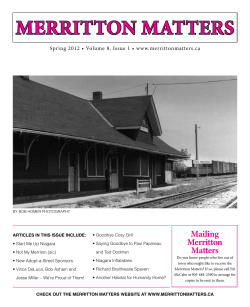


© Copyright 2026