ABC
docz
Explore
Log in
Create new account
Download
Report
No category
Flora and Vegetation of the Macedonian Steppe
You will leave our Big Writing training day with:
Four page A5 Pamphlet (Print version)
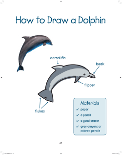
How to Draw a Dolphin Materials dorsal fin beak
3.3 Vegetation / Erosion
Want to learn how to change things in your community?
Figure 2.1 Your results are ultimately a manifestation of your thinking.
Climate Family Climographs & Locations Developed by Joe Naumann
Chapter 7 Lesson 2 Reteach
Preface - Novella
Glossary - Pearsoncmg
© Copyright 2026
About abcdocz
DMCA / GDPR
Report