
X14 Operator`s Manual â Guidance & AutoSteer
X14 Guidance and Auto Steering
Operator Manual
Part Number: AGA5495-EN
Rev Number: 1.0
For use with Software Version 3.17
© Copyright Topcon Precision Agriculture
November 2013
All contents in this manual are copyrighted by Topcon. All rights reserved. The information
contained herein may not be used, accessed, copied, stored, displayed, sold, modified, published or
distributed, or otherwise reproduced without express written consent from Topcon.
www.topconpa.com
Preface
This manual provides information about operating and maintaining this Topcon
Precision Agriculture product. Correct use and servicing is important for safe and
reliable operation of the product.
It is very important that you take the time to read this manual before using the
product.
Information in this manual is current at the time of publication. A system may vary
slightly. The manufacturer reserves the right to redesign and change the system as
necessary without notification.
Terms and Conditions
Please read these Terms and Conditions carefully.
General
APPLICATION - You accept these Terms and Conditions by purchasing the product from
Topcon Precision Agriculture (TPA) or from one of TPA’s product dealers.
COPYRIGHT - All information contained in this manual is the intellectual property of, and
copyrighted material of TPA. All rights are reserved. You may not use, access, copy, store,
display, create derivative works of, sell, modify, publish, distribute, or allow any third parties
access to, any graphics, content, information or data in this manual without TPA’s express
written consent and may only use such information for the care and operation of your product.
The information and data in this manual are a valuable asset of TPA and are developed by the
expenditure of considerable work, time and money, and are the result of original selection,
coordination and arrangement by TPA.
TRADEMARKS – ZYNX, PROSTEER, EAGLE, KEE Technologies, Topcon, Topcon
Positioning Systems and Topcon Precision Agriculture are trademarks or registered trademarks
of the Topcon Group of companies. Microsoft and Windows are trademarks or registered
trademarks in the United States and/or other countries of Microsoft Corporation. Product and
company names mentioned herein may be trademarks of their respective owners.
WEBSITE AND OTHER STATEMENTS - No statement contained at the website of TPA
or any other Topcon Group company or in any other advertisements or TPA literature or made
by an employee or independent contractor of TPA modifies these Terms and Conditions.
IMPORTANT: SAFETY - Improper use of the product can lead to death or injury to persons,
damage to property and/or malfunction of the product. The product should only be repaired by
authorized TPA service centers. You should closely review the safety warnings and directions
as to the proper use of the product in this manual and at all times comply with the same.
Limited Warranty
ELECTRONIC AND MECHANICAL COMPONENTS -TPA warrants that the electronic
components manufactured by TPA shall be free of defects in materials and workmanship for a
period of one year from the original date of shipment to the dealer. TPA warrants that all valves,
hoses, cables and mechanical parts manufactured by TPA shall be free of defects in materials
and workmanship for a period of 90 days from the date of purchase.
i
RETURN AND REPAIR - During the respective warranty periods, any of the above items
found defective may be shipped to TPA for repair. TPA will promptly repair or replace the
defective item at no charge, and ship it back to you. You must pay the shipping and handling
charges in respect of the same. Calibration of components, labor and travel expenses incurred
for in-field removal and replacement of components are not covered in this warranty policy. The
foregoing warranty shall NOT apply to damage or defects resulting from:
(i) disaster, accident or abuse
(ii) normal wear and tear
(iii) improper use and/or maintenance
(iv) unauthorized modifications of the product; and/or
(v) use of the product in combination with other products not supplied or specified by TPA.
Software accompanying any product is licensed for use in connection with the product and not
sold. Use of software that is provided with a separate end user license agreement (“EULA”)
will be subject to the terms and conditions, including those relating to limited warranty, of the
applicable EULA, notwithstanding anything in these Terms and Conditions to the contrary. WARRANTY DISCLAIMER - OTHER THAN FOR THE ABOVE WARRANTIES,
WARRANTIES PROVIDED IN AN APPLICABLE WARRANTY CARD,
APPENDIX OR END USER LICENSE AGREEMENT, THIS MANUAL, THE
PRODUCT AND RELATED SOFTWARE ARE PROVIDE ‘AS-IS’. THERE ARE
NO OTHER WARRANTIES AND TO THE EXTENT ALLOWED BY LAW TPA
EXCLUDES ALL IMPLIED TERMS, CONDITIONS AND WARRANTIES IN
RESPECT OF THE MANUAL AND THE PRODUCT (INCLUDING ANY IMPLIED
WARRANTY OR MERCHANTABILITY OR FITNESS FOR ANY PARTICULAR
USE OR PURPOSE). TPA IS NOT RESPONSIBLE FOR THE OPERATION OF
GNSS SATELLITES AND/OR AVAILABILITY, CONTINUITY, ACCURACY, OR
INTEGRITY OF GNSS SATELLITE SIGNALS.
LIABILITY LIMIT AND INDEMNITY - TPA and its dealers, agents and representatives
shall not be liable for technical or editorial errors or omissions contained herein or for special,
indirect, economic, incidental or consequential damages resulting from the furnishing,
performance or use of this material, the product or its accompanying software (including where
TPA has been advised of the possibility of such damage). Such disclaimed damages include but
are not limited to loss of time, loss or destruction of data, loss of profit, savings or revenue or
loss of or damage to the product. You shall defend, indemnify and hold TPA harmless from and
against any claims, actions, suits, damages, losses, liabilities and costs (including attorneys’ fees)
arising from, or relating to (a) your operation use, or maintenance of the product and/or software
other than as provided for in this manual or the applicable end user license agreement; and (b)
your negligence or wrongful act or omission in respect of the product. In any event, TPA’s liability to you or any other person for any claim, loss or damage (in
contract, tort or on any other basis) will be limited (in TPA’s option) to either (a) the
replacement or repair of the product, or (b) payment of the cost of replacing or repairing the
product.
ii
Other
These Terms and Conditions may be amended, modified, superseded or cancelled, at any time by
TPA. These Terms and Conditions will be governed by, and construed in accordance with:
n the laws of South Australia if the product is sold and supplied to you in Australia (in which
case the courts of South Australia or the Federal Court of Australia (Adelaide Registry) have
exclusive jurisdiction in respect of any claim or dispute) or
n
n
the laws of the State of California if the product is sold and supplied to you outside of Australia
the provisions of the United Nations Convention on Contracts for the International Sale of
Goods shall not apply to these Terms and Conditions.
All information, illustrations, and applications contained herein are based on the latest available
information at the time of publication. TPA reserves the right to make product changes at any time
without notice.
If any part of these Terms and Conditions would be unenforceable, the provision must be read
down to the extent necessary to avoid that result, and if the provision cannot be read down to that
extent, it must be severed without affecting the validity and enforceability of the remainder of these
Terms and Conditions.
Service Information
Service assistance can be provided by contacting your local TPA Authorized Dealer.
Communications Regulation Information
FCC Compliance Statement (USA)
This equipment has been tested and found to comply with the limits for a
Class ‘A’ digital device, pursuant to Part 15 of the FCC Rules. Operation
of this equipment in a residential area is likely to cause harmful
interference in which case the user will be required to correct the
interference at the user's expense.
FCC Compliance Statement (Canada)
This Class A digital apparatus meets all requirements of the Canadian
Interference-Causing Equipment Regulation.
CE EMC Statement (European Community)
Warning: This is a class ‘A’ product. In a domestic environment this
product may cause radio interference in which case the user may be
required to take adequate measures.
‘C’ Tick EMC Statement (Australia & New Zealand)
This product meets the applicable requirements of the Australia and New
Zealand EMC Framework.
Type Approval and Safety Regulations
Type approval may be required in some countries to license the use of transmitters on
certain band frequencies. Check with local authorities and your dealer. Unauthorized
iii
modification of the equipment may void that approval, the warranty and the license
to use the equipment. The receiver contains an internal radio-modem. This can potentially send signals.
Regulations vary between countries, so check with the dealer and local regulators
for information on licensed and unlicensed frequencies. Some may involve
subscriptions.
Radio and Television Interference
This computer equipment generates, uses, and can radiate radio-frequency energy.
If it is not installed and used correctly in strict accordance with TOPCON
Precision Agriculture instructions, it may cause interference with radio
communication.
You can check if interference is being caused by this equipment by turning the
Topcon equipment off to see if the interference stops. If the equipment is causing
interference to a radio or other electronic device, try:
l Turning the radio antenna until the interference stops
l
Moving the equipment to either side of the radio or other electronic device
l
Moving the equipment farther away from the radio or other electronic device
l
Connecting the equipment to another circuit that is not linked to the radio.
To reduce potential interference operate the equipment at the lowest gain level that
will allow successful communication.
If necessary contact your nearest Topcon Precision Agriculture dealer for
assistance.
Changes or modifications to this product not authorized by TOPCON
Precision Agriculture could void the EMC compliance and negate
authority to operate the product.
This product was tested for EMC compliance using Topcon Precision Agriculture
peripheral devices, shielded cables and connectors. It is important to use Topcon
Precision Agriculture devices between system components to reduce the possibility
of interference with other devices
General Safety
DANGER: It is essential that the following information and the
product specific safety information is read and understood.
Most incidents arising during operation, maintenance and repair are caused by a
failure to observe basic safety rules or precautions. Always be alert to potential
hazards and hazardous situations.
iv
Always follow the instructions that accompany a Warning or Caution. The
information these provide aims to minimize risk of injury and/or damage to property.
In particular follow instructions presented as Safety Messages.
Safety Messages and Warnings
The safety symbol is used with the relevant word: DANGER, WARNING or
CAUTION.
Messages marked in this way recommend safety precautions and practices. LEARN
and apply them.
DANGER: Indicates an imminently hazardous situation that, if not
avoided, could result in DEATH OR VERY SERIOUS INJURY.
WARNING: Indicates a potentially hazardous situation that, if not
avoided, could result in DEATH OR SERIOUS INJURY.
CAUTION: Indicates a potentially hazardous situation that, if not
avoided, may result in MINOR INJURY.
Safety Signs
WARNING: DO NOT remove or obscure safety signs. Replace any
safety signs that are not readable or are missing. Replacement signs
are available from your dealer in the event of loss or damage.
If a used vehicle has been purchased, make sure all safety signs are in the correct
location and can be read. Replace any safety signs that cannot be read or are missing.
Replacement safety signs are available from your dealer.
Operator Safety
WARNING: It is YOUR responsibility to read and understand the
safety sections in this book before operating this vehicle. Remember
that YOU are the key to safety.
Good safety practices not only protect you, but also the people around you. Study
this manual as part of your safety program. This safety information only relates to
Topcon equipment and does not replace other usual safe work practices.
WARNING: In some of the illustrations or photos used in this manual,
panels or guards may have been removed for demonstration purposes.
Never operate the vehicle with any panels or guards removed. If the
removal of panels or guards is necessary to make a repair, these
MUST be replaced before operation.
v
WARNING: Always check that any suspended vehicle attachments
are lowered to the ground before beginning repair or maintenance
work on a vehicle.
WARNING: Vehicle and implement parts can become hot during
operation and may be under pressure. Refer to vehicle manuals.
WARNING: Wear appropriate protective clothing for the task
being undertaken and conditions.
WARNING: Do not operate equipment around explosive equipment
or supplies.
WARNING: Topcon is committed to good environmental
performance and minimizes the use of any potentially harmful
substances in its products. However, it is always advisable not to
handle damaged electronic equipment.
This Topcon product may contain a sealed lithium battery.
Always dispose of any electronic equipment thoughtfully and
responsibly.
Exposure to Radio Frequency
Exposure to energy from radio frequencies is an important safety issue. Keep a
distance of at least 20 cm (7.8 inches) between people and any radiating antenna.
Keep a distance of at least 20 cm between transmitting antennas.
WARNING: Products using cellular modem or an RTK base station
can transmit radio frequency energy. Check with your dealer.
This device is designed to operate with TPA approved antennas. Discuss with your
dealer.
Preparation for Operation
l
l
Keep the manual with the equipment.
l
If the equipment is moved to another vehicle, move the manual as well.
l
vi
Read and understand this manual and learn all of the controls before you use
the equipment.
Read the manual for the vehicle with which the equipment will be used and
check that the vehicle has the correct equipment required by local regulations.
l
Make sure you understand the speed, brakes, steering, stability, and load
characteristics of the vehicle before you start.
l
Check all controls in an area clear of people and obstacles before starting work.
l
Identify possible hazards.
WARNING: Topcon equipment must not be used by an operator
affected by alcohol or drugs. Seek medical advice if using prescription
or over-the-counter medication.
Disclaimer
Topcon accepts no responsibility or liability for damages to property, personal
injuries, or death resulting from the misuse or abuse of any of its products.
Further, Topcon accepts no responsibility for the use of Topcon equipment or the
GNSS signal for any purpose other than the intended purpose.
Topcon cannot guarantee the accuracy, integrity, continuity, or availability of the
GNSS signal.
The operator must ensure that the equipment is correctly turned off when not in use.
Before operating any vehicle equipped with Topcon products, read and understand
the following product specific safety precautions.
Important Safety Information
Operator Alertness and Responsibility
The console helps the operator to steer the vehicle, but the operator remains in charge
and must be alert and in complete control of the vehicle at all times. The operator is
ultimately responsible for safe operation of this equipment.
It is essential that safety requirements are met when operating the console and any of
its components. All operators and other relevant personnel must be advised of safety
requirements.
Electrical Safety
WARNING: Incorrectly connected power can cause severe injury and
damage to people or the equipment.
When working with electrical components, you must do the following:
l Make sure the negative terminal of the battery is disconnected before doing any
welding on the vehicle.
l
l
Check that all power cables to system components are connected to the correct
polarity as marked. Please refer to the vehicle manual for safety information.
Check that equipment is grounded in accordance with installation instructions.
vii
Operation and Risk of Obstacles
The following list is not exhaustive or limited. To use the console for assisted
steering along a defined wayline, the operator must ensure that it is used:
l Away from people and obstacles
l
Away from high voltage power lines or other overhead obstructions (identify
any clearance problems before activating the console)
l
On private property without public access
l
Within cleared fields
l
Off public roads or access ways.
Note that:
l The operator needs to know the vehicle’s position and the field conditions at
all times.
l
l
l
l
The operator will need to respond if the GNSS satellite or differential
correction signal is lost momentarily.
The console cannot detect obstacles (people, livestock or other).
Only use the console in areas that are clear of obstacles and keep a proper
distance.
Steering needs to be disengaged for manual control if an obstacle appears in
the path or the vehicle moves away from the wayline.
On/Off and Manual Control
WARNING: Ensure the steering switch is Off to prevent
unintentional engagement of the assisted steering. When repairing
or maintaining the vehicle/implement, ensure the vehicle CANNOT
be moved. Disengage steering, apply brakes and remove keys.
The operator must ensure that the steering switch is Off (all LED indicators are
off) when assisted steering is not being used.
The operator must disengage assisted steering and use manual control if an
obstacle is in the line of travel or moves into the line of travel, or if the vehicle
steers away from the desired wayline.
To disengage assisted steering:
l Turn the steering wheel a few degrees OR
l
l
viii
Select the Disengage Auto Steering button on the console AND/OR
If using an external steering switch, disengage using the switch if the above
actions do not disengage assisted steering.
Vehicle Shut Down Safety
Before leaving the vehicle, disengage assisted steering, disengage external steering
switch if this is being used, and remove the key from the key switch.
Using a Reference (Base) Station
WARNING: Do not move a reference station while in operation.
Moving an operating reference station can interfere with the
controlled steering of a system using the reference station. This could
result in personal injury or damage to property.
Operators and other affected personnel must be advised of the following safety
precautions.
l Do not erect the reference station under or within the vicinity of high voltage
power lines.
l
When using the portable reference station, make sure that the tripod is securely
mounted.
To Get the Best Out of the Product
Back up data regularly. The console has large, but limited storage capacity. Use the
Diagnostics Mini-view to view capacity available. A warning screen displays if
storage is reaching its limit.
Be aware of file format compatibility. Discuss compatible formats with the dealer.
Topcon Agricultural Products are hardy and designed to work in tough conditions.
However, if equipment is unused for a length of time, store away from water and
direct heat sources.
Alert Symbols
In this manual two alert symbols are used:
This offers additional information.
WARNING: A warning signal appears on safety signs and in this
manual to show that this information is very important to your safety.
LEARN these and APPLY them.
ix
Table of contents
Chapter 1 – Console Overview
1.1. Introduction
1.2. Starting the console
1.3. Shutting down the console
1.4. Using the console toolbar
Chapter 2 – User Interface Description
2.1. Switching between setup and operation screen
2.2. Setup screen controls
2.3. Operation screen controls
2.3.1. Implement color indicators
2.4. Icon descriptions
2.4.1. Guidance toolbar
2.4.2. Menu icons
2.4.3. Navigation window icons
2.4.4. View controls
2.4.5. Other icons
Chapter 3 – Quick Setup Guide
3.1. Software update instructions
3.2. Getting started
Chapter 4 – Regional and User Settings
4.1. Setting the region
4.1.1. Language setup
4.1.2. Time/date setup
4.1.3. Units setup
4.2. Setting up the lightbar
4.3. Setting up environment
4.4. Setting up map options
4.5. Setting access level
Chapter 5 – System Setup
5.1. Setting features
5.1.1. Console setup
5.1.2. Guidance setup
5.1.3. Implement setup
x
1
1
1
2
3
5
5
5
8
9
9
9
9
11
12
12
13
13
13
15
15
15
16
17
17
18
19
21
23
23
23
24
24
5.2. Setting up GPS
5.2.1. Receiver setup
5.2.2. Correction setup
5.3. Setting up alarms
5.3.1. Alarm window description
5.3.2. Alarms list
5.4. Setting up flag points
Chapter 6 – Vehicle Setup
6.1. Selecting a vehicle
6.2. Creating a new vehicle
6.2.1. Customizing a vehicle
6.3. Setting the vehicle geometry
6.4. Setting up the steering controller
6.5. Selecting the vehicle antenna
Chapter 7 – Implement Setup
7.1. Selecting an implement
7.2. Setting up a new implement
7.3. Setting the implement geometry
7.4. Setting up section control
7.4.1. Setting timing
7.4.2. Setting up the section switch
7.5. Setting up the master switch
Chapter 8 – Operation Basics
8.1. Using the window toolbar
8.2. Using the navigation window
8.3. Viewing guidance
8.3.1. Using view controls
8.4. Viewing GPS information
8.5. Viewing system diagnostics
8.6. Monitoring on the dashboard
8.6.1. Customizing the dashboard
8.7. Storing information about jobs
8.8. Recognizing color and working status
8.9. Understanding default file names
24
24
27
30
30
31
33
35
35
36
37
37
38
40
41
42
42
43
44
44
45
45
47
47
47
48
48
51
52
53
53
55
55
55
xi
Chapter 9 – Steering Calibrations
9.1. Calibrating the compass
9.2. Calibrating the wheel angle sensor
9.3. Calibrating the mounting bias
9.4. Dealing with calibration errors/alarms
Chapter 10 – Field Menu
10.1. Creating a client / farm / field
10.2. Selecting a client / farm / field
10.3. Setting a new boundary
10.3.1. Creating a boundary from a shapefile
10.3.2. Removing a boundary
10.4. Setting flag points
10.4.1. Removing or changing a flag point
10.5. Setting exclusion zones
10.5.1. Clearing an exclusion zone
Chapter 11 – Job Menu
11.1. Creating a new job
11.2. Selecting an existing job
11.3. Recording a job
11.4. Exporting a job report
11.5. Clearing a job
Chapter 12 – Guideline Menu
12.1. Using straight lines guidelines
12.1.1. Setting AB lines manually
12.2. Using identical curve guidelines
12.3. Using center pivot guidelines
12.4. Using guidelock guidance mode
12.5. Selecting an existing guideline
Chapter 13 – Auto Steering
13.1. Auto steer status
13.1.1. Auto steer troubleshooting
13.2. Tuning auto steer
13.3. Engaging auto steer
13.4. Disengaging auto steer
xii
57
57
59
60
64
67
67
68
68
69
70
71
71
72
73
75
75
75
76
77
77
79
79
80
80
81
82
82
83
83
84
86
88
90
Chapter 14 – Nudge Menu
14.1. Using nudge options
14.2. Compensating for GPS drift
14.2.1. Compensating correctly for GPS drift
14.2.2. High accuracy correction sources
Chapter 15 – Inventory Manager
15.1. Using the manager toolbar
15.2. Using item manager
Chapter 16 – Troubleshooting Guide
16.1. Common error messages
Chapter 17 – Appendices
17.1. Appendix A – Glossary
17.2. Appendix B – Technical Information
91
91
91
92
93
95
95
96
97
97
103
103
107
xiii
xiv
Chapter 1 – Console Overview
1.1. Introduction
The X14 is a vehicle-mounted electronic console with LCD display
and touchscreen. The console allows operators to work with auto
steering, guidance and other control functions from the console. The
console is designed to interact with GPS and Electronic Control Units
(ECUs), centralizing the ability to communicate, record, store and
display data for agricultural uses.
Before using guidance and auto steering, please read the safety
instructions and learn about the controls by reading this
manual carefully.
The console is a touchscreen. To select something on the screen,
touch the area with the tip of a finger, fingernail or stylus (not
supplied).
1.2. Starting the console
1. Connect the console to a power supply. Ensure associated devices
(such as GPS (Global Positioning System)) are connected. The
console starts automatically and the warning screen displays.
2. Scroll to the base of the warning screen and select YES.
Note: To change the language on the console, select
.
3. Use the scroll bar, or slide a finger down the list, to see more
languages. Confirm the selection
.
1
1.3. Shutting down the console
The warning screen displays in the chosen language.
4. Use the scroll bar to display the complete warning screen and if
you agree select YES.
Selecting Yes confirms your understanding and accepts your
responsibility for liabilities described in the warning screen.
The console may display the following warning.
5. To acknowledge the alarm, press the center of the alarm window.
Note that extra details may be displayed for some alarms by
dragging the window downwards.
6. Confirm the GPS receiver is connected correctly and
communicating.
If the warning appears again, this should be remedied during
setup by referring to Setting up GPS, page 24.
1.3. Shutting down the console
To shut down the console, swipe up from the base of the screen to
display the console toolbar and select the off icon. The system will
ask if you want to power down. Select Yes to turn off or No to
continue working.
Alternatively, turn off the tractor.
2
Chapter 1 – Console Overview
1.4. Using the console toolbar
The console toolbar is displayed by swiping upwards from the base of
the screen.
Power off button
The power off button may be used to shut down the console.
Help
The Help hint feature displays the names of the user interface elements
on the screen.
Touch the Help icon on the base of the screen. Question marks
appear on the screen next to the icons. Select the screen element
showing a question mark to view the names.
USB eject
The USB port is on the harness. This can be used to import data to and
export data from the console.
Before removing the USB, always disconnect first by touching
the USB eject icon. A message will display that it is safe to
remove the USB.
3
1.4. Using the console toolbar
Screenshots
Use the screenshot icon to take screenshots (which are stored
on the USB). Press the USB eject icon before unplugging the
USB.
Brightness control
Brightness control adjusts the brightness of the display.
Use plus or minus to adjust display.
Day/night mode
Day/night mode changes the brightness of the display.
Settings are Day, Night and Auto. Auto light mode will set
the mode automatically, depending on light conditions.
4
Chapter 2 – User Interface Description
2.1. Switching between setup and operation
screen
The console has two main screens; the Operation screen and the Setup
screen.
Use the highlighted buttons to switch between the screens.
2.2. Setup screen controls
This section describes the Setup screen controls.
The Setup screen has the following types of controls:
Menus
Menu items are selected from the base of the screen to display the
next level of sub-options. When features are enabled, more items may
appear in the menus.
5
2.2. Setup screen controls
Option lists
Selecting menu items will typically display a list of options at the top
of the screen. As features are enabled, more options may appear.
Selection lists
Selection lists are used to choose one or more items from a list. A
message is displayed if too many items are selected in a multiple
choice list. Selections must be confirmed using the tick button.
Cancel and confirm buttons
These buttons are used to cancel or confirm an entry or a selection.
One of the buttons must be selected to progress from any screen
displaying them.
6
Chapter 2 – User Interface Description
Keyboard and number-pad
Letter and number keypads are used to enter alphanumeric characters or
numeric characters. Entries must be confirmed.
Wizards
Wizards are used to guide the operator through a complex
configuration of the system by answering a series of questions. The
answers provided determine which questions will follow.
7
2.3. Operation screen controls
2.3. Operation screen controls
1 Lightbar: Used for manual guidance to the set waylines
(guidelines). Refer to Setting up the lightbar, page 17.
2 View controls: Allows the user to control what is displayed on
the guidance map and how it displays. Refer to Using view
controls, page 48.
3 Dashboard: Provides selected information from the system for
monitoring. Refer to Monitoring on the dashboard, page 53.
4 Navigation window: Displays a list of selectable views
(information screens), the setup screen and the inventory
manager. Refer to Using the navigation window, page 47.
5 Window toolbar: Provides access to tools used to control
guidance.
6 Master switch: Turns product application on and off if ‘virtual
master switch’ has been enabled during implement setup. Refer
to Setting up the master switch, page 45.
7 Auto steer engage: Turns auto steer on and off.
8
Chapter 2 – User Interface Description
2.3.1. Implement color indicators
This indicates the position and direction of the vehicle and its
implement. The implement color indicates product application status:
Red: Section is off.
Blue: Section is inhibited (on and not flowing, typically due to low
speed or pressure).
Yellow: Section is on and not flowing intentionally (typically due
to auto-section control stopping the flow).
Green: Section is on and flowing.
Orange: Section is on and not flowing unintentionally or OFF but
still flowing unintentionally (typically due to a delay in the time it
takes for the flow to start up).
l
l
l
l
l
2.4. Icon descriptions
2.4.1. Guidance toolbar
Icon
Description
Page
Icon
Description
Page
Field menu
67
Job menu
75
Guideline menu
79
Steering options menu 83
Nudge menu
91
2.4.2. Menu icons
Field menu
Icon
Description
Page
Icon
Description
Page
Field menu
67
Boundary recording
offset
68
Select field
67
Create boundary from
shapefile
69
9
2.4. Icon descriptions
Icon
Description
Page
Icon
Description
Page
New field
67
Clear field boundary
70
Place flag point
71
Record field boundary 68
Select exclusion map
72
Complete field
boundary recording
68
Job menu
Icon
Description
Page
Icon
Description
Page
Job menu
75
Record job details
76
Select job
75
Data exchange
77
Create new job
75
Clear job data
77
Guideline menu
Icon
Description
Page
Icon
Description
Page
Guideline menu
79
Change guidance mode 79
Select guideline
82
Open manual AB line
entry window
80
Create new AB line
79
Set A point
80
Steering options menu
Icon
Description
Page
Steering options menu 83
10
Icon
Description
Auto steer status
Page
83
Chapter 2 – User Interface Description
Icon
Description
Auto steer calibration
Page
Icon
57
Description
Auto steer tuning
parameters
Page
86
Nudge menu
Icon
Description
Page
Icon
Description
Page
Nudge menu
91
Nudge guideline to the 91
vehicle’s position
Open nudge options
91
GPS drift
compensation
Nudge guideline to the 91
right
91
Save nudged guideline 91
Nudge guideline to the 91
left
2.4.3. Navigation window icons
Icon
Description
Page
Icon
Description
Page
System information
47
System diagnostics
52
Guidance
48
Job information
47
GPS information
51
Setup screen
5
Inventory manager
95
Switch box
45
Auto section control
24
11
2.4. Icon descriptions
2.4.4. View controls
Icon
Description
Page
Icon
Description
Page
Select visible map
layers
49
Zoom out
51
Toggle map view
mode
50
Zoom in
51
Re-center/pan
19
2.4.5. Other icons
Icon
Description
Master switch
12
Page
45
Icon
Description
Auto steer engage
Page
83
Chapter 3 – Quick Setup Guide
This chapter provides a quick overview to installing software onto the
console, setting up the basics and operating the console.
WARNING: It is not recommended to operate the
console for the first time without reading the complete
manual to become familiar with all safety and
operational issues.
3.1. Software update instructions
Note that this procedure should not be necessary when receiving a new console. It is only necessary if a software upgrade is
required.
1. Insert the USB containing the upgraded software.
2. Go to the Setup screen and select System / Features / Console.
3. Select CONSOLE SOFTWARE UPGRADE.
Selecting this option displays a message that the console will
restart.
4. Confirm the message. The console will restart and load the
upgraded software.
The console will provide the option to restore all user data to the
state it was before the upgrade. WARNING: Selecting No will
delete all data saved on the console.
3.2. Getting started
To configure the system:
1. Connect a GPS receiver to the console.
2. Go to the Setup screen.
3. Select System / GPS and select:
The GPS receiver that is being used (see page 24).
The Correction Source required (see page 27).
l
l
13
3.2. Getting started
4. Once the system receives GPS for the first time, it will prompt for
configuration of the local time. Accept the current time or modify
it to your local time.
5. Select Vehicle / New and create a new vehicle profile by selecting
the appropriate model from the factory profile. Check and if
needed modify the geometry of the vehicle (see page 36).
6. Select Implement / New and create a new implement profile by
selecting the appropriate implement type. Check and if needed
modify the geometry of the implement (see page 42).
7. Go to the Operation screen.
8. Go to Select Field and create new Client, Farm and Field (see
page 67).
9. Go to New Job and create a new job (see page 75). The system is
now operational.
10. To enable Auto Steering, go to Setup screen, System / Features /
Guidance / AUTO STEER (see page 83).
11. To enable Auto Section Control, go to Setup screen and:
Create or load an implement with ECU Type set to ASC-10.
In Implement / Section Control / Sections configure the
number of sections and their width (see page 44).
If required, change the section timing in Implement / Section
Control / Timing (see page 44).
If required, configure a physical or virtual switchbox in
Implement / Section Control / Section Switch (see page 45).
Enable the Auto Section Control feature in System / Features /
Implement / AUTO SECTION CONTROL (see page 24).
12. To control any of the enabled features from the Operation screen,
use the buttons on the Navigation window (see page 47).
l
l
l
l
l
14
Chapter 4 – Regional and User Settings
To access the Setup screen, select the following icons:
On the Setup screen, the User menu option provides the following
menu items:
Region: Selects the language, time/date and units.
Lightbar: Sets operation of the LED bar for guidance use.
Environment: Sets up console interaction.
Map: Sets how maps work on the Operation screen.
Access Level: Selects access level for technical staff (not for
operator use).
l
l
l
l
l
4.1. Setting the region
4.1.1. Language setup
The language displayed on the console may be changed if required
and decimal separators may be represented by a period or a comma.
To set the language or decimal point format:
1. Select User / Region / Language.
The following options are available:
15
4.1. Setting the region
Language
There is a choice of languages available.
Use the scroll bar, or slide a finger down the list, to see more
languages. Confirm the selection. The console will restart.
The language may also be changed on the warning screen at
startup by selecting
.
Decimal point format
A decimal point may be represented by a period (.) or a comma (,).
4.1.2. Time/date setup
The time and date information is used on the console for job start and
end dates, as shown on job reports and is also used for creating time
stamps for files. The current date is supplied from the GPS signal.
Note that both time and date will not work if there is no GPS
signal.
To set time and date information:
1. Select User / Region / Time/Date.
The following options are available:
Date format
Day of the month first (12 August 2013)
Month first (August 12 2013)
l
l
Time format
Twelve hour time (2:30pm)
Twenty four hour time (14:30)
l
l
Set current time
Current time (does not change automatically for daylight saving).
Note that -/+ will change time incrementally.
16
Chapter 4 – Regional and User Settings
4.1.3. Units setup
The units options sets the displayed units of measurement (metric or
imperial), area and the latitude/longitude format.
To set unit information:
1. Select User / Region / Units.
The following options are available:
Units
Metric
Imperial (US)
Imperial (UK)
l
l
l
The United States (US) and United Kingdom (UK) imperial options are
provided because gallons, fluid ounces and bushels have different
measurements in the US and the UK.
Note that changing this setting will not override the selection of
individual units (Pressure, Area etc.) that have been changed.
Latitude/longitude format
Standard (decimal degrees: 45.54)
DMS (Degrees, Minutes, Seconds: 45o, 23’ 36”)
l
l
Area units
ha (hectare)
ac (acre)
Default (ha)
l
l
l
4.2. Setting up the lightbar
During operations, the virtual lightbar on the top of the screen can
show how far the vehicle is deviating from the set guideline.
To set up the lightbar:
1. Select User / Lightbar.
The following options are available:
17
4.3. Setting up environment
Light bar
Enabled or disabled.
LED spacing
Sets the ground distance from the wayline (guideline) that each LED
represents.
If the LED spacing is set to 10 cm (0.1 m), the following behavior is
observed:
The center LED is blue and will be illuminated all the time
(unless the cross track error is 100 cm or more). When on the
wayline by less than 10 cm (+ or -) that is the only LED that is
illuminated.
Once you reach a cross track error of 10 cm, the next LED (green)
will also illuminate.
At 20 cm another green LED illuminates.
Yellow LEDs illuminate at 30, 40, 50 cm.
Red LEDs illuminate at 60, 70, 80 and 90 cm.
Once the cross track reaches 100 cm or more, all LEDs turn off
except for one red LED on the far side of the console.
l
l
l
l
l
l
LED mode
Drive away: Activates the LEDs on the side of the vehicle
veering away from the guideline. Drive away from the lit LEDs to
move back to the guideline.
Drive towards: Activates the LEDs on the side of the vehicle
veering towards the guideline. Drive toward the lit LEDs to move
back to the guideline.
l
l
4.3. Setting up environment
Sets up console interactions.
1. Select User / Environment.
The following options are available:
Audio volume
Sets the volume of console sounds.
18
Chapter 4 – Regional and User Settings
Alarm audio
Enables sounds when an alarm is triggered.
System 150 file transfers
Enables the following System 150 (GX-45) files to be imported and
exported: AB lines, Pivots, Curves, Optimal lines, Project lines and
Field boundaries.
System 150 file transfers allow the operator to export files in a format
that matches Topcon’s System 110/150 system and import files that
were exported from System 110/150.
Enabling this option displays the System 150 icon
the Inventory Manager
Manager, page 95).
at the base of
on the Operation screen (refer to Inventory
Automatic steering status window
Displays a Steering Status window when the Auto Steer Engage button
is selected on the Operation screen if the steering is unable to
engage. The Steering Status window displays issues that may be
preventing the steering from engaging.
The Steering Status window may still be displayed via the
Steering Options Menu / Auto Steer Status (see page 83) if this
setting is disabled.
Toolbar button size
Changes the size of the buttons on the Operation screen.
4.4. Setting up map options
Sets how maps work on the Operation screen.
To set up the maps:
1. Select User / Map.
The following options are available:
Point of focus
Vehicle: Places the vehicle at the center of the screen.
l
19
4.4. Setting up map options
l
Implement: Places the implement at the center of the screen.
Map panning
Allows the screen to move around in a map when the user slides a
finger across the screen.
Enabling this option places the map panning icon
beside the
Toggle Map View and Map Layers at the top of the Operation screen.
Touching this icon re-centers a panned map to the current location of
the vehicle.
Highlight loaded coverage
After loading an existing job, shows previously completed and loaded
coverage in a different color from the newly created coverage.
Previously covered areas are shaded yellow if this has been
enabled and past job information has been recorded.
New coverage is shaded green. If this option is not enabled,
both the previous coverage (from the loaded job) and the
newly recorded coverage are shown in the same green
colour.
Pause boundary recording with master
If the master switch is turned off while a boundary is being recorded,
the boundary recording is paused. Turning the master switch back on
resumes the boundary recording.
This may be useful to automatically pause boundary recording if
product application is paused to maneuver in a tight corner or deviate
around an object.
Note that boundary recording may still be manually paused (refer to
Setting a new boundary, page 68).
Visual reference line length
Provides a display marker in front of the vehicle icon to help
accurately acquire the wayline after a turn when using manual
guidance.
20
Chapter 4 – Regional and User Settings
4.5. Setting access level
Setting the access level is a restricted activity and Operator is the only
available option for all operators and owners.
To view the access level:
1. Select User / Access Level.
Other levels of access are only used by qualified and fully trained
technical and support staff. DO NOT ATTEMPT TO CHANGE THE
ACCESS LEVEL.
21
4.5. Setting access level
22
Chapter 5 – System Setup
To access the Setup screen, select the following icons:
This chapter explains how to set up system elements such as GPS
connections, alarms and optional features.
The System menu option provides the following menu items:
Features: Enables or disables optional features.
GPS: Sets up the functionality of the connected GPS receiver.
Alarms: Sets alarm functionality.
Flag Points: Selects icons and labels for flag points. Flag points
show obstacles or other land features on a guidance map.
l
l
l
l
5.1. Setting features
The Features menu option provides the following menu items:
5.1.1. Console setup
Upgrade console software.
1. Select System / Features / Console.
Console software upgrade
This option is used if the console software is being upgraded via a
USB.
23
5.2. Setting up GPS
Insert the USB containing the upgraded software. Selecting this
option displays a message that the console will restart. Confirm the
message. The console will restart and load the upgraded software.
The console will provide the option to restore all user data to the state
it was before the upgrade. Note: Selecting No will delete all data
saved on the console.
5.1.2. Guidance setup
Sets the guidance system functionality.
To set up guidance features:
1. Select System / Features / Guidance.
Guidance
This is a standard feature of the console and cannot be disabled.
Auto steer
Enables auto steering and can only be used on vehicles fitted with an
auto steering system such as the AES-25.
5.1.3. Implement setup
Sets up the functionality for the attached implement.
To set up implement functionality:
1. Select System / Features / Implement.
Auto section control
Permits the system to turn sections on for new areas to be covered
and off for areas that have already been covered.
5.2. Setting up GPS
5.2.1. Receiver setup
Sets up GPS receiver capabilities.
To set up the GPS receiver:
1. Select System / GPS / Receiver.
GPS receiver
Select the GPS receiver type from the selection list.
24
Chapter 5 – System Setup
The console can accept GPS input from a third party GPS receiver
provided the receiver can be configured to output the data in the
required correct format. Please consult the GPS receiver manufacturer to
find out if your receiver can be set up in the correct way.
The console requires the following input if Other is selected under
GPS RECEIVER:
GGA 0.2 seconds (5Hz)
VTG 0.2 sec (5Hz)
ZDA 15 seconds
RS-232 communications
19200 baud rate (preferred) 8 data bits, No Parity, 1 Stop bit
(19200, 8N1)
l
l
l
l
Firmware upgrade
Initiates a GPS receiver firmware upgrade via USB (if required) or via
the package that comes bundled internally with the console software.
The Firmware Upgrade button shows the version of the firmware that is
currently in the GPS receiver and the version of the firmware to which
it will be upgraded.
Use ignition line
(AGI-4 only) Separates the power supply to the AGI-4 receiver from
the vehicle ignition. This enables the GPS receiver to remain powered
after the vehicle is turned off. The Keep Alive Time determines how
long the receiver remains powered.
Keep Alive Time
(AGI-4 only) Keeps the GPS receiver active after the system has been
shut down. This is useful to retain accurate positioning information
(satellite convergence). For example: To keep the receiver on for 1 hour
after the system is shut down, enter 60.
This feature is only available if Use Ignition Line is set to
Enabled, and if the vehicle wiring and harnessing is compatible.
25
5.2. Setting up GPS
Load OAF File
Loads an Options Authorization File to the GPS receiver. This is
normally done prior to receiver installation, but the file can be
updated in the field via USB (if required).
Baud Rate
The data transmission rate for modems. GPS receiver baud rate can be
changed from the default value. This setting should not normally be
altered. If the setting does need to be changed, refer to the manual
supplied with the modem.
26
Chapter 5 – System Setup
5.2.2. Correction setup
GPS correction sources are used to increase the accuracy of the GPS
position.
To set up the GPS correction source:
1. Select System / GPS / Correction.
2. Select the required CORRECTION SOURCE.
The available correction sources are defined below. The extra
options that must be defined vary depending on the correction
source selected, refer to Correction source options, page 28.
Correction sources
Correction
Source
Description
Autonomous Let the receiver find any free available satellites. Will
not use any correction. Precision: 2 - 5 m.
Automatic
Let the receiver select the best available correction
source.
WAAS
Use Wide Area Augmentation System. North America
only. Precision: sub-meter.
EGNOS
Use the European Geostationary Navigation Overlay
Service. Europe only.
Precision: sub-meter.
MSAS
Use Multi-functional Satellite Augmentation System.
East Asia only. Precision: sub-meter.
OmniSTAR
VBS
Use OmniSTAR Virtual Base Station (VBS) correction.
Precision: sub-meter.
OmniSTAR
XP
Use OmniSTAR XP correction.
Precision: sub ½ meter.
OmniSTAR
HP
Use OmniSTAR HP correction.
Precision: 10 cm
27
5.2. Setting up GPS
Correction
Source
Description
OmniSTAR
G2
Uses OmniSTAR correction with both GPS and
GLONASS satellites. Precision: 10 cm
RTK
Use Real Time Kinematic navigation. Precision: 2 cm.
RTK
(External
Modem)
Use external modem connected to GPS receiver for
RTK corrections. Precision: 2 cm.
RTK
(NTRIP)
Use a cellular delivered RTK correction source from a
network provider.
Precision: 2 cm.
DGPS
(External
Modem)
Use an external modem to import DGPS corrections
from a network provider. Precision: sub-meter.
DGPS
(NTRIP)
Use a cellular delivered DGPS correction source from a
network provider.
Precision: sub-meter.
Note that the source selected here will affect the functioning of
guidance and auto steering. It is important to be aware of the
needs of the GPS equipment. Refer to the manual supplied
with the GPS equipment.
Precision figures depend on many variables (number of
satellites, distance from the correction source, ionospheric
conditions, receiver, antenna) and cannot be guaranteed.
Correction source options
The correction source options that must be defined vary
depending on the correction source selected.
28
Chapter 5 – System Setup
Option
Description
GLONASS Allows the GPS receiver to use the Russian satellite
navigation system GLONASS, in addition to GPS.
TRUPASS Topcon’s autonomous GPS drift compensation algorithm,
used to provide better pass to pass performance.
Note: This option must be purchased separately.
RTK
Protocol
Communication protocol for data transfer between the
RTK base station and the rover (tractor). Must be set to
same protocol as base station. Refer to base station setup
information.
Region
The Region must be selected to determine the frequency
used by OmniSTAR. The frequency for the region is set
automatically.
Frequency The frequency used by OmniSTAR. Selecting the Region
sets the frequency automatically. This should not normally
be altered.
Omni over Delivers the OmniSTAR correction signal via IP (cellular)
IP
rather than satellite.
Fallback
If the system is not receiving enough data to compute the
vehicle’s position with the required accuracy, auto steering
cannot be engaged. The fallback feature allows the system
to reduce the position accuracy requirement so that auto
steering can be engaged. This is useful in situations where
a high degree of position accuracy is not required.
Baud Rate The data transmission rate for modems. Refer to
documentation supplied with modem.
GGA
Output
Some network providers require a GGA (position) to be
sent to them to allow them to identify the location of the
rover (tractor).
29
5.3. Setting up alarms
NTRIP setup options
If RTK or DGPS NTRIP is selected, a wizard launches to detect the
attached modem.
The GSM and CELL ROAMING settings can be obtained from your
cellular network provider. The remaining settings are provided by
your NTRIP service provider.
5.3. Setting up alarms
If no implements have been set up in the system, only General alarms
are available to set up.
To set up general alarms:
1. Select System / Alarms / General.
The list of general alarms is displayed. All general alarms may be
enabled or disabled by selecting All General Alarms.
Alternatively, each general alarm may be enabled or disabled
independently.
The End of Row alarm requires extra information. This alarm sounds
and displays when the vehicle is approaching the boundary and the
operator should slow down to prepare for manual control.
First Distance: Distance from the boundary at which the alarm
will first trigger. Distance is measured from the tractor to the
boundary along the wayline (guideline).
Second Distance: Distance from the boundary at which the
second alarm will trigger, warning the operator to immediately
take control of the vehicle.
l
l
5.3.1. Alarm window description
To acknowledge an alarm, press the center of the alarm window.
The alarm window may be dragged down to display additional details
about the alarm if Drag down for details is displayed at the top of
the alarm window.
The speaker icon may be used to mute the alarm.
30
Chapter 5 – System Setup
The spanner icon displays the appropriate alarm setup page to configure
that alarm (or disable it if it’s not relevant to your current setup). There
are a few exceptions to this behavior:
The GPS Receiver Firmware Mismatch spanner displays the setup
screen to upgrade your GPS receiver firmware.
The No GPS Time alarm displays the time/date setup screen to enter
the correct local time.
l
l
5.3.2. Alarms list
This is a list of all the alarms on the console and their descriptions.
Alarm
Description
COM port fail
This is triggered if the specified COM port cannot be
opened.
End of row
This is triggered when the vehicle is approaching the
boundary and the operator should soon take control.
Fallback
Triggered when the selected GPS correction source is
not available and the system must use a less accurate
correction source temporarily.
GPS drift
correction
This is triggered on startup as an informational
reminder that the GPS drift correct has been applied.
Since GPS drift varies with time this is a reminder
that GPS drift compensation may need to be
recalculated.
GPS lost
Triggered when the GPS signal is lost but the receiver
is still connected.
GPS receiver
firmware
mismatch
Select the spanner to display the screen required to
update the applicable firmware.
31
5.3. Setting up alarms
Alarm
Description
Invalid/obsolete Triggered when an old implement or vehicle profile
profile loaded is active on the system. This can occur if upgrading
from a very old version of the software to the latest
version.
Low resources
Triggered when the system resources (memory or
space on the file system) are more than 90% full.
Max guideline Triggered when the length of the recorded line
length exceeded exceeds the maximum number of points (typically
several kilometres, but will vary based on how
complex the curve is).
No GPS
This is triggered if the GPS connection is lost.
No GPS time
Triggered if the GPS receiver is not configured to
send time messages (ZDA NMEA messages).
Parameters
mismatch
Vehicle geometry parameters do not match the
geometry configuration in the steering system. Reselect the vehicle on the Setup screen or ensure the
vehicle geometry in the vehicle geometry screen is
correct.
Path too far
away
Triggered if the active guideline (AB line, curve or
pivot) is too far away from the current GPS position.
Project line too Triggered if the active set of project lines is too far
far
away from the current GPS position.
32
Receiver
disconnected
The GPS receiver is not responding. Check the
receiver connections.
Resources
exhausted
Triggered if the system resources (memory or space
on the file system) are more than 97% full.
Chapter 5 – System Setup
Alarm
Description
Reverse station Informational alarm triggered when the operator’s
seat is rotated by 180 degrees (only applicable for
tractors with dual driving stations).
Steering
disengage
(visual)
This is triggered when the steering has been
disengaged. This may be due to losing satellites,
losing the guideline or manually turning the steering
wheel.
Steering engage The Steering Engage/Disengage alarms cannot be
(visual)
silenced for safety reasons, however, the visual
component of the alarm can be suppressed if desired.
Steering profile The parameters in the selected vehicle profile do not
mismatch
match the vehicle configuration in the steering
subsystem. Select the correct vehicle profile for this
vehicle.
Steering restart Triggered if the steering subsystem needs to be power
needed
cycled. Occurs for some types of steering subsystem
after calibration.
Steering unable The steering status popup which appears when
to engage
steering cannot be engaged as requested can be
suppressed. If the engage button is pressed this auto
clearing alarm is shown to indicate the requested
could not be completed.
5.4. Setting up flag points
Flag points show obstacles or other land features for a field on the
Operation screen. Flag points are set during operation by driving to the
flag point location. Refer to Setting flag points, page 71.
Flag point symbols and names can be defined in the Setup screen.
To change flag point preset symbols and names:
1. Select System / Flag Points.
33
5.4. Setting up flag points
2. Select the flag having its symbol or name changed.
3. Select the new symbol or select FLAG POINT NAME and type
in the new name for the flag, then confirm.
Note that flags can be changed but new preset flags cannot be
created.
34
Chapter 6 – Vehicle Setup
To access the Setup screen, select the following icons:
This chapter explains how to set up and access profile information
about the vehicle on which the console is mounted. If the console is
to be used on more than one vehicle then more than one vehicle
profile must be set.
The Vehicle menu option provides the following menu items:
Select: Select a vehicle from the previously created profiles.
New: Create a new vehicle profile.
Note that Select and New are the only options available on this
menu if no vehicles have been setup.
Geometry: Sets the vehicle measurements so that guidance can
work accurately.
Steering: Controls how the vehicle will respond to guidance.
Antenna: Sets whether the GPS receiver has an internal or
external antenna.
l
l
l
l
l
6.1. Selecting a vehicle
Selects a vehicle from a previously defined list of vehicle profiles.
This is blank when the console is first used.
35
6.2. Creating a new vehicle
To select a vehicle:
1. Select Vehicle / Select.
2. Highlight the required vehicle and confirm, or:
Select to import a vehicle profile from a USB.
6.2. Creating a new vehicle
Creates a new vehicle profile for the vehicle on which the console is
mounted.
To create a new vehicle profile:
1. Select Vehicle / New.
A list of pre-defined factory vehicle templates displays.
Templates contain standard measurements and steering parameter
information where this is available.
Measurements can be adjusted to correct for the particular vehicle, tire
size and so on when geometry is confirmed in the following section.
Steering parameters control how the vehicle will respond to guidance
and these can be fine-tuned later in the process in Auto Steering, page
83. If steering continues to be unsatisfactory once setup is complete
and after tuning the auto steering, contact your dealer.
2. Select the vehicle make. Use the scroll bar to see the complete list.
If the required make is not available, select one that is most like
the vehicle being used. If none of the choices are appropriate,
select Other and go to Customizing a vehicle, page 37.
Select
to go up one level to the parent folder.
3. Select the vehicle model and confirm.
4. To change the name, select VEHICLE NAME, enter the name
and confirm.
5. Confirm the new vehicle. The Vehicle Geometry screen displays.
6. Go to Setting the vehicle geometry, page 37.
36
Chapter 6 – Vehicle Setup
6.2.1. Customizing a vehicle
When Other is chosen from the Vehicle Template screen, generic
vehicle templates are displayed that hold basic vehicle information and
steering parameters.
1. Select Other. A list of steering controllers displays:
AES-25: Accurate Electric Steering
AF: AutoFarm® valve block
RST: Raven SmarTrax™ valve
Topcon S4: Prosteer series 4 steering valve
Other: Any other steering controller
2. Select from the list and confirm. A range of generic vehicle
templates displays.
3. Use the arrows to select the template shape most like your vehicle
and confirm.
4. To change the name, select VEHICLE NAME, enter the name and
confirm.
5. Confirm the new vehicle. The Vehicle Geometry screen displays.
6. Go to Setting the vehicle geometry, page 37.
l
l
l
l
l
6.3. Setting the vehicle geometry
Sets the vehicle measurements so that guidance can work accurately.
Measure the vehicle dimensions as accurately as possible. The
recommended tolerance is +/- 5 cm.
To set the vehicle geometry:
1. Select Vehicle / Geometry. Alternatively, the Vehicle Geometry
screen displays automatically when a vehicle is created or selected.
2. Select a vehicle dimension.
Dimensions requested vary according to the type of vehicle
selected.
3. Add or adjust dimensions where needed and confirm.
The following lists key measurements commonly used in the system:
37
6.4. Setting up the steering controller
l
l
l
l
l
l
l
l
l
Wheelbase: The distance from the center of the front axle to the
center of the rear axle.
Implement Tow Point: The distance from the center of the rear
axle to the tow point.
GPS Steer: The offset left or right from the middle of the axles to
the GPS receiver. This is a positive number if the receiver is to
the right of the middle of the axle and negative if the receiver is
to the left.
GPS Antenna: The horizontal distance of the receiver from the
center of the rear axle. The number is positive when the receiver
is in front of the rear axle and negative if it is behind the rear
axle.
Axle Height: The height of the axle above ground.
GPS Height: The height of the top of the GPS receiver above the
ground.
Front Hitch: The distance from the center of the front axle to the
front hitch position.
Track Spacing: This only applies to tracked vehicles and is the
distance between the tracks.
Articulation Point: This only applies to articulated vehicles and
is the distance from the rear axle to the articulation (pivot) point
of the vehicle.
6.4. Setting up the steering controller
Controls how the vehicle will respond to guidance. Refer to Auto
Steering, page 83.
This option is only visible if AUTO STEER is enabled on System /
Features / Guidance.
To set up the steering controller:
1. Select Vehicle / Steering.
38
Chapter 6 – Vehicle Setup
Controller
It is important to select the specific steering controller, if it is
listed, so that auto steering settings match the vehicle profile.
Note that if the steering controller is changed later, it may be
necessary to return to the vehicle geometry to confirm the
dimensions (refresh them).
Note that Other does not automatically detect the controller
options that are available in the list, so the specific controller
must be selected if it is an available option.
Selecting AES-25 as the controller adds extra options to the Steering
Tuning screen, refer to Tuning auto steer, page 86.
CAN bus
Controller Area Network. Select the CAN bus being used. If unsure,
look at the labeling on the connections to the GPS receiver.
CAN 1: ISOBUS
CAN 2: Primary steering BUS
l
l
Steering engage
Allows the operator to engage auto steering from the console.
Virtual: Select if only the on-screen Engage button will be used
l
l
.
Virtual and External Console Input: Select if you have an
external Engage button connected directly to the console.
If you have an external Engage button connected to the CAN bus, you
can select either of these two options.
Direct spool
This option is only available if Other is the selected Controller.
Direct spool is a special mode where the ACU-1 will operate without a
wheel angle sensor.
This is designed for use with tracked sugar cane harvesters.
39
6.5. Selecting the vehicle antenna
Enabling this adds two new options to the Steering Tuning screen,
refer to Tuning auto steer, page 86.
6.5. Selecting the vehicle antenna
Sets whether the GPS receiver has an internal (built into the receiver)
or external antenna. Internal antenna is set as default.
To set the antenna type:
1. Select Vehicle / Antenna.
If External is selected, the measurements for the location of this
antenna must be entered:
Forward offset to AGI-4 (or AGI-3)
Enter the distance forward from the center of the AGI-4 to the center
of the antenna (use a negative number if the antenna is behind).
Right offset to AGI-4 (or AGI-3)
Enter the distance to the right from center of AGI to center of antenna
(use negative number if antenna is to the left of the AGI).
Height
Enter the height of the antenna above the ground.
40
Chapter 7 – Implement Setup
To access the Setup screen, select the following icons:
This chapter explains how to set up and access profile information
about the implement being used. If the console is to be used with
more than one implement, then more than one implement profile
must be set up.
The following information details how to set up a non-controlled
implement for correct swath paths or guidelines. This allows the
creation of coverage maps and provides waylines for auto steering
and guidance.
The options displayed on the Implement menu will vary
depending on the implements created/selected.
The Implement menu option provides the following menu items
when no implements have yet been created:
Select: Select an implement from previously created profiles.
(This list is blank if no implements have been created.)
New: Create a new implement profile.
l
l
41
7.1. Selecting an implement
7.1. Selecting an implement
Selects an implement from a previously defined list of implement
profiles. This is blank when the console is first used.
To select an existing implement:
1. Select Implement / Select.
2. Highlight the required implement and confirm, or:
Select to import an implement profile from a USB.
7.2. Setting up a new implement
Creates a new implement profile for the attached implement.
To create a new implement:
1. Select Implement / New.
2. Use the arrows to select the implement Type and confirm.
rigid
pivoted (tow behind)
front mount
double pivoted (tow between)
A default name for the implement is displayed.
It is highly recommended that items are named in a thoughtful
and structured way to allow easy use in future seasons.
3. To change the default name, select IMPLEMENT NAME and
enter the new name, then confirm.
42
Chapter 7 – Implement Setup
7.3. Setting the implement geometry
Sets the implement measurements so that guidance can work accurately.
Measure the implement dimensions as accurately as possible.
The recommended tolerance is +/- 5 cm.
To set the implement geometry:
1. Select Implement / Geometry. Also, the Implement Geometry
screen displays automatically when an implement is created or
selected.
2. Select an implement dimension.
Dimensions requested vary according to the type of implement
selected.
3. Add or adjust dimensions where needed and confirm.
The following lists measurements used in the system:
Swath Width: Measures the working width of the implement (that
is, the width of the area that is treated during one pass of the
implement).
Working Length: Length from the start to the finish of the
working area of the boom. Together with swath width, it defines the
‘Working Area’, which is the region that product is applied over for
that boom.
Overlap: Measures the width of the overlap between two adjacent
passes.
Implement Offset: Measures the distance between the hitch point
and the wheels of the implement.
Implement Wheels Offset: Measures the distance between the
wheels and the working area of the implement.
Inline Offset: Measures the off-center offset of the implement
relative to the hitch point. Enter a positive number if the implement
is shifted to the right and a negative number if it is shifted to the
left.
l
l
l
l
l
l
43
7.4. Setting up section control
l
l
Trailer Offset: Measures the distance between the trailer hitch
point and the trailer wheels.
Trailer Wheels Offset: Measures the distance between the
implement hitch point and the trailer wheels.
7.4. Setting up section control
To set up section control:
1. Select Implement / Section Control / Sections.
2. Select SECTIONS and use plus or minus to set the number of
sections, then confirm.
3. To set the section width for all sections, select Width next to All.
4. Enter the section width for all sections and confirm.
5. To set individual widths for sections, select the width next to a
section, enter the width and confirm.
6. Repeat for each section.
7.4.1. Setting timing
These settings set the response times for the sections when switched
on or off. It is important to accurately calculate the response times to
avoid overlaps or gaps in product application.
To calculate the response times:
1. Ensure the implement is ready to begin product application.
2. Use a stop watch to time the delay between switching a section on
and the application of product. This is the ON TIME.
3. When the section is switched off, time the delay between
switching it off and the product ceasing to flow. This is the OFF
TIME.
To set the response times:
1. Select Implement / Section Control / Timing.
2. Select ON TIME to set how many seconds delay there is between
switching a section on and the application of product, then
confirm.
44
Chapter 7 – Implement Setup
3. Repeat for OFF TIME and confirm. This will set how many
seconds delay there is between switching a section off and stopping
product flow.
7.4.2. Setting up the section switch
The section switch can be Virtual (on the console screen).
To configure the switches:
1. Select Implement / Section Control / Section Switch.
2. Select TYPE.
3. Select Virtual and confirm.
7.5. Setting up the master switch
The master switch turns on the application control (spreader, sprayer,
seeder) and also enables the coverage map on the guidance screen.
To set up the master switch:
1. Select Implement / Master Switch.
Virtual
Enables the master switch to be operated by selecting the virtual master
switch on the console Operation screen.
Refer to the manual for the implement controller for information on
setting up the switches for the implement.
External console input
Enables the master switch to be operated via an external switch (a
physical switch box / master switch connected to the ASC-10 ECU or
console).
45
7.5. Setting up the master switch
If an external switch is connected, this is usually done by the
dealer during installation. The cable labeled ‘Remote Mapping’
connects to the console harness and provides power to
activate/deactivate coverage map and master switch input.
46
Chapter 8 – Operation Basics
8.1. Using the window toolbar
The Window Toolbar is used to access the tools used to control
guidance.
Note that it is necessary to swipe upwards on the screen to display all
the available tools.
Selecting a tool displays the sub-menu options.
8.2. Using the navigation window
The Navigation Window is used to display information screens, the
guidance screen and the inventory manager.
The following options are available:
System information. Displays software and system
information summaries. Use the arrows and scroll bar to
expand and display information.
Guidance. Displays the guidance screen. Refer to Viewing
guidance, page 48.
47
8.3. Viewing guidance
GPS information. Displays GPS position, vehicle orientation
and GPS accuracy information. Refer to Viewing GPS
information, page 51.
System diagnostics. Displays memory usage, console
diagnostics and trouble codes. Refer to Viewing system
diagnostics, page 52.
Job information. Displays job statistics, duration, settings,
notes and guidance settings.
Auto section control configuration. Refer to Implement
setup, page 24.
Virtual switchbox. Refer to Setting up the section switch,
page 45.
Setup. Opens the setup screen.
Inventory manager. Refer to Inventory Manager, page 95.
8.3. Viewing guidance
The full guidance screen opens by default when the Operation screen
is accessed for the first time.
8.3.1. Using view controls
An option for panning across the map is also available (refer to
Map panning, page 20).
48
Chapter 8 – Operation Basics
Select visible map layers
1. Select
to choose which coverage and information layers will
appear on the screen.
Map layers
Grid lines: Show grid lines on the guidance screen.
Exclusion zones: Refer to Setting exclusion zones, page 72.
All fields: Displays all defined fields in the current farm.
Flag points: Refer to Setting flag points, page 71.
Line numbers: Displays guidelines as a row of numbered lines
across the field (applies only to AB Lines).
l
l
l
l
l
Coverage map
The coverage map selector enables one type of coverage map to be
selected. This is done by pressing the center button and selecting from a
list or by pressing the left/right arrows to scroll through the list with a
live preview of that layer in the map in the background.
49
8.3. Viewing guidance
Coverage shows in green.
GPS quality shows in orange.
Legend displays for GPS quality.
Editing the legends
The legends that are displayed for GPS Quality may be edited.
1. Click on the legend to display the legend color and range map.
2. Select Edit to change the colors and ranges used.
Toggle map view mode
1. Select
to toggle views of the map (North Up, Overhead or
Perspective).
50
Chapter 8 – Operation Basics
In North Up View
represents North.
the top of the screen
In Overhead View
the top of the screen
represents the vehicle’s current direction.
Perspective View
places the map into
virtual perspective with a virtual horizon.
Map zoom
Select
quickly.
to zoom in or out if needed. Press and hold to zoom
8.4. Viewing GPS information
To view and monitor GPS information:
1. Select GPS Information
from the Navigation window
.
Positioning information displays.
Latitude and Longitude show the positioning of the vehicle.
Easting and Northing shows the Universal Transverse Mercator (UTM)
position and zone of the vehicle. They are measured in meters.
The grid numbers on the east-west (horizontal) axis are called Eastings,
and the grid numbers on the north-south (vertical) axis are called
Northings.
51
8.5. Viewing system diagnostics
2. Select the Vehicle Orientation
tab.
This shows altitude, heading (degrees), actual speed of the vehicle and
roll/pitch (degrees).
Roll is the left/right tipping of the vehicle.
Pitch is the forward/back tipping of the vehicle.
3. Select the GPS Accuracy
tab.
This displays the number of available satellites, the correction age
(seconds) and the HDOP (lower value indicates better accuracy) and
HRMS (lower value indicates better accuracy).
The HDOP (Horizontal Dilution of Precision) indicates the
effect on accuracy of a number of satellite sources and their
geometry. Keep the antennae clear of obstructions to maintain
accurate GPS readings.
HDOP < 1.0
HDOP between 1.0 and 4.0
HDOP > 4
GPS invalid 0
Good accuracy
Average accuracy
Poor accuracy
No signal
The HRMS (Horizontal Root Means Squared) calculates an
average horizontal position from the source information from the
satellites.
8.5. Viewing system diagnostics
To view diagnostic information:
1. Select System Diagnostics
from the Navigation window
. Memory usage displays.
2. Select the Console Diagnostics
information displays.
52
tab. Console status
Chapter 8 – Operation Basics
3. Select the Trouble Codes
tab.
Error messages are listed. If problems do happen, take note of these for
customer support personnel.
8.6. Monitoring on the dashboard
The display on the dashboard can be adjusted.
The dashboard has one GPS panel and three guidance panels.
8.6.1. Customizing the dashboard
1. Select anywhere on the dashboard to customize what is shown on
the dashboard.
2. Deselect and select options as required.
3. Confirm the new dashboard display. The chosen options appear on
the dashboard.
GPS and correction source
The GPS panel shows:
System readiness (satellite icon) and the number of satellite signals
available
Correction quality and position accuracy
Correction source in use (DGPS, PPS, RTK, Float RTK, SBAS,
OmniSTAR VBS, OmniSTAR XP, OmniSTAR HP, OmniSTAR
G2, Invalid, Unknown, Estimated, GPS, Manual Input).
l
l
l
Accuracy to within 2 cm is high level accuracy.
If correction source is set to Autonomous, the dashboard displays GPS.
Satellite icon
A green satellite icon shows that the GPS and correction source are
converged and is based on HDOP. Other colors indicate that
information is not available:
53
8.6. Monitoring on the dashboard
Grey: No correction source, no signal
Red: Poor accuracy
Yellow: Average accuracy
Green: Good accuracy
If AUTOMATIC was chosen during GPS setup, the colors
may shift during operation as different correction sources are
detected.
If a specific source was chosen during GPS setup, then the system will seek to detect the chosen system.
Refer to page 27 for more information on correction sources
and to page 51 for more information on HDOP.
Correction icon
Green: Correction source has converged for auto steering.
(Position accuracy on steering status panel page is green.)
Yellow: Correction source received but not accurate enough
to engage auto-steering. Check differential correction and
position accuracy on steering status.
Red: Correction source received is different from
configuration.
Grey: No correction source received.
Guidance information
The guidance information panels may be configured to display one or
two of six possible options: cross track error, speed, heading, swath,
area covered or area remaining.
54
Chapter 8 – Operation Basics
Cross track error displays the distance of the vehicle from the
nearest wayline.
8.7. Storing information about jobs
The console allows operators to record and store features and working
files for many fields and for each job on each field.
Under each field additional information such as obstacles and
boundaries can be stored.
Under each job, information about the job can be stored. It is important
to create clear names for farms, fields and jobs so that the information
can be accessed easily next season.
The operator can then select the field easily in the future and access the
same boundaries, flag points and guidelines without having to recreate
them.
8.8. Recognizing color and working status
The Operation screen uses colors to indicate the status of functions. The
exact meanings will vary slightly with the implements, choices and
features established during setup.
In general terms:
Red indicates that the function cannot be used. Check that all
necessary items have been enabled and set up correctly.
White indicates that the function is ready to use.
Yellow and/or green indicate that the function is currently working.
l
l
l
8.9. Understanding default file names
When new vehicles, implements, guidelines or jobs are created, the
system displays a default name which can be changed by the operator.
Each default name consists of three parts:
a letter to indicate the type of item (line, curve, job and so on)
the date (MMDDYY) on which the item was created
the time that the item was created.
Examples:
l
l
l
55
8.9. Understanding default file names
C_020113_1351 is a curve created on February 1 2013 at 1.51 pm.
J_011413_1121 is a job created on January 14 2013 at 11.21am.
Note that the User / Region / Time/Date setting on the Setup
screen allows the month to be placed before or after the day.
Renaming items in a structured way is recommended. This
allows items to be easily identified in later seasons.
56
Chapter 9 – Steering Calibrations
The console uses the satellite data it receives, through the receiver
attached to the top of the vehicle, to identify the precise coordinates
of the vehicle. Using this and other data, the system is able to
estimate the vehicle’s position and control the vehicle’s steering
system.
For this to work properly the system needs to be calibrated for the
individual vehicle. If the system has not been calibrated for this
vehicle, follow the steps in this chapter.
WARNING: Drive the vehicle to a suitable area with
level ground, away from people and obstacles with room
to drive in complete circles. To ensure accurate
calibration, the vehicle should have open sky visibility
and be well away from trees, high voltage power wires
and buildings.
It is recommended to remove the implement if it is a
trailed, pivoted type implement to avoid implement draw
bar interference.
Note that calibration screens may vary depending on the
vehicle selected. Some steering controllers may offer
hydraulics calibration.
9.1. Calibrating the compass
Follow the steps to start the calibration wizard. Drive to a place that
will not interfere with the calibration before beginning. This should
be away from high voltage and large metal objects, with space to
drive in complete circles.
Calibration screens may vary depending on the vehicle
selected. ALWAYS READ THE SCREEN PROMPTS
CAREFULLY.
57
9.1. Calibrating the compass
1. Select
/ Steering Options Menu
/ Auto Steer
Calibration
.
The Steering Calibration screen displays.
2. Select COMPASS. If the component reports as calibrated, still
complete the calibration procedure if the receiver has not been
calibrated on this vehicle.
3. Read the screen and find an appropriate flat place away from high
voltage and large metal objects. Then select next
.
4. Drive the vehicle in a circle at approximately 75% of full lock,
the direction does not matter. Once 1 and ½ turns have been
completed, stop and select next.
5. Drive the vehicle straight ahead for approximately 100 m then
STOP the vehicle. Select next.
6. The system will begin to save calibration data. Wait until the
screen states that the calibration is completed successfully and
then confirm
58
.
Chapter 9 – Steering Calibrations
9.2. Calibrating the wheel angle sensor
WARNING: Ensure there is sufficient space for the tractor
to complete the full maneuver before selecting Next. The
calibration will take up to 60 seconds in each of these
locked modes.
WARNING: Some models of vehicles may automatically
move the wheels to the required position.
1. Select WHEEL ANGLE SENSOR. If the component reports as
calibrated, still complete the calibration procedure if the receiver has
not been calibrated on this vehicle.
Number of screens and contents of screens may vary depending
on the vehicle. If an error displays, read the message and take the
recommended action before proceeding.
2. Drive the vehicle forward to start the procedure. The wheel angle
sensor calibration should be completed at 2 kph (1.2 mph).
3. Turn the steering wheel full lock to the left and select next
.
The console will beep and move to the next step once calibrated.
4. Turn the steering wheel full lock to the right and select next. The
console will beep and move to the next step once calibrated.
59
9.3. Calibrating the mounting bias
5. Ensure the vehicle is still moving at 2 kph (1.2 mph). Turn the
steering wheel as close to the center position as possible.
Finding the center position and driving in a straight line,
before selecting Next, is crucial for system performance.
WARNING: Ensure there is sufficient space for the
tractor to drive forward in the center position before
proceeding.
6. Select next.
7. The system will begin to save calibration data. Wait until the
screen states that the calibration is completed successfully and
then confirm
.
Some steering controllers may cause the console to offer
hydraulics calibration. If this is displayed, select hydraulics and
follow the screen prompts.
9.3. Calibrating the mounting bias
This is done in a clear area well away from obstacles. If the mounting
of the receiver is not quite level, this calibration will adjust for the
actual position.
WARNING: Ensure the vehicle has sufficient space to
travel in a straight line for at least 70 m/230 ft and then
turn at each end of the wayline.
1. Select MOUNTING BIAS. If the component reports as
calibrated, still complete the calibration procedure if the receiver
has not been calibrated on this vehicle.
60
Chapter 9 – Steering Calibrations
To calibrate for mounting bias, ‘A’ and ‘B’ wayline points are
plotted over 70 m/230 ft, driving the vehicle at 2 kph or
1.2 mph along the wayline. The operator turns the vehicle
around at the end of the pass and repeats the procedure. It is
important that the vehicle meets the ‘A’ and ‘B’ waypoints
within approximately 30 cm, to initiate the next step in the calibration procedure.
2. Reposition the vehicle in an open area. When ready to start the
procedure, select
to mark the ‘A’ waypoint.
3. Drive forward in a straight line. The ‘B’ waypoint is created
automatically when the Distance To A indicates 70 m/230 ft.
4. Turn the vehicle around and acquire the wayline just plotted, this
track number should read ‘0’.
5. Select Auto Steer Engage on the operations screen to steer on the
wayline. The color will turn green, an audible tone will sound and
an ‘engage message’ will flash on screen to indicate the auto
steering has engaged.
61
9.3. Calibrating the mounting bias
6.
7.
8.
9.
10.
11.
12.
If steering does not engage when Auto Steer Engage is selected,
the steering status box will appear.
Address any of the issues with red indicators before proceeding
with the mounting bias calibration procedure.
Drive the vehicle over the ‘B’ point previously created during the
calibration procedure.
Set the vehicle speed to 2 kph or 1.2 mph.
Steer along the wayline back to the ‘A’ point previously created.
When the Distance To A indicates 50 m the blue line on the
Calibration Progress bar will start to move and the percentage will
increase.
When the Calibration Progress bar reaches 50% the calibration
bar will stop and the percentage will remain at 50%.
This indicates the system has enough data for the first stage of the
calibration and the mounting bias calibration will be paused at
this point.
Proceed to cross the ‘A’ waypoint.
When the ‘A’ waypoint has been crossed, turn the vehicle around.
Acquire the track ‘0’ and engage the auto steering again.
13. Cross over the ‘A’ waypoint again travelling in the opposite
direction.
14. Set the vehicle speed to 2 kph or 1.2 mph.
15. Steer along the wayline back to the ‘B’ waypoint previously
created.
When the Distance To B is less than 50 m, the blue line on the
Calibration Progress bar will move from 50% and the percentage
will increase.
62
Chapter 9 – Steering Calibrations
When the Calibration Progress bar reaches 100% this indicates the
system has enough data for the second stage of the calibration and
the mounting bias calibration is paused at this point.
16. Proceed to cross the ‘B’ waypoint.
17. Stop the vehicle. Mounting Bias has been successfully calibrated.
18. Confirm
to return to the calibration screen.
The Steering Calibration screen will display Calibrated for
Compass, Wheel Angle Sensor and Mounting Bias.
19. Confirm
to return.
Steering Status box indicators will now all be green.
63
9.4. Dealing with calibration errors/alarms
9.4. Dealing with calibration errors/alarms
The following errors/alarms can occur during calibrations. Perform
the recommended procedures below to fix the errors.
View
Error
Steering controller not initialized
The steering subsystem is not turned
on or is not ready for use.
Check to see that the steering
subsystem is powered on and ready
for use.
Steering Profile Mismatch
The parameters in the selected
vehicle profile do not match the
vehicle configuration in the steering
subsystem.
Select the correct vehicle profile for
this vehicle.
Parameters Mismatch
Vehicle geometry parameters do not
match the geometry configuration in
the steering system.
Re-select the vehicle on the Setup
screen or ensure the vehicle
geometry in the vehicle geometry
screen is correct.
64
Chapter 9 – Steering Calibrations
View
Error
Receiver Disconnected
The AGI receiver has shutdown, lost
power or the receiver – console serial
connection has been broken.
Check the power supply to the
receiver and ensure the serial
connection is good.
Compass Calibration Failed
Repeat compass calibration and
ensure the vehicle completes 1½
turns. Ensure the vehicle is stopped
when completing the procedure.
Move the receiver away from
magnetic sources.
Wheel Angle Sensor Calibration
Failed
Repeat procedure and ensure the
steering axle moves through the
complete range.
Confirm wheel angle sensor position
information moves when steering
axle is turned.
Confirm wheel angle sensor
harnesses and connections. Check
wheel sensor condition.
Failed wheel angle sensor.
65
9.4. Dealing with calibration errors/alarms
View
Error
Wheel Angle Sensor Not Detected
Wheel angle sensor value is 0, check
wheel angle sensor harnesses and
sensor condition.
Vehicle profile error.
Guidance controller is not configured
for wheel angle sensor use.
Receiver firmware version is out of
date
Update receiver firmware.
66
Chapter 10 – Field Menu
This chapter details how to set client, farm, field, boundaries, flag
points and exclusion zones. These are the first steps when beginning a
job.
The console will store the field information so that, once set up, the
field details can be recalled for other jobs in the same field.
Drive to the field and follow the steps to set up a field and identify its
features.
Note that the vehicle must be in or near the field for
boundaries and related information to appear on the screen.
10.1. Creating a client / farm / field
1. Select
/ Field Menu
/ New Field
.
2. Select CLIENT NAME, (or select an existing client if some have
already been set up).
Default file names are provided when naming options appear.
It is highly recommended that the operator names items in a
thoughtful and structured way to allow easy use in future
seasons.
3. Select New, enter a name and confirm.
4. Select FARM NAME, (or select an existing farm name if some
have already been set up).
5. Enter a name and confirm.
6. Select FIELD NAME, enter a name and confirm.
7. Completing this section selects the new field, proceed to Setting a
new boundary, page 68.
To change any of these settings after they have been
confirmed, refer to Inventory Manager, page 95.
67
10.2. Selecting a client / farm / field
10.2. Selecting a client / farm / field
Note that the vehicle must be in or near the field for
boundaries and related information to appear on the screen.
1. Select
/ Field Menu
/ Select Field
.
2. Select the required client, farm and field, then confirm.
3. To import field information from a USB, select USB
.
4. To select the nearest field, select Nearest Field
.
The current GPS position is used. This will only work if the
nearby fields have boundaries created.
5. Confirm field selections.
To change any of these settings after they have been
confirmed, refer to Inventory Manager, page 95.
10.3. Setting a new boundary
Setting the boundary establishes the perimeter of the field.
To do this, a boundary offset may be entered. This is the distance
from the center of the vehicle to the actual boundary to be worked.
This accounts for fences and other obstacles that do not allow the
vehicle to drive exactly on the boundary.
Once the offset is entered, the vehicle must be driven around the
boundary of the field.
1. Drive the vehicle to the edge of the field.
2. Select
/ Field Menu
/ Boundary Offset
.
3. Select BOUNDARY OFFSET and enter the offset distance from
the boundary necessary to avoid contact with fences, tree lines etc.
68
Chapter 10 – Field Menu
Use negative offset if the boundary is to the vehicle /
implement’s left and positive offset if the boundary is to the
vehicle / implement’s right. A setting of zero indicates that the
vehicle has driven exactly on the boundary.
An implement needs to have been established during setup, but
the actual implement does not need to be physically attached to
the vehicle.
4. Select Record Field Boundary
.
5. Drive the vehicle around the boundary of the field. A blue line will
display the boundary being recorded, taking into account any
offset.
6. Select Pause
to pause recording. This is useful if an obstacle
prevents driving on the boundary. The icon will change to show the
record option. Select Record
to resume. The boundary will
record a straight line between the point recording paused and the
point recording resumed. Note that boundary recording may be
automatically paused if the master switch is turned off (see Pause
boundary recording with master, page 20).
7. As the vehicle approaches the start point, select Complete Field
Boundary Recording
boundary.
to automatically complete the
10.3.1. Creating a boundary from a shapefile
A boundary may be imported from a shapefile stored on a USB.
The file should only contain a single shape as otherwise the
boundary will be defined from the first shape in the file, which
may not represent the boundary.
1. Load the shapefile onto a USB.
2. Ensure the USB is inserted into the console.
69
10.3. Setting a new boundary
3. Select
Shapefile
/ Field Menu
/ Create Boundary from
.
4. Select the USB icon at base of the screen
turn blue.
. The data objects
5. Select the USB home icon
to view the root of the USB
file structure. Files and folders on the USB root are displayed.
6. Select a folder to open it. Find the required file and select it. It
will display as white and next is now enabled. Note that multiple
files may be selected.
7. Confirm to import the shapefile boundary.
10.3.2. Removing a boundary
If a boundary must be changed, it can be erased and a new boundary
can be set.
1. Drive to the field.
2. Select
/ Field Menu
/ Select Field
to choose the
client, farm and field names. The boundary will appear on the
screen.
3. To remove the boundary, select Clear Boundary
message will ask for confirmation.
Erasing a boundary is a permanent action.
70
.A
Chapter 10 – Field Menu
10.4. Setting flag points
Flag points are used on the guidance map to indicate obstacles and
noted items in the field.
If required, flag points can be used with an exclusion zone
around the obstacle (such as a large hole or electrical tower). If
this is needed, read this section and read Setting exclusion zones,
page 72.
1. Drive to the item to be flagged.
2. Select
/ Field Menu
/ Set Flag Point
.
3. To flag the obstacle, choose a flag symbol to be placed at that spot
on the map.
To change Flag Point presets, refer to Setting up flag points,
page 33.
4. To customize flag points, select Custom to define a particular flag
point.
5. Select the required symbol.
6. Select FLAG POINT NAME and enter the name. Confirm the
name. Confirm to add the customized flag point.
7. If an exclusion zone is needed around the obstacle, go to Setting
exclusion zones, page 72.
8. If an exclusion zone is not needed, drive to the next item in the
field to be flagged and repeat.
10.4.1. Removing or changing a flag point
To remove or change a flag point:
1. Select the flag point marker on the screen.
2. Select:
71
10.5. Setting exclusion zones
l
l
l
l
Change to choose a different flag point.
Rename to change the name showing
on the flag point.
Delete to remove the selected flag point
or Clear All to clear all flag points
from the field.
GPS Drift Correction to move the
vehicle to the flag point location to
compensate for GPS drift. Note, to
remove applied GPS drift
compensation, refer to Compensating
for GPS drift, 91.
10.5. Setting exclusion zones
Exclusion zones are used to indicate areas that will not have product
applied if section control is being used. Exclusion zones are deducted
from the total field area.
Once a boundary is completed, the Record Field Boundary icon
turns yellow (
becomes
) and can be used to record internal
boundaries as exclusion zones if these are needed (for example
around a large hole).
1. Drive to the area.
2. If an offset is required to allow for any offset from the center of
the vehicle’s implement or to avoid contact with fences, tree lines
and so on, refer to Setting a new boundary, page 68 for
instructions on setting a boundary offset. If a boundary offset has
already been defined, it is not necessary to redefine it.
An implement must have been established during setup (refer
to Implement Setup, page 41), but the actual implement does
not need to be physically attached to the vehicle.
3. To set the exclusion zone within the boundary area, select
Field Menu
72
/
Chapter 10 – Field Menu
/ Record Exclusion Zone
, which now shows yellow.
4. Drive the vehicle around the exclusion zone. A yellow line displays
the zone, drawn from the offset point that has been set.
5. Select Pause
, to pause recording. This is useful if an obstacle
prevents driving on the boundary. The icon will change to show the
record option. Select Record
to resume and the missing
section between these points is completed as a straight line.
6. As the vehicle approaches the start point, select Complete
Exclusion Zone Recording
to automatically complete the
zone.
The exclusion zone displays as a shaded area.
10.5.1. Clearing an exclusion zone
If exclusion zones are no longer needed, these can be removed.
1. Select
/ Field Menu
/ Remove Exclusion Map
.
2. To restore the removed exclusion zones, select Select Exclusion
Map
.
3. Select the file and confirm. The exclusion map will reappear.
Note that this action may also be used to import exclusion maps
and shapefiles created externally.
Insert a USB containing the files and select
,
, then
and navigate to the required exclusion maps or
shapefiles.
73
10.5. Setting exclusion zones
74
Chapter 11 – Job Menu
The Job Menu selects or sets up specific job information associated
with the chosen field.
Using this menu, the job information is stored and activity can be
recorded and reported.
11.1. Creating a new job
1. To set up a new job, select
/ Job Menu
/ Create New
Job
.
2. Select JOB NAME.
3. Enter a name and confirm.
Default file names are provided when naming options appear.
It is highly recommended that the operator names items in a
thoughtful and structured way to allow easy use in future
seasons.
4. Confirm the new job.
11.2. Selecting an existing job
Job information can be recorded, stored and transferred for later
access.
Drive to the field and follow the steps to choose an existing job. To
create a new job, refer to Creating a new job, page 75.
1. Before selecting an existing job, ensure the correct field is
selected (refer to Selecting a client / farm / field, page 68).
2. To choose from a list of existing jobs, select
/ Job Menu
/ Select Job
.
3. Select the job and confirm.
75
11.3. Recording a job
Changing the client, farm or field at the top of the Select Job
window allows importing of a job from a neighbouring field.
This can be useful in order to reuse common information
stored within the job, such as weather observations, crop
information or product application notes. The coverage should
be cleared manually before starting the new job.
The same implement that was used to create the job must be
selected to load an existing job.
11.3. Recording a job
The console can record details of the job and store and export these.
1. Select
/ Job Menu
/ Record Job Details
.
Weather and site conditions are optional. Adding some crop and
product information is recommended.
2. Select a category, enter the information and confirm.
3. Use the scroll bar or use the hide arrow to see crop and product
options.
4. Select CROP NAME, enter the name and confirm.
5. Select categories as needed, enter the information and confirm.
The Product section of this screen is intended to record the
specific product mix that is being used for this job. This
information is stored separately to the product definitions saved
in the Product menu on the Setup screen.
6. Select Product Name from the list or select Add a new product.
7. Select Rate next to the product and enter the rate.
8. Select Units next to the product and choose the unit of
measurement.
76
Chapter 11 – Job Menu
11.4. Exporting a job report
Job records can be exported in PDF format to a USB.
Exporting a job places the PDF report in D:/Reports and in
D:/Client/Farm/Field/Reports. It also makes folders
D:/Client/Farm/Field/CoverageShapefiles and
D:/Client/Farm/Field/BoundaryShapefiles
1. Insert the USB into the console.
2. Select
/ Job Menu
/ Data Exchange
/ Export
Job Report to USB
.
The active or current job is exported to a folder named Reports on the
USB.
Before removing the USB, always disconnect first by
touching the USB Eject icon (refer to Using the console
toolbar, page 3). A message will display that it is safe to
remove the USB. If this is not done, the report may be
missing or corrupt.
When the export takes place it also exports the coverage and the current
boundary file.
This export can only happen when the unit has a GPS signal and the
current job loaded is within 15 km.
11.5. Clearing a job
This action will remove any coverage information on the screen and
delete job data that has been recorded on the current job. It does not
affect field information or guidelines set for the field.
1. Select
/ Job Menu
/ Clear Job Data
The following message appears.
.
77
11.5. Clearing a job
2. Select Yes to clear the data or No to keep the data.
To delete farms or fields or previously created job data, refer to
Inventory Manager, page 95.
78
Chapter 12 – Guideline Menu
Guidelines are used to indicate the path that the vehicle should travel
for optimum coverage. The system will use the implement width to
set evenly spaced lines across the field.
Guideline types supported are:
Parallel AB Line guidelines, page 79
Identical Curve guidelines, page 80
Centre Pivot guidelines, page 81
Guidelock Guidance mode, page 82
To clear a guideline once it has been created, refer to Inventory
Manager, page 95.
12.1. Using straight lines guidelines
This option creates parallel lines for guidance, using the width of the
implement to set the distance between guidelines.
Where working is generally done in straight lines, the AB line should
be set near the headland line. This allows the lines to evenly space
across the working area.
1. Position the vehicle.
2. Select
/ Guidelines Menu
/ Change Guidance
Mode, if necessary, to choose AB Lines
.
3. To set the AB line, select Create New AB line .
4. To change the default name, select GUIDELINE NAME.
5. Enter a name and confirm. Confirm the new guideline.
79
12.2. Using identical curve guidelines
6. Drive to the start of the swath. Select Set A Point
.
7. To set a ‘B’ point, drive along the required swath and select
.
The ‘B’ point appears and parallel guidelines for steering display
on the screen.
In most cases the screen will display the line being travelled and the
two adjacent lines.
To view all guidelines across the field, select
from the top of the
screen and choose Line Numbers. (This requires a field boundary,
refer to Setting a new boundary, page 68.)
12.1.1. Setting AB lines manually
It is also possible to set AB lines using coordinates.
1. Select
/ Guidelines Menu
/ Manual AB Line
The Manual AB Line screen displays.
2. Set the ‘A’ point using one of the following methods:
Drive to the desired location and select
.
Enter the coordinates (latitude/longitude) of the ‘A’ point.
3. Set the B point using one of the following methods:
l
l
l
l
l
Drive to the desired location and select
.
Enter the coordinates (latitude/longitude) of the B point.
Enter the Heading of the AB Line. The software will
automatically place a ‘B’ point to create an AB line of the
desired heading, relative to the ‘A’ point.
To erase a guideline, select
.
12.2. Using identical curve guidelines
Some fields are not rectangular and have a curved or shaped
boundary. For these, identical curves may be the best option for
80
.
Chapter 12 – Guideline Menu
guidelines. This can be useful for steering the boundary of a field and
using this guideline for future operations.
Identical curves allows the operator to set a curved guideline and the
system will create equidistant guidelines across the field, based on a
swath width.
1. Position the vehicle.
2. Select
/ Guidelines Menu
/ Change Guidance Mode,
if necessary, to choose Identical Curves
.
3. Select Create New Identical Curve
.
4. Select GUIDELINE NAME.
5. Enter a name, if desired, and confirm. Confirm the new guideline.
6. Drive to the start of the swath. Select Set ‘A’ Point
.
7. Drive along the curved swath. A black line will appear behind the
vehicle on the map to indicate the curve that is being recorded.
8. At the end of the curved swath, select
curve recording.
to indicate the end of the
12.3. Using center pivot guidelines
Some fields are best worked in a circular shape. This setting allows the
operator to create guidelines around a center pivot point.
1. Position the vehicle.
2. Select
/ Guidelines Menu
/ Change Guidance Mode,
if necessary, to choose Center Pivot Lines
.
3. Select Create New Center Pivot
.
4. Select GUIDELINE NAME.
5. Enter a name and confirm. Confirm the new guideline.
81
12.4. Using guidelock guidance mode
6. Drive around the center of the field. Once the system detects the
arc, circular guidelines are created, based on the width of the
implement. Remember to consider the turning circle of the
vehicle and implement when driving the first arc.
12.4. Using guidelock guidance mode
Guidelock is a coverage based guidance mode. It generates a curve
based on existing coverage, regardless of when that coverage was laid.
This is convenient if wanting to steer around a contour or field
boundary but you don’t want to create and save a curve, or if you
want to continue steering alongside some coverage that was treated
earlier that you did not save a curve for. This guideline method is
sometimes referred to as ‘free form’.
1. Select
/ Guidelines Menu
/ Change Guidance
Mode, if necessary, to choose Guidelock Guidance Mode
.
A guideline is generated that follows whichever path the vehicle
takes.
12.5. Selecting an existing guideline
Once guidelines have been created within fields, these are stored and
can be accessed on future jobs in the field.
1. From the Guidelines Menu
, select the required guideline
mode, then select Select Guideline
.
2. Select client, select farm and select field. Existing guideline sets
will display.
3. Choose the guideline set required and confirm.
82
Chapter 13 – Auto Steering
The Steering Options Menu allows the operator to set options for the
auto steering. To use this feature, it must be enabled. If it has not
been enabled, refer to Guidance setup, page 24 to enable auto
steering.
To calibrate the steering refer to Steering Calibrations, page 57.
13.1. Auto steer status
Auto Steer Status allows the operator to view the status of the
conditions required for auto steering. Red indicates that the
conditions are not met and therefore steering is not ready.
1. To review the status of the auto steering, select
/ Steering
Options Menu
/ Auto Steer Status
.
The Steering Status screen displays.
Steering alarms may be displayed by selecting the steering alarm
button at the bottom left of the screen.
Green indicates that the item is ready.
Red indicates that the item is not ready.
2. Select
to return to the main screen and complete the
necessary actions.
83
13.1. Auto steer status
13.1.1. Auto steer troubleshooting
Error Display
Actions
Page
Auto Steering Engage is showing red.
Auto steering does not engage.
Select Auto Steering Engage to bring
up the Steering Status panel.
Red on the panel indicates that the item
is not working correctly.
84
Receiver hardware
displays with red
Is the receiver connected correctly,
mounted securely and turned on?
Steering controller
displays with red
Confirm controller is connected and
turned on.
Confirm that the correct steering
controller has been selected during
setup.
If using AES-25, power cycle the AES25, then turn wheel a ¼ turn to enable
steering.
38
Vehicle geometry
displays with red
Return to Setting the Vehicle Geometry
and reset dimensions correctly or reselect the vehicle profile.
37
Vehicle profile
displays with red
Review which vehicle has been selected 36-37
and review geometry.
Steering calibrated
displays with red
Confirm calibrations have been done
57-60
for this vehicle. Drive to an open space
away from power lines and obstacles,
reboot and repeat calibrations.
Steering wheel
Let go of the steering wheel and try
again.
Chapter 13 – Auto Steering
Error Display
Actions
Page
Position accuracy
displays with red
Allow time for convergence to occur.
What color is the satellite icon on the
dashboard? How many satellites show
next to the icon? You need at least four
satellites available.
Is the correction source correct? If not,
select the appropriate correction source.
Are you in an open space away from
power lines? Drive to an open space
and allow time for convergence.
If on a subscription scheme, confirm
current subscription. Confirm correct
frequency has been set.
24
Differential
correction displays
with red
Confirm setup in console matches the
correction source requirements.
24
Wayline available
displays with red
Drive closer to the wayline (guideline). 79-81
Confirm that guideline has been
created and selected.
Speed displays with Adjust speed to between 1 and 25 kph
red
(0.7-15 mph). The necessary speed
may vary with the vehicle.
Cross track error
displays with red
Drive closer to the guideline before
engaging auto steering.
Heading displays
with red
Check that the angle of the vehicle’s
approach to the guideline is less than
85 degrees.
Confirm that compass has been
calibrated for the vehicle.
Repeat calibration if necessary.
57
85
13.2. Tuning auto steer
Error Display
Actions
Page
Prohibited
operation
Certain actions cannot be done while
steering is engaged, for example,
selecting a field. These actions are
therefore prohibited.
Wayline
synchronized
Wayline (guideline) is not successfully
loaded. Confirm connection with
receiver and reload the wayline. Note
that it may take some time for the
wayline to be uploaded to the receiver,
particularly for large curves.
Operator presence
The steering system will disengage if
the driver leaves the control seat.
Lockout
The steering system has been put into a
transport mode (i.e. when driving on a
highway) so that the steering cannot be
inadvertently engaged.
13.2. Tuning auto steer
It is important to tune the auto steering to suit the conditions, the type
of job and the type of vehicle/implement.
1. Select
/ Steering Options Menu
Tuning Parameters
86
.
/ Auto Steer
Chapter 13 – Auto Steering
1 Online Aggressiveness sets how aggressively the steering will try to
follow the guideline.
2 Approach Aggressiveness sets how aggressively the steering will
approach the line. If too high, the vehicle may turn sharply.
3 Maximum Steering Angle limits the angle of turn to stay within the
limits of the vehicle’s safe capability.
4 Smoothing Radius for Curve Waylines sets how tight or loose the
auto steering will adhere to curved waylines.
2. Set Online Aggressiveness to suit the precision necessary for the
task.
3. Set Approach Aggressiveness considering accuracy for the job and
safety for the equipment users.
4. Set Maximum Steering Angle to the safe levels for the vehicle and
any implement being towed.
5. Set Smoothing Radius for Curve Waylines to the appropriate
level. Lower values will follow the curved waylines more closely.
87
13.3. Engaging auto steer
AES-25
Note that if AES-25 is selected in the setup screen (Vehicle / Steering
/ CONTROLLER), three new options are added to this screen:
AES-25 Sensitivity Adjustment: Adjusts the responsiveness of
the steering when following guidelines.
AES-25 Deadband Adjustment: Adjusts the amount of
movement the AES-25 needs to make before the wheels respond.
AES-25 Disengage Threshold: Adjusts the amount of effort
required to disengage the steering wheel.
l
l
l
Direct spool
Note that if Direct Spool is enabled in the Setup screen (Vehicle /
Steering / DIRECT SPOOL), two new options are added to this
screen:
Direct Spool Sensitivity Adjustment: Adjusts the responsiveness
of the steering when following guidelines.
Direct Spool Deadband Adjustment: Adjusts the amount of
movement the steering wheel can make before the wheels
respond.
l
l
13.3. Engaging auto steer
To use auto steering, the operator must have:
Established guidelines (page 79)
Enabled auto steering on the console (page 24)
Calibrated the steering (page 57)
Confirmed that all Steering Status items are green (page 83)
Set the auto steering tuning to suit the task and vehicle type (page
86)
Positioned the vehicle at the desired starting point.
1. Zoom and pan on the screen until the vehicle is in the center of
the screen and at a comfortable size for viewing (if panning is
enabled, refer to Setting up map options, page 19).
l
l
l
l
l
l
88
Chapter 13 – Auto Steering
Note that if an external auto steering engage switch is to be used,
this needs to be enabled during setup for the vehicle. Refer to
Setting up the steering controller, page 38.
If using an AES-25, turn on the AES-25 and turn the steering
wheel a quarter turn to enable auto steering.
2. Confirm that the Auto Steer Engage is showing white. This means
it is ready to use.
Auto Steer is ready to use. Select Auto Steer Engage to
begin.
Auto Steer is engaged and active. Select Auto Steer Engage
to change back to manual control. Note that the button may
briefly flash blue before turning green.
Auto steer cannot engage. Select Auto Steer Engage or return
to the Steering Options Menu to see Steering Status for
possible causes.
Auto steer is flashing in ‘Delayed Engage’ mode.
If Auto Steer is displaying red and the only condition
displaying red on the Steering Status is easily resolved (for
example speed), the operator may select Auto Steer Engage
twice (double click) and flashing yellow will indicate that auto
steer will engage if conditions are met within 15 seconds. If
conditions are not met, it will return to red.
3. Correct any issue displaying red in the Steering Status Panel. When
Auto Steer Engage is white, auto steer is ready to engage.
For more information on Steering Status Errors refer to Auto
Steering, page 83.
4. Drive slowly to meet a guideline, heading in the desired direction.
5. Select Auto Steer Engage. It will turn green. The vehicle will steer
to the nearest guideline.
89
13.4. Disengaging auto steer
6. If it steers towards the line too aggressively, stop, disengage auto
steering and adjust the Auto Steer Tuning Parameters from the
Steering Options Menu.
13.4. Disengaging auto steer
Auto steer will automatically disengage when the necessary
conditions (shown on the Steering Status screen) are no longer met.
To manually disengage auto steering:
Turn the steering wheel a few degrees OR
Select the Auto Steer Engage button on the console to disengage
OR
If using an external steering switch, disengage using the switch.
l
l
l
WARNING: Before leaving the vehicle, disengage auto
steer, turn off the steering switch and remove the key.
A visual and audible alarm will display and sound whenever
auto steer is engaged or disengaged. The volume can be
adjusted. Refer to Setting up alarms, page 30.
90
Chapter 14 – Nudge Menu
The Nudge menu allows for minor adjustments to the guidelines that
have been set. This is useful for slightly realigning the guidelines to
changing conditions or when returning to a field the next season.
Guidelines can be nudged in a number of ways.
Nudge works with AB lines, center pivot guidelines and identical
curves.
14.1. Using nudge options
1. Select
/ Nudge Menu
/ Open Nudge Options
2. To set how far a nudge will move a line, select NUDGE
OFFSET.
3. Enter the required NUDGE OFFSET.
.
4. Use Nudge Left
or Nudge Right
on the Nudge
Options screen or on the Nudge menu to nudge the lines.
5. TOTAL NUDGE calculates the total distance nudged. Select this
to set a total nudge offset or to reset to 0.
6. Select Save Nudged Guideline
positions.
to save the new guideline
Nudging to the vehicle’s position
To align the guidelines to the vehicle’s current position:
1. Select Nudge Guideline to the Vehicle’s Position
.
Note that when nudging a curve or pivot, the size of the curve
(or radius of the pivot) will change.
14.2. Compensating for GPS drift
GPS Drift may occur over time (when using low accuracy correction
sources). When the operator returns to a field, there may be a slight
91
14.2. Compensating for GPS drift
change in the reported vehicle position with respect to fixed objects
such as the field boundary or guidelines. This is largely due to
changes in the satellite constellation patterns.
Other factors such as having no clear access to the sky (operating near
trees or other obstacles) and satellite data errors may also result in a
drift.
Note that it is also possible to reposition the vehicle position to
a selected flag point, refer to Removing or changing a flag
point, page 71.
To compensate for GPS drift:
1. Select
/ Nudge Menu
/ GPS Drift Compensation
.
The compensation value may be selected by:
Entering a positive or negative value in the NORTH and/or EAST
field and confirming.
Or
Entering the required value in the GPS DRIFT INCREMENT field
and then selecting the required direction button until the required
compensation is achieved.
2. Select Reset GPS drift
compensation.
to remove the selected GPS drift
14.2.1. Compensating correctly for GPS drift
When applying GPS drift, the vehicle on the map will be moved
relative to the other objects on the map (for example, the field
boundary, guidelines, flag points and any previous coverage). The
easiest way to see this on the map is to switch to a North Up view
and pan the map so that the vehicle is visible next to the GPS
Drift Options window.
To correctly compensate for GPS drift:
92
Chapter 14 – Nudge Menu
1. Drive the vehicle to an identifiable location within the field (for
example, next to a gate, the corner of the field or in the previous
year’s wheel tracks).
2. Use the GPS Drift Options window to position the vehicle on the
map relative to these fixed landmarks.
In order to do this more accurately and quickly, you may want to set a
flag point at a marked location on the field. Then each time you return
to the field, position the vehicle at that marked location, locate the flag
point on the map and select it. This will open a window with the option
for 'GPS Drift Correction'. Selecting that option will move the vehicle
to the location of the flag point.
The GPS drift compensation that is applied is remembered when the
console is restarted. However, this compensation may no longer be
accurate if conditions have changed. An alarm will be shown shortly
after the system starts that will advise the operator that GPS drift
compensation is in effect. The operator must then decide if they want to
continue using this compensation factor, clear it back to zero or
perform the GPS drift compensation procedure again to get a more
accurate result for that session.
14.2.2. High accuracy correction sources
GPS drift compensation should not be necessary with higher accuracy
correction sources (for example, RTK, OmniSTAR HP). If a high
accuracy source is being used, the GPS drift compensation should be
reset back to zero in the GPS Drift Options window.
93
14.2. Compensating for GPS drift
94
Chapter 15 – Inventory Manager
The Inventory Manager allows the operator to view details of
information files on the system and make changes to that
information. Files can be deleted, renamed, transferred to USB or
imported from USB.
1. Select Inventory Manager
from the Navigation window
.
15.1. Using the manager toolbar
Use the Manager Toolbar to access USB files, backup and restore and
export files.
Use this to select the type of item to manage.
Use this to access files from a USB. When browsing for USB
files, the display is blue instead of grey.
This will backup all system data onto a USB.
Restore All. NOTE: This overwrites any data on the system
and is used to restore content from a backup USB. Normally
this is used by service personnel.
95
15.2. Using item manager
This exports diagnostic information. Use this when a dealer
asks for it so the data can be assessed.
Use this to be compatible with System 150 files. (Must
enable User / Environment / System 150 file transfers.)
15.2. Using item manager
1. Select an item on the displayed list to enable the item manager
icons.
Select all items.
Rename selected item.
Delete selected items.
Export selected items to USB.
When browsing files on a USB, the ‘Export selected items to USB’
icon will change to offer ‘Import selected items from USB’.
Note that it is not possible to delete items that are currently active
(shown with a green tick).
96
Chapter 16 – Troubleshooting Guide
16.1. Common error messages
For many errors an error code, or Trouble Code, will display. It is
also possible to view errors via the Steering Status screen (see page
83), or the Diagnostics screen, Trouble Codes tab (see page 52).
The errors listed below are fairly common and may be corrected by
the user. For other errors or if a problem persists, always record the
error message to report to your dealer, including any code displayed.
Code
Fault
U1052 Steering subsystem
firmware version is
incorrect.
Action
Upgrade the firmware.
Page
24
U1054 Steering subsystem is Please power cycle
in fault mode.
steering controller.
U1055 Steering controller
needs to be reset.
Please power cycle
steering controller and the
vehicle. Wait 20 seconds
and restart.
U1056 Steering controller
configuration error.
Please repeat WAS
calibration.
59
U1061 Tractor parameter
Return to main setup
settings not found in menu and confirm correct
steering subsystem. vehicle.
35
U1062 Mounting bias
Calibrate mounting bias.
calibration required. This allows the system to
compensate if the receiver
is not level on the cab
roof.
60
97
16.1. Common error messages
Code
Fault
Action
U1065 Wheel angle sensor A change of tires is a
calibration required. common cause but is not
the only possible cause.
Confirm vehicle
measurements and then
recalibrate.
37
59
U1066 Compass calibration Calibrate compass.
required.
57
U1067 New vehicle or new
steering controller
has been detected.
57
Recalibrate compass.
U1068 Vehicle profile does Confirm steering
not match steering
subsystem is turned on.
subsystem settings. Return to main setup
menu and reset vehicle
and steering.
U1069 Steering subsystem Contact dealer.
steering wheel sensor
is not configured.
U1071 AES-25 average
Confirm load on AES-25
power is greater than motor unit (for example
the power limit.
the steering column is too
heavy or the bushes or
bearings are worn).
Contact dealer.
U1072 AES-25 temperature Turn off and allow to
greater than the
cool down. If problem
temperature limit.
persists contact the dealer.
98
Page
36 - 38
Chapter 16 – Troubleshooting Guide
Code
Fault
Action
U1074 AES-25 steering
controller not
initialized.
Manually turn steering
wheel by one quarter
revolution.
U1075- CAN receive or
U1078 transmit errors.
Confirm connections.
Power cycle the junction
box. Contact dealer if the
problem persists.
U1079 Wheel angle sensor
disconnected.
Check connection or
replace faulty sensor.
Contact dealer.
U1080 Wheel angle sensor
has short-circuited.
Contact dealer. Sensor
may need to be replaced.
U1082 Compact flash file
Confirm memory usage
system has less than in the mini-view. It may
1% space remaining. be necessary to remove or
transfer old files using
inventory manager.
U3001 Transfer failed.
Try exporting or
importing the file from
USB again.
Page
52 & 96
96
U4001 Wayline initialization Recreate wayline.
error.
79 - 82
U4006 Valid system
calibrations do not
exist.
57 - 60
Calibrate compass, wheel
angle sensor and
mounting bias.
99
16.1. Common error messages
Code
100
Fault
Action
U5001 Steering subsystem
not detected.
Confirm that steering
subsystem is turned on.
Confirm that ‘road lock
switch’, which prevents
engaging while on public
roads, is off.
Return to main setup
menu to confirm correct
steering system in setup.
U5002 Implement and
wayline are not
defined.
Confirm correct
implement chosen and
confirm correct field and
job chosen.
Create waylines if
necessary.
U5003 Could not engage
due to steering
controller lockout.
Confirm road switch is
OFF.
U5004 Implement is not
defined.
Confirm correct
implement chosen.
U5007 Row spacing
(implement overlap
subtracted from
implement width) is
too small.
Overlap set is too large.
Change overlap in auto
section control mini-view.
Refer to the controller’s
manual.
U6904 Only one of the
steering controller
type and vehicle type
is articulated.
Confirm settings in
vehicle setup on the
console match settings in
the steering controller.
Page
38
42
68 & 75
79 - 82
42
37 - 38
Chapter 16 – Troubleshooting Guide
Code
Fault
Action
Page
U6905 Unknown machine
type.
Return to main setup
menu, and revise vehicle
setup.
37
U8505 Factory calibration
not present.
Calibrate compass, wheel
angle sensor and
mounting bias.
57 - 60
TC8
Confirm connections.
No 12V power
supply to inertial
sensor and modem.
101
16.1. Common error messages
102
Chapter 17 – Appendices
17.1. Appendix A – Glossary
Base
Station
A GNSS receiver that supplies differential corrections
to receivers equipped with GNSS. Also called a base or
a reference station.
Baud Rate
This is the speed of data transfer, measured in bits per
second.
Differential A method that uses correction data from satellite
GPS
services or fixed reference stations to increase GPS
accuracy. The satellites or local reference stations send
correction data to vehicles equipped with GNSS
receivers.
Easting/
Northing
Eastings and Northings show the Universal Transverse
Mercator (UTM) position and zone of the vehicle. They
are measured in meters.
The grid numbers on the east-west (horizontal) axis are
called Eastings, and the grid numbers on the northsouth (vertical) axis are called Northings.
EGNOS
(European Geostationary Navigation Overlay Service)
This is a European SBAS developed to supplement
GPS, GLONASS and Galileo systems by reporting on
the reliability and accuracy of the signals.
EMC
Electromagnetic Compatibility is the science that
studies impact of electromagnetic interference. EMC
aims to ensure that equipment items or systems will not
interfere with each other or prevent correct operation
through emissions.
103
17.1. Appendix A – Glossary
Fallback
Satellites and correction sources require specific
position accuracy when computing the position of the
vehicle. If the system is not receiving enough data to
compute the vehicle’s position with the required
accuracy, auto steering will not be enabled. The
fallback feature allows the system to bypass the
position accuracy requirement so that auto steering can
be engaged. This is useful in situations where a high
degree of position accuracy is not required.
Field
Defined working area of the tractor.
Field
Boundary
The edge of the field.
Firmware
A computer program that is permanently embedded in
the hardware of a device.
GDOP
(Geometric Dilution of Precision) GDOP is a metric
used to quantify the accuracy of GNSS satellite
geometry.
GLONASS Global Navigation Satellite System (Russian GNSS)
104
GNSS
Global Navigation Satellite System
GPS
Global Positioning System (US GNSS)
Guideline
The virtual line between two way points in a field. The
guideline is used as reference for further field runs (also
Wayline).
HDOP
(Horizontal Dilution of Precision)
HDOP is a metric for quantifying the accuracy of the
horizontal (latitude/longitude) position information
received from the GNSS satellites.
HRMS
The HRMS (Horizontal Root Mean Squared) calculates
an average horizontal position from the source
information from the satellites
Chapter 17 – Appendices
Latitude
The distance of a position north or south of the equator
measured in degrees.
One minute latitude is equal to one nautical mile (1852
m). The equator has a latitude of zero.
Longitude
The distance of a position east or west from the prime
meridian measured in degrees. The prime meridian runs
through Greenwich, England and is zero longitude.
Mobile
Base
Station
A base station that can be easily moved and can
independently determine its new position so that it can
then continue working with the DGPS system.
Mounting
Bias
Mounting bias refers to whether the receiver is exactly
level, when installed.
MSAS
(Multi-functional Satellite Augmentation System) This
is a Japanese SBAS which supplements the GPS by
reporting and improving on the reliability and accuracy
of the GPS signals.
NMEA
(National Marine Electronics Association) This is a
standard protocol used by electronic devices to receive
and transmit data.
OmniSTAR A commercial service that receives GPS signals from
NAVSTAR, checks them for errors and then uploads
the error correction data to the OmniSTAR satellites.
Reference
Station
A GNSS receiver that supplies differential corrections
to receivers equipped with GNSS. Also called a base
station.
105
17.1. Appendix A – Glossary
106
RTK
Network
Association of base stations that transmit their position
data to a server via the internet (NTRIP). The vehicles
in the RTK network (rovers) also transmit their
position to the server via mobile radio. The server uses
the position data from the base stations and vehicles to
calculate the correction data for each vehicle and
transmits it to the vehicle via mobile radio. This allows
position determination to be carried out with an
accuracy of 1-2 cm in real time.
SBAS
(Satellite-Based Augmentation System) This is a
system which supports wide area or regional
augmentation through the use of additional satellite
broadcast messages. SBAS correction sources are
commonly composed of multiple ground stations
which take the measurements of one or more GNSS
satellites, and the satellite signals and environmental
factors that may impact the signal.
Shapefile
A shapefile stores non-topological geometry and
attribute information for the spatial features in a data
set. The geometry for a feature is stored as a shape
comprising a set of vector coordinates. It is in the form:
abcd.shp
WAAS
(Wide Area Augmentation System) This US SBAS was
developed by the US Federal Aviation Administration
to serve as an air navigation aid by improving the
accuracy and availability of the GPS signals.
WAS
Wheel angle sensor
Wayline
The virtual line between two way points in a field. The
wayline is used as reference for further field runs (also
Guideline).
Chapter 17 – Appendices
17.2. Appendix B – Technical Information
Console specifications
Operating voltage:
9 to 36 V DC
Operating temperature:
-30 to +65oC
Storage temperature:
-40 to +85oC
Power consumption:
current at 13.5 V DC: 0.5 A
current at 27 V DC: 0.25 A
l
l
l
l
l
107
17.2. Appendix B – Technical Information
108

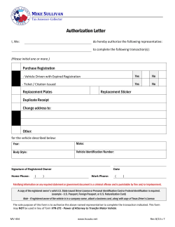


© Copyright 2026