
- Leckhampton Local History Society
LECKHAMPTON LOCAL HISTORY SOCIETY RESEARCH BULLETIN NUMBER 1 - Autumn 1999 Edited by Eric Miller Tel: 01242 526461 ______________________________________________________________________________ CONTENTS Pages Editorial 1-2 ‘Leckhampton in a Nutshell’ Eric Miller 3 - 11 Liddington Lake - Leckhampton’s Pleasure Ground John C Milner 12 - 18 Early Flying at Leckhampton Alan Gill 19 - 24 Leckhampton - ‘the Fields Beneath’ Terry Moore-Scott 25 - 38 The Evolution of Leckhampton’s Street Names Amy Woolacott 39 - 47 Some Leckhampton ‘Mysteries’ Eric Miller 48 - 50 Kidnappers Lane - Lillie Langtry and Leckhampton Court The Pairs of Rails near ‘The Norwood’ - EDITORIAL I. Welcome to this Bulletin Welcome to Leckhampton Local History Society’s first collection of research articles. In its quarterly newsletter, Smoke Signal, there is room only for short articles and notes. Here our contributors have had the opportunity to develop their theme at greater length, accompanied by illustrations in a larger format. ‘Leckhampton in a Nutshell’ sets the scene. It is a ‘potted history’ listing all that is significant or unique about the village and I hope it also demonstrates why Leckhampton’s past is worth investigating and chronicling, as a means of establishing a ‘sense of place’. There follows an article on the pleasure grounds at Liddington Lake, which for a quarter of a century delighted crowds from miles around. Barely a trace or memory of it remains, and John Milner has performed an important service in unearthing the evidence. Many townspeople will know him as a popular lecturer on the history of Cheltenham and its surroundings. He is also a supportive member of the Society, and we are pleased to print one of his rare articles, written at our special invitation. At the Society’s recommendation, backed by the two other similar societies in the area, John has been chosen to receive this year’s Cheltenham Arts Council Award for his work in the historical field. Other forms of amusement were taking over as the Twentieth Century progressed. Alan Gill’s account of the early days of flying deals with rough and ready forerunners of today’s air tattoos, which just before the First World War drew crowds of spectators to Leckhampton’s open spaces. To complete the picture, two complementary articles are concerned with Leckhampton’s physical layout, from the pattern of its medieval fields to its present-day system of roads. The 1 ownership and use of the land are comprehensively described by Terry Moore-Scott and some of the historical names of the fields and their owners find echoes in Amy Woolacott’s study of the evolution of Leckhampton’s street names. At the end are three short items which investigate some local myths: correcting false impressions of the past can be as important as presenting new infomation. Leckhampton’s highways and byways may now be no more than an extension of Cheltenham’s, and its remaining fields may be under threat from developers, but there is still an air of individuality about the village, which this bulletin aims to portray. We hope that it has succeeded and that enough interest will be shown to justify the compilation of a second such bulletin in due course. (To whet your appetites, articles are planned on the Leckhampton Golf Club and on Leckhampton’s brickworks and potteries.) II. Chronicling Leckhampton’s History Leckhampton has been well served by past and present historians. The local worthy Robert Cary Barnard set a fine example in 1897 with his Records of Leckhampton. It chronicles the evolution of the village from the Domesday onwards, and gives a particularly detailed description of the parish records. A Souvenir of Leckhampton Court, edited by Sydney Harrison in 1919, paints an intimate picture of the Red Cross Hospital which was housed there during the First World War. Both books are rare, but second-hand copies may occasionally be found. More recently, the Leckhampton Women’s Institute’s Leckhampton - the Story Of Our Village Within Living Memory, 1850 - 1957, produced for private circulation, is a valuable source of local tradition. David Bick’s Old Leckhampton describes the rise and fall of the Leckhampton Quarries and the associated tramways and also gives an excellent summary of the disputes over access to the hill. In Leckhampton through the Ages, Eve Andrew and Canon Eric Brewin give a concise yet comprehensive survey of the evolution of the village from prehistoric times to the present day, with chapters on the church and court and the families of the lords of the manor. Your editor’s History of Leckhampton Church covers the building, furnishings, stained glass, the bells, the organ, memorials, parish records, and much more besides. The Local History Society’s first publication, 1894 - the End of an Era (now out of print), describes the sale of Leckhampton Court and its lands in that year and presents a portrait of the village as it was then. It was edited by the late Bruce Stait, who first proposed the formation of the Local History Society. Your editor’s second book, Leckhampton Yesteryear, based on information taken from parish magazines, describes aspects of village life from the turn of the century to the beginning of the Second World War: entertainments and the growth of local societies, the building of the parish hall and the new school, celebrations of peace and war, and much additional information on church activities. Most recently, in 1998, the Society brought out Leckhampton in the Second World War, based in large part on the recollection of numerous present and previous inhabitants, but also using important and hitherto unpublished documentary material and some 50 rare photographs. The chapters on the air raids over Leckhampton and on the POW camp have attracted particular attention, but the descriptions of aspects of everyday life have a general appeal: civil defence and the Home Guard, air raid precautions, fire-watching and the blackout, the arrival of evacuees, the effects of rationing, the response of schools and churches, and attempts to maintain some kind of social life. The Society has collected some 400 historic photographs of the area, as well as a number of prints and engravings, and its next venture is planned to be the publication of a selection of these, with appropriate commentary. If any reader feels able to fill a possible gap, please get in touch with Alan Gill (tel 519248). 2 LECKHAMPTON IN A NUTSHELL By Eric Miller ______________________________________________________________________________ What is it about Leckhampton that makes it more than just an extension of Cheltenham? For a start, the Anglo-Saxon name and its listing in the Domesday Book establish the settlement’s identity. Today the following are visible characteristics of a village which for most for its existence has been not only physically separate from Cheltenham but also independent in outlook: St Peter’s church Leckhampton Court a few thatched cottages Leckhampton Hill the Village Hall the Parish Reading Room the ‘horse’s grave’ St Philip & St James’s church the remains of the Moat some stone-built farm houses the Devil’s Chimney and quarry workings the war memorial the Delancey Hospital Tower Lodge In addition, there are some places that have disappeared completely: the parish pound the mineral tramroad the passenger trams the railway and the station the Pilford brickworks the pottery in Charlton Lane the caravan factories the village well the drinking fountain the Ladies’ College Sanatorium Liddington Lake Pleasure Ground Most of these will be dealt with in the following paragraphs, while some are covered in the other articles. The name Leckhampton was first recorded in the 9th century, when the settlement was the home farm for the royal manor of Cheltenham. The word is now generally considered to mean ‘homestead where leeks (ie any kind of vegetable) are grown’. Indeed, market gardening still thrives on the fine alluvial soil of the valley, while traces of earlier ploughing can still be made out in the ridge and furrow patterns on the lower slopes of the hill, now used for grazing. The medieval village was close to both court and church. That earlier layout is indicated by a row of 17th-century thatched cottages - ‘Moat Cottage,’ ‘Field Cottage’ and ‘Sheeps Head Row’. These probably follow the line of an old track and lie at right angles to Collum Street (now Church Road), where there are or were a few other timber-framed cottages, including the socalled ‘Cromwell Cottage’, demolished in 1962. The historic parish, both civil and ecclesiastical, was comparatively large and (as shown on the map overleaf) extended from the prehistoric camp on the hill top down as far as Warden Hill - not the same as today’s electoral division or the postal district. It was sparsely inhabited until early in the 19th century and its land was largely devoted to agricultural use. Such industry as existed occurred on the periphery, and some artisan dwellings near the top of Old Bath Road and in Pilley housed quarrymen and brickmakers. In general it was not until the mid- to late 19th century that new housing began to spread up the hill from the Norwood Arms, in addition to a few scattered villas occupied by the gentry. In the Domesday Survey of 1086 two manorial estates (at least) were listed under the heading of Leckhampton. One was probably centred on an island surrounded by a moat. Some of the latter is still recognisable, though much overgrown with trees, beside the rectory; older 3 4 inhabitants recall being able to skate on its frozen surface! When the moat was excavated in 1933, traces of a stone building were uncovered, with access by a bridge and a fortified gateway dating from probably the 14th century. Some 16th-century floor tiles were also found. Later the building evidently fell into disuse, and an 18th-century map shows trees growing on the site. A new manor house was built behind the present rectory, serving as a farmhouse until early in the 19th century. This was eventually demolished, some clumps of nettles betraying its former location until these were ploughed over in the 1980s. The moat itself may have much older origins and is comparable to numerous other sites to be found at the foot of the Cotswold escarpment. Leckhampton Moat, by E J Burrow, 1916 The other manor, whose administrative centre will have been on the site of Leckhampton Court, was more powerful, and in due course absorbed the first-mentioned estate. The Court itself, one of the oldest non-religious buildings in the county, was saved from dereliction 20 years ago and very sympathetically restored by the Sue Ryder Foundation. The oldest part, the 14thcentury banqueting hall on the east side, has now been converted into a chapel. The south wing, with its half-timbering, is Tudor - the date ‘1582’ is carved over a doorway - as is the section at the end of the north wing, with its twisted brick chimneys. In 1732 a fire destroyed the central part of north wing, which at first was partly filled in by a 3-storey Georgian house (see illustrations overleaf). This was demolished at the end of the 19th century and replaced by the north wing, whose ‘Tudorbethan’ facade is what passers-by now see from Church Road. From the early 14th century onwards the title to the manor of Leckhampton was held for nearly 600 years by a succession of three interrelated families: the Giffards, Norwoods, and Tryes. All produced men of distinction as well as benefactors to the local community. Sir John Giffard, d. 1330, was the first builder of the Court - and of the church, where he and his wife are commemorated by carved effigies. When Eleanor Giffard married John Norwood in 1486 the tenure passed to the Norwoods. The 16th-century William Norwood (whose portrait hangs in Cheltenham Art Gallery) was probably the most distinguished. He was MP for Gloucester, and Lord of the Manor of Cheltenham through his marriage to Elizabeth Lygon, to whom he dedicated a fine memorial brass in the church. It also shows their two daughters and nine sons, two of whom emigrated to help found the colony of Virginia. 5 Leckhampton Court as it was in 1793 (Samuel Lysons’s Collection of Gloucestershire Antiquities) and 1863 (Norman’s History of Cheltenham). William’s grandson, the swashbuckling royalist Colonel Henry, mentioned in Pepys’s Diaries, was imprisoned by Cromwell and then exiled to the colonies. After the restoration of the monarchy he was Acting Governor of Dunkirk when the English garrison was forced to evacuate the town in 1661. He was appointed Treasurer of Virginia and brought to King Charles II the news of the surrender by the Dutch of New Amsterdam (now New York). Back in England, he became Mayor of Gloucester and its MP. Before his death in 1689, he gave money for five bells in Leckhampton Church, cast by Abram Rudhall of Gloucester. There are many distinguished descendants of the Norwoods living today in the USA, several of whom have made a ‘pilgrimage’ back to Leckhampton. At the end of the 18th century the estate passed by marriage to Charles Brandon Trye FRS. He was Senior Surgeon at Gloucester Infirmary and encouraged his friend Edward Jenner in his vaccination experiments. He also appreciated the commercial benefits of the stone quarries on his estate. The quarries were served by what were probably the first railways in Gloucestershire. One of the upper tracks passed between the escarpment and the ‘Devil’s Chimney’ - a pillar of harder rock, left by quarrymen and later strengthened; little did they know that it was to become one of Cheltenham’s distinctive emblems! (The Local History Society has also come to use it as its ‘trade-mark’.) This horse-drawn railway followed a route along what is now Daisybank Road. It is still possible to trace its continuation as it curves down behind Hill House and the Scout Hut and the cluster of light industrial buildings that occupy the site of a former stone-yard and stables (and where the Cheltenham Caravan Company’s factory flourished until after the Second World War). Among the undergrowth there remain a few sleepers, which supported short lengths of cast-iron rail. By 1811 the railway was linked up to the line which carried freight between Cheltenham and 6 Gloucester docks. (This line is not to be confused with the passenger trams which ran to the foot of Leckhampton Hill during the early 20th century.) The Trye family’s fortunes relied heavily on income from the quarries. The demand for stone declined in the 1880s, and in 1894 it was decided to sell off the estate by auction. This was effectively the end of the old order for Leckhampton, whose status was in any case being eroded: in the previous year a large area in the north-east of the parish had been incorporated into Cheltenham Borough. The hill and quarries were bought by Henry J Dale (of Dale, Forty the music dealer) and the Court estate was bought by the agents for Captain Bennett, who soon after sold it on to John Hargreaves, a descendant of the inventor of the Spinning Jenny. John Hargreaves built the north wing extension to the Court (see also ‘Leckhampton Mysteries’ on page 49). John Hargreaves’s daughter Muriel married Captain Cecil Elwes in 1901. The whole village was involved, and the occasion offered an opportunity for generous hospitality. The Revd Clifford Aston performed the wedding ceremony at the Guards Chapel at Wellington Barracks, and the villagers contributed to a wedding present. To mark their homecoming from honeymoon, the couple treated 300 of the older inhabitants of the village to a dinner in the school, followed by dancing in the Parish Hall - one of many gestures of hospitality towards the village. The ‘horse’s grave’ in a field above the Court is a memorial to Cecil (now promoted to Colonel) Elwes’s favourite hunter ‘The Continental’, which died in 1902. During the 20th century the Court has fulfilled a variety of rôles. In the First World War it housed a Red Cross Hospital with 100 beds for wounded soldiers. In the Second World War barrack huts were built in its grounds (and the foundations of some of them can still be made out). These were occupied at first by British troops and later by the US, prior to the D-Day landings. After the end of war in Europe, German Prisoners-of-War were billeted there, the last of them not leaving until 1948. They mostly worked on farms in the area but lived under a fairly relaxed régime and enjoyed hospitality from local families. Several inmates married local girls, some deciding to live in the area, and to this day a few even return from Germany to revisit the site. After Mrs Elwes’s death in 1956 the Court was bought by Dr Paul Saunders, who ran a preparatory school there until 1969. The building’s present incarnation as a Sue Ryder Palliative Care Home has given it a fresh lease of life and a very special place in the community. The upper lodge to Leckhampton Court - Tower Lodge - was at one time an ale-house for the quarry workers and then a private house. In 1938 it was linked with a notorious unsolved crime. Coincinding with the suicide of the occupant of the lodge, a headless torso was discovered at Haw Bridge on the river Severn. The body was believed to be that of one Captain Butt, whose bloodstained coat was found by police under floorboards at the lodge. All this provoked much local gossip and speculation, but in the absence of conclusive evidence no official cause of death could be established nor any culprit be named. The fortunes of St Peter’s church and its incumbents are closely linked to the Court. The lords of the manor were patrons until 1903; later that rôle was assumed by the Bishop of Gloucester. No religious house is mentioned in the Domesday Survey, but in 1133 Henry I endowed the Canons of Cirencester Abbey with the church at Cheltenham and its attached chapels. One of these must have been at Leckhampton, for in 1162 its priest, Henry by name, was summoned before Archbishop Thomas-à-Beckett in a dispute over payment of dues to the Canons of Cirencester. Henry was found liable and fined two shillings. Sir John Giffard is considered responsible for the original building of the church: roughly what is now the nave, south aisle and sanctuary and the tall slender ‘broach’ spire, which is still a conspicuous landmark in local stone. It stands on the site of an earlier chapel probably used by 7 Henry, of which a few traces survive, including the font. This little church remained unchanged until 1834, when a gallery was erected over the south aisle and a vestry was added. Thirty years later, Leckhampton’s population had grown to such an extent that the architect John Middleton was invited to draw up plans to enlarge the church. The gallery was taken down, a north aisle was added, the porch was resited and the whole building was extended 23 feet to the west. St Peter’s Church, as built by Sir John Giffard from a lithograph by George Rowe, c. 1840 To Henry Norwood’s five bells a further three have been added, and Leckhampton now possesses a well-tuned ring of 20th-century bells. Among the other items of interest in the church - apart from the already mentioned Norwood brass and the Giffard effigies - is the pulpit. This is reputed to have been made out of oak taken from a tree grown in a nearby field. It was designed by L W Barnard, the son of the historian R C Barnard. L W Barnard also designed the war memorial, which was erected on the site of the former village draw well. The earliest surviving parish records date from the late 17th century and are kept in the Gloucester Record Office. They list numerous burials in woollen shrouds. Another unusual feature is a list of ‘compositions’, or special collections for good causes elsewhere, for example in 1666 ‘for late sad fire in the City of London’. The churchwardens’ accounts for 1826 record the purchase of lime trees at a cost of 6 shillings. Six of these venerable trees are still standing in the avenue leading up to the church. In the churchyard the earliest identified burial dates from 1670, and the oldest person to be interred was Richard Purser, who died in 1868, aged 111. There are also graves of numerous 8 Victorian generals and men who had influential careers in India, in the army, civil service or as planters. Three holders of the Victoria Cross have memorials, as does Dr Edward Wilson, who died on Scott’s Antarctic expedition. Baron de Ferrières, a great benefactor to Cheltenham, is buried there, and two stained-glass windows are dedicated in his memory. Several of the parish priests were members of the Norwood or Trye families. Notable among these was Charles Brandon Trye, son of the surgeon of the same name, who held the post for 58 years, from 1830 to 1888. He was responsible for a number of improvements for the public good: not only the moves to enlarge the church in 1834 and 1866, but also the building of the National School in about 1840 (now used as the canteen) and of the present rectory. He was a moving force behind the creation of a daughter church to cater for worshippers in the Park and Naunton areas. The church (originally just ‘St Philip’s’) was dedicated on St Philip and St James’s day in 1840; it became a parish church in its own right in 1869 and the present larger building, designed by Middleton, replaced it in 1882. C B Trye’s son Reginald, who succeeded him in 1884, was last Trye to be rector of St Peter’s. He shared his family’s financial misfortunes and as a consequence in 1895 he had to give up the living, which until his death in 1929 was in the care of a succession of Curates-in-charge. His immediate successor was the enthusiastic Clifford Aston, who encouraged the formation of many new organisations in the parish, eg Boys’ and Girls’ recreation classes, cricket and football clubs, a Girls’ Drill Club, and branches of the Church Lads’ Brigade, Girls’ Friendly Society, Church of England Men’s Society and the Mothers’ Union. Above all, he put much energy into having the Village Hall built, in time for Queen Victoria’s Diamond Jubilee in 1897. Appropriately, he is commemorated by a brass plaque in the Village Hall. Though the former vicarage for Emmanuel Church is in Leckhampton (above the old railway bridge), the church itself lies just outside the boundary. Its own parish was not created until 1922, out of the southern part of St Luke’s. The present church was consecrated in 1937, but there were several predecessors on other nearby sites, originating with a mission room for St Luke’s, situated in Clare Street. In 1872 that was superseded by a corrugated iron structure near the junction of Exmouth Street and Naunton Terrace. The name ‘Emmanuel’ recalls the church at Clifton where the Revd J A Aston (Vicar of St Luke’s and father of Leckhampton’s Clifford Aston) had at one time been a curate. The corrugated iron hall fell down down in a heavy snowstorm in 1878, was rebuilt, and then in 1916 burnt down. Worship was carried on in an old school (now demolished) in Naunton Terrace until the present church was completed. By the early 1900s the Revd C B Trye’s school had become too small for the number of children who wished to attend, and in 1906 a new building was opened for the older pupils. The development of the Pilley estate necessitated a further extension for the infants in 1931. At the lower end of Leckhampton Road, St Philip and St James’s School, designed by Middleton (again [1]), was opened in 1860. By 1908, after a Council School had been created at Naunton Park, the old school had reached the end of its useful life and was closed. Its Headmaster, Mr G W Fenning, transferred to head the new school. The St Philip and St James’s School building was then used as a meeting place for the Church Institute, the Church Lads’ Brigade and other church organisations. It has latterly been sold and houses an accountant’s office and a dance studio. The present-day electricity substation in Moorend Road occupies a brick building, whose unusual architectural style at one time led it to be nicknamed ‘the early cowshed’ - see illustration below. This was originally built for the Leckhampton Local Board, which from 1873 to 1894 was responsible for most of the local administration, largely replacing the Local Vestry. In due course the building came to serve as a free reading room and lending library. (Another substation, near the Moat, covers what was at one time the Parish Pound, where stray animals might be impounded or beasts in transit could be kept safe.) 9 Leckhampton Local Board Room By Courtesy of Gloucester Record Office [2] The scattered pockets of clay to be found on the lower slopes of Leckhampton Hill proved ideal for making bricks, the demand for which grew during the late 19th-century building boom. Brickmaking started at Lower Pilford (strictly speaking, on the Charlton Kings side of Old Bath Road) in 1879, but it never really paid its way. In 1907 the site was taken over by Webb Bros of Battledown and the buildings dismantled. Lower down the hill, the ‘Naunton Potteries’ made bricks and tiles out of clay dug from pits which in due course filled with water and formed Liddington Lake, described by John Milner in a later article. Nearby, when the railway from Banbury to Cheltenham was laid in 1875, the site of another clay-pit was taken up by the station. By 1895 the works had become the ‘Cotswold Potteries’ and moved to Charlton Lane, opposite the Delancey Hospital. As well as building supplies, it produced more refined work, such as glazed tiles, bread crocks and garden pots, until it went out of business in about 1912. Over the period 1894 - 1906 Leckhampton Hill was the focus of a significant episode with wider implications in the history of Cheltenham. This was the struggle to protect traditional rights of way across the hill, which its new owner H J Dale proposed to close to the public. He built a house (‘Tramway Cottage’) for his quarry foreman in an old gravel pit beside Daisybank Road, which had been a favourite spot to set up side-shows and stalls on bank holidays. The building also blocked the main footpath up the hill, and later the area above it was also fenced off. There was much local opposition, not least from R C Barnard and other gentry, whose homes backed on to the hill. In 1902 Miss Beale, Headmistress of the Ladies’ College, whose pupils were wont to visit the hill for recreational walks, retaliated by sending 100 of her girls to walk over the rightsof-way and by ordering Dale to remove all of his pianos from her establishment! 10 On several occasions crowds destroyed fences which Dale had had erected. In 1902 four working men, who came to be known as ‘the Leckhampton stalwarts’, were charged with obstructing the police, but were acquitted. This encouraged as many as 2000 people to gather and walk in procession to Leckhampton. They stopped at the Malvern Inn to hear a rousing speech. They then made for Tramway Cottage, which they dismantled until hardly a stone was left standing. A judge found in favour of Dale’s enclosure and only three paths were granted as public rights of way. Dale rebuilt the cottage exactly where it had been. On Good Friday 1906 another crowd assembled at the site and the Riot Act had to be read. Arrests followed and eight men were tried at Gloucester Assizes. Sentences of up to six months’ hard labour were imposed, though these were substantially reduced on appeal. Leckhamptoners licked their wounds, and Dale imposed many conditions for access to the hill. The story had a happy ending, however. By 1929, the Quarry Company had gone out of business and Cheltenham Town Council was in a position to purchase the 400-acre estate, thus securing the freedom to walk on the land. In a sense, today’s successor to the ‘Stalwarts’ is the Leckhampton Green Land Action Group (LEGLAG), which acts, in a strictly law-abiding way, to conserve and protect local rights. That is a reminder that Leckhampton’s history is still in the making. In recent years, for example, we have witnessed the closure of the Malvern Inn, pressure to build more houses, and moves to plant trees on part of the hill. It is for a later generation to assess these developments in truer perspective. It is hoped that this article will provide a useful starting point. Footnotes: [1] Middleton also designed Delancey Fever Hospital. It was opened in 1874, though smallpox cases had earlier been housed in wooden huts. The first elderly sick were admitted in 1951. [2] GRO D2970/93, deposited by Messrs Barnard & Partners Sources: The books mentioned on page 2, various local newspapers, maps, personal observation, etc. __________________________________________________________ 11 LIDDINGTON LAKE - LECKHAMPTON’S PLEASURE GROUND By John C Milner ______________________________________________________________________________ Liddington Lake, from a postcard dated about 1905 Pleasure gardens became highly popular resorts in the late 18th and early 19th centuries. Cremorne, Vauxhall and Ranelagh, in London, set a fashion copied elsewhere. Food, drink, music, dancing and other entertainments were on offer in illuminated gardens. By day, the gardens looked rather tawdry, tinsel revealing itself for what it was. In the evenings they sprang to life. Dancers, clowns and troops of acrobats were all part of this make-believe world providing escape from the daily grind. Secluded walks and grottos offered privacy for family parties or dalliance. In Cheltenham, Regent Gardens (where Regent Street is today) was a short-lived example. From being highly respectable, and patronised by the fashionable, all such gardens deteriorated in terms both of entertainment and behaviour. Pick-pockets, card-sharpers and others operated easily in dimly lit grounds. The Old Well, Montpellier, Imperial Gardens and Pittville were gardens of a different kind. Subscriptions and tickets of admission were aimed at excluding ‘members of the lower orders’. When the spa fashion declined, these gardens, too, offered more than mineral water. There were many special events such as balloon ascents, flower shows and band concerts. However, even after municipal ownership, charges of 6d and 1/- offered a barrier to families living on weekly wages of about £1. Cheltenham people had some advantages. Leckhampton Hill was a place for picnics and walks on holidays. In the 1890s, right of access to Cleeve Common was gained. There the Rising Sun offered open grounds and dining rooms. When the electric trams began to run, the Geisha Tea Rooms and other establishments offered refreshments. Stalls would open on public holidays. The Grotto at Mill Lane, Prestbury, was another favourite resort until the behaviour of some patrons spoilt the atmosphere. 12 Fresh air and exercise were increasingly seen to be beneficial. The Bank Holiday Act of 1871 made August 1st a holiday and a Supplementary Act of 1875 extended the statutory holidays. Footpath and open space preservation became an issue. A legal obligation was placed on local authorities to provide allotment gardens. Thanks to pneumatic tyres, cycling became an 1890s craze. Municipal ownership of Pittville and Montpellier, the gift of the Agg-Gardner Recreation Ground and the successful campaign for a similar facility in South Ward (Naunton Park) were part of a general recognition of public need. Private initiatives were not lacking. Liddington Lake, close to Leckhampton Road and the railway station, was a low-cost mecca for people from the narrow streets. Before the coming of horse buses and the trams, people walked to Liddington, pushing their prams, just as many did to Cleeve Hill. Admission prices were kept at 2d for adults and 1d for children. Liddington Lake was not advertised widely except in the pages of The Cheltenham Mercury newspaper which carried weekly notices and reports of special occasions. Later on, the guide books included advertisements and even illustrations. Leckhampton had many brick, tile and pottery works, kilns and yards. Extraction of clay for these works left holes which soon filled with water. Some ponds may have been dug as ornamental features, though some of those may have originated by digging for on-site brick making. A couple of small pools are shown on the site on the Ordnance Survey 25-inch plans of the 1880s. Early in the next decade these pools seem to have been joined and extended to make a lake with an island, and a house named Liddington was erected near by. The house is first mentioned in the Cheltenham and Gloucester Directory of 1894, though no occupier’s name is given. From 1895 to 1901 Mrs E Newby is named as the occupier. From 1902 to 1912, when the property was up for auction, the occupier was Mrs E Lewis. From 1901 to 1911, though not afterwards, the land was defined as ‘Pleasure Gardens’. The Cheltenham Mercury of 1 April, 1893, reports the opening of the gardens for ‘Easter Amusements’. William Smart is named as the proprietor. He it was, we must assume, who enlarged the lake and established the enterprise. The paper said he ‘should deserve a good share of patronage’. That same issue of the Mercury included an advertisement, which read: BOATING! BOATING! BOATING! GREAT ATTRACTIONS FOR THE EASTER HOLIDAYS AT LIDDINGTON LAKE ADJOINING LECKHAMPTON STATION On and after THURSDAY, March 30th, 1893, Two Splendid SCREW STEAMERS, “PIONEER” and “MAYFLOWER,” will Ply on the Lake Daily, from 10 until dusk. Also CANOES and SMALL BOATS by the hour. Likewise the ARIEL FLIGHT. Light Refreshments at Moderate Charges. Tobacco and Cigars. Admission---Twopence, including a Ride on Steamboat. WILLIAM SMART, PROPRIETOR. 13 For the rest of that year no further advertisements seem to have appeared. 6 July was the wedding day of the Duke of York and Princess Mary of Teck and saw the opening of Naunton Park. No notice of winter closure appeared in the Mercury. 1894 saw weekly advertisements with more detailed ones for Bank Holiday events. These show that a variety of activities was being organised and that attractions had been increased. For example, on Easter Monday there was a ‘Canoe Race - lst Prize, Watch; 2nd Prize, Gold Pin; 3rd Prize, Silver Pin; 4th Prize, Knife. For Boys under 16. Those who wish to enter should give their names to Mr Smith, Liddington Lake before March 20th. Entrance Fee 3d. Greasy Pole Climbing - 1st Prize Watch. Anyone allowed to enter. No charge made’ August Bank Holiday, 1894, saw another canoe race for boys under 16, though no entrance fee was charged this time. There was also a steam boat race, plus tub racing, water polo and walking the greasy pole across the water. That day began with pouring rain but things improved by midday. ‘Man-in-the-Moon’ (the Mercury columnist) recorded that ‘... something like 1700 went to Liddington Lake where they had a capital entertainment’. An advertisement published on 18 August 1894, said that the Lake was ‘well stocked with Perch, Roach, Bream etc. Terms for fishing 6d per day’. From then on, fishing was another attraction offered by the management. A mild Christmas and New Year were followed by severe frost in February 1895. Liddington Lake opened for ‘Skating! Skating! Ice Just Flooded. In Grand Condition. The Town Band will be in attendance on Wednesday from 3pm to 5pm (weather permitting). Admission - All Day 6d; from 6 till 9.30 3d. At night the Gardens will be Illuminated. E. Newby Proprietress’. Clearly, the new year had brought new management. Takings on Sunday 10 February were given to the Poor Relief Fund. In those days Sunday trading was socially unacceptable. Joseph Hall, the Borough Engineer, had attracted severe censure for charging for Sunday skating at Pittville when the number on the ice appeared dangerous. ‘Man-in-the-Moon’ commented on 16 February 1895 that ‘... if there was no skating at Marle Hill (the sluices had been raised and the ice unsafe) there was plenty at Liddington Lake, the fine sheet of water pronounced to be one of the best in the district and in splendid condition, offering every facility’. The Poor Relief Fund benefited by £6-1s-1d. He was writing of the week before, but on 16th February itself the Cheltenham Rifle Band was in attendance, admission was only 3d and all takings were given to the Poor Relief Fund. Thus another tradition was established. The main 1895 season began on 13th April with many visitors coming on the 15th (Easter Monday). Whit Monday was a great success with the Cheltenham Rifle Band again in attendance. There were canoe, flat, hurdle and novelty races, with prizes, for boys under 16. Swings, seesaws and an out-door gymnasium were all free. Tea and light refreshments were on offer. All-day admission cost only 3d (6 to 9 pm only 2d) with children under 10 at half price! Liddington had established itself! ‘Man-in-the-Moon’s’ comment on 8 June summed it up: ‘As a popular resort Liddington Lake now ranks amongst your fully established institutions of your town and as Mrs Newby, the spirited proprietress, has spared no pains in expense to make it attractive, it will be found one of the pleasantest spots in the neighbourhood to pass an hour or two at holiday or any other time.’ Steam boats plied every Wednesday. A strong band played on August Bank Holiday. A procession of illuminated boats, and dancing on the lawns to a quadrille band added to the pleasures of the day. 9 November saw closure for the winter. Early 1896 was too mild for skating and a wet March was followed by drought until late July. Fishing was available again at 6d per day with tench and eels added to the possible catches. Some 1600 visitors came on one day in late May. However, 1896 saw the abandonment of many local events, including a visit to the town by the Prince of Wales, because of a smallpox epidemic in Gloucester. Ripples of concern ran far beyond the county town. Widespread vaccination and restrictions on public assembly seem to have led to a waning of the epidemic by May and the 14 problem was over by the August Bank Holiday. In the Mercury of 8 August a very significant comment was published: ‘I was pleased to see the great advance that continues to be made in the general, good behaviour of the masses. A holiday not so long ago used to be fraught with drunkenness, rows and general bad behaviour; but now drunkenness was almost conspicuous by its absence, and there was not a single “run-in” during either the day or night’. Clearly, the simple pleasures of places such as Liddington were having beneficial effects. The late 19th century suffered a severe drink problem, the temperance movement having arisen for very good reasons. Men had always gone to the pub. Women and children were left at home. Now, places such as Liddington offered family entertainment with non-alcholic drinks and other refreshments available. If people wished to take their own picnics they were free to do so, knowing that they could buy cups of tea when there. Liddington was very much a place for family enjoyment. On 19 August 1896, the gardens at Liddington Lake were the scene of a temperance societies’ garden party and Band of Hope festival. We have to look at Liddington Lake against a wider background of social progress. The entertainments on offer may seem charmingly innocent to us, but they represent a great step forward from the brutalities of working and lower middle class life and entertainment of earlier decades. In 1896, Liddington Lake remained open until 21 November, three weeks later than usual. This was, presumably, to make up for a worrying spring and indifferent summer. By the season of 1897, the Lake had been deepened slightly, though it was always advertised as being safe for children, being only three feet in depth. On Easter Monday that year the Cheltenham Brass Band, under the direction of Mr Charles Preston, performed at Liddington Lake. Some 2300 visitors came that day and Mrs Newby ran out of refreshments! The Brass Band came again at Whitsun when there was a water polo match at 3.30 pm in addition to the usual sports and attractions. Advertisements stressed that the ’bus passed and repassed every half-hour up to 9.30 pm! June 22nd 1897 saw the grand celebration of the Queen’s Diamond Jubilee, concluding with a procession of illuminated boats, balloon ascents at intervals and a display of fireworks by Messrs Pain and Sons of London. There were bonfires in the gardens and those present could see the huge beacon bonfire on the top of Leckhampton Hill. A whole programme of sports had taken place during the day. Men swam for the prize of a musical clock. Ladies had a canoe race for the prize of a pair of bracelets. Competitors could climb the greasy pole for a 12lb ham (a frequent prize). A sack race for boys had prizes of 3s 6d, 2s 6d and 1s 6d - but then one could buy a lot of chocolate, sweets or ice cream for those sums! It proved to be a very successful day at Liddington Lake in spite of all the other attractions in the town, including those at nearby Naunton Park. The rest of the year saw the usual pattern of events. An attendant was always present to row ladies and children. When the season of 1898 opened, a tricoloured bandstand and two new rustic summer houses had been added to the attractions, together with fairy lamps and bunting. Re-opening on 11 April, all the usual entertainments, including climbing a greasy pole for a ham, were laid on once more. The Brass Band played and there was dancing on the lawns. Although Easter Monday was one of indifferent weather, 2000 people were admitted. ‘Man-in-the-Moon’ commented ‘... the above place is laid out with boweries and quiet corners; just the place to have a quiet half hour’s spooning. If you don’t believe it, go and see for yourselves!’. On Whit Monday a tug-of-war was added to the sports and that greasy pole was there to climb ‘for a magnificent ham of Stroulger’s celebrated cure’. One tug-of-war, at 4 pm, for a 10/- prize, was between the Cheltenham and the Leckhampton Married Men. Another, for 5/-, was between the Cheltenham and Leckhampton Boys of under 16. Temperance drinks at moderate prices were available. The Easter Monday of 1899 was one of perfect April weather so that Liddington Lake attracted a record attendance. A skipping competition was arranged for the under-16 girls. Many of the sports seem to have been for men and boys, so this came as a pleasant change. To celebrate 15 Whit Monday a ‘Cycle Parade in Fancy Costumes’ was arranged for 1 pm All cyclists were invited to join the parade and could enter the gardens free of charge. The Parade went via Bath Road, High Street, Clarence Street, Manchester Street, Lower High Street, Swindon Road, Fairview, Promenade, Montpellier, Tivoli and back to Leckhampton. It was a good way to pull the crowds in and to advertise Liddington Lake! In early July 1899, the Band of Hope Treat was held in the gardens, the children being joined by adults. The fun was spoilt for a small boy named Wixey who broke his wrist attempting to stand on a ‘tint-a-tant’. Liddington Lake, c 1908 By the turn of the century, guide books began mentioning Liddington Lake amongst the attractions of Cheltenham. For example, E J Burrow (also responsible for the illustration on the front cover of this bulletin and for some of the postcard photographs) summed things up by saying ‘Liddington Lake, although a private enterprise, occupies the same position in the Leckhampton district that Pittville Lake does at the other end of the town’. Even the Cheltenham Annuaire carried an advertisement for Liddington Lake in 1900 and onwards. Advertisements changed little over the years. A pattern of entertainments had been set by Mrs Newby, who was being assisted by a Mrs Evans in 1900. When Mrs Newby took over the management in 1902 little changed, although there seems to have been more emphasis placed on the lake itself, the boating and fishing and the skating when the ice was thick. Experienced boatmen were employed for rowing ladies and children. Rowing lessons were given. So standard did advertisements become that the words ‘The Boating Season has Begun’ were used every week from Easter until seven days before the November closure! 16 Singing competitions were introduced in 1900 with five shilling prizes for the best comic and the best sentimental songs. Potato races were added to the athletic events. Ices were included amongst the refreshments on offer. Giant strides and see-saws were added for children. (One who recollects ‘giant strides’ being in use at Naunton Park describes them as consisting of a 15-foot high central post like a telegraph pole with a wheel bearing at the top. Ten chains were suspended from the bearing, each having a wooden crossbar handle about 3 feet from the ground. Children would run around the central post - faster and faster - until they would literally ‘take off’ - Ed.) Refreshments in the early 1900s appear to have been supervised by Mrs Crump who lived in Short Street. The boatman, in the later years, was Mr Cribb who lived in Moorend Street. When the pleasure grounds finally closed, Mr Cribb emigrated to Winnepeg in about1912. Picture postcards of the lake could be obtained by visitors while there. One of these [1] was sent as a Christmas card by the above-mentioned Mrs E Lewis. Posted on Christmas Eve, 1907, it was sent to Miss Woodward of 17 Cambray - the daughter of A E Woodward the music dealer. Delivery was on Christmas Day! An advertisement dated 1908 The final years of Liddington Lake saw a continuation of the entertainments established by Mrs Newby. A letter to The Cheltenham News of 11 February 1988, from Mr C. Palmer of 58 Pennine Road, casts light on the Liddington scene. He writes: My father [William] and my uncle [George] were noted for their clowning act there on Bank Holidays when special entertainments were arranged. My father used to walk around on high stilts while uncle amused the spectators dressed up as a clown. Brock’s fireworks arranged an evening spectacular and father and uncle also assisted in this show. One year they were known as the Palmer Brothers and the next show they became the Remlap Brothers. The Pleasure Gardens were listed in The Cheltenham and Gloucester Directory of 1911 but the lake and gardens were up for sale by auction in March 1912. Bidding at Messrs. Cornelius and Boulter’s sale began at £500 and went to £600. No further bids were forthcoming, so the property was withdrawn, the vendors putting in a bid for £750. The Directory lists no occupants between 1913 and 1916. 17 Dr J H Garrett, Cheltenham’s famous Medical Officer of Health, wrote in the earlier editions of his Cheltenham: the Garden Town of England as follows: ‘The gardens around the lake are prettily laid out and in the summer months are much used for festive gatherings of various kinds.’ The 5th (1906-07) edition made no reference to Liddington. However, Dr Garrett’s words sum up Liddington’s charm. The Directory of 1916-17 shows that Mr Leigh James was in occupation. Mr James was a farmer and butcher with a well remembered shop in Great Norwood Street. Part of the attraction of Liddington for him appears to have been that some grazing was possible. He also appears to have had fears for the safety of his children, however, and over a period of time set about filling in the lake. The 1921 revision of the Ordnance Survey plan shows the north-eastern part of the lake to be still there. The island was no more, though the outline was still evident, with paths marking the old shore. A suggestion has been made that the doubling of the railway track from Andoversford to Cheltenham (completed on 28 September 1902) resulted in a problem of seepage, with the possibility that the embankment might collapse. On the face of it, this seems likely, but the 1921 plan shows that the last part of the lake to be filled in was that closest to the embankment. An end had come to an amenity that had given pleasure to thousands. In a way, Liddington Lake and gardens typified a style of living that could not have survived the First World War. By 1919 motor coaches were taking parties to Weston. Private cars had become increasingly common, as had motor cycles and sidecars, and people went further afield on Bank Holidays. What survives? The house is still there, serving as offices for Moss Construction, builders. The lake and grounds now lie under storage sheds. A local street name, Liddington Close, perpetuates the name but it lies far from the site of the Lake and Gardens, and it should not be confused with the lake, the location of which is certain. Photos, drawings and advertisements help to fill in the background, giving us a glimpse of another Leckhampton of a hundred years ago. Footnote [1] Kept in the Gloucestershire Collection at Brunswick Road, Gloucester. It was previously held at the County Archives Office, Gloucester under the reference number D4761/16. Sources Anderton’s Pictorial History of Cheltenham, Publisher unknown, c.1908 Burrow, E.J. Way About Cheltenham, E.J. Burrow, c.1901 Burrow, E.J. Cheltenham: the Midland Educational and Health Centre, E.J. Burrow, 1897 Cheltenham Annuaire, 1900-1907 Cheltenham and Gloucester Directory, 1891-1917 The Cheltenham Examiner newspaper, 22 March 1912 The Cheltenham Mercury newspaper, many issues April-November 1893-1900, advertisements and column by ‘Man-in-the-Moon’. Letters and photograph in Cheltenham News, 12 and 19 February 1987 Clarke, M. and Anley, E (Eds.), Leckhampton: the story of our village within living memory -1850-1957, Leckhampton Women’s Institute, c.1958 Garrett, Dr J H, Cheltenham: the Garden Town of England, British Medical Association, 1901 Gibson, A (Ed), A Brief History of Naunton Park, Cheltenham Borough Council, 1998 Ordnance Survey, 25 ins-to-1 mile plans, Sheet XXVI, 11 and 12, 1888, 1903 and 1921 editions Palmer, C, Letter in Cheltenham News, 11 February 1988 18 EARLY FLYING AT LECKHAMPTON By Alan Gill ______________________________________________________________________________ A field at the top end of Old Bath Road, just underneath Leckhampton Hill, was the unlikely venue for several aviation events in 1912 and 1913. Flying was then in its infancy in this country; most people had never seen an aeroplane, so great interest and excitement was caused, attracting crowds of thousands to see the latest wonder of the age. The first powered flight in England had taken place on 16 October 1908, by an American, Samuel Franklin Cody, at Farnborough; Blériot made the first crossing of the Channel on 25 July 1909. The first plane seen over Cheltenham was in 1911 when B C Hucks, one of the leading British aviators at the time, gave displays at an aviation meeting held at Whaddon Farm from 5 to 7 October. Apart from that there was only a quick landing and take-off by Lieutenant Fox on the East Gloucestershire Sports Ground on 13 July 1912. A Frenchman, Monsieur Henri Salmet, who was Chief Instructor at the Blériot School at Hendon, was engaged by the Daily Mail to tour the country, landing at various towns, to demonstrate and popularise flying to people in this country. On 12 July 1912 he was on a tour in a Blériot monoplane that included landings at Worcester, Stratford, Evesham, Gloucester, Cirencester, and continuing to Stroud and Swindon later. There was some difficulty finding a landing field in Cheltenham, the Racecourse being deemed to be too enclosed, as an area of at least 700 x 500 yards was needed which was also easily accessible to the general public. The field used by Hucks at Whaddon Farm was also ruled out. Thanks to the local weekly publication The Cheltenham Looker-On, a large field at the top of the Old Bath Road, Pilley, known as Rowlands Field after its owner, Mr D Rowlands, was found at the last moment, approved by Salmet’s agent, and fitted into the schedule, between Gloucester and Cirencester. Rowlands Field was below where Pilford Brickworks were located, now Pilford Road, down to what is now Everest Road. It is now largely built over. A 1900s map, with Rowlands Field added 19 20 According to the local newspapers all Cheltenham was agog with excitement, many thousands waiting for hours to see this newfangled flying machine. Having given a display at Gloucester, Salmet left for Cheltenham just after 4pm but there was a strong gusty wind which necessitated extreme care. He flew at a height of between 300 and 400 feet and some enthusiasts on the railway bridge on Shurdington Road had an excellent view of man and machine as he flew towards the landing ground at Pilley, where he made a graceful descent. He was greeted by the Mayor of Cheltenham, Councillor C H Margrett, who shook his hand heartily and congratulated him on his performance, and by the ringing cheers of the crowd numbering 2000, or several thousands, according to different estimates. He soon took off for an exhibition flight over the area, but did not remain in the air very long on account of the treacherous wind. He was due in Cirencester later that evening, and was to spend the night there, so at about 8pm he departed after bidding the spectators ‘Good Bye’ and promising to come back again sometime. He ascended over Leckhampton Hill, turned back over the field, then made for Charlton Kings. From there he flew over Pittville, the High Street, Lansdown, Hatherley Road, and thence at a height of 3000 feet to Cirencester, which he reached in less than 45 minutes. The flight over Cheltenham was witnessed by practically the whole population and evoked much admiration. Fortunately the local photographer Frank Webley was on hand to record the event at Leckhampton and published a couple of postcards showing the plane landing and at rest. Another picture, of Salmet with his plane at Cirencester after arriving from Leckhampton, appeared in the Graphic. 1913 saw three more aviation events at the same field which had become known as ‘The Aviation Ground’ or ‘The Aeroplane Field’. The first was the arrival on 27 March of Sydney Pickles from Hucclecote near Gloucester, where he had been giving demonstrations in his 60 hp Blériot machine. A large crowd had already assembled, as the event had been advertised in the local papers. Extra trams had been laid on from the town. The meeting was due to last for three days, and an admission charge of 6d was made to the field and one shilling to ‘the paddock’. Passenger flights were on offer at 2 guineas, or £10 for a flight to Gloucester. An advertisement for Sydney Pickles’s display 21 After a short rest Pickles made two short flights taking up a lady passenger on both trips. The first was Miss Wilkie who had been a nurse throughout the Boer War. It was her first flight and she seemed to enjoy it greatly for her first words on landing were ‘It’s great, it’s fine, I liked it better than I thought I should!’ Miss Howard was the next passenger and she waved gaily to the crowd from the plane. On coming down to earth she exclaimed ‘It’s awfully nice. I liked going up better than coming down. I had a funny feeling here’, indicating the small of her back. ‘My feelings were all joyful ones,’ she said. Unfortunately heavy rain on the next two days prevented any flying, so the event was extended to Sunday, 30 March, when the weather was clear and bright. Rockets were sent up from the field to attract spectators and there was soon a large crowd. All the roads around were blocked with sightseers and many gathered on the lower slopes of the hill to avoid having to pay the entrance fee. After a couple of short flights around the town, the airman gave exhibitions of figure-of-eight flying and bomb-dropping with bags of flour. At dusk he gave more displays guided by rockets sent up from the ground, and also took up passengers for short flights. The next event was scheduled for Whit Monday, 12 May, as part of the annual open~air festival organised by the Pilley Social Institute. This was to be a balloon ascent and parachute drop by an Australian aeronaut-aviator, Captain Penfold, who held a Pilot Aviator’s Certificate of the Royal Aero Club. Advertisements described him as the air hero of the San Francisco Exhibition whose daring deeds had amazed and entertained hundreds of thousands of spectators in Australia, America, and England. Before ascending in his great balloon he was to give a scientific exposition of bomb exploding in the sky at a safe distance from the earth, showing how, in case of necessity, he could actually ignite explosive bombs with a time fuse and drop them on a hostile invader. His parachute drop was described as especially instructive as a life-saving device from a balloon or airship which had been burst by an enemy’s shot. Another attraction was to be the dropping from the balloon of prizes worth up to 10/6d each on toy parachutes for the public on the ground. Readers of the Echo were exhorted to look out for a white parachute which contained a card entitling the finder to a handsome and valuable dresslength from the department store of E L Ward. Admission to the field was again 6d, with another 6d to get into the ‘aerodrome’. The big day arrived, wet and windy. A huge crowd had gathered and some of the festival events were held, but no balloon ascent was possible. It was postponed until Wednesday, 14 May, which was a beautiful day. Large crowds again assembled and the time for the main event arrived. Captain Penfold gave an account of his ascents and experiences in mid-air, and an explanation of the way in which the parachute was separated from the balloon when about 3000 feet above the ground. The burner was then lit, the hot air began to inflate the balloon, and excitement mounted. As luck would have it the wind got up at that moment, the balloon swayed from side to side, and sparks set fire to the material. Suddenly there was a cry of ‘Fire!’, and smoke was seen issuing from the side of the balloon. A bucket of water was quickly thrown over it, but too late, there was a gaping blackened hole about two feet in diameter in the side of the balloon. This put an end to all thoughts of flying, much to the disappointment of all, including Captain Penfold himself who must have felt very deflated! He wanted to have another go before he left the area, but nothing further seems to have come of it. The third exciting aviation event of 1913 was the arrival on 23 October of no less than three aircraft of the Royal Flying Corps from the Netheravon Flying School. They were two biplanes, one type ‘BH’, and one ‘Henry Farman’ and a 2-seater Blériot monoplane, piloted by three Old Cheltonians, Lieutenants Porter, Conran, and Stopford. A Captain Beor was a passenger in one plane, plus two mechanics in the others. They were combining routine flying training with attending the wedding of Miss Mather, a friend of Lieutenant Porter, at Christ Church, 22 Extract from the Gloucestershire Graphic Courtesy of the Gloucestershire Echo 23 Cheltenham! News of the visit had not been made public beforehand, but some of Lieutenant Porter’s acquaintances had passed on the information, so that a number of people had turned up to see the airmen arrive, including Inspector Corbett with three or four officers of the County Constabulary. The Chief Constable, Major Chester-Master, also appeared a bit later, as did the grandmother of Lieutenant Porter, Mrs Stirling Home. An Echo reporter was there too, and also the boys of Brandon House School, Leckhampton, where Lieutenant Porter had been a pupil [1]. The Echo representative had reached the field at about 0830 to find only Mr D Rowlands, the owner, and a policeman present. This was not surprising as there was a thick dripping pall of fog. However, about 9 o’clock the sun broke through, more spectators began to arrive, and hopes began to rise that the aircraft would appear. The mist came down again though, blanking off any view of the hill, and some people began to talk of leaving, but spirits rose again after 10 o’clock when the sun reappeared and the mist lifted. The minutes dragged by until at 1050 the buzzing of the Blériot’s 80 hp Gnome engine was heard and excitement mounted. The aircraft flew over the hill and on for about a mile before turning back towards the field. It circled round twice, before making a graceful landing by the T-shaped sheet spread out as a guiding star. This was the 2seater monoplane piloted by Lieutenant Conran who had Captain Beor as a passenger. They had taken off at 1015 and landed just after 11 o’clock, an average speed of about 60 mph. They were interviewed by the Echo reporter, and were surprised to learn that the other two machines, which had set out from Netheravon before them, had not yet arrived. There was not long to wait, for at 1105 the second machine was seen approaching from the direction of Cleeve Hill. This was the BH biplane piloted by Lieutenant Porter, accompanied by a photographer-mechanic. He had had to make an emergency landing near Pewsey en route, due to a faulty inlet valve, and when approaching Cheltenham the fog was so bad that he could not see the town and passed it. The first point he recognised was Cleeve Hill and the golf links. No sooner had the two machines been wheeled to the side of the field than the third aeroplane was sighted at about 1130. This was the Henry Farman biplane piloted by Lieutenant Stopford, who was also accompanied by a mechanic. It was placed together with the other machines and they were roped off. Large numbers of interested people inspected the aeroplanes while the airmen went off to the wedding. There was no charge for admission to the field on this occasion. By the time the planes took off, between 3.15 and 4 o’clock, hundreds of people were on the field. This was the final occasion that Rowlands Field was used by aircraft. The following year, 1914, saw the outbreak of the First World War, during which aviation made rapid progress. By the end of the war the novelty value of flying had been lost. Purpose-built aerodromes had been developed and large air shows began to be staged at various places in the county. Footnote [1] Garthshore Tindal Porter, Eric Lewis Conran and George Beresford Stopford had all been pupils at Cheltenham College. Porter joined the army in 1906 and was seconded to the RFC. He was propmoted to captain in 1914 and saw service on the Western Front until being taken prisoner in 1915. He remained in the services until 1934. Conran was a Lieutenant in the County of London Yeomanry in 1912 and joined the RFC in 1913. During the First World War he was a Squadron-Leader, awarded the MC and wounded. He died in London in 1924. Stopford enlisted in the Royal Artillery in 1906 and later transferred to the RFC. In the First World War he became Flight Commander and Major, serving in France from 1915 to 1917. After the war he returned to the Artillery. Sources The Gloucestershire Echo, Cheltenham Chronicle and Gloucestershire Graphic The Cheltenham Looker-On F.A.Webley postcards Cheltenham College Registers The History of Bristish Aviation by R Dallas Brett 24 LECKHAMPTON: THE FIELDS BENEATH By Terry Moore-Scott ______________________________________________________________________________ INTRODUCTION The history of Leckhampton, like that of so many other once rural parishes, is deeply rooted in the land and in the field systems on which, for centuries, its very existence depended. Changes were slow to evolve and, for the most part, life in the fields and village went on largely unaltered, reflecting only the ebb and flow inherent in the rhythm of the seasons. Change of a different nature, however, began in the early 1800s with major residential developments in the Park and Gratton estates. Since then more and more of Leckhampton has become urbanised and where this has happened the ancient landscape lies submerged and, in many places, totally obliterated. This study attempts to reveal something of this past landscape and how it was used, of the original open field system and later ridge and furrow ploughing and finally the eventual enclosure of land to form the fields of more recent times. Virtually every piece of land had a name of its own and what these were, and may signify, forms a core theme. Hopefully this work will interest those with a curiosity about old Leckhampton and as well, perhaps, provide others with a basis for further work. In researching this subject, I have drawn on a variety of published and unpublished sources. I am indebted not only to the staff of the Gloucestershire Record Office for their assistance but also to Miss Eve Andrew, local geographer and historian, for her valuable advice in general and in particular her contribution on the subject of ridge and furrow. I was fortunate also in having access to certain working notes on Cheltenham fields compiled during her life by the late Barbara Rawes but never published. My title, ‘The Fields Beneath’, was coined by her and it is in her memory that I use it here. THE PARISH BOUNDS It is generally accepted that in this country the parish unit dates from as early as the 9th or 10th century and that its boundary would most often have corresponded with that of the estates of the local Saxon lord who endowed the first local church [1]. Typically, boundaries made great use of features in the landscape such as watercourses and sharp edges of hills. Since Saxon times, the parish of Leckhampton lay within the royal Manor and Hundred of Cheltenham. John Norden’s 1617 survey of Cheltenham describes a circuit of the hundred [2]. To the south and south-west, it is contiguous with what is still today the boundary of Leckhampton parish. Picking it up where it crossed the top of Leckhampton Hill (as it happens following the course of a probable Iron Age earthwork), it ran in a southwesterly direction to ‘Sowterley’ (fieldname Salterley above Blackhedge), thence to ‘Blackheadge’ itself (where the boundaries of Coberley, Badgeworth and Shurdington parishes all met) and proceeded northwards to ‘Burlyfield’, ‘Lynnakre’, ‘Bandlands’ and ‘Lowens Laynes’, all ancient names of fields on the south-west side of the parish. Beyond there, the Hundred boundary continued in a northwesterly direction but the parish boundary turns eastwards. For the rest of the parish circuit, the earliest most reliable source is Pinnell’s plan of Leckhampton produced in association with the Leckhampton Inclosure Act (LIA) of 1778 [3]. This depicted a boundary skirting to the north of Warden Hill and running in a northeasterly direction towards the Merestone fields (partly following the line of modern-day Alma Road). Here it traced a right-angular pattern apparently following the early ‘furlong’ boundaries in what we shall see were the early open fields called Merestones and Starford [4]. 25 26 The boundary then crossed open country until it met the ‘Westall Brook’ just north of the present-day Park estate and thereafter followed this watercourse eastwards until, turning sharply south around Gratton fields, it followed the line of what Pinnell described as a ‘footpath to Cheltenham’ (running roughly east of, and parallel to, today’s Leckhampton Road). Just east of Moorend the boundary turned briefly eastwards again and then south, probably following the course of the Pilley brook through Naunton. Incidentally, it was at ‘a certain place called Pilley’ (a reference either to the cottages there or possibly to the ‘Pilley’ field itself) that a perambulation of the Leckhampton parish boundary of October 1835 was to commence [5]. The boundary then followed a winding course up the north side of the hill to complete the whole circuit. Except where modern local government boundary changes have affected the division between Cheltenham and Leckhampton, the boundary as outlined above and authenticated by both Pinnell and Croome still appears in Ordnance Survey publications. FIELDNAMES AND THEIR USES It may come as a surprise to many that at one time virtually every piece of land under cultivation in Leckhampton had a name of its own, given to it by those who lived by the land itself and used by them in their everyday language. In all, and discounting alternative spellings, well over 200 fieldnames are known for Leckhampton and recorded in a variety of documentary sources. The majority are provided to us by land surveys and estate plans of the 18th and early 19th centuries, but some date back much further to between the 12th and 15th centuries [6]. Some of these earlier names are clearly of ancient origin and may derive from even Saxon times. The map opposite (figure 1) shows the layout of named fields and field boundaries much as they would have been around about the end of the 18th century; it also shows the parcel number(s) for each piece of land as allocated systematically by Croome in 1835. [For those interested in fuller details, a larger version of the map and an alphabetical listing of all recorded fieldnames, with allocated land parcel numbers or letters, are available from the author (tel 238369).] Because of the descriptive nature of their origins, fieldnames can provide much useful information for the local historian. For genealogists, fieldnames can be a useful additional source for the names of families once owning or occupying land in the parish. Examples for Leckhampton include Ballinger (known from parish records as a Leckhampton family since at least the 17th century), Caffold’s free land (the family name variously recorded as Caffold, Cafford, Caffoll and Caffould was associated with the village in the late 17th/early 18th centuries) and Crump’s Orchard (Ralph Crompe was a witness to an inquisition taken in Leckhampton in 1302 and a Crumpe family was also closely associated with the village during the 17th and early 18th centuries). Paynes Corner may be connected with a Giles Pain who was listed as ‘constable’ in Leckhampton parish records for 1685, while Pomfrey’s Piece probably refers to the Pumfrey or Pumphrett family in Leckhampton during the 17th century. Other local names are possibly provided by fieldnames Cummins Hill Ground, Fluck’s Close/Ground and Phelp’s Piece. Finally, is it possible that the early 14th-century name Spenserescroft actually alludes to someone called Spenser, conceivably even a connection with the Despensers who were prominent holders of manorial lands in Leckhampton for a century or more prior to that reference? Fieldnames can often be of use to archaeologists and local historians if they relate to ancient (perhaps long-since disappeared) features in the landscape. Consider, for example, the Burley or Burleigh fields which, it has been suggested, might derive from OE burh meaning fort, i.e. land by the fort (on Leckhampton Hill). Also related to the hillfort will be Camp Ground and Camp Enclosure atop of Leckhampton Hill. The naming of Moat Ground adjacent to the ancient moat is self-explanatory but the reason for Mill Hay just below Leckhampton Court is less clear unless it 27 was once the site of an ancient water- or wind- mill serving the Court. Canal Orchard reminds us that for a period prior to the middle of the 19th century, a long ornamental water feature or fish pond existed at that spot below the Court. The prefix ‘walk’, as in Walkhampstead, usually indicates an association with the fulling of cloth, suggesting that at some time in the distant past that activity may have taken place around there. The Railroad Piece and its connection with the Bottom Incline built in about 1810 to carry stone from the hill-side quarries is also fairly obvious, but less obvious perhaps is the suggested association of Portway Piece (today covered by Gloscat’s extension carpark) with an ancient ‘portway’, that is a track or path used to carry produce to market (presumably in Cheltenham). Turnpike Ground is a pointer to Farm Lane, as the through road we know today, having been a relatively late development associated with the turnpike era which started in the middle of the 18th century. Fieldnames can also reflect aspects of past land usage. For example Lynacre could well indicate that it was once used to grow flax (OE lin meaning flax). Banlond (later called Blandlands) is believed to have been associated with the growing of beans. Coneygree, wherever it appears, invariably indicates an association with warrens and the breeding of rabbits. The term ‘grove’, which appears a number of times in Leckhampton, implies that the piece of land so named was once woodland and probably important as a source of timber in ancient times. Fieldnames can also be of interest to those with a linguistic bent, if only in the way that they reflect the vernacular dialect of the locality in earlier times (when words were often written down as they sounded). Take, for example, the 17th-century name Shurneton at the southern end of the parish which must be a representation of how the locals of Leckhampton pronounced Shurdington. Brizen appears to be a local rendering of Bray’s End but who or what Bray was remains unknown. In some circumstances, the fieldname Starverd can be a derogatory name for unproductive land, but it could equally well be a local pronunciation of the Starford fieldname. Finally, and in a more up-to-date connection, fieldnames became a ready-made source for local street and house names. Several of Leckhampton’s old fieldnames are still preserved in names like Gratton (or Grafton), Meerstone and Collum End [7]. Sandfield is remembered by Sandfield House on Leckhampton Road and there are other houses in the village using old fieldnames like Medley Green near the Crippetts and Calves Close and Linacre, both on Leckhampton Lane [8]. THE OPEN COMMON FIELDS [9] The first great open fields in Britain are generally believed to have been laid out during the 8th and 9th centuries in response to various demands at the time, not the least of these being population increase and growing demands for royal and ecclesiastical taxation. Development of the more efficient heavy plough would also have been a factor especially in areas of heavy clay soils. At that time, every manorial estate was in two parts: the lord’s demesne, or the manorial home farm (which could be a separate part of the manor or intermingled with the lands of tenants in the open fields) and the land let out to tenants (villeins and bordars). The open fields were broad unenclosed areas of land divided into smaller areas known as ‘furlongs’ or ‘shots’ which in turn were subdivided into around a dozen parallel strips, each one running the full length of the furlong and held by diverse individual tenants. These strips were known as acres, ridges or lands [10]. It is clear from written records of land ownership in Leckhampton that even in the mid- to late 17th century, within any one open field, varying amounts of land could be held by a number of different owners or tenants, including both manors in the parish as well as the rectory (glebe land). For example, one open field known as Burley is recorded about that time as containing two acres of arable land belonging to the second manor (then held by the Partridges of Wishanger) and also one ‘small arable land or butt’ of about a quarter of an acre belonging to the rectory [11]. 28 The open fields were ‘common’ only in the sense that when they were not growing crops, all the owners and tenants could pasture their animals on them. Some peripheral boundary ditches may have been needed to prevent stock from straying but, in the main, the furrows made by the plough were deemed sufficient to demarcate land boundaries. Regular hedges or ditches as we know them today were virtually non-existent, and apart from forests or woodland adjacent to villages (important for the timber needed for fuel, to build houses and make farm implements), the landscape was quite different from that of today. Some permanent pasture existed near to streams and rivers but most of the land was arable. Depending on soil conditions, to maintain fertility either a 2- or 3-field method of crop rotation is commonly believed to have been practised whereby, in any one year, one field was left fallow and used for common pasture. The open fields were therefore an intrinsic part of the manorial estate. Strictly speaking, they were owned by the lord of the manor and their use was regulated by the local manor court (in the case of Leckhampton, this would be the manor of Cheltenham of which it was part), but in later times this was done either by an ad hoc committee of landowners or the local parish vestry. Customs were established governing the tenancy of land (‘copyhold’), including the levying of ‘heriot’ (a death duty payable to the lord of the manor, usually in the form of the dead man’s best beast), how much timber could be cut at any time, and the number of animals that could be turned out on to common pasture (‘stinting’) or other land after harvest (‘the aftermath’). As consolidation of holdings in these open fields took place and landowners began to seek greater independence to cultivate as they wished, the fields gradually became enclosed but this process did not start until around the 14th century. The fact that the Merestones and Starford fields lay on both the Leckhampton and Cheltenham sides of the parish boundary points to at least these open fields existing prior to the setting of the boundary and its related ‘mere’ stones around the 9th or 10th century. From this, one may reasonably conclude that the lands under cultivation in Leckhampton at the time of Domesday consisted primarily of such open fields. For evidence of the actual extent of the original open fields in Leckhampton, one has to rely on later sources. Prominent among these is the schedule accompanying the 1778 Act of Inclosure for Leckhampton in which formerly common fields were designated by letters as distinct from numbers which were used for those fields already enclosed. Crow’s plan of 1746 is also useful since it indicates where land was still being cultivated in unenclosed narrow strips. Individual fieldnames can provide a clue [12] and occasionally a record will go so far as to refer to a field as ‘common’ or ‘formerly common’ land. From such detail, it can be deduced that Leckhampton once contained at least eight, possibly nine, open fields (see map, figure 2). Beginning in the north of the parish, these were: 1. Merestones: The existence of a ‘Merstowe’ furlong is indicated as far back as the 12th century [13] and a number of other early references to various Merestone fields attests to its ancient standing. By 1778, only Merestone or Portway Piece is designated by letter but it is just one among nine different parcels of land listed by Croome in 1835 bearing the name Merestone. These, together with the similarly-named fields over the boundary in Cheltenham parish, must have constituted the original open field. 29 30 2. Starford: This collection of fields lay to the east of Merestones, separated from it by the Moorend (or Walkhampstead) Brook. By 1778 it comprised at least seven separate parcels of already enclosed land (two lying across the boundary in Cheltenham parish). Pinnell’s map shows the whole northeastern portion of the land as being under strip cultivation. Probably the earliest record of the name is provided by a manor court roll for Leckhampton of 1691 where it appears as ‘Starverd’ [14]. Two fields known as Breach Piece and Starford Piece both probably formed part of the original open field. 3. Stanleyfield: First noted as a furlong name ‘Stanleye’ in a deed of 1423 [15] but shown on later maps as an elongated piece of land subdivided into three large fields called Lower, Middle and Upper running from north to south on the west side of Hatherley Brook. Crow shows much of the field as being at that time still under strip cultivation. At its southern end, the open field probably also incorporated land on the south side of Kidnappers Lane, including Brizen Piece and another parcel of land called Priory Butts (later amalgamated as Priory and Turnpike Ground). 4. Walkhampstead. The use of letters in the schedule to the 1778 Act to denote three adjacent fields in Walkhampstead, on the southeast side of Starford, and the fact that these fields are shown on Crow’s map of 1746 as being under strip cultivation, make it probable that this was another of Leckhampton’s open common fields. The depiction of a part of Walkhampstead on an estate plan of the early 19th century as ‘formerly common land’ [16] further supports this. 5. Middle Field. The largest of Leckhampton’s open fields, this comprised all the land lying between the parish’s two principal water courses, Hatherley Brook and Moorend Brook (which formed natural boundaries on the north, west and east sides of the field) and extending at its southern end almost to the centre of the village. Crow depicts large areas of Middle field as being under strip cultivation and virtually the whole field is denoted by letters in the 1778 schedule. Another field called The Lotts may well once have been part of the open field. A probable fieldname ‘medio campi’ (literally ‘middle fields’), which appeared in the Latin text of a 12thcentury cartulary [13], assuming it refers to Middle field, could indicate an early origin. On its east side, Middlefield may possibly have extended over the Moorend Brook to include also Lott Meadow [17] which not only had a letter designation in the 1778 schedule but was also referred to in it as ‘meadow ground lying in a certain common meadow’. A more plausible interpretation however would be that Moorend Brook formed an unbroken eastern boundary of Middlefield and that Lott Meadow was really part of another common field, probably Sandfield. 6. Sandfield. A collection of adjacent fields in the eastern part of the parish around Hall Road and Leckhampton Road and associated with fieldnames Upper and Lower Sands (or Sandfield). All bore letter designations in the 1778 schedule and are shown by Crow as being partially under strip cultivation. In addition to possibly Lott Meadow (see above), the original field may well have included further land around Moorend such as that known as Hale Piece. 7. Collum Field. Lying between today’s Leckhampton Road and Old Bath Road and extending down as far as Delancey, it is shown on Pinnell as a single large field called Collum with subdivisions of varying sizes. Crow’s plan shows the fields to be under extensive strip cultivation. By 1835 and Croome’s map, the field had ceased to exist, having by then been converted to domestic properties and gardens. It may well also have originally incorporated Upper and Lower Collum Pieces which lay on the other side of Leckhampton Road. 8. Burleyfield. A roughly crescent-shaped grouping of fields on the southwest edge of the parish comprising Burley Field, Lower Burleyfield and Upper Burleyfield. Crow, in 1746, shows Burleyfield and Upper Burleyfield under strip cultivation. In addition, a terrier dated 1679 specifically describes Burley field as ‘a common field’[18]. Burley, however, may have originally been much larger, taking in also the fields known as Lynacre, Shurdington Piece and Woolpits (see figure 1). The same terrier actually refers to 31 Lynacre as being ‘in ye part of Birleigh Field’ whilst Shurdington Piece (described as ‘Shurneton’) was described in the 1691 manor court roll as ‘a common field’. The third field, Woolpits, appears on maps as a separate field adjacent to Lower Burley Field but in the same court roll it was referred to as one of two acres ‘lying in Birly Ffields’. An early origin for these fields is suggested by the fact that Lynacre is bisected by, and may therefore predate, Leckhampton Lane; as the extension of ‘Collum Strete’, the lane dates back to at least medieval times, probably earlier [19]. Shurdington Piece, but for Leckhampton Lane, could also have been a part of Lower Burley Field. 9. Hillfield. There is less straightforward evidence as to the extent of this open field. The 1778 schedule allots a letter to the whole of Hillfield and one also to the Common. What may have happened was that originally the two formed a single field cut through by a trackway that subsequently became the turnpike from Cheltenham to Birdlip. Crow in 1746 shows Hillfield at least as being cultivated in strips but, by the time of Croome’s plan (1835), this block of land was enclosed into two parts named Hillfield and The Severals [20]. In earlier times, the steep terrain, especially on Rock Common, may have posed problems for cultivation but, as common wasteland, it could have been used both as rough pasture for smaller stock animals as well, possibly, as a source for timber. Many, if not all, of these open fields would have existed in the 11th century when Domesday was compiled; those like Middlefield, Starford, Walkhampstead and the aptly-named Sandfield may have been the first to be exploited because they lay on the more easily-farmed sandy soil, although by medieval times and the advent of the heavier plough to England, the more fertile clay soil would have been preferred [21]. What, if any, crop rotation was followed by Leckhampton’s early farmers is still uncertain. It happens that both Stanley and Middle fields display internal boundaries (and, in the case of the former, fieldnames Upper, Middle and Lower) consistent with three rather than two subdivisions of roughly equal size. The same could also be said for Collum and Burley but this does not necessarily signify a three year cycle of cultivation for those fields. RIDGE AND FURROW Reference has already been made to the strip cultivation and employment of ridge and furrow ploughing in Leckhampton’s early open common fields (see section on Open Common Fields). The distinctive parallel ridges formed by centuries of such ploughing are still visible in the fields around Leckhampton, for example on the slope of the hill above the Court, and are best seen when a low sun casts shadows on the ground or in conditions of light snow lying in the furrows. How did ridge and furrow come about, how much has survived into modern times, and what does it tell us about Leckhampton’s past? There is little doubt that at one time most of the arable land in the parish, as was the case over most of the midlands of England, was cultivated in narrow strips. Each of these strips (also known as lands, or selions) was ploughed in a clockwise manner using teams of six or eight oxen. This particular method caused the soil to become ridged up in the centre of each strip with the ground sloping down from the top of the ridge into a furrow on either side. This assisted natural drainage but, before enclosure and the advent of boundary hedges and ditches, the furrows were also used to demarcate separate parcels of land being worked by individual owners or tenants. Towards the ends of each land, where the ploughteam prepared to turn around, there would often be a slight lefthand twist causing the strip to have an inverted ‘S’ shape. The steeper the ground, the sooner the oxen needed to rest and the shorter therefore were the strips. 32 33 Over long periods of ploughing in this way, these ridges often became quite high and the furrows correspondingly deep. Writing on the state of farming in Gloucestershire at the end of the 18th century, Marshall [22] refers to the notoriety of the ‘high lands’ of the Vale of Gloucester, commmenting (not without some hyperbole one suspects) that men on horseback, riding in the furrows, could not see each other over the ridges! At that time, lands could vary in size (sometimes as wide as 20 yards) but in this area, so we are told, they tended to be around 8 yards wide and 2 to 2½ feet high and this largely accords with what we see today of remnant ridge and furrow around Leckhampton. Mechanised cross-ploughing introduced during the 19th century has obliterated much of the ancient ridge and furrow but, where fields were converted to permanent pasture land in the early 19th century (mainly to provide more dairy produce to serve a growing local population), the ridge and furrow has been preserved. Sadly, today broad areas of such land in Leckhampton are covered by housing and other modern development but, in some places where this has not happened (and especially in the heavier clay areas), the ridge and furrow can still be seen. The actual dating of ridge and furrow remains a controversial subject but studies carried out in the Midlands show that much of the ridge and furrow we see here today is pre-enclosure and may well have its origins in medieval ploughing that was maintained by later farmers using traditional ploughing methods until as recently as 18th and even 19th centuries [23]. As far as Leckhampton is concerned, we can be certain that this method of cultivation was in practice at least as far back as the 12th century. A document of around 1160 recording the tithes due to the Abbot of Cirencester from ploughland in Leckhampton [24] cites several ‘furlongs’ (including one named ‘Wollefynchewell’ and another ‘Merstowe’) and various ‘selions’ and ‘gorses’ (the latter signifying triangular-shaped lands). The 1778 enclosure plan for Leckhampton shows large tracts of land still under arable strip cultivation including much of the Stanley, Middle, Sandfield, Collum and Burley open fields. Late 18th-century land surveys for Leckhampton also contain numerous references to this form of cultivation: in one source for example there is a mention of ‘2 lands shooting towards Harvest Brook’ and, in another, the statement ‘In Linacre, shooting east 8 lands and 6 gorses’. One way of detecting ridge and furrow is obviously by personal observation while walking fields, and such work done by both Miss Eve Andrew (since 1981) and by the author more recently has contributed information to the present study. To obtain a broader picture however it was necessary to refer to earlier records made before the area was affected by modern development and here photography, especially official aerial photography, has provided a good source. Most fruitful was the aerial photography produced by the RAF in the mid-1940s, now deposited in the National Monuments Record at Swindon, but that held by the Archaeology Unit of Gloucestershire County Council was also useful. In addition, some privately-held photographs were kindly made available for this study by local residents. The map at figure 3 is a composite record, based on all these sources, of the areas of ridge and furrow that were detectable in Leckhampton around the mid-1900s. Some indication of strip cultivation is provided by both the 1778 enclosure map and, to a lesser extent, Crow’s 1746 map; it is reassuring that, where modern observation of areas of ridge and furrow coincides with strip cultivation back in the 18th century, in the great majority of cases the alignments agree. Ridge and furrow in the form of small curved strips can sometimes indicate an early origin; very little of this is now visible in Leckhampton although that lying within Lampbrook (marked as ‘A’ on figure 3) might be a survival. An example of the inverted ‘S’ shape - and therefore possibly earlier - pattern still shows near Moat Cottage on a part of House Ground (‘B’ on figure 3) but, for the most part, Leckhampton’s ridge and furrow is longer and straighter and probably the result of later improved methods. 34 The ability to relate ridge and furrow to some specific dateable feature is useful. For example, the earliest known plan of Leckhampton’s fields is that produced by Crow in 1746 which indicates that by then the boundaries of the upper and lower Crow Park fields above the court were already established. Yet we see that the pattern of ridge and furrow there even today runs across those boundaries, presumably therefore pre-dating 1746 (‘C’ on figure 3). Examples of lines of ridge and furrow respecting field boundaries in existence in 1778 are quite numerous. Of the extensive ridge and furrow that must have covered the fields in the northern part of the parish, some remains were still visible in the 1940s and 1950s before finally being submerged under the Warden Hill estate and Bournside School playing fields. That this dates back to at least the early part of the 19th century, however, is clear from the way that sections of it disappear under the old railway line which we know was laid in the mid 19th century (‘D’ on figure 3). Similarly, that near Brizen Farm adjacent to Shurdington Road (‘E’ on figure 3) consistently runs up to the road in a way to suggest that it was there before 1823 when the road was opened, although in this case none is visible on the other side of the road. ENCLOSURE While some conversion of the open fields in Gloucestershire may have been underway from as early as the 14th century, it has been suggested that, compared to other parts of England, enclosure of fields in this county began relatively late [25]. Leland, travelling through the county in the early 16th century, was able to say that conditions in Gloucestershire were still very largely 'in champion', that is in open field. Already by then, however, a national trend towards enclosure of fields had built up gradually, often through local agreement between landowners and tenants who had begun to realise the benefits of enclosure: stock could be improved, new crops cultivated and, in general, land was worth more enclosed than open [26]. Even so, the process was not without its opponents who still set store by their common land rights. This was so in the Cheltenham Hundred during the 16th century, particularly in the case in Charlton Kings, although in Arle there seems to have been little resistance [27]. The evidence for early enclosure in Leckhampton is sketchy, but the parish is unlikely to have escaped the trend. Certain of Leckhampton’s fieldnames are of very early date: the earliest on record are Wollefynchwell (unlocated) and Merstowe (Merestone) (both 12th-century) and Stanleye (1423) but these related to furlongs in the open fields. The same 12th-century source, however, also mentions a field (‘campo’) called La Breche which, possibly as The Breach or Breach Piece in the vicinity of Moorend and Gratton, may have been one of Leckhampton’s earliest enclosures. By the 17th century, records refer to numerous other fieldnames such as Brizen, Blandlands, Dockmead, Gillrydge, Lampruck and so on, all of which seem to relate to what was by then enclosed land [28]. A collection of early furlong and fieldnames also occurs in a document of around 1350 concerning the granting of tithes from the manor of Leckhampton to Llanthony Priory in Gloucester. Allowing for the vagaries of interpreting its hand-written Latin text, the document provides the following names: Brethurcolum (?Lower Collum), Midulcolam (?Middle Collum), Understream (also known as Pilley Ford), Abovestream, Above Ye Orchard, Gorend, Sladforlang, Ffyffeteyelonde (?Fifty lands) and Sixteylonde (?Sixty lands). All these appear to relate to fields on the eastern edge of the parish cclose to, and uphill from, Old Bath Road [29]. The age of a field boundary is held by some authorities to be assessable from the number of tree species found in standing hedgerows (each additional species above one representing 100 years). Some selective (but unpublished) work on this has been done for Leckhampton by Miss Eve Andrew but the results on the whole are not especially revealing, the majority of counts taken being between two and five (ie between 100 and 400 years). One notable exception was a high count of twelve along the western edge of Lower Park field coupled with one of six where the same hedge continued northward along the western side of Church Meadow Grove. Such high 35 counts may, however, equally well reflect the past presence of woodland which Crow’s map certainly shows to have been the case with Church Meadow Grove at least until 1746. What is clear is that by the end of the 18th century substantial areas of land in Leckhampton were already enclosed since, according to the 1778 Inclosure Act, the area of common fields remaining in the parish was little more than 343 acres, barely a fifth of the total available [30]. The first known enclosure act of Parliament (relating to certain parishes in Herefordshire) was passed in 1607. This was followed by demands for a general act of enclosure but the idea was rejected by government in 1664. Thus, most landowners and tenants were left to enclose by private agreement and later, mainly during the 18th century, by a series of privately sponsored acts of Parliament. Between 1760 and 1797, 1500 such acts were passed, including of course that for Leckhampton. All these acts had the same basic purposes: to implement and legally register the change from ancient methods of land usage by once and for all extinguishing common rights over a piece of land; to appoint commissioners to survey the relevant land and allocate parcels or blocks to different owners in compensation for the loss of scattered strips and rights of common pasture they had previously held in the open fields; and finally to require the new owners to plant and maintain adequate hedges and roads. This last requirement was of no small importance since, prior to large-scale enclosure, it had been possible to cross the open fields along roads and tracks following the contours of the small holdings. Enclosure often therefore required the creation of new roads, usually straight with wide strips of grass on each side. The 1778 Act of Inclosure for Leckhampton [31] states its purpose as ‘an Act for dividing and inclosing the Open Common Fields, Common Meadows and Pasture Waste Grounds and other Common Lands in the Parish of Leckhampton, in the County of Gloster; and several small parcels of the said fields which extend into the Parish of Cheltenham’ [32]. The Act was apparently promoted by the Earl of Essex, who at the time held the impropriation (and was thereby entitled to the tithes) of the rectory of Cheltenham. In addition to the Earl (whose holding of common land was only 8 acres), other persons then holding significant common rights in Leckhampton were: Henry Norwood Esq (lord of the principal manor of Leckhampton), 82 acres. Edward Draper (rector of the parish church and as such entitled to certain glebe lands and tithes), 160 acres with some tithes in kind (i.e. wheat or barley) continuing to be paid on certain properties. Richard Critchett Esq (who had become lord of Leckhampton’s other manor in 1766), 28 acres. Abraham Wallbank (who had acquired the so-called Iles (or Berry) estate and farm (today’s Leckhampton Farm), 26 acres. The Act further provided for: the rector’s power to lease out land the setting out of roads the laying together of small allotments the removal of trees, hedges etc. the leaving of convenient gaps in fences and inclosures, for a period of twelve months, for the passsage of cattle, carts and carriages (specific mention being made of ‘the new road to be used in place of the road or way to Birdlip and Cirencester’) Accompanying the Act was the Award of the Commissioners, a formidable parchment document, detailing the allocation of land parcels. There was also a map of the parish (drawn by T Pinnell of Gloucester) depicting individual parcels of land, each designated by either a letter or number according to whether it was an older enclosure or until then part of the open field system. Thus came to an end in Leckhampton a system which had existed in some form since at least Norman times. The theory behind such changes was that the way would become open for leading landowners of the parish to modernise their land husbandry and increase productivity to meet the growing demands of an increasing population. The lord of the manor and the incumbent of the 36 parish church would receive sufficient compensation for the loss of common land rights and tithes while the more lowly copyholders (the ‘deserving poor’) would find their new plots easier to work than the scattered strips in the open fields. The ‘undeserving poor’, in their tumbledown homes, would be better off being compelled to work more regularly for an employer [33]. The consequences of enclosure in Leckhampton appear to have accorded very much to this. In particular, there is no obvious evidence of the hardship that followed enclosure in other parts of the country where large numbers of one-time small holders ended up as landless labourers. Many such people of Leckhampton would, in any case, probably have found a livelihood not least in the local quarries, brickworks and potteries and in nearby Cheltenham where growing service trades were needed to support the town’s Regency expansion. Perhaps the last word should go to R C Barnard writing on the subject (in somewhat high Victorian style) over a hundred years ago: It is not easy to be sure what effect on the well-being of the population of the parish was produced by the enclosure of the Commons. I do not think the working class, the day labourers, lost anything: they probably had nothing to lose. There is no reason for supposing that any man’s rights were curtailed. That the lord of the manor, and the greater proprietors benefited is obvious. If one is disposed to regret that no open spaces were specially reserved for the boys to play cricket on, or for allotments for working men, and that all was given to those who already had most, it must be remembered that 120 years ago that course seemed the only proper and right one to pursue. That we think differently ... is a sign of the greater hold that practical Christianity is getting on the nation’s mind. But we must not be hard on our ancestors for not acting up to our modern idea of what is right. Sources: the principal sources are as follows; most others are referenced in full in the Footnotes: Plan of the Leckhampton Estate of Wm Norwood Esq, produced by James Crow, 1746. (GRO D303/P2) Tithe map for Leckhampton Parish, by W Croome, 1835. (GRO P168a VE1/2) Survey of the Manor and Hundred of Cheltenham by John Norden the Elder and John Norden the Younger. (GRO D855 M50) Manor Court Roll for the first court held under the Lordship of Edward Nourse,1691; the original of this document resides in the British Museum (BM Add 32972) Transcripts of Parish Registers, Entries from Gloucester Diocesan Registry by G B Witts. (GRO P/198/1 IN 1/30) The Leckhampton Inclosure Act 1778 with its accompanying plan of the Parish by T Pinnell. (GRO 2025/10) A True Terrier of all glebe lands and other things belonging to ye Rectory of Leckhampton taken 26 February 1679 (with marginal amendments added in 1705). (GRO 303 E12) Margaret Gelling, Placenames in the Landscape, 1984 Ralph Bigland, Historical, Monumental and Genealogical Collections Relative to the County of Gloucester (1791 1889), edited by Brian Frith, BGAS Gloucestershire Record Series. Footnotes [1] Batsford Companion to Local History, Friar, 1991. [2] Rawes B G, ‘The Hundred of Cheltenham and its Boundaries’, Cheltenham Local History Society Journal No 2 (1984), 1-9. [3] GRO D2025/10. A similar picture is given by Croome’s later plan of Leckhampton of 1835. GRO P198a VE1/1. [4] Interestingly, both these open fields extended across the boundary into Cheltenham. See for example Map of Gallipot and Westhall Farms, Miller, 1765; also GRO Cheltenham maps, photocopy 711, negative 117. [5] GRO 198a CW 3/1. [6] The open common field Merstowe (Meerstones) and two other early names less firmly located in the parish, La Breche and Wollefynchwell date back to the 12th century. Banlond, Kenegest, Ovensonde and possibly Spenserescroft appeared in the 14th century and another open common field Stanleye (Stanley) in the 15th century. The spellings are as given in the documentary sources. [7] Placenames incorporating the word ‘end’ usually reflect outlying or distant locations, hence Brays End, a reference to a farmstead on the outskirts of the village. Collum End is at the centre of the modern village but it may well have been regarded as being at the far western edge of the Collum fields. [8] For further useful reading on the subject of fieldnames, John Field’s English Fieldnames: A Dictionary, 1972, can 37 be recommended. For the more ancient fieldnames in Leckhampton itself, A A Smith’s The Placenames of Gloucestershire, 1964 (Part 2) is a valuable source. [9] For which I have drawn on several source documents notably The Origins of Open Field Agriculture, ed. by T Rowley, 1981, pp 37-38. [10] Although strip lengths varied from area to area, the traditional ‘furrow-long’ (furlong) became 220 yards and the traditional width 22 yards. It is from these measurements that we have the common land measure of an acre (4840 square yards). [11] A ‘butt’ normally meant either a short strip of land ploughed at right angles to other strips in the field or soil mounded up at the end of each land. [12] The term ‘piece’, for example, can refer to a small block of land in a common field which has been accumulated by an owner piecemeal often as an intermediate stage in the process of enclosure. [13] The Cartulary of Cirencester Abbey, Gloucestershire, edited by M Devine, vol 3, p 894, no 438. Although undated, this document must post-date 1162-64 when ownership of the chapel of Leckhampton and the tithes therefrom was confirmed. GRO 855 M12. [14] This particular court roll now resides in the British Museum (BM Add 32972) but a partial transcript was published in successive issues of the Leckhampton Parish Messenger between August 1925 and February 1926. [15] GRO D1252. [16] Plan of lands situate in the parish of Leckhampton formerly called the Graftons, but now the Park Estate, 1820-30; GRO D303/P4. [17] The term ‘Lott’ or ‘Lotts’ usually denotes portions of common land distributed annually to tenants by lot. [18] Two terriers of glebe lands belonging to the rector of Leckhampton taken on 26 February 1679 and 22 March 1705. GRO D303/E12. [19] Cardew, The Moats of the Vale of the Severn, TBGAS vol. XXI, pp 65-66. [20] Interestingly, the term ‘several’ usually applied either to land held by different individual tenants in an area of common cultivation or to enclosed land within the furlongs of an open field. [21] The land in Leckhampton is predominantly heavy lias clay, but two beds of sand and gravel, separated by the Moorend Brook, extend in a northerly direction out from the village centre. One reaches as far as Shurdington Road and the other (covering the area of Moorend) reaches as far as the south corner of The Park. Even today, these beds provide soil very suitable for cultivation, market gardening etc. Source: L Richardson, ‘Memoir Explanatory of a Map of a part of Cheltenham and neighbourhood showing the distribution of sand and gravel and clay’. Proceedings of Cotteswold Naturalists Field Club, vol xviii, part 2 (1912-14), 125-136. [22] William Marshall, The Rural Economy of Gloucestershire, 1796, pp 76-77. [23] David Hall, Medieval Fields, 1982, a Shire publication. [24] Cartulary of Cirencester Abbey, vol.3, p 894, no 438. [25] Christopher Elrington, ‘Open Fields and Inclosure in the Cotswolds’, Proceedings of the Cotswold Naturalists [26] Marshall; vol 1. [27] Gwen Hart, A History of Cheltenham, 1965, pp 66-69. [28] It has been suggested that, generally speaking, the tendency was for early enclosures to follow the ridge and [29] Cartulary of Llanthony Priory, Pt 1 (PRO C115/77, GRO microfilm 1104), item 90, f.314. [30] Recorded acreages for Leckhampton vary considerably over time. The 1831 census for Cheltenham hundred [31] Gloucestershire Collection, ref 184.1; also Records of Leckhampton by R C Barnard - extracts from the Leckhampton Parish Magazines for 1897. [32] The last-mentioned is presumably a reference to parts of the Merestone and Starford open fields. [33] W E Tate, Gloucestershire Enclosure Acts and Awards; TBGAS 1943. 38 THE EVOLUTION OF LECKHAMPTON’S STREET NAMES by Amy Woolacott ______________________________________________________________________________ Some Origins Roads are some of our oldest landmarks, but were their courses planned? Maybe our ancestors used animal tracks, so perhaps we should assume that the first human routes began when bands of hunters followed animals like deer and auroch on their migrations. More likely is it that early human tracks are from flint-traders of the chalk uplands of southern and eastern England, or other stone-age traders in axe-heads from northern England. But it could be hard to prove the Stone Age use of any surviving route. Many ancient tracks still exist as the merest country footpath, or show as paths in a fordaligned village; rights-of-way are often the oldest man-made features in village and landscape. In deciphering hidden pathways, by field-walking, studying place-names on maps old and new, we can have flashes of insight into our forefathers’ existence. It has long been the practice to link people’s names to roads; the most famous probably occurred when the Duke of Buckingham, George Villiers, sold land in London in the 1760s on the condition that the streets around The Strand should immortalise his name. More recently, thematic names have been adopted by council and private developers. In the following we look at street-naming in Leckhampton district, taking the original parish, but adding one or two other roads on our boundary for completeness. The names are in general presented in alphabetical sequence under each heading. A Sense of Meaning - Road, Street, or Lane? Romans in Britain built military routes called via strata or paved ways. The Anglo-Saxons used a similar word which became ‘street’ in modern parlance, which we tend to think of as a town road of houses, usually rather straight; like UPPER NORWOOD STREET (Little Norwood Street in the mid-19th century). But Collum Street (a previous name for Church Road) has long been more rural, is more sinuous and may be of prehistoric origin. [1] People usually speak of the ‘road’ to a place and not the ‘street’ to it. We usually think of a road being more countrified than a street, and perhaps associated with a journey (or ride) to somewhere, for example, PAINSWICK ROAD (originally Lane) which was laid out as a turnpike road. ‘Lane’ [2] has an even more rural tone and we expect to find a narrow way between hedgerows, like KIDNAPPERS LANE (originally Green Lane), but it may also run between houses in a town, like CROFT LANE or BROOKSDALE LANE, hinting to their earlier rural nature. It is only in the 20th century that country lanes have been well-surfaced, previously they received infrequent dressings of quarry stone. A Sense of Direction There are a dozen or so directional roads in our district. CHARLTON LANE may have been named for the route to Charlton Park (on Norden’s 1617 map), but it is far more likely to have been the regular route to Charlton, a Saxon settlement, later appended Kings when it became an ancient demesne of the Crown in the 13th century. CHURCH ROAD (previously Church Lane) was Collum Street in Norden’s 1617 survey, and presumably led to Collamende (documented in 1570). The name may derive from col meaning charcoal and hamme - a water-meadow. Its extension is LECKHAMPTON LANE, doubtless referring to the way to Leckhampton from Shurdington. LECKHAMPTON GATE, a new 39 development on the Shurdington Road, is clearly at an entrance to our district; ‘gate’ from the Old English word geat, though in a northern town like York the origin is Old Norse gata meaning path or road. CRIPPETTS ROAD (LANE) leads to The Crippetts, documented as early as 1473 and thought to derive from Cropet, a surname found in Gloucestershire from the 13th century. The house’s one-time resident, Dr Edward Wilson (1872-1912), was the zoologist and artist who went on Captain Scott’s expeditions, and in the Antarctic lost his life. The lane itself was once an old ‘greenway’, linking at the top of the scarp with Greenway Lane from Shurdington and Badgeworth, used for taking sheep into hill-top summer pastures. FARM LANE seems to lead to a farm, known to us now as Leckhampton Farm Court. The lane has not always been a through route from its junction with Kidnappers Lane. From near the property known in the 19th century as Cummins’s Row to the one-time farm, Farm Lane was the merest track and had (within living memory) a gate across it at a point near to Brizen Lane. The farm flourished under the name of Berry Farm, later changing to Leckhampton Farm. Berry Farm appears on Croome’s 1835 parish survey, and the buildings are shown on the parish plan of 1786. The occupants of the Farm were for a long time members of the Hicks family, one of whom was able to tell me that the former large barn, which bears a stone-cut plaque dated 1819 and is now converted into residences, is reputed to have been built using ship’s timbers from Berkeley. The reason that the farmhouse appears to be back-to-front is because there was a track off Church Road further east than Farm Lane, where a gateway still exists. Adjacent to this track, Croome’s map shows old brickpits which may have been the source of material for bricks used to erect farm outbuildings. LECKHAMPTON ROAD, as it is today, became a through route between The Hill and the modern Bath Road after the completion of the Leckhampton - Gloucester tramway in 1811. Indeed, for many years it was regarded as part of the ‘(New) Bath Road’ and appeared as such on maps and in postal addresses until late in the 19th century. It was at first used for the transport of railway ballast, hard-core for roads and building stone from Leckhampton quarries to Gloucester Docks, and there was a stone depot where the Post Office[3] is today. This depot remained in operation until about 1900, though most of the tramrails lower down the hill were lifted and sold for scrap-metal in 1861. NAUNTON LANE was the road to Naunton, an area which as early as 1375 was identified as having a niwe tun or new homestead. It also led to Naunton Bank, or Nanton Hill in 1605, where Naunton Farm stood on a knoll. At the top of Asquith Road stands an old property (called Naunton Bank), which may have been part of the farm. From old maps it would seem that Naunton Lane follows a former boundary between the ancient Naunton Field and Naunton Close, (close or enclosed land). The lane provided a link from Sandford to Leckhampton via Moorend (see Moorend Park below), long before Leckhampton Road was completed. OLD BATH ROAD was once the route to Bath. We know that King George III would have travelled this way from Cheltenham to Bath after his visit in 1788. It only became ‘old’ when the new BATH ROAD was begun in the summer of 1813; in fact the latter is shown on John Cary’s 1812 map Environs of Cheltenham. It opened in 1819 as far as the Exmouth Arms and was largely completed by 1834. Tolls were collected and a number of toll-bars were erected at junctions with Naunton Lane and Old Bath Road. A cast-iron mile-post (1mile from Market House, Cheltenham), erected in the 1840s, is located near the lower pedestrian crossing. The OLD BATH ROAD in the 1770s in the region of Pilford was known as Pilford Lane, but in 13th century was part of (the) King’s Highway, which linked with Prestbury. PAINSWICK ROAD, formerly Painswick Lane, was also used for George III’s route south from Cheltenham. In our area it crossed arable fields of medieval origin. A 1752 Act of Parliament allowed improvement of the road from Cheltenham to Painswick via Birdlip and 40 Cranham Woods [4] and it was developed in 1777. PILLEY LANE led, as it does today, to a district whose name derives from a small stream or pyll and leah - a meadow on cleared land. Pillymeade is shown on Norden’s map. A 1464 document refers to Pulleysende, and in the 19th century the district was termed a ‘village’, scattered on either side of the upper part of Old Bath Road. PILLEY CRESCENT was developed in the late 1920s. SHURDINGTON ROAD came into existence because the Enclosure Acts of 1802-6 in the Cheltenham area gave increased opportunities for new turnpikes to be planned. Charles Baker, a Painswick surveyor, drew up plans in 1819 for a route linking Cheltenham with Painswick via Shurdington. Previously, the most likely route to Shurdington was a track which ran roughly parallel to, and a little north of the present road. Footpaths from the region of Merestones Road trace its earlier route across fields and streams, and towards Cheltenham in the narrow lanes of Tivoli and Montpellier. This would most probably have served Shurdington inhabitants on their visits to Cheltenham market. The new Shurdington Road was a toll-road, and wheeled traffic typically had to pay nine-pence; or a little less for a horse and rider, and The Leckhampton Inn was soon providing fly-vans for speedy travel. There was a ‘catch-pike’ at the junction with Moorend Park Road, which at that time did not extend as far as Moorend. UP HATHERLEY WAY, a newly constructed road, linking Leckhampton with Up Hatherley, which itself has been inhabited since the 13th century and had a farm until the early years of this century. Its name refers to the presence of hawthorn trees. WARDEN HILL ROAD leads to Warden Hill district. It was previously Warden Lane and led to Warden Hill Farm. The name is obscure, but may have been coined from a ‘lookout’ hill and there is slightly higher ground near the old farmhouse site, though place-names experts suggest a hedged enclosure. The 17-acre farm was worked by the Weaver family, and Philip is listed in the 1871 census. It was sold for development in the 1960s. FARMFIELD ROAD follows the route to Warden Hill, taken by a track shown on the 1884 Ordnance Survey map. BRIZEN LANE would appear to belong in this section, possibly for a way to Brizen Farm which is on the pre-enclosure map of 1788, also in a 1691 document where it is Brizill and on 19th-century Ordnance Survey maps as Brizedon. However, the road itself though relatively new actually follows an ancient route which can be traced on early maps. It crossed the fields to Kidnappers Lane then to Farm Lane, near a dwelling called Cummins’s Row. Evidence of its antiquity may be judged on the footpath between these two lanes which is a ‘hollow way’, and at the crossing of the brook there is a bridge (largely obscured by brambles) which is wide enough (11ft 6in) for a horse and cart. A Sense of Place - Links with the Past Collum Street once led to a Farm already well established by 1570 at Collumende. ‘Collum Fields’ extended largely to the east and beyond the line of Leckhampton Road, and COLLUM END RISE now occupies some of that farmland, of about 200 acres extent in the 1870s. CROFT STREET A‘croft’ in Anglo-Saxon was a small enclosed field, invariably adjacent to a dwelling, however small. From old maps, it appears that Croft Street was on the northern boundary of farmlands which later constituted Moorend Farm, and CROFT LANE seems to have led to the same croft. Some of the fields to the east were given over to orchards, and EWLYN ROAD was merely a track between the trees of Ewlyn Cottages in 1835, but the track led to limekilns, doubtless part of the later construction industry. Croft was often connected with a personal name, for example Allencroft, which has given us ALLENFIELD ROAD, formerly a footpath between Moorend and Allencroft, interrupted by the new Shurdington Road. The street pattern in the Exmouth Street area also follows old field boundaries; but 41 EXMOUTH STREET took its name in 1828 from Viscount Admiral Exmouth (Sir Edward Pellew) who visited the area in 1816. The Exmouth Arms gardens (once a bowling green) were the subject of disputes between 1989 and 1992 as one remaining green patch in the midst of houses and shops. Also on former fields is GRATTON ROAD (graed-tun, Old English for a stubblefieldhomestead). On the 1834 map it was shown as Grafton Road built on Gratton Grounds (fieldname); but the tree-lined GRAFTON ROAD (with a brewery opposite SS Philip & James church) today runs on the former Grafton Street and Argyle Place (its earlier name west of Painswick Road). ASHFORD ROAD (named in 1891 by Leckhampton Local Board) was previously Lower Grafton Street; (‘grafton’, two Old English words graefe - a grove, and tun - a homestead). When the quarry tramroad was in use, there was a stone depot at Grotten Wharf. HALL ROAD seems to have been named from Hale Piece, a small parcel of land on the preenclosure map of 1788 at the junction with Church Lane. Hale is from Old English halh (pronounced ‘hall’) meaning a nook of land. LIDDINGTON ROAD was named after the previously popular Liddington Lake. The road was to be called Bendall Close for the noted local family of builders, but it was thought that this would be confused with the Benhall area. Liddington House remains near the former station, and is used by Moss builders. A ‘close’ is usually an enclosed group of dwellings invariably in a culde-sac, sometimes by a church, though this does not apply for LIDDINGTON CLOSE [5]. MERESTONES ROAD’s name can be traced to the 17th century at least, but the origin is uncertain; ‘mere’ may mean a pool, or come from Old English (ge)maere a boundary, which could have been marked by a series of stones. Fullwood Park’s lake existed previously as a pool in the former fields. An ancient boundary of Cheltenham once existed along the line of Westal Brook, which flowed into Hatherley Brook and accounts for BROOK COURT (near Merestones Road). The term ‘court’ often describes a courtyard off a street, and sometimes is also used for a passage leading to a court. ‘Park’ usually refers to an adjacent park, but The Park implies there are no others [6]. THE PARK (previously Park Promenade) is a road surrounding the former Fullwood Park. In 1831 Thomas Billings purchased the land with ambitious plans to develop a Gloucestershire Zoological, Botanical and Horticultural Gardens, to be opened for Queen Victoria’s coronation on 28 June 1838. This venture failed, and SW Daukes later cultivated the area as pleasure gardens. Fullwood Park was developed on former fields called ‘the mowing breach’ where breach refers to ‘land broken for cultivation’. BILLINGS WAY was named after Thomas Billings (of T & W F Billings) who was a solicitor and buildings inspector for the town’s commissioners (forerunners of the borough council). MOOREND PARK ROAD, possibly named from a former residence called Moorend Park Lawn, crosses old ‘walkhamstead’ field, possibly referring to a ‘waulk-mill’ connected with cloth-making and fulling. Walkhamstead Brook (1691) was apparently the same as Moorend Stream. Moorend Park already existed in 1605, and would seem to have been in the style of the earliest parks which were first set up by the Normans for hunting, though this may well have been the park at Charlton Kings. The areas of both Leckhampton and Charlton Kings known as Moorend may originally have been linked together within medieval hunting grounds. The locality called Moore-end already existed in 1570, and [farms] appear on the 1746 Norwood estate map in MOOREND ROAD [formerly Lane] near the corner of Moorend Crescent. The buildings extended over land between Moorend Crescent and Gordon Road, where a stone-built property may have had the name Providence Place. The farmland extended over an area known as The Moors. This, together with the adjacent Lott Mead (shared out by lots after the 16th century) probably extended as far as Moorend Stream. The Norwood map also identifies 42 Tanseys on the site of GORDON ROAD, which was extended in the 1950s, but existed at the turn of the century. Moorend has examples of various road-naming styles; ‘crescent’ was first used in 1784 for the curving Royal Crescent at Bath. MOOREND CRESCENT came into existence in about 1860 after the farm was sold. A ‘grove’ is a small wood or plantation, (from graefe - a thicket where tool- or cart-shafts were cut); the former grove is included in Croome’s 1835 survey. It is the origin of MOOREND GROVE and The Grove (1884 map) which is now Osprey Road. A tiny lane off Moorend Park Road is PARK MEWS, a name combining the proximity to The Park and ‘mews’ - a term used for a cul-de-sac in a town where stables used to be. Mews were first used for the confinement of moulting hawks in medieval times, and ‘mew’ from the Old French muer - to moult. NAUNTON PARK ROAD is near a park developed as a public amenity and recreation ground, complete with drinking fountain. Urban parks were begun when the 1848 Public Health Act required the creation of open spaces in towns. There may have been an earlier park where Naunton Park was created, but the sand and clay pits in that area, which had long been a source of building materials, were filled with refuse and the Park opened in 1893. On the 1886 OS map the road is shown as a tree-lined ‘New’ Road. The adjacent Hay Cottage Homes almshouses commemorate Mr and Mrs J A Hay of (the then) St Ronan’s in Old Bath Road. Naunton was a new tun in 1375 but, with 19th-century new housing development, street names in the Naunton area demonstrate name continuity. ‘Terrace’ as in NAUNTON TERRACE, is frequently used for a row of houses a little higher than the roadway. NAUNTON CRESCENT was developed around 1888 along the line of a former field boundary. ‘Way’ often describes a thoroughfare or link-road. This is not so for NAUNTON WAY, but is true for GIFFARD WAY, which was named after the Giffard family who were Lords of Leckhampton Manor in the 14th and 15th centuries. In the 18th century parks were laid out around country houses to show them to advantage. Fairfield Park would have been of this type, laid out to show off the features of Fairfield House (1847 map). In the grounds of Fairfield House there used to be a large fish-pond with a central footbridge. Nolty Brook probably supplied the fish-pond and a Nolty Cottage is on the 1883 map. Nolty Brook merges with Westal Brook, both now culverted, it crosses the old railway line east of the station site in an aqueduct having passed near Delancey Hospital. A Sense of History - Former Dwellings and Local Families Many new housing developments adopt a theme-name from a house formerly on the site; Fairfield district is typical in its use of street names. FAIRFIELD PARK ROAD was laid in the first few years of this century, and the Fairfield estate was developed by F E Jenkins around 1908. ‘Avenue’, as in FAIRFIELD AVENUE, came into use from the 17th century, originating from the French avenir - to approach. It was first used for a tree-lined way to a country house, but nowadays for a tree-lined street. FAIRFIELD PARADE came into existence at the turn of the 20th century, and was extended when the new Emmanuel Church was built. ‘Parade’ has been used since the 18th century to denote a row of houses or shops; though it is also often occurs in seaside towns on the sea-front, and its use infers airiness. ‘Walk’ is another way of implying an attractive path for a stroll in a semi-rural locale and FAIRFIELD WALK was previously an ancient public path. Fairfield Cottages (on 1883 OS map) once stood in FAIRFIELD ROAD which was called Tinderbox Lane until the late 19th century, but the reason for this name is lost in the mists of time. BELWORTH COURT takes its name from Belworth on the site of the former St Mary’s Convent which occupied the site until the 1960s. CLARE STREET and CLARE PLACE were named from the early 1800s Clare Villa, with a 43 lake in its grounds; there was also a small chapel there in 1834, when Clare Place was called Beau Street and Clare Street was Clare Terrace. KEW PLACE was called Clare Parade in the 1820s. DAISY BANK ROAD [7] takes its name from Daisy Bank House, which was at one time the home of Henry Dale, landowner of Leckhampton Hill and director of a local music dealers. HAMPTON CLOSE takes its name from Hampton House (Hampton Villa a century ago). On Croome’s 1835 plan of the parish, the property is shown as Leys Farm. Alongside the Villa ran a track, a continuation of Kidnappers Lane interrupted by the new Shurdington Road in 1820. This track linked to the one between The Park and Shurdington (see Shurdington Road). HERMITAGE STREET is also named from the former residence called The Hermitage, but about 1825 the map shows Ferryman Cottage presumably named from the Ferryman family who are commemorated in SS Philip & James church. HILLSIDE CLOSE off Warden Hill Road is on the site of a dwelling called Hill Side shown on 1884 map. A short distance away are BOURNSIDE CLOSE and DRIVE now occupying the site of a former house called Bournside also on the Hatherley Court estate, no doubt taking its name from the adjacent Hatherley Brook, or bourn. On the opposite bank of that stream is BOURNSIDE ROAD, which was originally a cul-de-sac on the southern side of Hatherley Park. The road was extended in the 1950s, taking in Beaufort Road, and linked into Hatherley Court Road. KENELM GARDENS occupy the former gardens of St Kenelm’s School. MAIDA VALE ROAD is named after the former residence of TW Smith, timber merchant. The name commemorates the Battle of Maida, Italy, in 1806. MEAD ROAD was developed in the 1930s by J Bendall & Sons, locally famous builders, and may refer to ‘mead’ meaning a field. An 1884 map shows a house, Old Mead, in nearby Charlton Lane. MEAD CLOSE was simply The Close until the 1960s, when it was renamed to eliminate confusion with THE CLOSE off Church Road. MORNINGTON DRIVE takes its name from a large house built on Moorend Farm land in the 19th century. SOUTHCOURT DRIVE was developed on the site of Southcourt (on 1835 map), which in 1891 was occupied by William Lance, a ‘dissenting minister’. A ‘drive’ was originally a private road to a large house, often tree-lined and scenic. SOUTHFIELD RISE and CLOSE are on the site of the former Southfield Farm (on Mitchell’s 1806 map), which was situated beside the Old London Road (now Sandy Lane). The farm was acquired by the Leckhampton Quarry Company to develop sidings for the ill-fated standard gauge railway (1922-1924) to a junction at Charlton Kings with the Cheltenham - Banbury line. The term ‘rise’ is used for a gentle slope or hill. ‘Approach’, as in SOUTHFIELD APPROACH, became popular from the 1870s and frequently led to a railway station, though it is a somewhat tenuous association in this instance. TREELANDS CLOSE and DRIVE replace the former Treelands dwelling-house occupied in the last quarter of the 19th century by William Hall, who ran a market garden and fruit-growing business. TROWSCOED AVENUE was developed on the site of the former Trowscoed Lodge, built by the Reverend John Griffiths-Lloyd (d. 1843) and named after the family’s links with Trowscoed Hall in South Wales. The lodge was later occupied by F E Jenkins who began the development of Fairfield House estate. TUDOR LODGE ROAD and DRIVE were named after a now demolished Gothic mansion 44 designed and occupied by the architect, Samuel Daukes, who left his mark on Cheltenham. A stone gatepost of the property survives and can be seen beside the pavement of The Park. UNDERCLIFFE AVENUE and TERRACE take their names from a nearby house; but more than that, the location is tucked under the lee of Leckhampton Hill. VINERIES CLOSE has been built on the land of the former Vineries nursery gardens. WESTBURY ROAD is named from the former Westbury Villa, which was for some years the residence of William Crook Hicks, a vet and farrier popular with local and travelling horseowners. WYCHBURY CLOSE is on the site of Wychbury, a residence built and occupied by Nathaniel Smith, a local chemist, who lived to the great age of 98 years and died in November of 1903. The name Wychbury derives from hwicce, a Saxon name for the inhabitants of this area. In the 18th century Mary Norwood of Leckhampton Court married into the Trye family, and later the sale of manor lands by Henry Norwood Trye led to housing development in the north of the manor estate; TRYES ROAD and NORWOOD ROAD take their names from those families. Norwood Road began about 1810 as the route of the quarry tramroad to Cheltenham and Gloucester and had depots for stone, and coal from the Forest of Dean. Nearby was the Norwood Arms public house (now The Norwood) whose one-time proprietor, Henry Warner, provided travellers with fly-vans for more speedy journeys than by the older stage-coaches. UPPER NORWOOD STREET is also part of the area developed after the sale of The Court lands; similarly, BRANDON PLACE was named after Charles Brandon Trye, Henry’s father. Nearby Brandon House was built in 1825, and at Brandon Place, a local carriage and trap maker, John Toombs, carried out a business of custom-made vehicles from 1858. ‘Place’ usually describes houses grouped on two or more sides of a square, or a small road running off a more significant one but it can also denote a short residential cul-de-sac. ANSELL CLOSE is named after Walter Ansell who was a freeman of the Borough in the 1960s. DUCKWORTH CLOSE was named from the Duckworth family who lived in Moorend Road, at a house named Rosenhoe, their garden once occupied the lands of the present close until the 1970s. FLECKER’S DRIVE is not far from Dean Close School where Dr WH Flecker (father of poet James Elroy Flecker) was the first headmaster at the end of the 19th century. NOURSE CLOSE takes its name from Edward Nourse, the 18th century lord of Leckhampton’s ‘second manor’ and owner of Leckhampton Manor Farm, which may have existed before 1746 just north of the ‘moat’, behind the Rectory. PICKERING ROAD was developed in the mid-1950s and named after a former borough surveyor. PICKERING CLOSE was initially intended to be Long Orchard. THOMPSON DRIVE immortalises the popular head-teacher, Mr B G Thompson, at Leckhampton School from the late 19th century on. A town or village seldom misses an opportunity to commemorate religious establishments. Church Road is the most obvious occurrence. ST PHILIP’S STREET relates to the original church on the site of St Philip and St James’s, which was dedicated as ‘St Philip’s’. In 1834 it was called Charles Street but had been altered by 1847 after the church was built. EMMANUEL GARDENS in the proximity of the Emmanuel Church is logical, and ‘gardens’ often occurs in urban areas, being originally for a square or street beside a 19th-century suburban London garden. Emmanuel Church was originally located near the junction of Exmouth Street and Naunton Terrace, but was lost in a fire. 45 A Sense of Pride - Famous People and Events ASQUITH ROAD was begun in 1908 by TW Smith, whose timber yard was in Mead Road, it was named after Henry Herbert Asquith (Prime Minister 1908-16), who died in 1928. His likeness appears on canvas alongside four other ministers in London’s Portrait Gallery, where the picture also portrays Winston Churchill after whom CHURCHILL ROAD was named, being developed in about 1908 by the timber merchant, TW Smith. In fact, Churchill Road follows a much older path which linked Naunton Lane and Sandford (to the north via Christowe Lane) through Naunton Green, where this route may have once been known as Matey Smith’s Lane. Naunton Green is identified on the Norwood estate map of 1746. The track crossed (at the north-west end of the modern Pilley Nature Reserve) Nolty Brook, then across the course of the modern Leckhampton Road near the dwelling-house St Cloud. The route probably continued along Hall Road, crossing Church Road to ascend the hill through the fields passing to the north-east of Leckhampton Court. ALMA ROAD forms the old north-western boundary to our area and commemorates the Battle of Alma, first British engagement of the Crimean War in the autumn of 1854. However, the name was first shown on the now Loweswater Road, though this may have been a map-maker’s error. Alma Villa Farm stood a little north of Alma Road beside the road now known as Caernarvon Road [8]. In 1953 the major event was the coronation of Queen Elizabeth II, and almost to the day the world’s highest mountain was conquered. This provided the theme for HILLARY ROAD (Sir Edmund Hillary), TENSING ROAD (Sherpa Tensing) and EVEREST ROAD, which is on old allotments once crossed by Buckle's Alley footpath to sandpits, which may have been named after Thomas Buckle who lived in Charlton Kings at the start of the 19th century. Further north another old route strikes off from Old Bath Road, this is CLAYPITS PATH (on 1884 map) - a further reminder of the extensive workings of clay used in local brick-making. A Sense of Belonging - Thematic Names Use of themes is one of the most common forms of street-naming in urban areas; be it for Victorian terraces or modern housing estates. We have several themes; one of which is Midlands ‘forests’ in a development off Hall Road in the 1960s [9]. In the 19th century there was a house named Charnwood in nearby Moorend Park Road. Other themes are ‘birds of prey’, ‘trees’ and similar rural subjects for roads around Allenfield developed in the late 1950s. Cathedral cities and a religious theme provide much of Warden Hill area names. The Cumbrian Lake District is also remembered with roads around Alma Road and we are also reminded of our Welsh cousins in the same area. A development off Up Hatherley Way on the former fields of Brizen Farm, uses a floral theme. A Sense of the Obvious OLD STATION DRIVE was named following the closure in 1962 of the Banbury - Cheltenham railway line, which had passed through Leckhampton since 1881. This leads to the Liddington Industrial Estate, which harks back to the abovementioned Lake. PILFORD ROAD and COURT relate to the small stream (or pyll) which passes under upper Old Bath Road, the adjacent part of which was known as Pilford Lane in the 1770s. PILFORD AVENUE and CLOSE, also refer to the small stream which becomes Nolty Brook. SHORT STREET (‘Lane’ on 1835 Enclosure map) is just as its name suggests. SOUTHERN ROAD, begun in the mid-1930s, was intended to become a southern by-pass to link with Cirencester Road, but the idea had died by the mid-1950s. It could perhaps be described as history that never was. 46 Footnotes [1] Leckhampton has a ‘linear’ form typical of late Saxon era, having developed along a main thoroughfare with medieval residences between the one-time Cromwells’ Cottage (near end of Hall Road) and the crossroads at Farm Lane. It is more unusual for a rural route called a ‘street’ to be like Ermin Street, a Saxon name for the ‘paved’ Roman road which locally linked Gloucester and Cirencester. [2] Although a leyne was an arable strip in early farming, it seems unlikely the word was used for a path between arable lands. [3] Opposite the Post Office was the Malvern Inn which, in 1890, became a terminus for horse-buses from Cheltenham. They were replaced by trams in 1905 and by motor-buses in 1932. Outside the PO was a drinkingfountain and horse-trough for two- and four-legged travellers; the Corporation giving back the water from The Hill. [4] Many old routes, like the one to Painswick, largely ignored valleys and kept either to higher ground, or clung to the valley sides. [5] Liddington Close was built on land formerly occupied by the Ladies’ College Sanatorium. [6] One of Britain’s oldest parks is at Woodstock, near Oxford, which dates from 1113. In the 18th century parks were laid out around country houses to show them to advantage; and as a matter of curiosity, Britain’s smallest park is at Burntwood, near Lichfield, where Prince’s Park, created in 1863, is just 29ft by 15ft and contains only three trees. [7] In 1810 a route was proposed from Cheltenham to London via Leckhampton and the journey would have taken approximately 11 hours. The route would have passed Leckhampton Court and Tower Lodge, joined with Sandy Lane via Daisy Bank Road to reach Seven Springs then continued via Dowdeswell and Kilkenny to the Frog Mill at Shipton. As a matter of interest, in 1817 Leckhampton Court Lodge was the home of the Court coachman, John Wood. [8] Almost opposite its junction with Alma Road was Green Farm (built sometime after the 1840s) in a field called Pool Piece; the buildings still stand today, but are now a general stores beside a petrol station. I was told that when the proprietor replaced some wooden floorboards, the original stone floor was found beneath. [9] A forest being a tract of land beyond the cultivated lands and used for hunting, and not necessarily having any trees. ‘Charn’ refers to a rock or carn, and ‘arden’ means a dwelling house. Sources Maps: 1617, Norden; 1786 Plan of Parish, based on Thomas Pinnell 1778; 1806, Edward Mitchell, Plan of Cheltenham; 1809, Daniel Trinder; 1812, John Cary, Environs of Cheltenham; 1819, Samuel Bettison; 1825, Tovey; 1835, Croome, Parish Survey; 1843, Henry Davies, Town Plan; 1884, first edition Ordnance Survey 25-inch map; 1897, Norman, Sawyer & Co Plan of Cheltenham. Books: A H Smith, Place-names of Gloucestershire Vol 2 M Gelling, Signposts of the Past [An alphabetical list of the streets mentioned in this article are available on request from the author, tel 522566.] 47 SOME LECKHAMPTON ‘MYSTERIES’ By Eric Miller _________________________________________________________________ I. KIDNAPPERS LANE - A MEMORIAL OF A PAST INCIDENT? Amy was perhaps wise in her article above not to speculate on the origin of the name of Kidnappers Lane; (it seems that street names do not invariably attract an apostrophe, by the way). The first mention in print was on the 1884 Ordnance Survey map. R C Barnard, the great historian of Leckhampton, writing in his notebook [1] in 1896, specifically stated that he could offer no explanation for the name. If someone with his knowledge could not do so, so soon after the name was coined, what chance have we today? However, that does not stop arguments over the origin. It appears to be widely supposed that ‘kidnapper’ in this case relates in some way to the keeping of goats and leather working. This is very unlikely, if only for the reason that the word has nothing whatever to do with ‘napping’ leather (ie raising a pile on the material) and still less with young goats. A kidnapper is, strictly and simply, one who steals (‘naps’ or ‘nabs’) a child (‘kid’) or seizes another human being against his or her will, often for ransom. Similarly (since this thought is also sometimes raised!), one can rule out a connection with the ‘knapping’ of stone. Knapping (note the initial k) is the breaking of flint, usually for roadmaking or building purposes but sometimes for use in flint-lock guns or to ignite tinder. There is, for example, a house in Charlton Kings now known as ‘Knappings’ which was once occupied by a man who engaged in this pursuit [2]. Flint does not occur naturally in the local limestone, clay or alluvial soil. Comparisons too with The Knapp, Knapp Lane, in Cheltenham are red herrings, as that name relates to the knap, or barrow, which was obliterated by the building of St James’s station (cp Bela’s Knap) . Other possible explanations are offered by James Hodsdon, in An Historical Gazetteer of Cheltenham. One is that the word is possibly a corruption of a dialect term, perhaps sharing an origin with Giddynap Lane in Dursley, Glos; this suggestion has yet to be followed up. The other, more attractive, explanation is that the name is an allusion to a past incident. If by chance, therefore, some eagle-eyed reader of this article comes across, or has already spotted, a reference to an incident of abduction in Leckhampton reported in the local press of around 1880, please let the Society know! Footnotes [1] Donated to the Society by a a relative [2] Charlton Kings LHS Bulletin No 23 p.23 48 A present-day drawing of the North Wing of Leckhampton Court By Eric Miller II. LILLIE LANGTRY AND LECKHAMPTON COURT There is a widely held belief, repeated in various published sources, including the official handbook to the Sue Ryder Home, that John Hargreaves built the north wing (or so-called ‘King’s Wing’) of Leckhampton Court during the Prince of Wales’s affair with Lillie Langtry, and that he provided a special suite for their use above the library. However, it is instructive to compare the actual dates of John Hargreaves’s occupation of the Court and of the Prince’s relationship with Lillie Langtry. The Prince first met Lillie in May 1877, and their affair lasted over the next two and a half years. It was therefore over by late 1880, when it was discovered that Lillie was pregnant; thereafter the Prince sought companionship elsewhere, while remaining on good terms with Lillie. (It was only after the birth of her daughter, in Paris, that she took to the stage. She opened the new theatre in Regent Street - now the Everyman - in 1891.) John Hargreaves occupied the Court from 1872 onwards, but at first he was simply a tenant and did not become the owner until after 1894. It was only later in that decade that he was in a position to build the north wing which we now see from Church Road. This was fully fifteen years or more after the Prince’s affair with Lillie had been broken off; the Prince, of course, did not accede to the throne as Edward VII until 1901. This leads us to the conclusion that, whatever the truth may be about possible visits to Leckhampton Court by the future Edward VII, he could not have stayed in the north wing with Lillie Langtry as his companion. 49 III. THE PAIRS OF RAILS NEAR ‘THE NORWOOD’ Elsewhere in this Bulletin are references to the tramway which served the quarries and enabled stone to be brought down Leckhampton Hill. Today’s unusually wide sunken pavement on the west side of Leckhampton Road points to the route it took before continuing along Great Norwood Street. In the pavement outside ‘The Norwood’ (formerly ‘The Norwood Arms’) are two set of metal rails, which are a recurring source of puzzlement and have often been assumed to be relics of the old tramroad. David Bick’s The Gloucester and Cheltenham Tramroad and correspondence (courtesy of Terry Moore-Scott) with the Borough Council Planning Officer leave no doubt that the rails were more recent and had a much simpler explanation. The following points are relevant: the Norwood rails are barely 2 feet apart; however, the gauge of the tramroad was 3 feet 6 inches; the Norwood rails are quite narrow and lightweight, whereas those used in the tramroad would have been at least half an inch thick and made of much heavier cast iron (an example is on display at the Winchcombe Railway Museum); there are in fact two pairs of similar rails, but they are not in line with each other; if they were a remnant of the tramroad, they would have to be much more precisely aligned; 19-century maps show that the original tramroad route ran outside the pavement at this point, not on it; last, but not least, the original tramrails in this part of Leckhampton Road were taken up in 1861. A much more straightforward and, literally, down-to-earth explanation is that the Norwood rails are a relic of the underground lavatories which were in use there until the early 1960s. No doubt these will be well remembered by many local inhabitants. Let us hope that nobody now produces a photograph implying that the lavatories did not line up with the Norwood rails ...! The Devil’s Chimney from a chromolithograph dated c. 1900 50


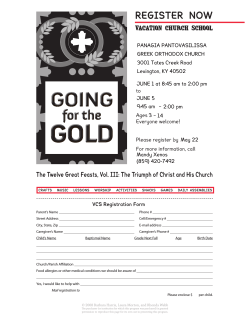


© Copyright 2026